Tag Archives: biking

Discovering Marvels of Crazy Horse Memorial on Badlands, Black Hills & Mickelson Trail Bike Tour

Crazy Horse Memorial, Mickelson Trail, South Dakota, © Karen Rubin/goingplacesfarandnear.com

by Karen Rubin, Travel Features Syndicate, goingplacesfarandnear.com

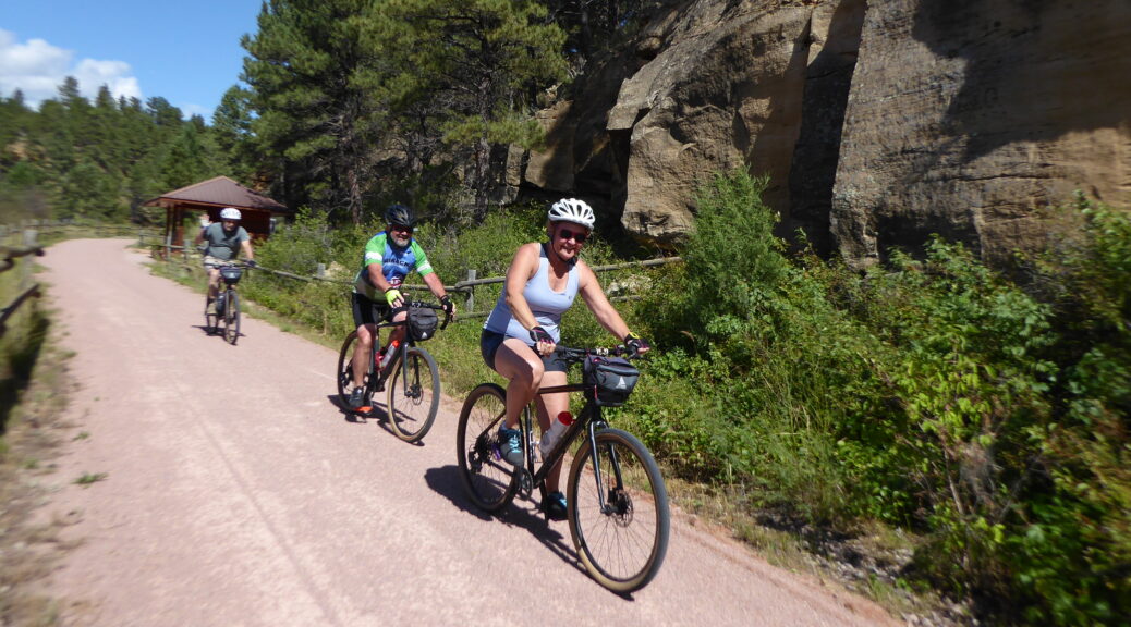
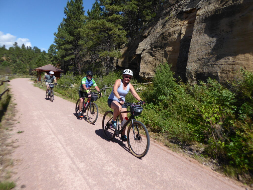
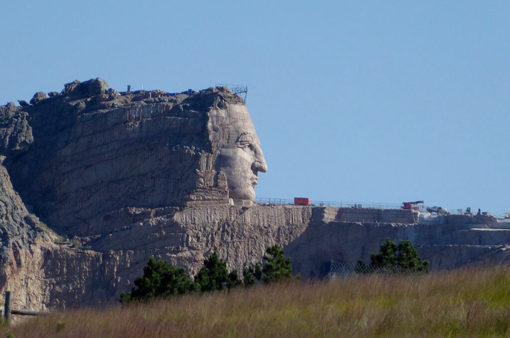
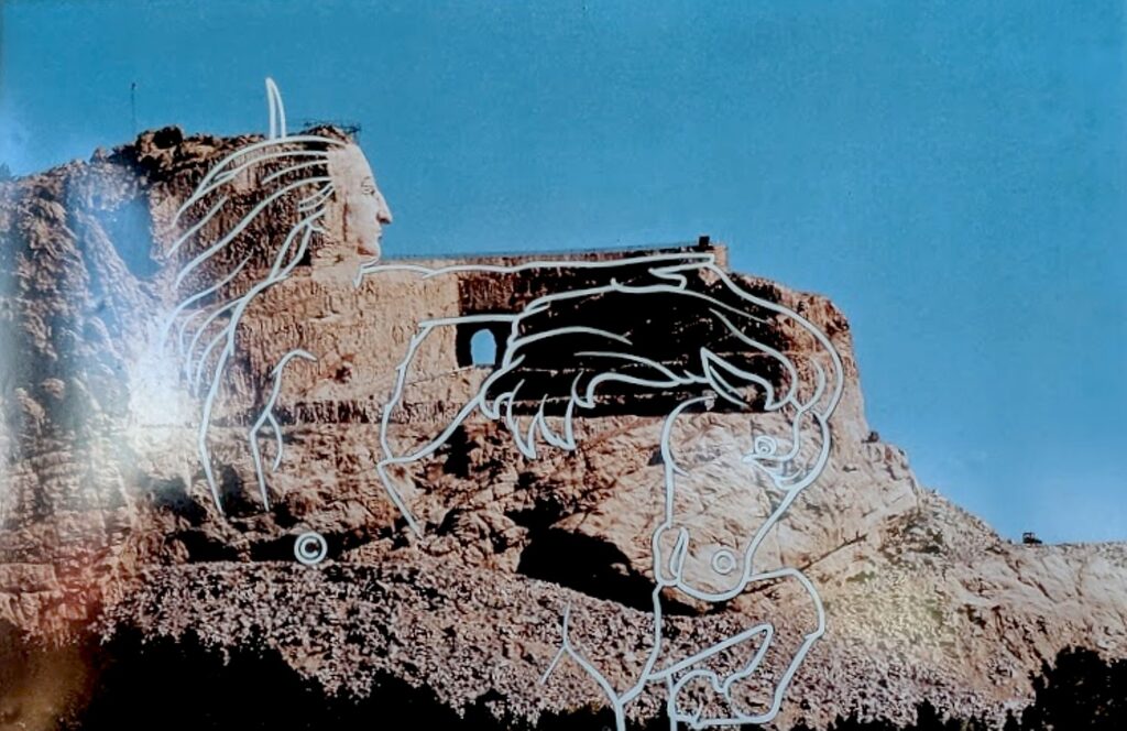
The Crazy Horse Memorial is sensational, awesome and profound. The carved portrait in the cliff-side, which I first encounter by surprise as I bike on the Mickelson Trail between Custer and Hill City is spectacular enough, but there is so much more to discover. There is also a superb Museum of Native Americans of North America (it rivals the Smithsonian’s Museum in Washington DC) where you watch a terrific video that tells the story of the America’s indigenous people, and can visit the studio/home of the sculptor, Korczak Ziolkowski. It is the highlight of our third day of the Wilderness Voyageurs “Badlands and Mickelson Trail” bike tour of South Dakota.

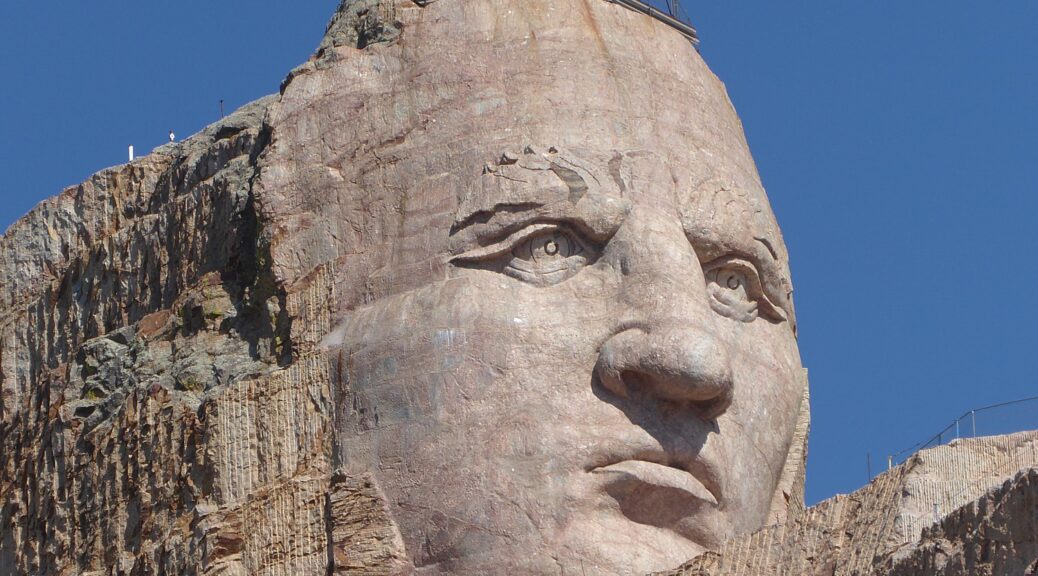
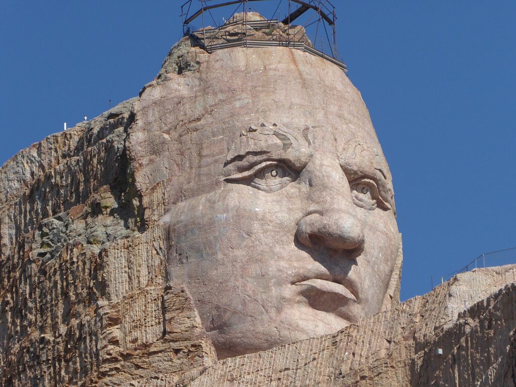
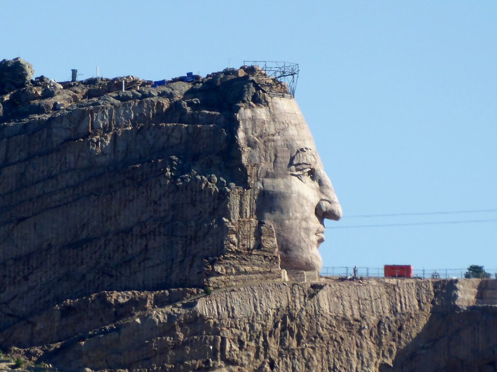
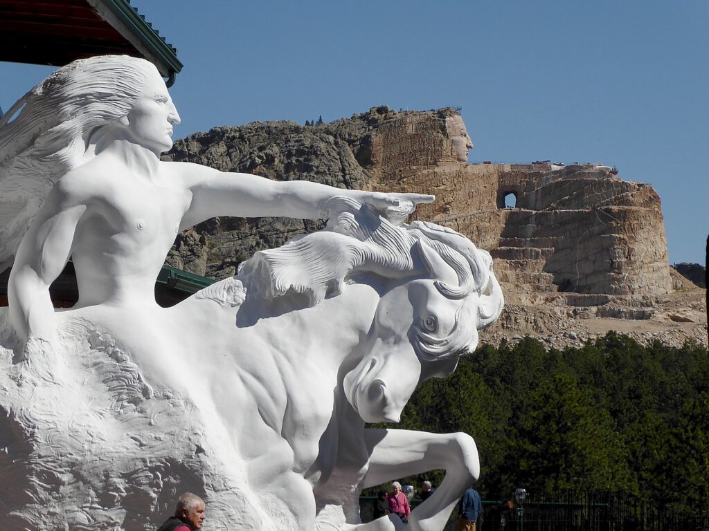
I rush to join a tour (a modest extra fee) that brings us right to the base of the sculpture. You look into this extraordinary, strong face – some quartz on the cheek has a glint that suggests a tear.

Crazy Horse Memorial, Mickelson Trail, South Dakota, © Karen Rubin/goingplacesfarandnear.com

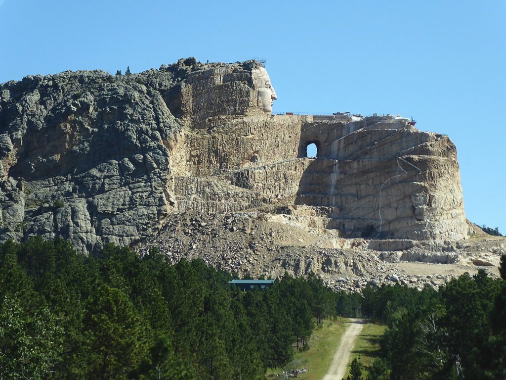
Only then do I realize that, much to my surprise, seeing the scaffolding and equipment, that 70 years after sculptor Ziolkowski started carving the monument in 1947, his grandson is leading a crew to continue carving. Right now it is mainly a bust – albeit the largest stone carving in the world – but as we see in the museum, the completed sculpture will show Crazy Horse astride a horse, his arm outstretched toward the lands that were taken from the Lakota.

Crazy Horse Memorial, Mickelson Trail, South Dakota, © Karen Rubin/goingplacesfarandnear.com

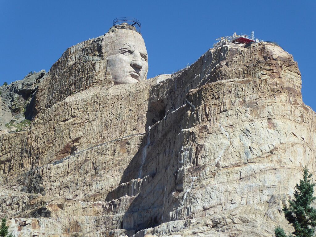
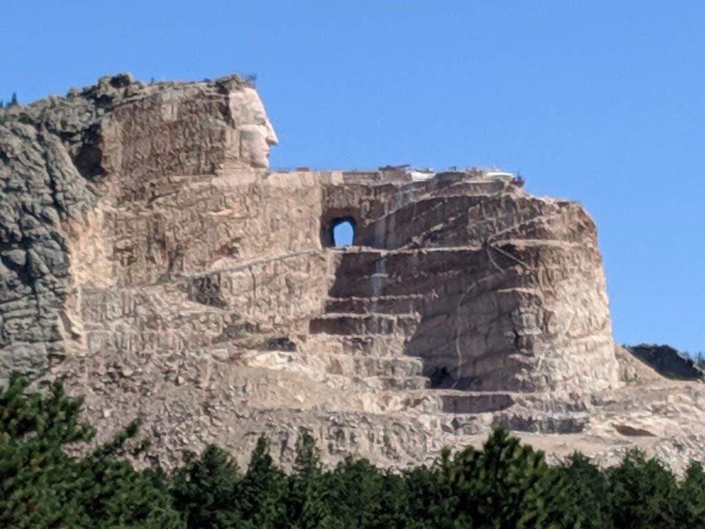
At 87 ft 6 inches high, the Crazy Horse Memorial is the world’s largest mountain carving in progress. They are now working on the 29-foot high horse’s head, the 263-foot long arm, and 33 ft-high hand, the guide tells us. The horse’s head will be as tall as 22-story building, one-third larger than any of the President’s at Mount Rushmore. The next phase of progress on the Mountain involves carving Crazy Horse’s left hand, left forearm, right shoulder, hairline, and part of the horse’s mane and head over 10-15 years. The plan is to carve the back side of the rock face as well, which would make the Crazy Horse Memorial a three-sided monument.

Crazy Horse Memorial, Mickelson Trail, South Dakota, © Karen Rubin/goingplacesfarandnear.com

When completed, the Crazy Horse Mountain carving will be the world’s largest sculpture, measuring 563 feet high by 641 feet long, carved in the round. The nine-story high face of Crazy Horse was completed on June 3, 1998; work began on the 22-story high horse’s head soon after.

“One if hardest decisions (after two years of planning) was to start with head, not the horse (in other words, work way down),” the guide tells us.

Crazy Horse Memorial, Mickelson Trail, South Dakota, © Karen Rubin/goingplacesfarandnear.com

In 71 years of construction, there have been no deaths or life threatening injuries of the workers (though there was that accident when a guy driving a machine slipped off edge; his father told him he had to get the machine out himself.)

Four of Korczak and Ruth’s 10 children and three of his grandchildren still work at the Memorial.

On the bus ride back to the visitor center, the guide tells us that Zioklowski was a decorated World War II veteran who was wounded on D-Day, but was so devoted to the Crazy Horse Memorial, he even planned for his death: there is a tomb in a cave at the base of the monument..

Back at the visitor center/museum, the story about the Crazy Horse Memorial is told in an excellent film:

The overwhelming theme is to tell the story, to give a positive view of native culture, to show that Native Americans have their own heroes, and to restore and build a legacy that survived every attempt to blot it out in a form of genocide.

There were as many as 18 million Indians living in North America when the Europeans arrived (the current population is 7 million in the US). “These Black Hills are our Cathedral, our sacred land,” the film says.

Crazy Horse was an Ogala Lakota, born around 1840 on the edge of Black Hills. He was first called “Curly” but after proving himself in battle, earned his father’s name, “Crazy Horse” (as in “His Horse is Crazy”). The chief warned of encroaching “river” of settlers, leading to 23-years of Indian wars. In 1876 Crazy Horse led the battle against General Custer, the Battle of Little Big Horn (known as Custer’s Last Stand, but Indians call it “the Battle of Greasy Grass”). It was a victory for the Indians, but short-lived. Soon after, the US government rounded up the rebels and killed Crazy Horse while he was in custody at Fort Robinson, Nebraska. (See www.nps.gov/libi/learn/historyculture/crazy-horse.htm)

Crazy Horse Memorial, Mickelson Trail, South Dakota, © Karen Rubin/goingplacesfarandnear.com

I am introduced to a new hero: Standing Bear.

Standing Bear was born 1874 near Pierre, South Dakota, and was among the first Indian children sent away to the Carlisle Indian School in Pennsylvania where his name was randomly changed to “Henry.” In the school, their Indian identity was forcibly removed – they cut the boys’ hair, they were not allowed to speak their language “to best help them learn the ways of non-native.”

“As a result of attending Carlisle, Standing Bear concluded that in order to best help his people, it would be necessary for him to learn the ways of the non-Native world. Somewhat ironically, Carlisle – an institution that was designed to assimilate Native Americans out of their indigenous ways – became a source of inspiration that Standing Bear would repeatedly draw upon to shape his enlightened understanding of cross-cultural relationships, as well as to find new ways of preserving his people’s culture and history.” He honed leadership skills like public speaking, reasoning, and writing, realizing that because of the changing times, the battle for cultural survival would no longer be waged with weapons, but with words and ideas. “This realization became a driving force behind much of his work during his adult life and led him to become a strong proponent of education,” the background material on the Crazy Horse Memorial website explains (crazyhorsememorial.org).

Standing Bear attended night school in Chicago while he worked for the Sears Roebuck Company to pay for his schooling. With feet firmly placed in both worlds, he became heavily involved in the affairs of his people over the course of his life and politically astute —working with Senator Francis Case and serving as a member of the South Dakota Indian Affairs Commission. He led the initiative to honor President Calvin Coolidge with a traditional name – “Leading Eagle,” taking the opportunity for advocacy during the naming ceremony to challenge President Coolidge to take up the leadership role that had been previously filled by highly-respected leaders such as Sitting Bull and Red Cloud.

In 1933, Standing Bear learned of a monument to be constructed at Fort Robinson, Nebraska, to honor his maternal cousin, Crazy Horse, who was killed there in 1877. He wrote to the organizer that he and fellow Lakota leaders were promoting a carving of Crazy Horse in the sacred Paha Sapa – Black Hills.

Crazy Horse Memorial, Mickelson Trail, South Dakota, © Karen Rubin/goingplacesfarandnear.com

Standing Bear looked for an artist with the skill to carve the memorial to his people that would show Indians had heroes too and turned to Korczak Ziolkowski, a self-taught sculptor who had assisted at Mount Rushmore and had gained recognition at the 1939 World’s Fair. Standing Bear invited him back to the Black Hills. 

Born in Boston of Polish descent in 1908, Korczak was orphaned when he was one year old. He grew up in a series of foster homes and is said to have been badly mistreated.  He gained skills in heavy construction helping his foster father.

On his own at 16, Korczak took odd jobs to put himself through Rindge Technical School in Cambridge, MA, after which he became an apprentice patternmaker in the shipyards on the rough Boston waterfront. He experimented with woodworking, making beautiful furniture. At age 18, he handcrafted a grandfather clock from 55 pieces of Santa Domingo mahogany. Although he never took a lesson in art or sculpture, he studied the masters and began creating plaster and clay studies. In 1932, he used a coal chisel to carve his first portrait, a marble tribute to Judge Frederick Pickering Cabot, the famous Boston juvenile judge who had befriended and encouraged the gifted boy and introduced him to the world of fine arts.

Moving to West Hartford, Conn., Korczak launched a successful studio career doing commissioned sculpture throughout New England, Boston, and New York.

Ziolkowski wanted to do something worthwhile with his sculpture, and made the Crazy Horse Memorial his life’s work.

“Crazy Horse has never been known to have signed a treaty or touched the pen,” Ziolkowski wrote. “Crazy Horse, as far as the scale model is concerned, is to be carved not so much as a lineal likeness, but more as a memorial to the spirit of Crazy Horse – to his people. With his left hand gesturing forward in response to the derisive question asked by a white man, ‘Where are your lands now?’ He replied, ‘My lands are where my dead lie buried’.”

There is no known photo of Crazy Horse, Ziolkowski created his likeness from oral descriptions.

He built a log studio home (which we can visit) at a time when there was nothing around – no roads, no water, no electricity. For the first seven years, he had to haul himself and his equipment, including a decompressor and 50 pound box of dynamite, up 741 steps.

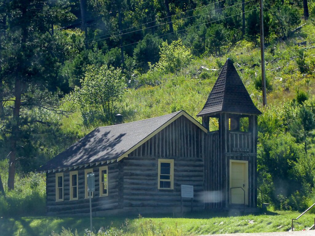
Living completely isolated in the wilderness, Korczak and his wife Ruth bought an 1880s one-room school house, had it moved to this isolated property and hired a teacher for their 10 children.

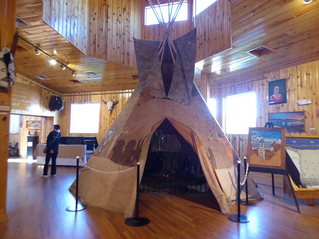
There is so much to see here: The Museums of Crazy Horse Memorial feature exhibits and engaging experiences that let you discover Native history and contemporary life, the art and science of mountain carving and the lives of the Ziolkowski family.  

Crazy Horse Memorial, Mickelson Trail, South Dakota, © Karen Rubin/goingplacesfarandnear.com

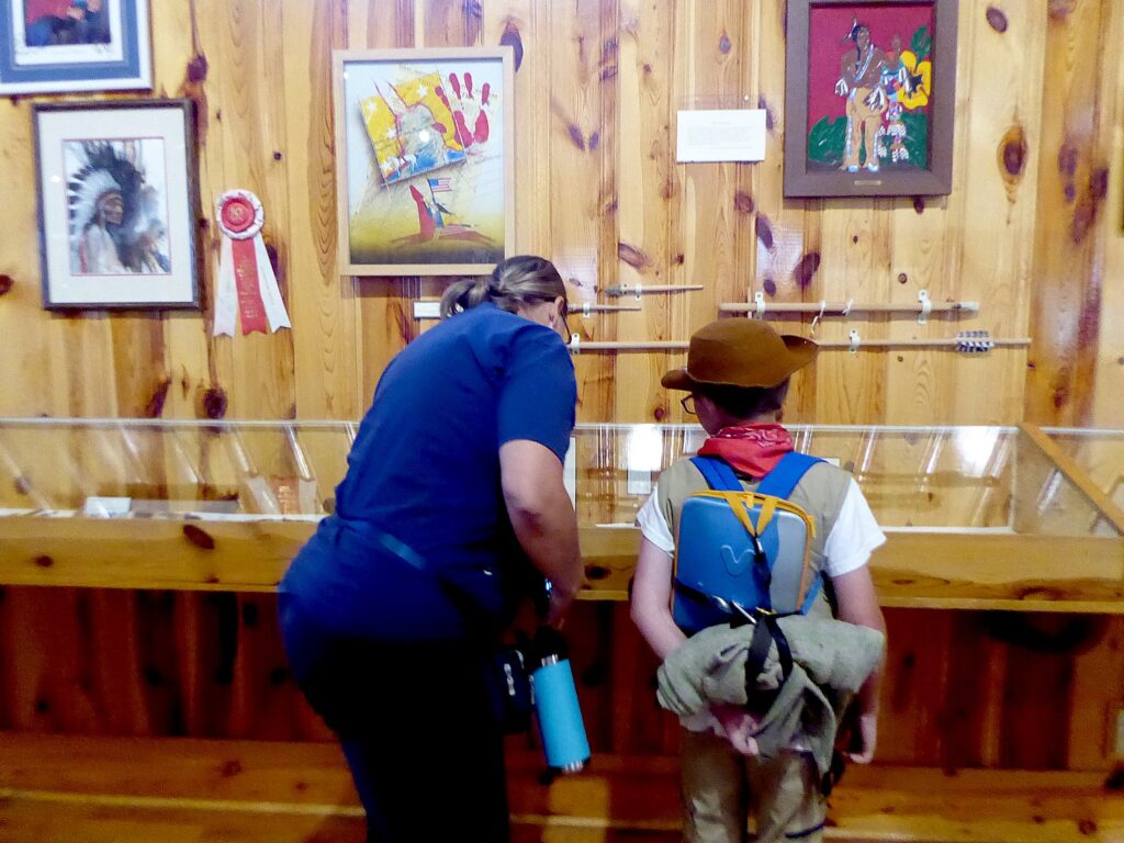
THE INDIAN MUSEUM OF NORTH AMERICA® houses an enormous collection of art and artifacts reflecting the diverse histories and cultures of over 300 Native Nations.  The Museum, designed to complement the story being told in stone on the Mountain, presents the lives of American Indians and preserves Native Culture for future generations. The Museum collection started with a single display donated in 1965 by Charles Eder, Hunkpapa Lakota, from Montana, which  remains on display to this day.  The Indian Museum has about the same number of annual visits as the National Museum of the American Indian at the Smithsonian Institute in Washington, DC. Close to 90% of the art and artifacts have been donated by generous individuals, including many Native Americans.

Crazy Horse Memorial, Mickelson Trail, South Dakota, © Karen Rubin/goingplacesfarandnear.com

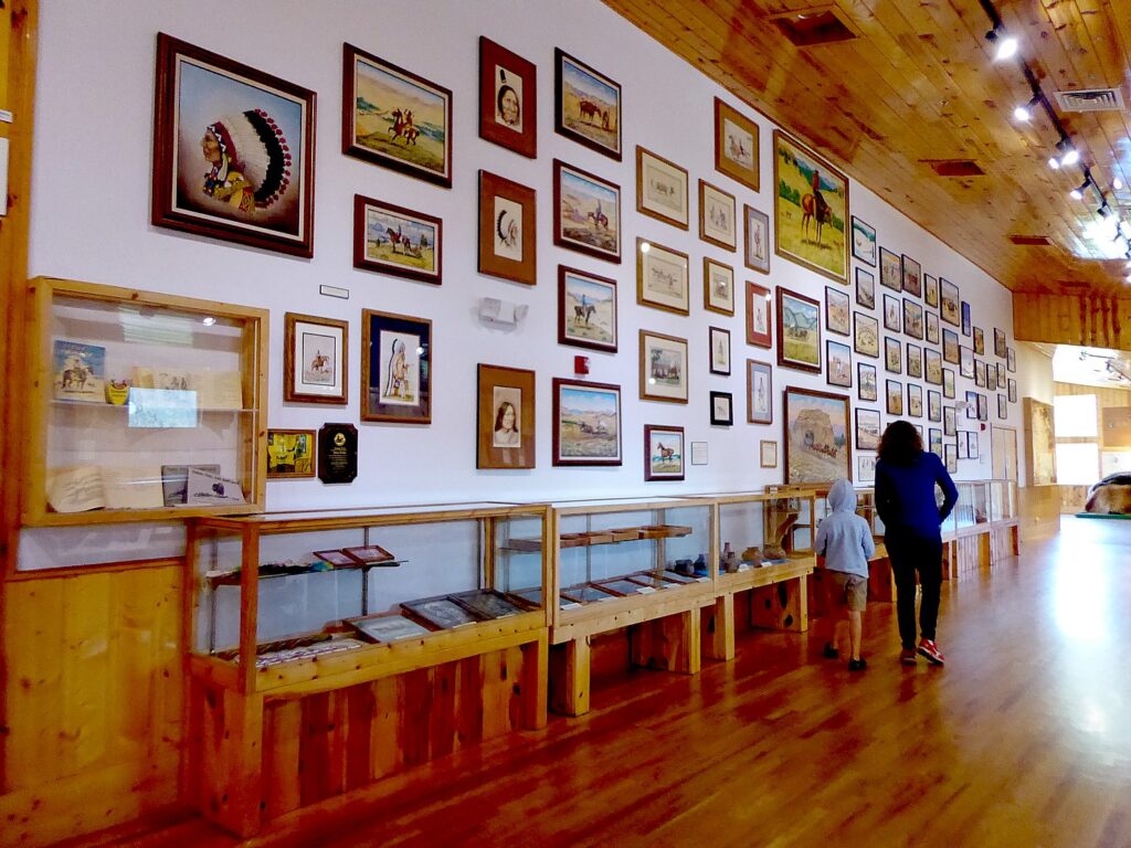
The gorgeous building housing the Museum was designed and built by Korczak Ziolkowski and his family in the harsh winter of 1972-73, when no work was possible on the Mountain. The Museum incorporated Korczak’s love of wood and natural lighting, being constructed from ponderosa pine, harvested and milled at Crazy Horse Memorial. The original wing of the museum was dedicated on May 30, 1973. In the early 1980s, Korczak planned a new wing of the Museum to accommodate the growing collection of artifacts. He did not live to see his plans realized, instead his wife Ruth Ziolkowski and 7 of their children made sure the new wing was built. The structure was built in the winter of 1983-84 and funding came in large part from a $60,000 check left in the Crazy Horse Memorial contribution box in late August of 1983. The contributor said he was moved by the purpose of Crazy Horse, Korczak, and his family’s great progress and by the sculptor’s reliance on free enterprise and refusal to take federal funds

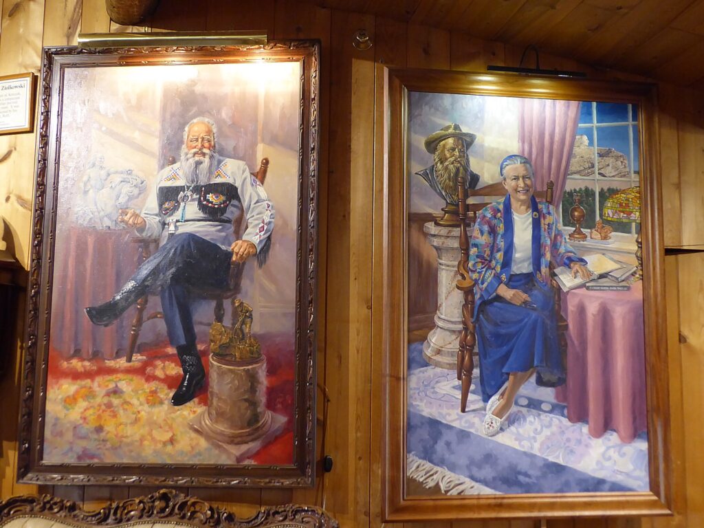
The Ziolkowski Family Life Collection is shown throughout the complex and demonstrates to people of all ages the timeless values of making a promise and keeping it, setting a goal and never giving up, working hard to overcome adversity, and devoting one’s life to something much larger than oneself. There are portraits of the couple and personal effects that tell their life’s story.

Portraits of Korczak and Ruth Ziolkowski, Crazy Horse Memorial, South Dakota, © Karen Rubin/goingplacesfarandnear.com

The Mountain Carving Gallery shares the amazing history of carving the Mountain. It features the tools Korczak used in the early years of carving, including a ½ size replica of “the bucket” – a wooden basket used with an aerial cable car run by an antique Chevy engine that allowed the sculptor to haul equipment and tools up the Mountain. Displayed in the Mountain Carving Room are the measuring models used to carve the face of Crazy Horse, plasters of Crazy Horse’s face and the detailed pictorial progression of carving the face. They also detail the next phase in the Memorial’s carving which is focused on Crazy Horse’s left hand and arm, the top of Crazy Horse’s head, his hairline, and the horse’s mane. If you stand in just the right spot, you can line up the model of how the finished work will look against the actual mountain sculpture as it is.

Crazy Horse Memorial, Mickelson Trail, South Dakota, © Karen Rubin/goingplacesfarandnear.com

Crazy Horse Memorial is actually a private, nonprofit (they also have a nonprofit college and medical training center that educates Indians), and twice turned down federal funding because “they didn’t believe the government would do it right.” Indeed, Mount Rushmore (which we see on the last day of our bike tour) was never completed because the federal government stopped funding the project. The entrance fee ($30 per car, 3 or more people, $24 per car two people, $12 per person, $7 per bicycle or motorcycle) support the continued carving, the Indian Museum of North America and the Indian University of North America, which assists qualifying students get their college degrees.

Once again, I am so grateful that I am not being pushed along with an artificial time limit by the Wilderness Voyageurs guides, I wander through the vast complex trying to take it all in. I am utterly fascinated.

I buy postcards for 25c apiece and stamps, sit with a (free) cup of coffee in the cafe and mail them at their tiny post-office. There is an excellent gift shop.

The Crazy Horse Memorial is open 365 days of the year, with various seasonal offerings.

(Crazy Horse Memorial, 12151 Avenue of the Chiefs, Crazy Horse, SD, 605-673-4681, crazyhorsememorial.org.)

Crazy Horse Memorial, Mickelson Trail, South Dakota, © Karen Rubin/goingplacesfarandnear.com

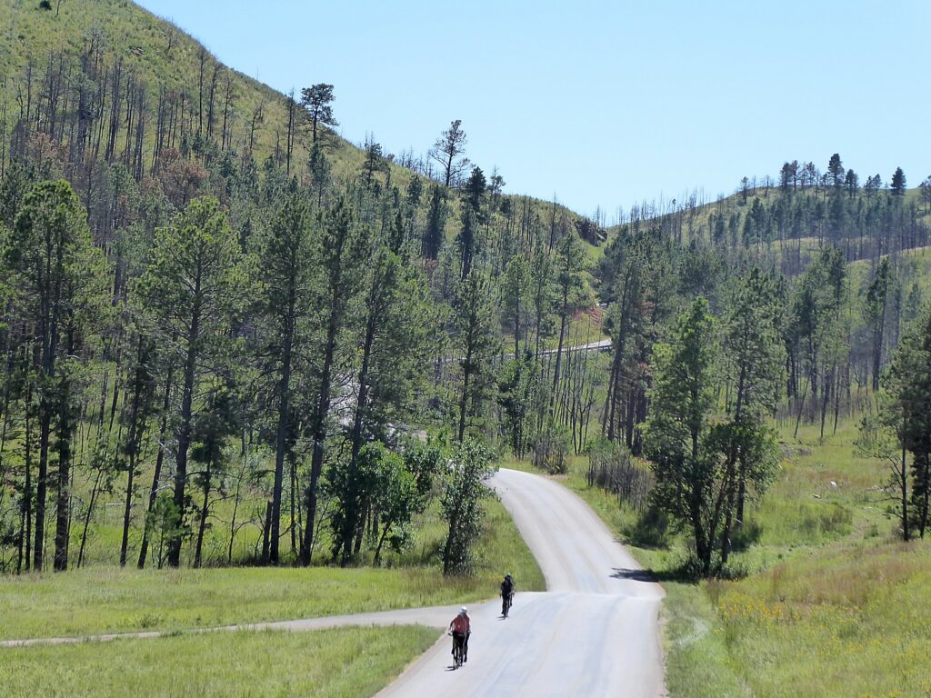
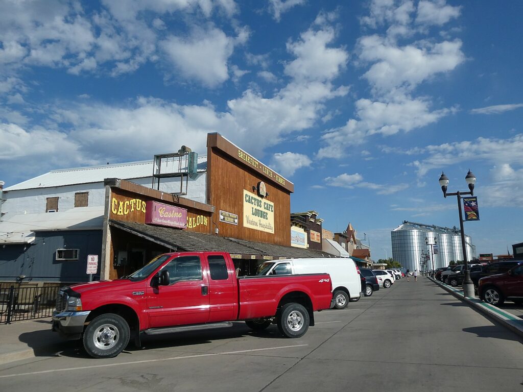
I’m the last one to leave the Crazy Horse Memorial, and note that the bike of our sweeper guide for today John Buehlhorn, is still on the rack, but I figure he will see that I have gone and catch up to me, so I get back on the Mickelson Trail. He catches me again when I don’t realize to get off the trail at Hill City, where we are on our own for lunch and exploring the town.

South Dakota State Railroad Museum, Hill City, © Karen Rubin/goingplacesfarandnear.com

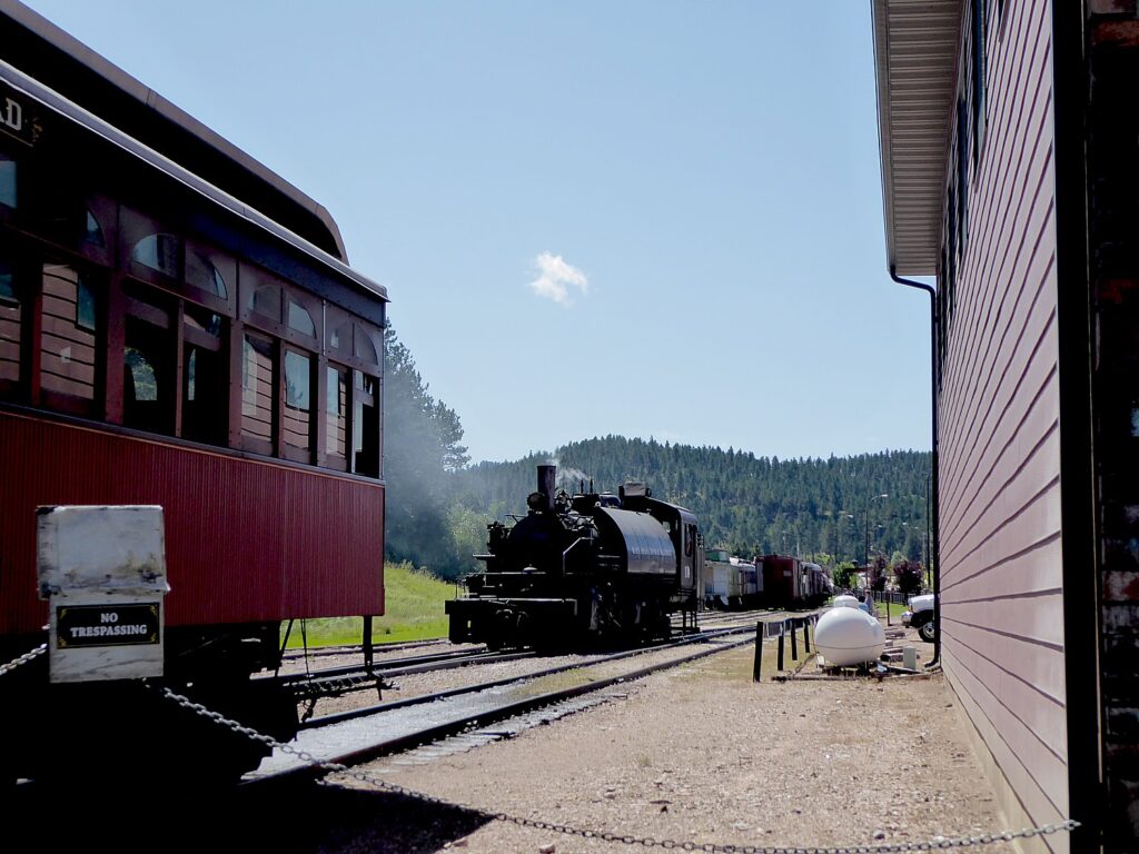
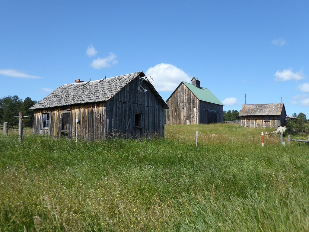
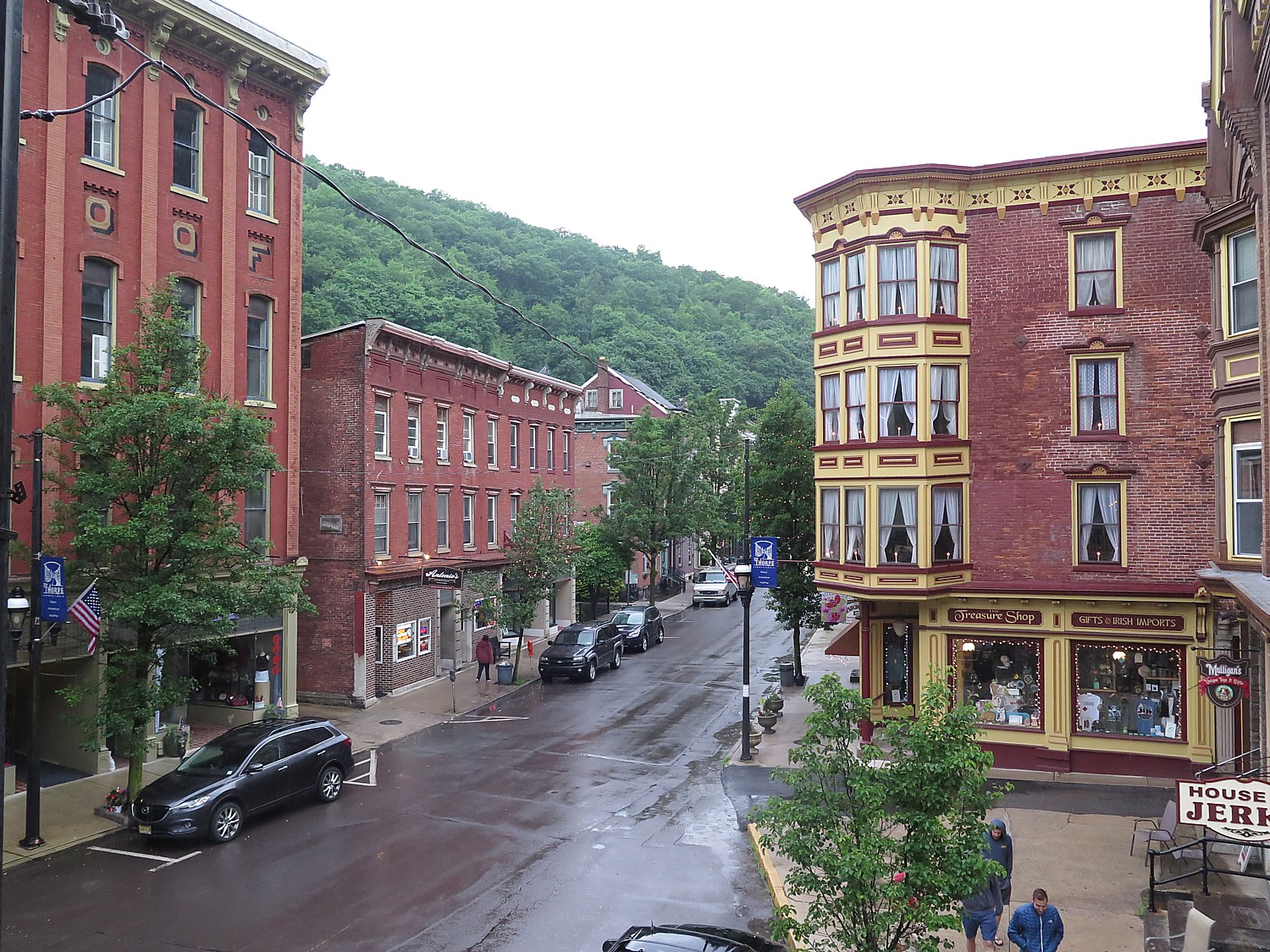
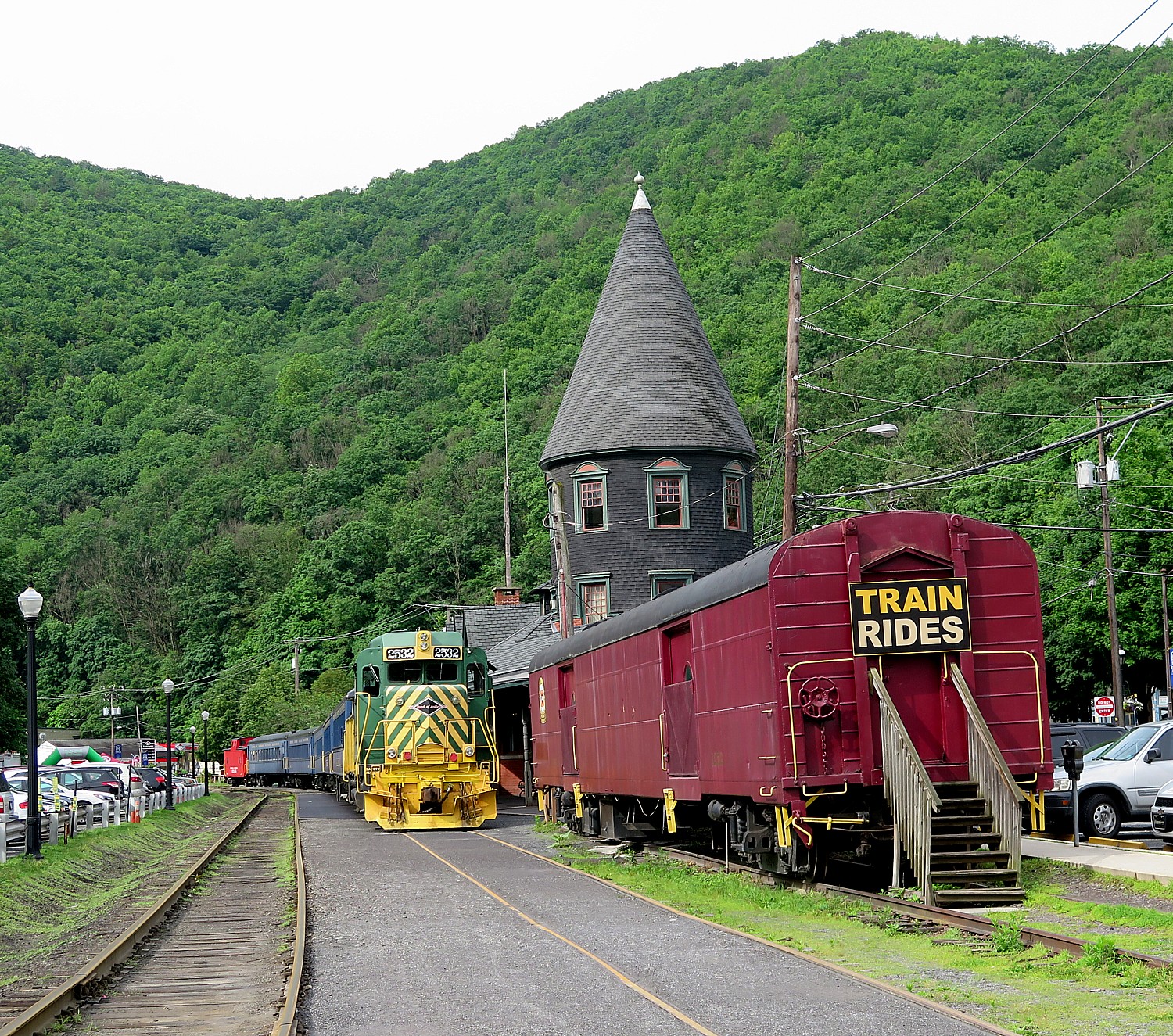
Hill City is really charming and the home of the South Dakota State Railroad Museum, where you can take a ride on an old-time steam railroad. The shops are really pleasant.

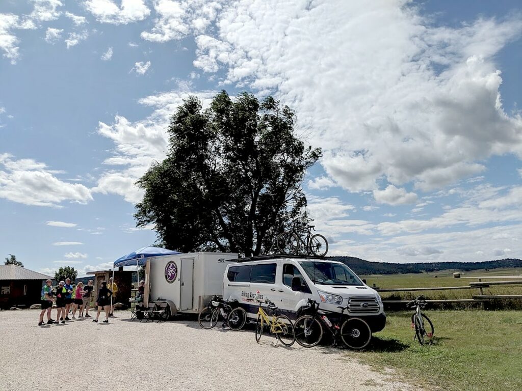
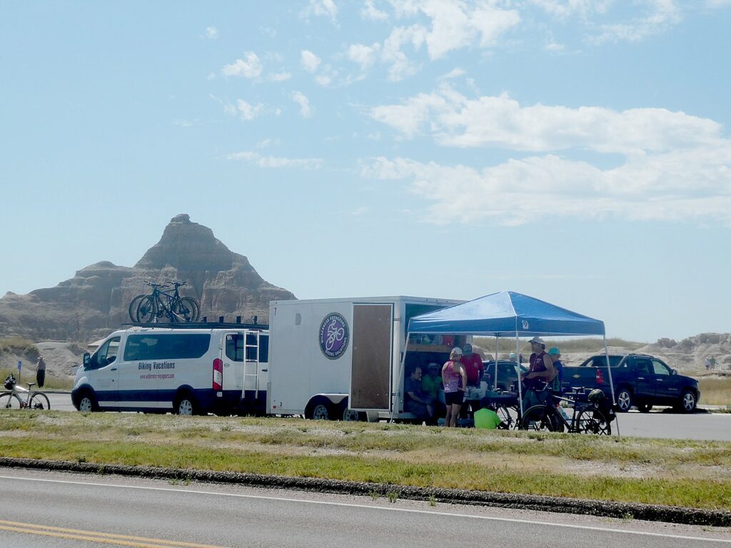
The Wilderness Voyageurs van is parked there in case anybody needs anything.

Hill City, South Dakota, © Karen Rubin/goingplacesfarandnear.com

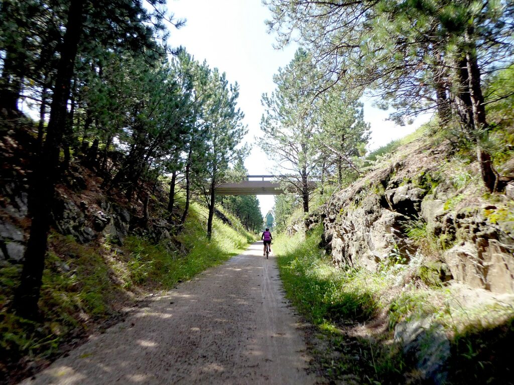
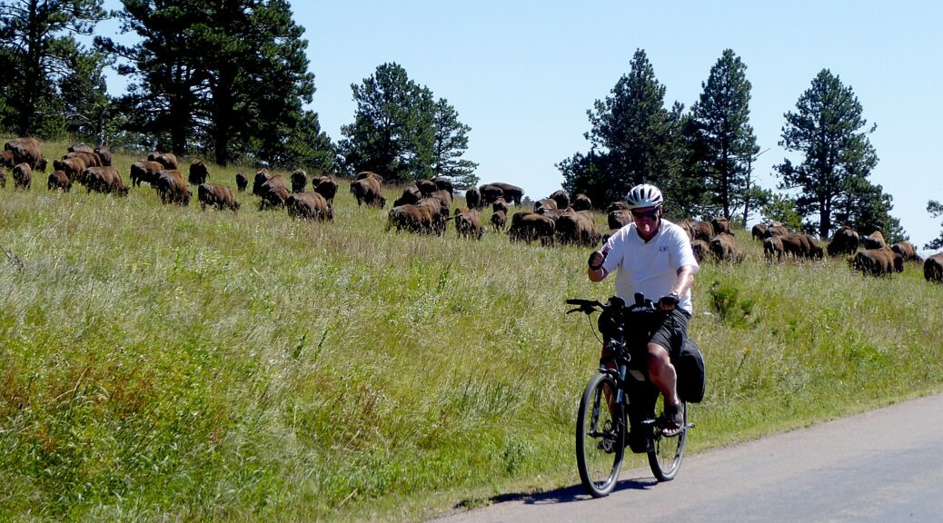
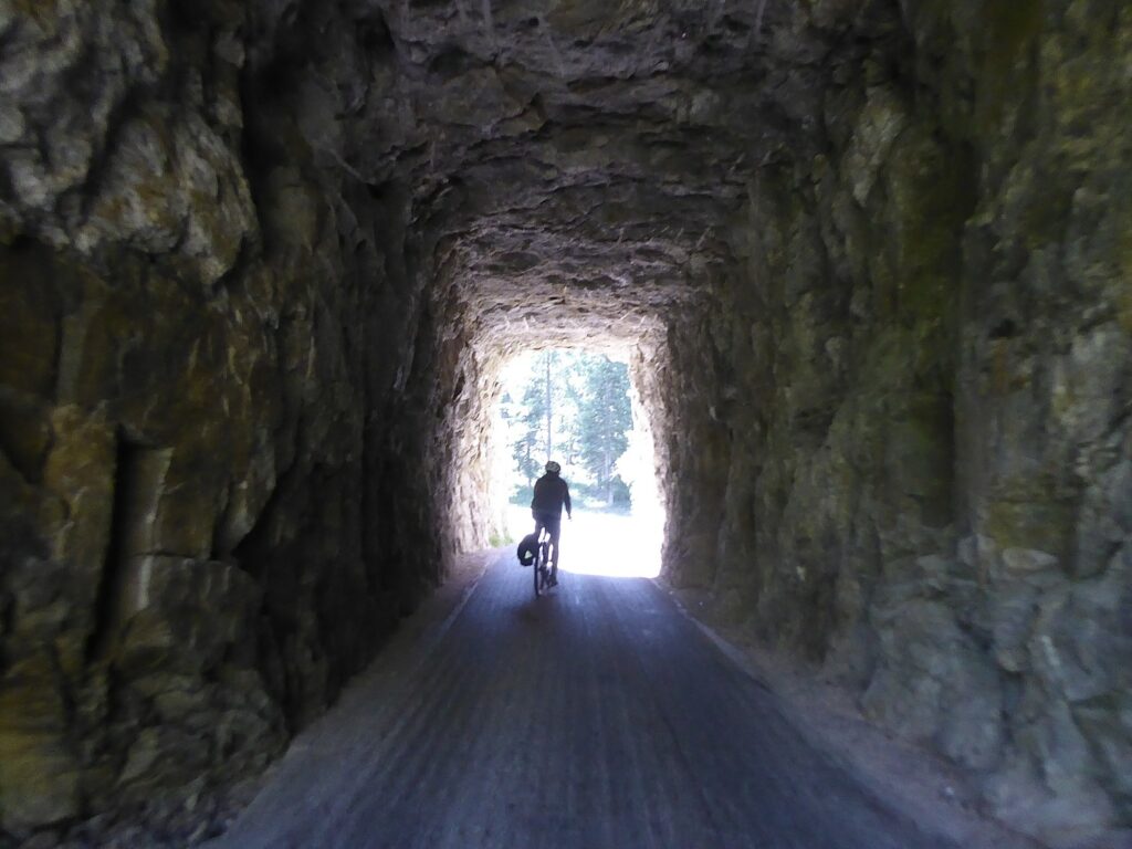
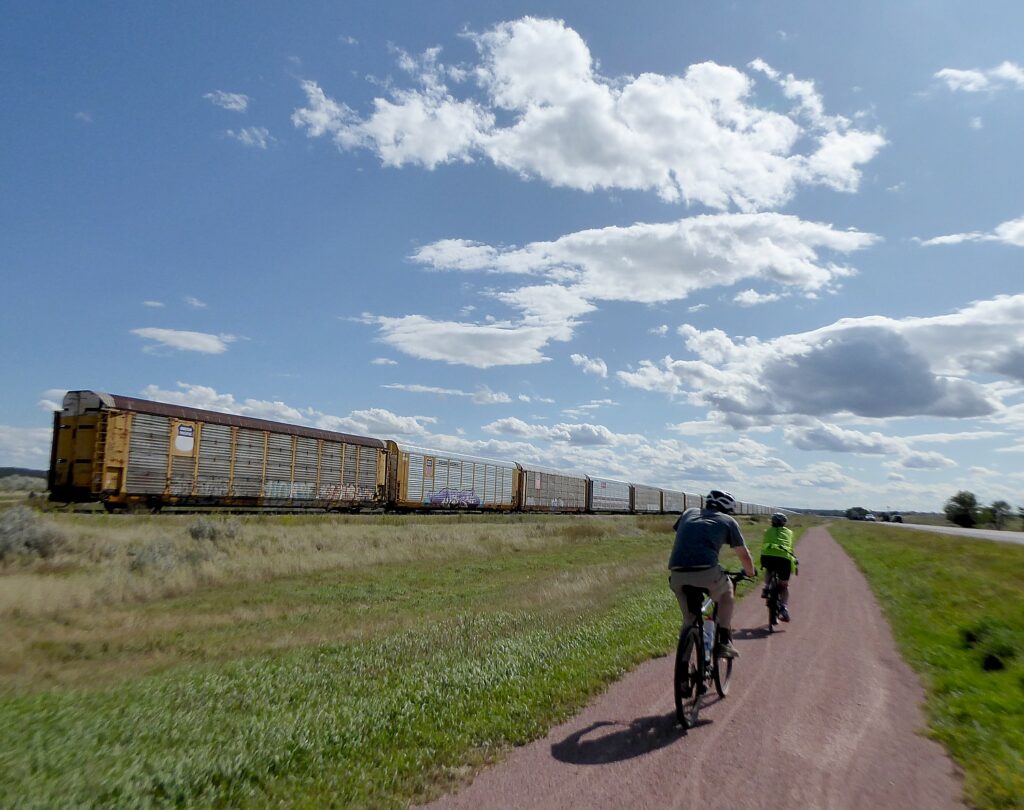
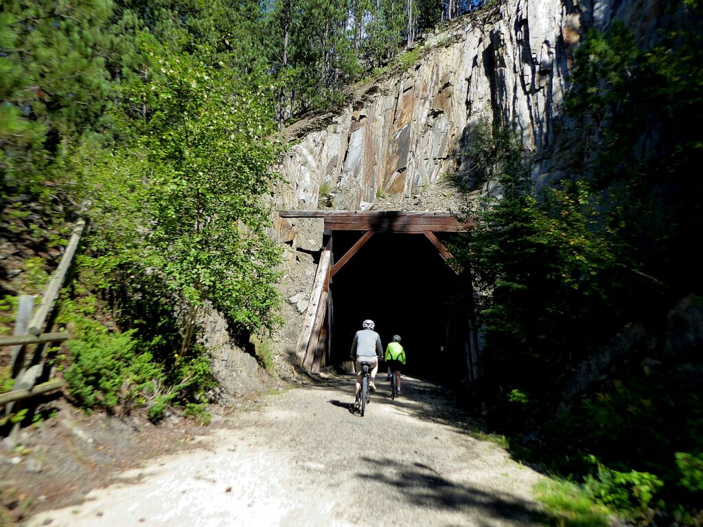
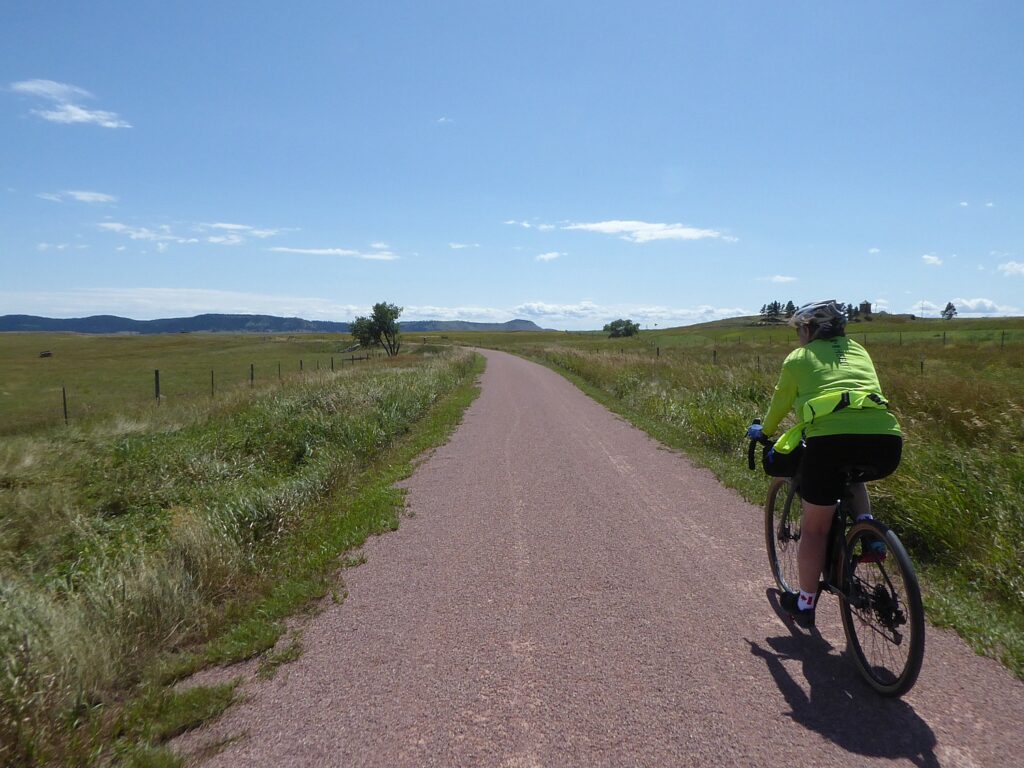
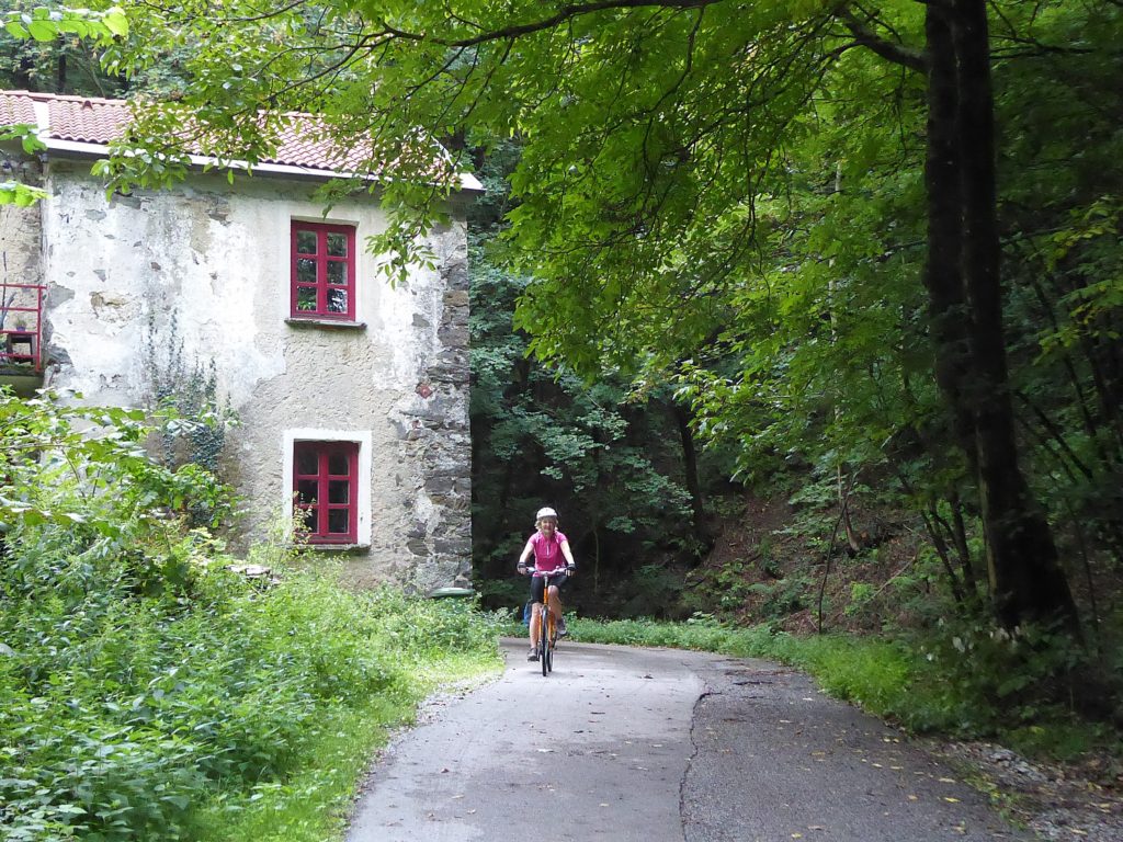
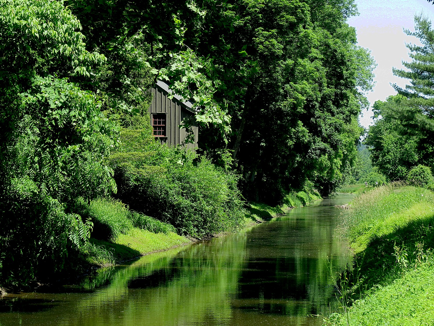
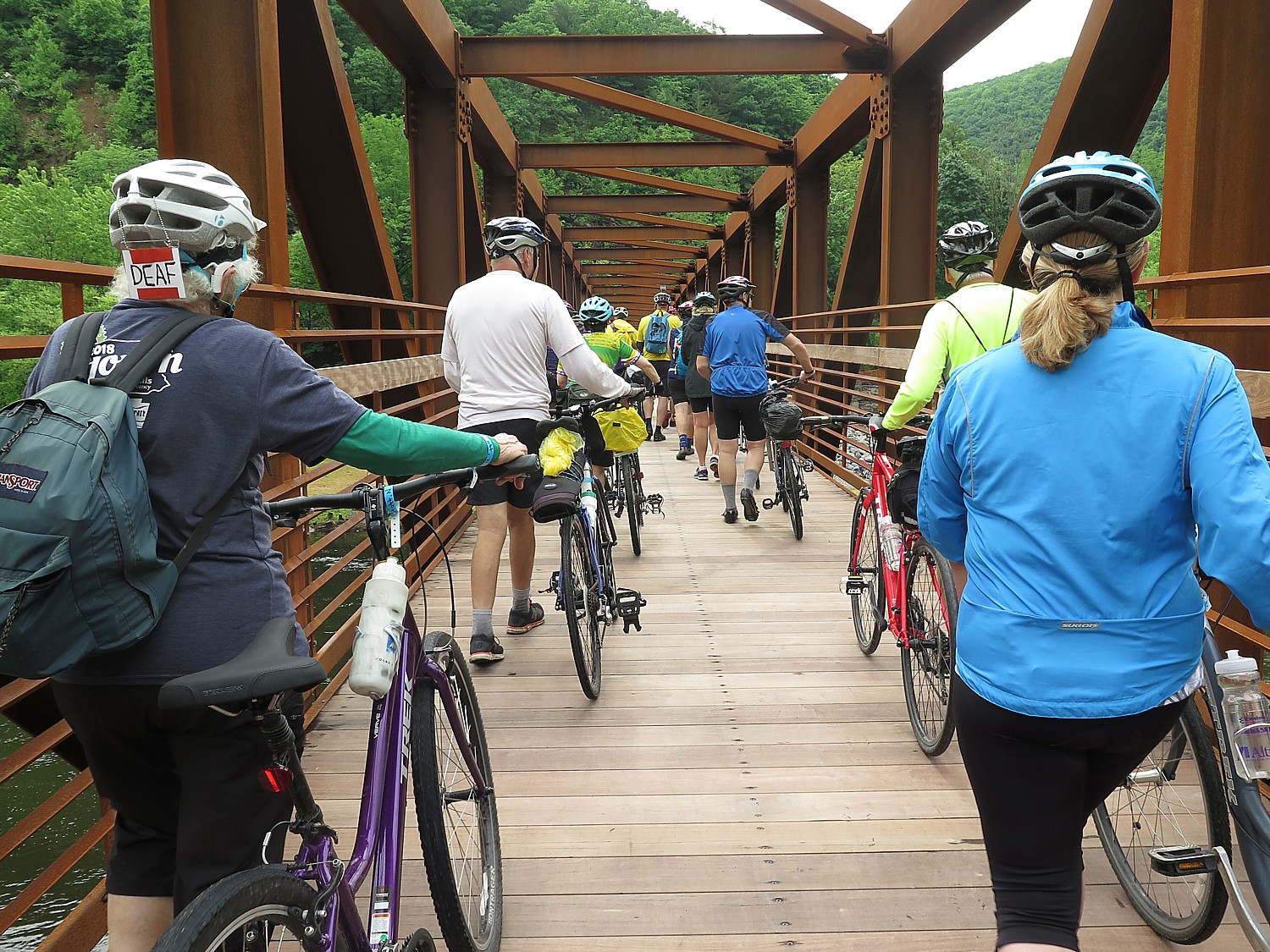
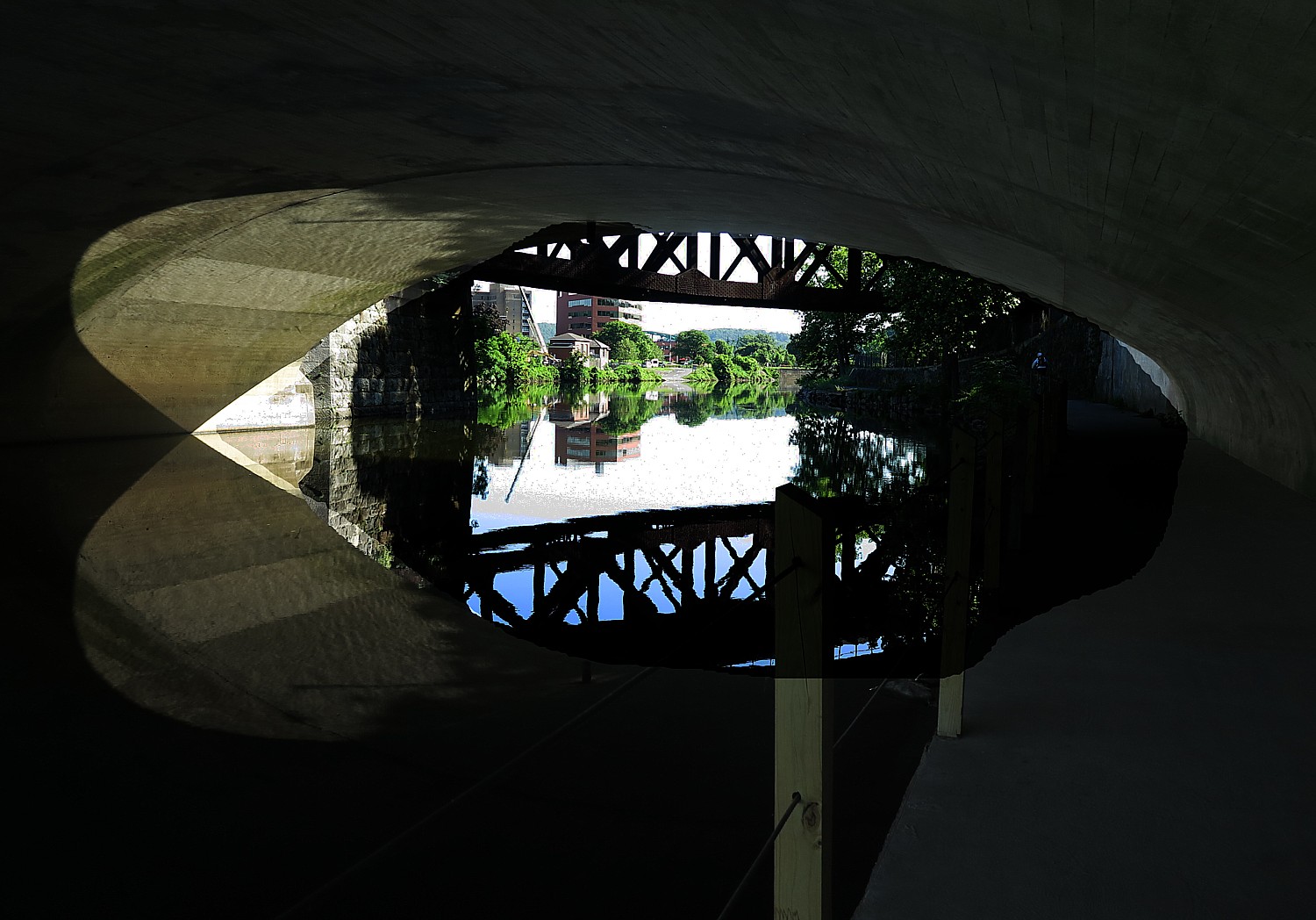
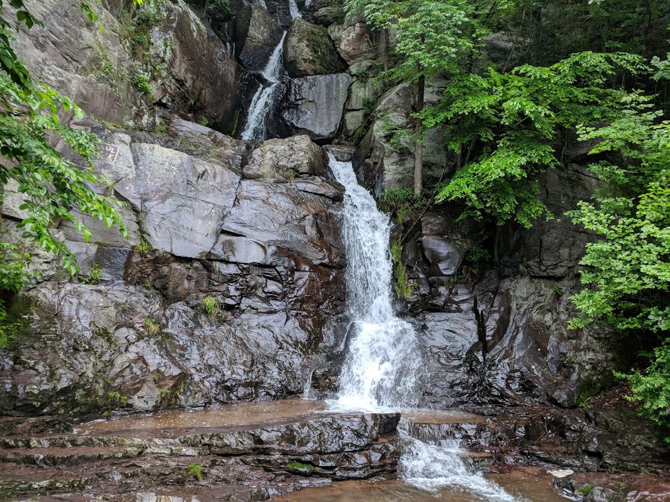
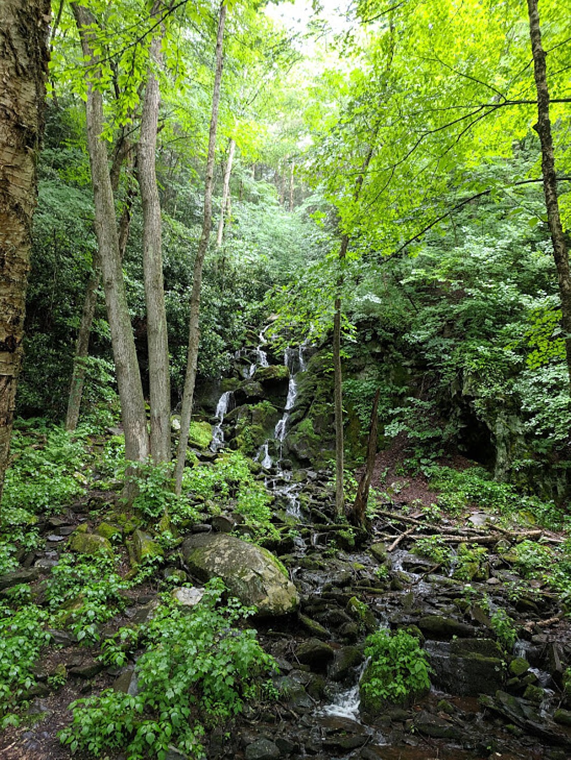
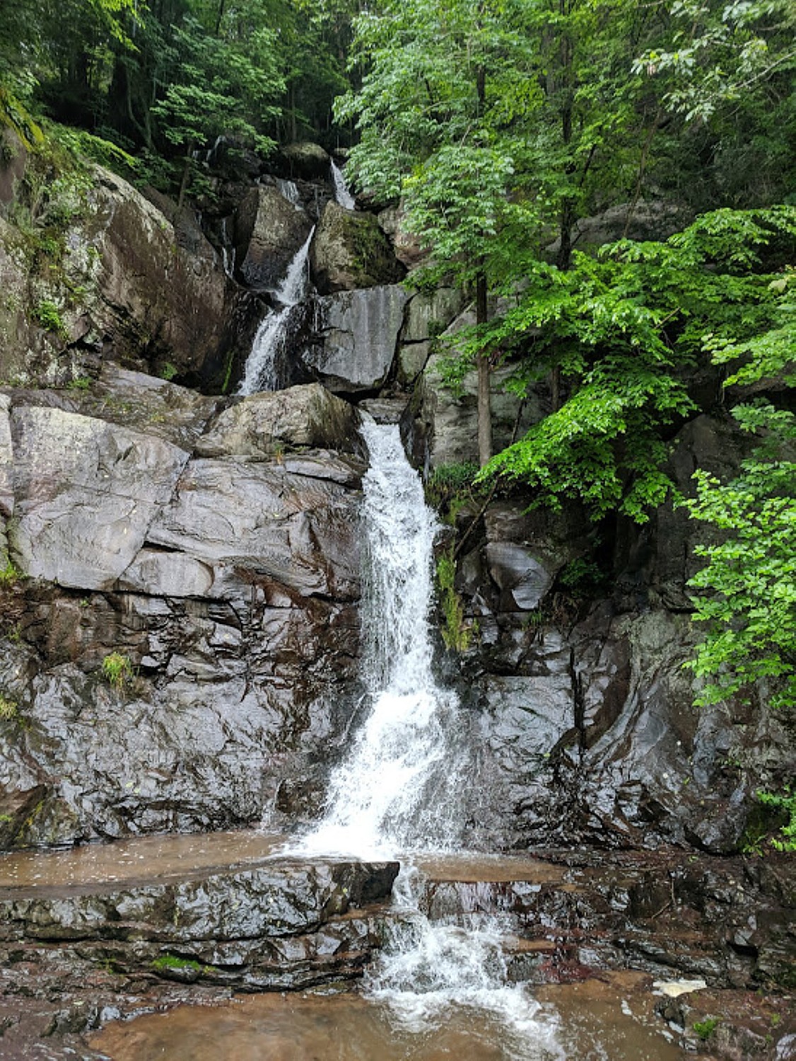
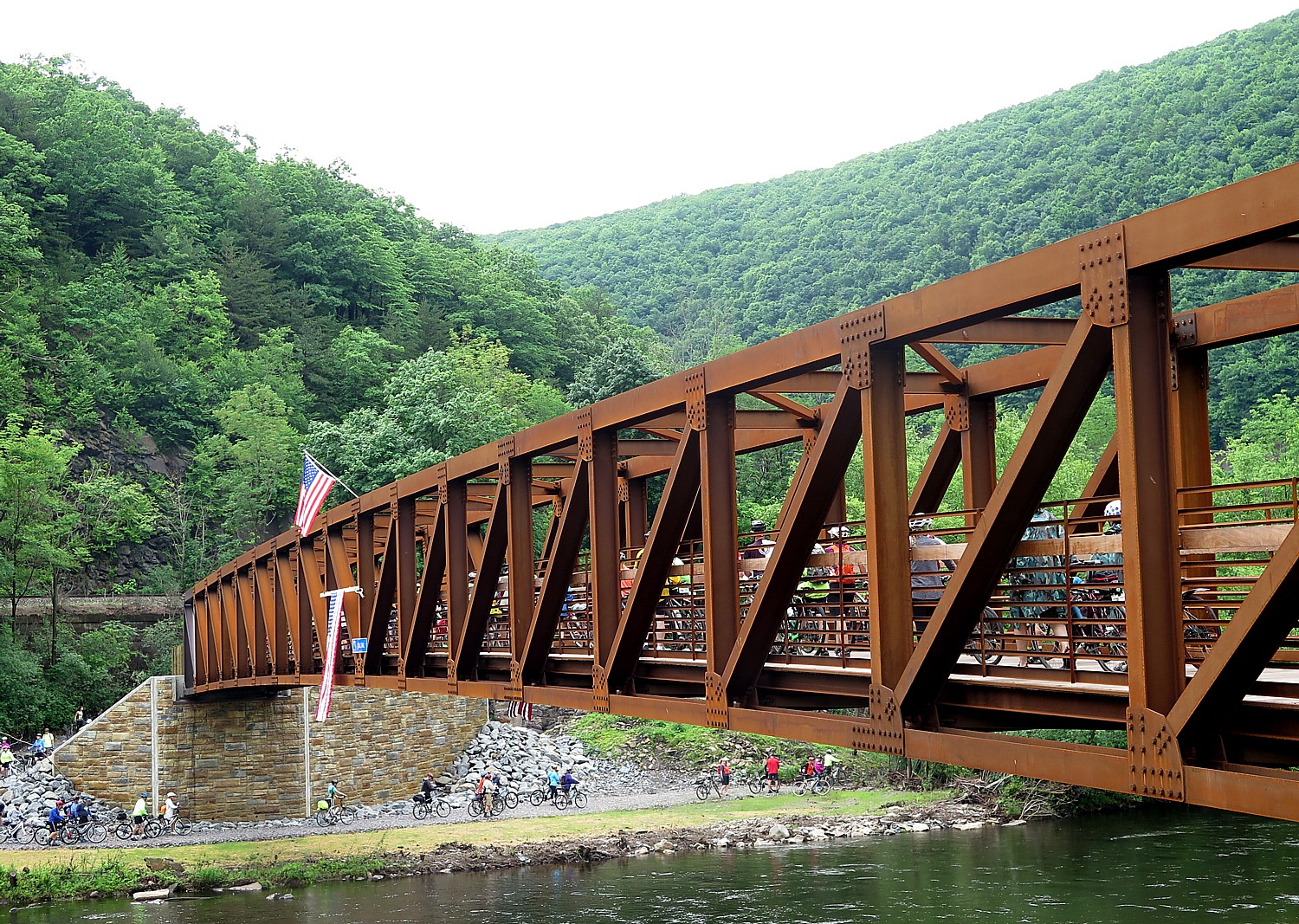
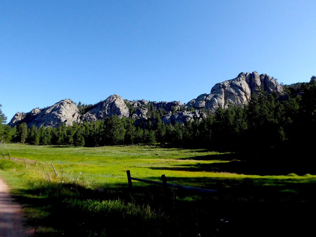
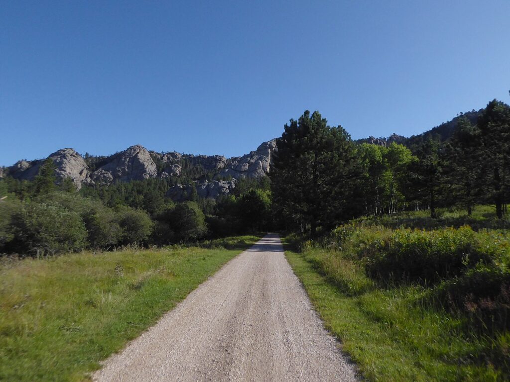
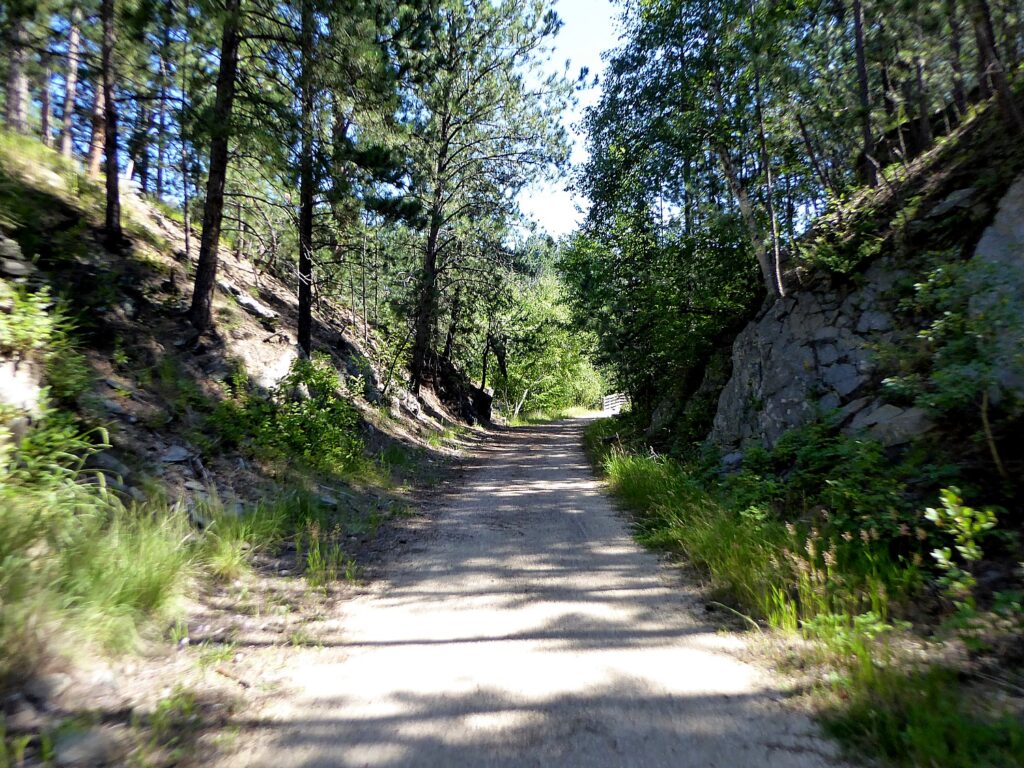
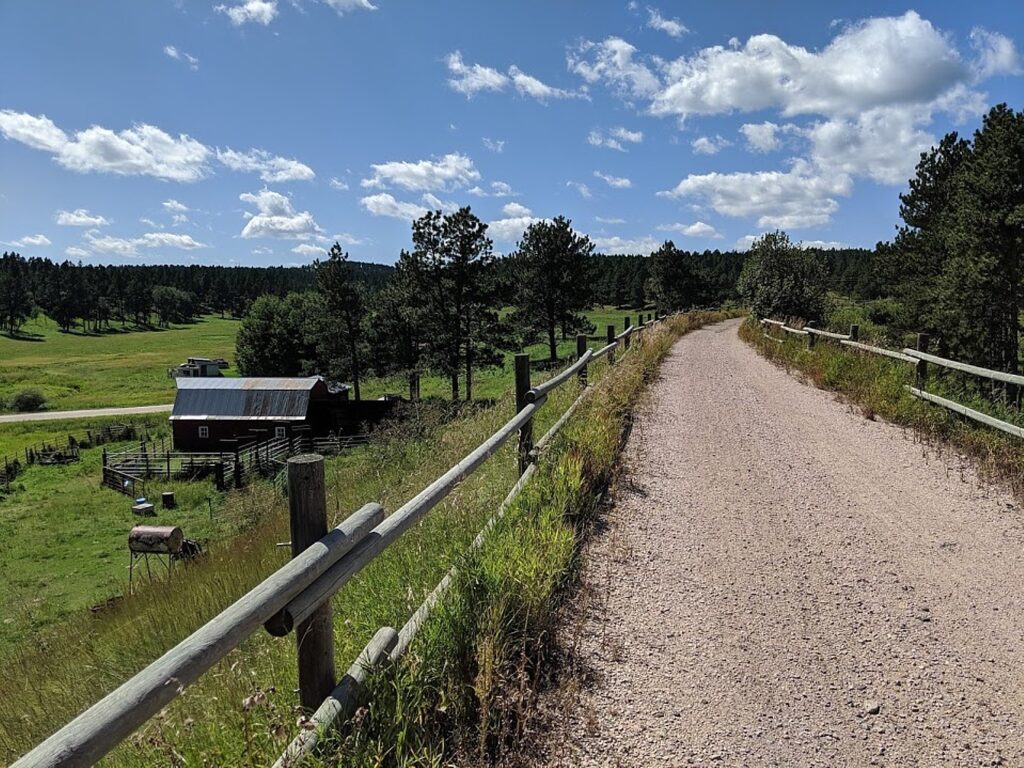
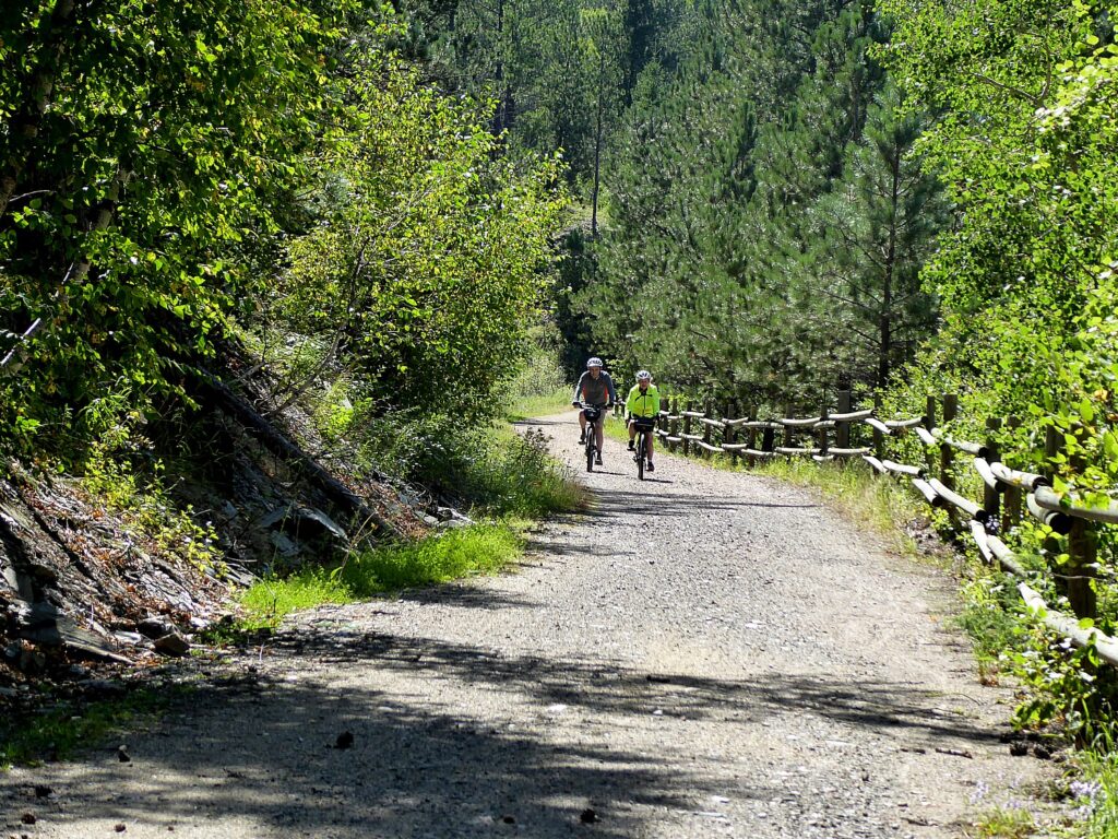
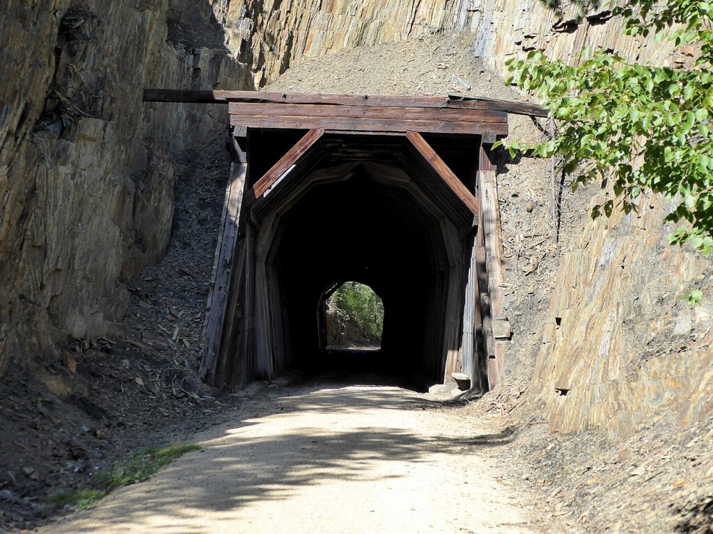
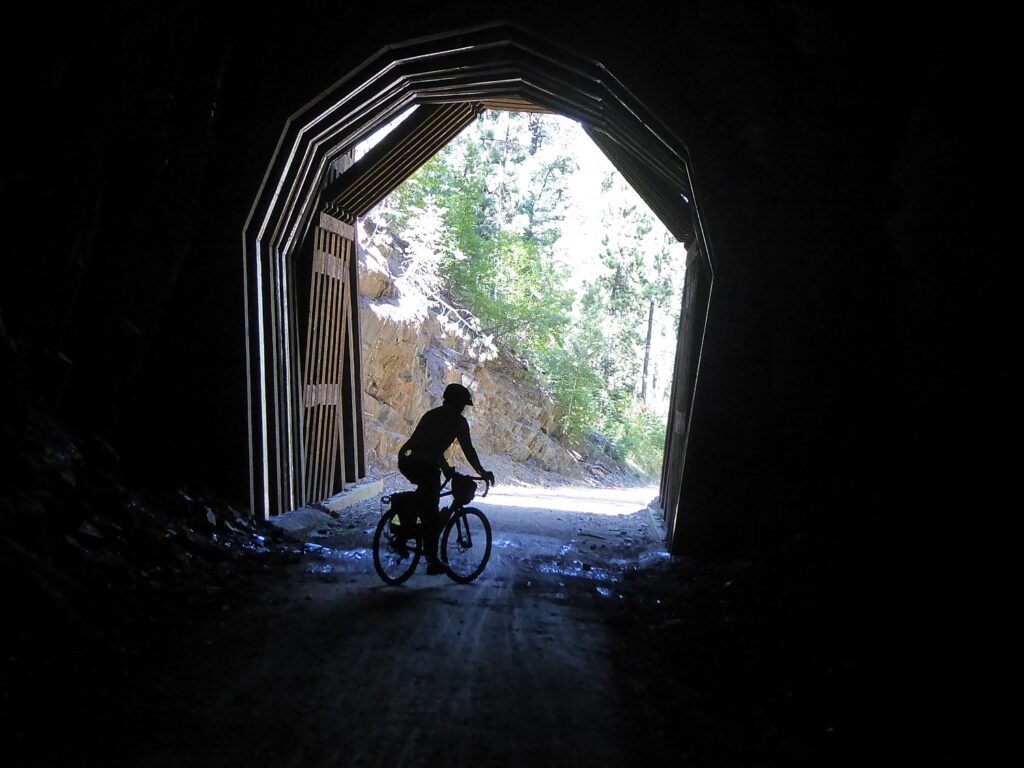
The ride to the Crazy Horse Memorial was uphill on the rail trail for 8 miles but going down hill isn’t a picnic because of the loose gravel – but not difficult and totally enjoyable.  We ride through train tunnels and over trestles. It is no wonder that the 109-mile long Mickelson Trail, which is a centerpiece of the Wilderness Voyageurs’ tour, is one of 30 rail-trails to have been named to the Hall of Fame by Rails-to-Trails Conservancy.  We finish this day’s ride at Mystic at the 74.7-mile marker– we’ll ride the remaining miles on another day. Mystic used to be a significant town when the railroad ran here. Now there are just two buildings and four residents.

Crazy Horse Memorial, Mickelson Trail, South Dakota, © Karen Rubin/goingplacesfarandnear.com
Mickelson Trail, South Dakota, © Karen Rubin/goingplacesfarandnear.com
Mickelson Trail, Mystic, South Dakota, © Karen Rubin/goingplacesfarandnear.com

I notice the sign tacked up at the shelter: Be Aware: Mountain Lions spotted on the trail toward Rochford within the last few days.

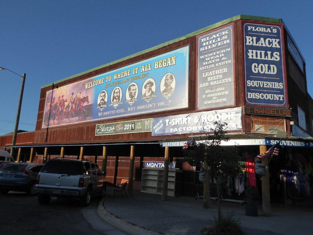
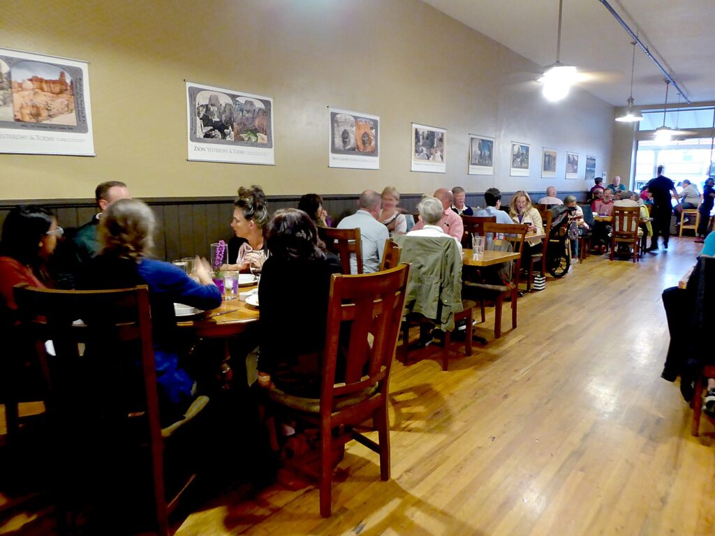
We are shuttled back to Custer for our second night’s stay at the Holiday Inn Express (very comfortable, with pool, game room, WiFi and breakfast), and treated to a marvelous dinner at one of the finer dining restaurants, the Sage Creek Grill (611 Mount Rushmore Road, Custer).

Sage Creek Grill, Custer, South Dakota, © Karen Rubin/goingplacesfarandnear.com

Wilderness Voyageurs started out as a rafting adventures company 50 years ago, but has developed into a wide-ranging outdoors company with an extensive catalog of biking, rafting, fishing  and outdoor adventures throughout the US and even Cuba, many guided and self-guided bike itineraries built around rail trails like the Eric Canal in New York, Great Allegheny Passage in Pennsylvania, and Katy Trail in Missouri.

There are still a few spots left on Wilderness Voyageurs’ Quintessential West Cuba Bike Tour departing on March 21.

Wilderness Voyageurs, 103 Garrett St., Ohiopyle, PA 15470, 800-272-4141, [email protected], Wilderness-Voyageurs.com.

_________________________© 2020 Travel Features Syndicate, a division of Workstyles, Inc. All rights reserved. Visitgoingplacesfarandnear.com, www.huffingtonpost.com/author/karen-rubin, and travelwritersmagazine.com/TravelFeaturesSyndicate/. Blogging at goingplacesnearandfar.wordpress.com and moralcompasstravel.info. Send comments or questions to[email protected]. Tweet @TravelFeatures. ‘Like’ us at facebook.com/NewsPhotoFeatures

Badlands, Black Hills & Mickelson Trail Bike Tour Offers Unexpected Experience on Guest Ranch

Note the slope at the end of the gravel road up to the Circle View Guest Ranch © Karen Rubin/goingplacesfarandnear.com

by Karen Rubin, Travel Features Syndicate, goingplacesfarandnear.com

The steep gravel road to the Circle View Guest Ranch proves too much as I slip and slide with my hybrid bike and I wind up walking the bike a short distance (only one of us managed to ride it), at the end of our 28 mile ride through the Badlands National Park, South Dakota on this first day of our six-day Wilderness Voyageurs bike tour. The guest ranch, set on a mesa surrounded by 3,000 acres, with beautiful views, is delightful. I drop my bags in my room, wonderfully decorated in a Western motif, and go out just in time to see 11-year old Katie Kruse feeding chickens and her brother, 10-year old Jacob, being chased by an aggressive calf anxious to get at the bottle he is using to feed it.

Young guests at Circle View Ranch get to bottle feed a calf © Karen Rubin/goingplacesfarandnear.com

 A stay on a guest ranch in South Dakota, just beyond the entrance to Badlands National Park and adjacent to Indian lands, is an unexpected bonus experience of our six-day “Mickelson Trail and the Badlands” bike tour of South Dakota.

Philip Kruse was born and raised on the ranch and opened it to guests in 2000 to give visitors “a glimpse into life on a real, family run cattle ranch.” It is very much all of that.

Katie shows me where 17 eggs have been “hidden” by the hens to prevent them from being taken by the farmer so they can hatch. The secret nest had been hidden by high grass and only revealed when the grass was cut. The hen had apparently walked off to get some water, revealing the eggs. Katie lifts up one of the eggs – I can still feel the warmth.

“Sometimes they hide an egg in a tree and abandon it. Sometimes you will see one chicken with 10 chicks following. They sneak in to lay eggs that won’t be collected.” On the other hand, the hens that do hatch the chicks aren’t necessarily maternal. “They don’t show the young ones where the water is.”

I am amazed to contemplate the strategy and teamwork that these hens, which we assume are just dumb creatures, to create a collective nest, hide it from the farmer, and designate one of the hens to sit on it.

Now the farmer uses his wits to outwit the hens. “We don’t want the chickens to hatch their own because we will not have control over whether they have roosters or infertile chickens. So in the night when they sleep, we will steal an egg and replace it with a hatched chick so she will think it is hers.”

There’s a pecking order, she tells me. The older, bigger hens sleep on top; younger ones on the floor. She says that young chicks lay one egg a day; older ones lay fewer and fewer, maybe one in two or three days.

“Here, we don’t kill the hen when gets old but another lady butchers them – after she chops off the head, they can still run around for 5 minutes – she has machine that spins to take off feathers.”

I find all of this utterly fascinating.

Burros on the Circle View Guest Ranch © Karen Rubin/goingplacesfarandnear.com

I watch how aggressive the calf is chasing after Jacob who is trying to bottle feed it. The calf was born prematurely and would have been abandoned by its mother. There are a slew of chicks and peacocks all about, as well. And burros.

We enjoy a sensational dinner prepared by Amy Kruse, served family style along long tables inside and outside on the porch. Tonight’s menu is Mexican tacos, prepared with such fresh ingredients including cherry tomatoes from the garden as sweet as candy.

At Circle View Guest Ranch, see a hen defying farmer by sitting on secret nest with 17 eggs © Karen Rubin/goingplacesfarandnear.com

The next morning before breakfast, I walk out to see if the hen is sitting on the nest. Sure enough. But as I walk back, my head in my notepad, I look up to see a crowd of kids frantically gesticulating at me and yelling, pointing to my right. As I move, they stop, so I keep moving in that direction. I assume they are directing me to watch them feed the chickens. No, they are warning me not to walk up the path because there is a rattlesnake that had been discovered by their dog. “That’s why we wear cowboy boots,” 10-year old Jacob tells me. “Rattlesnakes can’t bite through.”

Later at breakfast, Philip Kruse, shows me his jar two-thirds filled with rattlesnake rattles (they are only about an inch long and quarter inch wide) collected over two generations on the ranch.

10-year old Jacob bottle feeds a calf at the Circle View Ranch © Karen Rubin/goingplacesfarandnear.com

The breakfast that Amy Kruse prepares is a triumph: fresh eggs from the farm (of course), whole wheat blueberry pancakes, tater tots with bacon, white chocolate and raspberry scones (sensational), granola made of sour cherry, pistachios, vanilla yogurt.

We get to experience much of what the Circle View Guest Ranch offers – free wifi, beautifully appointed rooms, seeing the various animals, feeding chickens, including burros, enjoying scrumptious breakfast (included) and dinner, access to the guest kitchen, and the game room. But we don’t have the time to really experience all it offers longer staying guests: horseback rides, bon fires, hunting rocks and fossils, and exploring the 3,000 acres. There are also cabins including an original 1880 Homestead cabin.

Western vibe at the Circle View Guest Ranch, Badlands, South Dakota © Karen Rubin/goingplacesfarandnear.com

But even with this short stay, it gives us a first-hand glimpse at family life on a ranch.

The ranch is open year-round, as is Badlands National Park.

Circle View Guest Ranch, 20055 E. Highway 44, Interior, South Dakota 57780, 605-433-5582, www.circleviewranch.com, [email protected].

Biking the George S. Mickelson Trail 

Biking the Mickelson Trail, South Dakota © Karen Rubin/goingplacesfarandnear.com

It’s just the second day of our six-day “Mickelson Trail and the Badlands” bike tour. We pile into the van and are shuttled from Badlands National Park to the George S. Mickelson Trail. Over the course of our trip, we will ride the whole 109 miles of the rail-trail. Today, instead of starting at mile “0” in Edgemont and riding uphill to Custer, we start at the Harbach Park Trailhead in Custer (mile 44.5) and bike mostly down a slope to Edgemont (mile 0), where we are picked up and shuttled back to Custer for the night.

Such different landscape today from biking the Badlands – we ride through a pine forest with the smell of pine.

Scenes along the Mickelson Trail, South Dakota (c) Karen Rubin/goingplacesfarandnear.com

Minnekahta, where we have an amazing lunch that our guide, James Oerding, pulls out of the van and sets up under a lean-to (28 miles into the ride) at the rest stop, is just off the highway that looks just like the country road in Alfred Hitchcock’s classic film, “North by Northwest” – that famous scene of Cary Grant running from the crop duster that is trying to kill him. There is even the same sound of silence broken by the wind and growing scream of a truck as it comes out of the distance and barrels down road. There is that long view of the road disappearing into the horizon, white clouds in blue sky, hay bales in the fields on either side (in the movie, they were corn fields). Surreal. I still wonder if this is the very location where Hitchcock filmed that scene.

Highway evokes scene in Alfred Hitchcock’s “North By Northwest” which was filmed in the area © Karen Rubin/goingplacesfarandnear.com
Lunch stop on the Mickelson Trail at Minnekahta Trailhead © Karen Rubin/goingplacesfarandnear.com
 
Railroads opened up the Black Hills. The 109-mile long Mickelson Trail is built on the historic Deadwood to Edgemont Burlington Northern rail line that passes through the Black Hills and was abandoned in 1983. Work started in 1991 and the full trail was dedicated in 1998. © Karen Rubin/goingplacesfarandnear.com

The Mickelson Trail is wonderfully maintained – mostly crushed limestone – with rest facilities and water cisterns along the way and great signage. On this first day, we are immersed in ranch land with broad vistas, dramatic cloud formations, hay bales, cows.

Custer relishes its frontier heritage © Karen Rubin/goingplacesfarandnear.com

From Edgemont, we are shuttled back to Custer, a pleasant, modest Western town, with art of decorated bison on many corners. We will be here for two nights at the Holiday Inn Express. Tonight we are on our own for dinner, but tomorrow we will be hosted at a fine-dining restaurant.

Custer relishes its frontier heritage © Karen Rubin/goingplacesfarandnear.com

The next morning, Day 3 of our trip, we ride out from the hotel directly onto the Mickelson Trail at Harbach Park Trailhead (thankfully, our guide, John Buehlhorn, has caught me again going onto a wrong spur and bringing me back to the trail).

We are now in the Black Hills National Forest – a lot of trees with black bark, which I presume gives the forest its name.

From Custer, we bike along the Mickelson Trail, 8 miles up a gentle grade (one of the advantages of a rail trail versus a road which can have much steeper slopes and corkscrew turns), with lovely scenery, beautiful rock formations, grassy plain and pine trees, when all of a sudden, the Crazy Horse Memorial comes into view. I am entranced by it when John, the Wilderness Voyageurs guide, again catches me missing the turnoff for us to ride to the Memorial for our visit. (Biking up the very steep hill proves the most challenging part of the day, and I am delighted with myself that I make it.)

That first view of the Crazy Horse Memorial from the Mickelson Trail is mesmerizing © Karen Rubin/goingplacesfarandnear.com

Visiting the Crazy Horse Memorial is a revelation.

Wilderness Voyageurs started out as a rafting adventures company 50 years ago, but has developed into a wide-ranging outdoors company with an extensive catalog of biking, rafting, fishing  and outdoor adventures throughout the US and even Cuba, many guided and self-guided bike itineraries built around rail trails like the Eric Canal in New York, Great Allegheny Passage in Pennsylvania, and Katy Trail in Missouri.

There are still a few spots left on Wilderness Voyageurs’ Quintessential West Cuba Bike Tour departing onMarch 21 (yes, Americans can still visit Cuba).

Wilderness Voyageurs, 103 Garrett St., Ohiopyle, PA 15470, 800-272-4141, [email protected], Wilderness-Voyageurs.com

_________________________

© 2020 Travel Features Syndicate, a division of Workstyles, Inc. All rights reserved. Visit goingplacesfarandnear.com, www.huffingtonpost.com/author/karen-rubin, and travelwritersmagazine.com/TravelFeaturesSyndicate/. Blogging at goingplacesnearandfar.wordpress.com and moralcompasstravel.info. Send comments or questions to [email protected]. Tweet @TravelFeatures. ‘Like’ us at facebook.com/NewsPhotoFeatures

Badlands and Black Hills, Buffalos and Bikes: Wilderness Voyageurs’ South Dakota Biketour

Biking where buffalo roam, on Wilderness Voyageurs Badlands and Black Hills bike tour of South Dakota © Karen Rubin/goingplacesfarandnear.com

by Karen Rubin, Travel Features Syndicate, goingplacesfarandnear.com

I find myself mere feet from a swarm of buffalo (or more accurately, bison). I am walking my bike and have wisely chosen to walk between two cars that are essentially stopped as the herd crosses a road in Custer State Park, in the Black Hills of South Dakota. From this vantage point, though, I can shoot photos from the left hill and the right field and feel reasonably protected even though there is really nothing between me and them.

Biking where buffalo roam, on Wilderness Voyageurs Badlands and Black Hills bike tour of South Dakota © Karen Rubin/goingplacesfarandnear.com

This is the second encounter today with this herd – the first came as our small group biked from the enchanted Sylvan Lake to our lunch stop in Custer State Park at the new Visitors Center. The herd had parked itself right on the field outside the center, as if orchestrated by our tour operator, Wilderness Voyageurs. (I am told this isn’t necessarily a regular thing, but was a fortuitous occurrence on this day). It is only just one thrilling experience in an incomparable day, in an incomparable six-days of biking through South Dakota’s Badlands and Black Hills.

In the days before, we biked through Badlands National Park, completely surprised and enthralled by the stark scenery – essentially an ocean floor that had risen up as the Rocky Mountains formed. I had never realized that the Badlands is a gold mine of fossils from about 65 million years ago and from 35 million years ago (with a curious gap of 30 million years) – a transition period from dinosaurs (which went extinct around 65 million years ago) and mammals. Some 600,000 specimens have already been excavated just from this area, supplying every major museum and paleontology laboratory in the world. On this day, in the Visitors Center, we walk into an astonishingly fine Paleontology lab to watch two paleontologists painstakingly chipping away ever so carefully to release fossilized bones from rock.

The captivating scenery as we bike the road through Badlands National Park, South Dakota © Karen Rubin/goingplacesfarandnear.com

The fossils are so plentiful – and more are being exposed with erosion – that fossil-hunting should be added to the list of activities that visitors to the Badlands National Park can enjoy. There is an entire “heroes” wall filled with photos of visitors who have made their own fossil finds just this year alone, alerting the paleontologists to their location. One of those visitors from years ago – he is a legend – was a photographer who happened on a couple of fossils; when the paleontologists came, thinking it was an afternoon’s worth of digging, they found a tennis-court sized bone field that so far has yielded 19,000 specimens over 15 years of excavation.

Biking through Badlands National Park, South Dakota © Karen Rubin/goingplacesfarandnear.com

Each day of biking through the Badlands and Black Hills of South Dakota, the landscapes change so dramatically, along with such variety of visual and experience, from nature and natural wonders to heritage to history.

Biking the Mickelson rail trail, South Dakota © Karen Rubin/goingplacesfarandnear.com

Over the course of the six days of riding, we bike the entire 109-mile long Mickelson Rail Trail (one of Rail-to-Trails Conservancy’s “Hall of Fame” award-winning trails), taking us through ranch land and towns, ending at the historic town of Deadwood (but not all at once – the Wilderness Voyageurs guides have broken up the rides so we get the best ride and the best itinerary); we ride through Badlands National Park and Custer State Park, with the stunning scenery of the Needles Highway, and ride the Wildlife Loop giving us close encounters with herds of buffalo (actually bison).

A buffalo has the right of way outside my cabin at Blue Bell Lodge in Custer State Park (c) Karen Rubin/goingplacesfarandnear.com

The lodgings are also distinctive: after the Badlands ride, we stay at a guest house on a ranch, and after our ride through Custer State Park, we overnight in luxurious log cabins at the Blue Bell Lodge. The attractions are epic: we hop off the Mickelson trail to visit the Crazy Horse Memorial (who knew it wasn’t finished, but that decades after the death of sculptor Korczak Ziokowski who designed and carved the head, two more generations have worked on it and it will likely take decades more to finish); and finish our tour at Mount Rushmore National Monument (who knew that famous sculpture of the presidents Washington, Jefferson, TR Roosevelt and Lincoln also was not finished but never will be?).

Coming upon the Crazy Horse Memorial as we ride along the Mickelson Trail, South Dakota (c) Karen Rubin/goingplacesfarandnear.com

I love that the focus is not on racing from point A to B as fast as possible, but that our bikes are our vehicles to explore, to discover, to immerse, to revel in this glorious landscape and history – the bikes become an endorphin-making machine, filling you with exultant feelings. “This is your vacation,” our guide, James Oerding says more than once. I am so glad that most of the rides do not depend upon us all ending up at the van for a shuttle ride, so I don’t have that nagging feeling of holding up other people by stopping for photos or listening to a ranger talk, watching a film or looking at an exhibit.

“This is your vacation.” Taking a break on the Mickelson rail trail, South Dakota © Karen Rubin/goingplacesfarandnear.com

That attitude, “This is your vacation,” follows into how they carefully the route is constructed for the best possible ride and experience. So we don’t do the Mickelson Trail end to end. We start in the middle and go in one direction, then on another day, are shuttled back to that middle starting point to go in the other direction.

The group – small enough so we all fit in one van – is absolutely delightful. After a dozen bike tours, I have found there is a certain self-selection process that goes into choosing a bike tour – bikers (and especially bikers on trips that involve camping) are welcoming, open, interested, congenial, love and respect nature and heritage.

Riding through the rock tunnel on the Needles Highway in Custer State Park © Karen Rubin/goingplacesfarandnear.com

The six-day bike tour is spectacular in every way, and once again confirms why bike trips are my favorite form of travel: the pace you travel is ideal to really see things (even stop when you want to more closely observe or explore), but fast enough to provide unending interest. The scenery is certifiably spectacular – the idyllic setting on Sylvan Lake, the stone spires of the Needles, the tunnels cut through stone, the expanse of trees that become prairie. Then there is the wildlife – especially as you ride the Wildlife Loop in Custer State Park. Plus there is that element of physical challenge that gets the endorphins going (not to mention the pure fresh air, scented with pine and the altitude).

Biking on the Needles Highway in Custer State Park, South Dakota © Karen Rubin/goingplacesfarandnear.com

Not to mention the delightful places Wilderness Voyageurs organizes for us to stay – Circle View Guest Ranch and the cabin at the Blue Bell Lodge were so fantastic (more on that later), the excellent food – breakfast at the lodgings, lunch as satisfying as any gourmet feast, usually served from the back of the van on a table under a lean-to, with ingredients fresh from the farmer’s market or store, wonderfully prepared sandwiches and wraps on request, and dinners at the guides’ favorite restaurants (they sure know how to pick ‘em).

We’re going up where?? The more challenging part of the ride through Custer State Park, south Dakota (but it is really worth it) in Custer State Park © Karen Rubin/goingplacesfarandnear.com

The guides on our trip – James Oerding and John Buehlhorn – are not only experienced and skilled, but take care of us like Father Hens (rescuing me on that dark night at the lodge when a buffalo was on the path back from the restaurant to my cabin). And then there are the companions you travel with – on this trip, there were three couples and three single women from all over the country, who contribute immeasurably to the pleasure of the experience.

Each day brings its own highlights and surprises – such variety and diversity in the experience and the visuals on top of the normal adventures of biking and travel. Biking is its own experience – you are in your own head, in control of your own transportation. Wilderness Voyageurs, a company I became familiar with as the tour operator for Rails-to-Trails Conservancy’s Sojourns on the Great Allegheny Passage (the company is headquartered in Ohiopyle, PA, on the trail) operates the bike tour in an ideal way – we ride at our own pace; the second guide serves as “sweeper” hanging back with the last rider (most often me!). Neither John nor James ever push me along or discourage me from stopping, exploring, taking photos.

Our lunch stop in Badlands National Park, South Dakota © Karen Rubin/goingplacesfarandnear.com

We have cue sheets and a Garmin that show us the route, and can download an app that talks the directions (though there aren’t a lot of turns – I still manage to go off route three times). (This style of guided bike tour is not always the case; I recently was on a bike tour with one guide who we had to follow, no cue sheets or directions and plenty of turns; we all had to ride together at the pace of the slowest rider, and if I wanted a photo, I had to ask for the whole group to stop).They also provide wonderful meals including a few dinners at restaurants where we order off the menu. Guided bike tours are not cheap, but there is excellent value in Wilderness Voyageurs’ tour price.

Biking through Badlands National Park, South Dakota © Karen Rubin/goingplacesfarandnear.com

This is a part of the country I have never been before. And frankly, it is ideal for anyone – especially international visitors – who yearn to immerse themselves in America’s mythic Western past. The combination of nature, open country, historic and heritage attractions that go so deeply into America’s psyche, is unbeatable. And on top of that is the endorphin-rush you get from biking.

A key part of the tour is riding the 109-mile long Mickelson Trail, one of 30 rail-trails to have been named to the Hall of Fame by Rails-to-Trails Conservancy.

Also known as “The Big Mick,” The George S. Mickelson Trail (originally named the Black Hills Burlington Northern Heritage Trail), was dedicated in 1998 in memory of the late South Dakota governor who acted in strong support of transforming the former rail line into a multi-use trail.

Railroads opened up the Black Hills. The 109-mile long Mickelson Trail is built on the historic Deadwood to Edgemont Burlington Northern rail line that passes through the Black Hills and was abandoned in 1983. Work started in 1991 and the full trail was dedicated in 1998. © Karen Rubin/goingplacesfarandnear.com

The trail follows the historic Deadwood to Edgemont Burlington Northern rail line that passes through the Black Hills and was abandoned in 1983. After strong activism by locals and Governor Mickelson, the first six miles of trail was opened in 1991. Another decade under Governor Jacklow and the trail was completed in 1998 with the help of the US Forest Service, SD Department of Transportation, SD Department of Corrections, the National Guard, SD Department of Game, Fish and Parks, the Friends of the Mickelson Trail and hundreds of volunteers.

There is a strong link between the very existence of this trail and the railroads, and the Crazy Horse Memorial which we will visit, which pays homage to the indigenous peoples who lived here.

Riding through one of the rail tunnels on the Mickelson Trail © Karen Rubin/goingplacesfarandnear.com

I am reminded that the railroads through these Black Hills can be traced back to 1874, when the infamous Lt. Colonel George A. Custer discovered gold as part of an exploration team. This discovery caused an explosion of miners hoping to strike it rich. Within a few years, many other towns were founded and quickly grew. But what led to the development of railroads, was not the need to transport the gold itself, but to move people and supplies.

Along the trail, we see some mining shafts and go through the towns that developed with the railroads, and will even stay in a casino hotel in Deadwood that was re-created from a slime plant (slime is the waste left when they use cyanide to decompose rock to release the gold), that was part of the Homestake Mine, the largest and deepest gold mine; it produced the most gold and was longest in operation, from 1885 to as recently as 2001.

The trail, largely crushed limestone and gravel and beautifully maintained with rest stops and water cisterns, offers wonderful diversity in landscapes as well as attractions. It travels along creeks, across open valleys, and through forests besides ranches; we ride over 100 bridges and through four tunnels. (See more at www.traillink.com/trail/george-s-mickelson-trail)

Over the course of our trip, we will ride the full 109 miles of the trail, but Wilderness Voyageurs has broken it up in such a way as to intersperse attractions and, in a word, make it easier.

Biking the Mickelson rail trail © Karen Rubin/goingplacesfarandnear.com

The Wilderness Voyageurs Badlands trip starts in Rapid City where I cleverly organize my trip to arrive the day before, staying at the famous, historic Alex Johnson Hotel (famous on its own, but made eternally famous for the part it played in Alfred Hitchcock’s classic film, “North by Northwest” – an autographed caricature of Hitchcock is behind the front desk).

Indeed, the Alex Johnson Hotel is a major attraction in itself (it’s red and white sign atop the building is iconic symbol of the city) – the hotel even provides a walking tour. (Hotel Alex Johnson Rapid City, Curio Collection by Hilton, 523 Sixth Street,Rapid City SD 57701, 605-342-1210, alexjohnson.com.)

The next morning, our guides pick us up with the van at our hotels, and we drive 55 miles down the highway (following what seems like hundreds of Corvettes who have gathered in Rapid City for a convention) to Badlands National Park, for our first day’s ride and the start of our Badlands adventure. But first, we stop at Wall, a literal hole-in-the-wall town that rose up to serve the Westward-bound settlers. On this spot, a drug store opened – more of a general store – and this quaint Western-looking town has become a must-see tourist stop. Delightful. I keep seeing a sign for a museum but can’t find it before it is time to get back to the group.

We stop in Wall before beginning our bike tour in the Badlands, South Dakota © Karen Rubin/goingplacesfarandnear.com

Wilderness Voyageurs started out as a rafting adventures company 50 years ago, but has developed into a wide-ranging outdoors company with an extensive catalog of biking, rafting, fishing  and outdoor adventures throughout the US and even Cuba, many guided and self-guided bike itineraries built around rail trails like the Eric Canal in New York, Great Allegheny Passage in Pennsylvania, and Katy Trail in Missouri.

There are still a few spots left on Wilderness Voyageurs’ Quintessential West Cuba Bike Tour departing on March 21.

Wilderness Voyageurs, 103 Garrett St., Ohiopyle, PA 15470, 800-272-4141, [email protected], Wilderness-Voyageurs.com

_________________________

© 2020 Travel Features Syndicate, a division of Workstyles, Inc. All rights reserved. Visit goingplacesfarandnear.com, www.huffingtonpost.com/author/karen-rubin, and travelwritersmagazine.com/TravelFeaturesSyndicate/. Blogging at goingplacesnearandfar.wordpress.com and moralcompasstravel.info. Send comments or questions to [email protected]. Tweet @TravelFeatures. ‘Like’ us at facebook.com/NewsPhotoFeatures

Caves, Castle Among Astonishing Sights Visited on Guided Bike Tour of Slovenia

Predjama Castle, improbably built into a crevasse halfway up a 123-meter cliff-face, and connecting to a cave system © Karen Rubin/goingplacesfarandnear.com

By Karen Rubin, Travel Features Syndicate, goingplacesfarandnear.com

When I signed up for Biketours.com’s guided eight-day “The Emerald Tour of Slovenia’s Gems” bike tour, I was expecting sprawling landscapes and quaint villages. What I wasn’t expecting was to be surprised each day by some unique attraction. Postjana caves, Predjama Castle, Škocjan Caves, the most magnificent parts of the trip prove not to be above ground, but underground, as we experience what Slovenia’s karst (limestone) geology really means.

Day 3: Vrhnika – Postojna (20 miles/32 km or 27 miles/44 km with side trip)

Our second day of biking is a bit more demanding as we cycle 36 km up and down over hills, forest roads and a “typical” karst polje (field) with intermittent rain showers. We leave the main tourist routes and ride through the Slovenian countryside, cycling passed the beautiful Slivnica Mountain and the “disappearing” lake of Planina. And if there is a theme for the day, it is about Slovenia’s remarkable natural wonders.

We stop in the Rakov Škocjan nature reserve, where the Rak River has carved out a beautiful gorge, interesting landscape formations, including two natural bridges – which proves just a teaser for what we will experience later.

Indeed, the spectacular highlight comes after we check in to our hotel, Hotel Kras. We quickly drop our things and walk up to Slovenia’s justifiably most popular tourist attraction, the Postojna Caves.

Spectacular is an understatement. Colossal only begins to describe it. Stupendous is probably closer.

The jaw-dropping Postojna Cave, the most extensive cave system in Slovenia, is a series of caverns, halls and passages some 24 km long and two million years old.

The thrilling train ride that speeds you 1 mile into the Postjana Caves © Karen Rubin/goingplacesfarandnear.com

The visit begins with a spectacularly thrilling train ride that Disney would envy (but there is no warning to “keep your hands inside the car, your head down and hold on to your kids!” just a brief whistle and we’re off). The open railway car speeds us through the narrow, twisting opening more than a mile into the cave, some 120 meters below the surface and I swear, unless you were mindful, you might lose your head on a protruding rock face. Rather than a Disney ride, the image that comes to mind (no less surreal) is the frantic train ride Harry Potter takes to escape Gringots.

The incomparable Postjana Caves © Karen Rubin/goingplacesfarandnear.com

Then we get to walk 1.5 km through this fantastic cave system of massive halls, stunning rock formations, stalagmites, stalactites that have been carved by the Pivka River. It is impossible to imagine how the first people explored these caves – it was discovered 1818 and first opened to visitors in 1819. We walk over what is known as the “Russian Bridge,” built by World War I Russian POWs, for tourists. The scale of the halls is not to be believed.

They manage to move some 1,500 people through the caves each day on the 1 1/2-hour tour,  that ends with a peek at an aquarium containing the proteus they call a “human fish”, a mysterious creature that lives in dark pools inside the caves – just one of some 100 species that live in this netherworld.

The proteus, one of the strange creatures that lives in the Postjana Caves, in an aquarium © Karen Rubin/goingplacesfarandnear.com

Another thrilling rail ride whisks us 2.5 km out of the caves to the surface. (Wear a jacket, the cave is about 10 degrees Celsius, and you need appropriate foot gear.)

Day 4: Postojna – Štanjel/Kodreti (26 miles/42 km or 30 miles/48 km with side trip)

It is hard to imagine anything as thrilling as the Postojna caves, but this day’s attraction is also breathtaking and extraordinary.

It is foggy when we set out on what will be a 48 km biking day, but becomes sunny and cool. We take a short detour, riding 11 km (much of it uphill), before we arrive at the incredible sight of Predjama Castle, improbably built into a crevasse halfway up a 123-meter cliff-face.

The incomparable Postjana Caves © Karen Rubin/goingplacesfarandnear.com

The impenetrable fortress, first built in 1274 by the Patriarch of Aquileia (I was there! just a week before on the Venice-Trieste-Istria self-guided bike tour! See bit.ly/2JnF8Su) that looks down at the valley protrudes dramatically into the surrounding basin. It is claimed to be the biggest castle in the world built in a cave.

We are enthralled by the story of the vivacious and daring knight, Erasmus, the “Slovenian Robin Hood” who lived here. Erasmus of Lueg, son of the imperial governor of Trieste, Nikolaj Lueger, was lord of the castle in the 15th century and a renowned “robber baron.”

As legend has it, Erasmus riled the Habsburg Monarchy when he killed the commander of the imperial army, Marshall Pappenheim, for offending the honor of Erasmus’s deceased friend. He took refuge in the family fortress of Predjama, and, allying himself with King Mattias Corvinus, attacked Habsburg estates and towns in Carniola. This angered Holy Roman Emperor Frederick III (a Habsburg) who dispatched the governor of Trieste, Andrej Ravbar, to capture or kill Erasmus.

The enemy’s strategy was to blockade the castle and starve Erasmus out, but they didn’t realize that the castle was actually built at the mouth of a cave, linked to a network of tunnels that provided “a secret path to freedom”.

Erasmus had steady access to supplies. He would acquire freshly picked cherries which he would throw at his adversaries to taunt them.

Erasmus is revered as a hero for keeping the Austrian army at bay for a year and a day.

The self-guided audio tour you listen to as you climb through the warren of rooms, is unbelievable. and learning how Erasmus met his untimely demise (literally caught with his pants down), is worthy of Greek mythology or Hollywood.

Apparently, the weak link was the lavatory: Someone in the castle was bribed to signal when Erasmus went to the lavatory, and they launched a cannonball that killed him. (There are stone cannonballs laid out so you can get the picture)

“It was never a pleasant place to live in – cold, dark, damp but safe. There was safety but little comfort. In the Middle Ages, safety was most important.”

Exploring Predjama Castle © Karen Rubin/goingplacesfarandnear.com

It is fascinating to see how the castle and the cave intertwined the natural and manmade.

What you appreciate, as the audio guide notes, is “the inventiveness of Middle Ages people.”

For example, a channel chiseled into the rock provided fresh water, which was directed to lower floors.

The ruler’s bedroom had the brightest light, and was the most pleasant and the warmest part of the castle.

We see the 16th century coat of arms of the family who lived here for 250 years.

We visit the castle chapel and the vestry and see how it overlooked the torture chamber (there are sound effects to add atmosphere).

The ceiling of the medieval Knight’s Hall was painted with ox blood and there is a small secret room where the family documents were kept safe.

Predjama Castle was connected to the cave, giving Erasmus a secret passage to get supplies © Karen Rubin/goingplacesfarandnear.com

I subsequently learn that after the siege and destruction of the original castle, its ruins were acquired by the Oberburg family. In 1511, the second castle, built by the Purgstall family was destroyed in an earthquake. In 1567, Archduke Charles of Austria leased the castle to Baron Philipp von Cobenzl, The castle we see today was built in 1570 in the Renaissance style, pressed up against the cliff under the original Medieval fortification.  The castle has remained in this form, virtually unchanged, to the present day.

In the 18th century, it became one of the favorite summer residences of the Cobenzl family, among them the Austrian statesman and famous art collector Philipp von Cobenzi and the diplomat Count Ludwig von Cobenzi.

The castle was inherited by Count Michael Coronini von Cronberg in 1810 and was sold to the Windischgratz family in 1846, who remained its owners until the end of world War II, when it was nationalized by the Yugoslav Communist government and turned into a museum.

It costs 37E for a combo ticket (with the Postojna cave park and castle), definitely worth it.

Biking country roads in Slovenia © Karen Rubin/goingplacesfarandnear.com

We bike in the countryside through small villages (“Slovenian flat “ – rolling terrain- as our guide Vlasta calls it). Quaint homes are decorated with flowers. Vlasta says that locals are in competition with each other for the best floral decorations.

Flowers decorate homes © Karen Rubin/goingplacesfarandnear.com

Stopping for a picture of flowers that decorate houses, we find ourselves in front of a World War II memorial. Vlasta uses it as a teaching moment to explain some of the history of Slovenia and Tito: “Slovenians were against Hitler after Hitler invaded Czechoslovakia,” she tells us. “Tito broke with Stalin – allowed freer movement (things were never as bad as in Soviet Union). People could move freely, could go to Trieste to buy Western goods. There was some self-management.”

She adds, “People always wanted democracy but some say things were better under Communism. Today, there is free enterprise but there is also rising income inequality, unemployment, young people can’t get jobs or afford houses,” she says, sounding a familiar refrain. “Slovenians used to like to own their own house but mortgages were affordable; now too much. Now, you may have three generations living in the same house.”

One of the oldest houses © Karen Rubin/goingplacesfarandnear.com

We stop in front of one of the oldest houses to appreciate the architecture, and again, the use of flowers as decoration. At another stop, she points to a flag hoisted on top of a tree pole to signify a marriage.

We stop for lunch at a delightful restaurant, where we eat at tables outside, under a walnut tree – Vlasta says women used to take the black for hair dye and to make schnapps (“Of course, Slovenians make everything into schnapps”). The restaurant has page after page of items with truffles; I enjoy the fish soup immensely.

Family vineyard © Karen Rubin/goingplacesfarandnear.com

Riding through vineyards, we meet a woman biking with her two children whose family owns these 500 Riesling vines. She tells us that the family comes together to pick the grapes – it takes 4 hours – and produce 600 liters of wine.

Stopping to visit a church © Karen Rubin/goingplacesfarandnear.com

We arrive at a charming guest house, Hisa posebne sorte, in Stanjel, at 4 pm, having biked 44 km for the day.

The guest house was built 1991, a modern representation of karst architecture using old stones. The cellar, which serves as the restaurant, is a large open arch, absolutely gorgeous, decorated with their daughter’s sculpture (Teacurksorta.com), which I learn also was part of the “dragon” exhibition at the castle museum in Ljubljana.

The guesthouse offers a set dinner menu which this evening consists of zucchini soup, fresh baked bread, a pork dish, and a delectable dessert using the juice from forest fruits.

Dinner served at Hisa posebne sorte in Stanjel © Karen Rubin/goingplacesfarandnear.com

Along the way, we have seen vineyards, farms, orchards of apples, pears, plums, figs.

The attractions along the Emerald tour of Slovenia are what make this 8-day bike tour so special. The climbs – the ups and downs of Slovenian hills  make the ride a bit physical. There is not a lot of English spoken (except in the facilities that accommodate tourists) and it is hard to read the language, but that just makes Slovenia more exotic, more interesting, and you find other ways to connect.

Slovenia’s countryside © Karen Rubin/goingplacesfarandnear.com

(I booked this 8-day “Emerald Tour of Slovenia’s Gems” guided bike tour through BikeTours.com, a broker which has an excellent catalog of well-priced guided and self-guided bike and bike/boat trips, mostly in Europe, and has very attentive counselors. Biketours.com, 1222 Tremont Street, Chattanooga, TN 37405, 423-756-8907, 877-462-2423, www.biketours.com, [email protected])

See also:

Biketours.com 8-day Guided Ride Through Slovenia Offers Surprises

Setting Out on 8-Day Self-Guided #BikeTour from Venice Bound for Croatia

Following Whim and Whimsy in Venice

A Night Visit to the Doge Palace, Venice

Discovering Ancient Christian Site of Aquilea, Roman City of Grado and Trieste on Self-Guided Biketour

Discovering Portorose, Slovenia and Porec, Croatia at End of 8-day Self-Guided BikeTour from Venice

_____________________________

© 2019 Travel Features Syndicate, a division of Workstyles, Inc. All rights reserved. Visit goingplacesfarandnear.com, www.huffingtonpost.com/author/karen-rubin, and travelwritersmagazine.com/TravelFeaturesSyndicate/. Blogging at goingplacesnearandfar.wordpress.com and moralcompasstravel.info. Send comments or questions to [email protected]. Tweet @TravelFeatures. ‘Like’ us at facebook.com/NewsPhotoFeatures

Discovering Ancient Christian Site of Aquilea, Roman City of Grado and Trieste on Self-Guided Biketour

Exquisite 12th century frescoes in the crypt in Aquileia, a UNESCO World Cultural Heritage site, dating from 313 AD © Karen Rubin/goingplacesfarandnear.com

By Karen Rubin and Eric Leiberman, Travel Features Syndicate, goingplacesfarandnear.com

Stage 3 of our eight-day Venice-Trieste-Istria self-guided bike tour again offers a choice of a 28-mile ride (if we take a boat) or 55 miles without. Of course we bike.

We stop at the 38.4 km mark at Marano Lagunare, a delightful, picturesque village (which is where we could take the boat).

Stopping for lunch at Marano Lagunare © Karen Rubin/goingplacesfarandnear.com
The piazza in Marano Lagunare © Karen Rubin/goingplacesfarandnear.com
Marano Lagunare © Karen Rubin/goingplacesfarandnear.com

We find ourselves in the center piazza and a marvelous restaurant, Trattoria Barcaneta, for lunch. It is so peaceful and quiet and utterly charming and colorful.

As we ride the bike trail, we come upon a set of Roman ruins of a colonnade behind a fence, oddly alongside a road. Then, a tower comes into view, looming above a wall of tall trees. I must investigate, and check the notes the tour operator has provided.

Venice-Trieste-Istria self-guided biketour. Stage 3-Aquileia -Grado (c) Karen Rubin/goingplacesfarandnear.com
Roman columns, Aquileia © Karen Rubin/goingplacesfarandnear.com

I realize that this is Aquileia, a UNESCO World Cultural Heritage site.

This proves the highlight of the day: the massive Basilica di Santa Maria Assunta dates from 313 AD, when the Dict of Milan ended religious persecution and the Christian community could legally build a place of public worship. The first church was destroyed and over the centuries has been rebuilt four times, each time using the stones of the earlier buildings. As it stands today, the basilica is in Romanesque-Gothic style, with a 73 meter-high tower. The inside is breathtaking: the entire floor is Roman mosaic from the 4th century, only uncovered in 1909-1912. The 760 sq. meter floor is believed to be the largest Paleo-Christian mosaic of the western world. But more awaits:

Aquileia, a UNESCO World Heritage Site © Karen Rubin/goingplacesfarandnear.com
The entire floor of the basilica at Aquileia is covered with Roman mosaics © Karen Rubin/goingplacesfarandnear.com

I walk down to the Crypt of Frescoes, incredibly beautiful and amazingly rich color. The structure dates back to the 9th century and the frescoes date from the 12th century. 19 scenes tell the history of Hermagora and the origins of Christianity in Aquileia.

The entire floor of the basilica at Aquileia is covered with Roman mosaics © Karen Rubin/goingplacesfarandnear.com
You wonder who this woman was, immortalized in mosaic at Aquileia © Karen Rubin/ goingplacesfarandnear.com
Frescoes, Aquileia, a UNESCO World Heritage Site © Karen Rubin/ goingplacesfarandnear.com
Aquileia, a UNESCO World Heritage Site © Karen Rubin/goingplacesfarandnear.com

It is a lovely complex, and we enjoy some refreshment – ice cream and drinks – at the café and sit under tall trees. It restores us for the rest of the ride. We don’t have that much further to go.

Grado

Biking over the dam into Grado © Karen Rubin/goingplacesfarandnear.com

The rest of the ride is extremely pleasant, capped with what feels like three miles over a dam, with water on both sides, to get into Grado, another gorgeous seaside beach resort, this one with yachts.

We arrive in time to make it down to the beach by 7 pm (when we discover they don’t charge the 2E fee to use the beach at that hour), and get to swim in the Adriatic before going in search of a dinner place.

Grado is interesting – our hotel is along the beach and is a string of modern hotels that have you thinking a little bit of Miami Beach. Our guidebook says that Grado, known as a golden island, is the only good beach resort on the Upper Adriatic, and has an exceptionally picturesque old town and a fascinating history.

Grado © Karen Rubin/goingplacesfarandnear.com

Indeed, just a couple of blocks away, it’s like a completely different world: we find ourselves in Grado’s Old City, standing over an excavation of Roman ruins of a military camp (fort), a town square with a Basilica della Corte that dates from the 4th century (one of the oldest in Italy), and a delightful pedestrian walkway loaded with shops and restaurants in an old historic section.

Grado © Karen Rubin/goingplacesfarandnear.com

All the restaurants are booked solid (we haven’t yet learned the trick of phoning in advance for reservations, which would be facilitated by the dining recommendations in our guidebook), but we find a small innovative place that serves tapas-style.

The picturesque fountain along the seaside promenade, Grado © Karen Rubin/ goingplacesfarandnear.com

The town is extremely picturesque and at night the promenade is lighted, there is an interesting fountain with colored lights you walk under like a tunnel, and it is simply delightful to stroll.

Other attractions include the Basilica di Sant’Eufernia which dates from the 6th century and is located in Campo del Patriarchi. The bell tower was built in 1455. There is also a statue of Archangel Michael, the symbol of Grado, on the tower.

Our guidebook also makes note of a boat trip to the island of Anfora, a picturesque fishing village in the heart of the lagoon. Some parts of the lagoon are designated nature preserves, harboring some 260 species of birds.

Here again, we just fall under the spell of this place.

It has been another utterly perfect day.

Stage 4: Aquilea/Grado – Trieste (43 miles/70 km or 25 miles/40 km) + train

Day 5 of our eight-day self-guided Venice-Trieste-Istria bike tour starts off magnificently: the ride from Grado begins with another glorious miles-long ride over a dam (a different one from yesterday) giving stunning views and refreshing breezes. It continues through a landscape of rocky caverns and farmland, along the seacoast, finally coming to a delightful swimming beach (this is why you should carry swimming things). This part of the ride, the first 24 miles, has been fantastic. Then we come into Monfalcone, a busy city of shipyards and cruise ships, where we get lost. And here we make a bad choice for our route to Trieste.

Riding over a dam from Grado en route to Trieste © Karen Rubin/ goingplacesfarandnear.com

The regular (recommended) route would have us riding 43 miles along the coastal road (we are told this isn’t a bike trail but there may be a bike lane) taking in Duino, Sistiana, Miramare, and Barcola. Our FunActive guide Anthony (I recall too late), has described riding along cliffs that you can climb down, passing the castle of Miramare high above the Bay of Grignano, situated in the middle of a park, which is a major attraction (not to mention the castle has a Manet exhibit, which I only learn about after we arrive at our Trieste hotel). Anthony also said how the ride can be reduced to 25 miles by taking a train into Trieste.

Biking Stage 4 from Grado en route to Trieste © Karen Rubin/ goingplacesfarandnear.com

We don’t do either. Instead, we take a “variant” route from Monfalcone into the “hinterland” (the thought of “hinterland” had really excited Eric) that brings us into Slovenia (no border crossing or passport required back and forth to Italy).

A beautiful beach outside of Monfalcone © Karen Rubin/goingplacesfarandnear.com

As it turns out, this adventure adds 17 miles to the 43 of which most of it is up and up and up, on winding roads (at one point, my “can do” attitude fails and I walk the bike up the last quarter-mile to this section’s “top” feeling defeated). There are no charming villages. No beautiful sights or vistas. Even the restaurant that is marked on the map is closed. We ride through what is supposed to be a preserve with trees on both sides, but there are no real views or scenery.

Finally, we come back to the Italy border where there is a tiny rest stop (no bathroom though). I rejuvenate with an ice cream bar, sitting on an air-conditioned porch (I think I am close to heat exhaustion), and recover myself for the final trek into Trieste. Chalk this up to the “physical challenge” part of bike touring that gives you something to boast about forever more. And adventure. After all, it could have been the most fantastic off-the-beaten-track discovery anyone had ever seen.

We make the final climbs and then find ourselves, indeed, at a scenic overlook (actually somebody’s driveway) with a sensational view of Trieste. But after taking our victory-photos, we realize that now we have to bike down this narrow, busy road with its hair turns that (seemingly) goes on for miles.

Finally, our climbs through the hinterland are rewarded with a scenic overlook of Trieste © Karen Rubin/goingplacesfarandnear.com
Trieste © Karen Rubin/goingplacesfarandnear.com

We feel like we are coming down a corkscrew and finally are deposited into the traffic and hubbub of a bustling major city.

Trieste is like culture shock after our time in the tranquil countryside. But we see regal, if drab and aging, buildings, evidence of an important city.

Somehow, Eric finds the way to our hotel, located on the fringe of the historic Old City (I clock the day at 54 miles of which I estimate 12 miles are uphill). We quickly drop our things and go out to explore while there is still light. It’s a short walk to the main square.

Trieste’s architecture evokes Vienna rather than Venice © Karen Rubin/ goingplacesfarandnear.com

All at once, I am transported: the architecture evokes Vienna rather than Venice – majestic buildings in neoclassic style. Indeed, Trieste (as much of Slovenia just across the border), was part of the Austro-Hungarian Empire. It was once the Empire’s most important Mediterranean port, and interestingly, with the European Union, has again become a major gateway into Europe, rivaling Koper, Slovenia’s major port, for commerce.

Trieste © Karen Rubin/goingplacesfarandnear.com

The city puts out an outstanding tourist map, giving background to its history and guide to important sites like the Museum of History and Art and Lapidary Gardens, the Castle Museum and Lapidarium, the Victory Lighthouse (built 1922 honoring sailors lost in World War I), the Opicina Tramway built in 1902 linking city centre with the plateau. It offers tours to Roman Trieste and literary tours.

And as I discover (too late to take advantage): Jewish Trieste: Risiera di San Sabba, created inside an old rice husking factory, was the only extermination camp in Italy and declared a national monument in 1965; Via del Monte, a Jewish community with a cemetery used for 400 years, a Jewish Temple, and a Jewish Community Museum, the newer Jewish Cemetery, a synagogue which dates from 1912, and some other sites.

Unfortunately, we have arrived in early evening, and are only able to explore what we can by foot in the old city, to get a flavor of the city.

Trieste © Karen Rubin/goingplacesfarandnear.com

Here too, Eric puts out his radar (app) and finds Osteria de Scorpon for dinner (the risotto with black ink is excellent). This area reflects its heritage as part of the Austro-Hungarian Empire and goulash is a regional specialty.

Trieste © Karen Rubin/goingplacesfarandnear.com

(We booked our 8-day self-guided “Venice-Trieste-Istria” self-guided bike tour through BikeTours.com, a broker which has an excellent catalog of well-priced guided and self-guided bike and bike/boat trips, mostly in Europe, and has very attentive counselors. Biketours.com, 1222 Tremont Street, Chattanooga, TN 37405, 423 756-8907, 877 462-2423, www.biketours.com, [email protected])

See also:

Setting Out on 8-Day Self-Guided #BikeTour from Venice Bound for Croatia

Following Whim and Whimsy in Venice

A Night Visit to the Doge Palace, Venice

_____________________________

© 2019 Travel Features Syndicate, a division of Workstyles, Inc. All rights reserved. Visit goingplacesfarandnear.com, www.huffingtonpost.com/author/karen-rubin, and travelwritersmagazine.com/TravelFeaturesSyndicate/. Blogging at goingplacesnearandfar.wordpress.com and moralcompasstravel.info. Send comments or questions to [email protected]. Tweet @TravelFeatures. ‘Like’ us at facebook.com/NewsPhotoFeatures

Setting Out on 8-Day Self-Guided BikeTour from Venice Bound for Croatia

Picturesque Caorle, Day 2 of our eight-day biketour from Venice to Croatia © Karen Rubin/goingplacesfarandnear.com

By Karen Rubin and Eric Leiberman, Travel Features Syndicate, goingplacesfarandnear.com

We hadn’t biked far from the Hotel Alexander on the mainland of Venice in Mestre on the first morning of a week-long self-guided bike tour that would take us some 300 miles following the seacoast to Porec, Croatia, before I imagined: had I done this by myself as I had originally planned, I would have been found weeks later wandering in a wilderness. I was so grateful that by son could come along – his tech prowess (and insistence on getting an app of our route) made all the difference.

Each morning, he would unfurl the day’s Stage map and have his smart phone tucked into the plastic case on the handlebars. Once underway (after a delightful breakfast in the pre-arranged inns), I would be trying in vain to follow the cue sheets and do mathematical gymnastics with the kilometers, and was so consumed with these and watching for Eric ahead, and being enrapt by the scenery and taking photos, that I would miss the mark the tour operator left on sign posts for each turn.

“It’s simple,” Eric says. “If you don’t see a mark, just go straight.” © Karen Rubin/goingplacesfarandnear.com

“It’s simple,” Eric says. If you don’t see a mark, you go straight.” But what if you have missed the mark that told you to turn? You could find yourself kilometers ahead before you even have a clue you missed the turn and have no idea where to go back. At one point, Eric installs the hang-out app on my phone so he can find me on his map and I can see where he is, that comes in really handy when I miss a turn altogether in the middle of Trieste.

But all of it becomes part of the adventure – the excitement of doing, not just seeing, of becoming immersed in a place or not knowing what will beyond the next turn.

The day before we set out from Venice for the first stage ride, Anthony, the guide from FunActive, the local tour operator that coordinates the tour, had come to the hotel in the afternoon to deliver and fit our rental bikes, the vouchers and maps and sit with us for an orientation reviewing each day’s trip. He arrived specially, as we requested, shortly after Eric arrived by plane, and we rushed him through so we could have the afternoon and evening in Venice. Anthony sat patiently with us in the hotel’s lounge trying to review the route for each of the six days of riding (he would have to repeat the entire thing for the four other self-guided cyclists later that afternoon). He reviewed the particularities of the route – the recommended “options” for sightseeing and the route “variants”. He tried to give us a sense of the road, and the highlights. I took notes but we rushed him and I think we missed a few things.

Each day has alternatives of a shorter, easier ride (usually with some ferry or train) and the longer one. But one day stands out in Eric’s mind in particular when he is determined to take “the hinterland” route.

Stage 1: Venice mainland/Mestre – Jesolo/Caorle (22 or 50 miles/35 or 80 km)

I thought the thunder storm that hit during the night would mean fair weather for our first day’s ride, Venice to Jesolo, a distance of 51 km (30 miles, though there is an option to take a shorter ride, 22 miles). No luck. It is raining when we leave and surprisingly cold – about 20 degrees cooler from the day before. We set out anyway because the rain is part of our adventure, after all.

Setting out from Venice on an eight-day self-guided biketour
© Karen Rubin/goingplacesfarandnear.com

I had thought we would mainly be riding on roads with traffic but am surprised and relieved that most of our ride for the next few days are along bikeways – often paved but sometimes gravel or pebbles, but nonetheless a bikeway – or else some country roads with very little traffic. And for the next few days, our ride will be flat, taking us through farmland and along the coast.

This first day of cycling is designed by FunActive to be easy (and would be but for the rain and head wind). Our destination is Jesolo, a seaside beach town. Many of the days offer options to cut off some of the biking (or the climbing or the traffic) by taking a ferry from the lagoon in Venice to Punta Sabbioni, which would have cut the day’s ride to 22 miles). We opt to take the “hinterland” route, cycling along the river Sile, 30 miles to Jesolo, passing the ruins of Torre Caligo, a tower from the Middle Ages which is situated near the canal “Caligo.”

FunActive has given us excellent background material – a guidebook in fact (I wish I had paid more attention to it before we set out) that includes background on the landscape, history and culture of the regions we travel through, plus recommendations for attractions and restaurants in each place, along with local maps. The route map, broken up into each day’s Stage, is well marked with places to stop for food, photos, attractions.

We ride through countryside – farms and villages – we can even see the snowcapped mountain peaks of the Dolomites in the distance.

This first day is really an orientation to learn “the rules of the road” – for me, figuring out how to correlate the cue sheets and look for the trail markings. At first, I am very disoriented, but Eric manages to get us to our destination.

Jesolo, a charming family beach town © Karen Rubin/goingplacesfarandnear.com

Jesolo is utterly charming seaside beach resort that attracts local families, and despite its proximity to Venice, doesn’t seem to have attracted any foreign tourists at all (another delight of a bike tour, that brings you into local places well off the beaten tourist track). I am amazed how fine the sand is. The weather has cleared but it is rather cold and there is a red flag on the lifeguard stand, so no one is in the water this late in the afternoon. We enjoy walking along the beach, sticking our feet in the water, and taking in all the color.

Jesolo, a family-oriented beach town © Karen Rubin/goingplacesfarandnear.com

The town has a ferris wheel, amusement park, water park, go karts, arcade, lovely shops and restaurants, is loaded with surreys and bikes, and in the evening, closes the street to cars altogether. What we notice is there are few (if any) bars. This is really a family place. We love our hotel, the Marco Polo which is right on the main street, a block off the beach. The scenes evoke flashbacks to my own childhood, when our family would take trips in February to Atlantic City, normally a beach resort, and enjoy the boardwalk.

There are a plethora of restaurants – many are full and one in particular, Atmosphera, has people (including many families), lining up in the street. Lucky for us, they have a table for two. This place is a revelation – and we can soon see why it is probably the most popular restaurant in Jesolo – it has a sensational menu (pages and pages of pizza offerings, meat and fish selections), wonderfully prepared with fresh, flavorful ingredients in open kitchens, large portions beautifully presented and modest prices.

Our hotel, the Marco Polo, is most charming, and right on the main drag.

The Marco Polo, Jesolo © Karen Rubin/goingplacesfarandnear.com

Stage 2: Jesolo/Caorle to Concordia Sagittaria/Portogruaro (19 or 31 miles).

Today’s ride, 31 miles from Jesolo to Concordia Sagittaria/Portogruaro, is easy, cycling along the coast and it’s sunny! which dramatically adds to my sunny mood and puts metal to my pedal. We ride through scenic farmland and countryside. We take a slight detour into Caorle, which the FunActive guide, Anthony, has heartily recommended we do, and this proves one of the pure gems of the tour.

Venice-Trieste-Istria self-guided biketour. Stage 2-Caorle-Saggitaria-Portogruaro (c) Karen Rubin/goingplacesfarandnear.com

As we enter the town, the colorful buildings around a plaza makes me think of Sausalito over the Golden Gate Bridge from San Francisco, or, then again, of Seaside, Florida, that idyllic village in the “Truman Show,” and as soon as we make the turn into the Old District, with the warm sun streaming down, I think what a fantastic movie set this would make. It seems that all the property owners by choice or decree paint their buildings before each season, according to a certain gorgeous palette of colors.

Venice-Trieste-Istria self-guided biketour. Stage 2-Caorle-Saggitaria-Portogruaro (c) Karen Rubin/goingplacesfarandnear.com

The colors are stirring, surreal almost, especially because of the narrow alleys and the angles. A riot of color. Think Nanny McPhee. I can’t get enough of it- the scenes make my heart race, especially the narrow, angled alleys. As we walk, each new vista is like a new painting.


Picturesque Caorle, Day 2 of our eight-day biketour from Venice to Croatia © Karen Rubin/goingplacesfarandnear.com

We discover Carole in layers – first wandering through the streets. Eric has zoned in on a restaurant for lunch. We eat outside but this clever place, inside, actually has a model train set that delivers your food to the table.

Caorle has been settled for about 2000 years. Wandering around, we come upon the Cathedral San Stefano Protomartire Caorle, built in 1038.

Madonna dell’Angelo Church, Caorle © Karen Rubin/goingplacesfarandnear.com

Then we walk back and hone in on the Madonna dell’Angelo Church, perched on a cliff overlooking the water and the beach at the end of the stone promenade, wrapping around on two sides. Across the way, there are a gazillion beach umbrellas set up, but where we are, there are like random, ad hoc DIY blankets and umbrellas. Eric swims in the Adriatic while I take photos.

Keep a bathing suit handy for opportunities like this: the beach at Caorle © Karen Rubin/goingplacesfarandnear.com

We are so delighted with Caorle, we buy refrigerator magnets with the scene of the colorful buildings.

Venice-Trieste-Istria self-guided biketour. Stage 2-Caorle-Saggitaria-Portogruaro (c) Karen Rubin/goingplacesfarandnear.com

We leave this enchanting town and find ourselves in absolutely gorgeous countryside – with what I presume are the Dolomite Mountains as a backdrop. At one point, we ride along a berm that elevates us over the farmland on either side.

Anthony had strongly recommended that once we arrive at Concordia Sagittaria where our inn is, we ride the few extra kilometers into Portogruaro, and when I see the photo of the Town Hall on our hotel’s card, we race out to take advantage of the warm late afternoon light.

Portogruaro © Karen Rubin/goingplacesfarandnear.com

It is a delightful ride on a bike path along a river into Portogruaro, aglow in golden light. The town, founded in the 12th century as a port on the river Lemene, is surprisingly big and bustling, and we dash to try to capture that scene from the photo before the sun sets. We find our way to the Old City and the Plaza della Republica with its grand Gothic Town Hall, A concert is going on and we are drawn in but pull away in order not to miss the fading sunlight.

Portogruaro © Karen Rubin/goingplacesfarandnear.com

The setting is absolutely magnificent – this 12th century Town Hall with ancient watermills (one still spinning), is very Venetian in its look. I realize that the shot I want is across the river, and cross the bridge to a small park adjacent to a monastery. I get there just in time before the light fades.

We bike back to Concordia Sagittaria, a delightful village well off the tourist “beaten track,” which is why I love bike tours so much. The village sits in what was a Roman colony on the River Lemene.

Concordia Sagittaria © Karen Rubin/goingplacesfarandnear.com

By now we’re famished. It’s a Monday night and some restaurants are closed. But Eric finds a marvelous one (which turns out to be listed in the FunActiv guide): Pizzeria Al Solito Posto. All the tables have been reserved (notably, by locals), but we notice two people just finishing their meal at a table outside. There are something like four pages of pizza to choose from and I have the best pizza I’ve had in my life: cheese, olives, capers and anchovies with the freshest tomato and thinnest of crust done to perfection.

The Julia, Concordia Sagittaria © Karen Rubin/goingplacesfarandnear.com

Our inn, The Julia, is right on the river and in the middle of the square, towered over by the 10th century Byzantine Cathedrale di Santo Stefano Protomartire, dedicated to the first Christian martyr. (Inside, our notes say, is a holy water stoup in Greek marble from the 1st century and 13th century paintings). Just across the square, we discover an archeological dig with sarcophagus, on the ruins of the first basilica. The excavations have also uncovered ruins of a Roman street. Next to the church is a Roman-style bell tower from 1150. There is also a Bishop’s Palace (1450) and town hall from the year 1523.

An archeological dig with sarcophagus on the ruins of the first basilica Concordia Sagittaria © Karen Rubin/goingplacesfarandnear.com

This day has been the most magnificent. And the most interesting thing of all is we would never have seen or experienced any of it except for riding our bikes.

There are four other riders following the same self-guided FunActive itinerary as we who have started on the same day, and we meet up with them periodically in the inns and even on the trail and delight in sharing stories and comparing notes of our travels.

Concordia Sagittaria © Karen Rubin/goingplacesfarandnear.com

Next: Discovering Ancient Christian Cite of Aquilea, Roman City of Grado

(We booked our 8-day self-guided “Venice-Trieste-Istria” self-guided bike tour through BikeTours.com, a broker which has an excellent catalog of well-priced guided and self-guided bike and bike/boat trips, mostly in Europe, and has very attentive counselors. Biketours.com, 1222 Tremont Street, Chattanooga, TN 37405, 423 756-8907, 877 462-2423, www.biketours.com, [email protected])

_____________________________

© 2019 Travel Features Syndicate, a division of Workstyles, Inc. All rights reserved. Visit goingplacesfarandnear.com, www.huffingtonpost.com/author/karen-rubin, and travelwritersmagazine.com/TravelFeaturesSyndicate/. Blogging at goingplacesnearandfar.wordpress.com and moralcompasstravel.info. Send comments or questions to [email protected]. Tweet @TravelFeatures. ‘Like’ us at facebook.com/NewsPhotoFeatures

Following Whim and Whimsy in Venice

Wandering through Venice’s neighborhoods © Karen Rubin/ goingplacesfarandnear.com

By Karen Rubin, Travel Features Syndicate, goingplacesfarandnear.com

One of the smartest choices I make in preparation for a week-long self-guided bike tour from Venice to Trieste to Istria (Slovenia to Croatia) is to arrive a day earlier. This gives me the unsurpassed luxury of spending a day wandering around Venice without a plan or an objective, just to follow whim and whimsy and take in the incomparable essence of this enchanting city. I am transfixed by Venice – the colors, the constant motion, the angles, the architecture, how you never know what you will see around any corner, how getting lost leads to new discovery. I have that cherished time to really focus on details.

Eric, my son who will be biking with me, will be arriving the next day, and I have made my way from Marco Polo International Airport to the Hotel Alexander, on the mainland, in Mestre by public bus (following the directions provided by FunActive, the tour company). I drop my bags and have most of the day to explore on my own.

The hotel that has been selected on the FunActiv tour (self-guided means that they have booked the inns and laid out the route, provide the rental bikes and support, a ferry the luggage each day to the next inn) which I booked through Biketours.com, is well located, just a short walk to a tram that comes frequently (they tell me where to buy the ticket, at a convenience store) and whisks me in comfort to the magnificent old city in 15 minutes.

Before I left the hotel, I had spotted a flyer about a new Leonardo Da Vinci Museum and am delighted when, serendipitously, I find myself right in front of it, next door to Chiesa di San Rocco, a church where a concert is underway. I listen for awhile and then go into the Museum.

Trying out one of Leonardo DaVinci’s inventions at the new Leonardo DaVinci Museum in Venice © Karen Rubin/ goingplacesfarandnear.com

What distinguishes the Leonardo Da Vinci Museum is that it is designed as a laboratory for experimentation and curiosity – actually giving you insights into the mind of Leonardo da Vinci by bringing his manuscripts, schematics and drawings to reality. Engineers have recreated large-scale models of Da Vinci’s inventions from his own plans “created through the skillful craftsmanship typical of the Renaissance workshops” which you can touch and maneuver.  Essentially, you get to play with DaVinci’s inventions – delighting children of all ages. The museum also exhibits DaVinci’s anatomical studies. A special space is dedicated to his main pictorial works including the Mona Lisa and Annunciation, reproduced using high-resolution backlight technology.(Open daily, Scuola Grand di San Rocco, www.davincimuseum.it).

My motto, “Seize the day” (and waste no time) serves me well, because my first day is sunny, bringing out the colors of Venice – along with everyone else. Venice is unbelievably crowded with tourists– like Times Square but on a much, much bigger scale– and quite warm and humid. But I don’t mind and I find myself wandering down streets and alleys in neighborhoods (and they are really neighborhoods, where Venetians live) that are amazingly uncrowded and quiet.

Concert underway in a church provides respite for body and soul © Karen Rubin/ goingplacesfarandnear.com

I periodically take refuge in churches to get out of the heat and take a bit of a rest and often am pleasantly surprised to discover art and music.

One of the delights of Venice is that it is set up like a labyrinth of warrens, alleys, bridges over canals, so you are constantly surprised by the scenes that come into view as you walk about.

Venice (c) Karen Rubin/goingplacesfarandnear.com

The most popular is the famous view from the Rialto Bridge at the center of the city where you literally have to wait your turn to get a photo.

The narrow alleys all of a sudden open up into the famous square of San Marco and I come upon the Basilica of San Marco with its ornate decoration. There is so much to see and do here in the piazza, which remarkably has retained the same look as depicted in Renaissance paintings.

Rush hour for gondoliers © Karen Rubin/ goingplacesfarandnear.com

At San Marco, I stand on a bridge the gondoliers go under to get to the Bridge of Sighs – that famous place in the Doge Palace where prisoners would be taken to their cramped, damp cells, across this bridge with the last view of the open sky and their last breath of fresh air. It’s like rush hour of the gondolas. I admire the skill with which they deftly turn 90-degree corners and avoid hitting each other or smack into the pilings. The choreography of their floating dance is amazing – I notice the oar lock the gondoliers use, shaped in such a way that they get a different angle to control their stroke.

Bridge of Sighs, Doge Palace © Karen Rubin/ goingplacesfarandnear.com

What really strikes me is that despite the crowds, how clean Venice’s streets are (though there is graffiti, more a reflection of political climate) and how fresh. This wasn’t the case when I last visited, 10 years ago.

I linger in the Piazza San Marco for a time, and am sitting on marble benches under an archway at the Doge Palace when I hear thunder. Last time I was here, the city was flooded – platforms mysteriously would appear on the streets that you had to walk over to avoid wading in six inches of water – a worrisome warning that Venice may at some point become submerged altogether with rising sea level.


Venice’s famous Piazza San Marco © Karen Rubin/ goingplacesfarandnear.com

No one seems particularly bothered by the thunder, not even the street vendors. I take the tram back to the hotel, and just before I get there, the thunderstorm starts.

The next morning is raining, but no matter. I hop the tram again, a five-minute walk from the Hotel Alexander through the neighborhood for the ride into Venice, and this time, after crossing over the bridge that provides entrance to the Old City (and apparently closes at night to those who aren’t living or staying here) go left at the fork instead of right. I walk over a bridge and see a sign pointing to the Jewish Ghetto and follow it. I come upon a group of Israeli tourists huddled under a passageway leading into the Jewish quarter as their guide gives her talk. I walk ahead and find the synagogue, where Sabbath services are just finishing, guarded by city soldiers who don’t let me in.

The last time I was in Venice, I happened upon Chabad gathering for Shabbat dinner and was invited in. The Chabad are actively repopulating European cities that emptied their Jewish communities during the Holocaust.

Gondolier, Venice © Karen Rubin/ goingplacesfarandnear.com

I have a few hours before Eric arrives and we have our orientation with a FunActive guide for our bike tour. I make my way to San Marco again, before walking back to the depot to get the tram back to the hotel, in time for Eric and the guide to arrive.

We spend about an hour with Anthony, the FunActive guide, actually hurrying him along because we are so anxious to get back to Venice so Eric can have some time there. Anthony persists: going over the day-by-day maps, pointing out sights we might look out for, and alternative routes we can take, and then fits us to the bikes we will be taking.

Entrance to the synagogue. Venice’s Jewish Ghetto is being repopulated © Karen Rubin/ goingplacesfarandnear.com

By the time we get to Venice in the afternoon, the rain has cleared. We return together to the Jewish Ghetto and wander from there. I let Eric take the lead so he can have that same delight in discovering Venice for himself.

It is important to realize that Venice is a place where people live (signs ask visitors to respect the residents), and coming in this way, through the Jewish Ghetto, we find many streets – very quiet streets – that are simply neighborhoods off the beaten tourist track. Laundry stretched across the canal.

Dining at Al Portego © Karen Rubin/ goingplacesfarandnear.com

Eric uses his tech prowess (and the AFAR app) to find a restaurant, which gives a purpose and focus to our wandering through the streets. We arrive at Al Portego just in time before all the tables would be reserved for dinner.

After dinner, we walk to San Marco, which is especially magical at night. I have saved visiting the Doge Palace for the evening (the Doge Palace and three other museums stay open on Fridays and Saturdays until 11 pm, last entrance at 10 pm) so that Eric could see it as well. But Eric is too exhausted after having traveled all day and heads back to the hotel.

Doge Palace at night © Karen Rubin/ goingplacesfarandnear.com

I waltz in at 7:30 pm without waiting at all – such a contrast to the daytime when the lines are long and hundreds of people, including massive tour groups, funnel in at once. The ticket, I learn, is valid at all four museums and good for three months. Unfortunately, I won’t be able to take advantage, but the ticket is well worth it.

Priceless, in fact.

I find myself in these rooms – grand doesn’t begin to describe it – by myself or with at most five other people. All of us are breathless. No one speaks. The silence is thrilling.

The art work – monumental pieces by titans of the Renaissance – fill the massive walls and the entire ceiling. One room is grander and bigger and more gilded than the next, and at this hour, at this moment, it feels like all of this is for me and me alone.

Next: A Night Visit to the Doge Palace

(We booked our 8-day self-guided “Venice-Trieste-Istria” self-guided bike tour through BikeTours.com, a broker which has an excellent catalog of well-priced guided and self-guided bike and bike/boat trips, mostly in Europe, and has very attentive counselors. Biketours.com, 1222 Tremont Street , Chattanooga, TN 37405,  423 756-8907, 877 462-2423, www.biketours.com, [email protected] ).

_____________________________

© 2019 Travel Features Syndicate, a division of Workstyles, Inc. All rights reserved. Visit goingplacesfarandnear.com, www.huffingtonpost.com/author/karen-rubin, and travelwritersmagazine.com/TravelFeaturesSyndicate/. Blogging at goingplacesnearandfar.wordpress.com and moralcompasstravel.info. Send comments or questions to [email protected]. Tweet @TravelFeatures. ‘Like’ us at facebook.com/NewsPhotoFeatures

Rails-to-Trails Conservancy To Focus on TrailNation Advocacy for New Biking/Walking Trails


Rails-to-Trails Sojourners bike under a covered bridge along the Delaware-Lehigh Trail © Karen Rubin/goingplacesfarandnear.com

by Karen Rubin

Travel Features Syndicate, goingplacesfarandnear.com


On the fifth and last day of our 160-mile Rails-to-Trails Conservancy Sojourn on the Delaware-Lehigh Trail, the 37-mile bike ride back to the Hugh Moore Park in Easton along the Pennsylvania side of the river, is absolutely beautiful.

After spending our layover day exploring Washington Crossing State Park, our last night together was a true banquet (grilled steaks! beer!) served under a gorgeous pavilion at Bowman Hill, followed by a talent show by some of the more intrepid Sojourners which is surprisingly great in addition to being pure fun.

Biking back along the Delaware Canal State Park section of the D&L Trail, with its historic locks and bridges, I savor these views of bucolic villages and landscape.

On Day 3 of our Sojourn, we also got to experience part of another of my favorite greenways, the Delaware-Raritan Canal trail on the New Jersey side. Rails-to-Trails Conservancy’s TrailNation website offers an itinerary, but you can do a fabulous daytrip, starting on the trail just across from Princeton University, and biking north. You can ride 20 miles to the end, at Edison, NJ (or turn back when you feel you want to). I find this portion of the trail, which follows the canal, to be the most picturesque, particularly in fall. There are also places to rent a kayak or a canoe and you may even see the university crew team.

The Sojourners show off their talent at the last night’s fun-filled banquet © Karen Rubin/goingplacesfarandnear.com

This Sojourn on the Delaware-Lehigh is a sentimental favorite for Rails-to-Trails Conservancy – returning to the trail that was the focus of the very first Sojourn, in 2002.

For the past 12 years, the annual Sojourn has been RTC’s way of celebrating accomplishments in repurposing disused rail lines and canal towpaths for biking, walking and recreation, as well as to showcase gaps in trails that its advocacy works to fill. This year’s Sojourn was a major celebration of the opening of a new bridge across the river at the village of Jim Thorpe in Pennsylvania, helping to complete the 160-mile long along the Delaware-Lehigh Trail.

Rails-to-Trails Sojourners were among the first to cross over the new Mansion House Bridge, closing the gap on the Delaware-Lehigh Trail at Jim Thorpe © Karen Rubin/goingplacesfarandnear.com

“Way back in 2002, the Rails-to-Trails Conservancy helped draw attention to our burgeoning efforts to build the D&L Trail from Wilkes Barre to Bristol, Pennsylvania.  Today, as we welcome Sojourners back, the D&L Trail is about 92 percent complete and we hope to be fully connected by 2022,” Elissa Garofalo, the executive director of the Delaware & Lehigh National Heritage Corridor, wrote the Sojourners.

“While we are still a work in progress, the route of the D&L is one that celebrates the legacy of innovation, risk, resilience and beauty of America’s 19th century Industrial Revolution.  As you travel our mine-to-market path, I hope you will revel in the wonders that my co-workers and I are fortunate to help celebrate, preserve and inspire connections every day.” (http://delawareandlehigh.org/).

But the 300 Sojourners – so many who have done multiple trips (I’ve done three, including two on the Great Allegheny Gap) – were disheartened to learn this year’s fully supported five-day bike/camping tour was Rail-to-Trails Conservancy’s last, at least for now.  (It is hoped local trail groups or biketour companies would host similar annual supported tours). The reason? So the nonprofit organization can concentrate/focus on advocacy of preserving and repurposing trails – TrailNation –some 10,000 miles of multi-use trails, already. (You can find these trails on Rails-to-Trails Conservancy’s site, traillink.com.)

The urgency has come because the Trump Administration has pulled funding that had been available for more than a decade to help communities take back these resources for their own benefit – including local economic revitalization as well as improving the quality of life and healthful outdoor recreation – and changed regulations to make it harder for communities to take back these trails.

For example, an important tool for advocates seeking to acquire and repurpose abandoned rail corridors has been Railbanking, a federal statute which provided the mechanism for communities across the country to convert former railways into thriving rail-trails that boost local economies and create healthier, more vibrant communities while protecting rail corridors for generations to come. The process requires complicated agreements between the railroad owners of the corridor and local trail managers and necessitates multiple extensions beyond the six-month period provided in the law. Now the Trump Administration’s Surface Transportation Board (STB) is proposing to significantly restrict the timeframe for these negotiations.

Rails to Trails Conservancy has its work cut out for it – no wonder the non-profit organization, advocates for  its 160,000 members and supporters, 31,000 miles of rail-trails and multi-use trails, and more than 8,000 miles of potential trails waiting to be built,  is focusing on advocacy and activism. The Trump Administration has done everything possible to reverse course on repurposing obsolete railways and canalways to multi-purposed trails that provide alternatives to climate-choking cars and already strapped public transportation (largely in response to donors with a stake in fossil fuels like the Kochs who are spending their lobbying dollars to kill transit projects, see New York Times).

Bucolic scenes along the Delaware-Lehigh Trail © Karen Rubin/ goingplacesfarandnear.com

It is ironic because, as we see as we bike, these communities were originally built in the service of a fossil-fueled economy and have collapsed largely because of changing technology. The Trump Administration is desperately trying to rekindle that economy and quite literally, force society back a century instead of propel us forward into the 21st century.

But as Rails-to-Trails Conservancy points out, promoting biking and walking infrastructure can be an answer to so many of the ills facing communities today. According to the Rails-to-Trails’ website:

Traffic Congestion: Biking and walking infrastructure can be a solution to local traffic congestion. Pilot studies have proven that people will choose biking and walking over driving for daily trips if the infrastructure is in place. In Minneapolis, Minn., for example, 28% of all trips don’t rely on a car (Nonmotorized Transportation Pilot Program: 2014 Report).

Building more highways and roads has failed to stem the rise in congestion. Between 1982 and 2011, the number of hours of vehicle delay in urban areas rose 360%, even as the number of highway and road miles increased by 61%  (Texas A & M’s Annual Urban Mobility Report).

Economic Development: Trails boost the desirability and value of the homes and neighborhoods they connect to. Prospective homebuyers in Ohio, for example, were willing to pay an additional $9,000 to be located 1,000 feet closer to a trail, according to 2012 study by University of Cincinnati School of Planning.

Trails and pathways have been proven to increase activity in downtown business areas by making it easier for people to get to stores without having to worry about parking and traffic. A study found the business occupancy rate in downtown Dunedin, Fla. increased from 30% to 95% with the opening of the nearby Fred Marquis Pinellas Trail. (Investing in Trails).

Transportation Patterns: Americans are already beginning to shift away from cars for daily transportation in favor of biking, walking and transit systems. This generation of young Americans is the first since the invention of the automobile to be less likely to get a driver’s license than their parents. (See: Transportation and the New Generation, 2012).

More than one-quarter of all trips we make are less than a mile—an easy walking distance—and nearly one-half are within three miles—an easy biking distance. Trail networks create the infrastructure that encourage and enable people to walk and bike as part of their daily lives.

Biking and walking is not just “an urban trend.” RTC’s 2012 report, Beyond Urban Centers showed that the share of work trips made by bicycle in small towns is nearly double that of urban centers.

Social Equity: Comprehensive trail systems can bridge gaps within and between communities, creating new access to jobs, physical activity and outdoor recreation-offering connected active transportation options to the more than 90 million Americans without a car.

Buttermilk Falls, along the Delaware-Lehigh Trail. Converting disused rail lines and towpaths into biking and walking trails helps preserve the environment © Karen Rubin/ goingplacesfarandnear.com

Health: Obesity is the most pressing public health crisis of our age, particularly among children. Obesity costs America more than $190 billion in reactive healthcare spending each year. Making walking and biking a regular part of daily activities by providing convenient pathways is one of the most cost-effective ways to combat physical inactivity – something we cyclists on the Sojourns saw constantly.

When people have safe places to walk within 10 minutes of their home, they are one and a half times more likely to meet recommended activity levels than those who don’t. Comprehensive trail systems can give people new access to outdoor recreation opportunities.

Protecting the Environment: The environmental benefits of green infrastructure are strongest when open spaces are connected. Trail networks contribute to a healthy environment by protecting precious open space while encouraging active modes of transportation that reduce air pollution, traffic congestion and climate change.

The Beauty of Bike Tours

Bike tours are my favorite way to travel these days.

Biking gives you a sense of place – you travel at a speed to see a lot, but also slow enough, with no barriers to really focus on small and big details. You can stop and literally smell roses (or photograph wild flowers), or chat with the fellows in period dress at the historic lockmasters house in Freemansburg, take time to review a poster showing migration patterns of birds. Camping makes a big difference in the experience.

Rails-to-Trails Sojourn bikers come upon an interpreter in period dress beside the restored lock and lockmaster’s house along the Delaware-Lehigh Trail at Freemansburg © Karen Rubin/goingplacesfarandnear.com

There are private bike tour companies that service many of these trails apart from these organized rides, notably Wilderness Voyageurs (which operated Rails to Trails Conservancy’s Sojourns in the past, and is offering five-day trips on the Erie Canal and offers trips on the Katy Trail in Missouri, www.wilderness-voyageurs.com) that offer these itineraries as supported rides, most typically with inn-to-inn accommodations. Road Scholar offers all-inclusive bike trips geared to seniors (www.roadscholar.org)

There are also outfitters, like Pocono Bike, that provide shuttle service to take you back to a starting point for hub-and-spoke kind of itineraries (which works well at Washington’s Crossing and the Jim Thorpe, where there are lovely inns in a most charming town). Pocono Bike offers full day, half-day, as well an overnight stay in historic downtown Jim Thorpe. Convenient access points allow for one way rides up to 36 miles, while two and four day overnight getaways feature up to 138 miles of trail through the D&L National Heritage Corridor (stunning in the fall foliage). (A four-day inn-to-inn bike trip goes from Jim Thorpe to Washington’s Crossing; the company also offers whitewater rafting trips and “pedal & paddle”  trips. https://poconobiking.com/the-trail/ 800-whitewater.)

But these large-scale programs, organized around groups like Rails-to-Trails Conservancy and Parks & Trails NY, which bring together hundreds of people from all over the country, even the world, add a new and marvelous dimension to the experience – a sense of community, especially because of  the opportunity to do supported camping. And these group programs are also organized with so many other features – special activities like entertainment and tours, museums and attractions stay open for us, put on special guides, and whole communities who come out onto the trail to welcome us.  Not to mention putting the trip in reach of many more people because they tend to have a modest per diem cost (about $125 per day including most meals).

Organized bike tours which afford supported camping add an extra dimension to the experience: the sense of community. Rails-to-Trails Conservancy Sojourners camp out at Hugh Moore Park, Easton; more than half used the “glamping” service of Comfy Campers © Karen Rubin/ goingplacesfarandnear.com

Rails to Trails Conservancy is holding out the possibility that the local trail alliances will host their own trips, either as day trips, hub-and-spoke or multi-day. Indeed, there are organizations that do annual cross-state itineraries (not necessarily on trails but on roads):  in Maine (Bike Maine is taking reservations for its Sept . 7-14, 2019 ride, 207-623-4511, [email protected], ride.bikemaine.org), or agencies such as Missouri State Parks which offers an annual supported ride along the Katy Trail. New York State’s Parks & Trails NY (518-434-1583, www.ptny.org) does the sensational eight-day, 400-mile Cycle the Erie biketour from Buffalo to Albany, which to my mind, offers the best panorama to tell the story of how America came to be (“400 miles and 400 years of history”).

TrailNation

Giving up operating the annual Sojourn, however, will allow Rails-to-Trails to concentrate on its TrailNation work so that many more communities have access to trails. These TrailNation projects take an innovative approach to how trails and active transportation systems are built—from concept to implementation— by demonstrating the power of trails to create healthy, thriving communities. Rails-to-Trails works with local advocacy groups, offering political, financial and technical expertise. For example (from RTC’s website):

Baltimore Greenway Trails Coalition: A game-changing urban trail network that will link three existing Baltimore City trails to form a 35-mile loop connecting the city’s diverse neighborhoods and natural features with the downtown core. When complete, this project—a partnership between RTC and Bikemore—will transform the public realm by opening up bike and pedestrian access to major civic institutions and destinations around the city, and provide equitable, low-stress access to open space, transportation and recreation. Only 10 additional miles are needed to close critical gaps (https://www.railstotrails.org/our-work/trailnation/baltimore-greenway-trails-coalition/).

Bay Area Trails Collaborative, consisting of some 36 organizations, agencies and businesses, is working to develop an ambitious 2,700-mile regional trail network that will connect the San Francisco Bay Area—its trails, people and places—in innovative new ways. The regional trail network the Collaborative is working to create will provide safe biking and walking routes for millions of people across nine counties to get to jobs, parks, shopping areas, educational institutions and cultural and civic sites (https://www.railstotrails.org/our-work/trailnation/bay-area-trails-collaborative/).

Capital Trails Coalition is working to create a 676-mile network of multiuse trails  throughout the Washington, D.C. metropolitan region. RTC is a founding partner in this coalition which was initiated by the Washington Area Bicyclist Association (https://www.railstotrails.org/our-work/trailnation/capital-trails-coalition/)

The Circuit Trails: An innovative, regional urban trail network that is connecting people of all ages to jobs, communities and parks in the nine-county Greater Philadelphia-Camden, NJ, region will encompass 800 miles of trails on both sides of the Delaware River by the time of the project’s completion in 2040, and more than 50 percent of the region’s population—over 3.1 million people—will live within a mile of the trail network.

Industrial Heartland Trails Coalition, comprising more than 100 organizations, and led by the Pennsylvania Environmental Council, the National Park Service and RTC, is working to establish the Industrial Heartland as a premier destination with a 1,500-miles-plus multiuse trail network stretching across 48 counties in four states—Pennsylvania, West Virginia, Ohio and New York. A key undertaking is the 238-mile Parkersburg to Pittsburgh (P2P) trail corridor, a game-changing project that will stimulate economic development and small-business investment for the dozens of small Appalachian towns it connects, creating benefits that will help transform the entire project footprint (https://www.railstotrails.org/our-work/trailnation/industrial-heartland-trails-coalition/)

The Lower Rio Grande Valley Active Plan is a blueprint for a 428-mile trail network that will link the rich natural, cultural and historical resources the area is known for. Sponsored by the Valley Baptist Legacy Foundation, University of Texas School of Public Health, RTC and 10 communities in Cameron County, the Active Plan will support job creation, tourism spending and economic development and serve as a “catalyst” for healthier lifestyles in one of the most underserved areas of the country (https://www.railstotrails.org/our-work/trailnation/lower-rio-grande-valley-active-plan/)

The Miami Loop is a 225-mile trail vision to expand transportation options, make biking and walking safer and more equitable, strengthen the regional economy, reduce the area’s carbon footprint, and improve health and wellness across Miami-Dade County. (https://www.railstotrails.org/our-work/trailnation/miami-loop/)

Route of the Badger, a partnership of RTC and the Wisconsin Bike Fed, is envisioned to be a world-class, 500-plus-mile regional trail system that connects people towns and counties, providing opportunities for physical activity, tourism, connections to nature, recreation and stronger businesses along the route (https://www.railstotrails.org/our-work/trailnation/route-of-the-badger/)

New York State’s Empire State Trail will eventually connect 750 miles of biking/walking trails and make it possible to ride from the tip of Manhattan, on the Hudson River Conservancy greenway, up to the Canadian border © Karen Rubin/goingplacesfarandnear.com

Empire State Trail: Notably, Parks & Trails NY, another organization which is committed to developing multi-purpose trails, has been active over the years in completing the 353-mile Erie Canalway. Now New York State is taking that initiative even further, spending $200 million to develop and connect 750 miles of multi-purpose trails (including 350 miles of new trails) of the east-west Erie Canalway Trail and the north-south Hudson River Valley Greenway. The Empire State Trail will enable someone to bike from the tip of lower Manhattan up to the Canadian border, and across the state, from Buffalo to Albany; it is targeted for completion in 2020 (https://www.ny.gov/programs/empire-state-trail)

Rails-to-Trails Conservancy is a nonprofit organization dedicated to creating a nationwide network of trails from former rail lines and connecting corridors; with a goal of creating more walkable, bikeable communities in America. RTC offers TrailLink, a free service that lets you access RTC’s 30,000 miles of trail maps and itineraries and downloadable mobile app. Rails-to-Trails Conservancy, 2121 Ward Court, NW, Washington, DC 20037, 866-202-9788, railstotrails.org, TrailLink.com.

See also:

Biking the Delaware & Lehigh Trail, Showcased on Rails-to-Trails Conservancy’s Last Sojourn BikeTour

Rails-to-Trails Sojourn on Delaware-Lehigh Trail Showcases Repurposed Canal Towpath & History of Industrial Revolution

Rails-to-Trails Sojourn on the Delaware-Lehigh Trail: America’s Revolution Comes to Life at Washington Crossing

_____________________________

© 2018 Travel Features Syndicate, a division of Workstyles, Inc. All rights reserved. Visit goingplacesfarandnear.com,  www.huffingtonpost.com/author/karen-rubin , and travelwritersmagazine.com/TravelFeaturesSyndicate/. Blogging at goingplacesnearandfar.wordpress.com and moralcompasstravel.info. Send comments or questions to [email protected]. Tweet @TravelFeatures. ‘Like’ us at facebook.com/NewsPhotoFeatures


Rails-to-Trails Sojourn on Delaware-Lehigh Trail Showcases Repurposed Canal Towpath & History of Industrial Revolution

Rails-to-Trails Sojourn bikers come upon an interpreter in period dress beside the restored lock and lockmaster’s house along the Delaware-Lehigh Trail at Freemansburg © Karen Rubin/goingplacesfarandnear.com

by Karen Rubin

Travel Features Syndicate, goingplacesfarandnear.com


I race from the historic Asa Packer Mansion to the railroad station in the center of Jim Thorpe, Pennsylvania, where a ceremony is being held to open the new Mansion House pedestrian/biking bridge across the Lehigh River that eliminates a gap in the Delaware Lehigh bike trail. (See: Biking the Delaware & Lehigh Trail, Showcased on Rails-to-Trails Conservancy’s Last Sojourn BikeTour)

This wonderful celebration, led by the local bike club, gets the 300 Sojourners in gear for our longest ride, 48 miles, of our five-day, 160-mile Rails-to-Trails Conservancy Sojourn on the Delaware-Lehigh Trail through the picturesque Pennsylvania wilderness to Hugh Moore Park in Easton where we will camp for the night.

Jim Thorpe Bike Club is the first over the new Mansion House Bridge across the Lehigh River © Karen Rubin/goingplacesfarandnear.com

We follow after the Jim Thorpe Bike Club as the first across the bridge, an achievement 25 years in the making.

Around midday, we navigate a complex gap in the D&L Trail onto city streets.  Indeed, drawing attention to such gaps, and the coalition working to improve them, has been one of the objectives of these annual Rails-to-Trails Conservancy Sojourn supported biketours. To date, an impressive 92 percent of the D&L Trail has been built—most of which we ride during this Sojourn—and the goal is to connect all 165 miles by 2022.

Rails-to-Trails Sojourners are among the first to cross over the new Mansion House Bridge © Karen Rubin/goingplacesfarandnear.com

The trail condition has been surprisingly good considering yesterday’s drenching rain and even yesterday, the trail had enough hard-pack that our tires didn’t sink into mud.

Yesterday, as we rode downhill from the highest point, deep in Pennsylvania’s coal mining country, the beauty of the wilderness section of the trail was hard to appreciate through the rain (though nothing could mar the exquisite beauty of Buttermilk Falls).

But on this June day, the weather is sunny with a cool breeze, just perfect for biking.

Biking the Lehigh-Delaware Trail © Karen Rubin/goingplacesfarandnear.com

We  get to see just how beautiful the trail is – much of it following a narrow canal on one side or the other. The trail is built on the original towpath, which is essentially a built-up berm. We see rock walls, lily pads. The scenery and joy of biking produce a feeling of euphoria.

We come to the Lehigh Gap Nature Center, a non-profit conservation organization at the foot of the Kittatinny Ridge, which is like an oasis to us. The center is dedicated to preserving wildlife and habitat through conservation programs such as the Lehigh Gap Wildlife Refuge, educational programs such as the Kittatiny Raptor Corridor Project as well as research. I linger in the butterfly garden before setting out again. (8844 Paint Mill Rd, Slatington, PA 18080, 610-760-8889, http://lgnc.org/)

Beautiful scenery along the Lehigh-Delaware Trail © Karen Rubin/ goingplacesfarandnear.com

Just beyond, we Sojourners are treated to a catered lunch in a park, where we can sit comfortably under a pavilion.

Riding on, we come to an island that consists of a shuttered steel mill that today stands somewhat surreally like an abstract sculpture.

A shuttered steel mill looks like abstract sculpture © Karen Rubin/ goingplacesfarandnear.com

Along the way, we come upon what is left of the original canal locks – stone walls, wooden gates with metal latches and gears, remnants from the mid-1800s.

At Freemansburg, we find a lockmasters house, the remains of the locks and a mill, and I am delighted to find the site manned by interpreters in period dress. I ask if the village was settled by freemen and am told that it was named for one of the original settlers, Richard Freeman.

The restored lockmaster’s house and lock at Freemansburg © Karen Rubin/ goingplacesfarandnear.com

Freemansburg is a classic example of a canal town with houses and structures built up against the waterway that was the village’s lifeblood in the 1800s. Members of the Old Freemansburg Association (OFA) reclaimed a 1.5 mile section of the Lehigh Canal the Borough owns from overgrowth and debris and restored the towpath which became the D&L Trail. The OFA spearheaded efforts to protect and restore the 1829 Locktender’s House, mule barn, Lock No. 44, gristmill, and coal yard. Volunteers also reconstructed the barn using canal era tools and equipment, a project that took 10 years to complete. The multi-functional building now hosts weddings, educational sessions and interpretative demonstrations. (http://lehighvalleyhistory.com/history-of-the-borough-of-freemansburg)

This proves a warm-up for what we will see during our overnight stay at the Hugh Moore Park and its major attractions, the National Canal Museum and the ride on a mule-drawn canal boat that has been arranged for us.

National Canal Museum, Hugh Moore Park.

Our 48-mile ride today ends at the home base in the 520-acre Hugh Moore Park, where we began and will end. With the Lehigh River, Lehigh Canal, the old Lehigh Valley Railroad, National Canal Museum, remnants of the oldest industrial park in the region, a Locktender’s House and one of only three mule-drawn canal boats still operating in America, the park offers a microcosm of the D&L story, and an absolutely delightful place for our second-night campout.

The Sojourn planners have specially arranged for us to have free cruise on the historic Josiah White II canal boat, all the more exciting because it is pulled by two mules and manned by a crew in period dress along this portion of the restored canal. You really get to appreciate what it was like for these families who operated the canal boats that carried the anthracite coal from the mountains to Philadelphia. At one time mules pulling canal boats on narrow towpaths would have been a common sight in much of the United States east of the Mississippi River.

Boarding the Josiah White II canal boat © Karen Rubin/ goingplacesfarandnear.com

We board the Josiah White II canal boat to cruise on the restored Section 8 of the Lehigh Coal & Navigation canal. Captain Susan is at the tiller. The boat is 50 feet long – when it turns, it has mere inches to spare.

Two mules, Hank and George, pull the boat, led by Steve and Doug. You would think it is a strain, but the boat slides easily. “Benjamin Franklin worked out the mathematics, that two mules can pull 235 tons on water. He saw the method in Europe and Britain. George Washington also was a proponent of canals. – though neither one lived to see beginning of canal era.”

Captain Susan is just finishing saying how Hank and George are the luckiest mules in the land, when they both bolt and start running toward the campsite, chased by Steve and Doug who bring them back.

The boats were designed to carry 80 to 90 tons of coal, which meant the canal had to have six feet of draft.

They needed eight feet high walls – so they dug out four feet by hand and piled on the four-feet of soil to create the eight-foot high walls.

They knew the limestone couldn’t contain the water, so they lined the canal with clay, using the same method of road building in Ireland – sheep tamp down the bottom and the clay is left to dry in the sun. (The clay enclosure is why you can’t have any sharp implements on the boats).

It took 2 ½ years to build the canal which extends 46 miles from Jim Thorpe and consists of 9 dams and 51 locks. It cost $1 million (actually under budget). These canals were the first million dollar civil projects in the United States, she says.

When they started to mine the anthracite coal, this whole region of northeast Pennsylvania was uninhabited. To make money, they had to move the coal to the population center in Philadelphia. The Lehigh River was not suitable for transportation – it was too shallow, rocky.

The Lehigh Coal & Navigation Company (we saw their building in Jim Thorpe) owned the river, built the canal, and furnace and brought an iron maker from Wales who knew how to make iron with anthracite coal (the secret was high-pressure blast of air).

Pennsylvania is one of the few places where anthracite – hard coal – is known to exist. It was discovered sporadically during the 18th century, when people would literally stumble on it on the surface. “No one cared. It looked like stone. You couldn’t light it.”

What is more, there were still trees to provide fuel. But by the early 1800s, the mid-Atlantic was virtually clear cut of wood sparking an energy crisis.

They experimented with soft coal, but the supply was cut off in 1812 by blockade during the War with Britain.

Around then, Josiah White and Erskine Hazard, who manufactured wire and nails from iron, needed coal.

They learned of the success of a Welshman who developed hot-blast iron making. They traveled to Wales to sign David Thomas to a five-year contract, and brought him to Pennsylvania to oversee the construction of an anthracite furnace.

In 1818, they bought the Summit Hill quarry. But the problem still was how to get the coal to market.

They founded the Lehigh Coal and Navigation Company and created one of America’s first industrial and transportation networks, which led to an industrial boom across Pennsylvania and the Northeastern United States.

We see a lock tender’s house that was built in 1928 to replace one that burned – the new house was the only lock tender’s house with indoor plumbing and electricity.

Two mules pull the Josiah White II canal boat © Karen Rubin/ goingplacesfarandnear.com

This lock had a new gear system that even a young person could operate, so the father (who would have earned $8/month, low even for those times) could take a cash job in one of the many mills or furnaces in the area. The lock had to be manned from 3 am to 11 pm, so this was a family enterprise. The mother could sell or barter with the canal boat families – at this lock, known as a “laundry lock” the woman would do the canal boat family’s laundry. She would also keep chickens and vegetables.

“There was an economy of people who lived and worked on the canal, separate from anthracite. Boats were crewed by families.

“Sailors had poor reputation and White was Quaker and wanted ethical people, sober and honest. So he recruited married men. They didn’t want to be away from their families from March to November, so they brought them on the boat. Whether provided own or leased from Lehigh Coal & Navigation – were families.

“The father of the family (the only one who legally could sign a lease) was the captain, kept records, leased the boat, bought the mules ($20) on time; the wife helped with steering and homemaking. Kids as young as six would be responsible for caring for the mules. Younger children were tied to the boat so they couldn’t fall over.”

She demonstrates how they would blow a conch shell to alert the lockmaster, who would have been on duty 18 hours a day.

“It’s easy to romanticize life on the canals, but it was difficult, uncomfortable.”

This canal was operated until 1942; the Delaware until 1932; there were sons, grandsons and great grandsons of canal boat captains.

“It was a way of life. People stuck with it.”

Here at Hugh Moore Park was the site of an industrial furnace. By the time of the Civil War, half of iron in the United States came from Lehigh Valley.

Hugh Moore made his fortune manufacturing Dixie Cups. He bought this property and found out it came with the disused canal.

I get to tour the National Canal Museum, which has stayed open late for us.

The National Canal Museum was originally housed in a Crayola factory building; it was relocated to the Hugh Moore Park in 2006 with a National Science Foundation mission to provide a STEM curriculum to school children – the museum is loaded with interactive exhibits and experiments.

“Canals are perfect for these lessons – it’s the last transportation system using simple machines and human and animal power (mules).”

Comfy Campers sets up tents at the Hugh Moore Park, Easton, for more than half the Sojourners © Karen Rubin/goingplacesfarandnear.com

The Delaware & Lehigh National Heritage Corridor interprets this fascinating period of American history in the park through tours of the National Canal Museum and rides on the 110-passenger Josiah White II canal boat. The National Canal Museum is open seasonally, from June until October. Hands-on exhibits highlight 19th century canal life and technology. During our visit, we saw its special exhibition, Powering America:  Pennsylvania’s Anthracite Railroads.

See more  at National Canal Museum, https://canals.org/

The Delaware & Lehigh National Heritage Corridor, 2750 Hugh Moore Park Road, Easton, PA 18042, http://delawareandlehigh.org/ (It also has a description of the bike trail.)

Day 3: To New Hope

As spartan as our first night’s campsite was on a baseball field in Jim Thorpe, Hugh Moore Park in contrast feels luxurious, especially with access to the facilities in the museum (in addition to actual bathroom rooms) and one of the workers, has offered to stay inside and open it up for us during the night .

We also have a delicious catered dinner and breakfast around the museum before setting out on our third day’s ride, which will take us 38 miles but 242 years back in time to Washington Crossing State Park, where we will camp for two nights, and find ourselves immersed in the story of the American Revolution.

The Delaware-Lehigh Trail showcases America’s Industrial Revolution © Karen Rubin/goingplacesfarandnear.com

Just before we cross the Delaware to Frenchtown on the New Jersey side, we see a picturesque red wooden bridge over the canal. Frenchtown, where they have arranged for a bike corral while we enjoy the restaurants and shops, is very charming. I munch on the artisanal cheese and bread I purchased beside the water before setting out for the rest of the ride.

This part of the ride is along the sensational Delaware-Raritan Canal trail (one of my favorite trails, a particularly gorgeous section is from Princeton University north). We cross back to Pennsylvania at Lambertville into New Hope, another picturesque village. We are on our own for dinner tonight and many will bike back into New Hope from our campground at Washington State Crossing Park.

A bucolic scene along the Delaware-Lehigh Trail © Karen Rubin/ goingplacesfarandnear.com

During the ride, I rehash what I learned at the National Canal Museum and wonder, “What did these families do for the rest of the year when the canals were closed? It bothers me that these families made so little money ($8/month) for such long days, they had to work extra jobs, even after all the members of the family also worked, when owners became richest people in the world.

How did Benjamin Franklin calculate that mules could pull a floating barge carrying 235 tons? How did they calculate the 6 foot draft for the canal boats to carry 90 tons? By formula or by trial & error? What if a boat had different dimensions?  I wonder if the STEM curriculum at the National Canal Museum would answer these questions.

The Delaware-Lehigh Trail goes under a bridge © Karen Rubin/ goingplacesfarandnear.com

Here’s another important lesson from our immersion into this National Heritage Corridor: The change in ecology necessitated changes in the economy and technology (an example of how history matters.) Americans were always moving, migrating to take advantage of new industry, new technology, new economy, new opportunities, sometimes forced by changes in the environment. These canal towns, factory towns, mill towns arose because of coal and steel and many were ruined with the change in fortunes. Today, climate change, global warming is changing ecology again, forcing new changes in the economy, in technology, in society and in where and how we organize our communities.  It’s very much how the canal towpath, originally devised to transport the coal which replaced wood, is repurposed for recreation and wellness, revitalizing the local economy.

Rails-to-Trails Conservancy is a nonprofit organization dedicated to creating a nationwide network of trails from former rail lines and connecting corridors; it advocates for  its 160,000 members and supporters, 31,000 miles of rail-trails and multi-use trails, and more than 8,000 miles of potential trails waiting to be built, with a goal of creating more walkable, bikeable communities in America. RTC offers TrailLink, a free service that lets you access RTC’s 30,000 miles of trail maps and itineraries and downloadable mobile app.

Rails-to-Trails Conservancy, 2121 Ward Court, NW, Washington, DC 20037, 866.202.9788, railstotrails.org, TrailLink.com.

Next: The American Revolution Comes to Life at Washington Crossing

_____________________________

© 2018 Travel Features Syndicate, a division of Workstyles, Inc. All rights reserved. Visit goingplacesfarandnear.com,  www.huffingtonpost.com/author/karen-rubin , and travelwritersmagazine.com/TravelFeaturesSyndicate/. Blogging at goingplacesnearandfar.wordpress.com and moralcompasstravel.info. Send comments or questions to [email protected]. Tweet @TravelFeatures. ‘Like’ us at facebook.com/NewsPhotoFeatures

Biking the Delaware & Lehigh Trail, Showcased on Rails-to-Trails Conservancy’s Last Sojourn BikeTour

Buttermilk Falls, along the Delaware-Lehigh Trail, is a highlight of Day One’s ride on the Rails-to-Trails Conservancy Sojourn © Karen Rubin/ goingplacesfarandnear.com

by Karen Rubin

Travel Features Syndicate, goingplacesfarandnear.com


Fall is a superb time to bike some of the phenomenal multi-purpose trails repurposed from rail lines and canal tow paths.

This year, I became acquainted with one of the best in our area – the Delaware-Lehigh Trail just across from New Jersey in Pennsylvania, a 165-mile long trail that follows the Delaware Canal State Park and the Delaware Lehigh National Heritage Corridor. The trail was featured in this year’s Rails-to-Trails Conservancy’s Sojourn, an annual multi-day supported biking/camping trip. The itinerary included riding a portion of one of my favorite trails on the planet, the Delaware-Raritan on the New Jersey side of the river.

Rails-to-Trails has offered these supported Sojourn biketours annually since 2002 to showcase repurposed rail trails and highlight the need to advocate for future projects. These trips are incredibly popular and the 300 of us on this year’s trip were saddened to learn that this Sojourn would be the last, because RTC will be focusing on advocacy and leave such organized bike tours to local organizations. Appropriately, the focus of the last Sojourn was also the trail for its first.

Still, it is there for all of us to enjoy, any time.

Beautiful scenery along the Delaware-Lehigh Trail on Rails-to-Trails Conservancy’s Sojourn © Karen Rubin/goingplacesfarandnear.com.

The Delaware & Lehigh National Heritage Corridor (D&L) follows the Delaware and Lehigh Canals and the old Lehigh Valley Railroad as it stretches through five counties, from the city of Wilkes-Barre in the mountainous coal region of northeastern Pennsylvania, to historic Bristol borough, along the Delaware River near Philadelphia.

Congress established the Heritage Corridor in 1988 at a time when the region was economically depressed with the collapse of coal and steel industry that had birthed these communities – the mining towns, factory and milltowns –  to begin with.

With 86 of the D&L Trail’s 165 miles located within two state parks (Lehigh Gorge and Delaware Canal), the advocates to create the trail out of disused towpath had a jumpstart to connect people to the region’s story—one of innovation, conservation and industrialization.

About 92 percent of the D&L Trail is built and the goal is to connect all 165 miles by 2022. Three gaps will have been closed in 2018, including the opening of the $4.1 million Mansion House Bridge across the Lehigh River at Jim Thorpe (we get to participate in the opening ceremony and are among the first to cross), a road/railroad crossing at Middleburg Road in Luzerne County and a connector in Delaware Canal State Park at Tyburn Road in Bucks County.

These trail projects inspire local groups, breathing new life into the small downtowns along the corridor. Three regional revitalization efforts in particular: a 2004 move to greener programming; a 2005 Superfund reclamation project at Lehigh Gap Nature Center (which we visit); and Tales of the Towpath, an educational curriculum that now has 80 schools participating, which we get to sample at the National Canal Museum at Hugh Moore Park in Easton. And all along the way, we get to see participants in the Get Your Tail on the Trail wellness program who so far have logged more than 3 million miles.

As we, the beneficiaries of all this effort, appreciate over the course of our Sojourn, the trail showcases and immerses us into two significant revolutions in American history: the American Revolution (particularly when we get down to our most southerly point, Washington Crossing) and the Industrial Revolution. All along our route, which follows the canals built to transport anthracite coal from the mines to the markets, we see the markers and remnants amidst a beautiful setting.

Indeed, for me, the big surprise was seeing remains of the historic canal, the locks and gates, dams and lockmaster houses all along the ride.

Here we see the underpinnings, the infrastructure of the Industrial Revolution, which enabled the United States to ascend as a world power. Yet, from where we are on the trail alongside the canal with trees on one side, in a more natural state, except when we come upon long-shuttered steel mills that now seem like oversized sculpture.

A Soggy Day One

We meet up at Hugh Moore Park in Easton, Pennsylvania, (which we learn is land donated by the man made rich through the manufacture of Dixie Cups) where we park our cars and register. Interestingly, we will be returning here to camp the next night.

Rain starts just as we board the buses that take us an hour and a half to the start of the D&L trail near the quaint mountainside community of Glen Summit. But instead of stopping as forecast, the drenching rain continues on, and on, and on, throughout the day and into the night – almost 24 hours before it stops. I’ve never been outside in the rain for a full 24 hours before.

We set out on the ride – 160 miles over the course of five days – at the highest, steepest part of the trail, literally in the mountains where anthracite coal was mined. The trail becomes muddy and slick in the steady rain. I make myself feel comfortable with the feeling of slipping, but soon enough, the trail flattens out. The trail is surprisingly still solid enough to keep the tires from sinking or catching.

But we miss the gorgeous views for which this part of the trail is renowned.

I am loving the new poncho that I bought at the Bike Expo before the NYC 5 Boro Bike Tour, but thinking about having to set up my new REI tent in the rain which I have never done before, kicking myself that I didn’t use the Comfy Camper service (closest thing to glamping) so that my tent would be up, with an air mattress, when I arrived.

Instead of just enjoying the scenery and the thrill of biking downhill, this becomes an interesting physical and mental  challenge that tests character, an adventure in overcoming obstacles, that when it is accomplished, changes you because you know you have done it and can do it– a value of a biking/camping trip in itself.

We ride along the river and see people out there in canoes and kayaks having a rollicking good time – clearly a great day for a waterborne activity.

Buttermilk Falls, along the Delaware-Lehigh Trail, is a highlight of Day One’s ride on the Rails-to-Trails Conservancy Sojourn © Karen Rubin/ goingplacesfarandnear.com.

This first day, we bike 35 miles southeast along the rushing Lehigh River, passing the most rugged and natural landscape of the ride – 800-foot hillsides of the Lehigh Gorge. At Moosehead Lake there are the remnants of highlift locks that were part of the Lehigh Canal’s Upper Grand Navigation.

Even this grey day cannot mar the beauty of the waterfalls we come upon, particularly Buttermilk, which cascades down in tiers.

Jim Thorpe, PA

We bike to the quaint town of Jim Thorpe, which (we discover), because of its steep hillsides, narrow streets, and terraced gardens is known as the “Switzerland of America.” I think of it as the San Francisco of Pennsylvania.

Our campsite is on a baseball field literally a 1.5 mile hike up a steep winding narrow road from the center of this charming town, pushing our bikes up (it’s only about half-mile walk back down along a steeper route). The rain is unfortunate because unlike most campgrounds on these trips, the only cover are a couple of dugouts that we have commandeered to stow our stuff (one woman has set up her tent inside one), but no pavilions.

I overcome one of my anxieties, setting up my brand new tent in the rain, fortunately, which has abated to more of a drizzle.

We stand outside in the rain waiting out turn for the shower truck to clean off the mud before walking back down into the town for dinner (tonight’s dinner is on our own).

The charming town of Jim Thorpe, Pennsylvania © Karen Rubin/ goingplacesfarandnear.com

The town of Jim Thorpe is absolutely charming even in this weather that has many of us buying up sweatshirts and sweatpants and even taking lodging in one of the many charming inns and guesthouses instead of camping out.

I am invited to join some new friends from the Sojourn I meet on the walk down for dinner at the Molly McGuire pub-style restaurant, which I learn is named for the Molly McGuires, labor agitators who were executed here (you can visit the Old Jail).

I stroll around awhile – struck by the many American flags and other patriotic displays, and in one of the charming historic inns, I find a poster of Jim Thorpe.

Established in 1818 as Mauch Chunk, which means “Mountain of the Sleeping Bear,” the name the Lenni Lenape Indians gave to the nearby mountain, it was later renamed for an Oklahoma-born Native American, Olympic hero, Jim Thorpe, who is buried there. Thorpe was born in Oklahoma in 1888 and raised on the Sac and Fox Reservation and had never set foot in the borough.  But Patsy Thorpe, Jim’s third wife, cut a deal with two struggling towns in Pennsylvania, that if they would merge and rename themselves Jim Thorpe and build a memorial to honor him, she would present them his remains for burial. 

Here, entrepreneurs led by Josiah White formed the Lehigh Coal & Navigation Company in the 1820s (we can still see the brick building), which shipped tons and tons of anthracite coal and other goods to market via the Lehigh and Delaware Canals which they constructed. The town grew in importance when it was named Carbon County’s seat in 1843.

I explore this charming town before taking one of the shuttles the organizers have arranged for us to ferry us back up to the campground.

I am comfortable in my tent despite the rain which continues to fall, At 1:45 am, I hear the rain abating, so I race to the bathroom and get back to tent just in time for the rain to start up again. It stops in the early morning, so I rush to take down the tent before it rains again.

This morning’s breakfast as been arranged in a restaurant a short walk from the campsite.

I remember that they have arranged for us to have a guided tour of the Asa Packer Mansion (before the bridge dedication) and I race over there.

Asa Packer Mansion

Two things stand out as I regard the exquisite decoration and furnishings in the Asa Packer Mansion in Jim Thorpe, Pennsylvania, a charming town on the Delaware-Lehigh trail: the house, which dates from 1861, was vacant from 1912 to 1954, but never disturbed, never vandalized, never burgled despite the fantastic riches it contained; and Asa Packer, who I had never heard of before, was a rags to riches American Dream come true story, who became one of the richest people in the world (Queen Victoria even gave him a table which we see in the house), but was always beneficent to his workers (he built housing for them and paid in cash from a strongbox), founded Lehigh University (was originally for boys who attended tuition-free), hospitals. In fact, everything that he built is still in existence and used for good purpose. Cornelius Vanderbilt hated him because Packer, an intensely religious man, made the miser look bad.

The mansion, built in 1861 by Philadelphia architect, Samuel Sloan, and containing the original furnishings and exquisite architectural details, is spectacular in its own right.

Asa Packer Mansion in Jim Thorpe, PA © Karen Rubin/ goingplacesfarandnear.com

The mansion was constructed over a span of two years and cost a total of $14,000 dollars.  Topped by a red-ribbed tin roof and a central cupola, or belvedere, the home was built over a cast iron frame and consists of 3 stories, 18 rooms and approximately 11,000 square feet of living space.

The furnishings are exquisite – a “Mermaid” chandelier, an important grandfather clock by Bailey Bay Banks & Biddle of Philadelphia, a table that was a gift of Queen Victoria. The mansion had gasoliers (capable of both electric lights, which was new, and gas) and a self-cleaning stove. But out of all this splendor, there is a “settler bench,” dating from the 1700s, that seems out of place: Asa kept it as a reminder of where he came from.

The mansion is spectacular enough, but  what fascinated me is the story of Asa Packer, one of the early Industrial Revolution millionaires (he became one of the richest people in the world), but who never forgot his humble beginnings, acted honorably to his workers, antagonized the likes of the cheapskate Cornelius Vanderbilt, and whose beneficence created many important institutions that are still operating today, including Lehigh University (which was tuition free when it opened) and St. Lukes Hospital, because there weren’t any hospitals in the area. He made considerable donations to the Gothic Revival  St. Mark’s Episcopal Church in downtown Jim Thorpe. “Everything he built is still operating,” the docent tells me.

The mansion – in contrast to Cornelius Vanderbilt II’s Breakers mansion in Newport – is a testament to Asa Packer’s humanism: he kept a safe from which he would pay workers’ wages and from the mansion you can look out on row houses on Ray Street that he built for workers; he built an entire new wing on the mansion and hung gold wallpaper (literally gold) for his 50th wedding anniversary gala at a time when few people lived long enough to celebrate a golden anniversary. He took in two orphan girls who became cooks – their rooms were actually quite splendid (especially compared to the servants’ quarters at The Breakers); the butler’s room had a copy of Lincoln’s bed and was where the son, Harry, would stay when the Bishop visited. (Just next door to the Asa Packer Mansion is the Harry Packer Mansion which was a wedding present; the Victorian mansion is also a jewel, indeed it was the model for Disney’s Haunted Mansion; today, it is an inn and hosts murder mystery weekends and wine tasting events.)

Born in Mystic, Connecticut, Asa Packer (1805-1879) left home when he was 17, setting out on foot to Brooklyn, Pennsylvania where he apprenticed as a carpenter to his cousin, Edward Packer. In 1828, he married Sarah Minerva Blakslee (1807-1882) and the couple tilled a farm they rented from Sarah’s father.  But after four years, they were just as poor as when they started. So hearing that men were needed to captain coal barges on the Lehigh Canal, Asa traveled to Mauch Chunk, Pennsylvania, in the winter of 1832. He used his skill as a carpenter to build and repair canal boats. He resettled his family in Mauch Chunk and became the owner of a canal boat that carried coal to Philadelphia, then opened his own firm, A. & R. W. Packer, which built canal boats and locks for the Lehigh Coal & Navigation Company.

He tried to get the company to build a railroad, but was refused. So, in October 1851, risking financial ruin, Asa purchased nearly all the controlling stock and interest for the unfinished Delaware, Lehigh, Schuylkill and Susquehanna Railroad (later known as the Lehigh Valley Railroad).  By November, 1852, he expanded the railroad from Mauch Chunk to Easton, Pennsylvania, in exchange for the company’s stocks and bonds, and later into New York State.

He became the third richest person in the world and parlayed his business success into political success, serving asja Judge, a state representative, a two-term Congressman (1853-7), and challenged Ulysses S. Grant for the Democratic presidential nomination in 1868. He narrowly lost election to become Pennsylvania’s Governor in 1869.

The Packers settled in their Italianate Villa in Mauch Chunk, Pennsylvania in 1861 and on January 23, 1878, Asa and Sarah celebrated their 50th wedding anniversary with a fantastic gala (a newspaper printed in gold described it, and the man who performed their wedding attended). Asa died just 18 months later. For all his success, their life together was marked by tragedy.  Daughters, Catharine, Malvina and Gertrude all passed away before the age of three.  Lucy Eveline (1832-1873), Robert Asa (1842-1883) succumbed to pneumonia. Harry Eldred (1850-1884) passed away from cirrhosis of the liver (the mansion next door was built for him and is operated as an inn today). Mary Hannah (1839-1912), was the last of their children to pass away; she was supposed to sail on the Titanic, but got sick in 1912; she was legally blind when she died.

The Harry Packer Mansion Inn inspired Disney’s Haunted Mansion; it offers Murder Mystery Weekends and wine-tasting events © Karen Rubin/ goingplacesfarandnear.com

“Asa never fully forgot his humble beginnings, his generous deeds spoke for him. A philanthropist throughout his lifetime, Asa gave $33 million to the town of Mauch Chunk and the Lehigh Valley.  At the time of his passing, Asa retained an estate valued at $55 million.”

Asa’s daughter, Mary Packer Cummings, who moved into her mother’s bedroom when she got sick, inherited the mansion and estate as the last surviving child of seven (becoming the second richest person in the world after the Queen of England). When Mary died in 1912 (the calendar on the desk is from 1912); she bequeathed the home and all its contents to the Borough of Mauch Chunk as a memorial to her father and his accomplishments. But the house remained shuttered from 1912 to 1954, until the Bear Mountain Lions became trustees and reopened the mansion to the public in 1956. Remarkably, the true testament to Asa Packer and his family is that in all that time the mansion was vacant, with all these priceless antiques inside, it was never vandalized or burgled.

“Robert, the only grandchild who survived, didn’t want the house after Mary died,” the docent relates. “Robert’s great granddaughter and her daughter came on tour once,” she recalled.“

(The Asa Packer Mansion Museum, Jim Thorpe PA  18229, 570.325.3229, www.asapackermansion.com).

Rides on the historic the Lehigh Gorge Scenic Railway are one of the attractions at Jim Thorpe © Karen Rubin/goingplacesfarandnear.com

This quaint village of Jim Thorpe, Pennsylvania is actually a hub for many marvelous natural and historic attractions including the Harry Packer Mansion; the Old Jail Museum (where the Molly McGuires were jailed; Cell 17 with its mysterious handprint on the wall, under the gallows on which seven of the accused Molly Maguires were put to death, and down into the eerie dungeon); the Lehigh Gorge Scenic Railway, the St. Mark’s Church, Historic Stone Row, the Mauch Chunk Opera House, Anita Shapolsky Art Center, Mauch Chunk Museum and Old Jail Museum, plus wineries, distilleries (Big Creek Vineyard and Stonekeep Meadery), biking, hiking and rafting (PoconoBiking.com, PoconoWhitewater.com, Adventurerafting.com.

There are a score of historic bed-and-breakfasts, inns and guesthouses.

Jim Thorpe Visitors Center, 2 Lehigh Ave., Jim Thorpe PA 18229, 570-325-3673, jimthorpe.org. 

The Delaware & Lehigh National Heritage Corridor, 2750 Hugh Moore Park Road, Easton, PA 18042, http://delawareandlehigh.org/ (It also has a description of the bike trail.)

Rails-to-Trails Sojourners are among the first to cross over the new Mansion House Bridge © Karen Rubin/goingplacesfarandnear.com

Rails-to-Trails Conservancy is a nonprofit organization dedicated to creating a nationwide network of trails from former rail lines and connecting corridors; it advocates for  its 160,000 members and supporters, 31,000 miles of rail-trails and multi-use trails, and more than 8,000 miles of potential trails waiting to be built, with a goal of creating more walkable, bikeable communities in America. RTC offers TrailLink, a free service that lets you access RTC’s 30,000 miles of trail maps and itineraries and downloadable mobile app.

Rails-to-Trails Conservancy, 2121 Ward Court, NW, Washington, DC 20037, 866.202.9788, railstotrails.org,TrailLink.com.

Next:

Rails-to-Trails Sojourn on Delaware-Lehigh Trail Showcases Repurposed Canal Towpath & History of Industrial Revolution

_____________________________

© 2018 Travel Features Syndicate, a division of Workstyles, Inc. All rights reserved. Visit goingplacesfarandnear.com,  www.huffingtonpost.com/author/karen-rubin , and travelwritersmagazine.com/TravelFeaturesSyndicate/. Blogging at goingplacesnearandfar.wordpress.com and moralcompasstravel.info. Send comments or questions to [email protected]. Tweet @TravelFeatures. ‘Like’ us at facebook.com/NewsPhotoFeatures