by Karen Rubin, goingplacesfarandnear.com
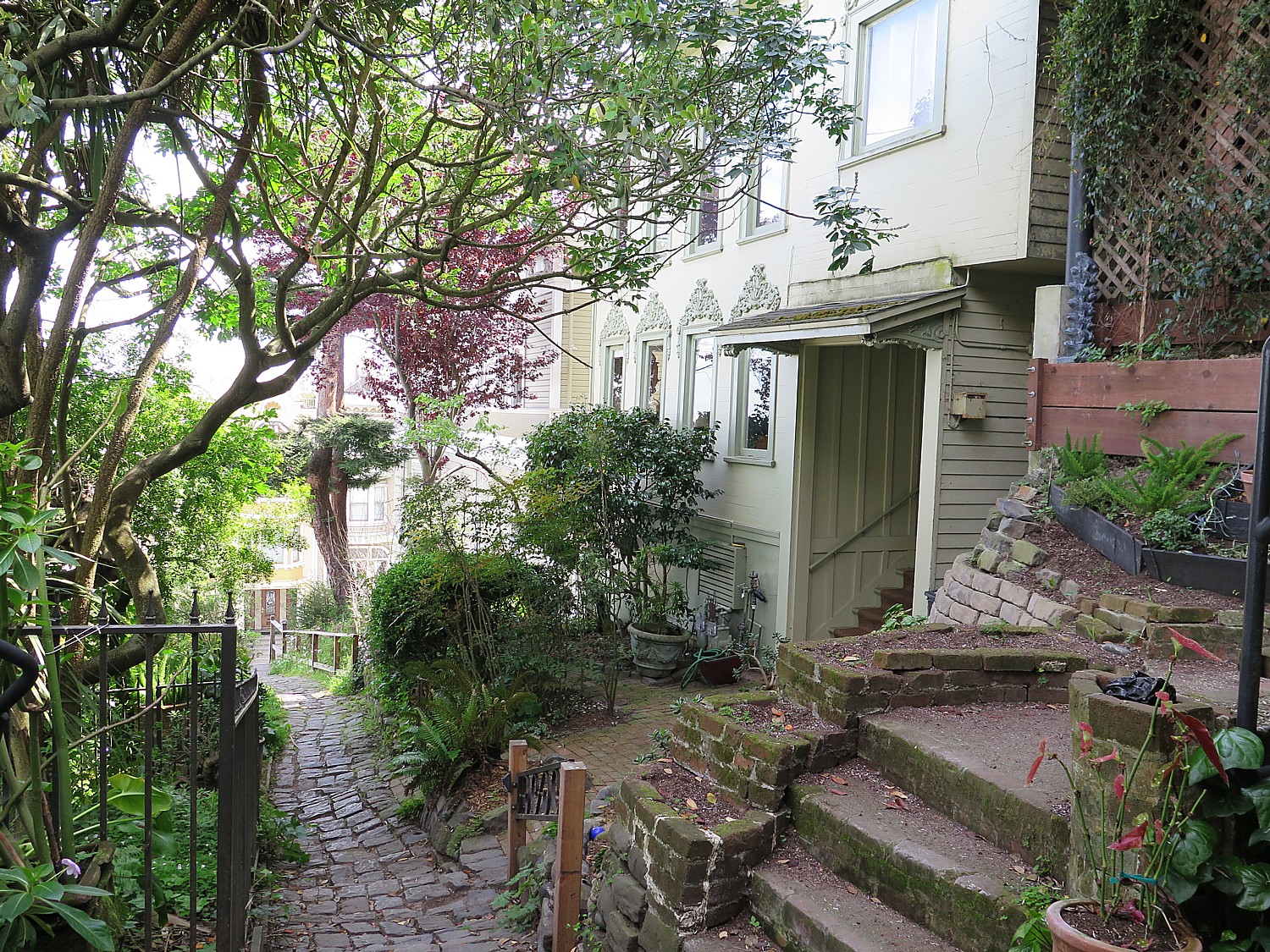
A day devoted to exploring San Francisco’s past, and how this improbable city came to be began with Hudson Bell’s Fern Hill Walking Tours’ Classic San Francisco, which offered a brilliant orientation to the city. We end the tour with a ride on the California cable car line. Just a couple of blocks where Bell’s walking tour ends, back at Nob Hill, is the Cable Car Museum.
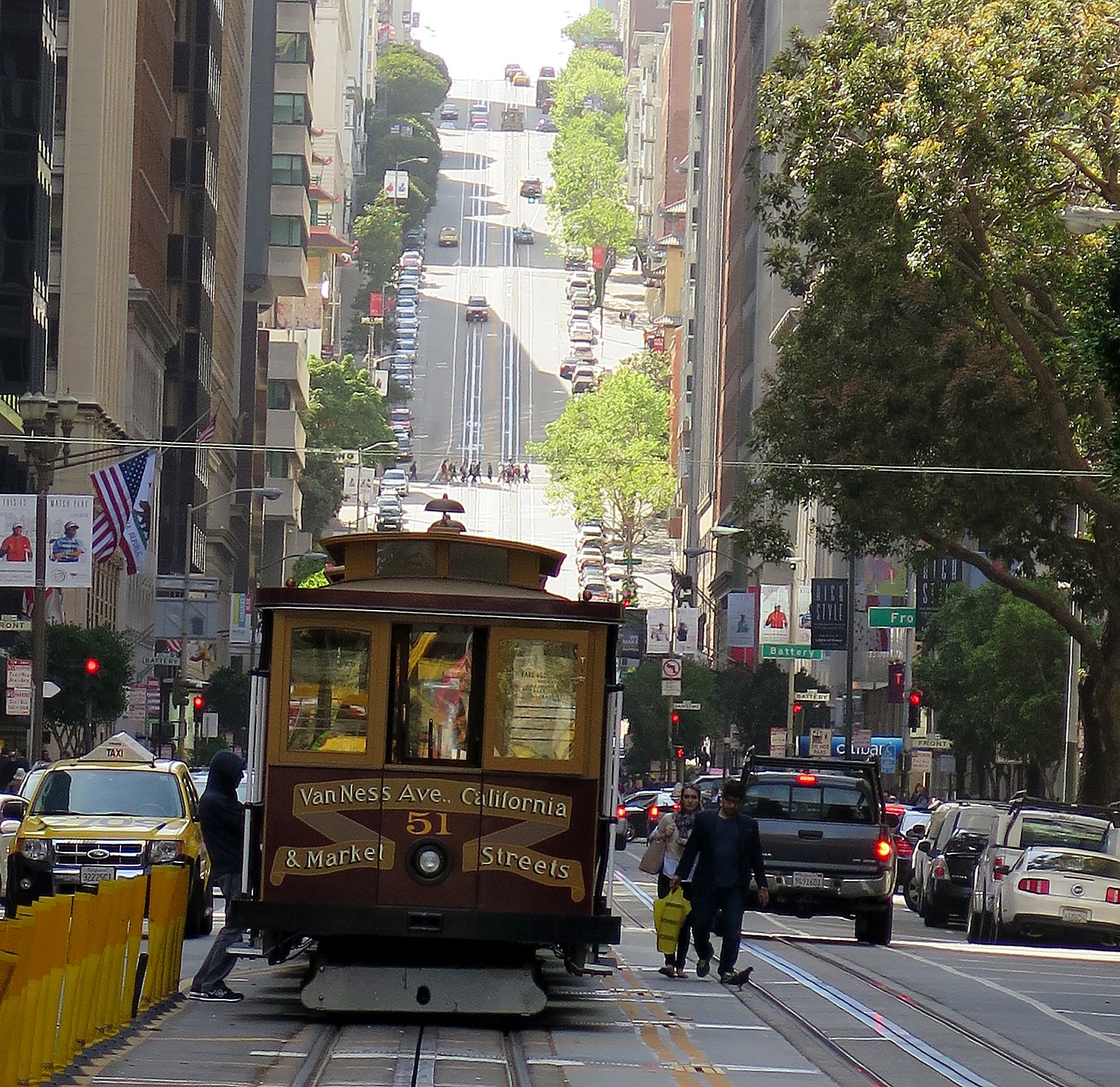
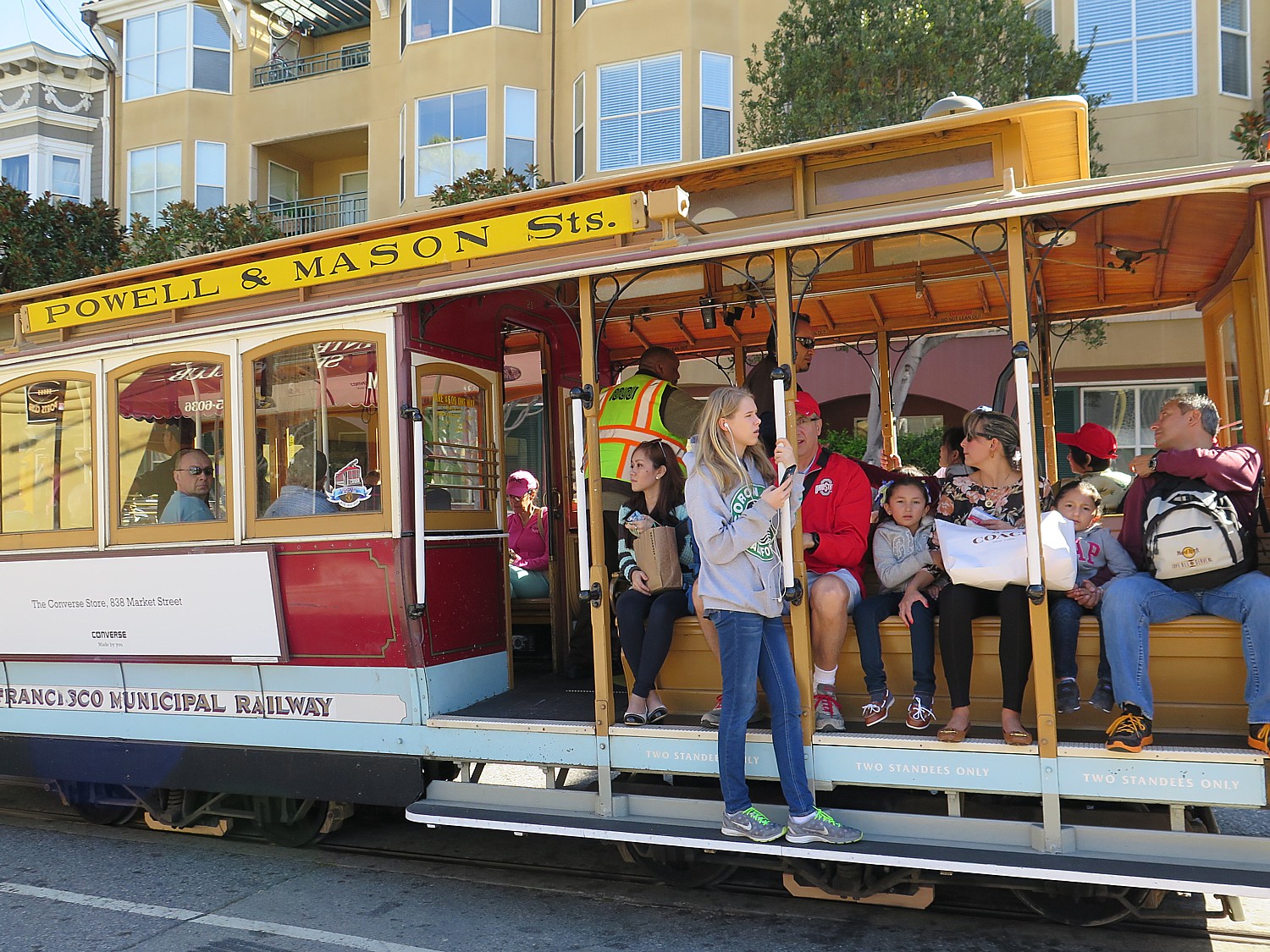
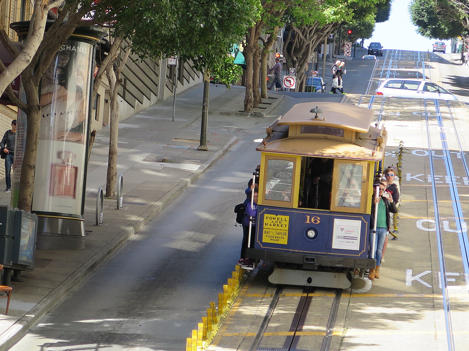
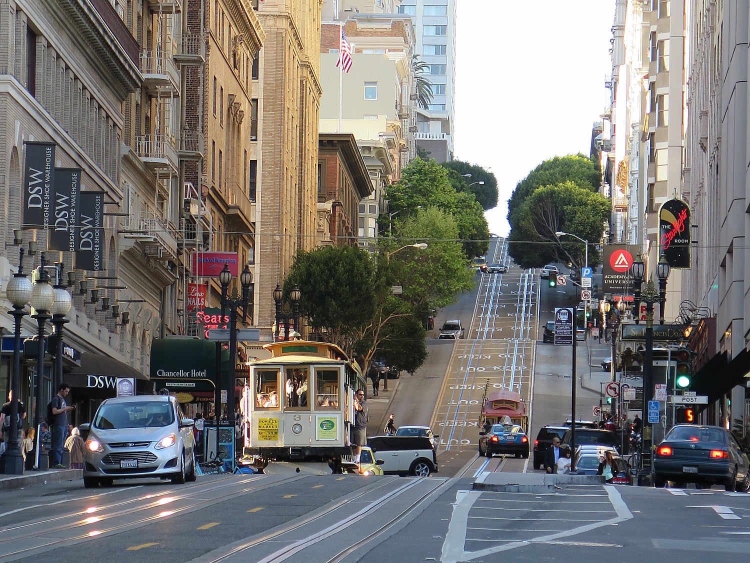
Even more than the Golden Gate Bridge, I believe, the cable car defines San Francisco – it is fact, the only city where cable cars still operate as more than just a tourist ride and an essential part of mass transit system. But as I soon learn, the cable cars survive in spite of repeated attempts to replace them altogether. It is quite literally the Little Train that Could – a technology that was invented here in the 19th century which still proves the best to tackle San Francisco’s hills. The cable car is what made San Francisco livable.
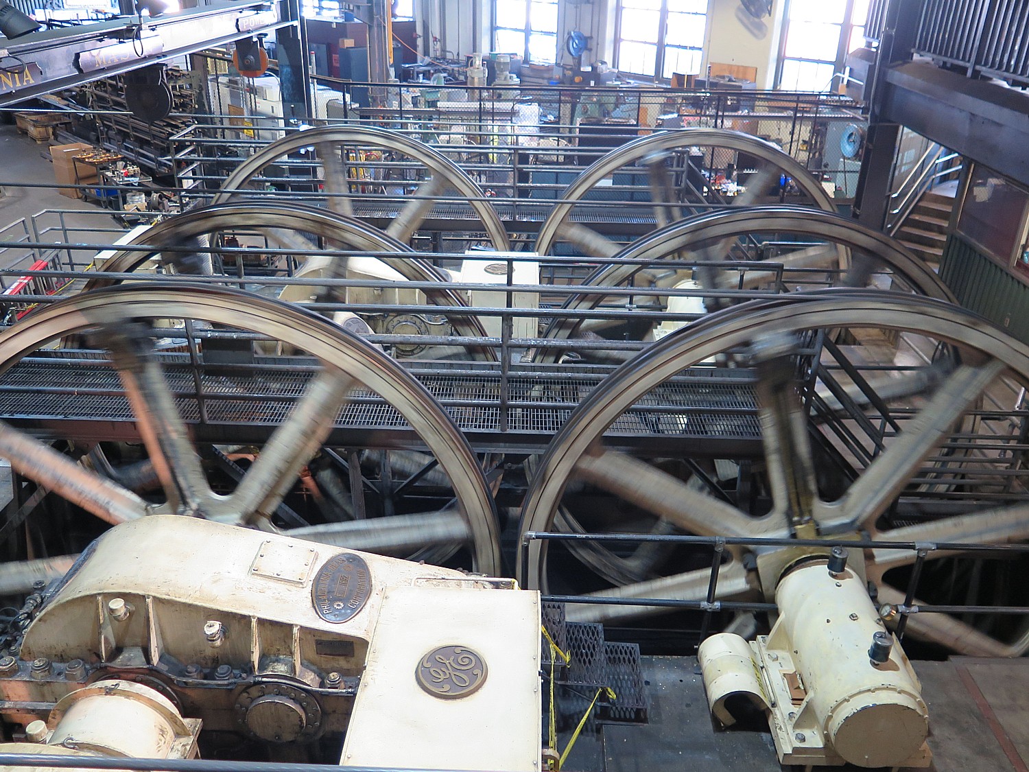
Located in the historic Washington/ Mason cable car barn and powerhouse, the Cable Car Museum, which opened in 1974, is so much more than a museum. It lets you look at the actual workings of all four cable-car lines – gigantic wheels, gears and pulleys and cables, moving underground constantly at 9 mph from this central powerhouse. You even get to look under the street to see the “sheavers” doing their painstaking work.
The deck overlooks the huge engines and winding wheels that pull the cables. Downstairs is a viewing area of the large sheaves and cable line entering the building through the channel under the street.
You can see the marvelous mechanical devices – grips, track, cable, brake mechanisms, tools – detailed models, and a large collection of historic photographs.
You sit in an open car to watch a fantastic video (apparently, produced by GE in the 1980s, when the cable cars were saved from being completely removed), that explains how the cable cars work and the history.
San Francisco’s cable cars are intrinsic to the city’s persona. Invented in San Francisco, it is the only city that still uses the cable cars, which are still the best way to climb its hills © 2015 Karen Rubin/news-photos-features.com
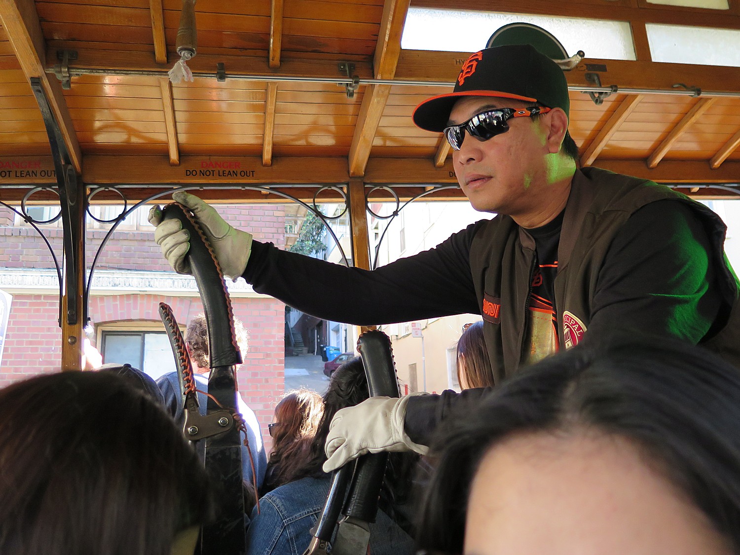
You come away with extraordinary respect and admiration for the cable car engineers – how physical, all the things they have to watch, since they are in essence driving in traffic and have to be careful of cars and pedestrians in the way. Most interesting of all is how the engineer literally let’s go and the car is in free fall as it goes around turns or crosses over the cable for another line.
These aren’t simple, archaic machines at all – It is an ingenious, completely mechanical system: four cable lines, each a closed loop, occasionally crossing each other; sheaving machines that change the cable direction; hundreds of smaller sheaves are under the streets (like pulleys). The huge winding wheels we see here at the powerhouse pull a steel cable at a constant 9 mph through a trench beneath the tracks. The car latches onto the cable with a grip that works like a giant pair of pliers.
The video shows how the engineer drives the cable car, gripping and releasing the cable, how the cable car is actually in free fall when it turns the corner or crosses another cable.
Considering all that stress on the cables of lifting those cars, full of passengers, up those steep hills, don’t the cables fray and break? The cables are actually totally replaced every few months.
My admiration for the invention – and the engineering and how the people who operate them – skyrockets.

The cable car was invented in San Francisco by Andrew Smith Hallidie. Hallidie’s father was an inventor who had a patent in Great Britain for “wire rope” cable. Hallidie immigrated to the U.S. in 1852 during the Gold Rush. He began using cable in a system he had developed to haul ore from mines and in building suspension bridges.
The story goes that he got the idea for a steam engine powered, cable-driven – rail system in 1869, after witnessing horses being whipped while they struggled on the wet cobblestones to pull a horse car up Jackson Street; the horses slipped and were dragged to their death.
Hallidie entered into a partnership to form the Clay Street Hill Railroad, which began construction of a cable line on Clay Street in May of 1873. tested the first cable car at 4 o’clock in the morning, August 2nd, 1873, on Clay Street, in San Francisco.
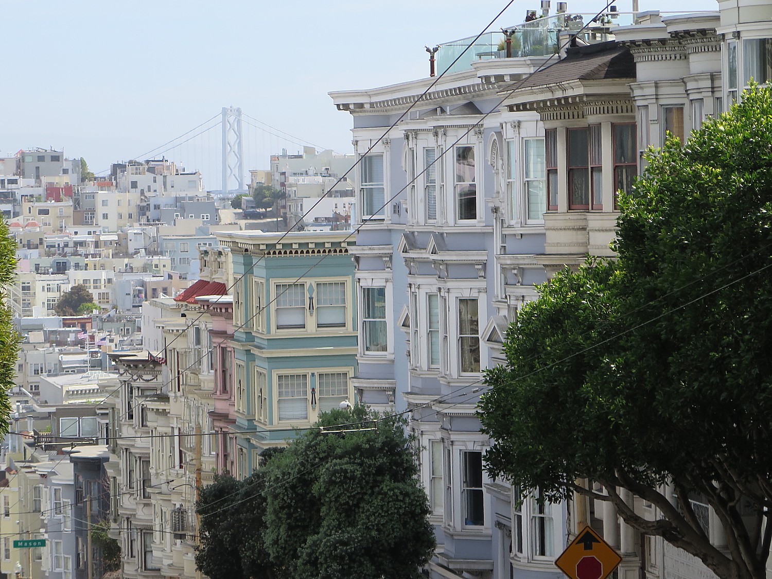
There was a move to replace the cable cars, but after the 1906 earthquake and fire, there was too much to be replaced, so the system was restored.
After the 1906 earthquake and fire, there was a move to replace cable cars with the electric streetcar, perfected in1888 by Frank Sprague. Street cars had become the vehicle of choice for city transit – requiring only required half the investment to build and maintain, and could reach more areas and was quicker. But the cable cars were still able to traverse the steep hills better, so some of the lines were rebuilt. However, as the streetcars improved, even those lines were in jeopardy.
By 1947, the lower operational costs of buses prompted Mayor Lapham to declare, “the city should get rid of all cable car lines as soon as possible.”
But that idea met with huge community opposition. Friedel Klussmann founded the Citizens’ Committee to Save the Cable Cars. There was an international outcry to save the cable cars, which just about everyone appreciated defined the city.
“It would be like Paris without the Eiffel Tower, New York without the Statue of Liberty, London without Big Ben,” an international newspaper screamed.
But by the 1970s, the system was deteriorated. The system was shut down from 1982-4 to be completely rehabilitated. reopening in 1984 in time for the Democratic National Convention that was held in the city. San Francisco Mayor Dianne Feinstein (now US Senator) cut the ribbon.
San Francisco is now only place that operates cable car on streets.
The museum houses three antique cable cars from the 1870s. The Sutter Street Railway No. 46 grip car & No. 54 trailer and the only surviving car from the first cable car company, the Clay Street Hill Railroad No. 8 grip car.
The museum also offers a vivid exhibit with historic photos and commentary of the Great Earthquake of 1906 – you really appreciate the devastation, which makes how San Francisco came back from that all the more remarkable:
At 5:12 am, the equivalent of 6 million tons of TNT – that’s 12,000 times the impact of the 1945 atomic bomb of Hiroshima – struck. The city shook for 40 seconds, then a 10-second pause and 25 seconds more. It left a 200 mile long, 20-40 mile-wide path of destruction along the San Andreas Fault, from Salinas Valley to Fort Bragg.
But that wasn’t the worst – fire broke out April 18, burning for three days. All the water mains, from Crystal Spring reservoir into the city, were broken, so the firefighters had nothing to fight with. The three days of fire caused six times the devastation of London’s 1666 fire.
City Hall was in ruins. The Palace Hotel burned late on April 18 (from which the opera singer Enrico Caruso fled, to the St. Francis where he had breakfast).Russian, Nob and Telegraph Hills burned down to bare earth. The Wharf, North Beach, financial district were desolated. The district known as “South of the Slot” (because of the Market Street cable car slots down the street) burned block after block of tenement and industrial buildings.
The Mission District burned to 20 th & Church streets, where, miraculously, water was available.
But many of the cable car lines that survived the earthquake and fire fell victim to modern rebuilding, with the construction of electric trolley lines – the electric streetcar.
When you consider the strain on hoisting these cable cars up and down the hills, I can only imagine the wear and tear and what would happen if any snapped at any point. I learn that the cables that pull the cable cars around day in and day out are completely replaced every few months.
There is a fun gift shop and a small cafe inside (across the street from the cable car museum is a great cafe to get refreshment).
Free admission! Open daily (except 4 holidays), 10-6 April 1-Sept. 30, 10-5, Oct 1-Mar 31.
Cable Car Museum, 1201 Mason Street, San Francisco, CA 94108, 415-474-1887, www.cablecarmuseum.org.
Riding the Cable Car
The visit to the Cable Car Museum only enhances my appreciation for the cable car, and during my visit, I take about four different rides.
The Powell & Hyde route is supposed to offer the steepest hills, and I take that from Market Street to Fisherman’s Wharf. (It has a stop right above the famous Crooked Street /Lombard.)
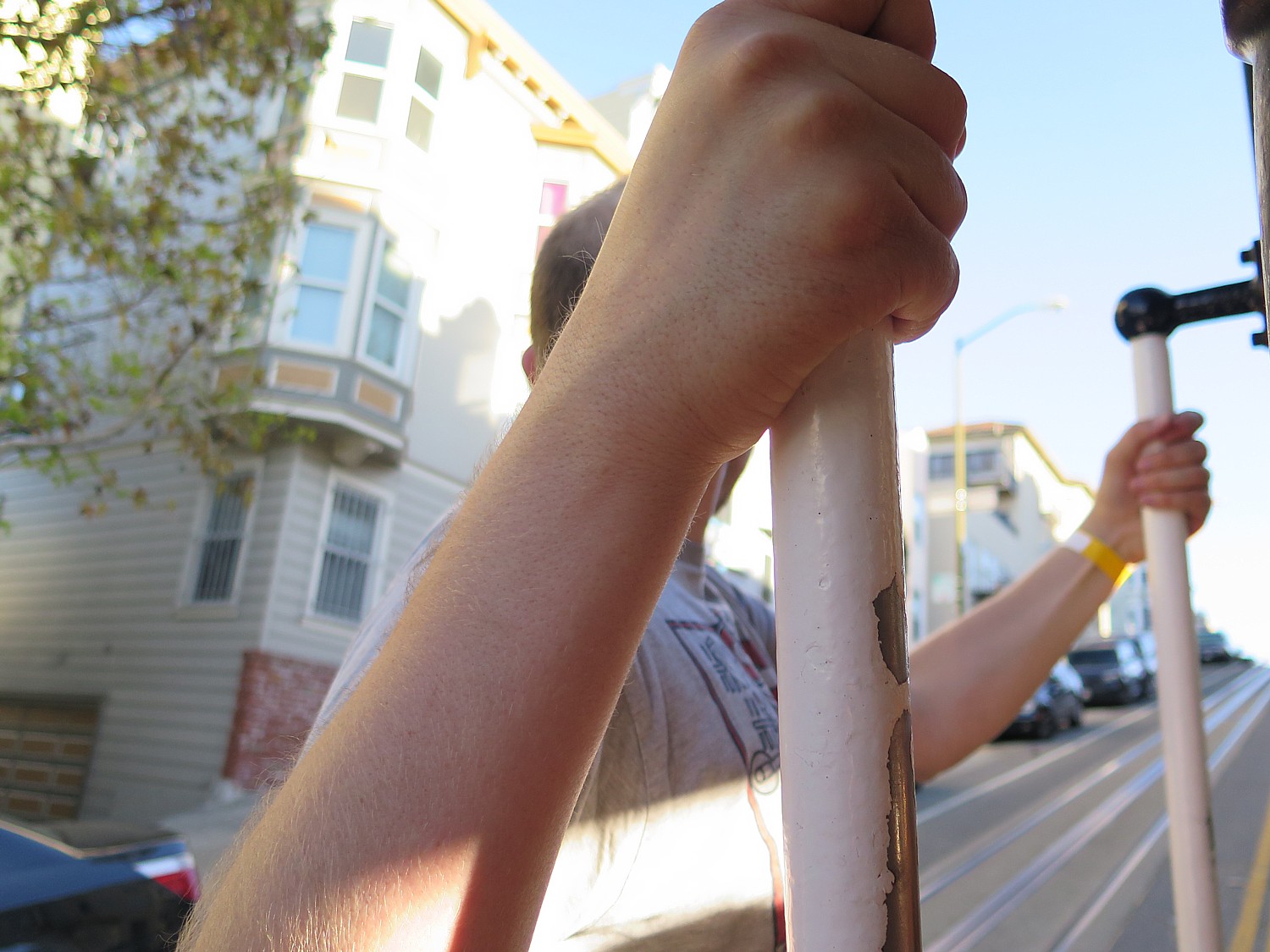
Riding on the outside, standing on the running board and holding on with one hand as you try to take photos with the other! Disney doesn’t have a ride to compare.
It is quite thrilling, especially when the cable car comes within inches of the returning cable car (wave to the people!), or traffic that buzzes along side. The views are fantastic.
I’m impressed with all the gears the engineer operates, the physical effort it takes, and how he has to watch out for pedestrians, cars that drive into the lane, the riders hanging off (like me), the riders who want to get on, watch the traffic lights and the signs painted into the streets.
Returning, I gauge the long line to get back on, so go over to the Powell & Mason line, at Bay Street.
I’ve calculated just right and for my last ride, I am in the exactly right position: riding outside, in the front, so I can rest my camera and hold on with one hand.
Half the seats are outside, and you face out, not front.
People hail the cable car along the route – if they can get on – and it’s not just tourists who use the cars but locals. The California line tends to get fewer tourists and more commuters.
Historic John’s Grill
A perfect way to cap off our sojourn into San Francisco’s history is dining at Historic John’s Grill, located toward the Market Street end of the Powell Street Cable Car ride, just up from the ferry building in Union Square (it’s also walking distance of the theater district, museums, shops and the city’s historic hotels, the Westin St. Francis and The Drake).
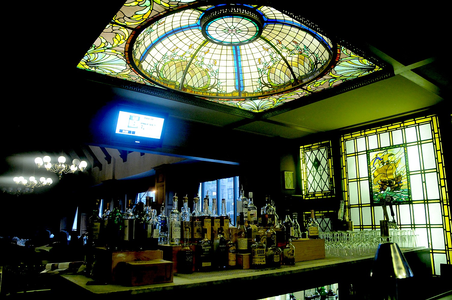
John’s Grill has been a San Francisco institution since 1908 – just after the earthquake – a favorite of politicians, detectives, journalists and generations of San Franciscans. The interior is a masterpiece of original period furnishings, with wood-paneled walls and its historic photographs reflect a colorful century of San Francisco’s history. The restaurant also is the home of the Maltese Falcon, the precious statue made famous by detective novelist Dashiell Hammett, who worked next door and would frequent the restaurant. Hammett used the restaurant as a setting in his famous Sam Spade stories: “Sam Spade went to John’s Grill, asked the waiter to hurry his order of chops, baked potato, sliced tomatoes … and was smoking a cigarette with his coffee when…”
There is a whole atmosphere to John’s Grill – there’s live jazz nightly from 6:30 to 9:30 pm on the second floor, but the music fills the main floor restaurant also. (The third floor of the townhouse is a banquet room accommodating 100).
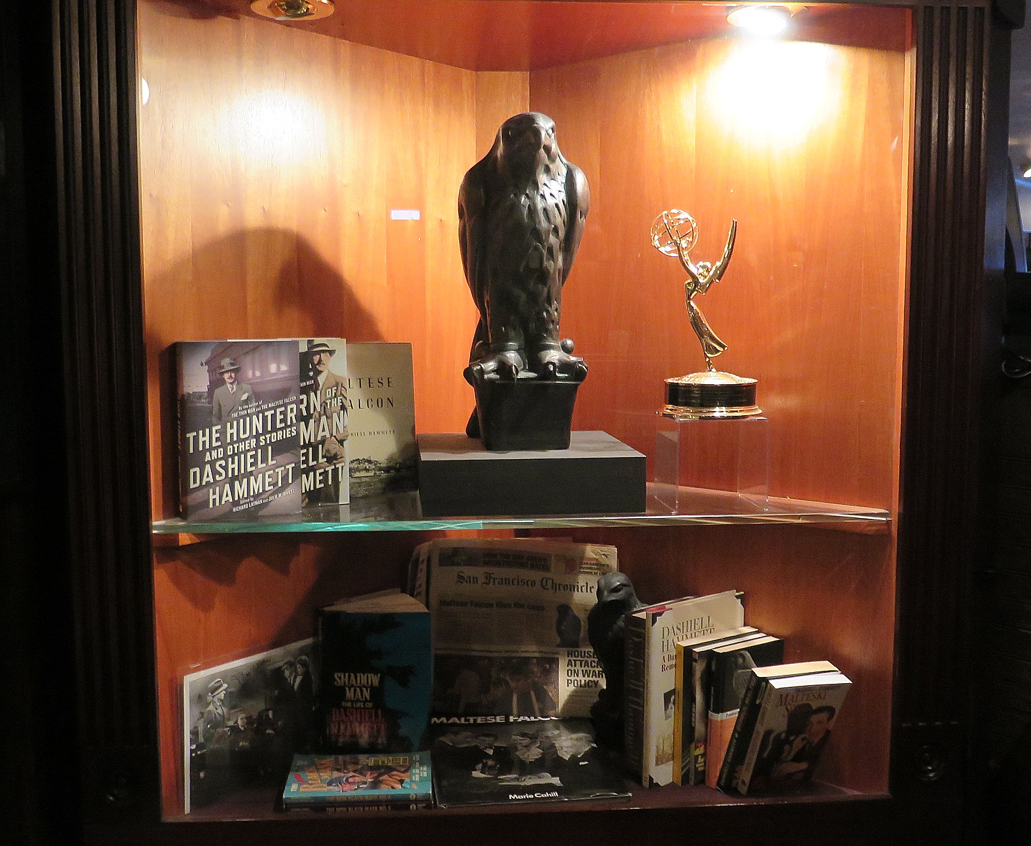
You must go up to the second floor where there is a sort of “museum” to the Maltese Falcon – actually more of an exhibit case, with the statue, copies of Hammett’s books. (John’s Grill is the headquarters of the Dashiell Hammett Society of San Francisco, founded in 1977 by William F. Nolan, a biographer of Hammett, and Jack Kaplan, a director of Pinkerton’s. they created the “Maltese Falcon Room” and guide “Hammett Walks” around the city).
A steakhouse that evokes the machismo of Sam Spade, everything we ordered was fantastic (the rib eye steak was perfection with a peppery accent, as was the Jumbo Prawns Dijonnaise, sauteed with mushrooms, wine, garlic and dijon cream; broiled seabass in a roasted garlic beurre blanc; and a seafood cannelloni- crepes filled with crab, shrimp, baby spinach, cheese, mushrooms with a sherry cream sauce.
The restaurant is known for its Chicken Jerusalem (sauteed with artichokes, mushrooms and creamy white wine sauce) and Oysters Wellington (prepared with creamed spinach, smoked bacon, baked in a puff pastry and served on a bed of sherry cream) .
We start the meal with a selection of appetizers – fresh oysters, Maine lobster ravioli, Moules a la mariniere (mussles with garlic in an herbed light cream broth).
Historic John´s Grill, 63 Ellis Street, San Francisco 94102, Tel: (415) 986-0069, email john@johnsgrill.com, www.johnsgrill.com
Historic Hotel Whitcomb
Hotel Whitcomb is the perfect accommodation for this sojourn through San Francisco’s history – it is, indeed, one of the Historic Hotels of America members in San Francisco (historichotels.org).
For several years following the earthquake of 1906, it served as the City Hall (1912-1915) – (“City Hall” used to be etched in stone above the entrance) – and has been a hotel since 1916.
When you walk through the front doors of the landmark Hotel Whitcomb from bustling Market Street, you find yourself in an elegant boutique hotel with high cathedral ceilings and lovely interiors of early 19th century and Edwardian architecture.
The opulent lobby features Austrian crystal chandeliers, Tiffany stained glass domes above the front desk and also in the piano bar, polished Italian marble columns and floors, Janesero wood paneling, polished brass fixtures, and fresh flowers accentuates the hotel’s Victorian style that is remarkably calming. 1940s music is playing.
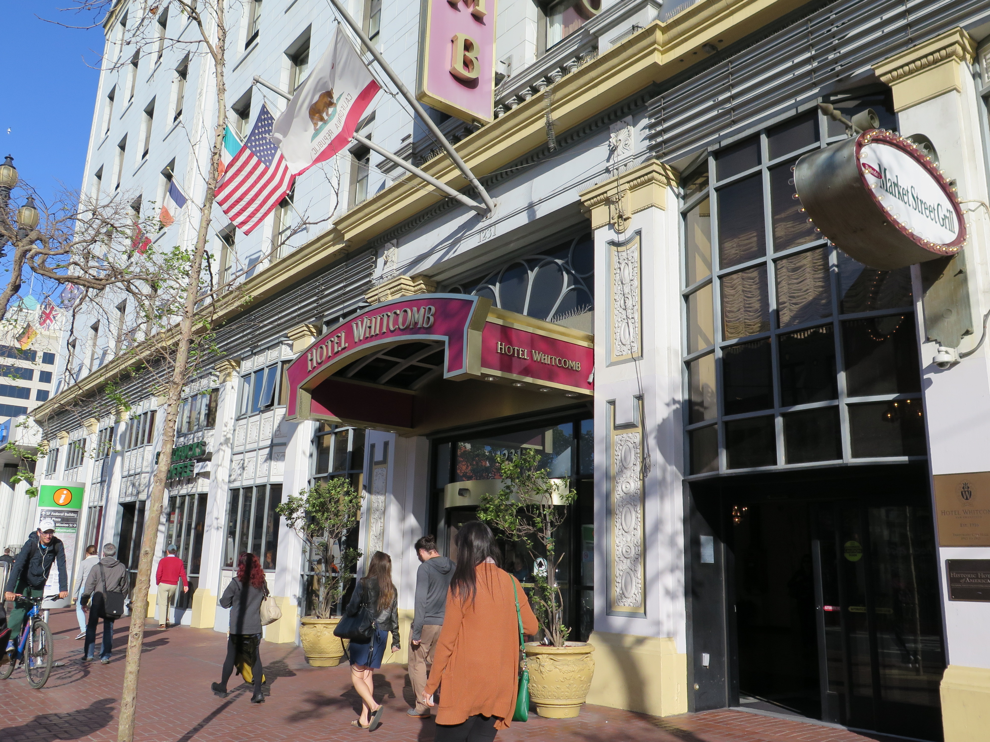
Located on Market Street, across from the Orpheum Theater, the hotel is surrounded by trendy Soma and Hayes Valley restaurants, shops and attractions, walking distance to many of San Francisco’s historic sites, steps away from Civic Center, the theater district, or ride the cable car to Union Square, the financial district, Fisherman’s Wharf, Ghirardelli Square, and The Moscone Center.
The hotel’s 460 beautifully-appointed guestrooms and 12 parlor suites deliver a luxurious hospitality experience with modern amenities and good value. The Penthouse Governor’s Suite offers marvelous views of San Francisco.
Other conveniences: there is a Starbuck’s Coffee right in the lobby, a fitness center, an internet cafe, a business center, high speed wireless internet (free), a gorgeous ballroom to accommodate meetings and weddings, and a lovely dining room.
There is also a very interesting Asian art museum and gallery, plus “Hall of History” with display cases of artifacts and memorabilia from the hotel’s and the city’s past.
Hotel Whitcomb 1231 Market Street, San Francisco, CA 94103, 415-626-8000, Email: sales@hotelwhitcomb.com, hotelwhitcomb.com.
See also:
Walking tour tells story of San Francisco’s improbable rise as a great city and slideshow
_____________________
© 2015 Travel Features Syndicate, a division of Workstyles, Inc. All rights reserved. Visit www.examiner.com/eclectic-travel-in-national/karen-rubin,www.examiner.com/eclectic-traveler-in-long-island/karen-rubin, www.examiner.com/international-travel-in-national/karen-rubin, goingplacesfarandnear.com and travelwritersmagazine.com/TravelFeaturesSyndicate/. Blogging at goingplacesnearandfar.wordpress.com and moralcompasstravel.info. Send comments or questions to FamTravLtr@aol.com. Tweet @TravelFeatures. ‘Like’ us at facebook.com/NewsPhotoFeatures