
By Karen Rubin, Eric Leiberman, Dave E. Leiberman & Laini Miranda
Travel Features Syndicate, goingplacesfarandnear.com
Tourism began in Death Valley in 1926 with the opening of the first hotels. It became a national monument in 1933 and was elevated to a national park as recently as 1994 with the expansion of 1.3 million acres. It is mind-boggling to realize Death Valley is the largest national park outside Alaska, at 3,422,024 acres – twice the size of Delaware.
A basin below sea level, there is drought and extreme heat, but towering peaks, rising as high as 11,000 feet that ring the basin, get snow. There is even a waterfall. Periodic flooding over millions of years has carved and smoothed ragged rock – a cautionary tale of nature’s power and unpredictability – while oases provide refuge for wildlife and people. Most surprising of all is the diversity of life that has adapted to this harsh location, no more surprising than that there are people here at all – indeed, the Timbisha Shoshone American Indian tribe are repopulating the area around Furnace Creek.
Death Valley is a land of extremes and constant surprises that excite the senses and force you to pay attention. You are never merely a casual observer, but an active participant, often getting to test new skills.
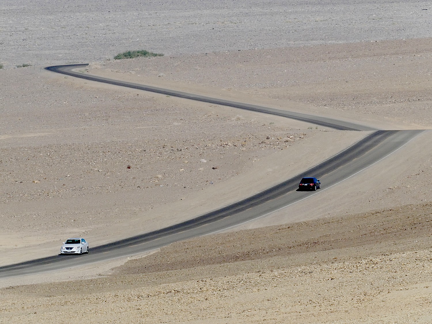
Because Death Valley National Park is so vast, so massive (nearly 1,000 miles of paved and dirt roads, with gasoline and water as much as 78 miles apart) and conditions that can be fairly treacherous, you are advised to research and plan out what you want to do not only to maximize what you see but for safety’s sake.
Among the important safety considerations: especially in summer, you are advised not to start hiking a trail after 10 am (take into account the distance and estimate the amount of time you need – my rule of thumb is one mile per hour); make sure you have sufficient water (allocate a gallon of water per person per day, which you should buy before you arrive); have hat, sunglasses, sunscreen. You are advised not to hike certain trails after a rain or if rain threatens because they can be treacherous. The weather can change dramatically – indeed, you can see where floods have come through and etched the rock – canyons can turn into rivers quickly. The ground temperature in summer can actually be 80 degrees hotter than the air temperature – a temperature of 201 degrees F was actually measured; ground temperature on the valley floor is 40 percent higher than surrounding air temperature. And yet, it can also get very cold – the lowest temperature recorded on the valley floor was 15 degrees F in 1913. (The best time to hike in Death Valley is from November through March.)
And though you may well see other hikers on the trail (masks!), what stays in your mind is how few, how remote; in four days, we never saw a park ranger on the road. This is no amusement park with pretend thrills. But this sense of the possibility of danger is thrilling.
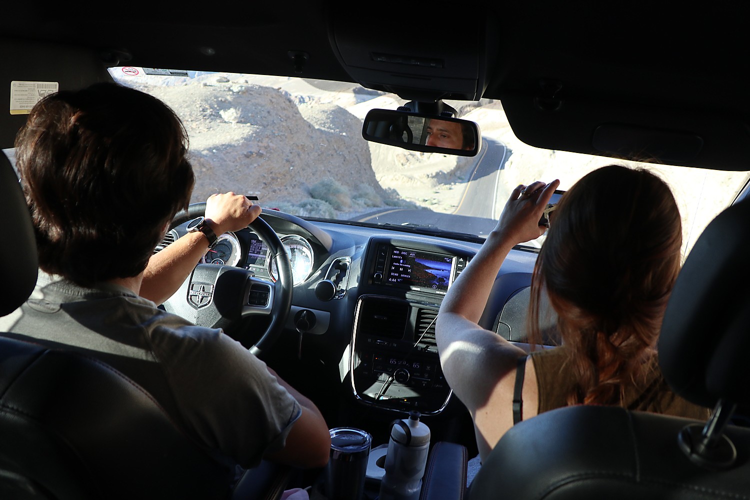
We research the most popular hikes (alltrails.com is a great source) and highlights of Death Valley, set them into geographic areas, calculated an estimated amount of time to visit, mixed hiking with less strenuous touring, and driving time (there is no public transportation in the park) and took into account the time of day and season – you don’t want to be at the far end of a trail when the sun has already begun to set.
So we had cleverly notched one of Death Valley’s most popular highlights, Mesquite Flat Sand Dunes, timing are arrival in the late afternoon the day before, and on our way back into the park on our first morning from our Air BnB in Beatty (20 miles away), we explored Rhyolite Ghost Town, which was also high up on our list of “must-sees.”
For our first full day in Death Valley, we’ve etched out hiking the Golden Canyon trail, 20 Mule Team, Badwater Basin, Artist’s Palette, and finishing with the sunset at Zabriskie Point.
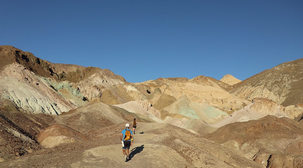
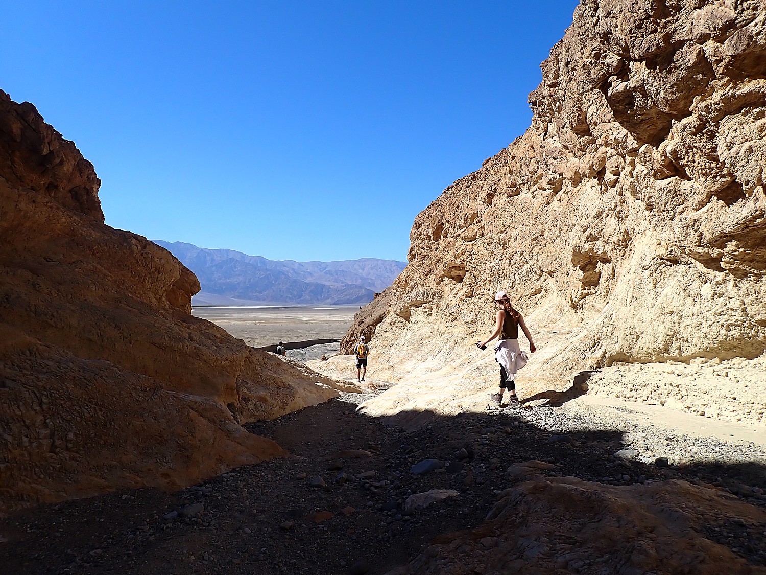
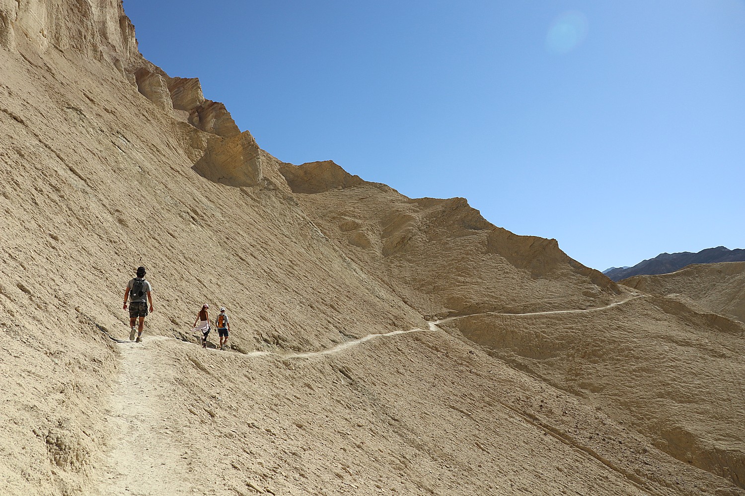
Golden Canyon Trail

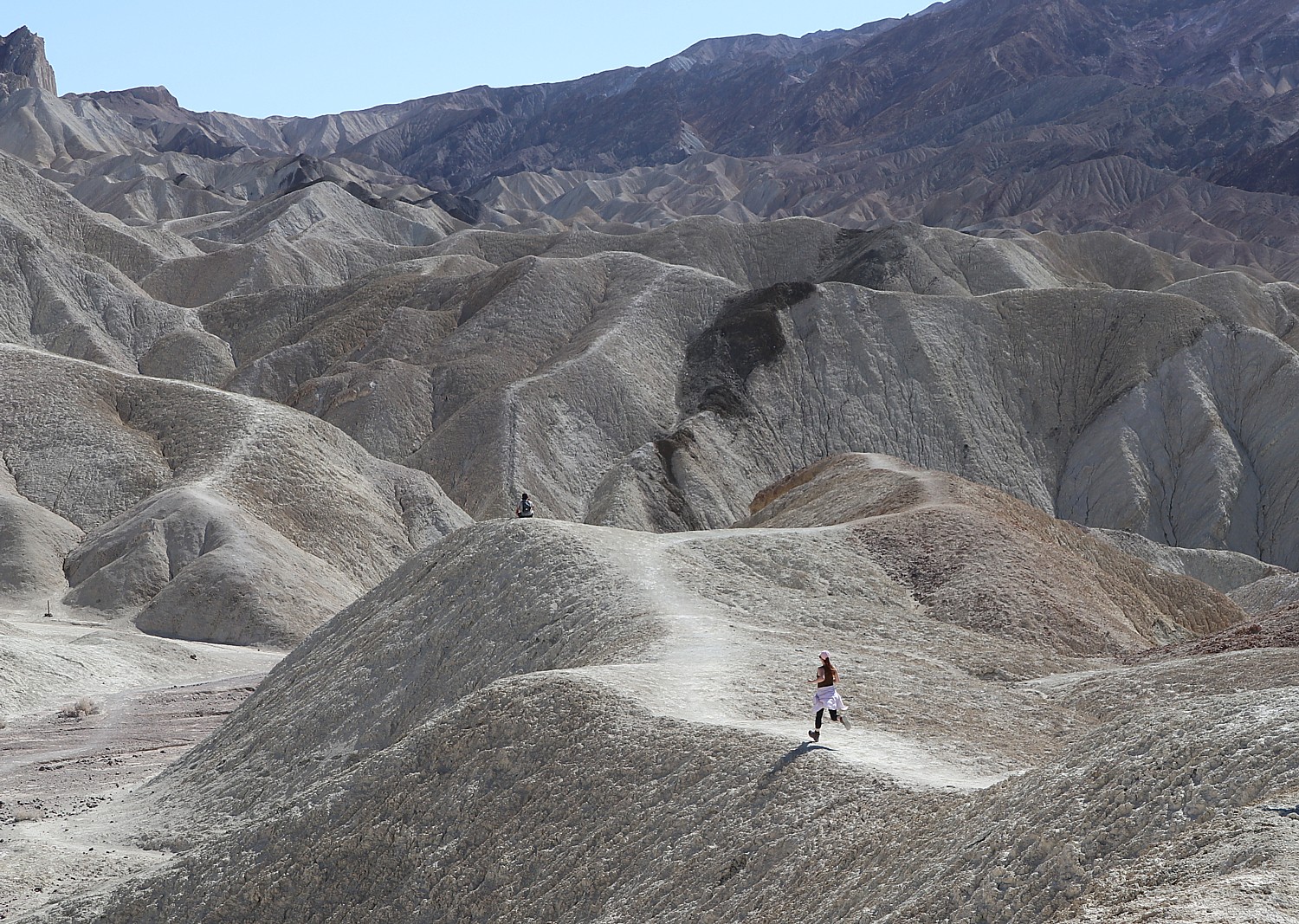
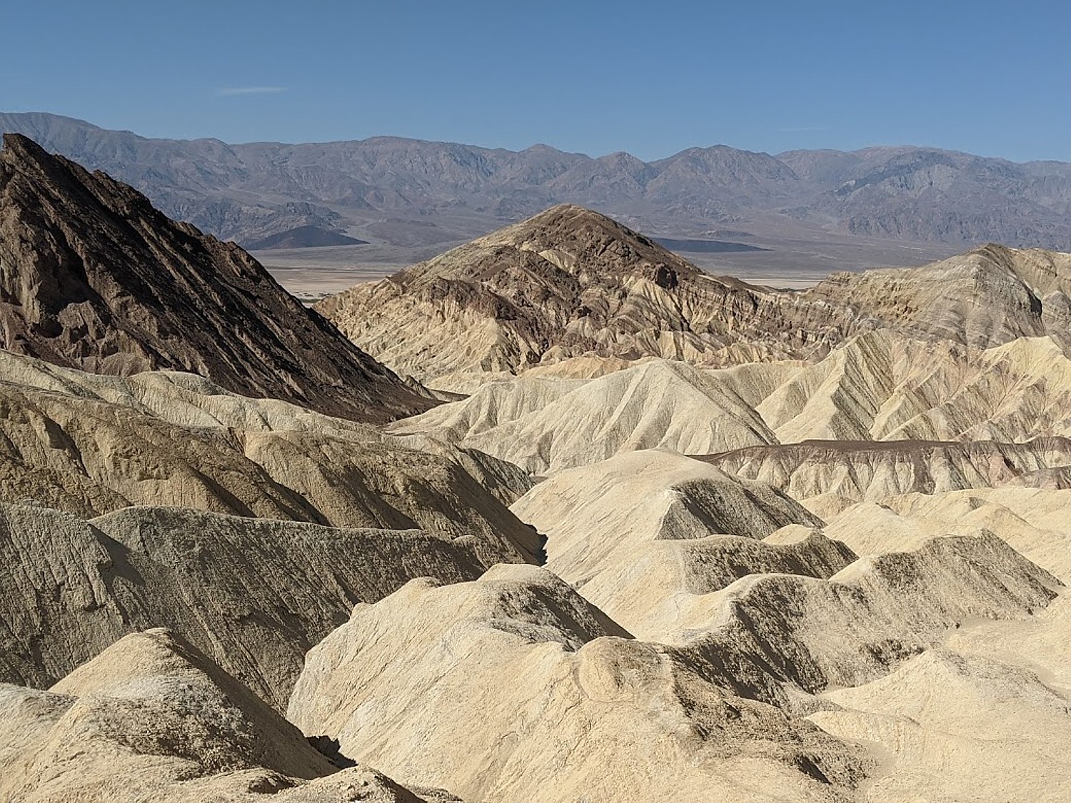
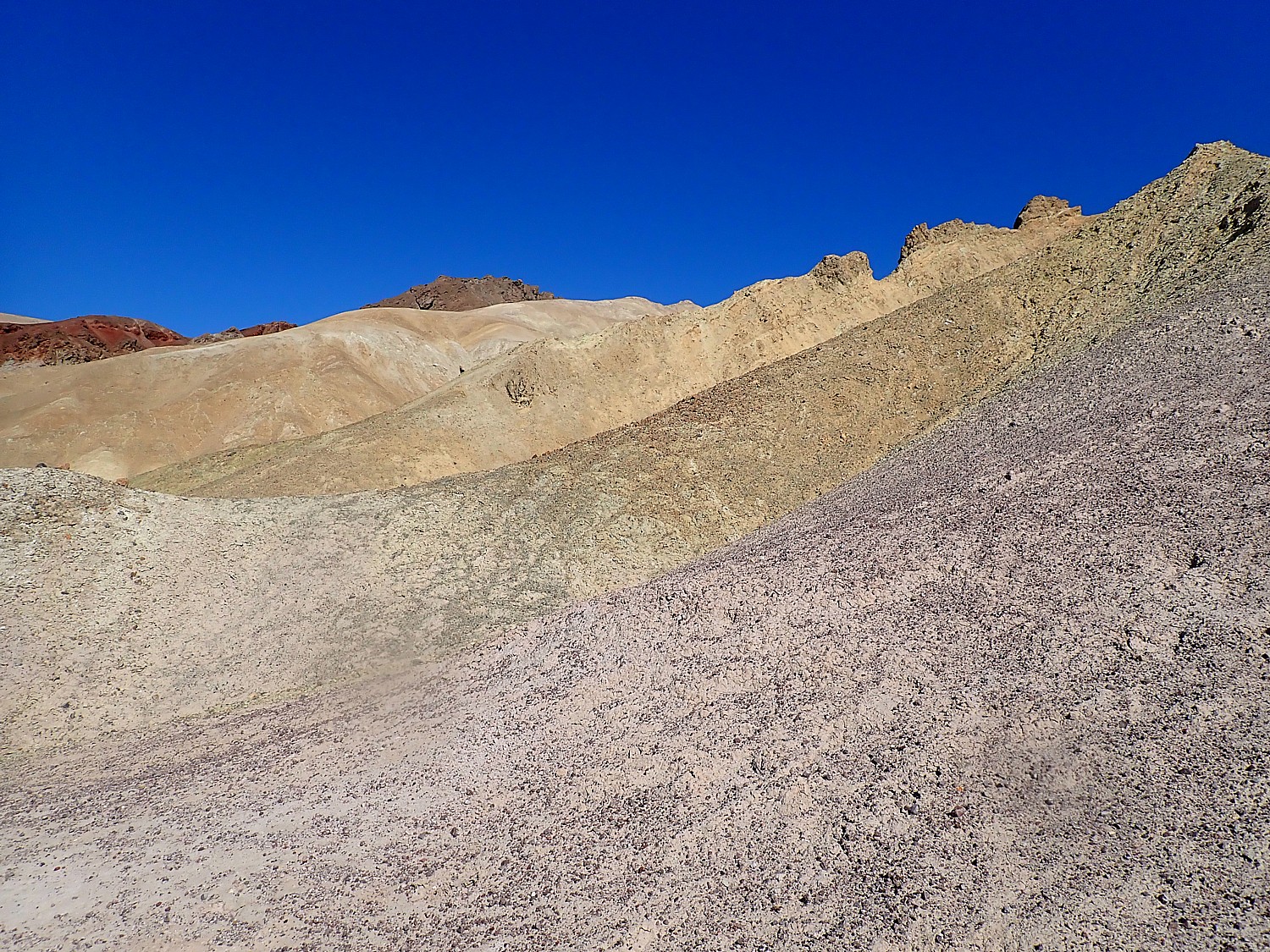
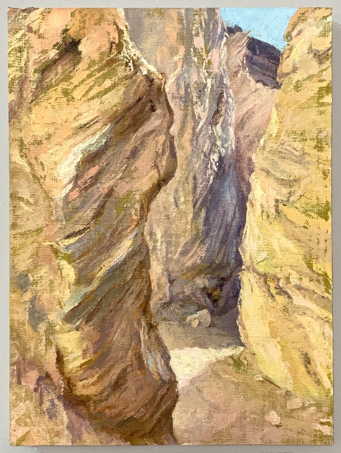
Our first hike, Golden Canyon trail, is the most popular in Death Valley and for good reason. It hits on all cylinders: the absolutely dramatic landscape, patterns and colors of the rocks, but also, the trail itself. The section between the Red Cathedral (really gorgeous) and the turn-off to the spur trail to Zabriskie Point is particularly exciting – you walk a narrow cut in a rounded rock and then over a formation we dub the “Stegasaurus” – like a dinosaur’s back. The full loop is 4.5 miles, winding past Manly Beach and Gower Gulch, just about every step pure joy. The morning sunlight brings out the golden hues in the eroded badlands, contrasting with the red stone cliffs of Red Cathedral. (The hike takes us from 10:30 am to 1:30 pm).


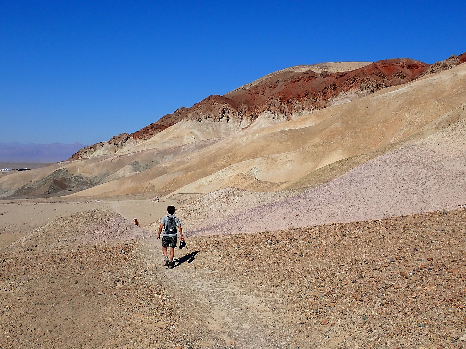
Feeling absolutely exhilarated after the hike, we drive through the 20 Mule Team Canyon – driving it actually does feel more like an amusement park ride. There is a narrow, winding, looping, rolling one-way only road that takes you through. You are reminded that this place used to have mule teams hauling out borax. It’s perfect after the hike – a 15-minute drive through.
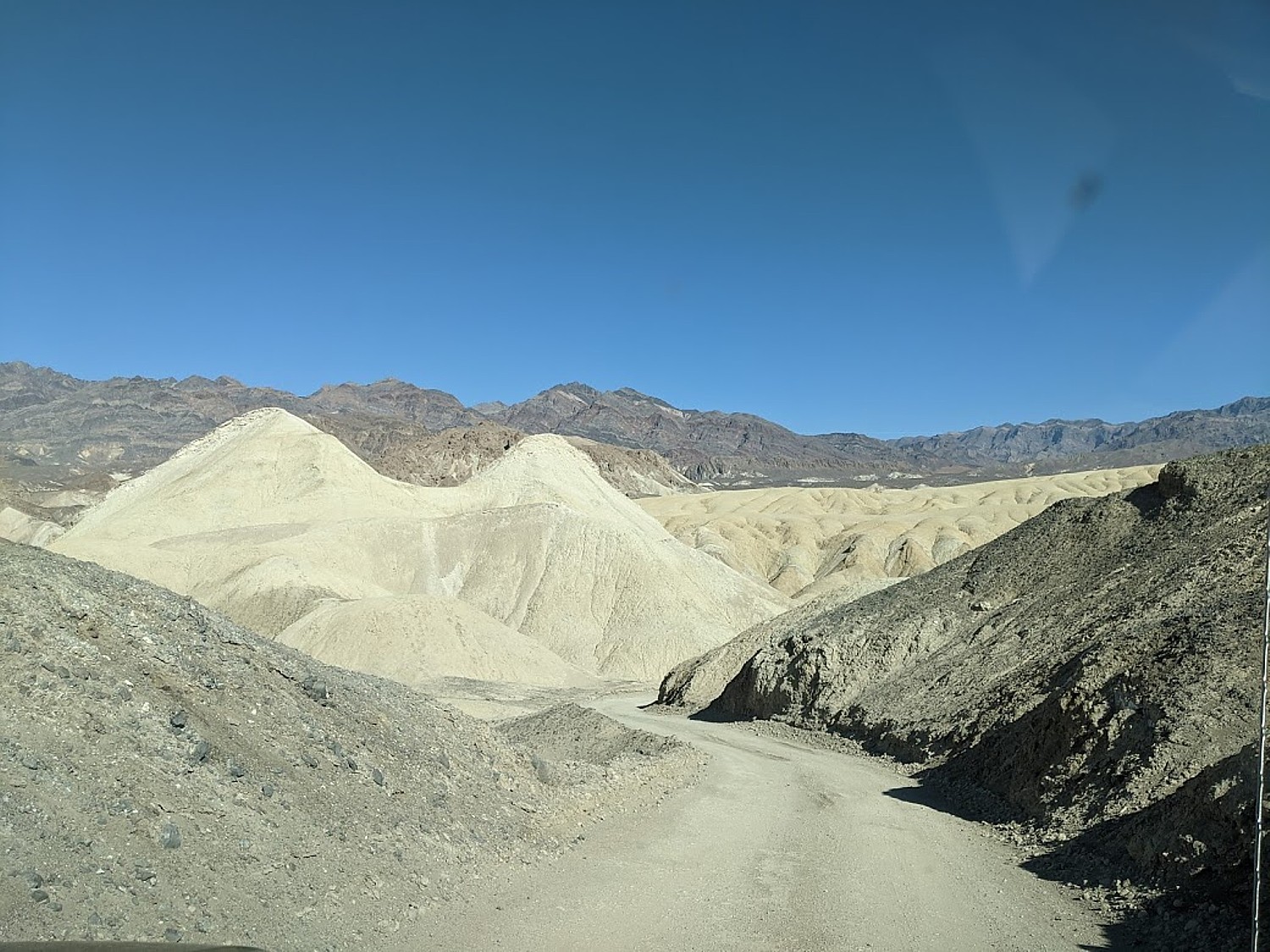
We drive through Artist’s Drive to Artist’s Palette, where we have a picnic lunch (planning!), but decide to return later in the afternoon when its famous colors will be more pronounced.
Badwater Basin
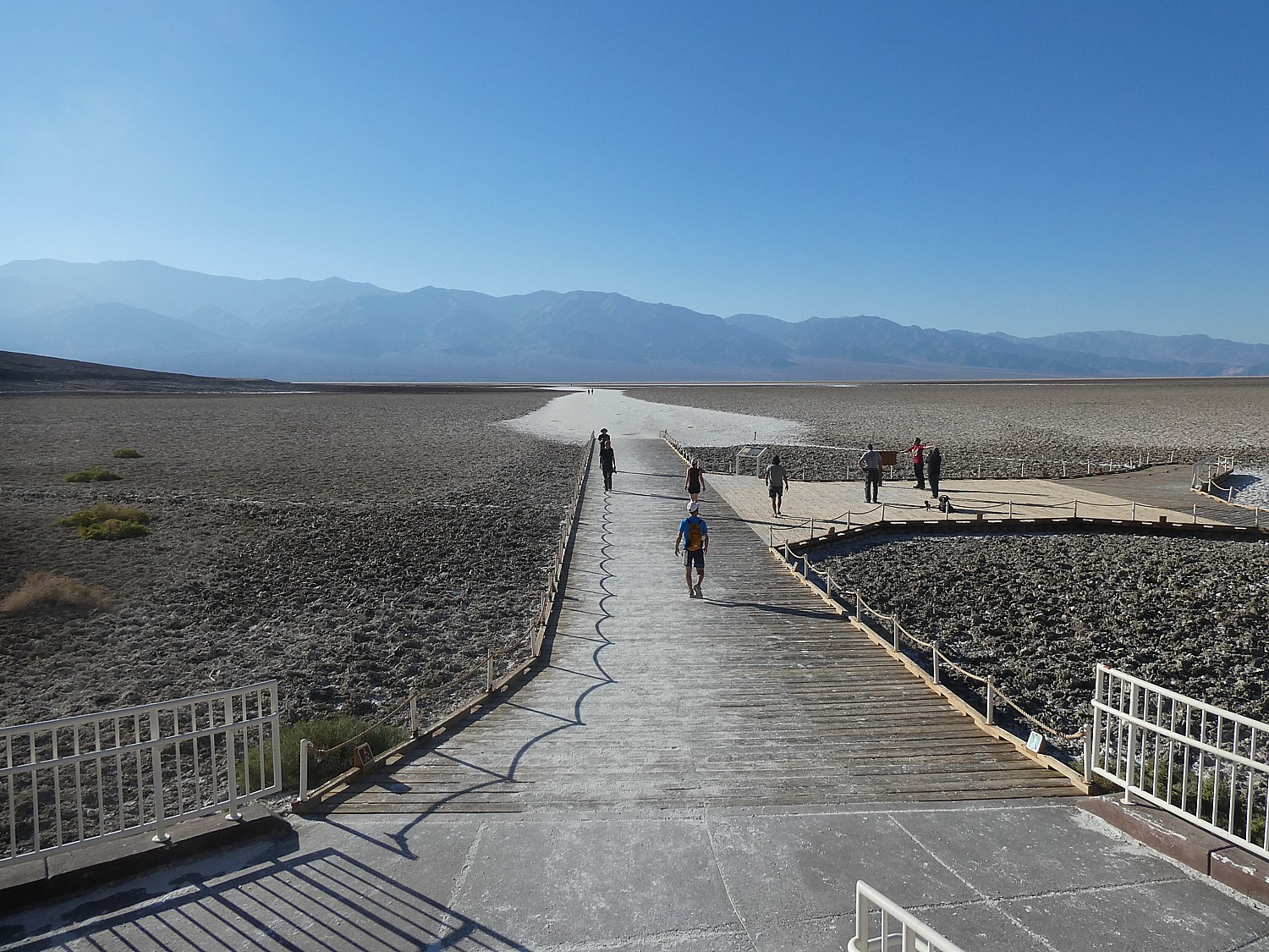
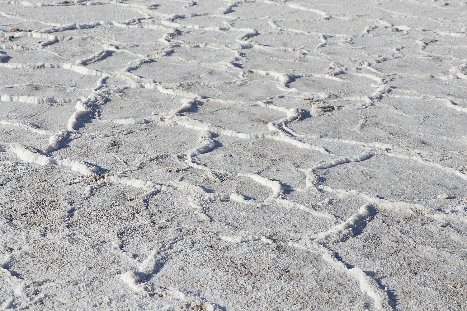
Then on to Badwater Basin, probably one of the most famous sights in Death Valley. Spanning 200 square miles, this extraordinarily expansive, giant salt flat doesn’t look it but you can walk 7 miles across, ringed by mountains. At 282 feet below sea level, when we stand here we are standing at the lowest point in North America. The basin consists of sodium chloride (table salt), calcite, gypsum, and borax.

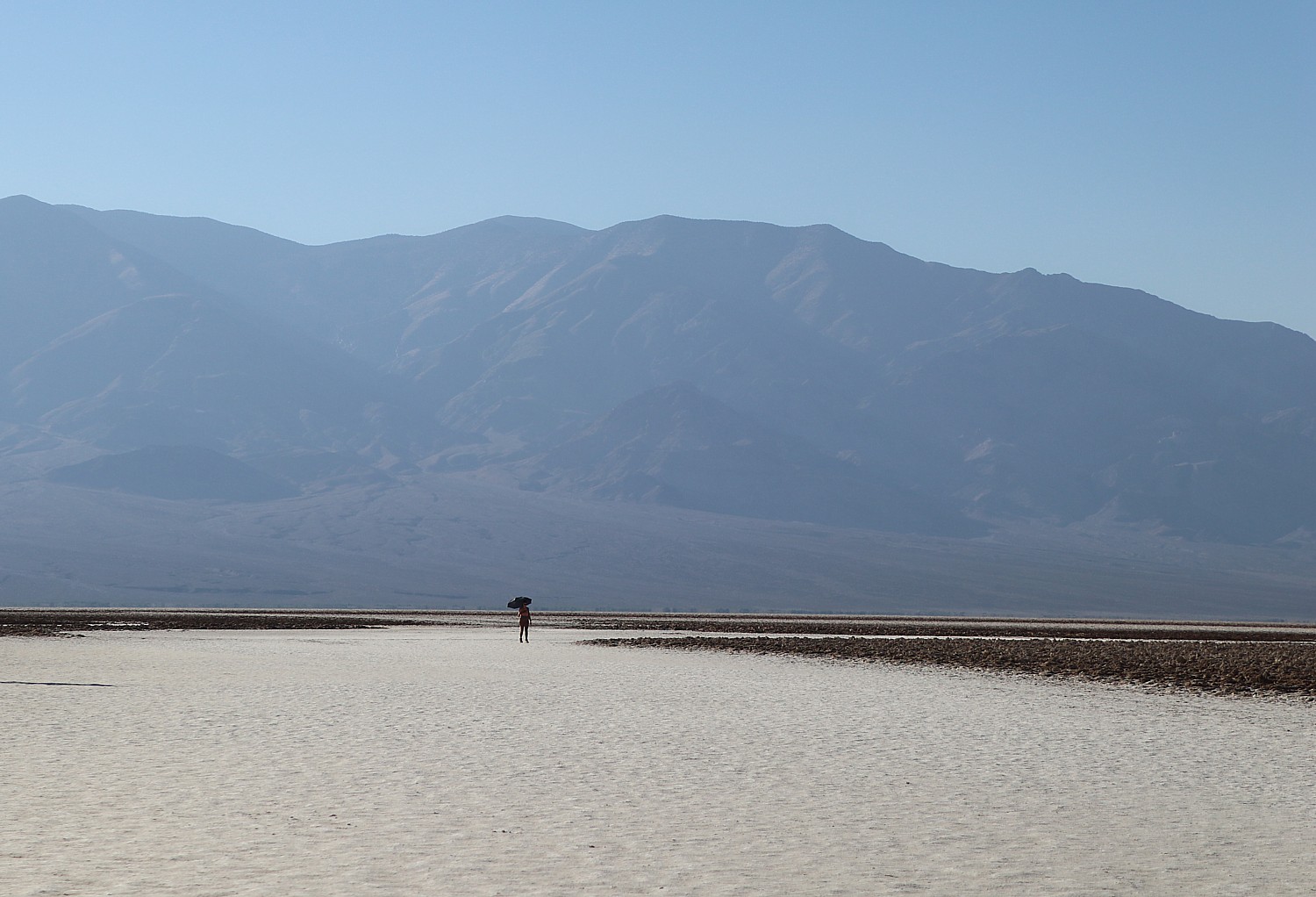
Though named “badwater,” the water is not actually bad but salty, and despite the name, “Death Valley,” it is remarkable to learn that many organisms thrive in it. The pool is home to an endemic snail naturally found only at this location, and its rim is dotted with salt tolerant plants, such as pickleweed. This was once a large inland lake which evaporated over thousands of years, leaving concentrated salt deposits behind that form fascinating geometric polygon shapes.


The pool and boardwalk are easily accessible from the parking lot off Badwater Road, but for the best views of the salt polygons, walk out onto the salt flats a half mile or so. Look behind you to the cliffs of the Black Mountains to the east, where there is a sign high above marking sea level. From here, you can also see Telescope Peak in the Panamint Range to the west; at 11,049 ft, this peak is over two miles above you. “Nowhere else in America can you see such a dramatic vertical relief over such a close distance.” (https://www.nps.gov/places/badwater-basin.htm) (Eric gets to hike up Telescope Peak on his return a month later on his adVANture; see ad-VAN-turing, Newest Travel Trend)
It’s 4:30 pm and there are long shadows bringing out the interesting formations and patterns in the salt. Here, we are famously 282 feet below sea level. (In summer, it is not advised to walk out on the salt flats after 10:30 am).
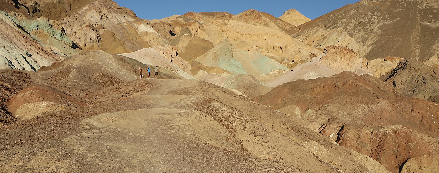
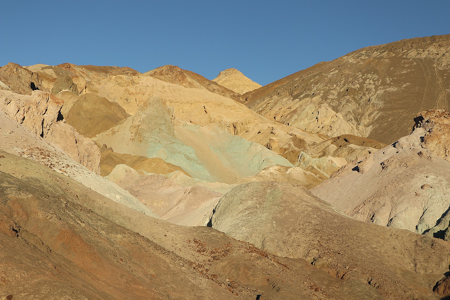
Artist’s Palette
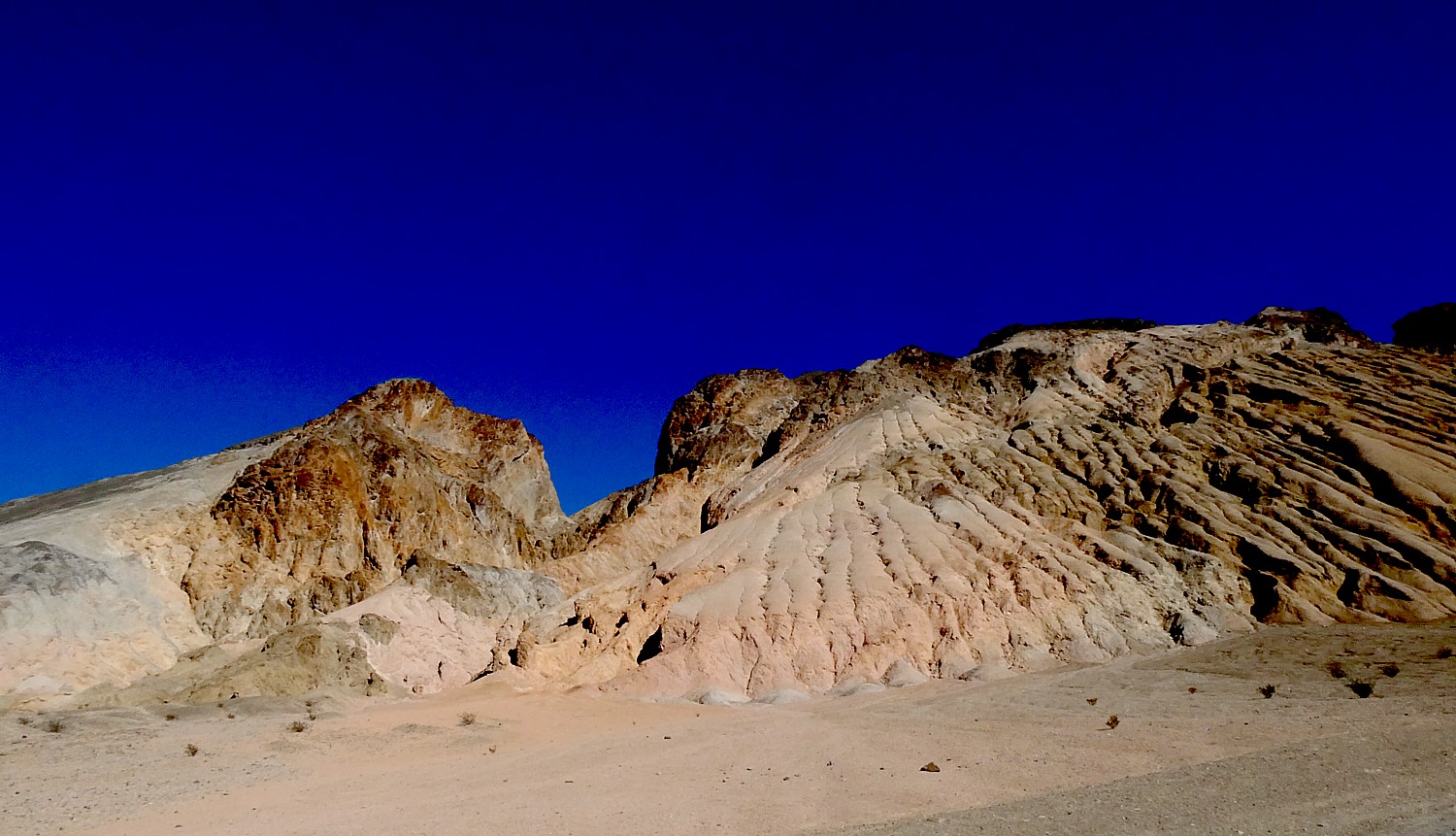
We drive the nine-mile loop-de-loop roller coaster of Artist’s Drive to Artist’s Palette, to see the richer color of the cooler, late afternoon sun, and scamper across the rolling ridges, literally into the multi-colored palette itself – yellow ochre, burnt umber, sienna, rust, rose, copper.
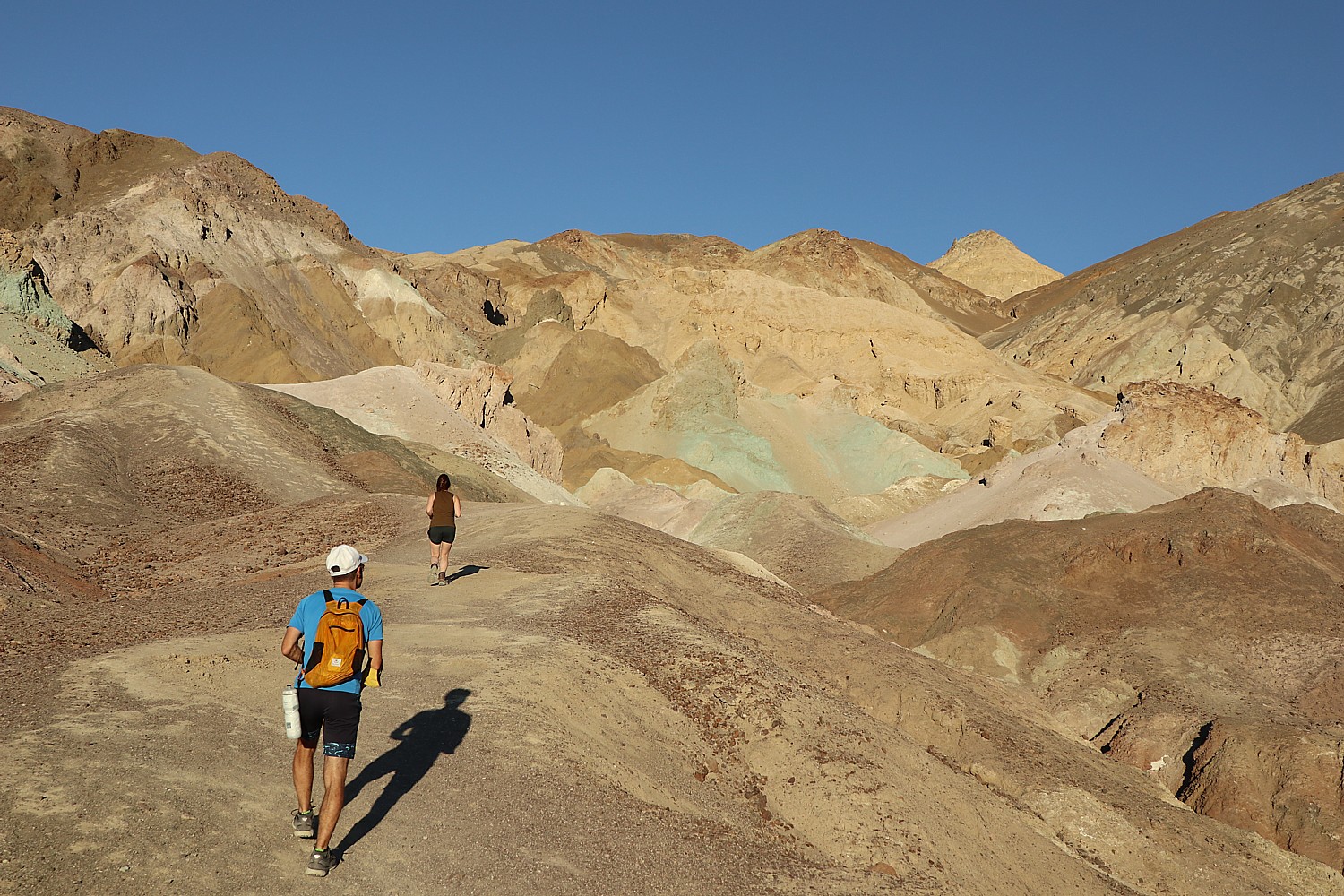

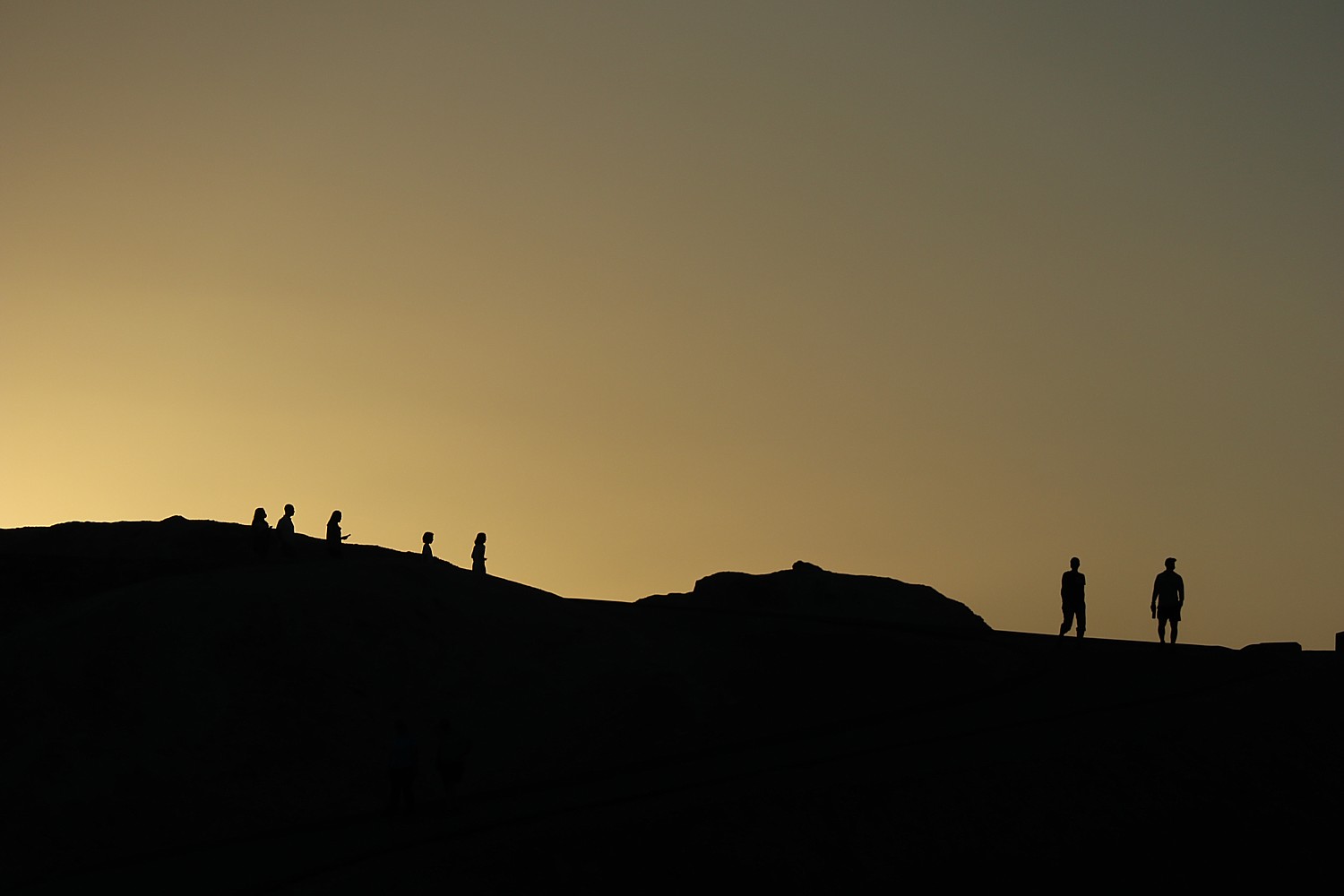
Artist’s Palette is one of the most popular places to watch the sunset, but we decide to go to Zabriskie Point instead.
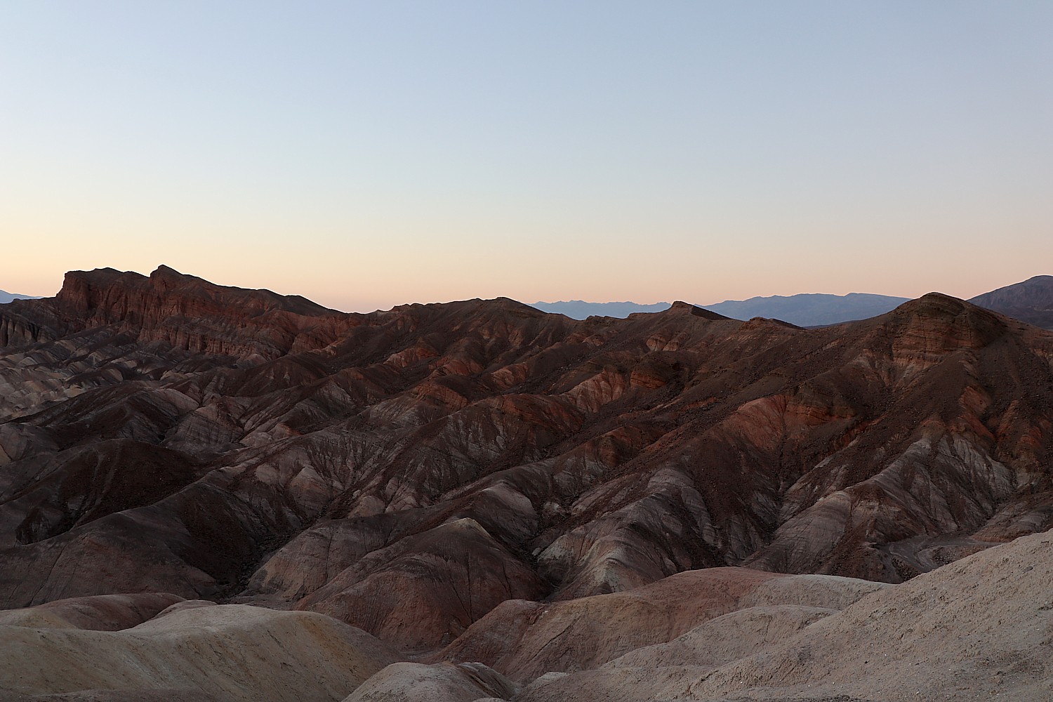
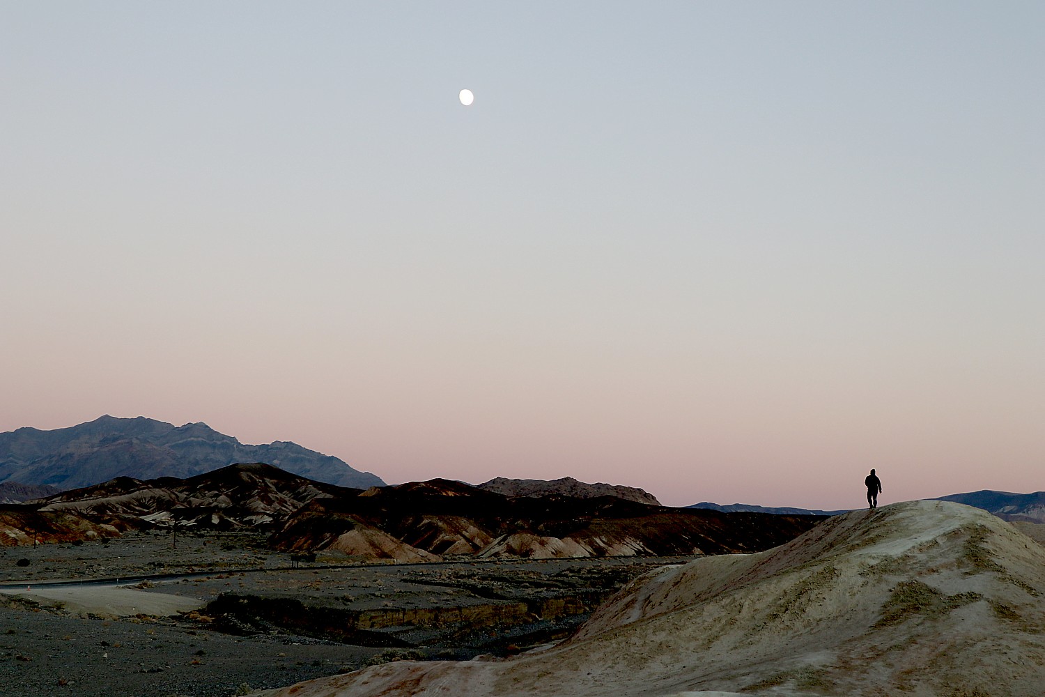
Timing the sunset can be tricky because of the peaks, the day of the year, also. You need to get wherever you want to see the sunset a half-hour before, when the colors begin to deepen. The actual sunset is over in a few minutes, so you have a very short window for the best images.
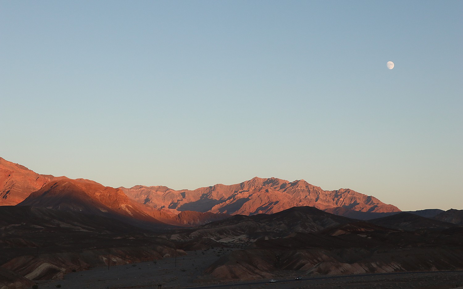
And so we miss the sunset at Zabriskie Point by five minutes. Even so, it is a gorgeous sight as the rocks take on warm colors, there is a pink rim to along the mountain ridges, and a full moon rises.

Fortunately, we will have the opportunity to see the sunrise and sunset on our next day. Indeed, that’s why we decided to book two nights at the Ranch at the Oasis, just a short drive away from Zabriskie Point, instead of driving 45 minutes each way to the Designed to Death Air BnB in Beatty, Nevada, where we stayed on our first night.
We check into the Ranch at Oasis, order out dinner from the menu and sit outside on the lovely terrace adjacent to the restaurant (which also has outside dining, properly spaced). It is sheer perfection (as was the steak with an espresso rub, fantastic!).

We drop our things in our hotel room (Laini has made sure to get a first-floor room at the end of the hall, close to the door, so we would have minimal time in a public space, and was assured that the rooms are thoroughly cleaned and left for 24 hours before the next guest). We immediately go to the Olympic-sized pool – absolutely magnificent, naturally warmed to a constant 87 degrees by hot mineral springs. The water feels silky, and as we swim we delight in the stars overhead. (www.oasisatdeathvalley.com)
The biggest surprise of all is how diverse Death Valley is – low valley floors, salt flats, rugged mountains rising as high as 11,000 feet, deep and winding canyons, rolling sand dunes, oases. The landscape is not a monotone at all, but a riot of colors, textures, contours. Each hike we take, each highlight we explore is spectacular in its own way, exciting and thrilling, exacting surging emotions and senses – the Mesquite Flat Sand Dunes, the Golden Canyon, the Badwater Basin salt flats, the 20 Mule Team Canyon, Artist’s Palette, Zabriskie Point – and it’s only been a day and a half.
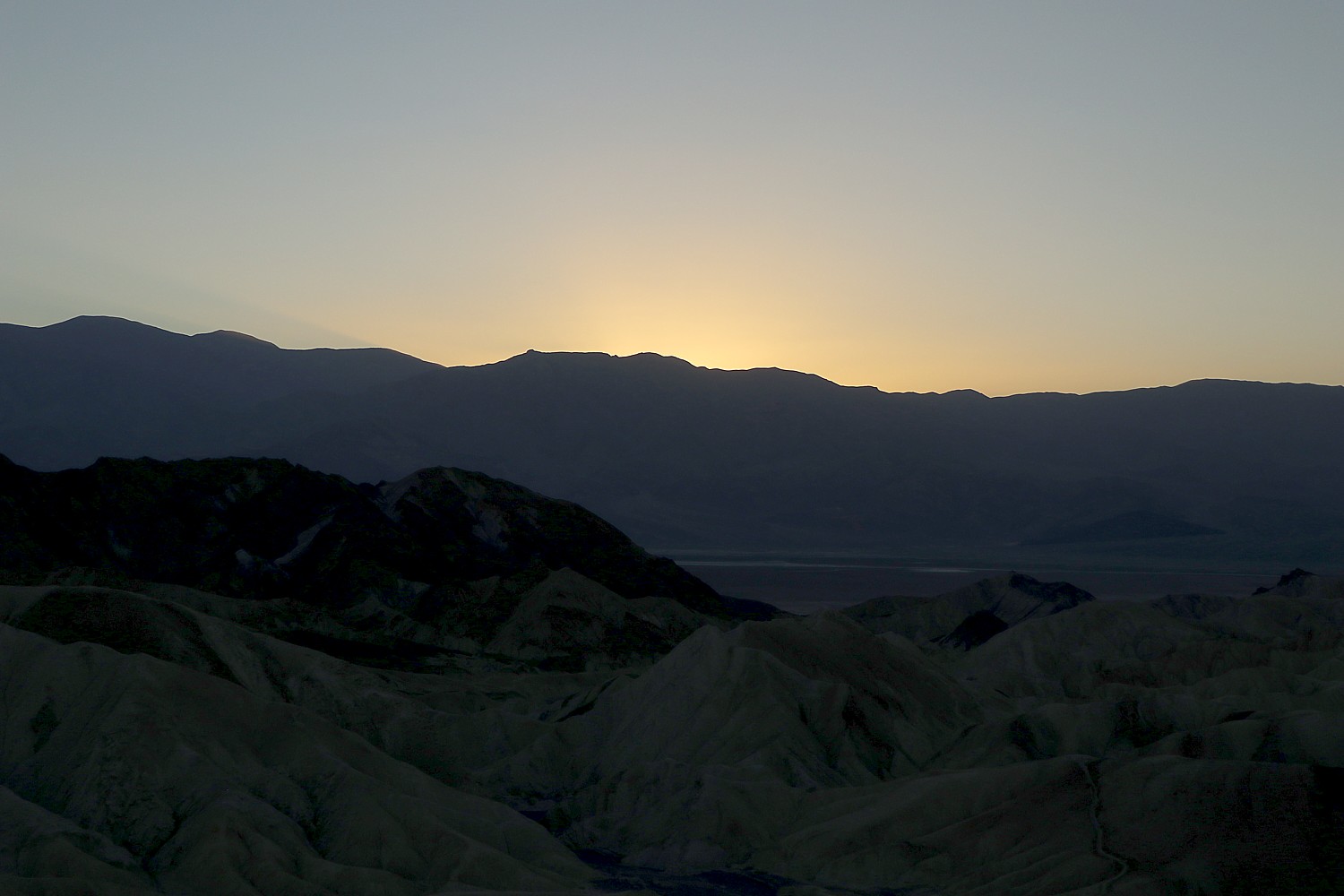
The next morning, we get up before sunrise to get to Zabriskie Point (about a 7-minute drive away) to watch the brilliant display as the rocks seem aflame with sunlight.
See also:
ROAD TRIP: DISCOVERING DEATH VALLEY’S TREASURES, RICHER THAN GOLD
_______________
© 2021 Travel Features Syndicate, a division of Workstyles, Inc. All rights reserved. Visit goingplacesfarandnear.com, www.huffingtonpost.com/author/karen-rubin, and travelwritersmagazine.com/TravelFeaturesSyndicate/. Blogging at goingplacesnearandfar.wordpress.com and moralcompasstravel.info. Send comments or questions to FamTravLtr@aol.com. Tweet @TravelFeatures. ‘Like’ us at facebook.com/NewsPhotoFeatures
