Tag Archives: Death Valley

Road Trip: Sunrise, Sunset in Death Valley National Park, Nature’s Geologic Art Gallery

Sunrise at Zabriskie Point, Death Valley National Park © Karen Rubin/goingplacesfarandnear.com

By Karen Rubin, Laini Miranda, Dave E. Leiberman & Eric Leiberman

Travel Features Syndicate, goingplacesfarandnear.com

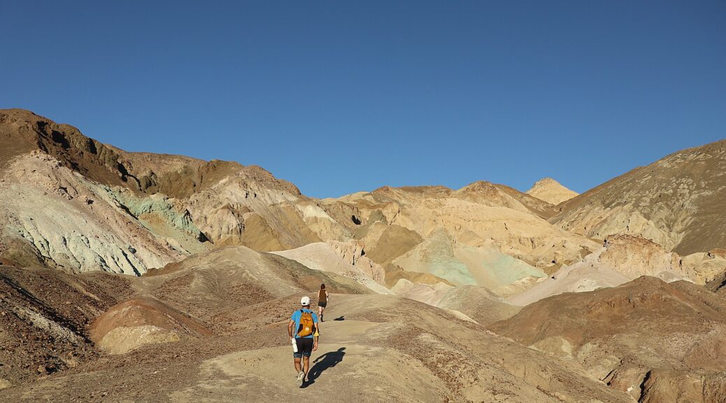
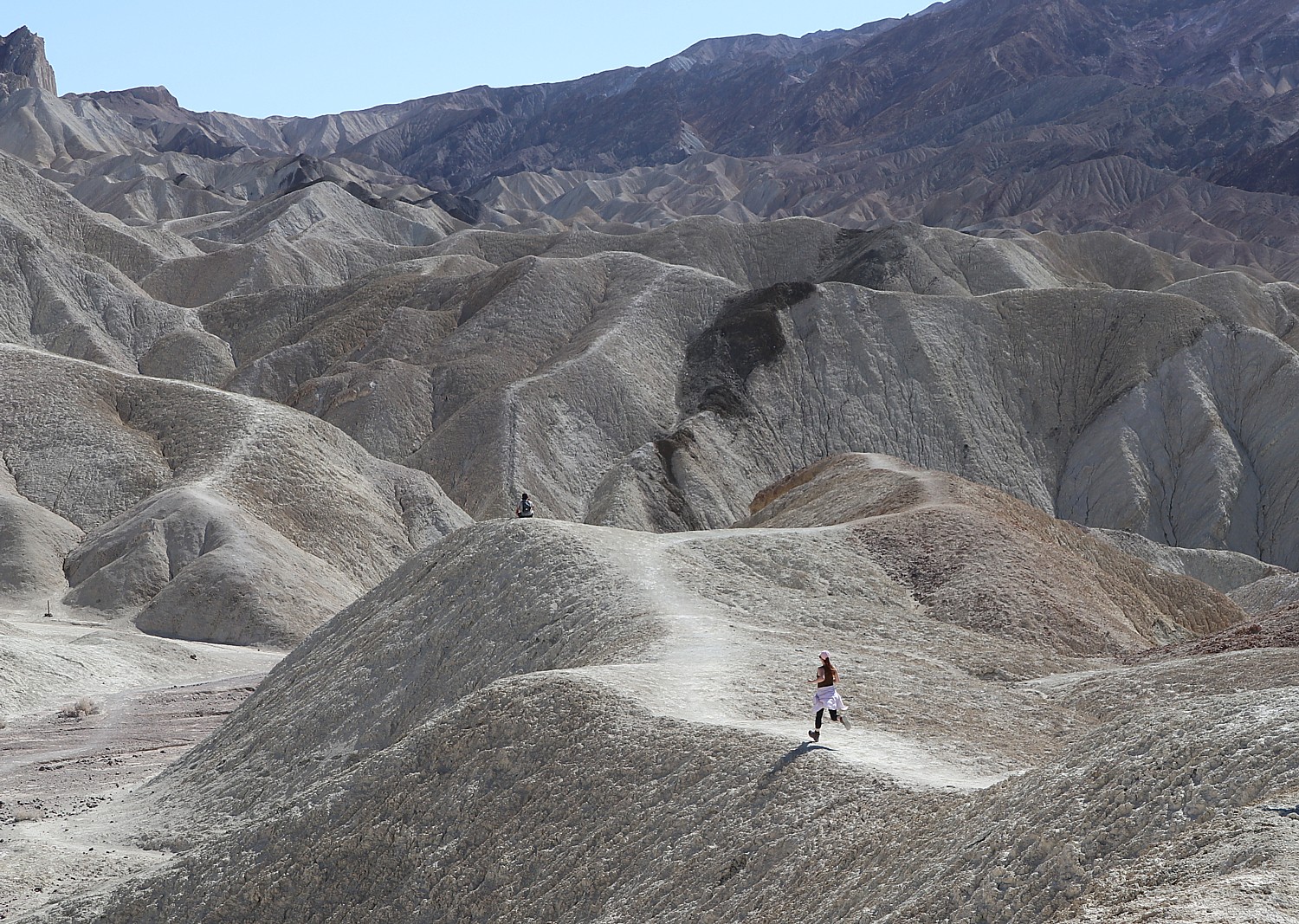
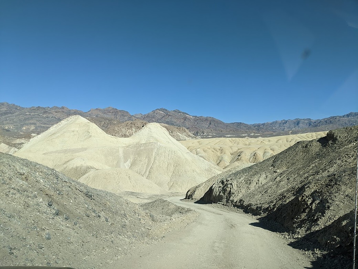
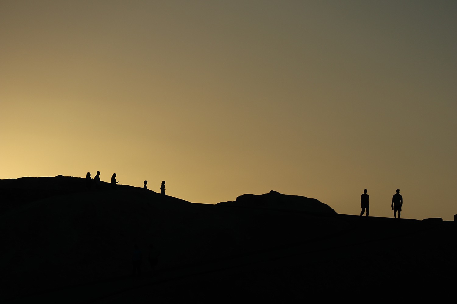
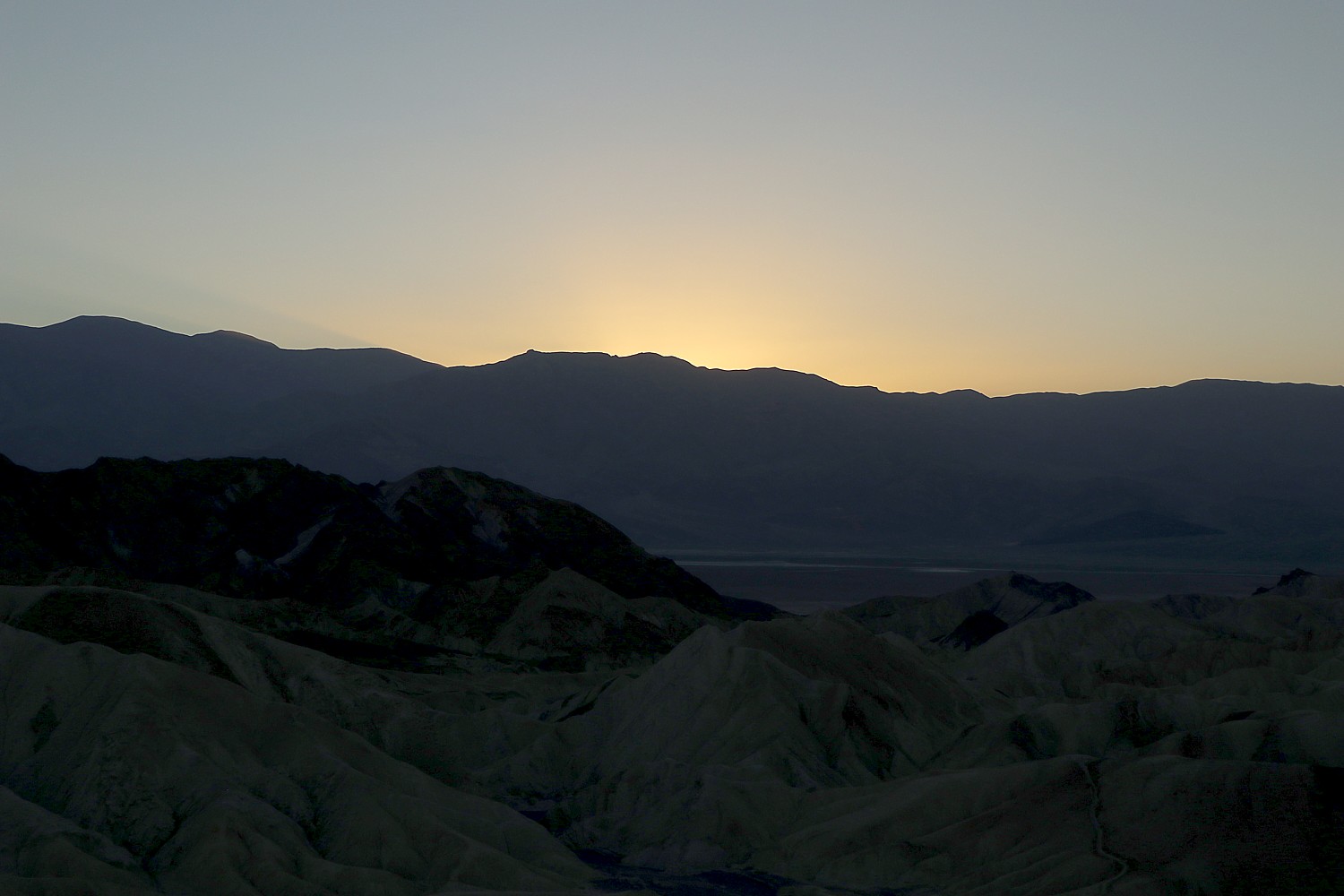
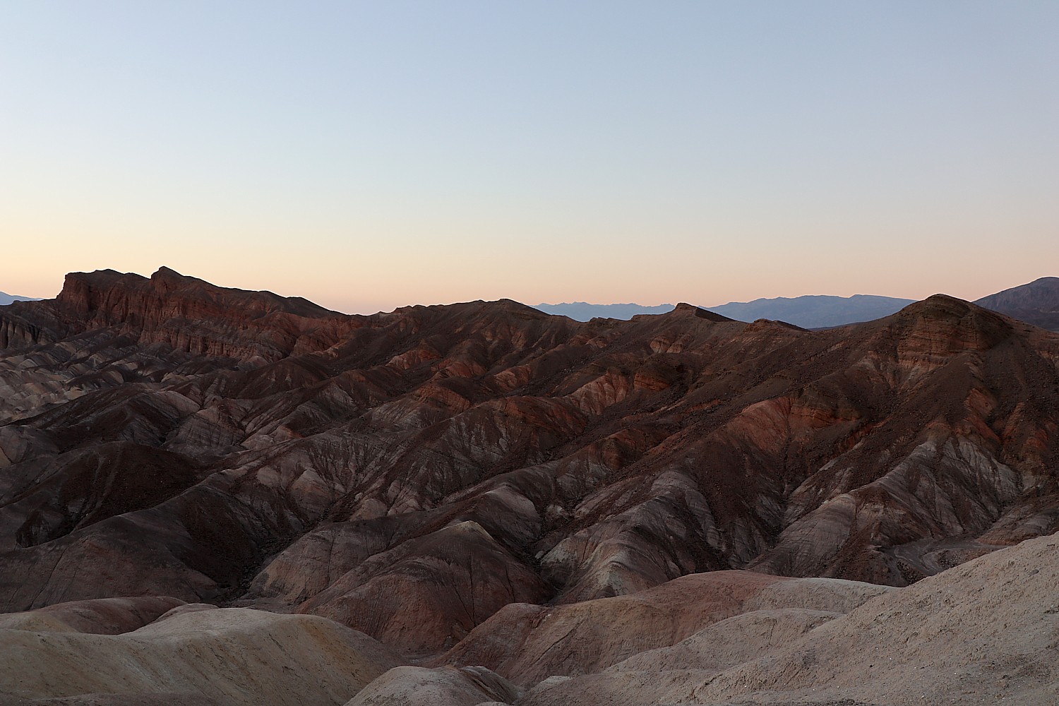
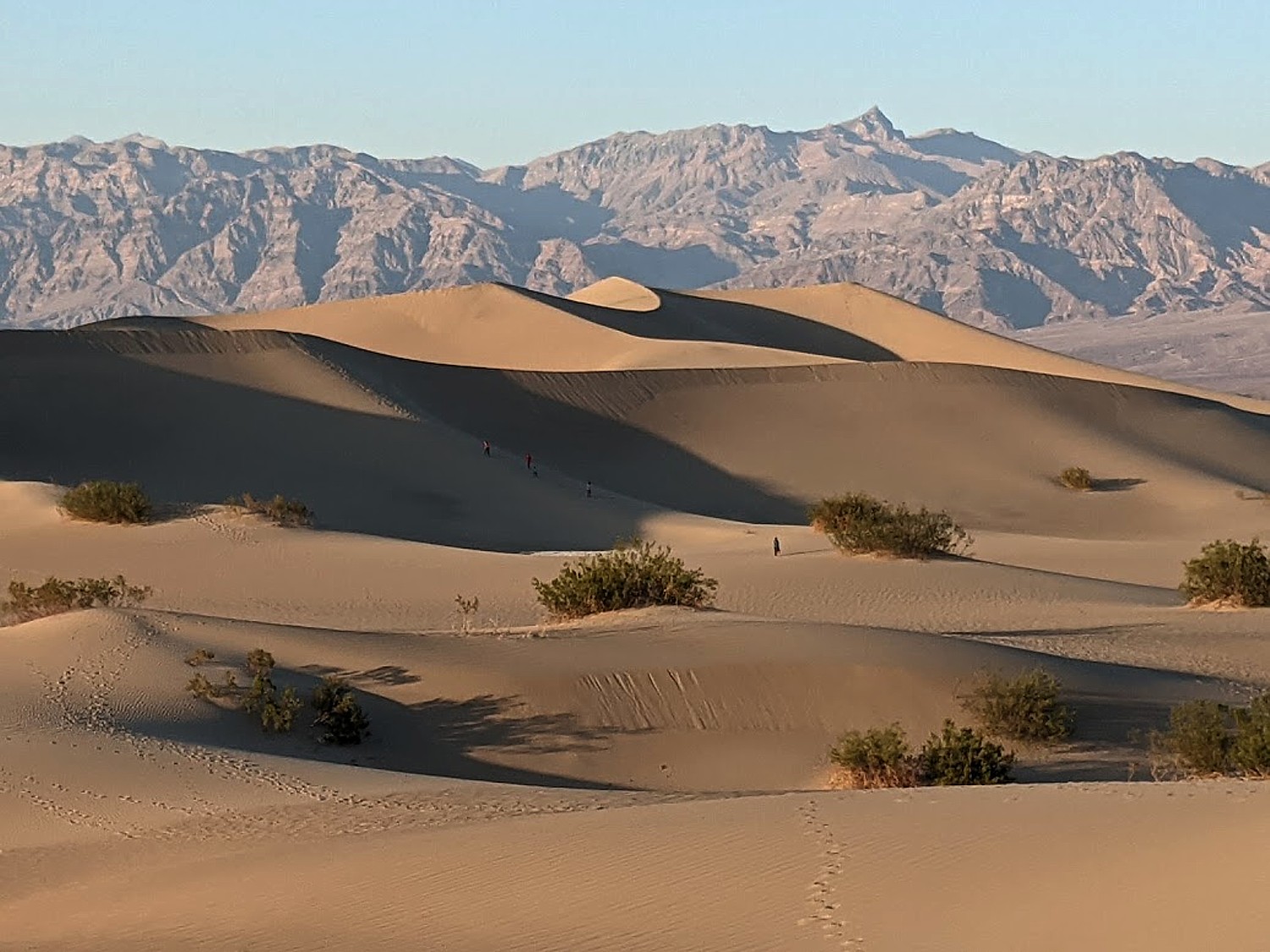
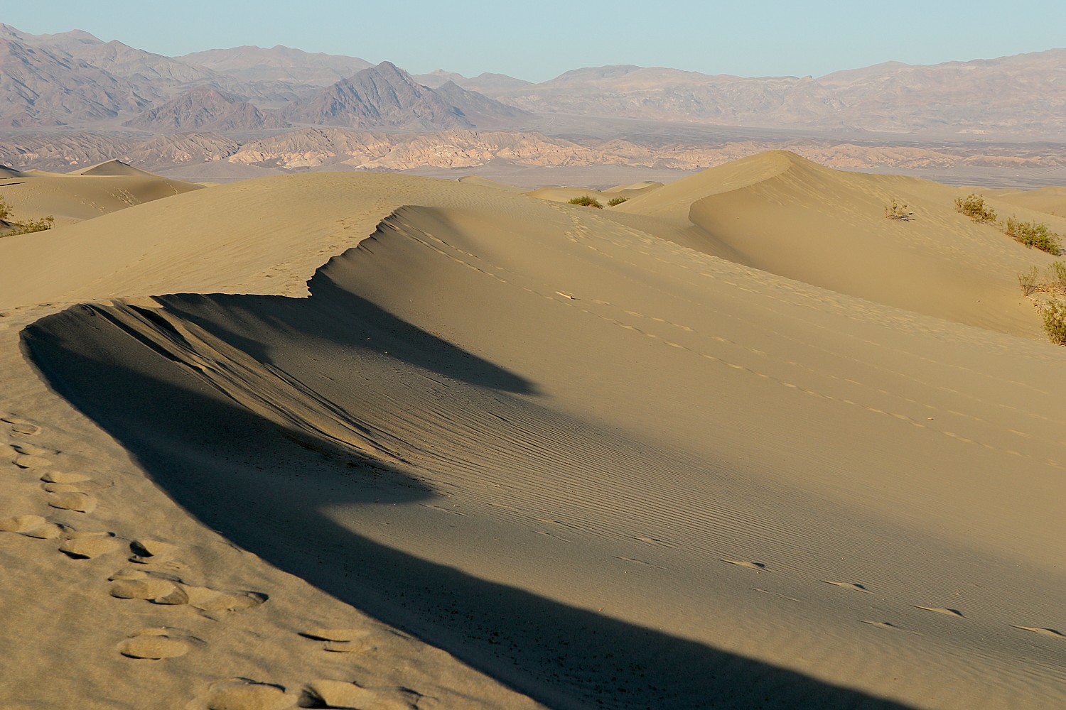
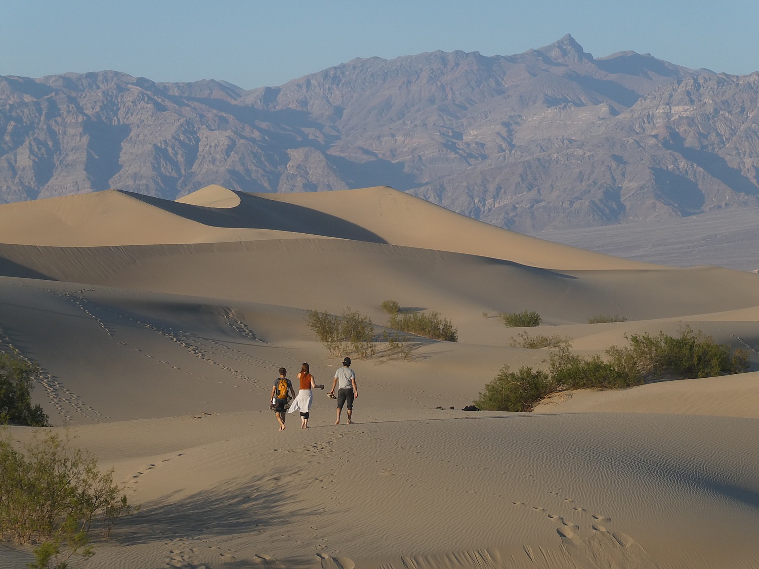
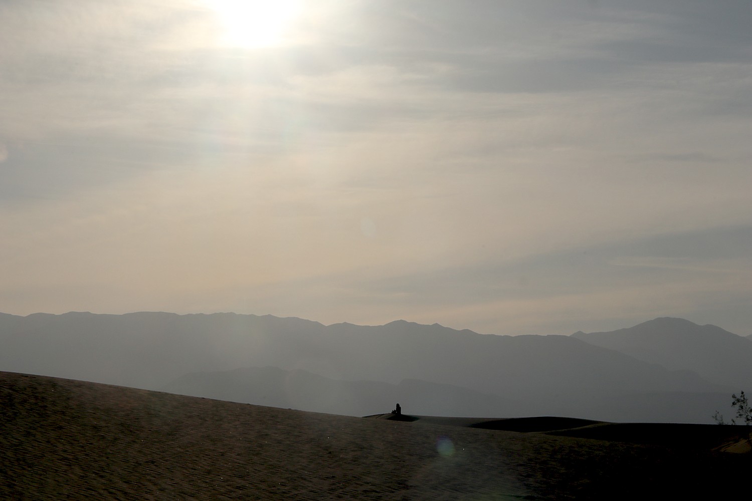
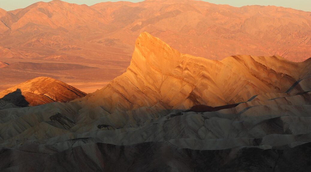
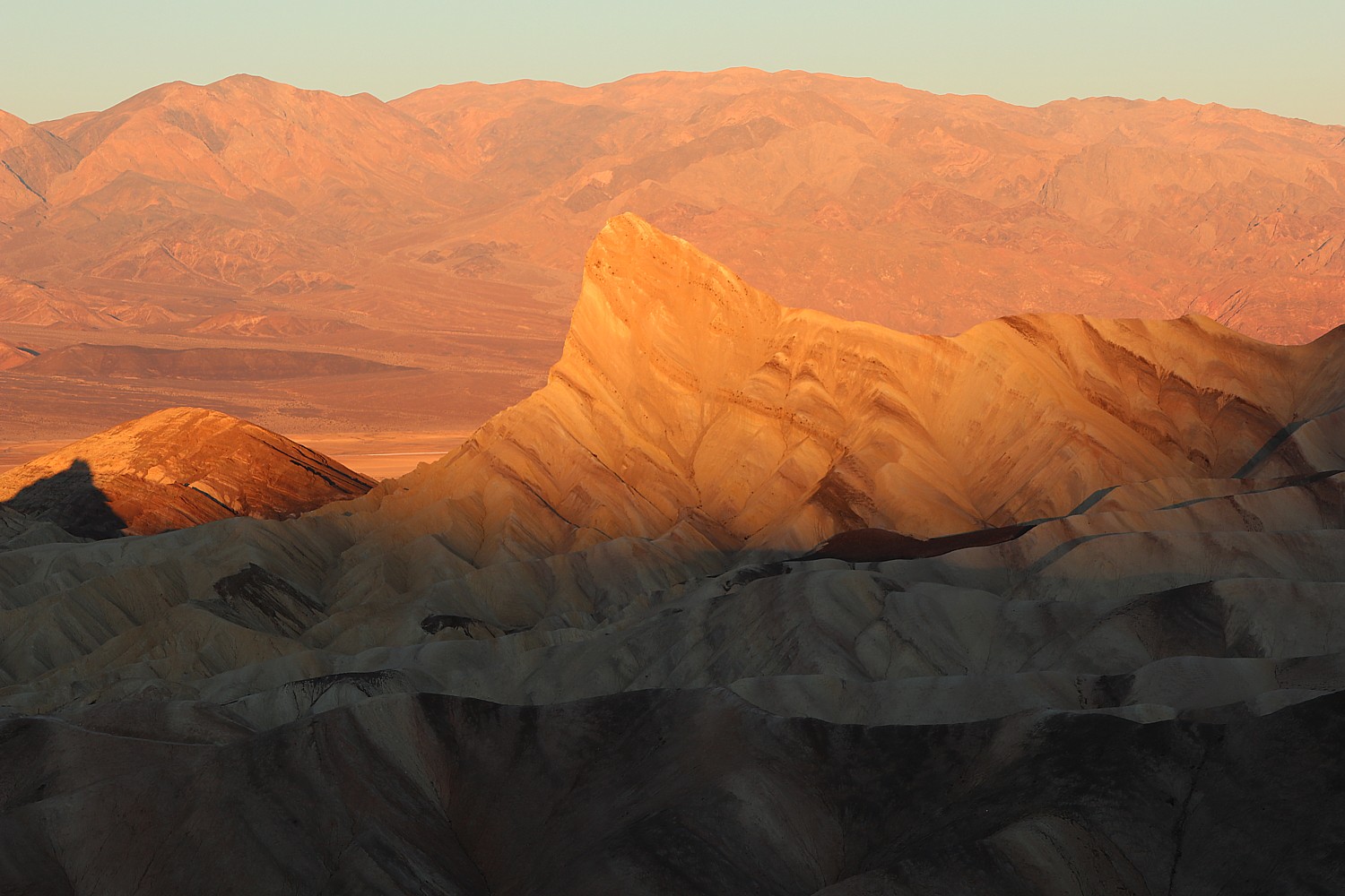
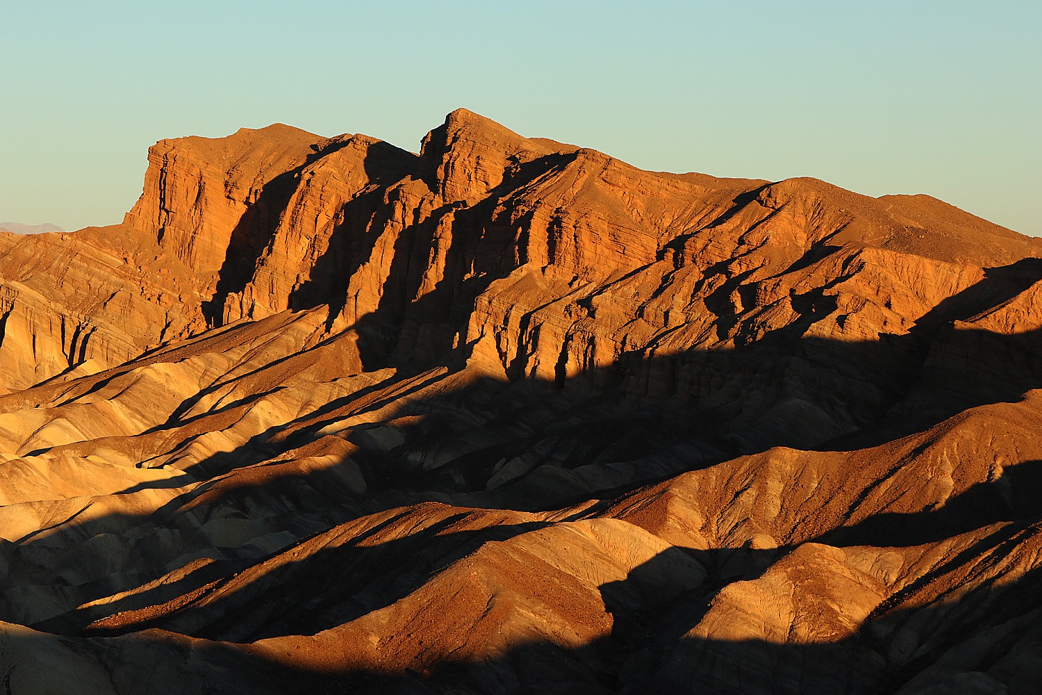
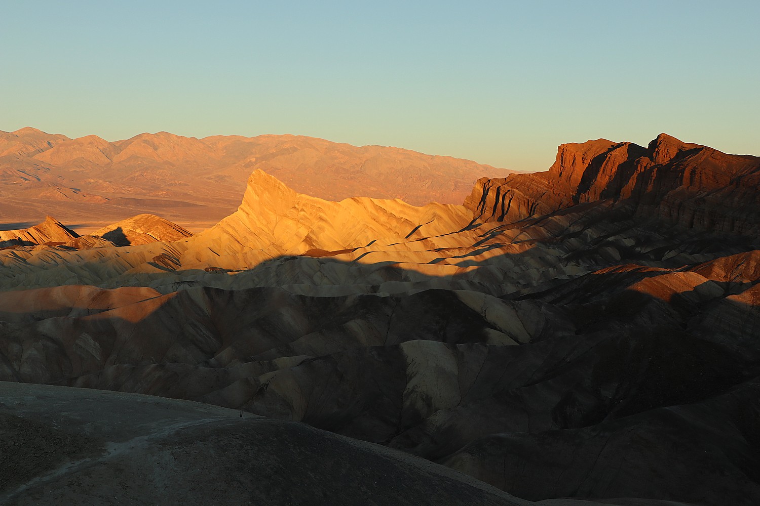
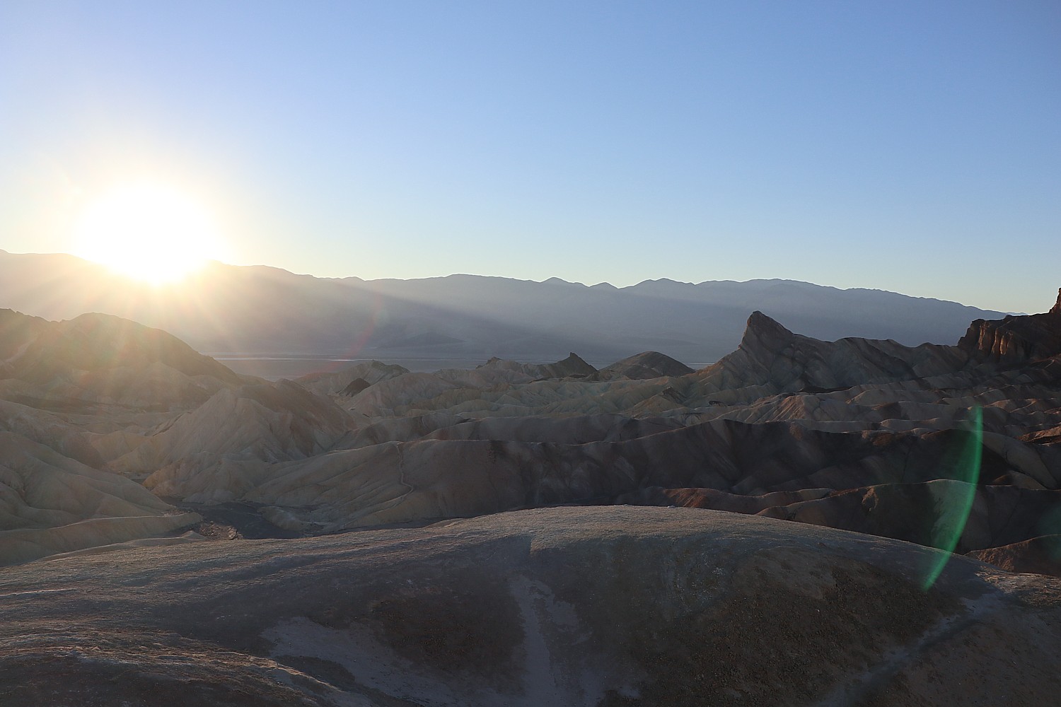
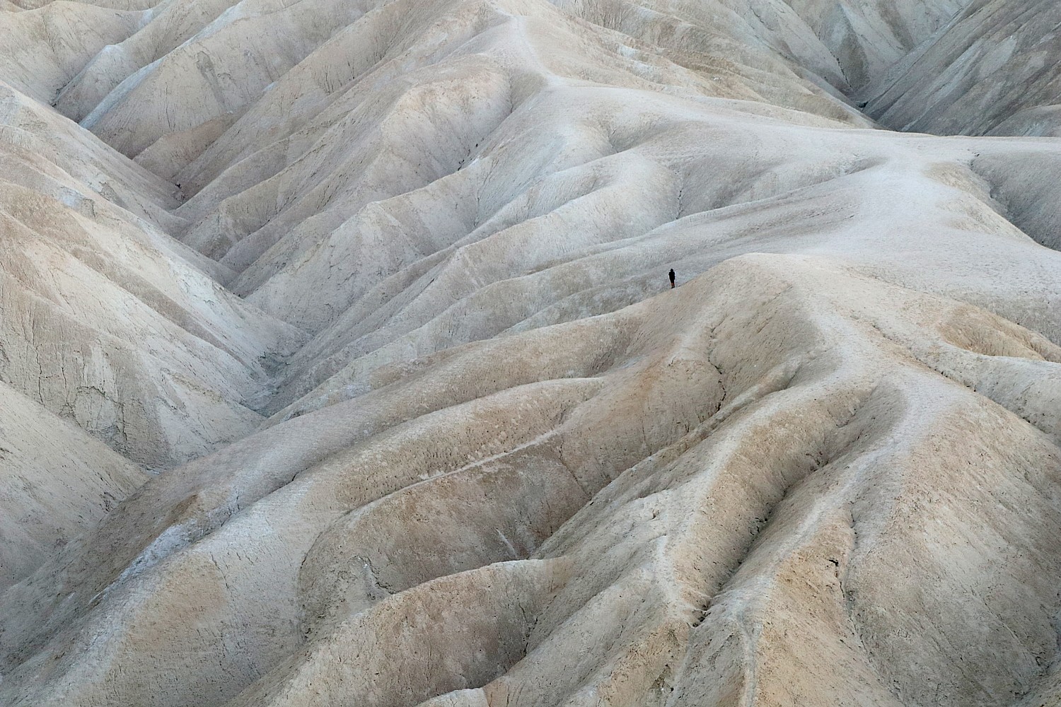
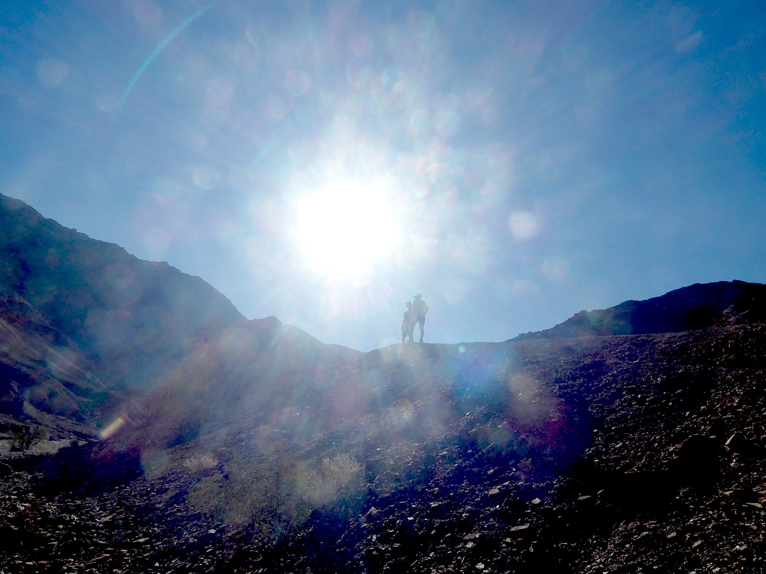
On our second morning in Death Valley National Park, we’re up before sunrise to race to Zabriskie Point, one of the not-to-be-missed highlights, to watch the brilliant display as the rising sun seems to set the rock faces aflame with color.

Sunrise at Zabriskie Point, Death Valley National Park © Karen Rubin/goingplacesfarandnear.com

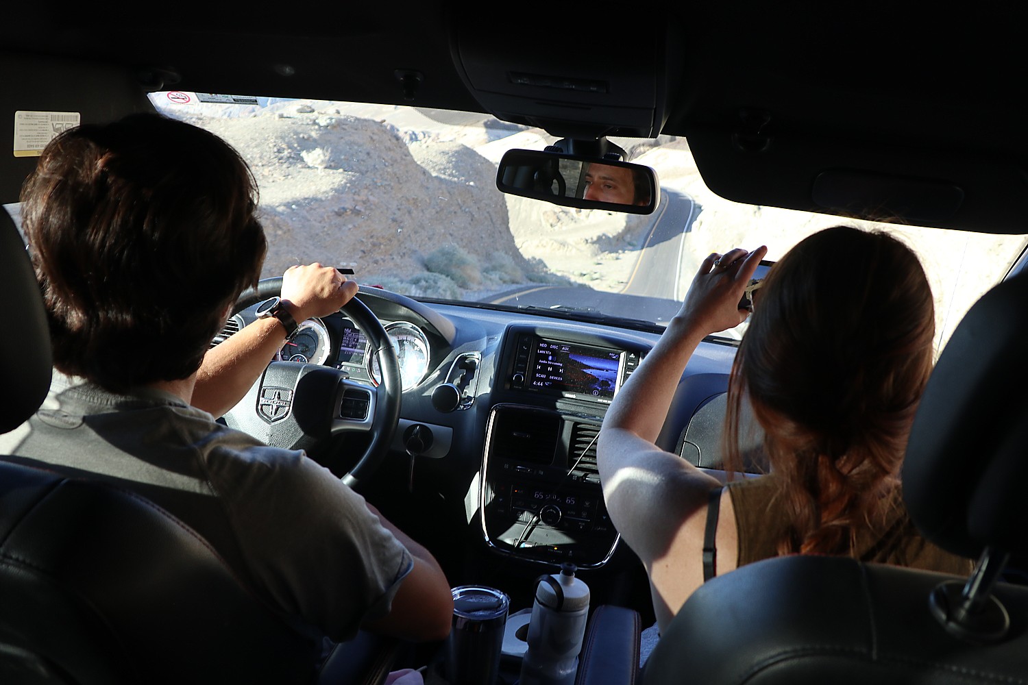
Today’s itinerary in Death Valley National Park is on a strict schedule around Laini’s zoom appointments (COVID has given rise to “worker nomads” and “workations”) – the proximity to the places we wanted to see was one of the reasons we left Designed to Death AirBnB, 45 minutes drive into the park, for the Ranch at Death Valley, just about 7 minutes drive from Zabriskie Point, in the most central part of this vast national park. We rush back to the Ranch at Death Valley, until her next break, so grateful for its close proximity to what we would like to do today. It requires incredible planning and logistics considering the distance to get to places in a park twice the size of Delaware.

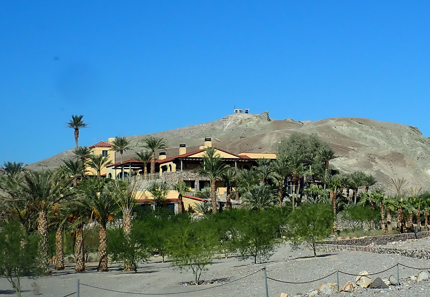
But these breaks give me more time to explore and enjoy the Ranch. It is a full resort with a very casual, family-friendly vibe almost like a dude ranch resort; in fact it once was a working ranch and now has stables offering horseback and carriage rides and a marvelous “Last Kind Words Saloon” that looks like it is straight out of a western movie. It is laid out with two-story units of rooms that open out to either a patio or balcony, with everything from a gorgeous swimming pool, tennis courts, basketball courts, playground. There is even a full 18-hole golf course, at 214 ft below sea level, the lowest elevation course in the world. The ranch also offers Jeep rentals to explore the park in a rugged 4×4.

The Ranch at Death Valley © Karen Rubin/goingplacesfarandnear.com

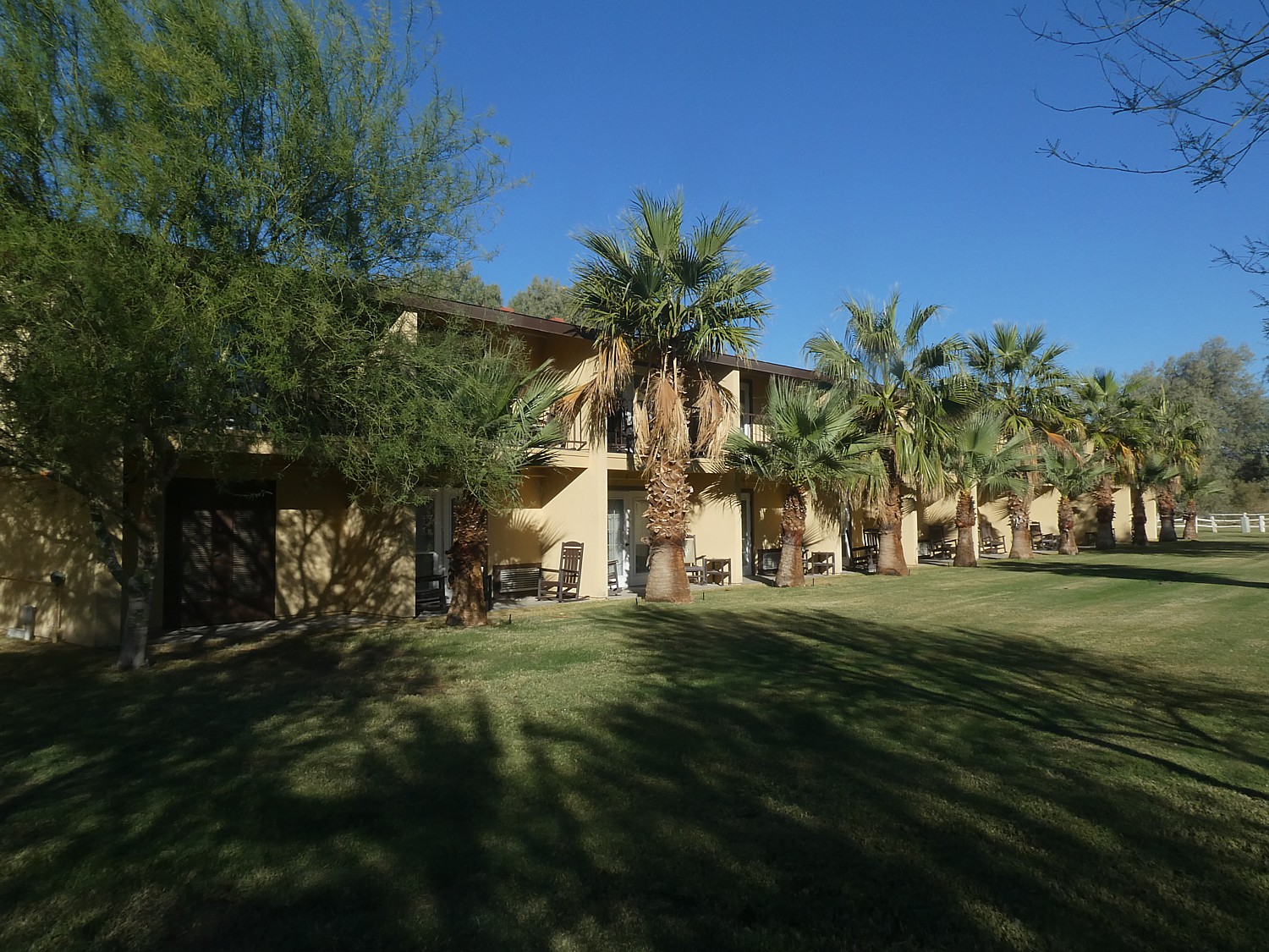
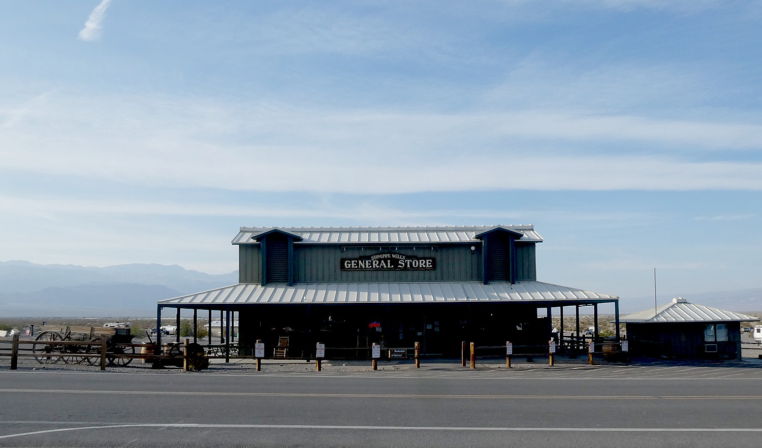
The “new and improved” 224-room Ranch at Death Valley is part of a $100 million renaissance along with the nearby Inn at Death Valley (a historic, four-star luxury resort), and is at the vital center of activity in Death Valley. Set along Highway 190 next to the National Park Service Visitor Center, it offers a classic town square with towering date palms and Mission California architecture. Among the improvements: a new restaurant, ice cream and coffee bar, general store with souvenirs as well as groceries.

There’s also a gas station next door. It really is an oasis. (www.oasisatdeathvalley.com/)

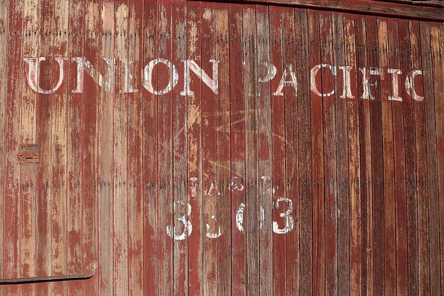
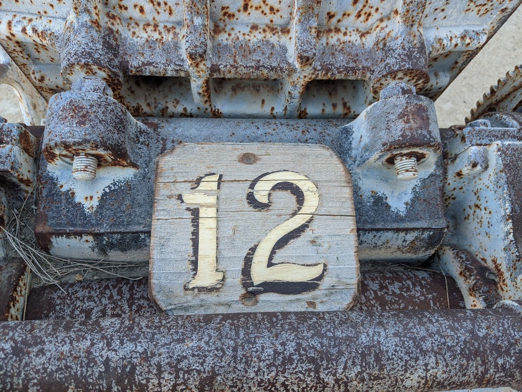
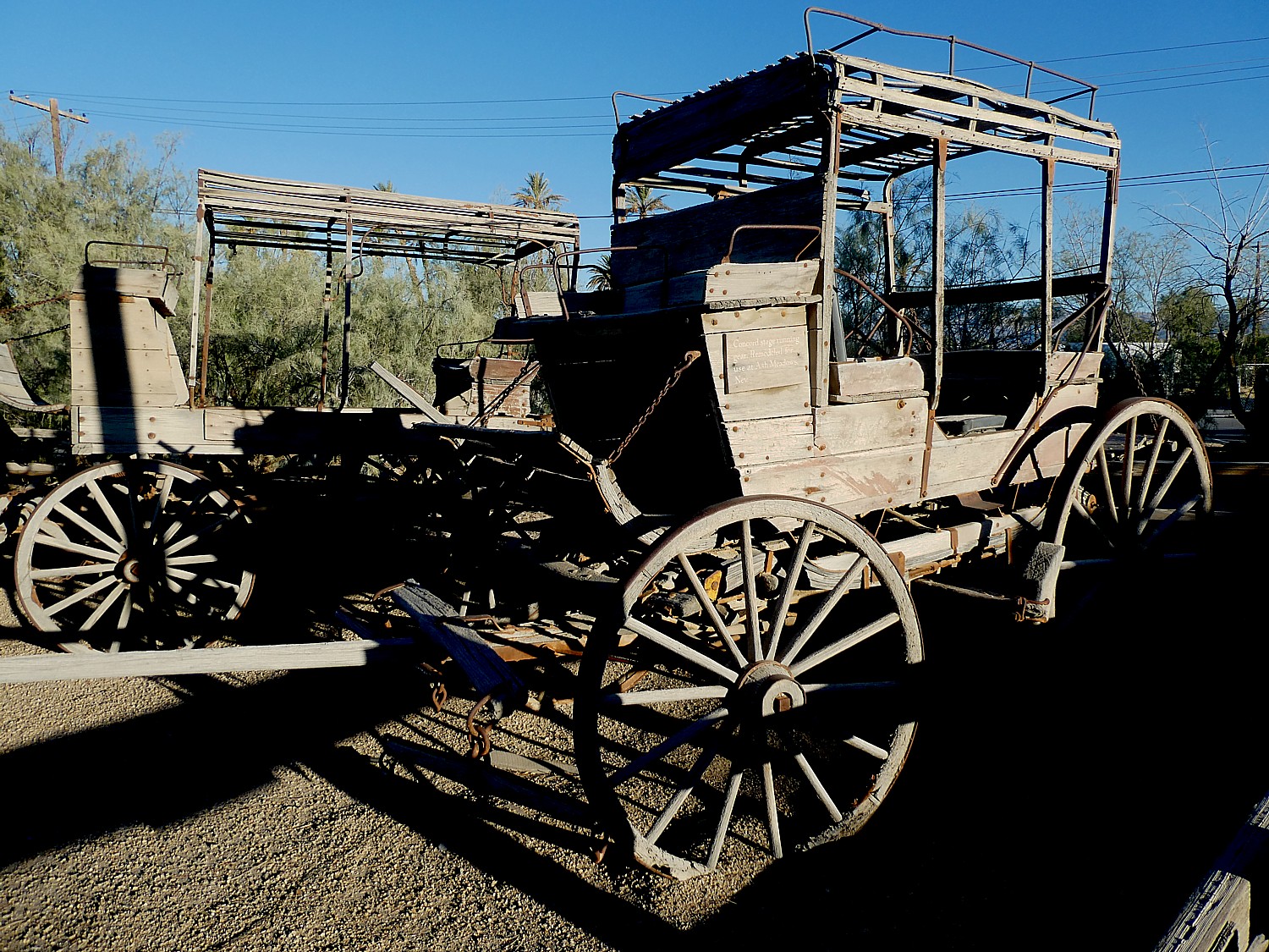
The Ranch offers a real surprise when I come upon a museum with an outdoor display (the indoor museum is still closed as a COVID precaution) of coaches, mining implements, even a full train locomotive train, set outside almost like a park. And you realize that this wasn’t all that long ago – the turn of the last century, a blip in context of the eons of time on view in Death Valley’s dramatic geology.

Step back in time at the museum at The Ranch at Death Valley © Karen Rubin/goingplacesfarandnear.com

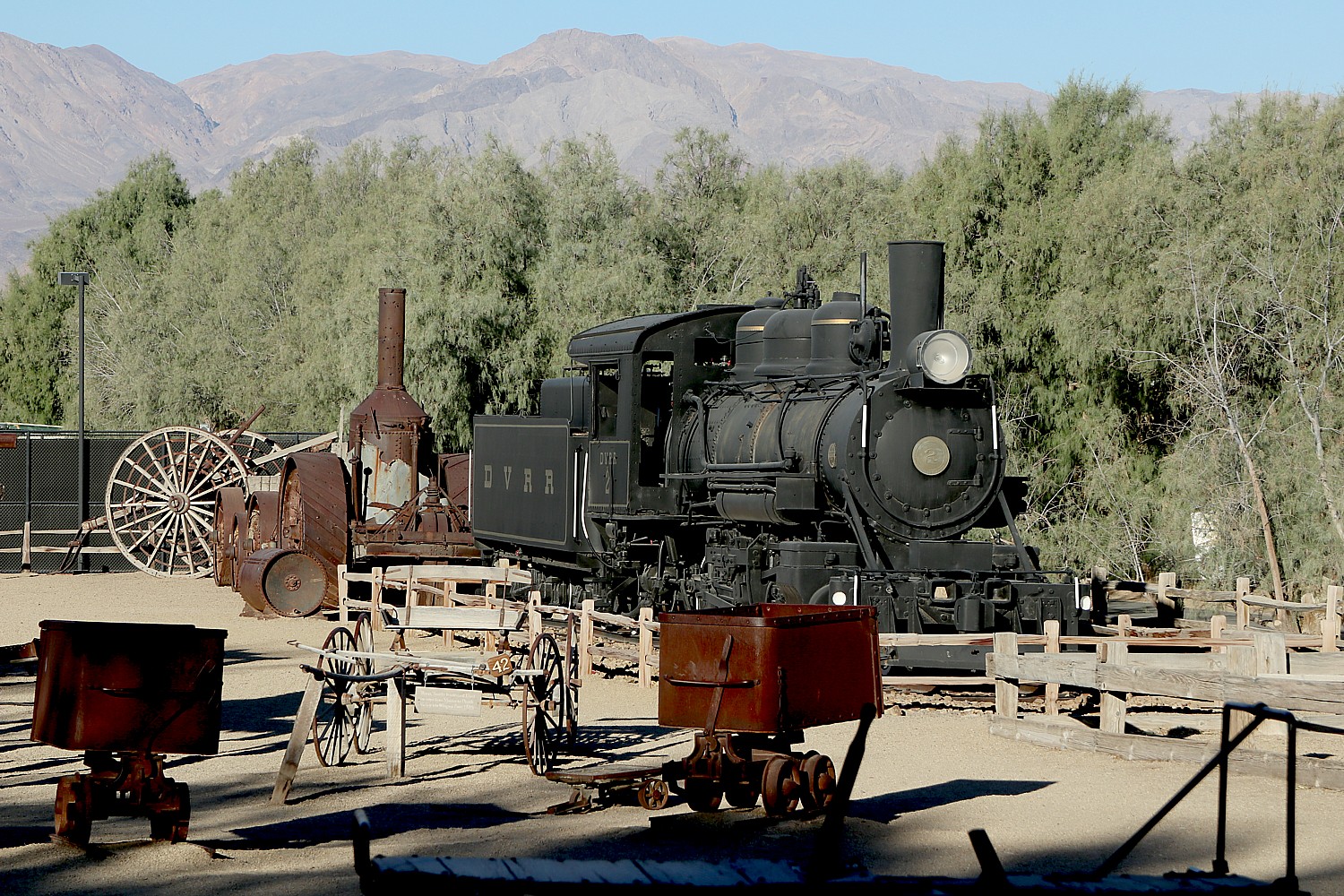
The Museum at the Ranch is not to be missed. When you are in the midst of this unforgiving harsh environment, it is astonishing to realize how people lived and worked here, that they even lived here at all – extracting resources like salt and borax, mining gold. The way the artifacts are displayed, it seems almost as if they had just been left behind – there is this immediate connection.

Step back in time at the museum at The Ranch at Death Valley © Karen Rubin/goingplacesfarandnear.com

You are overwhelmed in Death Valley by nature and its powerful force, but here at the museum, you are reminded of man’s handiwork. The first white men to enter Death Valley were gold-seeking pioneers with the Death Valley Wagon Train in 1849, looking for a short cut to California. They came to Travertine Springs, near where we are here at Furnace Creek. Stranded, they eventually walked up to Stovepipe Wells and used wood from their wagons to cook meat of slaughtered oxen. We had seen the marker at Stovepipe Wells Village of “Burned Wagons Camp,” the site of the first tourist accommodations in Death Valley.

Step back in time at the museum at The Ranch at Death Valley © Karen Rubin/goingplacesfarandnear.com

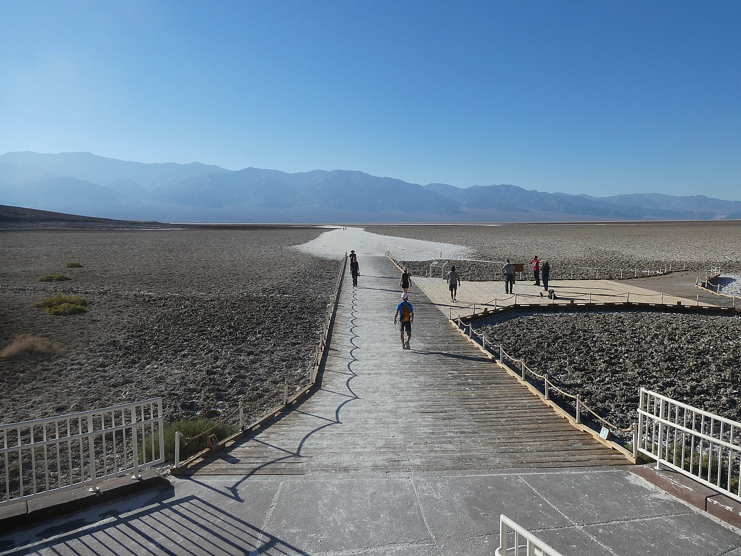
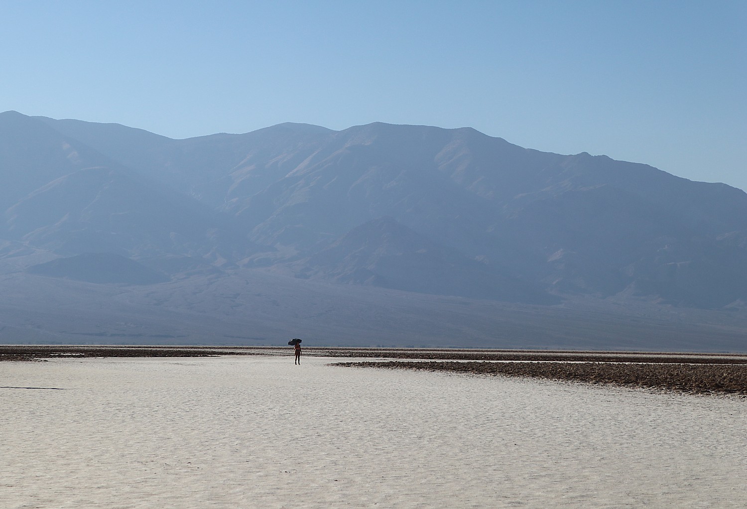
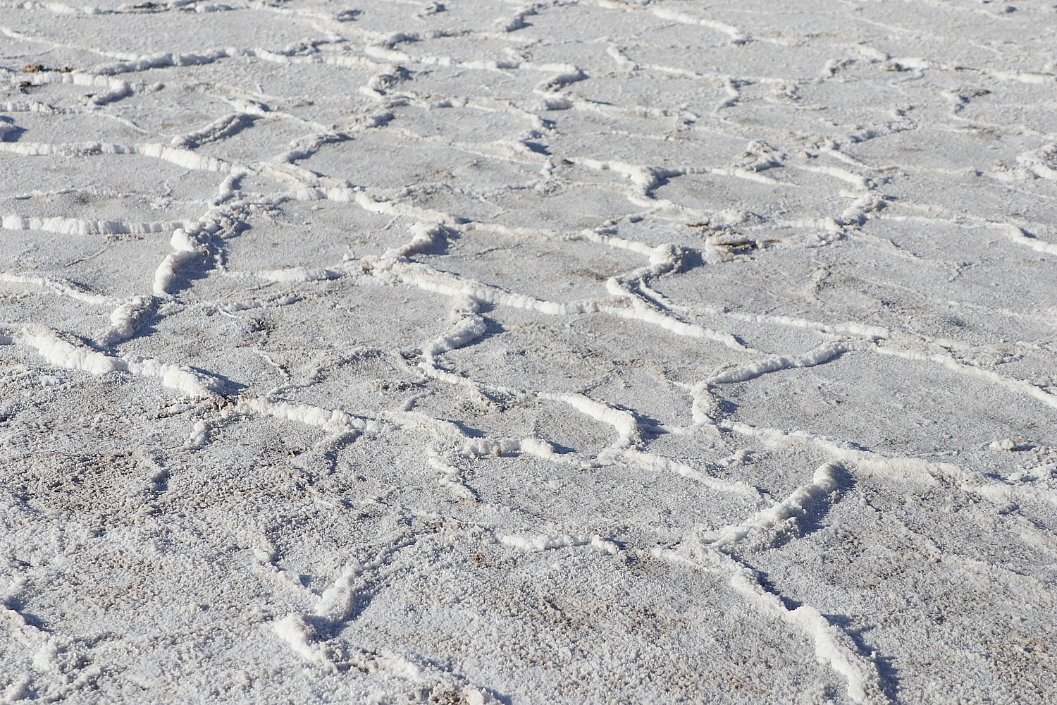
You also feel the presence of the workers and miners when you drive through the 20 Mule Team Trail and walk over the Badwater Basin salt flat, visit the Harmony Borax Works and hike passed a mine shaft.

I contemplate all of this as I sit outside on the porch of the wood cabin with a cup of coffee coffee.

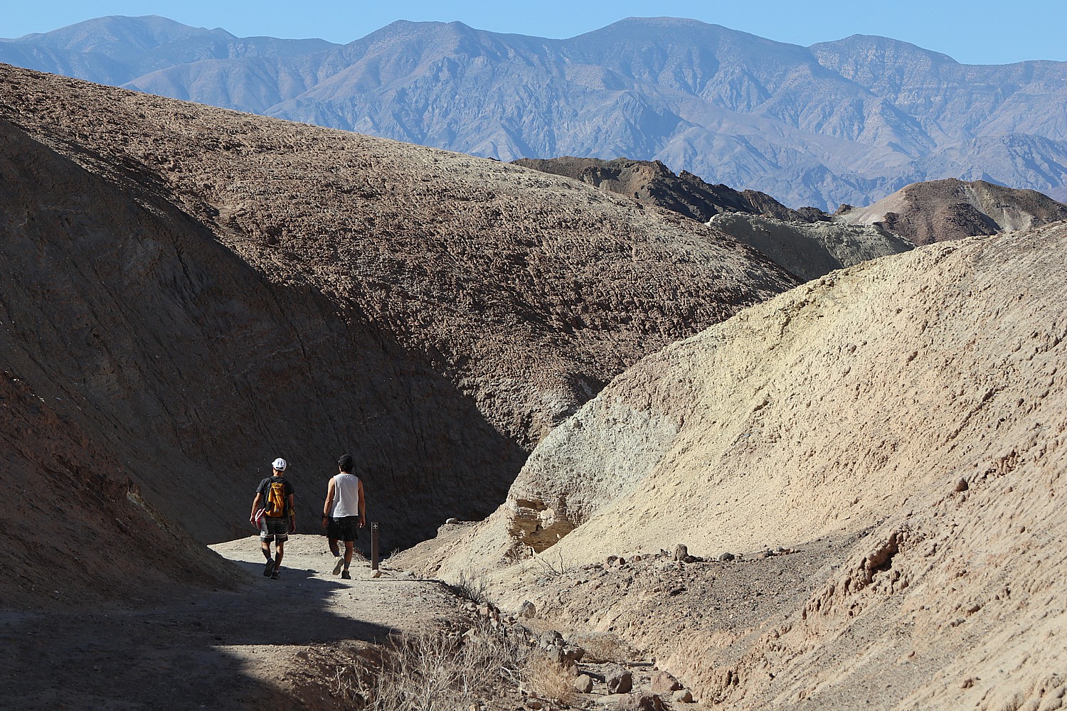
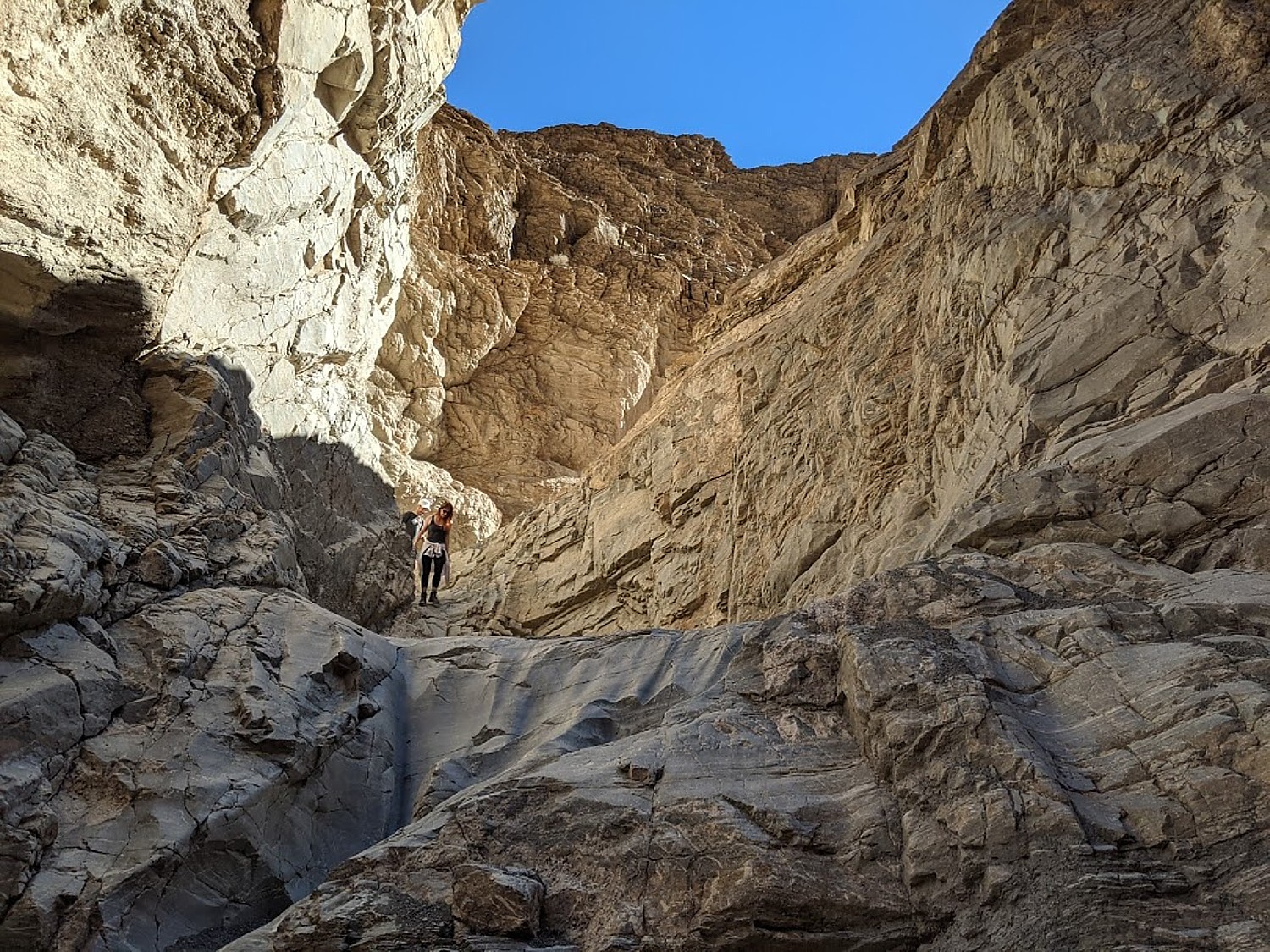
We’ve timed it so as soon as Laini has another break we dash back to Zabriskie Point for a short hike (the trail connects to the Golden Canyon trail), before rushing back for her next Zoom meeting.

Hiking into Gower Gulch from Zabriskie Point © Karen Rubin/goingplacesfarandnear.com

Back again at the Ranch, I do something I rarely ever have time to do: swim in the pool. It is absolutely glorious – naturally heated by hot mineral springs to a perfect temperature. And the scenery! We see what we couldn’t last night when we had the stars – the mountain peaks all around. We lounge for a couple of hours.

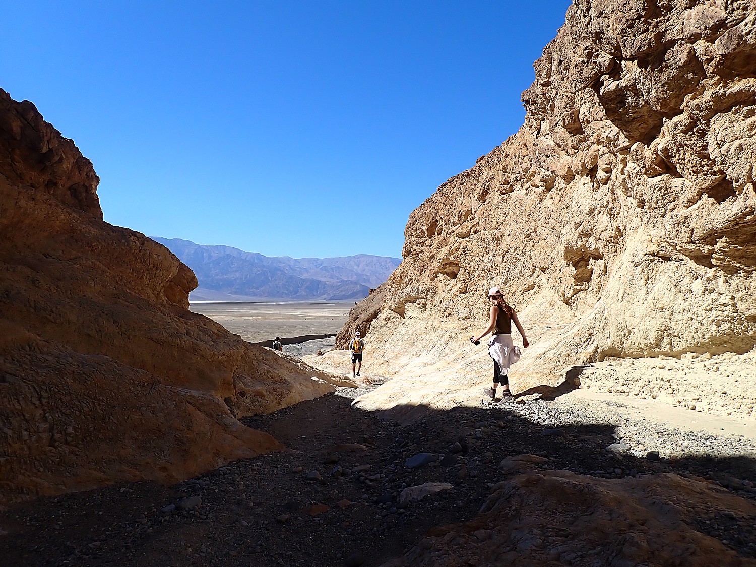
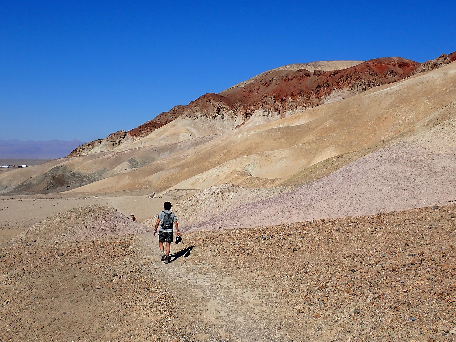
We’ve plotted an afternoon hike for when Laini finishes: Sidewinder Canyon.

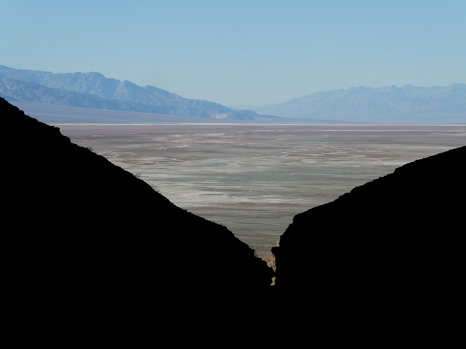
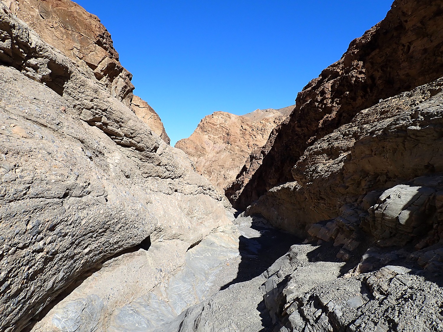
We eat our lunch in the car as we drive the 32 miles to Sidewinder Canyon, a slot canyon where you are supposed to be able to explore three separate slots.

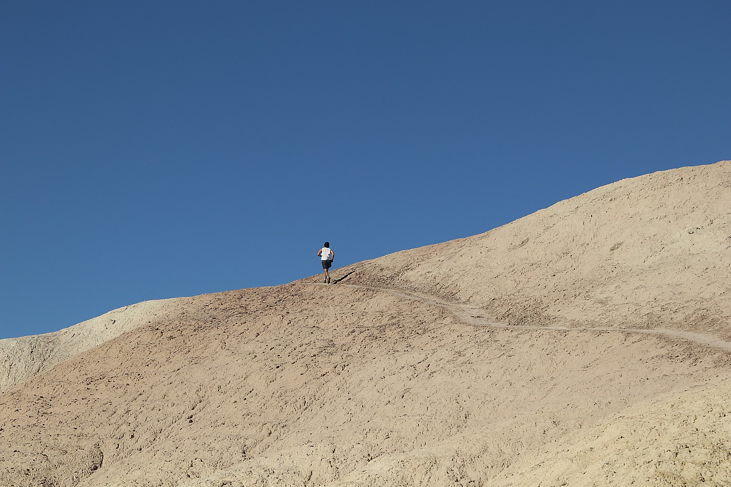
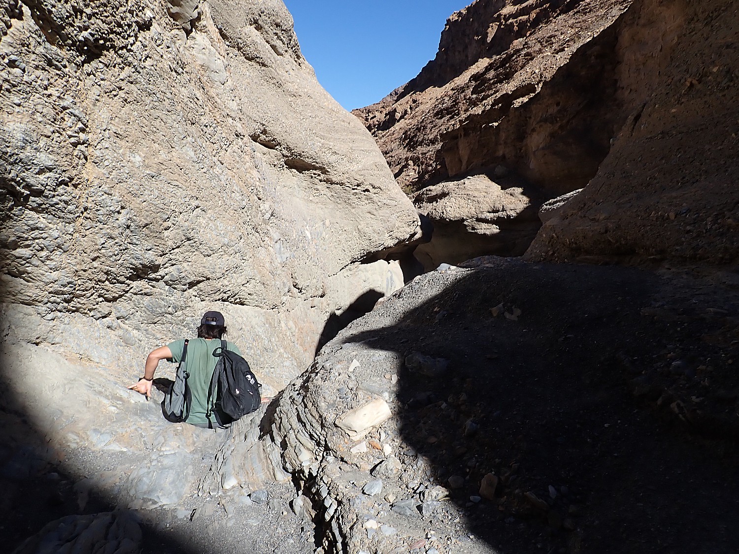
This trail is really for adventurers, much less visited than the star attractions (there isn’t even an outhouse at the trailhead here); and it’s not at all well marked.

Hiking into the slots in Sidewinder Canyon © Karen Rubin/goingplacesfarandnear.com

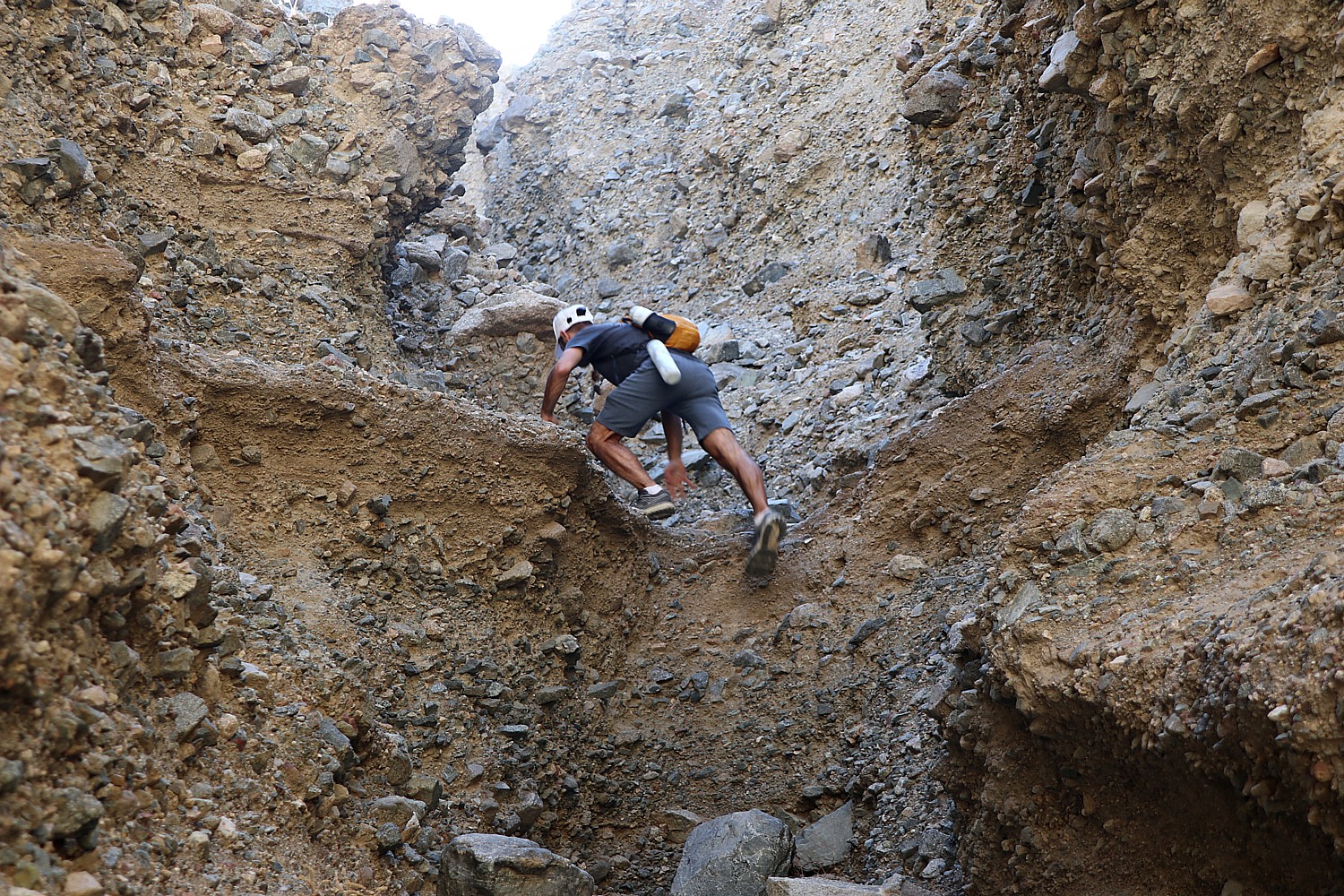
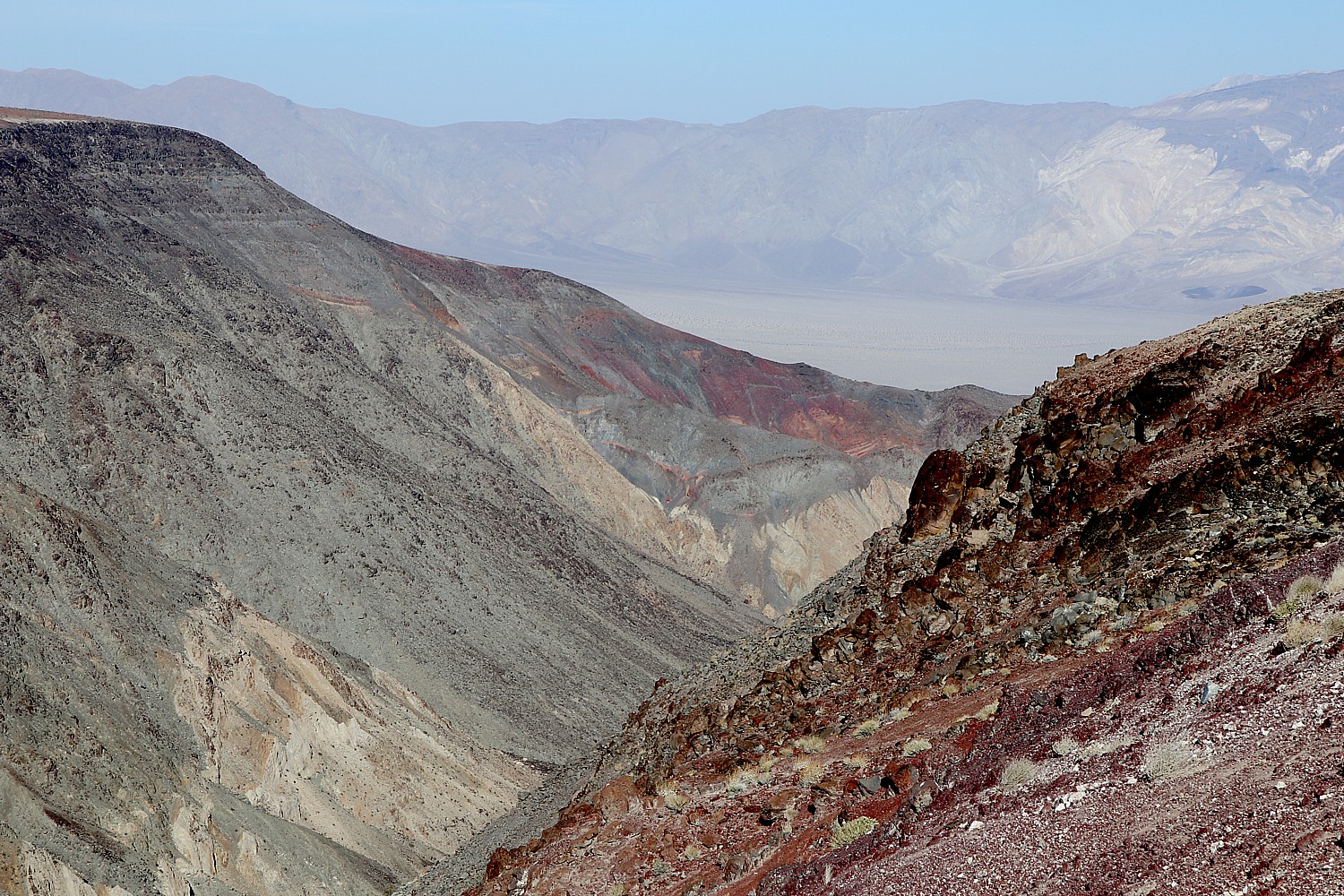
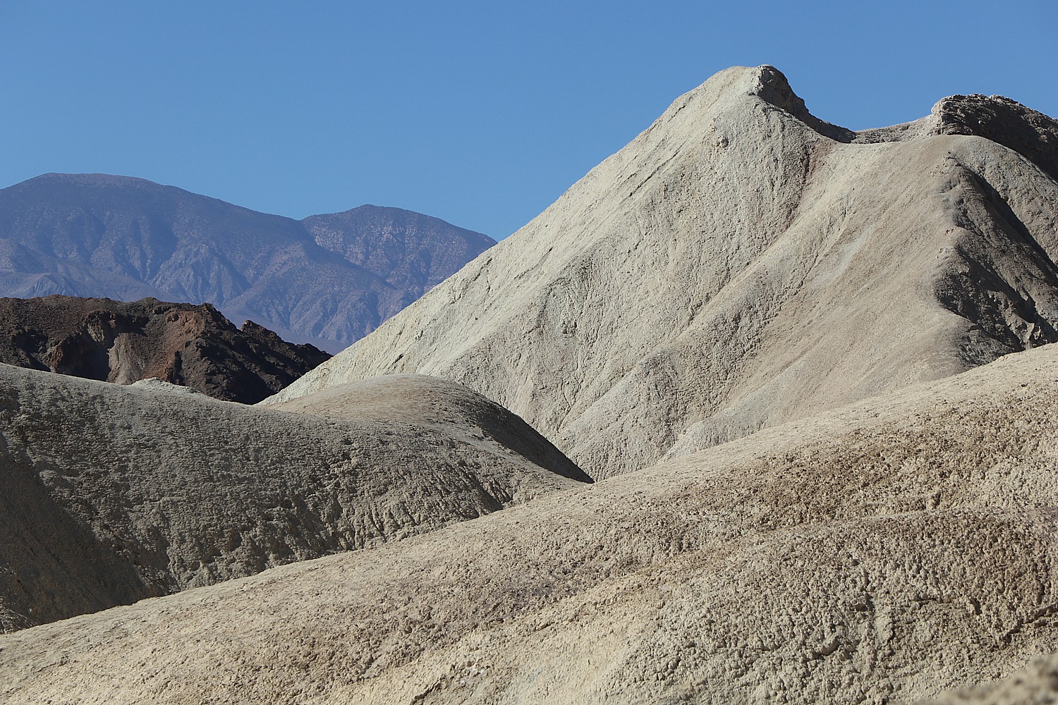
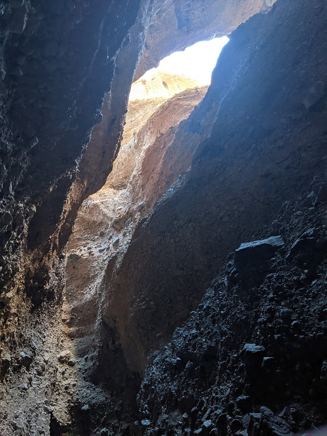
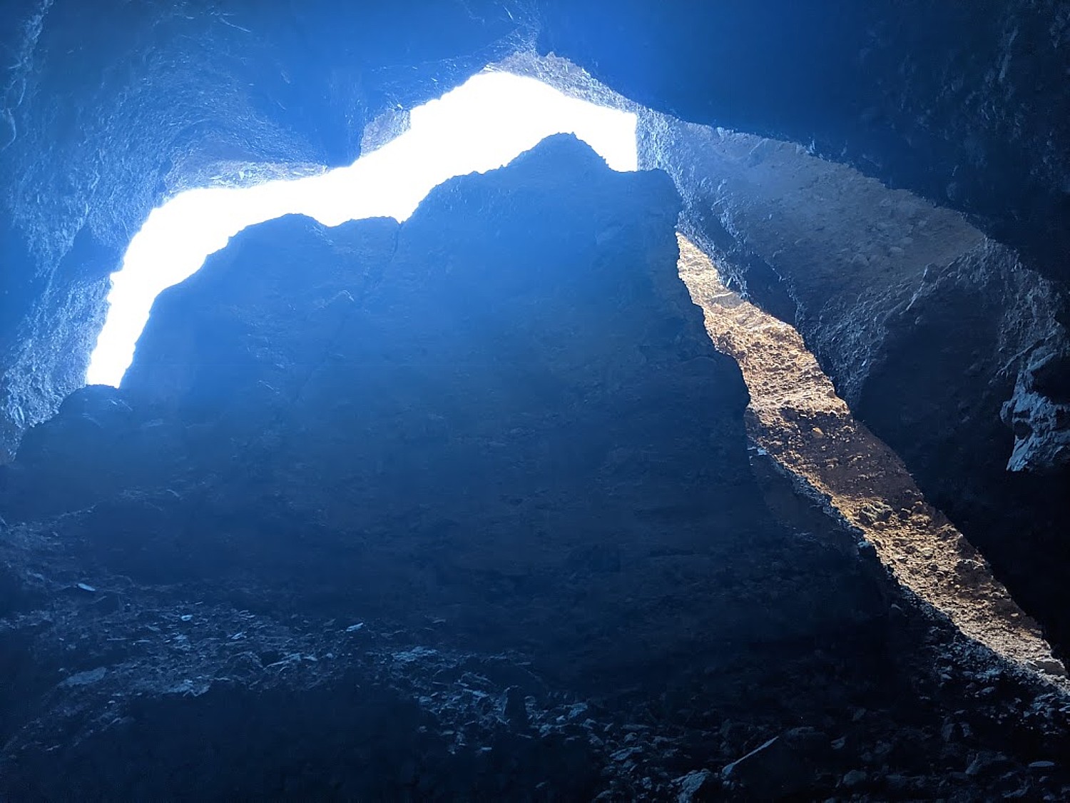
We are supposed to watch for cairns – stones others have arranged in the shape of an arrow, or a pile of stones to mark the entrances. Even the notes say that the first slot, supposedly at the .8-mile mark, is easy to miss. What we think is the first slot has a fairly dramatic entrance, a stony scramble of pointy sedimentary rock like concrete that has come out of the mixer with lots of stones.

Heads up! Hiking into the slots in Sidewinder Canyon © Karen Rubin/goingplacesfarandnear.com

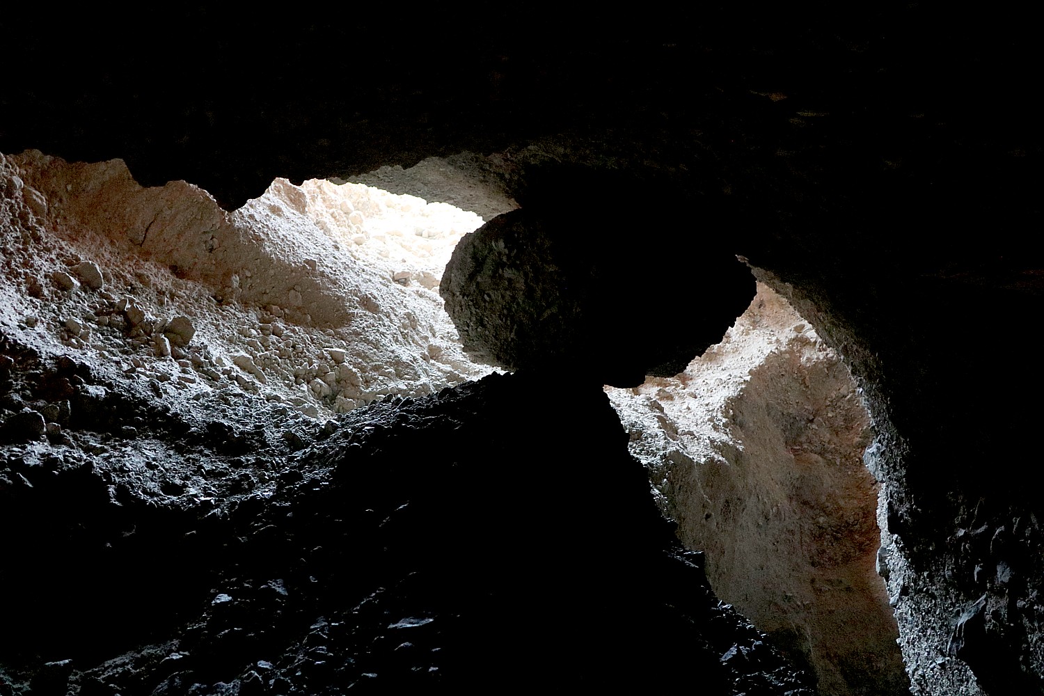
The second slot though is great – scrambles to get to higher levels – interesting formations with light coming through. It is dramatic when you enter, like something will happen, especially when look up and see a boulder wedged in a space between narrow walls above you. It dares you.

Hiking into the slots in Sidewinder Canyon © Karen Rubin/goingplacesfarandnear.com

The landscape here is really harsh, unforgiving – RoadRunner cartoons come to mind, especially when we see a coyote and what seems to be roadrunner’s feathers on the ground.

Hiking into the slots in Sidewinder Canyon © Karen Rubin/goingplacesfarandnear.com

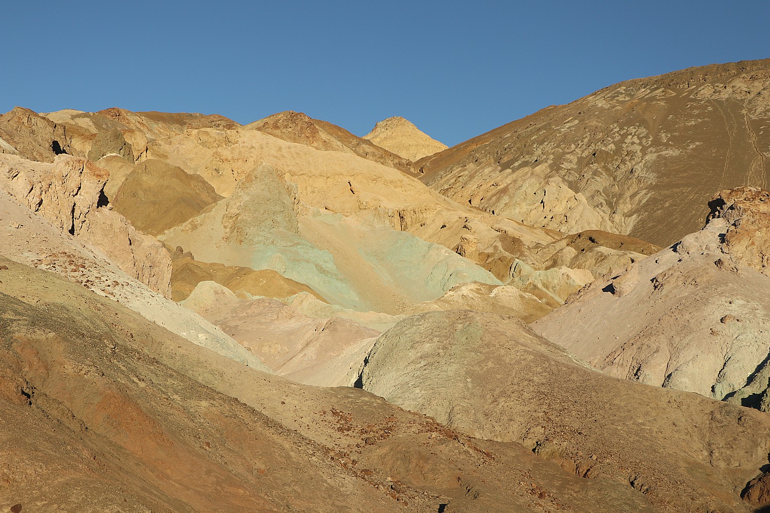
The Sidewinder Canyon is more of adventure than I anticipated. Rugged, stony, not a lot of color, more scramble than I imagined (Dave and Laini go further into the canyon while Eric starts back with me), and not as picturesque, making me appreciate the Golden Canyon trail all the more, but in retrospect, a wonderful adventure. We hike uphill for a mile and then return.

Hiking in Sidewinder Canyon © Karen Rubin/goingplacesfarandnear.com

The contrast between these two canyon hiking experiences – the Golden Canyon yesterday and Sidewinder today – is remarkable, in fact, all the hikes prove so wonderfully different.

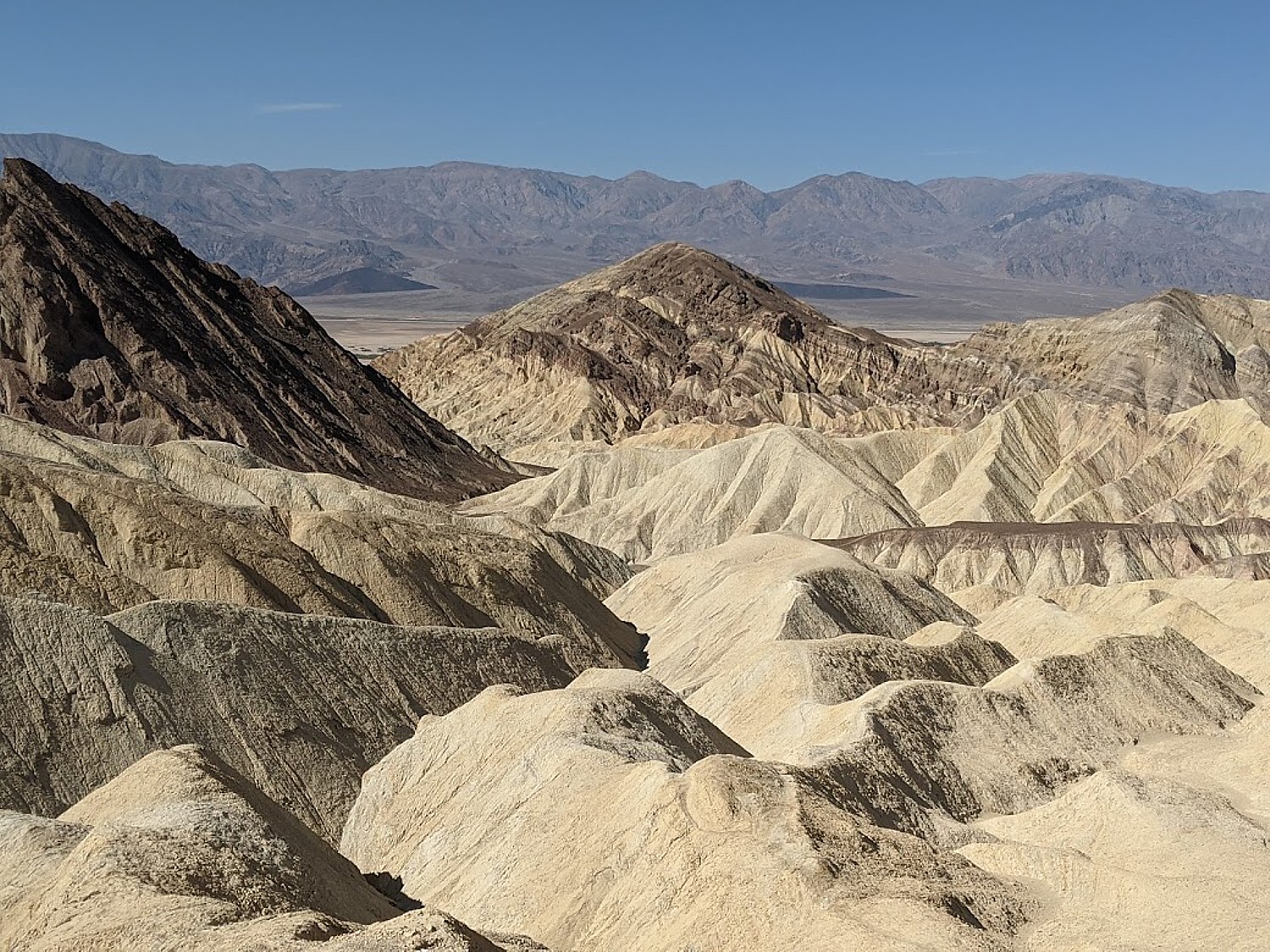
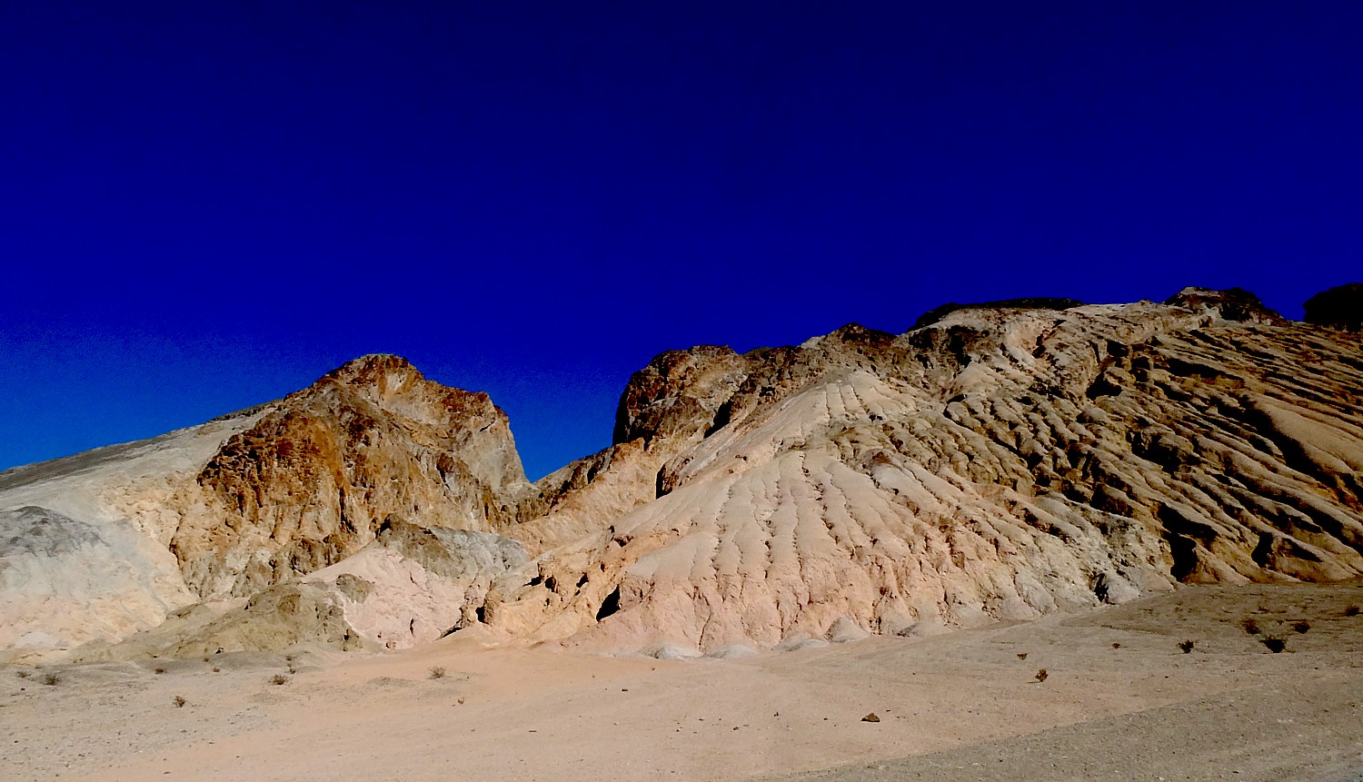
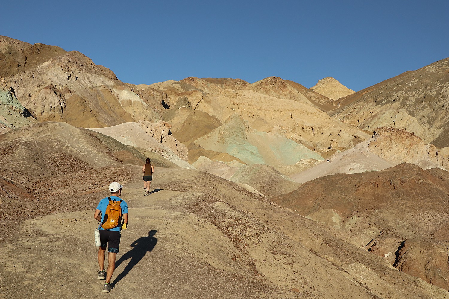
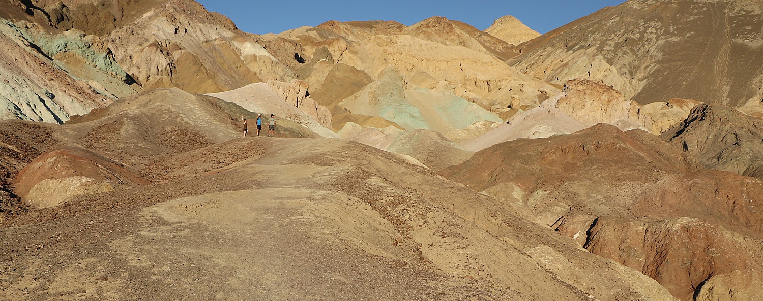
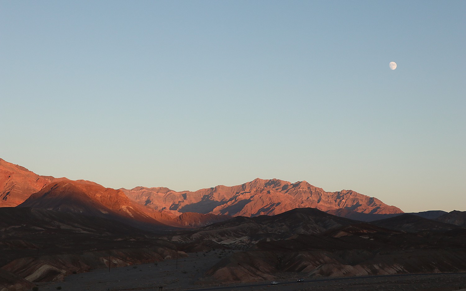
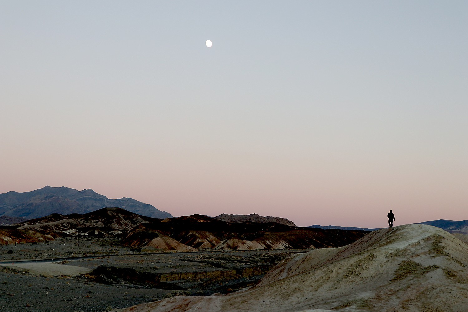
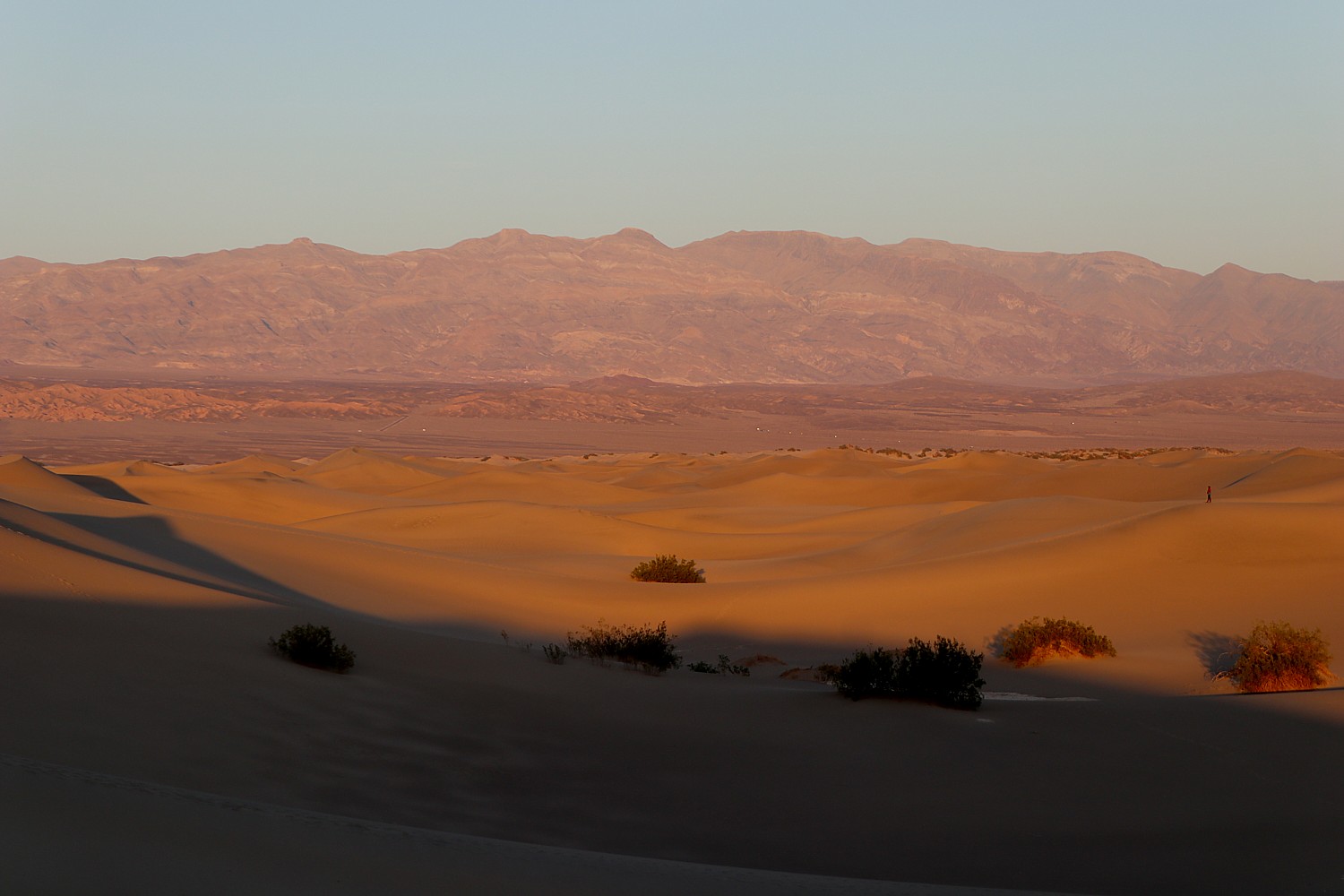
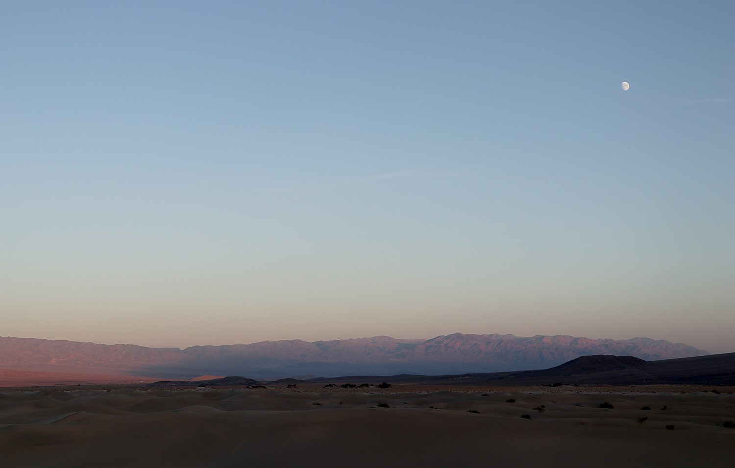
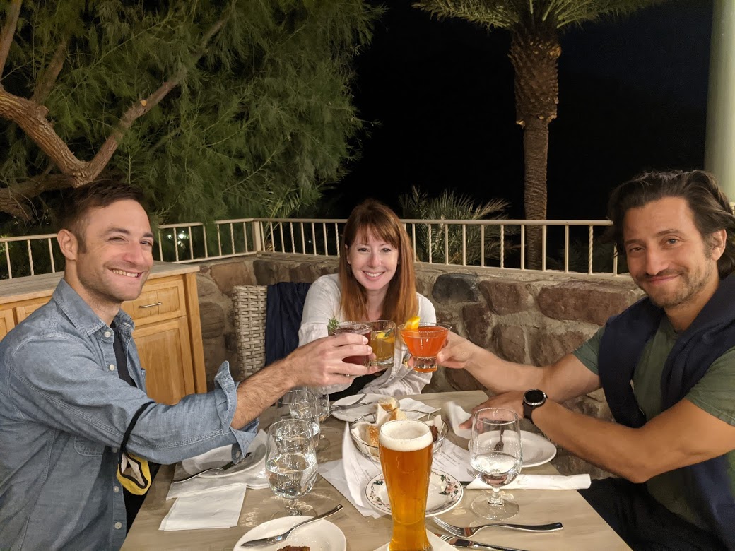
We again rush back to Zabriskie Point for sunset – we had missed it by five minutes the night before, so this time, we make sure to get here in plenty of time to appreciate the changing light and colors. It proves not what I expected – I actually find myself more entranced by the full moon rising from behind the mountain peaks. (Artist’s Palette is another popular place to watch the sunset – get there at least a half-hour ahead in order to see the rich colors in the rock.)

Sunset at Zabriskie Point, Death Valley National Park © Karen Rubin/goingplacesfarandnear.com
Moonrise at Zabriskie Point, Death Valley National Park © Karen Rubin/goingplacesfarandnear.com
Sunset at Zabriskie Point, Death Valley National Park © Karen Rubin/goingplacesfarandnear.com

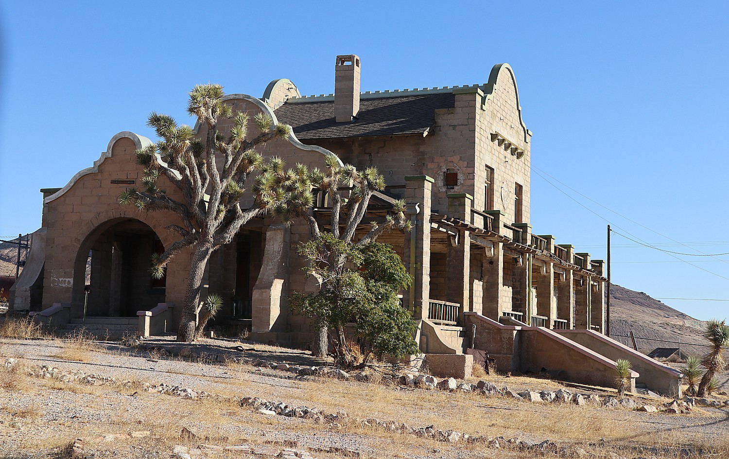
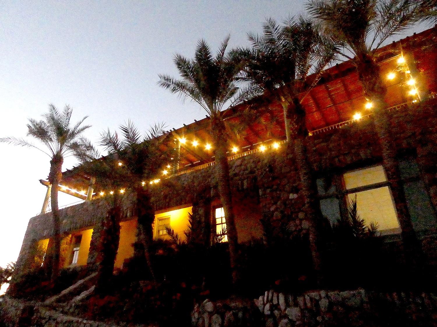
This evening, we treat ourselves to a special dinner at the luxury, grand hotel, the Inn at Death Valley (originally named the Furnace Creek Inn), sitting outside on a lovely terrace rather than the dining room. The historic hotel, a member of Historic Hotels of America, dates from 1927, built by Richard C. Baker  of the Pacific Coast Borax Company as a means to save its newly built Death Valley Railroad, and played a pivotal role in the transformation of Death Valley from a mining wasteland to treasured national park.

The luxury historic Inn at Death Valley is set in a oasis © Karen Rubin/goingplacesfarandnear.com

The Inn was designed by prominent Los Angeles architect Albert C. Martin and landscape architect Daniel Hull. Baker hired the Fred Harvey Company to manage the inn (a similar story to the famous El Tovar Hotel in Grand Canyon), which it did for decades.

The luxury historic Inn at Death Valley is set in a oasis © Karen Rubin/goingplacesfarandnear.com

After 90 years, the AAA Four Diamond resort remains an elegant hideaway- and how much more romantic could it be that it is set in a desert oasis and lists among its famous guests are Marlon Brando, Clark Gable and Carole Lombard. Open from mid- October to mid-May, it offers fine dining in one of the world’s most remote settings, a magnificent spring-fed pool, lush palm gardens, and golf on the world’s lowest golf course, 214 feet below sea level, located at the adjacent Ranch at Death Valley. Both the Ranch and the Inn at Death Valley are part of the Xanterra Travel Collection (www.oasisatdeathvalley.com; xanterra.com; you can also book at historichotels.org)

Celebrating the day’s achievements at a special dinner, al fresco, at the Inn at Death Valley © Karen Rubin/goingplacesfarandnear.com

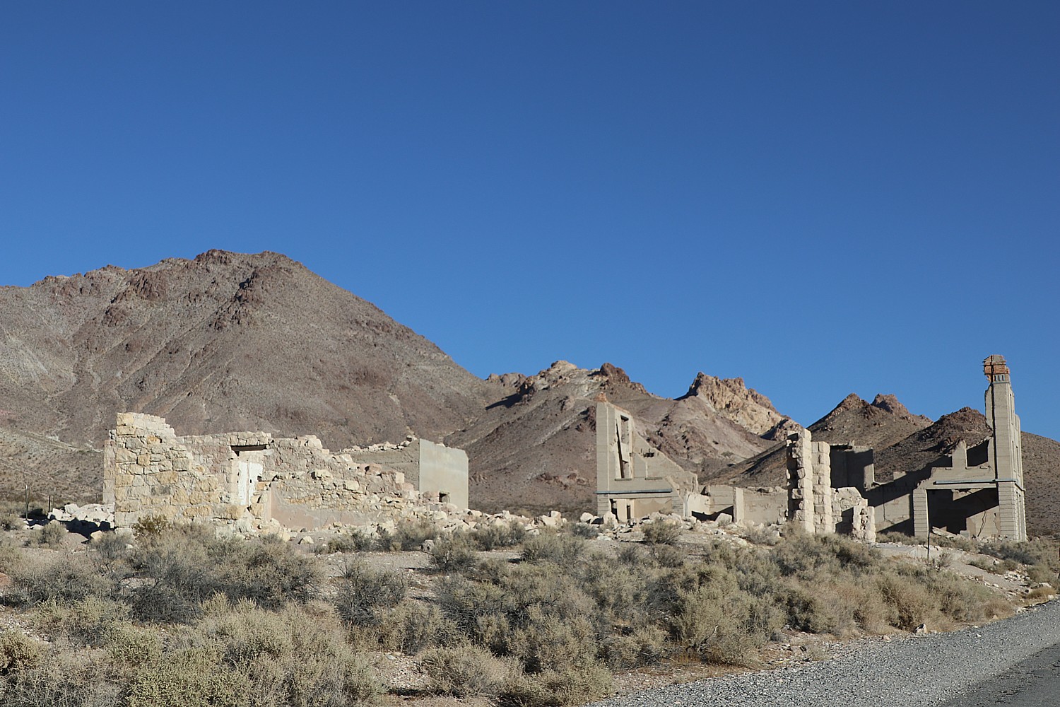
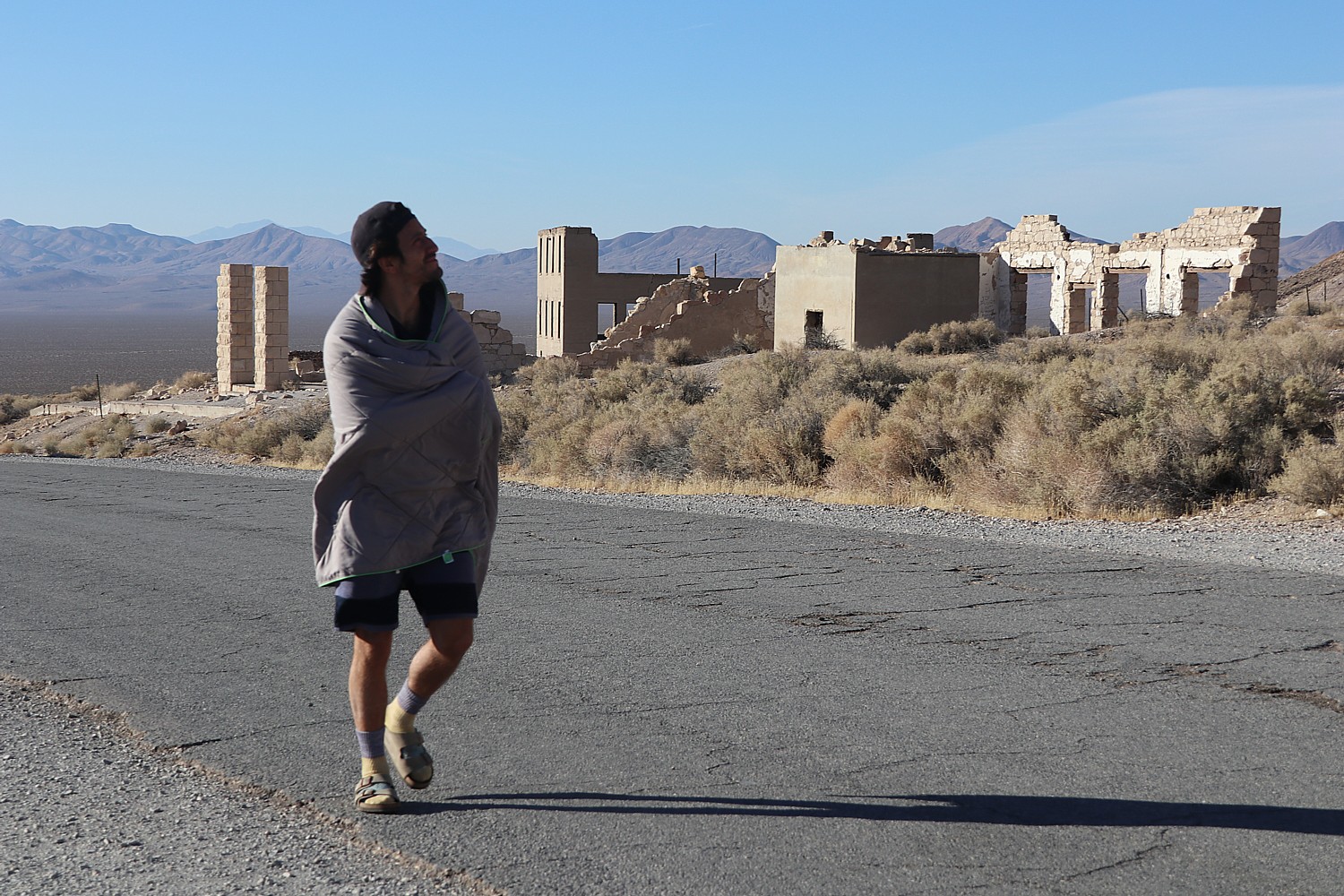
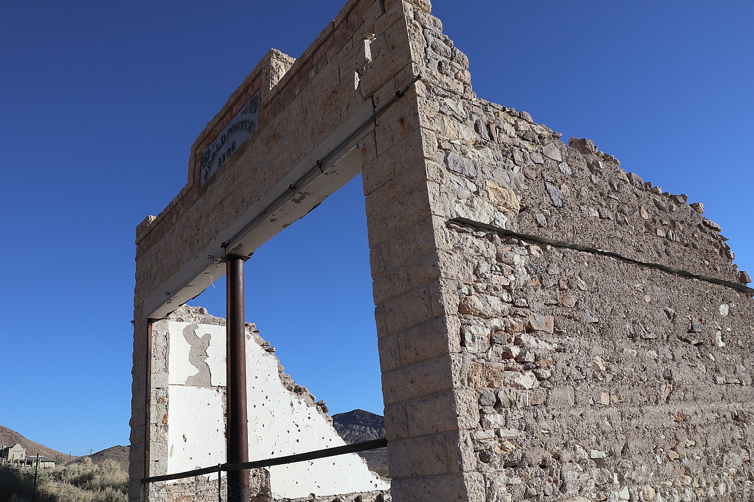
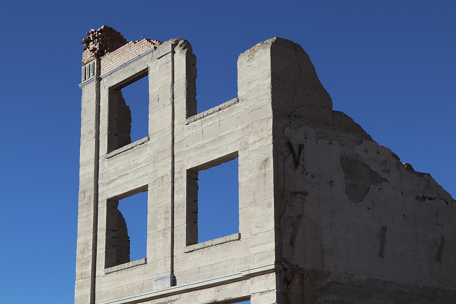
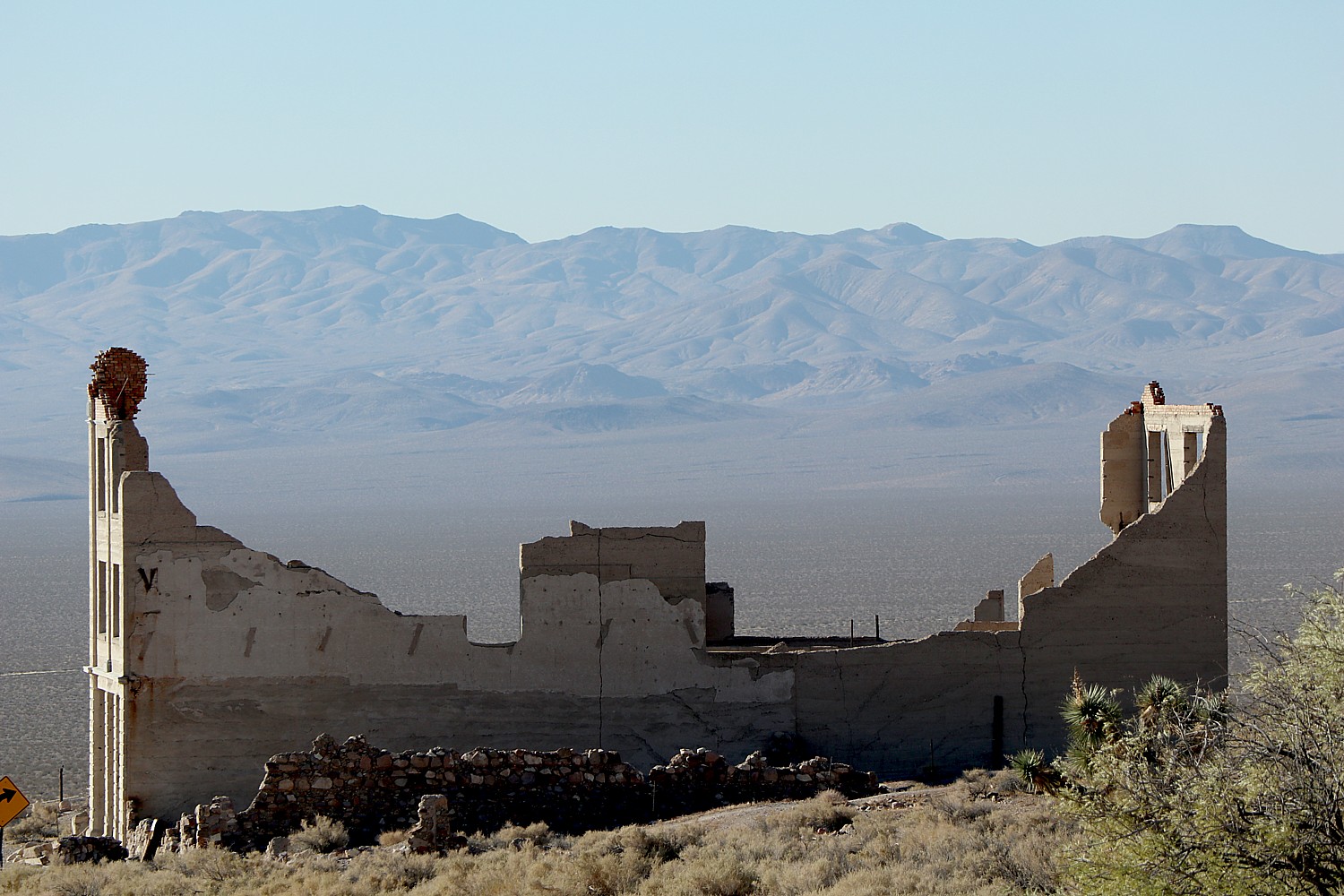
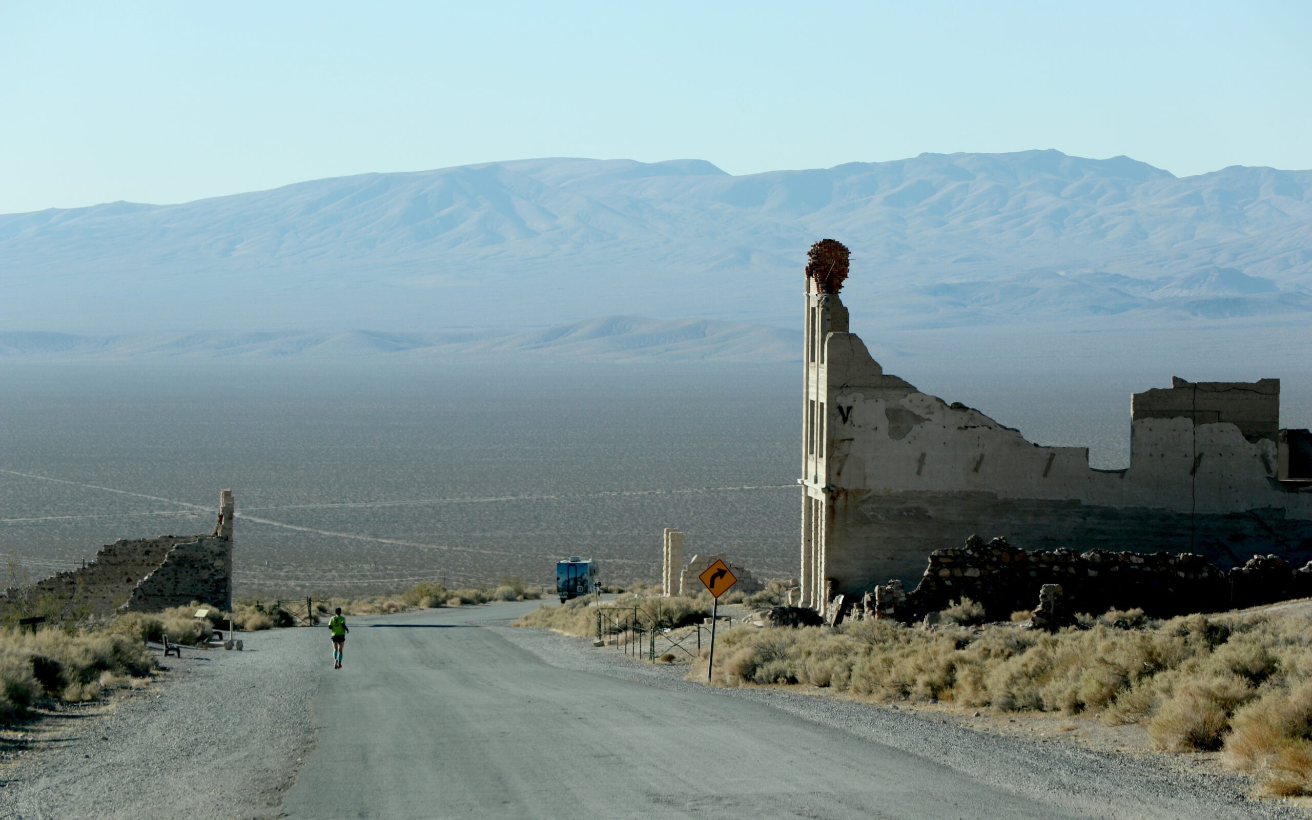
Before returning to the Ranch, we head to Harmony Borax Works, one of the best places to see stars (I even see a shooting star), though on this night with a full moon, we probably should have gone back to the Badwater Basin salt flats where we likely would have seen amazing shadows cast by the moon. The difference though, is that Harmony Borax Works is just five minutes away from the Ranch versus Badwater Basin, a 30 minutes drive.

Star Gazing at the Harmony Borax Works © Karen Rubin/goingplacesfarandnear.com

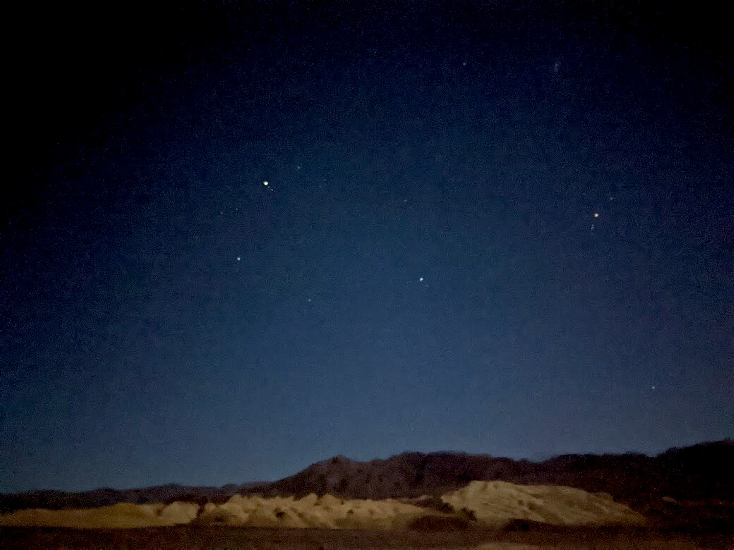
In the moonlight, we can make out what remains of Harmony Borax Works. Borax ore was processed here from about 1884 to 1888. It was built by W.T. Coleman who developed the system of 20-mule team wagons that hauled the borax 165 miles across the desert to the railroad at Mojave. But after only five years, Coleman’s financial empire collapsed and the Harmony plant was shut down.

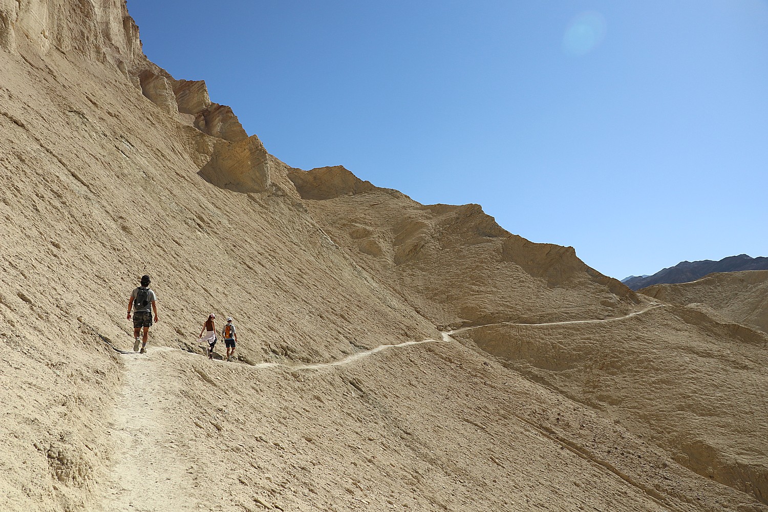
The next morning, we pack up to leave the Ranch, with a plan to hike the Mosaic Canyon trail on our way out of the national park.

The four-mile roundtrip hike into Mosaic Canyon is sensational from start to finish – stunning, improbably smooth marble walls, scrambles on the way in that become natural slides on the way back (from eons of floods, apparently, or perhaps all the backsides that slide down).  This is like amusement park ride from start to finish – sheer delight. We follow cairns in the shape of stone arrows that point the way.

Mosaic Canyon, “a geological art gallery” in Death Valley National Park © Karen Rubin/goingplacesfarandnear.com

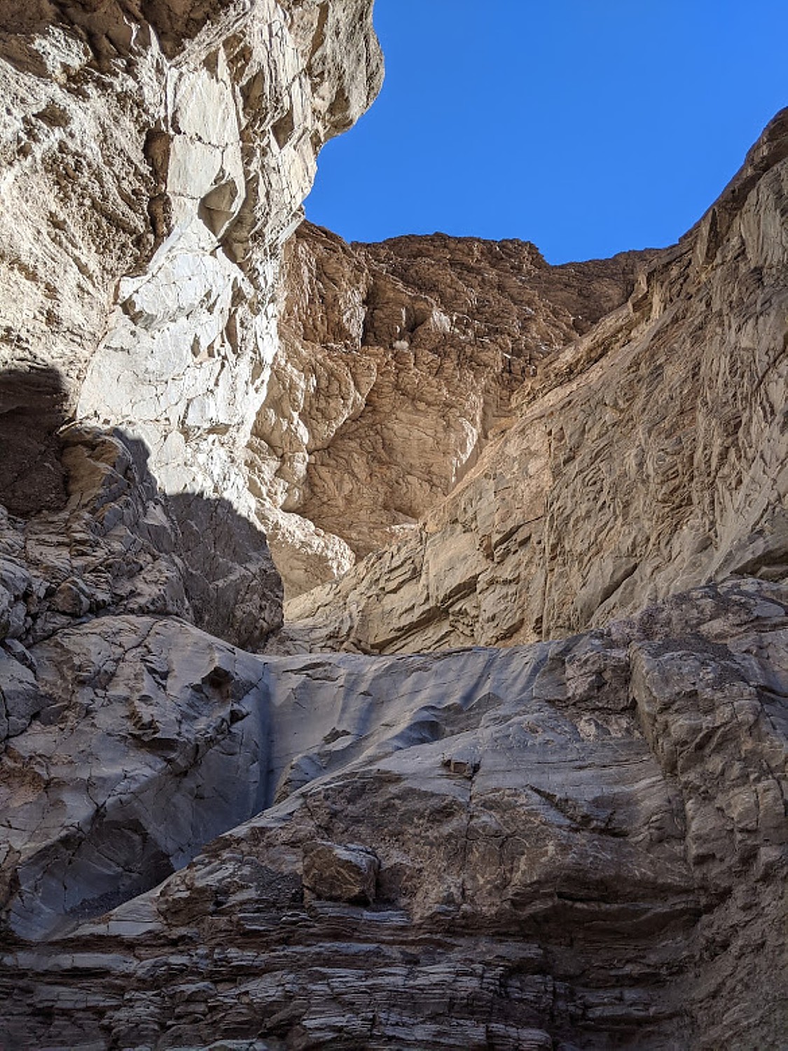
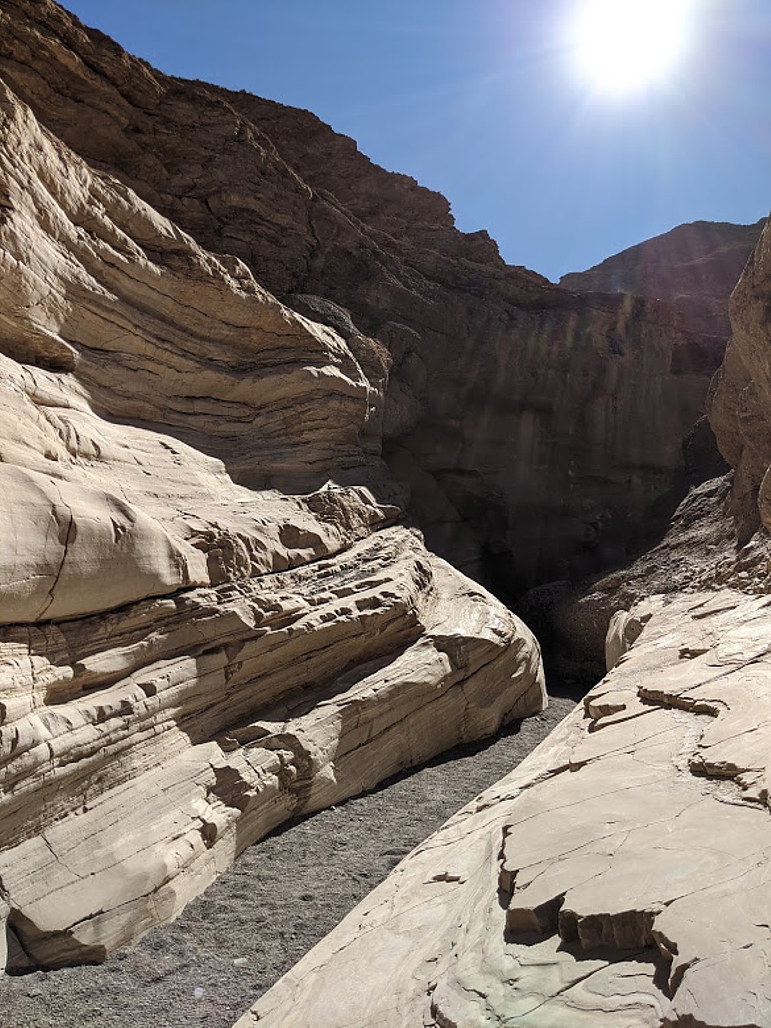
“Mosaic Canyon is a geological art gallery: irregularly shaped fragments of tan-colored Noonday Dolomite, sandy matrix, and limey cement create what seem to be murals on the canyon walls,” the National Park Service notes read. “In other places, dolomite, transformed into marble by heat and pressure, forms colorful swirls in stream-polished whirlpools and chutes in the bedrock. This is because the geologic history of Mosaic Canyon is a succession of fill-and-scour cycles – major flash floods fill the canyon with up to 20 feet or more of gravel every couple of decades, often blocking easy passage with large boulders. Less intense storms slowly scour the canyon again, removing the earlier deposits. The remains of iron railings and steps installed at the first narrows serve as reminders of a filled canyon only a few decades ago. Hiking up the canyon is a visual and intellectual treat. The canyon itself offers evidence of past floods and serves as a vivid reminder of the enormous power of water.” (https://www.nps.gov/deva/planyourvisit/mosaic-canyon.htm)

Mosaic Canyon, “a geological art gallery” in Death Valley National Park © Karen Rubin/goingplacesfarandnear.com
Using the smooth rock as a slide in Mosaic Canyon in Death Valley National Park © Karen Rubin/goingplacesfarandnear.com
Using the smooth rock as a slide, at Mosaic Canyon, Death Valley National Park © Karen Rubin/goingplacesfarandnear.com
Mosaic Canyon, “a geological art gallery” in Death Valley National Park © Karen Rubin/goingplacesfarandnear.com

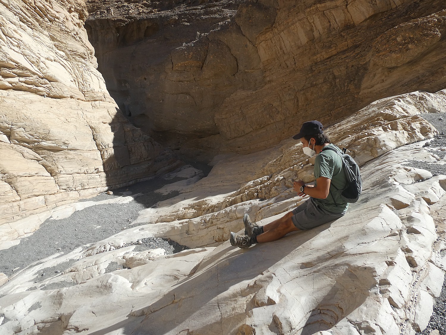
You can take just an easy one-mile roundtrip hike through the narrows or hike 2.2 miles to the upper end of the canyon.

I have to actually try my (minimal) rock-climbing skills, with lots of cheers and support from everyone. It is a hoot. And the colors and patterns!

It takes us less than three hours, gorgeous and fun from very beginning, perfect for our final hike before driving back to Sonoma, with a short stop to enjoy the view of Mono Lake in the late afternoon light.

As we drive away, we start a list of what we need to do when return: the Telescope Peak hike (a strenuous 7-mile hike up 3,000-feet to 11,049 feet altitude, which Eric does just weeks later when he returns); Dante’s Peak (for an amazing view); and Darwin Falls (an actual water fall) top the list.

Plan your visit to Death Valley National Park, nps.gov/deva, 760-786-3200.

Death Valley in art: “Sidewinder Canyon” diptych by Laini Nemett (2020, 12 x 9 in, oil on linen on panel). Visit www.laininemett.com.

See also:

ROAD TRIP: DISCOVERING DEATH VALLEY’S TREASURES, RICHER THAN GOLD

ROAD TRIP: HITTING THE HIGHLIGHTS OF DEATH VALLEY NATIONAL PARK

AD-VAN-TURING, NEWEST TRAVEL TREND

______________

© 2021 Travel Features Syndicate, a division of Workstyles, Inc. All rights reserved. Visit goingplacesfarandnear.com, www.huffingtonpost.com/author/karen-rubin, and travelwritersmagazine.com/TravelFeaturesSyndicate/. Blogging at goingplacesnearandfar.wordpress.com and moralcompasstravel.info. Send comments or questions to [email protected]. Tweet @TravelFeatures. ‘Like’ us at facebook.com/NewsPhotoFeatures

Road Trip: Hitting the Highlights of Death Valley National Park

Hiking into the Artist’s Palette, Death Valley National Park © Karen Rubin/goingplacesfarandnear.com

By Karen Rubin, Eric Leiberman, Dave E. Leiberman & Laini Miranda

Travel Features Syndicate, goingplacesfarandnear.com

Tourism began in Death Valley in 1926 with the opening of the first hotels. It became a national monument in 1933 and was elevated to a national park as recently as 1994 with the expansion of 1.3 million acres. It is mind-boggling to realize Death Valley is the largest national park outside Alaska, at 3,422,024 acres – twice the size of Delaware.

A basin below sea level, there is drought and extreme heat, but towering peaks, rising as high as 11,000 feet that ring the basin, get snow. There is even a waterfall. Periodic flooding over millions of years has carved and smoothed ragged rock – a cautionary tale of nature’s power and unpredictability – while oases provide refuge for wildlife and people. Most surprising of all is the diversity of life that has adapted to this harsh location, no more surprising than that there are people here at all – indeed, the Timbisha Shoshone American Indian tribe are repopulating the area around Furnace Creek.

Death Valley is a land of extremes and constant surprises that excite the senses and force you to pay attention. You are never merely a casual observer, but an active participant, often getting to test new skills.

Because Death Valley National Park is so vast, so massive (nearly 1,000 miles of paved and dirt roads, with gasoline and water as much as 78 miles apart) and conditions that can be fairly treacherous, you are advised to research and plan out what you want to do not only to maximize what you see but for safety’s sake.

Driving in Death Valley National Park © Karen Rubin/goingplacesfarandnear.com

Among the important safety considerations: especially in summer, you are advised not to start hiking a trail after 10 am (take into account the distance and estimate the amount of time you need – my rule of thumb is one mile per hour); make sure you have sufficient water (allocate a gallon of water per person per day, which you should buy before you arrive); have hat, sunglasses, sunscreen. You are advised not to hike certain trails after a rain or if rain threatens because they can be treacherous. The weather can change dramatically – indeed, you can see where floods have come through and etched the rock – canyons can turn into rivers quickly. The ground temperature in summer can actually be 80 degrees hotter than the air temperature – a temperature of 201 degrees F was actually measured; ground temperature on the valley floor is 40 percent higher than surrounding air temperature. And yet, it can also get very cold – the lowest temperature recorded on the valley floor was 15 degrees F in 1913.  (The best time to hike in Death Valley is from November through March.)

And though you may well see other hikers on the trail (masks!), what stays in your mind is how few, how remote; in four days, we never saw a park ranger on the road. This is no amusement park with pretend thrills. But this sense of the possibility of danger is thrilling.

Hiking the Golden Canyon Trail, Death Valley National Park © Karen Rubin/goingplacesfarandnear.com

We research the most popular hikes (alltrails.com is a great source) and highlights of Death Valley, set them into geographic areas, calculated an estimated amount of time to visit, mixed hiking with less strenuous touring, and driving time (there is no public transportation in the park) and took into account the time of day and season – you don’t want to be at the far end of a trail when the sun has already begun to set.

So we had cleverly notched one of Death Valley’s most popular highlights, Mesquite Flat Sand Dunes, timing are arrival in the late afternoon the day before, and on our way back into the park  on our first morning from our Air BnB in Beatty (20 miles away), we explored Rhyolite Ghost Town, which was also high up on our list of “must-sees.”

For our first full day in Death Valley, we’ve etched out hiking the Golden Canyon trail, 20 Mule Team, Badwater Basin, Artist’s Palette, and finishing with the sunset at Zabriskie Point.

Golden Canyon Trail

Red Cathedral off the Golden Canyon trail © Karen Rubin/goingplacesfarandnear.com

Our first hike, Golden Canyon trail, is the most popular in Death Valley and for good reason. It hits on all cylinders: the absolutely dramatic landscape, patterns and colors of the rocks, but also, the trail itself. The section between the Red Cathedral (really gorgeous) and the turn-off to the spur trail to Zabriskie Point is particularly exciting – you walk a narrow cut in a rounded rock and then over a formation we dub the “Stegasaurus” – like a dinosaur’s back. The full loop is 4.5 miles, winding past Manly Beach and Gower Gulch, just about every step pure joy. The morning sunlight brings out the golden hues in the eroded badlands, contrasting with the red stone cliffs of Red Cathedral. (The hike takes us from 10:30 am to 1:30 pm).

Golden Canyon Trail, Death Valley National Park © Karen Rubin/goingplacesfarandnear.com
The section of the Golden Canyon trail we dub “Stegasaurus” © Karen Rubin/goingplacesfarandnear.com
Golden Canyon Trail, Death Valley National Park © Karen Rubin/goingplacesfarandnear.com

Feeling absolutely exhilarated after the hike, we drive through the 20 Mule Team Canyon – driving it actually does feel more like an amusement park ride. There is a narrow, winding, looping, rolling one-way only road that takes you through. You are reminded that this place used to have mule teams hauling out borax. It’s perfect after the hike – a 15-minute drive through.

Driving through 20 Mule Team Canyon, Death Valley National Park © Karen Rubin/goingplacesfarandnear.com

We drive through Artist’s Drive to Artist’s Palette, where we have a picnic lunch (planning!), but decide to return later in the afternoon when its famous colors will be more pronounced.

Driving the loop-de-loop of Artist’s Drive, Death Valley National Park © Karen Rubin/goingplacesfarandnear.com

Badwater Basin

Badwater Basin, Death Valley National Park © Karen Rubin/goingplacesfarandnear.com

Then on to Badwater Basin, probably one of the most famous sights in Death Valley. Spanning 200 square miles, this extraordinarily expansive, giant salt flat doesn’t look it but you can walk 7 miles across, ringed by mountains. At 282 feet below sea level, when we stand here we are standing at the lowest point in North America. The basin consists of sodium chloride (table salt), calcite, gypsum, and borax. 

Badwater Basin, Death Valley National Park © Karen Rubin/goingplacesfarandnear.com

Though named “badwater,” the water is not actually bad but salty, and despite the name, “Death Valley,” it is remarkable to learn that many organisms thrive in it. The pool is home to an endemic snail naturally found only at this location, and its rim is dotted with salt tolerant plants, such as pickleweed. This was once a large inland lake which evaporated over thousands of years, leaving concentrated salt deposits behind that form fascinating geometric polygon shapes.

Badwater Basin, Death Valley National Park © Karen Rubin/goingplacesfarandnear.com

The pool and boardwalk are easily accessible from the parking lot off Badwater Road, but for the best views of the salt polygons, walk out onto the salt flats a half mile or so. Look behind you to the cliffs of the Black Mountains to the east, where there is a sign high above marking sea level. From here, you can also see Telescope Peak in the Panamint Range to the west; at 11,049 ft, this peak is over two miles above you. “Nowhere else in America can you see such a dramatic vertical relief over such a close distance.” (https://www.nps.gov/places/badwater-basin.htm)  (Eric gets to hike up Telescope Peak on his return a month later on his adVANture; see ad-VAN-turing, Newest Travel Trend)

It’s 4:30 pm and there are long shadows bringing out the interesting formations and patterns in the salt. Here, we are famously 282 feet below sea level.  (In summer, it is not advised to walk out on the salt flats after 10:30 am).

Artist’s Palette

Artist’s Palette, Death Valley National Park © Karen Rubin/goingplacesfarandnear.com

We drive the nine-mile loop-de-loop roller coaster of Artist’s Drive to Artist’s Palette, to see the richer color of the cooler, late afternoon  sun, and scamper across the rolling ridges, literally into the multi-colored palette itself – yellow ochre, burnt umber, sienna, rust, rose, copper.

Artist’s Palette, Death Valley National Park © Karen Rubin/goingplacesfarandnear.com

Artist’s Palette is one of the most popular places to watch the sunset, but we decide to go to Zabriskie Point instead.

Timing the sunset can be tricky because of the peaks, the day of the year, also. You need to get wherever you want to see the sunset a half-hour before, when the colors begin to deepen. The actual sunset is over in a few minutes, so you have a very short window for the best images.

And so we miss the sunset at Zabriskie Point by five minutes. Even so, it is a gorgeous sight as the rocks take on warm colors, there is a pink rim to along the mountain ridges, and a full moon rises.

Sunset at Zabriskie Point, Death Valley National Park © Karen Rubin/goingplacesfarandnear.com
Moonrise at Zabriskie Point, Death Valley National Park © Karen Rubin/goingplacesfarandnear.com
Sunset at Zabriskie Point, Death Valley National Park © Karen Rubin/goingplacesfarandnear.com
Sunset,at Zabriskie Point, Death Valley National Park © Karen Rubin/goingplacesfarandnear.com
Moonrise at Zabriskie Point, Death Valley National Park © Karen Rubin/goingplacesfarandnear.com

Fortunately, we will have the opportunity to see the sunrise and sunset on our next day. Indeed, that’s why we decided to book two nights at the Ranch at the Oasis, just a short drive away from Zabriskie Point, instead of driving 45 minutes each way to the Designed to Death Air BnB in Beatty, Nevada, where we stayed on our first night.

We check into the Ranch at Oasis, order out dinner from the menu and sit outside on the lovely terrace adjacent to the restaurant (which also has outside dining, properly spaced). It is sheer perfection (as was the steak with an espresso rub, fantastic!).

Dining al fresco at the Ranch at Death Valley © Karen Rubin/goingplacesfarandnear.com

We drop our things in our hotel room (Laini has made sure to get a first-floor room at the end of the hall, close to the door, so we would have minimal time in a public space, and was assured that the rooms are thoroughly cleaned and left for 24 hours before the next guest). We immediately go to the Olympic-sized pool – absolutely magnificent, naturally warmed to a constant 87 degrees by hot mineral springs. The water feels silky, and as we swim we delight in the stars overhead. (www.oasisatdeathvalley.com)

The biggest surprise of all is how diverse Death Valley is – low valley floors, salt flats, rugged mountains rising as high as 11,000 feet, deep and winding canyons, rolling sand dunes, oases. The landscape is not a monotone at all, but a riot of colors, textures, contours. Each hike we take, each highlight we explore is spectacular in its own way, exciting and thrilling, exacting surging emotions and senses – the Mesquite Flat Sand Dunes, the Golden Canyon, the Badwater Basin salt flats, the 20 Mule Team Canyon, Artist’s Palette, Zabriskie Point – and it’s only been a day and a half.

The next morning, we get up before sunrise to get to Zabriskie Point (about a 7-minute drive away) to watch the brilliant display as the rocks seem aflame with sunlight.

Death Valley in art: “Golden Canyon,” by Laini Nemett (2021, 12 x 9 in, oil on linen on panel). Visit www.laininemett.com

See also:

ROAD TRIP: DISCOVERING DEATH VALLEY’S TREASURES, RICHER THAN GOLD

_______________

© 2021 Travel Features Syndicate, a division of Workstyles, Inc. All rights reserved. Visit goingplacesfarandnear.com, www.huffingtonpost.com/author/karen-rubin, and travelwritersmagazine.com/TravelFeaturesSyndicate/. Blogging at goingplacesnearandfar.wordpress.com and moralcompasstravel.info. Send comments or questions to [email protected]. Tweet @TravelFeatures. ‘Like’ us at facebook.com/NewsPhotoFeatures

Road Trip: Discovering Death Valley’s Treasures, Richer than Gold

Mesquite Flat Sand Dunes, Death Valley National Park © Karen Rubin/goingplacesfarandnear.com

By Karen Rubin, Laini Miranda, Dave E. Leiberman & Eric Leiberman

Travel Features Syndicate, goingplacesfarandnear.com

In the quest, so very popular in these days of coronavirus, of finding open spaces to become renewed, revitalized, revel in nature and contemplate one’s place in the universe, there is no better place than Death Valley National Park, spanning California and Nevada.

Our four-day trip to Death Valley has an overlay of planning that goes beyond planning for hiking in a vast desert: the coronavirus pandemic. It impacts our route, where we stay (an Air BnB at the outskirts and the Ranch at Death Valley in the park, having double-checked their COVID-19 protocols), how we organize food and water to take with us (and ice chest) to cut down on the need to eat out.

And our itinerary is designed to pack as much as possible from such an expansive landscape into such a limited time. In the process, we discover that we are very much following in the footsteps of the miners who came before seeking the treasures in these landscapes. For us, the treasures we find are not the material kind, but even more enriching.

With an eight-hour drive ahead of us, we calculate when to depart in order to get to Death Valley in time to begin our exploration. With meticulous planning and organization that the Army would be proud of, we pull away from Sonoma at 5:39 am, taking an interior route, east toward Tahoe, then south, passing the eastern side of Yosemite National Park.

The fall scenery all along the way is breathtaking, going from wilderness, through these little Western towns and ranches.

We pass the ski resorts at Lake Tahoe, where the road takes us up to an altitude of 8,000 ft. and temperatures as low as 19 degrees, and by the end of the day, down to 275 feet below sea level at Death Valley. As we drive out of Tahoe, we watch the thermometer ticking up a degree every mile, until reaching the 80s. Actually, the weather is quite cool and comfortable for Death Valley, which is the hottest place on the planet, with ungodly temperatures that reached 130 degrees this summer, but can also get frigid in winter. Our visit, in October, is actually a terrific time.

Mono Lake Tufa State Natural Preserve

Mono Lake Tufa State Natural Preserve, Lee Vining, California © Karen Rubin/goingplacesfarandnear.com

Laini plots our route so we would stop at Mono Lake Tufa State Natural Preserve, in Lee Vining, California, where we have a picnic lunch. The first sight of Mono Lake from the highway above is astonishing: a stunning, ethereal scene with its brilliant aquamarine color and striking tufa formations. We stop at the overlook and then drive down along the shore to the parking lot. The visitors center is closed (because of COVID-19 restrictions), but we go into a trailhead that leads to a short boardwalk to the lake edge.

California created the reserve to protect these spectacular “tufa towers,” calcium-carbonate (limestone) spires and knobs formed by the chemical interaction of freshwater springs and alkaline lake water. The reserve protects the lake surface as well as the wetlands and sensitive habitat for the 1 – 2 million birds that feed and rest at Mono Lake each year.

Mono Lake Tufa State Natural Preserve, Lee Vining, California © Karen Rubin/goingplacesfarandnear.com

Covering 65 square miles, Mono Lake is ancient – over 1 million years old and one of the oldest lakes in North America. Freshwater evaporating from the lake each year has left the salts and minerals behind so that the lake is now about 2 1/2 times as salty as the ocean and very alkaline. “The extremely high salinity and alkalinity of Mono Lake has created a rare ecosystem, supporting a complex food chain of green algae, brine shrimp and alkali flies, and more than 80 species of migratory birds.” (www.parks.ca.gov)

Mono Lake Tufa State Natural Preserve, Lee Vining, California © Karen Rubin/goingplacesfarandnear.com

(Highway 395, 13 miles east of Yosemite National Park, near the town of Lee Vining, California, 760-647-6331, www.parks.ca.gov; also www.monolake.org).

We stop off at Carroll’s Market (probably the last one we will see), which actually gets high ratings on Yelp, especially for its blue cheese dressing, and has become its own attraction. We buy a dozen gallon jugs of water and stop off to fill up at a gas station.

Death Valley National Park

Father Crowley Vista Point view over Rainbow Canyon, a colorfully striped canyon created by ancient volcanic activity, nicknamed “Star Wars Canyon” © Karen Rubin/goingplacesfarandnear.com

After a long flat stretch with mountains in the distance, we drive the winding mountain road (make sure you have a full tank of gas), entering the park at Panamint Springs. We stop at the Father Crowley Vista Point for the view over Rainbow Canyon, a colorfully striped canyon created by ancient volcanic activity. Nicknamed “Star Wars Canyon”, it’s where the military practices Star-Wars type of flying. The wind today is so intense, it practically throws us over.

(Nearby is Darwin Falls, a seeming oxymoron in this desert place, quickly turning from a gravel canyon to a lush oasis of cottonwoods and willows, creek crossings, and finally 20-foot waterfalls, a two-mile roundtrip hike, which we have marked down for a return visit.)

We stop at the historic Stovepipe Wells Village – like something out of a Western movie – that links back to the very beginning of tourism in Death Valley. In fact, long after mining gold, borax and talc had collapsed, tourism has been the enduring enterprise in Death Valley.

Stovepipe Wells General Store evokes the earliest days of tourism to Death Valley © Karen Rubin/goingplacesfarandnear.com

Herman William “Bob” Eichbaum effectively invented Death Valley’s tourism industry here, believing its “beauty, mystery and history” would attract tourists. Indeed, since 1915, motion pictures, automobile companies and writers weaving tales and promoting advertisements sparked interest (early social influencers) in visiting. In 1925, Eichbaum built a 38-mile toll road over Towne Pass and 20 tent-style bungalows, a restaurant, general store and filling station. He opened the Stovepipe Wells Hotel in 1926. Just a few months later, the luxurious Furnace Creek Inn was opened by the Pacific Coast Borax Company, setting off an intense rivalry. Most enthralling is that both places are still around and give you this sensation of stepping back in time. (Open year-round, deathvalleyhotels.com, 760-786-7090).

Mesquite Flat Sand Dunes

Mesquite Flat Sand Dunes, Death Valley National Park © Karen Rubin/goingplacesfarandnear.com

It’s only a short drive from the village to reach Mesquite Flat Sand Dunes, a little after 4 pm, giving us at least one hour before sunset. We have just enough time to play on the dunes and watch the colors (and temperature) change with the setting sun. People bring cardboard sleds, using the sand like snow.

Mesquite Flat Sand Dunes is an extraordinary setting:  sprawling over 14 square miles, ringed with mountain peaks, the contrast of colors, shapes, contours is just stunning.

Mesquite Flat Sand Dunes, Death Valley National Park © Karen Rubin/goingplacesfarandnear.com

In late afternoon, the sand is cool enough to take off shoes and feel remarkably soft granular sand on toes. We climb the dunes –as much as 150 feet high- wowed in the colors of the golden hour as the sun descends.  All the pure joy you had playing in a sand box when you were four comes bursting through.

Mesquite Flat Sand Dunes, Death Valley National Park © Karen Rubin/goingplacesfarandnear.com

The best time to visit is the early morning or late afternoon; on a dawn hike, the notes say, you might see tracks of nocturnal animals and if you hike at night in the warm months, they warn, be alert for sidewinder rattlesnakes (I’m still thinking about the tracks of nocturnal animals).

Designed to Death

We drive on, reveling in the scenes of the road disappearing into the far distance, headed to our Air BnB, with the intriguing name, Designed to Death, in the small town of Beatty, about 20 miles outside the park’s eastern border (Las Vegas would be about 1 ½ hours beyond). Though the name evokes Agatha Christie, it is breathtakingly beautiful, cozy luxury, with a bit of a Western vibe – easily explained because the hosts are interior designers and the house is a showplace for their talent.

Preparing dinner at Designed to Death AirBnB, Beatty, Nevada © Karen Rubin/goingplacesfarandnear.com

We are here for too short a time to fully enjoy all that the house affords. Set on an isolated stretch of high desert, the 1,200 sq. ft.,  three-bedroom, two-bath vacation home was designed by Peter Strzebniok to incorporate the vistas, providing stunning views while making the desert part of the interiors – merging the inside with the outside. What we do thoroughly enjoy though, is the large open kitchen, dining room, living room, that opens onto a 900 sq. ft deck with hot tub. The Presidential Suite at a five-star hotel would not have been any nicer or more comfortable.

Our Designed to Death Air BnB hosts are Karen McAloon, an interior designer who works in San Francisco Bay Area, Los Angeles and Joshua Tree, who was an HGTV host and her partner was her producer. (They have two sister properties, Hip Modern cottage of Amazingness in Lake Tahoe, @hipmoderncottageofamazingness, and Too Pool for School in Joshua Tree, @toopoolforschooljtree.)

They provide excellent notes – like the nearest place for supplies would be at Family Dollar, but the nearest actual grocery is 70 minutes south at Pahrump. They also supply tour information of nearby ghost towns, museums, attractions and of course Death Valley National Park. There is an interesting note about the wild burros that we might see (there is even a traffic sign like a deer crossing), which are descended from burros abandoned by miners a century ago. “Don’t feed them, they can be destructive. They tend to be down at the creek in the morning and wander into town at night.”

We take full advantage of the gorgeous kitchen to prepare dinner (we brought food for dinner and breakfast).

Rhyolite Ghost Town

Rhyolite, a Death Valley ghost town © Karen Rubin/goingplacesfarandnear.

The next morning, we pack up quickly and head out early morning with a plan to stop off on our way into Death Valley to visit an actual ghost town, Rhyolite.

It is so fascinating to try to piece together what this town might have been like and to realize how big it was – most surprising, really (especially when you see the context) is what’s left of a hotel and casino. A casino! “100 years ago, Rhyolite was the largest city in southern Nevada with more than 10,000 residents. Yet after only a decade, the town became a ghostly remnant of itself” – a classic boom and bust story, with all sorts of lessons about the transitory nature of success in the span of history. It is tremendously exciting to wander about these ruins, so dramatically set.

Rhyolite, a Death Valley ghost town © Karen Rubin/goingplacesfarandnear.

In its heyday, between 1905-1911, Rhyolite had two churches, 50 saloons, 18 stores, two undertakers, 19 lodging houses, eight doctors, two dentists, a stock exchange and an opera.

The ruins that remain today include the Bottie House, the train depot (there is a caboose there), the remains of a three-story bank building and the jail.

It is one of several ghost towns that are scattered through Death Valley, “the silent ruins of broken dreams.”

Death Valley in art: “Rhyolite Bank Window,” a Death Valley ghost town, by Laini Nemett (2020, 12 x 9 in, oil on linen on panel). Visit www.laininemett.com

Next: Hitting the Highlights of Death Valley National Park

______________________

© 2021 Travel Features Syndicate, a division of Workstyles, Inc. All rights reserved. Visit goingplacesfarandnear.com, www.huffingtonpost.com/author/karen-rubin, and travelwritersmagazine.com/TravelFeaturesSyndicate/. Blogging at goingplacesnearandfar.wordpress.com and moralcompasstravel.info. Send comments or questions to [email protected]. Tweet @TravelFeatures. ‘Like’ us at facebook.com/NewsPhotoFeatures