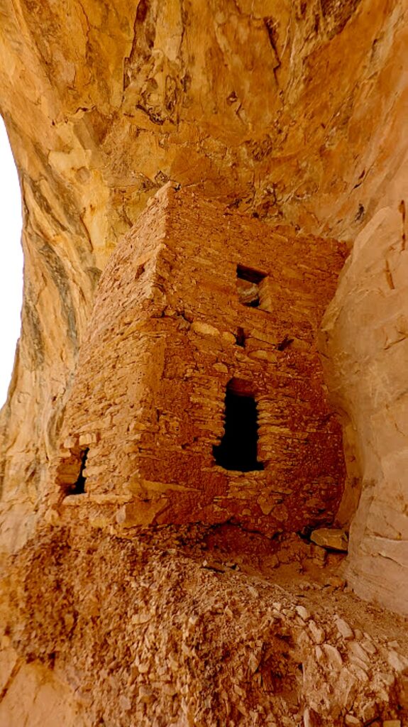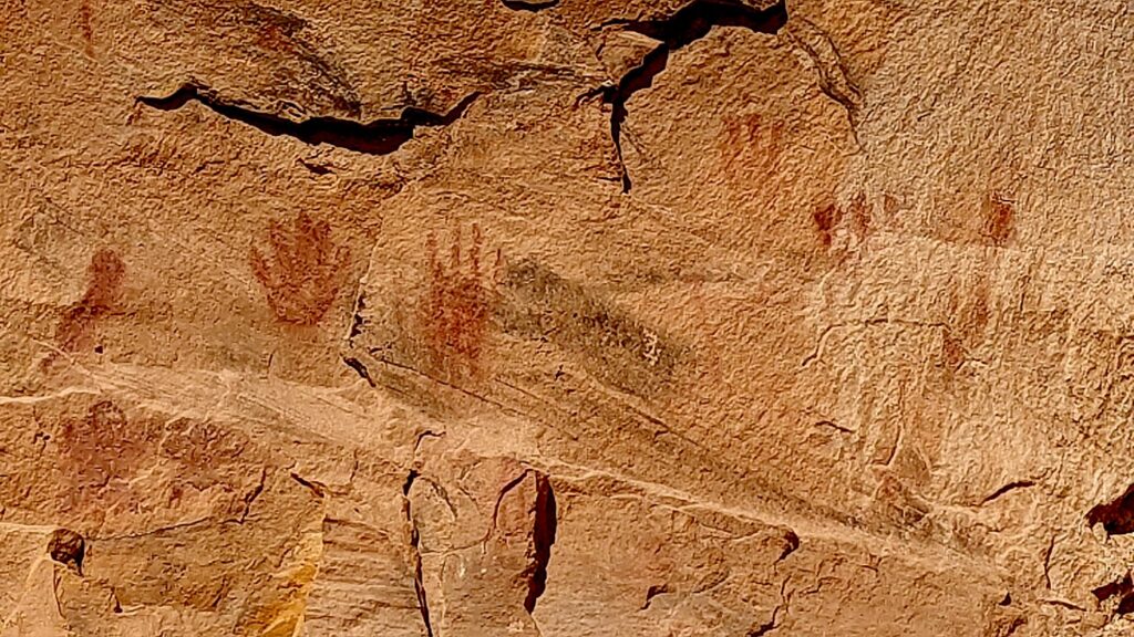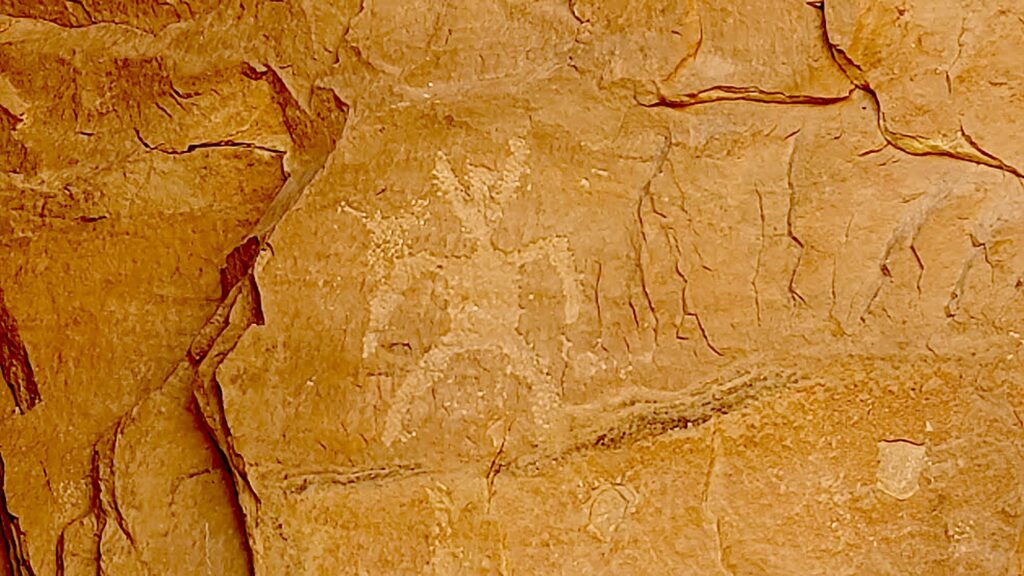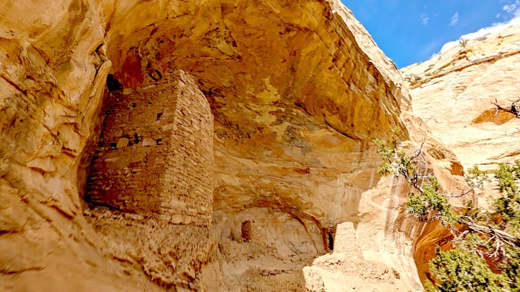
Category Archives: See America

Lake Placid, Where You Can Be Immersed in Olympic Sport, Spirit Year-Round

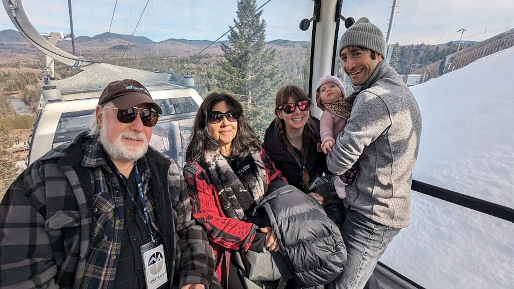
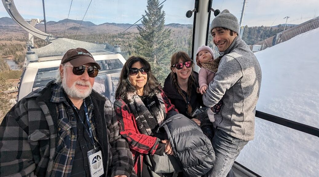
Our three-generation family rides the new Skyride Gondola to begin our visit at the top of the highest ski jump tower at Mt. Van Hoevenberg, one of four venues included in the Olympics Legacy Site Passport © Karen Rubin/goingplacesfarandnear.com

By Karen Rubin, Travel Features Syndicate, goingplacesfarandnear.com

The Olympic spirit is everywhere in Lake Placid. You can almost hear the fanfare playing. It is infectious, and fun – and what is even better, you get to participate, to see and experience it for yourself.

While so many other Olympic venues shut down after the event, Lake Placid, which hosted one of the first winter Olympics, in 1932, and then again in 1980, the facilities have not just been upgraded, enhanced and once again entice World Cup and international sports events. Lake Placid is very much a four-season destination, an outdoors paradise where you can actually experience the same Olympic venues, attractions and activities year-round, along with the athletes who live and train here, and the world-class athletes who compete here.

It offers an ideal mix of activities to appeal to the most athletic and active, to those who prefer to spectate rather than participate – perfect for our three-generation family – skiers and nonskiers and infant.  

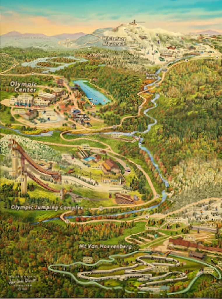
The venues of Lake Placid’s Olympics Legacy sites © Karen Rubin/goingplacesfarandnear.com

The best way to experience Lake Placid, we discover, is with the Olympics Legacy Sites Passport, which provides access to the four Olympic venues and experiences – so even if you don’t ski, you can take the Cloudsplitter Gondola up to the summit of Little Whiteface to enjoy the spectacular view of the Adirondacks high peaks; go to the top of the highest ski jumping tower at the Olympic Jumping Complex to see what the ski jumpers see (terrifying); tour Mt. Van Hoevenberg where the sliding sports (bobsled, skeleton and luge), Nordic skiing, and Biathalon are held; and tour the Olympic Center, where you visit the museum that houses one of the best collections of Olympics memorabilia in the world, as well as the skating arenas.  (The passport includes one admission to the four venues plus 10% off shopping and dining at all the Legacy Sites, https://olympicjumpingcomplex.com/legacysitespassport/)

But if you haven’t visited Lake Placid in the last few years, you wouldn’t know about any of these experiences. So much has changed. So much is new. So much is so special.

The New York State Olympic Regional Development Authority (ORDA, now more familiarly known as the Olympic Authority), which owns and manages the facilities here in Lake Placid (as well as Gore Mountain and Belleayre ski areas), since 2018 has not only upgraded and massively improved the facilities in order to continue to host major international competitions (providing opportunities to watch the competition, training and even meet athletes), but has added attractions and activities so that we can experience much the same thrill and excitement as the athletes, year round. We even get to see their sport through their eyes.

New SkyRide, Zipline at Olympic Jumping Complex
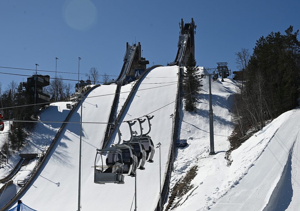
The Olympic Jumping Complex is visited with a new Skyride Gondola, then an elevator to the top of the highest ski jump © Karen Rubin/goingplacesfarandnear.com

At the Olympic Jumping Complex, we ride a new, scenic Skyride Gondola to the base of the towers (athletes used to have to take a chairlift), then walk a short distance to the glass-windowed elevator that takes us up to the top of the highest ski jump tower for the view that the jumpers get (terrifying), and the setting amid the High Peaks Region (open daily but subject to weather conditions).   

New attractions and experiences put you in the Lake Placid Olympics © Karen Rubin/goingplacesfarandnear.com

Today, this facility is the only sanctioned ski jumping facility in North America for winter and summer competition and training. For warm-weather practices, there is a kind of plastic grass that is sprayed with water, that apparently athletes like even better because it is more consistent than snow.

That is a really good thing because climate change will make Lake Placid one of only four premier winter facilities that will be able to host a winter Olympics by 2050, my ORDA guide, Jaime Collins, tells us.

The World Cup will be held here again in February 2025.
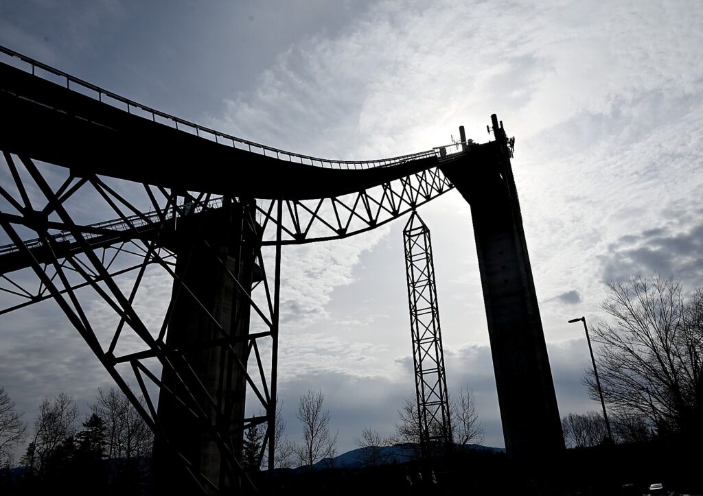
It’s awesome to get to see and be in the places of the Olympic athletes, like riding up the elevator to the highest ski jump © Karen Rubin/goingplacesfarandnear.com

Here at the Olympic Jumping Complex, you can also ride the new Sky Flyer Zipline adjacent to the ski jumps – and if the ski jumpers are practicing, you can seemingly fly alongside. ($20 off ticket price with the Legacy Passport).

New Coaster Ride, Bobsled Experience at Mt Van Hoevenberg

At Mt Van Hoevenberg, home to the three sliding sports – bobsled, skeleton and luge – the Legacy Passport provides a tour that starts in the newly built Mountain Pass Lodge and the push track where you learn about elite athlete development, then taken by bus up the track for a guided walk inside the sliding track.
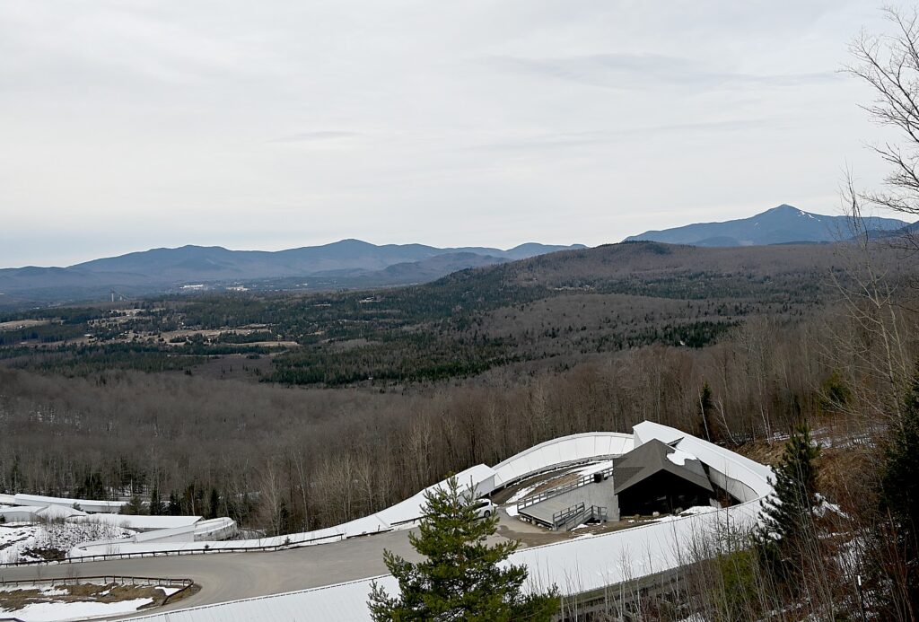
A view of just a portion of Mt. Van Hoevenberg famous track © Karen Rubin/goingplacesfarandnear.com

Be sure to take in the view from the start area which offers the only place where you can get a view of all the Olympic venues at once: the Ski Jump complex, Whiteface Mountain, the track and Nordic center, and the Olympic Center in downtown Lake Placid. (Open daily; check daily updates page for current conditions and trail offerings.The pass also provides 10% off at Mt Van Hoevenberg’s 81-18 Café, Mountain Pass Mercantile and Swix Store.)

As it happens, our visit coincides with preparations for the final International Bobsled & Skeleton Federation (IBSF) World Cup competition of the 2023-2024 season and we get to watch some of the two-man bobsled practice and meet some of the athletes.

During our visit to Mt. Van Hoevenberg, we get to watch practice runs for the two-person bobsled World Cup competition © Karen Rubin/goingplacesfarandnear.com

We learn that this track – with 17 curves and a vertical drop of 365 feet – is considered one of the most difficult and has one of the most famous and challenging turns in the world.  Turn 10 winds 180 degrees into a 20 foot-high wall that, if hit right, can slingshot the sled for a gain 6 mph. “The G forces are so severe, that they can only practice 4-5 times a day,” our ORDA guide, Jaime Collins tells us.

When the track isn’t being used for practice or competition, you can take the Bobsled Experience, where you are driven down the track with real bobsledders. You get to go through that famous Turn 10 but from Start 4, so it comes soon into the ride before you get going too fast, but you still reach speeds up to 50 mph on the lower half-mile of the track. (Be sure to reserve in advance; in summer, the bobsled uses wheels on concrete; $125/9+; $100/military, https://mtvanhoevenberg.com/todo/bobsled-experience/).

The track is set up so spectators get a real close-up view (pro tip: the best place is where the track is shaped as a heart).

Mt. Van Hoevenberg is also the Olympic Nordic ski area and we just miss watching practices for the Junior National Nordic races at the Nordic stadium on the side of the lodge.

But non-Olympians can do cross-country skiing here, as well as actually experience the Biathlon, an Olympic event which combines shooting and cross-country skiing.  

In summer, Mt. Van Hoevenberg becomes a mountain biking center – you can rent bikes and take lessons.

In fact, Lake Placid was selected as the only U.S. venue to host the World Cup mountain bike competition, which will be held September 27 – 29.
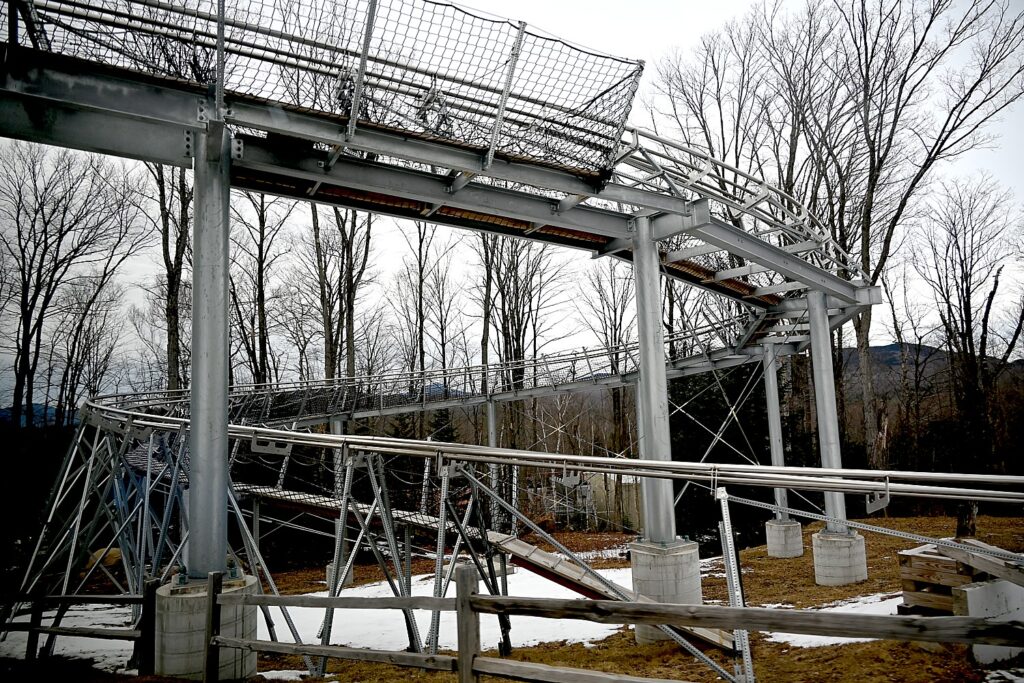
A portion of the Cliffside Coaster track at Mt. Van Hoevenberg, the longest in North America © Karen Rubin/goingplacesfarandnear.com

Here at Mt Van Hoevenberg you not only get to see the Olympic bobsled track but you can ride alongside on the Cliffside Coaster, the longest coaster in North America, which opened in 2020. As you ride up to the top, you hear the Olympic history of the track but once at the peak, you are in the driver’s seat and control the speed, navigating sharp corners, cliffside banks and long winding stretches (open daily in season but weather dependent; make reservations in advance; 31 Van Hoevenberg Way, Lake Placid, NY 12946, https://mtvanhoevenberg.com/todo/cliffside-coaster/).

Skiers, NonSkiers Treated to View at Whiteface Mountain

At Whiteface Mountain, the Legacy Passport enables even nonskiers to experience the 15 minute ride on the scenic, eight-passenger Cloudsplitter Gondola from the Main Base Lodge to the top of Little Whiteface to enjoy the gorgeous view of the Adirondacks that the skiers get. (Open daily. The Legacy Passport gets you 10% off at these locations: 10% off at Whiteface: 4610’ Grille, Castle Gift Shop, Legends Café, and Brookside Apparel.)
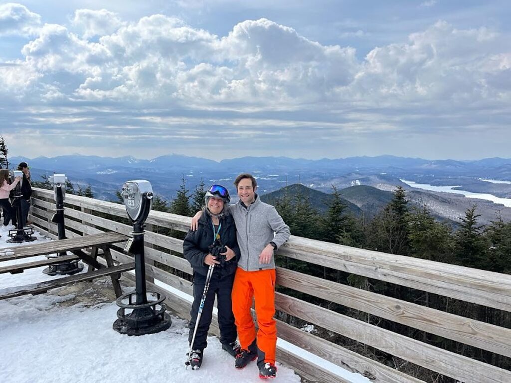
You don’t have to be a skier to ride the Cloudsplitter Gondola to the summit of Little Whiteface for the view, included on the Olympic Legacy Sites Passport competition © Karen Rubin/goingplacesfarandnear.com

Another activity included on the Legacy Sites Passport is to drive (or bike) the Veterans’ Memorial Highway that rises over 2,300 feet in five miles, with scenic stops along the way. An elevator or 15-minute hike takes you to the summit of New York’s fifth highest peak. (Open daily, but subject to daily weather conditions, visit Whiteface Conditions).  

Immersive New Museum at Olympic Center

The Olympic Center, in downtown Lake Placid, is really special. The Legacy Passport gives you admission to the Lake Placid Olympic Museum, which has one of the world’s largest collections of Winter Olympic memorabilia, and brilliantly tells the story of Lake Placid’s role in the development of winter sports and the Olympics.
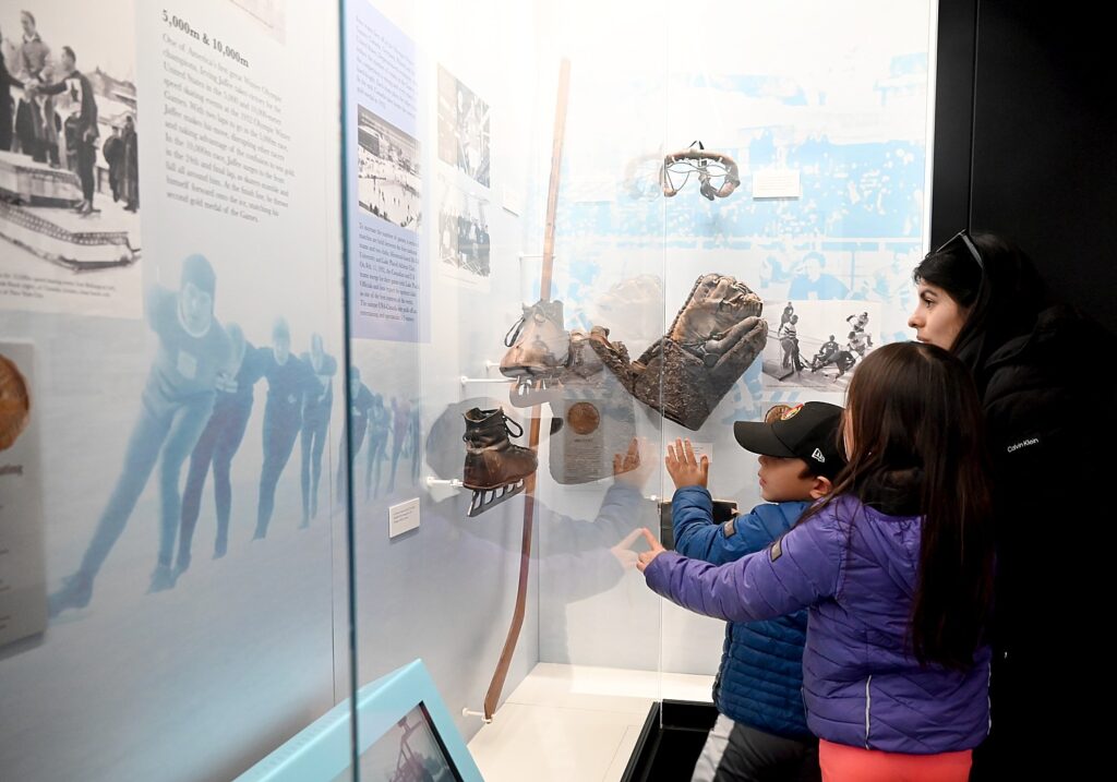
Lake Placid’s museum immerses you in its Olympics history and legacy © Karen Rubin/goingplacesfarandnear.com

The state-of-the-art museum, which only has been opened two years, features interactive and engaging displays, 3D visualizations, experiential learning exhibits, marvelous videos, and interesting and intriguing artifacts. It is especially inspiring to see the names of local Olympians, some who are multi-generational.
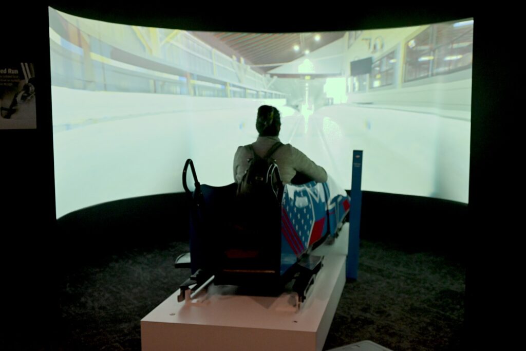
Speed down the Mt. Van Hoevenberg track in a bobsled in this virtual ride in Lake Placid’s Olympics Museum © Karen Rubin/goingplacesfarandnear.com

The 3D and interactive displays are really superb. In one, you sit in a real bobsled and virtually speed down the actual bobsled track (thrilling); you can see exactly what the ski jumper sees flying off the jump.

The climax is sitting in a screening room to watch a 12-minute video of the highlights of the 1980 “Miracle on Ice” when the USA hockey team beat the Soviet Union. (Each year, there is a1980 Miracle on Ice fantasy camp – where participants get to play with the actual members of the team.)

In the museum, you get to really immerse into the personal stories of the Olympians, especially those with connections to Lake Placid.
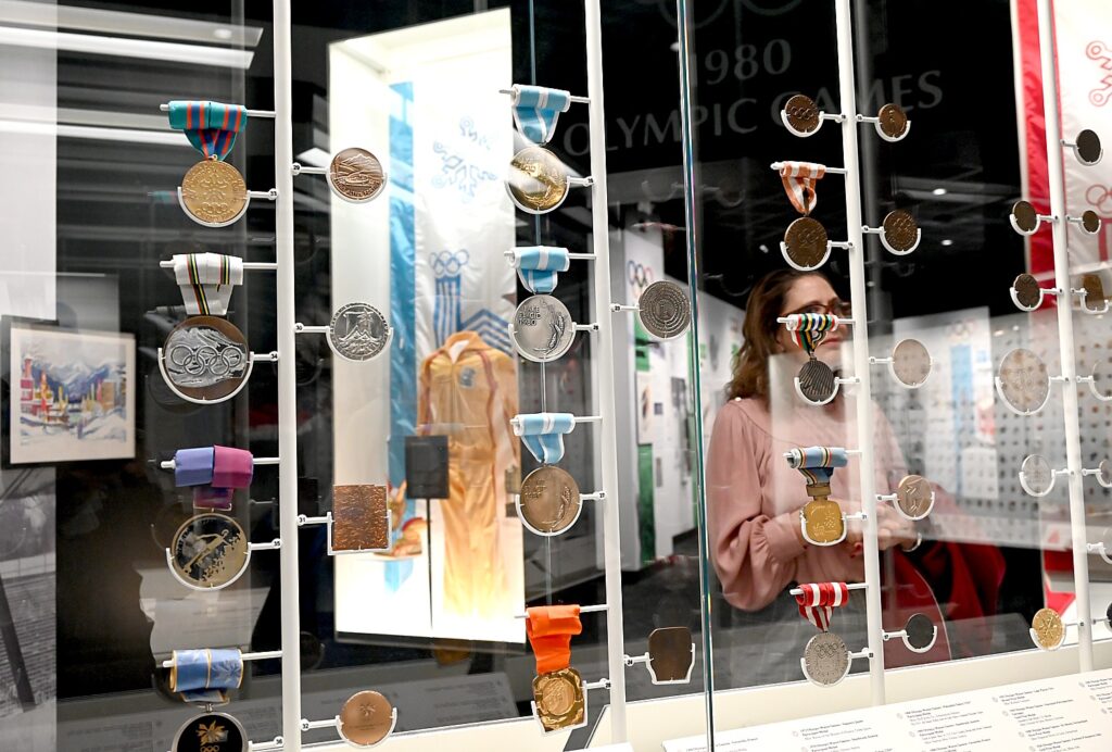
Lake Placid’s Olympics Museum has one of the largest collections of memorabilia, including medals, uniforms, torches, buttons © Karen Rubin/goingplacesfarandnear.com

You learn that it wasn’t just good fortune why Lake Placid hosted one of the first winter Olympics, in 1932. Lake Placid really began America’s love affair with winter sports.

The first “modern” Olympics was held in 1896, and by the early 1900s, a Norwegian man known as “Jack Rabbit” introduced alpine and Nordic skiing to the Lake Placid area. The Lake Placid Club was formed by the strongest advocates of winter sports.

The high jumping venue, originally known as Intervales, hosted  the first international ski jump competition here in 1921, drawing 3000 spectators  – more than the local population.

The first winter Olympics was held in 1924, and the first gold medal was actually awarded to Charles Jewtraw, a speed skater, from Lake Placid .

The first gold medal won at the Lake Placid games was won by Lake Placid local, Jack Shea for speed skating (he won two gold in 1932,and was instrumental in the games returning to Lake Placid in 1980). His son, Jim Shea was a 1964 Olympian cross country skier, and his grandson, Jim Shea, Jr., was the men’s skeleton champion aat Salt lake City in 2002 (Jack Shea was killed by a drunk driver just two weeks before).
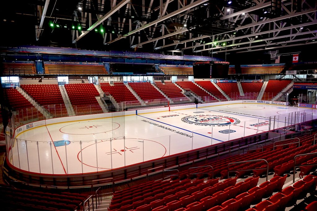
The Herb Brooks arena is where the 1980 “Miracle on Ice” wowed the nation and the world, as the USA defeated the Soviet Union © Karen Rubin/goingplacesfarandnear.com

You get to tour the famous ice arena, named for Herb Brooks, and the 1932 skating rink (really tiny seating area), and even go down to the locker room.

These historic skating rinks are open to the public for skating year-round, and we see some adorable kids starting their long journey to gold (open Tuesday – Saturday).

Little ones start their journey to gold on the skating arena built for the 1932 Olympics Union © Karen Rubin/goingplacesfarandnear.com

(The Olympic Center is open daily. The pass also provides 10% off at Olympic Center Roamers Café and Miracle Moments Store.)

Just across from the center is the Olympic speed skating oval, where Eric Heyden made history in 1980 for winning all five speed skating events. (He only agreed to one commercial endorsement, for Crest Toothpaste, to finance medical school and became an orthopedic surgeon.). In season, you, too, can skate on the Olympic oval well into the night (weather permitting.)

The Olympic Legacy Passport is $69/adult, $59 ages 19+, military and seniors and can be purchased at any of the venues (, https://lakeplacidlegacysites.com/legacysitespassport/). Lake Placid Legacy Sites, 518-523-1655, https://lakeplacidlegacysites.com/

Ski Whiteface
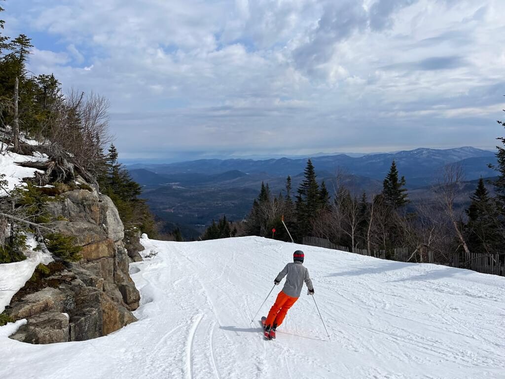
You can’t help but feel like an Olympian when you ski Whiteface Mountain © Laini Miranda/goingplacesfarandnear.com

It’s March – spring skiing – and David, Laini and Karen get the ultimate Olympic experience of skiing Whiteface Mountain – even if you are stuck on the green and blue trails. David and Laini, though, were able to tour much of the mountain, tackling the advanced trails, and loved the long runs and sweeping mountain views. With the spring melt already underway, the alpine creek rushed beneath our chairlift rides and the Ausable River at the base had a Galway-esque feel. The lookout atop the Cloudsplitter Gondola was a gorgeous rest stop for us skiers as well as Laini’s non-skiing parents, who were able to enjoy the view and then easily take the gondola down. We discovered the beautiful mid-mountain lodge on our last run – a great lunch spot with high vaulted ceilings and huge pictures windows.
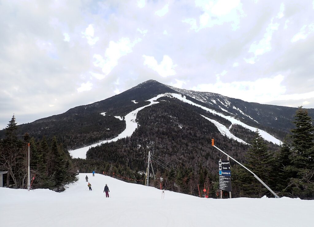
Even skiing the intermediate trails, you feel the Olympic spirit on Whiteface Mountain© Karen Rubin/goingplacesfarandnear.com

March, when we visit, is often one of snowiest and most spectacular months for outdoor winter recreation, but this year, snow was lacking and it also was the warmest since 1905, so we aren’t able to do several of the winter activities, like riding the toboggan chute onto Mirror Lake, cross-country skiing, skating on the Olympic oval, and snowshoeing the Mt Van Hoevenberg East Trail (a hiking trail in summer).

In summer, Whiteface Mountain offers disk golf, hiking, the scenic gondola, and plans to resume mountain biking.

Food & Lodging

After our visit to the Olympic Center, we stroll Lake Placid’s charming main street and enjoy the shops, cafes, bistros.
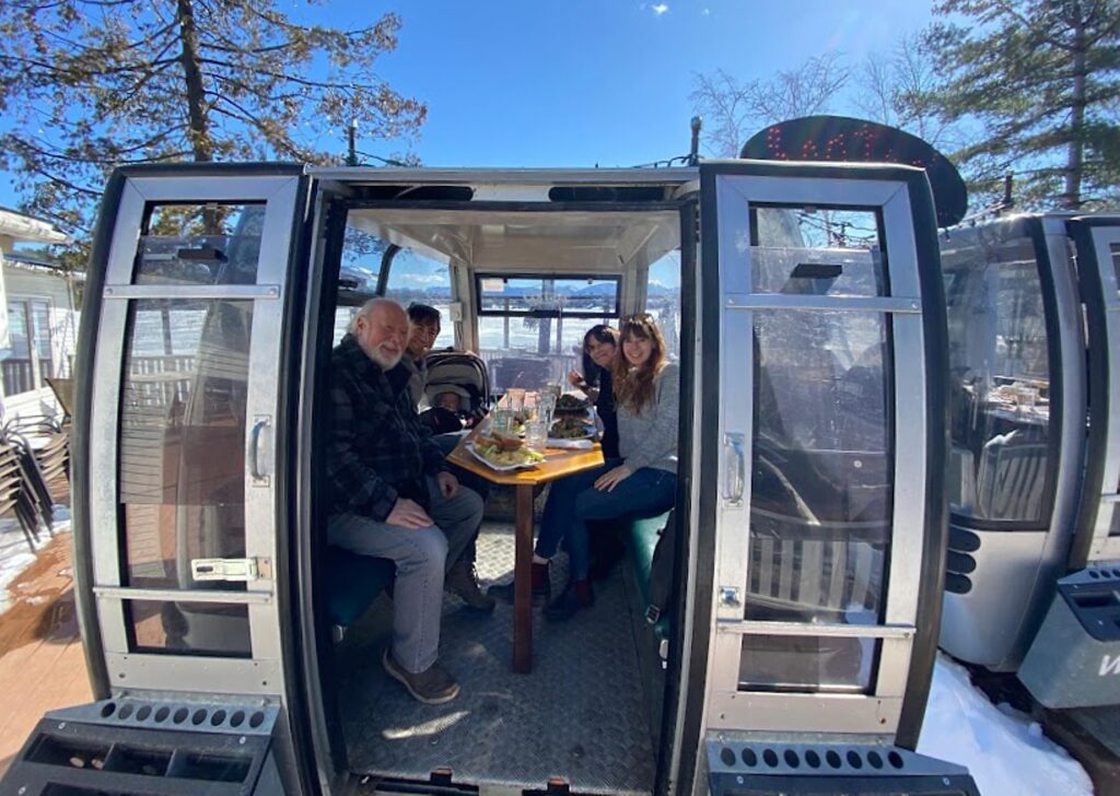
Lunching in a gondola at the Cottage at Mirror Lake Inn © Dave E. Leiberman/goingplacesfarandnear.com

We stop for lunch at The Cottage at Mirror Lake Inn, (17 Mirror Lake Dr.) enjoying the meal in one of the actual ski gondolas overlooking Mirror Lake with spectacular views out to the Great Range of the Adirondack High Peaks (17 Mirror Lake Dr., 518-302-3045, mirrorlakeinn.com/dining/the-cottage)

Each night of our stay in Lake Placid, we had a marvelous cocktail/dining experience (so many to choose from and return to Lake Placid for):

Big Slide Brewery, where you eat beside the giant barrels of the brewery in a comfortable dining room and semi-open kitchen. Not your typical pub grub, its menu has pizaazz – snacks like marcona almonds in hop oil and thyme, Cake Placid pretzel nuggets with beer cheese, and tater tot poutine; sandwiches like a shaved steak sandwich with thinly-sliced ribeye, Sugarhouse Creamery Dutch Knuckle cheese, sautéed onions and Mushrooms and Horseradish Aioli; Tomahawk Pork Chop or chicken fried chicken over smoked ham grits; and pizzas cooked in a 700 degree brick oven. Tomahawk Pork Chop or chicken fried chicken over smoked ham grits  (5686 Cascade Road, just over a mile from downtown, bigslidebrewery.com, 518) 523-7844.
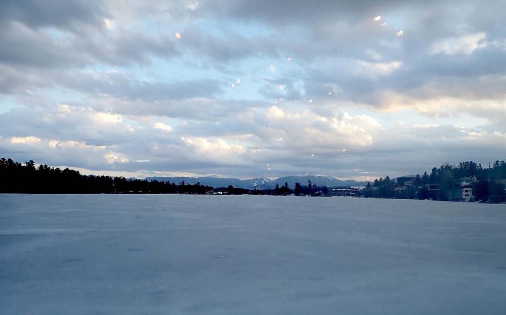
The view over Mirror Lake to the Great Range of the Adirondack High Peaks from The Cottage at Mirror Lake Inn at sundown © Karen Rubin/goingplacesfarandnear.com

Smoke Signals, also overlooking Mirror Lake (a gorgeous dining room and there is a patio overlooking the lake for outside dining), offering classic BBQ with some innovative twists, (2489 Main St.,  518-523-2271, www.smokesignalsq.com).

We loved our culinary experience at Cafe Rustica, a quaint, old-fashioned (traditional) Italian restaurant (even the music was a throw-back) serving fabulous Northern Italian cuisine, like the Ravioli Carbonara (fresh wild mushroom ravioli, black pepper, organic egg, pancetta, baby peas, parmesan); Cavatelli Bolognese (rustica Bolognese sauce, cavatelli pasta, parmesan, rosemary oil); chicken Mediterraneo (kalamata olive, heart of plan, tomato, lemon, whitewine, capers, pepperoncini, linguini) (1936 Saranac Ave, Lake Placid, NY 12946, 518-523-7511, www.rusticalp.com)

East Wind Lake Placid Hotel
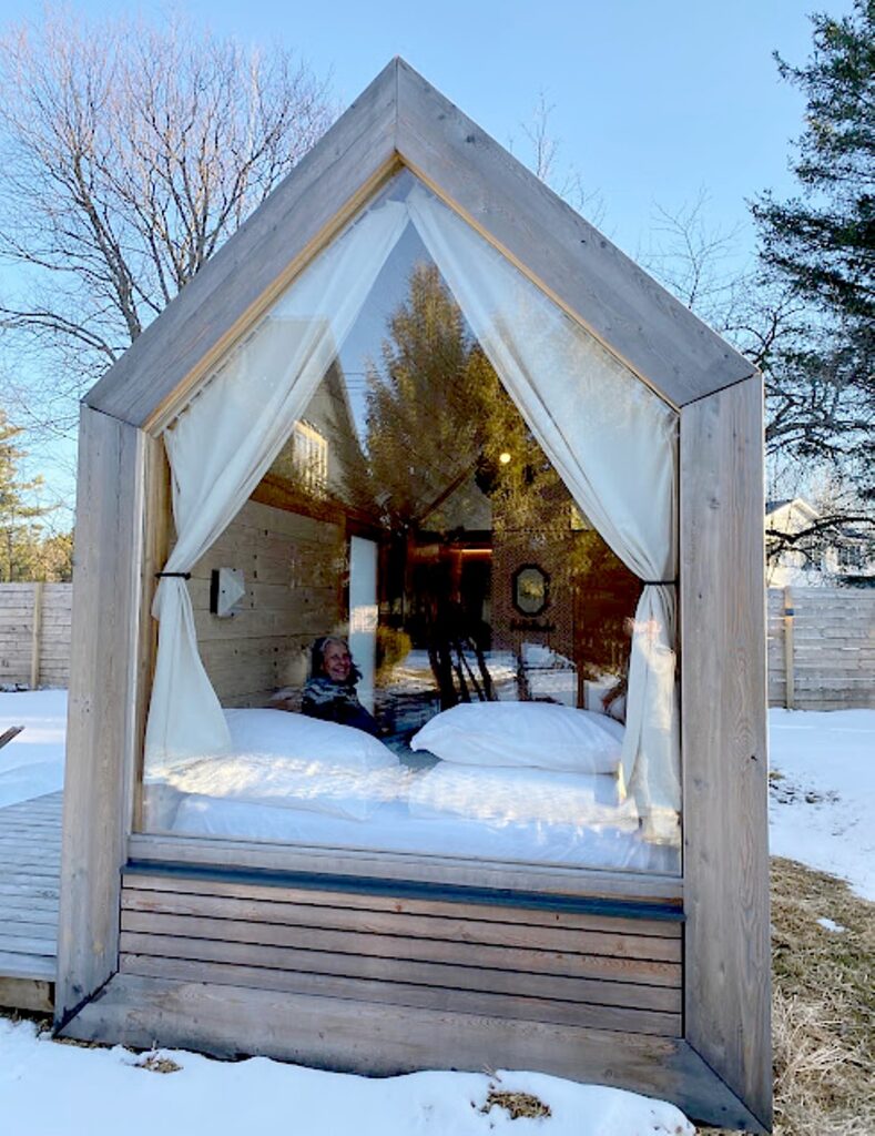
Settling in to my lushna at East Wind Lake Placid Hotel © Dave E. Leiberman/goingplacesfarandnear.com

The East Wind Lake Placid Hotel, just a short distance off of Main Street, Lake Placid, proved perfect for our multi-generational getaway – like a small community of lodges and lushnas for a total of 29 units, each homey with dashes of luxury and high-style. My lushna (like a tiny house) was just the width of the (extremely comfortable) queen bed, and had all the comforts of home – refrigerator, coffee maker, bathroom, remote-controlled A/C. David and Laini and baby were comfortable in a spacious room in the house; grandparents Diane and Barry in the lodge.
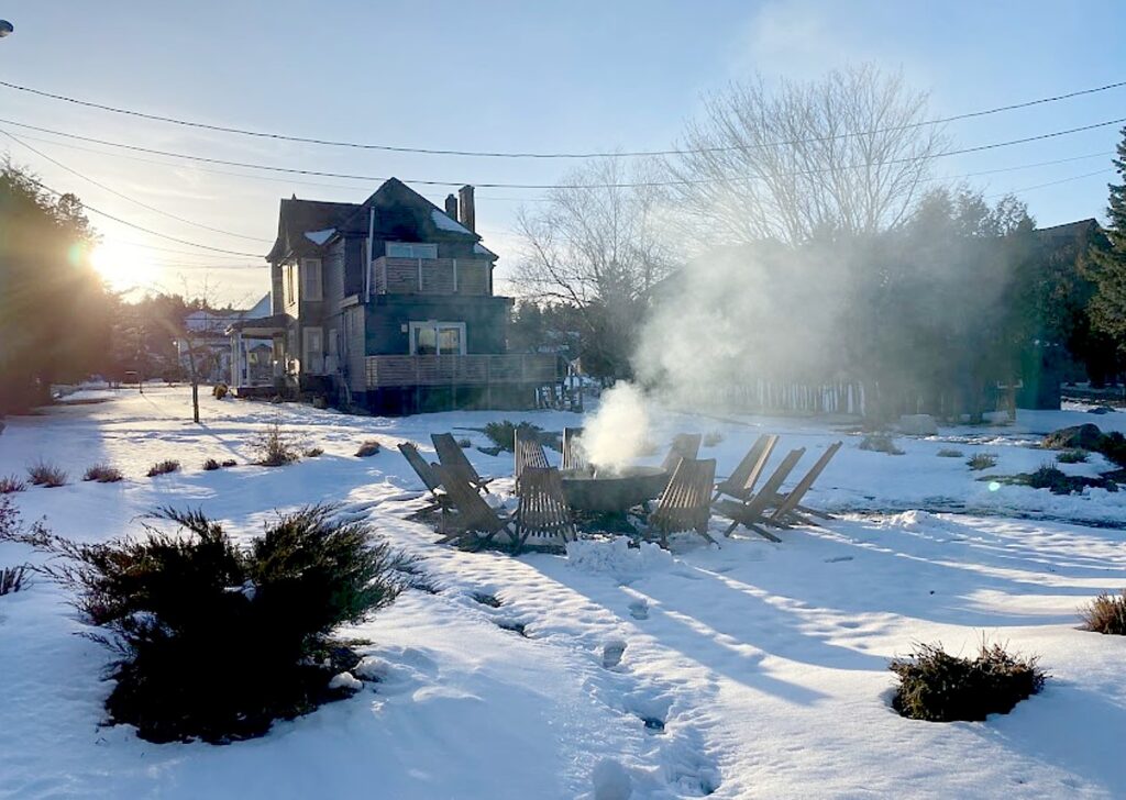
East Wind Lake Placid Hotel offers a variety of accommodations and lovely gathering places © Dave E. Leiberman/goingplacesfarandnear.com

There are gathering areas – fire pits ringed with Adirondack chairs, a gorgeous reception room (open 24 hours, where coffee, tea and fruit are laid out, you can order breakfast, and there are cocktails and drinks at the bar); a lovely library/salon in one of the buildings (great for taking a conference call).
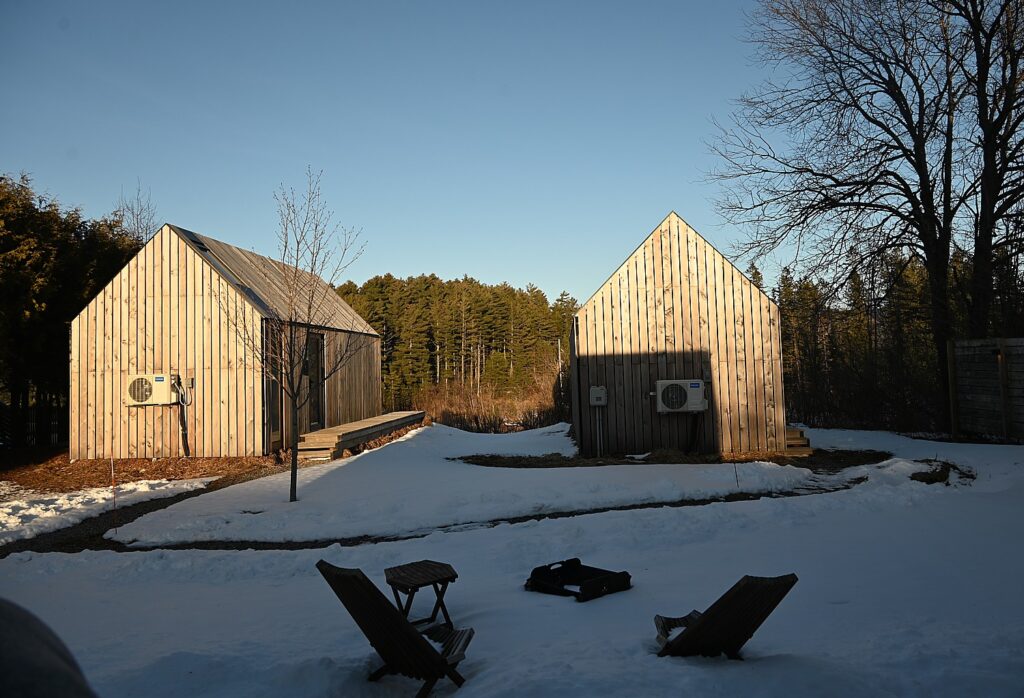
East Wind Lake Placid Hotel offers a variety of accommodations and lovely gathering places © Karen Rubin/goingplacesfarandnear.com

Eastwind Lake Placid, 6048 Sentinel Road, Lake Placid,518-837-1882, https://www.eastwindhotels.com/lake-placid-overview.

For a luxury, resort-style experience: the historic Mirror Lake Inn Resort & Spa (77 Mirror Lake Dr, Lake Placid, NY 12946, 518-523-2544, mirrorlakeinn.com; and High Peaks Resort (2384 Saranac Avenue, Lake Placid, NY 12946, 800-755-5598, highpeaksresort.com).
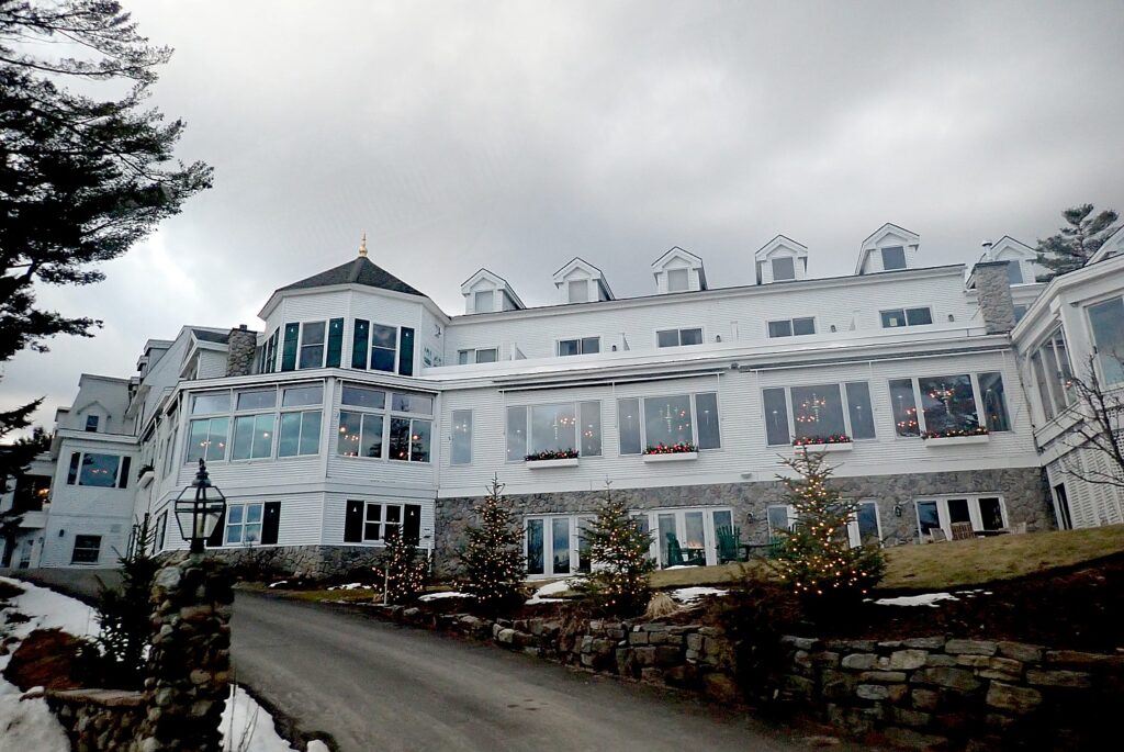
Mirror Lake Inn Resort & Spa, Lake Placid © Karen Rubin/goingplacesfarandnear.com

High Falls Gorge

Definitely make time to visit High Falls Gorge, a 22-acre nature park, just a short drive beyond the entrance to Whiteface ski area. It is a 30-minute walk – about a mile – hugging the rockface, where you can go out onto overlooks and bridges and be very close to the series of cascading waterfalls formed by the Ausable River as it drops 115 feet. There is also a trail accessible for strollers or wheelchairs. 
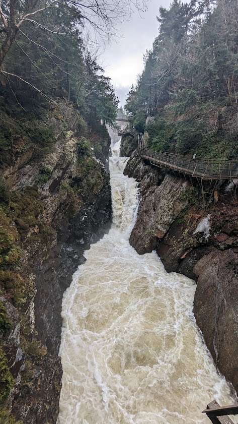
High Falls Gorge offers an exciting one-mile walk along the cascading waterfalls of the Ausable River © Karen Rubin/goingplacesfarandnear.com

Some of the oldest rocks in the world are here – you can touch an Anorthosite boulder 1.5 billion years old (Anorthosite, the base rock for the Adirondacks, is the same rock found on the moon). In season, High Falls Gorge also offers rock climbing, tubing and white water rafting, as well as trails through the forest. (4761 NYS Route 86, Wilmington, NY 12997 518-946-2278, https://highfallsgorge.com/)

More travel planning information:

Lake Placid  800-44PLACID, www.lakeplacid.com

Whiteface Mountain Region Visitors Bureau, 518-523-1655, whitefaceregion.com

Visit Adirondacks.com, https://visitadirondacks.com/regions/lake-placid

_______________________

© 2024 Travel Features Syndicate, a division of Workstyles, Inc. All rights reserved. Visit goingplacesfarandnear.com and travelwritersmagazine.com/TravelFeaturesSyndicate/. Blogging at goingplacesnearandfar.wordpress.com and moralcompasstravel.info. Visit instagram.com/going_places_far_and_near and instagram.com/bigbackpacktraveler/ Send comments or questions to [email protected]. Tweet @TravelFeatures. ‘Like’ us at facebook.com/NewsPhotoFeatures 
California Pacific Highway 1 Roadtrip Finishes in Redondo Beach

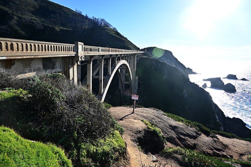
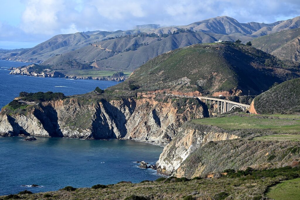
The Pacific Highway 1 brings you to spectacular sights of Big Sur, with a view of the Bixby Creek Bridge © Karen Rubin/goingplacesfarandnear.com

By Karen Rubin with Eric Leiberman, Travel Features Syndicate, goingplacesfarandnear.com

Our adventure down California’s famous (and fragile) Pacific Highway 1 – rightly considered one of the most scenic byways in the country – which began in San Francisco comes to an end in Redondo Beach.

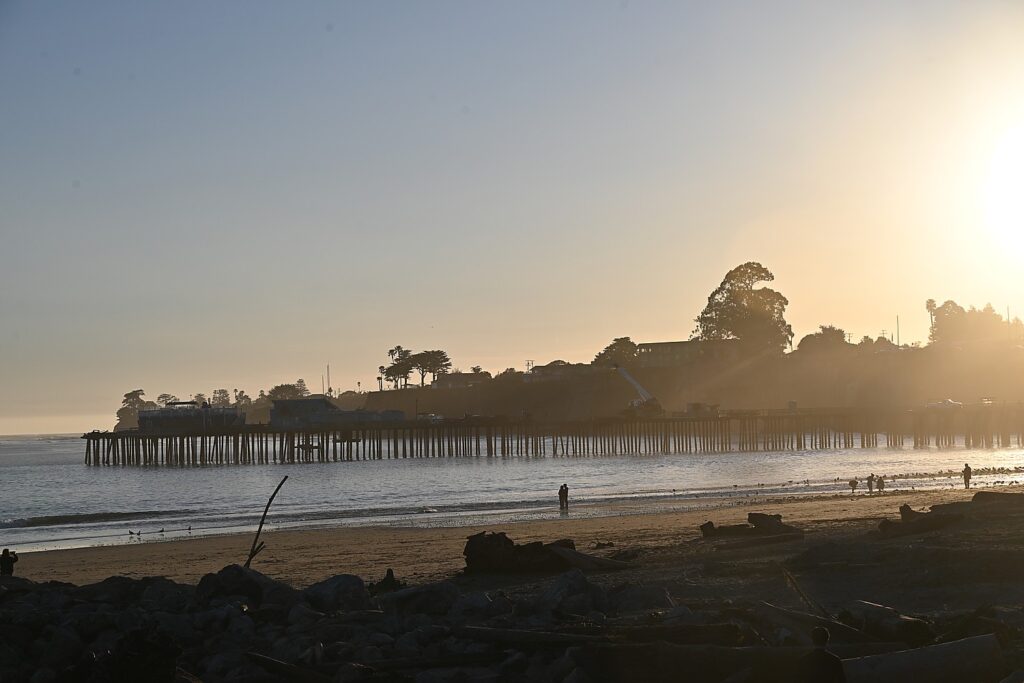
You don’t have to go far outside of San Francisco for the incredible coastal scenes to come into view, as well as interesting, funky and fun beachtowns, like Santa Cruz (with its Coney-Island-ish amusement park on the beach) and Capitola (really scenic, where we stop to stroll), before coming into Monterey for our first night.

You don’t have to drive far out of San Francisco to see spectacular views along California’s Pacific Highway 1 © Karen Rubin/goingplacesfarandnear.com
Driving the famous (and fragile) California’s Pacific Highway 1, one of the most scenic byways in the country You don’t have to drive far out of San Francisco to see spectacular views along California’s Pacific Highway 1 © Karen Rubin/goingplacesfarandnear.com
 
Capitola, along Pacific Highway 1 © Karen Rubin/goingplacesfarandnear.com

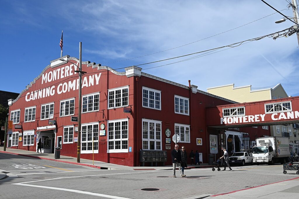
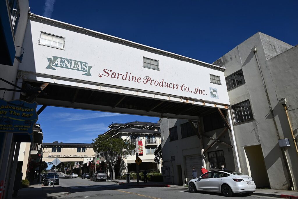
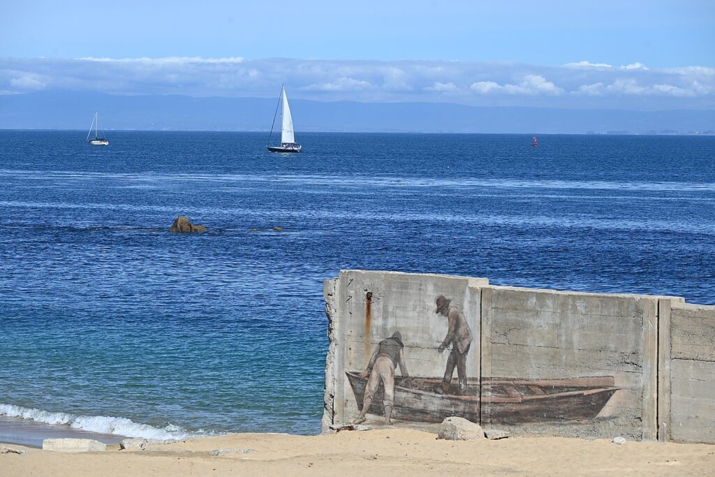
Monterey was made famous by John Steinbeck’s “Cannery Row” and now with a world renowned Aquarium; I love taking the self-guided history walk and visiting the history museum and Customs House).

Monterey, made famous in John Steinbeck’s “Cannery Row” © Karen Rubin/goingplacesfarandnear.com

We follow the Pacific Highway 1 as it hugs the cliffs that get ever more dramatic as we come into Big Sur. We pull over frequently to take in those breathtaking views that look like the edge of the Continent just fell into the ocean.

The spectacular view from the pull-off at Bixby Creek Bridge on Pacific Highway 1 © Karen Rubin/goingplacesfarandnear.com
Bixby Creek Bridge on Pacific Highway 1 © Karen Rubin/goingplacesfarandnear.com

We come the Bixby Creek Bridge. Big Sur’s answer to the Golden Gate Bridge, it is a incredibly dramatic sight that actually competes for its man-made achievement with the spectacular scenes that nature has made. Completed in 1932 for $200,000 (a bargain at $4.6 million in 2024 dollars), the concrete span is one of the highest bridges of its kind in the world, soaring 260 feet from the steep canyon carved by Bixby Creek. It is awesome to contemplate how this structure was even constructed and to learn that the bridge was completed before the road. There are a few viewing spots you can pull off before the bridge going south (and a short hike you can take for closer viewing) and another about a mile south looking back at it.

Bixby Creek Bridge on Pacific Highway 1 © Karen Rubin/goingplacesfarandnear.com

We get another, completely different perspective of the Bixby Creek bridge on the way back up to Monterey (the route to go south to Cambria because the Pacific Highway is closed off in sections), from the other side of the road.

Not much further, we see the Big Creek Bridge, which looks similar, but is not as dramatic in its setting.

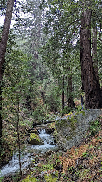
Hiking Tan BarkTrail in the Julia Pfeiffer state park © Karen Rubin/goingplacesfarandnear.com
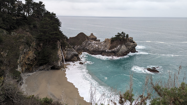
The scenic walk to Partington Cove and the McWay Falls © Karen Rubin/goingplacesfarandnear.com

We spend a couple of days hiking and exploring in the Big Sur (thoroughly enjoyed hiking the Tan Bark Trail in the Julia Pfeiffer state park and then, across the road, a fantastic walk to McWay Falls, an 80 ft waterfall flowing straight into the ocean) in Partington Cove, overnighting at the utterly enchanting, historic Deetjen’s Big Sur Inn (www.deejens.org, 831-667-2377), so we get to see an amazing sunset and hear the bellowing chorus of elephant seals at the Seal Beach overlook (I wonder to myself whether they purposely form a chorus or are they competing for attention.) We drive almost as far south as we can on the Pacific Highway before it is closed to traffic.

Our rustic, cozy lodge at the historic Deetjen’s Big Sur Inn © Karen Rubin/goingplacesfarandnear.com
The restaurant at the historic Deetjen’s Big Sur Inn © Karen Rubin/goingplacesfarandnear.com

To continue south, we have to backtrack to Monterey, then drive inland and three hours south on Highway 101 to come into Cambria, where we thrill to see the spectacular Hearst Castle, the elephant seal rookery at Piedras Blancas, Moonstone Beach and Ragged Point (at the southern tip of Big Sur).

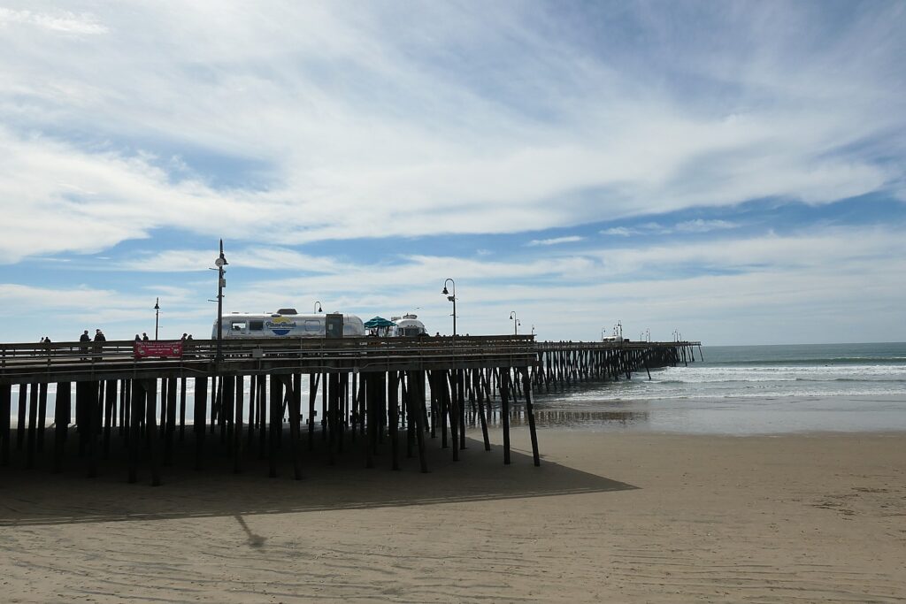
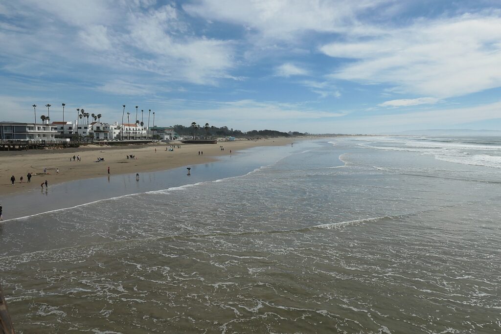
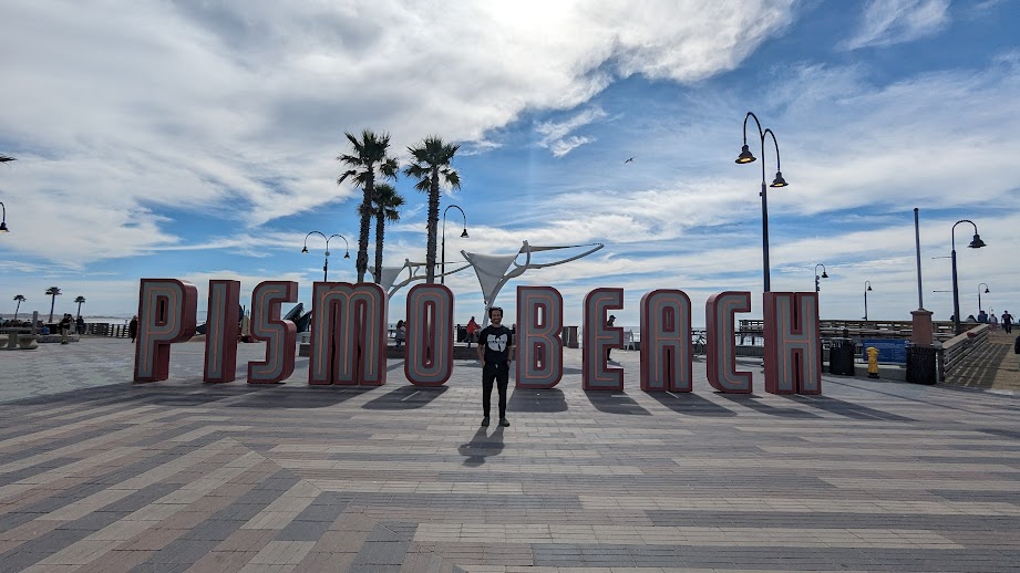
Pismo Beach, one of the funky beachtowns along the Pacific Highway 1 © Karen Rubin/goingplacesfarandnear.com

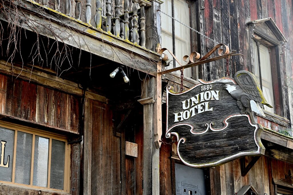
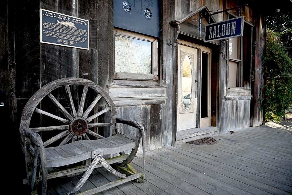
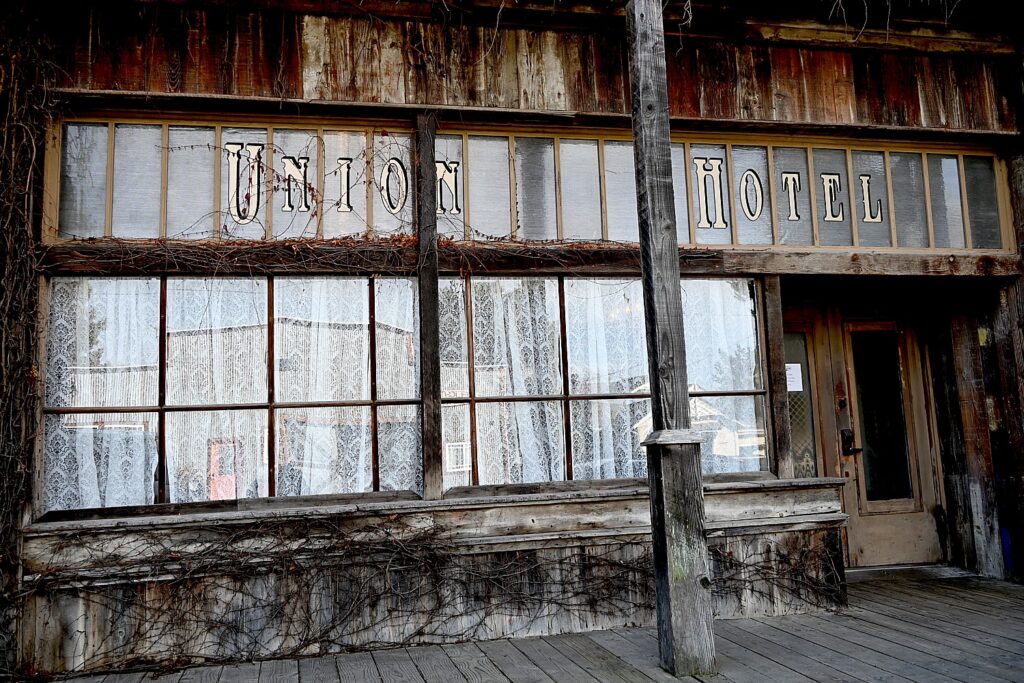
After Cambria, we follow the Highway along the coast – stopping in fun beachtowns including Morro Bay, Cayucos (which is on the Whale Trail), Pismo Beach (retro 1950s/1960s vibe, vintage Airstreams on the pier that serves as snack bar and visitors center), before slipping back inland. Here, we drive through California’s rich farmland and discover some astonishing places: Los Alamos (not the New Mexico atomic testing place, but this old-timey, 1880s town that has a Michelin-rated restaurant, a sensational saloon/hotel that looks like a movie set for a Western that gives you this overall surreal sensation of not knowing where or when you are).

The 1880 Union Hotel, Los Alamos,California  © Karen Rubin/goingplacesfarandnear.com
The 1880 Union Hotel, Los Alamos “On this site, the original 1880 Union Hotel served as office and Wells, Fargo & Company’s stagecoach stop. It was destroyed by fire in 1893, reconstructed and restored in 1915, service stagecoach and early railroad passengers… It currently is a bed & breakfast and dining establishing.” Once astonishing is to realize that the building is still actually in use – it makes you smile, as if you are in on the joke. © Karen Rubin/goingplacesfarandnear.com
The 1880 Union Hotel, Los Alamos,California  © Karen Rubin/goingplacesfarandnear.com

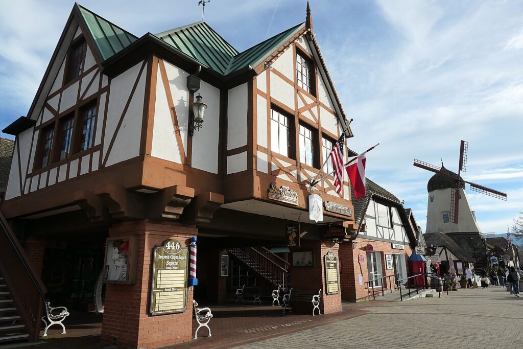
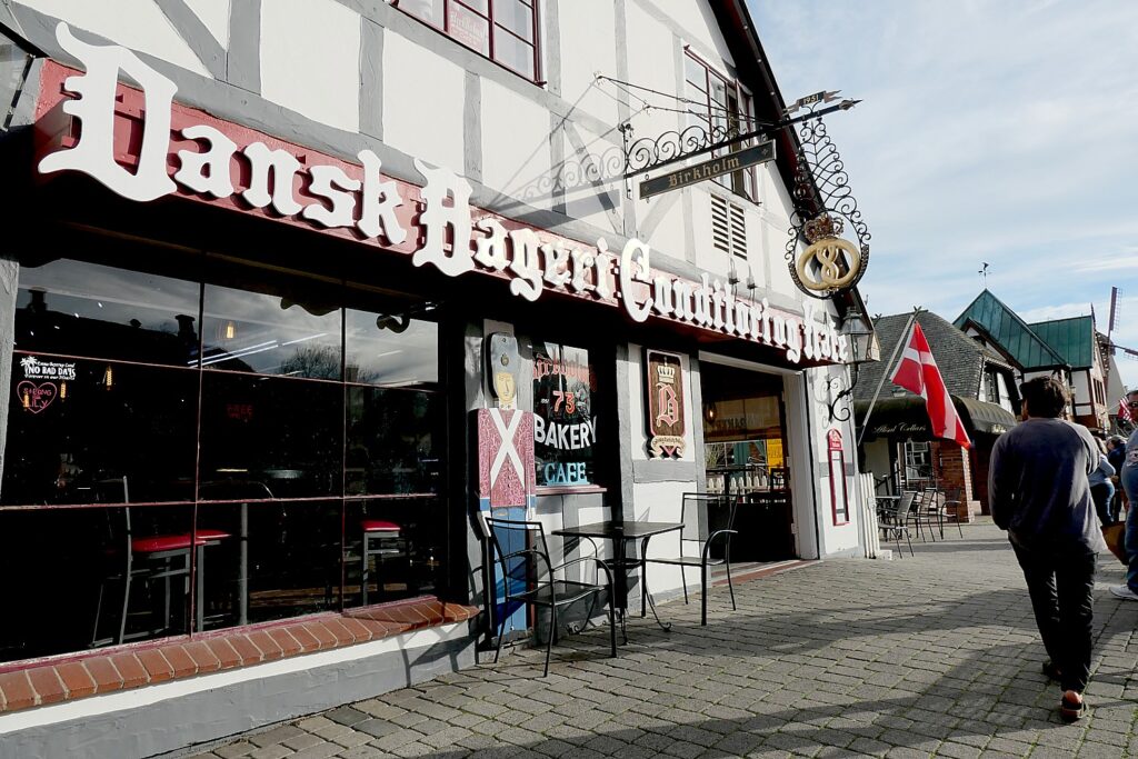
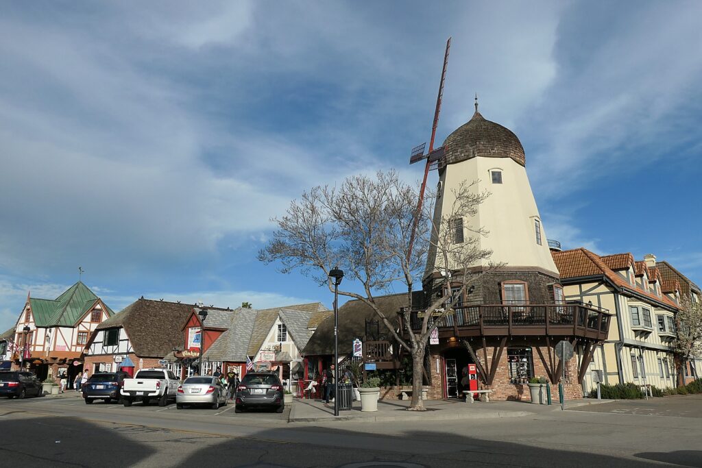
We continue on to Solvang in the Santa Ynez Valley, another surreal experience that makes you think you have suddenly been transported to Denmark (too weird after the Wild West vibe of Los Alamos and the ‘50s beach vibe of Pismo Beach – the town was founded in 1911 by three Danish immigrants, and somehow, have managed to keep the entire town architecturally and culturally Danish).

Stopping into Solvang feels like you stepped into a Danish village Bridge © Karen Rubin/goingplacesfarandnear.com
 
Stopping into Solvang feels like you stepped into a Danish village Bridge © Karen Rubin/goingplacesfarandnear.com
 
Stopping into Solvang feels like you stepped into a Danish village Bridge © Karen Rubin/goingplacesfarandnear.com
 

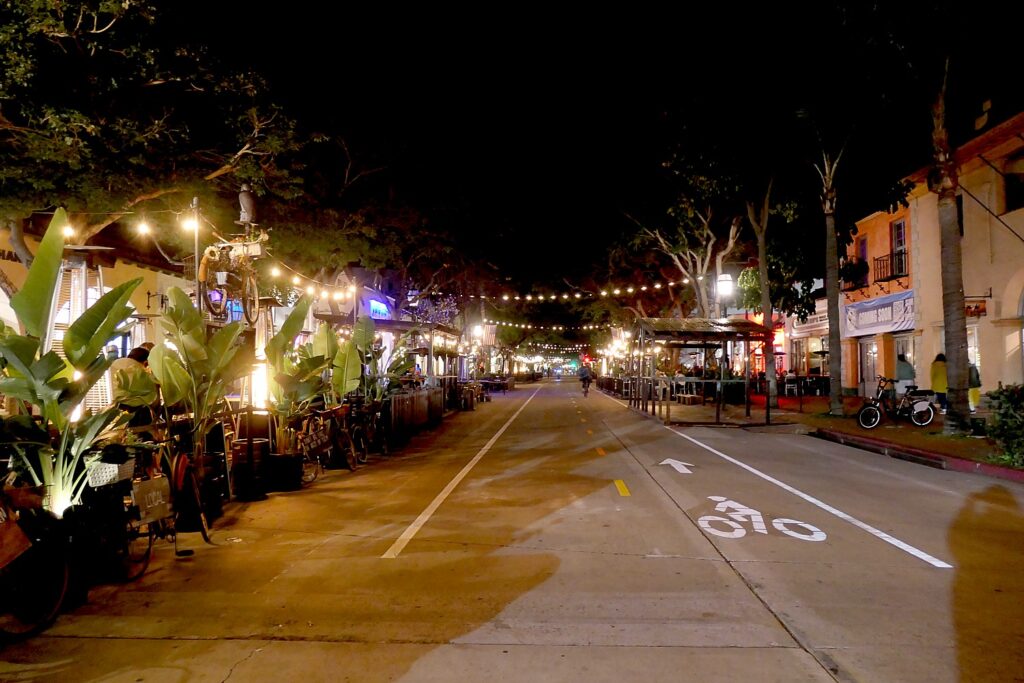
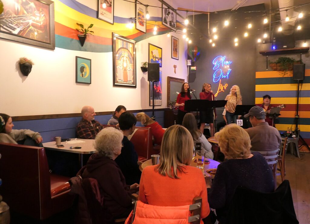
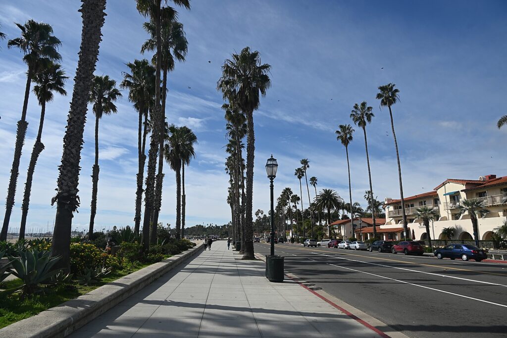
Then going back onto the coastal highway to stop at Santa Barbara which has fantastic nightlife – restaurants, music venues – they close down the main street for pedestrians and the music just spills into the street. We pass a movie theater where the Santa Barbara International Film Festival is underway, and find a live Beatles tribute band even in the tiny vegetarian restaurant we happen into, then, on the walk back, wander into a pub where the jazz is sensational, and a brewery featuring a hometown-rock band-made-good. In the morning, we find the festive recreation path along the beach,before continuing on to our final stop on our Pacific Highway roadtrip, Redondo Beach.

Santa Barbara on the Pacific Highway 1 has sensational nightlife © Karen Rubin/goingplacesfarandnear.com
The beachside recreational path in Santa Barbara on the Pacific Highway 1 © Karen Rubin/goingplacesfarandnear.com

Sonesta Redondo Beach & Marina

Redondo Beach is this laid back beach town – a place where (I suspect) they get more vacation home/condo owners from Los Angeles than transient visitors, so it feels like a community.

The Sonesta Redondo Beach & Marina, a casual yet sophisticated city-style resort hotel © Karen Rubin/goingplacesfarandnear.com

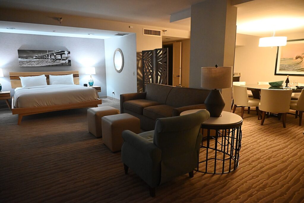
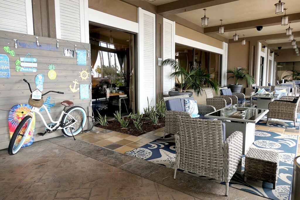
Our base is the Sonesta Redondo Beach & Marina, a casual yet sophisticated city-style resort hotel decorated in beach-y colors and motif, decorated with stunning photographs of nature and sealife – as comfortable for a corporate retreat or wedding as for a weekend beach getaway.

We arrive at the Sonesta Redondo Beach & Marina in the night and flop down in a stunning and spacious suite, then go to explore Frenchman’s Wharf across the boulevard from the resort.

A suite at the Sonesta Redondo Beach & Marina © Karen Rubin/goingplacesfarandnear.com

Sonesta Redondo Beach & Marina is surrounded by views of the Pacific Ocean and the Palos Verdes Hills and 346 spacious guest rooms, 8 suites and a Presidential Suite. The vibe is coastal-chic, with custom hardwood finishes, fine furnishings, and colors that evoke the water and sand. Rooms have private balcony with views of the pool, marina and ocean. The rooms also equipped with in-room safe and mini refrigerator. Accessible rooms are available.

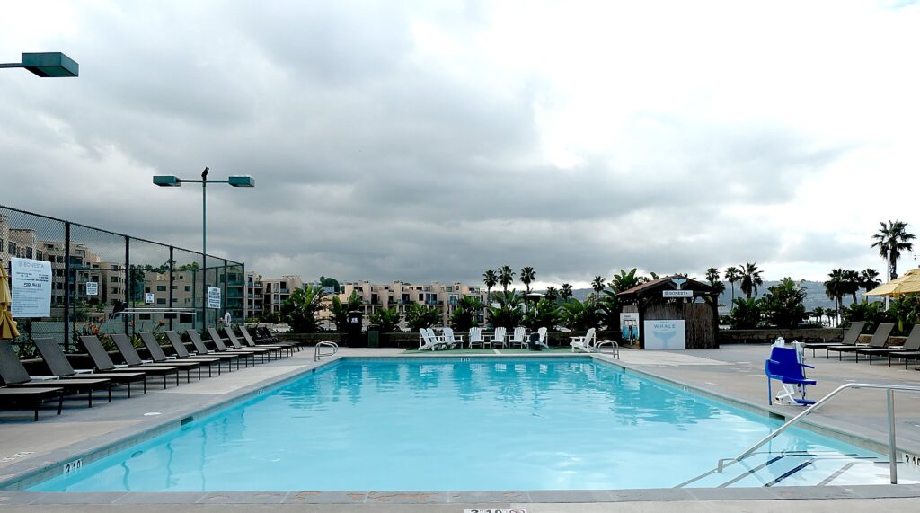
The outdoor pool at the Sonesta Redondo Beach & Marina © Karen Rubin/goingplacesfarandnear.com
The Sonesta Redondo Beach & Marina, a casual yet sophisticated city-style resort hotel © Karen Rubin/goingplacesfarandnear.com

A true resort, the Sonesta Redondo Beach offers a heated outdoor pool and tennis court (lights for night play, free to use; rackets and balls available) on the recreation deck, a fully-equipped fitness center (open 24 hours; there are plans to offer massage therapy), rental bikes ($20/two hours; $30/day, helmet and lock provided), and on-site dining at SOL (made-to-order omelet station for breakfast, Asian/American fusion for dinner) and the Harbor Bar & Bistro (local favorites and signature cocktails in a hip atmosphere, for lunch and dinner) and being a luxury hotel, in-room dining is also available. It also offers meeting rooms and a ballroom that can accommodate up to 500, making it one of the largest facilities in the area. It even has a laundry available for guest use. The resort also has its own garage for valet and self-parking.

This is the beach vacation portion of our Pacific Highway 1 trip that had taken us along the Big Sur cliffs and forests, the rocky beaches and coves of Cambria and extraordinary cultural, historical and natural attractions of Monterey and San Simeon.

Now we are level with the ocean – the surf pounding with dramatic waves that so entice surfers.

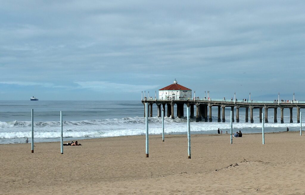
The Sonesta Redondo Beach & Marina is across the boulevard from the Pier, the beach and recreational path© Karen Rubin/goingplacesfarandnear.com
The Sonesta Redondo Beach & Marina is across the boulevard from the beach and recreational path © Karen Rubin/goingplacesfarandnear.com
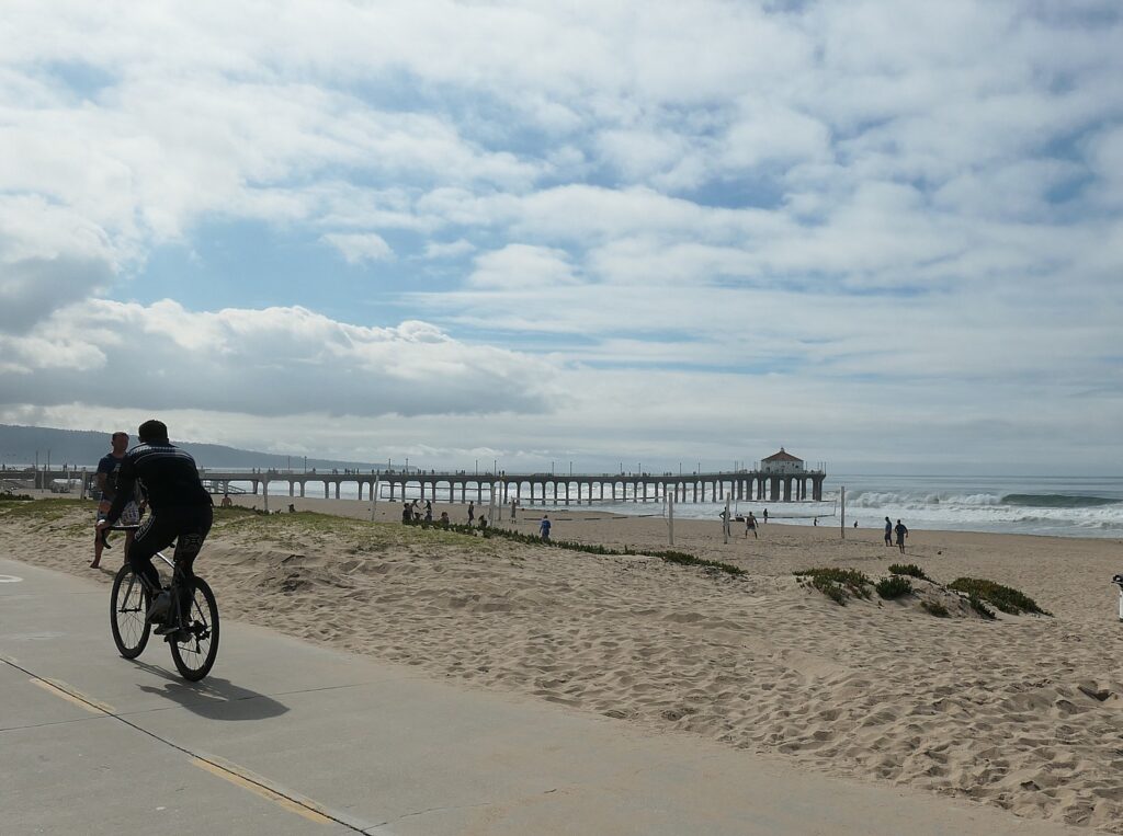
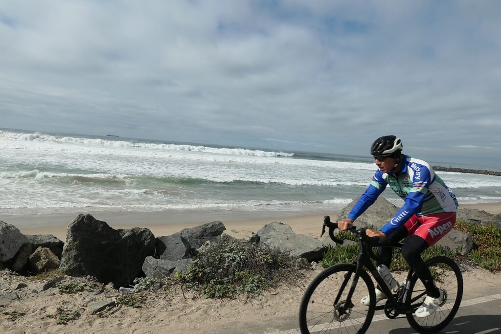
Biking the Redondo Beach recreational path © Karen Rubin/goingplacesfarandnear.com

The next morning, after breakfast in its SOL restaurant, I take out take out one of the resort’s rental bikes and bike the 12 miles along the recreational path along the beach up to Venice Beach – it is so colorful and fun and the ride is really beautiful with the beach on one side, and homes and shops on the other (excellent rest facilities along the way).

Nearby attractions include: Redondo Beach Pier and International Boardwalk, Seaside Lagoon, Riviera Village, Hermosa Beach, Del Amo Fashion Center, SoFi Stadium, Kia Forum, Intuit Dome, Dignity Health Sports Park, Manhattan Beach Village shopping Center, The Point on Pacific Coast Highway in El Segundo, Porsche Experience Center.

The Sonesta Redondo Beach & Marina is also just a short drive (like 30 minutes) to Los Angeles International Airport.

Sonesta Redondo Beach & Marina, 300 N. Harbor Drive, Redondo Beach, CA 90277, 310-318-8888, sonesta.com/redondobeach.

More trip planning help: https://highway1roadtrip.com/ and https://www.visitcalifornia.com/

See also:

CALIFORNIA PACIFIC HIGHWAY ROADTRIP: CAMBRIA IS ENCHANTING BASE TO VISIT HEARST’S ‘ENCHANTED HILL’ 

CAMBRIA IS GREAT BASE FOR CALIFORNIA PACIFIC HIGHWAY 1 ROADTRIP

_______________________

© 2024 Travel Features Syndicate, a division of Workstyles, Inc. All rights reserved. Visit goingplacesfarandnear.com and travelwritersmagazine.com/TravelFeaturesSyndicate/. Blogging at goingplacesnearandfar.wordpress.com and moralcompasstravel.info. Visit instagram.com/going_places_far_and_near and instagram.com/bigbackpacktraveler/ Send comments or questions to [email protected]. Tweet @TravelFeatures. ‘Like’ us at facebook.com/NewsPhotoFeatures 
Utah Adventure Day 6-7: House on Fire Among Highlights Hiking Amid Sacred Sites, Spirits of Bears Ears National Monument

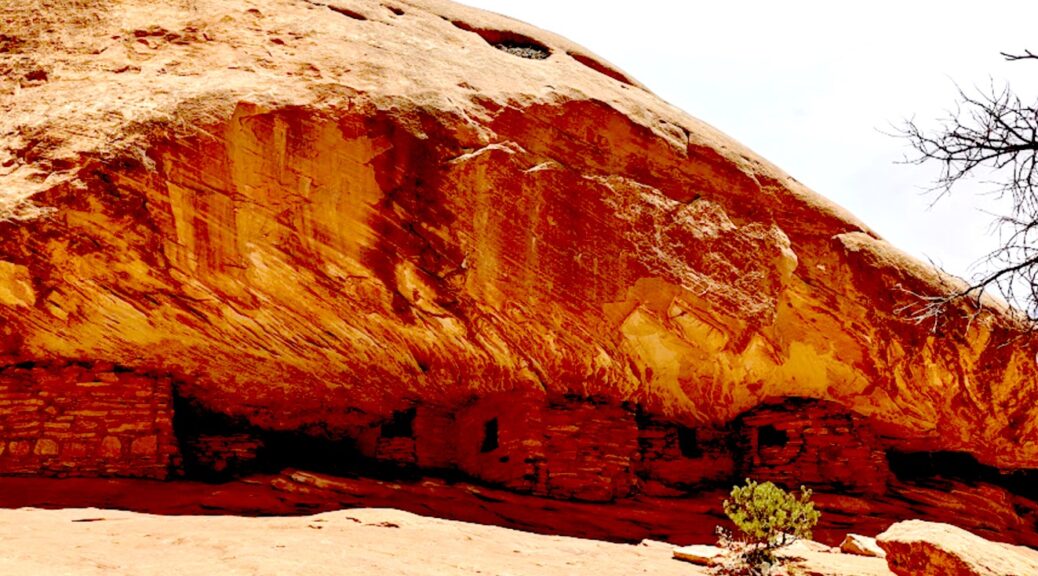
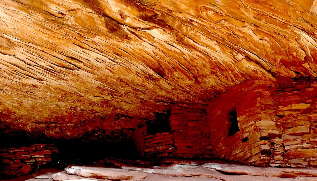
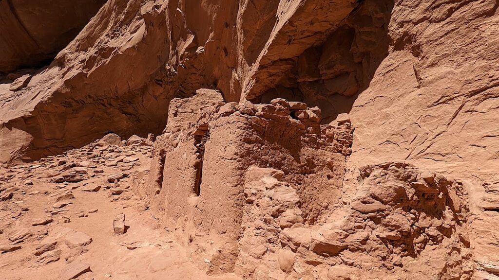
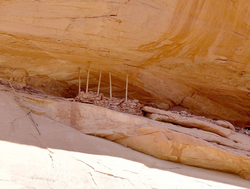
House on Fire is one of the most photographed – and dramatic – archeological sites in Bears Ears National Monument-Cedar Mesa © Karen Rubin/goingplacesfarandnear.com

By Karen Rubin, with Laini Miranda and Dave E. Leiberman

Travel Features Syndicate, goingplacesfarandnear.com

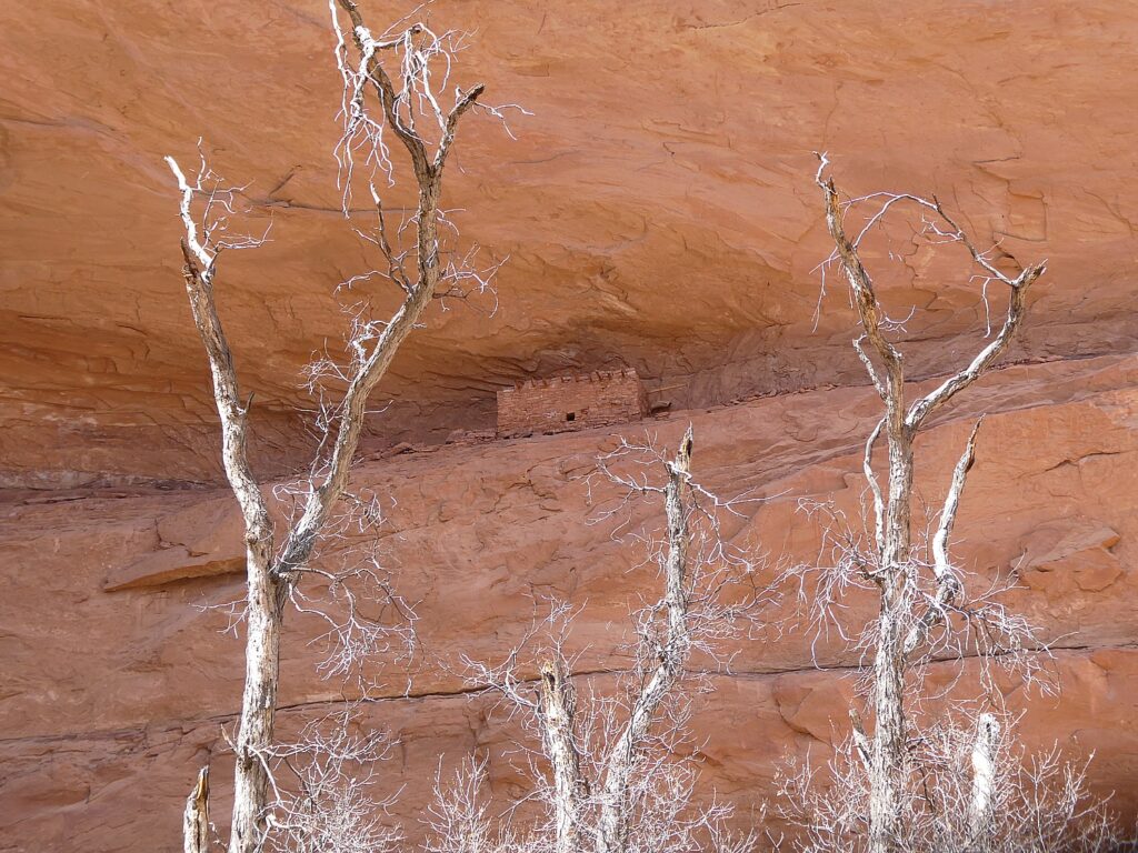
What is truly special about Bears Ears National Monument-Cedar Mesa – and what draws Laini back time and again, are the remnants, artifacts and structures left by Ancestral Puebloans – ancestors of the Hopi and Zuni – who inhabited these canyons and cliffs between 700 and 2500 years ago. Arrowheads and other artifacts dating back 10,000 years have also been found in this region. Some of these sites are at once accessible yet also feel remote – so you feel you are the first archaeologist to discover, though obviously that can’t be since the BLM Rangers have left laminated info packets in metal cases in some of the dwellings. Still, we can pretend.

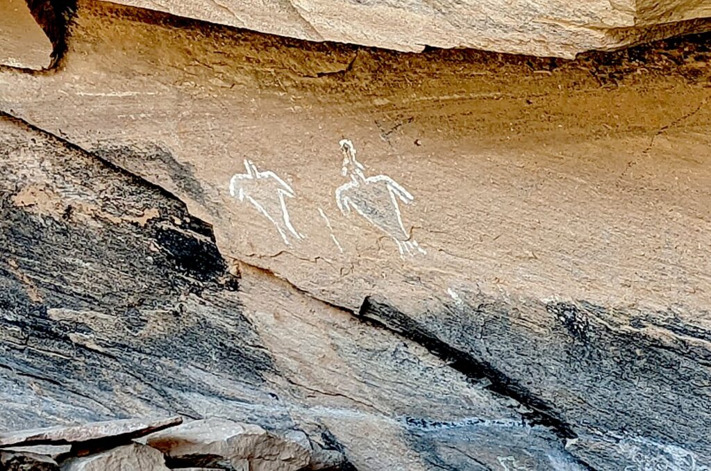
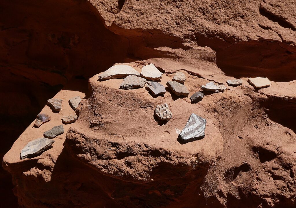
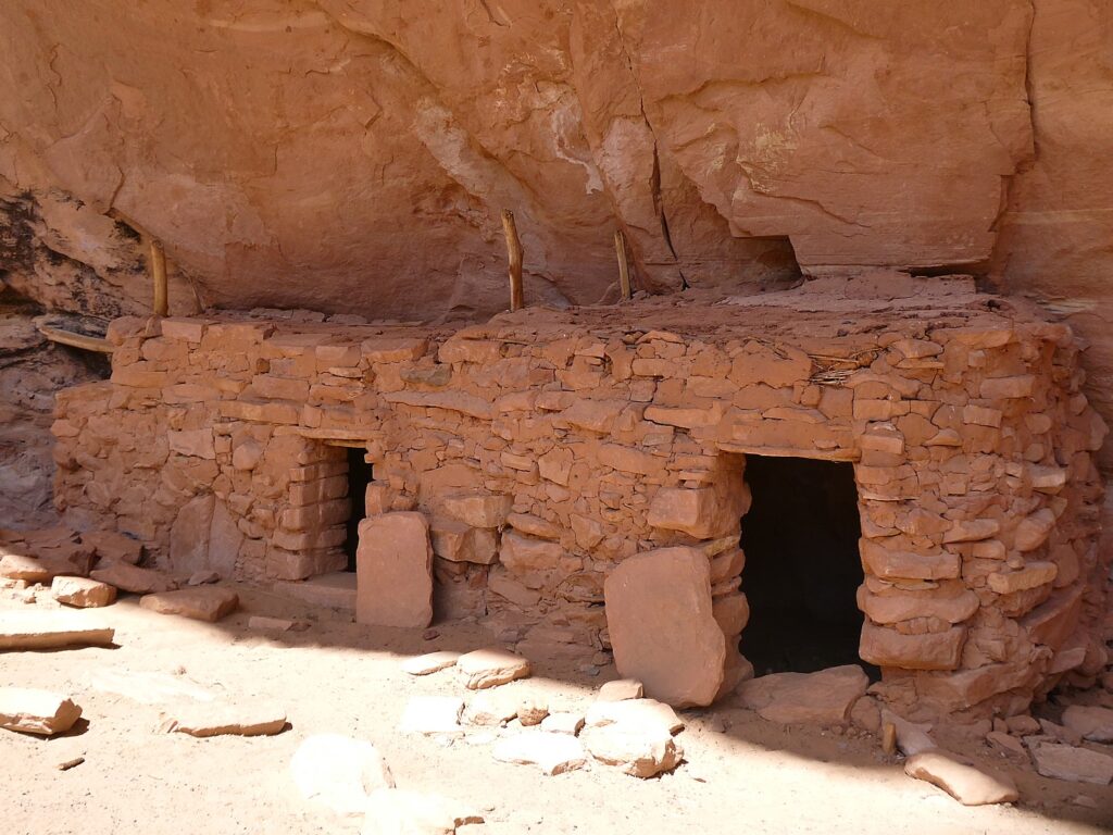
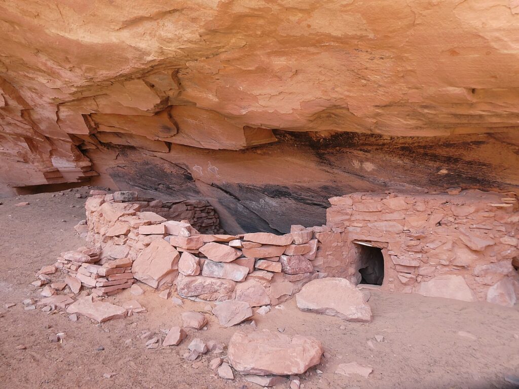
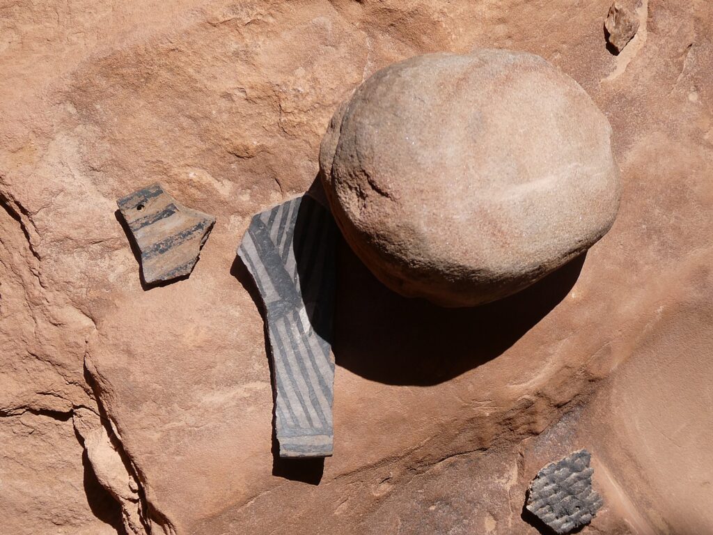
Our hikes bring us to these places that seem as if the occupants only recently vacated, leaving behind painted pottery shards, tiny corn husks, stone and bone tools, even their hand-prints, pictographs and petroglyphs that speak to us through time, as if to say, “We were here. We still are.”

Because these lands are sacred, all of us must be respectful of the dwellings and the archaeological artifacts that we come upon. And these sites truly feel sacred – precisely because of the artifacts, the pictographs and petroglyphs, you feel the presence of those who lived here. And because those of us who visit do show proper respect, these mud-and-stick (jacal) constructions delicate pictographs and petroglyphs etched into sandstone and  artifacts, though incredibly fragile, are here for us to discover, as if we are among the first.

It’s fairly miraculous these sites have survived Mother Nature, let alone humans.

After hiking to the Arch Canyon Ruins, Laini leads us to a trail to one of the outstanding highlights of the Bears Ears National Monument: the House on Fire, one of the most photographed (spectacular) sites in the region.

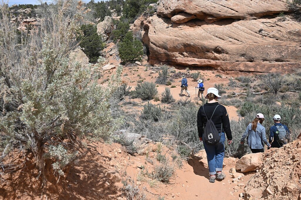
Hiking the Mule Canyon trail © Karen Rubin/goingplacesfarandnear.com

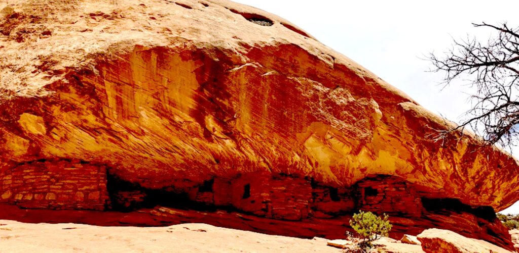
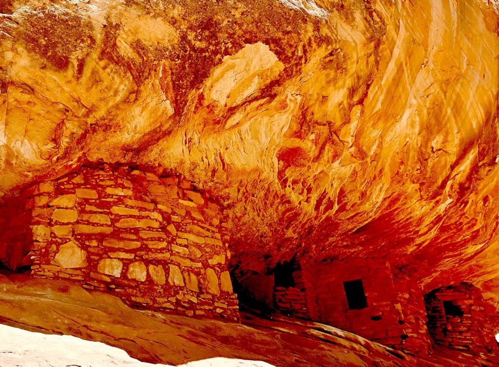
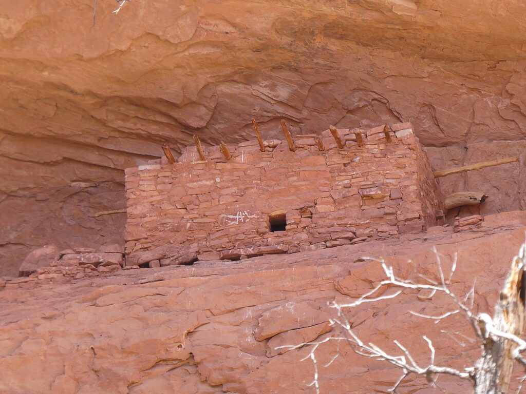
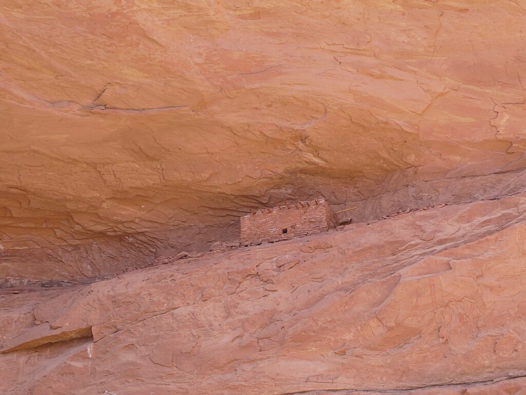
This site features five granaries built into overhanging Cedar Mesa Sandstone with a streaked pattern that, in the early morning light, resembles flames (photo tip: because these dwellings were built to be south-facing, the most dramatic light is around 10-11 am depending upon time of year). (https://bearsearsmonument.org/house-on-fire/)

House on Fire is one of the most photographed – and dramatic – archeological sites in Bears Ears National Monument-Cedar Mesa © Karen Rubin/goingplacesfarandnear.com

“As you take in the view, imagine how the ancient Puebloans lived here between 700 and 2,500 years ago,” Matcha writes at the visitutah.com site. “The granaries perched high in the cliffs stored corn, a main source of food. The Puebloans also ground Indian ricegrass into meal to make bread, and they ate abundant prickly pears. The ever-present yucca was invaluable, as its leaves were spun into fiber and woven into baskets, sandals, and bags, as well as ropes that are said to have helped reach some of the higher, less accessible granaries. The Native Americans used the root of the yucca for soap, and they roasted and ate the base of the plant.

House on Fire is one of the most photographed – and dramatic – archeological sites in Bears Ears National Monument-Cedar Mesa © Karen Rubin/goingplacesfarandnear.com

“The pinyon pines that you weave around and duck under to reach the ancient sites were a key source of building material, fuel, and food. When burned, the wood created the high temperatures needed for firing pottery, while pine bark served as roofing and padding, and pinon nuts provided much-needed vitamins and protein.” (https://www.visitutah.com/articles/exploring-mule-canyon-house-on-fire-cave-tower)

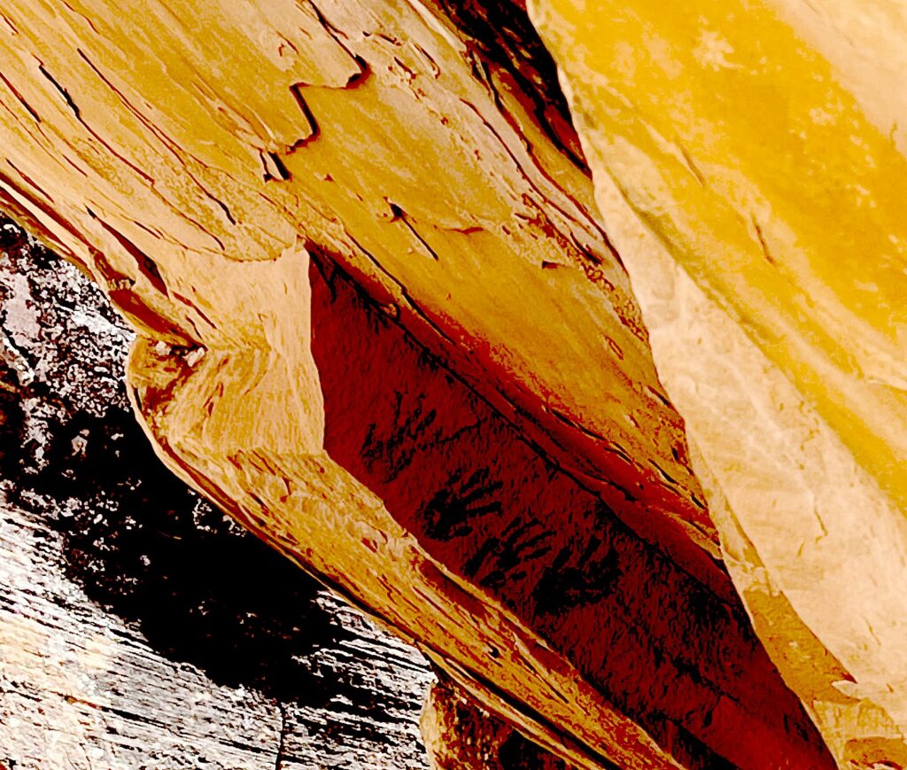
You have to really look closely to discover these hand prints in House of Fire, Bears Ears National Monument-Cedar Mesa © Laini Miranda/goingplacesfarandnear.com

Matcha further advises to search for rock art located beneath an overhanging boulder in the wash below the House on Fire. And if you continue on the trail, there are several more sites worth seeing. While some sit right off the trail, you either need binoculars to see or have to climb 200 feet to reach them. “Toward the end of the canyon is the spectacular Wall Site, which has several intact rooms built into small caves in the pock-marked cliff. Some of the roofs still have the original roof timbers.”

(South Fork of Mule Canyon trail is 4.3 miles one-way, and elevation gain is 250 feet. Cave Tower Site is 1-1.5 miles round trip, and elevation change is less than 200 feet. Passes are required for day hiking, check with the Bureau of Land Management for the current fee amount. Be prepared with exact change.)

Coming upon The Tower Ruin, off the beaten path © Karen Rubin/goingplacesfarandnear.com

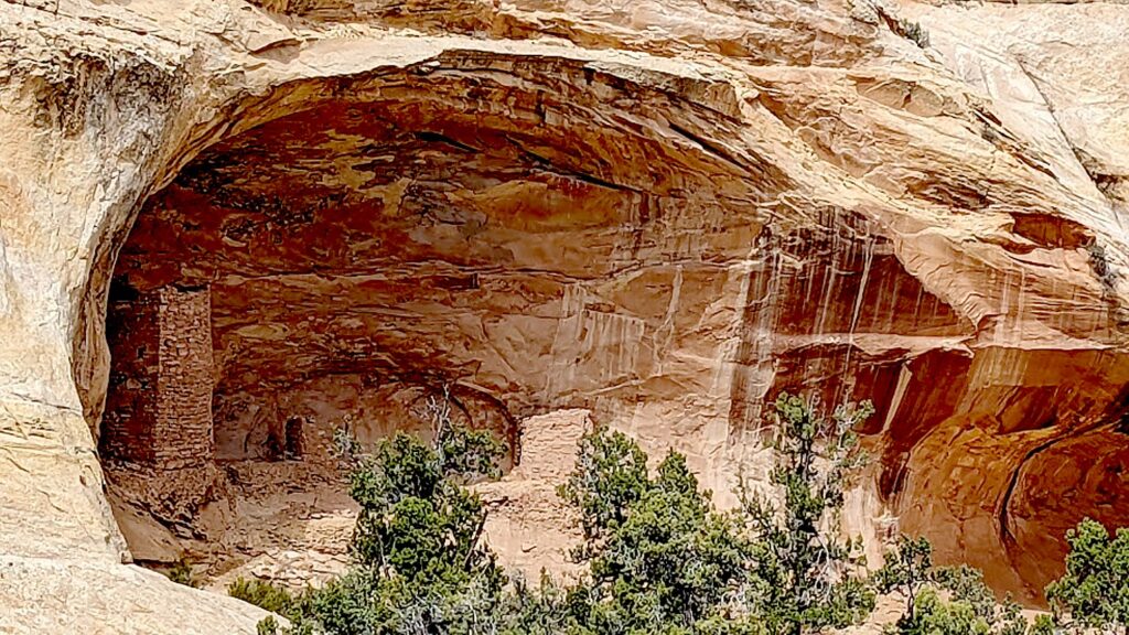
After this spectacular hike, we drive west on Hwy 95 near milepost 103, then drive onto a dirt road for half a mile. We hike in and across the way, we see The Tower Ruin – a rare, two-story structure on the other side of the canyon.

The Tower Ruin, Bears Ears National Monument-Cedar Mesa © Karen Rubin/goingplacesfarandnear.com

At first, it seems too steep a scramble for me, but Dave and Laini go down. Dave makes it look easy. Sure enough, he comes back to guide me to the site (so glad he did!).

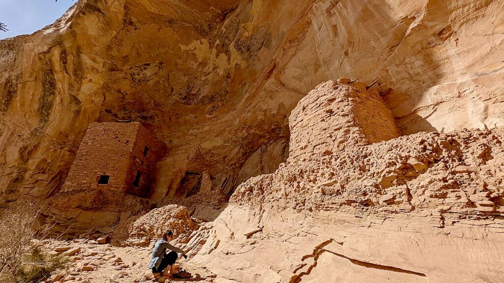
The Tower Ruin, Bears Ears National Monument-Cedar Mesa © Karen Rubin/goingplacesfarandnear.com

This site is so secluded, remote and untouched, it feels as if we discovered it on our own (though I’m sure that’s not true, the feeling is still so exciting).

The Tower Ruin, Bears Ears National Monument-Cedar Mesa © Karen Rubin/goingplacesfarandnear.com

The tower construction seems to be “modern” – Laini says there is evidence of three different generations having a hand in the construction. There are fabulous pictographs and petrolyphs here. I imagine that one is a symbol for the chief.

The Tower Ruin, Bears Ears National Monument-Cedar Mesa © Karen Rubin/goingplacesfarandnear.com

Altogether, we have hiked about 9 to 10 miles today – so satisfying.

We drive into the town of Blanding for dinner and supplies, seeing signs along the way for Native American Crafts, Dinosaur Museum, State Edges of the Cedars Native American Museum.

The Tower Ruin, Bears Ears National Monument-Cedar Mesa © Karen Rubin/goingplacesfarandnear.com

Laini decides to change plans from our original itinerary and instead of leaving here for Canyonlands, we stay an extra night and day in Cedar Mesa.

So glad, because the second day’s hike is one of the best I have ever experienced.

Catching the last rays of sun driving back to our wild camping site in Arch Canyon from Blanding © Karen Rubin/goingplacesfarandnear.com
 

Kane Gulch Trail

Take seriously the need to obtain permits in advance for certain hikes. We changed our plans in order to stay this second day in Cedar Mesa so did not get the necessary permit (limited to just 20 a day) to hike to Moon House – the only day hike that requires a permit instead of just a hiking day pass. We thought we might get away with it because we are here on Easter Sunday, but no such luck (the permit allocations fill up even months before). It is easier to get permits in summer months, which is when Laini and David found themselves the only ones at the site when they last visited (likely because of the heat; when we are here, in early spring, the weather is perfect).

Hiking the Kane Gulch Trail, Bears Ears National Monument-Cedar Mesa © Karen Rubin/goingplacesfarandnear.com

Instead, at the Kane Gulch Visitor Center, the Ranger suggests we hike the Kane Gulch Trail which starts right across the road. We purchase our day hiking passes ($5 pp – my America the Beautiful pass doesn’t count). She suggests what to look for at what distances.

Hiking the Kane Gulch Trail, Bears Ears National Monument-Cedar Mesa © Karen Rubin/goingplacesfarandnear.com

Dave gets out our hot-water maker and we have our breakfast at the picnic table outside the visitor center, then set out. Our plan is to go five miles, to the Stimper Arch, and five miles back.

Profile of an Indian Chief? Hiking the Kane Gulch Trail, Bears Ears National Monument-Cedar Mesa © Karen Rubin/goingplacesfarandnear.com

At about a mile in, there is a short slot canyon where we see a formation to me looks like the profile of an Indian chief.

At the two-mile mark, Dave stashes our 5-gallon water jug so we have enough for the return.

Junction Ruin, Kane Gulch Trail, Bears Ears National Monument-Cedar Mesa © Karen Rubin/goingplacesfarandnear.com 

It’s four miles to the Junction Ruin which has some fabulous dwellings, pottery shards, and pictographs.Dave and Laini climb up sheer rock to get to an upper level (a defensive watchtower?) and could see remnants of a ladder that would have been used.

Turkey Pen, Kane Gulch Trail, Bears Ears National Monument-Cedar Mesa © Karen Rubin/goingplacesfarandnear.com 

Another .7 mile and we come to a site known as Turkey Pen. Looking up from the trail, it seems the cliff dwellings are cramped and close to the edge, but when we get up here, it is surprising how much space there actually is.

Turkey Pen, Kane Gulch Trail, Bears Ears National Monument-Cedar Mesa © Karen Rubin/goingplacesfarandnear.com

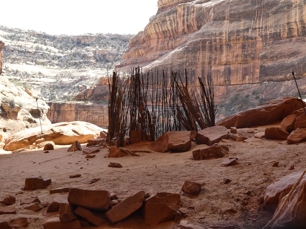
Here, we see some fabulous examples of mud and stick method of construction (jacal) and some exquisite painted pottery shards, pictographs, even the remnants of the actual turkey pen formed with sticks – so it almost seems you are coming upon a dwelling just after the residents left. You feel you are the archaeologist making the discovery – except for the printed notes left by the National Park Service- but still. 

Cliff dwellings along the Kane Gulch Trail, Bears Ears National Monument-Cedar Mesa © Karen Rubin/goingplacesfarandnear.com

We also come upon a square kiva (most kivas Laini and Dave have seen are circular, Laini notes).

Junction Ruin, Kane Gulch Trail, Bears Ears National Monument-Cedar Mesa © Karen Rubin/goingplacesfarandnear.com

You wonder about whether the site was designed to defend and who to defend from – people who would take food stored in the granary? One of the pictographs depicts sheep being killed, another of “lizard man.”

Cliff dwellings along the Kane Gulch Trail, Bears Ears National Monument-Cedar Mesa © Karen Rubin/goingplacesfarandnear.com

As we hike, we keep our eyes peeled on the cliffs above for evidence of dwellings, well off the trail and likely minimally visited. Laini says there were thousands of cliff dwellings here and only a fraction have been discovered (or are still intact, but when you consider they are 1000 years old, and the crumbling rock all around, it is amazing any remain). We spot one and Laini goes off to try to find a way to climb up to it.

Cliff dwellings along the Kane Gulch Trail, Bears Ears National Monument-Cedar Mesa © Karen Rubin/goingplacesfarandnear.com

We find a pleasant rock overhang to sit and have our picnic lunch, feeling like this would have been exactly what the Puebloans would have done.

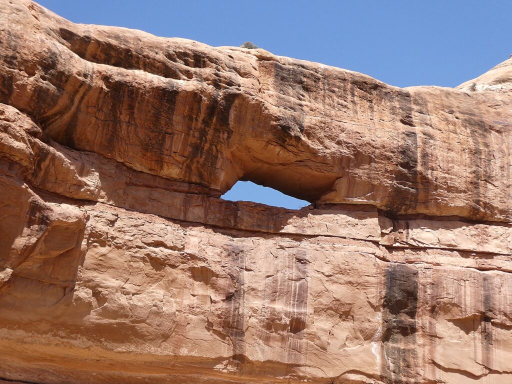
We hike a further .3 miles to the Stimper Arch (which is the 5-mile mark), where we turn around.

Turkey Pen, Kane Gulch Trail, Bears Ears National Monument-Cedar Mesa © Karen Rubin/goingplacesfarandnear.com

This hike has everything – it has just the right amount of physical challenge – a section where you scramble a bit and walk a narrow edge – gorgeous greenery, stunning rock formations, water features (but not too watery to hike), but best and most spectacular of all, these cliff dwellings that look like we have just discovered them, with relatively large and stunningly painted pottery shards, stone tools, stunning pictographs (I start thinking they are either indications of how many people lived in the dwelling like a census; markers of whose dwelling it is, like a family name?  or just being playful, artful?).

Turkey Pen, Kane Gulch Trail, Bears Ears National Monument-Cedar Mesa © Karen Rubin/goingplacesfarandnear.com

The trail is not specifically marked – so you have to figure your own way using the landscape and intermittently placed cairns.

Turkey Pen, Kane Gulch Trail, Bears Ears National Monument-Cedar Mesa © Karen Rubin/goingplacesfarandnear.com
The actual turkey pen, Kane Gulch Trail, Bears Ears National Monument-Cedar Mesa © Karen Rubin/goingplacesfarandnear.com
Turkey Pen, Kane Gulch Trail, Bears Ears National Monument-Cedar Mesa © Karen Rubin/goingplacesfarandnear.com

Even though this is a popular trail, we come upon other people only occasionally (but it kind of reassures us we are going the right way).

The trail actually goes on for miles (days), connecting to other trails. (We meet a group of college students who are making a multi-day backpacking trip and will return on the Fish and Owl trail.)

Turkey Pen, Kane Gulch Trail, Bears Ears National Monument-Cedar Mesa © Karen Rubin/goingplacesfarandnear.com
Kane Gulch Trail, Bears Ears National Monument-Cedar Mesa © Karen Rubin/goingplacesfarandnear.com

We get back to the start at 6:30 pm (we set out around 10 am), having hiked about 11 miles. (It took us 5 hours to get 5 miles (including the time exploring the archaeological sites) and 3 ½ hours to hike back.

Stimper Arch, Kane Gulch Trail, Bears Ears National Monument-Cedar Mesa © Karen Rubin/goingplacesfarandnear.com

After this full day’s hike, we drive to Arches National Park. It’s a fairly long drive and already sunset by the time we arrive. This is the first time we have to set up camp in the dark and there is a strong wind that makes it difficult to keep the tent from blowing away (especially since I can’t find my tent stakes so we improvise, until they are ultimately found under the footprint.)

Dave makes a fire and we prepare dinner from our supplies.

It is night by the time we set up camp at the Devils Campground in Arches National Park © Karen Rubin/goingplacesfarandnear.com

If You Go….

The Moon House Ruin is one of the best archaeology sites on Cedar Mesa, consists of three separate structures with 49 rooms; well preserved pictographs grace the walls of an interior courtyard and some of the rooms (the hike is 3.2-5.6 miles roundtrip). More of the best hikes in Bears Ears at http://www.hikingwalking.com/index.php/destinations/ut/ut_se/blanding

Day hiking in Bears Ears National Monument requires a day hiking pass. Day hiking passes are unlimited.

Bears Ears National Monument does not charge an entry fee where your America the Beautiful Pass would typically apply. However, activity fees called “Individual Special Recreation Permits” are charged for day hiking and backpacking (typically $2 at the trailhead). Visit the permits page for more information (https://www.blm.gov/programs/recreation/permits-and-passes/lotteries-and-permit-systems/utah/cedarmesa).

Visitor Centers:

Kane Gulch BLM Ranger Station, UT-261 36 miles west of Blanding. Open: March 1-June 15, September 1-October 31, 8 am-noon daily

Monticello Visitor Center, 216 S Main St., Hours: 9 am-5 pm, closes at 3 pm on Sunday, Phone: 435-587-3401

Blanding Visitor Center, 12 North Grayson Parkway, 9 am-5 p.m., closed Sunday

https://www.blm.gov/visit/bears-ears-national-monument

See:

UTAH ADVENTURE DAY 1-2: CAPITOL REEF’S COLORFUL CANYONS

UTAH ADVENTURE DAY 3-4: GRAND STAIRCASE-ESCALANTE POSES CHALLENGE

UTAH ADVENTURE DAY 4-5: DRIVING BURR TRAIL, EXPLORING GLEN CANYON, WILD CAMPING IN ARCH CANYON

UTAH ADVENTURE DAY 6: SACRED SITES, SPIRITS OF BEARS EARS NATIONAL MONUMENT

______________________

© 2023 Travel Features Syndicate, a division of Workstyles, Inc. All rights reserved. Visit goingplacesfarandnear.com, www.huffingtonpost.com/author/karen-rubin, and travelwritersmagazine.com/TravelFeaturesSyndicate/. Blogging at goingplacesnearandfar.wordpress.com and moralcompasstravel.info. Visit instagram.com/going_places_far_and_near and instagram.com/bigbackpacktraveler/ Send comments or questions to [email protected]. Tweet @TravelFeatures. ‘Like’ us at facebook.com/KarenBRubin 

A Stone’s Throw From Daytona Beach, Finding ‘Florida as it Used to Be’

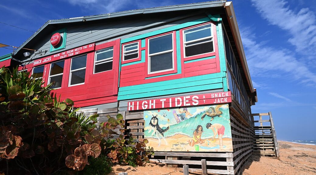
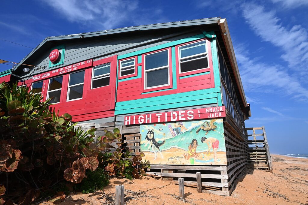
Snack Jack’s along A1A just north of Ormond Beach, retains the vibe of “Florida as it used to be.” © Karen Rubin/goingplacesfarandnear.com

By Karen Rubin, Travel Features Syndicate, goingplacesfarandnear.com

To be candid, I would not have traveled to Florida except for a special occasion presenting an opportunity to visit with family I haven’t seen in quite some time. Luckily, this is a mere week before Omnicron hit with such fury or is even a thing, but I still don’t feel Florida particularly appealing for a long list of reasons.

My destination is the immensely popular Daytona Beach area. So even though Omnicron has yet to hit and though I am triple vaxxed, because of Florida’s contempt for preventive public health measures, I remain extremely vigilant in using a mask, staying outdoors as much as possible and avoiding crowds – even the wedding I attend is a small, intimate affair held outside.

Fortunately, the Ormond Beach area, a mere few miles north of Daytona Beach, and north along the famed Highway A1A, where, my cousin – a native Floridian – takes me, is the fabled “Real Florida,” and provides the perfect setting.

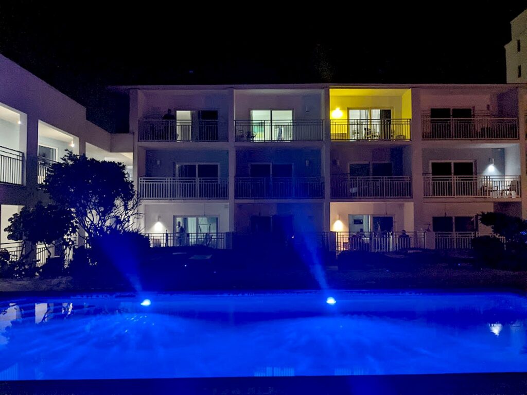
Lotus Inn, a delightful boutique hotel on Ormond Beach, with its pool stunningly lit at night © Karen Rubin/goingplacesfarandnear.com

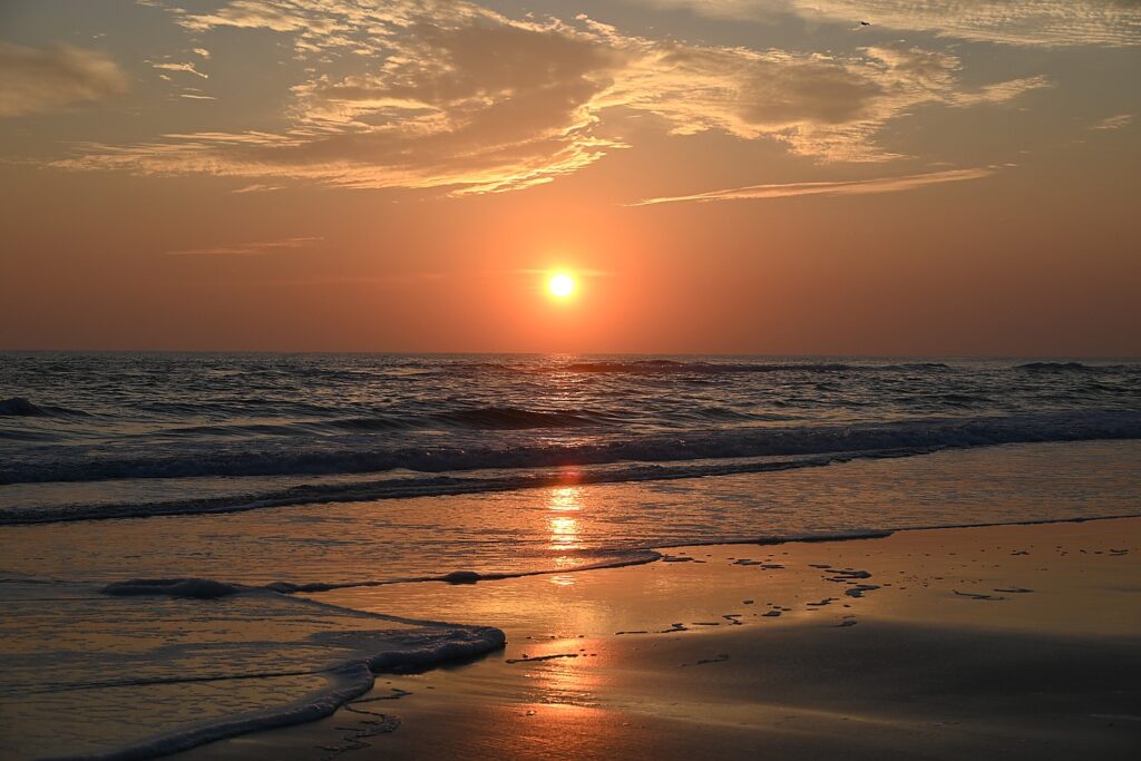
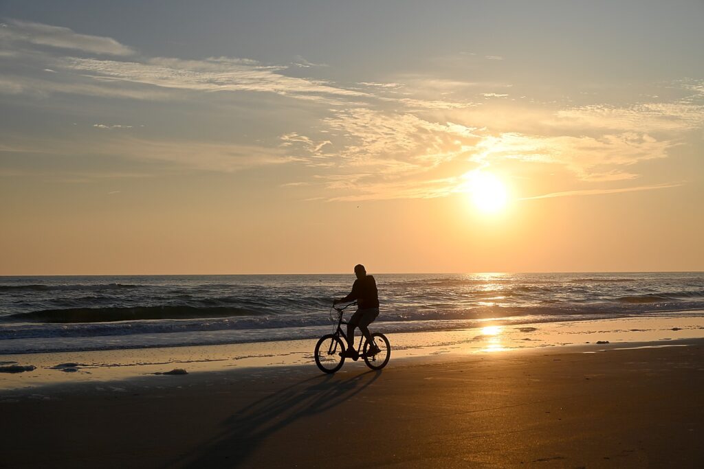
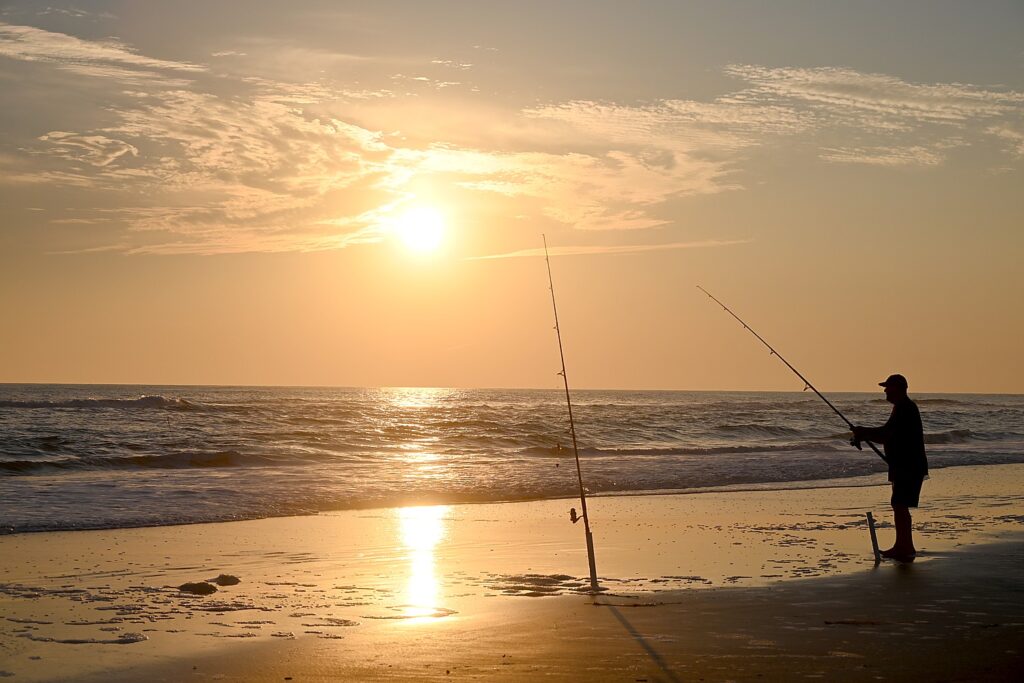
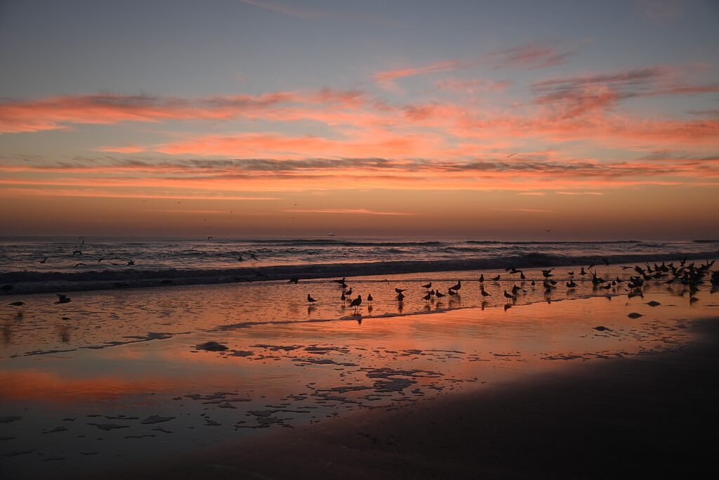
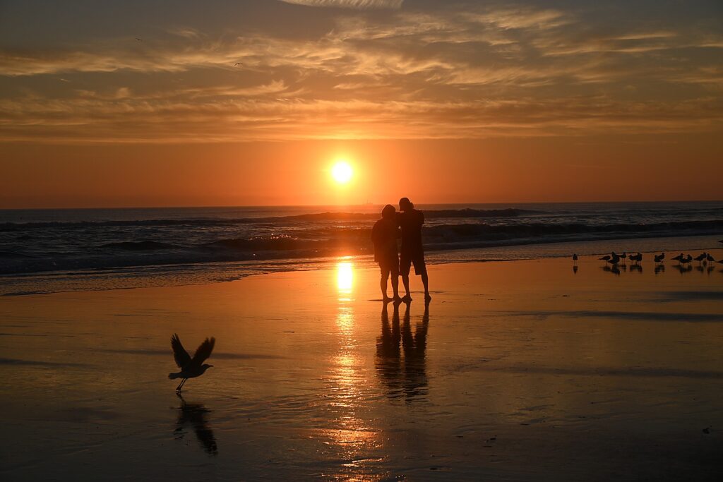
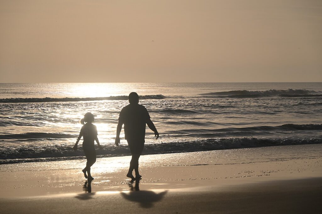
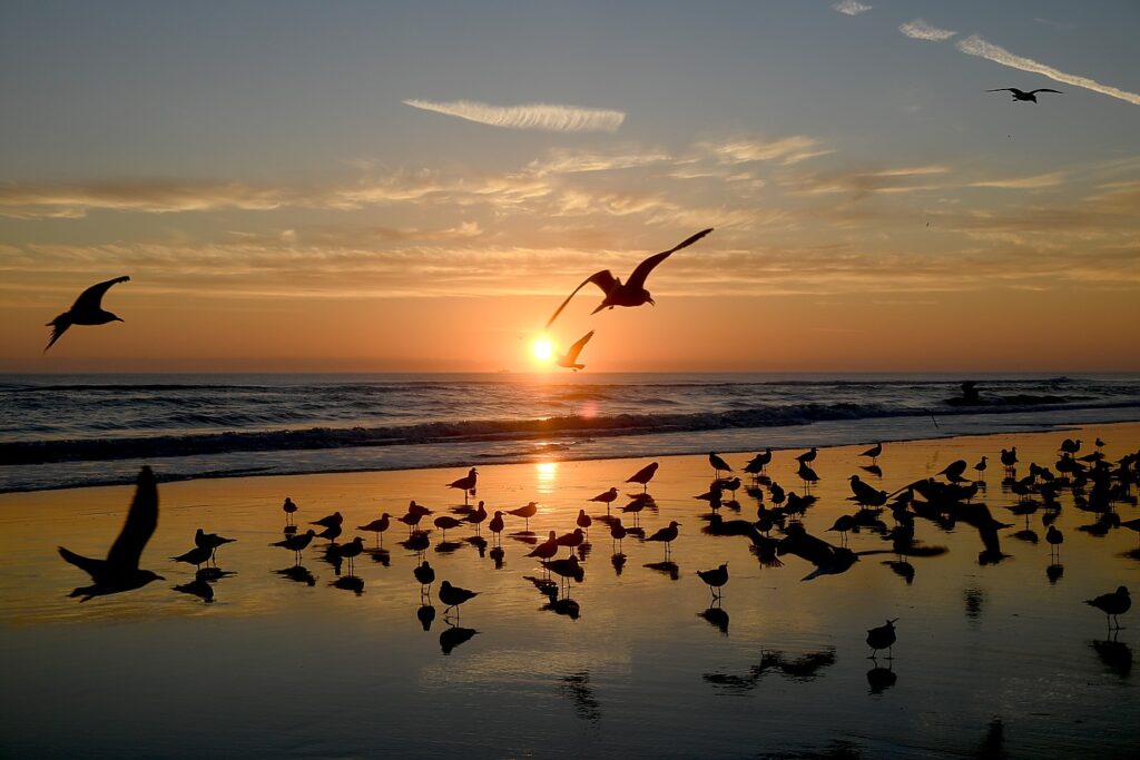
I stay in a delightful boutique hotel, the Lotus Inn, refurbished with chic touches (stunning pool, fire pit, landscaping), right on the beach, so that each morning, I can grab a cup of coffee from the lounge and walk out onto the beach before the sun rises, when the colors begin to burst in the sky.

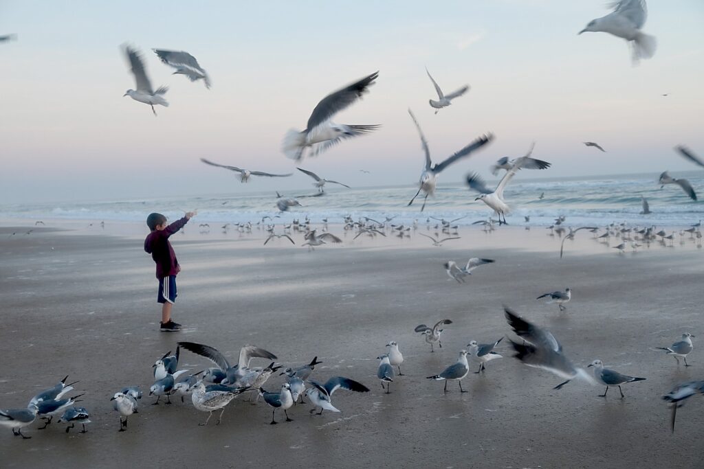
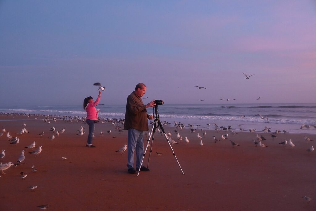
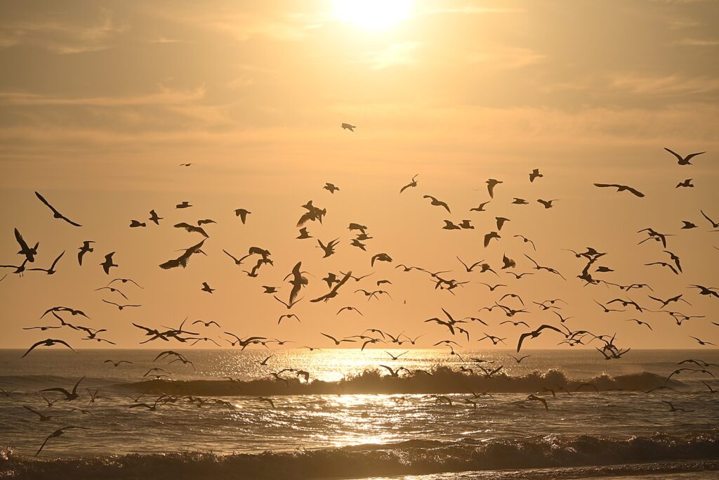
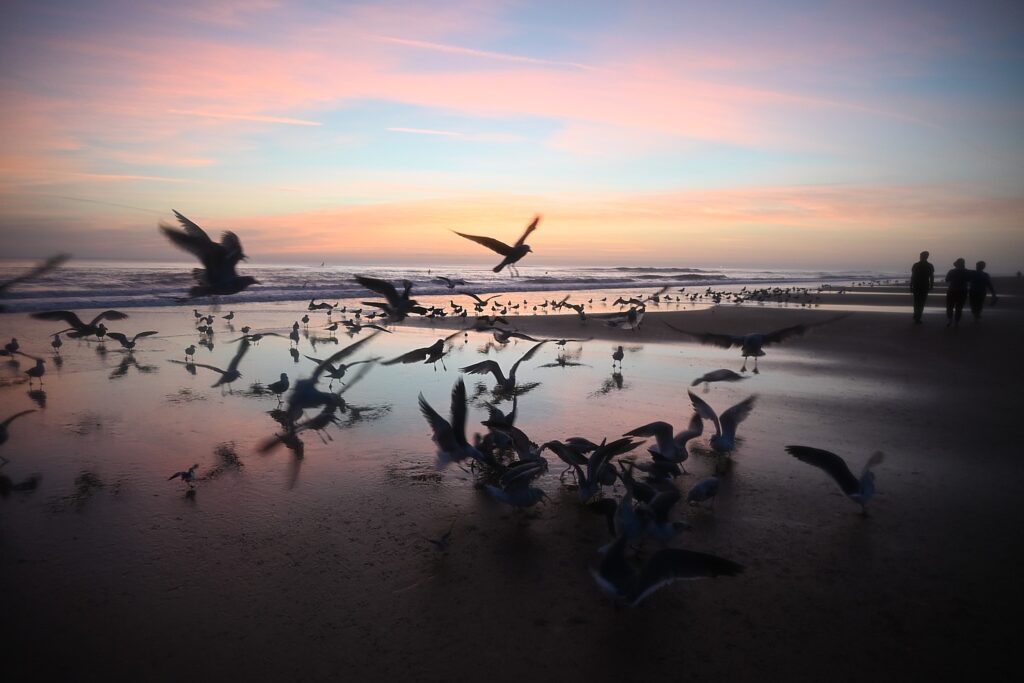
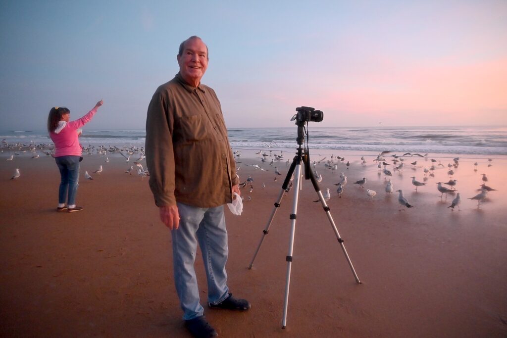
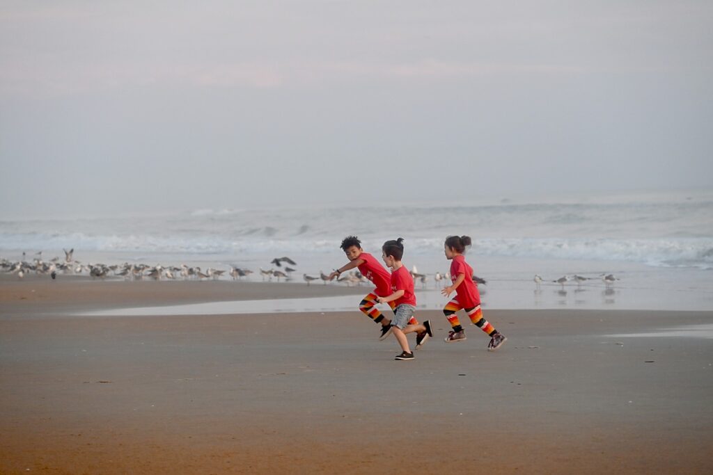
I do this each of the four mornings of my visit, and each day, the experience is very different and dramatic in its own way – the colors most vibrant on the first day, a tad less so on the second but the experience enhanced when I discover Jeffrey Dunne, who has come out every morning to photograph the sunrise for something like 10 years, posting them and drawing his own following, as well as taking photos for visitors. There are other regulars I get to meet as well, which includes a flock of seabirds who are drawn to this one spot because of a woman who comes each day with crackers (sharing with visitors who delight in the experience). The colors are different on the third day, but now I focus on the activity – the regulars who come, like the group of swimmers in their wetsuits, who come no matter the season. My fourth morning, there isn’t a sunrise at all, but I get to see the beach in its moody blue-grey colors.

Sunrise on Ormond Beach © Karen Rubin/goingplacesfarandnear.com
Jeffrey Dunne, who has come out every morning to photograph the sunrise on Ormond Beach, while his friend feeds the sea birds © Karen Rubin/goingplacesfarandnear.com

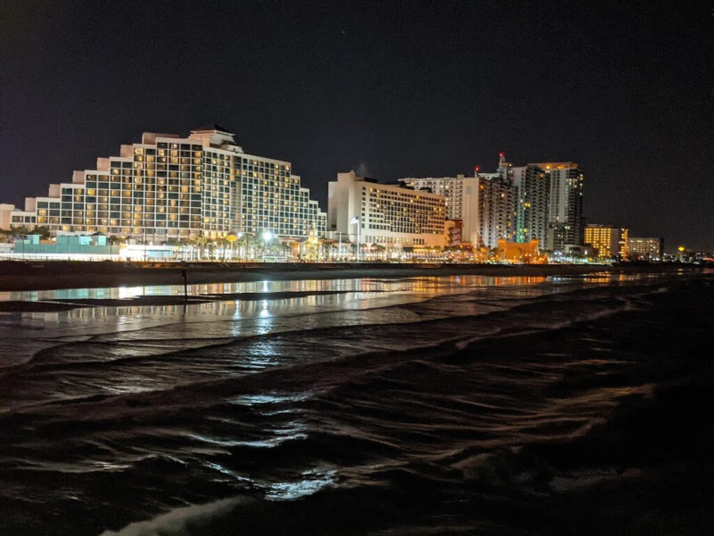
Even though you can see Daytona Beach from Ormond Beach, the atmosphere here is completely different. Here there are mostly low-rise, low-density hotels like mine, the Lotus Inn.

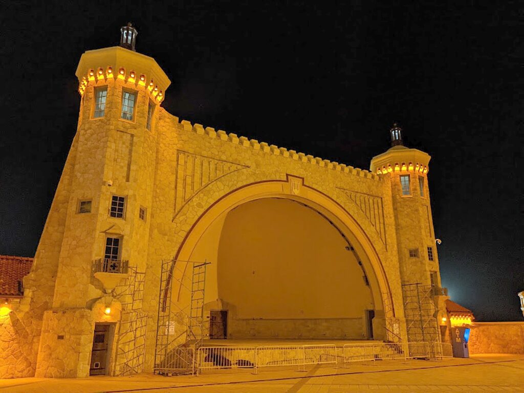
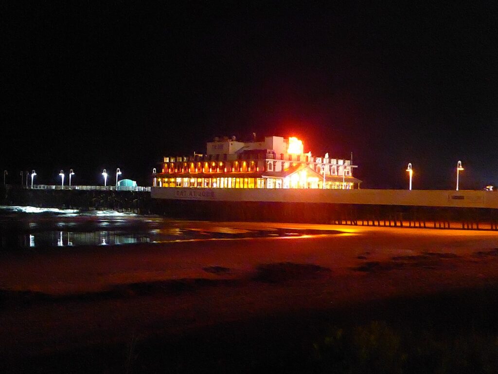
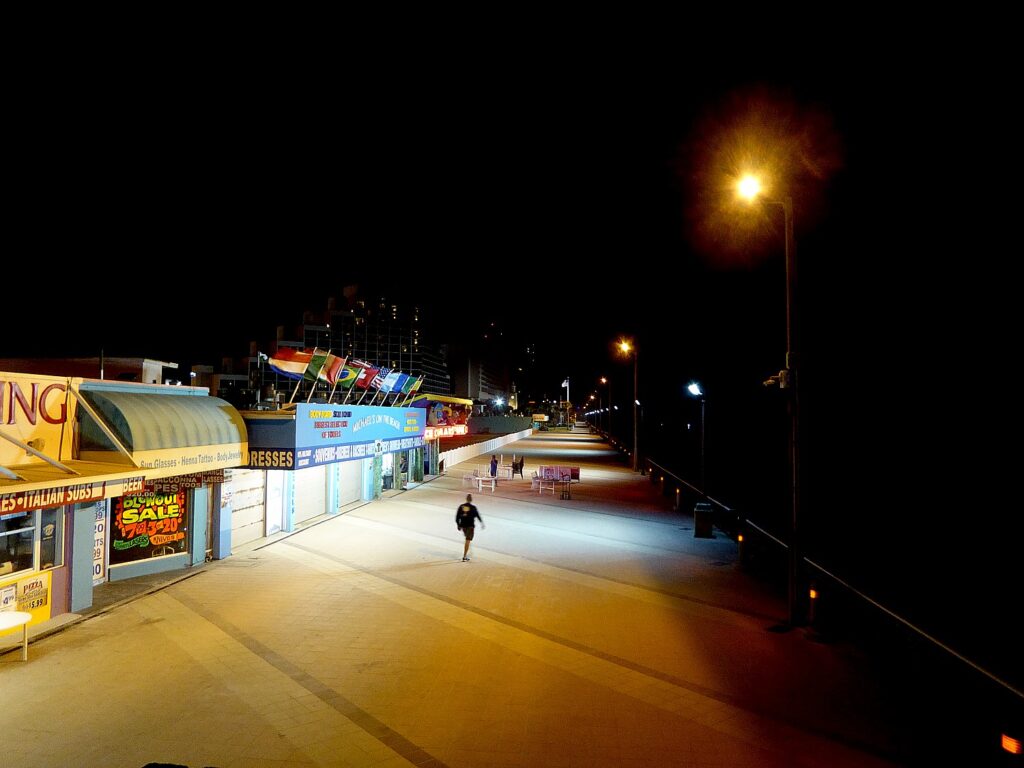
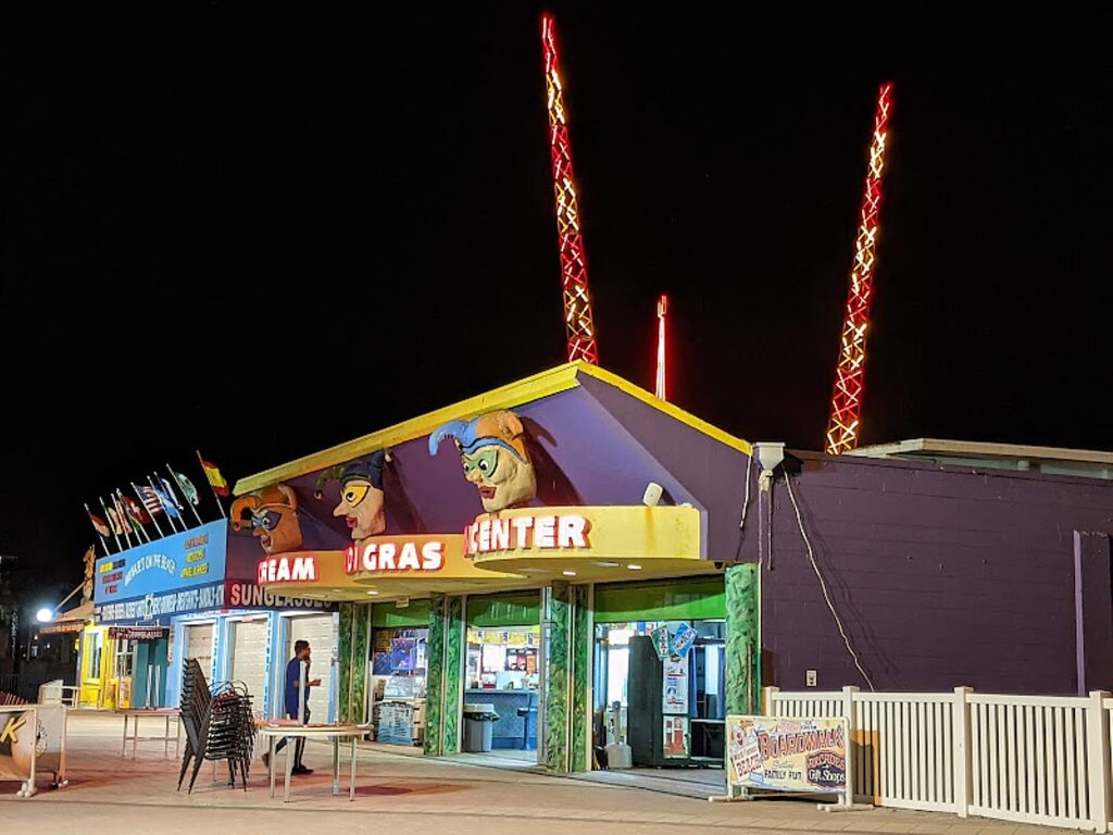
My first night in Ormond Beach, I drive my rental car the four miles down A1A to Daytona Beach and walk the charming boardwalk, really enjoying discovering the 1930s-era Bandstand, coming upon the boardwalk games, and then the long pier itself, alight in neon announcing Joe’s at the end, with a stunning view back at the shoreline. I also get a glimpse of the heart pounding, adrenaline pumping thrill rides at Screamer’s Park.

The Bandshell on Daytona Beach boardwalk © Karen Rubin/goingplacesfarandnear.com
Eat at Joe’s on the Daytona Beach pier © Karen Rubin/goingplacesfarandnear.com
Daytona Beach boardwalk © Karen Rubin/goingplacesfarandnear.com
Daytona Beach © Karen Rubin/goingplacesfarandnear.com

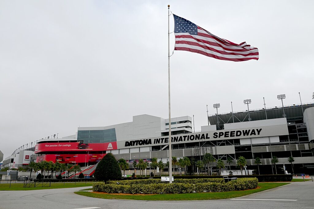
Now of course, Daytona Beach is famous for auto racing and the Daytona 500 – that began on the beach (cars are still allowed in specific lanes, and plenty of people bike on the flat, hard sand, which became the International Speedway. I would venture that most who come are car people, and touring the speedway and visiting the Racing Hall of Fame are musts. The Daytona International Speedway has just undergone a $400 million “reimagining” and transformed into a state-of-the-art motorsports facility. You can even get behind the wheel of an actual race car with NASCAR Racing Experience and take laps around the world famous 2.5-mile Speedway. (“Speedway Tours” run multiple times  each day; tour tickets are sold on a first come first serve basis, and include the Motorsports Hall of Fame of America, https://www.daytonainternationalspeedway.com/tours/).

Daytona International Speedway © Karen Rubin/goingplacesfarandnear.com

I stop by for a look at the gi-normous stadium, how it is banked at a 30-degree angle so the cars don’t just fly off at the turns, but spend my time discovering what my cousin, Ray Weiss, a former journalist, calls “Florida as it used to be.”

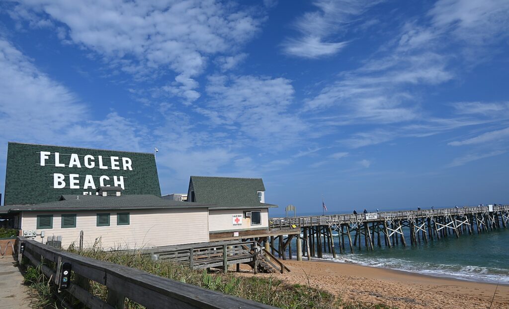
Ray drives me up the famous A1A, to Ormond by the Sea up to Flagler Beach, which cannot be more un-touristy. Here, he stresses, you can still park your car alongside the two-lane road (they call it a highway), on a patch of sand bordered with sea grass, and walk right onto the beach – such a contrast to Daytona Beach, which seems to be competing to have as many high rises and parking meters as Miami Beach. (My cousin describes Daytona Beach perfectly: “a bit of an Atlantic City feel with a redneck flair.”)

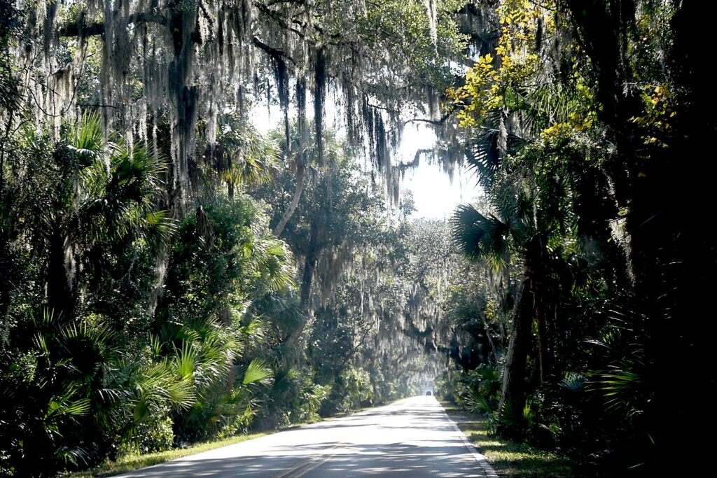
“Florida as it used to be,” along A1A between Ormond Beach and Flagler Beach © Karen Rubin/goingplacesfarandnear.com

This stretch between Ormond Beach and Flagler Beach, though, is exactly as he has described it and what he cherishes – there are the colorful, weatherworn, funky beach places, miles of undeveloped open beach (vacant of people) and thousands of acres of pristine land called the Loop – woods, water and marshland. “It’s like stepping back in time to what the rest of Florida once looked like when the Seminoles were here,” he says. He should know because my first memory as a child was visiting his family in old Miami and seeing Seminole Indians wrestling alligators.

Driving The Loop © Karen Rubin/goingplacesfarandnear.com
“Florida as it used to be,” along A1A between Ormond Beach and Flagler Beach © Karen Rubin/goingplacesfarandnear.com

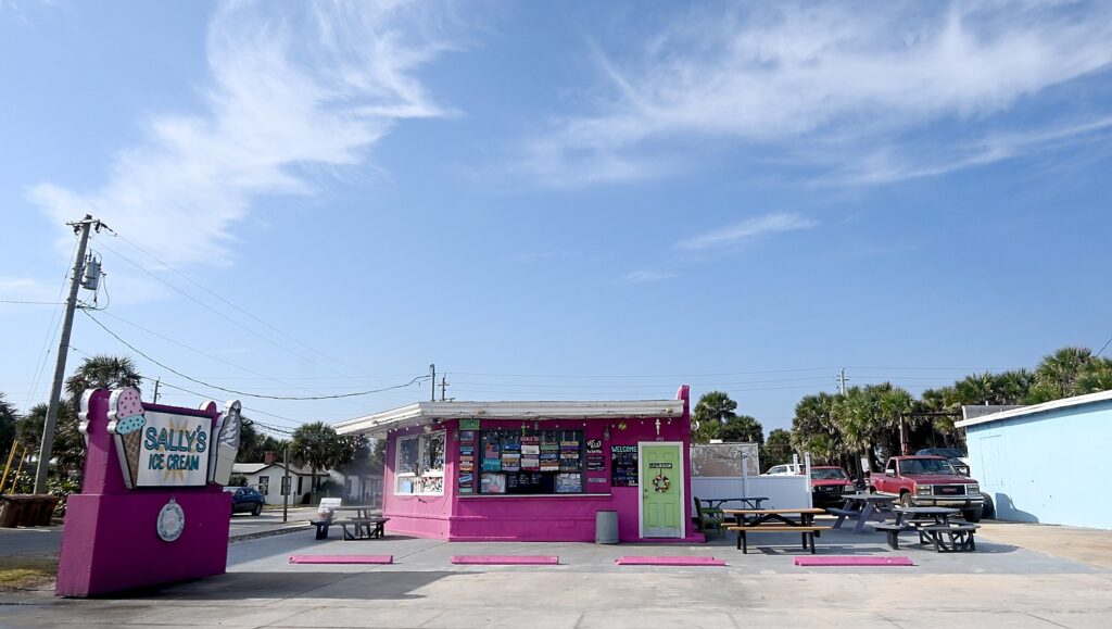
Flagler Beach is a Florida town that is seems stuck in the 1950s. No high-rises here, only modest houses on the beach. (My thoughts alternate between thinking that the property they sit on would be $1-2 million in Long Island, and thinking that sea level rise caused by the climate change Florida’s governor denies makes them worthless.)  Ray points out several old style restaurants, stopping at Snack Jack’s right on the beach – his favorite and I can see why.

Flagler Beach © Karen Rubin/goingplacesfarandnear.com

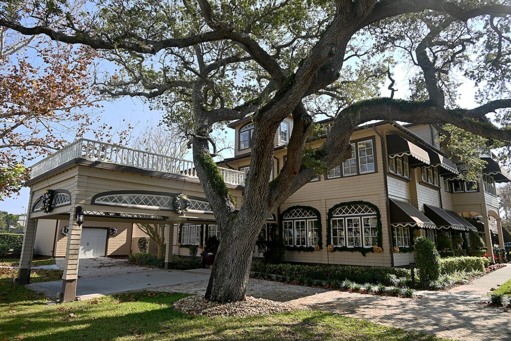
Back in Ormond Beach, we stop to visit The Casements, John D. Rockefeller’s 1890s winter home, so beautifully set on the river.

The Casements, John D. Rockefeller’s 1890s winter home, Ormond Beach © Karen Rubin/goingplacesfarandnear.com

On my own, I also discover some of the attractions that make actually living here wonderful – starting with the Museum of Arts and Science (MOAS).

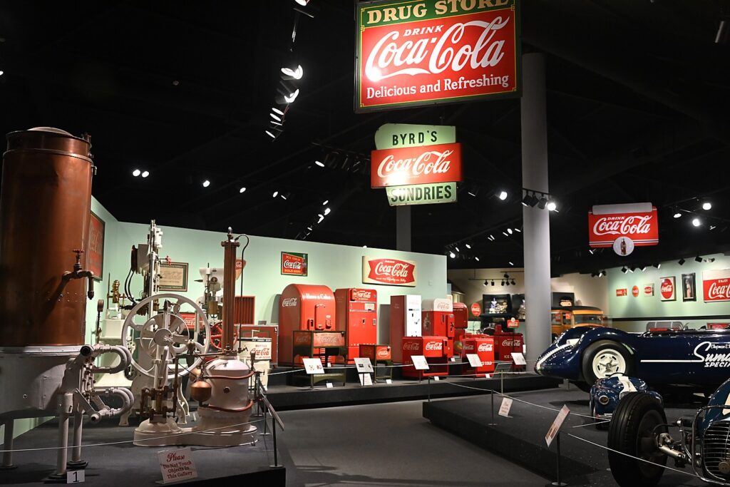
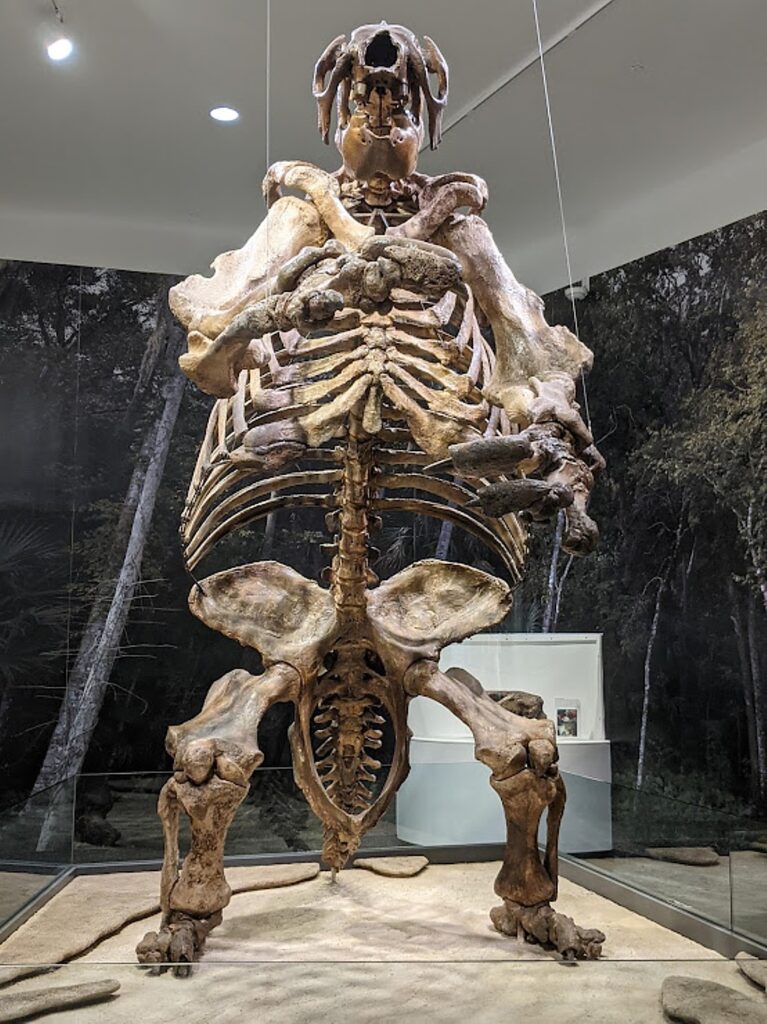
When I arrive, I ask the receptionist what is special, what should I definitely look out for. She replies, “Well, we have the biggest collection of Coca Cola bottles, and a skeleton of a giant sloth.”

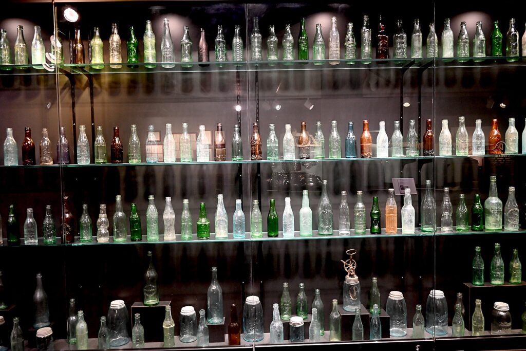
Root Family Museum of what is probably the largest collection of Coca-Cola memorabilia, at the Museum of Arts and Science, Daytona Beach © Karen Rubin/goingplacesfarandnear.com

Walking into the Coca-Cola collection, you can’t help but let out an actual “Wow,” It turns out that the guy who invented and manufactured that classic glass Coke bottle in Indiana, Chapman J. Root (he got 5c royalty on every bottle sold), also had interests in Coca-Cola bottling plants in New York, New Jersey, Pennsylvania, Missouri, Illinois and Florida, and when he retired, his grandson Chapman S. Root took over the company and moved it, in 1951, to Daytona Beach. Over a 50-year period, Chapman S. Root and his wife Susan Root Fieblman, collected some 100,000 objects that make up the $5 million Root Family Museum collection – probably the largest of Coca-Cola memorabilia – housed within MOAS. We see not only a timeline of all the bottles and bottling equipment, but the delivery trucks, the different vending machines, all with the trademark Coca Cola red color. It is pure Americana – both for the Coca-Cola cultural iconography and the story of an entrepreneur and innovator making good. (See: For Coke Fans, Collection is ‘The Real Thing’, https://www.orlandosentinel.com/news/os-xpm-2001-10-14-0110120609-story.html)

The Giant Sloth at MOAS, discovered just 2 ½ miles away © Karen Rubin/goingplacesfarandnear.com

Then I walk into the “Natural Florida” exhibit and there it is. When you think of “sloth” you might think of Sid in the “Ice Age” movies. Now imagine The Hulk but probably three or four times the size. The skeleton of the Eremotherium – the largest sloth to have ever existed – that we see assembled in its fearsome pose was collected just 2 ½ miles away. It would have weighed up to five tons and stood 15 feet tall – only the Wooly Mammoth was larger in the Western Hemisphere. Phenomenal.

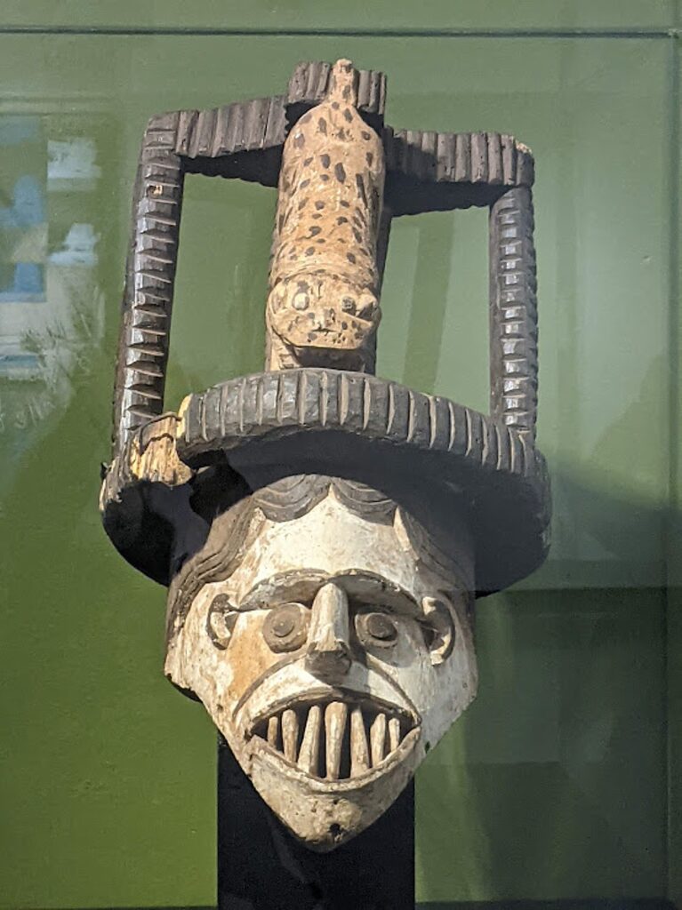
A fantastic collection of African tribal masks, on view at MOAS © Karen Rubin/goingplacesfarandnear.com
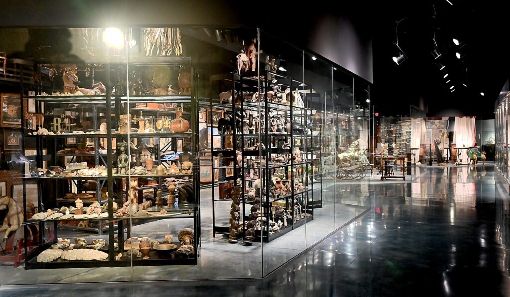
The Warehouse at MOAS, Daytona Beach © Karen Rubin/goingplacesfarandnear.com

The rest of the museum has some fabulous, unexpected and eclectic collections: African tribal artifacts including incredible masks, Chinese art, and the American decorative arts collection of Anderson Child Bouchelle (a fifth generation Floridian, his father was Florida’s first cardiologist, brought to the state by Henry Flagler). I especially love “The Warehouse” where you can peek at treasures that otherwise would be stored away. (352 South Nova Road, Daytona Beach, Florida 32114, 386-255-0285, www.moas.org/visit/index)

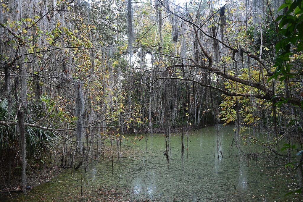
Walk the nature trail outside MOAS © Karen Rubin/goingplacesfarandnear.com

Before leaving, I follow the Nature Trail that starts just outside the museum that takes you on a boardwalk into the jungle (note the sign that warns of such creatures as snakes and alligators).

Sunrise on Ormond Beach © Karen Rubin/goingplacesfarandnear.com

The next day, after my ritual beach walk to revel in the daily miracle of the sunrise, I go off to two other signature attractions, both very close together at the southern tip of the barrier island.

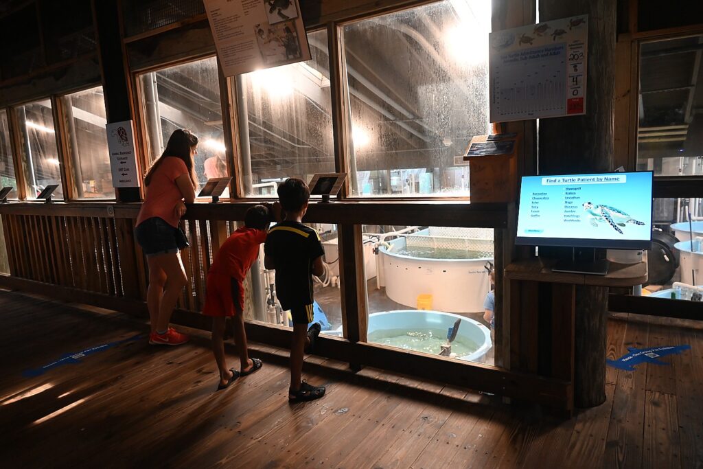
Marine Science Center, Daytona Beach © Karen Rubin/goingplacesfarandnear.com

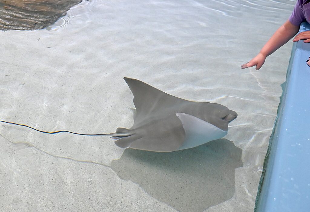
The modest but intimate Marine Science Center, is mainly an aquarium but also is where you can see its medical facilities where sea turtles are being restored to health (you can even watch operations through a glass) and a sanctuary for rescued birds. The small area is packed with fun things to look at, interact with and learn about Volusia County’s rich marine life – like how they are re-growing (not just restoring) coral so crucial to the survival of ecosystems. This is a delight for families with children (100 Lighthouse Drive, Ponce Inlet, Fl 32127, 386-304-5545, www.marinesciencecenter.com)

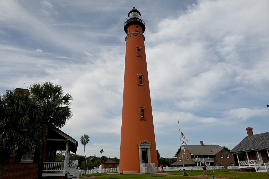
Ponce Inlet Lighthouse © Karen Rubin/goingplacesfarandnear.com
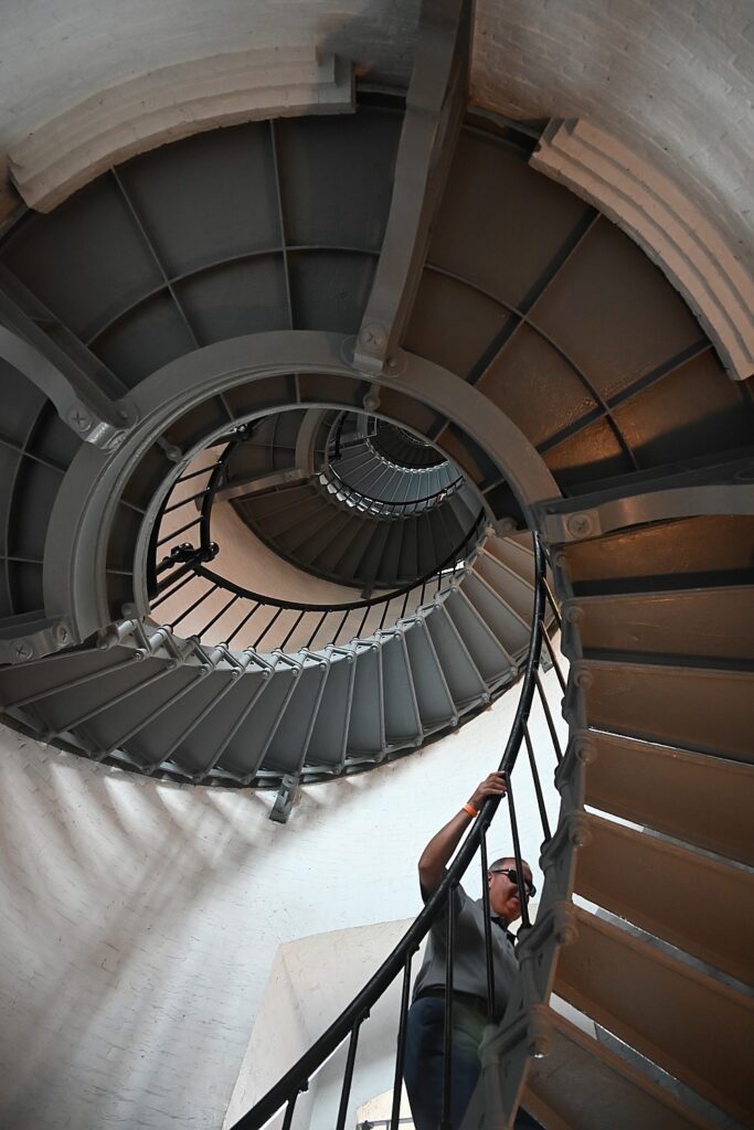
Walk up the 203 steps to the top of the Ponce Inlet Lighthouse © Karen Rubin/goingplacesfarandnear.com

Nearby, The Ponce Inlet Lighthouse, constructed in 1887, is a treasure. At 175 feet tall, the lighthouse is the highest in Florida and second highest in the country. You can walk up all 203 steps winding around and around, and step out for a 360-degree view. Most interesting are the other structures and buildings – all original – that you can visit and the exhibits that show the life and times of the lighthouse keepers, and wonderful videos showing the history. In the modern Ayres Davies Lens Exhibit Building, you can see a world-class Fresnel lens collection. There is also an exhibit of Cuban Rafts that carried refugees trying to make their way to freedom on these fragile homemade boats and rafts. There is really a lot to see and explore, including nature trails and you can walk out to a very long break-water. (4931 S. Peninsula Drive, Ponce Inlet, FL 32127, 386-761-1821, ponceinlet.org)

Ayres Davies Lens Exhibit Building at the Ponce Inlet Lighthouse has a world-class Fresnel lens collection. © Karen Rubin/goingplacesfarandnear.com

For more historic sites, you can trace the footsteps of educator and civil rights activist Dr. Mary McLeod Bethune on a tour of her former home, and visit the historic Jackie Robinson Ballpark (where in 1946, a year before he broke the major league racial color barrier in Brooklyn, Robinson broke the color barrier with the Montreal Expos, the triple A minor league affiliate of the Brooklyn Dodgers, after being rejected from other Florida cities, Ray relates).

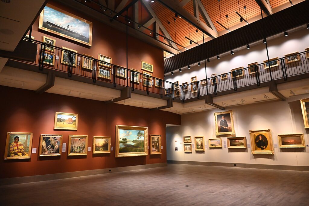
Cici and Hyatt Brown Museum of Art © Karen Rubin/goingplacesfarandnear.com

The next day, I visit the extraordinary Cici and Hyatt Brown Museum of Art, which is on the same campus as MOAS. This is the most astonishing find of all. Since 1997, the Browns made it their mission to collect art representing Florida. After being a traveling exhibit for some time, what is the largest collection of Florida art is now housed in this stunning, brand new two-level structure. The museum features a rotating collection of 2,600 Florida-themed oil and watercolor paintings. The Museum’s grand central gallery and mezzanine showcase the collection’s signature pieces, while six smaller galleries feature beautiful changing exhibitions with Florida themes. Most impressive are the way the paintings are selected, framed, how they are hung together, and the absolutely fascinating notes that accompany each and every one – not only a biography of the artist, but the context for the painting, something of history, and then really fascinating notes that are like a painting tutorial. (https://www.moas.org/explore/cici-and-hyatt-brown-museum-of-art/index)

Sunrise on Ormond Beach © Karen Rubin/goingplacesfarandnear.com
Jeffrey Dunne, who has come out every morning to photograph the sunrise on Ormond Beach, while his friend feeds the sea birds © Karen Rubin/goingplacesfarandnear.com
Ormond Beach © Karen Rubin/goingplacesfarandnear.com
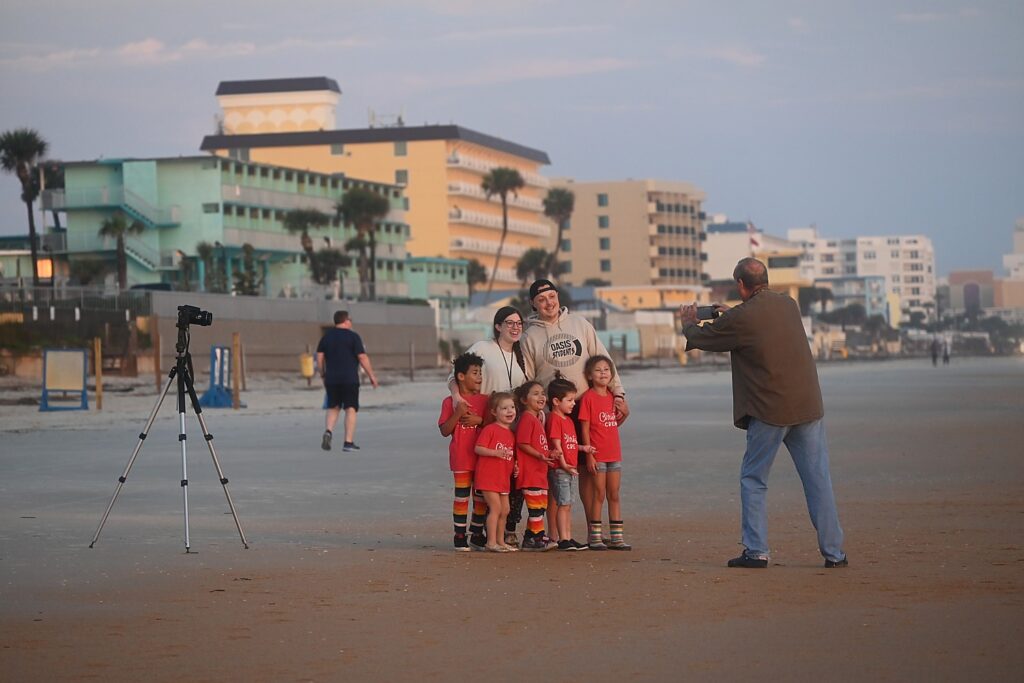
Jeffrey Dunne delights in taking photos for beachgoers on Ormond Beach © Karen Rubin/goingplacesfarandnear.com

While not my focus on this trip, I would be remiss not to include some of the immensely popular and new attractions in Daytona Beach:

Speedway Indoor Karting (SIK), which opened in late 2020, offers state-of-the-art electric powered karts and gives guests of all ages and skill levels a full racing experience on a 16- turn road course featuring multiple elevation changes and a slick tri-oval.

Daytona Lagoon Premier Waterpark and Family Entertainment Center, just north of the pier area and steps from the beach, added a wave maker Treasure Lagoon Wave Pool, arcade games, and two water slides: Kraken’s Revenge, a 54-foot-high, four-lane mat racer slide; and Shaka Halfpipe, a thrilling inner-tube experience that shoots riders backwards over a 50-foot drop. These new features, along with mini golf, go-karts, the MEGA arcade, and Sky Maze indoor ropes course make this a favorite year-round family spot.

More my speed: a new Riverfront Esplanade. The park that runs the length of historic downtown Daytona Beach is being transformed. When complete in 2022, the Riverfront Esplanade will extend a mile along the Halifax River and include a promenade along the water’s edge, running and walking trails, and landscaping designed to encourage relaxation and reflection including water features, shade trees and raised botanical gardens.

Interactive maps for themed trails are available on DaytonaBeach.com including the new Cars, Craft and Culture trail, Share The Heritage Trail, Monuments & Statues Trail, an Iconic Trail and a Motorsports Trail to add to its popular Hiking & Biking Trails and the Ale Trail.

For more information, Daytona Beach Area Convention & Visitors Bureau,126 E. Orange Avenue, Daytona Beach, FL 32114, 386-255-0415, DaytonaBeach.com.

____________________

© 2022 Travel Features Syndicate, a division of Workstyles, Inc. All rights reserved. Visit goingplacesfarandnear.com, www.huffingtonpost.com/author/karen-rubin, and travelwritersmagazine.com/TravelFeaturesSyndicate/. Blogging at goingplacesnearandfar.wordpress.com and moralcompasstravel.info. Send comments or questions to [email protected]. Tweet @TravelFeatures. ‘Like’ us at facebook.com/NewsPhotoFeatures

Wilmington/Brandywine Mansions & Gardens Welcome Mobility-Challenged Visitors

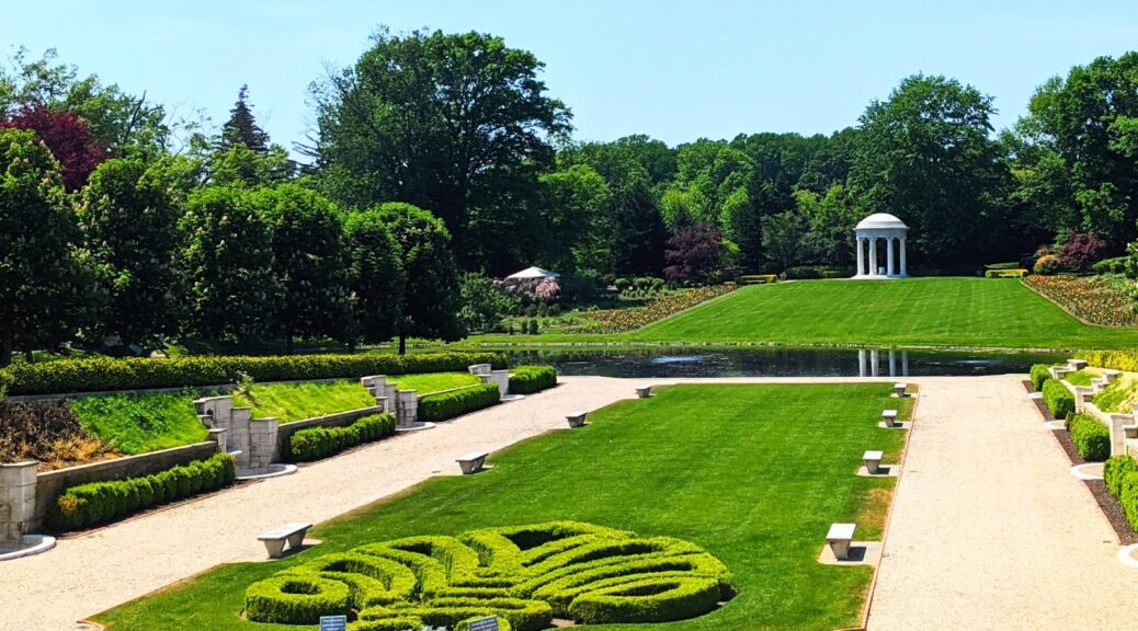
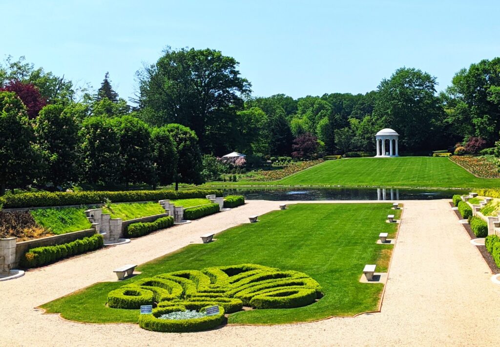
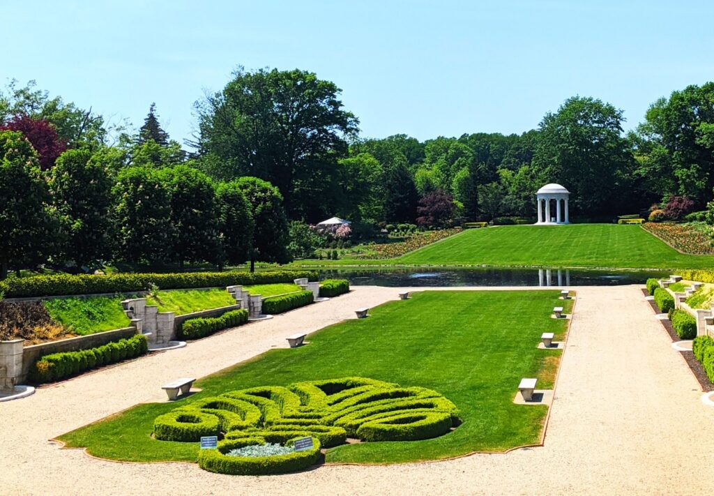
The Sunken Garden at the Nemours Estate, Wilmington, DE © Laurie Millman/goingplacesfarandnear.com

By Laurie Millman and Martin Rubin, Travel Features Syndicate, goingplacesfarandnear.com

We’ve heard for years about the beautiful DuPont family mansions and gardens in the Wilmington, Delaware and Brandywine Valley region. With Marty now mobility-challenged, we set out on a long weekend to visit these fine architectural examples of Gilded, Industrial Age homes and gardens, to check out first-hand how the DuPont historic sites accommodate visitors with accessibility issues:

Winterthur Mansion and Gardens

The Winterthur grounds are expansive, with walking trails running through 1,000 acres of woods, meadowlands and farmland. Natural and groomed paths are also found throughout the 60-acre gardens surrounding the childhood home and country estate of Henry Francis DuPont (1880-1969). The Mansion complex includes the family home, botanical labs, Library and Museum galleries revolving exhibits.

A Dupont Family Home – Winterthur Museum, Garden & Library© Laurie Millman/goingplacesfarandnear.com

Winterthur offers a number of accessibility options to tour the garden area and the mansion complex:  a) Companion-guided wheelchairs and strollers are available at no cost at the Visitor Center where you pick up your tickets, as well as at the Galleries Reception Atrium. b)  Shuttles and trams for touring the gardens and reaching the mansion and galleries have wheelchair lifts and ramps, and designated wheelchair spots that allow a wheelchair to be securely locked in place.  There is a sharp incline leading up to the mansion’s main entrance from the tram stop, which will require some effort to push a wheelchair up the hill; but once inside, it is easy to navigate around the main floor of the house with an accessibility device.

Guide and therapy dogs are allowed on the shuttle and tram, as well as in the buildings. Assistive listening systems are available for guided tours and special presentations. With at least one week’s notice, a sign-language interpreter can be hired for your visit. The grounds have restrooms with ADA bars and are wide enough to accommodate a wheelchair or mobile scooter.

Winterthur is open to the public from late February through mid-November.   Tour tickets are currently available by calling 800-448-3883, or on-site in the Visitor Center. Reserve a wheelchair when you make a tour reservation, to ensure availability when you arrive. To learn more about accessibility options at Winterthur, explore this link: https://www.winterthur.org/visit/plan-your-visit/transportation-and-special-needs-access/. For a virtual tour of Winterthur, go to https://tour.winterthur.org/.

Winterthur Mansion and Gardens, 800-448-3883, 5105 Kennett Pike, Winterthur, DE 197350, www.winterthur.org.

Nemours Estate

The early 20th century home and grounds of Alfred I. DuPont was designed in a late 18th-century French style. Nemours offers self-guided tours of the mansion. You will have to bring your own mobility devices, as the Estate does not rent wheelchairs, electric scooters or strollers, nor does it offer a shuttle or tram to tour around the 200 acres of grounds and gardens.

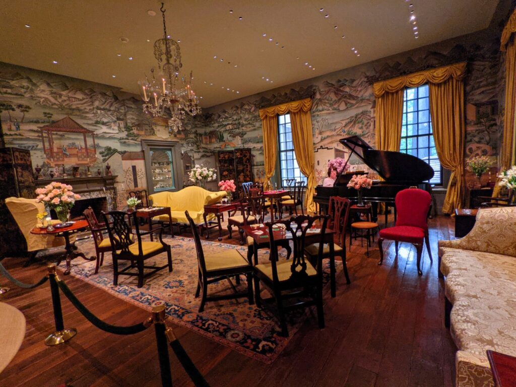
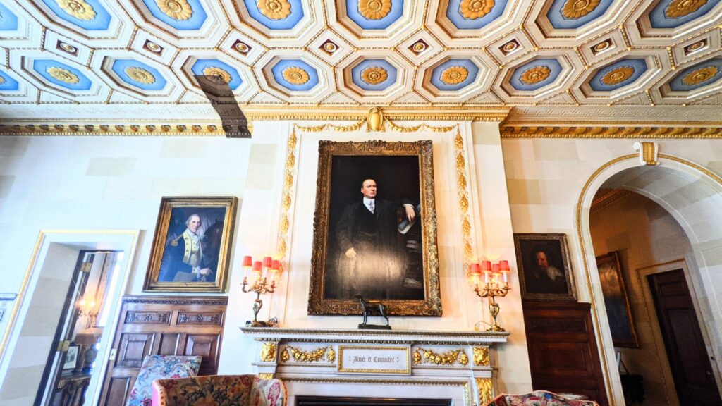
A fine example of a Gilded Age Home at the Nemours Estate, Wilmington, DE © Laurie Millman/goingplacesfarandnear.com

Nemours mansion and gardens is a hike from the parking lot. For those walking the grounds, wear comfortable walking shoes.   Although the roads and paths leading to the mansion are flat, paved, and accessible by wheelchair, scooter, and stroller, the garden paths are not paved nor handicap accessible.  However, between the beautifully manicured sunken gardens, reflection pools and Art-Nouveau statues, there is a wide overlook for picturesque views, which can be reached by a mobility device.

When arriving at the Nemours mansion, the staff is very accommodating for visitors traveling with mobile devices (strollers are not allowed inside): they put out small ramps to get our wheelchair over a few steps leading into the mansion’s main floor. Once inside, visitors take a self-guided tour of the two accessible floors. Nemours has a huge, grand spiraling staircase leading up to the bedrooms on the second floor. Alternatively, for assistance to go up to the second floor, a first floor mansion attendant will contact a member of the staff on the second floor and direct you to an elevator that opens to a mezzanine level. The second floor attendant will be waiting to assist with a stair lift to the second floor.

The Estate is open to visitors from April through December, with self-guided tours of the mansion and chauffeur’s garage. ADA bathrooms are located a short walk from the parking lot and in the mansion. Food and water are not available onsite, but visitors are encouraged to bring food and water, even to bring a blanket to picnic on the grounds.  Service animals are allowed on the grounds and in the mansion.

Nemours Estate, 600 Rockland Road, Wilmington, DE, 302-651-6912, http://nemoursestate.org

Hagley Museum and Library

The Hagley complex offers a hands-on learning experience for all ages about early American commerce and life. The 235 acres of the Hagley grounds, founded by E. I. DuPont in 1802 for manufacturing gunpowder, rise above the Brandywine River.  Open daily, Hagley currently offers small-group tours of the ancestral DuPont family home and garden. Interpretive docents and demonstrations are also found at the restored mill, the artisans building, and the Workers Hill Community, where the gunpowder works employees lived.

Pick up tickets for your timed tour at the Hagley Visitor Center and Gift Shop. A bus with a wheelchair lift leaves from the Visitor Center parking area.  Some areas of Hagley are not easily navigable in a mobility device – ask the staff in the Visitor Center to highlight those areas on a grounds map. To reserve a group tour or a lunch and learn tour, go to https://www.hagley.org/plan-your-visit/hours-admission, call 302-658-2400, or email [email protected]. Call or email to confirm wheelchair availability.

Hagley Museum and Library, 200 Hagley Creek Rd, Wilmington, DE, 302-658-2400, www.hagley.org.

Longwood Gardens

Longwood Gardens was developed initially in the early 20th century by Pierre DuPont to be enjoyed by family and friends. To perpetuate and expand his vision, after DuPont died in the mid-1950s, the mission of the Gardens was to continue for public enjoyment and education.  This is one of our favorite gardens in the country and one of the largest in the world. With 1,100 acres of outdoor gardens, Longwood is open year-round for visitors (even Christmas Day!) to enjoy the ever-changing seasonal displays of outdoor natural beauty, along with “dancing” fountains scattered throughout the grounds and beautiful, indoor glass conservatories (one of them a massive 4.5 acres).

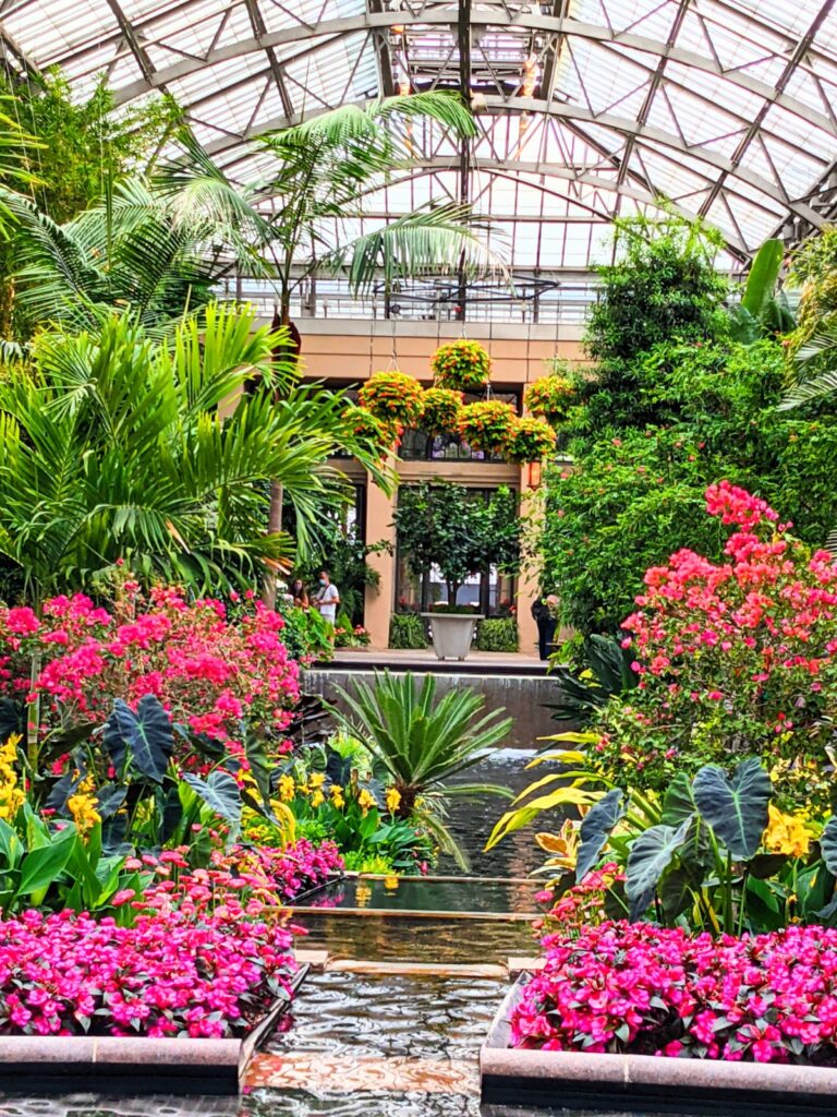
Conservatory at Longwood Gardens, Kennett Square, PA © Laurie Millman/goingplacesfarandnear.com

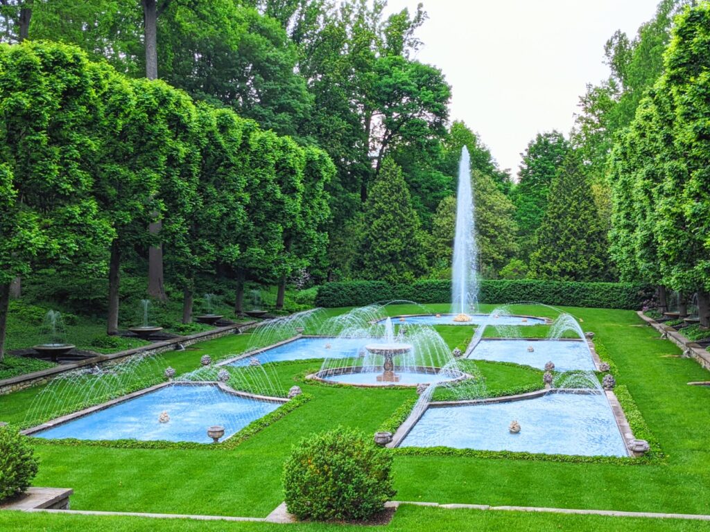
Over the past few years, the Main Fountain Garden area has been the location of beautiful fountain, light and fire shows with synchronized music. Fountain performances will resume on May 5, 2022. 

Longwood does not offer a shuttle or tram to tour around the large park, but the hilly garden paths are primarily paved and mobility device accessible, as well as most buildings. Visitors to Longwood Gardens are strongly recommended to bring their own mobility devices (strollers, wheelchairs and scooters with 3 or more wheels).  Through our experience, electric-powered mobility scooters will handle the steeper paths better than companion-pushed wheelchairs.  The Visitor’s Center offers a limited supply of electric scooters on a first-come, first-served basis, with a “pay as you wish” rental fee policy for the entirety of your visit – more of a donation than a fixed price. A limited number of free wheelchairs and strollers are also available at the Visitor’s Center. The Gardens provides many water fountains and bathrooms that are mobility device accessible. Service dogs are permitted on the grounds and in the buildings. With at least two week’s notice, a sign-language interpreter will be available for a private, guided group walking tour; amplified listening devices are also available for use on the private tours.

At this writing, the Gardens is selling timed tickets. Check out availability and ticket prices at https://longwoodgardens.org/visit.

Longwood Gardens, 1001 Longwood Rd, Kennett Square, PA 19348, 610-388-1000, https://longwoodgardens.org.

As our experience shows, there is no reason not to continue to explore and experience attractions and destinations, just prepare in advance.

April is National Garden Month

April is National Garden Month. As the colors of spring begin to appear across Wilmington and the Brandywine Valley, enjoy the warmer weather and change of seasons with a weekend tour of the region’s numerous botanical gardens, all within a short distance of one another.

Jennifer Boes, Director of Marketing Communications and Media Relations for Greater Williamsburg prepared this driving itinerary:

Start at Rockwood Park, just off I-95 in north Wilmington. Though not as well known as some of the area’s other gardens, the grounds surrounding the rural Gothic-style Rockwood Mansion are sublime. Explore the 72 acres of parkland including a six-acre formal garden. Unique features include a monkey puzzle tree (an unusual-looking evergreen native to Chile); a ha-ha (a sunken wall used to keep livestock away); and a stone from the Giant’s Causeway, a distinctive hexagonal rock formation along Ireland’s coast. An apothecary garden, filled with medicinal plants, was added in fall 2019.

Hagley Museum & Library’s gardens are as much about function as they are about form.  It has two very different restored gardens that date back to the 1800s: one that fed the du Pont family and another that fed company workers. A pollinator garden, new in 2020, attracts a variety of butterflies and bees.

Nemours Estate’s French-style gardens, inspired by Versailles, are among the finest and largest of their kind in the U.S. There’s a formal boxwood garden and a maze dominated by a sculpture gilded in 23-karat gold leaf. The Baroque-style Russian gate was acquired from a palace built by Catherine the Great. The English gate was once used at Wimbledon Manor. In addition to the formal gardens, there are family-friendly woodland walking trails to explore.

The Sunken Garden at the Nemours Estate, Wilmington, DE © Laurie Millman/goingplacesfarandnear.com

Winterthur Museum & Gardens features 1,000 acres of rolling hills, streams, meadows and forests. A favorite of the young and young at heart is the fairytale-like Enchanted Woods with its Faerie Cottage and Tulip treehouse. From April into May, the Azalea Woods, with thousands of Kurume azaleas and wildflowers that weave through the forest, is a must see.

Winterthur Enchanted Woods – Winterthur Museum, Garden & Library, Wilmington, DE © Laurie Millman/goingplacesfarandnear.com

The nationally renowned Longwood Gardens is home to 11,000 varieties of plants spread across 1,100 acres of meadows, woodlands, and elaborate horticultural displays. In the four-acre conservatory, don’t miss the Wood’s Cycad. Called Longwood’s “King of the Conservatory,” this palm tree-like plant is extinct in nature and one of the rarest plants in the world.

Dancing Fountains at Longwood Gardens, Kennett Square, PA © Laurie Millman/goingplacesfarandnear.com

The final stop on the garden tour is Mt. Cuba Center in Hockessin, Delaware. Opened for general admission to the public in 2013, it is home to more than 1,000 native plants, many of which are threatened by extinction. On the gently rolling hills of the Delaware Piedmont, part of the Appalachian Mountain system, it consists of 630 acres of historic pastures, fields, ponds, native forests, a woodland wildflower garden, and formal landscapes. One notable feature is the trillium garden, containing every trillium species native to the eastern U.S.

The Greater Wilmington Convention & Visitors Bureau is an excellent source of information to preplan your visit to the Wilmington-Brandywine region: 800-489-6664, www.visitwilmingtonde.com.

______________________

© 2022 Travel Features Syndicate, a division of Workstyles, Inc. All rights reserved. Visit goingplacesfarandnear.com, www.huffingtonpost.com/author/karen-rubin, and travelwritersmagazine.com/TravelFeaturesSyndicate/. Blogging at goingplacesnearandfar.wordpress.com and moralcompasstravel.info. Send comments or questions to [email protected]. Tweet @TravelFeatures. ‘Like’ us at facebook.com/NewsPhotoFeatures
Experience Sonoma Like a Local

A late afternoon stroll in our Sonoma “neighborhood” © Karen Rubin/goingplacesfarandnear.com

By Karen Rubin, Travel Features Syndicate, goingplacesfarandnear.com

You know the refrain: “It’s a nice place to visit, but I wouldn’t want to live there.” Rare is the place that is equally precious to visit and reside. Fortunately, our family has decided to reside in such a place, and I get to visit: Sonoma, California.

Just 43 miles northeast of San Francisco, Sonoma has long been a retreat for urban dwellers, offering a “healthier” climate.  

Sonoma is the perfect combination of man and nature, as the vineyards attest, and residents today are obsessive about preserving that balance. In fact, the Sonoma County Tourism, as part of its continued commitment to encourage responsible stewardship from visitors and residents, has just joined the Global Sustainable Tourism Council.

The historic plaza is the centerpiece of Sonoma © Karen Rubin/goingplacesfarandnear.com

This is my second visit to Sonoma and while my family works, I get to explore like a local, hopping on a bike to ride the delightful paved recreation trail that goes right into the exquisitely quaint, historic village center and out to the vineyards. On my first trip, we biked, visited wineries, and hiked the spectacular Pacific coast. This trip, I focus on Sonoma’s history, heritage and the fascinating people who shaped it. What is more surprising is how contemporary the history feels – truly, history repeats.

Sebastiani Theatre in Sonoma’s historic village plaza © Karen Rubin/goingplacesfarandnear.com

It starts at the village plaza – utterly charming today with lovely restaurants, wine tasting rooms and boutiques – but dotted with really important historic sites that are part of Sonoma State Historic Park, a collection of six sites located throughout the community.

Sonoma’s City Hall © Karen Rubin/goingplacesfarandnear.com

I start at the Barracks, a military post of Mexican soldiers established in 1834 to serve as a buffer to Russian expansion from Fort Ross (!!!). The Russians had come in 1812 to produce crops and trap furs to supply their Alaskan settlement. (The Russians ultimately moved out, ironically, just before gold was discovered.) You can see a room furnished as if the soldiers were still there. It is interesting to learn that they had to supply their own uniforms, horse and supplies, and basically buy them back from the Commandante. The barracks turns out to be the best place to start my journey because it offers an excellent video that encapsulates the history of this place, and puts everything into context.

The Barracks in Sonoma’s historic plaza © Karen Rubin/goingplacesfarandnear.com

From 1834-1846, it was the headquarters for General Mariano Guadalupe Vallejo, the Commandant of the Frontera del Norte – the northern Mexico provincial frontier – who built it, as well as the Plaza. More than 100 military expeditions set out from Sonoma to subdue rebellious Wappo and Cainameros or Satisyomis native tribes trying to overthrow Mexican domination. For ten years, until 1844, the Presidial company of Sonoma was considered the most powerful military force in California. During the short-lived California Republic, the barracks housed Republic followers until July 9, 1846, when the Stars and Stripes flag was first raised at Sonoma. It then served as an army post.  In 1860, Vallejo remodeled the barracks to serve as a winery. (Vallejo’s story, I learn, underpins just about everything in Sonoma.)

Mission San Francisco Solano was founded in 1823 © Karen Rubin/goingplacesfarandnear.com

Across the street from the Barracks is Mission San Francisco Solano – the last of 21 missions established in California. It was founded in 1823 to convert Native Americans to Christianity – often forcibly. Indians would come to the mission first out of hunger –since the colonists introduced disease, technology and livestock which depleted the corn that was their mainstay. The Indians’ had their own culture, religion, lifestyle which “was contrary to the colonists” and so, had to be eradicated. Under the mission system, families were split up, children taken for indoctrination. Indians revolted and tried to escape the mission and the soldiers would hunt the “fugitives” down and bring them back. I learn in the video in the Barracks. (There is a display, “Collision of Cultures,” which acknowledges the tribes’ experience.)

“The Sonoma mission’s sphere of influence reached its peak around 1832, with nearly 1,000 Native California Indians in residence and 10,000 acres of land used to raise crops and livestock.” In 1834, the Mexican government secularized all the missions into parish churches – which was General Vallejo’s task.

The dining room at Mission San Francisco Solano now exhibits watercolors created between1903-5 by Chris Jorgensen depicting the 21 missions © Karen Rubin/goingplacesfarandnear.com

The Dining room today houses a marvelous exhibit of watercolors created between 1903-5 by Chris Jorgensen depicting the 21 missions that remained. His watercolors helped generate interest in preserving the missions. It is most interesting to see his watercolor of this mission as it stood.

Mission San Francisco Solano, as captured by Chris Jorgensen © Karen Rubin/goingplacesfarandnear.com

The small adobe chapel on the west side of the Padres’ Quarters, built and furnished by General Vallejo in 1840, replaced the original mission church.

The small adobe chapel on the west side of the Padres’ Quarters, built and furnished by General Vallejo in 1840, replaced the original mission church © Karen Rubin/goingplacesfarandnear.com

It is here in the mission that I meet Ranger April Farnham. When I ask if she is a native Californian, she tells me of her great great great aunt, Eliza Farnham, born in Rensselaerville, NY in 1815, who came to northern California in 1849 with her two sons (her husband, Thomas Farnham, was apparently a rogue). What a character! Wikipedia describes Farnham as a novelist, feminist, abolitionist and activist for prison reform (she worked as the matron of Sing Sing prison’s women’s ward). She returned to New York in 1856 and  in 1859, organized a society to assist destitute women find homes in the West. She returned to California, but died in New York City, at the age of 49, of consumption.

(I’m so intrigued about her, I look up her publications: Life in the Prairie Land, 1846 – An account of life on the Illinois prairie near Pekin between 1836 and 1840; California, In-doors and Out, 1856 – A chronicle of her experiences and observations on California; My Early Days, 1859 – An autobiographical novel; Woman and Her Era, 1864 – “Organic, religious, esthetic, and historical” arguments for woman’s inherent superiority’ and The Ideal Attained, 1865 – The heroine molds the hero into a worthy mate.)

General Vallejo’s Home

“Lachryma Montis,” the “Yankee Home” of General Mariano Guadalupe Vallejo, provides a window into Sonoma’s fascinating founder ©Karen Rubin/goingplacesfarandnear.com

I get back on my bike to visit General Vallejo’s home, Lachryma Montis, a 20-acre site (out of his original 500 acres) just along the path about a mile from the mission. Here you appreciate what a visionary – even progressive – Vallejo was, and how instrumental he was to the founding and nurturing of Sonoma through its multiple transitions. By the time he was 40, he had lived under four flags – Spanish, Mexican, the Bear Revolution and then the United States.

Born in 1807 to an upper class Spanish family, his career paths were limited to the military, politics or church. He chose the military. At the age of 25, a lieutenant, he commanded Presidio de San Francisco, the “director of colonization.” In 1826, he was ordered to secularize the missions and transfer power from the church to civil authorities.

The Mexican government fell into chaos; there were frequent changes of governor in his district. Vallejo got no assistance from Mexico and had to pay his soldiers out of his own pocket. The settlers became Mexican citizens, learned Spanish but were different from the “Yankees” who began to come through.

After Mexican Governor Jose Castro proclaimed that the purchase or acquisition of land by foreigners who had not been naturalized as Mexicans “will be null and void, and they will be subject (if they do not retire involuntary from the country) to be expelled whenever the country might find it convenient.” 33 Yankees lead the Bear Flag Revolt against Mexican authorities. They attacked Sonoma, took Vallejo prisoner, imprisoning him at Sutter’s Fort for two months, where he contracted malaria and was a dath’s door before being released. “His imprisonment lasted longer than the Republic” (communication was slow). At the time of the Bear Flag Revolt, (June–July 1846), there were 500 Americans living in California, compared with between 8,000 and 12,000 Mexicans.

Despite the Treaty of Guadeloupe that ended the Mexican-American War (1846-1848) assuring the Mexicans their property ownership would be respected, the Yankees claimed the property belonged to them “by right of conquest”.  Mexicans, including Vallejo, had to fight in court to prove title and that often put them in debt. His holdings were reduced from 500 acres to 20 acres, but he kept his vineyards.

Vallejo family photos on view in a small museum in the visitors center of his home, part of the Sonoma State Historic Park, give insight into Sonoma’s founder and visionary ©Karen Rubin/goingplacesfarandnear.com

Indeed, Vallejo also had a hand in developing wine-making in Sonoma. His two older daughters married sons of Count Agoston Haraszthy, who began the first vineyards (you can learn this part of the history at Haraszthy’s Buena Vista winery).

Ever adapting, Vallejo went on to be elected state senator for Sonoma, serving until 1853.

“Lachryma Montis,” the “Yankee Home” of General Mariano Guadalupe Vallejo, provides a window into Sonoma’s fascinating founder ©Karen Rubin/goingplacesfarandnear.com

What is striking about Vallejo’s home is that it looks like it was deposited here from New England. Vallejo referred to his dwelling as the “Yankee Home” or “Boston House,” departing from traditional adobe style. That was deliberate on his part, to symbolize change (and acceptance) of becoming part of the United States.

You start your visit in the Chalet, a Tudor-style structure which originally was a storage house and granary, now a visitor center that houses a museum with family photos and personal artifacts of Vallejo and his family (he had 16 children, 10 of whom lived to adulthood), as well as their magnificent carriage. The furnishings in the main house, too, are mainly from the family.

Seeing the home as if the Vallejo family still lived there ©Karen Rubin/goingplacesfarandnear.com

You visit the parlor, which Vallejo furnished with items from around the world, the master bedroom, his daughter, Maria’s, bedroom, the nursery. You visit the bedroom of Luisa, his 15th child, who was born here, married here and, after being widowed, raised her three children in the house; she cared for her elderly parents and inherited the estate where she lived until her death in 1943 at 87. She sold the estate to the state of California in 1933 and served as its curator from 1933-1943.

The picturesque stone and masonry reservoir supplied the Vallejo home with water from natural artesian springs ©Karen Rubin/goingplacesfarandnear.com

There are several other interesting buildings and structures: the picturesque stone and masonry reservoir was constructed in the 1850s to collect water from natural artesian springs; a tiny cottage, the Hermitage, or “Napoleon’s Cottage” at the top of a winding stone staircase above the reservoir, where Vallejo’s youngest son, Napoleon, moved in 1865 at the age of 15, and kept 14 dogs, two monkeys, three cats and one parrot.  

A monument to the Bear Flag Rebellion, which briefly established the California Republic ©Karen Rubin/goingplacesfarandnear.com

Sonoma’s Plaza itself – the birthplace of the state’s Bear Flag – is picturesque. You can see a monument to where rebels raised their new, homemade flag and declare their own republic, June 14, 1846. (The Bear Flag Republic lasted just 24 days; then the United States took over).

There is also City Hall, a pavilion for outdoor events, and across the way, a lovely old-timey movie theater.

The Sonoma State Historic Park (363 Third Street W, Sonoma CA 95476, 707-938-1519). includes six sites – in addition to the Mission, the Barracks and Lachryma Montis, it also includes Casa Grande (Vallejo’s home on the plaza), the beautiful Blue Wing Inn (built to house soldiers it later accommodated such famous visitors as US Army officer Ulysses S. Grant); and Toscana Hotel. For a schedule of docent-led tours, visit www.parks.ca.gov or call 707-938-9560. (The $3 admission includes same-day visit to the Barracks and General Vallejo’s Home (363 3rd St. West) and Petaluma Adobe State Historic Park (3325 Adobe Road, Petaluma).

The Buena Vista Winery. Count Agoston Haraszthy planted the first vineyards in Sonoma; Vallejo’s two daughters married his sons © Karen Rubin/goingplacesfarandnear.com

My biking takes me into the vineyards that completely ring the village. I return to the Buena Vista Winery, founded by Count Agoston Haraszthy, who came from Hungary initially in pursuit of gold but in 1857, decided instead to build a stone winery on the property. He introduced cuttings from Europe’s best vineyards to California and basically proved that California could produce wine. Buena Vista Winery, 18000 Old Winery Road, Sonoma, CA 95476, 800-926-1266, [email protected], www.buenavistawinery.com.

There are about 90 vineyards and wineries you can explore, see Sonoma.com.

I also come upon a wonderful local community garden, Sonoma Garden Park, which is a working farm, education center and “vibrant gathering place” where I encounter a gardener who comes up from San Francisco and learn about sustainable gardening in this drought-plagued place (Seventh St. East & MacArthur).

Jack London State Park

Jack London State Historic Park© Karen Rubin/goingplacesfarandnear.com

Another marvelous example of this merging of man and nature is the Jack London State Park in nearby Glen Ellen, where we go for a hike and discover a most intriguing history.  I was expecting to hike in the woods, but the historic and biographical features blew me away.

I always associated Jack London with San Francisco and Alaska. It was a complete surprise to learn that Glen Ellen was home to the writer/adventurer from 1905 until his untimely death in 1916, at age 40, of gastrointestinal uremic poisoning. London pioneered new agricultural techniques here at his 1,400-acre Beauty Ranch.

Jack London State Historic Park© Karen Rubin/goingplacesfarandnear.com

“London was well ahead in the real estate game in 1905 when he began buying up what was then exhausted farmland around Glen Ellen,” writes Kenneth Brandt, The Short, Frantic, Rags-to-Riches Life of Jack London,” in Smithsonian (www.smithsonianmag.com/smithsonian-institution/short-heroic-rags-riches-life-jack-london-180961200). “His intention was to restore the land by using innovative farming methods such as terracing and organic fertilizers… ‘I see my farm,’ he declared, ‘in terms of the world and the world in terms of my farm.’ Today, docents lead tours showcasing London’s progressive ranching and sustainable agricultural practices.”

Jack London State Historic Park© Karen Rubin/goingplacesfarandnear.com

We wander through the ruins of his old stone winery and see a stone barn. You can visit the magnificent ruins of London’s 15,000-square-foot Wolf House mansion, built out of native volcanic rock and unstrapped redwoods, that would have had 26 rooms and nine fireplaces, a library measuring 19 x 40 feet, a two-story high living room, a wine cellar and – befitting a forward looking innovator – electric lighting and built-in vacuum cleaning system. It cost $75,000 ($1.9 million today) to build, but burned to the ground a month before completion.

Jack London State Historic Park© Karen Rubin/goingplacesfarandnear.com

“Built out of native volcanic rock and unstripped redwoods, it was to be the rustic capstone of Beauty Ranch and architectural avatar Jack London himself. He was devastated over the fire but vowed to rebuild. He would never get the chance,” Brandt writes.

I learn how contemporary London actually was, his writings and outlook remarkably prescient (or else you realize things don’t actually change but only repeat) – he could have been writing today. “He also remained politically engaged,” Brandt writes, quoting London from a 1914 letter: “If, just by wishing I could change America and Americans in one way. I would change the economic organization of America so that true equality of opportunity would obtain; and service, instead of profits, would be the idea, the ideal and the ambition animating every citizen.”

We set out on our hike (there are 20 miles of trails) through lush forest, majestic redwood groves, and meadows (a scenic six-mile trail leads to the top of Sonoma Mountain; you also can explore by horseback or bike), passing by a gorgeous vineyard to get to the trail. (We note the sign warning about rattlesnakes as we enter.)

Jack London State Historic Park© Karen Rubin/goingplacesfarandnear.com

I must return to visit the museum housed in “The House of Happy Walls” where there are displays of London’s books along with artifacts London and his second wife, Charmian, brought back from their 27-month sailing adventure among unexplored South Seas islands. (Volunteer pianists play on Charmian’s 1901 Steinway grand piano in the cottage where she lived from 1934 until she died in 1955.)

Jack London State Historic Park© Karen Rubin/goingplacesfarandnear.com

The park is very popular with locals in the know about all there is to do here – including concerts, performances, lectures, piano recitals; year-round there are free docent-guided tours, docent-led Sunday morning hikes, and other park events. Download a park map.

(Jack London State Historic Park, 2400 London Ranch Road, Glen Ellen, CA 95442, 707-938-5216, jacklondonpark.com).

You can pick up picnic supplies, as we did, at the superb Glen Ellen Village Market or croissants, mini-sandwiches and other baked goods at Les Pascals bakery.

In the late afternoon, we take a walk in the “neighborhood”:

A late afternoon stroll in the Sonoma “neighborhood” © Karen Rubin/goingplacesfarandnear.com
Moon rise during our late afternoon stroll in the Sonoma “neighborhood” © Karen Rubin/goingplacesfarandnear.com

See also: WINE & ART: THE PERFECT PAIRING IN SONOMA, CALIFORNIA (https://goingplacesfarandnear.com/wine-art-the-perfect-pairing-in-sonoma-california/)

For excellent planning materials, visit Sonoma County Tourism, 800-576-6662, [email protected]www.sonomacounty.comwww.sonomacounty.com/things-to-do.                

______________________

© 2022 Travel Features Syndicate, a division of Workstyles, Inc. All rights reserved. Visit goingplacesfarandnear.com, www.huffingtonpost.com/author/karen-rubin, and travelwritersmagazine.com/TravelFeaturesSyndicate/. Blogging at goingplacesnearandfar.wordpress.com and moralcompasstravel.info. Send comments or questions to [email protected]. Tweet @TravelFeatures. ‘Like’ us at facebook.com/NewsPhotoFeatures
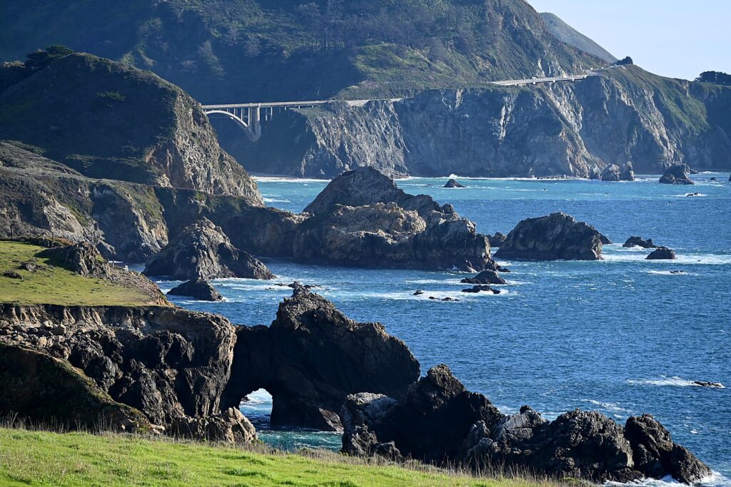
Weekend in Mendocino: Historic Skunk Train Introduces a Novel RailBike Experience

The legendary Skunk Train on the Pudding Creek track, out of the historic depot in Fort Bragg, California © Karen Rubin/goingplacesfarandnear.com

By Karen Rubin, Eric Leiberman & Sarah Falter

Travel Features Syndicate, goingplacesfarandnear.com

Our Mendocino, California weekend sojourn continues. From the Brewery Gulch Inn, where we stayed our first night, it is a picturesque 20 minute drive up the coast to Fort Bragg for the Skunk Train, a vintage steam train that weaves through the redwood forests of the Noyo River Canyon. That was alluring enough, but what really captured our imagination was the idea of riding a “railbike” on the same train tracks through the forest. Railbike?

Before you board the Skunk Train or railbike, sure to visit the model train display and the historic exhibits across the track from the Skunk Train depot © Karen Rubin/goingplacesfarandnear.com

Train buffs will be absolutely ecstatic to visit the historic train station, walk across the tracks to a fantastic model train exhibit and historical society exhibit housed in appropriately aged buildings (so atmospheric), then board the train for a fairly short ride about 3 ½ miles down the track along the Pudding Creek, to Glen Blair Junction before returning, for a total of 7 miles. Weather permitting, you can ride an open car or sit inside the vintage cars.

Boarding the Skunk Train at Glen Blair Junction © Karen Rubin/goingplacesfarandnear.com

Since 1885 the historic Skunk has made its way through these old-growth redwood groves, over scenic trestle bridges, through tunnels, and into the heart of the Noyo River Canyon, primarily for logging purposes. Today, the repurposed train offers five trains that ply two different routes and two different railbike experiences.

First the railbike experience.

Riding the railbike through the redwood forest en route to Glen Blair Junction © Karen Rubin/goingplacesfarandnear.com

Two of us have already gotten onto our railbike (it seats two people) – custom-built, patent pending, specially designed like a recumbent, where you sit back, outfitted with electronic-assist, and virtually silent so you can really appreciate the forest.

Riding the railbike through the redwood forest en route to Glen Blair Junction © Karen Rubin/goingplacesfarandnear.com

We take the more modest of the railbike trips that are offered, The Pudding Creek railbike trip, which gives you an excellent taste and can be done by just about anyone. It is 7 miles roundtrip traveling along the same tracks as the scenic train – in fact, the trips are coordinated so the railbikes leave first, then the train, then the train leaves and the railbikes follow. (Note: it is downhill most of the way but uphill most of the way back, along a grade that is higher than most railroads – no problem, you have the motor assist!). There are two guides who accompany us – one in front and one in the back. People follow one after another but everyone is independent.

Railbikers return to the station © Karen Rubin/goingplacesfarandnear.com

One person is designated the “driver” (the other is the passenger) who is given an orientation before we set off how to brake and use the electronic assist; the passenger just pedals (it is manageable for a parent and young child). It is fun, and you get this wonderful opportunity to just chat and be together as you roll through the forest.

The Puddle Creek railbike excursion takes less than two hours, including time at Glen Blair Junction where we get off (as the railbikes are reversed for the return), and can walk a delightful forest loop trail.

This gives the historic train time to arrive, the train passengers to also get out and stretch, and depart before the railbike riders start back. The guide gives us some narration here and points to where the train tunnel has collapsed.

While Eric and I set out on the railbike, Sarah boards the train at the Fort Bragg depot for the relaxed, scenic 7-mile roundtrip journey on the Pudding Creek Express, traveling along the same Pudding Creek Estuary through primeval ancient redwoods forest to the Glen Blair Junction.

The stop at Glen Blair Junction gives the railbikers time to hike a short trail in the redwood forest which brought industry and settlers to Mendocino © Karen Rubin/goingplacesfarandnear.com

Trains also stop at Glen Blair Junction for 15 minutes, allowing the passengers to get off and explore. But if you would like to spend more time walking the trails among the redwoods, you can stay behind and catch the next train (roughly two hours later). You can bring a packed lunch (to enjoy at the picnic tables set out there.

We organize it so I switch off with Sarah who has come on the train so she can experience the railbike and I can experience the train on the way back (how clever of me since the return was more uphill). Both were delightful experiences and the length well suited to families with young children.

The Skunk Train claims to be the crookedest train in the West © Karen Rubin/goingplacesfarandnear.com

On the way back I hear the narrator say these were some of the first tracks ever laid down by the California Western Railroad in 1885 and have been used in some fashion just about ever since. He claims it is also the most crooked train in the West, possibly the world (though I would need confirmation of that). 1940s music is playing as we roll along. I mostly stay in the open car but wander through the passenger cars to see what that is like.

The Skunk Trains operate with both Diesel-Electric engines and a #45 Baldwin 2-8-2 Mikado Steam Engine, the Super Skunk, pulling the passenger cars, including a bar car with snacks, non-alcoholic drinks, beer, wine, and spirits, as well as an open air car.

Train buffs will love the back story of this historic train: the Fort Bragg Railroad was formed in 1885 to make transporting lumber easier, eventually being incorporated into the California Western Railroad, commonly known as The Skunk.

The train played a vital role transporting families and workers to their logging camps along the route, making The Skunk a different type of railroad, the website notes: It not only was key to the area’s economic activity but also its social and cultural life. “No other logging railroad in America has made the deep impression on American life that was created by the line from Fort Bragg – first by the natural beauty of its route and later, by the distinctiveness of its equipment,” the website boasts.

The nickname “Skunk” originated in 1925 when motorcars (actually railbuses or railcruisers) were introduced on the line. These single unit, self-propelled motorcars had gasoline-powered engines for power and pot-bellied stoves burning crude oil to keep the passengers warm, but the fumes they emitted had a very pungent odor that people living along the line said smelled like skunk. “You could smell them before you could see them.” (No longer the case.)

The Skunk Train dates back to 1885 and played a vital role transporting families and workers to their logging camps along the route, and not only was key to the area’s economic activity but also its social and cultural life © Karen Rubin/goingplacesfarandnear.com

The California Western Railroad was first operated as a division of the Fort Bragg mill (Union Lumber Company, Boise-Cascade). In the mid-1960s, Arizona-based Kyle Railways began managing the railroad and purchased it in 1987. In August 1996, a group of local Mendocino Coast investors purchased California Western, marking the first time in its 111-year history that the line operated as an independent business. Today the Skunk Train is owned and operated by Mendocino Railway.

The Pudding Creek train operates year-round and the railbikes operate rain or shine, so just bring raingear if the weather isn’t great).

The Pudding Creek railbike excursion is $250 for one or two people; the train is $41.95 (Ages 13 and up); $25.95 (Ages 2-12), Infant: $10.95; Dog: $10.95.

Be sure to visit the model train display and the historic exhibits across the track from the Skunk Train depot © Karen Rubin/goingplacesfarandnear.com

Train buffs should consider the longer excursion, the two-hour Wolf Tree Turn a scenic 16-mile roundtrip journey departing from the Willits valley floor that takes you over the summit of the line (1740 feet elevation), through Tunnel #2, and down into the Noyo River Canyon where you are immersed in the redwood forest that made Mendocino County famous. The train stops briefly at Crowley, giving passengers the opportunity to visit one of the oldest and most iconic trees along the route, the Wolf Tree (named for the large growth off of one side which woodsmen called “wolf trees”) (Adult: $49.95; child: $29.95; Infant: $10.95; Dog: $10.95).

There is a much longer, more ambitious railbike experience, as well: a four-hour excursion that travels the Redwood Route takes you 25 miles along the meandering Noyo River and deep into old-growth redwood groves on a section of track now reserved exclusively for the railbikes ($495/railbike for one or two people).

Eric and Sarah pedal the railbike © Eric Leiberman/goingplacesfarandnear.com

There are loads of seasonal and themed events as well: Cinema in the Redwoods; Music in the Redwoods; Magical Christmas Train; Easter Express, Pumpkin Express; summer BBQ trains, murder mystery trains, the Mushroom Train, the Crab & Cremant train and Railbikes by Moonlight. The trains can also be used to host corporate meetings, picnics, parties, proms, weddings, baby showers, and  team building.

The Pudding Creek railbike excursion is $250 for one or two people; the Pudding Creek Express train departing Fort Bragg year-round is $41.95 (Ages 13 and up); $25.95 (Ages 2-12), Infant: $10.95; Dog: $10.95.

Skunk Train, 100 West Laurel Street Fort Bragg, California 95437;
299 East Commercial Street Willits, California 95490, www.skunktrain.com.

Glass Beach

Polished sea glass like gemstones at Glass Beach, Fort Bragg © Karen Rubin/goingplacesfarandnear.com

From here, it is a very short distance to go to Glass Beach in Fort Bragg – one of the absolute highlights of this place. The intriguing name and spectacularly picturesque scene belie the origins of the beach and why it is covered with tiny, shimmering pebbles of sea glass like gemstones: Rather than the sea glass floating in on waves from various places and mysteriously collecting here, the sea glass is in this space because it was once a garbage heap and the glass bottles tossed away over the years have broken down, smoothed and rounded by the rhythmic waves. There is a finite amount of glass so though it is illegal to remove any glass, people take what they think is an insignificant amount, and over the years, has drained the beach of much of what it used to have. Still, it is magical.

Polished sea glass like gemstones at Glass Beach, Fort Bragg © Karen Rubin/goingplacesfarandnear.com

The water crashes against rocks just off the shore here, making for dramatic scene (but not suitable for swimming or letting kids venture into the water). You can hike north up to Pudding Creek Beach where a paved multi-use trail crosses over an old train trestle; other trails go south from Glass Beach to other glassy beaches.

Dramatic scenery at Glass Beach, Fort Bragg © Karen Rubin/goingplacesfarandnear.com

Glass Beach is at the southern end of the sprawling MacKerricher State Park in Fort Bragg, which is noted for birdlife and harbor seals.

Dramatic scenery at Glass Beach, Fort Bragg © Karen Rubin/goingplacesfarandnear.com
Polished sea glass like gemstones at Glass Beach, Fort Bragg © Karen Rubin/goingplacesfarandnear.com
You can hike from Glass Beach north up to Pudding Creek Beach where a paved multi-use trail crosses over an old train trestle; other trails go south from Glass Beach to other glassy beaches © Karen Rubin/goingplacesfarandnear.com

From here, we follow the Brewery Gulch Inn’s concierge recommendation to lunch at Princess Seafood in Noyo Harbor, an actual fishing port where various restaurants have sprung up to serve the fresh catch. Princess Seafood not only is totally operated by women, but the fishing boat that brings in its catch is run by women, as well.

We take the short drive into Mendocino to explore this charming place.

Headlands Coastal Trail

You literally step across Main Street from Mendocino’s charming shops and eateries to enter Mendocino Headlands State Park, a 347-acre park that envelops this enchanting village. The coastal trail is nothing less than spectacular: dramatic 70-foot bluffs providing views of rocky offshore islands, tide pools and beaches below. The hiking trail begins at the Ford House Visitor Center and continues for some 2 miles around the entire bluff of the headlands to the north side of town.

Hiking the Headlands Coastal Trail, you get a great view of Mendocino and Portuguese Beach © Karen Rubin/goingplacesfarandnear.com

Our hike starts overlooking Noyo Bay, then snakes around to open views of the Pacific.

One of the highlights of this incomparable trail is Portuguese Beach, named for the Portuguese sailors from the Azores who were among Mendocino’s early settlers. The tide is low enough when we take the stairs down to Portuguese Beach to come upon these fabulous formations of driftwood, and can see at water level the rock arch. Eric can’t resist and with great abandon, plunges into the frigid water. The beach, its sand surprisingly soft, is aptly named, since it is reminiscent of the beaches in Portugal’s Algarve.

Encompassed by high bluffs, Portuguese Beach is reminiscent of the beaches in the Algarve of Portugal © Karen Rubin/goingplacesfarandnear.com

Continuing on the trail, we see remnants of the logging that was Mendocino’s primary industry, and, at a promontory about half-way along the trail, you take a small path to a blow hole/punchbowl where the ocean smashes up through a hole in the rocks, with a roar and a splash.

Coming upon the blow hole on the Headlands Coastal Trail © Karen Rubin/goingplacesfarandnear.com

Rounding the bend, there are dramatic rock formations. Offshore and north of the west end of Little Lake Street is Goat Island, a large flat offshore rock that is part of the California Coastal National Monument where you are also likely to see various shorebirds and seabirds. Indeed, it is a good idea to bring binoculars because whales and birds can be seen throughout the year.

Headlands Coastal Trail © Karen Rubin/goingplacesfarandnear.com

The visitor center for Mendocino Headlands State Park is in the Historic Ford House on the south side of Main Street near the beach. It is worth a visit especially if you are interested in local history and the flora and fauna you are likely to encounter at the beaches and on the trails nearby. Walking tours are also available. There are public restrooms at the north and south ends of the Headlands- on Heeser Drive and near the Ford House.

Headlands Coastal Trail © Karen Rubin/goingplacesfarandnear.com

The Headlands trail is a fabulous place to watch the sunset – the sun literally falls into the ocean – before we head to our next destination, Little River Inn.

Headlands Coastal Trail © Karen Rubin/goingplacesfarandnear.com

For excellent planning help: Visit Mendocino County, 866-466-3636, 707-964-9010, www.visitmendocino.com.

See also:

WEEKEND GETAWAY IN MENDOCINO: BREWERY GULCH INN

WEEKEND GETAWAY IN MENDOCINO: LITTLE RIVER INN

WEEKEND GETAWAY IN ENCHANTING MENDOCINO

______________________

© 2021 Travel Features Syndicate, a division of Workstyles, Inc. All rights reserved. Visit goingplacesfarandnear.com, www.huffingtonpost.com/author/karen-rubin, and travelwritersmagazine.com/TravelFeaturesSyndicate/. Blogging at goingplacesnearandfar.wordpress.com and moralcompasstravel.info. Send comments or questions to [email protected]. Tweet @TravelFeatures. ‘Like’ us at facebook.com/NewsPhotoFeatures
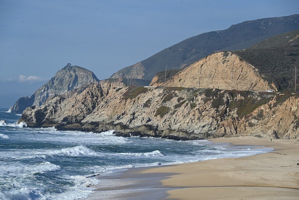
Our Favorite Hiking & Camping Gear for 2 Months On the Road in our Converted Subaru

Wild camping in our REI Half Dome 3 Plus tent by Little Payette Lake, ID © Laini Miranda/goingplacesfarandnear.com

*Black Friday & Cyber Monday Deals*

By Laini Miranda & Dave E. Leiberman, Travel Features Syndicate, goingplacesfarandnear.com

We just returned home from two months living out of our converted Subaru while we traveled 8,300 miles around the country. We outfitted our Subaru Forester with a platform bed and two drawers underneath to maximize storage, which we designed and built ourselves, and brought along enough creature comforts so that we didn’t miss a thing while we were on the road or wild camping.

Our wild camp spot outside of Silverton, CO, just before the rainstorms © Laini Miranda/goingplacesfarandnear.com

Here’s more of our round-up of our favorite hiking and camping gear (See also: Car Camping in Comfort: How We Turned our Subaru into Our Home On the Road):

WEARABLES

Smith’s Chromapop Lowdown Slim 2 are the perfect polarized sunglasses to enrich every day of our 7 weeks on the road. There’s not a day we spend without these glasses © Laini Miranda/goingplacesfarandnear.com

Smith Chromapop Sunglasses – $179.99

These sunglasses are probably the most important gear we own and the most noticeable improvement to this trip versus our previous desert adventures. Dave has enjoyed Warby Parkers in the past and both of us are usually very happy with our standard >$20 sunglasses. These Smith glasses, however, are game changers. I have the rose gold lenses, Dave the green/grey, and we both love how they don’t change the color of the world outside but just enhance it. The polarization is different from any other “polarized” glasses we’ve tried.

The true otherworldly colors at the Grand Prismatic Spring in Yellowstone National Park come through with our Smith Chromapop Sunglasses © Laini Miranda/goingplacesfarandnear.com

Outside almost all day everyday on this trip, we notice that the way the Smith Chromapop Sunglasses filter intense sun while balancing shadows and contrast throughout the day is nothing short of magic. They are also light enough that you don’t notice you’re wearing them all day. Dave even wore them inside a few times without realizing they were still on.

Laini initially bought these Keen Targhees for a 6-day Salkantay trek to Machu Picchu and has sworn by them for the past 11 years © Dave E. Leiberman/goingplacesfarandnear.com

Keen Targhee – $130-150

Merrell Moab Ventilator – $100

Good hiking shoes are everything. Laini initially bought these Keen Targhees for a 6-day Salkantay trek to Machu Picchu and has sworn by them for the past 11 years. The soles have just finally started to come loose a bit, but it wasn’t anything that some Shoe Goo (another recommendation) couldn’t fix. Dave has also owned his Merrels for many years and had a similar issue with his sole towards the end of our road trip. Both shoes provide so much comfort and support that we barely even notice our feet on 7+ mile hikes. We especially love these shoes for their Vibram soles that seem to let us scale pretty vertical slickrock boulders with zero slippage. They are also both waterproof, making them perfect for creek hikes (for deeper or more frequent waters we’d recommend an actual water shoe like Keen’s Newport style).

Dave has been hiking in his Merrels for years and the shoes provide so much comfort and support that we barely even notice our feet on 7+ mile hikes © Laini Miranda/goingplacesfarandnear.com

Darn Tough No show Lightweight Hiking Sock – $17

We bring multiple pairs of socks with us, but find ourselves washing these out overnight to reuse them since they’re the most comfortable, lightest weight socks we’ve tried. The merino wool lets you wear them for two or three days straight before you even need to wash them (we try to stick to no more than two). These work great for our low hiking shoes, but they also make them in mid-calf for boot styles.

HYDRATION

Using our Hydrapak 4L Seeker to fill up water bottles on our hike through the Dry Fork Slot Canyons of Grand Staircase Escalante National Monument © Laini Miranda/goingplacesfarandnear.com

Hydrapak 4L Seeker – $28

This collapsible water bottle/bag is indispensable for us on our long hiking days. We fill up with our water pump, throw it in a backpack on our way out, and roll it up when we’re finished with it. The super durable handle is also useful for clipping to a backpack and the large threaded mouth is both pleasant to drink out of and compatible with most 42mm threaded filters. The BPA & PVC-free material can also be frozen or filled with hot water. Generally this 4L container plus two water bottles hydrates both of us for 6-7 mile hikes. On longer hikes we bring a water cube and stash it after a mile or so. They also sell a handy Plug-N-Play Cap Kit that can turn your Seeker into a solar shower or camp tap.

Made from 50% recycled plastic, the Recon Hydrapak water bottle is super lightweight, has a great drinking spout, and doesn’t spill when closed tightly, great for this hike at Craters of the Moon National Monument © Laini Miranda/goingplacesfarandnear.com

Recon Hydrapak Water Bottle – $17

Made from 50% recycled plastic, this water bottle is super lightweight, has a great drinking spout, and doesn’t spill when closed tightly. It touts a “patented twist cap that provides an experience like drinking out of a glass”, and as someone who hates drinking out of Nalgenes, I can attest to that branding. It’s so lightweight and comfortable to carry with its durable and flexible handle, I usually prefer to hold it while hiking instead of clipping to my backpack.

Hiking with the Recon Hydrapak water bottle in hand © Dave E. Leiberman/goingplacesfarandnear.com

FANS

Karacel Battery Operated Rechargeable Fan – $16.99

Rechargeable Tent Fan with Light – $29.99

These fans are indispensable in desert camping. We did a ton of research to find ones that were rechargeable, kept their charge throughout the night, and didn’t make too much noise. We prefer the convenient hook and fan/light combo of the $29.99 model and find that this is all we need for most nights in the tent, but the Karacel is a great second fan for extra hot nights in the tent or car.

COOKING ESSENTIALS

The Classic Coleman 2-Burner Stove with our Stanley Boil & Brew bring comforts of home to our wild camping at Badlands National Park © Laini Miranda/goingplacesfarandnear.com

Stanley Boil + Brew French Press – $25

Does just what the name suggests and makes a delicious cup of coffee. We also love that it’s the same height as a standard 16oz Propane tank and our mess kit so all three fit perfectly side by side in the front compartment of our car kitchen drawer.

Overmont Lightweight Mess Kit – $28.99

This may not be the best mess kit out there, but for the price you really can’t beat it. We’ve used this for the past 3 years and love it. The food-grade anodized aluminum is super lightweight, compact, and everything nestles inside each other to fit in one small carrying case. On our road trip we only take with us the two pots, sponge, and spatula, and keep our mugs inside the pots. 

2-piece Stainless Steel Travel Mugs – $17.99

Again, there are certainly better versions out there, but we love how lightweight and inexpensive these mugs are. They fit perfectly in the pot of our mess kit and can be clipped to our backpack if we’re on the move.

Coleman Classic 2-Burner Stove – $43.99

It’s a classic for a reason. 

PERSONAL CARE 

Advanced Elements Solar Shower is also handy for washing our feet after a trip to Third Beach in Olympic National Park © Laini Miranda/goingplacesfarandnear.com

5 Gallon Solar Shower – $34.99

We shopped around a bit, but I ended up going with Wirecutter’s pick for best solar shower. With the hooks on each edge of the bag and some reusable zip ties, we strap this to our roof rack clear-side-up and by the time we reach our campsite the water is as hot as our home shower (sometimes after extra long summer drives we actually need to leave it in the shade for a bit to cool it off before using––the thermometer on the bag is really helpful for this scenario). The durable strap is made to hang from a tree, but we use it just as much from the roof of our car. In the backcountry of the desert when no one else is around for miles you don’t even need to worry about a privacy tent. Pull the nozzle down from the hose to open the valve, push it back up to close. Two of us can shower (one of us with long knotty hair), and we still have water left in the bag.

Triptips Portable Toilet – $38.99

You might wonder where one goes to the bathroom when backcountry camping. If you must know, this portable toilet is actually excellent. The accordion wall design collapses to a mere 2 inches and fits in its own carrying bag when traveling. When we set up camp, we pop in the bottom circle which makes the accordion take its cylindrical form, place the seat over the top, and it can apparently hold up to 330 lbs. The seat is surprisingly comfortable for being so small, and it closes so tightly that you really can’t smell a thing when it’s latched. We use these compostable toilet bags (only for solid waste) and tie them to the roof rack until we get to a dump station. TMI? Sorry.

Our makeshift powder room with “HI NINGER collapsible sink by Little Payette Lake, ID (the sink collapses to a cutting board for food prep) © Laini Miranda/goingplacesfarandnear.com

MISCELLANEOUS

Bamboo Charcoal Air Purifying Bags/Shoe Deodorizers – $14.79/12-pack

This is perhaps the best $15 we spent in our car living. We stick one of these in each shoe when we take it off and don’t even notice we have several pairs of sweaty sneakers and sandals in our car. These things may actually be magic.

Thermarest Compressible Travel Pillow – $25.99 (bought for $14.99 at Mountain Steals)

Ok, so our secret to comfy camping is that we bring our big pillows from home because we generally prioritize our sleep, but a last minute thought to throw one of these in the car was great for our long driving days. We continue to keep this in the car since it compresses into such a compact log, and even becomes a nice lumbar support. In the future we may just bring two of these on longer road trips since they are actually quite comfortable––just make sure you give it enough time for the shredded foam filling to fully expand. The attached cover is so soft you don’t even need an extra pillow case.

The soles of our hiking boots have just finally started to come loose a bit after many years of wear, but it wasn’t anything that some Shoe Goo couldn’t fix © Dave E. Leiberman/goingplacesfarandnear.com

Shoe Goo – $3.98

This 1oz tube is a lifesaver for when you need a quick shoe repair on-the-go. Parts of both of our soles came loose at certain points with all the hiking we do between slickrock and loose dirt. We use this goo at night, hold it in place with some masking tape (painter’s tape, really), and the shoe is good to go the next morning.

Reusable Zip Ties, 100 pack – $13.99

We use these for so many things while camping we can’t leave them off the list. The 10” ties hold up to 50 lbs, and are sturdy enough to secure our solar panels and solar shower to our roof rack even while driving on major highways. 

See also: Car Camping in Comfort: How We Turned our Subaru into Our Home On the Road

____________________

© 2021 Travel Features Syndicate, a division of Workstyles, Inc. All rights reserved. Visit goingplacesfarandnear.com, www.huffingtonpost.com/author/karen-rubin, and travelwritersmagazine.com/TravelFeaturesSyndicate/. Blogging at goingplacesnearandfar.wordpress.com and moralcompasstravel.info. Send comments or questions to [email protected]. Tweet @TravelFeatures. ‘Like’ us at facebook.com/NewsPhotoFeatures
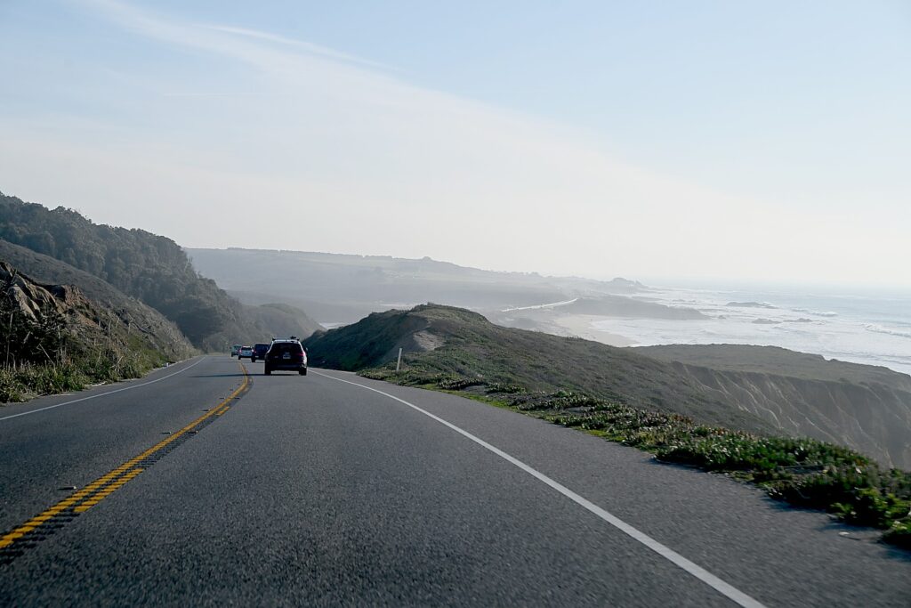
Driveable Getaways: Great Time to Time-Travel in Sandwich, Cape Cod’s First Village

The Dexter Grist Mill in historic Sandwich, Cape Cod, Massachusetts © Karen Rubin/goingplacesfarandnear.com

By Karen Rubin, Travel Features Syndicate, goingplacesfarandnear.com

One of my favorite places for a driveable getaway is Sandwich, Cape Cod’s first village, settled in 1637. Sandwich is an enchanting jewel where history, exquisite architecture, fascinating attractions abound in a compact, walkable area, a short distance from the delightful Sandy Neck beach as well as the Cape Cod Canal biking trail. It is quintessential New England, an idyllic place to visit, to stay, to make your hub for exploring Cape Cod.

All through Sandwich, you see homes that bear the names of the ship captains who commanded the packet ships and clippers that made this area a mercantile center.

Many of these quaint historic houses and buildings (including a church) have been turned into charming bed-and-breakfast inns, but if you want to extend your time travel back to when the Patriots were debating revolution, a wonderful choice is the Dan’l Webster Inn and Spa, at the heart of the village. It is also is the most substantial in size, with 48 rooms, amenities and services that include a full-service Beach Plum Spa, offering the best of past and present.

The present inn sits on property that was once a parsonage, built in 1692 by Rev. Roland Cotton; in the 1750s, it was converted to the Fessenden Tavern, one of the first and most famous of New England’s taverns and a Patriot headquarters during the American Revolution (the Newcomb Tavern, just across the pond, served as Tory headquarters). In the late 1800s, the inn, then known as the Central House, hosted famous visitors including President Grover Cleveland and poet Henry David Thoreau.

In 1980, the Dan’l Webster was acquired by the Catania family’s hospitality company which operates the popular Hearth n’ Kettle Restaurants, as well as the John Carver Inn in Plymouth and the Cape Codder Resort, in Hyannis. Since acquiring the Dan’l Webster, they have restored it with exquisite taste and respect for its heritage – there are antique furnishings and Sandwich glass.

The Conservatory at the Dan’l Webster Inn, Sandwich, MA © Karen Rubin/goingplacesfarandnear.com

The Catania family also acquired the historic house next door. A marker outside the house tells the story: Nancy Fessenden married Capt. Ezra Nye in 1826 and moved into the house following their wedding. She was the daughter of the innkeeper (now the Dan’l Webster Inn). Nye was a famous captain who broke the speed record by sailing his clipper ship from Liverpool in 20 days, in 1829. Restored by the Dan’l Webster Inn in 1982, the house now offers accommodates four luxury suites, each named after prominent people associated with the inn, dating back to 1692.

Historic Fessenden house, now part of the Dan’l Webster Inn, Sandwich, MA © Karen Rubin/goingplacesfarandnear.com

The Dan’l Webster has become an award-winning hotel, spa and dining destination. Recognized as a Distinguished Restaurant of North America (placing it in the top 1% of restaurants in the country) it offers a choice of the casual Tavern at the Inn, the cozy Music Room or the more formal (and romantic) ambiance in a lovely glass enclosed Conservatory.

The Tavern at the Inn is an authentic replica of the two-centuries-old tap room where Daniel Webster made regular visits and which had been a meeting place for local Patriots during the Revolution.

This is an especially good time to visit. The inn is offering a special package, Mosey & Museum Package, that captures the real essence of small-town Cape Cod (through October 3). It includes admission to the Sandwich Glass Museum to appreciate the art of glass making and Sandwich’s contribution to the industrial craft, and to Heritage Museum and Gardens to celebrate their Pollinator Festival. (Check the website for more packages.)

Dan’l Webster Inn & Spa 149 Main Street, Sandwich, MA 02563, 800-444-3566,[email protected], www.DanlWebsterInn.com.

So Much to Do in Sandwich

Heritage Museum & Gardens, Sandwich, Cape Cod, Massachusetts © Karen Rubin/goingplacesfarandnear.com

In a village of many substantial attractions and places of interest, what truly stands out is the Heritage Museum & Gardens – a destination attraction. It hits on a spectrum of cylinders – 100 acres of magnificent grounds and trails on the banks of the Shawme Pond; the vast, stunning and notable gardens that feature internationally important collections of rhododendrons, including those created by Charles Dexter, collections of hydrangeas, over 1,000 varieties of daylilies, hostas, herb, heather gardens, and more than a thousand varieties of trees, shrubs and flowers along beautiful and easily walked paths.

The JK Lilly III collection of vintage cars and folk art at Heritage Museums & Gardens, Sandwich © Karen Rubin/goingplacesfarandnear.com

Also, the JK Lilly III collection of vintage cars and folk art, and  you can take a ride on a delightful working vintage carousel. There is also – imagine this – Hidden Hollow, an enchanting family-friendly outdoor adventure center where you can get a “squirrel’s perspective” of the forest.  You should allocate the better part of a day to visit. (Heritage Museums & Gardens, 67 Grove Street, Sandwich, MA 02563, 508.888.3300, www.heritagemuseumsandgardens.org, open daily through Mid-October.)

See the forest from a squirrel’s eye view at Hidden Hollow at Heritage Museums & Gardens, Sandwich, Cape Cod © Karen Rubin/goingplacesfarandnear.com

What built Sandwich, though (and likely the reason that so many of its magnificent buildings reflect the prosperity of the early-1800s) was that in 1825, Deming Jarves built a glass factory to manufacture glass with a revolutionary process that made it affordable for the masses (Sandwich glass is still a thing). The factory grew rapidly to be one of the largest producers in the country with over 500 workers producing over five million pieces of glass annually by the 1850s. By the 1880s, labor strikes, an economic depression, and new factories being built further closer to natural gas fuel sources forced the factory to close.

Today, you can visit the Sandwich Glass Museum which displays original pieces created during the 1800’s and provides demonstrations of glass blowing techniques. The museum’s theater shows a great documentary of the history of Sandwich. Throughout the village there are several glass blowers and artists with open studios to visit, creating a dynamic center for contemporary glass art (Sandwich Glass Museum,120 Main St., 508-833-1540, www.sandwichglassmuseum.org).

Historic Dexter Grist Mill, Sandwich, Cape Cod’s first village © Karen Rubin/goingplacesfarandnear.com

A short walk from the Dan’l Webster Inn is the Dexter Grist Mill, a working grist mill since 1654 where you can still buy ground cornmeal, or draw fresh water from the well (as many locals do for their personal supply).

The Hoxie House, built in 1675, was lived in until the 1970s but was never modernized with electricity or plumbing. This saltbox is named after a whaling captain who owned the house in the mid-1800s. it is now a wonderful little museum house showing what family life was like in the 1600s.

Benjamin Nye Homestead & Museum, is the 18th-century home of one of the first 50 men who settled in Sandwich.

Also, the Wing Fort House, built in 1641, the oldest house in New England continuously owned and occupied by one family (63 Spring Hill Rd., 508-833-1540).

A short distance away, you can visit the Green Briar Nature Center & Jam Kitchen (6 Discovery Hill Road off Route 6A), which celebrates author and naturalist Thornton W. Burgess, who wrote the Peter Cottontail stories. There are nature programs, nature trails, a working 1903 Jam Kitchen, jam-making classes (508-888-6870, www.thortonburgess.org). 

Scene biking along the Cape Cod Canal © Karen Rubin/goingplacesfarandnear.com
 

One of my favorite things about Sandwich is the proximity to the Cape Cod Canal which offers a 6.2 mile-long paved path (on each side) for biking, roller blading or just walking (the banks of the canal are also popular for fishing). Along the trail, you can visit the Aptucxet Trading Post, built by the Pilgrims in 1627 to facilitate trade with the Dutch at New Amsterdam and the Narrangansett Indians.

The Cape Cod Canal is a marvel (there is a visitor center on the mainland side that tells the history). The canal was constructed in 1914 – up until then, there were a tragic number of ships that were wrecked trying to sail around the peninsula. But it is astonishing to learn that interest in building the canal dated back to the earliest settlers: in 1623, Pilgrims scouted the area as the place best suited for a canal. In 1697 the General Court of Massachusetts considered a formal proposal to build a canal, but no action was taken. In 1776, George Washington, concerned about its military implications, studied the site. But it took until 1909 for construction to start. (60 Ed Moffitt Dr., 508-833-9676, www.capecodcanal.us).

Cape Cod also has the most marvelous network of dedicated bike trails.

Sandwich offers easy access to other marvelous places to visit on Cape Cod, like Falmouth, Wood’s Hole, Hyannis but you should spend at least a day on the other side of the Sagamore Bridge, in Plymouth, to visit a score of historic attractions associated with the Pilgrims, including the Mayflower II and Plimoth Plantation, one of the best living history museums anywhere.

For more information, contact Sandwich Chamber of Commerce, 508-681-0918, [email protected], www.sandwichchamber.com.

______________________

© 2021 Travel Features Syndicate, a division of Workstyles, Inc. All rights reserved. Visit goingplacesfarandnear.com, www.huffingtonpost.com/author/karen-rubin, and travelwritersmagazine.com/TravelFeaturesSyndicate/. Blogging at goingplacesnearandfar.wordpress.com and moralcompasstravel.info. Send comments or questions to [email protected]. Tweet @TravelFeatures. ‘Like’ us at facebook.com/NewsPhotoFeatures
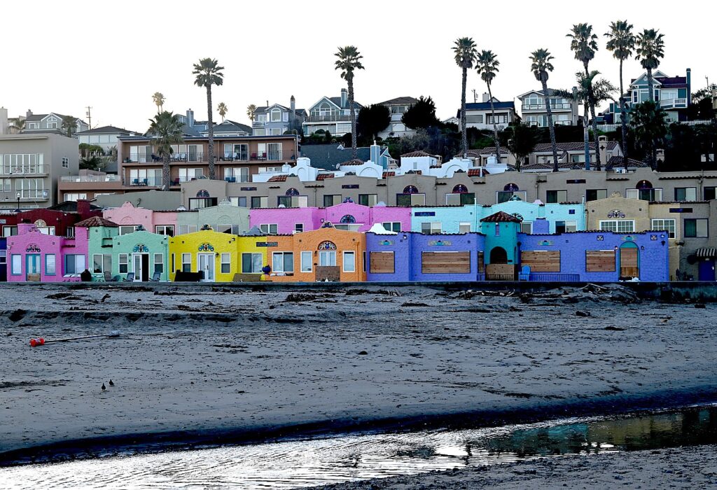
Discovery Bicycle’s 6-Day Coast of Maine Tour Delights the Senses

Discovery Bicycle Tours’ cyclists bike the carriage roads in Acadia National Park © Karen Rubin/goingplacesfarandnear.com

By Karen Rubin

Travel Features Syndicate, goingplacesfarandnear.com
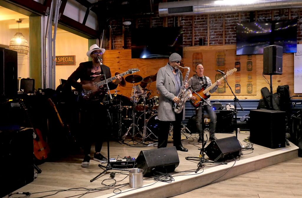
When I finally reach the summit of Cadillac Mountain, Acadia National Park’s highest point at 1500 ft., having huffed, puffed and sweated my way by bike up the 3.5 mile long, ever-rising winding road, little kids come up with amazement. “We passed you on the road. You rode up here!” I must confess to beam with pride while also taking in the view. Looking down to the ocean, Bar Harbor and the Bar Harbor Inn at sea level where we started our ride some 20 miles and several hours earlier, I realize, “Wait a minute, We rode from there!” (In fact, the ride is mostly uphill from mile 12 to 20) The view is amazing, but having that physical, mental achievement is all the more satisfying.

That is what a bike tour is. The scenery, the attractions, the things you see and do are all amazing, but when you bike, there is that added component of being physically and mentally engaged.

Biking up Cadillac Mountain is the pinnacle of Discovery Bicycle Tour’s six-day Coast of Maine bike tour – and a peak of personal accomplishment – but each day presents its own series of highlights and delights. After all, this is Bar Harbor and Acadia National Park on Maine’s Mount Desert Island, with one of the prettiest seacoasts anywhere. The daily itineraries are outstanding – each day’s route so carefully designed for a great ride, interesting attractions, gorgeous scenery.

John and I revel in having biked up to the summit of Cadillac Mountain.

This means we ride at our own pace, stop for photos or take a breath, take in the view, hike a trail, or just smell the roses. The guides never pressure you to keep with the group or finish the ride at a certain time. One of the two guides rides sweep to make sure everyone is okay, and the other drives the van along the route (where possible). They make every accommodation for riders, so when feasible, even shuttling some to the top of a slope, or on one day, starting three miles further. The two toughest climbs – Day Mountain and Cadillac Mountain are optional.

Stopping to enjoy the view from Thunder Hole in Acadia National Park on Discovery Bicycle’s Coast of Maine tour © Karen Rubin/goingplacesfarandnear.com

Another aspect of the way Discovery designs its itinerary is that it adds a lovely mix of other activities to round out the experience: a sunset sail on the historic schooner, Mary Todd; sea kayaking, a hike (we choose to walk across the land bridge at low tide to Bar Island) and on our last morning, they arrange a 4:30 a.m. drive up Cadillac Mountain in the van (you have to get a reservation to drive up Cadillac) for the sunrise, considered one of the primo-supremo experiences in Acadia. (Unfortunately for me, I miss out when my phone dies and I miss the alarm, but I awake just as the sun is rising out my window and dash down to the Shore Path.)

Boarding the historic schooner Mary Todd from the dock in front of the Bar Harbor Inn for the sunset sail © Karen Rubin/goingplacesfarandnear.com

Both our guides, Cindy Burke and Tom Walsh are long-time veterans and particularly of this Coast of Maine itinerary, and filled us with marvelous insights into the history and people of the island, as well as point out specific parts of that day’s ride. And they have a particular challenge, having to re-jigger the rides inside Acadia after June storms forced the closure of the Eagle Lake carriage roads.

Enjoying the view from Acadia’s Park Loop Road on our way to Cadillac Mountain on Day 5 of Discovery Bicycle’s Coast of Maine tour © Karen Rubin/goingplacesfarandnear.com

Being able to ride at our own pace is key. At the most popular Acadia sights and overlooks – like Sand Beach, Thunder Hole, Bubble Pond, Cadillac Mountain (where cars now need a timed reservation even to drive up), I can just get off my bike and strut over and spend as much time as I like, as when I wait and wait to try to get a photo of a whale’s geyser-like burst of water we spot offshore at Thunder Hole (at high tide, it is said to sound like thunder, but Cindy says most of the time it is a gurgle). Or when I just stop along the road to watch a lobsterman collect the lobsters, throwing back the ones that did not meet the rigid bigger-than-3.5-inches-and-smaller-than-5-inches regulations, and when I just want to get a better image of the stacks of lobster traps and realize Tom is waiting patiently (no judgment!) on the road until I continue the ride.

On our first day, we are encouraged to arrive by 1 pm for an orientation, getting fitted to our bikes, and then an optional 9.9-mile “Schooner Head Overlook Warm-up Ride” on the Park Loop Road in Acadia – except that it is raining. We decide to do it anyway and even when the rain becomes a real downpour, it is wonderful fun (and so fantastic to go into the Bar Harbor Inn’s heated pool and hot tub after). And it shows us, yes, we can ride hills in the rain!

Stopping at Bubble Pond before starting the hardest part of Day 5 ride, up to Cadillac Mountain on Day 5 of Discovery Bicycle’s Coast of Maine tour © Karen Rubin/goingplacesfarandnear.com

For our Day 2 ride, we are ferried in the van to the start at Seal Cove Auto Museum, where they have pre-arranged our admission. I walk in and am completely enthralled. The museum has an outstanding collection that includes automobiles that are the last of their kind (a 1913 Peugeot is worth $3-5 million; a 1905 Pierce Great Arrow is very rare). But what makes the visit even more fascinating is its special exhibit, “Engines of Change: A Suffrage Centennial.”

Who knew? At the Seal Cove Auto Museum, I learn that Bertha Benz, inventor, partner and wife of Karl Benz, was the first person to travel long distance (65 miles) by car. The museum displays the 1886 Benz © Karen Rubin/goingplacesfarandnear.com

Here I learn that Bertha Benz, inventor, business partner and wife of Karl Benz, got fed up with her husband’s endless tinkering so on August 5, 1888, grabbed her children and became the first person to drive an automobile over a long distance (65 miles), field testing the Benz Patent-Motorwagen. Her trip brought worldwide attention for the vehicle and got the company its first sales. (We actually see the 1886 Benz Patent-Motorwagen in the exhibit.)

The notes for the exhibit are fabulous: “In 1873, Harvard doctor Edward Clarke claimed that stimulating a woman’s brain would enfeeble her reproductive organs. Later, when automobiles were invented, it was a common belief that they were far too complicated for women to operate.”

he fascinating “Engines of Change” exhibit at the Seal Cove Auto Museum, shows that bicycles and then automobiles were the major force leading to women’s suffrage. “A girl who rides a wheel is lifted out of herself and her surroundings,” Ellen B. Parkhurst wrote ca. 1890.  © Karen Rubin/goingplacesfarandnear.com

Indeed, by giving women mobility, independence and an opportunity to demonstrate their capability, bicycles and automobiles were the “engines of change” that directly resulted in liberating women and winning the right to vote. Indeed, automobiles were even used in petition drives (we see examples of these cars and photos in the exhibit).

“Before 1900, few women would have had Bertha Benz’s access to an automobile. They did, however, gain greater geographic freedom through the invention of the safety bicycle in the 1880s…Early suffrage leaders credited the bicycle with doing more for women’s emancipation than anything else in the world. Women could more easily go beyond the limited areas where they could walk. This glimpse of a larger world appealed to many women and paved the way for embracing the automobile.”

The fascinating “Engines of Change” exhibit at the Seal Cove Auto Museum, shows that bicycles and then automobiles were the major force leading to women’s suffrage © Karen Rubin/goingplacesfarandnear.com

“A girl who rides a wheel is lifted out of herself and her surroundings,” Ellen B. Parkhurst wrote ca. 1890. (Bicycles also paved the way for new, liberating fashion – bloomers, bicycle pants, and pants that converted to a skirt.)

“The bicycle did more for woman’s equality than anything” and automobiles further bolstered that. On the other hand, the notes say, “the 1917 Spanish flu almost put suffrage out of business.

Meanwhile, automobiles were designed to appeal to women – the electric automobile was clean, noiseless, and slow, versus the fast, loud, gasoline cars oriented to men. (Seal Cove Auto Museum, 1414 Tremond Road, Seal Cove, Maine, 207-244-9242, sealcoveautomuseum.org).

Discovery Bicycle Tours’ Coast of Maine cyclists enjoy a classic view at Thurston’s Lobster Pound © Karen Rubin/goingplacesfarandnear.com

I spend a fair amount of time in the museum before heading out for the day’s mile ride, which takes us to charming coastal villages. A stunning scene is at Thurston’s Lobster Pound.

Bass Harbor on Day 2 of Discovery Bicycle’s Coast of Maine tour © Karen Rubin/goingplacesfarandnear.com

Another highlight is the Bass Harbor Head Lighthouse, the only lighthouse within Acadia National Park (one of the most photographed in Maine). I walk a beautiful trail to a rocky area below the lighthouse where you have to scramble over the boulders to get any view at all of the Lighthouse (the best view here would have been to get further down to the water, but it starts to rain again).

Scrambling over boulders for a view of Bass Harbor Lighthouse on Day 2 of Discovery Bicycle’s Coast of Maine tour © Karen Rubin/goingplacesfarandnear.com

I continue riding, stopping to hike the Ship Harbor trail, pass by the Wonderland Trail, and ride into the scenic Seawall picnic area, where, we are told, Nor’easters have been so powerful, they spray the rocks onto the road.

Stopping for a short hike on the Ship Harbor Trail © Karen Rubin/goingplacesfarandnear.com

Our ride ends in charming Southwest Harbor, where the van returns us to the Bar Harbor Inn.

Day 2’s Discovery Bicycle Coast of Maine ride ends in picturesque Southwest Harbor © Karen Rubin/goingplacesfarandnear.com

Almost all the rides include Acadia on the Park Loop road and on the marvelous carriage trails.

Built so that horses pulling carriages would not be strained (we even see one of the carriages as it returns to the stables in the park), much like rail-trails, they are not particularly steep but are a bit steeper and hillier than rail-trails. A good portion of the rides are also on the roads which can have longer, somewhat steeper climbs.

Discovery Bicycle Tour cyclists are instructed to walk our bikes through Wildwood Stables, so not to spook the horses © Karen Rubin/goingplacesfarandnear.com

There are 45 miles of gravel carriage trails in Acadia – the gift of philanthropist John D. Rockefeller Jr.  who wanted to travel on motor-free byways through the mountains and valleys by horse and carriage. Today, the opportunity to bike through forest is one of Acadia’s special draws.

Discovery Bicycle Tours’ cyclists bike the carriage roads in Acadia National Park © Karen Rubin/goingplacesfarandnear.com

Constructed between 1913-40, the roads were designed to preserve the line of hillsides and save trees, align with the contours of the lands, and take advantage of scenic views – hence the ups and the downs. Some 16 feet wide, they are in the style of broken-stone roads commonly used at the turn of the 20th century. Tom points out the magnificent architecture of the stone bridges that span streams, waterfalls, motor roads and cliff sides (there are 17 of them), the two gorgeous gate lodges, and the granite coping stones used as guardrails that line the roads (which Rockefeller complained were too precise, not natural enough), affectionately nicknamed “Rockefeller’s teeth.”

Biking over one of the beautiful stone bridges on the carriage roads in Acadia National Park © Karen Rubin/goingplacesfarandnear.com

Tom and Cindy had to re-jigger rides almost on the fly because sections of the carriage roads (notably the Eagle Lake carriage roads) they normally ride are closed for re-construction after a major June storm (but we hardly noticed, though I had to almost sneak through a barrier to get a photo of picturesque Eagle Lake). Of the 47 miles of carriage roads, Tom estimates we bike almost half. (I try to imagine how I would have figured out where to go in Acadia without their route maps that say, “Sharp left onto Around-Mountain Carriage Road, Post #14. Stay right at Post #1, right at Post #20, left at Post #19, right at Post #18, Left on Post #13, Left on Post #11, straight at Number #6”)

The access to Eagle Lake carriage roads is closed for reconstruction after a storm, but I manage to snatch a photo © Karen Rubin/goingplacesfarandnear.com

Day 3’s ride also begins with us being ferried to the start – on the “quiet side” of Mount Desert Island, for a delightful ride along the scenic coastal Sargeant’s Drive, passing lovely “cottages” into Northeast Harbor, a quick visit to the Asticou Azalea Gardens before we enter Arcadia National Park and ride the Carriage Roads.  We get to the renowned Jordan Pond House (famous for popovers, but the crowds are ridiculous) and here we can choose to take an 8.2 mile extension to Day Mountain, with a 694-foot elevation. (No one does the extension because there is some possibility of rain.)

Discovery Bicycle Tours arranges a morning of scenic sea kayaking © Karen Rubin/goingplacesfarandnear.com

Wednesday, Day 4, breaks up biking with a sensational day of kayaking and hiking. National Park Sea Kayak Tours does a marvelous job. We kayak about 6.5 miles, spotting harbor seals, porpoise, loons, bald eagles, and are back just in time for low tide which lets us walk the land bridge to Bar Island. (There is something very magical about a land bridge appearing every day, then disappearing back under the water, especially so when as we return, fog rolls in, blanketing the scene.).  Walking back to the Bar Harbor Hotel, you see the same image as depicted in the historic photos, from the 1940s.

There is something magical about a land bridge that opens each day to connect Bar Harbor with Bar Island, especially as fog rolls in © Karen Rubin/goingplacesfarandnear.com

Day 6 (Friday), which is the getaway day, offers a mild 10-mile ride on the Duck Brook Carriage Roads, passing beaver ponds and the scenic Eagle Lake. I take my time, really taking in the landscapes.

Witch Hole Pond offers a gorgeous scene on our last day’s ride © Karen Rubin/goingplacesfarandnear.com
Breakneck Pond, Acadia National Park © Karen Rubin/goingplacesfarandnear.com

But before, they have organized a ride up to Cadillac Mountain for sunrise, which means meeting at the van by 4:30 am (my phone dies and I miss the wake-up, but get up on my own at 5 am for sunrise, so walk along the shore path).

Watching the sunrise from the Shore Path. Cindy noted that the Native Americans who lived here for 12,000 years were called Wabanaki – “People of the Dawnland.” Discovery Bicycle Tours has arranged for us to see the sunrise from the summit of Cadillac Mountain, a highlight experience of visiting Bar Harbor Acadia National Park © Karen Rubin/goingplacesfarandnear.com

We have enough time each afternoon to really enjoy the historic Bar Harbor Inn (it dates from 1887), which hands down has to be one of my very favorite places to stay in Bar Harbor – luxurious but cozy, exquisitely landscaped, a stunning (heated) infinity pool with one of the prettiest views in the world, a spa, a dining room with picture windows out to the water where we have lavish breakfasts (and a choice to have continental-style breakfast in the pool house), magnificently poised on the point overlooking Frenchman Bay and the Shore Path, walking distance to Bar Harbor’s shops and restaurants, and all our rooms are oceanfront with a balcony (www.barharborinn.com).

Discovery Bicycle’s Coast of Maine lets us luxuriate all five nights at the Bar Harbor Inn © Karen Rubin/goingplacesfarandnear.com

Bar Harbor is bustling – some say it is the busiest summer in this popular tourist town since perhaps forever with people making up for last year and not taking a chance on putting off experiences – but we just breeze passed the crowds and the line of cars. Well, maybe “breeze pass” is an exaggeration. We pedal passed at whatever speed we can muster or choose. Also, because our lodging (in the absolutely gorgeous Bar Harbor Inn) and dinner reservations are booked well in advance, we have both when it is obvious that others, traveling on their own, do not.


The historic Bar Harbor Inn occupies the most beautiful setting on the point and looks much as it has since 1887 © Karen Rubin/goingplacesfarandnear.com

Cindy, who is a history buff, regales us with wonderful insights into the places we ride: The interesting, if disturbing, history of American Indians on Mount Desert, the Wabanaki (“People of the Dawnland”), consisting of four distinct tribes—the Maliseet, Micmac, Passamaquoddy and Penobscot – who had come seasonally to Mount Desert Island for 12,000 years to hunt, fish, harvest clams, berries and sweetgrass for basket-weaving. In the early 1900s, they had encampments on Bar Island and at West Harbor and sold baskets and goods and performed as Western Indians for tourists at the hotels. “They were allowed to stay because they had stuff the whites wanted,” Cindy says. She recommends visiting the Abbe Museum, which has a partnership with the Smithsonian Institution and holds the largest and best documented collection of Maine Indian basketry and contemporary Wabanaki craft tradition (abbemuseum.org). (I regret not having the time to visit.)

And before we head out on the Day 5 ride, which starts with a turn onto Schooner Head Road, Cindy tells the story of a woman who perished on Titanic. Her house, High Seas, on Schooner Head Road, may be haunted, Cindy says, relating her personal experience.

Celebrating at our last dinner together, at Café This Way in Bar Harbor, at the end of the Discovery Bicycle’s six-day Coast of Maine tour © Karen Rubin/goingplacesfarandnear.com

Everything about the Discovery Bicycle tour is topnotch – on three nights, we enjoy wonderful dinners in some of Bar Harbor’s best restaurants and for two of our rides, we are provided box lunches we pre-ordered to take with us.

The ride is billed as “easier to intermediate,” but it is best if you do not expect the rides to be easy or expect that “coastal Maine” has anything “flat.”  There are lots of ups and downs – mostly short – and the rides are definitely do-able if you have the right mental framework (“I can do it.”) and the guides do their best to accommodate riders’ ability.

Discovery Bicycle’s Coast of Maine tour lets you become immersed in the scenery © Karen Rubin/goingplacesfarandnear.com

Coast of Maine is a particularly relaxing bike tour – because as much as I enjoy inn-to-inn (or supported camping trips) so that every day you are moving forward to a new destination, this trip spends all the nights at the Bar Harbor Inn. That means we don’t have to pack up each morning to get our luggage out to the van and no matter how thoroughly wet we get, we can luxuriate and relax in a heated infinity pool and hot tub. (Boat/bike tours have the best of both worlds).

Discovery Bicycle Tours’ guides, Cindy Burke and Tom Walsh are long-time veterans leading bike tours, particularly this Coast of Maine itinerary © Karen Rubin/goingplacesfarandnear.com

A bike tour is also one of the best ways to enjoy traveling in these times of concern over COVID-19.

Notably, Thistle Cone surveyed all the tour participants as to our COVID-19 vaccine status and reported back to us that we were all fully vaccinated (which I appreciated knowing). A bike tour also maximizes our time out of doors, socially distanced; our hotel rooms all had our own access and really, the only times we were gathered together inside was for breakfast (if we chose), the morning meeting and the dinners in restaurants, which, notably, were also following COVID restrictions of distancing and capacity.

They are also monitoring and reacting to changes in conditions, for example, recently asking guests to wear masks in the van and where social distancing isn’t practical. “The good news is that your tour deposits are completely refundable (with no penalties for changes) until the final payment date. So you can reserve with confidence.”

There are still several departures of the Coast of Maine bike tour this season.

Also, Discovery Bicycle Tours offers what may be the first to design an itinerary on New York State’s new Empire State Trail, from the tip of Manhattan to Albany (the trail continues north to the Canadian border, and connects with the 353-mile east-west Erie Canalway).

In addition, Discovery has bike tours to Cape Cod; Idaho; Mickelson Trail & Black Hills, South Dakota; Tucson & Saguaro National Park; Lake Champlain Islands; Crater Lake & Scenic Bikeways; Texas Hill Country; as well as abroad including Bike & Barge Moselle River; Catalonia Trails; Chile’s Lakes & Volcanoes; Cotswolds & Stonehenge; and New Zealand Trails.

Discovery Bicycle Tours, 2520 W. Woodstock Rd., Woodstock, VT 05091, 800-257-2226, [email protected], www.discoverybicycletours.com.

______________________

© 2021 Travel Features Syndicate, a division of Workstyles, Inc. All rights reserved. Visit goingplacesfarandnear.com, www.huffingtonpost.com/author/karen-rubin, and travelwritersmagazine.com/TravelFeaturesSyndicate/. Blogging at goingplacesnearandfar.wordpress.com and moralcompasstravel.info. Send comments or questions to [email protected]. Tweet @TravelFeatures. ‘Like’ us at facebook.com/NewsPhotoFeatures