By Karen Rubin, with Laini Miranda and Dave E. Leiberman
Travel Features Syndicate, goingplacesfarandnear.com
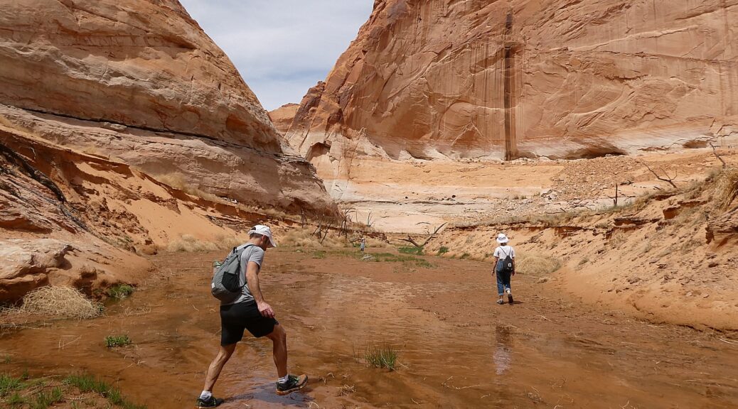
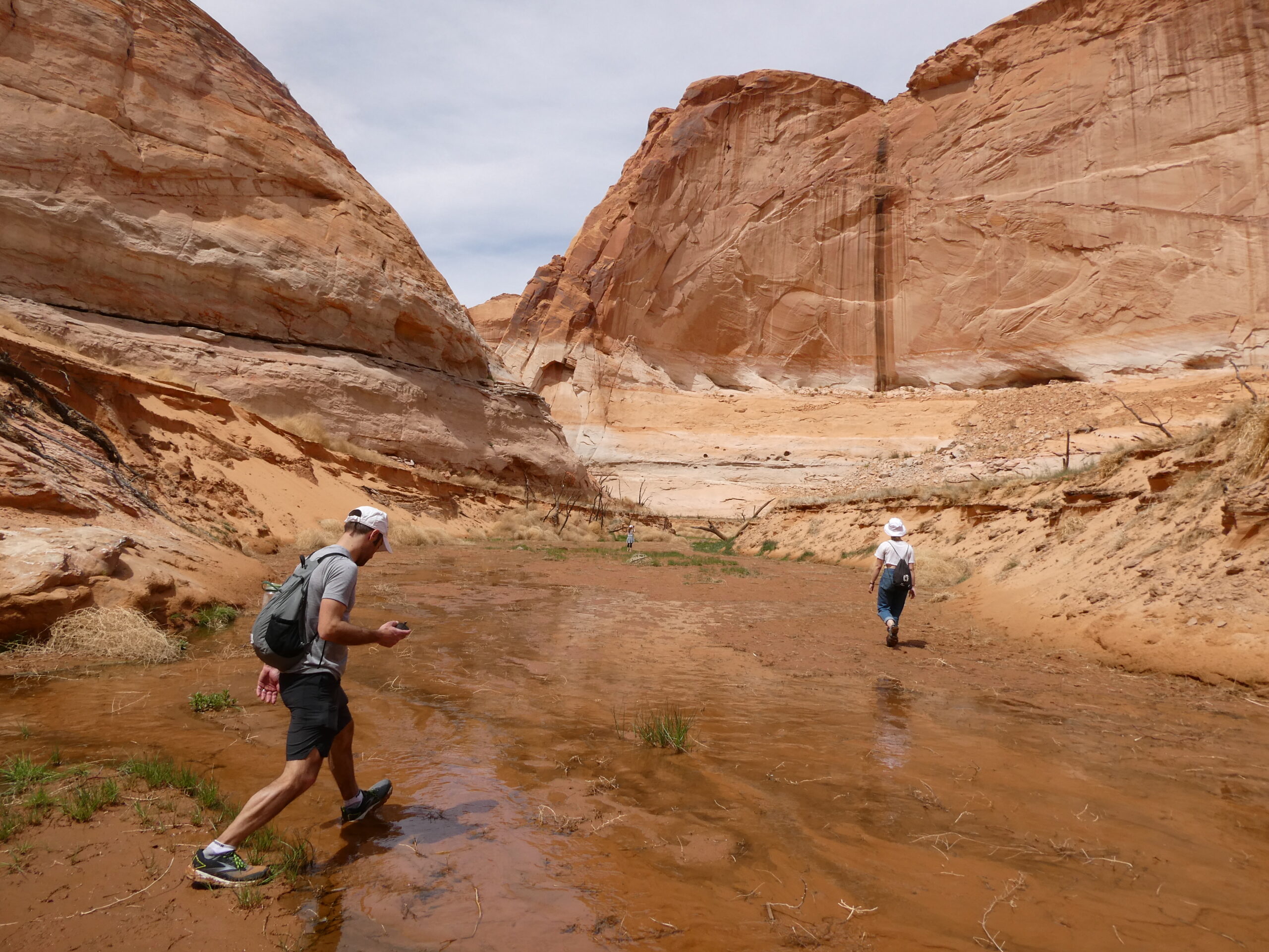
It’s the afternoon when we leave the Grand Staircase-Escalante after having a sensational hike through Big Horn Canyon, and drive through the Dixie National Forest on our way to Glen Canyon Recreation Area.
We stop in Boulder where the Magnolia burrito food truck that Dave and Laini love is based in the parking lot of the Anasazi State Park Museum. I wander into the museum for a quick look – the displays are really wonderful and had I had the time, I would have taken advantage of the interactive exhibits (you can grind corn using a mano and metate, identify seeds with a microscope, make rubbings of pottery designs).
I find it fascinating that “Anasazi” is actually a Navajo word meaning “ancient enemies” or “enemy ancestors” but it is not actually known what these people – Ancestral Pueblo who inhabited the area before the Navajo – called themselves. Still, the name has stuck. They were village-dwelling farmers – that is to say, not nomadic people – who lived in the Four Corners between 1 and 1300 AD, when there is some mystery about why they suddenly left en masse (some suspect it was the drought of historic proportions, only rivaled by our current 20-year drought). Behind the museum you can walk a short trail to the Coombs Site Ruins and a life-size, six-room replica of part of the pueblo as it would have existed 800-900 years ago. Beyond that are several more unexcavated areas. (Anasazi State Park Museum, Boulder, UT, 435-335-7308, www.stateparks.utah.gov)
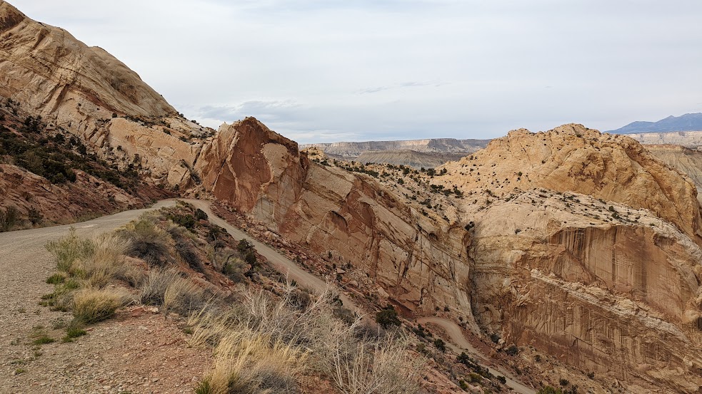
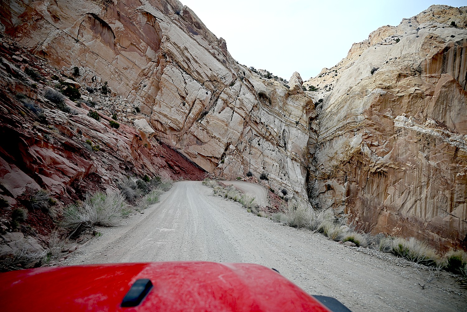
Just down the road from the museum, we turn onto the Burr Trail Scenic Backway, considered one of the most picturesque drives in Utah. Paved and graded in some sections, gravel and dirt in others, the road extends 66 miles from Boulder, passing the slickrock canyons of the Grand Staircase–Escalante National Monument, the Badlands of Capitol Reef National Park, the Waterpocket Fold, and painted rock desert of Glen Canyon National Recreation Area, ending at Bullfrog Basin on Lake Powell – our destination on the fourth day of our Utah Adventure.
I find it interesting to learn that the Burr Trail was originally developed as a cattle trail by stockman John Atlantic Burr (born in 1846 aboard the SS Brooklyn sailing across the Atlantic; his family established Burrville, Utah, in 1876). Burr developed the trail so he could take his herd through the rough, nearly impassable country around the Waterpocket Fold, Burr Canyon and Muley Twist Canyon.
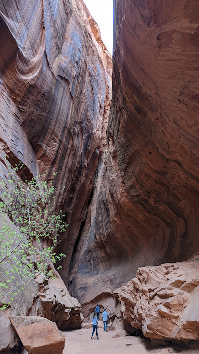
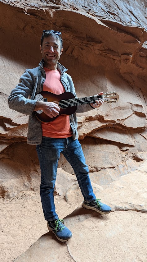
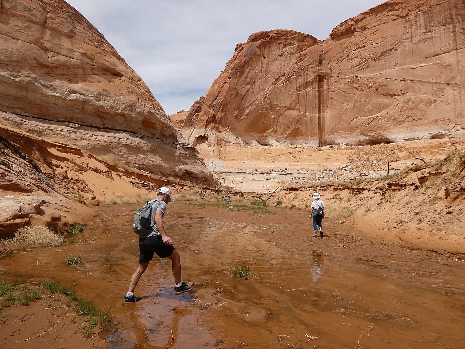
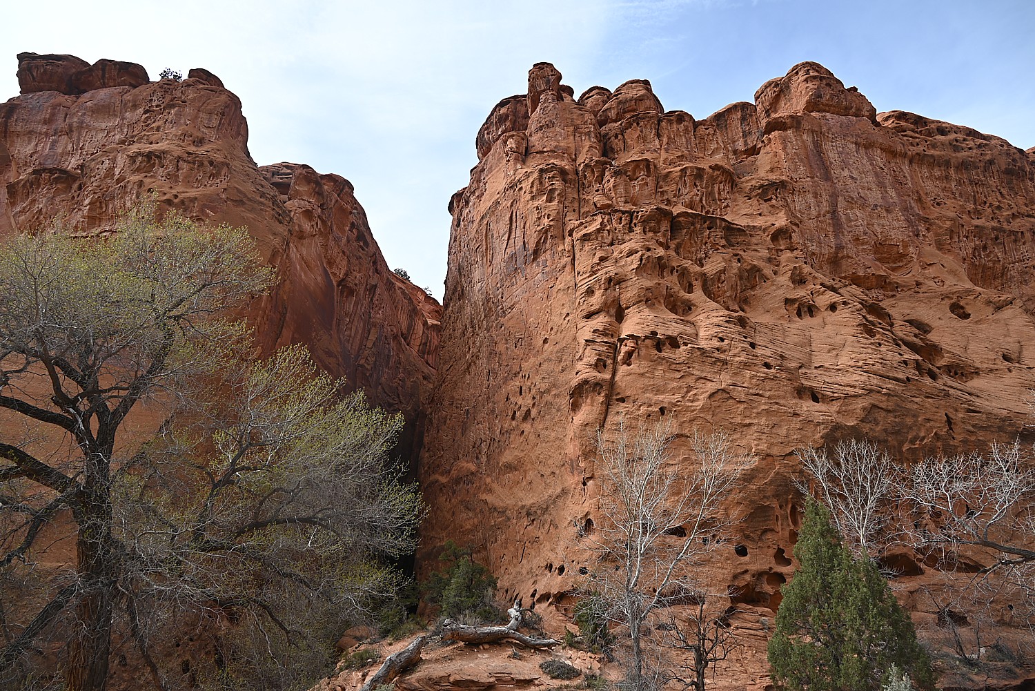
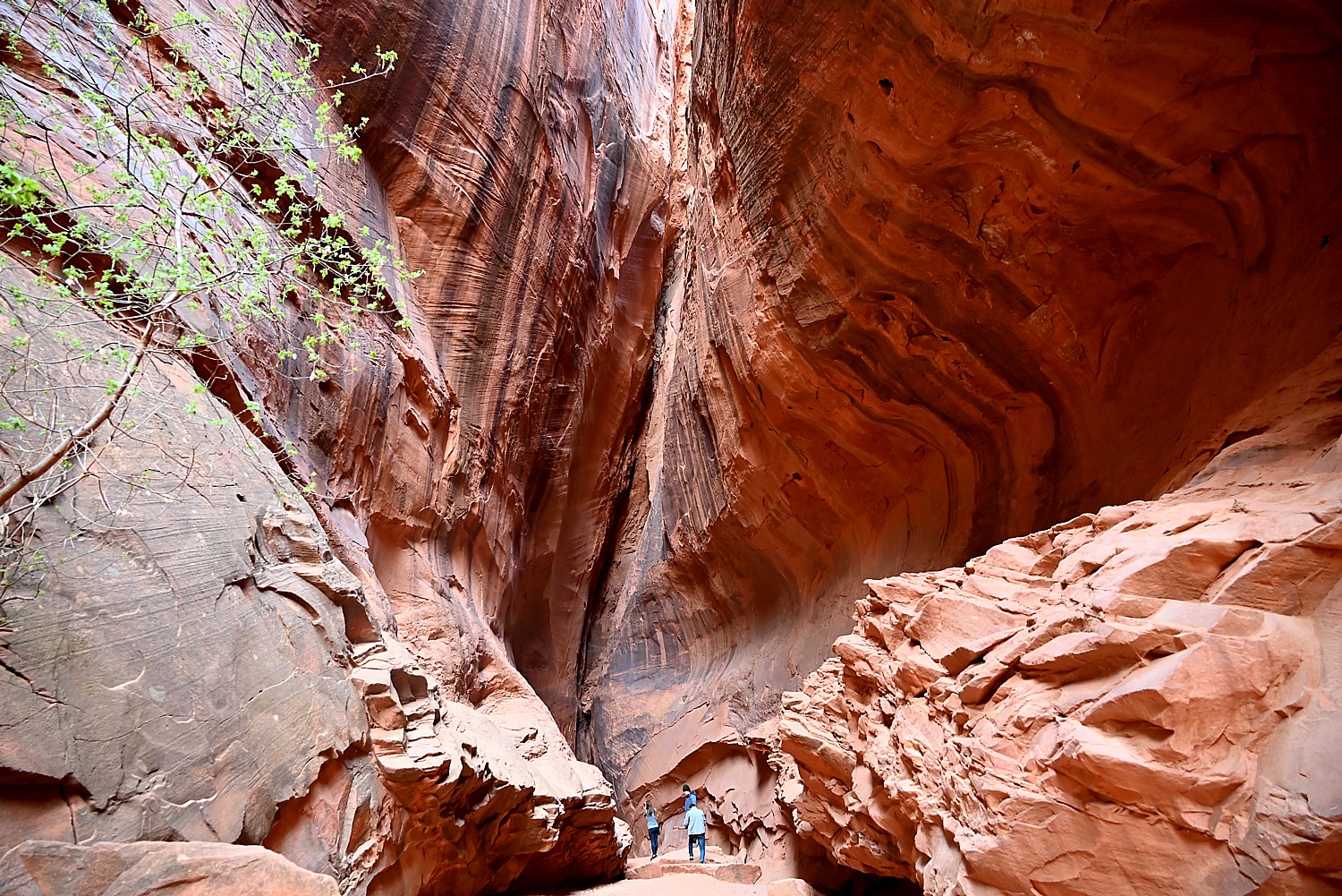
We drive through Long Canyon and soon come to one of the highlights along the route, which accounts for its nickname, Singing Canyon. It looks like a setting for Jurassic Park. We walk in, feeling so small against these gigantic, high cliffs of red rock. Dave gets out his mini-guitar for the occasion and we revel in the acoustics that give the canyon its name (I can imagine proposals and weddings happening here).
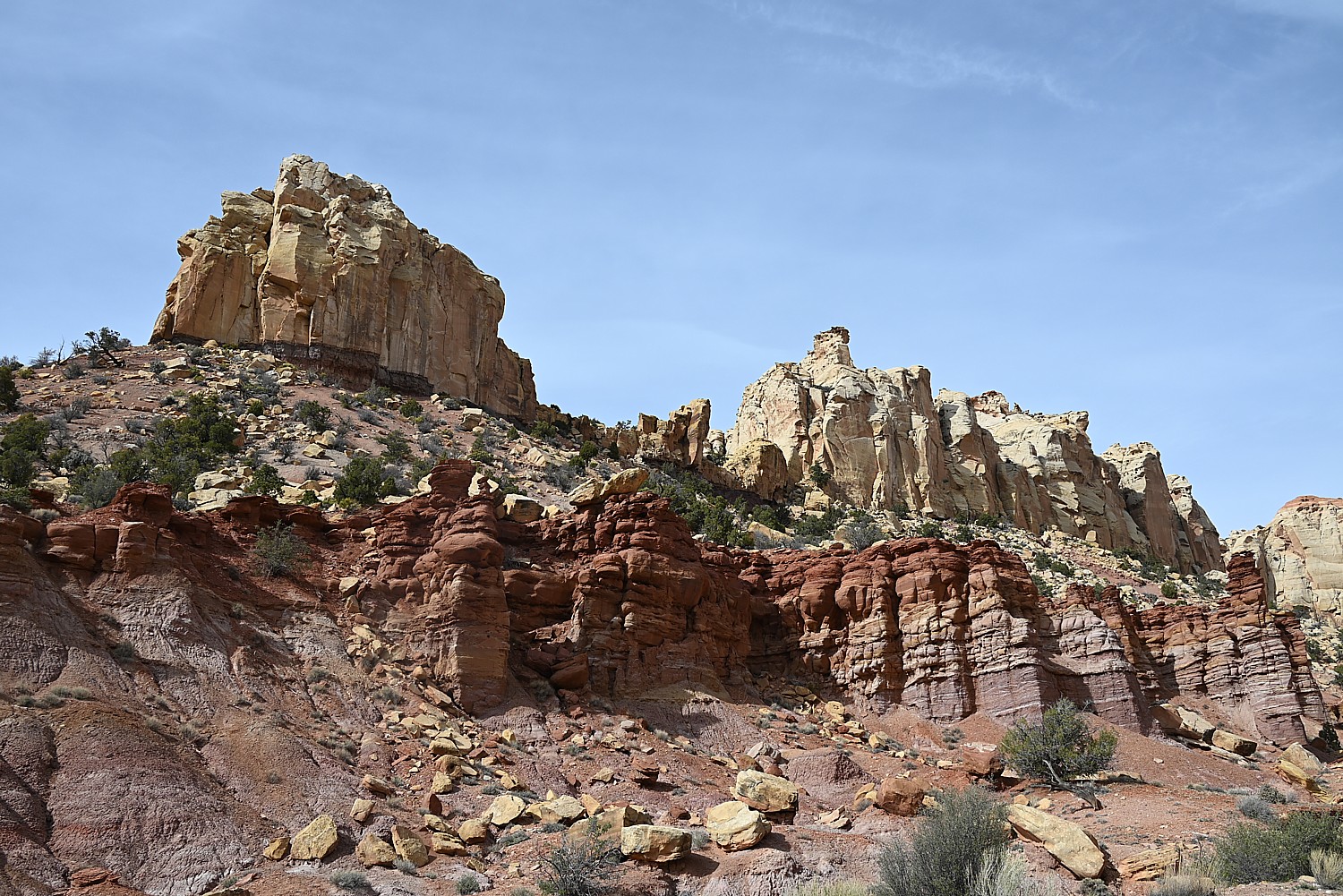
As we drive this rustic highway, we see giant red rock boulders strewn all over, having broken off from these cliffs, so close to road. Some are precariously balanced. We wonder over what period of time they came down (last century, or last week?), and whether more are likely to come down anytime soon.

This is a landscape that seems at once fixed and yet is constantly changing. Burr Trail is like driving through destruction – you see these enormous, massive walls of rock collapsed in heaps and think how fragile it all is, how even the mighty can fall. It is as if it is all falling apart and you wonder how long before these rocks turn to mounds of sand.
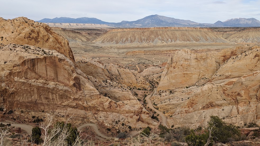
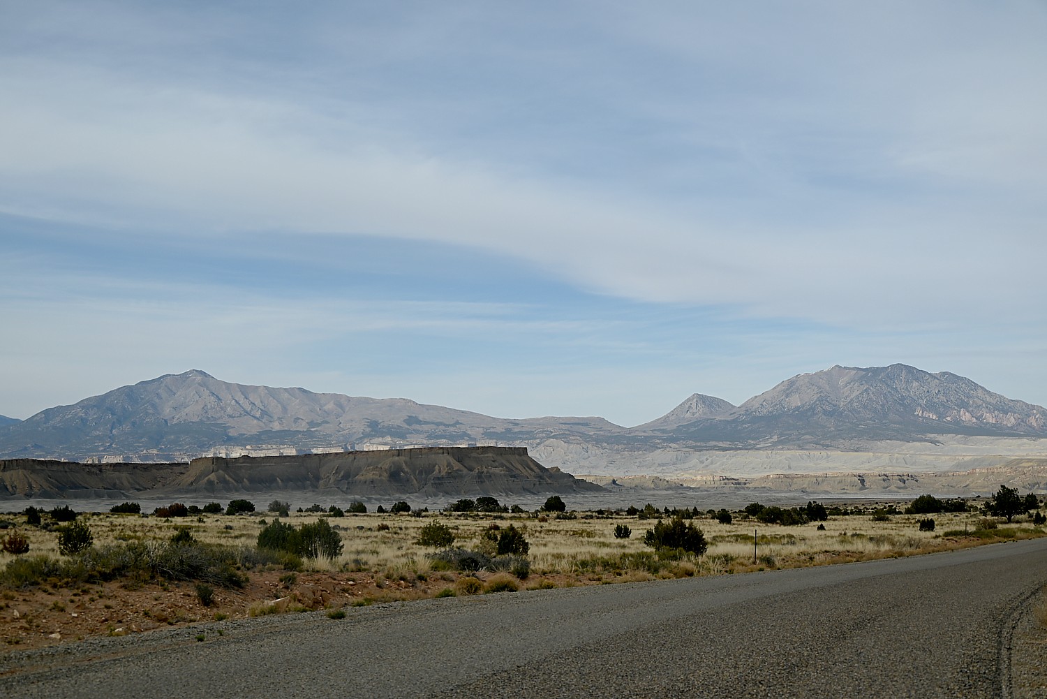
We next come to the famous Burr Trail Switchbacks. The view from the top to the Henry Mountains and Waterpocket Fold is stunning. The intriguingly named “Waterpocket Fold” is a geologic wonder: a nearly 100-mile long warp in the Earth’s crust. Aclassic monocline – a “step-up” in the rock layers – it formed between 50 and 70 million years ago when a major mountain building event in western North America, the Laramide Orogeny, reactivated an ancient buried fault in this region.

After taking in the view, Dave maneuvers down the series of ridiculously steep, tight turns (scary!) several hundred feet to the valley below.
[A note from the Bureau of Land Management: Although in dry weather the Burr Trail is easily accessible to passenger cars, wet weather may make the road impassable even for 4WD vehicles. Check with rangers or local officials for weather and road conditions. Recreational vehicles are not recommended. (https://www.visitutah.com/places-to-go/cities-and-towns/boulder/burr-trail)
We don’t get to do our wild camping tonight either, but rather have found what seems one of the few motels around, Tikaboo Lodge, and make do with the remaining food supplies we have.
(Note that there are very minimal amenities in the Bullfrog/Ticaboo area during the off-season. There are, however, two helpful outdoor outfitters/gas stations open until 4pm. )
Boating in Glen Canyon, Wild Camping in Arch Canyon
Our destination the next morning is Glen Canyon National Recreation Area. Spanning 1.25 million acres, it stretches for hundreds of miles from Lees Ferry in Arizona to the Orange Cliffs of southern Utah.
Lake Powell is only 13% of the National Recreation Area, but is (or rather was) one of the largest man-made lakes in North America. At full pool (3700′ elevation) it is 186 miles long, has 1,960 miles of shoreline, some 96 major side canyons, and a capacity of 27 million acre-feet (32 million cubic meters). Its maximum depth (at Glen Canyon Dam) is 561 feet.
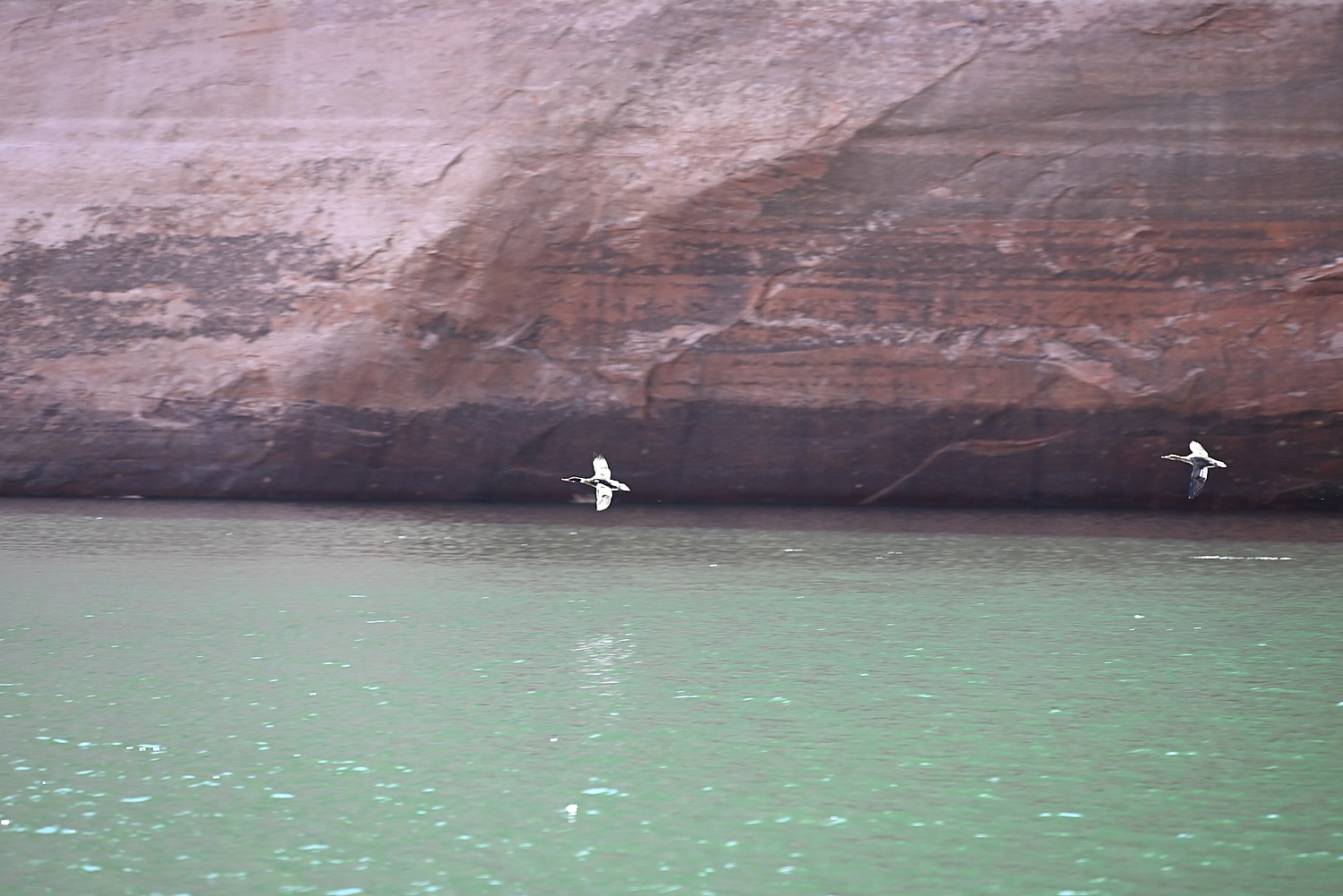
But since 2001, declining water levels (the lake had dropped over 100 feet over a two-year period at the time of our visit) due to climate change and 20 years of drought have reshaped Lake Powell’s shoreline and changed or closed boat ramp access points, on-lake facilities, and dramatically altered the landscape. (Check conditions, www.nps.gov/glca/learn/changing-lake-levels.htm)
I think that similar conditions must have been what caused the Ancestral Puebloans to leave their communities in 1300 AD after hundreds of years living here, because they also had experienced a 20-year long drought; the drought today is the worst since then.
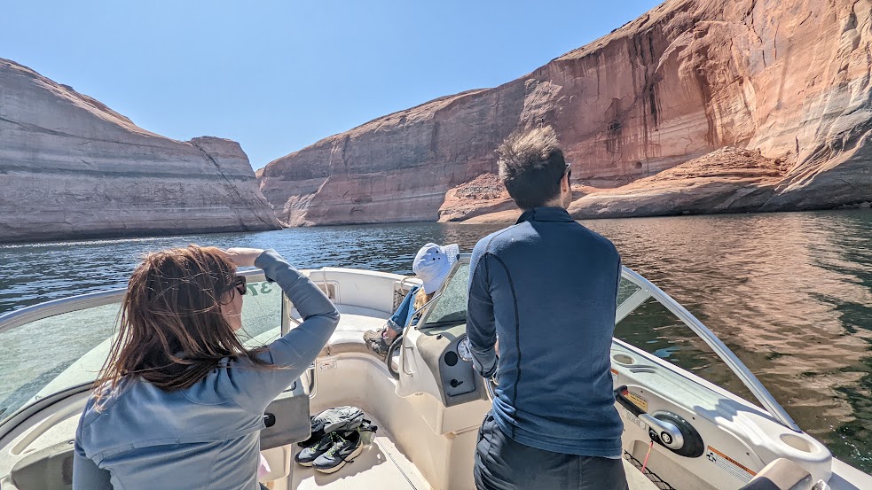
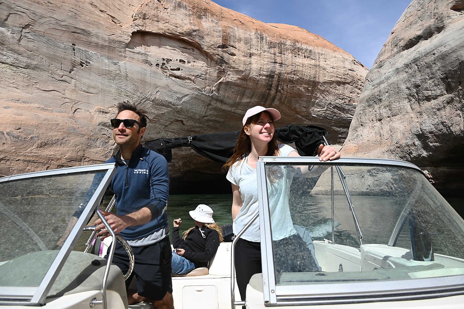
Laini has rented a power boat from Bullfrog Boat Rentals (435-684-3010) at the Bullfrog Marina so we can explore the canyons that were flooded when they created the controversial Glen Canyon Dam on the Colorado River. We are in search of signs of cliff dwellings or petroglyphs that may have been exposed with the drop in water level.
We get a map from the boat rental company and try to follow the mile markers on the lake that help us orient.
Compared to our two days of adventuring in Grand Staircase-Escalante, this day is like a resort vacation, with the luxury of a boat allowing us to traverse 20+ miles in one afternoon.
The water level has dropped so much over the past two years that trees are poking out from the bottom.
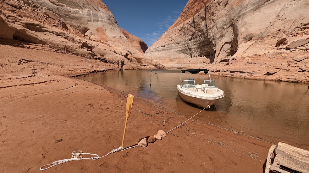
Dave navigates to Forgotten Canyon where Laini has information that a trail will lead to Defiance House Archaeological Site, an 800-year old cliff dwelling (nps.gov, 800-227-7286).
Because the water level is so low, we come to the edge of the water much earlier than expected, and pull up the boat onto a beach, have a picnic lunch (avocado on bread, peanut butter/jelly) under a rock awning (like the Ancestral Puebloans might have), and then set off on foot in search of the cliff dwelling.
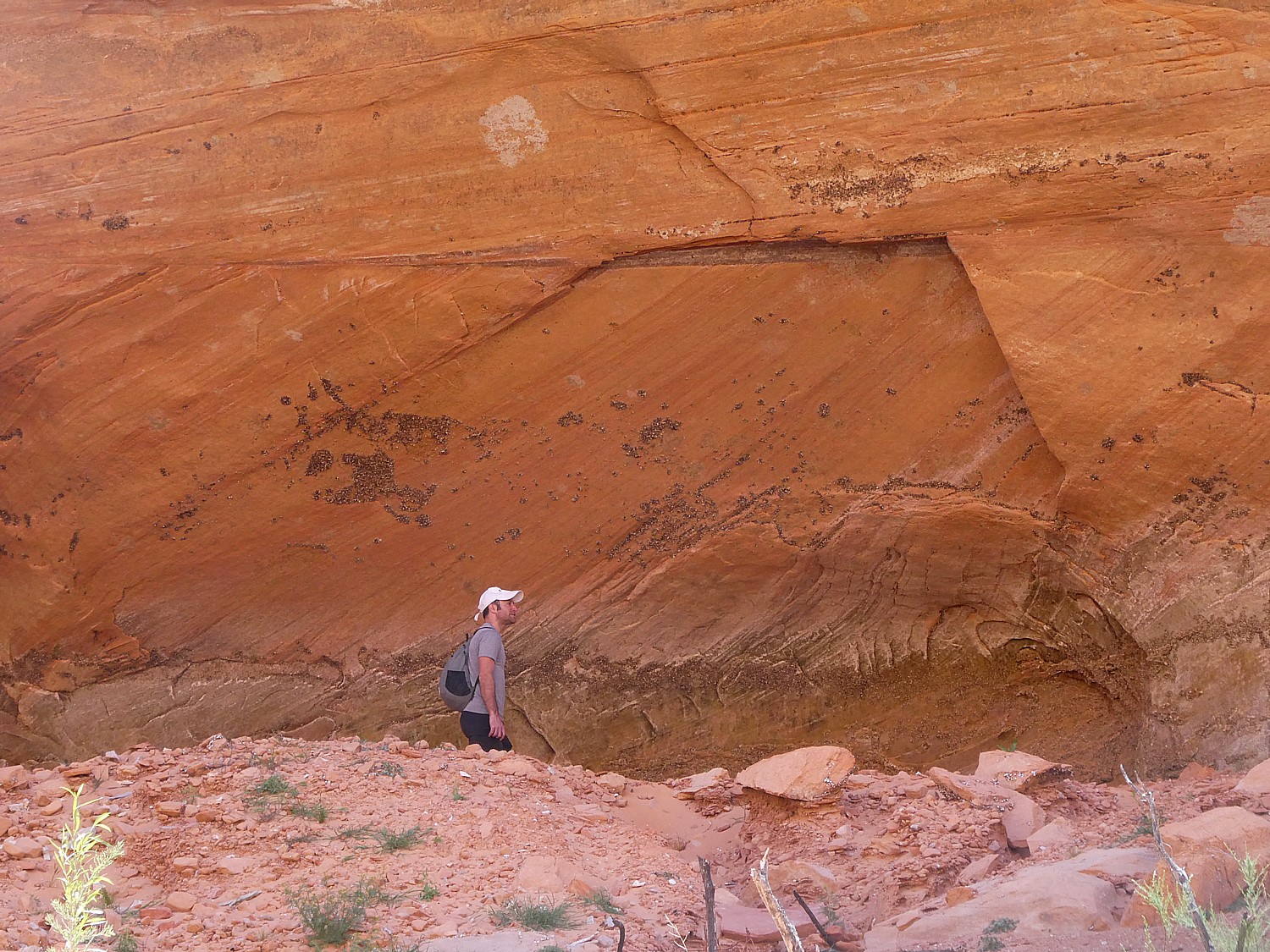
This really feels like Indiana Jones, because there is no actual trail. We follow the water – slogging along the deep mud, crisscrossing to avoid deeper water. Dave comes with me as Laini and Alli bound ahead to explore in the limited time we have before we have to get back to the boat.
The site (which is only reachable by boat then foot) is usually just a quarter mile past the end of the water, but with the water level so much lower, it’s now over two miles away and we don’t have the time. Also there is so much overgrowth and prickly thickets that Laini and Alli can’t get through wearing shorts. They turn around and tell us we should make our way back to the boat.
Even with this disappointment, it has been an immensely fun adventure.
As we boat out of the canyon, we see a vulture contemplating eating a dead fish on the shore.
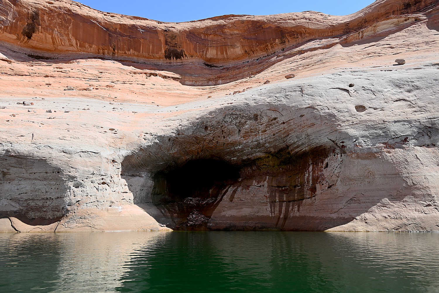
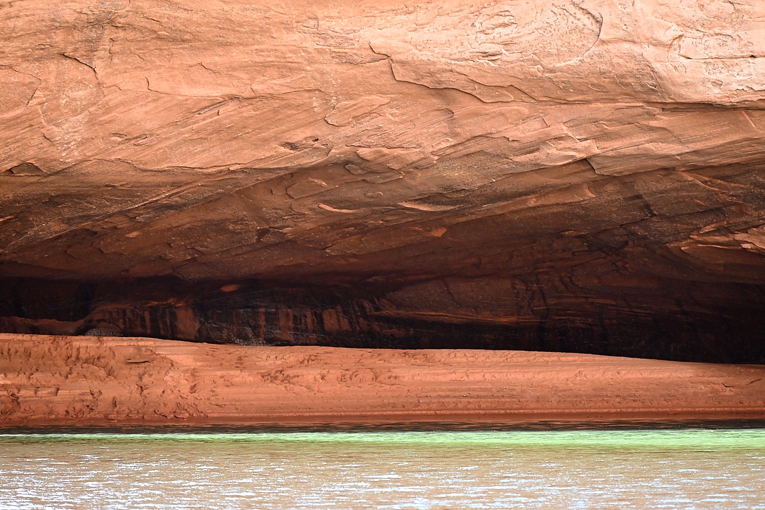
We are close to the time when we need to return the boat, but Dave pilots us into the Lost Eden Canyon. This turns out to be an absolutely magical (overused word but really apt) place – a superb finale to our adventure.
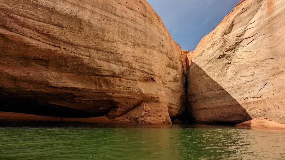
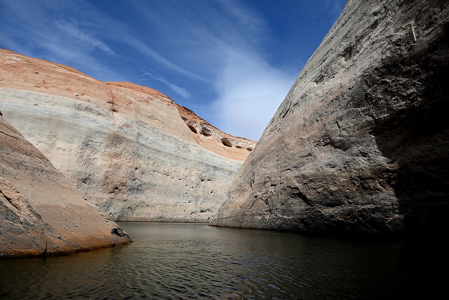
There are golden dapples on the gray rock faces like gold coins shimmering in sunlight. The water is a surreal emerald green under a brilliant blue sky, the rocks are orange, tan and gray, making interesting patterns, as we wind through the narrow canyon.
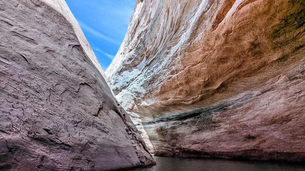
You can easily imagine how ancient artists were inspired not just by the colors, but the patterns in rock faces.
When we get back to the marina, it takes 30 minutes just to refill the tank ($200!) – which we hadn’t calculated for in getting the boat back in time.
Driving from Lake Powell on our way to our next stop, Bears Ears National Monument-Cedar Mesa, we stop at Outpost Marine Trading Post – as significant today as it must have been for early pioneers. It has a fabulous selection of gear and groceries for camping as well as fantastic sandwiches at incredibly reasonable prices (considering how desperate people can be at this point in their journey) – Reuben, probably best outside of NYC, $8; thick burgers; fresh sliced turkey only $4.99/lb (Dave can’t believe it so buys 2 pounds). Everyone is absolutely delighted as we savor our car dinner when we get back on the road.
We soon see a dead calf on the road and vultures hovering.
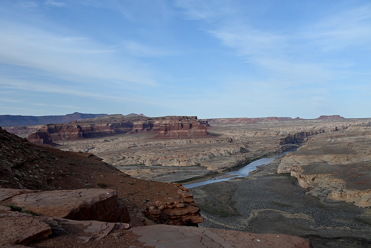
We stop at Hite Overlook for spectacular, iconic views of the Western landscape.
The historic marker here relates how in 1883 Navajo Chief Hoskininni led Cass Hite to the Canyon below, where he found gold. He opened a small store and post office, making his fortune off the miners. After World War II, the town’s population “swelled” to more than 200. This time, miners were searching for “hot” rocks (uranium). This mining boom also went bust and Hite returned to its small town existence. But in 1964, the waters of Lake Powell swallowed up Hite, leaving behind the only true treasure: the view.
We drive to Bears Ears-Cedar Mesa where we finally get to do the wild camping I have been so excited about (that means no services at all, just wilderness). The sun is descending and we are hoping to set up camp before dark.

Dave finds his way down a dirt road leading to Arch Canyon and we finally find a suitable site literally next door to a sign marking an Indian reservation (no trespassing!).
We set up in time before dark, but the full moon shines like a giant lantern, rising just as the sun sets, making flashlights unnecessary.
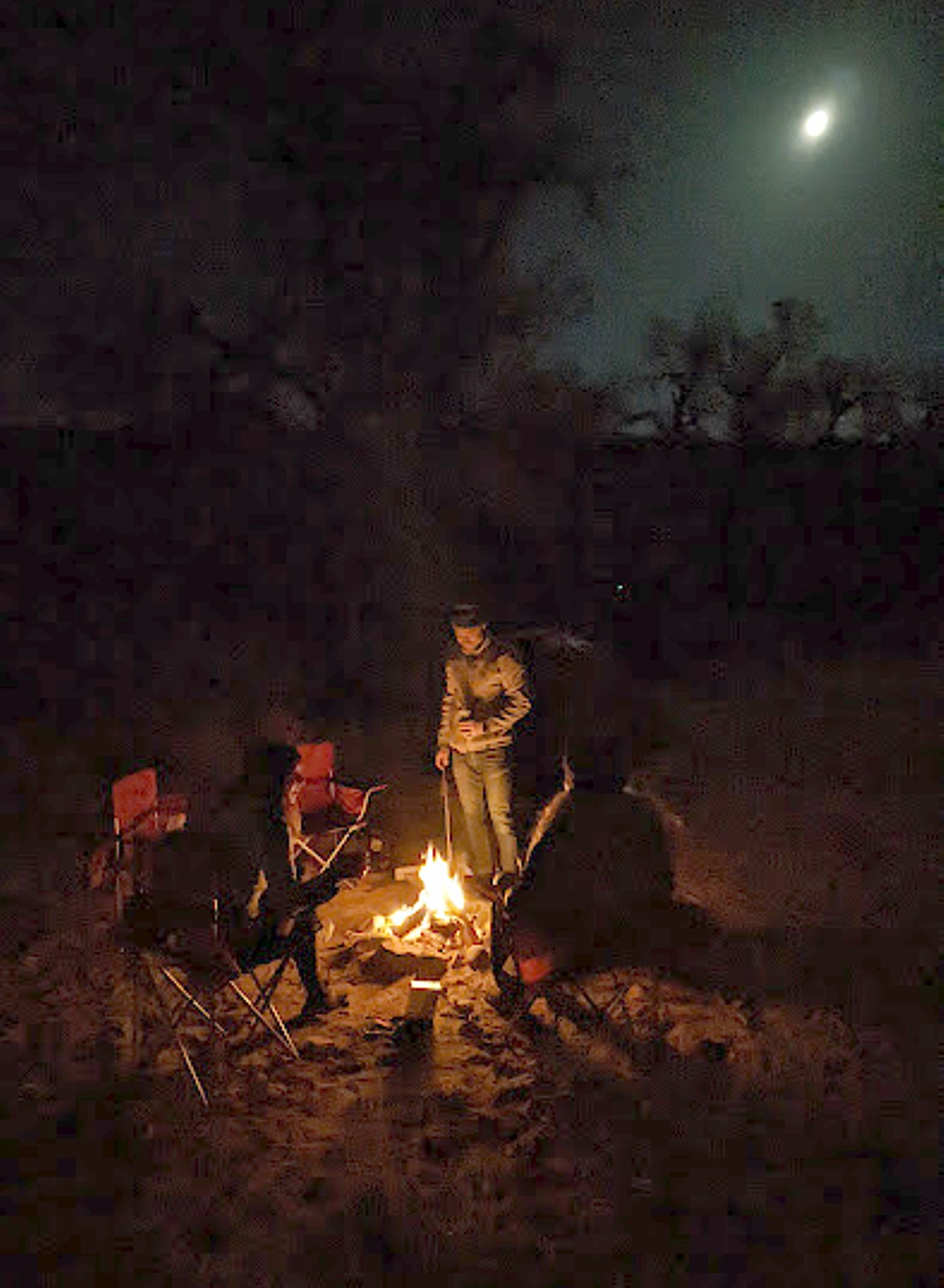
We sit around the campfire, enjoying the peace and reveling in our adventure. We will finally get to use our winter-rated sleeping bags and pads Dave had rented from Moosejaw (https://www.moosejaw.com/content/gear-rental, 877-666-7352).
Each day of our trip, we are immersed in landscape that manifests different personality, character, color, texture, ambiance, even theme, and provide the contours for our experience.
Tomorrow we will get to meet Bears Ears and the spirits of the Ancestral Pueblo people.
Glen Canyon National Recreation Area, www.nps.gov/glca, 928-608-6200; Bullfrog Visitors Center, 435-684-7423.
See:
UTAH ADVENTURE DAY 1-2: CAPITOL REEF’S COLORFUL CANYONS
UTAH ADVENTURE DAY 3-4: GRAND STAIRCASE-ESCALANTE POSES CHALLENGE
______________________
© 2023 Travel Features Syndicate, a division of Workstyles, Inc. All rights reserved. Visit goingplacesfarandnear.com, www.huffingtonpost.com/author/karen-rubin, and travelwritersmagazine.com/TravelFeaturesSyndicate/. Blogging at goingplacesnearandfar.wordpress.com and moralcompasstravel.info. Visit instagram.com/going_places_far_and_near and instagram.com/bigbackpacktraveler/ Send comments or questions to FamTravLtr@aol.com. Tweet @TravelFeatures. ‘Like’ us at facebook.com/KarenBRubin

One thought on “Utah Adventure Day 4-5: Driving Burr Trail, Exploring Glen Canyon, Wild Camping in Arch Canyon”
Comments are closed.