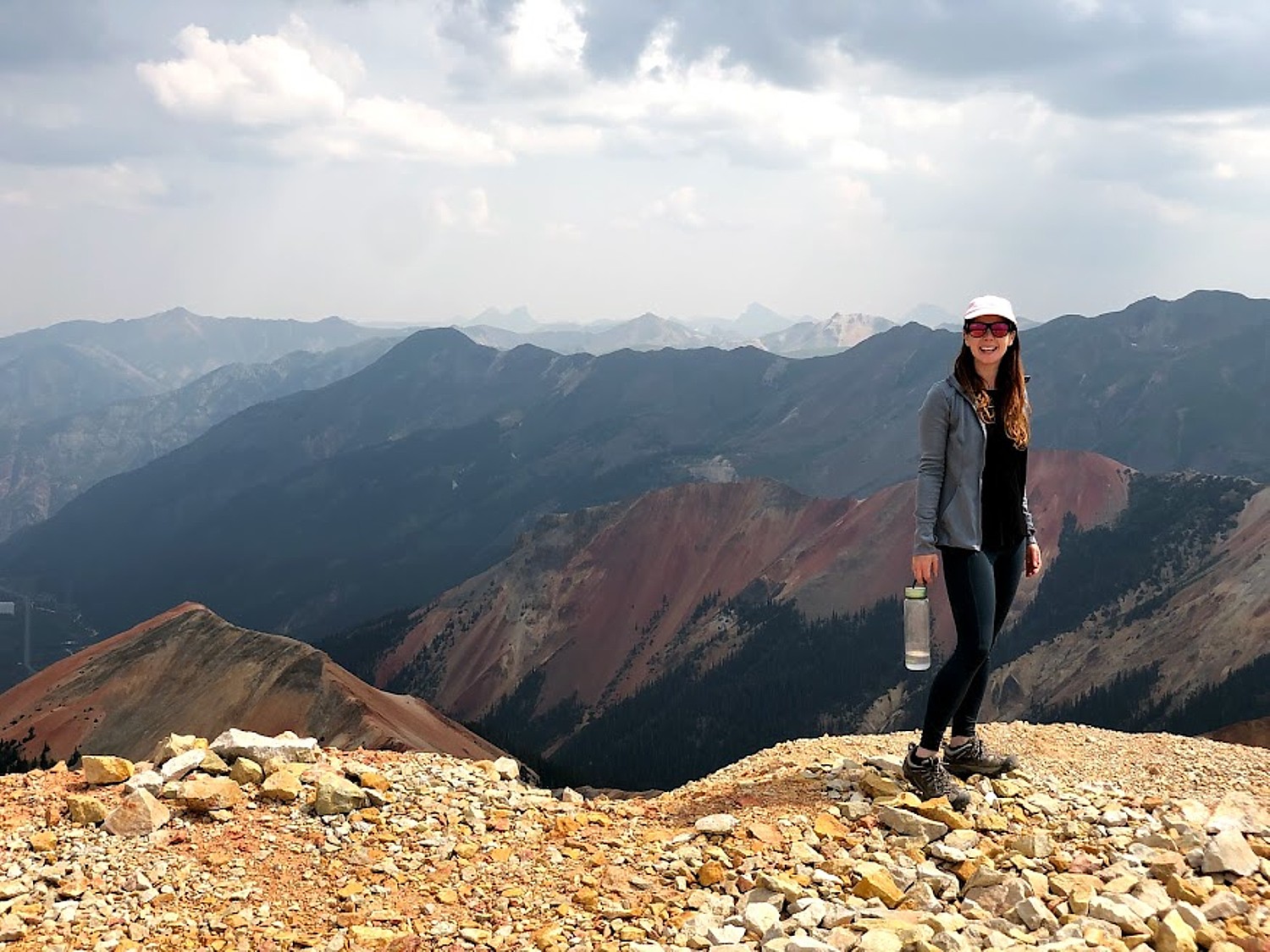
By Karen Rubin, with Laini Miranda and Dave E. Leiberman
Travel Features Syndicate, goingplacesfarandnear.com
What is truly special about Bears Ears National Monument-Cedar Mesa – and what draws Laini back time and again, are the remnants, artifacts and structures left by Ancestral Puebloans – ancestors of the Hopi and Zuni – who inhabited these canyons and cliffs between 700 and 2500 years ago. Arrowheads and other artifacts dating back 10,000 years have also been found in this region. Some of these sites are at once accessible yet also feel remote – so you feel you are the first archaeologist to discover, though obviously that can’t be since the BLM Rangers have left laminated info packets in metal cases in some of the dwellings. Still, we can pretend.
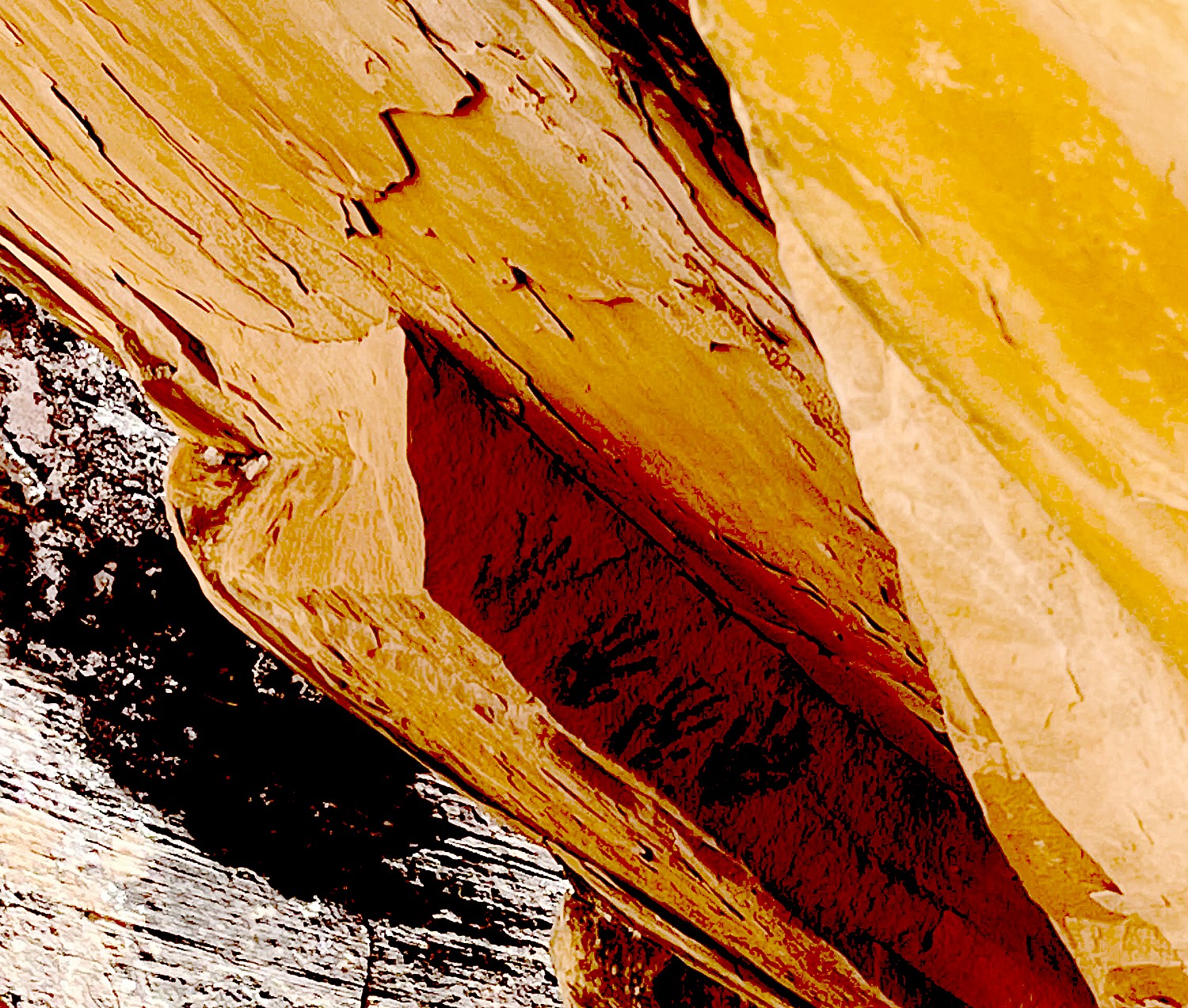
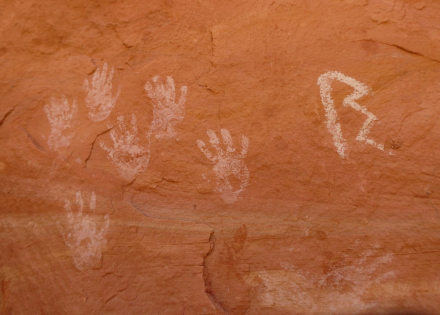
Our hikes bring us to these places that seem as if the occupants only recently vacated, leaving behind painted pottery shards, tiny corn husks, stone and bone tools, even their hand-prints, pictographs and petroglyphs that speak to us through time, as if to say, “We were here. We still are.”
Because these lands are sacred, all of us must be respectful of the dwellings and the archaeological artifacts that we come upon. And these sites truly feel sacred – precisely because of the artifacts, the pictographs and petroglyphs, you feel the presence of those who lived here. And because those of us who visit do show proper respect, these mud-and-stick (jacal) constructions delicate pictographs and petroglyphs etched into sandstone and artifacts, though incredibly fragile, are here for us to discover, as if we are among the first.
It’s fairly miraculous these sites have survived Mother Nature, let alone humans.
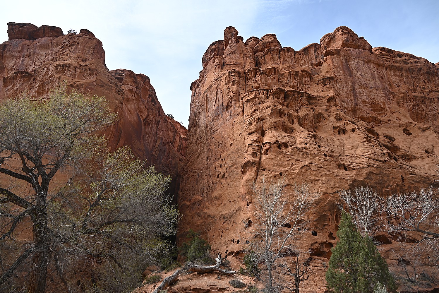
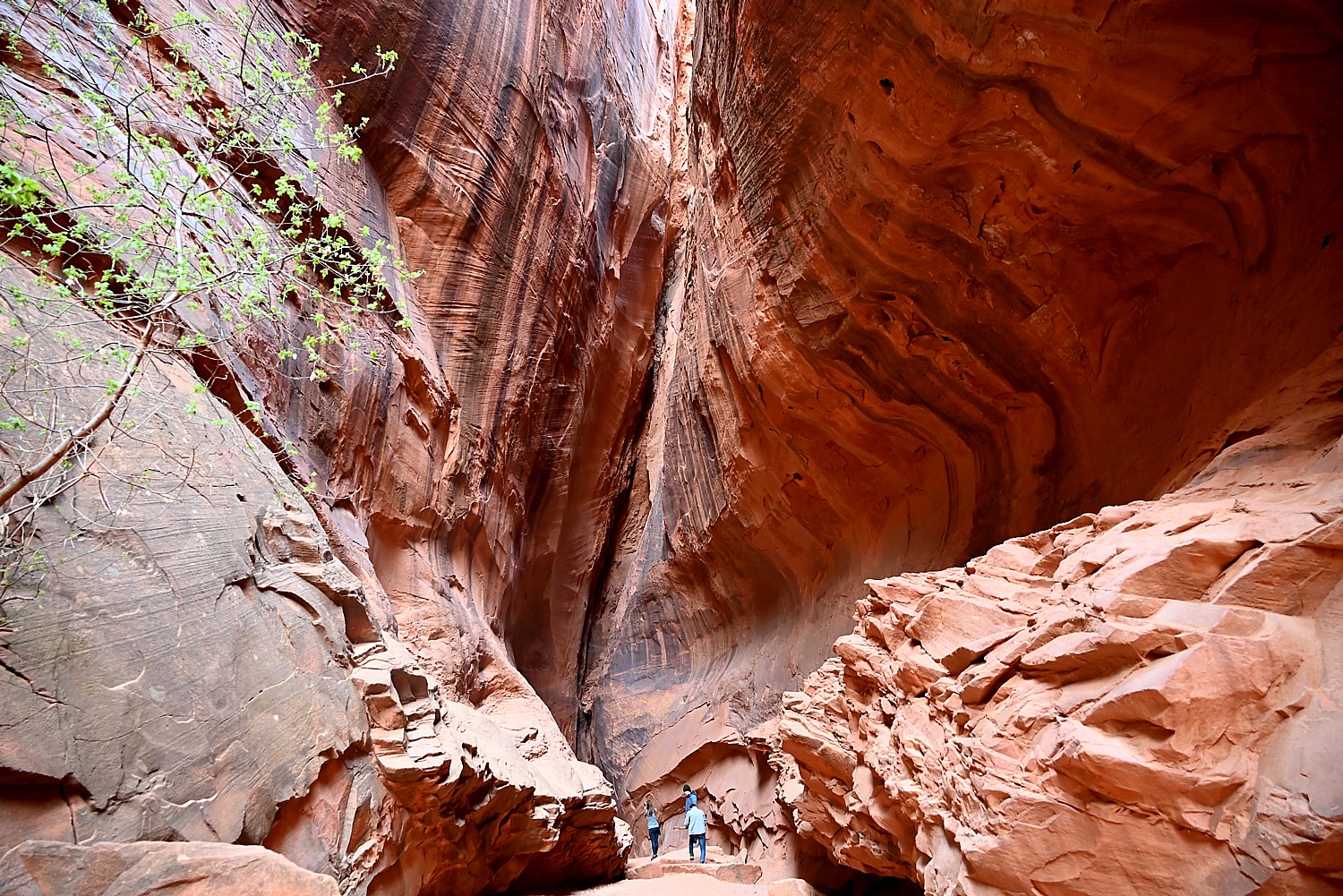
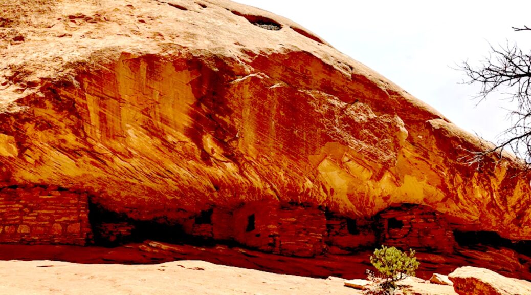
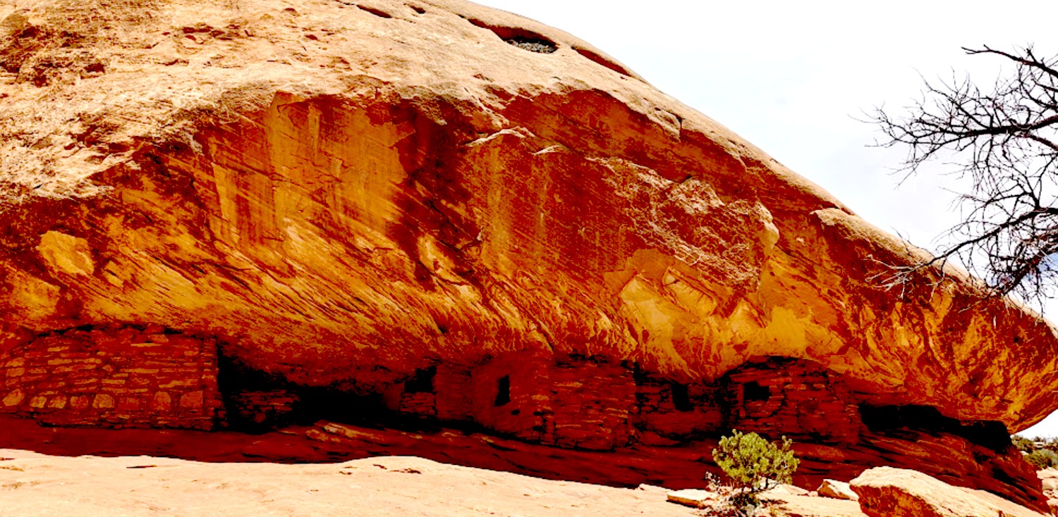
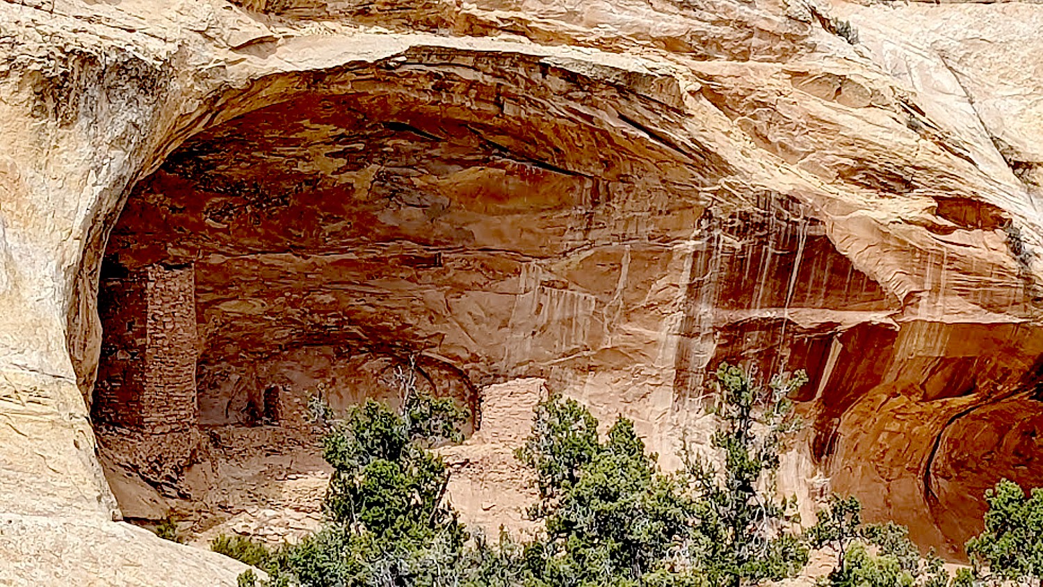
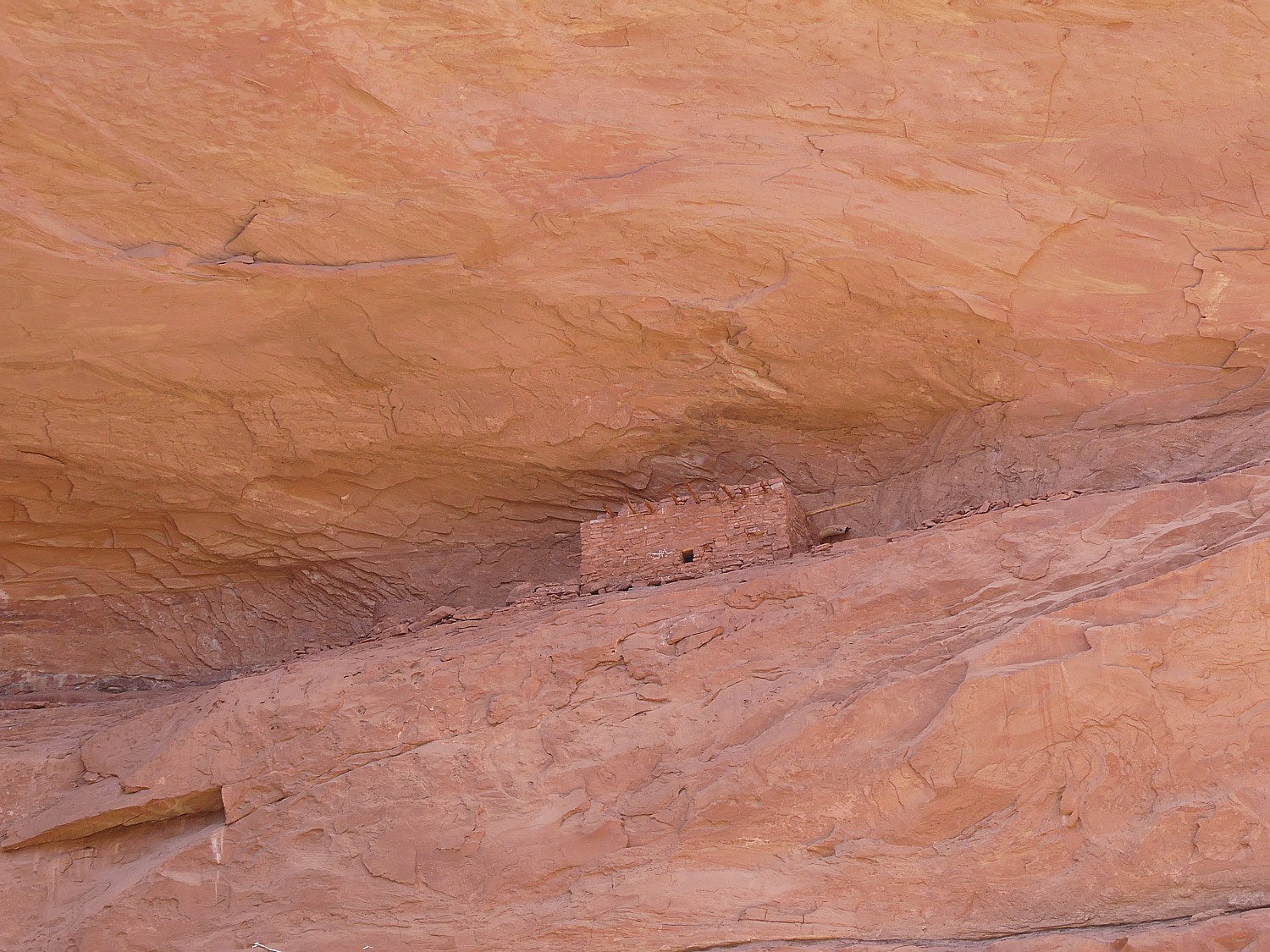
After hiking to the Arch Canyon Ruins, Laini leads us to a trail to one of the outstanding highlights of the Bears Ears National Monument: the House on Fire, one of the most photographed (spectacular) sites in the region.
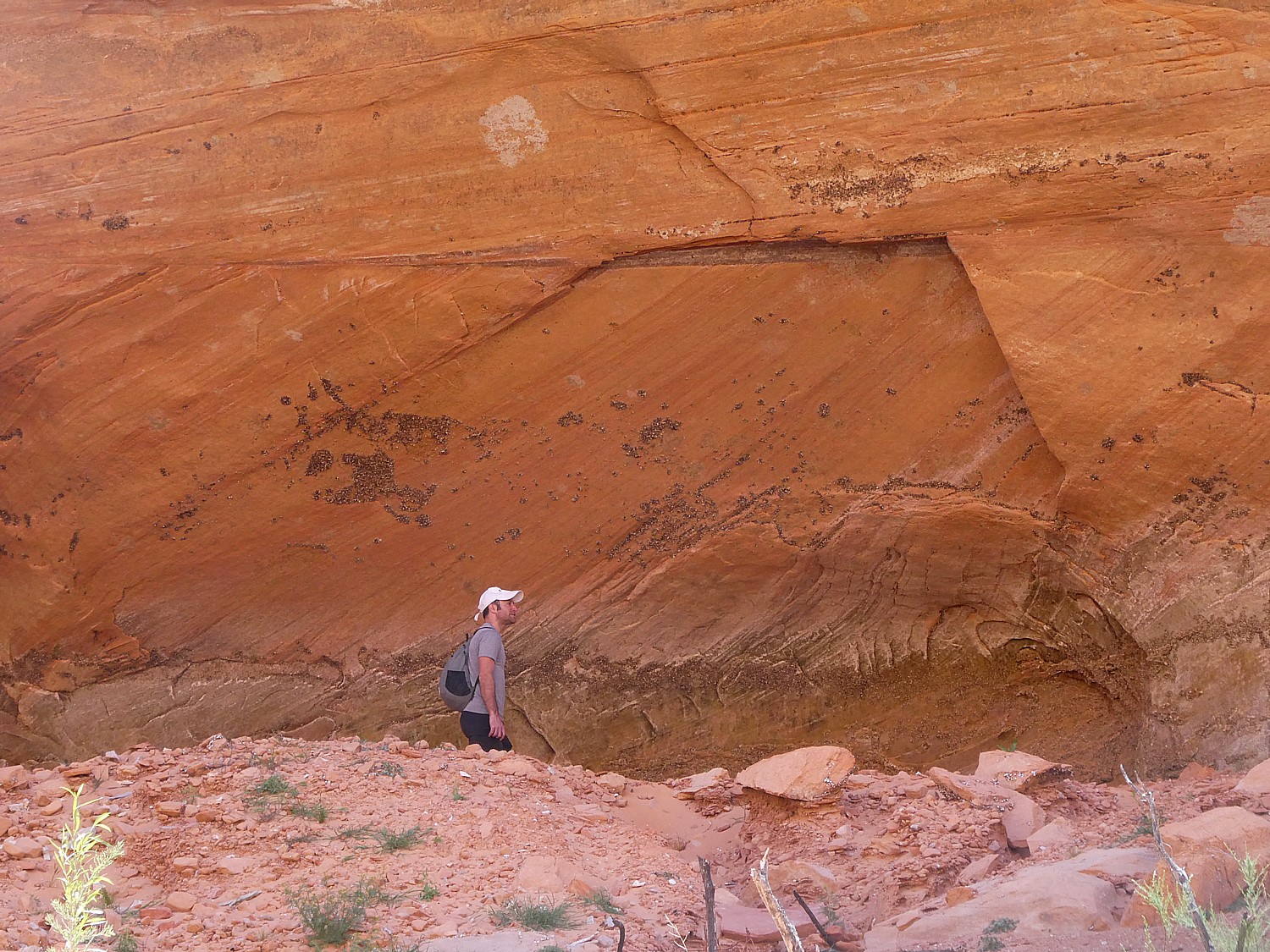
This site features five granaries built into overhanging Cedar Mesa Sandstone with a streaked pattern that, in the early morning light, resembles flames (photo tip: because these dwellings were built to be south-facing, the most dramatic light is around 10-11 am depending upon time of year). (https://bearsearsmonument.org/house-on-fire/)

“As you take in the view, imagine how the ancient Puebloans lived here between 700 and 2,500 years ago,” Matcha writes at the visitutah.com site. “The granaries perched high in the cliffs stored corn, a main source of food. The Puebloans also ground Indian ricegrass into meal to make bread, and they ate abundant prickly pears. The ever-present yucca was invaluable, as its leaves were spun into fiber and woven into baskets, sandals, and bags, as well as ropes that are said to have helped reach some of the higher, less accessible granaries. The Native Americans used the root of the yucca for soap, and they roasted and ate the base of the plant.

“The pinyon pines that you weave around and duck under to reach the ancient sites were a key source of building material, fuel, and food. When burned, the wood created the high temperatures needed for firing pottery, while pine bark served as roofing and padding, and pinon nuts provided much-needed vitamins and protein.” (https://www.visitutah.com/articles/exploring-mule-canyon-house-on-fire-cave-tower)
Matcha further advises to search for rock art located beneath an overhanging boulder in the wash below the House on Fire. And if you continue on the trail, there are several more sites worth seeing. While some sit right off the trail, you either need binoculars to see or have to climb 200 feet to reach them. “Toward the end of the canyon is the spectacular Wall Site, which has several intact rooms built into small caves in the pock-marked cliff. Some of the roofs still have the original roof timbers.”
(South Fork of Mule Canyon trail is 4.3 miles one-way, and elevation gain is 250 feet. Cave Tower Site is 1-1.5 miles round trip, and elevation change is less than 200 feet. Passes are required for day hiking, check with the Bureau of Land Management for the current fee amount. Be prepared with exact change.)
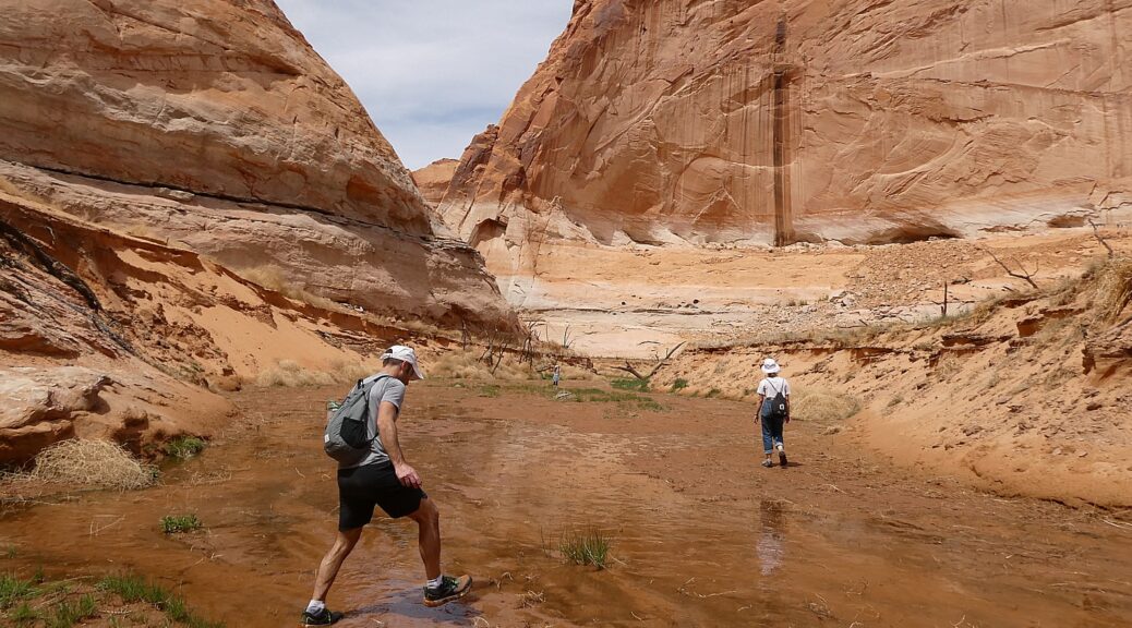
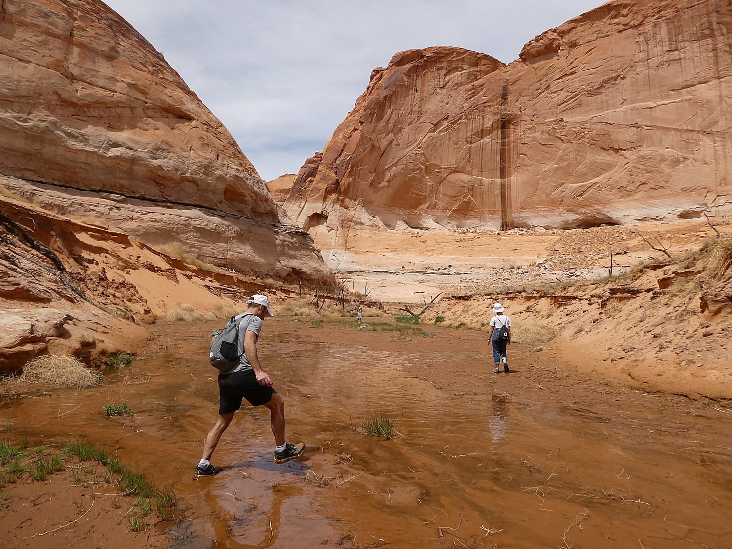
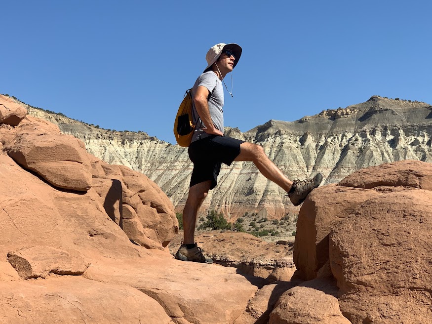
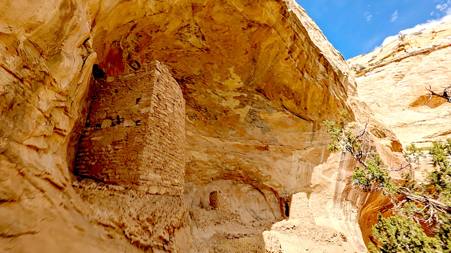
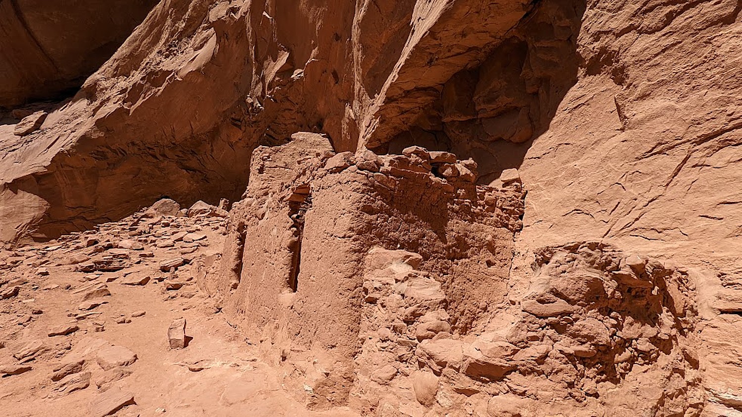
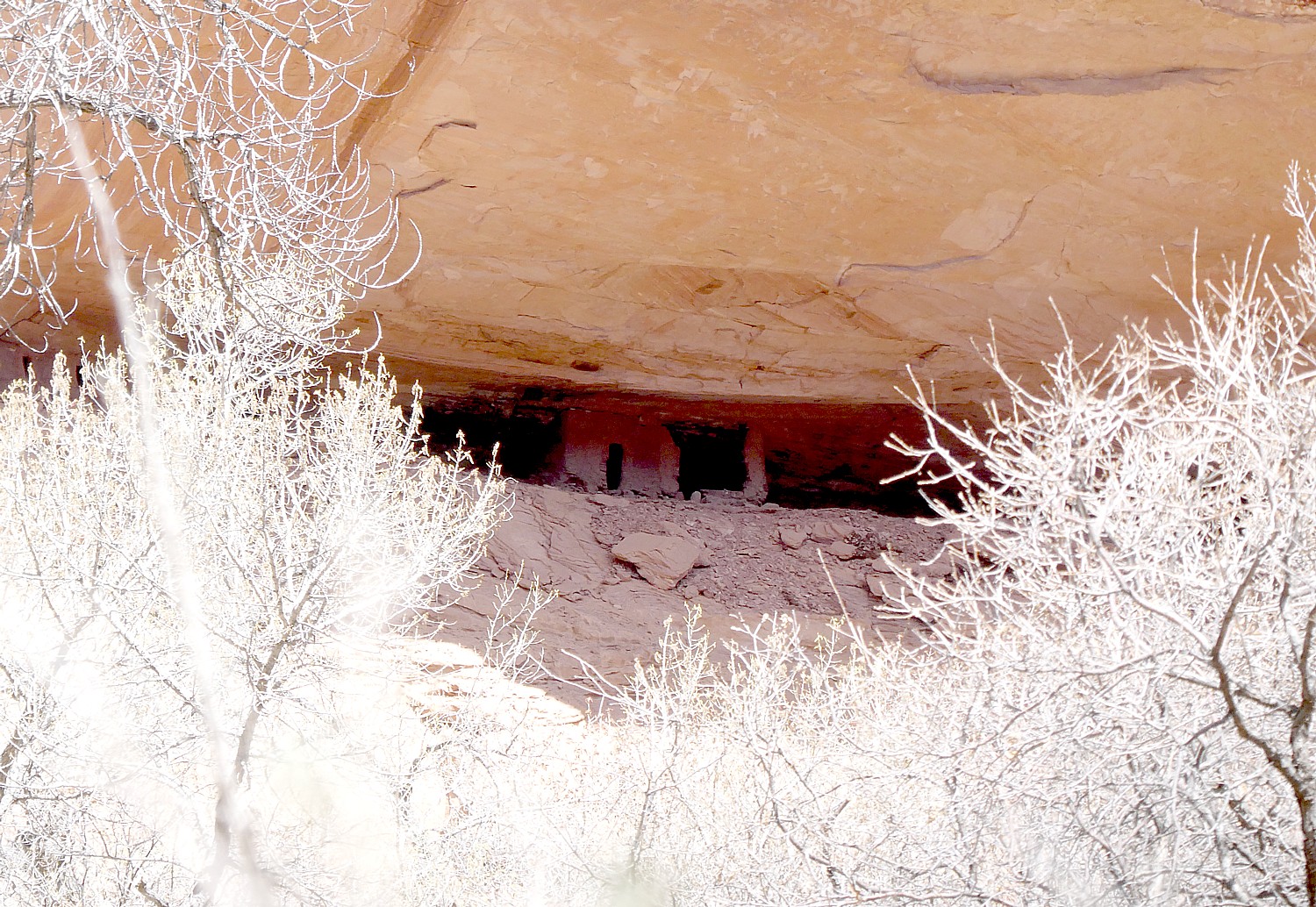
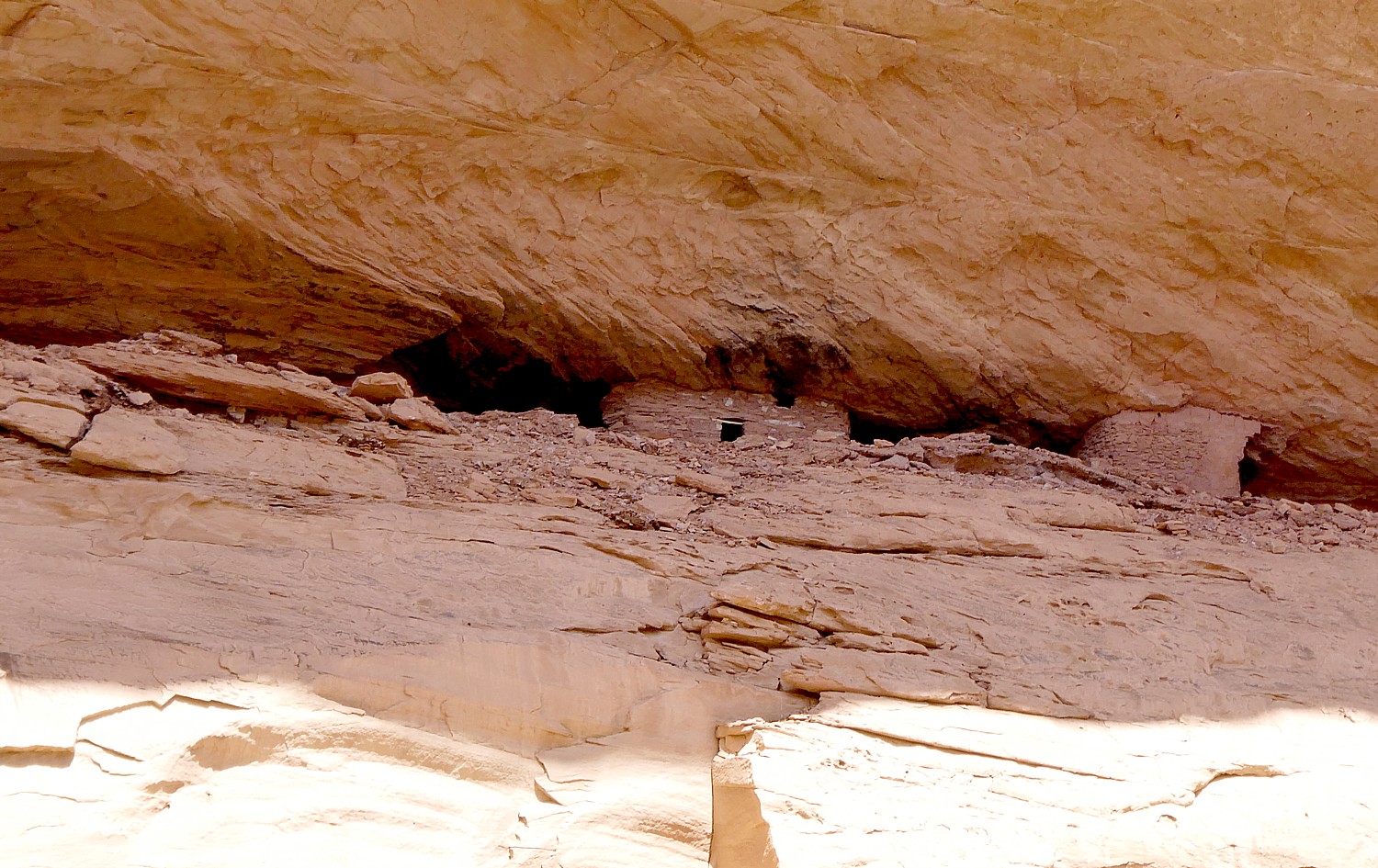
After this spectacular hike, we drive west on Hwy 95 near milepost 103, then drive onto a dirt road for half a mile. We hike in and across the way, we see The Tower Ruin – a rare, two-story structure on the other side of the canyon.
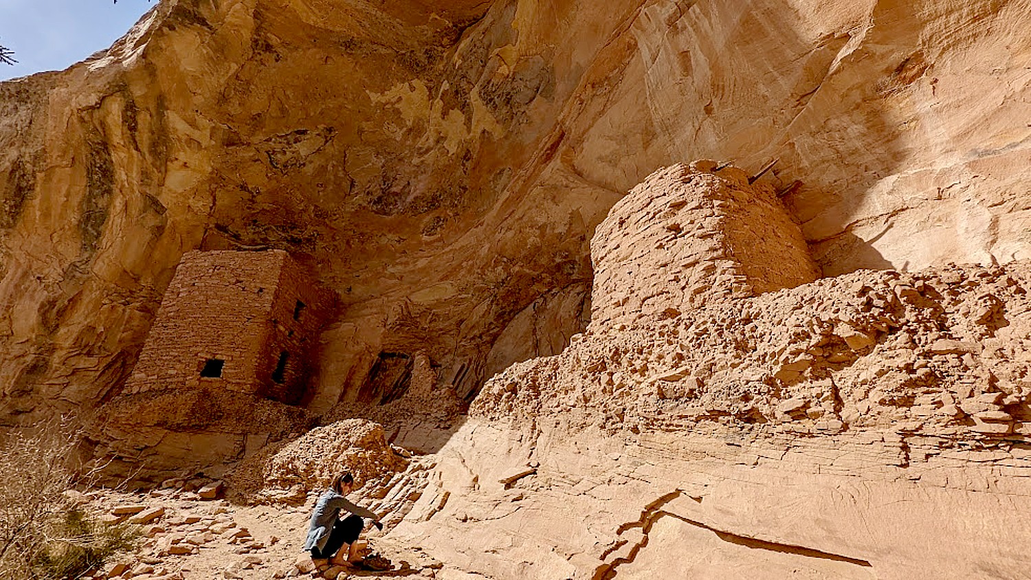
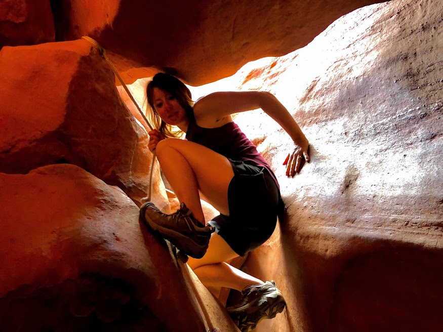
At first, it seems too steep a scramble for me, but Dave and Laini go down. Dave makes it look easy. Sure enough, he comes back to guide me to the site (so glad he did!).
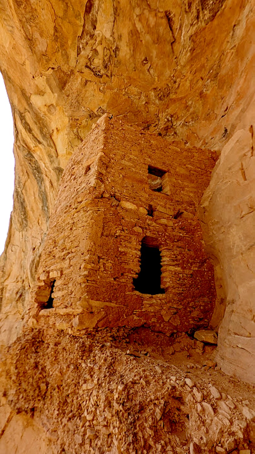
This site is so secluded, remote and untouched, it feels as if we discovered it on our own (though I’m sure that’s not true, the feeling is still so exciting).

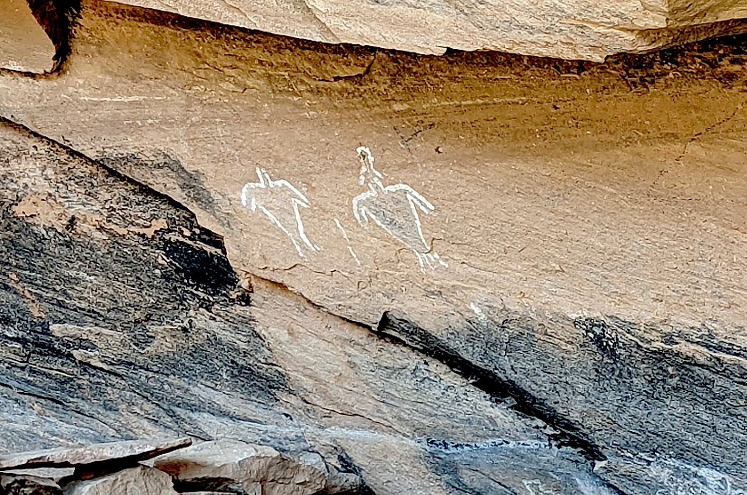
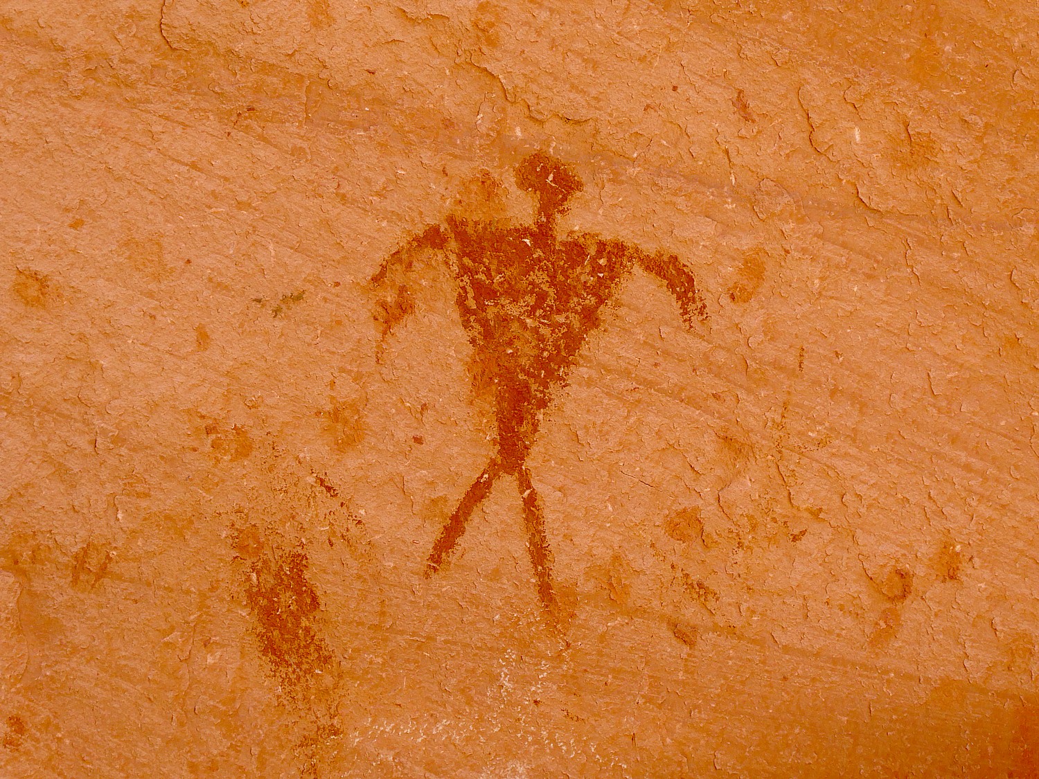
The tower construction seems to be “modern” – Laini says there is evidence of three different generations having a hand in the construction. There are fabulous pictographs and petrolyphs here. I imagine that one is a symbol for the chief.

Altogether, we have hiked about 9 to 10 miles today – so satisfying.
We drive into the town of Blanding for dinner and supplies, seeing signs along the way for Native American Crafts, Dinosaur Museum, State Edges of the Cedars Native American Museum.
Laini decides to change plans from our original itinerary and instead of leaving here for Canyonlands, we stay an extra night and day in Cedar Mesa.
So glad, because the second day’s hike is one of the best I have ever experienced.
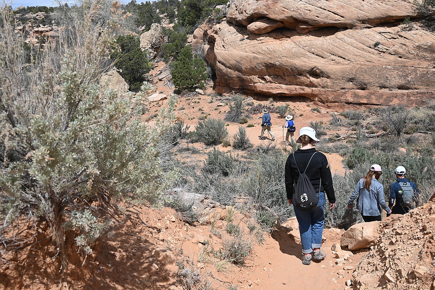
Kane Gulch Trail
Take seriously the need to obtain permits in advance for certain hikes. We changed our plans in order to stay this second day in Cedar Mesa so did not get the necessary permit (limited to just 20 a day) to hike to Moon House – the only day hike that requires a permit instead of just a hiking day pass. We thought we might get away with it because we are here on Easter Sunday, but no such luck (the permit allocations fill up even months before). It is easier to get permits in summer months, which is when Laini and David found themselves the only ones at the site when they last visited (likely because of the heat; when we are here, in early spring, the weather is perfect).
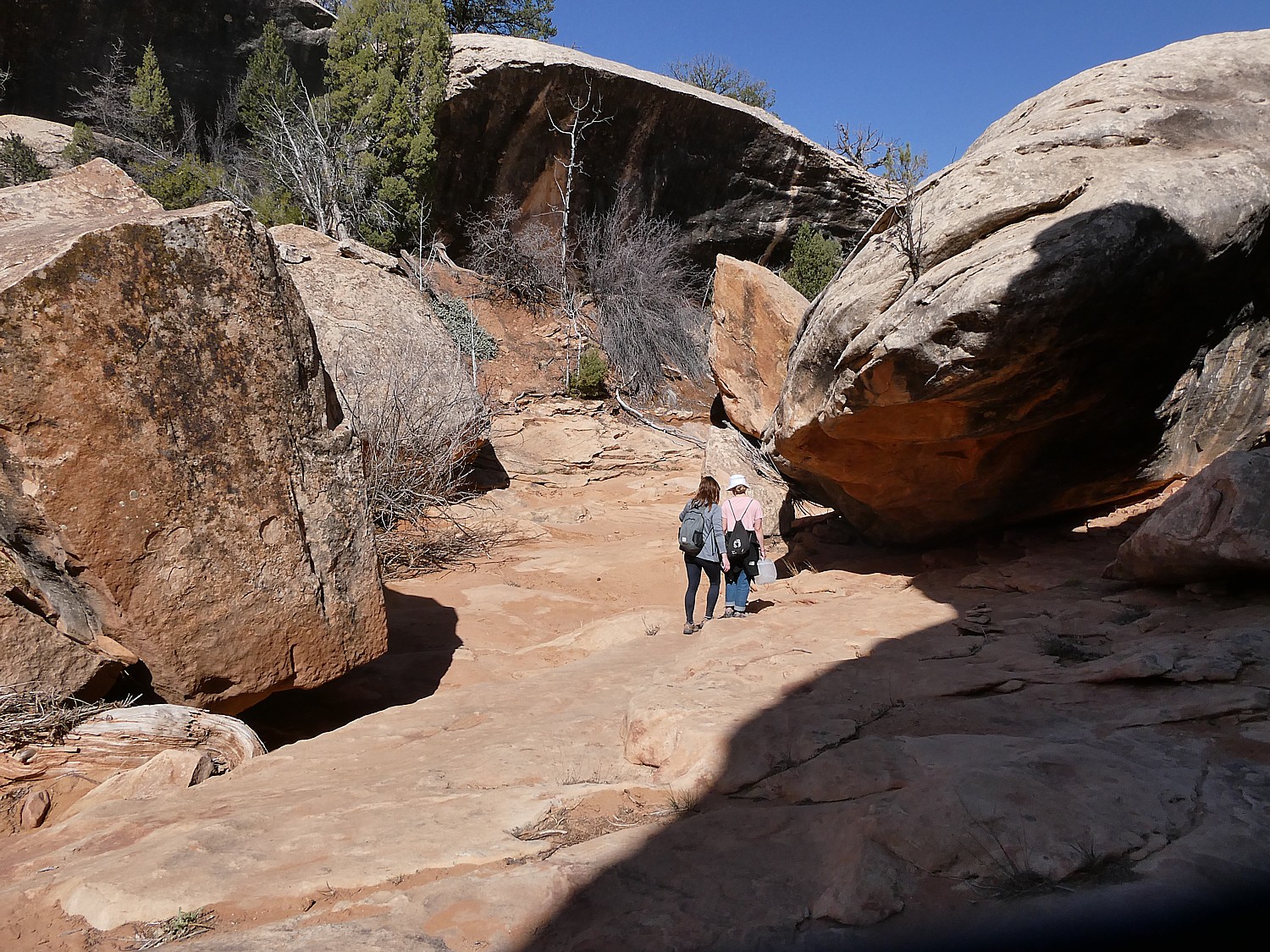
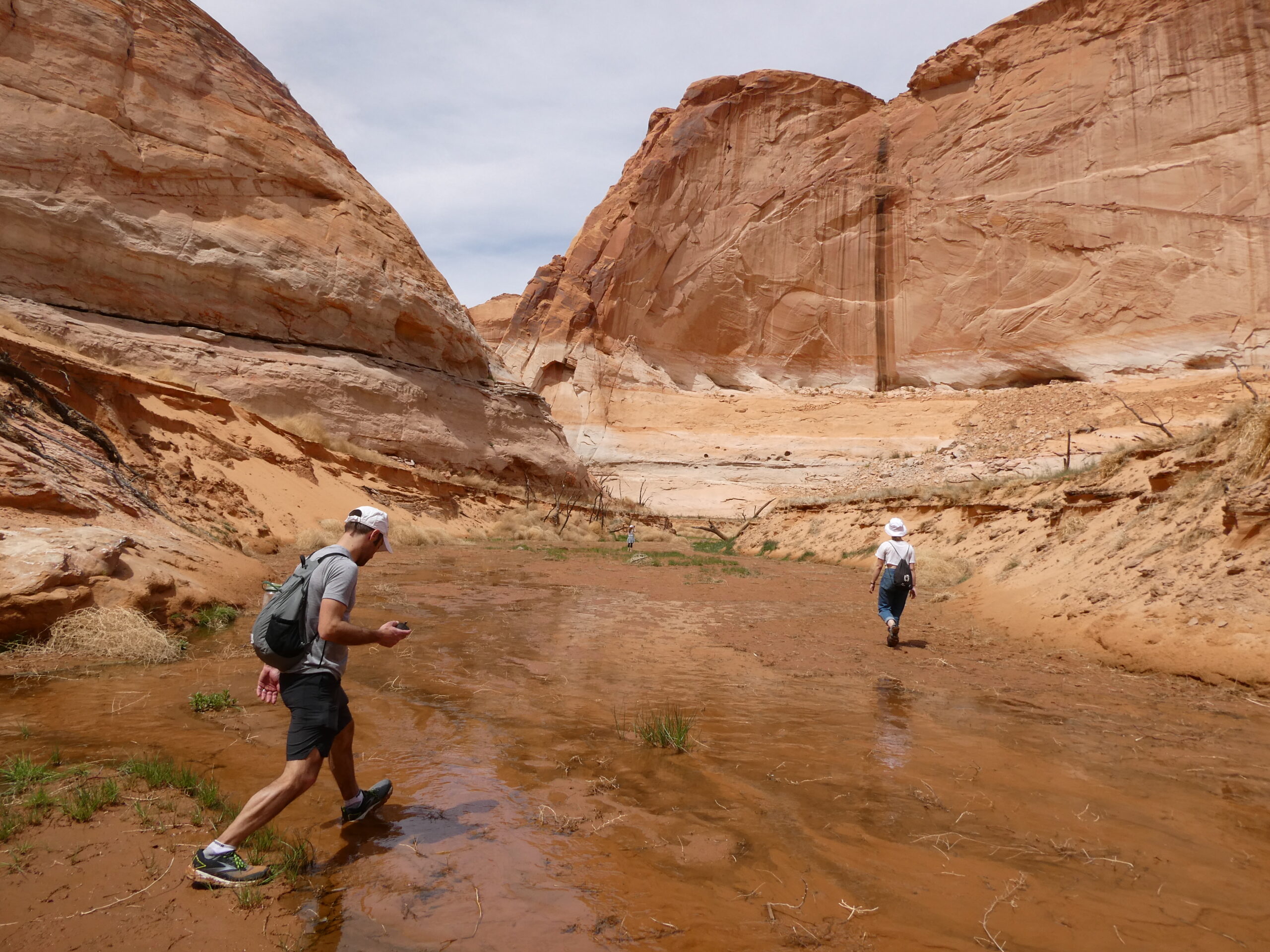
Instead, at the Kane Gulch Visitor Center, the Ranger suggests we hike the Kane Gulch Trail which starts right across the road. We purchase our day hiking passes ($5 pp – my America the Beautiful pass doesn’t count). She suggests what to look for at what distances.
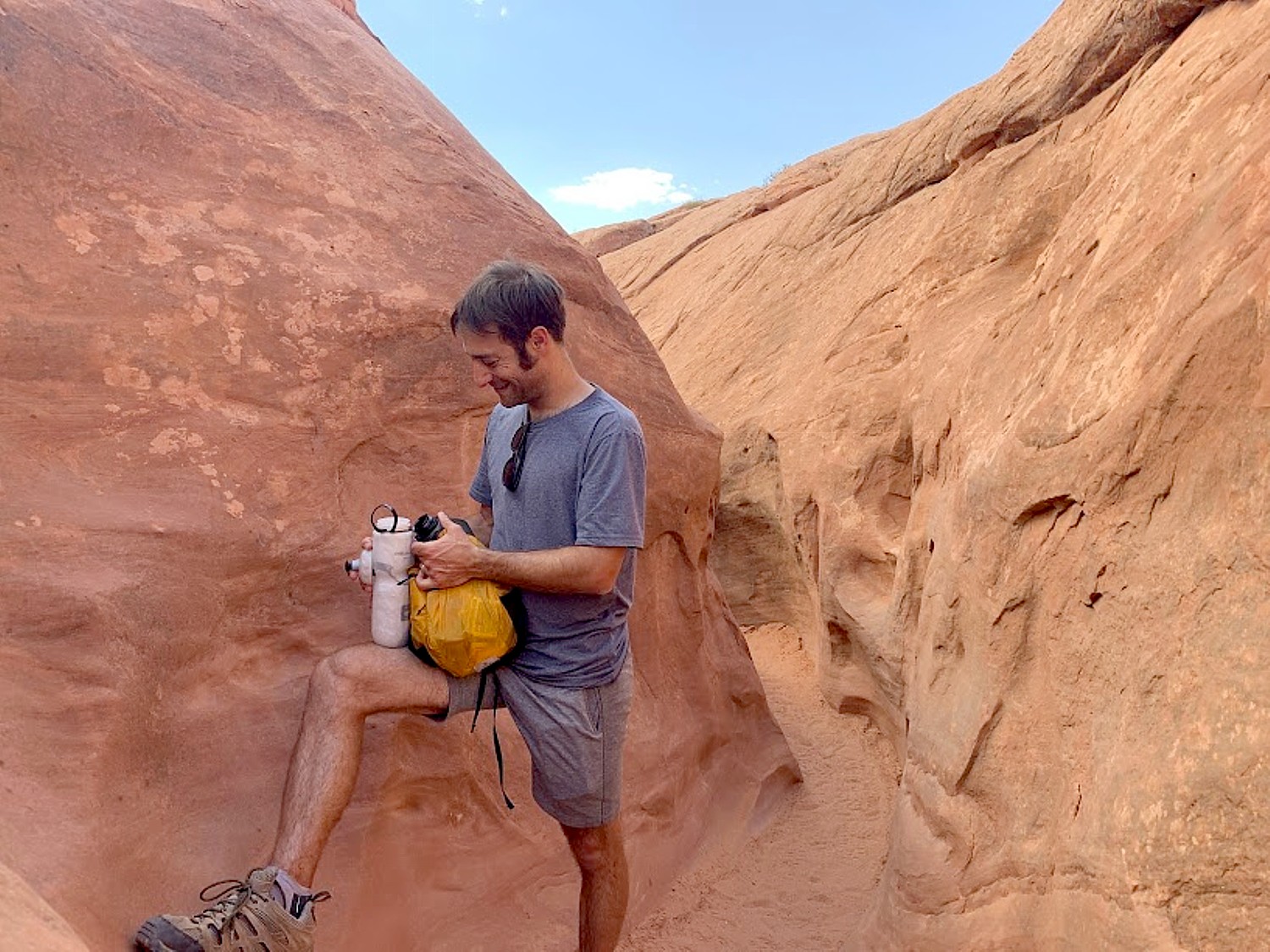
Dave gets out our hot-water maker and we have our breakfast at the picnic table outside the visitor center, then set out. Our plan is to go five miles, to the Stimper Arch, and five miles back.
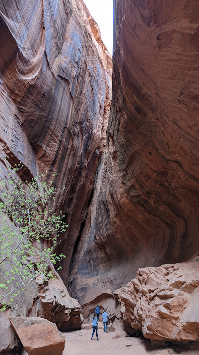
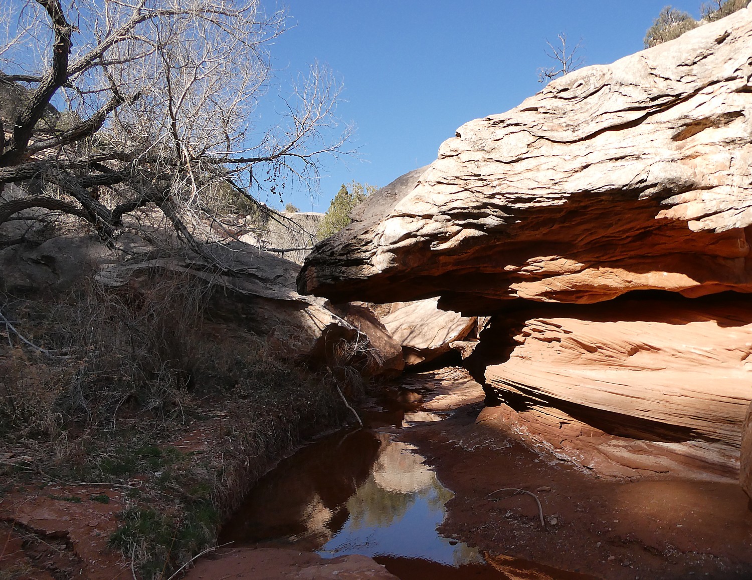
At about a mile in, there is a short slot canyon where we see a formation to me looks like the profile of an Indian chief.
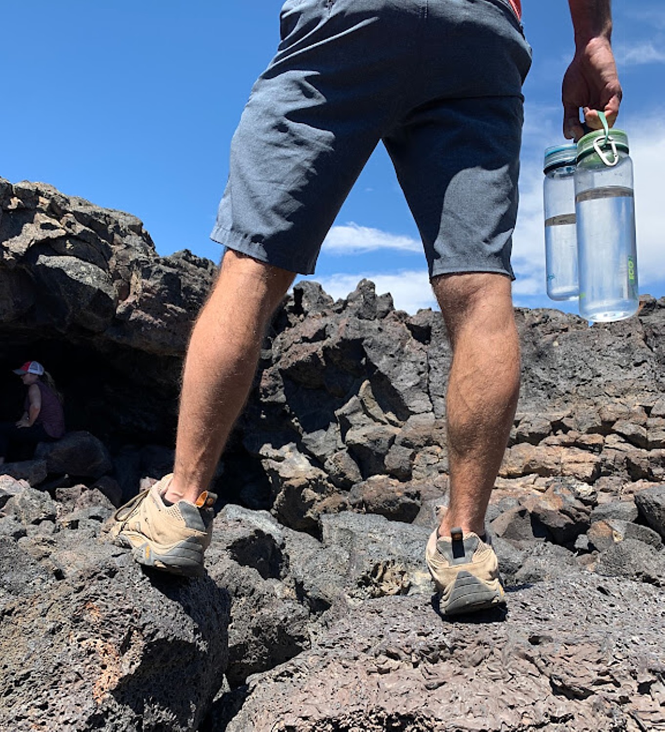
At the two-mile mark, Dave stashes our 5-gallon water jug so we have enough for the return.
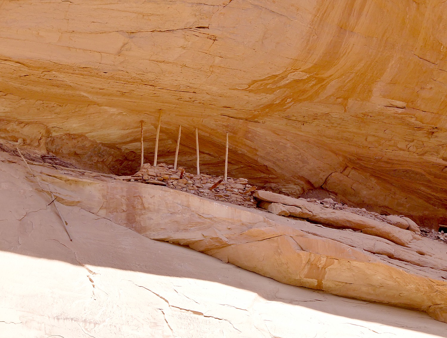
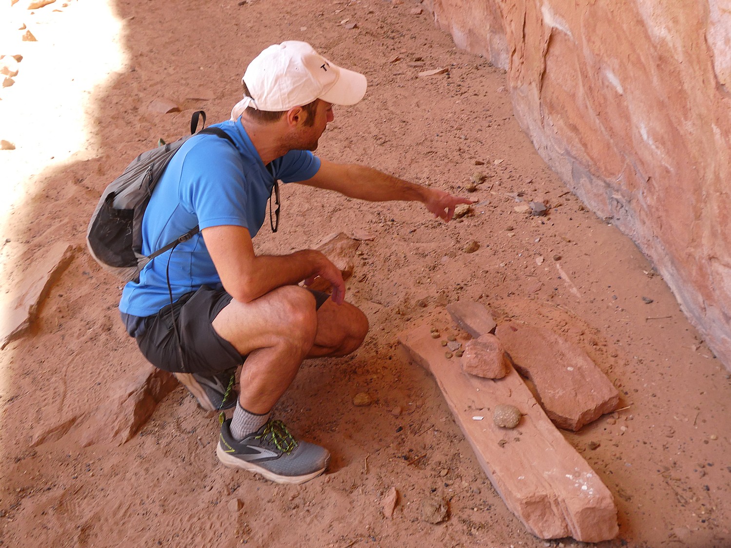
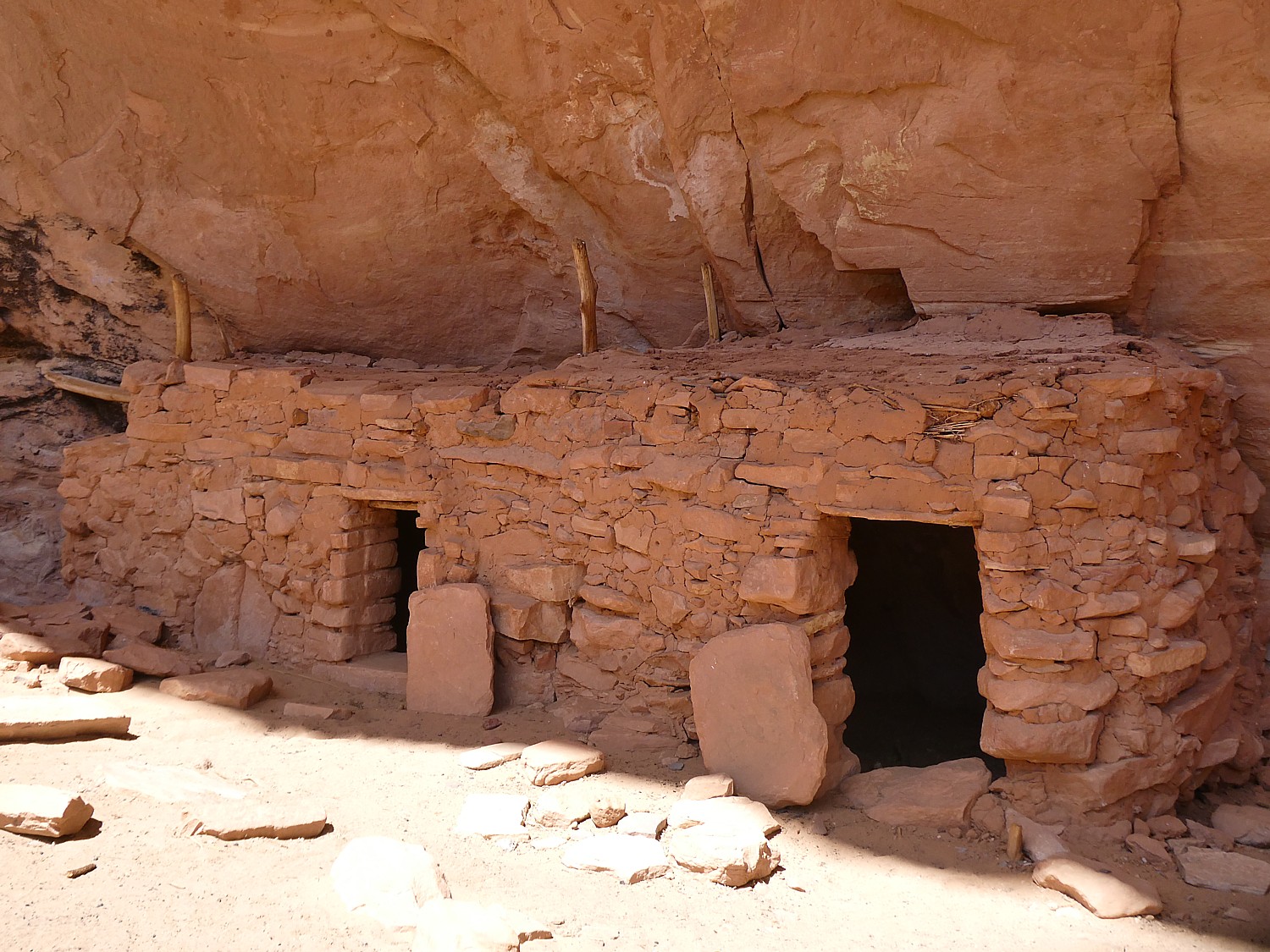
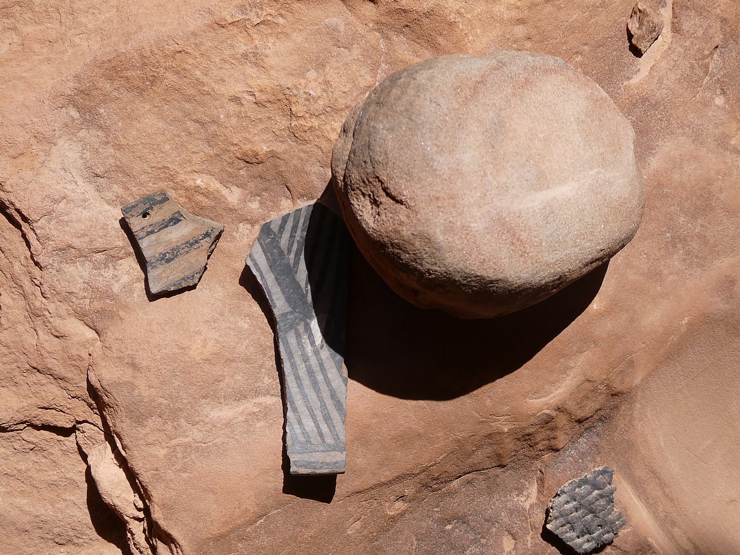
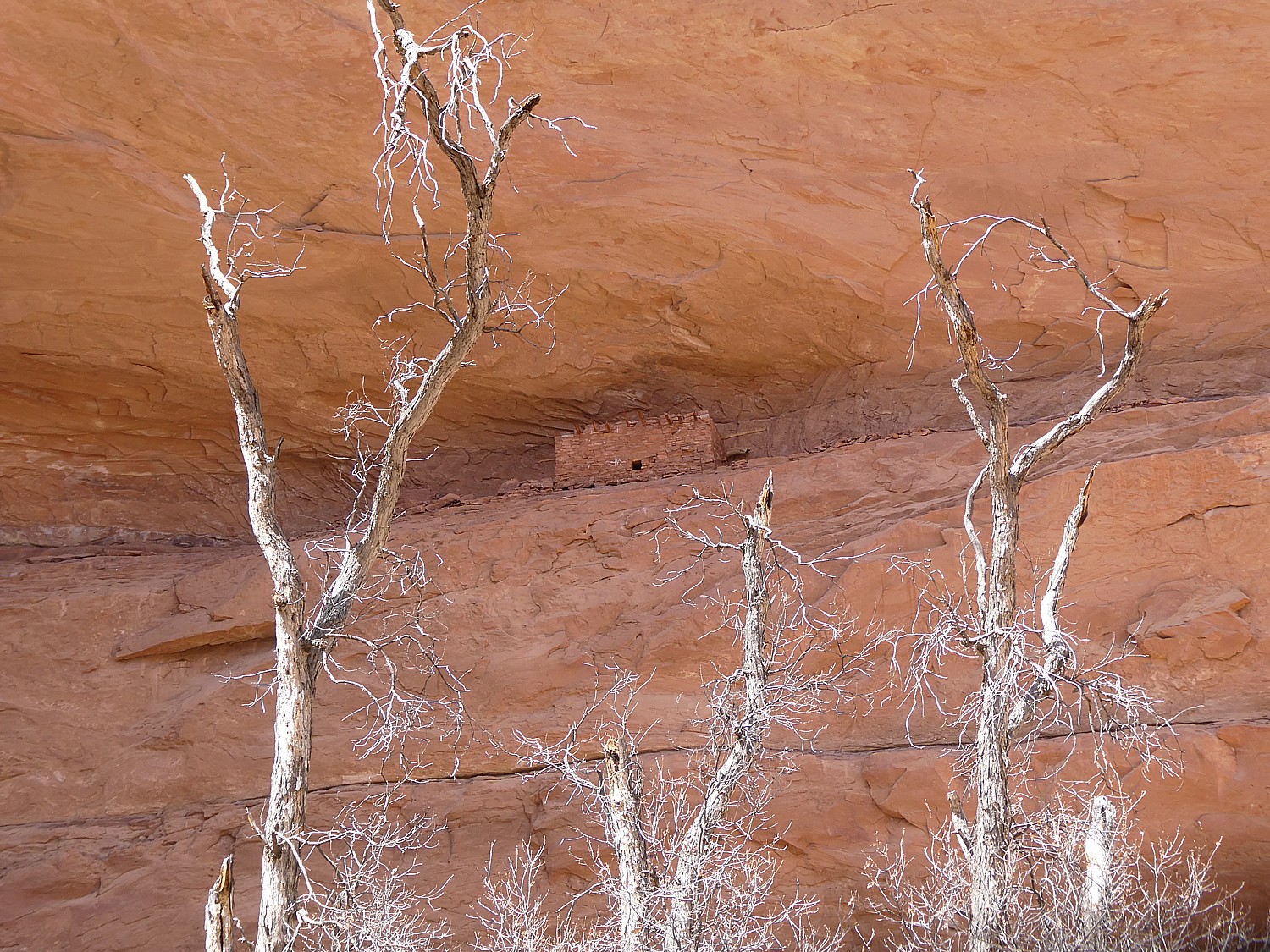
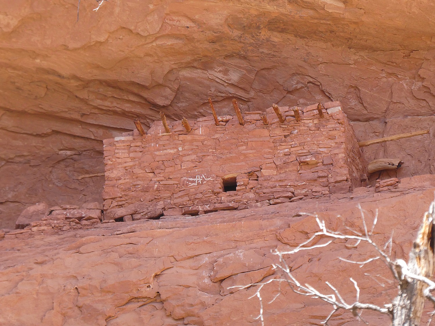
It’s four miles to the Junction Ruin which has some fabulous dwellings, pottery shards, and pictographs.Dave and Laini climb up sheer rock to get to an upper level (a defensive watchtower?) and could see remnants of a ladder that would have been used.
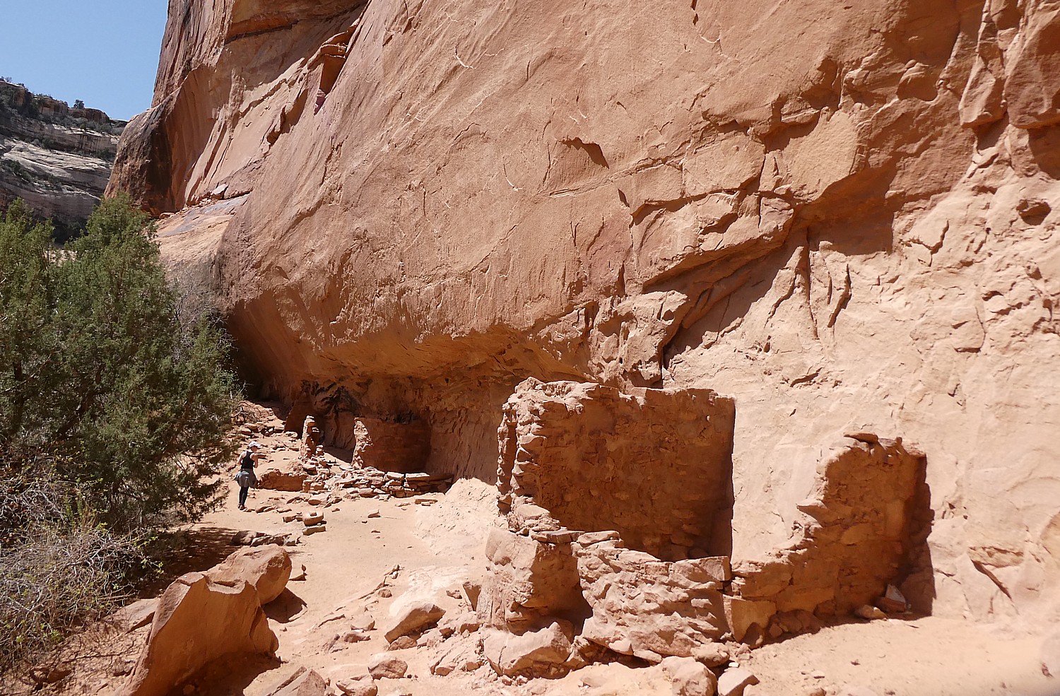
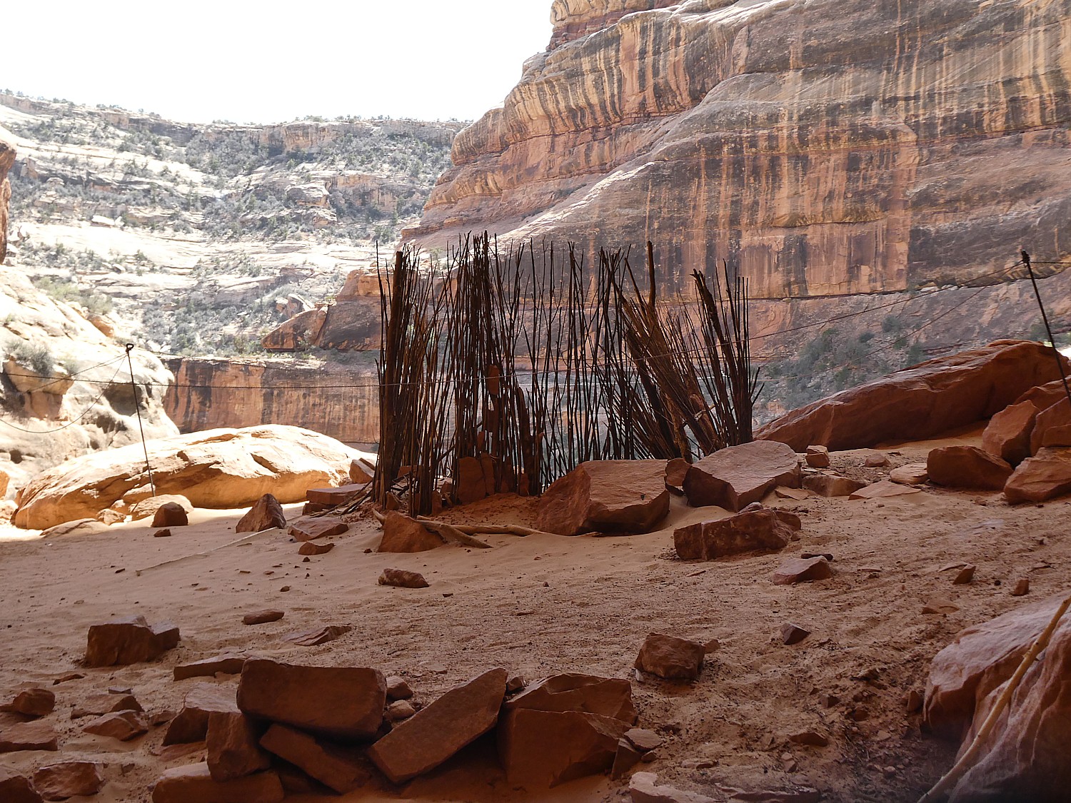
Another .7 mile and we come to a site known as Turkey Pen. Looking up from the trail, it seems the cliff dwellings are cramped and close to the edge, but when we get up here, it is surprising how much space there actually is.

Here, we see some fabulous examples of mud and stick method of construction (jacal) and some exquisite painted pottery shards, pictographs, even the remnants of the actual turkey pen formed with sticks – so it almost seems you are coming upon a dwelling just after the residents left. You feel you are the archaeologist making the discovery – except for the printed notes left by the National Park Service- but still.
We also come upon a square kiva (most kivas Laini and Dave have seen are circular, Laini notes).
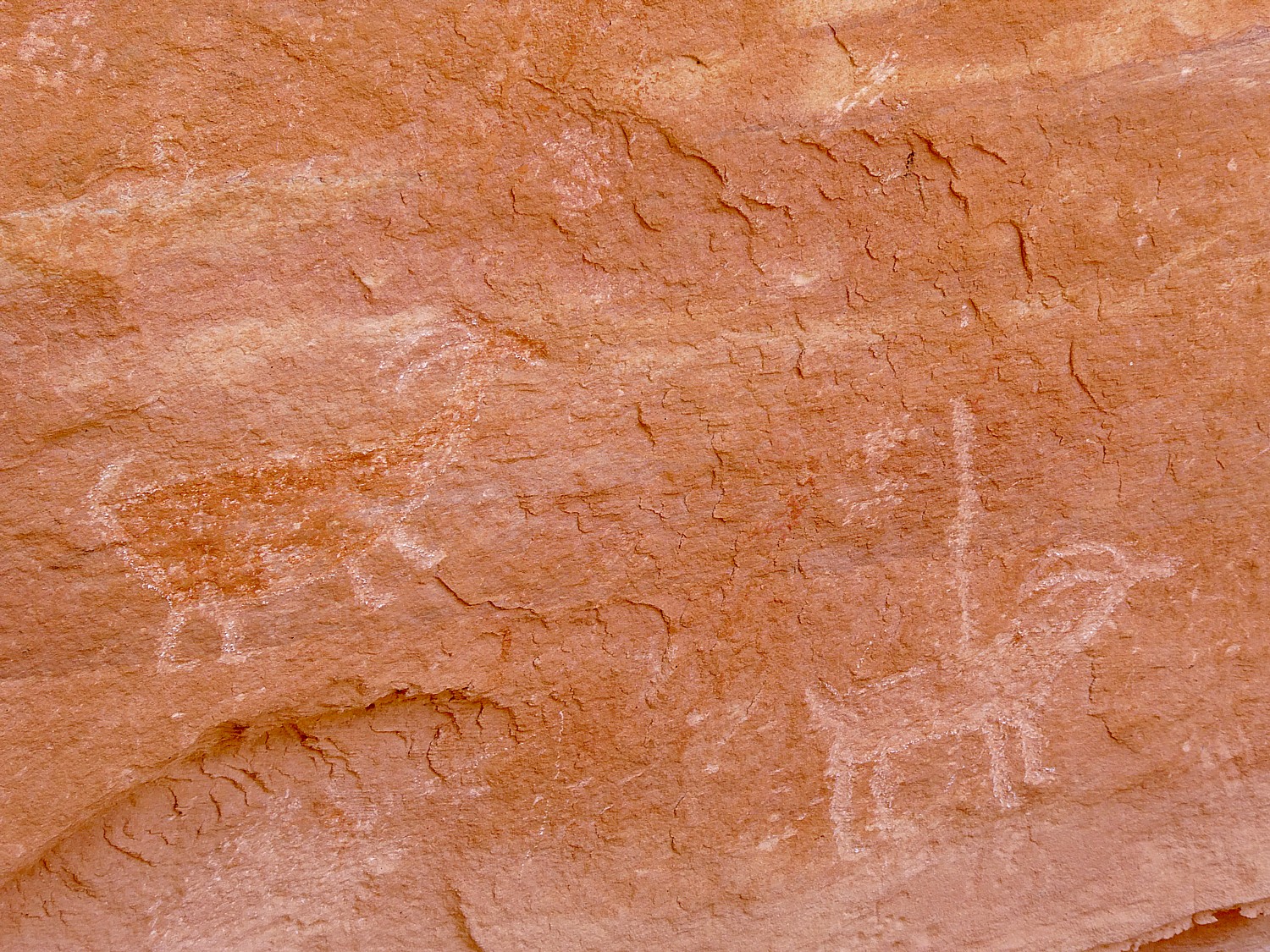
You wonder about whether the site was designed to defend and who to defend from – people who would take food stored in the granary? One of the pictographs depicts sheep being killed, another of “lizard man.”
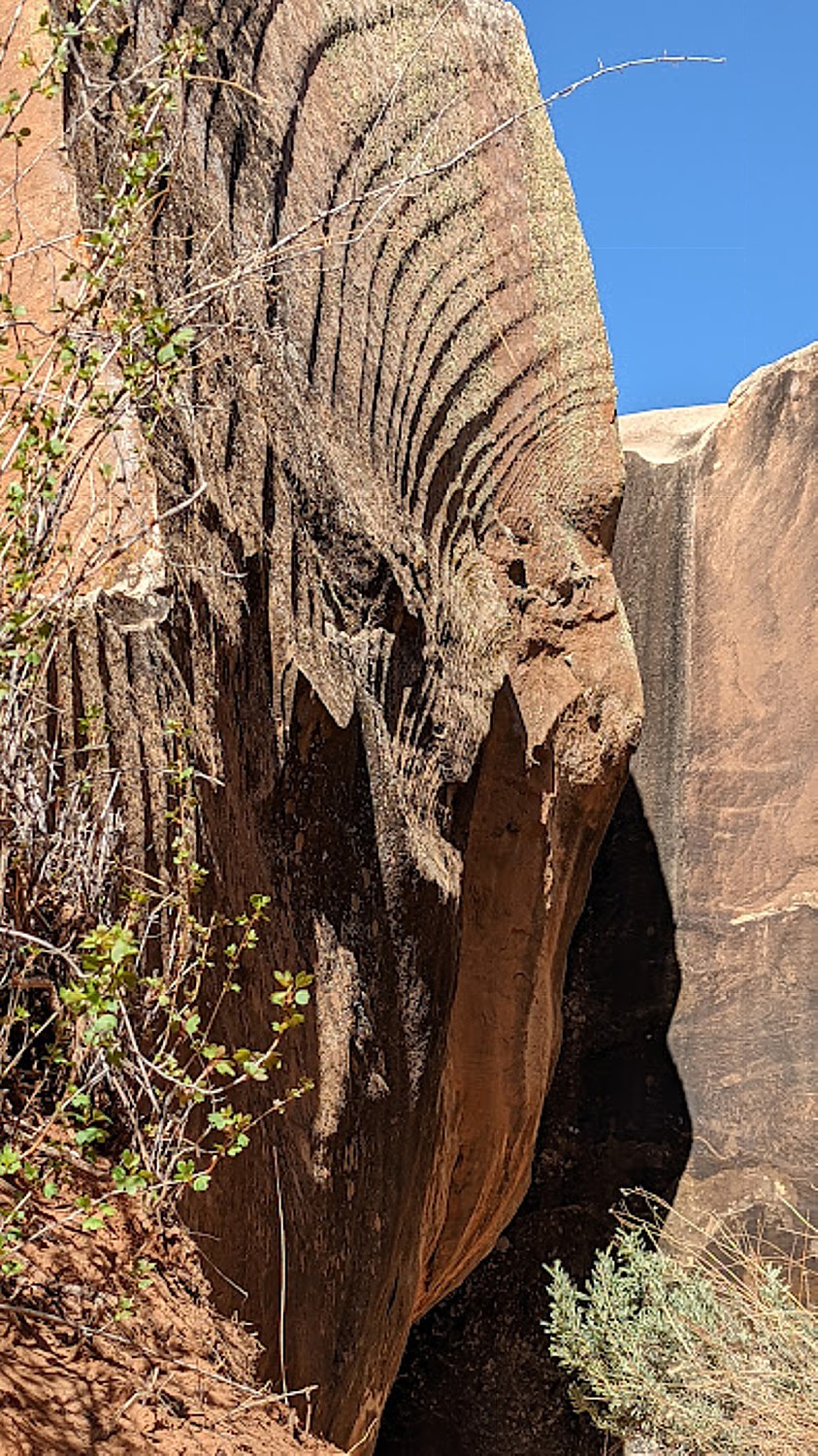
As we hike, we keep our eyes peeled on the cliffs above for evidence of dwellings, well off the trail and likely minimally visited. Laini says there were thousands of cliff dwellings here and only a fraction have been discovered (or are still intact, but when you consider they are 1000 years old, and the crumbling rock all around, it is amazing any remain). We spot one and Laini goes off to try to find a way to climb up to it.
We find a pleasant rock overhang to sit and have our picnic lunch, feeling like this would have been exactly what the Puebloans would have done.
We hike a further .3 miles to the Stimper Arch (which is the 5-mile mark), where we turn around.
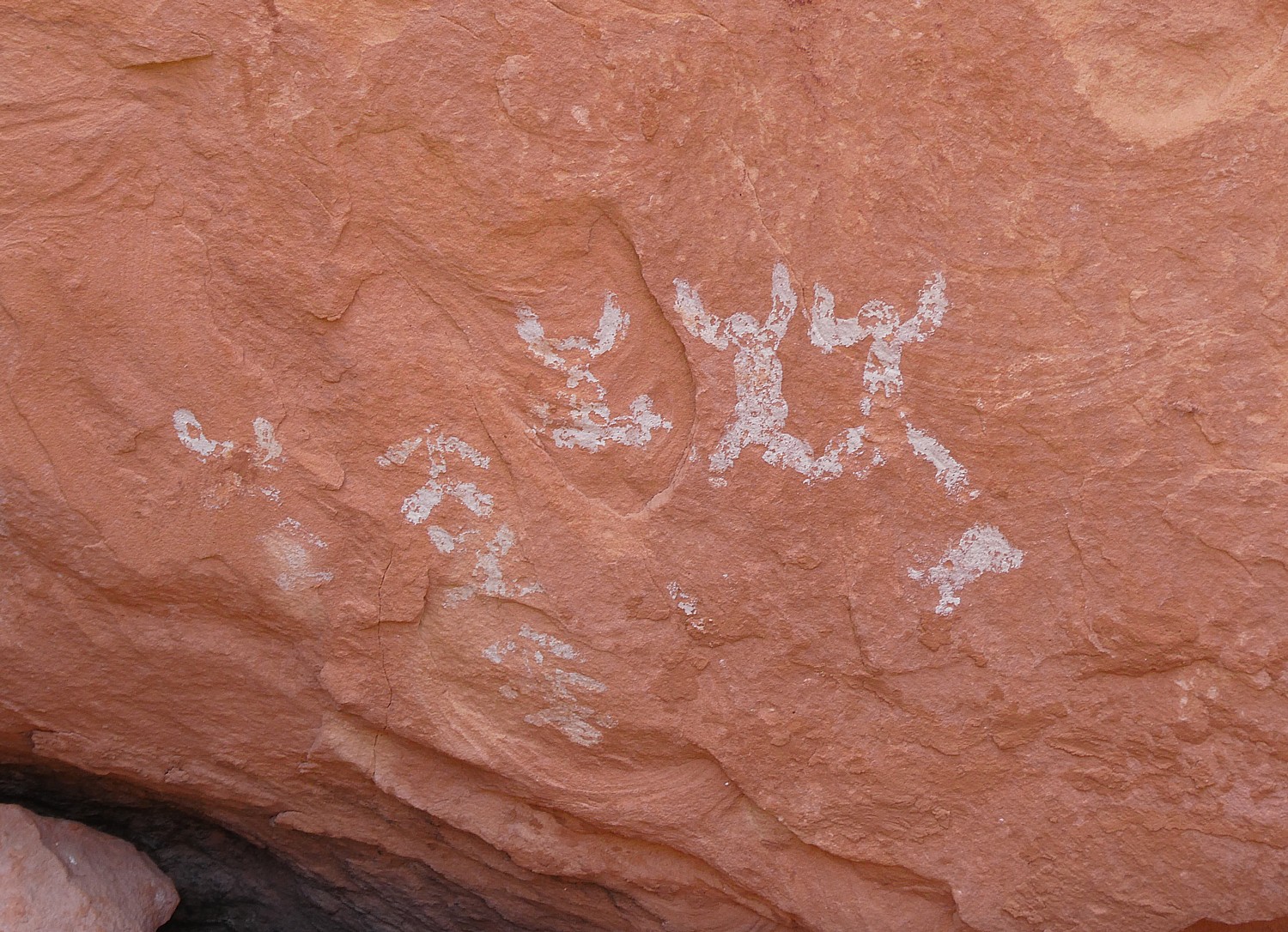
This hike has everything – it has just the right amount of physical challenge – a section where you scramble a bit and walk a narrow edge – gorgeous greenery, stunning rock formations, water features (but not too watery to hike), but best and most spectacular of all, these cliff dwellings that look like we have just discovered them, with relatively large and stunningly painted pottery shards, stone tools, stunning pictographs (I start thinking they are either indications of how many people lived in the dwelling like a census; markers of whose dwelling it is, like a family name? or just being playful, artful?).
The trail is not specifically marked – so you have to figure your own way using the landscape and intermittently placed cairns.

Even though this is a popular trail, we come upon other people only occasionally (but it kind of reassures us we are going the right way).
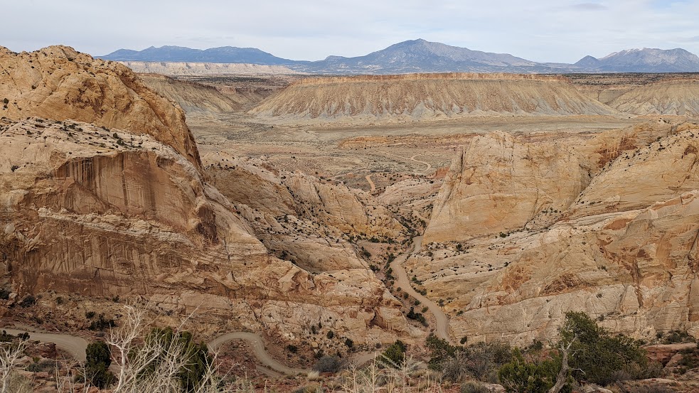
The trail actually goes on for miles (days), connecting to other trails. (We meet a group of college students who are making a multi-day backpacking trip and will return on the Fish and Owl trail.)
We get back to the start at 6:30 pm (we set out around 10 am), having hiked about 11 miles. (It took us 5 hours to get 5 miles (including the time exploring the archaeological sites) and 3 ½ hours to hike back.

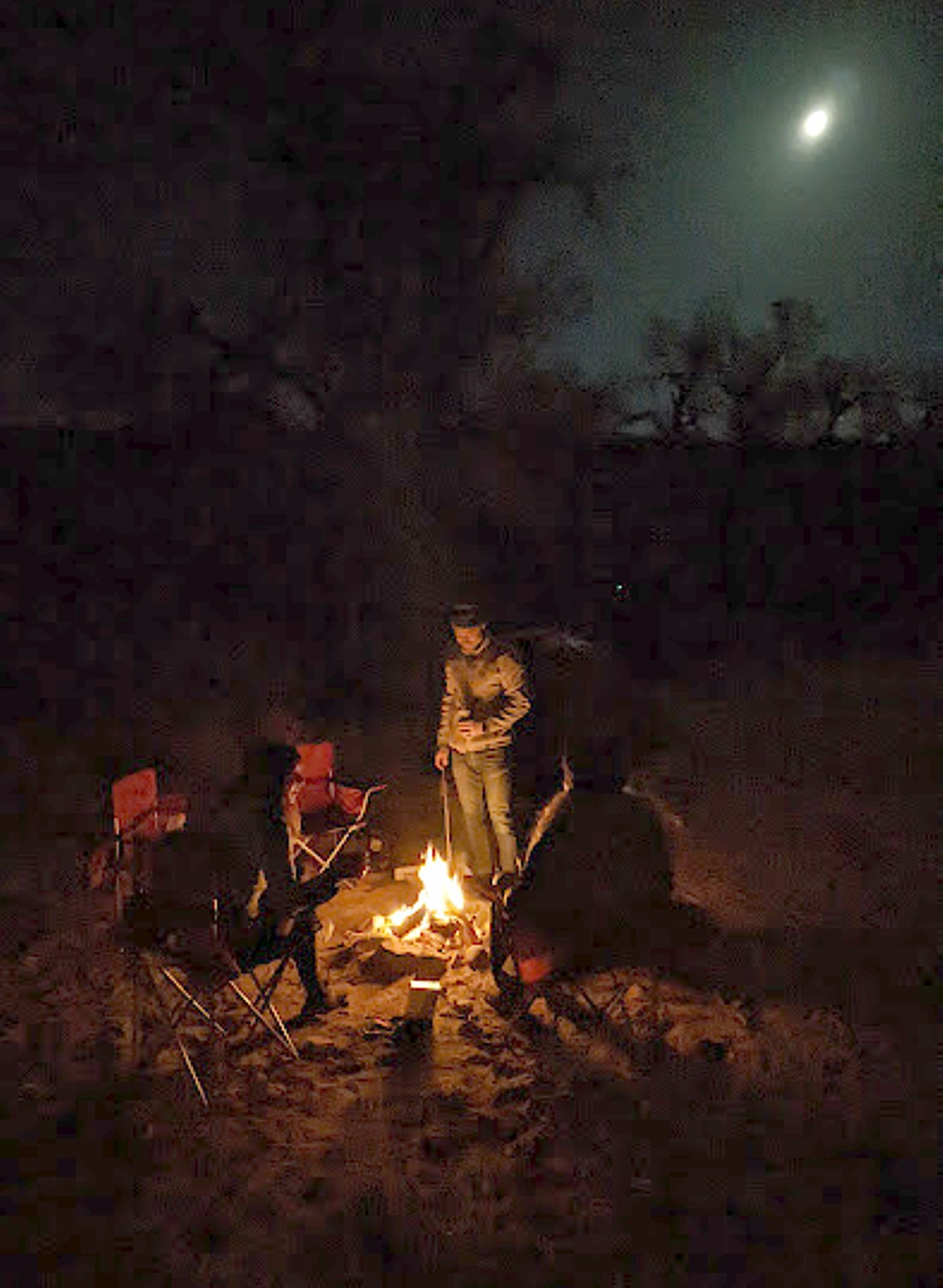
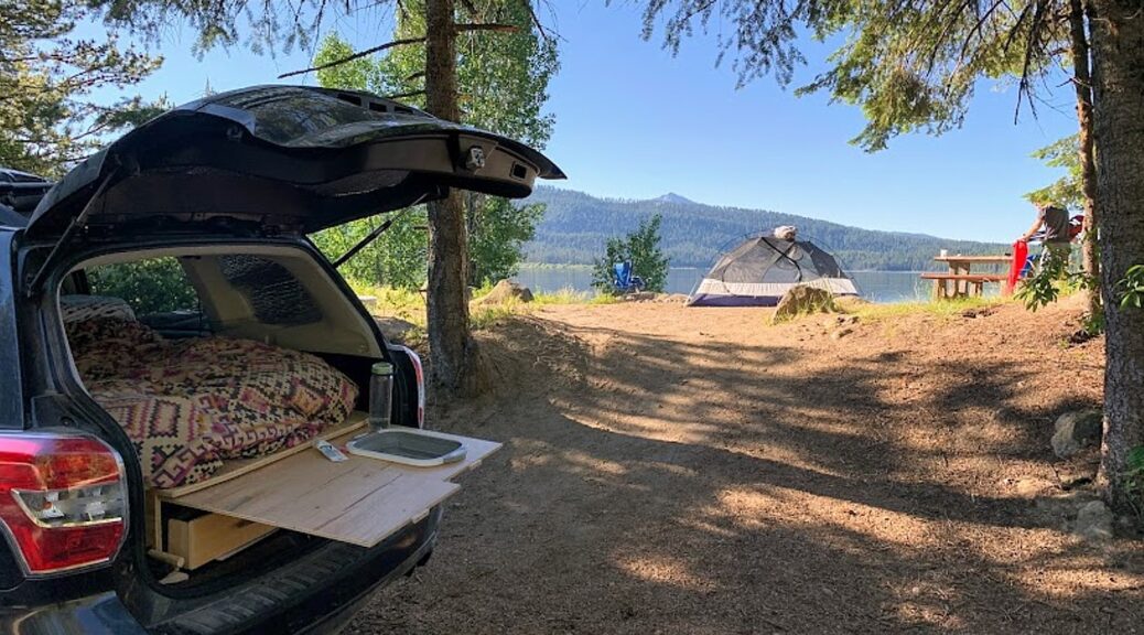
After this full day’s hike, we drive to Arches National Park. It’s a fairly long drive and already sunset by the time we arrive. This is the first time we have to set up camp in the dark and there is a strong wind that makes it difficult to keep the tent from blowing away (especially since I can’t find my tent stakes so we improvise, until they are ultimately found under the footprint.)
Dave makes a fire and we prepare dinner from our supplies.

If You Go….
The Moon House Ruin is one of the best archaeology sites on Cedar Mesa, consists of three separate structures with 49 rooms; well preserved pictographs grace the walls of an interior courtyard and some of the rooms (the hike is 3.2-5.6 miles roundtrip). More of the best hikes in Bears Ears at http://www.hikingwalking.com/index.php/destinations/ut/ut_se/blanding
Day hiking in Bears Ears National Monument requires a day hiking pass. Day hiking passes are unlimited.
Bears Ears National Monument does not charge an entry fee where your America the Beautiful Pass would typically apply. However, activity fees called “Individual Special Recreation Permits” are charged for day hiking and backpacking (typically $2 at the trailhead). Visit the permits page for more information (https://www.blm.gov/programs/recreation/permits-and-passes/lotteries-and-permit-systems/utah/cedarmesa).
Visitor Centers:
Kane Gulch BLM Ranger Station, UT-261 36 miles west of Blanding. Open: March 1-June 15, September 1-October 31, 8 am-noon daily
Monticello Visitor Center, 216 S Main St., Hours: 9 am-5 pm, closes at 3 pm on Sunday, Phone: 435-587-3401
Blanding Visitor Center, 12 North Grayson Parkway, 9 am-5 p.m., closed Sunday
https://www.blm.gov/visit/bears-ears-national-monument
See:
UTAH ADVENTURE DAY 1-2: CAPITOL REEF’S COLORFUL CANYONS
UTAH ADVENTURE DAY 3-4: GRAND STAIRCASE-ESCALANTE POSES CHALLENGE
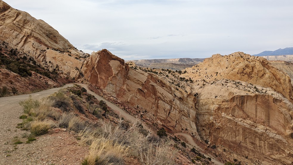
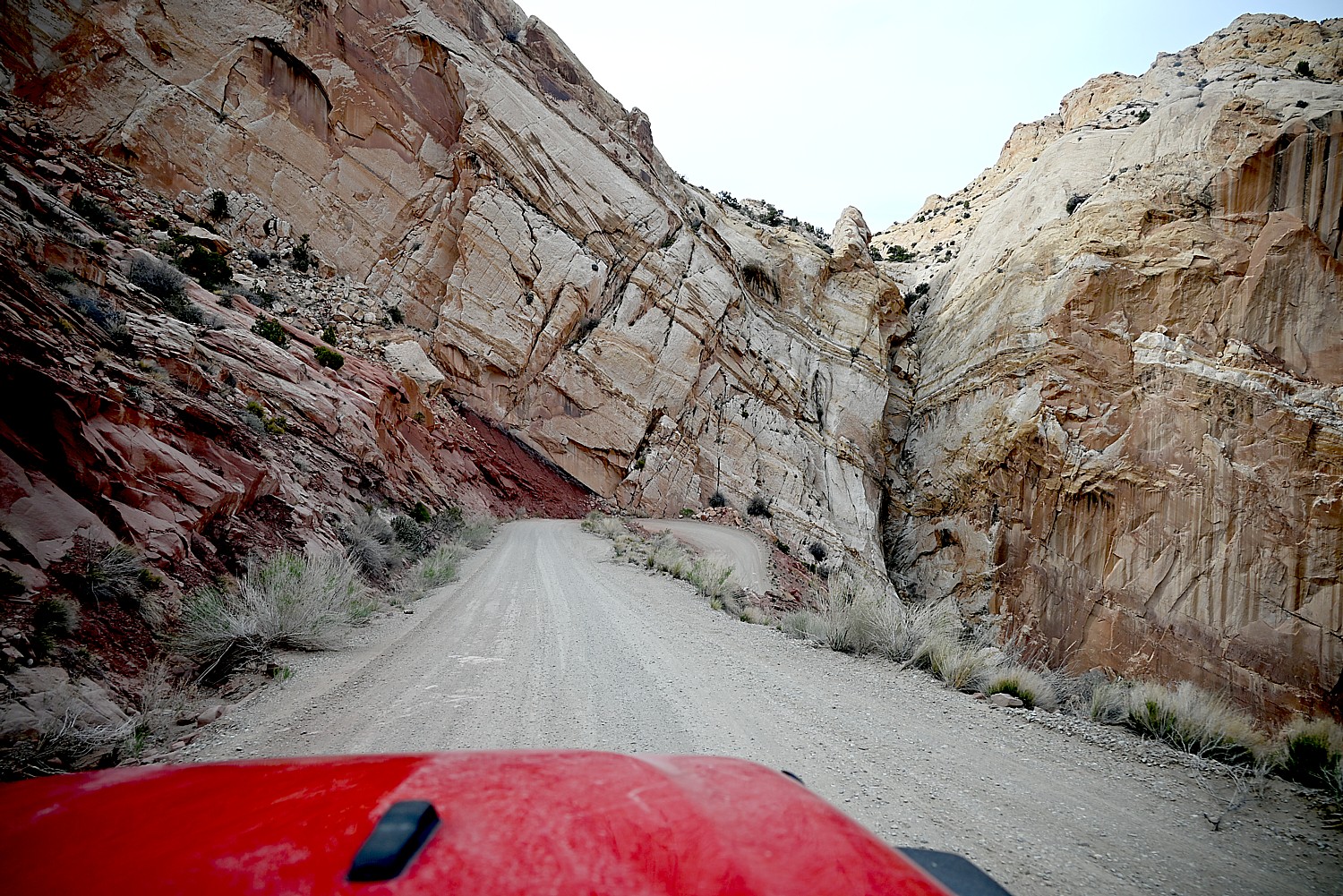
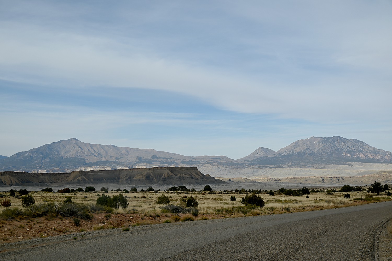
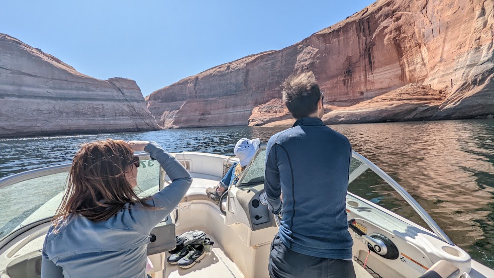
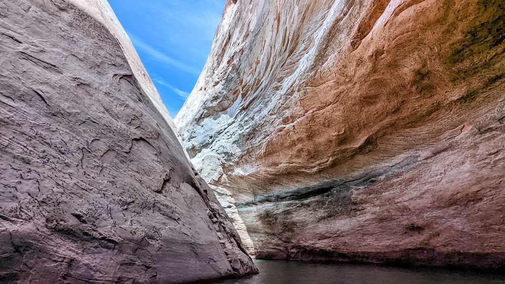
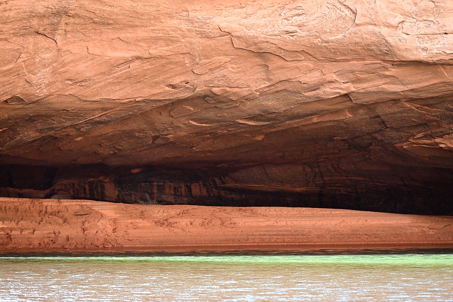
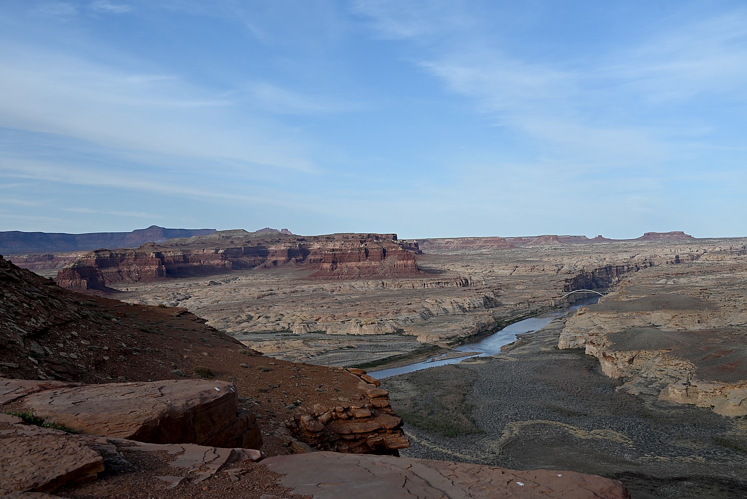
UTAH ADVENTURE DAY 4-5: DRIVING BURR TRAIL, EXPLORING GLEN CANYON, WILD CAMPING IN ARCH CANYON
UTAH ADVENTURE DAY 6: SACRED SITES, SPIRITS OF BEARS EARS NATIONAL MONUMENT
______________________
© 2023 Travel Features Syndicate, a division of Workstyles, Inc. All rights reserved. Visit goingplacesfarandnear.com, www.huffingtonpost.com/author/karen-rubin, and travelwritersmagazine.com/TravelFeaturesSyndicate/. Blogging at goingplacesnearandfar.wordpress.com and moralcompasstravel.info. Visit instagram.com/going_places_far_and_near and instagram.com/bigbackpacktraveler/ Send comments or questions to FamTravLtr@aol.com. Tweet @TravelFeatures. ‘Like’ us at facebook.com/KarenBRubin