
By Karen Rubin, with Laini Miranda and Dave E. Leiberman
Travel Features Syndicate, goingplacesfarandnear.com
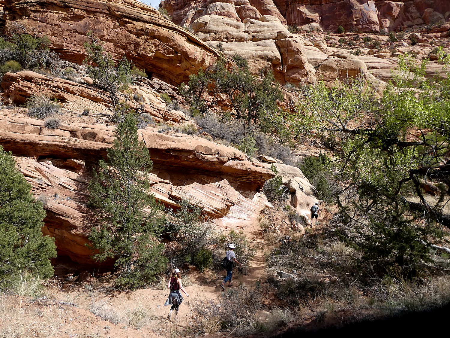
Bears Ears National Monument-Cedar Mesa is the highlight (out of so many) of our Utah Adventure – hitting on all cylinders of stunning landscape, fascinating cultural heritage, and the opportunity to really explore, adventure and discover for ourselves on some of the most wonderful hikes (Kane Gulch!) anywhere.
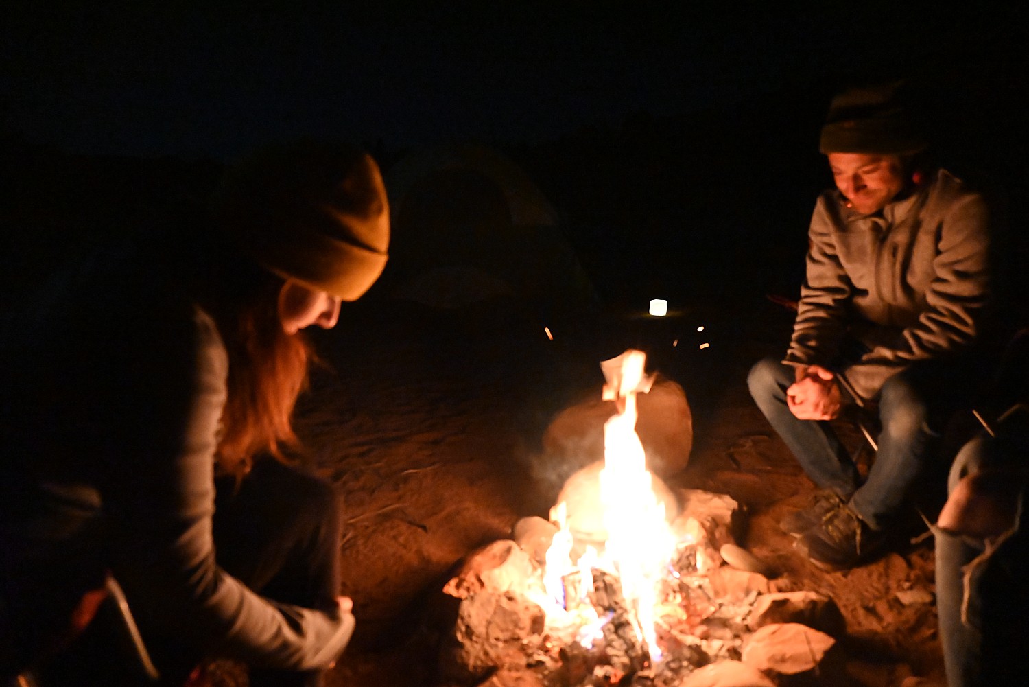
Finally! I get to do wild camping that I have been so intrigued about ever since Dave and Laini spent much of a summer exploring the West in their Subaru Forester which they converted into a campervan.
Dave drives our rental Jeep down a dirt road into Arch Canyon until we find a spot we can claim for our own (it happens to be immediately adjacent to an Indian reservation, with a warning sign posted on a fence, “No trespassing.”). There are many other wild campers in this area in the spring and we get one of the last suitable spots. (But this is still so much more interesting than going further down the road to an actual campground where you need advance reservations for official campgrounds, recreation.gov, information at 435-587-1500 M-F, 8 am-noon. No reservation is required for any BLM land that does not clearly prohibit camping and the custom is to find a site that already has a stone circle for a fire pit.)
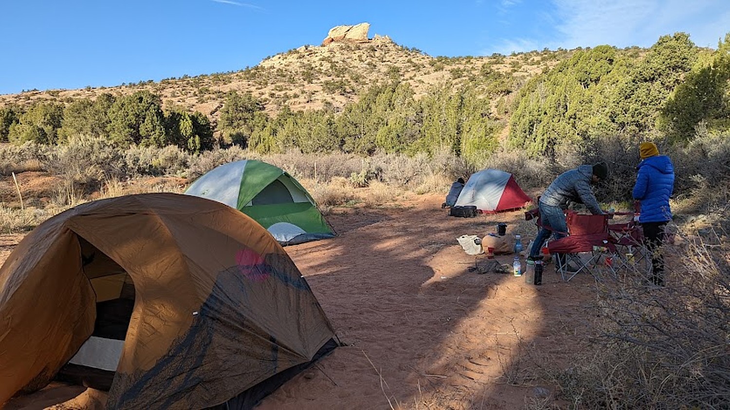
Where we set up is just a walk down a path that leads to the Arch Canyon trailhead and the Arch Canyon Ruins, where we get to explore cliff dwellings.
Indeed, Cedar Mesa is a network of canyons that are home to ancient archaeological ruins and rock art panels – the ultimate combination of spectacular scenery and fascinating cultural sites.
Streams carve into the banded yellow-gray and reddish-orange sandstone, creating fabulous formations and arches – Mother Nature’s sculpture. Cliffs are streaked with “desert varnish” – thin deposits of minerals including iron, manganese, magnetite and clay particles, combined with bacteria – which add to the painterly ambiance. And some of these have provided the overhang for dwellings.
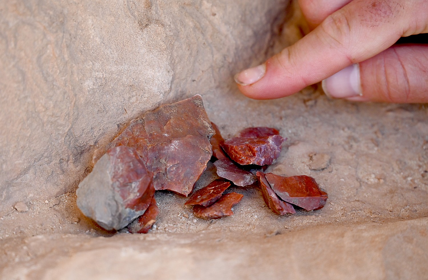
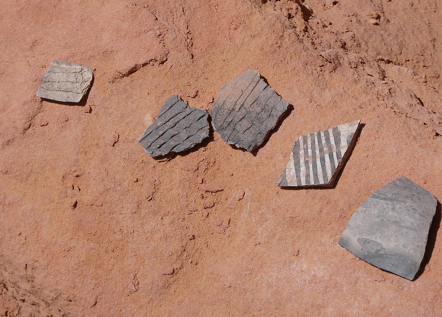
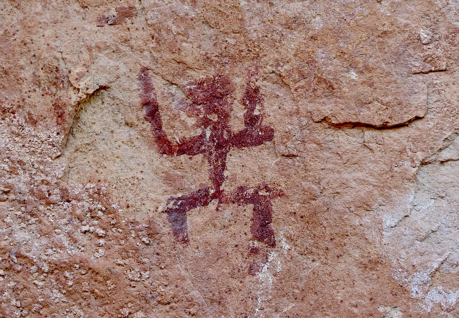
What is truly special about Bears Ears National Monument-Cedar Mesa – and what draws Laini back time and again, are the remnants, artifacts and structures left by Ancestral Puebloans – ancestors of the Hopi and Zuni – who inhabited these canyons and cliffs between 700 and 2500 years ago. Arrowheads and other artifacts dating back 10,000 years have also been found in this region. Some of these sites are at once accessible yet also feel remote – so you feel you are the first archaeologist to discover, though obviously that can’t be since the BLM Rangers have left laminated info packets in metal cases in some of the dwellings. Still, we can pretend.
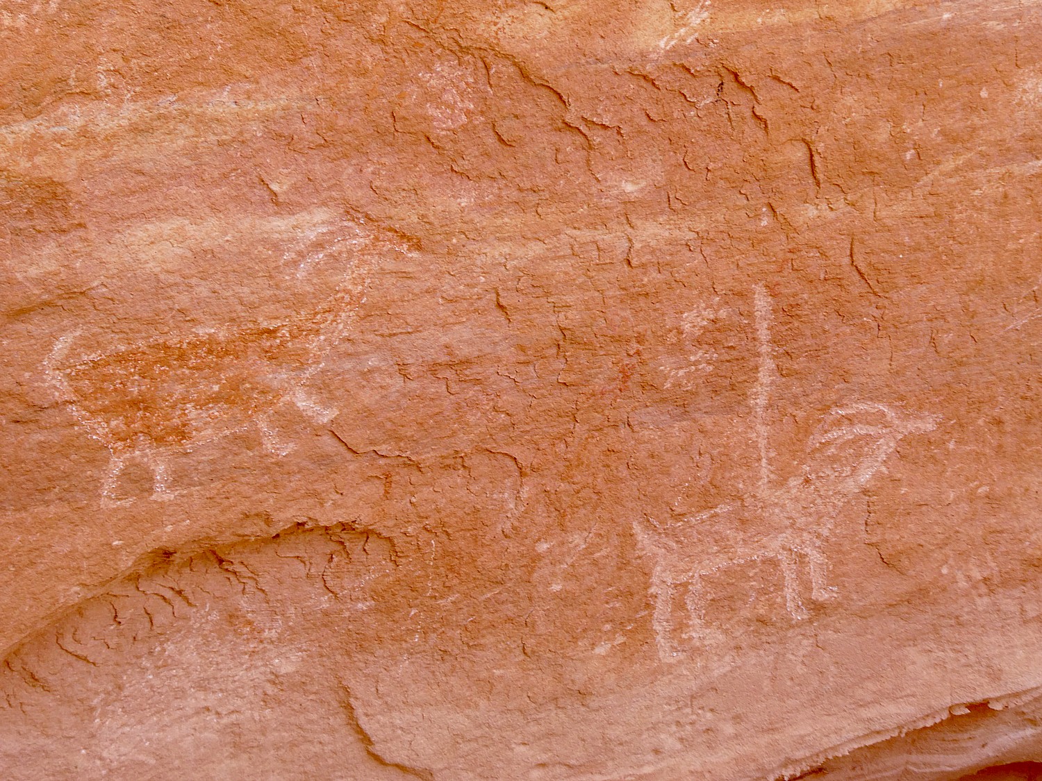
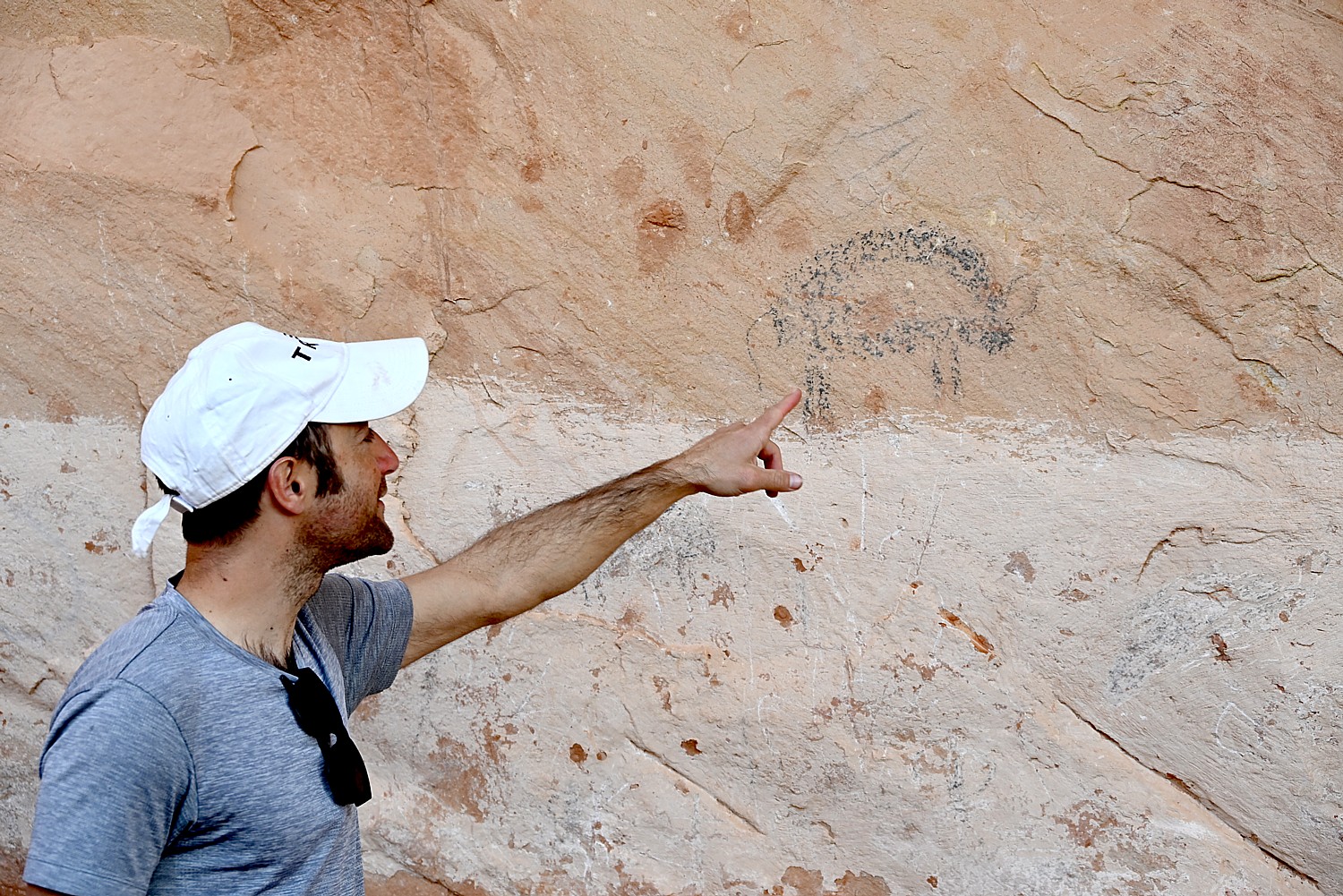
Our hikes bring us to these places that seem as if the occupants only recently vacated, leaving behind painted pottery shards, tiny corn husks, stone and bone tools, even their hand-prints, pictographs and petroglyphs that speak to us through time, as if to say, “We were here. We still are.”
Indeed, there are a mind-boggling 100,000 known archaeological sites protected within the Bears Ears National Monument, which spans 1.35 million acres. The buttes and surroundings have long been held as sacred or significant by a number of the region’s Native American tribes.
But it has not been without controversy.
Bears Ears National Monument was established in 2016 by President Barack Obama to preserve thousands of these indigenous cultural and archaeological sites. The Bears Ears Inter-Tribal Coalition, an alliance of five sovereign Tribal nations with ties to Bears Ears (the Hopi, Navajo, Uintah and Ouray Ute Indian Tribe, Ute Mountain Ute and Zuni Tribe), was the driving force behind its designation and are partners in managing the monument along with the federal Bureau of Land Management and US Forest Service.
In their proposal to have Bears Ears designated as a national monument, the Coalition described these canyonlands as ancestral land and the Southern Utah Wilderness Alliance (SUWA) described the Bears Ears as “the most significant unprotected cultural landscape in the U.S.”

But in 2017, catering to mining, fossil fuel and other extraction industry interests, Donald Trump drastically reduced the size of Bears Ears (by 85 percent) and Grand Staircase-Escalante (by half) – the single largest rollback of public lands protection in history. These changes exposed archaeological and paleontological sites to vandalism, looting and opened the door to drilling and mining. Moreover, Trump’s Interior Department, under Secretary Ryan Zinke (who left in 2019 in disgrace) offered meager plans for managing what remained of the monuments, leaving important cultural sites and wildlife habitat vulnerable.
Various groups brought lawsuits and President Joe Biden (who appointed Deb Haaland Interior Secretary, the first native American to hold the cabinet position and the first to lead the department which historically oversees the Bureau of Indian Affairs) restored the territory under protection in October 2021. The Bears Ears Inter-Tribal Coalition and the federal government officially signed a cooperative agreement, unveiling the first monument boundary sign on June 18, 2022,
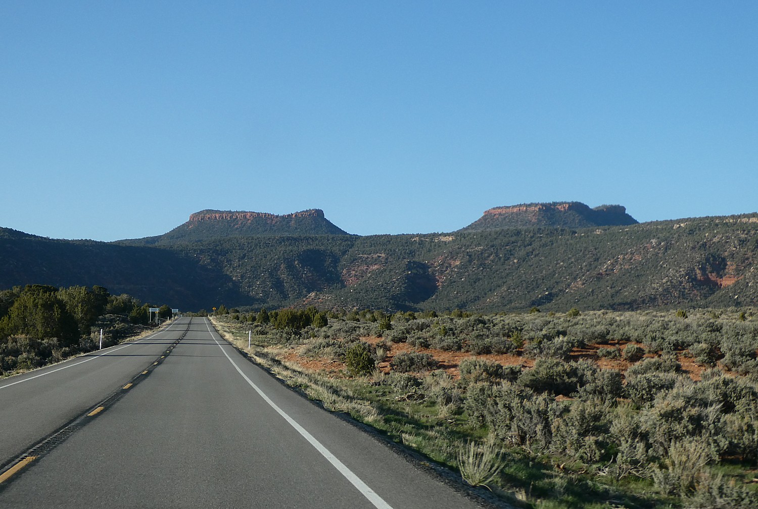
The monument is named Bears Ears for a pair of buttes that rise to elevations of 8,900 feet and 9,000 feet – more than 2,000 feet above Utah state routes 95 and 261. The monument includes the area around the Bears Ears formation and adjacent land to the southeast along the Comb Ridge formation, as well as Indian Creek Canyon to the northeast. The monument also includes the Valley of the Gods to the south, the western part of the Manti-La Sal National Forest’s Monticello unit, and the Dark Canyon Wilderness to the north and west.
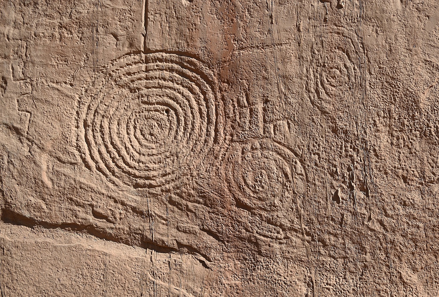
Because these lands are sacred, all of us must be respectful of the dwellings and the archaeological artifacts that we come upon. And these sites truly feel sacred – precisely because of the artifacts, the pictographs and petroglyphs, you feel the presence of those who lived here. And because those of us who visit do show proper respect, these mud-and-stick (jacal) constructions delicate pictographs and petroglyphs etched into sandstone and artifacts, though incredibly fragile, are here for us to discover, as if we are among the first.
It’s fairly miraculous these sites have survived Mother Nature, let alone humans.
Indeed, we are able to see artifacts and sites that date back 1000 years, but it is mind-boggling to contemplate that this area has been inhabited since 12,000 BC to 6000 BC by the PaleoIndians; the Archaic (6000-2000 BC); Early Agriculture (2000-500 BC); Basketmaker II (500 BC to 500 AD); Basketmaker III (500-750 AD); Pueblo I (750-900 AD), Pueblo II (900-1150 AD-we see evidence of their kivas, plain gray pottery, black-on-white pottery); Pueblo III (1150-1290 AD, when the Four Corners Area was abandoned).
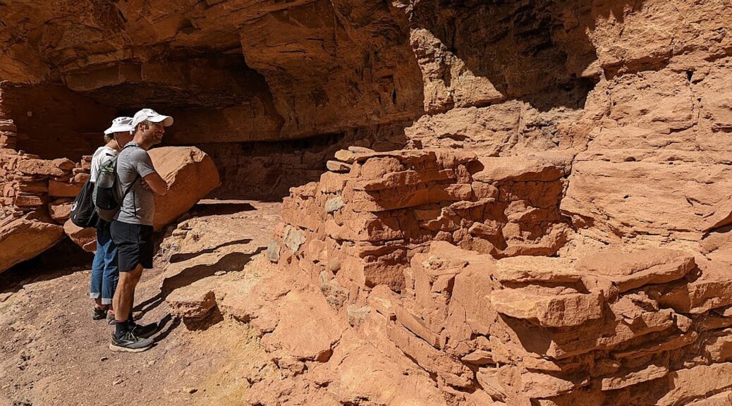
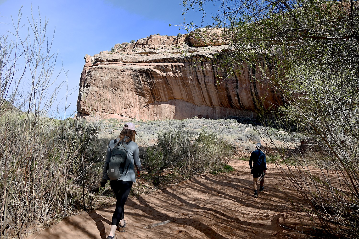
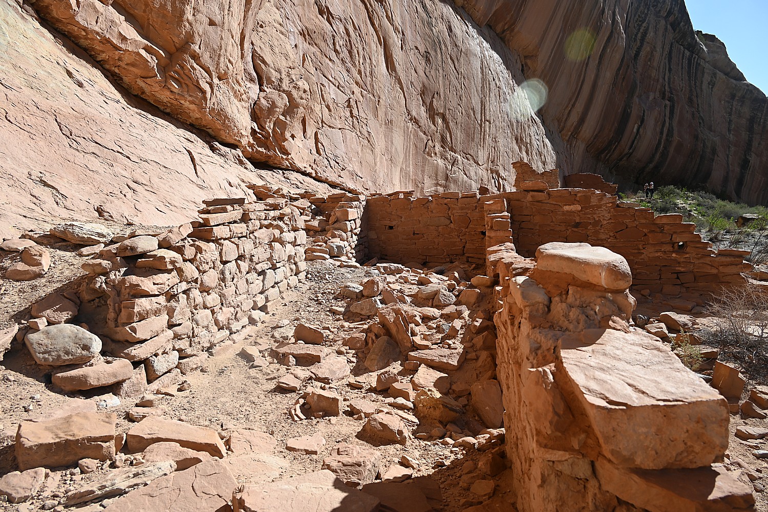
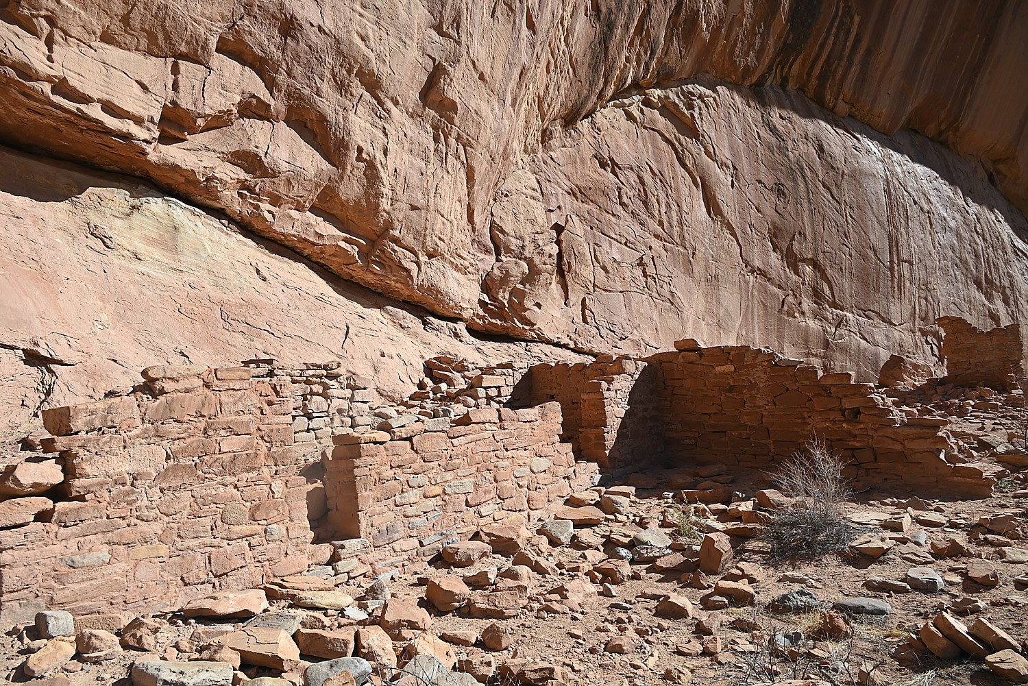
Arch Canyon Ruins
Each day of our Utah Adventure, which so far has taken us through Capitol Reef National Park, Grand Staircase-Escalante, and Glen Canyon National Recreation Area, has been so different in highlights, experience and even theme. Today’s theme is cultural, as we go in search of cliff dwellings through these canyons.
We wake up in our “wild” campsite and after breakfast, stroll down Arch Canyon Road and soon come to the Arch Canyon Ruin.

Seeing these structures, how they were built high up in the rock overhangs, camouflaged in rock, you wonder whether they were designed for defense: Who or what were they defending against? The fact that the Navajo named the Ancestral Pueblo people who were there before them, Anasazi – “enemy ancestors” (as we learned at the Anasazi State Park Museum in Boulder) suggests that there were conflicts among tribes or clans. Were these groups afraid of being attacked for their food or water? Or were they built so far above the river because of flash floods?
A panel provides background about the Puebloan People and these cliff dwellings: Few people lived in Cedar Mesa from 700-1050 AD, but by 1050, there were many Pueblo communities throughout the mesa and its canyons. During this time, Cedar Mesa’s cultural landscapes were interconnected with those of Chaco Canyon to the southeast, Mesa Verde to the east and the kayenta region to the south. Later, smaller groups moved into Cedar Mesa’s canyons to occupy nearly inaccessible but defensible places such as cliff face alcoves and ledges. But by 1280 AD, a combination of social and environmental factors prompted the Puebloan people to migrate again from Cedar Mesa to lands to the south and east. Cedar Mesa’s descendant populations now reside among the Hopi of Arizona, the Zuni and Keres-speaking pueblos of New Mexico and the Tanoan peoples along the Rio Grande.
I note the word “defensible” and wonder about who and what they were defending against.
In one of the structures, we see an innovation: shelves! We climb under boulders and see a pictograph of four hands.
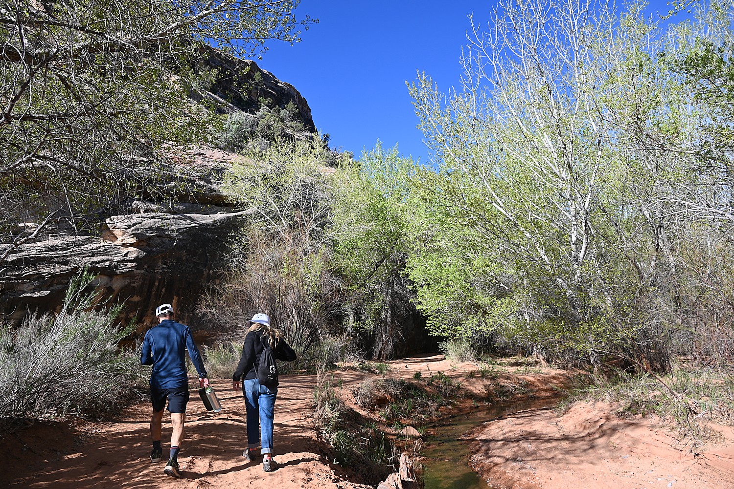
We spend about two hours in this section, and then get the Jeep to go to the next destination. (You can hike between Arch Canyon and House on Fire, via Arch Canyon Road and Mule Canyon trail, 5.7 miles, or two hours, one way.)
We stop for a picnic lunch at Mule Canyon Ruin site along the road (almost a rest stop, complete with two bathrooms).
Laini leads us to a trail to one of the outstanding highlights of the Bears Ears National Monument: the House on Fire, one of the most photographed (spectacular) sites in the region.
If You Go….
Day hiking in Bears Ears National Monument requires a day hiking pass (there is no limit on the number of day hiking passes issued).
Bears Ears National Monument does not charge an entry fee where your America the Beautiful Pass would typically apply. However, activity fees called “Individual Special Recreation Permits” are charged for day hiking and backpacking (typically $2 at the trailhead). Because your America the Beautiful Pass does not cover Individual Special Recreation Permits, it does not apply toward your backpacking permit, Moon House permit, nor day hiking pass. Visit the permits page for more information.
Visitor Centers:
Kane Gulch BLM Ranger Station, UT-261 36 miles west of Blanding. Open: March 1-June 15, September 1-October 31, 8:00 a.m. – 12:00 p.m., 7 days a week
Monticello Visitor Center, 216 S Main St., Hours: 9:00 a.m. – 5:00 p.m., Closes early at 3:00 p.m. on Sunday, Phone: 435-587-3401
Blanding Visitor Center, 12 North Grayson Parkway, 9:00 a.m. – 5:00 p.m., closed Sunday
More information: https://www.blm.gov/visit/bears-ears-national-monument
Next: House on Fire, Kane Gulch Trail
See:
UTAH ADVENTURE DAY 1-2: CAPITOL REEF’S COLORFUL CANYONS
UTAH ADVENTURE DAY 3-4: GRAND STAIRCASE-ESCALANTE POSES CHALLENGE
UTAH ADVENTURE DAY 4-5: DRIVING BURR TRAIL, EXPLORING GLEN CANYON, WILD CAMPING IN ARCH CANYON
______________________
© 2023 Travel Features Syndicate, a division of Workstyles, Inc. All rights reserved. Visit goingplacesfarandnear.com, www.huffingtonpost.com/author/karen-rubin, and travelwritersmagazine.com/TravelFeaturesSyndicate/. Blogging at goingplacesnearandfar.wordpress.com and moralcompasstravel.info. Visit instagram.com/going_places_far_and_near and instagram.com/bigbackpacktraveler/ Send comments or questions to FamTravLtr@aol.com. Tweet @TravelFeatures. ‘Like’ us at facebook.com/KarenBRubin

2 thoughts on “Utah Adventure Day 6: Sacred Sites, Spirits of Bears Ears National Monument”
Comments are closed.