Tag Archives: outdoors adventures

Grand Teton National Park: Mother Nature in Her Purest Form

View to String Lake from the trail, Grand Teton National Park © Karen Rubin/goingplacesfarandnear.com

By Karen Rubin, Eric Leiberman, David Leiberman & Laini Miranda

Travel Features Syndicate, goingplacesfarandnear.com

If Yellowstone National Park makes you feel you have fallen into some surreal, other-worldly, “I can’t believe this is real” state, next-door neighbor Grand Teton National Park, barely an hour’s drive away, is Mother Nature in her purest, most pristine condition.

We leave West Jackson, going through Yellowstone Park. We realize we will miss Old Faithful by just a few minutes so go straight to West Thumb again (Eric had missed it the day before), wanting to be immersed, again, in its calming Zen – with the broad blue lake and intense thermal pools. The hour of the day changes the experience, but West Thumb is marvelous.

Then we are off to the Grand Tetons. Less than an hour’s drive away, Grand Teton National Park is a majorly different landscape and different experience from Yellowstone.

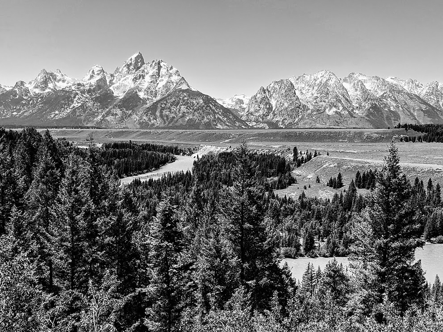
Leaving Yellowstone National Park from the South entrance, we drive into the Grand Teton National Park on the John D. Rockefeller Jr Memorial Parkway, encompassing 24,000 acres. Rockefeller bought up the land to preserve it and donated 32,000 acres to the federal government.

View from Signal Mountain, Grand Teton National Park © Karen Rubin/goingplacesfarandnear.com

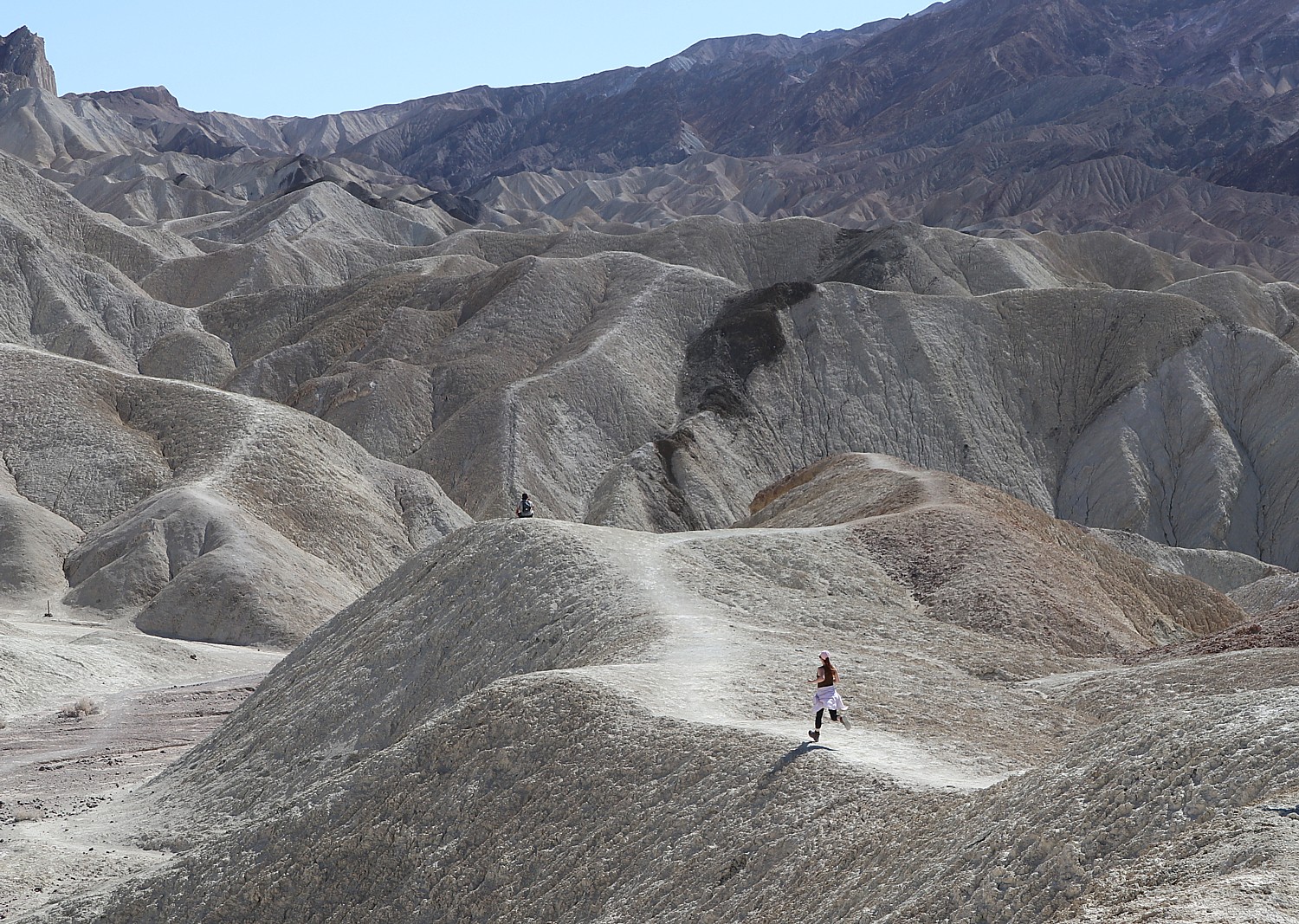
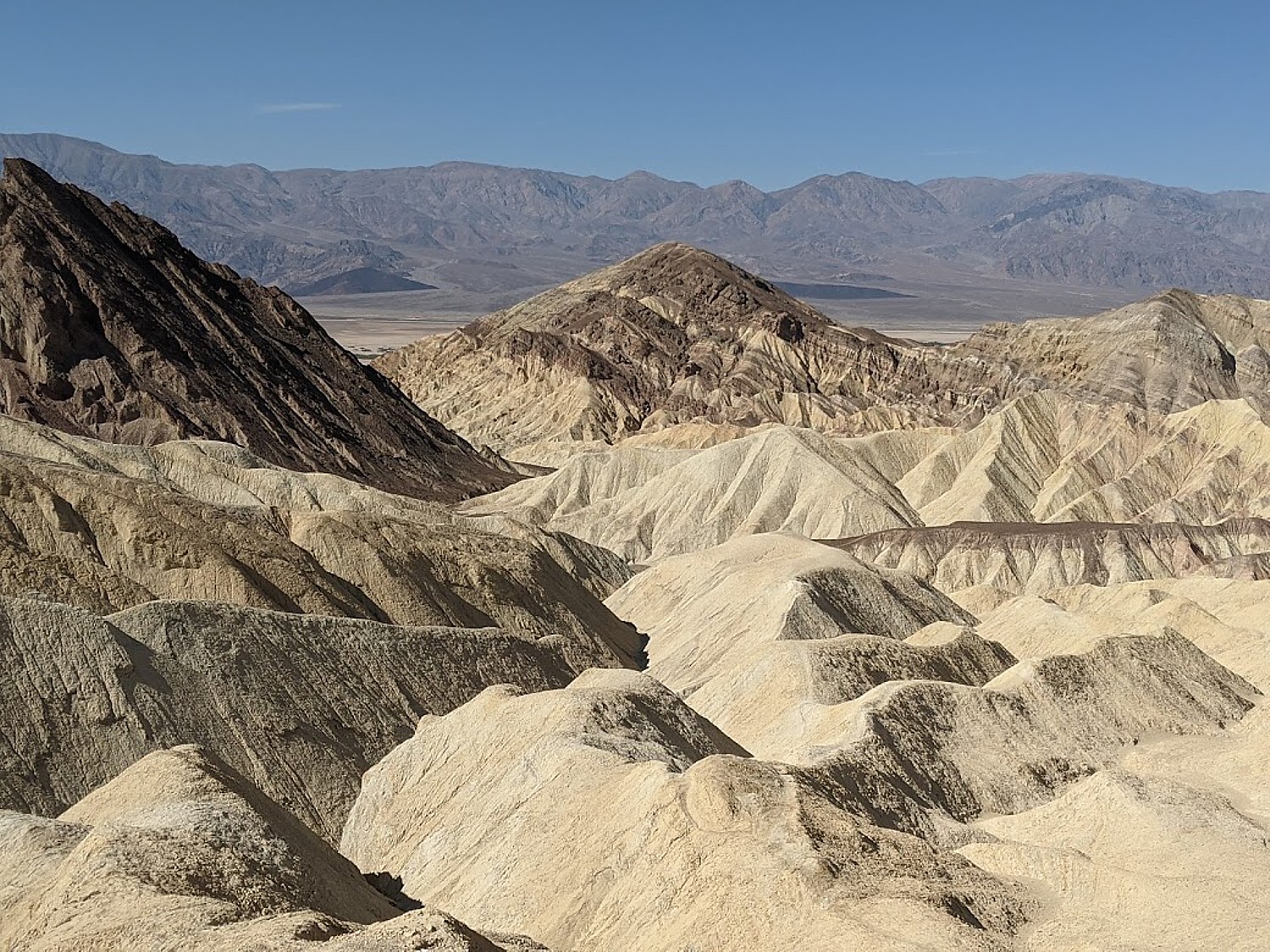
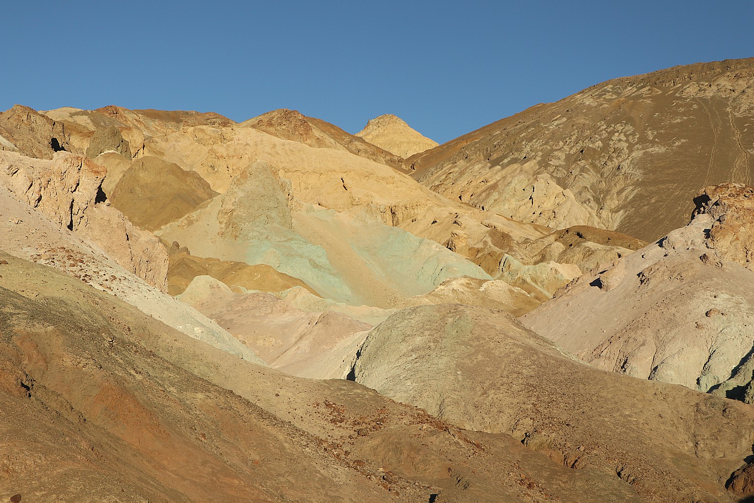
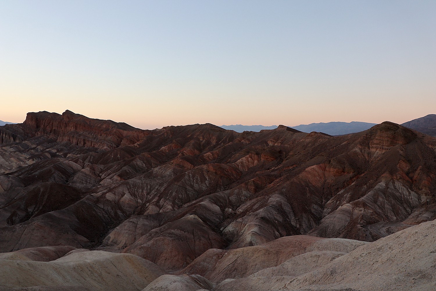
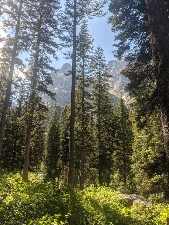
Here, there are sweeping vistas to snow-capped mountain peaks. Indeed, the 2.7 billion year old rocks in the core of the Teton Range are some of the oldest in North America, yet the mountains are mere youngsters in the planet’s geology. Ten million years ago, the movement on the Teton fault generated massive earthquakes, pushing up the mountains while the valley floor dropped, then erosion and glacial action sculpted the landscape and created habitats for plants and wildlife.

We see this on display when we stop at the overlook to Mount Moran, which, the notes say, “reflects all the geologic forces shaping the Teton Range. Formed of a massive block of metamorphic gneiss, cut by dikes of igneous granite and diabase, capped by sedimentary sandstone and flanked by glaciers, this formidable peak dominates the park’s northern skyline. The gneiss and granite are among the oldest rocks in North America, 2.7 and 2.5 billion years old. They form the core of the Teton Range. The vertical ‘Black Dike’ of 775 million year old diabase is about 150 feet wide and juts from the mountain face because the surrounding gneiss has eroded away.”

We pick up a picnic lunch at a well-stocked market at the Colter Bay Village and drive to the Chapel of the Sacred Heart for a scenic place for a picnic (swim, also), stopping along the way for some of the iconic views of the park, like Mount Moran.

Jenny Lake, nature’s playground, Grand Teton National Park © Karen Rubin/goingplacesfarandnear.com

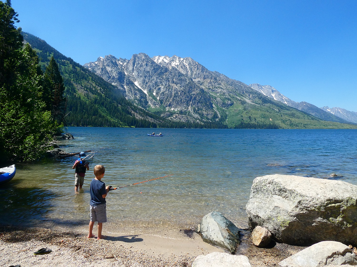
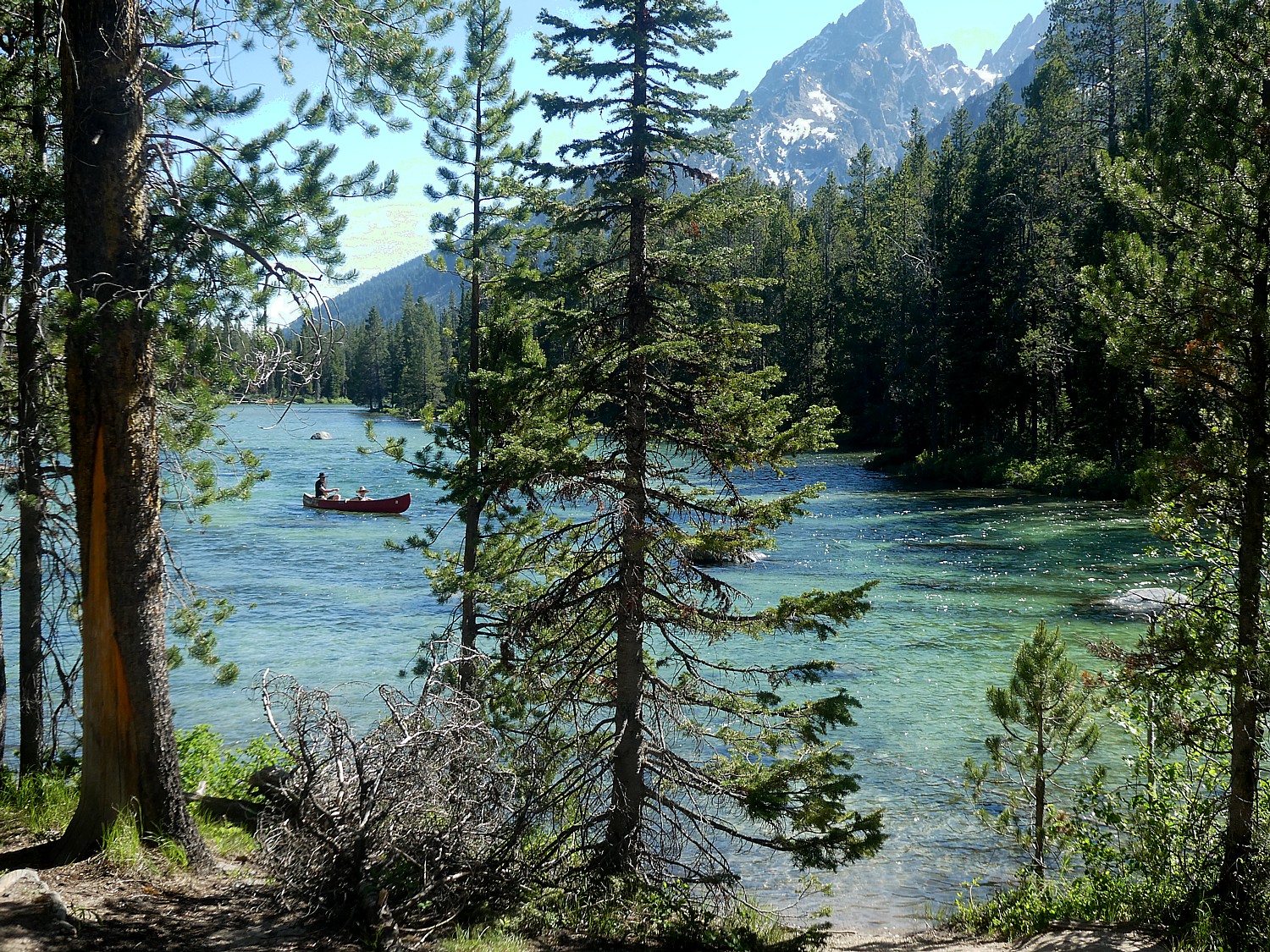
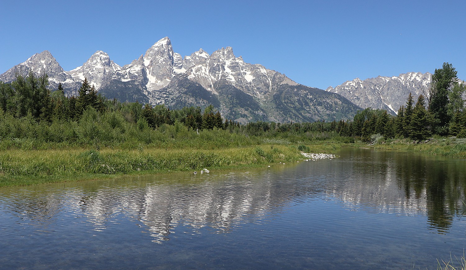
We head next to Jenny Lake, one of the most visited places in Grand Teton National Park for good reason. Tucked away at the base of the Teton Range, the lake is a centerpiece of the park. From the east shore, you have stunning views of Teewinot Mountain, Mount St. John, and into Cascade Canyon. From the west shore, you can look back across the lake towards the valley of Jackson Hole. Here you find the Jenny Lake Visitor Center, housed in the historic Harrison Crandall Studio, dating from the 1920s.

Walking the Jenny Lake trail, Grand Teton National Park © Karen Rubin/goingplacesfarandnear.com

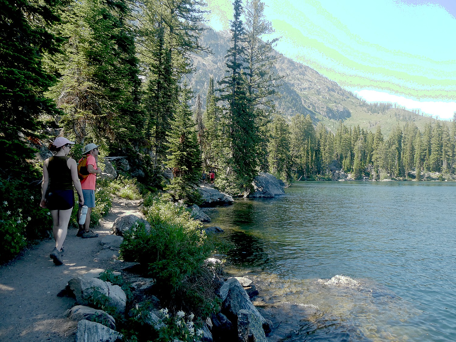
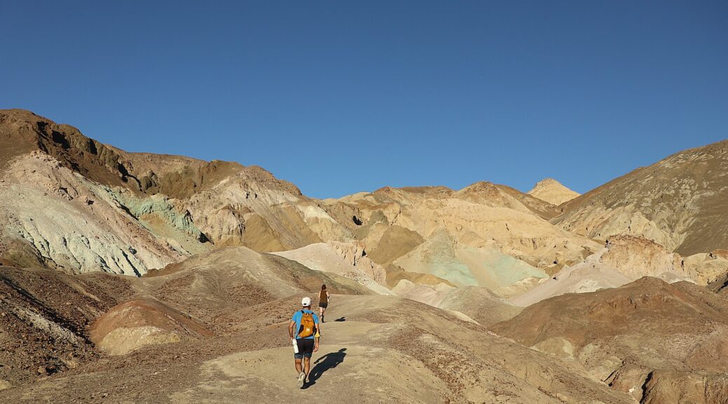
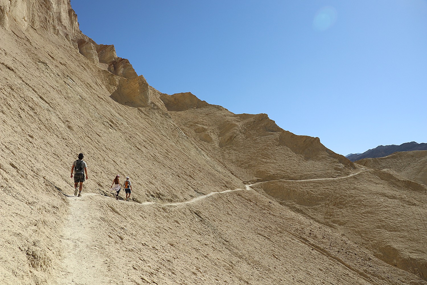
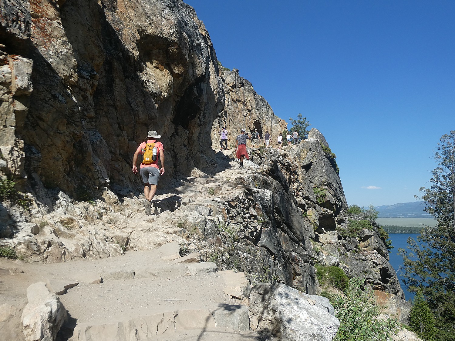
We opt for the most scenic hike, which proves to offer just the right amount of challenge, that takes us to the most impressive features – Hidden Falls and Inspiration Point (about 3 miles one way), with an option to either walk back, finish the loop (5 miles more), or take the shuttle boat (fee charged) from just below Inspiration Point back to the Jenny Lake Lodge.

Hiking the Jenny Lake trail, Grand Teton National Park © Karen Rubin/goingplacesfarandnear.com

The hike is absolutely gorgeous and fun – Hidden Falls, cascading 100 feet, is stunning, and the extra hike a half-mile almost straight up to Inspiration Point gets interesting with a rocky, sheer cliff as a special finishing touch to make you feel you have really accomplished something.

Hidden Falls, Grand Teton National Park © Karen Rubin/goingplacesfarandnear.com

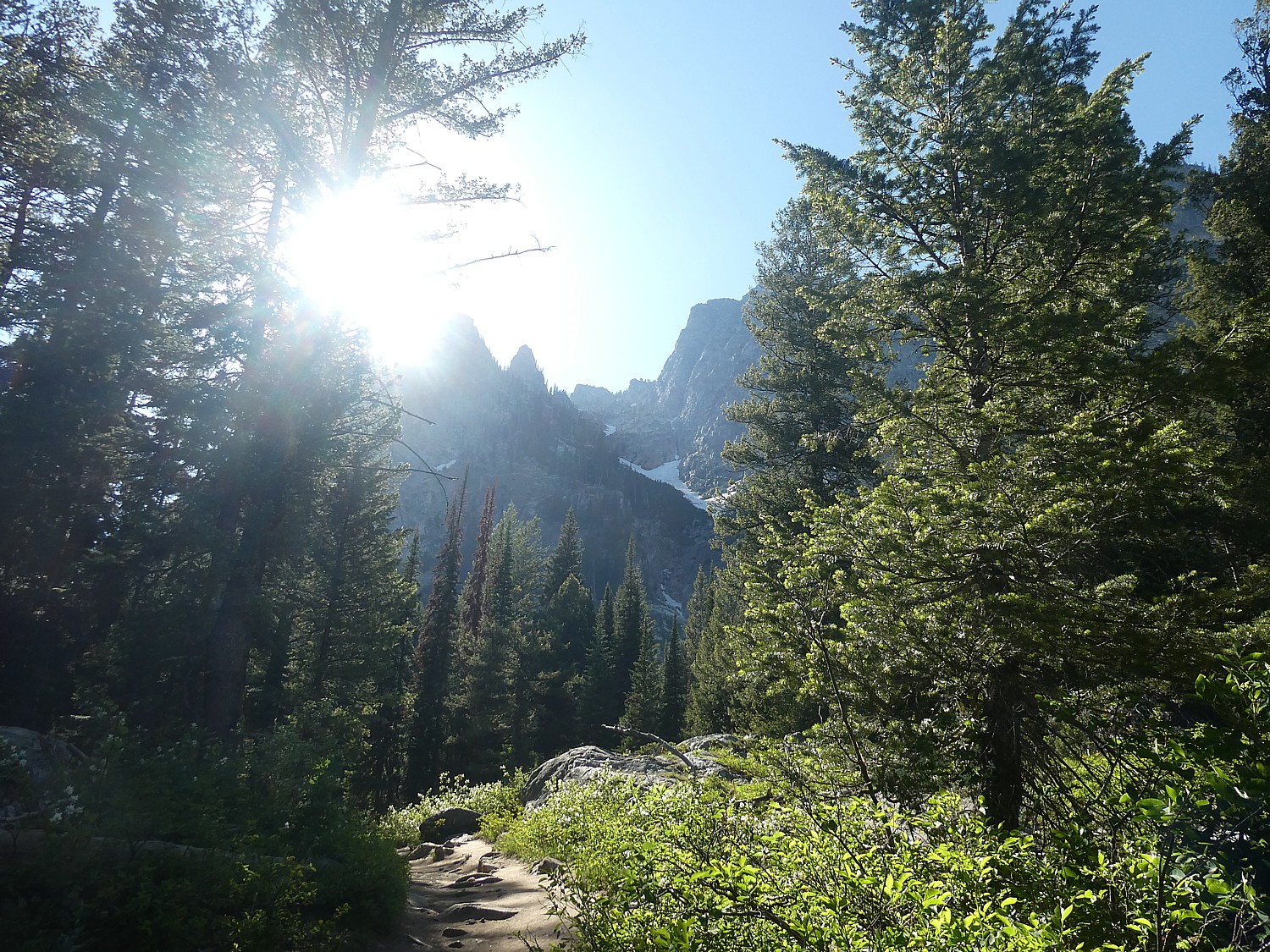
From here, you can connect with the Cascade Canyon trail, and we go in search of a spectacular view that is supposed to be just about the next bend, and the next bend, and the next.

Hiking up to Inspiration Point on the Jenny Lake trail, Grand Teton National Park © Karen Rubin/goingplacesfarandnear.com

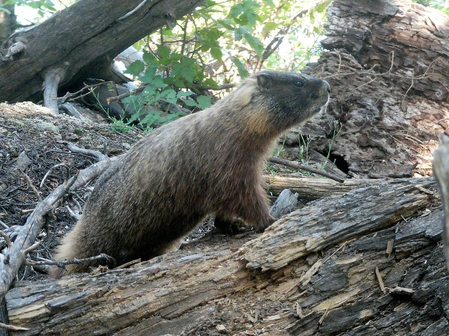
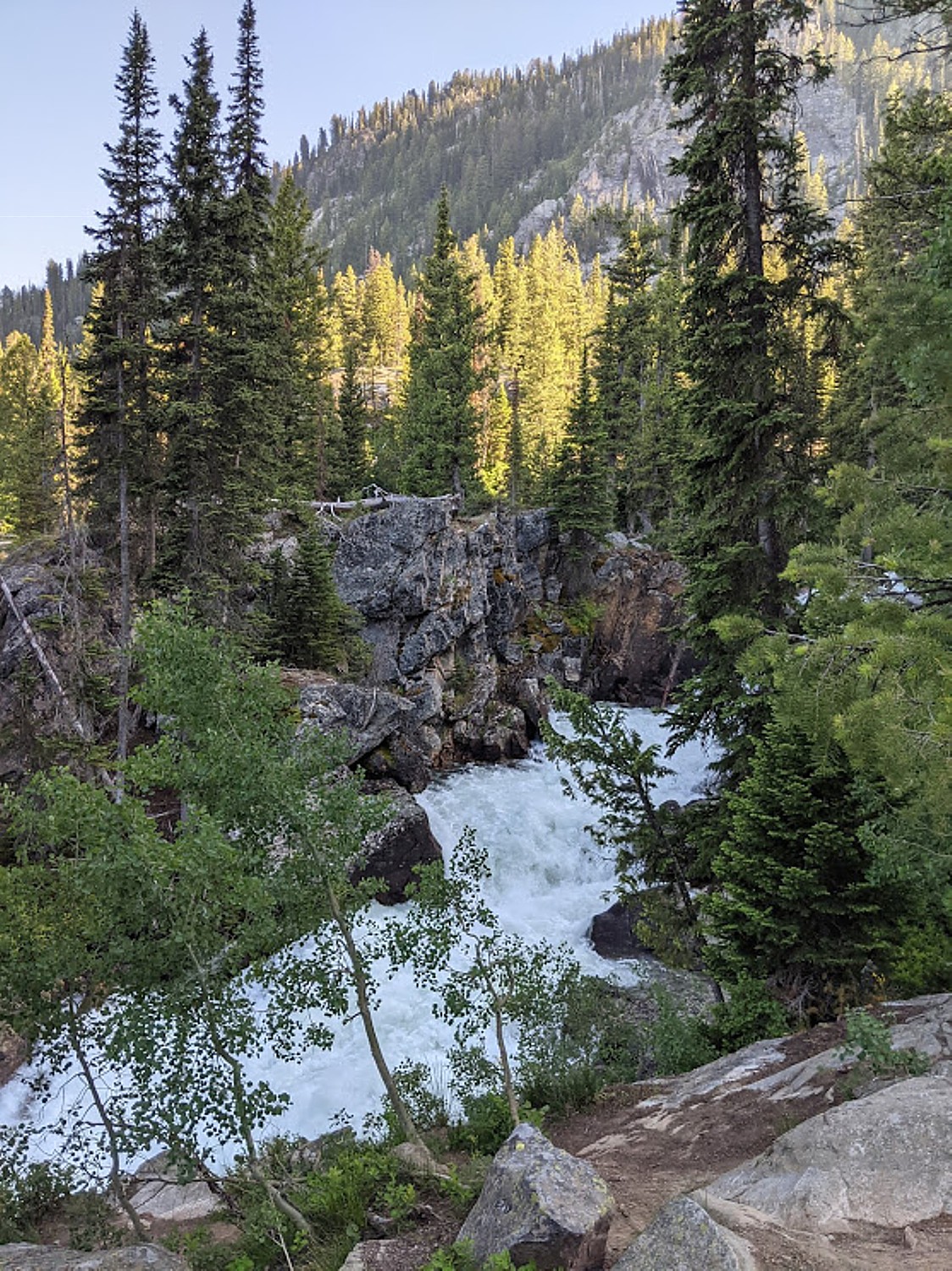
Cascade Canyon, a glacially carved u-shaped canyon, passes between Teewinot and Mount St. John to provide easy access into the Teton backcountry. This out-and-back trail is a popular option with visitors who want to get into the mountains without gaining a significant amount of elevation. While following Cascade Creek, the trail provides spectacular views of the surrounding peaks, including the Grand Teton, Mount Owen, and Teewinot. This trail also provides an opportunity to spot wildlife like moose and bears (really recommended to have bear spray with you and we heard a harrowing story from a restaurant manager encountering a bear here), as well as some of our alpine species like pika. (We spot a marmot.)

Cascade trail, Grand Teton National Park © Karen Rubin/goingplacesfarandnear.com

The trail continues 4.4 miles back into the canyon before splitting but you can turn back, making the hike as long or as short as you like. (Cascade Canyon is accessible via the Jenny Lake Loop Trail, 14.6 miles roundtrip, or you can shorten the hike to 8.8 miles by taking the shuttle boat.)

Marmot pokes out on the Jenny Lake trail © Karen Rubin/goingplacesfarandnear.com

David, Laini and Eric continue further on the Cascade Canyon trail while I return to Inspiration Point for our hike back down, deciding to take the shuttle boat back. (If you are planning on using the shuttle boat, check their hours and prices – we are told to be at the dock no later than 7 pm; tickets are purchased directly at the boat dock; you can also rent a kayak at the marina.) 

Hiking the Jenny Lake trail, Grand Teton National Park © Karen Rubin/goingplacesfarandnear.com

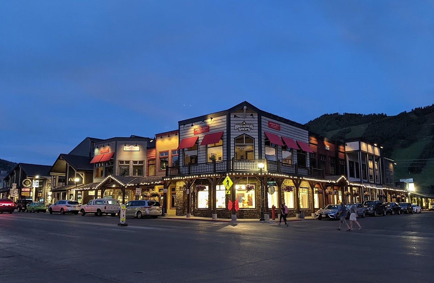
We finish our day in Jackson, an absolutely stunning town that makes a great effort (and success) to keep its Western charm.

Western charm in Jackson, Wyoming © Karen Rubin/goingplacesfarandnear.com

We manage to get a table on the outdoor patio at Roadhouse Brewing Co for dinner (sensational beer).

National Museum of Wildlife Art, Jackson, Wyoming © Karen Rubin/goingplacesfarandnear.com

Our second day in the Grand Tetons starts with a photo safari, as we hunt for iconic photos of the Grand Tetons. Indeed, the layout of the Grand Tetons – those vast vistas with the backdrop of snow-capped mountain peaks – makes this area especially popular with photographers. (Actually, Jackson Hole is a base for one of the most iconic wildlife photographers, Thomas D. Mangelsen, who has a gallery in Jackson, Images of Nature, as well as several other marvelous galleries; you can also visit the National Museum of Wildlife Art, 307-733-5771, www.wildlifeart.org.)

Church of the Transfiguration © Karen Rubin/goingplacesfarandnear.com

So we set out to find the iconic places, pretty much following Route 89/191 before swinging back on the Teton Park Road. (Of course, the time to be here is sunrise when the colors are most dramatic, but we do the best we can with what we have.)

Moulton Barn © Karen Rubin/goingplacesfarandnear.com

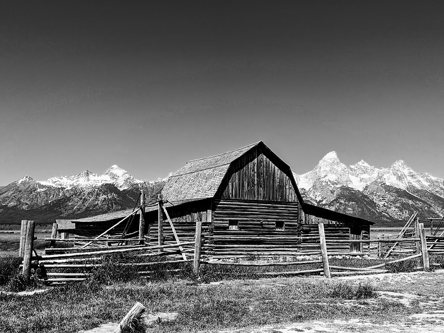
We head to the top photo site on everyone’s list, Mormon Row on Antelope Flats, and the most photographed barns in Wyoming, possibly the world (probably because it is billed as the “most photographed barn”): the Thomas Alma Moulton Barn with the pointed roof and John Moulton Barn with the rounded roof, in front of the towering Tetons. If you are really lucky, a bison or few may wander into view. The structures date back 1890s, built by Church of Jesus Christ of Latter-day Saints homesteaders. The best time is at sunrise.

Schwabacher’s Landing © Karen Rubin/goingplacesfarandnear.com

Next is Schwabacher’s Landing – absolutely so picturesque. Here I am lucky to have the river calm and reflecting the mountain range. We walk a short distance and find a lovely spot under a tree to have our picnic lunch. I spot a beaver dam which is largely responsible for setting the scene, by damming up this branch of the Snake River and creating the ponds that let us photograph the reflection of the Tetons when the water is calm.

Paying homage to the legendary landscape photographer Ansel Adams, recreating his iconic image of the Snake River, Grand Teton National Park © Karen Rubin/goingplacesfarandnear.com

We continue on to the Snake River Overlook, a scene made iconic by Ansel Adams who was commissioned to photograph it for the National Park Service in 1941. His famous photograph showed the Snake River meandering through a pine forest, with the Tetons in the background, but in the more than 75 years since, pine trees have blocked a lot of the river bend so you can’t re-create the scene. Nonetheless, you feel you are channeling, or at least paying homage to Ansel Adams, when you shoot your own, using the filter to change to black-and-white for better effect.

Elk Ranch Flats: classic Wyoming image © Karen Rubin/goingplacesfarandnear.com

Right at the Elk Ranch Flats, we get that iconic Wyoming image of a herd of bison in front of the snow-capped mountains.

Oxbow Bend, Grand Teton National Park © Karen Rubin/goingplacesfarandnear.com

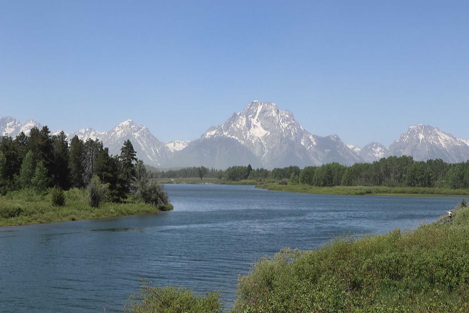
The famous Oxbow Bend provides another great reflection of the Grand Tetons and Mount Moran in Snake River. 

View from Signal Mountain, Grand Teton National Park © Karen Rubin/goingplacesfarandnear.com

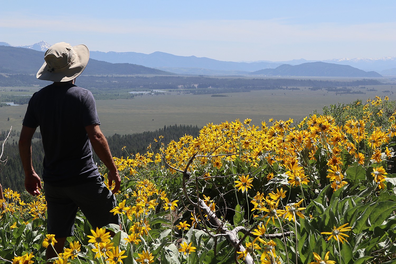
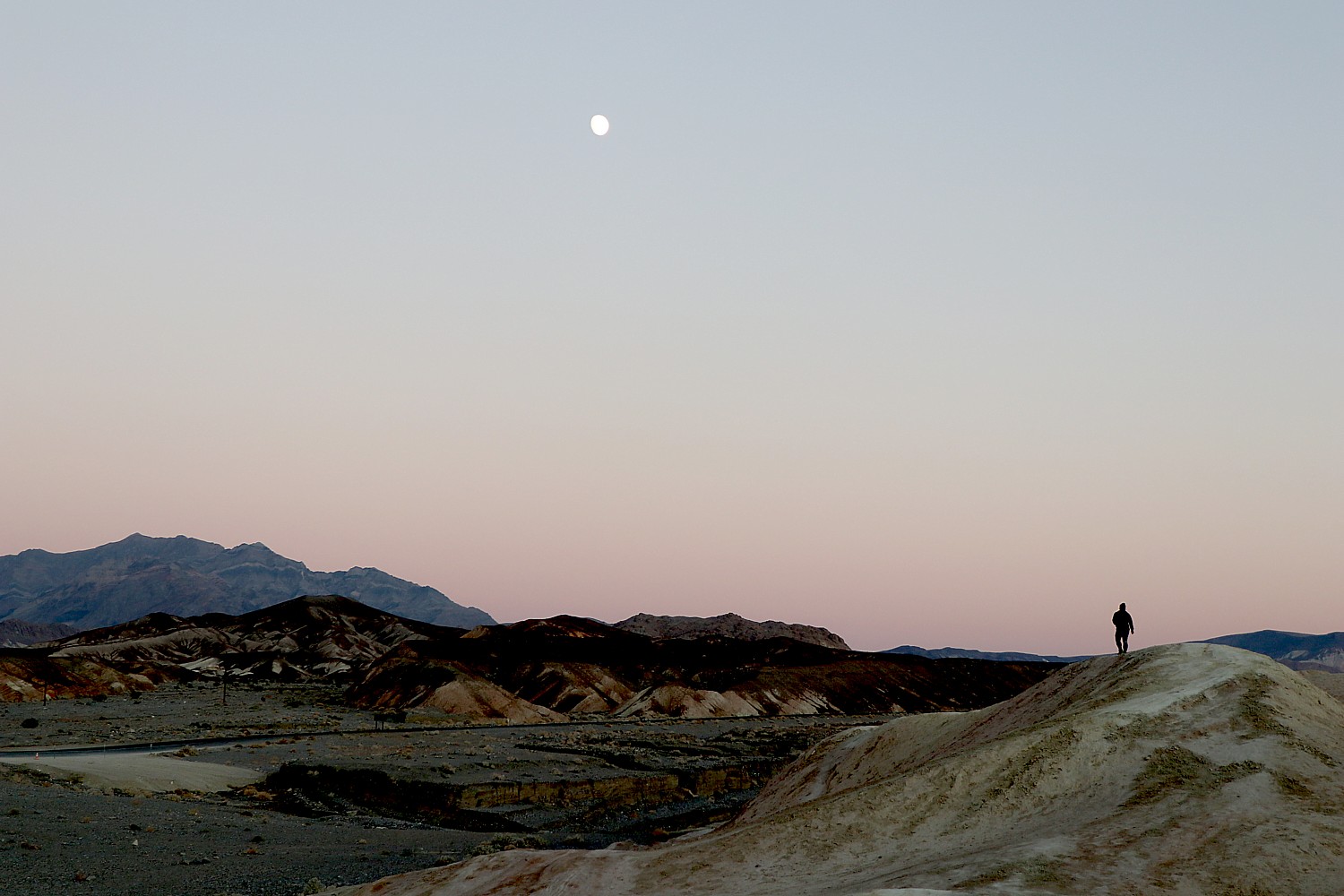
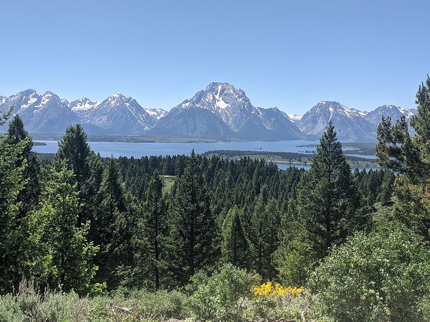
We next head over to the Signal Mountain road, off of the Teton Park Road, for the sweeping views of the valley from the summit.From here, you can see clearly the geology that controls the park’s natural communities, from valley wetlands to mountain alpine. The NPS notes describe how Ice Age glaciers periodically blanketed this landscape, last retreating 14,000 years ago, leaving behind river channels, outwash plains, glacial moraines, potholes, deep canyons and jagged peaks. Glaciers act like conveyor belts depositing rocky debris as ridges called moraines that contain rocks ground to the consistency of flour. Rock flour retains moisture allowing lodge pole pine forests to flourish. As glaciers retreat, blocks of ice drop to the valley floor and become buried in outwash gravel and when the ice melts, the resulting depression (pothole) forms a pocket of forest or wetland surrounded by a sea of sagebrush in the outwash plain. (This place is best at sunset, but then you would have to drive back down the steep, winding, narrow road in the dark).

Of course, the best photos are taken at sunrise and sunset – but that isn’t always practical, so you do the best with what you have.

Leigh Lake, Grand Teton National Park © Karen Rubin/goingplacesfarandnear.com

After our photo/sights safari, we want to literally get into the swim of this exquisite wilderness. We head back to the Jenny Lake Lodge area to hike along String Lake trail, just north of Jenny Lake, which connects to Leigh Lake. Again, the scenery is just breathtaking -stunning views of the “Cathedral Group,” which includes 12,325-foot Teewinot Mountain, 13,770-foot Grand Teton and 12,928-foot Mt. Owen.  At almost six-tenths of a mile we pass the Leigh Lake Trailhead. From here the trail continues to follow along the eastern shore of the narrow lake. We go purposefully to take in the gorgeous view of Mt. Moran, which, at 12,605 feet is the fourth highest mountain in Grand Teton National Park. It was named for artist Thomas Moran whose landscape paintings played a critical role in the creation of Yellowstone National Park, the world’s first national park (as we saw when we hiked the Grand Canyon of the Yellowstone trail).

A swim in String Lake, Grand Teton National Park © Karen Rubin/goingplacesfarandnear.com

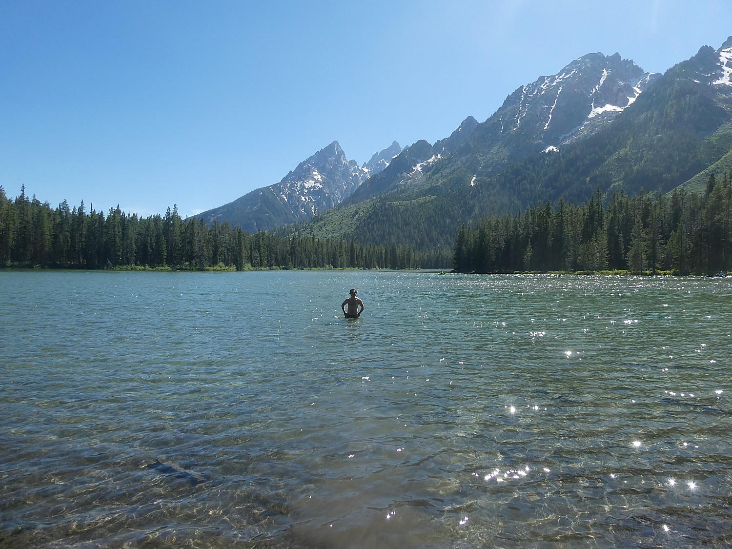
On the way back, we scout a great place for swimming in the glacial water (many of the areas have communal bear boxes for you to stow your stuff while you swim; we actually spotted some very large scat on the small wooden bridge). Refreshing. Brisk. Exhilarating. And the backdrop!

More help to plan your visit to Grand Teton National Park: www.nps.gov/grte/planyourvisit/index.htm.

The town of Jackson is really fun, and so striking. The mountains come right into town (Snow King ski resort is right there); the National Elk Refuge is there (the herd seems to spend the summer elsewhere); an incredible network of bike paths take you all the way into the national park (there are many bike rental shops, plus City Bike which Eric and David used to explore).

Biking passed the National Elk Refuge. Jackson has a marvelous bike path network © Karen Rubin/goingplacesfarandnear.com

We finish the evening in Jackson at Figs, a Lebanese restaurant (who would imagine!) at the swank Jackson Hotel (the meal is excellent), then wander around.

The Playhouse, Jackson, Wyoming © Karen Rubin/goingplacesfarandnear.com

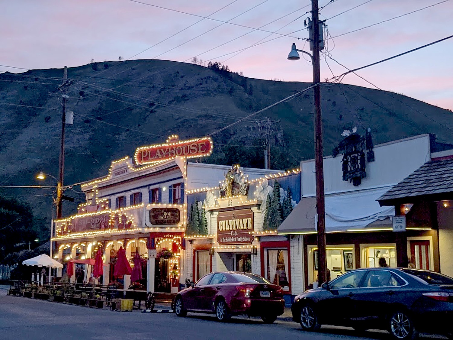
You can have a western musical dinner (“Seven Brides for Seven Brothers” and a saloon-style dinner at the Playhouse (Monday-Saturday, 307-733-6994, www.MTIShows.com.

The Million Dollar Cowboy Bar, Jackson, Wyoming © Karen Rubin/goingplacesfarandnear.com

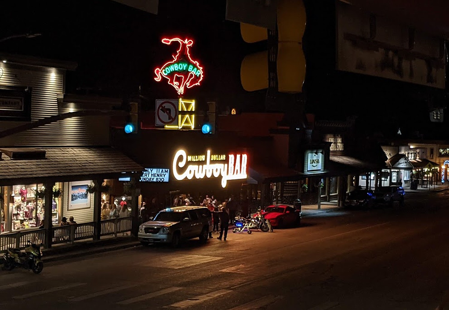
Check out the Million Dollar Cowboy Bar, a popular place for drinks, dancing and live entertainment since 1937, with an iconic vintage neon sign of a cowboy on a bronco.

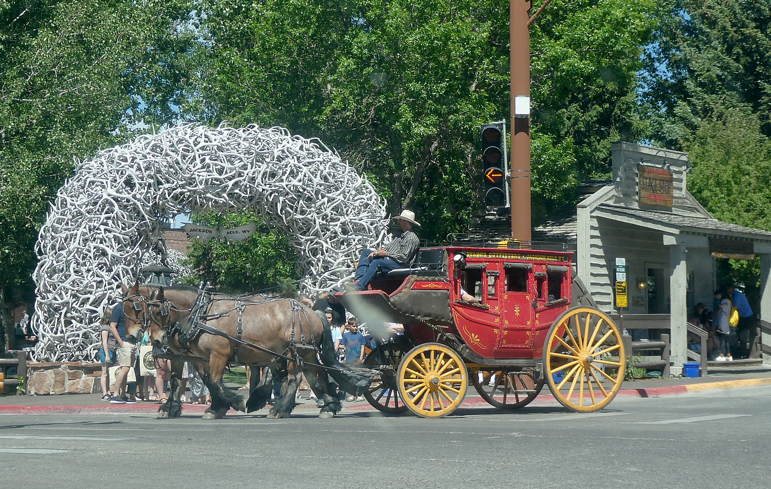
The Elk Antler Arches that mark the four corners of Jackson’s historic George Washington Memorial Park (Town Square), is another iconic feature of Jackson. A stage coach makes a regular rotation around the square.

Jackson maintains its charming Western ambiance: a stagecoach passes one of the Antler Arches that grace the town square © Karen Rubin/goingplacesfarandnear.com

The next morning, we get to explore the town more, before I head out to the Jackson Hole Airport and David and Laini continue their road trip in their Subaru Forester they converted into a camper van, for points west.

Flying into Jackson Hole Airport, Wyoming © Karen Rubin/goingplacesfarandnear.com

We loved our stay at the Elk Country Inn, delighted with the accommodations (we booked months ago) that include two queen beds plus a sleeping loft with another queen bed, refrigerator, microwave, coffee maker, balcony, parking. The hotel also has an indoor/outdoor pool, laundry facilities (really appreciated), serves a lovely full breakfast, and is walking distance to everything, and a very short drive into the Grand Teton National Park. (Elk Country Inn, 480 West Pearl Avenue, Jackson 83001 WY, 307-733-2364).

(The Elk Country Inn is one of the Town Square Inns of Jackson Hole; the others are the 49er Inn & Suites, Antler Inn and Cowboy Village Resort, 800-4-TETONS, townsquareinns.com).

We split our stay among three hotels, staying two nights in each – in Gardiner, West Jackson and Jackson – researching and booking on hotels.com and booking.com. We appreciated the ability to cancel reservations (sometimes a special rate is nonrefundable, but most bookings on hotels.com can be cancelled for free) which gives us the ability to modify our itinerary. Seeing all the “no vacancy” signs everywhere we went confirmed we were clever to book early, especially this year when travel is resurging and the national parks top the list.

Whitewater Rafting Adventure in Big Sky

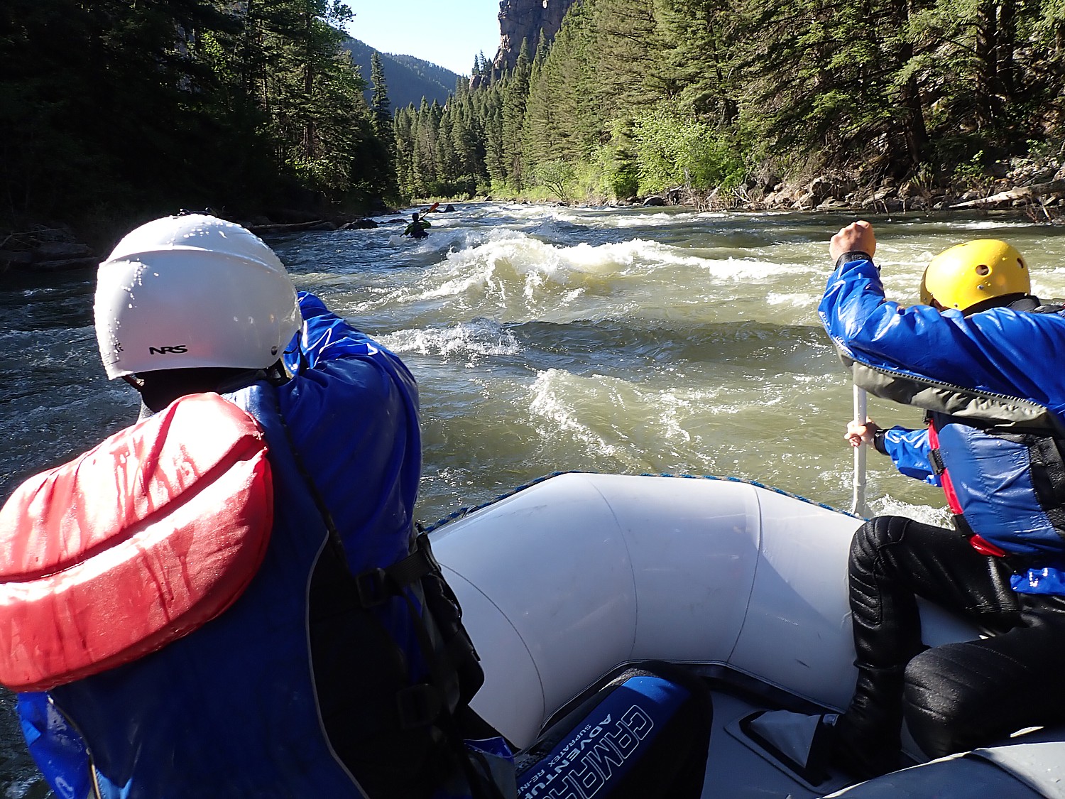
Between Yellowstone National Park and Grand Teton, we spend a day in Big Sky, Montana, to go whitewater rafting on the Gallatin River, with Geyser Whitewater Expeditions.

Whitewater rafting on the Gallatin River with Geyser Whitewater Expeditions, Big Sky, Montana
(Crystal Images Photography photo by Rob Hunt/Bigskyphotos.com )

We take the half-day (three hours) rafting trip on the Lower River, which affords “the most exciting” part with class III-IV rapids. Indeed it is. There is very little floating, most of the time being splashed, bumped, soaked and generally thrilled as you go through rapids with names like Screaming Left, Straightaway, House Rock and down the Mad Mile. Much of the setting is scenic, under the rock walls, but much is also alongside the road. The rafting is really fun, and our guide, Clay Kincer, is excellent – competent (most important), funny and informative and clearly enjoying his job. They rent the wetsuit as a separate charge (usually recommended).

Whitewater rafting on the Gallatin River with Geyser Whitewater Expeditions, Big Sky, Montana © Karen Rubin/goingplacesfarandnear.com

There is also an Upper Whitewater trip, with Class II-III rapids (not as rough but you get some good soakings), and a scenic float (class I-II gentle cruise).

The company, founded in Big Sky by Eric Becker in 1992, also offers Adventure Zipline Tour; Nature Zip Tour (a half-day rafting and a pass to the Zipline Adventure Park), whitewater kayaking, and an Ousel Falls bicycle adventure (46651 Gallatin Road, Gallatin Gateway, MT, 406-995-4989, www.raftmontana.com)

______________________

© 2021 Travel Features Syndicate, a division of Workstyles, Inc. All rights reserved. Visit goingplacesfarandnear.com, www.huffingtonpost.com/author/karen-rubin, and travelwritersmagazine.com/TravelFeaturesSyndicate/. Blogging at goingplacesnearandfar.wordpress.com and moralcompasstravel.info. Send comments or questions to [email protected]. Tweet @TravelFeatures. ‘Like’ us at facebook.com/NewsPhotoFeatures

Road Trip: Hitting the Highlights of Death Valley National Park

Hiking into the Artist’s Palette, Death Valley National Park © Karen Rubin/goingplacesfarandnear.com

By Karen Rubin, Eric Leiberman, Dave E. Leiberman & Laini Miranda

Travel Features Syndicate, goingplacesfarandnear.com

Tourism began in Death Valley in 1926 with the opening of the first hotels. It became a national monument in 1933 and was elevated to a national park as recently as 1994 with the expansion of 1.3 million acres. It is mind-boggling to realize Death Valley is the largest national park outside Alaska, at 3,422,024 acres – twice the size of Delaware.

A basin below sea level, there is drought and extreme heat, but towering peaks, rising as high as 11,000 feet that ring the basin, get snow. There is even a waterfall. Periodic flooding over millions of years has carved and smoothed ragged rock – a cautionary tale of nature’s power and unpredictability – while oases provide refuge for wildlife and people. Most surprising of all is the diversity of life that has adapted to this harsh location, no more surprising than that there are people here at all – indeed, the Timbisha Shoshone American Indian tribe are repopulating the area around Furnace Creek.

Death Valley is a land of extremes and constant surprises that excite the senses and force you to pay attention. You are never merely a casual observer, but an active participant, often getting to test new skills.

Because Death Valley National Park is so vast, so massive (nearly 1,000 miles of paved and dirt roads, with gasoline and water as much as 78 miles apart) and conditions that can be fairly treacherous, you are advised to research and plan out what you want to do not only to maximize what you see but for safety’s sake.

Driving in Death Valley National Park © Karen Rubin/goingplacesfarandnear.com

Among the important safety considerations: especially in summer, you are advised not to start hiking a trail after 10 am (take into account the distance and estimate the amount of time you need – my rule of thumb is one mile per hour); make sure you have sufficient water (allocate a gallon of water per person per day, which you should buy before you arrive); have hat, sunglasses, sunscreen. You are advised not to hike certain trails after a rain or if rain threatens because they can be treacherous. The weather can change dramatically – indeed, you can see where floods have come through and etched the rock – canyons can turn into rivers quickly. The ground temperature in summer can actually be 80 degrees hotter than the air temperature – a temperature of 201 degrees F was actually measured; ground temperature on the valley floor is 40 percent higher than surrounding air temperature. And yet, it can also get very cold – the lowest temperature recorded on the valley floor was 15 degrees F in 1913.  (The best time to hike in Death Valley is from November through March.)

And though you may well see other hikers on the trail (masks!), what stays in your mind is how few, how remote; in four days, we never saw a park ranger on the road. This is no amusement park with pretend thrills. But this sense of the possibility of danger is thrilling.

Hiking the Golden Canyon Trail, Death Valley National Park © Karen Rubin/goingplacesfarandnear.com

We research the most popular hikes (alltrails.com is a great source) and highlights of Death Valley, set them into geographic areas, calculated an estimated amount of time to visit, mixed hiking with less strenuous touring, and driving time (there is no public transportation in the park) and took into account the time of day and season – you don’t want to be at the far end of a trail when the sun has already begun to set.

So we had cleverly notched one of Death Valley’s most popular highlights, Mesquite Flat Sand Dunes, timing are arrival in the late afternoon the day before, and on our way back into the park  on our first morning from our Air BnB in Beatty (20 miles away), we explored Rhyolite Ghost Town, which was also high up on our list of “must-sees.”

For our first full day in Death Valley, we’ve etched out hiking the Golden Canyon trail, 20 Mule Team, Badwater Basin, Artist’s Palette, and finishing with the sunset at Zabriskie Point.

Golden Canyon Trail

Red Cathedral off the Golden Canyon trail © Karen Rubin/goingplacesfarandnear.com

Our first hike, Golden Canyon trail, is the most popular in Death Valley and for good reason. It hits on all cylinders: the absolutely dramatic landscape, patterns and colors of the rocks, but also, the trail itself. The section between the Red Cathedral (really gorgeous) and the turn-off to the spur trail to Zabriskie Point is particularly exciting – you walk a narrow cut in a rounded rock and then over a formation we dub the “Stegasaurus” – like a dinosaur’s back. The full loop is 4.5 miles, winding past Manly Beach and Gower Gulch, just about every step pure joy. The morning sunlight brings out the golden hues in the eroded badlands, contrasting with the red stone cliffs of Red Cathedral. (The hike takes us from 10:30 am to 1:30 pm).

Golden Canyon Trail, Death Valley National Park © Karen Rubin/goingplacesfarandnear.com
The section of the Golden Canyon trail we dub “Stegasaurus” © Karen Rubin/goingplacesfarandnear.com
Golden Canyon Trail, Death Valley National Park © Karen Rubin/goingplacesfarandnear.com

Feeling absolutely exhilarated after the hike, we drive through the 20 Mule Team Canyon – driving it actually does feel more like an amusement park ride. There is a narrow, winding, looping, rolling one-way only road that takes you through. You are reminded that this place used to have mule teams hauling out borax. It’s perfect after the hike – a 15-minute drive through.

Driving through 20 Mule Team Canyon, Death Valley National Park © Karen Rubin/goingplacesfarandnear.com

We drive through Artist’s Drive to Artist’s Palette, where we have a picnic lunch (planning!), but decide to return later in the afternoon when its famous colors will be more pronounced.

Driving the loop-de-loop of Artist’s Drive, Death Valley National Park © Karen Rubin/goingplacesfarandnear.com

Badwater Basin

Badwater Basin, Death Valley National Park © Karen Rubin/goingplacesfarandnear.com

Then on to Badwater Basin, probably one of the most famous sights in Death Valley. Spanning 200 square miles, this extraordinarily expansive, giant salt flat doesn’t look it but you can walk 7 miles across, ringed by mountains. At 282 feet below sea level, when we stand here we are standing at the lowest point in North America. The basin consists of sodium chloride (table salt), calcite, gypsum, and borax. 

Badwater Basin, Death Valley National Park © Karen Rubin/goingplacesfarandnear.com

Though named “badwater,” the water is not actually bad but salty, and despite the name, “Death Valley,” it is remarkable to learn that many organisms thrive in it. The pool is home to an endemic snail naturally found only at this location, and its rim is dotted with salt tolerant plants, such as pickleweed. This was once a large inland lake which evaporated over thousands of years, leaving concentrated salt deposits behind that form fascinating geometric polygon shapes.

Badwater Basin, Death Valley National Park © Karen Rubin/goingplacesfarandnear.com

The pool and boardwalk are easily accessible from the parking lot off Badwater Road, but for the best views of the salt polygons, walk out onto the salt flats a half mile or so. Look behind you to the cliffs of the Black Mountains to the east, where there is a sign high above marking sea level. From here, you can also see Telescope Peak in the Panamint Range to the west; at 11,049 ft, this peak is over two miles above you. “Nowhere else in America can you see such a dramatic vertical relief over such a close distance.” (https://www.nps.gov/places/badwater-basin.htm)  (Eric gets to hike up Telescope Peak on his return a month later on his adVANture; see ad-VAN-turing, Newest Travel Trend)

It’s 4:30 pm and there are long shadows bringing out the interesting formations and patterns in the salt. Here, we are famously 282 feet below sea level.  (In summer, it is not advised to walk out on the salt flats after 10:30 am).

Artist’s Palette

Artist’s Palette, Death Valley National Park © Karen Rubin/goingplacesfarandnear.com

We drive the nine-mile loop-de-loop roller coaster of Artist’s Drive to Artist’s Palette, to see the richer color of the cooler, late afternoon  sun, and scamper across the rolling ridges, literally into the multi-colored palette itself – yellow ochre, burnt umber, sienna, rust, rose, copper.

Artist’s Palette, Death Valley National Park © Karen Rubin/goingplacesfarandnear.com

Artist’s Palette is one of the most popular places to watch the sunset, but we decide to go to Zabriskie Point instead.

Timing the sunset can be tricky because of the peaks, the day of the year, also. You need to get wherever you want to see the sunset a half-hour before, when the colors begin to deepen. The actual sunset is over in a few minutes, so you have a very short window for the best images.

And so we miss the sunset at Zabriskie Point by five minutes. Even so, it is a gorgeous sight as the rocks take on warm colors, there is a pink rim to along the mountain ridges, and a full moon rises.

Sunset at Zabriskie Point, Death Valley National Park © Karen Rubin/goingplacesfarandnear.com
Moonrise at Zabriskie Point, Death Valley National Park © Karen Rubin/goingplacesfarandnear.com
Sunset at Zabriskie Point, Death Valley National Park © Karen Rubin/goingplacesfarandnear.com
Sunset,at Zabriskie Point, Death Valley National Park © Karen Rubin/goingplacesfarandnear.com
Moonrise at Zabriskie Point, Death Valley National Park © Karen Rubin/goingplacesfarandnear.com

Fortunately, we will have the opportunity to see the sunrise and sunset on our next day. Indeed, that’s why we decided to book two nights at the Ranch at the Oasis, just a short drive away from Zabriskie Point, instead of driving 45 minutes each way to the Designed to Death Air BnB in Beatty, Nevada, where we stayed on our first night.

We check into the Ranch at Oasis, order out dinner from the menu and sit outside on the lovely terrace adjacent to the restaurant (which also has outside dining, properly spaced). It is sheer perfection (as was the steak with an espresso rub, fantastic!).

Dining al fresco at the Ranch at Death Valley © Karen Rubin/goingplacesfarandnear.com

We drop our things in our hotel room (Laini has made sure to get a first-floor room at the end of the hall, close to the door, so we would have minimal time in a public space, and was assured that the rooms are thoroughly cleaned and left for 24 hours before the next guest). We immediately go to the Olympic-sized pool – absolutely magnificent, naturally warmed to a constant 87 degrees by hot mineral springs. The water feels silky, and as we swim we delight in the stars overhead. (www.oasisatdeathvalley.com)

The biggest surprise of all is how diverse Death Valley is – low valley floors, salt flats, rugged mountains rising as high as 11,000 feet, deep and winding canyons, rolling sand dunes, oases. The landscape is not a monotone at all, but a riot of colors, textures, contours. Each hike we take, each highlight we explore is spectacular in its own way, exciting and thrilling, exacting surging emotions and senses – the Mesquite Flat Sand Dunes, the Golden Canyon, the Badwater Basin salt flats, the 20 Mule Team Canyon, Artist’s Palette, Zabriskie Point – and it’s only been a day and a half.

The next morning, we get up before sunrise to get to Zabriskie Point (about a 7-minute drive away) to watch the brilliant display as the rocks seem aflame with sunlight.

Death Valley in art: “Golden Canyon,” by Laini Nemett (2021, 12 x 9 in, oil on linen on panel). Visit www.laininemett.com

See also:

ROAD TRIP: DISCOVERING DEATH VALLEY’S TREASURES, RICHER THAN GOLD

_______________

© 2021 Travel Features Syndicate, a division of Workstyles, Inc. All rights reserved. Visit goingplacesfarandnear.com, www.huffingtonpost.com/author/karen-rubin, and travelwritersmagazine.com/TravelFeaturesSyndicate/. Blogging at goingplacesnearandfar.wordpress.com and moralcompasstravel.info. Send comments or questions to [email protected]. Tweet @TravelFeatures. ‘Like’ us at facebook.com/NewsPhotoFeatures