Tag Archives: New Brunswick Roadtrip

New Brunswick Roadtrip: Exploring French Acadia’s Culture, Heritage by Bike!

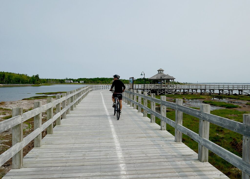
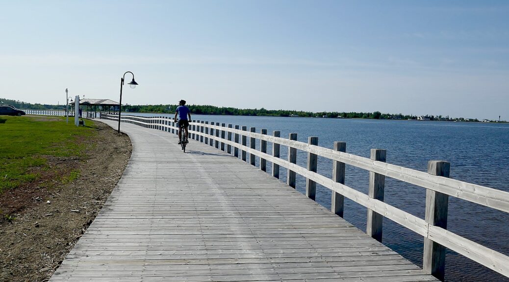
Biking the beautiful boardwalk in Shippagan, New Brunswick © Karen Rubin/goingplacesfarandnear.com

By Karen Rubin, with Dave E. Leiberman & Laini Miranda

Travel Features Syndicate, www.goingplacesfarandnear.com

Our New Brunswick roadtrip that has so enthralled us with the natural wonders of the Bay of Fundy, now takes us to the Acadien Peninsula, where its French heritage is most pronounced and you really feel you are in another country. We are also excited to explore a portion of a marvelous new cycling trail, the Veloroute Peninsule Acadeienne, which opened in 2019, consisting of 14 cycling circuits, totaling 379 miles, that go through 14 coastal French fishing villages and communities. 

Because the Veloroute is so new, it seems, it is not well set up for a supported, self-guided multi-day trip, so we stitch together our own, with the help of Neil Hodge at New Brunswick Tourism. Neil arranges a multi-day bike rental for us from the Villegiature Deux Rivieres Resort (more geared for day rental), and an itinerary that follows the C15 circuit. Fortunately, Laini prefers to spend the day painting, so volunteers to drive the car to the next stop and then take my bike for a shorter ride with Dave at the end of the day. And we have to ferry the bike back to the rental shop (not really difficult, it is less than one hour’s drive back to Tracadie, and we’ve prepared by taking our bike rack). It is exciting to feel like we are pioneering a new biking destination.

This is an opportunity to take advantage of what is best about cycling (and clearly, this is an extremely popular activity throughout New Brunswick and Quebec): you ride at a perfect pace through local communities, small villages, see where and how people live. And there is such freedom during the day, to stop and explore, and really be immersed in a place.
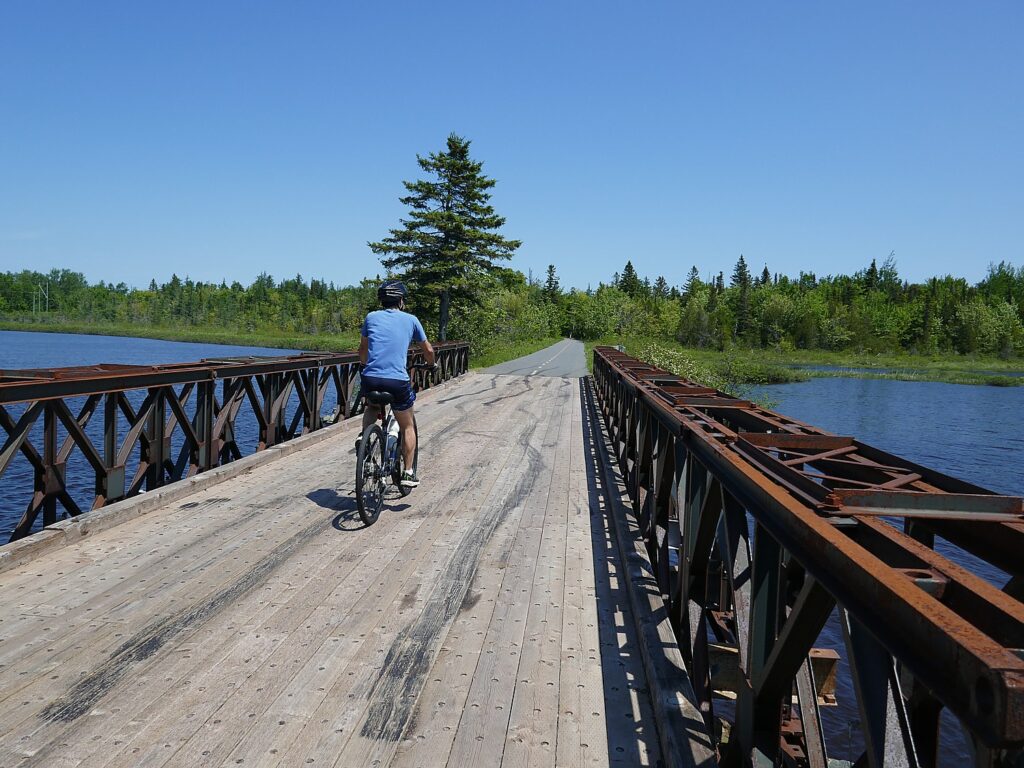
Biking the New Brunswick’s new cycling trail, the Veloroute Peninsule Acadeienne,  from Tracadie to Shippagan © Karen Rubin/goingplacesfarandnear.com

This first day, we bike on the trail 22 miles from Tracadie at one end of the circuit, to Shippagan, riding mainly through woods and then along marshes, arriving at Shippagan at about 2:30. We have a delightful late-lunch in a Mediterranean-style restaurant, Chez Aicha (197 Bd J. D. Gauthier, +1 506-336-8989), then Dave and I continue exploring Shippagan, picturesquely set between Saint-Simon Bay and the Chaleur Bay inlet that goes into the Gulf of St. Lawrence, stopping at its most popular beach, Le Goulet.
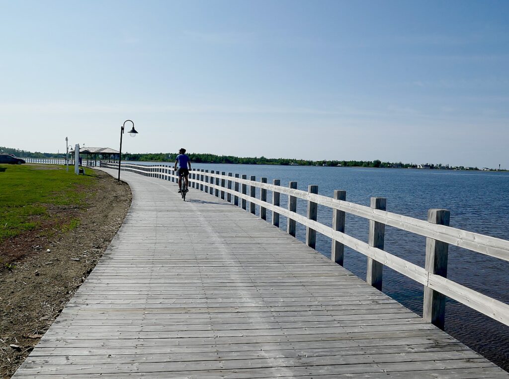
Shippagan, New Brunswick’s beautiful boardwalk © Karen Rubin/goingplacesfarandnear.com

We discover the boardwalk along Shippagan’s waterfront, and that we can bike all the way to Point Brule, the road that leads us to the cottage Laini has booked for two nights on Airbnb. We calculate we cycled 40 miles for the day.
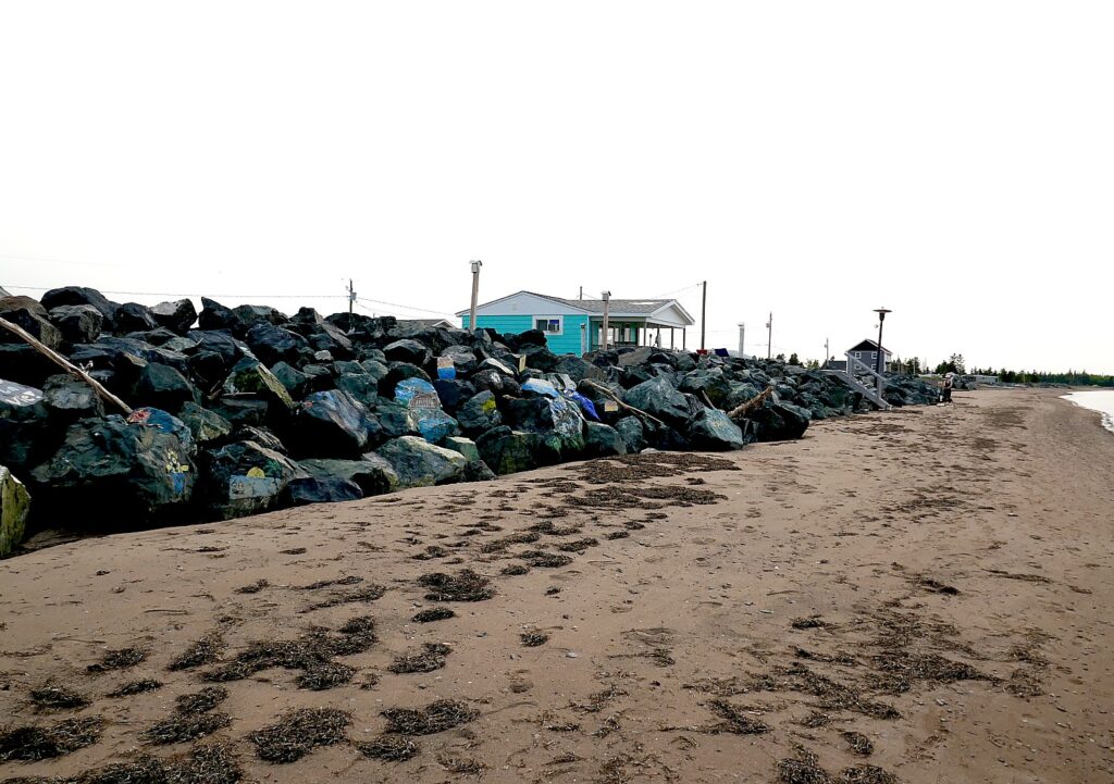
Our charming Airbnb cottage on Point Brule, Shippagan © Karen Rubin/goingplacesfarandnear.com

Dave and I are giddy with delight when we see the sweet, cozy aquamarine-colored cottage and how it is poised on the tip of Point Brule, perched on a ridge with our own ladder to the beach into the bay.

Who can resist? We quickly change and play in the water (surprisingly not too cold), then set out to watch the sunset on Miscou Island, which sits between the Bay of Chaleur and the Gulf of St. Lawrence, at its magnificent historic lighthouse.
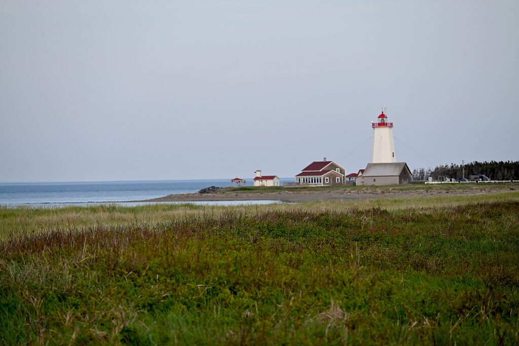
The picturesque Miscou Lighthouse © Karen Rubin/goingplacesfarandnear.com

We reach the Miscou Island Lighthouse on the northeastern tip of the island, just before sunset. The lighthouse was built in 1856 and designated a National Historic Site of Canada in 1974.
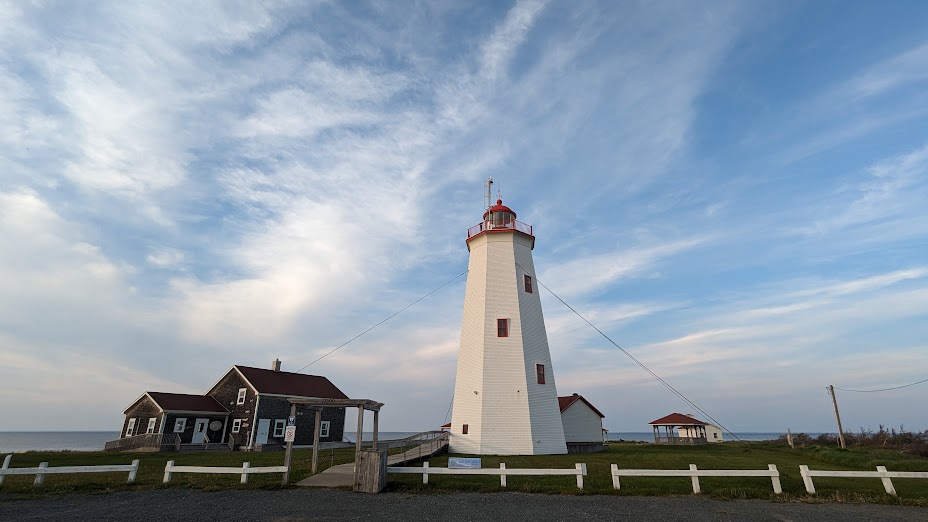
The picturesque Miscou Lighthouse © Karen Rubin/goingplacesfarandnear.com

It is surprising how long (how far) Miscou Island actually is (24 km long by 16 km wide – small for an island but a good distance by bike), because this is the route we are supposed to bike tomorrow. Even on our itinerary, the route is 26 miles each way, hilly, on a two-lane, windy road. But Miscou is fabulous to explore – for birds and wildlife (we see a family of foxes), peat bogs, and not to be missed.
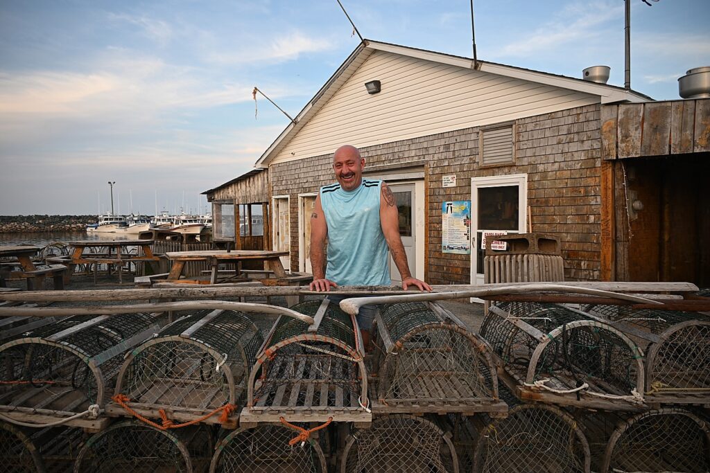
Steve of the popular Terasse a Steve restaurant on Miscou Island © Karen Rubin/goingplacesfarandnear.com

Our plan is to have dinner at Terasse à Steve a fun, rustic place so beautifully set overlooking the Miscou wharf that is legendary in the community, but when we pull up, we discover Steve has closed early (for mosquitoes!).

That means we have to race back to Shippagan before the restaurants close (at 8:30 pm). We’ve called ahead to Pinokkio’s who tell us to just get there by 9 pm. We race back, arriving at 9 pm on the dot, and sure enough, they seat us. The wood-fired pizzas (fungi pizza, margarita), with the freshest, most flavorful ingredients, are fantastic. ((Pinokkio Pizzeria Resto-Bar, 121 16e rue, Shippagan, 506-336-0051, www.pinokkio.ca).
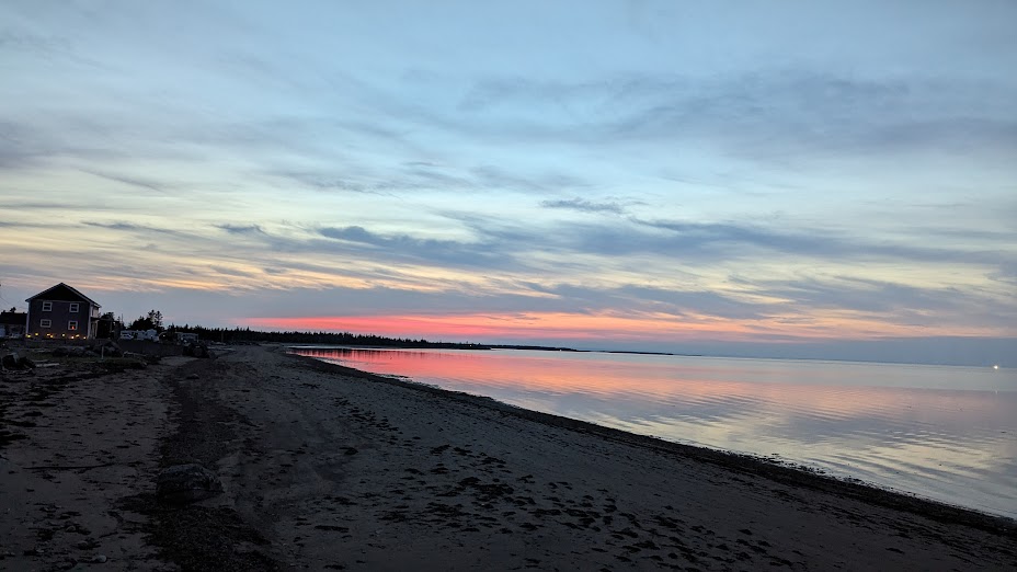
Sunset from our cottage on Point Brule, Shippagan © Karen Rubin/goingplacesfarandnear.com

Instead of biking back to Miscou Island (Veloroute map shows the Miscou route as 41 km just on the island), Dave and I decide to explore Lameque Island, which is in between Shippagan and Miscou (so glad we toured by car).

We set out again from the cottage on the road that leads to the entrance to the beautiful wooden boardwalk and connects to our biking routes, winding passed the colorful marina, then over the bridge to Lameque.
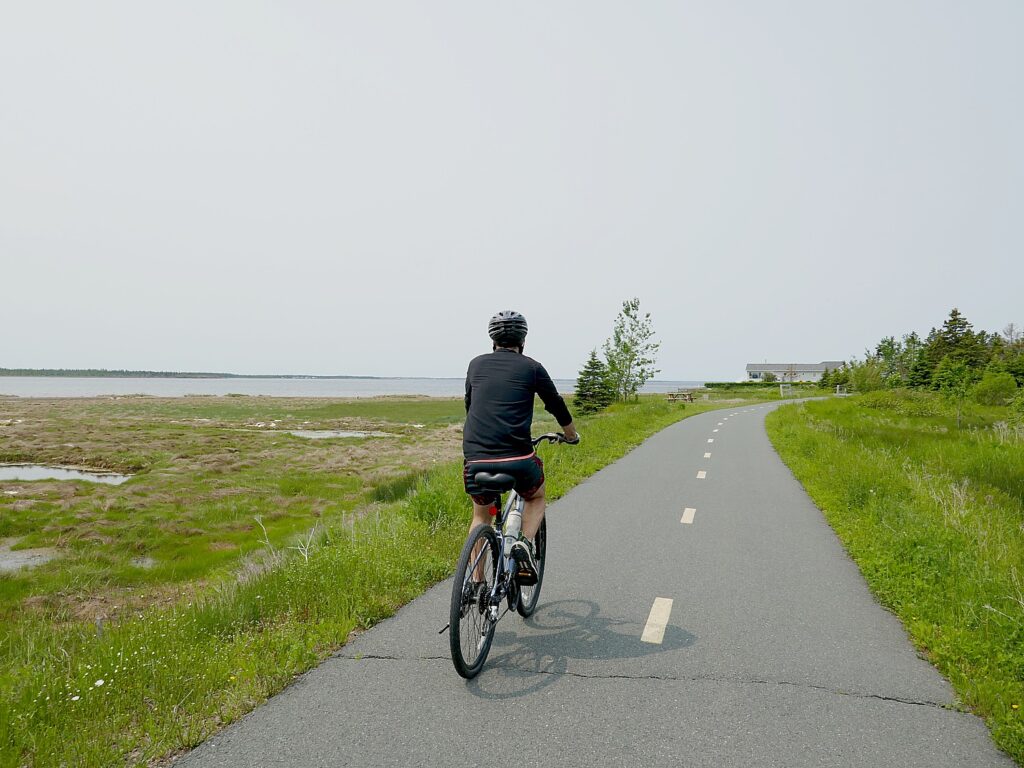
Biking around Lameque, on the Acadian Peninsula, New Brunswick © Karen Rubin/goingplacesfarandnear.com

We first find a lovely bike trail in the woods that parallels the busy Route 113, cross another small bridge, and then find a beautiful, if short, trail along the water. But when that ends, we ride on the shoulder of Route 113, which serves as a bike path. We come upon an eco-park on Lameque, and explore that before continuing our cycling,
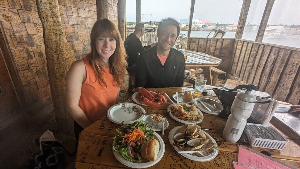
Enjoying a meal at Steve’s Terrasse on Miscou © Karen Rubin/goingplacesfarandnear.com

We are determined to dine at Steve’s Terrasse on Miscou, which is just on the other side of the (high) bridge from Lameque. Laini pulls away from her painting and meets us there for a late lunch – a sensational meal of lobster with spaghetti, pesto and parmesan; steamed clams; and a whole lobster (9650 route 113, Miscou, +1 506-344-7000)
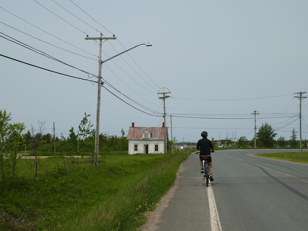
Biking around Lameque, on the Acadian Peninsula, New Brunswick © Karen Rubin/goingplacesfarandnear.com

Biking back to Lameque (back again over the steep bridge!), we follow a route that takes us along the eastern side of the island along the road (with ups and downs, unlike the bikeway) – it is marked in purple on the map – that give us some lovely views of the water as we ride through neighborhoods. (Amazingly, we don’t find actual stores or restaurants, absolutely nothing for the people to do except for some churches).

Each day, our ride begins and ends on the Shippagan boardwalk, my favorite part of the ride.
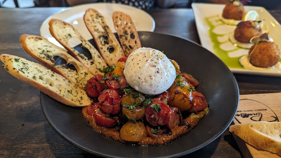
Enjoying a second dinner in a row at Pinokkio, Shippagan © Karen Rubin/goingplacesfarandnear.com

By the time Dave and I get back to our cottage in Shippagan, we calculate we’ve biked 45 miles. But now we have to race back into town to find a restaurant. The recommended places we call are all booked solid (it’s graduation day), so we (happily) call again to Pinokkio, and sure enough, they are booked too, but make room for us. The mushroom risotto is sensational. (Pinokkio Pizzeria Resto-Bar, serving up wood-fired pizzeria, appetizers, salads, pasta, seafood, steak, international cuisine, wine list, selection of domestic and imported beers, and decadent desserts, 121 16e rue, Shippagan, 506-336-0051, www.pinokkio.ca).
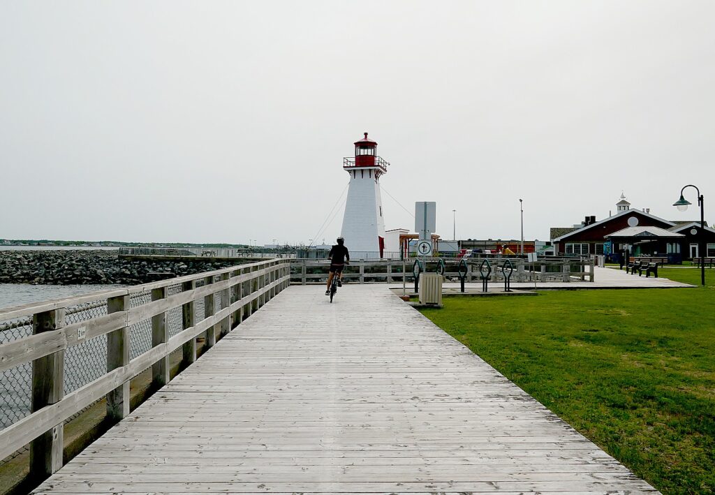
Biking Shippagan, New Brunswick’s beautiful boardwalk © Karen Rubin/goingplacesfarandnear.com

We really have to pull ourselves away from Shippagan (regrettably we don’t have time to visit the Aquarium which we keep passing on the boardwalk, 100 Aquarium St., Shippagan, 506-336-3013, [email protected], aquariumnb.ca).

(Shippagan, https://tourismepeninsuleacadienne.ca/en/region-shippagan/, 506.336.3900).

Caraquet
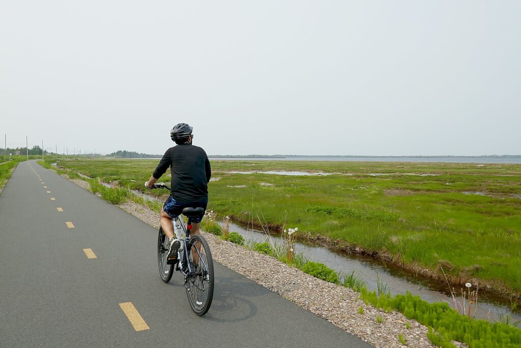
Biking the new cycling trail, the Veloroute Peninsule Acadeienne, along New Brunswick, Canada’’s Acadian Peninsula, from Shippagan © Karen Rubin/goingplacesfarandnear.com

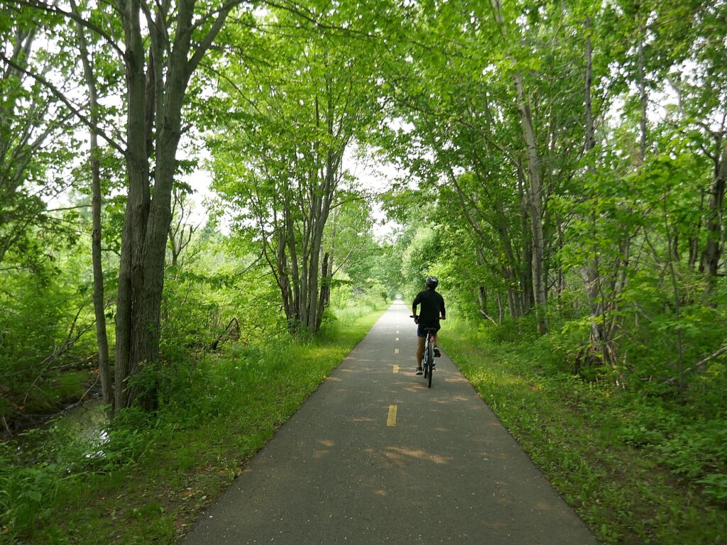
Today’s ride takes us back onto the delightful Veloroute to Caraquet, 20 miles on the trail. Basically we back track from Shippagan 10 miles to a fork in the trail and then back up 10 miles to Caraquet, most of it in the trees (so refreshing).
We find our way to a charming waterfront village of cute shops, a small artist’s collective, eateries and a picturesque wharf and marina, where we have lunch.
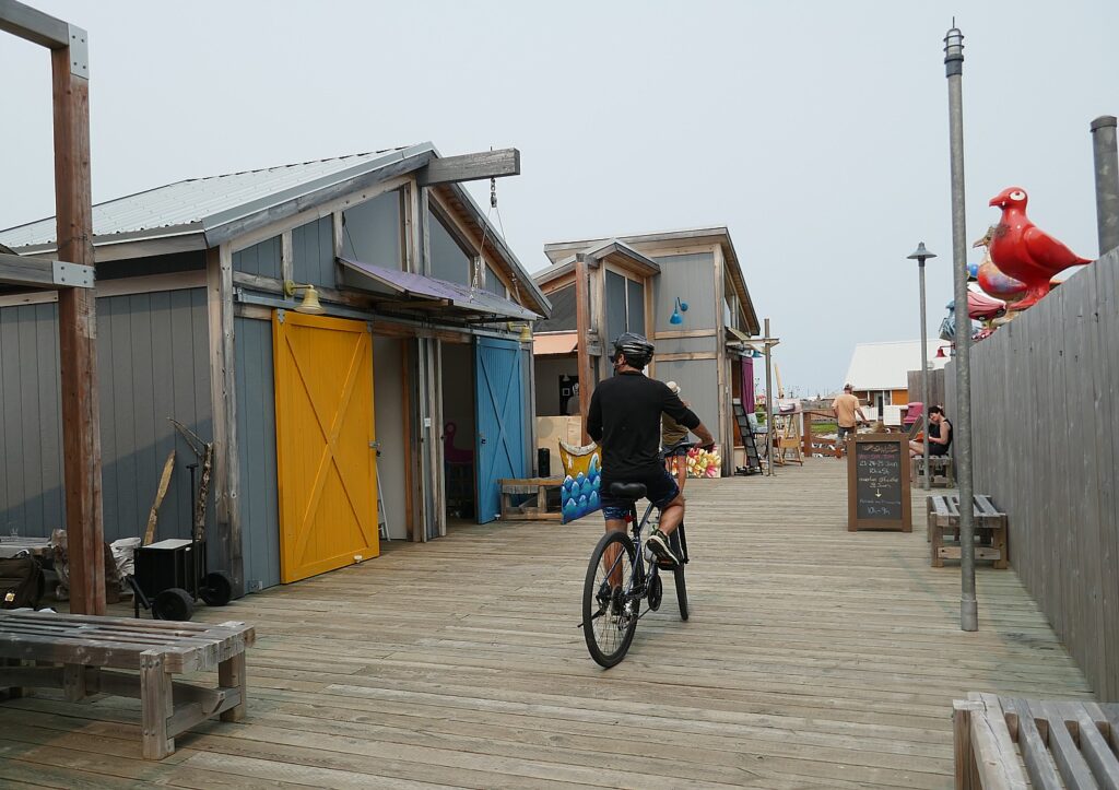
An artisan village within Caraquet © Karen Rubin/goingplacesfarandnear.com

We consider biking back the 20 miles from Caraquet to Tracadie to return the bikes, but realize we would be doubling back 20 miles on the trail we had already taken, and prefer instead to spend the afternoon exploring the rest of the trail, 7 miles further along Caraquet Bay to where it ends at Bertrand.
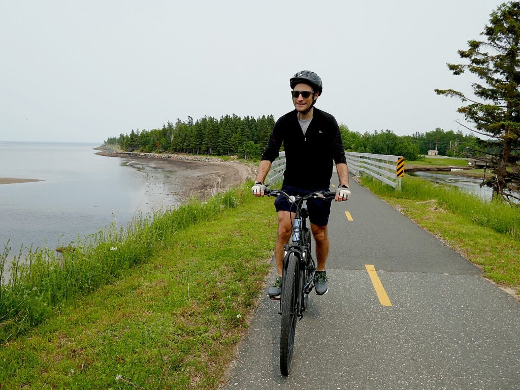
Biking along the shore from Caraquet © Karen Rubin/goingplacesfarandnear.com

It is the best choice! This part of the trail is particularly scenic, hugging the coast along Caraquet Bay (an inlet of Chaleur Bay), passing some gorgeous houses and views of the water, adding about 14 miles to our total for the day. We then drive the bikes back Tracadie, racing to get to the rental shop by closing time.

(Veloroute de la Peninsule acadienne, 506-336-4116, [email protected], www.veloroutepa.ca)

Caraquet is an extremely nice place to live, and clearly, very popular for tourists, judging by the string of hotels along the main street.

My hotel is the Super 8 By Wyndham (9 Avenue du Carrefour, 506-727-0888), is ideally located right in the waterfront village, alongside the coastal trail.

Returning the bikes the afternoon before works out superbly for me, because it gives me time to visit Caraquet’s major, not-to-be missed attraction, the Historic Acadian Village, which proves such a highlight of our New Brunswick roadtrip.

“Leave the 21st Century behind at Historic Acadien Village”
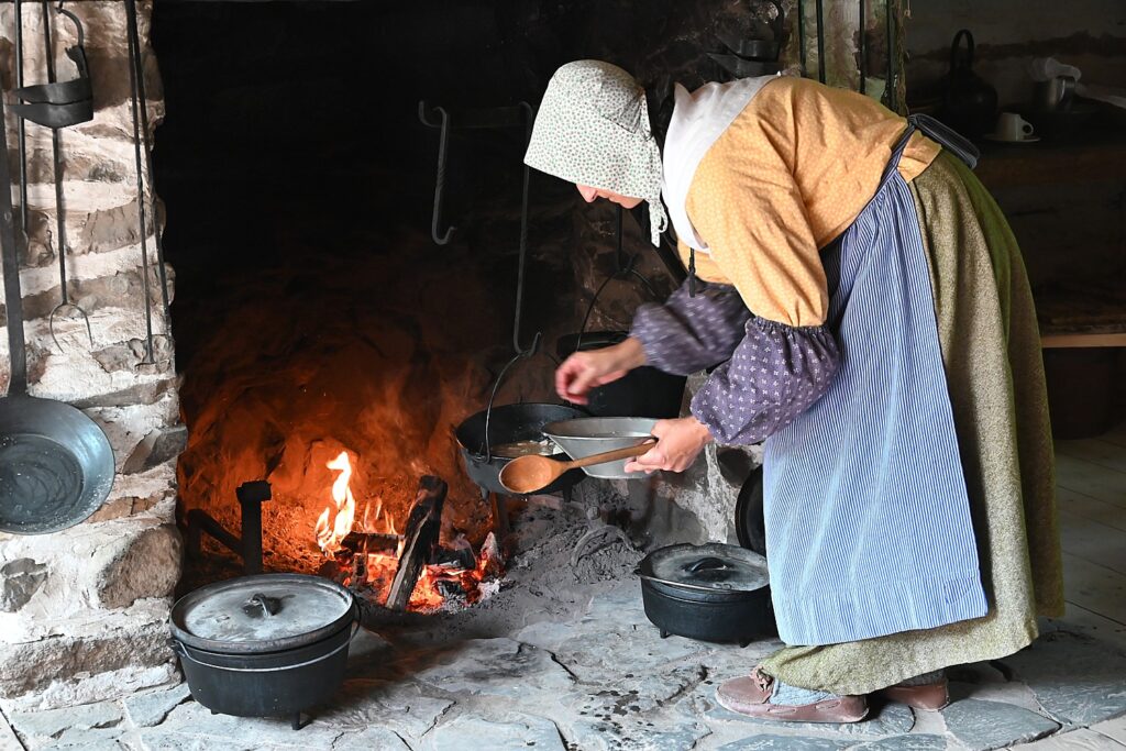
“Leave the 21st Century behind at Historic Acadien Village” a highlight of our visit to New Brunswick © Karen Rubin/goingplacesfarandnear.com

Historic Acadien Village is an open air living history museum with costumed (fully bilingual) interpreters who recreate the roles of real people. What makes this place so extraordinary, though, is that you walk a 2.2 km circuit through 200 years of history – the 40 buildings represent a different time, the oldest from 1773 up to 1895, then, you walk through a covered bridge built in 1900 into the 20th century village where the buildings date from 1905 to 1949.

As you walk about, you literally feel yourself stepping across the threshold back in time.

Walking through this idyllic village, looking at the goats, the sheep, the cows which supply the milk, meat, fiber for clothes, the fields and streams for fish, you would imagine they had everything they needed, life was tranquil, sustainable. But I soon learn from my conversation with the interpreter in the 1852 Cyr house that it was a daily struggle for survival.
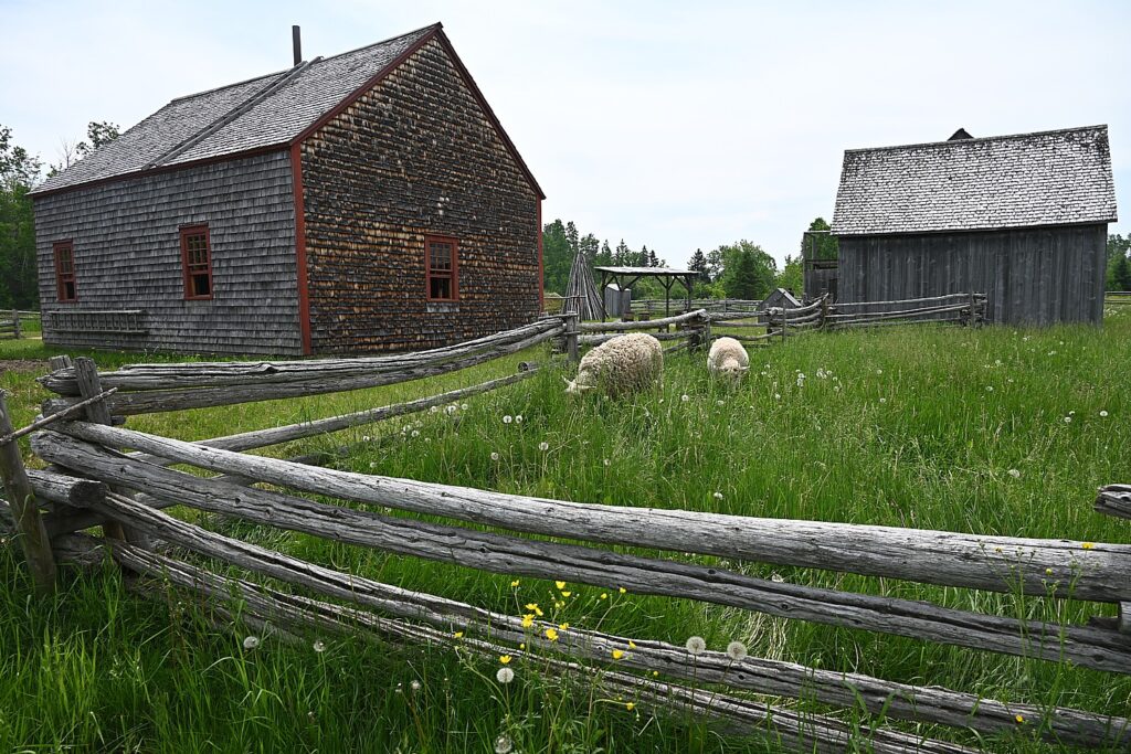
An idyllic Acadien village masks how hard life would have been like for the Acadiens Brunswick © Karen Rubin/goingplacesfarandnear.com

This arises when I watch her sewing and she says she baked 25 loaves yesterday, enough that would have lasted her family of 8 including grandparent and a farmhand, a week (but actually supplies the village restaurants which serve menus appropriate to the time). I suggest that must be a lot of work. She tells me that her children help. Don’t they go to school? “The children don’t go to school, they are needed at home. It’s a question of surviving. We would have been too isolated to go to school in winter, and they are needed in summer.” Homeschool? “We cannot read; we depend on the priest to read any letter that might come.”
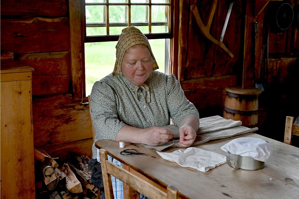
On the stove, she is preparing a pie with pork, onion, turnip, potato. “The pot is on legs so it doesn’t burn; we put wood chips on top so the food cooks from the top and bottom.”

This house came from Saint-Basile, New Brunswick, near the St. John River near Maine/Quebec. I observe that it seems quite large. “We’re not rich, but there was enough wood to build.”

What she tells me next seems to explain why the French Acadiens are so fiercely French (and why, as we travel, we see many flags of French Acadia but few of New Brunswick or Canada):
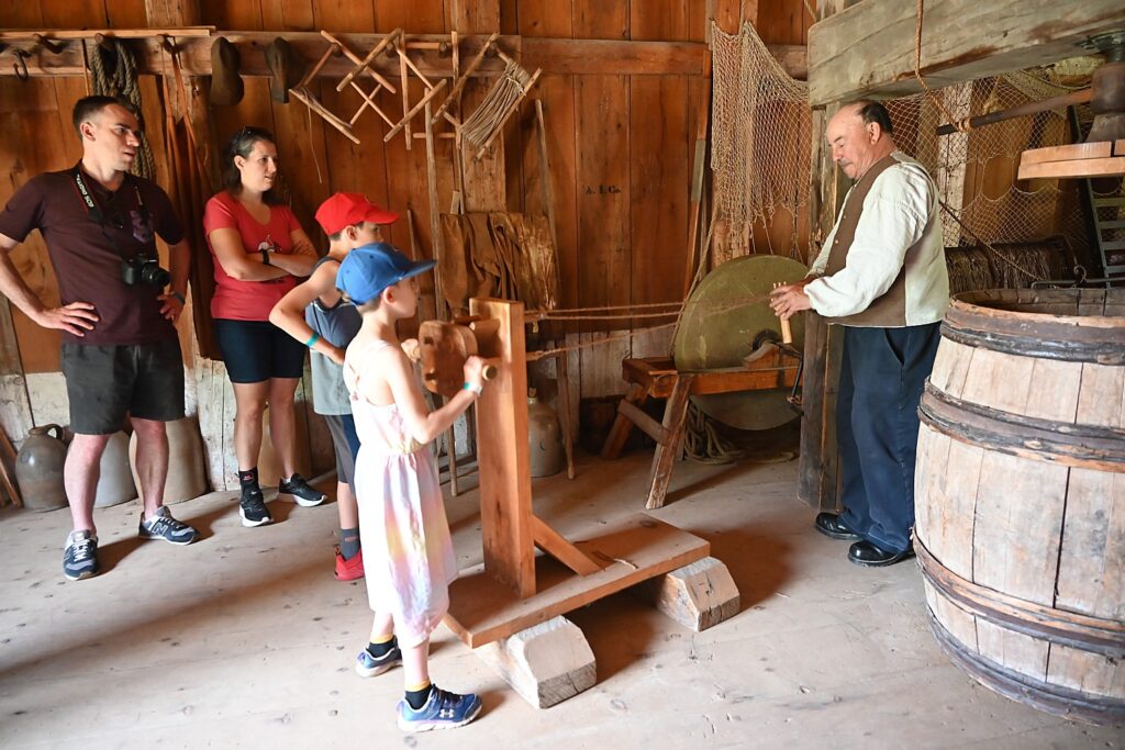
It was during the French and Indian War, when Britain battled France for control of the New World colonies. “In 1755, the British took the French men in one boat and women and children in another – they didn’t want families together. They felt there were too many Acadiens in same place and would be able to fight British. They made the Acadiens sign a contract to be British, not French, and those who refused were sent away. The boat took them far away – they didn’t know where they were going- some were sent to Charleston, South Carolina, to Louisiana.”
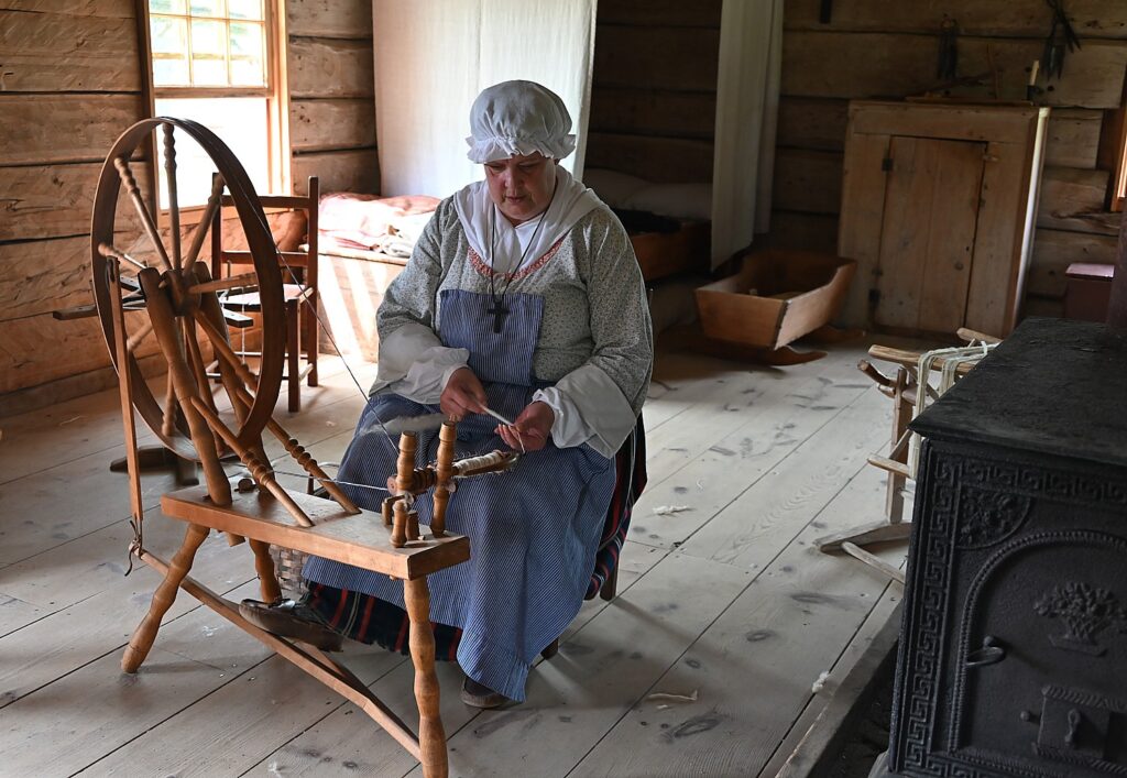
Seeing how life would have been like over 200 years at the living history museum, Village Historique Acadien, Bertrand, New Brunswick © Karen Rubin/goingplacesfarandnear.com

The war ended with the Treaty of Paris in 1763, with France giving Great Britain its colonial possessions in North America, except the islands of St. Pierre and Miquelon, off the coast of Newfoundland (which remain French colonies even today). In 1764, the British allowed Acadians to return in small isolated groups, but by then as many as 18,000 had been forcibly removed and thousands more killed. (See: https://www.cbc.ca/acadian/timeline.html)
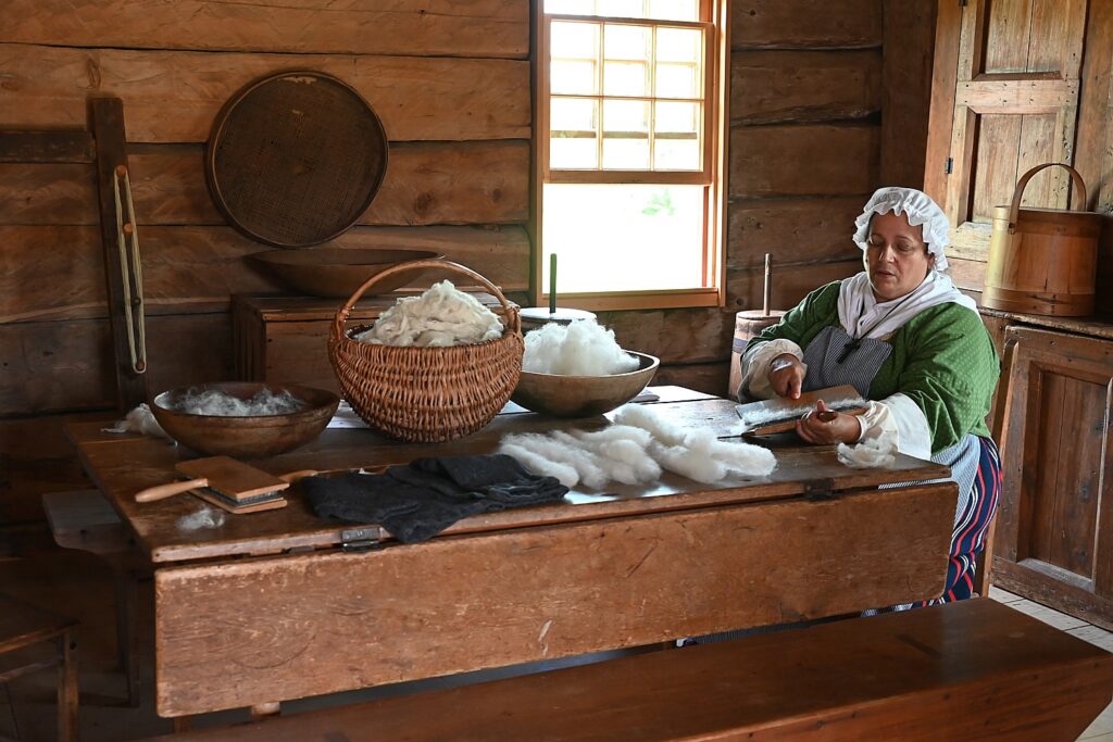
Seeing how life would have been like over 200 years at the living history museum, Village Historique Acadien, Bertrand, New Brunswick © Karen Rubin/goingplacesfarandnear.com

She says that when the French colonists were kicked out of Nova Scotia, they would send word to each other to come “a Cadia” (“to Cadia”), a name derived from an Indian word meaning “the place.”

Indeed, all these buildings were collected from other places in New Brunswick during the mid-1970s, creating a what appears to me to be an idyllic “Pleasantville” community.

I continue my walk through these fascinating homesteads. You also get to visit the chapel (1831), post office, general store (1889), tavern (1880), blacksmith’s shop and forge (1874), all with interpreters demonstrating their crafts.
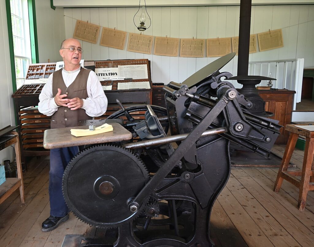
The 1867 printing office at the living history museum, Village Historique Acadien, Bertrand, New Brunswick © Karen Rubin/goingplacesfarandnear.com

My personal favorite: the newspaper/printing office (1867), which had been owned by Israel Londry who had five employees putting out 2000 copies of a four-page weekly paper (delivered to the post office), that would cost $1 for a six-month subscription. There are copies you can read.

There is also a one-room schoolhouse (1869), where the teacher tells me that on any day, she might have 20 students or 2, depending upon whether they were needed at home. “Before 1941, there were no mandates to attend school – children stayed home as free labor. It was a matter of survival.”
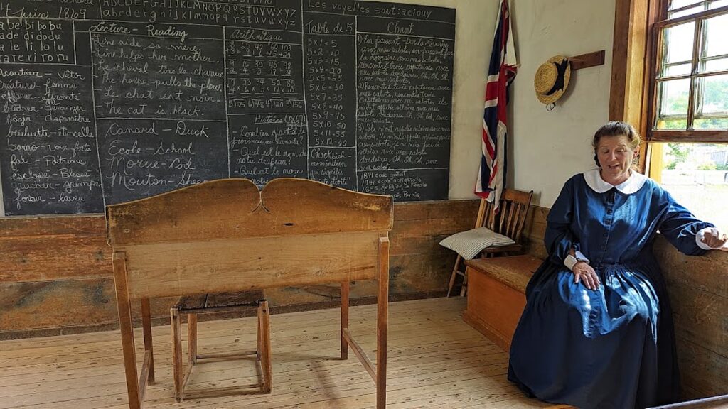
The one-room schoolhouse where the teacher could have 2 or 20 children a day depending if they were needed on the farm © Karen Rubin/goingplacesfarandnear.com

I love seeing the machinery of the 1895 grist mill. Originally it would have milled flour, sawed wood, made cedar shingles, serving a 50-mile radius. The miller would keep 10% of the flour, which he would trade for something else. “There was not much currency,” the miller tells me.. But in 1918, the miller closed the flour mill over a dispute of $125 from a bill for repair parts that went back to 1890, when new repairs were needed in 1914, and the $125 was again added to the bill, he shut it down, but kept the saw mill, carting machine and cedar shingles.
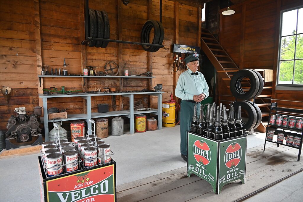
Cross the Kissing Bridge into the 20th century to visit the Irving Gas Station at the living history museum, Village Historique Acadien, Bertrand, New Brunswick © Karen Rubin/goingplacesfarandnear.com

Then you walk across the covered bridge (1900), called “the Kissing Bridge,” and you are in a 20th century town. There is an Irving Gas Station with antique cars; a saw mill (1949), general store (1924), tinsmith’s shop (1905) where you can buy a stove, cobbler’s shop (1945), a railroad station (1930). The Thomas Cooperage that dated from 1937 actually made barrels until 1980, employing 60 people who made 200 a day, until plastic barrels made the wood ones obsolete.
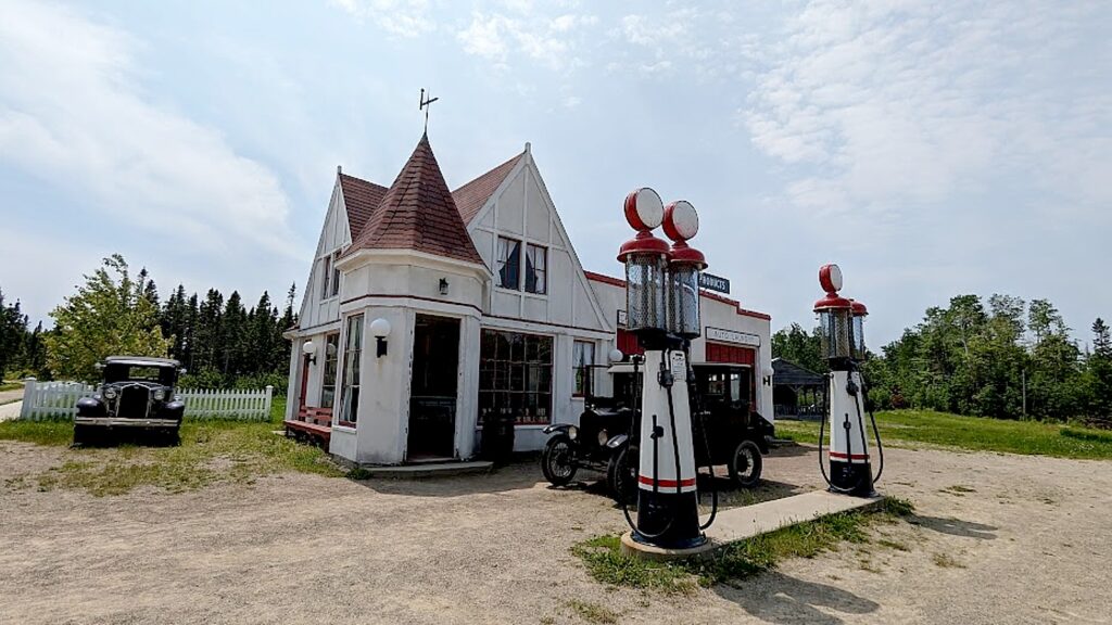
The Irving Gas Station at the living history museum, Village Historique Acadien, Bertrand, New Brunswick © Karen Rubin/goingplacesfarandnear.com

You not only visit but can actually book a room to stay at the Hotel Chateau Albert (1910). Albert opened hotel in 1870 but had financial problems from the beginning and was put out of business by Canadian Pacific railroad.. The building was destroyed in a fire in 1955, and restored using the original plans. It now offers 14 rooms (with bathrooms) that you actually can book to stay overnight. (hotelchateaualbert.com, 506-726-2600).
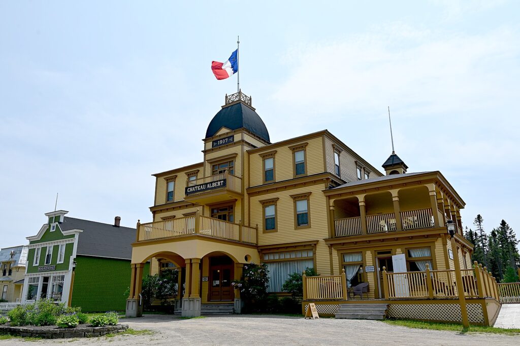
You can stay over in the Village Historique Acadien, at the Hotel Chateau Albert © Karen Rubin/goingplacesfarandnear.com

There is a really nice café in the (modern) visitor center before you go back in time, plus a restaurant in the historic village serving a menu appropriate to the period.

Plan on staying at least three hours. Open June through mid-September.

Historique Acadien Village, 5 rue du Pont, Bertrand, NB, 1-0877-721-2200, [email protected], villagehistoriqueacadien.com  

Travel planning assistance from Tourism New Brunswick, 800-561-0123www.tourismnewbrunswick.ca.

See also:

NEW BRUNSWICK ROADTRIP BEGINS IN ST. ANDREWS

NEW BRUNSWICK, CANADA ROADTRIP: SAINT JOHN, CITY OF FIRSTS, OLDESTS, AMAZEMENTS

NEW BRUNSWICK ROADTRIP: DISCOVERING FUNDY TRAIL PARKWAY, FUNDY NATIONAL PARK, CAPE ENRAGE

NEW BRUNSWICK ROADTRIP: MESMERIZING HOPEWELL ROCKS

NEW BRUNSWICK ROADTRIP: METEPENAGIAG HERITAGE CENTER HIGHLIGHTS MIRAMICHI VISIT

____________________________

© 2023 Travel Features Syndicate, a division of Workstyles, Inc. All rights reserved. Visit goingplacesfarandnear.com, www.huffingtonpost.com/author/karen-rubin, and travelwritersmagazine.com/TravelFeaturesSyndicate/. Blogging at goingplacesnearandfar.wordpress.com and moralcompasstravel.info. Visit instagram.com/going_places_far_and_near and instagram.com/bigbackpacktraveler/ Send comments or questions to [email protected]. Tweet @TravelFeatures. ‘Like’ us at facebook.com/KarenBRubin 
New Brunswick Roadtrip: Metepenagiag Heritage Center Highlights Miramichi Visit

By Karen Rubin, Travel Features Syndicate, goingplacesfarandnear.com

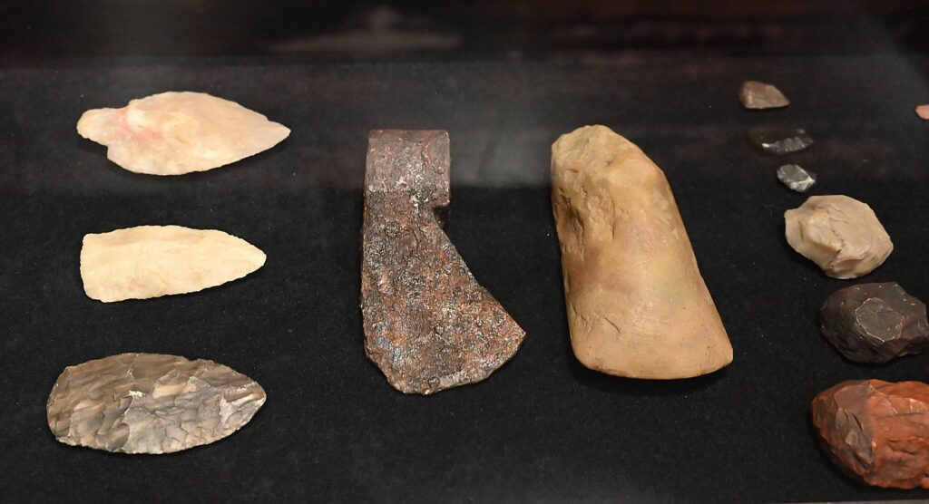
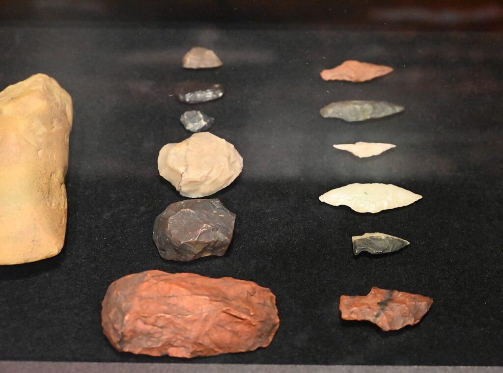
Metepenagiag Heritage Center has artifacts that show 3,000 years of habitation of the Mi’kmaq people in Miramichi, New Brunswick, Canada © Karen Rubin/goingplacesfarandnear.com

So often the best travel experiences happen by serendipity. I had left the Bay of Fundy coastal trail behind in Moncton this morning to continue our New Brunswick roadtrip, driving 90 minutes to Miramichi, a small city that’s the gateway to northern New Brunswick, Canada, renowned for hunting and fishing. I meet up with Amanda Craig, from Miramichi’s tourism office who was taking me to hike a mile-long trail to Fall Brook Falls (at 108 feet high is the highest in New Brunswick). It’s located in Irving Woodlands private preserve, but alas, the access road is closed. I had spotted a sign along the highway to the Metepenagiag Heritage Park and was really excited to learn more about New Brunswick’s First Nations history and so we head there.

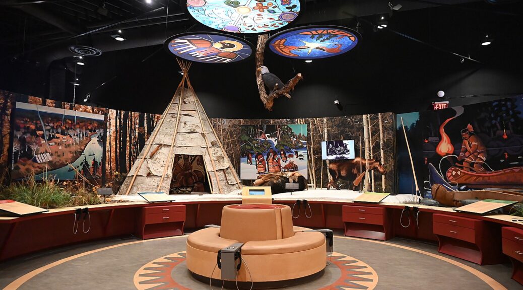
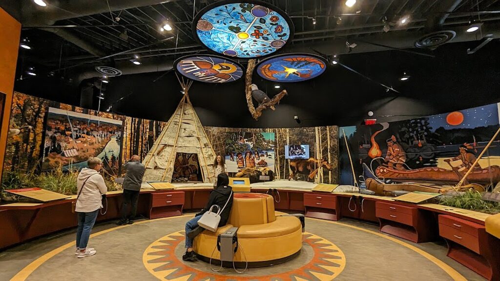
Metepenagiag is so much more than a museum exhibition – it preserves, documents, honors and resurrects the Mi’kmaq heritage and culture.

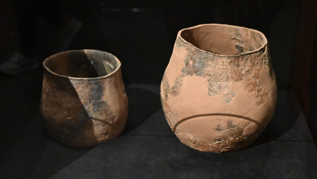
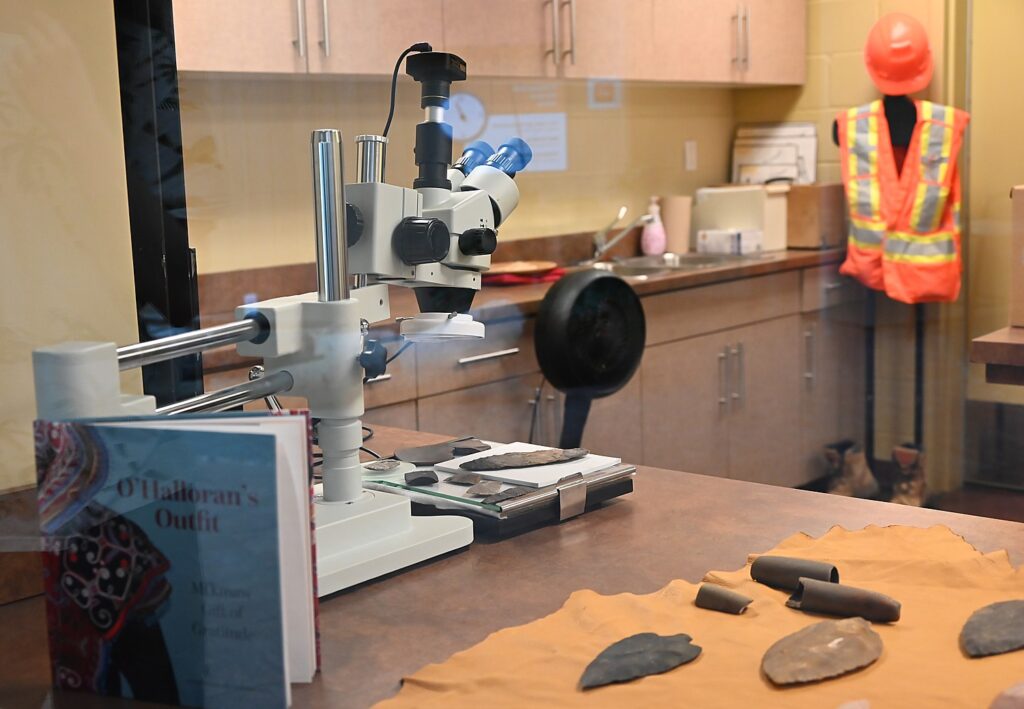
Metepenagiag is an active archaeological site and research center where artifacts unearthed have provided proof the Mi’kmaq have been occupying this land for at least 3,000 years. When you first walk into the exhibition building, you can look into the lab where researchers examine artifacts. Some of the items, like a 1200-year old Earthenware pot, arrowheads and other items are on display.

Earthenware 1200 years old is on display at Metepenagiag Heritage Center, Miramichi, New Brunswick, Canada © Karen Rubin/goingplacesfarandnear.com

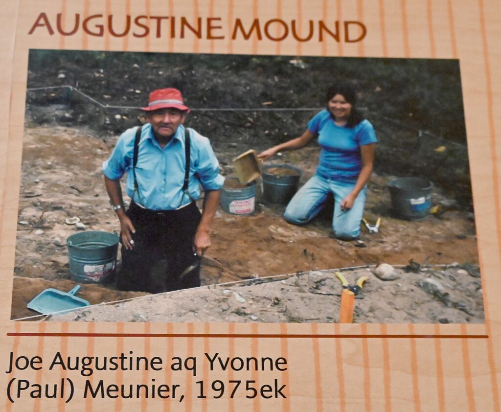
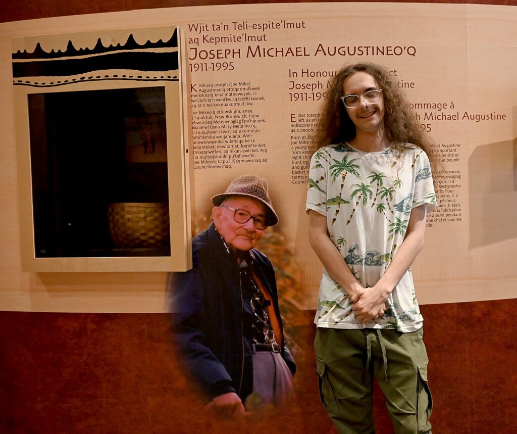
The significance of this place is clear when you learn that it was after decades and generations of a national policy to eradicate First Nations’ cultural heritage, when even speaking the language, so critical to passing along its oral history and tradition, was banned and children were forced from their community into residential schools to strip away their native identity, that in the 1970s, a Mi’kmaq member, Joe Augustine, discovered the Augustine Mound and Oxbow.

“When a company was planning to expand its gravel pit in our community, our beloved and respected Elder Joe Augustine remembered being told from his Elders before him of an old burial ground in the area,” state the notes accompanying a photo of Joe Augustine and Yvonne (Paul) Meunier digging at the pit state. “He went to the site they described and found what was to become the Augustine Mound – a cemetery dating back to over 600 BC.

Mi’kmaq Elder Joe Augustine discovered the Augustine Mound and Oxbow archaeological sites in the 1970s which provide evidence of 3,000 years of habitation in Miramichi, New Brunswick, Canada © Karen Rubin/goingplacesfarandnear.com
 

The concept of preserving, protecting and presenting the rich Mi’kmaq culture is expressed by our Elder and lives on in our community.”

In 1977, archaeological work began on another site Elder Joe Augustine uncovered: the Oxbow, a village site situated at the head tide, showing Metepenagiag has had over 3,000 years of continuous settlements right to the present day.

Artifacts uncovered at the Augustine Mound and Oxbow show that for the past three millennia, aboriginal people have repeatedly come to this oxbow in the Miramichi River to fish, hunt and gather plants © Karen Rubin/goingplacesfarandnear.com

Constructed about 2500 years ago, the circular Augustine Mound is a rare example in the Maratimes of the elaborate burial tradition associated with the Adena culture, which originated in the Ohio River Valley and then spread throughout eastern North America. The rich archaeological record found at the site includes well-preserved textiles and basketry, ornaments of Lake Superior native copper, Ohio fireclay pipes, and distinctive Adena-type stone tools dating back 7000 years.

The types of objects retrieved from the Augustine Mound are exceptional for this area of Canada – copper beads on leather, small pieces of baskets, textiles, animal hides, moose-hair work, porcupine quills, feathers and wooden-handled tools. The salts from thousands of copper beads helped save the raw natural fibers from decomposing.

Artifacts uncovered at the Augustine Mound and Oxbow show that for the past three millennia, aboriginal people have repeatedly come to this oxbow in the Miramichi River to fish, hunt and gather plants © Karen Rubin/goingplacesfarandnear.com

The earth mound, the types of burials and the artifacts suggest that the Mi’kmaq of Metepenagiag probably carried on complex trading and cultural relations with other Aboriginal societies as distant as central Ohio.

Oxbow is one of the largest pre-contact archeological sites in the Maritimes and remarkable for its rich and deeply stratified record of almost continuous human occupation. The artifacts uncovered show that for the past three millennia, aboriginal people have repeatedly come to this oxbow in the Miramichi River to fish, hunt and gather plants. Seasonal flooding covered their camps with silt, preserving evidence of their everyday life, including stone tools, ceramics, and fire pits.

Archaeological research is actively underway at Metepenagiag Heritage Center, Miramichi, New Brunswick, Canada © Karen Rubin/goingplacesfarandnear.com
 

Known today as the Mi’kmaq (from the word nikmaq, meaning my kin-friend), in ancient times they called themselves Lnu’k, The People. The Mi’kmaq are an Eastern Algonkian-speaking people closely related to the Wolastoqiyik, Passamaquoddy, Penobscot and the Eastern and Western Abenaki. Together, these nations formed the Wabanaki Confederacy.

“The findings of these two archeological sites scientifically prove the ancient oral history we have always known, passed down through many generations. This is our legacy and how two national historic sites came to be.”

“Elder Joseph (Joe Mike) Michael Augustine (1911-1995) left an important legacy: the rediscovery of the Mi’kmaq identity and culture as a people and as a nation.” Joe Mike served two terms each as Chief and as a Band Councillor.

Metepenagiag Heritage Center guide Marcus Alexander LaViolette poses with a photo of his great grandfather, Mi’kmaq Elder Joe Augustine discovered the Augustine Mound and Oxbow archaeological sites that proved Mi’kmaq habitation for 3,000 years © Karen Rubin/goingplacesfarandnear.com

“This is archaeological proof of living here 3000 years,” says our guide,  Marcus Alexander LaViolette, heritage interpreter, a 20-something fellow who turns out to be the great grandson of Joe Augustine, making his remarks all the more poignant.  

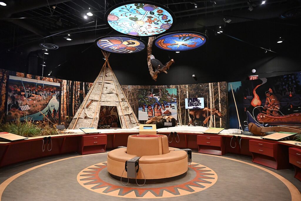
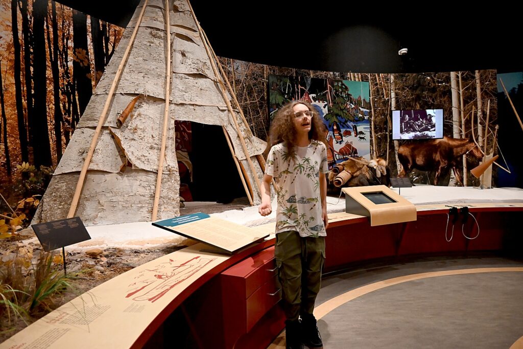
One room displays how the Mi’kmaq would have lived, season by season (they lived along the river in warm seasons, and moved to the forest in cold).

Mi’kmaq ancestors lived in wikuoms (wigwams), not tipis. Some cone- shaped wigwams could hold up to 30 people; A or V-type usually held large groups, which typically would have been built by women.

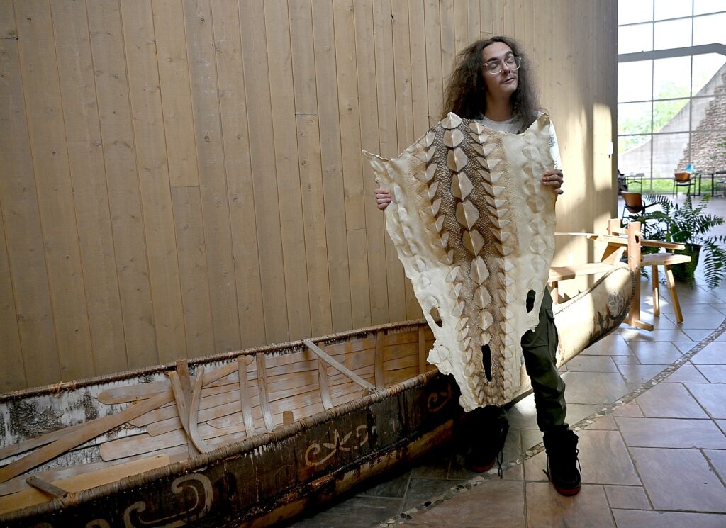
Marcus shows us a re-created canoe and the skin of an Atlantic sturgeon, which grew to a size “as long as a canoe.” A main food source for generations, the sturgeon, which could grow over 3 meters long and weigh 400 kilos, are now exceptionally rare – the last one was caught 30 years ago. “Sturgeon are an ancient fish in an ancient river; they haven’t evolved,” Marcus tells us.

Metepenagiag Heritage Center guide Marcus Alexander LaViolette with a canoe and skin of a sturgeon that once provided sustenance to Mi’kmaq, but now is virtually extinct © Karen Rubin/goingplacesfarandnear.com

The birchbark canoe “was likely the most remarkable Mi’kmaq construction.” It ranged from 3 to 8 meters long; with high ends and raised sides, a uniquely Mi’kmaq design, that kept the canoe from taking on water. Using this type of canoe, the Mi’kmaq ancestors traveled out to sea, up streams and down rapids. The canoe could transport large loads but was light enough so one or two people could easily carry it.

“We lost the tradition of canoe making,” Marcus tells us, “so this is a generic style for birch bark canoe.”

The exhibit hall is a portal to ancient history, he tells us, stressing that it is a point of pride that all the notes are equally translated in English, French, and Mi’kmaq, especially since only 5% of Mi’kmaq people can understand their native language. There are about 200,000 Mi’kmaq in Canada and in Maine.

Marcus notes that there the pots do not have a flat bottom but would be designed to wedge into the ground. They would boil or cook using superheated sand – which would form a crust around bread and not get into the bread. When it was done, they would pat it like a drum so the sand comes off, leaving the bread. “That they can recreate the process shows proof of concept – shows can do it, re-creatable.” (In the “Taste of Metepenagiag” package, guests learn how to make traditional bread.)

Metepenagiag Heritage Center displays how the Mi’kmaq would have lived, season by season © Karen Rubin/goingplacesfarandnear.com
 

The ancient Oxbow village was next to one of the best salmon fishing pools. For centuries the Miramichi River was a river of fish – so many salmon swam up the river that they would keep villagers awake at night as they fell on the water after leaping into the air. The ancestors smoke-dried a lot of the salmon catch for winter or to use in trade.

The Mi’kmaq ancesters knew the names and uses of trees, plants, flowers and herbs. Foods included fiddleheads, cat-tail roots, raspberries and blueberries. The bloodroot plant provided dye. Balsam fir helped to cure wounds. Canoes and containers were made from birchbark, wood and root, and mats from reeds and rushes. Sweetgrass and tobacco are still used in ceremonies.

Metepenagiag Heritage Center displays how the Mi’kmaq would have lived, season by season © Karen Rubin/goingplacesfarandnear.com
 

“We slowed down First Contact,” Marcus says, then adds, “The Mi’kmaq way of life did not last. With the first Europeans came dramatic changes. The ancestors began to spend more time gathering furs to trade for the prized European goods. They became dependent on Europeans for food. European diseases killed whole Mi’kmaq villages. With few people left to pass on tradition, much knowledge and history was lost.” In fact, the British barred them from hunting or fishing.

This place had always been important for trade – there is even evidence of the Vikings having come. European merchant traders set up a commercial fishery on the Miramichi River in the 1760s that destroyed much of the traditional salmon fishery. “The few Mi’kmaq living at Metepenagiag struggled to survive.”

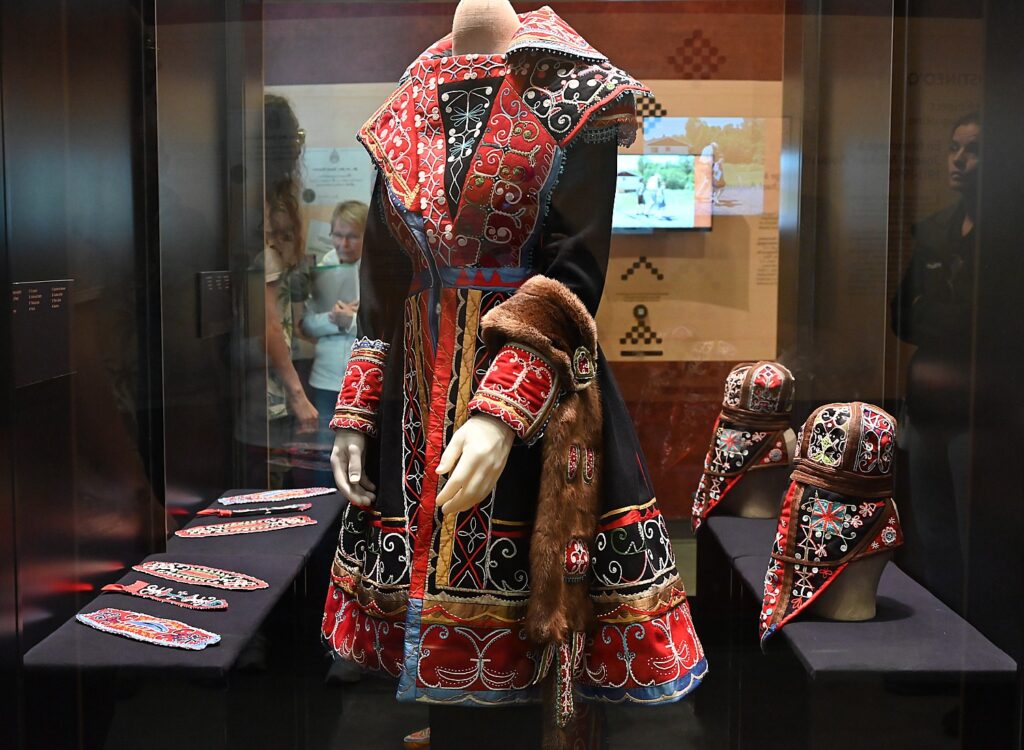
Local women made this re-creation of the magnificent embroidered, beaded coat made in 1841 for British sea captain Henry O’Halloran who was made an honorary chief of the Mi’kmaq, on view at the Metepenagiag Heritage Center © Karen Rubin/goingplacesfarandnear.com

This is what made a magnificent embroidered, beaded coat that is on exhibit all the more significant, and treasured by the community: it is a re-creation of a fabulous coat, meticulously crafted by local women for a British sea captain, Henry O’Halloran. At a time when the Mi’kmaq were forced onto a reserve and weren’t allowed to hunt or fish, Captain O’Halloran traded with the indigenous people, provided food and formed a close relationship. The coat was made in 1841on the occasion of making him an honorary chief. This one is an exact replica, made by the local women, which if sold, would be valued at $300,000. (Marcus proudly says he got to model it.)

Marcus points to the Treaties of Peace and Friendship, saying, “When our ancestors signed treaties with the British Crown, such as in 1779, they did not give up ownership of our traditional lands. They also kept our rights to fish, hunt, gather and trade.” But these rights were not honored.

In 1994 Metepenagiag signed a historic “loss of land-use” agreement with the government of Canada. But it did not include all of the lands and access to resources that have been taken from our community. Negotiations are continuing in an effort to obtain a fair settlement.” Only recently, each tribal member received $20,000 from the Canadian government as compensation for land.

It is important to note that First Nations people – there are about 2 million in Canada – only received the right to vote without losing their native Indian status in 1960; the last residential school closed as recently as 1995. In 2014, Canada passed the Truth & Reconciliation Act, apologizing for the harm in trying to eradicate indigenous heritage, prompting a policy toward promoting indigenous rights and heritage. Indigenous tourism, a key tool for both economic development and preservation of indigenous heritage and culture, is now Canada’s the fastest growing industry, Amanda says.

At the end of our visit, Marcus says, “First Nations people don’t believe in goodbye – everything is a circle, comes back – even if in next life.”

Metepenagiag Heritage Park has 1800 meters of groomed trails (30 minutes walking time) that let you “walk in the footsteps of our ancestors” to the water.

You can overnight at the Metepenagiag Heritage Center in a tipi, lodge or cabin and be immersed in Mi’kmaq experience © Karen Rubin/goingplacesfarandnear.com

What is more, you can overnight in a tipi (glamping), cabin or lodge, have a First Nations dining experience, storytelling and be immersed in the 3,000-year heritage around a campfire. Or take part in “A Taste of Metepenagiag” and learn about foods and cooking techniques. New experiences are also being developed.

The Mi’kmaq operate SP First Nations Outdoor Tours, authentic indigenous experiences that begin with a traditional welcome, a river tour by canoe or kayak, storytelling; and authentic First Nations dining and accommodations (56 Shore Road, Red Bank NB, Metepenagiag, 506-626-2718).

Metepenagiag Heritage Park, 2156 Micmac Road, Red Bank NB, 506-836-6118, [email protected] 1-888-380-3555, metpark.ca.

To get to the Metepenagiag Heritage Center, you go through a Mi’kmaq residential community of about 600 people, where you have to be a community member to own the home (but do not own the land). It looks like a typical suburban neighborhood. with its own school (the federal government subsidizes the public school but teachers are paid less than regular school teachers) and shopping center. After the museum was built, the community opened a woman’s shelter, health center. The community also owns Riverside Entertainment (gaming room, restaurant), downtown.

Sportsman’s Paradise

Miramichi is world renowned as a sportsman’s paradise for fishing, hunting, hiking, kayaking, tubing down the rivers, and the longest zipline in New Brunswick (1200 feet). Indeed, the rivers, filled with salmon, and lush wilderness that provided the food and shelter to sustain the Mi’kmaq even 3,000 years ago, continues to sustain Miramichi today.

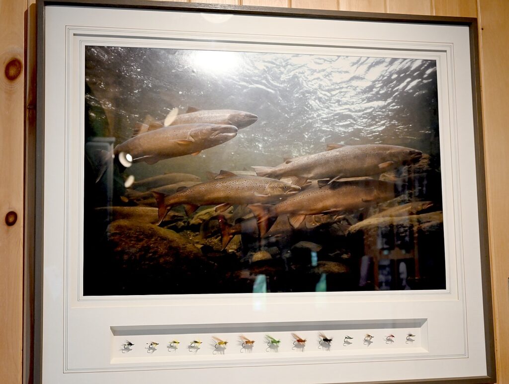
Miramichi is so prominent for salmon fishing (baseball star Ted Williams used to invite major celebrities including Marilyn Monroe to his family cottage in Blackville), that there is actually an Atlantic Salmon Museum, founded by the local historical society in 1982, that displays 5,000 artifacts “celebrating the artistry of fly tying, the beauty of a well-crafted rod and, above all, the nobility of that ‘king of fish’ the Atlantic salmon.”

One of John William Keith-King collection of 150 plates on view at the Atlantic Salmon Museum in Doaktown, New Brunswick © Karen Rubin/goingplacesfarandnear.com

Most notably, the museum is the repository for the internationally revered John William Keith-King collection of 150 plates that feature exquisite flies combined with stunning artwork and historic photos, plus artwork, reels, fishing rods, fishing tackle, fish replicas and antique outboard motors. The collection is valued at $500,000 (the plates alone valued at $5,000 each), Believe me, I never thought such a museum could be so fascinating even to someone who has never fished for salmon. This place is pure bliss for fishing enthusiasts. (Admission is free. Check hours. 263 Main St, Doaktown NB, 506-365-7787, www.atlanticsalmonmuseum.com

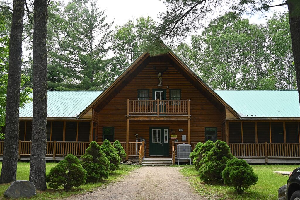
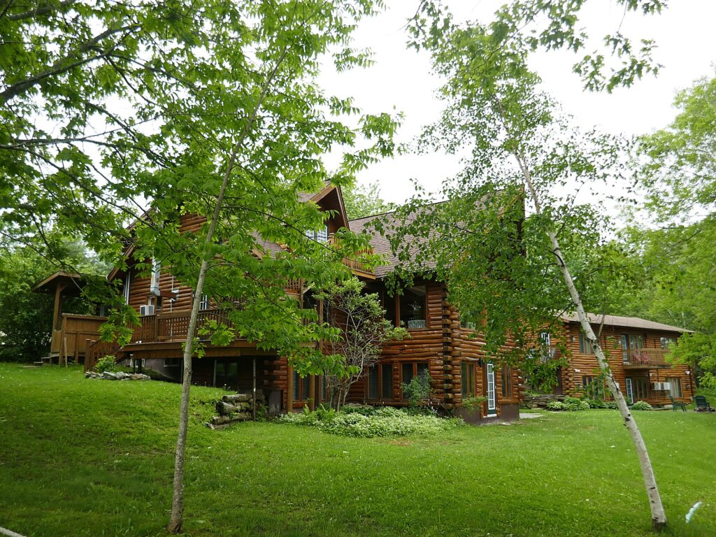
The Ledges Inn, a sportsman’s retreat, Doaktown, New Brunswick © Karen Rubin/goingplacesfarandnear.com
 

People come from all over for the opportunity to fish and hunt, staying in upscale places like The Ledges Inn,  a 4.5-star outfitter with 10-room lodge, picturesquely set on the bank of the Miramichi River, where you can enjoy salmon fishing, upland bird-hunting, four-wheeling, snowmobiling (30 Ledges Inn lane, Doaktown NB, 1-506-365-1820, Ledgesinn.com); and the historic Wilson’s Sporting Camps, family-owned hunting lodge, offering sportsmen retreats since 1855(23 Big Murphy Lane, McNamee NB, 1-877-365-7962, Wilsoncamps.nb.ca).

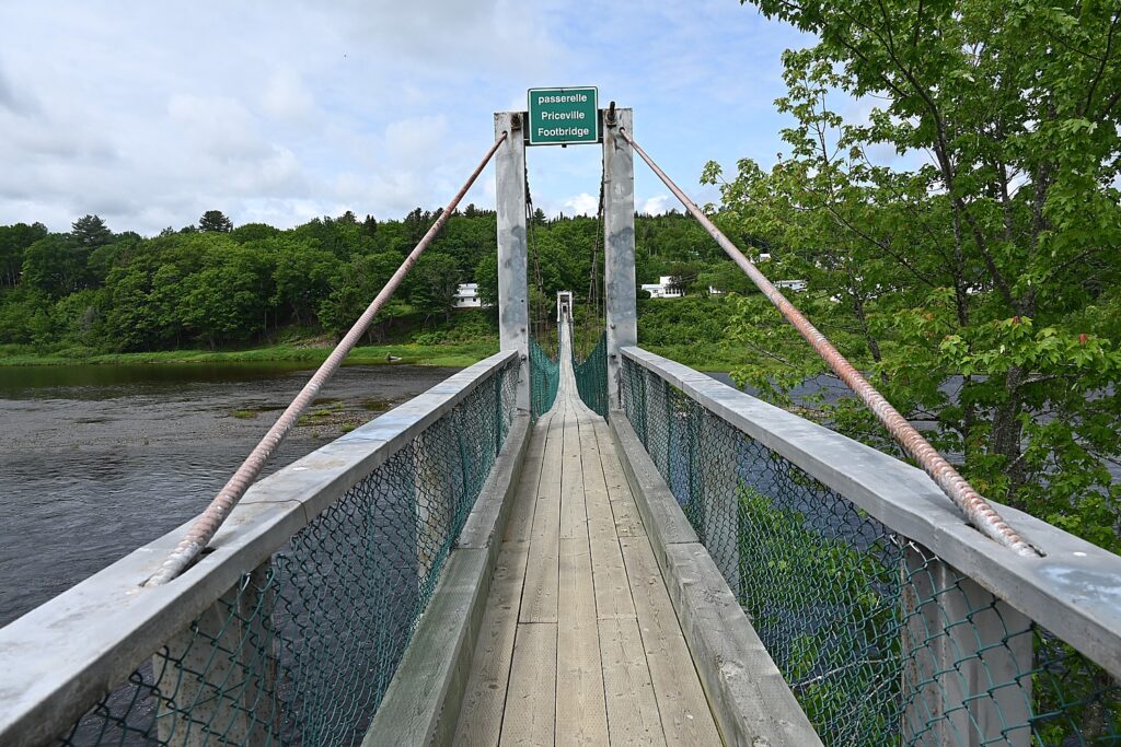
Another local attraction is the Priceville Footbridge, which, local lore has it, was built in 1938 to unite two lovers who lived in villages separated by the river. At 656 feet, it’s the longest suspension bridge in New Brunswick, was damaged and rebuilt in 1939, then replaced in 1988 (McNamee Road. https://tourismnewbrunswick.ca/listing/priceville-suspension-footbridge).

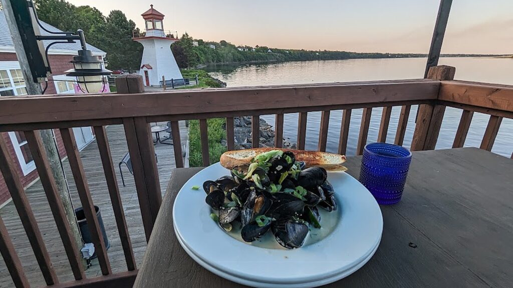
Enjoying a plate of mussels at Vera’s at Richie Wharf, Miramichi, as the sun sets © Karen Rubin/goingplacesfarandnear.com

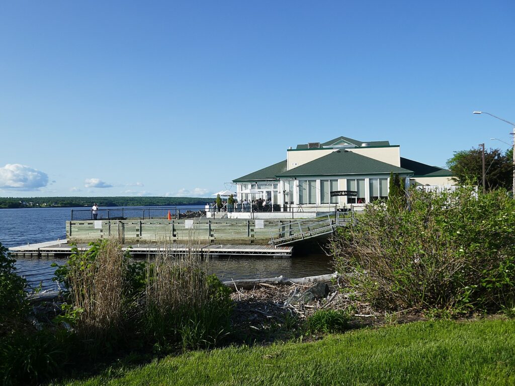
Back in Miramichi, I spend a pleasant evening at Richie Wharf, a charming waterfront park and historic site, where on Friday nights locals come out for music and dancing, After enjoying this scene, I have a delightful dinner (mussels!) at Vera’s patio with a gorgeous view of the sunset on the river. (84 Norton’s Lane, Miramichi, 506-625-2300)

Other Miramichi highlights: There are loads of historic sites we didn’t have time to visit but sound so interesting: Doak House commemorates Scottish entrepreneur Robert Doak who settled here in the early 1820s (386 Main St. Doaktown, 506-365-2026); Wilson’s Point Historic Site, a provincial historic site, contains the Scottish ancestry of Miramichi, but has archaeological significance for the Mi’kmaq people as well as the French Acadians and Loyalists (8 Enclosure Rd., Derby Junction, www.wilsonspoint.com, 506-627-0162); Miramichi History Museum (182 Wellington St., 506-778-4050); Tabusintac Library & Museum (4490 Rte 11, Tabusintac); and W.S. Loggie House & Cultural Centre, a Victorian home with artifacts from 1850 to 2000 (222 Wellington St., Miramichi, 506-775-4996).

Also: Miramichi River Interpretive Trail (1.4 km long, 158 main Street, Blackville; 90-min, Miramichi River Boat Tours out of Richie Wharf; Gallan’s Miramichi River Tubing (Doyles Brook, miramichirivertubing.com); Escuminac Beach (escuminacbeach.com); Historical Beaverbrook House Haunted Tour.

Rodd Miramichi River Hotel © Karen Rubin/goingplacesfarandnear.com

I overnight at the Rodd Miramichi River Hotel, picturesquely set in the waterfront village (1809 Water Street, 506-773-3111).

The next morning, I meet up with David and Laini at the Calico Café; they have been exploring Prince Edward Island and Shediac, where they had a fabulous dinner at Le Mogue Tortue, a restaurant with an Alice-in-Wonderland like setting (tea cups,clocks!), and we continue on our roadtrip to French Acadia, where we will bike on the new Veloroute (bikeway) along the coast, through French fishing villages.

Miramichi Tourism, 800-459-3131, discovermiramichi.com.

Travel planning assistance from Tourism New Brunswick, 800-561-0123www.tourismnewbrunswick.ca.

See also:

NEW BRUNSWICK ROADTRIP BEGINS IN ST. ANDREWS

NEW BRUNSWICK, CANADA ROADTRIP: SAINT JOHN, CITY OF FIRSTS, OLDESTS, AMAZEMENTS

NEW BRUNSWICK ROADTRIP: DISCOVERING FUNDY TRAIL PARKWAY, FUNDY NATIONAL PARK, CAPE ENRAGE

NEW BRUNSWICK ROADTRIP: MESMERIZING HOPEWELL ROCKS

Next: Exploring French Acadia’s culture and heritage by bike!

____________________________

© 2023 Travel Features Syndicate, a division of Workstyles, Inc. All rights reserved. Visit goingplacesfarandnear.com, www.huffingtonpost.com/author/karen-rubin, and travelwritersmagazine.com/TravelFeaturesSyndicate/. Blogging at goingplacesnearandfar.wordpress.com and moralcompasstravel.info. Visit instagram.com/going_places_far_and_near and instagram.com/bigbackpacktraveler/ Send comments or questions to [email protected]. Tweet @TravelFeatures. ‘Like’ us at facebook.com/KarenBRubin 

New Brunswick Roadtrip: Discovering Fundy Trail Parkway, Fundy National Park, Cape Enrage

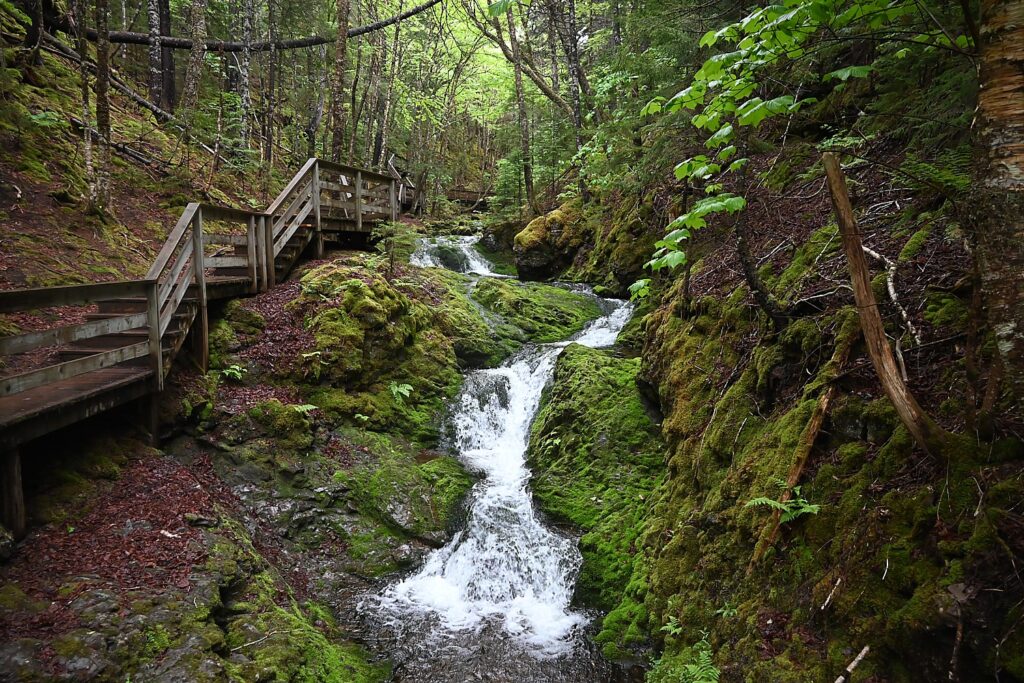
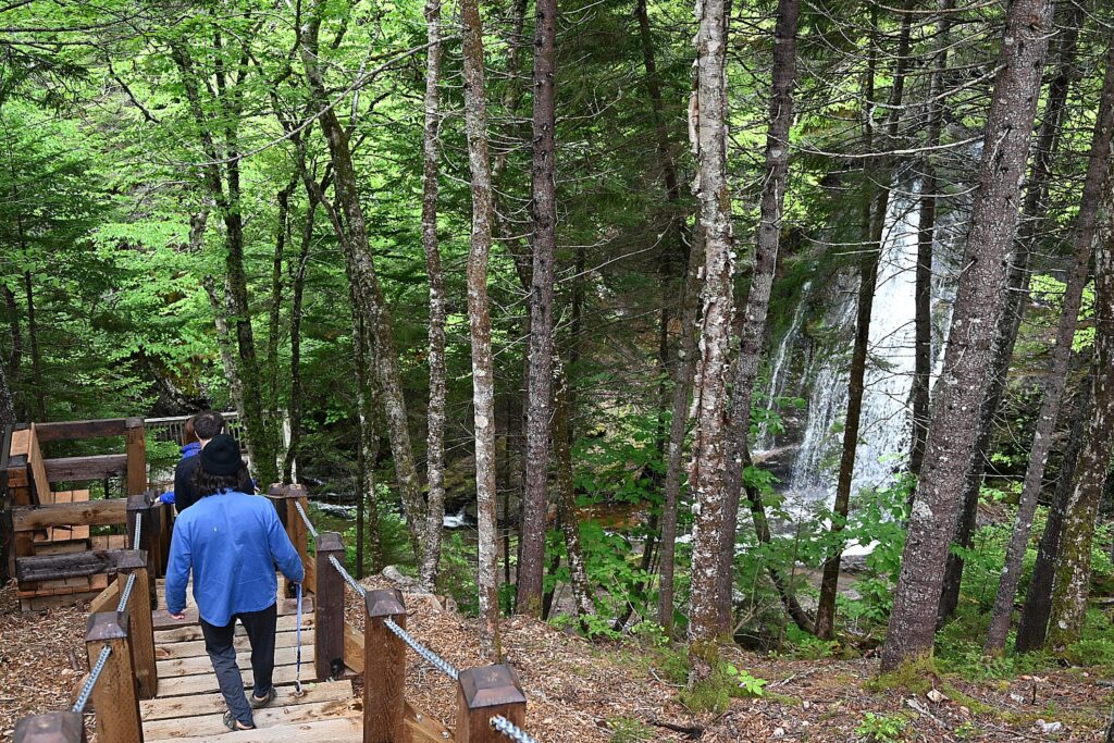
Walking the enchanting trail to Dickson Falls in Fundy National Park, New Brunswick, Canada © Karen Rubin/goingplacesfarandnear.com
By Karen Rubin, with Dave E. Leiberman, Laini Miranda & Eric Leiberman

Travel Features Syndicate, www.goingplacesfarandnear.com

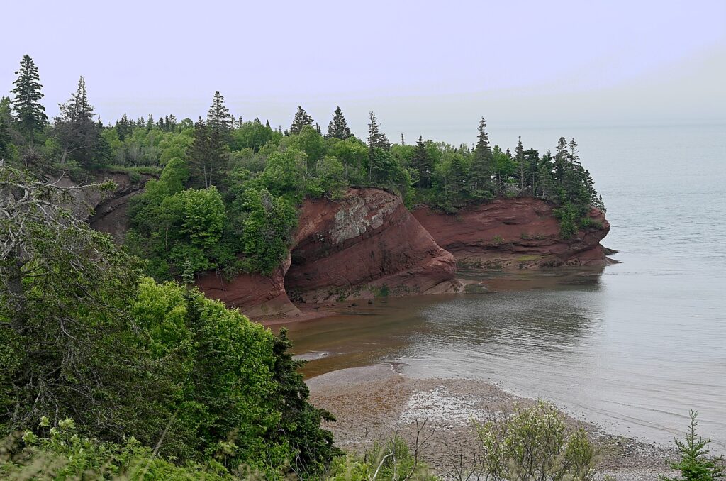
We set out from Saint John for the 45-minute drive from Saint John to St. Martins. St. Martins, a quaint and charming little village on the Bay of Fundy, is a slow-paced and picturesque community known for sea cliffs, sea caves, two covered bridges and natural beauty. The coastline that starts in St. Martins is one of the last areas of pure coastal wilderness on the eastern seaboard of North America. It’s a popular place to come for cycling, hiking, bird watching, nature walks, rock hounding and sea kayaking.

St. Martins is one of the picturesque communities on the Bay of Fundy with “two faces” depending upon whether the tide is high or low © Karen Rubin/goingplacesfarandnear.com
 

“Communities on the Bay of Fundy are places with two faces because they have much different looks depending on whether it’s high or low tide,” Neil Hodge of New Brunswick Tourism has advised. “A trip along the Fundy Coastal Drive is an opportunity to get a feel for ‘The People of the Tides’. The tides impact people’s lives – what they can do when.’’

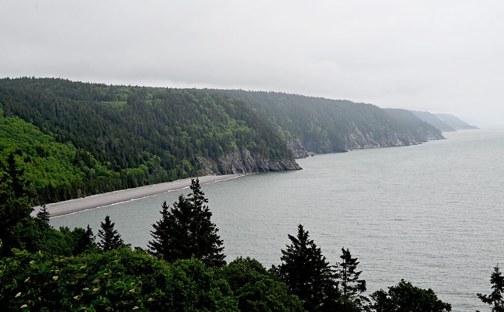
The coastline that starts in St. Martins is one of the last areas of pure coastal wilderness on the eastern seaboard of North America © Karen Rubin/goingplacesfarandnear.com

We are scheduled for a 2 ½ hour sea kayaking tour with Bay of Fundy Adventures (415 Main Street in St. Martins, 506-833-2231, bayoffundyadventures.com) and excited to paddle out of this quaint fishing harbor down the rugged coastline next to sea cliffs and sea caves through two UNESCO World Heritage Sites– the Fundy Biosphere Reserve and the Stonehammer UNESCO Global Geopark. Alas, the company has to cancel because of wind and waves are too great (but we have another sea kayaking experience scheduled, at Hopewell Rocks). We hang out awhile in a small coffee place where some of the “People of the Tides” have also gathered for their morning coffee, even inviting us to come by their house for a better photo of the cliffs.

The coastline that starts in St. Martins is one of the last areas of pure coastal wilderness on the eastern seaboard of North America © Karen Rubin/goingplacesfarandnear.com

We walk the beach, already seeing how the tide flows in so swiftly – not tsunami-like as you might expect before actually seeing it – but pretty much swamping the trail before you realize it.

Had we had our kayaking adventure, we would have stopped for lunch at The Caves Restaurant (82 Big Salmon River Road, St. Martins) and had dessert at Octopus Ice Cream (404 Main Street in St. Martins).

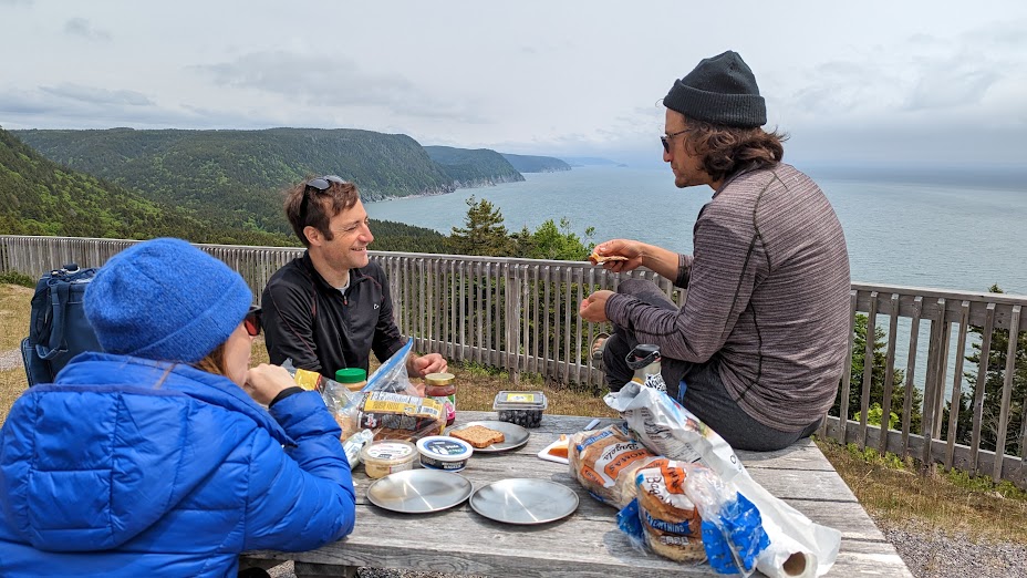
We set out on the Fundy Trail Parkway, a slow cliffside drive, from gate to gate, that offers numerous beautiful views of the Bay of Fundy and its long, rocky coastline (great for biking). All along this magnificent route there are delightful pull-ins, lookouts, picnic areas, rest areas, hiking trails. We pack a picnic lunch with us (no restaurants on the Fundy Trail Parkway),

The Fundy Trail Parkway, 19-miles long from gate to gate, is a coastal, multi-use park with has five beaches, four waterfalls, 22 miles of hiking trails, 21 scenic lookouts and 16 observation decks.

Spectacular views of the Bay of Fundy await along the newly completed Fundy Trail Parkway, a 19-mile long multi-use park that hugs the coastal wilderness © Karen Rubin/goingplacesfarandnear.com

We learn that the Fundy Escarpment is a 2 km-wide corridor (one km of land and one km into the Bay of Fundy), stretching from Fownes Beach in St. Martins (where we start) to the western boundary of Fundy National Park. The 1 km width is essential because most of the ecosystem dynamics of the Bay of Fundy exist within the area, including the nutrient-rich salt marshes, tidal flats and the dramatic Fundy tides. The Fundy Escarpment is one of the last remaining coastal wilderness areas between Florida and Labrador.

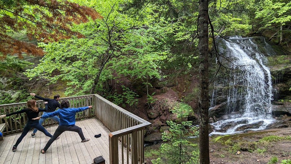
Taking the cable ladder to Fuller Falls, one of the highlights of the Fundy Trail Parkway © Karen Rubin/goingplacesfarandnear.com

Traveling from west to east: we stop often to take in the views (there is so much to see and do, thankfully, Hodge at New Brunswick Tourism has given us a list of recommendations): Fox Rock Lookout and Melvin Beach Lookout. We stop to really enjoy Fuller Falls (not to be missed) – this is a gorgeous waterfall that you reach by walking down a cable ladder to a lower deck for the best eye-level view, where David, Laini and Eric are inspired to do yoga.

Inspired to do yoga at Fuller Falls, on the Fundy Trail Parkway, New Brunswick, Canada © Karen Rubin/goingplacesfarandnear.com

We continue on to Pangburn Beach Lookout, Black Point Lookout, and drive in to see The Cookhouse (a lumberjack camp 100 years ago, the workers needed to eat 8,000 calories per day to do the job), but has not yet open for the season. There is also the Big Salmon River Interpretive Centre, where you learn about the logging and shipbuilding history of this once thriving community in the 1840s-early 1900s. (Also not yet open for the season when we visit).

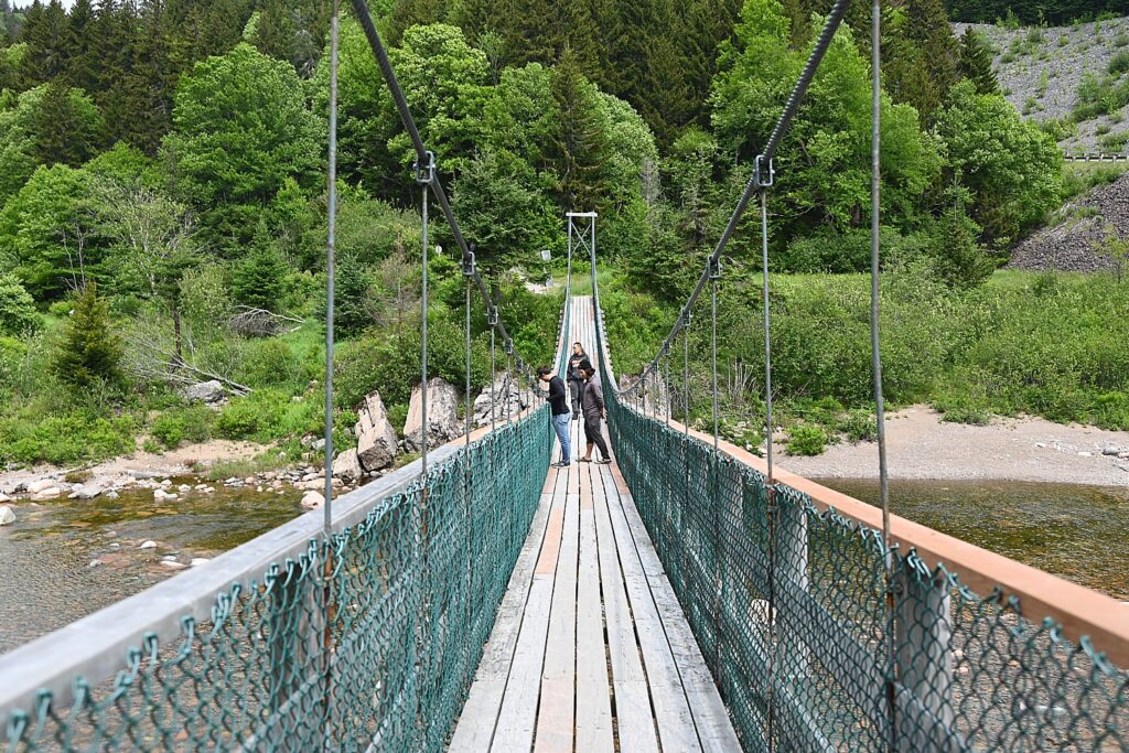
The Suspension Footbridge on the Fundy Trail Parkway, New Brunswick, Canada © Karen Rubin/goingplacesfarandnear.com

From here, we go to Parking Lot 8 (P8) and take the five-minute walk along the river to the 84m Suspension Footbridge. It’s a great view there as you explore the banks of Big Salmon River (once a popular salmon fishing site, the salmon are now protected). From here, we can visit the lookouts at Long Beach (From 2010 until the Parkway opening in 2016, this lookout was the farthest you could drive in the park; the beach showcases a “horizontal tide”, extending 1640 feet at low tide) and Tufts Plateau, and then continue on to Martin Head Lookout and Seeley Beach Lookout, stopping for our picnic lunch with a stunning view.

Enjoying a picnic with a spectacular view on the Fundy Trail Parkway, New Brunswick, Canada © Karen Rubin/goingplacesfarandnear.com

We take an easy 1.5-mile hike from the parking lot through the woods to a viewing platform to see Walton Glen Gorge, known as the Grand Canyon of New Brunswick, and the star attraction of the Fundy Trail Parkway. The Gorge is 1,000 feet across, 525 feet deep and 550 million years old, carved during the most recent Ice Age – you can see the path the glacier took to the sea as it melted, and see waterfalls coming down the rock face on the other side of the gorge.

Walton Glen Gorge, known as the Grand Canyon of New Brunswick, is a star attraction of the Fundy Trail Parkway © Karen Rubin/goingplacesfarandnear.com
 

It is astonishing to learn that The Fundy Trail Parkway actually was only completed in 2020, during the pandemic, after taking 25 years and $100 million to build. It is operated by a non-profit, The Fundy Trail Development Authority Inc., (admission is $11.50/A, $10/S, $6.50/5-18, $36/family, $40/up to 7 people. Open mid-May to mid-October).

Fundy Trail Parkway, 1-506-833-2019 1-866-386-3987, [email protected], www.fundytrailparkway.com

The Parkway to Alma, New Brunswick Canada © Karen Rubin/goingplacesfarandnear.com

Leaving the parking lot at Walton Glen Gorge, we follow the sign that says Sussex and five minutes later exit the Fundy Trail Parkway. A little further ahead, we turn right at the sign to Alma and then follow this road which takes us on a scenic 45-minute drive through Fundy National Park to Alma, where we will have two-nights stay to explore Fundy National Park and environs, and have a cozy stay at the Parkland Village Inn in Alma (8601 Main Street, 506-887-2313).

Alma, a charming fishing village, is home to Molly Kool, who made history as the first female sea captain in North America. Kool is the nautical equivalent of Amelia Earhart, the American who was the first female pilot to fly solo across the Atlantic Ocean. Molly Kool also broke ground for women at a time when females weren’t allowed to be sea captain. (I regret we didn’t have time to stop into the Molly Kool — Albert County Museum & RB Bennett Centre.)

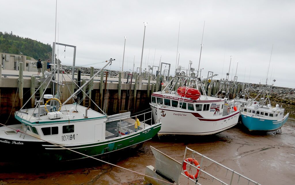
It is a bizarre sight at the Alma wharf at low tide to see boats sitting on the ocean floor © Karen Rubin/goingplacesfarandnear.com

We explore Alma, and quickly realize what Hodge meant when he said these are “communities with two faces.” It is a bizarre sight at the wharf at low tide to see boats sitting on the ocean floor.

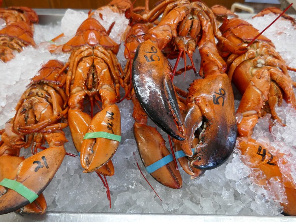
Getting a taste of Alma at the Alma Lobster Shop floor © Karen Rubin/goingplacesfarandnear.com

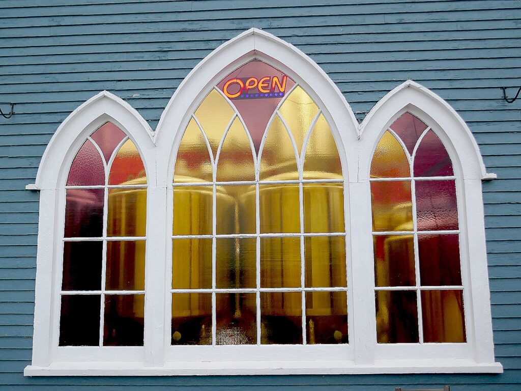
We immediately get to taste Alma – lobster rolls and the best, freshest mussels ever at the Alma Lobster Shop (36 Shore Lane); a delightful dinner at Tipsy Tales Restaurant (8607 Main Street), and the hip ambiance of Holy Whale Brewery/ Buddha Bear Coffee Roasters, housed in a former church.

Holy Whale Brewery is housed in a former church in Alma © Karen Rubin/goingplacesfarandnear.com

Cape Enrage

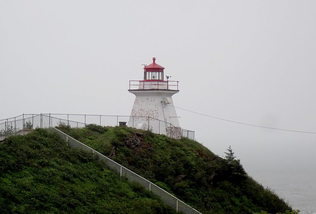
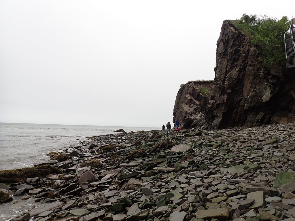
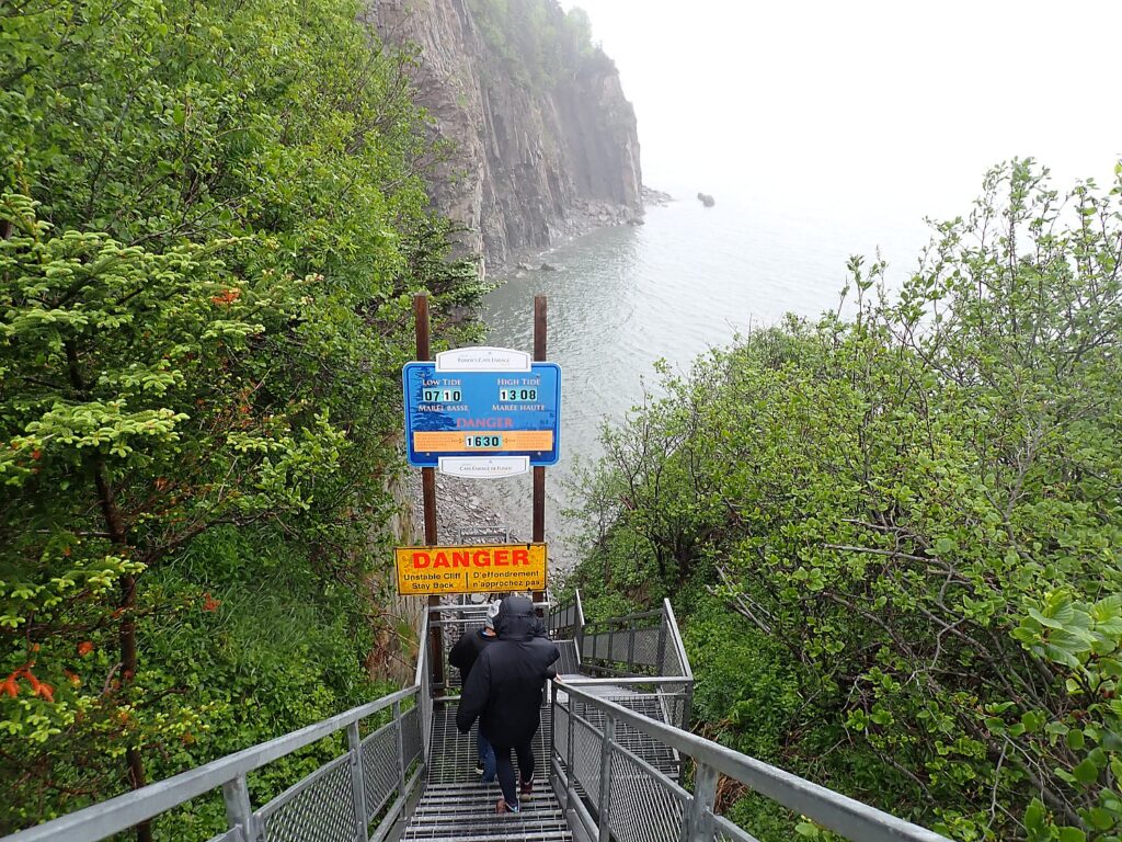
We set out in the morning to drive 20 minutes along a lovely coastal country road to Cape Enrage, an iconic destination with a historic lighthouse on the Bay of Fundy where you can best appreciate the coastline. Wherever we go along the Bay of Fundy, we have to be mindful of the time, because the tides determine what we can see and do.

Saving the historic lighthouse at Cape Enrage was the impetus to create a center for learning and adventure © Karen Rubin/goingplacesfarandnear.com

We arrive at Cape Enrage, at 9:30 am. This place is famous for its historic lighthouse, which was supposed to be knocked down and replaced by a metal pole. Dennis Tate, a local high school physics teacher (the son of a lighthouse keeper who used to visit by boat as a boy), was so upset, he raised funds to take over the lighthouse, restore it, and turn Cape Enrage into an “interpretive center.” I think it is more accurately an adventure center, offering truly special experiences: taking a fossil tour on its rocky beach, ziplining and rappelling down its 140-foot high cliffs back down to the beach.

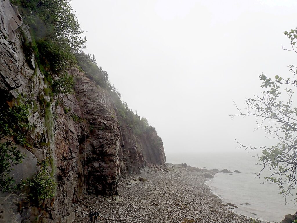
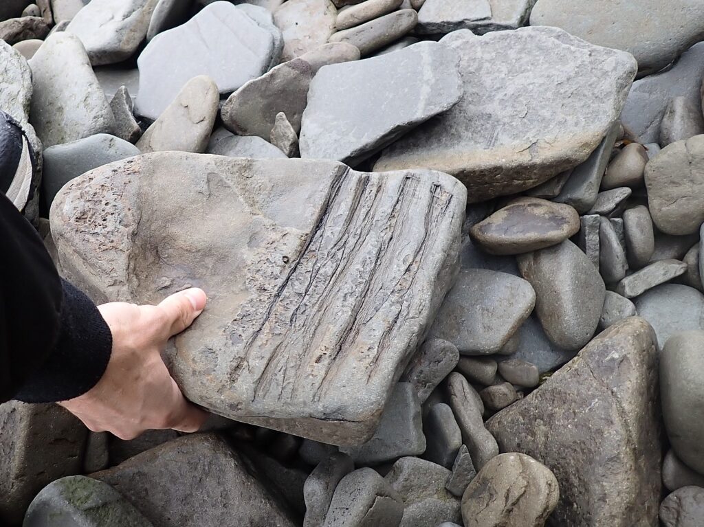
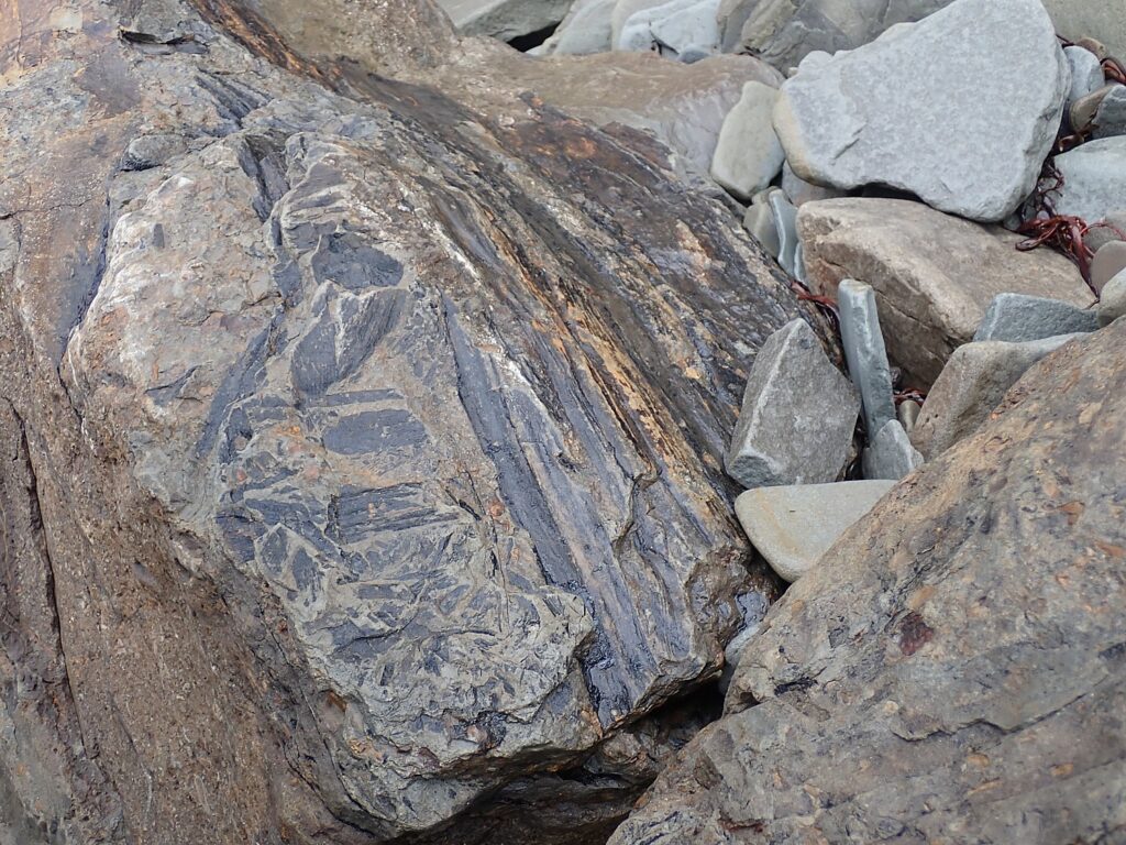
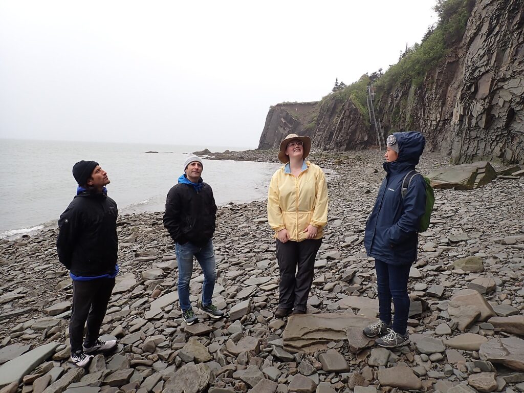
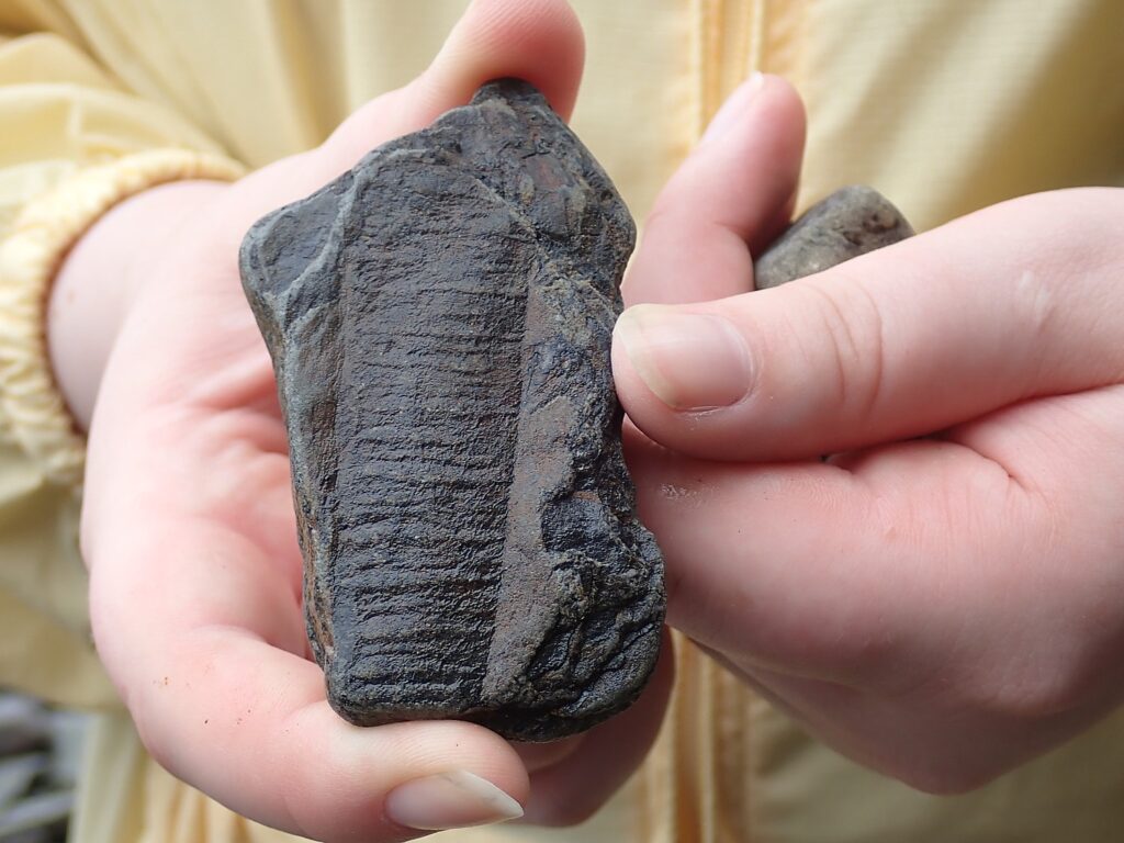
We start our visit on the rocky beach with two geology students who are interning here, who show us a literal field of fossils – plant, insect, tree fossils 320 million years old.

“The rocks on cliffs erode and fall away, like turning a page in a book, exposing fossils,” Evelyn, our Cape Enrage guide says © Karen Rubin/goingplacesfarandnear.com

It is astonishing how plentiful the fossils are, just about everywhere we walk we spot one. It’s why Cape Enrage is one of the sites within the UNESCO-designated Fundy Biosphere Reserve (www.fundy-biosphere.ca). We find fossils of vascular plants that pre-dated trees even before dinosaurs. “There wasn’t grass when dinosaurs lived, grass is relatively recent, our guide, Evelyn, a second-year geology student, tells us. “The rocks on cliffs erode and fall away, like turning a page in a book, exposing fossils.”  (This beach fossil tour is included in the admission price, but a more in-depth, two-hour fossil tour on a nearby beach is also available).

Walk the rocky beach at Cape Enrage to find 350-million year old fossils of early plants and trees © Karen Rubin/goingplacesfarandnear.com

The activities depend on tide and weather – we have to wait for a lightning storm to pass before Eric and David try ziplining. Then we have to wait for the tide to pull back from the cliffs before we can rappel – it is stunning to walk back toward the beach we had just been walking on, to see it submerged.

Walk the rocky beach at Cape Enrage to find 350-million year old fossils of early plants and trees © Karen Rubin/goingplacesfarandnear.com

We wait out the weather enjoying a delightful early lunch in the Cape House Restaurant, with lovely views of the bay (in clear weather, we would see Nova Scotia). Meanwhile, zipliners swing past the window, so we know the weather has passed.

Walk the rocky beach at Cape Enrage to find 350-million year old fossils of early plants and trees © Karen Rubin/goingplacesfarandnear.com

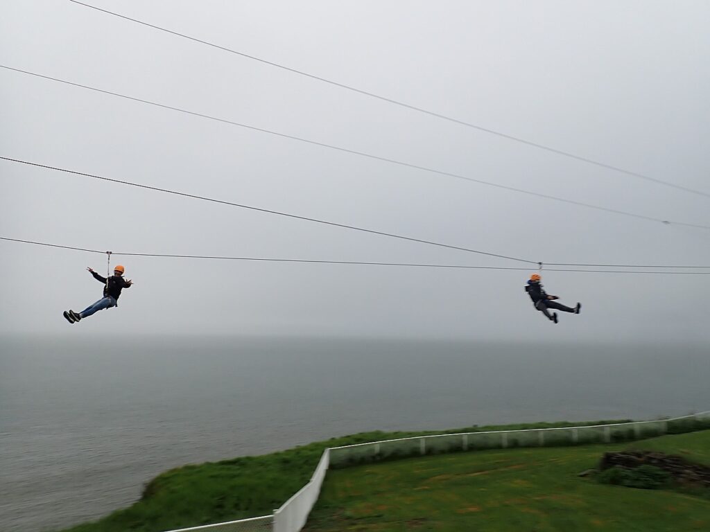
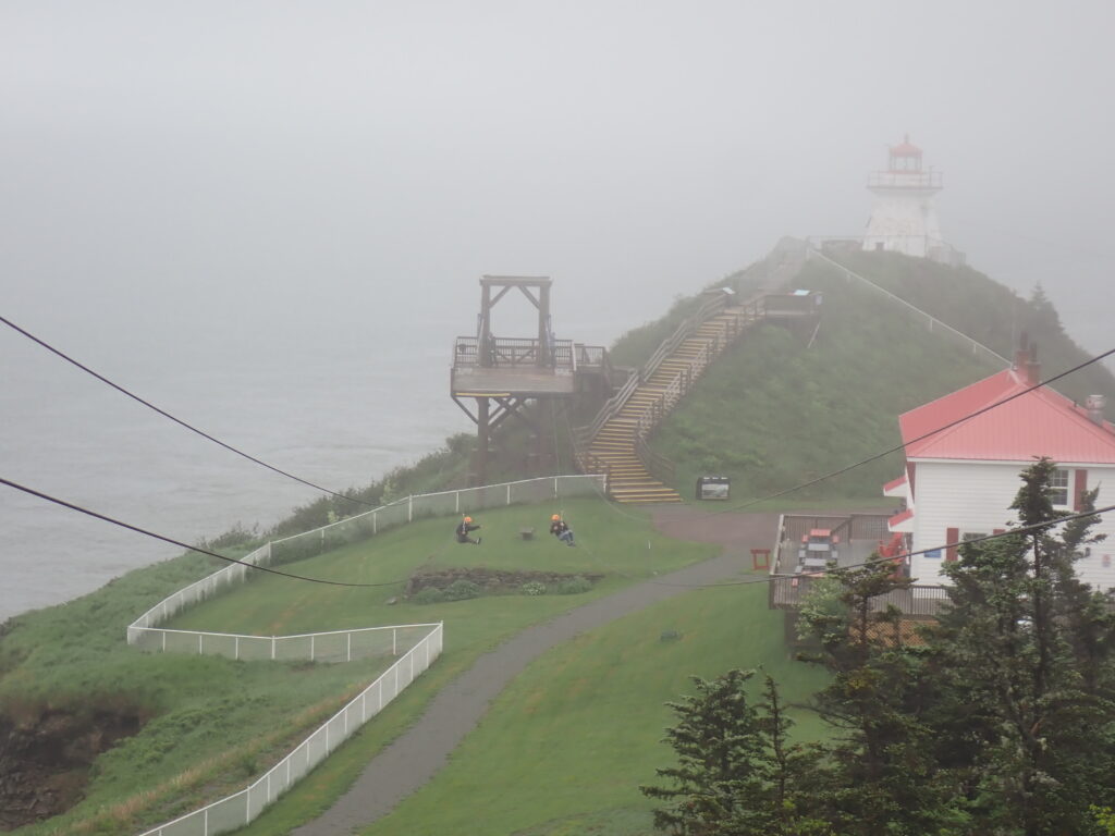
David and Eric get to do ziplining – a huge thrill and so fun to sail over the water at high tide to a tower next to the lighthouse. They get three runs, with the guides suggesting different techniques each time (excellent preparation for rappelling, as it turns out).

Ziplining at Cape Enrage © Karen Rubin/goingplacesfarandnear.com

Next up: rappelling off 140-foot high cliffs back down to the beach.

None of us have done rappelling before. (David and Laini do rock climbing, and ziplining, especially when Eric and David step off backwards, is excellent preparation.)

Ziplining at Cape Enrage © Karen Rubin/goingplacesfarandnear.com

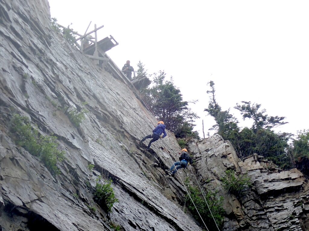
Our experience starts with training in how to rappel. We are in the hands of gentle, masterful guides, Morgan and Isaac, who manage to alleviate any anxiety whatsoever (I am really, really surprised at myself, but it helped that earlier, I had watched a couple from Indiana rappelling effortlessly).It is that first step backwards off the platform that is the hardest (that leap of faith that seems to crop up often in life). They talk us through, all the way down.

No fear as we try rappelling off the 140-feet high cliffs at Cape Enrage © Karen Rubin/goingplacesfarandnear.com

When we get passed a ledge, we dangle and just let the rope pass through our fingers to lower ourselves down to the beach.  You get two-hours, including the training, to rappel as many times as you like. It starts to rain heavily during our second try, but we are now so confident, the rain doesn’t faze.

This whole activity center was started in order to save the Cape Enrage Lighthouse. First built in 1838 (the light came on in 1840 and the keeper only got half pay because he only had a foghorn), the lighthouse was replaced in 1870 and then again in 1902, which is the one that stands today. When the wooden lighthouse was to be demolished, Dennis Tate and his wife, both school teachers, made a deal to take over the lighthouse, and clearly found ways to sustain it. (The Coast Guard still operates the light and foghorn. It’s been foggy and rainy and sure enough, the foghorn sounds.)

What a difference! The Cape Enrage beach at low tide…. © Karen Rubin/goingplacesfarandnear.com 

The province owns the park, but Cape Enrage is operated by a nonprofit, Cape Enrage Interpretive Center Inc., and employs 12 paid student interns and volunteers. Jim Campbell (who retired from managing a trucking company), became general manager in 2020.

We wind up staying 6 hours, from 9:30 am-3:30 pm – long enough to see an entire change of the “highest tides in the world”.

… The Cape Enrage beach at high tide© Karen Rubin/goingplacesfarandnear.com

Admission to Cape Enrage is $7.50A, $25/family which includes the guided fossil tour on the beach. You can buy separate tickets for one hour of ziplining (3 runs per person, $53.90, single run, $26.95), and two hours of rappelling (which can be three or four times plus the training, $99.95), or combination tickets that bundle zipline and rappel ($139.95). In addition, there is a separate two-hour fossil tour, Logjam, along a different beach ($19.50). (Prices are in Canadian dollars, which at this writing was about 25% less than the US dollar.)

Cape Enrage, 888-423-5454, www.capeenrange.ca.

Fundy National Park

Back in Alma, we go to explore Fundy National Park. This beautiful area has 25 waterfalls, 25 hiking trails, the world’s oldest red spruce tree (400 years old), several campgrounds, rivers, and lakes. This park, which is celebrating its 50th anniversary this year, is part of the Fundy Biosphere Reserve — an area of 1,062,553 acres that is protected by UNESCO. (https://parks.canada.ca/pn-np/nb/fundy).

Fundy National Park is huge and it would take a few days to really see it. We get a small taste of it this afternoon:

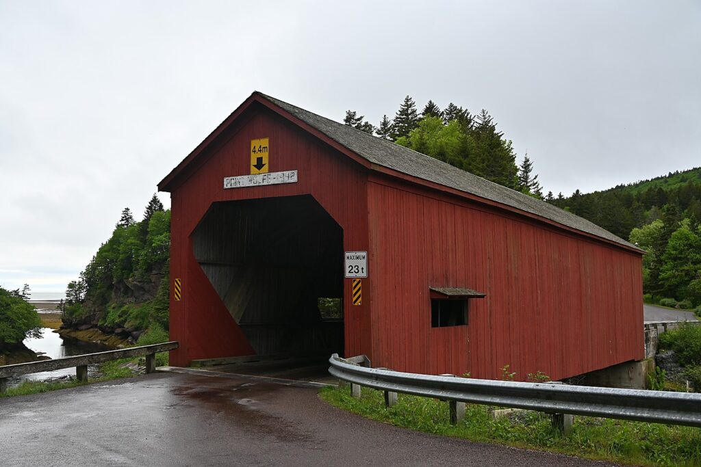
Point Wolfe Covered Bridge, Fundy National Park © Karen Rubin/goingplacesfarandnear.com

Driving along Point Wolfe Road bring us to the picturesque Point Wolfe Covered Bridge. “There are 141 covered bridges in Canada and 58 of them are in New Brunswick. Covered bridges are part of our historical and cultural identity. We refer to them as Kissing Bridges because back in the days of horse and wagon young couples would stop in the middle of the bridge to kiss in privacy,” Neil Hodge of New Brunswick Tourism said.

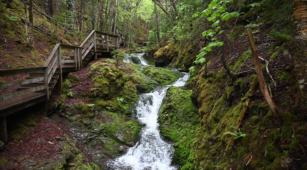
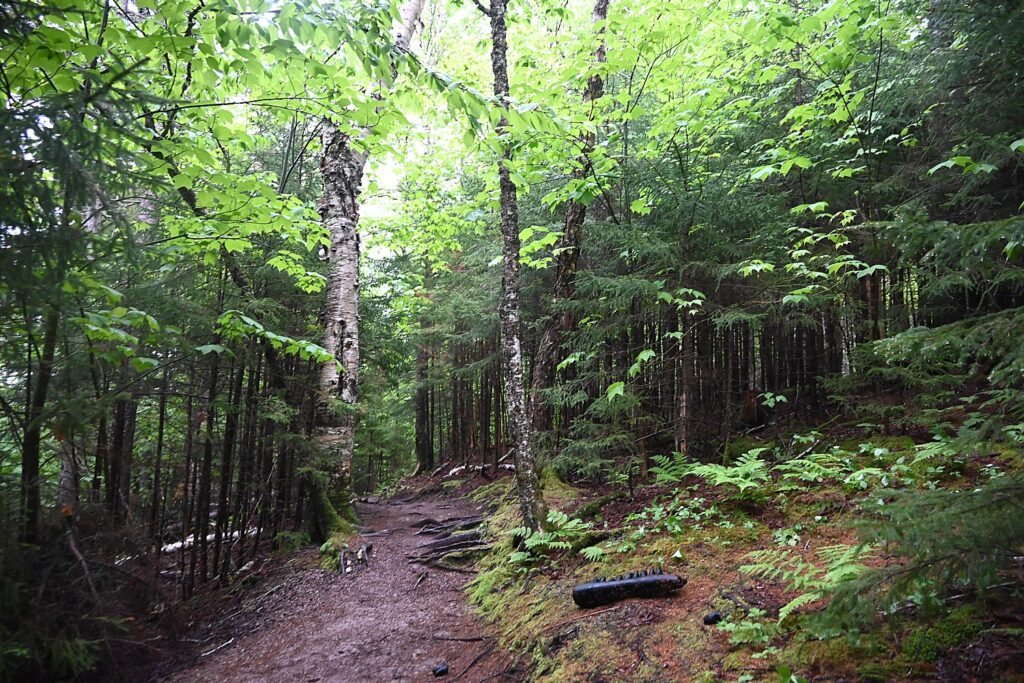
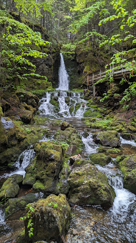
An enchanting trail leads to Dickson Falls in Fundy National Park © Karen Rubin/goingplacesfarandnear.com

Just a five minute drive back toward Alma from the bridge we pull into a parking area for one of the true must-see, must-do highlights of the park: Dickson Falls, the most photographed waterfalls in Fundy National Park (for good reason). It’s an enchanting walk on an easy trail through the lush forest with splashes of neon green, then on across a wooden boardwalk and bridges along a gurgling brook. It takes less than an hour to do the trail, and it is so beautiful, that instead of finishing the loop, we back track to do the trail through the forest again in reverse.  

Dickson Falls, a highlight of Fundy National Park © Karen Rubin/goingplacesfarandnear.com

For our second night in Alma, we thoroughly enjoy The Alma Boathouse (8588 Main Street) which graciously stays open for us. (Restaurants close early in Alma.)

Fundy National Park, the Fundy Parkway Trail, Cape Enrage and Hopewell Rocks are all located within the UNESCO-designated Fundy Biosphere Reserve (www.fundy-biosphere.ca).

Travel planning assistance from Tourism New Brunswick, 800-561-0123, www.tourismnewbrunswick.ca.

Next: New Brunswick Roadtrip: Hopewell Rocks

See also:

NEW BRUNSWICK ROADTRIP BEGINS IN ST. ANDREWS

NEW BRUNSWICK, CANADA ROADTRIP: SAINT JOHN, CITY OF FIRSTS, OLDESTS, AMAZEMENTS

____________________________

© 2023 Travel Features Syndicate, a division of Workstyles, Inc. All rights reserved. Visit goingplacesfarandnear.com, www.huffingtonpost.com/author/karen-rubin, and travelwritersmagazine.com/TravelFeaturesSyndicate/. Blogging at goingplacesnearandfar.wordpress.com and moralcompasstravel.info. Visit instagram.com/going_places_far_and_near and instagram.com/bigbackpacktraveler/ Send comments or questions to [email protected]. Tweet @TravelFeatures. ‘Like’ us at facebook.com/KarenBRubin