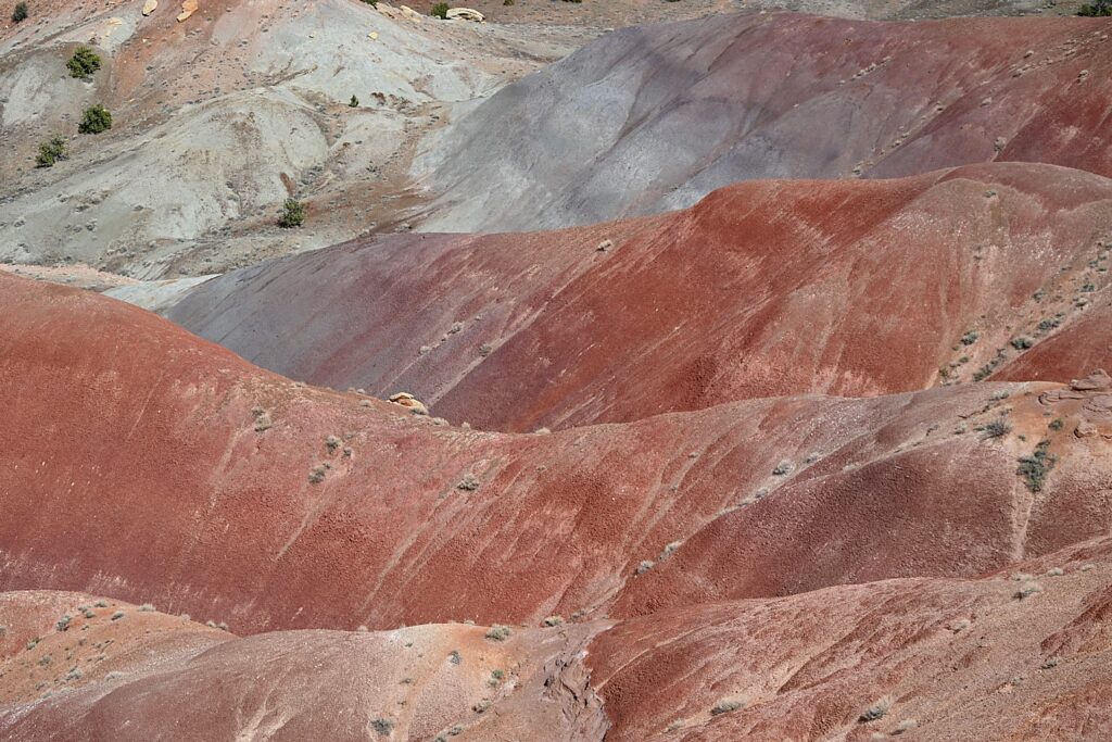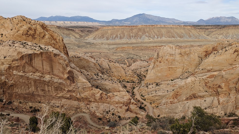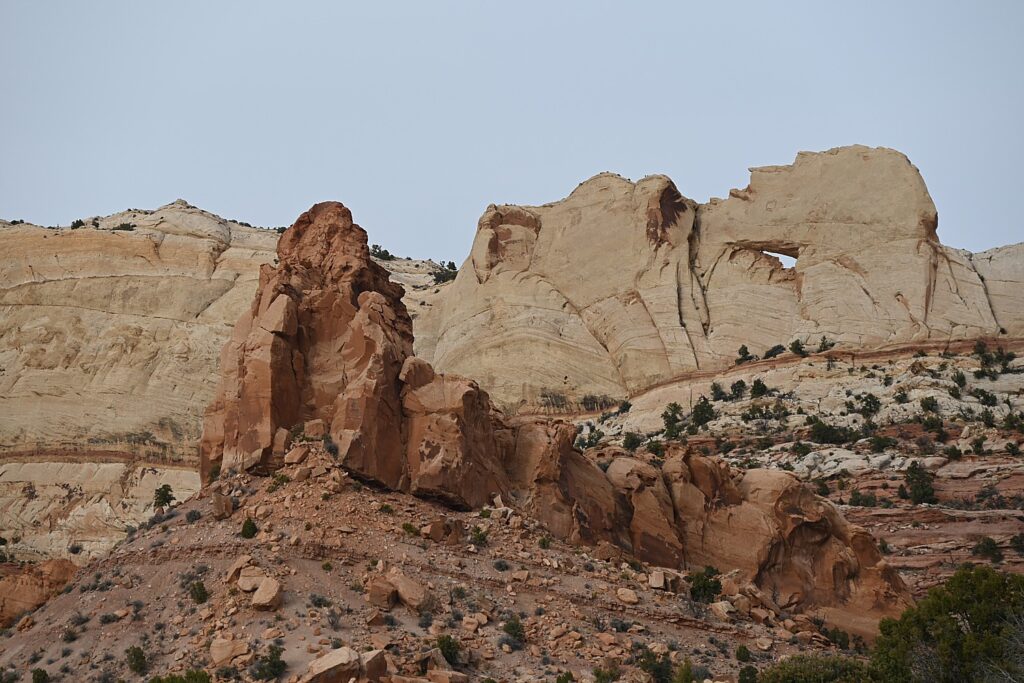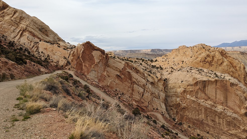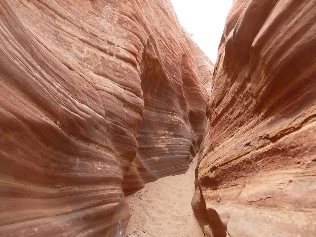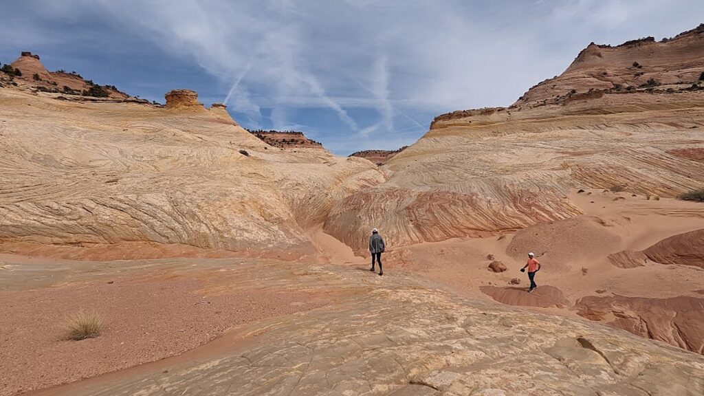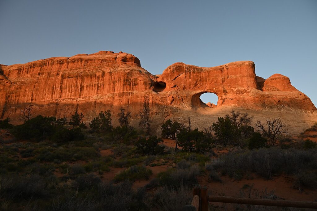
Tag Archives: Visit Utah

Utah Adventure Day 8: Arches National Park, a Geologic Wonderland

Sunrise on the Landscape Arch, Devils Garden Trail, Arches National Park © Karen Rubin/goingplacesfarandnear.com

By Karen Rubin, with Laini Miranda and Dave E. Leiberman

Travel Features Syndicate, goingplacesfarandnear.com

Arches National Park is a fantastical place, a geologic wonderland, and being able to wake up before the sun in the Devils Garden Campground and stroll along the Devils Garden Trail as the formations come alive with color, is extraordinary.

Arches’ sprawling landscape of 2,000 natural stone arches – the highest concentration of arches on the planet – plus hundreds of soaring pinnacles, massive rock fins, giant balanced rocks, coupled with its accessibility and ease of getting around (well, except for traffic and difficulty finding parking) and access (through Moab) draws hundreds of thousands of visitors each year, making it one of the most popular national parks. Indeed, Arches is so popular (and crowded) that it requires advance purchase, timed entry reservations just to enter, between April 1 and October 31.
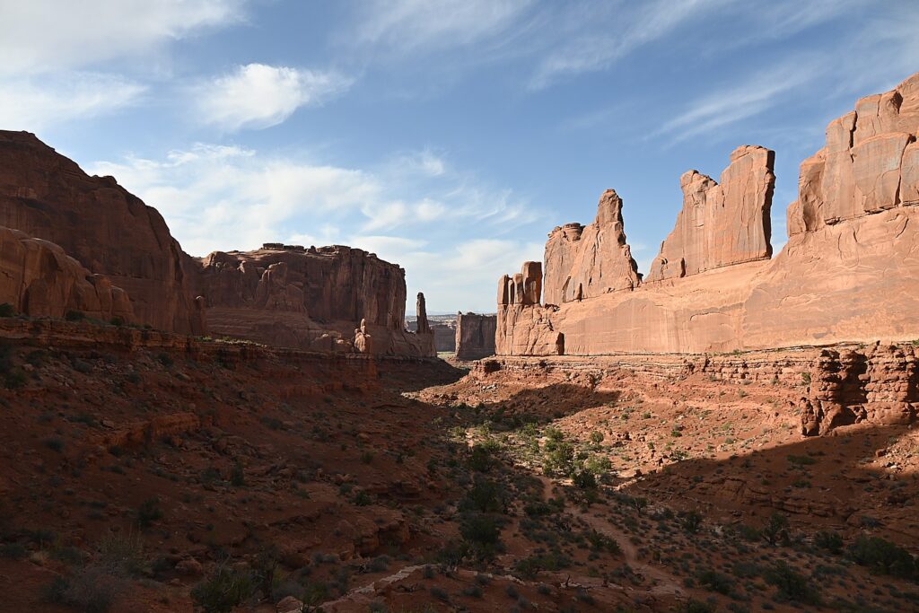
Arches National Park is a geologic wonderland © Karen Rubin/goingplacesfarandnear.com

We are lucky because Laini has cleverly booked two nights at the Devils Garden campground months before our trip. The campsite reservation acts as the entry ticket and for this reason but especially because of being immersed in the landscape, this is the absolute best way to experience Arches National Park. (Devils Garden Campground is pen year-round, with 52 sites, reservations for individual sites can be made up to six months in advance; for group sites can be reserved up to year in advance, www.nps.gov/arch)
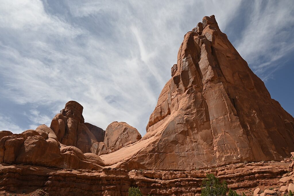
Arches is the most touristic of all the places we have visited this trip and offers such a contrast with the wild camping and communion with ancient spirits (Bears Ears), the remote unmarked hikes (Grand Staircase-Escalante), the long meandering hikes (Capitol Reef) and our search through muck and mud to find archaeological sites (Glen Canyon).

Here, we go sightseeing for the dazzling arches that give the park its name, like the amazing Double Arch, the Windows, Landscape Arch and Delicate Arch, accessed along paved paths from parking lots, with restroom facilities.
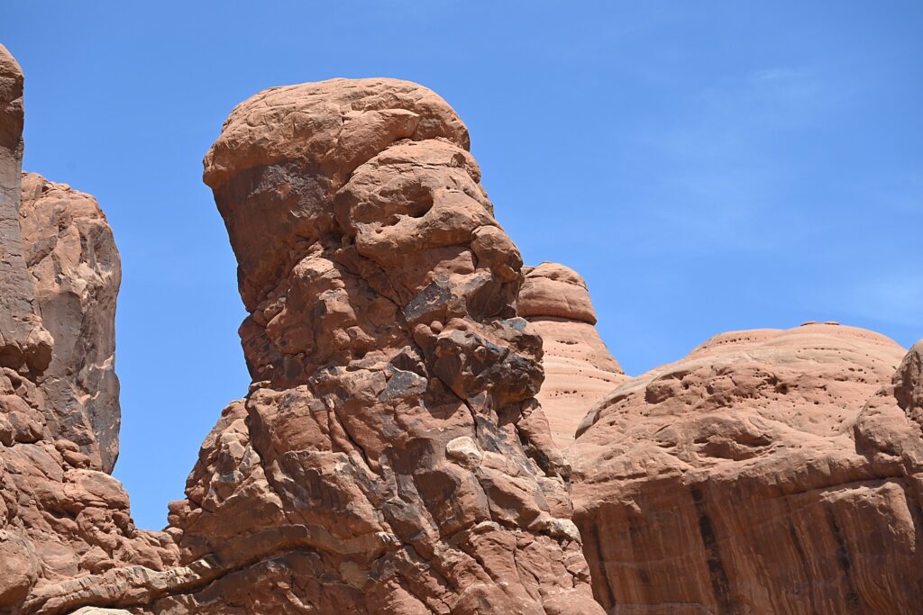
A formation in Arches National Park that looks like Croesus had just been turned to rock © Karen Rubin/goingplacesfarandnear.com

Throughout Arches, there are formations – eroded monoliths – that inspire names, like Parade of Elephants, Petrified Dunes, Tower of Babel and Fiery Furnace, also trigger imagination. Some look so much like mudmen, we name them (we rechristen Balanced Rock “E.T.”, the Gossips we rename “The Suffragists,” and formations that look to me as if Nefertiti and Croesus had just been turned to rock.
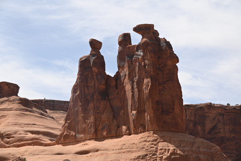
The formation once known as “The Gossips” we re-name “The Suffragists” Arches National Park © Karen Rubin/goingplacesfarandnear.com

The source of what we see is a salt bed, thousands of feet thick in places, that was deposited across the Colorado Plateau 300 million years ago when a sea flowed into the region and eventually evaporated, according to the Arches National Park notes. The salt bed was unstable and unable to hold the weight of the thick cover of rock formed from compressed debris. It shifted, buckled, liquefied and repositioned, thrusting rock layers upward as domes, while whole sections fell into cavities.
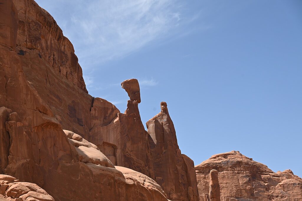
Doesn’t this rock formation look like Nefertiti? Imaginations run wild in Arches National Park © Karen Rubin/goingplacesfarandnear.com

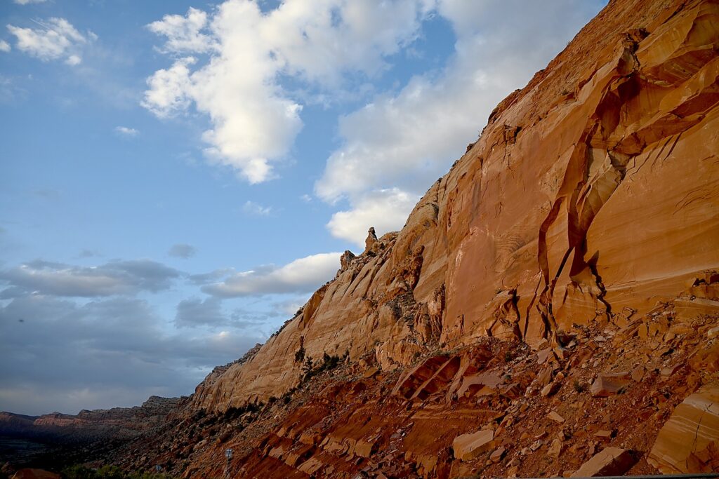
Faults make the surface even more unstable. From the visitor center, you can see the result of a 2,500-foot displacement, the Moab Fault. The faults caused vertical cracks and wind and water over 100 million years of erosion and weathering, ultimately formed the arches of salmon-colored Entrada Sandstone and buff-colored Navajo Sandstone.

The process is ongoing – new features are being formed as old ones are transformed.

Sometimes the changes happen suddenly, violently. That was the case at the Skyline Arch, just next door to Devils Garden, where a massive boulder tumbled down in the 1940s, expanding the arch.
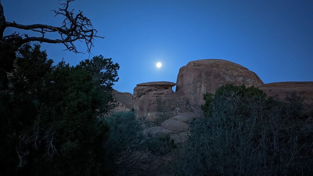
Waking before sunrise with the moon in Devils Garden Campground, Arches National Park © Karen Rubin/goingplacesfarandnear.com

The most ambitious hikes in Arches National Park are to the Double O Arch (4.1 miles); the Primitive trail (2.1 miles one way, considered most difficult), and if you would do the whole Devils Garden Trail (7.8 miles, that goes to the Landscape Arch, Double O Arch, Dark Angel along a primitive trail, with narrow ledges, rock scrambling and few trail markers; be sure to take enough water— 1 liter of water per person, per hour).

We do none of these, holding out for our most ambitious hike, to Delicate Arch, for sunset but I already have my trepidations.

And, in addition to the outstanding Devils Garden trail, from the campground (which feels luxurious to us for its restrooms and running water), you can hikethe Broken Arch Loop Trail which runs past Tapestry Arch and Broken Arch, then swings south towards Sand Dune Arch and back up passed Skyline Arch before returning to the campground. (Unfortunately, we don’t have time for that hike. Next time!)
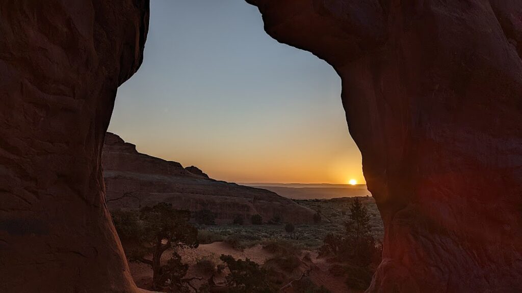
Sunrise in Devils Garden, Arches National Park © Karen Rubin/goingplacesfarandnear.com

For my sunrise hike, I do the easy, paved trail, rushing to get to a good position for photos, and then continue on to do more of it, going to where I see the famous Landscape Arch. After my walk through the easy part of the Devils Garden Trail (it is surprising how fast the sun comes up, washing out the colors), I go back to the campsite where we have breakfast.
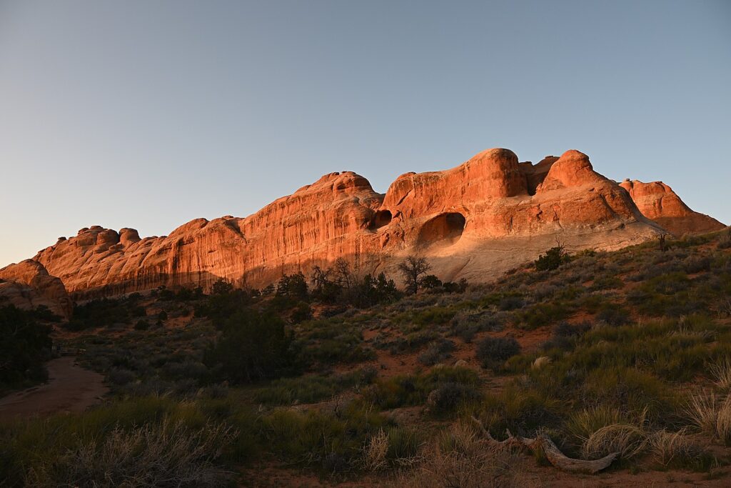
Sunrise in Devils Garden, Arches National Park © Karen Rubin/goingplacesfarandnear.com

(Actually, we have to move from one campsite to another for our second night and Dave and Laini figure out to just put the tent with the sleeping bags and stuff on top of the Jeep and drive it over, which we do by check-out time.)
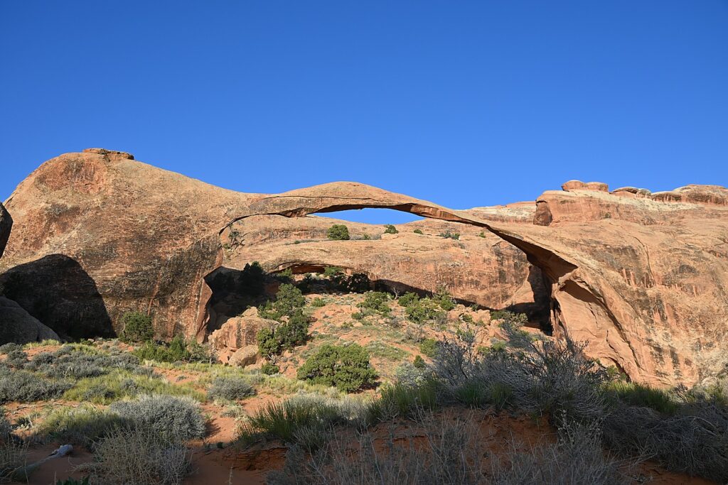
Landscape Arch, Devils Garden, Arches National Park © Karen Rubin/goingplacesfarandnear.com

We then set out to explore Arches.

We only have one full day at Arches National Park, and it’s the end of our hiking/camping adventure, so we kind of go with the flow. We drive to the different sites, and do short hikes up to the various formations, basically doing the tourist thing.
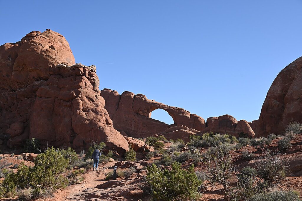
An easy trail takes you to the Skyline Arch, Arches National Park © Karen Rubin/goingplacesfarandnear.com

We follow a route, starting with the Skyline Arch adjacent to Devils Garden. Dave climbs to the top of that humongous boulder that fell down (scary to contemplate). The Skyline Arch Trail is short and easy, less than a half-mile roundtrip hike from the parking lot and back. The arch itself is one of the more popular landmarks in Arches. It makes for spectacular photographs, owing to its position, literally, on the skyline. And its proximity to the Devils Garden Campground makes it a perfect hike if you arrive late in the afternoon. (We arrived too late.)
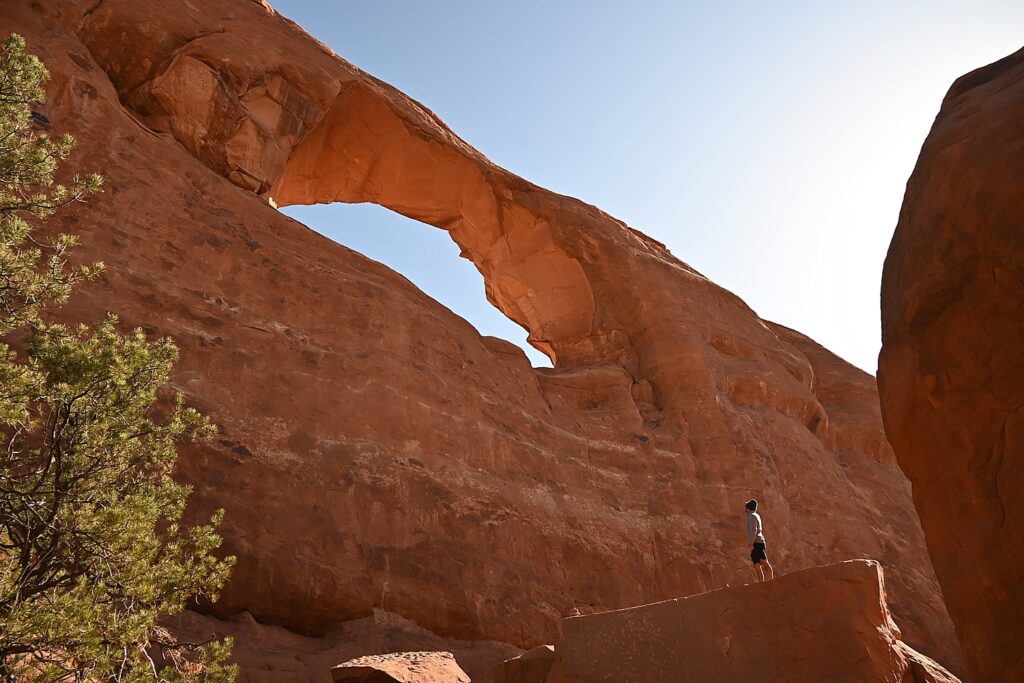
Dave climbs atop of a boulder that came off the Skyline Arch © Karen Rubin/goingplacesfarandnear.com

We go next to the observation area that overlooks The Fiery Furnace, a labyrinth of narrow sandstone canyons. (Hiking the Fiery Furnace requires agility and a permit, or a ticket for a ranger-led hike that must be reserved in advance through Recreation.gov; one route is marked, but getting lost is still possible.)
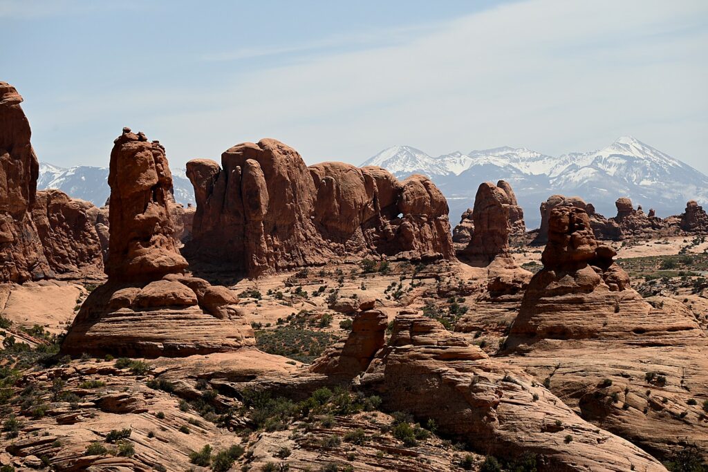
The Fiery Furnace, contrasted against snow-capped peaks, Arches National Park © Karen Rubin/goingplacesfarandnear.com

Next, we drive to one of the famous highlights of Arches (there are many, but this one is tops for me): the Double Arch Viewpoint and Trail. The tallest arch in the park at 122 ft., there seems to be this intricate dance between the two arches. An easy gravel path leads to the base of the two huge, arching spans. Of course Dave and Alli climb up to the arches, while Laini draws.
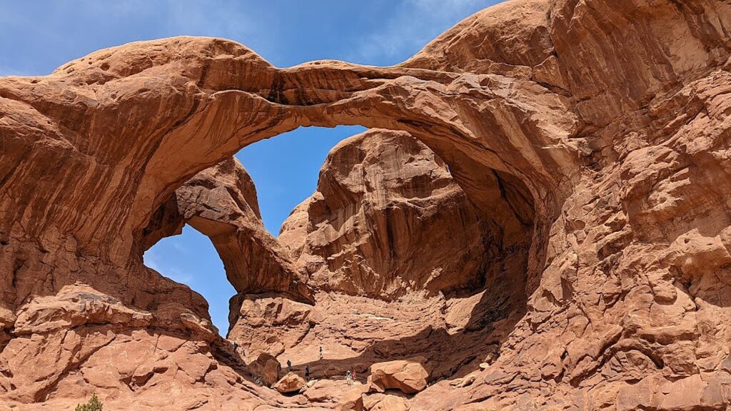
There seems to be an intricate dance between the two arches of the Double Arch, Arches National Park © Karen Rubin/goingplacesfarandnear.com

Balanced Rock is another signature landmark and just about everyone (who can get a parking space) walks the short hike around the base for up-close perspectives. We re-name Balanced Rock E. T. because from a certain angle, it’s a dead ringer for the endearing character.
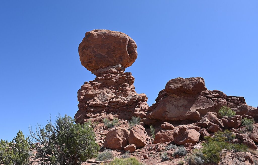
“Balanced Rock”is a dead-ringer for the beloved E.T., Arches National Park © Karen Rubin/goingplacesfarandnear.com

(The Arches National Park newsletter guide is invaluable – it recommends how much water to take, and gives excellent information about distance and time and difficulty for each of the hikes.)

Dinosaurs, Indians!

Arches National Park (believe it or not), has no food or lodging (that is, beyond the sensational Devils Garden campground) – so we drive out of the park into the delightful, hopping town of Moab for lunch at the food truck park, and a bit of shopping.

From here, we drive a short distance to where Laini promises we will encounter both dinosaurs and Indians.
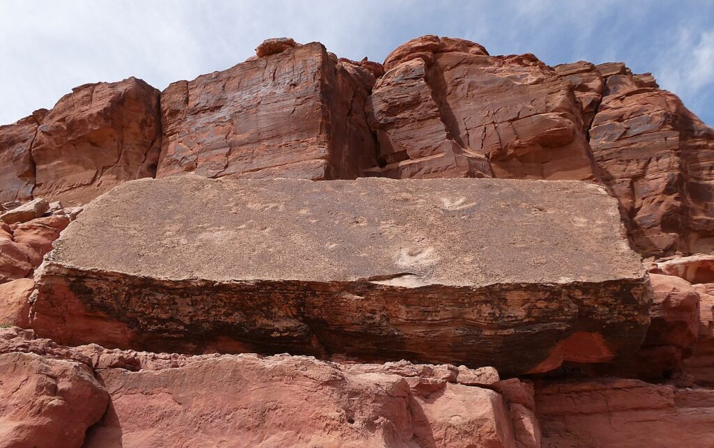
Tracks made by three-toed meat-eating dinosaurs can be seen at the Poison Spider Dinosaur Tracksite and Rock Art Trail © Karen Rubin/goingplacesfarandnear.com

We drive along Utah Scenic Byway 279 to the trailhead of the Poison Spider Dinosaur Tracksite and Rock Art Trail. It’s a quarter-mile walk up a steep, crumbly trail up a rocky hillside to two rock slabs where tracks made by three-toed meat-eating dinosaurs can be seen, as well as a wall with a good collection of petroglyphs.

This area was once a vast sand dune sea, known as an erg. These tracks would have been found along the edge of a lake between dunes. As the wind would blow across the dunes these tracks would have been gently buried in shifting sand and preserved. The preserved tracks were unearthed when the slabs fell from the sandstone cliffs above.

The trail switchbacks up the hill before coming alongside the petroglyph wall and then descends back to the parking lot. (Use caution: though short, there are a few steep areas and the trail can be hard to follow.)

(From this trailhead you can also connect to the Longbow Arch hiking trail that goes into a canyon to an arch, 2.4 miles roundtrip.)
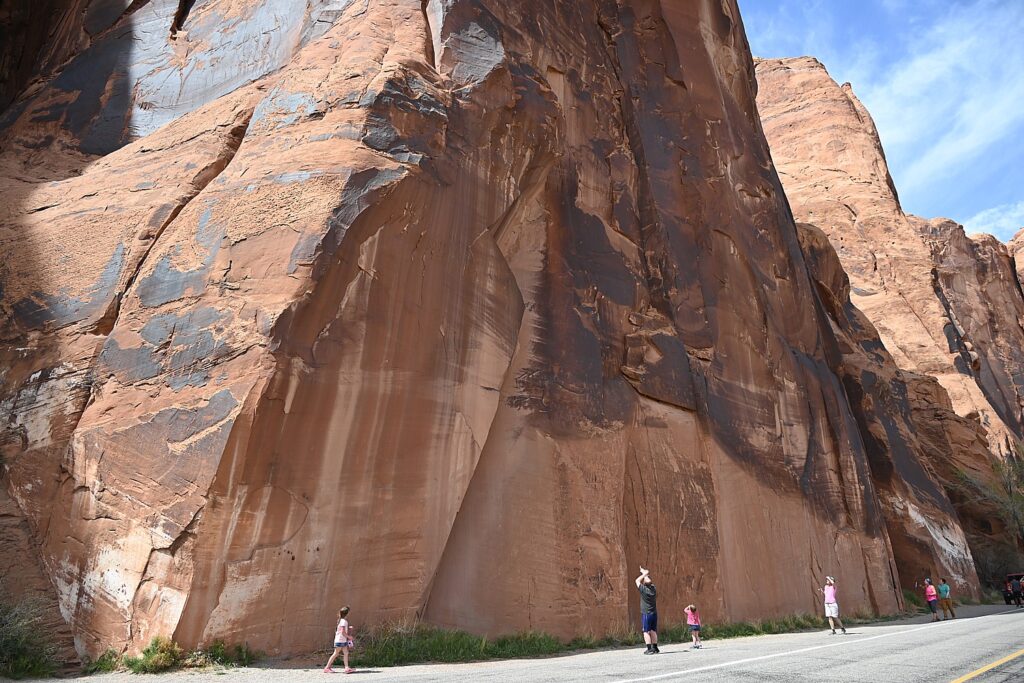
The astonishing Utah Highway 279 Rock Art Site, where a huge rock wall face has the most amazing sets of petroglyphs and pictographs, Moab © Karen Rubin/goingplacesfarandnear.com

A short distance along Potash Road is the Utah Highway 279 Rock Art Site, where a huge rock wall face has the most amazing sets of petroglyphs and pictographs. It looks like a museum exhibit, except this is where they were made and it is astonishing to contemplate that this is where people so very long ago stood here and carved and painted them.
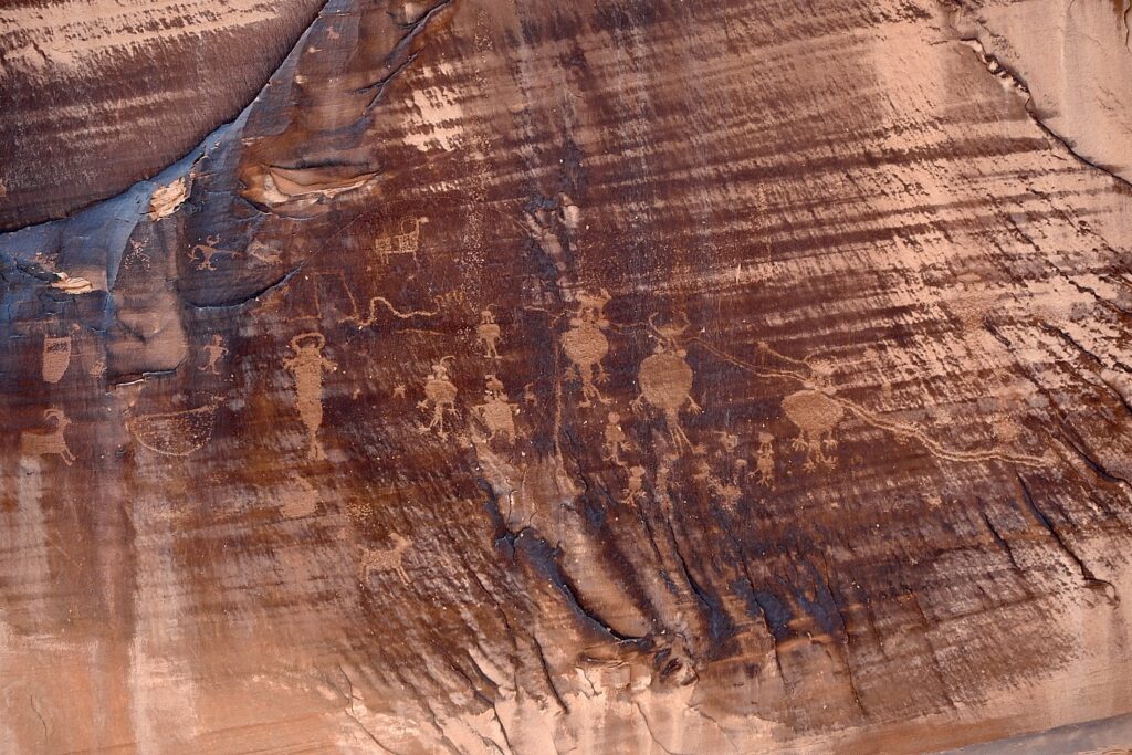
The astonishing Utah Highway 279 Rock Art Site, where a huge rock wall face has the most amazing sets of petroglyphs and pictographs, Moab © Karen Rubin/goingplacesfarandnear.com

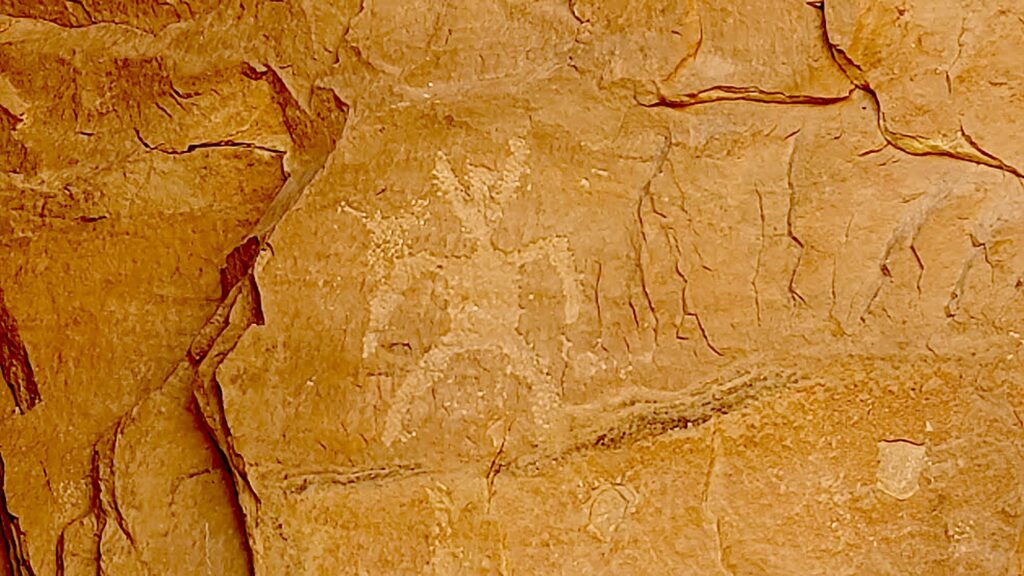
Archaeologists believe most of the rock art found here was created during the Archaic (6,000 – 1,000 B.C.) and Fremont (450-1300 A.D.) cultural periods. The art consists of pictographs (painted images) and petroglyphs (pecked, incised or chiseled images). The majority of the rock art features anthropomorphic (human forms) and zoomorphic (animal forms) but there are also curvilean lines, zigzags, wavy lines, concentric circles and abstract symbols. Sometimes both Archaic and Fremont petroglyphs can be found on the same rock art panel.
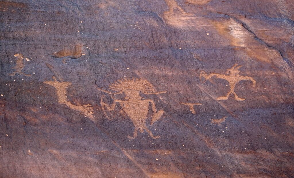
The astonishing Utah Highway 279 Rock Art Site, where a huge rock wall face has the most amazing sets of petroglyphs and pictographs, Moab © Karen Rubin/goingplacesfarandnear.com

Some of the rock art panels depict religious rituals and are considered sacred sites. Some depict migration routes, fertility, hunting, ceremonies, and cosmic events.
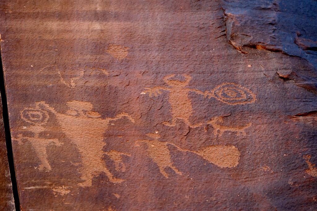
The astonishing Utah Highway 279 Rock Art Site, where a huge rock wall face has the most amazing sets of petroglyphs and pictographs, Moab © Karen Rubin/goingplacesfarandnear.com

These petroglyphs were exposed when the road was widened, and it is a surreal experience to see these magnificent, huge murals just along the road – especially because it is beside a section popular with rock climbers (one was prosecuted for rock climbing where the protected petroglyphs are).

Fremont rock art often depicts trapezoidal anthropomorphs with horns, bighorn sheep, dogs, hunting scenes with weapons, and abstract objects – and sure enough, we see plenty of examples – there are horned anthropomorphs holding shields and paper doll-like cut-outs; at the southern end of the panel, we see a large bear with a hunter at its nose and another hunter over its back. The notes say this art is 3000 to 8000 years old.
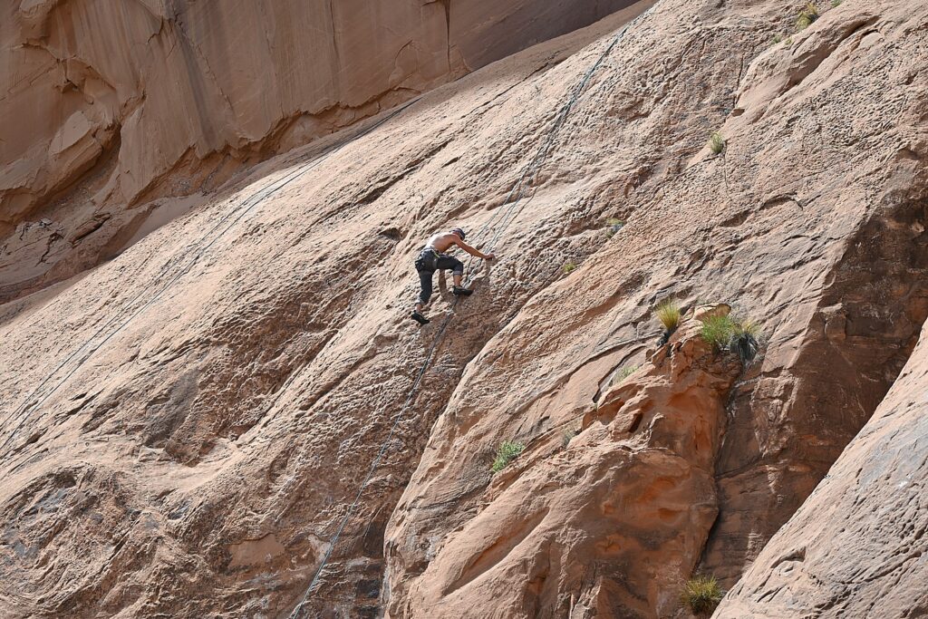
The ancient rock-art panels are next to a popular rock climbing place © Karen Rubin/goingplacesfarandnear.com

At the northern end of the panel, round holes carved into the sandstone underneath the left side would have once held roof poles of a structure which was excavated by archaeologists before the road construction. The rock panels extend 125 feet along Potash Road.

Sunset and Star-Gazing

We return to Arches National Park for sunset (there is still a long line of cars getting in with their timed admission tickets, but because we are camping, we breeze right in).

Laini suggests we hike the 3 miles roundtrip to Delicate Arch for the sunset, but I’m actually dreading it (my feet are actually bleeding from yesterday’s 11-mile Kane Gulch hike – the folly of hiking in boots that haven’t been broken in).

My trepidation comes from the description of the hike: The Delicate Arch hike is ranked difficult – the trail climbs 480 feet up a steep slickrock slope, and just before you get to Delicate Arch, follows a narrow rock ledge for about 200 yards). I am especially nervous about hiking the 1.5 miles back in the dark.

Laini, who has done the hike on their previous trip, admits she also has been dreading it but only wanted to do it for me, because I would have been disappointed not to see the iconic rock formation that Utah uses for its state symbol.

We set out and I ask what exactly we will see and she pulls up the photo she took on a previous trip. I suggest we not bother, but rather go to The Windows where I’ve been told is a popular place for sunset.

But before we leave the trail to the Delicate Arch, we explore the Wolfe Ranch historic site and walk a little further along a path to see an excellent example of historic Ute rock art – a huge bonus to coming here.
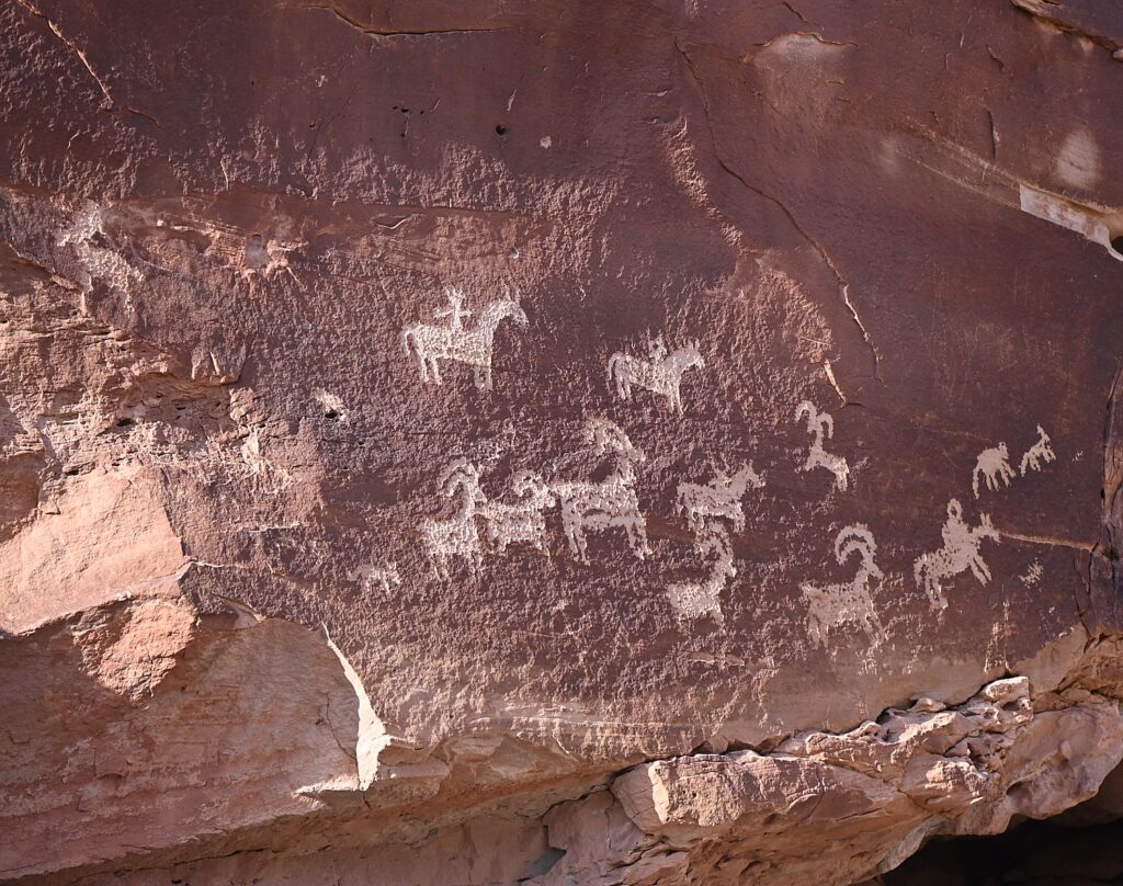
Historic Ute rock art at the Wolfe Ranch site, Arches National Park © Karen Rubin/goingplacesfarandnear.com

The panel depicts a stylized horse and rider surrounded by bighorn sheep and dog-like animals which are typical of Ute rock art. The petroglyphs were carved sometime between 1660-1860.

The historic marker is fascinating because it also shows photos of an Ute on horseback in 1909. “The Utes’ acquisition of horses by the mid-1600s radically changed the way they hunted, worked and traveled.” Another photo depicts a Ute warrior and his bride, circa 1873. Utah’s name is derived from the Ute Indians who moved into this area around 1300 AD.

I’m thrilled we came here, and even more thrilled to go to The Windows for the sunset, which I had read in the park’s newsletter (so helpful!) is one of the great spots to watch the sunset.
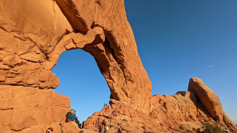
The Windows, a great place to watch the sunset in Arches National Park © Karen Rubin/goingplacesfarandnear.com

The Windows – just across from the Double Arch where we had been in the morning – is a pleasant half mile walk. We arrive just as the light is turning the rock deep gold, to orange, to red. I find a “comfortable” rock to sit on at the bottom of the arch while Dave, Laini and Alli (of course) climb up into the Windows.  Our view looks out to the Turret Arch and a wide open expanse, to where the sun dips below the horizon.
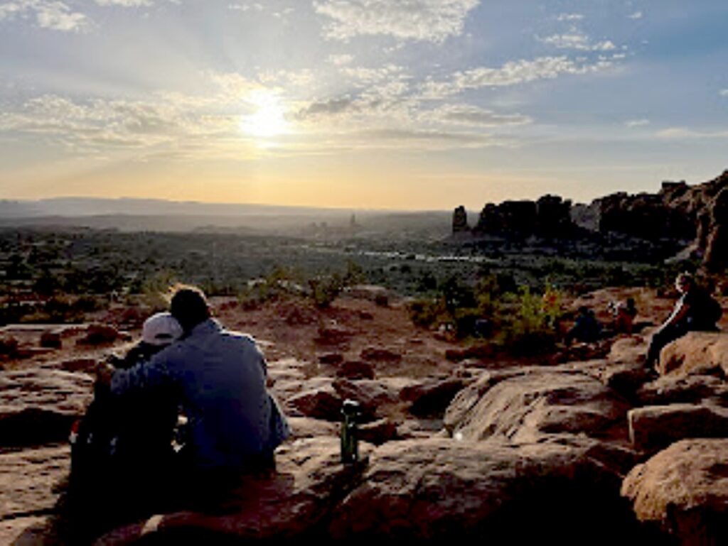
Watching the sunset from The Windows, Arches National Park © Laini Miranda/goingplacesfarandnear.com

We drive back to Moab to stop in for a bite and beer flight at Moab Brewery, and then return to the national park to do some stargazing before settling into our campsite.

Arches National Park is a great family park where a short walk brings you to many of the iconic features, and you can even see a lot from a car and the observation areas. Stop at the visitor center for advice, where you can watch an orientation film and see exhibits. A self-guiding audio tour is available. Ranger programs are offered seasonally.

For more information, and to reserve entry tickets and campsites, www.nps.gov/arch; info 435-719-2299; hiking info at https://www.nps.gov/arch/planyourvisit/hiking.htm
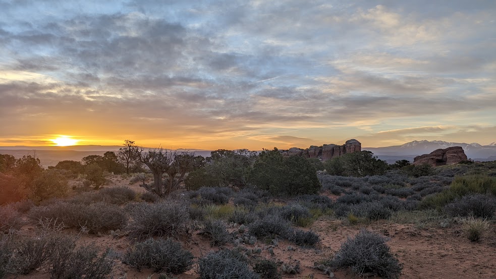
Sunrise from the Devils Garden Campground, Arches National Park © Karen Rubin/goingplacesfarandnear.com

On our last morning, I awake again before sunrise and scramble up a small hill across the road from our campsite for a different view.

We pack up quickly for our departure which also entails packing up the rental sleeping bags and pads, which we ship back to Moosejaw.com from Moab, pick up breakfast from a delightful cafe, and head out for the drive back to Salt Lake City and our flight home, having had the most marvelous Utah Adventure, a trip of a lifetime for me.

Trip planning tools are available at https://www.visitutah.com/.

Advance Purchase Tickets Required

From April 1 to Oct. 1, 2023, you need to secure in advance a timed entry reservation in order to enter Arches National Park between 7 a.m. and 4 p.m. Reservations must be secured three months in advance of the anticipated date of visiting Arches. A single booking of a timed entry ticket covers each registered visitor (an individual, couple, group or family). You can enjoy the park all day, entering and re-entering at will with the validated ticket. A $2 processing fee is added nto the standard park entry fee. Reservations are accepted on a first-come, first-served basis on Recreation.gov. (It may also be possible to obtain a limited number of tickets through Recreation.gov up to midnight the day before planning to visit the park.).

See:

UTAH ADVENTURE DAY 1-2: CAPITOL REEF’S COLORFUL CANYONS

UTAH ADVENTURE DAY 3-4: GRAND STAIRCASE-ESCALANTE POSES CHALLENGE

UTAH ADVENTURE DAY 4-5: DRIVING BURR TRAIL, EXPLORING GLEN CANYON, WILD CAMPING IN ARCH CANYON

UTAH ADVENTURE DAY 6: SACRED SITES, SPIRITS OF BEARS EARS NATIONAL MONUMENT

UTAH ADVENTURE DAY 6-7: HOUSE ON FIRE AMONG HIGHLIGHTS HIKING AMID SACRED SITES, SPIRITS OF BEARS EARS NATIONAL MONUMENT

______________________

© 2023 Travel Features Syndicate, a division of Workstyles, Inc. All rights reserved. Visit goingplacesfarandnear.com, www.huffingtonpost.com/author/karen-rubin, and travelwritersmagazine.com/TravelFeaturesSyndicate/. Blogging at goingplacesnearandfar.wordpress.com and moralcompasstravel.info. Visit instagram.com/going_places_far_and_near and instagram.com/bigbackpacktraveler/ Send comments or questions to FamTravLtr@aol.com. Tweet @TravelFeatures. ‘Like’ us at facebook.com/KarenBRubin 
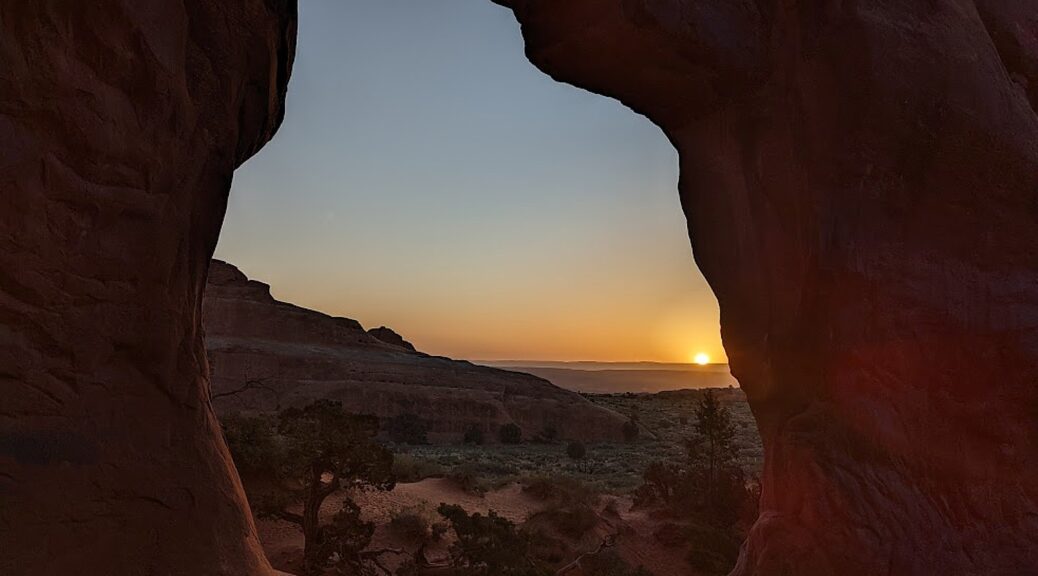
Utah Adventure Day 6-7: House on Fire Among Highlights Hiking Amid Sacred Sites, Spirits of Bears Ears National Monument

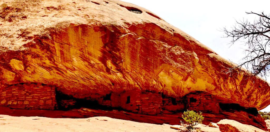
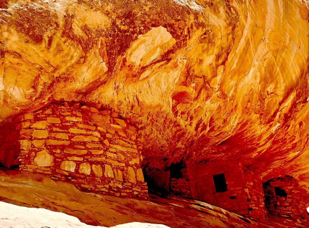
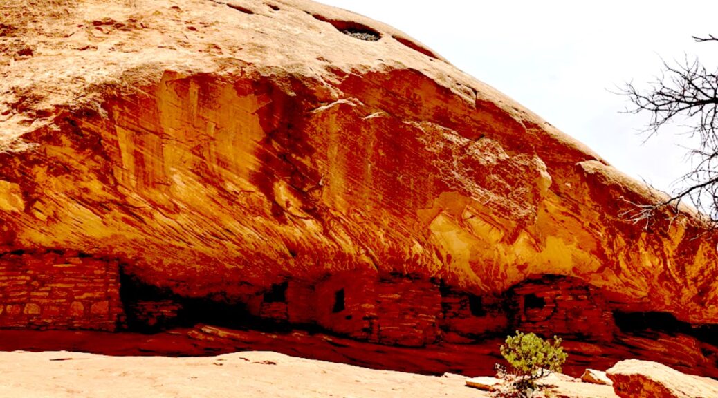
House on Fire is one of the most photographed – and dramatic – archeological sites in Bears Ears National Monument-Cedar Mesa © Karen Rubin/goingplacesfarandnear.com

By Karen Rubin, with Laini Miranda and Dave E. Leiberman

Travel Features Syndicate, goingplacesfarandnear.com

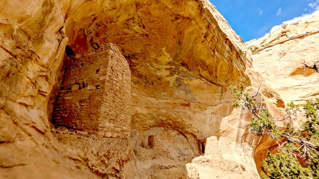
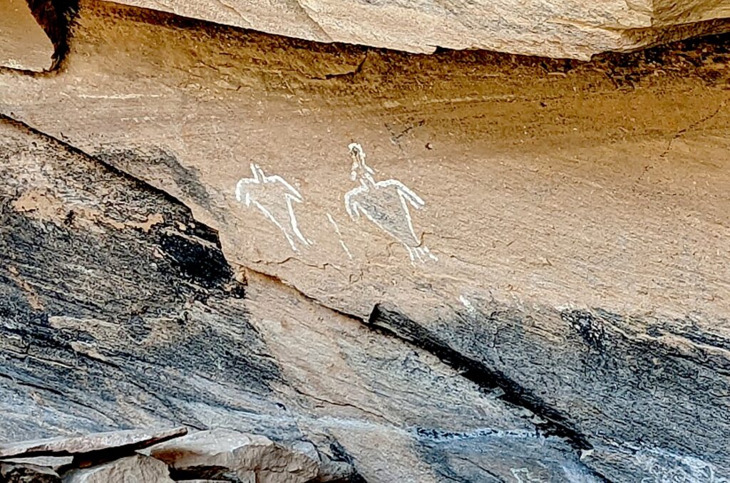
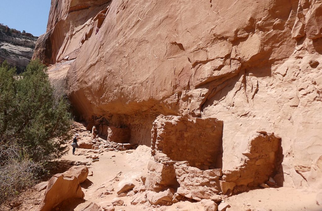
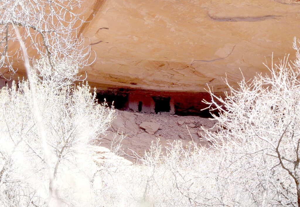
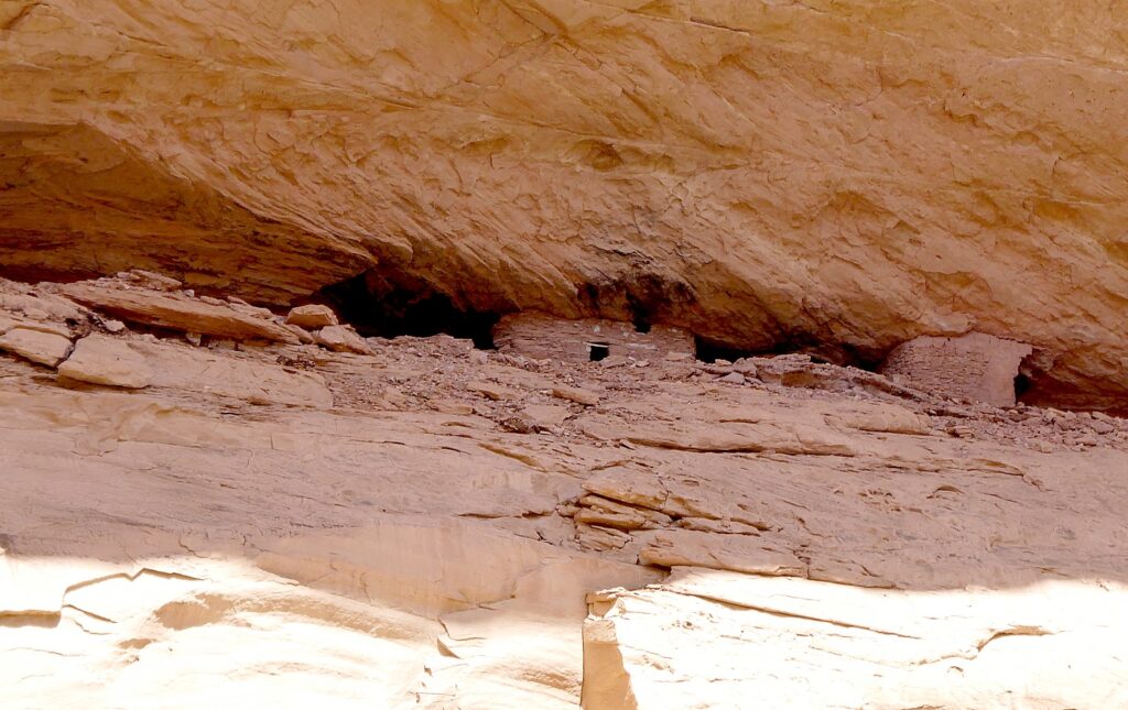
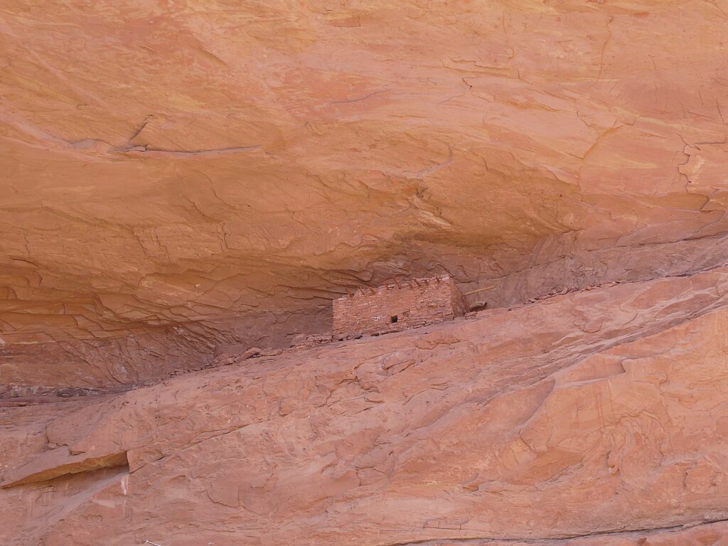
What is truly special about Bears Ears National Monument-Cedar Mesa – and what draws Laini back time and again, are the remnants, artifacts and structures left by Ancestral Puebloans – ancestors of the Hopi and Zuni – who inhabited these canyons and cliffs between 700 and 2500 years ago. Arrowheads and other artifacts dating back 10,000 years have also been found in this region. Some of these sites are at once accessible yet also feel remote – so you feel you are the first archaeologist to discover, though obviously that can’t be since the BLM Rangers have left laminated info packets in metal cases in some of the dwellings. Still, we can pretend.

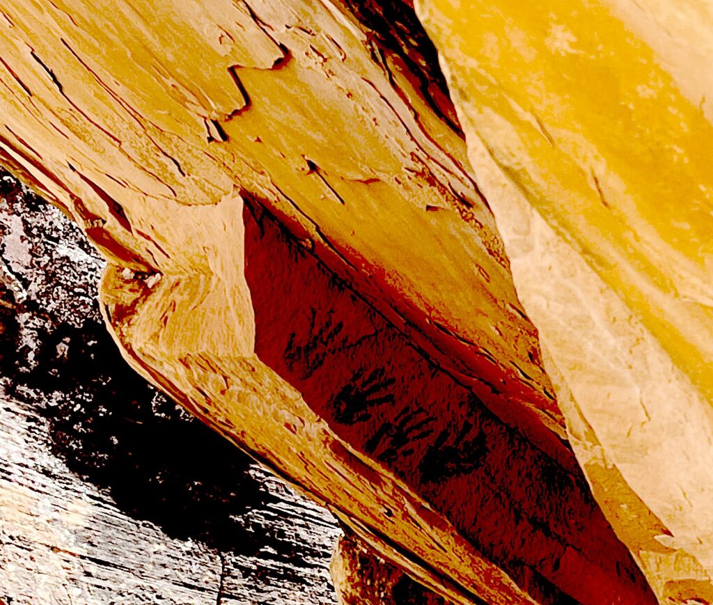
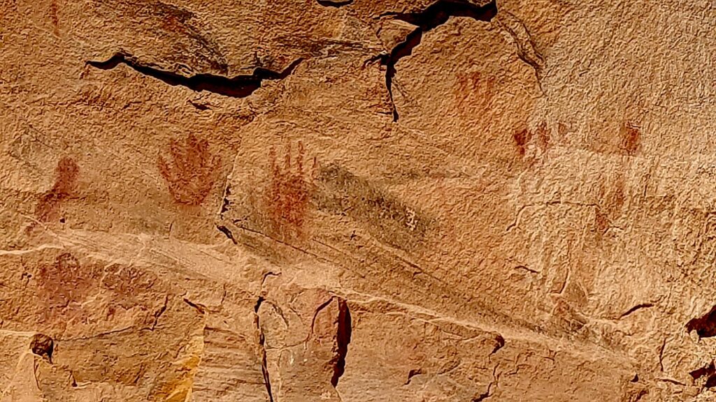
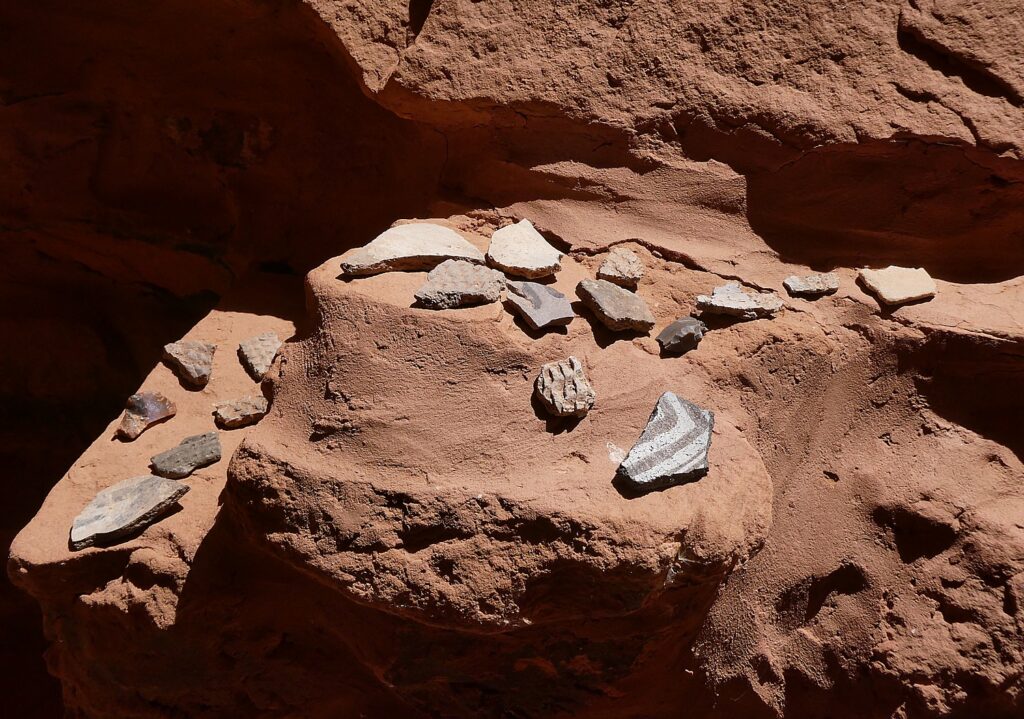
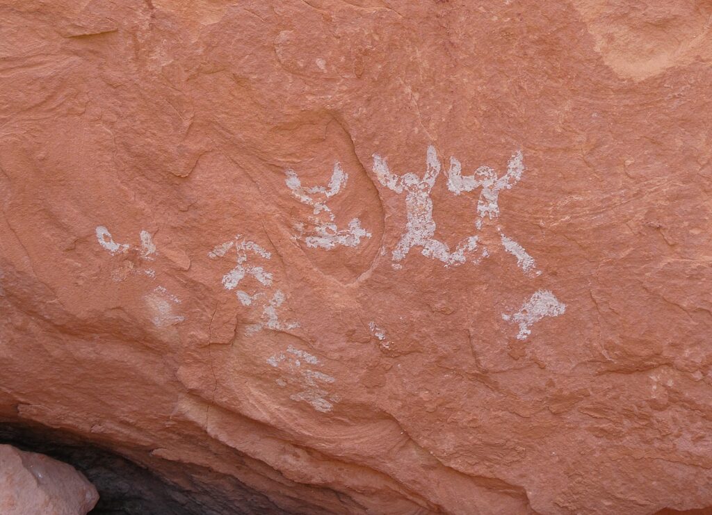
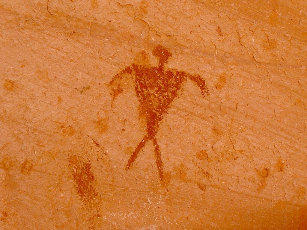
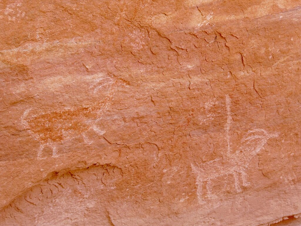
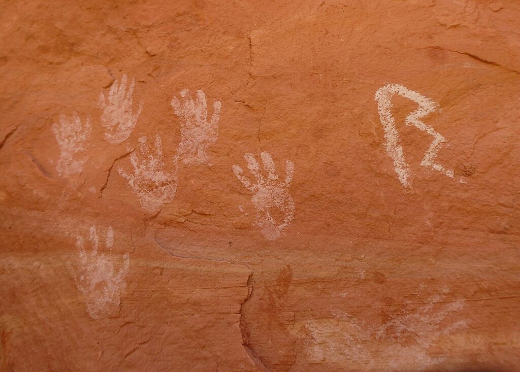
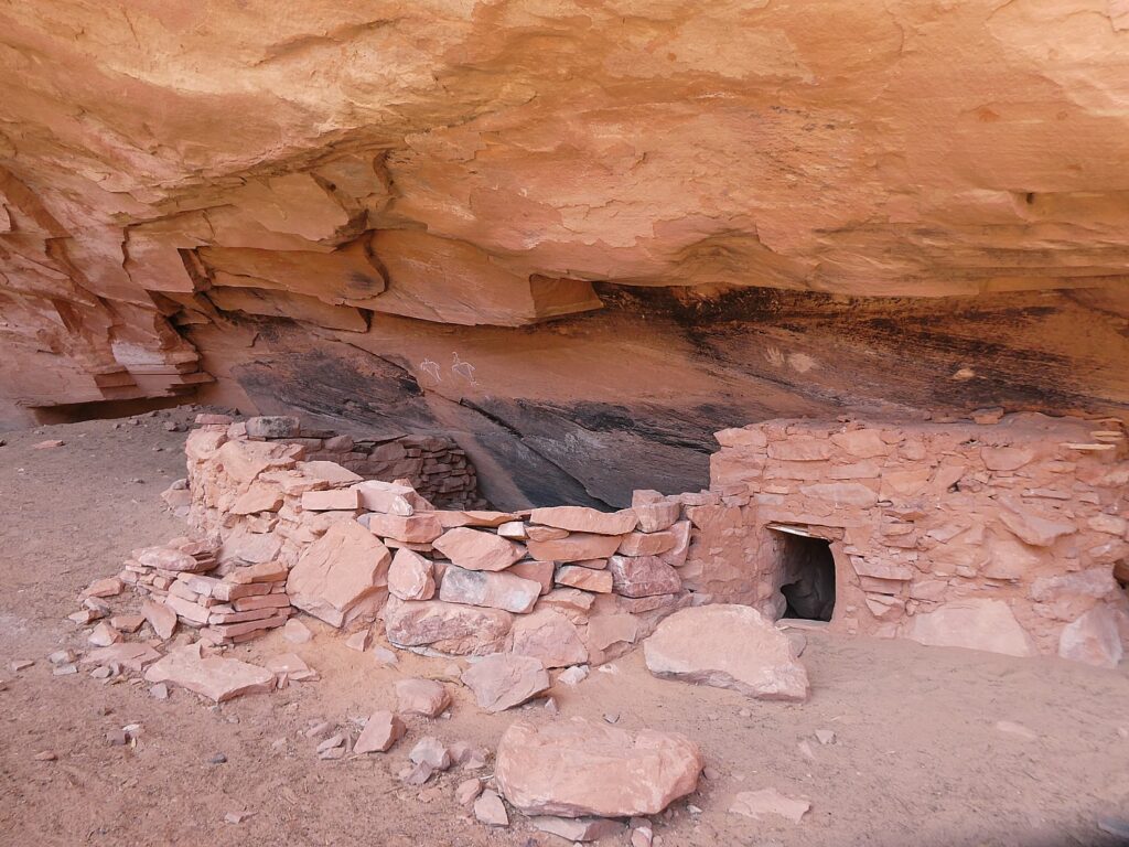
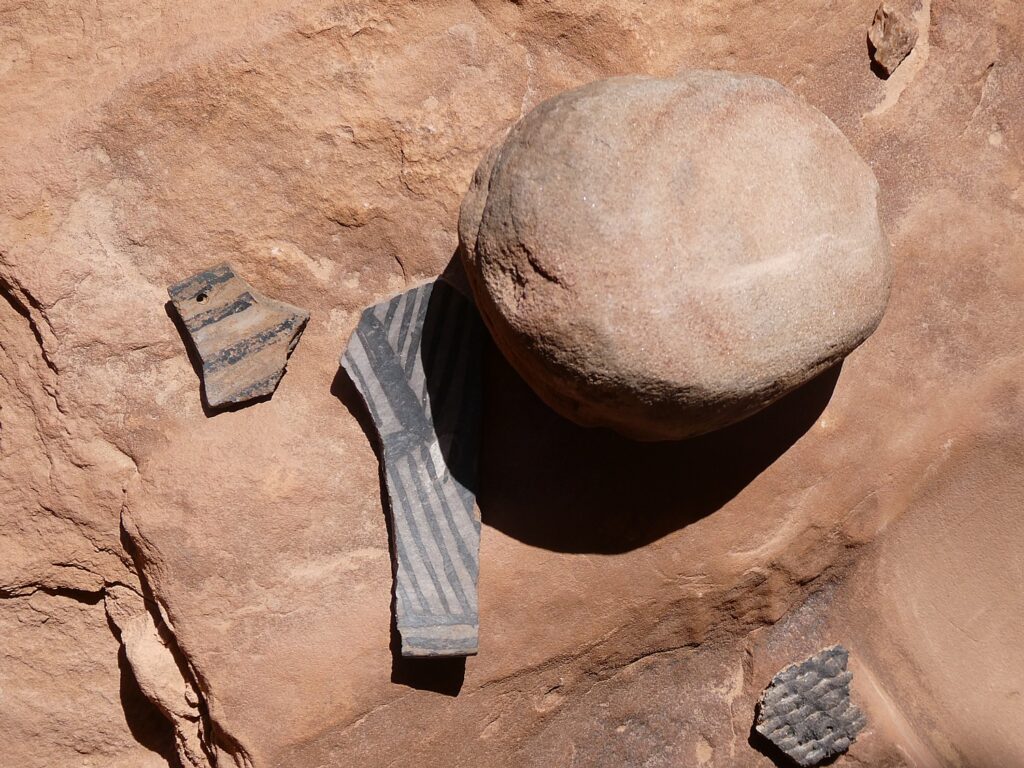
Our hikes bring us to these places that seem as if the occupants only recently vacated, leaving behind painted pottery shards, tiny corn husks, stone and bone tools, even their hand-prints, pictographs and petroglyphs that speak to us through time, as if to say, “We were here. We still are.”

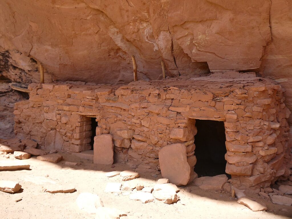
Because these lands are sacred, all of us must be respectful of the dwellings and the archaeological artifacts that we come upon. And these sites truly feel sacred – precisely because of the artifacts, the pictographs and petroglyphs, you feel the presence of those who lived here. And because those of us who visit do show proper respect, these mud-and-stick (jacal) constructions delicate pictographs and petroglyphs etched into sandstone and  artifacts, though incredibly fragile, are here for us to discover, as if we are among the first.

It’s fairly miraculous these sites have survived Mother Nature, let alone humans.

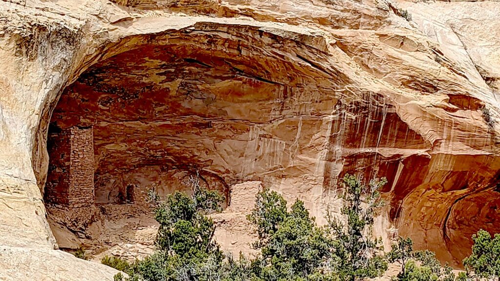
After hiking to the Arch Canyon Ruins, Laini leads us to a trail to one of the outstanding highlights of the Bears Ears National Monument: the House on Fire, one of the most photographed (spectacular) sites in the region.

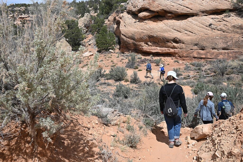
Hiking the Mule Canyon trail © Karen Rubin/goingplacesfarandnear.com

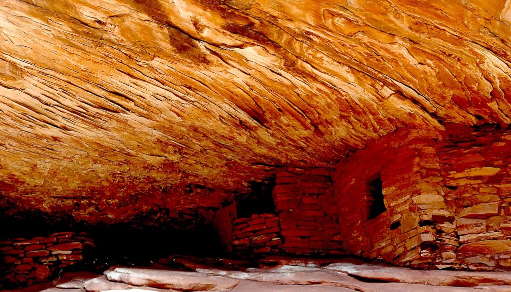
This site features five granaries built into overhanging Cedar Mesa Sandstone with a streaked pattern that, in the early morning light, resembles flames (photo tip: because these dwellings were built to be south-facing, the most dramatic light is around 10-11 am depending upon time of year). (https://bearsearsmonument.org/house-on-fire/)

House on Fire is one of the most photographed – and dramatic – archeological sites in Bears Ears National Monument-Cedar Mesa © Karen Rubin/goingplacesfarandnear.com

“As you take in the view, imagine how the ancient Puebloans lived here between 700 and 2,500 years ago,” Matcha writes at the visitutah.com site. “The granaries perched high in the cliffs stored corn, a main source of food. The Puebloans also ground Indian ricegrass into meal to make bread, and they ate abundant prickly pears. The ever-present yucca was invaluable, as its leaves were spun into fiber and woven into baskets, sandals, and bags, as well as ropes that are said to have helped reach some of the higher, less accessible granaries. The Native Americans used the root of the yucca for soap, and they roasted and ate the base of the plant.

House on Fire is one of the most photographed – and dramatic – archeological sites in Bears Ears National Monument-Cedar Mesa © Karen Rubin/goingplacesfarandnear.com

“The pinyon pines that you weave around and duck under to reach the ancient sites were a key source of building material, fuel, and food. When burned, the wood created the high temperatures needed for firing pottery, while pine bark served as roofing and padding, and pinon nuts provided much-needed vitamins and protein.” (https://www.visitutah.com/articles/exploring-mule-canyon-house-on-fire-cave-tower)

You have to really look closely to discover these hand prints in House of Fire, Bears Ears National Monument-Cedar Mesa © Laini Miranda/goingplacesfarandnear.com

Matcha further advises to search for rock art located beneath an overhanging boulder in the wash below the House on Fire. And if you continue on the trail, there are several more sites worth seeing. While some sit right off the trail, you either need binoculars to see or have to climb 200 feet to reach them. “Toward the end of the canyon is the spectacular Wall Site, which has several intact rooms built into small caves in the pock-marked cliff. Some of the roofs still have the original roof timbers.”

(South Fork of Mule Canyon trail is 4.3 miles one-way, and elevation gain is 250 feet. Cave Tower Site is 1-1.5 miles round trip, and elevation change is less than 200 feet. Passes are required for day hiking, check with the Bureau of Land Management for the current fee amount. Be prepared with exact change.)

Coming upon The Tower Ruin, off the beaten path © Karen Rubin/goingplacesfarandnear.com

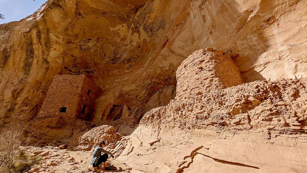
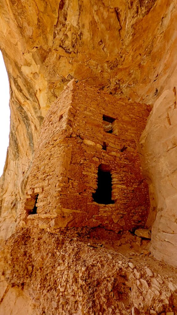
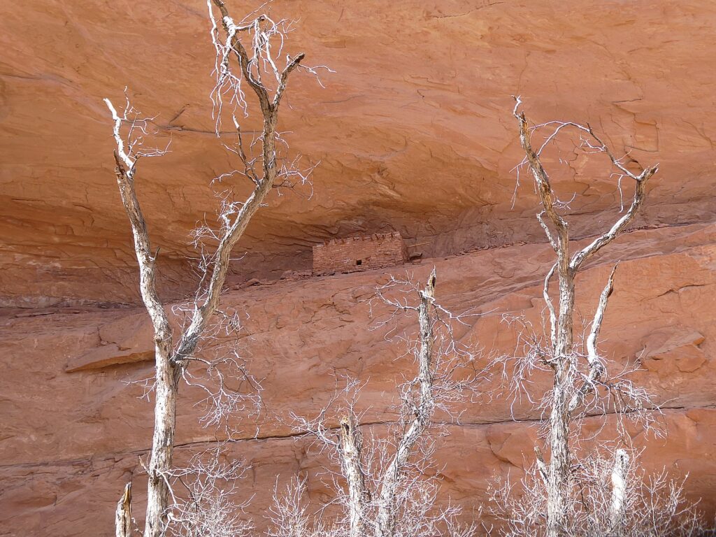
After this spectacular hike, we drive west on Hwy 95 near milepost 103, then drive onto a dirt road for half a mile. We hike in and across the way, we see The Tower Ruin – a rare, two-story structure on the other side of the canyon.

The Tower Ruin, Bears Ears National Monument-Cedar Mesa © Karen Rubin/goingplacesfarandnear.com

At first, it seems too steep a scramble for me, but Dave and Laini go down. Dave makes it look easy. Sure enough, he comes back to guide me to the site (so glad he did!).

The Tower Ruin, Bears Ears National Monument-Cedar Mesa © Karen Rubin/goingplacesfarandnear.com

This site is so secluded, remote and untouched, it feels as if we discovered it on our own (though I’m sure that’s not true, the feeling is still so exciting).

The Tower Ruin, Bears Ears National Monument-Cedar Mesa © Karen Rubin/goingplacesfarandnear.com

The tower construction seems to be “modern” – Laini says there is evidence of three different generations having a hand in the construction. There are fabulous pictographs and petrolyphs here. I imagine that one is a symbol for the chief.

The Tower Ruin, Bears Ears National Monument-Cedar Mesa © Karen Rubin/goingplacesfarandnear.com

Altogether, we have hiked about 9 to 10 miles today – so satisfying.

We drive into the town of Blanding for dinner and supplies, seeing signs along the way for Native American Crafts, Dinosaur Museum, State Edges of the Cedars Native American Museum.

The Tower Ruin, Bears Ears National Monument-Cedar Mesa © Karen Rubin/goingplacesfarandnear.com

Laini decides to change plans from our original itinerary and instead of leaving here for Canyonlands, we stay an extra night and day in Cedar Mesa.

So glad, because the second day’s hike is one of the best I have ever experienced.

Catching the last rays of sun driving back to our wild camping site in Arch Canyon from Blanding © Karen Rubin/goingplacesfarandnear.com
 

Kane Gulch Trail

Take seriously the need to obtain permits in advance for certain hikes. We changed our plans in order to stay this second day in Cedar Mesa so did not get the necessary permit (limited to just 20 a day) to hike to Moon House – the only day hike that requires a permit instead of just a hiking day pass. We thought we might get away with it because we are here on Easter Sunday, but no such luck (the permit allocations fill up even months before). It is easier to get permits in summer months, which is when Laini and David found themselves the only ones at the site when they last visited (likely because of the heat; when we are here, in early spring, the weather is perfect).

Hiking the Kane Gulch Trail, Bears Ears National Monument-Cedar Mesa © Karen Rubin/goingplacesfarandnear.com

Instead, at the Kane Gulch Visitor Center, the Ranger suggests we hike the Kane Gulch Trail which starts right across the road. We purchase our day hiking passes ($5 pp – my America the Beautiful pass doesn’t count). She suggests what to look for at what distances.

Hiking the Kane Gulch Trail, Bears Ears National Monument-Cedar Mesa © Karen Rubin/goingplacesfarandnear.com

Dave gets out our hot-water maker and we have our breakfast at the picnic table outside the visitor center, then set out. Our plan is to go five miles, to the Stimper Arch, and five miles back.

Profile of an Indian Chief? Hiking the Kane Gulch Trail, Bears Ears National Monument-Cedar Mesa © Karen Rubin/goingplacesfarandnear.com

At about a mile in, there is a short slot canyon where we see a formation to me looks like the profile of an Indian chief.

At the two-mile mark, Dave stashes our 5-gallon water jug so we have enough for the return.

Junction Ruin, Kane Gulch Trail, Bears Ears National Monument-Cedar Mesa © Karen Rubin/goingplacesfarandnear.com 

It’s four miles to the Junction Ruin which has some fabulous dwellings, pottery shards, and pictographs.Dave and Laini climb up sheer rock to get to an upper level (a defensive watchtower?) and could see remnants of a ladder that would have been used.

Turkey Pen, Kane Gulch Trail, Bears Ears National Monument-Cedar Mesa © Karen Rubin/goingplacesfarandnear.com 

Another .7 mile and we come to a site known as Turkey Pen. Looking up from the trail, it seems the cliff dwellings are cramped and close to the edge, but when we get up here, it is surprising how much space there actually is.

Turkey Pen, Kane Gulch Trail, Bears Ears National Monument-Cedar Mesa © Karen Rubin/goingplacesfarandnear.com

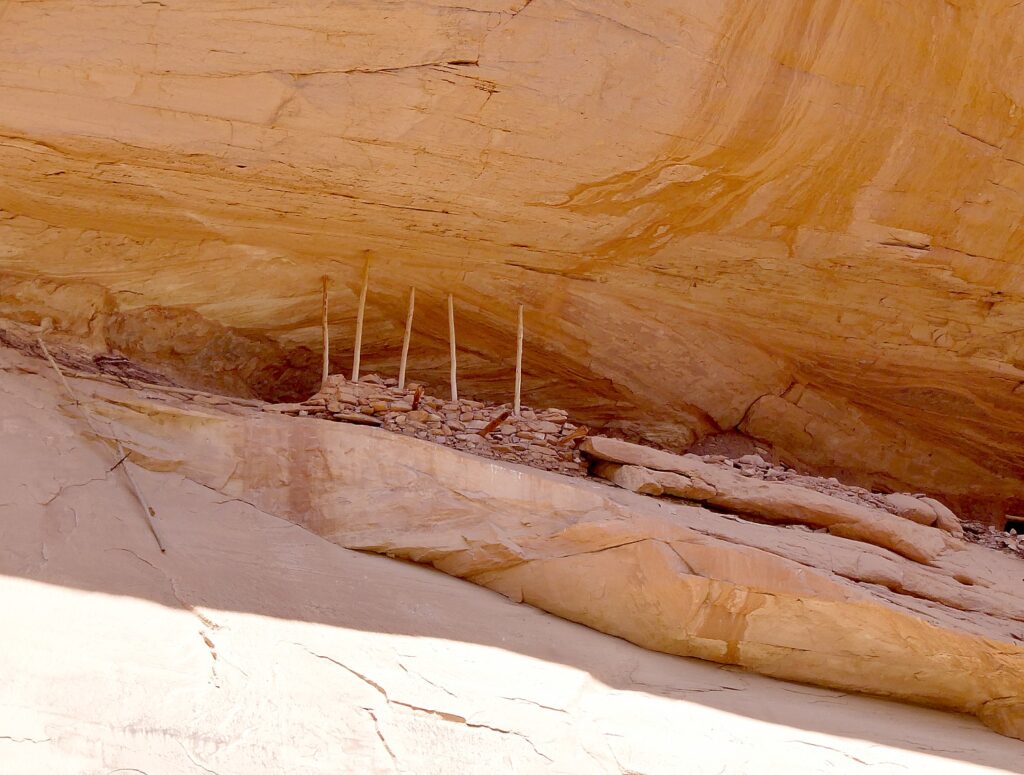
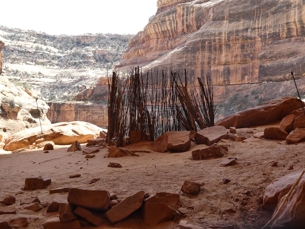
Here, we see some fabulous examples of mud and stick method of construction (jacal) and some exquisite painted pottery shards, pictographs, even the remnants of the actual turkey pen formed with sticks – so it almost seems you are coming upon a dwelling just after the residents left. You feel you are the archaeologist making the discovery – except for the printed notes left by the National Park Service- but still. 

Cliff dwellings along the Kane Gulch Trail, Bears Ears National Monument-Cedar Mesa © Karen Rubin/goingplacesfarandnear.com

We also come upon a square kiva (most kivas Laini and Dave have seen are circular, Laini notes).

Junction Ruin, Kane Gulch Trail, Bears Ears National Monument-Cedar Mesa © Karen Rubin/goingplacesfarandnear.com

You wonder about whether the site was designed to defend and who to defend from – people who would take food stored in the granary? One of the pictographs depicts sheep being killed, another of “lizard man.”

Cliff dwellings along the Kane Gulch Trail, Bears Ears National Monument-Cedar Mesa © Karen Rubin/goingplacesfarandnear.com

As we hike, we keep our eyes peeled on the cliffs above for evidence of dwellings, well off the trail and likely minimally visited. Laini says there were thousands of cliff dwellings here and only a fraction have been discovered (or are still intact, but when you consider they are 1000 years old, and the crumbling rock all around, it is amazing any remain). We spot one and Laini goes off to try to find a way to climb up to it.

Cliff dwellings along the Kane Gulch Trail, Bears Ears National Monument-Cedar Mesa © Karen Rubin/goingplacesfarandnear.com

We find a pleasant rock overhang to sit and have our picnic lunch, feeling like this would have been exactly what the Puebloans would have done.

We hike a further .3 miles to the Stimper Arch (which is the 5-mile mark), where we turn around.

Turkey Pen, Kane Gulch Trail, Bears Ears National Monument-Cedar Mesa © Karen Rubin/goingplacesfarandnear.com

This hike has everything – it has just the right amount of physical challenge – a section where you scramble a bit and walk a narrow edge – gorgeous greenery, stunning rock formations, water features (but not too watery to hike), but best and most spectacular of all, these cliff dwellings that look like we have just discovered them, with relatively large and stunningly painted pottery shards, stone tools, stunning pictographs (I start thinking they are either indications of how many people lived in the dwelling like a census; markers of whose dwelling it is, like a family name?  or just being playful, artful?).

Turkey Pen, Kane Gulch Trail, Bears Ears National Monument-Cedar Mesa © Karen Rubin/goingplacesfarandnear.com

The trail is not specifically marked – so you have to figure your own way using the landscape and intermittently placed cairns.

Turkey Pen, Kane Gulch Trail, Bears Ears National Monument-Cedar Mesa © Karen Rubin/goingplacesfarandnear.com
The actual turkey pen, Kane Gulch Trail, Bears Ears National Monument-Cedar Mesa © Karen Rubin/goingplacesfarandnear.com
Turkey Pen, Kane Gulch Trail, Bears Ears National Monument-Cedar Mesa © Karen Rubin/goingplacesfarandnear.com

Even though this is a popular trail, we come upon other people only occasionally (but it kind of reassures us we are going the right way).

The trail actually goes on for miles (days), connecting to other trails. (We meet a group of college students who are making a multi-day backpacking trip and will return on the Fish and Owl trail.)

Turkey Pen, Kane Gulch Trail, Bears Ears National Monument-Cedar Mesa © Karen Rubin/goingplacesfarandnear.com
Kane Gulch Trail, Bears Ears National Monument-Cedar Mesa © Karen Rubin/goingplacesfarandnear.com

We get back to the start at 6:30 pm (we set out around 10 am), having hiked about 11 miles. (It took us 5 hours to get 5 miles (including the time exploring the archaeological sites) and 3 ½ hours to hike back.

Stimper Arch, Kane Gulch Trail, Bears Ears National Monument-Cedar Mesa © Karen Rubin/goingplacesfarandnear.com

After this full day’s hike, we drive to Arches National Park. It’s a fairly long drive and already sunset by the time we arrive. This is the first time we have to set up camp in the dark and there is a strong wind that makes it difficult to keep the tent from blowing away (especially since I can’t find my tent stakes so we improvise, until they are ultimately found under the footprint.)

Dave makes a fire and we prepare dinner from our supplies.

It is night by the time we set up camp at the Devils Campground in Arches National Park © Karen Rubin/goingplacesfarandnear.com

If You Go….

The Moon House Ruin is one of the best archaeology sites on Cedar Mesa, consists of three separate structures with 49 rooms; well preserved pictographs grace the walls of an interior courtyard and some of the rooms (the hike is 3.2-5.6 miles roundtrip). More of the best hikes in Bears Ears at http://www.hikingwalking.com/index.php/destinations/ut/ut_se/blanding

Day hiking in Bears Ears National Monument requires a day hiking pass. Day hiking passes are unlimited.

Bears Ears National Monument does not charge an entry fee where your America the Beautiful Pass would typically apply. However, activity fees called “Individual Special Recreation Permits” are charged for day hiking and backpacking (typically $2 at the trailhead). Visit the permits page for more information (https://www.blm.gov/programs/recreation/permits-and-passes/lotteries-and-permit-systems/utah/cedarmesa).

Visitor Centers:

Kane Gulch BLM Ranger Station, UT-261 36 miles west of Blanding. Open: March 1-June 15, September 1-October 31, 8 am-noon daily

Monticello Visitor Center, 216 S Main St., Hours: 9 am-5 pm, closes at 3 pm on Sunday, Phone: 435-587-3401

Blanding Visitor Center, 12 North Grayson Parkway, 9 am-5 p.m., closed Sunday

https://www.blm.gov/visit/bears-ears-national-monument

See:

UTAH ADVENTURE DAY 1-2: CAPITOL REEF’S COLORFUL CANYONS

UTAH ADVENTURE DAY 3-4: GRAND STAIRCASE-ESCALANTE POSES CHALLENGE

UTAH ADVENTURE DAY 4-5: DRIVING BURR TRAIL, EXPLORING GLEN CANYON, WILD CAMPING IN ARCH CANYON

UTAH ADVENTURE DAY 6: SACRED SITES, SPIRITS OF BEARS EARS NATIONAL MONUMENT

______________________

© 2023 Travel Features Syndicate, a division of Workstyles, Inc. All rights reserved. Visit goingplacesfarandnear.com, www.huffingtonpost.com/author/karen-rubin, and travelwritersmagazine.com/TravelFeaturesSyndicate/. Blogging at goingplacesnearandfar.wordpress.com and moralcompasstravel.info. Visit instagram.com/going_places_far_and_near and instagram.com/bigbackpacktraveler/ Send comments or questions to FamTravLtr@aol.com. Tweet @TravelFeatures. ‘Like’ us at facebook.com/KarenBRubin 

Utah Adventure Day 4-5: Driving Burr Trail, Exploring Glen Canyon, Wild Camping in Arch Canyon

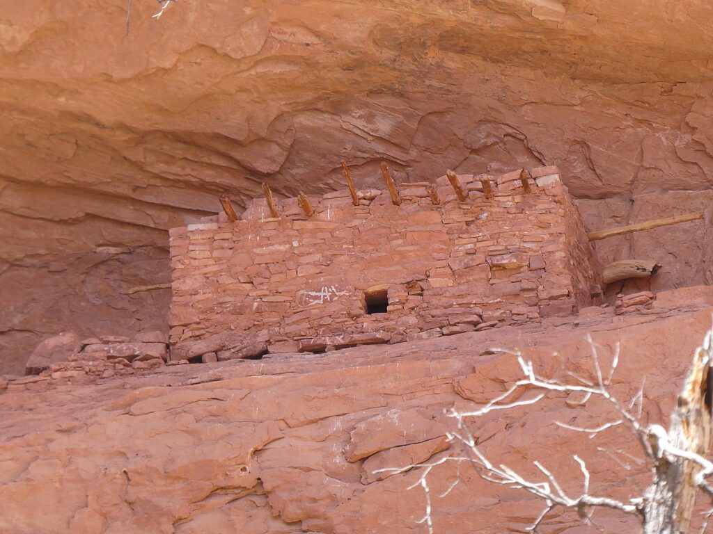
In search of Defiance House archaeological site, tucked away in the Forgotten Canyon © Karen Rubin/goingplacesfaranadnear.com

By Karen Rubin, with Laini Miranda and Dave E. Leiberman

Travel Features Syndicate, goingplacesfarandnear.com

It’s the afternoon when we leave the Grand Staircase-Escalante after having a sensational hike through Big Horn Canyon, and drive through the Dixie National Forest on our way to Glen Canyon Recreation Area.

We stop in Boulder where the Magnolia burrito food truck that Dave and Laini love is based in the parking lot of the Anasazi State Park Museum. I wander into the museum for a quick look – the displays are really wonderful and had I had the time, I would have taken advantage of the interactive exhibits (you can grind corn using a mano and metate, identify seeds with a microscope, make rubbings of pottery designs).

I find it fascinating that “Anasazi” is actually a Navajo word meaning “ancient enemies” or “enemy ancestors” but it is not actually known what these people – Ancestral Pueblo who inhabited the area before the Navajo – called themselves. Still, the name has stuck. They were village-dwelling farmers – that is to say, not nomadic people – who lived in the Four Corners between 1 and 1300 AD, when there is some mystery about why they suddenly left en masse (some suspect it was the drought of historic proportions, only rivaled by our current 20-year drought). Behind the museum you can walk a short trail to the Coombs Site Ruins and a life-size, six-room replica of part of the pueblo as it would have existed 800-900 years ago. Beyond that are several more unexcavated areas. (Anasazi State Park Museum, Boulder, UT, 435-335-7308, www.stateparks.utah.gov)

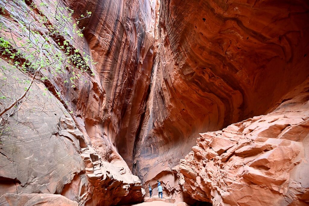
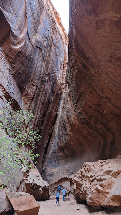
Long Canyon on the Burr Trail © Karen Rubin/goingplacesfaranadnear.com
 

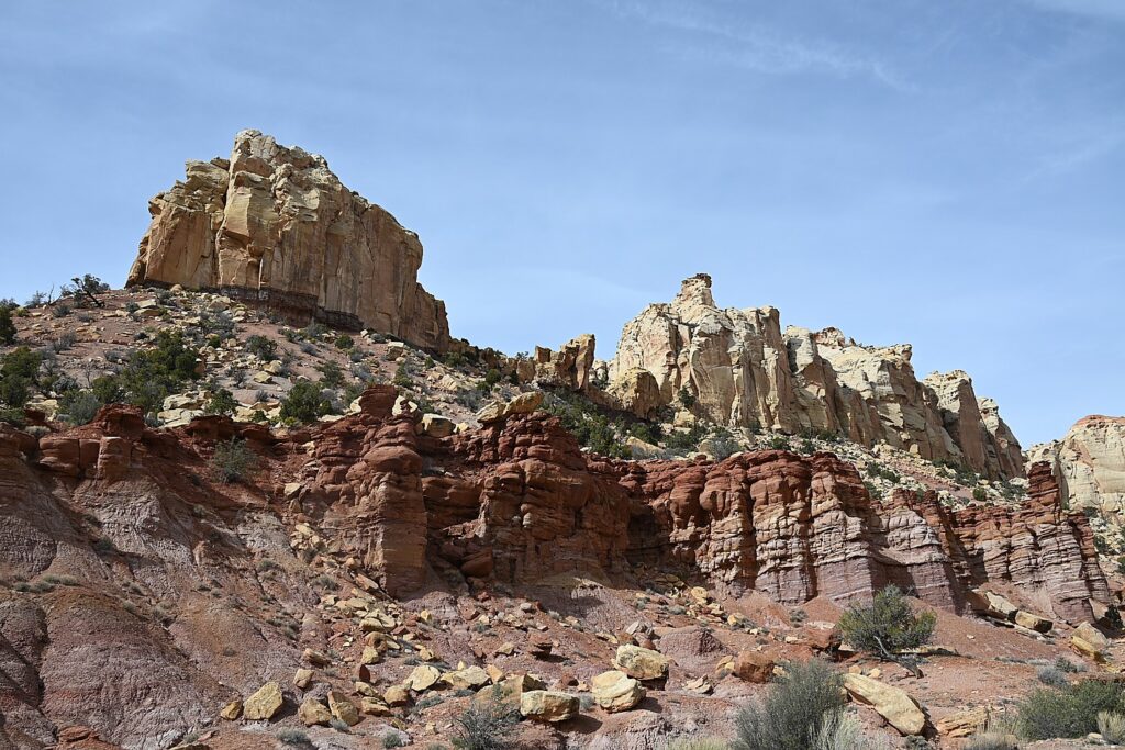
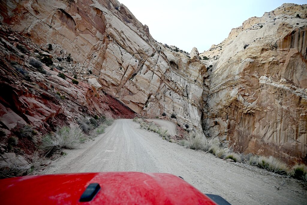
Just down the road from the museum, we turn onto the Burr Trail Scenic Backway, considered one of the most picturesque drives in Utah. Paved and graded in some sections, gravel and dirt in others, the road extends 66 miles from Boulder, passing the slickrock canyons of the Grand Staircase–Escalante National Monument, the Badlands of Capitol Reef National Park, the Waterpocket Fold, and painted rock desert of Glen Canyon National Recreation Area, ending at Bullfrog Basin on Lake Powell – our destination on the fourth day of our Utah Adventure.

Singing Canyon on the Burr Trail © Karen Rubin/goingplacesfaranadnear.com

I find it interesting to learn that the Burr Trail was originally developed as a cattle trail by stockman John Atlantic Burr (born in 1846 aboard the SS Brooklyn sailing across the Atlantic; his family established Burrville, Utah, in 1876). Burr developed the trail so he could take his herd through the rough, nearly impassable country around the Waterpocket Fold, Burr Canyon and Muley Twist Canyon.

Singing Canyon on the Burr Trail © Karen Rubin/goingplacesfaranadnear.com
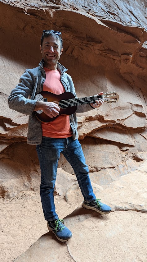
Dave tries out the acoustics in Singing Canyon on the Burr Trail © Karen Rubin/goingplacesfaranadnear.com

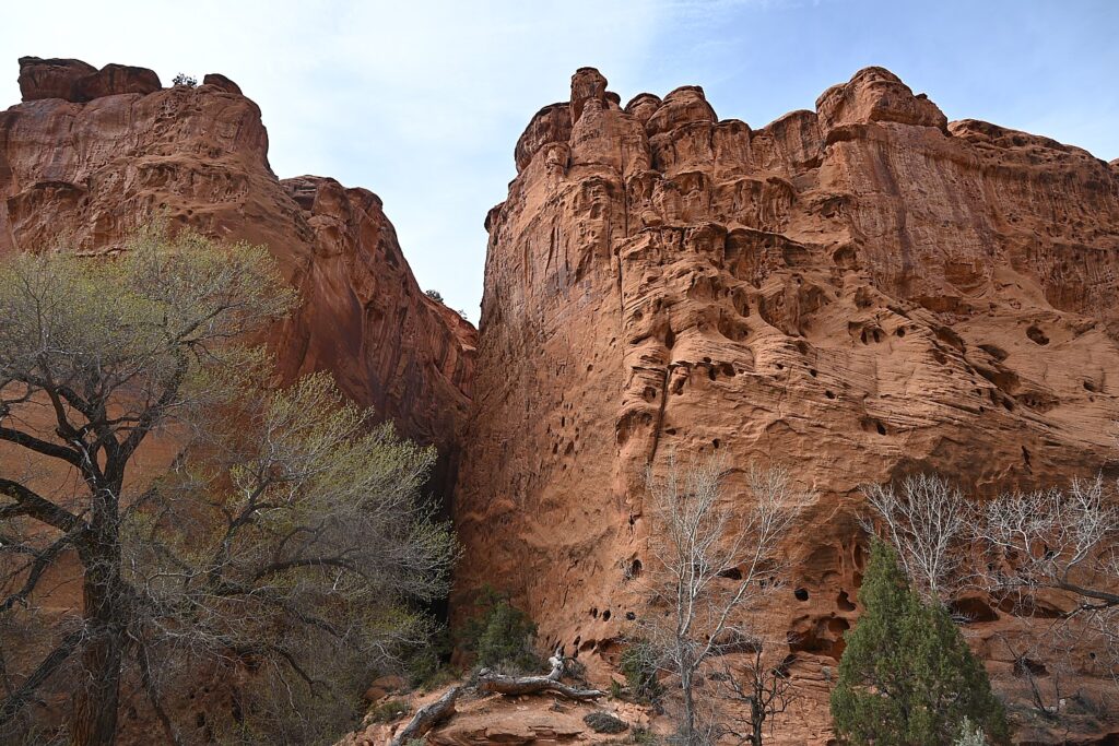
We drive through Long Canyon and soon come to one of the highlights along the route, which accounts for its nickname, Singing Canyon. It looks like a setting for Jurassic Park. We walk in, feeling so small against these gigantic, high cliffs of red rock. Dave gets out his mini-guitar for the occasion and we revel in the acoustics that give the canyon its name (I can imagine proposals and weddings happening here).

Driving along the Burr Trail, it is eerie to see how such mighty rocks crumble © Karen Rubin/goingplacesfaranadnear.com

As we drive this rustic highway, we see giant red rock boulders strewn all over, having broken off from these cliffs, so close to road. Some are precariously balanced. We wonder over what period of time they came down (last century, or last week?), and whether more are likely to come down anytime soon.

Driving along the Burr Trail, it is eerie to see how such mighty rocks crumble © Karen Rubin/goingplacesfaranadnear.com

This is a landscape that seems at once fixed and yet is constantly changing. Burr Trail is like driving through destruction – you see these enormous, massive walls of rock collapsed in heaps and think how fragile it all is, how even the mighty can fall. It is as if it is all falling apart and you wonder how long before these rocks turn to mounds of sand.

The view from the top of the famous Burr Trail Switchbacks © Karen Rubin/goingplacesfaranadnear.com

We next come to the famous Burr Trail Switchbacks. The view from the top to the Henry Mountains and Waterpocket Fold is stunning. The intriguingly named “Waterpocket Fold” is a geologic wonder: a nearly 100-mile long warp in the Earth’s crust. Aclassic monocline – a “step-up” in the rock layers – it formed between 50 and 70 million years ago when a major mountain building event in western North America, the Laramide Orogeny, reactivated an ancient buried fault in this region.

The view from the top of the famous Burr Trail Switchbacks © Karen Rubin/goingplacesfaranadnear.com

After taking in the view, Dave maneuvers down the series of ridiculously steep, tight turns (scary!) several hundred feet to the valley below.

Starting the harrowing descent down the Burr Trail Switchbacks © Karen Rubin/goingplacesfaranadnear.com
 

[A note from the Bureau of Land Management: Although in dry weather the Burr Trail is easily accessible to passenger cars, wet weather may make the road impassable even for 4WD vehicles. Check with rangers or local officials for weather and road conditions. Recreational vehicles are not recommended. (https://www.visitutah.com/places-to-go/cities-and-towns/boulder/burr-trail)

The harrowing descent down the Burr Trail Switchbacks © Karen Rubin/goingplacesfaranadnear.com
The Burr Trail Scenic Backway, considered one of the most picturesque drives in Utah © Karen Rubin/goingplacesfaranadnear.com

We don’t get to do our wild camping tonight either, but rather have found what seems one of the few motels around, Tikaboo Lodge, and make do with the remaining food supplies we have.

(Note that there are very minimal amenities in the Bullfrog/Ticaboo area during the off-season. There are, however, two helpful outdoor outfitters/gas stations open until 4pm. )

Boating in Glen Canyon, Wild Camping in Arch Canyon

Our destination the next morning is Glen Canyon National Recreation Area. Spanning 1.25 million acres, it stretches for hundreds of miles from Lees Ferry in Arizona to the Orange Cliffs of southern Utah.

Lake Powell is only 13% of the National Recreation Area, but is (or rather was) one of the largest man-made lakes in North America. At full pool (3700′ elevation) it is 186 miles long, has 1,960 miles of shoreline, some 96 major side canyons, and a capacity of 27 million acre-feet (32 million cubic meters). Its maximum depth (at Glen Canyon Dam) is 561 feet.

Boating on Lake Powell in Glen Canyon Recreation Area in search of cliff dwellings © Karen Rubin/goingplacesfaranadnear.com

But since 2001, declining water levels (the lake had dropped over 100 feet over a two-year period at the time of our visit) due to climate change and 20 years of drought have reshaped Lake Powell’s shoreline and changed or closed boat ramp access points, on-lake facilities, and dramatically altered the landscape. (Check conditions, www.nps.gov/glca/learn/changing-lake-levels.htm)

Boating on Lake Powell in Glen Canyon Recreation Area © Karen Rubin/goingplacesfaranadnear.com

I think that similar conditions must have been what caused the Ancestral Puebloans to leave their communities in 1300 AD after hundreds of years living here, because they also had experienced a 20-year long drought; the drought today is the worst since then.

The gorgeous formations reveal themselves on Lake Powell in Glen Canyon Recreation Area in search of cliff dwellings © Karen Rubin/goingplacesfaranadnear.com

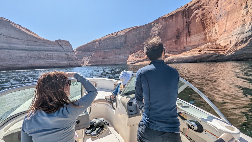
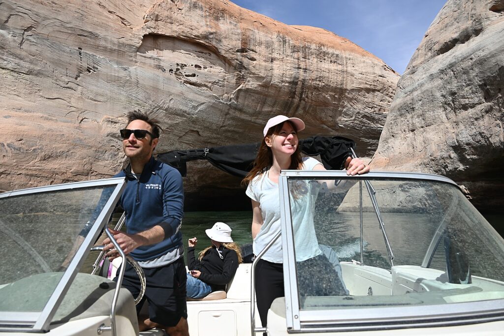
Laini has rented a power boat from Bullfrog Boat Rentals (435-684-3010) at the Bullfrog Marina so we can explore the canyons that were flooded when they created the controversial Glen Canyon Dam on the Colorado River. We are in search of signs of cliff dwellings or petroglyphs that may have been exposed with the drop in water level.

We get a map from the boat rental company and try to follow the mile markers on the lake that help us orient.

Compared to our two days of adventuring in Grand Staircase-Escalante, this day is like a resort vacation, with the luxury of a boat allowing us to traverse 20+ miles in one afternoon. 

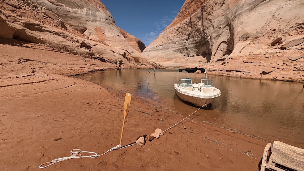
The water level has dropped so much over the past two years that trees are poking out from the bottom.

Boating on Lake Powell in Glen Canyon Recreation Area in search of cliff dwellings © Karen Rubin/goingplacesfaranadnear.com

Dave navigates to Forgotten Canyon where Laini has information that a trail will lead to Defiance House Archaeological Site, an 800-year old cliff dwelling (nps.gov, 800-227-7286).

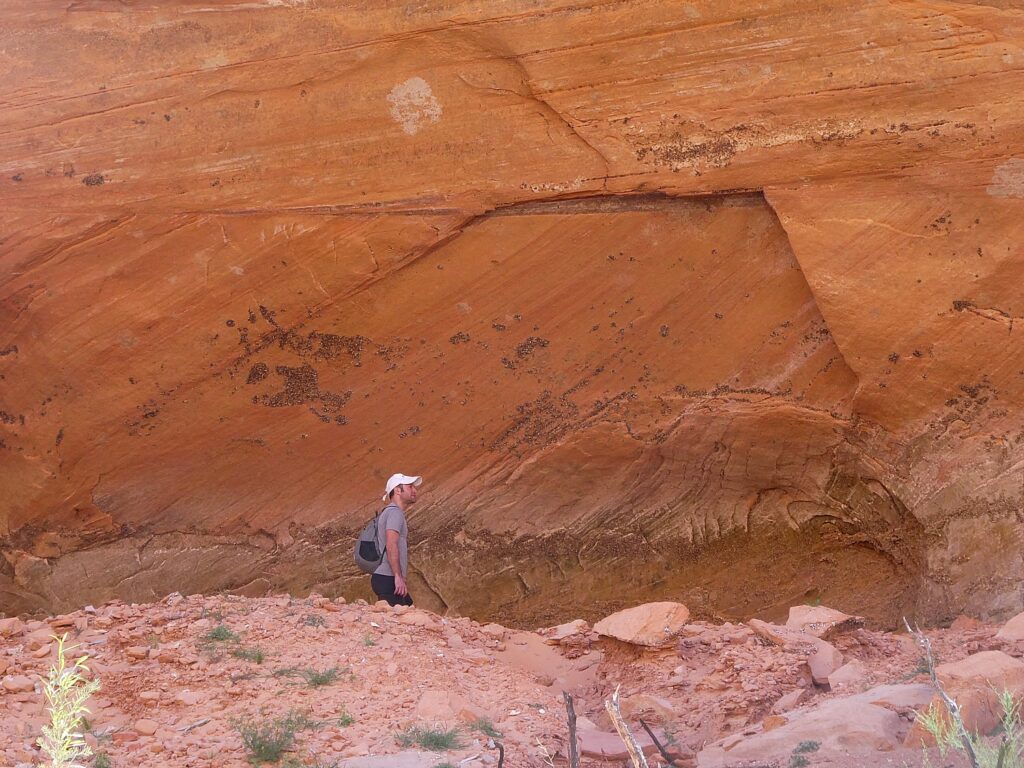
Because the water level is so low, we come to the edge of the water much earlier than expected, and pull up the boat onto a beach, have a picnic lunch (avocado on bread, peanut butter/jelly) under a rock awning (like the Ancestral Puebloans might have), and then set off on foot in search of the cliff dwelling.

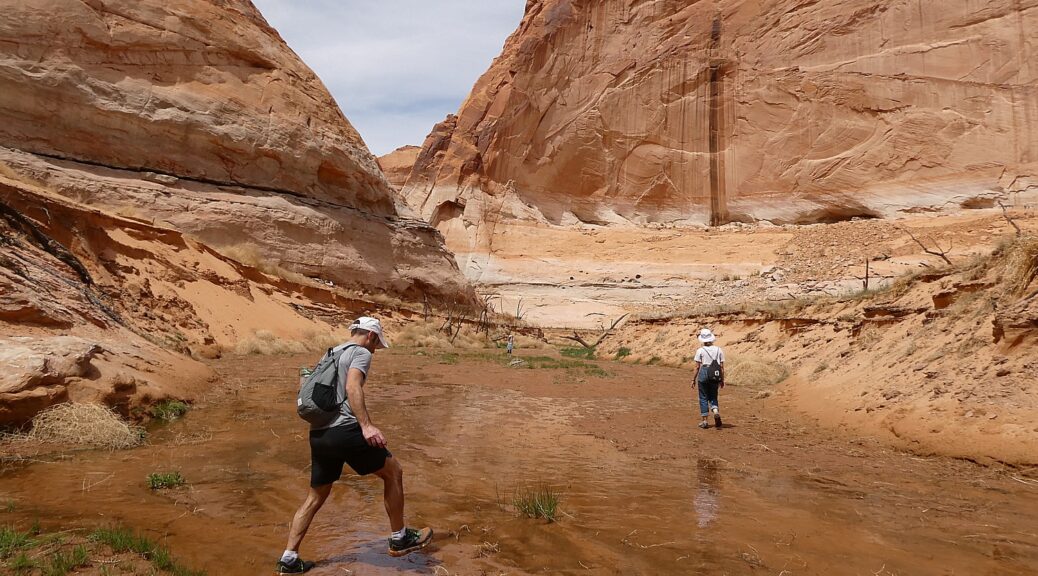
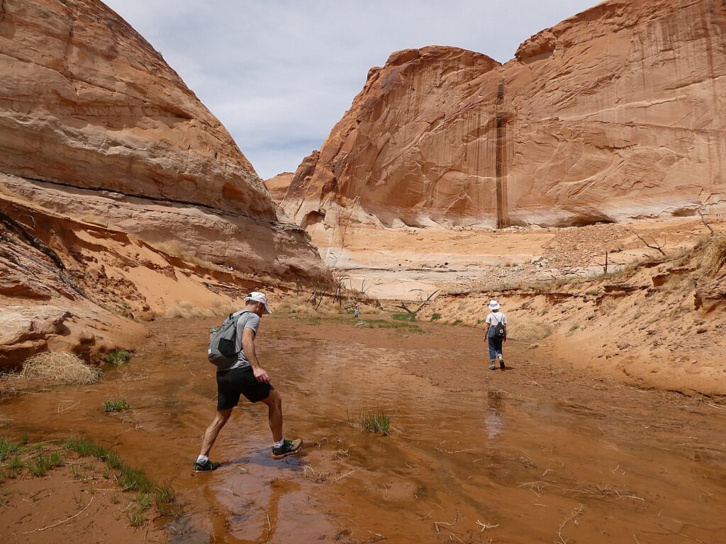
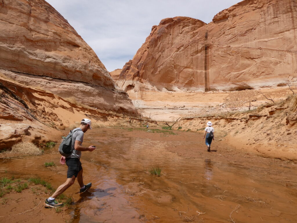
Exploring Forgotten Canyon © Karen Rubin/goingplacesfaranadnear.com

This really feels like Indiana Jones, because there is no actual trail. We follow the water  – slogging along the deep mud, crisscrossing to avoid deeper water. Dave comes with me as Laini and Alli bound ahead to explore in the limited time we have before we have to get back to the boat. 

The site (which is only reachable by boat then foot) is usually just a quarter mile past the end of the water, but with the water level so much lower, it’s now over two miles away and we don’t have the time. Also there is so much overgrowth and prickly thickets that Laini and Alli can’t get through wearing shorts. They turn around and tell us we should make our way back to the boat.

In search of Defiance House archaeological site, tucked away in the Forgotten Canyon © Karen Rubin/goingplacesfaranadnear.com

Even with this disappointment, it has been an immensely fun adventure. 

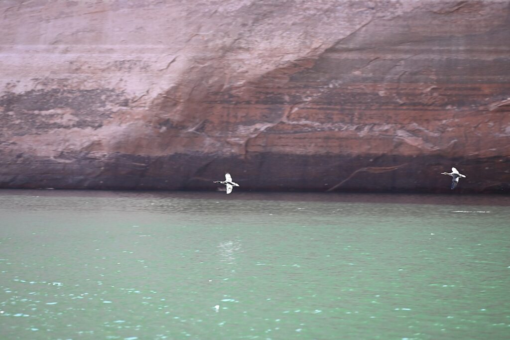
As we boat out of the canyon, we see a vulture contemplating eating a dead fish on the shore.

Boating on Lake Powell in Glen Canyon Recreation Area in search of cliff dwellings © Karen Rubin/goingplacesfaranadnear.com

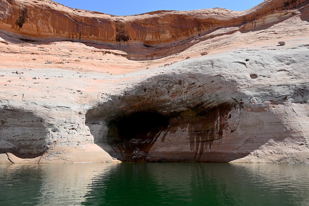
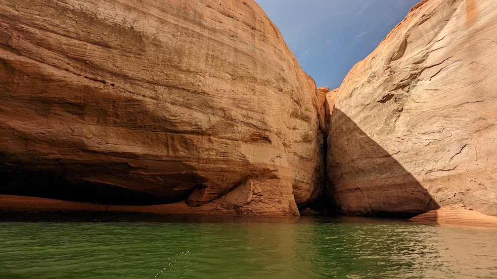
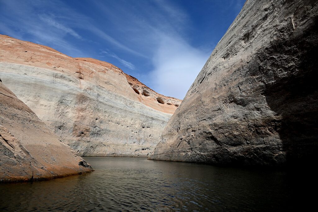
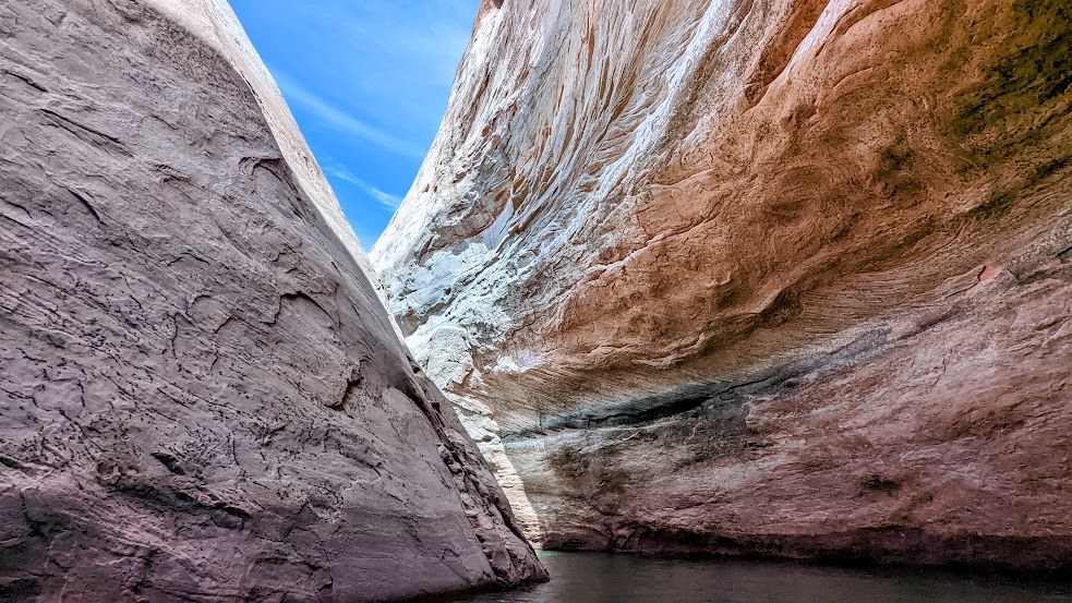
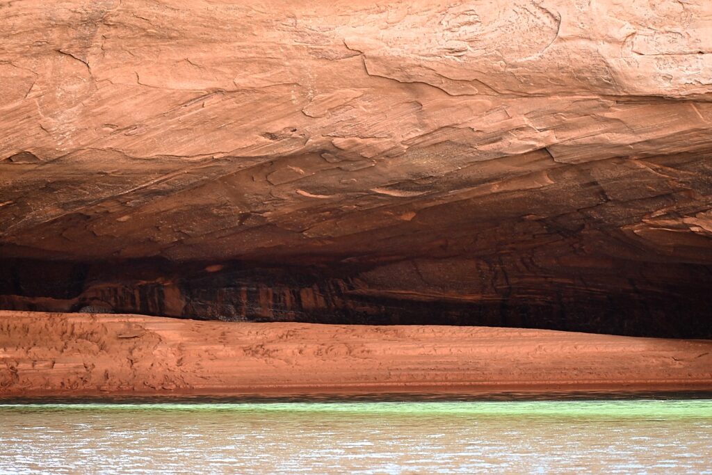
We are close to the time when we need to return the boat, but Dave pilots us into the Lost Eden Canyon. This turns out to be an absolutely magical (overused word but really apt) place – a superb finale to our adventure.

Lost Eden Canyon, Lake Powell in Glen Canyon Recreation Area in search of cliff dwellings © Karen Rubin/goingplacesfaranadnear.com

There are golden dapples on the gray rock faces like gold coins shimmering in sunlight. The water is a surreal emerald green under a brilliant blue sky, the rocks are orange, tan and gray, making interesting patterns, as we wind through the narrow canyon.

Lost Eden Canyon, Lake Powell in Glen Canyon Recreation Area in search of cliff dwellings © Karen Rubin/goingplacesfaranadnear.com

You can easily imagine how ancient artists were inspired not just by the colors, but the patterns in rock faces.

Lost Eden Canyon, Lake Powell in Glen Canyon Recreation Area in search of cliff dwellings © Karen Rubin/goingplacesfaranadnear.com

When we get back to the marina, it takes 30 minutes just to refill the tank ($200!) – which we hadn’t calculated for in getting the boat back in time.

Driving from Lake Powell on our way to our next stop, Bears Ears National Monument-Cedar Mesa, we stop at Outpost Marine Trading Post – as significant today as it must have been for early pioneers. It has a fabulous selection of gear and groceries for camping as well as fantastic sandwiches at incredibly reasonable prices (considering how desperate people can be at this point in their journey) – Reuben, probably best outside of NYC, $8; thick burgers; fresh sliced turkey only $4.99/lb (Dave can’t believe it so buys 2 pounds). Everyone is absolutely delighted as we savor our car dinner when we get back on the road.

We soon see a dead calf on the road and vultures hovering.

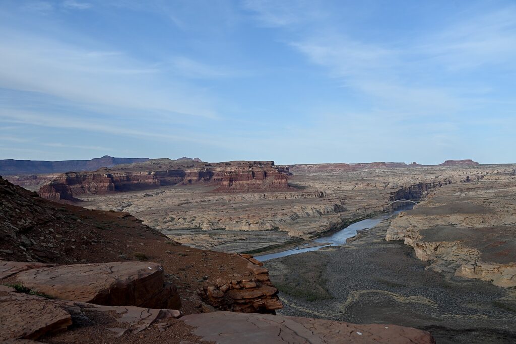
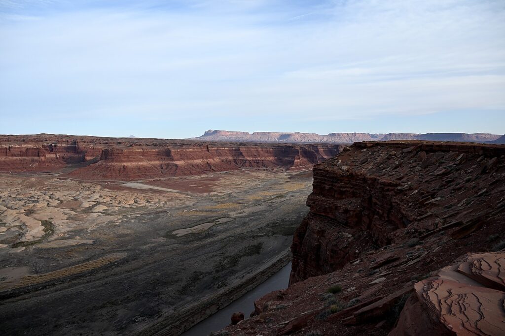
We stop at Hite Overlook for spectacular, iconic views of the Western landscape.

The historic marker here relates how in 1883 Navajo Chief Hoskininni led Cass Hite to the Canyon below, where he found gold. He opened a small store and post office, making his fortune off the miners. After World War II, the town’s population “swelled” to more than 200. This time, miners were searching for “hot” rocks (uranium). This mining boom also went bust and Hite returned to its small town existence. But in 1964, the waters of Lake Powell swallowed up Hite, leaving behind the only true treasure: the view.

Hite Overlook © Karen Rubin/goingplacesfaranadnear.com

We drive to Bears Ears-Cedar Mesa where we finally get to do the wild camping I have been so excited about (that means no services at all, just wilderness). The sun is descending and we are hoping to set up camp before dark.

Hite Overlook © Karen Rubin/goingplacesfaranadnear.com

Dave finds his way down a dirt road leading to Arch Canyon and we finally find a suitable site literally next door to a sign marking an Indian reservation (no trespassing!).

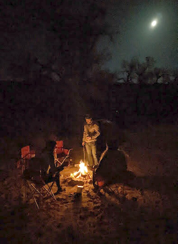
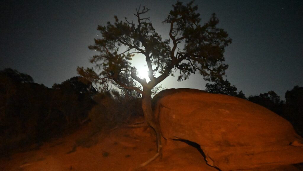
We set up in time before dark, but the full moon shines like a giant lantern, rising just as the sun sets, making flashlights unnecessary.

Wild camping in Arch Canyon © Karen Rubin/goingplacesfaranadnear.com

We sit around the campfire, enjoying the peace and reveling in our adventure. We will finally get to use our winter-rated sleeping bags and pads Dave had rented from Moosejaw (https://www.moosejaw.com/content/gear-rental, 877-666-7352). 

Each day of our trip, we are immersed in landscape that manifests different personality, character, color, texture, ambiance, even theme, and provide the contours for our experience.

Tomorrow we will get to meet Bears Ears and the spirits of the Ancestral Pueblo people.  

Glen Canyon National Recreation Area, www.nps.gov/glca, 928-608-6200; Bullfrog Visitors Center, 435-684-7423.

See:

UTAH ADVENTURE DAY 1-2: CAPITOL REEF’S COLORFUL CANYONS

UTAH ADVENTURE DAY 3-4: GRAND STAIRCASE-ESCALANTE POSES CHALLENGE

______________________

© 2023 Travel Features Syndicate, a division of Workstyles, Inc. All rights reserved. Visit goingplacesfarandnear.com, www.huffingtonpost.com/author/karen-rubin, and travelwritersmagazine.com/TravelFeaturesSyndicate/. Blogging at goingplacesnearandfar.wordpress.com and moralcompasstravel.info. Visit instagram.com/going_places_far_and_near and instagram.com/bigbackpacktraveler/ Send comments or questions to FamTravLtr@aol.com. Tweet @TravelFeatures. ‘Like’ us at facebook.com/KarenBRubin 
Utah Adventure Day 3-4: Grand Staircase-Escalante Poses Challenge

Hiking Big Horn Canyon, Grand Staircase-Escalante, Utah © Karen Rubin/goingplacesfarandnear.com

By Karen Rubin, with Laini Miranda and Dave E. Leiberman

Travel Features Syndicate, goingplacesfarandnear.com

Grand Staircase-Escalante National Monument is a Delaware-sized museum of sedimentary erosion that takes you down a 200-million-year-old “staircase” – a series of plateaus that descend from Bryce Canyon south toward the Grand Canyon.

But it’s relatively new and unexplored: it was the last part of the Lower 48 United States to get cartographed. President Bill Clinton set aside these 1.87 million acres as a national monument in 1996 because its untrammeled significance distinguishes it for researchers and explorers alike – but it has been controversial ever since, as Trump and Republicans sought to reverse its protected status, slash the size of Grand Staircase in half and neighboring Bears Ears by 85%,and open up vast sections of both – including areas sacred to indigenous people – to extraction and exploitation. Biden reinstated the protected areas in 2021.

Unlike the exceptionally popular and trafficked Capitol Reef (which we visited on our first two days of our Utah Adventure), Zion, Bryce Canyon and Arches National Park, Grand Staircase-Escalante is for more hard-core adventures – most of the trails are barely marked, require four-wheel drive to reach the trailhead, and have minimal services (you are on your own).

David and Laini have been here before, so have scouted and know the ropes – like how to drive down the rustic, 55-mile long Hole-in-the-Rock road that begins on Highway 12, just southeast of the town of Escalante, and ends at the edge of a cliff. That road leads to the trailheads of the minimally marked trails into many slot canyons that Laini most wants to explore. When they came the last time, the road was almost impassable – we are lucky today, that the gravel and sand are not so deep. (Pro tip: go in early spring shortly after the road is regarded; in summer and fall, the washboard road has been so well-traveled and destroyed that it takes over an hour to drive just 20 miles, even in a four-wheel drive car with high clearance, as David and Laini learned through experience).

Hole in the Rock Road is actually a famous historic Mormon Trail. The off-highway portion begins/ends near Halls Crossing on Utah Highway 276 and goes near to the pioneer crossing of the Colorado River (now Lake Powell). A large group of Mormon settlers in wagons traveled this route on a journey from Escalante to Bluff, which they expected to take six weeks but actually took six months. It is an amazing expanse of open country. This is also the famed road featured in Edward Abbey’s cult classic, “The Monkey Wrench Gang”.

Names here are very descriptive and should give you some idea (they might as well use skull and crossbones instead of trail markers): Devils Garden (the easiest and most enchanting hike), Spooky Gulch (a moderate hike), Little Death Hollow, Death Hollow (a difficult hike). And then there’s Hell’s Backbone – a rugged, 45-mile long mostly unpaved mountain road from Escalante to Boulder through Dixie National Forest into Box Death Hollow Wilderness area that climbs far up the southern slopes of Boulder Mountain, reaching the summit at 9,200 feet; without stops takes nearly 2 hours to drive, is closed in winter and usually impassable during the snowmelt season of late spring.

The trail to Zebra Canyon, Grand Staircase-Escalante, Utah © Karen Rubin/goingplacesfarandnear.com

The canyons are a rugged, desolate adventurers’ paradise – Jurassic Park comes to mind – and draws hard-core hikers, canyoneers and other outdoors enthusiasts. There are very few people around (the town is tiny), even reaching the trailhead requires four-wheel drive capable of off-road, and the trails are not marked, beyond a sign at the trailhead, and even these are rare.

As we head out for hikes, we have to be extremely mindful of carrying enough water and snacks. David hauls a 5-gallon collapsible water jug that he stashes for the trip back, and carries a 4L Hydrapak water bladder that he uses to refill our personal water bottles. We’re here in cool weather, but in summer, it can be dangerously hot. You are cautioned not to start out on these hikes after 10 am. David and Laini are also big fans of the lightweight Clif Energy Bloks that you can stock up on at Escalante Outfitters in town, where we get breakfast before heading out.

Dave, Laini and Alli hiking the trail to Zebra Canyon, Grand Staircase-Escalante, Utah © Karen Rubin/goingplacesfarandnear.com

Besides water, hat, sunglasses, sunscreen, snacks (and me a camera), a light compactable jacket, we try to carry as little as possible. (This means I can’t take my Nikon Z5 mirrorless –too big, bulky; on the more challenging hikes I rely on my Panasonic Lumix, my Olympus T6, and my Google Pixel phone, which actually capture the richest colors). Laini and David advise us that in some spots the slot canyons are only 10” wide and simply cannot accommodate a backpack.

On a previous trip, David and Laini had a sophic guide named Ace (or Yoda), who said things like, “Let the land reveal itself to you and you will ultimately find the red zone.” (I have no idea what the red zone represents but it sounds very Zen and I think it has something to do with the fact that there is no real trail – we have to find our own way using instinct, intuition, or just common sense, as well as the verbal descriptions of landmarks.)

The trail to Zebra Canyon, Grand Staircase-Escalante, Utah © Karen Rubin/goingplacesfarandnear.com

(Actually, you don’t have to go off on your own – the Visitor Center can provide a list of outfitters in Escalante. David and Laini hired Ace Kvale on their first trip to the area; he’s a photographer and guide, https://acekvale.com/; see https://www.visitutah.com/Articles/Roaming-Grand-Staircase-Escalante. And apparently, there is actually a “red zone’, Laini tells me later, “literally an area of red swirly mounds in the middle of the otherwise white and yellow landscape.”)

This first morning, we hike to the Zebra Canyon – a slot canyon which is often too flooded to visit, as it was when Laini and David were last here. It’s a two-mile hike across flat open terrain to get to the entrance (virtually no shade).

Laini reads notes to direct our route that sound like Indiana Jones navigating by looking out for cryptic descriptions of land formations.

“Named after the vivid stripes that line its walls, Zebra Slot Canyon in Grand Staircase Escalante is perhaps the most unique canyon in Southern Utah,” the notes read. “To reach the stunning canyon requires an 8-mile drive down a dirt road, a 5-mile round trip hike that can be tricky to follow, and a challenging climb through very narrow canyon walls. Even though the Zebra Slot Canyon itself is only about a quarter-mile long, the long journey to reach it is completely worth the effort.”

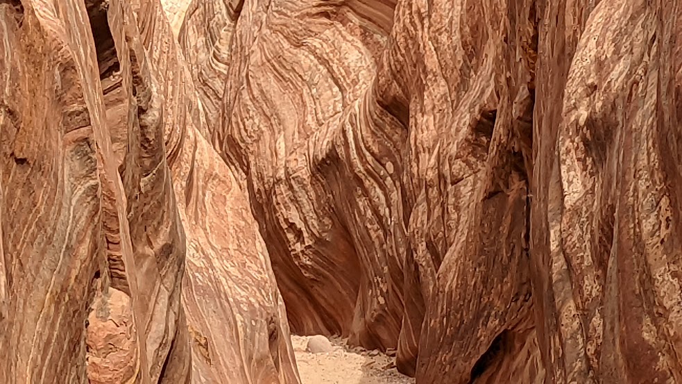
The landscape here in the Grand Staircase Escalante is so different from Capitol Reef – swirls and folds, amazing color, the formations sensuous.

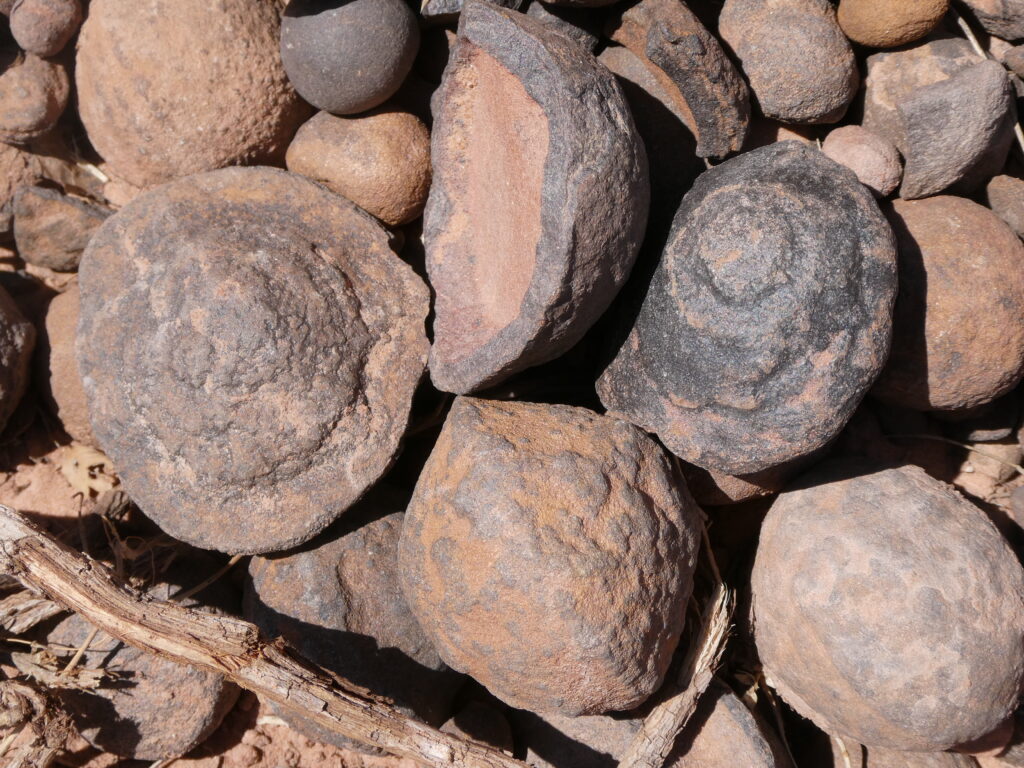
Moqui marbles on the trail to Zebra Canyon, Grand Staircase-Escalante, Utah © Karen Rubin/goingplacesfarandnear.com

We come upon a literal pile of perfectly round rocks (“Moqui marbles”)—that look like chocolate bon bons or rubber balls formed by hand–that native peoples used like marbles or balls.

Zebra Canyon is wide open where it joins Harris Wash, but within 10 minutes, becomes deeper and narrower. Where it narrows, there can be a few pools of water from ankle to waist deep (you may want to take off your boots, but keep them with you); “15 minutes up the canyon you enter the short, but amazing Zebra section that ends at a small dryfall you can upclimb. This is the best section of Zebra. Above the small dryfall is a large pothole and the canyon opens. Head back down to Harris Wash when finished,“ the notes say.(www.roadtripryan.com/go/t/utah/escalante/zebratunnel)

The trail to Zebra Canyon, Grand Staircase-Escalante, Utah © Karen Rubin/goingplacesfarandnear.com

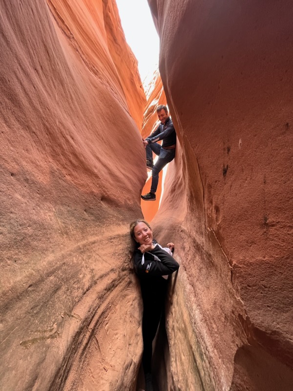
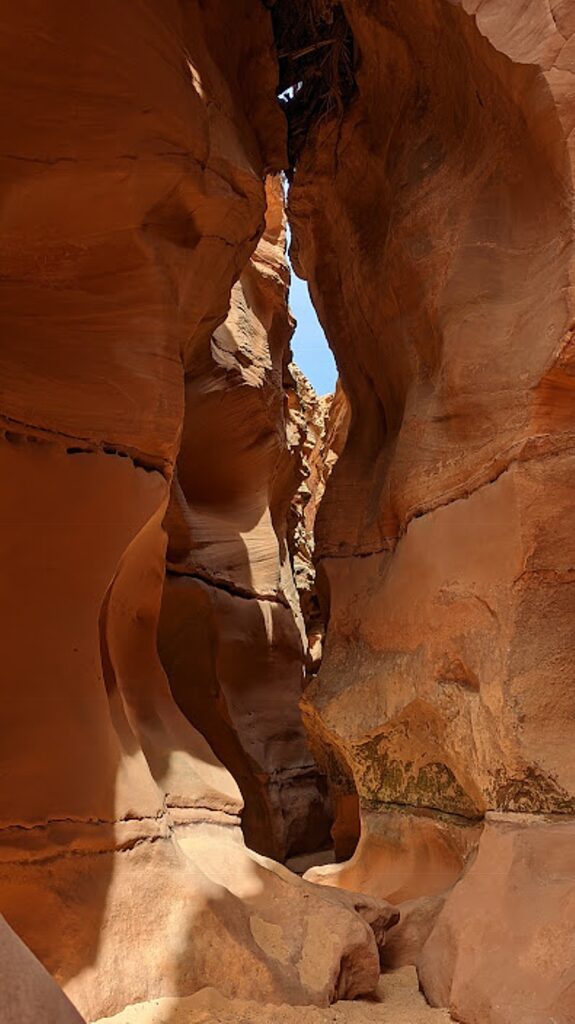
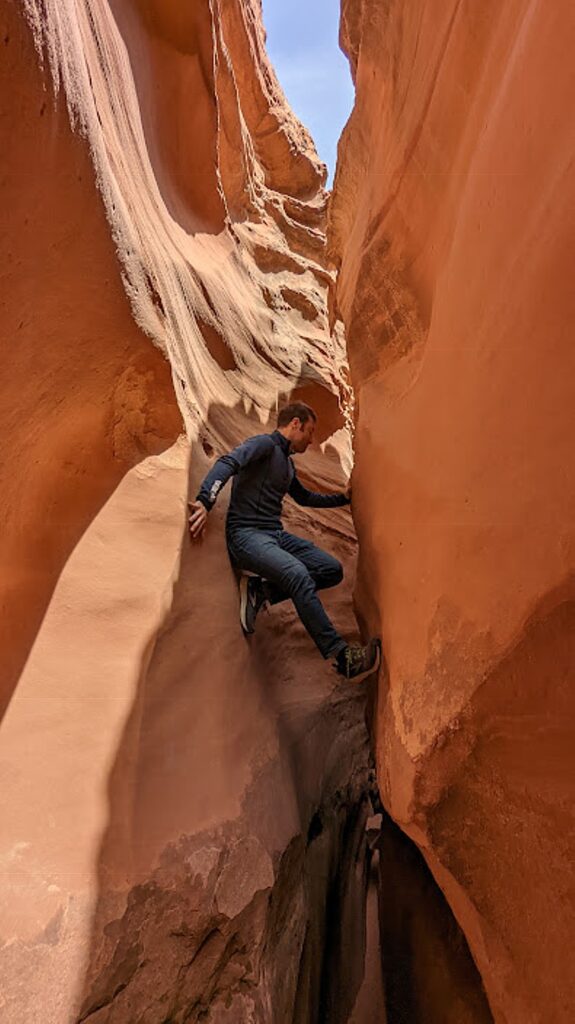
I make it through a little ways, squeezing my way in, but then it becomes even narrower, with barely 10 inches to get through. This is much more technical, requiring real climbing skill, where you have to use your hands and legs to shimmy up the walls of the canyon and slither through. Essentially, every “step” is problem-solving a puzzle – involving seeing the puzzle in its full-dimension, thinking out of the box to use all your resources, and transfigure/manipulate/reshape your body. You need to be flexible (I’m not), have good strength in your upper body, hands and knees (I don’t), and it helps to be thin (no comment).

This is my first experience in a slot canyon, and I am intimidated. I don’t want to hold back the others or have them worry that I will be completely trapped inside (my worry), so I tell them to go on ahead and wait for them in a small wider section, enjoying watching others go through (and not return).

Laini demonstrates her rock climbing skill as she navigates the Zebra Canyon in Grand Staircase-Escalante © Dave E. Leiberman/goingplacesfarandnear.com
Dave and Alli meet the challenge of Zebra Canyon in Grand Staircase-Escalante © Laini Miranda/goingplacesfarandnear.com

It feels surreal, but I can hear people laughing through the rock walls, as if embedded in the rock (it’s weird).  While I wait, I watch the various techniques people use to scramble up the sides and solve the problem of slithering through. Very creative! (I’m sorry to have missed the experience but I did not want David and Laini to be concerned for me.) 

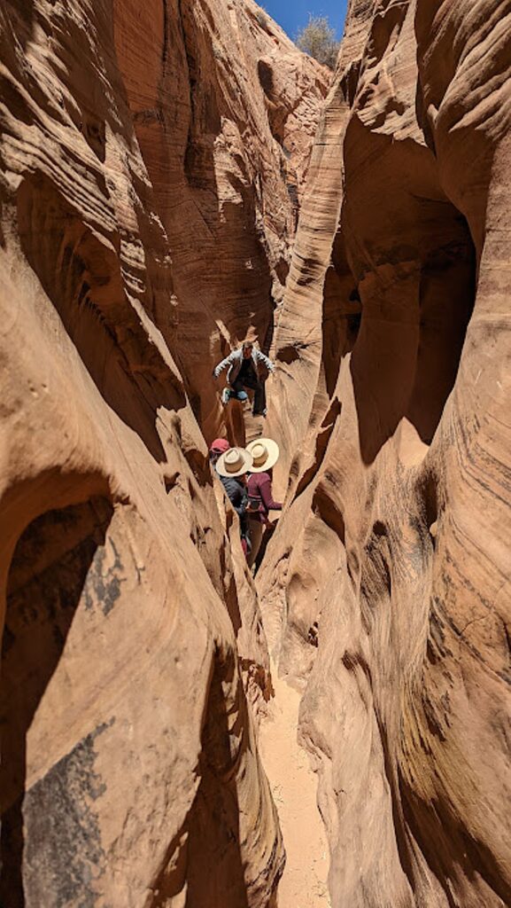
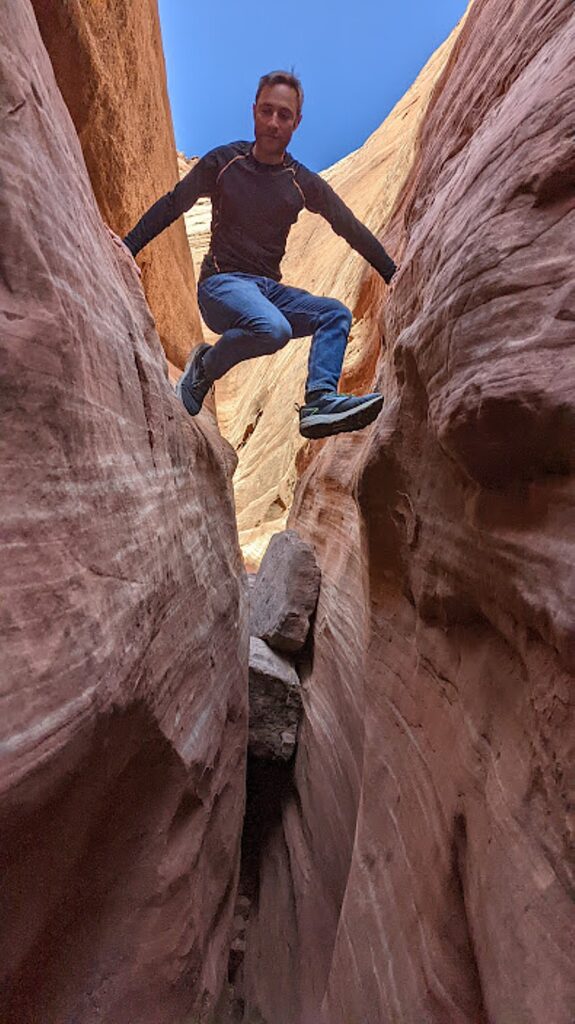
Dave demonstrates his climbing technique to get through the narrow sections of Zebra Canyon Grand Staircase-Escalante, Utah © Karen Rubin/goingplacesfarandnear.com
 

Our plan is to next go to Tunnel Slot. The directions say to go down Harris Wash a little less than a mile (20-30 minutes) from Zebra to the first side canyon coming in on the left. Go up this side canyon about 10 minutes to reach the Tunnel. It can be dry, or a deep pool.

But instead of exiting to the other end of Zebra where I would expect these directions apply, David, Laini and Alli come back to where I am at the beginning, and we continue on in search of the Tunnel Slot Canyon that is supposed to be nearby.

Finding our way in Grand Staircase-Escalante, Utah © Karen Rubin/goingplacesfarandnear.com

Canyons don’t have signs or markers. People just know where to go. In some instances we find cairns (a marker made of piled-up rocks that leads you to the right path. I keep that in mind to throw back at bigots who have turned my name, Karen, into a slur: cairns lead the way to the right path).

But mostly, we just go (a tad unnerving because of the vastness of emptiness and the thought of actually wandering around totally lost, as I’ve seen in Survivor and/or Disaster movies).

Laini recalls another of Ace’s sagacious aphorisms, “Whichever way you go, that’s the best way.”

Dave demonstrates his climbing technique to get through a narrow slot canyon in Grand Staircase-Escalante, Utah © Karen Rubin/goingplacesfarandnear.com

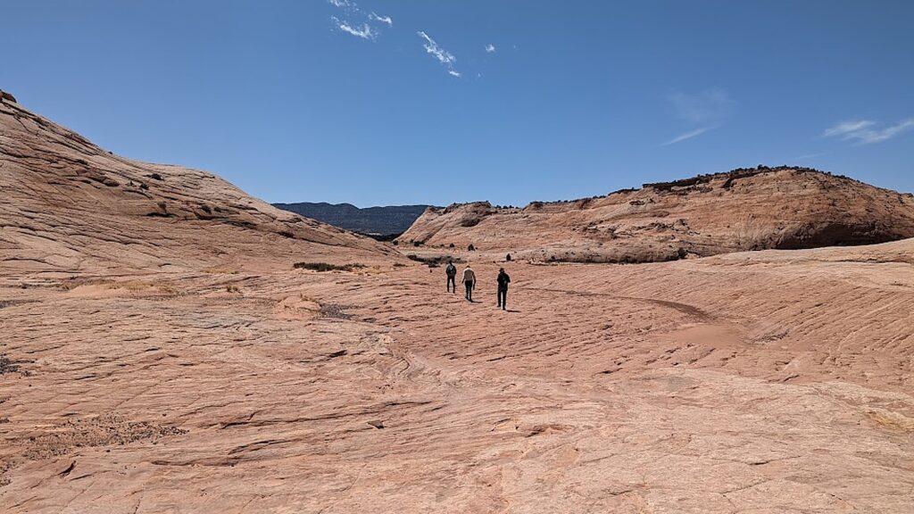
So, we find ourselves paving our own trail (that’s fun too) , walking over a vast section of slickrock – amazing white, swirled smooth mounds of rock like petrified ice cream – and instead find another slot to explore. This time, I scramble over boulders to get in (very proud of myself), but it doesn’t go far. Still. I did it and it gives me confidence for another day. We don’t actually find the Tunnel Slot Canyon.

We find our way to the trail we came in on (whew!), and return to the trailhead.

We’re back to the Jeep by 4:10 pm, having hiked for 6 hours (6 miles).

There are more slot canyons in this region of Utah than anywhere in North America, Laini says. (See: Top 10 Slot Canyons in Utah, https://www.utah.com/articles/post/top-10-slot-canyons-in-utah/)

The slots are reached along Hole in the Rock Road. And after these ambitious hikes, we continue driving on the road to Devils Garden, 13 miles south of Escalante

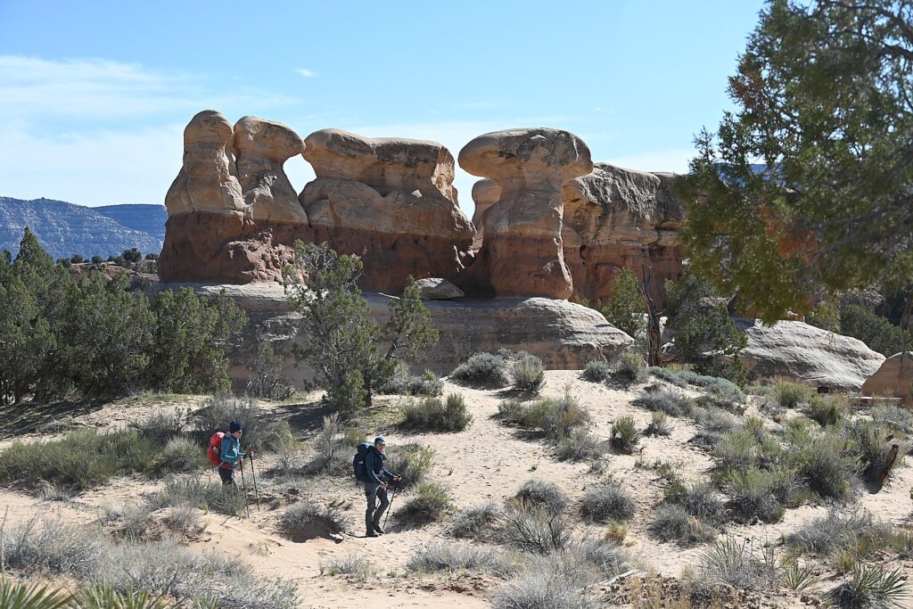
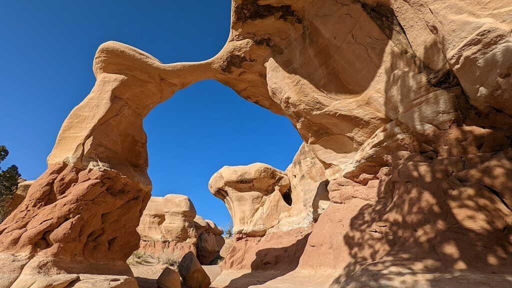
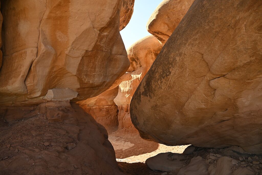
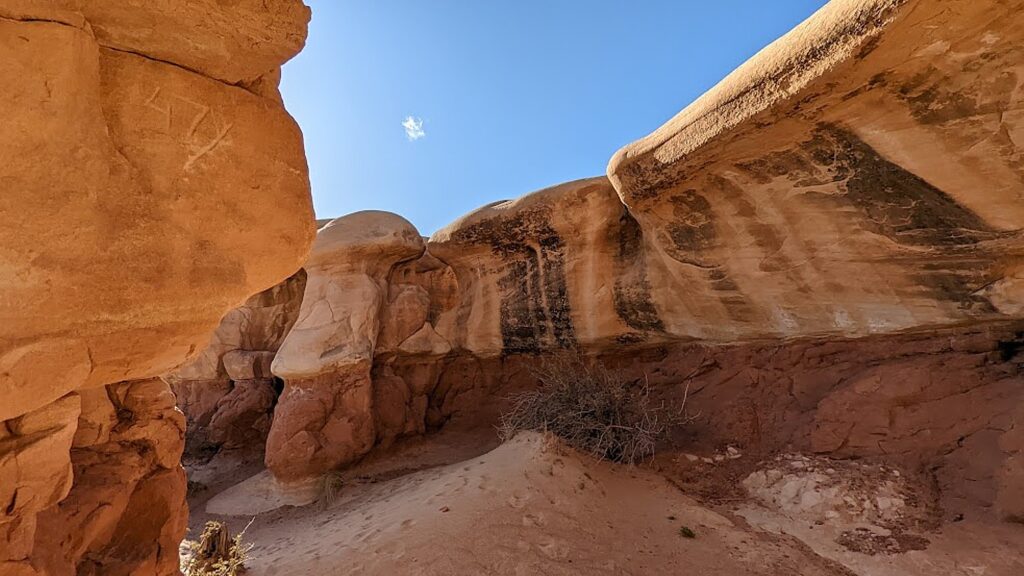
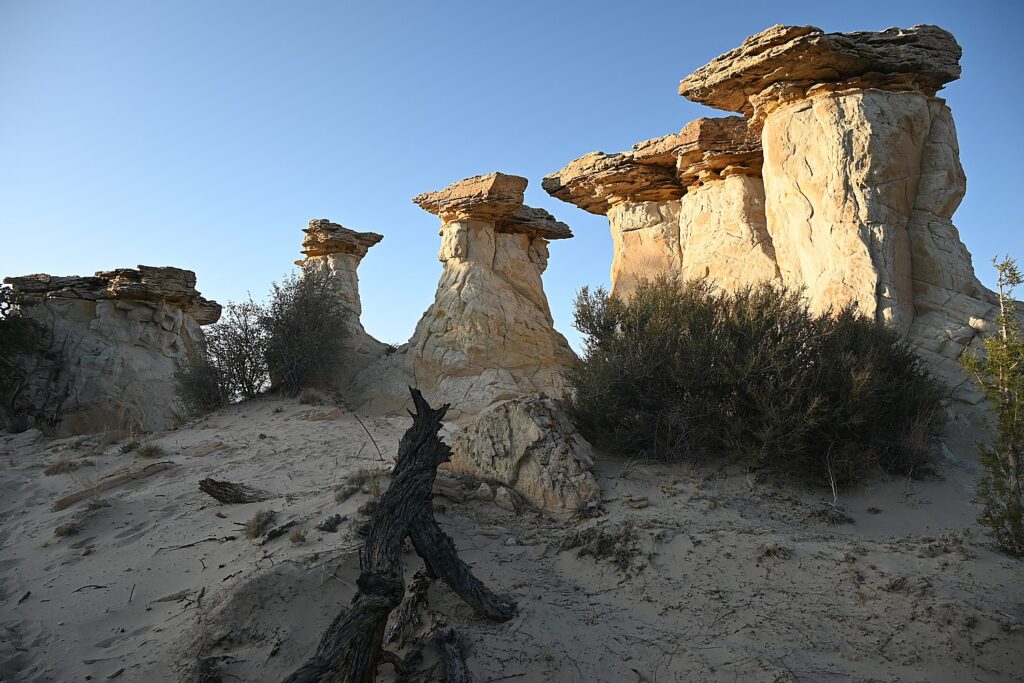
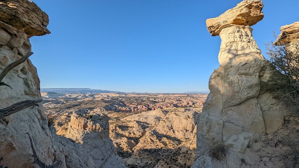
Devils Garden is an astonishing sight – a whole cityscape of hoodoos and arches. These are incredibly dramatic, mysterious – not rock at all, but seem to be imbued with spirits (hence the name, no doubt). To me, this place evokes Easter Island (and I wonder if that’s how the Easter Island statues were actually formed – originally hoodoos that islanders then carved). How is this place not so famous that everyone knows about it and comes? Don’t miss the Metate Arch.

Hoodoos abound in Devils Garden, Grand Staircase-Escalante, Utah © Karen Rubin/goingplacesfarandnear.com
Metate Arch, Devils Garden, Grand Staircase-Escalante, Utah © Karen Rubin/goingplacesfarandnear.com
Devils Garden, Grand Staircase-Escalante, Utah © Karen Rubin/goingplacesfarandnear.com

This is probably the easiest trail in the area, and is absolutely magical. There is also a lovely picnic area and bathrooms.

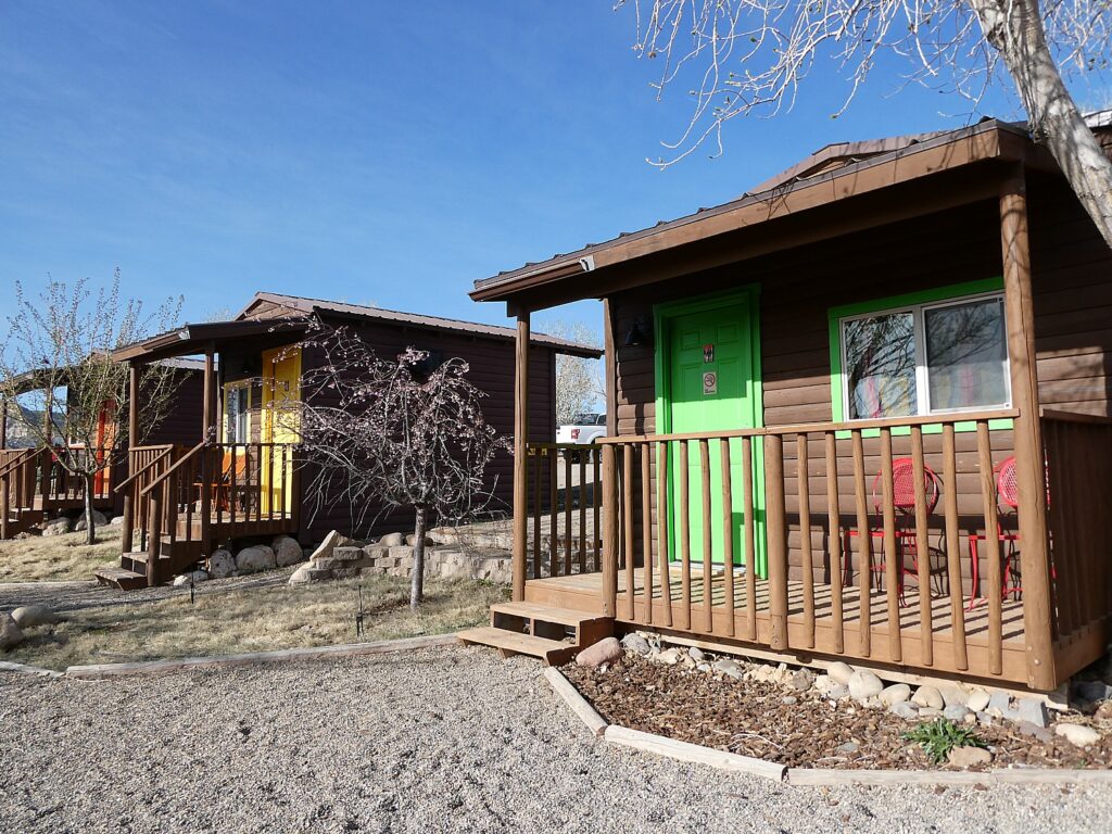
Back in the Jeep, Laini leads us down a wild path to the no-name hoodoos overlook that she and David discovered wild camping on a previous trip (the drive was harrowing enough, like being in an ATV). From this high elevation we look through these towering rock formations to the vast expanse below. It’s tempting to camp here, but we return to our cozy cabin at Canyons of Escalante RV Park in Escalante.
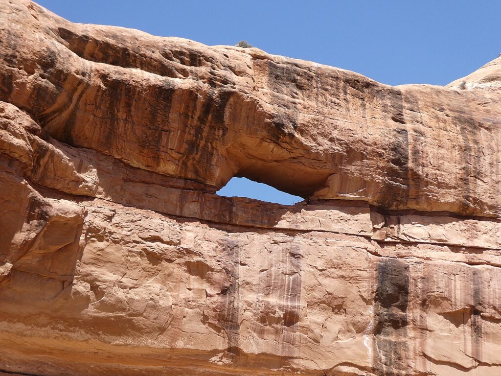
Hoodoos overlook Grand Staircase-Escalante, Utah © Karen Rubin/goingplacesfarandnear.com

At the trailhead, we had met two “influencers” who seemed to us to be amateurs since they were not even carrying much water. We see them again in  Zebra Canyon, where they were dressed incongruously in flowy blue dresses for a fashion shoot. At the end of the day, we happen upon them again at a restaurant adjacent to our campground, and learn they had completed Zebra, Tunnel, Spooky, and Pickaboo slot canyons all in one day!

Our cozy cabin at Canyons of Escalante RV Park, Escalante, Utah © Karen Rubin/goingplacesfarandnear.com

Big Horn Canyon

For our second day exploring Grand Staircase-Escalante, we head to Big Horn Canyon.

I’m more prepared today for this hike and basically, go with the flow (as Ace would say).

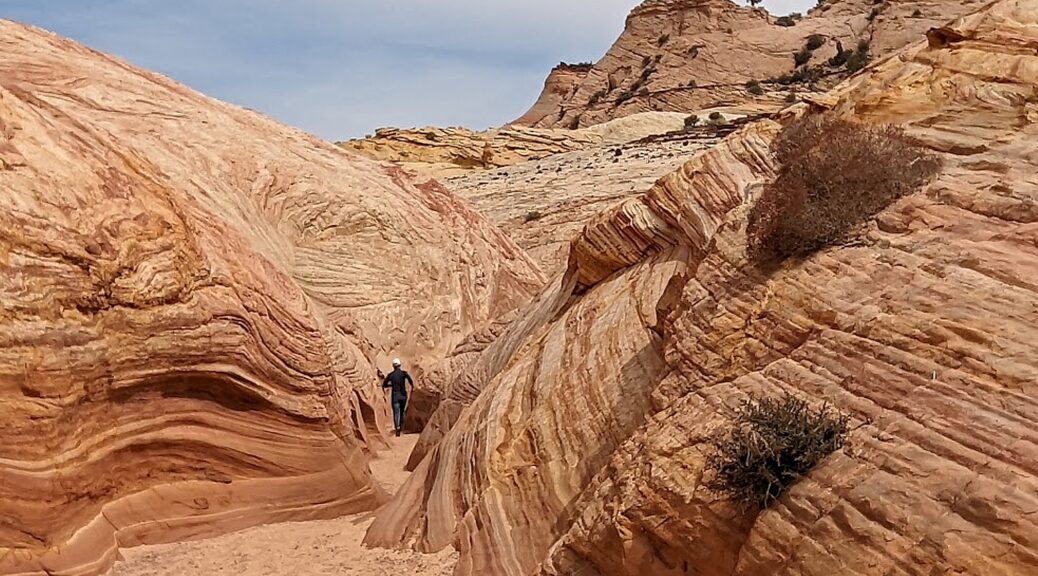
Big Horn Canyon is a tributary of Harris Wash. It runs for three miles through alternating slickrock and sand – the first two miles are in the wash. The slots cut into the Navajo sandstone rock layers displaying an unusually wide range of colors and forms.

We follow instructions which say to park at the two blue containers, then make our way down to the river bed (exactly where do we start?) and follow Harris Wash  of the Escalante River, crossing it many times (and can be hard to reach when the water is higher.)

This first part of the hike to reach the canyon is pleasant – we go back and forth over a riverbed which on this day, is mostly dry.

Hiking through Burr Canyon, Grand Staircase-Escalante, Utah © Karen Rubin/goingplacesfarandnear.com

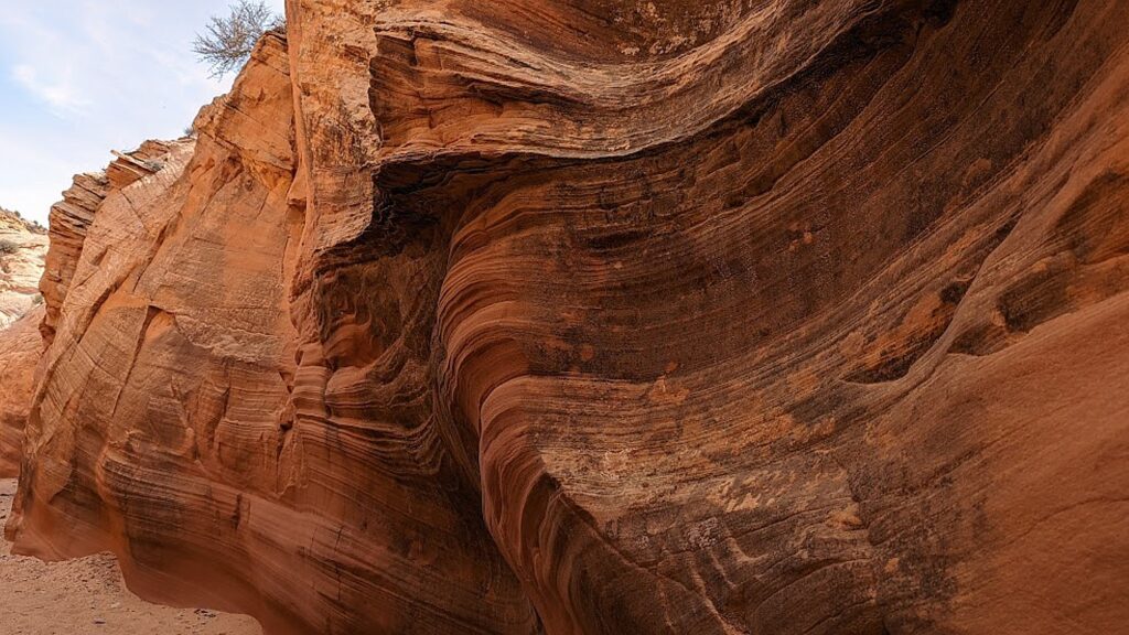
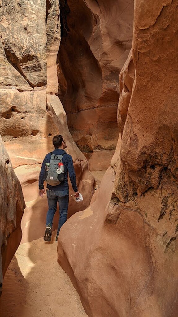
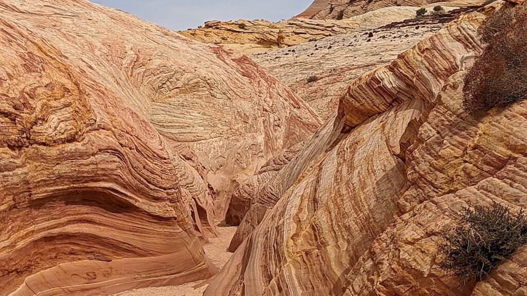
There are two slot canyons. The first over to the left is shorter and the hike ends when it becomes too narrow to pass through. The second one is long and the colors are spectacular. For a change in perspective, once the canyon walls open you can hike on the creamsicle swirled ice cream rocks. 

Hiking through Burr Canyon, Grand Staircase-Escalante, Utah © Karen Rubin/goingplacesfarandnear.com

Unlike Zebra, Big Horn Canyon is really easy to navigate (no need to slither up walls) – ideal for neophytes like me.

Hiking through Big Horn Canyon, Grand Staircase-Escalante, Utah © Karen Rubin/goingplacesfarandnear.com
Hiking Big Horn Canyon, Grand Staircase-Escalante, Utah © Karen Rubin/goingplacesfarandnear.com

Big Horn Canyon is magnificent. Nature puts on a fantastic display of colors, patterns, swirls and shapes. You can imagine how the ancients got their inspiration for their art. Walking through, it feels like you are the ball in a psychedelic pin ball machine.

Hiking Big Horn Canyon, Grand Staircase-Escalante, Utah © Karen Rubin/goingplacesfarandnear.com

This hike reminds Laini of Dr. Seuss’ “Oh the Places You Will Go.”

And I think to myself, how is this canyon not more popular!?! In fact, for the most part, we are completely alone – not a soul around (in contrast to Zebra which seemed to draw lots of people, despite its difficulty). It makes it all the more surreal when a couple does pop up in our space, bursting the reverie.

Hiking Big Horn Canyon, Grand Staircase-Escalante, Utah © Karen Rubin/goingplacesfarandnear.com

The hike altogether is about six miles – absolute perfection.

We are back in the car at 2:14 pm, and head out to drive to our next stop, Glen Canyon, via the Burr Trail, a scenic byway. 

I have it on my list to tackle more of the best hikes in Escalante:

  • Spooky Gulch is a short slot canyon hike in the Grand Staircase-Escalante area, considered moderate difficulty. You can also visit Dry Fork and Peek-a-boo as a six-mile loop, each slot slightly more difficult and narrow than the last. Laini says this was one of her most favorite hikes. (Spooky gets to be only 10-inches narrow in some spots).
  • Calf Creek Falls is one of the most enchanting areas of the Grand Staircase-Escalante area, a verdant oasis amid tumbled stone monoliths, considered moderate difficulty.
  • Coyote Gulch isa winding, semi-narrow canyon that snakes its way down through incredible red rock, considered difficult. Laini says that she has had this one on her list, but it requires an overnight on the hike, or a 16+ mile hiking day, 8-10 hours.

Other moderate-rated hikes include Fortymile Gulch; Golden Cathedral; Little Death Hollow; Peek-a-boo Gulch and Round Valley Draw.

Information at Escalante Interagency Visitor Center, 755 West Main, Escalante UT 84726, 435-826-5499, www.blm.gov/programs/national-conservation-lands/utah/grand-staircase-escalante-national-monument. Another visitors center is at 745 US-89, Kanab, UT 84741, 435-644-1200.

Also, https://www.utah.com/destinations/national-monuments/grand-staircase-escalante-national-monument/

See:

Utah Adventure Day 1-2: Capitol Reef’s Colorful Canyons

______________

© 2023 Travel Features Syndicate, a division of Workstyles, Inc. All rights reserved. Visit goingplacesfarandnear.com, www.huffingtonpost.com/author/karen-rubin, and travelwritersmagazine.com/TravelFeaturesSyndicate/. Blogging at goingplacesnearandfar.wordpress.com and moralcompasstravel.info. Visit instagram.com/going_places_far_and_near and instagram.com/bigbackpacktraveler/ Send comments or questions to FamTravLtr@aol.com. Tweet @TravelFeatures. ‘Like’ us at facebook.com/KarenBRubin