Tag Archives: camping

Utah Adventure Day 8: Arches National Park, a Geologic Wonderland

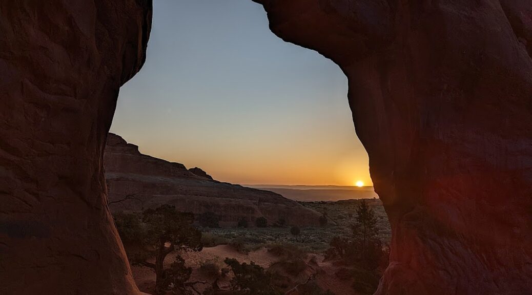
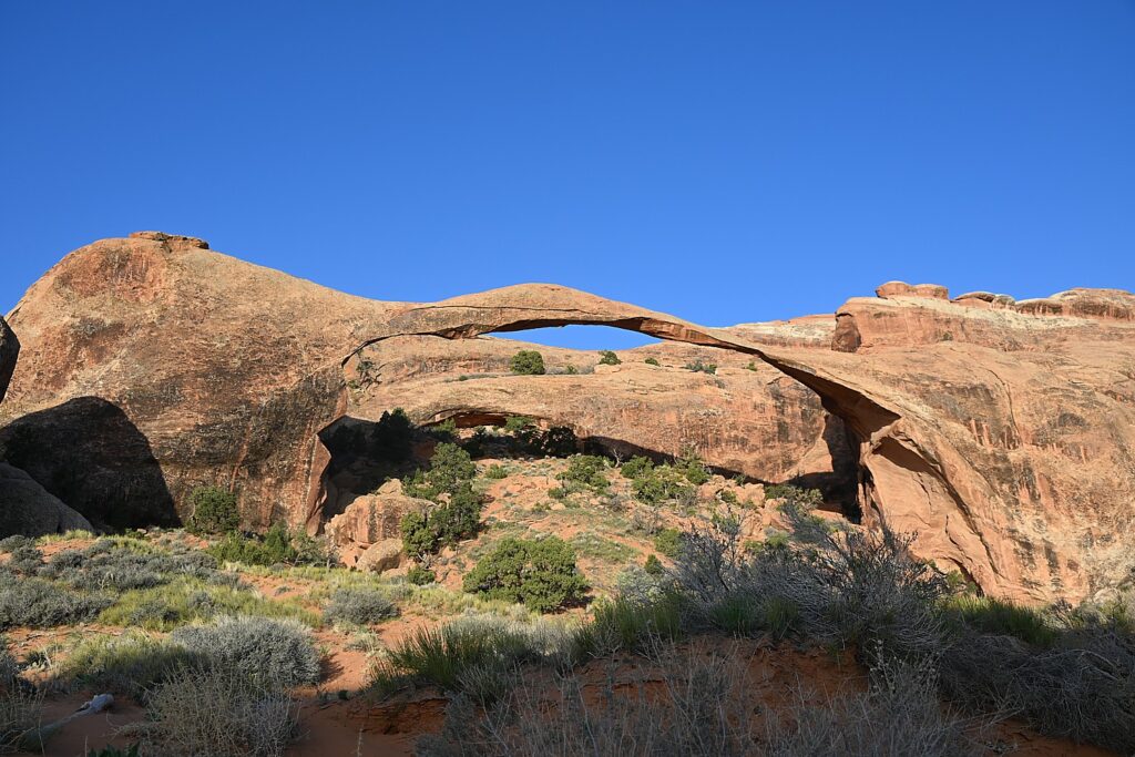
Sunrise on the Landscape Arch, Devils Garden Trail, Arches National Park © Karen Rubin/goingplacesfarandnear.com

By Karen Rubin, with Laini Miranda and Dave E. Leiberman

Travel Features Syndicate, goingplacesfarandnear.com

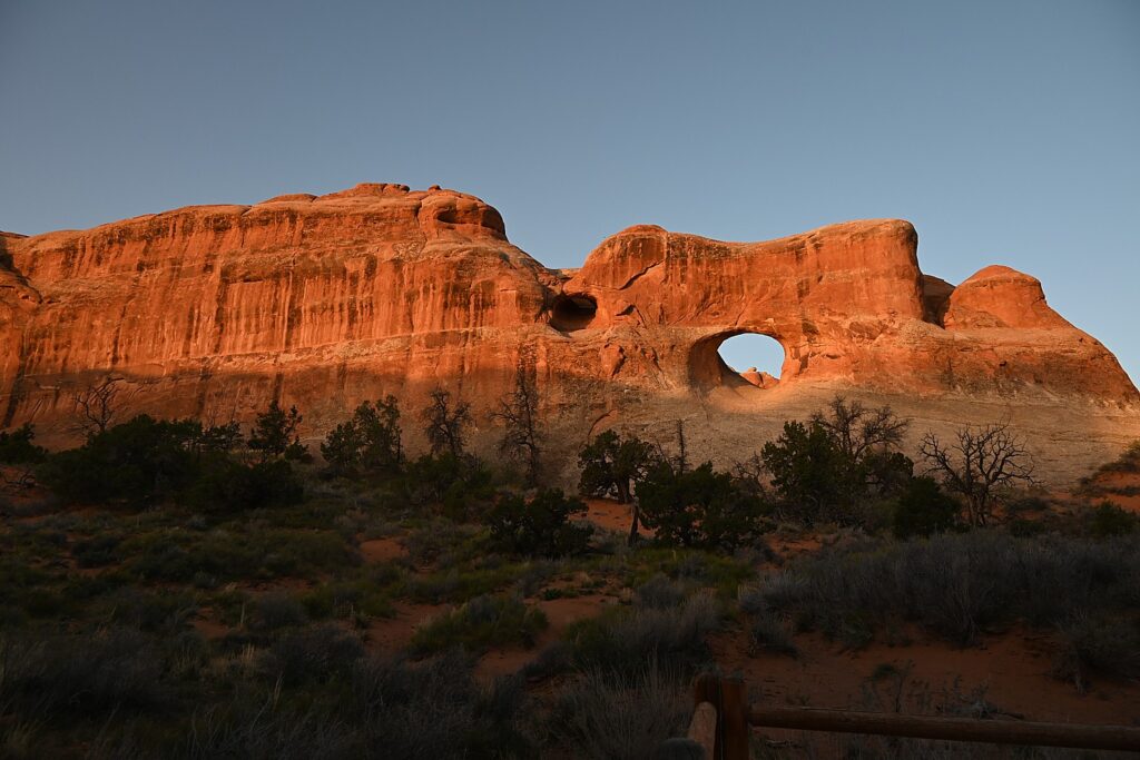
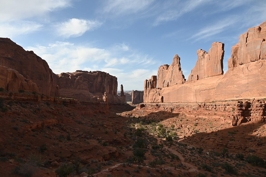
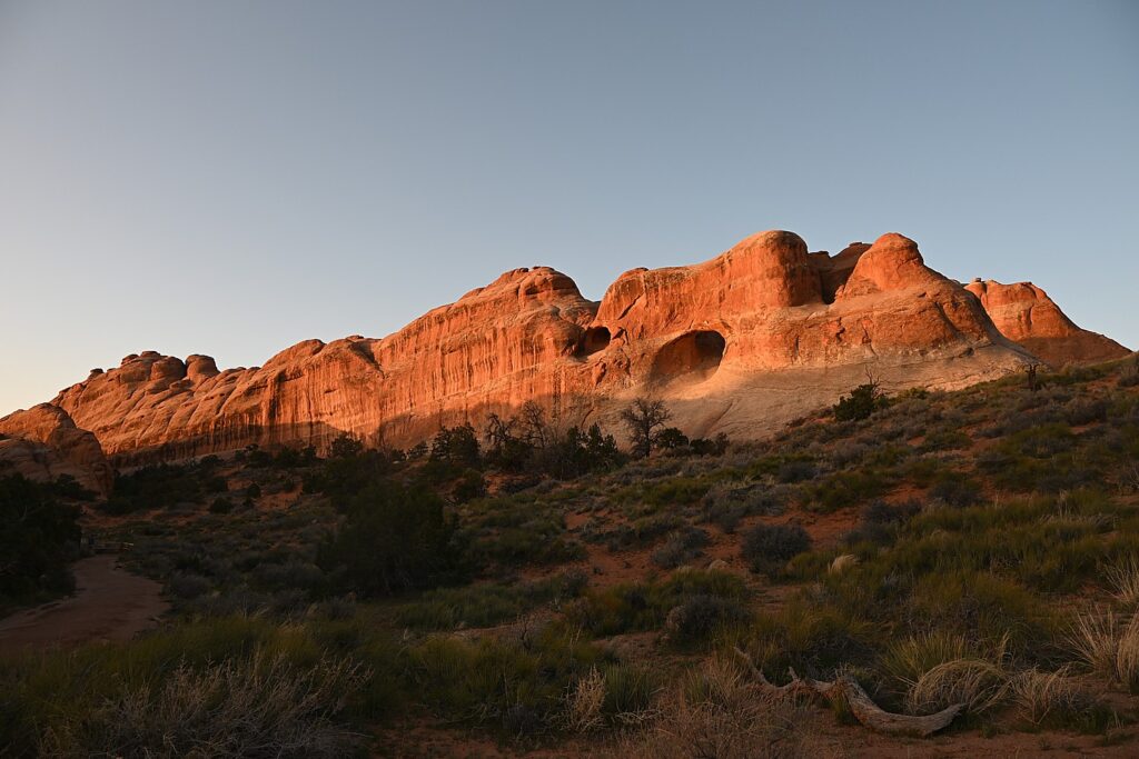
Arches National Park is a fantastical place, a geologic wonderland, and being able to wake up before the sun in the Devils Garden Campground and stroll along the Devils Garden Trail as the formations come alive with color, is extraordinary.

Arches’ sprawling landscape of 2,000 natural stone arches – the highest concentration of arches on the planet – plus hundreds of soaring pinnacles, massive rock fins, giant balanced rocks, coupled with its accessibility and ease of getting around (well, except for traffic and difficulty finding parking) and access (through Moab) draws hundreds of thousands of visitors each year, making it one of the most popular national parks. Indeed, Arches is so popular (and crowded) that it requires advance purchase, timed entry reservations just to enter, between April 1 and October 31.

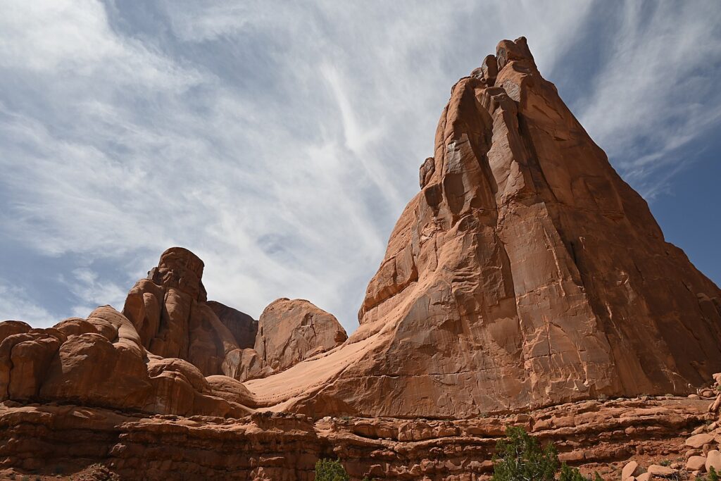
Arches National Park is a geologic wonderland © Karen Rubin/goingplacesfarandnear.com

We are lucky because Laini has cleverly booked two nights at the Devils Garden campground months before our trip. The campsite reservation acts as the entry ticket and for this reason but especially because of being immersed in the landscape, this is the absolute best way to experience Arches National Park. (Devils Garden Campground is pen year-round, with 52 sites, reservations for individual sites can be made up to six months in advance; for group sites can be reserved up to year in advance, www.nps.gov/arch)

Arches is the most touristic of all the places we have visited this trip and offers such a contrast with the wild camping and communion with ancient spirits (Bears Ears), the remote unmarked hikes (Grand Staircase-Escalante), the long meandering hikes (Capitol Reef) and our search through muck and mud to find archaeological sites (Glen Canyon).

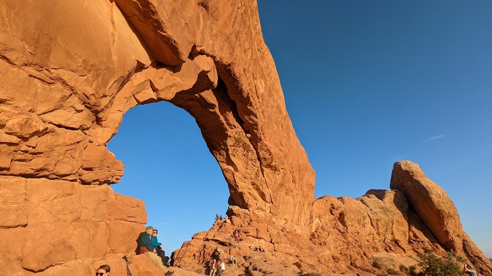
Here, we go sightseeing for the dazzling arches that give the park its name, like the amazing Double Arch, the Windows, Landscape Arch and Delicate Arch, accessed along paved paths from parking lots, with restroom facilities.

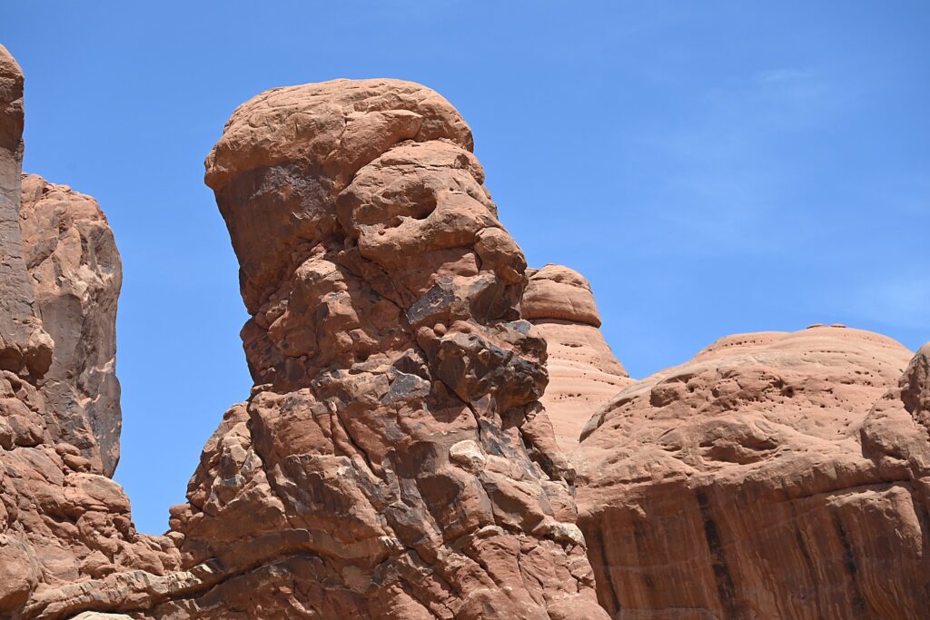
A formation in Arches National Park that looks like Croesus had just been turned to rock © Karen Rubin/goingplacesfarandnear.com

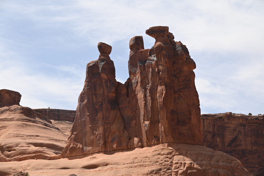
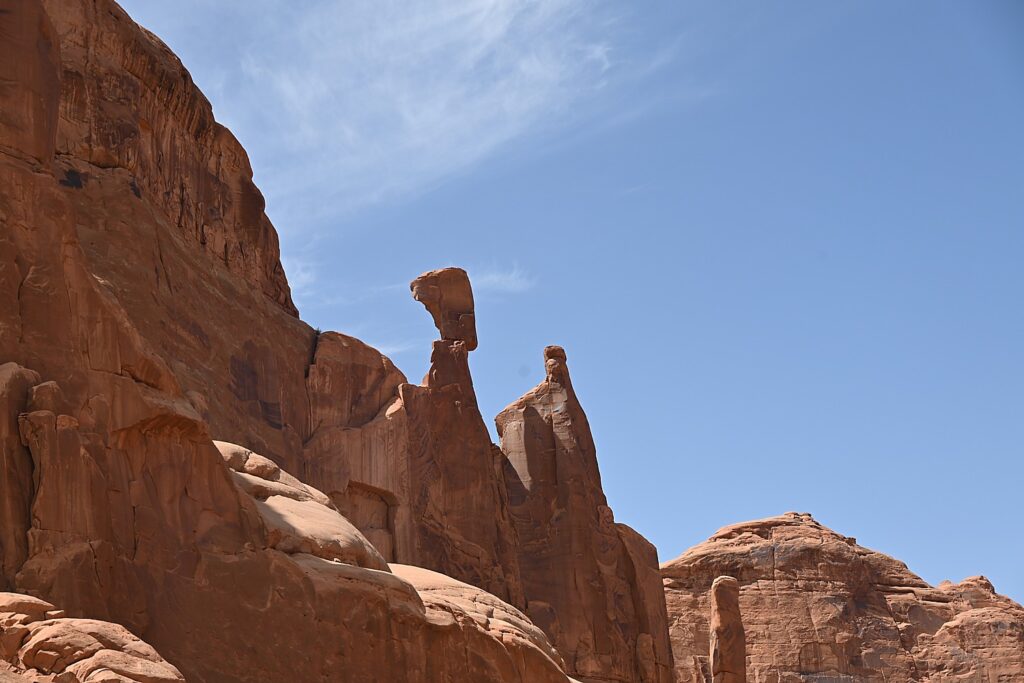
Throughout Arches, there are formations – eroded monoliths – that inspire names, like Parade of Elephants, Petrified Dunes, Tower of Babel and Fiery Furnace, also trigger imagination. Some look so much like mudmen, we name them (we rechristen Balanced Rock “E.T.”, the Gossips we rename “The Suffragists,” and formations that look to me as if Nefertiti and Croesus had just been turned to rock.

The formation once known as “The Gossips” we re-name “The Suffragists” Arches National Park © Karen Rubin/goingplacesfarandnear.com

The source of what we see is a salt bed, thousands of feet thick in places, that was deposited across the Colorado Plateau 300 million years ago when a sea flowed into the region and eventually evaporated, according to the Arches National Park notes. The salt bed was unstable and unable to hold the weight of the thick cover of rock formed from compressed debris. It shifted, buckled, liquefied and repositioned, thrusting rock layers upward as domes, while whole sections fell into cavities.

Doesn’t this rock formation look like Nefertiti? Imaginations run wild in Arches National Park © Karen Rubin/goingplacesfarandnear.com

Faults make the surface even more unstable. From the visitor center, you can see the result of a 2,500-foot displacement, the Moab Fault. The faults caused vertical cracks and wind and water over 100 million years of erosion and weathering, ultimately formed the arches of salmon-colored Entrada Sandstone and buff-colored Navajo Sandstone.

The process is ongoing – new features are being formed as old ones are transformed.

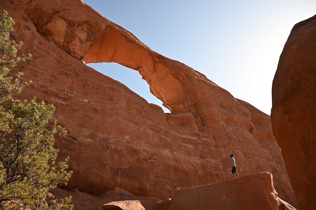
Sometimes the changes happen suddenly, violently. That was the case at the Skyline Arch, just next door to Devils Garden, where a massive boulder tumbled down in the 1940s, expanding the arch.

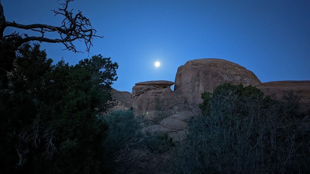
Waking before sunrise with the moon in Devils Garden Campground, Arches National Park © Karen Rubin/goingplacesfarandnear.com

The most ambitious hikes in Arches National Park are to the Double O Arch (4.1 miles); the Primitive trail (2.1 miles one way, considered most difficult), and if you would do the whole Devils Garden Trail (7.8 miles, that goes to the Landscape Arch, Double O Arch, Dark Angel along a primitive trail, with narrow ledges, rock scrambling and few trail markers; be sure to take enough water— 1 liter of water per person, per hour).

We do none of these, holding out for our most ambitious hike, to Delicate Arch, for sunset but I already have my trepidations.

And, in addition to the outstanding Devils Garden trail, from the campground (which feels luxurious to us for its restrooms and running water), you can hikethe Broken Arch Loop Trail which runs past Tapestry Arch and Broken Arch, then swings south towards Sand Dune Arch and back up passed Skyline Arch before returning to the campground. (Unfortunately, we don’t have time for that hike. Next time!)

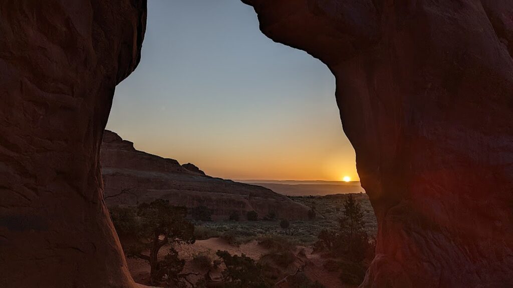
Sunrise in Devils Garden, Arches National Park © Karen Rubin/goingplacesfarandnear.com

For my sunrise hike, I do the easy, paved trail, rushing to get to a good position for photos, and then continue on to do more of it, going to where I see the famous Landscape Arch. After my walk through the easy part of the Devils Garden Trail (it is surprising how fast the sun comes up, washing out the colors), I go back to the campsite where we have breakfast.

Sunrise in Devils Garden, Arches National Park © Karen Rubin/goingplacesfarandnear.com

(Actually, we have to move from one campsite to another for our second night and Dave and Laini figure out to just put the tent with the sleeping bags and stuff on top of the Jeep and drive it over, which we do by check-out time.)

Landscape Arch, Devils Garden, Arches National Park © Karen Rubin/goingplacesfarandnear.com

We then set out to explore Arches.

We only have one full day at Arches National Park, and it’s the end of our hiking/camping adventure, so we kind of go with the flow. We drive to the different sites, and do short hikes up to the various formations, basically doing the tourist thing.

An easy trail takes you to the Skyline Arch, Arches National Park © Karen Rubin/goingplacesfarandnear.com

We follow a route, starting with the Skyline Arch adjacent to Devils Garden. Dave climbs to the top of that humongous boulder that fell down (scary to contemplate). The Skyline Arch Trail is short and easy, less than a half-mile roundtrip hike from the parking lot and back. The arch itself is one of the more popular landmarks in Arches. It makes for spectacular photographs, owing to its position, literally, on the skyline. And its proximity to the Devils Garden Campground makes it a perfect hike if you arrive late in the afternoon. (We arrived too late.)

Dave climbs atop of a boulder that came off the Skyline Arch © Karen Rubin/goingplacesfarandnear.com

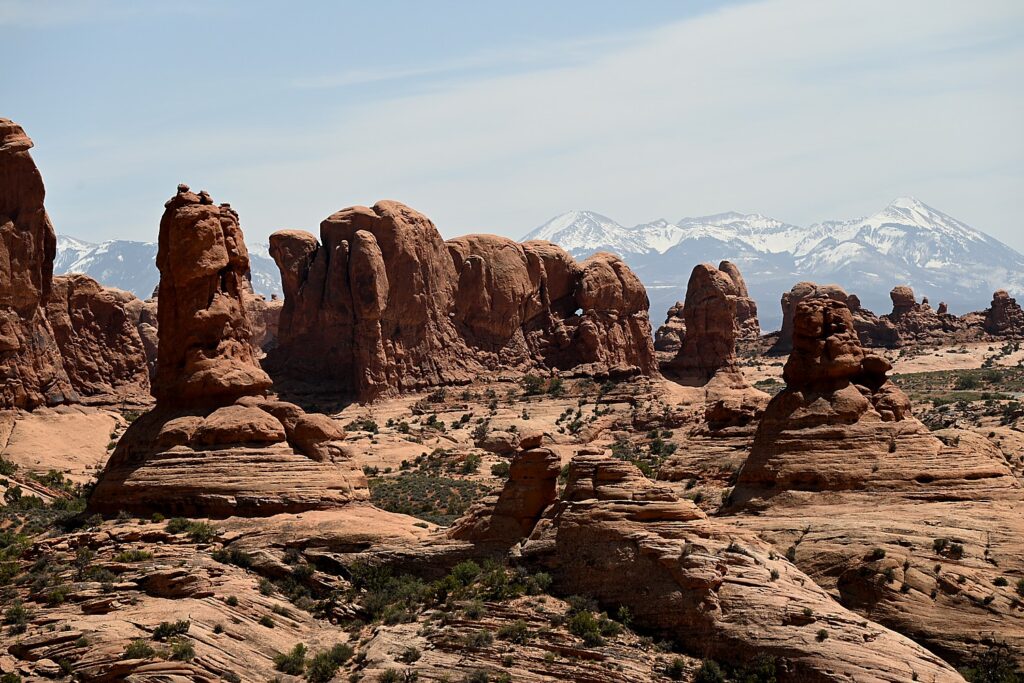
We go next to the observation area that overlooks The Fiery Furnace, a labyrinth of narrow sandstone canyons. (Hiking the Fiery Furnace requires agility and a permit, or a ticket for a ranger-led hike that must be reserved in advance through Recreation.gov; one route is marked, but getting lost is still possible.)

The Fiery Furnace, contrasted against snow-capped peaks, Arches National Park © Karen Rubin/goingplacesfarandnear.com

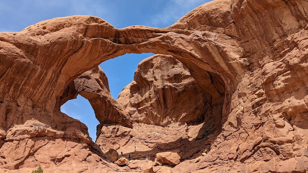
Next, we drive to one of the famous highlights of Arches (there are many, but this one is tops for me): the Double Arch Viewpoint and Trail. The tallest arch in the park at 122 ft., there seems to be this intricate dance between the two arches. An easy gravel path leads to the base of the two huge, arching spans. Of course Dave and Alli climb up to the arches, while Laini draws.

There seems to be an intricate dance between the two arches of the Double Arch, Arches National Park © Karen Rubin/goingplacesfarandnear.com

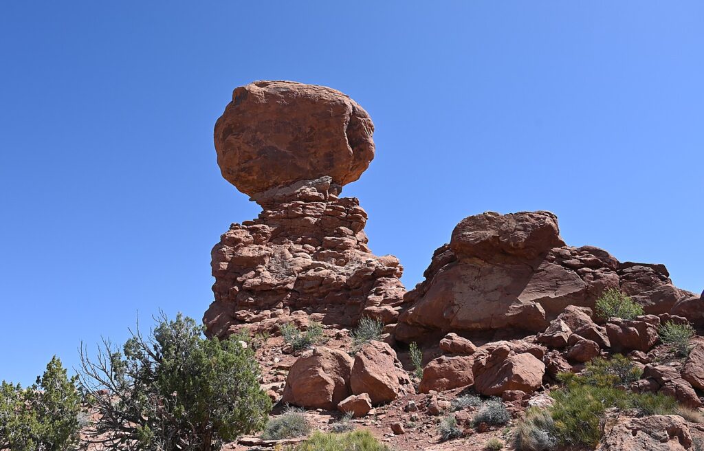
Balanced Rock is another signature landmark and just about everyone (who can get a parking space) walks the short hike around the base for up-close perspectives. We re-name Balanced Rock E. T. because from a certain angle, it’s a dead ringer for the endearing character.

“Balanced Rock”is a dead-ringer for the beloved E.T., Arches National Park © Karen Rubin/goingplacesfarandnear.com

(The Arches National Park newsletter guide is invaluable – it recommends how much water to take, and gives excellent information about distance and time and difficulty for each of the hikes.)

Dinosaurs, Indians!

Arches National Park (believe it or not), has no food or lodging (that is, beyond the sensational Devils Garden campground) – so we drive out of the park into the delightful, hopping town of Moab for lunch at the food truck park, and a bit of shopping.

From here, we drive a short distance to where Laini promises we will encounter both dinosaurs and Indians.

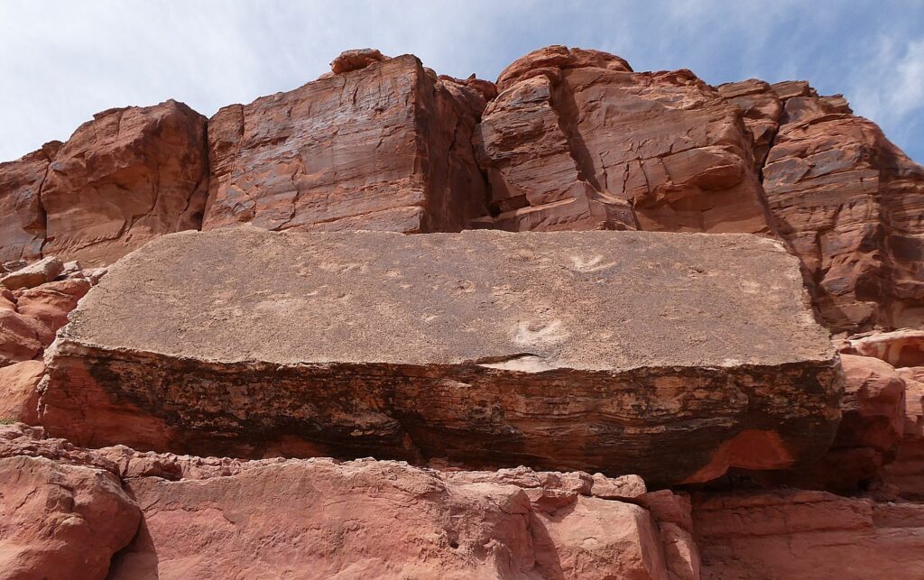
Tracks made by three-toed meat-eating dinosaurs can be seen at the Poison Spider Dinosaur Tracksite and Rock Art Trail © Karen Rubin/goingplacesfarandnear.com

We drive along Utah Scenic Byway 279 to the trailhead of the Poison Spider Dinosaur Tracksite and Rock Art Trail. It’s a quarter-mile walk up a steep, crumbly trail up a rocky hillside to two rock slabs where tracks made by three-toed meat-eating dinosaurs can be seen, as well as a wall with a good collection of petroglyphs.

This area was once a vast sand dune sea, known as an erg. These tracks would have been found along the edge of a lake between dunes. As the wind would blow across the dunes these tracks would have been gently buried in shifting sand and preserved. The preserved tracks were unearthed when the slabs fell from the sandstone cliffs above.

The trail switchbacks up the hill before coming alongside the petroglyph wall and then descends back to the parking lot. (Use caution: though short, there are a few steep areas and the trail can be hard to follow.)

(From this trailhead you can also connect to the Longbow Arch hiking trail that goes into a canyon to an arch, 2.4 miles roundtrip.)

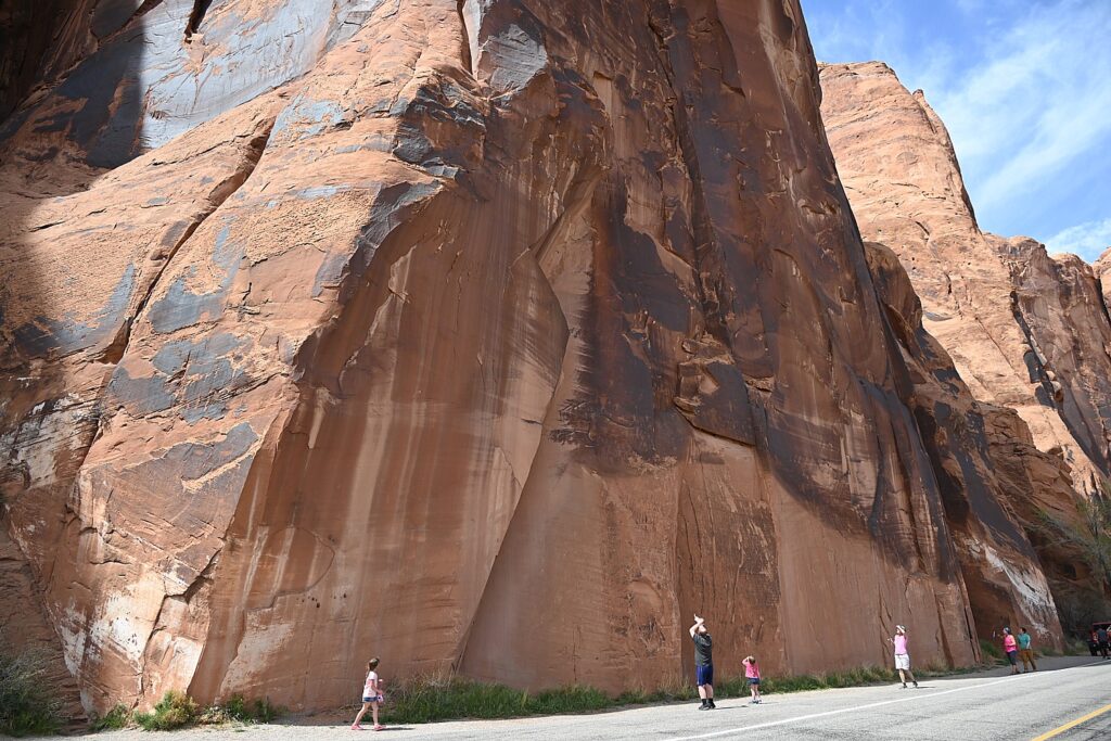
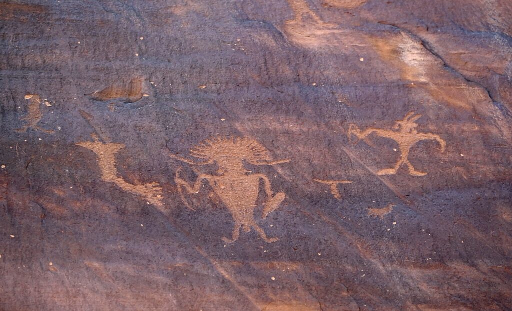
The astonishing Utah Highway 279 Rock Art Site, where a huge rock wall face has the most amazing sets of petroglyphs and pictographs, Moab © Karen Rubin/goingplacesfarandnear.com

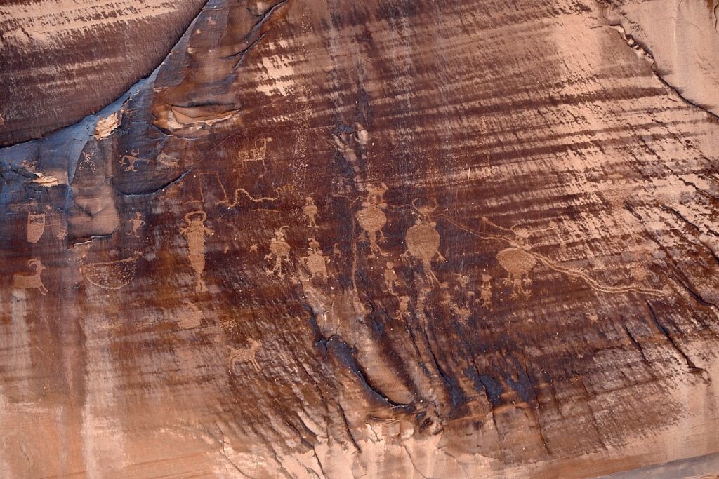
A short distance along Potash Road is the Utah Highway 279 Rock Art Site, where a huge rock wall face has the most amazing sets of petroglyphs and pictographs. It looks like a museum exhibit, except this is where they were made and it is astonishing to contemplate that this is where people so very long ago stood here and carved and painted them.

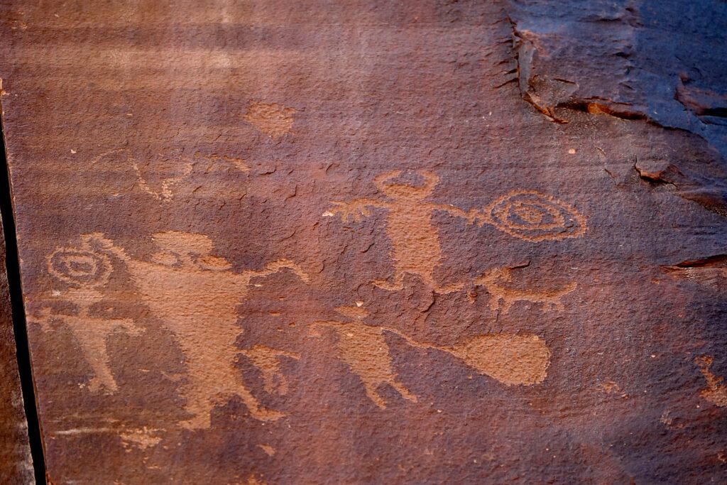
The astonishing Utah Highway 279 Rock Art Site, where a huge rock wall face has the most amazing sets of petroglyphs and pictographs, Moab © Karen Rubin/goingplacesfarandnear.com

Archaeologists believe most of the rock art found here was created during the Archaic (6,000 – 1,000 B.C.) and Fremont (450-1300 A.D.) cultural periods. The art consists of pictographs (painted images) and petroglyphs (pecked, incised or chiseled images). The majority of the rock art features anthropomorphic (human forms) and zoomorphic (animal forms) but there are also curvilean lines, zigzags, wavy lines, concentric circles and abstract symbols. Sometimes both Archaic and Fremont petroglyphs can be found on the same rock art panel.

The astonishing Utah Highway 279 Rock Art Site, where a huge rock wall face has the most amazing sets of petroglyphs and pictographs, Moab © Karen Rubin/goingplacesfarandnear.com

Some of the rock art panels depict religious rituals and are considered sacred sites. Some depict migration routes, fertility, hunting, ceremonies, and cosmic events.

The astonishing Utah Highway 279 Rock Art Site, where a huge rock wall face has the most amazing sets of petroglyphs and pictographs, Moab © Karen Rubin/goingplacesfarandnear.com

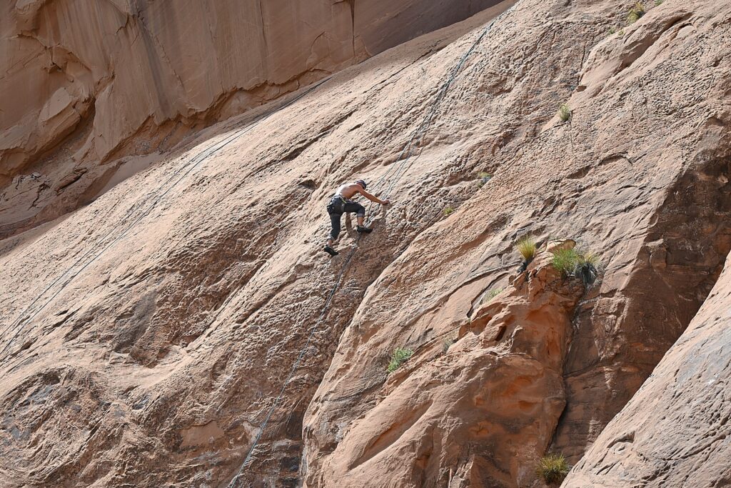
These petroglyphs were exposed when the road was widened, and it is a surreal experience to see these magnificent, huge murals just along the road – especially because it is beside a section popular with rock climbers (one was prosecuted for rock climbing where the protected petroglyphs are).

Fremont rock art often depicts trapezoidal anthropomorphs with horns, bighorn sheep, dogs, hunting scenes with weapons, and abstract objects – and sure enough, we see plenty of examples – there are horned anthropomorphs holding shields and paper doll-like cut-outs; at the southern end of the panel, we see a large bear with a hunter at its nose and another hunter over its back. The notes say this art is 3000 to 8000 years old.

The ancient rock-art panels are next to a popular rock climbing place © Karen Rubin/goingplacesfarandnear.com

At the northern end of the panel, round holes carved into the sandstone underneath the left side would have once held roof poles of a structure which was excavated by archaeologists before the road construction. The rock panels extend 125 feet along Potash Road.

Sunset and Star-Gazing

We return to Arches National Park for sunset (there is still a long line of cars getting in with their timed admission tickets, but because we are camping, we breeze right in).

Laini suggests we hike the 3 miles roundtrip to Delicate Arch for the sunset, but I’m actually dreading it (my feet are actually bleeding from yesterday’s 11-mile Kane Gulch hike – the folly of hiking in boots that haven’t been broken in).

My trepidation comes from the description of the hike: The Delicate Arch hike is ranked difficult – the trail climbs 480 feet up a steep slickrock slope, and just before you get to Delicate Arch, follows a narrow rock ledge for about 200 yards). I am especially nervous about hiking the 1.5 miles back in the dark.

Laini, who has done the hike on their previous trip, admits she also has been dreading it but only wanted to do it for me, because I would have been disappointed not to see the iconic rock formation that Utah uses for its state symbol.

We set out and I ask what exactly we will see and she pulls up the photo she took on a previous trip. I suggest we not bother, but rather go to The Windows where I’ve been told is a popular place for sunset.

But before we leave the trail to the Delicate Arch, we explore the Wolfe Ranch historic site and walk a little further along a path to see an excellent example of historic Ute rock art – a huge bonus to coming here.

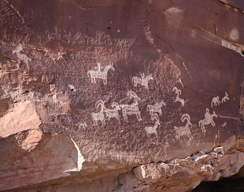
Historic Ute rock art at the Wolfe Ranch site, Arches National Park © Karen Rubin/goingplacesfarandnear.com

The panel depicts a stylized horse and rider surrounded by bighorn sheep and dog-like animals which are typical of Ute rock art. The petroglyphs were carved sometime between 1660-1860.

The historic marker is fascinating because it also shows photos of an Ute on horseback in 1909. “The Utes’ acquisition of horses by the mid-1600s radically changed the way they hunted, worked and traveled.” Another photo depicts a Ute warrior and his bride, circa 1873. Utah’s name is derived from the Ute Indians who moved into this area around 1300 AD.

I’m thrilled we came here, and even more thrilled to go to The Windows for the sunset, which I had read in the park’s newsletter (so helpful!) is one of the great spots to watch the sunset.

The Windows, a great place to watch the sunset in Arches National Park © Karen Rubin/goingplacesfarandnear.com

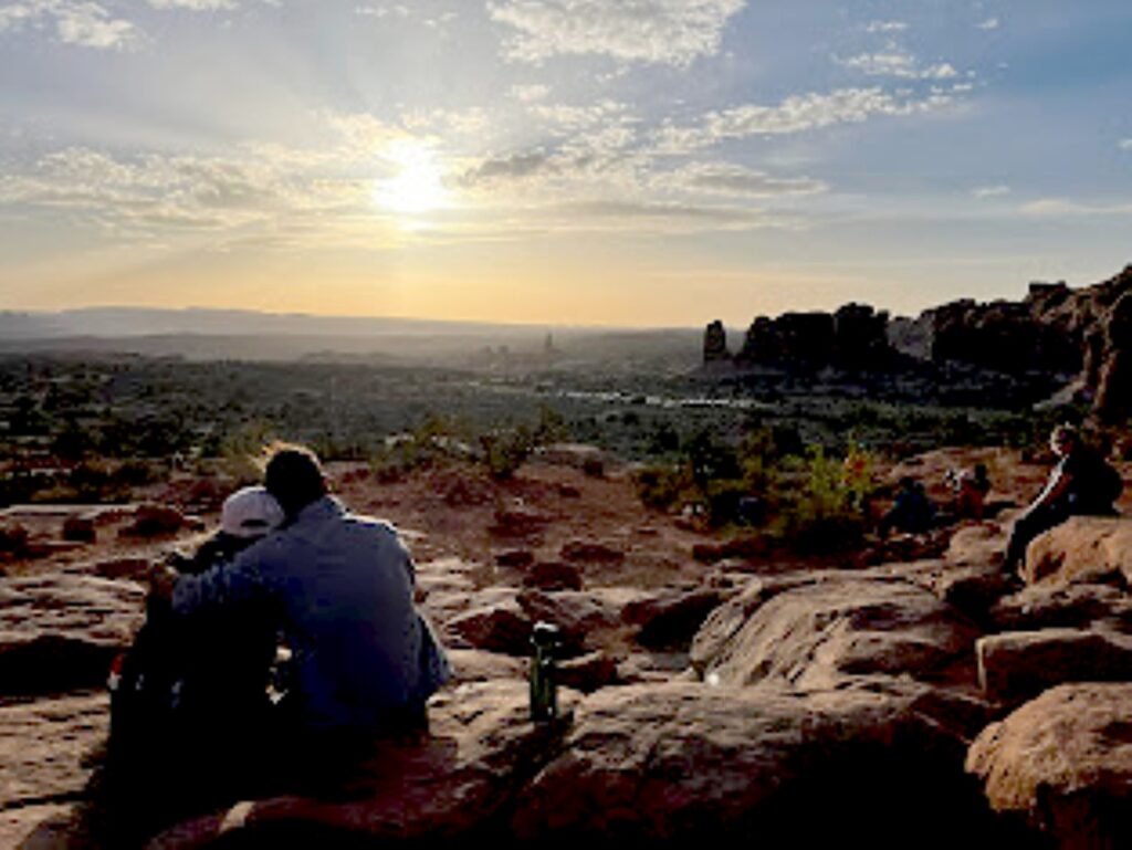
The Windows – just across from the Double Arch where we had been in the morning – is a pleasant half mile walk. We arrive just as the light is turning the rock deep gold, to orange, to red. I find a “comfortable” rock to sit on at the bottom of the arch while Dave, Laini and Alli (of course) climb up into the Windows.  Our view looks out to the Turret Arch and a wide open expanse, to where the sun dips below the horizon.

Watching the sunset from The Windows, Arches National Park © Laini Miranda/goingplacesfarandnear.com

We drive back to Moab to stop in for a bite and beer flight at Moab Brewery, and then return to the national park to do some stargazing before settling into our campsite.

Arches National Park is a great family park where a short walk brings you to many of the iconic features, and you can even see a lot from a car and the observation areas. Stop at the visitor center for advice, where you can watch an orientation film and see exhibits. A self-guiding audio tour is available. Ranger programs are offered seasonally.

For more information, and to reserve entry tickets and campsites, www.nps.gov/arch; info 435-719-2299; hiking info at https://www.nps.gov/arch/planyourvisit/hiking.htm

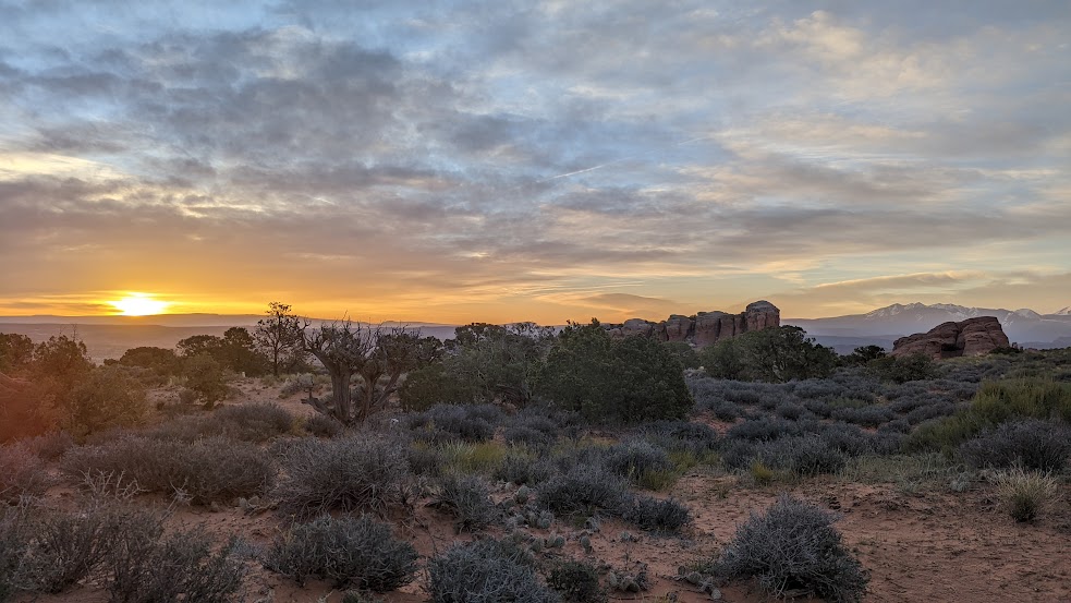
Sunrise from the Devils Garden Campground, Arches National Park © Karen Rubin/goingplacesfarandnear.com

On our last morning, I awake again before sunrise and scramble up a small hill across the road from our campsite for a different view.

We pack up quickly for our departure which also entails packing up the rental sleeping bags and pads, which we ship back to Moosejaw.com from Moab, pick up breakfast from a delightful cafe, and head out for the drive back to Salt Lake City and our flight home, having had the most marvelous Utah Adventure, a trip of a lifetime for me.

Trip planning tools are available at https://www.visitutah.com/.

Advance Purchase Tickets Required

From April 1 to Oct. 1, 2023, you need to secure in advance a timed entry reservation in order to enter Arches National Park between 7 a.m. and 4 p.m. Reservations must be secured three months in advance of the anticipated date of visiting Arches. A single booking of a timed entry ticket covers each registered visitor (an individual, couple, group or family). You can enjoy the park all day, entering and re-entering at will with the validated ticket. A $2 processing fee is added nto the standard park entry fee. Reservations are accepted on a first-come, first-served basis on Recreation.gov. (It may also be possible to obtain a limited number of tickets through Recreation.gov up to midnight the day before planning to visit the park.).

See:

UTAH ADVENTURE DAY 1-2: CAPITOL REEF’S COLORFUL CANYONS

UTAH ADVENTURE DAY 3-4: GRAND STAIRCASE-ESCALANTE POSES CHALLENGE

UTAH ADVENTURE DAY 4-5: DRIVING BURR TRAIL, EXPLORING GLEN CANYON, WILD CAMPING IN ARCH CANYON

UTAH ADVENTURE DAY 6: SACRED SITES, SPIRITS OF BEARS EARS NATIONAL MONUMENT

UTAH ADVENTURE DAY 6-7: HOUSE ON FIRE AMONG HIGHLIGHTS HIKING AMID SACRED SITES, SPIRITS OF BEARS EARS NATIONAL MONUMENT

______________________

© 2023 Travel Features Syndicate, a division of Workstyles, Inc. All rights reserved. Visit goingplacesfarandnear.com, www.huffingtonpost.com/author/karen-rubin, and travelwritersmagazine.com/TravelFeaturesSyndicate/. Blogging at goingplacesnearandfar.wordpress.com and moralcompasstravel.info. Visit instagram.com/going_places_far_and_near and instagram.com/bigbackpacktraveler/ Send comments or questions to [email protected]. Tweet @TravelFeatures. ‘Like’ us at facebook.com/KarenBRubin 

Car Camping in Comfort: How We Turned our Subaru into Our Home On the Road

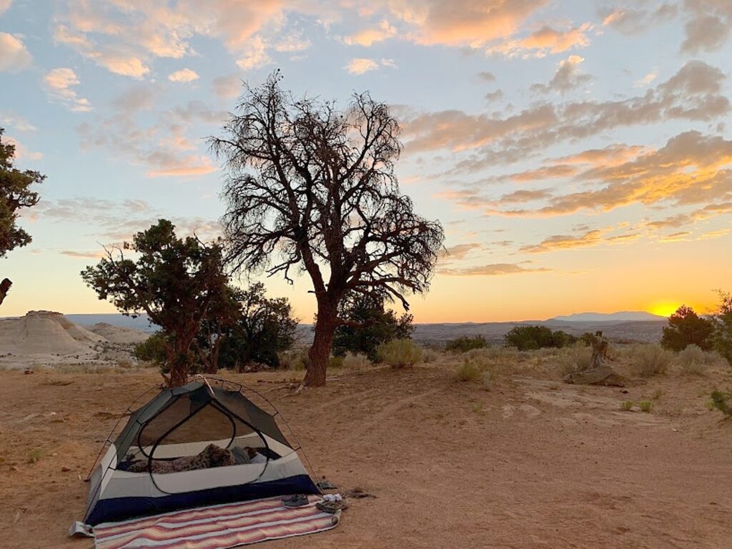
Our wild camp spot at Grand Staircase National Monument, comfy in our REI Half Dome 3+ on our Best Choice 4″ thick Folding Mattress © Laini Miranda/goingplacesfarandnear.com

By Laini Miranda & Dave E. Leiberman

Travel Features Syndicate, goingplacesfarandnear.com

We just returned home from two months living out of our Subaru while we traveled around the country. Without much pre-planning, our route took us 8,300 miles from upstate New York through Wisconsin, South Dakota, Wyoming, Idaho, Washington, The San Juan Islands, Oregon, Utah, Colorado, Missouri, Ohio, Pennsylvania, and back home to New York. 

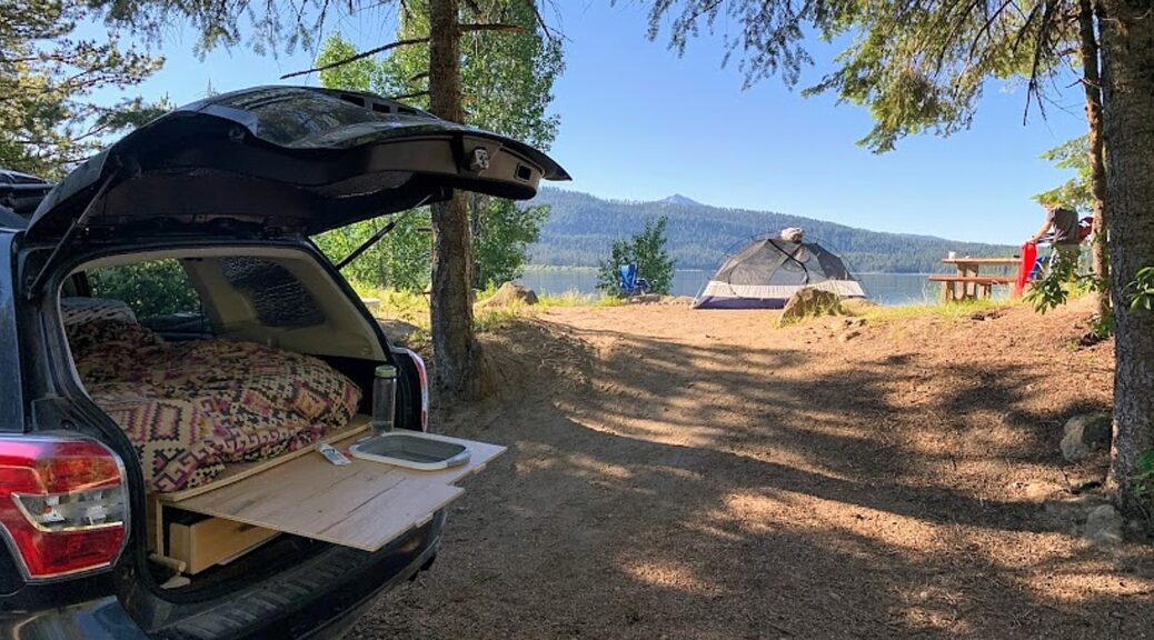
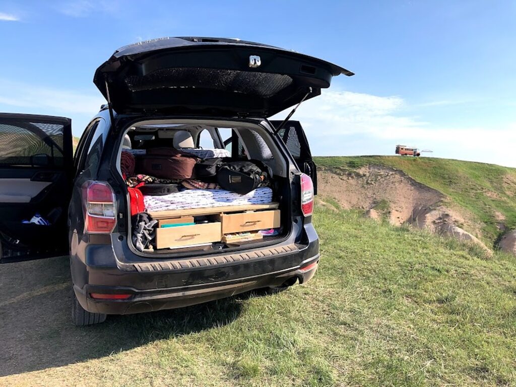
We outfitted our Subaru Forester with a platform bed and two drawers underneath to maximize storage, which we designed and built ourselves, and brought along enough creature comforts so that we didn’t miss a thing while we were on the road or wild camping (other than friends and family, of course!). 

Here’s a round-up of some of the things we learned we can’t live without, in no particular order:

We outfitted our Subaru Forester with a platform bed and two drawers underneath to maximize storage, which we designed and built ourselves, and brought along enough creature comforts so that we didn’t miss a thing while we were on the road or wild camping © Laini Miranda/goingplacesfarandnear.com

500W Jackery Power Bank  – $499

We keep the Jackery Power Bank on the floor behind our front seats, plugged into the 12V cigarette lighter in the rear of the car. The Jackery powers our car fridge, cell phones, laptop and fans. The 2.4A in the USB outlet charges our phones so much faster than the car USB does, we’ve actually been keeping it in the car even when not on a road trip. While driving any substantial distance, the Jackery stays at a healthy 99% and rarely drops below 50% even overnight when not drawing power from the car. We use the 60W solar panels to top off the Jackery on days we aren’t driving. 

Alpicool C9 Mini Refrigerator – $159.99

Our car fridge sits next to the Jackery on the floor behind the driver’s seat and stays plugged into the 12V plug on the Jackery at all times. We keep the fridge on “Eco” mode, which fluctuates between about 38 and 44 degrees. We opted for the C9 because that was as much space as we could dedicate in our Subaru and it worked well for us, but I definitely see the benefits of the larger C20 model with the raised lid if you have the extra room. Most days our Alpicool stored: 1L milk, 1 block of cheese, turkey, 4 or 5 string cheeses, jam, hot sauce, and 3 beers, with a little room to stuff random things on top if needed. This refrigerator is miraculously quiet. We almost never notice it while driving, and even when sleeping in the car, the compressor isn’t loud enough to be heard over our earplugs, even with it located just below our heads. The great thing about keeping the Alpicool behind the driver’s seat is that the passenger can easily access its contents with the lid on top. We love never having to deal with melted ice as we used to with our cooler, and find that this size fits enough for a week in the desert.

Rockpals Portable Solar Panel is easy to position for optimal sun exposure on top of or beside the car. It then folds up into a slim briefcase we can quickly slide into any free gaps in our car. © Dave E. Leiberman/goingplacesfarandnear.com

60W Rockpals Portable Solar Panel – $159.99

This is a cleverly designed, high quality solar “briefcase” that we use to top up our Jackery when not driving. The 20-25 watts we get with full sun keeps our Jackery from depleting even when powering our Alipicool fridge throughout the day and night. It’s easy to position it for optimal sun exposure on top of or beside the car, especially with the two kickstands attached to the back. It then folds up into a slim briefcase we can quickly slide into any free gaps in our car.

Best Choice Tri-Fold Mattress – $89 at time of purchase

This 4-inch foam mattress is what kept us on the road for 7 weeks and has us wanting to go right back out. The tri-fold feature of this mattress allows us to keep it semi-folded when not in use, and easily move it between the car and our tent to make every night as comfortable as sleeping in our bed at home. The twin is 75 x 39” and perfect for two small adults. We purchased this for $89.99, but it does seem to fluctuate on Amazon so we recommend grabbing it whenever you see a good deal, even if you’re not car camping anytime soon! We plan to use this in place of an air mattress whenever we need an extra guest bed. 

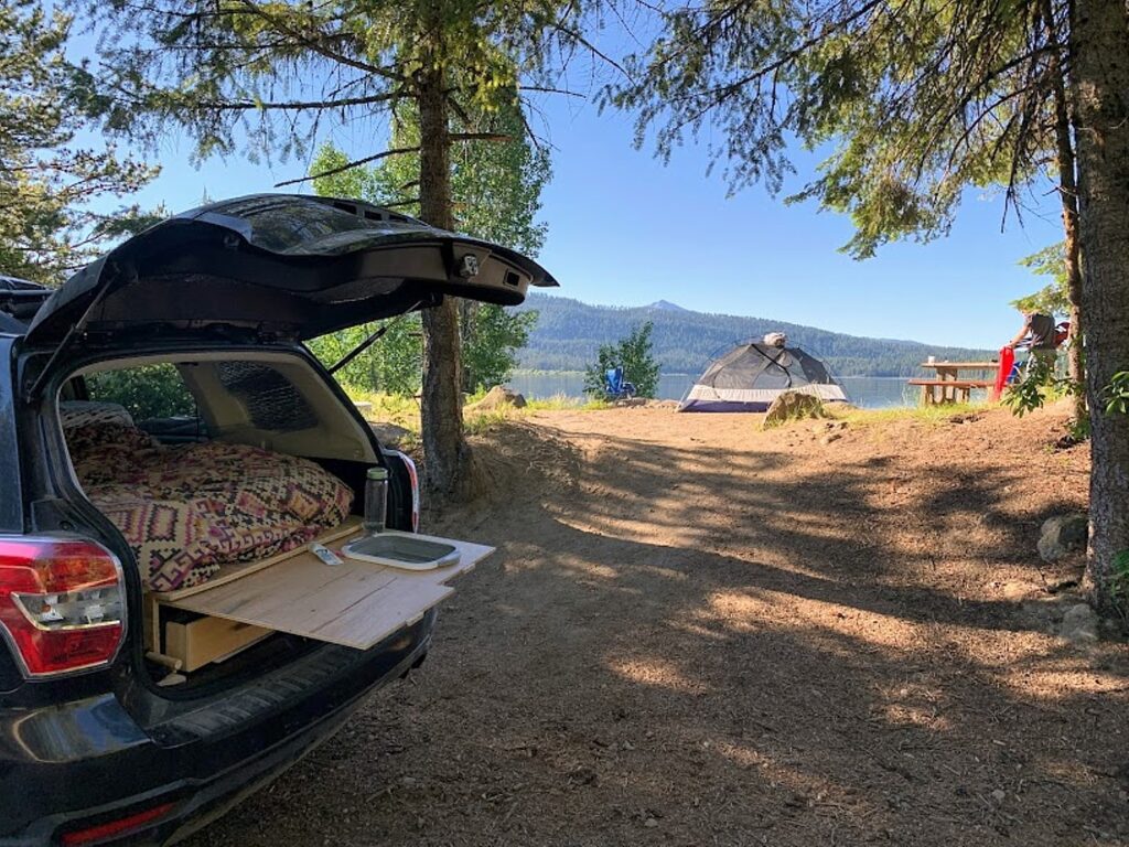
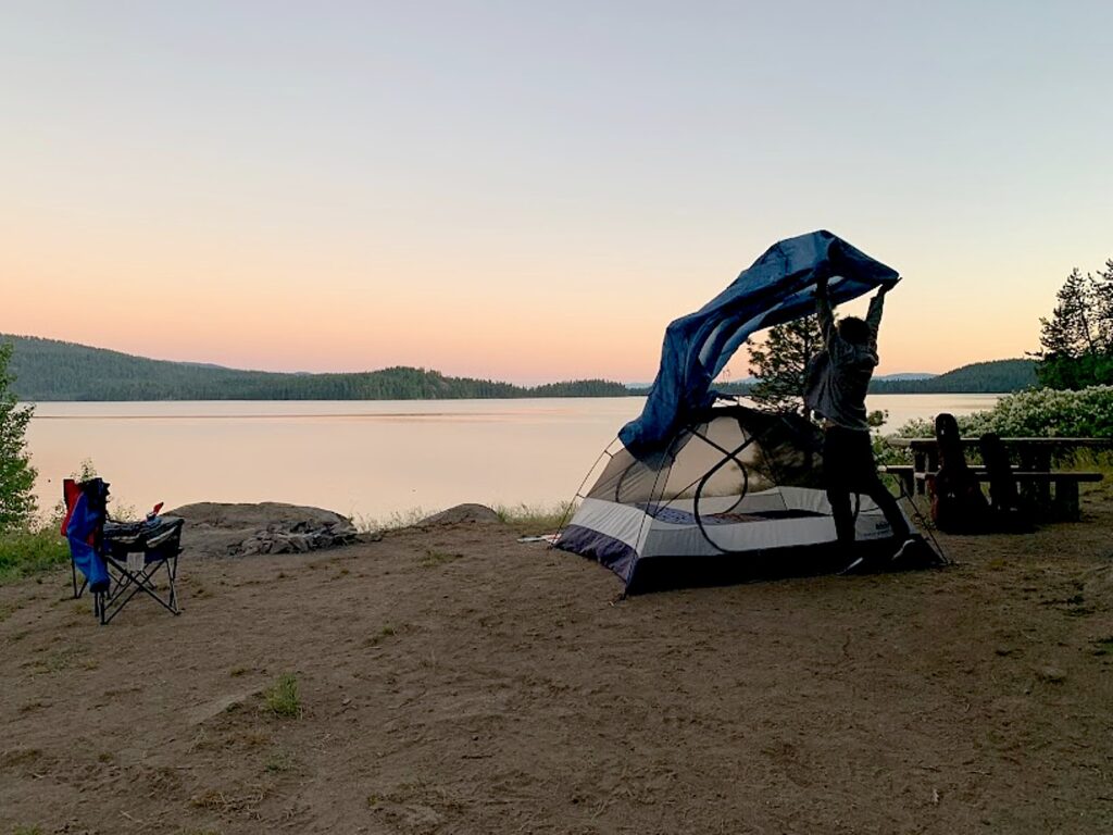
Our Subaru camper car outfitted with collapsible sink, and REI Half Dome 3+ at Little Payette Lake, ID © Laini Miranda/goingplacesfarandnear.com

Collapsible Sink and Cutting Board – $16.99

This is an integral part of our kitchen and bathroom setup. We cut a hole in our pull-out wood counter exactly the size of this sink, pop it in, and immediately have a basin for washing dishes, brushing teeth, doing laundry, and everything in between. It has a push drain to release water when ready, and collapses down to a perfect sized cutting board. At just over an inch collapsed, it’s easy to store anywhere. It does drip a bit with the drain plugged, but since we only use it outside that doesn’t really bother us. We now can’t imagine ever camping without this. 

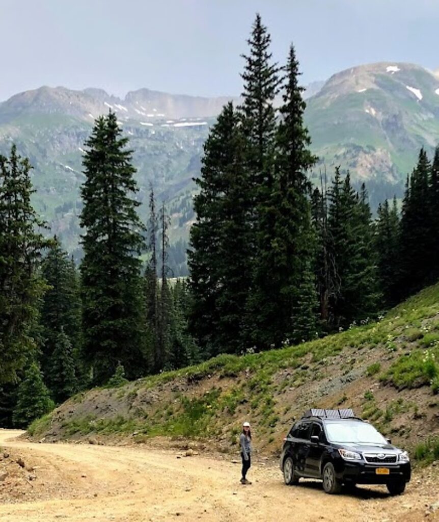
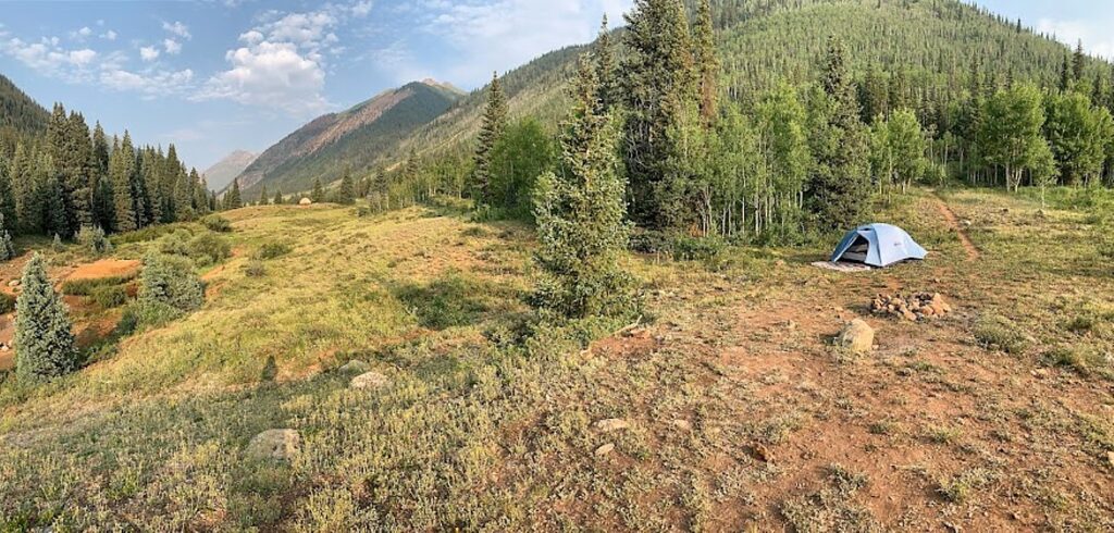
Wild camp spot outside of Silverton, CO, just before the rainstorms © Dave E. Leiberman/goingplacesfarandnear.com

Wireless Auto Water Pump – $12.99

Did you think you can’t have running water in your car?? We bought a longer silicon tube for this pump, inserted it into our 7 gallon water container and have water on demand. We use this baby constantly–filling up our water bottles while driving or before hikes, making food, washing dishes, brushing teeth, etc., and we only had to charge it ONCE in our 7 weeks on the road. While these water pumps are generally made to be used on top of a water cooler jug, we fashioned a bottom for it with inspiration from a YouTube video by Todd Parker: cut a notch in a roll of electrical tape, stuff that inside the base, add adhesive neodymium rare earth magnets to the bottom, affix a metal plate to the surface you want to hold the pump, and you have a beautiful faucet with running water! We most often use this pump either from the front seat to fill up water bottles during long drives, or affixed to the metal plate next to our pop-in sink in the back of the car for cooking or washing up. We bought this 25-ft braided sleeve so we can move the long hose back and forth without the silicon tube collecting dust and grime, also a brilliant Todd Parker recommendation. (Note: we do not personally know Todd Parker.) 

Our REI Half Dome 3 Plus tent by Little Payette Lake, ID © Laini Miranda/goingplacesfarandnear.com

Car Rear Window Shade – 2 pack – $12.99

This is a simple product that lets us turn our car windows into screens. On the nights we opt to sleep in the car instead of setting up our tent, we put one of these window sleeves on each door, open the window, and voila, great airflow without the mosquitoes. We also leave one of these on the rear window above the refrigerator during the PNW heat wave to reduce the heat in the car, but we don’t recommend them on any other windows while driving since they also reduce visibility (an added plus for when you have to sleep in the Cracker Barrel parking lot).

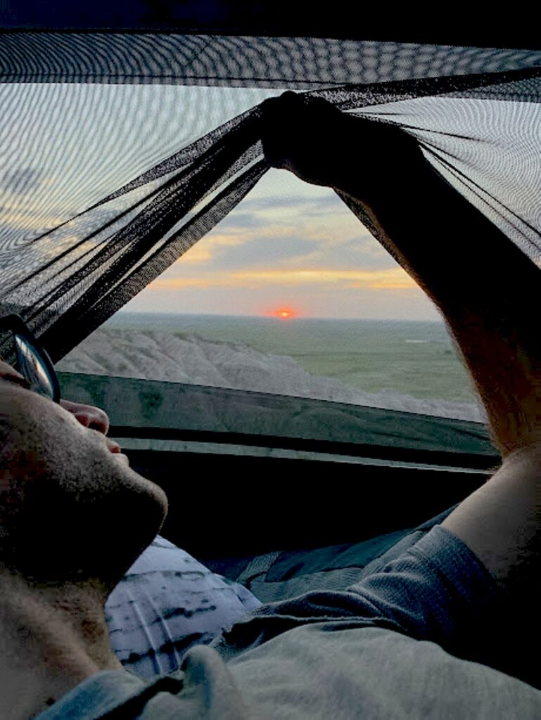
LEMLEON Car Window Shade fits our Subaru Forester windows perfectly. It comes with velcro to secure them to the inside of the car door, though you can still easily raise them to see the sunrise over the Badlands. (OR: “We raise our Lemleon Car Window Shades to catch the sunrise over Badlands National Park” © Laini Miranda/goingplacesfarandnear.com

EzyShade Windshield Sun Shade – $12.97

Sun Shades are a must when leaving the car in the desert sun. We tried two different kinds and like these the best. It takes about 10 seconds to stuff these two rounded rectangular pieces into our windshield and just as long to collapse them back into a small circle that fits in the car door pocket. We use ours so frequently we just keep it in the slot between the seat and the door.

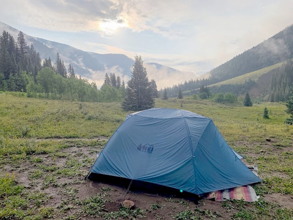
Our trusty REI Half Dome and Nemo blanket after 2 straight days of thunderstorms outside of Silverton, CO © Laini Miranda/goingplacesfarandnear.com

REI Half Dome 3 Plus Tent – $329

This tent is brilliant. Its color-coded poles and ingenious architecture enables us to pitch it in under 2 minutes. Usually one of us pitches the tent while the other starts the fire or preps food. The upper portion of the tent is full mesh, which allows for optimal air flow and viewing of the Milky Way. In the desert we tend to not need the fly, but for the few days of torrential downpours and strong winds we encounter in the Colorado mountains, when we are thrilled at the durability and protectiveness of the fly and footprint. We used to use the 2 Plus model, but the 3 Plus is extra luxurious and easily fits our 4” tri-fold foam mattress plus plenty of room to hang out on rainy nights (Note: the 2 Plus would also fit the twin 4” tri-fold). We also love the location and quantity of pockets and hanging loops for all our tent gear. 

Nemo Victory Blanket – $29.99 (40% off at Mountain Steals at time of writing)

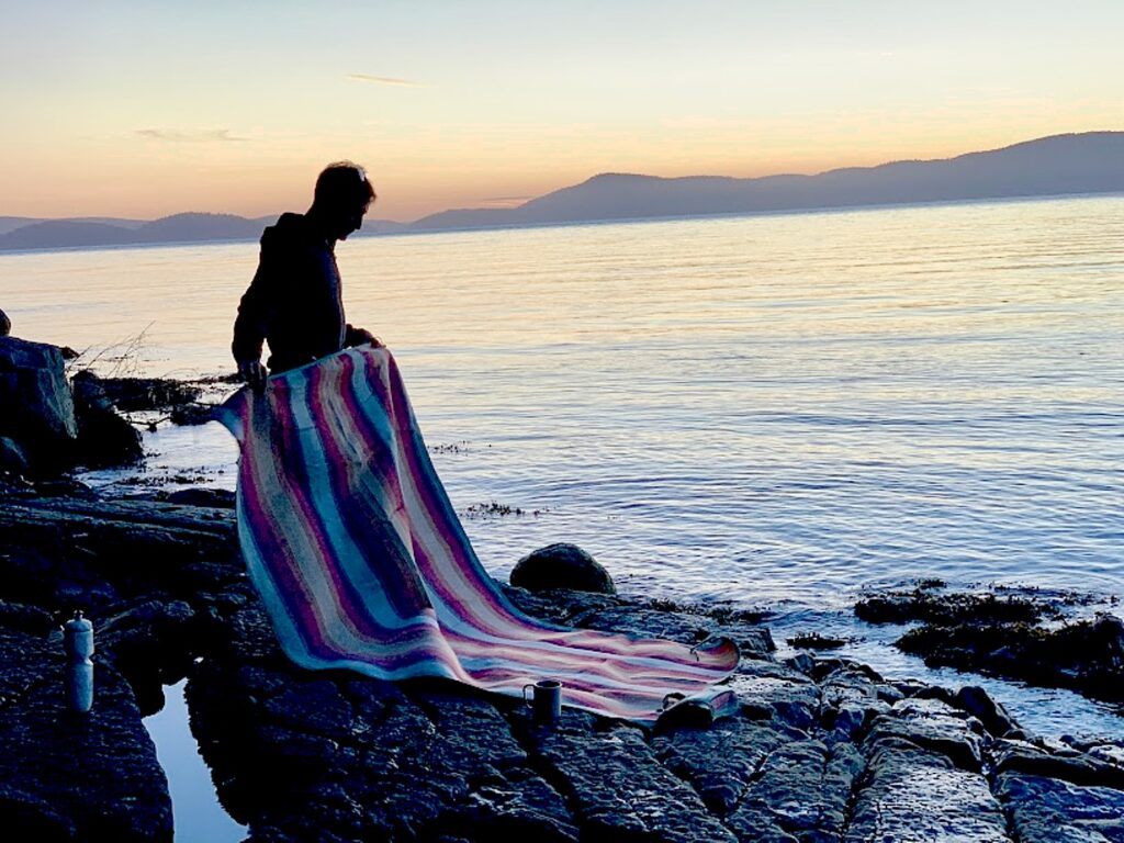
We use this blanket daily, whether it’s the rug by our tent (the 2P is the exact length of our REI Half-dome 3), or a blanket on a pebbly beach. The fabric side is extremely soft and delightful to lay on, while the under-side is waterproof and more durable. Though it is thick enough to keep us comfortable even on a lava rock ground in Craters of the Moon, it is light enough that I barely notice carrying it on a 2 mile hike to Third Beach in Olympic National Park. It even dried remarkably fast after 2 straight days of torrential downpours in Colorado. One of us remarks almost every day about how much we love this blanket.

Our Nemo Victory blanket makes the perfect sunset spot on the wet rocky shores by Washington Park in Anacortes, WA. © Laini Miranda/goingplacesfarandnear.com

MPowerd Solar Lights – $24.95 – $49.95

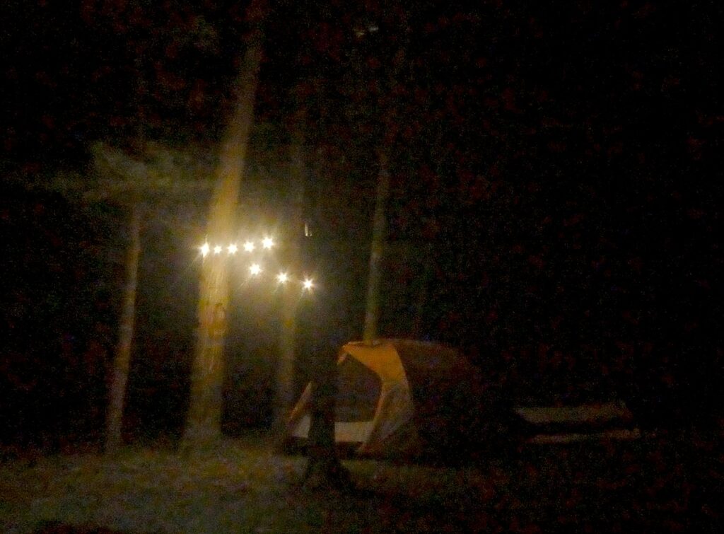
This brand has nailed the compact solar light game. We highly recommend their Luci Solar String Lights and the Luci Lux Inflatable Lantern. Both give off warm light and offer 3 different brightness settings, as well as a battery level indicator. The string lights are long enough to provide light to our tent between a couple trees, and the Luci Lux (which flattens to less than an inch) is the only lantern we now use while camping. The attached strap lets us easily hang it from the opened hatch of our Subaru or the tent ceiling. The lowest setting, warm light, and frosted/matte finish also makes for a perfect pillow-side lamp. 

Luci Solar String Lights gives off warm light and offer 3 different brightness settings, as well as a battery level indicator and is long enough to string between a couple trees. ©Karen Rubin/goingplacesfarandnear.com

Next: More of our favorite hiking & camping gear 

_____________________

© 2021 Travel Features Syndicate, a division of Workstyles, Inc. All rights reserved. Visit goingplacesfarandnear.com, www.huffingtonpost.com/author/karen-rubin, and travelwritersmagazine.com/TravelFeaturesSyndicate/. Blogging at goingplacesnearandfar.wordpress.com and moralcompasstravel.info. Send comments or questions to [email protected]. Tweet @TravelFeatures. ‘Like’ us at facebook.com/NewsPhotoFeatures
New York’s Watkins Glen State Park is Spellbinding

By Karen Rubin, David Leiberman & Laini Miranda

Travel Features Syndicate, goingplacesfarandnear.com

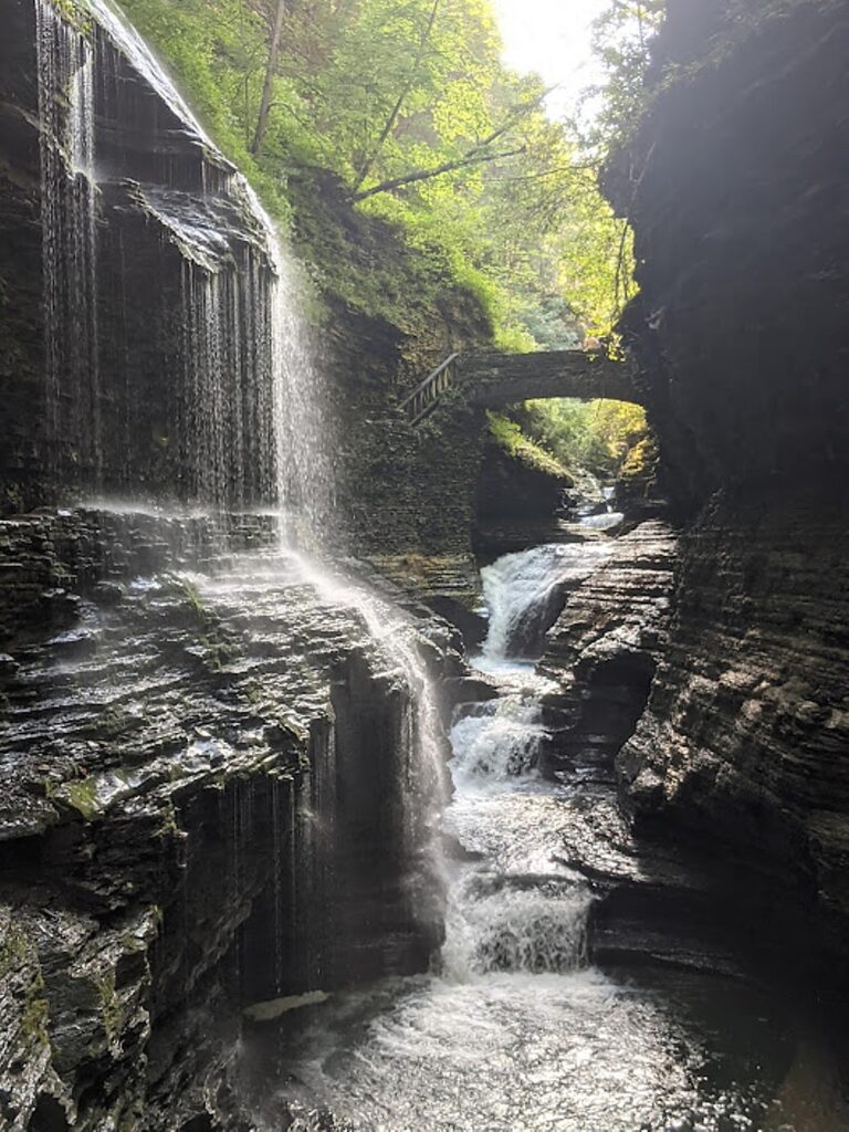
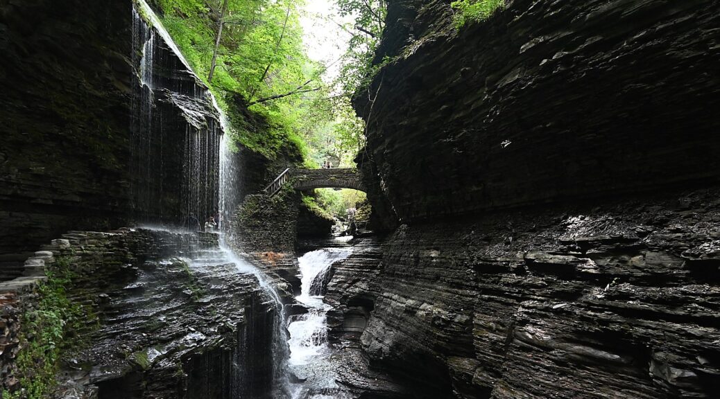
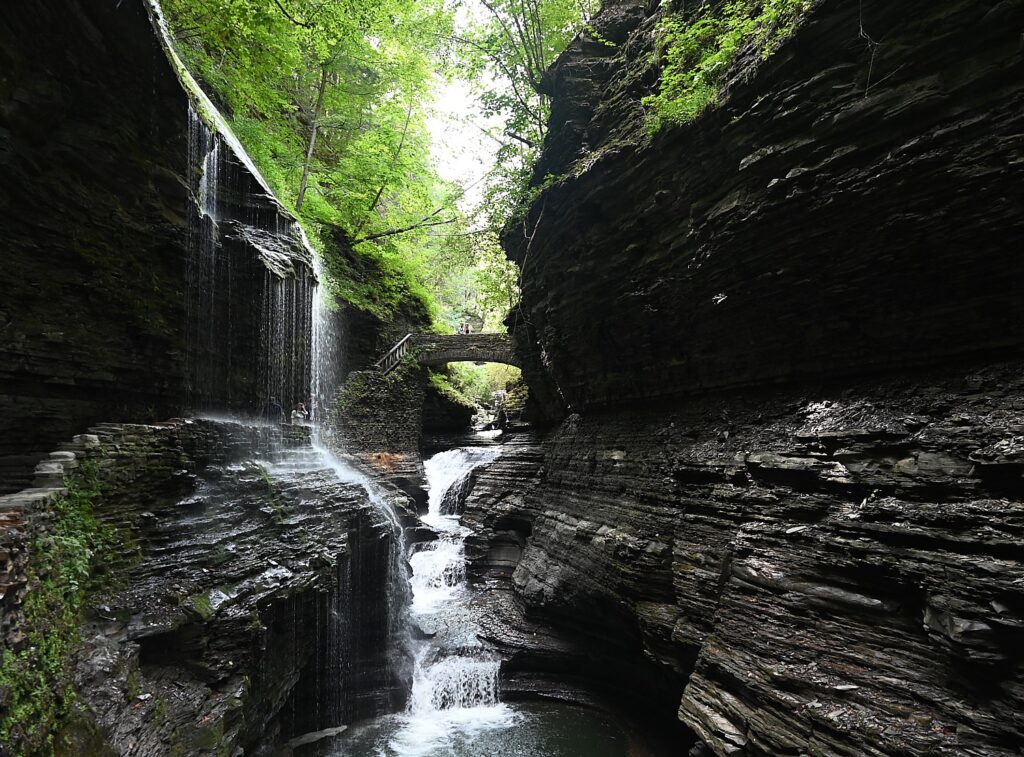
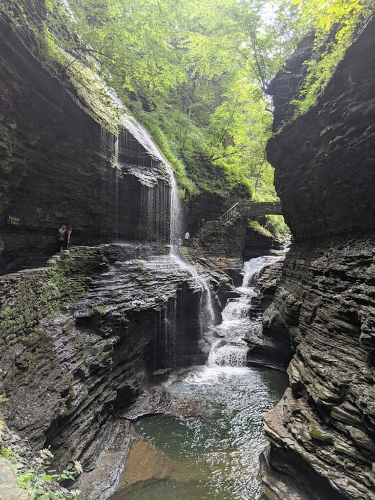
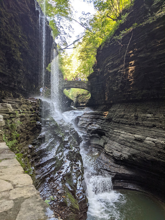
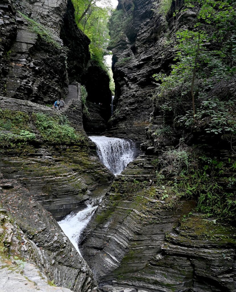
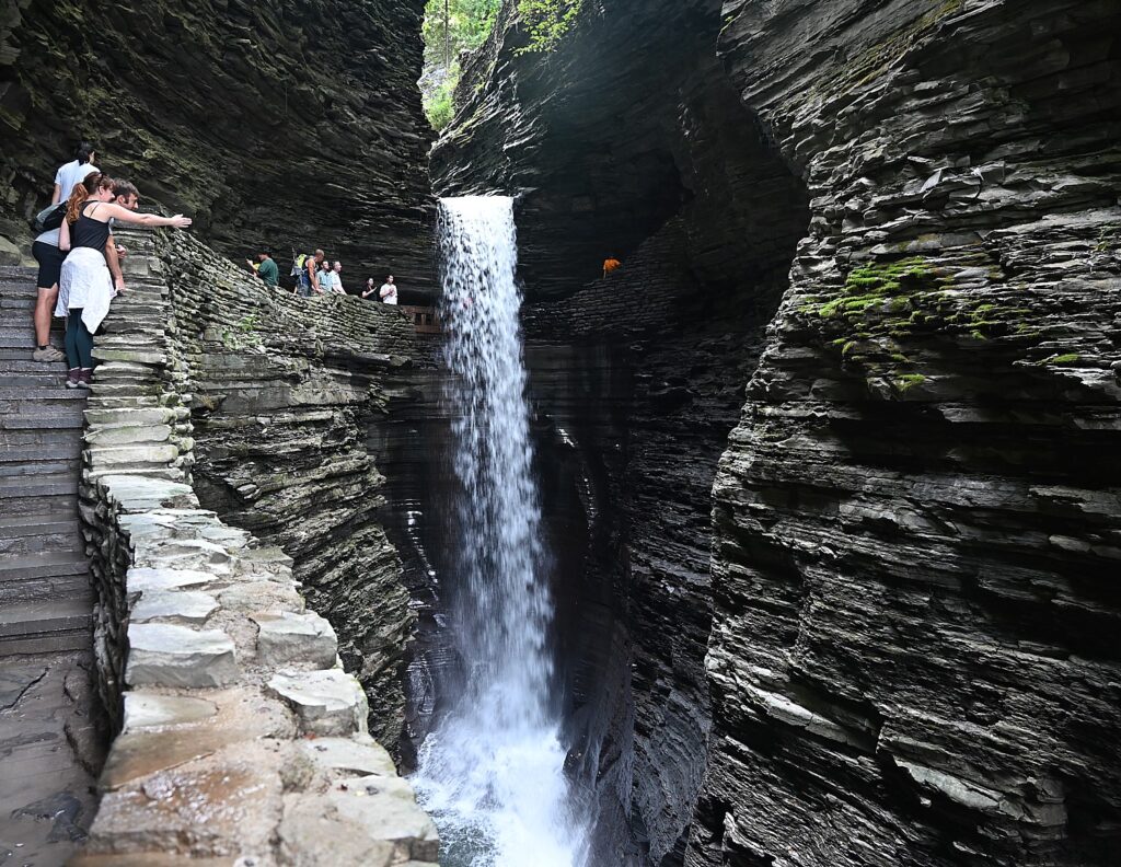
Rainbow Falls, one of the highlights of the Glen Creek Gorge Trail, Watkins Glen State Park, © Karen Rubin/goingplacesfarandnear.com

Walking the Gorge Trail in Watkins Glen State Park in New York’s Finger Lakes is, in a word, spellbinding.

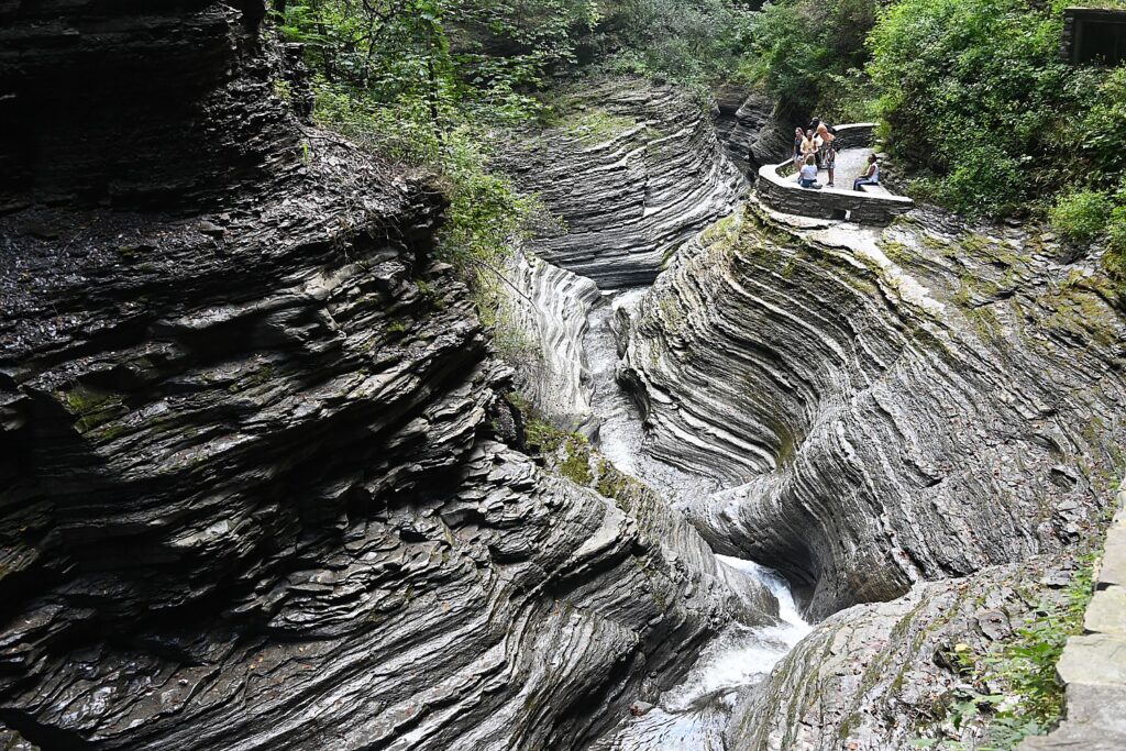
The centerpiece of the 778-acre Watkins Glen State Park is a 400-foot deep, narrow gorge cut by the Glen Creek that was left “hanging” when glaciers of the last continental glaciation, some 12,000 years ago, deepened the Seneca valley, creating rapids and waterfalls through layers of hard rock. The textures and shapes of the soft shales, sandstone and limestone – which erode at different rates – are gorgeous.

If you have ever visited a slot canyon, and marveled at the smooth, twisted, perfectly contoured curves, walk the Glen Creek Gorge Trail, where you can watch Mother Nature working her magic.

Rainbow Falls, one of the highlights of the Glen Creek Gorge Trail, Watkins Glen State Park, © Karen Rubin/goingplacesfarandnear.com

We don’t waste time after arriving at the Six Nations Campground in the park in the afternoon, in order to take advantage of the beautiful sunlight. So we drop out things and rush down to the Gorge Trail for a taste of what we will see more completely the next day.

In the course of a 1.5 mile stone trail, with 800 steps and beautiful stone bridges you see 19 incredible waterfalls.

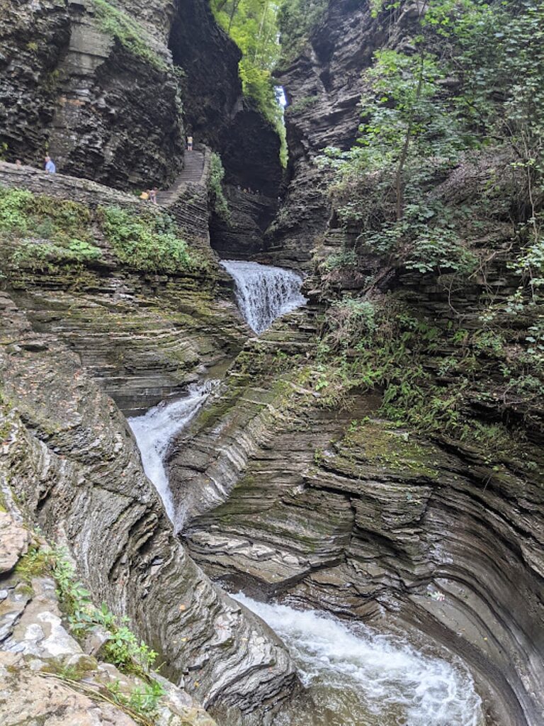
Cascading falls on the Glen Creek Gorge Trail, Watkins Glen State Park, © Karen Rubin/goingplacesfarandnear.com

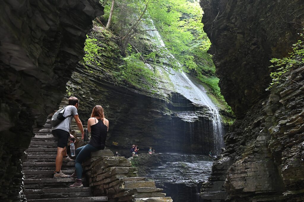
The waterfalls range from those that flow from dramatic heights of 200 foot-high cliffs, to those that cascade; you see waterfalls coming in together from different directions, cutting through the sedimentary rock of shale, sandstone and limestone, making exquisite, remarkably perfect shapes and cuts that are astonishingly precise and straight or curved, and cascades of falls that twist.

Rainbow Falls, one of the highlights of the Glen Creek Gorge Trail, Watkins Glen State Park, © Karen Rubin/goingplacesfarandnear.com

In this “hanging valley,” we also see “hanging gardens” – the tender mosses, ferns, mosslike plants (liverworts) that drape over the rocks and down the rock walls, the delicate plants that stubbornly grow, albeit slowly in crevasses in the rock walls. They depend on continuous moisture trickling down, and you can see differences in ecosystems based on the amount of sun, shade and moisture that a section of the rock wall gets. (Visitors are told not to pick anything.)

A place of perfect peace, Watkins Glen State Park, © Karen Rubin/goingplacesfarandnear.com

You are enveloped by a feeling of perfect peace – the sound of the flowing water, the cool of the green moss and moist rock, the fresh smell, the late afternoon light that turns the tops of the trees into shades of yellow and gold. The gorge is fairly narrow, so you feel cocooned in this primal, Jurassic Park-like setting.

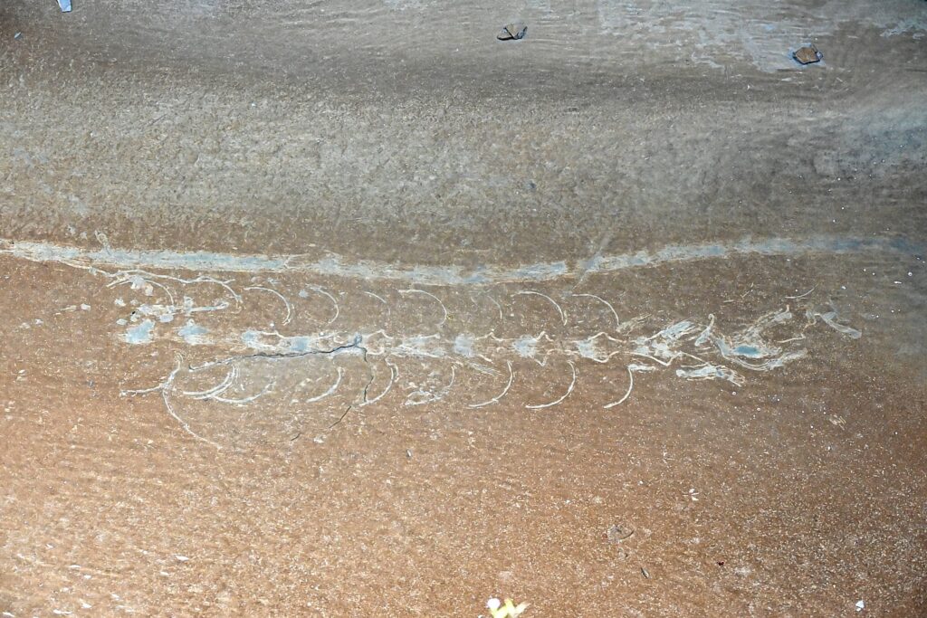
Looking down into where the water flattens out at one point into soil what appeared to be a giant fossil skeleton, exposed in the low water. It is exciting to imagine.

Could this be a titanoboa fossil, only just exposed in the Glen Creek? © Karen Rubin/goingplacesfarandnear.com

We walk back to Mile Point Bridge where we follow the trail back into the Six Nations Campground, after this brief survey mission.

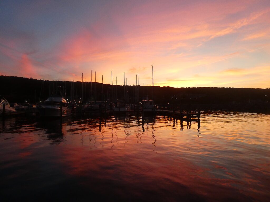
Back at our campsite, we set up our tents and go downtown to where John, who checked us into the campground, had recommended as the best place in Watkins Glen for sunset: the marina on the southern tip of Seneca Lake. There is a rock wall that is very popular for people to walk out to watch. We opt to go to the Village Marina for dinner where we can dine outside and take in the sunset.

Blazing sunset from the Village Marina in Watkins Glen © Karen Rubin/goingplacesfarandnear.com

The colors that blaze through the sky, reflect back in the water, after the sun went behind the hills, are spectacular.

The next day, we stroll down from our campsite to the Gorge Trail.

We enter the Gorge Trail at Mile Point Bridge, giving us our first stunning view. We walk the half-mile to the end, at Jacob’s Ladder (a set of 180 stairs that goes to the Upper Entrance), and then return, choosing to go back along the Gorge Trail rather than connect to the Indian Trail that goes along the rim for views down into the Gorge. Going back this way on the Gorge Trail we go down in elevation towards the Main Entrance in the village (many people who don’t want to do the 1.5 mile trail both ways start park up here, hike down, and take a shuttle bus back, $5).

Glen Creek Gorge Trail, Watkins Glen State Park, is spellbinding © Karen Rubin/goingplacesfarandnear.com

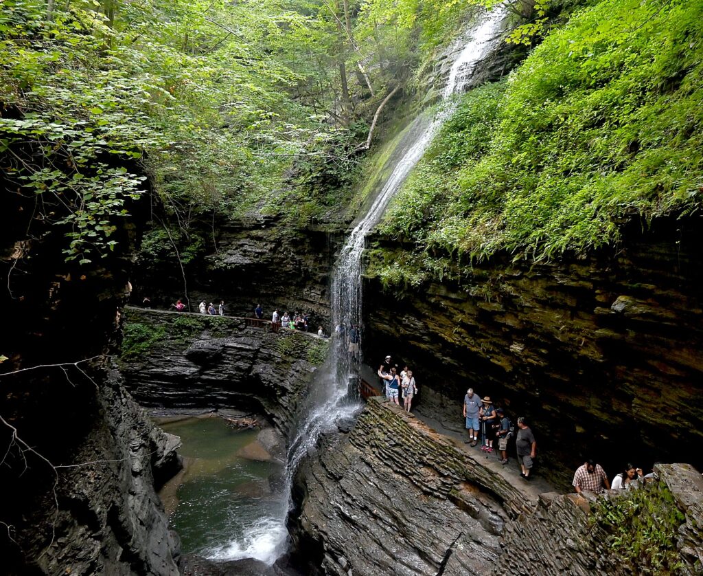
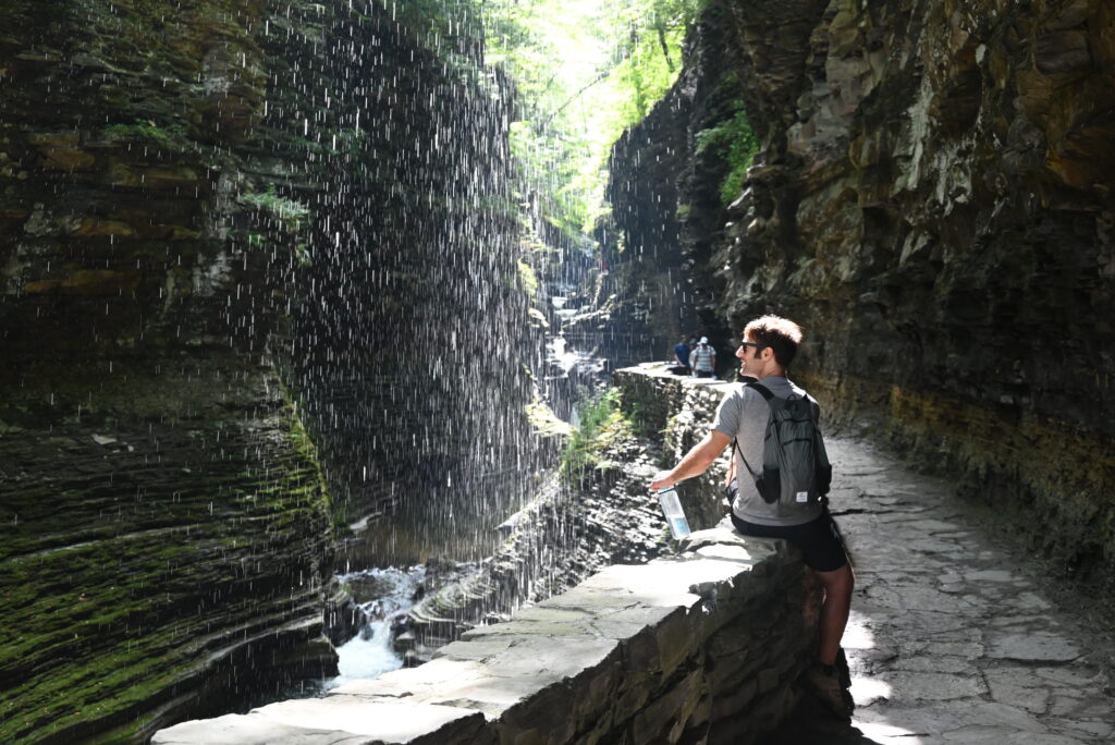
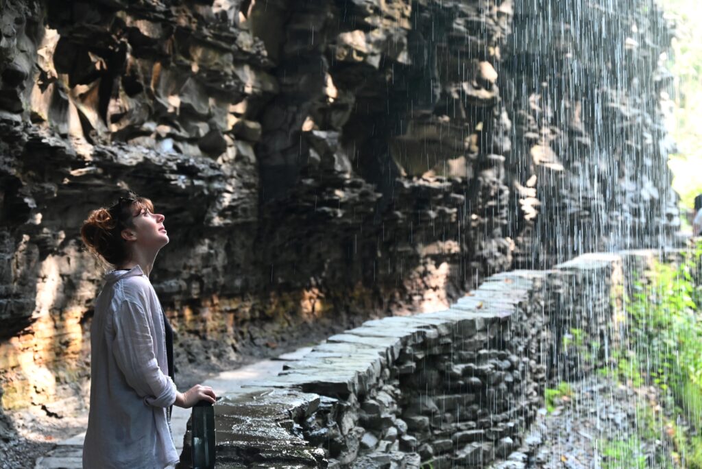
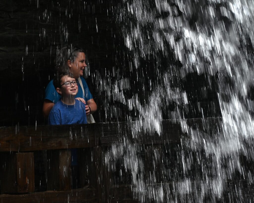
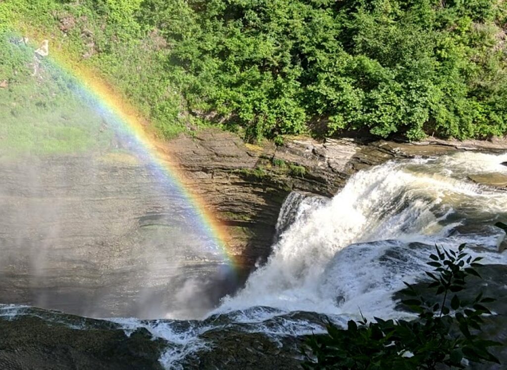
Just beyond the Mile Point Bridge is Frowning Cliff, a gorgeous waterfall, then the climatic scene, Rainbow Falls (most dramatic from the other direction on the way back; you walk behind the falls along the trail), aptly named because, on some afternoons, the sunlight comes at just the right angle to create rainbows.

Rainbow Falls, one of the highlights of the Glen Creek Gorge Trail, Watkins Glen State Park, © Karen Rubin/goingplacesfarandnear.com

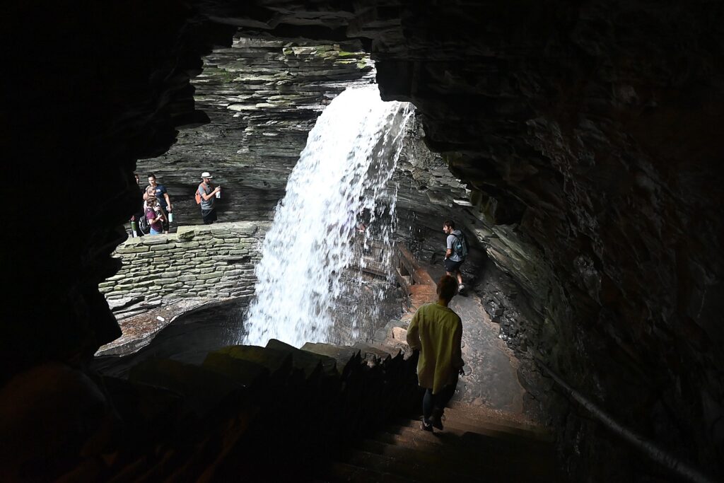
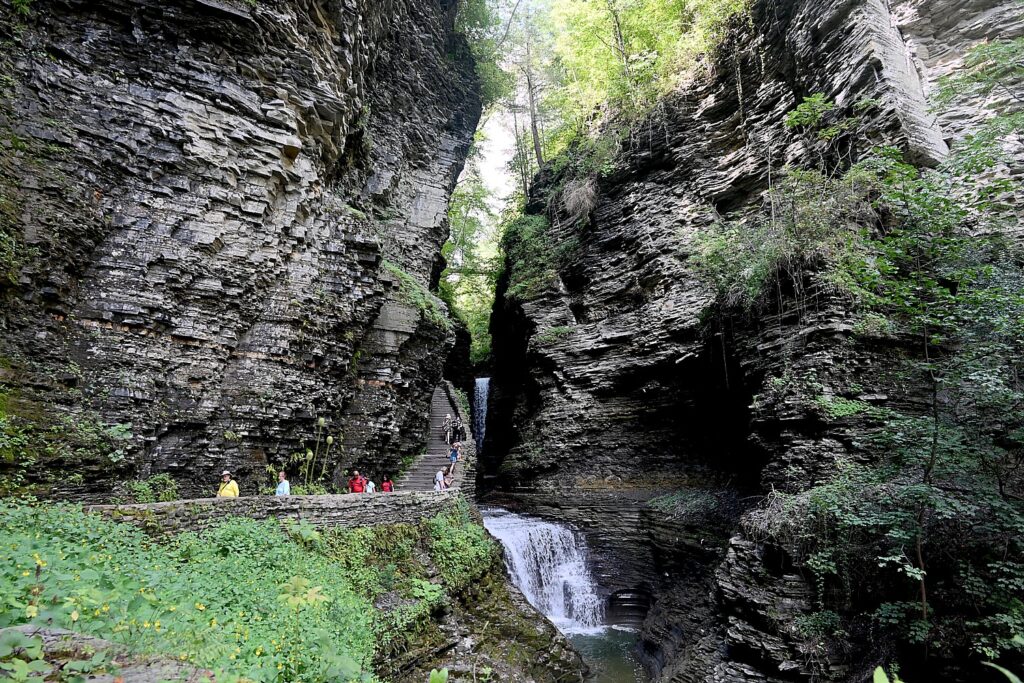
On to the Central Cascade (plunging more than 60 feet, this is the highest waterfall in the Gorge), Glen Cathedral (the horizontal layers of shale were formed 380 million years ago; ripples in the rock were created by wave action at the bottom of an ancient sea floor that eventually turned to stone), then a steeper descent, through the Spiral Tunnel (hand cut in 1927) to the Cavern Cascade, where you again walk behind the waterfall) and across Sentry Bridge (look for a round flume hole in the rock where, in the 1800s, water was once diverted to power a mill where the visitor center now stands) to the new Visitor Center and main entrance on Franklin Street in Watkins Glen.

Cascading falls on the Glen Creek Gorge Trail, Watkins Glen State Park, © Karen Rubin/goingplacesfarandnear.com
Walk through the Spiral Tunnel (hand cut in 1927) to the Cavern Cascade, where you walk behind the waterfall, Watkins Glen State Park © Karen Rubin/goingplacesfarandnear.com

Along the way, we meet up with a park ranger who we tell about seeing what appeared to be a giant fossil. He tells us that it was exposed only two days before and might well be a titanoboa – a giant sea snake that could be as big as 45 feet long. This exciting news passes from one to another as people come to that spot to view it. Another park ranger tells us that a naturalist is coming to investigate.

For awhile, visitors to Watkins Glen State Park that morning had an extra thrill beyond the breathtaking scenery: the prospect of seeing a newly discovered fossil of a prehistoric sea snake, Monster in the Glen.

A place of perfect peace, Watkins Glen State Park © Karen Rubin/goingplacesfarandnear.com

We finish walking the trail, have a delightful lunch at the Harbor Hotel on the lake. By now it is the afternoon and markedly less crowded (everyone seems to come out early for the walk) as we walk back on the Gorge Trail.

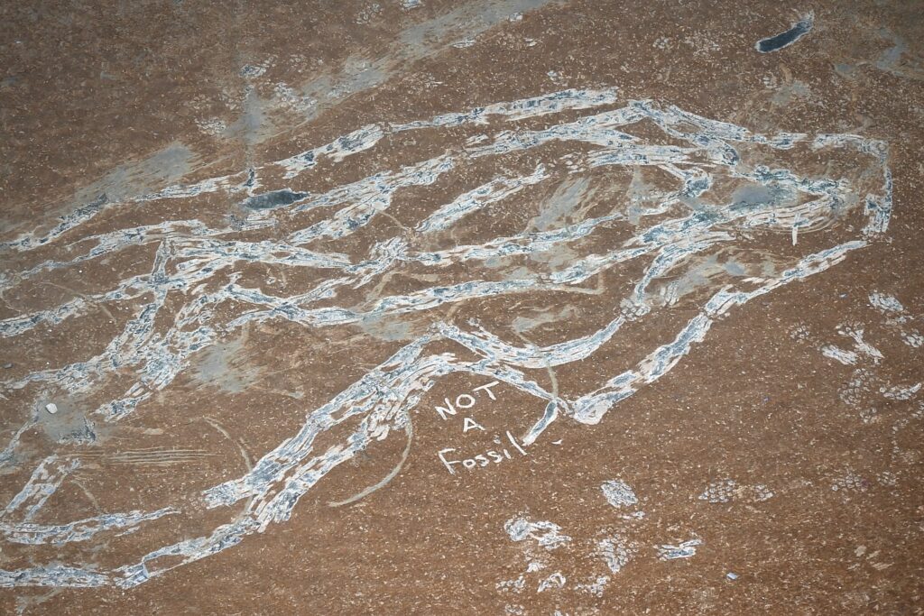
By the time we get back to where the “titanoboa fossil” would have been, we see the naturalist has etched in the soil, “Not a Fossil,” and smudged the image completely away, having revealed the fossil to be a hoax (people had remarked on what they thought were footprints leading to it).

Not a fossil! But now the mystery remains: who created it and how? © Karen Rubin/goingplacesfarandnear.com

So, if we didn’t witness a major fossil discovery, we were witness to the hoax. ow the mystery is: Who created the hoax? How? Anyway, it got everyone buzzing that day.

Also, on my walk I saw in black rock what looked like an ammonite. That too was smudged away on our return.

Glen Creek Gorge Trail, Watkins Glen State Park, is spellbinding © Karen Rubin/goingplacesfarandnear.com

This stunning gorge has been visited by tourists since 1863 and was privately operated as a tourist resort ($1 admission per person, equivalent to $34 today) until New York State acquired the property, in 1906 for a state park. (It is named for Samuel Watkins; “glen” comes from a Greek word meaning “small, narrow, secluded valley”.). After the 1935 flood destroyed the trail, it was rebuilt with a stunning series of stone walks, staircases (there are 800 steps altogether), bridges and tunnels cut through the rock, by Franklin D Roosevelt’s Civilian Conservation Corps between 1935-1940. (You can do the trail one way and take a shuttle bus, $5, back).

The stunning rock formations, created by the rushing water, on the Glen Creek Gorge Trail, Watkins Glen State Park © Karen Rubin/goingplacesfarandnear.com

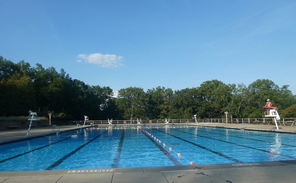
Capping this experience is the beautiful Six Nations Campground – beautiful trees, excellent restroom facilities, and a glorious Olympic-sized pool. There are also a couple of pavilions that can be rented for groups and even the Iroquois Lodge, which is essentially a house that can be rented instead of a campsite (altogether, you can imagine a wedding here, with photos in front of waterfalls; there are also lovely accommodations in town including a luxury Watkins Glen Harbor Hotel, right on Seneca Lake, where we enjoy lunch). Where we camp, we are just a short walk down to the Gorge Trail.

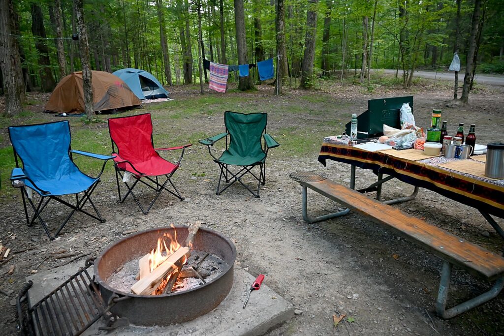
Our campsite at Six Nations Campground, Watkins Glen State Park © Karen Rubin/goingplacesfarandnear.com

Six Nations Campground is named for the Haundenosaunee Confederation, more commonly known to us as Iroquois (Haundenosaunee means “They made the house”), a reminder of whose land this was before the European colonists came. The loops of the campground are named for the nations of the Confederacy: Mohawk, Oneida, Onondaga, Cayuga, Seneca and Tuscarora. The Haudenosaunee Confederacy, the park brochure notes, is renowned for its organization and democratic system, one of the first of its kind (Ben Franklin is said to have drawn upon the Iroquois Confederation for our US Constitution; suffragist Melinda Gage drew upon the Oneida’s matriarchal structure, in which women could be chiefs, own property, have custody of their children in a divorce, to set out demands for women’s rights in 1848).In 1842, what remained of the First Nations were relegated to the Six Nations Indian Reserve. (More information is available at nearby Ganondaganb State Historic Site, 7000 County Rd. 41 (Houghton Hill Rd), Victor, NY 14564).

Walking the stone trail along the Glen Creek Gorge, Watkins Glen State Park © Karen Rubin/goingplacesfarandnear.com

There are seven moderate trails in Watkins Glen State Park ranging from 0.7 to 7.6 miles and from 479 to 1,171 feet above sea level, but we focus all our time on the Gorge Trail (1.5 miles), captivated by the views and the enchantment of the place. Other trails – the Indian Trail (2.4 miles) and the South Rim Trail (2.6 miles) provide views of the Gorge from above. You can connect from the Gorge Trail to Lovers Lane Loop which takes you to a Suspension Bridge for a view above the gorge. You can also do a Gorge Trail, Outer Rim and Finger Lakes Trail combination (7.6 miles, about 3 hours) (see alltrails.com for more detail). (The trail is closed in winter.)

Cavern Cascade, Watkins Glen State Park © Karen Rubin/goingplacesfarandnear.com

It’s about 3:30 in the afternoon when we return to the campsite. We go to the gorgeous, Olympic-sized pool to refresh before returning to the campsite for an amazing steak dinner David and Laini prepared over the campfire they built for our second night camping.

The gorgeous Olympic-sized pool at Watkins Glen State Park © Karen Rubin/goingplacesfarandnear.com

It is no wonder that Watkins Glen State Park was awarded the third best among 6,000 state parks nationwide in 2015, and is consistently among the state’s top parks.

Watkins Glen State Park, 1009 N Franklin St, Watkins Glen, NY 14891, 607-535-4511, https://parks.ny.gov/parks/watkinsglen/maps.aspx.

There is so much to do in Watkins Glen, in the heart of the Finger Lakes, you could easily make this your base for a week.

Auto enthusiasts know Watkins Glen for its famous NASCAR races. The pavement is dotted with names of winners throughout the years, the crosswalks painted like the race start/finish. Auto racing is still sacred here, with much of the quaint village (the downtown was a recipient of New York State’s $10 million Downtown Revitalization Initiative award) themed for autos.

Wine enthusiasts know Watkins Glen as the southerly point of Seneca Lake, from which you can drive up Winery Trails on both sides.

Nearby is the Corning Museum of Glass; about 1 ½ hours drive away is another jewel,  Letchworth State Park, “The Grand Canyon of the East,” where we camped and hiked last year; a half-hour away is Ithaca.

The Finger Lakes region has over 1,000 waterfalls and gorges, 650 miles of shoreline, more than 16,000 acres of National Forest, and over 2,000 miles of hiking and biking trails. There is plenty to explore indoors at museums, art galleries, historic sites, theaters, wineries, breweries.

With summer turning to fall foliage season (which is amazing here), plan early and secure tickets and lodging.  

Excellent planning aids are available from The Finger Lakes Tourism Alliance, 309 Lake Street Penn Yan, NY 14527, 315-536-7488, 800-530-7488, www.fingerlakes.org.

New York State Begins Weekly ILoveNY Fall Foliage Reports; New Interactive Map

The 2021 fall foliage season is underway in New York State. Fall is one of the most popular travel times in New York, attracting visitors from around the world to explore the state’s unique communities and support local businesses. To help travelers and foliage enthusiasts plan a fall getaway, I LOVE NY has begun issuing its weekly fall foliage reports and will now include a new enhanced interactive progression map (www.iloveny.com/foliage).    

The foliage report is compiled each week using the on-location field observations from I LOVE NY’s team of volunteer leaf peepers. More than 85 spotters extending across the state’s 11 vacation regions are tasked with keeping track of the color change in their area as leaves progress each week. Reports detail the predominant leaf colors, approximate percentage of change, and how much color change has progressed relative to peak conditions.  

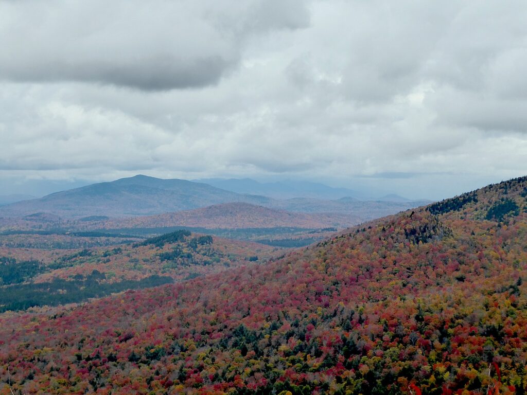
View from Chimney Mountain, The Adirondacks. ILoveny.com/foliage report helps you monitor the progress of fall foliage throughout New York State © Karen Rubin/goingplacesfarandnear.com

New this year, I LOVE NY is introducing an enhanced, interactive map that tracks weekly foliage change and progression across the state throughout the season. The map, located on the I LOVE NY foliage website, showcases great foliage viewing locations in each of the various regions throughout the state. Visitors can also use the map to see what the foliage is like during peak viewing in a given area, and learn about nearby, must-see attractions. 

Thanks in part to its size and location, New York State has one of the longest and most colorful foliage seasons in the country. On any weekend from late September through mid-November, part of the state is likely experiencing peak foliage.  

Travelers are also invited to share their photos of New York State’s amazing foliage on social media by using the #NYLovesFall hashtag. Photos submitted to this hashtag have a chance of being featured on the I LOVE NY fall foliage website and official I LOVE NY social media accounts reaching nearly two million followers. Reports and the new interactive map are updated Wednesdays throughout the season at www.iloveny.com/foliage.Reports are also available toll-free by dialing 800/CALL-NYS (800/225-5697) from anywhere in the U.S., its territories and Canada. For more information on how to volunteer for as an I LOVE NY leaf peeper, e-mail your name, address and phone number to [email protected].

______________________

© 2021 Travel Features Syndicate, a division of Workstyles, Inc. All rights reserved. Visit goingplacesfarandnear.com, www.huffingtonpost.com/author/karen-rubin, and travelwritersmagazine.com/TravelFeaturesSyndicate/. Blogging at goingplacesnearandfar.wordpress.com and moralcompasstravel.info. Send comments or questions to [email protected]. Tweet @TravelFeatures. ‘Like’ us at facebook.com/NewsPhotoFeatures
Driveable Adventures: Hiking/Camping in the ‘Grand Canyon of the East’ – NY’s Letchworth State Park

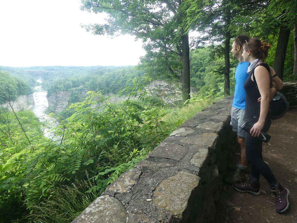
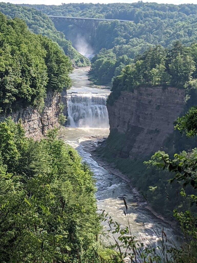
Letchworth State Park, New York © Karen Rubin/goingplacesfarnandnear.com

by Karen Rubin, Dave E. Leiberman & Laini Miranda

Travel Features Syndicate, goingplacesfarandnear.com

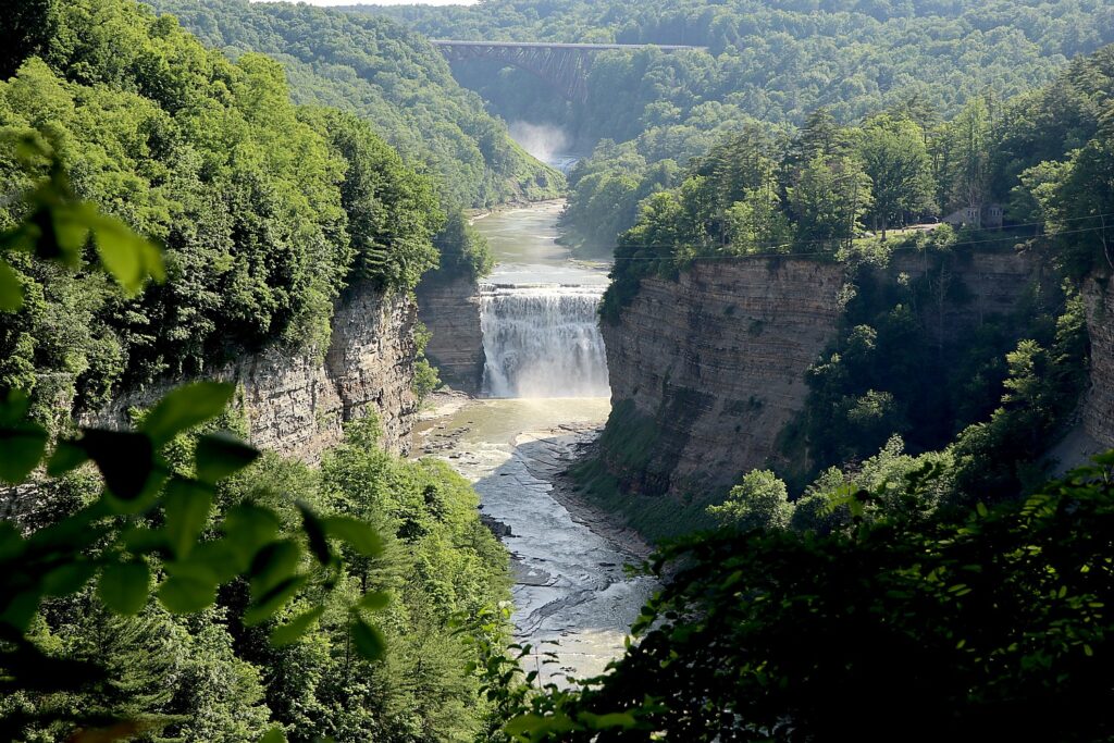
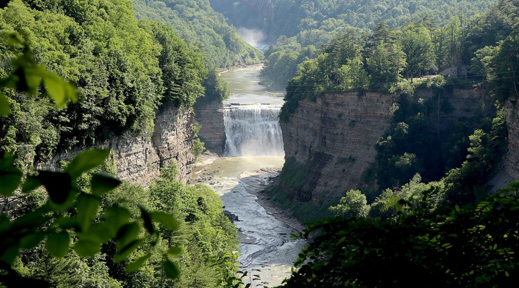
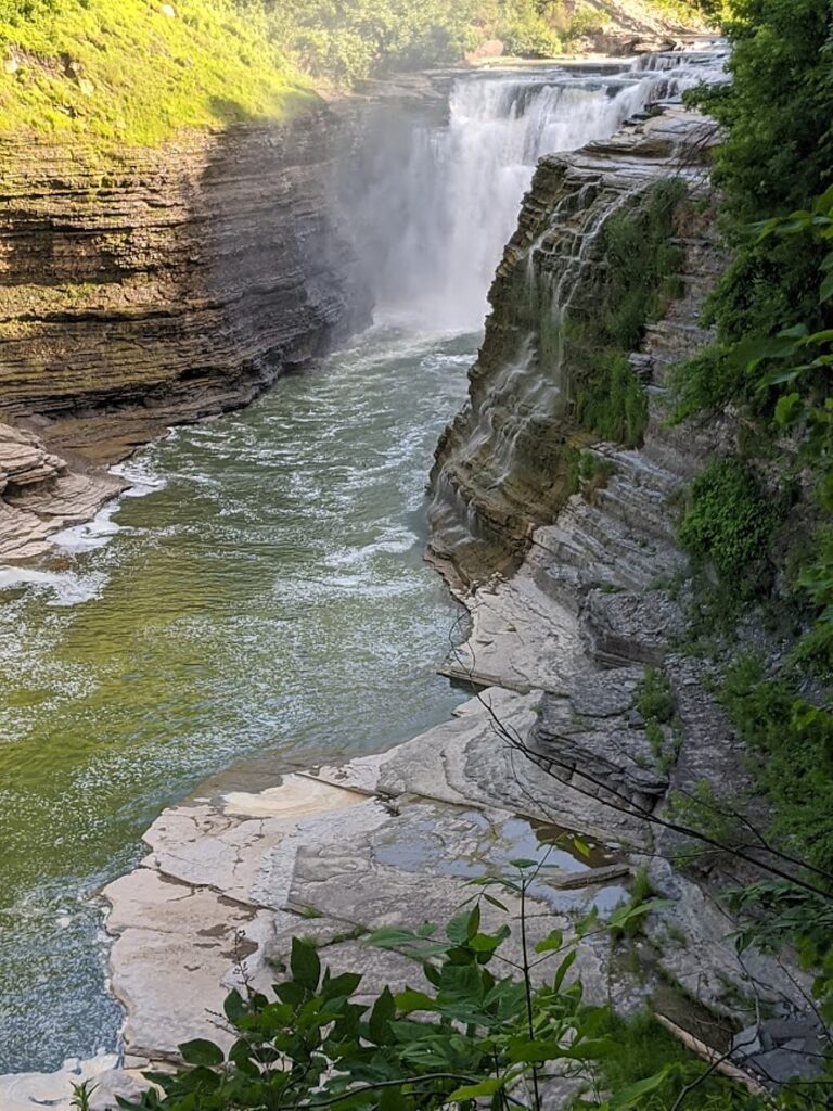
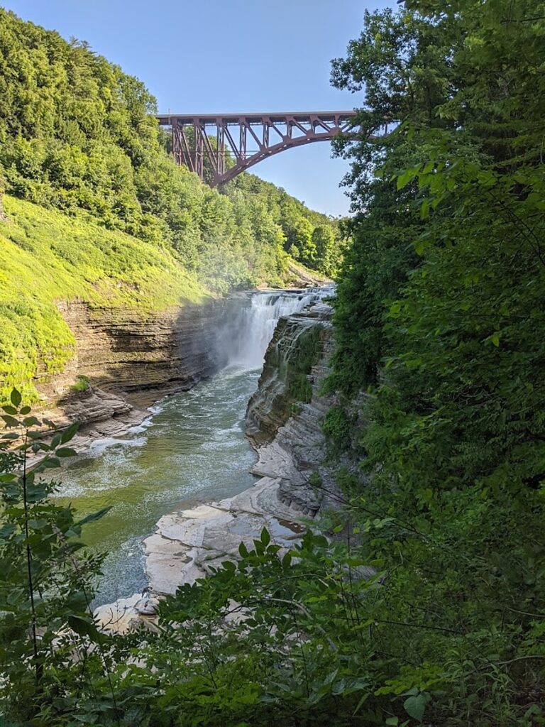
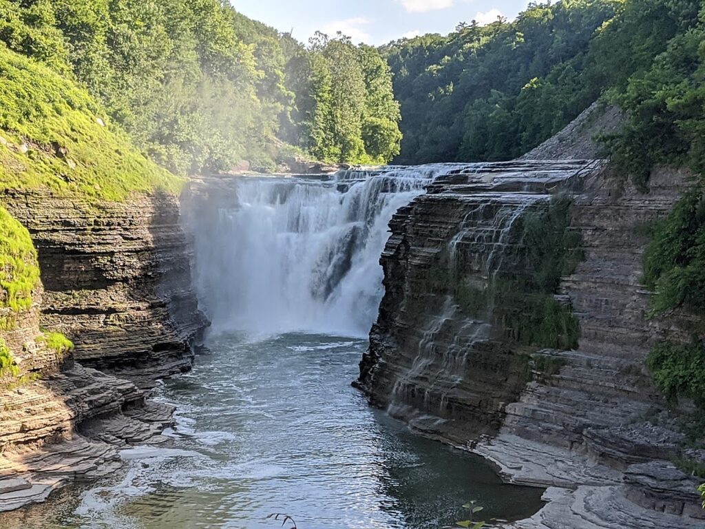
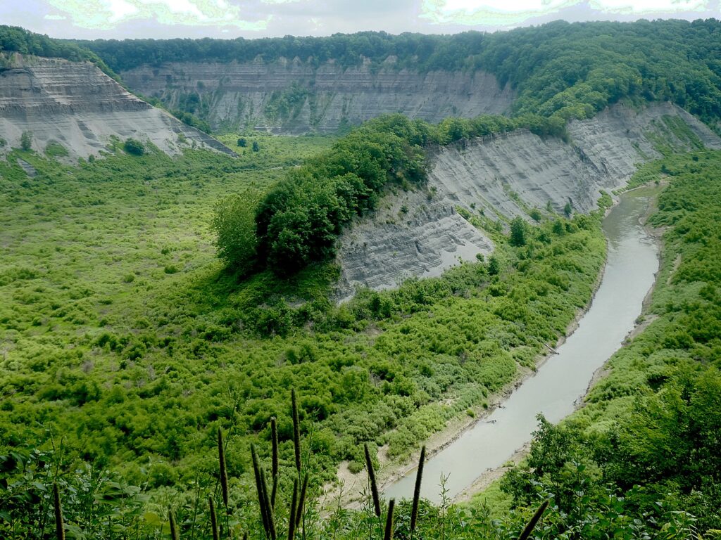
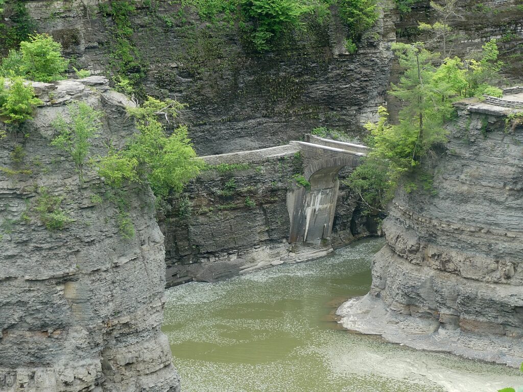
It doesn’t take long once you arrive at New York’s Letchworth State Park to see why this vast preserve merits its nickname, “Grand Canyon of the East.” One of the most dramatically scenic areas in the eastern United States, the Genesee River roars through a humongous gorge that extends the 17 mile-long expanse of the park, over three major waterfalls between cliffs as high as 600 feet, surrounded by lush forest.

Ever since I saw a poster of Letchworth State Park while riding the Long Island Railroad, I said, “Where is that!” So when our plan to camp and hike in the Southwest fell apart this year and feeling safe staying within New York State which has so scrupulously monitored and imposed safety conditions to contain the coronavirus, we sought out a comparable adventure driving distance from home: Letchworth is just south of Rochester in western New York in appropriately named Wyoming County.

Letchworth State Park, New York © Karen Rubin/goingplacesfarnandnear.com

Our camping trip was made all the more special by staying in the campground within the state park that had only just reopened (private campgrounds, such as Kampgrounds of America, koa.com, are also available in the area) – so we could cook our dinner in the most spectacular settings – dinner with a view and be in prime places for the early light. (I booked our stay mere minutes after the website, reserveamerica.com, reopened reservations.)

During the two full days we were there, we hiked the most scenic, marquee trails: the Gorge Trail (#1), 7.6 miles following along the rim in the southern portion of the 17-mile long park, and the next day, the Highbanks Trail (#20), 4.5 miles along the rim and through forest in the north part of the park. Indeed, these hiking experiences were reminiscent of hiking the Rim Trail along the southern rim of the Grand Canyon.

Letchworth State Park, New York © Karen Rubin/goingplacesfarnandnear.com

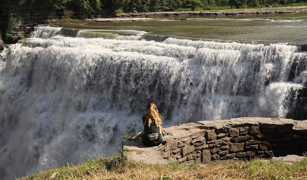
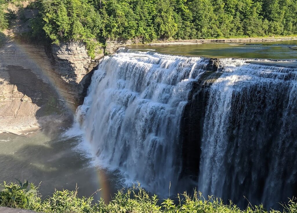
Letchworth State Park, (voted best attraction in New York State in 2017) is a geologic wonder. Its main attractions are three waterfalls (and if you visit in the late afternoon, you may well see rainbows over the Middle Falls) in the southern section. The trails take you to the most popular, scenic overlooks, which people can drive to, so they can be bustling with visitors (when we visited, people seemed to be respectful of wearing masks and keeping distance). This is another reason why camping in the park is such an advantage – the driving tourists tend to arrive at mid-day, so you can get out early and have these spectacular scenes almost to yourself.

If you do the hike early in the morning, do it from north to south. It’s out-and-back, so to avoid doing the 7.6 miles twice (that is, 15 miles), you can leave a second car or a bicycle at the end (as we did).

Letchworth State Park, New York © Karen Rubin/goingplacesfarnandnear.com

The park is huge, about 17 miles long (it takes about 20-30 minutes to drive from the campground to the Upper Falls along the Park Road which is narrow, winding and rolling with dips and rises) to the Upper Falls area. Indeed, the park is so narrow that the hiking trails are just alongside the road, separated in most instances by curtains of trees.

Letchworth State Park, New York © Karen Rubin/goingplacesfarnandnear.com

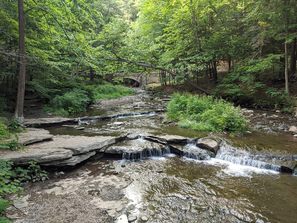
The Gorge Trail, in the south, brings you to the most spectacular views – Upper Falls and Middle Falls in quick succession, then Lower Falls. The real surprise is coming upon Wolf Creek waterfall and a bridge with a painterly scene. Along the way you come upon these stunning stone look-outs at Inspiration Point, Archery Field Overlook, Great Bend Overlook, Tea Table lookout, which also have stone tables and BBQ set-ups.

Letchworth State Park, New York © Karen Rubin/goingplacesfarandnear.com

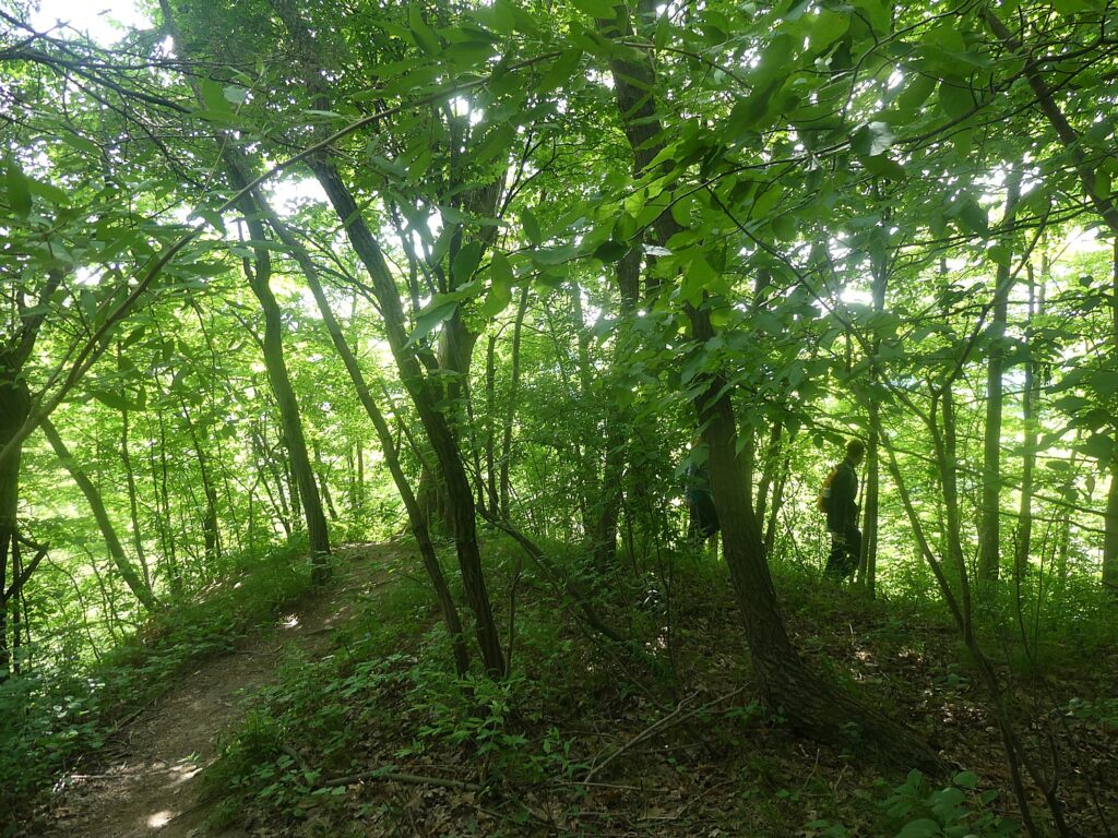
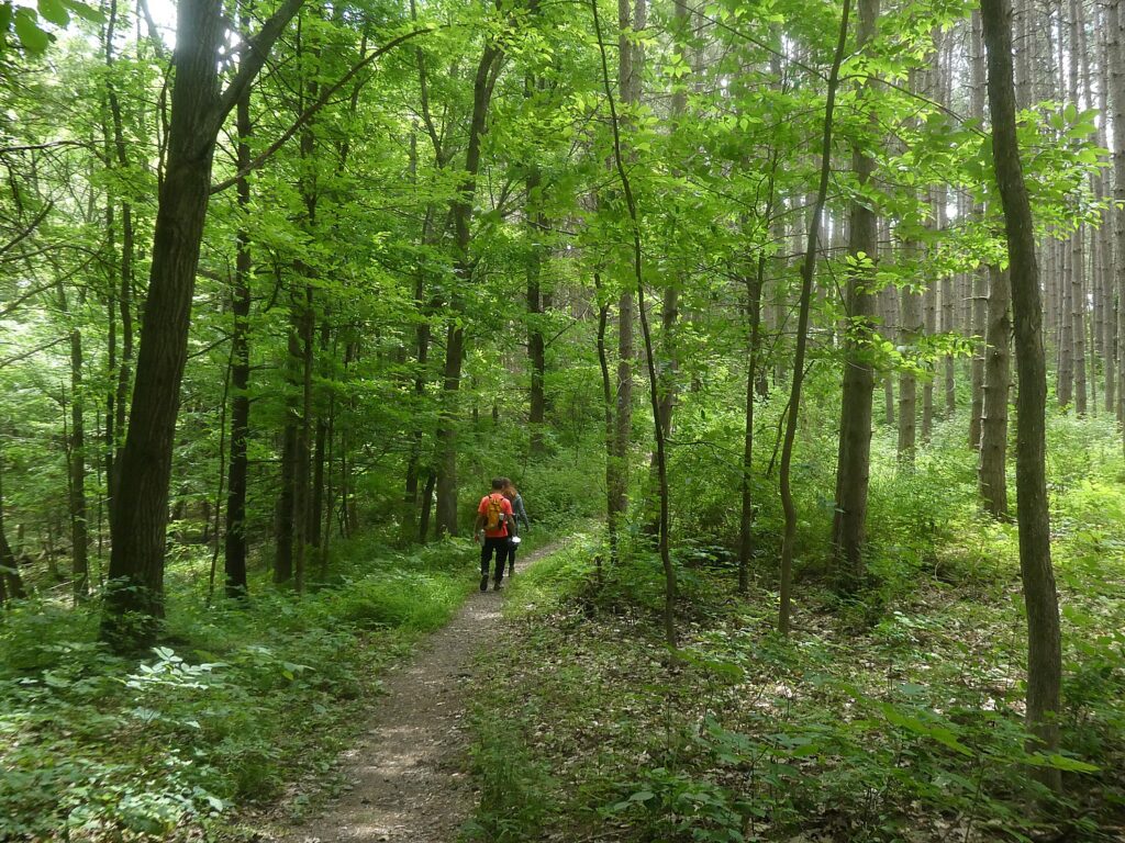
The Highbanks trail in the north section doesn’t have the awesome waterfalls, but is very special in its own way, providing the expansive vistas that evoke awe over just how enormous and winding this gorge is (respect for Mother Nature’s power) and why Letchworth has been dubbed the “Grand Canyon of the East.” Here, the hike brought us into stunning woods where the forest itself makes a painterly canvas.

View from Hogs Back on the Highbanks Trail, Letchworth State Park, New York © Karen Rubin/goingplacesfarnandnear.com
Letchworth State Park, New York © Karen Rubin/goingplacesfarnandnear.com

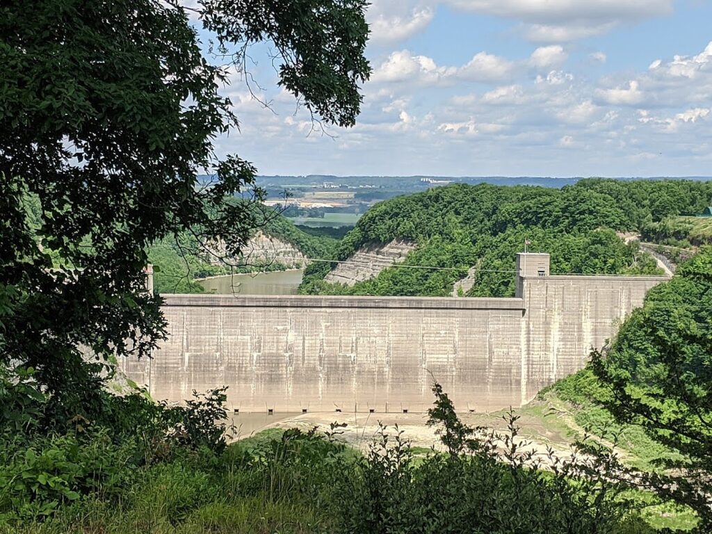
We started at the absolutely stunning overlook at Hogs Back (where we parked our car for the hike), going south about 2.5 miles, then reversing and going north from Hogs Back, you walk along the ridge, sometimes almost hanging over the gorge, until you come to the Mt. Morris Dam Overlook. The treat here comes at the end, at the Mt. Morris Dam Overlook Area, where there is a delightful snack bar serving excellent ice cream.

Letchworth State Park, New York © Karen Rubin/goingplacesfarnandnear.com

Two of the trails that I believe was closed during our visit, but definitely recommended is the Footbridge Trail that brings you down to the Lower Falls (#6A), just a half-mile long but rated “moderate” and the Portage Trail (#6).

Footbridge, Letchworth State Park, New York © Karen Rubin/goingplacesfarnandnear.com

Altogether, the park offers 66 miles of trails (almost all rated easy or moderate, and most on the west side of the park). But for hard-core hikers, there is a 22-mile Finger Lakes Trail that runs along the entire eastern section of the park

Letchworth State Park, New York © Karen Rubin/goingplacesfarnandnear.com

I tried to research in advance to find the best places for sunrise and sunset photos, which of course depends on season and weather. I wasn’t able to get any sunrise or sunset photos, but the late afternoon light proved best at the Upper Falls and Middle Falls (where rainbows seem not uncommon as the sun lowers and sends its rays through the mist).

Letchworth State Park, New York © Karen Rubin/goingplacesfarnandnear.com

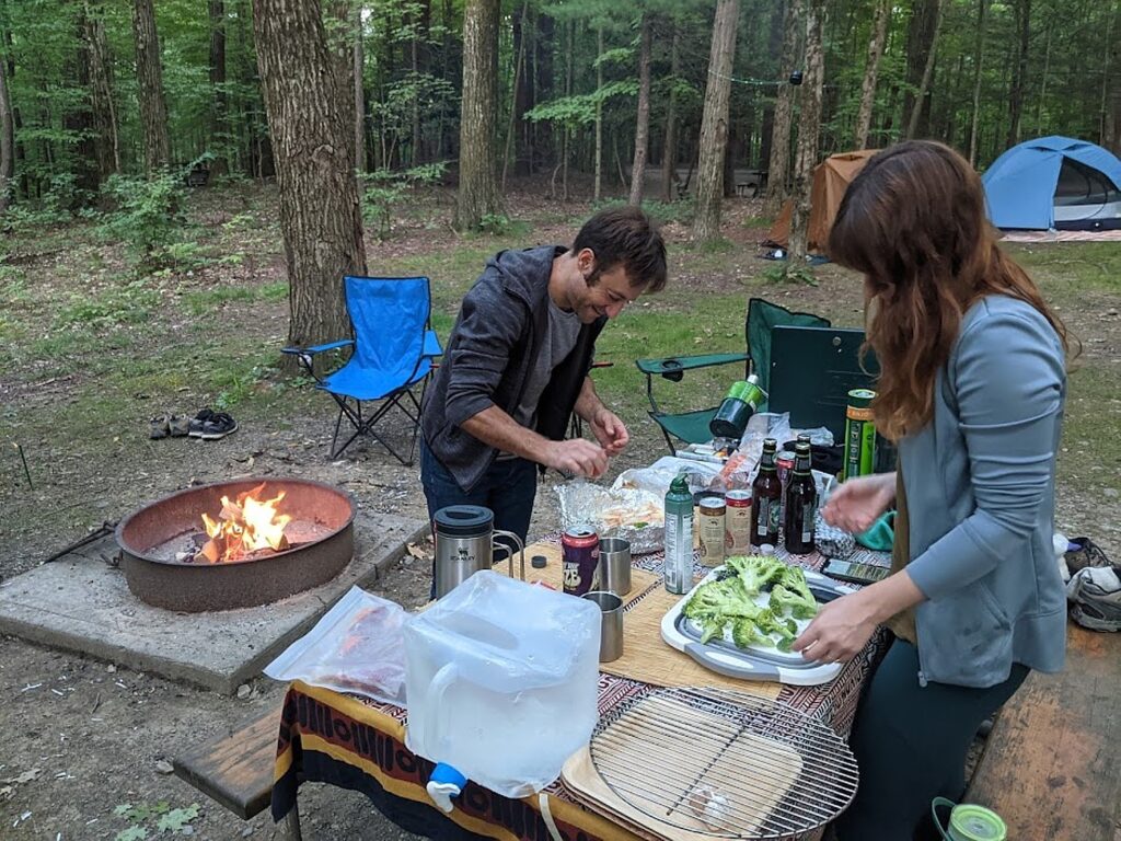
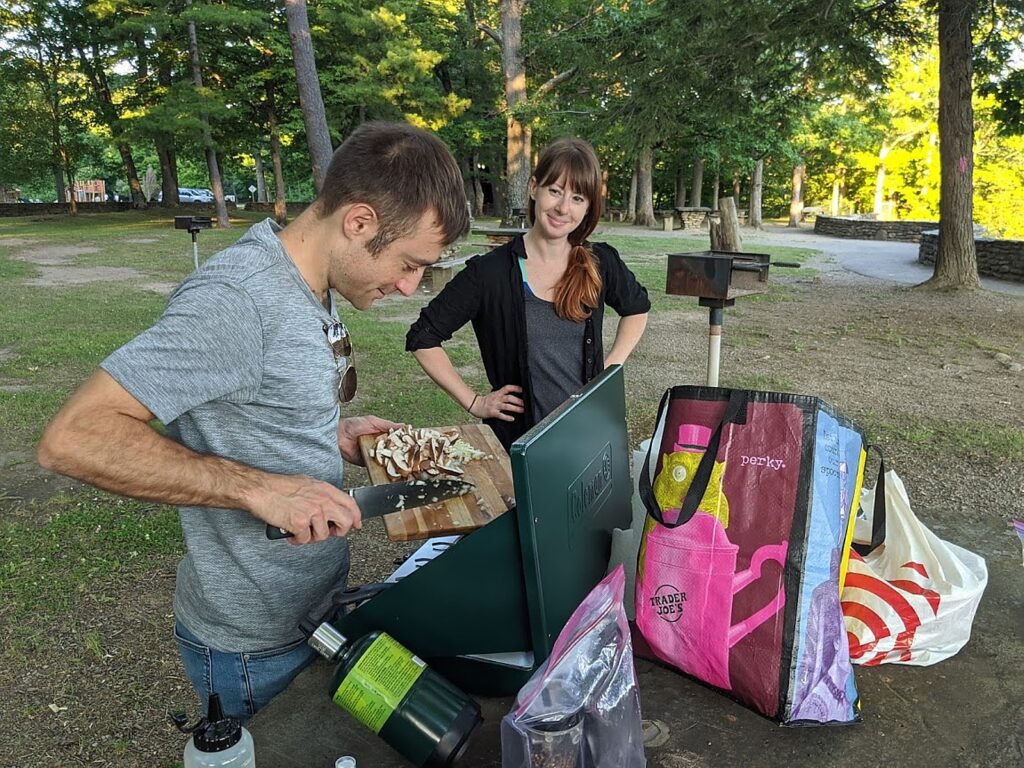
Instead of eating at the campsite (not that scenic, but very pleasant for sleeping and breakfast), we kept our food in the cooler and equipment in the car and each evening would pick out a different setting – dining on tables with slate tabletops apparently taken from these very cliffs. David would haul out his Coleman stove and tiny propane tank, his culinary tools, cutting board, and perform his culinary magic. We dined at the appropriately named Tea Table the first evening, Wolf Creek the second evening, which proved our favorite, with a virtually private view of a sweet waterfall, that we discovered on our hike. We were going to have our third night’s dinner overlooking the Upper Falls, but realized this is the most popular part of the park, and since a priority was to avoid possible exposure to lingering COVID germs, we decided to return to Wolf Creek which we again had all to ourselves.

Wolf Creek, Letchworth State Park, New York © Karen Rubin/goingplacesfarnandnear.com

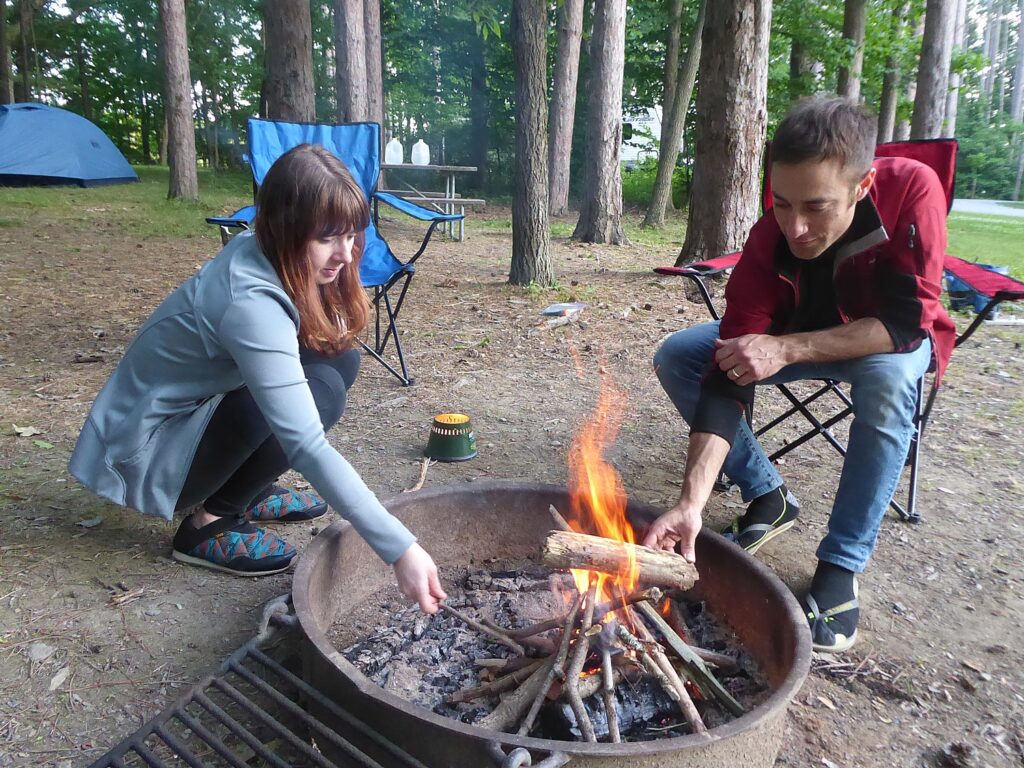
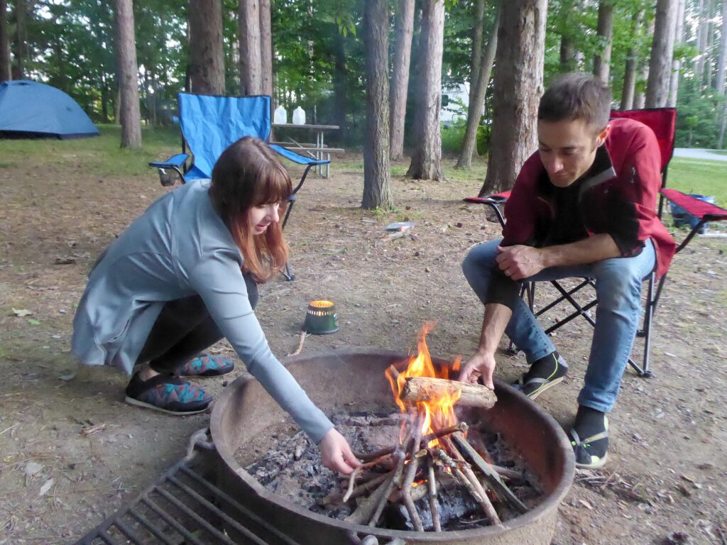
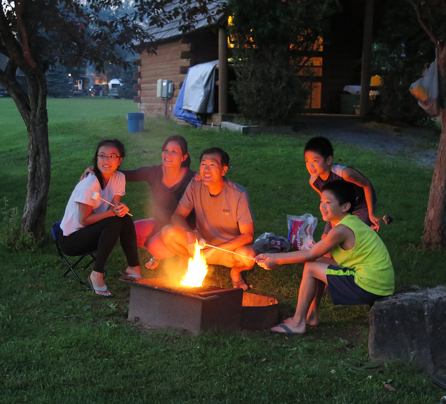
Each evening we returned to the campsite and David and Laini made a fire (s’mores for dessert!). The peace of this place, with tall trees opening to a blanket of stars, and fireflies darting about as if they were Superflies! or shooting stars, was perfect and priceless.

Highbanks Campground, Letchworth State Park, New York © Karen Rubin/goingplacesfarnandnear.com

Letchworth, which was voted USA Today’s Reader Choice for Best State Park in the nation in 2015, is well maintained, especially during this heightened COVID-19 health emergency. The campground restroom facility was very clean, and all the restrooms (they indicate which are open), require masks and social distancing.

Letchworth State Park, New York © Karen Rubin/goingplacesfarnandnear.com

Our plan for this trip was to be completely self-sufficient so we wouldn’t have to worry about getting water or food, not knowing if places would be open to buy supplies and wanting to cut down our interactions as much as possible. We took enough supplies for our three days, though we did discover that by the time of our trip, this region of New York had achieved Phase 4 reopening, so places were open though with significant limitations, including the Highbanks Camp Stores. (Concessions also were at the Dam Overlook Cafe and Highbanks Pool Snack Bar on the North end; Letchworth Gift shop, Lower Falls, upper Falls Snack Bar.)

(Indeed, for the foreseeable future, travel will involve more planning and forethought, checking ahead what will be open and under what conditions; as a general rule, some places are requiring advance reservations or timed-ticketing.)

Mount Morris Dam, Letchworth State Park, New York © Karen Rubin/goingplacesfarnandnear.com
 

The Highbanks campground is wonderful – six miles from the entrance, and several more miles to get to the actual camping loops for tents and RVs. There are also cabins. Several areas accommodate pets.

There are also a few cottages and lodges available within the park. For a family vacation rental experience, the Maplewood Lodge, located at the entrance to the Highbanks Camping Area, sleeps up to eight and has a furnished kitchen, living room with working fireplace, TV and DVD/BluRay player and formal dining room.

Camping was one of the attractions for us to come to Letchworth at this time (so many are choosing camping and RVing and even AirBnBs over commercial hotels), but the park also offers the charming Glen Iris Inn, scenically set right above the Middle Falls.

Glen Iris Inn, Letchworth State Park, New York © Karen Rubin/goingplacesfarnandnear.com

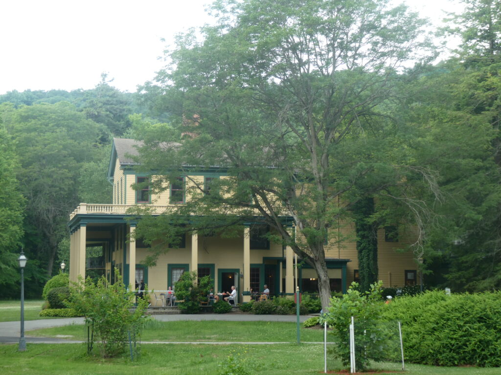
An inn since 1914, the historic Glen Iris Inn was formerly the country estate of William Pryor Letchworth. Completely restored, the inn offers accommodations and is open to the public for breakfast, lunch and dinner (banquet and catering services are available for special events). We see people dining on the lovely veranda, as well as in an enormous tent set up on the lawn to further accommodate those preferring to dine al fresco.

Addressing this historic moment, rooms are sanitized with an electrostatic cleaning machine and sealed for the guest’s arrival; capacity in Caroline’s Dining Room is limited to 50%. In addition to rooms in the Inn, the Glen Iris also offers some cottages (585-493-2622, glenirisinn.com).

Just across from the inn is the small stone William Pryor Letchworth Museum which tells the fascinating story of Letchworth Park, paying tribute to William P. Letchworth who preserved the land and its heritage by donating it to the state. The museum tells the history of the Genesee Valley, the canal, and of the Seneca who lived on these lands. Letchworth’s personal collection of artifacts from local Native American tribes is on view.

The museum also relates the compelling story of Mary Jemison, “The White Woman of the Genesee,”  born on a ship from Europe in 1743 and kidnapped from her home in Pennsylvania in 1758 by Shawnee, then sold to the Seneca who adopted her into the tribe, becoming Dehgewanus. (Trail #2 is named the Mary Jemison Trail, the creek is named De-ge-wa-nus Creek and there is a statue of her, erected by Letchworth not long after her remains were brought back from a reservation and reburied on his estate, that Letchworth dedicated to her memory in 1910; read her remarkable story: http://www.letchworthparkhistory.com/jem.html)

We didn’t have the opportunity to visit the museum during our visit, but is one of the top items on our list for our return.

Letchworth State Park, New York © Karen Rubin/goingplacesfarnandnear.com

We also did not get a chance to explore the Humphrey Nature Center which in normal times, offers year-round environmental education programming and interactive exhibits highlighting the geology, wildlife, and ecology of the park.

Highbanks Trail, Letchworth State Park, New York © Karen Rubin/goingplacesfarnandnear.com

Letchworth State Park offers many recreational facilities and activities that were just beginning to reopen at the time of our visit – including nature, history and performing arts programs, guided walks, tours, a summer lecture series. The enormous Highbanks Recreation area has a pool. And since our visit, the park opened a new $2 million outdoor Lower Falls Recreation Center offering table games, badminton and pickle ball courts, bocce and shuffleboard, as well as a fitness loop.

Highbanks Trail, Letchworth State Park, New York © Karen Rubin/goingplacesfarnandnear.com

The project also involved restoration of a historic bathhouse that is used as the base for the whitewater rafting concessionaire, Adventure Calls Outfitters (https://adventure-calls.com/). Letchworth also offers  kayaking, there is even hot air ballooning (https://balloonsoverletchworth.com/). 

A half-dozen trails allow biking (I wouldn’t recommend biking on the main Park Road), and there is horseback riding as well.

Middle Falls, Letchworth State Park, New York © Karen Rubin/goingplacesfarnandnear.com

Letchworth State Park is open year-round – the fall colors look spectacular, as do the winter scenes when there is cross-country skiing on most of the trails, snowmobiling on four trails, and snow tubing. Winterized cabins are available.

To book a spot in the state campground, go to https://newyorkstateparks.reserveamerica.com/.

Letchworth State Park, Castile, NY 14427 (there are several entrances, but Mt. Morris Entrance is closest to the highway; check out the wonderful antique shops in Mount Morris); 585-493-3600, letchworthpark.com.

Letchworth State Park, New York © Karen Rubin/goingplacesfarnandnear.com

New York State Office of Parks, Recreation and Historic Preservation oversees more than 250 parks, historic sites, recreational trails and boat launches, which were visited by a record 77 million people in 2019. A recent university study found that spending by State Parks and its visitors supports $5 billion in output and sales, 54,000 private-sector jobs and more than $2.8 billion in additional state GDP. For more information on these sites, call 518-474-0456 or visit parks.ny.gov.

______________________

© 2020 Travel Features Syndicate, a division of Workstyles, Inc. All rights reserved. Visit goingplacesfarandnear.com, www.huffingtonpost.com/author/karen-rubin, and travelwritersmagazine.com/TravelFeaturesSyndicate/. Blogging at goingplacesnearandfar.wordpress.com and moralcompasstravel.info. Send comments or questions to [email protected]. Tweet @TravelFeatures. ‘Like’ us at facebook.com/NewsPhotoFeatures
Antidote for Cabin Fever: Road Trip to the Great Outdoors

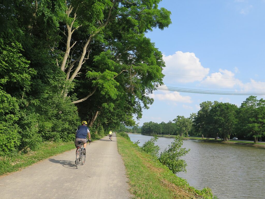
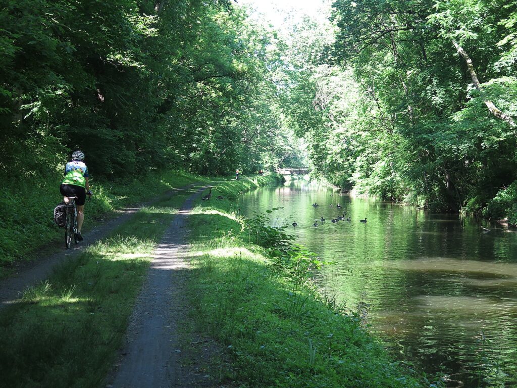
Perfect antidote for cabin fever: Parks & Trails NY’s eight-day, 400-mile Cycle the Erie biking/camping trip from Buffalo to Albany, NY (c) Karen Rubin/goingplacesfarandnear.com

by Karen Rubin, Travel Features Syndicate, goingplacesfarandnear.com

This time last year I was getting set for an around-the-world Global Scavenger Hunt which took me to places that I had always hoped to see – Petra, Jordan; Myanmar; Vietnam; Morocco, just to list a few. The coronavirus pandemic has made that experience impossible this year. But it just goes to show: Don’t put off experiences, especially not a trip of a lifetime.

These are uncharted waters for the travel industry, and for travelers.

With the worst of the crisis appearing to be coming under control, state governments are looking to gradually reopen and lift their lockdowns. The same is true for people venturing out of doors. People are burning with cabin fever but may be cautious.

Here is the antidote to cabin fever: I’m thinking outdoors, great open vistas, clean air. This is a great time for a throwback to the 1950s family road trip to enjoy the Great Outdoors. Instead of a station wagon, pack up the SUV and set an itinerary that revolves around national and state parks, wildlife areas, nature preserves. I’m thinking camping (koa.com) or glamping (glampinghub.com). I’m thinking hiking, biking, rafting, kayaking.

“It’s vital that people find ways to engage in physical activity during this time; the benefits to our immune systems and our mental health are significant. But it is critical that we do so in ways that will keep us safe and minimize the spread of the pandemic,” writes Ryan Chao, President, Rails-to-Trails Conservancy.

Rails-to-Trails’ Conservancy has compiled resources, provides information on the latest on trails, walking and biking and the COVID-19 pandemic (Visit railstotrails.org/COVID19), and provides a trail-finder website and app, TrailLink.com, which is free for anyone to use to find particulars on more than 37,000 miles of multi-use trails nationwide, including trail maps, walking and biking directions to get to the trail, and contact information for local trail management organizations (visit railstotrails.org).

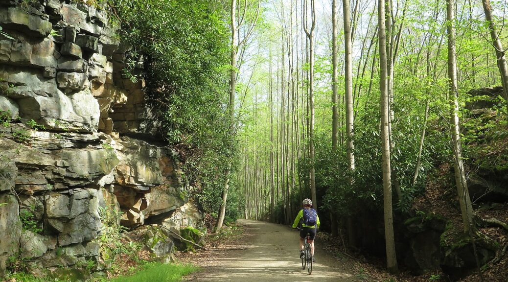
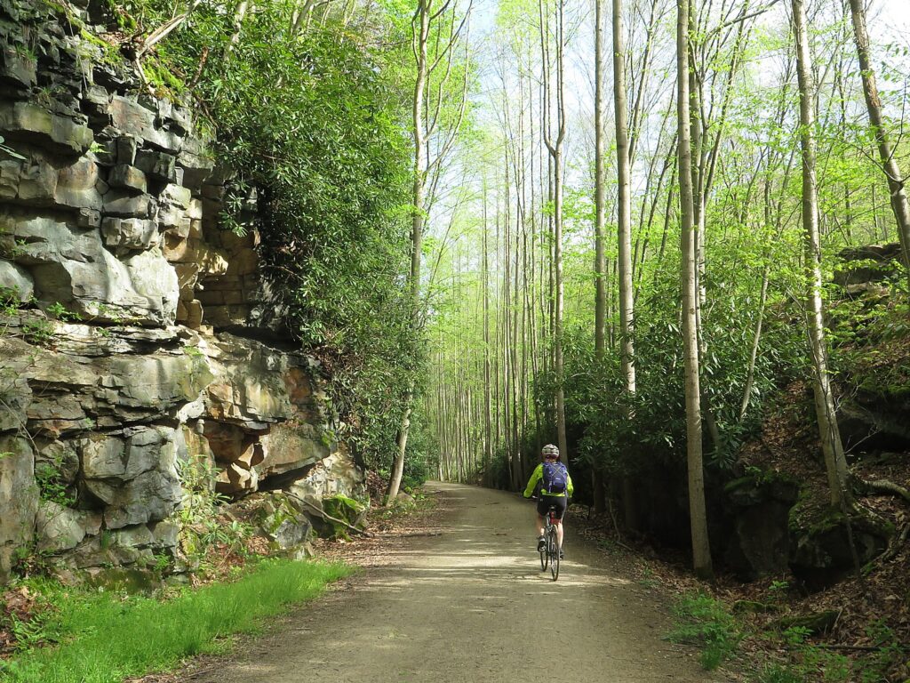
Rails-to-Trails Conservancy Sojourn on the Delaware-Lehigh Trail (c) Karen Rubin/goingplacesfarandnear.com

Here are more ambitious ideas:

An ideal trip (and also one of my favorite bike tours ever) which hits all of these criteria (driving distance, biking, camping) is the Cycle the Erie, an eight-day 400-mile, fully supported biking/camping trip, from Buffalo to Albany, operated by Parks & Trails NY. At this writing, the 22nd Annual Cycle the Erie was still taking place July 12-19, 2020. (they expect to make a decision on May 12; they have eased the cancellation policy and would transfer the registration at this year’s fee next year if they have to cancel.) For information on Cycle the Erie Canal, call Parks & Trails New York, 518-434-1583, email [email protected] or visit www.ptny.org/cycle-the-erie-canal.

Hopefully, other supported biking/camping rides that also support nonprofit organizations will also run, such as the BikeMaine 2020: Katahdin Frontier – a seven-night ride 340 mile-loop (17,455 feet of climbing), from Old Town, September 12-19, 2020 (www.bikemaine.org)

The next best thing is an organized bike tour – self-guided trips obviously have the fewest people to interact with, and guided – that utilize inn-style accommodations are our favorites. We have enjoyed trips around the world – the Danube Bike Trail, Greek islands bike/boat trip, Venice-Croatia, Slovenia, and Albania (Biketours.com is a great source), and I’m still hoping to take my family on a self-guided bike trip of northern Portugal in late summer – but there are fabulous trips within driving distance that can be done on rail-trails with camping, inns and airbnb.com, such as the Delaware-Lehigh trail in Pennsylvania and the Great Allegheny Passage which can be linked with the C&O trail that can take you from Washington DC all the way to Pittsburgh, PA, and the Erie Canalway.

Rails-to-Trails Conservancy’s Sojourn on the Great Allegheny Passage Rail Trail (c) Karen Rubin/goingplacesfarandnear.com

Wilderness Voyageurs, a wide-ranging outdoors company with an extensive catalog of biking, rafting, fishing and outdoor adventures throughout the US and even Cuba, offers many guided and self-guided bike itineraries built around rail trails like the Eric Canal in New York, Great Allegheny Passage in Pennsylvania and Katy Trail in Missouri. Last year we thoroughly enjoyed the six-day “Badlands and Mickelson Trail” bike tour of South Dakota. Wilderness Voyageurs, 103 Garrett St., Ohiopyle, PA 15470, 800-272-4141, [email protected], Wilderness-Voyageurs.com.

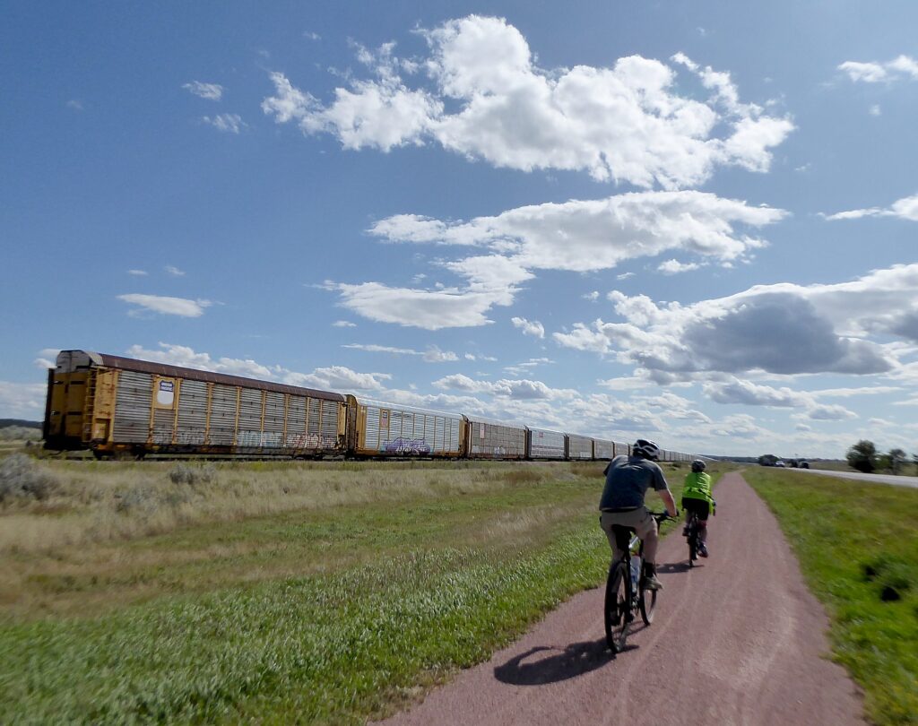
Biking the Mickelson railtrail in South Dakota with Wilderness Voyageurs (c) Karen Rubin/goingplacesfarandnear.com

Bicycle Adventures is offering 6-day bike tours of Oregon Columbia (riding and hiking); South Dakota’s Mickelson Trail; and Washington San Juan Islands. Bicycle Adventures, 18047 NE 68th St, Ste B140, Redmond, WA 9805 (425-250-5540, bicycleadventures.com).

Tour Operators to the Great Outdoors

Tour operators are in a position not only to have access to permits and accommodations in places that are likely to be overrun this year, but are better plugged in to what is happening on the ground,  can move passengers around, adapt itineraries. Wilderness adventure travel companies so far are still offering trips this summer.

Based in Billings, Montana, Austin Adventures has spent over 35 years building an international reputation as a top provider of luxury, small group, multisport tours for adults and families to the world’s most captivating destinations. Austin Adventures has perfected the art of creating itineraries featuring exceptional regional dining, distinctive accommodations, incredible guides and exhilarating activities, all while keeping all-inclusive rates and services the norm. In addition to scheduled group departures on all seven continents, Austin Adventures has developed a reputation as the leader in customized trip planning and execution, all backed by the industry’s best money-back satisfaction guarantee. For information on Austin Adventures’ trips, cruises and distinctive accommodations on seven continents:800-575-1540, [email protected], www.austinadventures.com.

Western River Expeditions escorts more people down rivers on professionally guided rafting trips in Utah, Idaho and Arizona than any other company and is the largest licensed outfitter in the Grand Canyon. (866-904-1160, 801-942-6669, www.westernriver.com).

Moab Adventure Center, a division of Western River Expeditions and the largest single tour provider in Moab, UT, is a one-stop resource for a myriad of outdoor adventures that take you to Arches National Park and Canyonlands and river rafting. (435-259-7019 or 866-904-1163, www.moabadventurecenter.com)

Moab Adventure Center, Utah, is a one-stop resource for a myriad of outdoor adventures that take you to Arches National Park and Canyonlands and river rafting.

Holiday River Expeditions hopes to be offering its river rafting trips from the end of June through the end of the season in October. The company, operating out of Green River Utah, offers trips on the Colorado, Green River, San Juan and out of Vernal, on the Yampa, in heart of Dinosaur National monument.

Holiday River has just put out The Complete Guide to Whitewater Rafting Trips in Utah, for do-it-yourselfers as well as people who are more than happy to use a commercial outfitter. This new resource for every kind of adventurer is offered free and online.

Here are the seven river trips chosen for inclusion in this new resource:

The Colorado River through Cataract Canyon 

The Colorado River through Westwater Canyon

The Green River through Desolation Canyon

The San Juan River in Utah

The Green River through Lodore Canyon

The Yampa River

Labyrinth Canyon

“Oar power is the most natural way to experience the river and the absence of motors makes high water trips as exciting as it gets. Rafters experience the rush of wind, a chatty raven or a churning rapid absent the drone and smell of a motorized raft,” said Tim Gaylord, Director of Operations and Holiday employee since 1978. (For information, availability, reservations or the catalog, 800-624-6323, [email protected], www.bikeraft.com)

Rethink “Lodging”

A perfect corollary for any sojourn into the wilderness, instead of staying in a hotel, consider glamping – basically luxury camping that brings you into the most gorgeous and distinctive places, close to nature, in comfort but affording very distinctive experiences.

With the popularity of glamping surging, an array of glamping destinations have popped up around the world in recent years, offering everything from geodesic domes to Airstream RVs to tiny homes. For example:

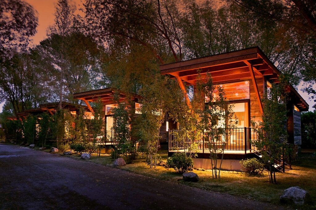
Fireside Resort: By combining the amenities of a luxury boutique hotel with the atmosphere of a wooded campground, Fireside Resort offers Wyoming’s best glamping experience. The lodging options reflect the heritage of the valley’s original homesteader cabins, with cozy fireplaces, full kitchens, private furnished decks, and outdoor fire pits. Situated on wildlife-filled acres where moose, elk, red-tailed hawks, bald eagles and deer roam, Fireside Resort is just seven miles from Jackson’s bustling town square.

Fireside Resort offers Wyoming’s best glamping experience.

Kestrel Camp: The American Prairie Reserve in Montana is piecing together what will be the largest nature reserve in the lower 48 states, totaling 3.5 million acres, and restoring habitat and species in the process. APR’s Kestrel Camp offers five yurt-style luxury suites set around a central lounge and dining room serving chef-prepared meals, as well as a safari-style experience with special access to tour the reserve’s ecosystem with personal naturalists.

A great source to finding glamping accommodations is GlampingHub.com, an online booking platform for unique outdoor accommodations across the globe. With over 35,000 accommodations in over 120 countries, Glamping Hub’s mission is to connect travelers with nature in order to create authentic experiences in which travelers can stay in the great outdoors without having to sacrifice creature comforts—camping with added luxuries and five-star amenities. Guests can find over 27 different types of glamping accommodations to choose from on Glamping Hub from safari tents, tree houses, and cabins to tipis, villas, and domes. (glampinghub.com)

Or, think cottage on a beach (Cape Cod, Martha’s Vineyard are my favorites).

Rethink “resort”.

I’m thinking dude ranch: Duderanch.org lists 100 in Wyoming, Montana, Colorado and such, but there are also dude ranches as close as the Catskills and Adirondacks in the wilds of New York State, like the Pine Ridge Dude Ranch (30 Cherrytown Road, Kerhonkson, NY 12446, pineridgeranch.com), Ridin’ Hy, year-round inclusive ranch resort in the Adirondacks Preserve near Lake George, Warrensburg, NY 12885, 518-494-2742, www.ridinhy.com);  and the ever-popular Rocking Horse Ranch (reopening June 12, 600 State Route 44/55, Highland, NY 12528, 877-605-6062, 845-691-2927, www.rockinghorseranch.com).

And while many will choose to venture within driving distance – biking, hiking (check out the Hudson River School Art Trail in the Catskills and camping at the North-South Campground, for example) – I will pretty much bet that traveling by air will be absolutely safe because of the regimen that every airline has imposed (going as far as to leave middle seats empty; sanitizing surfaces and utilizing hospital-grade ventilation/air purification systems). I would bet that the most dicey part of an airline trip will be getting through airport security.

Hiking the Hudson River School Art Trail, in the Catskill Mountains, Greene County, New York State (c) Karen Rubin/goingplacesfarandnear.com

Air Travel

Airlines are doing their best to allay passengers’ concerns – both from the point of view of health as well as easing up cancellation, change and refund policies. This from Delta is fairly typical of the major carriers:

“In the current environment, it’s important for all of us to travel smarter and more consciously. That’s why I want to personally update you on the situation with COVID-19 (the coronavirus) and the steps we are taking to ensure your health and safety in your travels,” writes Delta CEO Ed Bastian.

“For more than a decade, Delta has been preparing for such a scenario. As a global airline, we have strong relationships in place with health experts including the Centers for Disease Control (CDC), the World Health Organization (WHO), the Federal Aviation Administration (FAA) and local health authorities worldwide. We are in constant contact with them to make sure our policies and procedures meet or exceed their guidelines.

“Operations are our lifeblood. We’ve learned from past experience with outbreaks like H1N1 and Ebola, and have continually refined and improved our ability to protect our customers. That includes the way we circulate clean and fresh air in our aircraft with highly advanced HEPA filters, the new fogging procedures in our cleaning process, how we sanitize aircraft between flights and how we respond if a customer is displaying symptoms.

“A full report on the measures Delta is taking to help you have a healthy flying experience..outlines our expanded cleaning and disinfecting at our airports and on board our aircraft; distribution of hand sanitizer and amenity kits to help customers stay clean; and the technology on our aircraft to filter and replace cabin air.

“A command center in Atlanta has been stood up to guide our response, leading our global team of thousands of Delta professionals dedicated to this effort. That includes our reservations specialists handling thousands of incoming calls, our flight crews and Airport Customer Service (ACS) agents taking extra care of our customers, and our TechOps and operations coordination teams keeping the airline moving. This world-class group of airline employees has your back, and I have never been prouder of the women and men of Delta.

“To ensure you always have access to the latest information and guidance, we have a website on the COVID-19 situation that is continually being updated with cleaning policies and actions we’re implementing to keep you safe, ways you can stay healthy while flying, and changes to our flight schedules and waiver information. Transparency is one of our core values, and we are committed to keeping you fully informed as the situation evolves.

“While we’re committed to providing you with information you need to make informed decisions around your travel, we also understand the need for flexibility based on your individual circumstances. To make sure you can travel with confidence, we’re offering flexible waivers, and we’ve also adjusted our network in response to guidance from the State Department.

“We understand that in today’s world, travel is fundamental to our business and our lives, which is why it can’t – and shouldn’t – simply stop. I believe Delta’s mission of connecting the world and creating opportunities is never more important than at times like this.”

_________________________

© 2020 Travel Features Syndicate, a division of Workstyles, Inc. All rights reserved. Visit goingplacesfarandnear.com, www.huffingtonpost.com/author/karen-rubin, and travelwritersmagazine.com/TravelFeaturesSyndicate/. Blogging at goingplacesnearandfar.wordpress.com and moralcompasstravel.info. Send comments or questions to [email protected]. Tweet @TravelFeatures. ‘Like’ us at facebook.com/NewsPhotoFeatures
Erie Canal Cruises, Gems Along Mohawk Round Out Stay at Herkimer Diamond Mines KOA

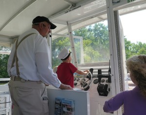
Excitement entering Lock 18 on the Erie Canal, on the cruise from Gems Along the Mohawk © 2015 Karen Rubin/news-photos-features.com

I’ve already had some extraordinary experiences during my all-too-brief stay at the Herkimer Diamond Mines KOA, a camping resort that prides itself on “edutainment”. I’ve tried my hand at mining for Herkimer Diamonds in the quarry – these magnificent quartz crystals that almost pop out of their rocky prison as if cut and polished by Mother Nature. I’ve done sluicing and had the delight in finding gemstones, diamonds and fossils, and explored the massive retail store and museum with its fine display of rocks, gemstones and fossils – including the large Herkimer diamond cluster in the shape of a cross that was discovered the morning of September 11, 2001, and the skull of a triceratops. And I’ve enjoyed the special atmosphere of a campground – or rather, a camping resort – the peaceful sounds of the flowing West Canada Creek, the smells of campfires, and the giggles of kids riding bikes passed my creekside cabin, themed for dinosaurs.

But there is more to do: the Herkimer KOA is but seven miles away from the Erie Canal, that marvel of human ingenuity and engineering which helped unify the fledgling nation and propel it into the Industrial Revolution. There, Dr. Renee Shevat, who owns the Herkimer Diamond Mines KOA, has turned a building that used to warehouse buoys into a gigantic indoor “mall” showcasing artists, artisans, writers, and companies, in a most pleasant environment (come on Saturdays, when there are free tastings), a marina where you can take a delightful 90-minute narrated cruise on the Erie Canal, climaxed with going through a lock that lifts (or drops) the boat 20 feet, and an excellent restaurant, the Waterfront Grille, with a lovely setting on the canal.

Cruising the Erie Canal

Captain Jerry Gertz welcomes passengers aboard the Lil Diamond II for the 90-minute narrated Erie Canal cruise © 2015 Karen Rubin/news-photos-features.com

Captain Jerry Gertz delivers a delightful narration (part on tape, but he interjects and takes questions) which is interesting, engaging, and very entertaining, delivered with wonderful humor. The climax of the 90-minute cruise comes when you go through Lock 18.

Along the way, he points out interesting sights and fascinating (and I mean fascinating) details about the history and the remarkable engineering of the Erie Canal, and why the Erie Canal was so crucial to opening the West, unifying the fledgling nation, making New York the Empire State and New York City the financial capital of the world. Captain Jerry came to the Erie Canal in his “retirement” – after operating one of the largest tour boat companies in Florida.

I am surprised to learn that the peak use of the Erie Canal (this is actually the third “incarnation” of the canal – the first was Governor DeWitt Clinton’s Ditch, built 1817-1825 despite enormous skepticism and opposition and was so successful, it had to be enlarged just 10 years later and this, the third, is the Barge Canal) was not in the 1920s but in the 1950s, when over 5 million tons of cargo came through. And the canal’s undoing wasn’t even the Transcontinental Railroad (though that helped), but Eisenhower’s Interstate Highway (and volume on the canal tracks with fuel prices), which did not close down, as the Erie Canal did, from November to April, and even more devastating, the opening of the St. Lawrence Seaway, which could carry much larger ships.

Since the 1980s, the Erie Canal has been “re-purposed” from commercial use to almost entirely recreational. And while people like Dr. Shevat and her husband who grew up in the 1950s near the canal would have never thought to boat on it – it was regarded as little better than a sewer with the pollution and smell – now it is this bucolic place, with the canal towns finding new life and new quaint housing cropping up along the canal, and the original towpath used by boys leading mules to pull the boats, is now a multi-use path extending almost the entire 363-mile length, from Buffalo to Albany (30% of the trail still needs to be completed; when it is completed, it will be longest multi-use trailway in US, and then can be combined with the Hudson Greenway down to New York City.).

Approaching Lock 18 on the Erie Canal, on the cruise from Gems Along the Mohawk © 2015 Karen Rubin/news-photos-features.com

Today’s Barge Canal extends 524 miles with 57 locks, each lock chamber made 328 feet long, 45 ft wide (and using the same century-old motors, manufactured by General Electric). This canal was completed in 1918 at a cost of $151 million (would cost $2.5-$3 billion in today’s dollars), but it could not be built today because of environmental restrictions (while the earlier canals probably could not be built either because of environmental and labor protections).

“The Erie Canal was the most important economic, transportation structure; only the Intercontinental railway had the same impact,” he tells us. “It was more than trade – it was about religion (7th Day Adventist), women’s suffrage, abolition. The underground railroad used the canal.

“It was the Internet of its day – the first attempt at networking and globalization,” he declares.

For the original 13 states to prosper, he tells us, they needed to open the West in order to tap those natural resources, such as lumber, as well as access to the inland waterways like the Mississippi River. “But the Appalachians were hard to get over. The route was impossible to cross –they couldn’t blast mountains then – they only had black powder.”

President Madison, a Jeffersonian, didn’t see the benefit to the nation of such a canal, so it was left o New York State to finance the project on its own.

“DeWitt Clinton worked tirelessly.” There was tremendous skepticism – no one actually had the technical expertise to build such a canal. But a “New York Memorial” speech Clinton delivered as a State Senator ignited the Legislature which authorized $7 million in bonding.

Of the three men overseeing construction, only one had any engineering background. They had to invent new methods and tools – the breakthrough was inventing hydraulic cement that hardens under water.

Now where to build? DeWitt Clinton realizes that $7 million may not be enough money to finish the project, so he has the construction start where it is easiest – in soft, flat farmland – and in the middle of the state, in Rome, and tells them to dig east and west from there. “It starts in the middle of nowhere, goes nowhere, so the state would have to give them more money.” Captain Jerry relates.

The original canal was built by 350 workers who were being paid 80c/day – they carved the ditch 40 feet wide and just four feet deep, 363 miles, from Albany-Buffalo, 83 locks, which take a boat the 565 feet difference in elevation. In the first year, was a huge success, as the cost of commerce dropped from $125/ton; one year after canal opened, to $5/ton to transport.

By now, we have cruised to Lock 18, which Captain Jerry says is still powered by the original GE motors from 1912 (the earlier canals were not motorized, but were opened and closed manually). The lock will lower us 20 feet, emptying 2.5 million gallons of water in just 7 1/2 minutes (and reversing the process when we return).

As we pass Fort Herkimer Church, the second oldest surviving church, dating from 1767, Captain Jerry tells the story of General Herkimer - probably the most important Revolutionary War hero few have heard of © 2015 Karen Rubin/news-photos-features.com
As we pass Fort Herkimer Church, the second oldest surviving church, dating from 1767, Captain Jerry tells the story of General Herkimer – probably the most important Revolutionary War hero few have heard of © 2015 Karen Rubin/news-photos-features.com

As we pass Fort Herkimer Church, which he says is the second oldest surviving church, dating from 1767, Captain Jerry also tells the story of General Herkimer – probably the most important Revolutionary War hero few have heard of:

General George Washington commissioned Herkimer as a general but he had no army. But when Herkimer learned that the British had taken Fort Stanwix in July 1777, he gathered up a militia formed mainly of German immigrants to gather at Fort Dayton (now Herkimer, New York), to begin the 40-mile westward march to the besieged Stanwix.

Herkimer was betrayed by Molly Brant, who sent word of their march to her brother, Joseph Brant, the Mohawk leader.

On August 6, Herkimer and his men were ambushed by a group of Loyalists and Mohawk Indians at a bloody battle that came to be known as the Battle of Oriskany, during which Herkimer was mortally wounded – he died 10 days later.

it is one of bloodiest encounters of War – 400 were killed in just 6 hours.

But the British blockading Fort Stanwix believed reinforcements were on their way and retreat – giving the Patriots their first victory of sorts. And the British General John Burgoyne went on to a major defeat at Saratoga (at the hands of General Benedict Arnold), turning the tide of the war for the Patriots.

“Herkimer was one of saviors of American Revolution,” Captain Jerry says, no doubt introducing most of us to a historic figure we had never heard of before.

Near here, is the Herkimer Homestead, which during the Revolutionary War consisted of 7 building on 3000 acres. The Historic Herkimer House, a 1762 mansion, can be visited in Little Falls. And you can easily reach the Fort Herkimer Church, on Rte. 5S.

Captain Jerry Gertz gives over the wheel to a young passenger  © 2015 Karen Rubin/news-photos-features.com
Captain Jerry Gertz gives over the wheel to a young passenger © 2015 Karen Rubin/news-photos-features.com

This day we are on a small, 36-passenger boat, the Lil Diamond II (he even lets a couple of the kids drive it for awhile), but he also has a large boat, the Lil Diamond III, that is utilized by groups (including weddings).

($19/adults, $12/3-10; reservations recommended, departs 1 & 3 pm daily, mid-May through mid-October, rain or shine. Erie Canal Cruises, 315-717-0077, www.eriecanalcruises.com.)

Gems Along the Mohawk

Gems Along the Mohawk is one of the most interesting shops you will ever encounter.

It serves as a Visitor Center for travelers coming off of I-90 (it is directly across from the ramp at Exit 30), and staff cheerfully greet guests and provide travel information (and rest rooms) for weary travelers. It offers a wonderful restaurant with stunning views of the canal, and a marina from which you can take the 90-minute Erie Canal Cruise.

But it is so much more. The shop is a showcase for New York and the Mohawk Valley producers – actually 70 different merchants whose items are displayed, like Mele jewelry boxes (based in Utica since 1912, which you have probably seen in major department stores), and Salida Tea (check out the collection of Red Rose figurines and the giant porcelain tea set); Also, Jim Parker Folk Art. And it also heralds the region’s legacy companies, like Revere Copper Products, started by Paul Revere, 1801), and Remington Arms (200 years old, the same company as produced the iconic typewriter and other items like sewing machines and even a bridge – you can even visit the Remington Museum nearby); HM Quakenbush, founded in 1871 in Ilion, which is America’s largest and oldest manufacturer of nutcrackers; Beech Nut, founded in 1931 in Amsterdam, the baby-food company

“This is what created Mohawk Valley,” Melody Milewski, General Manager, tells me as she gives me a tour.

“We don’t just take anybody,” she says. “All the associates want to show their story, their connection to the Mohawk Valley.”

Come on Saturdays and Sundays, and you can enjoy tastings (and free coffee and tea) at about 17 of the 70 shops.

But when you peruse the shop, it is astonishing how much you learn.

Gems Along the Mohawk, an unusual shop showcasing local artisans and producers, features a children's play area themed for the Wizard of Oz © 2015 Karen Rubin/news-photos-features.com
Gems Along the Mohawk, an unusual shop showcasing local artisans and producers, features a children’s play area themed for the Wizard of Oz © 2015 Karen Rubin/news-photos-features.com

NYS-HerkimerKOA_071015_225(c) Karen RubinThe kids can play in an area devoted to the Wizard of Oz. Why the Wizard of Oz, I ask? The famous author, L. Frank Baum, lived not far from here (you can visit the All Things Oz Museum, in Chittenango), but his mother-in-law, Matilda Joslyn Gage, had an even greater connection and for the first time, I learn that she was instrumental in the Women’s Rights movement. She had connections to the Oneida women and incorporated their ideas of a woman’s right to property and child custody and selecting the chief at a time when women had rights to none of these. (I take this basic knowledge with me to Seneca Falls, to the Women’s Rights National Park, and to Fort Stanwix which picks up on the themes of the “clash of cultures” between Europeans and Indians).

Indeed, the Mohawk Valley was The West, a vast wilderness. James Fennimore Cooper’s “Last of the Mohicans: was set in part in Glens Falls). This was the land of the Mohawk, the Oneida and the 6 Nations.

The shop features a bookstore stocked by Ganesvoort House Books (who also operates a bed-and-breakfast in Little Falls), which offers books about Gage, and the native American influence on Women’s Rights movement, “Sisters in Spirit,” by Sally Roesch Wagner as well as scores of other local writers.

This is all news to me. Just walking around introduces me to people and places I had never heard of before – like Fort Stanwix which I will later visit in Rome, when I take the 400-mile Cycle the Erie Canal tour (I will get to camp out at the Fort, where Melody says she participated in excavations before the National Park Service rebuilt it.)

Gems Along the Mohawk (800 Mohawk Street, Herkimer NY 11350, 315-717-0077, 866-716-GEMS, [email protected], www.gemsalongthemohawk.com).

Waterfront Grille

Today, cruising the Erie Canal and dining at the Waterfront Grille, we see a bucolic scene, but when Dr. Renee Shevat and her husband, Sam, were growing up, during the peak of commercial traffic on the Erie Canal, it was a noxious sewer.

The canal has gone through a major re-purposing – it carries very little commercial traffic but is almost exclusively used for recreation – and so have the canal towns the grew up because of the canal, then went into a tailspin with its decline.

The complex that is now a retail store, visitors center, restaurant and marina was originally a terminal building for tending buoys for the Barge Canal, before Dr. Shevat convinced the state to let her build a private enterprise on the canal, which is part of the Heritage Corridor.

Dr. Renee Shevat has put her PhD in finance and strategic planning to good use in developing four business units for the Herkimer Diamond Mines KOA, mining attraction, Gems Over the Mohawk and retailing Herkimer Diamonds worldwide © 2015 Karen Rubin/news-photos-features.com

Dr. Shevat, who has her PhD in finance and strategic planning, and was the vice president of a college (with ambition of becoming a president someday) utilized all of her skills and experience when she took over running the campground and mining attraction from her father – developing four distinct business units.

She also clearly has not left her academic credentials behind, but manages to incorporate “edutainment” into every aspect of the experience – and not just for the young campers, but for the adult campers and the young people who work as counselors, as well.

“I like making science fun,” she says. The activities that are offered daily incorporate gemology, paleontology, robotics, geology. Many of the lodges are themed around science – solar powered lodges, dinosaurs, a fossil pit, an astronomy lodge (with a real computer-operated telescope for the exclusive use of that cabin), and a robotics lodge.

“I don’t want them just to have a summer job but a resume,” she says of her counselors. “I encourage them to do projects.” So Blair and Josh, both student teachers, created the catalog of gems and fossils and a curriculum to teach their colleagues, and counselors will be helping campers build a robot and a crystal radio.

That philosophy was genesis of Professor Gadget’s Lodge.

The Robotics Lodge was designed by the 2013-2014 graduating senior class of engineers from Binghamton University’s Watson School of Engineering and Applied Science. At the Herkimer Diamond Mines, there are K-12 projects and programs offered throughout the year, but this was the first project at the collegiate level, giving students a the opportunity to design a commercial project from the ground up.

This process involved five interdisciplinary projects which were completed by two teams of 12 students. Each project allowed not only for the education of the students who created it, but also for the continued education of KOA guests. Campers of all ages learn about motors, motion sensors, battery power, chain machines, vectors and inertia.

A Rube Goldberg-like sculpture, designed by Binghamton University grad students, decorates the Professor Gadget's Robotics Lodge at Herkimer Diamond Mines KOA © 2015 Karen Rubin/news-photos-features.com
A Rube Goldberg-like sculpture, designed by Binghamton University grad students, decorates the Professor Gadget’s Robotics Lodge at Herkimer Diamond Mines KOA © 2015 Karen Rubin/news-photos-features.com

When you walk by the lodge, the first thing you notice is the 6’ tall weatherproof case engineered by Danielle Brogna, which contains a prototype of a Rube Goldberg rolling ball sculpture. Inside, the lodge utilizes an innovative and interactive lighting system designed and programmed by computer engineering major Elan Ashendorf; a mechanical lift system and hammock which lets guests practice their own engineering skills, and has robotic display boxes lining the wall.

“What is special about this project,” says Shevat, “is that each student was allowed the freedom to design to their strengths, which they believed would be enjoyed by many campers.

“The partnership with Binghamton University and campers, as consumer consultants, was very rewarding. And, yes, we would do it again with another scientific theme!.”

Also, during the season, the KOA offers a Rock and Gem Camp for about 100 kids (26 had to be turned away for the first camp) as well as Geology weekends for Girl Scouts and Boy Scouts (conferring a Geology badge).

“Diamonds and the Erie Canal – two unique attractions – I want to be the centerpiece for dinner conversation: ‘Do you remember when we….?’” Dr. Shevat says.

The Herkimer Diamond KOA is open April through October (peak season rates apply July and August.) Weekends have special themes.

Herkimer Diamond Mines KOA was recognized as KOA’s “Kampground of the Year” on the North American continent in 2010. I would rate the Herkimer Diamond KOA 5 diamonds – and then some.

Herkimer Diamond KOA, 4626 State Route 28, Herkimer, NY 13350, 315-891-7355, E-mail: [email protected], www.herkimerdiamond.com; mining info at 315-717-0175, [email protected]. Erie Canal Cruises, 315-717-0077, www.eriecanalcruises.com; Gems Along the Mohawk, 315-717-0077, www.gemsalongthemohawk.com; Waterfront Grille, 315-717-0700, www.waterfrontgrille.net

More to Explore

There is much to do in the area:

Cooperstown (half hour away)

Howe Caverns (1 hour away)

Remington Gun Museum (on Catherine Street off Route 5S, Ilion, NY 13357, 315-895-3200, 800-243-9700, www.remington.com).

Fort Herkimer Church, on 5S

Historic Herkimer Mansion

Fort Stanwix, Rome

Erie Canal Museum (318 Erie Boulevard East Syracuse, NY 13202, eriecanalmuseum.org

All Things Oz Museum, which opened in 2011 and is run by volunteers, is the house where L. Frank Baum, who wrote “The Wizard of Oz,” was born in 1856. The museum claims to have over 1000 Baum- and Oz-related items in its collection (219 Genesee St., Chittenango, NY, Wed-Sun., 315-333-2286, $5.)

I get to experience many of these sites when I continue my travels, biking 400-miles on the Erie Canal Trail, along with 600 others in the 17th annual Cycle the Erie Buffalo-Albany bike tour (ptny.org).

See also:

Diamond Mining, Robotics, Erie Canal Cruises Top List of Special Experiences at Herkimer KOA Camping Resort

_______________________________

© 2015 Travel Features Syndicate, a division of Workstyles, Inc. All rights reserved. Visit www.examiner.com/eclectic-travel-in-national/karen-rubin,www.examiner.com/eclectic-traveler-in-long-island/karen-rubin, www.examiner.com/international-travel-in-national/karen-rubin, goingplacesfarandnear.com and travelwritersmagazine.com/TravelFeaturesSyndicate/. Blogging at goingplacesnearandfar.wordpress.com and moralcompasstravel.info. Send comments or questions to [email protected]. Tweet @TravelFeatures. ‘Like’ us at facebook.com/NewsPhotoFeatures
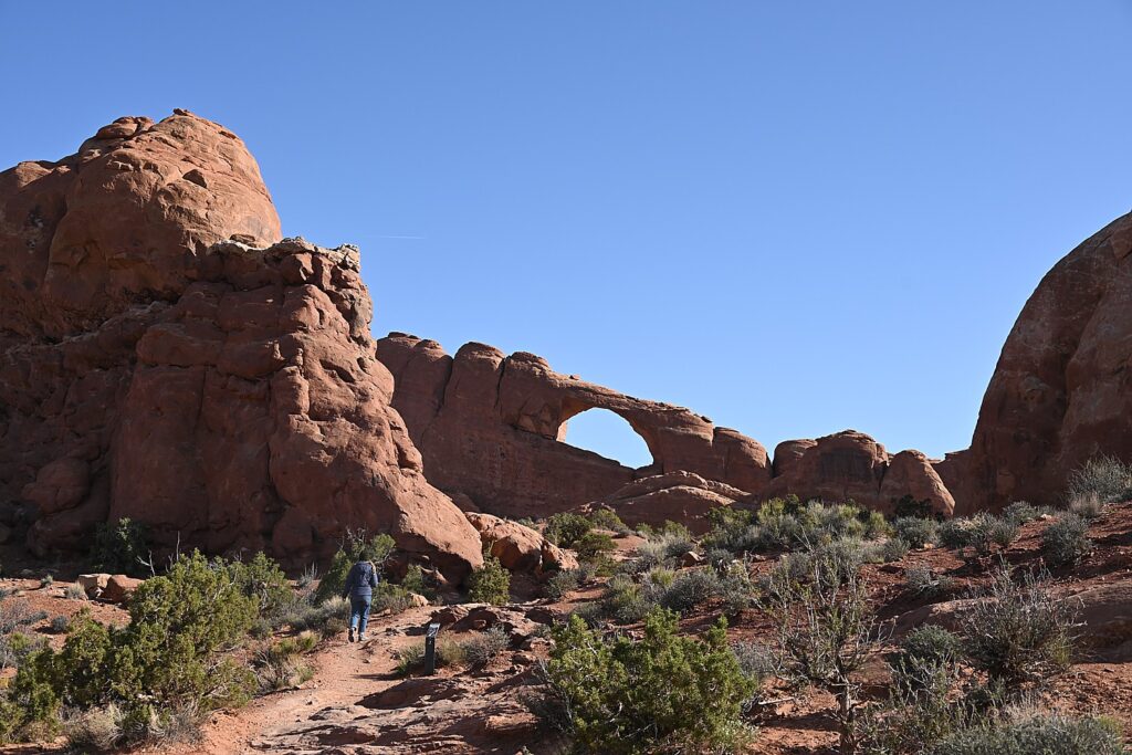
 

Diamond Mining, Robotics, Erie Canal Cruises Top List of Special Experiences at Herkimer KOA Camping Resort

The Herkimer Diamond, actually a special kind of quartz crystal, is found crystal clear and faceted in the dolomite rock, as if cut and polished by Mother Nature © 2015 Karen Rubin/news-photos-features.com

There I am, swinging a small sledgehammer, quarrying for diamonds – Herkimer Diamonds, that is, extraordinary quartz crystal nuggets that emerge (even pop right out) of their rocky prison with 18 facets, as if they had been cut by a jeweler.

You never know what you will find, what the next smashing, crushing blow will reveal and it is thrilling when you crack the rock to expose the diamond. A treasure hunt, to be sure. But it is also remarkably satisfying to be smashing rock.

This is just one of the – dare I say – unique attractions when you come to Herkimer Diamond Mines KOA, a true camping resort, in upstate New York. An altogether different experience – certainly, not your father’s camping experience.

Bucolic setting - the newest themed Herkimer Diamond KOA cabins hug the West Canada Creek © 2015 Karen Rubin/news-photos-features.com
Bucolic setting – the newest themed Herkimer Diamond KOA cabins hug the West Canada Creek © 2015 Karen Rubin/news-photos-features.com

To begin with, I am in one of the Herkimer Diamond KOA’s new themed cabins, set right on a rushing creek, which campers use for tubing (a whole mile from beginning to end, for a 20-minute ride!), and others use for some of the best trout and bass fishing in New York.

Mine is called Randy’s, named for the triceratops skull that is on view in Herkimer Diamond Mines’ gems and fossil museum (yes, it has its own museum), and is themed for dinosaurs.

The first emotion I feel when I enter is sheer delight that manifests as an ear-to-ear smile when I see all the dinosaur accoutrements – including a two-foot high (plastic) raptor that whenever I see it in the corner of my eye, makes me jump. The bedding, shower curtain, wall hangings are all themed for dinosaurs, and it is complete fun (informative, also).

The cabin is outfitted with every creature comfort you could possibly want – a well equipped kitchenette, bath items, flat-screen TV, sofa in the living room, table with four chairs, air conditioning and heater, linens and towels – all cleverly laid out to maximize space. The porch has a rocking chair and there is even a patio, right beside the creek, with patio furniture, BBQ and firepit.  And WiFi, which has become such an essential feature.

Ideal for pet lovers: Caesar's Cabin at Herkimer Diamond Mines KOA has its own doggie run, just for that cabin © 2015 Karen Rubin/news-photos-features.com
Ideal for pet lovers: Caesar’s Cabin at Herkimer Diamond Mines KOA has its own doggie run, just for that cabin © 2015 Karen Rubin/news-photos-features.com

Other cabins and lodges are also themed: there is Caesar’s Place (Woof), which has its very own doggie-park; Another is themed for fossils and even has its own pit where you can dig to find your own fossils.

There are even more elaborate lodges (I really would have trouble choosing): one is themed for astronomy and actually has its own “planetarium” with a sophisticated, computer-operated telescope as well as photos taken from the Hubble telescope; another is Professor Gadget’s Robotics Lodge that features working robotic components (“to educate and entertain”) devised by Binghamton University grad students.

Then there are three lodges that operate on solar energy – just part of the initiative to demonstrate renewable energy and model eco-friendly living.

In another delightful socially-conscious and community-building initiative, there are 40 bins where they grow fresh vegetables, and campers are welcome to help themselves. There is also a Japanese garden which is a tribute to the victims of Japan’s tsunami.

There is so much about the Herkimer Diamond KOA that is special – and I haven’t even begun to describe the diamond mining, jewelry making. and Erie Canal cruising.

There is an atmosphere here – it’s true of camping in general, but there is something very special about this place.

To begin with, its Edutainment – that is, a healthy mixture of education (or actually, enrichment) with entertainment, that is woven into the architecture, the landscape and programming.

The playground and basketball court at Herkimer Diamond Mines KOA © 2015 Karen Rubin/news-photos-features.com

There are daily activities – jewelry making, science experiment (static electricity, make a volcano, make a balloon rocket), badminton, flag football, cray fishing, basketball, chess and checkers tournament, volleyball, dodgeball, water balloon toss, table tennis, scavenger hunt, relay races, hula hoop contest – as well as nightly movies (outside on nice evenings, under the pavilion when it rains), and gatherings around the firepit (S’mores on Saturday nights).

There is a huge playground area –  separate playground equipment for youngest kids and older kids, and basketball court.

A volleyball court which is next to a gigantic firepit which is a gathering area (s’mores on Saturday nights); and a pavilion where there are games, a snack bar (ever try  a breakfast pizza? It’s made with bacon and egg; and a Herkimer Diamond pizza for evening).

There is a gorgeous swimming pool (next year, the plan is to have it solar heated).

If you forgot your tube or fishing rod, you can buy these in the Herkimer Diamond KOA general store; in fact, probably everything you need, forgot, wish you brought, can be had there, so if you wanted to travel light, no problem.

And if you don’t feel like cooking, there is the Rock n’ Roll Cafe, as well as Crystal Chandelier Restaurant, a very pleasant pub-style restaurant located a short walk across the road from the campground (KOA guests get a discount and $9.95 nightly specials, 4579 State Rt. 28N,, 315-891-3366, crystalchandelier.net).

You can easily fill out a two or three-day getaway with just the activities right at the resort: directly across the tiny road (Rte 28), from the camping resort  is the Herkimer Diamond Mine – an attraction that brings people from far and wide, including many who come back time and again (more on that to come). There is mile-long tubing along the West Canada Creek, which also affords some of the best trout and bass fishing in New York State.

Just about five miles away – bikeable on the bike lane on Rte 28 – is the uniquely appealing Erie Canal, where you can enjoy Gems Along the Mohawk (owned by the Herkimer Diamond KOA people) a combination visitor center, specialty shops showcasing regional artisans and artists, Waterfront Grille for dining, and a marvelous 90-minute narrated Erie Canal Cruise which climaxes with the experience of going through Lock 18, as well as biking along the Erie Canal.  Not to mention that Cooperstown is about 30-minutes drive away.

Mining for Diamonds!

Prospecting for treasure in the Herkimer Diamond Mines quarry © 2015 Karen Rubin/news-photos-features.com

Mining for the Herkimer diamonds isn’t a fantastical thing – it is more unlikely that you will leave without finding one than it is to find one. And there are many people who come and merely gather diamonds from the ground, without even swinging a hammer.

The kind of mining we get to do is “quarry” mining, rather than going into a cave. An outcrop of rock of this giant crystal-laden mountain has been exposed, and the idea is to basically look for rocks with black holes or a black vein – sometimes pulling down rock using crowbars and chisels, and 6 to 20 lb. sledge hammers. Then whacking at the pieces of rock with a 2 or 3 lb. crack hammer.

Jordan, Herkimer’s resident miner (your image would be of a grizzled, fossilized old man, but Jordan is a young strapping fellow who grew up nearby but learned his mining skills on the job), guides me in what to look for: a dark pocked hole in a rock that makes it a good candidate for housing a diamond. Then he shows me how to set it down on flat ground and whack across a line (being careful not to smash your hand, finger or foot). Sometimes, you don’t want to release the diamond, but let it show itself off in the rock.

Most Herkimer Diamonds, no matter how small, have 18 facets – all you do is wash off the mud and there you have it: a jewel.

Jordan tells me that each Herkimer diamond stone is unique. “To a collector, a certain stone ‘speaks to him’ because of its shape, inclusion, anthraxolite (ancient carbon) inside, presence of a water bubble, or another distinctive feature like a negative crystal (another stone) inside.”

Jordan displays how the Herkimer diamonds are found embedded in the rock, at the Herkimer Diamond Mines © 2015 Karen Rubin/news-photos-features.com

Often you see the rock not with a single stone, but with “druzy” – thousands, even millions of sparkling Herkimers, that form a vein or fill one of those black holes. “We don’t know why – perhaps it is a phase of growth,” Jordan tells me. Rocks with druzy can be even more valuable because of how beautiful and unusual they are.

He says that often, the stone is even more valuable when it is kept in the rock, where the black-hole background enhances the visual display – makes it “pop”  (you have to put felt on the bottom or the rock will ruin wood or glass).

I find a fairly large Herkimer diamond, which Jordan estimates to be valued at $25.

The most perfect crystals are usually less than half-inch long, but occasionally much larger crystals are found. Crystals are also common that are intertwined or clustered, with perfect crystals attached to the backs of larger ones. And you can bring your day’s find into the shop for an appraisal. (The most valuable stone a tourist found was valued at $2000).

You can watch a video in the museum which explains the process.

(The admission pass, $11/adult, $1 less for KOA campers and veterans, $9/ages 5-12 – includes all day prospecting, use of rock hammer, all day museum entrance, zip lock bags, mining information. You should bring protective eye wear and closed-toed shoes, though they sell goggles. Some people bring their own chairs, umbrellas, chisels, screens. and when you get hungry, you can visit the Rocks n’ Roll Cafe, right by the quarry.)

Polished by Mother Nature

It doesn’t matter to me that the Herkimer diamonds are not actually diamonds – they are marvels in their own right in that they literally pop out of the dolomite rock that holds them, coming out polished and faceted by Mother Nature. (And many attach healing powers to them.)

They look like actual diamonds, but in actuality, they are “doubly terminated” quartz crystals. They have a hardness of 7.5, comparable to emeralds and aquamarines, whereas diamonds, which are formed from carbon, have a hardness of 10 (one of the hardest substance known to man). Most interestingly, by quirk of how the earth formed, they are found mainly in Herkimer County and the Mohawk Valley of New York.

The dolomite bedrock in which the crystals are found – a sedimentary carbonate rock, closely related to limestone – began forming 500 million years ago in a shallow Cambrian sea on the southern shores of what became the Adirondack Mountains. The limy sediments (calcium magnesium carbonate) which had slowly accumulated beneath the sea’s saltwater were gradually compacted under the weight of thousands of feet of sediment, forming the rock strata Dolostones (interestingly, it is also in this layer of Early Ordivician rock that the first evidence of marine life can be found).

It is believed that while still beneath the sea, water seeped through the pores of the rock, often creating “vugs” by dissolving part of the rock. Millions of years later, water rich with silica  filled these vugs and eventually evaporated or drained away, leaving the silica which had grown by precipitation to form the quartz crystals.

One theory that explains the source of the silica material is that hundreds of millions of years ago, there were micro-sized simple-cell sea organisms that lived in colonies and secreted silica in glass-like geometrical shapes, and that they were trapped under the sediments.

A series of evolutionary geographical events continued through the Ice Age – the Pleistocene Epoch. A giant continental ice sheet covered the region. Rushing waters caused by the melting glacier eroded away thousands of feet of sedimentary rock, eventually uncovering the dolomite rock layer.

Often you see the rock not with a single stone, but with “druzy” – thousands, even millions of sparkling Herkimers, that form a vein or fill one of those black holes © 2015 Karen Rubin/news-photos-features.com

What is remarkable about the Herkimer diamonds is that most have 18 facets – six triangular faces form the termination points on each end of the crystal – regardless of how small they are. These are separated by a group of six square or rectangular faces that form a diamond shape, with such precision that it would be hard to reproduce by hand.

“Most limestone doesn’t throw quartz crystal like here,” Jordan tells me.

A “curiosity” of some Herkimer Diamonds is that many of the crystals have liquid trapped inside, which can be seen with the naked eye because of the clarity.

The liquid  inside the inclusion is mostly saltwater, confirming that seawater was present when they were forming. Many of the liquid inclusions have bubbles which float about in the liquid – some are carbon dioxide gas, but most are water vapor.

Some Herkimer Diamonds have solid inclusions – most commonly a coal-like substance called “anthraxolite,” which give the pockets a solid black appearance. The anthraxolite could be the result of decomposition of plant life that inhabited the sediments.

Another theory is offered to explain the source of the silica material – that hundreds of millions of years ago, there were micro-sized simple-cell sea organisms that lived in colonies and secreted silica in glass-like geometrical shapes, and that they were trapped under the sediments.

As for the discovery of the Herkimer diamonds: Local lore has it that two Revolutionary War soldiers happened on the diamonds and believed they were real. Their commanding officer, General Herkimer (who went on to become a genuine hero of the Revolutionary War), was said to want to use the diamonds to help finance the war, but that when the minerals were assayed, they were found not to be actual diamonds.

“General Herkimer is legend in the valley,” Dr. Renee Scialdo Shevat, who owns the property, tells me later.  “They named the county, the village for him. He led troops to Battle of Oriskany – a turning point for the Revolution.”  (He mustered 800 locals for a militia to save Fort Stanwix which was being blockaded by British, and when the British retreated, that gave the patriots their first victory.)

“But it is a myth that Herkimer financed artillery with Herkimer diamonds. The Native Americans were first to find the diamonds. The Mohawk Valley was called the land of crystal. Iroquois arrowheads have been found that used Herkimer diamonds.”

Awareness of the Herkimer diamonds goes back to at least 1819 but James Hadley is credited with being the first to bring the diamonds to public attention, in 1823. Prospectors were blasting the hard dolomite rock earlier than 1879. But what really exposed the diamonds was cutting the road for Route 28 which passes directly in front of the Herkimer Diamond Mines.

Miners come with their equipment for a day in the Herkimer Diamond Mines quarry © 2015 Karen Rubin/news-photos-features.com

The Herkimer Diamond Mines was first opened to the public in 1955 for prospecting by the farmer who owned the property. Eventually the property was sold to investors headed by Van Atty, who developed the mine, the rock shop and a public campground for the prospectors. In 1981, Rena and Rudy Scialdo purchased the property, today, it is owned and operated by their daughter, Dr. Renee Scialdo Shevat.

Dr. Shevat, who has a PhD in finance and strategic, took over the operation in 1997 and really boosted the Diamond Mines as an attraction and the Herkimer diamonds in jewelry, and has carefully guarded against over-saturating the market. The mountain that is rich in Herkimer diamonds spans 300 acres, but in all these years, they have only opened 6 acres for prospecting.

As many as 500 people a day from all around the world come here to prospect.

People who aren’t physically inclined to smash rocks with a hammer can do very well just hunting for the Herkimer diamonds on the ground – Dr. Shevat relates how a 98-year old woman found $400 worth of diamonds loose in the soil.

If quarrying isn’t your thing, you can do sluicing – you can purchase a bag and do like the California gold miners, and run water over a sieve to find your treasure – which has its own Zen quality to it. You can purchase a bag that has Herkimer diamonds, or a bag that has various gemstones, or a bag that contains fossils (these are $11), or a “megabag” (it is giant), that has all three ($29).

Ambitious interns Blair and Josh, who are student teachers  have produced a guide to what you find and are on hang to help people not just identify their finds, but to learn about what they are.

Edutainment: Blair and Josh, student teachers, created a guide for people to identify the rocks, gems and fossils they find when they sluice © 2015 Karen Rubin/news-photos-features.com

I did the mixed bag – and yes indeed, there were the Herkimer diamonds, nice chunks of amethyst, gemstones and fossils galore which Josh and Blair helped me identify: a blue stone (sodalite), rose quartz, a fossil with the imprint of a sea clam; petrified wood; agate; ammonite; ammulite (which they tell me could grow up to 3 feet long, and like an octopus, pull water in the shell, and squirt it out to propel motion); sand shark teeth; a crinoid (which I am told, was a free-floating animal that went extinct 65 million years ago), and a piece of coral.

Yet another activity at the Herkimer Diamond Mine: you can even get your picture taken via drone.

And if you get hungry from all your mining, you can stop into the Rock & Rolls Cafe.

Jewelry Shop and Museum

On the morning of September 11, 2001, the largest cluster ever found of Herkimer diamonds, in the shape of a cross, was unearthed. It is on view in the museum © 2015 Karen Rubin/news-photos-features.com

The Herkimer Jewelry Shop is an attraction in itself – not just items made from the Herkimer diamonds (which are actually sold on the Home Shopping Network, and similar shopping networks around the world, including Germany and Japan) – but gems collected and turned into jewelry by designers from around the world – Istanbul, Bali, Egypt, Rio, Hong Kong. It boasts being the largest jewelry, rock and gem store in the Northeast.

The second floor of the shop offers an extensive, really well-done museum with gemstones, rocks and minerals, as well as fossils, a Herkimer Diamond Hall of Fame, a Children’s reaching room, and an exhibit of the largest and finest cut Herkimer Diamonds.

One of the most remarkable exhibits is a massive cluster of Herkimer Diamonds, 17 x 12 inches (one of the largest ever found) in the shape of a cross, which Dr. Shevat tells me, was unearthed on September 11, 2001 at almost the exact time as the terror planes hit the Twin Towers in New York City. It seems to bolster the belief in such quartz crystals for their mystical properties.

The skull of a triceratops, Randy, excavated in Madagascar,  is on view in the Herkimer Diamond Mines museum © 2015 Karen Rubin/news-photos-features.com
The skull of a triceratops, Randy, excavated in Madagascar, is on view in the Herkimer Diamond Mines museum © 2015 Karen Rubin/news-photos-features.com

Another key attraction is Randy, a dinosaur skull from Madagascar (most likely a triceratops), found two years ago. Jordan points out that inside his mouth is another dinosaur bone, suggesting that the dinosaur died choking on its meal.

The building was originally an 1880 barn, and upstairs, you can see the original wood floor; and sit in chairs from the oldest movie theater in town to watch a video about prospecting the Herkimer Diamonds.

Herkimer Diamond KOA: An Edutaining Experience

A family poses for a photo at their campfire at the Herkimer Diamond Mines KOA © 2015 Karen Rubin/news-photos-features.com

In the morning, I wander around as this camping community comes to life – kids on bikes, parents walking dogs or pulling their kids , kids on the basketball court,  people sitting by the creek with a cup of coffee, others sitting around a fire. A neighborhood that ebbs and flows daily, but a neighborhood, nonetheless.

There are all manner of RVs – some bigger than a bus – and I am always amazed at how people outfit them (one has its own bike rack, plastic bins all neatly organized, another has a TV and its own homecoming sign, “The Dennies”).

There are also many sites for tents.

“When I was 18, I might have tented, but not so much now,” Dr. Shevat tells me later when we go about the campground. “And people of all ages want to be able to charge their mobiles and computers and access WiFi. Kids like to tent but they want to charge cell phone,” so now they provide 30 amp connections at the tent sites.

There may be all these comforts added to the “camping” experience, but what is still true, is being outdoors. And together.

We see a steady stream of people returning from the creek with their tubes – you can float a mile, about 20 minutes worth, from one end of the resort to the other.

The Astronomy Lodge at Herkimer Diamond Mines KOA features its own planetarium and electronic telescope, and is decorated with photos from the Hubble © 2015 Karen Rubin/news-photos-features.com

We meet people from all over the country – a family from West Texas, sitting around their campfire – and many who have been coming back year after year; the fellow who has rented the Astronomy Cabin (who turns out to be an astronomy hobbyist), who delightedly shows me the telescope, is part of a big group that comes to the campground every year for the Boilermaker Race that takes place in Utica.

Shevat, who earned a PhD in finance and strategic planning, was a vice president of a college with hopes of eventually becoming a college president, when, in 1997, she took over running the Herkimer Diamond KOA for her father, expecting it to be a temporary arrangement.

Dr. Renee Shevat, who owns the Herkimer Diamond Mines KOA, expanded the retail operation. Herkimer diamond jewelry is now sold on Home Shopping Network © 2015 Karen Rubin/news-photos-features.com

She went on to develop the four major business units – the campground, turning it into a camping resort with themed lodges; the Herkimer Diamond mine attraction; the retail shop; and now the Gems on the Mohawk complex with the Erie Canal Cruise. Her retail jewelry operation is global – selling on Home Shopping Networks around the world – and the Herkimer Diamonds have some novel uses, including being used in the making of vodka (Crystal Skull Vodka, with a bottle in shape of crystal skull from Indiana Jones, and 46 Peaks in Adirondacks, are filtered through Herkimer diamonds), and the Dalai Lama, she tells me, is purchasing Herkimer diamonds to decorate Buddhas.)

In the days of quartz watches, these diamonds were used for their precision with which they would release their pulse, and there is some research being done to see if there are new uses for the Herkimer crystals in telecommunications.

But she is an educator at heart, and interweaves “edutainment” in every aspect of the resort.

They offer two sessions of week-long science camps, accommodating 100 kids at a time (they had to turn away 26 for the first camp), where kids get to take part in activities like  exploding volcano, dissecting a frog, building a robot, flying drones, and learning about geology, paleontology, gemology. (Activities for parents are organized, as well, such as trips to nearby Cooperstown.)

And there are weekend sessions for Boy Scouts and Girl Scouts to earn a Gemology badge.

A Rube Goldberg-like sculpture, designed by Binghamton University grad students, decorates the Professor Gadget's Robotics Lodge at Herkimer Diamond Mines KOA © 2015 Karen Rubin/news-photos-features.com
A Rube Goldberg-like sculpture, designed by Binghamton University grad students, decorates the Professor Gadget’s Robotics Lodge at Herkimer Diamond Mines KOA © 2015 Karen Rubin/news-photos-features.com

About inviting Binghamton University graduate students to help design the Robotics Lodge, she says, “What is unique about this project is that each student was allowed the freedom to design to their strengths, which they believed would be enjoyed by many campers. What better sense of accomplishment can one have when you build something unusual with high energy collegiate talent for campers to experience an all-inclusive scientific theme…The partnership with Binghamton University and campers, as consumer consultants, was very rewarding.  And, yes, we would do it again with another scientific theme!”

Herkimer Diamond KOA was recognized in 2010 as KOA’s Kampground of the Year on the North American continent for its innovative lodgings and programming . Kampgrounds of America, with 485 locations in North America, is celebrating its 53rd Anniversary in 2015. (For more information and trip-planning tools, go to www.KOA.com.)

A stay at Herkimer Diamond KOA offers so much more to do, such as a canal boat ride with Lil’ Diamond III at the Herkimer Marina that takes you through a lock that lifts you up and down 20 feet on the Erie Canal (see next).

“Diamonds and the Erie Canal – two unique attractions,” Dr. Shevat tells me. “I want to be the centerpiece for dinner conversation: ‘Do you remember when we….?’”

The Herkimer Diamond KOA is open April through October (peak season rates apply July and August.) Weekends have special themes.

Herkimer Diamond KOA, 4626 State Route 28, Herkimer, NY 13350, 315-891-7355, E-mail: [email protected], www.herkimerdiamond.com; mining info at 315-717-0175, [email protected]

Next: More to Do at Herkimer Diamond KOA: Gems Along the Mohawk, Eric Canal Cruise

_______________________________

© 2015 Travel Features Syndicate, a division of Workstyles, Inc. All rights reserved. Visit www.examiner.com/eclectic-travel-in-national/karen-rubin,www.examiner.com/eclectic-traveler-in-long-island/karen-rubin, www.examiner.com/international-travel-in-national/karen-rubin, goingplacesfarandnear.com and travelwritersmagazine.com/TravelFeaturesSyndicate/. Blogging at goingplacesnearandfar.wordpress.com and moralcompasstravel.info. Send comments or questions to [email protected]. Tweet @TravelFeatures. ‘Like’ us at facebook.com/NewsPhotoFeatures.