Category Archives: Outdoors Adventures

Wellness & Travel, the Perfect Synergy

The quest for wellness is becoming ubiquitous, especially for travelers who seek out immersive nature and cultural experiences. Having just summated the 14,000-foot high Dead Woman’s Pass on Day 2 of Alpaca Expeditions’ four-day Inca Trail trek to Machu Picchu, one of our group leads yoga stretches © Karen Rubin/goingplacesfarandnear.com

Edited by Karen Rubin, Travel Features Syndicate, goingplacesfarandnear.com

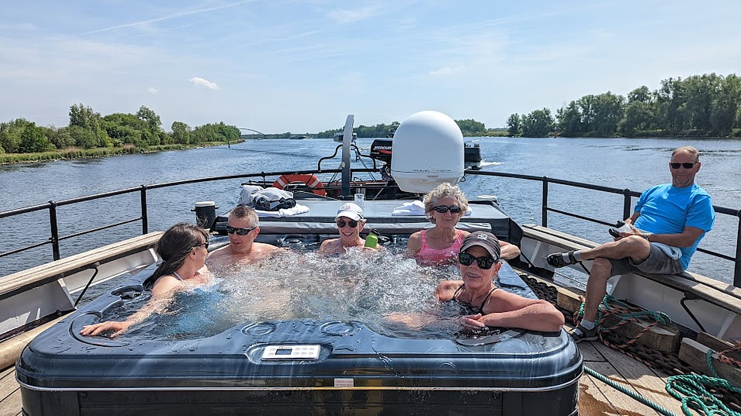
Wellness travel is among the leading travel trends for 2023, as it has been for several years. But when the very act of breaking away from daily irritants, giving oneself the opportunity to rest, renew, recharge, revitalize, isn’t all travel wellness? The trend refers to the fact that people are traveling with greater intention to improve their physical, mental, emotional, even spiritual well-being.

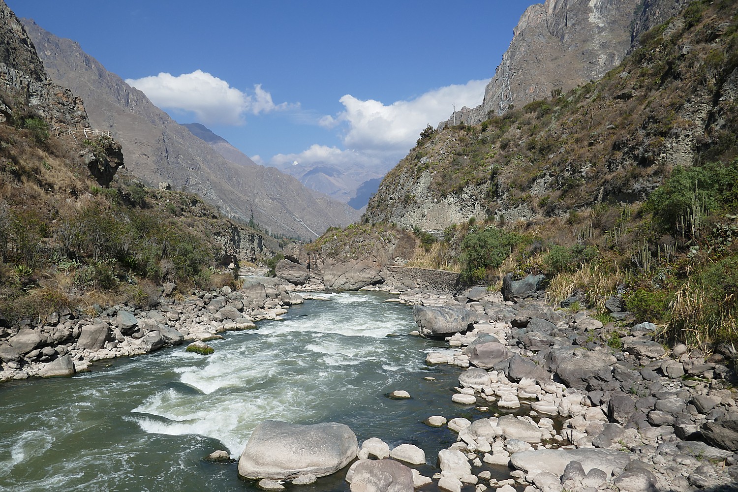
It could be a visit to a wellness retreat or spa. But it could also be a hiking, biking, rafting, camping trip that gets you out into nature, pure air, with some physical exertion. It can be an itinerary that is spiritually uplifting or intellectually fulfilling, of doing something you love or even finding love. It could be travel that brings family and friends together, forging bonds and lifelong memories that also contribute to wellness, or even making new friends to conquer loneliness or isolation. Travel, at its essential core, is inevitably about life-enhancing, even life-changing experience. What’s new is people intentionally seeking out such experiences – and that the industry, from tour companies to hotels, cruiselines to destinations, from festivals and events to attractions – are tailoring their offerings to cater to the quest for wellness.

Not only does wellness impact how, where and why people travel, but through lifestyle changes, wellness also impacts longevity and financial security – which when you think about it, expands the market for travel with time, money and physical ability.

These themes emerged in the Global Wellness Summit’s report, “12 Wellness Trends for 2023” with implications of how travel, hospitality, even urban design, workplace policies (vacations are essential to recharge), government planning are accommodating. Among the key findings, as reported by the researchers:

WELLNESS + TRAVEL: From Global Smorgasbord to Hyper-Indigenous

By Elaine Glusac

Wellness and wellness tourism have long resembled Disney’s “It’s a Small World”: buffets of global experiences typically divorced from place. Yoga, born in India, is ubiquitous worldwide; ayahuasca retreats have departed their Amazonian homelands; you can get a Hawaiian Lomi Lomi massage in Dubai.

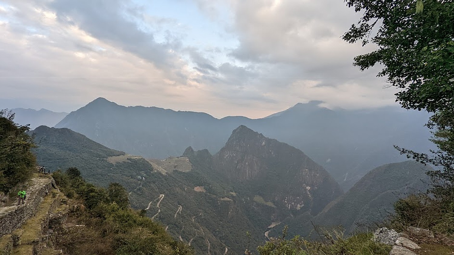
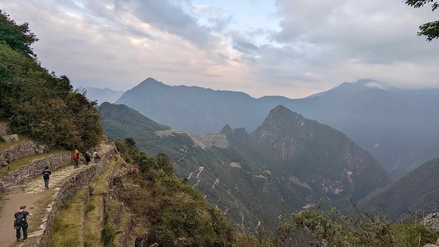
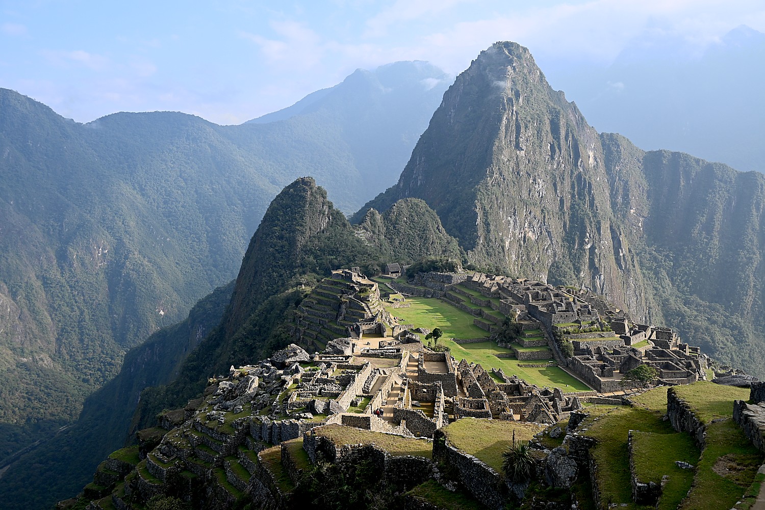
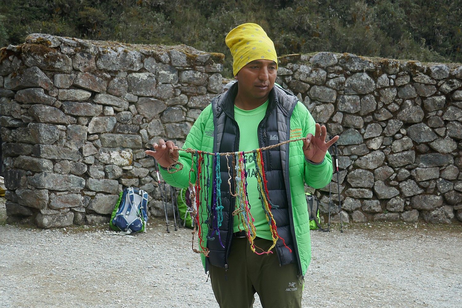
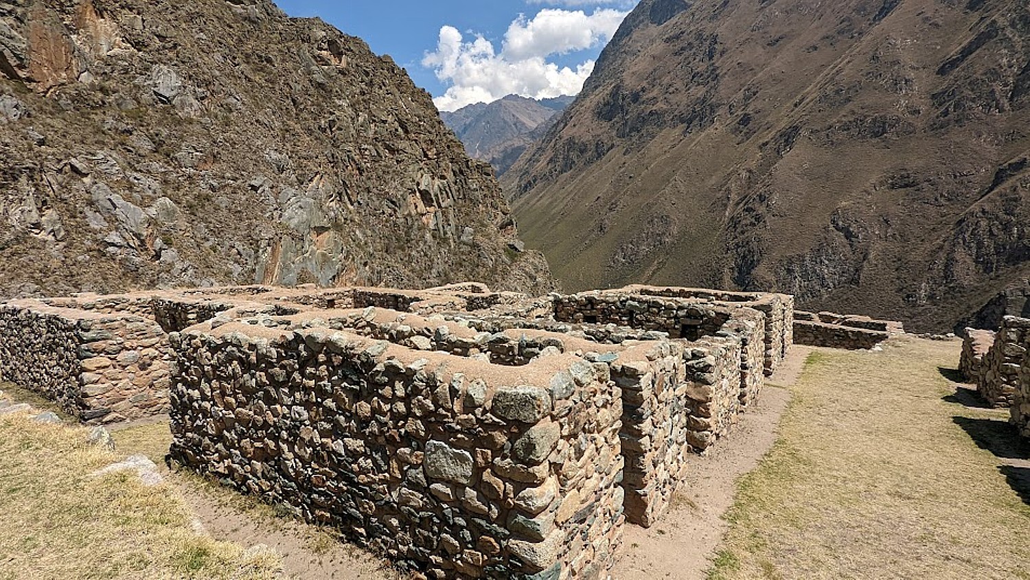
But with a new critique of wellness as a profound cultural appropriator, a rising social justice movement, and greater emphasis on authenticity, travelers are now seeking much deeper cultural experiences and showing interest in going to the source of ancient healing and knowledge to learn how they care for the land and for themselves. Indigenous travel and going to the cultural source for wellness is our travel trend for 2023.

There interest not only in going back to the origin places for wellness programs, but also to immerse in culture and heritage, such as in the Sacred Valley of Peru © Karen Rubin/goingplacesfarandnear.com

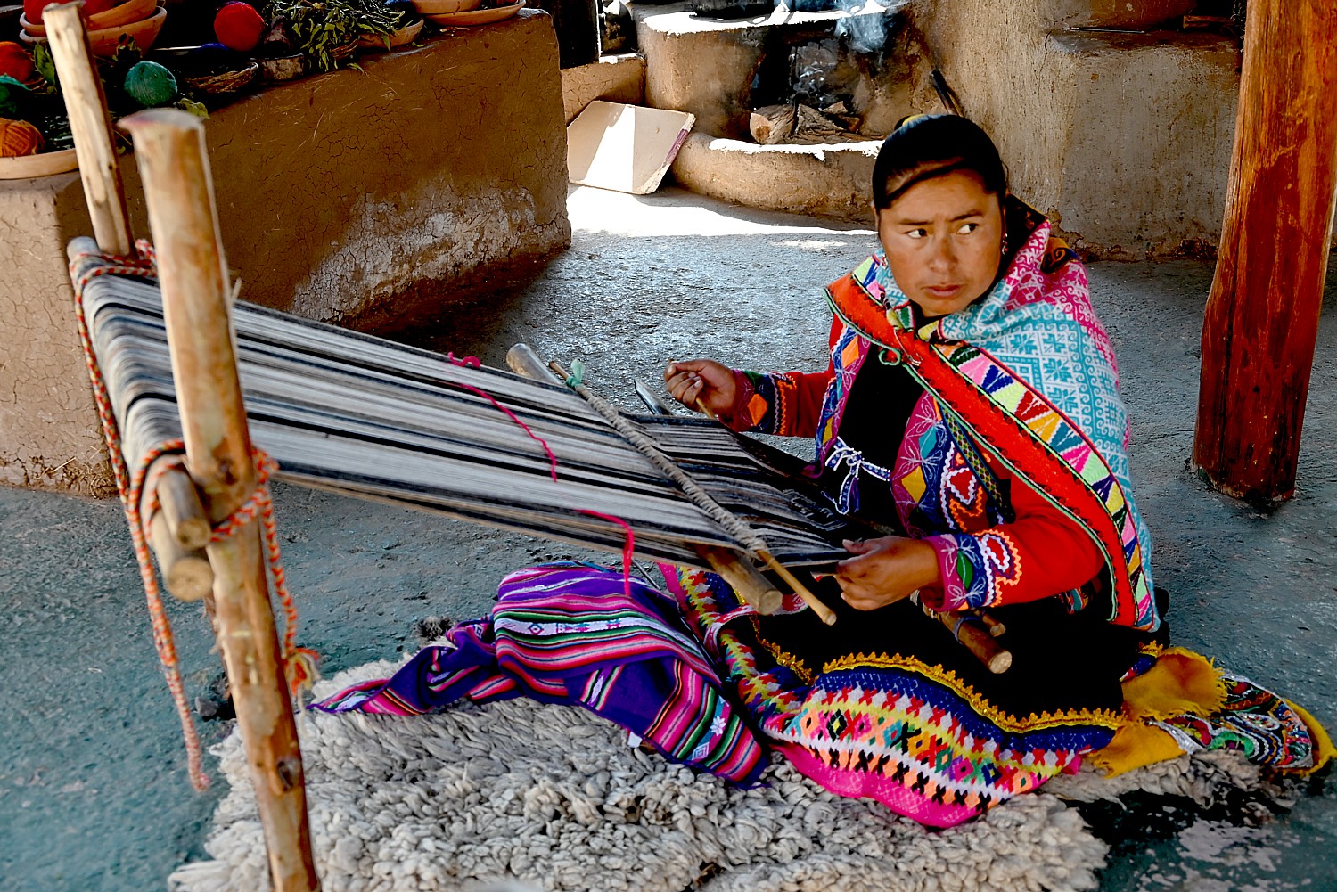
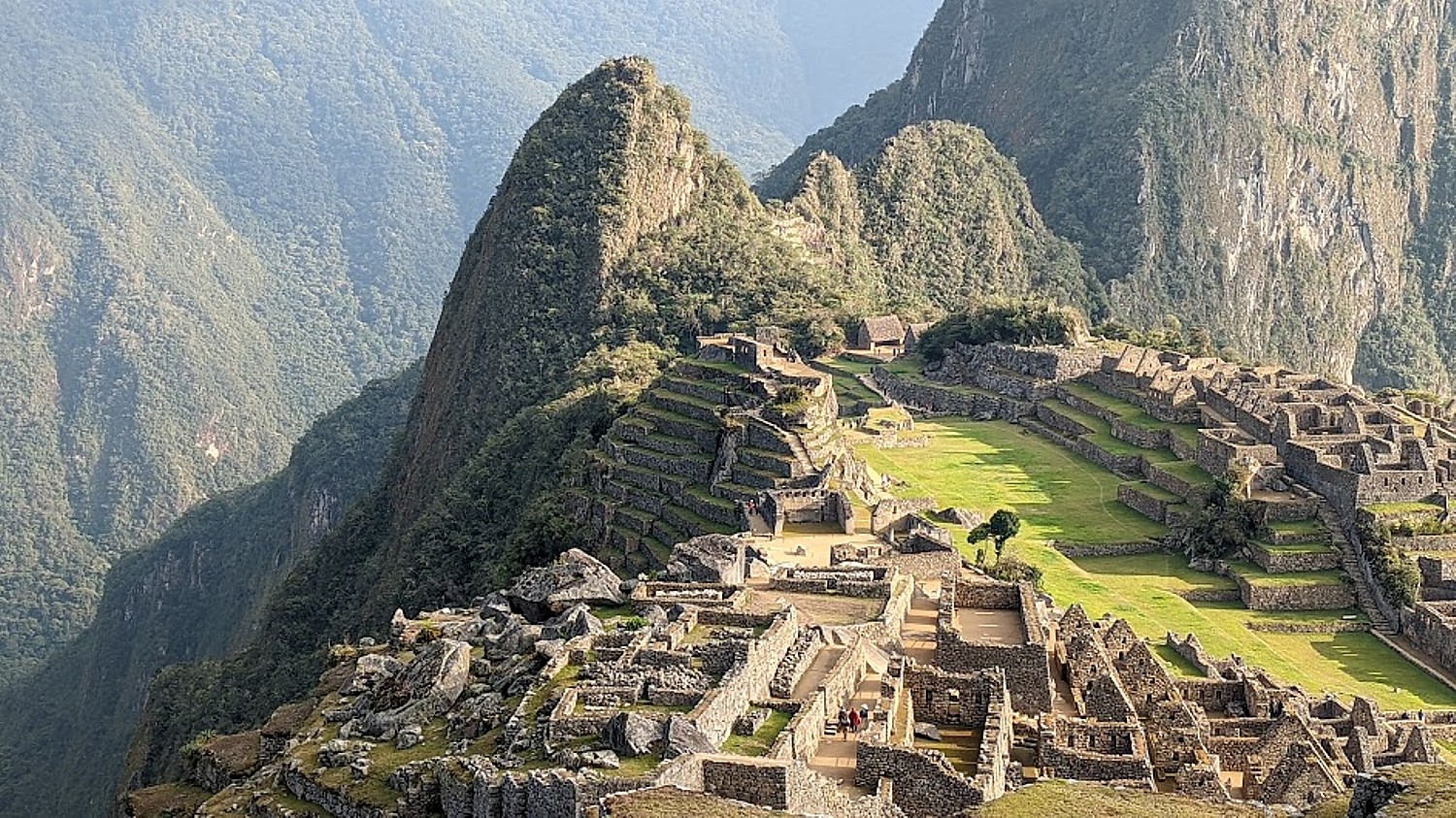
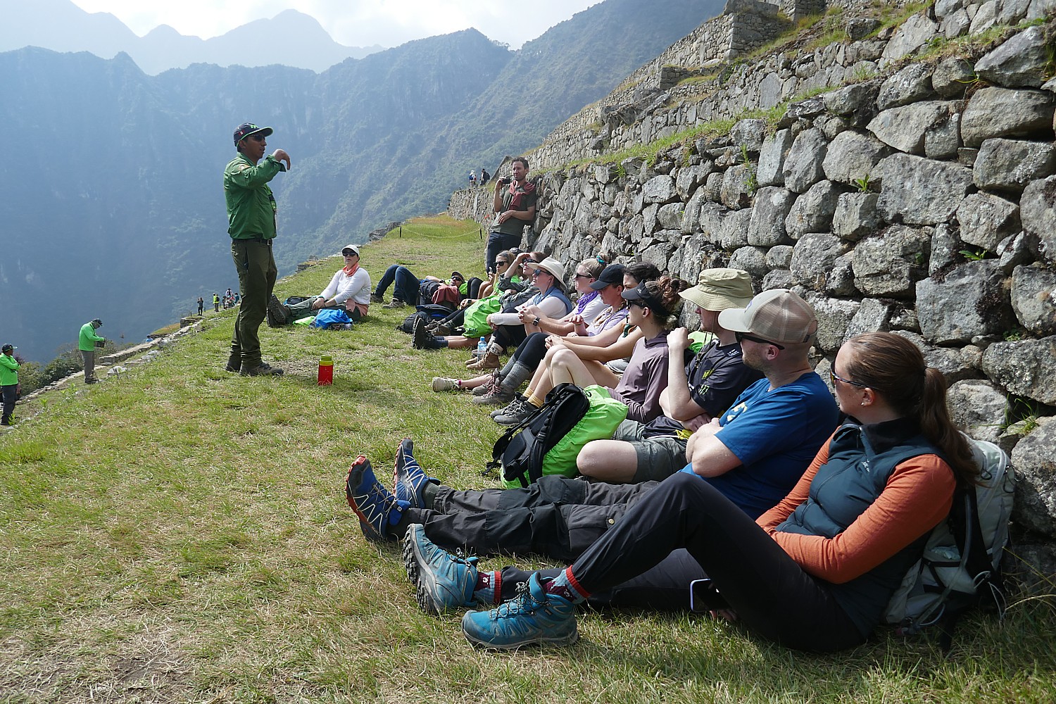
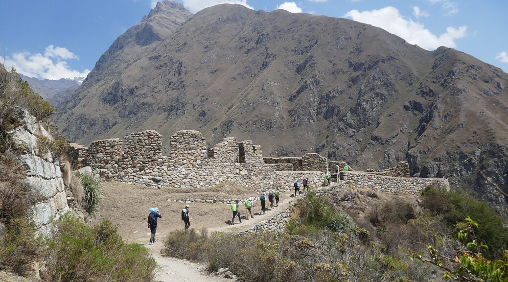
Community-led Indigenous travel offerings are surgingfrom the boreal forests of Canada to the Australian Outbackand speak deeply to travelers seeking inclusive, sustainable and regenerative travel experiences. The fast-mounting interest in original cultures includes Indigenous wellness practices, from purification ceremonies to food and nutrition.

Concurrently, culturally-rooted wellness experiences are booming globally and inspiring travelers to go to the original wellspring for authenticity. In Japan, traditional ryokans, or hot springs inns, are having an incredible renaissance as nature-based experiences that shift with the seasons. Resorts are exploring new menus of from-the-source wellness, whether traditional Arabic and Islamic medicine in the Middle East or Druidry in England. India, which gave the wellness world yoga, is poised to lure travelers back to the source with an upcoming center for traditional medicine partnered by the World Health Organization.

[Canada has really taken the lead to support tourism enterprises among its indigenous populations, under the umbrella of Indigenous Tourism Association (ITAC). In British Columbia, where there are 204 indigenous communities, a tourism development organization IndigenousBC.com is an excellent website to plan visits. Many of the Canadian indigenous communities offer wellness programs.

Also Ponant Cruises has introduced a series of programs that feature encounters with indigenous people, including the Inuit in Greenland, the Emberas in panama, Papuans in Papua New Guinea, us.ponant.com]

WELLNESS + SPORTS: New Business Models for Hospitality

By Lisa Starr

Savvy hospitality brands are responding to demands from wellness-focused clients looking beyond the basement gym, in search of pro-athlete-level equipment, fitness classes and wellness programming, whenever and wherever they travel. Some hotel brands are even creating facilities that cater to entire amateur or professional sports teams, expanding the function of the hotel and ensuring professional quality for the rest of us. We predict businesses that support this trend will become the go-to brands for future generations.

The ubiquity of the wellness-focused lifestyles of elite and professional athletes are fueling this trend and increasing demand for pro-level wellness at hotels and resorts. Hospitality brands like Kerzner International Holdings, owner of the Atlantis Resort and One&Only Resorts, are responding to the public preoccupation with sports with new concepts like the immersive global lifestyle brand SIRO, a “fitness and recovery hotel.” Zulal Wellness Resort by Chiva-Som in Qatar, the Middle East’s first full-immersion wellness resort, offers TAIM (traditional Arabic and Islamic medicine) treatments and hosted the German World Cup soccer team in 2022.

The global sports market is predicted to hit $20 billion by 2027, and we’re going to see new, creative, profitable intersections between sports and wellness. Sports of all types are being seen as a strategy to attract and connect with wellness-oriented consumers and travelers—and this timely business trend shows no sign of stopping.

Hospitality companies are catering to the rising interest and demand for wellness experiences, including the grand, historic Mohonk Mountain House in Hudson Valley, New York, which has provided a retreat for urban dwellers since Victorian times © Karen Rubin/goingplacesfarandnear.com

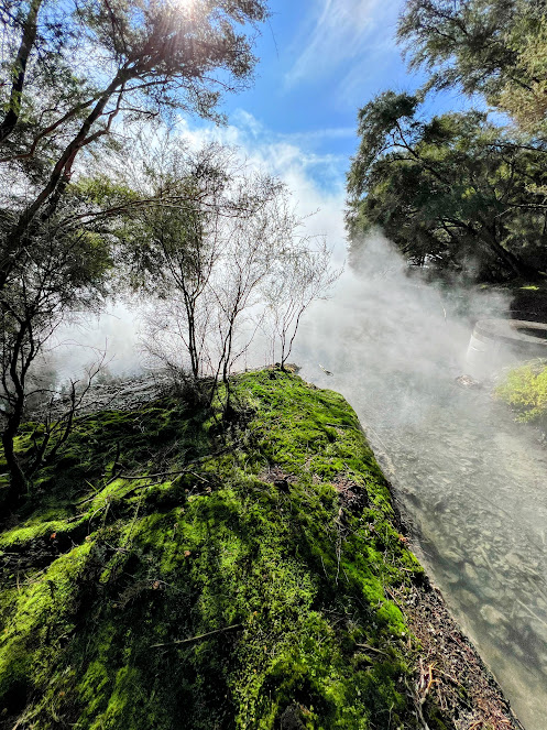
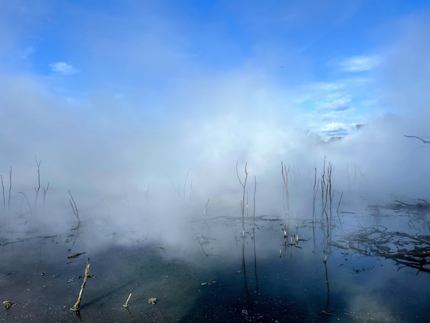
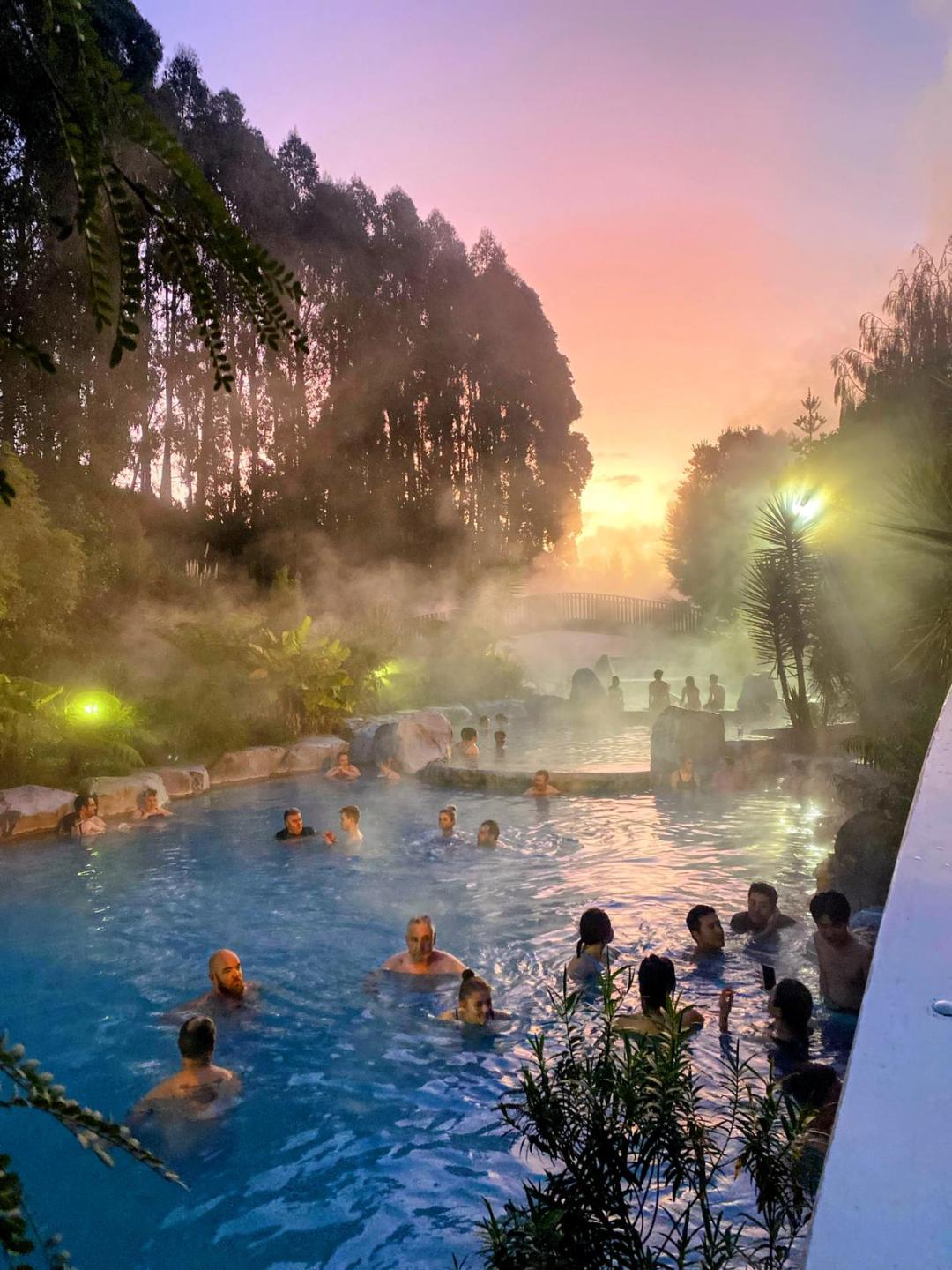
WELLNESS + WATER: Blue, Hot and Wild

By Jane Kitchen

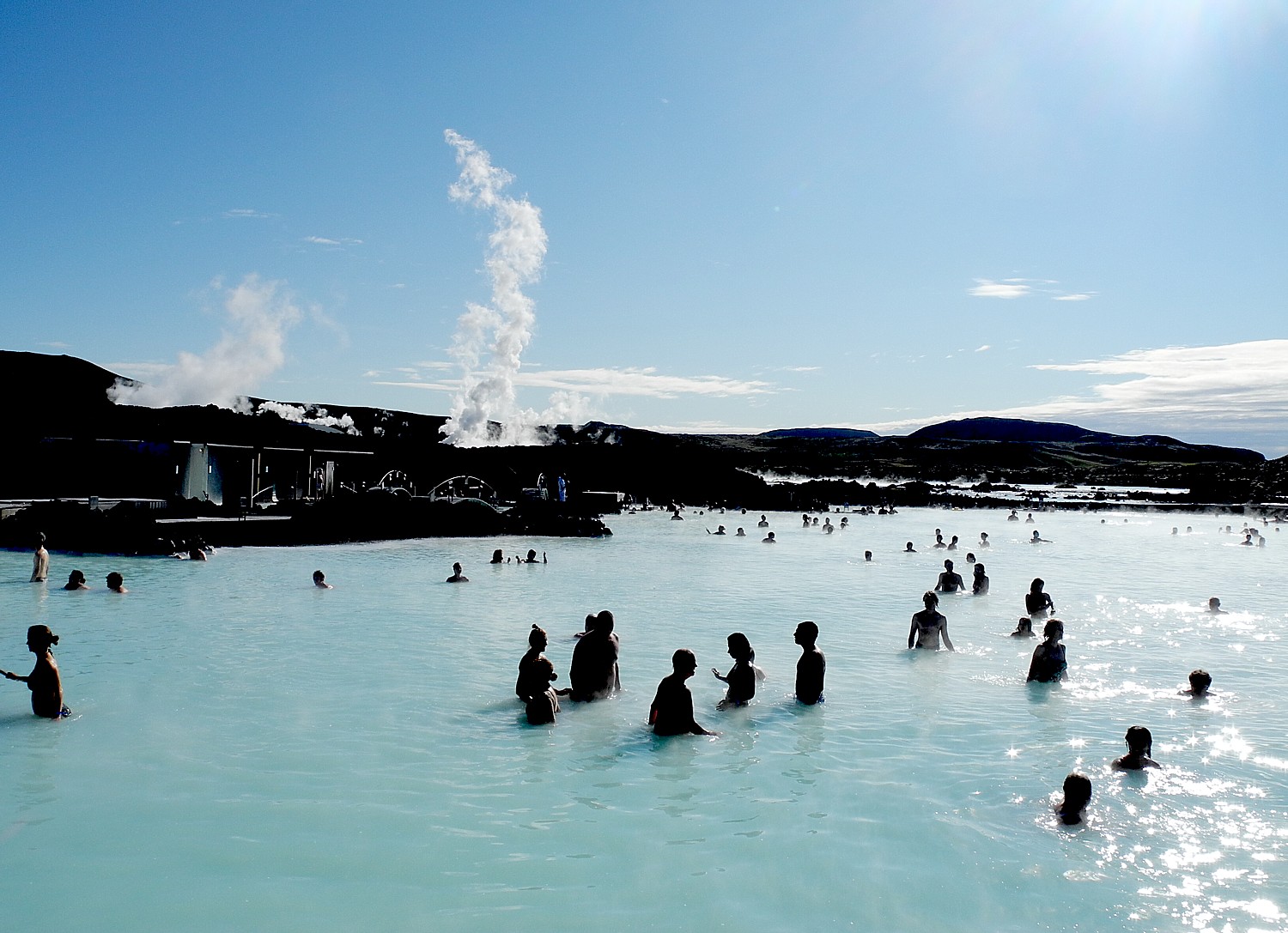
The pandemic spurred a hunger for in-nature experiences that shows no signs of abating. But when we talk about the nature surge, we usually remain on terra firma. In 2023, people will jump into the world’s wild waters for some “blue wellness”— with an unprecedented global surge in new-look hot springs destinations and wild and cross-country swimming going global. (The film, “Avatar: The Way of Water” likely helped.)

At the steamy end of the temperature spectrum, hot springs are now poised to be the next big thing in wellness. There are an unprecedented number of new and in-the-pipeline global destinations and new life is being breathed into long-forgotten facilities–from Australia to the US (where about 50 new projects are underway). A whole new social era in hot springs has arrived, where developers are combining live entertainment, watery wellness classes, restaurants and bars with traditional soaking. At Peninsula Hot Springs in Australia, take in live bands from its hot springs amphitheaters and do some hot springs yoga; at Sky Lagoon in Reykjavik, you soak in the midnight sun while sipping prosecco from a swim-up bar; you’ll soon be able to watch a baseball game while soaking in hot springs at Hokkaidos’ ESCON Field. This is social, affordable wellness and it’s pulling in a younger, diverse crowd.

Hot springs, Blue Lagoon, Iceland. The future of wellness and nature immersion? Blue, hot, cold and wild. © Karen Rubin/goingplacesfarandnear.com

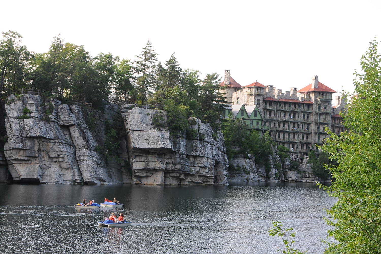
On the cold side of the trend, there is surging interest in wild, cold and cross-country swimming, once the domains of serious athletes. Wild swimming groups like the Bluetits Chill Swimmers offer inclusive group swims that foster connection, and more global resorts are offering guided wild swimming programs—whether the Hotel J in Sweden or New York’s Mohonk Mountain House. Cross-country swimming is starting to take off, epic adventures where hiking and wild swimming are combined. People are even building wild swimming ponds instead of the old concrete swimming pools.

The future of wellness and nature immersion? Blue, hot, cold and wild.

WELLNESS + CITIES: Urban Infrastructure Just Might Save Cities

By Robbie Hammond and Omar Toro-Vacay

The role of the city has been reimagined countless times over the centuries (they’ve been trading posts, political and artistic centers, and, recently, concrete jungles of retail and offices). But the pandemic served as a wake-up call for just how unwell our cities are—sparking a new recognition of the inextricable relationship between the health of the cities and the health of city dwellers. Global cities are now at another historical inflection point where they are rebuilding themselves around the wellness needs of their citizens. “Urban wellness infrastructure” is no longer perceived as a luxury—it’s a necessity.

Urban wellness infrastructure—the melding of capital improvements and business opportunities that holistically address social, mental and physical health—is being embraced around the world as a solution for accelerating growth, fueling post-pandemic recovery and cultivating healthier, happier citizens.

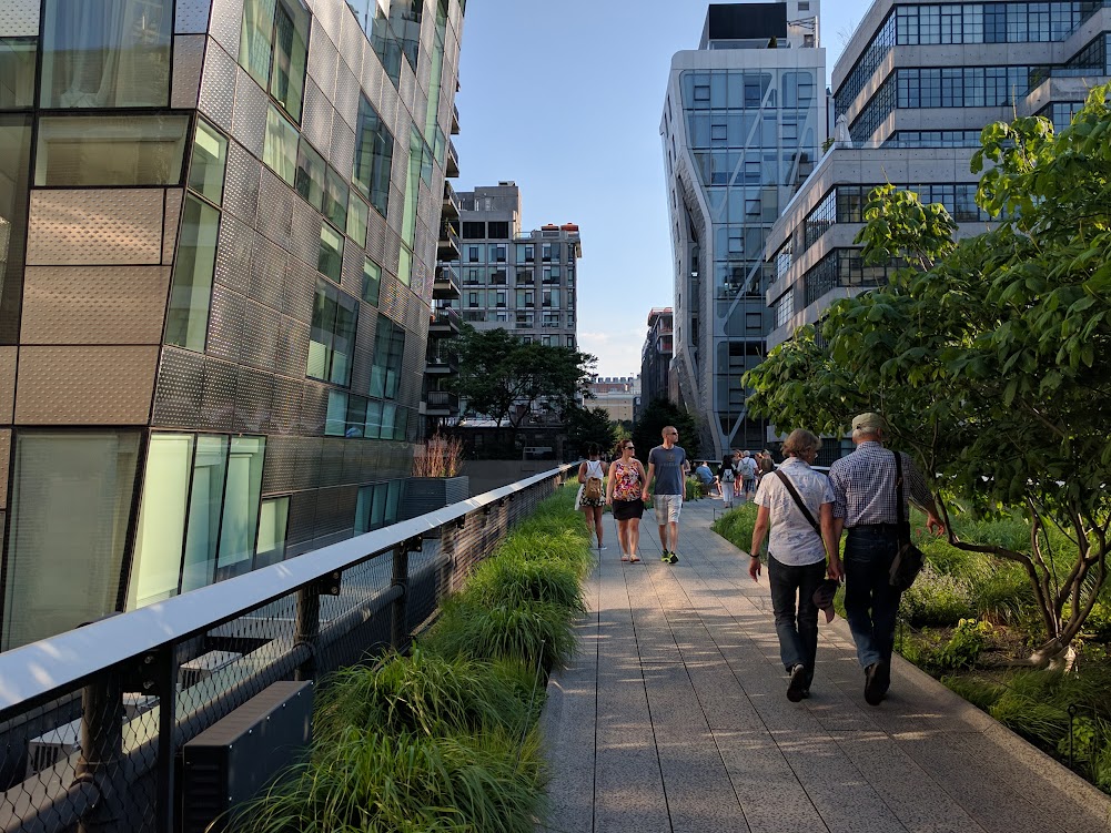
There are so many powerful examples. Developed 20 years ago on an abandoned railway line in the heart of Manhattan, the Highline is a pioneering example of this trend—a wellness destination in its own right where people exercise, socialize and take in natural beauty in the heart of the city, which has become one of the most popular tourist sites in the city. The Highline has inspired over 60 such projects across America. The 11th Street Bridge Park in Washington, DC, a new public space project that connects neighborhoods and helps cross racial and economic divides, is an example of the new community-building urban wellness infrastructure.

The Highline, created out of a decrepit highway, is now one of the top attractions in New York City. Cities, back as a top destination for travelers, are consciously restructuring around health and wellness for residents and visitors alike. © Karen Rubin/goingplacesfarandnear.com

In Singapore, the government is striving to become an “urban wellness haven,” creating a whole slate of programs and initiatives that showcase the city’s unique natural and wellness resources. In Monterrey, Mexico, a successful collaboration between private and public organizations, DistritoTec, is creating a thriving new community with wellness at its core—a model Mexico plans to replicate.

To remain vital in the next century, cities must become places not to survive but to thrive. That’s only possible with a new wellness infrastructure.

[Indeed, cities are making a comeback as top destinations for travelers in 2023 after the pandemic steered people to wide-open spaces. But much of the adaptations that worked so well to keep people well during the pandemic – like advance purchase timed-ticket admissions to museums and attractions to control capacity – are being kept in place.]

WELLNESS + SENSES: Multisensory Integration

By Ari Peralta

Advances in neuroscience and neuroaesthetics confirm that, when combined, the senses elevate our human experience. Nature is multisensory and it turns out, so are we. The senses have always been present in wellness. In fact, we subconsciously associate many wellness activities with one sense or another… spa is touch, wellness music is sound, chromotherapy is color, healthy food is taste and thermal is temperature. This siloed approach is quickly changing in remarkable ways.

Now brands are accessing multiple senses simultaneously to better support wellbeing outcomes, amplify wellness experience and influence behavioral change—think using multiple sensory cues in a harmonious way to deepen meditation. With a better grasp on evidence, wellness brands are using multisensory integration as an approach to deepen and amplify felt experiences. From wellness brands to spas to retailers, they are experimenting with playful combinations of light and sound, light and taste, etc., to build connection and more meaningful moments.

Some examples: In Saudi Arabia, the AIUIa Wellness Festival has curated a 360-degree multisensory event allowing visitors to stimulate and elevate all five senses amidst ancient and stunning surroundings; while Six Senses has teamed with mycoocoon to create synesthetic dining experiences, enabling guests to “taste” color and sound, while, in the metaverse, digital sense is becoming a reality, adding scent and touch to sight and sound.

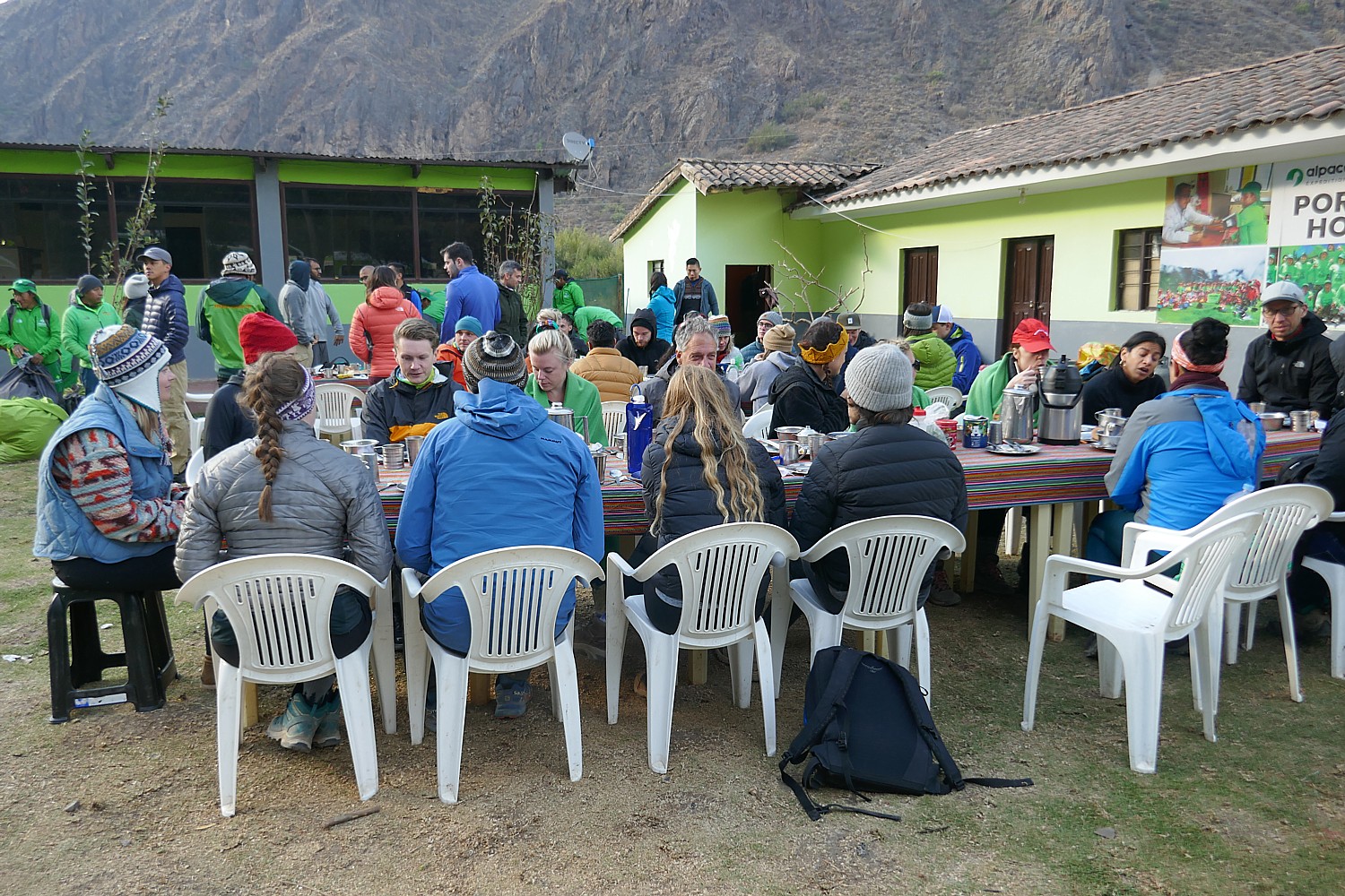
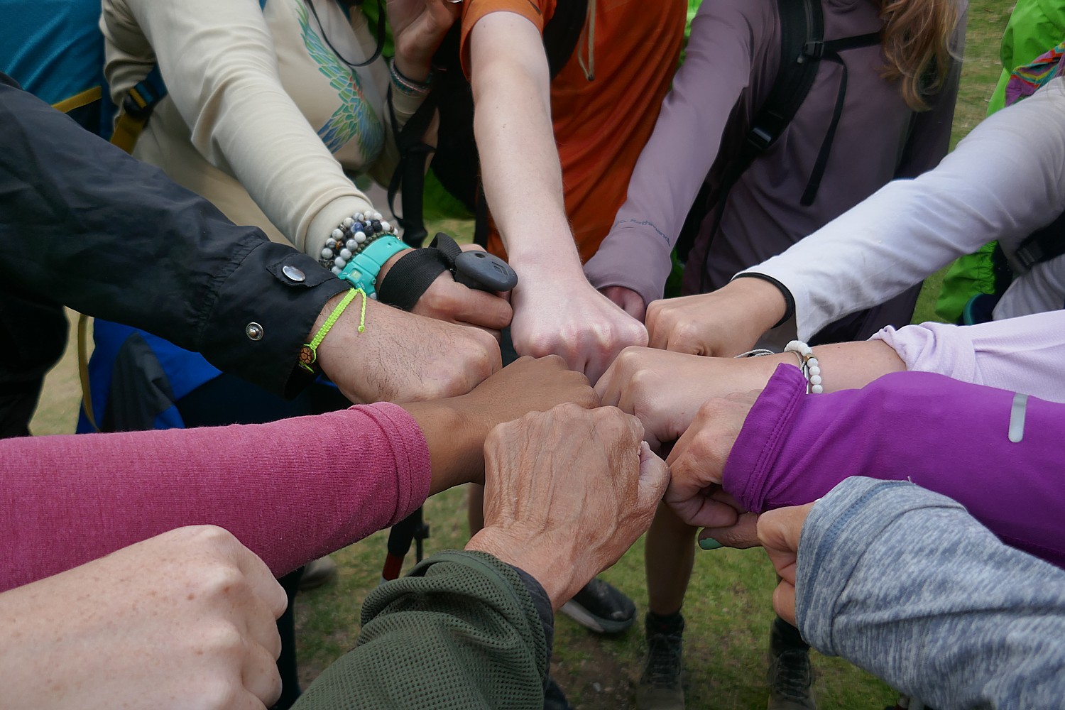
WELLNESS + GATHERING: Wellness Comes for the Loneliness Epidemic

By Beth McGroarty

We “know” loneliness is skyrocketing, that it kills and that the #1 predictor of health and happiness is relationships. But somehow, the recent uber-capitalist wellness market has led with two things: a sea of keep-them-spending “me time” products and “digital wellness”both lonely journeys of “self-care.” The pandemic has proven to be the breaking point. The biggest wellness trend is the development of new spaces and experiences that bring people together in real life—creatively and with intentionwhere social connection is the burning center of the concept.

Social wellness clubs with different vibes and price-points will surge, where group bonding comes first and the (sometimes dizzying menus of) wellness experiences serve as social icebreakersfrom pioneer Remedy Place to social bathhouse Othership to Six Senses Place. With remote work, people need everyday places to be and belongand younger gens, who are ditching booze and bars, seek healthier social spaces. With human “communication” having devolved into emojis, the wellness world is now teaching us how to connect and empathize more deeply. Peoplehood, the group conversation concept from SoulCycle’s founders, nixes the bikes to teach “relational fitness” through active listening. “Empatho-delics/actives” (that drive human openness) will rise: psilocybin, MDMA (in clinical trials), and ancient botanical “social elixirs,” such as kanna and kava.

Boat Bike Tours’ cycling trip from Bruges to Amsterdam. Travel affords unlimited opportunities for social interaction and engagement, bringing together people from all points of the globe © Karen Rubin/goingplacesfarandnear.com

Tackling loneliness is a huge trend beyond the wellness space. Startups are bringing connection to those who need it most, whether it’s the elderly or black men. New social apps/platforms are actually social, creating dinner parties for strangers or bonding apartment dwellers. More governments are fighting loneliness with new policies, and there’s even a new “social medicine.” The future of wellness? A move from lonely to social self-care, from buying to belonging, from URL to IRL, from ego to empathy, from Goop to group.

[Travel is the antidote to loneliness, promoting social interactions. And while solo travel is one of the biggest new trends for 2023, but there are even apps that cater to solo travelers and that match people with travel buddies.]

Wellness + Workplace: Workplace Wellness Finally Starts to Mean Something

by Skyler Hubler and Cecelia Girr

From protected time off and prioritizing vacation time to finally acknowledging women’s health needs, employee wellness is getting a much-needed rethink. Employers have been casually tossing around the word “wellness” since the 1980s. But four decades later, we have little to show for it. Worldwide, 70% of knowledge workers have experienced burnout in the past year, and a recent global study found that 38% of workers hate their jobs so much that they wouldn’t wish it on their worst enemy. Clearly, all those “workplace wellness” initiatives haven’t been working for us. But with the pandemic dramatically accelerating shifts in work models and the mental health crisis—and employees newly empowered—things are changing

Copper Mountain Resort, Colorado Rockies: company-wide vacations and outings are part of a new focus on wellness in the workplace © Karen Rubin/goingplacesfarandnear.com

Superficial wellness at work schemes are being replaced with more meaningful solutions. Better balance is being achieved through movements such as extended, company-wide vacations and the “right to disconnect” from emails after hours; employers making in-person time count with memorable offsites and gatherings at wellness resorts and social wellness clubs (meetings held in ice baths are officially a thing). The workplace wellness reform is well underway and it’s set to change everything, from how we connect with coworkers to what we look for in a job.

[Indeed, there is every indication that some variation of remote work will remain, and people will claim their opportunity to be nomadic workers.]

WELLNESS + GOVERNMENTS: The Case for Coming Together

By Thierry Malleret

Wellness policies have been years in the making, but in 2023 and beyond, they will evolve, multiply and strengthen. Governments “know” the crippling economic and societal costs that come when people don’t feel mentally and physically well. They “know” that unwellness shrinks the labor force while simultaneously hurting productivity—the worst possible combo for long-term economic growth. They “know” that preventative wellness saves public money because it always costs less than cure.

Now more governments are moving from knowing to action, pursuing diversified policies aimed at, pursuing policies—aimed at improving physical, mental, work, environmental, and even financial wellbeingfrom healthy eating campaigns to funding regenerative agriculture and biodiversity protection.

Wellness policies will become far more prominent on the political agendas of national, regional and local governments. We predict they will be: (1) more expansive, by encompassing adjacent policies that contribute to our planetary, societal and individual wellbeing; (2) more “muscular,” toughening regulations and fighting vested interests; and (3) more local, because the greatest policy-success stories happen when you empower communities at the local level.

The Future of Wellness 2023 Trends report just released by the Global Wellness Summit identifies 12 key wellness trends impacting the wellness economy in 2023 and beyond. More information or to purchase the report, www.globalwellnesssummit.com/2023-global-wellness-trends.

______________

© 2023 Travel Features Syndicate, a division of Workstyles, Inc. All rights reserved. Visit goingplacesfarandnear.com, www.huffingtonpost.com/author/karen-rubin, and travelwritersmagazine.com/TravelFeaturesSyndicate/. Blogging at goingplacesnearandfar.wordpress.com and moralcompasstravel.info. Visit instagram.com/going_places_far_and_near and instagram.com/bigbackpacktraveler/ Send comments or questions to FamTravLtr@aol.com. Tweet @TravelFeatures. ‘Like’ us at facebook.com/NewsPhotoFeatures

Day 4 on the Inca Trail: Sun Gate to Machu Picchu, The Lost City Of The Incas

Machu Picchu, The Lost City of the Inca, reached on Day 4 of the Alpaca Expeditions 26-mile Inca Trail trek © Karen Rubin/goingplacesfarandnear.com

By Karen Rubin, with Eric Leiberman and Sarah Falter

Travel Features Syndicate, goingplacesfarandnear.com

This is the day that many of us have had on a bucket list, and for some of us, represents the fulfillment of a “trip of a lifetime”: Machu Picchu.

We are awakened at 3 am when the Alpaca Expeditions staff bring hot coffee to our tents. We have everything ready for leaving the Wiñaywayna campsite by 3:15 am (I had packed everything the night before and only kept out what I would be taking on the trail), and set out, our bagged breakfast in hand, wearing our headlamps in the dark for the surprisingly short distance walk to the check-in point for Machu Picchu where we wait until it opens at 5:30 am.

Our guide Lizandro Aranzabal Huaman wants us to get up so early to be first on line (he claims to have a 98% success rate) and also to get to the Sun Gate as the sun rises (and before it gets overwhelmed with photo-snappers), and to Machu Picchu in time for the first rays to illuminate the scene. In fact, there is only a group of six ahead of us and something like 200 behind us, checking our passport against the list of permits granted for the day.

Somehow, I wind up leading our pack of 15 trekkers and I surprise myself at the pace I set for the one-hour hike on this mostly flat portion of the trail to the Sun Gate. I am in the lead until we get to what Lizandro calls the “Gringo killer”- 50 of the steepest steps – more like a rock climbing wall – where you need to use your hands to crawl up like cat.

Lizandro has prepared us for the fact that the sun only comes through the Sun Gate (Inti Punku) at sunrise on the solstice. But from here, we get our first view of Machu Picchu in the distance (it’s still an hour’s hike away).

One of the many nice aspects of our guides, Lizandro and Georgio, is that they have been patiently  taking individual and group photos of us with our phones and cameras at each of the key spots along the trail, and so we stop at the Sun Gate to take our turn posing for those shots. (Everyone wants to be at this small point for the sunrise, which is why Lizandro wanted us first.)

The first view of Machu Picchu from the famed Sun Gate on the Inca Trail © Karen Rubin/goingplacesfarandnear.com

And then we continue (downhill!) from the Sun Gate at 8,956 ft. elevation, an hour more to Machu Picchu, descending to 7,873 elevation over the course of three miles from the Wiñaywayna campsite. At the same time, the temperature which had been cold at the highest elevations, becomes warm, even balmy, so we are actually sweating (need sunscreen and hat!) at the site.

The first view of Machu Picchu from the famed Sun Gate on the Inca Trail as dawn breaks © Karen Rubin/goingplacesfarandnear.com

This part of the Inca trail gives us views that show how Machu Picchu is positioned – we see the entirety of the Lost City (I can only imagine what it was like before it was excavated) and how it is etched amid the contours of the mountain peaks – which is how it was kept hidden from the Spanish when they invaded in 1538 and for 400 years.

The first view of Machu Picchu from the famed Sun Gate on the Inca Trail as dawn breaks © Karen Rubin/goingplacesfarandnear.com

Literally 10 seconds after I pass a scenic overlook, the sun pokes out. (These views and so much more, are why we take the Inca Trail trek.)

At about 7:40 am, we walk in what seems to be a back entrance into the city, where we are perched on high terraces and the views are the iconic ones of magazines and postcards (and I suspect are not available to the day-trippers who come in from the bottom entrance for the tour). How lucky we are because the sun breaks through, highlighting the structures, for exquisite scenes.

Only 40% of Machu Picchu has been excavated so far, which means that 60% is still underground and hidden from view © Karen Rubin/goingplacesfarandnear.com

We actually walk down and out of Machu Picchu site to wait for our ticketed time to re-enter (you can only stay 2 ½ hours and can only come in with a guide). While we wait, we have to use the bathroom before we reenter and check bigger backpacks and hiking poles.

We made it! Karen, Sarah and Eric at Machu Picchu at the end of the Alpaca Expeditions four-day, 26-mile Inca Trail trek (photo by Lizandro Aranzabal Huaman)

Our scheduled time to enter Machu Picchu to begin our 2 hour private guided tour with Lizandro is 8:30 am, who leads us on Circuit #4 (there are four different circuits to control crowds) to the highlights: the terraces, Sun Temple, Royal Mausoleum, Palace, Plaza, Sacred Rock.

Machu means “old,” “ancient,” “big”). Picchu means “peak,” so Machu Picchu actually means “Ancient Mountain,” but that is not its indigenous name.

Lizandro tells us that Machu Picchu was built in the mid-1400s by Pachacuti, the 9th Inca king but its first emperor and the “Alexander the Great” , the Empire Builder, of the Inca. Beginning in 1438, he and his son Tupac Yupanqui began a far-reaching expansion that brought much of the modern-day territory of Peru under the ruling Inca family control. He rebuilt Cuzco, built Pisac, Ollantaytambo  as well as Machu Picchu. He built Machu Picchu up in the mountains instead of the valley to be closer to the sun, to connect the sky and the earth in one place, as well as for protection.  “Mountains were gods that protected the villages and the animals,” he relates. Almost all of the construction faces east to catch the sunrise – the Inca rulers claimed to be the children of Inti, the Sun God.

The archaeologist Hiram Bingham didn’t discover Machu Picchu (it was discovered in 1902 by Bolivian fortune hunters looking for Incan treasure), but came on an expedition in 1911 in search of Vilcabamba, the last stronghold of the Inca after the Spanish conquest. But Bingham is credited with bringing Machu Picchu to the attention of the world. © Karen Rubin/goingplacesfarandnear.com

Over the next 100 years, the Empire ultimately expanded to what are today six South American countries, connected by 25,000 miles of roads, suspension bridges and trails, and controlling a population as many as 18 million.

The Sun Gate was built as a check point to enter Machu Picchu, but positioned so that on December 22, the summer solstice, the sun beam would come through gate; and on June 21, it comes through the other window.  

Only when you are actually at Machu Picchu can you begin to comprehend what an astonishing construction it is, why it is worthy of being called one of the Seven Wonders of the World and designated a UNESCO World Heritage Site © Karen Rubin/goingplacesfarandnear.com

Machu Picchu is built in two sections – an urban sector has some 200 units of which 172 were homes, and the rest were temples, and a sun dial.

There would have been 700-800 people living here full time – 60% were nobles, the rest were farmers and workers.

Only when you are actually at Machu Picchu can you begin to comprehend the scale of the construction, why it is worthy of being called one of the Seven Wonders of the World and designated a UNESCO World Heritage Site © Karen Rubin/goingplacesfarandnear.com

How did they build Machu Picchu without slaves, without animals to carry, without a wheel, iron tools, or written language? Consider that China’s Great Wall and the Egyptian pyramids were built with slave labor, draft animals, a wheel, iron tools and written language.

What they had was a culture and a labor system based on principles: Ani – reciprocity – one for all, all for one; Minka – community benefit – care for vulnerable – collectivity (how the Peruvians got through Covid despite a poor health care system); and Mita – paying taxes by work, labor (not cash) to benefit the whole.

Only when you are actually at Machu Picchu can you begin to comprehend what an astonishing construction it is, why it is worthy of being called one of the Seven Wonders of the World and designated a UNESCO World Heritage Site © Karen Rubin/goingplacesfarandnear.com

It took 50-60 years to build Machu Picchu for Emperor Pachacuti,  who ruled from 1432-1472, but it was never finished. I can’t help but wonder how many men were impressed to build this enormous complex of structures in that amount of time.

When the Spanish invaded in 1538, Machu Picchu was abandoned before it was finished and the Incan forces fell back to arm Vilcabamba, the Inca’s last stronghold. “They promised to come back but didn’t,” Lizandro says.

Our Alpaca Expeditions guide Lizandro Aranzabal Huaman relates the background to Machu Picchu, the Lost City of the Inca © Karen Rubin/goingplacesfarandnear.com

It is mindboggling to contemplate that as complex a construction as what we see, the scale, and the fact that more than 60% is still unexcavated, buried under 400 years of overgrowth.

The archaeologist Hiram Bingham didn’t discover Machu Picchu (it was discovered in 1902 by Bolivian fortune hunters looking for Incan treasure), but came on an expedition in 1911 in search of Vilcabamba, the last stronghold of the Inca after the Spanish conquest.

“He set up tents at base, met a local to ask where Vilcabamba might be. The man didn’t know, but on July 24 1911, with machete in hand, Bingham had a big surprise: the sight of Machu Picchu took his breath away. Two families were living here, cultivating the terraces two years before Bingham arrived. They were running away from paying taxes to the government.” [Off the grid?]

Only 40% of Machu Picchu has been excavated so far, which means that 60% is still underground and hidden from view © Karen Rubin/goingplacesfarandnear.com

Bingham returned for a second, then a third expedition. He uncovered eight Inca trails (the Inca destroyed many of the trails to prevent the Spanish from reaching Machu Picchu) and took away artifacts, he claimed, for two years. “More than 100 years later, Yale still has the artifacts and is requiring Peru to build a museum to hold artifacts near Machu Picchu. But Peru wants it by the river. In 2015, the United States sent 11 percent of the artifacts back – but not all were real, some were replicas that they returned. The Peru government wants all of it back.”

The photos Bingham published brought international attention to Machu Picchu, the “Lost City of the Inca” – and tourists. The first tourist following the Inca trail came in 1954 and this Incan Citadel has become the most visited tourist attraction in Peru. The site was named among the New Seven Wonders of the World and designated a UNESCO World Heritage Site in 1983.

Machu Picchu, reached on Day 4 of the Alpaca Expeditions 26-mile Inca Trail trek © Karen Rubin/goingplacesfarandnear.com

We trekkers follow Circuit 4 (there are four circuits, to spread out the crowds): starting at the Main Gate (where we must present our passports and permit), to the Sun Temple, House of the Inka, the water foundation; Granitic Chaos; Sacred Plaza; Intiwatana Pyramid; Sacred Rock; Three Gates; Water Mirrors; and Condor Temple.

Our Alpaca Expeditions guide Lizandro Aranzabal Huaman points to the astonishing construction of Machu Picchu © Karen Rubin/goingplacesfarandnear.com

We climb the steep stone steps and come to the Sun Temple. It was built as a royal tomb to contain the mummified remains of the king.  Lizandro points to how a temple would have the highest quality building stones and most precise placement and its architecture emphasizes the “harmony between people and nature. They always incorporate the natural bedrock. The windows are aligned for summer and winter solstice – a solar observatory. There are three steps – the Inca triology. The mummified body was placed in the tomb in fetal position.” There are no mummies left in the tomb, but there would have been mummies of the 12 Inca kings (others were buried). On the day of Ayamaki, the mummies would have been paraded from the mausoleum.

The Royal Tomb at Machu Picchu © Karen Rubin/goingplacesfarandnear.com

Lizandro notes that the word ‘jerky” – the dehydrated meat snack – comes from the indigenous Quechua word, “jakky charky” (related to mummification).

We come to the Royal Inca Palace, where we can see that instead of windows (too cold), there would have been shelves for idols. “Bingham got here in time to see some.”

Only when you are actually at Machu Picchu can you begin to comprehend what an astonishing construction it is © Karen Rubin/goingplacesfarandnear.com

How would they have set the weighty keystone in place? With ramps, aloe vera to make it slick, he says. The enormous stone building blocks, weighing tons, are trapezoid shape and set at a slight incline angle, for stability against earthquakes. Indeed, Peru suffered two big earthquakes – in 1650 and 1950 – when the colonial buildings collapsed, the great cathedral in Cuzco collapsed, but these structures remained (in fact, the 1950 earthquake in Cuzco unearthed Incan structures). We see under one massive block a roller-shaped stone – a precursor to the wheel.

You only appreciate the scale of Machu Picchu as you haul yourself up the high steep stone steps © Karen Rubin/goingplacesfarandnear.com

You only appreciate the scale of Machu Picchu as you haul yourself up the high steep stone steps. The straight lines and perfect angles, the precision, the sheer size and bulk of the stones, and how this entire city is nestled on a plateau amid these sheer mountain peaks.

You only appreciate the scale of Machu Picchu as you haul yourself up the high steep stone steps © Karen Rubin/goingplacesfarandnear.com

There is a large open area, like a field, which would have been used for festivals, activities, an amphitheater. And in the middle, is what would have been a sundial. In 1978, the then president invited the Spanish King and Queen to visit, and their helicopter landing in the field, broke the sundial. (I find it ironic that the Spanish were still destroying Incan heritage.)

In this small plaza, Lizandro points out a huge section of bedrock cut to mimic the shape of the mountain behind – mountains were considered sacred.

Our Alpaca Expeditions guide Lizandro Aranzabal Huaman points to the precision of the placement of the stone boulders for the temple at Machu Picchu © Karen Rubin/goingplacesfarandnear.com

He explains a bit of the Incan society hierarchy – the Inca were the royal family and nobles – perhaps 20,000 who ruled over a population of dozens of different tribes totaling as many as 18 million across much of South America. Professionals could become nobles (rise to that privileged class) because of their expertise, skill and function. Teenagers could show a talent and go into a profession.

Can’t help but thinking of architect Antoni Gaudi’s style at Temple of the Condor at Machu Picchu © Karen Rubin/goingplacesfarandnear.com

We sit around for a bit of a rest, and Lizandro explains some of the contemporary politics. Apparently, in the 1990s, President Alberto Fujimori [a fixture in Peru’s politics from 1990 to 2003] wanted to privatize Machu Picchu – selling it off to Chilean investors, drawing an outcry of protests from the people. “The president did well his first five years – investing in industrial farming – but after he was reelected, he sold off or privatized without people knowing.” Fujimori, the son of Japanese immigrants, wound up being investigated for corruption. He tried to flee to Japan and was captured enroute in Santiago with eight suitcases of cash. He was convicted and sentenced to 17 years in prison.”

Lizandro says the Peruvian constitution (which I subsequently read has been rewritten and set aside multiple times since the country’s independence, while the government has undergone a series of coups back and forth from dictatorship to democracy, socialism to capitalism) favors foreign companies (they don’t pay tax). Because 50 percent of Peru’s population lives in Lima, he tells us, the people who live in rural areas, in the mountains, have little say.

The view of Machu Picchu from the top of Huayna Picchu © Sarah Falter/goingplacesfarandnear.com

Several of our group have obtained permits in advance to climb Huayna Picchu – that famous nub of a mountain, like an overlord, in the iconic Machu Picchu images – and Sarah has obtained one, while the rest of us continue touring Machu Picchu with Lizandro.

The steep stone trail to the top of Huayna Picchu © Sarah Falter/goingplacesfarandnear.com

Sarah reports back that the 45-minute hike is extremely arduous – much harder than the Inca Trail hike – almost straight up to a tiny perch at the top, at 8,835 ft., 850 ft. higher than Machu Picchu, where everyone has to take turns for the photo, but you get a famous view of Machu Picchu. The trail was built by the Inca who also built temples and terraces at the top.  “I would definitely recommend it to fitter hikers looking for one last challenge. It’s not super long and being able to see the scale of Machu Picchu from above was really impressive.”

Sarah with other members of our Alpaca Expeditions trek celebrate reaching the Huayna Picchu summit.

We finally come back down to the entrance/exit to Machu Picchu and Lizandro hands us a ticket for the bus that takes us down an extremely winding road to the village of Aguas Calientes. We meet for a last lunch together in a local restaurant – kind of a celebratory meal ( optional and not included). Lizandro gives us our train ticket, departing Aguas Calientes 3:20 pm (you need to take seriously the notice to be on the platform at least 30 minutes ahead of time, which is when the train loads) to Ollantaytambo.

The train is wonderfully vintage, with roof-windows, and very comfortable for the two-hour trip (which for some reason takes us much longer). At Ollantaytambo, we are met by the Alpaca Expeditions bus for the two-hour drive back to Cuzco and drop off back at our hotel.

The train from Aguas Calientes is wonderfully vintage, with roof-windows, and very comfortable for the relaxing two-hour trip to Ollantaytambo © Karen Rubin/goingplacesfarandnear.com

Candidly, I had been so obsessed about getting passed Day 2, Machu Picchu was more of an end-goal of a quest than the prime attraction – being here means I had gotten over the Dead Woman’s Pass, completed the 26 miles, going as high as nearly 14,000 feet – much as it would have been for the pilgrims who undertook this journey of a lifetime. It is personal.

For me, it is not just a trip of a lifetime but a now or never proposition.

I am not the only one celebrating an important milestone. Indeed, this is the sort of bucket-list trip that warrants a milestone – Peter timed reaching Machu Picchu for his 35th birthday; a couple had just gotten engaged at the start of the hike; another 30-something couple (he’s Italian, she’s Dutch) is on their honeymoon .That’s how special this trek is, embodying physical, spiritual – just as it did for the Inca, a triumph of will and willpower. A test of character then as now.

Eric and Sarah relax on the train after our four-day trek and two-hour tour of Machu Picchu © Karen Rubin/goingplacesfarandnear.com

You are at the same time amazed by the ability of these people to construct these sites at all, but then wonder at the level of control exerted, the role of religion in maintaining that control and how authoritarians throughout human history use religion (the divine right). No surprise: the Inca kings claimed to be the son of the Sun God, Inti. And yet, you can’t help but marvel at the accomplishment of that government capable of building the 25,000 miles of roads, in producing the amount of food to sustain the population, and unifying a population of 18 million into a society.

You appreciate the social structure that produced these extraordinary mountain villages in a society that did not have slaves nor currency, did not have the wheel or beasts of burden, did not have compass, ruler, alphabet or written language.

Most astonishing, these structures were built within 20, 40 or 60 years’ time – apparently, each chief would select a project to be completed within his own lifetime.

Photos do not do justice, you have to stand next to the rock walls, trace how the boulders link to perfectly together, see the curve at the edge, the inclined angle (for stability against earthquake) with such exquisite precision, hoist yourself up the steep stone steps, look beyond to the distance these boulders would have had to be transported from their quarry.

You stand perched on these terraced structures built into the side of a mountain and simply cannot fathom what it took to build.

All these thoughts come to me as I step, climb, step, climb the trail.

Our Alpaca Expeditions group, at Machu Picchu © Karen Rubin/goingplacesfarandnear.com

At each site, Lizandro tells us more of the story of the Inca and the society they created – but unlike the sturdy bedrock that these sites were built on, the Inca’s hold on the people was really not that strong because it was not a bond. At a certain point, their hold was by force. “The Inca weren’t very nice people,” he says softly.

What was unexpected was to come away with an understanding of the limits of authoritarian control. Indeed, the Inca ruled for less than 400 years, but the empire existed only for a century before it was toppled, too weak and lacking support of the people, to withstand the Spanish invaders. There are lessons for day.  And as we learn, Peru is still going through these cycles of economic struggle, political ping-pong between dictatorship and democracy, socialism and capitalism, since becoming independent from Spain in 1821. The more things change, the more they stay the same, may well be the lasting lesson.

What makes a “trip of a lifetime” – one that is truly life-enhancing, even life-changing? It is the doing.

Alpaca Expeditions offers many ways to get to experience Machu Picchu – the trek is its own experience, and when you think about it, is very inexpensive (from $650); it’s not even that difficult or expensive an airfare to reach (at this stage, you fly through Lima or Quito to Cuzco, but a new international airport is being built closer to Cuzco). The tour company also offers many different programs – like the Sacred Valley excursions – to different areas.

The permits to do the Inca Trail trek are limited to 500 a day for all the trekking companies (which includes 200 for trekkers and 300 for porters and staff) and get booked up months in advance.

More information: Alpaca Expeditions, USA Phone: (202)-550-8534, info@alpacaexpeditions.com, raulmanager@alpacaexpeditions.com, https://www.alpacaexpeditions.com/

See also:

VISIT TO PERU’S SACRED VALLEY IS BEST WAY TO PREPARE FOR INCA TRAIL TREK TO MACHU PICCHU

INCAN SITES OF PISAC, OLLANTAYTAMBO IN PERU’S SACRED VALLEY ARE PREVIEW TO MACHU PICCHU

ALPACA EXPEDITIONS’ INCA TRAIL TREK TO MACHU PICCHU IS PERSONAL TEST OF MIND OVER MATTER

DAY 1 ON THE INCA TRAIL TO MACHU PICCHU: A TEST

DAY 2 ON THE INCA TRAIL TO MACHU PICCHU: DUAL CHALLENGES OF DEAD WOMAN´S PASS,
RUNCURACCAY

DAY 3 ON THE INCA TRAIL TO MACHU PICCHU: TOWN IN THE CLOUDS, TERRACES OF THE SUN
& FOREVER YOUNG

DAY 4 ON THE INCA TRAIL: SUN GATE TO MACHU PICCHU, THE LOST CITY OF THE INCAS

__________________

© 2022 Travel Features Syndicate, a division of Workstyles, Inc. All rights reserved. Visit goingplacesfarandnear.com, www.huffingtonpost.com/author/karen-rubin, and travelwritersmagazine.com/TravelFeaturesSyndicate/. Blogging at goingplacesnearandfar.wordpress.com and moralcompasstravel.info. Visit instagram.com/going_places_far_and_near and instagram.com/bigbackpacktraveler/ Send comments or questions to FamTravLtr@aol.com. Tweet @TravelFeatures. ‘Like’ us at facebook.com/NewsPhotoFeatures

Day 3 on the Inca Trail to Machu Picchu: Town in the Clouds, Terraces of the Sun & Forever Young

Wiñaywayna is the most spectacular Inca site on the trail after Machu Picchu © Karen Rubin/goingplacesfarandnear.com

By Karen Rubin, with Eric Leiberman and Sarah Falter

Travel Features Syndicate, goingplacesfarandnear.com

On our third morning on the Inca Trail, we are wakened at 5 am at our tents in the Chaquiccocha campsite to be packed up, have breakfast at 5:30 am and out by 6:30 am to begin what is generally considered the most relaxed day of the four-day trek, when our Alpaca Expeditions group will hike 6.2 miles mostly downhill, and visit two Inca sites, Phuyupatamarka (‘Town in the Clouds”) and Intipata (“Terraces of the Sun”), before reaching the campsite, where, we are told, a special activity awaits.

I’m still on a high from surviving Day 2 and the dual challenges of Dead Woman’s Pass and Runcuraccay Pass, so I feel I can handle anything (and not just on this trek).

It’s a foggy morning and before setting out, our guide Lizandro organizes all of us in a great circle with the porters and staff and guests (Giorgio calls us “family” and Lizandro calls us “team” and both are true in the way we have bonded) so we meet each other. We learn that the porters all come from one mountain village, that two are brothers, 62 and 68 years old, that one of the porters is a woman (very unusual, but Alpaca Expeditions has made an effort to recruit women).

Getting to know you: Alpaca Expeditions porters and staff and trekkers introduce ourselves © Karen Rubin/goingplacesfarandnear.com

We trekkers introduce ourselves, also, and I mention that today is my 71st birthday – mentioning it because I am pretty pleased with the achievement (and our guide, Giorgio, at one point guessed I was 55 – perhaps just being polite) – to emphasize that they have made this experience of a lifetime possible for me.

Alpaca Expeditions’ “Green Machine” porters and staff who make our Inca Trail trek to Machu Picchu – a trip of a lifetime for many – possible © Karen Rubin/goingplacesfarandnear.com

We hike for 2 hours along what they call “Inca flat” (gradual inclines) and begin to enter the jungle, known as the Cloud Forest. As we walk, we have the opportunity to see Salkantay, the second highest snow-capped mountain in the Sacred Valley, and get glimpses of a fantastic panoramic view of the Vilcabamba mountain range through mist and clouds.

One of the fun sections of the Inca Trail goes through a small cave © Karen Rubin/goingplacesfarandnear.com

We make our way up to the last peak and our third pass, Phuyupatamarka (“Temple Above the Clouds”) at 12,073 ft. from where we have great views overlooking the Urubamba River.  Down the valley, we get our first view of Machu Picchu Mountain, but the famous “Lost City” itself is still hidden from view.

From Phuyupatamarka it´s a 3-hour walk down a flight of stone steps to our last campsite and the grand finale for this day, exploring the Incan site of Wiñaywayna (“Forever Young”).

On the descent, we stop in a small cave, and just as the pilgrims did 600 years ago as they came closer to Machu Picchu, the religious center, Lizandro uses this site, the Temple Above the Clouds, to discuss religious beliefs and practices at the time of the Inca.

Exploring the Incan site of Phuyupatamarka © Karen Rubin/goingplacesfarandnear.com

This would have been one of the religious sites where pilgrims 600 years ago would be able to show their devotion and purify themselves before they reached the sacred Machu Picchu. It would have been a place of offerings, a ritual shower, of sacrifice.

At the time of the Inca and thousands of years before, the many different tribes were polytheists, worshipping many gods mostly associated with Nature. They believed that nature, man and the Pachamama (Mother Earth), lived in harmony and perpetual interrelationship. The Inca state promoted the worship of a Creator God (Wiracocha), Sun God (Inti), Moon Goddess (Mamaquilla), Thunder God (Illapa) and Earth Mother (Pachamama), and a host of other supernatural entities. But the ruling Inca established Inti, the sun god, as the most important (the first Inca king declared himself to be the son of Inti, to establish his divine power and authority).

Eric takes in the dramatic landscape along the Inca Trail to Machu Picchu © Karen Rubin/goingplacesfarandnear.com

Lizandro points to a trinity that organizes the belief system: “The Inca thought three lives (past, present and future) ran parallel – one underneath (past), one above (future). They divided the world in three dimensions, three stages of life, which they depicted with animals – the condor (the heavens), the puma (the middle world of earth), and the snake (the underworld).

The snake represents knowledge, wisdom; because everything known is from past; the puma represents strength, energy; the condor connects this world to next world because it could touch heaven and carry heavy things, he says.

“The Inca saw life as a circle, not a line, so life never ends. They believed life is reborn and when they were buried, they were placed in the fetal position pointing to the sun and mountains; rulers were mummified and their mummified remains taken and paraded around one day a year. Children didn’t inherit property – people were buried with their belongings (for the next life). Machu Picchu, a sacred place, would have taken more than a lifetime to build, but though Emperor Pachacuti believed he wouldn’t enjoy it in this world, he would in the next.”

And the linchpin to it all, the basis for the Inca emperor’s power and authority, was religious faith.

So, while the Inca did not have slaves, they had a system of labor, whereby the men would give two to three months of service to the rulers (the first Inca Emperor, Pachacútec, the Alexander the Great of the Inca, had them build Machu Picchu, Pisac, Ollantaytambo and the various palaces and temples), and gave 50 percent of what they harvested to the nobles and the priests out of religious devotion.  And the people were kept ignorant – only the nobles and priests were educated – so they could be controlled with the use superstition and miracles.

He says there would have been six water fountains here – so people could take a ritual shower “to purify mind and body before going to Machu Picchu.” He also points to a sacrificial rock.

There appears to be an altar carved into the bedrock facing sunrise.

We have about 45 minutes of a steep downward hike before it levels off again.

The Incan site of Intipata, Terraces of the Sun, one of the sites that would have served the pilgrims and nobles on their way to Machu Picchu and were abandoned for 400 years before being discovered by archaeologists © Karen Rubin/goingplacesfarandnear.com

We come to an Inca site, Intipata (Terraces of the Sun) that interestingly, overlooks our final campsite waaaay down the mountain. Lizandro points out what would have been a platform for sacrifice. “Not for human. That would be rare” indicating that it would take place only in extreme circumstances, like a famine and would be mainly girls 11 and 13 years old who belonged to Cuzco noble families, who were told they were born to be sacrificed as offerings to stop a national disaster. He describes one instance when the king sacrificed his daughter. (I’ll bet it was a period of famine, because they needed to reduce population to keep in balance.) The sacrificed were given fresh vegetable hallucinogenic flower to eat. “They offered them not death, but life.”

Llama at Intipata. “The Llama represents spiritual life and the black llama, a symbol of material life, would be sacrificed,” our Alpaca Expeditions guide, Lizandro, tells us © Karen Rubin/goingplacesfarandnear.com

More typically, it was a llama that would be sacrificed. “The llama represents spiritual life and the black llama, a symbol of material life, would be sacrificed.”

At Intipata, a boulder that would have been used as a platform for ritual sacrifice © Karen Rubin/goingplacesfarandnear.com

The Inca did not have a written alphabet, yet they had to figure ways to communicate across distances – to alert the villages along the Inca Trail when the king was coming, when enemies approached. They did it using runners – sometimes in relays (they could do the 26 mile distance we do in four days in four hours), using conch trumpets. Also, the patterns and colors of their clothing would identify who they were, what tribe, and so, whether friend or foe.

Terraces at Intipata. The scale is mind-blowing © Karen Rubin/goingplacesfarandnear.com

But they also had a system of colored strings and knots, called quipu, that recorded and relayed information, which he shows us as an example. Lizandro says (not disguising his resentment) that only a few quipu have survived but many have been taken to foreign museums (in fact, most of what the archeologists have taken from the Inca sites have yet to be returned).

(I imagine that the quipu could be read like Morse code and while they did not have an alphabet, the code was probably based on mathematics, so perhaps a computer could decipher?)

Getting set for our Alpaca Expeditions cooking class activity © Karen Rubin/goingplacesfarandnear.com

At the end of this relatively short and easy third day’s hike, we get into camp at 1 pm (it doesn’t feel like five hours!) and Lizandro tells us to look forward to a special “activity”. This turns out to be a cooking class, where Chef Mario shows us how to cook a popular Peruvian dish, lomas latudo. We get chef’s hats and aprons and the platters of ingredients – beef, red pepper, tomatoes, onions, yellow pepper, ginger, garlic, vinegar, soy sauce, salt, pepper, cilantro, oil to fry potato (served with French fries and rice) – which we learn how to properly cut, dice, stir and sauté – before enjoying our handiwork for lunch.

Chef Mario leads a cooking demonstration © Karen Rubin/goingplacesfarandnear.com

Later in the afternoon, after time to relax, we walk a surprisingly short distance (less than 10 minutes) along a trail from our campsite to one of the most impressive Incan villages of all, Wiñaywayna, and (unlike when we go to Machu Picchu the next day) we have it almost to ourselves to explore.

Eric demonstrates the tossing technique during our Alpaca Expeditions cooking class © Karen Rubin/goingplacesfarandnear.com

Wiñaywayna is the most spectacular Inca site on the trail after Machu Picchu and the most popular campsite because of its proximity to Machu Picchu.

Winawayna, one of the most impressive archaeological sites along the Inca Trail, was named ”Forever Young” because of the blooming orchids found there © Karen Rubin/goingplacesfarandnear.com

Wiñaywayna was discovered by a local archeologist in 1942 who was excavating a different site, Chamchabamba, and found it hidden under dense vegetation and cloud forest. Amazingly, they found orchid flowers growing on the wall. Lizandro explains that Peru has 435 species orchids, but they mostly bloom early or at the end rainy season, some bloom only  every 4-5 years or for only one day year, opening at sunrise and dying at sunset. But the orchids found here bloom year round, which is why they named the site, Wiñaywayna  – Forever Young – for the orchid. (If Dead Woman’s Pass, thankfully, did not prove prescient for me, perhaps Forever Young on this, my birthday?)

Wiñaywayna is the most spectacular Inca site on the trail after Machu Picchu © Karen Rubin/goingplacesfarandnear.com

We explore the site, climbing up and down the steep stone steps, walking through the corridors, really getting into the architecture and engineering, the logistics, as if the people left only yesterday. You realize these ruins were buried under overgrowth for 400 years and can only marvel at what was involved in its excavation so that we can appreciate it today.

Wiñaywayna is the most spectacular Inca site on the trail after Machu Picchu © Karen Rubin/goingplacesfarandnear.com

Most of the Inca sites have yet to be uncovered and are still buried, and the ones that we do see have only been partially excavated. Indeed, only about 40 percent of Machu Picchu has been excavated.

We go through a room with three walls and big windows which, Lizandro tells us, means it was a storage room – the windows provided ventilation for better preservation, while homes had no windows because it would be too cold; instead, there are spaces in the walls where they would put idols for decoration.

Wiñaywayna is remarkably intact so you can see how the homes, storage rooms and temple were constructed © Karen Rubin/goingplacesfarandnear.com

We see what would have been a watch tower. There would have been guards with weapons at the ready to protect Machu Picchu – like sling shots (a rope of wool with a bag in the middle with rocks),  arrows, lances, spears, hatchets – fine for use against another tribe, but fairly useless against the weapons the Spanish invaders wielded. The guard would have been able to recognize if someone coming was friend or foe by the colors and design of their clothes.

Seven windows arranged on a curve in the temple at Winawayna © Karen Rubin/goingplacesfarandnear.com

The temple here has three different architectural styles, which Lizandro says shows it was built by different generations and different engineers. A wall of this temple has seven windows that look out to the peak, arranged in a curve. The round shape was to reflect the sun, to provide different places to observe sun, like a sun dial. The seven windows are homage to the Seven Sister stars of the Pleiades.

Appreciating the terraces – an agricultural laboratory to determine the best methods at different levels of elevation – and how Winawayna was built into these steep cliffs of the Andes Mountains © Karen Rubin/goingplacesfarandnear.com

The terraces here at Wiñaywayna were Incan agricultural laboratories – narrow and concave to follow the curves of the mountain, every seven levels a different ecology, granite and quartz used to absorb heat from the sun to keep plants from freezing overnight. “The Inca realized that elevations produced better potato and corn adapted to altitude.”

This site, along with the others, were purposely abandoned in 1538 with the Spanish conquest.

The first Spanish expedition, in 1532, had only 167. “They were invaders, not explorers.  They came to destroy the culture, the civilization. They took gold and silver and brought disease,” Lizandro says. The population at the time of the Inca was as high as 18 million before the Spanish.

Appreciating the terraces – an agricultural laboratory to determine the best methods at different levels of elevation – and how Winawayna was built into these steep cliffs of the Andes Mountains © Karen Rubin/goingplacesfarandnear.com

Machu Picchu and the other sites were built in the mid 1400s, over a period of about 60 years. Less than 100 years later, the population started decreasing– the human ecologist in me can’t help but wonder if the massive building projects and empire building didn’t take its toll on the population.

“European diseases came even before the Spaniards came. Cortez brought disease to the Mayans, and the Mayans, trying to flee the Spaniards by going south, carried the diseases along the same network of roads the Inca used to conquer and unify its empire. The 12th Incan king, Huayna Cápac (it is believed) died in 1525 from smallpox and there was no king to follow.”

He says that it is wrong to think of an Incan civilization, rather than an Incan ruler and ruling family of perhaps 20,000 who dominated a population that ranged in size from 10 to 20 million.  “When he passed away, he was mummified to continue guiding.” Because the Inca ruler could have as many concubines as he wanted, Huayna Cápac likely had 500 children throughout the kingdom, but only three who were sons of the Queen, were in line to be king. Two of the brothers were fighting a civil war for control at the time the Spanish came to Cuzco in 1533,” another reason the Spanish were successful with their conquest.

“The Spaniards saw amazing gold, silver – a city of gold – buildings covered in gold, a temple that had life-sized animals of gold. The Spaniards melted them to make coins. Then the Spanish king sent more soldiers.”

The view through the temple at Winawayna © Karen Rubin/goingplacesfarandnear.com

The Incan kingdom, weakened by civil war and not exactly supported by the masses they had subjugated for a century, abandoned this place to protect Machu Picchu, which was holy to them, like the Vatican. Machu Picchu was hidden amid the mountain peaks. To protect it from the Spanish invaders, the Inca destroyed the trails that led to Machu Picchu, and ultimately, abandoned Machu Picchu as well, making a last stand at Vilcabamba.

“The Inca weren’t the nicest to build such a civilization. For 100 years, they had to kill to control, so not all people were happy, so they didn’t help the Inca against the Spanish,” Lizandro says.

None of these grand projects were ever finished, which is more understandable than if they were completed.

We have as much time as we want to explore until darkness begins to fall because we can just stroll back to the campsite.

When we sit down to dinner, Chef Mario presents me with the most amazing birthday cake I have ever had in my life – completely decorated. It took him three hours to prepare it with the camping equipment he cooks with. I share the cake with Peter who timed his bucketlist Machu Picchu ascent for his 35th birthday the next morning.

Lizandro then asks us what time we would like to wake up in order to get to the check point to Machu Picchu before the other 200 trekkers who will be on line: “3 am? No? Then 3:01,” he says, noting that he has a 98% success rate in being first in line for the checkpoint when it opens at 5:30 am. The check point is only about 10 minutes walk from the campsite. Why so important to be first? Well, to get to the Sun Gate by sunrise, and before the small space gets jammed crammed with people all elbowing to get the best views and photos.

Tomorrow is the day we will reach the goal of our trek: Machu Picchu.

The permits to do the Inca Trail trek to Machu Picchu are limited to 500 a day for all the trekking companies (which includes 200 for trekkers and 300 for porters and staff) and get booked up months in advance.

More information: Alpaca Expeditions, USA Phone: (202)-550-8534, info@alpacaexpeditions.com, raulmanager@alpacaexpeditions.com, https://www.alpacaexpeditions.com/

Next: Day 4 on the Inca Trail – Machu Picchu!

See also:

VISIT TO PERU’S SACRED VALLEY IS BEST WAY TO PREPARE FOR INCA TRAIL TREK TO MACHU PICCHU

INCAN SITES OF PISAC, OLLANTAYTAMBO IN PERU’S SACRED VALLEY ARE PREVIEW TO MACHU PICCHU

ALPACA EXPEDITIONS’ INCA TRAIL TREK TO MACHU PICCHU IS PERSONAL TEST OF MIND OVER MATTER

DAY 1 ON THE INCA TRAIL TO MACHU PICCHU: A TEST

DAY 2 ON THE INCA TRAIL TO MACHU PICCHU: DUAL CHALLENGES OF DEAD WOMAN´S PASS, RUNCURACCAY

DAY 3 ON THE INCA TRAIL TO MACHU PICCHU: TOWN IN THE CLOUDS, TERRACES OF THE SUN & FOREVER YOUNG

DAY 4 ON THE INCA TRAIL: SUN GATE TO MACHU PICCHU, THE LOST CITY OF THE INCAS

__________________

© 2022 Travel Features Syndicate, a division of Workstyles, Inc. All rights reserved. Visit goingplacesfarandnear.com, www.huffingtonpost.com/author/karen-rubin, and travelwritersmagazine.com/TravelFeaturesSyndicate/. Blogging at goingplacesnearandfar.wordpress.com and moralcompasstravel.info. Visit instagram.com/going_places_far_and_near and instagram.com/bigbackpacktraveler/ Send comments or questions to FamTravLtr@aol.com. Tweet @TravelFeatures. ‘Like’ us at facebook.com/NewsPhotoFeatures

Day 2 on the Inca Trail to Machu Picchu: Dual Challenges of Dead Woman´s Pass, Runcuraccay

Eric and Sarah celebrate having reached Dead Woman’s Pass on Day 2 of Alpaca Expeditions’ four-day Inca Trail trek to Machu Picchu © Karen Rubin/goingplacesfarandnear.com

By Karen Rubin, with Eric Leiberman and Sarah Falter

Travel Features Syndicate, goingplacesfarandnear.com

This is the day I have been dreading for weeks. This is the day of reckoning. Dead Woman’s Pass.

Everyone  – and not just my about-to turn-71-year-old self, some 25 to 40 years older than the other 14 in our pack – seems to have the same anxiety over Day 2. It is the longest, most challenging day of the four-day trek on the Inca Trail to Machu Picchu, when we will hike for four hours up to 13,829 ft over what I hope is not presciently named Dead Woman’s Pass (the name comes from its shape, not an event).

In fact, the climb up to Dead Woman’s Pass is only the first four hours of the full day’s hike, followed by two hours down, then rest and lunch. But then (and this is what could do me in), another hike up another mountain, to Runcuraccay Pass at 13020 ft albeit not quite as high, but steeper, 1,378 ft in elevation (more like a stadium staircase times 100 that I had imagined the whole way up to Dead Woman’s Pass would be), and then a steeper (1,220 ft), challenging decline to our campsite at Choquicocha. In fact, it is theRuncuraccay Pass that proves the more fearsome, as I soon discover, but actually unfolds to some of the most dramatic and interesting views and sites of the entire 26-mile Inca Trail trek. In all, we will hike a total of 10 miles this day, which includes a mile’s worth of up and downs.

One of my fears is that I won’t make it into camp before dark (there are 12 hours of daylight) so I keep my headlamp handy in my day pack, which helps alleviate my high anxiety.

(I used Day 1, the second hardest of the four day-hike, as a test, fully well expecting that our guide would politely tap me on the shoulder and suggest I walk back down the way I came, which also was my strategy if I decided the trek was too hard. But he didn’t. And I didn’t. But pressed on.)

Our Alpaca Expeditions group up at 5 am for breakfast before tackling the most challenging day on the Inca Trail Trek to Machu Picchu: hiking over Dead Woman’s Pass at an altitude of 13,779 ft. above sealevel, followed by Runkuracay Pass at 13,020 ft. © Karen Rubin/goingplacesfarandnear.com

It’s 5 am when we are wakened in our tents with basins of hot water and soap and hot coca tea (to help with the altitude).

Breakfast is sensational, providing excellent energy food (porridge is especially good). Indeed, breakfast typically offers some combination of scrambled eggs or omelette, pancakes, porridge, cereal, fruit salad, toast, orange juice, milk, tea, coffee, hot chocolate. We are always supplied enough drinking water – tap water that is boiled for us.

Alpaca Expeditions’ Green Machine team of porters cheer us on as we leave for Day 2 on the four-day Inca Trail trek to Machu Picchu © Karen Rubin/goingplacesfarandnear.com

As we leave camp at just about 6 am with the first light, the porters line up and applaud for us, giving us that extra boost of encouragement.

As we get higher, Lizandro stops to tell us little stories – a clever ploy so that we rest and acclimate to the higher altitude (in fact, I hear that older people such as myself do better with the altitude precisely because we go slower and stop more often).

Hiking up to Dead Woman’s Pass on Day 2 of Alpaca Expeditions’ four-day Inca Trail trek to Machu Picchu © Karen Rubin/goingplacesfarandnear.com

At another point, he distributes coca leaves and instructs us how to stuff it into a cheek and let the liquid blend with saliva to get its benefit of countering altitude sickness. Then, at another stop, he distributes a kind of plant oil (like eucalyptus) and shows us how to clap three times, then breath in the vapor, which opens up our air passages so we can can in more oxygen.

Alpaca Expeditions guide Lizandro gives us an oil and shows us how to inhale it to breathe more efficiently as we climb the last stage to Dead Woman’s Pass © Karen Rubin/goingplacesfarandnear.com
Hiking up to Dead Woman’s Pass on Day 2 of Alpaca Expeditions’ four-day Inca Trail trek to Machu Picchu © Karen Rubin/goingplacesfarandnear.com

Before the last ascent to Dead Woman’s Pass, there is a rest stop at Llulluchampampa (the best public restrooms on the trail!) and a stand where locals sell snacks and such. There are llamas with a baby grazing and hummingbirds. We see snow on the peaks.

Llama graze along the Inca Trail at Llulluchapampa, happy at an altitude of 12460 ft. © Karen Rubin/goingplacesfarandnear.com
 
A rest stop and snack stand at Llulluchapampa, before the final ascent to Dead Woman’s Pass © Karen Rubin/goingplacesfarandnear.com

Actually, I make it up to Dead Woman’s Pass by 9:15 am – coming in not at the end of the pack as I expected, but more towards the middle, Eric tells me. Everyone cheers. I honestly don’t remember feeling pain or discomfort, though I know I stopped several times along the way.

A rest break at Dead Woman’s Pass, the highest point on the four-day Inca Trail trek to Machu Picchu, at 13020 ft. © Karen Rubin/goingplacesfarandnear.com
Group photo! Our Alpaca Expeditions pack celebrates reaching Dead Woman’s Pass, the highest point, at 13020 ft., on the four-day Inca Trail trek to Machu Picchu © goingplacesfarandnear.com

On reaching the pass, we stop for a short break to enjoy the views and take photos (our guide, Lizandro, patiently takes each of our photos and a group photo), and we each indulge in the self-satisfaction of the accomplishment before setting off again to descend to Pacaymayu Valley, Hidden River. It’s another hour and a half down the side of the valley – to our lunch spot.

Beginning the descent from Dead Woman’s Pass 13,020 ft. to Pacaymayu at 11,700 ft. on the four-day Inca Trail trek to Machu Picchu © Karen Rubin/goingplacesfarandnear.com

I get in at 11:15 am to the cheers of the porters and fellow trekkers, where I find mats have been laid out for us to rest, but Mary Kate (who is part of the group of six women who are friends or friends of friends or friends of friends of friends of Caroline), is leading yoga stretches.

Mary Kate leads our Alpaca Expeditions trekkers in yoga stretches © Karen Rubin/goingplacesfarandnear.com

We enjoy a snack and then a fantastic and welcome lunch served in the dining tent (delectable chicken salad appetizer; Sara Lawa soup which is a kind of egg-drop soup made with corn flour, eggs, ginger) and I am struck by how really excellent the food is – I mean as good as the finest restaurant in Peru. Alpaca Expeditions boasts the best chefs in the mountains, and I am inclined to agree.

Alpaca Expeditions sets out basin of warm water and soap before lunch in the dining tent © Karen Rubin/goingplacesfarandnear.com

Chef Mario seems to use spices, flavors, textures (hot soups, energizing carbs, reinforcing proteins) that are medicinal or at least appropriate to the activity, whether to hike, acclimate, rest, sleep or wake. All the food is prepared from fresh ingredients purchased in the Cusco local market and carried up for us by the porters, then prepared by the chef (no canned or rehydrated food) who also caters to vegetarians, lactose intolerant and food allergies with heaping platters.

Lunch typically includes a delicious soup (like corn or mushroom) and some combination of chicken and rice, sausage, fried fish, ceviche, steak, beans, fried rice, french fries, boiled potatoes, vegetables, salad.

Tea time snack when we make it into camp for lunch © Karen Rubin/goingplacesfarandnear.com

There is such a lot of food but it is not just for us – the porters and staff eat the same food as we do (which, we learn, was not always the case for the trekking companies and a feature of Alpaca Expeditions that we really appreciate).

 After this delightful lunch, the realization sets in: this is only the half-way mark of this challenging day. We actually have another mountain to climb and descend.

Alpaca Expeditions porters hike up to Runkuracay Pass on the four-day Inca Trail trek to Machu Picchu © Karen Rubin/goingplacesfarandnear.com

In fact, the two-hour climb up the next mountain to Runcuraccay Pass is steeper though shorter – really what I had envisioned (and feared) the Dead Woman’s Pass would be like – and altogether more challenging.

We stop at a small Inca site (Runcuraccay) and see two huge waterfalls cascading down the opposite side of the valley.

Our Alpaca Expeditions guide, Lizandro, explain that while the Inca did not have written language, they communicated with quipu – a system of colored strings and knots – that so far have not been deciphered © Karen Rubin/goingplacesfarandnear.com

After the second pass, it’s another hour of a steep downhill hike to reach the magnificent Inca site, Sayacmarca (an otherwise inaccessible village).

The second half of the Day 2 Inca Trail trek proves the more challenging, but also the most scenic © Karen Rubin/goingplacesfarandnear.com

This part of the trek has actually been the hardest. Eric and Sarah, who had just 10 days before hiked Rainbow Mountain, a 6.2-mile out-and-back trail near Pitumarca, Cusco, where they hiked 1,627 ft  in elevation up to 16,000 feet (and suffered altitude sickness), are skipping up and down these peaks like a mountain goat. I’m a tortoise, taking my sweet time, going slow and steady, stopping for the views.

Eric and Sarah, on the “grand finale” of a six-month travel odyssey, having already hiked Peru’s Rainbow Mountain, literally skip up and down the Inca Trail © Karen Rubin/goingplacesfarandnear.com
The descent from Runkuracay Pass proves the more challenging © Karen Rubin/goingplacesfarandnear.com

The trail disappears as a thin line hugging the mountainside, the people are mere dots of color, and then, in the distance, this amazing and improbable fortress, Sayacmarca, appears. This is an astonishing view as we descend (it is steep), with the mountain mist – even more astonishing because you are not prepared for it as you are for Machu Picchu. And to realize that this construction was basically to protect Machu Picchu. (Here, though, as Lizandro warned, we encounter the meanest mosquitoes.)

Those tiny dots of color are members of our Alpaca Expeditions pack on the Inca Trail toward Sayacamaka, the “inaccessible village” © Karen Rubin/goingplacesfarandnear.com

In 1941, an archeaologist came upon Sayacamaka, which was completely buried under the overgrowth and named it “inaccessible village.” The site is strategic – on top of mountain, surrounded by valleys, and protected. We see what would have been a watch tower. These structures were used for resting places, like a hostel, for the pilgrims, nobles and travelers, spaced 20-25 km apart so they could be reached in a day’s hike and travelers knew there would be food and drink ready, Lizandro tells us.

Sayacamaka, which was completely buried under the overgrowth and named by archaeologist “inaccessible village” emerges out of the mist along the Inca Trail © Karen Rubin/goingplacesfarandnear.com

The Inca would build a temple just for storing idols (gold), but would worship in open area – more important than a temple, because being in contact with nature  was the essence of their religion.

Some 16 small rooms have been excavated – the ones with windows were storage rooms; homes did not have windows (too cold). There were no farming terraces here; food came from other places, supplied by other community people.

Sayacamaka, which was completely buried under the overgrowth and named by archaeologist “inaccessible village” emerges out of the mist along the Inca Trail © Karen Rubin/goingplacesfarandnear.com

There is a huge rock in the middle of a house that was natural, part of mountain, in the same shape as mountain. “The Inca made a replica to be closer to mountain (it was considered a god).”

Sayacamaka is one of the most intriguing and dramatic sites along the Inca Trail © Karen Rubin/goingplacesfarandnear.com

How did they get the building stones there? Lizandro points to where a quarry would have been on the other side of the mountain; the building stones would have been brought up the steep trail using only human power. How many would have built the village, and over what period of time, I wonder.

They also engineered canals to bring drinking water – we see three small, square constructions that served as water fountains.

Peru’s Ministry of Culture and Ministry of Environment is responsible for these sites and rangers protect them. While they excavate and can restore, they cannot rebuild any of the structures, so if there is a stone that has fallen off and they are not sure where it came from, they leave it where it fell.

Sayacamaka is one of the most intriguing and dramatic sites along the Inca Trail © Karen Rubin/goingplacesfarandnear.com

In 1915, the archaeologist Hiram Bingham, who is most responsible for uncovering Machu Picchu, found 8 of these Incan trails. One of the trails led to Vilcambaba, the last refuge of the Inca. In 1538, these sites along the Inca Trail to Machu Picchu and Machu Picchu were destroyed by order of Manco Inca, the last Incan king to protect them from the invading Spaniards. Portions have been restored.

After exploring Sayacamaka, it’s only 20 minutes further to our second campsite, Chaquicocha (Dry Lake) at 11,808 ft. altitude, as the sun sets over the Vilcabamba mountain range. 

Chaquicocha campsite is described as a recently restored Inca settlement at the gateway to the jungle, nestled between two eco-systems – high ground and cloud forest © Karen Rubin/goingplacesfarandnear.com

After exploring Sayacamaka, it’s only 20 minutes further to our second campsite, Chaquicocha (Dry Lake) at 11,808 ft. altitude. We reach the campsite at around 6:30 pm, as the sun sets over the Vilcabamba mountain range, having met the toughest challenge of the trip (and my life).

The Chaquicocha campsite is described as a recently restored Inca settlement at the gateway to the jungle, nestled between two eco-systems – high ground and cloud forest. It has one of the most picturesque settings with a fantastic view of the night sky to observe the stars, except it is cloudy tonight. It is also quite cold, and I am so happy with my $4 purchase of knee-high alpaca wool socks.

Chaquicocha campsite is described as a recently restored Inca settlement at the gateway to the jungle, nestled between two eco-systems – high ground and cloud forest © Karen Rubin/goingplacesfarandnear.com

“Happy Hour” ( tea time) before dinner consists of popcorn, fried wontons, tea, coffee, followed by another superb dinner (the menu might consist of some combination of stuffed chicken, vegetable tortillas, pizza, spaghetti, pork cutlet, sauteed vegetables, salad).

The permits to do the Inca Trail trek are limited to 500 a day for all the trekking companies (which includes 200 for trekkers and 300 for porters and staff) and get booked up months in advance.

More information: Alpaca Expeditions, USA Phone: (202)-550-8534, info@alpacaexpeditions.com, raulmanager@alpacaexpeditions.com, https://www.alpacaexpeditions.com/

Next: Day 3 on the Inca Trail

See also:

VISIT TO PERU’S SACRED VALLEY IS BEST WAY TO PREPARE FOR INCA TRAIL TREK TO MACHU PICCHU

INCAN SITES OF PISAC, OLLANTAYTAMBO IN PERU’S SACRED VALLEY ARE PREVIEW TO MACHU PICCHU

ALPACA EXPEDITIONS’ INCA TRAIL TREK TO MACHU PICCHU IS PERSONAL TEST OF MIND OVER MATTER

DAY 1 ON THE INCA TRAIL TO MACHU PICCHU: A TEST

DAY 2 ON THE INCA TRAIL TO MACHU PICCHU: DUAL CHALLENGES OF DEAD WOMAN´S PASS, RUNCURACCAY

DAY 3 ON THE INCA TRAIL TO MACHU PICCHU: TOWN IN THE CLOUDS, TERRACES OF THE SUN & FOREVER YOUNG

DAY 4 ON THE INCA TRAIL: SUN GATE TO MACHU PICCHU, THE LOST CITY OF THE INCAS

__________________

© 2022 Travel Features Syndicate, a division of Workstyles, Inc. All rights reserved. Visit goingplacesfarandnear.com, www.huffingtonpost.com/author/karen-rubin, and travelwritersmagazine.com/TravelFeaturesSyndicate/. Blogging at goingplacesnearandfar.wordpress.com and moralcompasstravel.info. Visit instagram.com/going_places_far_and_near and instagram.com/bigbackpacktraveler/ Send comments or questions to FamTravLtr@aol.com. Tweet @TravelFeatures. ‘Like’ us at facebook.com/NewsPhotoFeatures

Day 1 on the Inca Trail to Machu Picchu: A Test

Crossing the bridge to set out on the Inca Trail on Day 1 of the four-day, 26-mile Alpaca Expeditions trek to Machu Picchu © Karen Rubin/goingplacesfarandnear.com

By Karen Rubin, with Eric Leiberman and Sarah Falter

Travel Features Syndicate, goingplacesfarandnear.com

For me, the first day of the four-day, 26-mile Inca Trail trek to Machu Picchu is a test – like throwing down the gauntlet. It is the second hardest (Day 2 is the day I have been dreading), when we will hike 8.7 miles, climbing 1,866 feet to an altitude of 10,829 feet where our campsite will be. My strategy is that if I find it too difficult, I will simply walk back the way I came, rather than continue on to Day 2. Having an out is the security blanket I need.

The day actually begins the evening before, when our group meets at 6 pm (we arrive late from our Sacred Valley day tour) at the Alpaca Expeditions offices in Cuzco for an orientation and to pick up the duffle bags (we are limited to 7 kg which includes the sleeping bag, so only about 4 kg of stuff), as well as a rain cover for our day packs, a rain poncho and hiking poles that we have rented. (We will leave the rest of our luggage at the hotel or can store it with Alpaca). A team of porters will carry not only our duffels (they carry 3 plus their own!), but the camping gear (tents, sleeping bags and mats), a dining tent and stools, cooking stuff, our food, and even a private potty tent.

Alpaca Expeditions’ Porters House provides a place for the porters to stay between expeditions, and is where trekkers have breakfast before setting out on the Inca Trail © Karen Rubin/goingplacesfarandnear.com

Our adventure starts with a pick up at our hotel, Amaru Inca, in Cuzco’s historic district at 4 am. We pick up the other participants at various locations (didn’t realize we could have overnighted at Ollantaytambo!) and are taken to Piskachucho, Porters House, where we enjoy a marvelous and energizing breakfast. This is a bunkhouse where the porters – who come from mountain villages hours away – stay between expeditions.

We stop off for a bathroom break at a fantastic shop where I purchase a treasure: the most marvelous alpaca wool knee-high socks for $4 which I adore to keep me comfy cozy on the cold nights in the tent.

Alpaca Expeditions guides Lizandro and Giorgio give us a bit of an orientation and pep talk at the museum at the entrance to Machu Picchu national park, a UNESCO World Heritage Site since 1983 © Karen Rubin/goingplacesfarandnear.com

We drive to Km 82, and go through the first Inca Trail checkpoint to begin our trek. We have to present our passport and be checked off against the list of permits, which are limited to 200 trekkers a day (which is why you have to book this trip sometimes months in advance). Machu Picchu became a national sanctuary in 1981 and a UNESCO World Heritage Site in 1983. There is a small museum there and our lead guide, Lizandro Aranzabal Huaman, uses this opportunity to gather us all together to reintroduce ourselves (after the orientation meeting the night before), and give us a little intro and pep talk.

Our Alpaca Expeditions group sets out on the Inca Trail © Karen Rubin/goingplacesfarandnear.com

We are a group of 15: a couple on their honeymoon (he from Italy, she from Netherlands), a couple from New York (actually he comes from my hometown and she from Miami) who just got engaged; a couple from Norway living in Guyana; a couple (she from New Zealand, he from Ukraine) doing remote work in Lima; a group of six ladies organized by one who actually did not know each other until the trip, but were friends or friends of friends, who come from NY, Kentucky, California; and Eric and Sarah who are finishing up six-month travel odyssey with this grand finale and me. Every one is well traveled and adventurous (also between 25 and 35 years younger than me. (On the trail, I find a family taking a private tour where the parents are in their mid-60s, so I believe I am the oldest trekker on the trail at this point.)

Crossing the river to the Inca Trail to Machu Picchu © Karen Rubin/goingplacesfarandnear.com

What we call the Inca Trail was part of an immense network built Pachacuti Inca Yupanqui, the ninth ruler of the Inca, in the mid-1400s. These roads linked the main cities of the empire with Cusco, the capital, and Machu Picchu. During the time of the Inca, the trail was the only way to get to Machu Picchu.

Sarah and Eric at the start of the Inca Trail trek to Machu Picchu, the “grand finale” to their six-month odyssey © Karen Rubin/goingplacesfarandnear.com

Our guide, Lizandro, tells us about the animals we may encounter: puma and condor (not surprisingly, they are also sacred animals that appear in architecture), speckle bear (a herbivore), and birds like fly catcher and hummingbirds (32 species).

Setting out on the Inca Trail on Day 1 of the four-day, 26-mile Alpaca Expeditions trek to Machu Picchu © Karen Rubin/goingplacesfarandnear.com

We head out and cross a bridge over a rushing river after scouts tell us the trail has been reopened. It had been closed down for a month after a rock slide killed two porters. We are the first group of trekkers on the trail – which saves about an hour.

Lizandro stops to point out an insect on cactus – cochinillia – which the Inca used for dying textile. The prickly pear on a cactus, he says, should be eaten before sundown or it will cause an upset stomach. He points to a kind of bean which is made into a powder as a base for aspirin.

Lizandro explains the properties of green agave so important to Incan society © Karen Rubin/goingplacesfarandnear.com

The green agave was used to make string, while ichu grass was woven into rope, strong enough to haul the massive building stones and build suspension bridges (an Incan invention). Part of the bridge’s strength and reliability came from the fact that each cable was replaced every year by local villagers as part of their mit’a – their public service obligation.

Incan society innovated suspension bridges, which villagers replaced each year as part of their mit’a public service obligation to the state © Karen Rubin/goingplacesfarandnear.com

Indeed, the Inca did not use currency, nor, apparently, have slave labor; their society was organized on a system of Anyi (reciprocity, like barter); Minka (communities work together) and Mita (a labor tax, where every man was obligated to do two to three months of service to the government or serve in the military each year). By combining their political authority with religious authority, the people who were impressed to build temples and palaces did it out of devotion.

The first morning’s hike takes us through a few mountain villages – now set up to sell drinks, snacks and items to the hikers.

The Inca Trail takes us through mountain villages © Karen Rubin/goingplacesfarandnear.com

At the last village we encounter before ascending into mountain wilderness, Lizandro tells us this is actually the village where he grew up and where 96 families still live. From the age of 5, he was leading a pack horse on the trail. There was no school in his community, so his parents sent him to live with an uncle for three years, until his parents couldn’t afford to send him. He met a chef for an expedition company and began as a porter at age 18 (one of the youngest) and spent two years as a porter, then a chef before becoming a guide, which is how he learned English. Our other guide, Georgio, lives in the Sacred Valley and joined Alpaca Expeditions this year.

The first 2 hours of the trek are relatively easy – a warm up – as we make our way to our first Inca site where there is also a stunning overlook.

Patallacta was an ancient Inca checkpoint for the approach to Machu Picchu. This was a small resting place and Lizandro begins his story that he will continue at various sites and resting places along our four-day hike © Karen Rubin/goingplacesfarandnear.com

Patallacta was an ancient Inca checkpoint for the approach to Machu Picchu. This was a small resting place and Lizandro begins his story that he will continue at various sites and resting places along our four-day hike (each time, giving us time to refresh and acclimate to the altitude and recover energy to progress).

Overview of an Incan village © Karen Rubin/goingplacesfarandnear.com
Coming to our first Incan site on the trail, Patallacta was an ancient Inca checkpoint for the approach to Machu Picchu © Karen Rubin/goingplacesfarandnear.com

This site would have housed travelers and soldiers who manned the nearby “hill fort” of Willkaragay. It was also a shrine with rounded walls known as Pulpituyuq that had religious and ceremonial functions. Patallacta was burned by Manco Inca Yupanqui, the last Incan emperor, who destroyed a number of settlements along the Inca road system during his retreat from Cuzco in 1536, to block pursuit from the Spanish conquistadors. This is one reason why the Spanish never discovered the Inca Trail to Machu Picchu.

Patallacta was an ancient Inca checkpoint for the approach to Machu Picchu. This was a small resting place and Lizandro begins his story that he will continue at various sites and resting places along our four-day hike © Karen Rubin/goingplacesfarandnear.com

“The culture that built these weren’t the only civilization,” Lizandro tells us. The peoples who lived here were one of the oldest cultures in the hemisphere: the Caral civilization of Peru dating back to 3200 BCE, is the oldest known civilization in the Americas and built pyramids before the Egyptians.

The Paracas performed skull surgery 2000 years ago. I learn that Inca was one of the first cultures that could do surgery; surgeons in ancient Peru commonly and successfully removed small portions of patients’ skulls to treat head injuries; the surgical procedure—known as trepanation —was most often performed on adult men, likely to treat injuries suffered during combat.

Besides the Paracas, there were the Nasca who were responsible for those mysterious lines etched into plains that could only be seen from high up in the shapes of monkey and toucan even though these animals didn’t live here (sometimes I think we imagine what the shapes represent); Chimu, believed to be the first civilization to practice human sacrifice (500 skeletons were found in one tomb near Lima); Tiajuanacas who were the first culture to domesticate animals – llama used to carry goods, alpaca for their fur and meat, and vincuna, all three in the camel family.

These civilizations and cultures all preceded the Inca but the Inca, a ruling family that imbued themselves with divine authority, were the first to conquer the Andes and establish such a vast empire. The Inca reigned from 1150 to 1533, but the history is mostly lost – eradicated by the Spanish – because the Inca did not develop a written language (that is that they know of).

Coming to our first Incan site on the trail, Patallacta was an ancient Inca checkpoint for the approach to Machu Picchu © Karen Rubin/goingplacesfarandnear.com

How did they build such big monuments and conquer the Andes?

According to myth, Lizandro relates, around 1100, the first Incan king and queen emerged from Lake Titicaca floating islands, traveled north looking for good soil and came to Cuzco Valley which was already inhabited. They transformed the land – built homes, established religion putting the sun god, Inti, ahead of the other gods, and the Incan king anointing himself the son of the sun. They conquered the tribes around Cuzco and made Cuzco the center of their universe and the spiritual center of the Andes. Then they discovered (and conquered) the Sacred Valley – sacred because of its fertile production of corn.

Overview of an ancient Incan village © Karen Rubin/goingplacesfarandnear.com

Over the next 350 years, the Inca expanded their empire, built a road system (known as the Royal Road) that was the most extensive and advanced transportation system in pre-Columbian South America – 25,000 miles of road stretching to Ecuador, Argentina, and Chile, connecting the coast, Andes and rainforest regions. It was also a communications system. They would send messages by relay runners who carried quipu – messages based on strings and knots (they did not have written alphabet). The runners – who might announce the impending arrival of a noble – could make it to Machu Picchu in four hours (we take four days).

Most of the sites we see were built in the mid-1400s by Pachacuti, the Incan “Alexander the Great”. He rebuilt Cuzco, built Pisac, Ollantaytambo and Machu Picchu. These sites we encounter along the Incan Trail were built specifically as resting places for pilgrims and travelers headed to Machu Picchu, for religious purpose and for protection of Machu Picchu.

Lunch at Hatunchaca before we enter the wilderness© Karen Rubin/goingplacesfarandnear.com

From Patallacta it’s another 2-hour hike to Hatunchaca, a kind of way station, where we have lunch, actually served in a small building, as fine as the best restaurant: avocado salad, a sensational pumpkin soup  (the soups are so welcome, comfort food), garlic bread; trout (outstanding), rice, roasted potato, corn.

We meet villagers during the day’s hike on the Inca Trail © Karen Rubin/goingplacesfarandnear.com

The next hour (for me, more like 1 hour 20 minutes) is all uphill, making me all the more anxious for Day 2’s hike, which will be the real challenge. I am imagining that tomorrow will be this times 10 – four hours of this just to get to Dead Woman’s Pass.

On this last stretch, we pass through two small communities where we can buy an energy drink, snacks, or essential items like batteries.

At Wayllabamba (9842 ft elevation it begins to mist and we delight in seeing a rainbow (auspicious? Some indigenous people worshipped the rainbow, associated with fertility), but then it thunders and rains © Karen Rubin/goingplacesfarandnear.com

We come to a ranger station at Wayllabamba (9,842 ft elevation) where it begins to mist and we delight in seeing a rainbow (auspicious? Some indigenous people worshipped the rainbow, which they associated with fertility), then drizzle, then thunder, and as we get into the Ayapata campsite (10,829 ft elevation) , at 4:30 pm, it is a real downpour. But we get cozy inside our tents, where the sleeping bag (winter grade) and mat and our duffels are already placed (whew!).

Then it’s tea time! with snacks (popcorn!), and by 7:30 pm a marvelous dinner.

Our tents are all set up when we get to the Ayapata campsite for our first night © Karen Rubin/goingplacesfarandnear.com

The rain clears out and the stars are amazing.

Lizandro points out the constellations so important to the Inca. The Inca believed the Milky Way to be a river, Mayu, the source of all water on earth. and that earth and sky are connected, sacred, alive and parts of one whole. The sky had special, even religious significance in managing this civilization and organizing daily life, especially food production. The Inca could identify the solstices, equinoxes, the changes of season in order to better identify when to sow and harvest. We see how the Incan sites were constructed to connect to the solstice – even Machu Picchu was constructed around the stars and the Sun Gate aligned with the solstice. In the magnificent Southern Hemisphere sky, away from all the artificial lighting, you can appreciate the wonder the sky evoked.

We hiked 8.7 miles this day and climbed from an altitude of 8,923 ft to 10,829 to the Ayapata campsite, the hike helping us to acclimate and get used to the Inca Trail. I’m feeling fine after today’s hike – at first feeling sensory deprived because I did not bring a book with me (too much weight) so I look over old tweets. I fall asleep anxious about what Day 2 will bring.

The stars come out at Ayapata campsite, so we can appreciate the constellations that inspired such wonder and awe in the Inca © Karen Rubin/goingplacesfarandnear.com

The permits to do the Inca Trail trek are limited to 500 a day for all the trekking companies and get booked up months in advance.

More information: Alpaca Expeditions, USA Phone: (202)-550-8534, info@alpacaexpeditions.com, raulmanager@alpacaexpeditions.com, https://www.alpacaexpeditions.com/

Next: Day 2: Conquering Dead Woman’s Pass

See also:

VISIT TO PERU’S SACRED VALLEY IS BEST WAY TO PREPARE FOR INCA TRAIL TREK TO MACHU PICCHU

INCAN SITES OF PISAC, OLLANTAYTAMBO IN PERU’S SACRED VALLEY ARE PREVIEW TO MACHU PICCHU

ALPACA EXPEDITIONS’ INCA TRAIL TREK TO MACHU PICCHU IS PERSONAL TEST OF MIND OVER MATTER

DAY 1 ON THE INCA TRAIL TO MACHU PICCHU: A TEST

DAY 2 ON THE INCA TRAIL TO MACHU PICCHU: DUAL CHALLENGES OF DEAD WOMAN´S PASS, RUNCURACCAY

DAY 3 ON THE INCA TRAIL TO MACHU PICCHU: TOWN IN THE CLOUDS, TERRACES OF THE SUN & FOREVER YOUNG

DAY 4 ON THE INCA TRAIL: SUN GATE TO MACHU PICCHU, THE LOST CITY OF THE INCAS

__________________

© 2022 Travel Features Syndicate, a division of Workstyles, Inc. All rights reserved. Visit goingplacesfarandnear.com, www.huffingtonpost.com/author/karen-rubin, and travelwritersmagazine.com/TravelFeaturesSyndicate/. Blogging at goingplacesnearandfar.wordpress.com and moralcompasstravel.info. Visit instagram.com/going_places_far_and_near and instagram.com/bigbackpacktraveler/ Send comments or questions to FamTravLtr@aol.com. Tweet @TravelFeatures. ‘Like’ us at facebook.com/NewsPhotoFeatures

Alpaca Expeditions’ Inca Trail Trek to Machu Picchu is Personal Test of Mind Over Matter

Our Alpaca Expeditions group strikes a celebratory pose after reaching Dead Woman’s Pass, the highest point on the four-day classic Inca Trail trek to Machu Picchu © Karen Rubin/goingplacesfarandnear.com

By Karen Rubin, with Eric Leiberman and Sarah Falter

Travel Features Syndicate, goingplacesfarandnear.com

The day after we cross over Dead Woman’s Pass at 13,829 feet above sea level on the Inca Trail and the day before reaching Machu Picchu – the destination of this Alpaca Expeditions four-day/three-night trek –  I celebrate my 71st birthday. I say this because I am not a habitual hiker or climber, am reasonably but not especially fit and live at sea level.  So I had been really, really anxious for weeks about whether or not Dead Woman’s Pass, named for its shape, would take on literal meaning.

And while age would normally be a private matter, I say this because if I could do it, anyone who is determined (it is mostly about mind over matter) can do it too.

Early morning breakfast before we head out to conquer the Dead Woman’s Pass on Day 2 of the four-day Inca Trail trek © Karen Rubin/goingplacesfarandnear.com

But my success (and yes, I do considerate it a major life accomplishment, if only to overcome fear and go outside my comfort zone to take on the challenge) has a lot to do with how well Alpaca Expeditions, the tour operator, runs this trip –all that our guides do to make the trek as comfortable and enjoyable as possible; how the porters (who are carrying our gear) all line up to applaud and cheer us when we come in from the hike; the quality of the camping and trekking equipment; the incredible food, snacks and teas (tea time!) that Chef Mario serves that are not only the quality of a fine restaurant but seem perfect for the task; providing basins of hot water and soap and delivering hot coca tea as our wake up call. (The private porto-potty tent, and an actual “sanitation engineer” assigned to keep it functioning, is also extremely appreciated.)

Alpaca Expeditions’ “Green Machine” team of porters cheer us as we set out on Day 2 for Dead Woman’s Pass © Karen Rubin/goingplacesfarandnear.com

The hike itself – 26 miles with some fairly steep ups and downs – is actually considered moderate difficulty, along a trail of stones, albeit some high (especially for someone like me with short legs), some narrow, and some that can be slick.

Imagining the people who laid these stone steps, carved the trail, and the pilgrims who used it to trek to Machu Picchu 600 years ago © Karen Rubin/goingplacesfarandnear.com
 

The main problem comes from the altitude. And my great fear that inhabits my mind with each step as I try to prepare myself by walking up and down the steepest hill in my neighborhood for an hour (fortunately, it is on my corner) is Day 2, when we climb not one but two mountain passes – the first to Dead Woman’s Pass at 13,779 ft., which will take four hours, and the second, Runkuracay, at 13020 ft, a total distance of 10 miles that involves 10 hours of hiking. I calculate the amount of sunlight in the day and am concerned it will take me 12 hours and I won’t get into camp before dark.

I console myself by giving myself an escape plan: I figure that if I have difficulty on Day 1 (the second toughest day) when the hike is  8.7 miles taking 7 hours to get to the campsite at 10,827 feet elevation, I can decide to simply walk back to the start. (I believe the tour operator also has this as a plan; in fact, we ask what happens if somebody is injured along the way and we are told that the porters, who carry huge loads, would carry the person on their back.) It is also a comfort to know the guides carry satellite phones which they can use for an emergency. I also pack my headlamp in my daypack. Just in case.

The view from Dead Woman’s Pass. Altitude was the major concern in doing the Inca Trail trek to Machu Picchu. Otherwise, the hike is considered “moderate.” © Karen Rubin/goingplacesfarandnear.com

And I prepare myself for altitude sickness – not having any alcohol before the trek, taking Sorojchi pills (mainly aspirin and caffeine, sold over the counter in Cuzco) and drinking plenty of water (which works!). I also have Ibuprofin with me.

Trekking among the peaks of the Andes along the Inca Trail to Machu Picchu © Karen Rubin/goingplacesfarandnear.com

Our guide, Lizandro Aranzabal Huaman, cleverly stops at opportune times to talk to us about plants, insects (used for medicine as well as for dyes, cactus for rope for bridges and to haul stones), the tribal people who still inhabit the mountain villages where he grew up, the Incan sites along the trail, the history, culture and legacy of the Inca Empire. This not only enhances the experience as our imagination fills the images of what we see, but (cleverly) gives us time to rest and acclimate to the higher and higher altitudes, get back our legs and our fortitude, and get revitalized for the next stage.

And on Day 2, on one of these stops, Lizandro takes out a bag of coca leaves and shows us how to pack it into a cheek and let the juice mix with saliva to help avert altitude sickness. Then, before we are about to ascend the stage to Dead Woman’s Pass, he whips out a vial of an oil, like eucalyptus, which he puts into our palms, tells us to clap three times, then inhale the vapors to open our nasal passages and make our breathing more efficient. That really helps, too.

Our Alpaca Expeditions guide Lizandro gives us an oil that helps us breathe more efficiently as we climb the last stage to Dead Woman’s Pass © Karen Rubin/goingplacesfarandnear.com

But we also go at our own pace – our guide, Georgio, typically stays in the back of the pack, so we can stop as often as we need, and admire the view, take a photo, take some extra breaths. (Which interestingly, is why they say older folks like me actually do better than the younger, eager beavers.)

I am surprised the trek is not as much about the landscape, scenery, or nature– the views of the pointed peaks with clouds and mist are beautiful, to be sure – as it is a conversation with the people who built the trail, laid the stones that line the entire trail, built the fortresses, enclaves, resting places for pilgrims and nobility on their way to Machu Picchu.

Alpaca Expeditions “Green Machine” team of porters haul up our duffels and camping gear © Karen Rubin/goingplacesfarandnear.com

You feel a oneness with the pilgrims, as you walk in their footsteps. It all becomes a matter of personal challenge and self-discipline, mind over matter, just as it would have been for the pilgrims 600 years ago when these sites were built. Each step engages you with the human dimension in time, space and substance.

And I can’t stop thinking about the people who actually built all of this.

Lizandro stops at Incan sites along the trail to tell us about the history and culture of the Inca, which also gives us time to rest © Karen Rubin/goingplacesfarandnear.com

Our voyage in the Galapagos, where we had just traveled, was about natural selection, survival of the fittest and the ecosystems in the natural world. Here, trekking on the Inca Trail, going from site to site, we learn about the human ecology. I can only wonder as I plod up these trails, what was involved to hoist those multi-ton boulders and set them in place to build these structures, the amount of food production that must have been required to sustain a population with the numbers of laborers and soldiers to build, expand and secure the Empire, and the calorie count to create and sustain all of this, without the benefit of draft animals, the wheel, iron tools, written language.

So much surprises me about the Inca Trail trek, but most of all is the number of Inca sites – resting places along the pilgrimage route, defensive forts built by Pachacuti Inca Yupanqui, the ninth ruler of the Inca, in the mid-1400s in support of Machu Picchu, his most monumental project– that we encounter. Like Machu Picchu, they were reclaimed from the overgrowth after 400 years being abandoned to Nature. How meticulously they were restored (not rebuilt) by the government– so that we could better appreciate the society, the culture and the history in their context.

The view of the Patallacta from above on the Inca Trail near Willkaraqay on the first morning of the four-day trek to Machu Picchu © Karen Rubin/goingplacesfarandnear.com

They were built to accommodate people making a once-in-a-lifetime pilgrimage. This is once-in-a-lifetime for me, as well, or as I tell myself, “now or never” as the window of opportunity closes for me. So seize the day, which is my motto.

You read about these sites, see photographs of it (indeed, the photos archaeologist Hiram Bingham published of Machu Picchu, “The Lost City of the Inca”, is what inspired the excavations and spurred this multi-million dollar tourism industry that supports preservation and conservation). But it is only when you are physically here, climbing the steep stone steps, seeing how they are built into these mountains, the scale and the precision with which they were built 600 years ago, feeling the stone, that you can understand and can appreciate this achievement of human endeavor.

Lizandro says, “Okay, team.” Giorgio calls us “Family” and in no time, we are, as we set out on the Inca Trail © Karen Rubin/goingplacesfarandnear.com

The story unfolds as we haul ourselves up the heights, over mountain passes and down onto plateaus.

Lizandro says, “Okay, team.” Giorgio calls us “Family” and we are off and in no time at all, we are a family as we set out on the Inca Trail.

Tips to prepare: Comfortable hiking boots are essential. Since so much of the four-day, 26-mile hike involves steep stone steps, I wanted a light boot with good grip and as comfortable as possible (hard for my hard-to-fit feet, I went through several different brands). After several trials and errors, I was exceedingly happy with the Altra lone peak all-weather mid (wide)  hiking boots I bought at REI just before I came – as comfortable as sneakers, but great grip and ankle support. I broke them in (and tested them) on my daily “workout” going up/down the steepest hill in my neighborhood.

Our tents are set up and ready for us when we come into camp. Alpaca Expeditions’ excellent camping equipment (even a private porto-potty tent) make the Inca Trail trek as comfortable as possible © Karen Rubin/goingplacesfarandnear.com

Hiking poles are essential (if you don’t bring your own, you can rent from Alpaca Expeditions). They provide the tents but you rent the sleeping bag, and mat (really recommended).

Bring a power bank to recharge your phone and camera batteries (no place to plug in for four days; bring extra, charged batteries for camera). Bring a light, compact camera, like a point-and-shoot, to hike with so you don’t carry any extra weight (I packed my Nikon Z5 in Sarah’s duffel but hiked with it the last (easiest) day into Machu Picchu).

Comfortable hiking boots and hiking poles are essential for the Inca Trail trek © Karen Rubin/goingplacesfarandnear.com

Bring two water bottles (they provide boiled drinking water to fill). Bring layers and hats for cold and warm weather; expect rain or mist (you trek through the Cloud Forest). The first two nights camping are likely to be cold – the sleeping bags are excellent quality winter grade but I am thrilled with the warm knee-high alpaca wool socks I had bought for $4 at the shop just before starting the hike). A headlamp is a must – I  love the Black Diamond Astro 300 lumens from REI)

Bring altitude sickness medicine (there is a prescription medicine, but I am happy with the Sorojchi Pills you can purchase over-the-counter in Cuzco), also people bring coca leaves or candy; have Ibuprofen on hand.

Definitely do what you can to prepare yourself physically (and mentally). As I was walking up/down the hill for an hour, I was contemplating doing this for 9 more hours and it wasn’t a pleasant thought. I resigned myself to feeling very uncomfortable for 12 hours, and that in itself was comforting.

The permits to do the Inca Trail trek are limited to 500 a day for all the trekking companies (this amounts to 200 trekkers and 300 porters, guides and staff) and get booked up months in advance.

More information: Alpaca Expeditions, USA Phone: (202)-550-8534, info@alpacaexpeditions.com, , https://www.alpacaexpeditions.com/

To check with the US State Department to get the latest information on travel to Peru: https://travel.state.gov/content/travel/en/international-travel/International-Travel-Country-Information-Pages/Peru.html.

Next: Setting Out on the Inca Trail

See also:

VISIT TO PERU’S SACRED VALLEY IS BEST WAY TO PREPARE FOR INCA TRAIL TREK TO MACHU PICCHU

INCAN SITES OF PISAC, OLLANTAYTAMBO IN PERU’S SACRED VALLEY ARE PREVIEW TO MACHU PICCHU

ALPACA EXPEDITIONS’ INCA TRAIL TREK TO MACHU PICCHU IS PERSONAL TEST OF MIND OVER MATTER

DAY 1 ON THE INCA TRAIL TO MACHU PICCHU: A TEST

DAY 2 ON THE INCA TRAIL TO MACHU PICCHU: DUAL CHALLENGES OF DEAD WOMAN´S PASS, RUNCURACCAY

DAY 3 ON THE INCA TRAIL TO MACHU PICCHU: TOWN IN THE CLOUDS, TERRACES OF THE SUN & FOREVER YOUNG

DAY 4 ON THE INCA TRAIL: SUN GATE TO MACHU PICCHU, THE LOST CITY OF THE INCAS

__________________

© 2022 Travel Features Syndicate, a division of Workstyles, Inc. All rights reserved. Visit goingplacesfarandnear.com, www.huffingtonpost.com/author/karen-rubin, and travelwritersmagazine.com/TravelFeaturesSyndicate/. Blogging at goingplacesnearandfar.wordpress.com and moralcompasstravel.info. Visit instagram.com/going_places_far_and_near and instagram.com/bigbackpacktraveler/ Send comments or questions to FamTravLtr@aol.com. Tweet @TravelFeatures. ‘Like’ us at facebook.com/NewsPhotoFeatures

Cruising on the Galapagos Legend: San Cristobal Island

Snorkeling at Punta Pitt, San Cristobal Island, Galapagos © Karen Rubin/goingplacesfarandnear.com

By Karen Rubin, Dave E. Leiberman, Laini Miranda, Eric Leiberman & Sarah Falter

Travel Features Syndicate, goingplacesfarandnear.com

We have our longest, and roughest, sail over the second night of this three-night, four-day cruise aboard the 100-passenger Galapagos Legend. Our guide, naturalist Alejandro, tells us to keep doors closed so they don’t slam. Actually, it feels more like being rocked in a cradle during the night. (While the weather is temperate year round and the Galapagos is visited throughout the year, in this, the dry season, is when the seas tend to be rockier. In any case, we’ve prepared by taking a motion sickness pill and not drinking any alcohol-well, Karen abstained.)

Booby in flight, San Cristobal Island, Galapagos © Karen Rubin/goingplacesfarandnear.com

We sail to Punta Pitt and Pitt Islet off San Cristobal Island, the easternmost island, closest to South America’s coast (600 miles away), the oldest island and oldest settlement in the Galapagos. Here we first have a marvelous, two-hour hike to the high point of a steep, eroded tuff cone. Here is the only opportunity to see all three booby species in the same place: the red-footed booby perched on small trees, the Nazcas which nest on the ground near the cliff edge and the blue-footed boobies inland. Frigatebirds fly around and the views are stunning. Notably, we see how hardy vegetation takes hold in such a volcanic barren land – saltbush, spiny shrubs, Palo Santo trees, cacti, and, because it is the dry season, we get to see stunning carpets of red Vesuvius.

While it seems that most of the time, the animals we see ignore us, as we walk the trail, a blue-footed booby (adolescent?) seems curious enough to just stand in the middle of the trail as we take photos, study us, and wait until we came back.

A young blue-footed booby seems to be as curious about us as we are about it © Karen Rubin/goingplacesfarandnear.com
A young blue-footed booby seems to be as curious about us as we are about it. San Cristobal Island, Galapagos © Karen Rubin/goingplacesfarandnear.com
San Cristobal Island, Galapagos © Karen Rubin/goingplacesfarandnear.com

While the blue-footed booby lays up to three eggs and can get enough fish to feed two to three chicks, the red-footed booby only lays one egg, because it takes half day to fish so it can only feed one chick. It nests in large colonies, laying one chalky blue egg in a stick nest, which is incubated by both adults for 44–46 days. The nest is usually in a tree or bush and only rarely on the ground. It may be three months before the young first fly and five months before they make extensive flights. Red-footed booby pairs may remain together over several seasons. They perform elaborate greeting rituals, including harsh squawks and the male’s display of his blue throat, also including short dances. (See: https://www.santacruzgalapagoscruise.com/boobies-in-the-galapagos/)

Red-footed booby, San Cristobal Island, Galapagos © Karen Rubin/goingplacesfarandnear.com
Red-footed booby parent feeds its chick, San Cristobal Island, Galapagos © Karen Rubin/goingplacesfarandnear.com

At the high-point in the walk, there is a stunning view and the most vivid color. And for sure, Karen spots a red-footed booby flying back with a branch and watches as it maneuvers the branch to make a nest. We soon come upon another nest where the parent is feeding her chick.

Red-footed booby flies back with a branch to build its nest, San Cristobal Island, Galapagos © Karen Rubin/goingplacesfarandnear.com
Red-footed booby builds its nest, San Cristobal Island, Galapagos © Karen Rubin/goingplacesfarandnear.com

We see a marine iguana nest. Our guide, naturalist Billy, says it’s a mystery why it lays its eggs so far from the ocean, and how the hatchling, without any parental help (because the parents don’t stick around), knows instinctively how to get to the ocean. He suggests the baby iguana can feel the vibration of the ocean waves; Karen has the hunch that the baby can smell the salt since we have learned that land iguana have glands which remove the salt from their blood and, as we have seen, expel the collected salt in forceful nose excretions which look like snorting or sneezing. (Karen says, “Hey, we’ve been in the Galapagos like five days, I have my two cents!)

San Cristobal Island, Galapagos © Karen Rubin/goingplacesfarandnear.com
Close encounters with sea lions on the beach at Punta Pitt, San Cristobal Island, Galapagos © Karen Rubin/goingplacesfarandnear.com

Coming back down to the beach, we get to snorkel again, and this proves to be the most sensational experience of all – the sea lions actually play with us in the water. One uses a rock like a ball, tossing it up and grabbing it in its mouth, and when it drops into the sand, digs it out with its snout and plays some more. Sarah finds a sea turtle that we get to swim with.

Close encounters with sea lions on the beach at Punta Pitt, San Cristobal Island, Galapagos © Karen Rubin/goingplacesfarandnear.com
This sea lion was showing off for Laini, San Cristobal Island, Galapagos © Karen Rubin/goingplacesfarandnear.com
This sea lion amuses itself with a rock, San Cristobal Island, Galapagos © Karen Rubin/goingplacesfarandnear.com
Snorkeling, San Cristobal Island, Galapagos © Karen Rubin/goingplacesfarandnear.com
San Cristobal Island, Galapagos © Karen Rubin/goingplacesfarandnear.com
Swimming with a sea turtle, San Cristobal Island, Galapagos © Karen Rubin/goingplacesfarandnear.com
San Cristobal Island, Galapagos © Karen Rubin/goingplacesfarandnear.com

In the afternoon, we sail to a different part of San Cristobal, Cerro Brujo, where there is an exquisite white-sand beach just loaded with sea lions. Our visit begins with a dinghy ride to explore the gorgeous rock formations and see the iconic scene of Kicker Rock through an opening.

San Cristobal Island, Galapagos © Karen Rubin/goingplacesfarandnear.com
A view of the iconic Kicker Rock, San Cristobal Island, Galapagos © Karen Rubin/goingplacesfarandnear.com

We spend a relaxed afternoon on Cerro Brujo, which was one of the first sites visited by Darwin. The coral sand beach is so beautiful, we spend only a little time swimming or snorkeling because just walking (or jogging) along the beach is so special. The scenery is dramatic – the white sand, black lava, aquamarine water, the sweep of the horizon, the iconic Kicker Rock framed on the horizon, and the Galapagos Legend anchored.

Stunning scenery from Cerro Brujo, San Cristobal Island, Galapagos © Karen Rubin/goingplacesfarandnear.com
A marine iguana emerges from the sea at Cerro Brujo,, blending in with the rock, San Cristobal Island, Galapagos © Karen Rubin/goingplacesfarandnear.com
Stunning scenery from Cerro Brujo, San Cristobal Island, Galapagos © Karen Rubin/goingplacesfarandnear.com
San Cristobal Island, Galapagos © Karen Rubin/goingplacesfarandnear.com

There are black iguana, black crabs and bright-red crabs climbing the black lava rocks, some of us spot the last baby sea turtle trot from its nest into the ocean, and we get to watch a mother sea turtle making her way back into the sea.  Walking to the far end of the lagoon to Sapho Bay (Puerto Grande), we look out for black-necked stilts, ruddy turnstones, whimbrels and white-cheeked pintails. And apparently, there are legends of buried treasure at Puerto Grande.

Laini sketches the sea lions from a distance of a few feet; Sarah is transfixed by a mother sea lion and pup, David and Eric run to the end of the lagoon.

Cerro Brujo, San Cristobal Island, Galapagos © Karen Rubin/goingplacesfarandnear.com

It is a feeling of complete contentment that continues on during an Ice Cream Festival on board the Galapagos Legend, while sitting in the hot tub, and looking back as Kicker Rock fades into the distance, glowing a golden brown in the setting sun.

Cruising on the Galapagos Legend passed Kicker Rock © Karen Rubin/goingplacesfarandnear.com
Enjoying the Ice Cream Festival in the hot tub onboard the Galapagos Legend © Karen Rubin/goingplacesfarandnear.com
Onboard the Galapagos Legend, Kicker Rock fading into the sunset© Karen Rubin/goingplacesfarandnear.com
Sailing into the sunset on the Galapagos Legend © Karen Rubin/goingplacesfarandnear.com

The next morning, we sail around to the Puerto Baquerizo Moreno, the main town of San Cristobal and the capital of the Galapagos province and the second most populated after Puerto Ayero on Santa Cruz.

For our final excursion, we are taken by bus up to the highlands to visit the Cerro Colorado Tortoise Reserve, a giant tortoise breeding center, established by the Galapagos National Park in 2003. We get to observe giant tortoises living in a semi-natural habitat, and learn about their origin, evolution, and threats from introduced animals. The reserve is one of four in the Galapagos dedicated to restoring the populations of tortoise, ultimately to return them to the wild.

We watch as giant tortoises at the Cerro Colorado Tortoise Reserve seem to form a line and parade as if to a meeting, San Cristobal Island, Galapagos © Karen Rubin/goingplacesfarandnear.com
Cerro Colorado Tortoise Reserve, San Cristobal Island, Galapagos © Karen Rubin/goingplacesfarandnear.com
Cerro Colorado Tortoise Reserve, San Cristobal, Galapagos © Karen Rubin/goingplacesfarandnear.com
Cerro Colorado Tortoise Reserve, San Cristobal Island, Galapagos © Karen Rubin/goingplacesfarandnear.com
Cerro Colorado Tortoise Reserve, San Cristobal, Galapagos © Karen Rubin/goingplacesfarandnear.com

Being a port town, a provincial capital city and having an international airport, San Cristobal is also a gateway for invasive, sometimes aggressive, species – like the black fly which came in 1990 and proved dangerous for humans and farm animals.

The town is just a short walk to the airport where Eric, Sarah and Karen fly on to our next destination, Quito, en route to Cuzco, Peru, and the four-day/three-night Inca Trail hike to Machu Picchu. It will be the grand finale to Eric and Sarah’s six-month odyssey.

The Galapagos Legend cruise is perfect for this bucket-list experience – the ideal mix of soft adventure, the wonder, thrill and delight of exploring and encountering truly unique sights, all in comfort, and sharing together.

Go Galapagos offers a selection of itineraries that basically cover the major islands – four 4 day/3 night itineraries (East, South, North, West) which can be combined to make longer itineraries.

The itineraries are wonderfully organized so that your days are filled and fulfilling with exploring, hiking, snorkeling, discovering, adventuring, each place so different and distinct in terms of wildlife and geology, and then time on board to enjoy truly sensational meals either in the comfortable Lonesome George dining room, or alfresco; relax in the hot tub (how fun to have an ice cream festival while soaking in the hot tub), pool or fitness room, or hang out in the charming lounge where you are likely to see Attenborough’s “Galapagos” series running or play board games that are on hand. They also have kayaks available for rent. (Another advantage of the East itinerary is that it let us start off with a few days on Santa Cruz island and the charming town of Puerto Ayora before meeting up at Baltra Airport for the cruise.)

Cabin on the Earth Deck of the 52-cabin Galapagos Legend © Karen Rubin/goingplacesfarandnear.com

The ship, with 52 ocean-view, air-conditioned cabins is large enough to feel very comfortable and have all the amenities you would want on a luxury cruise, but small enough to feel intimate.

The Lonesome George dining room on the Galapagos Legend ship is named for the iconic giant tortoise who was the last of his species, who in turn was named for comedian George Gobel because of a character the comedian played © Karen Rubin/goingplacesfarandnear.com

There’s a reason they say Galapagos is a trip of a lifetime – the total experience is a constant wow, especially when shared with loved ones and have the memory to share with the next generation so is ideal for a family, especially multi-generational. That’s what this is about – a chain of life and living. (But note: you need to be mobile enough to get on/off the dinghy from the boat, onto the shore, and hike, so seize the opportunity and don’t put this bucket-list trip off). The Galapagos is also an ideal honeymoon for a couple who loves adventure but wants the luxury and romance of a cruise for their special journey starting out life together. 

Lounge aboard the Galapagos Legend © Karen Rubin/goingplacesfarandnear.com

Just how special a Galapagos cruise is can be appreciated by the multiple milestone birthdays celebrated each night. (Indeed, Paul, a video game animator who was taking his third consecutive cruise aboard the Galapagos Legend, said he got tired of waiting for friends to join him, so just two days after celebrating his 40th birthday, he flew to the Galapagos on his own.)

A farewell toast and the end of the four-day/three-night “East” cruise aboard the Galapagos Legend © Karen Rubin/goingplacesfarandnear.com

Galápagos is wonder-full to visit any time of the year. Because of the Islands’ location on the Equator, the air and water temperatures remain relatively stable all year long. During peak seasons (mid-June through early September, and mid-December through mid-January), it is particularly important to make your travel arrangements well in advance.

Go Galapagos, an alliance of Kleintours and Gala Tours, is a cruise and tour operator with more than 34 years of experience, offering excellent price/quality value for 3, 4, 7 and -night inclusive cruises (two guaranteed weekly departures), You can also combine the cruise with land packages in the Galapagos, in Ecuador, and in Peru.

In addition to the Galapagos Legend, Go Galapagos also has two yacht-style ships, Coral I and Coral II.

Go Galapagos by Kleintours, Av. Eloy Alfaro N° 34-111 & Catalina Aldaz. 170515, Quito – Ecuador, Ph: (593) 2 – 2267000 / (593) 2 – 2267080, USA: 1-888 50 KLEIN, www.GoGalapagos.com.

Here are more helpful links: 

https://www.Go Galapagos.com/request-a-quote-2/
https://www.Go Galapagos.com/galapagos-legend/
https://www.Go Galapagos.com/coral-yachts/
https://www.Go Galapagos.com/islands/santa-cruz/
https://www.Go Galapagos.com/islands/genovesa-island/
https://www.Go Galapagos.com/islands/south-plaza/
https://www.Go Galapagos.com/islands/santa-fe/
https://www.Go Galapagos.com/islands/santa-cruz/
https://www.Go Galapagos.com/galapagos-animals/

See also:

CRUISING ON THE GALAPAGOS LEGEND: A VOYAGE OF WONDER

SANTA CRUZ ISLAND IS WONDER-FUL START TO GALAPAGOS ADVENTURE

CRUISING ON THE GALAPAGOS LEGEND: SANTIAGO ISLAND

__________________

© 2022 Travel Features Syndicate, a division of Workstyles, Inc. All rights reserved. Visit goingplacesfarandnear.com, www.huffingtonpost.com/author/karen-rubin, and travelwritersmagazine.com/TravelFeaturesSyndicate/. Blogging at goingplacesnearandfar.wordpress.com and moralcompasstravel.info. Visit instagram.com/going_places_far_and_near and instagram.com/bigbackpacktraveler/ Send comments or questions to FamTravLtr@aol.com. Tweet @TravelFeatures. ‘Like’ us at facebook.com/NewsPhotoFeatures

Cruising on the Galapagos Legend: Santiago Island

In Sullivan Bay, exploring this newly formed (350 years old) lava landscape on our second day of a four-day cruise aboard the Galapagos Legend © Karen Rubin/goingplacesfarandnear.com

By Karen Rubin, Dave E. Leiberman, Laini Miranda, Eric Leiberman & Sarah Falter

Travel Features Syndicate, goingplacesfarandnear.com

On the second day of the four-day cruise aboard the Galapagos Legend, we sail on to Santiago island. Early in the morning, after a talk about snorkeling and getting outfitted with our gear, we have a dry landing at Bartolome island just off Santiago.

We climb a long boardwalk, 372-steps, over a barren landscape that evokes a moonscape, up to the summit for an iconic view overlooking the famous Pinnacle Rock and Santiago Island. On the way up, we get to see sea lions frolicking (courting, perhaps?) with each other, and on the way down, one perches on a deck, perhaps putting on a show for us, until another literally pushes it off (wanting attention?).

Sea lions frolicking as we arrive on Bartolome island © Karen Rubin/goingplacesfarandnear.com

When Darwin visited here on October 5, 1835, he encountered Spaniards who came to catch tortoises for food; he also found many land iguana which today are extinct. Goats, pigs and donkeys were released on the island in the 1800s, “causing havoc for the island ecosystem and many of its native species,” the Galapagos Conservancy, a US-based nonprofit, notes. “Goats destroy habitat, cause massive erosion, and compete with native herbivores, including the giant tortoise. Pigs dig up both giant tortoise and sea turtle nests and destroy both eggs and hatchlings, dig into Galapagos petrel nests in the highlands, and destroy other ground-nesting birds. Donkeys are particularly destructive to Opuntia cactus in the arid zones. The presence of these species on Santiago had created an ecosystem very different from the pristine condition.” (https://www.galapagos.org/about_galapagos/the-islands/)

Bartolome island © Karen Rubin/goingplacesfarandnear.com

Today there are programs to eradicate the goats, which have provoked ire from animal rights groups. “Which would you prefer,” our guide, Billy, challenges, “penguins or goats? Penguins or cats? Flightless cormorants or dogs? We are sorry for animal-loving people” but the Galapagos has made its choice.

The summit of Bartolome island provides an iconic view © Karen Rubin/goingplacesfarandnear.com
One sea lion seems to resent the other sea lion which has been putting on a show for us© Karen Rubin/goingplacesfarandnear.com

Then we ride in the dinghy along the coast where we get a glimpse of the Galapagos penguin (one of 18 penguin species but the only one found this close to the Equator).

Getting a scenic view © Karen Rubin/goingplacesfarandnear.com

We are returned to a beach on Santiago Island to snorkel and explore for an hour. (Those who don’t want to snorkel can take a 12-passenger glass bottom boat to observe the marine life). Naturalist Alejandro, who is also a Galapagos National Park ranger, tells us to look for sea turtles, rays, maybe a small reef shark and the Galapagos penguin. (Karen is so happy with her Olympus Tough6 waterproof, shockproof camera, though David got excellent video with his cellphone in a waterproof pouch).

Snorkeling on Bartolome island © Karen Rubin/goingplacesfarandnear.com

It is amazing to literally share the beach with sea lions. This also provides an opportunity to see the extraordinary Galapagos penguins; Sarah gets to swim with one. One of our group (we are Albatross; the other group is Booby) actually sees a white-tipped reef shark as he snorkels.

Enjoying alfresco dining onboard the Galapagos Legend © Karen Rubin/goingplacesfarandnear.com

In the afternoon after a wonderful lunch, we have a dry landing off the dinghy and into the water at Sullivan Bay (Santiago Island) – a fascinating geologic site of a relatively “young” pa-hoe-hoe lava flow that came from 10 km away. It is like being dropped into a sculpture of black swirls and shapes – an absolutely stunning and dramatic landscape. Billy explains the black is because of oxidation but the layers underneath still have the original reddish-mustard color.

Landing at Sullivan Bay © Karen Rubin/goingplacesfarandnear.com

Billy says that when Darwin visited this very place, he estimated it formed only 200 years before and was spot on because scientists believe this land mass is a mere 350 years old. Now it seems virtually devoid of life – a moonscape – though when we look more carefully, we see the very beginnings of life taking hold: small mollugo plants beginning to grow out of fissures, a cactus, a locust flying by. 

Exploring the lava field at Sullivan Bay © Karen Rubin/goingplacesfarandnear.com

There is no organic soil, no water, the food chain is poor, but that locust eats the little bush and drinks its liquid and becomes food for lava lizards. This is like what Galapagos would have been at the beginning, just the top of volcano above the surface and nothing living, he says.

Exploring the lava field at Sullivan Bay, like being plopped into a sculpture © Karen Rubin/goingplacesfarandnear.com

We are already witnessing the process of how the surface material will be broken down by lichens and eventually become soil.

Lichens are key to “terraforming” this barren landscape. “Look for moisture from steam coming out from fissures – that’s where lichens colonized.” The lichens crack the rock and turn it into organic soil that can support a plant or tree. Come back in 500 years, he says, and there will be life.

A tiny cactus grows in the lava rock © Karen Rubin/goingplacesfarandnear.com
This little locust, the only animal we see, plays a major role in turning this barren landscape into one that can sustain an ecosystem © Karen Rubin/goingplacesfarandnear.com
Lichens taking hold in the lava rock will ultimately help break it down into soil © Karen Rubin/goingplacesfarandnear.com

Billy tells us there used to be coal mining here, but after the National Park was established, the company was evicted. Today, the government has resisted permitting any kind of drilling, mining – for fresh water or for any of the valuable minerals that are likely in these islands, nor any of the resort or real estate development companies that would pay a small fortune for the rights to establish themselves here. The government has resisted all offers in order to preserve the Galapagos, “Nature’s Greatest Laboratory.”

Exploring the lava field at Sullivan Bay © Karen Rubin/goingplacesfarandnear.com

“We know the Ecuador government has pressure to build resort hotels. But Galapagos has been a UNESCO Heritage site since 1978 – even if a corrupt government would want to sell, it cannot. Politically and geographically, Galapagos belongs to Ecuador, but culturally, Galapagos belongs to world.” But a lot of celebrities and billionaires have been so moved by their experience, they deposit hefty checks on their way home. “Bill Gates wrote a check for $5 million and left it at one station.”

Mother Nature’s artwork at Sullivan Bay © Karen Rubin/goingplacesfarandnear.com

Sullivan Bay was made famous because “Master & Commander” was filmed here – but the images of the ship were all digitized because the only boats allowed in the Galapagos have to come from here. Also, all the wood that is used to build boardwalks has to be already cut down – no living trees can be cut.

Exploring the lava field at Sullivan Bay © Karen Rubin/goingplacesfarandnear.com

Back on board, Alejandro gives a talk about how the weather and currents are responsible for the unique life found in the Galapagos, and why, only in the Galapagos, can you see sea lions, penguins, tuna with parrot fish, angel fish and flamingoes. 

From December through May, the water temperature (avg. 76°F/25°C) and air temperature (avg. low/high 72-86°F/22-30°C) are slightly warmer. Seas tend to be calmer. Rainfalls are common for a short period of time each day, but the remainder of the day tends to be very sunny resulting in high humidity. Flowers come into bloom and vegetation is more colorful. This is a good time to observe birds mating or sea turtles nesting on the beaches.

Naturalist Alejandro explains how hot and cold currents converging at the Galapagos Islands accounts for the extraordinary diversity of life © Karen Rubin/goingplacesfarandnear.com

From June through November, when we visit, the Humboldt Current brings colder water (avg. 72°F/22°C) and cooler land temperatures (avg. low/high 66-79°F/19-26°C) It also brings nutrient-rich water that attracts fish and sea birds: albatross arrive on Española and penguins are easier to encounter. This is the mating season for blue-footed boobies. During this time of year clouds fill the sky and a misty rain called Garua is common. Winds tend to be stronger and seas a bit rougher. The abundant marine life makes this the preferred time of year for experienced divers.

Alejandro tells us that the sunny, blue skies we have had are unusual for this time of year (late August).

Back on board the Galapagos Legend, we thoroughly enjoy relaxing on the deck, hanging out together – there are two hot tubs and a nice-sized pool, plus a fitness center, a library, a children’s playroom, and a gorgeous lounge where coffee, tea, hot chocolate and fresh fruit are always available.

The Galapagos Legend cruise affords time and space to relax © Karen Rubin/goingplacesfarandnear.com

The M/V Galapagos Legend has 52 ocean view, air-conditioned cabins plus 3 interior ones, each cabin which can accommodate a matrimonial, double, triple or quadruple option, accommodating 100 passengers. The Balcony suites have private balconies and panoramic windows. The Junior suites have three meters of panoramic windows. Housekeeping is provided twice daily.  You can use US plugs, and US currency. Our cabins on the Earth deck  are gorgeous and spacious and can easily accommodate a triple.

The ship is large enough to feel very comfortable and have all the amenities you would want in a luxury cruise, but small enough to feel intimate.

The cuisine on board is superb (we especially love the BBQ banquet served alfresco on deck), how we are greeted on the return from our excursions and snorkeling with hot chocolate or tea and a snack, and how coffee, tea and fresh fruit are always available.

There are special touches: we absolutely adore the electronic key-bracelets we wear throughout our stay (even snorkeling) so you never have to fish for a key; how they keep track that everyone is onboard with a computerized check-in. (You can purchase beer or wine packages; wet suits are $25 to rent; kayaks are $40 pp, and you can purchase access to wifi.)

More information: Go Galapagos by Kleintours, 1-888 50 KLEIN, www.GoGalapagos.com.

Next: Our Voyage on the Galapagos Legend Continues to San Cristobal

See also:

CRUISING ON THE GALAPAGOS LEGEND: A VOYAGE OF WONDER

SANTA CRUZ ISLAND IS WONDER-FUL START TO GALAPAGOS ADVENTURE

CRUISING ON THE GALAPAGOS LEGEND: SAN CRISTOBAL ISLAND

 __________________

© 2022 Travel Features Syndicate, a division of Workstyles, Inc. All rights reserved. Visit goingplacesfarandnear.com, www.huffingtonpost.com/author/karen-rubin, and travelwritersmagazine.com/TravelFeaturesSyndicate/. Blogging at goingplacesnearandfar.wordpress.com and moralcompasstravel.info. Visit instagram.com/going_places_far_and_near and instagram.com/bigbackpacktraveler/ Send comments or questions to FamTravLtr@aol.com. Tweet @TravelFeatures. ‘Like’ us at facebook.com/NewsPhotoFeatures

Santa Cruz Island is Wonder-ful Start to Galapagos Adventure

Opportunities for close encounters with unique animals such as giant tortoises at the El Chato Ranch Tortoise Reserve abound during the course of a voyage of discovery to the Galapagos © Karen Rubin/goingplacesfarandnear.com

By Karen Rubin, Dave E. Leiberman, Laini Miranda, Eric Leiberman & Sarah Falter

Travel Features Syndicate, goingplacesfarandnear.com

For a place that seems so remote, so exotic, so far from the reaches of the everyday and which affords such a unique opportunity to see rare and endangered animals, the Galapagos is surprisingly easy to reach – not at all like Jules Verne’s “Journey to the Center of the Earth.” All that it takes to have this “once in a lifetime,” “bucket list,” wonder-ful experience, is making the decision to go.

“Nature’s Greatest Laboratory,” the Galapagos is where you see natural selection and evolution unfold before you in real time. The Galapagos is also the poster child for the importance of tourism to provide the economic resources to protect the environment and culture, but also the critical need to rein in tourism and development. In effect, the Galapagos is the model for what responsible, sustainable tourism can mean to preservation, conservation of these precious places.

The rocky shore of Santa Cruz © Karen Rubin/goingplacesfarandnear.com

The Galapagos became a national park (Ecuador’s first) in 1959, the same year that the Charles Darwin Research Station was founded and 100 years after Darwin published his seminal “On the Origin of the Species”-  introducing the concepts of natural selection and evolution which he developed as a young naturalist who joined the voyage of the Beagle. The park began operations in 1968. In 1979 UNESCO declared the Galápagos Islands Natural Heritage for Humanity, making the Park Service responsible for park conservation and guarding the islands.

Swimming with marine iguana, at Tortuga Bay on Santa Cruz island, Galapagos © Karen Rubin/goingplacesfarandnear.com

Karen has been writing about the origin of “soft adventure” travel since Lars Eric Lindblad basically invented it and more than anyone else, opened Galapagos to the world in the 1970s. At the same time, Lindblad crusaded for insuring the protection of the Galapagos – lobbying to limit on the numbers of visitors, the size of ships, which are in force today. (His son, Sven Lindblad now continues that legacy with his own company, Lindblad Expeditions, and specially designed expeditionary ships in partnership with National Geographic.)

Finally, we have the opportunity to see the Galapagos and its responsible tourism preservation strategies first hand.

The best way to experience the Galapagos is by ship (you feel a little like Darwin) and we book a four-day/three-night cruise on the 100-passenger MV Galapagos Legend, a gorgeous ship that affords all the luxury amenities, which is operated by Go Galapagos (gogalapagos.com).

We cleverly organize our trip to arrive in the Galapagos a couple of days before the cruise, on Santa Cruz, easily accessed from the Baltra International Airport where we will meet up for the cruise.

The “welcome committee” – a golden iguana – on arrival at Baltra International Airport, Galapagos © Karen Rubin/goingplacesfarandnear.com

We fly in separately from Quito and Guayaquil into Baltra International Airport on a tiny island that became a US naval base during World War II. Just walking from the plane at Baltra Airport into the terminal, Karen ise met by a “welcoming committee” of a golden iguana (land iguanas were extinct on Baltra by 1954, but thanks to repopulating effort from nearby North Seymour island, they have recovered). 

Encountering a wild giant tortoise on Santa Cruz island, Galapagos © Karen Rubin/goingplacesfarandnear.com

Along with most of the other air travelers, we get on buses to the ferry ($5 fare), and the short ferry ride ($1 fare) to Santa Cruz, one of four inhabited islands, where we have the most splendid introduction to the Galapagos.

Ecuador has the highest biodiversity per square kilometer in the world, spread out among a wide variety of environments, even within the small area of Santa Cruz island © Karen Rubin/goingplacesfarandnear.com

It’s almost an hour’s drive from the ferry to get to Puerto Ayora on the island’s southern tip along the longest paved road in the Galapagos, and you already see the variety of geology and ecosystems which support such diversity of animal life and vegetation. The taxi driver pulls over so Karen can see giant tortoises wandering in a pasture, mixed in with cows.

Ecuador has the highest biodiversity per square kilometer in the world, spread out among a wide variety of environments such as the rainforest to the east and the dry forests to the south. Indeed, within minutes of landing, we already see many of the animals and birds that the Galapagos is famous for.

A pelican in flight © Karen Rubin/goingplacesfarandnear.com

Santa Cruz has a long history of human settlement and agriculture, which has left the landscape permanently altered by invasive species. But the island really developed with World War I and II and settlers from the United States and Europe. Some 12,000 people now live on the island, the second largest of the archipelago. Besides ranches and farms that raise avocados, coffee, sugarcane, bananas, oranges, and lemons, Santa Cruz is the main tourism hub for the Galapagos and in fact, offers a microcosm of what you see throughout. 

Playa Garrapatero, a long beautiful sand beach with clear waters © Karen Rubin/goingplacesfarandnear.com

Karen’s taxi stops at Playa Garrapatero, a long beautiful white powder sand beach with clear waters (and no kiosks so bring your own food!) where David and Laini, Eric and Sarah are already encamped – Eric and Sarah on the last legs of their six-month odyssey. (Imagine, meeting up in the Galapagos!). We arrange with the driver for a taxi to pick us up later (no cell service!). (They have biked here about 15 miles along a hilly route from their AirBnB in Puerto Ayora).

Laini organized a stay in a fantastic AirBnB, Encantadas Guest House, walking distance to everything Puerto Ayora, and steps away from the entrance to the boardwalk that leads to the fabulous beach at Tortuga Bay.

Our delightful AirBnB, Encantadas Guest House, in the town of Puerto Ayora on Santa Cruz island, is actually two buildings, roomy enough for the five of us © Karen Rubin/goingplacesfarandnear.com

Puerto Ayora is absolutely charming and fun – unbelievably wonderful restaurants and delightful (and tastefully upscale) shops. (Calle Charles Binford is a bustling street of seafood restaurants where you order that day’s catch the length of your arm, some of them still moving, for a $10 complete dinner; elsewhere you can also get a three-course lunch for $5, such as at Laguna Beach, one of our favorite stops; also La Pausa, which Karen insists is the best cerviche ever!).

Lunch at Laguna Beach in Puerto Ayora on Santa Cruz island © Karen Rubin/goingplacesfarandnear.com
Calle Charles Binford in Puerto Ayora, Santa Cruz, is a bustling street of seafood restaurants where you order that day’s catch the length of your arm, some of them still moving, for a $10 complete dinner © Karen Rubin/goingplacesfarandnear.com
Delightful La Pausa restaurant in Puerto Ayora, Santa Cruz, serves the best cerviche © Karen Rubin/goingplacesfarandnear.com

One of the fun places to stop is the fish market on the pier where the fishermen bring in their catches, eagerly awaited by a gaggle of pelicans and a sea lion or two that hang out daily, waiting patiently for their share of scraps.

Pelicans seem to understand the rules at the fish market: wait patiently and you will be rewarded © Karen Rubin/goingplacesfarandnear.com
A park is decorated with beautiful mosaics in Puerto Ayora on Santa Cruz island, Galapagos © Karen Rubin/goingplacesfarandnear.com

There also are any number of tour companies offering day-trips to the various islands, scuba diving, bike rentals.

Red crab along the rocks in Puerto Ayora on Santa Cruz island, Galapagos © Karen Rubin/goingplacesfarandnear.com
Hollywood clearly found inspiration in Santa Cruz’ marine iguana © Karen Rubin/goingplacesfarandnear.com
Marine iguana in Puerto Ayora on Santa Cruz island, Galapagos © Karen Rubin/goingplacesfarandnear.com

We walk along the rocky shore and are dazzled to see the marine iguanas, red crabs, sea lions and pelicans.

Visiting the Charles Darwin Research Station/Fausto Llerena Tortoise Center is a must to learn about the conservation efforts of the islands’ giant tortoises. Established in 1959, the center has a new guided tour – including infrastructure to support it. The tour is fantastic, introducing you to the concepts – which you can see in real life – of natural selection and evolution which Darwin developed on his five-year voyage (1831-1836) around the world on the Beagle; he studied and documented flora and fauna, particularly noting the specialization of species living in the isolation of the Galapagos islands.

Learning about the near-extinction and conservation efforts of giant tortoises at the Darwin Research Station, Puerto Ayora on Santa Cruz island, Galapagos © Karen Rubin/goingplacesfarandnear.com

The dramatic climax of the tour comes when you enter a special darkened room to see a mummified Lonesome George, the last of his species, the Pinta tortoise. Lonesome George died in 2012 at the age estimated to be around 100 years old. (Lonesome George was named for comedian George Gobel because of a character the comedian played.) His body was sent to a taxidermist at the Museum of Natural History in New York City to be mummified, and is now both a cautionary tale of extinction and an iconic symbol of the conservation efforts in the Galapagos.

At the Darwin Research Station, seeing the mummified Lonesome George, the last of his species, is both a cautionary tale of the threat of extinction and an iconic symbol of the conservation efforts in the Galapagos © Karen Rubin/goingplacesfarandnear.com

The Fausto Llerena Tortoise Center, a long-term program run jointly by the Galapagos National Park Directorate and the Charles Darwin Foundation, began in 1965 to save the giant tortoise population on Pinzón. It was quickly expanded to include other populations, in particular that of Española where only 14 individuals remained. As of 2008, more than 4,000 young tortoises from eight different populations have been repatriated to their native island, with nearly 1,500 going back to Española. At the Tortoise Center, we observe a variety of tortoises, including hatchlings, juveniles and full-grown individuals.

Learning about the near-extinction and conservation efforts of giant tortoises at the Darwin Research Station, Puerto Ayora on Santa Cruz island, Galapagos © Karen Rubin/goingplacesfarandnear.com

There would have been 350,000 tortoises in the 15th Century – the pirates and explorers who found their way here used tortoises and sea turtles for food and fresh water; by 1959, when the Darwin Research Center was founded, there were only 16,000 great tortoises left. The efforts of this center, and three others located in the Galapagos have resulted in the population reboundng to 50,000.

Eric and David follow the footsteps of discovery of naturalist Charles Darwin and Vice-Admiral Robert FitzRoy, at the Darwin Research Center on Santa Cruz, Galapagos © Karen Rubin/goingplacesfarandnear.com

Among the fascinating facts: the conservationists impact whether a tortoise egg will hatch as male or female by controlling the incubator temperature – a higher temperature produces a female.  The eggs are brought here to hatch because they would not survive in the wild due to the introduced animals – rats, cats, dogs – and are kept here for four to six years until their shells are firm enough to give them a defense against predators, and then are returned to their native island. We see their colored markings and numbers on their shells. “If left to nature, their survival rate is zero because of intruder animals,” our guide tells us. “We investigate how they live, behave, learn what tortoise need, study mortality. After, we restore the population.”

Seeing interactions of giant tortoises at the Darwin Research Station © Karen Rubin/goingplacesfarandnear.com

We keep hearing that the tortoises are not “social” but we keep seeing interactions. Perhaps they are changing their behavior simply by putting them together in these reserves, Karen wonders.

Baby marine iguana at the Darwin Research Station © Karen Rubin/goingplacesfarandnear.com

There is a sandy path that goes along the coast where we find many black marine iguanas and their babies.

Charles Darwin Research Station, Av. Charles Darwin s/n, Puerto Ayora, Galapagos,  https://www.darwinfoundation.org/en/, $10 fee; allocate two hours.

We pick up some sandwiches at Galapagos Deli in town and then go off to what is easily the most wonderful day on any beach Karen has ever had, on Tortuga Bay – soft powdery white sand, the most exquisite blue-aqua-green waters, white waves, black lava rock, and a quiet cove where you get to snorkel with parrot fish and black marine iguanas (the Galapagos is the only place in the world where you see these marine iguana).

The gorgeous mile-long walk to Tortuga Bay beach, Puerto Ayora on Santa Cruz island, Galapagos © Karen Rubin/goingplacesfarandnear.com

But first, we walk about 45 minutes down a mile-long paved path through a gorgeous lush forest (cactus trees!), before you get to this most stunning beach. There are actually two beaches – the long beach which is open to the ocean, has strong undercurrents and is not great for swimming.

The stunning white powder sand beach at Tortuga Bay Puerto Ayora on Santa Cruz island, Galapagos © Karen Rubin/goingplacesfarandnear.com

But then we come to a small cove at the end which offers superb calm waters for snorkeling and swimming with those black marine iguana as well as colorful parrot fish. Just passed this cove and around a thicket of mangrove trees we find a second beach at “Tortuga Laguna” that is more of a protected lagoon area on the bay, where the water is calm and families gather along the more narrow strip of sand.

 
Snorkeling at the protected cove, ringed with black lava rock at Tortuga Bay, Puerto Ayora on Santa Cruz island, Galapagos © Karen Rubin/goingplacesfarandnear.com
A fun encounter with a parrot fish while snorkeling at Tortuga Bay, Puerto Ayora on Santa Cruz island, Galapagos © Karen Rubin/goingplacesfarandnear.com
Snorkeling with a marine iguana at Tortuga Bay, Puerto Ayora on Santa Cruz island, Galapagos © Karen Rubin/goingplacesfarandnear.com
Snorkeling at Tortuga Bay, Puerto Ayora on Santa Cruz island, Galapagos © Karen Rubin/goingplacesfarandnear.com
Enjoying a day at the beach at Tortuga Bay, Puerto Ayora on Santa Cruz island, Galapagos © Karen Rubin/goingplacesfarandnear.com
A quiet lagoon ideal for swimming at Tortuga Bay, Puerto Ayora on Santa Cruz island, Galapagos © Karen Rubin/goingplacesfarandnear.com

We round out this exquisite stay on Santa Cruz by arranging with our taxi driver on our way to meet our Go Galapagos cruise group at Baltra Airport to stop at the El Chato Ranch – Giant Tortoise Reserve in the Highlands (a rainforest), where we get to see where great tortoises are protectedand also get to walk through two lava tubes.(The boots they give you to wear through the mud is appreciated, $10 admission, General Rodriguez Lara 629 Puerto Ayora, Santa Cruz 200350, Ecuador, +593 98 864 4178, www.ranchoelchato.com).

El Chato Ranch Tortoise Reserve on Santa Cruz island, Galapagos © Karen Rubin/goingplacesfarandnear.com
Walking through a lava tube at El Chato Ranch Tortoise Reserve on Santa Cruz island, Galapagos © Karen Rubin/goingplacesfarandnear.com

At the driver’s suggestion, we also make a quick stop at Los Gemelos (Twin Craters) – two giant pit craters which were caused by the collapse of empty magma chambers, located just off the road. If we had more time, we would have walked the trail through the Scalesia forest, which is an excellent place to spot terrestrial birds such as Vermilion Flycatchers, Short-eared Owls, the Galapagos Dove and several finch species.

Los Gemelos are twin craters that give insight into the geologic history of Santa Cruz island © Karen Rubin/goingplacesfarandnear.com

Two days is really not enough time in Santa Cruz to take advantage of all it offers – you can easily spend a week. On our list for when we return:

Las Grietas (The Crevices), a strip of water through two rock formations where we hear the snorkeling is fantastic. From there the trail passes by lagoons, a beach, and the residential zone until reaching the cliffs of the main crevice. Take care climbing down into the crevices. There, you can see fresh water at the surface and the salt water of the sea at the bottom. It’s a great place to swim or snorkel. (Take a water taxi from the municipal pier to the pier of Finch Bay Hotel on the other side of the bay.)

El Mirador is a partially collapsed lava tube. Located in the arid zone, you may also get to see several of Darwin’s finches and a barn owl that lives inside the tube.

Dragon Hill, created by the Charles Darwin Foundation and the Galapagos National Park to restore the population of land iguanas that had been decimated by feral dogs, is also a wonderful place for snorkeling. Heading inland on the trail, you pass two small salt-water lagoons where you might see flamingos and other shore birds.

Playa de los Perros is a very short beach out on the western outer point of Academy Bay. The highlight is a white-tipped shark pond where you can watch sharks. It is reached by an 8-minute boat ride from the municipal pier followed by a ½ km hike on a rough trail.

Santa Cruz is ground zero for the urgency and need for sustainable tourism and development of such precious and rare places as the Galapagos. Indeed, the main point of visiting the Galapagos is that you see this process unfolding in front of you – this delicate balance between predator and prey, population numbers and the resources sufficient to sustain it, whether it is the giant tortoise, the iguana or humans. Humans have been the invasive species for centuries, not only decimating the population of sea turtles and tortoises for food and water, but introducing rats, cats, dogs and goats.

A birthday party in Puerto Ayora on Santa Cruz island, Galapagos. The population of the island, second largest among the Galapagos, has grown with the increase in tourism © Karen Rubin/goingplacesfarandnear.com
One of the artful shops in the charging town of Puerto Ayora on Santa Cruz island, Galapagos © Karen Rubin/goingplacesfarandnear.com

The growth of tourism has led to the growth in population in the Galapagos, putting pressure on local resources and municipalities in health, education, waste management and all the aspects of daily life, the Galapagos Conservancy notes. In effect, the Galapagos demonstrates in real time the principles of natural selection and the need to keep resources in balance. The islands are also a model in terms of adapting to these pressures – so there are strict limits on everything from owning a car to requiring the ships that bring in vital goods take away the waste that cannot be recycled (before, they just piled waste onto a dump without treatment). In 2006, the community and the national park built the “Fabricio Valverde Environmental Center” that now recycles 40% of the waste materials generated in Santa Cruz. On our walk from Tortuga Bay we also see the Galapagos Renewable Energy Center building.

Not discussed with us tourists but what must be a major concern to islanders: the impacts of human-caused climate change – stronger storms, rising sea levels. But it all adds to the urgency: see the Galapagos now.

An excellent source of information is the Galapagos Conservancy, which, since 1985, “has been the only U.S.-based nonprofit dedicated exclusively to the protection and restoration of the Galápagos Islands  and its brilliant mosaic of life, including more than 2,000 species found nowhere else on Earth.” (https://www.galapagos.org/about_galapagos/the-islands/)

Some important tips: You pay $20 airport fee at Quito or Guayaquil for the flight to the Galapagos, $100 in cash to the Galapagos National Park (US dollars are used for currency in Ecuador) upon arrival. The electrical plugs are the same as we use in the US. Karen really appreciated her waterproof Olympus Tough TG-6, though an inexpensive waterproof pouch for David’s cell phone also worked well (video!).

We get to Baltra airport and meet up with the guides and fellow passengers for our cruise aboard the Galapagos Legend (www.gogalapagos.com).

See also:

CRUISING ON THE GALAPAGOS LEGEND: A VOYAGE OF WONDER

SANTA CRUZ ISLAND IS WONDER-FUL START TO GALAPAGOS ADVENTURE

CRUISING ON THE GALAPAGOS LEGEND: SAN CRISTOBAL ISLAND

 __________________

© 2022 Travel Features Syndicate, a division of Workstyles, Inc. All rights reserved. Visit goingplacesfarandnear.com, www.huffingtonpost.com/author/karen-rubin, and travelwritersmagazine.com/TravelFeaturesSyndicate/. Blogging at goingplacesnearandfar.wordpress.com and moralcompasstravel.info. Visit instagram.com/going_places_far_and_near and instagram.com/bigbackpacktraveler/ Send comments or questions to FamTravLtr@aol.com. Tweet @TravelFeatures. ‘Like’ us at facebook.com/NewsPhotoFeatures

Dispatch 5 From Living the Nomadic Life, a Global Odyssey: Australia-New Zealand-Chile

Coromandel Peninsula, New Zealand © Sarah Falter/goingplacesfarandnear.com

By Eric Leiberman and Sarah Falter, Travel Features Syndicate, goingplacesfarandnear.com

Eric and Sarah are on a 6-month around-the-world sabbatical, joining a huge movement of young people who are choosing to live the nomadic life (at least for a time) and travel or work remotely, becoming immersed in local life and culture. They are filing these dispatches periodically. They previously reported about their adventures in MexicoSouth Korea, VietnamMalaysia and Cambodia and Indonesia. Here’s their dispatch #5 from the Southern Hemisphere: Australia, New Zealand, Chile.

AUSTRALIA Melbourne

We took an overnight flight Bali → Melbourne (actually we flew separately though our flights were minutes apart–cheaper!). Food costs in Australia brought us straight back to SF living, at >$20/meal, but we managed to find  $1 oysters our budget can always accommodate!

In the colder Melbourne climate, Sarah expanded her small wardrobe when she realized for the first time she doesn’t just fit into Eric’s tops, she fits into his pants too! A whole new world. Feeling fresh in Eric’s khakis, we spent our few days there wandering hipster neighborhoods, catching an AFL game, exploring a winter food fest (including fake snow), and laughing our arses off at a comedy show (we def missed some local references, but Sarah howled when they mentioned anything Bravo-related). We reckon it was a pretty good time. 

One of Melbourne’s hipster neighborhoods © Eric Leiberman/goingplacesfarandnear.com
Watching an Australian Football League game (Australia’s own version of football, invented in Melbourne) in Melbourne © Eric Leiberman/goingplacesfarandnear.com
Can’t leave Australia without seeing an actual koala © Eric Leiberman/goingplacesfarandnear.com

NEW ZEALAND Lake Hawea, Wanaka

We arrived in New Zealand just in time for winter holidays, which meant that our serendipitous trip planning had met its match. When we began our search for an accommodation just three days before arriving, we knew we’d made a mistake – everything was booked solid. One shout out to friends and we were connected with Jack & Cass – our saviors! Jack and Cass showed us their beautiful town of Lake Hawea, South Island, where we hiked around, marveled at views of the humongous lake, drank flat whites in the morning and craft beers in the evening, and got real local watching the All Blacks (rugby) at a local pub.

Lake Hawea, Wanaka, New Zealand © Eric Leiberman/goingplacesfarandnear.com
Lake Hawea, Wanaka, New Zealand © Sarah Falter/goingplacesfarandnear.com
Meeting up with friends in Lake Hawea, Wanaka, New Zealand © goingplacesfarandnear.com

At the Mount Iron Track, we got some gorgeous views of South Island mountains, lakes and ski fields 🙂 
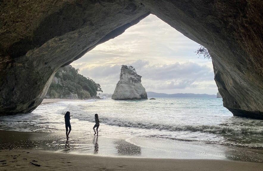
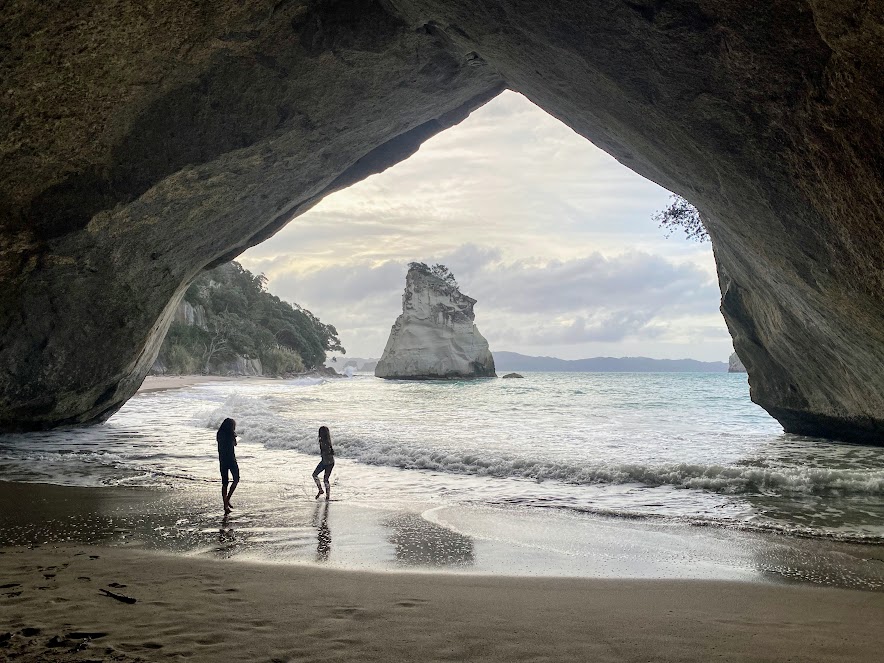
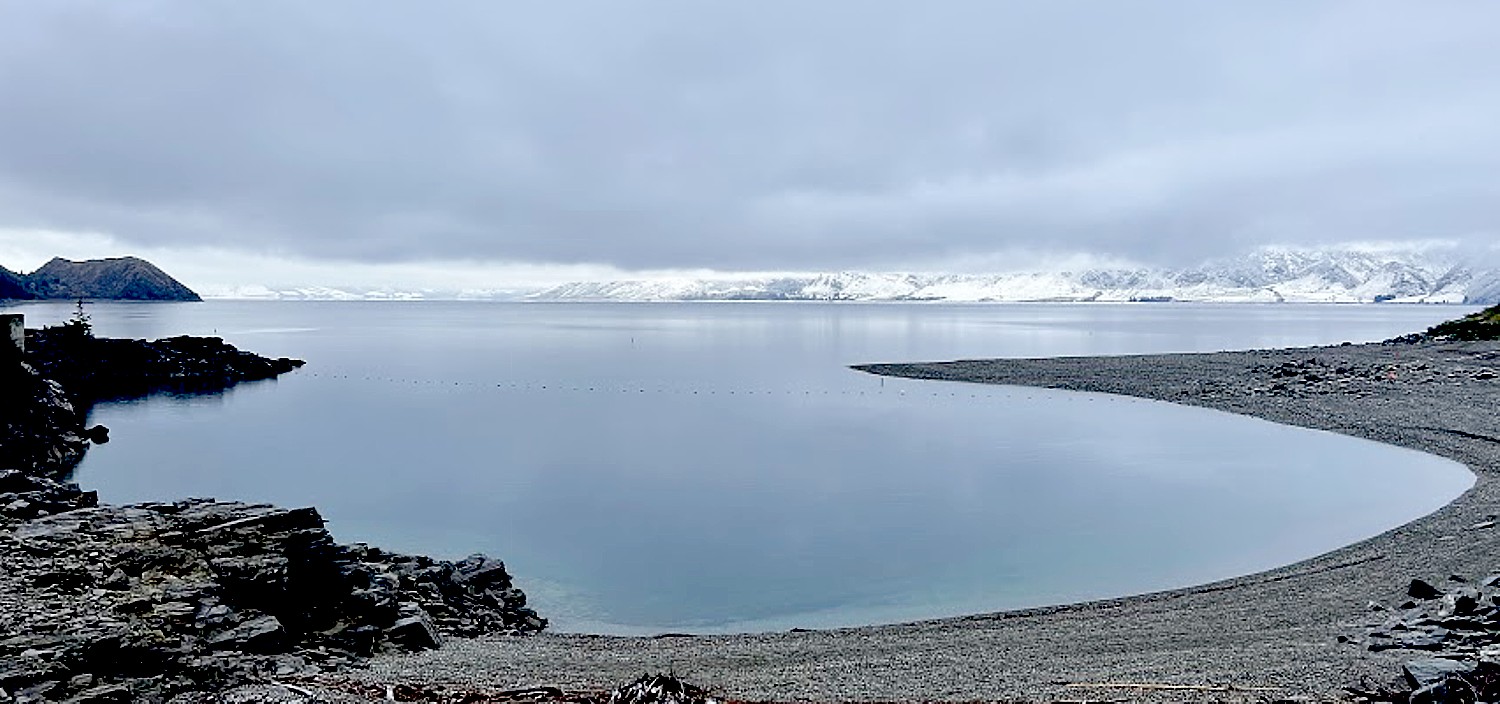
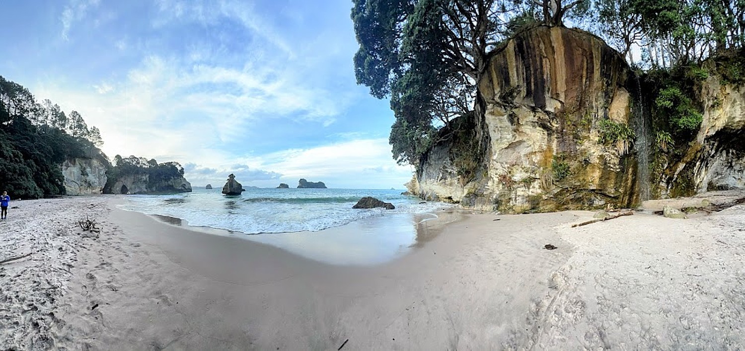
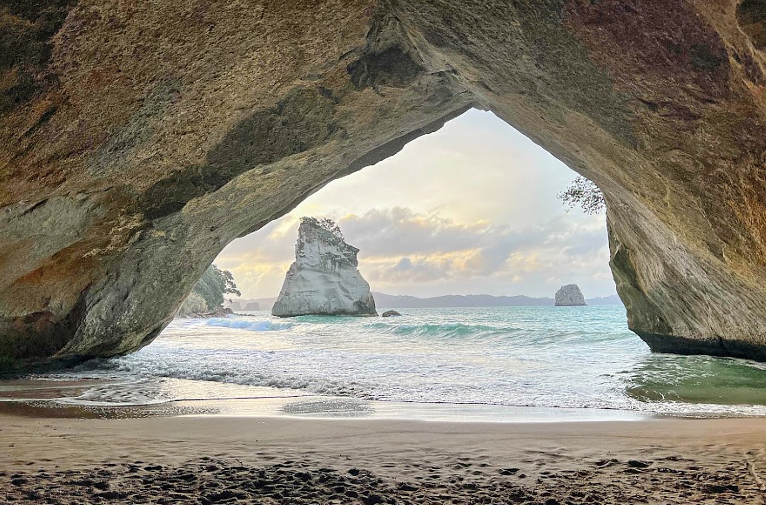
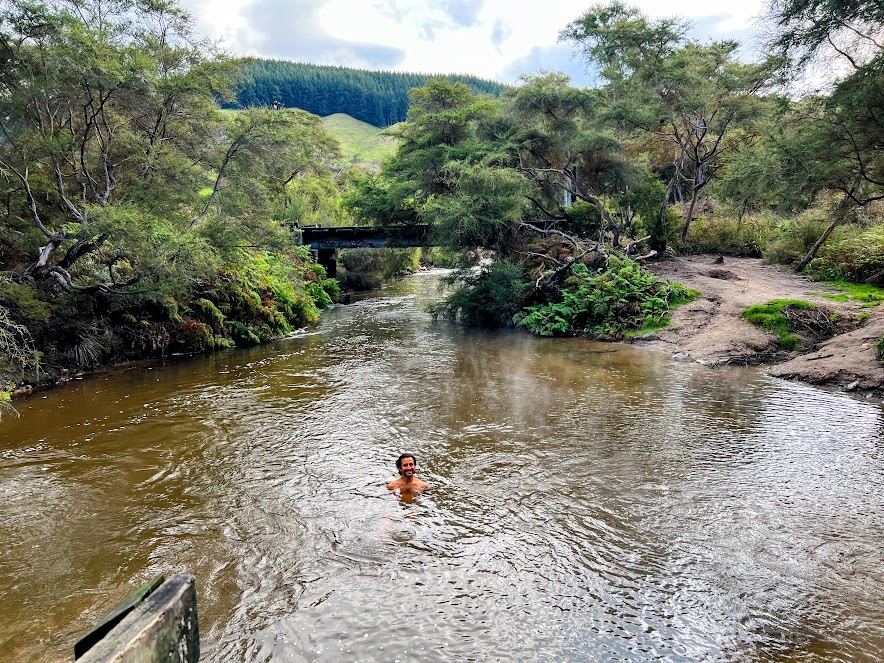
Did ya’ll know that the only native land mammal in NZ is the bat? Everything else came with the humans…wild. And still to this day, there are no big scary predators or poisonous snakes in all of NZ…paradise. And did we mention the public bathrooms everywhere are beautiful and spotless!? Again, huge shout out to Jack & Cass for showing us their home and such a good time. It was a massive highlight of our whole trip!
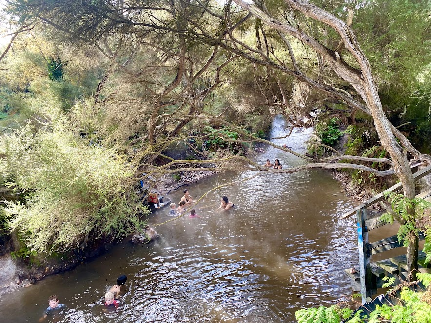
Cardrona, Remarkables

Skiing in summer (or actually, our summer, their winter!) was a huge bucket list item. So to round-out our time on the South Island, we hit the slopes at Cardrona ski field with lots of borrowed gear and some thrift store finds Eric couldn’t resist ($8 for a helmet, goggles & gloves?!). It was basically a white-out all day on slippery ice, but Sarah only fell once, whined twice, and we were truly stoked to have the chance to ski on this sabbatical.

Skiing Cardrona in New Zealand © Eric Leiberman/goingplacesfarandnear.com

When the opportunity came about to ski again at Remarkables a few days later (about an hour south near Queenstown), Eric jumped at it and lucked out with a bluebird day. Sarah audibled and jumped at a local jewelry-making class.

Skiing Remarkables, New Zealand © Eric Leiberman/goingplacesfarandnear.com
 
Skiing Remarkables, New Zealand © Eric Leiberman/goingplacesfarandnear.com
 
Making my own ring in jewelry-making class © Sarah Falter/goingplacesfarandnear.com

Queenstown

We caught a flight from Queenstown → Auckland, but squeezed in time to explore this charming, twinkly-light town right on the lake. Our Airbnb gave us ghost vibes, so we skipped about town as much as the frigid temps would allow. Notably, we nommed some delicious (and massive) fish n’ chips, and washed it down with fried kiwi for dessert (!!).

Queenstown, New Zealand © Eric Leiberman/goingplacesfarandnear.com

Van Life – Coromandel Peninsula

We zipped up to North Island to begin our week-long van life extravaganza. We hit the road after stocking up on pb&j, chips & craft beer. First stop: Coromandel Peninsula. We were treated to neon greenery, the salty ocean, and cool fog (but thankfully little rain despite the forecast!). Also, no road trip is complete without Taco Bell, and Eric wants everyone to know that TB in NZ is unparalleled – perfectly crispy tortilla, succulent pulled pork & it weighed approx. 1KG. Watch out, San Francisco burritos..

We zipped up to North Island to begin our week-long van life extravaganza © Eric Leiberman/goingplacesfarandnear.com
Coromandel Peninsula, New Zealand © Eric Leiberman/goingplacesfarandnear.com
Coromandel Peninsula, New Zealand © Sarah Falter/goingplacesfarandnear.com

Van Life – Rotorua, Taupo

We continued south in the van, coming to find that NZ is bubbling with thermal activity– especially in Rotorua & Taupo. Geothermal steam oozes from ponds at local parks and Eric veered off the road for any and all opportunity to hop in a thermal bath – his favorite being the Hot N’ Cold river where two rivers converge (one piping hot, one ice cold, as the name suggests). It was his dream come true – a natural version of a hot tub and cold plunge!

Hot N’ Cold River, Rotorua, New Zealand © Sarah Falter/goingplacesfarandnear.com
Rotorua, New Zealand © Eric Leiberman/goingplacesfarandnear.com
Rotorua, New Zealand © Sarah Falter/goingplacesfarandnear.com

Our campsite in this region was chosen for us when we got our van thoroughly stuck in the mud. Thankfully a lovely Kiwi helped us MacGyver a way out in the morning:) Sarah also tried mountain biking here for the first time, and basically screamed the entire way down.

Taupo, New Zealand © Eric Leiberman/goingplacesfarandnear.com
Mountain biking, Taupo, New Zealand © Eric Leiberman/goingplacesfarandnear.com
Taupo, New Zealand © Eric Leiberman/goingplacesfarandnear.com

CHILE Santiago, Valparaiso

The direct flight from Auckland → Santiago, being loosely in the direction of home (California), was what ultimately led to the decision of concluding our adventure in South America. We touched down in Santiago and immediately had to gear our stomachs up for cream-sauce & mayo-covered-everything (Eric was ready). Sarah’s dad, Joel, joined us for the Chile leg, and we spent the first couple days at parks, drinking pisco sours, and consuming “completos” (local version of a hot dog).

Santiago, Chile © Eric Leiberman/goingplacesfarandnear.com

Eric also squeezed in one more day on the slopes of Valle Nevado (ya know, because he had to maximize the return on the thrift store ski gear he picked up in NZ). Then we scooped up a rental car and drove west to Valparaiso, a graffiti-filled port town. We wanted to love Valparaiso, but lots of warnings of crime plus stray dogs and their doodoo on every inch of the street left us feeling a tiny bit meh. Joel did find a really cool hat at the market though——->

Happy with their hats from the Valparaiso market © Sarah Falter/goingplacesfarandnear.com
Skiing at Valle Nevado, Chile © Eric Leiberman/goingplacesfarandnear.com
Valparaiso, Chile © Eric Leiberman/goingplacesfarandnear.com
 
Valparaiso, Chile © Eric Leiberman/goingplacesfarandnear.com
 
Valparaiso, Chile © Sarah Falter/goingplacesfarandnear.com
Valparaiso, Chile © Eric Leiberman/goingplacesfarandnear.com

Casablanca, Maipo

We continued on with a stop in Casablanca (wine country) where we sipped some delicious (and inexpensive) vino, ate pizza, and slept in a tiny house overlooking vineyards. We loved the much more chill and less elitist vibes of the wineries we visited (compared to Northern California).

Casablanca, Chile © Eric Leiberman/goingplacesfarandnear.com
 
Casablanca, Chile © Eric Leiberman/goingplacesfarandnear.com
 
Casablanca, Chile © Eric Leiberman/goingplacesfarandnear.com
 
Casablanca, Chile © Eric Leiberman/goingplacesfarandnear.com
 

And to round-out the road trip, we visited the mountains of San Jose de Maipo. We stocked up on food and took the hosts 4×4 van up the steep and rocky road to our Airbnb. The cute cabin had one furnace, so Eric and Joel got to practice the manly skill of fire building 24/7, and we all slept in four layers of clothing. We spent the days cooking meals and going for lots of walks with mountain views (the neighbor’s sweet dog accompanied us wherever we went).

Atacama Desert

Last stop in Chile: The Atacama Desert, the driest and one of the highest deserts in the world. Lots to see in this vast dryland, which often felt like another planet – salt flats, sand dunes, lagoons with flamingos (did you know flamingos are born white, and their diet of exclusively sea monkeys turns them pink!?), multicolored canyons & geothermal springs.

Flamingoes, Atacama Desert, Chile © Eric Leiberman/goingplacesfarandnear.com
Lagoon, Atacama Desert, © Sarah Falter/goingplacesfarandnear.com
Atacama Desert, Chile © Eric Leiberman/goingplacesfarandnear.com
Atacama Desert, © Sarah Falter/goingplacesfarandnear.com

At one point we were locked out of our car in the middle of the desert, but thankfully we are small humans and were able to climb in through the trunk back to mobile safety. After the panic subsided we were treated to a herd of llamas trekking alongside our car for 30 minutes. This desert oasis has an added bonus– a Death-Valley-meets-Albuquerque boho-chic little town called San Pedro de Atacama. Lots of funky cool souvenir shops and live music to check out.

San Pedro de Atacama © Sarah Falter/goingplacesfarandnear.com

Now off to Peru and Ecuador for trekking and wildlife viewing, the grand finale of our six-month odyssey.

See also:

DISPATCH 1 FROM LIVING THE NOMADIC LIFE, A GLOBAL ODYSSEY: MEXICO

DISPATCH 2 FROM LIVING THE NOMADIC LIFE, A GLOBAL ODYSSEY: SOUTH KOREA TO VIETNAM

DISPATCH 3 FROM LIVING THE NOMADIC LIFE, A GLOBAL ODYSSEY: MALAYSIA TO CAMBODIA

DISPATCH 4 FROM LIVING THE NOMADIC LIFE, A GLOBAL ODYSSEY: INDONESIA

DISPATCH 5 FROM LIVING THE NOMADIC LIFE, A GLOBAL ODYSSEY: AUSTRALIA-NEW ZEALAND-CHILE

____________________________

© 2022 Travel Features Syndicate, a division of Workstyles, Inc. All rights reserved. Visit goingplacesfarandnear.comwww.huffingtonpost.com/author/karen-rubin, and travelwritersmagazine.com/TravelFeaturesSyndicate/. Blogging at goingplacesnearandfar.wordpress.com and moralcompasstravel.info. Visit instagram.com/going_places_far_and_near and instagram.com/bigbackpacktraveler/ Send comments or questions to FamTravLtr@aol.com. Tweet @TravelFeatures. ‘Like’ us at facebook.com/NewsPhotoFeatures