Category Archives: Biking Tours

Biking is Great Way to Tour San Francisco’s Must-See Attractions

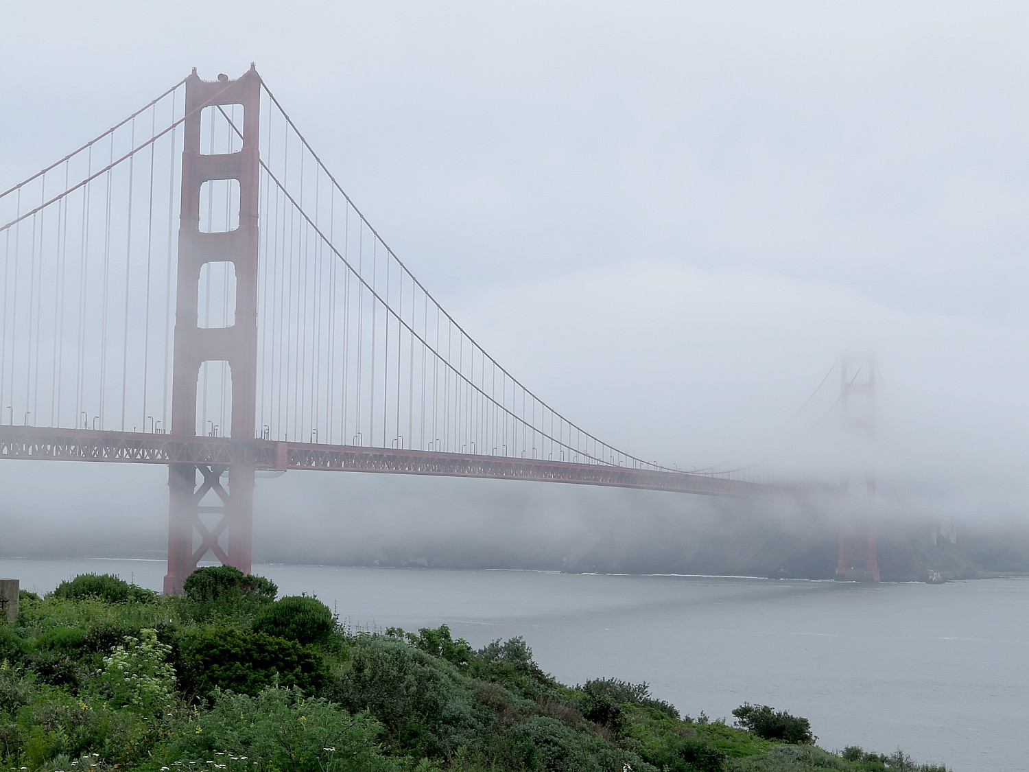
A view of the Golden Gate Bridge shrouded in San Francisco’s famous fog, from Vista Point on the bike trail © 2017 Karen Rubin/ goingplacesfarandnear.com

By Karen Rubin,

Travel Features Syndicate, goingplacesfarandnear.com

The weather is overcast on the day I have set to do that iconic bike ride along San Francisco’s waterfront, over the Golden Gate Bridge into Sausalito and on to Tiburon. But that doesn’t stop me or several thousand other visitors to this engaging city. I just throw in some rain gear along with water and snacks.

I set out for Blazing Saddles, which has the largest bike fleet in California and some nine locations throughout San Francisco.

The company’s main location is at 2715 Hyde Street, ideally located in Fisherman’s Wharf, and just a block and a half from the start of the National Park Bike Path. This path takes riders on a beautiful, car-free bike ride along the bay, passed the Marina, through historic Fort Mason, and over to the Golden Gate Bridge, which is where most of the riders go.

Blazing Saddles has been in business over 30 years – it is the original “Bike the Bridge” company – but now has some new offerings, including a new electric bike model that was custom-made for the company, the Electric Blazer, and a free mobile app.

The new “e-Blazer” was customized for Blazing Saddles and they say is the lightest electric bike. The bike looks like regular bike (the battery is on the luggage rack on the back rather than where your legs are). It would be exceptional if you were riding San Francisco’s hills.

But a consideration for me, as the Blazing Saddles person explains, is that e-bikes, can only take the Blue & Gold ferry line from Sausalito or Tiburon to Pier 41, which has somewhat more limited service than the Golden Gate Ferry (which goes into the Ferry Building at Embarcadero  – so I see that my last time back from Tiburon (where I am trying to get to) would be 4:15 pm and it is already noon.
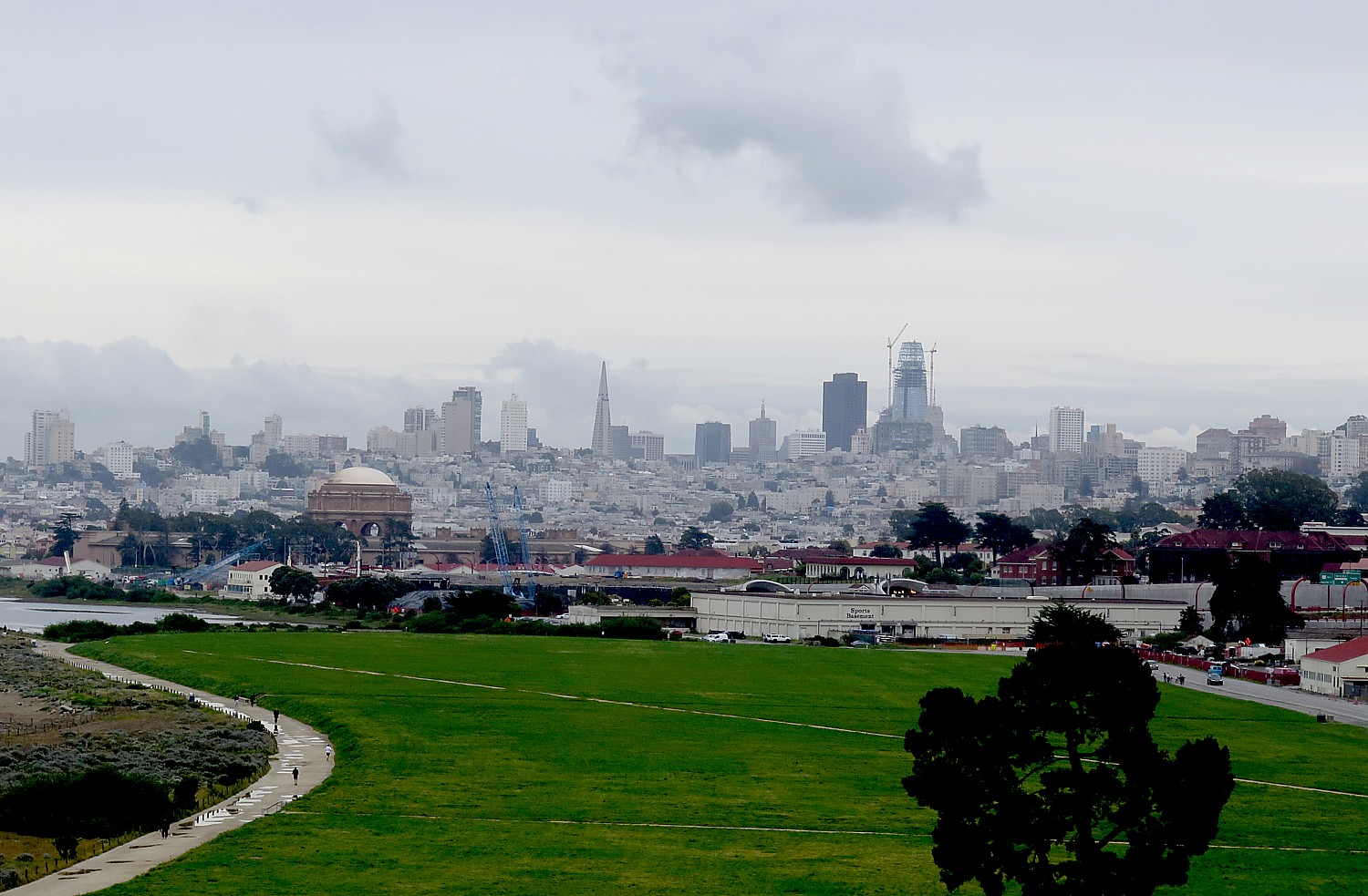
San Francisco skyline, from the ramp up to the Golden Gate Bridge © 2017 Karen Rubin/goingplacesfarandnear.com

I decide not to take the e-bike but to take a regular bike, which is lighter and easier for me to get on/off, and soldier through the hills, starting with Fort Mason (made it!), then the ramp up to Golden Gate Bridge (made it!).

The weather may be overcast, but I get to see that wonderful scene of the Golden Gate Bridge half-shrouded in San Francisco’s famous fog, a scene that changes moment to moment, it seems.

It is 8 miles to Sausalito – that takes about 1 ½ hours (you won’t just be riding over the Golden Gate Bridge, you will want to sightsee, stop for photos, and also have to keep stopping for pedestrians). Plan to spend time – at least an hour – in Sausalito which has really wonderful shops, galleries, eateries and scenic views, even if you are planning to continue the ride to Tiburon. (I have spent time in Sausalito a few days before on my way back from Muir Woods with Extranomical Tours.)
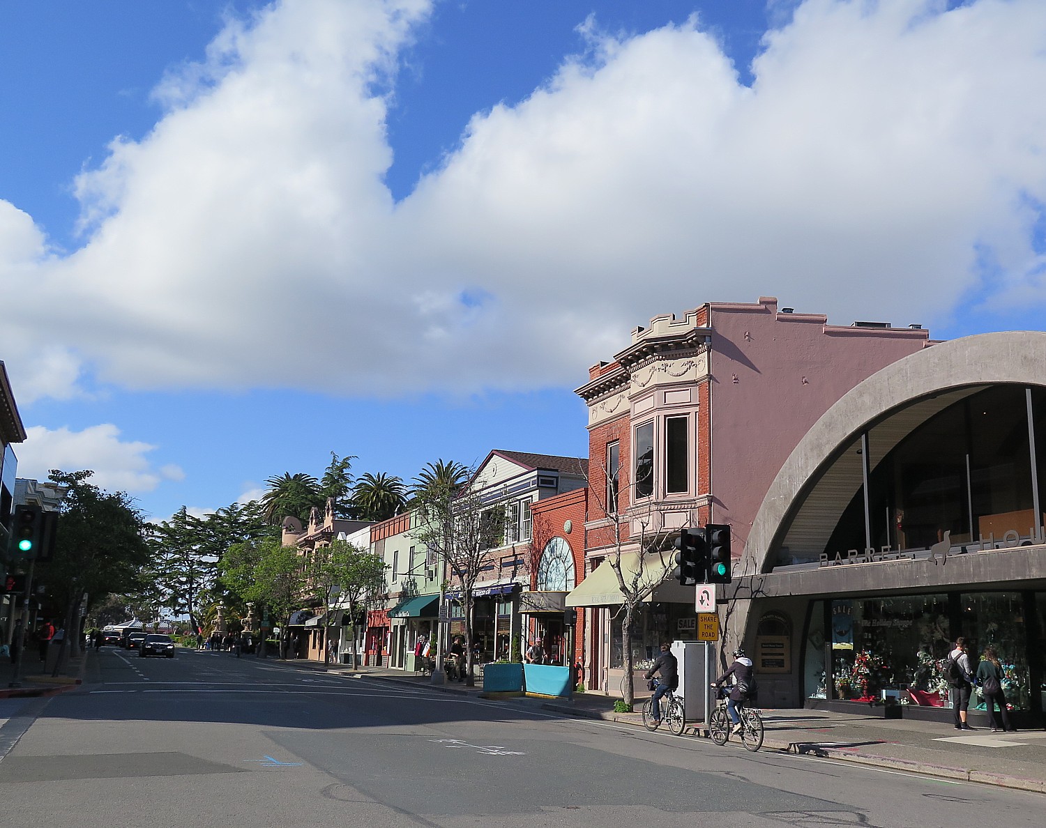
Plan on spending time in Sausalito, which offers delightful galleries, shops and eateries © 2017 Karen Rubin/goingplacesfarandnear.com

It is 10 more miles between Sausalito and Tiburon, which should take another 1 ½ to 2 hrs.

Blazing Saddles does an excellent job of preparing  you – showing a 2-minute video of the route along the waterfront through the Marina district, up over Fort Mason (a strenuous hill) to the ramp up to Golden Gate Bridge (also strenuous hill), then down, down, down, into Sausalito.

They also give you a ticket for the ferry which you don’t actually pay for unless you use it (saves time and anxiety to buy the ticket at the ferry but I notice that the Blue & Gold lets you buy the ticket on the ferry, also). When I get back, I pay Blazing Saddles $11.50 for the ferry (the same amount as you would pay directly to the ferry). Their map/brochure even gives the time schedule for the ferries.

They tell us we should return the bikes by 7:30 pm or else call. They supply quality helmets, a lock, a pouch and luggage rack, and an excellent map (which also shows points of interest along the routes) and take care to properly fit the bike. (Blazing Saddles offers an all-day guided tour out of the 2715 Hyde Street location, departing 10 am and 1 pm, that includes the all-day Deluxe Comfort bike rental for $55/adult, $35/child).
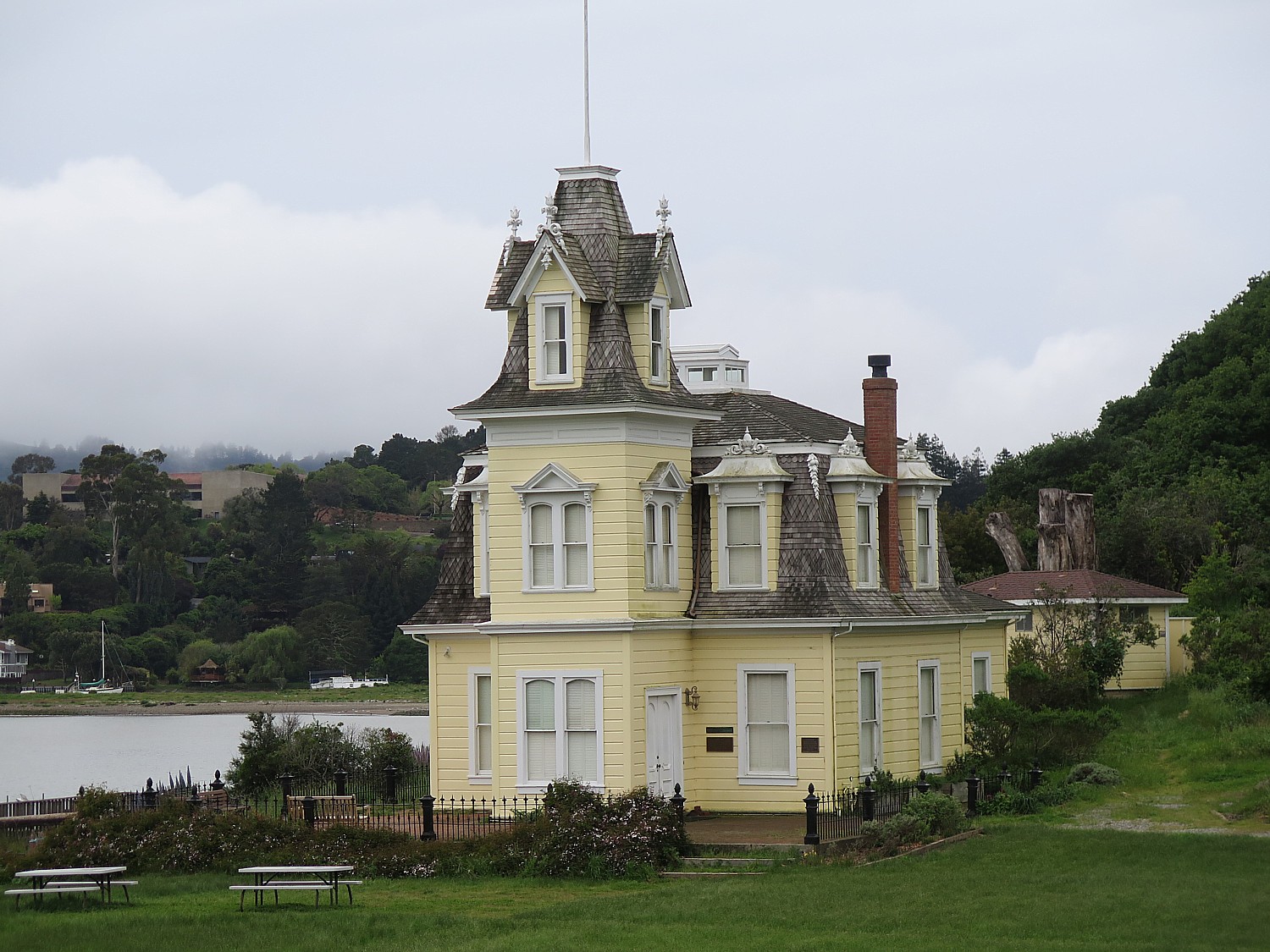
Enroute to Tiburon I stumble upon the Audubon Sanctuary © 2017 Karen Rubin/goingplacesfarandnear.com

I had really wanted to see the ride to Tiburon which is mostly on a bike trail but partly sharing the road. But once you get under the highway and go along the highway on the service road, the sign to the bike route (for Bike Route 8) to Tiburon is confusing (everyone else I met on the line to the ferry made the same mistake) – when actually, all you have to do is follow the service road maybe ¼ mile more and turn up on Belvedere Road, for a much more pleasant ride (just a few hills) which soon connects to a very nice bike trail (Bike Route 10).

I made the mistake of not biking out to Mill Valley’s Old Mill Park, where you get to see the Coastal Redwoods, and then connecting to the Bike Route #8 – which is the way Blazing Saddles recommends to go (I was in a hurry to get to Tiburon).

The weather does not cooperate, but fortunately I have prepared for rain.

Eventually you connect with Route 10 which is a dedicated bike trail along the water into Tiburon.
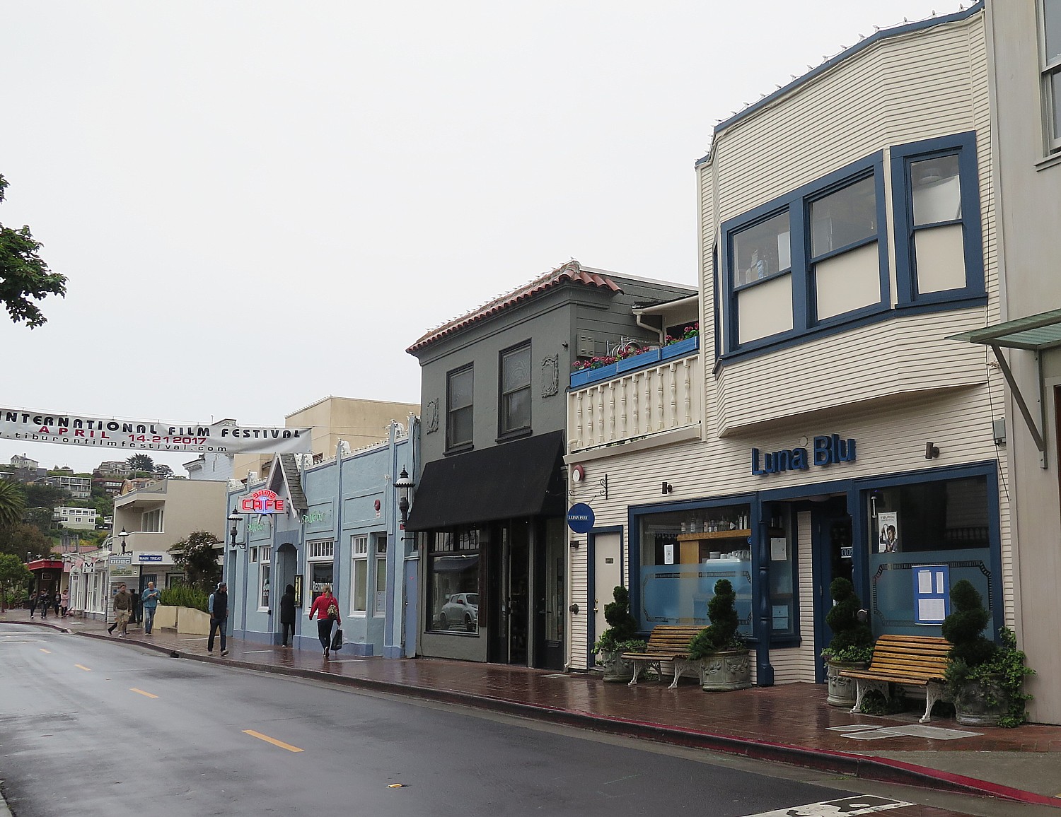
Tiburon’s main street © 2017 Karen Rubin/goingplacesfarandnear.com

Even with getting lost (involving riding up three major hills in the residential area and stumbling upon the beautiful Audubon sanctuary (until a very nice man stopped his car and pointed out the route to me), I still get to Tiburon at 3:55 pm. There is not nearly as much to visit as in Sausalito, so I basically walked up and down the street in the “historic” district where the shops are and still made it to the 4:15 pm ferry for the fun 35-minute scenic “cruise” back to San Francisco’s Pier 41 at Fisherman’s Wharf, stopping at Angel Island and passing very close to Alcatraz on the way. There were a gazillion other bikes – a huge slew with the Blazing Saddles emblem – and the ferry people are extremely efficient in loading and unloading the bikers.
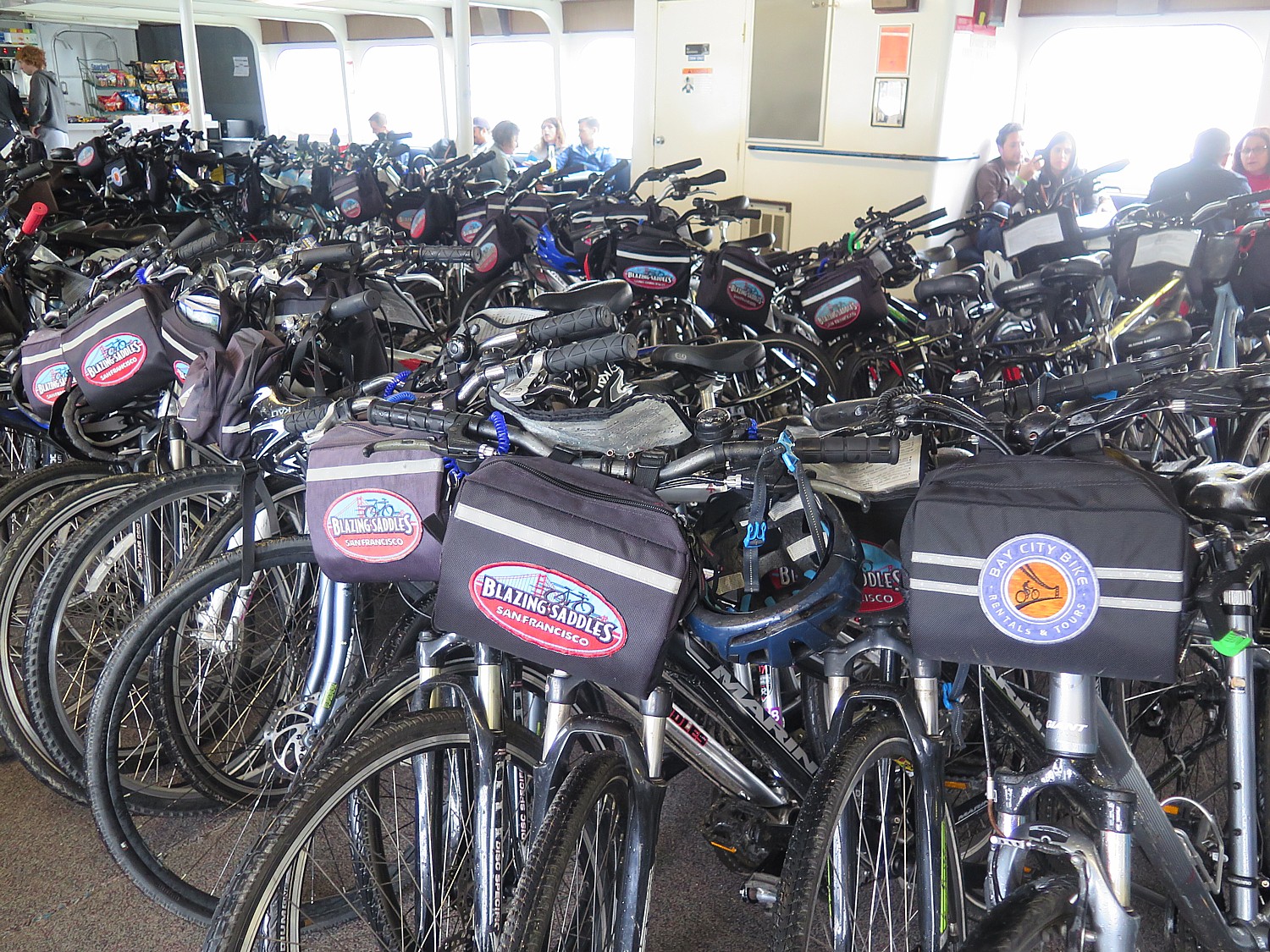
A slew of bikes on the Blue & Gold Ferry from Tiburon to Pier 41 © 2017 Karen Rubin/goingplacesfarandnear.com

Besides this most popular Bike the Bridge ride (average 3 hours for the full 22 miles into Tiburon), other recommended routes include Bike the Parks (San Francisco’s bike route system connects Union Square and the “Wiggle” to the famous Golden Gate Park and the Presidio, 15 miles averaging 2-3 hours; the Marin Headlands Loop (from the north side of the Bridge, follow the coast west on Conzelman Road, out towards Point Bonita and Rodeo Beach, 10 miles, 2-3 hours; and “Conquer Mount Tamalpais, which would take you to Muir Woods National Monument, 15 miles beyond Sausalito, for a 5-6 hour trip – the elevations to Mount Tamalpais at 2,574 feet, make this especially challenging.

Rain doesn’t dampen the enthusiasm for biking through Fisherman’s Wharf © 2017 Karen Rubin/goingplacesfarandnear.com

Indeed, San Francisco, despite its hills, is one of the most bike-friendly, welcoming cities anywhere (and if you get tired, public buses and the BART subway system accommodate bikes).

Blazing Saddles has a score of different road, hybrid and mountain bikes and types, starting at $8/hour or $32 for a 24-hour day; the best bike for biking the Bridge is a deluxe comfort hybrid, $9/hr, $36/for a 24-hour day; the e-Blazer ranges from $48-88.

Blazing Saddles Bike Rentals and Tours, 2715 Hyde Street, San Francisco, CA 94109, 415-202-8888, www.blazingsaddles.com 

Maritime National Historical Park 

Besides all the marvelous tourist places – souvenir shops, eateries of every stripe – there are some excellent attractions at Fisherman’s Wharf, such as the Exploratorium and the Aquarium and most especially the famous and fabulous Cable Car (expect long lines of about 30 minutes but totally worth it; along the cable car route, there is the Cable Car Museum which is free and SO fantastic).
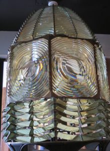
The lens from the Farallon Lighthouse is on view at the San Francisco Maritime National Historical Park visitor center © 2017 Karen Rubin/ goingplacesfarandnear.com

The end of Fisherman’s Wharf is the start of the San Francisco Maritime National Historical Park and the Visitor Center which is free and fantastic (located in the Argonaut Hotel building). Here you experience the sights, sounds and textures of the city’s seafaring past, beginning with the Native Americans who lived here before the Spanish arrived. There are hands-on activities and exhibits that describe the Gold Rush, shipwrecks, and development of San Francisco. On view is the lens from the Farallon Lighthouse. There are many historic vessels along the Hyde Street Pier, where park staff volunteers lead programs where you get to participate (school children can even overnight on historic vessels).  The Maritime Museum is in the Aquatic Park Boathouse building (also free). (San Francisco Maritime National Historical Park, Fort Mason Center, San Francisco, 94123, 415-447-5000, www.nps.gov/safr).

I stop in on my way to picking up the bike from Blazing Saddles, and the exhibit gives me an excellent foundation for appreciating what I will see during the ride.
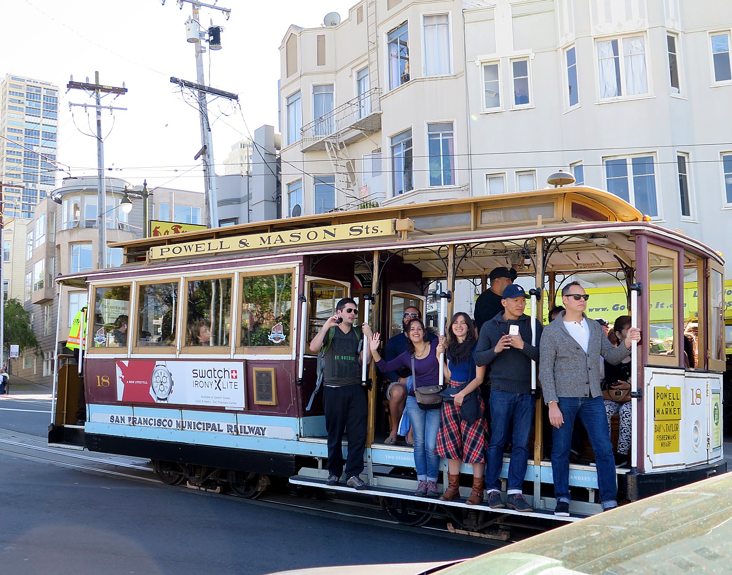
Riding San Francisco’s famous cable car © 2017 Karen Rubin/ goingplacesfarandnear.com

It’s also where a few of the marvelous San Francisco cable cars begin and end – be prepared for a 20-30 minute wait on a line but it is so worth it and is an excellent way to either arrive at Fisherman’s Wharf or finish off the day. The one-way fare is $7. (Locals can’t get on so it is almost exclusively tourists who ride the cable car.)

Also try to visit the Cable Car Museum, located in the historic Washington/Mason cable car barn and powerhouse. (Cable Car Museum, 1201 Mason Street, San Francisco, CA 94108, 415-474-1887, www.cablecarmuseum.org. See story A Day in San Francisco Revisiting the Past: Plucky Cable Car Epitomizes City’s Grit, Determination, Innovation)

Pier Market Seafood Restaurant at Pier 39 

Pier 39, which is celebrating its 39th anniversary in 2017, is a tourist mecca with scores of fun shops and restaurants such as the Hard Rock Café (especially fun during this Summer of Love celebration, we noticed live music going on; also, check out the autographed Grateful Dead guitar, a painting of Jerry Garcia by Grace Slick of the Jefferson Airplane, Jerry Garcia’s bomber jacket, Jimi Hendrix’ jacket and one of the last photos of Janice Joplin, www.hardrock.com/cafes/san-francisco/).

This trip we enjoyed dinner at the Pier Market Seafood Restaurant, heralded for its New England clam chowder, Mesquite-grilled seafood, and lovely setting with views of the Bay, waterfront and resident sea lions.

Pier Market Seafood is one of the Simmons family’s restaurants in San Francisco (Fog Harbor Fish House, and Wipeout Bar & Grill are the others), offering menus that showcase all sustainable seafood offerings aligned with the Monterey Bay Aquarium’s “Seafood Watch” guidelines.

“We undertook this transition based on a commitment to best practices, even in the absence of any specific demand from our customers,” Scooter Simmons commented. “It was important to our family and everyone in our company to do the right thing and lead by example. There are surprisingly few area restaurants that have made this choice.”

Three generations of Simmons’ are a part of the history of San Francisco’s hospitality industry. Warren Simmons was the creator and developer of PIER 39, which opened in 1978, and his son, Scooter, daughter-in-law, Nancy, and his grandchildren, Nicki and Ryan, now work running the four Pier 39 businesses still owned by the family.

Menu highlights include garlic roasted whole crab, fresh seafood cioppino, mesquite grilled lobster tail, red curry steamed mussels, and Anchor Steam battered fish and chips and Pier Market’s award winning clam chowder.

In addition to the sourcing of sustainable ingredients for all seafood dishes the menu reflects seasonality, the use of local purveyors, generous portions, and moderate (“non-tourist”) pricing (mains are priced from around $11 to $30). Pier Market Seafood offers a diverse selection of libations including a wine list that emphasizes California vintages and handcrafted classic, contemporary and signature cocktails, plus intriguing non-alcoholic beverages including a strawberry basil nojito.

The selections are wonderful for sharing, especially the starters like sourdough garlic bread, garlic fries (crispy fries tossed with fresh garlic, herbs and topped with parmesan cheese); Crispy Scallops (house-breaded and served with roasted jalapeño aioli); fried calamari coated with sweet & sour sauce; crab cakes, a house specialty, served with a Cajun rémoulade; clams steamed in garlic, butter and white wine; steamed mussels prepared with onions and peppers in a red curry coconut broth.
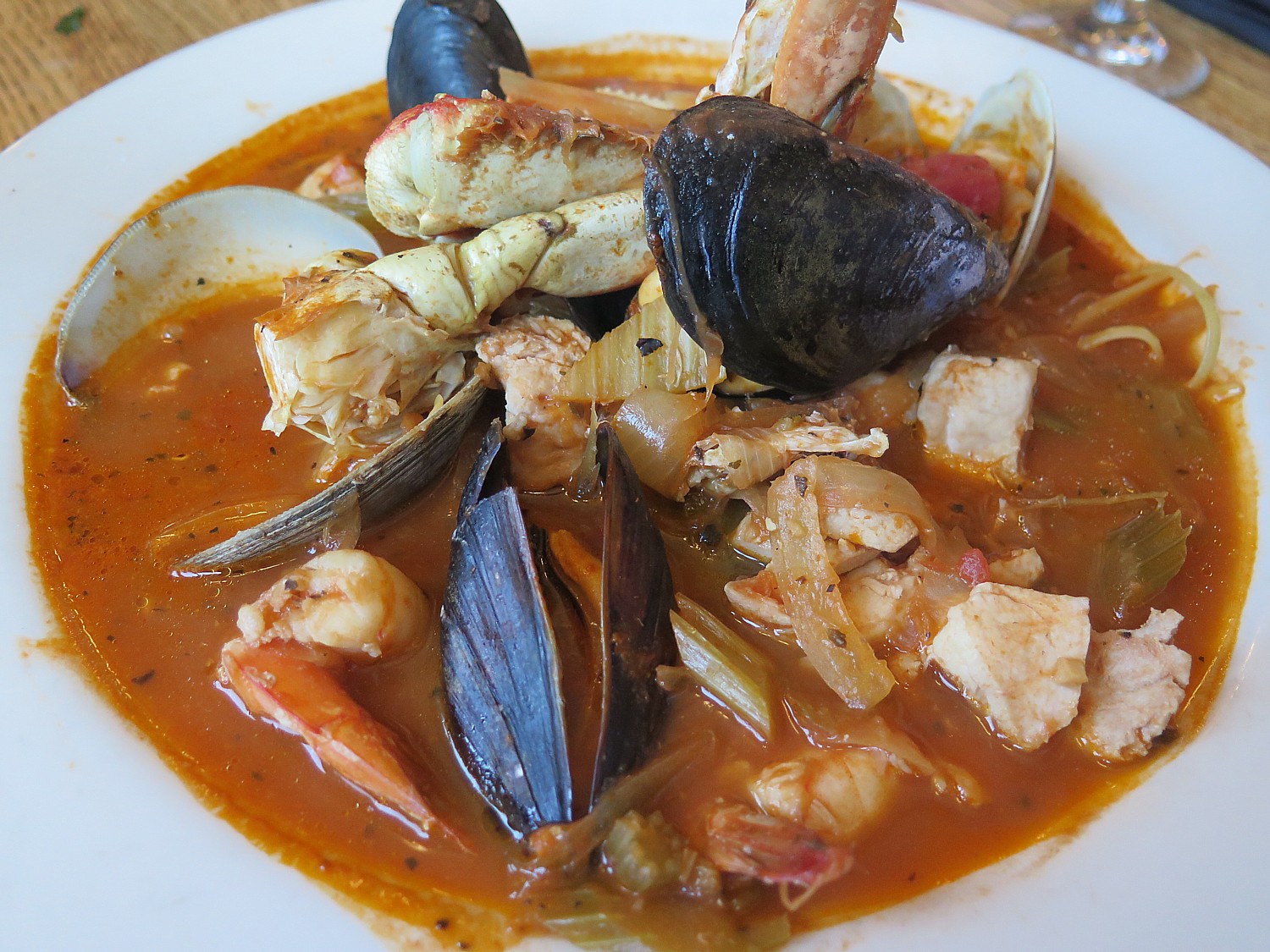
Pier Market Seafood at Pier 39 is very proud of its Cioppino, a classic San Francisco dish © 2017 Karen Rubin/goingplacesfarandnear.com

The restaurant is also very proud of its Cioppino, a  classic San Francisco dish, a tomato based seafood stew with fresh fish, mussels, clams, shrimp and crab served over pasta ( for a few dollars more, they remove the crab from the shell).

The menu offers tremendous variety and selections – meats to salads, sandwiches, pastas – and the ambiance is casual, pubbish, perfect after a day of sightseeing. The restaurant serves until 10 pm.

One hour free validated parking in an easily accessed and conveniently located garage adds to the allure of the dining experience.

(Pier Market Seafood, Pier 39. San Francisco, CA 94133, 415-989-7437, piermarket.com/).

For more help planning a visit to San Francisco, contact San Francisco Travel. 415-391‑2000, www.sftravel.com. 

See also:

San Francisco Throwing Year-Long 50th Anniversary Celebration of Summer of Love – Be Prepared to Be Blasted into the Past

San Francisco Goes All Out With Special Events, Exhibitions Marking 50th Anniversary of Summer of Love

A Day in San Francisco Revisiting the Past: Plucky Cable Car Epitomizes City’s Grit, Determination, Innovation

____________________

© 2017 Travel Features Syndicate, a division of Workstyles, Inc. All rights reserved. Visit goingplacesfarandnear.com www.huffingtonpost.com/author/karen-rubin , and travelwritersmagazine.com/TravelFeaturesSyndicate/. Blogging at goingplacesnearandfar.wordpress.com and moralcompasstravel.info. Send comments or questions to [email protected]. Tweet @TravelFeatures. ‘Like’ us at facebook.com/NewsPhotoFeatures


‘Jungle Book’ Cycling Adventure Through Local Villages of India’s Kanha National Park

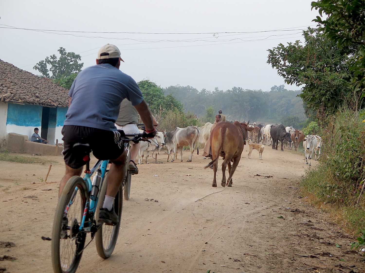
Cycling through a herd of cattle on their way home © 2016 Karen Rubin/ goingplacesfarandnear.com

By Karen Rubin, Travel Features Syndicate, goingplacesfarandnear.com

Our 25 km cycling trip through the Forest Corridor sanctuary between Pench and Kanha national parks in central India – literally the locale for Rudyard Kipling’s 1895 classic “Jungle Book” –  is the most challenging ride of the aptly named new “Jungle Book Wildlife Safari & Cycling Adventure” offered by Royal Expeditions (see story). But the most colorful, scenic and interesting ride comes during our stay at the Kanha Earth Lodge (another fantastic ecolodge), alongside the national park, when we ride through villages and alongside farms.

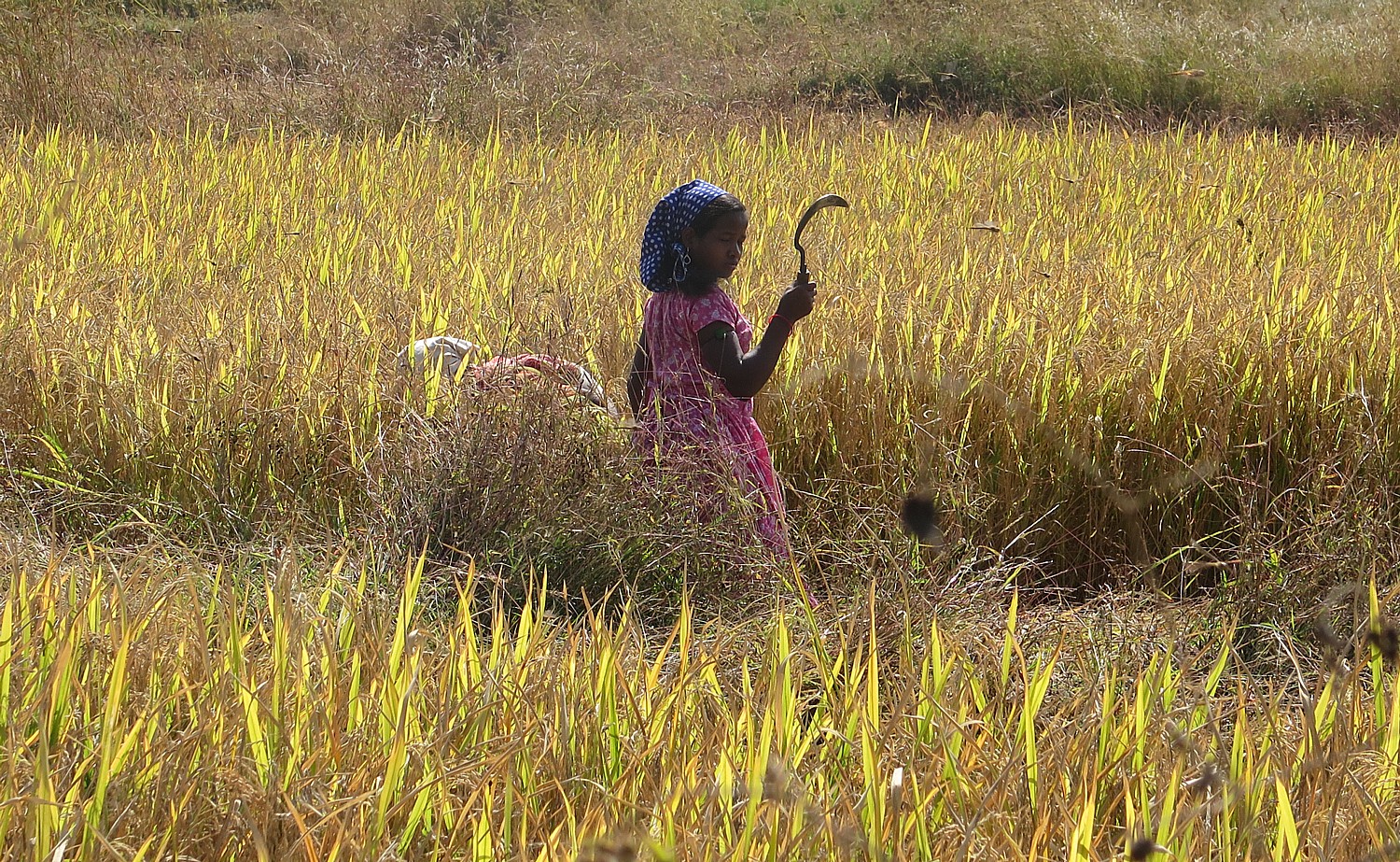
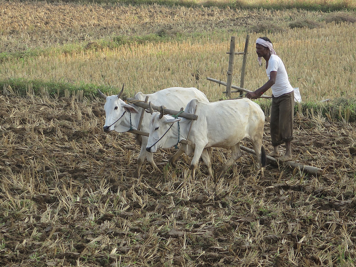
Farmer in a field in Kanha © 2016 Karen Rubin/ goingplacesfarandnear.com

After an exciting game drive in the Kanha National Park in the morning (still no sighting of the tiger, though) and lunch at the lodge, we set out on a 14.9 km route that circles back to the lodge. It is a mix of road and single-track off-road (though the cars don’t drive on anything better), and involves some technical riding (sand, gravel, rocks).

What is so special about cycling is that it brings you into local communities, at a pace and perspective, perched on the bike saddle, to really see things, to be in the scene, not just a spectator looking through glass, and with the ability to stop, look around, and interact.

Not too far from the Kanha Earth Lodge we come into a village, where our guide invites us into a home to see what it looks like on the inside. A father and son are there, looking a little mystified at this sudden intrusion. There are cows and goats in pens in a front courtyard (in this community, the animals are kept in front of the house and not usually in pens, as a sign of wealth and status, Vishal Singh, the managing director of Royal Expeditions who accompanies our small group, tells us). It is dark and spartan inside – there is electricity and a small, old television set. Most homes do not have indoor plumbing. There is a beautiful garden in the back.

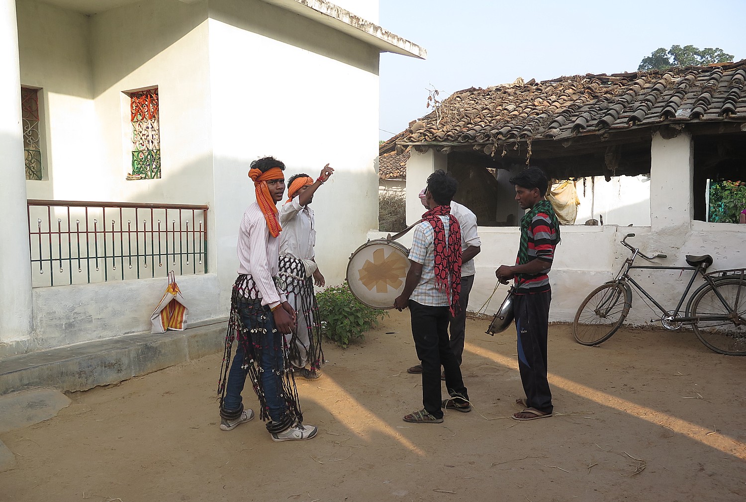
We ride a little further and hear drumming so we ask to go inside and come upon a band of shepherds rehearsing with dancing and singing, getting ready for a competition that is part of the Diwali harvest festival underway.

A band of shepherds rehearse for a festival © 2016 Karen Rubin/ goingplacesfarandnear.com

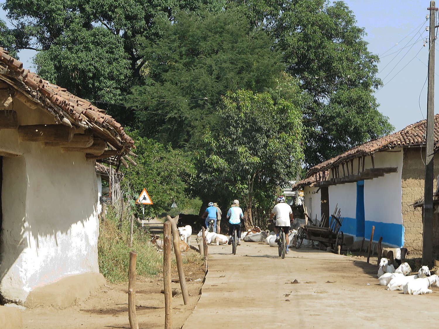
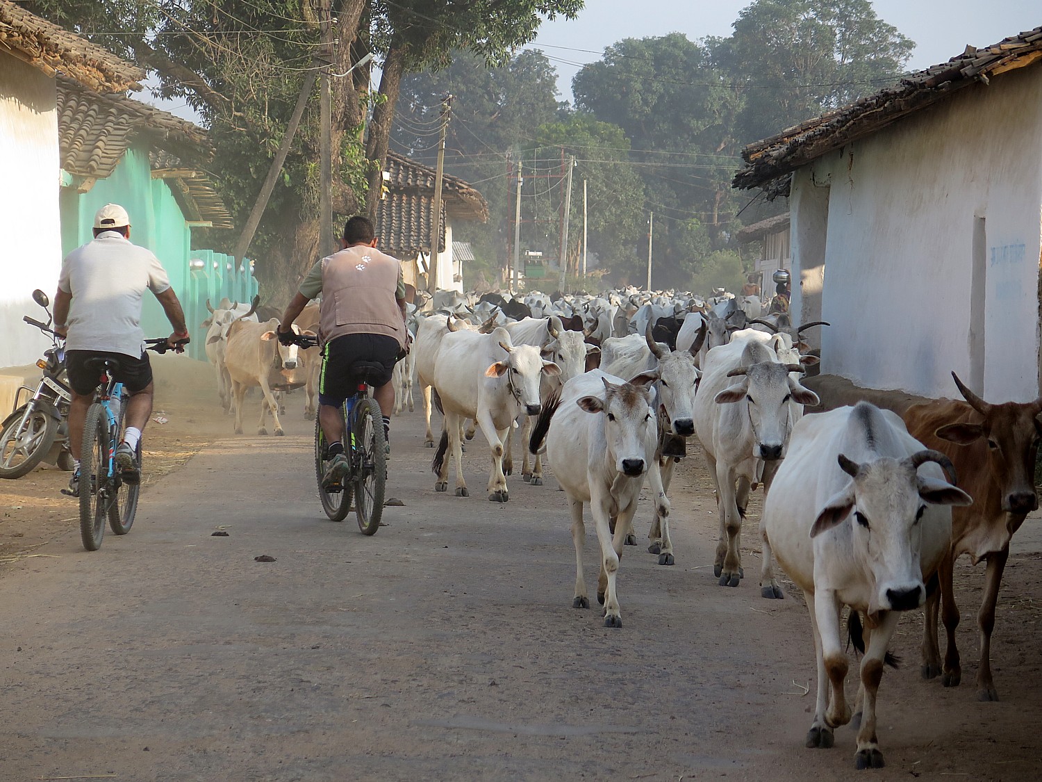
As we set out to continue on our ride, we find ourselves going against a massive herd of cattle (with horns, no less) that fills the narrow street, with no choice but to bike straight through. The cows, it turns out are used to people, and as we come mere inches in front, turn slightly to make way for us. There is a shepherd at the back of the herd, but we are told that the cows find their way to their own homes for the night.

Biking through a village in Kanha © 2016 Karen Rubin/ goingplacesfarandnear.com

People cycle all over India, but not in the manner or style that we are riding, so we are curiosities. In fact, it is astonishing to see the loads that people carry with a basic bike, though scooters and motorcycles are extremely popular (and we’ve saw as many as four people on a motorbike). When you see people biking with a load of sugar cane or batches of wood or pipe on a regular bike – not the mountain bikes or hybrids with 24 gears that we have – it is awe-inspiring.

Scenes of the Kanha countryside © 2016 Karen Rubin/ goingplacesfarandnear.com

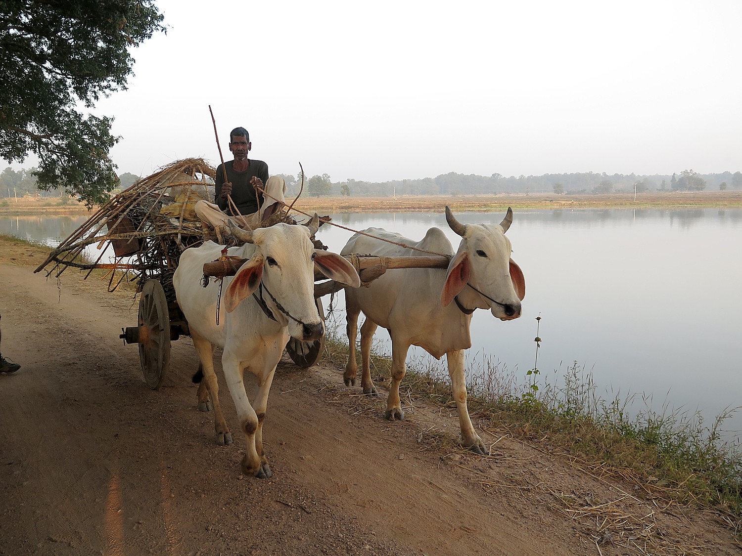
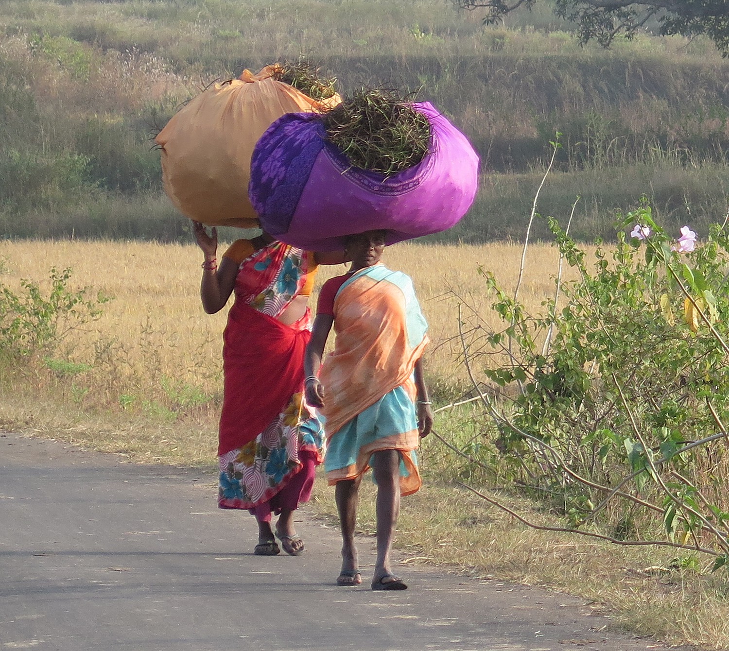
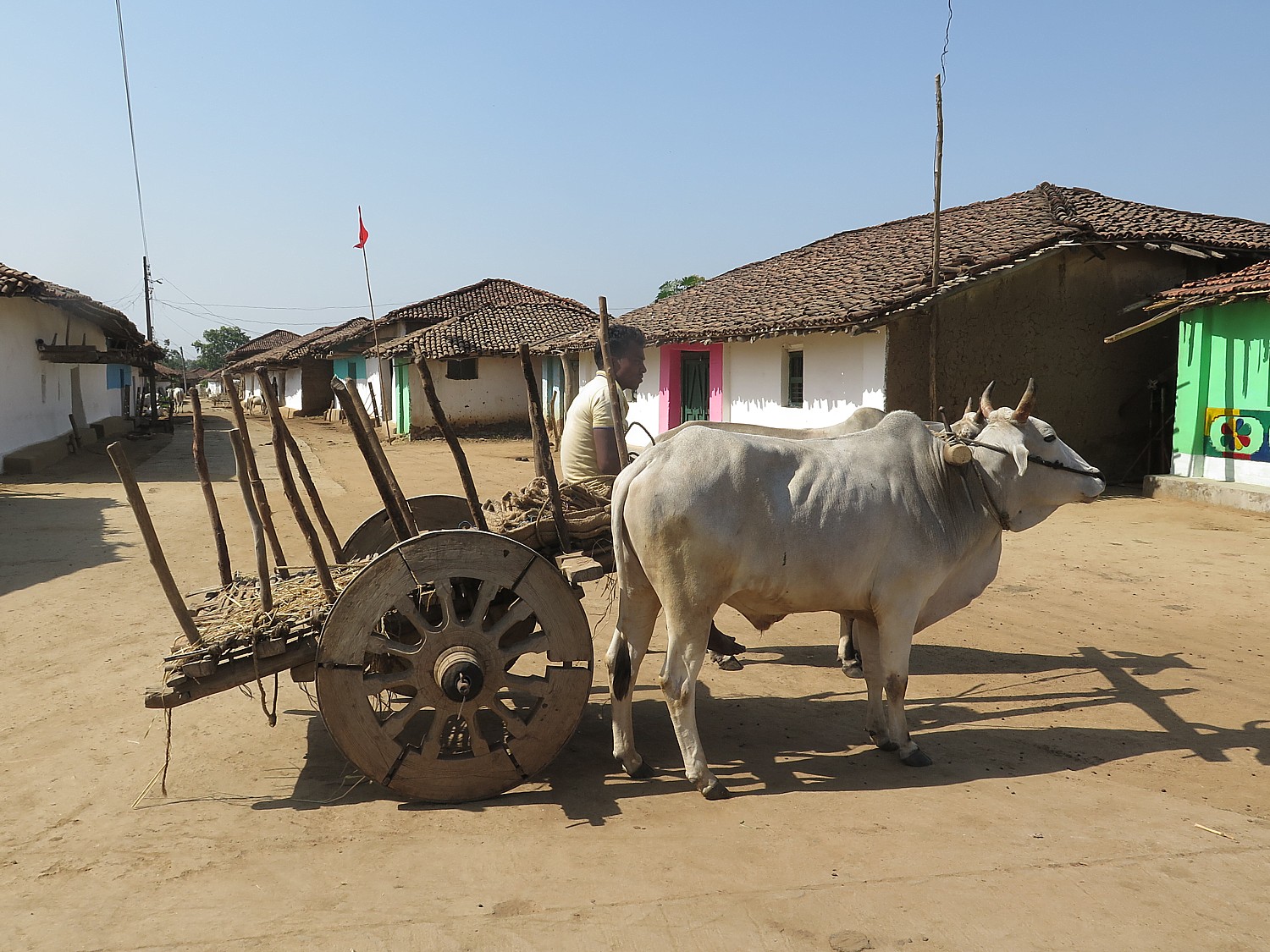
We become immersed in these scenes of everyday life and fields and farms: women are carrying massive loads on their heads, walking with the grace of a model in an etiquette school; men driving carts pulled by cows; school girls in their neat uniforms riding bicycles home (the government gives girls a bicycle when they matriculate to high school); a fisherman who has just returned with his catch.

Biking in Kanha © 2016 Karen Rubin/goingplacesfarandnear.com

Then toward the end of the ride, on a berm overlooking gorgeous rice fields on one side and a small lake with water buffalo on the other, trees along the border completing the picturesque setting as the sun begins to set, the Kanha Earth Lodge fellows set up a snack using the front of the jeep as a table – offer soda, coffee, tea, water, a kind of fried onion (tasty!).

We snack leisurely while watching people cutting down the rice stalks with scythes; others take huge clumps in yokes on their shoulders to great mounds growing ever higher with each new contribution, to dry before being threshed. Soon, a woman comes along who we had met in the village earlier, engages in conversation and takes photos with us.

Scenes of the Kanha countryside © 2016 Karen Rubin/ goingplacesfarandnear.com

The sun is a blazing red-orange when we set out on the last leg on a sandy road. I get one shot just before it disappears into a line of clouds. As dusk sets in, the temperature becomes much cooler as we make it back to the hotel just before dark – greeted with a wash towel and refreshing lime juice.

Scenes of the Kanha countryside © 2016 Karen Rubin/ goingplacesfarandnear.com

Photo tip: For biking, I use a Canon G16, a small point-and-shoot I can keep around my neck and pull out with one hand. It is remarkably fast and responsive, has a terrific zoom lens that is wide enough for landscapes, long enough for close-ups, has an enormous ISO range plus built-in flash if necessary, sensitive sensor that gives rich color, and has image stabilization. It also takes video. I’ve taken shots in horribly low light using the Automatic setting.

Market Day in Kanha 

The Royal Expeditions trip is designed to really immerse us in the cultural experience.

On our third day, we have a morning game drive at Pench, then lunch at the Pench Tree Lodge, then drive a couple of hours to Kanha National Park, which will be our venue for the next three days for game drives and cycling. The drive gives us a superb view of local life – Vishal notes that in India, “Daily life is lived in public” as we see a fellow brushing his teeth in the street. Vishal times the trip so we arrive in time for a weekly village market underway, just at the base of the forest road to the Kanha Earth Lodge.

Women carrying a load along the road © 2016 Karen Rubin/ goingplacesfarandnear.com

Madhya Pradesh is dominated by tribal groups, remarkably untouched by development in other parts of India.  The differences in the tribal community, spread over various parts of the state, are based on heredity, lifestyle and cultural traditions as well as social, economic structure, religious beliefs, language and speech.

This is most apparent in the market. It is a swirl of color, sound and activity.

Merchants spread out food produce and wares on cloth on the ground – have their scales to weigh. They hawk their wares. People crowd around to buy. Cash money is exchanged. It is a kaleidoscope of color: the women in vibrant saris, the fresh produce.

Weekly market in Kanha © 2016 Karen Rubin/goingplacesfarandnear.com

Cows roam freely in the market- one snatches a potato from a pile and the merchant yells and reaches over to swat it with a switch to get it to move on.

We are here at around 4 pm and the warm light makes for gorgeous photos. Indeed, Royal Expeditions offers a photography tour that goes from village to village for their markets.

Weekly market in Kanha © 2016 Karen Rubin/goingplacesfarandnear.com

There are the photos I’ve seen in my mind –that I have wanted to take my whole life. The colors and contours of the bright saris against the brown fields, or the colors of the mud homes, newly painted in broad horizontal stripes – white and blue or pink or green – for the Diwali Festival, the Festival of Lights celebrating the last harvest before winter, against the field of bright yellow mustard (canola) flowers.

In these settings – even shooting from a moving vehicle and especially for wildlife – I use my new Nikon D500 DSLR with a 28-300 mm lens with image stabilization, which I find wide enough for landscape scenes, but close enough. The camera’s best virtue is how fast it responds, its enormous  ISO range (I even shoot village scenes at night as we drive back to the lodge). In general, its 20.9 megapixel CMOS sensor produces rich tones though I am still trying to figure out how to get the best exposure readings. It takes cinematic 4K UHD video and is WiFi capable. It is relatively light compared to other professional-grade cameras and fits ergonomically in my hand, which is a comfort when you are shooting for hours at a time.

Bangles for sale at the weekly market in Kanha © 2016 Karen Rubin/ goingplacesfarandnear.com

Royal Expeditions’ new “Jungle Book Wildlife Safari & Cycling Adventure” program combines all my favorite activities: biking, immersive cultural and wildlife experiences and photography.

It’s hard to overstate how unusual this trip is – the whole idea of being able to bike where wild animals can also roam, when people are not allowed to step out of their safari vehicles, normally. The trip is result of a creative insight as well as the tour company’s connections with the preserve officials to get the permits to bike into the sanctuary.

Indeed Royal Expeditions has royal connections: the tour company, which specializes in luxury, customized and special interest trips, was founded in 1993 by the Princess of Jodhpur, who served in Parliament and as the nation’s Minister of Culture (see http://royalexpeditions.com/)

Royal Expeditions has created an innovative “Jungle Book” itinerary that combines wildlife safari with cycling adventure through central India © 2016 Karen Rubin/goingplacesfarandnear.com

Notably, our trip, which covered about 25 km of the Forest Corridor, was immediately followed by a fascinating 160 km fundraising ride, produced by Tour Operators For Tigers (TOFT) along this same forest corridor that we traveled, linking Pench with Kanha national parks, where wild animals freely roam. Singh is a founder of the group which has about 150 members now. This year, about 20 people took part in the 4-day/3-night ride which raises money to hire local people as village guardians, providing them with smart phones so they can alert authorities to illegal poaching. But I see the ride as a major lure for cyclists from around the world because of its unique setting and challenge (the “road” is more of a mountain bike trail, especially so soon after the rainy season), as well as the opportunities to stay in guesthouses in these villages, not to mention the mission. “Authentic” doesn’t even begin to describe the experience.

Kanha Earth Lodge

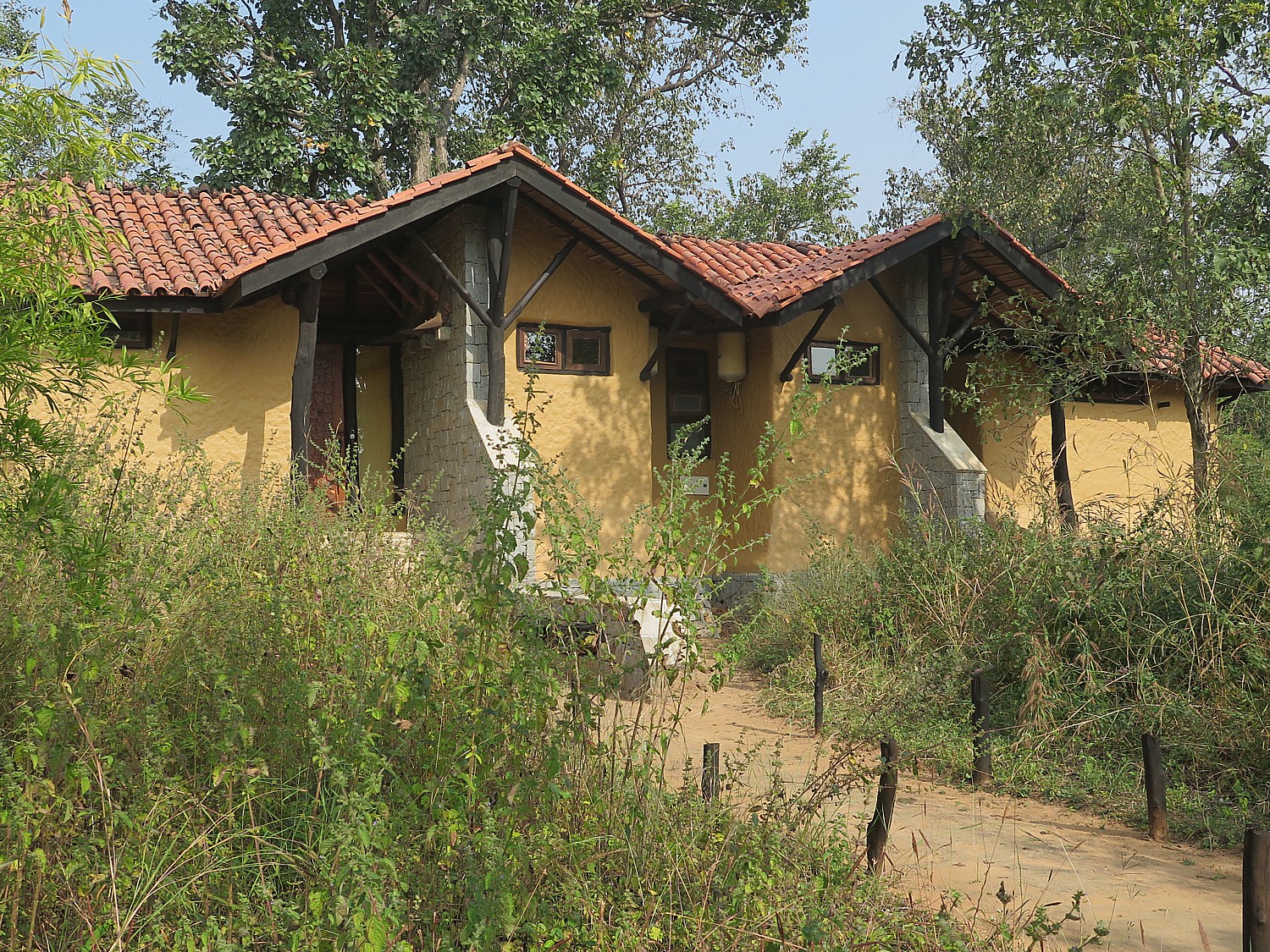
My villa at Kanha Earth Lodge © 2016 Karen Rubin/ goingplacesfarandnear.com

Like the Pench Tree Lodge which we enjoyed during our time at the Pench National Park, the Kanha Earth Lodge (www.kanhaearthlodge.com) enhances the wilderness experience. It is an ecolodge made of all natural materials that is stunning in its design that blends so perfectly without adverse impact on the environment, uses local and traditional art (there is even a fellow who paints tigers), has its own organic garden and a lovely swimming pool, a stunning lodge (WiFi available in the office), and each evening, during cocktail hour, the in-house naturalist offers fascinating presentations about the wildlife and the national park,.

For more information, contact Royal Expeditions Pvt. Ltd. www.royalexpeditions.com, [email protected], or Royal Expeditions’ North American representative: [email protected], 720-328-8595.

Next: Tiger Tiger! On Safari in Kanha National Park 

See also: Jungle Book’ Cycling Adventure Into Tiger Territory of India


____________________

© 2016 Travel Features Syndicate, a division of Workstyles, Inc. All rights reserved. Visit goingplacesfarandnear.com and travelwritersmagazine.com/TravelFeaturesSyndicate/. Blogging at goingplacesnearandfar.wordpress.com and moralcompasstravel.info. Send comments or questions to [email protected]. Tweet @TravelFeatures. ‘Like’ us at facebook.com/NewsPhotoFeatures
‘Jungle Book’ Cycling Adventure Into Tiger Territory of India

Cycling in India brings us alongside farms © 2016 Karen Rubin/goingplacesfarandnear.com

By Karen Rubin, Travel Features Syndicate, goingplacesfarandnear.com

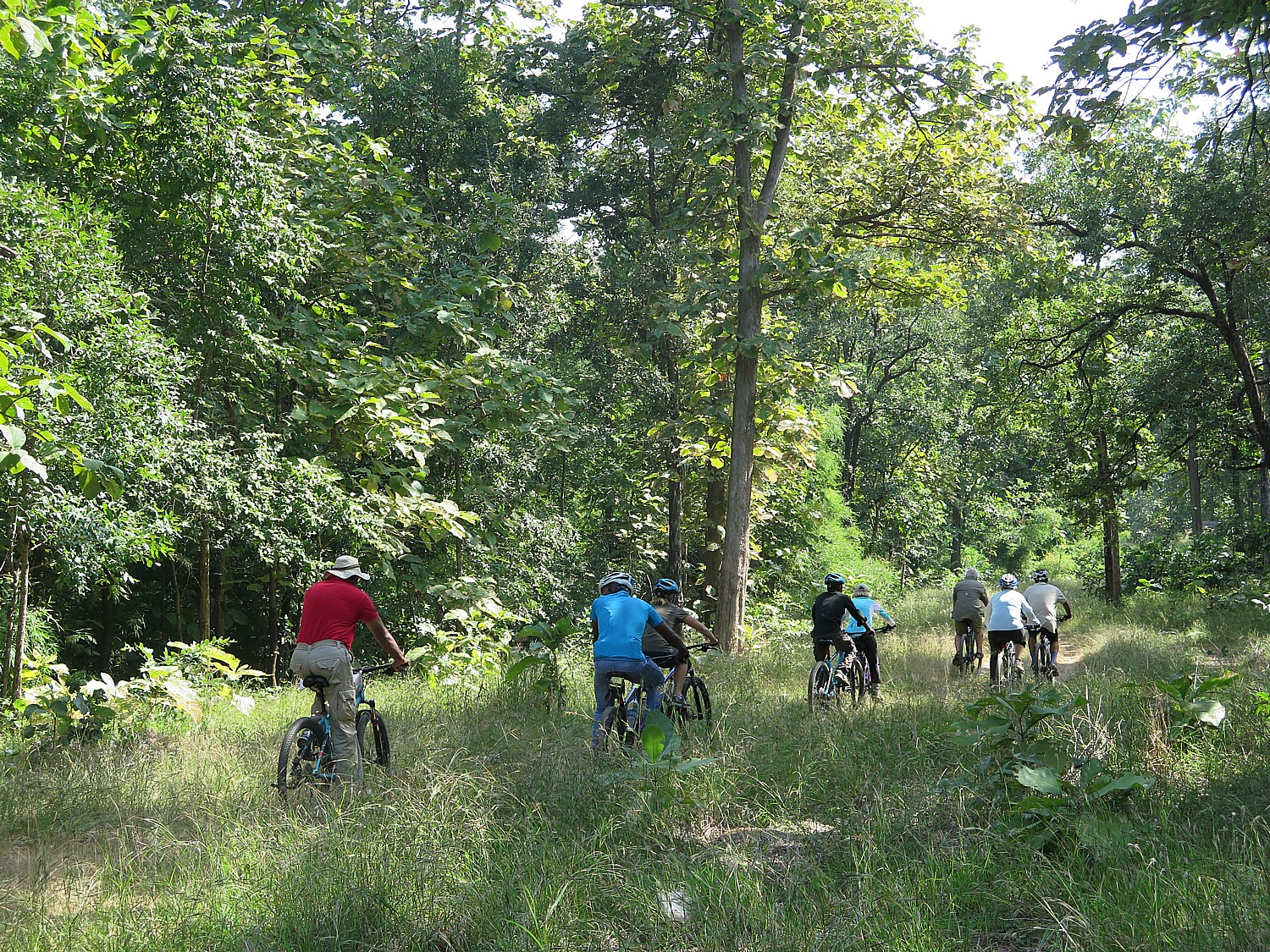
When I signed on to Royal Expeditions’ new “Jungle Book Wildlife Safari & Cycling Adventure” in India, I couldn’t believe or even visualize the concept of cycling through a wildlife sanctuary populated with tigers, leopards, sloth bears, wild dogs, langur monkeys and jackals. And Royal Expeditions which devised this innovative, out-of-the-box trip, set in the same region as Rudyard Kipling’s beloved 1895 story, didn’t ask how fast I could ride (or, for that matter, whether I had any experience in single-track off-road biking). But here I am, on a rough cut, overgrown, rolling trail that serves as a forest corridor between the two national parks known for tigers – Pench and Kanha – where animals, including tigers, roam freely. This is confirmed when a naturalist who rides along with us points out tiger pugmarks (paw prints) in a sandy section of the trail we are riding.

Biking through the Forest Corridor linking Pench and Kanha National Parks in central India, populated with tigers, leopards, sloth bears, wild dogs, langur monkeys and jackals © 2016 Karen Rubin/goingplacesfarandnear.com

At one point, I find myself (inexplicably) well ahead of our group (which has as many guides, cycle experts and leaders as we tourists), including a jeep and a van loaded with supplies with snacks and our lunch that will be set up at the end of a ride in a guesthouse.

Here I am, in a stretch of high, dense grass that reaches up to my knee, with dense forest on both sides. I decide this isn’t the place to be alone – after all, the naturalist said that the tigers who live here (there are 8 who live in the corridor, and about 120 between the two national parks) are craftier, more intelligent, because they have less food (that is, not as many deer and monkeys to munch), that they take advantage of the denser forest growth to surprise their prey, and are less used to humans (which I take to mean less afraid of humans and I am not particularly reassured that tigers don’t like the smell or taste of humans – how do they know?). Putting that together, I realize I am the slowest prey around, so I ride back to meet up with the riders, recalling that old adage: you don’t have to be the fastest, just faster than someone else.

That thought plays around in my mind, adding  to the adventure and sense of bravery – courage – that I’ve known only a couple of times in my life – that makes the exhilaration you feel after the ride- and not just from the physical challenge  – all the sweeter and richer. It’s a sense of personal triumph, of overcoming fear (of course, the danger was minimized by the safari vehicles which followed us and the guides who accompanied us, outnumbering our small band, not to mention we are here in mid-day when the scariest animals are least likely to be out and about and hunting. Still.

Fording a stream on the Forest Corridor ride © 2016 Karen Rubin/goingplacesfarandnear.com

That 25 km ride proves the most challenging cycling of Royal Expeditions’ unique and creative “Jungle Book Wildlife Safari & Cycling” tour. Vishal Singh, who designed the trip, said it was more challenging than expected because it was so soon after the rainy season. But it is exhilarating and thrilling and totaling fabulous – that sense of actual adventure and physical challenge – that also includes crossing a stream (I chicken out and find a place to walk across rocks).

Most of the rides we take are challenging in their own way, but go through villages and past farms, giving us a unique perspective on local life.

The itinerary is set in the same region that provided the setting for Rudyard Kipling’s “Jungle Book” which he published in 1895, in central India, cycling through the same jungles (the word is Hindi for “forest”).

Biking on the Forest Corridor between Pench and Kanha National Parks © 2016 Karen Rubin/goingplacesfarandnear.com

This corridor, we are told, plays an important part in the conservation of the tigers – by linking the two national parks, which between them have about 120 tigers, helps promote diversity in the gene pool, and provides protected habitat for their long-term survival. Other tiger habitats in India are fast becoming islands and there is little change in genetic pool of the tiger population. The landscape also supports diverse land use, and traditional forest dwelling tribal communities.

Our visit, we are told, also has the function of raising awareness among local communities of the part they play in wildlife conservation (indeed, just days after our visit, Vishal Singh is leading a 160 km fundraising ride that goes along the entire forest corridor linking Pench and Kanha, to supply locals with smart phones so they can alert authorities to poaching).

Time for a snack! Taking a break on our ride through the Forest Corridor © 2016 Karen Rubin/goingplacesfarandnear.com

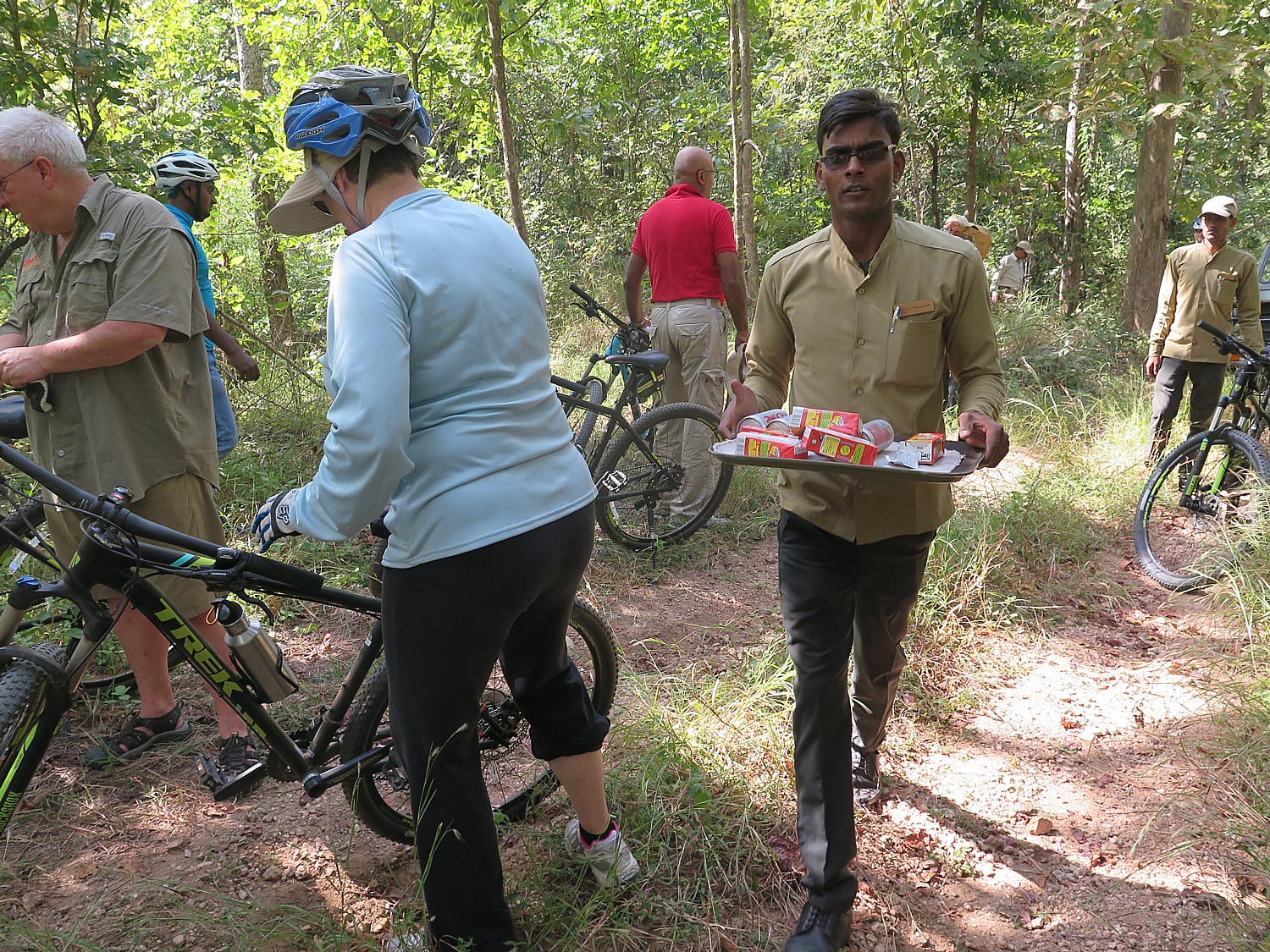
A safari vehicle and van follow behind us (in case somebody can’t finish the ride). Every time we stop, a couple of fellows guys jump out, smartly dressed in their Pench Tree Lodge uniforms, and refill our water bottles, offer drinks in glasses, and offer snacks on a silver tray.

Our ride is accompanied by Sagor Mahajan, our naturalist from the Pench Tree Lodge, who stops along the way (as much as to give us a rest as to impart wisdom) to point out spiders interesting trees and plants, and tell us about work been done by conservation organizations to save this critical landscape.

The giant wood spider female eats the male after mating © 2016 Karen Rubin/goingplacesfarandnear.com

For once in my life, I’m more fascinated than afraid of these gigantic insects: he points to a funnel web spider which makes an elaborate funnel and lives inside; and a giant (really gigantic) female wood spider (the male is much smaller and the female eats the male after mating unless there is some better food available). He says they make bullet-proof jackets out of its web that is four times stronger than stainless steel. He points out Wandering Gliders – dragonflies that are the longest migrating insect, traveling from India to southern Africa, taking four to five generations to cover the distance; many bird species depend on the migrating gliders for food. As for how they know where to go? The wind temperature and humidity give them the direction and some suggest that the magnetic induction of the earth plays a part, like for sea turtles.

He points out lichen on a tree, which is a sign that there is no pollution in this forest (significant considering that while we are in India, New Delhi has had to close its schools because the air pollution is so severe); indeed, the clear, crisp air is one of the reasons so many Indian people escape to these parks for relief.

When we come upon tiger pugmarks, he shows us how to identify that it is male (more rounded toes), while the female’s is more pointed.

I learn that tigers are endangered while leopards are not, and it has a lot to do with the way they have evolved. Leopards can climb trees so have access to more prey like monkeys, and hunt mainly at night. A tiger male will only mate with a few females, and if she has cubs, will kill them in order to mate.

A village within the Forest Corridor © 2016 Karen Rubin/goingplacesfarandnear.com

The last 5 K of the 25K ride takes us through villages and passed farms where we watch people working in the fields, using scythes to cut down rice, and plows pulled by bulls. Our ride ends at the Sakata Forest Rest House, built in 1903 for the officers who patrolled the area (tourists can rent rooms here), where the staff of the Pench Tree Lodge sets up a fantastic lunch which we enjoy under a thatch-covered pavilion.

Watching the flow of everyday life © 2016 Karen Rubin/goingplacesfarandnear.com

We are among the first to do this cycling trip through this sanctuary – when you think about it, people are not allowed out of the safari vehicles otherwise, but here we are, on our bikes, or walking about with nothing between us and the wild animals who live here. Vishal Singh, the managing director of Royal Expeditions, who accompanies us on this trip, has used his personal connections (his company was founded by a royal family of Jodhpur and connected to a Princess who also served  in Parliament and as the Minister of Culture), to convince the officials who control the sanctuary to issue permits for our cycling adventure.

Biking through a village © 2016 Karen Rubin/goingplacesfarandnear.com

Some experiences are billed as “adventure” and wind up being as tame as a Disney themepark ride (though I have new respect for Disney’s Animal Kingdom safari ride). This really is adventure – even more than I had imagined it would be – actual mountain biking where we need to navigate rocks, sand, gravel, ruts, tall grass, descents and some climbs, and a small stream.

Lunch at a 1903 guesthouse, prepared by the Pench Tree Lodge is our reward after our 25K bike trip through the Forest Corridor between Pench and Kanha National Parks © 2016 Karen Rubin/goingplacesfarandnear.com

After lunch, Vishal offers us the option of biking back along the same forest corridor – that is, 25K back, and this time, mostly uphill through the same high grass and broken, sandy and gravel trail. Not to mention it is already about 3 pm in the afternoon and it took about 4 hours to get here. We are really quite tuckered from what we have done, so everyone opts to pile onto the safari vehicle which has followed after us, along with the van that has been carrying the bike trailer (in case someone couldn’t finish the ride). We take satisfaction in the fact that it is even a difficult, rumbling ride back in the vehicle – and really can’t believe we did this by bike.

Pench Tree Lodge 

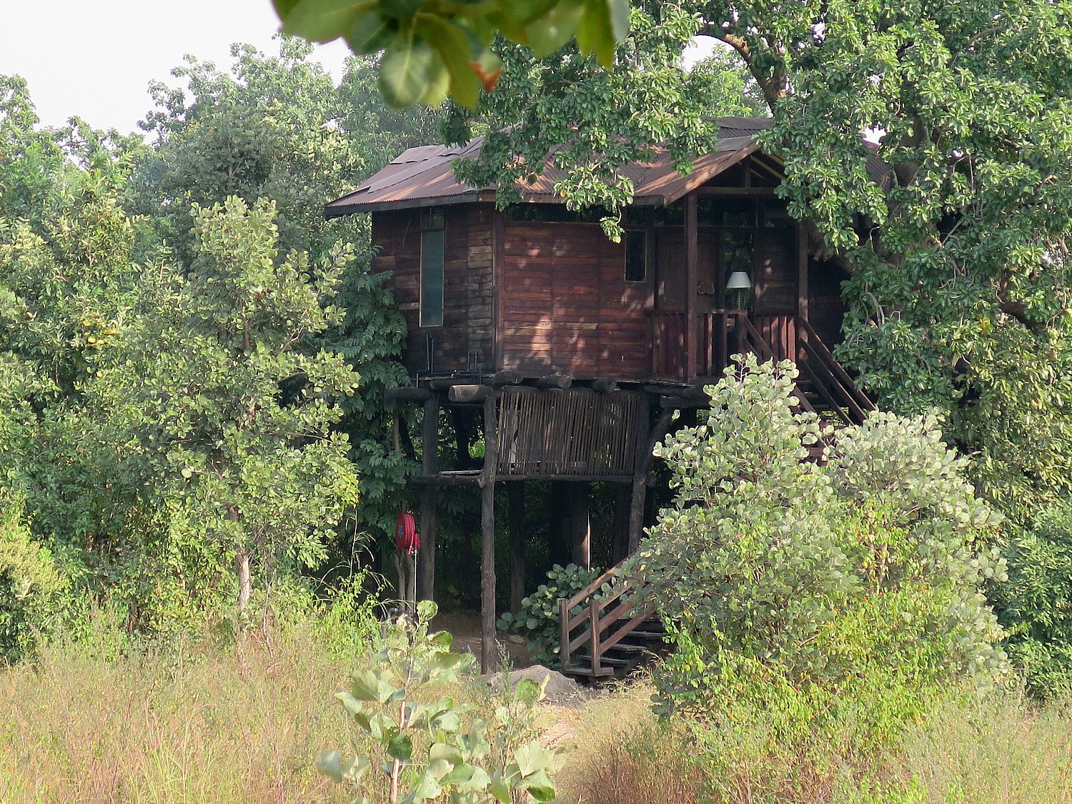
What makes the experience all the more special are the accommodations: My room at Pench Tree Lodge (www.PenchTreeLodge) which only opened in 2016, is literally a tree house, built of all natural materials, but with stunning design, local and traditional art, and every comfort and amenity you could crave. There are just six of these tree house accommodations, spread over 16 acres (including a fantastic lap-size swimming pool (so much fun to swim and watch the green parakeets flying above). Meals, prepared by a sensational chef, Pankaj Fulera, (he was runner-up for Best India Chef and is equally adept at traditional Indian cuisine as fusion Continental, are served in a charming dining lodge where there are also lovely sitting areas. One night, they set up a dinner outside, under the boughs of a tree I call the Tree of Life, with firelight.

Our own treehouse at the Pench Tree Lodge © 2016 Karen Rubin/goingplacesfarandnear.com

Pench Tree Lodge is located near the Karmajhiri gate into Pench National Park, which is gets a lot less tourist traffic and you really feel immersed in local life.

The forest region (“jungle” is the Hindi word for forest) is where Rudyard Kipling set his story of Mowgli, the boy raised by wolves, and his nemesis, Shere Khan, the tiger. During the course of our visit in Pench, which includes game drives into Pench National Park, we see many of the characters that populated his story and the landscape in which they thrived. Later, I learn that there may be some truth to the legend.

For more information, contact Royal Expeditions Pvt. Ltd. www.royalexpeditions.com, [email protected]or Royal Expeditions’ North American representative: [email protected], 720-328-8595.

Next: “Jungle Book Wildlife Safari & Cycling Adventure” in India continues

____________________

© 2016 Travel Features Syndicate, a division of Workstyles, Inc. All rights reserved. Visit goingplacesfarandnear.com and travelwritersmagazine.com/TravelFeaturesSyndicate/. Blogging at goingplacesnearandfar.wordpress.com and moralcompasstravel.info. Send comments or questions to [email protected]. Tweet @TravelFeatures. ‘Like’ us at facebook.com/NewsPhotoFeatures
Pennsylvania’s Industrial Past Highlights Day 3 on Rails-to-Trails Sojourn on Great Allegheny Passage


The third and final day of Rails-to-Trails Conservancy’s spring sojourn on the Great Allegheny Passage offers the starkest contrasts between a trail reclaimed for nature and the industrial heritage that both built and destroyed this region’s environment © 2016 Karen Rubin/goingplacesfarandnear.com

By Karen Rubin, Travel Features Syndicate, goingplacesfarandnear.com

(After meeting up at Homestead, PA and bussing to the start of our Rails-to-Trails Conservancy’s first springtime Sojourn, a three-day biketour on the Great Allegheny Passage, we rode 33.5 miles from Harnedsville to Adelaide on Day 2, a ride highlighted by a sidetrip into Dunbar to see Donald Trump’s donation of Pascal’s ‘Seated Torso’ glass sculpture to the historical society. Our adventure continues.)

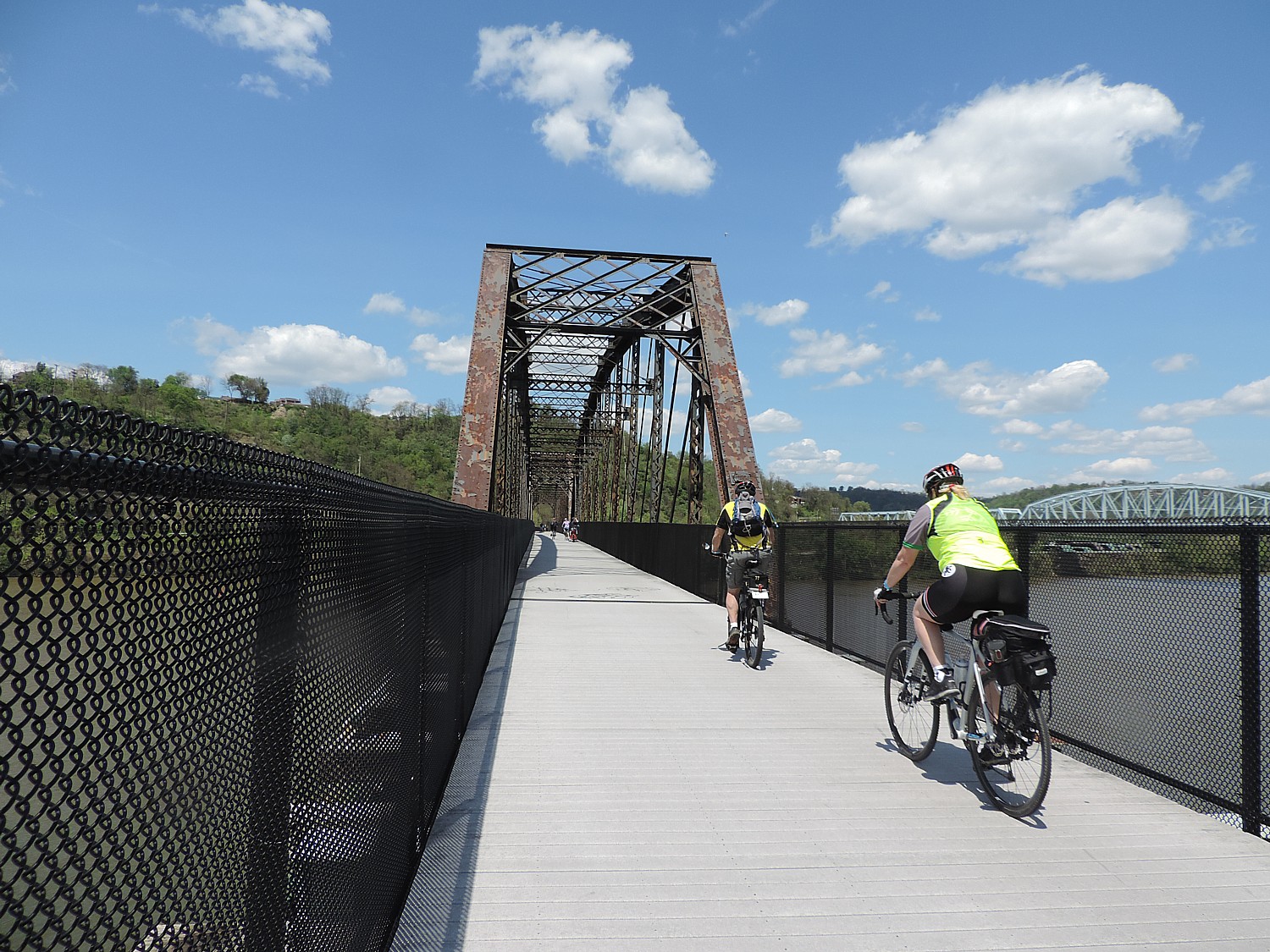
The last day of Rails-to Trails Conservancy’s first spring sojourn, a three-day supported bike tour on the Great Allegheny Passage, is our longest ride, 49 miles from Adelaide to West Homestead, and, unlike our first two days which have been essentially downhill, has a good number of ascents, to boot – mostly as we come into the urban area and have to ride up and over bridges and overpasses.

This ride offers the starkest contrasts between the wholesomeness of a trail reclaimed for nature, and the industrial heritage that both built and destroyed this region’s environment.

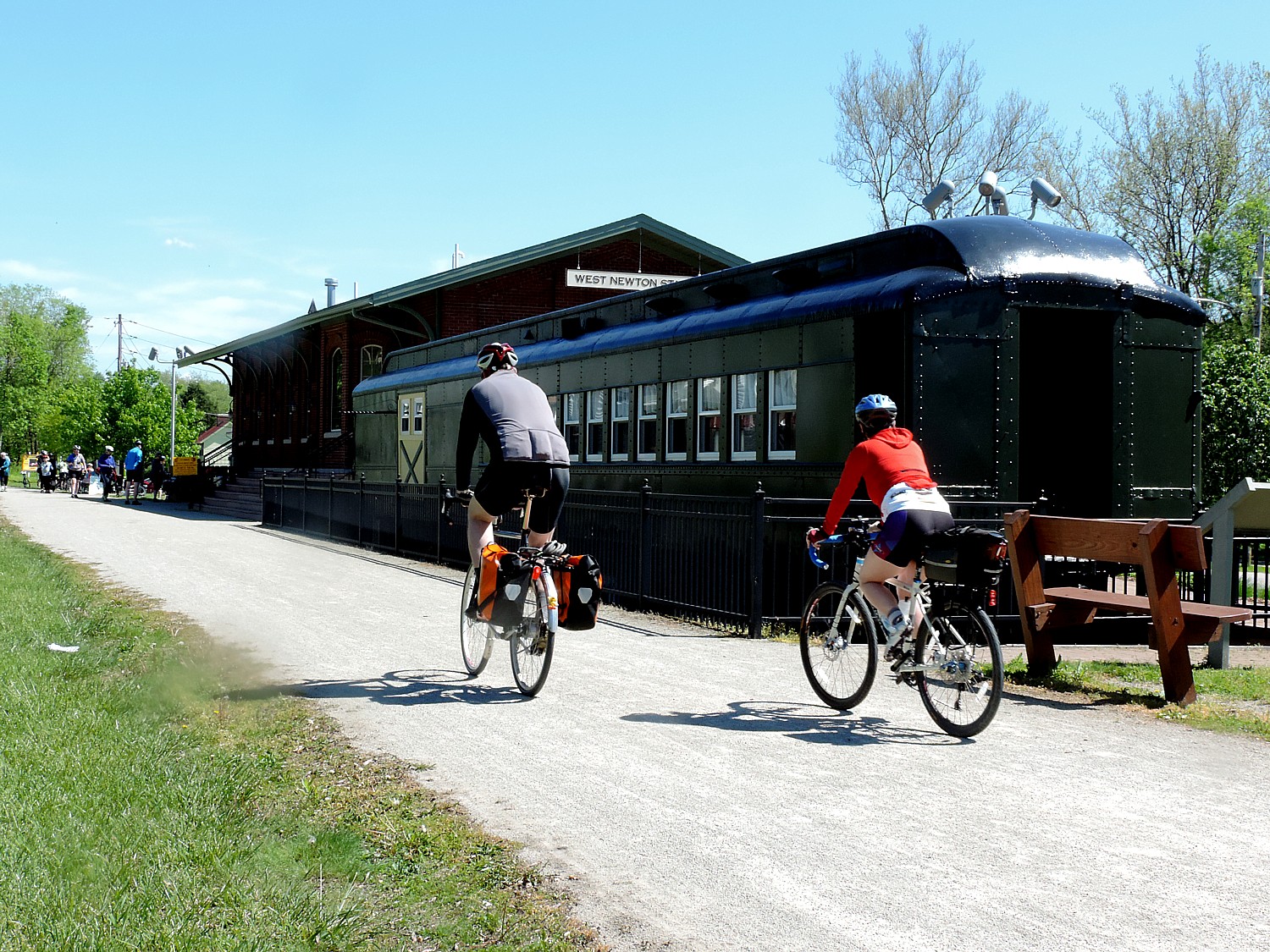
West Newton has a replica of the 1910 P&LE train station, now a historical society and visitors center and retail shop, with a historic train car outside © 2016 Karen Rubin/goingplacesfarandnear.com

We have three support stops. The second, at 21.9 miles, is in West Newton at a replica of the 1910 P&LE train station, now a historical society center and retail shop, with a train car outside. Literally across the “street” are three bed-and-breakfasts, right off the trail.

If you took the time to explore the downtown, you would find some quaint storefronts (some needing new owners), and some tucked away gems like the Victorian home on Vine Street, the historic Plumer House (circa 1814) on South Water Street. I take time to explore the historic West Newton Cemetery, accessible from the trail.

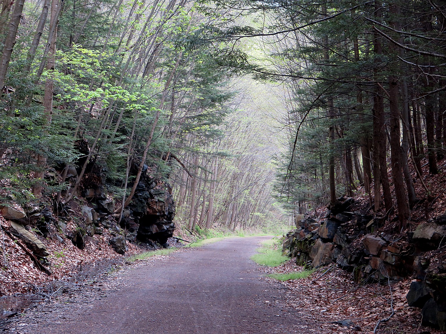
The trail follows the Youghiogheny River with beautiful scenic views.

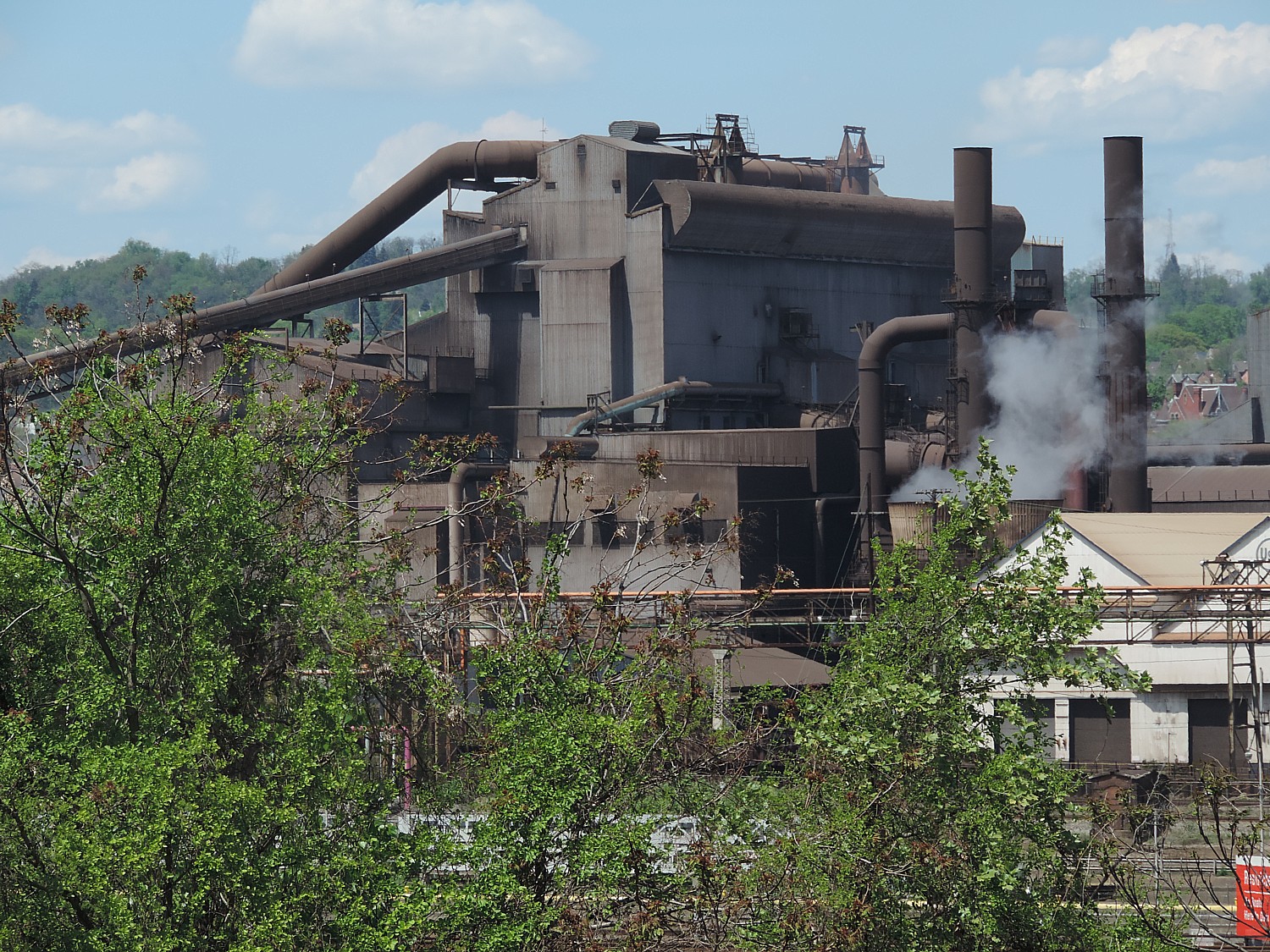
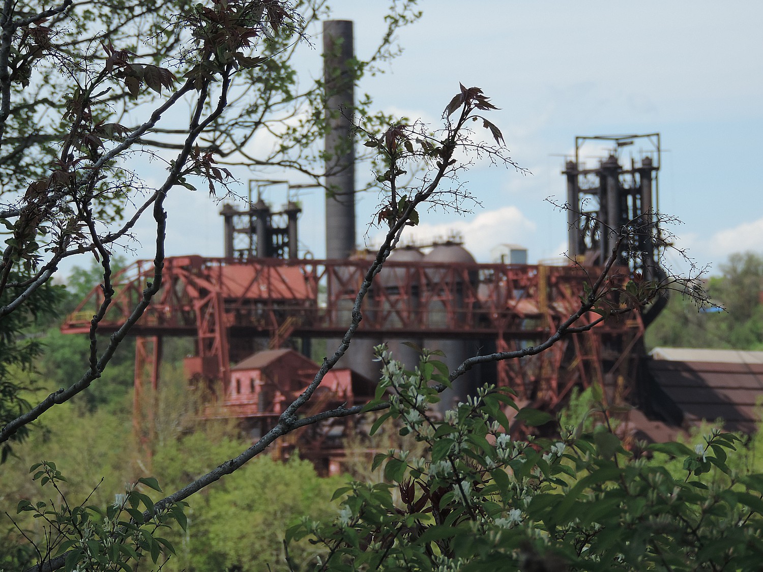
In the 1890s, this area that we ride through that seems so natural and so pristine today, was the Industrial Heartland of America – steel mills, coke ovens filled the air with suffocating black smoke, blighting the area and making it unhealthy to live.

Pittsburgh’s industrial past comes into view © 2016 Karen Rubin/goingplacesfarandnear.com

“They didn’t have the number of trees we see now,” Tom Sexton, the Northeast Regional Director for Rails-to-Trails Conservancy tells us during our nightly presentation. “The skies were so dark, they needed to use lights during the day.”

But these steel mills also were enabled the expansion of the United States– forging the bridges,  railroads, skyscrapers – and the booming industrial economy that made the United States a world power. The wealth generated – and the economic policies – produced the Gilded Age, a time of great income inequality, when money and power was concentrated in a handful of Industrial Barons like Andrew Carnegie and Henry Clay Frick, among the richest people in the world, whose steel plants accounted for 30% of all the steel produced in the US.

We associate Carnegie and Frick today as great philanthropists, but they were ruthless industrialists who exploited labor and the environment for their personal benefit.

Sexton cites a book, “Meet You in Hell: Andrew Carnegie, Henry Clay Frick, and the Bitter Partnership That Changed America, by Les Standiford, who drew his title from Frick’s response to Carnegie’s deathbed invitation to meet: “I’ll meet you in hell,” Frick responds, perhaps a reflection of the penance they would have to pay for the hellfire they forced their workers to endure.

Carnegie and Frick were enthralled by efficiency, developed new processes, new tools to maximize productivity and manpower, Sexton tells us. That helped them add to their fortune, but “wasn’t a good lifestyle for people living and working in the steel and coal plants.

“They cut costs in all ways.” For example, workers lived in company towns and had to shop in company stores where prices were high. People were working 12 hours a day and wanted  a shorter day.

“Being efficiency experts, they did study and found that after 8 hours, worker wasn’t so productive, less efficient, so they reduced the work day to 8 hours.”

Still, conditions were abominable and on July 4, 1892, the steel workers went on strike. After a bloody battle, followed by the state militia ultimately quashing the labor action months later, in November, Carnegie Steel reinstated the 12-hour day as retribution.

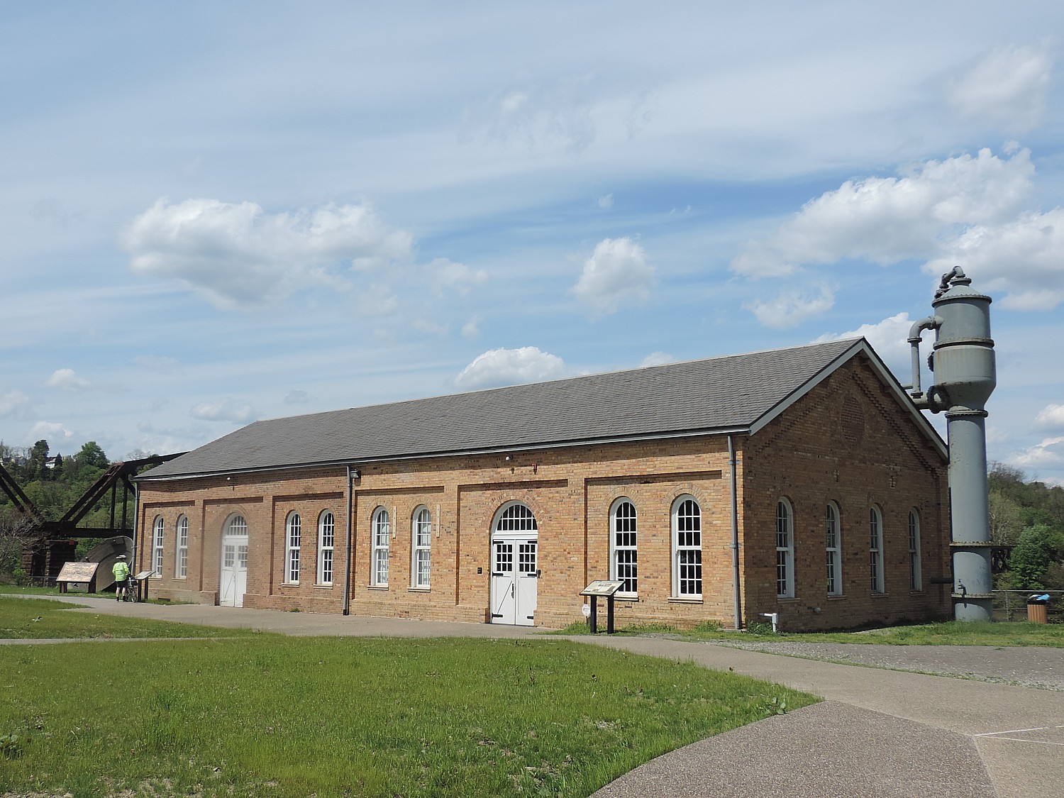
Sexton relates this story because our ride will take us passed the historic Pump House in West Homestead where the bloody labor battle took place.

Sexton’s story is in my mind as we ride, as I reflect on the glorious landscape. To think this whole area was so blighted – didn’t have the trees, the clear clean air, the clean rushing water that is so intoxicating now.

Indeed, the ride is gorgeous up until Boston where there is a beautiful park and we have our third support stop. Then, just as we ride through some trees, it is like culture shock because the trail becomes very urban – broken and winding, and then plops you out to a street beside the railroad tracks.

We go through a series of streets before getting back on the trail, going up and over several railroad crossings, past shuttered factories.

This is the part of the ride when we get to peer back into the landscape of the Industrial Revolution and get a greater appreciation of the clean pure air and the trees and clean water that we had been seeing along the GAP.

The historic Pump House, from 1892, marks the place of a bloody battle of Homestead, where striking workers first battled Pinkertons and later state militia© 2016 Karen Rubin/goingplacesfarandnear.com

The most interesting part of the ride is when we come to the Pump House at West Homestead, the site of a bloody strike which Sexton has described to us, the site in 1892 of one American Labor’s bloodiest battles. I frankly might not have stopped (though there is also a restroom there for the benefit of the GAP trail riders) and spent as much time inspecting the site were it not for Sexton’s orientation.

Notes from the site tell the story: “In the early morning hours of July 6, 1892, at the Pump House of the Carnegie Steel Company’s Homestead Works, thousands of workers, their families and supporters, armed with sticks, rocks, and guns rushed to meet two barges coming up the Monongahela River.  The barges carried 300 Pinkerton guards who had been sent to protect the works during the Homestead Strike and Lockout.

“After bitter fighting throughout the day resulted in the deaths of seven strikers and three Pinkerton men and dozens of others wounded, the guards surrendered.  They were then forced to “run a bloody gauntlet” while being lead to a temporary jail at the Homestead Opera House until they were sent out of town by rail the next morning.

“Henry Clay Frick, Andrew Carnegie’s partner, convinced Pennsylvania Governor Pattison that Homestead was under “mob rule”. On July 12, 1892  the governor ordered 8,000 state militiamen into Homestead. The strike and lock out continued until November when unskilled laborers asked to be released from their strike pledge. Two days later, the strike ended – the union had been broken. The Battle of Homestead signaled the end of union activity in the steel industry until the 1930s” (riversofsteel.com).

After learning the history of the strike, a sign that salutes steelworkers seems more ironic than respectful: “In honor of the employees, USS. Homestead.” It also happens to be across the street from the offices of the US Steel Corporation.

Pittsburgh’s industrial past comes into view © 2016 Karen Rubin/goingplacesfarandnear.com

As we continue along the riverfront trail, across the way, we see get a sense of how it was – massive factories, small houses built into the hillside, giant churches commanding the highest ground.

The ending of the ride proves the most strenuous – besides the ups and downs as we negotiate the overpasses and bridges, we are fighting against a strong head wind.

Riding over one of the rail bridges converted for biking use on the Great Allegheny Passage © 2016 Karen Rubin/goingplacesfarandnear.com

We continue on for several more miles until we come to the trickiest part of the ride – the shopping mall that has replaced Carnegie’s steel mill – and back to where we have parked, under the smokestacks.

This ride showcases a Rails-to-Trails Conservancy success story – the gorgeously maintained Great Allegheny Passage trail. It exemplifies the renaissance from industrial blight back to clean air and water and a better quality of life.  Besides bringing in visitors who form the underpinning of a new, sustainable economy, the trail directly benefits locals, too – healthy living (the best preventive medicine) while offering families fun activities they can share together.

Complete from Pittsburgh in the west to Cumberland, MD in the east, the 150-mile Great Allegheny Passage connects with the 184.5-mile C&O Canal Towpath to create a 335-mile non-motorized route between Pittsburgh and Washington, DC. AMTRAK offers a walk on bicycle service. (https://gaptrail.org/, 888-282-BIKE).

For more information about the sojourn supported bike tours, visit railstotrails.org/sojourn.

Rails-to-Trails Conservancy, a nonprofit organization headquartered in Washington DC with more than 160,000 members and supporters, is the nation’s largest trails organization dedicated to connecting people and communities by creating a nationwide network of public trails, many from former rail lines. Founded in 1986, Rails-to-Trails Conservancy’s national office is located in Washington, D.C., with regional offices in California, Florida, Ohio and Pennsylvania. For more information, visit www.railstotrails.org or call 866-202-9788.

These rides are organized by Wilderness Voyageurs which offers many different biking and rafting trips including inn to inn biking trips, across the US and international: 800-272-4141, Wilderness-Voyageurs.com.

See also:

Rails-to-Trails Conservancy Takes Cyclists on Sojourn on Great Allegheny Passage

Rails-to-Trails’ Great Allegheny Passage Bike Tour Side Trip into Dunbar Brings Surprise Encounter with TrumpWorld

One Day, Two Nights in Pittsburgh: From Grey to Green, A Proud City Revitalized

36 Hours in Pittsburgh: Point State Park Proves Highlight of Walking Tour

36 Hours in Pittsburgh: Andy Warhol Museum is at Center of Revitalized City

36 Hours in Pittsburgh: Strip District Exemplifies City’s Past, Future

Two Nights, One Day in Pittsburgh: Historic Omni William Penn Hotel Connects to City’s Proud Heritage 

____________________

© 2016 Travel Features Syndicate, a division of Workstyles, Inc. All rights reserved. Visit goingplacesfarandnear.com and travelwritersmagazine.com/TravelFeaturesSyndicate/. Blogging at goingplacesnearandfar.wordpress.com and moralcompasstravel.info. Send comments or questions to [email protected]. Tweet @TravelFeatures. ‘Like’ us at facebook.com/NewsPhotoFeatures
Rails-to-Trails’ Great Allegheny Passage Bike Tour Side Trip into Dunbar Brings Surprise Encounter with TrumpWorld

Biking the Great Allegheny Passage rail-trail, Confluence to Adelaide, PA on Rails-to-Trails’ spring sojourn © 2016 Karen Rubin/goingplacesfarandnear.com.

By Karen Rubin, Travel Features Syndicate, goingplacesfarandnear.com

(After meeting up at Homestead, PA and bussing to the start of our Rails-to-Trails Conservancy’s first springtime Sojourn, a three-day biketour on the Great Allegheny Passage, we start off Day 2 in Harnedsville and ride 33.5 miles to Adelaide. Our adventure continues.)

Yesterday, our first day on the Rails-to-Trails Conservancy’s Sojourn bike tour on the Great Allegheny Passage was mostly under overcast skies and rainy (fortunately after we finished the ride) but today is crystal clear, glorious spring day. This is Rails-to-Trails Conservancy’s first spring sojourn supported bike tour  – these sojourns are designed to showcase rail-trails, transform trail users into advocates and show the value for economic development for trail networks nationwide – and we soon realize the advantages of a spring ride: The leaves are not yet full on the trees so we can see through to the vistas, and have a soft delicacy that makes you think of Chinese painting. The blossoms are out making for gorgeous pastel colors. Butterflies seem to be everywhere, but the pesky insects haven’t yet appeared. There are scores of waterfalls from the spring melt. The weather is cool, sparkling, the air so and pure it is like a narcotic.

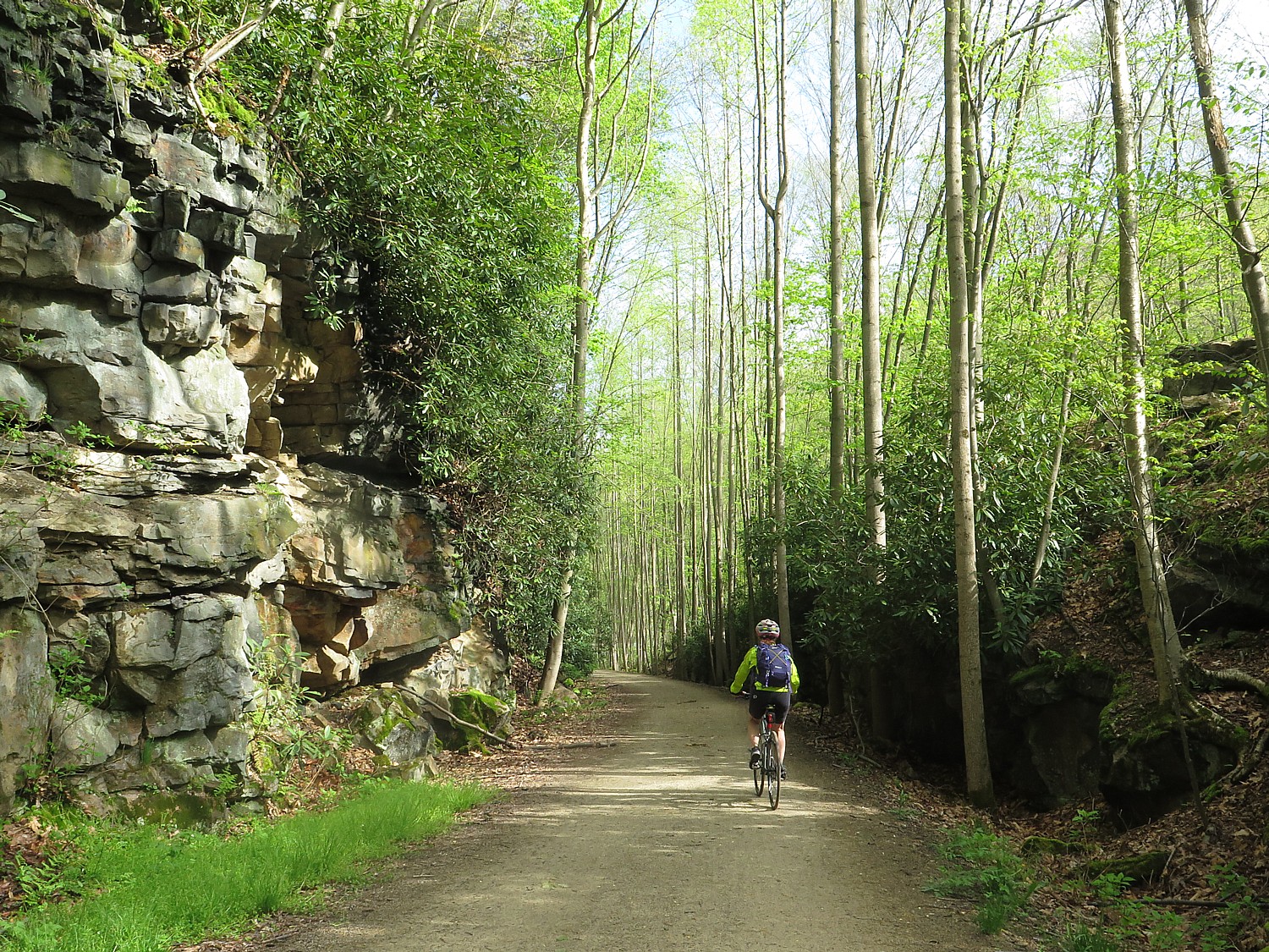
Our group is only 85 riders (owing in part to the fact the ride started on a workday/school day and finishes on Mothers Day). Nonetheless, we come from dozens of states. A woman from Colorado observes that the hardwood trees which line the path, some impossibly tall and straight like tent-poles, create a canopy effect which she doesn’t have. Today, the trees seem to glow in yellow sunlight.

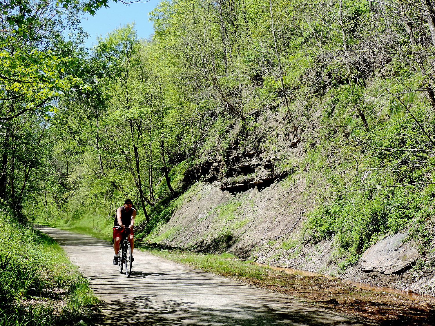
Our ride today from Harnedsville, where we camped on the grounds of the Turkey Foot Valley School, is 33.5 miles to Adelaide, almost entirely downhill. We will drop 500 feet in elevation, overall, and we continue to marvel how well maintained the trail is – wide, flat, crushed gravel.

We ride over a bridge over the Casselman River, then another bridge over the Youghiogheny River, then pass under the highway bridge at Confluence where there is a fisherman casting for trout.

A scene along the Great Allegheny Passage rail trail on day 2 of Rails-to-Trails Conservancy's Spring Sojourn, just outside Confluence © 2016 Karen Rubin/goingplacesfarandnear.com
A scene along the Great Allegheny Passage rail trail on day 2 of Rails-to-Trails Conservancy’s Spring Sojourn, just outside Confluence © 2016 Karen Rubin/goingplacesfarandnear.com

The trail is absolutely stunning. On one side, you see wonderful rock formations – signposts that explain the geology and point to a seam of coal (I find pieces of coal along the path).

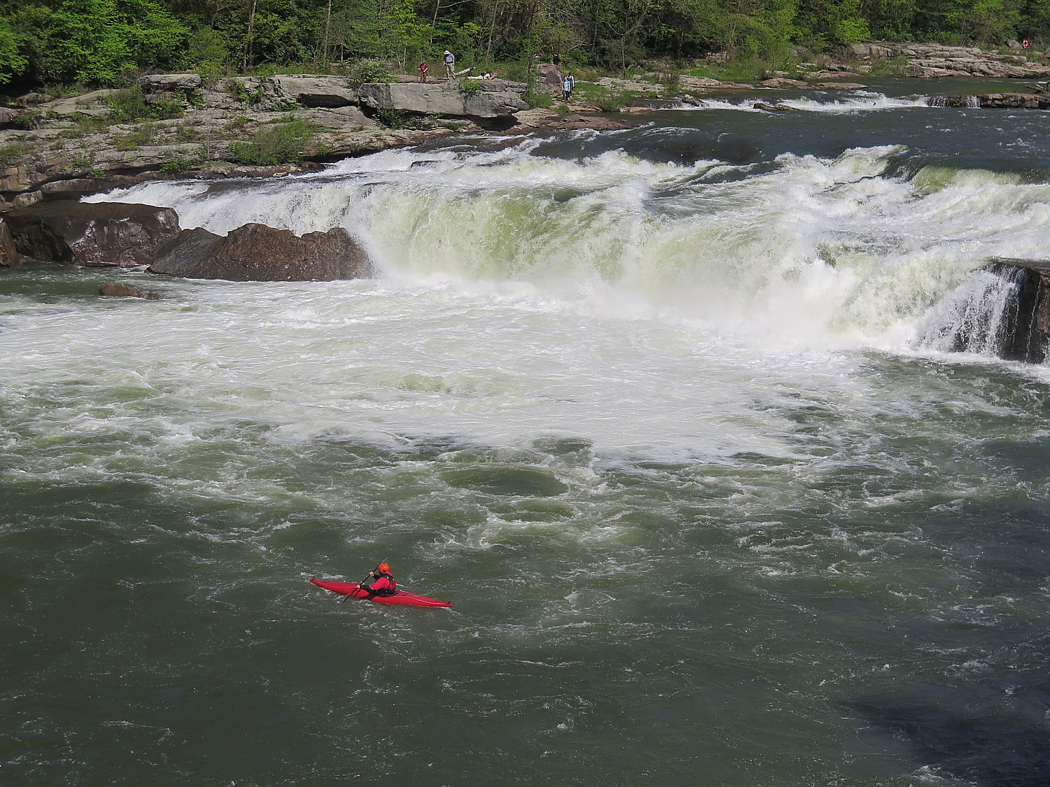
Much of the ride today is through the utterly gorgeous Ohiopyle State Park, and a highlight comes at the town of Ohiopyle, a hub for visiting the park. A short ride off the trail are the 20’ waterfalls across the width of the Youghiogheny River (no luck spotting the Youghiogheny Monster). This is a rafting and kayaking center and for excellent reason– a class 5 river at the top, a class 3 below the falls.

Kayakers at the bottom of the Youghiogheny River falls in Ohiopyle State Park. A new visitors center offers fabulous views and excellent exhibits © 2016 Karen Rubin/goingplacesfarandnear.com

The people are duly proud of their new Visitors Center – an architectural gem wonderfully positioned to let you look out over the falls, while in the lower level, offering excellent exhibits about the area – how water power was central to its development – with interactive exhibits that will engage children.

Wagons and settlers came through on the National Road in 1818. Ohiopyle, itself, was settled in 1891, when it was known as Falls City, and its economy revolved around these rushing waters. The area has always drawn tourists because of the natural beauty. Among the early visitors: Thomas Edison, Henry Ford and Harvey Firestone came in a camper in 1918. Visiting wasn’t cheap – an exhibit notes that a family spent $20 on accommodations and $11 on tolls, at a time when the average worker took home just $11 a month.

But by 1900, the area was already polluted by coal production and lumbering.

Today, though, the natural beauty has been reclaimed. Ohiopyle is at the hub of the 20,000 acre Ohiopyle State Park which features utterly stunning sites including the Youghiogheny River Gorge, Ohiopyle Falls, Cucumber Falls and Ferncliff Peninsula (724-329-8591, [email protected].)

The town now has wonderful shops that cater to visitors, outdoor recreation.

Nearby is Fallingwater, a home designed by architect Frank Lloyd Wright in 1937 for the wealthy Pittsburgh department store magnate, Edgar Kaufmann, Sr. (www.fallingwater.org/2/visit), and Kentuck Knob, another Wright work. (www.friendsofohiopyle.info, 224-329-8591).

The trail from Confluence to Ohiopyle was the first completed section of the GAP – in 1986 – and it is gorgeous.

Riding out of Ohiopyle, I see the Great Gorge hiking trail which goes to Cucumber Falls. I am tempted but I am not sure how far the hike is and how long it will take (next time, I will).

Trees line the Great Allegheny Passage on the Rails-to-Trails Conservancy’s spring sojourn © 2016 Karen Rubin/goingplacesfarandnear.com

Continuing on, there are wonderful hiking trails, and we take a short one just across from where we have our rest stop which is supposed to take us to a view over the Youghiogheny falls. The view isn’t so great, but surrounded by wilderness, it is easy to imagine this landscape when the Indians were the main inhabitants.

We come to a new connector to the Sheepskin Trail, a 34-mile “missing link” between the Great Allegheny Passage, the Potomac Heritage National Scenic Trail and the West Virginia Mon River Trail System.

We ride the new trail from the GAP for 2 miles into the town Dunbar (we had to ride over a rocky half-mile section that is still being finished by the railroad).

Bike-Trail, Trump Sculpture Breathe New Life into Dunbar

Historic buildings such as the George H. Swearingen Store (1901) are testament to the Dunbar’s former prosperity as an industrial center © 2016 Karen Rubin/goingplacesfarandnear.com

Dunbar is the poster child for a town blighted by the loss of industry and epochal changes in technology, but here you also witness the beginning of a revitalization largely because of the rail-trail. But its history has always been that way: new technology and new industry that brings new people, and funds new structures and institutions. The entirety of the Industrial Revolution, supplanting the agrarian economy, was that way.

Settled in the 1790s, Dunbar was originally called Frogtown. It was renamed for Col. Thomas Dunbar who fought in the French & Indian War along with General Braddock, and helped retake Fort DuQuesne (now Fort Pitt) in Pittsburgh, taking from the French and important hub from which it wanted to control its colonial empire (as I have learned from my visit to the Fort Pitt Museum there, www.heinzhistorycenter.org/fort-pitt/).

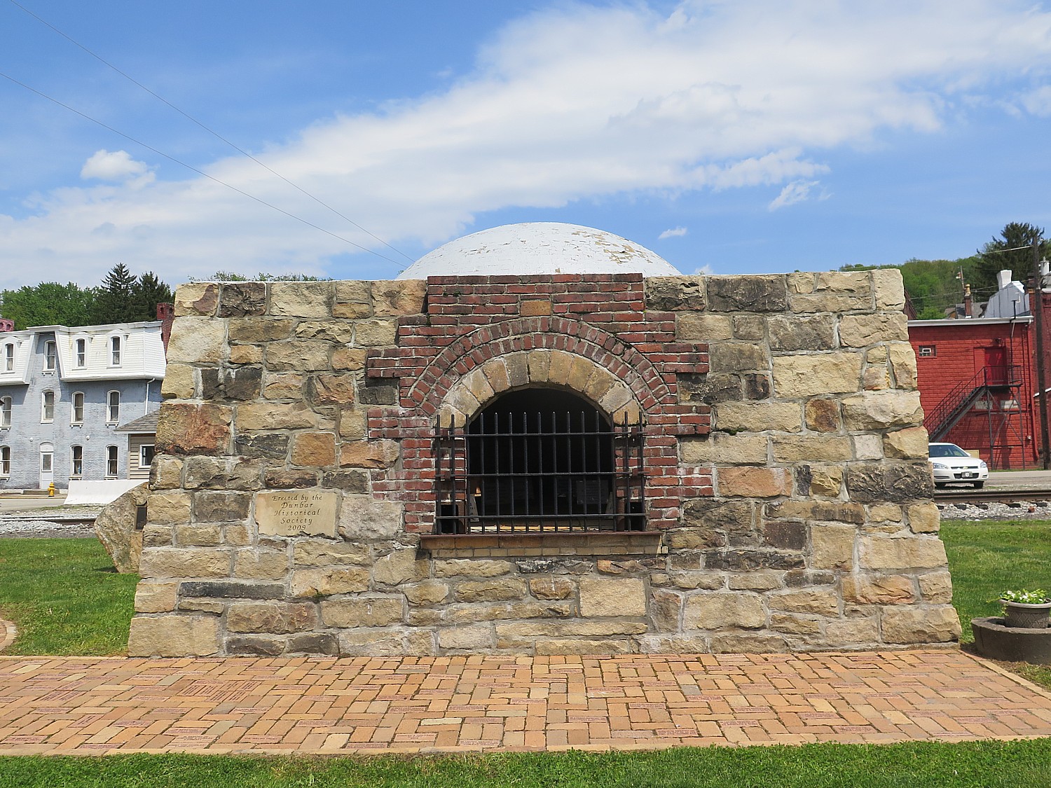
Historic coke oven in Dunbar’s town park © 2016 Karen Rubin/goingplacesfarandnear.com

In 1793, Isaac Meason set into motion an industrial revolution in Dunbar when he opened his Union Furnace #1 (I later see a street named for Meason). This became Dunbar’s lifeblood over the next century. One of the coke ovens now has a place in the town park, alongside a creek, adjacent to the railroad tracks. All around the town are the brick buildings that are testament to the prosperity – at one time, there were five banks. From the time of Meason’s first iron furnace through the 1950s, Dunbar was home to Dunbar Furnace, Pennsylvania Wire Glass Company (it was a leading glass making center), Bluestone quarry, among others, plus several mines and coke oven sites. Today, we see some wonderful historic buildings from the turn of the last century, such as the George H. Swearingen Store (1901) just across from the railroad tracks.

Except for the little league baseball game going on and the activity at the Historical Society, the town is eerily vacant – almost like a movie set.

The rail-trail is breathing new life into towns like Dunbar. Last year, RTC centered its Sojourn ride around Dunbar, a sleepy town of 1900 people, camping overnight in the Coke Oven town park, and all 300 riders, who hailed from 36 states, were personally greeted by the mayor. He appreciated what this event could mean to its economic development (the ride alone injected $245,000 into the local economy.

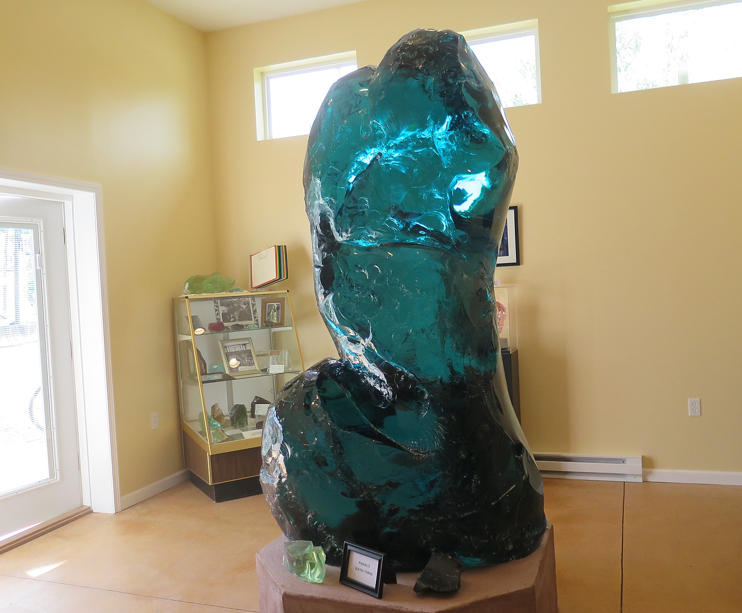
Donald J. Trump commemorates his largesse in donating Pascal's "Seated Torso" glass sculpture to the town of Dunbar, where it is housed at a new Historical Society annex © 2016 Karen Rubin/goingplacesfarandnear.com
Donald J. Trump commemorates his largesse in donating Pascal’s “Seated Torso” glass sculpture to the town of Dunbar, where it is housed at a new Historical Society annex © 2016 Karen Rubin/goingplacesfarandnear.com

This year, there is a major new attraction in Dunbar which really will draw people: an 8 x 5 foot, 2,800-pound glass sculpture, “Seated Torso,” by French artist Pascal, who visited Dunbar in 1961 when it was still a major glass-making center, as the Pennsylvania Wire Glass Co. was going bankrupt and closing down, donated to the tiny town by none other than Donald J. Trump.

The Dunbar glass was unusual because it was so tempered, it resisted splintering when struck with a hammer, and Pascal could attempt what no one else had accomplished, sculpt glass. She purchased a 4,000-pound hunk of the glass, according to an account published in Triblive.com.

“Pascal spent 15 to 20 years carving ‘Seated Torso,’ [her daughter Jill] Petty said. It was purchased in 1994 for $3 million by billionaire John Kluge, who at the time was considered one of the richest men in America.

“Kluge, who died in 2010, displayed the sculpture in a domed rotunda at his Charlottesville, Va., estate. When tycoon Donald Trump acquired the estate for a winery, he needed the space for other purposes, and a search was on for a home for the piece, said Kerry Woolard, general manager of Trump Winery.”

So, the Trump people decided to return the sculpture to where the glass had originated. Then it was up to the town to raise the tens of thousands of dollars to build a place to display the piece and get it to Dunbar, including $16,000 to remove the roof from the domed structure in Virginia in order to extricate it, Trib Live’s Liz Zemba reported.

(I have no doubt Donald Trump took a $3.5 million tax deduction for his largesse.)

Artist Pascal’s “Seated Torso” glass sculpture now housed in a new Dunbar Historical Society annex should be a major draw to the town © 2016 Karen Rubin/goingplacesfarandnear.com

We visit on the day that the Dunbar Historical Society is unveiling the new space, the Pascal Annex, that houses the Seated Torso and offers quite a fine exhibit of the artist, as well as a framed photo and letter from Donald J. Trump. We are also treated to a bottle of 2008 vintage Trump “red wine.” (Dunbar Historical Society Center, www.dunbarhistoricalsociety.com, 724-277-8800).

It is fascinating to see the contrast between Dunbar and Connellsville, just a few miles away on the trail.

Connellsville is located on the banks of the Youghiogheny River – new, beautiful homes have been built between the bike trail (once the railroad) and the river.

Connellsville was once known as the “coke center of the world” – for the coke ovens that heated the coal to produce steel. In the early 1900s, beehive ovens “lit up the hillsides” (you can see ovens between miles 93 and 94) and there would have been rail lines and streetcars crisscrossing the city.

We pass the Youghiogheny Opalescent Glass Factory, with painted silos (part of the public art program along the rail trail that we have been enjoying).

The trail takes us through the West Side (formerly the town of New Haven). In the renovated Yough River Park, where we have our support stop. We pass by a re-creation of Col. William Crawford’s 1766 Cabin and Spring House, and one of 16 Heritage Trail signs that you can follow on a two-mile walk or ride to explore the city – another indicator of pride people have in their heritage.

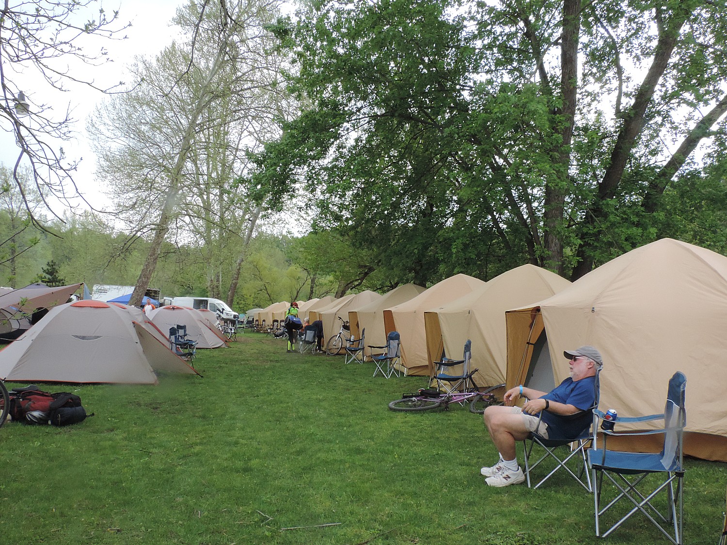
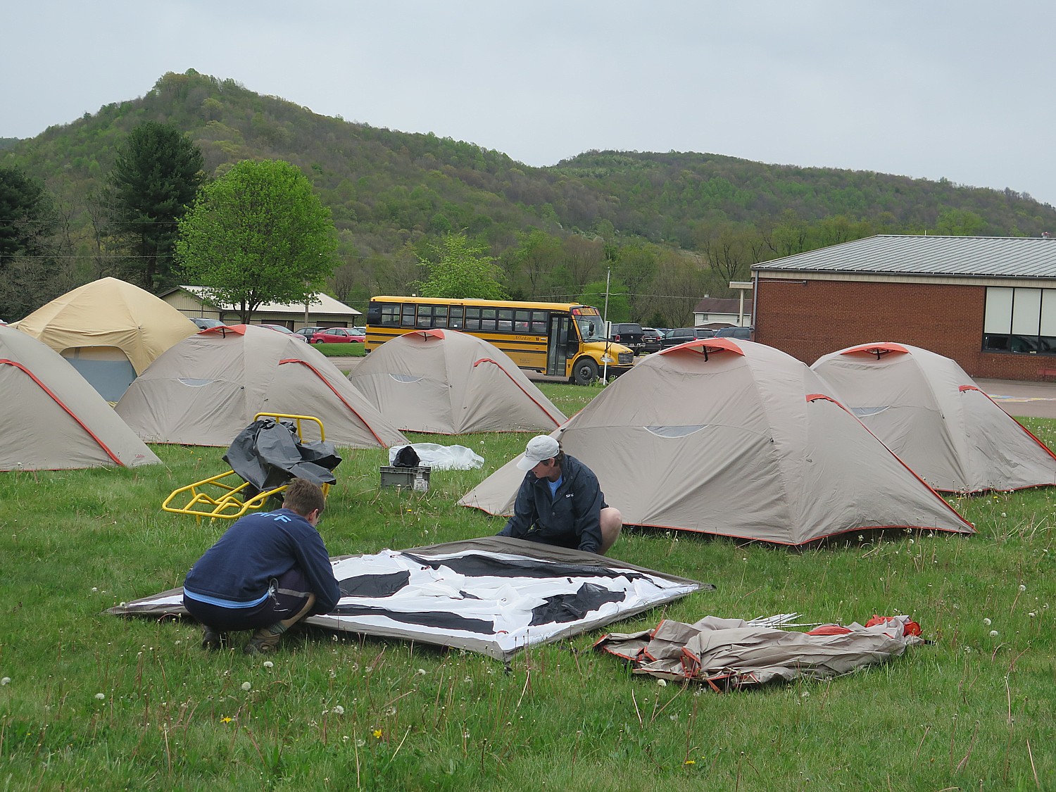
The end of our 33-mile ride on Day 2 of Rails-to-Trails Conservancy's Spring Sojourn on the Great Allegheny Passage takes us to the ROA camping resort in Adelaide, where Comfy Campers has already set up tents © 2016 Karen Rubin/goingplacesfarandnear.com
The end of our 33-mile ride on Day 2 of Rails-to-Trails Conservancy’s Spring Sojourn on the Great Allegheny Passage takes us to the ROA camping resort in Adelaide, where Comfy Campers has already set up tents © 2016 Karen Rubin/goingplacesfarandnear.com

We come to the KOA at River’s Edge- a camping resort that borders both the rail-trail and the river, which seems luxurious to us (there are inner tubes available and other water sports equipment, including a pool which is not yet open for the season. We enjoy a BBQ dinner under a pavilion and the other amenities of a camping resort. It is Saturday night and the resort offers a DJ that plays until 10 pm.

For more information about Rails-to-Trails Conservancy rides and to register, visit railstotrails.org/sojourn.

Next: Great Allegheny Passage bike tour takes us back to Homestead’s turbulent industrial history

See also:

Rails-to-Trails Conservancy Takes Cyclists on Sojourn on Great Allegheny Passage

One Day, Two Nights in Pittsburgh: From Grey to Green, A Proud City Revitalized

36 Hours in Pittsburgh: Point State Park Proves Highlight of Walking Tour

36 Hours in Pittsburgh: Andy Warhol Museum is at Center of Revitalized City

36 Hours in Pittsburgh: Strip District Exemplifies City’s Past, Future

Two Nights, One Day in Pittsburgh: Historic Omni William Penn Hotel Connects to City’s Proud Heritage


____________________

© 2016 Travel Features Syndicate, a division of Workstyles, Inc. All rights reserved. Visit goingplacesfarandnear.com and travelwritersmagazine.com/TravelFeaturesSyndicate/. Blogging at goingplacesnearandfar.wordpress.com and moralcompasstravel.info. Send comments or questions to [email protected]. Tweet @TravelFeatures. ‘Like’ us at facebook.com/NewsPhotoFeatures
Rails-to-Trails Conservancy Takes Cyclists on Sojourn on Great Allegheny Passage


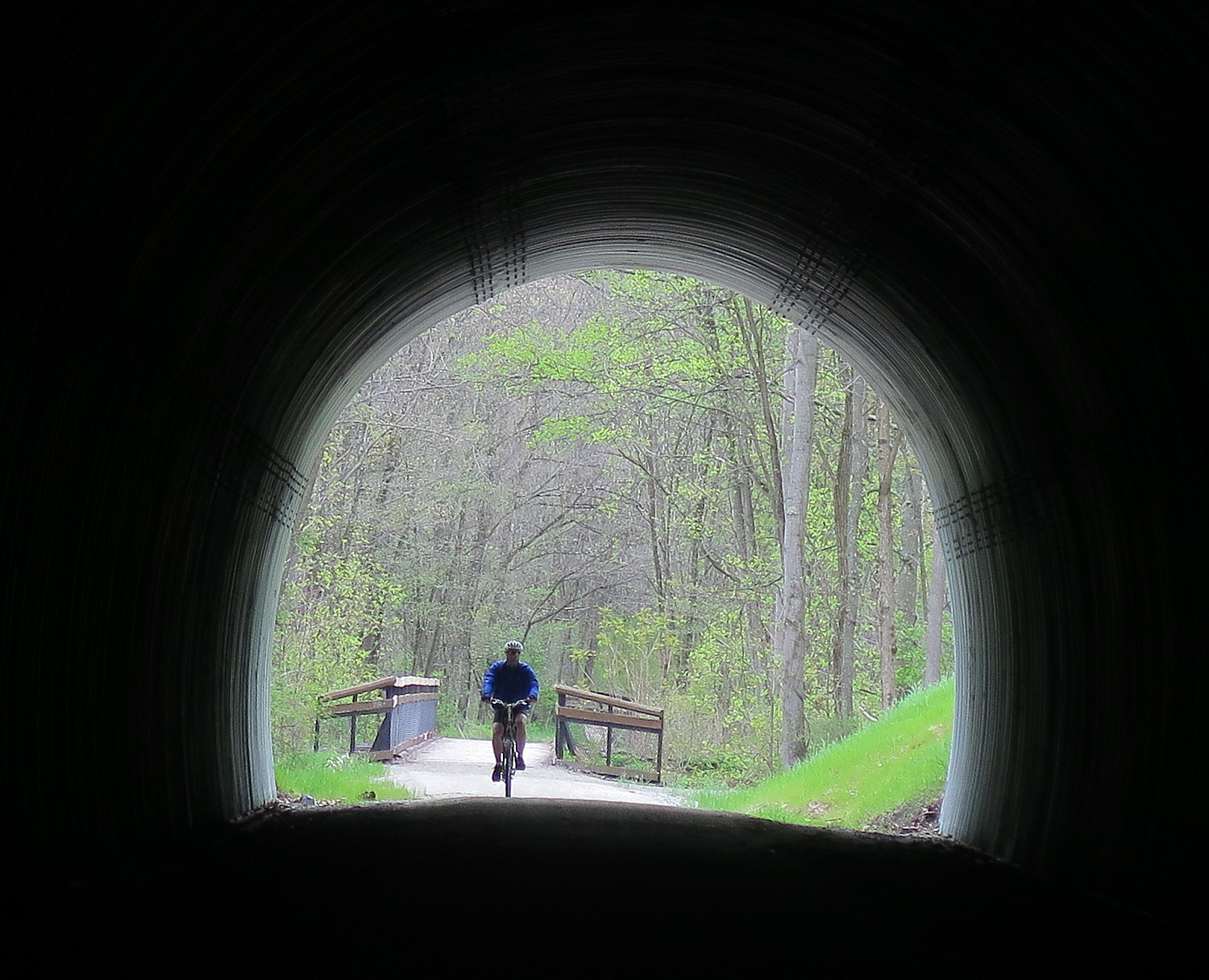
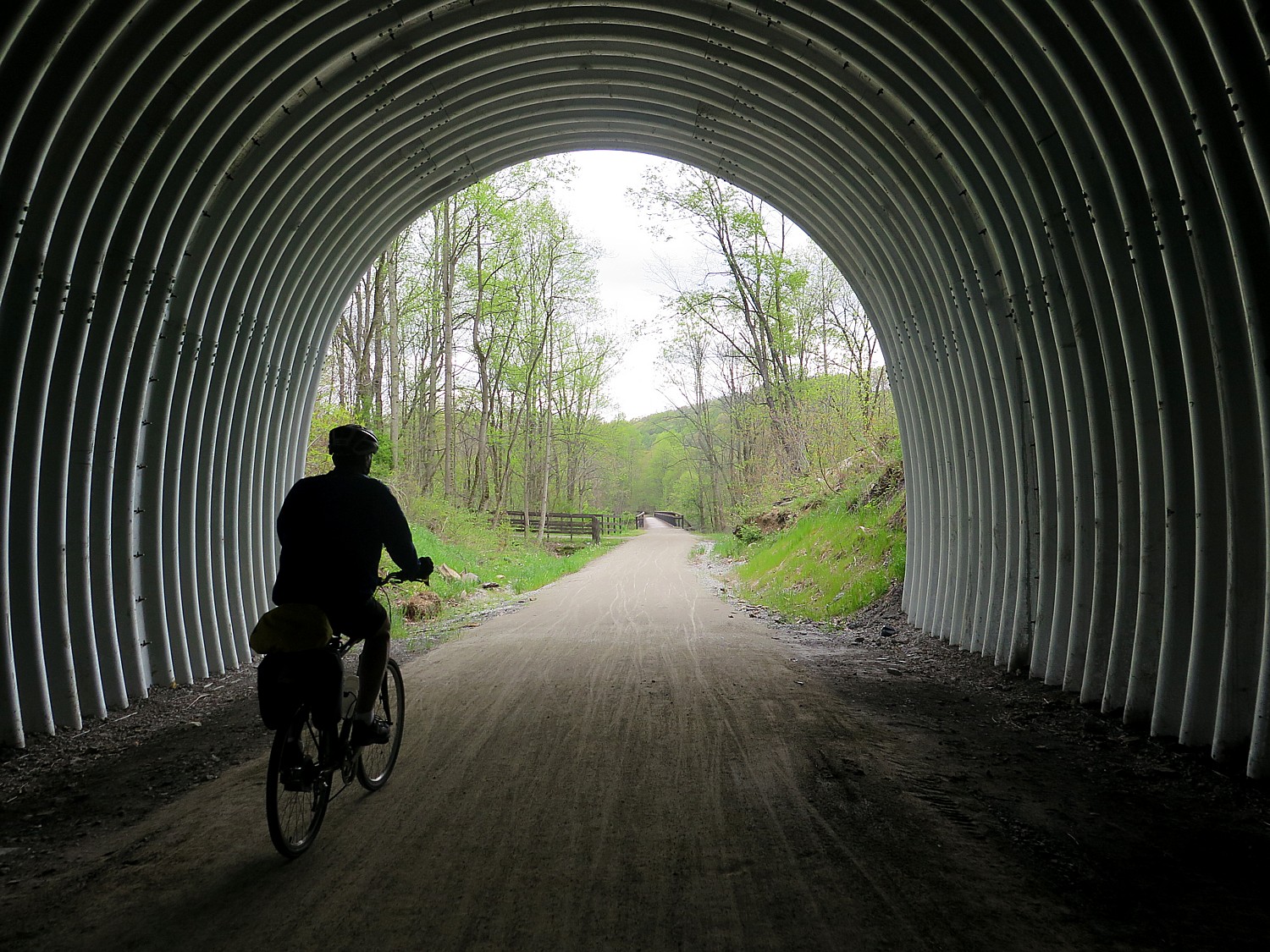
A highlight of this section of the Great Allegheny Passage ride is going through the Pinkerton Tunnel, only recently rebuilt and reopened © 2016 Karen Rubin/goingplacesfarandnear.com

By Karen Rubin, Travel Features Syndicate, goingplacesfarandnear.com

I’m the first to arrive at the appointed spot beside the tall brick smokestacks that border the parking field of a shopping mill, where once one of Pittsburgh’s mighty steel mills had been. It’s 6:30 am, but one of the leaders of the Rails to Trails Conservancy’s Great Allegheny Passage Spring Sojourn is already here. Gradually over the next half hour, our group of 85 riders comes together. We bring our bikes, now with our “license plate” to a truck, load our luggage and camping gear, board the two buses, and drive about 1 ½ hours to where the start of our three-day, 120 mile ride begins, in Meyersdale.

Meyersdale is just nine miles down from the Eastern Divide – the equivalent of the Continental Divide, a highpoint in the Allegheny Mountains. The Great Allegheny Passage (GAP), a relatively new, dedicated rail-trail completed in 2013, actually starts in Cumberland, 32 miles from where we begin our sojourn. The GAP links to the 184.5-mile C&O Canal trail that comes out of Washington DC, and extends 150 miles westward to Pittsburgh, creating a 335-mile non-motorized route between Pittsburgh and Washington, DC. (AMTRAK offers a walk on bicycle service; https://gaptrail.org/, 888-282-BIKE).

We are starting our ride below the Divide, so our trip today, 27 miles, will be a gentle decline totaling 600 feet. Had I been cleverer, I would have done what a few others did, and go back the nine miles up to the Divide, which would have added about 1 ½ hours to the ride. (

We are greeted at the Meyersdale train station, now converted into a delightful café and shop, by representatives of the Meyersdale Merchants Association. We are part of the repurposed, renewed, sustainable economy, now that the rail line, steel and coal extraction have shut down. The rail-trail has brought new visitors, and new vitality, to these small villages and towns all along the Great Allegheny Passage.

This is Rails-to-Trails Conservancy’s first spring sojourn, and it takes place over Mothers Day, no less, which accounts for our group being smaller than a typical sojourn – just 85 riders instead of over 200 which is more typical of the annual sojourn. But this year, RTC is for the first time offering a series of four sojourn rides. The first, in Florida, had already taken place. The third one will be in West Virginia (June19-22); and the last is four-days/three nights from Cleveland to Columbus on the Ohio-to-Erie Trail, Ohio in (Sept. 23-26, 4 days/three nights)..

Riding over the historic Salisbury Viaduct on the Great Allegheny Passage trail, wind turbines on the hillside © 2016 Karen Rubin/goingplacesfarandnear.com

These rides showcase the progress of rail lines that are no longer used converted to biking and multi-use trails, and where there are gaps in the trails that need the support of advocates, communities and government to complete. The Great Allegheny Passage rail trail is on what was the Western Pennsylvania line, which closed in 1975, because it couldn’t compete with the C&O line (that still operates on the other side of the river, and, as it happens, right beside our campsites).

This ride, as it turns out, showcases a success story – the Great Allegheny Passage trail we ride over these three days is exquisite, a testament to the enthusiastic participation and pride of the communities it crosses – wide, with crushed limestone, lovely sitting areas along the way with views to the river, wonderful bridges and tunnels, some bathroom facilities, excellent signage, even “stations” where there are bike repair tools and an air pump. Since its opening, GAP (as it is known) has become one of the most popular trails and was the first inductee in RTC’s Rail-Trail “Hall of Fame.”

Our ride features gorgeous mountain vistas and relaxing river scenes, historic bridges and tunnels that showcase the GAP’s railway heritage. Highlights include Salisbury Viaduct, Casselman River Valley, the Historic Pump House (Homestead) and Great Allegheny Passage Trail towns: Meyersdale, West Newton, Confluence and Ohiopyle.

Offering these supported bike rides is not RTC’s main mission, but the rides are invaluable to raising consciousness and commitment, not just of the riders, but of the communities which are essential. We become ambassadors for the concept of rail-trails,

The Rails-to-Trails Sojourn on the Great Allegheny Passage is a supported ride © 2016 Karen Rubin/goingplacesfarandnear.com

I love these supported rides. RTC’s sojourns are professionally organized by an Ohiopyle-based tour company, Wilderness Voyageurs, which lays out the route, arranges for our camping sites, the trucks, the meals (breakfast and dinner), the support stops.

This ride takes place over Mothers Day, as well as over a work/school day. Nonetheless, there are a number of us who have come on our own, leaving spouse and/or children at home (one mother left her five kids, age 8 to 16 at home with her husband as her Mothers Day gift). These rides are ideal for couples, for families (the ages on this ride range from 8 years old to 82 and a 10-year old can manage the ride), and particularly for single travelers because we become not just a community, but a tribe – a nomadic tribe in fact that picks up stakes and moves on each day. It’s a supported ride which means that our luggage is ferried by truck to the next  designated campground where they have arranged dinner and breakfast, a place to charge our phones, bathrooms and showers, provide support stops (with snacks) along the way, leader/volunteers who ride with us and behind, and support vehicle if anyone can’t complete the day’s ride.

Day 1: Meyersdale to Harnedsville, 27.3 Miles

The first day’s ride starts in Meyersdale in the Casselman River Valley, near Pennsylvania’s highest point, Mount Davis (mile 32 from the start of the Great Allegheny Passage trail).

The area was first occupied by the Monongahela Indians, who harvested the sap from maple trees to make maple syrup – and representatives of the Meyersdale Merchants Association greet us with maple candy samples. Known as “Maple City,” Meyersdale has hosted the Pennsylvania Maple Festival every March for more than 60 years.

The town itself is experiencing a renaissance with rail-trail and the completion of a streetscape project. At the trail access, the Western Maryland Railway Station has been turned into a visitor center, with local history exhibits and a retail store. A mural on Main Street (one of several along the Great Allegheny Passage) pays homage to Meyersdale’s roots as a bustling transportation hub for local agriculture, coal and timber. (www.visitmeyersdale.com).

There is a bit of fan-fare as we set out, going through a blow-up arch.

Countryside just passed the Salisbury Viaduct on the Great Allegheny Passage outside Meyersdale © 2016 Karen Rubin/goingplacesfarandnear.com

It is clear, sunny day as we set out, but the weather forecast is for clouds and rain. But we soon come to one of the highlights of the GAP: going over the Salisbury Viaduct,: 1,912’ long, built in 1908, it is our first crossing of the Casselman River (this turns out to be one of the top 10 photo views). At the other end, we see a line of wind turbines on stretched out over the hilltops – a fitting testament to what is old is new again. I also come upon an old cemetery – a stone there memorializes Peter G. Meyers who died in 1891, and I wonder if he is the founder of Meyersdale.

Our cue sheets (very well done) also point us to the Wymps Gap Fossil Quarry, at 9.0 miles into the ride. During the Mississippian Period (330 million years ago), Western Pennsylvania was the hsore of a shallow sea. The exposed limestone layers are a fairly thin band of fossil bearing rock sandwiched between layers of shale. It’s marked with a wooden post, labeled GR5 (unfortunately, I miss it)..

At 11.9 miles, we pass Rockwood, where we are recommended for lunch options.

Rockwood is described as a tightly knit rural community, with roots in industry and railroading. The town was laid out in 1857 but boomed after the end of the Civil War, with the Baltimore & Ohio Railroad. By 1884, the town had several mils and shops, four general stores, two grocery stores and four hotels.

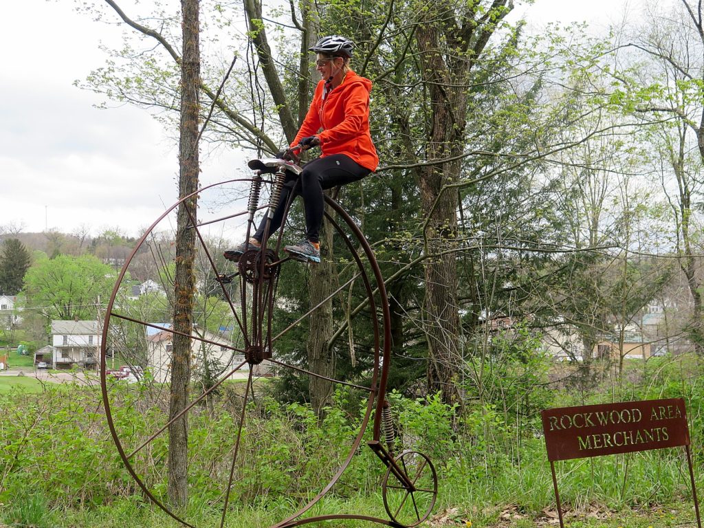
Playful public art pays homage to Rockwood’s heritage and its new commitment to the bike trail © 2016 Karen Rubin/goingplacesfarandnear.com

A locomotive sculpture at the Rockwood trailhead is a link between the town’s rail history and its present-day “investment” in biking and recreation. You cross the Casselman River to get into the town. There is public art, including a mural that honors trail ambassador Maynard Sembower, who died in 2009 at the age of 100 – a reminder that these improvements are the result of sweat and activism of committed individuals.

The most interesting structure is the Rockwood Mill Shops & Opera House, with a performance space. Lumber and feed were processed in the building for nearly a century, while the opera house hosted visiting and local performers above the mill. The building was restored in 2000 and listed on the National Register of Historic Places. (www.somersetcountychamber.com).

The highlight of today’s ride for me comes at 19.9 miles: riding through the 849‘ long Pinkerton Tunnel. The tunnel was originally built in 1911, collapsed and was rebuilt in a kind of a kwansit hut at a cost of $1.8 million and only reopened in 2015. It is very surreal going through it: Inside, a dizzying array of concentric metallic circles – long, dark, with proverbial light at the end of it.

Shortly after, we cross High Bridge over the Casselman River (our third crossing on the GAP today).

The Great Allegheny Passage reclaims a former rail line into a stunning 150-mile non-motorized trail returned to nature © 2016 Karen Rubin/goingplacesfarandnear.com

At 27.1 miles, we leave the GAP and follow the signs they have placed for us, for a couple of turns that bring us just a 2/10 of a mile beyond to the grounds of the Turkey Foot High School (which has been on the USA Today’s list of top high schools) where we will camp.

It’s Friday and school is in session, so we aren’t able to enter the school until after 3:30 pm – a little disconcerting because rain is threatening.

I opt to continue down the trail another two miles to the town of Confluence, so named because it is set where three rivers converge. It’s the shape of the three peninsulas that looks just like a turkey’s foot.

A highlight of this section of the Great Allegheny Passage ride is going through the Pinkerton Tunnel, only recently rebuilt and reopened © 2016 Karen Rubin/goingplacesfarandnear.com

Indeed, in George Washington’s day, this area was called Turkeyfoot by natives and settlers. George Washington, himself, came to the confluence of the rivers in 1754 during the French & Indian War, as he and his soldiers were on their way to the forks of the Ohio River. As we travel the trail in the woods, revitalized and full now that the steel mills and coal mining have shut down, I can easily imagine the wilderness that he saw and the how the Indians would have used the rivers.

The skies have been threatening rain and I return to the campsite.

If we don’t want to set up our own tents, we can use the Comfy Camper service or stay in nearby bed-and-breakfast accommodations. This trip I treat myself to the Comfy Camper service ($118 for the two nights, comfycampers.info, 315-283-0220) and it adds a measure of luxury to the trip: When I arrive, the tent – roomy, comfortable, wonderfully waterproof, with an air mattress, chair and towel – are all ready for me. Shawn Stewart, owner/director, has just finished blowing up the air mattress and I am cozy inside, just as the rain comes down in earnest.

Our dinner is provided by the Turkey Foot Fire Department – another way the Sojourn supports local communities.

Ambassadors for Rail-Trails

Indeed, this is the theme for the Sojourn rides.

During the evening’s presentation, Tom Sexton, Northeast Regional Director of Rails to Trails Conservancy, tells us about the plans to finish the gaps on the trails, and ultimately connect a network of trails stretching through most of the Mid Atlantic.

RTC, in its 30th year, helps finds money and means to build rail-trails. Since 1991, $1 billion spent. Certain amount of transportation money (from fed) has to be spent on things other than highways, airports, bridges, but “other transit.” RTC helps communities, nonprofits, governments come together on how to build rail trail – negotiate with railroad, what surface to use, how to maintain. RTC also offers its members TrailLink – an online tool that helps you find trails and map your ride.

These Sojourns are a means of engaging interest in the rail trials – spotlighting gaps in trails, showcasing successes, and inspiring communities to get involved. The riders become ambassadors – especially with our “license” plates and shirts that announce who we are.

The sojourn also helps show a community (and funding agencies) the economic benefits of trails, as well as its social benefits, building camaraderie, community, and quality of life benefits.

“Towns (like Dunbar) which have fallen on hard times since the railroad left, find the trails revitalize, become the main street. In 15 years since RTC started sojourn rides, we’ve hosted 3400 riders, brought $2.1 billion in spin off to the corridors we ride through.

“We show that an economy built around the rail-trail is sustainable. The money spent stays here, it has low impact. The trail benefits environment and the local people who benefit from trails.”

Indeed, as we ride over the weekend, you see families out and about – the trails provide a healthy, active outdoor activity that families can share together.

RTC has big plans to create a regional network of interconnected trails.

For example, connecting Parkersburg West Virginia, the access for the North Bend Trail (the start of the third Sojourn of this year’s series) to Pittsburgh and the GAP rail trail, which already connects to the 34-mile long Sheepskin Trail out of Dunbar.

Then the idea is to continue on to Clarksburg-Parkersburg trail, which will be 260 miles when finished. At that point, you could start in DC, go to Pittsburgh (on C&O, 183 miles and GAP 150 miles), altogether about 600 miles.

“This is the epicenter of trails in the US,” Sexton says.

But this is only a piece of what is an even bigger grand plan. 

Eric Oberg, Director of Trail Development, Midwest Regional Office, speaks of a “Trails Manifest Destiny”:in describing a sprawling network of 1,450 miles of interconnected multiuse trails that will be called “The Industrial Heartland Trail” which together, would be the largest in the country – from DC to Pittsburgh, to Cleveland –Cleveland-Cincinnati-Dayton, Parkersburg, Indianapolis, up to Erie and Buffalo (where you can then connect to the 400-mile long Erie Canalway). Some 48% of these multi-use trails are done, and the hope is to have it completed by 2035.

“It won’t take 80 years, but it will be more than five years” before the manifest destiny is realized, Eric says.

Comfy Campers sets up comfortable tents with air mattress, chair and towel for those who don’t want that extra luxury © 2016 Karen Rubin/goingplacesfarandnear.com

Sojourn Bike Tours

For the first time in the 14 years of hosting a Sojourn bike tour showcasing a rail-trail, the Rail-Trails Conservancy expanded the series to four rides: the first, in Florida, was held in February; the second on the popular Allegheny Passage in Pennsylvania, was May 6-8. The third was a four-day/three-night North Bend Rail Trail out of Parkersburg, West Virginia (June 19-22; and the last was four-days/three nights from Cleveland to Columbus on the Ohio-to-Erie Trail, Ohio in September.

“The Sojourn Series is much more than just a bike ride. It’s a trail building tool for Rails-to-Trails Conservancy, and allows us to pull advocacy into participants’ trail use experience.”

The Sojourn rides are crafted to weave experiences that go beyond simply riding from point A to point B. Each sojourn aims to transform trail users into advocates and create the economic case for trail networks nationwide.

The West Virginia Sojourn showcases the North Bend Rail Trail out of Parkersburg, West Virginia. “It is an incredible trail but does not yet connect to the two communities on either end, Parkersburg and Clarksburg.” This ride serves to bring attention to those gaps and advocate for their completion. The corridor is also part of a much larger trail development effort being undertaken by the Industrial Heartland Trails Coalition.

“The West Virginia ride will allow you to get on a new trail and take part in some of the advocacy that our organization is known for.”

Since 2001, more than 3,000 riders have joined RTC’s sojourns. These rides not only highlight incredible trails, but they also help empower communities to complete trail networks that will benefit the entire region.

Equally importantly, they highlight the economic benefit to communities, particularly those who have seen older industries shut down, along with the rail lines.

RTC’s 2015 Pennsylvania Rail-Trail Sojourn brought visitors from 35 states and had an economic impact of more than $245,000 – something significant for a town like Dunbar, Pennsylvania, which once depended upon coal and railroads.

The rail-trail could be an engine for a new economy fueled by lodging, restaurants and gear shops. RTC estimates that the GAP would generate more than $40 million in direct spending from trail users annually.

“The Sojourn Series is a real-world example that show how trails can provide an economic boon to local economies,” says Liz Thorstensen, vice president of trail development for RTC. “By providing these rides, we’re creating more opportunities for people to experience and advocate for these trail networks.”

For more information about the rides and to register, visit railstotrails.org/sojourn.

Rails-to-Trails Conservancy, a nonprofit organization with more than 160,000 members and supporters, is the nation’s largest trails organization dedicated to connecting people and communities by creating a nationwide network of public trails, many from former rail lines. Founded in 1986, Rails-to-Trails Conservancy’s national office is located in Washington, D.C., with regional offices in California, Florida, Ohio and Pennsylvania. For more information, visit www.railstotrails.org. 

These rides are organized by Wilderness Voyageurs which offers many different biking and rafting trips including inn to inn biking trips, across the US and international: 800-272-4141, Wilderness-Voyageurs.com.

Next: Great Allegheny Passage Rails-to-Trails Conservancy Sojourn Continues

See also:

One Day, Two Nights in Pittsburgh: From Grey to Green, A Proud City Revitalized

36 Hours in Pittsburgh: Point State Park Proves Highlight of Walking Tour

36 Hours in Pittsburgh: Andy Warhol Museum is at Center of Revitalized City

36 Hours in Pittsburgh: Strip District Exemplifies City’s Past, Future

Two Nights, One Day in Pittsburgh: Historic Omni William Penn Hotel Connects to City’s Proud Heritage

____________________

© 2016 Travel Features Syndicate, a division of Workstyles, Inc. All rights reserved. Visit goingplacesfarandnear.com and travelwritersmagazine.com/TravelFeaturesSyndicate/. Blogging at goingplacesnearandfar.wordpress.com and moralcompasstravel.info. Send comments or questions to [email protected]. Tweet @TravelFeatures. ‘Like’ us at facebook.com/NewsPhotoFeatures
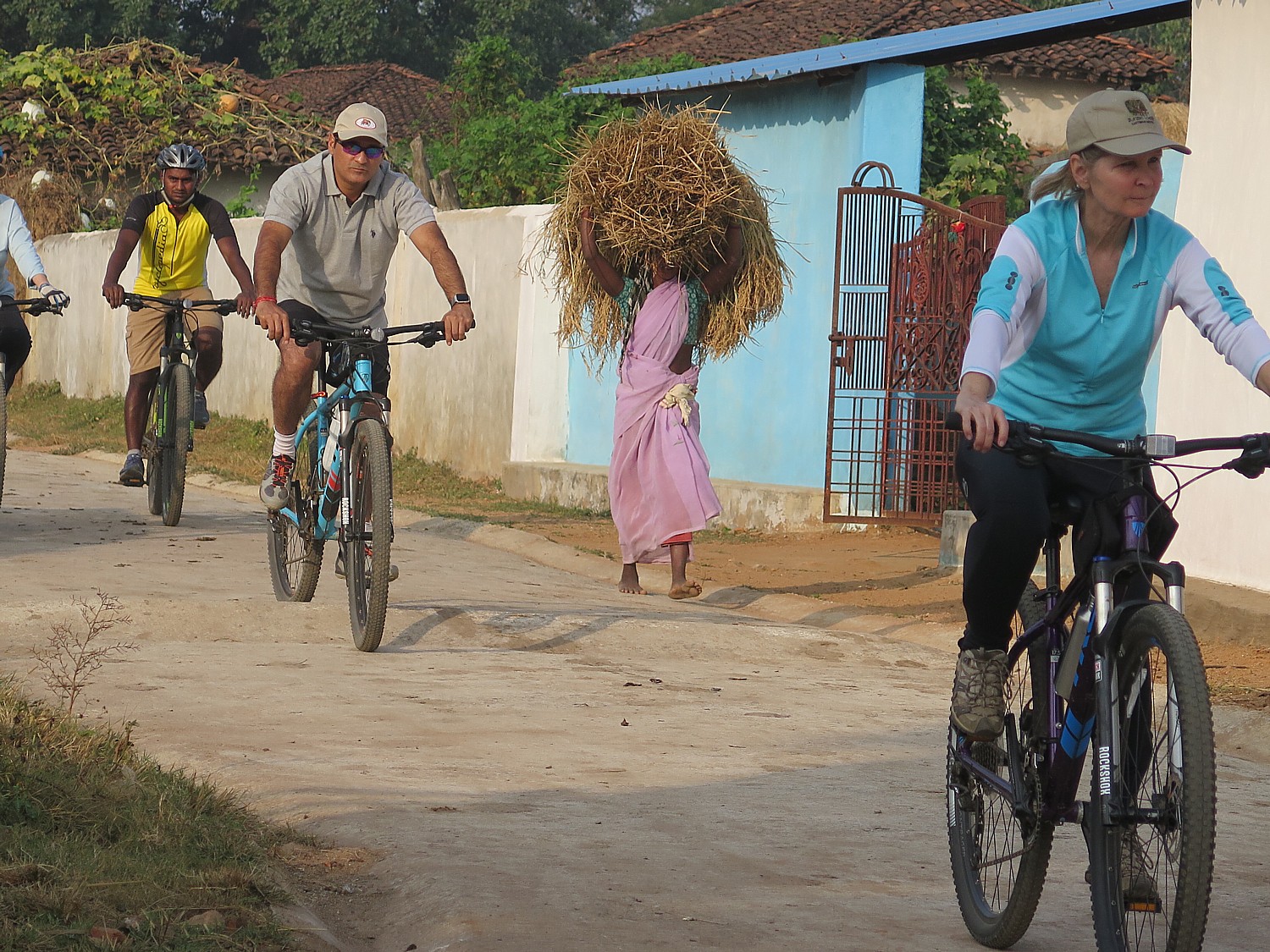


E-Bike Opens World of Possibility for Bike Touring

BikeTours.com President Jim Johnson (left) and Junid (middle) riding e-bikes on the mountain roads of Albania © 2016 Karen Rubin/gongplacesfarandnear.com
BikeTours.com President Jim Johnson (left) and Junid (middle) riding e-bikes on the mountain roads of Albania © 2016 Karen Rubin/goingplacesfarandnear.com

By Karen Rubin, Travel Features Syndicate, goingplacesfarandnear.com

Here’s my dilemma: A chance to see Albania by bike, a country that is steeped in mystery having been secluded behind an Iron Curtain for decades, but so mountainous, it may be too difficult to make the enormous climbs. Or, I could set aside pride and principle and use an e-bike – an electric bike that uses a battery to give an extra push to your pedaling.

I’m a purist and enjoy the physical challenge of biking. I had had an amazing time on Biketours.com’s bike/boat trip in the Greek Isles the year before and know the pain (and accomplishment) of burning lungs that come with tackling the steepest, longest climbs of my life. But the BikeTours experts say that the Greek Isles was a Class 3 ride and Albania would be a Class 4 – with even steeper, longer climbs (and when I look over the day-by-day elevations, one day stands out at being the equivalent of a mile in total elevation gain). So if the Greek Isles was my physical limit, I’m not so sure I can do Albania.

BikeTours.com President Jim Johnson biking in Albania on an e-bike. © 2016 Karen Rubin/goinplacesfarandnear.com
BikeTours.com President Jim Johnson biking in Albania on an e-bike. © 2016 Karen Rubin/goingplacesfarandnear.com

But I also believe that the best way to engage, to discover a destination like Albania is by bike. Cars, buses would never come to these back country roads, roads that have been bypassed by more recently constructed highways, or through villages and neighborhoods. They would go too fast to get any sense at all of moments that, on a bike, you can snatch up and savor, and looking through glass windows puts a layer of unreality. But from the perch of a bike saddle, you move at just the right pace to see things, hear the sounds of cows mooing, the bells attached to goats, the cicadas; you can smell the wild sage growing beside the road, and feel the moist coolness as you ride through a forest. You can stop at a bend in the road to take in the breathtaking views or just get your breath. You can stop – even chat – with a shepherd edging his flock across the road. People wave and call out hello as we ride through a village and we wave and say a cheery “hello” as back. Most important of all, you can stop when you want (as I did most frequently) to take photos.

And, finally, I believe ardently in the quest for knowledge and understanding and ambassadorship that is the essence of travel and particularly, the style of travel of a bike tour, so if the only way to experience Albania is to use an e-bike, I will set aside my pride and principle.

And actually, the e-bike is part of the new experience and I discover a whole new dimension of possibility.

Biking in Albania brings you into villages you would not visit otherwise © 2016 Karen Rubin/gongplacesfarandnear.com
Biking in Albania brings you into villages you would not visit otherwise © 2016 Karen Rubin/goingplacesfarandnear.com

For one thing, I discover other advantages of using an ebike: I can stop for pictures and know I can catch up with the group; I don’t suffer or need to focus exclusively on the ride; I don’t lose sleep over the worry of whether I can manage the next day’s ride. What is more, I discover I can make the ride as challenging as I want (I simply don’t go into an easier setting), so I still get the workout I want and feel the satisfaction of conquering a climb. But most importantly, the priority of this trip is to experience a culture and explore a destination, not a physical work-out or just getting from point A to B.

And finally, what I realize is that the e-bike extends horizons and lifespan for adventure and exploration for many of us who have reached an age where we appreciate biking but are unsure of doing the distance or the hills.

And so I opt for the e-bike for the first time. It takes me about two minutes to figure it out and three minutes to get comfortable.

The e-bike is not like a scooter – you still have to pedal. But to me, it takes the hill out of the climb, making it like pedaling on flat surface (unless you want to retain the challenge, as I did, and keep it at an “Econ” setting, the lowest of three “speeds”, “Norm” and “Sport” being the others). In “Econ”, I find, it makes my hybrid bike, which with the added weight of the battery (about 12-15 pounds) feels like a mountain bike, ride like a road bike.

Biking through Albania’s countryside © 2016 Karen Rubin/goingplacesfarandnear.com

The e-bike that I ride is so responsive – it changes gears immediately, efficiently, at the push of a button (up arrow, down arrow) and I could change speeds if necessary, from “Econ” to “Norm” on a dime, smoothly, without any hesitation or resistance.

I find that on the big hills, by keeping the setting at Econ I still have that physical effort of climbing, but I don’t wind up with burning lungs. And of course, I can just zip up the hills by going to the Norm and for an even greater push, the Sport setting (I never use the Sport setting, and only use Norm a couple of times, when the climb seems never ending).

It makes me feel as if I have superpowers.

The cycling company that BikeTours.com has selected for our tour, Cycle Albania, is relatively new and may in fact be the only company offering bike tours in the country. We attracted attention as we zipped through villages because we were such an oddity.

I am really impressed with the quality of the bikes, manufactured by the Taiwan-based Giant company, which Cycle Albania purchased from the Netherlands. Each of the bikes – the regular hybrids and the e-bikes (probably the only ones in the entire country) – are the best quality, valued at thousands of dollars (in a country where the median income is $5000 a year). They have hydraulic brakes, suspension. (You can bring your own seat and pedals if you want, as does a couple from Oregon, used to climbing hills).

My pedals have screw heads that grip the soles of my sneakers for the extra push without toe clips.

And boy are we grateful for suspension and hydraulic brakes on the Day 6 ride, when we come down a road more like a mountain trail – broken gravel, rocks, potholes, gravel, steep with winding hairpin turns.

I use the e-bike feature of my Giant bike for the first time on the second day of cycling, when we are leaving Ohrid, in Macedonia, one of the oldest human settlements in Europe, and are on the last third of a 35-mile ride. We have three progressively longer and harder hills to climb on our way back into Albania. I just whisk up the hills like nothing – and am only in the “Norm” setting – I didn’t even use the “Sport” setting which gives even more thrust to each pedal stroke.

Biking through Albania’s countryside © 2016 Karen Rubin/goingplacesfarandnear.com

But that’s what it is – it’s like taking the hill out of the ride. You feel like you are riding on flat. You still pedal each stroke, change the gears but each stroke is magnified. You hear a tiny whir of a motor but it isn’t like riding a scooter.

The e-bike is a superb alternative for anyone who has denied themselves the opportunity to discover a destination by bike – the best way in my opinion – because they were afraid they could not go the distance or manage hills. The e-bike is a godsend: destinations and experiences that seemed out of reach can now be conquered. If you felt you had aged out of managing 35 to 50 miles a day on anything but flat rail-trails, e-bikes open up a whole new world, and a whole new dimension.

Many of the BikeTours.com offerings now give an e-bike option.

BikeTours.com 1-877-462-2423 or 423-756-8907, 1222 Tremont St., Suite 100, Chattanooga, TN 37405, biketours.com.

______________

© 2016 Travel Features Syndicate, a division of Workstyles, Inc. All rights reserved. Visit goingplacesfarandnear.com and travelwritersmagazine.com/TravelFeaturesSyndicate/. Blogging at goingplacesnearandfar.wordpress.com and moralcompasstravel.info. Send comments or questions to [email protected]. Tweet @TravelFeatures. ‘Like’ us at facebook.com/NewsPhotoFeatures
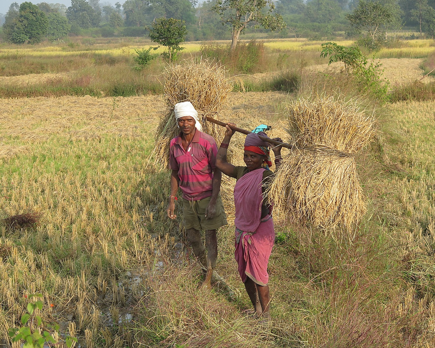
Biking Albania: Saranda & the Albanian Riviera

Saranda, a cosmopolitan resort town on Albania’s Riviera © 2016 Karen Rubin/goingplacesfarandnear.com

by Karen Rubin, goingplacesfarandnear.com

(I travel to Albania with BikeTours.com’s President Jim Johnson on a specially constructed “President’s Tour” itinerary that modifies the regular “Albania’s UNESCO Sites with Rivers, Valleys, and Gorges” trip.  (See: Come to Albania Now to See Emergence of a Young Country-Best Way to Experience Albania is on Bike Tour. This is 7th in the series.)

After our tour of the National Park of Butrint, the extraordinary archaeological site that lets us travel through five époques of civilization, from the Hellenic to Roman, to Ottoman to Venetian, we continue riding our bikes into Saranda, one of the most popular beach towns along Albania’s Riviera, the end of a 70 km ride.

Draped along a curving bay with a narrow strip of beach, Saranda immediately reminds me of some of the smaller, non-posh beach towns of the French Riviera. Riding in, there are any number of new-built apartment houses, many not yet finished (housing bubble, anybody?). We ride down to the beach level where lovely hotels abound, and there is a gorgeous promenade.

Our bike tour turns into a beach holiday, and we get to see a different side of Albania – Albanians at play.

Saranda © 2016 Karen Rubin/goingplacesfarandnear.com

Saranda immediately reminds me of some of the smaller, non-posh beach towns of the French Riviera. Riding in, there are any number of new-built apartment houses, many not yet finished (housing bubble, anybody?). We ride down to the beach level where lovely hotels abound, and there is a gorgeous promenade.

Saranda, formerly known as Porto Edda, named after Mussolini’s daughter, has emerged as a major beach resort on the Ionian Sea, just opposite the Greek island of to Corfu (we watch major cruise ships sailing in the distance toward Corfu). Indeed, it has that cosmopolitan flare we found in Korca, owing to the fact many foreign day-trippers come by ferry from Corfu. There is a very festive atmosphere – and didn’t exist during the Communist reign. Indeed, most of its buildings are post-1990.

Still, Albanian most southern coastal city, only recently accessible, remains unpretentious.

Saranda © 2016 Karen Rubin/goingplacesfarandnear.com

I get the idea that this would be a great place for some Americans looking for an inexpensive place to retire where there is a very pleasant, relaxed, welcoming atmosphere (like in “Best Exotic Marigold Hotel”). It is cheap to live here, where I calculate living costs at about one-fourth to one-fifth of what we expect to pay in the US, and where the median annual income is $5000 (though Albania’s medical infrastructure gets mixed reviews).

Our bike tour turns into a beach holiday, and we get to see a different side of Albania – Albanians at play.

I drop my stuff at our hotel, a very pleasant place which is directly above this marvelous promenade with gorgeous views from my balcony to the beachfront and marina, and go for a swim.

Instead of soft white sand, though, the beach is made of pebbles (bring water shoes, not just flip flops).

Strolling the promenade at night in the resort town of Saranda on Albania's Riviera © 2016 Karen Rubin/goingplacesfarandnear.com
Strolling the promenade at night in the resort town of Saranda on Albania’s Riviera © 2016 Karen Rubin/goingplacesfarandnear.com

Strolling along the promenade after dinner, I mix in with the crowds of people – couples holding hands, groups of friends, families with young children excitedly leaning up to an ice cream stand. There is a gay, carefree spirit.

This could be Coney Island, Brighton Beach, Long Beach, Jones Beach.

Across the water there is a loud dance place, with bright lights flashing; they shoot off fireworks.

Nighttime in Saranda © 2016 Karen Rubin/goingplacesfarandnear.com

(I subsequently learn that just before we arrived here, the city unveiled a bust to Secretary of State Hillary Clinton, but I did not know to look for it.)

(More info at www.visitsaranda.com)

Day 8 Cycling: Himare

Today’s ride, the last of the cycling portion of our specially arranged President’s tour of Albania, is the most arduous and challenging, with a total elevation gain of 1064 meters (and an equal drop), over a distance of 54 km.

Cycling along Albania’s Ionian Seacoast © 2016 Karen Rubin/goingplacesfarandnear.com

We cycle up out of Saranda, along the Albanian Riviera heading north toward Himare, a small Communist-era fishing village. We have mountains to the right and coastal views to the left before descending to the long beach and bay of Potam where we get to swim in the brilliant aquamarine waters of the Ionian Sea, just across the street from our hotel.

Himare, a Communist-era fishing village is an emerging beach town on Albania’s Ionian seacoast © 2016 Karen Rubin/goingplacesfarandnear.com

This ends the biking portion of our trip and I am frankly sad to see our bikes (especially my e-bike, which I have become very attached to) being hauled off in the van by Bato, our wonderful driver. The next two days, we will be traveling by kayak – another special feature of this specially tailored Presidents’ tour.

Seeing the coastline from the kayak is stunning – the blue-to-aquamarine-to-emerald colored water, so clear when you look down; the rocky cliffs that drop straight into the water.

Kayaking to a secluded beach along Albania’s Ionian seacoast © 2016 Karen Rubin/goingplacesfarandnear.com

We paddle about 6 km, pulling into secluded beaches and coves, and get to peak into a couple of small caves. There are any number of these beaches where there are but a handful of people, some of whom are camping out.

Kayaking to a secluded beach along Albania’s Ionian seacoast © 2016 Karen Rubin/goingplacesfarandnear.com

One of the beaches near Himare (also spelled Dhimare), in particular, has a canyon for a backdrop of exquisite beauty.

It is tremendous fun to arrive into the place where you will be staying by kayak.

A canyon behind a secluded beach along Albania’s Ionian seacoast © 2016 Karen Rubin/goingplacesfarandnear.com

Our last two days are spent in Dhermi – a small village that is considered Albania’s #1 beach town – providing us with an unexpected time to just relax and stay put.

Dhermi is considered Albania’s #1 beach town © 2016 Karen Rubin/goingplacesfarandnear.com

This is like the Riviera without any of the pretension. Lounge chairs and umbrellas are neatly laid out; a waiter comes to take drink orders; the roadway (sometimes asphalt, sometimes cobblestone and sometimes dirt and rock) lined with hotels and restaurants.

Here we get more opportunity to hang out with ordinary Albanian families. I am struck to see how parents dote over their kids, how tender, attentive and adoring fathers are with their toddlers, how women are every bit on equal footing with the men, without any kind of self-consciousness. It just is. And how scant the bathing suits. So much for a Majority Muslim country.

Sunset from Dhermi © 2016 Karen Rubin/goingplacesfarandnear.com

On our last evening, Junid, our guide, drives us up to the actual town, Dhermi,built into the hillside, where there is a delightful tavern that has an exquisite view of the sunset.

The next day, on our way back to Tirana, the capital city, where the Mother Theresa International Airport is located, he takes us up to an even higher promontory on the mountain pass, where we get to watch a paragliding club take off and soar down to the seacoast.

Paragliding in Albania © 2016 Karen Rubin/goingplacesfarandnear.com

It is hard to imagine these scenes 35 years ago or even 20 years ago.

This is the new Albania, the young Albania. It is a very different place from even 10 years ago and one only can imagine what it will be like in 10 years time.

“It’s Europe’s best-kept—and maybe last—secret,” says Jim Johnson, president of BikeTours.com. Few foreigners have visited this mysterious country due to decades of Communist rule, dictatorship and isolationism. But since the country opened its borders in 1991, visitors have been awestruck by its untouched nature and rich culture and the overall uniqueness of this truly special place.

“Albania still remains undiscovered by mass tourism, setting it apart from other European destinations. In Rome, you’ll throng elbow to elbow with tourists vying for views of ancient ruins. In Albania, you’ll often have them all to yourself. In Butrint National Park, for example, our small group roamed nearly alone among acres of ruins dating from Greek, Roman, Byzantine, and medieval times. Even just to the north in Croatia, tourists clog the beaches. In Albania, we could dip our toes into turquoise waters along the pristine coastline with not another person in sight.

“Albania is the best place no one has been to yet,” he says. “See it now” before it comes on to travelers’ radar.

Bike Touring: Best Way to Travel

I’ve been touring Albania for just two weeks – before it was a complete unknown to me, and I expect most Americans. But I believe that I have really come to know the country, its culture and its people and that’s mainly because of the way we travel: by bike.

Bike touring is the best way to engage, to really discover a destination even in a short period of time. Cars and tour buses would never come to these back country roads, roads that have been bypassed by more recently constructed highways; they would never come through these villages and neighborhoods as we have. They would go too fast to get any sense at all of moments that, on a bike, you can snatch up and savor, and looking through glass windows puts a layer of unreality.

Biking through Albania with BikeTours.com President Jim Johnson © 2016 Karen Rubin/goingplacesfarandnear.com

I have found, over a lifetime of travel, that bike touring is my favorite style of traveling. The pace is perfect to really see things – I really like the physical aspect (as opposed to sitting in a car or bus to get point-to-point), with the ability to stop and really look around, have a conversation with a local person, take a photo. The word “authentic” has been bandied about, but bike touring affords one of the more “authentic” travel experiences. Typically, the routes go into villages, through neighborhoods, and along country roads that would not typically be traveled by a tour bus.

And now, with the availability of e-bikes (which are not scooters, but basically provide an electronic boost to your pedaling), especially in hilly destinations, you really don’t have to worry about being able to manage the distance or climbing the hills.

Exercising your body (biking versus sitting in a car or bus) also gets your brain working, and you find yourselves really thinking about what you are seeing, really absorbing.

And what you feel at the end of the trip is a combination of exhilaration, satisfaction and personal growth.

BikeTours.com President Jim Johnson, who is leading this special “President’s Tour” of Albania (and who is providing some counsel to USAID on how to develop sustainable tourism, like bike trips), says that too many people have a misconception of what bike tours are about.

“They think they will be biking 100 miles in a day.” In fact, the distances each day were more in the range of 25-50 miles, depending upon the difficulty, and are broken up with coffee stops and lunch.

Biking from Saranda to Himare © 2016 Karen Rubin/goingplacesfarandnear.com

More significantly, the bike tour itinerary is constructed so that the distances are manageable (there are classes of guided bike-tours which indicate the difficulty), and the emphasis is on enjoying and appreciating the destination, as opposed to racing or training for the Olympics. The day’s rides are designed to feature the best scenery and sites. And each day, we finish biking early in the afternoon and have time for sightseeing, or visit sites along the way, still arriving early in the afternoon at our destination. (Admissions are typically included and the visits are guided.)

Also people assume that on a guided tour, they will have to ride in a pack. In fact, we ride at our own pace.

Our biking tour through Albania brings us through countryside we would likely never get to otherwise © 2016 Karen Rubin/goingplacesfarandnear.com

Also, even though this is a guided group trip, we ride at our own pace – the guide or the group typically will take a water break to allow the slower rider (me) catch up, and there will always be someone to wait for the following rider if there is a turn. When there are larger groups, there is typically a guide at the front and at the back. (Once I inexplicably wound up as the lead rider and came to a fork in the road, and was just consulting my map when I hear shouts to tell me I was on the wrong side of the fork.).

In the Greek Isles on Biketours.com’s bike/boat trip, when we had a dozen in our group, there was a guide leading and another following; here in Albania, with only five riders, we had a guide and are followed by a van (Bato keeps a distance so we barely notice him) – and if any of us would have felt we couldn’t finish a climb, could have just hopped in.

The rides are supported – the van carries our luggage (that is a key difference with traveling on your own) as well as a supply of water.

There are variations on bike tours.

Our Biketours.com group says goodbye to Bato, the van driver, and our bikes at the end of the cycling portion of our Albania trip © 2016 Karen Rubin/goingplacesfarandnear.com

Guided bike tours are a terrific advantage, especially if you are traveling on your own – you get to join a group. But you also have the benefit of a guide to lead, who knows the territory, speaks the language, has mapped the best route both for riding as well as sights), and can explain things. Equally important, there is the benefit of the support van that carries luggage and is available in case someone feels they can’t climb the hill. You have the benefit of arranged coffee stops, lunch places, quaint accommodations, admissions to sites and attractions. On your own, you would need massive amounts of time to research the route, find lodging, not know the quality of the road or how long it would take to get to the destination.

Self-guided trips: Apart from guided tours (as the Albania trip and the boat/bike tour of the Greek Isles), there are self-guided trips, where you travel on your own, say with a friend or family or your own small group (which I did on the Danube Bike Trail with my two adult sons). But you still have the benefit of a mapped-out route (you can do at your own pace and pleasure), the maps with the route, itinerary, the bike rentals, and vouchers for the pre-arranged accommodations. You can choose your style of accommodation, from modest inns to luxury hotels (if available). The ride is supported – they pick up your luggage and deliver it to the next inn, which is a tremendous advantage. And there would be help available if you needed it along the way.

In both cases, you benefit from the expertise of the local tour operators, as well as their buying power to book accommodations at favorable rates.

BikeTours.com is basically a broker that has cataloged the best tours operated by local companies. I have typically found the programs to provide excellent value for dollar. Their pre-trip preparation materials are excellent, and their logistical coordination (pick up at airport, transfers, for example) are really well done.

Beginning with next season’s brochure, the company is returning to its roots and concentrating its offerings on Europe, rather than the entire world.

The biketours.com website is really user-friendly, but if you have trouble deciding where you want to go, you can check out the Gold Star Tours, which is a compendium of the most popular (for different reasons), and the Founders Tour (which I took this year to Albania), which is specially done.

You can search the site based on destination, style of bike touring, or special interest: Categories include: Self-guided, Guided, Bike + boat, Budget-friendly, Flat + leisurely, E-bikes, Family-friendly, Challenging, Wine + cuisine.

The key advantage of working with BikeTours.com advisors is that they know the destinations and the biking programs and can give the kind of advice to make the best choices (based on interest, goals, ability) and prepare for the trip (everything from a superb packing list to organizing transfer, pre- and post-trip hotels).As BikeTours motto says, “Life begins at the end of your comfort zone.”

Go for it.

BikeTours.com 1-877-462-2423 or 423-756-8907, 1222 Tremont St., Suite 100, Chattanooga, TN 37405, biketours.com

____________________

© 2016 Travel Features Syndicate, a division of Workstyles, Inc. All rights reserved. Visit goingplacesfarandnear.com and travelwritersmagazine.com/TravelFeaturesSyndicate/. Blogging at goingplacesnearandfar.wordpress.com and moralcompasstravel.info. Send comments or questions to [email protected]. Tweet @TravelFeatures. ‘Like’ us at facebook.com/NewsPhotoFeatures
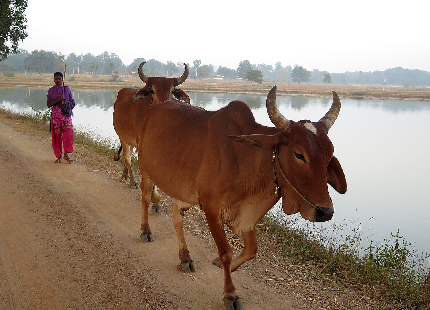
 

Biking Albania: National Park of Butrint is Pathway to 5 Archaeological Epoques

Unearthed ruins from the Hellenic period of the ancient city of Butrint © 2016 Karen Rubin/goingplacesfarandnear.com

By Karen Rubin, goingplacesfarandnear.com

(I travel to Albania with BikeTours.com’s President Jim Johnson on a specially constructed “President’s Tour” itinerary that modifies the regular “Albania’s UNESCO Sites with Rivers, Valleys, and Gorges” trip.  (See: Come to Albania Now to See Emergence of a Young Country-Best Way to Experience Albania is on Bike Tour. This is 6th in the series.)

On this, the seventh day of our cycling through Albania (8th day of our trip), we have our longest distance ride, at 70 km, but it is mostly downhill: just 725 meter gain in elevation and a total of 1285 meters drop, and mostly along the coast, giving us our first spectacular views of the Ionian Sea, with the Greek island of Corfu in the distance.

But today’s attraction is an absolute highlight among the many fascinating places we have already visited in Albania: the National Park of Butrint is a 2000-year old Hellenic-Roman-Byzantine city, reclaimed from forest overgrowth and an earthen tomb by Italian archaeologists beginning in 1924, nearly 100 years ago. Indeed, Butrint is the most visited cultural tourist destination in Albania, and for good reason.

The setting is exquisite, the ruins most impressive, and for me, the connection to Asclepius (the Greek God of Healing or more accurately the father of Medicine), and to Anthony and Cleopatra (defeated in the battle Actium nearby by Augustus who is immortalized with busts created during his lifetime which can be seen in the museum), makes this place all the more profound.

But to get there, we have a fantastic ride.

After the past few days riding in the mountains (affording magnificent views), we reach the seacoast. Albania’s coastline extends over two seas: from the Adriatic Sea in the north to the Ionian Sea in the south, where we are.

We start with a 45 minute transfer in the van to Muzina Pass in the mountains that brings us to the seacoast. We start descending just before the turnoff to Saranda which is our ultimate destination today (we will double back to Saranda, a beach resort city, by the end of the day) and continue south toward the southernmost tip of Albania, near the Greek border.

Riding by fortress en route to Butrint © 2016 Karen Rubin/goingplacesfarandnear.com

We pass a fascinating triangle-shaped fort on our way to a small “improvised” ferry – a wooden raft pulled by cables that calls to mind Huckleberry Finn – to Butrint, a UNESCO World Heritage Site, one of Albania’s most important archeological treasures.

Before visiting the site, though, we enjoy a terrific lunch just next door at the Livia Restaurant (named for Emperor Augustus’ wife, as I learn later in the museum at Butrint) – mussels, calamari, sea bass, dining outside under a canopy, across the road from the water.

After lunch, we stroll into the National Park.

Taking the raft over to Butrint © 2016 Karen Rubin/goingplacesfarandnear.com

Butrint’s history dates back to Greek times (in fact, this whole area was part of Greece), and was an important coastal city.

Roman writer Virgil said the legendary founder of the city was the seer Helenus, a son of the King Priam of Troy who moved West after the fall of Troy. Greek Historian Dionysius of Halicarnasseus, as well as Virgil, in his epic poem “Aeneid”, wrote that Aeneas visited Bouthroton after he escaped the destruction of Troy.

What is so fascinating is that there were five civilizations that occupied this town, and you can peel away the centuries and eras, one by one. The city was hidden underground until 1924 when Italian archaeologists began to excavate. Most of what we see is thanks to the Italian Archaeological Mission, headed by Luigi Maria Ugolini, who worked for a decade in Butrint (1928-1939). What has been uncovered shows the stamp of Hellenistic, Roman, Byzantine, Venetian and Ottoman cultures and civilization, and the artifacts are presented in an astonishing museum.

According to notes, Butrint (also called Buthrotum or Bouthroton) was originally within the region of Epirus, and one of the main centers of the Greek tribe of Chaonians who had close contacts to the Corinthian colony of Corcyra (Corfu).

The earliest archaeological evidence of settled occupation dates between 10th and 8th centuries BC. The occupied original settlement likely sold food to Corfu and had a fort and sanctuary. It occupied a strategic position due to its access to the Straits of Corfu. The geographer Hecataeus of Miletus described Buthrotum as an important port and trading center on the main Adriatic waterway.

Around 380 BC the ancient settlement was surrounded with defensive walls, fortified with a new 870 meters long wall, with five gates, enclosing an area of four hectares.

By the 4th century BC it had grown in importance as a cult center, and included a sanctuary to Asclepius, the Greek god of healing, on the southern slope of the Acropolis hill, an agora and a theater – there is even an inscription from the 4th century BC on one of the seas of the theater that credits donations of religionists that supported construction.


Unearthed ruins of the ancient city of Butrint © 2016 Karen Rubin/goingplacesfarandnear.com

In 228 BC, Buthrotum (Bouthroton) became a Roman protectorate and later, in the 1st century BC, a part of the Roman province of Macedonia. In 44 BC, Caesar designated Buthrotum as a colony to reward soldiers who had fought with him against Pompey, naming in Colonia Julia Buthrotum. In what sounds like it could be ripped from the headlines of today, the local landholder Titus Pomponius Atticus objected to his correspondent Cicero who lobbied against the plan in the Roman Senate. As a result, Buthrotum received only a small number of colonists.

In 31 B C, Emperor Augustus, fresh from his victory over Mark Antony and Cleopatra at the battle of Actium mere meters away from here, renewed the plan to turn Buthrotum into a veterans’ colony.

Under Emperor Augustus, the city, now known as Colonia Augusta Buthrotum, experienced its greatest development, doubling the size of the town – temples, fountains, baths (thermae), villas (private residences), a forum complex, and nyphaeum ( a monument consecrated to the nymphs, especially those of springs, typically natural grottoes, which were believed to be where local nymphs lived), a new water supply and a bridge linking the two banks of the Vivari canal. (We see these ruins clearly, and even the nyphaeum the mere thought of which had piqued our curiosity.)

A rare look at the mosaics on the Baptistry floor at Butrint © 2016 Karen Rubin/goingplacesfarandnear.com

In the 3rd century AD, an earthquake destroyed a large part of the town. By the 6th century, it became the seat of a bishop and new construction included a large baptistery, one of the largest Paleochristian buildings of its type, and a basilica. We see some of the gorgeous mosaic floor of the baptistery, laid out in 8 rings with columns, which, we are told, is a rare treat and a bit of luck because the mosaic usually cannot be seen, kept under protective sand. But because they were in the process of changing out the sand, we get to see half of the floor exposed. So far, eight other churches have been uncovered, the most important of which is in Vrina plain on the other side of the Vivari canal.

Butrint followed the historical pattern seen in other Balkan cities, with the 6th to 7th centuries being a period of transformation of the Roman world into the Early Middle Ages.

By the beginning of the 9th century, Butrint had become a small fishing settlement. Around 1807, in the outfall of the Vivari canal, Ali Pasha built a fortress to guard against French attacks coming from Corfu. After his death, Butrint fell under Ottoman Rule, until the Declaration of Independence in 1912.

What is so impressive about Butrint is that it is at once a place of these extraordinary historical monuments that clearly depict these époques of civilization, but also the natural setting and landscape and the scale.

Pathway Through Time

Our visit begins at a Venetian tower built in the 15th and 16th century and a chapel of the 4th century BC dedicated to the god of Asclepius.

Junid, our Biketours.com guide on this two-week cycling trip through Albania, leads us on a path through the woods to the 300-seat theater where plays were performed and there was  public discussion (they still hold festivals here).

Buthrotum was as much a healing place (or in modern terms, a spa retreat) as a religious center, dedicated to Asclepius, god of heating because in those days, the earliest form of medicine involved spiritual healing.

Unearthed ruins from the Hellenic period of the ancient city of Butrint © 2016 Karen Rubin/goingplacesfarandnear.com
View of the theater devoted to Aslepius, god of healing, from the Hellenic period of the ancient city of Butrint © 2016 Karen Rubin/goingplacesfarandnear.com

I am particularly fascinated with Asclepius, who I first encountered on the island of Epidaurus in Greece on a previous Biketours.com tour. Asclepius is regarded as the God of Healing, by virtue of being the son of Apollo and the human princess Coronis, but who incited the wrath of Zeus (who would have been Asclepius’ grandfather). Zeus struck Asclepius dead with a thunderbolt because Asclepius had the audacity of cheating death – Asclepius used his powers of healing to restore people to life, usurping Zeus’ power. To me, though, Asclepius is the first doctor, the first to use the scientific method – testing what worked and what did not; he kept notes and refined his technique. (The medical symbol still used today is the staff of Asclepius.)

In this period of time, though, “medicine” or “healing” was all wrapped up with spiritualism (faith). So, just like at the temple at Epidaurus, Butrint has a great amphitheater because Greeks believed in the connection between spiritual, emotional, mental and physical health (theater as well as athletics were part of religious experience).

The sick usually had to spend one or more nights in Asclepius’ sanctuary so that remedy for their ailment could be revealed in their dreams.  Priests and physicians would perform rituals to interpret their dreams so an appropriate cure or treatment could be devised (or surmised).

We come to the remains of a really magnificent Roman Forum – it is astonishing to learn that it was only unearthed as recently as 2005.

We go by a structure that is thought to be a gymnasium (a high school, still the word that is used in Albania today for high school).

Baptistry at Butrint © 2016 Karen Rubin/goingplacesfarandnear.com

We come to the Baptistry and Junid, points out the mosaic floor (partially exposed). The use of mosaics, he says, meant that it was a place of importance. It was designed in a series of eight circles (we see the columns). Junid notes that the mosaic is usually covered with sand and the only reason we are fortunate enough to see even part of the art is because workers are changing the sand.

We walk further through the forest path and come to the Basilica, constructed in 6th century, which Junid notes has an altar facing east.

The historic markers (in English), are really well done.

Junid points out Lion’s Gate and the unusual stone relief at Butrint © 2016 Karen Rubin/goingplacesfarandnear.com

We come to the Lake Gate, a beautiful setting on the water, then walk through the woods again, along the outer fortress wall, until we come to Lion’s Gate – where there is a big stone with a relief of a lion devouring a bull’s head. Junid notes the odd position and how the boulder stands out from the rest – an indication that the stone may have been taken from a temple (but that doesn’t answer why it was positioned too low for a door frame).

Remarkably, only half of Butrint has been excavated so far. “They want to leave something for next generation of archeologists,” Junid tells us.

View from the Museum at Butrint © 2016 Karen Rubin/goingplacesfarandnear.com

Finally we come to the Butrint Museum, situated in the Acropolis castle (and what a setting this affords, with a view out to the water).

The Museum at Butrint © 2016 Karen Rubin/goingplacesfarandnear.com

The museum was established in the 1950s to house the finds from Italian archeologists who first excavated 1928-40. In 1988, the museum was enlarged, and in 2005, it was completely renovated, updated and reopened under the aegis of the Albania Institute of Archeology, Butrint Foundation, AG Coventis Foundation, Packard Humanities Institute and Butrint National Park.

The museum is absolutely astonishing – it presents a chronological overview of the history of Butrint starting from the Bronze Age to the Late Middle Ages, and displays artifacts that have been uncovered from the archaeological digs.

Busts of Augustus and Livia in the museum at Butrint © 2016 Karen Rubin/goingplacesfarandnear.com

In 1992, the ancient city was designated a UNESCO World Heritage Site. Butrint is also a national park comprising 9400 hectares and since 2003 has also been designated a wetland area of international importance (RAMSAR area). There are some 800 kinds of plants among them 16 which are considered endangered and 12 as rare; 246 species of birds; 105 species of fish and 39 species of mammals.

Admission is 700 Lek for foreigners (about $7). (National Park of Butrint, Saranda, Albania, pkbutrint@yahoo.,com, www.butrint.al)

There are still some scheduled departures left this year for “Albania’s UNESCO Sites with Rivers, Valleys, and Gorges,” 9 nights, Level 4, averaging 37 miles/day (950E or about $1050) (www.biketours.com/albania/albania-UNESCO-tour).  

BikeTours.com 1-877-462-2423 or 423-756-8907, 1222 Tremont St., Suite 100, Chattanooga, TN 37405, biketours.com. 

See also:

Come to Albania Now to See Emergence of a Young Country – Best Way to Experience Albania is on Bike Tour 

Biking Albania: Exploring Heritage Sites of Lake Ohrid, St Naum, Ancient City of Ohrid

Biking through Albania’s ‘Breadbasket’ into Korca, the ‘Paris of Albania’

Biking Albania: Farm, Thermal Springs on Route through Countryside into the Mountains

Biking Albania: Touring Centuries Old City of Gjirokaster

Next: Biking Albania: Saranda & the Albanian Riviera

____________________

© 2016 Travel Features Syndicate, a division of Workstyles, Inc. All rights reserved. Visit goingplacesfarandnear.com and travelwritersmagazine.com/TravelFeaturesSyndicate/. Blogging at goingplacesnearandfar.wordpress.com and moralcompasstravel.info. Send comments or questions to [email protected]. Tweet @TravelFeatures. ‘Like’ us at facebook.com/NewsPhotoFeatures
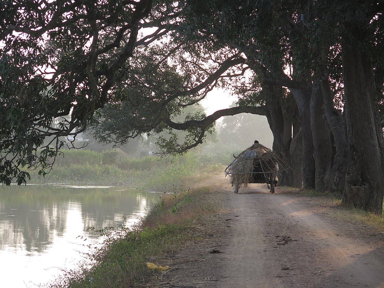
Biking Albania: Touring Centuries Old City of Gjirokaster

The view from the castle of Gjirokaster, a UNESCO-protected living history city in Albania, overlooks a lush valley © 2016 Karen Rubin/goingplacesfarandnear.com

By Karen Rubin, goingplacesfarandnear.com

(I travel to Albania with BikeTours.com’s President Jim Johnson on a specially constructed “President’s Tour” itinerary that modifies the regular “Albania’s UNESCO Sites with Rivers, Valleys, and Gorges” trip.  (See: Come to Albania Now to See Emergence of a Young Country-Best Way to Experience Albania is on Bike Tour. This is 5th in the series.)

Our ride today, the 6th of cycling (7th of the tour), will bring us into the historic city of Gjirokaster – an Ottoman-era city carved into the hillside overlooking a spectacular river valley.

Today’s 46 km ride is one of the easiest – almost steadily downhill or flat – for a total elevation gain of just 200 meters and a loss of 360 meters. We follow the Vjoca River to Kelcyra Gorge.

Bridal shop in a village in Albania © 2016 Karen Rubin/goingplacesfarandnear.com

We stop on the road in a small village (I note the bridal shop) and Junid, our guide on this biking journey across the southern part of Albania, picks up ice cream for 50 Leke (that’s about 50 cents for an ice cream that would be $2.50 in the US) and we fill our water bottles by a natural spring – fresh and cool.

Our lunch is in a delightful restaurant which literally has a stream running over it, like a waterfall. We sit upstairs on a terrace, and the water runs down as we eat, making it look like a sunshower.

After a most delightful lunch, we drive in the van 24 km along a highway and then up a steep, twisting road into the old city of Gjirokaster (also spelled Gjirokastra or Girocastro) built on a hill 300 meters high, overlooking a lush valley beside the mountains Mali Gjerë and the Drinos river.

This means we only biked 46 km instead of 70 km, but that saves our legs and lungs (which would have been brutal to go up the hill to the village). The biking trip is not designed to be a brutal test of endurance; it is designed so that we can really enjoy the scenery and get a sense of place. So driving us into Gjirokaster also gives us more time (and energy) to explore “the city of 1000 steps”, with its narrow cobblestone streets, that is dominated by a formidable castle.

Gjirokaster

Gjirokaster is known as the “city of stone roofs” © 2016 Karen Rubin/goingplacesfarandnear.com

I quickly drop my things at the Hotel Cajupi, right below the Castle which looms from above, and go off to explore on my own before we are scheduled to meet for Junid to take us on a walking tour.

Gjirokaster is one of the oldest cities of Albania, its name means Silver Fortress and the city clearly shows the confluence of Greek, Roman, Turkish and Albanian cultures. The historic district is a protected  UNESCO World Heritage Site.

The bazaar in Gjirokaster’s old city © 2016 Karen Rubin/goingplacesfarandnear.com 347 –
The bazaar in Gjirokaster’s old city © 2016 Karen Rubin/goingplacesfarandnear.com

Gjirokaster is a very popular tourist attraction (they are cultivating cultural tourism) and it is understandable why we see (wonderful) souvenir shops, English signs, historic markers with English translation, a fantastic tourist map. In fact, these are the best (actually only) tourist shops we encounter on our trip. That’s not because of American tourists, who are scant in number (though I do come upon a few), but because of Scandinavians, Swiss, Germans and Poles who come for whom English is the most common language.

I explore a bit on my own and enjoy discovering the 18-19th century houses with their distinct architectural features.

The “city of a thousand steps” which is also known as the “city of stone” is distinguished by hundreds of Ottoman-style tower houses with distinctive shapes, stone roofs, wooden balconies and whitewashed stone walls.

Historic Gjirokaster’s distinctive architecture © 2016 Karen Rubin/goingplacesfarandnear.com

Gjirokaster has gone “from feudal stronghold to Ottoman jewel to Italian colony, the city has known many rulers and has inspired poets, authors and artists,” Europa Travel & Tours, an Albanian travel company, notes.

The network of cobblestone streets climb steeply out of a bazaar at the center of the old town. You walk ever higher to the 13th century castle.

The village is perched on the steep side of the Drino Valley overlooking a stunning landscape framed by snow-capped mountains.

In 1336, the city was known by its Greek name, Argyrokastro and was part of the Byzantine Empire. It later became the center of the local principality under the Albanian lord, Gjon Zenebishi before falling under Ottoman Empire rule for the next five centuries. It was occupied by the Greek Army during the Balkan Wars because of its large Greek population (street signs are in both Albanian and Greek and the Greek minority still speaks Greek instead of Albanian). It was eventually incorporated into Albania in 1913, when Albania won its independence from the Ottoman Empire, and the Council of Ambassadors (Western powers) put the area within its borders.

Historic Gjirokaster’s distinctive architecture © 2016 Karen Rubin/goingplacesfarandnear.com

Gjirokaster owes its preservation to the fact it is the birthplace of the former Albanian Communist dictator Enver Hoxha, who ordered that the city remain untouched (except for destroying the mosques; the city, Junid says, once had 15 mosques but today has only one). It has been under UNESCO protection since 2005.

This is a city that honors three important writers including Ismail Kadare, most famous for “Chronicle in Stone” which is set in Gjirokaster, tells the history of the city during the Italian and Greek occupation in World War I and II. Kadare, who lives between Paris and Albania, was nominated five times for the Nobel Prize in Literature and was awarded a gold medal from French President Hollande.  You can visit his house in Gjirokaster.

Gjirokaster Castle

Gjrokaster has an abundance of fascinating attractions but the two standouts are the oldest, grandest house, and the Castle that lords over the town and the valley below.

Gjirokaster Castle was used as a fortress and a prison and now is a military museum © 2016 Karen Rubin/goingplacesfarandnear.com

According to some notes I am able to find, the castle dates back to the 12th century, the earliest parts built by the Despots of Epirus, an off-shoot of the Byzantine government. It was reconstructed and adapted to modern war techniques during the reign of Ali Pasha of Tepelene, 1812-1821. The magnificent clock tower and an aqueduct were added in the 1800s. But it was Zog, the self-proclaimed King of the Albanians, who, in the 1920s, converted the fortress into a garrison and political prison. Zog also forged an alliance with Mussolini, who provided funds to Albania to modernize its army, but, in 1930, sent 30,000 Italian soldiers to occupy Albania.

As Junid relates, Mussolini modernized Albania’s army believing that Albania would provide a barrier for Italy’s own defense. “But then the King made a new connection with Mussolini’s enemy – so Mussolini invaded and occupied and used castle for defense,” Junid tells us. He says that there would have been as many as 5000 soldiers living in the castle (hard to imagine).

It was operated as a prison until 1968 when the castle was turned into a military museum paying tribute to Albanian independence.

US plane on display at Gjirokaster  Castle military museum © 2016 Karen Rubin/goingplacesfarandnear.com
US plane on display at Gjirokaster Castle military museum © 2016 Karen Rubin/goingplacesfarandnear.com

Inside the stone walls, we find World War I and World War II Italian tanks and cannon (including a tiny Panzer with a Fiat engine) on display. Outside, there is a US fighter plane that they claim was a spy plane that was shot down (actually the plane had crashed landed near Tirana) and is shown off as a kind of trophy.

From this perch, we gaze out to a spectacular view of the valley. Greece is very close by; indeed, until 1914, this area was part of Greece, but was assigned to Albania by the Council of Ambassadors (the Western European powers). There is still a large Greek minority near here – signs are in both Greek and Albanian, the TV is Greek, and there are Albanians in the area who only speak Greek.

The castle is also the venue for the Balkan Festival, held every five years, a music and cultural festival involving some 30 countries.

(Admission to the castle is 200 Leke, or about $2).

Skendulate House

The 9th generation owner relates the history of Skendulate House, one of the grandest and oldest in historic Gjirokaster, Albania © 2016 Karen Rubin/goingplacesfarandnear.com

A second attraction we visit, the Skendulate House, is spectacular in its own way because it provides a human connection to quite literally centuries of history.

Skendulate House, one of the grandest and oldest in historic Gjirokaster, Albania © 2016 Karen Rubin/goingplacesfarandnear.com

As luck would have it, we are escorted around the house by the 9th generation owner, the last to occupy the house before it was taken over by the Communists and turned into an “enthnographic” museum (and after Communism fell, tried to block the owner from filing his claim of title, offering a pittance, the equivalent of a few hundred dollars, to maintain it as a national museum.)

Before Communism, a feudal system prevailed and a handful of rich families owned the land. Then the Communist regime nationalized all the property and took over the house.

Since the fall of Communism, in 1992, property ownership was restored, but there are still unresolved issues about who actually owns the land: The original feudal families? The workers who labored on the land. Until ownership is resolved, investment and development has simply ceased – as we travel around the country, we see numerous buildings left unfinished – the owners purposely started building in order to establish their  claim.

This grand house of Skendulate dates from 1833 (according to one document I see; he says it dates from the 17th century, which could mean that his family owned the property from then). He is the 9th generation and the last to live in the house before it was nationalized by the Communist regime and turned into an ethnographic museum.

You get an idea of what the conditions were like when this great house – which would have been one of the richest and most splendid in the region (though he says it wasn’t the richest or most splendid) – was built. Junid translates as he points out 10 openings to protect the house; there would have been 10 guards to control the courtyard; two entrances (one for people and the other for animals). It has 64 windows, 44 doors, a cellar to preserve food for winter, a cistern to store water captured from the rain. He points out how the house was built with layers of natural chestnut wood, because it would be flexible.

The house had a bunker “in case of war or barbarity” and was constructed with two cupolas – so that cannon fire would hang from the first cupola and not penetrate deeper.

The house was built with a cellar for natural refrigeration (milk could be kept fresh for 3-4 days), they captured rainwater and had a water cistern that held 130 cubic meters of water so they could be pretty much self-sufficient for a period of time.

The house was built for cooler rooms in summer and warmer rooms for winter with a wood fireplace. It had six indoor bathrooms (the waste was pumped out) and 9 fireplaces (the more fireplaces, the greater the wealth). There would have been 20 people – 3-5 families – living in the house at one time.

The house was constructed so that men and women were kept separate.

In one room where men would gather, women could look down and count the men in order to know how much coffee and Rakia (a liquor) to prepare and serve, giving it to a male who would serve the rest.

We visit the kitchens where children and women would eat first, then the men; and poke into the various bedrooms one by one (the grandmother’s room was the smallest).

The family lived in the house until 1981, when the Communist regime turned it into an Ethnographic Museum.

The  grand room of Skendulate House where weddings were held © 2016 Karen Rubin/goingplacesfarandnear.com
The grand room of Skendulate House where weddings were held © 2016 Karen Rubin/goingplacesfarandnear.com

The family got the house back in 1993 (as well as their landholdings), after a year of filing claims and the state trying to keep it as a museum. But it was unlivable (in fact, it would not be allowed to be opened to the public in the US in its condition), so he has continued showing it as a private, cultural museum.

It is odd to sit in the grandest room, lined with banquettes. He says it is the room where weddings would be held – in fact, it was the very room where he was married.

The decoration of the woodwork, the ceiling, the painted fireplace, is magnificent. The fireplace is painted with pomegranates – a symbol of his family.

He says that the only time a bride would be in the same room as men is at her wedding. It would be an arranged marriage, performed by the family.

There would be two days of receptions – one day for the bride’s family (Saturday), Sunday for the groom’s family. Women would look down through a screen from a mezzanine. “They might see their future husband” among the gathering.

He seems to get wistful as he relates that his was the last generation to live in the house; he had lived here for 33 years, was married in this very room, but, his son was 3 years old, they all were kicked out when the Communists took it over. (200 Leke entry fee, about $2).

Night time in Gjirokaster’s bazaar © 2016 Karen Rubin/goingplacesfarandnear.com

There are many other attractions of Gjirokaster, most that can be appreciated just by walking around. You can also visit Ismail Kadare’s house, historic houses such as Zekate House (1812), Angone, Babameto and Kabilate. the Ethnographic Museum. Besides the buildings in Ottoman style, there are several stunning buildings in the historic district in 19th century Italian style, like the hotel “Royal”, the former “Banco di Napoli”, the former shopping center Ziga, the High School (labeled the “gymnasium”), Villa “Kokalari” and Villa “Papavangjeli”.

There’s also an intriguingly named The Cold War Tunnel, which Junid dismisses and I don’t have time to discover on my own.

Enjoying dinner in Gjirokaster, Albania © 2016 Karen Rubin/goingplacesfarandnear.com

We get a little time to shop (this is the only place we find where there are actually shops to buy crafts and such, and meet up at a delightful restaurant for dinner, where I watch as entire lambs are roasted on a spit.

We then go off to a tavern in the square just outside our hotel, where big-screen TVs are outside, and people have gathered to watch the European football (soccer) matches.

There are still some scheduled departures left this year for “Albania’s UNESCO Sites with Rivers, Valleys, and Gorges,” 9 nights, Level 4, averaging 37 miles/day (950E or about $1050) (www.biketours.com/albania/albania-UNESCO-tour). 

BikeTours.com 1-877-462-2423 or 423-756-8907, 1222 Tremont St., Suite 100, Chattanooga, TN 37405, biketours.com. 

See also:

Come to Albania Now to See Emergence of a Young Country – Best Way to Experience Albania is on Bike Tour 

Biking Albania: Exploring Heritage Sites of Lake Ohrid, St Naum, Ancient City of Ohrid

Biking through Albania’s ‘Breadbasket’ into Korca, the ‘Paris of Albania’

Biking Albania: Farm, Thermal Springs on Route through Countryside into the Mountains

Next: Biking Albania: Greco-Roman City of Butrint

____________________

© 2016 Travel Features Syndicate, a division of Workstyles, Inc. All rights reserved. Visit goingplacesfarandnear.com and travelwritersmagazine.com/TravelFeaturesSyndicate/. Blogging at goingplacesnearandfar.wordpress.com and moralcompasstravel.info. Send comments or questions to [email protected]. Tweet @TravelFeatures. ‘Like’ us at facebook.com/NewsPhotoFeatures