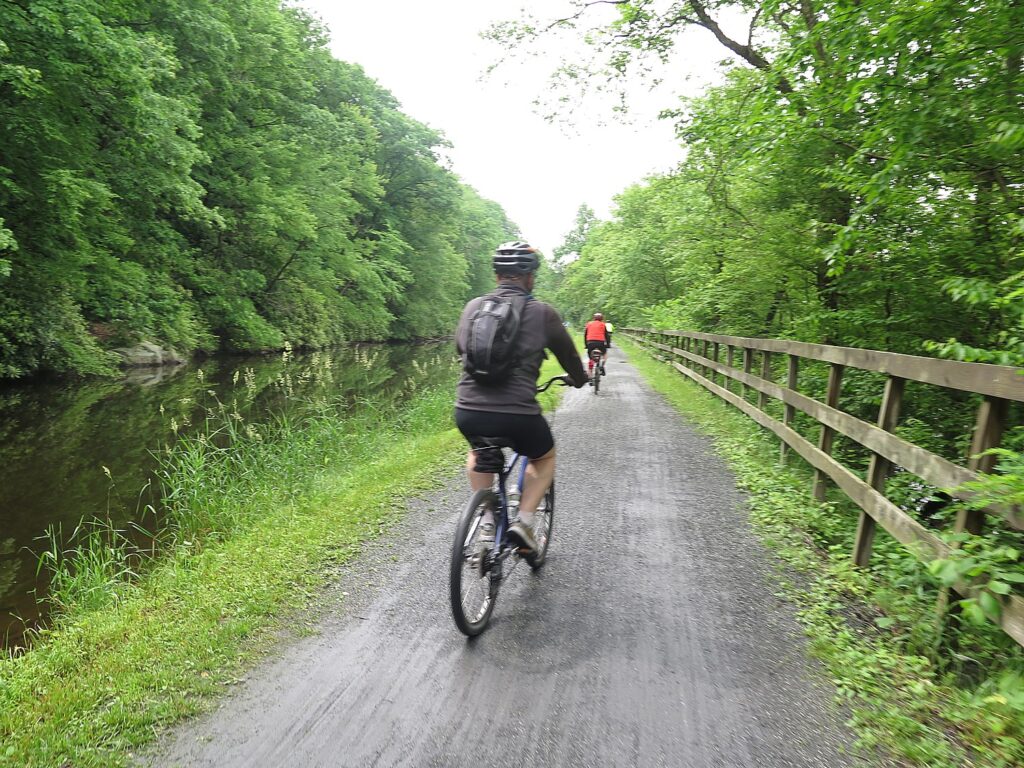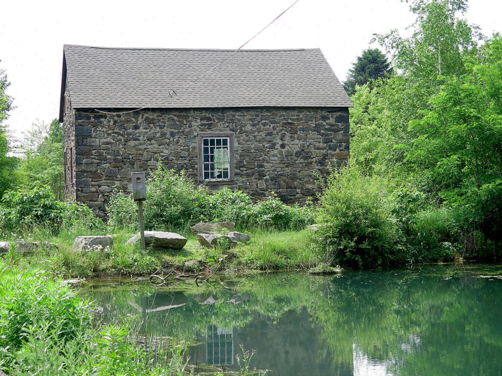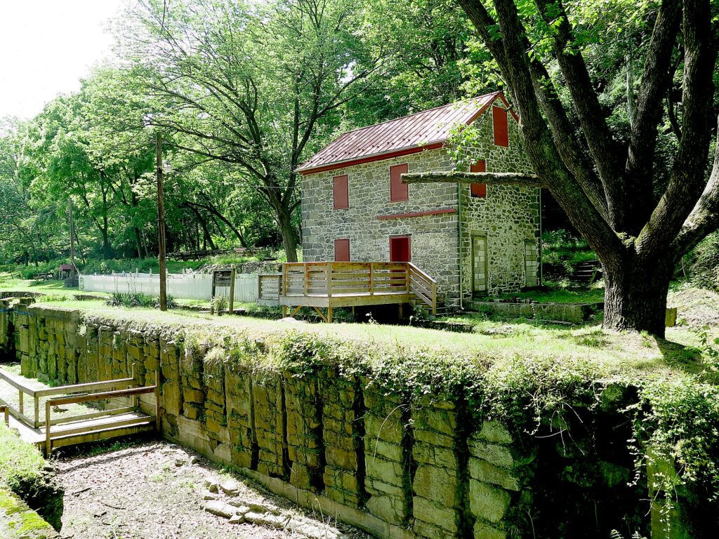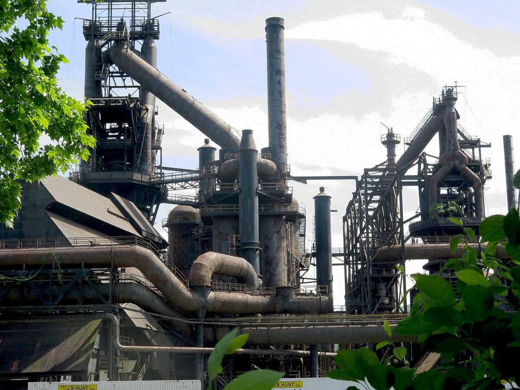
Tag Archives: rail trails

Railtowns, Canaltowns, Rivertowns, GhostTowns – Now Trail Towns

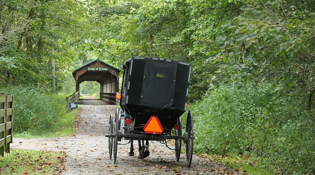
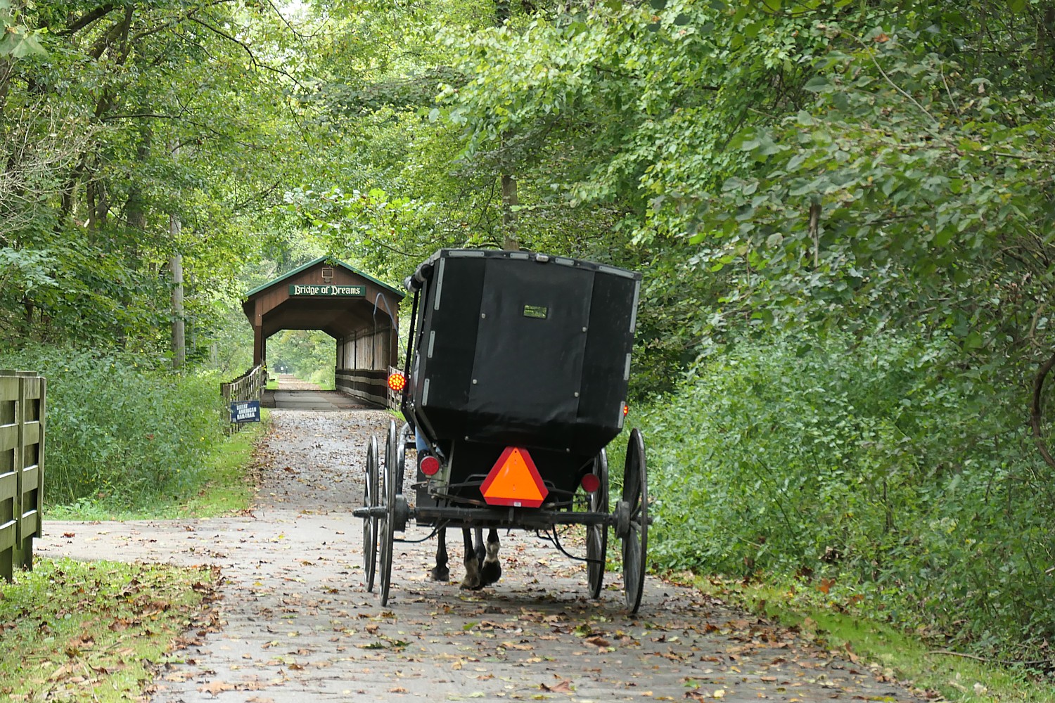
One of the most scenic sections of the Ohio-Erie Trail: a horsedrawn Amish carriage approaches the Bridge of Dreams © Karen Rubin/goingplacesfarandnear.com

By Karen Rubin, Travel Features Syndicate, goingplacesfarandnear.com

There are railtowns, canaltowns, rivertowns, and to avoid the fate of becoming ghosttowns with the loss of railroads, canal and riverboats, and factories, many of these places are looking to become Trail Towns, serving the thousands streaming by on the leisure trails that have replaced the rail lines and towpaths.

The trails are what bring people to these towns, revitalizing their economy and community, as our Rails to Trails Conservancy group of media people reporting on the progress of the 3,700-mile-long Great American Rail-Trail discover.

As we set out on a newly repaved portion of the Ohio-Erie trail, we meet a couple from Wallisburg, Ontario, Canada. They spark our attention considering the plummeting (as much as 25%) in Canadian visits to the USA. What brought them, we ask. “Biking.” Why here? “Well, we did the Erie Canalway [353 miles from Buffalo to Albany, New York], and the Pittsburgh to DC [350 miles on the Great Allegheny Passage and C&O, the most complete stage of the Great American Rail-Trail so far], so this was next,” said the couple who, we learn, got engaged on a bike trip.
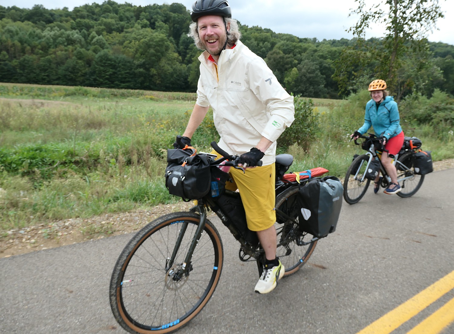
A couple from Ontario, Canada on a six-day trip biking 326 miles from Cleveland to Columbus on the Ohio to Erie Trail. “We don’t have a plan. It’s easy to get services.” © Karen Rubin/goingplacesfarandnear.com

They never book a hotel more than four hours in advance (and estimate they are spending $200/day), but check out their app to see what is convenient to where they are on the trail. “We don’t have a plan,” Mike said. “It’s easy to get services.” In Columbus, they stayed in a Rooms Plus just off the Ohio-Erie trail and close to the stadium where they took in a Blue Jackets baseball game. They also remarked that in contrast to the hostility shown by their homeland by the White House, they find “the people of America are wonderful,” adding they frequently are offered free beer and pop when locals learn they have come from Canada. “People are good.”

They are taking six days to bike the Ohio to Erie Trail, that connects the Ohio River to Lake Erie, 326 miles from Cleveland to Columbus to Cincinnati.
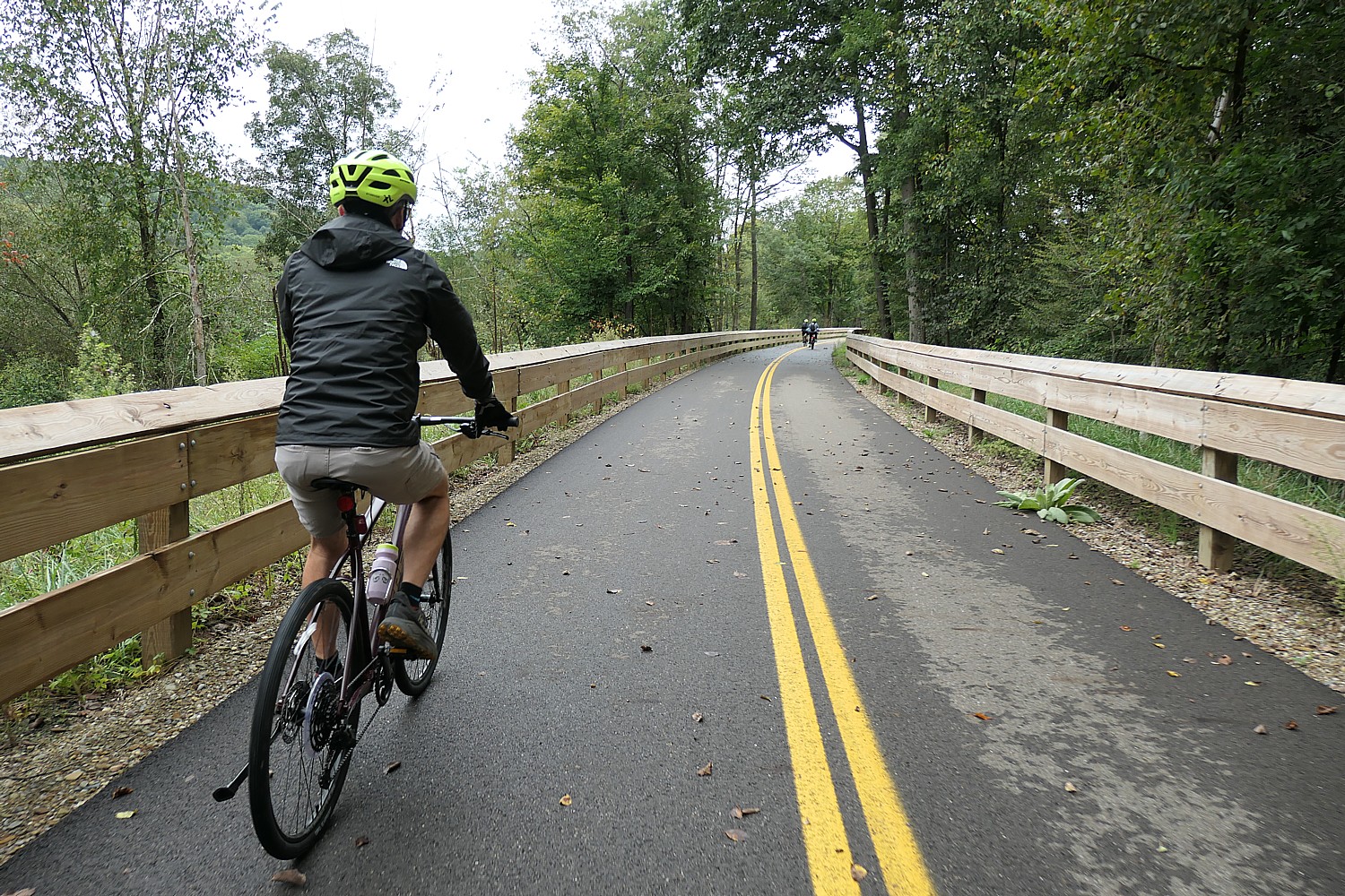
We set out on the newly repaved section of the Ohio-to-Erie Trail, one of more than 150 trails that are part of the Great American Rail-Trail that will connect Washington DC to Washington State © Karen Rubin/goingplacesfarandnear.com

“Our mission is to build, maintain, and promote this world-class trail corridor, encouraging outdoor recreation, healthy lifestyles, sustainable transportation, and a deeper appreciation for Ohio’s people, history, and natural beauty,” the website exclaims (https://www.ohiotoerietrail.org/).

The trail – one of more than 150 trails that are being linked together to create the Great American Rail-Trail from Washington DC to Washington State – is 245 miles paved, 49 crushed stone, 20 miles on-road and 10-miles on street. Where we start our ride and meet this couple has been newly repaved, and just behind us, we see where a new section of the trail is being laid, replacing having to go on-road.
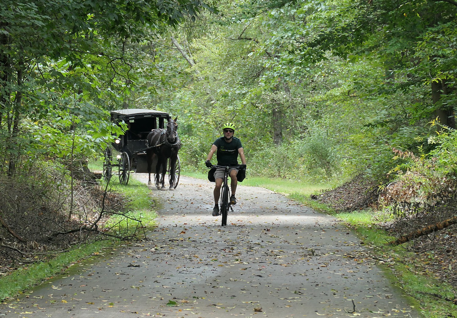
Sharing the Ohio to Erie Trail with an Amish carriage © Karen Rubin/goingplacesfarandnear.com

Soon we come to a most scenic and interesting section: it goes through an Amish community and we find ourselves sharing the path with horse-drawn carriages (the trail was purposely made wide enough to accommodate the carriages). Our rest stop is just before a marvelously named “Bridge of Dreams” covered bridge, where Raymond Weaver treats us to freshly baked and utterly divine pretzels from his family’s Weaver’s Farm & Pretzel shop. (“Better than New York’s,” I tell him to his delight.)
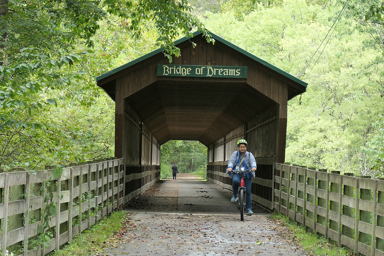
The Bridge of Dreams on the Ohio to Erie Trail © Karen Rubin/goingplacesfarandnear.com

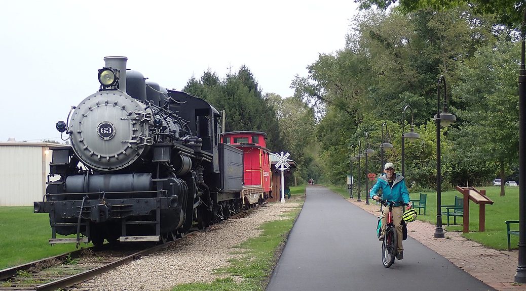
At Gambier, on the Kokosing Gap Trail, we come to an absolutely magnificent steam locomotive, train and red caboose (a volunteer repaints it every summer). I feel like a giddy kid climbing up into the cab and ringing the brass bell.
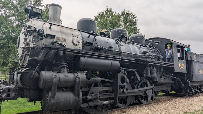
Such fun to climb into the cab of a steam locomotive in Gambier, on the Kokosing Gap Trail © Karen Rubin/goingplacesfarandnear.com

I have been thinking that the creation of these rail-trails that connect and build communities reminds me of how “Johnny Appleseed” went from town to town planting apple seeds, and, amazingly, as we enter Mount Vernon, I see a historic marker that notes Johnny “Appleseed” Chapman had property and apple orchards in this very place.
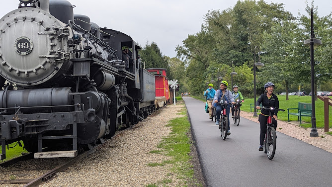
A historic steam train is now an attraction at Gambier, on the Kokosing Gap Trail, part of the Ohio to Erie Trail © Karen Rubin/goingplacesfarandnear.com

I am so intrigued, I learn from the Knox County Historical Society, that “as a young man, Johnny traveled through New York and Pennsylvania in the late 1700’s, coming into Ohio during the early 1800’s. He made it his life’s work to plant apple trees so that the soon-to-arrive pioneers would have a plentiful supply of apples at their new home. He set up his nurseries at strategic spots so that he could sell or trade his young trees to the newcomers and then move on to new unsettled areas. Many of these orchards were established throughout central Ohio, especially around Mount Vernon, Coshocton, Mansfield, Ashland and Wooster.

“He is said to have voted in Mount Vernon’s first election about 1806. Until 1828 he owned the lot now occupied by the tire store at 401 South Main St., as well as the adjacent lot toward the Kokosing River. When he needed a new supply of apple seeds, he would walk from Mount Vernon to Pittsburgh, then fill several canoes with sacks of seeds, lash the canoes together, then travel down the Ohio River to Marietta, up the Muskingum River to Zanesville, then up the Walhonding and Kokosing back to Mount Vernon – quite a trip, indeed!” 

The story touches me greatly – his life was about community and sustainability, lessons that we can certainly apply today.

It is fun to discover Mount Vernon, one of the first five Trail Towns designated by Mid-Ohio Regional Planning Commission.
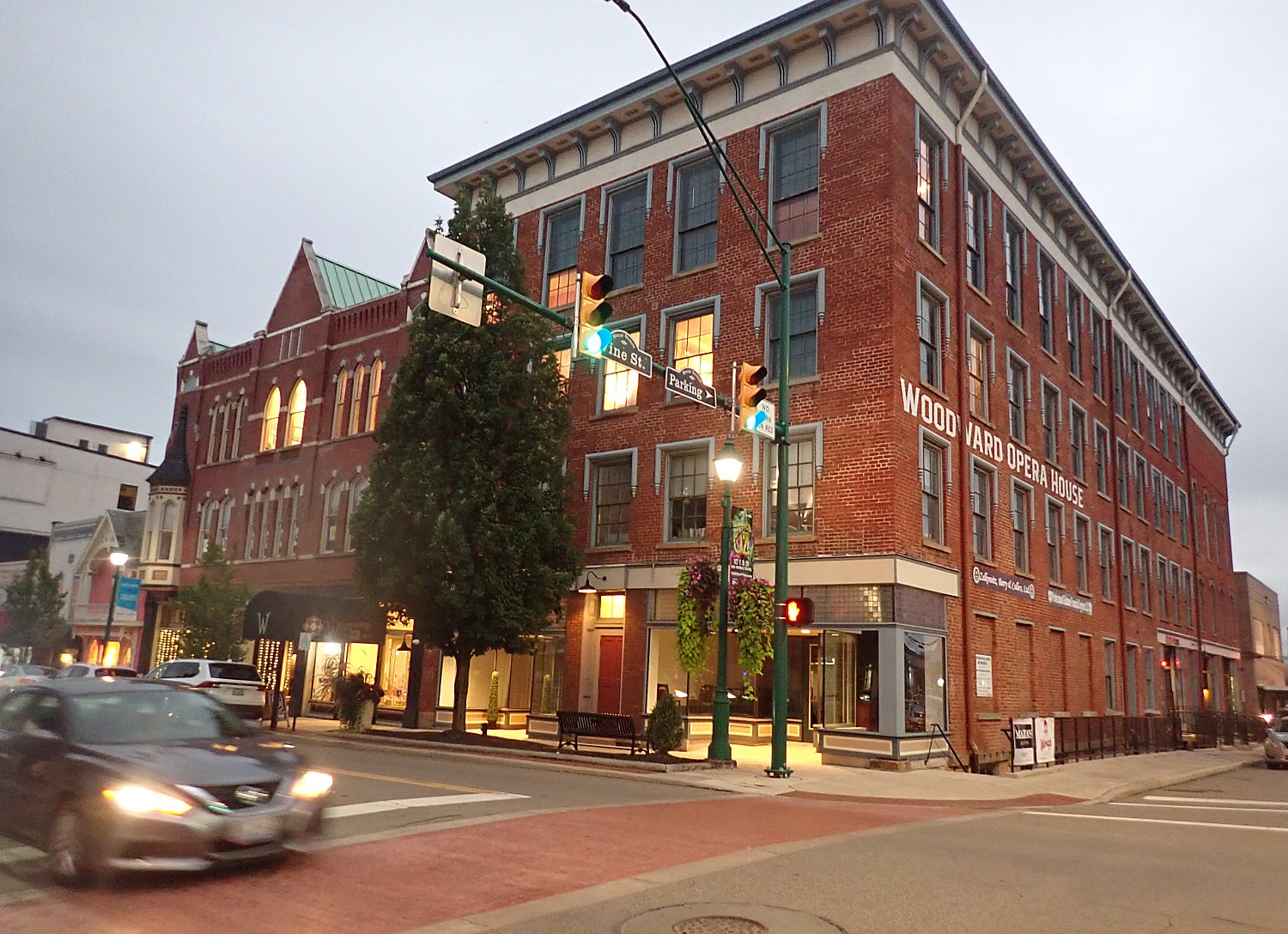
In Mount Vernon, one of Ohio’s first trail towns, we visit the Woodward Opera House, built in 1851, the  “oldest authentic operating opera house in the country” © Karen Rubin/goingplacesfarandnear.com

We are entranced by how charming Mount Vernon is and visit the Woodward Opera House, the “oldest authentic operating opera house in the country” (built in 1851, the balcony added in the 1880s, restored in 1997 and opened 2019, it has a certain percentage of original architecture to qualify), where a history lecture is going on. We overnight in an authentically reconstructed Grand Hotel, owned by Nazarene University.
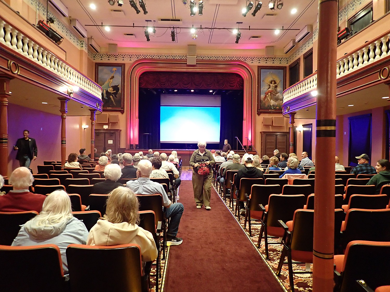
A lecture at the Woodward Opera House, Mount Vernon © Karen Rubin/goingplacesfarandnear.com

It’s about repurposing not just obsolete railroads, canalways, depots and ports, but the buildings and structures, factories and warehouses – that instead of demolishing decaying wrecks are being reclaimed, repurposed and rebranded so they benefit the community, and in the process, build community.
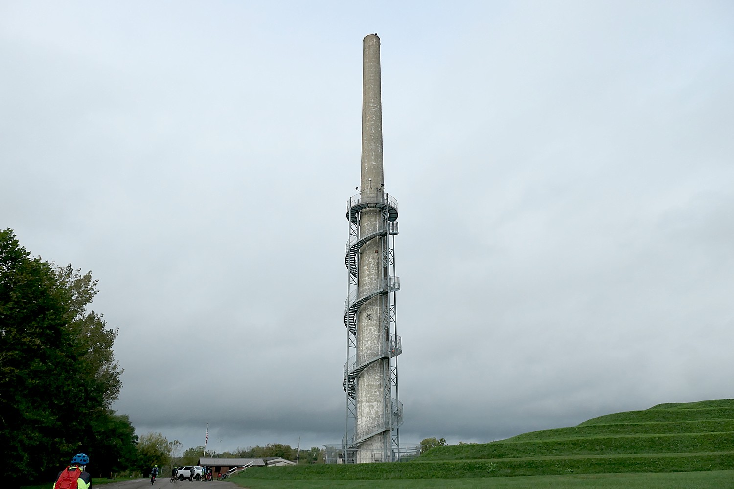
A chimney stack in a former glass factory has been repurposed into the Rastin Observation Tower at Ariel Foundation Park, Mount Vernon, alongside the Heart of Ohio Trail © Karen Rubin/goingplacesfarandnear.com

So just as we head out from Mount Vernon on the Heart of Ohio trail (a16.9-mile segment of the Ohio-Erie Trail), bound for Columbus (a 50-mile ride on trails that are part of the Ohio to Erie Trail), we come to Ariel Foundation Park, a trailside park developed from an old glass factory that manufactured car windshields. The 280-ft. tall chimney stack that served PPG from 1951 until it closed in 1976 has been repurposed instead of being demolished, and turned into a marvelous attraction, the Rastin Observation Tower.
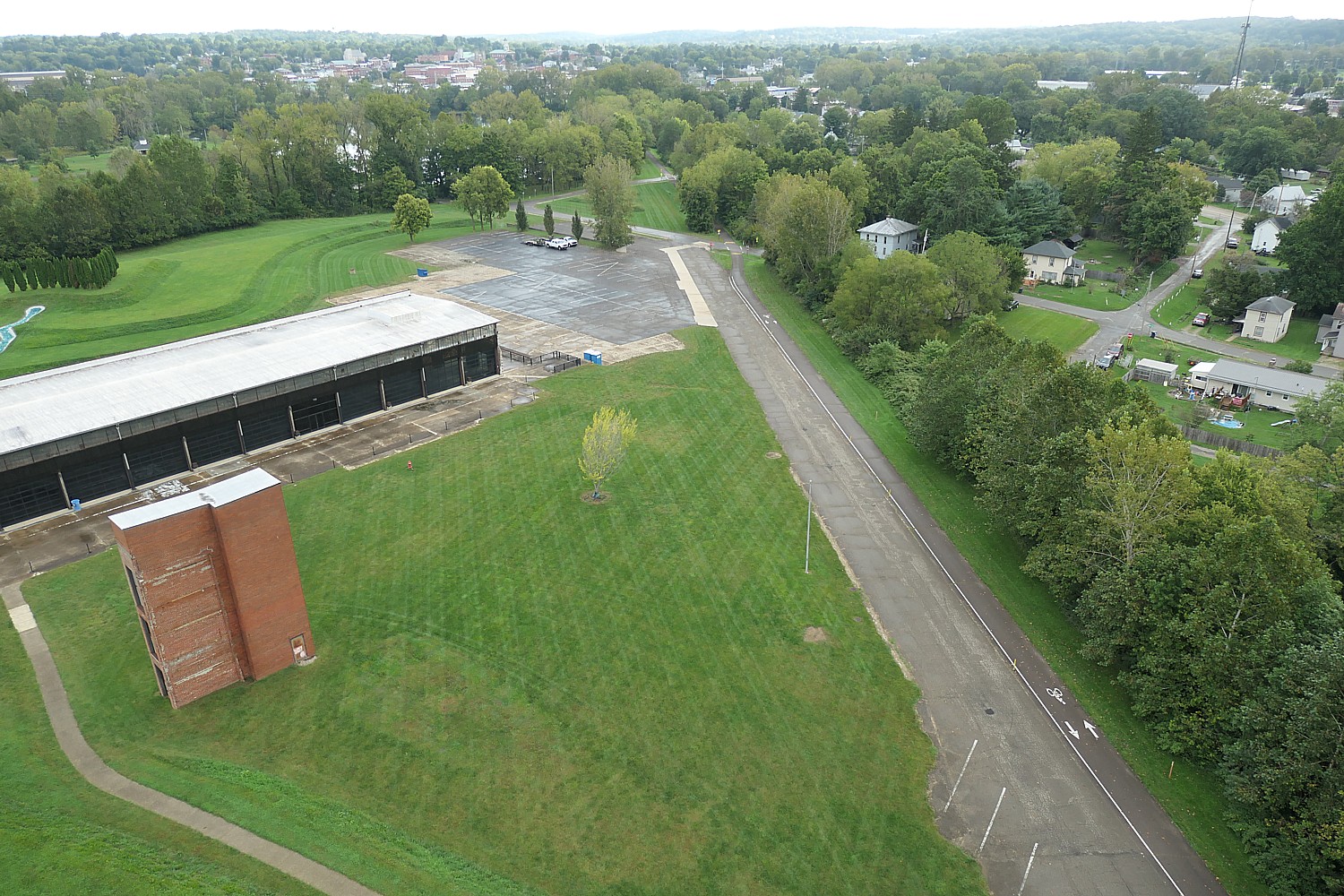
The view from 280-ft. above the Heart of Ohio trail at Ariel Foundation Park, developed from a former glass factory © Karen Rubin/goingplacesfarandnear.com

You climb a protected spiral staircase, 224 steps up to the deck 140 ft. above ground (boy do you feel it), for an incredible view of the countryside. There is an impressive entranceway constructed that prevents children from accessing on their own. It is truly an experience.
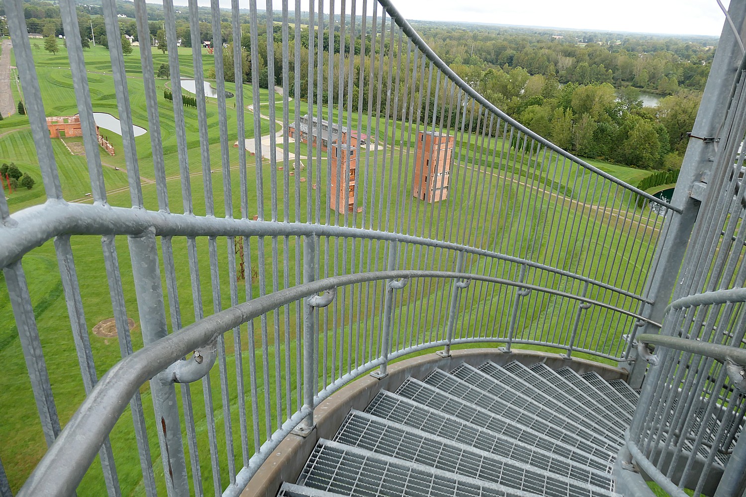
A chimney stack in a former glass factory has been repurposed into the Rastin Observation Tower at Ariel Foundation Park, Mount Vernon, alongside the Heart of Ohio Trail © Karen Rubin/goingplacesfarandnear.com

A marker notes that the Heart of Ohio Trail was built on the CANC railroad line that ran from Cleveland to Columbus through Mt. Vernon, the TNOC railroad that ran from Toledo to central Ohio. The Centerburg train station was finished in 1873, connecting the two rail lines.  Use of the tracks ended between 1960-1970. The A trail committee began purchasing the railroad line in 2000 and finally acquired it in 2005.
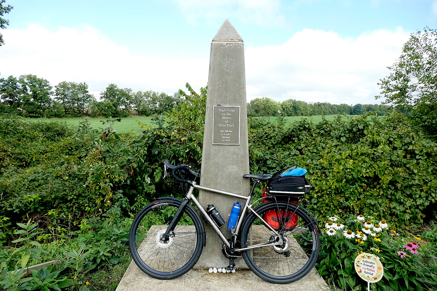
“It’s all downhill from here! The high point on the Heart of Ohio trail © Karen Rubin/goingplacesfarandnear.com

We come to a monument that marks the highpoint of the Heart of Ohio Trail, at 1,285 ft. (they joke that it is all downhill from here and that is more or less the case). Soon after, we come to Centerburg, where a sign on the trail marks the mid-point of the 326-mile-long Ohio-Erie Trail.
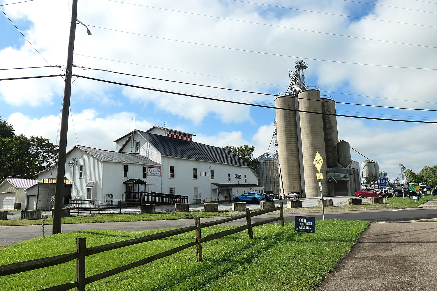
Coming into Centerburg on the Heart of Ohio Trail, one of Ohio’s first Trail Towns. © Karen Rubin/goingplacesfarandnear.com

We are greeted by many of the activists who are turning Centerburg into one of Ohio’s first five “Trail Towns.” Centerburg received a $1 million Transportation Alternatives Grant that will pay for a short connector into its town center so that cyclists (some 40,000 pass this point, which they know because of counters in the pavement) who might otherwise just pose for a photo, will spend time and money in the shops and services catering to the visitors.
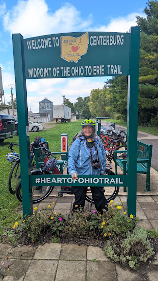
Cyclists love to take a photo at the Centerburg marker of the mid-point of the Ohio to Erie Trail, now a Trail Town, cyclists have an incentive to go into the downtown to dine and shop © Karen Rubin/goingplacesfarandnear.com

Melinda Vonstein, Greenways Planning Studio Lead for the Mid-Ohio Regional Planning Commission, has been instrumental in creating Ohio’s Trail Towns program, that launched this year with the first five towns and next year will add five more.

She tells us that several towns came to the Commission to ask to develop Trail Towns program.
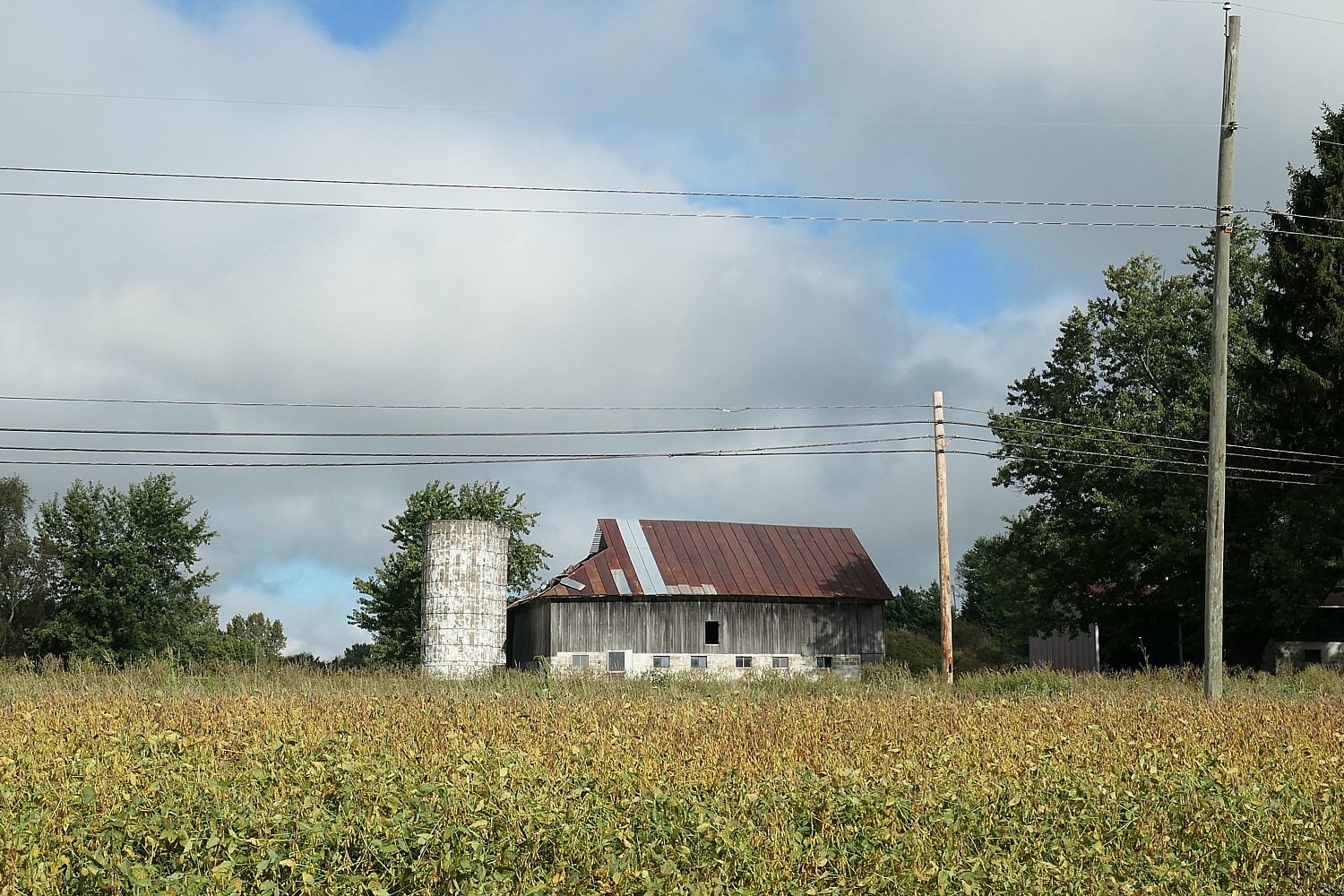
Coming into Centerburg on the Heart of Ohio Trail, one of Ohio’s first Trail Towns. © Karen Rubin/goingplacesfarandnear.com

Columbus’ Trail Towns program was modeled after the Great Allegheny Passage’s created by The Progress Fund  (https://www.trailtowns.org/guide/). The group worked for four years to come up with a framework that would suit Ohio.

The Trail Town Program® was created by The Progress Fund more than 17 years ago and was the first to test and prove the idea of multiplying the economic impact along trails like the C&O and Great Allegheny Passage. Visitors are an economic engine: every $1 spent by a visitor has a $3 impact on the local economy.

“It starts by thinking regionally: a world-class trail needs amenities along its entire stretch, and towns working together can create a much broader impact. Not every project looks the same. Every region has its own strengths and challenges. But we share the insights and lessons we’ve learned along the way in our free Trail Town guide” (www.trailtowns.org/guide).

[Indeed, even the ghost towns are getting a new lease on life because of rail trails. There is a Ghost Town Tour Trail – 54 miles long featuring a 32-mile continuous loop  from Blacklick, PA to Ebensburg, PA, and 20-mile C and I Extension – where a new Creekside Cabin opened in Strongstown, assisted by Pennsylvania’s The Progress Fund, which is now boosted by AirBnB tours and can be booked through www.airbnb.com/h/creeksidecabinsgtt (https://www.cambriaconservationrecreation.com/ghost-town-trail/)]
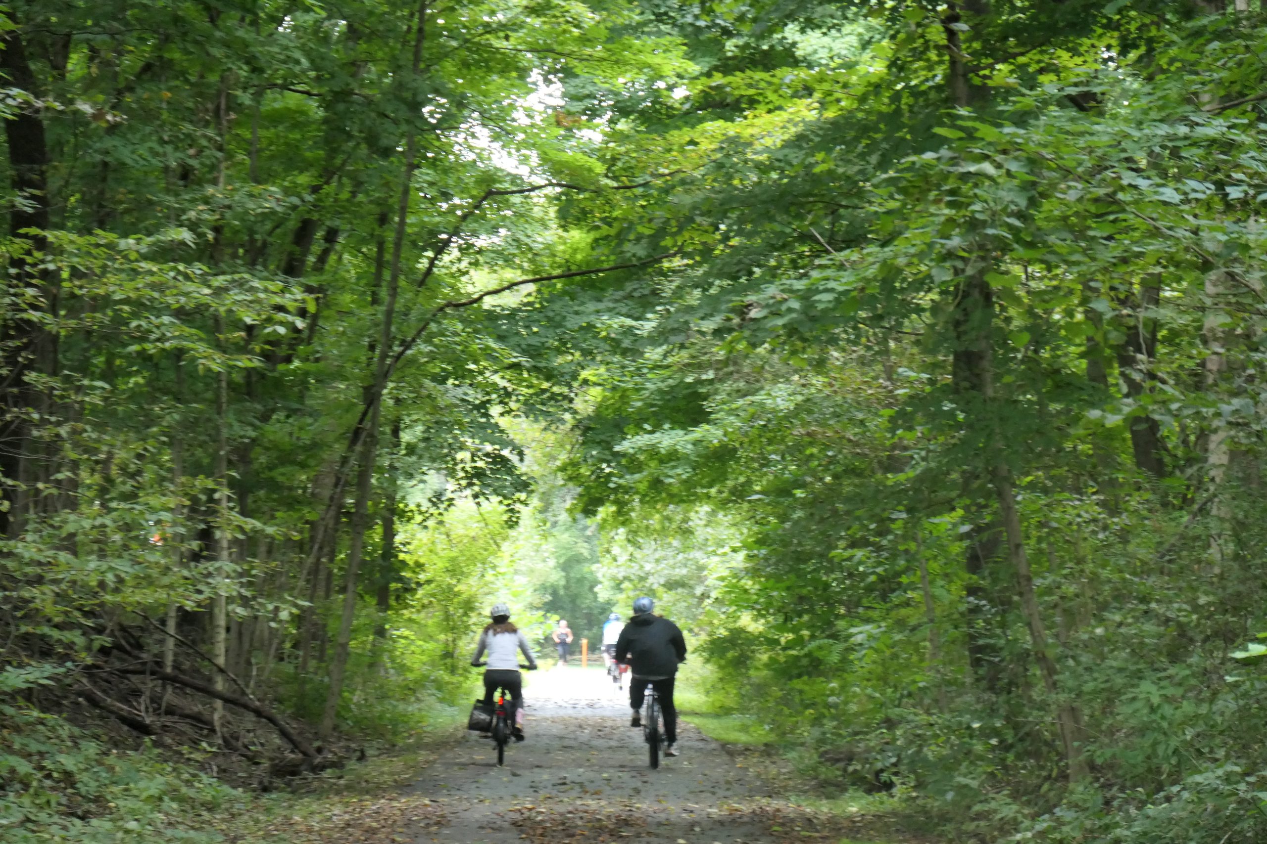
The Ohio to Erie Trail is one of more than 150 trails that when connected, will form the 3,700-mile long Great American Rail-Trail, from Washington DC to Washington State © Karen Rubin/goingplacesfarandnear.com

Ohio’s first Trail Towns are in the outskirts of Columbus, the 14th largest city in the US and the largest city on the Great American Rail-Trail. The city is working to create links and connections to the trails, including adding bus services with bike racks so people can shuttle to and from the trails instead of doubling back and a new bike trail map has curated routes accessed on Linkus through the Central Ohio Transit Authority (COTA).

They are working to create their own Trail Towns site but for now, information is available on CentralOhioGreenways.com.

For more information on the Great American Rail-Trail, visit: https://www.railstotrails.org/site/greatamericanrailtrail/

Next: ‘It Was a Choice’: Columbus, Ohio Allocates $250 Million to Build 150 Miles of Biking, Walking Trails

See also:

Imagine Biking 3,700 Miles Across the USA on The Great American Rail-Trail

Grassroots Volunteerism Builds the Great American Rail-Trail

‘One Mile at a Time.’ New Trails Are Links in Building the 3,700-Mile Great American Rail-Trail

__________________

© 2026 Travel Features Syndicate, a division of Workstyles, Inc. All rights reserved. Visit goingplacesfarandnear.com, longislandpress.com/category/vacation-travel.com and travelwritersmagazine.com/TravelFeaturesSyndicate/. Blogging at goingplacesnearandfar.wordpress.com and moralcompasstravel.info. Visit instagram.com/going_places_far_and_near. X: @TravelFeatures Threads: @news_and_photo_features ‘Like’ us atfacebook.com/NewsPhotoFeatures. Send comments/questions to FamTravLtr@aol.com.

‘One Mile at a Time.’ New Trails Are Links in Building the 3,700-Mile Great American Rail-Trail

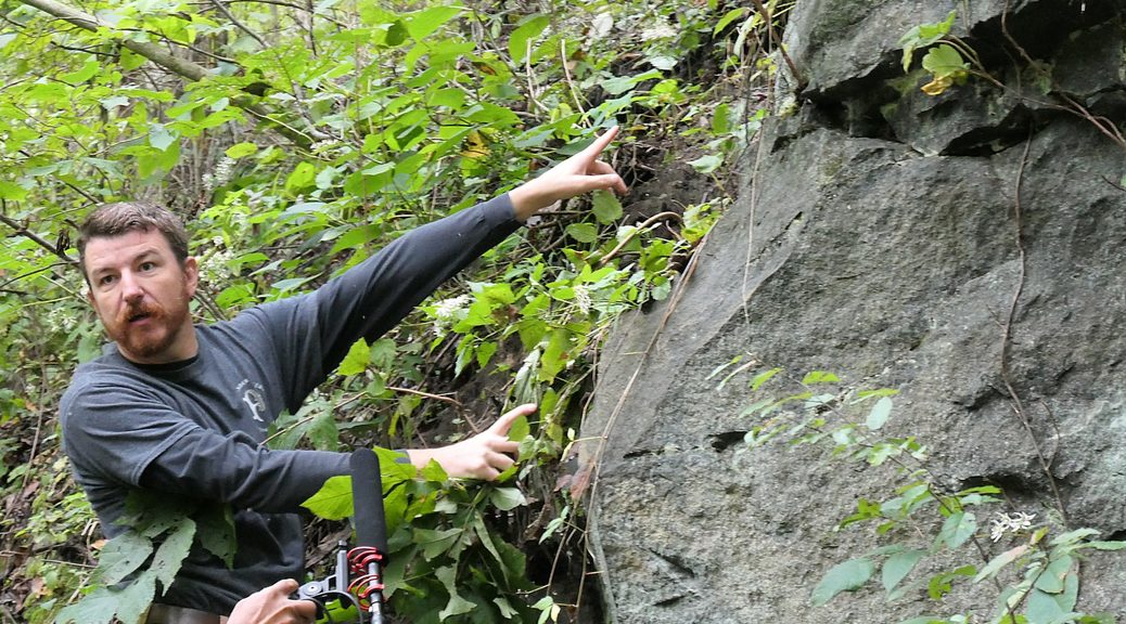
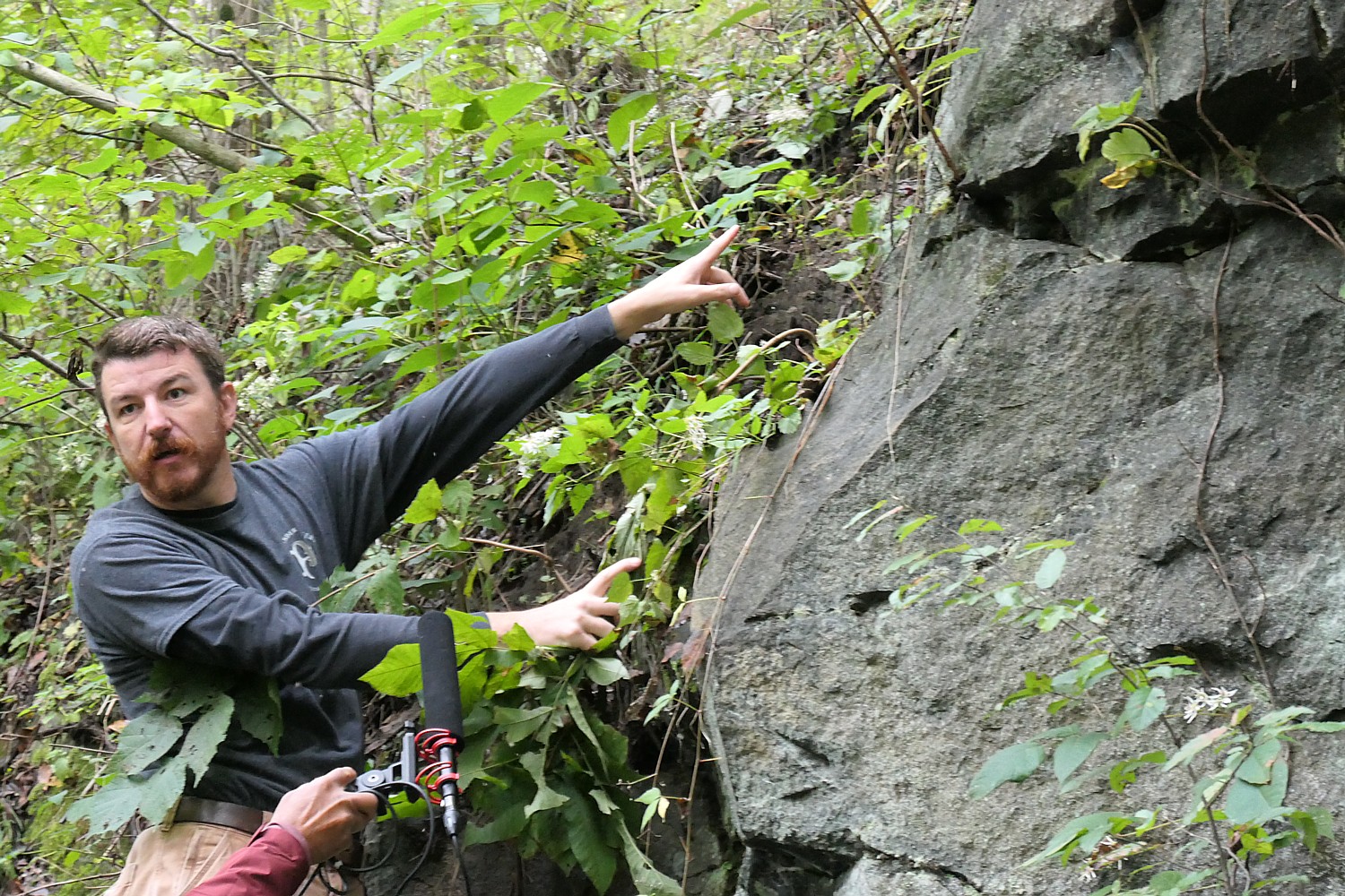
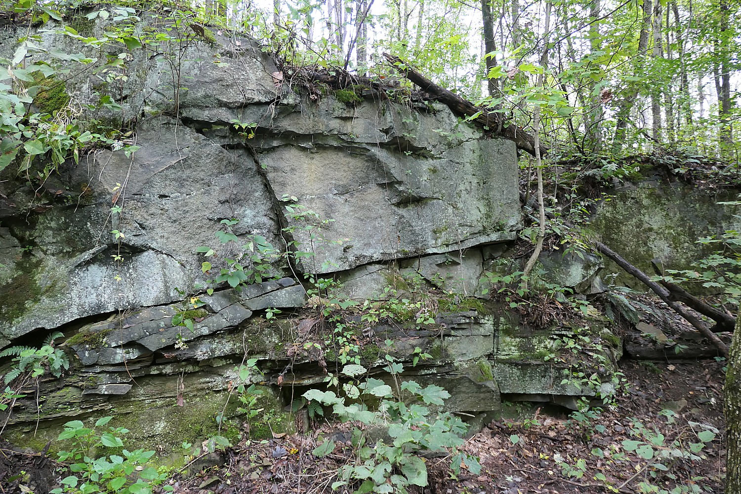
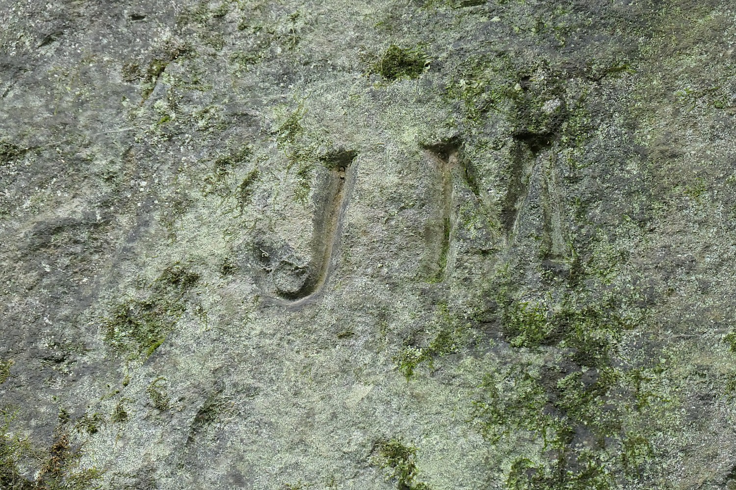
Aaron Dodds, program manager for Jefferson Soil Water Conservation District points to Hellbender Preserve’s “Ghost Wall” where Irish immigrant and freed Black Americans tunnel workers would carve their initials into rock, that mysteriously appear and disappear © Karen Rubin/goingplacesfarnandnear.com

By Karen Rubin, Travel Features Syndicate, goingplacesfarandnear.com

Within this one mile that cuts through Ohio forest, there are stories: reclusive Hellbender salamanders that grow to 28 inches long; a bridge where Abraham Lincoln nearly lost his life on the way to his inauguration; a rail tunnel, slightly askew, built by warring groups of Irish immigrants; a Ghost Wall, where they carved their initials that today appear, disappear and new initials reveal themselves.

It’s only a mile long now slicing through Hellbender Preserve, but it is the first new mile of multi-use trail in Jefferson County; four more miles will soon be added. Ultimately, it will be part of a 15-mile connector along the Great American Rail-Trail, a 3,700-mile network of biking/walking trails across America, from Washington DC to Washington State.

Even the story about how the Hellbender trail was re-discovered is worthy of a novel.

This was the Old Panhandler Rail Line, but after they built a new route and bypassed this one, the 273 acre-property was abandoned in 1949 and taken over by forest.

Hellbender Preserve is only one year old – it opened on National Trails Day 2025 – and within the first six months after opening, 30,000 visited.

The “Ghost Wall” in Hellbender Preserve, where the first new mile of multi-use trail in Ohio’s Jefferson County has just opened and eventually will connect to the Great American Rail-Trail, 3,700-miles across the USA from Washington DC to Washington State © Karen Rubin/goingplacesfarnandnear.com

“The trail builds community, provides an opportunity to meet, get out. We’re in the Rust Belt where healthcare isn’t a priority. This is passive way to get out, get fit,” Aaron Dodds, program manager for Jefferson Soil Water Conservation District, tells us as we walk through.  “It’s great for conservation and railroad history.”

“The railroad hired Irish workers to build it because they were cheap and expendable. They came for the American Dream and carved their names and initials in the rock walls.” When they expanded the railroad from single to double track, they brought freed slaves who also carved their names. Depending on the light, you can see the names, which later disappear and other names emerge. The names come and go. They have identified 80 different names so far. That’s why they call it the Ghost Wall.

Initials in the “Ghost Wall” in Hellbender Preserve, where the first new mile of multi-use trail in Ohio’s Jefferson County has just opened and eventually will connect to the Great American Rail-Trail © Karen Rubin/goingplacesfarnandnear.com

“The Irish were cheap, expendable. They first used old canal diggers from County Cork (Corkonians) and then Far Downers (from farther down Ireland). They hated each other.” They lived in separate camps and worked different sides of the tunnel. But when they came together, they found they were four feet off.

“A war broke out. They went at each other with pick axes. The Corkonians raided Far Downers, chased them to the hillsides, then throw them off.”

The tunnel which triggered a war between factions of Irish railroad workers is now part of the trail through Hellbender Preserve © Karen Rubin/goingplacesfarnandnear.com

Far Downers broke into the Steubenville Armory and rolled out a cannon to Market Street, and fired on the Corkonians. The governor called in the state militia – it took four days to quell the violence. In the end, they figured out how to link up the tunnel (it is only slightly askew today). “It wasn’t worth a war.” Dodds wears a t-shirt with the newspaper clipping printed on the back,

We come to the Lincoln Bridge and Dodds tells of a critical historical event that was almost lost to history – how Abraham Lincoln, traveling by rail to his inauguration, got stuck in a severe rainstorm that damaged this bridge and the passengers were told to walk over in case the train would have caused it to collapse; he nearly lost his life as he walked, holding his sons’ hands when he fell and was nearly swept into the water.

“Lincoln Bridge,” on the former railroad line, where the president-elect nearly lost his life and rebuilt to serve Union troops during the Civil War © Karen Rubin/goingplacesfarnandnear.com

Lincoln made it to Fort Steuben in Steubenville where he gave a speech on the train platform – the first time against a backdrop of seven states succeeding from the union in reaction to his election.

“Now Steubenville didn’t love Lincoln,” Dodds related. “He was described as ugly and an awful speaker (with a high-pitched voice). That is what was reported when in fact, he was ‘workshopping’ his inaugural address,” considered one of his most important, in which he set the Constitutional and moral framework for keeping the Union together.

Remarkably, Lincoln’s speech was forgotten until they began searching for the provenance of the land to acquire the preserve. “This event was lost to history, but a railroad vice president had collected newspaper clippings” which reported the event “and a railroad engineer atlas verified it.”

The Steubenville Herald reported on the four-day riot by Irish tunnel workers, now part of the trail through Hellbender Preserve © Karen Rubin/goingplacesfarnandnear.com

After the Battle of Fort Sumter in April 1861, Lincoln remembered the bridge. The Battle of Bull Run was looming. Lincoln knew he needed to get Union troops to the east, so he directed that the bridge where he almost lost his life be rebuilt. It took just eight months with a massive workforce and now named for him.

The bridge is just before we enter the 970-foot long, double track tunnel. Just feet beyond the tunnel is where the trail ends for now.

This one-mile is in the middle of what will be a 15-mile-long trail; so far, they have three miles and are working to open five more.

The State of Ohio owned the land – acquired from ConRail – but was inaccessible to the public for all this time. The state didn’t even realize it owned it until 2015 when the commission did a title search in order to acquire it (and uncovered the Lincoln story). The state willingly donated the land to the commission for a multi-use trail, but it still took five more years.

Good neighbor Mike Ruthen sets out bikes for visitors to Hellbender Preserve to use and is one of the volunteers who help maintain the rail-trail which will ultimately connect to the Great American Rail-Trail © Karen Rubin/goingplacesfarandnear.com

Mike Ruthen, whose gorgeous property along the creek is immediately adjacent to the property, puts bikes out for visitors to use and volunteers to help maintain the trail. “He saw the joy on people’s faces when they come,” Dodds said.

“One mile at a time. The trail builds community,” he said.

Hellbender Trail, https://www.traillink.com/trail/hellbender-preserve-trail/  

Ribbon Cutting in Orrville 

As we drive into Orrville, Ohio, we see Amish driving horse-drawn carriages, pass a Lehman’s store (everything you ever needed to buy is at Lehman’s), and the headquarters for The J.M. Smucker Company (Smucker’s!), where you see railroad tracks that come right up to the entrance.

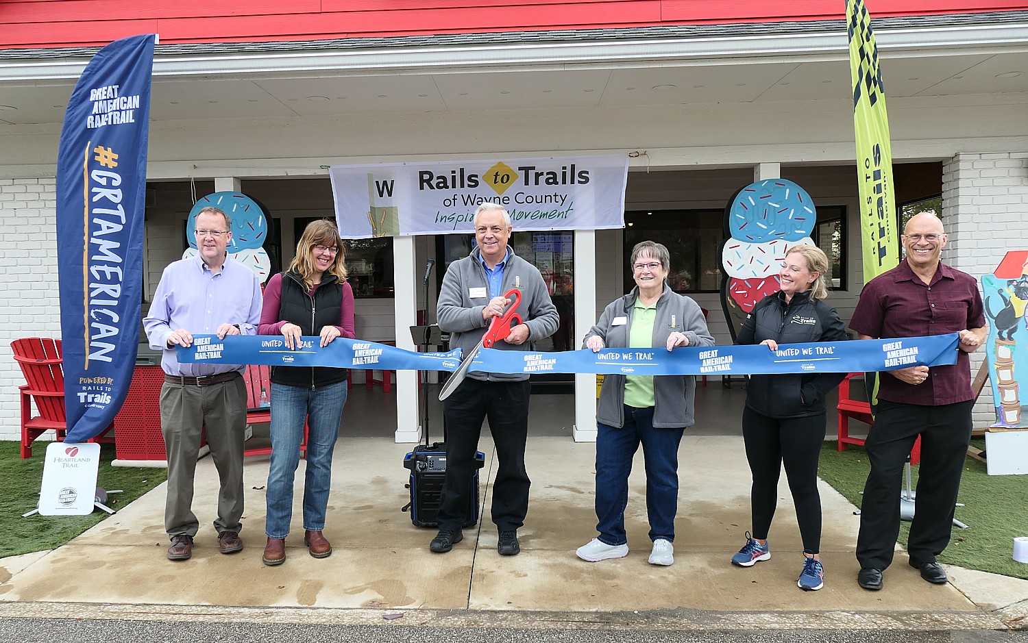
We have come to Orrville to celebrate with Rails to Trails of Wayne County the ribbon cutting for 2.7 new miles of the Heartland Trail, a connector to the Great American Rail-Trail.

Don Noble of Rails to Trails Allegheny, with state and local leaders and Brandi Horton, Rails to Trails Conservancy’s Vice President, Communications, cut the ribbon celebrating the opening of 2.7 new miles of Ohio’s Heartland Trail which will ultimately connect to the Great American Rail-Trail © Karen Rubin/goingplacesfarandnear.com

The new section begins at the downtown trailhead, just 3 blocks from the Orrville Historical Museum and Orville Railroad Heritage Society on Depot Street. The trail then threads northward through the downtown business district and Orrville Dog Park before connecting to the former Cleveland, Akron, and Columbus (CA&C) rail corridor near Little Chippewa Creek, then continues along the former railbed to Marshallville, terminating at Coal Bank Road.

Don Noble, Board President Rails to Trails of Wayne County, noted that along the trail in Marshallville, there is an unusual “geologic unconformity” dating from the Carboniferous Period (360–299 million years ago) when erosion removed older (Mississippian) rocks before younger (Pennsylvanian) rocks were deposited. The rare geologic feature was revealed during the construction of the railroad. 

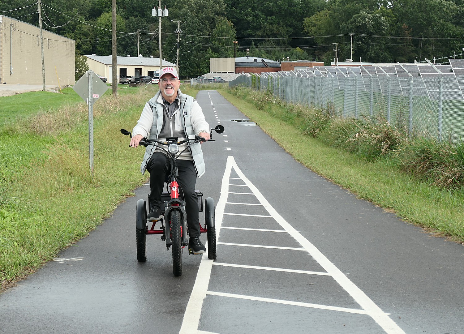
Victor Schantz of Orrville, takes a ride on the new section of Ohio’s Heartland Trail, one of more than 150 trails that will connect 3,700 miles of the Great American Rail-Trail, from Washington DC to Washington state © Karen Rubin/goingplacesfarandnear.com

Rails to Trails of Wayne County put in an application to Ohio Department of Transportation in 2020 and received $1.33 million – 58% of the total cost – but the city and donors had to come up with the rest – Ohio Clean put up $200,000; the City of Orrville, $238,000, and a foundation gave $535,000,

The group has managed to complete two sections in one year (1.7 and 1.1 miles each), from downtown Orrville north of Marshallville – a total of 7 miles in order to eventually connect to the Great American Rail-Trail.

Rails to Trails of Wayne County hopes to complete another extension of the trail that will connect it to Clinton where it will connect to the Ohio & Erie Towpath Trail, which spans 80 miles from Cleveland to Bolivar.

“This is a great day for Orrville,” Mayor Matt Plybon said. “Years ago, people saw the old railroad bed and saw what could become. This moves Orrville closer to becoming true trail town, neighbors and beyond…We welcome people who come- shop, eat, experience community, meet people. Trails may connect place but their best value is when they connect people.”

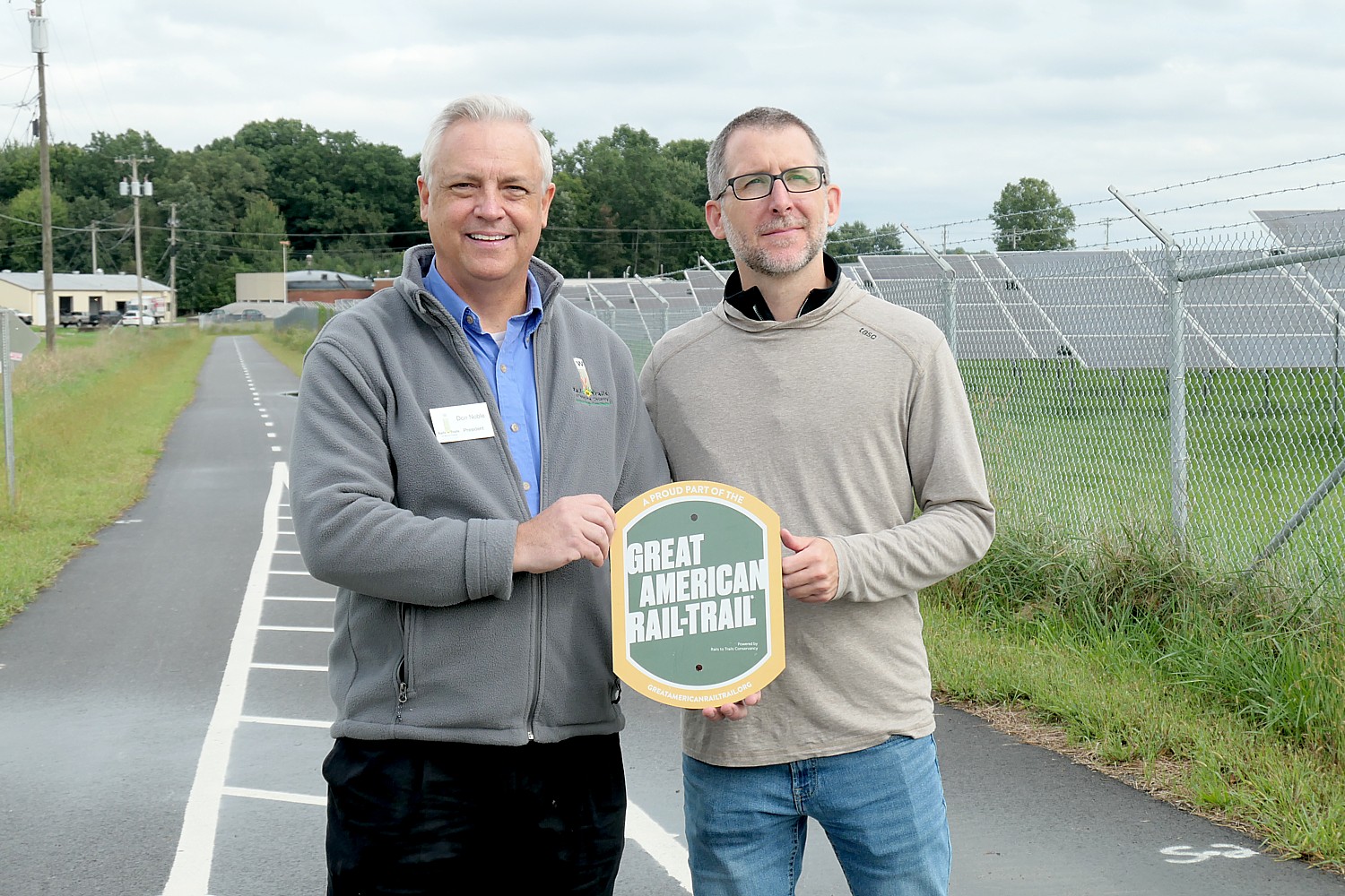
Don Noble of Rails to Trails Allegheny and Kevin Belle, Rails to Trails Conservancy’s Project Director, celebrate the opening of 2.7 new miles of the Heartland Trail, a connector to the Great American Rail-Trail © Karen Rubin/goingplacesfarandnear.com

As we sit together for lunch with many of the Rails to Trails of Wayne County volunteers and officials it becomes clear:  It may take years before all 3,700 miles of the Great American Rail-Trail across America are connected, but every foot and every mile of trail impacts people today in tangible ways – those who live in community and those who come to visit – economically, health and wellness, building community and social connections, and pride.

Leaving Orrville, Kevin Belle, who has spent 10 years as Rails to Trails Conservancy’s Project Director for the Great American Rail-Trail, reflected that they have successfully closed 10 gaps in less than 10 years.

“They are coming more frequently now,” he said, with the pride of a new father or more accurately, a midwife who has helped in the birth of a baby. “Close the gap. Open the trail.”

The Great American Rail-Trail will extend 3,700 miles across the USA, enabling biking, walking, hiking from Washington DC to Washington State. “This is the most ambitious public lands project in generations, but unlike other projects, this is the result of the determination of regular people, groups, private donations, working in conjunction with local, state and federal government, reflected Brandi Horton, Rails to Trails Conservancy’s Vice President, Communications.

Heartland Trail, https://www.traillink.com/trail/heartland-trail-/

For more information on the Great American Rail-Trail, visit: https://www.railstotrails.org/site/greatamericanrailtrail/

Next: Railtowns, Canaltowns, Rivertowns, GhostTowns – Now Trail Towns

See also:

Imagine Biking 3,700 Miles Across the USA on The Great American Rail-Trail

Grassroots Volunteerism Builds the Great American Rail-Trail

__________________

© 2026 Travel Features Syndicate, a division of Workstyles, Inc. All rights reserved. Visit goingplacesfarandnear.com, longislandpress.com/category/vacation-travel.com and travelwritersmagazine.com/TravelFeaturesSyndicate/. Blogging at goingplacesnearandfar.wordpress.com and moralcompasstravel.info. Visit instagram.com/going_places_far_and_near. X: @TravelFeatures Threads: @news_and_photo_features ‘Like’ us atfacebook.com/NewsPhotoFeatures. Send comments/questions to FamTravLtr@aol.com.
Grassroots, Volunteerism Builds the Great American Rail-Trail

The repurposed McDonald viaduct, built in 1913, is one of the highlights of biking the Montour Trail, one of more than 150 trails that will make up the 3,700-mile Great American Rail-Trail, from Washington DC to Washington State © Karen Rubin/goingplacesfarandnear.com

By Karen Rubin, Travel Features Syndicate, goingplacesfarandnear.com

Unlike the Interstate Highway, the Intercontinental Railway or the Erie Canal, the Great American Rail-Trail is being created by hundreds of local communities, organizations, agencies and volunteers, who appreciate what such recreational trails mean for quality of life, health and wellness and economic vitality.

When completed, the Great American Rail-Trail will provide 3,700 miles, from Washington DC to Washington State, of connected multiuse trails and byways for biking and walking,

More than half of the route – over 150 existing railtrails, canalways, bikeways and greenways across 12 states totaling 2100 miles – is completed, the most complete stage letting you ride 350 miles from Washington DC to Cumberland Md. on the C&O canalway, connecting to the Great Allegheny Passage from Cumberland into Pittsburgh.

Now the task falls to connect more than 80 gaps, totaling 1,600 miles, with trails.

And that’s where we start our tour with Rails to Trails Conservancy, the stewards leading some 150 partners in the project, to see for ourselves how the Great American Rail-Trail is unfolding, what is happening to bring this 40-year vision of Rails to Trails’ co-founder David Burwell to reality.

Point State Park is where the longest completed segment of the Great American Rail-Trail, 350 miles from Washington DC to Pittsburgh on the C&O Canalway and the Great Allegheny Passage ends and there is a 9.8-mile gap to get to the Montour Trail  © Karen Rubin/goingplacesfarandnear.com

At Pittsburgh’s Point State Park we come to the place where the Great Allegheny Passage ends and the first significant gap looms:  9.8-miles along the heavily trafficked West Carson Street, sandwiched between high stone walls and rail lines hugging the riverfront, posing the problem that even if there is a will, it is hard to find a way with such constricted space.

Our Rails to Trails Conservancy group shuttles by van to the next trail on the Great American Rail-Trail (GART), the Montour, stretching 63-miles to form a necklace around the south Greater Pittsburgh Area. Julian Wolfe, Board President of Montour Trail Council, boasts that the private, nonprofit, “100 percent volunteer” trail, supported by some 1,300 dues-paying members, is the longest suburban trail in the nation.  

Montour Trail volunteers take justified pride in the legacy they have created © Karen Rubin/goingplacesfarandnear.com

Here we meet a dozen of the more than 50 volunteers who give of their time (22,000 hours a year!), expertise and money to maintain and improve the trail and close a remaining four-mile gap. To create the Montour, they had to repurpose bridges, trestles, viaducts and tunnels, and create the connector to the Panhandle Trail that provides the next stage of the GART linking Pennsylvania to West Virginia.

We meet three of the original founders who got the idea 37 years ago for the trail and acquired the abandoned rail line from the railroad in 1991. Now they are faced with new challenges: raising $3 million to repair a 1913 tunnel at mile 25 which has been closed for 10 months after the ceiling collapsed, filling a four-mile gap on the existing trail, and most challenging of all, creating that 9.8-mile connector from the Great Allegheny Passage (GAP) in downtown Pittsburgh to the Montour trailhead. Once that gap is filled, it will be possible to bike all the way from Washington DC to West Virginia and the next significant gap.

The McDonald viaduct, built in 1913, on the Montour Trail. The Montour Trail Council raised $2.3 million to renovate it. Montour Trail Council President Julian Wolfe shows us a photo of the bridge, built in 1913, as it was in 1915 with a steam train going over it. © Karen Rubin/goingplacesfarandnear.com

These volunteers and advocates recognize that bikeways and greenways bring so much benefit to local communities – quality of life, health and wellness, and economic development, even increasing property values. But they also build community.

Each project has had its challenges – to pave or put down a surface; rebuild a bridge, a trestle, a tunnel; acquire land or easements; create the infrastructure of parking lots, restrooms, signage and safe crossings.

Biking through tunnels on the Montour Trail © Karen Rubin/goingplacesfarandnear.com

What we see in the volunteers and officials and organizers is the pure joy and pride in creating these trails that have such impact on their neighbors today and for generations to come, and the satisfaction that comes knowing this is their legacy.

We bike the Montour Trail from mile zero to mile 16.6 where we will take the connector to the Panhandle Trail. But first, we ride just beyond the connector to the McDonald viaduct, a key attraction on the trail and point of considerable pride for the Montour Trail Council. The council raised $2.3 million to renovate it. Wolfe shows us a photo of the viaduct, built in 1913, as it was in 1915 with a steam train going over it (www.traillink.com/trail/montour-trail).

The repurposed McDonald viaduct, built in 1913, is one of the highlights of biking the Montour Trail, one of more than 150 trails that will make up the 3,700-mile Great American Rail-Trail, from Washington DC to Washington State © Karen Rubin/goingplacesfarandnear.com

“When trails were first proposed, a lot of people say it will be a nuisance and don’t want it in my backyard. But when it is done, they see their property values increase with the development that comes with the trail, because people love the amenities,” Dave Borrebach, a long-serving board member and volunteer leader for the Montour Trail Council, tells us as we tour the McDonald viaduct. “Coraopolis is deprived of greenspace, so the trail gives the community the opportunity to get to nature. Trails represent making connection – municipalities, private, contractors – all elements brought together, carefully, blended. Continuity of organization is key – putting the pieces together takes a tremendous amount of time.”

The Montour Trail, he said, is the culmination of “37 years of effort, little by little, persistence and luck…The Founding Fathers [of Montour] organized quickly, made the right decisions of time, funding, legal counsel (an expert in rail law). It all had to come together.”

We take the Panhandle Connector and drop down from the Montour Trail, passing under the viaduct for a great view onto the Panhandle Trail.

Bikers stop for lunch at Paradise on Panhandle, in a repurposed train depot on the Panhandle Trail © Karen Rubin/goingplacesfarandnear.com

We stop at the Paradise on Panhandle for lunch, in the repurposed train depot beside the trail.

There is a historic marker – one of 20 put up by Trails Across America, another project of Rails to Trails Conservancy – that notes, “Coal Mining. As early as 1903, bituminous coal from local mines shipped from here on Pittsburgh, Cincinnati, Chicago & St. Louis Railway.”

Biking the Panhandle Trail, from Pennsylvania to West Virginia © Karen Rubin/goingplacesfarandnear.com

Fortified by a delightful lunch (and delicious ice cream), we go back on the trail and find ourselves at a marker between Pennsylvania and West Virginia, where we continue on for four miles before we come to the Panhandle Trail’s end (www.traillink.com/trail/panhandle-trail).

Crossing from Pennsylvania to West Virginia on the Panhandle Trail © Karen Rubin/goingplacesfarandnear.com

We soon face another critical gap: the Market Street Bridge linking Weirton, West Virginia, and Steubenville, Ohio, which carried bikes and walkers in addition to four lanes of cars. It was closed indefinitely on December 21, 2023 after routine inspections revealed broken strands and significant deterioration in the 1906 steel suspension bridge’s cable anchoring system.

The bridge is a case in point of the challenge faced in building the Great American Rail-Trail.

Closing of the 1906 steel suspension Market Street bridge, linking West Virginia and Ohio is a significant impediment to bikers and walkers but also to finishing the 3,700-mile Great American Rail-Trail  © Karen Rubin/goingplacesfarandnear.com

It will cost about $200 million to replace and though the Biden Administration already approved $87.5 million, West Virginia, which owns the bridge, must come up with the rest by September 30, 2027 or lose the federal funding.

Now the task is to try to get extra money from the Surface Transportation Fund, which funds Active Transportation Infrastructure Projects. But this requires support from West Virginia’s Senator Shelley Wellons Moore Capito who sits on the Surface Transportation committee and she works closely with House Transportation Chair Representative Sam Graves (R-MO), who has vowed to cut all federal funding for walking and biking paths. 

At a reception in Steubenville for Rails to Trails Conservancy at historic Fort Steuben next to the Market Street Bridge, the mayors of Weirton WV and Steubenville OH expressed support for rebuilding the bridge.

“This bridge is vital to revitalization and community,” said Ralph Petrella Mayor City of Steubenville, OH. “People want to go outside. They don’t want malls, they want nature. This is an opportunity for national entity to help give those experiences.”

“We see the importance of the trail – exercise, meeting people (socialization) – important to Weirton,” said Dean Harris Mayor City of Weirton, WV. “Bridge needs to have pathway for walkers, bikers across Ohio River (great Divide). The economic development of our area depends on this bridge. We need to get the link completed and join our two cities – for the economic prosperity of area.”

Eric Oberg, Rail to Trails Conservancy’s Senior Director of Programs, Dean Harris Mayor City of Weirton, WV., Ralph Petrella Mayor City of Steubenville, OH are united in calling for the rebuilding of the Market Street Bridge. © Karen Rubin/goingplacesfarandnear.com

“We need to work with you to achieve this vision of a safe, accessible way to help people walk or bike across country. We want to be partner, to tell the story of a beautiful part of the country,” said Eric Oberg, Rail to Trails Conservancy’s Senior Director of Programs. “People want to see, experience, visit places like this, the Industrial Heartland.”

He took strong exception to the notion it could take 20 years to rebuild the bridge.

“Our message: speed up, prioritize. Just because historically took 20 years doesn’t mean it has to now. Communities fall into the trap that it costs too much money and takes obscene amount of time.” (You only have to look at the pace of data center construction, which blights, rather than benefits local communities.)

Oberg pointed to how fast the Interstate 35W Bridge in Minneapolis was rebuilt after it collapsed, the speed in rebuilding the Key Bridge in Baltimore (at a cost of $5 billion) and how the I-95 interstate in Philadelphia was reopened in 12 days and fully repaired in less than a year.

“The narrative that it takes 20 years shouldn’t be acceptable. We shouldn’t allow public leadership and agencies to take 20 years to develop critical infrastructure.”

These bike trails are an investment in infrastructure that benefits locals as much as visitors (think of overtourism, and how this spreads visitors and economic development around to the villages, towns they would never know to visit or be inspired to visit and not in the far future but today.

The trail brought us to Steubenville, which we learn, is the birth place of Dean Martin, who is featured in an important attraction, Historic Fort Steuben, and was the birthplace of Edwin M. Stanton, Abraham Lincoln’s Secretary of War and a strong abolitionist who backed Emancipation; Lincoln’s telegrapher, David Homer Bates; and Moses Fleetwood Walker, the first Black man to play in Major League Baseball, breaking the sport’s color barrier 63 years before Jackie Robinson.

Steubenville hosts Free Fridays events every month and an important Nutcracker Village Christmas festival (Nov.24-Jan. 8), displaying 230 life-sized carved Nutcrackers as the centerpiece of a free Christmas-market that now draws 40,000-50,000 people (www.SteubenvilleNutcrackerVillage.com).

For more information on the Great American Rail-Trail, visit: https://www.railstotrails.org/site/greatamericanrailtrail/

Next: ‘One Mile at a Time.’ New Trails Are Links in Building the 3,700-Mile Great American Rail-Trail

See also: Imagine Biking 3,700 Miles Across the USA on The Great American Rail-Trail

__________________

© 2026 Travel Features Syndicate, a division of Workstyles, Inc. All rights reserved. Visit goingplacesfarandnear.com, longislandpress.com/category/vacation-travel.com and travelwritersmagazine.com/TravelFeaturesSyndicate/. Blogging at goingplacesnearandfar.wordpress.com and moralcompasstravel.info. Visit instagram.com/going_places_far_and_near. X: @TravelFeatures Threads: @news_and_photo_features ‘Like’ us atfacebook.com/NewsPhotoFeatures. Send comments/questions to FamTravLtr@aol.com.
Imagine Biking 3,700 Miles Across the USA on The Great American Rail-Trail

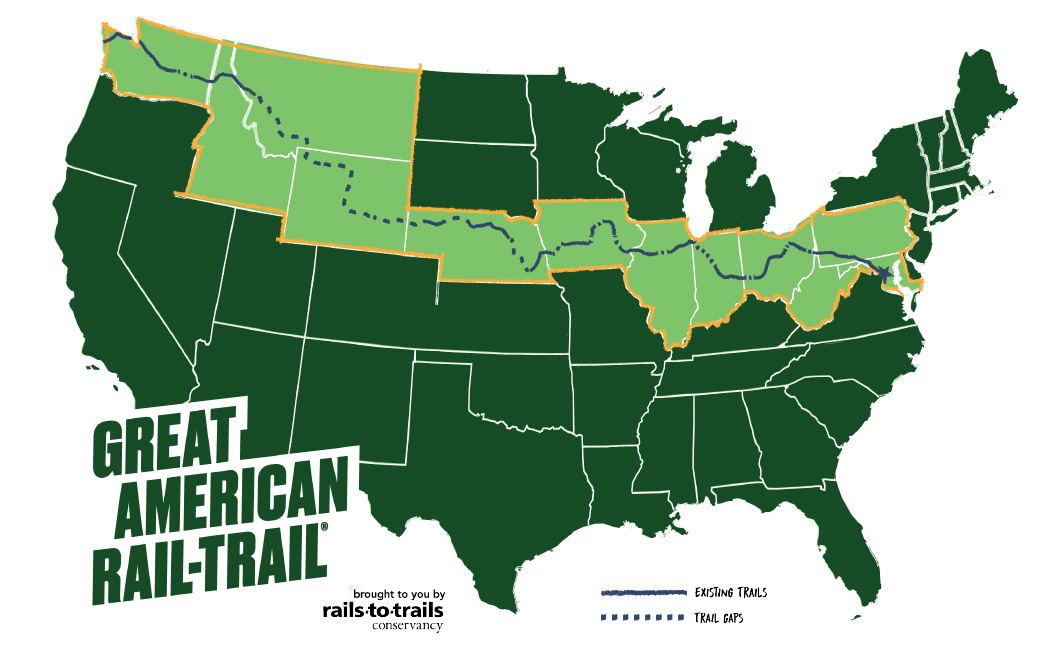
A vision for a 3,700 mile-long Great American Rail-Trail linking Washington DC to Washington State is becoming reality (map: Rails to Trails Conservancy)

By Karen Rubin, Travel Features Syndicate, goingplacesfarandnear.com

Imagine being able to bike 3,700 miles across the United States, from Washington DC to Washington State, on a network of connected, protected trails, the way people hike the Pacific Crest National Scenic Trail and the Appalachian Trail. This is the vision for the Great American Rail-Trail, and I didn’t have to imagine, because I was able to bike newly made trail connections bringing the GART to reality.

The trail now consists of more than 150 existing railtrails, canalways, bikeways and multi-use trails – 2100 miles through 12 states and DC – totaling 56% of the 3,700 miles when complete. These include some of America’s most famous and popular rail trails like the C&O Canalway from DC to Cumberland Md., where it connects to the Great Allegheny Passage (the GAP) railtrail to Pittsburgh, PA, which together form the longest (and most well used) completed stage, 350 miles long.

Biking the popular Great Allegheny Passage (GAP) trail, 150 miles from Cumberland, Md. To Pittsburgh, PA, one of the key sections of the 3,700-mile long Great American Rail-Trail © Karen Rubin/goingplacesfarandnear.com

It would be the largest, most ambitious public transport endeavor since the Interstate Highway and the Intercontinental Railroad, and longer than the longest Interstate Highway, Interstate 90 (I-90), 3,020 miles from Seattle, Washington, to Boston, Massachusetts, and longer than the Intercontinental Railroad project, 1,911 miles.

But unlike the Interstate Highway or the Transcontinental Railroad, the Great American Rail Trail is an enterprise of the local people who want to transform abandoned byways into leisure trails and greenways that can be enjoyed by residents and visitors alike, contributing to health and wellness (when being healthy is also key to financial health, productivity and prosperity), quality of life and economic vitality, instead of federal government exerting its eminent domain power or corporations blighting the environment in the name of “commerce,” reclaiming commercial and industrial land for public use. And it is about transport – accessibility, mobility for those who prefer to travel safely by foot or on two wheels.

“The Great American Rail-Trail is the most ambitious [public lands project] to connect East and West Coasts,” said Rails to Trails Conservancy’s Kevin Belle, Project Director, Great American Rail-Trail. The Great American Rail-Trail brings the promise of a new American experience – comparable to Route 66. 50 million people live within 50 miles of the route.

GART was the dream 40 years ago of Rails to Trails Conservancy co-founder David Burwell, who had the vision of converting disused rail corridors into a continuous, cross-country trail network. “He believed trails connect the country,“ said Eric Oberg, R2T’s Senior Director of Programs. “Every trail head feels like that – a cross section of the place we live. Trails are where community happens now – the new Main Street.”

Rails to Trails Conservancy, which is stewarding the Great American Rail-Trail project and leading a coalition of more than 150 partners, announced it six years ago, when half of the 3,700 miles were in place. It took two years to devise the route. (See a map, list).

The task now is to fill some 80 gaps – 1,600 miles – which is what brings R2T project managers and developers around the country, working with local groups.

The states and agencies and organizations for the more than 150 trails that form the backbone were eager to become a part of the Great American Rail-Trail, fully appreciating the enormous benefits that railtrails, canalways, bikeways and greenways bring to cities, towns and rural villages, and what being identified with a national network would mean. Eric Oberg, R2T’s Senior Director of Programs, explained.

An economic impact study projects GART investments could generate more than $229.4 million in visitor spending, 2,500 new jobs and $104 million in labor income, and $22.8 million in new tax revenue.

The GAP, for example, cost about $1 billion to build but brings 1 million users (they know because they have sensors under the trail that count), who spend $120 million a year,. In addition to the benefits to locals – health and wellness, outdoor recreation, increased mobility and safety away from dangerous road traffic, higher property values – the people who are drawn from around the country and the world spend money on hotels, restaurants, gear – $30 million worth in Pittsburgh alone; some even find a new place to set up a business and raise a family.

You would have a network of outfitters and bike tour operators at the ready to provide rental bikes, shuttle service, book lodging or direct you to campgrounds or trailside hostels, who can assist you in doing stages – as many as you want linked together, or come back and do new sections. (Many of these services for the existing trails are also easily found on Great American Rail-Trail’s website, and R2T’s TrailLink and mobile app, www.traillink.com, which details 40,000 miles of trails nationwide, and several tour operators like Wilderness Voyageurs and Discovery Bicycle Tours already feature these trails.)

We have been invited by Rails to Trails Conservancy, to bike trails from Pittsburgh to Columbus and see the vision of the GART unfold, what has already been achieved, and the task ahead in filling the gaps.

We meet Kelly Pack, the Trail Nation Accelerator Program Director, who counsels communities in eight states (WA, MT, AZ, MO, AK, IA, VA, TN), which are just starting development of a vision for a trail network. “We hope to provide the initial start of planning process – mapping support, bringing stakeholders together, to understand the importance [and benefits] of trails.” She explains how R2T can organize virtual workshops and create a “learning cohort” with communities that have had success creating trails.

“Every place is different but the challenges and strategies may be similar.”

We start our ride towards the end of the famous and popular Great Allegheny Passage (GAP) trail, to see a success story: a gap 8.2 miles long from Homestead along the Monongahela River, crossing near the Hot Metal Bridge, into Point State Park in downtown Pittsburgh, where the GAP ends. It took 20 years and $80 million (and a change of mayors) to finally complete the gap in 2013.

Volunteers help maintain it, forging community and pride. The trail contributes to public health, wellness and quality of life, and property values increase in communities along the trail, especially by repurposing aging, decaying abandoned rail lines, bridges and trestles and waterfront.

The historic site of the 1892 Homestead Steel Strike along the Monongahela River in Homestead(near Pittsburgh), where the massive Carnegie Steel Works once stood and on On July 6, 1892, striking steelworkers battled 300 armed private guards from the Pinkerton National Detective Agency who arrived on river barges to break a lockout orchestrated by plant manager Henry Clay Frick, one of the interesting places along the Great Allegheny Passage. © Karen Rubin/goingplacesfarandnear.com

Along the trail, you see purposely left remnants of steel plants as a tribute and continuity of heritage and history and a source of interest. We come to the pump plant where steel workers attempting to unionize were rebuffed by Pinkertons summoned by the governor when they attempted to strike for better wages and conditions.

The trail passes by the NFL Steelers training center. “When they built the stadium, Mayor Tom Murphy, asked Steelers owner Art Rooney to move the stadium back so the trail could come through, reclaiming what was taken from the public by and for industry,” said Bryan Perry, Executive Director of the Great Allegheny Passage Conservancy.

The repurposed bridge that connects Homestead to the end of the Great Allegheny Passage (GAP) in Pittsburgh on the Great American Rail-Trail © Karen Rubin/goingplacesfarandnear.com

We cross a bridge that used to be used to carry buckets of molten steel over the river, now repurposed to carry cars, bikes and walkers. Those steel plants and coal depots are gone now, instead, from the repurposed bridge you can see tech company buildings on one side, and hotels, housing, retail stores and a marina lining the other side, revitalizing the economy and the environment.

Showing off the repurposed bridge that connects Homestead to the end of the Great Allegheny Passage (GAP) in Pittsburgh on the Great American Rail-Trail © Karen Rubin/goingplacesfarandnear.com

Indeed, Pittsburgh has been transformed from a carbon-choked polluted city to this glorious, wonderfully liveable, sustainable city. Not coincidentally, it is called “the City of Trails,” where six national and regional trails originate and three rivers converge, their riverfronts reclaimed for public space (GAP, Three Rivers Heritage Trail, Erie to Pittsburgh Trail, Pittsburgh-to-Harrisburg Main Line Canal Greenway, Potomac Heritage National Scenic Trail, and Industrial Heartland Trails Coalition (IHTC) Network). and Great American Rail-Trail.

Pittsburgh is a “City of Trails”. At Point State Park, the Great Allegheny Passage (GAP) connects with the Three Rivers Heritage Trail© Karen Rubin/goingplacesfarandnear.com

And so we come to where the Great Allegheny Passage ends at Pittsburgh’s Point State Park where we encounter the first significant gap, a 9.8 mile section along a highly trafficked West Carson street, before reaching the next trail on the Great American Rail-Trail route, the Montour, which the Pittsburgh coalition has been working for two decades to connect.

It is not just for the benefit of long-haul, out-of-town users. “Solving the problem of West Carson would make Pittsburgh safer, better for pedestrians, bikers – cars, trucks pass at high speed, there is no dedicated space for bikes,” said Scott Bricker, co-founder and Executive Director of Bike Pittsburgh (BikePGH), a bicycle and pedestrian advocacy organization.  He noted that one-third of Pittsburgh residents do not drive.

West Carson in Pittsburgh poses a significant challenge to connecting the Great Allegheny Passage (GAP) trail to the Montour Trail on the Great American Rail-Trail © Karen Rubin/goingplacesfarandnear.com

“The trail system is only as strong as its links. Missing links deprive communities of the benefit of trail – economically, socially, quality of life and health,” said Kelsey Ripper, Executive Director Friends of the Riverfront.

“The key to the project is every single foot in every connection. There are 150 trails today – every foot took hard effort of all the people. Every one worth it,” said Belle, who has spent the past 10 years helping develop those links and connections.

Explore Route Assessment Report

View Economic Impact Report

Learn more about the preferred route, (www.railstotrails.org/site/greatamericanrailtrail/content/route)

States on Route

Route Through Washington, D.C.

Route Through Maryland

Route Through Pennsylvania

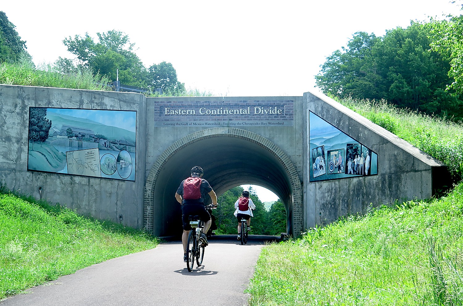
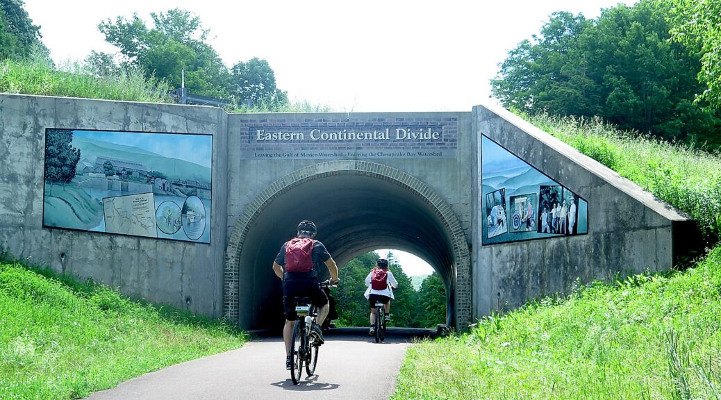
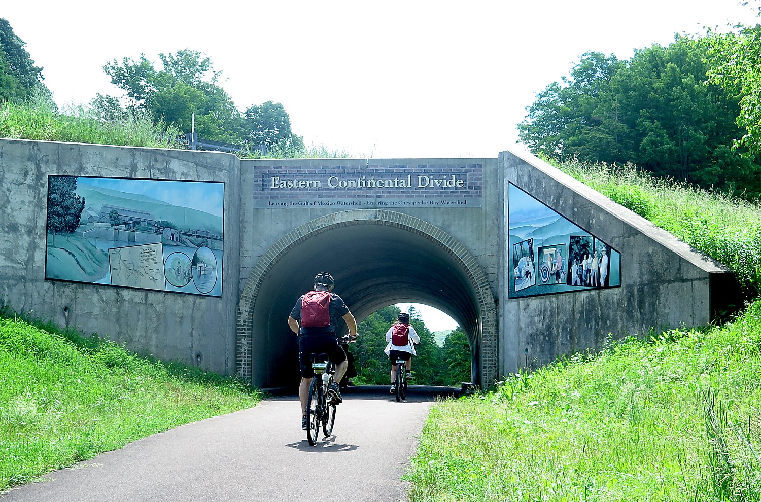
The extremely popular Great Allegheny Passage (GAP) forms one of the most complete stages of the Great American Rail-Trail, 150-miles to Pittsburgh from where it connects with the  C& O in Cumberland, Md., and crosses the Eastern Continental Divide  © Karen Rubin/goingplacesfarandnear.com

Route Through West Virginia

Route Through Ohio

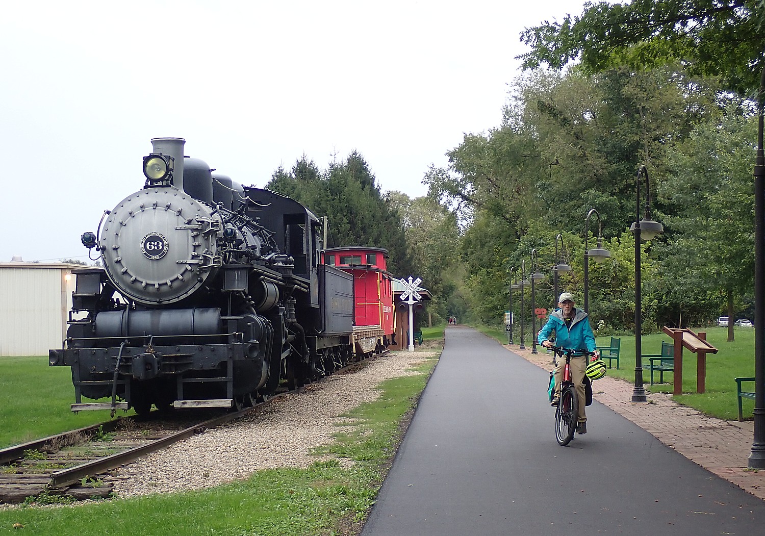
Ohio to Erie Trail takes us through Ohio’s Trail Towns like Gambier and into Columbus, the biggest city on the Great American Rail-Trail © Karen Rubin/goingplacesfarandnear.com

Route Through Indiana

Route Through Illinois

Route Through Iowa

Route Through Nebraska

Route Through Wyoming

Route Through Montana

Route Through Idaho

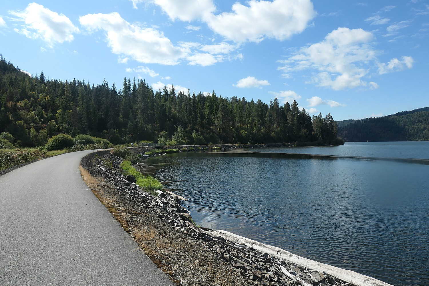
Idaho’s Trail of the Coeur d’Alenes is part of the Great American Rail-Trail © Karen Rubin/goingplacesfarandnear.com

Route Through Washington

For more information on the Great American Rail-Trail, visit: https://www.railstotrails.org/site/greatamericanrailtrail/

Next: The Great American Rail-Trail Comes Together with Grassroots Support, Volunteers

__________________

© 2026 Travel Features Syndicate, a division of Workstyles, Inc. All rights reserved. Visit goingplacesfarandnear.com, longislandpress.com/category/vacation-travel.com and travelwritersmagazine.com/TravelFeaturesSyndicate/. Blogging at goingplacesnearandfar.wordpress.com and moralcompasstravel.info. Visit instagram.com/going_places_far_and_near. X: @TravelFeatures Threads: @news_and_photo_features ‘Like’ us atfacebook.com/NewsPhotoFeatures. Send comments/questions to FamTravLtr@aol.com.
Biking Missouri’s Katy Trail Following Lewis & Clark, Daniel Boone & the Westward Expansion

Missouri Pride and community love of the Katy Trail is on view in art and community projects © Karen Rubin/goingplacesfarandnear.com

By Karen Rubin, Travel Features Syndicate, goingplacesfarandnear.com

Missouri’s Katy Trail, a Rails to Trails Conservancy Hall of Famer, is for bikers who want to ride 240 miles with pure abandon, with not much to distract unless you want to be distracted – such as by the historic markers that are fascinating, complete, and an excellent guide to what to look out for what I guarantee you would never have thought to look for.

Day 4 on Wilderness Voyageur’s six-day Katy Trail bike tour is another vigorous ride, 47.8 miles from the Missouri state capital, Jefferson City, to Hermann (elevation plus 772 ft, down 821 ft).

Starting out, though, we go back up that hill that provided such a dramatic view of the Capital Building the day before, back to the bridge over the river, and down the winding ramp (fun!), to the spur that brings us back onto the Katy Trail exactly where we turned off the day before.

Now we are back in Missouri’s farm land and a landscape that seems unchanged in 100 years. We ride passed fields of corn and soy, with the Manitou Bluffs in the distance beyond the plain.

The Katy Trail immerses cyclists in Missouri’s rural heritage © Karen Rubin/goingplacesfarandnear.com

What is so impressive all along the Katy Trail is Missouri Pride – it is evident in the meticulously planned rest stops and restored train depots, the historic notes at each one, the placards and markers and stories all along the trail that trigger our imagination as we ride, even on big posters and billboards and signs on buildings and silos. A city kid, I no sooner question in my mind how those grain silos work than we come upon an exhibit that explains the revolutionary invention.

Tiny villages that once were supported by the Missouri-Kansas-Texas railroad preserve their old-timey ambiance © Karen Rubin/goingplacesfarandnear.com

That pride is especially clear here at Tebbets, our first rest stop.

Tebbets is where there is the volunteer-run Turner Katy Trail Shelter, the only bike hostel centrally located on the Katy’s 240 miles (the key hangs on a light pole), which was a home donated by its owner.

The Turner Katy Trail Shelter is a free hostel for cyclists that was donated to the state park © Karen Rubin/goingplacesfarandnear

We ride through Rhineland, which I learn was the third largest producer of wine in the world before Prohibition dried it up. This is one of the few places where the Katy Trail follows a different path from the Missouri-Kansas-Texas railroad (the call sign, K-T). The town was destroyed by the flood of ’93, and moved along the bluff.

We ride along highway Route 93 (not really scary, actually, there is a wide shoulder), and over the bridge (there is a bike path over the bridge but getting there involves doing a clover leaf maneuver) that brings us into the town of Hermann.

Biking from Hermann © Karen Rubin/goingplacesfarandnear.com

We stay at the Hermann Crown Suites – which sounds like a modern chain hotel but is actually a charming historic hotel. It is a fun place – there is live music in its patio area in the evening, or if it is raining, in their 1837 Cellar Bar – and we are treated to a welcome drink (or ice cream, which I prefer).

We get here early enough to wander around the town checking out a remarkable selection of boutiques and shops before they close, and a beautiful riverside park. We check out the famous Hermann Wurst Haus.

Selection of liquors at Hermann Wurst Haus © Karen Rubin/goingplacesfarandnear.com

The German-feel to Hermann is not imaginary – the town was founded in 1836 as the “New Fatherland” for German settlers.

We come upon the red brick German School, built in 1871 but incorporated in 1849 by the state legislature to offer classes in German and English. The structure was the only privately owned public school building in the state when it was deeded to historic Hermann Inc in 1955 to be preserved and used for cultural and civic purposes.

Hermann, Missouri, was founded as the “New Fatherland” for German settlers © Karen Rubin/goingplacesfarandnear.com

There is a plaque on the Monnig Family General Store which basically epitomizes America’s immigrant experience: Otto Monnig, who migrated with two of his brothers from Rees, Germany to the US in the 1840s, operated his general store from 1870 to 1890. He started with hardware and cutlery and expanded to add clothing, toys, groceries. Otto’s son-in-law, Dr. Gustave Ettmueller opened a drug store and post office in the building. Otto Monnig also founded the Hermann Savings Bank and served as president, 1867-1883.

Hermann’s historic district has many marvelous buildings to explore. They date back to early 19th century, but the vibe is 1940s/1950s – from the signs, the products.  

Signs evoke past times in Hermann, Missouri © Karen Rubin/goingplacesfarandnear.com

We’ve been riding on what used to be the Missouri-Kansas-Texas rail line but In Hermann, we see an actual Amtrak train pulling out from the station just above the riverbank. 

Dinner is on our own and there are lots of places to choose from, returning to the hotel for the live music on its back patio.

Live music in the evening on the Hermann Crown Suites patio © Karen Rubin/goingplacesfarandnear.com

Day 5 is a 38 mile ride from Hermann to Augusta, almost entirely flat. We ride back on I-93 and back over the bridge to where we had left the Katy Trail.

The first support stop is at 18.5 miles (versus 9 miles which is more typical) at Treloar – and to get there, we need to make a 3 mile detour on roads because just the prior week, a storm put a tree across the trail (just ahead of the last Wilderness Voyageurs group so our guide James Oerding had to find a way around).

We stop at the Treloar Mercantile building, built around 1896 which served as the dry goods store and post office until closing in 1933. Dan and Connie Burkhardt, who created a foundation to preserve land and historic structures (katylandtrust.org), bought the building in 2018 and donated it to Missouri State Parks in 2024. It is being refurbished, and I chance upon the Burkhardts and the former state Transportation Secretary, David Kelly, who directed the building of the Katy Trail State Park and now is on the board of Magnificent Missouri, overseeing the restoration. There is a marvelous historic exhibition inside.

Connie Burkhardt (left) & Dan Burkhardt with Tammy Leigh, manager of the museum at the Treloar Mercantile building, which the Burkhardt’s donated to Katy Trail State Park, a demonstration of Missouri Pride we feel all along the 240-mile trail  © Karen Rubin/goingplacesfarandnear.com

It is with justified pride that Kelly relates that the last economic impact study showed the Katy Trail generated $18 million for the state – a figure that is much higher after COVID.  “There was a big uptick in users after COVID because people discovered the health benefits, and being outdoors.”

He acknowledges that places like Hartsburg (population 138) and Rotheport (population239) would be ghost towns were it not for Katy Trail and the tourism traffic it brings.

Of Missouri’s 93 state parks, the Katy is the most unique: 100 ft wide and 240 miles long. Missouri is now developing the 144-mile long Rock Island corridor, which opened 2021, of which 47 miles connect to the Katy Trail (so you can ride a loop).

Katy is the longest developed rail trail in US and Rock Island will be 4th largest; when combined with 13 miles in Jackson County, it forms a 445 mile long corridor to Kansas City.

The Katy Trail immerses cyclists in Missouri’s rural heritage © Karen Rubin/goingplacesfarandnear.com

Katy Trail State Park is built on the corridor of the former Missouri-Kansas-Texas (MKT) Railroad, better known as the Katy. When the railroad ceased operation on its route in Missouri from Machens in St. Charles County to Sedalia in Pettis County in 1986, the right-of-way was secured through funding from the late Edward D. “Ted” Jones Jr. (the son of the founder of Edward Jones Investments) and his wife, Pat. Construction of the Katy Trail began in 1987. The first section of trail at Rocheport was opened in 1990.

The Katy Trail repurposes an abandoned rail line for a recreational trail enjoyed by countless numbers of people © Karen Rubin/goingplacesfarandnear.com

In 1991, the Union Pacific Railroad donated 33 miles of rail corridor from Sedalia to east of Clinton. Additional purchases and donations were added over the years, completing the final 240-mile trail with Machens as the eastern terminus and Clinton as the western terminus. The trail’s 25th anniversary was celebrated in 2015.

The Katy Trail repurposes an abandoned rail line for a recreational trail enjoyed by countless numbers of people © Karen Rubin/goingplacesfarandnear.com

As we ride the Katy Trail, we are reminded of the trail’s railroad history, passing old telegraph poles, riding over truss and  trestle bridges. Four fully restored historic depots recall the past splendor of passenger service on the MKT, while the stone railroad tunnel at Rocheport displays the ingenuity required to complete the MKT rail line.

The Katy Trail helps preserve Missouri’s farm land and heritage © Karen Rubin/goingplacesfarandnear.com

Meanwhile, Dan and Connie Burkhardt, retired partners of Edward Jones investment company, continued Jones’ legacy by founding the Katy Land Trust in 2010, which  works cooperatively with landowners along the Katy Trail corridor to preserve farms, forests and Missouri River valley (katylandtrust.org).

The Katy Trail helps preserve Missouri’s farm land and heritage © Karen Rubin/goingplacesfarandnear.com

Four miles further is the Peers Store, the “Magnificent Missouri” outpost, with a mission to conserve and increase appreciation of the Katy Trail and the last 100 miles of the Missouri River Valley, from Hermann to Confluence. Here, there are live music on the porch from June through August, art, snacks and community (magnificentmissouri.org).

Missouri Pride: The Katy Trail helps preserve Missouri’s farm land and heritage © Karen Rubin/goingplacesfarandnear.com

We ride through tiny towns that reflect French and Native American influence. The furthest European settlements west of the Mississippi were in this region when Lewis & Clark first passed through in 1804. French fur trappers were prevalent settlers here.

A highlight today, is taking a bit of a detour off the Katy Trail to visit where Daniel Boone and his wife were buried. (They make no bones of the fact their bodies were supposedly moved from here back to Kentucky, but leave a bit of mystery in saying that the wrong bones may have been taken and Daniel may still be buried here after all.)

I first miss the turn but convince our guide, James Oerding, to go back (again, I am last, so the guide rides behind me). And I’m glad I did.

The original burial place of Daniel Boone and his wife, Rebecca Bryan Boone. Still a mystery if his bones were taken to Kentucky or are actually still there © Karen Rubin/goingplacesfarandnear.com

The small cemetery is very interesting, and is adjacent to his sons’ homestead (Daniel is said to have stayed there for a short time). It is interesting to see how Boone was so revered. (I think I am the only one of our group who did the detour.)

The small cemetery at the Boone homestead is interesting to see © Karen Rubin/goingplacesfarandnear.com

A marker at the rest stop relates how Daniel Boone, his sons’ and daughters’ families, other relations, friends and family slaves, came to Missouri in 1799 when Boone was 65 years old and already famous in America and Europe. He had fought in the French and Indian and Revolutionary wars. In between, he explored Kentucky and Tennessee and helped blaze the Wilderness Road over the Appalachian Mountains that settlers followed. In Kentucky, much of Boone’s fame was based on battling the Shawnee Indians who (understandably) resisted American expansion into Kentucky’s “dark and bloody ground.” But Boone “soured” on Kentucky. Spain, which then controlled the Louisiana Territory. was anxious to have settlers come, especially one as respected and influential as Daniel Boone, so Spain “recruited” Daniel Boone to come to Missouri, appointing him “syndic” (a justice of the peace) and militia leader. (I hadn’t realized until I visited the Gateway Arch National Monument in St. Louis that the Louisiana Territory went back and forth from France which claimed it in 1682, to Spain in 1762 through a secret Treaty of Fontainebleau, then (secretly) back to France in1800, before France sold the Louisiana Territory to the US in 1803. The whiplash!

A cabin on the Boone family’s homestead © Karen Rubin/goingplacesfarandnear.com

We ride through Marthasville (named for Martha Washington) and end today’s ride at Augusta where we are shuttled (the only time we are taken by the van to our hotel) into the charming town of Washington, where we first have lunch at a fun spot, John G’s Beir Deck (delicious bratwurst and coleslaw). We walk off lunch to where we overnight, Elijah McClean’s, a wonderful inn attached to a mansion, now a restaurant where we will have a grand dinner.

Washington, Missouri, is a slice of mid-America © Karen Rubin/goingplacesfarandnear.com

Along the way, we pass by the Meerschaum’s Corn Cob Pipe factory, the only corncob pipe factory still operating in the world (James tells us) – unfortunately, it is already closed so we can’t visit.

What may be the last Meerschaum Corn Cob Pipe factory in the world is in Washington, Missouri © Karen Rubin/goingplacesfarandnear.com
 

After settling into my hotel room, I walk back to Main Street and come upon a community concert at the Farmer’s Market, held weekly on Thursdays, 5-8 pm (for future Katy Trail riders). It is wonderful, especially when people start line dancing.

A band concert at the Farmers Market in Washington, Missouri © Karen Rubin/goingplacesfarandnear.com

Our last dinner together is a fabulous one, at Mangia Bella, the fine dining restaurant at Elijah Mclean’s,

Elijah Mclean’s, Washington, Missouri, where we spend our last night of the six-day Wilderness Voyageurs Katy Trail bike tour © Karen Rubin/goingplacesfarandnear.com
Enjoying our last dinner together at Mangia Bella, the fine dining restaurant at Elijah Mclean’s © Karen Rubin/goingplacesfarandnear.com

On Day 6, our last day, I have my only regret of the trip: I forget to stay for James’ whiteboard talk that would have told me to look for the spur marked “Klondike Park” just 2.5 miles from where we start, to a steep asphalt trail that would have taken me to a white silica sand lake you can ride around. (Only one of our group actually did it). The photos I see at the rest stop look amazing and I’m tempted to ride the four miles back (I was so proud of myself for being first for a change), but I think it would take too much time. People were pretty much hurrying to get to the end of the ride when they would disperse to travel back home and I feel self-conscious if I would hold people up. (Actually, we have lunch at a restaurant at the end of the trail, and people who need to leave early just don’t stay for it so there would have been lots of flexibility).

The tranquility of biking the Katy Trail, a Rails to Trails Conservancy Hall of Fame trail, 240 miles across Missouri © Karen Rubin/goingplacesfarandnear.com
The Katy Trail repurposes an abandoned rail line for a recreational trail enjoyed by countless numbers of people © Karen Rubin/goingplacesfarandnear.com

We gather there for a delicious farewell lunch at Hendricks BBQ.

Then we are shuttled back to the St. Charles hotels where people parked. Only two of us are flying (we were advised not to book our flight before 6 pm).

The Katy Trail has been named to the Rails to Trails Conservancy Hall of Fame © Karen Rubin/goingplacesfarandnear.com

The Katy Trail bike tour is rated a 3 not because of the trail’s difficulty, which is as easy as any dedicated recreational rail trail 240 miles long and as superbly served and maintained can be, – but because of the daily mileage, between 38 and 50 miles each day, except for the last (vastly easiest), 27 miles level or even with a slight downward slope.

This is my third tour with Wilderness Voyageurs (my first was the Badlands and Mikkelson Trail in South Dakota – I even had James as my guide on that trip – and Wilderness Voyageurs also provided the support for Rails to Trails Conservancy’s Sojourn biking/camping tour on the Great Allegheny Passage which goes passed its headquarters at Ohiopyle, PA.

Wilderness Voyageurs consistently provides sensational support – before the trip (with planning and packing lists, questionnaires) and most especially, during the ride (I love the Ride with GPS, the notes they provide and our daily ride orientation and especially their philosophy, “Ride your own ride.”), they even have on hand cold drinks, ice water, sunscreen, chafing cream, and each day organize two rest stops (great snacks) and a delicious picnic lunch. They also book the absolutely best lodgings and restaurants, like the Schoolhouse BnB and the General Store Restaurant in Rocheport where they arranged a private dinner for us. The guides are excellent and if necessary, can pick you up in the van should the distance or the elevation be uncomfortable. All of this makes what you pay for a guided bike tour well worth it.

Indeed, bike trips are ideal for solo travelers (there are four of us on this trip) – a way to travel on our own, but not alone. 

Wilderness Voyageurs, Ohiopyle, PA, 15470, 800-272-4141, wilderness-voyageurs.com.

See also:

Biking through History on Missouri’s Katy Trail During America’s 250th

Biking the Katy Trail: From Cliffside Pictographs to the Capital’s Stirring ‘Social History of Missouri’ Mural

 __________________

© 2026 Travel Features Syndicate, a division of Workstyles, Inc. All rights reserved. Visit goingplacesfarandnear.com, longislandpress.com/category/vacation-travel.com and travelwritersmagazine.com/TravelFeaturesSyndicate/. Blogging at goingplacesnearandfar.wordpress.com and moralcompasstravel.info. Visit instagram.com/going_places_far_and_near. X: @TravelFeatures Threads: @news_and_photo_features ‘Like’ us atfacebook.com/NewsPhotoFeatures. Send comments/questions to FamTravLtr@aol.com.
Biking the Katy Trail: From Cliffside Pictographs to the Capital’s Stirring ‘Social History of Missouri’ Mural

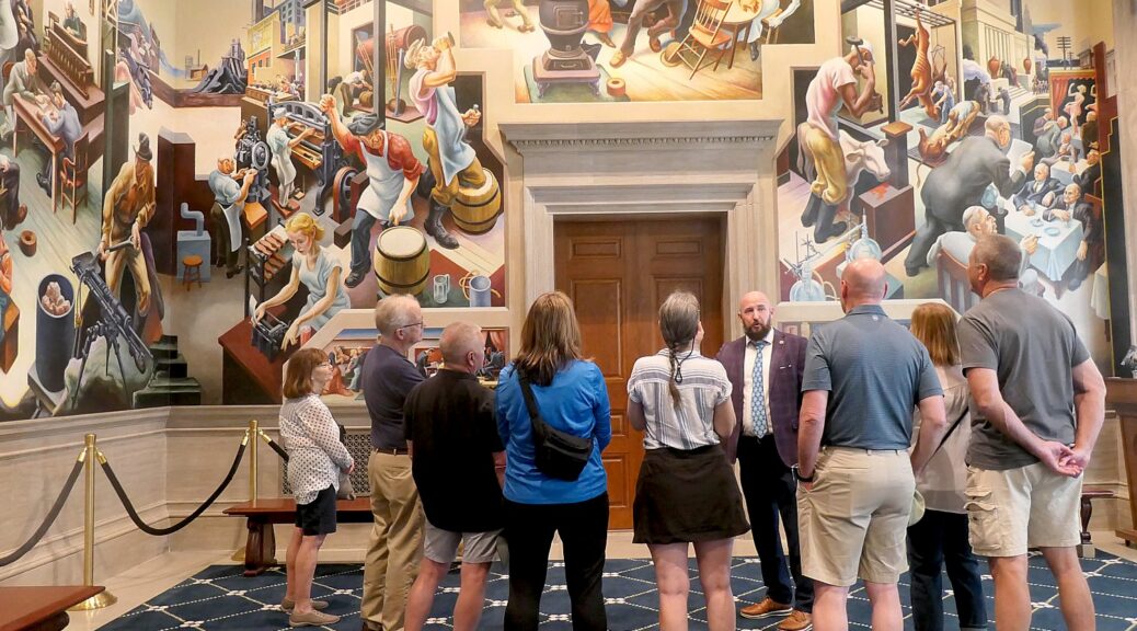
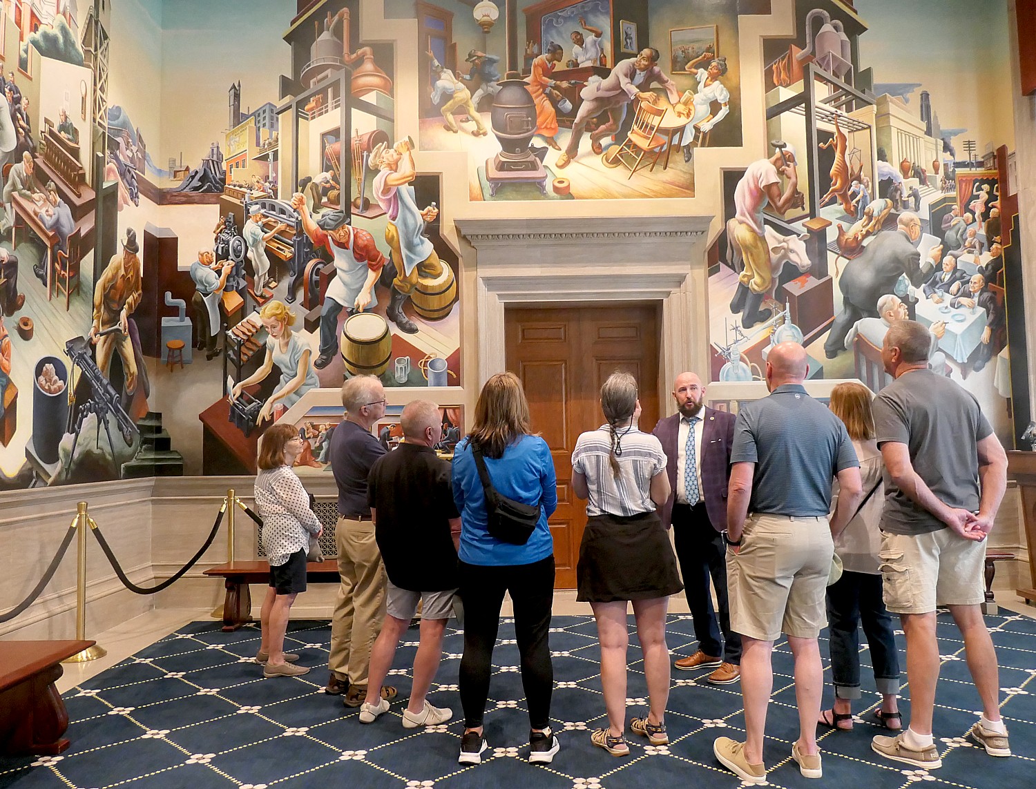
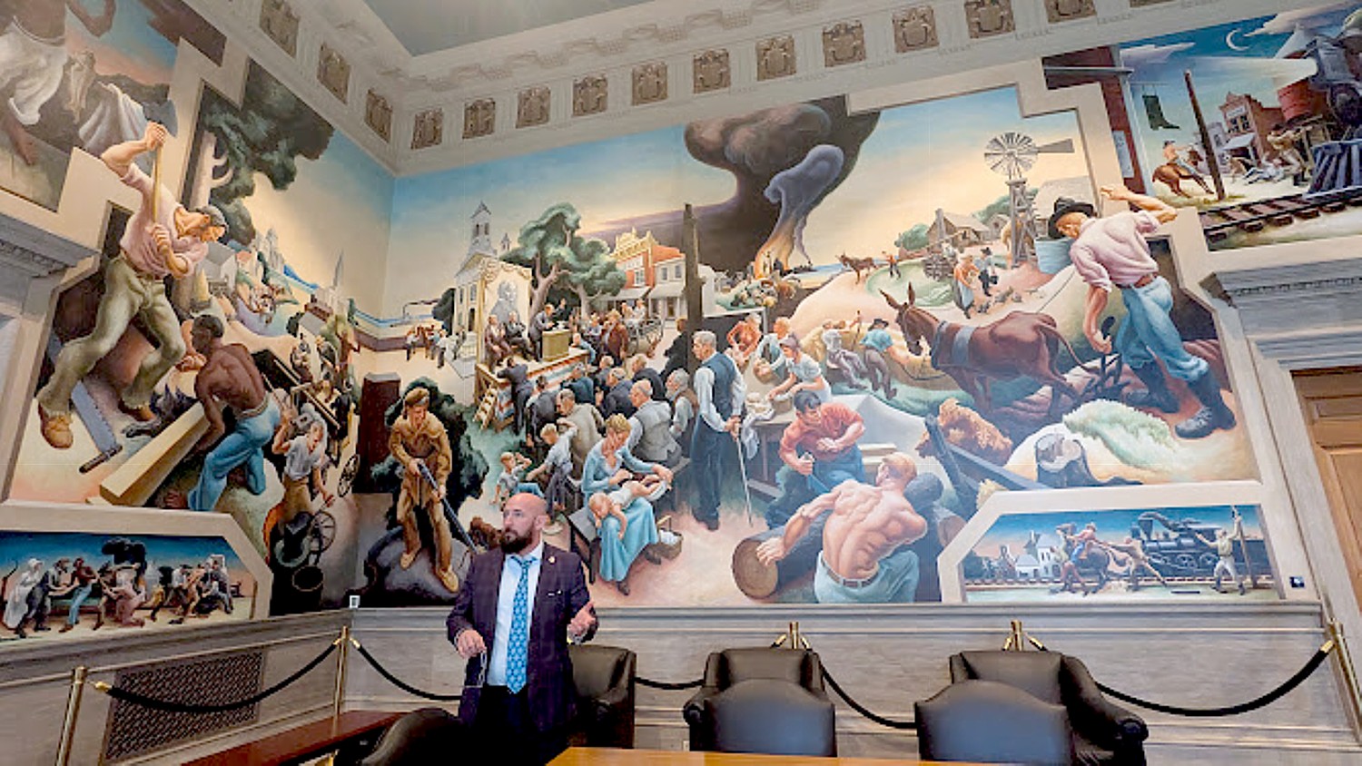
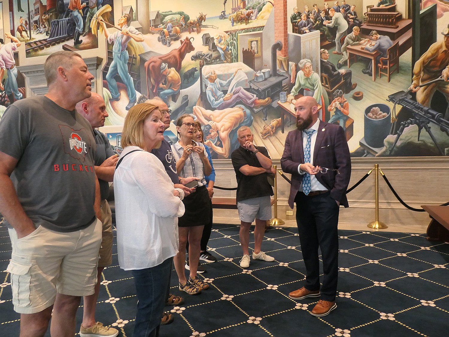
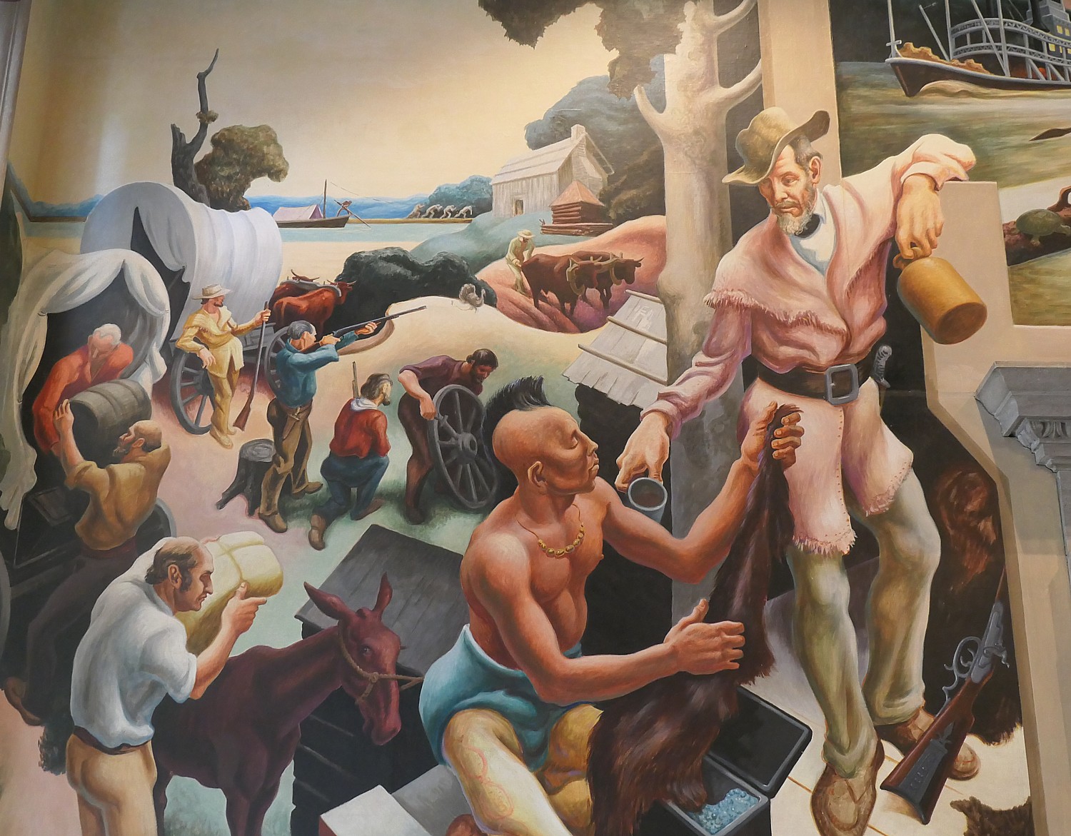
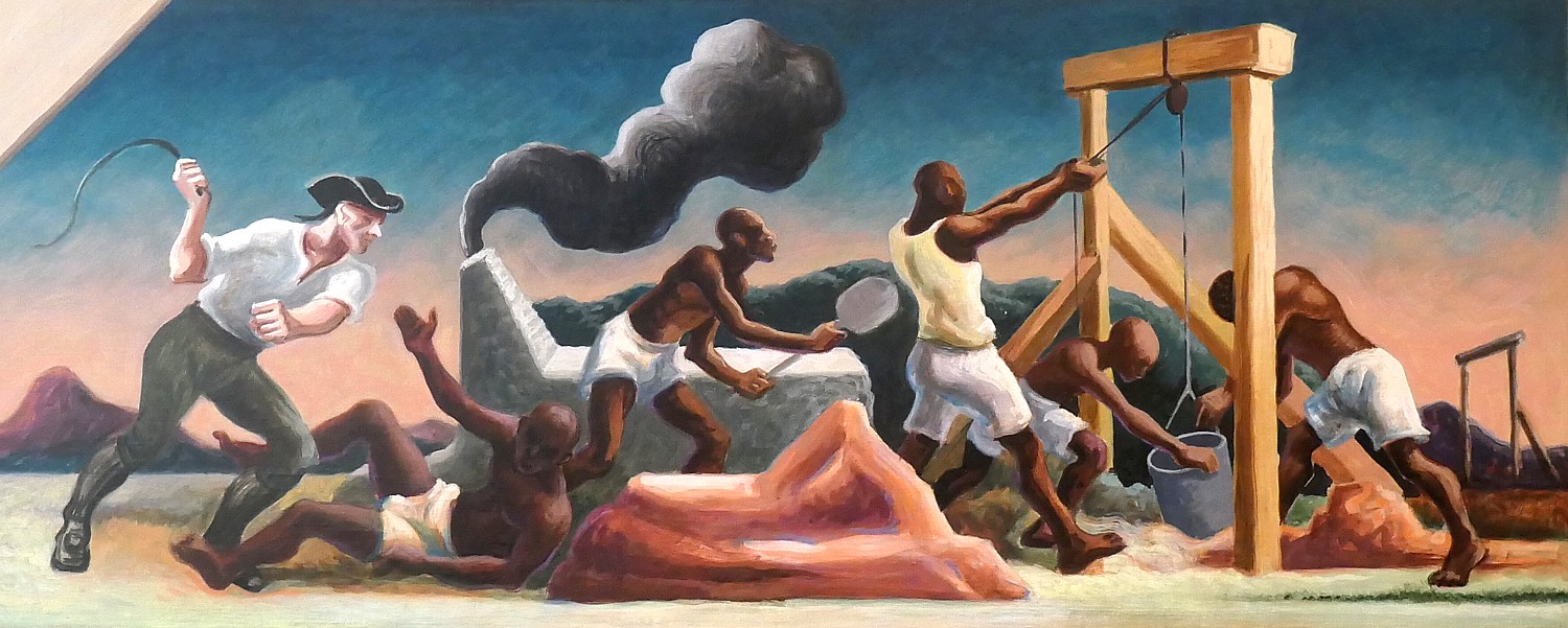
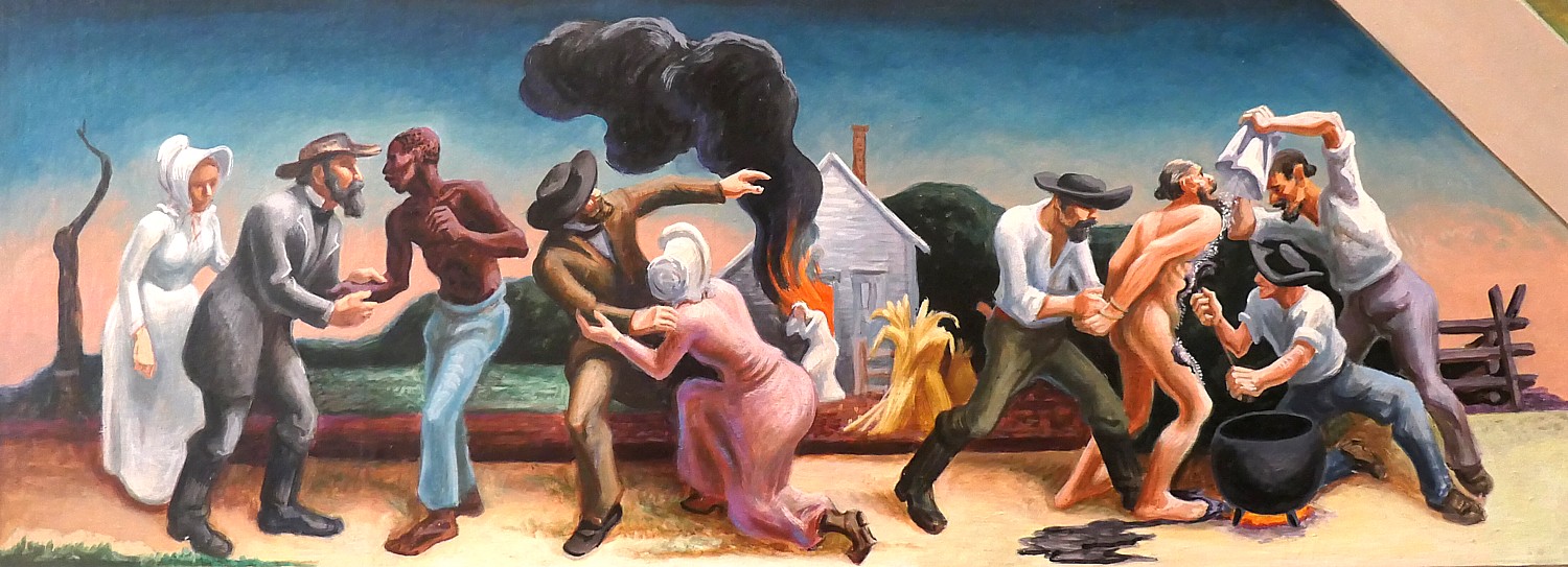
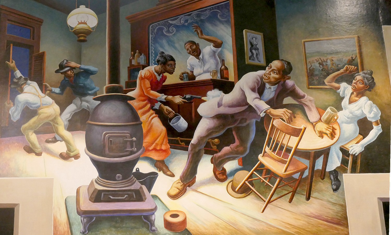
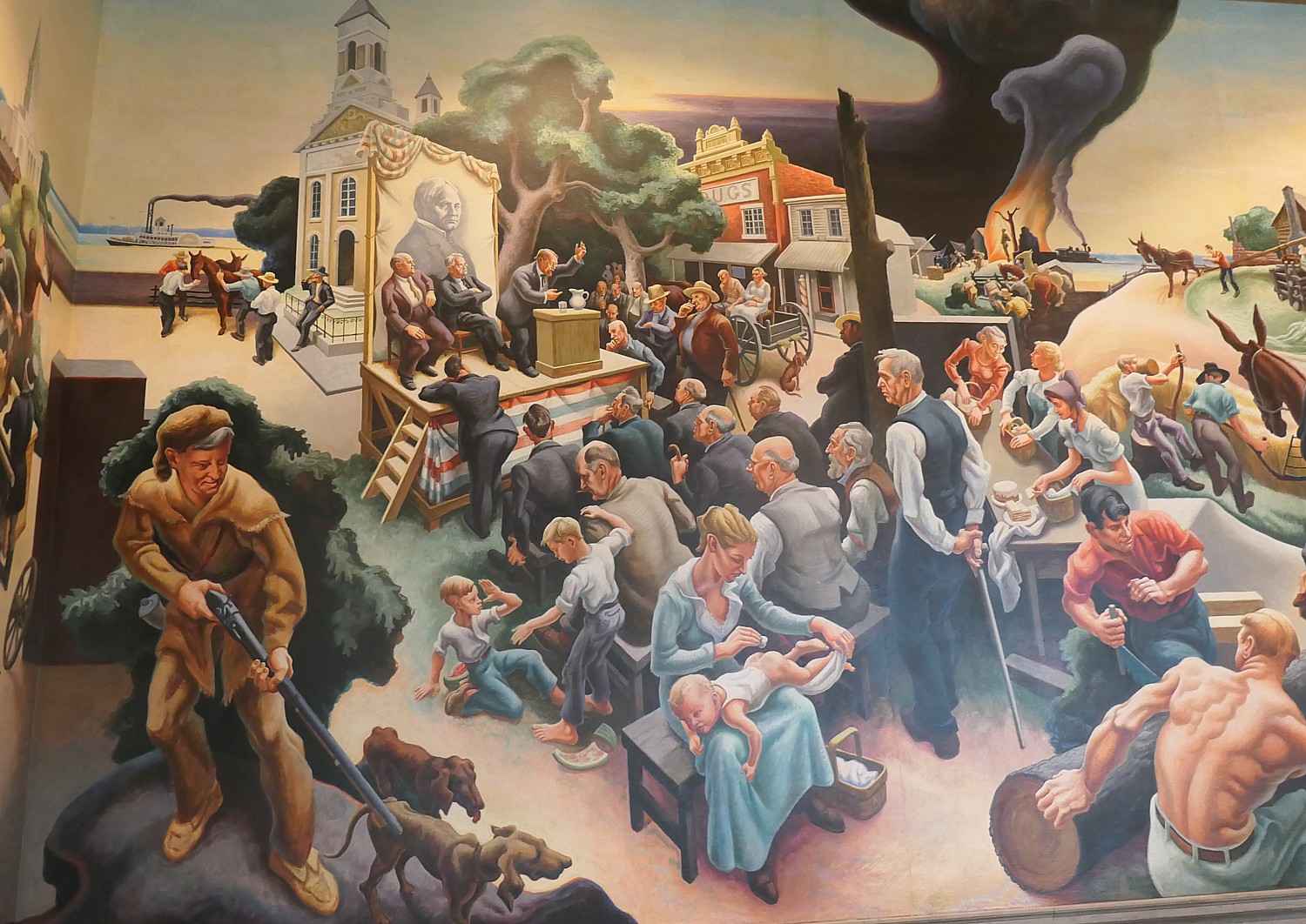
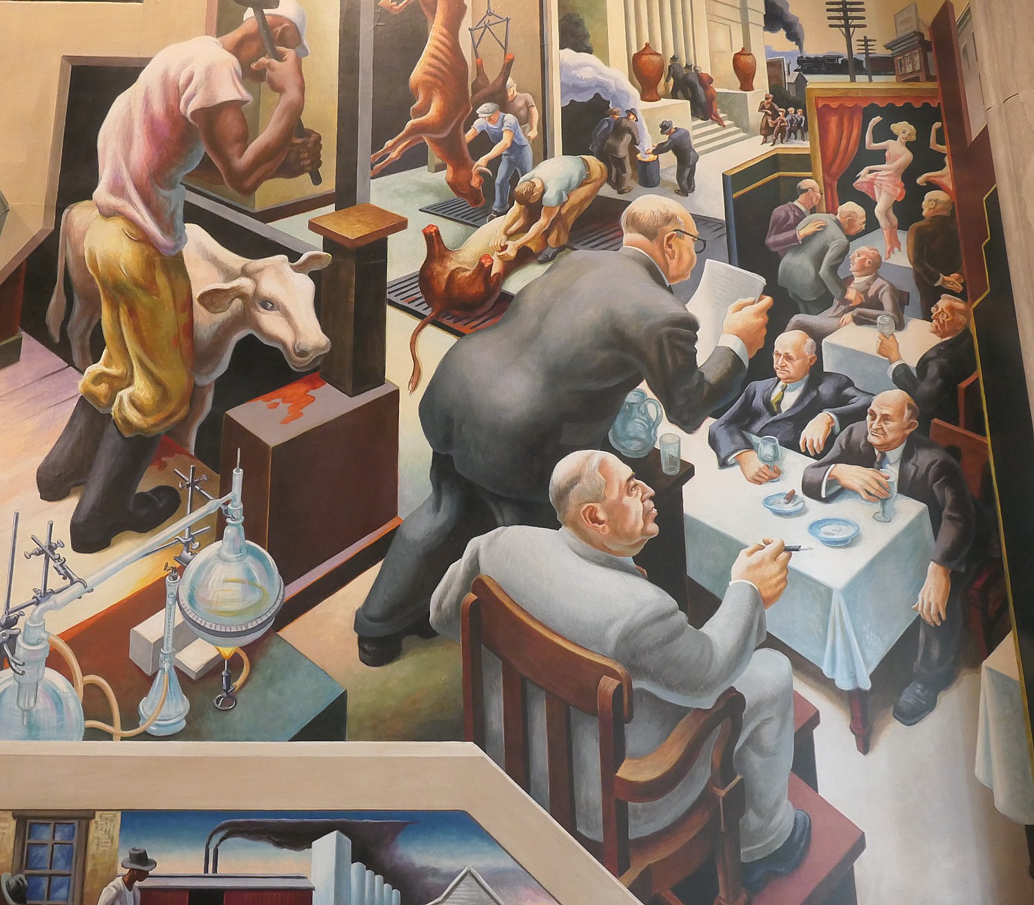
Ryan Clearwater, chief of staff to Missouri’s Speaker of the House, gives our Wilderness Voyageurs bike group a personal tour of Thomas Hart Benton’s famous mural, “A Social History of the State of Missouri” © Karen Rubin/goingplacesfarandnear.com

By Karen Rubin, Travel Features Syndicate, goingplacesfarandnear.com

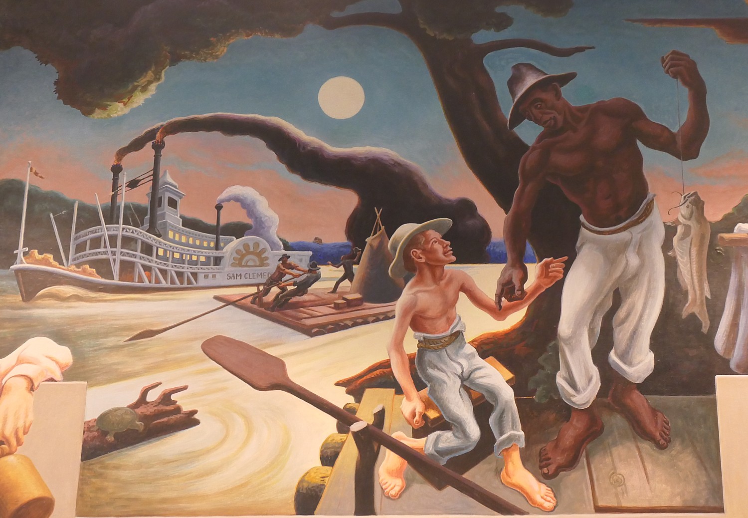
Day 3 of our six-day Wilderness Voyageurs Katy Trail bike tour 240-miles across Missouri is the most scenic, most interesting, teasiest ride, and the most dramatic for what we see. The day starts with pictographs left by the Indigenous people who populated this place for centuries before Lewis & Clark or Daniel Boone ever laid their eyes on this land, and ends with a mirror held up to Missourians, at the State Capital building, where we see Thomas Hart Benton’s stirring “Social History of Missouri” mural.

The 38.7 miles we ride from Rocheport to Jefferson City (Missouri’s capital), is almost entirely flat – a mere158 ft rise, 200 ft. decline. It also turns out to be my favorite part of the Katy Trail – much of it with limestone cliffs and forest on one side and views of the Missouri River on the other.

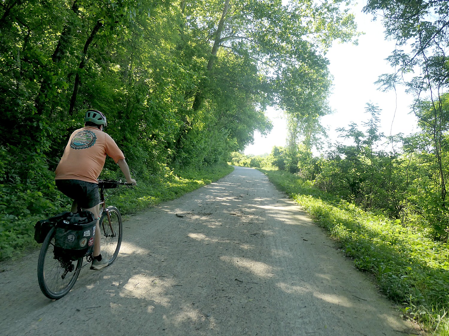
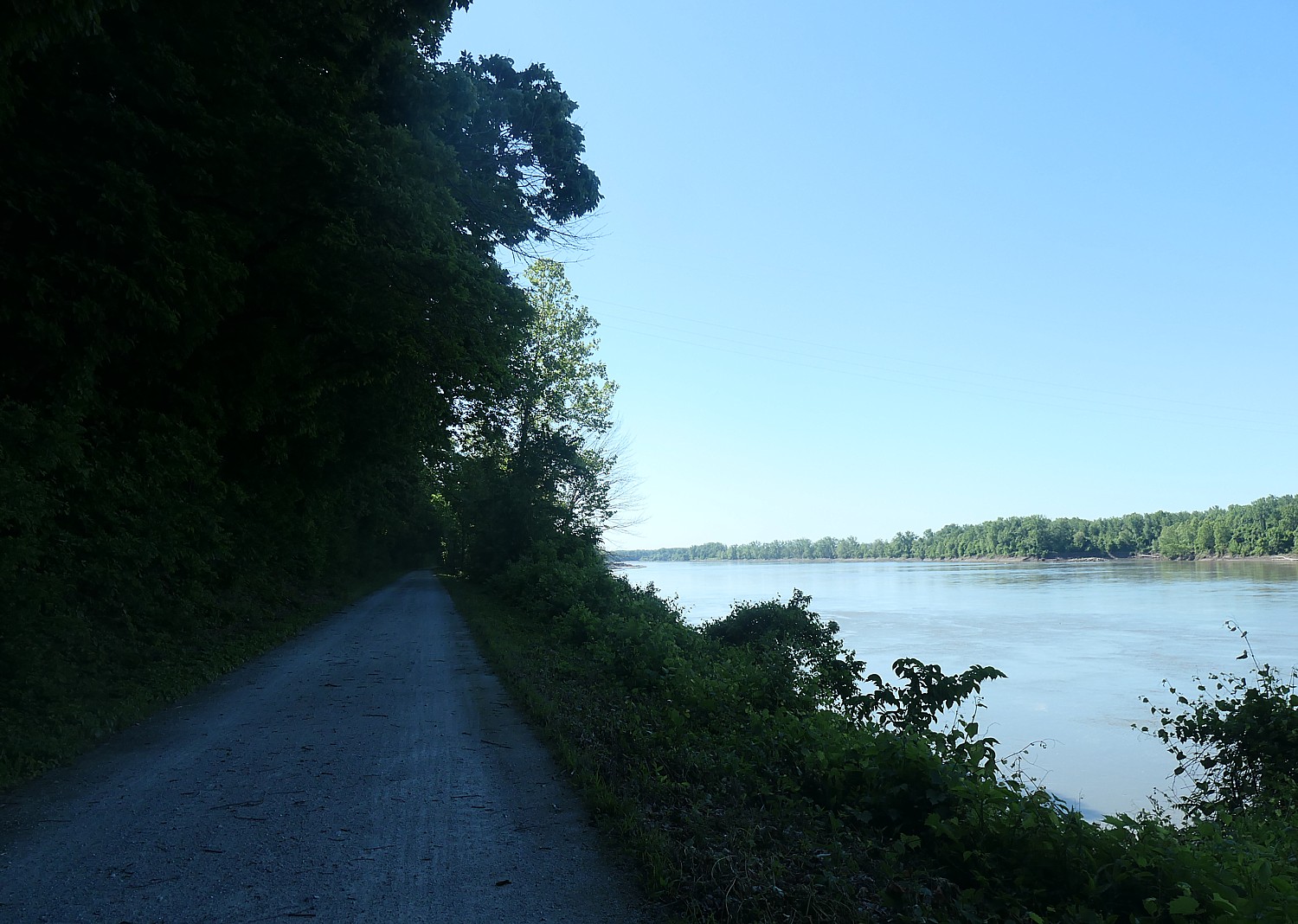
Biking the Katy Trail through Missouri on Day 3, with limestone bluffs and forest on one side and views of the Missouri River on the other © Karen Rubin/goingplacesfarandnear.com

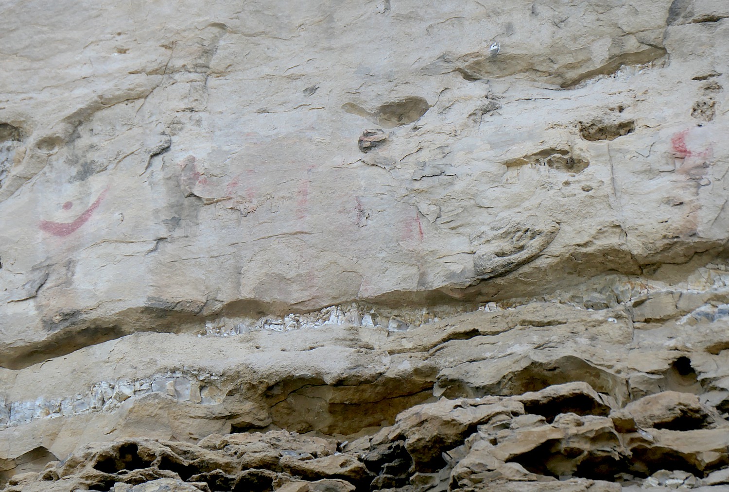
We set out from the base of the 200-foot high limestone Manitou Bluffs that towers above the bike trail. They were once sacred to Native American tribes and we spot remnants of pictographs.

They are easy to miss, but I am intent to find them (look for the marker that gives the description). Still, I might have missed them were it not for our guide, James Oerding, riding along with me (because I am last – again), who has guided for Wilderness Voyageurs for the past 13 years, pointed them out.

Pictographs that date from at least 1819 on limestone cliffs along the Katy Trail, Missouri © Karen Rubin/goingplacesfarandnear.com

What you do see most prominently is the symbol that looks like the Nike swoosh. Then you look to the right and make out others (there is a placard that shows all the figures to look for). They were like billboards of their time (perhaps saying “We are here”?).

The notes say that Lewis and Clark expedition camped below these bluffs just downstream from here on June 6,1804.

President Thomas Jefferson had made it clear the captains should carefully observe Indians and their way of life and though Clark and others in the expedition were conscientious about recording pictographs, there were no mentions of the pictographs we see here. But the Stephen Long Expedition did make note of these Torbett Spring pictographs in 1819. It is suspected that the Sauk and Fox Indians, who lived in the area until around 1814 and likely were the artists, painted the pictographs . after the Lewis and Clark Expedition passed by.

Needless to say, I linger here awhile, reading the notes, taking photos, so am last and James, our guide, hangs with me. (The Wilderness Voyageurs guides tell us at the outset, “This is your vacation. Ride your own ride” – and isn’t normally a problem with the route on our Ride GPS app and because on this trip, for all but the last night’s stay, we are able to bike from inn to inn without needing to gather in the van to shuttle to our lodging.)

Biking the Katy Trail through Missouri on Day 3, with limestone bluffs and forest on one side and views of the Missouri River on the other © Karen Rubin/goingplacesfarandnear.com

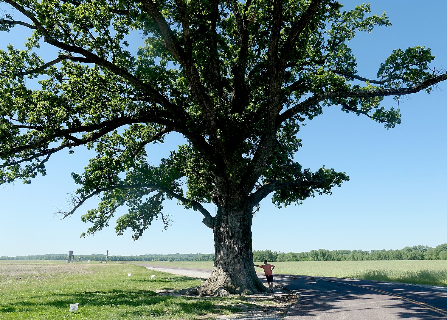
A short distance further, we veer off the Katy Trail for a quarter of a mile to see The Big McBaine Burr Oak Tree,  that sits all by itself with no other tree for 1000 feet. From a distance, it is just a tree. But as we get closer, I begin to appreciate just how gigantic it is, and why it is recorded in journals: The largest burr oak tree in Missouri, it is 287-inches around, 90 feet tall with a 13-foot spread, and takes a half-dozen people to wrap their arms around the trunk. It has stood strong for nearly 400 years, withstanding storms, droughts, floods, vandalism, and development and would have been formidable even to Lewis & Clark, who would have traveled within sight of the tree, a half-mile from the banks of the Missouri 200 years ago.

The Big McBaine Burr Oak Tree, largest in Missouri, is 350-400 years old © Karen Rubin/goingplacesfarandnear.com

At McBlaine, we take a peek at another oddity: “Boathenge” is comprised of 1950s ski boats that were swept here after a flood in 1993.

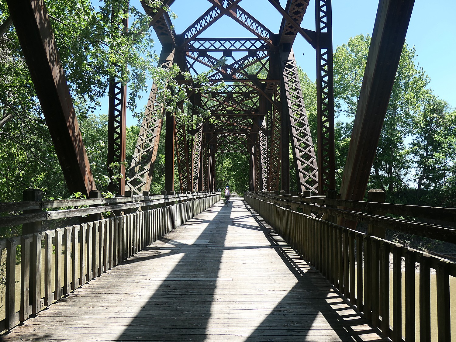
Biking over railroad trestles is one of the delights of cycling Missouri’s Katy Trail, a Rails to Trails Conservancy Hall of Famer © Karen Rubin/goingplacesfarandnear.com

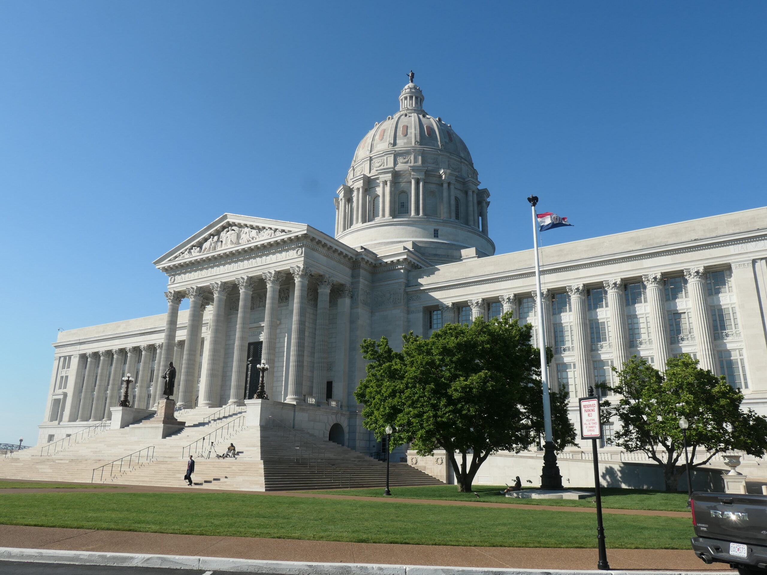
Coming into Jefferson City, we leave the Katy Trail onto a spur and bike up an extraordinary spiraling ramp onto the bridge over the Missouri River (and will return down the ramp the next morning to get back onto the Katy Trail).  Riding over the bridge affords dramatic views of Missouri’s majestic State Capitol.

Jefferson City, population 42,838, is the most urban part of our ride – and having just come from such rural areas on the protected carless rail trail, it is a bit of culture shock to be riding on city streets.

Biking into Jefferson City, after riding the Katy Trail through rural Missouri is a bit of culture shock © Karen Rubin/goingplacesfarandnear.com

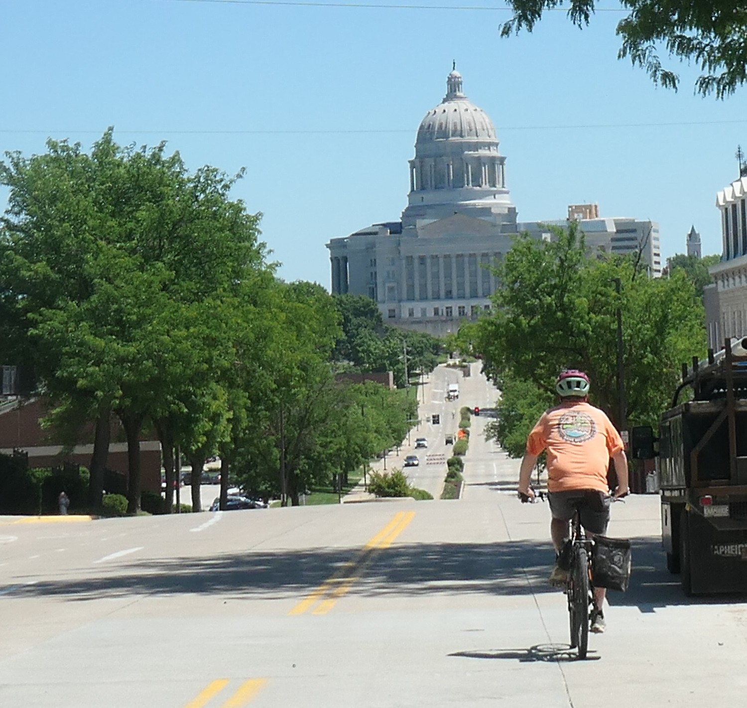
The only tricky part is getting to our hotel (the only “modern” hotel of our stay, Courtyard by Marriott), especially because of construction underway. We come down a steep sloping street, once again providing a dramatic view of the State Capital building set at the end.

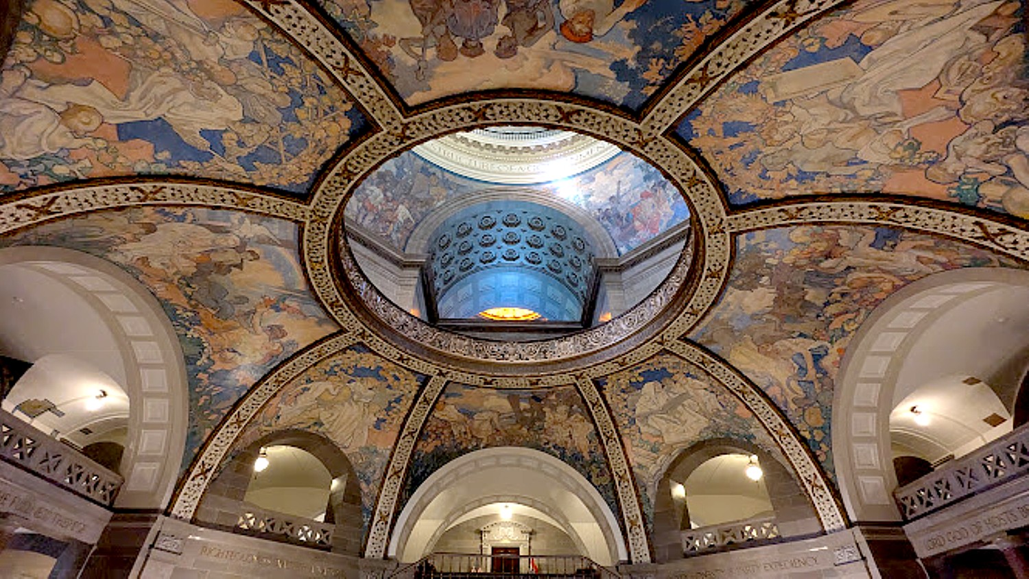
Missouri’s majestic capital building in Jefferson City is a “must-see” © Karen Rubin/goingplacesfarandnear.com

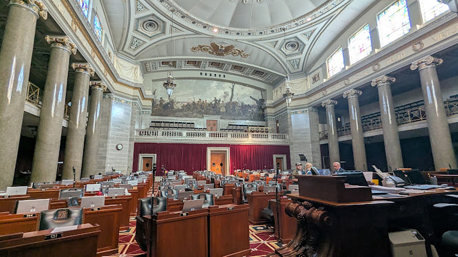
Once we are settled into the Marriott Courtyard Hotel (the only chain hotel of our trip), James offers to drive us to the State Capital Building, encouraging us to seek out the Thomas Hart Benton Murals that wrap around the walls of the House Members’ Lounge.

Ryan Clearwater, chief of staff to Missouri’s Speaker of the House, gives our Wilderness Voyageurs bike group a personal tour of Thomas Hart Benton’s famous mural, “A Social History of the State of Missouri” © Karen Rubin/goingplacesfarandnear.com

“A Social History of the State of Missouri,” Thomas Hart Benton’s famous mural, is more of an indictment than a glorification of Missouri’s history. It was 1934, in the midst of the Great Recession, when Benton got the $16,000 commission – “a prince’s ransom” at the time, equivalent to $300,000 today and more money than the governor earned – and a period of heightened racial tension in Missouri. Completed in December 1936, the state legislators immediately regretted having commissioned it and even considered painting over the murals, but feared humiliating defeats if they admitted their “misjudgment.”

Ryan Clearwater, chief of staff to Missouri’s Speaker of the House, gives our Wilderness Voyageurs bike group a personal tour of Thomas Hart Benton’s famous mural, “A Social History of the State of Missouri” © Karen Rubin/goingplacesfarandnear.com

The story of this extraordinary mural is being related to us by the Chief of Staff to the Speaker of the House, Ryan Clearwater, who we chanced to ask if we could visit when we find House Members Lounge locked. He takes us in (through the Speaker’s office, no less), and proceeds to spend an hour with us.  

Huck Finn with the runaway slave Jim, with the Samuel Clemons riverboat, was just one of the controversial scenes in Thomas Hart Benton’s “A Social History of the State of Missouri” mural  © Karen Rubin/goingplacesfarandnear.com

Instead of noble figures, Benton shows ordinary men and women who built Missouri, using real Missourians including his own family, as models for the 200 figures. He also shows its villains.

A white trader gives an Osage Indian whiskey in Thomas Hart Benton’s “A Social History of the State of Missouri” mural. Benton traveled to Oklahoma to find an Osage Indian for his model © Karen Rubin/goingplacesfarandnear.com

Instead of noble deeds and historic events, it depicts slaves being whipped and auctioned; a trader giving whiskey to an Osage Indian (he went to Oklahoma to find an Osage Indian to model); a Mormon being tarred and feathered (Missouri expelled Mormons and as recently as 1980s, Clearwater tells us, the state had a statute that it was permissible to kill Mormons); a settler being lynched by Civil War guerrillas while his family is turned out of their burning home; Huck Finn and runaway slave Jim on a raft escaping down the Mississippi River, the Samuel Clemons riverboat off to the side; Jesse James and his gang robbing a bank and a train; and Frankie entering the bar to murder Johnny, who did her wrong.

Instead of glorious deeds, Thomas Hart Benton depicted its ignobility in his “A Social History of the State of Missouri” mural.© Karen Rubin/goingplacesfarandnear.com
Instead of glorious deeds, Thomas Hart Benton depicted its ignobility in his “A Social History of the State of Missouri” mural © Karen Rubin/goingplacesfarandnear.com
Frankie murders Johnny in a scene in Thomas Hart Benton’s “A Social History of the State of Missouri” mural © Karen Rubin/goingplacesfarandnear.com

It depicts Missouri’s transition from frontier to factories, the Civil War to the Great War, people struggling and making due during the Great Depression (a comb with missing teeth as one of the symbols). One section portrays a political rally attended by all but one white man, while a woman on a bench, her back turned away from the rally, changes her baby’s bare bottom (scandalous! Benton’s nephew was the model),

A political rally of all but one white man in Thomas Hart Benton’s “A Social History of the State of Missouri” mural © Karen Rubin/goingplacesfarandnear.com

The last scene, In the bottom corner, plainly depicts Tom Pendergast, at the time the boss of Missouri politics, who was so powerful, he is said to have elected his candidate governor in just 30 days and get Truman into the US Senate (a figure very much like Truman is seated in front). Then 2 years after the mural was done, Pendergast went to federal prison for corruption. Benton came back and made a couple of changes – he had to touch up where someone drew Pendergast’s prison number on his suit, and to put clothes on the burlesque dancers in the background.

Corrupt political boss Tom Pendergast, instrumental in Harry Truman’s political career, is clearly portrayed by Thomas Hart Benton in his “A Social History of the State of Missouri” mural   © Karen Rubin/goingplacesfarandnear.com

“Benton put Pendergast in the mural to let every representative and senator and the public know how some got into office,” Clearwater remarks. 

The scene with the political rally depicts a black man, the only black man wearing a suit, leaning against a pole. This figure is Jordan Chambers, who was the Black political boss (“Tom Pendergast”) of St. Louis. Some claim that Jordan Chambers wanted to be in mural, he tells us, despite the association with Pendergast’s corruption.

The mural is shocking to see, even today, and you wonder how Benton was able to get away with it.

“The mural got mixed reviews – slavery, tar and feathering, lynching, murder, robbery,” Clearwater notes with an air of understatement. “They had wanted history. When it was unveiled, they talked about painting it over. But they had spent $16,000 and felt they wouldn’t get reelected, so they said, ‘We should learn from past.’” (I wonder if they also calculated that since the murals were locked away in the House Members’ Lounge, few would actually see it.)

Missouri’s House of Representatives chamber © Karen Rubin/goingplacesfarandnear.com

It’s 5 pm, when the building normally closes, but Clearwater takes us into the House chambers (he says that because the Senate is still in session trying to complete its business before the term ends, the building isn’t officially closed). It is a stunning, majestic room, with painted glass windows and a stunning mural (the gift of France). Clearwater says they had a $1 million budget for artwork when the building was built (the first two capital buildings burned down; this one is of “Carthage marble” – polished limestone). Missouri has the 4th largest House of Representatives per capita (163 House members and 34 Senate); a part-time position, they meet five months of the year.

I note portraits of Lincoln (“the first Republican,” Clearwater says) and Jefferson (“the first Democrat,” Clearwater says, but Jefferson was actually a Democratic Republican who advocated for states rights, agrarian interests and strict construction of Constitution, so also Republican; Franklin D. Roosevelt is probably the first modern Democrat).

The partisan animosity is practically built into the room. The center aisle is the width of “two swords”; the 7,000-page rule book includes such provisions as the member has to ask permission to speak, no member shall rattle their spittoon while another is talking, no one can intercede the line of debate.

Festooned around the room are the values these legislators are supposed to espouse for the state: Enterprise, Progress, Honor. Truth. Virtue. Temperance. Knowledge. Liberty. Equality. Justice. Fraternity. Education.

The spectacular dome of Missouri’s capital building © Karen Rubin/goingplacesfarandnear.com

By now, Clearwater, the chief of staff to the Speaker of the House has spent about an hour with us, even though only two of us are actually Missouri constituents. He jokes, “I would rather spend time with the public than lobbyist or legislator,” (though upon leaving, I spot a few of them on the way in, and all around the Capitol building, are offices of various unions and industry and trade associations).

It’s after 5 pm, too late to visit the State Museum contained within the building, but we get a few minutes to admire the stunning lobby and dome, surrounded by engravings extolling the state’s (aspirational?) credos:

The Earth is the Lord’s and the fullness thereof

Righteousness exalteth a nation

Property is the fruit of labor

Where there is no vision, the people perish

Ideas control the world

Lord God of Hosts be with us yet, lest we forget

Party honesty is party expediency.

The statue of The Corps of Discovery that passed Jefferson City June 4, 1804 © Karen Rubin/goingplacesfarandnear.com
Another mural depicting Missouri’s heritage, just outside the State Capital Building © Karen Rubin/goingplacesfarandnear.com

We go off to explore Jefferson City and have dinner (one of two evenings where we are on our own for dinner).

Just outside the capital building is a statue of The Corps of Discovery that passed Jefferson City June 4, 1804.

I walk back to the Courtyard Marriott, getting back early enough to enjoy the hotel pool.

Wilderness Voyageurs, Ohiopyle, PA, 15470, 800-272-4141, wilderness-voyageurs.com.

See also: Biking through History on Missouri’s Katy Trail During America’s 250th

See next: Biking Missouri’s Katy Trail Following Lewis & Clark, Daniel Boone & the Westward Expansion

__________________

© 2026 Travel Features Syndicate, a division of Workstyles, Inc. All rights reserved. Visit goingplacesfarandnear.com, longislandpress.com/category/vacation-travel.com and travelwritersmagazine.com/TravelFeaturesSyndicate/. Blogging at goingplacesnearandfar.wordpress.com and moralcompasstravel.info. Visit instagram.com/going_places_far_and_near. X: @TravelFeatures Threads: @news_and_photo_features ‘Like’ us atfacebook.com/NewsPhotoFeatures. Send comments/questions to FamTravLtr@aol.com.
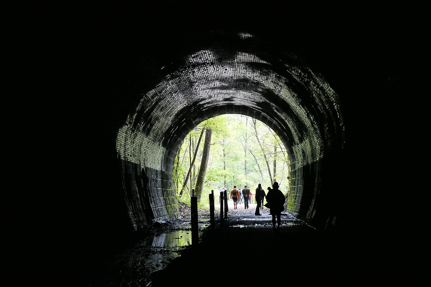
Biking through History on Missouri’s Katy Trail During America’s 250th

Biking the Rails to Trails Conservancy’s Hall of Famer, Katy Trail, a 240-mile-long linear state park, across Missouri is a delight for cyclists © Karen Rubin/goingplacesfarandnear.com

By Karen Rubin, Travel Features Syndicate, goingplacesfarandnear.com

Biking 240 miles across Missouri on the Rails to Trails Conservancy’s Hall of Fame Katy Trail is more about “being” than “seeing”. That is, the ride itself is glorious free-wheeling cycling, and when you finish being on the day’s ride in one of the charming, historic towns you get to “see”. You experience the towns and ports that grew up with the Missouri-Kansas-Texas Railroad (known as the K-T) and the Missouri River boats, that declined with the drop in rail and river traffic. These places that bring us so much delight today might well be ghost towns except for new life breathed into them by the thousands of cyclists who come through on the Katy Trail, like Rocheport, population 239.

Built between 1987 and 2011, the Katy Trail – actually a linear state park 100 feet wide and 240 miles long – is the longest continuous recreational rail trail in the United States.

It’s estimated the Katy Trail brought $18 million in spending to the area before the COVID pandemic inspired so many to discover the physical and emotional benefits of biking and being outdoors (as I learn after a chance meeting on the trail with the former state Commissioner who presided over its development). Meanwhile, the reputation of the Katy Trail continues to spread.

Starting out on our six-day Wilderness Voyageurs bike tour, 240-miles across Missouri on the Katy Trail, a rail trail built on the former Missouri-Kansas-Texas railroad line © Karen Rubin/goingplacesfarandnear.com

On our Wilderness Voyageurs Katy Trail bike tour, only one couple is from Missouri (they have done almost all of the trail before), the rest of us have come from Texas (doing this trip for a second time), Alabama, Indiana, California and New York, to enjoy one of the best rail trails in the country. It has the gentle slope of a rail line where there are ups and downs at all, marvelous and well maintained rest stops (every 12 miles) complete with picnic tables, depot-style benches under a canopy, where there are excellent placards describing the history, pointing to the important sites and mile markers on the coming section, and giving clear map and directions. It is such a comfortable trail that this tour is able to go for longer mileage days of 38 to 50 miles (but if you do tire, you can simply hop on the van used each day by one of the guides who sets up snack stops and lunch; e-bikes also available).

Biking 240-miles across Missouri on the Katy Trail, a rail trail built on the former Missouri-Kansas-Texas railroad line © Karen Rubin/goingplacesfarandnear.com

But it’s not just those of us who come from around the country and world to ride the Katy Trail – the trail is a string that binds and engages community and we can see how locals cherish it (even those who were skeptical at the start).  Along the way, we find a former home that was donated to the trail for use as a hostel (you just find the key and let yourself in), and a historic general store building that was donated to the park and being restored by Dan and Connie Burkhardt who run a foundation to protect and preserve the land. Indeed, the trail began with a generous donation by Edward D. “Ted” Jones Jr. and his wife, to secure the railroad’s right-of-way. All along the way you see signs of “Missouri Pride,” and “Magnificent Missouri.”

Much of the trail follows the route of the Missouri River with the river on one side and towering bluffs on the other, and takes us through forests, wetlands, valleys, remnant prairies, open pastureland and rolling farm fields.

The Katy Trail, a Missouri state park, has some of the best rest stops, with historic placards, and is where you meet interesting people, like Fabio, a real-life Forrest Gump, who has been traveling for 16 years © Karen Rubin/goingplacesfarandnear.com

We cycle through towns, villages, communities and landscapes we would never otherwise see (and without looking through a glass window), at a pace that is perfect to create an ever-changing scene. You can feel the wind and smell the air, and get off the bike when you want to spend more time, take a photo, read a plaque, have a different or deeper perspective – especially since Wilderness Voyageurs provides us with Ride with GPS so we can go at our own pace.

The gentle rise of the Katy Trail, built on the Missouri-Kansas-Texas railroad line  © Karen Rubin/goingplacesfarandnear.com

The pleasure of riding the Katy Trail is further enhanced this year when the nation is celebrating America’s 250th.

The Katy Trail is steeped in history, much of it following the actual route of Lewis & Clark’s expedition (part of the 4,900-mile Lewis & Clark National Historic Trail) and dotted with markers and panels recalling where they camped or where some incident happened. This place also figured prominently in the Westward expansion, led by figures like Daniel Boone and commemorated with Gateway Arch National Park in St. Louis. One of my favorite sections of the trail is where we see pictographs left by the Indigenous peoples who had lived here for centuries before any of them.

Cycling passed farms on the Katy Trail © Karen Rubin/goingplacesfarandnear.com

We go through towns that look like (should be and have been) film sets from 1930s,1940s and 1950s. I love seeing the vintage posters, paintings, murals, neon signs and shops that still have the proprietor’s family name and the tag, “Since [year]” This is small town America of myth and lore, especially when we come to our last night’s stay in Washington, Missouri, where I happen upon a community weekly concert at the Farmers Market that gets people line-dancing.

Our six-day tour begins with a 6:30 am pick up in St. Charles, so everyone stays over the night before, most in St. Charles. (I stay in St. Louis, about 25 minutes away, at the 21c Museum Hotel, a Historic Hotels of America member, to have a glorious day to explore this important city and immerse myself in history and culture.)

We are picked up at the various hotels and driven from St. Charles, where the trail and our tour ends, to where it begins, in Clinton. It is a 3 ½ hour drive, but will take us six days to bike.

Wilderness Voyageurs guide James Oerding gives us our whiteboard review of the day’s ride on the Katy Trail © Karen Rubin/goingplacesfarandnear.com

Before we set out each day, our guides, James Oerding (a St. Louis native who has been a Wilderness Voyageurs guide for 13 years and I actually knew from my South Dakota Wilderness Voyageurs tour) and Rob Figulski, review the ride and main points.  I would also recommend reading the day’s itinerary notes that are provided on the Ride with GPS app, which have even more interesting details for people like me who love to immerse in place and time.

Our first day’s ride is 38.4 miles through the Osage Plains with gentle rises and trees on both sides to Sedalia, a town that looks like it was set in a time capsule (and was used as the setting for the 1950s TV show, “Rawhide”).

This day’s ride takes us to the highest point on the trail, at 955 feet above sea level (though not the most elevation of our ride – that will come on day 2).

Sedalia, Missouri is a picturesque, historic town revitalized by the Katy Trail cyclists © Karen Rubin/goingplacesfarandnear.com

We finish at the Katy Trail Depot in Sedalia and make our way to the historic Hotel Bothwell, so perfect for this throwback experience. There are such marvelous ole-timey features – a telephone booth, elevator, mail drop, the wooden check-in desk. There are photos of President Harry Truman in the breakfast room, named for Truman, who dined in the hotel’s café in 1962.

The historic Hotel Bothwell, built in 1914, has connections to President Harry Truman, and delightful old-timey features © Karen Rubin/goingplacesfarandnear.com

A bronze plaque outside the hotel says that John Bothwell & Community Hotel Company built the hotel in 1927 for $400,000; in 1934, Harry S. Truman was here when he learned that Kansas City political boss Tom Pendergast had selected him as the candidate for US Senate; in 1942, Actress Bette Davis dined in its Palm Room; in 1959, Actors Clint Eastwood and Eric Fleming promoted the TV series Rawhide (which was set in Sedalia). The hotel was converted to senior housing in 1988 by the Westin Financial Group, then restored to a hotel by the Furnell Cos. in 1998.

Vintage poster in Sedalia, Missouri © Karen Rubin/goingplacesfarandnear.com

Sedalia also has the first Carnegie Grant public library awarded in Missouri; and the Missouri State Fair is located in Sedalia (we pass by the fairgrounds on the trail).

But most interesting is its connection to famed musician Scott Joplin, who came to Sedalia to work on the railroad and made Sedalia his home, earning his living as a piano teacher; today, Sedalia hosts an annual Scott Joplin Ragtime Festival (www.scottjoplin.org)

We have dinner together at The Vault – it’s only our first night together, but the 10 of us have already formed a tight unit. Notably, four of us are traveling solo – bike tours are one of the best ways to travel alone but together.

Biking over trestles is one of the fun features of Missouri’s Katy Trail, a rail trail built on the former Missouri-Kansas-Texas railroad line © Karen Rubin/goingplacesfarandnear.com

Day 2 is the most arduous and the most satisfying. It is our longest, hardest ride, 50.5 miles, from Sedalia to Rocheport with the most ups/downs – 1,100 ft of elevation and 1,395 ft. decline – so today is mostly about the physical experience versus the view. and ends at a place of serenity and contentment. (But you keep reminding yourself: this is a railtrail, so the uphill is very gradual, you barely feel it.)

Biking over trestles is one of the fun features of Missouri’s Katy Trail, a rail trail built on the former Missouri-Kansas-Texas railroad line © Karen Rubin/goingplacesfarandnear.com

This day’s ride is organized so we have two support stops, 12 miles apart, and a very long uphill before a two-mile downhill into Boonville and our lunch stop at the Boonville Visitor Center and River, Rails & Trails Museum.

Boonville Visitor Center and River, Rails & Trails Museum © Karen Rubin/goingplacesfarandnear.com

The museum is very interesting, especially the ambiguous way it relates Civil War events – a skirmish early in the war, on July 17, 1861, resulted in Union forces defeating a small, poorly equipped force of Missouri State Guard. (It’s not clear which side the folks were on but probably the Confederate, though Missouri was officially a Union border state).

A half-scale replica of Lewis & Clark’s keelboat at the Boonville River, Rails & Trails Museum © Karen Rubin/goingplacesfarandnear.com

All along the Katy Trail there are important markers and references to Lewis & Clark, and here in the museum is a half-scale replica of the famous keelboat they used.

Boonville was named for frontiersman Daniel Boone’s sons, who established a salt business here in the early 1800s. This was the first permanent American settlement west of St. Louis. Its strategic location on the Missouri River and the Santa Fe Trail made it a crucial hub during Westward Expansion.  More than 400 buildings are listed on the National Historic Register, and Boonville has one of four restored train depots along the Katy Trail.

We leave Boonville, crossing over the Missouri River, continuing on the trail, riding over train trestles.

New Franklin, “the crossroads to the West,” is where four major trails meet: the Katy Trail, the Lewis & Clark Trail, the Santa Fe Trail and the Boone’s Lick Trail © Karen Rubin/goingplacesfarandnear.com

New Franklin, “the crossroads to the West,” is where four major trails all meet: the Katy Trail, the Lewis & Clark Trail, the Santa Fe Trail and the Boone’s Lick Trail. Here, we see what is left of a KT Roundhouse (there is a campground here today), a train car, and a replica of a Conestoga Wagon such as the pioneers would have used.

We end our ride in Rocheport, a trading post when Lewis and Clark’s expedition came through in 1804. It became a permanent settlement in the early 19th century. Today, the whole town is a historic district, with 239 residents and yet there is a gallery and art studio, and an inn that caters to women recovering from mastectomy.

This has been a really arduous ride, so when we arrive at the School House B’n’B at about 3 pm and congregate in its lush garden to enjoy beer and snacks the guides have purchased for us (based on a questionnaire we filled  out as to our preferences), the most perfect peace washes over us, almost euphoria. Everything about this place evokes a feeling of serenity and sheer contentment.

The Schoolhouse BnB in Rocheport deserves its accolades as the “best traditional bnb in Missouri” © Karen Rubin/goingplacesfarandnear.com

Listed on the National Register of Historic Places, the School House B’n’B is a restored three-story brick building that was built in 1914 and was a school until 1972 (though a school was on the site for 70 years before that). It was converted to a bed and breakfast in 1988 and expanded and improved by a succession of three owner/operators and now offers 11 accommodations including a bridal suite. (Actually, there are three properties: School House Bed & Breakfast, Clark Street Lodge, and Dormitory House properties).

The Schoolhouse BnB incorporates delightful features of its heritage © Karen Rubin/goingplacesfarandnear.com

So charmingly repurposed and furnished, the School House BnB truly deserves its accolades as “best traditional bnb in Missouri”. I especially love how owner/operator Chandrika Hickman preserves the heritage – and the spirit – of a schoolhouse: the names of the rooms are delightful: Dick and Jane (which was occupied by our own Bill & Jill); Schoolmarm (which was occupied by a retired school teacher) and so forth. The parlor has a large chalkboard for guests to doodle on, and there are framed pages from old readers. A painting shows a class taking place in this very room now used as the dining room and lounge.

Schoolhouse BnB guests leave doodles on the chalk board © Karen Rubin/goingplacesfarandnear.com

At 5 pm (after we have time to refresh), we are taken for a tasting at the A Frame Wine Garden, scenically set on a high cliff above the Katy Trail affording a stunning view overlooking the Missouri River, with tiers of porches. (We will ride the Katy Trail below us, the next day).

Wilderness Voyageurs arranges a private dinner at the General Store restaurant in Rocheport © Karen Rubin/goingplacesfarandnear

This night’s dinner is the best, most special of the entire tour. Wilderness Voyageurs arranges a private dinner at the Rocheport General Store restaurant where Chef Susan Schapira prepares a fantastic meal (the seafood ravioli in a white cream sauce is out of this world; the strawberry and pecan cake, with a perfect texture and sweetness, is beyond delectable).  

Chef Susan Schapira, with assistant Sarah Kendall, prepares a five-star dinner for us at her General Store restaurant © Karen Rubin/goingplacesfarandnear.com

After dinner, a new friend joins me on a walk through woods to the river bank to enjoy the last rays of the sun on the river.

A sunset stroll to the Missouri River at Rocheport © Karen Rubin/goingplacesfarandnear.com

And then the breakfast at School House bnb! Incredibly scrumptious: croissant strata with bacon and cheese; maple lemon apple and pear salad; white chocolate banana muffin.

The scrumptious breakfast at Schoolhouse BnB fortifies us for the day’s ride on the Katy Trail © Karen Rubin/goingplacesfarandnear.com

It is no wonder that the School House B’n’B repeatedly is named “Missouri’s #1 traditional B&B” (schoolhousebnb.com).

We set out from Rocheport for Jefferson City, for what proves to be the most scenic and interesting day.

Wilderness Voyageurs, Ohiopyle, PA, 15470, 800-272-4141, wilderness-voyageurs.com.

Next: Indigenous Pictographs & ‘A Social History of Missouri’ Mural

__________________

© 2026 Travel Features Syndicate, a division of Workstyles, Inc. All rights reserved. Visit goingplacesfarandnear.com, longislandpress.com/category/vacation-travel.com and travelwritersmagazine.com/TravelFeaturesSyndicate/. Blogging at goingplacesnearandfar.wordpress.com and moralcompasstravel.info. Visit instagram.com/going_places_far_and_near. X: @TravelFeatures Threads: @news_and_photo_features ‘Like’ us atfacebook.com/NewsPhotoFeatures. Send comments/questions to FamTravLtr@aol.com.
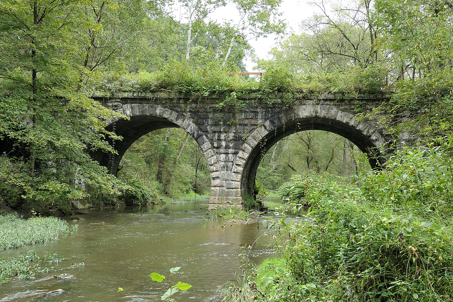
Rails to Trails Conservancy Highlights Benefits on Celebrate Trails Day, April 26

Biking the Great Allegheny Passage trail with Rails to Trails Conservancy. The trail is part of the Great American Rail-Trail that ultimately will create a transcontinental network of trails 3,700 miles from Washington DC to Washington state. Find a trail near you on Celebrate Trails Day, April 26.  © Karen Rubin/goingplacesfarandnear.com

By Karen Rubin, Travel Features Syndicate, goingplacesfarandnear.com

Rails to Trails Conservancy is hosting its Celebrate Trails Day on April 26. This annual spring celebration of America’s trails, which Rails to Trails has organized since 2013 on the fourth Saturday of April, invites one and all to “come outside to experience the joy and impact of America’s trails”.

Every Celebrate Trails Day, RTC teams up with partners—trail groups, agencies, nonprofits, businesses, brands, clubs and every other type of organization in between—to offer scores of events and activities that encourage physical activity, stewardship, community engagement and opportunities to see how fun it is to switch a car trip for a walk or a bike ride and help lower their individual carbon footprint.

Bike or walk the 2-mile long trail alongside New York’s Cuomo Bridge for a spectacular view of the Hudson River © Karen Rubin/goingplacesfarandnear.com

“Celebrate Trails Day creates a unique opportunity to show off the many ways trails are essential to communities across the country,” said Ryan Chao, RTC’s president. “Thousands of people get outside with us to send the message that when we connect trails, good things happen.”

Cycling over what used to be a railway bridge from Peebles Island at the end of Parks & Trails NY’s eight-day, 400-mile Cycle the Erie Canalway biketour © Karen Rubin/goingplacesfarandnear.com

What good things? “The nation’s 42,000+ miles of multiuse trails on the ground nationwide lay the foundation for 150+ trail networks in development means we have space to move our bodies and be active outside, which is good for our physical and mental health. We support our local economy and create new connections in the neighborhoods where we live. And we can get around safely without a car. These spaces bring incredible value to our everyday lives, improving the quality of life where people live, work and play. When we show up on trails, we send a message loud and clear that these spaces are essential to our communities.”

Biking over the famous Rosendale Trestle on the Walkill Valley Trail, now part of New York’s 750-mile Empire State Trail network © Karen Rubin/goingplacesfarandnear.com

RTC has curated resources to help you plan a day of biking, walking, hiking, running and/or exploring outdoors. These include an interactive map to find events near you (more events being added all the time). Using the map, you can find hikes, spring cleanups, group rides, fun runs, family-friendly festival. You can also find organizations hosting events and events where complimentary non-alcoholic beverages are being provided, courtesy of Athletic Brewing Company, the premier sponsor for Celebrate Trails Day. Go to the website, https://www.railstotrails.org/celebratetrailsday/. (You can also find out how to win prizes for participating.)

Find Trails: Any day of the year, you can find trails near you around the nation using RTC’s free trail-guide app and website, TrailLink.

Impact of Trails for People, Places and the Planet

Biking the Delaware-Lehigh Trail on a Rails to Trails Conservancy’s Sojourn  © Karen Rubin/goingplacesfarandnear.com

Many of the more than 240 events taking place on Celebrate Trails Day highlight the return on investment as the nation’s more than 41,000 miles of multiuse trails are connected into trail networks that make it safer and easier for people to be active outside where they live, with the potential to deliver more than $138 billion to the economy each year in health cost savings, climate savings and direct spending.

Last year’s Celebrate Trails Day was a celebration of unprecedented opportunity for trails, walking and biking – in part made possible by the Biden Administration’s Bipartisan Infrastructure Law – and demonstrated the widespread demand and benefit of dedicated and sustained investment in the nation’s trail networks.

The Highline, the urban art park trail created out of a highway on Manhattan’s west side, is now one of the most popular and used attractions in New York State, and a main artery in a neighborhood it spawned the size of a city © Karen Rubin/goingplacesfarandnear.com

Participants in Celebrate Trails Day reported mental health benefits of time spent being active on the trail (97% of people agree that using trails makes a difference for their mental health and well-being) and the majority say that having events or programming on the trail motivates them to be physically active (85%). More than three-quarters (78%) indicate that they would use trails as part of their everyday routine (e.g., going to the store, school, work or for exercise) and 76% of respondents indicated they chose to swap a car trip for a walk, bike ride or other active transportation on Celebrate Trails Day and at other times in their day-to-day routines.

“Everyone gains from staying active and should have safe and convenient access to trails. It’s also great when these places include green space, welcome all ages and abilities, and include activities like culturally inclusive programs,” said Ken Rose, MPA, physical activity and health branch chief at the CDC. “Good walking and biking trails can help us stay physically and mentally fit by making physical activity a part of our routine. They also bring communities closer together by giving us spaces to meet up and socialize.”

The Centers for Disease Control, which finds increasing physical activity is one of the best things we can do for our health and  recommends 150 minutes of moderate-intensity physical activity a day, reports that only about 1 in 4 adults do. Connected trail and active transportation infrastructure makes it possible for more people to incorporate physical activity into routine, everyday activities, like getting to work or school or running errands. Outcomes from Celebrate Trails Day underscore the impact of park, trail and greenway infrastructure improvements—combined with additional interventions, such as events and programming in these spaces—to increase awareness, enhance access and encourage participation as outlined in recommendations by the Community Preventive Services Task Force to increase physical activity.

The Centennial Trail from Washington State into Idaho goes through downtown Spokane © Karen Rubin/goingplacesfarandnear.com

Since 1986, Rails to Trails Conservancy, a nonprofit organization with one million members, has been “dedicated to creating a nationwide network of trails from former rail lines and connecting corridors to build healthier places for healthier people.”

“We reimagine public spaces to create safe ways for everyone to walk, bike and be active outdoors.”

RTC’s most ambitious program to date is the creation of the Great American Rail-Trail, that will ultimately connect more than 125 multi-use recreational trails 3,700 miles across the continent, from Washington D.C., through 12 states, to Washington State. (https://www.railstotrails.org/site/greatamericanrailtrail/)

Some iconic trails are already in place along the Great American Rail-Trail route, while communities, nonprofit partners, state agencies and volunteers are working to build trails to benefit their local area by linking up to the trans-continental network.(See the full list here, https://www.railstotrails.org/site/greatamericanrailtrail/content/route/)

As of January, 2025 the Great American Rail Trail – America’s first trans-continental network – is 55% complete with 2,059 miles of trails out of the total 3,700 miles.(see: https://www.railstotrails.org/resource-library/resources/great-american-rail-trail-route-assessment-2024/)

Rails to Trails Conservancy, 2445 M Street, NW, Suite 650, Washington, DC 20037, 866-202-9788, railstotrails.org.

Bike Tour Companies Embrace Rail Trails

Several bike tour operators offer itineraries on segments of the Great American Rail-Trail:

Wilderness Voyageurs already has tours on many segments of the Great American Rail-Trail – indeed, it is actually headquartered on, the famous and picturesque Great Allegheny Passage, one of the primary building blocks of the east-to-west route.  

With the addition of the Iowa Trestles Tour in 2021, Wilderness Voyageurs offers supported rides on more than 820 miles of the route.  Its multi-day, inn-to-inn, bike tours on the Great American Rail-Trail visit 14 different trails in eight states These include:

Biking through the Pinkerton Tunnel on the Great Allegheny Passage (GAP), a key part of the Great American Trail 3700-mile transcontinental network Spokane © Karen Rubin/goingplacesfarandnear.com

The Great Allegheny Passage (GAP) is an iconic rail-trail that runs 150 miles from Cumberland, Maryland, to Pittsburgh, Pennsylvania, and was built in partnership between state agencies and many local trail groups and volunteers. The GAP is featured on three different trips: a four-day Great Allegheny Passage tour from Pittsburgh to Cumberland; six-day Pittsburgh to D.C. tour, and Pennsylvania and Maryland Easy Rider tour. (Wilderness Voyageurs is headquartered right next to the trail in Ohiopyle, Check out the Great Allegheny Passage for info and travel tips.)

The C&O Canal Towpath from Cumberland to Georgetown is featured on a six-day Pittsburgh to D.C. bike tour Following the Potomac River, the C&O Canal Towpath traverses the Chesapeake & Ohio Canal National Historical Park for 184.5 miles. Hundreds of original features – locks, lock houses, aqueducts and other canal structures – are reminders of the canal’s role as a transportation system during the Canal Era, which peaked in the mid-19th century. The C&O actually connects with the GAP.

Its Pittsburgh to D.C. bike tour includes an optional ride on the Capital Crescent Trail, a paved trail that parallels the canal towpath. The 11-mile trail follows the former route of the Georgetown Branch rail line of the Baltimore & Ohio Railroad.

Both its Gettysburg and the Civil War bike tour and Shenandoah and Skyline Drive bike tours visit part of the towpath near historic Harpers Ferry.

The Cincinnati to Cleveland Tour features a corridor that will ultimately connect the Ohio River in Cincinnati to Lake Erie in Cleveland. Of its planned 326 miles, more than 270 miles of trail are complete visiting six different trails and many beautiful small towns. Besides knocking out a big chunk of the Great American Rail-Trail, you visit Cuyahoga National Park, one of the newest national parks.

The Iowa Trestles Tour is a 4 day meander that cycles 3 different trails that are part of the GART: the High Trestle Trail, the Heart of Iowa Nature Trail and the 2021 inductee to the Rail Trail Hall of Fame, The Raccoon River Valley Trail.  

Idaho’s Trail of the Coeur d’Alenes, part of the Great American Trail network, is featured on tour programs of Wilderness Voyageurs and Discovery Bicycle Tours, among others © Karen Rubin/goingplacesfarandnear.com

The Idaho Coeur d’Alenes and Hiawatha tour spends time on the NorPac Trail that follows the old right-of-way of the Northern Pacific Railway (hence the trail’s name) in western Montana and the Idaho Panhandle, crossing Lookout Pass. The trail runs from Idaho near Mullan at the trailhead for the Trail of the Coeur d’Alenes, past the East Portal of the Route of the Hiawatha (south of Taft, Montana) and on to the small town of Saltese. The entire trail offers spectacular views of the forested Rocky Mountains as well as lakes and streams.

The Trail of the Coeur d’Alenes covers nearly 72 paved miles through scenic mountains and valleys in Idaho’s Panhandle. The area has a rich mining, railroading and Native American history, and hugs the Lake Coeur d’Alene shoreline, rolling foothills in the Palouse prairie, and goes over the impressive Chatcolet Bridge.

The Washington Olympic Peninsula tour cruises the Olympic Discovery Trail, which is the western terminus of the Great American Rail-Trail. Starting in the Victorian seaport of Port Townsend and ending on the shores of the Pacific Ocean, the ODT is filled with views of snow capped peaks, ocean vistas, fast flowing rivers and pristine lakes, and everywhere the majestic forests of the Pacific Northwest. Olympic National Park, which was established in 1938 by President Franklin Roosevelt, is a UNESCO World Heritage Site. The park is truly special, with 922,650 acres of rain forest, old-growth forest, glacier-topped peaks and alpine meadows. Its forests are home to cougars, bears, deer, woodpeckers, golden eagles, mountain goats and peregrine falcons nesting above the trail on Pyramid Mountain.

(Wilderness Voyageurs has trips on many rail trails in New York, Maryland, Pennsylvania, Florida, Missouri, Wisconsin, Michigan, South Dakota, Idaho and Washington.  (See a complete list of rail-trail bike tours) 

Wilderness Voyageurs, 103 Garrett Street. Ohiopyle, PA 15470, 724-329-1000,  800-272-4141 wilderness-voyageurs.com

Discovery Bicycle Tours, similarly, offers several trips on rail-trails that are part of the Great American Rail-Trail: C&O Canal Trail; Great Allegheny Passage, Pennsylvania; Silver Comet Trail; the Centennial Trail, the Hiawatha Trail and the Trail of the Coeur d’Alenes on its  Idaho Trails tour), as well as many others.

Biking the Trail of the Coeur d’Alenes, Idaho on Discovery Bicycle Tours’ six-day Idaho Trails trip © Karen Rubin/goingplacesfarandnear.com

Other Discovery Bicycle Tours rail trail trips include 200 miles of the Empire State Rail Trail from Battery Park, Manhattan to Albany (part of the 750-mile long Empire Trail Network that goes from Battery Park on the southern tip of Manhattan up to the Canadian border, and east-west on the 360-mile-long Erie Canalway from Buffalo to Albany);  the longest rail trail in New England, the Lamoille Valley Rail Trail; Appalachian rail trails of Virginia and West Virginia; Mickelson Trail, South Dakota, 6-Day Washington Cascades Trails,  and the  P’tit du Nord rail trail in Quebec.

Bike from Battery Park in Manhattan along the Hudson River Greenway, up to Albany, on Discovery Bicycle Tours’ Empire State Rail Trail tour © Karen Rubin/goingplacesfarandnear.com

Discovery Bicycle Tours, 2520 W. Woodstock Rd., Woodstock, VT 05091, 888-459-3265, info@discoverybicycletours.com

_____________________

© 2025 Travel Features Syndicate, a division of Workstyles, Inc. All rights reserved. Visit goingplacesfarandnear.com and travelwritersmagazine.com/TravelFeaturesSyndicate/. Blogging at goingplacesnearandfar.wordpress.com and moralcompasstravel.info. Visit instagram.com/going_places_far_and_near and instagram.com/bigbackpacktraveler/ Send comments or questions to FamTravLtr@aol.com. Bluesky: @newsphotosfeatures.bsky.social X: @TravelFeatures Threads: @news_and_photo_features ‘Like’ us at facebook.com/NewsPhotoFeatures
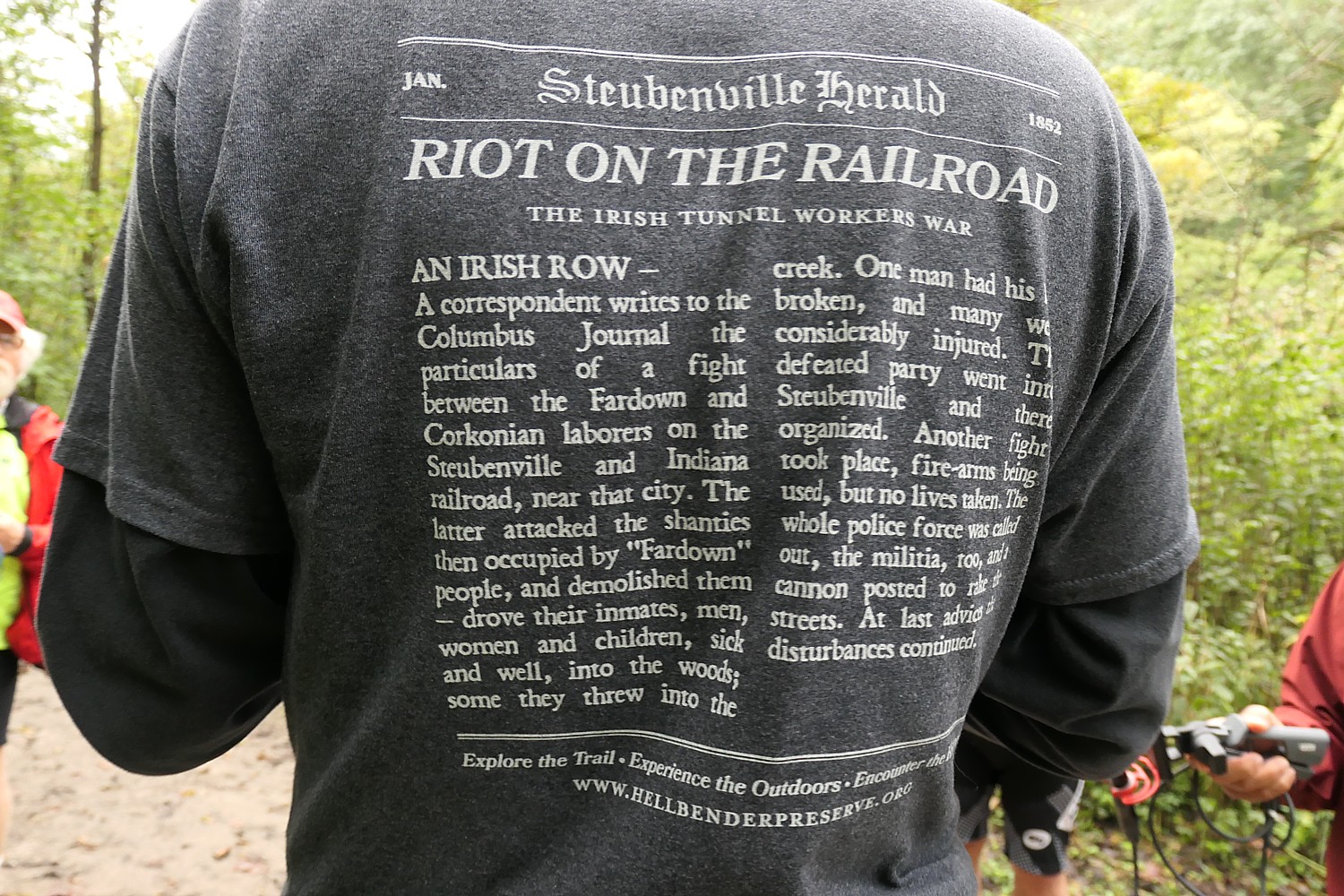
New York’s Empire State Trail Comes Together: Biking the Wallkill Valley Rail Trail in Hudson Valley

Biking over the Rosendale Trestle, 150 feet above the Rondout Creek, on the Wallkill Valley Rail Trail, part of the New York Empire State Trail © Karen Rubin/goingplacesfarandnear.com

by Karen Rubin, Dave E. Leiberman, Laini Miranda
Travel Features Syndicate, goingplacesfarandnear.com

The ambitious New York Empire State Trail is taking shape, linking and connecting and improving existing trails for a 750-mile network that will enable bikers, hikers, recreational users go from New York City to the Canadian border, and from Buffalo to Albany. And it seems like it is on track for completion by the end of the year, when it would become the longest multi-use state trail in the nation.

We headed out to one of the trails, Wallkill Valley Rail Trail, newly incorporated in the Empire State Trail, with signage and improvements (new trestles, bridges, widened paths, improved drainage), from New Paltz, which itself is a hub for some marvelous multi-use trails that collectively form the Hudson Valley Greenway Trail (www.ny.gov/empire-state-trail/routes-empire-state-trail).

It was pure delight. The linear trail through forests, beside and over creeks, passed dramatic rock formations, is 22 miles long (so 44 miles, out and back). Because of time limitations (and the fact the trail has some closures north of the Rosendale Trestle, midweek, for improvements that are expected to be completed in October, check the site), we only went seven miles north of the parking lot at Sojourner Truth Park in New Paltz, but can’t wait to return to do the rest, another 7 miles north to Kingston, and 7 miles south to Gardiner. The northern half of the trail, from New Paltz to Kingston, has been incorporated into the Empire State Trail, with new signs and improvements.

Biking the Wallkill Valley Rail Trail © Karen Rubin/goingplacesfarandnear.com

Shortly after the Wallkill Valley branch of the New York Railroad closed in the 1980s, the Wallkill Valley Land Trust purchased the12-mile stretch of the corridor between New Paltz, south to Gardiner, leading to the opening of the first stretch of trail in 1993. Today, the trail stretches a total of 24 miles and runs along its namesake river from Gardiner to Kingston.  In 2009, the northern section was purchased, extending the linear park 11.5 miles north from Rosendale through Ulster to Kingston, incorporating the dramatic Rosendale trestle, a 940-foot bridge across the Rondout Creek that provides one of the most thrilling parts of the ride. This portion of the trail, from New Paltz to Kingston, has been designated as part of the statewide Empire State Trail, which, when complete next year, will stretch 750 miles, running from New York City to Canada and from Albany to Buffalo. (info at Wallkillvalleylt.org,  845-255-2761).

The sights are marvelous, and the trail very pleasant.

We find our way from the New York Thruway to the Sojourner Truth Park along the river (where you can rent kayaks),  park the car and set off, north.

We soon come to a repurposed train station, now the Rail Trail Cafe, right on the trail.

About a mile north of the village, the trail crosses the Wallkill River on the Springtown Truss Bridge, featured in the movie “A Quiet Place” with magnificent views.  

Biking over the Springtown Truss Bridge over the Wallkill River, featured in the movie “A Quiet Place” © Karen Rubin/goingplacesfarandnear.com

The trail passes besides orchards, organic farms, lakes, streams and the Wallkill River.

 In Rosendale, the most memorable feature of the trail can be found, the Rosendale Trestle. This 940-foot-long continuous truss bridge carries the trail 150-feet high over the Readout Creek, and spans both route 213 and the former Delaware and Hudson Canal.

Gorgeous scenery off the Wallkill Valley Rail Trail © Karen Rubin/goingplacesfarandnear.com

We ride a little further north beyond the Rosendale Trestle, and come to the Binnewater Historic District where local quarries produced Rosendale cement. (I subsequently learn The Rosendale Cement Works near Limewater employed 5,000 workers and produced 4,000,000 barrels of cement a year at the peak of its activity at the turn of the century. Rosendale cement was used in the Brooklyn Bridge, the pedestal of the Statue of Liberty, the U.S. Treasury Building, as well as in many other structures around the country. The decline of the cementworks in this area is what accounts for the rail line being abandoned, and subsequently repurposed for the recreational trail. You can still see mines used to extract the cement,)

Interesting rock formations on the Wallkill Valley Rail Trail in the Binnewater Historic District where local quarries produced Rosendale cement © Karen Rubin/goingplacesfarandnear.com

Here, though, we see magnificent rock formations – what looks like a cave from which it feels as if air conditioning were flowing and we sit on a boulder to have a snack before turning back.

 Notes about the trail say that were we able to continue biking north, we would come to great views of Third Lake, Fourth Lake, and Fifth Lake before passing under Interstate 87 alongside Hickory Bush Road. The northernmost stretch of the trail runs through a scenic forested area before reaching its terminus at a parking area off of New York State Route 32 just south of Kingston. However, the City of Kingston and Ulster County are exploring options for extending the trail into the city. Meanwhile, the Empire State Trail is adding roadway enhancements to run the trail along roadways into the city, where it can connect with other projects currently underway, including the Kingston Point Rail Trail and the Ulster County Midtown Linear Park which runs out towards the O&W Rail Trail.

Riding back, we come to the Café in the Woods, set up for musical performances, where you can purchase food from what looks like a gypsy caravan, and an outdoor kitchen with a wood-burning stove.

Here is where we see Happy Trails Bike Rental (917-443-3600; call in advance) set up right on the trail, (you should call in advance to make sure he’s around). (There are a couple of bike rental shops in the area).

Café in the Woods on the Wallkill Valley Rail Trail © Karen Rubin/goingplacesfarandnear.com

It’s late afternoon by the time we ride back south to the Sojourner Truth Park, but if we had time, we would have wanted to complete the trail the further 7 miles to Gardiner.

The southern end of the Wallkill Valley Rail Trail is at Denniston Road in the Ulster County town of Gardiner. True to the corridor’s original use as a rail line, the trail is generally flat. However, especially at this southern end, the trail is unpaved and best suited in the summer for hikers or for bicycles with wider tires.  (www.traillink.com/trail-itinerary/wallkill-valley-rail-trail)

New Paltz Hub for Trails

New Paltz has become a regional hub for trails, with the Wallkill Valley Rail Trail running as the spine through the village. To the east, carrying the Empire State Trail up from New York City, is the Hudson Valley Rail Trail (which I have done in the past and found fantastic). This trail connects with the Walkway Over The Hudson’s western end in Highland – which has become one of New York State’s most popular attractions –  and as a part of the Empire State Trail’s investment, was recently extended from its previous terminus in the town of Lloyd all the way through to New Paltz where it connects with the Wallkill. Running west from New Paltz, a newly opened River-to-Ridge Trail  amidst the magnificent scenery of the Shawangunk Mountains.

Biking the new River to Ridge Trail © Karen Rubin/goingplacesfarandnear.com

Indeed, the next weekend, we return to bike the River-to-Ridge Trail (www.openspaceinstitute.org/places/river-to-ridge-trail) which was created by the Open Space Institute in partnership with Mohonk Preserve (www.mohonkpreserve.org) with support of the Butler Conservation Fund and only opened in 2018. This is a surprisingly hilly, gravel trail, about six miles long, that runs from the Wallkill River up through newly protected lands adjacent to fields, to 90 miles of carriage road trails on the grounds of the Mohonk Preserve, Mohonk Mountain House, and Minnewaska State Park Preserve.

Developed and managed by the Open Space Institute, the trail is a scenic and recreational off-road loop. It meanders through farm fields and over gently rolling hills, connecting New Paltz directly to the Shawangunk Ridge and 90 miles of recreational carriage roads and trails at the Mohonk Preserve and the Minnewaska State Park Preserve (https://parks.ny.gov/parks/127); the Wallkill Valley Rail Trail; and the Empire State Trail.

Just off the Wallkill Valley Rail Trail and up the road from the River to Ridge Trail is Coppersea Distillery © Karen Rubin/goingplacesfarandnear.com

There’s a bike rental set-up right by the parking lot on Springtown Road. Just up from the parking lot, on Springtown Road, we found you can visit Coppersea Distilling, where you can go for whiskey tasting, which turns out to be a stone’s throw from where we had biked the Wallkill Valley trail (239 Springtown Road, New Paltz, 845-444-1044, coppersea.com).

We also go for cider tasting, fruit picking, and have pizza, prepared in a wood-burning stove, enjoyed at an outdoor table (with strict COVID-19 protocols), rounding out a sensational day.

Empire State Trail

About 400 miles of the Empire State Trail network had already existed – the absolutely fantastic Erie Canalway, 326 miles from Buffalo to Albany (which we have done on the annual 8-day, 400-mile Parks & Trails NY Cycle the Erie supported biking/camping trip, ptny.org), during which you see unfurled before you 400-years of American history. Improvements to connect the Canalway have also been made.

Most notable is the work done to connect the trails on the north-south routes, from New York City (where you can ride the fabulous Hudson River Park), all the way up to Canada. This involved some 60 different construction projects, all engaging local stakeholders.

When the full 750 miles of continuous route is finished, The Empire State Trail will be the longest multi-use state trail in the nation. (see https://www.ny.gov/programs/empire-state-trail)

When the New York Empire State Trail is completed, it will be possible to bike from Hudson River Park in Manhattan, up to the Canada border © Karen Rubin/goingplacesfarandnear.com

The sections include:

Hudson Valley Greenway Trail

The Hudson River Valley Greenway segments start in New York City and run north to the Capital District:

LOWER HUDSON VALLEY

  • Hudson River Park
  • On-Road connection from Upper Manhattan to Van Cortlandt Park
  • South County Trailway
  • North County Trailway
  • Putnam Trailway
  • Beacon Rail Trail
  • Dutchess Rail Trail
  • Walkway Over the Hudson

UPPER HUDSON VALLEY

  • Hudson Valley Rail Trail
  • Wallkill Valley Rail Trail
  • Kingston Point Rail Trail and Promenade
  • On-Road North of Kingston to the City of Hudson
  • Albany-Hudson Electric Trail (AHET Trail)
  • Corning Preserve Trail
  • Mohawk Hudson Bike Hike Trail

Champlain Valley Trail

The Empire State Trail within the Champlain Valley goes from the Capital District to Whitehall, Wherever feasible, it is off-road along Champlain Canal towpaths. The 120- mile section from Whitehall to the Canada border at Rouses Point is on-road route primarily intended for bicyclists.

CHAMPLAIN VALLEY 

  • Champlain Canalway Trail
  • On-Road from Mechanicville to Stillwater
  • Path through Hudson Crossing Park
  • On-Road to Fort Edward
  • Champlain Canalway Trail
  • On-Road from Fort Ann to Plattsburgh
  • Terry Gordon Bike Path
  • Saranac River Trail
  • On-Road from Plattsburgh to Rouses Point / Canadian Border

Erie Canalway Trail

The Empire State Trail within the Erie Canalway include proposed new trail sections and link Buffalo to the Capital District.

WESTERN ERIE CANALWAY TRAIL

  • Buffalo Connection
  • Pendleton Connection
  • On-Road connection in Lyons
  • Shared Use Path from Lyons to Clyde
  • On-Road connection in Clyde
  • Shared Use Path from Clyde over Erie Canal
  • On-Road connection to Savannah
  • Savannah shared use path
  • On-Road connection to Port Byron trailhead
  • Honeywell Trail to Loop the Lake Trail
  • Onondaga Creekwalk 
  • On-Road Water Street Connection in Syracuse
  • Erie Boulevard

EASTERN ERIE CANALWAY TRAIL

  • Old Erie Canal State Park
  • Rome Connection
  • Utica – Schuyler
  • Ft. Herkimer Church – Lock 18
  • Lock 18 – Little Falls
  • Schuyler – Ilion
  • Ilion – Mohawk
  • Pattersonville Trail
  • Rotterdam Junction Connection

More information from Parks & Trails NY (ptny.org). (Next Cycle the Erie scheduled July 11-18, 2021).

Also, Rails to Trails Conservancy (railstotrails.org), Great American Rail-Trail, which would link up 3,700-miles of multi-use trails from Washington DC on the east coast to Washington State on the west coast (www.railstotrails.org/greatamericanrailtrail/vision).

______________________

© 2020 Travel Features Syndicate, a division of Workstyles, Inc. All rights reserved. Visit goingplacesfarandnear.com, www.huffingtonpost.com/author/karen-rubin, and travelwritersmagazine.com/TravelFeaturesSyndicate/. Blogging at goingplacesnearandfar.wordpress.com and moralcompasstravel.info. Send comments or questions to FamTravLtr@aol.com. Tweet @TravelFeatures. ‘Like’ us at facebook.com/NewsPhotoFeatures
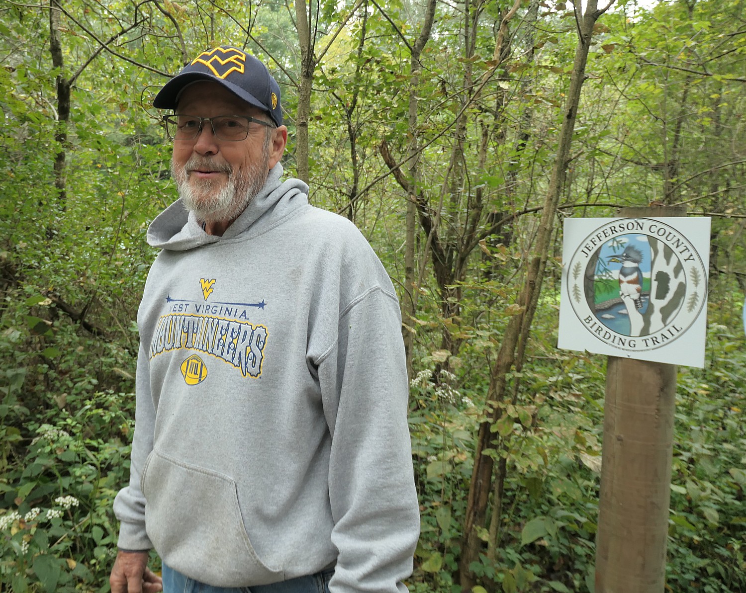
Driveable Adventures: Bike Tours Are Ideal Vacation Choice This Season

Biking the history-rich, scenic Delaware & Lehigh Trail (the D&L). Pocono Biking has a four-day, 142 mile guided inn-to-inn tour © Karen Rubin/goingplacesfarandnear.com

by Karen Rubin
Travel Features Syndicate, goingplacesfarandnear.com

Bike tours offer one of the best vacation alternatives in these times when people want to be outdoors in open spaces, and enjoy stunning landscapes, discover heritage and history and have that opportunity for shared experiences that travel uniquely provide. There is still time this season to take advantage of guided, self-guided and private bike tours from companies including Pocono Biking, Wilderness Voyageurs and Discovery Bicycle Tours.

Pocono Biking has space on departures this season on a supported four-day bike tour that takes you 142 miles of the Delaware & Lehigh rail trail, also known as D&L Trail.

I did this ride, anchored by the charming town of Jim Thorpe and the famous historic landmark at Washington Crossing, on the Rails-to-Trails Conservancy’s Sojourn, though with camping instead of inn-to-inn along this scenic and history-rich trail (railstotrails.org). The RTC trip also was operated by Pocono Biking, a powerhouse outdoors- adventure company in the area well known for its rafting adventures on the Lehigh River in the Lehigh Valley.

The trip, traveling through 57,600 acres (90 miles) of state park, is designed so you get to enjoy three of Pennsylvania’s award winning quaint small towns: Jim Thorpe, Bethlehem and New Hope. Essentially, we follow the route of Anthracite Coal, from mine to market, which thrust America into the Industrial Revolution. Along the way, we see the geography, the resources, and the technological innovations that made this possible, and how they affected the society, the culture, and the economy of the fledgling nation. The trail, part of the Delaware & Lehigh National Heritage Corridor, is so historically significant that it is a Smithsonian Institution Affiliate.

Buttermilk Falls, along the Delaware-Lehigh Trail, is a highlight of Day One’s ride through Lehigh Gorge State Park © Karen Rubin/ goingplacesfarandnear.com

Day 1 – 36 miles: The adventure starts in the wilderness of the Lehigh Gorge State Park, riding passed waterfalls and spotting wildlife (deer!), taking advantage of the newly connected D&L Rail Trail into the charming town of Jim Thorpe.  The first night is spent amid mountains in the Inn of Jim Thorpe, circa 1849.

A poster of Native American Olympian Jim Thorpe hangs in the Jim Thorpe Inn, in the town that was renamed for him © Karen Rubin/ goingplacesfarandnear.com

Jim Thorpe – an odd name for a town – was established in 1818 as Mauch Chunk, which means “Mountain of the Sleeping Bear,” the name the Lenni Lenape Indians gave to the nearby mountain. But it was later renamed for an Oklahoma-born Native American, the Olympic hero Jim Thorpe, who is buried there. Thorpe was born in Oklahoma in 1888 and raised on the Sac and Fox Reservation and had never set foot in the borough.  But Patsy Thorpe, Jim’s third wife, cut a deal with two struggling towns in Pennsylvania, that if they would merge, rename themselves Jim Thorpe and build a memorial to honor him, she would present them his remains for burial.

The town played a key role in the emergence of the United States as an Industrial Revolution powerhouse. Here, entrepreneurs led by Josiah White formed the Lehigh Coal & Navigation Company in the 1820s (you can still see the brick building), which shipped tons and tons of anthracite coal and other goods to market via the Lehigh and Delaware Canals which they constructed. The town grew in importance when it was named Carbon County’s seat in 1843.

Asa Packer Mansion in Jim Thorpe, PA © Karen Rubin/ goingplacesfarandnear.com

A major attraction here is the Packer Mansion, which I was lucky enough to visit on my trip. Asa Packer’s story epitomizes the rags-to-riches-for-those-with-grit-and-a-good-idea American Dream: Born poor in Mystic, Connecticut, Asa Packer (1805-1879) left home when he was 17, setting out on foot to Brooklyn, Pennsylvania where he apprenticed as a carpenter to his cousin, Edward Packer. In 1828, he married Sarah Minerva Blakslee (1807-1882) and the couple tilled a farm they rented from Sarah’s father.  But after four years, they were just as poor as when they started. So hearing that men were needed to captain coal barges on the Lehigh Canal, Asa traveled to Mauch Chunk, in the winter of 1832. He used his skill as a carpenter to build and repair canal boats. He resettled his family in Mauch Chunk and became the owner of a canal boat that carried coal to Philadelphia, then opened his own firm, A. & R. W. Packer, which built canal boats and locks for the Lehigh Coal & Navigation Company.  

He tried to get the company to build a railroad, but was refused. So, in October 1851, risking financial ruin, Packer purchased nearly all the controlling stock and interest for the unfinished Delaware, Lehigh, Schuylkill and Susquehanna Railroad (later known as the Lehigh Valley Railroad).  By November, 1852, he expanded the railroad from Mauch Chunk to Easton, Pennsylvania, in exchange for the company’s stocks and bonds, and later into New York State. 

He became the third richest person in the world and parlayed his business success into political success, serving as a Judge, a state representative, a two-term Congressman (1853-7), and even challenged Ulysses S. Grant for the Democratic presidential nomination in 1868. He narrowly lost election to become Pennsylvania’s Governor in 1869.

The Packers settled in their Italianate Villa in Mauch Chunk in 1861 and, to celebrate their 50th wedding anniversary, on January 23, 1878, held a fantastic gala (a newspaper printed in gold described it, and the man who performed their wedding attended). Asa died just 18 months later.

Biking the Delaware-Lehigh Trail © Karen Rubin/ goingplacesfarandnear.com

This quaint village is a hub for many marvelous attractions including the Packer Mansion; the Old Jail Museum (the eerie dungeon where the Molly McGuires were jailed; Cell 17 with its mysterious handprint on the wall, under the gallows on which seven of the accused Molly Maguires were put to death); the Lehigh Gorge Scenic Railway, St. Mark’s Church, Historic Stone Row, the Mauch Chunk Opera House, Anita Shapolsky Art Center, Mauch Chunk Museum, plus wineries and distilleries (Big Creek Vineyard and Stonekeep Meadery), biking, hiking and rafting.

Jim Thorpe Visitors Center, 2 Lehigh Ave., Jim Thorpe PA 18229, 570-325-3673, jimthorpe.org.

Day 2 – 37 miles:  After a night exploring the shops, museums and restaurants in Jim Thorpe and breakfast at the Inn, cycle beside the locks and canals along the Lehigh River to the town of Bethlehem, PA. Along the way you pass the Lehigh Gap Nature Center with its protected land. There are stunning views of the Blue Mountain and Appalachian Trail. Bethlehem, circa 1741, an old Moravian settlement, has cobblestone streets, quaint shops, and history around every bend.  Spend the night in the Hotel Bethlehem where Presidents and dignitaries have stayed.

Biking the Delaware-Lehigh Trail © Karen Rubin/ goingplacesfarandnear.com

Lehigh Gap Nature Center, a non-profit conservation organization at the foot of the Kittatinny Ridge, is dedicated to preserving wildlife and habitat through conservation programs such as the Lehigh Gap Wildlife Refuge, educational programs such as the Kittatiny Raptor Corridor Project as well as research. I linger in the butterfly garden before setting out again on the trail. (8844 Paint Mill Rd, Slatington, PA 18080, 610-760-8889, http://lgnc.org/)

Along the way, we come upon what is left of the original canal locks – stone walls, wooden gates with metal latches and gears, remnants from the mid-1800s. 

Historic Freemansburg, on the Delaware-Lehigh Trail © Karen Rubin/ goingplacesfarandnear.com

At Freemansburg, we find a lockmasters house, the remains of the locks and a mill, which, when I visited, was manned by interpreters in period dress. I wonder whether the village was settled by freemen and am told that it was named for one of the original settlers, Richard Freeman.

Freemansburg is a classic example of a canal town with houses and structures built up against the waterway that was the village’s lifeblood in the 1800s. Members of the Old Freemansburg Association (OFA) reclaimed a 1.5 mile section of the Lehigh Canal the Borough owns from overgrowth and debris and restored the towpath which became the D&L Trail. The OFA spearheaded efforts to protect and restore the 1829 Locktender’s House, mule barn, Lock No. 44, gristmill, and coal yard. Volunteers also reconstructed the barn using canal era tools and equipment, a project that took 10 years to complete. The multi-functional building now hosts weddings, educational sessions and interpretative demonstrations. (http://lehighvalleyhistory.com/history-of-the-borough-of-freemansburg)

Riding on, we come to an island that consists of a shuttered steel mill that today stands somewhat surreally like an abstract sculpture.

Bethlehem, PA: A shuttered steel mill looks like abstract sculpture © Karen Rubin/ goingplacesfarandnear.com

Day 3 – 47 miles: After breakfast, the group departs Bethlehem and cycles south following the path of 19th century aqueducts to the confluence of the Lehigh and Delaware Rivers. Visit the only operating mule drawn canal boat east of the Mississippi. Tour the National Canal Museum and pass through quaint river villages, until arriving in New Hope. New Hope offers bustling nightlife and cultural attractions such as the Bucks County Playhouse.

Two mules pull the Josiah White II canal boat at the National Canal Museum in Hugh Moore Park © Karen Rubin/ goingplacesfarandnear.com

The Delaware & Lehigh National Heritage Corridor interprets this fascinating period of American history in the 520-acre Hugh Moore Park through tours of the National Canal Museum and rides on the 110-passenger Josiah White II canal boat. Here you see remnants of the oldest industrial park in the region, a Locktender’s House and one of only three mule-drawn canal boats still operating in America, which plies a two-mile section of the canal that has been restored. The National Canal Museum, with hands-on exhibits highlighting 19th century canal life and technology, normally is open from June until October. (https://canals.org/)

Day 4 – 22 miles:  On day four, after breakfast at the Fox and Hound Bed & Breakfast, ride along the canal trail to Washington Crossing where George Washington crossed the Delaware in 1776.  You also cross the Delaware to the D&R Canal State Park and head north to Bull’s Island where the ride ends with lunch before being shuttled back to your car. 

Washington Crossing Historic Park, 1112 River Road, Washington Crossing, PA 18977, 215-493-4076, www.WashingtonCrossingPark.org.

A bike tour, whether guided or self-guided, is an ideal vacation choice this season © Karen Rubin/ goingplacesfarandnear.com

Available dates at this writing include Sept. 14 and Oct. 5 (up to 14 guests per trip, with 2 guides; the minimum age is 13; e-bike rentals are available, but the trail is easy/moderate crushed gravel trail). The cost is $995 ($225 single supplement); $90 to rent a bike, and includes the overnight accommodations, professional bike guides; sag wagon; basic bike repair (replacement bike if needed to complete the ride); rest stops with snacks and water; breakfast on three days; lunch on two days; luggage transportation to each accommodation; morning trail briefings and transportation back to your car by 4pm on the final day.

If you would rather DIY, Pocono Biking also offers daily rates and shuttle service, Big Day Out & Big Night Out (Multisport Adventures), two-day trips, and Pocono Whitewater Rafting on the Lehigh River.

Pocono Biking, 7 Hazard Square, Jim Thorpe, PA, 570-325-8430, PoconoBiking.com.

Other bike tours available this season:

Wilderness Voyageurs, operating out of Ohiopyle, PA, is offering New York Erie Canal Bike Tour (4-days,Sept. 21); Great Allegheny Passage Bike Tour (4-days, Sept. 21, 28, Oct. 5), Easy Rider GAP Bike Tour (3-days,  Sept. 9).

Rails-to-Trails Conservancy’s Sojourn on the Great Allegheny Passage Rail Trail, operated by Wilderness Voyageurs © Karen Rubin/goingplacesfarandnear.com

Other upcoming tours: Michigan Islands, Trails & Dunes Bike Tour  (8/30); Cycle Colorful Colorado Bike Tour (9/13); Katy Trail Missouri Bike Tour (9/27, 10/18) and
Kentucky Bike & Bourbon Bike Tour (10/19).

“Bike touring lends itself to a vacationing style that uniquely fits these times: small groups and big open spaces! Although we understand that traveling at this moment is not for everyone and is a personal decision, our goal is to minimize the risks where possible and make traveling as comfortable as possible.”

Wilderness Voyageurs, 103 Garrett St., Ohiopyle, PA 15470, 800-272-4141, bike@Wilderness-Voyageurs.com, Wilderness-Voyageurs.com

Discovery Tours is inviting biking enthusiasts to design their own tour: “Pick any of our U.S. locations — or suggest a new one — and we’ll customize an incredible biking vacation just for you.”

Groups of 8 or more get one tour free (or spread the savings across the group). Special pricing is available for groups of 4 or fewer.

Biking with Discovery Tours in Woodstock, Vermont © Karen Rubin/goingplacesfarandnear.com

The company, based in Woodstock, Vt., has already run private tours this summer on the Mickelson Trail and Black Hills in South Dakota, in Maine and in New York’s Finger Lakes.

For details, contact Scott (scott@DiscoveryBicycleTours.com), info@discoverybicycletours.com, 800-257-2226, discoverybicycletours.com.

Find more trails through Rails-to-Trails Conservancy, 2121 Ward Court, NW, Washington, DC 20037, 866-202-9788, railstotrails.org, TrailLink.com.

______________________

© 2020 Travel Features Syndicate, a division of Workstyles, Inc. All rights reserved. Visit goingplacesfarandnear.com, www.huffingtonpost.com/author/karen-rubin, and travelwritersmagazine.com/TravelFeaturesSyndicate/. Blogging at goingplacesnearandfar.wordpress.com and moralcompasstravel.info. Send comments or questions to FamTravLtr@aol.com. Tweet @TravelFeatures. ‘Like’ us at facebook.com/NewsPhotoFeatures