Tag Archives: New York State tourism

From Glamping to Biking to Hiking, New York State Makes it Easy to Get Out There!

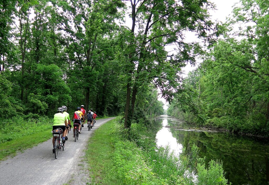
After a year’s hiatus, registration for the 2021 Cycle the Erie 8-day, 400-mile biking adventure from Buffalo to Albany is now open for a limited 350 riders. The 350-mile long Erie Canalway is now part of the state’s 750-mile long Empire State Trail Network © Karen Rubin/goingplacesfarandnear.com

by Karen Rubin, Travel Features Syndicate, goingplacesfarandnear.com

Throughout the coronavirus pandemic, when so much was locked down and out of reach, New York State parks and outdoors were a godsend, providing needed respite. Indeed, the state’s parks received a record number of visitors, even as measures were in place to control capacity. And throughout the year, the state consistently made improvements and found ways to be available to more people.

The improvements are part of Governor Andrew Cuomo’s NY Parks 100 initiative, which renews the historic commitment to investing and expanding the State Park system by committing at least $440 million over the next four years.

“This critical period of revitalization will culminate in the 2024 celebration of the 100th anniversary of the State Park Act, which first created our nation-leading State Park system in 1924 under Governor Al Smith. NY Parks 100 will continue crucial investments in park infrastructure while enhancing opportunities to reach the full range of New York State’s recreational and cultural offerings, including local parks and trails, regional flagship parks and historic sites, and vast wilderness parks. The initiative will focus on creating places to recreate locally, relieving overcrowded parks, welcoming new visitors, and protecting New York State’s environmental and historic legacy. This new plan will ensure people from all communities and across all ages and abilities can fully experience our outdoors, our culture, and our heritage,” the state said.

Here are some of the improvements that will welcome visitors this year:

New York State has formed a new public-private partnership for a new tent camping service with 45 sites at four State Parks in the Hudson Valley. Tentrr’s fully outfitted campsites are available to reserve at the Sebago and Silver Mine areas of Harriman State Park in Orange and Rockland Counties; Taconic State Park and Lake Taghkanic State Park in Columbia County; and Mills-Norrie State Park in Dutchess County.

The service provides tents, sleeping accommodations and an array of equipment needed for camping at each site. All items are set up and ready to use upon arrival for added convenience and sites are maintained by Tentrr staff.

All locations include a 10-foot by 12-foot, canvas-walled tent atop a raised platform. Each site is outfitted with a queen-sized bed and memory foam mattress, a propane heating source, a solar-powered “sun” shower, a camp toilet, water container, Adirondack chairs, a fire pit, grill, and a picnic table with storage and benches.  
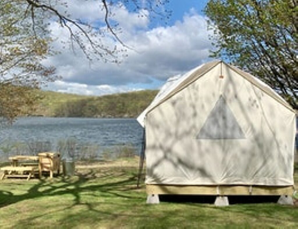
Tentrr camping site at the Sebago area of Harriman State Park, New York. The tenting service has a partnership with New York State to provide 45 glamping sites at four state parks in the Hudson Valley.

Guests have the option of single, double, and triple sites. Singles sleep up to six (two occupants in the main tent and four occupants in a provided pop-up tent). Double sites – or buddy sites – sleep up to 12 (two occupants in each of the two main tents and four occupants in each of the two provided pop-up tents) and triples can accommodate group camping. 

Sites are $135 per night, with a portion going toward the maintenance and stewardship of New York State Parks.

While Tentrr’s sites are naturally socially distanced, Tentrr adheres to state guidelines for maintaining and sanitizing the sites. Tentrr will continue to keep sites clean and wiped down with high-grade sanitizers and encourages guests to follow recommended COVID requirements and protocols. For more details on Tentrr’s COVID-19 protocols, visit here

To make a reservation, visit tentrr.com/nysp. Reservations can be made up to six months in advance.

Camp Rockaway

Through the Reimagine the Canals initiative, Camp Rockaway, a New York State based outdoor excursion company, is managing the site at Lock C-5 on the Champlain Canal in Schuylerville between Memorial Day weekend and September 8, with possible extension through early October. The glamping site will offer vacationing New Yorkers an opportunity to experience the vast history and bucolic landscapes of one of New York’s oldest canalside communities by enjoying luxury camping on the banks of the Canal.
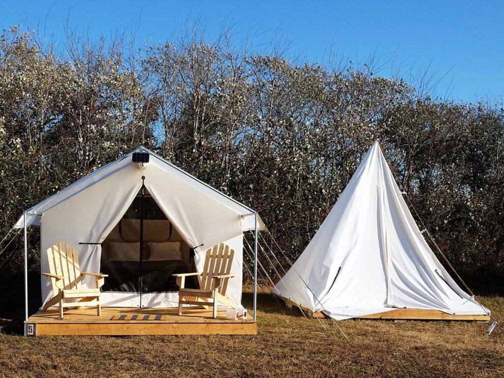
Through the Reimagine the Canals initiative,  Camp Rockaway, a New York State based outdoor excursion company, will manage the site at Lock C-5 on the Champlain Canal in Schuylerville between Memorial Day weekend and September 8, with possible extension through early October.

Reservations are now being accepted for a glamping experience on the Champlain Canal that will attract visitors to the State’s historic upper Hudson Valley and boost the local economy that is still recovering from the COVID-19 pandemic.

This new glamping experience is the latest innovation from Governor Cuomo’s $300 million Reimagine the Canals initiative that is revitalizing the Canal corridor as a tourism and recreation destination while simultaneously boosting economic development and the resiliency of canalside communities.

Visit https://camprockaway.com/schuylerville/.

Biking, Cycling the Eric Canal

Parks & Trails NY is offering its sensational eight-day, 400-mile biking adventure along the Erie Canalway for a 23rd year in 2021, after a hiatus in 2020. Riders will leave Buffalo July 11 and reach Albany on July 18. Registration is open for spots, limited this year to 350.

The route follows the legendary Erie Canal passing locks and aqueducts and winding through historic villages and rural farmlands. Over the course of the eight days, cyclists enjoy stunning pastoral scenes, fascinating history extending 400 years in which the story of how America came to be unfolds, and some of the best cycling in the United States. Covering between 40 and 60 miles per day, cyclists travel along the Erie Canalway Trail, which is now more than 85 percent complete and the east-west axis of the statewide 750-mile Empire State Trail.
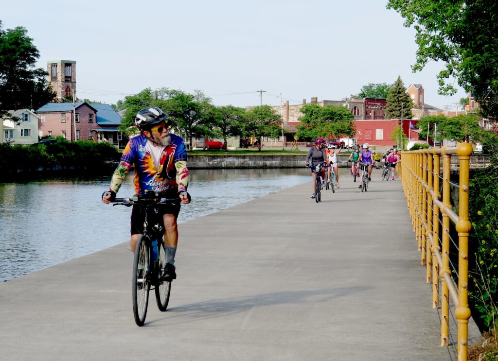
You can’t help but become immersed in history on Parks & Trails NY’s annual Cycle the Erie ride, 400-miles from Buffalo to Albany and 400 years of history © Karen Rubin/goingplacesfarandnear.com

Designed as a supported camping trip, accommodations are provided with showers, toilet facilities, some with pools or lakes for swimming; eight breakfasts and six dinners; two daily refreshment stops along the route; evening entertainment including music and historical presentations; guided tours of the Canal, historic sites, museums and other attractions including the Women’s Rights National Historic Park, Erie Canal Museum and Village, Fort Stanwix National Monument and a boat tour through the Lockport locks; kick-off reception and end-of-tour celebration; Cycle the Erie Canal t-shirt; baggage transport; SAG wagon and mobile mechanical support; daily maps and cue sheets; painted and arrowed routes; pre-departure info packet including training tips. Other amenities available (at additional fee) include fresh daily towels, gourmet morning coffee, tent and air mattress rental and set up (for those who don’t want to pitch their own tent).

With the ongoing COVID-19 pandemic, the safety of riders, volunteers, staff, vendors, and local community members is at the forefront of planning. With this in mind, the tour is limited to 350 participants and volunteers; all registrations will be for the full eight-day option; and to keep everyone safe and meet state and local COVID-19 regulations, registration fees have increased this year.

The price up until June 7 is $1200/adult, $650 youth (6-17); $290 child (5 and under); shuttle is $100.

The PTNY coordinators are following the guidance from New York State, and will be prepared to follow all regulations in place in July. Registrants will be notified of any updates or changes. Visit New York State’s COVID-19 Travel Advisory to stay abreast of restrictions that might impact your travel plans.

Find answers to questions riders may have on the Cycle the Erie Canal FAQ page. If there are questions that aren’t covered, email  [email protected].

Can’t do the Parks & Trails NY’s Cycle the Erie ride? Among the bike tour companies offering the trip, Wilderness Voyageurs offers a self-guided inn-to-inn tour (https://wilderness-voyageurs.com) and Classic Adventures (https://classicadventures.com/) and Womantours (www.womantours.com) offer guided itineraries.
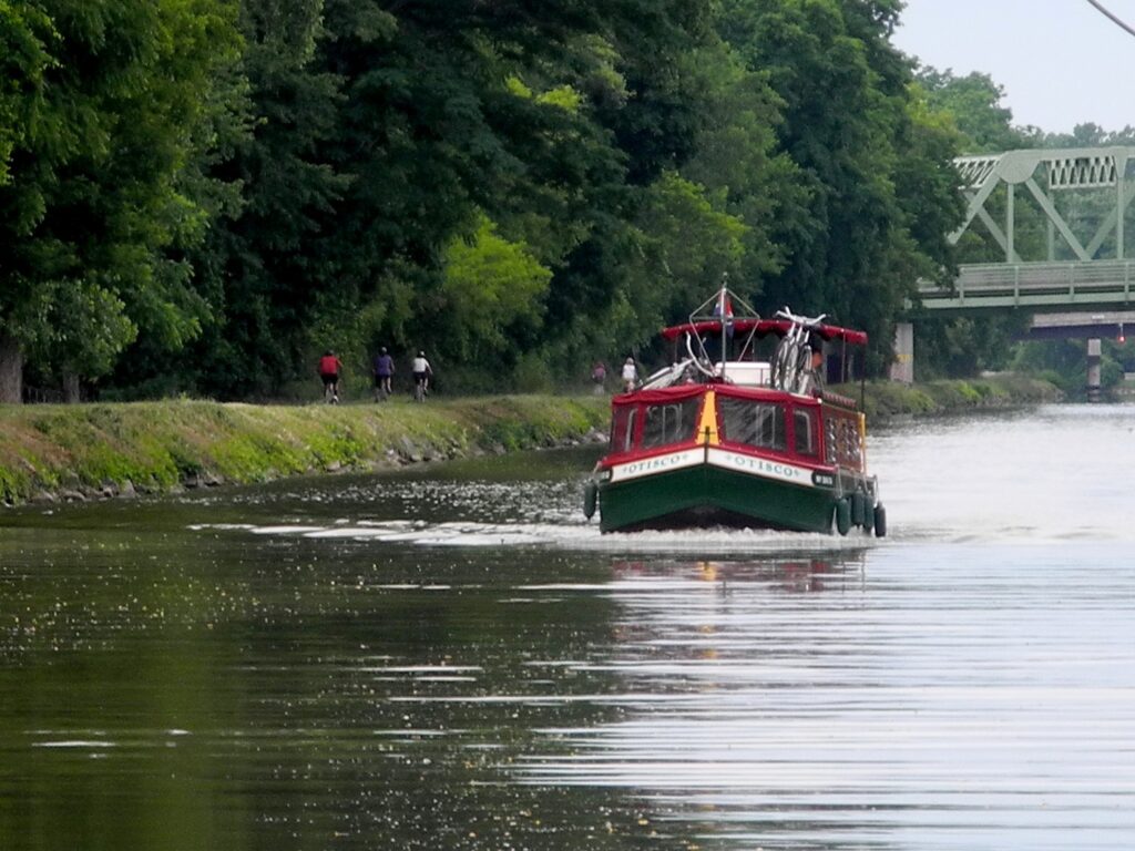
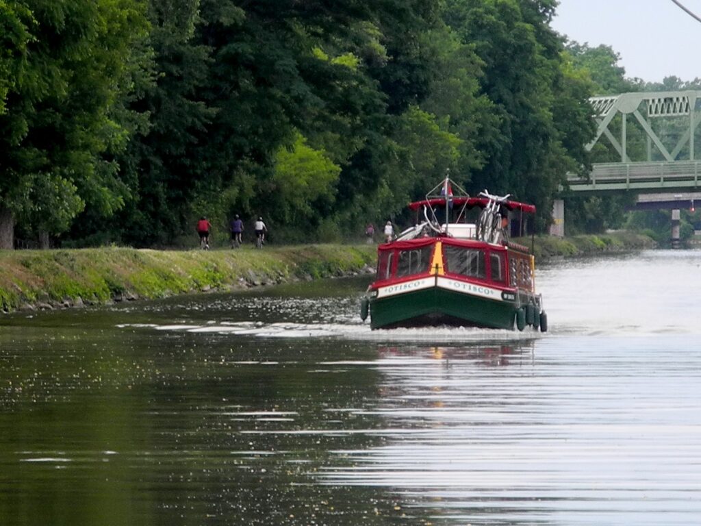
Cyclists ride the Erie Canalway as Erie Canal Adventures’ Lockmaster sails by © Karen Rubin/goingplacesfarandnear.com

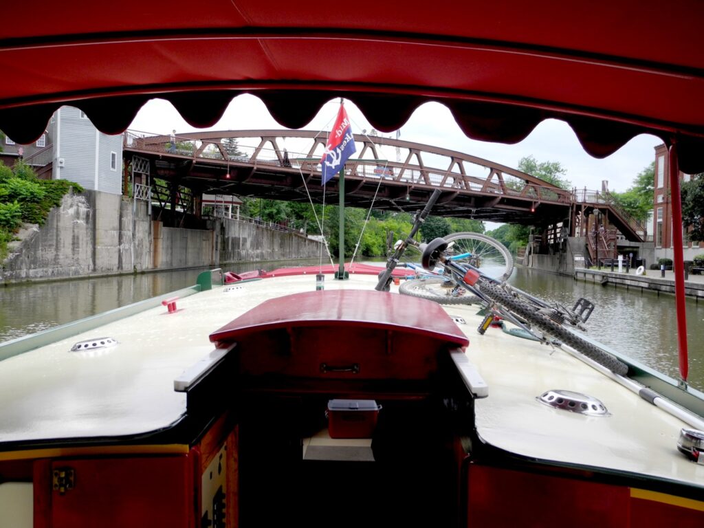
Another way to enjoy the Erie Canal is by boat – and bring a bike along. Erie Canal Adventures’ fleet of 11 custom-designed Lockmasters sail from Macedon, near Rochester, NY, and with enough time, you can cruise some 200 miles from Buffalo to Lake Oneida in Syracuse along the canal. Besides sailing along the Erie Canal (as far as , you can also sail on other waterways, taking spurs south to the Finger Lakes, or north up the Oswego canal to Lake Ontario. Erie Canal Adventures, 315-986-3011, www.eriecanaladventures.com.

With all these marvelous ways to enjoy the Canalway, the trail system was more popular in 2020 than any prior year, according to the 2020 Who’s on the Trail report from PTNY and the NYS Canal Corporation. The system saw a record 4.2 million visits in 2020, with 3.97 million visits made to the 360-mile Erie Canalway Trail between Albany and Buffalo and 288,000 visits to the 90-mile Champlain Canalway Trail between Waterford and Whitehall.

And now, the 353-mile long Erie Canalway, from Buffalo to Albany is linked and part of the state’s Empire Trail Network – 750 miles of interconnected off-road and on-road biking and recreational trails and lanes from the tip of Manhattan to the Canadian border.

Empire State Trail Open

New York’s ambitious Empire State Trail, now the nation’s longest multi-use state trail, is now fully opened. The trail network spans 750-miles total, 75 percent of which is off-road trails ideal for cyclists, hikers, runners, cross-country skiers and snow-shoers. The new recreational trail means you can go from New York City north-south through the Hudson and Champlain Valley to Canada, and east-west from Albany to Buffalo along the Erie Canal on a safe and incredibly scenic pathway, discovering fascinating historic and cultural sites along the way.
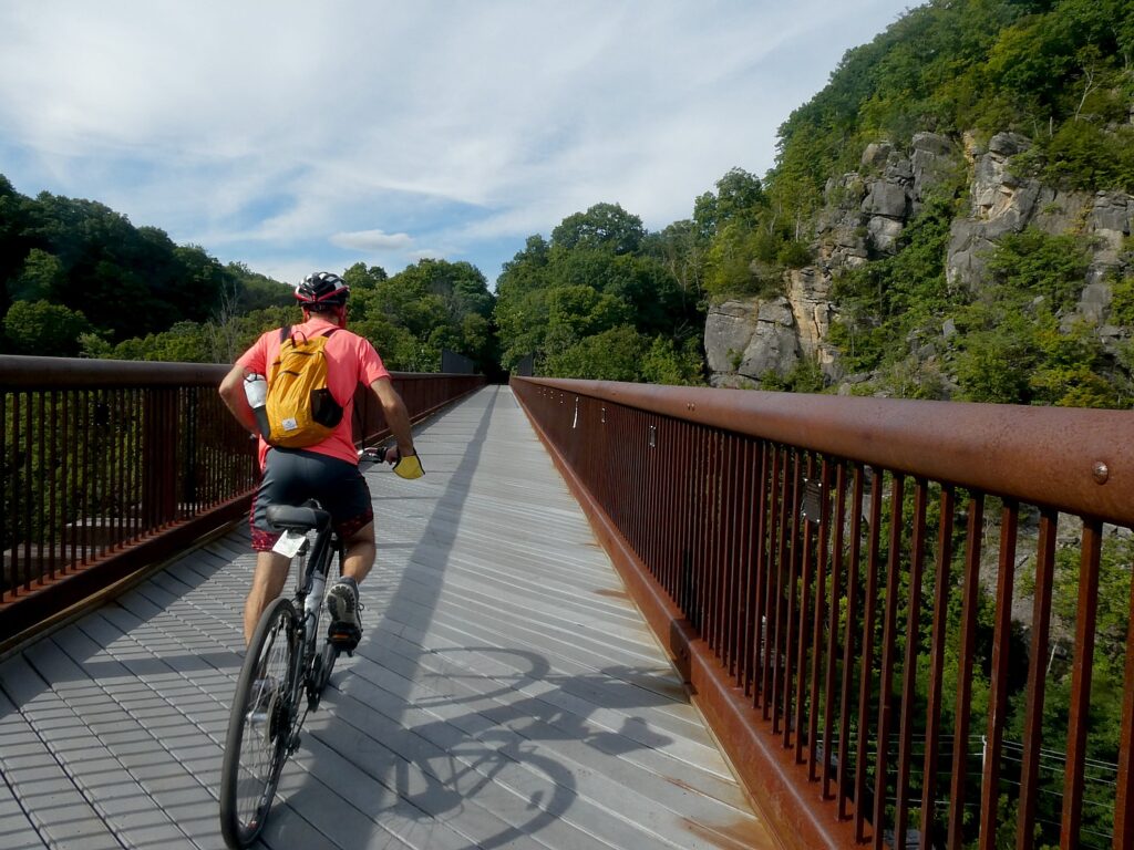
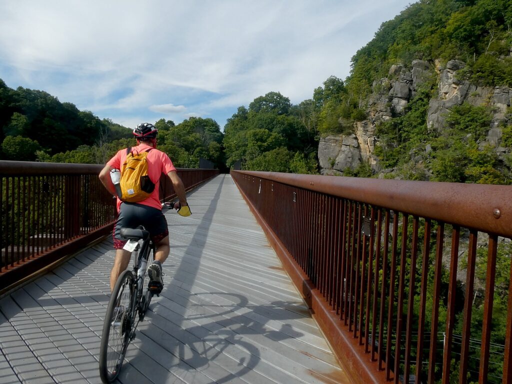
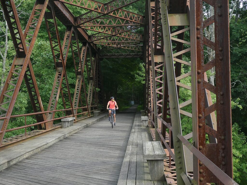
Biking over the Rosendale Trestle, 150 feet above the Rondout Creek, on the Wallkill Valley Rail Trail, part of the New York Empire State Trail © Karen Rubin/goingplacesfarandnear.com

The Empire State Trail website provides quick and easy access to trail information including segment descriptions, access points, trail distances, parking areas, restrooms, and nearby amenities and attractions. The website’s responsive and user-friendly design allows users to access interactive maps from mobile devices, zoom in to specific location of interest, and download/print maps of trail segments. Cyclists can print “cue sheets” with highly detailed directions for following a selected trail segment. The site also features information about the variety of activities and destinations on or near the trail such as campgrounds, parks, historic sites, and popular stops among the local communities. (empiretrail.ny.gov/)

To promote the opening of the Empire State Trail, the state has formed a partnership with the nationally-known Boilermaker race to create the “Empire State Trail Challenge” virtual race where participants can register and log their miles to reach milestones tied to virtual progress along the Empire State Trail, through July 31.  

Participants can register now and begin logging their miles walking, running or cycling. Participants would complete the mileage of at least one leg of the Empire State Trail: either the Hudson Valley Trail: 210 miles (New York City to Albany); the Erie Canalway Trail: 350 miles (Albany to Buffalo); or the Champlain Valley: 190 miles (Albany to Canada Border at Rouses Point). Participants can sign up as teams or individuals. For more information or to register, visit the website.

Although people are encouraged to the explore the actual Empire State Trail, participants can run, walk, or ride anywhere geographically, on local trails and running/bicycling routes near where they live to log and complete the challenge.

Each entrant receives a t-shirt with their $25 entrance fee for a single leg of the trail. If interested, participants can register for additional legs at the time of registration or any time during the race period at $5 per leg. Challenge participants will enter their mileage on an online platform over the duration of the race window, reaching milestones tied to virtual progress along the Empire State Trail, and have the ability to share their experiences on social media.

State Parks Commissioner Erik Kulleseid said, “The Empire State Trail Challenge is one of the ways we are building back better at our state parks and trails. Our parks and trails have been safe and healthy outlets for everyone during the pandemic. Whether enjoying a fun nature break with friends and family, or truly testing their limits, the Empire State Trail Challenge offers participants of all ages and abilities a rewarding and socially distanced opportunity to enjoy New York’s outdoors.”

The Empire State Trail website provides quick and easy access to trail information along the 750-mile route including segment descriptions and an on-line map identifying off-road trails connecting on-road sections, trail distances, designated parking areas, restrooms, and nearby amenities and attractions. (https://empiretrail.ny.gov/)

Discovery Bicycle Tour on Empire State Trail

Here is what well may be the first bike touring company to come out with a guided, inn-to-inn trip along the recently completed north-south section of the Empire State Trail in New York State:  Discovery Bicycle Tours’ has introduced a six-day itinerary that rides from the very tip of Manhattan, to Albany.

The six-day trip rides 200 miles of the newly completed Empire State Trail, which actually extends 750 miles from Manhattan to Canada and from Buffalo to Albany.
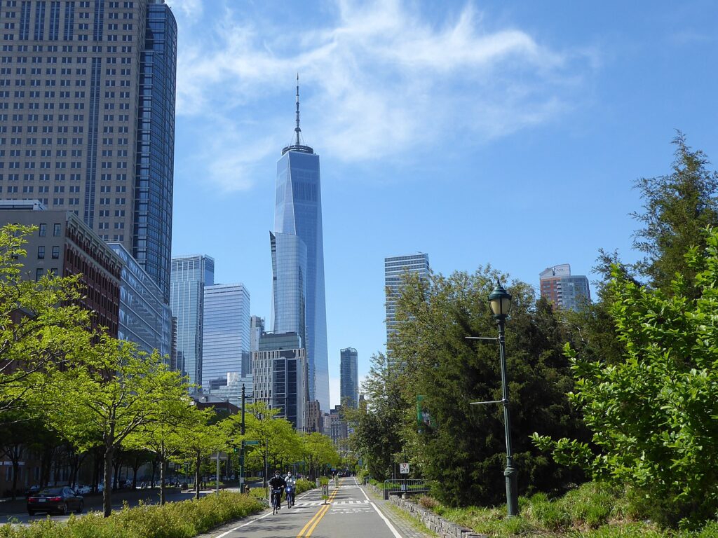
Discovery Bicycle Tours’ six-day Empire State Trail trip starts on the Hudson River bikeway at the tip of Manhattan and rides up 200 miles on newly connected trails to Albany © Karen Rubin/goingplacesfarandnear.

The Discovery Bicycle Tour goes through a wide variety of landscapes in New York State. Cycle passed the Freedom Tower and Manhattan skyscrapers, through forests, along lakes and rivers, with a triumphant finish in Albany, the state capital. You can be one of the first to enjoy this full section of the newly finished Empire State Trail, which allows cyclists to traverse the state almost entirely on dedicated hike/bike paths and routes.

Many miles are on dedicated rail-trail. And the riding is fairly flat with gentle hills. Look for vistas of the Catskill and Shawangunk mountains as you follow the gorgeous Hudson River Valley — favorite subject of Hudson River School landscape painters in the mid-1800s. As a bonus, you cycle across the Walkway Over the Hudson, the world’s longest elevated pedestrian bridge, and the iconic Rosendale Trestle.

Rated Level 1 (easier), daily cycling mileage ranges from 28 to 47 miles.

Accommodations are in casual and historic inns and a stylish boutique bed-and-breakfast.

The tour includes: 5 nights’ lodging, 5 breakfasts, 3 lunches, 4 dinners (you are on your own for 1 dinner in Rhinebeck), cycling routes with detailed maps and/or app-based navigation for those interested, plus bicycle, helmet, tour guides and van support, free week-long parking for guest cars in Hawthorne, NY. Free transfer on final day to either the Rensselaer Train Station (Albany) or take the van transit back to Hawthorne.

The trip is scheduled June 6-11, July 25-30, Aug. 1-6, Aug. 29-Sept. and Oct. 3-8, and is priced at $2,495; https://discoverybicycletours.com/empire-state-trail-bike-tour.

Discovery Bicycle Tours, Woodstock, VT., 800-257-2226, [email protected],  www.discoverybicycletours.com.

Adirondacks Preserve Gets Larger

Meanwhile, Governor Andrew M. Cuomo announced that the state has acquired 1,263 acres of land in the Warren County town of Johnsburg in the southern Adirondacks. The parcel includes Huckleberry Mountain, an elongated peak that tops 2,400 feet, with spectacular cliffs on the ridge’s south and southwest face.

“Through the Environmental Protection Fund, New York State continues to invest in land acquisitions that conserve open space and preserve the natural beauty of this great state for future generations to visit and enjoy,” Governor Andrew Cuomo said.  “Preservation of the spectacular Huckleberry Mountain lands will benefit the region for generations to come, providing new opportunities for visitors to explore the outdoors.”
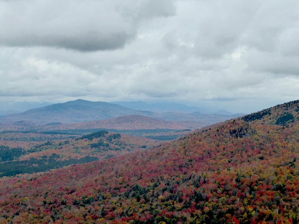
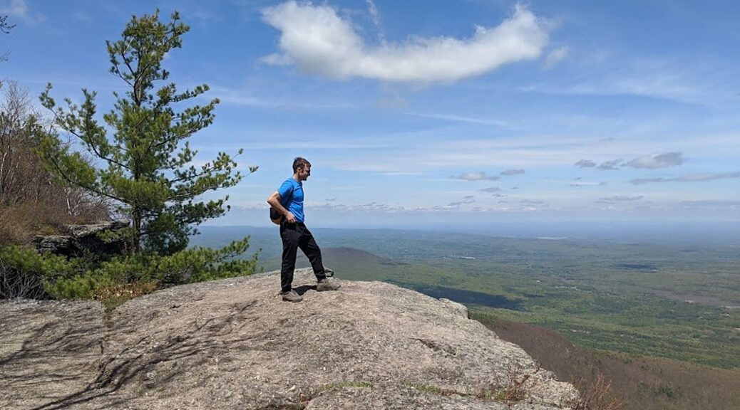
Hiking in New York’s Adirondack Preserve. The state just acquired 1,263 acres of land in the Warren County town of Johnsburg in the southern Adirondacks. The parcel includes Huckleberry Mountain, an elongated peak that tops 2,400 feet, with spectacular cliffs on the ridge’s south and southwest face. © Karen Rubin/goingplacesfarandnear.com

The New York State Department of Environmental Conservation purchased this property from the Open Space Institute for $770,000 using resources from the State’s Environmental Protection Fund. Permanent conservation of this land will enhance recreational access in the region and offers opportunities to connect New Yorkers with nature, protect crucial watersheds, and improve important wildlife habitat in this part of the Adirondack Park. The newly protected land adjoins Wilcox Lake Wild Forest, which includes Crane Mountain, a popular, publicly accessible mountain peak that also provides access to exceptional cliffs for climbers. The Huckleberry Mountain parcel contains a wide range of wildlife habitats, including a high quality cold-water stream—Crystal Brook—that is excellent for brook trout, cliff faces that are a preferred nesting place for the endangered peregrine falcon, and a wetland complex home to an active heron rookery.

The New York State Office of Parks, Recreation and Historic Preservation oversees more than 250 parks, historic sites, recreational trails, golf courses, boat launches and more, which were visited by a record 78 million in 2020. To book a spot in a New York State campground, go to https://newyorkstateparks.reserveamerica.com/. For more information, call 518-474-0456 or visit www.parks.ny.gov.

______________________

© 2021 Travel Features Syndicate, a division of Workstyles, Inc. All rights reserved. Visit goingplacesfarandnear.com, www.huffingtonpost.com/author/karen-rubin, and travelwritersmagazine.com/TravelFeaturesSyndicate/. Blogging at goingplacesnearandfar.wordpress.com and moralcompasstravel.info. Send comments or questions to [email protected]. Tweet @TravelFeatures. ‘Like’ us at facebook.com/NewsPhotoFeatures
Plenty to Discover, Experience Exploring New York’s Adirondack Hamlets

By Laurie Millman and Martin Rubin,

Travel Features Syndicate, goingplacesfarandnear.com

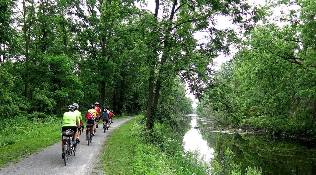
Idyllic Hudson River spot near North Creek, NY © Laurie Millman/goingplacesfarandnear.com

Less than a half hour from Lake George Village, in upstate New York, you can discover cultural and artistic venues in smaller hamlets in the Adirondack State Park all year long without the crowds usually found in the Village. The draw to the small town shops and restaurants are in the quality of locally sourced products they sell and use in food preparation.

Check out some of the Adirondack State Park towns we discovered while driving around Lake George and following the Hudson River:

North Creek, NY – in addition to this town being the location of Gore Mountain ski resort, it is taking off as the art center of the Gore region in the State Park. To get to North Creek, we drove north of Lake George on Rte 9 and Rte 28 for about 35 minutes. The short journey took us along a shallow, yet scenic section of the Hudson River. We found glassblowing, mosaics, local artist exhibits, and regional foods – we spent a day here, but we could easily have stayed over at a local hotel to do more in town and in the surrounding mountains. 

  • Widlund Gallery at Tannery Pond Center – also called the Adirondacks Art Center (228 Main St, North Creek, NY 12853;  518-251-2505 x128; https://tannerypondcenter.org ), runs exhibits by local artists continuously throughout the year (even during ski season). Each exhibit runs for 6-7 weeks. Check out the Center’s site for upcoming exhibits. Socially distanced, outdoor events will begin early Spring, 2021.

    We toured the oil paintings of Elizabeth MacFarland whose art reflects local, natural settings. We purchased a beautiful poetry book for our granddaughter from the Center — Butterfly, Dragonfly – Poetry for Children, which was both written and illustrated by Ms. MacFarland – you can also find this book on Elizabeth’s website (https://www.elizabethmacfarland.com/).

The Center is handicap accessible, with parking spots across the street and a ramp leading up to the main entrance. The main floor contains the exhibits. A performance hall on the lower level can be reached by an elevator. Expect to wear masks while visiting. 

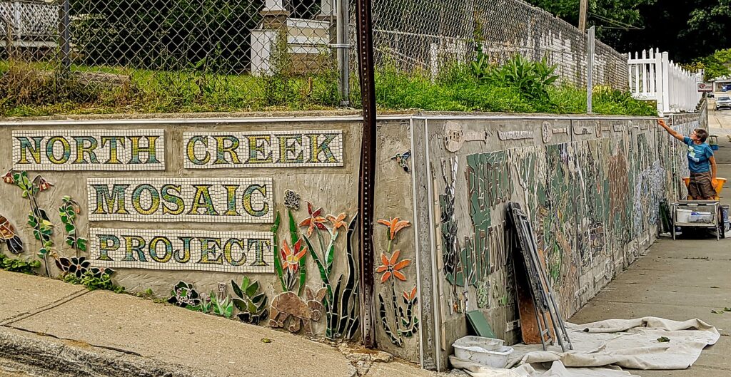
  • North Creek Mosaic Project just a couple of blocks from Tannery Pond Center, we found artist Kate Hartley working on the last major section of the 180-foot long mosaic relief along Main St. For the past 10 years, this project has been a labor of love for Hartley who conceptualized covering the retaining walls on this street with beautiful mosaic scenes representing activities in the Adirondacks. A project of this scale has drawn more than 2000 volunteers to help place pieces of tile, glass, and stone on the walls with Hartley’s guidance. Laurie is now one of those volunteers, by adding one of the last pieces to the mosaic that day. The Mosaic Project, now fully tiled, can be easily viewed from your car, but we recommend walking up to the walls to see close up the variety of materials used to build it. (For more information about this project follow https://www.facebook.com/northcreekmosaicproject/, or go to http://visitnorthcreek.org/project/the-north-creek-mosaic-project/.)
North Creek Mosaic Project © Laurie Millman/goingplacesfarandnear.com
  • Artist-in-residence, Gregory Tomb (https://www.gregorytglass.com) – Reserve a 1-2 hour glassblowing class when Gregory returns to the region as Artist-in-Residence from late spring through late September 2021. For a private class, contact Gregory at 530-318-9413 or [email protected]. Gregory’s temporary studio is located at the North Creek Railroad Station Complex (21 Railroad Place, North Creek, NY 12853). Gregory helped Laurie learn to use glassmaking tools to create a beautiful paperweight; Marty learned to blow hot glass and shape it into a bud vase.  The building is handicap accessible with parking on a gravel lot, but no bathroom is located on premise.
Marty takes a glassblowing class in North Creek with artist-in-residence Gregory Tomb © Laurie Millman/goingplacesfarandnear.com

Hudson River Trading Companyacross the street from the North Creek Mosaic Project, the 7,000 sq. foot, multi-level store (292 Main St., North Creek, NY; 518-251-4461) is filled with items for sale which represent Adirondack life and culture. The store has souvenirs distinctive of the region, including NY State maple-covered nuts and confections, accessories and wares for every room in your house, accessories for pets, and clothing for all ages.

As we toured the store, owner Laurie Prescott Arnheiter explained to us how she preserved the original 1898 walls and floors from its days as a livery and stables and later a butcher shop. Look for the posts and numbers where the horse’s yolks were hung on the walls of the lower room.  The retail store also has a kids’ section to keep them occupied while their parents shop – there is a puppet stage, a small piano, and a reading corner (note to us, bring our granddaughter next time). We purchased an Adirondack hoodie sweatshirt for our daughter, an apron for Laurie, some dog treats, local honey, and NY maple-coated peanuts and candies.

Arnheiter also owns the small gourmet shop next door — The Hungry Crow — which is also in a historic building, and offers all locally made shelf and refrigerated food, such as cheeses, ground coffee, chocolates, and pastas. She even scooped for us berry-infused ice cream freshly made from a local dairy. Check the website, https://hudsonrivertradingco.com, for spring reopening and hours.

Children’s Corner in Hudson River Trading Company, North Creek, NY © Laurie Millman/goingplacesfarandnear.com

Gore Mountain – this Adirondack ski resort offers downhill and cross-country skiing and snowboarding. Gore Mountain remains open the rest of the year for activities such as scenic hiking trails, a mountain skyride, downhill mountain biking, and nine-hole disc golf. The 2020/2021 season pass packages start from $499/adult. The pass applies to some of the summer and fall activities, and includes an additional ticket for sharing a winter activity. (793 Peaceful Valley Rd, North Creek, NY 12853; 518-251-2411, https://goremountain.com)

Skiing Gore Mountain. Gore remains open after the snow melts for summer and fall activities, such as scenic hiking trails, a mountain skyride, downhill mountain biking, and nine-hole disc golf. (c) Laini Miranda/goingplacesfarandnear.com

Bolton Landing, NYthis lakeside hamlet is just 15 minutes north of Lake George Village, as you drive along the lake.  Beautiful views of Lake George and shopping in small businesses with plenty of parking was a huge draw for us to stop and spend an afternoon here. Bolton Landing is also the home of the historic luxury hotel, The Sagamore Resort. 

  • Lake George Adirondack Wineryfor a fun and educational wine tasting experience for up to four people, book online or call any of their three locations in the region: Bolton Landing 518-708-6672; Lake George Village 518-203-2597; Queensbury 518-668-9463, https://www.adirondackwinery.com/. We opted for the Bolton Landing location.

This family-owned winery uses northern New York State and Canadian fresh grapes and fruit to create delicious red, pink, white, and ice wines. Adirondack Winery also effectively infuses semi-sweet red and white wines with seasonal fruit. The Adirondack Winery shops and production facility are open seven days a week for wine tasting and shopping – confirm hours online.

For the “Original Wine Tasting Experience” (just $8/person) we each selected seven different wine samples from a choice of 32 Adirondack Winery prepared wines. We added the  “Locavore Sampler” and the “Cheese Lover’s Sampler”  for an additional $10/person, which allowed us to sample local Adirondack cheeses along with the wines. Our  platter included a mild goat cheese, a champagne-infused cheddar which paired deliciously with Adirondack Winery’s very own “Berry Breeze wine-infused” jam,  locally made chocolate truffles, and crackers and pretzels to eat with them. We finished off the wine tasting with a refreshing wine slushy of the day (additional $5/person).   Masks and social distancing are still required in the wine-tasting room, even though masks may be removed when you are sitting for the tasting experience. Based on our sampling,  we chose four different, full-bodied wines to take home, a block of the champagne cheese and the “Berry Breeze” jam  — they were a big hit with our multi-generational family.

  • Adirondack Extreme Adventure Course is perfect for a multi-generational family with over 100 obstacle courses and 15 ziplines for adults and older kids, and two courses and a playground for younger children. Whether you are a newbie to ziplining, treetop climbing and swinging obstacle courses, or an experienced adventurer, this aerial park offers something for everyone to spend a thrilling day in the wonderful mountain air and beautiful views of the Lake (5 Westwood Forest Ln., Bolton Landing, NY; 518-494-7200, https://adirondackextreme.com)

The aerial adventure park reopens in April 2021. Check the website for hours of operation, pricing of course packages, and minimum age requirements. Reservations and payment in advance by phone or online are required. Masks are required at check-in, during harnessing procedures, and walking throughout the park; masks are not required while climbing the courses. Social distance between separate groups is expected. 

North River, NY – a small hamlet on the banks of the Hudson River, North River is the home of the world’s largest, commercial-grade garnet deposits found on Gore Mountain. In 1969, Governor Nelson Rockefeller officially named the ruby red Barton garnet as New York State’s gem stone.

  • Garnet Mine Tours – currently closed due to Covid-19 restrictions; check the web site (garnetminetours.com) to learn when they will reopen for tours of the historic Barton Mines (1126 Barton Mines Rd., North River, NY).  
  • Garnet Hill Lodge  just 15 minutes from the center of North Creek and around 45 minutes from Lake George, this rustic, Adirondack wood lodge, high up on a mountain, boasts a scenic canyon view of Thirteenth Lake from the resort’s meadow. 
Rustic Garnet Hill Lodge © Laurie Millman/goingplacesfarandnear.com

The Garnet Hill Lodge  is a perfect one-stop resort for four seasons of outdoor activities. During winter months, the Lodge offers 35 miles of groomed cross-country ski trails and six different snowshoe trails starting immediately outside the lodge and its Outdoor Center. Every stay at the lodge comes with complimentary trail passes.  The full service ski shop assists guests with equipment, clothing, repairs, rentals, and lessons.

Throughout the rest of the year, lodge guests can enjoy the mountain’s hiking trails, the resort’s tennis courts, sign out complimentary mountain bikes, canoes and kayaks, and enjoy the Lodge’s staff-attended private beach on Thirteenth Lake. While walking around the mountain, in addition to looking out at the beautiful Adirondack mountain scenery and looking up at the beautiful clean sky, try looking down – you just might find a rock with garnets! (garnet-hill.com; 39 Garnet Hill Road, North River, NY 12856; 518-636-1652)

With continued Covid-19 flying and quarantine restrictions continuing throughout the country and world, this secluded, Adirondack State Park lodge and resort is ideal for a destination wedding. Pre-Covid, Garnet Hill was able to accommodate up to 120 guests for an outdoor or indoor ceremony and reception from June through October, and up  to 80 guests between November and May.

A two-night minimum booking for guests at the Lodge included food and beverages in the lodge’s full-service restaurant and pub, the Bobcat Bar and Grill. Guests have complimentary use of the lodge’s outdoor equipment in all seasons, including the lake beach and well-marked hiking and mountain biking trails. Contact Nicole at 518-251-2444 to discuss current capacity limitations, to book a getaway, or a visit and tour of Garnet Hill Lodge for a potential wedding or other group event. Nicole will assist with planning all aspects of a destination wedding or event within state guidelines and restrictions.

Glens Falls, NY

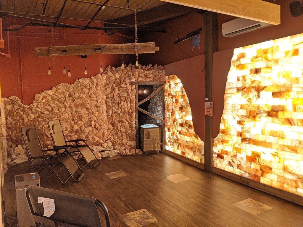
Reclining in zero-gravity chairs, wearing street clothes and covered up with warm, fluffy throw covers, we took off our masks, closed our eyes, and breathed in the medical-grade salt that was being released into the room. Listening to relaxing music, we immediately fell into a deep sleep.  Forty-five minutes later, owner Dawn gently woke us. We walked out of the room feeling quite relaxed, with Laurie commenting that she no longer had the acid reflux cough she came in with, and Marty left with clear sinuses.  The experience was a success for both of us!  We have one recommendation: the room is cool even with the warm comforter, so be sure to wear layers: long-sleeved shirt, jacket, or sweater, socks or booties, long pants.

Halotherapy room at Adirondack Salt Cave Halotherapy and Wellness Center in Glens Falls, NY © Laurie Millman/goingplacesfarandnear.com

The Wellness Center is a holistic healing arts center which also offers Swedish massage, Shiatsu, Reiki, Esthetician services, therapeutic reflexology, and other massage therapy services.  Owners Dana and Greg Russell renovated a 123-year old collar and shirt mill, built out therapy rooms and the large “salt cave” room while preserving the original wood floors, brick walls, and tall windows for lots of natural light in the waiting area. Over 7,000 lbs of Himalayan salt blocks went into creating the long, beautiful, backlit wall that is the focal point of the man-made “salt cave” room. They also built out the front desk and the base of the benches with salt blocks. For pricing of services and packages and to make an appointment,  visit adirondacksaltcave.com, call Dana at 518-798-2343, or email her at [email protected]. Please tell her that Laurie and Marty sent you! (11 Broad St., Glens Falls, NY 12801).

More information at https://visitadirondacks.com/.

__________________________

© 2021 Travel Features Syndicate, a division of Workstyles, Inc. All rights reserved. Visit goingplacesfarandnear.com, www.huffingtonpost.com/author/karen-rubin, and travelwritersmagazine.com/TravelFeaturesSyndicate/. Blogging at goingplacesnearandfar.wordpress.com and moralcompasstravel.info. Send comments or questions to [email protected]. Tweet @TravelFeatures. ‘Like’ us at facebook.com/NewsPhotoFeatures

Catching the Peak Fall Foliage in New York State’s Adirondack Mountains

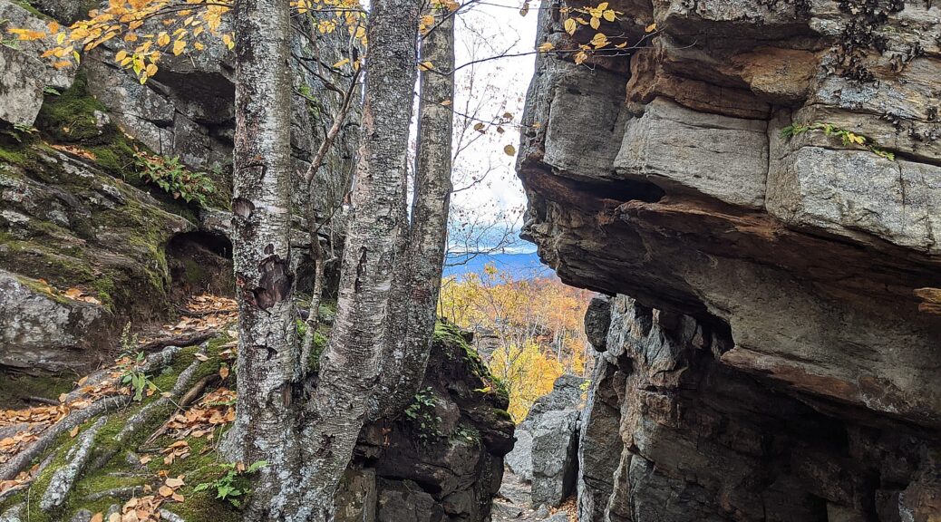
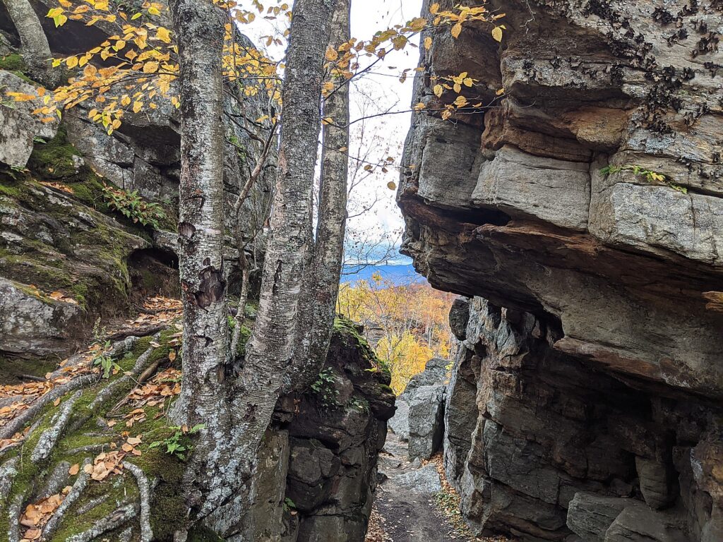
Stunning rock formations atop Chimney Mountain in New York’s Adirondack Mountains, made all the more spectacular by fall foliage colors © Karen Rubin/goingplacesfarandnear.com

By Karen Rubin and Dave E. Leiberman

Travel Features Syndicate, goingplacesfarandnear.com

We literally raced up to catch the peak fall foliage colors in the dramatic, spectacular setting of New York’s Adirondack Mountains.

There are so many different hiking trails, we wanted to make the best choices for a one-day adventure. Researching potential hikes, I found The Adirondack Experience, which lists hikes in categories, one of which is “best summit views” and excellent descriptions (also alltrails.com gives precise maps, elevations). That wasn’t enough for me to pin down, so I called Adirondack Experience, to get the low-down on the trails to high peaks. They also offer a fall foliage report, as does New York State (www.iloveny.com).

We set up an itinerary that would allow us to do two hikes to summits affording 360-degree views, in one sensational day:

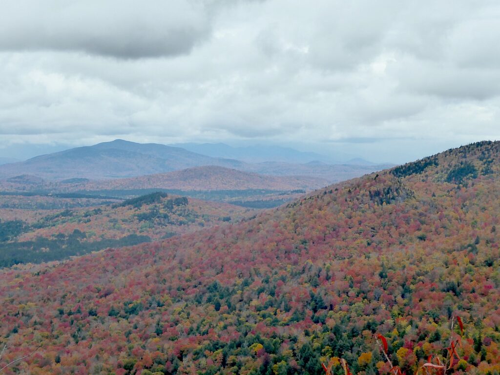
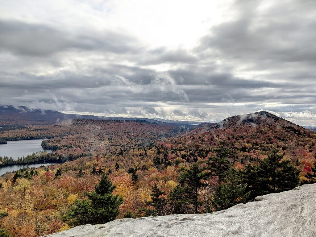
View of the Adirondack Mountains at peak fall foliage from the summit of Chimney Mountain © Karen Rubin/goingplacesfarandnear.com

Chimney Mountain: The extraordinary appeal here are the geologic formations at the top, a maze of caves and crevices, after an invigorating mile-long climb (entirely uphill), before you get to the true summit, a smoothed, mostly flat boulder, reached via a quarter-mile long herd path. “Chimney Mountain has unique features due to a large proportion of soft, sedimentary Grenville layers that have made passageways, cliffs, boulders, and caves. View the large geologic depression that was formed when the Western Rift separated from the Eastern Rift.” The hike, three-miles round trip (in/out), is a 870-foot ascent to 2721-foot elevation. Plan on 3 hours (bring water, face mask, and take into account that it gets dark in the woods before the sunset). (Big Brook Road, Indian Lake, NY, 12842, 518-548-3076, [email protected], www.adirondackexperience.com/hiking/chimney-mountain).

View from the summit of Chimney Mountain at peak fall foliage. © Dave E. Leiberman/goingplacesfarandnear.com

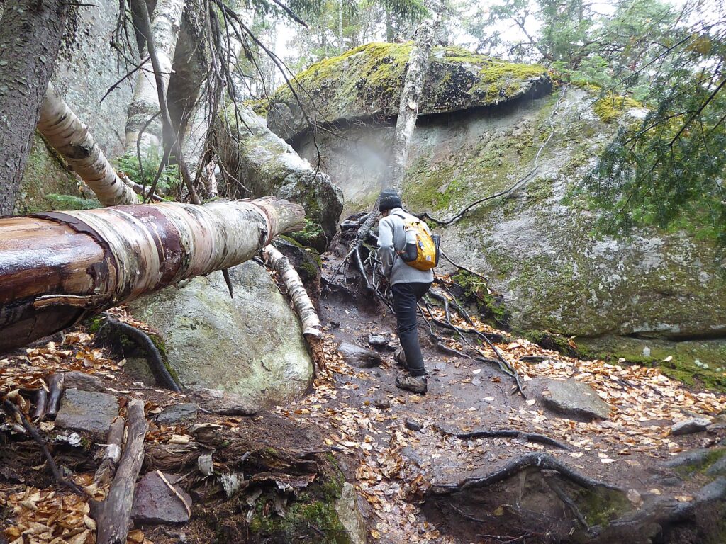
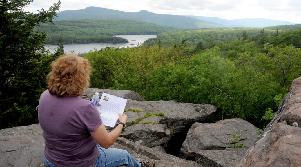
We came down and had ourselves a picnic lunch before setting out for our afternoon hike, about 30 minutes further drive, at Castle Rock, above Blue Mountain Lake. By the time we arrived, the drizzle which started just as we got back into the car turned into an actual rain when we were on the trail. But no matter, we were determined to forge on. This trail is a 3.2 mile long loop with a steady rise, but more gradual than Chimney Mountain – that is, until the last one-tenth mile that involves a scramble up over and between boulders, made more challenging (and therefore satisfying), by the slippery leaves (young kids would have no problem). But so worth it (and really satisfying to have accomplished it)! The rock formations here at the top are absolutely fabulous. Amazingly, just as we got to the summit – another relatively flat boulder – the rain turned to drizzle and then stopped altogether, allowing the sun to poke through, making the wet rock surface glisten. The views of Blue Mountain Lake, with its several tiny islands, and Blue Mountain, with other mountain peaks in the near and far distance, are stunning.

View from the summit of Castle Rock with the Adirondacks at peak fall foliage, rocks glistening with rain © Karen Rubin/goingplacesfarandnear.com

The summit is about at the half-way mark of the loop. At about the 1.5 mile mark, there is a sign that directs you to the summit, only a little disconcerting to realize you have another half-mile to go.  It’s 1.8 miles up on the less steep part of the trail, 1.4 miles on the other side, which goes past fabulous rock formations. (So glad we opted to do the full loop, instead of returning on the 1.8 mile side to avoid a steeper descent, but it actually wasn’t bad at all, even with the slippery leaves. I’ve cultivated a technique of hanging on to trees and branches to swing down, or climb down, or sit down and dangle my feet, and I really value my hiking poles.)

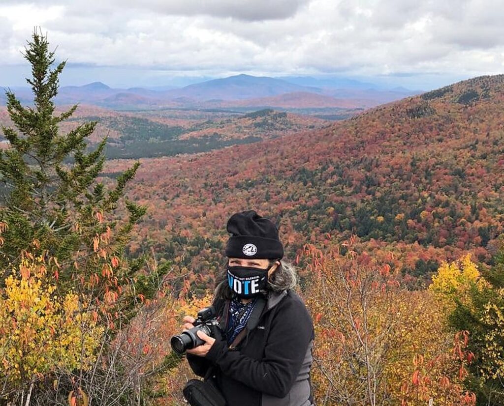
Tackling the scramble to the Castle Rock summit © Karen Rubin/goingplacesfarandnear.com

This is one of the most popular hikes in the area, so people are advised to get here early to get parking at the trailhead (Maple Lodge Road, Blue Mountain Lake). Also, on all of these hikes, wear a face mask and respect social-distancing when people are passing.

The Adirondack Fall Foliage Meter (www.adirondacksusa.com/fall) provides up-to-the-minute fall foliage reports on where the leaves are prettiest and most colorful.  

More sources: Adirondacks Regional Tourism, visitadirondacks.com; Hamilton County Tourism, adirondackexperience.com, 800-648-5239.

Hiking up to Chimney Mountain © Karen Rubin/goingplacesfarandnear.com

Since the Adirondacks are about a five-hour drive from the downstate metro area, people are flocking to Lake George and the surrounding area for accommodations which has maintained very strong occupancy. There are also any number of cabins, lodges, Airbnb’s to choose from, many with exquisite views along one of the many, many scenic lakes. At the trailhead to Chimney Mountain, in fact, there are rustic cabins.

High Peaks Resort in the heart of Lake Placid offers three different lodging experiences overlooking Mirror Lake and the Adirondack Mountains: The Resort, a traditional hotel with 105 guest rooms and suites (newly renovated earlier this year); the modern retro-vibe Lake House with 44 guest rooms; and the private and serene Waterfront Collection with 28 guest rooms including 10 suites on the shores of Mirror Lake. Take a break from studying or work with a dip in the indoor or outdoor pool, paddling Mirror Lake, hiking, biking, golfing. Dogs are welcome, with special canine-friendly treats and amenities. Save up to 30 percent with the Best Dates, Best Rates package, with rates from $125 per night (www.highpeaksresort.com).

Coming down from the summit at Castle Rock (c) Karen Rubin/goingplacesfarandnear.com

Foliage in the Catskills: Find vibrant fall colors on a hike along the Hannacroix Creek Preserve (www.greatnortherncatskills.com/outdoors/hannacroix-creek-preserve-hcp) in New Baltimore—featuring 113 acres of trails and scenic vistas—or explore the RamsHorn Livingston Sanctuary (https://www.greatnortherncatskills.com/outdoors/ramshorn-livingston-sanctuary) in Catskill, which is home to a wide variety of wildlife and plant life along more than three miles of trails. For exhilaration on your quest for foliage, try mountain biking along the Tannersville-Hathaway Trail System (https://www.greatnortherncatskills.com/outdoors/tannersville-hathaway-trail-system)  in Tannersville—suitable for beginners and experienced riders alike. To get the latest update on colors in the region, check out the Catskills’ fall foliage meter (www.greatnortherncatskills.com/catskills-fall-foliage).  

Connect with nature while camping at Purling Waters (www.greatnortherncatskills.com/camping/purling-waters), a fully-equipped campsite accommodating up to 6 campers, located along the banks Shinglekill Creek. For a historic stay, try Tumblin’ Falls House (www.greatnortherncatskills.com/resorts-lodging/tumblin-falls-house). The house, offering 5 guest rooms in an 1890s Dutch Victorian perched on a cliff overlooking Shinglekill Falls, has a tree level spa overlooking falls, natural pools, garden and trails.

To keep tabs on the progress of fall foliage in New York State, www.iloveny.com/things-to-do/fall/foliage-report.

See more information on where to go, what to do in New York, www.iloveny.com, 800-CALL- NYS, [email protected].

______________________

© 2020 Travel Features Syndicate, a division of Workstyles, Inc. All rights reserved. Visit goingplacesfarandnear.com, www.huffingtonpost.com/author/karen-rubin, and travelwritersmagazine.com/TravelFeaturesSyndicate/. Blogging at goingplacesnearandfar.wordpress.com and moralcompasstravel.info. Send comments or questions to [email protected]. Tweet @TravelFeatures. ‘Like’ us at facebook.com/NewsPhotoFeatures
New York’s Empire State Trail Comes Together: Biking the Wallkill Valley Rail Trail in Hudson Valley

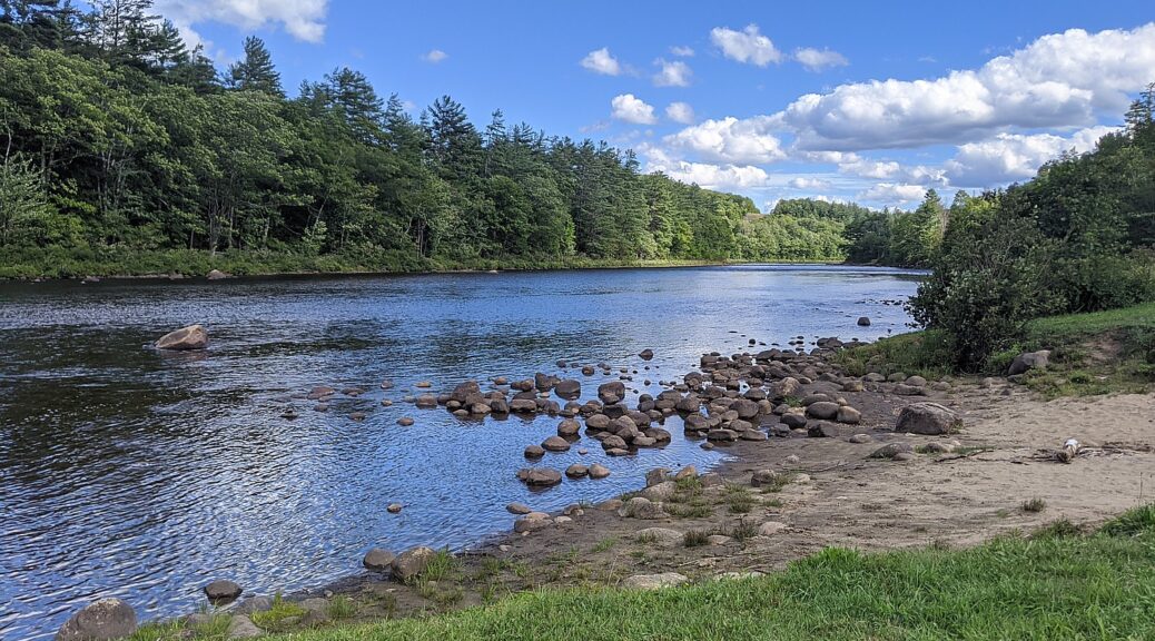
Biking over the Rosendale Trestle, 150 feet above the Rondout Creek, on the Wallkill Valley Rail Trail, part of the New York Empire State Trail © Karen Rubin/goingplacesfarandnear.com

by Karen Rubin, Dave E. Leiberman, Laini Miranda
Travel Features Syndicate, goingplacesfarandnear.com

The ambitious New York Empire State Trail is taking shape, linking and connecting and improving existing trails for a 750-mile network that will enable bikers, hikers, recreational users go from New York City to the Canadian border, and from Buffalo to Albany. And it seems like it is on track for completion by the end of the year, when it would become the longest multi-use state trail in the nation.

We headed out to one of the trails, Wallkill Valley Rail Trail, newly incorporated in the Empire State Trail, with signage and improvements (new trestles, bridges, widened paths, improved drainage), from New Paltz, which itself is a hub for some marvelous multi-use trails that collectively form the Hudson Valley Greenway Trail (www.ny.gov/empire-state-trail/routes-empire-state-trail).

It was pure delight. The linear trail through forests, beside and over creeks, passed dramatic rock formations, is 22 miles long (so 44 miles, out and back). Because of time limitations (and the fact the trail has some closures north of the Rosendale Trestle, midweek, for improvements that are expected to be completed in October, check the site), we only went seven miles north of the parking lot at Sojourner Truth Park in New Paltz, but can’t wait to return to do the rest, another 7 miles north to Kingston, and 7 miles south to Gardiner. The northern half of the trail, from New Paltz to Kingston, has been incorporated into the Empire State Trail, with new signs and improvements.

Biking the Wallkill Valley Rail Trail © Karen Rubin/goingplacesfarandnear.com

Shortly after the Wallkill Valley branch of the New York Railroad closed in the 1980s, the Wallkill Valley Land Trust purchased the12-mile stretch of the corridor between New Paltz, south to Gardiner, leading to the opening of the first stretch of trail in 1993. Today, the trail stretches a total of 24 miles and runs along its namesake river from Gardiner to Kingston.  In 2009, the northern section was purchased, extending the linear park 11.5 miles north from Rosendale through Ulster to Kingston, incorporating the dramatic Rosendale trestle, a 940-foot bridge across the Rondout Creek that provides one of the most thrilling parts of the ride. This portion of the trail, from New Paltz to Kingston, has been designated as part of the statewide Empire State Trail, which, when complete next year, will stretch 750 miles, running from New York City to Canada and from Albany to Buffalo. (info at Wallkillvalleylt.org,  845-255-2761).

The sights are marvelous, and the trail very pleasant.

We find our way from the New York Thruway to the Sojourner Truth Park along the river (where you can rent kayaks),  park the car and set off, north.

We soon come to a repurposed train station, now the Rail Trail Cafe, right on the trail.

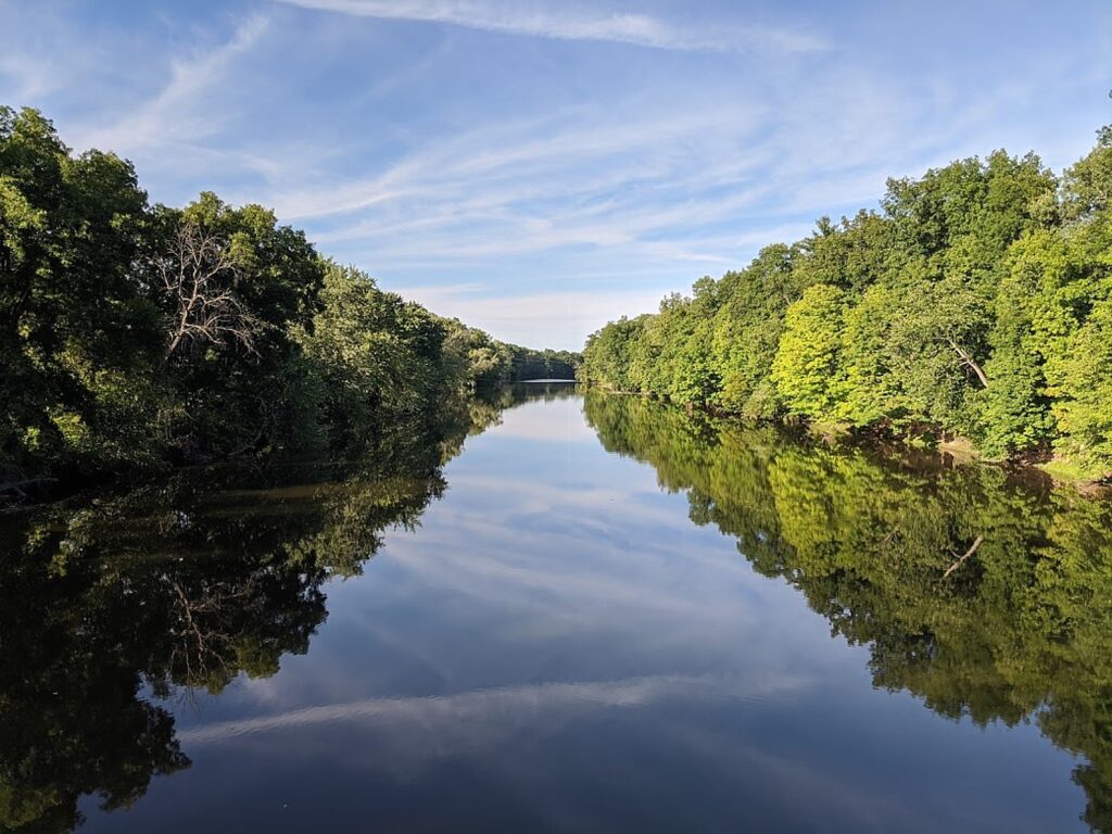
About a mile north of the village, the trail crosses the Wallkill River on the Springtown Truss Bridge, featured in the movie “A Quiet Place” with magnificent views.  

Biking over the Springtown Truss Bridge over the Wallkill River, featured in the movie “A Quiet Place” © Karen Rubin/goingplacesfarandnear.com

The trail passes besides orchards, organic farms, lakes, streams and the Wallkill River.

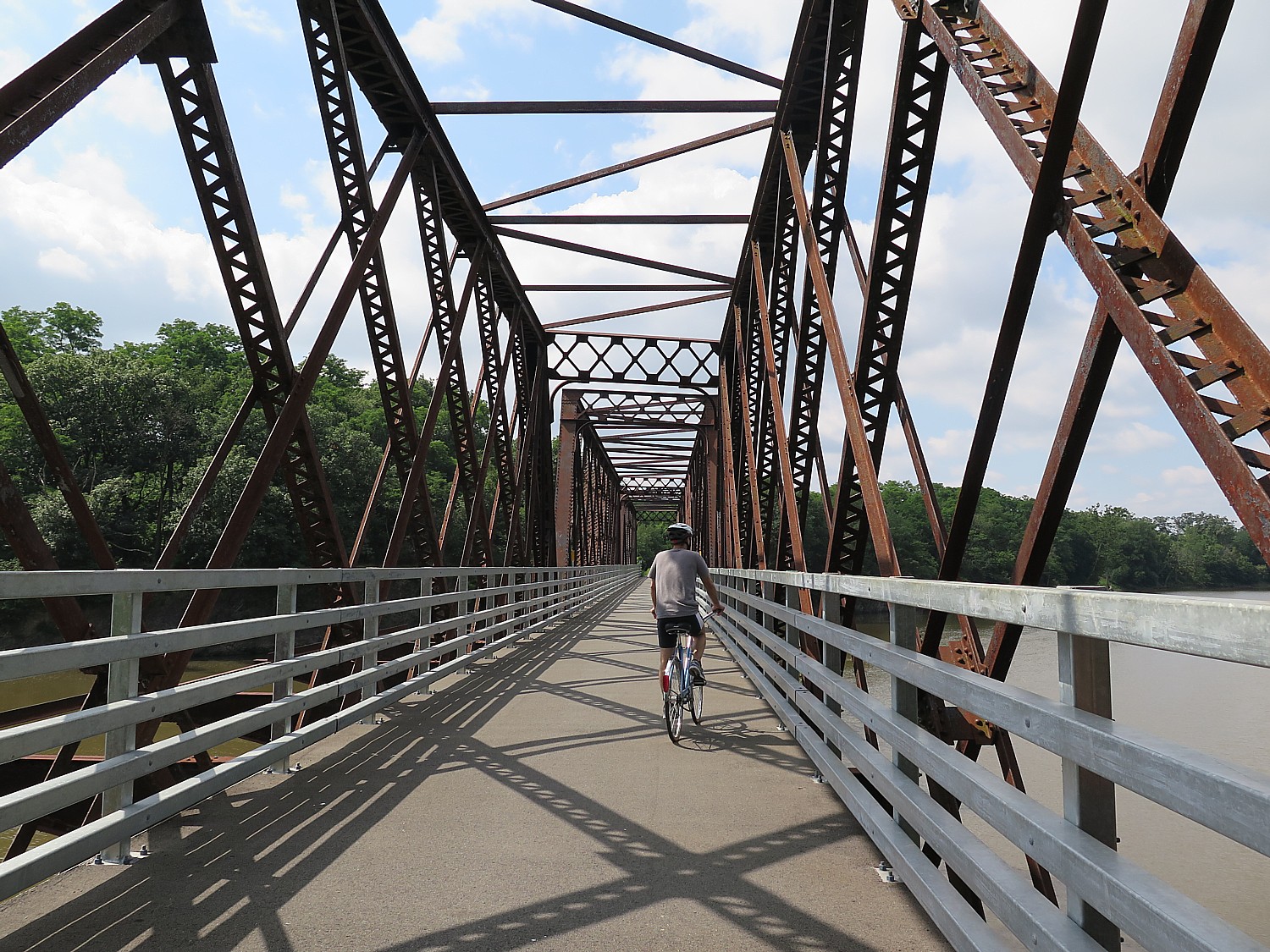
 In Rosendale, the most memorable feature of the trail can be found, the Rosendale Trestle. This 940-foot-long continuous truss bridge carries the trail 150-feet high over the Readout Creek, and spans both route 213 and the former Delaware and Hudson Canal.

Gorgeous scenery off the Wallkill Valley Rail Trail © Karen Rubin/goingplacesfarandnear.com

We ride a little further north beyond the Rosendale Trestle, and come to the Binnewater Historic District where local quarries produced Rosendale cement. (I subsequently learn The Rosendale Cement Works near Limewater employed 5,000 workers and produced 4,000,000 barrels of cement a year at the peak of its activity at the turn of the century. Rosendale cement was used in the Brooklyn Bridge, the pedestal of the Statue of Liberty, the U.S. Treasury Building, as well as in many other structures around the country. The decline of the cementworks in this area is what accounts for the rail line being abandoned, and subsequently repurposed for the recreational trail. You can still see mines used to extract the cement,)

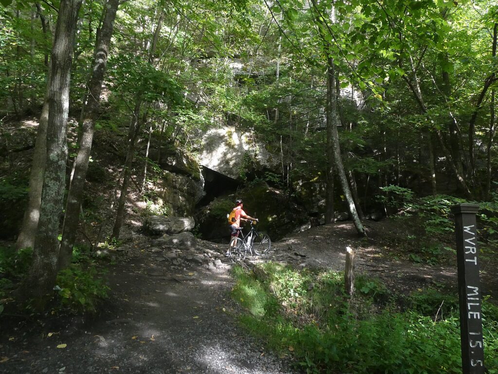
Interesting rock formations on the Wallkill Valley Rail Trail in the Binnewater Historic District where local quarries produced Rosendale cement © Karen Rubin/goingplacesfarandnear.com

Here, though, we see magnificent rock formations – what looks like a cave from which it feels as if air conditioning were flowing and we sit on a boulder to have a snack before turning back.

 Notes about the trail say that were we able to continue biking north, we would come to great views of Third Lake, Fourth Lake, and Fifth Lake before passing under Interstate 87 alongside Hickory Bush Road. The northernmost stretch of the trail runs through a scenic forested area before reaching its terminus at a parking area off of New York State Route 32 just south of Kingston. However, the City of Kingston and Ulster County are exploring options for extending the trail into the city. Meanwhile, the Empire State Trail is adding roadway enhancements to run the trail along roadways into the city, where it can connect with other projects currently underway, including the Kingston Point Rail Trail and the Ulster County Midtown Linear Park which runs out towards the O&W Rail Trail.

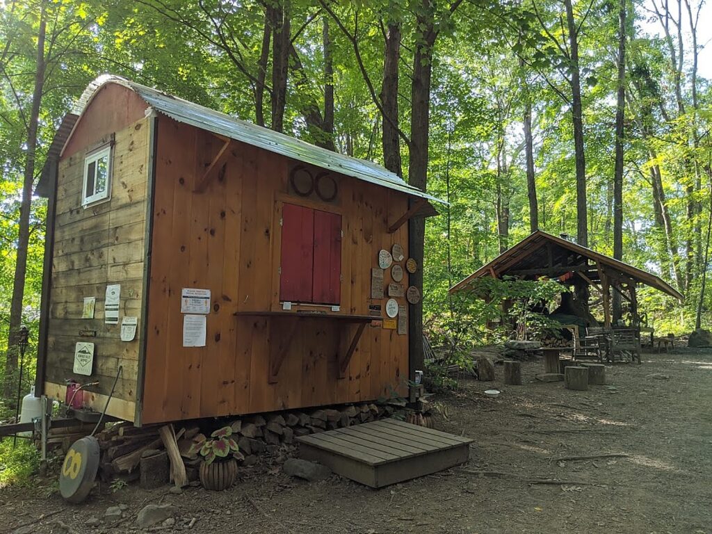
Riding back, we come to the Café in the Woods, set up for musical performances, where you can purchase food from what looks like a gypsy caravan, and an outdoor kitchen with a wood-burning stove.

Here is where we see Happy Trails Bike Rental (917-443-3600; call in advance) set up right on the trail, (you should call in advance to make sure he’s around). (There are a couple of bike rental shops in the area).

Café in the Woods on the Wallkill Valley Rail Trail © Karen Rubin/goingplacesfarandnear.com

It’s late afternoon by the time we ride back south to the Sojourner Truth Park, but if we had time, we would have wanted to complete the trail the further 7 miles to Gardiner.

The southern end of the Wallkill Valley Rail Trail is at Denniston Road in the Ulster County town of Gardiner. True to the corridor’s original use as a rail line, the trail is generally flat. However, especially at this southern end, the trail is unpaved and best suited in the summer for hikers or for bicycles with wider tires.  (www.traillink.com/trail-itinerary/wallkill-valley-rail-trail)

New Paltz Hub for Trails

New Paltz has become a regional hub for trails, with the Wallkill Valley Rail Trail running as the spine through the village. To the east, carrying the Empire State Trail up from New York City, is the Hudson Valley Rail Trail (which I have done in the past and found fantastic). This trail connects with the Walkway Over The Hudson’s western end in Highland – which has become one of New York State’s most popular attractions –  and as a part of the Empire State Trail’s investment, was recently extended from its previous terminus in the town of Lloyd all the way through to New Paltz where it connects with the Wallkill. Running west from New Paltz, a newly opened River-to-Ridge Trail  amidst the magnificent scenery of the Shawangunk Mountains.

Biking the new River to Ridge Trail © Karen Rubin/goingplacesfarandnear.com

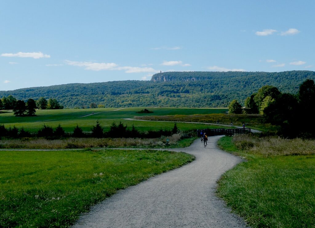
Indeed, the next weekend, we return to bike the River-to-Ridge Trail (www.openspaceinstitute.org/places/river-to-ridge-trail) which was created by the Open Space Institute in partnership with Mohonk Preserve (www.mohonkpreserve.org) with support of the Butler Conservation Fund and only opened in 2018. This is a surprisingly hilly, gravel trail, about six miles long, that runs from the Wallkill River up through newly protected lands adjacent to fields, to 90 miles of carriage road trails on the grounds of the Mohonk PreserveMohonk Mountain House, and Minnewaska State Park Preserve.

Developed and managed by the Open Space Institute, the trail is a scenic and recreational off-road loop. It meanders through farm fields and over gently rolling hills, connecting New Paltz directly to the Shawangunk Ridge and 90 miles of recreational carriage roads and trails at the Mohonk Preserve and the Minnewaska State Park Preserve (https://parks.ny.gov/parks/127); the Wallkill Valley Rail Trail; and the Empire State Trail.

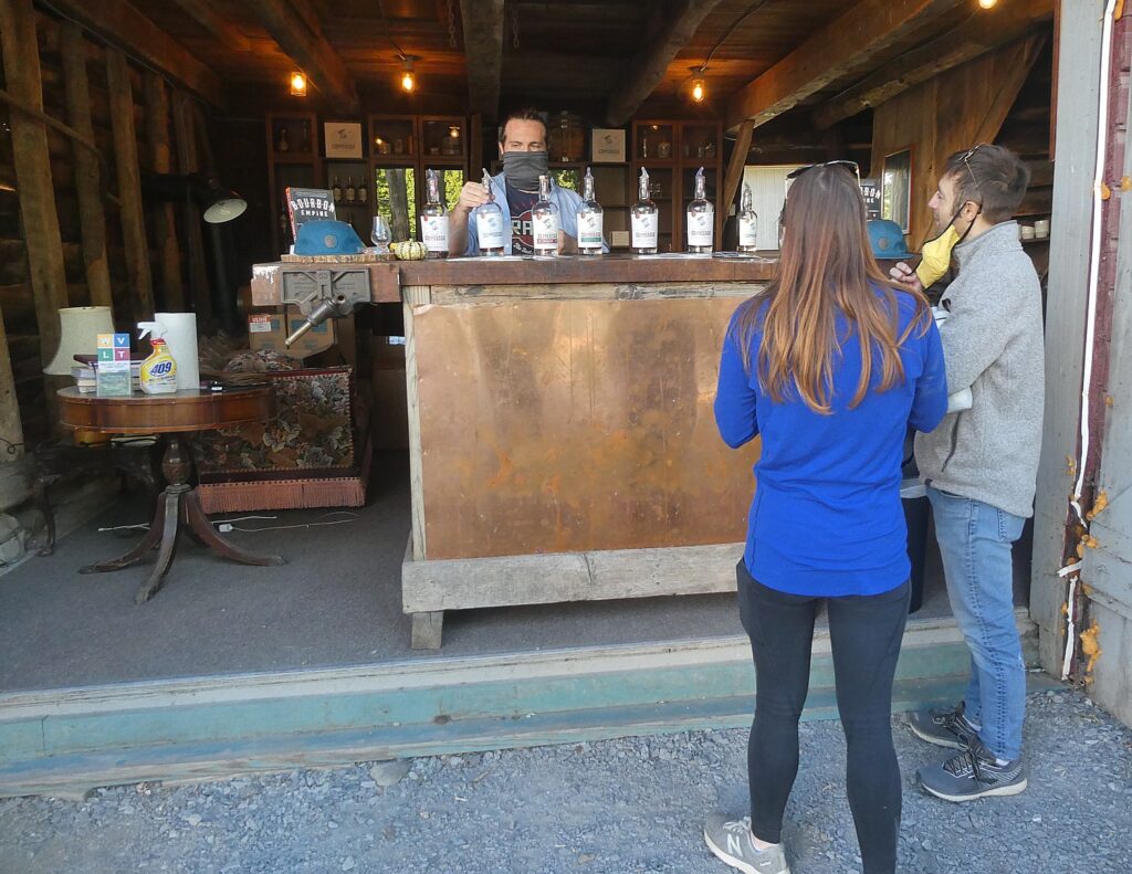
Just off the Wallkill Valley Rail Trail and up the road from the River to Ridge Trail is Coppersea Distillery © Karen Rubin/goingplacesfarandnear.com

There’s a bike rental set-up right by the parking lot on Springtown Road. Just up from the parking lot, on Springtown Road, we found you can visit Coppersea Distilling, where you can go for whiskey tasting, which turns out to be a stone’s throw from where we had biked the Wallkill Valley trail (239 Springtown Road, New Paltz, 845-444-1044, coppersea.com).

We also go for cider tasting, fruit picking, and have pizza, prepared in a wood-burning stove, enjoyed at an outdoor table (with strict COVID-19 protocols), rounding out a sensational day.

Empire State Trail

About 400 miles of the Empire State Trail network had already existed – the absolutely fantastic Erie Canalway, 326 miles from Buffalo to Albany (which we have done on the annual 8-day, 400-mile Parks & Trails NY Cycle the Erie supported biking/camping trip, ptny.org), during which you see unfurled before you 400-years of American history. Improvements to connect the Canalway have also been made.

Most notable is the work done to connect the trails on the north-south routes, from New York City (where you can ride the fabulous Hudson River Park), all the way up to Canada. This involved some 60 different construction projects, all engaging local stakeholders.

When the full 750 miles of continuous route is finished, The Empire State Trail will be the longest multi-use state trail in the nation. (see https://www.ny.gov/programs/empire-state-trail)

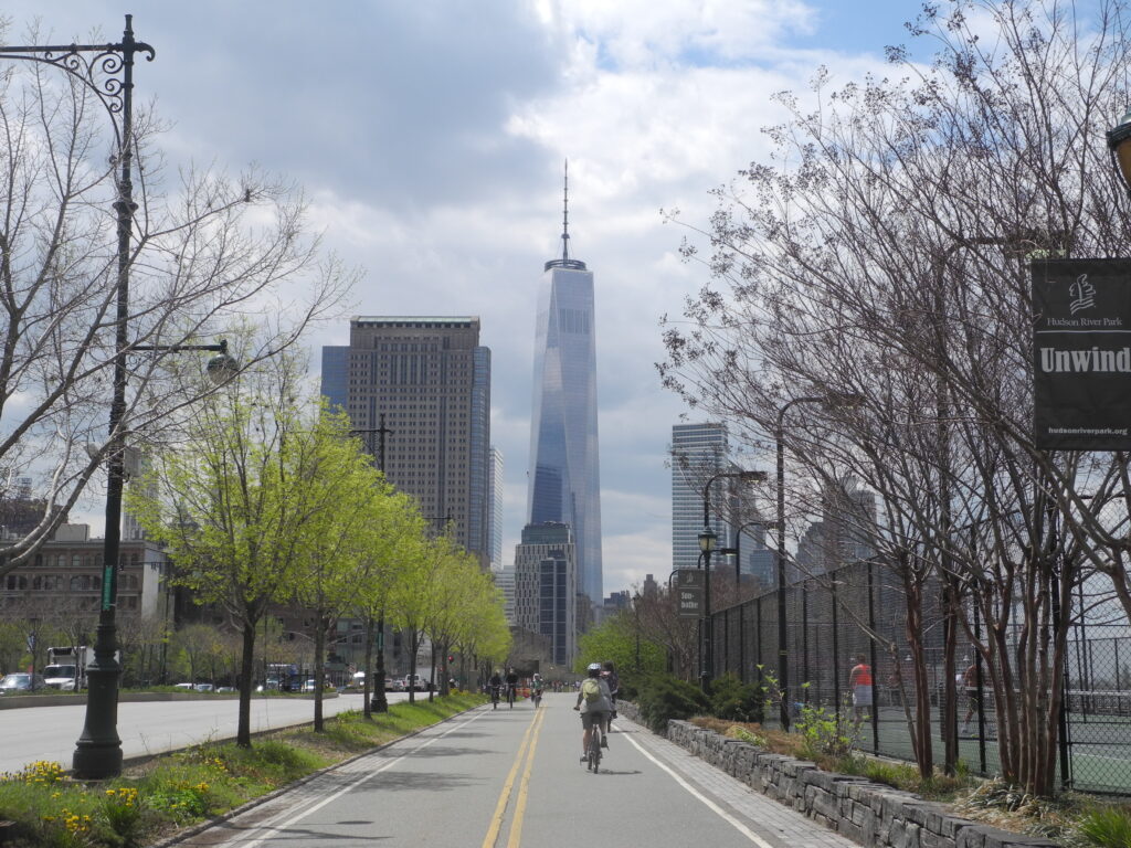
When the New York Empire State Trail is completed, it will be possible to bike from Hudson River Park in Manhattan, up to the Canada border © Karen Rubin/goingplacesfarandnear.com

The sections include:

Hudson Valley Greenway Trail

The Hudson River Valley Greenway segments start in New York City and run north to the Capital District:

LOWER HUDSON VALLEY

  • Hudson River Park
  • On-Road connection from Upper Manhattan to Van Cortlandt Park
  • South County Trailway
  • North County Trailway
  • Putnam Trailway
  • Beacon Rail Trail
  • Dutchess Rail Trail
  • Walkway Over the Hudson

UPPER HUDSON VALLEY

  • Hudson Valley Rail Trail
  • Wallkill Valley Rail Trail
  • Kingston Point Rail Trail and Promenade
  • On-Road North of Kingston to the City of Hudson
  • Albany-Hudson Electric Trail (AHET Trail)
  • Corning Preserve Trail
  • Mohawk Hudson Bike Hike Trail

Champlain Valley Trail

The Empire State Trail within the Champlain Valley goes from the Capital District to Whitehall, Wherever feasible, it is off-road along Champlain Canal towpaths. The 120- mile section from Whitehall to the Canada border at Rouses Point is on-road route primarily intended for bicyclists.

CHAMPLAIN VALLEY 

  • Champlain Canalway Trail
  • On-Road from Mechanicville to Stillwater
  • Path through Hudson Crossing Park
  • On-Road to Fort Edward
  • Champlain Canalway Trail
  • On-Road from Fort Ann to Plattsburgh
  • Terry Gordon Bike Path
  • Saranac River Trail
  • On-Road from Plattsburgh to Rouses Point / Canadian Border

Erie Canalway Trail

The Empire State Trail within the Erie Canalway include proposed new trail sections and link Buffalo to the Capital District.

WESTERN ERIE CANALWAY TRAIL

  • Buffalo Connection
  • Pendleton Connection
  • On-Road connection in Lyons
  • Shared Use Path from Lyons to Clyde
  • On-Road connection in Clyde
  • Shared Use Path from Clyde over Erie Canal
  • On-Road connection to Savannah
  • Savannah shared use path
  • On-Road connection to Port Byron trailhead
  • Honeywell Trail to Loop the Lake Trail
  • Onondaga Creekwalk 
  • On-Road Water Street Connection in Syracuse
  • Erie Boulevard

EASTERN ERIE CANALWAY TRAIL

  • Old Erie Canal State Park
  • Rome Connection
  • Utica – Schuyler
  • Ft. Herkimer Church – Lock 18
  • Lock 18 – Little Falls
  • Schuyler – Ilion
  • Ilion – Mohawk
  • Pattersonville Trail
  • Rotterdam Junction Connection

More information from Parks & Trails NY (ptny.org). (Next Cycle the Erie scheduled July 11-18, 2021).

Also, Rails to Trails Conservancy (railstotrails.org), Great American Rail-Trail, which would link up 3,700-miles of multi-use trails from Washington DC on the east coast to Washington State on the west coast (www.railstotrails.org/greatamericanrailtrail/vision).

______________________

© 2020 Travel Features Syndicate, a division of Workstyles, Inc. All rights reserved. Visit goingplacesfarandnear.com, www.huffingtonpost.com/author/karen-rubin, and travelwritersmagazine.com/TravelFeaturesSyndicate/. Blogging at goingplacesnearandfar.wordpress.com and moralcompasstravel.info. Send comments or questions to [email protected]. Tweet @TravelFeatures. ‘Like’ us at facebook.com/NewsPhotoFeatures
Driveable Getaways: Hiking the Hudson River School Art Trail in the Great Northern Catskills

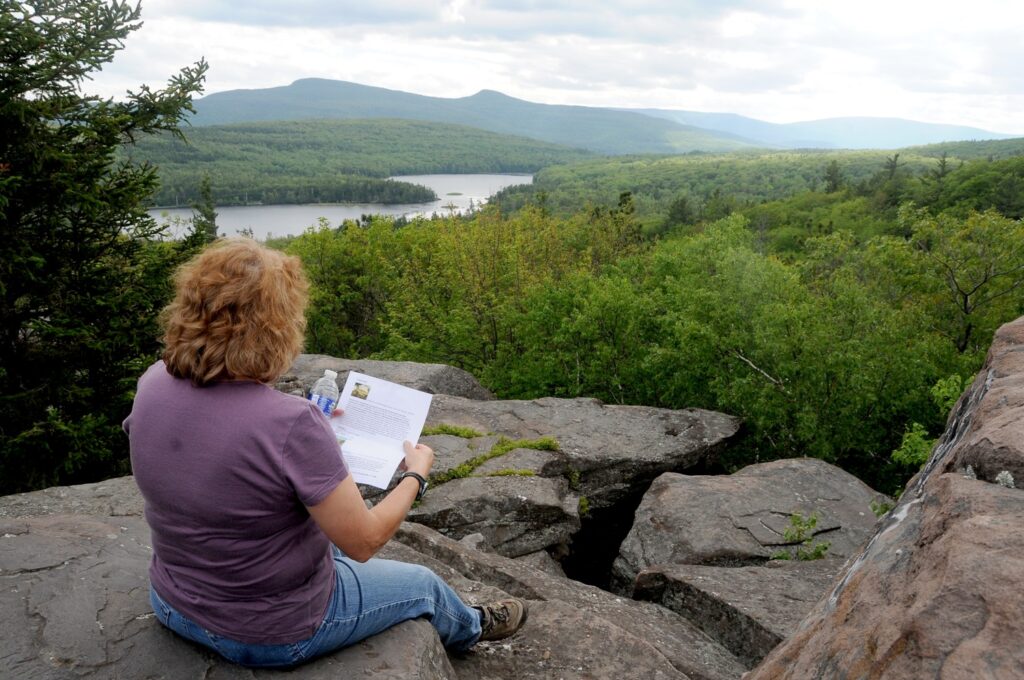
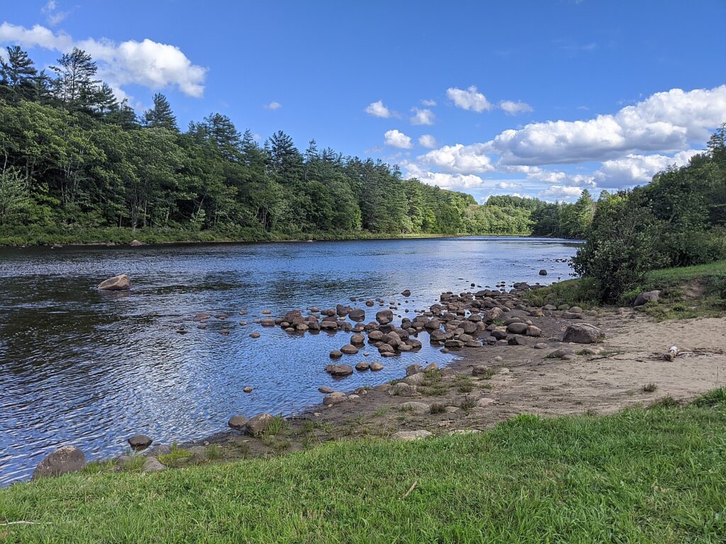
Sunset Rock. Hiking the Hudson River School Art Trail, in the Catskill Mountains, Greene County, New York State © Karen Rubin/goingplacesfarandnear.com

by Karen Rubin

Travel Features Syndicate, goingplacesfarandnear.com

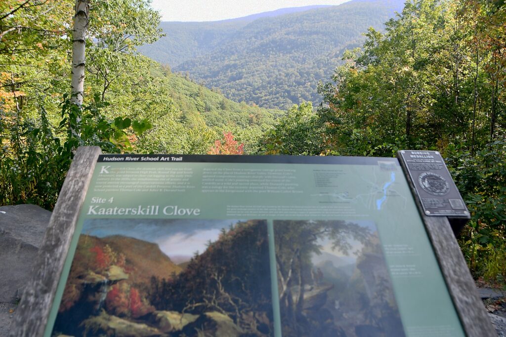
My getaway exploring the Hudson River School Art Trail in the Great Northern Catskills of New York starts at the trailhead to Kaaterskill Falls, where you get an amazing view of Kaaterskill Clove (HRSAT Site #4). You gaze out over the gorge where mountain peaks seem to thread together and compare the scene today to the way it is depicted by Hudson River School artist Asher B. Durand’s 1866 painting.

Kaaterskill Clove. Hiking the Hudson River School Art Trail, Great Northern Catskills, NY © Karen Rubin/goingplacesfarandnear.com

It’s a short walk along 23A (watch out for cars on the winding narrow road) to the trailhead for one of my favorite hikes, Kaaterskill Falls (HRSAT Site #5), a stunning scene that looks remarkably just as depicted in an 1835 painting by Thomas Cole, known as the father of the Hudson River School. “It is the voice of the landscape for it strikes its own chords, and rocks and mountains re-echo in rich unison,” Cole (who was also a poet and essayist) wrote.

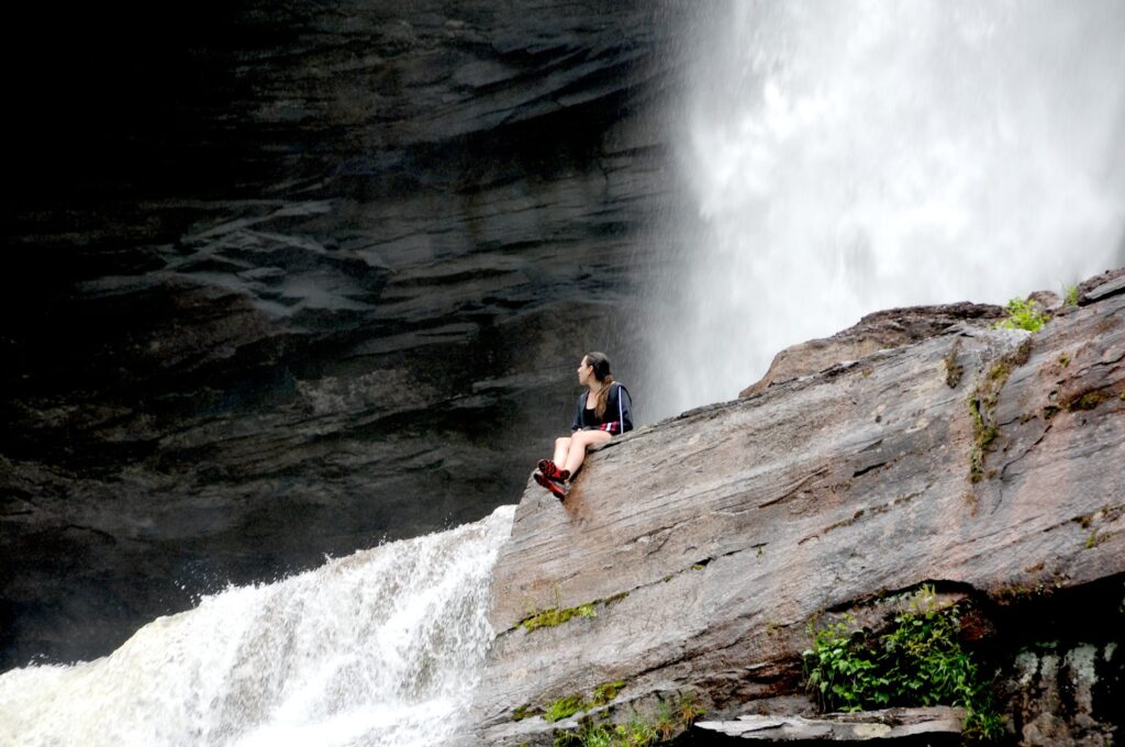
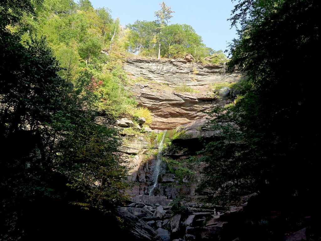
Kaaterskill Falls. Hiking the Hudson River School Art Trail, Great Northern Catskills, NY © Karen Rubin/goingplacesfarandnear.com

The Kaaterskill Falls were a favorite subject of many of the Hudson River School painters and for me, is the quintessential combination of stunning scenery plus the physical pleasure of the hike – half-mile up to the base of the double-falls, then another half-mile to the top.

Kaaterskill Falls. Hiking the Hudson River School Art Trail, in the Catskill Mountains, Greene County, New York State © Karen Rubin/goingplacesfarandnear.com

The two-tiered Kaaterskill Falls, 175 and 85 feet, is the highest in New York State and was described by James Fenimore Cooper in “The Pioneers” which Thomas Cole, a friend of Cooper’s illustrated.

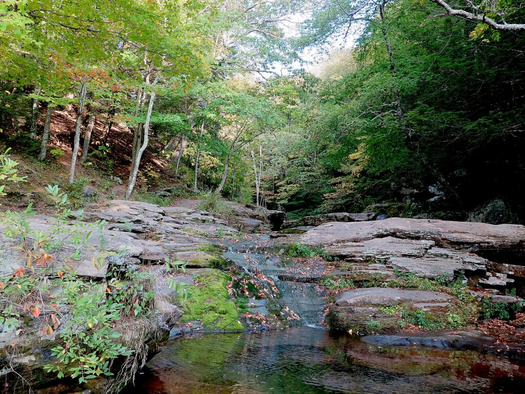
Hiking the Hudson River School Art Trail, Great Northern Catskills, NY © Karen Rubin/goingplacesfarandnear.com

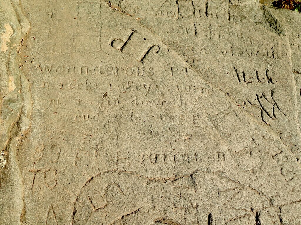
There is a small trail through the woods to the very top of the falls. Signs admonish hikers that climbing the ledges beside Kaaterskill Falls is extremely dangerous, and has resulted in numerous injuries and deaths. But the falls are not flowing when I come, so I get to walk on the ledges, giving me a really nervous view straight down and beyond, to the Valley and letting me look at the carved initials and graffiti from the 1920s and 30s, some even from the 1800s.  You feel a sense of kindred spirit with those who have passed through and passed on. You feel the height and the proximity to the drop off, and it makes your heart flutter.

At the top of the Kaaterskill Falls. Hiking the Hudson River School Art Trail, Great Northern Catskills, NY © Karen Rubin/goingplacesfarandnear.com

Later, I will recognize the view in Thomas Cole’s paintings and imagine how he must have stood in this precise place where you are standing.

Kaaterskill Falls. Hiking the Hudson River School Art Trail, Great Northern Catskills, NY © Karen Rubin/goingplacesfarandnear.com

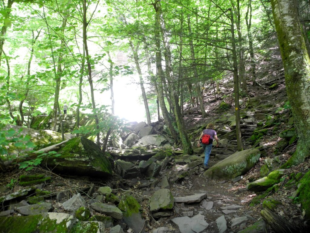
It is a half-mile to the base, and another half- mile to the top of the falls, for a total of 2 miles roundtrip. There are some scrambles and it is uphill almost all the way (walking sticks are really recommended), and is thoroughly fantastic.

Hiking the Hudson River School Art Trail, in the Catskill Mountains, Greene County, New York State
© Karen Rubin/goingplacesfarandnear.com

(The parking lot is just west of the trailhead and across 23A, so you park and walk back along the road, being very careful. Haines Falls NY 12436, 518-589-5058, 800-456-2267).

HRSAT Hikes in North-South Campground 

For my second day, after an amazing breakfast at the Fairlawn Inn, I head to North-South Campground, where there are several of the Hudson River School of Art Trail hikes (as well as many other hiking trails) – the lake itself depicted in paintings such as Thomas Cole’s “Lake with Dead Trees,” 1825 (HRSAT Site #6).

Artists Rock, Escarpment Trail, North-South Lake Campground, on the Hudson River School Art Trail © Karen Rubin/goingplacesfarandnear.com

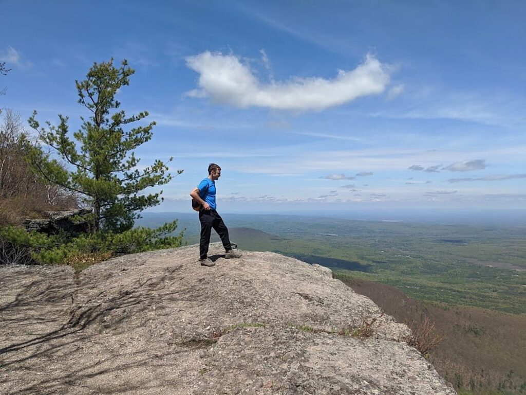
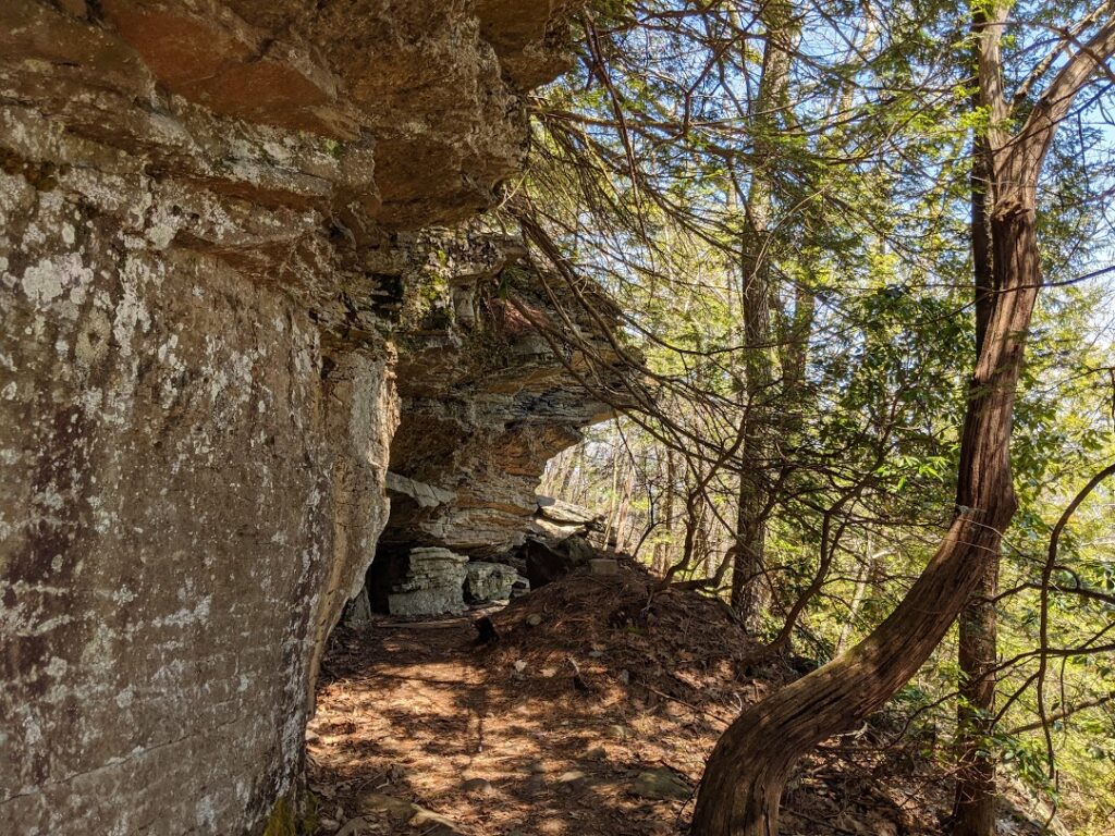
The Escarpment Trail to Sunset Rock (HRSAT Trail Site #7) begins along the well-marked blue trail (you cut off to the yellow trail to Sunset Rock) that mostly wraps around the ledges, with the amazing views that so enthralled the artists of the Hudson River Valley. Close to the beginning is a fairly interesting scramble, then the trail winds through the woods along side fabulous rock formations before coming out again to the ledges. You reach Artists Rock at about a half-mile. Continuing on, you look for the yellow trail marker to Sunset Rock and from there, to Newman’s Point.

Escarpment Trail, North-South Lake Campground, on the Hudson River School Art Trail © Karen Rubin/goingplacesfarandnear.com

You can either reverse and come back on the Escarpment Trail, or make a loop, coming down the Mary’s Glen trail, passing Ashley’s Falls.

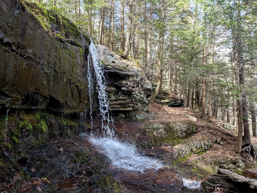
Ashley’s Falls on Mary’s Glen Trail © Karen Rubin/goingplacesfarandnear.com

Mary’s Glen trail can also be the entrance to a more challenging hike, to North Point, a distance of 3.2 miles with 840 feet ascent. It is a mostly moderate climb but has some short, steep scrambles over rock, but you come to large open slabs and expansive vistas at North Point, a 3,000 ft. elevation with some of the most distant views.)

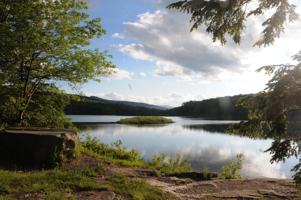
North-South Lake. Hiking the Hudson River School Art Trail, in the Catskill Mountains, Greene County, New York State © Karen Rubin/goingplacesfarandnear.com

Back at the North-South Lake, you can follow around the shoreline to see the same views that inspired Hudson River School paintings.

You can also take the trail to the site of the Catskill Mountain House (HRSAT Site #8), one of the earliest tourist hotels. The majestic hotel, which was opened in 1823 and accommodated 400 guests a night (Presidents Arthur and Grant were among those who stayed here), burned down in 1963 but the view that attracted visitors still remains as one of the most magnificent panoramas in the region, and can be compared to Frederic Church’s “Above the Clouds at Sunrise” (1849).

Where the Catskill Mountain House used to stand. Hiking the Hudson River School Art Trail, in the Catskill Mountains, Greene County, New York State © Karen Rubin/goingplacesfarandnear.com

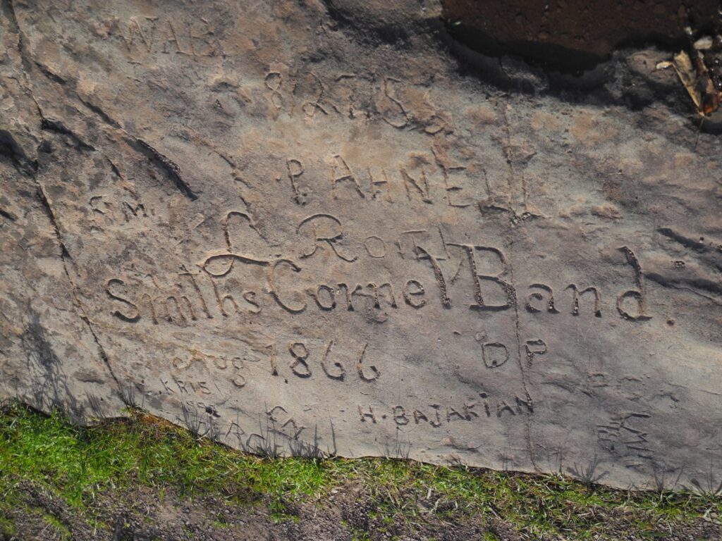
It is fun to see the initials carved into the stone ledges from more than a century ago. The Mountain House began drawing thousands of guests each season from all over the country as well as from abroad, who came not just for the cooler, healthier climate but for what had already become one of the most renowned natural panoramas in the young nation: the valley 1,600 feet below, stretching east to the Taconic Mountains and the Berkshires, with the silvery thread of the Hudson visible for 60 miles from north to south.  On a clear day, you can see five states – Connecticut, Massachusetts, New Hampshire, Vermont and New York. The hike is just a half-mile with only an 80-foot ascent.

Hiking the Hudson River School Art Trail, in the Catskill Mountains, Greene County, New York State © Karen Rubin/goingplacesfarandnear.com

There is a $10/car day use fee for the NYS DEC’s North-South Lake Campground from early May through late October, however the fee is waived for NYS residents 62 years or older midweek. The campground is open May through October; 518-589-5058 or call DEC Regional Office year-round at 518-357-2234, www.greatnortherncatskills.com/outdoors/north-south-lake-campground.

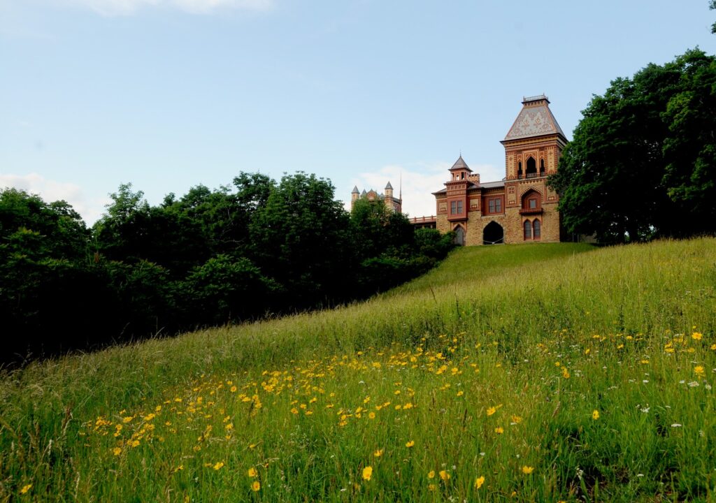
The Hudson River School Art Trail also features Olana, the magnificent and whimsical mansion home of artist Frederick Edwin Church. At this writing, the entrancing mansion was not yet reopened to visits, but the 250-acre grounds and the first-ever legally protected “viewshed” to the Hudson River are open (5720 Route 9G, Hudson, NY 12534, 518-828-0135, olana.org.)

Frederick Edwin Church’s Olana, Hudson, NY © Karen Rubin/goingplacesfarandnear.com

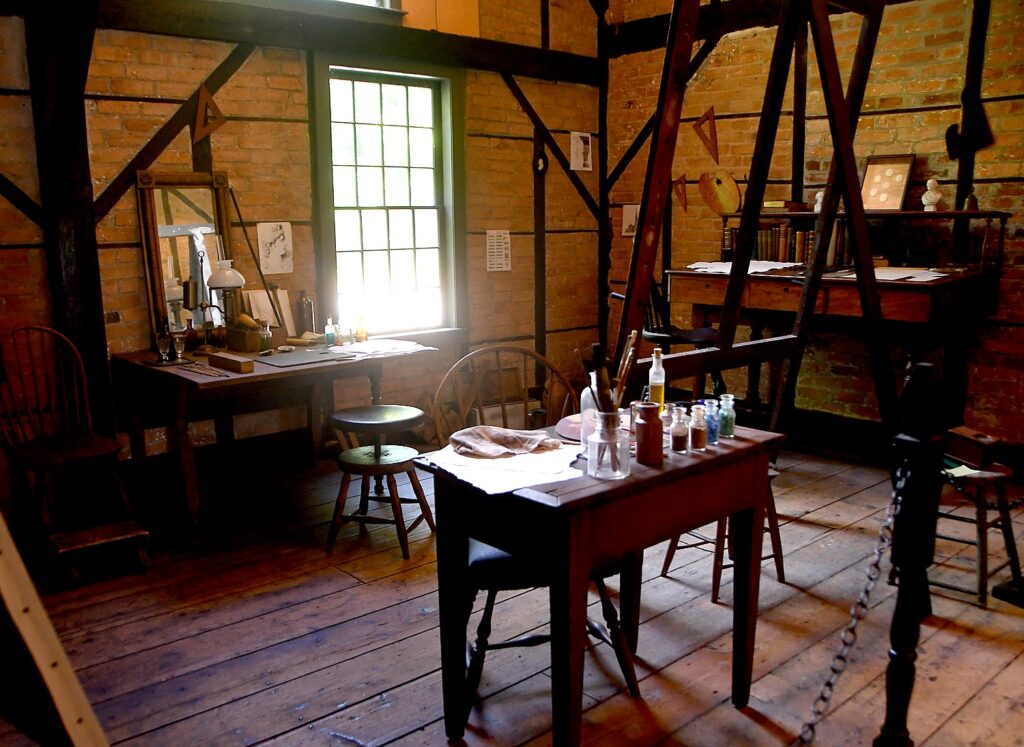
Also, you can walk the grounds Thomas Cole Historic Site (the home has yet to be reopened, but is marvelous to visit, especially Cole’s studio). (218 Spring Street, Catskill, NY 12414, 518-943-7465, www.thomasscole.org)

Thomas Cole National Historic Site, Catskill, NY, on the Hudson River School Art Trail © Karen Rubin/goingplacesfarandnear.com

Get maps, directions and background on the Hudson River School Art Trail atwww.hudsonriverschool.org/hudsonriverschoolarttrail.

View from Thomas Cole National Historic Site, Catskill, NY, on the Hudson River School Art Trail © Karen Rubin/goingplacesfarandnear.com

Also, walk on the Hudson River Skywalk along the Rip Van Winkle Bridge to find incredible river views.

In Tannersville: Explore the Mountain Top Arboretum, 178 acres of trails, wetlands, gardens, and native plants; go on a mountain biking adventure at the Tannersville Bike Park, part of the Tannersville-Hathaway Trail System.

In Athens:Rent a kayak or paddleboard at Screaming Eagle Outdoor Adventures; explore along the Hudson River at the Athens Riverfront Park and look for the Hudson-Athens Lighthouse

Places to stay include:

Fairlawn Inn bed-and-breakfast, Hunter, NY, the Catskills © Karen Rubin/goingplacesfarandnear.com

In Hunter, the Fairlawn Inn where we have stayed, oozes charm; open year-round (7872 Main St. Hunter, NY 12442, 518-263-5025, www.fairlawninn.com).

Just outside of Catskill, A Tiny House Resort offers 10 tiny houses perched over the Catskill Creek; open-year-round (2754 CR 23BSouth Cairo, NY 12484, 518-622-2626,www.atinyhouseresort.com).

In Coxsackie, Gather Greene is a glamping destination offering 17 wooden glamping cabins on 100 acres of rolling hills and fields, each is equipped with air conditioning and heating, full bathrooms, a mini-fridge (176 Levitt RoadCoxsackie,  262-448-3683, www.gathergreene.com).

More information from Greene County Tourism, 800-355 CATS, 518-943-3223, discovergreene.com.

______________________

© 2020 Travel Features Syndicate, a division of Workstyles, Inc. All rights reserved. Visit goingplacesfarandnear.com, www.huffingtonpost.com/author/karen-rubin, and travelwritersmagazine.com/TravelFeaturesSyndicate/. Blogging at goingplacesnearandfar.wordpress.com and moralcompasstravel.info. Send comments or questions to [email protected]. Tweet @TravelFeatures. ‘Like’ us at facebook.com/NewsPhotoFeatures
See America: Cruise the Erie Canal across New York State by Self-Skippered Canalboat

Erie Canal Adventures rents Lockmaster canalboats that let you cruise fancy free on the Erie Canal, New York State (c) Karen Rubin/goingplacesfarandnear.com.

By Karen Rubin
Travel Features Syndicate, goingplacesfarandnear.com

If you want to see how America came to be, travel along the Erie Canal. A marvel of engineering when it was opened in 1825, the canal, which spans 353-miles from Albany to Buffalo, creating a water highway for commerce from the Midwest through New York City to the rest of the world, remains a dazzling achievement. But it was also the artery and an engine for invention, innovation, economic development, and ultimately social and political movements. Bike along the Erie Canalway (now virtually uninterrupted and part of the 750-mile Empire State Trail; there are several bike tour companies that offer inn-to-inn bike trips), but to really get the sense of it, float along the canal, tying up at the small towns and major cities that the canal birthed, and see unfold before you all the major social and economic movements that made America: immigration, labor, abolition and civil rights, women’s rights.

A few years ago, I had that opportunity, and in this time when people are shunning cruising because of the coronavirus pandemic but embracing RVs, renting your own self-skippered, specially-designed Lockmaster canal boat offers the best of those worlds. Founded decades ago as Mid-Lakes Navigation by Peter Wiles who designed the Lockmaster canalboats and was a significant force in repurposing the Erie Canal from commercial to recreational use, the company, Erie Canal Adventures, is now in the hands of Brian Kennan, and . And even though you are still in New York State, the sights and experiences are as interesting and exciting as sailing the canals of Europe.

The company has made accommodations for COVID-19 – sanitizing the compartments so that there is a tape over them until the passengers arrive; instead of cooking utensils and “hard goods” being kept on the boat, they are taken off after each trip, sanitized and provided to guests in a sanitized tote when they arrive.

The orientation is still done on the water – the guide wears mask and gloves – to take you through one of the canal locks (thrilling), but the orientation that would have been done in the cabin is now offered by video.

Bikes are still provided but they are taken off the boat after each cruise, sanitized and replaced for each trip.

This part of New York State is already in Phase 4 – meaning that there is indoor and outdoor dining (with social distancing), many of the museums and attractions have reopened like the George Eastman Museum and the Strong Museum (with limits on capacity). In the various canal towns, you won’t have any trouble finding groceries or restaurants. And New York State has been successful containing the spread of illness and turning from the worst infection rate to the lowest in the country, because New Yorkers have scrupulously adhered to using masks and social distancing. (Now, to prevent any reemergence, the state is imposing a 14-day quarantine on visitors from states where COVID-19 rates are surging.)

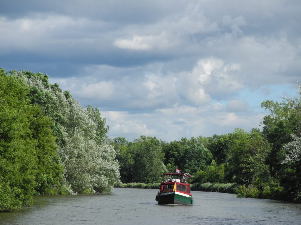
Cruising the Erie Canal in a Lockmaster canal boat, as cyclists ride the towpath (c) Karen Rubin/goingplacesfarandnear.com.

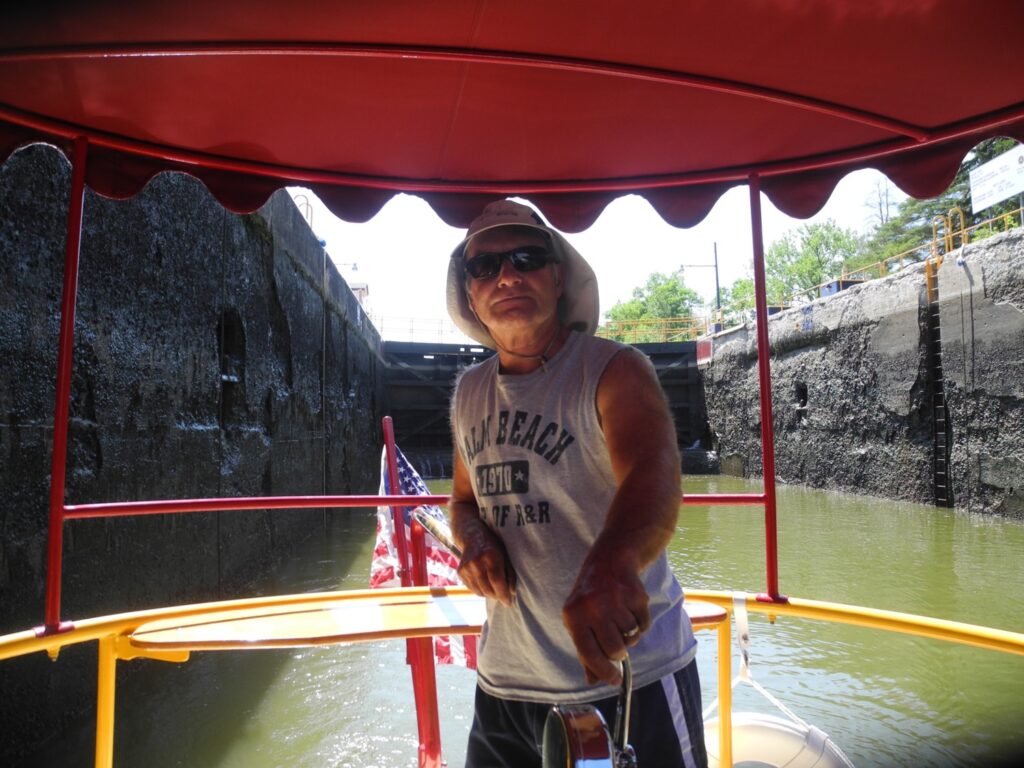
I am at the helm of a 41-foot canal boat, a boat so enchanting and lovely, it turns heads and evokes waves, smiles, and snapped photos as it chugs pleasantly along at a top speed of 6 mph.

From this vantage point, I can appreciate this marvel of engineering, of grit and ingenuity the Erie Canal was, the vital role it played in the United States’ emergence as an Industrial giant in the 19th century and a dominant economic power in the 20th century.

There is no place in the United States like the Erie Canal, and no experience like having your own self-skippered canal boat – our floating home for the week – and a bicycle with which to explore the towns that were literally birthed by the canal. And to a New York City kid, seeing this bucolic countryside is a revelation. (“This is New Yawk!”)

It is extraordinary and thrilling to travel on the 363-mile long Erie Canal that slices through New York State and played such a vital part in the nation’s history, especially as we go through locks that are filled for us, and under bridges that must be lifted for us to pass.

Most of all, it lets us explore and appreciate the extraordinary innovation and ingenuity that developed because of the Erie Canal, the villages and towns, the factories and businesses that developed, and how the canal turned New York City into a global financial capital, and united the East with the West, how it funneled thousands of immigrants who populated the Midwest.

This is a true adventure. One where there are new discoveries, new insights, new perspectives formed with every new encounter. The Erie Canal birthed these places and now we see how they are being reborn, revitalized.

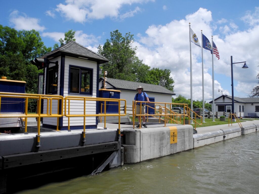
Going through one of the locks on the Erie Canal, New York State (c) Karen Rubin/goingplacesfarandnear.com

Setting off on our first morning, I have rarely felt that exhilarating sense of being so fancy free – to not have a set itinerary or schedule or even know where I am going or what I will see, but to have the power and ability just go where your curiosity leads. It is a marvelous.

We had trepidation about navigating the boat – a 41-foot long houseboat, like a floating RV – docking and most intriguingly going through the locks along the canal. But when we arrive, we get a two-hour orientation – every aspect about operating the boat, plugging in to electricity and water; how to turn on the engine, the stove, the shower, flush the toilet; how to recharge the batteries by running the engine in neutral; how to operate the radio and the correct protocol when contacting bridge and lock operators to “request passage”.

We are taken on a “shake-down” cruise that includes going back and forth through a lock. We are provided with a chart book and a handy sheet that lets you approximate how many hours between ports (important to keep track of the hours the lift operator is available).

Key advice: “Don’t approach anything faster than you would care to hit it.” The steel-hulled boat is powered by a 50 horsepower diesel engine; its top speed is 6 mph, and it weighs 11 tons “so you can’t get into trouble,” we are told.

The canal boat is outfitted with just about everything you might need – from ponchos to potholders to paper towels. There is even a grill and BBQ tools and canisters of propane. There are safety devices, a tool kit, even a sewing kit.

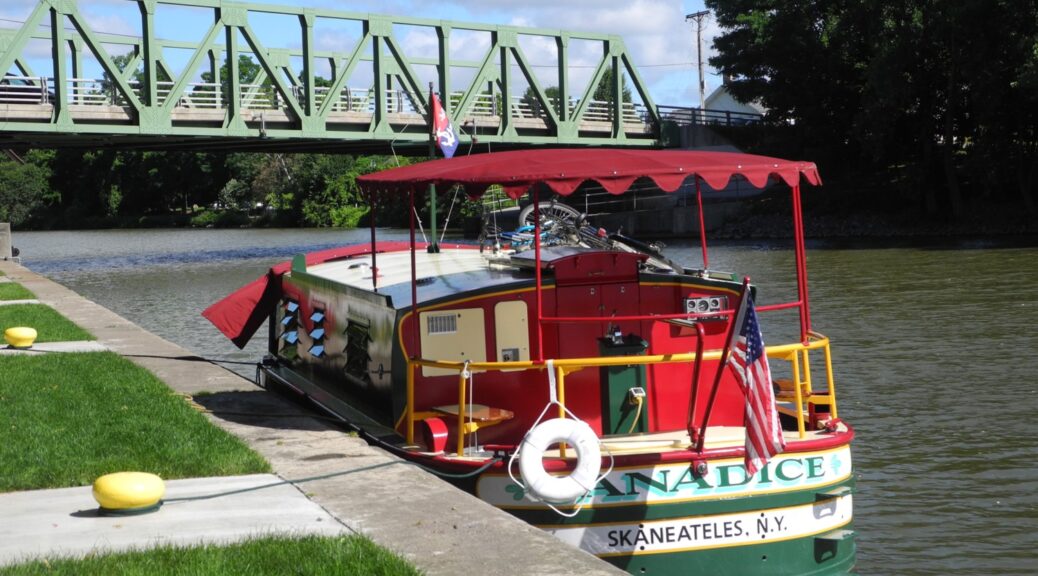
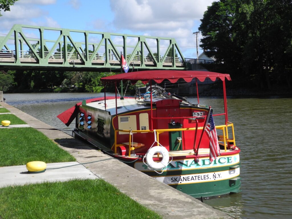
Our boat, the Canadice, is 41 feet long and can sleep 4 people (one double bed and two bunk beds in the galley; a well designed galley kitchen with small refrigerator and freezer; a shower; a table and sitting area in the bow), suitable for a family; the largest Lockmaster can accommodate 6 adults.

Within moments, the thrill of what this is all about floods over me: This is a real adventure, where have to do everything yourself, not have it done for you, make decisions.

Going through a lock on the Erie Canal: the lock tenders are extremely helpful (c) Karen Rubin/goingplacesfarandnear.com

As we sail along, I reflect on how lovely this boat is: the gorgeous knotty pine wood detailing; the varnished wood seats and a railing that makes for a back rest as you hold the tiller, brass and varnished wood. The cabin is beautiful knotty pine. It has a canvas canopy over the helm and even on a hot day, the breezes as we travel are delightful. The bow has screens with plastic and canvas that zip and snap easily so we can close everything up in the event of rain and a table that can even be moved inside.

The design for the Lockmaster came from Peter Wiles, Sr., who was a key architect of the transition of the Erie Canal from commercial to recreational use. He had a small tour boat business on Skaneateles Lake and went to England to see the self-skippered canal boats that operated on the Thames, and brought back the concept for boats that he would design and build here.

Wiles took the charm and the traditional design but adapted the boat to the Erie Canal, with a wider (roomier) beam, mostly flat bottomed and do not have a keel (the Erie Canal is only about 12-feet deep and is actually filled and drained each season). He founded the MidLakes Navigation company which, when we visit, is run by his children, Sarah and Peter Wiles (the company has since been acquired and renamed Erie Canal Adventures).

Fairport

We soon get the hang of piloting the boat, and after a couple of hours sailing, we come to Fairport, a most charming town, with shops and restaurants right along the canal. It is a picture-perfect model of revitalization.

Fairport did not exist before construction of the Erie Canal dried up a swamp and produced a “fair port” for travelers. “Commerce thrived as entrepreneurs turned ideas into products,” says one of the best guides to this portion of the canal, “100 Must See Miles”

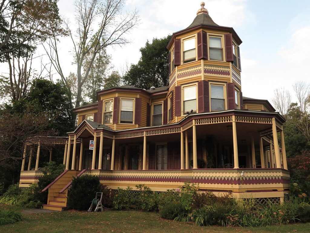
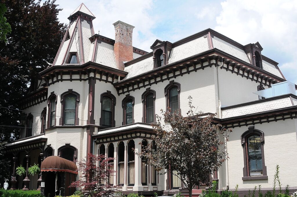
Henry Deland’s mansion is now the Green Lantern Inn, Fairport, one of the canaltowns on the Erie Canal (c) Karen Rubin/goingplacesfarandnear.ccm

One of these entrepreneurs was Henry Deland who had the idea to produce baking soda from wood ash. The building right on the canal and next to the bridge where there is now a delightful Towpath Cafe was where Deland manufactured his baking soda which was transported by canal to international markets.

Just up Main Street, on the south side of the canal, I find the Deland Mansion, built in 1876. After Deland made his fortune in Fairport, he bought land and founded Deland, Florida in 1876, which he thought to build into a citrus, agricultural and tourism center. He sold his northern business and hired people to clear land, lay out streets, erect buildings and recruit settlers, most from upstate New York; he lost his fortune in an orange freeze in 1885.

The mansion is magnificent: Second Empire style with tower, porches, fireplaces, it was one of the grandest private residences in western New York. After several private owners, including the Clark Family, the Deland Mansion opened as the Green Lantern Inn sometime after 1928, and served as a restaurant, speakeasy, rooming house, banquet hall.

The mansion is across from the First Baptist Church, which was built at same time as Deland built his mansion.

Each of the canal towns we visit has done a superb job of using historical markers and photos to illustrate the “then and now.” As we follow them, it is like a story that unfolds.

At Fairport, there is a marker that shows how Old South Main Street “yields to urban renewal: Commercial block changes from necessities to niceties.”

The beauty of the canal boat is that you can organize the day around what you want to do – whether it is to just hang out in a town – perhaps visit a museum. Our main purpose is to position us to bike the towpath. And so we tie up the Canadice at Fairport, take down our bikes from the roof, and head out about 7 miles to the next major town, Pittsford, along the canal bikeway. It is one of the prettier rides, with lovely homes on the canal.

The Great Embankment, Erie Canal, New York (c) Karen Rubin/goingplacesfarandnear.com

Just before Pittsford, we cross over a mile-long section called “The Great Embankment.” This is the highest canal embankment, actually built over the Irondequoit Creek which rushes through a tunnel under the canal.

In the earliest days of the Erie Canal, the embankment thrilled both onlookers and passengers as boats seemed to travel in midair over the mile-wide valley created by the Irondequoit Creek. The canal has been rebuilt three times since it originally opened in 1823. The original canal was a mere four-feet deep and 40-feet wide; three times it was enlarged, made deeper (first 7 feet deep and 70-feet wide, then 12-feet deep and 120-feet wide), and in many cases, moved entirely to make a better route as boats became motorized.

This is our first introduction to the engineering of the Erie Canal. I really hadn’t even thought of the canal as having a false bottom, that the canal is actually drained (around November 1), and refilled (around May 1) each season.

The Great Embankment is a revelation, but we will find even more dramatic examples of engineering, as we explore by bike and boat.

We return to Fairport, and prepare to get underway again – actually boating back to Pittsford.

It’s just passed 6 pm when we leave Fairport.

But to leave Fairport, you have to go under a lift bridge, and Fairport’s is very distinctive: it is constructed with no right angles.

Bridge at Fairport (no right angles) lifts for us to sail under, on the Erie Canal, New York State (c) Kaaen Rubin/goingplacesfarandnear.com

There are 16 lift bridges on the Erie Canal, all of them in the west, and the eastern-most one is here at Fairport. The bridges are delights to look at – they have ornate towers and it is wonderful to watch how they work.

We have been instructed on the etiquette of using the radio to ask the lock tender to lift a bridge or open a lock. Some are covered by operators handling multiple bridges, so you might be told to standby and wait for the operator to get back to the bridge. (take note of the hours of operation – westward from Macedon toward Buffalo, the locks are open 7 am to 10 pm; eastward to Lake Oneida in Syracuse (the boats do not go all the way to Albany), the lifts operate 7 am to 7 pm).

Pittsford

We tie up for the night at Port of Pittsford Park, right below the Main Street Bridge (there is no charge but some of the ports along the canal charge up to $15 to overnight).

We stroll the charming streets (and there are some gorgeous residential streets as well), and see what an affluent community Pittsford is. Old money and new money poured in over the last 15 years to revitalize the downtown area.

Pittsford was settled in 1789 by Revolutionary War veterans, but it was the Erie Canal that first brought prosperity to the town, because it facilitated transport to market of tons of heavy gravel from the nearby hills.

We see stunning Victorian-era buildings – the Phoenix Hotel, built in 1812 in the Federalist style, 1812 to serve the Erie Canal and Turnpike trade, restored 1967 as an office building across from the Town Hall, dated 1890. There is also the Canal Lamp Inn, a stunning Victorian, right beside the canal bridge. (Self-guided walk through Pittsford, villageofpittsford.org).

Just minutes after we finish our picnic dinner of pizza and get inside our boat and close the hatches, it starts to pour. We are cozy inside. We hear the patter of rain as we watch a DVD on our computer.

Cruising in a canalboat on the Erie Canal, New York State (c) Karen Rubin/goingplacesfarandnear.com

The star attraction – and the major character – in this travel epic is the Erie Canal, itself. The historic markers we come upon are like chapters in the story, and as our trip unfolds, our appreciation of what the canal was, what it represented, and the impact it had, grows.

All 11 Lockmasters in Erie Canal Adventures’ fleet sail from Macedon, near Rochester, NY, and with enough time, you can cruise some 200 miles from Buffalo to Lake Oneida in Syracuse along the canal. Besides sailing along the Erie Canal (as far as , you can also sail on other waterways, taking spurs south to the Finger Lakes, or north up the Oswego canal to Lake Ontario.

Erie Canal Adventures, 315-986-3011, www.eriecanaladventures.com.

________________________

© 2020 Travel Features Syndicate, a division of Workstyles, Inc. All rights reserved. Visit goingplacesfarandnear.com, www.huffingtonpost.com/author/karen-rubin, and travelwritersmagazine.com/TravelFeaturesSyndicate/. Blogging at goingplacesnearandfar.wordpress.com and moralcompasstravel.info. Send comments or questions to [email protected]. Tweet @TravelFeatures. ‘Like’ us at facebook.com/NewsPhotoFeatures
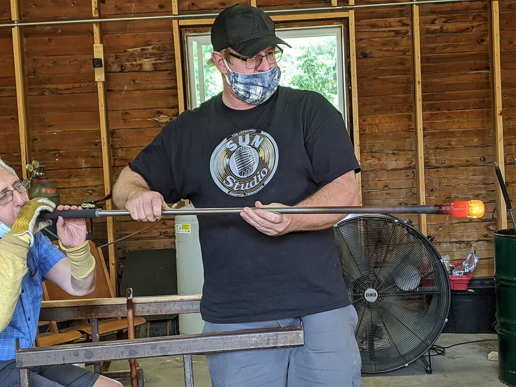
New York State Parks, Campgrounds, Beaches Reopen Just in Time to Save Summer

Hiking the Escarpment Trail in the North-South Lake Campground park in the Catskills Preserve affording spectacular views of the Hudson River Valley. New York State has officially reopened state parks and is taking reservations for campsites © Karen Rubin/goingplacesfarandnear.com

By Karen Rubin
Travel Features Syndicate, goingplacesfarandnear.com

Visiting New York State’s parks has been such a respite, a source of revitalization and renewal during this unprecedented public health crisis. Thankfully, they have been officially reopened as New York proceeds with its NY Forward phased plan, as New York has gone (miraculously) from having the highest-rate of COVID-19 infection in the nation to the lowest in just 100 days. That has been managed by methodical, scrupulous implementation of protocols, a “new normal,” that include reducing capacity in parking lots and cleaning restrooms, and requiring people to wear face masks when they cannot keep six-feet apart, even when hiking on a trail.

This weekend, I biked at Jones Beach State Park, where the bike path has been extended 3 miles along Ocean Parkway, then biked along the boardwalk which was surprisingly uncrowded and people were observing healthy practices (and there were plenty of monitors, as well as hand-sanitizing stations, and scrupulously cleaned restrooms), then continued the trail along Wantagh Parkway 5 miles to Cedar Creek Park and return – a 20-mile ride that is absolutely exhilarating.

Jones Beach State Park, Long Island, NY (c) Karen Rubin/goingplacesfarandnear.com.

Another weekend, I biked the sensational Bethpage State Park trail. The 6.8-mile trail, which is remarkably treed and natural-looking despite going through a narrow corridor between highway and residential neighborhoods has been nearly doubled in length, to 12.5 miles, from Woodbury Road, into and through Bethpage State Park and Massapequa Park (https://www.dot.ny.gov/bethpagebikeway).

Biking the Bethpage State Park trail into Massapequa Park, Long Island (c) Karen Rubin/goingplacesfarandnear.com.

I can’t wait to bike the newly opened 3.6 mile bike/walking path along the Governor Mario Cuomo Bridge (former Tappan Zee), which affords views of New York City to the South, Hudson Valley to the north (mariomcuomobridge.ny.gov). Already, the Walkway over the Hudson in Poughkeepsie has become one of the most popular attractions in the state (walkway.org), and this new path is expected to be a boon for local tourism as well.

See: New 3.6 Mile Biking/Walking Path Opens on Mario Cuomo Bridge over Hudson River

New York State Governor Andrew M. Cuomo announced the opening of the 3.6-mile shared bicycle and pedestrian path on the Governor Mario M. Cuomo Bridge (the rebuilt Tappan Zee Bridge), providing an environmentally friendly new connection for families, runners, cyclists, walkers and commuters to travel between Westchester and Rockland counties over the Hudson River. The path opened with safety protocols in place to limit the potential spread of COVID-19.

I also discovered how easy it is to hike in the Catskills – within 2 ½ hours drive, to be amid sensational scenes immortalized in the Hudson River Art School paintings (and now on the Hudson River School Art Trail), making it a day trip (the rest stops along the New York Thruway are open and observing COVID-19 protocols). (hudsonriverschool.org)

A centerpiece of the art trail is the North-South Lake Campground, 2 ½ hour drive (but you can now book a campsite), where there are a number of hiking trails that bring you to the scenes depicted in paintings by Thomas Cole and Frederic Edwin Church. My favorite is the Escarpment Trail, which goes along the edge for breathtaking views over the Hudson including Artist’s Rock, Sunset Rock, Newman’s Ledge, Boulder Rock and North Point, through wilderness with dramatic rock formations, and down Mary’s Glen trail, passed the beautiful Ashley Falls. (https://cnyhiking.com/North-SouthLakeCampground.htm)

Coming upon Ashley Falls on the Mary’s Glen trail in North-South Lake Campground state park in New York’s Catskills (c) Karen Rubin/goingplacesfarandnear.com.

Make it into a real adventure, in order to enjoy all the outdoor amenities of North-South Lake Campground, and make it a camping trip. North-South Lake Campground is the largest state campground in the Catskills, with more than 200 campsites.

NYS Parks Campgrounds Reopen

New York State Office of Parks, Recreation and Historic Preservation (State Parks) has begun accepting new camping reservations for all available sites – including tents, trailers, RVs, cabins, yurts and cottages – for camping stays beginning on June 22. Reservations are expected to fill quickly. Reservations can be made in advance by calling 800-456-CAMP or http://newyorkstateparks.reserveamerica.com. Online reservations are encouraged.

State Park Police and operations staff are patrolling campgrounds to ensure compliance with social distancing and crowd control measures. Anyone who does not adhere to this guidance will be requested to leave the facility, and will not receive a refund.

Upon check-in, campers will be asked a series of screening questions to determine if they may have been in contact with anyone suffering from Covid-19, or if they have any potential symptoms of Covid-19, including fever or respiratory illness. People who may be at risk will not be permitted to camp.

Campground density reduction and social distancing measures will be in effect, including:

  • No walk-up reservations will be allowed.
  • Each congregate restroom facility will be opened and cleaned per DOH protocols.
  • Rest rooms and shower buildings may have reduced capacity and may be closed periodically for cleaning.
  • Campground gatherings will be limited to immediate household members only.
  • All campground events and programs are suspended.
  • Park Social Distancing Ambassadors will monitor campgrounds, picnic areas, beachfronts, lawns, boardwalks and other areas to ensure park guidelines are being met.
  • COVID related signage has been installed throughout the park system.

For a listing of campgrounds operated by the Office of Parks, Recreation and Historic Preservation, visit https://parks.ny.gov/camping/. Campgrounds in the Adirondack and Catskill Parks overseen by the Department of Environmental Conservation operate on a different schedule.

If you are closed out, you can look to some of the private campgrounds, such as Kampgrounds of America (koa.com).

Beaches and day-use areas

In alignment with NY Forward, State Park beaches, day-use areas and historic sites are charging the normal entrance fee of $6-$10 as regions reach phase 2 of reopening. For information, visit: https://forward.ny.gov/.

The 2020 Season Empire Pass for unlimited day-use entry costing $80, is a wallet-sized card that can be shared within a household and not assigned to a specific vehicle ( https://parks.ny.gov/admission/empire-passport/default.aspx)

For guidance on visiting New York State Parks during the Covid-19 public health crisis, visit: https://parks.ny.gov/covid19/

NY Parks 2020 Plan

New York is spending $2.9 million to improve new or existing trails and playgrounds in state parks across the state in the next phase of the NY Parks 2020 Plan. The plan is a multi-year commitment to leverage a broad range of private and public funding to invest approximately $900 million in State Park improvements. Under the initiative, Governor Andrew Cuomo has set a goal of modernizing 100 playgrounds, replacing outdated equipment with modern, code-compliant facilities, improving access for people with disabilities, and creating specific areas for older and younger age groups.

“We are continuing to invest in every corner of the state to ensure that New Yorkers have access to nearby family-friendly, top-notch facilities, with modern playgrounds and expanded or improved opportunities for hiking and outdoor recreation,” Governor Andrew Cuomo said. “Our State Parks serve as community anchors as well as economic engines for families and business across New York, and this is why we have made their enhancement a top priority.”    

New York State has invested millions to refurbish the Art Deco structures in Jones Beach State Park as well as add amenities © Karen Rubin/goingplacesfarandnear.com.

Projects funded include:

Capital Region

  • Saratoga Spa State Park ($50,000) – Rehabilitation of stone dust paths.
  • Moreau Lake State Park ($20,000) – Design work started for a new gravel parking area at the Sherman Island boat launch.
  • Materials purchased ($5,000) for creation of new trail signs at the regional sign shop for all parks in the region.

Central New York

  • Fillmore Glen State Park ($60,000) – Completion of a new 80-foot bridge, rehabilitation of box steps and stone steps, and regrading of a mile of the North Rim Trail.
  • Chittenango Falls State Park (69,000) – Renovation of existing playground.

Finger Lakes

  • Chimney Bluffs State Park ($50,000) – Construction starting on a new 400-foot boardwalk and trail relocation, with completion expected in spring 2020.
  • Genesee Valley Greenway State Park ($50,000) – New drainage culverts are being added to improve the 90-mile former canal towpath and railway bed in Monroe, Livingston, Wyoming, Allegany and Cattaraugus counties. In September, Governor Andrew Cuomo announced $6.4 million in grants from the Ralph C. Wilson, Jr. Foundation, in addition to $4 million in state funding, to support ongoing improvements to the Genesee Valley Greenway State Park and the Niagara Shoreline Trail in Western New York.

Long Island

  • Hallock State Park Preserve ($17,000) – A new .75-mile birding trail loop added from the upper parking lot through Harbor Hill moraine and rare clay hoodoos (a type of rock tower formation) along the north shore of Long Island Sound.

Mid-Hudson Region

  • Taconic State Park ($158,000) – Expansion of playground to include equipment for younger children and a bear theme.
  • Lake Taghkanic ($245,000) – Expansion of West Beach playground to include new fish theme, along with increased shade structures and an ADA-compliant pedestrian trail to the beach.
  • Mills Norrie State Park ($405,000) – Bids opened for new woodland-themed playground, with construction to start next spring for summer completion.
  • Fahnestock State Park ($325,000) – Design work started for a new bird-themed playground at Canopus Lake, with completion estimated in 2020 or 2021.
  • Trail signage replacement ($75,000) throughout region, with work expected to be done by spring 2020.
  • Hudson Highlands State Park Preserve – New interpretive panels will be added to the Constitution Marsh Bird Conservation Area, with work expected to be done by spring 2020.

North Country

  • Wellesley Island State Park ($10,000) – Construction of new boardwalks at the Minna Anthony Common Nature Center.
  • Robert G. Wehle State Park ($50,000) – Construction of a new playground shaped like a dog’s paw, to underscore Wehle’s history as a breeder of champion bird hunting dogs.
  • Higley Flow State Park ($50,000) – Construction of a second playground closer to the campgrounds.

New York City

  • Clay Pit Ponds Park Preserve ($15,000) – Trails have been improved at the 265-acre nature preserve at the southwest shore of Staten Island.

Southern Tier

  • Buttermilk Falls State Park ($30,000) – Work begun on new 56-foot bridge at Scott’s Dam connecting the main parking lot to the Bear Trail, with completion expected in spring 2020.
  • Taughhannock Falls State Park ($10,000) – Construction completed of new box steps and stone steps on the South Rim Trail.
  • Chenango Valley State Park ($282,000) – Playground near beach area improved with upgraded equipment. Clearing work has started on the Chenango Lake Trail, with planning begun for a new ADA-compliant parking area near the trailhead, a new Oak Island bridge and a mountain bikes skills course.
  • Oquaga Creek State Park ($75,500) – Construction of new play area.

Western New York

  • Allegany State Park ($130,000) – Rehabilitation complete on the 25-mile Art Roscoe Cross-Country Ski and Mountain Bike Area, with work expected to be complete by October. Work is complete on refurbishing the Lonkto Hollow Trail and culvert replacement. Replace culverts, with work expected to be done by October 2019. Refurbish the Stoney Trail and replace culverts, with work expected to be done in summer 2020.
  • Midway State Park ($300,000) – Construction this winter for a new train-themed playground reflecting the park’s origination as a 19th century “trolley park,” with work expected to be done for the 2020 operating season.
  • Letchworth State Park ($300,000) – Design work underway for new Nature Center playground, with construction start anticipated for April 2020.

Statewide

  • Backcountry Trails Program ($170,000) – Sterling Forest State Park: Repairs to existing trails, and construction of new Doris Duke Trail and seven-mile Red Back multi-use loop; Hudson Highlands State Park Preserve: Restoration and surfacing improvements to highly-used trails.

State Parks oversees more than 250 parks, historic sites, recreational trails, golf courses, boat launches and more, which were visited by a record 74 million people last year. For more information on any of these recreation areas, call 518-474-0456 or visit www.parks.ny.gov.

______________________

© 2020 Travel Features Syndicate, a division of Workstyles, Inc. All rights reserved. Visit goingplacesfarandnear.com, www.huffingtonpost.com/author/karen-rubin, and travelwritersmagazine.com/TravelFeaturesSyndicate/. Blogging at goingplacesnearandfar.wordpress.com and moralcompasstravel.info. Send comments or questions to [email protected]. Tweet @TravelFeatures. ‘Like’ us at facebook.com/NewsPhotoFeatures
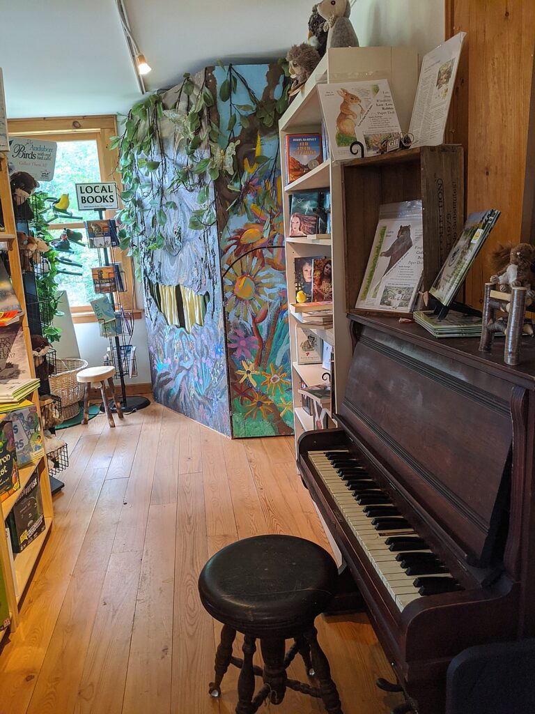
NYS’s Newest Attraction: 3.6 Mile Biking/Walking Path Opens on Mario Cuomo Bridge over Hudson River

New York State’s newest attraction is the 3.6-mile shared bicycle and pedestrian path on the Governor Mario M. Cuomo Bridge (the rebuilt Tappan Zee Bridge), providing an environmentally friendly new connection for families, runners, cyclists, walkers and commuters to travel between Westchester and Rockland counties over the Hudson River. The path opened with safety protocols in place to limit the potential spread of COVID-19. © Karen Rubin/goingplacesfarandnear.com

By Karen Rubin
Travel Features Syndicate, goingplacesfarandnear.com

On only the second weekend since New York State Governor Andrew M. Cuomo cut the ribbon to open the 3.6-mile  shared bicycle and pedestrian path on the Governor Mario M. Cuomo Bridge (the rebuilt Tappan Zee Bridge, named for his father, a three-term governor), it was bustling – even hard to get a parking space at Westchester Landing. There is a perennial festive atmosphere  – a sense of delight – that starts at the gorgeous, welcoming visitor center (bathrooms, water fountain), the snack trucks (beer, ice cream, other delights), and even a bike rental stall. The path opened with safety protocols in place to limit the potential spread of COVID-19 – everyone is required to wear masks, there is a monitored stand where you can get one as well as hand sanitizer, and monitors along the path at these gorgeous viewing platforms, each one artfully designed.

Biking the newly opened 3.6 mile path over the Governor Mario M. Cuomo Bridge © Karen Rubin/goingplacesfarandnear.com

The path provides an environmentally friendly new connection for families, runners, cyclists, walkers and commuters to travel between Westchester and Rockland counties. Even better, it sets what should be every municipality’s focus on providing opportunities for health and wellness (and happiness) –by walking or biking, but in any case, moving.

It takes approximately 80 minutes to walk the length of the path and approximately 20 minutes to bike across the path, so take that into account (especially with the four-hour limit on parking).

Magnificent viewing areas from the newly opened 3.6 mile path over the Governor Mario M. Cuomo Bridge © Karen Rubin/goingplacesfarandnear.com

The bridge itself is magnificent (Golden Gate, eat your heart out), and the views absolutely gorgeous. But cyclists and hikers will love the fact that once you get over to the Rockland side, you can continue the ride or hike north on the Raymond G. Esposito Memorial Trail for just a mile (not that interesting), but really marvelous is to go south on the Old Erie Path, a three-mile gravel path along an old rail line that follows the ridge and opens to magnificent views of the bridge and Hudson River, and ends at an old train station at Piermont.

The Old Erie Path, a three-mile gravel path along an old rail line that follows the ridge and opens to magnificent views of the Mario M. Cuomo Bridge and Hudson River © Karen Rubin/goingplacesfarandnear.com

“The new Governor Mario M. Cuomo Bridge is an iconic gateway to the Hudson Valley and a statewide landmark that celebrates the spirit of New York,” Governor Cuomo said. ”The addition of this state-of-the-art bike and pedestrian path will provide New Yorkers and tourists alike with more ways to cross the river, as well as updated amenities and a unique, interactive experience to enjoy while taking in the scenic views of the Hudson River Valley.”

Magnificent, artful viewing areas from the newly opened 3.6 mile path over the Governor Mario M. Cuomo Bridge © Karen Rubin/goingplacesfarandnear.com

With its signature blue overlay, the 12-foot wide shared use path extends from its Westchester Landing in the Village of Tarrytown, across one of the widest points of the Hudson River, to its Rockland Landing in the Village of South Nyack. Located on the northern side of the Governor Mario M. Cuomo Bridge’s westbound span, the path features six scenic overlooks, digital kiosks, interpretive signage and public art. Visitor parking, restrooms, bicycle repair stations and other amenities, along with connectivity to local bicycle and pedestrian networks, are available at both landings. 

The shared use path is open daily from 6 a.m. to 10 p.m. The path may temporarily close due to inclement weather, maintenance operations or security concerns. Updates and path information will be available at the bridge’s new website, mariomcuomobridge.ny.gov, and on its new Twitter account, @GMMCB.

The shared use path was part of the Thruway Authority’s $3.9 billion project to build the new Governor Mario M. Cuomo Bridge, which replaced the Tappan Zee Bridge in 2017. The cable-stayed crossing has been built to serve the Hudson Valley without major maintenance for at least a century. Approximately 50 million vehicles cross the bridge annually. 

“The opening of the Governor Mario M. Cuomo Bridge bicycle and pedestrian path is the culmination of a transformative public infrastructure project, one of the largest in the United States,” Project Director Jamey Barbas said. “Under the leadership of Governor Cuomo, the hundreds of laborers and engineers who have worked on this project have been committed from the start to providing transportation improvements, from wider lanes and emergency shoulders to dedicated space for buses and now a 3.6-mile shared use path. The path is not only functional, it is beautiful, and we thank all our community partners who made this bridge a reality.”

A lovely mural greets you as you enter the path over the Governor Mario M. Cuomo Bridge from the Rockland side © Karen Rubin/goingplacesfarandnear.com

As magnificent as the views up the Hudson River are, the art and design along the way add to the aesthetic experience. You encounter five sculptures, a 4,000-square-foot mural at the entrance in Rockland and a custom-designed bike rack referencing the Palisades and New York City skyline. Three of the sculptures incorporate remnant steel salvaged from the decommissioned Tappan Zee Bridge. Three more bicycle racks allude to the historic importance of the Hudson River as a commercial transportation artery. The viewing areas are works of art, themselves, and the people taking in the scenery almost become part of the canvas.

The Thruway Authority partnered with ArtsWestchester and the Arts Council of Rockland on the Governor Mario M. Cuomo Bridge Public Art Program. The 10 commissions were awarded to eight New York State artists. (Details about each art commission is available on the bridge website.)

“A spectacular group of monumental works of art have been installed at each terminus of the new bridge, transforming this twin crossing into a compelling destination for travelers to engage with the arts,” ArtsWestchester CEO Janet T. Langsam said. “We at ArtsWestchester were thrilled to collaborate with the New York State Thruway Authority on this landmark creative placemaking project. With the expansion of COVID19 outdoor recreation guidelines, the new bridge over the mighty Hudson is a visionary place for people to enjoy public art on their way to and from the Hudson Valley. The artwork is free, its public, and available to all New Yorkers.“

Magnificent, artful viewing areas from the newly opened 3.6 mile path over the Governor Mario M. Cuomo Bridge © Karen Rubin/goingplacesfarandnear.com

There are also free audio tours specially designed for walkers and cyclists available for download. The mobile tours include stories that cover a wide range of topics from information about bridge construction to local history, from the Hudson Valley’s connection to art to the Hudson River and its surroundings. Travelers can safely access the stories hands-free on their mobile devices while walking or cycling the path.

The New York State Thruway Authority partnered with Historic Hudson River Towns (HHRT), a non-profit consortium of riverfront municipalities, and TravelStorys to develop the audio tours. The New NY Bridge Community Benefits Program awarded Historic Hudson River Towns a grant for the project. In addition to the path tours, HHRT offers a new driving tour includes featuring its 16 member communities in Westchester and Rockland, as well as on both the new Governor Mario M. Cuomo Bridge and the Bear Mountain Bridge.

Other upcoming HHRT tours on the TravelStorys app include walking tours of Irvington, Tarrytown, Sleepy Hollow and Nyack, and artist Edward Hopper’s Nyack. Download the TravelStorys app for free to listen to the self-guided path tours.

Masks and sanitizer at the entrance to the Mario M. Cuomo Bridge path show #NewYorkTough (c) Karen Rubin/goingplacesfarandnear.com

Hudson Link, the enhanced bus service sponsored by the New York State Department of Transportation serving the Interstate 87/287 corridor, provides free shuttle service from large commuter parking lots in Rockland and Westchester to stop near the path’s landings in Tarrytown and South Nyack. The Hudson Link path shuttle regular weekend summer schedule operates from 7:30 a.m. to 7:30 p.m. each Friday, Saturday and Sunday.

There is a four-hour time limit in the parking lots at the path, and visitors are strongly encouraged to take shuttles and other mass transit to the path. The state-of-the-art path shuttles will leave every 20 minutes from Palisades Center. A map, schedule and details are available on Hudson Link’s website.

Safety features along the path over the Governor Mario M. Cuomo Bridge from the Rockland side © Karen Rubin/goingplacesfarandnear.com

As part of its COVID-19 response, Hudson Link has taken the following precautions:

  • Maximum occupancy per bus is 25 customers.
  • All passengers are required to wear face masks.
  • All passengers are asked to sit six feet away from each other while on the bus.
  • Hand sanitizing units are installed on all Hudson Link buses.
  • All operators wear face masks, gloves and use hand sanitizer.
  • CDC approved industrial sanitizers are used nightly to clean each bus.

To ensure the safety of all using the new shared use path, visitors should keep six feet apart from others. When social distancing cannot be maintained, visitors are asked to wear a face covering on the path and in the restrooms. Physical and digital signs have been posted to remind visitors of their shared responsibilities during the COVID-19 pandemic.

New York State Police Troop T is the law enforcement entity responsible for patrolling the path while a dedicated security team will actively monitor it and the entire bridge 24 hours/day, 365 days/year.

New York State’s newest attraction is the 3.6-mile shared bicycle and pedestrian path on the Governor Mario M. Cuomo Bridge (the rebuilt Tappan Zee Bridge), providing an environmentally friendly new connection for families, runners, cyclists, walkers and commuters to travel between Westchester and Rockland counties over the Hudson River. The path opened with safety protocols in place to limit the potential spread of COVID-19. © Karen Rubin/goingplacesfarandnear.com

The path features designated lanes for pedestrians and cyclists traveling in both directions to ensure safety. There is a 15-mph speed limit for all cyclists. Per a new state law, Class 1 and Class 2 bicycles with electric assist (e-bikes) may be used on the path by those 16 years of age and older. All cyclists must yield to pedestrians.

When visiting the path, keep the following in mind:

  • It takes approximately 80 minutes to walk the length of the path; factor in your return trip.
  • It takes approximately 20 minutes to bike across the path.
  • Wind, rain, sun, temperatures all feel more intense out over the water; dress accordingly.
  • Restrooms are in the Welcome Centers at both landings.
  • Water fountains are available at both landings, not on the path itself.
  • You may feel the bridge vibrate; this is normal.
  • If you need assistance, use the blue light phones along the path.

As part of a Thruway Authority pilot program, local merchants offer food and services at both landings.

One of the food trucks at Westchester Landing on the Mario M. Cuomo Bridge path © Karen Rubin/goingplacesfarandnear.com
 

Three food trucks – Anthi’s Greek Specialties, Westchester Burger Company and Graziella’s Italian Kitchen – serve both the Westchester and Rockland landings on a rotating basis, seven days a week, from 11 a.m. to 8 p.m.

At the Westchester Landing, Double Barrel Roasters serve hot and cold coffee, specialty drinks and scooped ices daily from 8 a.m. to 9 p.m. The Blue Pig, which sells locally sourced ice cream, operates from 2 p.m. to 9 p.m., Friday to Sunday, while Sleek E-Bikes offers electric bike rentals from 10 a.m. to 6 p.m. during the summer.

At the Rockland Landing, Teagevity offers organic tea and cold-brewed coffee from 9 a.m. to dusk, Thursdays to Sundays.

The Old Erie Path, a three-mile gravel path along an old rail line that follows the ridge and opens to magnificent views of the Mario M. Cuomo Bridge and Hudson River © Karen Rubin/goingplacesfarandnear.com
 

The Governor Mario Cuomo Bridge was the most ambitious infrastructure project undertaken in the United States in a decade, and Governor Andrew Cuomo equated the accomplishment to the state’s success in tackling the coronavirus pandemic which turned New York State into the global epicenter. But in 100 days, the state that had had the highest infection rate, has become the state with the lowest infection rate.

“The Mario Cuomo Bridge – nearly two years ago we celebrated the opening,” Cuomo said at the ribbon cutting for the new bike path. “The largest infrastructure project in the United States in the past 10 years. Think about that. Nowhere else in the nation did they even attempt a project this big, why? Because it’s intimidating. It’s intimidating. You’re going to build a new bridge across the Hudson River? Government? Government can’t put two bricks together; you think you’re going to build a bridge? Yes. Yes, we can do it. We can do it. That’s what we said with this bridge today.

“We’re going to open the 3.6-mile-long path for cyclists and pedestrians. You can come across the Hudson River which is spectacular in and of itself. From this bridge you look south you can see New York City; you look north you- one of the most beautiful river valleys on the globe. 3.6 miles and you’re over one of the most beautiful bridges in the United States of America…The bridge speaks to a sense of possibility, a sense of capacity— when people are wondering, ‘can we do this? Can we rise to the challenge? Are we capable of it? Can we do these big things?’

“And the bridge said, ‘yes we can,’ after 20 years of people questioning and doubting and being afraid. The bridge took on the challenge and defeated the challenge. It showed what we were capable of.”

______________________

© 2020 Travel Features Syndicate, a division of Workstyles, Inc. All rights reserved. Visit goingplacesfarandnear.com, www.huffingtonpost.com/author/karen-rubin, and travelwritersmagazine.com/TravelFeaturesSyndicate/. Blogging at goingplacesnearandfar.wordpress.com and moralcompasstravel.info. Send comments or questions to [email protected]. Tweet @TravelFeatures. ‘Like’ us at facebook.com/NewsPhotoFeatures
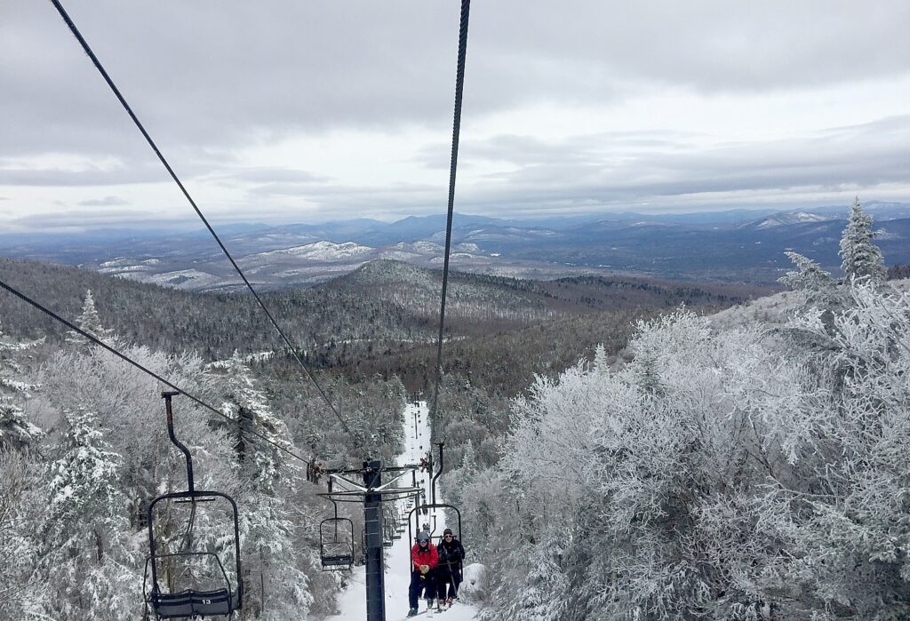
Cycle the Erie: Heritage of Erie Canal Preserved in Murals Along the Erie Canalway

By Karen Rubin, Travel Features Syndicate, goingplacesfarandnear.com

One of the many delights of Parks & Trails NY’s 8-day, 400-mile Cycle the Erie bike tour from Buffalo to Albany across New York State, is coming up beautiful murals that describe the history and cultural heritage of the Erie Canal and the canaltowns that were spawned.  Through the course of the ride, you travel 400 miles but also 400 years through history, and see the whole story of how America came to be unfold in front of you.

Here are some of our favorites, as we bike along the Erie Canalway, on brick, on barns, on bridges, on benches, on fences:

Gasport © Karen Rubin/goingplacesfarandnear.com

Middleport © Karen Rubin/goingplacesfarandnear.com

Medina © Karen Rubin/goingplacesfarandnear.com

Albion © Karen Rubin/goingplacesfarandnear.com

Albion © Karen Rubin/goingplacesfarandnear.com

Spencerport © Karen Rubin/goingplacesfarandnear.com

Spencerport © Karen Rubin/goingplacesfarandnear.com

Palmyra © Karen Rubin/goingplacesfarandnear.com

Palmyra © Karen Rubin/goingplacesfarandnear.com

Palmyra © Karen Rubin/goingplacesfarandnear.com

Newark © Karen Rubin/goingplacesfarandnear.com

Newark © Karen Rubin/goingplacesfarandnear.com

Newark © Karen Rubin/goingplacesfarandnear.com

Newark © Karen Rubin/goingplacesfarandnear.com

Newark © Karen Rubin/goingplacesfarandnear.com

Lyons © Karen Rubin/goingplacesfarandnear.com

Lyons © Karen Rubin/goingplacesfarandnear.com

Lyons © Karen Rubin/goingplacesfarandnear.com

Jordan © Karen Rubin/goingplacesfarandnear.com

Sims General Store, Camillus © Karen Rubin/goingplacesfarandnear.com


Syracuse Canal Museum © Karen Rubin/goingplacesfarandnear.com

Outside of Rome © Karen Rubin/goingplacesfarandnear.com

The 20th Annual Cycle the Erie Canal ride is scheduled July 8 – 15, 2018 (www.ptny.org/canaltour). In the meantime, you can cycle the trail on your own – detailed info and interactive map is at the ptny.org site (www.ptny.org/bikecanal), including suggested lodgings. For more information on Cycle the Erie Canal, contact Parks & Trails New York at 518-434-1583 or visit www.ptny.org.

The entire Erie Canal corridor has been designated the Erie Canalway National Heritage Corridor, Waterford, NY 12188, 518-237-7000, www.eriecanalway.org.

More information about traveling on the Erie Canal is available from New York State Canal Corporation, www.canals.ny.gov.   

See also:

Cycle the Erie: 400 Miles & 400 Years of History Flow By on Canalway Bike Tour Across New York State

Cycle the Erie, Day 1: In Lockport, See Erie Canal Engineering Marvel, ‘Flight of Five’, Cruise Thru Double Locks, and Go Underground to Fathom Rise of Industrial Revolution

Cycle the Erie, Day 2-3: A Sequence of Charming Canaltowns, Pastoral Landscapes, Punctuated by City Birthed by ‘Mother of Cities’

Cycle the Erie, Day 4: Seneca Falls to Syracuse, Crossing Halfway Mark of 400-Mile Biketour

Cycle the Erie, Day 5: Deep Dive into The Erie Canal: ‘Mother of Cities’, Empire Builder, Wonder of the World

Cycle the Erie: At Fort Stanwix, Rome, Time Travel Back to America’s Colonial, Native American Past

Cycle the Erie, Days 6-7: Erie Canal Spurs Rise of America as Global Industrial Power

Cycle the Erie, Days 7-8: Schoharie Crossing, Mabee Farm, Cohoes Falls to Finish Line in Albany of 400-Mile BikeTour

_____________________________

© 2018 Travel Features Syndicate, a division of Workstyles, Inc. All rights reserved. Visit goingplacesfarandnear.com,  www.huffingtonpost.com/author/karen-rubin , and travelwritersmagazine.com/TravelFeaturesSyndicate/. Blogging at goingplacesnearandfar.wordpress.com and moralcompasstravel.info. Send comments or questions to [email protected]. Tweet @TravelFeatures. ‘Like’ us at facebook.com/NewsPhotoFeatures
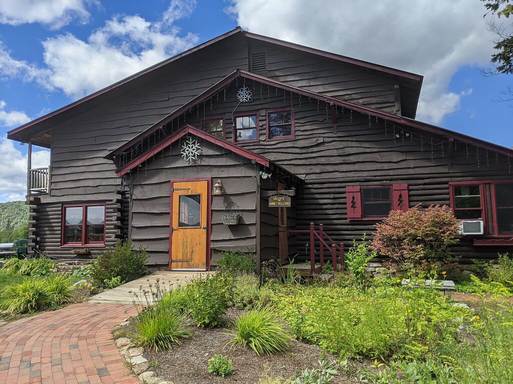
 

Cycle the Erie, Days 7-8: Schoharie Crossing, Mabee Farm, Cohoes Falls to Finish Line in Albany of 400-Mile BikeTour


Outside of Conajoharie, a Cycle the Erie rider stops off to buy some fresh-baked cookies © Karen Rubin/goingplacesfarandnear.com

By Karen Rubin, Travel Features Syndicate, goingplacesfarandnear.com
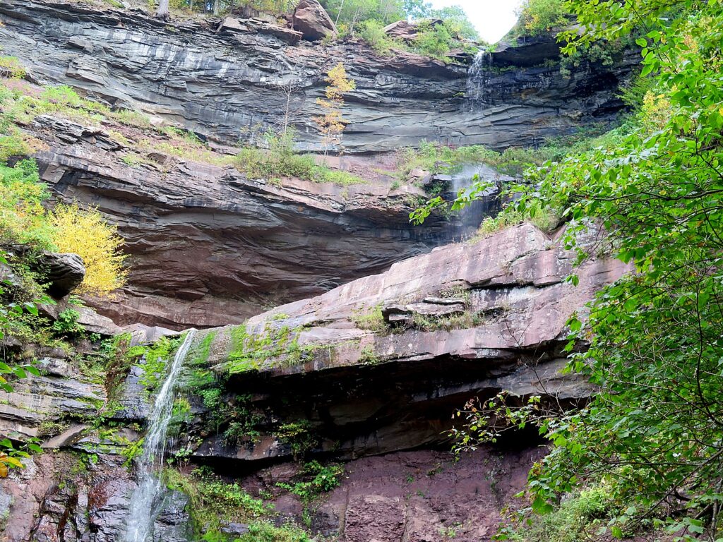
A highlight on Day 7 of Parks & Trails NY’s annual 8-day, 400-mile Cycle the Erie biketour from Buffalo to Albany is Schoharie Crossing State Historic Site. It looks fairly innocuous at first, a farm house along the canal, but here is the only place where you can see all three alignments of the Erie Canal – the 1825 “Clinton’s Ditch”, the 1836 expanded canal and the modern, 1918 “Barge Canal.”  The house, now a visitor center, contains a fascinating exhibit and is adjacent to outlines of Fort Hunter, an 18th century fort and trading post, remarkably only discovered after Hurricane Irene in 2011.

Schoharie Crossing State Historic Site dates from colonial times; it was a trading post. Here you can see all three incarnations of the Erie Canal © Karen Rubin/goingplacesfarandnear.com

The historic flooding caused the Schoharie Creek to breach its banks and destroyed the site’s parking lot. After the flood water receded, a number of stone walls and numerous artifacts associated with Fort Hunter emerged. Excavations revealed flat stone foundations upon which a fort wall and 24-foot square blockhouse would have been constructed.

After the archaeological work was completed, these original fort foundations were preserved by reburying them. Their exact locations are now represented on the surface with modern stone pavers. Artifacts recovered during excavation included a mix of domestic and military objects that represent the site’s Mohawk and British occupants. Dates associated with the artifacts suggest that the blockhouse saw greatest use from the 1740s to 1760.

Though you don’t really see anything of Fort Hunter, it points to how significant this area was in colonial times: Schoharie was a place of key interactions between Europeans and Indians, setting up a later clash of cultures.

Outlines of the foundation walls of Fort Hunter were revealed after Hurricane Irene in 2011© Karen Rubin/goingplacesfarandnear.com

During the 1600s, the British and French competed for control here. In the 1690s, the British forged an alliance with the Iroquois to establish a permanent structure – a fort/trading post – in order to solidify their standing.

The Indians at the time of the Revolutionary War were settled on farms and in towns. They employed European style farming techniques, lived in houses, and the gender roles started to shift away from the matriarchal society to male-dominated, copying the Europeans.

By the time of the Revolutionary War, there might have been about 10,000 Indians living in the area.

“They didn’t have a concept of property ownership. They were outnumbered early on” largely because of the diseases the Europeans brought that wiped out large numbers of the population, and over-trapping which pushed many further west.

“They were very good at diplomacy – well organized – and controlled access to the waterways. They played the European powers,” David Brooks, Education Coordinator says.

East Guard Lock – the original 1820s “Clinton Ditch” canal – at Schoharie Crossing State Historic State © Karen Rubin/goingplacesfarandnear.com

Historic photo of the lock at Schoharie Crossing © Karen Rubin/ goingplacesfarandnear.com

Most interesting at Schoharie Crossing is you can stand over the East Guard Lock – the original 1820s “Clinton Ditch” canal (now overgrown) – and see the same scene, minus water, as depicted in a historic photo.

Facing the other direction, standing beside the water, you can look over to what remains of the Schoharie Creek Aqueduct, built between 1835 and 1841 for the enlarged canal. This once grand 14-arch, 624-foot long aqueduct carried the canal above and apart from the Schoharie Creek (it enabled the canal to continue to function during flooding). The aqueduct was abandoned in 1917 when the Barge Canal opened on the Mohawk River, and over the years it declined so only six of the arches remain.

What remains of the Schoharie Creek Aqueduct © Karen Rubin/ goingplacesfarandnear.comA short bike ride further along the trail, you can visit Yankee Hill Lock #28 and the Putman Canal Store – the last double lock that was completed in eastern New York. The Putman’s Lock Grocery was constructed in 1856 and owned by the Garrett Putman family into the 1900s. (Schoharie Crossing State Historic Site, 129 Schoharie St., Fort Hunter, NY 12069, 518-829-7516, [email protected]).

Putman Canal Store sits amidst at the convergence of the three Erie Canals © Karen Rubin/goingplacesfarandnear.com


Mabee Farm

The initial appeal for me to join Parks & Trails NY’s annual Cycle the Erie bike tour was the exciting prospect of biking 400 miles, point to point, mostly without cars (and mostly on a flat trail), across New York State, with support services to carry our gear and host meals. But each and every day, I am pleasantly amazed at the array of sites to explore and discover. The Parks & Trails NY people who have designed the tour not only arrange visits at important sites along the way, but for morning and afternoon rest stops at interesting attractions that you might not have considered visiting on your own.

This is the case for our afternoon rest stop (at Mile 33.6), at the Mabee Farm Historic Site, which also houses the Schenectady Historical Society Museum.

Here, you can visit the Mabee’s 1705 Dutch-style Stone House, which was owned by the Mabee family until 1999.

This is one of the oldest homes in New York State and the oldest in the Mohawk Valley. It was first built in 1670 by Daniel Janse Van Antwerpen, who, it is believed, opened it as a fur-trading post. The property was sold to Jan Pieterse Mabee in 1705 and the house stayed in the Mabee family for a remarkable 288 years. It was given to the Schenectady County Historical Society in 1993 by George Franchere, the last descendant of the Mabee line, for the purpose of being a museum and education center.

Mabee’s 1705 Dutch-style Stone House, which was owned by the Mabee family until 1999, This is one of the oldest homes in New York State and the oldest in the Mohawk Valley © Karen Rubin/ goingplacesfarandnear.com

It is a surprise to most who visit these colonial sites to learn that slavery was practiced here, beginning after Jan Mabee’s death in 1725 and ended 100 years later in 1827 with Jacob Mabee, his great grandson (when New York State abolished slavery). Among the 583 original documents from the farm are three bills of sale for slaves, wills giving slaves to children and a receipt from the Crown Point Expedition in 1755 when a trusted slave, Jack, was sent to Fort Edward and Lake George with supplies, two weeks before the Battle of Lake George.

“What is significant about the Mabee family is that they were ordinary,” the docent says.

Jan Mabee, born in Holland, bought the property from a neighbor in 1705, and lived in the cellar as he built the house. Jan and his wife Annette had 8 kids.

The house partly made out of stone; the wood beams are 1000 years old.

Jan was likely involved in the illegal trapping business. His wife was part Mohawk so they had a good relationship with the local Indians. The Dutch were tolerant and fair with the tribes (it was the British and French who cheated them).

Over the years, the house was turned into the Mabee Inn. Simon Mabee farmed the land and when he died, he left everything but the Inn to his son, Jacob;  he left the inn to his two sisters.

It turns out that the Mabee farm is more than a history lesson, but a study of a dysfunctional family.

“Jacob was not a nice man. Jacob evicted them. He hired a carpenter and flipped the staircase around so they have no way to get up to the second floor. He built a new door. The sisters lived in one room. Jacob died 6 years later and the land passed to Margaret.”

The Mabee sisters were confined to just one room of the house by their brother, Jacob © Karen Rubin/goingplacesfarandnear.com

Just outside the house is the family cemetery. You can visit the 1760s Nilsen Dutch Barn, see the beautiful Mohawk River flow alongside the site. Tied to the dock or parked behind the Dutch Barn is a reproduction 18th century bateaux, the De Sagar and the Bobbie G , which provides an idea of how goods were shipped up and down the river.

Mabee family cemetery © Karen Rubin/goingplacesfarandnear.com

During our visit, a country fair is underway.

(Mabee Farm Historic Site, 100 Main St (Rte 5s), Rotterdam Junction, NY 12150, 518-887-5073, schenectadyhistorical.org/sites).

The Schenectady History Museum offers wonderful exhibits that follow the history of the county from the early settlers who traded with the Indians and farmed, to the 19th and 20th century. There is a collection of early American artifacts of the American Revolution era, the impact of the Erie Canal, and artifacts that show the role this area played in technological innovation and industrialization because of General Electric and the American Locomotive Company.

Coming upon a country fair at the Mabee Farm Historic Site © Karen Rubin/goingplacesfarandnear.com

We ride a newly paved bike path into Schenectady.

In Schenectady, they have arranged for us to leave our bikes in a “corral” so we can explore the city.

I spend my time riding through The Stockade District. The oldest neighborhood in Schenectady, the Stockade District has been continuously inhabited for over 300 years, and is New York State’s first Historic District (since 1962) with an amazing assortment of historic buildings with more than 40 pre-Revolutionary houses and architectural styles that include Dutch Colonial, Georgia, Federal and Victorian.(You can access a cell phone walking tour at www.historicstockade.com.)

Riding through the Stockade District in Schenectady, New York State’s oldest neighborhood and first historic district, it has been continuously inhabited for 300 years. © Karen Rubin/goingplacesfarandnear.com

I pull myself away to finish the ride to get to the Jewish Community Center at Niskayuna, a suburban neighborhood of Schenectady, where we camp. This is an incredible facility with a country-club like outdoor pool (indoor pool also).  I get there in time to swim.

This is the last night of our journey – and what a journey it has been. They have an elaborate “gala” dinner starting with beer and wine and hors d’oeuves, a fantastic catered dinner, and a “No Talent” talent show and a fashion show put on by the van drivers and baggage handlers of all the stuff that is still in the Lost & Found. And awards: like the most bones broken; the most crashes (5); most flat tires (4); the youngest solo peddling cyclist (8), the oldest cyclist (84). Side-splitting fun.

Truck drivers put on “fashion” show of Lost & Found items on last night of Parks & Trails NY’s Cycle the Erie bike tour © Karen Rubin/ goingplacesfarandnear.com

Day 8, Schenectady to Albany, 31 Miles

Our last day, the eighth of our 400-mile journey which began in Buffalo, is a breeze. Just 31 miles from Niskayuna into downtown Albany where most of us have parked our cars to take the bus to Buffalo for the start of the tour. The weather is perfect – sunny, cool.

Riding along the Mohawk River © Karen Rubin/ goingplacesfarandnear.com

The highlight of today’s ride comes at Mile 12: Cohoes Falls, one of the most powerful falls east of the Rockies which posed a major challenge for the Erie Canal engineers. Some of our riders who started in Buffalo were able to visit Niagara Falls and now are ending with Cohoes Falls, outside of Albany. What a way to bookend this journey.

Cohoes Falls, one of the most powerful falls east of the Rockies, posed a major challenge for the Erie Canal engineers © Karen Rubin/ goingplacesfarandnear.com

Just next to the falls are 19th century brick structures, built as factories that have been repurposed to apartments.

Our ride takes us onto Peebles Island State Park, Waterford, where our final rest stop of our journey is arranged at the Erie Canalway Visitor Center. During the Revolutionary War, American forces prepared defenses here to make a final stand against the British. (518-237-7000, www.eriecanalway.org).

Biking over the bridge from Peebles Island State Park © Karen Rubin/ goingplacesfarandnear.com

We ride through city streets – notable for the American flags that are flying – neighborhoods that have seen better days but nonetheless evoke a folksy feel of Americana.

Now, we come to the Hudson River, a goal in itself. We ride along a beautiful paved trail beside the Hudson that takes us into downtown Albany, New York State’s 300-year-old capital, and finally, cross the finish line, 400 miles.

You realize you haven’t just traveled 400 miles, but 400 years of American history, back to its very founding. And you understand so much better, the trajectory from colonialism and the clash of cultures with Native Americans, the transition from an agrarian economy to the Industrial Revolution, the wave of immigration and innovation, the progressive movements that followed and precipitated the explosive changes in society: labor, Women’s Rights, abolition. Most interesting of all, is how all of these seeds still flower in contemporary culture and politics. All of this unfolds before our eyes, mile by mile.

Youngest self-pedaling rider, 8-year old Sam Demeritt, with 11-year old brother, crosses the finish line in Albany, after biking 400-miles from Buffalo on the Cycle the Erie bike tour. Family, from Malta NY, also included Mom and Dad and 4-year old brother. © Karen Rubin/ goingplacesfarandnear.com

Biking adds an extra dimension to sight-seeing. It’s physical participation, an endorphin rush, an immersion. It puts you into the scene rather than merely observing – a participant, a part of the scene, rather than apart from it.

The tour is meticulously planned, well organized and supported, and how we have such wonderful opportunities to meet people from around the country (36 states are represented) and around the world (travelers from a half-dozen countries are here). A gathering like this prompts such fascinating interactions as people share their backgrounds, perspectives.

All of us have been so impressed by how well organized the trip is – from the truck drivers who pick up and drop off our gear each day, to the people who set up our breakfast and dinners and the morning and afternoon rest stops, to the SAG drivers and the riders who are there to assist if we have a problem. To the lecturers, the massage therapist and bike mechanics who travel along with us like camp followers.

Ah, this is the life. Camping on the grounds of the Schenectady Jewish Community Center in Niskayuna © Karen Rubin/ goingplacesfarandnear.com

For those who prefer not to set up their own tent (or take advantage of “indoor camping”) there is Comfy Campers, the closest thing to “glamping”. You have the luxury of having someone set up tent so it’s ready when you arrive, especially if it is raining, where you get a remarkably comfortable air mattress to put your sleeping bag on (amazing what a difference this makes), and take the tent down in the morning so you can just hit the trail again. Not to mention a fresh towel each day! Also, they set up a separate comfortable sitting area under canvas with charging stations. Those who want can also pay for coffee in the morning.

Camping on the grounds of the Schenectady Jewish Community Center in Niskayuna © Karen Rubin/goingplacesfarandnear.com

We are told that the finish line right at the Albany visitor center closes at 2 pm; UPS is on hand for those who need to ship their bikes home; a shower is made available nearby at the North YMCA; the municipal parking lot where many of us have parked our car is just next door; our luggage is deposited in the parking lot behind the visitor center for us to claim; some of us will take the shuttle bus back to Buffalo.

This has been one of the best, most memorable trips I have ever taken because the end-to-end Cycle the Erie ride hits on all cylinders: physically active and challenging so you feel you have really accomplished something at the end; communal – being with like-minded people from all over the country and the world, rich in heritage, scenic, affording real exploration and enlightenment. It’s no wonder that so many of us (myself included) have done it multiple times. (On this trip, the oldest cyclist, 84-year old, has done the tour 12 times.)

Cycle the Erie is an annual event, but you can download the route and do it all, or do segments as you like. A novel way to do it is by houseboat  through companies like Mid-Lakes Navigation Co., Ltd. (11 Jordan St., PO Box 61, Skaneateles, NY 13152, 315-685-8500, 800-545-4318, [email protected],www.midlakesnav.com, and take a bike onboard, providing a unique experience. (Be aware: they pull the plug on the Erie Canal – actually drain the water – from November through April).

The 20th Annual Cycle the Erie Canal ride is scheduled July 8 – 15, 2018 (www.ptny.org/canaltour). In the meantime, you can cycle the trail on your own – detailed info and interactive map is at the ptny.org site (www.ptny.org/bikecanal), including suggested lodgings. For more information on Cycle the Erie Canal, contact Parks & Trails New York at 518-434-1583 or visit www.ptny.org.

The entire Erie Canal corridor has been designated the Erie Canalway National Heritage Corridor, Waterford, NY 12188, 518-237-7000, www.eriecanalway.org.

More information about traveling on the Erie Canal is available from New York State Canal Corporation, www.canals.ny.gov.  

See also:

Cycle the Erie: 400 Miles & 400 Years of History Flow By on Canalway Bike Tour Across New York State

Cycle the Erie, Day 1: In Lockport, See Erie Canal Engineering Marvel, ‘Flight of Five’, Cruise Thru Double Locks, and Go Underground to Fathom Rise of Industrial Revolution

Cycle the Erie, Day 2-3: A Sequence of Charming Canaltowns, Pastoral Landscapes, Punctuated by City Birthed by ‘Mother of Cities’

Cycle the Erie, Day 4: Seneca Falls to Syracuse, Crossing Halfway Mark of 400-Mile Biketour

Cycle the Erie, Day 5: Deep Dive into The Erie Canal: ‘Mother of Cities’, Empire Builder, Wonder of the World

Cycle the Erie: At Fort Stanwix, Rome, Time Travel Back to America’s Colonial, Native American Past

Cycle the Erie, Days 6-7: Erie Canal Spurs Rise of America as Global Industrial Power

_____________________________

© 2018 Travel Features Syndicate, a division of Workstyles, Inc. All rights reserved. Visit goingplacesfarandnear.com,  www.huffingtonpost.com/author/karen-rubin , and travelwritersmagazine.com/TravelFeaturesSyndicate/. Blogging at goingplacesnearandfar.wordpress.com and moralcompasstravel.info. Send comments or questions to [email protected]. Tweet @TravelFeatures. ‘Like’ us at facebook.com/NewsPhotoFeatures