By Karen Rubin, Travel Features Syndicate, goingplacesfarandnear.com
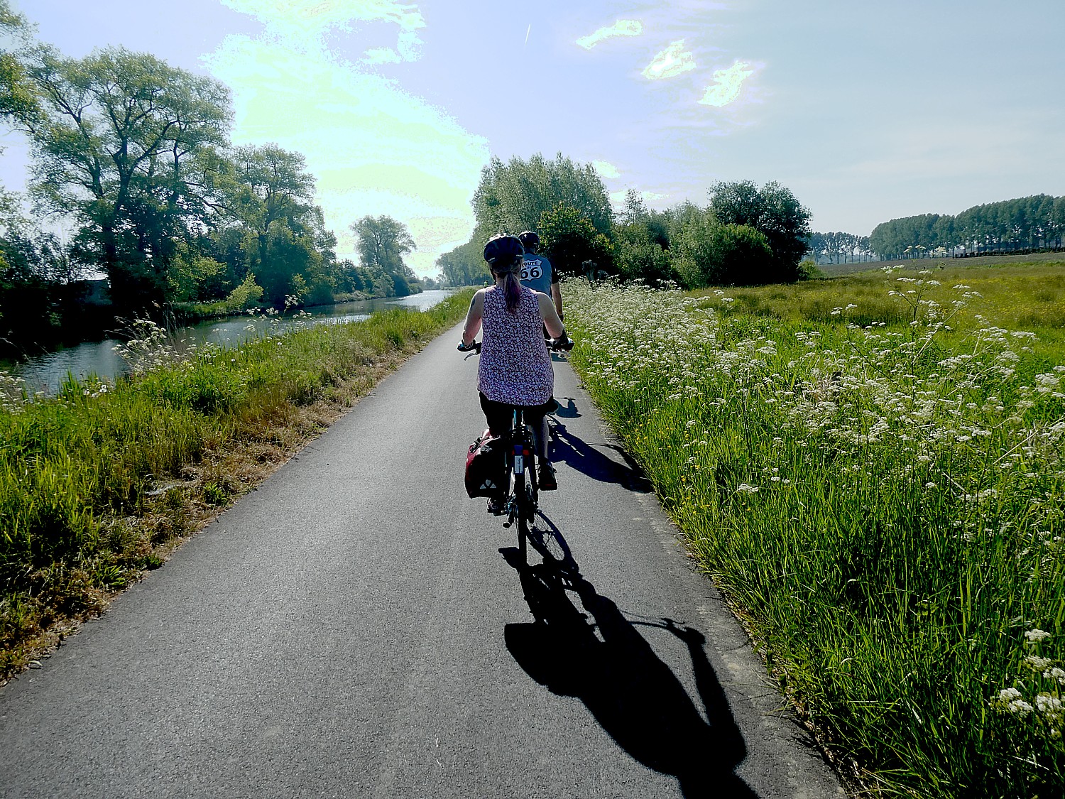
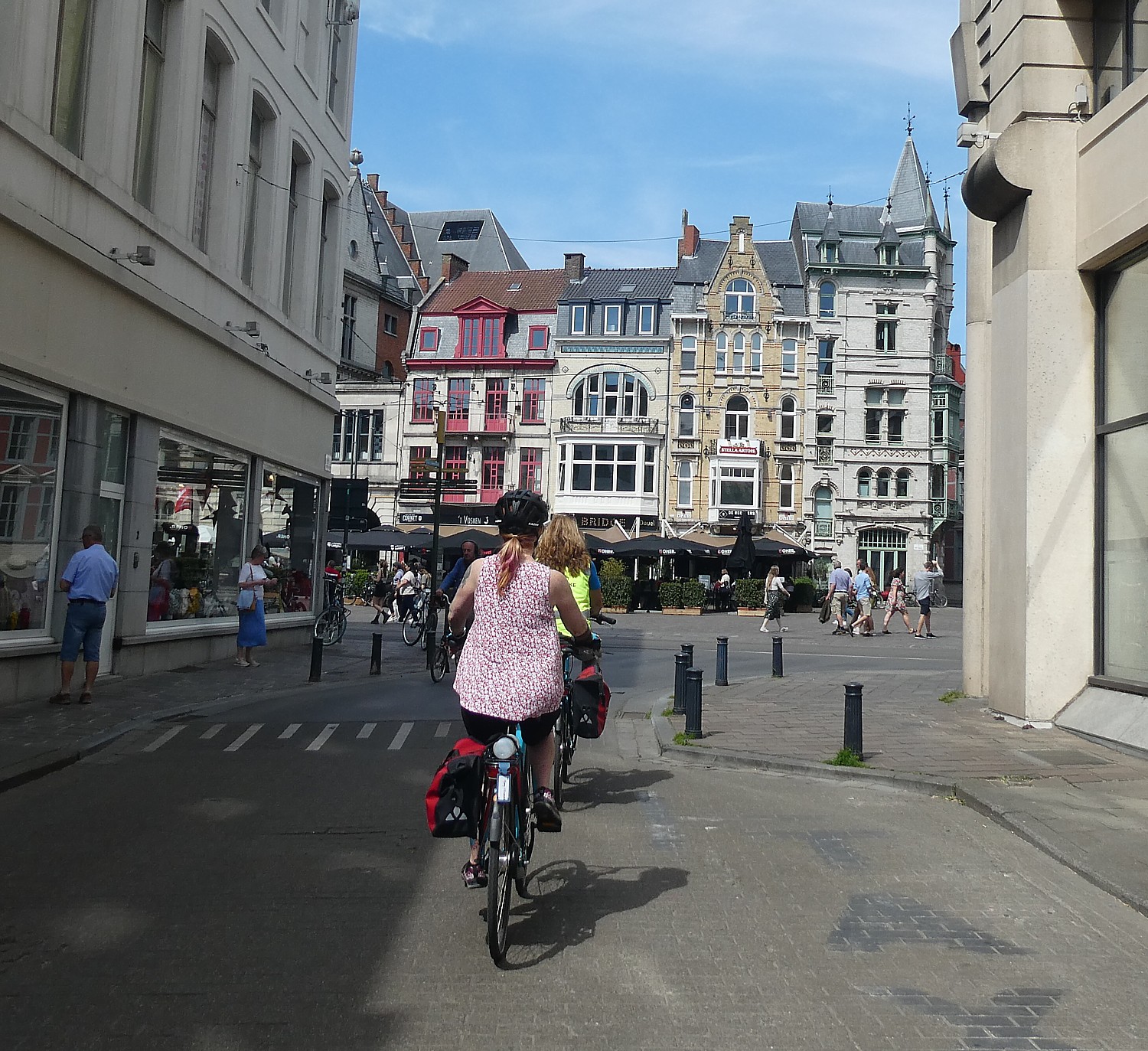
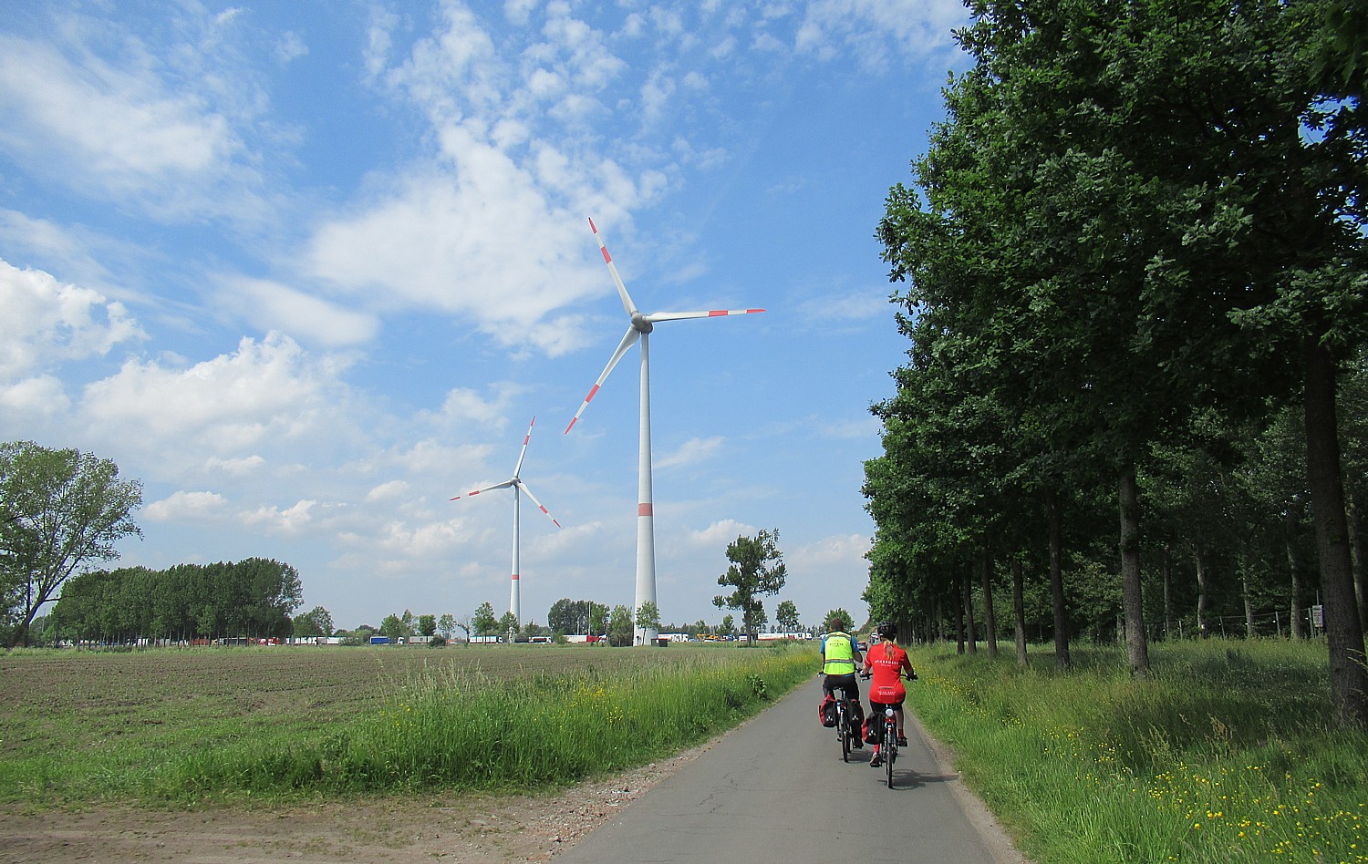
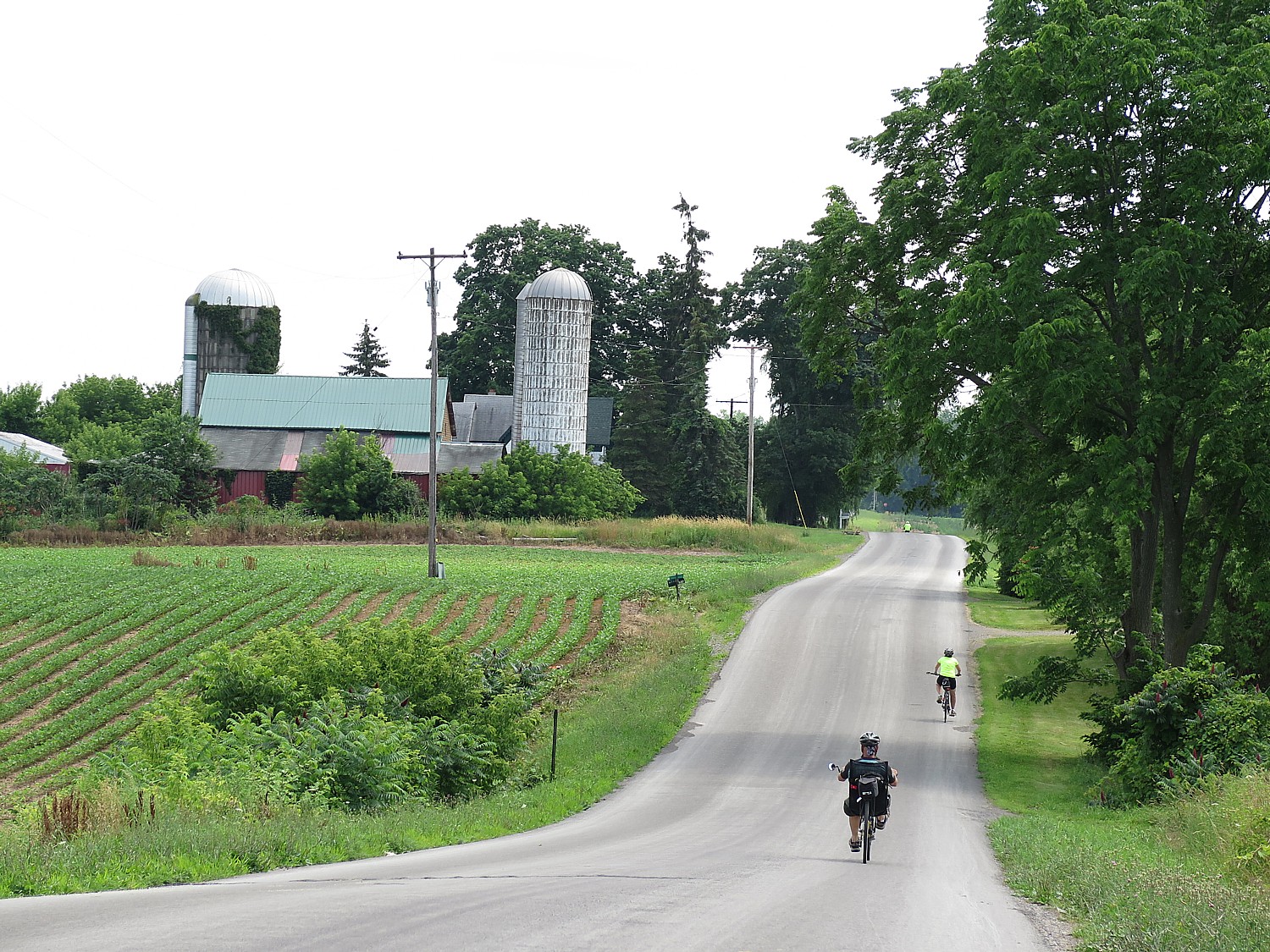
Though technically our Day 2 of BoatBikeTours’ eight-day Bruges-Amsterdam bike tour, our first ride takes us 35 miles from Bruges to Ghent along waterways, through farmland and villages and we get oriented to how they organize the ride, the gorgeous bikeways, local culture, and stunning scenery.
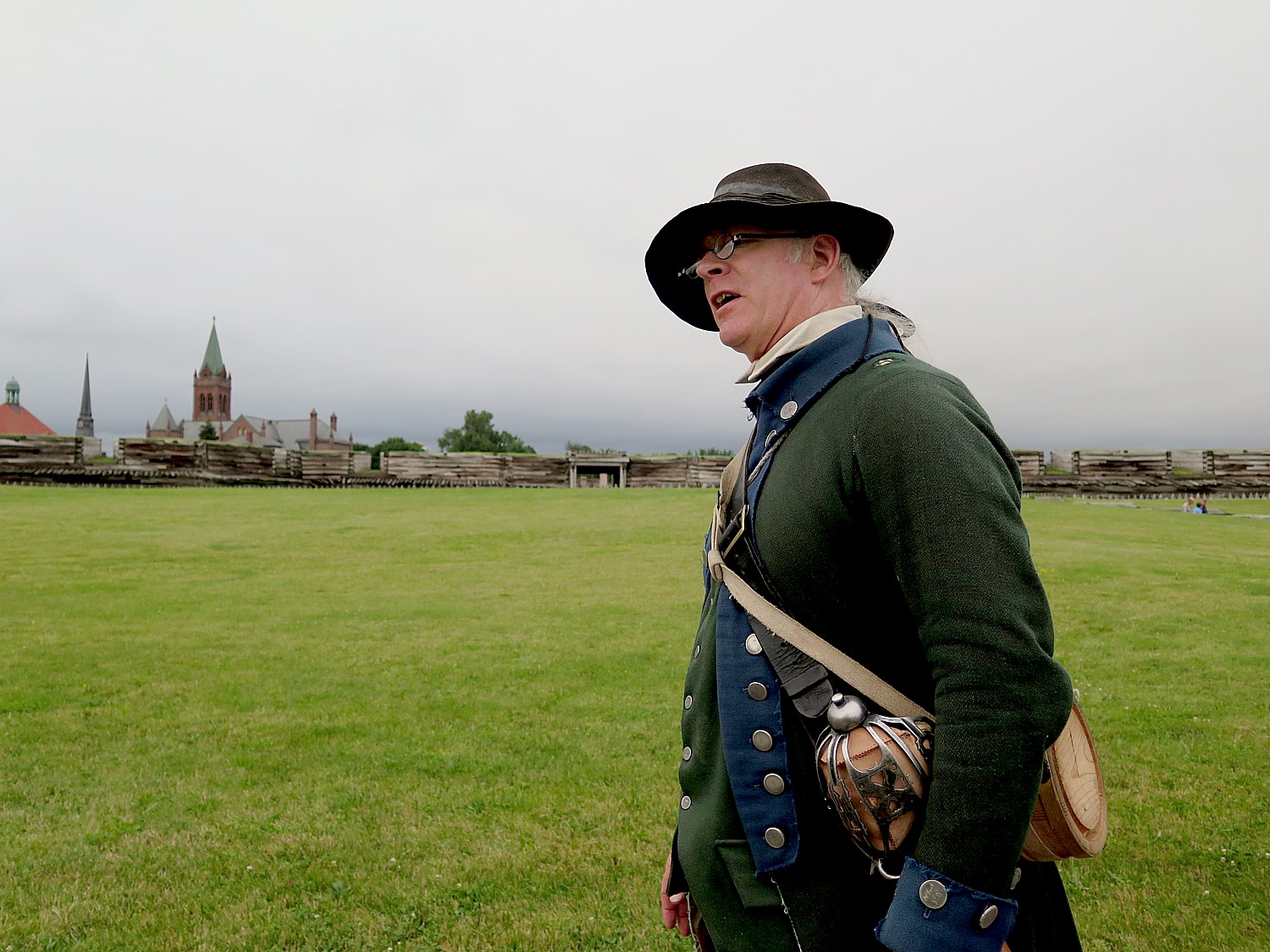
We stop at a very interesting Canadian War memorial – it’s actually the mangled tank turned into sculpture – and our leader, Arnold Thurkow (who spent a career in the military) tells us the story of these World War II defenders.
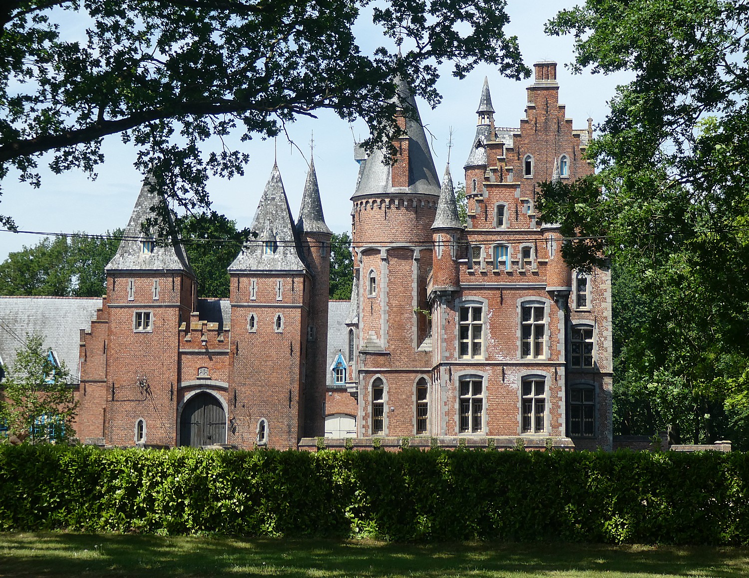
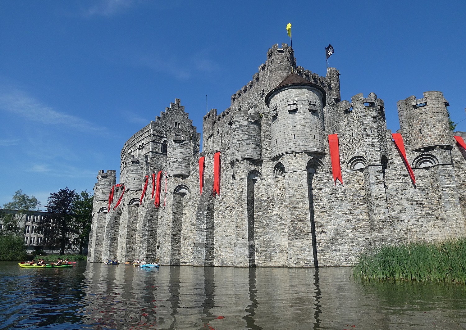
We stop next at Castle Lovendegem where our leader, Corrie Stein, tells the story of this place: it is privately owned by a Paris-based prominent wine merchant who grew up here and uses the castle for wine tastings (funny how contemporary history sounds more like gossip). We have a coffee break in the town of Aalter where I get to wander around and look into a bakery and a church.
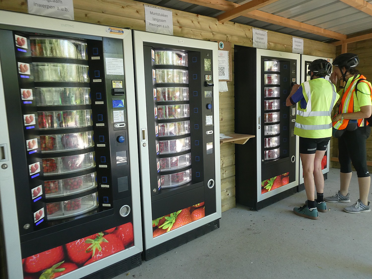
One of the most unusual sights along the trail that winds beside farms comes when Corrie stops at vending machines where you can purchase a basket of the freshest, sweetest strawberries you have ever savored (Corrie says there are even vending machines to buy fresh chicken!).
As we set out, we quickly see just how popular cycling is in Belgium – one biking club after another and families on an outing, come as a steady stream on these magnificent bike paths, trails and dedicated roadways.
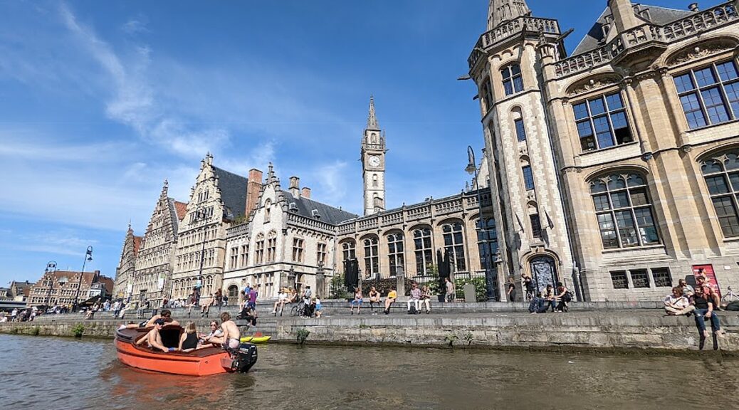
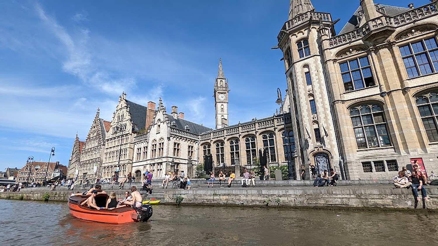
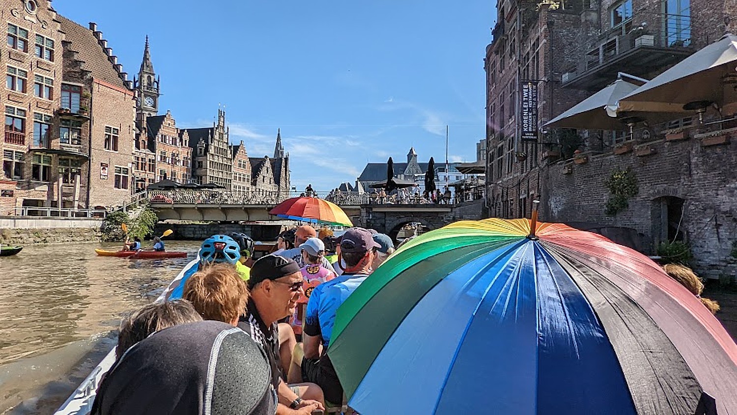
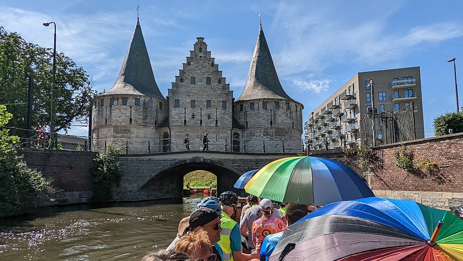
Our group on this first day of riding has been a bit slow (not my fault, I swear) so we have divided into two. I join the slower group so I don’t feel self-conscious shooting photos as I ride. As a result, we reach Ghent about 40 minutes after the first group, just in time to rush to meet up with the rest of our group for the pre-arranged sightseeing canal boat tour of the city (but the other group had 40 minutes to explore – we won’t make that mistake again).
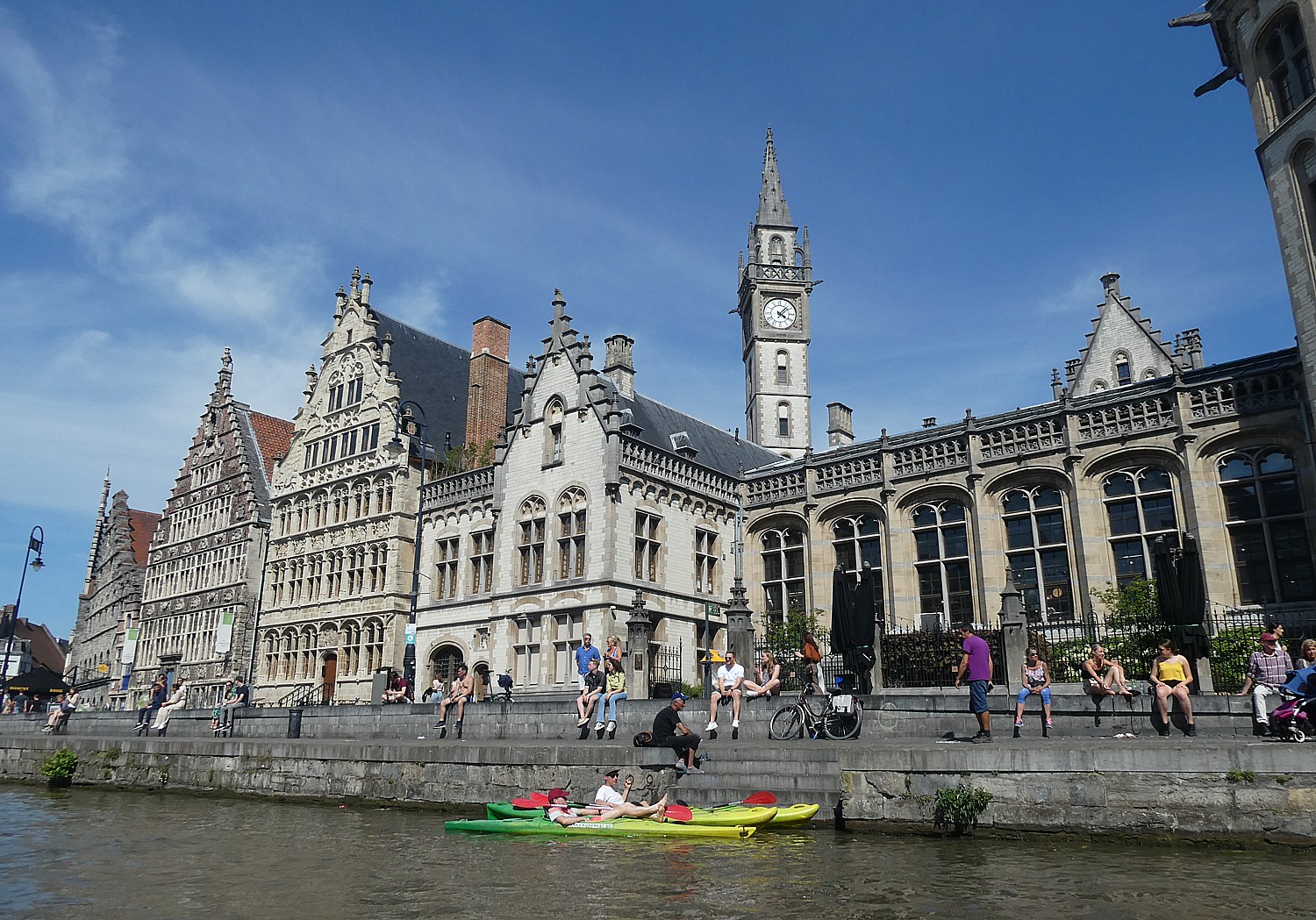
During the sightseeing canal boat trip, the guide points out a grain depot from the 1200s; a toll booth; a tiny tax house; a 16th century guild house; one of the historic city gates; a fish market that operated from the 15th century to the 1950s when it became a car wash but now is the visitor center. He points out a statue of a boy peeing – it’s a famous image – but he said it actually represents the leather tanners union because they used the urine of boys to smooth the leather (it was tasted to determine if the urine was of good quality), so there are many of these pissing statues.
Ghent was one of first industrialized cities that made textile barons wealthy. But the men, women and children who worked in factories lived in pollution, overcrowding and squalor – they worked in 16 hour shifts for low wages. This, along with the university, helps explain why Flemish Socialism was born in Ghent (still a liberal/progressive city, with Socialists still in the majority).
He points to a cannon dating from the 15th century that was installed here in the 16th century for defense. “It was only used once – two people died operating it. Today it is a peace symbol.”
Ghent, I learn, was the birthplace of Charles V who became the Holy Roman Emperor. At the time, Ghent was the 3rd largest city in Europe. To honor their favorite son for his 500th birthday, the city built the Bridge of Imperial Delight decorated with his bust. (Nearby is a sign, “Boat Tourism. Noise Pollution.)
We see a formidable castle, called the Hall of Justice, which (interestingly? ironically?) became a torture chamber. In 1949, students occupied the Castle to protest rising beer prices. “They didn’t change anything, but every November, they celebrate.”
After the canalboat tour (really excellent and appreciated), we still have another few miles to ride to get to St. Michael where our ship, the Princesse Royal is docked.
This day’s ride turns out to be the longest and also the hottest of our trip and when we return to the ship we are greeted with fruit-infused ice water and snacks.
We relax onboard the Princesse Royal and enjoy our dinner: a delectable pumpkin soup with basil; beef stew prepared like chili; a superb mango sorbet for dessert.
An Artist’s Gallery
Day 3’s ride, from Ghent to Merelbeke is 32 miles (or 24 for those wanting a shorter route) to Dendermonde-St. Amands.
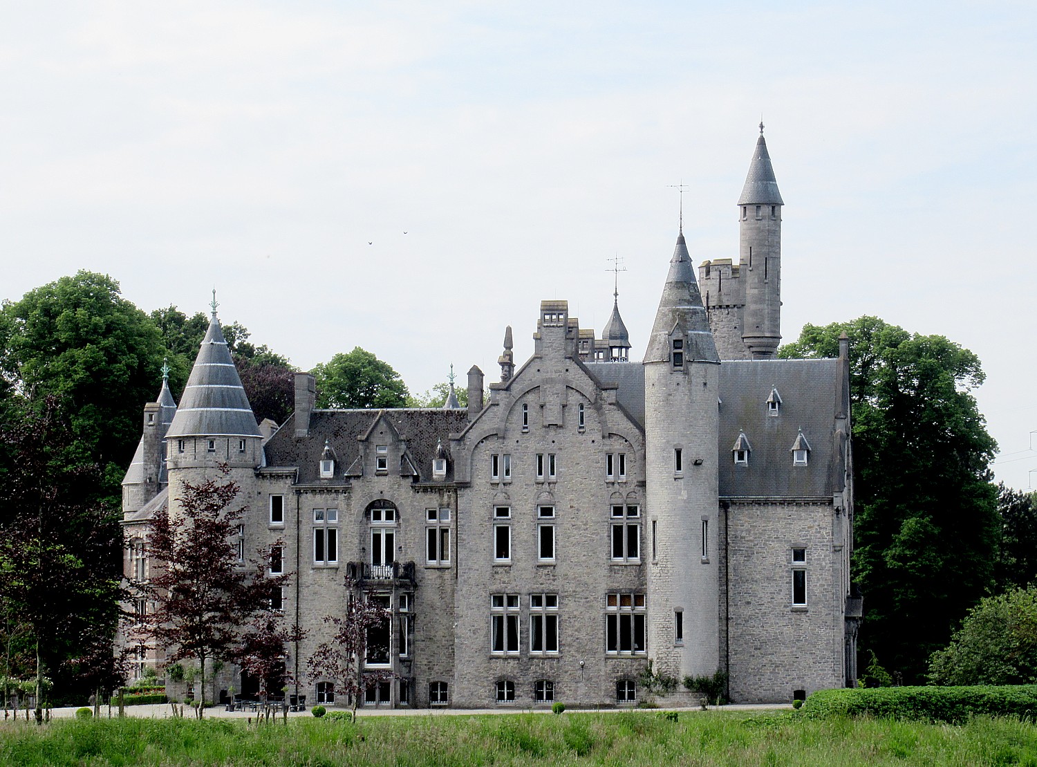
We start cycling along the canal and stop at Castle Van Laarne, and visit the small village for our coffee break.(The sign reads: Kasteel Van Laarne-Dit Domein is Prive Eigendom”)
We ride on to Lake Donk, Belgium’s second biggest lake and a popular recreational center where we have the relaxing lunch we packed from the ship.
Continuing on we take a free ferry across a small river, and bike along the river.
We ride into the city of Dendermonde. Corrie points out a statue of Queen Astrid, who is like Belgium’s Princess Di. She died in the 1920s in a car accident when her husband was driving. “He was so distraught, he couldn’t bear to look at his kids and they were sent to live with someone else.” Many squares in the country have statutes to her. Across the way is the International Court of Justice, where apparently “smaller” conflicts than are handled at The Hague (mostly about money) are heard.
Corrie tells us about this town’s most unique and important festival, held every 10 years (the 2020 festival was delayed until May 28, 2022 because of COVID; 85,000 watched). There are banners all over the city featuring the Horse Bayard with four boys on its back.
The legend (which I really can’t understand why this would be celebrated), goes like this: Aymon, Lord of Dendermonde who was related to Charles the Great (Charlemagne), had four boys who were on track to become knights. One boy was very strong (and apparently aggressive) and had to have strong horse. Bayard, to match. The boy played chess with Charlemagne’s son and in a fit, killed Charles’ son. Charles took their father captive, told the boy that to get his father back, he would have to give up his horse, Bayard. Reluctantly, the boy gave up the horse, which Charlemagne had drowned.
So, every 10 years, the small town commemorates this event with a huge horse, 4 meters high, who carries 4 boys on its back. The boys who are chosen have to have grandparents and parents from here, be four boys born in a row (no sisters) and be between ages of 16-25.
Dendermonde also holds a Traditional Giants Parade, Katuit, each year on the last Thursday of August when three giants – lndiaan, Mars and Goliath – parade through the town, accompanied by 1000 actors in medieval attire, floats, bands, flag-tossers, professional street performers and torchbearers.
We bike to St. Amands where the ship is docked (actually next to another BoatBikeTours’ ship, the Magnifique IV) and can walk into this quiet village before dinner.
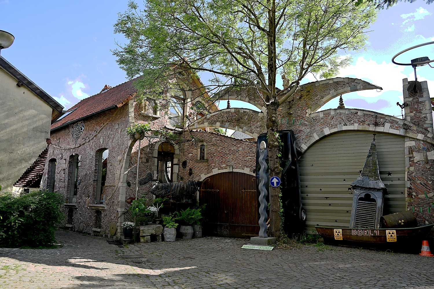
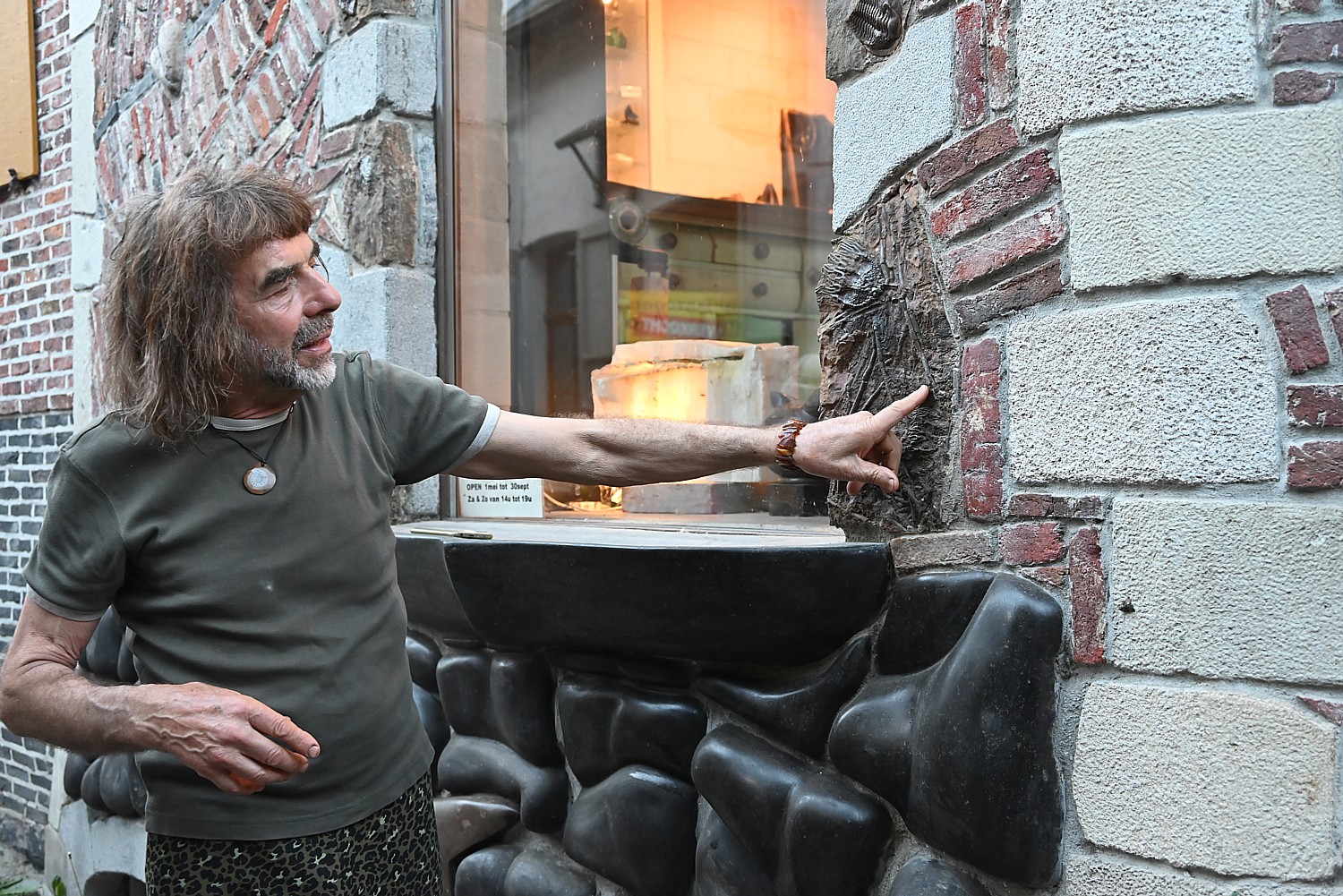
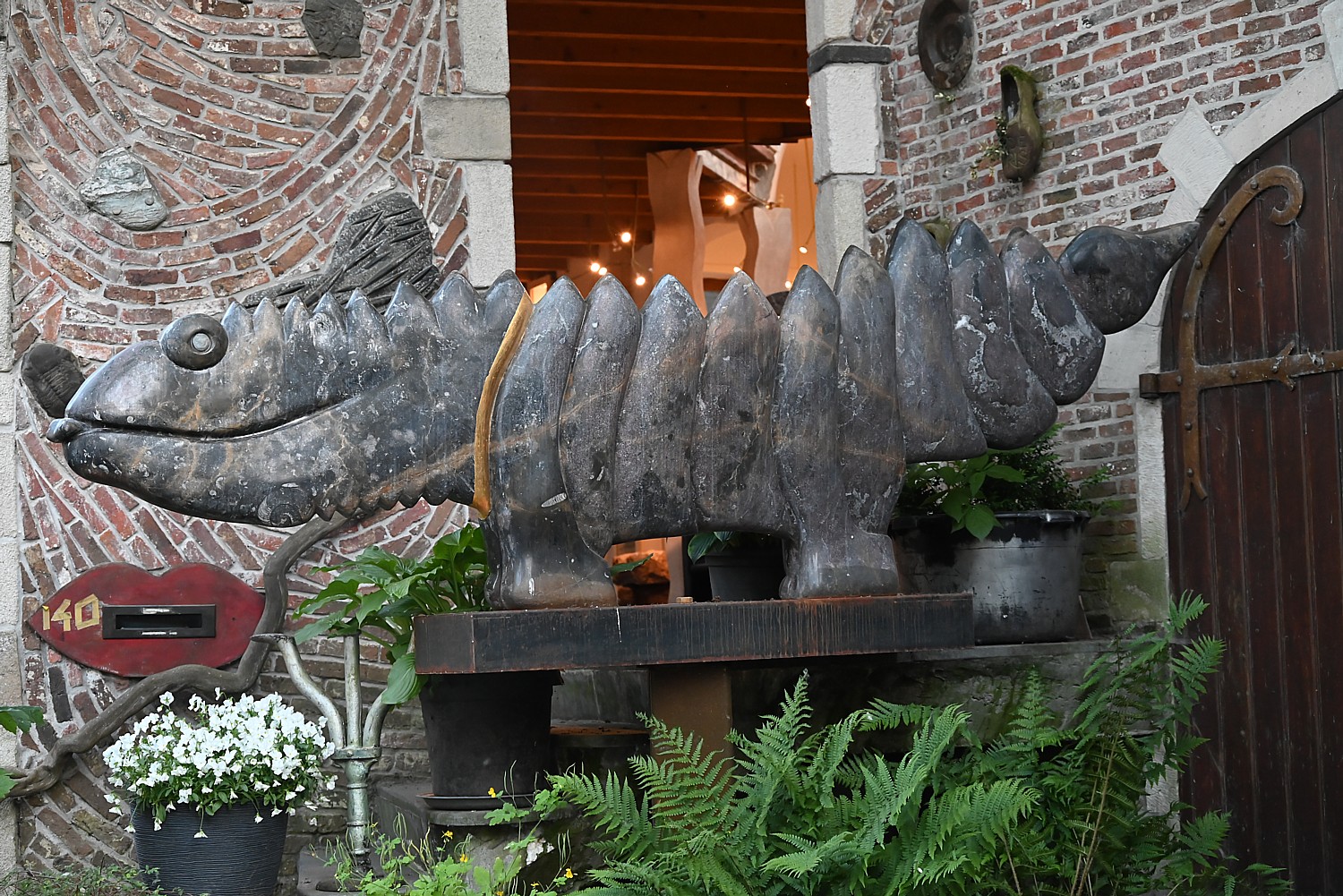
After dinner (beef carpaccio with truffles, pasta with salmon and lobster sauce), Corrie and Arnold lead us on an excursion to visit Sahara Stones, a gallery and home of artist Joris Maes and his wife, who gives us a tour and explains his extraordinary art.
Joris built his house and everything in it, and spends his winter in the Sahara, driving down in a van, to collect fossils and stones which he sculpts for his art. The fossils are embedded along with stones in the walls of his house. “The house is the history of my life,” he tells us.
The fossils, some of them absolutely enormous, encapsulate the history of earth, and Joris has turned them into rather marvelous sculptures – birds, animals. You think how the heck has he been able to acquire these pieces that you would think would be the nation’s heritage or in a museum. They are 360 million year old fossils, “before the continents formed,” he tells us. (sahara-art-stones.com)
On Day 4, we set out from St. Amands for a 30 mile ride to Antwerp (the shorter option is 21 miles).
We stop briefly to see a16th century castle which, Corrie tells us, was once owned by a cousin of William of Orange who led the Dutch revolt against Spanish King Philip II. The revolt – largely over religion (they call it religious freedom) began in 1568 and was finally won 80 years later. The castle is privately owned today.
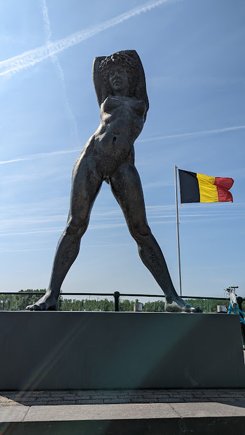
The cycle path follows the river. At Kruibeke, Corrie introduces us to what she calls their “statue of liberty” – a modern, sensuous statue of a woman, “curvey like the bends of the river.”
The town is significant because Gerardus Mercator, the 16th-century geographer, cosmographer and cartographer, most famous for creating a revolutionary 1569 world map, was born here (by accident – his parents were visiting relatives).
Mercator’s map represented sailing courses as a path of constant bearing, measured relative to true north (Rhumb lines)—an innovation that is still employed in nautical charts. In their day, they were as revolutionary as GPS, and improved navigation at a time when global shipping was the key industry contributing to a nation’s wealth.
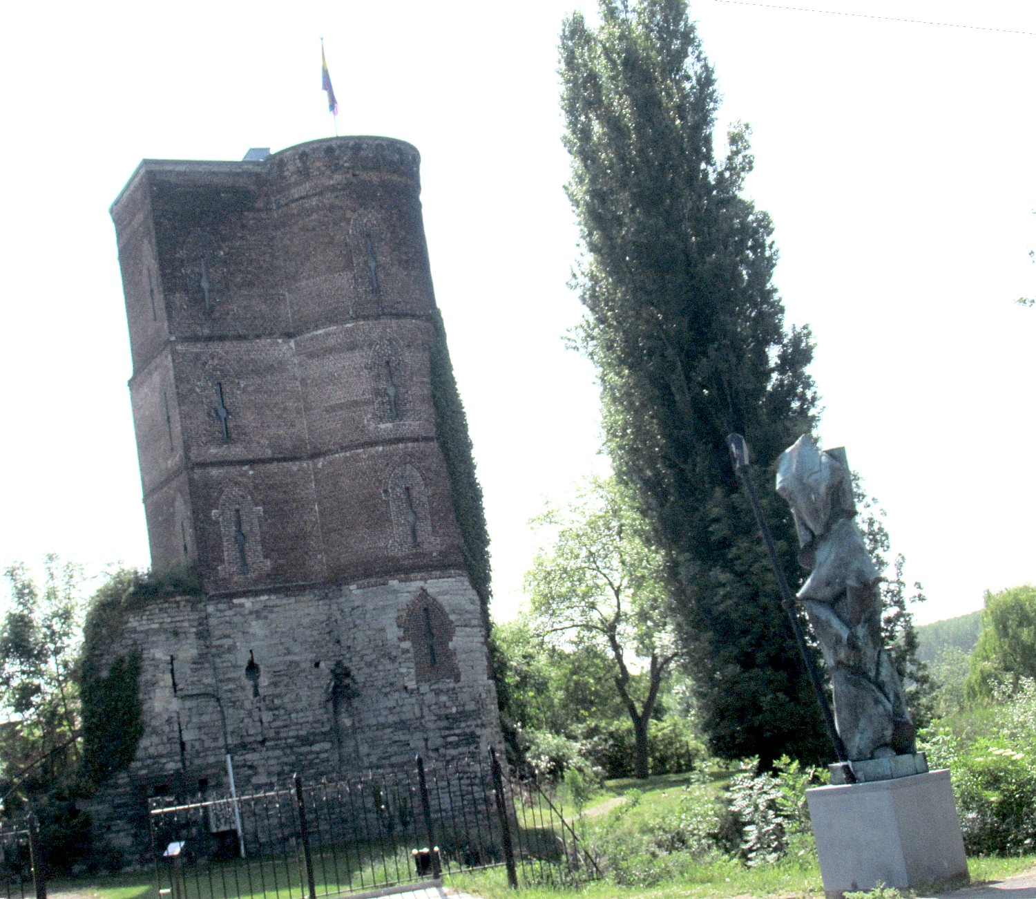
He wound up being imprisoned here in 1543 by the Catholic Church “for radical thinking. “When he couldn’t work, he became poor.” We ride passed Graventoren (Earl’s Tower) where he was imprisoned. There is also the remnants of a castle in Rupelmonde in the town of Kruibeke, where there is a statue of Mercator and a museum.
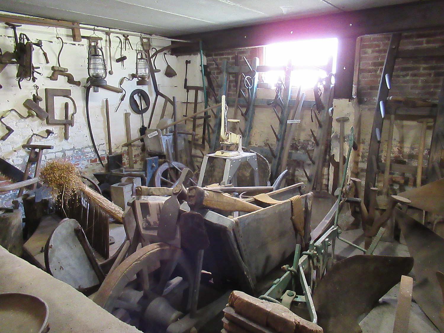
A bit further on, we stop to eat our picnic lunch at a restaurant that is also a farm museum, the VZW Museum De Schuur, with interesting antique implements that belonged to the proprietor’s husband (we see black and white photos of him). (www.museumdeschuur.be)
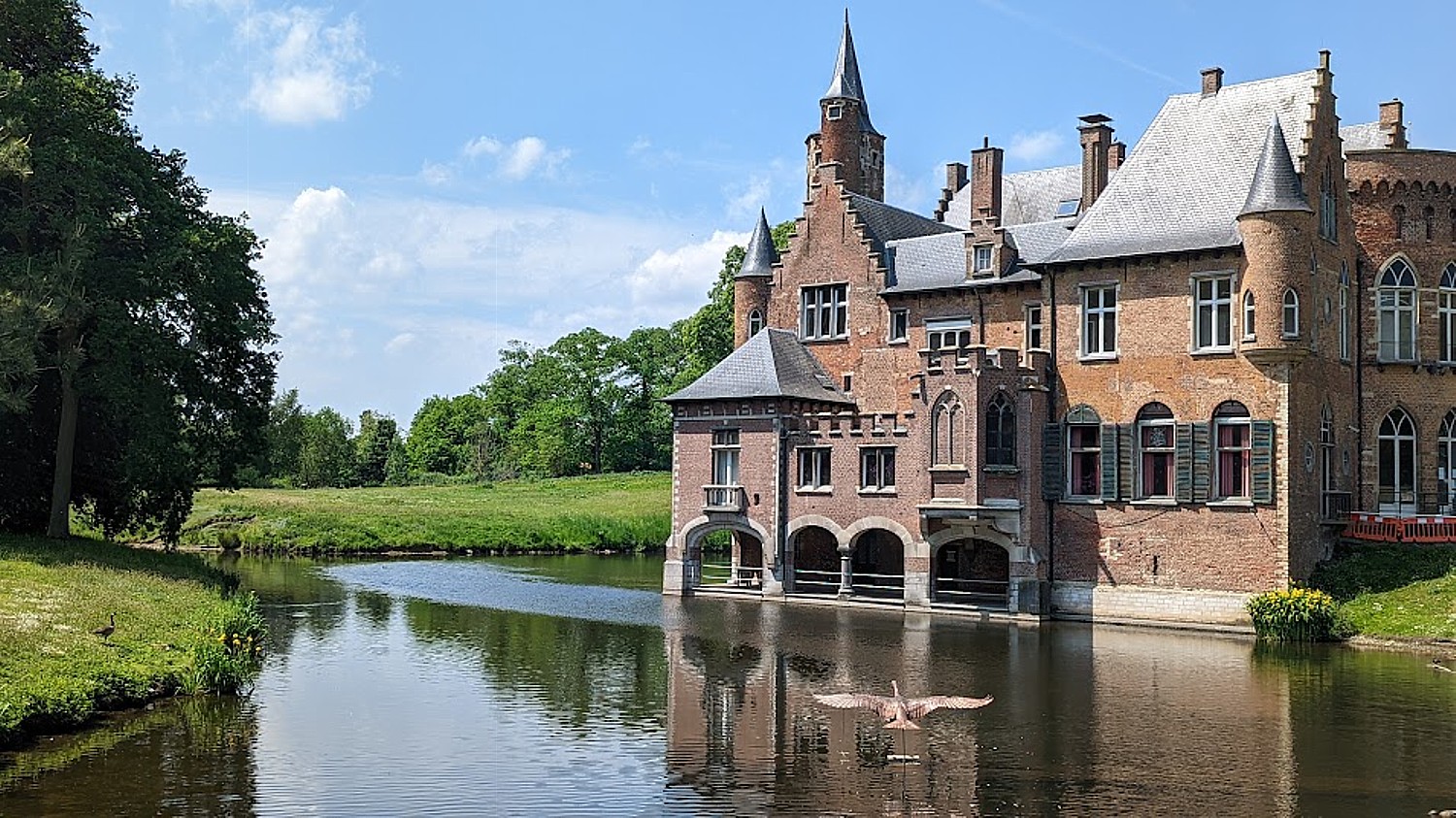
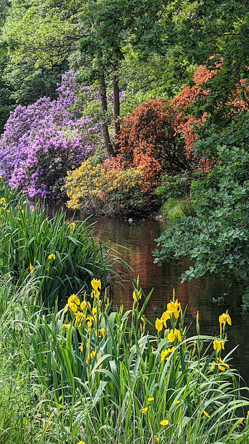
It is just down the road from a stunning (privately owned) castle (Kasteel Wissekerke) and garden which presents a gorgeous scene.
There has been a castle here since the 10th century, but the present one was largely built in the 15th century with lake, park and a suspension bridge. In fact, it is the suspension bridge, rather than the castle, that is of major importance: the bridge is one of the oldest surviving wrought iron suspension bridges in Europe, designed in 1824 by Jean-Baptiste Vifquain, an engineer from Brussels. “Though it only spans 23 meters, the bridge is of great industrial archaeological importance because of its historical and structural uniqueness,” notes read. The bridge, castle, gatehouse and pigeon tower were designated a protected historical monument in 1981.
Among the important people who lived at Wissekerke, was the influential family of Vilain XIIII –who were mayors of the town of Bazel for 139 years. In 1989, the castle was purchased by the town of Kruibeke, which has since handled the restoration work. The castle is also venue to many cultural activities, tours and exhibitions.
We hadn’t biked far from
the Hotel Alexander on the mainland of Venice in Mestre on the first morning of
a week-long self-guided bike tour that would take us some 300 miles following
the seacoast to Porec, Croatia, before I imagined: had I done this by myself as
I had originally planned, I would have been found weeks later wandering in a
wilderness. I was so grateful that by son could come along – his tech prowess
(and insistence on getting an app of our route) made all the difference.
Each morning, he would
unfurl the day’s Stage map and have his smart phone tucked into the plastic
case on the handlebars. Once underway (after a delightful breakfast in the
pre-arranged inns), I would be trying in vain to follow the cue sheets and do
mathematical gymnastics with the kilometers, and was so consumed with these and
watching for Eric ahead, and being enrapt by the scenery and taking photos,
that I would miss the mark the tour operator left on sign posts for each turn.
“It’s simple,” Eric says.
If you don’t see a mark, you go straight.” But what if you have missed the mark
that told you to turn? You could find yourself kilometers ahead before you even
have a clue you missed the turn and have no idea where to go back. At one
point, Eric installs the hang-out app on my phone so he can find me on his map
and I can see where he is, that comes in really handy when I miss a turn
altogether in the middle of Trieste.
But all of it becomes
part of the adventure – the excitement of doing, not just seeing, of becoming
immersed in a place or not knowing what will beyond the next turn.
The day before we set
out from Venice for the first stage ride, Anthony, the guide from FunActive,
the local tour operator that coordinates the tour, had come to the hotel in the
afternoon to deliver and fit our rental bikes, the vouchers and maps and sit
with us for an orientation reviewing each day’s trip. He arrived specially, as
we requested, shortly after Eric arrived by plane, and we rushed him through so
we could have the afternoon and evening in Venice. Anthony sat patiently with
us in the hotel’s lounge trying to review the route for each of the six days of
riding (he would have to repeat the entire thing for the four other self-guided
cyclists later that afternoon). He reviewed the particularities of the route –
the recommended “options” for sightseeing and the route “variants”. He tried to
give us a sense of the road, and the highlights. I took notes but we rushed him
and I think we missed a few things.
Each
day has alternatives of a shorter, easier ride (usually with some ferry or
train) and the longer one. But
one day stands out in Eric’s mind in particular when he is determined to take “the
hinterland” route.
Stage 1: Venice mainland/Mestre – Jesolo/Caorle (22 or 50 miles/35 or 80 km)
I thought the thunder storm that hit
during the night would mean fair weather for our first day’s ride, Venice to
Jesolo, a distance of 51 km (30 miles, though there is an option to take a
shorter ride, 22 miles). No luck. It is raining when we leave and surprisingly
cold – about 20 degrees cooler from the day before. We set out anyway because
the rain is part of our adventure, after all.
I had thought we would mainly be riding
on roads with traffic but am surprised and relieved that most of our ride for
the next few days are along bikeways – often paved but sometimes gravel or
pebbles, but nonetheless a bikeway – or else some country roads with very
little traffic. And for the next few days, our ride will be flat, taking us
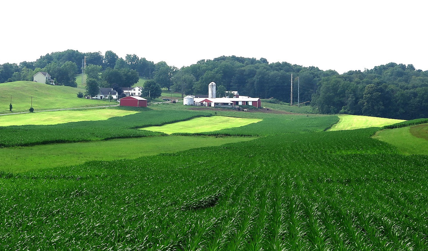
through farmland and along the coast.
This first day of cycling is designed by FunActive to be easy (and would be but for the rain and head wind). Our destination is Jesolo, a seaside beach town. Many of the days offer options to cut off some of the biking (or the climbing or the traffic) by taking a ferry from the lagoon in Venice to Punta Sabbioni, which would have cut the day’s ride to 22 miles). We opt to take the “hinterland” route, cycling along the river Sile, 30 miles to Jesolo, passing the ruins of Torre Caligo, a tower from the Middle Ages which is situated near the canal “Caligo.”
FunActive has given us excellent
background material – a guidebook in fact (I wish I had paid more attention to
it before we set out) that includes background on the landscape, history and
culture of the regions we travel through, plus recommendations for attractions
and restaurants in each place, along with local maps. The route map, broken up
into each day’s Stage, is well marked with places to stop for food, photos,
attractions.
We ride through countryside – farms
and villages – we can even see the snowcapped mountain peaks of the Dolomites
in the distance.
This first day is really an
orientation to learn “the rules of the road” – for me, figuring out how to
correlate the cue sheets and look for the trail markings. At first, I am very
disoriented, but Eric manages to get us to our destination.
Jesolo is utterly charming seaside
beach resort that attracts local families, and despite its proximity to Venice,
doesn’t seem to have attracted any foreign tourists at all (another delight of
a bike tour, that brings you into local places well off the beaten tourist
track). I am amazed how fine the sand is. The weather has cleared but it is
rather cold and there is a red flag on the lifeguard stand, so no one is in the
water this late in the afternoon. We enjoy walking along the beach, sticking
our feet in the water, and taking in all the color.
The town has a ferris wheel,
amusement park, water park, go karts, arcade, lovely shops and restaurants, is
loaded with surreys and bikes, and in the evening, closes the street to cars altogether.
What we notice is there are few (if any) bars. This is really a family place.
We love our hotel, the Marco Polo which is right on the main street, a block
off the beach. The scenes evoke flashbacks to my own childhood, when our family
would take trips in February to Atlantic City, normally a beach resort, and
enjoy the boardwalk.
There are a plethora of restaurants
– many are full and one in particular, Atmosphera, has
people (including many families), lining up in the street. Lucky for us, they
have a table for two. This place is a revelation – and we can soon see why it
is probably the most popular restaurant in Jesolo – it has a sensational menu
(pages and pages of pizza offerings, meat and fish selections), wonderfully
prepared with fresh, flavorful ingredients in open kitchens, large portions
beautifully presented and modest prices.
Our hotel, the Marco Polo, is most
charming, and right on the main drag.
Stage 2:
Jesolo/Caorle to Concordia Sagittaria/Portogruaro (19 or 31 miles).
Today’s ride, 31 miles from Jesolo
to Concordia Sagittaria/Portogruaro, is easy, cycling along the coast and it’s sunny!
which dramatically adds to my sunny mood and puts metal to my pedal. We ride
through scenic farmland and countryside. We take a slight detour into Caorle,
which the FunActive guide, Anthony, has heartily recommended we do, and this
proves one of the pure gems of the tour.
As we enter the town, the colorful
buildings around a plaza makes me think of Sausalito over the Golden Gate
Bridge from San Francisco, or, then again, of Seaside, Florida, that idyllic
village in the “Truman Show,” and as soon as we make the turn into the Old
District, with the warm sun streaming down, I think what a fantastic movie set
this would make. It seems that all the property owners by choice or decree
paint their buildings before each season, according to a certain gorgeous
palette of colors.
The colors are stirring, surreal
almost, especially because of the narrow alleys and the angles. A riot of
color. Think Nanny McPhee. I can’t get enough of it- the scenes make my heart
race, especially the narrow, angled alleys. As we walk, each new vista is like
a new painting.
We discover Carole in layers – first
wandering through the streets. Eric has zoned in on a restaurant for lunch. We
eat outside but this clever place, inside, actually has a model train set that
delivers your food to the table.
Caorle has been settled for about
2000 years. Wandering around, we come upon the Cathedral San Stefano
Protomartire Caorle, built in 1038.
Then we walk back and hone in on the
Madonna dell’Angelo Church, perched on a cliff overlooking the water and the
beach at the end of the stone promenade, wrapping around on two sides. Across
the way, there are a gazillion beach umbrellas set up, but where we are, there
are like random, ad hoc DIY blankets and umbrellas. Eric swims in the Adriatic while
I take photos.
We leave this enchanting town and find ourselves in
absolutely gorgeous countryside – with what I presume are the Dolomite
Mountains as a backdrop. At one point, we ride along a berm that elevates us
over the farmland on either side.
Anthony had strongly recommended
that once we arrive at Concordia Sagittaria where our inn is, we ride the few
extra kilometers into Portogruaro, and when I see the photo of the Town Hall on
our hotel’s card, we race out to take advantage of the warm late afternoon
light.
It is a delightful ride on a bike
path along a river into Portogruaro, aglow in golden light. The town, founded
in the 12th century as a port on the river Lemene, is surprisingly
big and bustling, and we dash to try to capture that scene from the photo before
the sun sets. We find our way to the Old City and the Plaza della Republica
with its grand Gothic Town Hall, A concert is going on and we are drawn in but
pull away in order not to miss the fading sunlight.
The setting is absolutely
magnificent – this 12th century Town Hall with ancient watermills
(one still spinning), is very Venetian in its look. I realize that the shot I
want is across the river, and cross the bridge to a small park adjacent to a
monastery. I get there just in time before the light fades.
We bike back to Concordia
Sagittaria, a delightful village well off the tourist “beaten track,” which is
why I love bike tours so much. The village sits in what was a Roman colony on
the River Lemene.
By now we’re famished. It’s a Monday
night and some restaurants are closed. But Eric finds a marvelous one (which
turns out to be listed in the FunActiv guide): Pizzeria Al Solito Posto. All
the tables have been reserved (notably, by locals), but we notice two people
just finishing their meal at a table outside. There are something like four
pages of pizza to choose from and I have the best pizza I’ve had in my life:
cheese, olives, capers and anchovies with the freshest tomato and thinnest of
crust done to perfection.
Our inn, The Julia, is right on the river and in the middle of the square, towered over by the 10th century Byzantine Cathedrale di Santo Stefano Protomartire, dedicated to the first Christian martyr. (Inside, our notes say, is a holy water stoup in Greek marble from the 1st century and 13th century paintings). Just across the square, we discover an archeological dig with sarcophagus, on the ruins of the first basilica. The excavations have also uncovered ruins of a Roman street. Next to the church is a Roman-style bell tower from 1150. There is also a Bishop’s Palace (1450) and town hall from the year 1523.
This day has been the
most magnificent. And the most interesting thing of all is we would never have
seen or experienced any of it except for riding our bikes.
There are four other
riders following the same self-guided FunActive itinerary as we who have
started on the same day, and we meet up with them periodically in the inns and
even on the trail and delight in sharing stories and comparing notes of our
travels.
Next:
Discovering Ancient Christian Cite of Aquilea, Roman City of Grado
(We
booked our 8-day self-guided “Venice-Trieste-Istria” self-guided bike tour
through BikeTours.com, a broker which has an excellent catalog of well-priced
guided and self-guided bike and bike/boat trips, mostly in Europe, and has very
attentive counselors. Biketours.com, 1222 Tremont Street, Chattanooga, TN
37405, 423 756-8907, 877 462-2423, www.biketours.com, info@biketours.com)
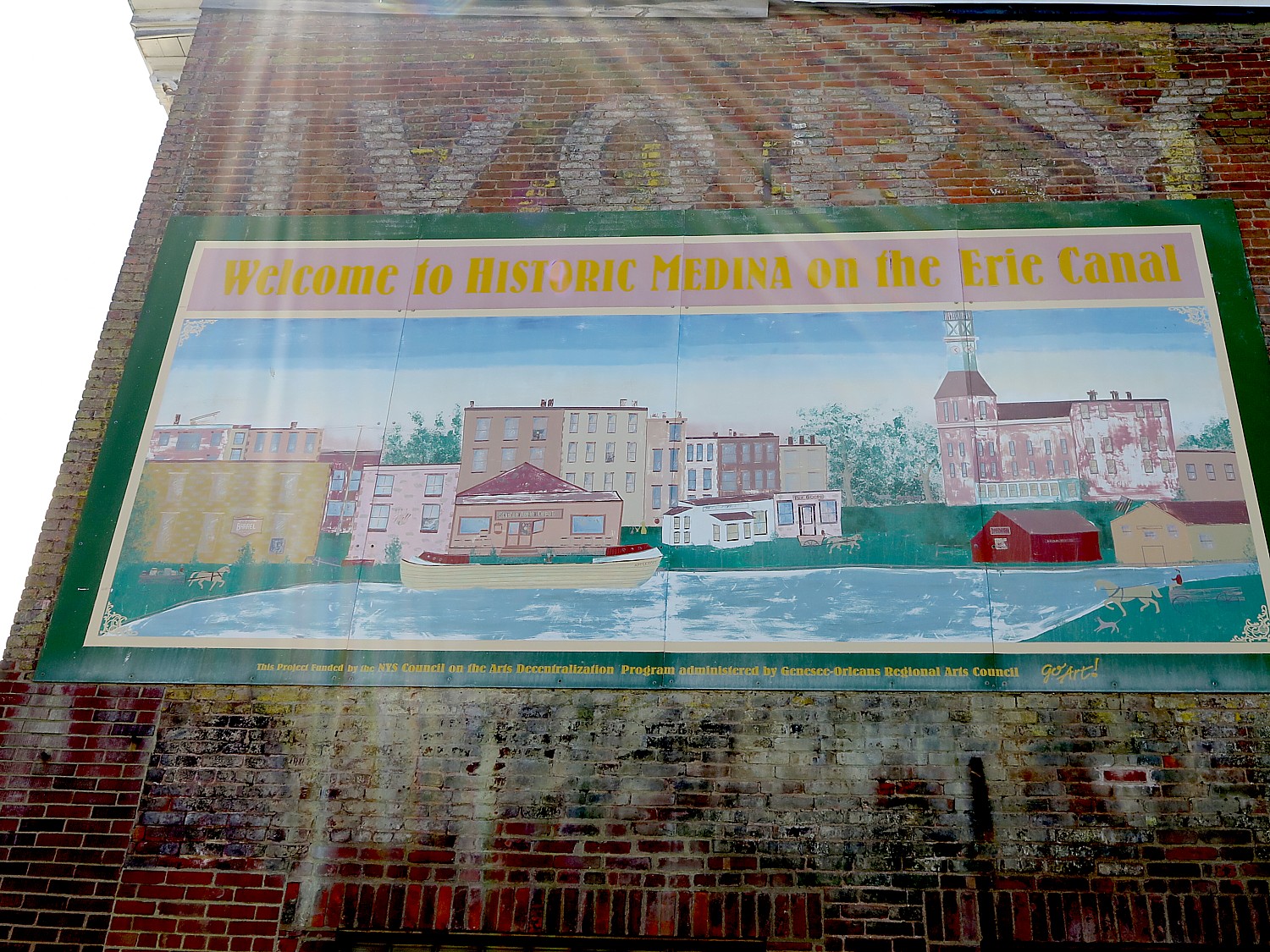
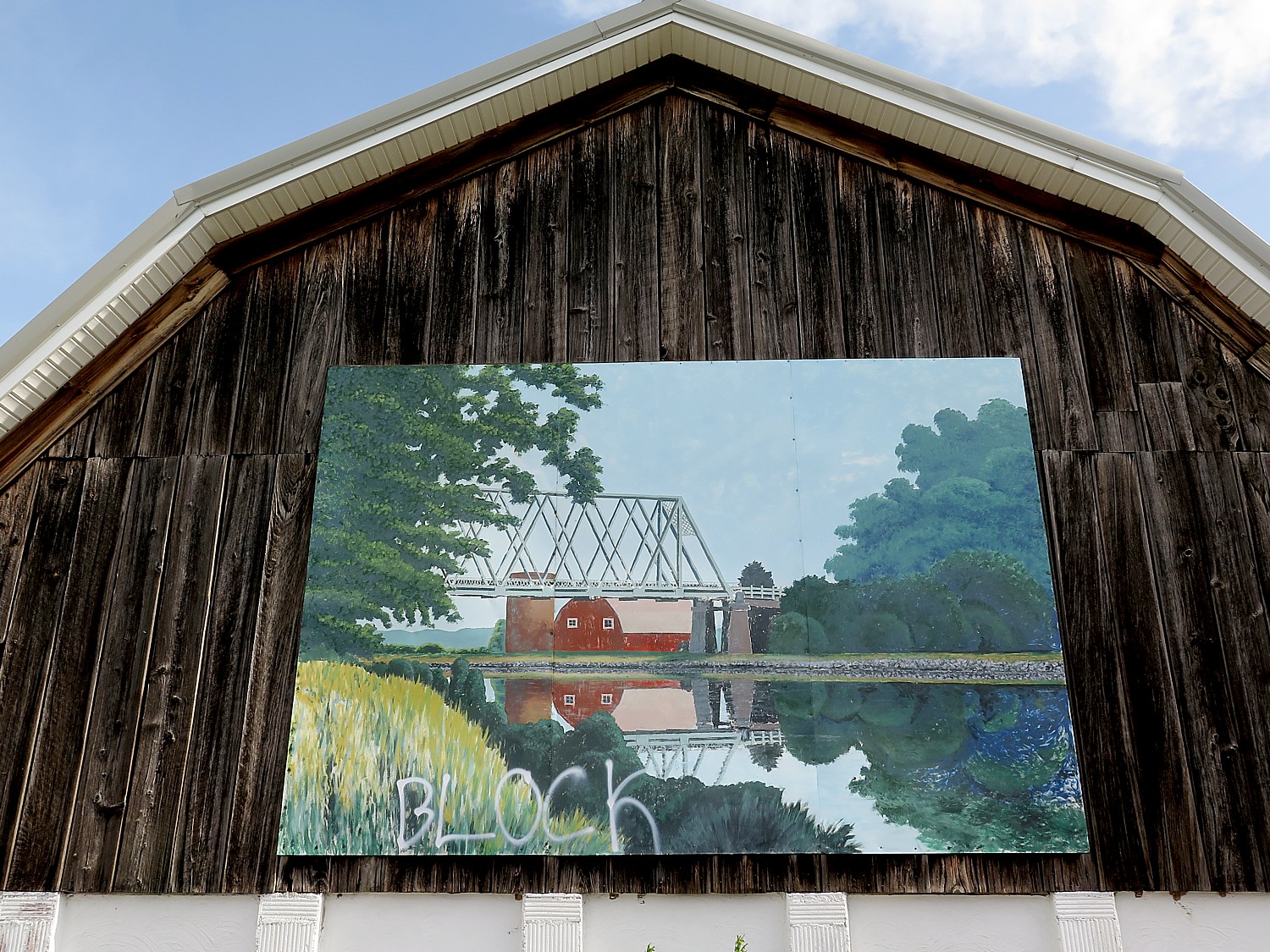
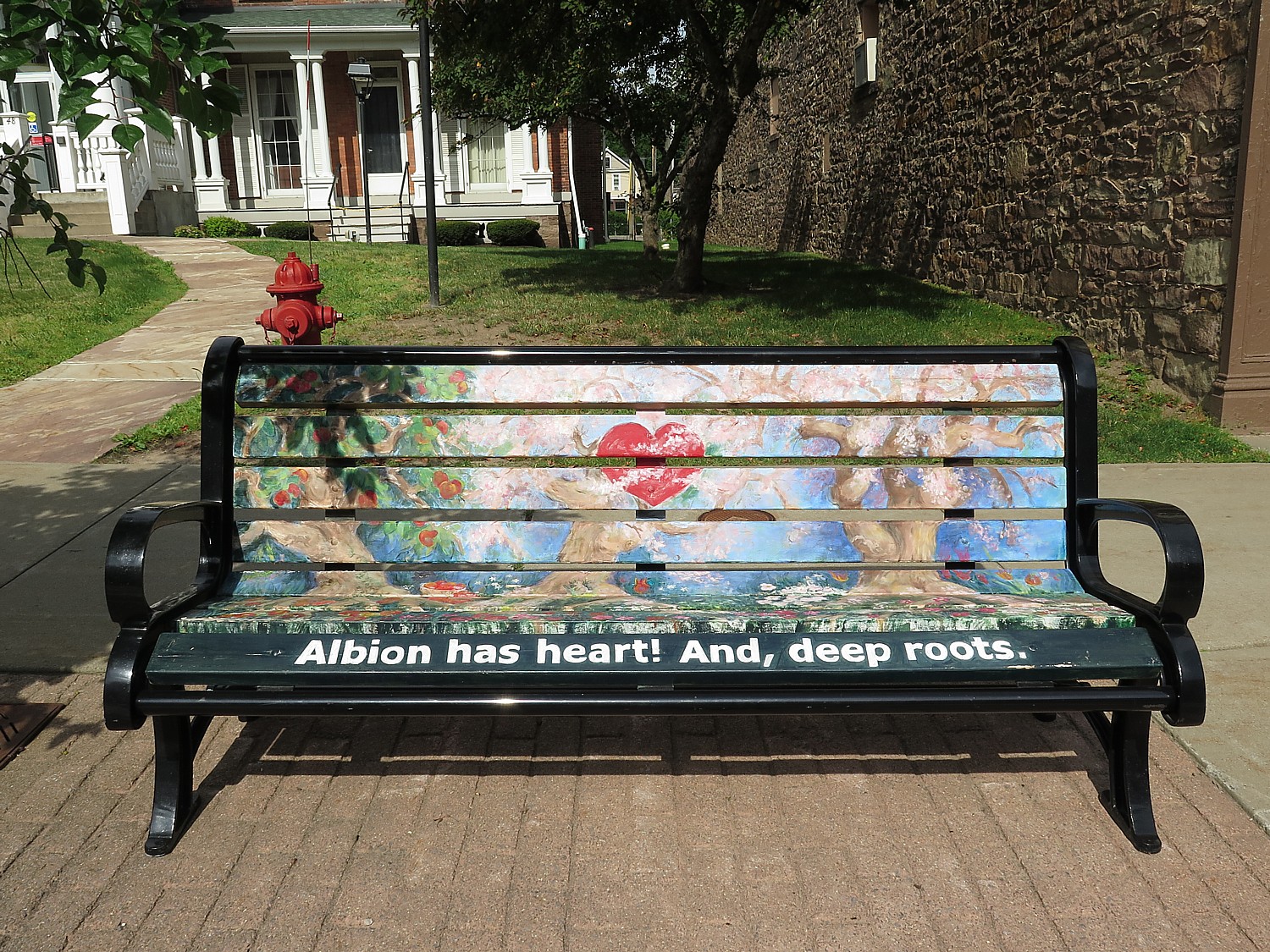
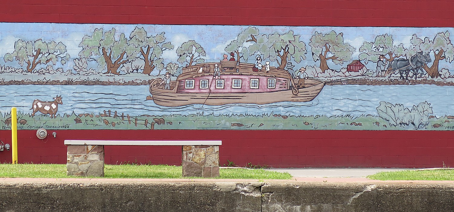
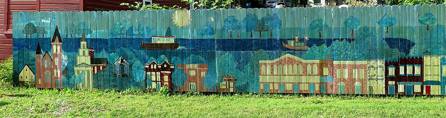
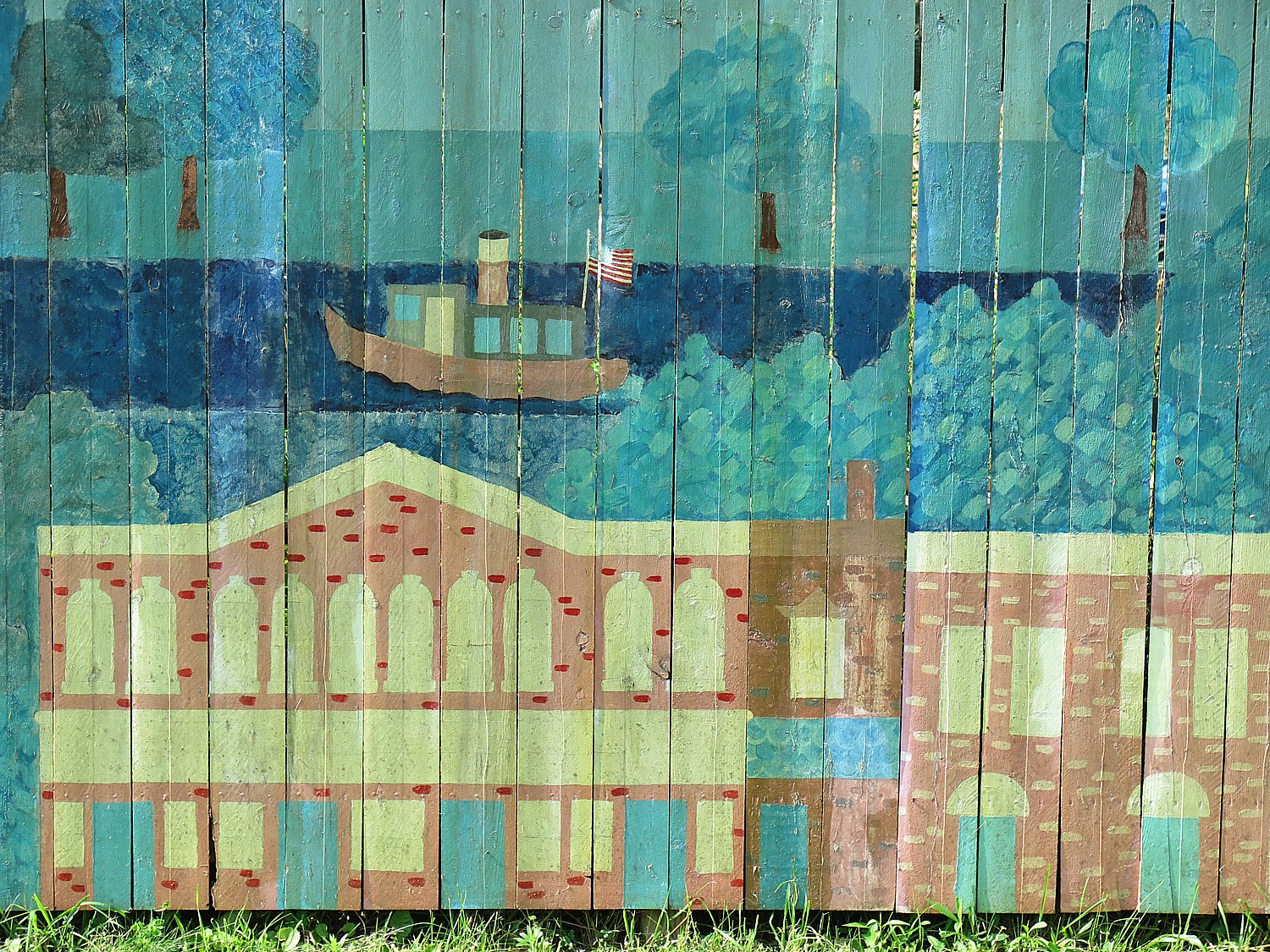
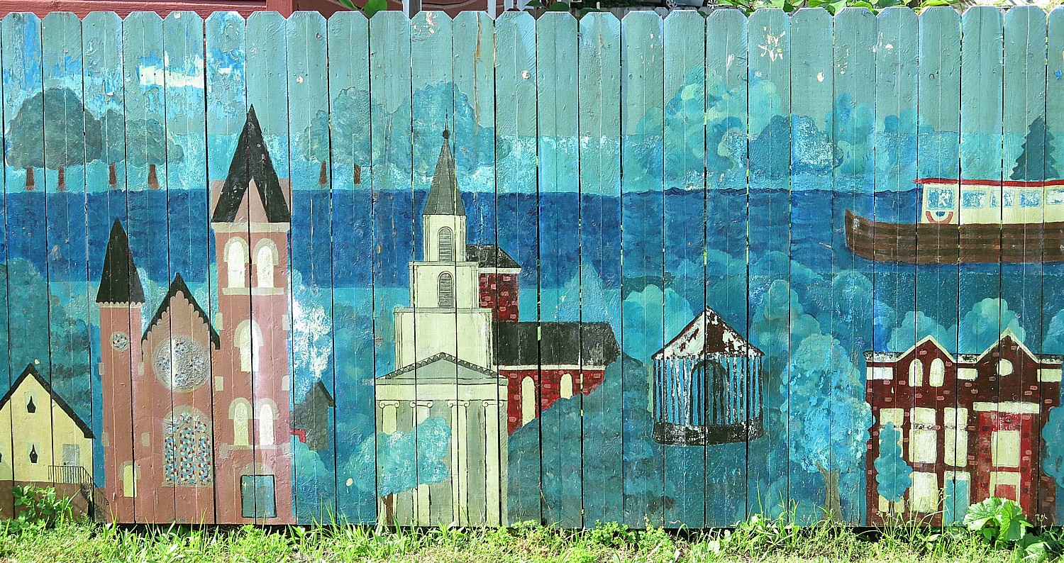
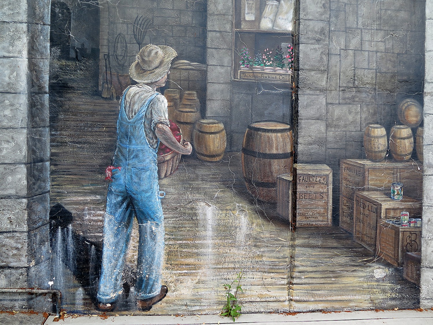
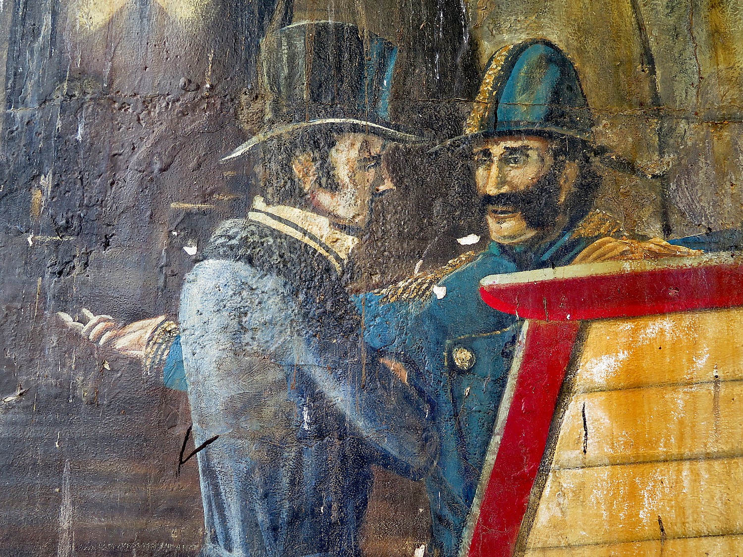
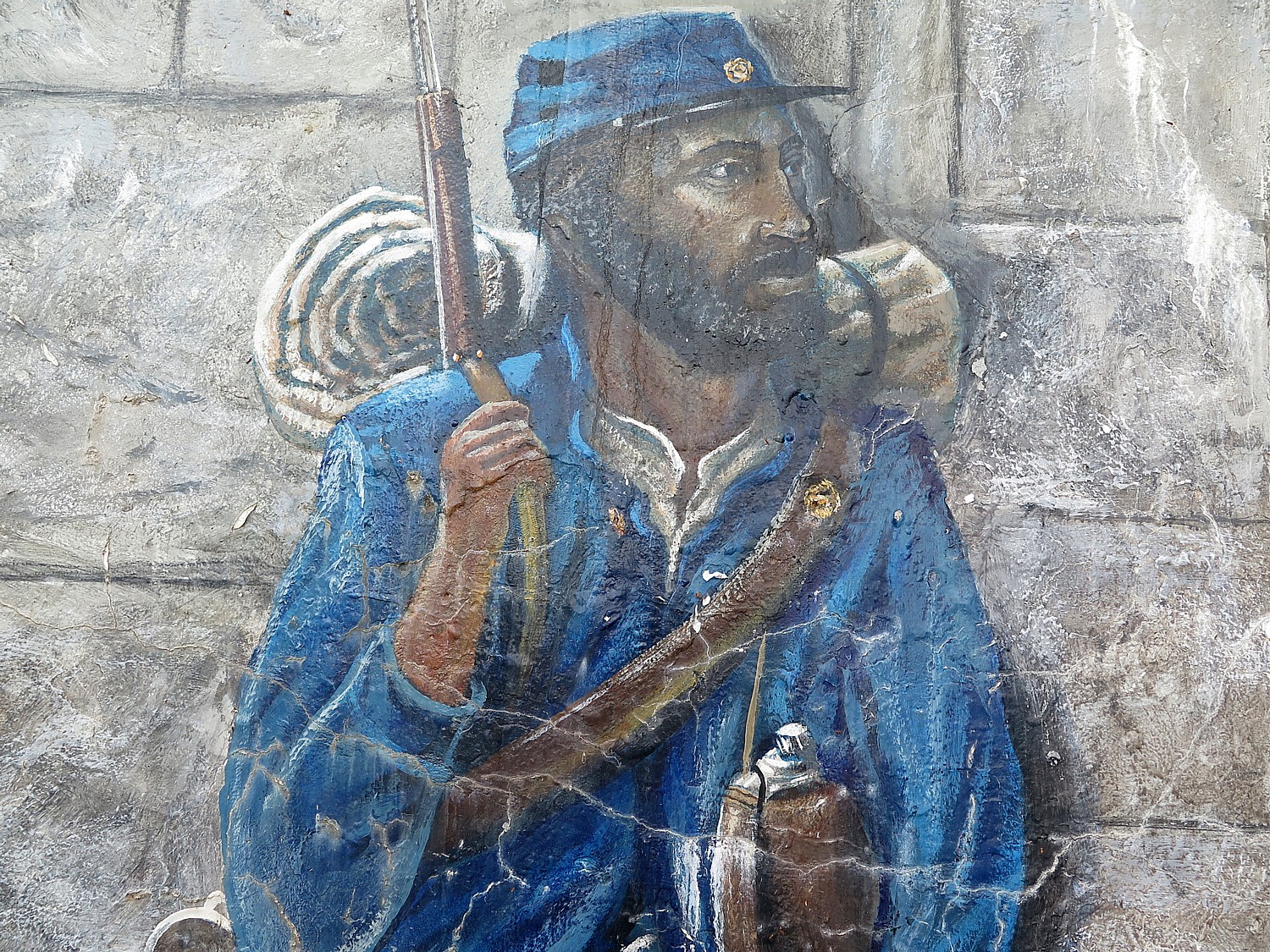
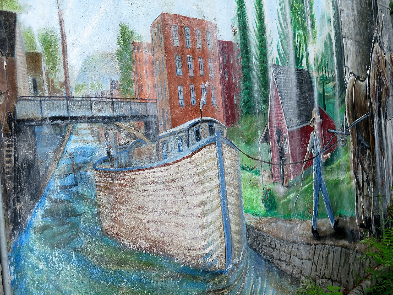
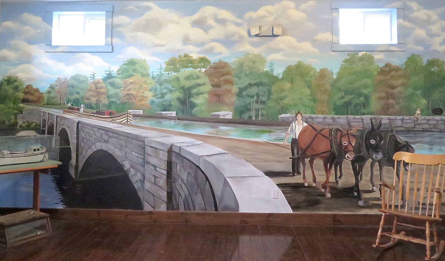
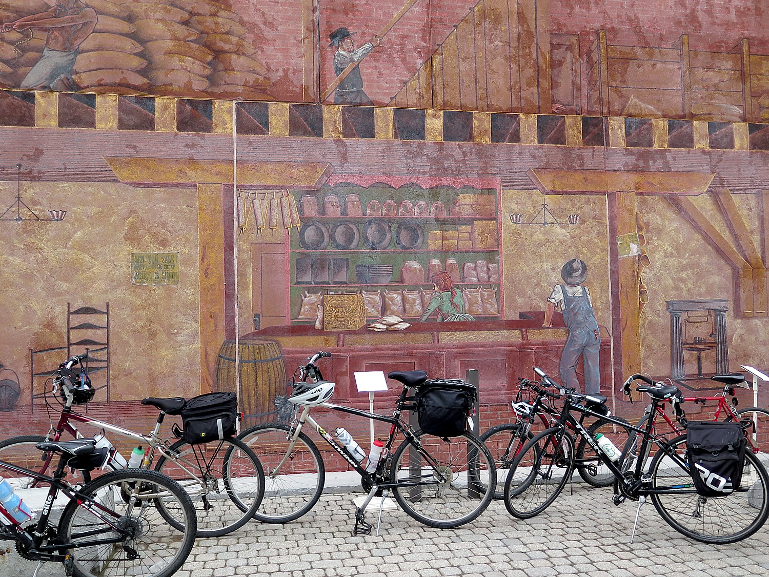
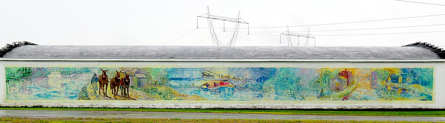
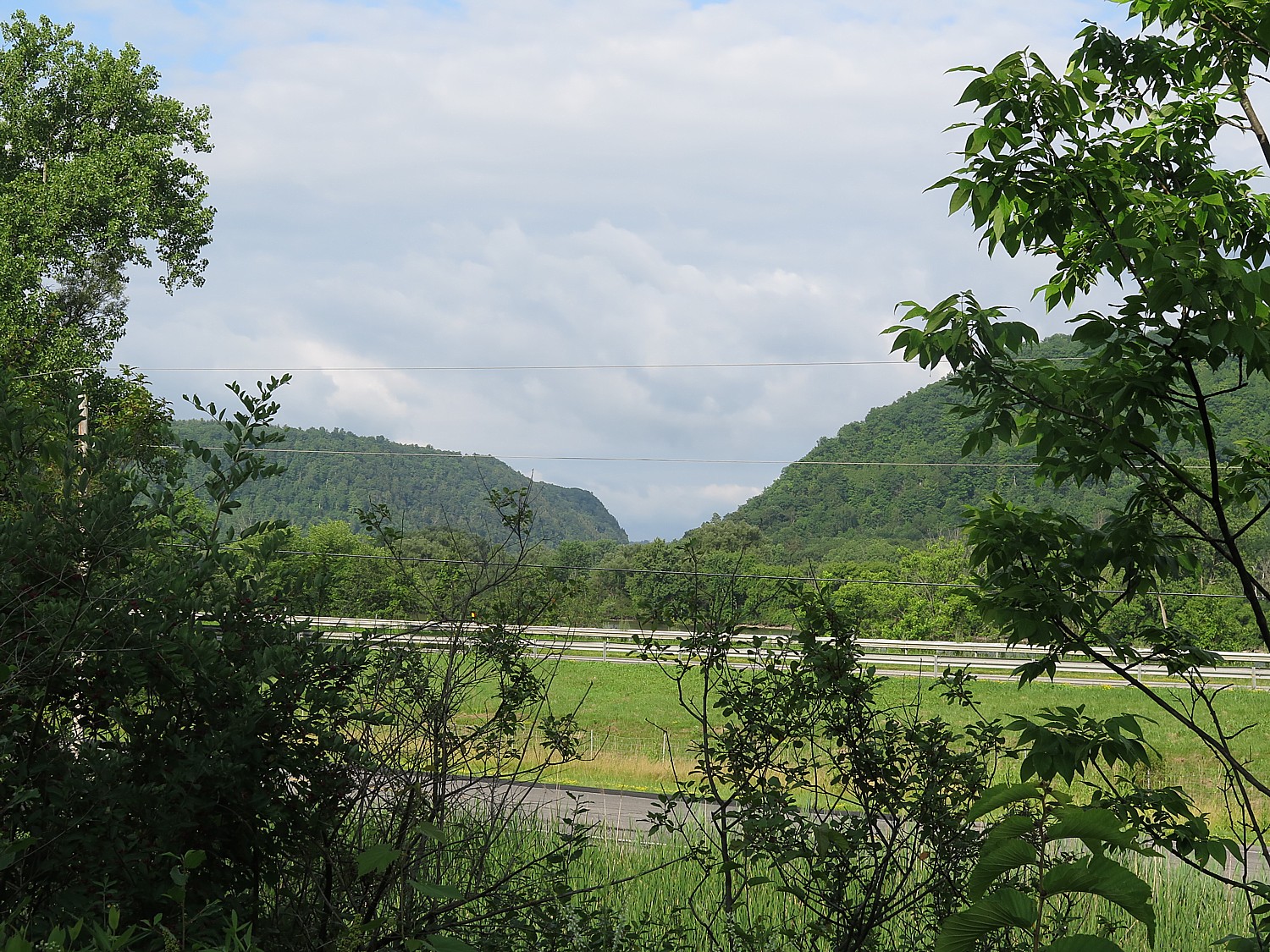
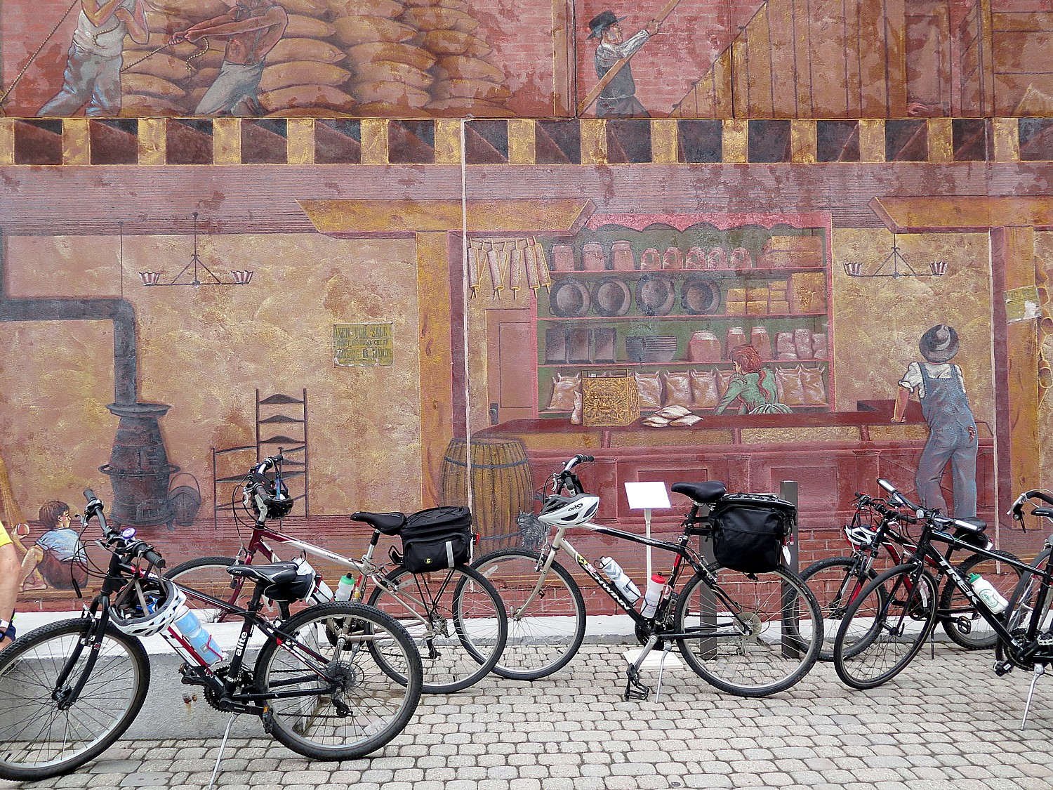
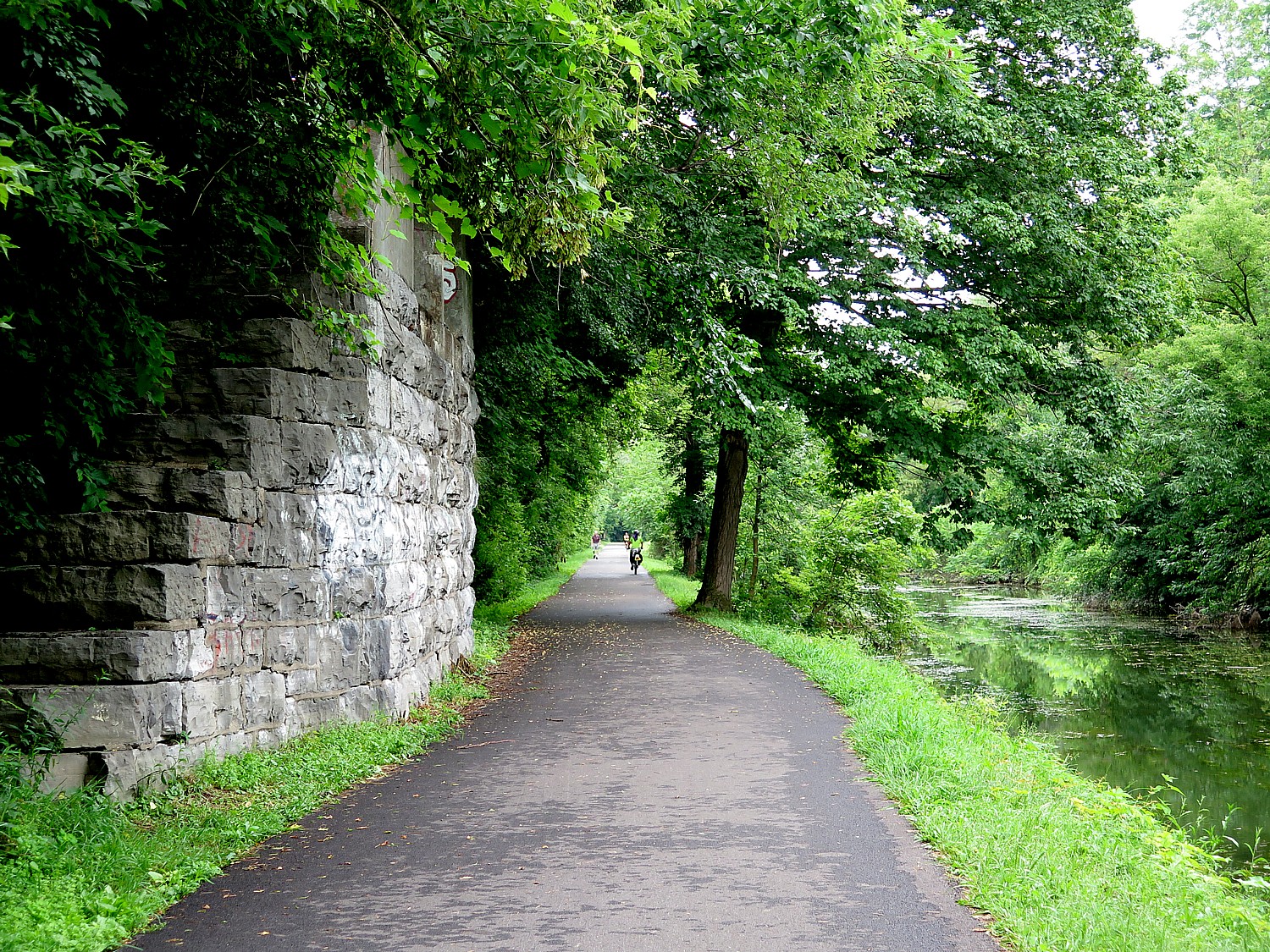
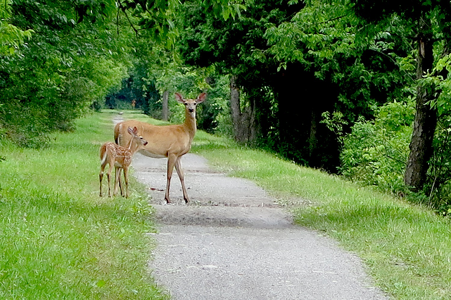
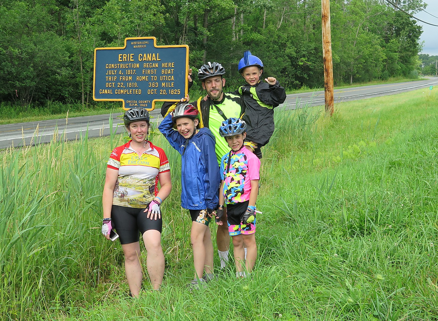
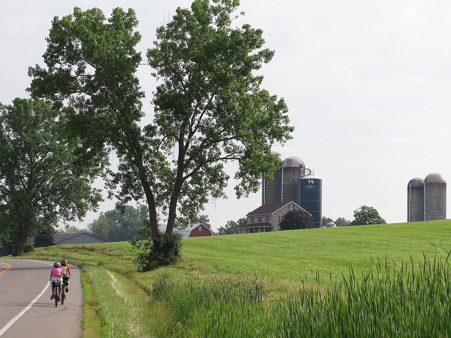
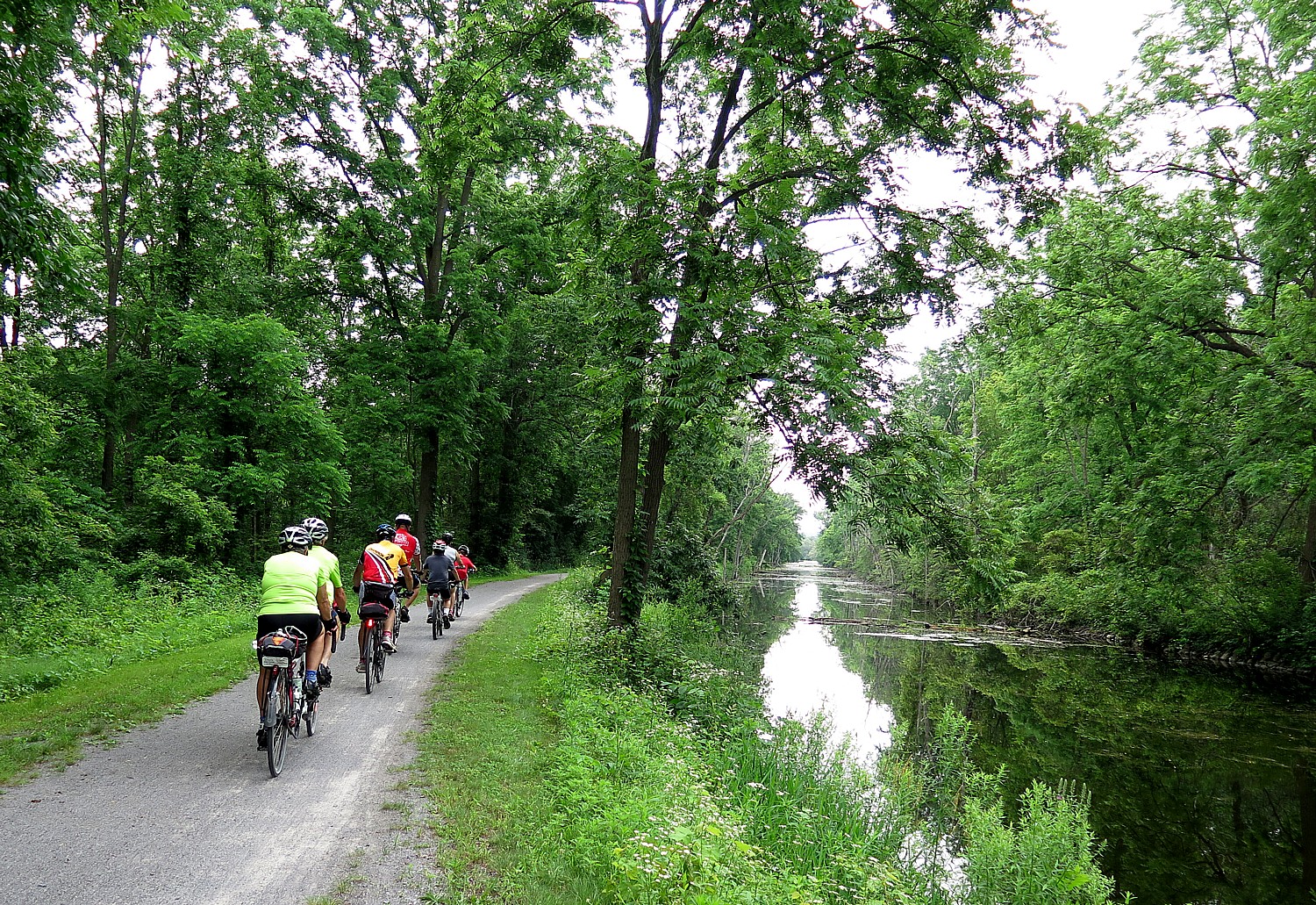
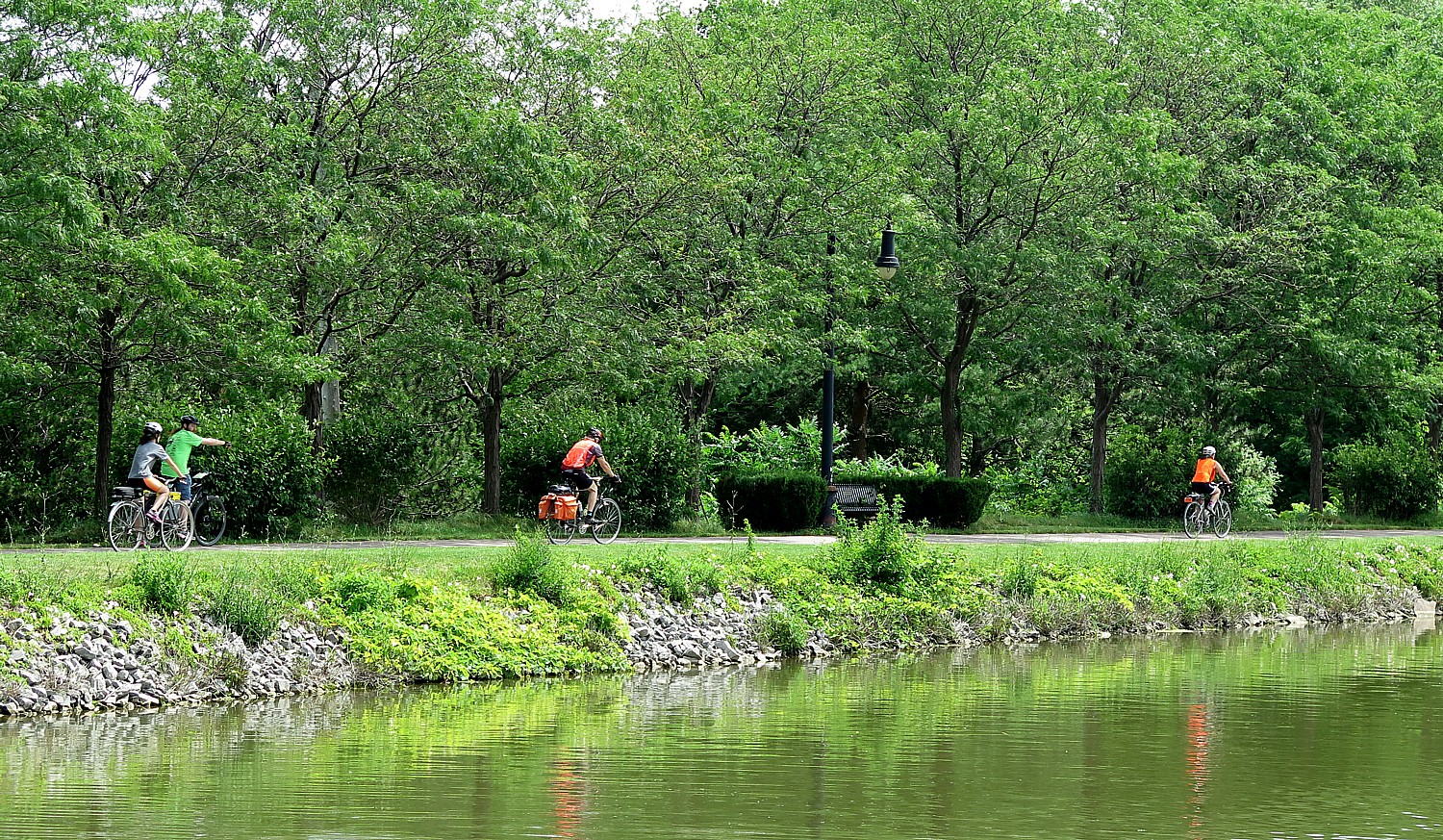
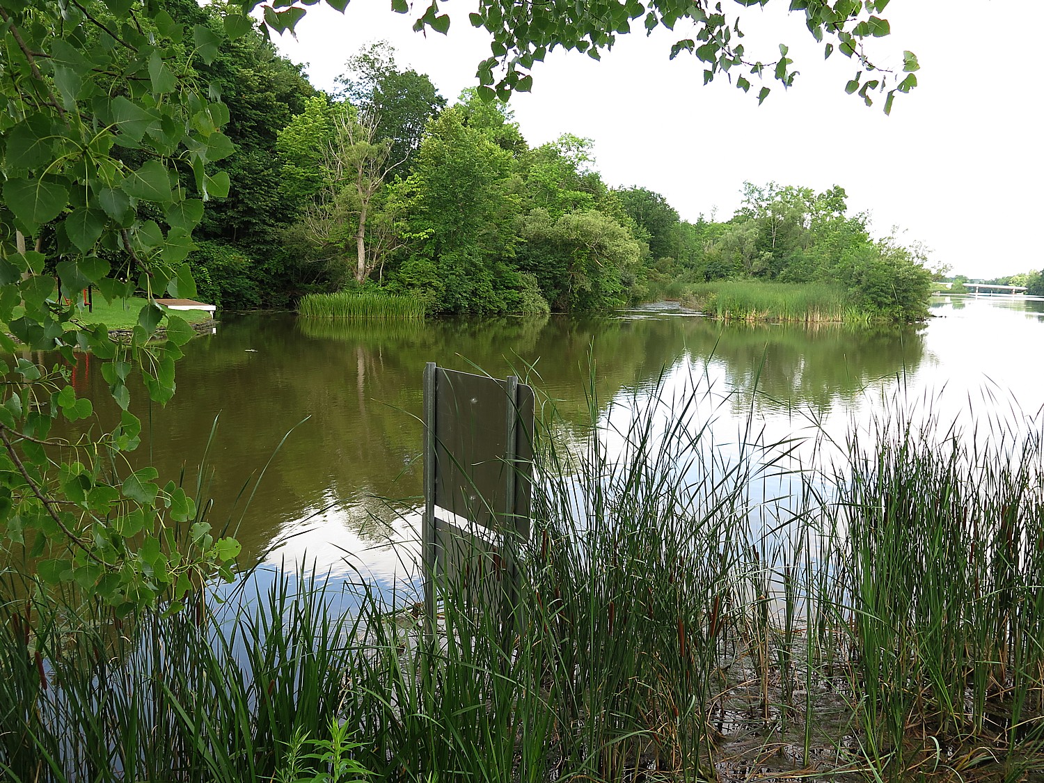
One of the many delights of Parks & Trails NY’s 8-day, 400-mile Cycle the Erie bike tour from Buffalo to Albany across New York State, is coming up beautiful murals that describe the history and cultural heritage of the Erie Canal and the canaltowns that were spawned. Through the course of the ride, you travel 400 miles but also 400 years through history, and see the whole story of how America came to be unfold in front of you.
Here are some of our favorites, as we bike along the Erie Canalway, on brick, on barns, on bridges, on benches, on fences:
The 20th Annual Cycle the Erie Canal ride is scheduled July 8 – 15, 2018 (www.ptny.org/canaltour). In the meantime, you can cycle the trail on your own – detailed info and interactive map is at the ptny.org site (www.ptny.org/bikecanal), including suggested lodgings. For more information on Cycle the Erie Canal, contact Parks & Trails New York at 518-434-1583 or visit www.ptny.org.
The entire Erie Canal corridor has been designated the Erie Canalway National Heritage Corridor, Waterford, NY 12188, 518-237-7000, www.eriecanalway.org.
More information about traveling on the Erie Canal is available from New York State Canal Corporation, www.canals.ny.gov.
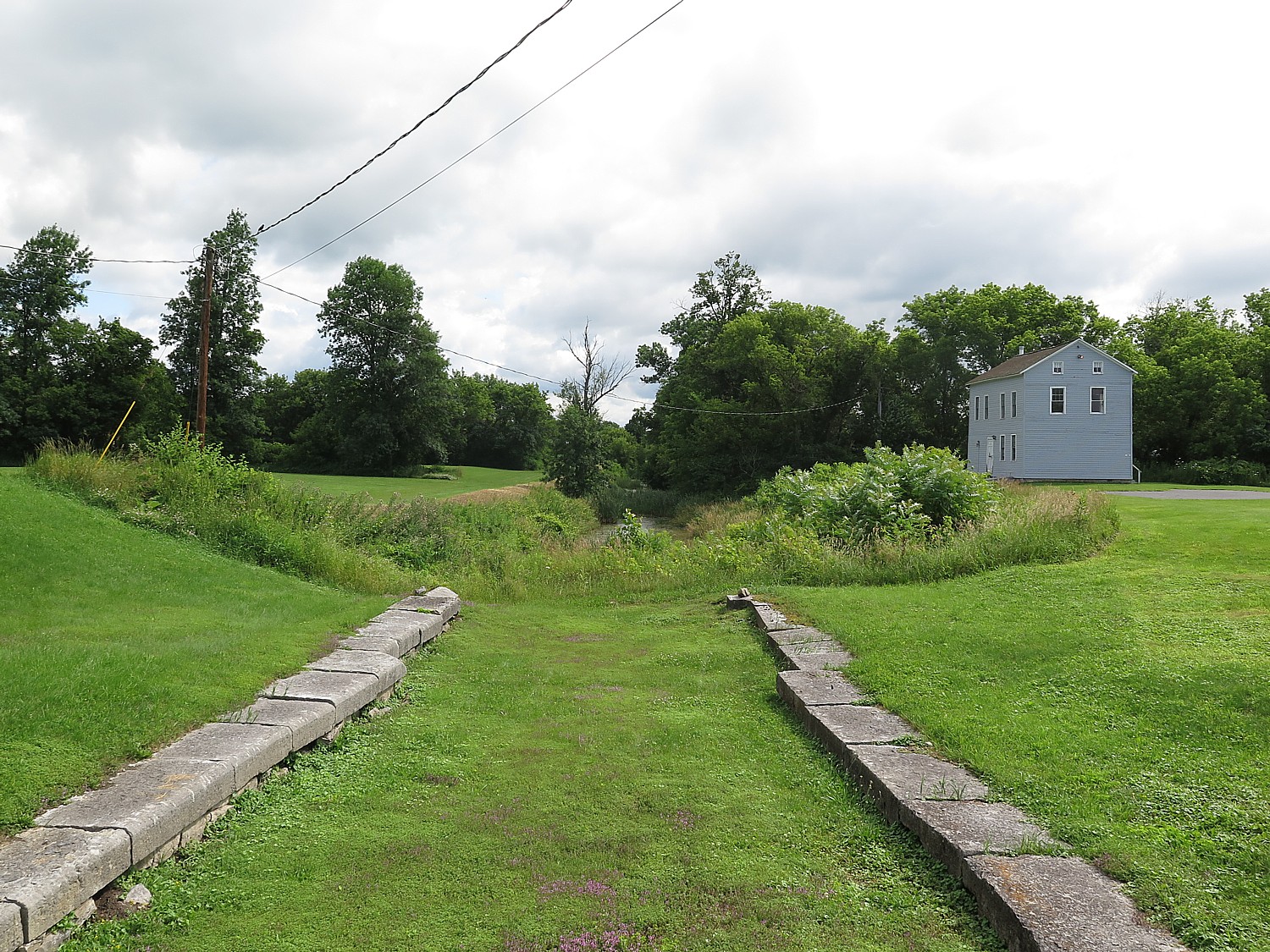
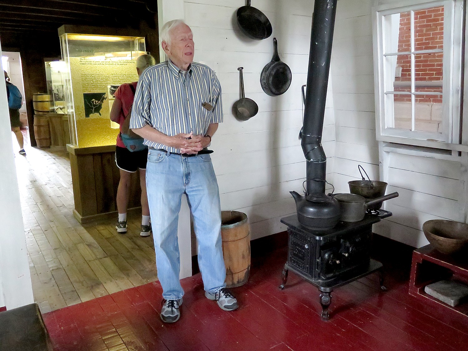
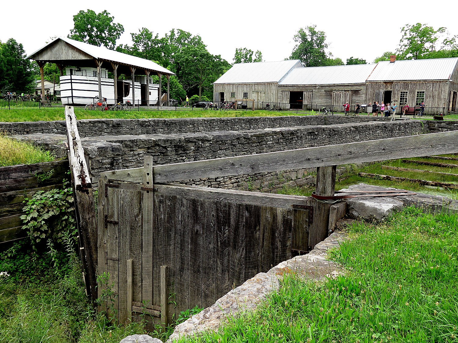
A highlight on Day 7 of Parks & Trails NY’s annual 8-day, 400-mile Cycle the Erie biketour from Buffalo to Albany is Schoharie Crossing State Historic Site. It looks fairly innocuous at first, a farm house along the canal, but here is the only place where you can see all three alignments of the Erie Canal – the 1825 “Clinton’s Ditch”, the 1836 expanded canal and the modern, 1918 “Barge Canal.” The house, now a visitor center, contains a fascinating exhibit and is adjacent to outlines of Fort Hunter, an 18th century fort and trading post, remarkably only discovered after Hurricane Irene in 2011.
The historic flooding caused the Schoharie Creek to breach its banks and destroyed the site’s parking lot. After the flood water receded, a number of stone walls and numerous artifacts associated with Fort Hunter emerged. Excavations revealed flat stone foundations upon which a fort wall and 24-foot square blockhouse would have been constructed.
After the archaeological work was completed, these original fort foundations were preserved by reburying them. Their exact locations are now represented on the surface with modern stone pavers. Artifacts recovered during excavation included a mix of domestic and military objects that represent the site’s Mohawk and British occupants. Dates associated with the artifacts suggest that the blockhouse saw greatest use from the 1740s to 1760.
Though you don’t really see anything of Fort Hunter, it points to how significant this area was in colonial times: Schoharie was a place of key interactions between Europeans and Indians, setting up a later clash of cultures.
During the 1600s, the British and French competed for control here. In the 1690s, the British forged an alliance with the Iroquois to establish a permanent structure – a fort/trading post – in order to solidify their standing.
The Indians at the time of the Revolutionary War were settled on farms and in towns. They employed European style farming techniques, lived in houses, and the gender roles started to shift away from the matriarchal society to male-dominated, copying the Europeans.
By the time of the Revolutionary War, there might have been about 10,000 Indians living in the area.
“They didn’t have a concept of property ownership. They were outnumbered early on” largely because of the diseases the Europeans brought that wiped out large numbers of the population, and over-trapping which pushed many further west.
“They were very good at diplomacy – well organized – and controlled access to the waterways. They played the European powers,” David Brooks, Education Coordinator says.
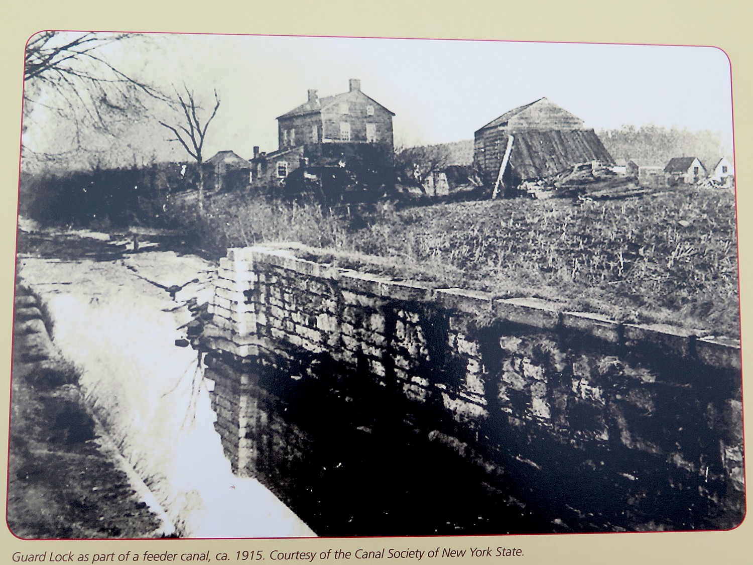
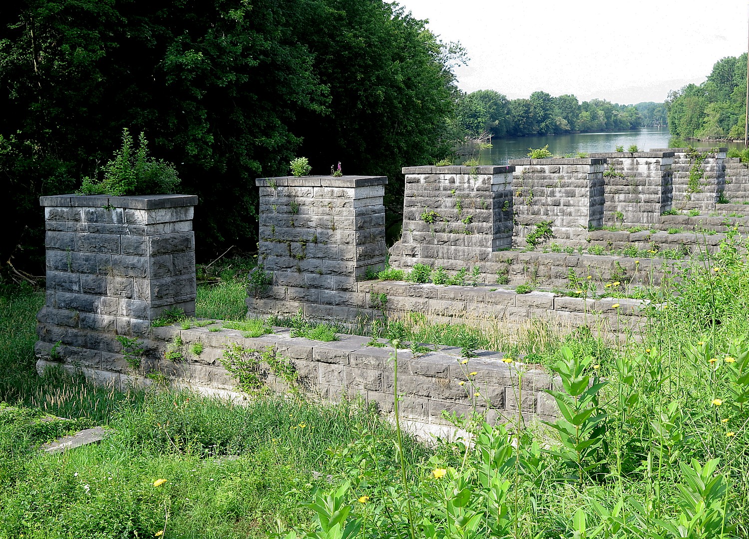
Most interesting at Schoharie Crossing is you can stand over the East Guard Lock – the original 1820s “Clinton Ditch” canal (now overgrown) – and see the same scene, minus water, as depicted in a historic photo.
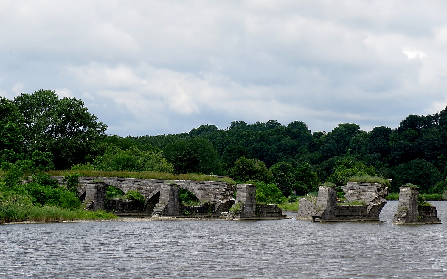
Facing the other direction, standing beside the water, you can look over to what remains of the Schoharie Creek Aqueduct, built between 1835 and 1841 for the enlarged canal. This once grand 14-arch, 624-foot long aqueduct carried the canal above and apart from the Schoharie Creek (it enabled the canal to continue to function during flooding). The aqueduct was abandoned in 1917 when the Barge Canal opened on the Mohawk River, and over the years it declined so only six of the arches remain.
The initial appeal for me to join Parks & Trails NY’s annual Cycle the Erie bike tour was the exciting prospect of biking 400 miles, point to point, mostly without cars (and mostly on a flat trail), across New York State, with support services to carry our gear and host meals. But each and every day, I am pleasantly amazed at the array of sites to explore and discover. The Parks & Trails NY people who have designed the tour not only arrange visits at important sites along the way, but for morning and afternoon rest stops at interesting attractions that you might not have considered visiting on your own.
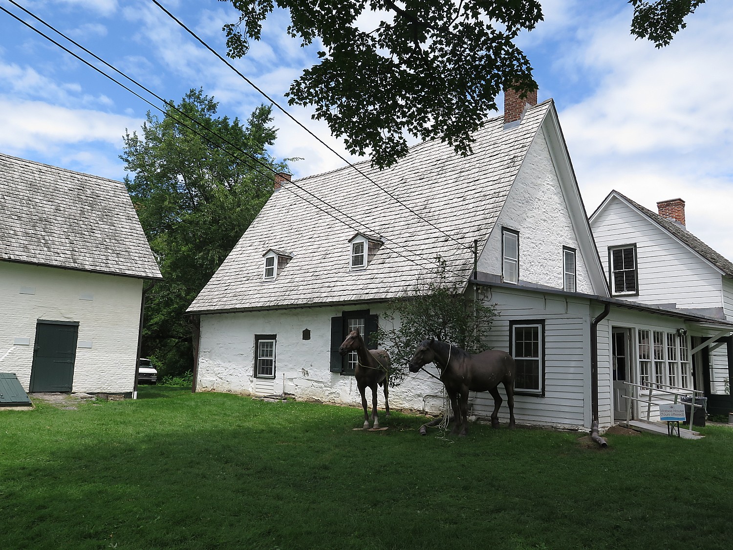
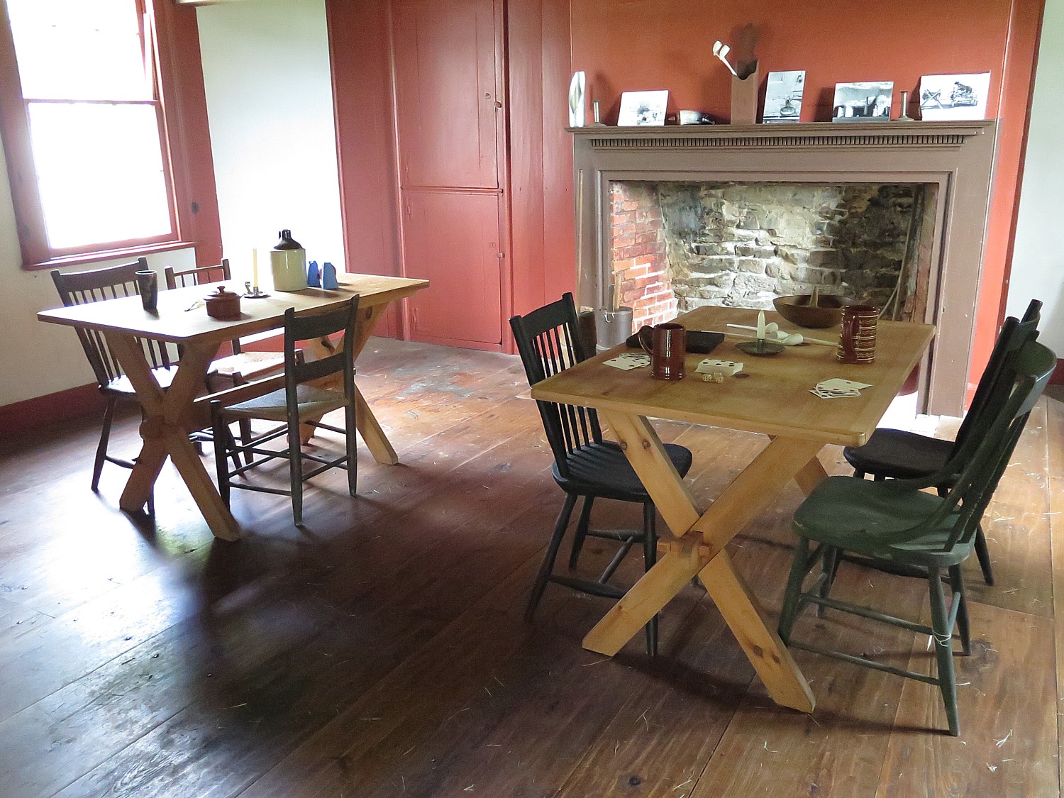
This is the case for our afternoon rest stop (at Mile 33.6), at the Mabee Farm Historic Site, which also houses the Schenectady Historical Society Museum.
Here, you can visit the Mabee’s 1705 Dutch-style Stone House, which was owned by the Mabee family until 1999.
This is one of the oldest homes in New York State and the oldest in the Mohawk Valley. It was first built in 1670 by Daniel Janse Van Antwerpen, who, it is believed, opened it as a fur-trading post. The property was sold to Jan Pieterse Mabee in 1705 and the house stayed in the Mabee family for a remarkable 288 years. It was given to the Schenectady County Historical Society in 1993 by George Franchere, the last descendant of the Mabee line, for the purpose of being a museum and education center.
It is a surprise to most who visit these colonial sites to learn that slavery was practiced here, beginning after Jan Mabee’s death in 1725 and ended 100 years later in 1827 with Jacob Mabee, his great grandson (when New York State abolished slavery). Among the 583 original documents from the farm are three bills of sale for slaves, wills giving slaves to children and a receipt from the Crown Point Expedition in 1755 when a trusted slave, Jack, was sent to Fort Edward and Lake George with supplies, two weeks before the Battle of Lake George.
“What is significant about the Mabee family is that they were ordinary,” the docent says.
Jan Mabee, born in Holland, bought the property from a neighbor in 1705, and lived in the cellar as he built the house. Jan and his wife Annette had 8 kids.
The house partly made out of stone; the wood beams are 1000 years old.
Jan was likely involved in the illegal trapping business. His wife was part Mohawk so they had a good relationship with the local Indians. The Dutch were tolerant and fair with the tribes (it was the British and French who cheated them).
Over the years, the house was turned into the Mabee Inn. Simon Mabee farmed the land and when he died, he left everything but the Inn to his son, Jacob; he left the inn to his two sisters.
It turns out that the Mabee farm is more than a history lesson, but a study of a dysfunctional family.
“Jacob was not a nice man. Jacob evicted them. He hired a carpenter and flipped the staircase around so they have no way to get up to the second floor. He built a new door. The sisters lived in one room. Jacob died 6 years later and the land passed to Margaret.”
Just outside the house is the family cemetery. You can visit the 1760s Nilsen Dutch Barn, see the beautiful Mohawk River flow alongside the site. Tied to the dock or parked behind the Dutch Barn is a reproduction 18th century bateaux, the De Sagar and the Bobbie G , which provides an idea of how goods were shipped up and down the river.
(Mabee Farm Historic Site, 100 Main St (Rte 5s), Rotterdam Junction, NY 12150, 518-887-5073, schenectadyhistorical.org/sites).
The Schenectady History Museum offers wonderful exhibits that follow the history of the county from the early settlers who traded with the Indians and farmed, to the 19th and 20th century. There is a collection of early American artifacts of the American Revolution era, the impact of the Erie Canal, and artifacts that show the role this area played in technological innovation and industrialization because of General Electric and the American Locomotive Company.
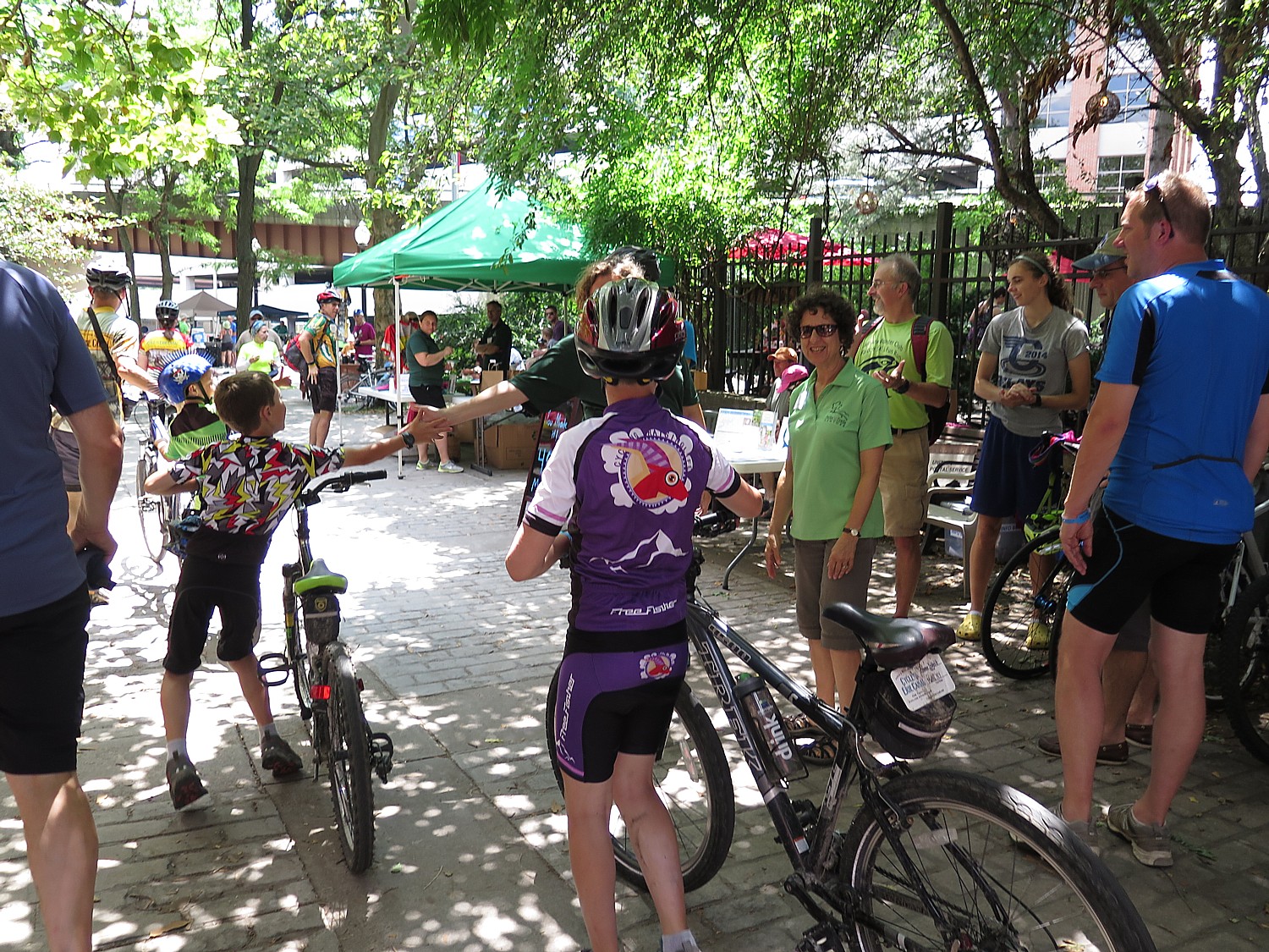
In Schenectady, they have arranged for us to leave our bikes in a “corral” so we can explore the city.
I spend my time riding through The Stockade District. The oldest neighborhood in Schenectady, the Stockade District has been continuously inhabited for over 300 years, and is New York State’s first Historic District (since 1962) with an amazing assortment of historic buildings with more than 40 pre-Revolutionary houses and architectural styles that include Dutch Colonial, Georgia, Federal and Victorian.(You can access a cell phone walking tour at www.historicstockade.com.)
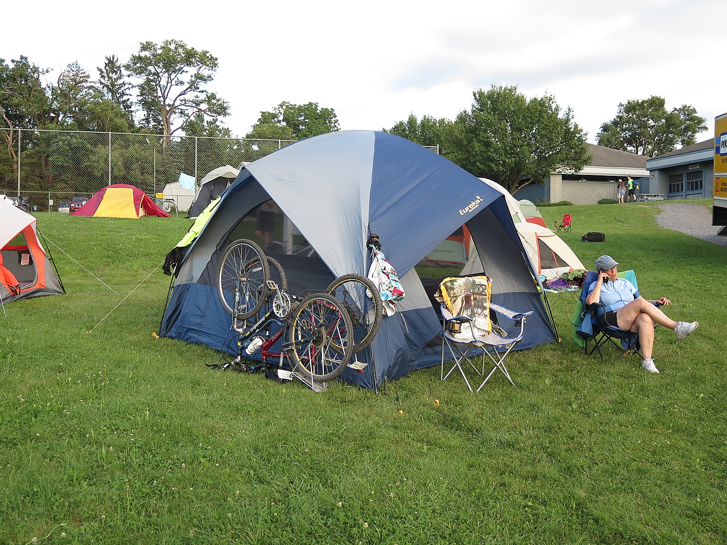
I pull myself away to finish the ride to get to the Jewish Community Center at Niskayuna, a suburban neighborhood of Schenectady, where we camp. This is an incredible facility with a country-club like outdoor pool (indoor pool also). I get there in time to swim.
This is the last night of our journey – and what a journey it has been. They have an elaborate “gala” dinner starting with beer and wine and hors d’oeuves, a fantastic catered dinner, and a “No Talent” talent show and a fashion show put on by the van drivers and baggage handlers of all the stuff that is still in the Lost & Found. And awards: like the most bones broken; the most crashes (5); most flat tires (4); the youngest solo peddling cyclist (8), the oldest cyclist (84). Side-splitting fun.
Our last day, the eighth of our 400-mile journey which began in Buffalo, is a breeze. Just 31 miles from Niskayuna into downtown Albany where most of us have parked our cars to take the bus to Buffalo for the start of the tour. The weather is perfect – sunny, cool.
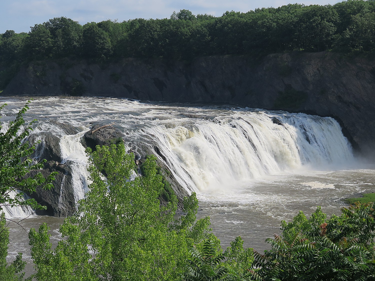
The highlight of today’s ride comes at Mile 12: Cohoes Falls, one of the most powerful falls east of the Rockies which posed a major challenge for the Erie Canal engineers. Some of our riders who started in Buffalo were able to visit Niagara Falls and now are ending with Cohoes Falls, outside of Albany. What a way to bookend this journey.
Just next to the falls are 19th century brick structures, built as factories that have been repurposed to apartments.
Our ride takes us onto Peebles Island State Park, Waterford, where our final rest stop of our journey is arranged at the Erie Canalway Visitor Center. During the Revolutionary War, American forces prepared defenses here to make a final stand against the British. (518-237-7000, www.eriecanalway.org).
We ride through city streets – notable for the American flags that are flying – neighborhoods that have seen better days but nonetheless evoke a folksy feel of Americana.
Now, we come to the Hudson River, a goal in itself. We ride along a beautiful paved trail beside the Hudson that takes us into downtown Albany, New York State’s 300-year-old capital, and finally, cross the finish line, 400 miles.
You realize you haven’t just traveled 400 miles, but 400 years of American history, back to its very founding. And you understand so much better, the trajectory from colonialism and the clash of cultures with Native Americans, the transition from an agrarian economy to the Industrial Revolution, the wave of immigration and innovation, the progressive movements that followed and precipitated the explosive changes in society: labor, Women’s Rights, abolition. Most interesting of all, is how all of these seeds still flower in contemporary culture and politics. All of this unfolds before our eyes, mile by mile.
Biking adds an extra dimension to sight-seeing. It’s physical participation, an endorphin rush, an immersion. It puts you into the scene rather than merely observing – a participant, a part of the scene, rather than apart from it.
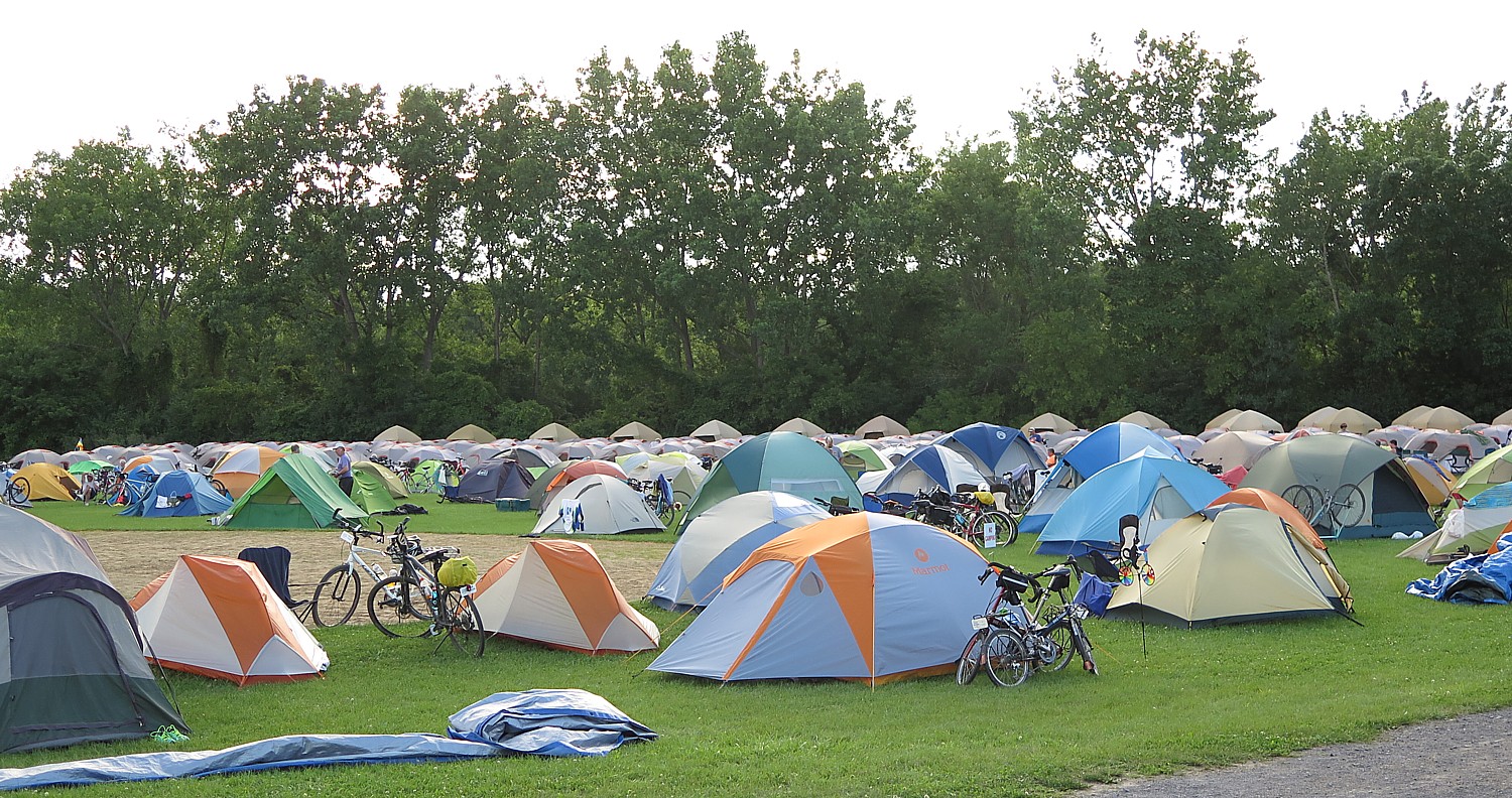
The tour is meticulously planned, well organized and supported, and how we have such wonderful opportunities to meet people from around the country (36 states are represented) and around the world (travelers from a half-dozen countries are here). A gathering like this prompts such fascinating interactions as people share their backgrounds, perspectives.
All of us have been so impressed by how well organized the trip is – from the truck drivers who pick up and drop off our gear each day, to the people who set up our breakfast and dinners and the morning and afternoon rest stops, to the SAG drivers and the riders who are there to assist if we have a problem. To the lecturers, the massage therapist and bike mechanics who travel along with us like camp followers.
For those who prefer not to set up their own tent (or take advantage of “indoor camping”) there is Comfy Campers, the closest thing to “glamping”. You have the luxury of having someone set up tent so it’s ready when you arrive, especially if it is raining, where you get a remarkably comfortable air mattress to put your sleeping bag on (amazing what a difference this makes), and take the tent down in the morning so you can just hit the trail again. Not to mention a fresh towel each day! Also, they set up a separate comfortable sitting area under canvas with charging stations. Those who want can also pay for coffee in the morning.
We are told that the finish line right at the Albany visitor center closes at 2 pm; UPS is on hand for those who need to ship their bikes home; a shower is made available nearby at the North YMCA; the municipal parking lot where many of us have parked our car is just next door; our luggage is deposited in the parking lot behind the visitor center for us to claim; some of us will take the shuttle bus back to Buffalo.
This has been one of the best, most memorable trips I have ever taken because the end-to-end Cycle the Erie ride hits on all cylinders: physically active and challenging so you feel you have really accomplished something at the end; communal – being with like-minded people from all over the country and the world, rich in heritage, scenic, affording real exploration and enlightenment. It’s no wonder that so many of us (myself included) have done it multiple times. (On this trip, the oldest cyclist, 84-year old, has done the tour 12 times.)
Cycle the Erie is an annual event, but you can download the route and do it all, or do segments as you like. A novel way to do it is by houseboat through companies like Mid-Lakes Navigation Co., Ltd. (11 Jordan St., PO Box 61, Skaneateles, NY 13152, 315-685-8500, 800-545-4318, info@midlakesnav.com,www.midlakesnav.com, and take a bike onboard, providing a unique experience. (Be aware: they pull the plug on the Erie Canal – actually drain the water – from November through April).
The 20th Annual Cycle the Erie Canal ride is scheduled July 8 – 15, 2018 (www.ptny.org/canaltour). In the meantime, you can cycle the trail on your own – detailed info and interactive map is at the ptny.org site (www.ptny.org/bikecanal), including suggested lodgings. For more information on Cycle the Erie Canal, contact Parks & Trails New York at 518-434-1583 or visit www.ptny.org.
The entire Erie Canal corridor has been designated the Erie Canalway National Heritage Corridor, Waterford, NY 12188, 518-237-7000, www.eriecanalway.org.
More information about traveling on the Erie Canal is available from New York State Canal Corporation, www.canals.ny.gov.
It’s Day 6 of our 8-day, 400-mile Parks & Trails NY’s annual Buffalo to Albany Cycle the Erie bike tour following the Erie Canalway. I was lucky last night when the deluge we had while biking stopped just as I came into the campsite and I was able to set up my tent on the grassy area surrounding Fort Stanwix, in Rome. This morning, I am awakened at 4:15 am to another massive downpour. I check weather.com app on my cellphone which says the rain would stop by 5:45 am. So I get up at 5:45 am (which is not unusual for the Erie Canal cyclists) and sure enough, the rain has stopped. I take advantage of the dry spell to organize my packing and take down the tent to avoid more rain.
Our breakfast – freshly prepared pancakes which we consume at long tables laid out with pretty placemats – is at the local YMCA before we head out onto the Canalway for our 63-mile ride to Canajoharie – the longest ride of our trip, there are actually three rest stops along the ride today, at mile 14, 41.5 and 52.5).
Yesterday’s rain has made the trail muddy, and when we go off the trail onto the road, there are serious headwinds and some significant hills, and my gears aren’t working properly.
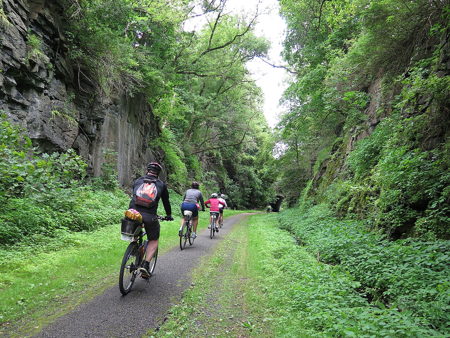
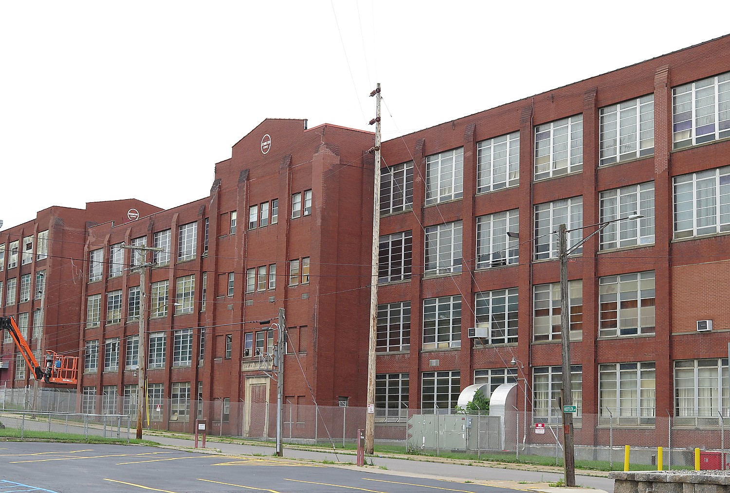
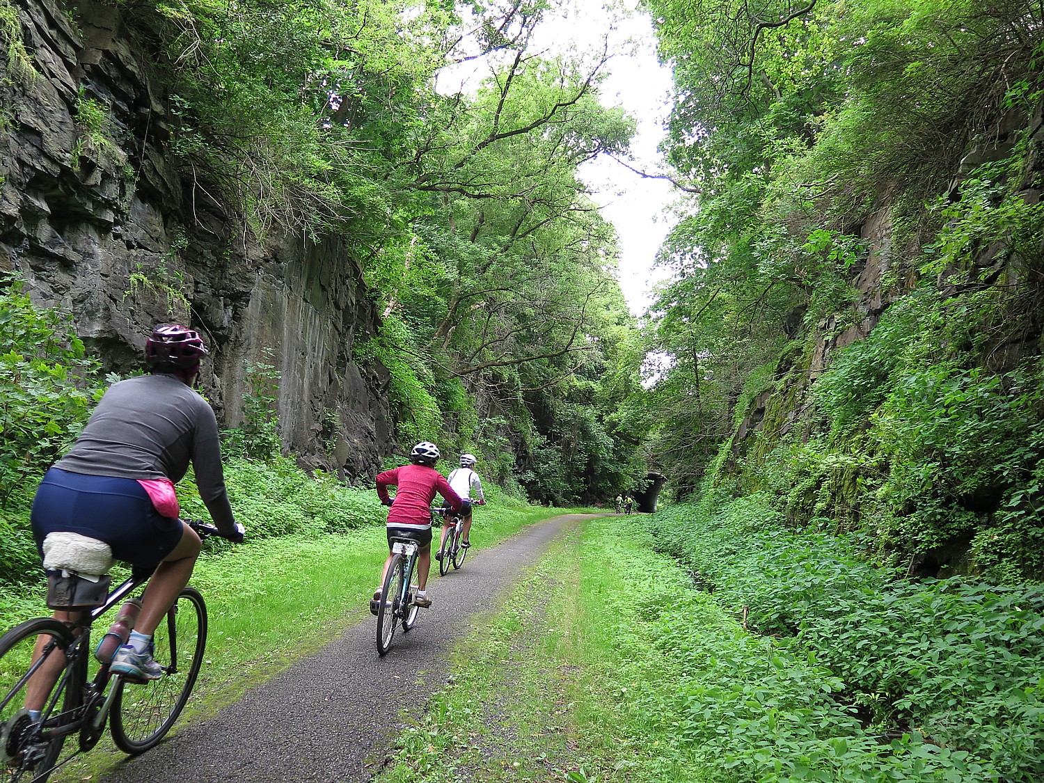
We ride past the Remington Arms Factory housed in a massive 19th century complex of brick buildings (the factory opened in 1816 and employed hundreds of people from here, which helps explain the pro-gun voting sentiment in this part of upstate New York). Two years ago, on my first Cycle the Erie biketour, I visited the Remington Museum (a highlight was seeing how they branded and marketed the guns, making a promotion deal with the celebrated Annie Oakley, for example; and how the company also produced other things, like bridges and typewriters but guns were the cash cow). I was looking forward to visiting again but it is closed and the cyclists are clearly not invited anywhere near the premises. (News update: the Remington Arms company has filed for bankruptcy protection – and I am reminded of several other periods of financial woes in its history – but I’m betting it won’t actually go out of the business of manufacturing guns.)
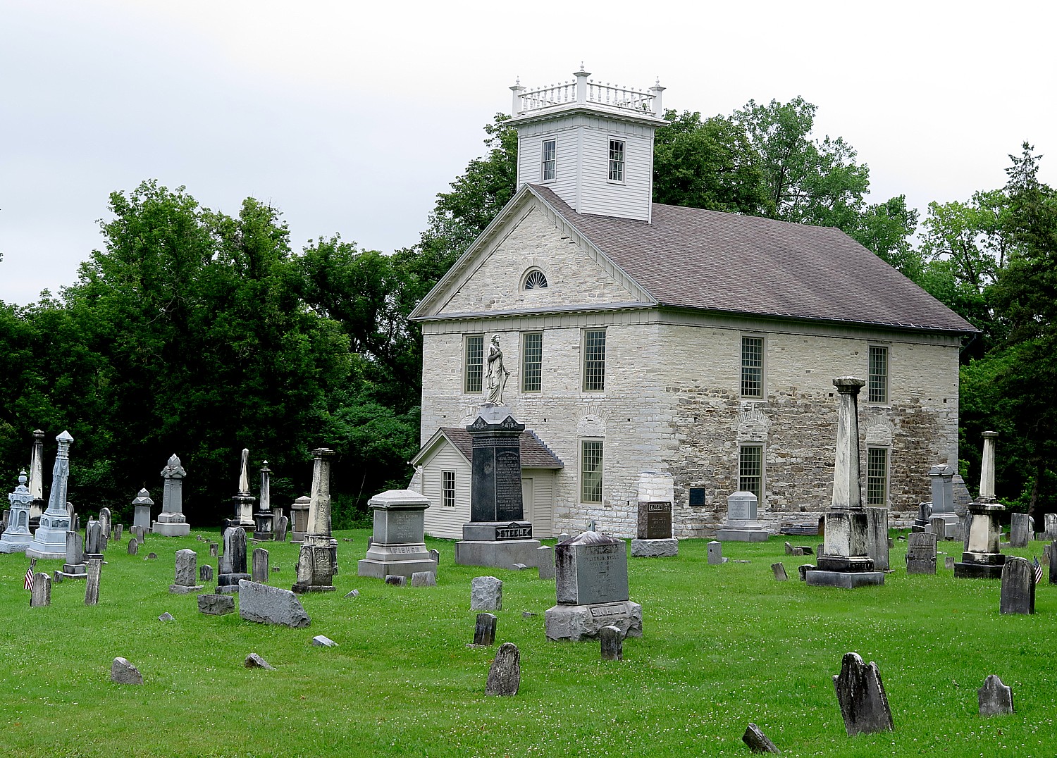
I come upon Historic Fort Herkimer Church, built around 1767 which is thought to be the second-oldest surviving church. From my visits to Fort Stanwix last evening, I understand why General Herkimer is known as “the most important hero of the American Revolution that few have heard of “. General Herkimer led that ill-fated group of 800 volunteers who were ambushed at Oriskany on their way to reinforce Fort Stanwix. Oriskany turned out to be one of the bloodiest battles of the Revolutionary War, with 600 killed in the space of an hour, but by a weird chain of events, indirectly altered the course of the Revolutionary War which the Americans were losing. Herkimer died here. Later (at Mile 43.4), we pass directly in front of Herkimer’s mansion home that is literally along the Erie Canal Trail, so I take a few minutes to walk the grounds before continuing on my way, paying respects to an unsung hero.
The second rest stop is at a beautiful visitor center at the Little Falls Canal Park on the bank of the river where I buy a long-sleeve t-shirt for added warmth). The weather improves after, with 25 miles to go, and I don’t need to wear the extra shirt.
Just beyond our rest stop at mile 41.5 at the Little Falls Rotary Canal Park, at mile 42.6, we can explore the glacial potholes of Moss Island, a National Natural Landmark and Lock 17, the highest lift lock on the Erie Canal (located .8 miles off the route but you don’t have to go back up). The geology here is most impressive: Moss Island trails let you see prehistoric potholes, extensive growth of mosses and lichens and some of the oldest rocks in North America. The Mohawk River Valley, the marker says, is the only horizontal break in the Appalachian mountain chain, which is what made it possible for the Erie Canal to be built and provide a water route west for trade and settlement of the United States interior.
We pass German Flatts townpark, which you are unlikely to take note of, except that in Fort Stanwix, I had learned that German Flatts had been burned to the ground by Loyalists, part of the brutal scorched-earth strategy waged by both sides in the Revolutionary War.
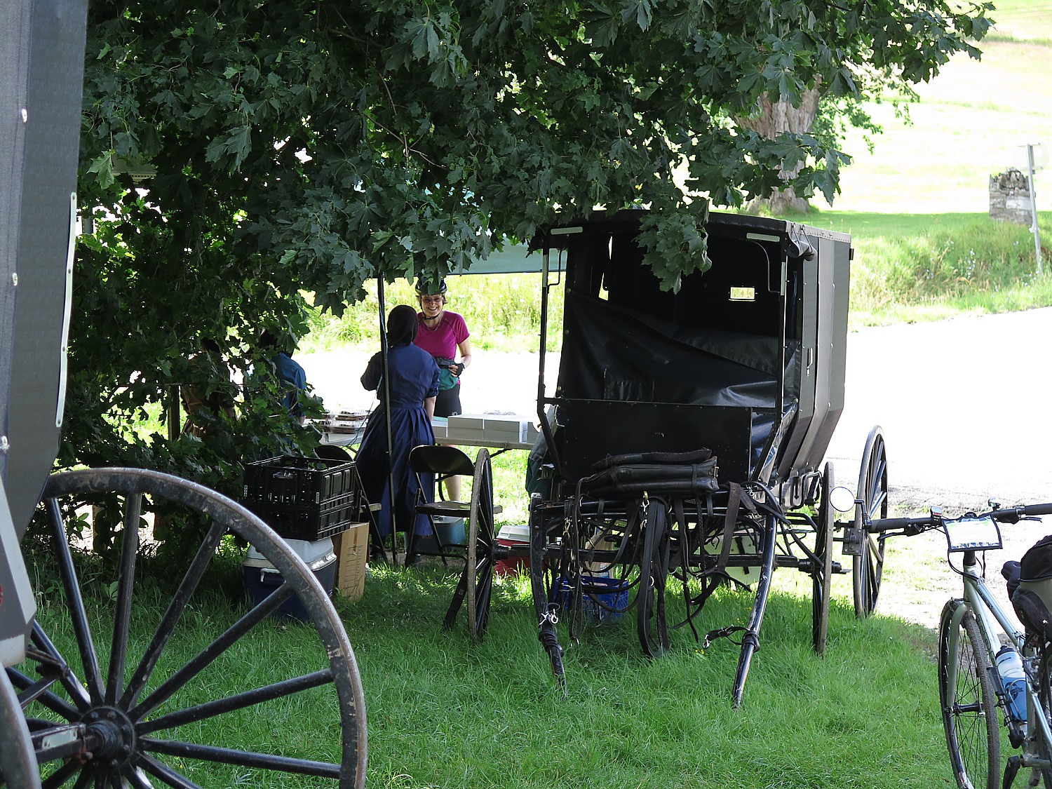
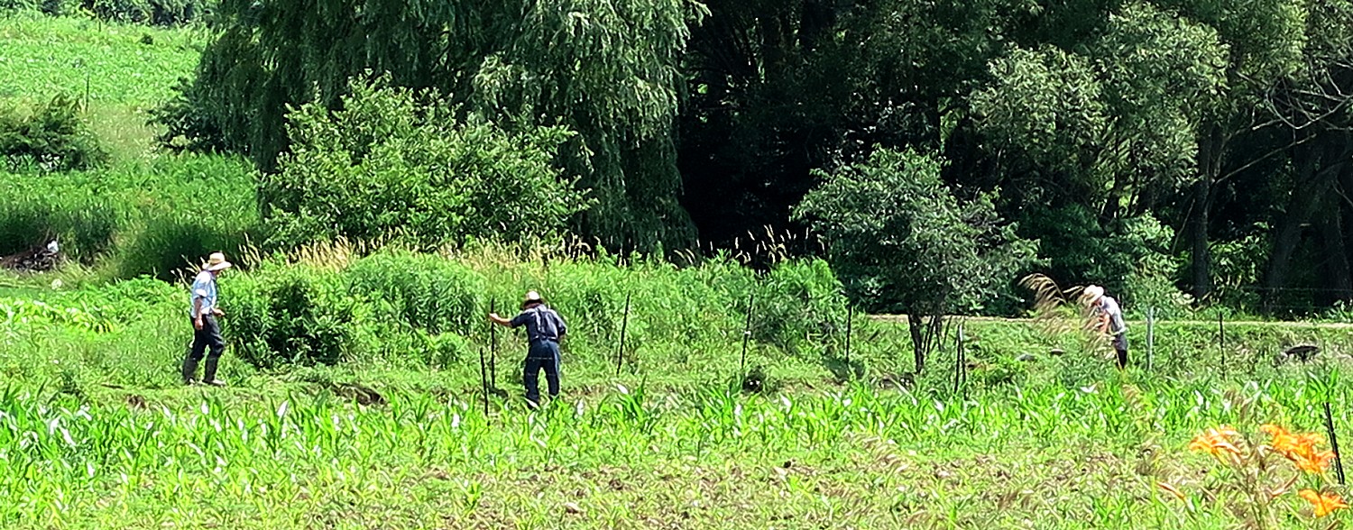
This part of our ride immerses us in colonial-era America. At mile 52.5, we have an option of two routes to take into Canajoharie and consistent with my plan to do as much as possible differently from my first Erie Canal ride, I take the blue trail option along the road to three historic sites (I miss the first one, the Nellis Tavern built in 1747, which was serving travelers along this route well before the Erie Canal was opened, in 1825); I stop at Fort Klock, built in the 18th century where there is a 1750 farmhouse, a schoolhouse and a blacksmith shop); I see the Palatine church, built in 1770 by Palatine Lutherans, from across the busy road. But I also see Amish (or Mennonite) workers using a power saw, one gets into truck; an Amish horse and buggy passes by. I am happy with my decision.
One of the challenges of the entire 400-mile ride now faces us: the last mile is the steepest climb of the trip, up to the Canajoharie High School at the very top where we will camp. There is a t-shirt for anyone who makes the climb. (I almost make it but my gears fail me, and I give up.)
The Parks & Trails NY biketour organizers mercifully have arranged buses to take us back down into the town center to the Arkell Art Museum where we are being treated to a fantastic barbecue chicken dinner, and the museum is staying open for us until 7:30 pm (at a reduced fee of $5).
The Arkell Art Museum was established by the millionaire founder and first president of the Beech-Nut Packing Company. I hadn’t visited the museum the last time (when we also had a fantastic chicken barbeque dinner here), so I made a point of visiting this time.
Bartlett Arkell, built the original Canajoharie Gallery in 1927 based on galleries he had visited on his travels to Europe. A museum designed by Ann Beha and DesignLAB Architects was added in 2007 to the existing Canajoharie Library and Art Gallery to provide new space for exhibitions and programs.
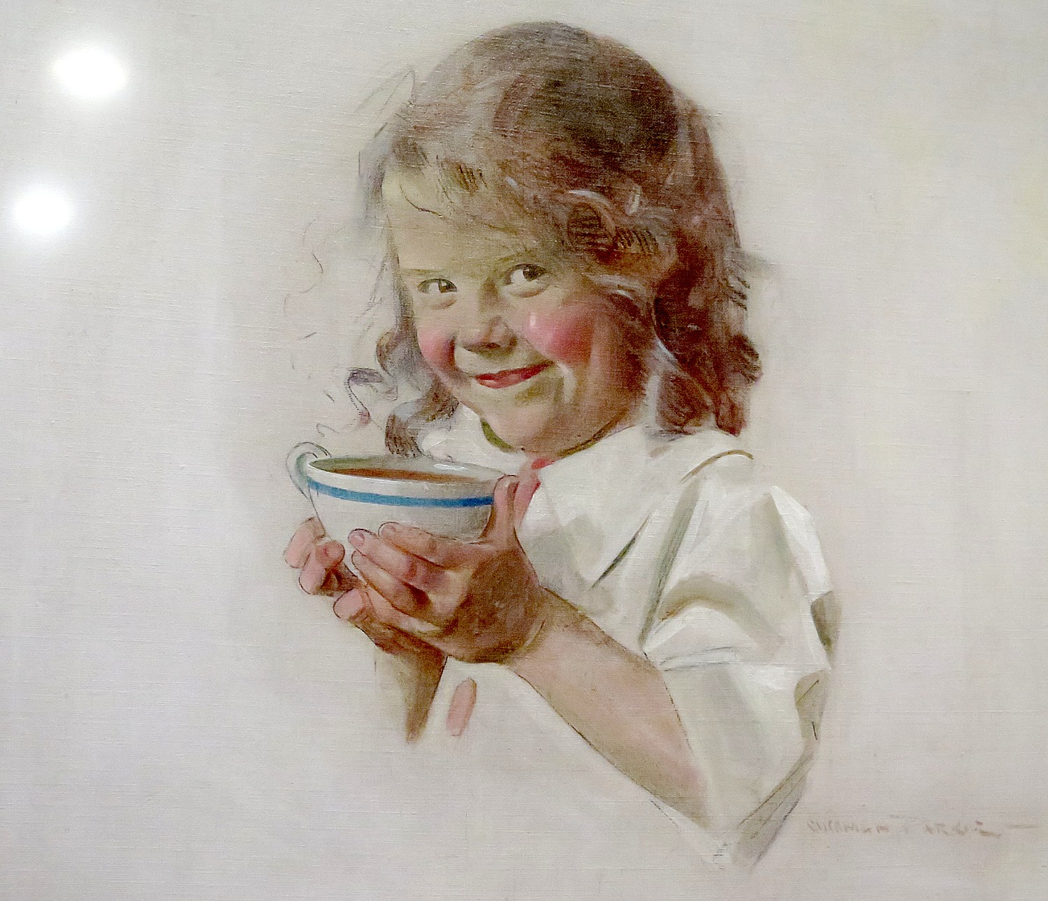
“Almost all of the paintings in the permanent collection were purchased by Bartlett Arkell for the people of Canajoharie. The American painting collection includes 21 works by Winslow Homer, and significant paintings by many distinguished artists, including George Inness, William M. Chase, Childe Hassam, Mary Cassatt, Georgia O’Keeffe, Robert Henri, and other members of The Eight. Permanent and changing exhibitions also feature selections from the museum’s Mohawk Valley History collection as well as the Beech-Nut as the Beech-Nut archives of early twentieth-century advertising material.”
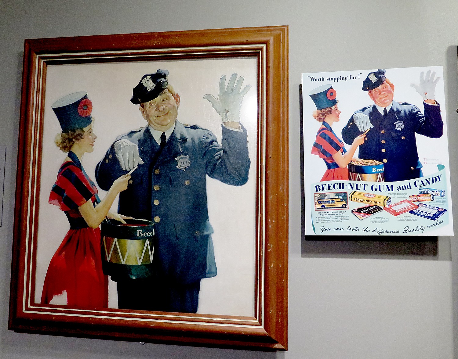
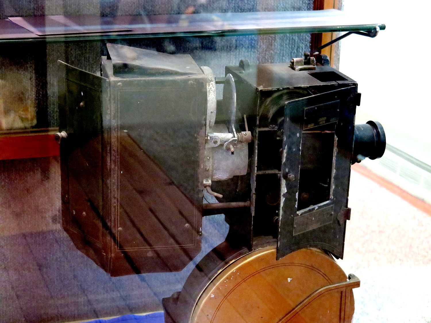
I am even more intrigued by the exhibit that tells the story of Arkell and the Beech-Nut company, which (at least the photos suggest) was the Google of its day in terms of providing a cafeteria for its workers and other employee niceties.
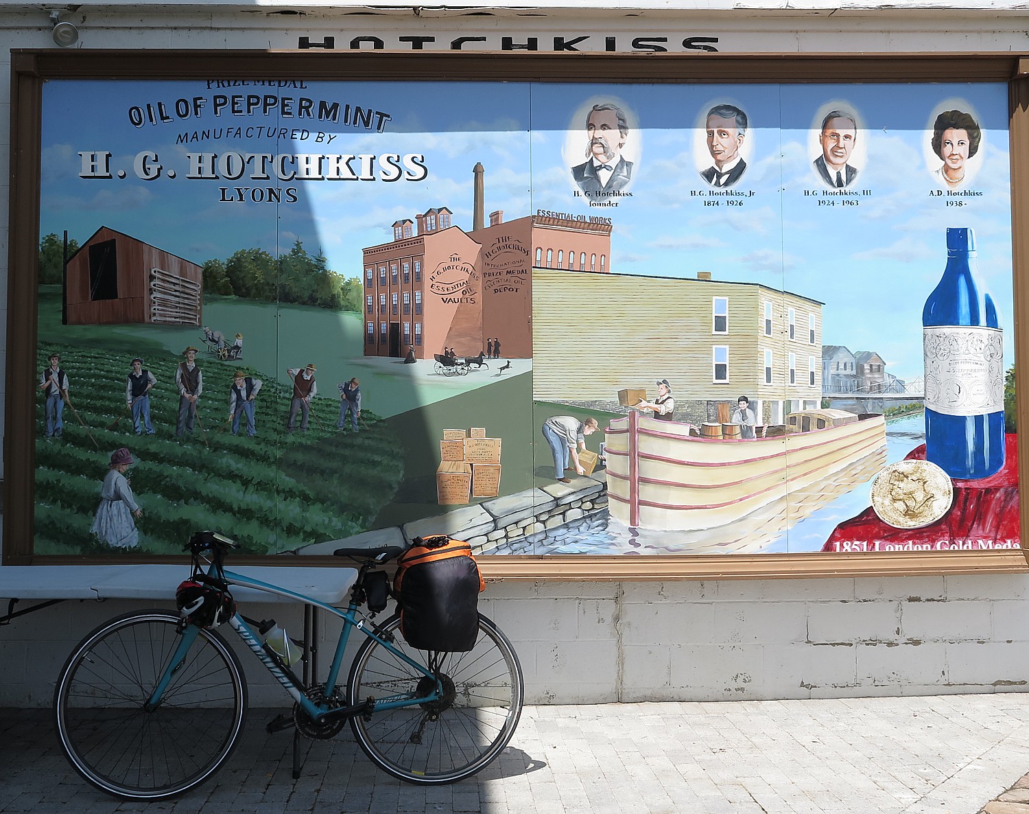
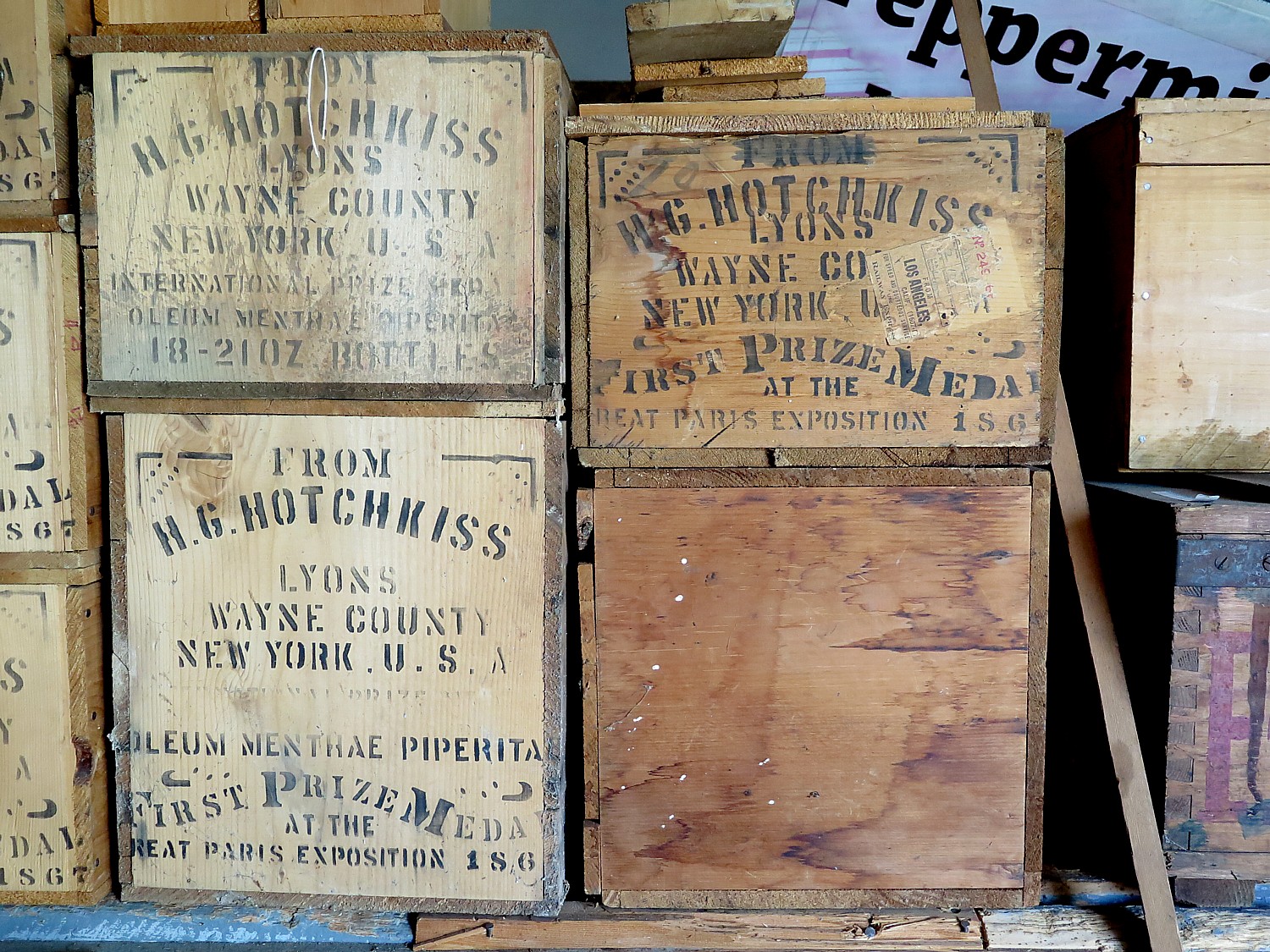
I learn that the key renovation that led to Beech-Nut’s success was the invention of the flour bag and that Beech-Nut began as a packaging enterprise; gum and candy came later (and used the peppermint oil from Hotchkiss Oil company in Lyons which we had visited).
You can see the old Beech-Nut factory (now shuttered) across the street; Beech-Nut was acquired by another company which has a new factory nearby.
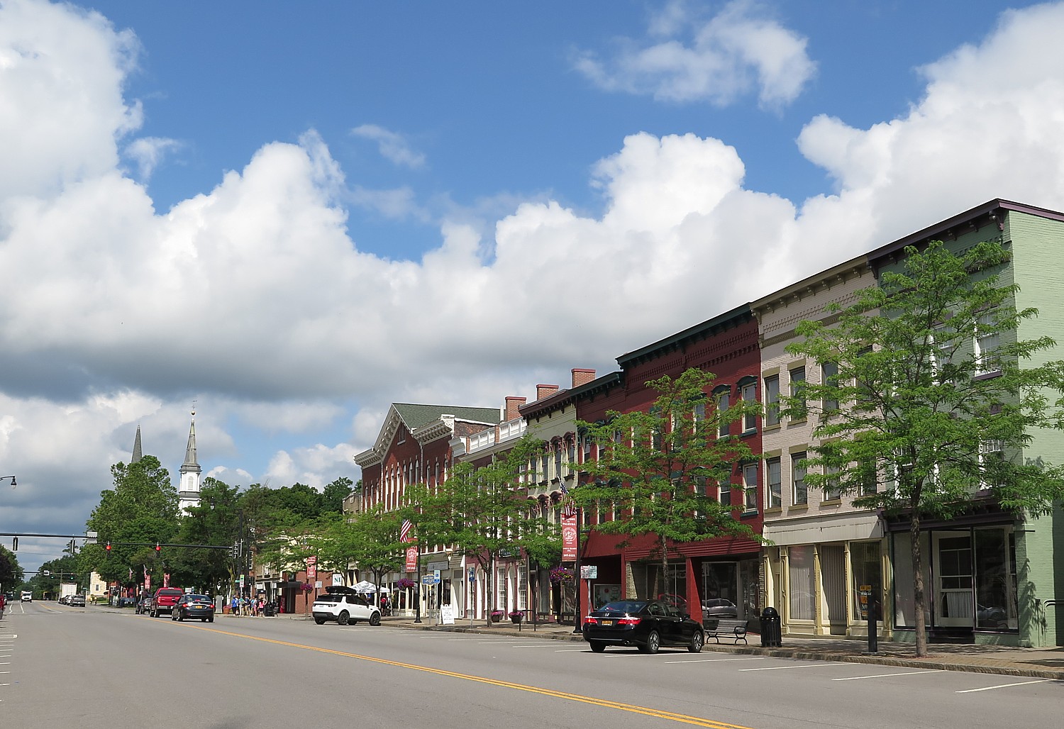
From the village center, we see the old high school, a cold, gothic style structure, up on another hill. The new high school, where we are camping, is luxurious. We wander around the quaint village, which has some striking Victorian architecture as a tribute to its wealth, before taking the shuttle bus back up the hill to our campsite.
I get back to the school in time for a rock n’ roll concert in the auditorium.
Day 7: Canajoharie to Schenectady, 46 Miles
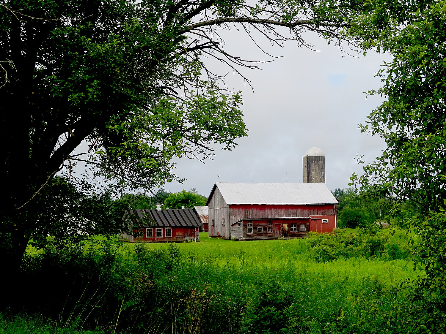
It is Day 7 of our 8-day ride and we are already feeling nostalgic that the end of our 400-mile journey from Buffalo to Albany is near. It’s a nice day for biking the 46 miles to Schenectady: perfect temperature, little wind, morning sun. The trail is nice, with a slight downhill tilt.
A fellow has stopped on the trail and I look to where he is looking and see “Big Nose & Little Nose” – where a glacier cut a path through Appalachians which is why this was always the place where the Erie Canal could be constructed (it’s hard to appreciate because of the overgrowth of trees).
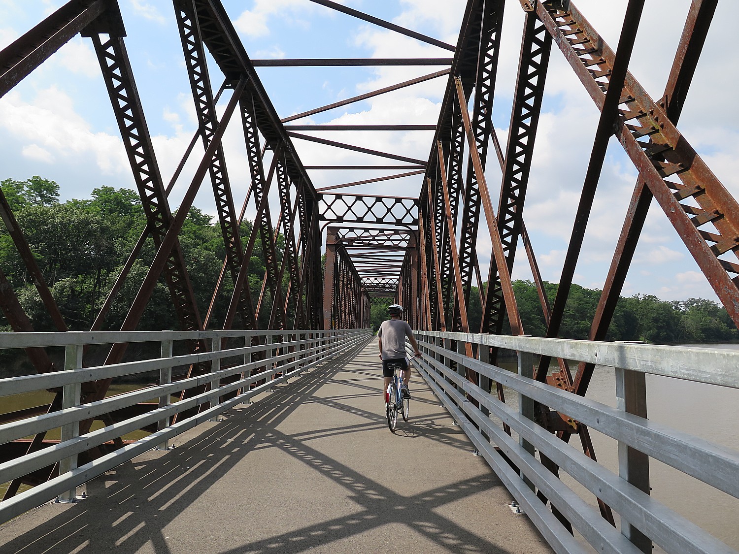
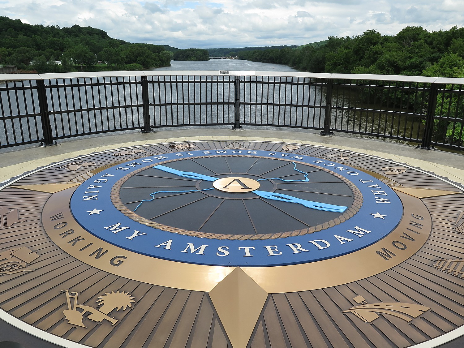
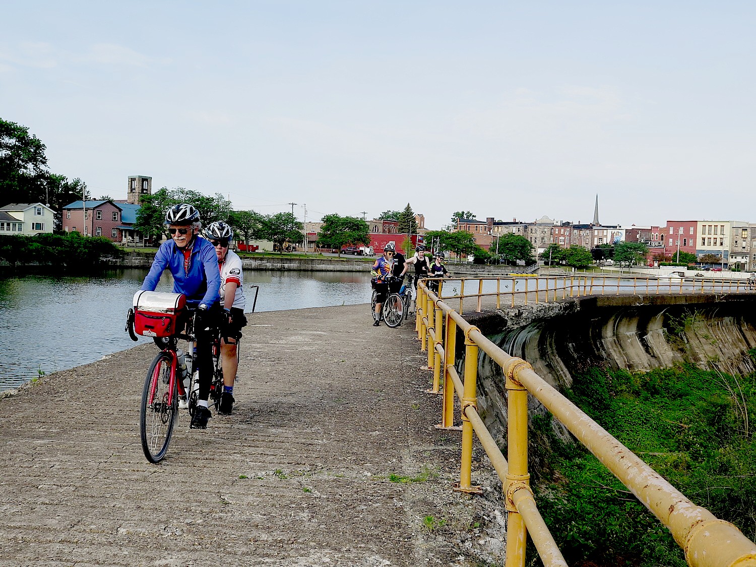
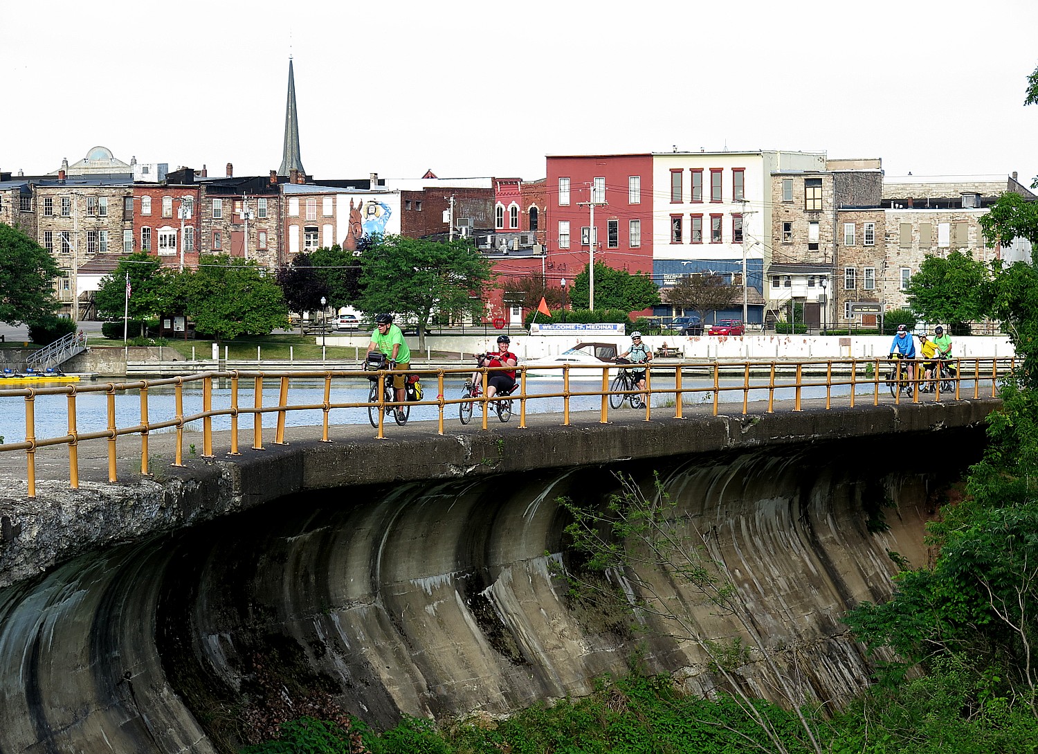
A highlight of this day’s ride is the new pedestrian/bicycle bridge across the Mohawk River connecting to Amsterdam.
The bridge is fabulous, much like the Walkway over the Hudson in Poughkeepsie (now one of New York State’s most popular attractions). I meet Michelle Eggleston who is a good-will ambassador for the town of Amsterdam, who tells me, “The bridge gives the community a sense of place,” she tells me. “More people are enjoying the river. My daughter started a kayak business, Down by the River Kayak. There are more boats on the river.”
Amsterdam used to be a center of carpet manufacturing factories which shut down, bringing down with them the economy and living standard of the city. Now many of these buildings have been repurposed to business incubators; there is ballroom in the clock tower.
“New people are moving in. Two of my four kids bought houses in Amsterdam. They are seeing it as a great place to live – the waterfront, the bike trail, restaurants they can walk to. Other business are seeing that and that Amsterdam is a great place to be, and are coming in. We had the Albany Symphony here on July 4 – thousands of people on the bridge. I’ve lived in Montgomery County my whole life – I’ve never seen that before. We have been given a sense of place; people are proud of our town.”
In one fell swoop of the space of our bikeride, today, we have gone from colonial times to the Industrial Revolution, to the post-Industrial Revolution.
Next: Schoharie Crossing, Mabee Farm, Cohoes Falls and Finish Line of 8-Day, 400-Mile Cycle the Erie BikeTour
The 20th Annual Cycle the Erie Canal ride is scheduled July 8 – 15, 2018 (www.ptny.org/canaltour). In the meantime, you can cycle the trail on your own – detailed info and interactive map is at the ptny.org site (www.ptny.org/bikecanal), including suggested lodgings. For more information on Cycle the Erie Canal, contact Parks & Trails New York at 518-434-1583 or visit www.ptny.org.
The entire Erie Canal corridor has been designated the Erie Canalway National Heritage Corridor, Waterford, NY 12188, 518-237-7000, www.eriecanalway.org.
More information about traveling on the Erie Canal is available from New York State Canal Corporation, www.canals.ny.gov.
Fort Stanwix, in Rome, New York, is a revelation. Hardly anyone knows of it – it doesn’t even seem to merit a footnote in history – but it played a role in two incidents, one during French & Indian War and one during Revolutionary War, that proved pivotal for American history, like a tiny peg in the giant cogwheel of history.
A National Historic Site, Fort Stanwix also offers one of the best presentations of tribal Indians and European settlers in the colonial and Revolutionary War period. Indeed, the Erie Canal was built across what was the Oneida Carrying Place, vital to the earliest traders. This fort is where the British negotiated and signed the 1768 treaty with the Six Nations of the Iroquois Confederacy. I suspect this area is also where Melinda Gage drew upon what she learned of the Oneida Indian women to form key planks of women’s rights movement.
The presentation here (in contrast to how pitiful the Womens Rights National Site in Seneca Falls is) is fantastic, both in the exhibits and the commentary. Engaging, informative, dramatic, thoughtful. Also, the park rangers are in period dress so you really feel as if you have stepped back in history. You wind up speaking to these people as if it was 250 years ago.
This part of the eight-day Cycle the Erie bike tour, 400 miles from Buffalo to Albany organized annually through Parks & Trails NY, takes us back to the very beginning of the United States, to its native American origins, European colonization and its emergence as an independent nation. It is 400 miles and 400 years of history.
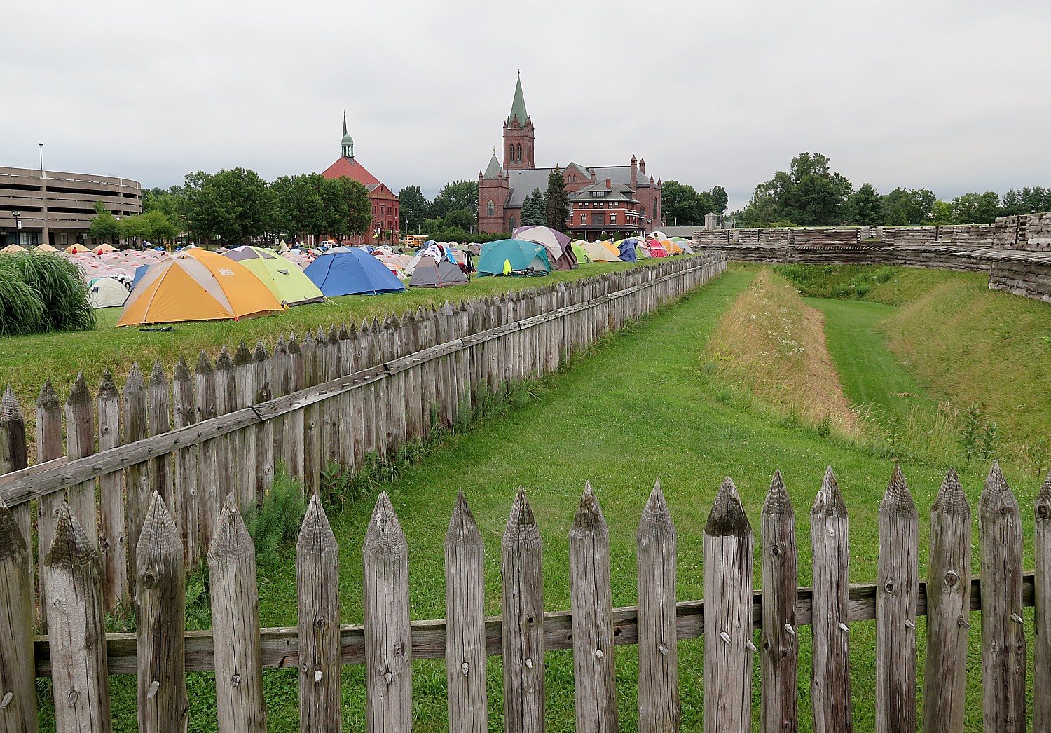
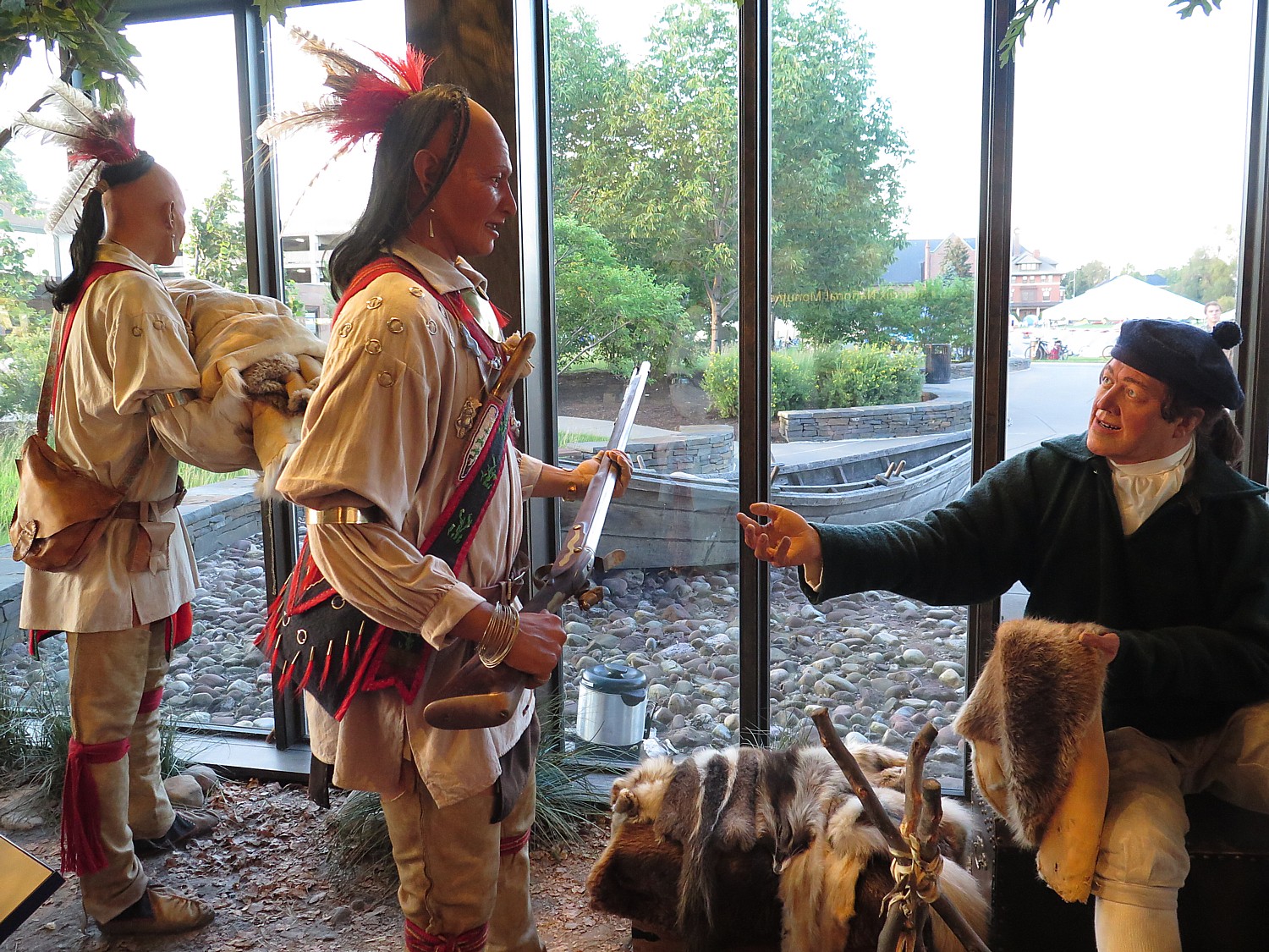
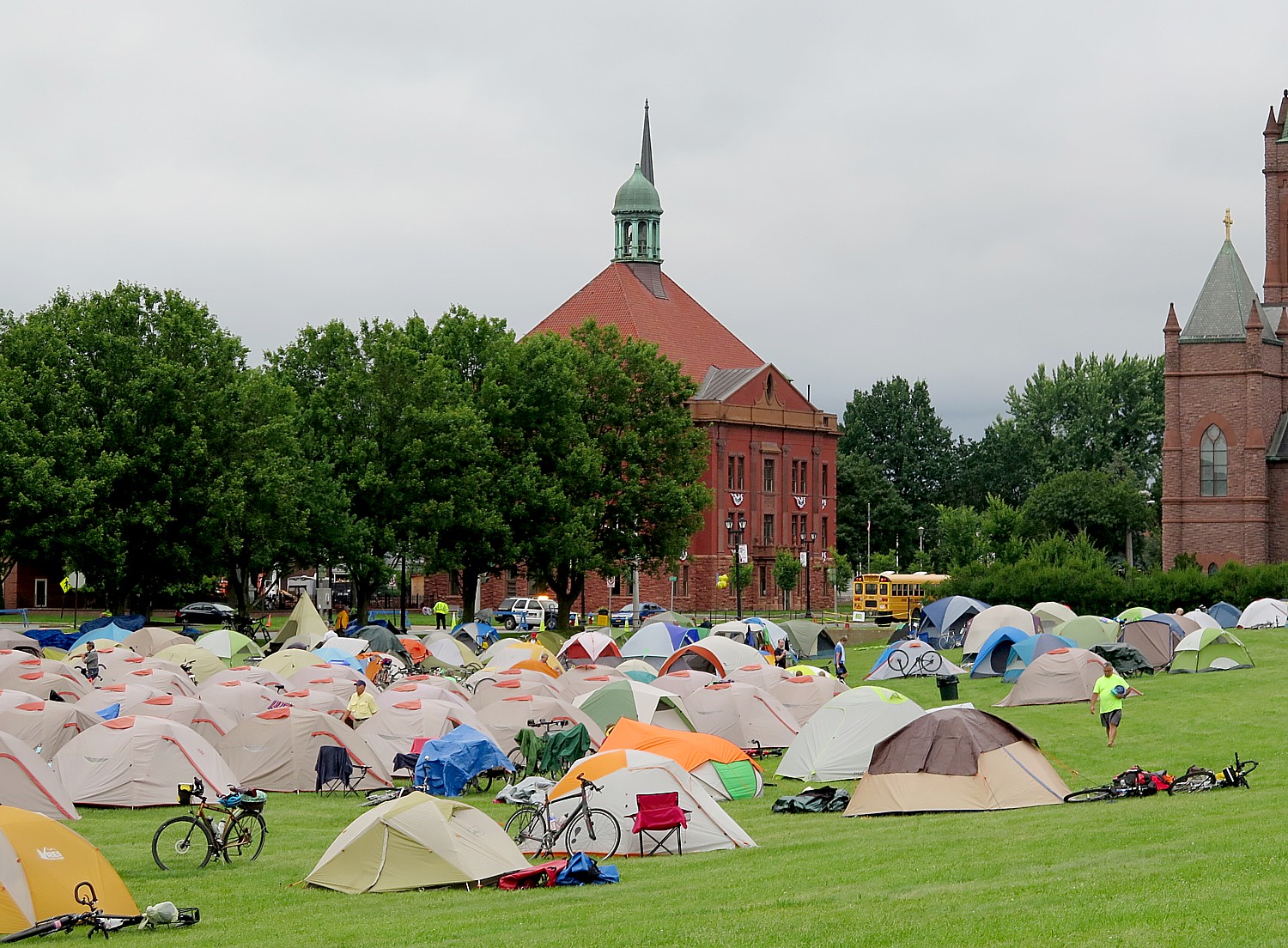
At Fort Stanwix National Monument in Rome (where the 750 of us actually camp out outside the fort, making it look like an army bivouac), we are put squarely into the drama of the American Revolution. Interpreters in period dress take on the roles of American soldiers and British prisoners in period dress – creating such realism that you appreciate so much more the context and the conditions. Most surprising, is that it also tells the story of the Native Peoples, almost entirely forgotten as having an equal stake in the Revolution. (It didn’t go well.)
The reconstruction of Fort Stanwix comes alive through the personal stories recounted inside the fort. You get to experience the American Revolution and the Siege of Fort Stanwix through the eyes of soldiers and their families, American Indians and traders. This is accomplished through the realistic recreations (especially of the fort), the costumed interpreters, outstanding markers, artifacts, the art, portraits and graphics, and superb videos. They create characters who are composites of actual people, and you hear their voices in a context.
It’s humbling to realize how little you actually know about Colonial America and the American Revolution.
The Fort puts the competing interests of the Patriots, Loyalists and Indian peoples into balance. You have empathy for each. (Especially the Native Americans, who were dragged into the fight, upsetting a long-standing peace among the Confederacy of Iroquois nations, found their whole society upended, and were literally screwed by every European and American they dealt with. George Washington, shockingly, even betrayed the Indians who were allied with the Patriots). But you also understand better the Loyalists, whose property was being seized by the Patriots, and the Patriots, who were not necessarily British subjects, but German and Dutch colonists – whose property was being burned by the Loyalists.
The National Park Service is keeping the fort open late for us and hosting tours, and is keeping the visitors center open all night (the indoor camping location, though, is off-site at a local YMCA).
We arrive at Fort Stanwix after biking 50 miles from Syracuse, a good chunk of our Day 5 ride in drenching rain. I set up my tent (fortunately, the rain stopped just as I came into Rome), grab a shower, and race over to the visitor center to join a guided tour. I am so lucky to attach myself to the same Park Ranger as I toured with two years ago, on my first Cycle the Erie tour.
Fort Stanwix as we see it today literally rose out of ash heap of history – reclaimed from earthly grave.
At one point, the fort was the reason Rome developed at all, but ultimately Rome grew up over its ruins, from fire and neglect. Then the city Rome went through a decline. But in 1960s, as part of urban renewal, planners wanted to redevelop the dilapidated downtown. A grassroots movement grew up to excavate the fort; meticulous archaeology unearthed some 400,000 artifacts. (Visitors can actually get a back-stage view of the archaeology being done during summer tours.)
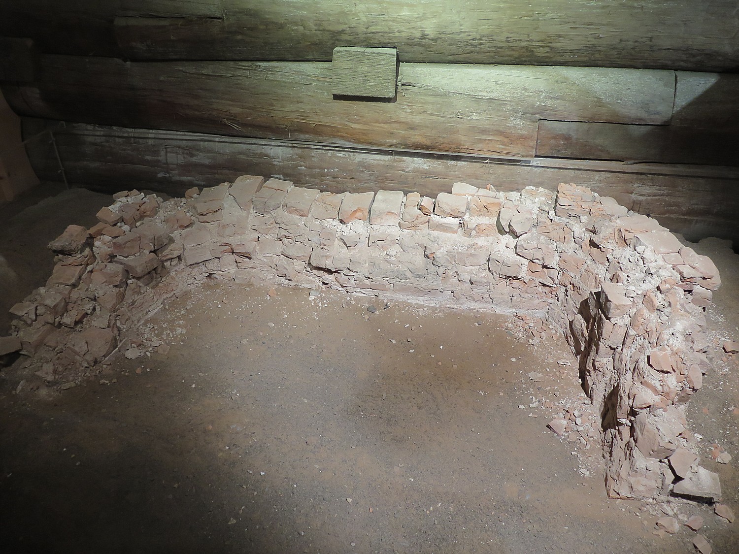
The National Park Service was faced with a quandary – its mission at the time discouraged reproduction or re-creation of a historical site. But there were strong arguments in favor of reconstructing the fort: they found the original fireplace (the only part of the fort that remains of the original, which we get to see); had the original plans (obtained from British archives); plus papers and drawings so they could reproduce it accurately; and letters of soldiers so they had a better idea of what happened here.
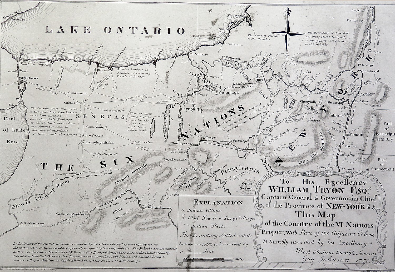
The location of this fort is significant. It sits along “Six Miles that Changed the Course of America,” reads the National Park Service brochure. “For thousands of years, the ancient trail that connects the Mohawk River and Wood Creek served as a vital link for people traveling between the Atlantic Ocean and Lake Ontario. Travelers used this well-worn route through Oneida Indian territory to carry trade goods and news, as well as diseases, to others far away. When Europeans arrived, they called this trail the Oneida Carrying Place and inaugurated a significant period in American history – a period when nations fought for control of not only the Oneida Carrying Place, but the Mohawk Valley, the homelands of the Six Nations Confederacy and the rich resources of North America as well. In this struggle Fort Stanwix would play a vital role.”
The British built the fort in 1758 with the permission of the Oneida to protect their commerce, but abandoned it to cut back on spending after the French & Indian War (taxes imposed by Britain to recoup their expenditures is what incited the American Revolution).
The fort was never put to the test, because the French were defeated elsewhere. But though Fort Stanwix fell into decay, the site was still important for trade and relations with the Six Nations.
It is here at Fort Stanwix, in 1768, after the Europeans had spread into “empty” spaces and fought with the Indians, that Sir William Johnson, Indian Supervisor, negotiated a treaty with the Six Nations of the Confederacy, basically laying out the terms that everything east of the fort would be for Europeans, and everything west would be for Indians.
“Over 3,000 American Indians from the Six Nations, Shawnee, Delaware, Mingo and other dependent tribes attended the treaty negotiations,” the notes read. “Ignoring British Crown instructions, Sir William Johnson encouraged the Six Nations to draw a new boundary line favorable to their mutual interests. Rather than settling tensions, frontier strife between colonists and American Indians increased.”
“I can never look upon that (Proclamation of 1763) in any other light… than as .. temporary expedient to quiet the mind of the Indians,” land speculator George Washington wrote to surveyor William Crawford, 1767. “Any person… who neglects the opportunity of hunting out good lands…for his own, in order to keep others from settling them, will never regain it.”
Meanwhile, British attempts to govern the growing colonies from afar and the associated costs led to strained relations. Hoping to defray the cost of colonial administration, the British parliament taxed many goods arriving in North America. But growing independence and identification as Americans caused many colonists to question British rule. Tensions steadily increased until American “Patriots” declared their independence in 1776.
The exhibit gives me a new perspective: a good number of colonists were not British – they came from Germany, Holland and other places. I realize that becoming a Patriot would not have been such a hard choice as for those with British ties.
“For colonists living on the frontier, the issues included British imposed restrictions on trade, limits on settlement, and continuing violence with American Indians. As war approached, many colonists had to choose between remaining loyal to the King or joining the movement to American independence.” Each side considered themselves “patriots”. But those who stayed loyal to the Crown became known as “Loyalists,” while those who sought independence called themselves “Patriots.”
In 1775, Patriots and Loyalists began struggling for control of the New York frontier. The British invaded the Mohawk Valley in 1777. Their strategy was to capture an important east-west supply route, deprive American soldiers of food grown in the valley, and strengthen Six Nation and Loyalist Alliances, and slice the colonies.
British General John Burgoyne led an invasion of New York from the north and west. His army advanced from Montreal towards Albany. A second force commanded by General Barry St. Leger invaded the Mohawk Valley. Strategically, St. Leger aimed to control the Oneida Carrying Place, create a diversion to split Patriot forces, and reinforce Burgoyne. Politically, he wanted to rally support among American Indian allies and Loyalists.
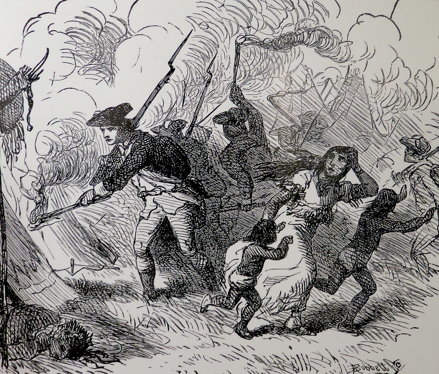
Patriots had taken over Fort Stanwix in 1777 and renamed it for General Schuyler. The fort was under the command of Col. Peter Gansvoort when it came under siege by the British. Some 2,000 British troops set up a blockade, helped by Indians allied with the British, which went on for months.
General Nicholas Herkimer assembled an 800-man militia to come to the fort’s aid, but was betrayed (by Molly Brant, a Mohawk woman allied with the British, and the second wife of Sir William Johnson). Herkimer’s militia was ambushed along the way at Oriskany. This became one of the bloodiest battles of the Revolutionary War, in which 600 were killed in a matter of hours. General Herkimer, himself, was fatally wounded, dying 10 days later. (Later in our trip, we pass Herkimer Church where he died, and his home.)
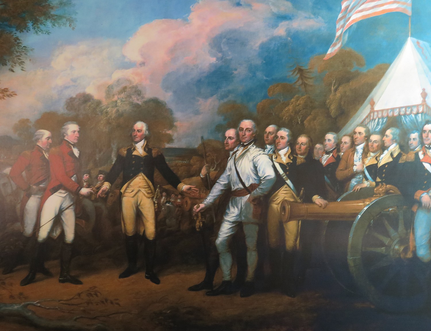
But the Indians allied with the British, hearing that the Americans had plundered their encampments, left the fort to go to their families’ aid. Fearing that more American reenforcements were on the way, the British retreated, handing the Patriots their first victory (of sorts) of the Revolutionary War. This, critically, boosted the Americans’ morale, and helped set the stage for the Patriots’ victory at Saratoga (under General Benedict Arnold).
This, then, is what changed the course of the war. Because of the victory at Saratoga, which was the unanticipated consequence of what happened at Oriskany and Fort Stanwix, Americans won the critical support of France (long time enemy of Britain), without which, the Americans could not have defeated the British and the British were forced to fight a world war.
In 1778, the British again attempted a formal invasion of New York, planning to burn the Mohawk Valley fields of grain that supplied the Continental Army.
The last battle here took place in 1780, when a work party outside the fort was ambushed by British-allied Indians and Loyalists.
But for most of the Revolutionary War, “It is frustrating for the troops to be here, the backwater of the Revolution,” Park Ranger Bill Sawyer, who is dressed in the uniform of the 3rd New York regiment, tells us. The men were upset because they were far from the fighting. But “Washington was vindicated in his decision to keep it fortified because the British refortified Fort Ontario. Washington wanted to block the British.”
And I am certain that those disgruntled soldiers confined to Fort Stanwix never appreciated that as a result of these events at Fort Stanwix, the British grand plan to slice off New York from the rebelling colonies and cut off the Continental Army’s source of food, failed. Instead, the Americans had the critical support of France.
Fort Stanwix: Living History
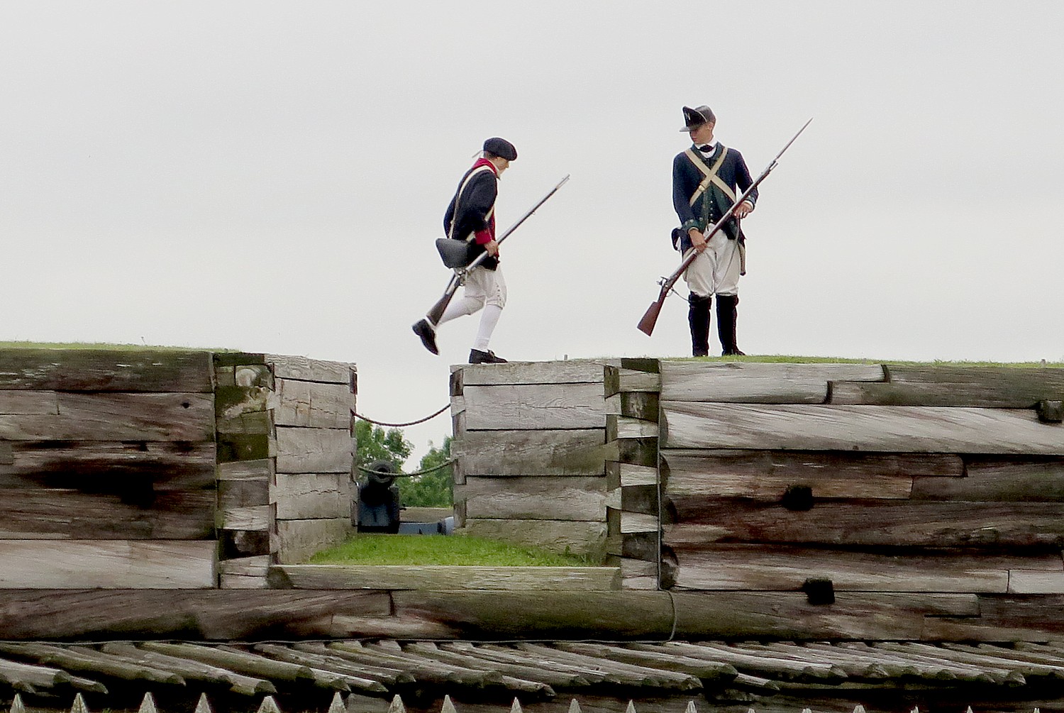
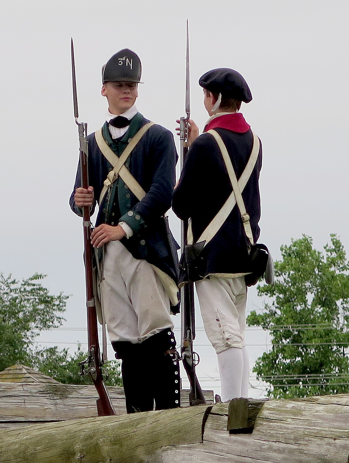
After this introduction in the Visitors Center, Park Ranger Bill Sawyer, walks us into the Fort, where we are greeted by costumed interpreters dressed as American soldiers. A couple of teenage boys (summer interns at the fort) patrol the ramparts of the fort. You are immediately transported back centuries.
This fort is a nearly complete reconstruction on the original foundation – the only thing original is a fireplace (that can be seen in one of the rooms). Over the decades, Rome was built up on top of the fort. Archaeological excavations conducted in 1970-73 uncovered the site, but all the artifacts were removed, the site completely cleared, and the fort rebuilt with new materials.
The fort held 800 soldiers (twice the number the fort was built to hold); families of soldiers (who couldn’t afford to maintain them in their homes) camped in the ditch outside the wall; women would try to get jobs within the fort. People died of disease and winter cold.
By February 1778, the soldiers’ clothing was reduced to rags, they hardly had any bedding left or blankets. They would have been stationed here for anywhere from 4 months to 2 years. Morale was terrible.
We see the harsh living conditions. Artillery men, though, had somewhat better accommodations, because they were specialists. “They had to have knowledge of math and the use of measuring tools to calculate the trajectory of cannon and mortar. They had better pay and living conditions.”
We visit the different rooms for the junior officers, a family quarters, the officers’ lodging, the orderly room, the surgeon’s day room. The Commandant’s HQ had a fine room befitting his wealth and high station and had a private assigned.
On my first visit, two years ago, I was able to see an outstanding film that depicted life in the fort and how the soldiers suffered. “The walls imprisoned them, supplies cut off. They were overcome by boredom and hunger. They wanted to go fight. Five men deserted, headed to Canada. Gansvoort sent out a band of Indians to recapture them. They were executed as an example to the rest….It was a forsaken place. Finally, they were sent to war.”
On my first visit, one of our cyclists, Peter Reeve, was British, though living in Maryland since 1981, and gave me the British perspective: “The British people didn’t care to keep America,” Reeve told me. “They didn’t want to spend the money fighting the Revolution. Most British generals were against the tax acts. General Howell supported the Americans’ grievance.”
While major battles took place in the South, minor battles and guerrilla-style warfare characterized the fighting in New York. General Washington lamented that crops that were being destroyed in these raids were needed to feed his army surrounding New York City. These raids and counter-raids were waged by Patriots, Loyalists, American Indians, British and British-allied Germans, alike, often against civilians, and were among the most brutal of the war.
The fort served as an isolated outpost for another four years after the siege. The inaction drained morale and the constant shortage of food and munitions made the soldier’s life insufferable. Regular petitions for transfer and increasing desertions reflected the wretched conditions.
By 1779, British strategy changed and they invaded the other colonies. Though Britain won most of the battles, they failed to destroy the Patriot army. Outmaneuvered, the British surrendered at Yorktown in 1781, bringing an unofficial end to the war.
Following their 1781 defeat at Yorktown, the English saw little value in continuing large scale war in America. Two years later, war ended with the signing of the Treaty of Paris by the US, France and Britain. As the British Army withdrew, Loyalists migrated to Canada and elsewhere.
American Independence Voids Treaty with Indians
The 1783 Treaty of Paris officially ended the war – at least between the British and the colonists. However, no terms of peace were negotiated for the American Indians. In later years, American Indians negotiated their own treaties with the Patriots (who tossed out the Treaty of 1768.)
The focus at Fort Stanwix on Indian history is very clear from the first display that greets you as you enter the Visitors Center – of trappers trading with Indians.
American Indians’ history, NPS Ranger Sawyer says, “was long ignored. Now we interpret to include it.”
Indeed, Fort Stanwix offers one of the most interesting and informative presentations about American Indians outside of the Smithsonian’s Museum of the American Indian in Washington DC.
I am most surprised to see that the Indians lived in villages, with a grid street plan; they wore western-style shirts and many had European names. They had many of the same household goods as the colonists – an indication of how well-developed trade had become, and in fact, how dependent the Indians had become on trade.
The constant theme in the history between the Indians and European settlers, though, was how the Indians were constantly betrayed.
The Indians wanted no part of the Revolutionary War and tried to stay neutral. That changed with the Battle of Oriskany, though.
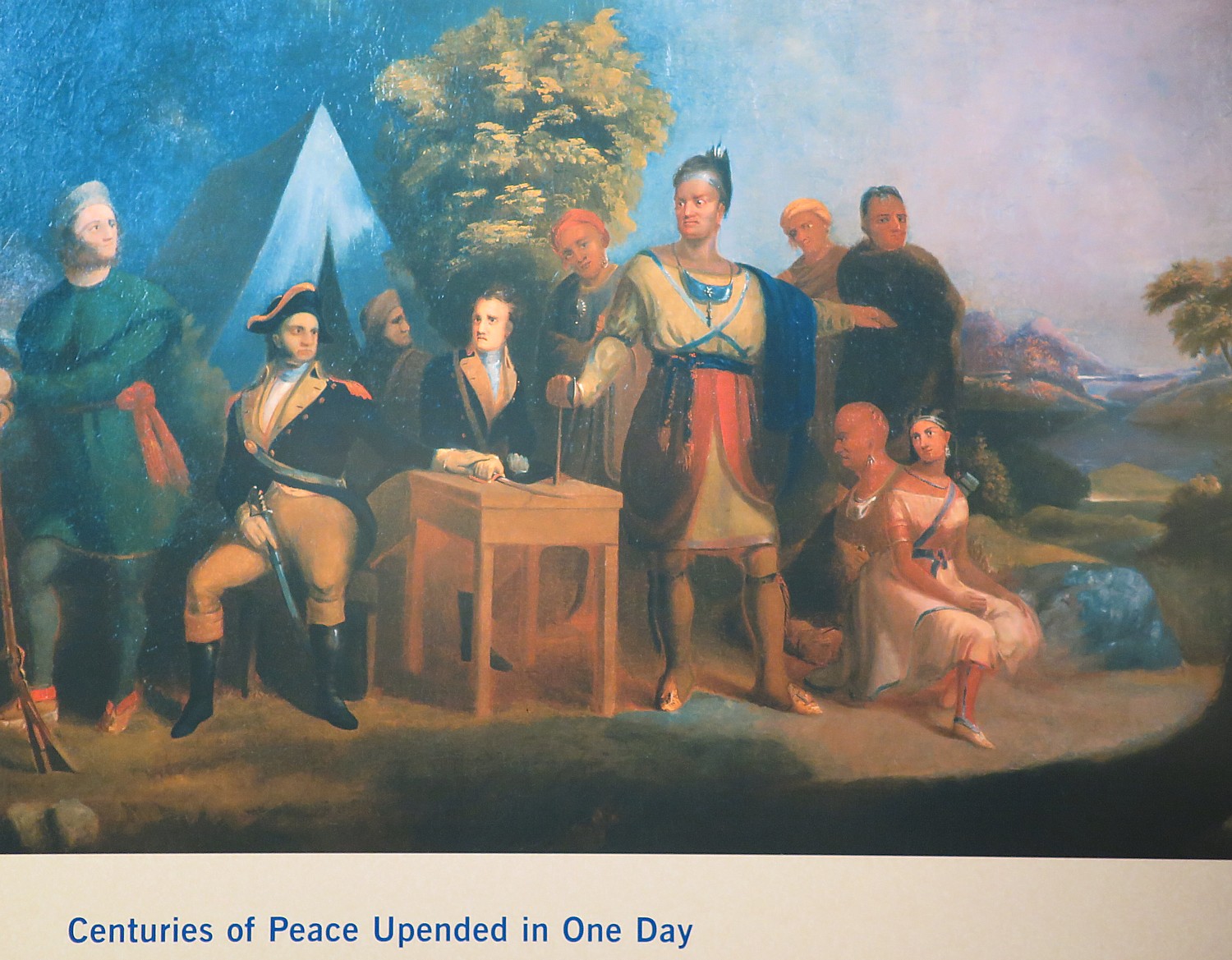
The Revolutionary War split the Iroquois Confederacy (“Iroquois” was the French name for the Haudenosaunee, “People of the Longhouse”). Mohawks led by Joseph Brant (the brother of Molly Brant who triggered the ambush of Herkimer’s militia at Oriskany) adhered to their long-standing allegiance to the British, and eventually most Cayugas, Onondagas, and Senecas joined them. But Oneidas and Tuscaroras sided with the Americans, owing in large measure to the efforts of their Presbyterian missionary Samuel Kirkland. The Revolution became a civil war for the Iroquois, as Oneidas clashed with Senecas at the Battle of Oriskany in 1777. (“Centuries of peace upended in a single day,” the notes read.) Iroquois suffering was compounded in 1779 when General John Sullivan, on orders of General Washington, led an American army through their lands, burning 40 towns and destroying crops.
Both sides practiced a scorched earth strategy. “Raids by Loyalists and British-allied American Indians in 1778 destroyed Patriot settlements in Pennsylvania and New York. In 1779, General Washington ordered Generals Sullivan and Clinton to retaliate and destroy Six Nation towns, homes and food. Soldiers from Fort Stanwix tricked Patriot-allied Oneida warriors into raiding the British supply depot at Oswegatchie before leaving to destroy Onondaga towns. These raids and counter-raids continued until 1783.” Afterwards, General George Washington was given the name “Town Destroyer” by the Seneca people.
The Americans, who always wanted to take over Indian lands (another sore point that led to wanting independence from Britain), nullified the treaty of 1768 as soon as they won independence in 1783, claiming it was negotiated with the British and did not apply to the new nation. The Americans voided the treaty with the Cayuga, Canandagua and Mohicans claiming that these nations sided with the British, and pushed them further west.
In 1784, Governor George Clinton (uncle of Dewitt Clinton who launched the Erie Canal project), who was not a supporter of the federal Constitution, decided to make his own treaty. The new treaty, negotiated at Fort Stanwix with the Oneida who allied with the Patriots, effectively relegated three Oneida Indian nations to a measly 32 acres, in which they were surrounded on all sides by settlers. (The Oneida tribe had already split, with half moving to Wisconsin).
“Now, for first time in history, the Indian nation is relegated to a reservation, surrounded by Europeans (whites),” Sawyer tells us.
By the 1790s, houses were built by the fort; by the mid-1800s, the fort was demolished and the city of Rome built on top of the ruins. In 1935, a national monument established, though by then the site a commercial district with no trace of the fort.
By the 1960s,a grassroots urban renewal effort was underway to revitalize the downtown and restore the fort, but this required the National Park Service to go against its long-standing policy: “We protect, preserve, interpret any natural thing, but nothing was left of fort.” But political pressure mounted to create a new Revolutionary War “themed park” to open in time for the bicentennial in 1976.
A massive excavation got underway by local volunteers and in the process, 400,000 artifacts were uncovered in three years of archaeological work.
They had a the foundation plus they had the original plans (from the British museum) and maps, clothing and receipts, enough to reconstruct the fort exactly as it would have looked.
Ranger Sawyer, who tells me his interest in becoming a park ranger was ignited during summer internship at the fort when he was a teenager and got “hooked”, says that the 400,000 artifacts are housed in a cultural conservation center in the Visitors Center.
In summer, on Wednesdays & Thursdays, at 11:15 & 1 pm, they open up back area to guided tours to see archaeologists working with the artifacts.
I am literally the last person out of the fort when they close at 9 pm, and walk a block to get some pizza for dinner (this is one of two nights when we are on our own for dinner and the city of Rome has provided a list of eateries.)
The 20th Annual Cycle the Erie Canal ride is scheduled July 8 – 15, 2018 (www.ptny.org/canaltour). In the meantime, you can cycle the trail on your own – detailed info and interactive map is at the ptny.org site (www.ptny.org/bikecanal), including suggested lodgings. For more information on Cycle the Erie Canal, contact Parks & Trails New York at 518-434-1583 or visit www.ptny.org.
The entire Erie Canal corridor has been designated the Erie Canalway National Heritage Corridor, Waterford, NY 12188, 518-237-7000, www.eriecanalway.org.
More information about traveling on the Erie Canal is available from New York State Canal Corporation, www.canals.ny.gov.
Next: Cycle the Erie, Days 6-7: Erie Canal Promotes Rise of America as Global Industrial Power
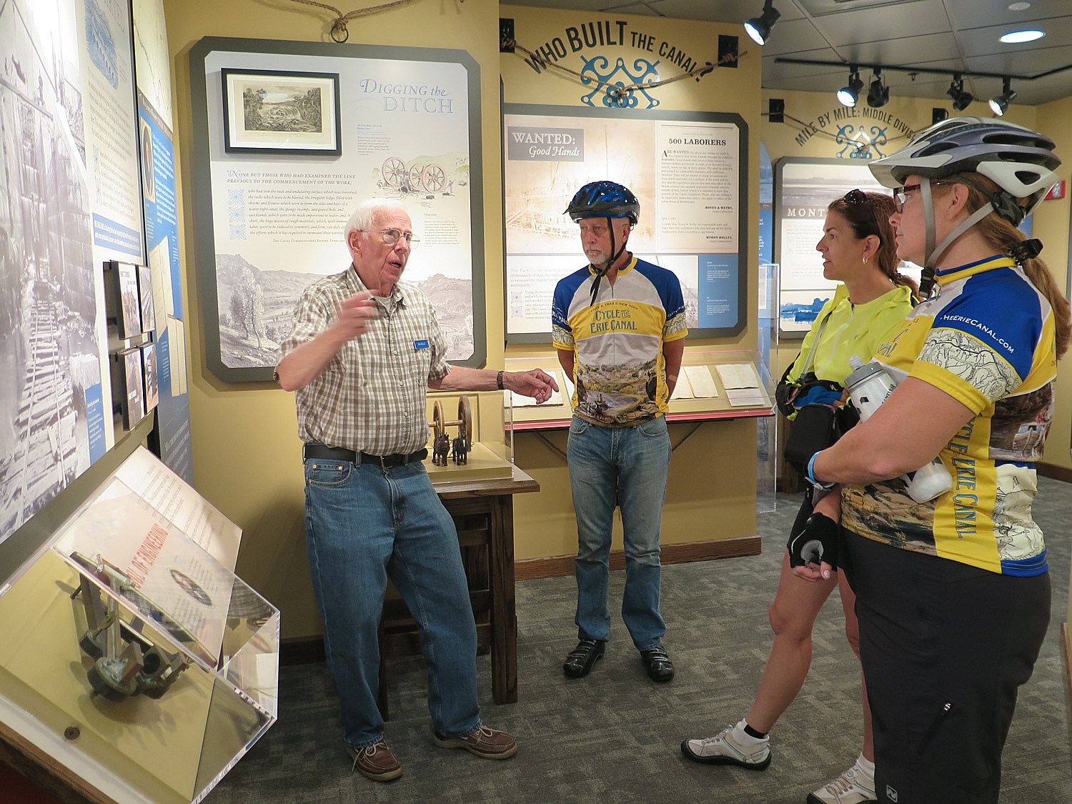
Day 5 of our 8-day, 400 mile Cycle the Erie biketour from Buffalo to Albany offers a deep-dive into the history of the Erie Canal, an appreciation for the engineering marvel that it was, and how it changed American culture and society, as our 50-mile ride today brings us to a sequence of museums and historic sites.
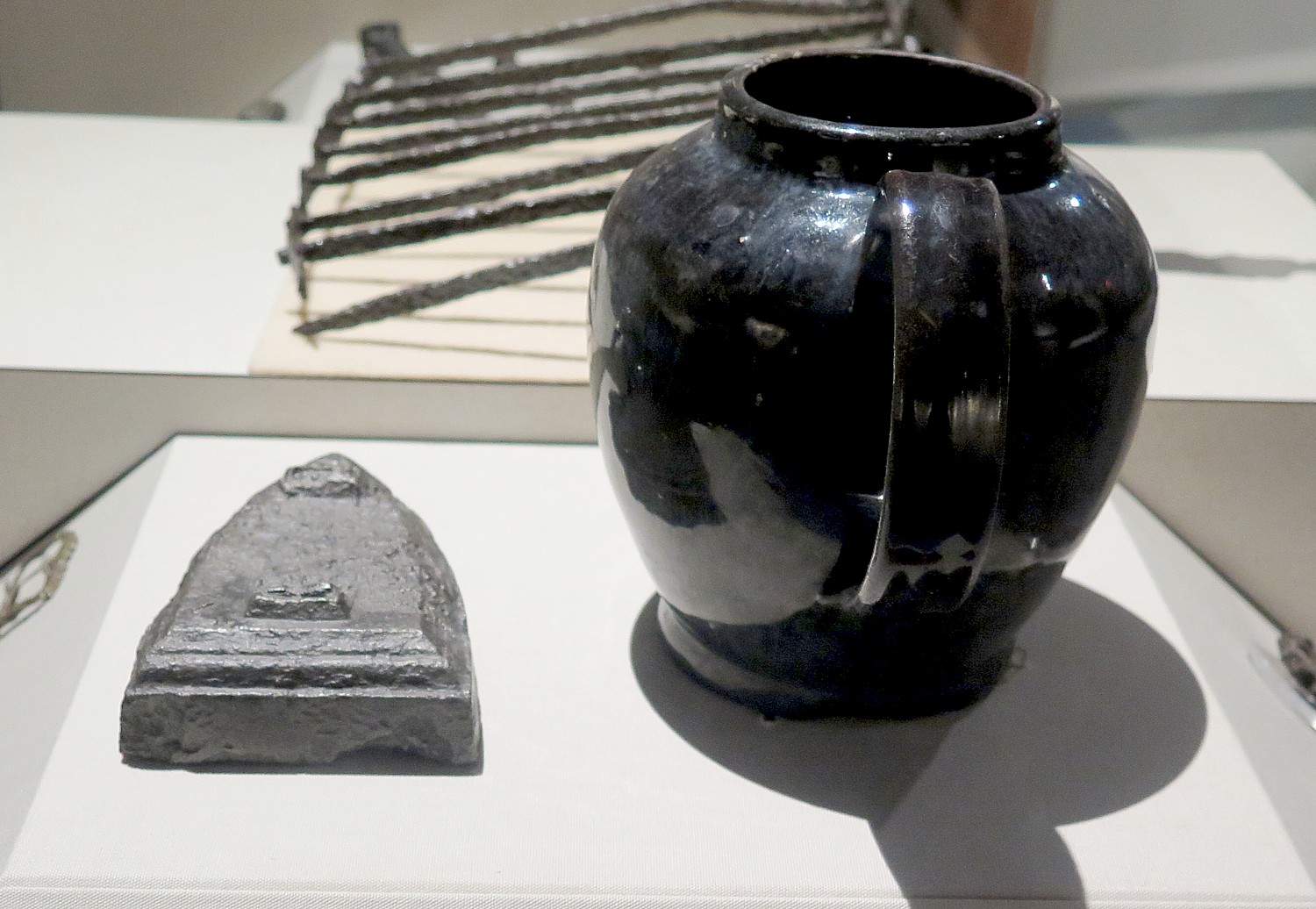
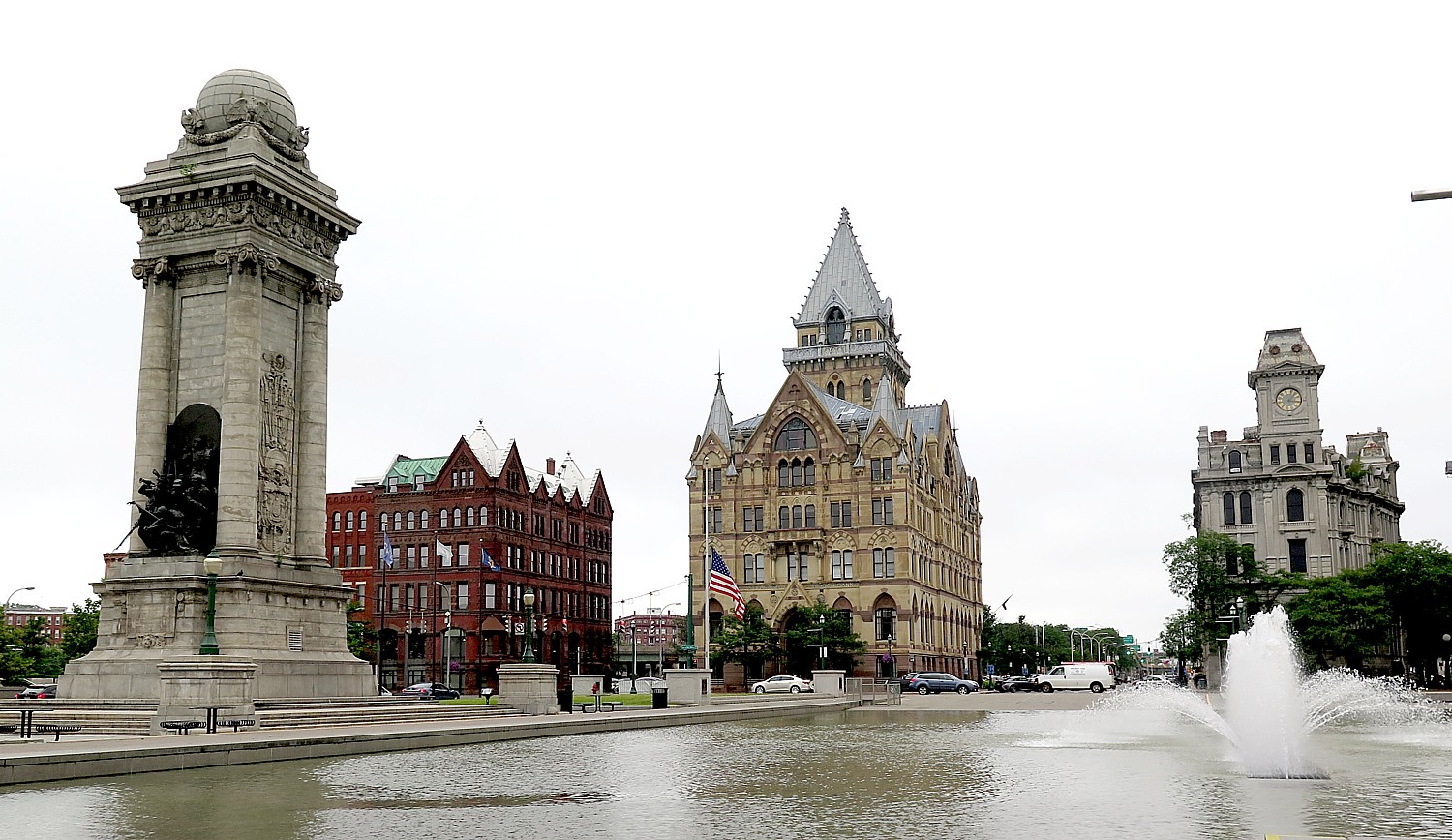
We begin the day riding into downtown Syracuse from our campsite at Burnet Park, adjacent to the Rosamond Gifford Zoo (we are so close, some said they could hear the animals during the night). A highlight for the entire trip is visiting the Syracuse Eric Canal Museum, which has opened early, from 7 am, especially for us. It is not to be missed and I plan to spend a couple of hours here. (The museum also was open especially for us last evening, with shuttle bus transportation from our campsite, to accommodate our riders, but I chose to visit the zoo.)
The downtown of Syracuse has gone through an amazing renaissance.
Erie Canal at one time went through Syracuse but President Roosevelt wanted a “modern” canal built and largely replaced the original canal.
Today, in a magnificent plaza there is an impressive Jerry Rescue Monument to William “Jerry” Henry, a freemason taken into custody under Fugitive Slave Act, despite the fact that New York State abolished slavery in 1820.
Daniel Webster, who was secretary of state under President Millard Filmore, came to Syracuse in1851 and declared that Syracuse (which was a stop on the Underground Railroad) was “a laboratory of abolitionism, libel, and treason” and warning local abolitionists and abetting slaves that any violation of the Fugitive Slave Law, which called for returning those in flight into bondage, would be “treason, treason and nothing else.”
A few months later, on October 1, a mob stormed a downtown police station, knocked down the doors and freed Jerry, and put him on a carriage traveling toward Canada.
Syracuse Canal Museum
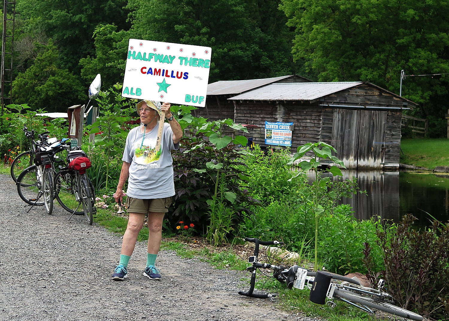
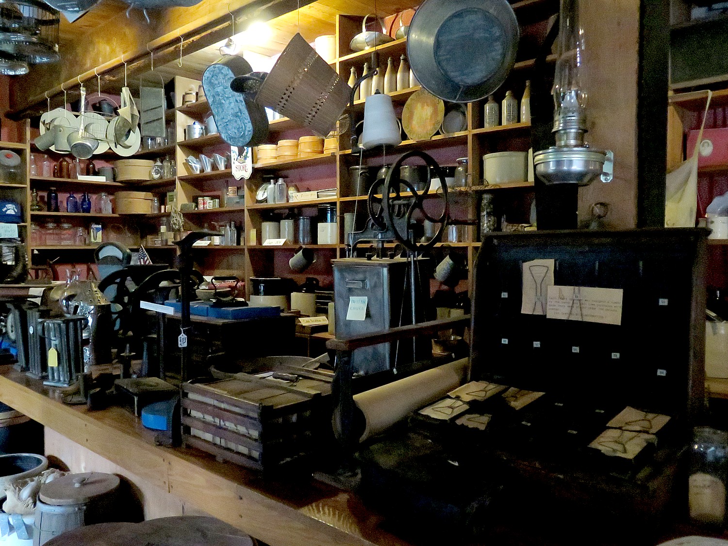
All along our Cycle the Erie route – mostly following the 353-mile long Erie Canalway – we have visited small canal museums and historical societies which each tell a part of the Erie Canal epic drama. At Lockport, which is itself a living-history museum, on the first day of our ride, we saw the astonishing “Flight of Five” locks and its small museum. At Camillus, the half-way mark of our 400-mile ride from Buffalo to Albany, we visited Sims Store, a re-creation of a 19th century general store that would have served the boats traveling along the canal. Still to come (later today), the Chittenango Landing Boat Museum which offers a look at how the canal boats were built and we get to look inside a reconstruction; Canastota, which offers a delightful Canal Town Museum in a tiny house that was once a bakery. Further on, we will see the Schoharie Crossing State Historic Site, featuring sections of all three alignments of the Erie Canal and a fascinating historic exhibit in a house-turned-museum.
But Syracuse is the “official” Erie Canal Museum – it offers the most expansive collection of artifacts, the most comprehensive history, starting the story well before Governor Dewitt Clinton pushed so obsessively for his Ditch. It offers the most sophisticated presentations, including lots of interactive exhibits and opportunities to engage. It is all the more remarkable because it is a maritime museum which is not on the water – indeed, the expanded canal was moved north of the city.
One of the unique features of the Canal Museum – indeed, the “most unique thing about Syracuse” – is the chance to visit the Weighlock Building, built in1850 – the only remaining weighlock building in America. You can walk aboard a replica passenger packet boat in the weighlock and get a real impression of how the Erie Canal transformed culture and society in America.
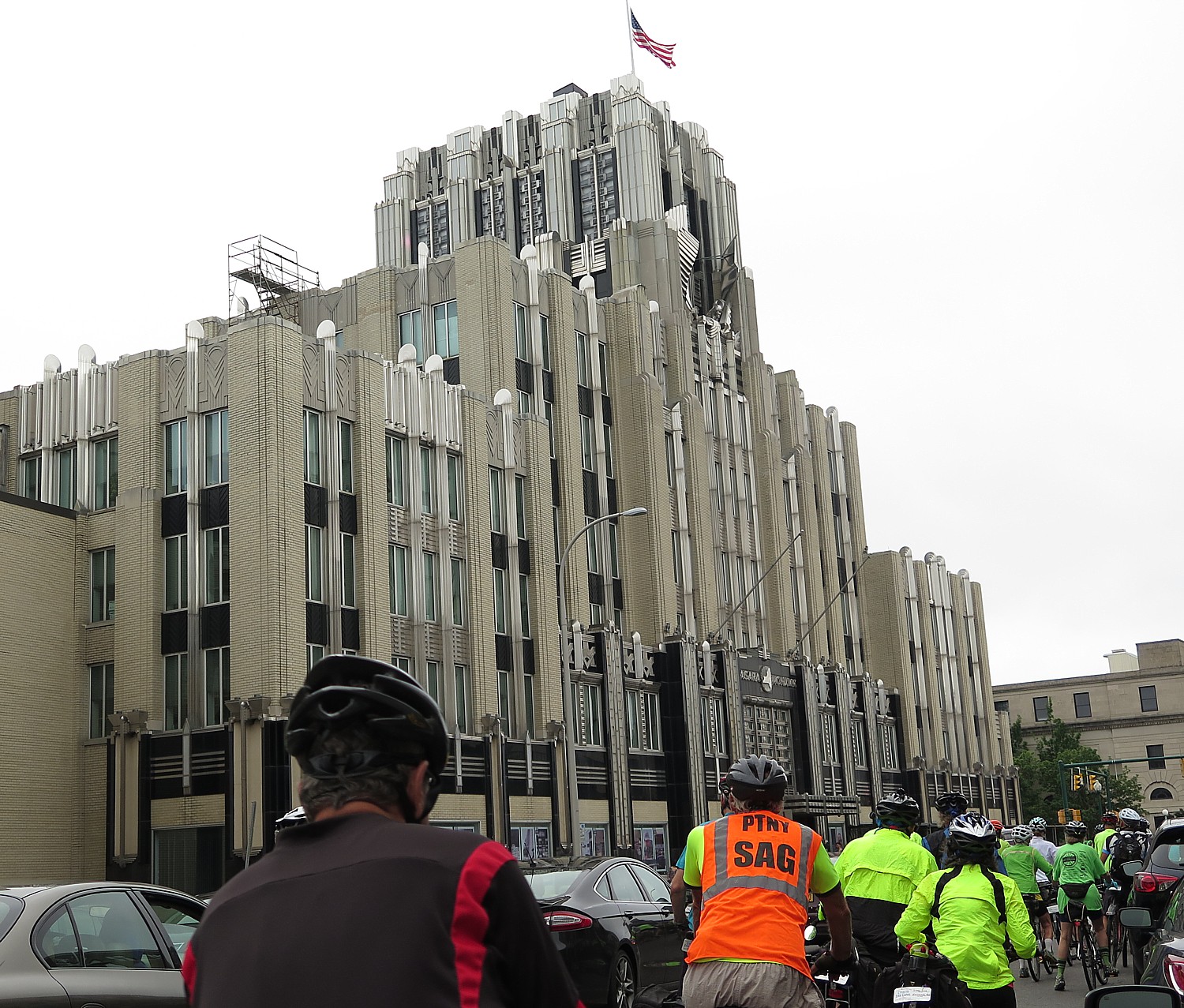
And, as we ride into the downtown historic district, with some magnificent architectural jewels (like the Niagara-Mohawk building, an Art Deco palace that is simply breathtaking), what we appreciate most is how the Erie Canal was the “Mother of Cities” – as historian Ben Willis has said – and how Syracuse is one of her children.
A chart in the museum graphs the explosive growth in population of Albany, Syracuse, Buffalo, and even small canaltowns like Lockport because of the Erie Canal, “It was the 8th Wonder of the World, the pathway to an empire, and a school of engineering.”
Indeed, in 1820, Syracuse was but a swampy settlement on Genesee Turnpike, its primary industry was salt production (a key reason that banks had already established themselves in Syracuse, before the canal). Because of the canal (“The Mother of Cities”) the population of Syracuse swelled 40-fold in just 10 years, from 250 in 1820, to 11,064 in 1830, and by 1920, a city of 171,717.
“German masons who came for the canal, stayed to build cobblestone houses, churches. The canal was a whole way of life.”
Before the Canal, it would take 6 to 8 weeks for a mule to carry less than a ton, versus 6 to8 days to transport up to 200 tons of freight on the canal. The cost dropped to one-tenth, $12 per ton and 60c for barrel of salt.
Each day, some 1,800 immigrants would come through Syracuse on the Erie Canal on their way to the west, paying 10c to travel from one town to the next.
“Land was free, you just had to get there, settle on it for a number of years. Often pioneers would work on the boat in exchange for transportation,” the notes read.
New York State financed the building of the Erie Canal (without any federal help) by selling $7.7 million in bonds; the state earned back revenue from fees on goods shipped and taxes on salt (because salt was brought out of salt springs that were owned by the state).
The success of Clinton’s Ditch was quickly apparent and in just 10 years (after paying off the $7.7 million), the Erie Canal had to be rebuilt and expanded to handle all the traffic.
There were no real engineers when they began to build the canal. The initial designers were surveyors. “They knew how to do property lines but were not engineers.” The biggest problem was figuring out the elevations. But when they completed the canal, these self-taught engineers started the engineering school, Rensselaer Polytechnic Institute (RPI) in Troy.
One of the innovative methods devised was a stump puller to clear the trees – a contraption that looks like a military armament, but actually had giant wheels to move it and give leverage to pull out stumps.
There is so much that is so engaging in the museum – even the staircases are made so you can see the elevations of the different locks along the entire canal, and the elevator is painted so you feel you are stepping into a lock, yourself.
Indeed, a key message you come away with from the Erie Canal Museum, is how the canal keeps reinventing itself, and with it, the society around it.
Peak use of the Erie Canal was 1951, but it was also a time when the canal was fetid with pollution – oil slicks and raw sewage. Then the Clean Water Act of 1972, prohibiting dumping and requiring municipalities to have treatment plants, changed the way shippers and factories could do business. (My suspicion is that environmental protection and worker protections, not free trade, is what led to the demise of American manufacturing.)
So, up until the 1980s, the canal was almost exclusively for commercial traffic and was too polluted, fetid and crowded for the recreational boater, or, in fact, residential buildings anywhere near the canal. That’s all changed. Now, the canal is predominantly used for recreational purposes, there are lovely housing developments along the canal. But a changing upstate economy is seeing a resurgence of manufacturing and more commercial shipping is coming to the canal.
There are many other uses of the Erie Canal other than shipping and transportation. The canal is the largest source of irrigation for upstate agriculture. People don’t think of New York as agricultural, but it rivals other states, producing a range of foodstuffs – orchards, vineyards, dairy operations. Riding along the canal trail, you see the white pipes of the irrigation system. The canal also provides for flood control for upstate New York. Many of the dams generate electricity.
Here, I appreciate the ecology of the Erie Canal – not just for the people whose towns, livelihoods and lives revolved around the canal, but how it impacted the environment.
And you can see the social ecology as well – as the canal is cleaned up, there are new housing developments that are popping up alongside, as we saw at Rochester, Spencerport, Fairport, changing the economic base for these communities. (They are not intrusive, though – indeed, the entire Barge Canal was just placed on the National Register of Historic Places and is part of New York State’s Heritage Corridor). The small canaltowns are reinventing themselves – and the structures that had been factories and silos and such in places like Pittsford and Cohoes have been re-purposed for condos and offices, as well as to cater to new manufacturing ventures like manufacturing wind turbines.
“Everything reinvents itself – just like the Canal,” says Daniel Ward, who curated the exhibit. “When I was boy, there was no accommodation for pleasure craft, no tie ups. It was a barge canal. Now there is balance.
“Often the Erie Canal gets separated in people’s minds from the Port of New York, but New York City is the terminal port of the canal system. Our current work is trying to reconnect idea of New York City – we’re coming up to the bicentennial of the opening of the canal (2025), which was a celebration in New York Harbor.”
The museum has a marvelous animated display of Governor Dewitt Clinton sailing into New York City to spill water from Lake Erie into the Hudson River in a ceremony called, “The Wedding of the Waters” with simulated fireworks. (There were cannons set up all along the route and it took hours for the sound that started in Buffalo to make its way to New York City.)
He points to the Mount Vernon Museum, at 421 East 61st Street, which was a hotel that opened in the 1820s to accommodate visitors who wanted to travel on the Erie Canal on packet boats.
Before the Erie Canal, “New York City was an insignificant port city, dwarfed by Boston and Philadelphia, and became a great city, as a result of this engineering.”
What I come away with: It wasn’t that people were different in 1817 when construction of the Erie Canal began, that they had more guts, gumption, daring, pioneering spirit. If anything, what this journey back in time shows is that people are exactly the same – Governor DeWitt Clinton was mocked for the project, which was called “Clinton’s Folly” and “Clinton’s Ditch”; President James Madison refused to give federal funding, questioning the role of the federal government.
“Farmers didn’t want to give right of way,” Ward tells me, “they didn’t envision a global economy. It turned out to be great for them. They went from local subsistence economy to global. When the Erie Canal was built, it was the wave of future.”
So many morals to be drawn to today.
You can easily spend two to three hours at the Erie Canal Museum, which I happily do, even with 50 more miles to travel today.
My deep dive into the Erie Canal’s history continues on this day’s ride.
I am fairly amazed to find some of the cyclists still at the morning rest stop when I arrive at Chittenango Landing Boat Museum, which, through preservation, reproduction, construction, and interpretation of the Chittenango Landing industrial complex, instructs about the construction and repair of canal boats and the social history of the Erie Canal era. There are people in period dress and it looks like a historic village. Here, I get to poke inside a re-creation of a canalboat, and see where the mules would have been housed on the boat with the family. (7010 Lakeport Rd, Chittenango, NY 13037, 315-687-3801, clcbm.org/)
Chittenango is also the birthplace of L. Frank Blum who wrote “Wizard of Oz” (his mother-in-law was the mother of the Women’s Rights movement, Melinda Gates), and I am told the village has a yellow-brick road.
Once again, I am determined not to miss the things that I missed on my first Cycle the Erie ride two years before. I ride up the main street looking for evidence of Frank Blum – I find the yellow brick sidewalk, but before I can get to the All Things Oz Museum, which has family photos, early posters from musicals and movies before the 1939 MGM film, collectibles, it starts to rain. (Open year-round or by appointment, 219 Genesee St., Chittenango, NY 13037, 315-687-7772, allthingsoz.org).
It is a drenching rain by the time I get to Canastota, where I remember there is a delightful Canal Town Museum which I visited on my first Cycle the Erie ride. Inside, I find other Erie Canal cyclists huddled together in the back, happily watching a video while they get warm.
Housed in a former bakery and residence dating from 1873, Canastota Canal Town Museum is a major surprise. From the outside, you wouldn’t think much at all of the tiny frame structure, but once inside, it’s like a Harry Potter experience – the rooms are chockablock full of fascinating artifacts and portraits that make the inside seem enormous. It is a surprisingly fine museum, which adds pieces of understanding to the historic puzzle of the Erie Canal and the rise of the United States. Here the focus is on people – including important people who contributed to building the canal, like Nathan Roberts (a Canastota native who devised the ingenious “Flight of Five” Locks in Lockport which we saw on our first day of the ride); there is a portrait of him by an important 19th century artist, Frederick R. Spencer, and portraits of others who owned the very existence of their town to the canal.
In addition to the ingenious engineering of Nathan Roberts’ lock system, I realize an amazing array of inventions came out of this tiny village: it was the birthplace of the American Microscope Industry; early movie and projection film industry.
I spot a photo on the wall referring to a action-adventure-comedy, “The Great Race” (1965), and only in that moment realize the movie was based on an actual event: the 1908 automobile race from New York to Paris, by way of Albany, Chicago, San Francisco, Seattle, Valdez Alaska, Japan, Vladivostok, Omsk, Moscow, St. Petersburg, Berlin and finally Paris. I learn that it was only made possible because of an innovation by Weed Chains of Canastota that enabled a car to drive across frozen Siberia. The 1908 Race was won by the American Thomas Flyer driven by George Schuster Sr. of Buffalo, NY. There is even a connection between Amelia Earhart and Canastota’s Airport opening in 1928. I am dazzled.
(Canastota Canal Town Museum, 122 Canal St., Canastota, NY 13032, 315-697-5002, www.canastota-canal.com)
Of the 50 miles between Syracuse and Rome that we ride today, 36 miles are in the Old Erie Canal New York State Park – rural, quaint, with wildlife, five aqueducts, and very flat. This is where the Erie Canal building began, in the “Long Level”. And just outside of our destination for today’s ride, Fort Stanwix in the center of Rome, we come to the historic marker where the very first shovel to dig the canal went into the ground on July 4, 1817.
Mercifully, just as I ride into Rome, the rain stops, and I am able to set up my tent right outside Fort Stanwix, take a shower at the shower truck, change into dry clothes, and rush over to the Fort where they have arranged for guided tours (by costumed rangers) until 9 pm. I am literally the last one out of the Fort at closing. I walk a couple of blocks to a pizza shop for dinner (this is one of two nights that we are on our own for dinner). The National Park Rangers keep the Visitor Center open for us all night long, and I love to really linger over the exhibits.
The 20th Annual Cycle the Erie Canal ride is scheduled July 8 – 15, 2018 (www.ptny.org/canaltour). In the meantime, you can cycle the trail on your own – detailed info and interactive map is at the ptny.org site (www.ptny.org/bikecanal), including suggested lodgings. For more information on Cycle the Erie Canal, contact Parks & Trails New York at 518-434-1583 or visit www.ptny.org.
The entire Erie Canal corridor has been designated the Erie Canalway National Heritage Corridor, Waterford, NY 12188, 518-237-7000, www.eriecanalway.org.
More information about traveling on the Erie Canal is available from New York State Canal Corporation, www.canals.ny.gov.
Next: Cycle the Erie: At Fort Stanwix, Time Travel Back to America’s Colonial, Native American Past
Day 4, Waterloo/Seneca Falls to Syracuse, 39 Miles
Leaving our campsite at Mynderse Academy in Seneca Falls for Day 4 of our 8-day, 400-mile Cycle the Erie biketour, I make a point this time of stopping into the Montezuma National Wildlife Refuge, keeping to my plan of doing everything I did not get to do on my first Erie Canalway ride two years before. I take care to cross the busy thoroughfare (this section of the ride is on roads rather than the non-motorized trail).
The Refuge is a breeding ground for bald eagles; unfortunately, perhaps because of the season, time of day, or that’s just the way the cookie crumbles, I don’t get to see any birds at all. But I still get to notch another one of the sites that I missed before, realizing that the time spent here is time lost to explore another point of interest. (3395 Rte 5 & 20 E, Seneca Falls, 315-568-5987, www.fws.gov/r5mnwr).
This part of the ride – on country roads – brings us through pastoral scenery.
Our rest stop – laid out with snacks, fresh fruit, water as well as our trusty bike mechanic – is at the brand new Port Byron Erie Canal Heritage Park (great bathrooms), where we get to visit the new historic displays before getting back on the Canalway.
We ride into the quaint village of Jordan, distinctive for the lovely murals of historic scenes of the canal on a 19th century brick building. The Canalway – which was the original towpath – comes through though the Erie Canal was relocated when it was enlarged; the lock has been turned into a small park. Here, you can see what it means for a community to lose the canal. A historic marker notes: Opened 1819, abandoned, fall 1917. Aqueduct built 1841 when the canal was enlarged. Canal park built 1932.”
Just up from Jordan, on a particularly scenic section of the trail that passes Memphis, locals greet us with ice pops; one of the ladies is responsible for creating a gorgeous garden right on the trail in memory of her son and tells us that she tenders it 6-8 hours a week.
We come to Camillus, where we are greeted with signs and cheers of “Half way!” as we cross the 200-mile mark, from where we started out in Buffalo. The rest stop has been set up for us here, and inside the Sims Store, they offer us refreshments, as well.
The Sims Store is a replica of the original canal store which would have been located two miles east. You enter the store where two years ago, a woman in period dress was there to show off the sort of stuff that would have been on sale to serve the boats. There is an excellent local history section, an Erie Canal Barge display, an 1800’s room, and a section describing the building of the canal including some of the tools used. There is also a wonderful wall-mural of a boat traveling over the Nine Mile Creek Aqueduct on the second floor.
The artifacts on display are very interesting. The docent shows a map of New York State which shows why the Erie Canal was the only route to the West: a relatively flat, open portion cutting through a break between the Adirondacks and the Appalachians.
The Sims Store is part of a 164-acre Camillus Erie Canal Park, a town park that preserves a seven mile stretch of the Erie Canal. It includes the impressive Nine Mile Creek Aqueduct, which is listed on the National Register of Historic Places. From the Sims Store you can take a boat ride on the old canal, which several of our cyclists are taking advantage of; they operate dinner cruises as well, (www.eriecanalcamillus.com/museum.htm)
At this point, we ride along the trail (the original towpath), but this part of what would have been the canal is no longer part of the Erie Canal – what looks like a stream now is where the original canal would have been and the water what is naturally collected.
We come to Nine Mile Creek Aqueduct, which is a stunning example of engineering. The aqueduct is a water-filled bridge that carried canal boats over rivers, streams or valleys. This 144 foot waterway enabled the first enlargement of the Erie Canal to be carried over Nine Mile Creek and is listed as the smallest of the larger aqueducts. Four stone arches made of fine Onondaga limestone quarried from Split Rock supported the towpath. Of the 32 original aqueducts on the First Enlargement, only about seven remain intact.
I try to rush to get to camp in time to also visit the Rosamond Gifford Zoo in Syracuse, which will close at 4:30 pm. (The organizers have also arranged for us to be able to visit the Syracuse Canal Museum this evening, with shuttle bus transportation into the downtown; I plan to visit the museum the next morning.)
It’s just about 3 pm when I arrive at our campsite in Burnet Park, alongside the Zoo. At the park, we can use the swimming pool and “indoor” campers can set themselves up on the hockey rink. Instantly, a whole tent city rises in front of the houses across the street from the park.
I promptly drop my things at the hockey rink, so I don’t lose time setting up the tent (also the forecast is for rain tonight). I walk directly to the zoo so I can see the animals before they are brought in at 4 pm. We also will be having a delightful barbecue dinner at the zoo this evening and a lecture in the visitor center auditorium.
Yesterday’s ride to Seneca Falls was 62 miles over rolling country roads but I didn’t feel tired at all and was able to explore the attractions that evening, perhaps because of my excitement at being there. But even though today’s ride was a mere 39 miles, I am heat-exhausted. I drag myself around the zoo, spending more time sitting on a bench and looking into animal cages than I do walking around.
Last time, I missed the excellent lecture that was held in the Rosamond Gifford Zoo’s visitor center auditorium by a representative of the Syracuse Canal Museum about the Erie Canal’s engineering. This time I wasn’t going to make the same mistake.
Sam Clemence presents “Engineering the Erie Canal” this year, and his talk is all the more fascinating because we have been riding alongside the canal and can appreciate the scale, the geography, the lift system, the aqueducts that made the Erie Canal an engineering marvel. And this evening, we not only appreciate the brilliant engineering, but what the canal meant in terms of transforming the United States into an industrial and global power, how it changed the face of the country quite literally in terms of population – bringing the immigrants to build and man factories, the settlers and pioneers through the west, unifying the nation, bringing down the cost of goods and improving living standards, and creating jobs and commerce.
Indeed, the idea for the Erie Canal goes back to George Washington and the French and Indian War. Thomas Jefferson, the guy responsible for such bold visionary enterprises as the Louisiana Purchase and the Lewis & Clark Expedition, said in 1809, “It is little short of madness to think of it this day – a splendid project and may be executed 100 years from today.” Just eight years later, because of New York Governor Dewitt Clinton’s determination (and state financing), the first shovel went into the ground.
Before the canal, it would take three weeks to travel from Albany to Buffalo on sparse roads, involving fjording rivers and surmounting the Cohoes Falls, and would have cost $100 a ton to transport wheat; $6 a barrel to transport salt.
But a wheat importer named, Jesse Hawley, sitting in debtor’s prison, 1808-9, wrote a letter to the Genesee Messenger newspaper, using the nom de plume of “Hercules” and proposed the idea of building the canal for $6 million. His letter caught the attention of DeWitt Clinton.
“The USA in 1800 was a new country, with an expanding frontier, diverse and abundant resources, and a shortage of labor. The new nation had an experimental form of government. It manifested confidence, embraced technology, epitomized ‘Ingenious Yankees’ – self-sufficient, versatile.”
But when they started to build the Erie Canal, there were fewer than 10 engineers in the whole country; by 1816 there were 37; by 1850 there were 50.
The two who headed up the Erie Canal project, Benjamin Wright and James Geddes (a surveyor and lawyer) were really county judges. Clinton hired them in 1811 to survey the route. They first thought to build a route along the Mohawk River (there were no dams then), but that was considered an unreliable source of water. So they decided to build a lock canal, fed by 12 feeder streams. This required building 185 locks, 18 aqueducts over the 363 miles from Lake Erie to the Hudson River.
The biggest challenge was the Niagara Escarpment, which we saw at Lockport – where they had to surmount a 60-foot elevation. “In those days [before steel], they could only hold back 12 feet of water [with wooden gates].”
But they knew that the canal would go through the Mohawk Valley – the gateway to West. It was the lowest canyon, the only place with a break in the Appalachian mountain range, from Maine to Alabama. It’s called “Little Nose” and “Big Nose” (and we are alert to seek it out on tomorrow’s ride.)
Construction began on July 4, 1817 in Rome, the very center of the state where the ground was flat. Clinton wanted to get as many people to see it and built out. And he realized that if building started, it would be easier to get more money, if necessary.
They looked to English canal building as well as Leonardo Da Vinci’s gate system, and imported Irish immigrants who were paid $8-12/month and a ration of rum (the pay was pretty good for the time), but three-fourths of the laborers were US citizens (mainly farmers).
In the first two years, they only built 15 miles. Clinton was excoriated. “That Federalist Son of a [expletive] taxes our dollars to build a Ditch.”
Built at a cost of $7,700,000 (equivalent to $159 billion in 2018 dollars), the canal opened Oct. 20, 1825 and was an immediate success, bringing down the cost of commerce and transportation to a fraction of what it was.
We learn that at one time, more than 50,000 people depended on the Erie Canal for their livelihood. A whole culture developed around canal life. For many, canal boats were floating houses, traveling from town to town: the father was the captain, the mother cooked for family and crew and children would serve as “hoggees,” leading the mules as they towed the boats. (At Chittenango Landing Boat Museum we see a model boat and how the mules lived onboard.) He tells us that one of the US presidents was a hoggee in his youth: James A. Garfield.
I can imagine how for those who traveled along the Canal in packet boats or passenger vessels, the Canal was an exciting place. Gambling and entertainment were frequent pastimes on the Canal and often, families would meet each year at the same locations to share stories and adventures.
Amazingly, by 1836, the very success of the original canal – which was a mere 4 feet deep and 40 feet wide (to permit east and west traffic), affording just 6 inches of draft below the boat –had not only paid back the original investment, but rendered it obsolete. An enlarged canal, 7-feet deep with locks 110 feet long and 18 feet wide, was built. That one, too, was replaced in 1905 with the New York State Barge Canal System; built for self-propelled vessels, it uses canalized rivers, lakes and land-cut sections with a minimum depth of 12 feet and electrically-powered locks 300-feet long, that still operate today.
The Erie Canal is called “The Mother of Cities” – a fact that is made eminently clear when I visit the Syracuse Canal Museum, which displays a graph showing the growth in population of cities like Syracuse before and after.
A heavy rainstorm is expected tonight, and I am happy to be doing my “indoor camping” in the hockey rink at Burnet Park, literally adjacent to the zoo. I hear from a few campers in the morning that they could hear the animals at night.
The 20th Annual Cycle the Erie Canal ride is scheduled July 8 – 15, 2018 (www.ptny.org/canaltour). In the meantime, you can cycle the trail on your own – detailed info and interactive map is at the ptny.org site (www.ptny.org/bikecanal), including suggested lodgings. For more information on Cycle the Erie Canal, contact Parks & Trails New York at 518-434-1583 or visit www.ptny.org.
Information is also available from the Erie Canalway National Heritage Corridor, Waterford, NY 12188, 518-237-7000, www.eriecanalway.org.
More information about traveling on the Erie Canal is available from New York State Canal Corporation, www.canals.ny.gov.
Next: Cycle the Erie, Day 5: Syracuse’s Erie Canal Museum
We finish our 62-mile ride on this third day of our 8-day, 400-mile Cycle the Erie biketour in Seneca Falls, renowned as the birthplace of Women’s Rights, where the organizers have arranged for the major sites, including the Women’s Rights National Historical Park, to stay open for us, and for a shuttle bus to take us from our campsite on the grounds of the Mynderse Academy into the downtown.
My impression of the Women’s Rights National Historical Park, operated by the National Park Service, has not changed from my first visit two years before: It is an absolute dud, especially when you consider the innovations in museums – especially compared to Fort Stanwix National Historic Site in Rome and the Erie Canal Museum in Syracuse (both of which we will see in coming days). What is more, the NPS rangers who run the site know how antiquated and uninspiring – even disrespectful to women and the struggle for equality – the exhibit is and revealed a frustration in their inability to improve it.
There are no new insights or inspiration to be gained. The exhibit doesn’t have a clear theme, point or focus: is it about how and why the Women’s Rights movement started here in Seneca Falls (the influence of the Oneida Indians, which allowed women to become chiefs, have property and retain custody of their children, on Melinda Gage, for example; the prevalence of Quaker women among the early women’s rights leaders who had roles in their church; and the number of factories, spurred by the Erie Canal, which in turn employed women who subsequently wanted equal pay and to control their earnings)? Is it about the leaders of the movement, the courage they needed and how they persevered? What about exploring why it took 80 more years for women to get the vote, even after former slave men got their (theoretical) right to vote after the Civil War? Nor does it confront the controversies behind the continuing fight for women’s rights: why women still don’t earn as much as men for the same work, what is the “glass ceiling”. What role does the lack of affordable, accessible child care and healthcare play, and the mother-of-all controversies: why are women’s reproductive rights still so tenuous? And, oh yes, why are women still so underrepresented in elected office, including the highest office in the land, the Presidency?
What is glaringly obvious is that the exhibit reflects the 1980s Reagan perspective – more Phyllis Schafly than Gloria Steinem – a half-assed, slap in the face, disrespectful, condescending lip service to women’s rights and the ongoing struggle. If there is a theme, it is that women should be grateful for the opportunity to work in fields beyond teaching, secretarial and nursing – but nothing about pay equity or glass ceilings or sexual harassment. To Reagan (and now Trump), women’s rights are simply a way of supplying more workers and keeping wages low.
No discussion of how laws and the lack of anti-discrimination laws helped keep women down: How a woman could be raped, beaten, killed by her husband – was not much more than property (as were children) – and how a woman’s property became her husband’s. How women could be fired from jobs once married or pregnant or had children or reached a certain age or weight, or not hired at all merely because of gender. How insurance companies could charge women more (preexisting condition for being able to give birth). How landlords could refuse to rent to a woman without a husband’s signature; banks would not loan money for a home or business; how women couldn’t get a license to practice law. Sexual harassment”? The phrase was only invented in the 1970s, as the modern Woman’s Movement came into flower.
What did not having a vote mean for women in society? What happened when women were widowed or divorced? Why were there certain professions that women were steered into – like teaching, secretarial work, factories and nursing, positions which as a result tended to be woefully underpaid?
What was the role of the Church in suppressing women’s rights? That is, except for the Quakers who were the earliest advocates of women’s rights. What was the influence of the Oneida Indians, which gave women property rights, custody of children and the ability to become a tribal chief, on the early feminists including Melinda Gage (the mother-in-law of Frank Blum who wrote Wizard of Oz).
Where is the discussion of the women who opposed suffrage, equal rights (ie. Equal Rights Amendment, Phyllis Shafly), even the fact that Eleanor Roosevelt initially was not a supporter of women’s suffrage (until happened), and the women today who oppose a woman’s right to choose (then and still today)?
Instead of “women’s rights”, (and this is pretty typical of women’s issues generally) the exhibit goes off track into the bigger topic of civil rights (Abolition, the Underground Railroad). This should be seen in the context of how women were the backbone of the movement to end slavery, but after the Civil War, fully expected to win the vote along with freedmen, but instead only black men got the right to vote (such as it was, before Jim Crow). Also, it gives a nod to Jacksonian Democracy but doesn’t answer the question how white men without property got to vote without the need for a Constitutional amendment, but women didn’t get the vote until the 19th Amendment was finally ratified in 1920.
The exhibit is largely devoid of the heroic women (except for the sculpture) who fought for suffrage, and what the fight was like (locked up, force-fed).
There’s copy of Lily Ledbetter act signed by Obama in a case in the lobby, but no explanation or context.
There is a film in a lovely auditorium, “Dreams of Equality,” (delightfully cool and relaxing after biking 62 miles in the hot sun) which dramatizes the early internal debate over breaking out of the constrained role women were relegated to, is woefully and pathetically outdated – the historic elements aren’t bad but the pseudo “conversations” between girls and boys is frankly stupid and archaic.
But in the film, one of the main characters loses her husband in the Civil War and one woman says to the other, “If a woman had a say in making laws, there would be no wars,” to which the other woman replies, “If we had a say, who would listen?”
And in another bit of dialogue, the woman wonders, “Don’t women also have rights?” to which her brother responds, “What men most prize in a woman is affection.”
You also visit the Wesleyan Chapel where the first Women’s Rights convention was held in 1848 and the “Declaration of Sentiments,” modeled after the Declaration of Independence was signed. The structure’s history can be a metaphor for the ambivalence of American society to women’s rights: From 1843-1871 it was chapel, then an opera house/performing arts hall; then a roller skating rink, a movie theater (in 1910s), then a Ford dealership, and ironically enough, was a laundromat before facing a wrecking ball.
Women fought to save the building, and in 1982, during the Reagan Administration, it was turned into a national park.
(Womens’ Rights National Historical Park, 136 Fall Street, Seneca Falls, NY 13148, 315-568-0024, www.nps.gov/wori.)
To put faces to the women’s movement, I walk down the main street to the National Women’s Hall of Fame. It is still in a ground floor storefront in a former bank building, awaiting its move into the factory building that was the Seneca Knitting Mill across the canal. This is most appropriate because the mill was where a number of the early feminists came from (they had a taste of earning their own money and were fired when they asked for wages equal to men).
This massive factory, which dates from 1844, was owned by two men, Charles Hoskins and Jacob Chamberlain, who were among the 32 who supported women’s right and signed the Declaration of Sentiments which came out of the Women’s Rights Convention. That is saying something because out of the 300 people (40 of them men) who attended the convention in the Wesleyan Chapel in 1848, only 32 people signed the Declaration. The Seneca Knitting Mills, which operated until 1999 (can you believe it!), manufactured heavy woolen socks for 150 years, and then went the way of 50,000 other factories in the US.
The plan is to turn the 170-year-old limestone building into the hall of fame, research center and museum celebrating women and their accomplishments, to be called the Center for Great Women.
When I was in school, I could count on one hand the number of women who were presented as heroic figures – Madame Curie, Molly Pitcher (who I learn may have been fictional but still representative of women who took up the guns when their husbands were killed in the Revolutionary War), and the reporter, Nellie Bly.
I am thrilled to find Nellie Bly among the honorees. Her real name was Elizabeth Cochrane Seaman (1864-1922, honored in 1998), and was a trail-blazing journalist considered to be the “best reporter in America” who pioneered investigative journalism (hence the pseudonym); Paulina Kellogg Wright Davis, (1813-1876, honored 2002), who headed the committee that organized the first National Women’s Rights Convention in Worcester, MA in 1850, helped found the New England Women’s Suffrage Association and established Una, one of the first women’s rights newspapers; Amelia Bloomer (1818-1894), the first woman to own, operate and edit a newspaper for women, The Lily (first published in 1849 in Seneca Falls) and whose penchant for wearing full-cut pantaloons under a short skirt (as a protest to the way women were expected to dress), gave birth to the term “bloomers”.
It turns out there were dozens and dozens of women, going back to Colonial times, who did really important things. The women who are honored here are not necessarily honored as feminists, but for their accomplishments.
“Women’s stories are not told,” the organization notes. “Less than 10% of the content of history books references women. Students cannot name 20 famous American women through history, excluding sports figures, celebrities and First Ladies. Only 20% of news article are about women. A society that values women values all of its members. By telling the stories of great American women through exhibits and educational resources, the Hall will make a future where all members of society are valued a reality.” (Indeed, the New York Times, during this year’s Women’s History Month, began publishing obituaries of women who were overlooked in their own time.)
Founded in 1969, the Women’s Hall of Fame actually predates the Women’s Rights National Historic Park (one could say it even was at the very cusp of the Women’s Movement which really emerged in the 1970s). And when you contemplate the timeline of the biographies, you get a better understanding of the historical context of the Women’s Rights Movement.
Looking around: Abigail Adams, what a pistol she must have been! She had such a strong influence on her husband but clearly was frustrated in the lack of opportunities women had to utilize their potential. (“Remember the ladies” in forming the new government,” she admonishes her husband, John Adams, in 1776).
Secagewea, Annie Oakley, Harriet Tubman. Jane Addams, Clara Barton, Margaret Bourke-White, Pearl S. Buck, Rachel Carson. Frances Perkins (Labor Secretary under Franklin Roosevelt), Eleanor Roosevelt, Anne Sullivan, Rosa Parks.
Of course, there are the suffragists Elizabeth Cady Stanton, Lucy Stone, Susan B. Anthony (there is a Susan B Anthony bench which came from the Ontario County courthouse in Canandaigua), but I also discover women identified as being early feminists (most you never heard of), and you realize that the struggle goes way, way back.
For example, Anne Hutchinson who lived 1591-1643 (honored 1994), was the first woman in the new world to be a religious leader and for it, was banished from the Massachusetts Bay Colony (there is a parkway in the Bronx named for her); Sarah Grimke, who lived 1792-1873 (honored 1998), who published papers championing abolition and women’s rights, and with her sister Angelina Grimké Weld, 1805 – 1879 (honored 1998), were southerners, born in South Carolina, who became the first female speakers for the American Anti-Slavery Society; Fanny Wright, 1795-1852 (honored 1994), the first American woman to speak out against slavery and for the equality of women; Mary Lyon, 1797-1849 (honored 1993), who founded Mount Holyoke in 1837, the first college for women, which became the model for institutions of higher education for women nationwide; and Maria Mitchell, 1818 – 1889 (honored 1994), an astronomer who discovered a new comet in 1847 and the first woman named to membership in the American Academy of Arts & Sciences, and a founder of the Association for the Advancement of Women.
Walking around (you can also peruse the website to find these biographies) I am introduced to all sorts of women I had not known, that fill me with pride: women on the front lines of science, civil rights, labor rights, education, human rights.
Mary “Mother” Harris Jones, 1830-1930 (honored 1984), a labor organizer and agitator who worked on behalf of the United Mine Workers and other groups; Sarah Winnemucca, c1844-1891 (honored 1994), Native American leader who dedicated her life to returning land taken by the government back to the tribes, especially the land of her own Paiute Tribe; Susette LaFlesche, 1854-1903 (honored 1994), a member of the Omaha Tribe and a tireless campaigner for native American rights; Julia Ward Howe, 1819-1910 (honored 1998), suffragist and author of “Battle Hymn of the Republic.” a lecturer on religious subjects, a playwright, an organizer of a women’s peace movement and advocate for women’s equality in public and private life; and Emma Lazarus, 1849-1887 (honored 2009), famous for authoring the words at the base of the Statue of Liberty, “Give me your tired, your poor, your huddled masses yearning to breathe free,” and an important forerunner of the Zionist movement.
There is the famous flyer Amelia Earhart but also Bessie Coleman, an aviatrix of the1920s, who was the first African American woman to have pilot’s license (at a time when women, let alone a black woman, were not allowed to have a license; Coleman went to Europe to get her license, what does that tell you?).
I so appreciate the diversity of the women represented, especially in the 20th century, when women do have more educational and professional opportunities: astronaut Sally Ride; tennis player Billie Jean King who broke through for women’s athletics; Ruth Bader Ginsburg, Sandra Day O’Connor. Madeleine Albright, Bella Abzug, Oprah Winfrey, Lucille Ball, Dorothea Lange, Lilly Ledbetter, Margaret Sanger.
(Go to the website to see the most recent inductees as well as search all).
We commiserate over the life-size portrait of Hillary Rodham Clinton, who was already in the Hall of Fame as First Lady and New York Senator, the first woman to be a presidential candidate of a major political party, but should have been the first woman President.
It is remarkable to look at the faces and read the short biographies of women who have made such important contributions, going back to colonial times.
(National Women’s Hall of Fame, 76 Fall St, Seneca Falls, NY 13148, 315- 568-8060, www.womenofthehall.org)
I wander over to the canalside park just in time, 7 pm, to enjoy an old-fashioned band concert by the Seneca Falls Community Band (33rd season!); there is a stand selling the absolutely best ice cream in the world. Perfect.
Our campsite tonight is on the grounds of the gorgeous Mynderse Academy, which even has a flat-screen TV where a few of us gather around to watch the All Star Baseball Game.
The 20th Annual Cycle the Erie Canal ride is scheduled July 8 – 15, 2018 (www.ptny.org/canaltour). In the meantime, you can cycle the trail on your own – detailed info and interactive map is at the ptny.org site (www.ptny.org/bikecanal), including suggested lodgings. For more information on Cycle the Erie Canal, contact Parks & Trails New York at 518-434-1583 or visit www.ptny.org.
Information is also available from the Erie Canalway National Heritage Corridor, Waterford, NY 12188, 518-237-7000, www.eriecanalway.org.
More information about traveling on the Erie Canal is available from New York State Canal Corporation, www.canals.ny.gov.
Next: Day 4: Seneca Falls to Syracuse, Crossing Half-way Mark of 400-mile Biketour
Immediately upon leaving Medina on Day 2 of Parks & Trails NY’s 19th annual 8-day, 400-mile Cycle the Erie biketour, which transverses New York State from Buffalo to Albany, we reach one of the highlights of the Erie Canalway: you ride over a concrete embankment that goes over a waterfall which turns at a hard angle. You marvel at the construction as much as the view – the quaint Industrial-era town on one side, the dramatic forest and falls on the other. I stop at one of the many historic markers that are along the trail to learn about the special mortar they had to devise to accomplish this engineering feat.
Just a little further is another remarkable feature of the Erie Canalway, the multi-use trail built mainly upon the original towpath that makes biking so pleasant: the culvert. We leave our bikes on the trail and climb down an embankment to where this tunnel has been cut under the canal. Here you can really appreciate just how shallow the Erie Canal is – really just a bathtub. This is the only place on the 353-mile long canal where a road is built under the canal – and is quite a dramatic scene.
This is also one of the more scenic parts of the trail, at least to an urban Downstater like me: here we see sprawling farmland. I later learn that the Erie Canal does not just play a role in transportation (now more recreational than commercial), but in irrigation and flood control.
We come into Albion, one of the charming canaltowns we travel through, so rich in history, where you see in the stunning architecture, and the opulence that the canal and the Industrial Revolution created – civic buildings, churches, banks.
Because I had been here before, I knew to ride a short distance up Main Street from the canal where there are churches and a Town Hall on four corners.
One of the churches, Pullman Memorial, has drop-dead magnificent Tiffany stained glass windows. I meet Bill Lattin, a church volunteer, and here is one time that my tardiness in leaving our campsite is rewarded: he wasn’t informed (as usual) that the 750 Cycle the Erie riders (a record) were coming through this morning, so no one was at the church to open it up for visits, but as he was coming in to town, he saw us and opened the church just in time for my visit.
George M. Pullman (1831-1897), who made his fortune manufacturing the luxurious railroad sleeper cars, was born in Albion. He had long before moved away but remained close to people in his hometown and one of his friends, Charles A. Danolds, in 1890, convinced him to donate $67,000 to build the church.
Shanties were set up to house the stonecutters who managed to complete the building in less than a year’s time and the church was dedicated January 1895. Pullman’s daughter bequeathed $5,000 to maintain the exquisite stainless glass window of Jesus which was created in the Tiffany Studios in New York (look closely to see the Tiffany signature etched in a corner) – an early example of Art Nouveau. There is also a 1,248-pipe organ with pipes of gold leaf decorated by Tiffany Studios. Lattin tells me that there are only 30 people left in the congregation (Albion has a population of 5,000). (10 East Park St., Albion, NY `14411, 585-589-7181, PullmanMemorial.org).
At Mile 21, we come to a small town of Holley, settled in 1812 and established on the original Erie Canal. Originally, this was an enormous and complicated loop that was straightened out when the canal, already hugely successful in its first several years, was expanded, putting the town a few blocks from the repositioned canal. The restored railroad depot (circa 1907) is now a museum. Holley was the center of a community of Italian immigrants who were brought over to work in Medina’s sandstone quarry (the sign says, “affectionately called, Podunk”).
As we ride into Brockport, where one of the State University of New York campuses is located as well as a prison, we are greeted with water, lemonade, and free stamped postcards. Brockport has a charming Main Street. Brockport, it turns out, was where Cyrus McCormick contracted a factory to manufacture his reapers (there is a marker near the dock), seeing that the reapers could be shipped on the canal to the Midwest where he was getting orders from the large farms.
We ride passed Adams Basin and Spencerport (recommended for our lunch stop), where a unique lift bridge carries Main Street over the canal.
The part of the ride that goes into Rochester is some of the toughest – a series of up-and-down hills and dales, twists and turns, but from the perches we can see how the canal was sheer-cut into high rock faces.
We ride over a bridge from which we can have a dramatic view of where the Erie Canal crosses the Oswego River. (I’ve done this by canalboat, a floating RV, which you can rent through Mid-Lakes Navigation, Skaneateles. So much fun to go through the canal locks, under the lift bridges, tying up where whimsy takes you. 800-545-4318, info@midlakesnav.com, midlakesnav.com.)
Our rest stop is here at Rochester (mile 45.8) is at a beautiful park along the Genesee Valley Waterway Center, where the organizers have arranged for us to go swimming, canoeing and kayaking, as well as for escorted bike rides to High Falls – a phenomenal sight – in downtown Rochester. REI has sponsored the stop, as well as bike repair.
The Erie Canal, known as “The Mother of Cities,” turned tiny Rochesterville into an American “boom town” and today, is the third largest city in New York State, the brochure says. The canal first went through the center of the city, across an 800-foot aqueduct over the Genesee River – a major engineering achievement at the time. A second, sturdier version, built in 1842 to replace the original aqueduct, can be seen at the base of the Broad Street ridge. Eventually, as Rochester was built up and the canal interfered with traffic, the canal was rerouted to bypass the city.
But as we leave Rochester, we see how the Erie Canal is still the “mother of communities” – along much of the trail, we see new housing developments that come right up to the Canalway.
We now ride along the Great Embankment, yet another engineering marvel. At the evening lecture, we had learned that they actually had to move a creek and flood a town in order to straighten out the canal, but this required engineering that had not yet been invented.
“You can get a lot done when you don’t have to file environmental impact statements. They moved the canal, redirected the creek, to create the Great Embankment.”
They put in floors of concrete and the re-done canal opened in May, 1912. But just a few months later,, in September, there was a break at Bushnell’s Basin and it collapsed.
They managed to keep navigation flowing by creating 70-foot high stilts to support a wooden trough while they rebuilt the Great Embankment from the bottom up (quite literally a concrete bathtub). There is a photo from May 1918 of the men standing in it when it reopened.
This day’s route has us riding through a sequence of charming canaltowns – Spencerport, Brockport, Pittsford (one of my favorites), and finally, our destination for the night, Fairport (my favorite) – which are experiencing the most marvelous renaissance because of the repurposed Erie Canal: no longer a polluted cesspool of stinky commercial boats, foul water and even fouler boatmen, but pastoral scenes of non-intrusive recreational boats. Indeed, there are charming residential communities – among them, at Buffalo, Rochester, Pittsford and Fairport – that are sprouting up right along the canal. Some like in Rochester are a planned community of single-homes built around a recreation center, and others, like in Spencerport and Fairport, are townhomes that seem ideal for empty-nesters (or people escaping summer heat in Florida).
Pittsford and Fairport are the best examples of this renaissance. In Pittsford (where I tied up one summer in the canalboat to overnight), you can see what was a grain silo repurposed as an office tower, and other structures turned into charming restaurants and boutiques.
The lift bridges are themselves an attraction – Fairport’s lift bridge, which celebrated its centennial in 2014 is a particular attraction because it has no right angles.
Our campsite tonight is at the Minerva DeLand School in Fairport, and they have arranged for shuttle buses to take us back into Fairport to enjoy the lovely restaurants and shops. But I don’t want to miss the talk by Andy Beers, director of the Empire State Trail about the Erie CanalwayTrail and New York State’s plans to build a new Empire State Trail – for a total of 750 miles of dedicated biking and walking trails. The plan is to complete the Erie Canalway from Buffalo to Albany (long the goal of Parks & Trails NY and this annual Cycle the Erie ride), and also to link and build new trails that will extend from the tip of New York City (the Hudson River trail) north to the Canadian border, making the longest state ‘shared use’ trail in the nation.
Day 3: Fairport to Waterloo/Seneca Falls, 62 Miles
This is my second time doing the Cycle the Erie ride, and I am attuned to the things I did not get to do the first time. So, leaving Fairport to start Day 3’s ride, I am alert to stopping off the trail (crossing over the canal) to visit Macedon, where you follow a nature trail to the end and come to a point where you can see where all three canals – the original 1825 canal, the expanded canal, and the Modern Barge canal – converge together.
Our rest stop is in Palmyra, a 19th century village which predates the Erie Canal (that’s why it isn’t called Palmyraport), which has 200 buildings on the Historic Register in one square mile, and where Joseph Smith founded the Mormon religion (you can visit his farmhouse). I take time to ride through Palmyra, which I had visited more extensively on a prior trip, by Mid Lakes Navigation canalboat (like an RV on the water) to enjoy its architecture. (www.palmyrany.com, 315-597-4849).
There is an unexpected treat at Newark, where the community has set up a welcome table for us at the canal park. You walk down to the canalside walkway (excellent rest facilities) and there are the most magnificent murals painted on the base of the bridge that tell the story of life for canalers on the Erie Canal with reflections on the Civil War era, some of which can only be fully appreciated if you come by boat.
On my first Cycle the Erie ride, because I was in a hurry to get ahead of the rain (it didn’t work), I missed the Peppermint Museum in Lyons, where a clever food scientist (not sure that is what he was known as), H.G. Hotchkiss, revolutionized the use of peppermint oil, so I was intent to visit this time. Once again, this is a tiny site that you might miss except if you were looking for it, and it proves fascinating in ways you never expected.
The Erie Canal is what brought Hiram Hotchkiss to Lyons in 1841. Indeed, there was an oversupply of peppermint oil, an herb that was grown extensively in fields around Lyons. But because of the Erie Canal, Hotchkiss had the idea to export the peppermint oil to Europe. Europe already had its own peppermint oil and his product was at first met with skepticism. But Hotchkiss perfected the process and his product won medals. The long success of H.G. Hotchkiss Company in peppermint and other essential oils made Lyons, New York, the Peppermint Capital of the world for many years. Indeed, at one time, Hotchkiss was responsible for half the annual production of peppermint oil in the United States. Canallers would say they could tell when they were approaching the village by the smell.
Until Hotchkiss, peppermint oil was used for medicinal purposes and to make tea. But Hotchkiss expanded its use – Beech-Nut (which has a factory in Canajoharie, another town where we will stay) first started using peppermint in candy and gum.
Hotchkiss, who was brilliant at branding and packaging in gorgeous blue glass bottles manufactured at the Clyde Glassworks (another town we visit) became a millionaire. He had a 42-room home a few blocks up the hill, which a couple from New York City purchased.
We get to visit Hotchkiss’ laboratory and warehouse; the parlor offers an exhibit honoring suffragettes. Indeed, we learn that Lissat Hotchkiss Parshall (1840-1913),one of Hotchkiss’ seven daughters, was a suffragette and Anne Hotchkiss (1914-2010),was the company’s fourth president (1963-1984), and one of the first women to become president of a company. This is most fitting because we will wind up this day in Seneca Falls, the birthplace of Women’s Rights.
Gradually, though, Lyons farmers started planting apples and switched to dairy production; and the peppermint factory closed in 1990. The town just about forgot about its peppermint past and locals didn’t know what the building was until the Lyons Heritage Society reopened it as a museum.
(The Peppermint Museum, an absolute jewel, is open by appointment only; you can arrange a tour by calling Patty Alena at the Lyons Heritage Society, 315-946-4596; 95 Water Street, Lyons, NY 14489, www.lyonsheritagesociety.com).
We have our afternoon rest stop in Clyde (the townspeople have gone all out on the Village Green with music and ice cream for us) and then go off the Canalway trail onto country roads through Amish Country (who knew there was an Amish country in New York State?), some of the prettiest farmland anywhere. On my last visit, it started pouring immediately as we left Clyde, and I was unable to capture these exquisite scenes that evoke Currier & Ives, in photos. This time, I am lucky because it is sunny and some of the farmers are out. I pass the barn where last time we took shelter from lightening.
Our 51-mile ride ends Day 3 of our 8-day, 400-mile Cycle the Erie biketour at another stunning school campus, Mynderse Academy in Seneca Falls.
Because I want to have as much time as possible in Seneca Falls, where the Women’s Rights National Park and other sites are staying open until 8 pm for us, I drop my things in the school gymnasium for “indoor camping,” (the school even has a TV where we get to watch the All-Stars baseball game at night) and rush out to the school bus which is shuttling us into town. Tonight is one of the two during our eight-day trip where we are on our own for dinner, but I occupy my time touring the attractions dedicated to Women’s Suffrage (New York State is making a big deal of the centennial of the 19th Amendment that is coming in 2020) and exploring Seneca Falls.
The 20th Annual Cycle the Erie Canal ride is scheduled July 8 – 15, 2018 (www.ptny.org/canaltour). In the meantime, you can cycle the trail on your own – detailed info and interactive map is at the ptny.org site (www.ptny.org/bikecanal), including suggested lodgings. For more information on Cycle the Erie Canal, contact Parks & Trails New York at 518-434-1583 or visit www.ptny.org.
Information is also available from the Erie Canalway National Heritage Corridor, Waterford, NY 12188, 518-237-7000, www.eriecanalway.org.
More information about traveling on the Erie Canal is available from New York State Canal Corporation, www.canals.ny.gov.
Next: Seneca Falls Hails its Role in Birthing Women’s Rights