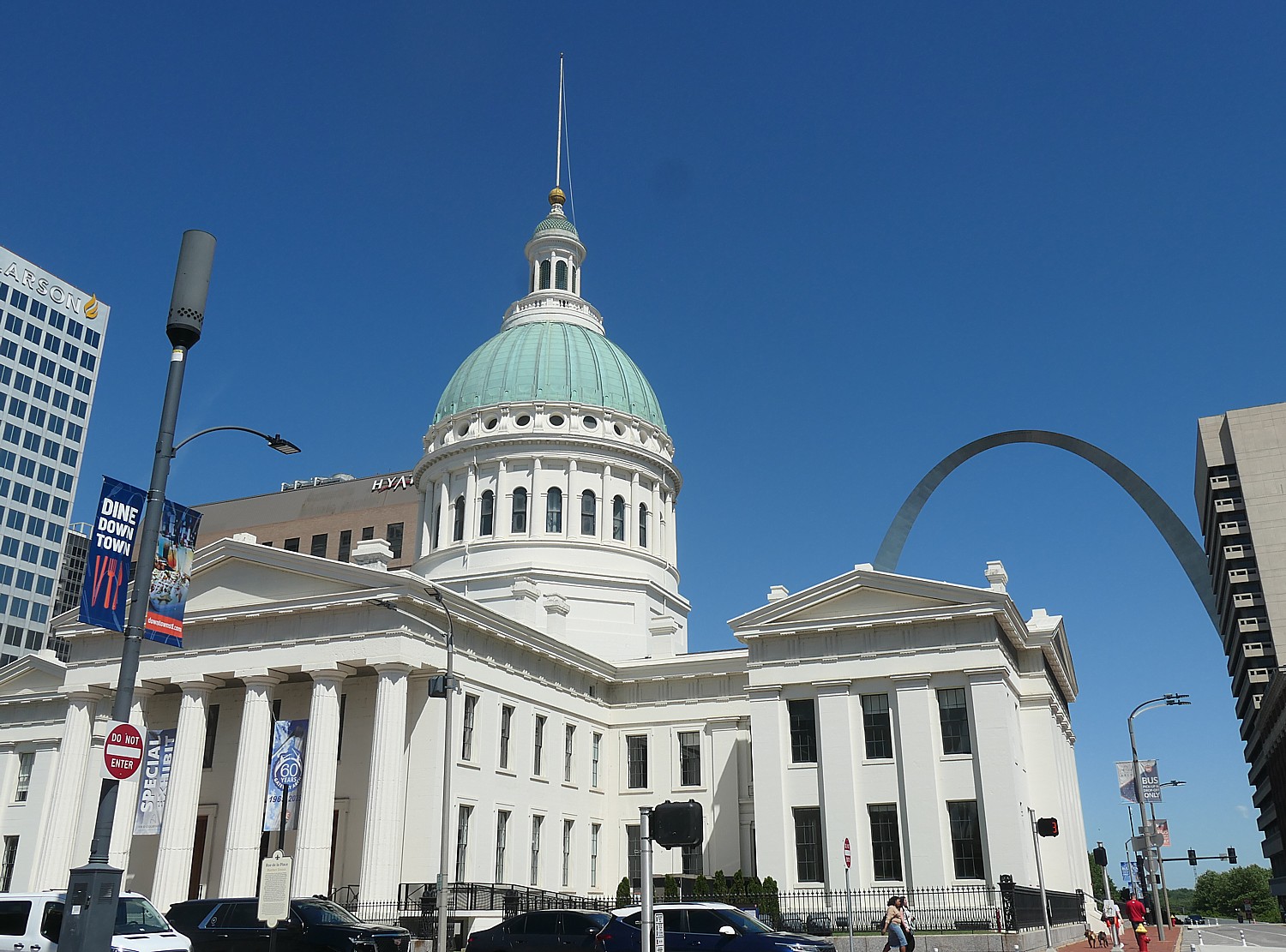
With only an afternoon and evening to explore St. Louis before my six-day Wilderness Voyageurs bike trip on the Katy Trail across Missouri, I immediately set out from the 21c Museum Hotel for Gateway Arch National Park. My walk takes me by majestic buildings and monuments such as Soldiers’ Monument, many from the 1930s and through the lovely Citygarden sculpture park. I find myself across the street from the Old Courthouse, with a banner that exclaims, “Open” and “New Exhibits.”
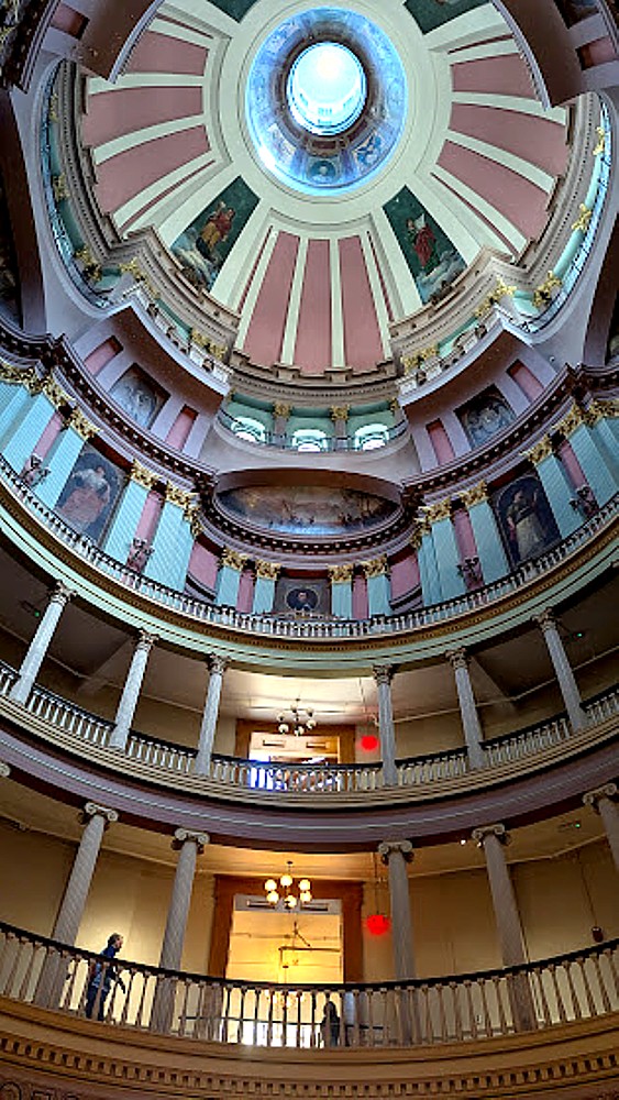
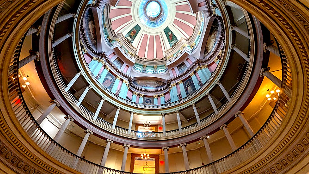
Touring the Old Courthouse is one discovery after another, beginning with its spectacular dome, architecture and stunning murals of historic scenes and important historical figures. I explore the four new museum galleries and the restored historic courtroom that opened in May 2025 after a five year, $24.5 million renovation, 2020-2025.
The Old Courthouse is actually part of Gateway Arch National Park. I find a National Park Service ranger in the spectacular lobby beneath a dome, and am amazed to learn the infamous Dred Scott case began here (two trials!) and would have ended in his favor were it not for the Supreme Court and its dastardly Dred Scott decision.
The ranger gives me a brief synopsis: The Old Courthouse was the site of the first two trials of the pivotal Dred Scott case in 1847 and 1850 before the infamous Supreme Court “Dred Scott decision” in 1857. I later learn that this was also where Virginia Minor‘s case for a woman’s right to vote came to trial in the 1870s. It was last used as a courthouse in 1930
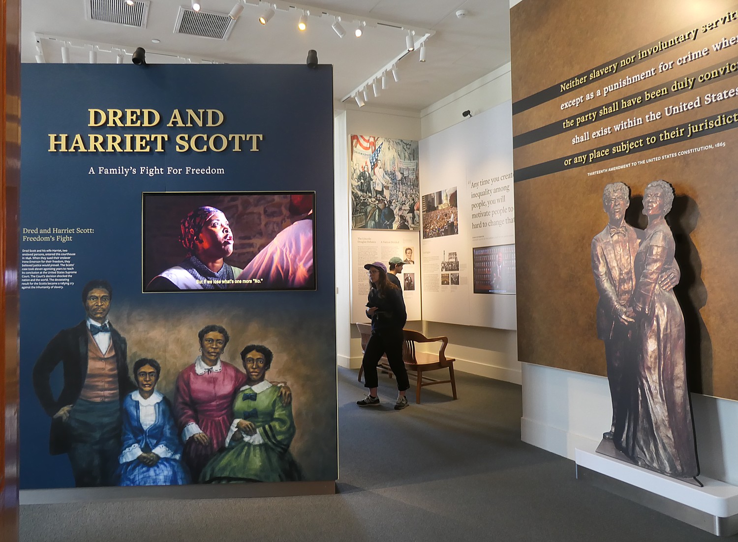
Sufficiently intrigued, I go off to see the new exhibit, simply named, “Dred and Harriet Scott,” a detailed biography of Scott and his wife, and their legal struggle. The story is not anything that is taught anywhere else, which more typically reduce Dred Scott to the Supreme Court decision, and not a person, and, as I discover, a story worthy of an opera.
I can only wonder if these exhibits will survive Trump’s anti-DEI crusade manifest in an executive order in 2025 called “Restoring Truth and Sanity to American History” executive order directing federal historic sites to “avoid showing content that disparages past or present Americans” – in essence erasing Black history and struggle for civil rights, women’s rights, human rights, and what was and is still being done to native peoples. (In Philadelphia, the National Park Service was ordered to replace slavery interpretive panels at the President’s House.)
It would be a terrible shame, though, because the exhibit is absolutely fascinating, revelatory, and pretty much this is the only place to appreciate it. Most of us only know the Supreme Court’s Dred Scott decision and do not know what led up to it, that for the 11 years the case was being argued and decided, Dred and Harriet Scott were prisoners of the sheriff, who hired them out and kept their wages. All during this period, the Scotts secreted their daughters away to protect them from being enslaved.
I learn that Scott was suing for his freedom from Irene Emerson, who inherited him upon the death of her husband, Dr. John Emerson, on the basis that his previous owner had taken him to a free territory, and under Missouri law (and the Missouri Compromise), if a slave or freed person lived in a free territory, they could not be re-enslaved. The first case was dismissed on a technicality (“hearsay”!), but the second case, which went to a jury of 12 white men (what else?), agreed that Scott was free. But Irene Emerson appealed up to the Supreme Court.
The Supreme Court’s 7-2 decision by Justice Roger B. Taney stated that Dred Scott did not have the right to sue for his freedom because he was not a citizen and Black people, enslaved or free, were not part of the original sovereign people so could never become citizens because they were not people but property; the Constitution’s protection of property rights overruled their human right to be free.
But in a fascinating turn of events, by then, Irene Emerson had married a Massachusetts politician, Calvin Chaffee, who ran for the US Congress in 1854 on the anti-slavery America Party Ticket, and was reelected in 1856; he only became aware of his wife’s connection to the Scotts in May 1857). He would have been mortified to be found to own slaves. So, to get rid of the embarrassing, inauspicious problem, sold the “title” to the Scotts to a descendant of the Blow family which had originally owned Dred Scott and who had actually provided financial support to the Scotts while the case was going on and who purchased the couple in order to emancipate them. Meanwhile, the Scotts, who had sent their two daughters away so they could not be captured and enslaved, were reunited.
Dred Scott was 48 years old when he initiated his suit for freedom (since he was illiterate and poor, it is assumed that he was encouraged by an abolitionist who guided him through the process). The operatic tragedy continues because after finally winning his freedom, his family lived in poverty (Irene Emerson kept the wages the Scotts earned during the 11 years of their arrest) and Dred Scott lived less than a year as a free man before dying of tuberculosis at the age of 59.
What I realize is that the landmark Dred Scott decision in effect nullified the Missouri Compromise that was put into place to forestall a Civil War; the decision intensified boiling national tensions and helped spark the Civil War. You also appreciate the lasting legacy and ongoing relevance of their case today. (You can hear reverberations of the Taney decision in Trump’s effort to overturn birthright citizenship enshrined in the 14th Amendment, which states that all persons born on U.S. soil and subject to its jurisdiction are citizens, no ifs, ands or buts.)
The exhibit includes A Bid for Freedom, an excellent 4 ½ minute video reenacting a hypothetical conversation between Dred and Harriett Scott, in which they discuss the risks to their family if they sue their enslaver for their freedom at the Old Courthouse and the risks they face if they don’t.
Pathways to Freedom gallery is another eye-opener. It personalizes African American life in St. Louis during the era of slavery and beyond, tracing the struggles of enslaved individuals seeking freedom, the continued fight for civil rights after the Civil War, and the rise of the Black elite known as the Colored Aristocracy, who built wealth and influence in the 1800s. Here you get an appreciation for the resilience, resistance, and influence of African Americans in St. Louis from slavery onward, with disturbing echoes as these struggles have resurfaced throughout the country today, as if the struggles of1865-1965, and brief period of progress and societal awareness, from 1965-2025 had been erased.
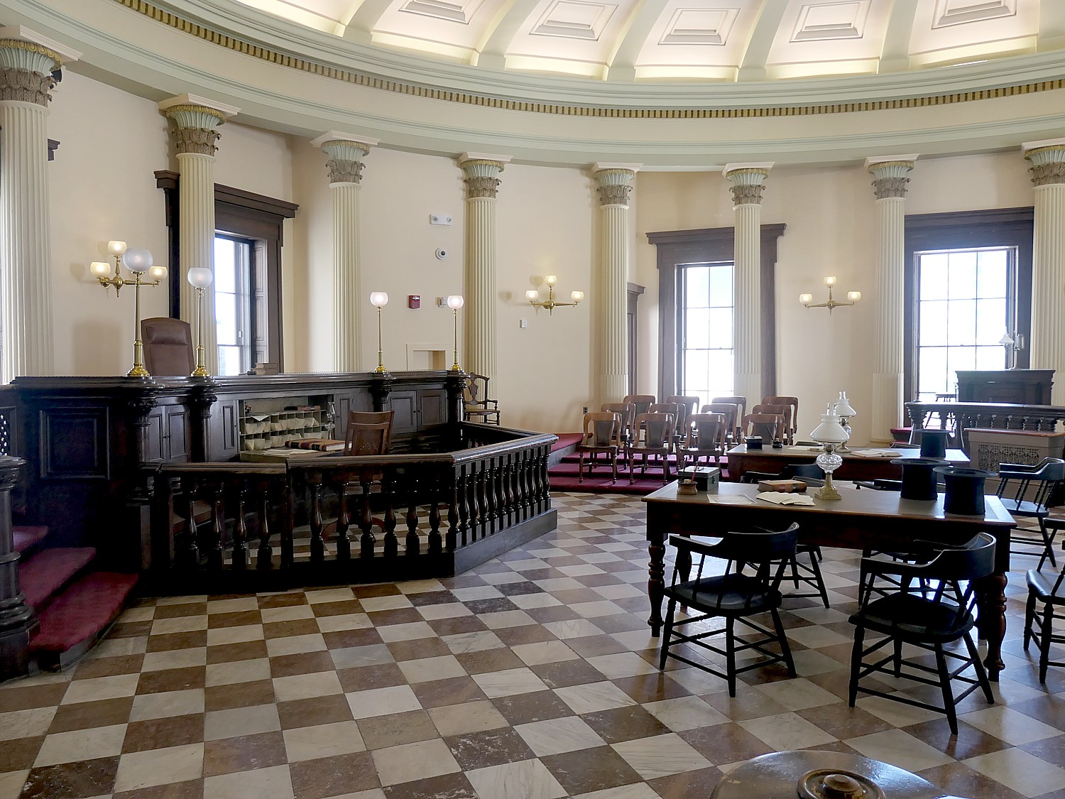
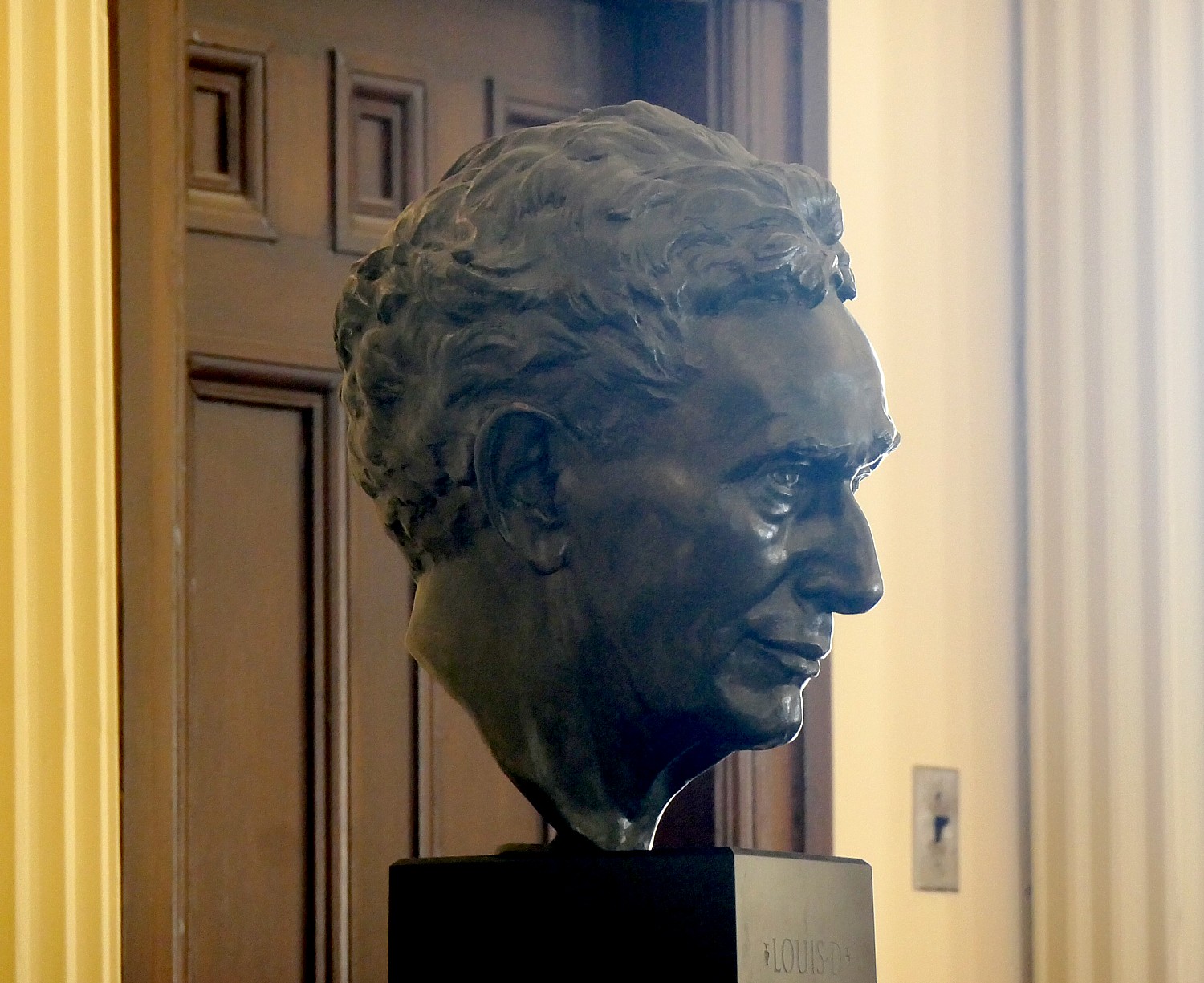
See You In Court, housed in a recreated 1850s courtroom, highlights the vital role courts have played in shaping our society, legal system, and daily life from 1839 to 1930. Visitors can explore the courtroom and even participate in mock trials, gaining a deeper understanding of how the court system helps resolve conflicts peacefully and supports the structure of our society (another important lesson for today, to remind of the foundational importance of the Rule of Law, without fear or favor.) I note the bust of Louis Brandeis, the first Jew to become a Supreme Court Justice, who was formally admitted to the Missouri Bar here on November 21, 1878.
One of the oldest buildings in St. Louis, the Old Courthouse is significant for its Greek Revival architectural style, engineered dome, and interior murals. In 1838, the County of St. Louis selected Henry Singleton’s cruciform plan with a central rotunda to replace the existing smaller courthouse. Construction started in 1839 and it opened in 1845 (just one year before the Scotts filed their suit). At this time emigrants traveling westward on the Oregon and California trails often stopped and gathered provisions in St. Louis, the “Gateway to the West,” and would meet up in the Old Courthouse rotunda. The present dome, which replaced a smaller one in 1862 (while the Civil War was going on, and the Capitol Dome in Washington DC was under construction), was designed by architect William Rumbold and was one of the first of its type. After the dome alteration, American painter Carl Wimar was commissioned to design four lunettes in the building’s interior. In 1976, the Old Courthouse was listed in the National Register as a component of the Jefferson National Expansion Memorial.
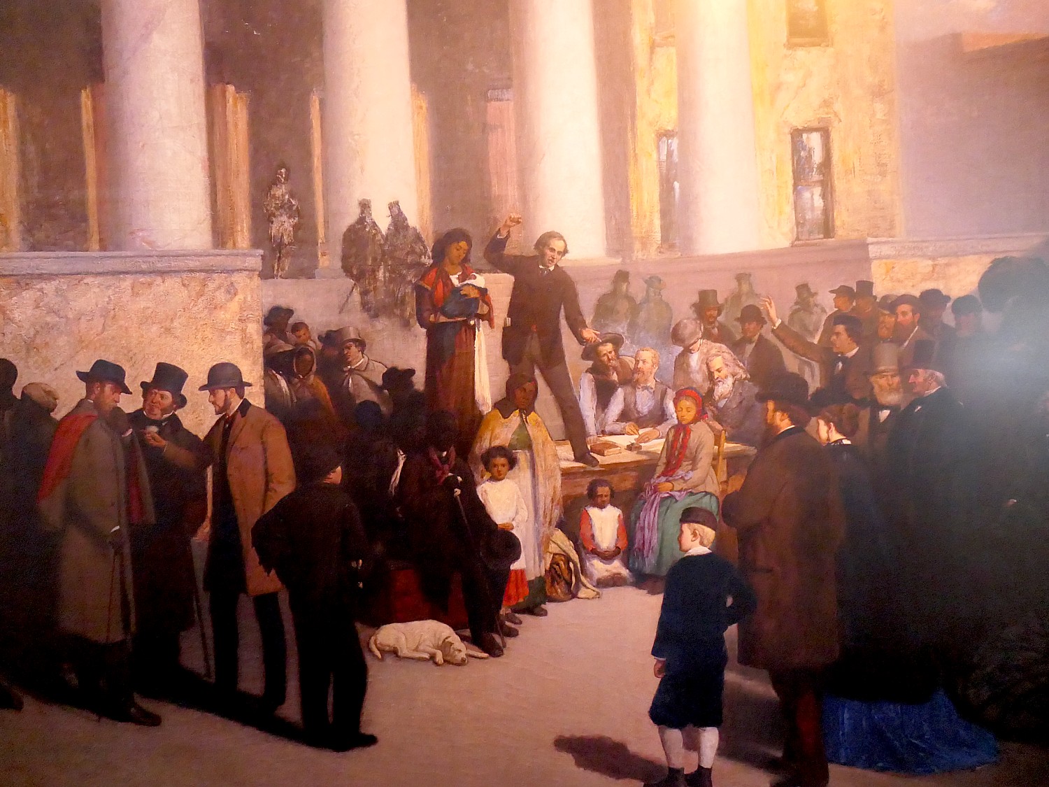
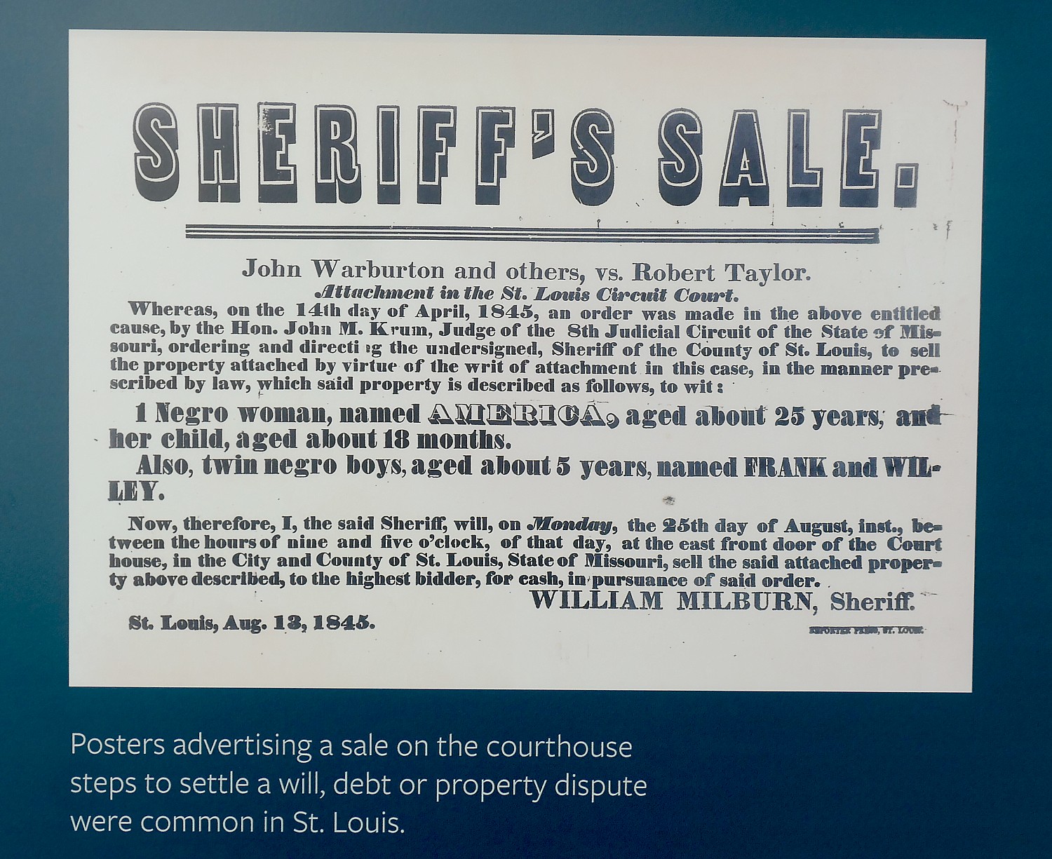
Largely because of the Dred Scott case, St. Louis’ Old Courthouse is included in the National Park Service’s National Underground Railroad Network To Freedom – places of “historic resistance to enslavement through escape and flight.” The Old Courthouse is linked with the Underground Railroad as a place associated with legal challenges to slavery. Slaves were auctioned from its steps in estate settlements, and the Old Courthouse was the site of hundreds of suits for freedom.
The city gave the Old Courthouse to the National Park Service for inclusion into Jefferson National Expansion Memorial in 1940, which was renamed Gateway Arch National Park by an act of Congress in 2018.
Plan to spend at least an hour, more likely two in the Old Courthouse.
National Park Service rangers provide guided tours of the building every day at 2:15 pm (only rarely cancelled due to staff availability). The tours cover the architecture and history of the building and the court cases associated with it. (No tickets or reservations necessary.)
The Old Courthouse is open daily from 9 am to 5 pm (closed on Christmas, Thanksgiving, and New Years Day). There is no admission fee.
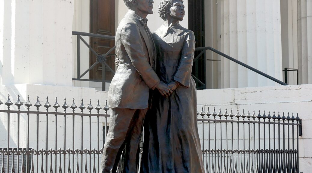
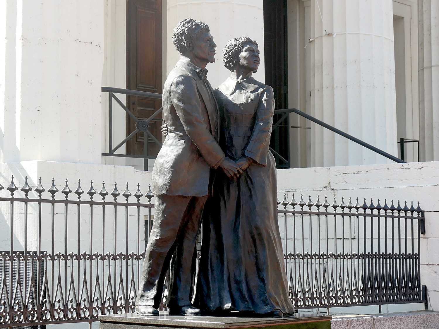
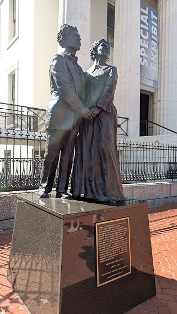
From here, I leave the Old Courthouse through the riverfront exit on my way to the Gateway Arch, about two blocks further, stopping at a stunning statue of Dred and Harriet Scott.
Fort Stanwix, in Rome, New York, is a revelation. Hardly anyone knows of it – it doesn’t even seem to merit a footnote in history – but it played a role in two incidents, one during French & Indian War and one during Revolutionary War, that proved pivotal for American history, like a tiny peg in the giant cogwheel of history.
A National Historic Site, Fort Stanwix also offers one of the best presentations of tribal Indians and European settlers in the colonial and Revolutionary War period. Indeed, the Erie Canal was built across what was the Oneida Carrying Place, vital to the earliest traders. This fort is where the British negotiated and signed the 1768 treaty with the Six Nations of the Iroquois Confederacy. I suspect this area is also where Melinda Gage drew upon what she learned of the Oneida Indian women to form key planks of women’s rights movement.
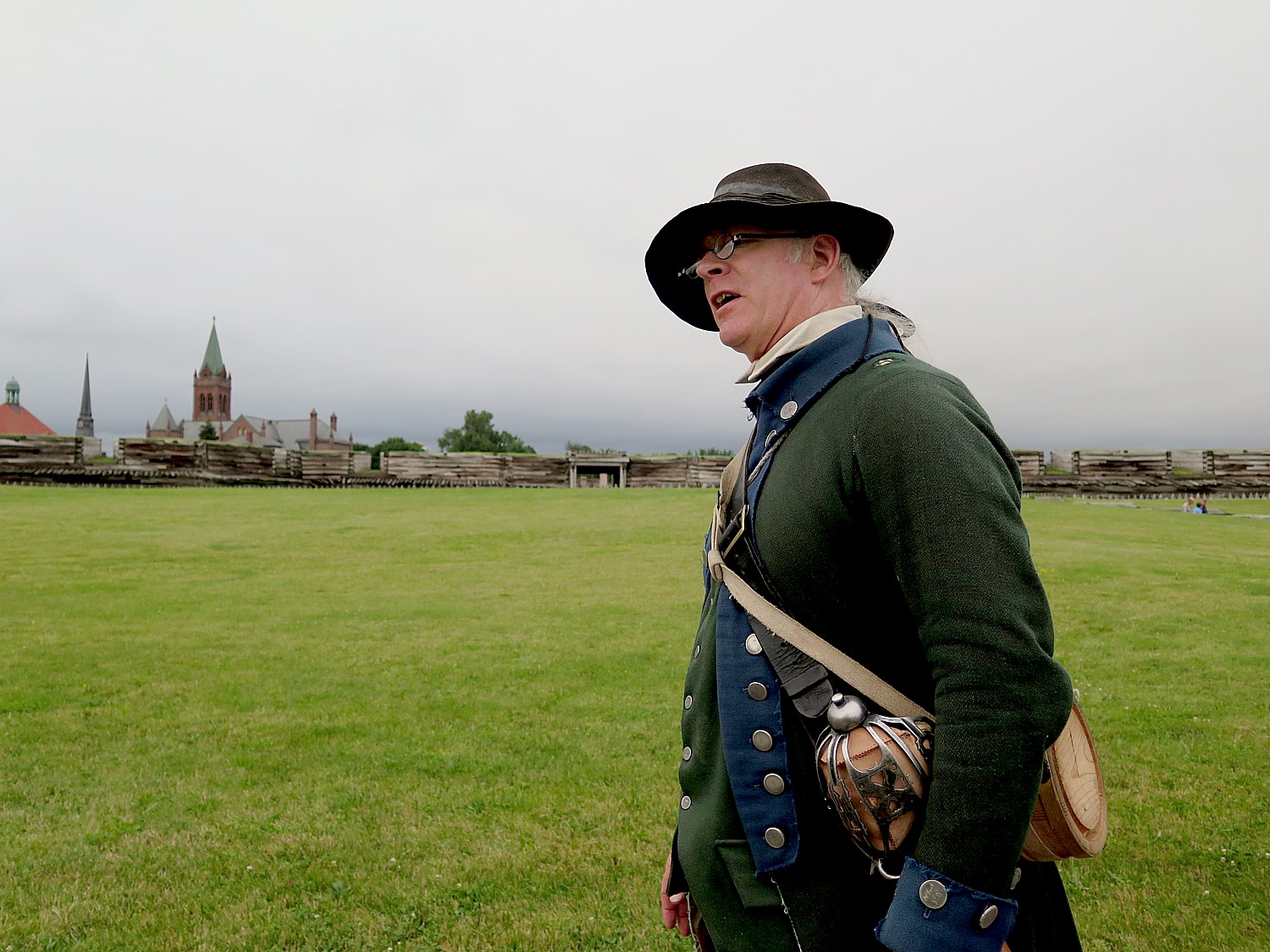
The presentation here (in contrast to how pitiful the Womens Rights National Site in Seneca Falls is) is fantastic, both in the exhibits and the commentary. Engaging, informative, dramatic, thoughtful. Also, the park rangers are in period dress so you really feel as if you have stepped back in history. You wind up speaking to these people as if it was 250 years ago.
This part of the eight-day Cycle the Erie bike tour, 400 miles from Buffalo to Albany organized annually through Parks & Trails NY, takes us back to the very beginning of the United States, to its native American origins, European colonization and its emergence as an independent nation. It is 400 miles and 400 years of history.
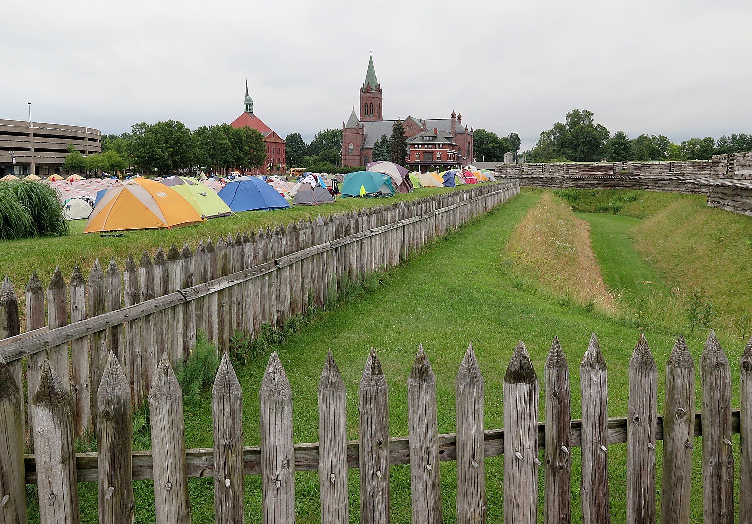
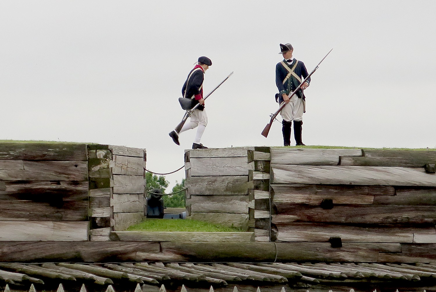
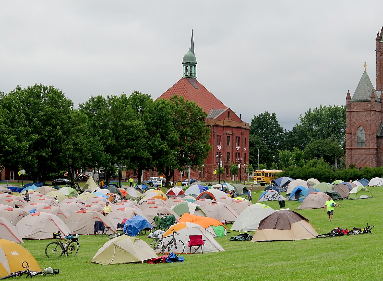
At Fort Stanwix National Monument in Rome (where the 750 of us actually camp out outside the fort, making it look like an army bivouac), we are put squarely into the drama of the American Revolution. Interpreters in period dress take on the roles of American soldiers and British prisoners in period dress – creating such realism that you appreciate so much more the context and the conditions. Most surprising, is that it also tells the story of the Native Peoples, almost entirely forgotten as having an equal stake in the Revolution. (It didn’t go well.)
The reconstruction of Fort Stanwix comes alive through the personal stories recounted inside the fort. You get to experience the American Revolution and the Siege of Fort Stanwix through the eyes of soldiers and their families, American Indians and traders. This is accomplished through the realistic recreations (especially of the fort), the costumed interpreters, outstanding markers, artifacts, the art, portraits and graphics, and superb videos. They create characters who are composites of actual people, and you hear their voices in a context.
It’s humbling to realize how little you actually know about Colonial America and the American Revolution.
The Fort puts the competing interests of the Patriots, Loyalists and Indian peoples into balance. You have empathy for each. (Especially the Native Americans, who were dragged into the fight, upsetting a long-standing peace among the Confederacy of Iroquois nations, found their whole society upended, and were literally screwed by every European and American they dealt with. George Washington, shockingly, even betrayed the Indians who were allied with the Patriots). But you also understand better the Loyalists, whose property was being seized by the Patriots, and the Patriots, who were not necessarily British subjects, but German and Dutch colonists – whose property was being burned by the Loyalists.
The National Park Service is keeping the fort open late for us and hosting tours, and is keeping the visitors center open all night (the indoor camping location, though, is off-site at a local YMCA).
We arrive at Fort Stanwix after biking 50 miles from Syracuse, a good chunk of our Day 5 ride in drenching rain. I set up my tent (fortunately, the rain stopped just as I came into Rome), grab a shower, and race over to the visitor center to join a guided tour. I am so lucky to attach myself to the same Park Ranger as I toured with two years ago, on my first Cycle the Erie tour.
Fort Stanwix as we see it today literally rose out of ash heap of history – reclaimed from earthly grave.
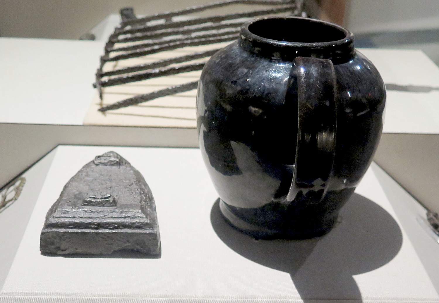
At one point, the fort was the reason Rome developed at all, but ultimately Rome grew up over its ruins, from fire and neglect. Then the city Rome went through a decline. But in 1960s, as part of urban renewal, planners wanted to redevelop the dilapidated downtown. A grassroots movement grew up to excavate the fort; meticulous archaeology unearthed some 400,000 artifacts. (Visitors can actually get a back-stage view of the archaeology being done during summer tours.)
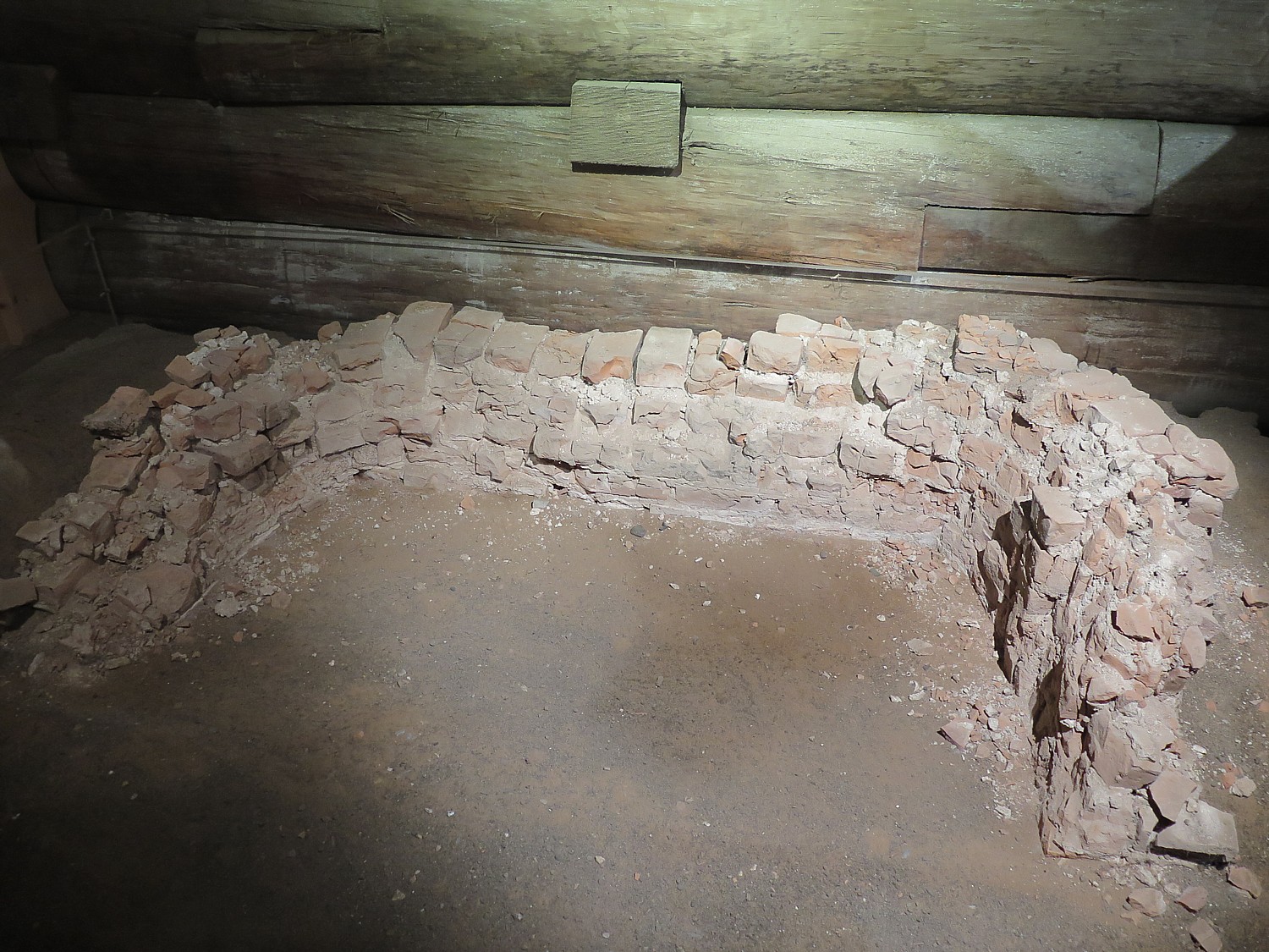
The National Park Service was faced with a quandary – its mission at the time discouraged reproduction or re-creation of a historical site. But there were strong arguments in favor of reconstructing the fort: they found the original fireplace (the only part of the fort that remains of the original, which we get to see); had the original plans (obtained from British archives); plus papers and drawings so they could reproduce it accurately; and letters of soldiers so they had a better idea of what happened here.
The location of this fort is significant. It sits along “Six Miles that Changed the Course of America,” reads the National Park Service brochure. “For thousands of years, the ancient trail that connects the Mohawk River and Wood Creek served as a vital link for people traveling between the Atlantic Ocean and Lake Ontario. Travelers used this well-worn route through Oneida Indian territory to carry trade goods and news, as well as diseases, to others far away. When Europeans arrived, they called this trail the Oneida Carrying Place and inaugurated a significant period in American history – a period when nations fought for control of not only the Oneida Carrying Place, but the Mohawk Valley, the homelands of the Six Nations Confederacy and the rich resources of North America as well. In this struggle Fort Stanwix would play a vital role.”
The British built the fort in 1758 with the permission of the Oneida to protect their commerce, but abandoned it to cut back on spending after the French & Indian War (taxes imposed by Britain to recoup their expenditures is what incited the American Revolution).
The fort was never put to the test, because the French were defeated elsewhere. But though Fort Stanwix fell into decay, the site was still important for trade and relations with the Six Nations.
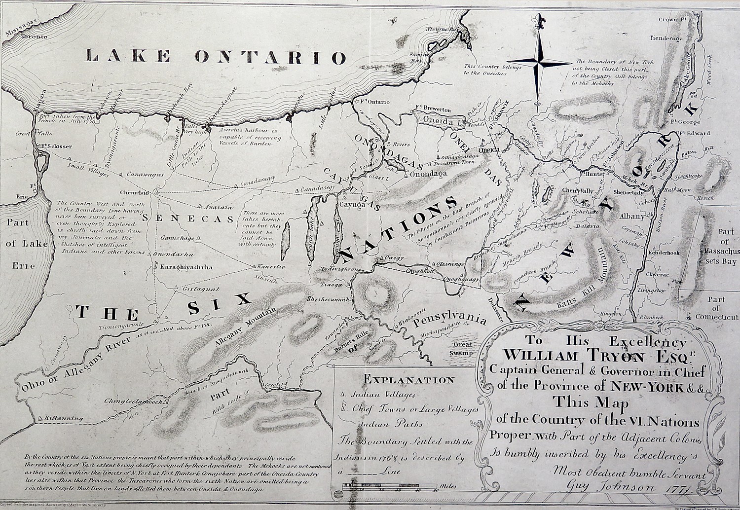
It is here at Fort Stanwix, in 1768, after the Europeans had spread into “empty” spaces and fought with the Indians, that Sir William Johnson, Indian Supervisor, negotiated a treaty with the Six Nations of the Confederacy, basically laying out the terms that everything east of the fort would be for Europeans, and everything west would be for Indians.
“Over 3,000 American Indians from the Six Nations, Shawnee, Delaware, Mingo and other dependent tribes attended the treaty negotiations,” the notes read. “Ignoring British Crown instructions, Sir William Johnson encouraged the Six Nations to draw a new boundary line favorable to their mutual interests. Rather than settling tensions, frontier strife between colonists and American Indians increased.”
“I can never look upon that (Proclamation of 1763) in any other light… than as .. temporary expedient to quiet the mind of the Indians,” land speculator George Washington wrote to surveyor William Crawford, 1767. “Any person… who neglects the opportunity of hunting out good lands…for his own, in order to keep others from settling them, will never regain it.”
Meanwhile, British attempts to govern the growing colonies from afar and the associated costs led to strained relations. Hoping to defray the cost of colonial administration, the British parliament taxed many goods arriving in North America. But growing independence and identification as Americans caused many colonists to question British rule. Tensions steadily increased until American “Patriots” declared their independence in 1776.
The exhibit gives me a new perspective: a good number of colonists were not British – they came from Germany, Holland and other places. I realize that becoming a Patriot would not have been such a hard choice as for those with British ties.
“For colonists living on the frontier, the issues included British imposed restrictions on trade, limits on settlement, and continuing violence with American Indians. As war approached, many colonists had to choose between remaining loyal to the King or joining the movement to American independence.” Each side considered themselves “patriots”. But those who stayed loyal to the Crown became known as “Loyalists,” while those who sought independence called themselves “Patriots.”
In 1775, Patriots and Loyalists began struggling for control of the New York frontier. The British invaded the Mohawk Valley in 1777. Their strategy was to capture an important east-west supply route, deprive American soldiers of food grown in the valley, and strengthen Six Nation and Loyalist Alliances, and slice the colonies.
British General John Burgoyne led an invasion of New York from the north and west. His army advanced from Montreal towards Albany. A second force commanded by General Barry St. Leger invaded the Mohawk Valley. Strategically, St. Leger aimed to control the Oneida Carrying Place, create a diversion to split Patriot forces, and reinforce Burgoyne. Politically, he wanted to rally support among American Indian allies and Loyalists.
Patriots had taken over Fort Stanwix in 1777 and renamed it for General Schuyler. The fort was under the command of Col. Peter Gansvoort when it came under siege by the British. Some 2,000 British troops set up a blockade, helped by Indians allied with the British, which went on for months.
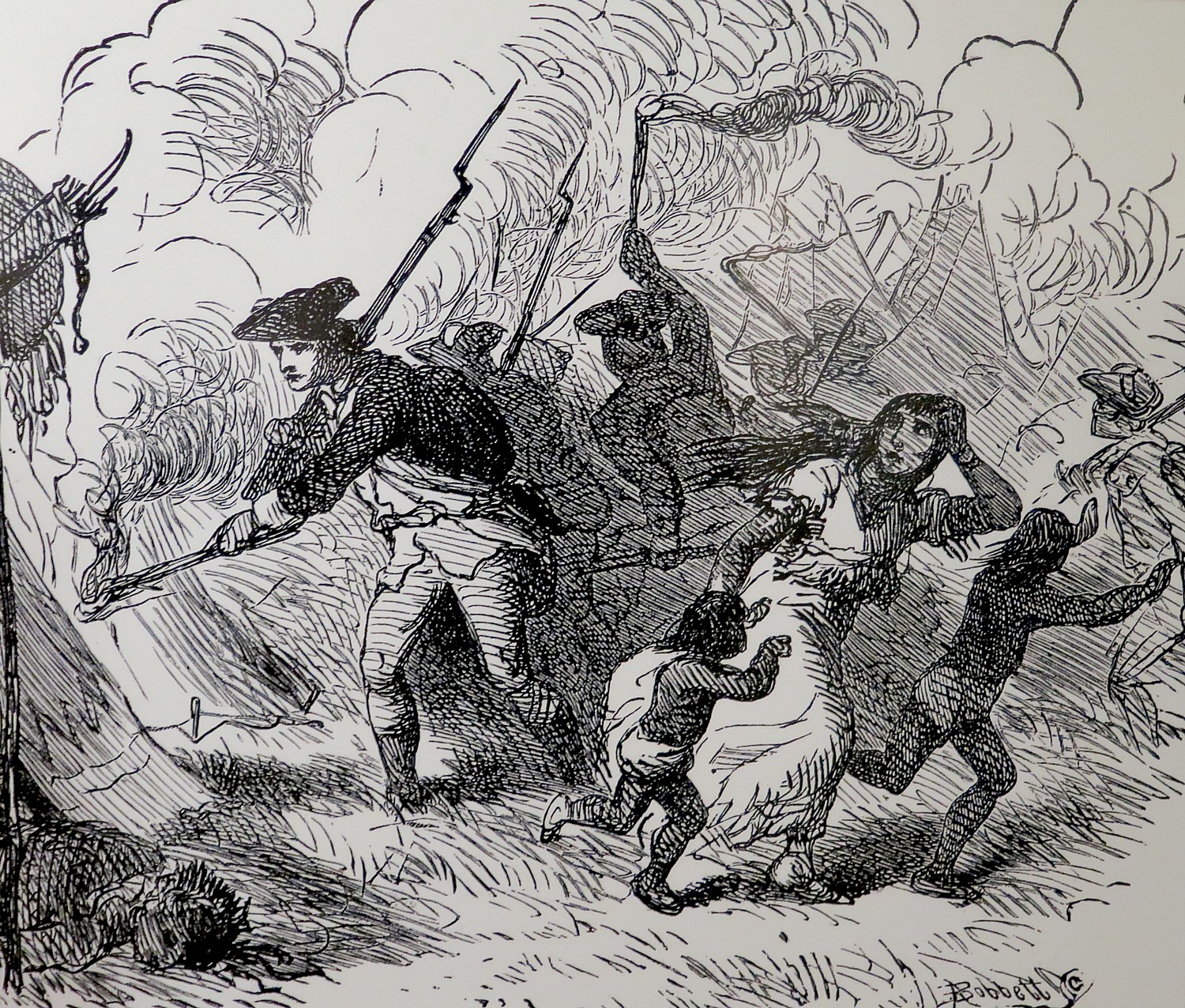
General Nicholas Herkimer assembled an 800-man militia to come to the fort’s aid, but was betrayed (by Molly Brant, a Mohawk woman allied with the British, and the second wife of Sir William Johnson). Herkimer’s militia was ambushed along the way at Oriskany. This became one of the bloodiest battles of the Revolutionary War, in which 600 were killed in a matter of hours. General Herkimer, himself, was fatally wounded, dying 10 days later. (Later in our trip, we pass Herkimer Church where he died, and his home.)
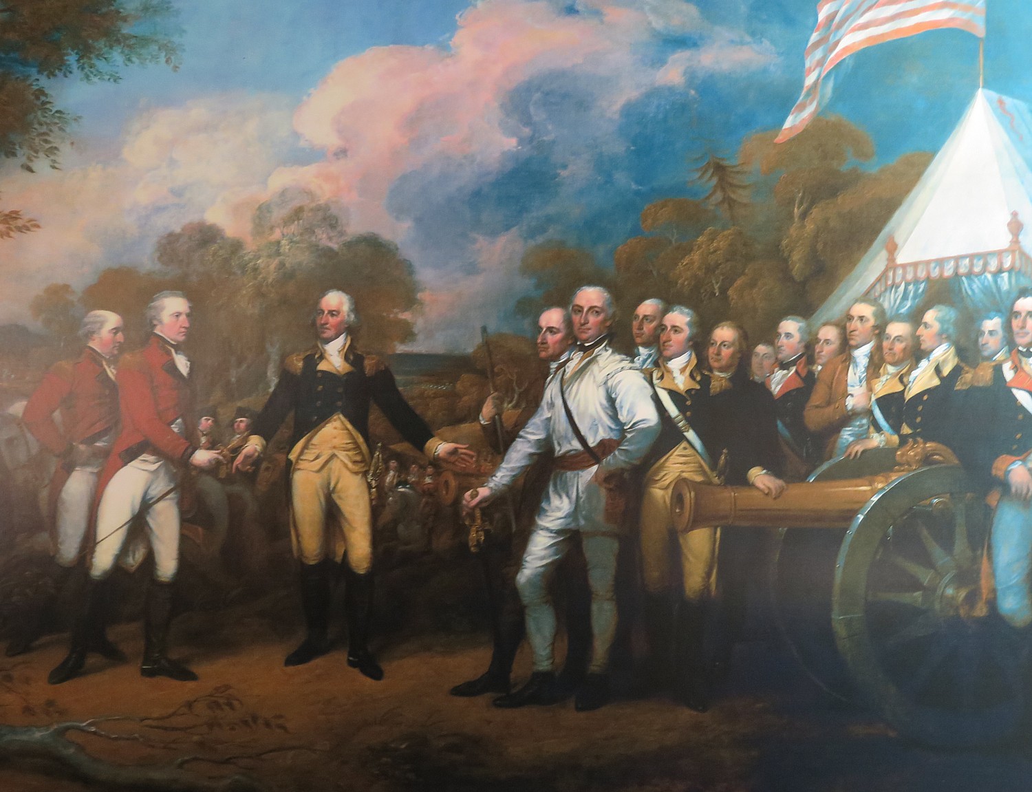
But the Indians allied with the British, hearing that the Americans had plundered their encampments, left the fort to go to their families’ aid. Fearing that more American reenforcements were on the way, the British retreated, handing the Patriots their first victory (of sorts) of the Revolutionary War. This, critically, boosted the Americans’ morale, and helped set the stage for the Patriots’ victory at Saratoga (under General Benedict Arnold).
This, then, is what changed the course of the war. Because of the victory at Saratoga, which was the unanticipated consequence of what happened at Oriskany and Fort Stanwix, Americans won the critical support of France (long time enemy of Britain), without which, the Americans could not have defeated the British and the British were forced to fight a world war.
In 1778, the British again attempted a formal invasion of New York, planning to burn the Mohawk Valley fields of grain that supplied the Continental Army.
The last battle here took place in 1780, when a work party outside the fort was ambushed by British-allied Indians and Loyalists.
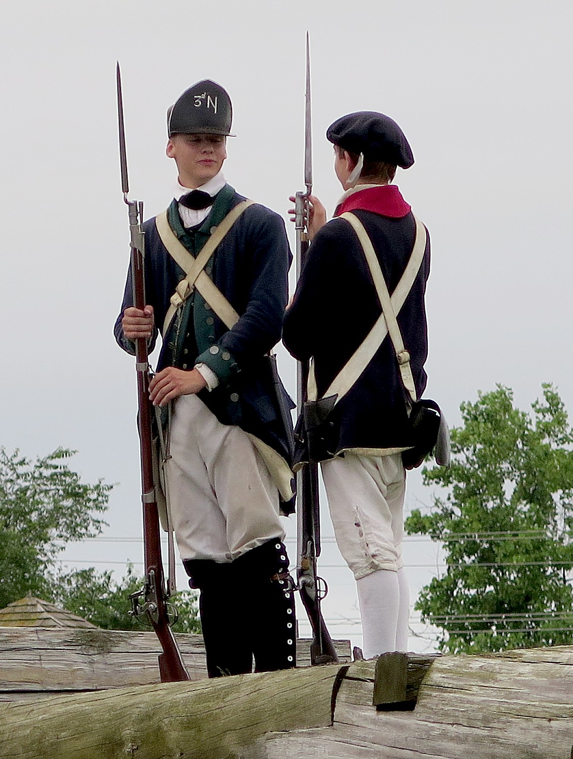
But for most of the Revolutionary War, “It is frustrating for the troops to be here, the backwater of the Revolution,” Park Ranger Bill Sawyer, who is dressed in the uniform of the 3rd New York regiment, tells us. The men were upset because they were far from the fighting. But “Washington was vindicated in his decision to keep it fortified because the British refortified Fort Ontario. Washington wanted to block the British.”
And I am certain that those disgruntled soldiers confined to Fort Stanwix never appreciated that as a result of these events at Fort Stanwix, the British grand plan to slice off New York from the rebelling colonies and cut off the Continental Army’s source of food, failed. Instead, the Americans had the critical support of France.
Fort Stanwix: Living History
After this introduction in the Visitors Center, Park Ranger Bill Sawyer, walks us into the Fort, where we are greeted by costumed interpreters dressed as American soldiers. A couple of teenage boys (summer interns at the fort) patrol the ramparts of the fort. You are immediately transported back centuries.
This fort is a nearly complete reconstruction on the original foundation – the only thing original is a fireplace (that can be seen in one of the rooms). Over the decades, Rome was built up on top of the fort. Archaeological excavations conducted in 1970-73 uncovered the site, but all the artifacts were removed, the site completely cleared, and the fort rebuilt with new materials.
The fort held 800 soldiers (twice the number the fort was built to hold); families of soldiers (who couldn’t afford to maintain them in their homes) camped in the ditch outside the wall; women would try to get jobs within the fort. People died of disease and winter cold.
By February 1778, the soldiers’ clothing was reduced to rags, they hardly had any bedding left or blankets. They would have been stationed here for anywhere from 4 months to 2 years. Morale was terrible.
We see the harsh living conditions. Artillery men, though, had somewhat better accommodations, because they were specialists. “They had to have knowledge of math and the use of measuring tools to calculate the trajectory of cannon and mortar. They had better pay and living conditions.”
We visit the different rooms for the junior officers, a family quarters, the officers’ lodging, the orderly room, the surgeon’s day room. The Commandant’s HQ had a fine room befitting his wealth and high station and had a private assigned.
On my first visit, two years ago, I was able to see an outstanding film that depicted life in the fort and how the soldiers suffered. “The walls imprisoned them, supplies cut off. They were overcome by boredom and hunger. They wanted to go fight. Five men deserted, headed to Canada. Gansvoort sent out a band of Indians to recapture them. They were executed as an example to the rest….It was a forsaken place. Finally, they were sent to war.”
On my first visit, one of our cyclists, Peter Reeve, was British, though living in Maryland since 1981, and gave me the British perspective: “The British people didn’t care to keep America,” Reeve told me. “They didn’t want to spend the money fighting the Revolution. Most British generals were against the tax acts. General Howell supported the Americans’ grievance.”
While major battles took place in the South, minor battles and guerrilla-style warfare characterized the fighting in New York. General Washington lamented that crops that were being destroyed in these raids were needed to feed his army surrounding New York City. These raids and counter-raids were waged by Patriots, Loyalists, American Indians, British and British-allied Germans, alike, often against civilians, and were among the most brutal of the war.
The fort served as an isolated outpost for another four years after the siege. The inaction drained morale and the constant shortage of food and munitions made the soldier’s life insufferable. Regular petitions for transfer and increasing desertions reflected the wretched conditions.
By 1779, British strategy changed and they invaded the other colonies. Though Britain won most of the battles, they failed to destroy the Patriot army. Outmaneuvered, the British surrendered at Yorktown in 1781, bringing an unofficial end to the war.
Following their 1781 defeat at Yorktown, the English saw little value in continuing large scale war in America. Two years later, war ended with the signing of the Treaty of Paris by the US, France and Britain. As the British Army withdrew, Loyalists migrated to Canada and elsewhere.
American Independence Voids Treaty with Indians
The 1783 Treaty of Paris officially ended the war – at least between the British and the colonists. However, no terms of peace were negotiated for the American Indians. In later years, American Indians negotiated their own treaties with the Patriots (who tossed out the Treaty of 1768.)
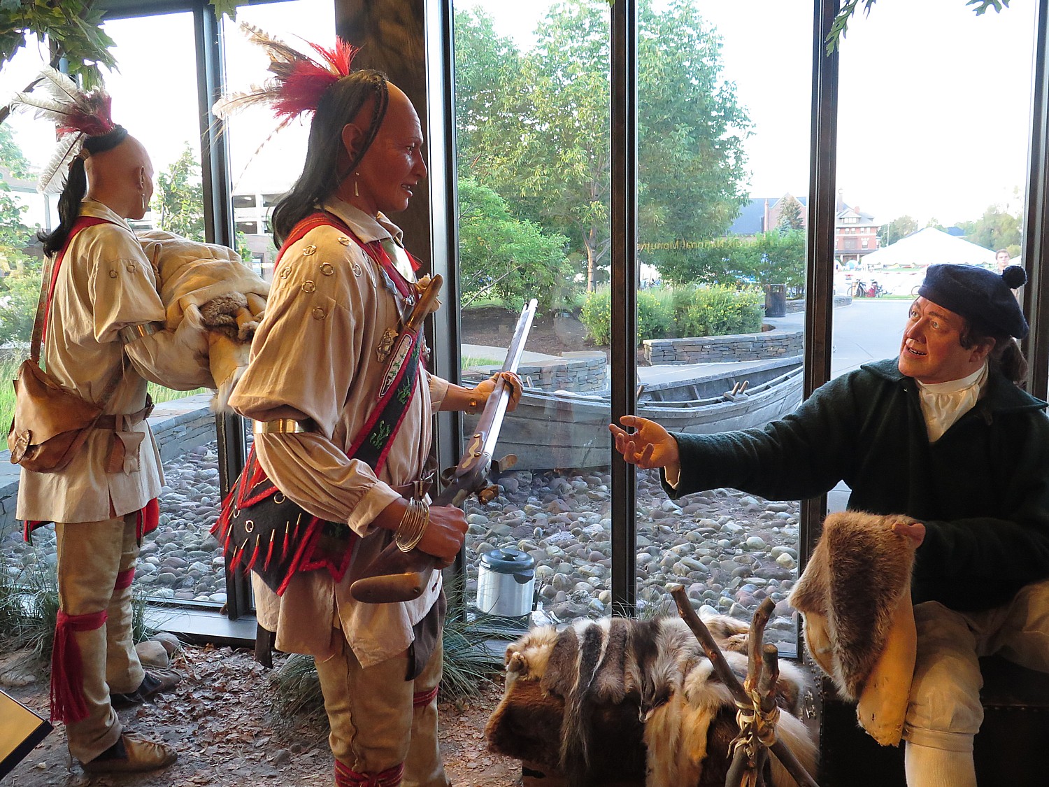
The focus at Fort Stanwix on Indian history is very clear from the first display that greets you as you enter the Visitors Center – of trappers trading with Indians.
American Indians’ history, NPS Ranger Sawyer says, “was long ignored. Now we interpret to include it.”
Indeed, Fort Stanwix offers one of the most interesting and informative presentations about American Indians outside of the Smithsonian’s Museum of the American Indian in Washington DC.
I am most surprised to see that the Indians lived in villages, with a grid street plan; they wore western-style shirts and many had European names. They had many of the same household goods as the colonists – an indication of how well-developed trade had become, and in fact, how dependent the Indians had become on trade.
The constant theme in the history between the Indians and European settlers, though, was how the Indians were constantly betrayed.
The Indians wanted no part of the Revolutionary War and tried to stay neutral. That changed with the Battle of Oriskany, though.
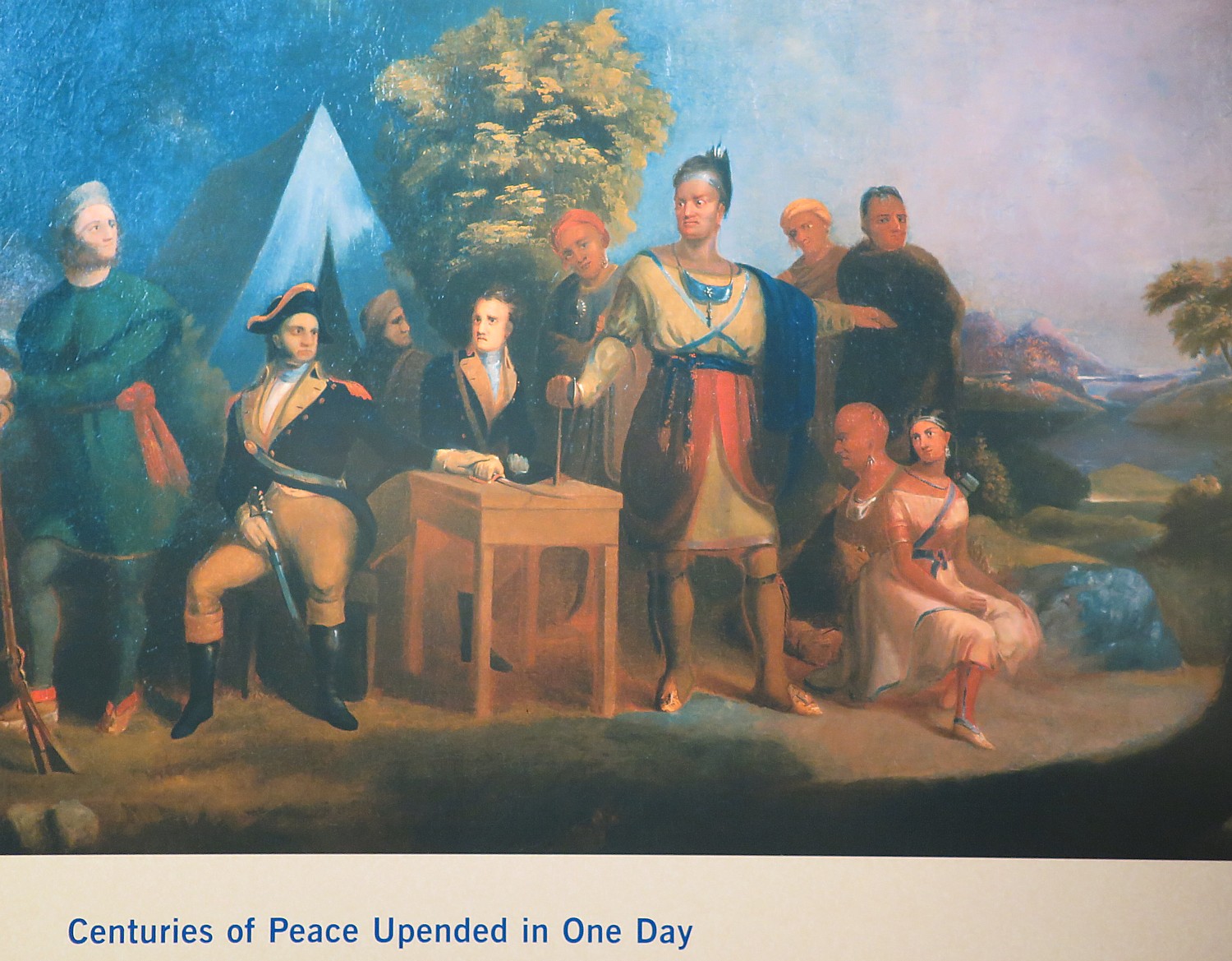
The Revolutionary War split the Iroquois Confederacy (“Iroquois” was the French name for the Haudenosaunee, “People of the Longhouse”). Mohawks led by Joseph Brant (the brother of Molly Brant who triggered the ambush of Herkimer’s militia at Oriskany) adhered to their long-standing allegiance to the British, and eventually most Cayugas, Onondagas, and Senecas joined them. But Oneidas and Tuscaroras sided with the Americans, owing in large measure to the efforts of their Presbyterian missionary Samuel Kirkland. The Revolution became a civil war for the Iroquois, as Oneidas clashed with Senecas at the Battle of Oriskany in 1777. (“Centuries of peace upended in a single day,” the notes read.) Iroquois suffering was compounded in 1779 when General John Sullivan, on orders of General Washington, led an American army through their lands, burning 40 towns and destroying crops.
Both sides practiced a scorched earth strategy. “Raids by Loyalists and British-allied American Indians in 1778 destroyed Patriot settlements in Pennsylvania and New York. In 1779, General Washington ordered Generals Sullivan and Clinton to retaliate and destroy Six Nation towns, homes and food. Soldiers from Fort Stanwix tricked Patriot-allied Oneida warriors into raiding the British supply depot at Oswegatchie before leaving to destroy Onondaga towns. These raids and counter-raids continued until 1783.” Afterwards, General George Washington was given the name “Town Destroyer” by the Seneca people.
The Americans, who always wanted to take over Indian lands (another sore point that led to wanting independence from Britain), nullified the treaty of 1768 as soon as they won independence in 1783, claiming it was negotiated with the British and did not apply to the new nation. The Americans voided the treaty with the Cayuga, Canandagua and Mohicans claiming that these nations sided with the British, and pushed them further west.
In 1784, Governor George Clinton (uncle of Dewitt Clinton who launched the Erie Canal project), who was not a supporter of the federal Constitution, decided to make his own treaty. The new treaty, negotiated at Fort Stanwix with the Oneida who allied with the Patriots, effectively relegated three Oneida Indian nations to a measly 32 acres, in which they were surrounded on all sides by settlers. (The Oneida tribe had already split, with half moving to Wisconsin).
“Now, for first time in history, the Indian nation is relegated to a reservation, surrounded by Europeans (whites),” Sawyer tells us.
By the 1790s, houses were built by the fort; by the mid-1800s, the fort was demolished and the city of Rome built on top of the ruins. In 1935, a national monument established, though by then the site a commercial district with no trace of the fort.
By the 1960s,a grassroots urban renewal effort was underway to revitalize the downtown and restore the fort, but this required the National Park Service to go against its long-standing policy: “We protect, preserve, interpret any natural thing, but nothing was left of fort.” But political pressure mounted to create a new Revolutionary War “themed park” to open in time for the bicentennial in 1976.
A massive excavation got underway by local volunteers and in the process, 400,000 artifacts were uncovered in three years of archaeological work.
They had a the foundation plus they had the original plans (from the British museum) and maps, clothing and receipts, enough to reconstruct the fort exactly as it would have looked.
Ranger Sawyer, who tells me his interest in becoming a park ranger was ignited during summer internship at the fort when he was a teenager and got “hooked”, says that the 400,000 artifacts are housed in a cultural conservation center in the Visitors Center.
In summer, on Wednesdays & Thursdays, at 11:15 & 1 pm, they open up back area to guided tours to see archaeologists working with the artifacts.
I am literally the last person out of the fort when they close at 9 pm, and walk a block to get some pizza for dinner (this is one of two nights when we are on our own for dinner and the city of Rome has provided a list of eateries.)
The 20th Annual Cycle the Erie Canal ride is scheduled July 8 – 15, 2018 (www.ptny.org/canaltour). In the meantime, you can cycle the trail on your own – detailed info and interactive map is at the ptny.org site (www.ptny.org/bikecanal), including suggested lodgings. For more information on Cycle the Erie Canal, contact Parks & Trails New York at 518-434-1583 or visit www.ptny.org.
The entire Erie Canal corridor has been designated the Erie Canalway National Heritage Corridor, Waterford, NY 12188, 518-237-7000, www.eriecanalway.org.
More information about traveling on the Erie Canal is available from New York State Canal Corporation, www.canals.ny.gov.
Next: Cycle the Erie, Days 6-7: Erie Canal Promotes Rise of America as Global Industrial Power
I am surprised at how much we could cover on our first day in Yosemite National Park, spent hiking in Yosemite Valley. This is the most popular and iconic part of this vast park, the size of Rhode Island, but the three trails we chose – Mist Trail, John Muir, Mirror Lake – haven given us a really good sense of the park, despite its size. Since we need to leave the area for San Francisco, 200 miles away, by 4 pm, we cleverly find a hike (thanks to the Tenaya Lodge concierge) that starts from just inside the South Gate, in the Wawona section, thereby cutting out 1 ½ hour drive each way jut to get into Yosemite Valley at the center of the park. We plan this out very well: the Chilnualna Falls Trail is just about 6 miles from the Tenaya Lodge, and is much, much, much less crowded – and yet, we meet some wonderful people from Australia and other places.
It is also sufficiently long hike to take about five or six hours – exactly the amount of time we have, and, we discover, offers dramatic, close-by views of the cascading Chilnualna Falls, the sweeping vistas of the southern Yosemite, and wonderful diversity of the landscape, as the trail winds through a variety of terrain and habitats. Our choice proves brilliant.
We start out in the village of Wawona (you pass a general store so if you need supplies, this would be a great place), turn onto Chilnualna Falls Road and park at the trailhead (there are restroom facilities here).
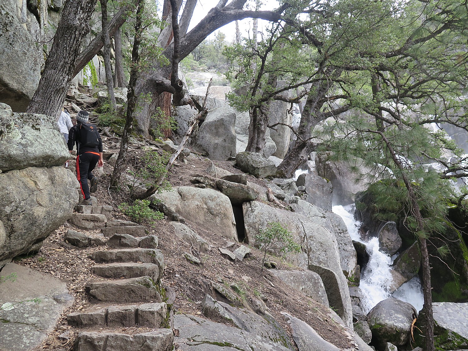
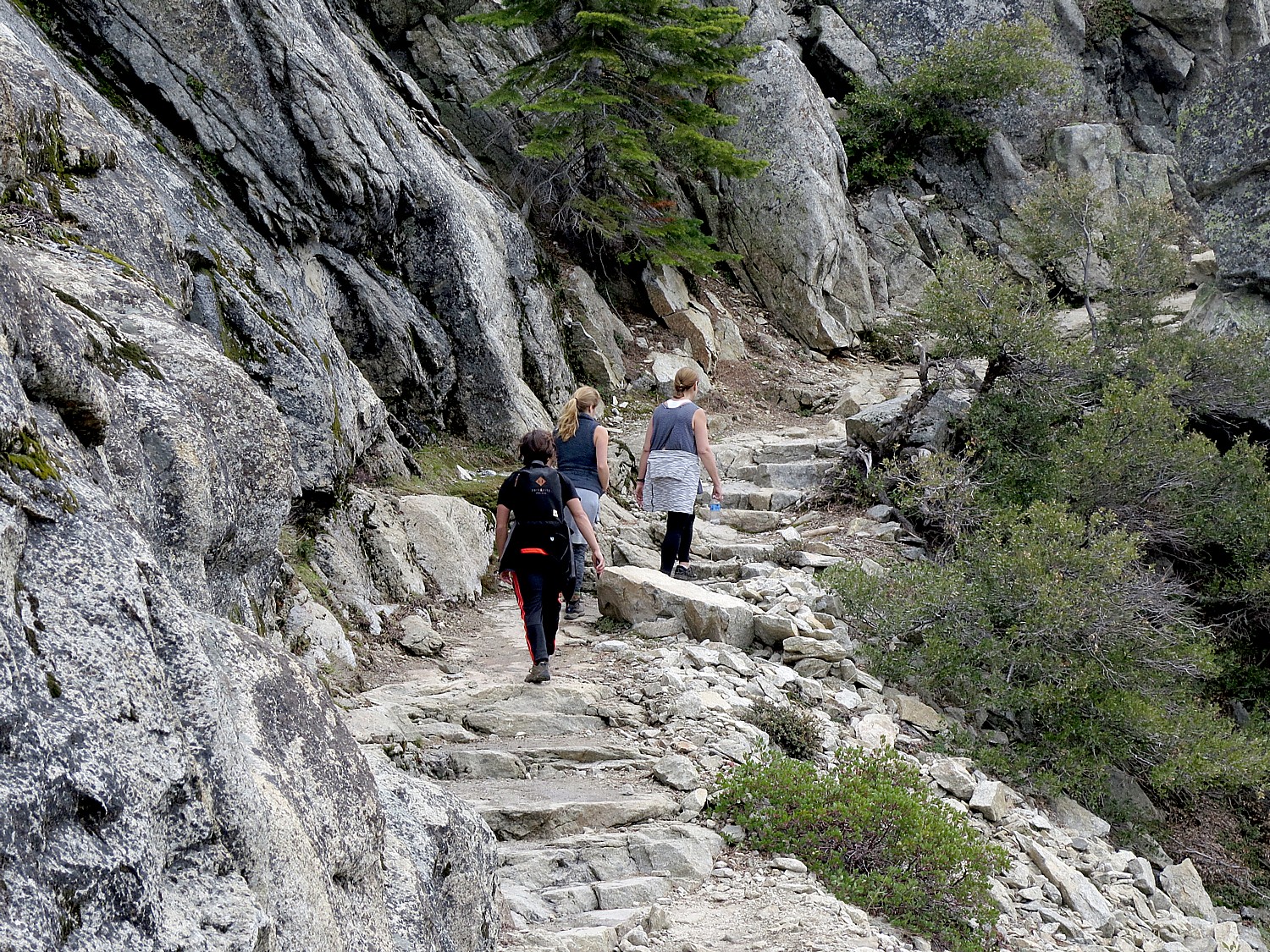
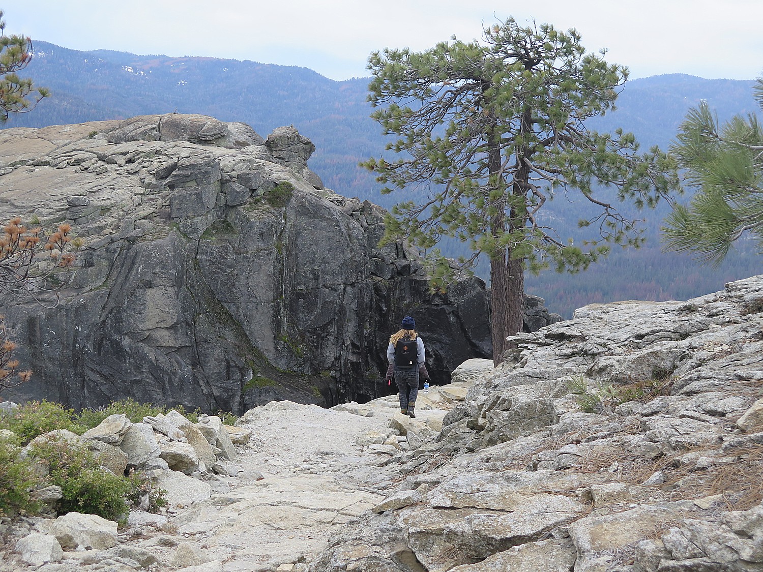
This hike is billed as strenuous – mainly for a fairly steep, nearly mile-long beginning, that includes narrow, high stone steps (with the reward of a gorgeous cascading waterfall). Then it is a steady upward (though mostly gradual) climb for about 4 miles, with a 2,400-foot elevation gain to an altitude of 6,600 feet – that’s what makes the hike tough.
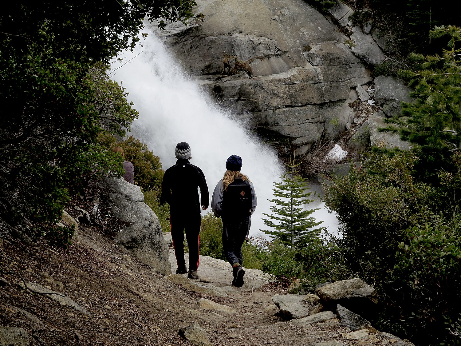
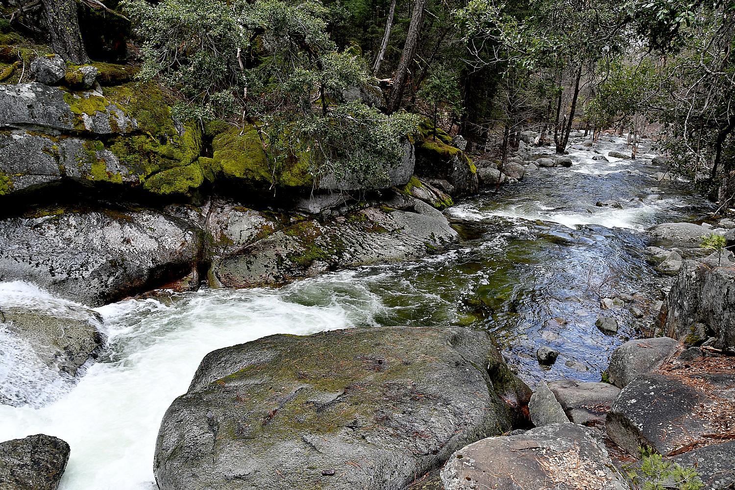
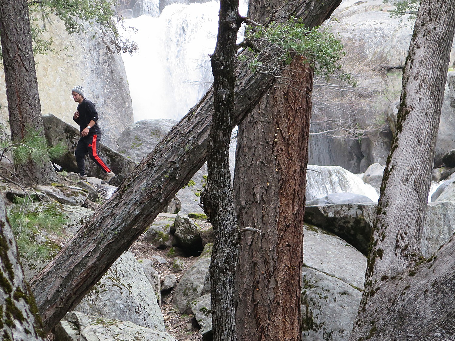
The Chilnualna Falls, which fortunately for us is one of the less known and visited falls (and not accessible by car), consists of five large cascades that slide through and over large granite rock formations – almost like the ruins of a fort, parts of which we get to climb.
At various points we come across the cataracts, up close, and each time, the sound and view is dramatic.
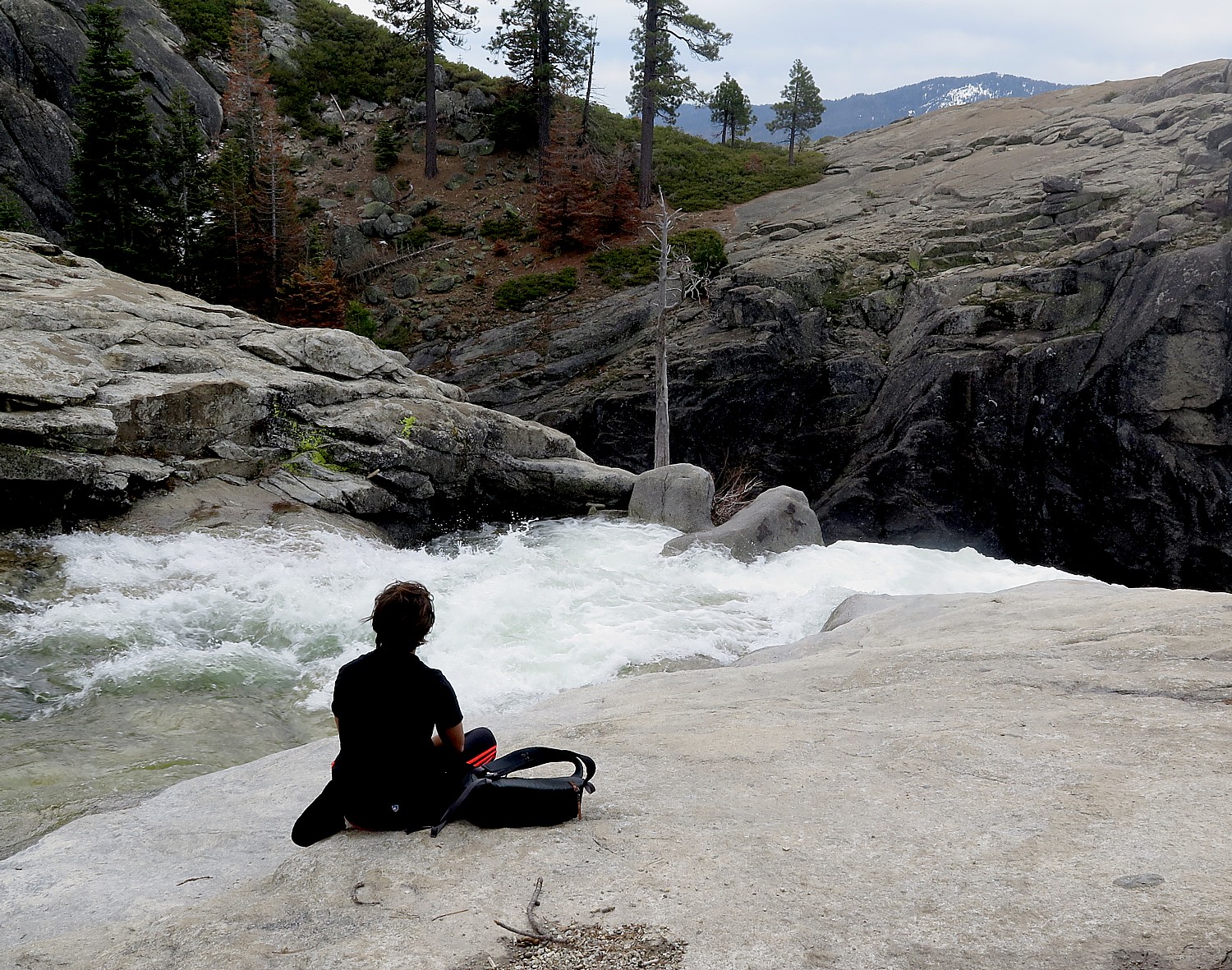
Finally, we come to a beautiful scene where the Chilnualna Falls comes to a ledge before going over a ridge. Here, we sit along some flat rocks right beside the water, and look over the forest and distant mountain peaks of the southern Yosemite and the Wawona Dome.
From here, you can continue on to get to the top of the fall (as well as connect to several other trails that go all the way back to into Yosemite Valley), but considering our time schedule (and looking out at rain clouds flowing in), we head down after a lovely picnic along side the cascading Chilnualna Creek.
Most of the trail is along the ridge so you have dramatic views of the creek or valley. Some of it crosses through meadow, so there is wonderful variation. The views of the rushing water and waterfalls are surprising and dramatic.
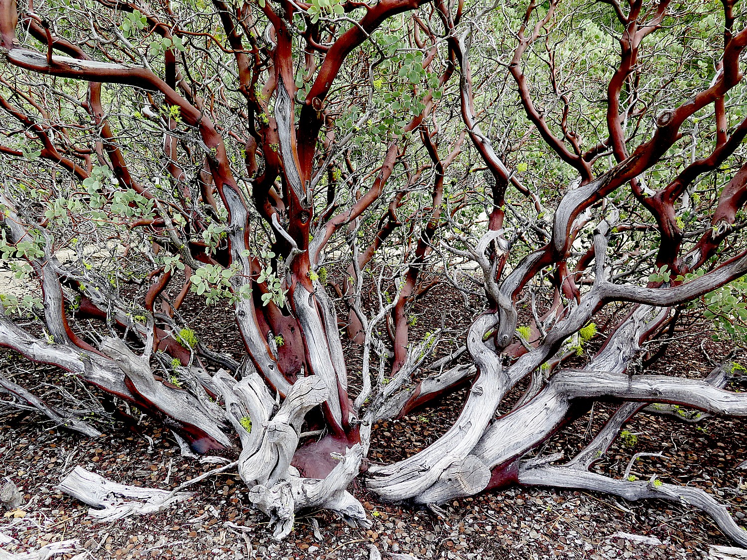
One of the nicest aspects of this trail, as compared to yesterday’s hikes on the Mist Trail, the John Muir Trail and the Mirror Lake Trail, are the opportunities to appreciate some magnificent trees and flowers. After about a half mile (and the first cascade), the trail leaves the creek and heads up switchbacks through manzanita, oak and mixed conifer forest. In the spring, the hillsides are full of Mountain Misery – a spreading plant with beautiful white blossoms, which we get to see. In among the Mountain Misery you may well see Hartweg’s Irises, Indian Pink, Golden Yarrow, Narrow-Leaved Ceanothus, Utah Serviceberry and several more showy flowers. Some of the side seeps might be blooming with Seep Spring Monkeyflowers and perhaps Sunflowers.
The upper cascades of Chilnualna Falls are quite beautiful in high flow, and in the early season they will be flanked with Azaleas, Mountain Pride Penstemmon and Dogwoods, Pussypaws and others.
We don’t necessarily realize it, but we are also passing through territories of deer, coyote, mountain lion, and black bear. There are birds, as well, but we are a bit early to see the western tanager which can be spotted from May through September.
Finally, as we near the top, we have views over to Wawona Dome and finally of the falls themselves.
We have to climb down a little from the trail to these broad slabs so we have a beautiful view of the falls. It is a perfect place for our picnic lunch.
Coming back is much, much easier – basically a gentle downward slope, and you are looking out at the scenery. Even the obstacles are no concern because we have already done them.
We are down to the steep part when it begins to rain. There are a couple of obstacles – like leaping over flowing water (thank goodness for my hiking sticks!).
We make it all the way back just in time for it to rain in earnest, adding to our feeling of physical satisfaction and accomplishment. All in all, an 8.2 mile hike that takes from 10 am to 3:40 pm.
What I love most, after completing this trail, is how different the experience has been from the previous day’s hike in Yosemite Valley – the vegetation, the meadows, the general landscape – and how surprisingly gorgeous the falls and the creek, and especially, the peacefulness without the crowds.
Preparation: bring enough water (2 water bottles) and prepare for changes in weather: bring rain poncho and plastic bags to cover cameras from rain or mist; rain poncho; snacks, moleskin for blisters, hat, sunglasses and sunscreen, camera, extra memory card and battery, cell phone, an extra layer in case it gets cool. I have also found hiking sticks extremely helpful.
For non-hikers, non-DIYers, Tenaya Lodge offers a Yosemite Tour Package, via mini-bus, that includes lunch and narration, and guarantees waterfalls and wildlife and seeing the most popular sights of Yosemite. (Offered May 1-Nov. 30; from $575 spring, $685 summer, $555 fall; call 888-514-2167 or Tenaya Reservations directly at 559-692-8916).
Tenaya Lodge, 1122 Highway 41, Fish Camp, CA 93623, 800-722-8584, tenayalodge.com.
Yosemite National Park – America’s first – has been on my bucket list for years, so I am beyond excited when we arrive at the Tenaya Lodge, in Fish Camp, just two miles from the South Gate, and immediately start planning for how we will tackle the park the next day. I am intimidated at first by how vast Yosemite is – the size of Rhode Island I am told – and how to organize the logistics if I am going to see for myself the places that are etched in the images in my mind in only two days.
We spend a lot of time with the Tenaya Lodge concierge to get suggestions of where to go, which trails to hike, where to park (there is a bus shuttle system but during our visit, at the very beginning of spring, it wasn’t operating very well).
Because it is so early in the season, some of the areas (like Glacier Point) aren’t even open yet. But it also means that the waterfalls are at near maximum of their cascading flow: all the sound and the fury, the feel of the cool spray, the moist smell. On the other hand, as it happens, we are here on the weekend of National Parks Week, when admission is free, coinciding with Easter, so the park is likely to be especially crowded.
But we pick out the trail for the day: Mist Trail – which is also one of the most popular (we discover) for good reason, especially this early in the season. In one trail, it seems to encapsulate the entire Yosemite experience of a reasonably vigorous hike over a good distance (3 miles roundtrip to Vernal Fall, with 1,000 foot elevation gain, taking about 3 hours), sensational views, proximity to a fantastic waterfall (Vernal) with views of the Nevada Fall (which would be a further 1.3 miles up Mist Trail from Vernal Fall).
Indeed, it is a shock to learn that though the Tenaya Lodge is a mere two miles from the South Gate entrance into Yosemite National Park, it is another 45 minutes drive (30 miles) just to get to the famous Tunnel View, then another 45 minutes drive to get to Curry Village where we will fnd parking for the Mist Trail.
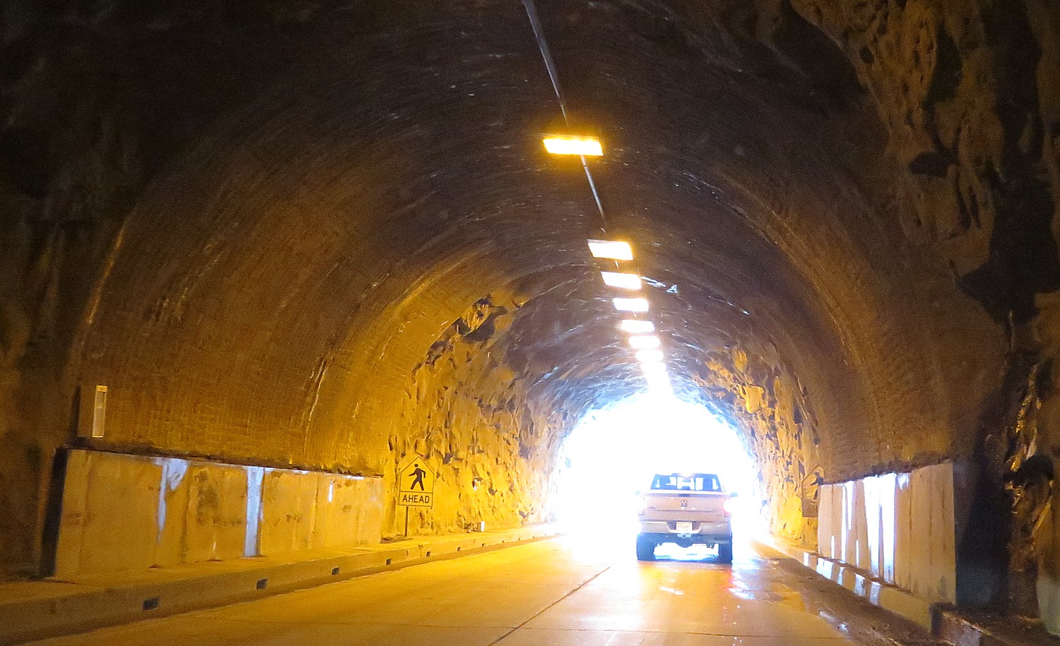
The concierge prepares us well. We know that just outside of the mile long tunnel, to look for the parking lot for the iconic Tunnel View. “Take the first spot” she has advised.
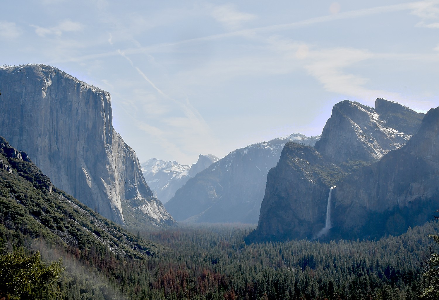
The Tunnel View lookout place, in one image, offers a spectacular view of the quintessential Yosemite sites: Bridalveil Fall, Half Dome, Clouds Rest, El Capitan.
Indeed, the biggest surprise for me is how accessible the iconic features of Yosemite National Park are from the road – I expected them to be more remote, reached only after long, difficult hikes through the wilderness.
And so I shouldn’t have been surprised by the steady stream – wall to wall in some spots – of people, just like us, seeking out the solace and majesty or our natural, national heritage. Indeed, last year saw a record – 331 million visitors to America’s 417 National Park Service sites (contributing $34.9 billion to the U.S. economy in 2016), 5 million alone to Yosemite (Grand Canyon got 6 million).
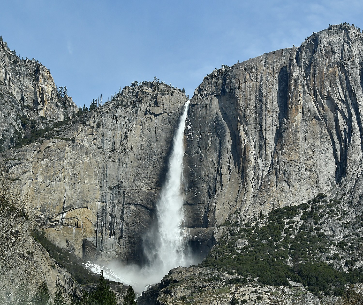
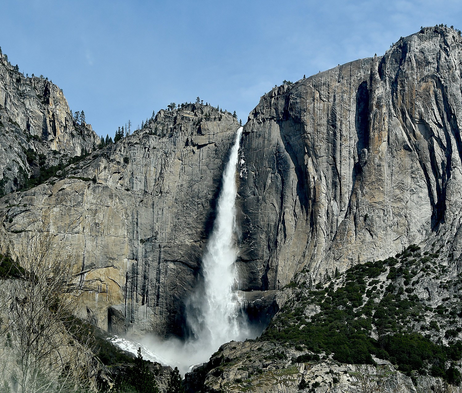
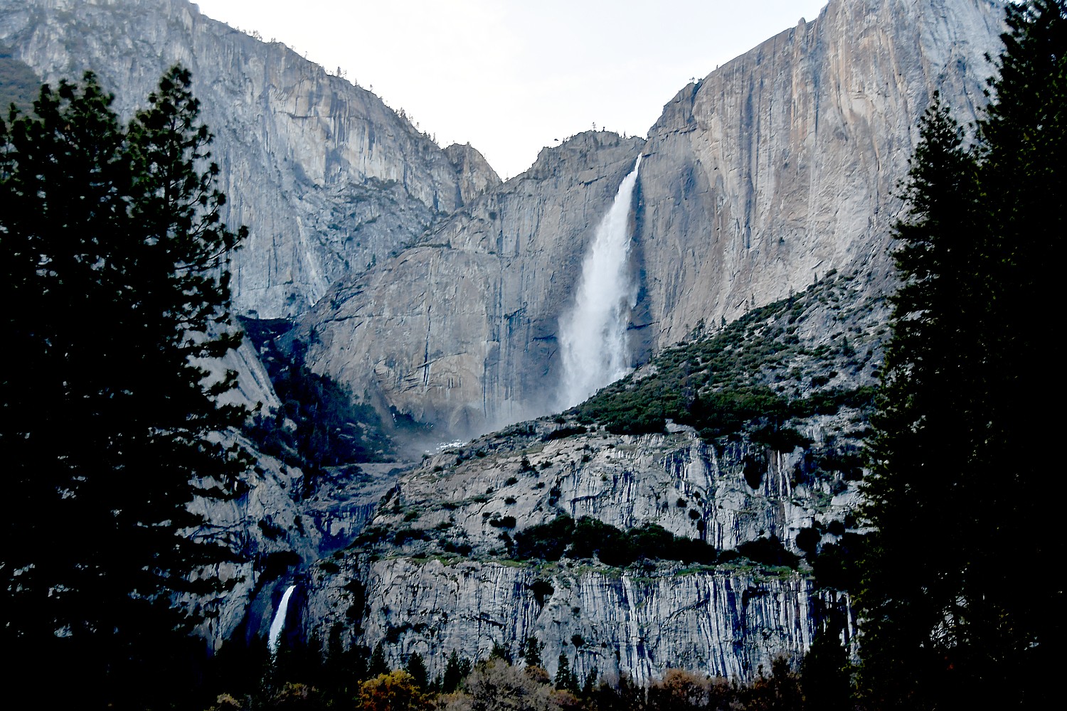
Just a half mile beyond Tunnel View, you come to Bridalveil Fall – which has to be the second most visited place in Yosemite – and it is just a quarter-mile walk to the waterfall (a key reason it gets MASSIVE crowds that converge in this small spot; I even meet someone who had just been at a wedding right there). The famous Yosemite Falls, also, is visible from the road (we see it on our way out, when it is already getting dark), and the Lower fall is an easy one-mile loop (half of it is wheelchair accessible).
But we are here to hike! And the trails we have picked out are perfect for the level of physical exertion (and satisfaction), photographic opportunities, and the general appreciation of Yosemite that we are seeking today.
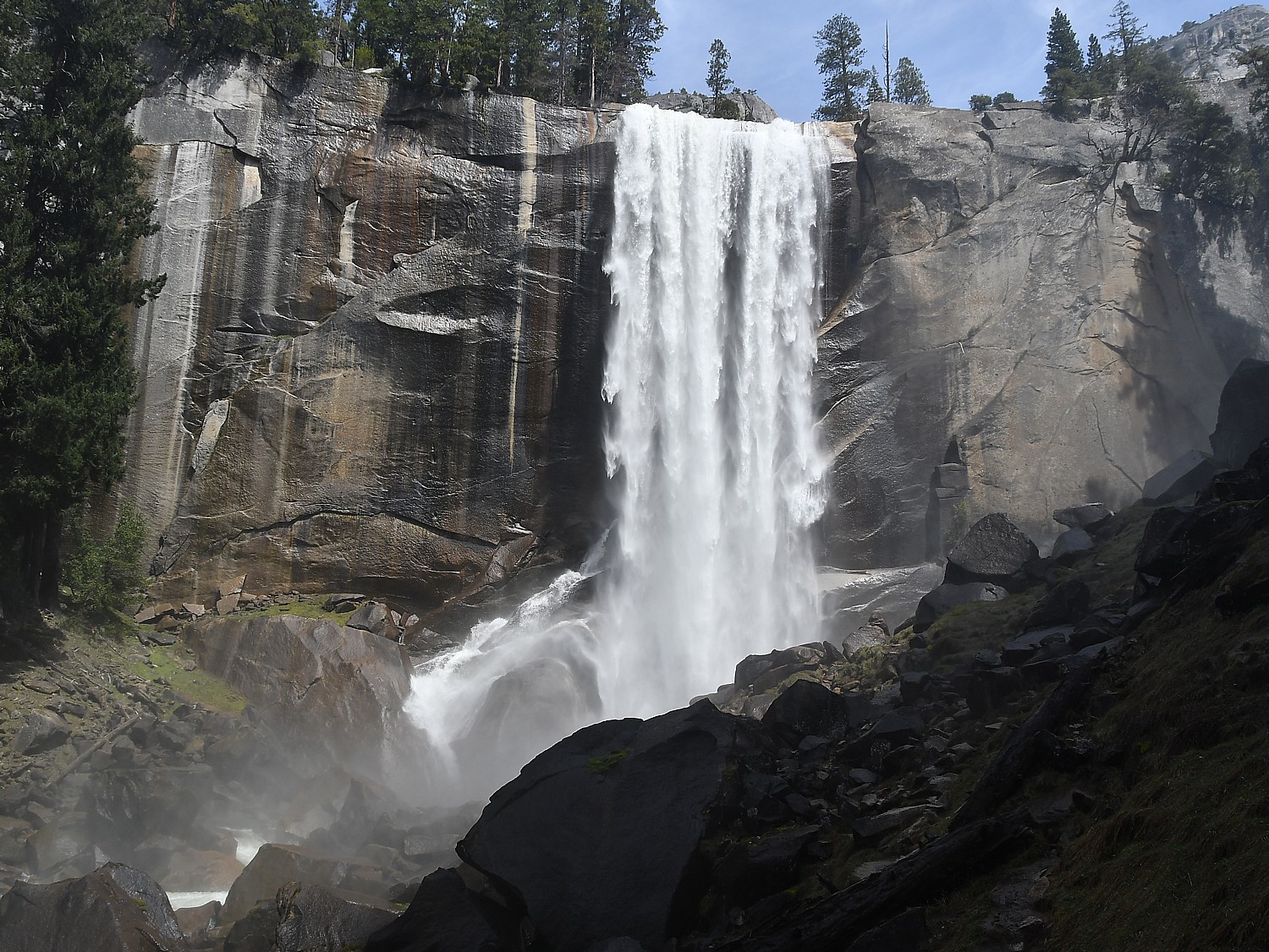
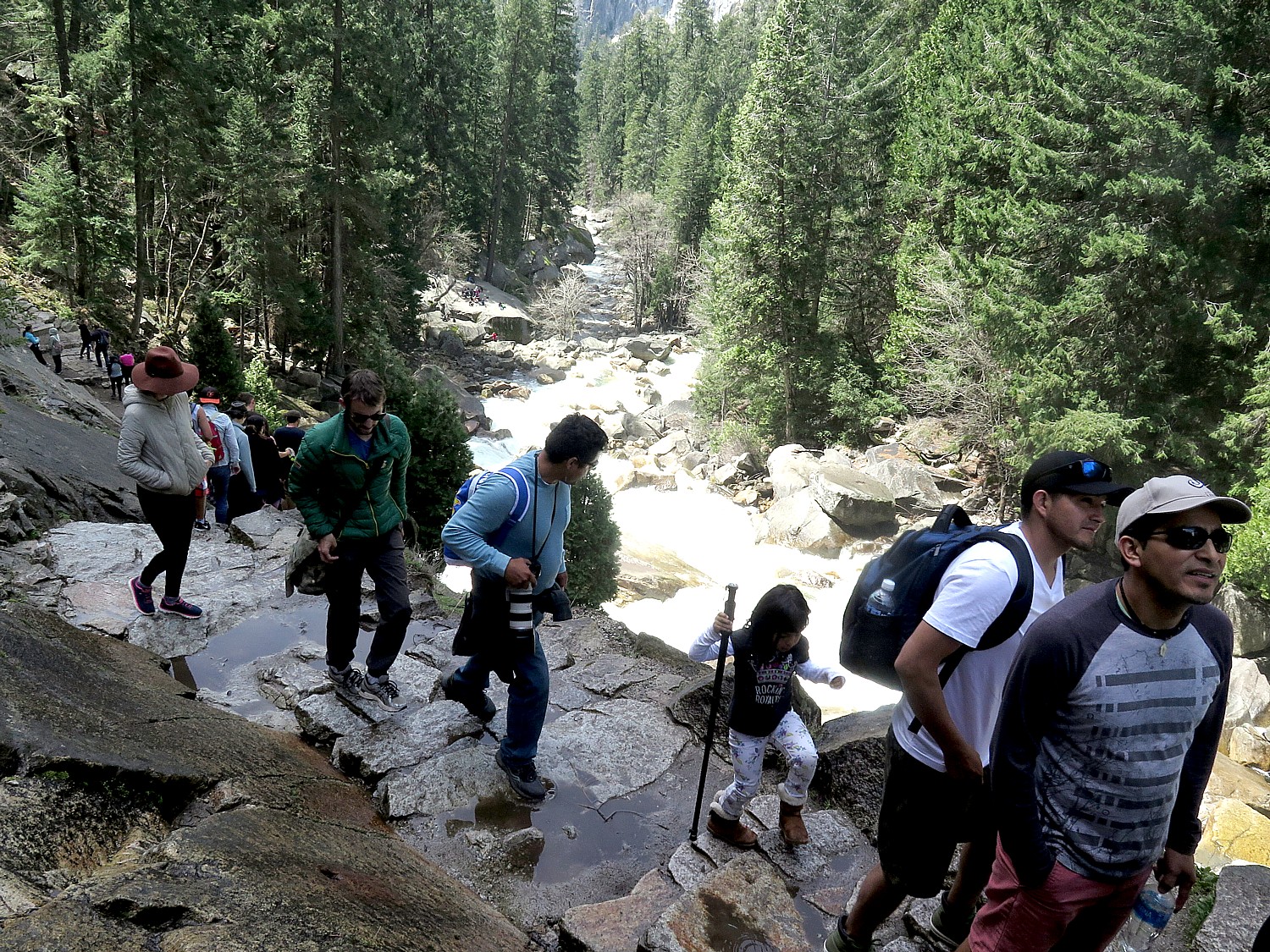
We have set our sights today on the Mist Trail which takes us alongside the Vernal Fall. The trail is both moderately challenging and an ideal distance (not too short, not too long), and unbelievably gorgeous, especially this early in the season, with the fall at maximum flow (especially after a winter where they had twice the normal snowfall; prepare to be sprayed). It is a steep hike beside the waterfall on a series of stone steps – narrow and very crowded, with most people walking up but some people trying to come down this way. (It is better to continue down on the John Muir Trail, which is not as steep or crowded and has fantastic views).
The trail starts off with an .8 mile hike up to the Vernal Falls footbridge (there are restrooms and water fountains here which you should definitely take advantage of before continuing on); and then another mile hike up to the top of Vernal Falls. Along the way, we see a rainbow in the spray at the bottom of the falls.
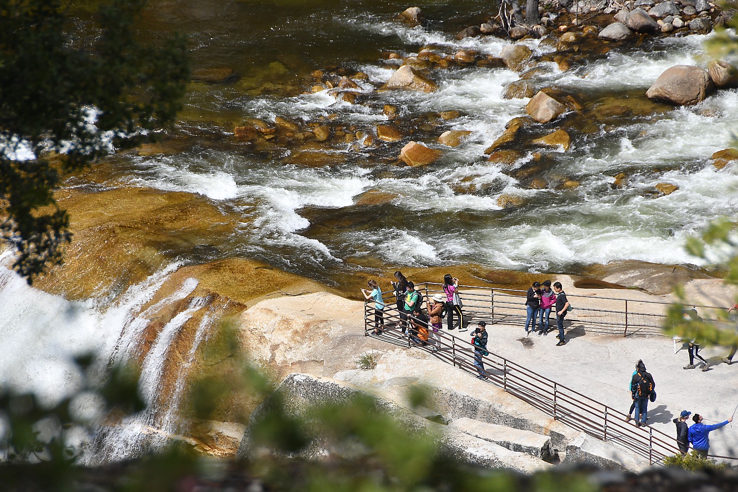
The Vernal Fall lookout – a series of relatively flat slabs – is about 1000 feet above where we started and is extremely popular spot for picnicking, relaxing and taking selfies. We do the same.
From here it is a short walk up to Emerald Pool which, so early in the season is a rushing torrent rather than the calm pool it will become by late summer.
It is so scenic and seems so benign, but there are warnings signs not to be so foolhardy as to go near the water or (perish the thought) swim. People are warned to watch out for their children. The rocks are slippery and this has been the scene of many accidents. I learn that in the summer of 2005, a hiker walked out into the water a bit to fill his water bottle, slipped, got caught in the deceptively strong current and was swept over the falls.
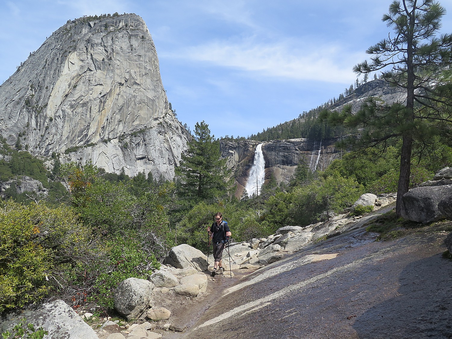
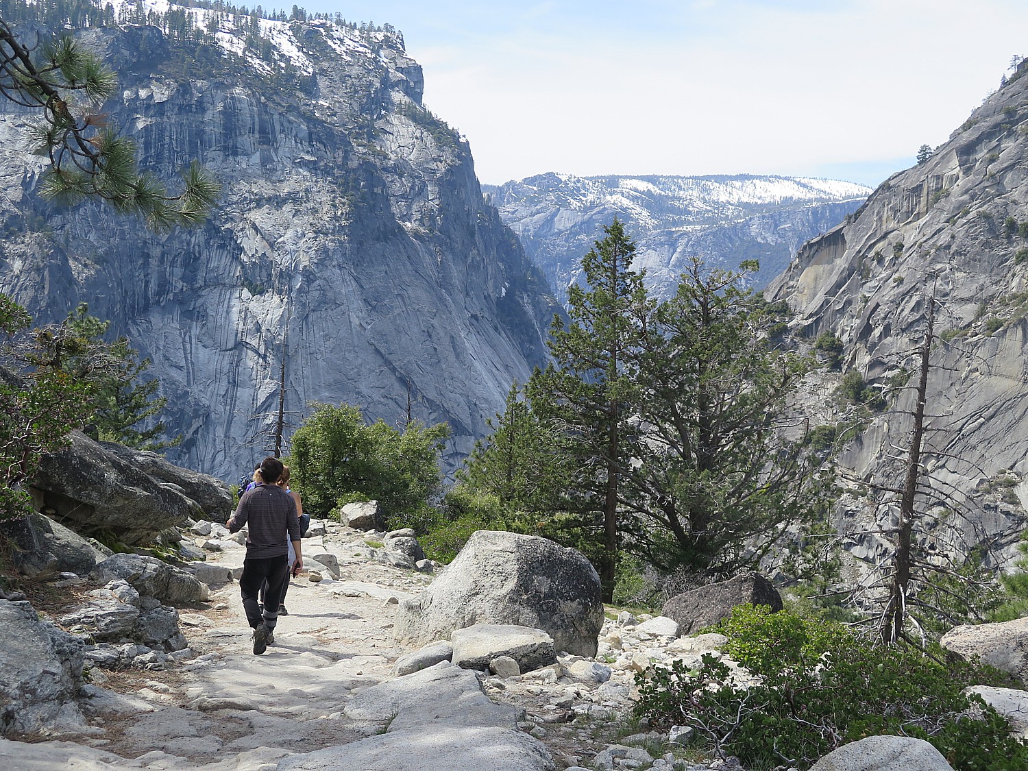
At this point, you can continue to hike another two miles to the top of the Nevada Fall, but we decide to hike down 3.5 miles along the less-steep John Muir Trail (versus coming back down on the Mist Trail). The John Muir Trail gives us a marvelous view of the Nevada Fall and Half Dome; much of the trail follows along a ridge that opens up to purple mountain majesty.
It’s still early enough in the afternoon when we get back down to the base – delighted with how perfect the Vernal Fall hike was (altogether, we’ve hiked six miles, and climbed 1885 ft. in elevation) that we are excited to try another. We look over the list we have been given for a shorter, easy hike and set out for Mirror Lake.
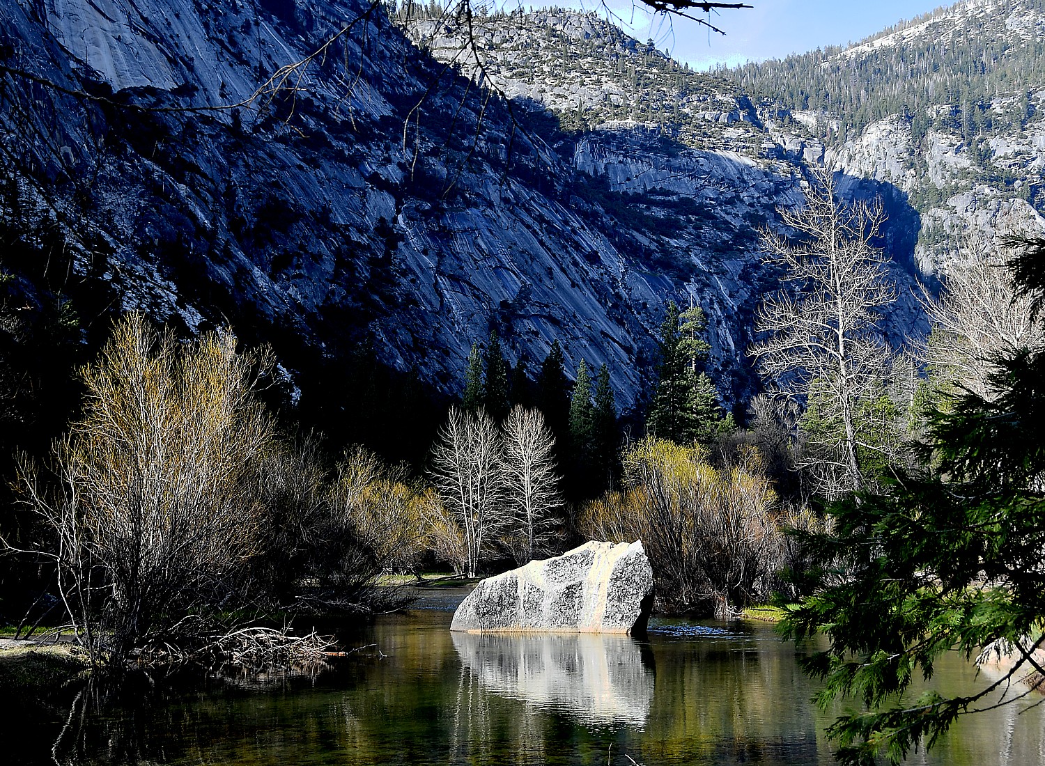
The Mirror Lake hike is supposed to be two miles round trip (taking one hour), but this is apparently if you just walk along the road. Instead, we take the trail that is apparently part of a five-mile loop around the lake which has more obstacles than I had bargained for. But there are some dazzling scenes along the way, and a stunning scene of the lake, so flat and still that it is literally a mirror reflecting back the stunning backdrop, and affords a closer view of the face of Half Dome.
To walk back by the road, Eric and Sarah scurry on a log across a narrow point which they imagine is a short cut to a road (the option is to hike around the lake). I’m not the scurrying-across-a-fallen-tree type, so I opt to backtrack along the same trial, which turns out to be fun, now that I know what the obstacles are (and that I can do them).
Finally meeting up with everybody in the car (after a MUCH longer walk back from the trailhead toward the parking lot, without seeing a single shuttle bus), which turns out to be a feat because cars are restricted, we set out to return to the Tenaya Lodge.
On the way out of Yosemite, we find ourselves crossing Sentinel Bridge which is supposed to be one of the best photo spots to capture Half Dome over the Merced River (the dusky light doesn’t cooperate, but that’s the element of serendipity that comes with every visit).
Then, the one-way road back to the South Gate passes by Yosemite Falls, agonizingly close (just a quarter of a mile), but it is too late to hike up to it in the fading light. We get a fleeting shot – I am surprised that it is so “exposed” to the access road – I imagined it was tucked inside.See https://www.nps.gov/yose/planyourvisit/valleyhikes.htm
Preparation: bring enough water (2 water bottles) and prepare for changes in weather: bring rain poncho and plastic bags to cover cameras from rain or mist; rain poncho; snacks, moleskin for blisters, hat, sunglasses and sunscreen, camera, extra memory card and battery, cell phone, an extra layer in case it gets cool. I have also found hiking sticks extremely helpful.
For non-hikers, non-DIYers, Tenaya Lodge offers a Yosemite Tour Package, via mini-bus, that includes lunch and narration, and guarantees waterfalls and wildlife and seeing the most popular sights of Yosemite. (Offered May 1-Nov. 30; from $575 spring, $685 summer, $555 fall; call 888-514-2167 or Tenaya Reservations directly at 559-692-8916).
Tenaya also offers an itinerary you can take on your own to hit Yosemite’s highlights in a single day: Half Dome, El Capitan, Yosemite Falls, Bridalveil Fall, Mariposa Grove, Glacier Point, Wawona, Royal Arches, Turtleback Dome, Three Brothers, Leaning Tower, Ribbon Fall, Cathedral Spires, Yosemite Chapel, Vernal and Nevada Falls. In summer, you have to park and use shuttle buses to get around.
Tenaya Lodge, 1122 Highway 41, Fish Camp, CA 93623, 800-722-8584, tenayalodge.com.