Category Archives: Camping/Hiking/Outdoors

3-Day Fall Getaway in the Catskills: Fairlawn Inn is Superb Hub for Exploring the Hudson River Valley

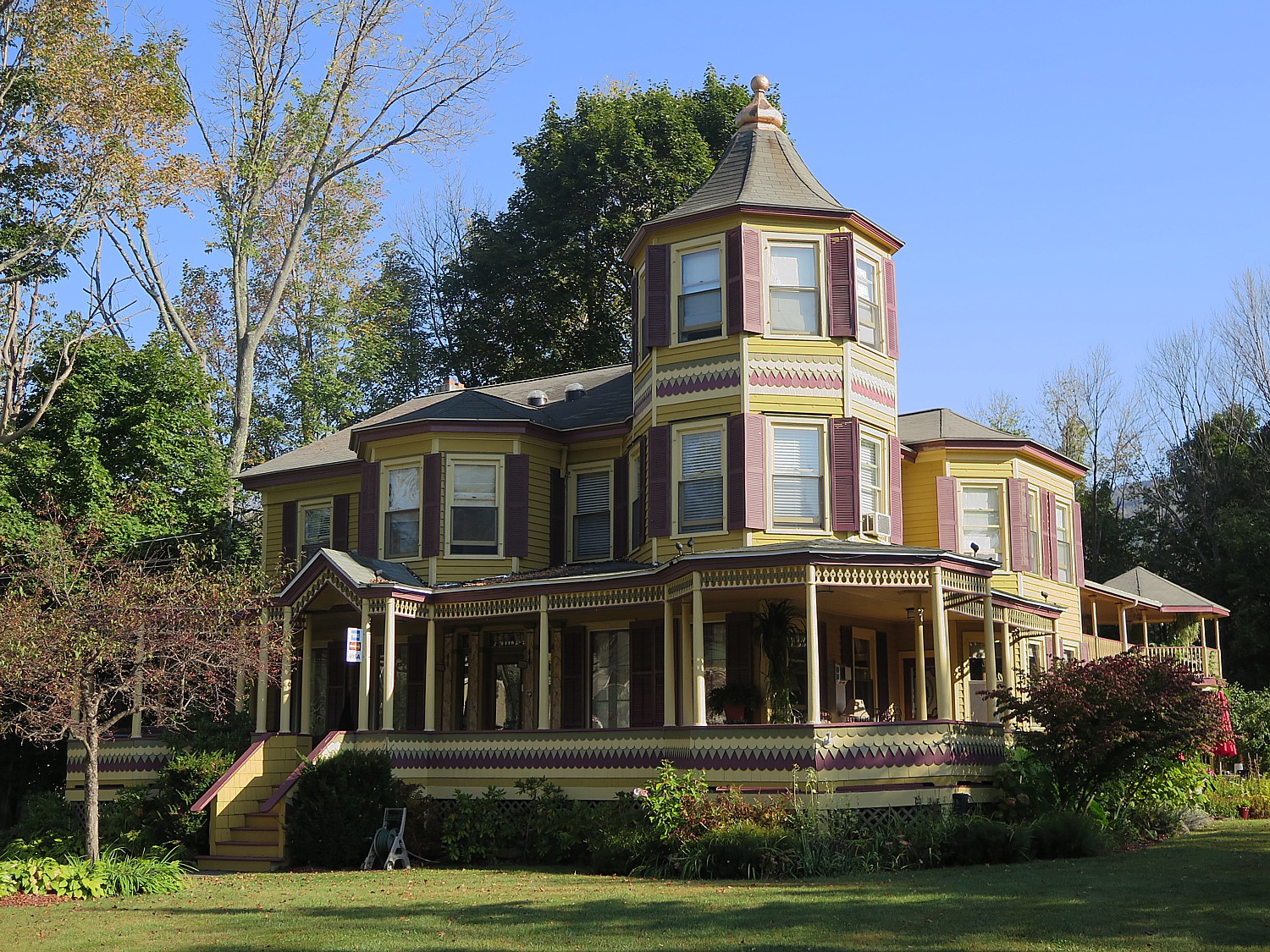
The historic Fairlawn Inn, Hunter, NY, looks out to the Catskill State Park © 2017 Karen Rubin/goingplacesfarandnear.com

By Karen Rubin, Travel Features Syndicate, goingplacesfarandnear.com

Two hundred years ago, Thomas Cole, the father of the Hudson River School art movement, sailed up the Hudson River to the Catskills and was smitten by the landscape, by the natural world, by the respite from the bustle of New York City. And so convenient to reach, even then, coming by the new steamships which was the “thing to do”. He railed against the influx of “progress” even then, and the ravage of the axe that was already decimating the lush forest. It is remarkable that we have Cole and his student, Frederick Edwin Church who built his magnificent Olana on a hilltop with a view over this magnificent Hudson Valley, to thank for its preservation. The Catskills are magnificent any time of the year, but in fall, there is an explosion of color. And like an explosion, it is fleeting.

Less than three hours drive to Hunter, NY, from Long Island, is the Fairlawn Inn, a magnificent bed-and-breakfast inn with an incredible story to tell. It will be my hub to explore the Hudson River School Art Trail that offers some of my favorite hikes in the world. They trace the footsteps of the artists and you can see the very same scenes they painted.

On my way to the inn, I have already visited two of the sites on the trail – relished the view from Kaaterskill Clove, marveling how it still looks much as it did in Thomas Cole’s “The Clove, Catskills” (1827), and Asher B. Durand’s “Kindred Spirits” (1849) -even the tree just turning red for fall foliage seems the same as the scene in the painting – which you see from the parking lot for the hike up Kaaterskill Falls, then continuing on to take this stunning hike to the heights of the double falls. They are along Route 23A, the scenic byway you take from the Thruway to get to Fairlawn Inn, in Hunter, less than a dozen miles further.
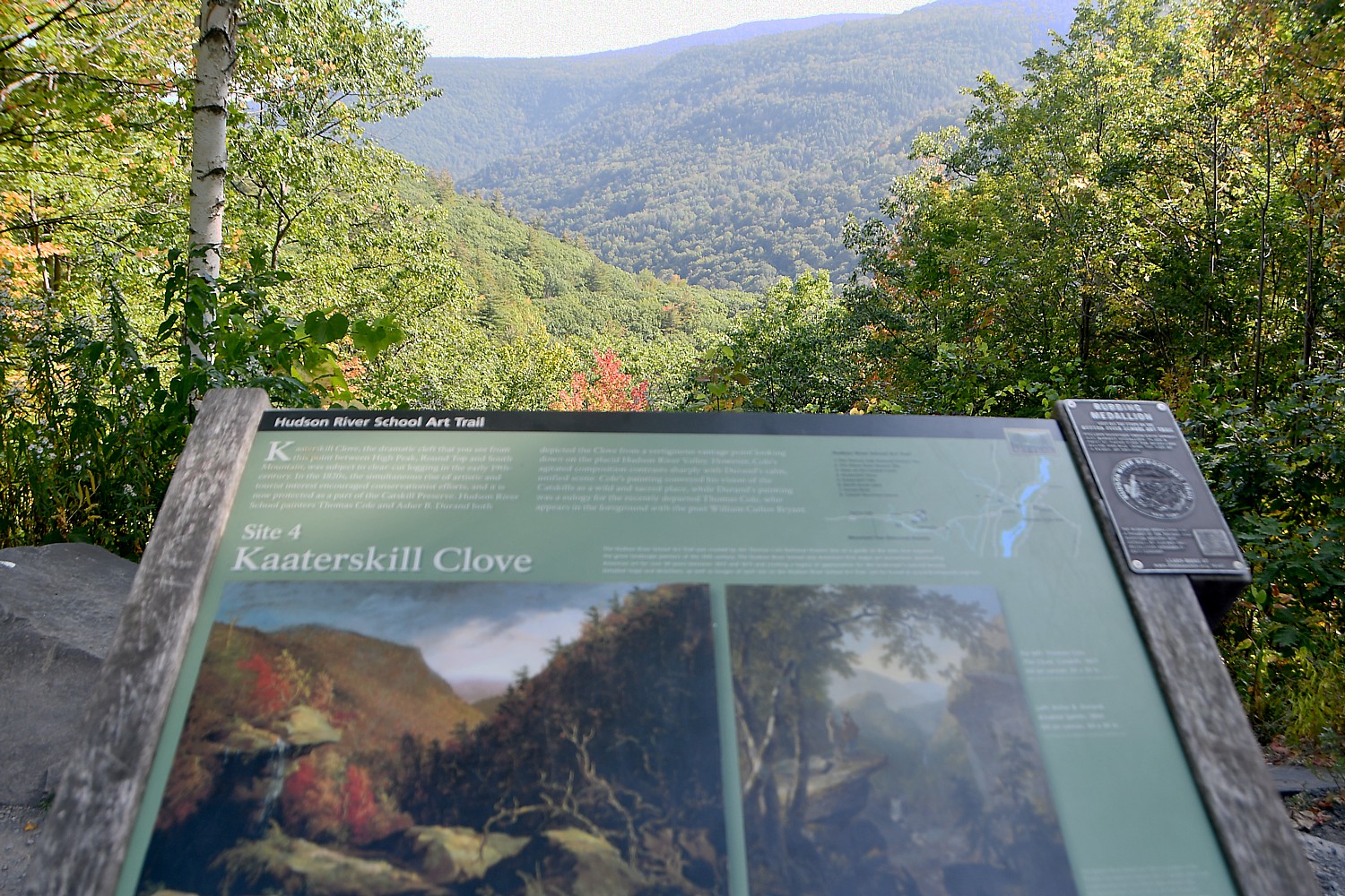
View of Kaaterskill Clove with the Hudson River School Art Trail marker that lets you compare the scene today with the Cole and Durand paintings © 2017 Karen Rubin/goingplacesfarandnear.com

During my all-too brief three-day getaway to the Catskills/Hudson River Valley, I spend two days hiking trails associated with the Hudson River School Art Trail in the Catskills State Park, just beginning to show their fall colors and imagining how the artists walked these trails before me, and one day re-discovering two historic jewels: Olana, Frederick Edwin Church’s exquisite mansion home and estate that has become one of New York State’s most visited historic houses (for good reason), and the Thomas Cole House Museum, devoted to the artist known as the “Father of the Hudson River School” which has been restored since my last visit with new ways of experiencing the museum that really give you a sense of the man.

The Fairlawn Inn is ideally situated, and so charming and comfortable, you immediately feel whatever city stress or physical exhaustion dissipate as soon as you cross the threshold – all of this the artistry and craftsmanship of the gracious host, Innkeeper Chuck Tomajko, who has anticipated everything to make his guests feel absolutely at home – even providing refrigerated drinks, ready snacks and fruit, a coffee maker and a refrigerator for guests to help themselves.

It is about 5:30 pm when I arrive at the Inn, bathed in the golden light of the late afternoon. Set beside Hunter Mountain (the entrance to the popular ski resort is less than a half-mile away) and with views of the Catskill State Park from its wrap-around porch, the bed-and-breakfast inn is in a Victorian jewel originally built in 1840 and expanded in 1904 as the summer home of a wealthy Jewish philanthropist and real estate developer, Harry Fischel.
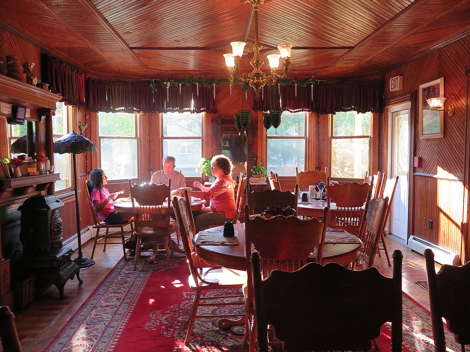
The charming dining room at the Fairlawn Inn where a made-to-order breakfast is served © 2017 Karen Rubin/goingplacesfarandnear.com

Innkeeper Chuck Tomajko, with 40 years in the fast-food industry, bought the bed-and-breakfast in 2002, and remodeled, redecorated, refitted, and refurnished with stunning antiques and period pieces and other amenities, exposed the gorgeous oak and maple floors and woodwork (hemlock, which was typical of the area because it was a byproduct of the tanning process the area was known for), created the stunning landscaping, added a patio, fire pit and waterfall, all with an eco-friendly eye.

Chuck claims to have the only historic home in North America that has earned a 4-key rating (on a 5-key scale) from Green Key Global, a Canada-based eco-tourism organization and was named Good Earthkeeper for 2013 and #1 Inn in New York for 2010 by New York State Hospitality & Tourism Association.

Indeed, it is quite remarkable for a 113-year old house to get that distinction– Chuck has used composting, solar tubes that bring in natural light to otherwise dark hallways,low-flow shower (yet still wonderful pressure); LED lighting throughout; the outdoor lanterns are solar-powered (from Ikea, no less; he has a plan to use them for Christmas lights).
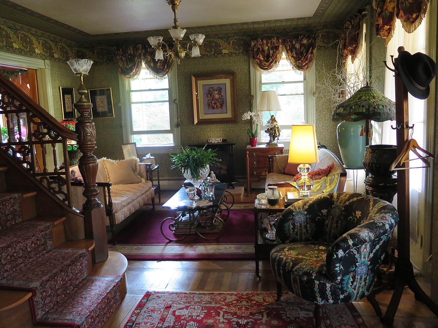
One of the parlors at the Fairlawn Inn © 2017 Karen Rubin/ goingplacesfarandnear.com

Walking around the inn, there are wonderful sitting areas outfitted with books, a parlor with a bar with snacks and a refrigerator with drinks as well as coffee maker to help yourself; a pool table in another parlor; a living-room area; outside a gorgeous, lushly landscaped patio with waterfall, solar-powered lanterns, a fire-pit.

I love to see Chuck’s clever innovations – how he made a wine rack out of crown moldings and planter hooks; a fire pit out of a coal bin; how he turns “shabby chic” into beautiful pieces of furniture.

Each of the guest rooms at the Fairlawn Inn bnb has its own theme and decoration © 2017 Karen Rubin/goingplacesfarandnear.com

There are 5 rooms upstairs of the main house, each one differently configured and scrumptiously decorated, several with fireplaces. The Glenwood Room has a two-person Jacuzzi and a fireplace. Several rooms are “outside”, along a lovely porch with charming sitting areas, in that extension to the home that originally housed the Jewish scholars and served as an ice house. My room, the Spring Valley, was originally a mikvah (a ritual bath for a bride).

The rooms are each uniquely themed and decorated in period furniture (several have clawfoot bathtubs), but with modern amenities (private bathroom in each, free Wifi) and eco-friendly features like solar-tubes which bring in natural light. Several have gas-operated fireplaces; at least one has a two-person Jacuzzi bath.

The Fairlawn Inn, a Gold Eco-Rated Lodging and 2015 Trip Advisor Certificate of Excellence winner. is gorgeous, comfortable, wonderfully situated, excellent amenities, but the best asset is Chuck, himself, who is more than a gracious host.

Bed-and-breakfast inns really reflect the character of their structure and the personality of the innkeeper. The Fairlawn Inn is an expression of Chuck’s phenomenal sense of hospitality and his prodigious artistic talents – the interior design and decorative arts, antiquing, painting, landscaping, and culinary arts. He loves to cook.
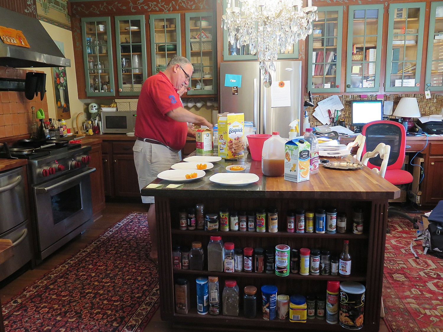
Fairlawn Innkeeper Chuck Tomajko preparing breakfast © 2017 Karen Rubin/goingplacesfarandnear.com

Many bed-and-breakfast hosts love to show off their breakfast creations but Chuck goes beyond: he offers his guests a selection of four different made-to-order omelettes (I enjoy his feta cheese, spinach, kale and arugula omelette) plus a special item like pancakes (selection of fillings), fresh fruit and muffins (pumpkin spice), freshly brewed coffee, served in a gorgeous dining room (just the right size – not too big, not too small), with glorious sunlight flooding in from the windows.

Before we leave the table, he comes out with a bottle of water and snacks to take on our hikes.

Everything is so caring, so thoughtfully arranged, so meticulous – there is even a night light in bathroom and hooks. Little things that matter. There is a remote control for the fireplace which Chuck has decorated himself with antique tiles.
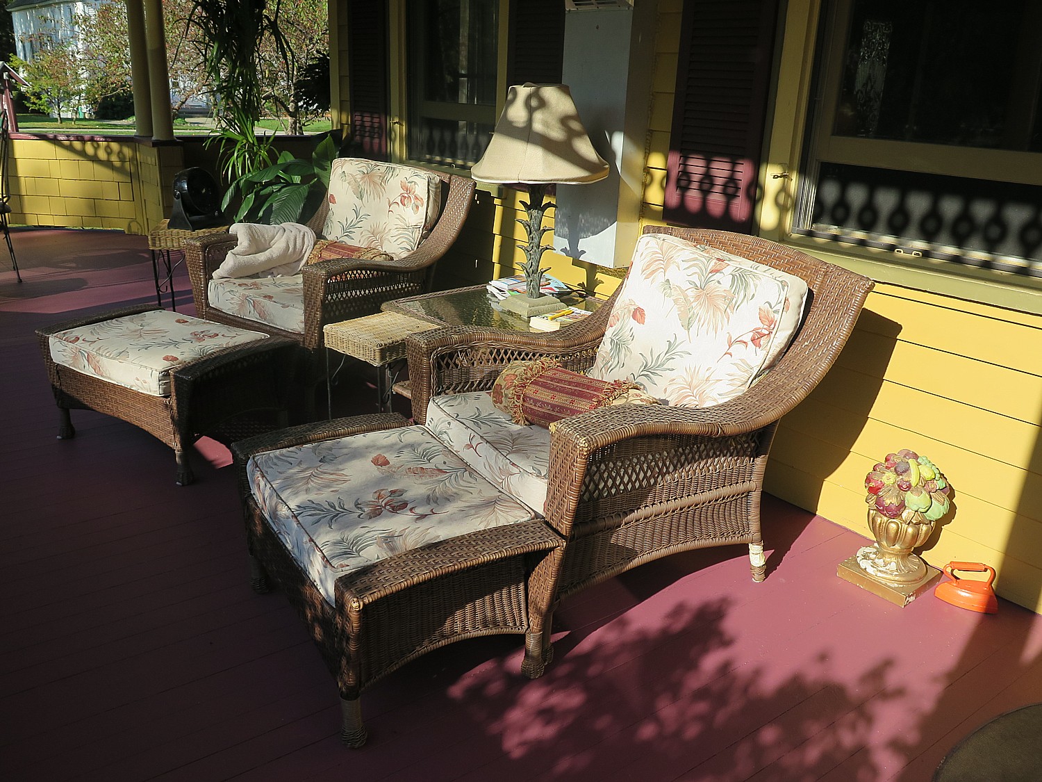
Wicker lounge chairs on the Fairlawn Inn porch make for a comfortable place to relax © 2017 Karen Rubin/goingplacesfarandnear.com

The porch has a delightful sitting area of wicker lounge chairs – even a blanket nearby – as well as tables if you should want to eat al fresco.

I am truly intrigued by Fischel’s story which Chuck relates as he gives me a tour of the inn and ask who built the house and why it is so enormous, with a huge two-story extension. Chuck explains that Fischel would house Jewish students in the summer; my room, Spring Valley, actually was a mikvah (a room used for a ritual bath for a bride).
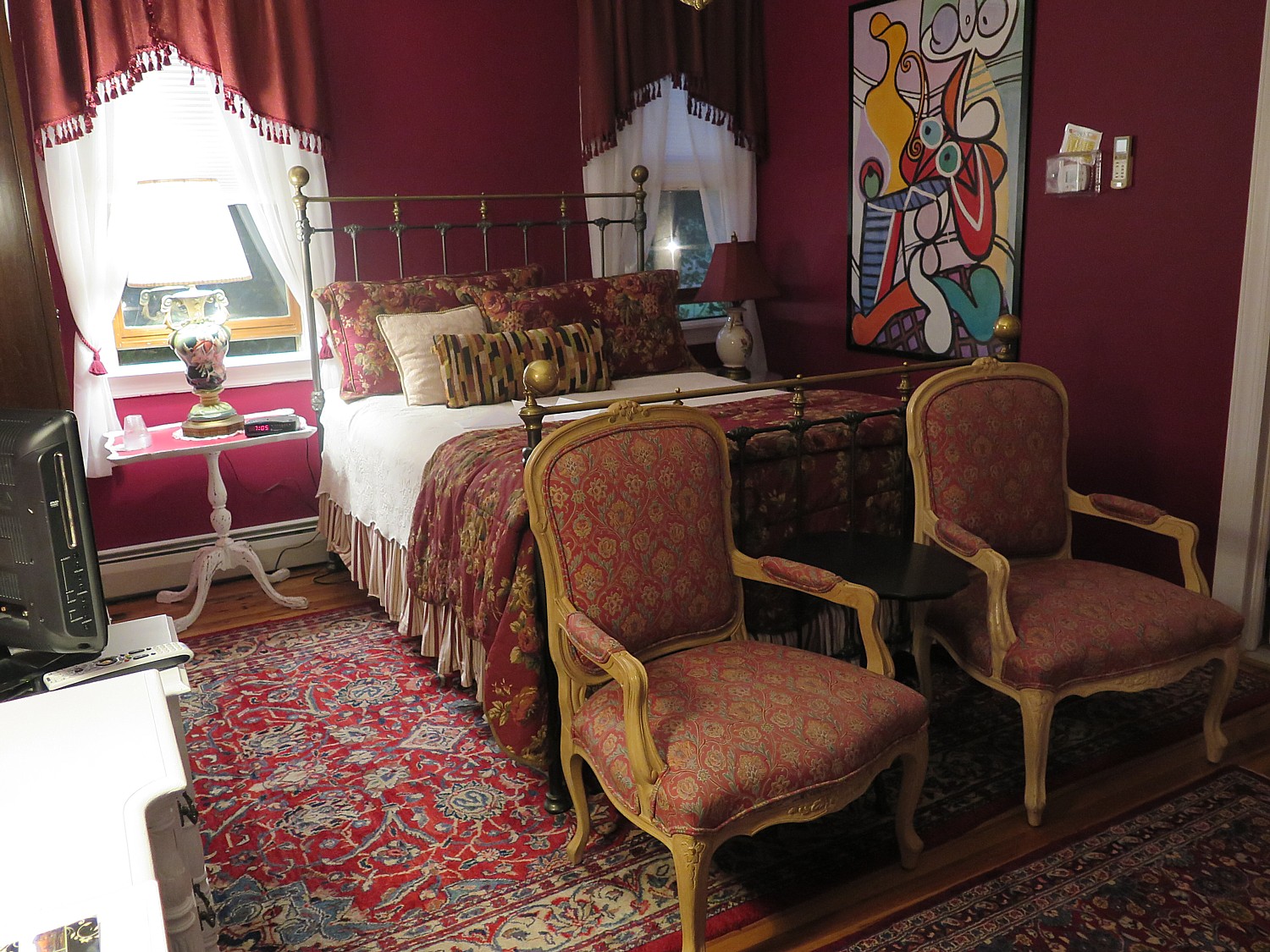
The Spring Valley room at the Fairlawn Inn was used as a mikvah by the original owner, Harry Fischel, who built the Victorian home in 1904 © 2017 Karen Rubin/goingplacesfarandnear.com

Chuck points to a thick biography of Fischel, written by his son-in-law, Rabbi Harry S. Goldstein. Fischel, I learn, was born in 1865 in a small, isolated  town of Meretz, Lithuania, to poor but pious parents (his father was a cabinet maker). Yisroel Aaron Fischel (later known as Harry) became an architect and a builder by the age of 19. At 20, he emigrated to America virtually penniless (“he had 60 cents in his pocket” Chuck tells me) and earned his first million in real estate at a young age (he pioneered building tenements in the Lower East Side on irregular-shaped lots, becoming the first successful Jewish developer on the Lower East Side). But even when he was earning just $10 a week, so his biography reads, he sent money home to help support his parents. “Fischel was one of the leading pioneers in the growth of American Judaism, in general, and in American Jewish Orthodoxy, in particular, particularly in the dynamic precedent-setting first half of the 20th Century,” the Wikipedia biography notes.
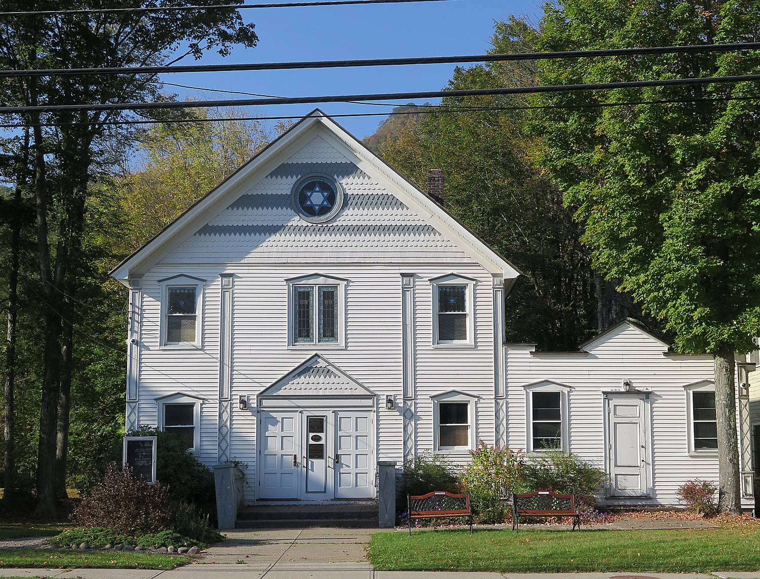
The Hunter Synagogue which Harry Fischel built across the street from his home, in 1914 and is now on the National Register of Historic Places © 2017 Karen Rubin/goingplacesfarandnear.com

Chuck notes that Fischel laid the cornerstone at Yeshiva University, built a high school for Jewish girls, and personally prevailed on President Taft to install a kosher kitchen at Ellis Island in 1911, so that Orthodox Jewish immigrants could have the opportunity to eat kosher food during a probation period (so they could be strong enough to pass the test to avoid deportation).

He also built the first modern Jewish theater in 1904 (exclusively for Yiddish productions).He was first Treasurer of the Central Committee for the Relief of Jews Suffering Through the War in 1914, a member of the Executive Committee of the Joint Distribution Committee in 1914; organizer of the Palestine Building Loan Association in 1921; built the home, office, yeshiva and synagogue for the Chief Rabbi of Palestine Abraham Isaac Kook at his own expense in 1923; established the Harry Fischel Institute for Talmudic Research in 1931 (which, after the creation of the country of Israel, trained, for many years, a large percentage of the judges who presided over the religious courts in the country); and established the Harry Fischel Foundation on January 4, 1932 (later renamed the Harry & Jane Fischel Foundation). He laid the cornerstone at Yeshiva University.
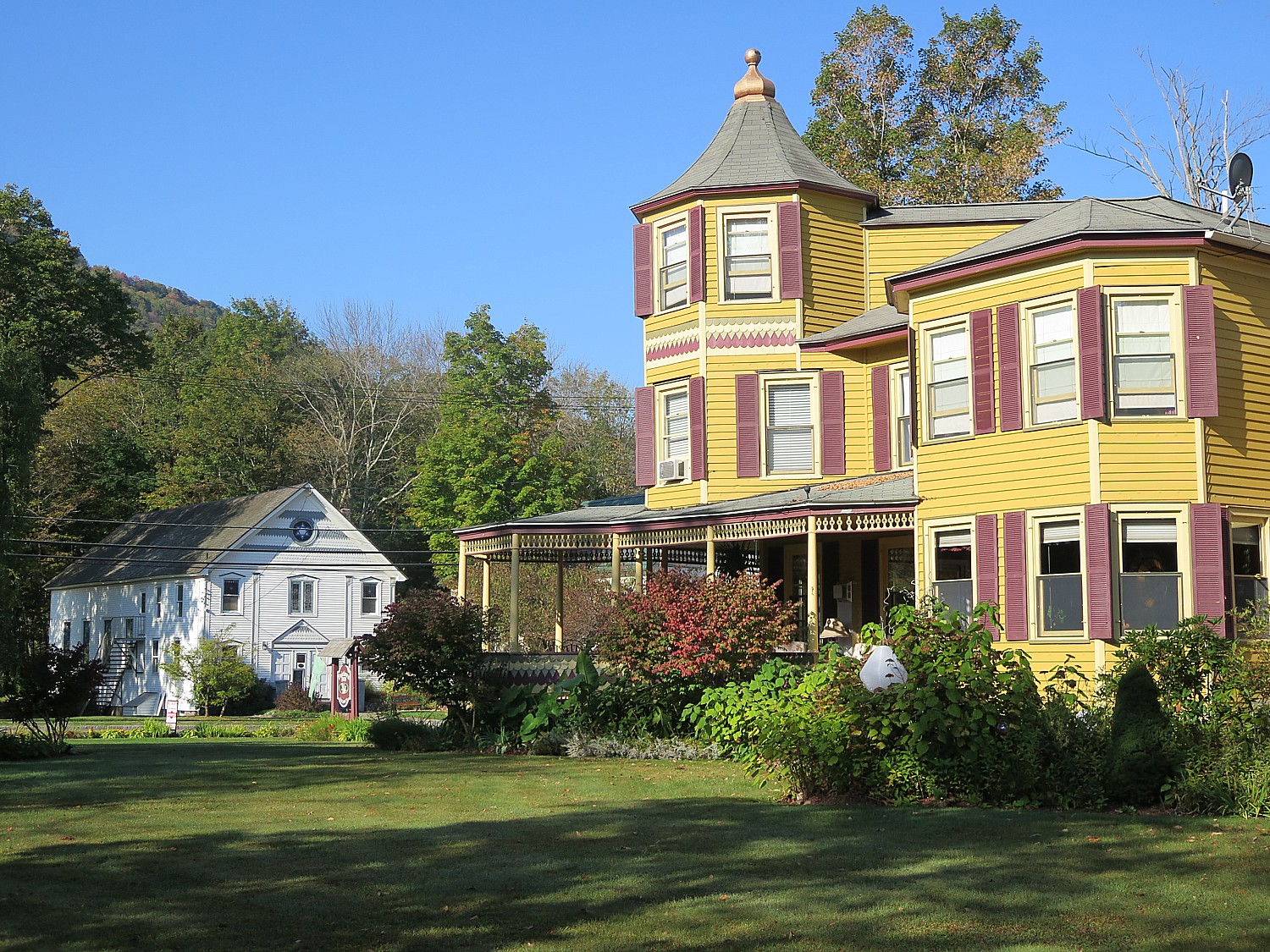
Harry Fischel’s summer home, now the Fairlawn Inn, and the Hunter Synagogue directly opposite, both built by Fischel more than a century ago © 2017 Karen Rubin/goingplacesfarandnear.com

Fischel also built the first synagogue in Hunter, but it burnt down in 1914, so he built a new one across the street from his home – a charming Victorian from 1914 that is on the National Register of Historic Places and is still operating.

Fischel died in 1948, just before Israel became a nation.

The Fischel house remained in the family until 1993, when a couple bought what had become a decrepit structure and devoted 3 ½ years to restore and renovate it into a bed-and-breakfast, which opened in 1996.

Fischel’s great grandson, Aaron Reichel, has visited the inn twice, Chuck tells me.

It is interesting to see some of the relics of the past: built 1904 when electricity was considered “transitional” (they didn’t know if electricity would last), there are light fixtures that were made to accommodate both electricity and gas; fixtures pointed down (for electric) and up (for gas). Electricity was delivered but made gas on-site – capturing methane released from coal, but sometimes blew up.

The hemlock wood paneling that is so stunning especially in the dining room was actually a by-product of the tanning process that was the major industry in Tannersville and Prattsville.
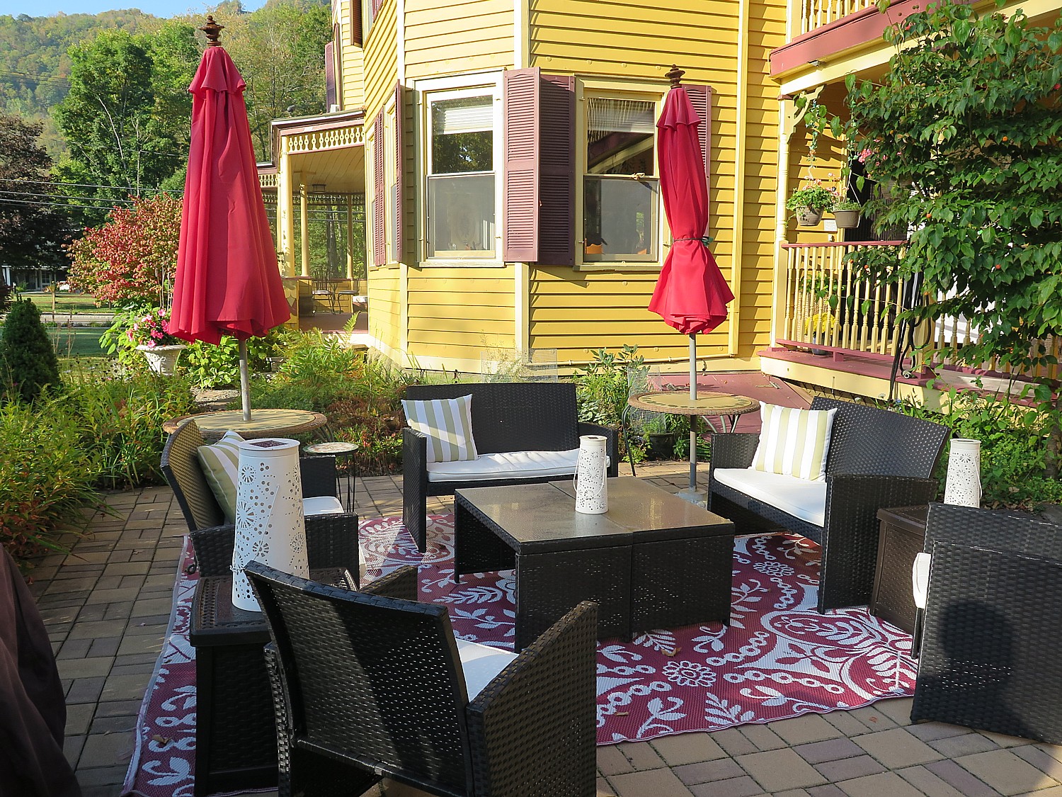
The outdoor patio which Innkeeper Chuck Tomajko created is part of the lush landscaping at the Fairlawn Inn © 2017 Karen Rubin/ goingplacesfarandnear.com

The Fairlawn Inn is perfect for corporate retreat (with all the outdoor activities- from skiing to mountain biking that are so great for team-building); special interest groups, multi-generational getaways, destination wedding with expansive lawns for a tent (Chuck loves to cook and has accommodated weddings with up to 150 guests).

The inn is ideal for a hub-and-spoke itinerary for exploring and enjoying the amazing array of historic, heritage, cultural and outdoor attractions and Chuck offers lists of attractions walking distance and a short drive that fill out a three-day getaway but can also easily fill a longer itinerary. He also can put you on the path for antiquing, and the Hudson Valley Wine & Craft Beverage trail (TravelHudsonValley.com)

(And Chuck can steer you to every one, providing comprehensive lists, brochures, maps, print-outs, and his personal guidance and tips.)
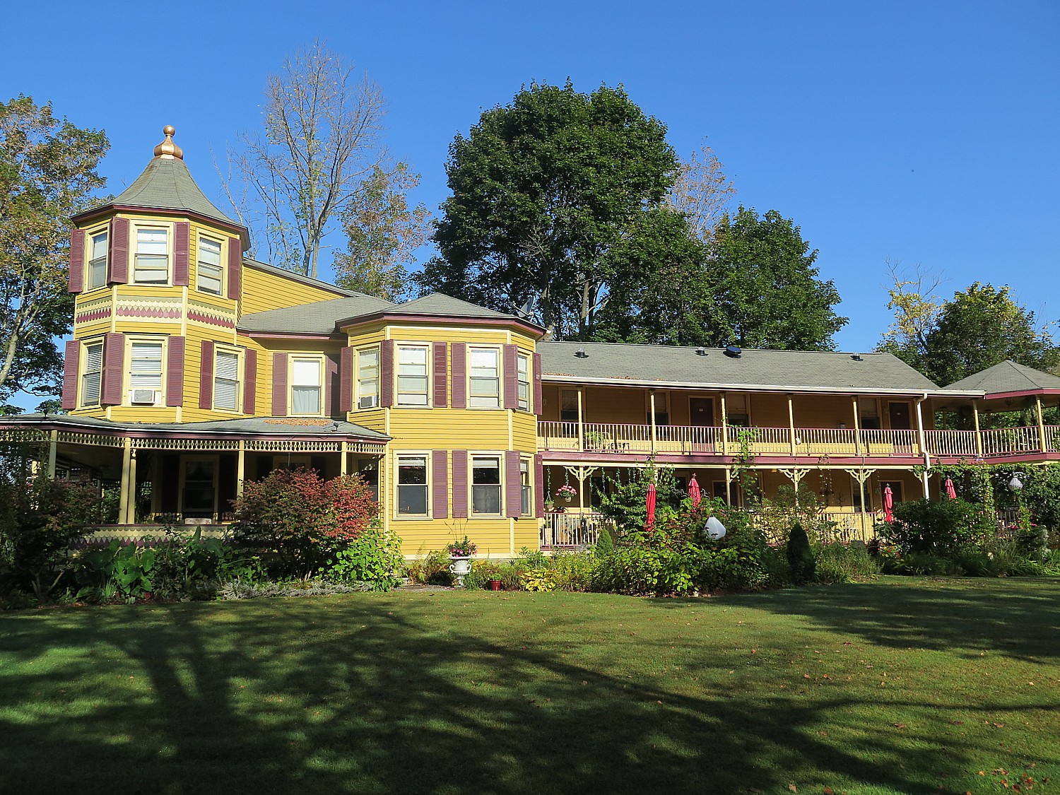
Plenty of space: the architecture of the Fairlawn Inn, the summer home of Harry Fischel, was unusual because he used it to house students and today makes a great venue for corporate retreats, special interest groups, and family gatherings © 2017 Karen Rubin/goingplacesfarandnear.com

Hiking is a huge activity and for my second day at the inn, I go to the North-South Lake Campground from which there are many trails as well as a fantastic lake (people are actually swimming with the record high temperature for a fall day), and set out for one of my favorite hikes that takes me to more of the Hudson River School artists’ favorite spots: North-South Lake (site #6 on the Hudson River School Art Trail), Artist’s Rock and Sunset Rock (site #7 on the HRSAT); another trail goes to where the Catskill Mountain House stood (trail site #8).
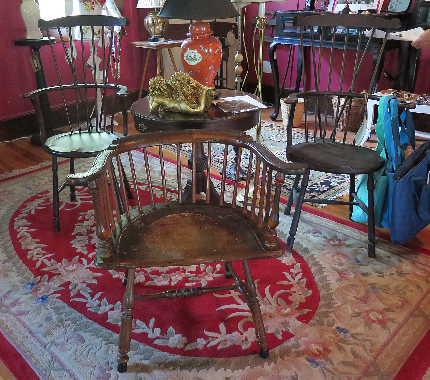
Pre-Revolutionary chair, made in Philadelphia, may well have been used by George Washington; it is flanked by chairs that had been owned by Elizabeth Abell, who introduced Mary Todd to Abraham Lincoln © 2017 Karen Rubin/goingplacesfarandnear.com

For my third day, Chuck gives me a tour of the Hunter Antique Mall, housed in what used to be the Masonic Lodge, which he also owns, which offers a literal treasure trove of fabulous finds, with fascinating documentation and excellent pricing. He points out a pre-Revolutionary chair made in Philadelphia that easily could have accommodated George Washington, and a pair of chairs signed on the bottom for Elizabeth Abell, a friend of Abraham Lincoln’s who introduced Mary Todd to him. (It turns out that chuck is an absolute expert on antiquing, and can steer you to auctions and a “junking” trail where you can find treasures at garage-sale prices). He offers his patrons clever ideas: like turning a stack of vintage luggage into a sidetable that also affords cramped apartment-dwellers storage; and how you can make a bird feeder out of gorgeous blue-and-white China cup and saucer; and decorates otherwise bland furniture with a waxy-press-on craft.
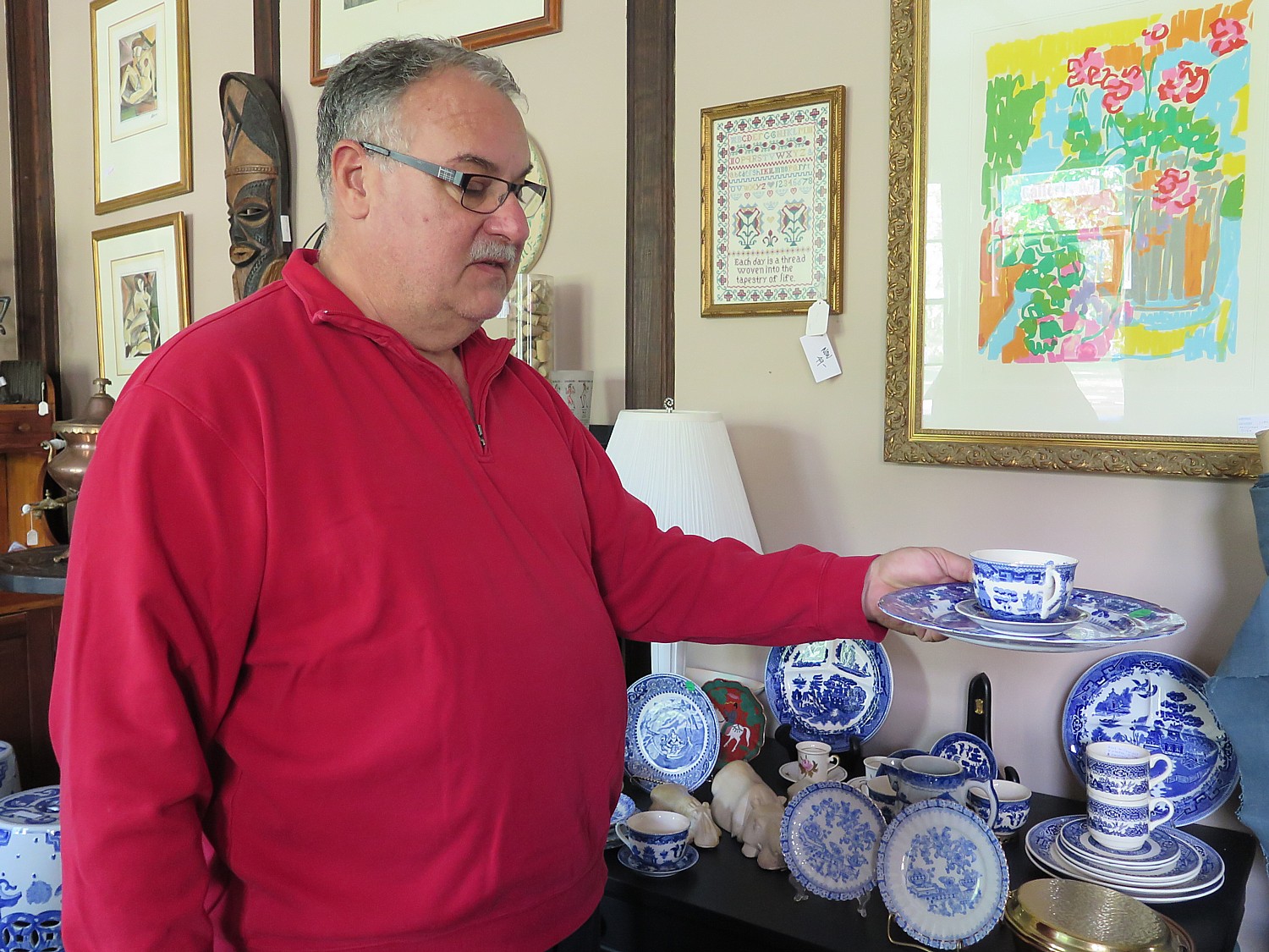
Fairlawn Innkeeper Chuck Tomajko shows how he might make a bird feeder out of blue-and-white china cup and saucer © 2017 Karen Rubin/ goingplacesfarandnear.com

I then go on to the Thomas Cole National Historic Site in Catskill (#1 on the Hudson River School Art Trail, www.thomascole.org) with a sensational guided tour as well as featured exhibit in the New Studio (this year’s exhibit is “Sanford R. Gifford in the Catskills”); the house usually closes at the end of October but this year has an extended season of November weekends; and then on to Olana State Historic Site (#2 on the HRSAT), in Hudson NY, which closes for the season on Oct. 28 (www.olana.org).

I prefer hiking to experience fall foliage, but those who prefer driving will find several scenic byways: Greene County’s two National Scenic Byways include a 21-mile route that descends from high country peaks to Durham Valley farmland.; along the way, you will find views that stretch across the Hudson River Valley to summits in four neighboring New England states. Then take an excursion along Mountain Clove, a byway that meanders through ravines, historic districts, and waterfalls. In fact, one of the best foliage views in New York State, Chuck notes, is just 2 miles from the Fairlawn Inn door, at the intersection of Rte 214 and 23A – which looks toward Bear Creek and some half-dozen mountains that form layers.
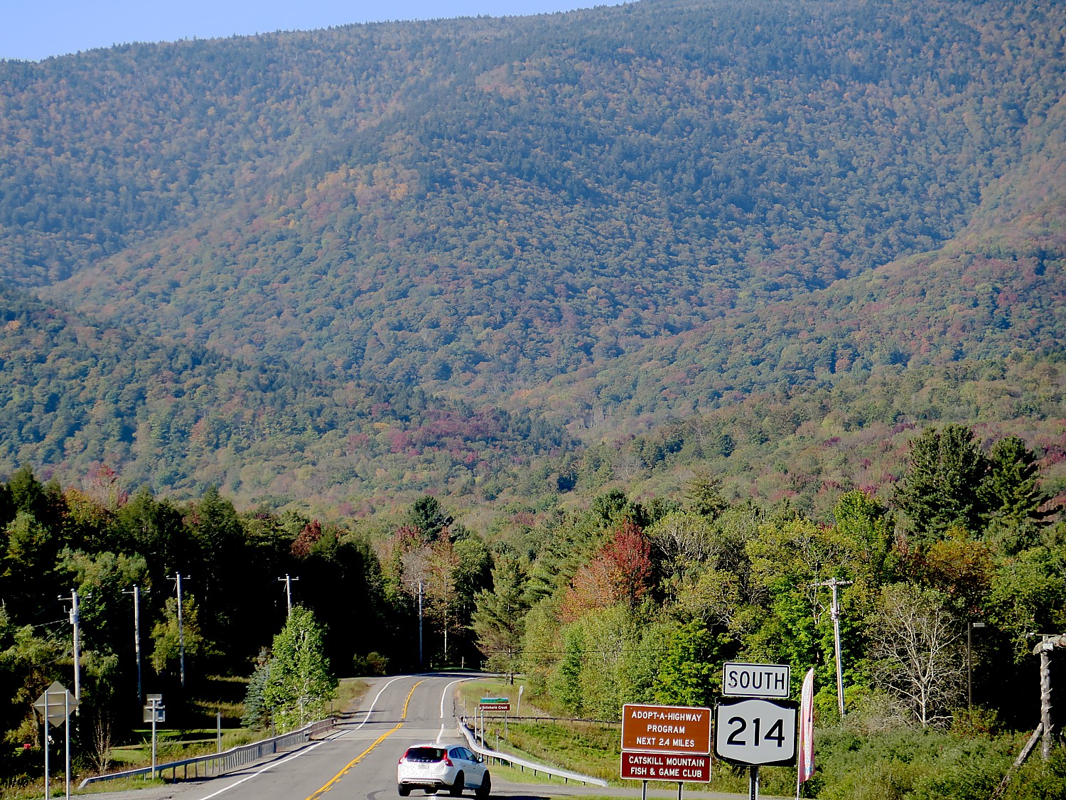
The intersection of Rte 214 and 23A, just two miles from the Fairlawn Inn, looking toward Bear Creek is ranked as one of the best foliage views in New York State © 2017 Karen Rubin/goingplacesfarandnear.com

An Arts-Meets-Nature Driving/Exploration Route: The Kaaterskill Clove Experience provides a new self-guided discovery tour through the history of American art, and the primeval landscape that inspired it. Tailored, easy-to-follow itineraries provide a roadmap for families, adventure seekers and leisure travelers to experience the Kaaterskill Clove at your own pace, while enjoying everything that Greene County has to offer, from farm stands to charming cafes.

Other attractions include:

Sky Walkway over the Hudson River alongside the Rip Van Winkle Bridge.

Antiquing (Tannersville and Catskill are the main villages, but Chuck can steer you to auctions and a “junking” trail where you can find treasures at garage-sale prices).

You can follow the Hudson Valley Wine and Craft Beverage trail (travelHudsonValley.com)

Bike (or walk) the 2.7-mile long Huckleberry Trail that follows the old Huckleberry Railroad track and is mostly under trees.

There is mountain biking and golf at Windham Mountain (another wonderful ski mountain just 8 miles up 23A).

Close by in Coxsackie is The Bronck House (in the same family for 400 years) and the quaint town of Hudson with its galleries, antiques, boutiques and restaurants, which is operated by the Greene County Historical Society (http://www.gchistory.org/).

The Fairlawn Inn is within 90 minutes of major attractions including Hyde Park (Franklin Roosevelt’s home and library), the Walk Over the Hudson, Hyde Park (FDR),Walk Over Hudson, Huguenot Village in New Paltz (a national historic site with costumed interpreters, www.huguenotstreet.org), Howe Caverns and Cooperstown (Baseball Hall of Fame). And it’s just 2 ½ hours from “the universe” of New York City.

The village of Hunter is accessible from Amtrak to Hudson, MTA to Poughkeepsie, where you can find Enterprise and other rental car agencies, car service and Uber.

The Fairlawn Inn, 7872 Main Street (Hwy 23A), Hunter, NY 12442, 518-263-5025, www.fairlawninn.com. (Children must be 10 or older.)

Really helpful sites to plan your getaway include www.greatnortherncatskills.com and its fall hub www.greatnortherncatskills.com/catskills-fall-foliage offered by the Greene County Tourism, 700 Rte 23B, Leeds, NY 12451, 800-355-CATS, 518-943-3223.

____________________


© 2017 Travel Features Syndicate, a division of Workstyles, Inc. All rights reserved. Visit goingplacesfarandnear.com,  www.huffingtonpost.com/author/karen-rubin , and travelwritersmagazine.com/TravelFeaturesSyndicate/. Blogging at goingplacesnearandfar.wordpress.com and moralcompasstravel.info. Send comments or questions to [email protected]. Tweet @TravelFeatures. ‘Like’ us at facebook.com/NewsPhotoFeatures


Rails-to-Trails Conservancy’s Sojourn Biketour on Great Allegheny Passage Showcases Forgotten Towns

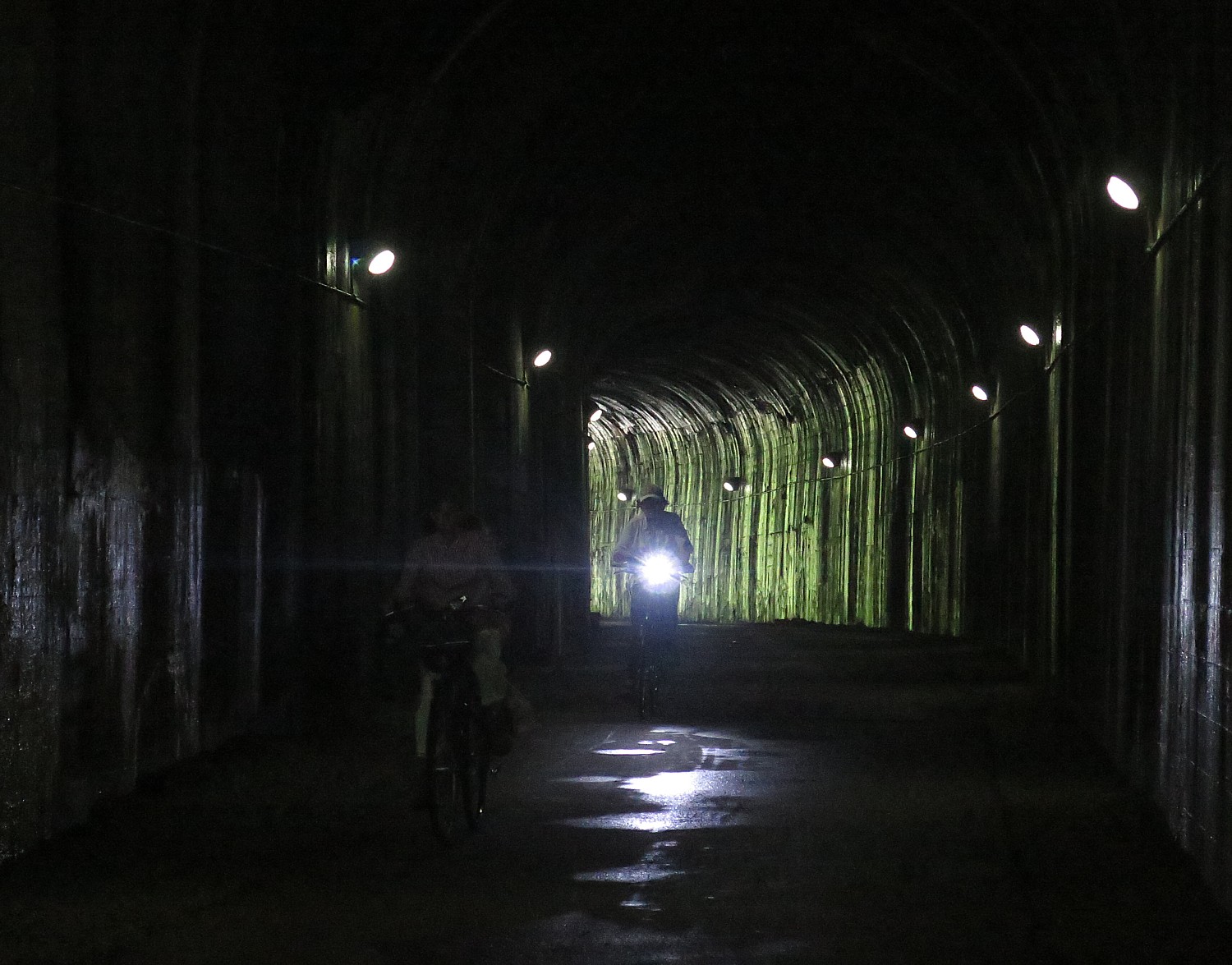
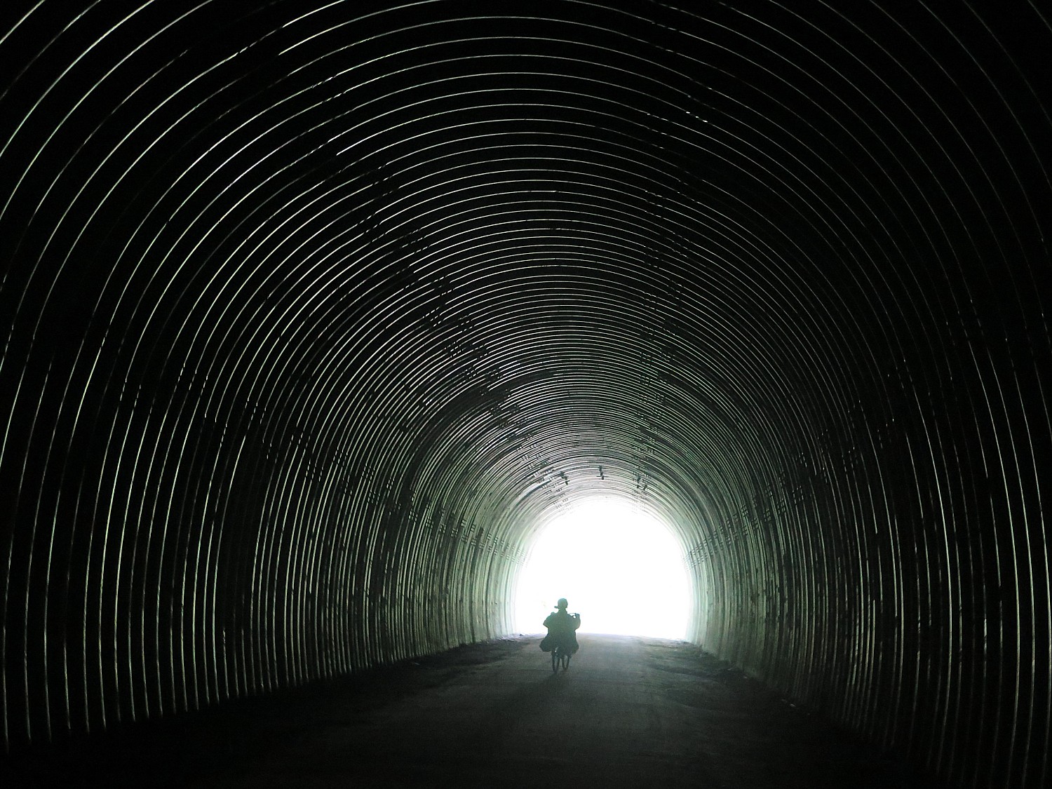
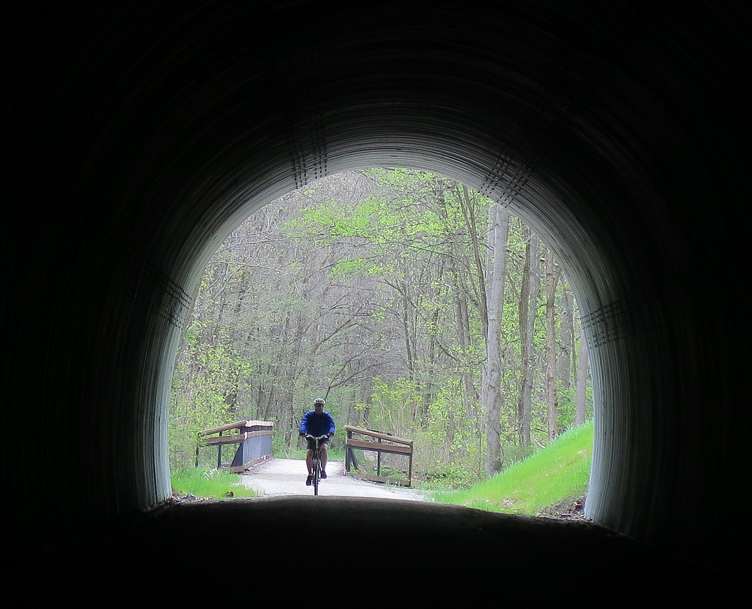
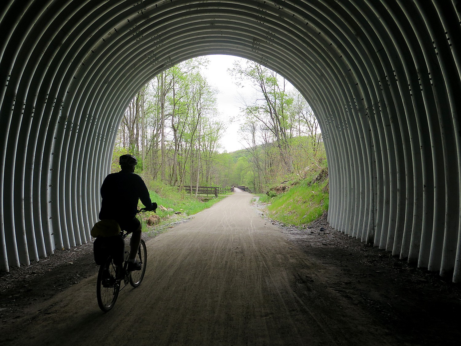
Biking through the Pinkerton Tunnel on the Great Allegheny Trail on the way to Confluence, PA © 2017 Karen Rubin/goingplacesfarandnear.com

By Karen Rubin, Travel Features Syndicate, goingplacesfarandnear.com


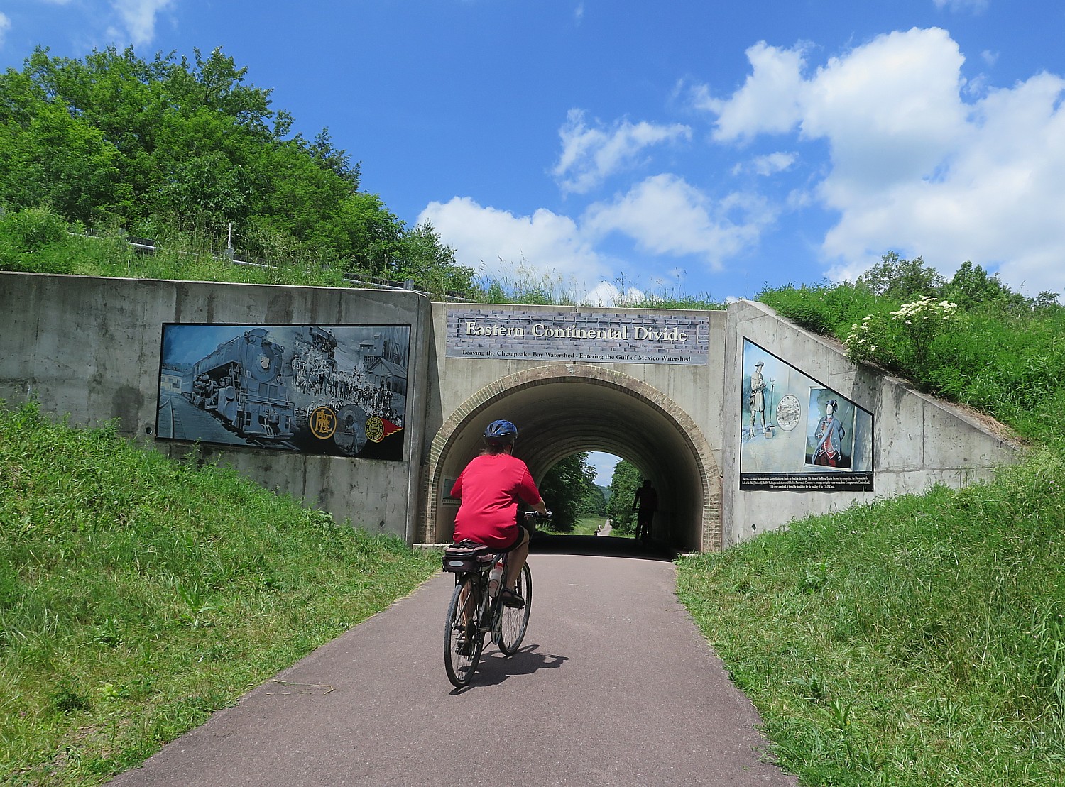
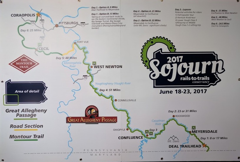
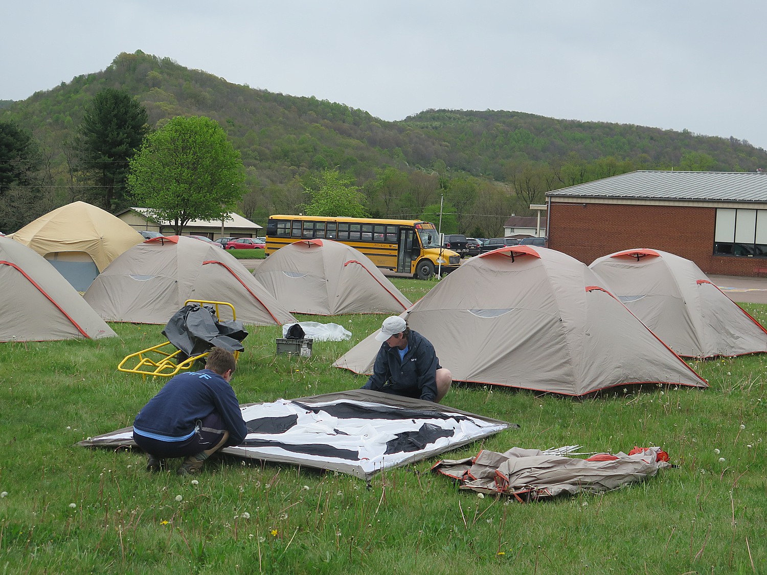
Our first day on this year’s Rails-to-Trails Conservancy’s Sojourn biketour on the Great Allegheny Passage and the Montour Trail, 140-miles biking over six days through Western Pennsylvania, brought us from Deal to Meyersdale with a side-trip that brings us across the Eastern Continental Divide (with gorgeous murals on the tunnel depicting the story), to the Mason-Dixon Line and a striking monument. It is a relatively short ride that brings us to the tented city we create at Meyersdale’s community park. We have time to explore, and to enjoy the town’s gracious hospitality with a dinner at the firehouse and pancake breakfast, complete with Meyerdale’s famous maple syrup, in the gym of the former high school. 

Meyersdale, PA © 2017 Karen Rubin/goingplacesfarandnear.com

Day 2: On the second day, we also have an option: to cruise an easy 31 miles downhill to the Confluence Outflow Campground, riding through an enchanting tree tunnel, or taking an on-the-road route to ride up to Pennsylvania’s highest point, Mount Davis. 

The forecast of rain all day makes the choice an easy one: the easy tree-tunnel route through tranquil forest. Despite some shelter from the trees, we get soaked, but it is a warm rain, and the amount of good cheer keeps us warmer still. The rain stops just as we arrive at Confluence, where we are greeted with two representatives of Confluence in period dress, inviting us to follow the balloons lining a route into the town center for free bike washes at the local cycle shop (and a gift!) and ice cream at the gazebo on the village green. Confluence, I am told, has a population of 700; for these two days, the census swells by 200 more. That evening, no one complains about the rain.

Rails-to-Trails Sojourners are welcomed to Confluence, PA © 2017 Karen Rubin/goingplacesfarandnear.com

The campground is absolutely magnificent, literally at the base below the enormous dam, constructed in 1944 to control flooding and more recently, to generate hydroelectric power. It is a popular place for fishermen.

Just after our evening “talk” (a workshop on repairing our bike), and sitting around waiting for phones to recharge, we get word that there is a major storm at Ohiopyle, about 11 miles away. We have 10 minutes before it hits us. Sure enough, small drops start to fall as I am just steps away from the tent. By the time I get there, rain is coming down in sheets. 

The Rails-to-Trails Sojourn campsite in the Outflow Campground, beneath the dam at Confluence, PA © 2017 Karen Rubin/ goingplacesfarandnear.com

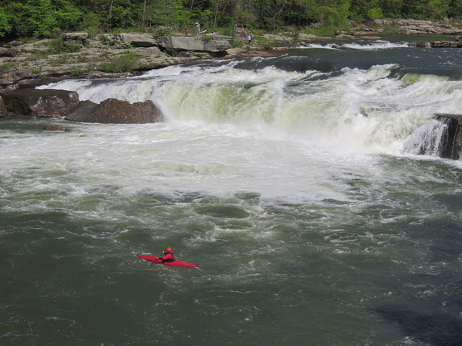
Day 3 is our “Fun Day” when we don’t cycle (unless we want to), but instead have a choice of activities: Fallingwater tour (designed by Frank Lloyd Wright), Kentuck Knob tour (designed by Frank Lloyd Wright), a rafting trip on the Middle Yough Class 1 – 2, or, the one I choose, a class 3 whitewater rafting trip on the Lower Yough.

In fact, 81 of us choose this option, organized by Wilderness Voyageurs, the same company that organizes the Rails-to-Trails Conservancy’s Sojourn rides including this one (the company has a catalog full of bike tours). I’ve done a fair amount of white water rafting trips in the past, but this one on the wonderfully scenic Youghiogheny River was absolutely the best – truly thrills and chills, especially since this is the only Class 3 rafting experience offered as a “guide-assisted” instead of having a guide in each raft. That means we are arbitrarily put into rafts and we “elect” a captain. This proves a great challenge and  a great experience (I lasted about 5 minutes as captain, exactly one set of rapids, when one of our four rafters got bounced out and we all decided to go into other rafts, leaving one of the guides to portage the raft to a point where he could deflate it and pick it up later). Getting bounced out of the raft – going for a “swim” – is not unusual and we have been cautioned to only wear what can get wet or lost.

We aren’t really on our own – one guide positions himself on a rock and gives us hand signals how we should “attack” the rapid, where to enter and so forth (though the instructions are for naught when inexperienced paddlers can’t follow directions, forget which is left and right, or are being bounced so high, they can’t reach paddle into the water); other guides in a kayak and in a raft are there to pick up anyone who is bounced out, and three of the rafts have guides in them (that’s the one I go into). Over the course of the trip, several of us get tossed out of the raft; one fellow gets a bit beat up.

A view of a portion of the lower Youghiogheny River where we had our class III whitewater rafting trip just the day from the overpass on the Great Allegheny Trail © 2017 Karen Rubin/goingplacesfarandnear.com

There is one point, though, where we come to an ominous sign warning that anyone who doesn’t want to raft through this particular set of rapids can portage their raft around it. The reason is because there is an underwater cavern, and if you get bounced out here, it is possible to be sucked down under. (Our guide says that most people die of heart failure rather than drowning. Small comfort.) The lead guide says that if any one of us in a raft wants to portage, the whole raft has to. We are in the lead raft and get to watch everybody coming through, cheering them on. Everyone makes it through.

We pull in for lunch at a small lagoon – we fill pita with chicken salad (fantastic) or tuna, cheese, lettuce and tomato, and have a wonderful time before continuing on down the river.

I don’t even know how long we are on the river – it all goes by so fast. But we are back at the campground by around 3 pm.

Storyteller Pennsylvania Jack © 2017 Karen Rubin/ goingplacesfarandnear.com

A few of us climb up to walk across the dam – the lake that was formed is popular for swimming and boating.

That evening, we are regaled by Pennsylvania Jack, a storyteller, and there is a campfire with s’mores.

Day 4 is our longest ride – 58 miles on the schedule (albeit mostly downhill), but with an option that increases the distance to a touch over 62. This section of the Great Allegheny Passage, between Confluence and West Newton, where we camp, is the most scenic, with much of it going through the stunning Ohiopyle State Park (Pennsylvania’s largest in land area). We ride along the river for just about the entire distance. When we reach the Ohiopyle State Park Visitors Center, about 11 miles into the ride, I go off the trail to do a hike that I had heard about the year before: Cucumber Falls. I had seen a painting of it in the Visitors’ Center, where there is an excellent historic exhibit, and heard about a hike starting a short walk from the center, and always regretted not doing the hike then.

Biking the Great Allegheny Passage, Confluence to Ohiopyle © 2017 Karen Rubin/goingplacesfarandnear.com

“Follow the yellow feet on the sidewalk,” they tell me. The hike is just about 25 minutes each way – a little over a mile – and proves absolutely enchanting: you follow yellow markings on trees and rocks, do some scrambling, and then, you make a turn and there ahead of you is the most magnificent falls, tucked into the woods. I felt as if I were John Muir coming upon Yosemite Falls for the first time.

Cucumber Falls, Ohiopyle State Park, PA, reached by an enchanting hike scrambling through the woods, along the Youghiogheny River from the Visitors Center © 2017 Karen Rubin/goingplacesfarandnear.com

The lighting is perfect – just a touch of sunlight hitting the waterfall. It is a magical experience and I am transfixed.

(I heartily recommend this hike, which should add 1 to 1 ½ hrs to the day’s ride time.)

Climbing up behind Cucumber Falls © 2017 Karen Rubin/ goingplacesfarandnear.com

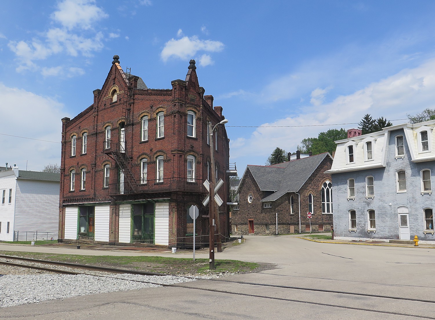
I’m calculating the extra time, as I get to mile 25.9 (not even halfway), when we have another option: to steer off about 2.1 miles on the Sheepskin Trail connector off the GAP, to go into the tiny town of Dunbar. Having visited last year, I knew this was an off-trail visit not to be missed, especially when you come in this way, off a back trail (even worth the half-mile over a rocky unimproved section). (See: Pascal Glass Sculpture with Trump Connection is Boon for Dunbar) 

The sculpture and the rest of the historical society is really worth seeing (www.dunbarhistoricalsociety.com).

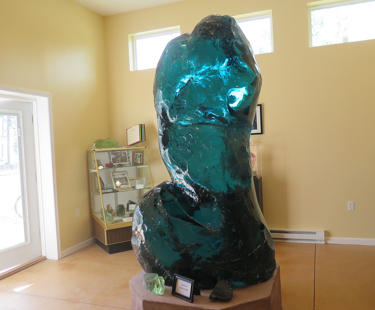
Dunbar, PA, once a glass-manufacturing center that depended upon railroads, now seeing a new lease on life with rail-trails and the Pascal “Seated Torso” sculpture, donated by Donald Trump, on view in the historical society © 2017 Karen Rubin/goingplacesfarandnear.com

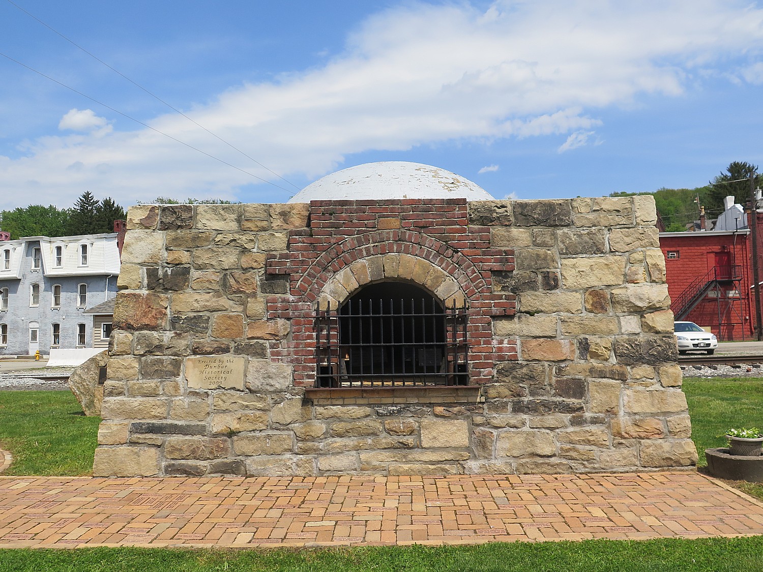
The train tracks come straight through the middle, as if a main street. On the village green is a coke oven and a memorial to those who died in a nearby mine accident.

RTC has basically adopted Dunbar as an example of how a town can be revitalized through tourism and culture.

Dunbar, PA was a bustling town a century ago, © 2017 Karen Rubin/ goingplacesfarandnear.com

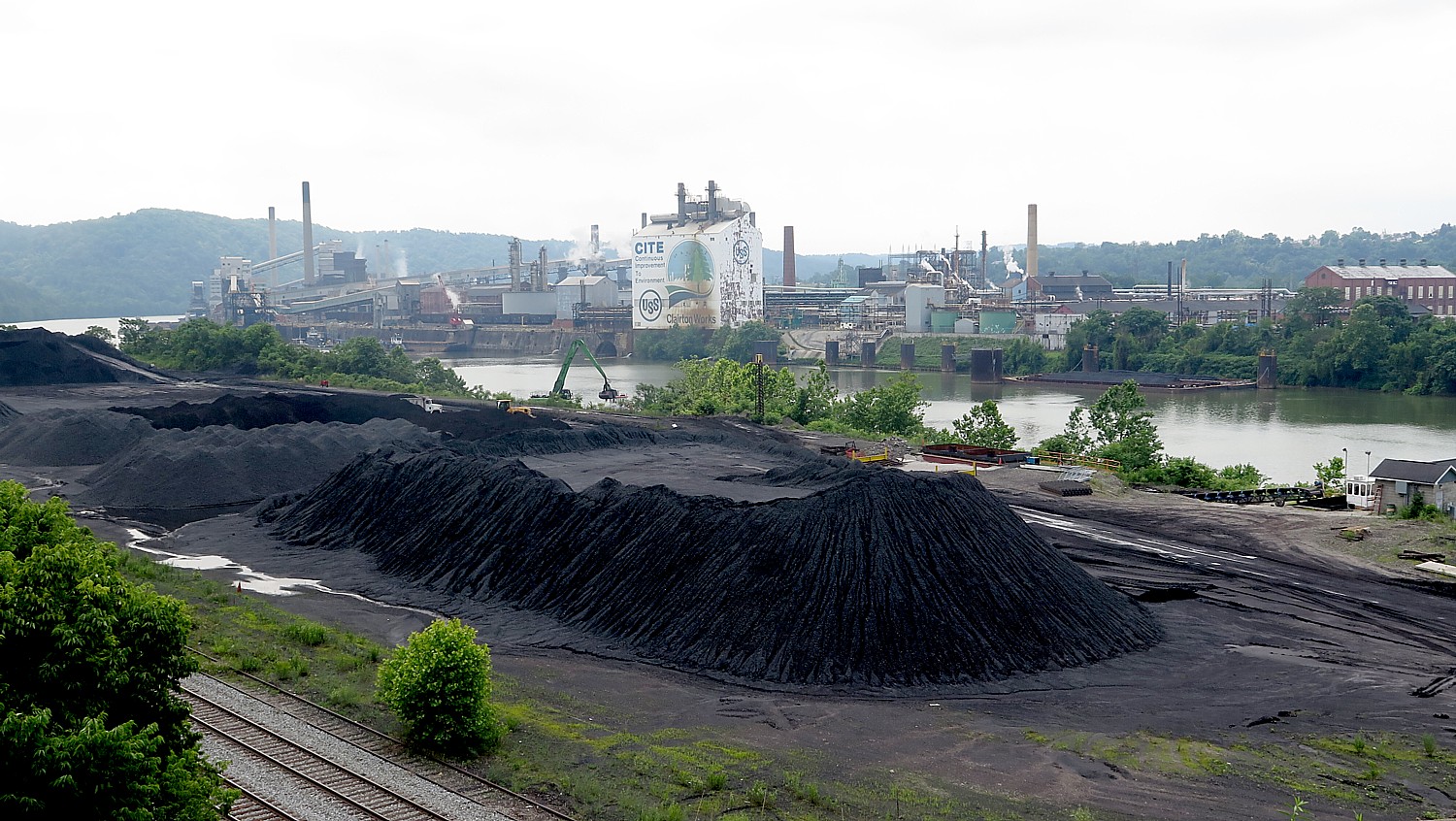
Day 5: This proves our most challenging day – not just because it is 48 miles of cycling after yesterday’s long ride, but I suspect because of the humidity and also because much of it, it seems, is uphill. But it also proves very interesting, as we leave the GAP after 17 miles (just after Boston, PA, where the trail becomes very urban, bringing a certain culture shock after such pastoral scenes.). To get from the GAP to the Montour Trail, we ride six miles on urban streets, through a small town of Glassport (where we are treated to snacks and cold water at a church), ride over a bridge to Clairton that gives us an eyeful into what I expect defined Pittsburgh just a couple of decades ago: a humongous pile of coal dwarfing the trucks scooping it up, and across the railroad tracks, a giant carbon materials and chemical plant. We finally get to the beginning of the Montour Trail, which includes several places where you are on/off the trail, on/off a shared road.

Culture shock as we leave the pastoral Great Allegheny Trail, ride through Clairton, on our way to the Montour Trail © 2017 Karen Rubin/ goingplacesfarandnear.com

At one point, I ride around a bend and find myself in a different time zone or the Twilight Zone – a hodgepodge of train cars, trucks, firetrucks, gas pumps and signs from the 1940s or so, as if they were just left there.  After a rocky start, the Montour Trail becomes as idyllic as the GAP, nestled in trees. A highlight is the 600-foot long National Tunnel.

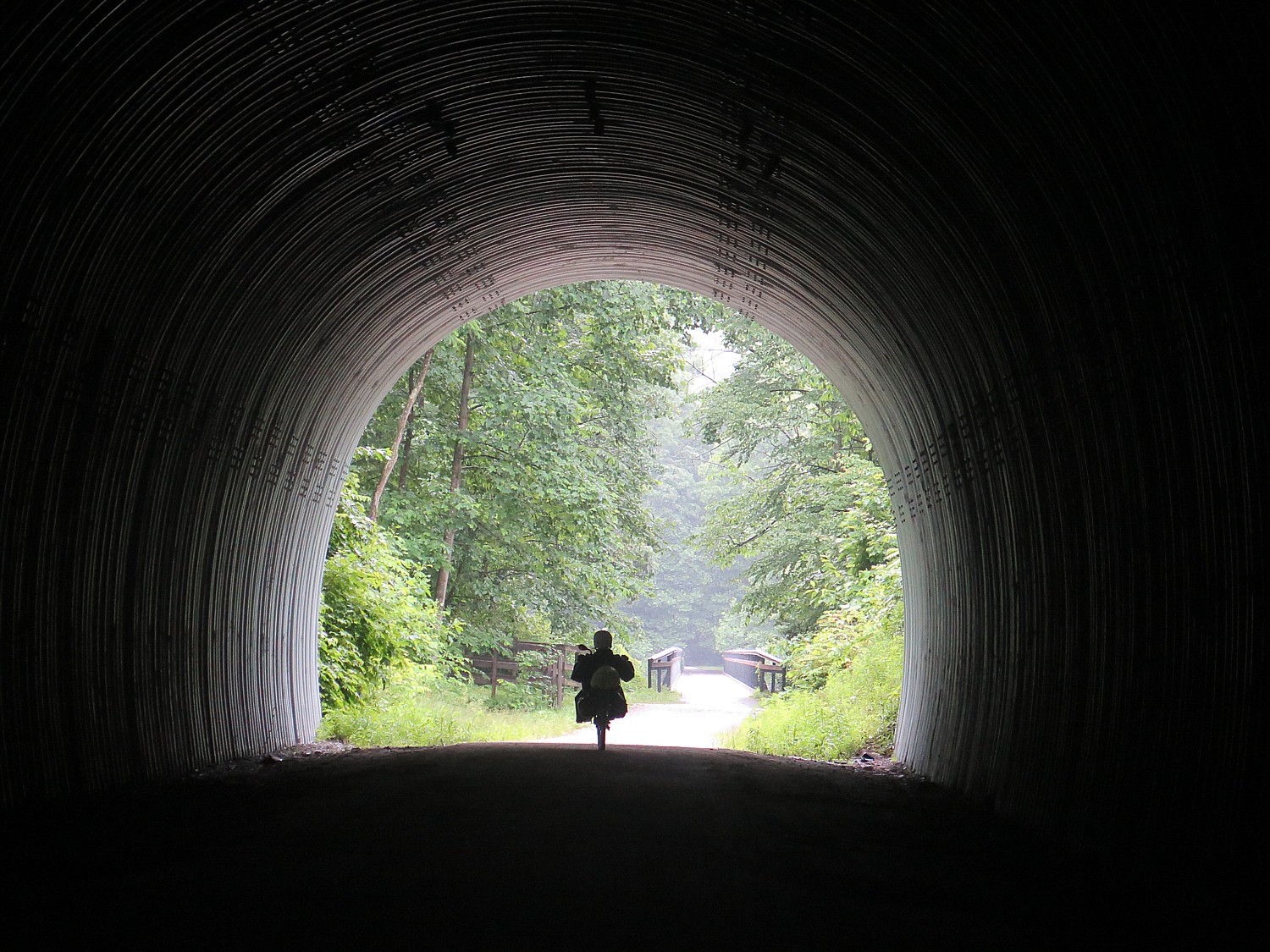
Biking through the National Tunnel on the Montour Trail © 2017 Karen Rubin/goingplacesfarandnear.com

We finally arrive at the small town of Cecil, where we camp at the Cecil Township Ballfield Park, and are treated to an absolute banquet (no kidding), Sierra Nevada beer, and finish off with a talent show.

It pours during the night (I am snug in the Comfy Camper tent), but amazingly stops just in time for breakfast. We are told to expect a break in the rain from 8 to 11am – exactly how much time we need to go the 26 miles to the end of our ride, including the last mile of the Montour Trail (actually an added mile that goes beyond the zero-milepost that they are working to improve), which is very definitely “off road”. The trail is really nice – it is wonderful to see how local communities show their pride and appreciation for the trail with beautiful gardens and rest stations. It also offers an example of the serendipity that takes place on the trail: I suddenly come upon what appears a depot of antique trucks, cars, gas station pumps and signs – either the historical society or a warehouse for theatrical props.

Local volunteers worked to improve rail bridges for bikers on the Montour Trail © 2017 Karen Rubin/goingplacesfarandnear.com

This last day’s ride also lets us see some of the “hybrids” and innovations in repurposed multi-use trails – a section of the Montour is a trail-beside-a-rail – the multipurpose trail is carved out of the right-of-way beside the active rail line.

We also literally ride over the “Panhandle” Trail which goes to Parkersburg West Virginia, with the connector that ultimately will allow bikers to cycle from Pittsburgh to Parkersburg (PtoP).

As for the rain, sure enough, as I pull into the parking lot at 11:15 am, the drops turn into deluge in a matter of moments.

Rails-to-Trails Conservancy, Washington, DC 20037, 202-974-5150, Railstotrails.orgTrailLink.com. 

Rails-to-Trails Conservancy’s Sojourn is a wonderful introduction to bike touring.

Wilderness Voyageurs, which operates the Sojourn on the GAP for Rails-to-Trails Conservancy, offers Ride the GAP trips with bed-and-breakfast accommodations (they portage luggage from inn to inn), as well as a full catalog of guided bike tours that includes Colorado; Missouri’s Katy Trail; Idaho’s Hiawatha & Coeur D’Alene; South Dakota’s Mickelson & the Badlands; the Erie Canal, Finger Lakes, and Adirondacks in New York; Shenandoah and the Civil War; Gettysburg & the Civil War; Maryland’s Chesapeake Bay; Pittsburgh to DC on the GAP & C&O; Pennsylvania’s Amish Country; Kentucky’s Bike & Bourbon; Georgia’s Gold Coast; and a biking trip in Cuba. (855-550-7705, Wilderness-Voyageurs.com)

See also:

Rails-to-Trails Conservancy’s BikeTour on Great Allegheny Passage Highlights Benefits of RailTrails

Pascal Glass Sculpture with Trump Connection is Boon for Dunbar, Pennsylvania


______________

© 2017 Travel Features Syndicate, a division of Workstyles, Inc. All rights reserved. Visit goingplacesfarandnear.com,  www.huffingtonpost.com/author/karen-rubin , and travelwritersmagazine.com/TravelFeaturesSyndicate/. Blogging at goingplacesnearandfar.wordpress.com and moralcompasstravel.info. Send comments or questions to [email protected]. Tweet @TravelFeatures. ‘Like’ us at facebook.com/NewsPhotoFeatures
Rails-to-Trails Conservancy’s BikeTour on Great Allegheny Passage Highlights Benefits of RailTrails

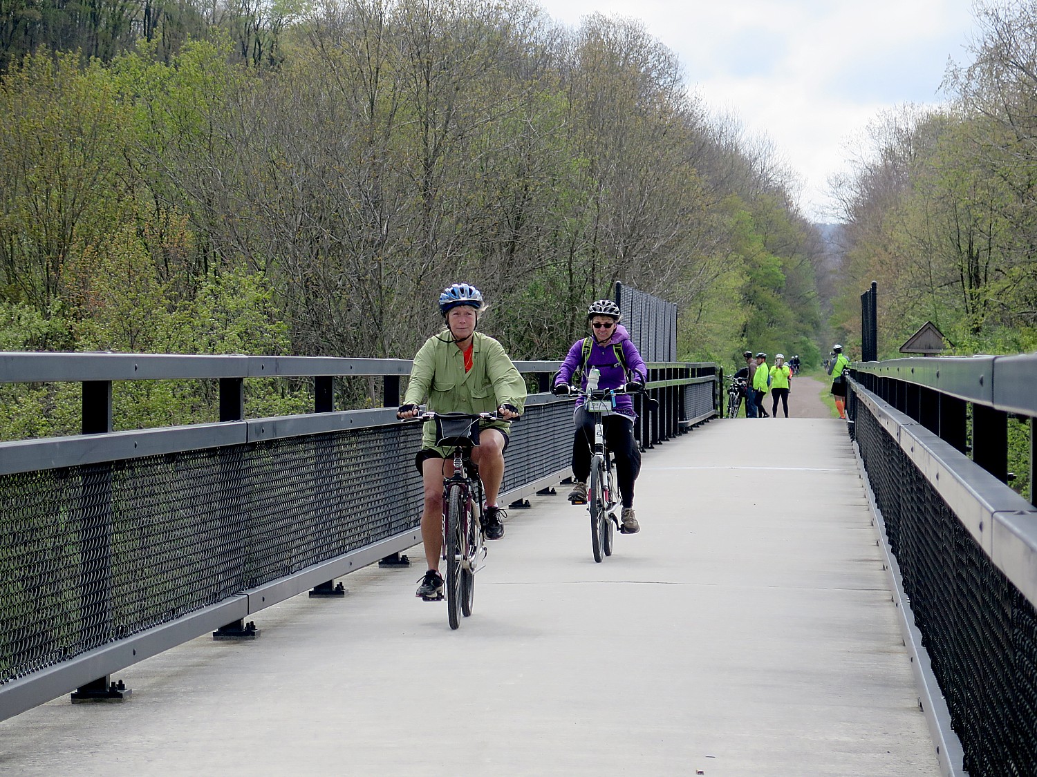
Riding over the Eastern Continental Divide on the Great Allegheny Passage railtrail on the first day of Rails-to-Trails Conservancy’s Sojourn biketour © 2017 Karen Rubin/goingplacesfarandnear.com


By Karen Rubin, Travel Features Syndicate, goingplacesfarandnear.com


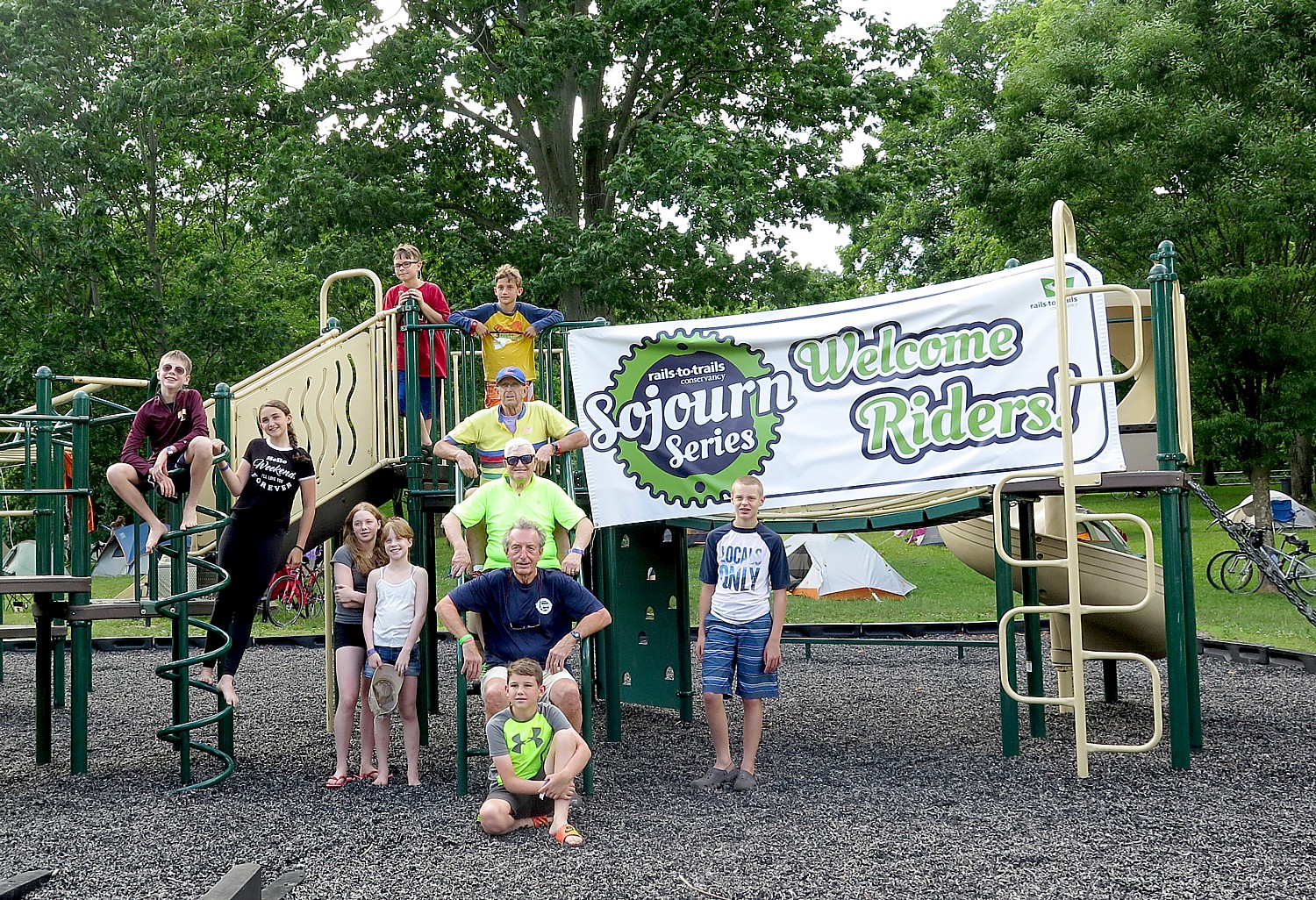
The ages of the 200 of us on this year’s Rails-to-Trails Conservancy Sojourn, biking 150-miles along the Great Allegheny Passage (GAP) and Montour Trail across western Pennsylvania, ranges from 9 to 83 years old. Indeed, there are 15 young people and three octogenarians among us.

A bike tour such as this, along relatively flat trails free of cars and other hazards, is a great equalizer: youngsters feel competent, accomplished, adventurous; and oldsters, well, feel competent, accomplished, adventurous and youthful.

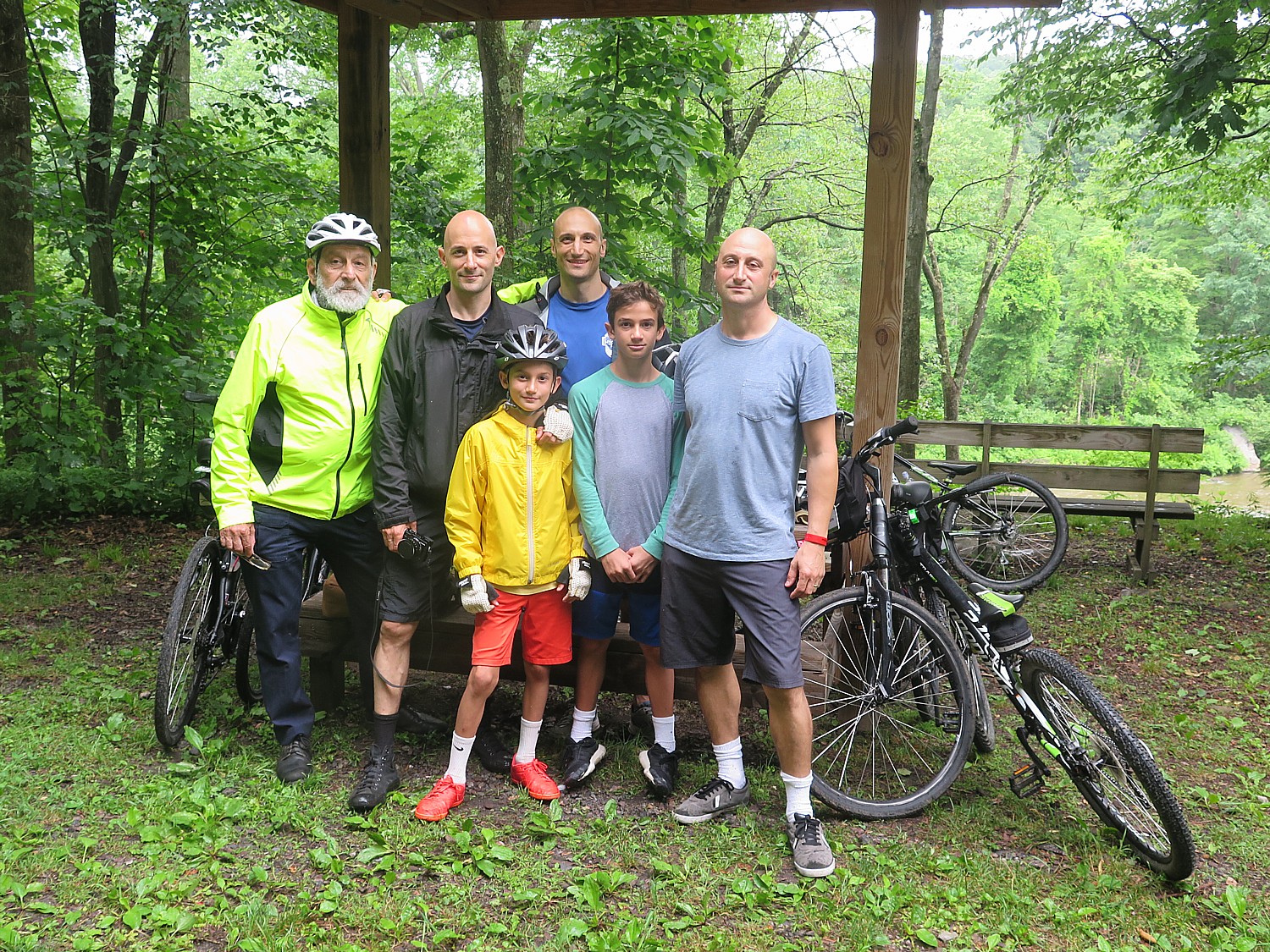
Our group comes from more than 30 states plus Canada and as far as Alaska, including families, three generations (a grandfather who is a retired physics professor, his three sons and two grandsons); grandfathers with grandsons, a mother with her son; husbands without wives; wives without husbands; and single women relishing the simultaneous independence with community.

Three generations of the Parsegian family who have come from Massachusetts, Texas, Michigan and New York to bike the Great Allegheny Passage on the RTC Sojourn © 2017 Karen Rubin/ goingplacesfarandnear.com

I reconnect with a couple from DC whom I first met on the 400-mile Erie Canal bikeride two years ago, again last year on this RTC Sojourn on the GAP, and this year, we find ourselves sitting next to each other on the bus from the drop-off to the start of the ride – he is the 83-year old. I meet people like Ed Holowinko of Connecticut, who was one of the activists who helped save the Walk over the Hudson, when otherwise, the bridge would have been taken down and instead has become one of the most popular attractions in the state. I meet people who defy the stereotype of an environmentalist cyclist: a woman who is as comfortable riding her motorcycle as her bike and a man who proudly defends the NRA (though political discussions are assiduously avoided, just as at any family gathering).

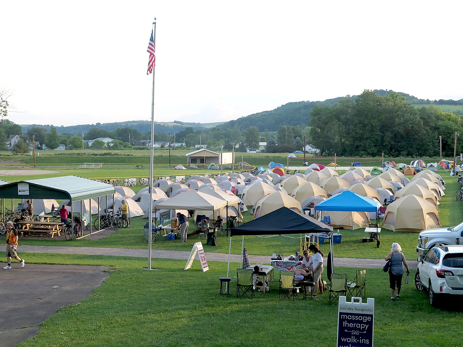
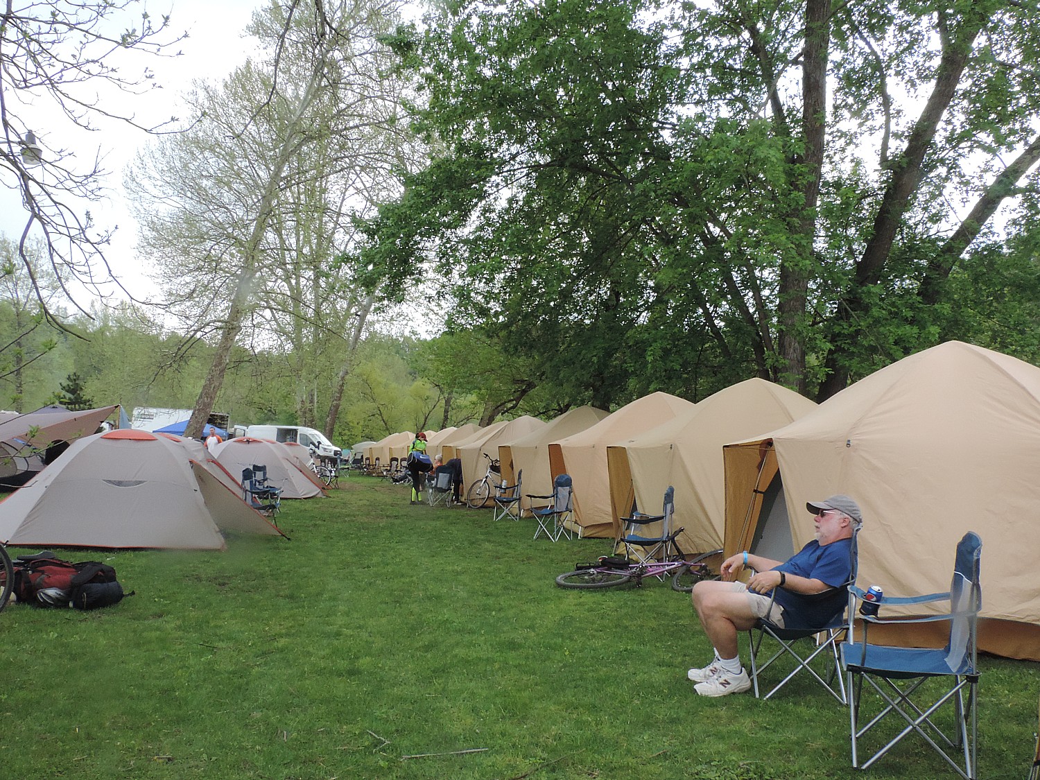
Comfy Campers set up 81 tents for the RTC Sojourners – the closest thing to “glamping” – creating a tent city at Meyersdale © 2017 Karen Rubin/goingplacesfarandnear.com

The supported ride is ideal for singles and families as well as those on their first biketour or experiencing their first long-distance ride: a luggage truck brings your stuff from one campsite to the next; there is breakfast and dinner provided daily; shower trucks and portasans supplement the campsite’s facilities; charging stations. If you don’t want to set up a tent, you can luxuriate in hiring Comfy Campers which provides a terrifically comfortable, watertight tent with air mattress, chair, fresh towel daily, cooling area with water and lemonade and chargers – the closest thing to “glamping” you can find. (Those who don’t want to camp can take advantage of bed-and-breakfast accommodations along the route.) In addition, there is a bike mechanic and massage therapists, and a volunteer nurse who travel with us.

There is such a sense of community that immediately forms in our tent city – sitting around long tables at breakfast and dinner; waiting for a turn at the shower truck, brushing teeth at the sinks – it’s like a giant pajama party. The kids come together in games and activities; we gather around for an evening talk (one night Pennsylvania Jack, a storyteller, regaled us), a campfire, and, for the final night, a talent show (contestants competed for the grand prize, a Fuji bike!). Another nice feature this year: Sierra Nevada Brewing Company joined as a sponsor, and we have free beer (terrific Pale Ale!) on a few of our dinners.

Oldest and youngest among us on Rails-to-Trails Conservancy’s 140-mile Sojourn on the Great Allegheny Passage and Montour Trail © 2017 Karen Rubin/goingplacesfarandnear.com

There are endless conversations with people who have never heard your stories before that typically begin, “Where are you from?” I meet a woman from Michigan who, now retired, takes one of these long-distance biketours on rail-trails practically monthly – Michigan’s Upper Peninsula; the Katy Trail, in Missouri; the Louisiana Bayou.

Many of us (one-third, in fact), had been on this Sojourn on the Great Allegheny Passage before, including me, but the destination and the experience is so fantastic, it is delightful to return over and over. Each day provides a different highlight, and each person will have a different experience. And each day brings its own serendipity, its own uniqueness – the season, weather, lighting, chance encounters, different things to explore. Indeed, even the sections of the Great Allegheny Passage that I had traveled last year in spring were very different this summer.

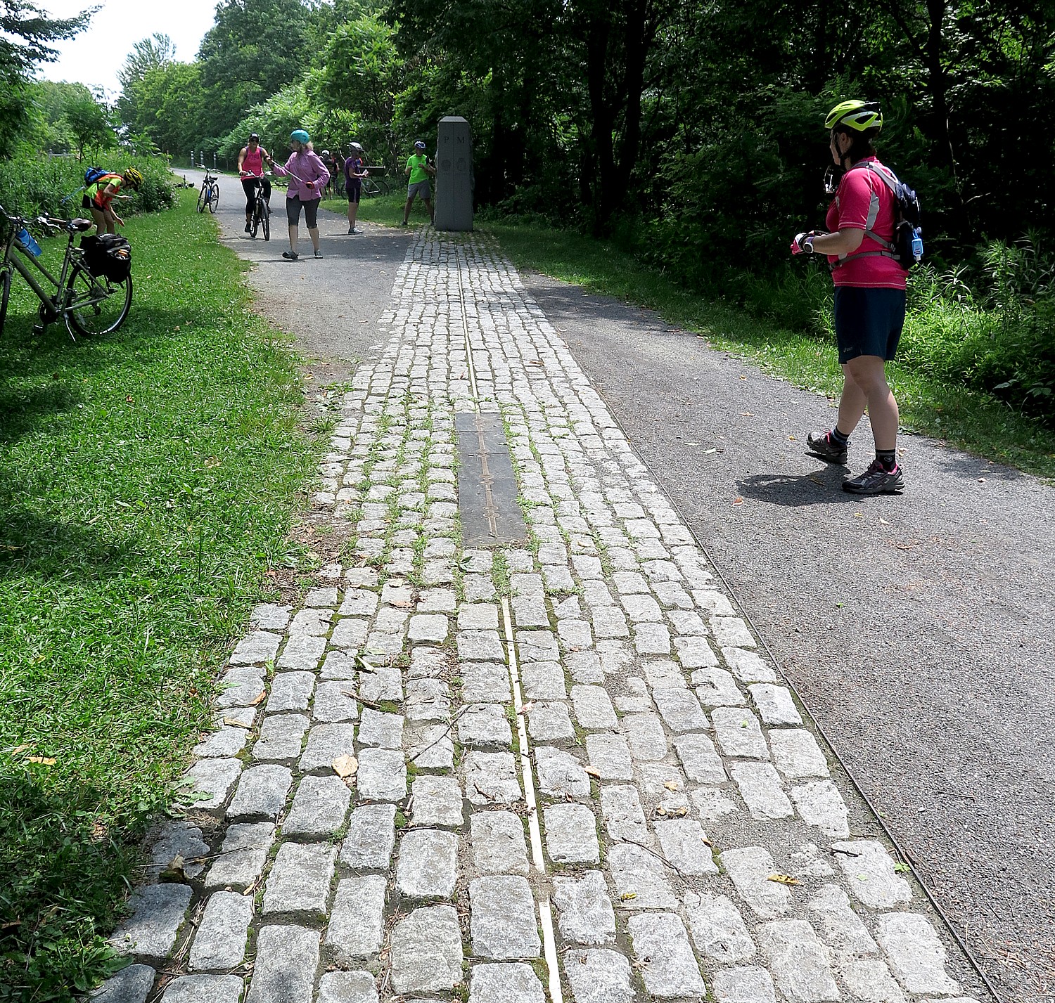
The Great Allegheny Passage crosses over the Mason-Dixon Line © 2017 Karen Rubin/goingplacesfarandnear.com

What is more, there are significant differences in the itinerary – this year’s trip was longer in distance and days, starting out closer to the Mason-Dixon Line and the Eastern Continental Divide (and the beginning of the 150-mile long GAP, which starts in Cumberland, Maryland, 21 miles further east from the Mason-Dixon line, but would involve a steep uphill climb; the way we do it, there is only a slight incline and most of us ride the mere 4 miles out and back, adding a mere 8 miles to the first day’s tally); featured a “fun day” in Pennsylvania’s magnificent Ohiopyle State Park when we get to choose among four different activities (I choose a Class III whitewater river rafting experience which is sensational; others choose a milder Class I river rafting trip, or visits to one of two Frank Lloyd Wright-designed homes, Fallingwaters or Kentuck Nob, and still others just do their own thing), which also meant we had two days at one campsite.

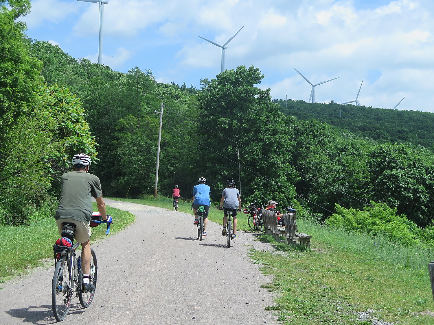
Also, the ending of the trip takes us back toward Pittsburgh (actually Coraopolis, PA) on the Montour Trail, which, like the Great Allegheny Passage – both award-winning trails – and a superb example of how obsolete rail lines (or canalways, or right-of-ways alongside active rail lines) can be turned into multi-use recreational trails. These linear parks, if you will, not only provide wellness and outdoor activities for families to do together, but also revitalize towns and villages whose economies have been upended by shuttered factories and mines, towns and villages that for so long had been defined by the railroads, the steel mills, the coal mines. Along the way, I will capture images of the cyclists on the rail trail cutting into hillsides topped with wind turbines above the Pennsylvania towns founded on oil, coal and gas. The rail-trails provide a new lease on life, as it were, and we realize it as the chambers of commerce, tourist bureaus, volunteer firefighters, Rotary and Lions Clubs go out of their way to greet us.

RTC bikers on the Great Allegheny Trail pass by wind turbines on the Pennsylvania hilltops © 2017 Karen Rubin/goingplacesfarandnear.com

And so we are welcomed at Meyersdale, our first night’s destination, where the railroad station along the Great Allegheny Passage has been turned into a delightful historical society display, refreshment stand and shop, by representatives of local chamber; a special Sunday evening service at the church features a prayer for all the Sojourners to have a safe ride, dinner at the fire department and breakfast at what used to be the town’s high school. This is a town that once supported six hotels, a bank, a high school and elementary school – today, all but the bank (built in 1904) are shuttered. And while the GAP goes over one railroad line that has been turned into the railtrail, there is still an active railroad line that goes right through the middle of town.

Walking about after our dinner, there is this eerie quiet and stillness – a sense of being in a movie set, rather than a town, or a scene in Twilight Zone (granted, it is Sunday and Fathers’ Day at that). I pass a barber shop and peer in: there is a crumbled newspaper, brown and deteriorating with age; the leather barber chairs are cracked; the shop seems to have been left alone for decades- I take note of a Sheriff’s notice on the door handle. I pass a porch with a Confederate flag and “Don’t tread on me” banner.

Meyersdale shows its pride © 2017 Karen Rubin/ goingplacesfarandnear.com

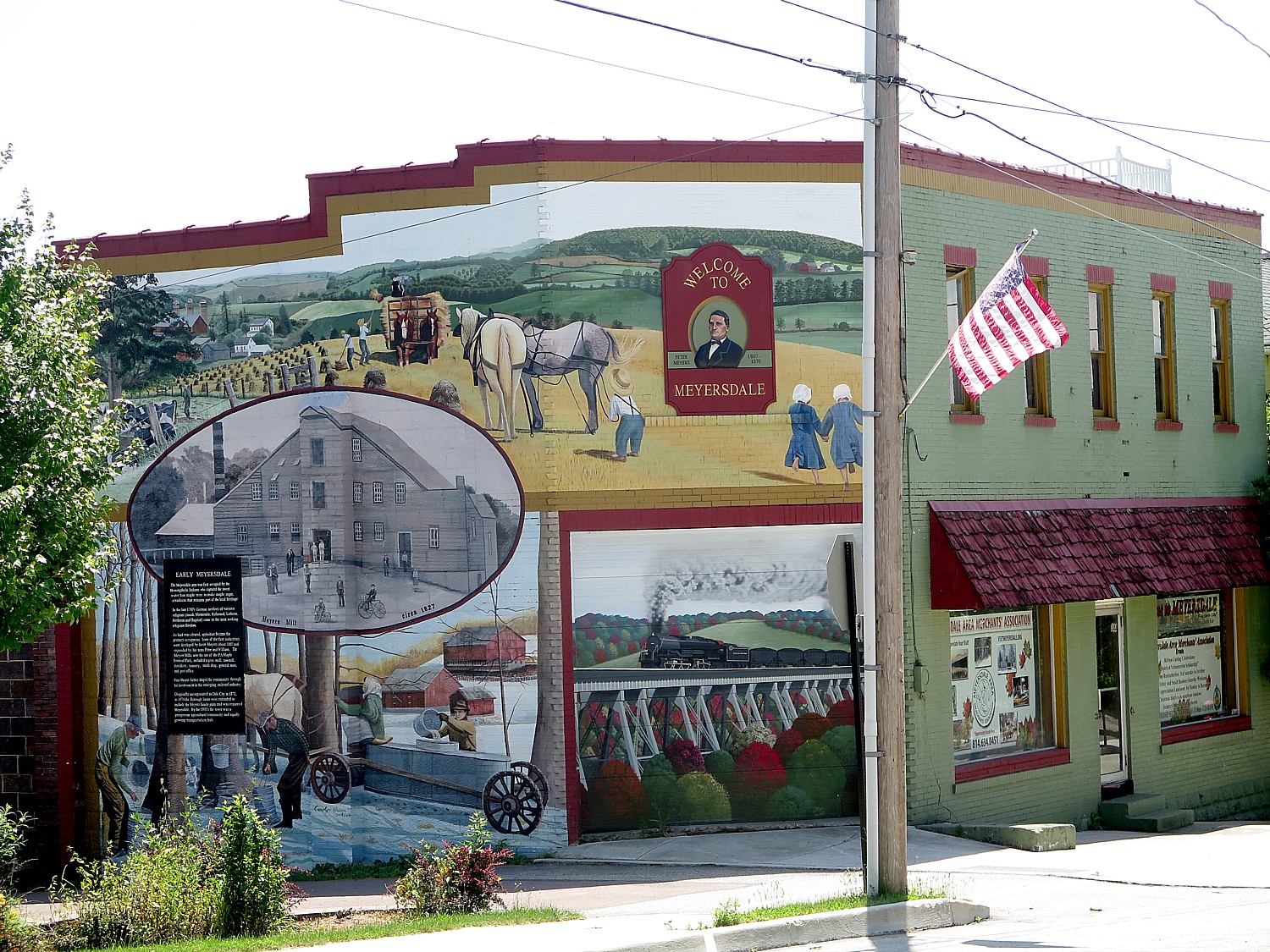
Meyersdale is a very proud community – it showcases its history on markers, on magnificent painted murals that fill entire sides of buildings, even on the placemats that picture the town’s history and attractions which are laid out for our breakfast that features Meyersdale’s famous maple syrup (who knew this was the capital of maple syrup making?).

The towns we get to visit are absolutely wonderful – quite literally, Smalltown America -and the contrast with seeing nothing but trees, rocks and river along the trail is stimulating and intriguing.

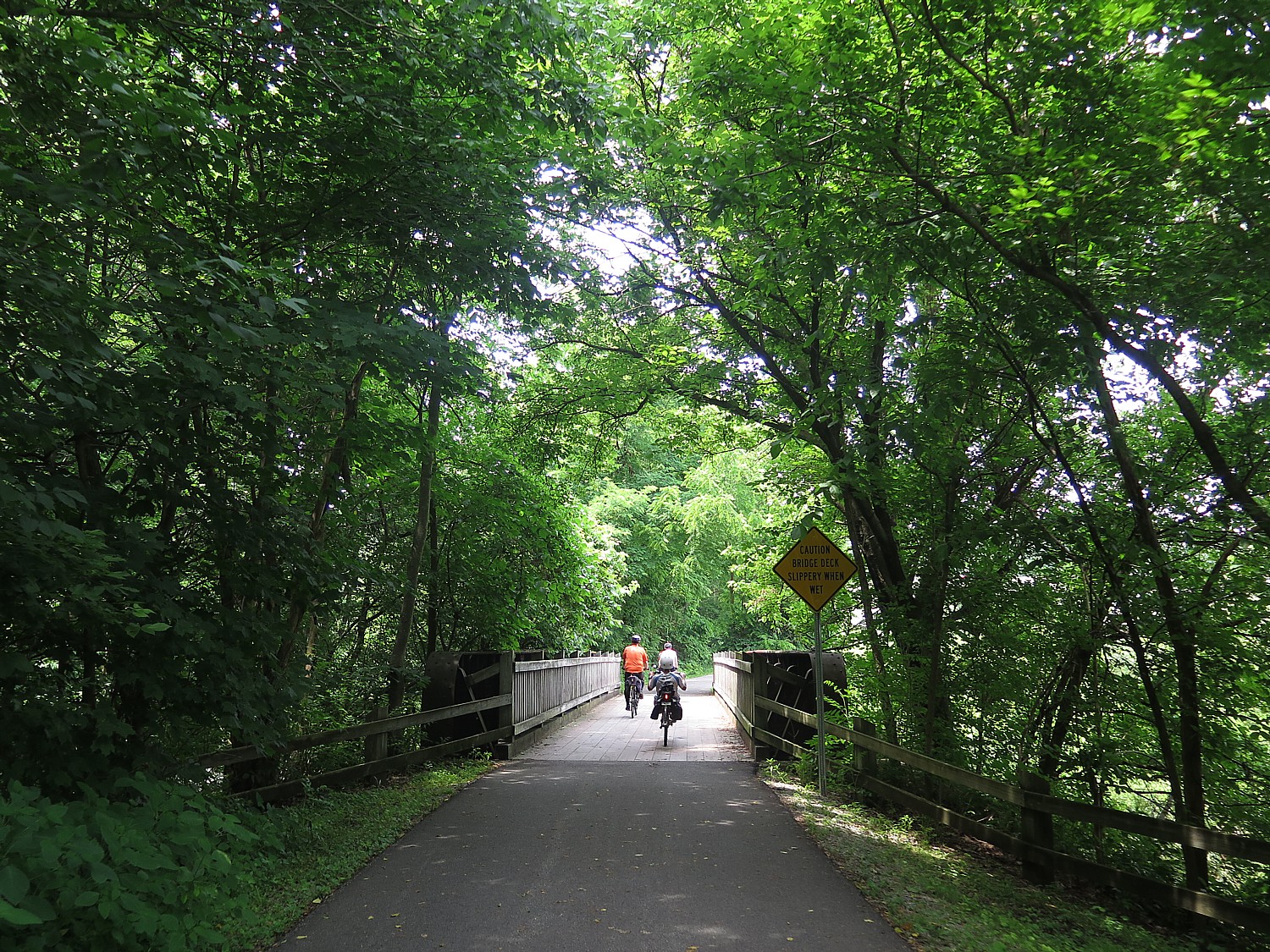
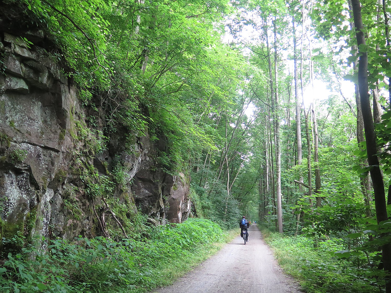
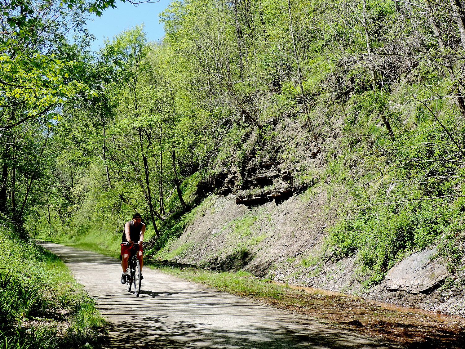
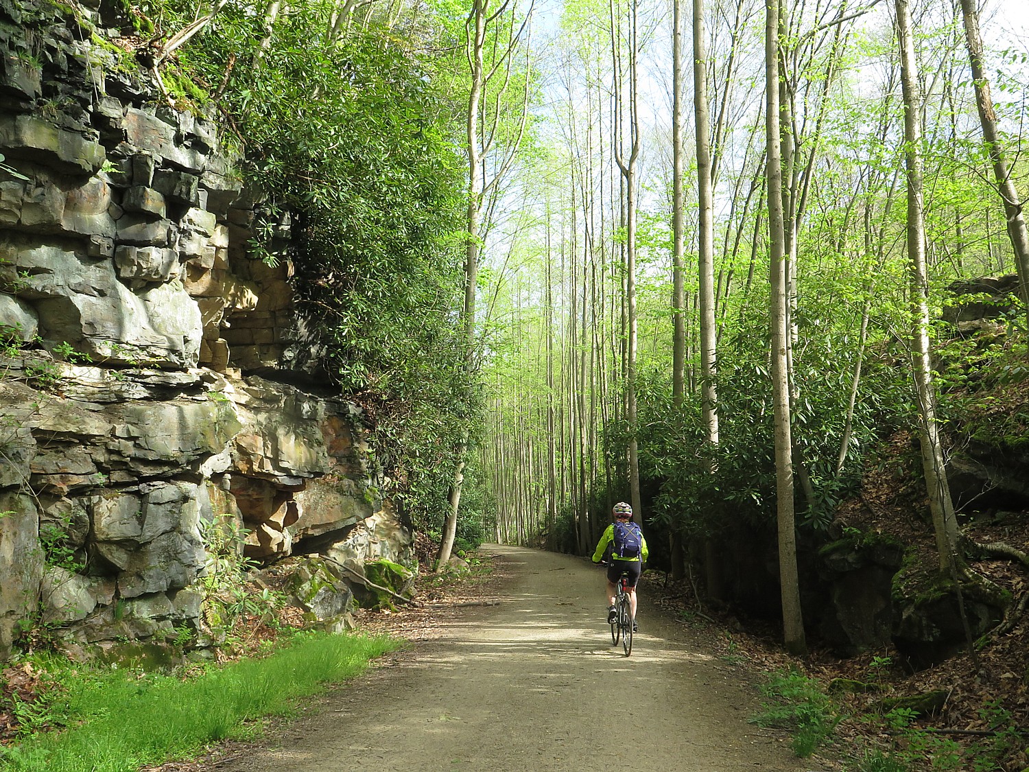
You are deep in the forest – for much of the way, riding alongside a river or creek on one side, and outcroppings of rocks on the other, riding through a literal “tree tunnel” that envelopes you. Occasionally we ride by a farm, but most of the time, the solitude is just stunning – the kind of serenity you feel when you are hiking. The only sound is the wind you create by riding, the crunching sound of the bike wheels on the hard-packed gravel, and birds. Many, many birds. Occasionally we pass by a small waterfall. It is surprising with so much land all around we don’t see that many animals, though on one day, we come upon several deer on the trail; chipmunks who scurry across the path (amazing how they time their dash), making a huge leap into the bushes just as I am about to reach them. The quiet is occasionally broken by a train whistle and the chugging as they haul something like 8000 tons of coal on tracks on the opposite riverbank.

The serenity of biking on the Great Allegheny Passage © 2017 Karen Rubin/goingplacesfarandnear.com

If you are a writer or poet, this is better to get creative juices flowing than holing up in isolated cabin – your imagination and your thoughts dance in your head as you ride, nurtured by the rhythms and the endorphins. If you are an artist, you will be inspired by the scenes that stream by.

At one point, I think to myself, “We are like nomads, like pioneers, steadily picking up stakes and moving on, each time setting up a new community.”

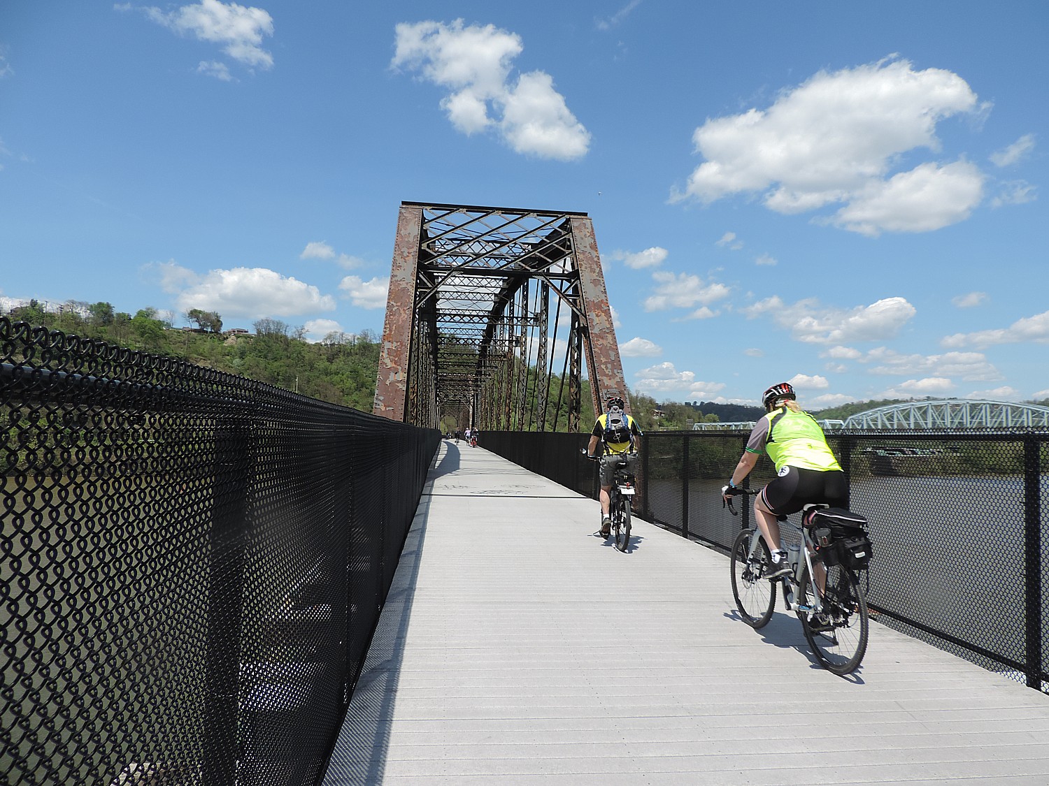
The trail also has some wonderfully thrilling  and dramatic features – it is tremendous fun (exciting too) going through these old rail tunnels, over viaducts and steel bridges – that have been built for the trains, but now rebuilt and repurposed, largely because of the efforts of local communities and volunteers, for bikes.

Riding through the Pinkerton Tunnel on the Great Allegheny Passage © 2017 Karen Rubin/goingplacesfarandnear.com

We ride at our own pace – and can go off the trail to explore if we like – and depending upon the length of ride (from about 30 miles to the longest ride, 62 miles with some optional add-ons, averaging 35-40 miles a day), we would have one or two rest stops with snacks and cold water. They offer suggestions for lunch or ice cream or attractions we might want to explore, like Rockwood’s Opera House (our cue sheets offer great detail). And in many cases, people from the town set up to welcome us.

This is clear from the first day, when we have the option of either riding a mere 8 miles to the first night’s campsite, just 8 miles to Meyersdale, or add four miles out and back to explore several iconic sites, including the Eastern Continental Divide, the Big Savage Tunnel, the Big Savage Overlook and the Mason-Dixon Line monument.

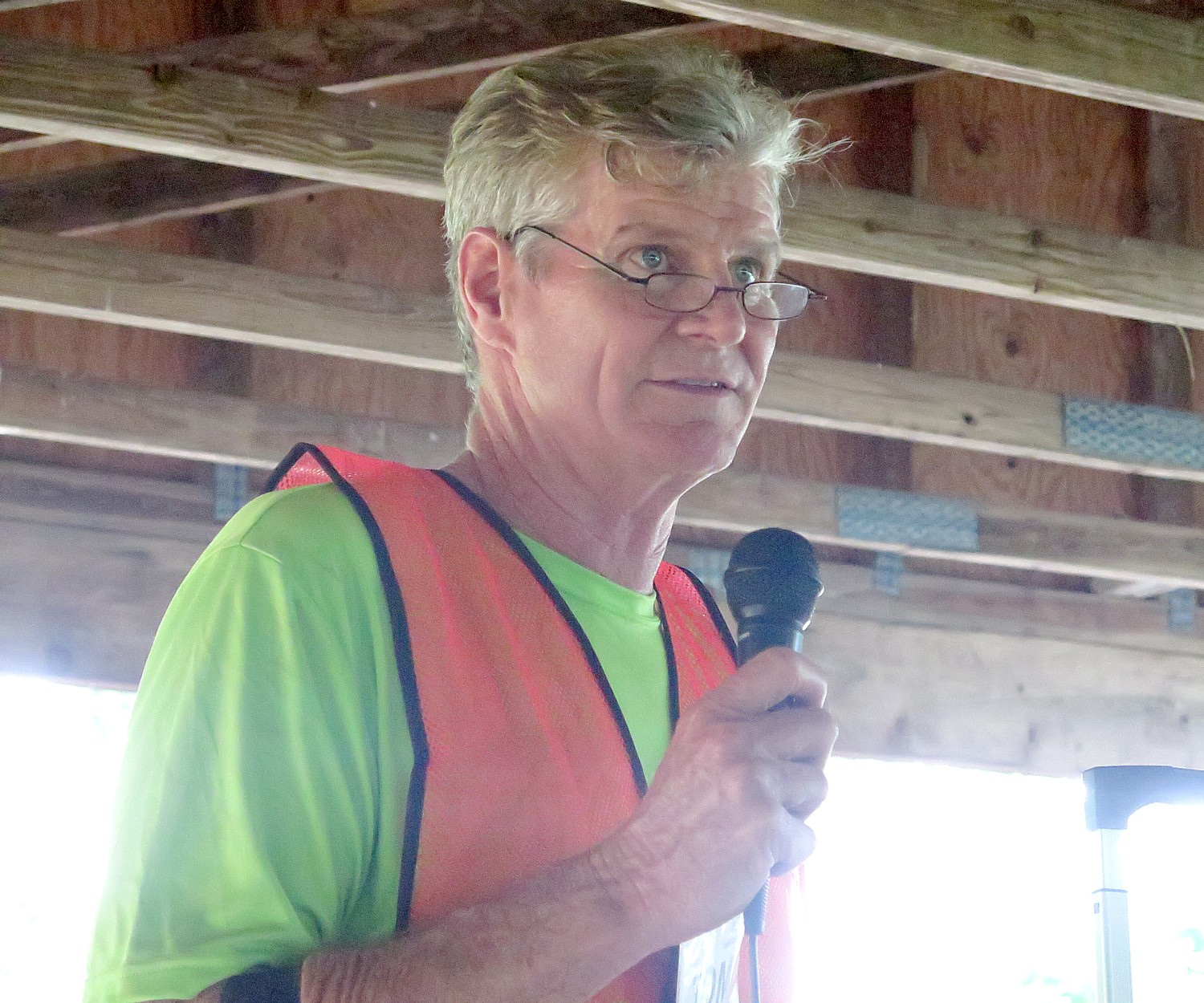
At that night’s dinner, held in the Meyersdale Fire House, the trip leader, Tom Sexton, Director of the Northeast Regional Office of the Rails-to-Trails Conservancy. Who is leading the Sojourn, talks about the mission of Rails-to-Trails Conservancy, and our role as Sojourners.

Rails-to-Trails Conservancy (RTC) has played a key advocacy role to promote the creation and use of these repurposed trails. RTC has been a partner, providing technical assistance – such as negotiating with railroads, advising localities on visioning and feasibility studies as well as construction, and coordination with nonprofits and volunteer efforts, such as the Montour Trail Council that has been so active in building and improving the trail we will take.

A current project underway will link trails in four states, New York, Pennsylvania, Ohio, West Virginia, creating an Industrial Heartland Trail Network. (New York State, which has the Erie Canalway that extends from Buffalo to Albany, is creating the Empire State Trail, finishing 350-miles of new trails that would complete the Eric Canalway and the Hudson River Valley Greenway, and connecting them to form a 750-mile pathway, the longest in the nation, from New York Harbor, through the Adirondack Mountains, to the Canadian border, and from Lake Erie to Albany.

Rails-to-Trails Conservancy promotes the use of rail-trails – there are some 23,000 miles of rail-trails- and its TrailLink.com website helps you locate them.

RTC is also an advocacy group lobbying Congress and the administration, which will be important coming up, because Trump’s proposed budget would eliminate the earmarks for rail-trails.

RTC’s Tom Sexton: federal funding for rail-to-trail projects like the Great Allegheny Passage and Montour Trail are in jeopardy © 2017 Karen Rubin /goingplacesfarandnear.com

As Sexton explains, since 1991, the major funding for these rail-to-trail projects has come from the federal government, with matching funds from states and localities. The Highway Bill had typically included mass transit and railroad funding but beginning in 1991, also earmarked funding for 10 categories, including rail-trails, given as grants to states to use for acquisition, planning and construction.

But that is under threat by the new administration:

“The president’s budget proposal eliminates all funding for the wildly popular TIGER program, which is bad news for trails and active transportation,” RTC states. “Without TIGER, trails could miss out on hundreds of millions in funding. Since the program began in 2009, TIGER has provided nearly $340 million in funding for active transportation projects and trail networks like the Circuit Trails in PhiladelphiaCleveland Metroparks and the Atlanta BeltLine. What’s more, using the American Association of State Highway Transportation Officials’ methodology to calculate jobs per mile of trail built, we project that TIGER investments in active transportation have generated thousands of jobs.

“TIGER is much more than a program that supports trails; it funds all transportation modes and is unique in that it encourages cross-jurisdictional and multimodal cooperation, breaking down traditional bureaucratic silos and looking at balanced transportation systems as a whole. This makes the program intentional, focused and efficient in the projects it selects—and effective in achieving outcomes after construction.

“The U.S. Department of Transportation has thus far awarded TIGER funding to diverse projects including roads and bridges, ports, railways, transit, freight operations and, of course, trails and other walking and biking infrastructure. However, the new president and transportation secretary will set their own funding priorities….

“The budget also calls for an end to general fund infusions to the Highway Trust Fund, eliminating $95 billion in expected transportation spending over the same 10 years, raising further doubts about the extent to which infrastructure investment would increase if the president’s budget proposal were to pass.”

Map of our 2017 Rails-to-Trails Conservancy Sojourn ride on the Great Allegheny Passage and Montour Trail © 2017 Karen Rubin/ goingplacesfarandnear.com

Indeed, we Sojourners are ambassadors and advocates and increasingly now, also activists.

“Everyone here is an ambassador,” says Brandi Horton, RTC’s VP of Communications. “We show the towns, the communities, city and town and state governments just how important rail trails are to building community, generating economic development, building tourism and getting people out together.”

Tips for advocating include bringing a friend out with you on the trail, use social media, lobby state and federal legislators to make sure trails are included in infrastructure funding; let your Congressmember know you use the trails, send a photo.

RTC has also its “take action” section of the website, where you can plug in your zipcode, find your official and send a note.

“Be a spokesperson, do community outreach. If you want to get a trail in your community, you need your voice heard not just at the federal, state and regional level, but at the local level.”

Rails-to-Trails Conservancy, Washington, DC 20037, 202-974-5150, Railstotrails.orgTrailLink.com.

See next:

Rails-to-Trails Conservancy’s Sojourn Biketour on Great Allegheny Passage Showcases Forgotten Towns

Pascal Glass Sculpture with Trump Connection is Boon for Dunbar, Pennsylvania

 ____________________

© 2017 Travel Features Syndicate, a division of Workstyles, Inc. All rights reserved. Visit goingplacesfarandnear.com,  www.huffingtonpost.com/author/karen-rubin , and travelwritersmagazine.com/TravelFeaturesSyndicate/. Blogging at goingplacesnearandfar.wordpress.com and moralcompasstravel.info. Send comments or questions to [email protected]. Tweet @TravelFeatures. ‘Like’ us at facebook.com/NewsPhotoFeatures


Yosemite National Park: Surprising Diversity, Dramatic Scenes Hiking Chilnualna Falls Trail, Wawona

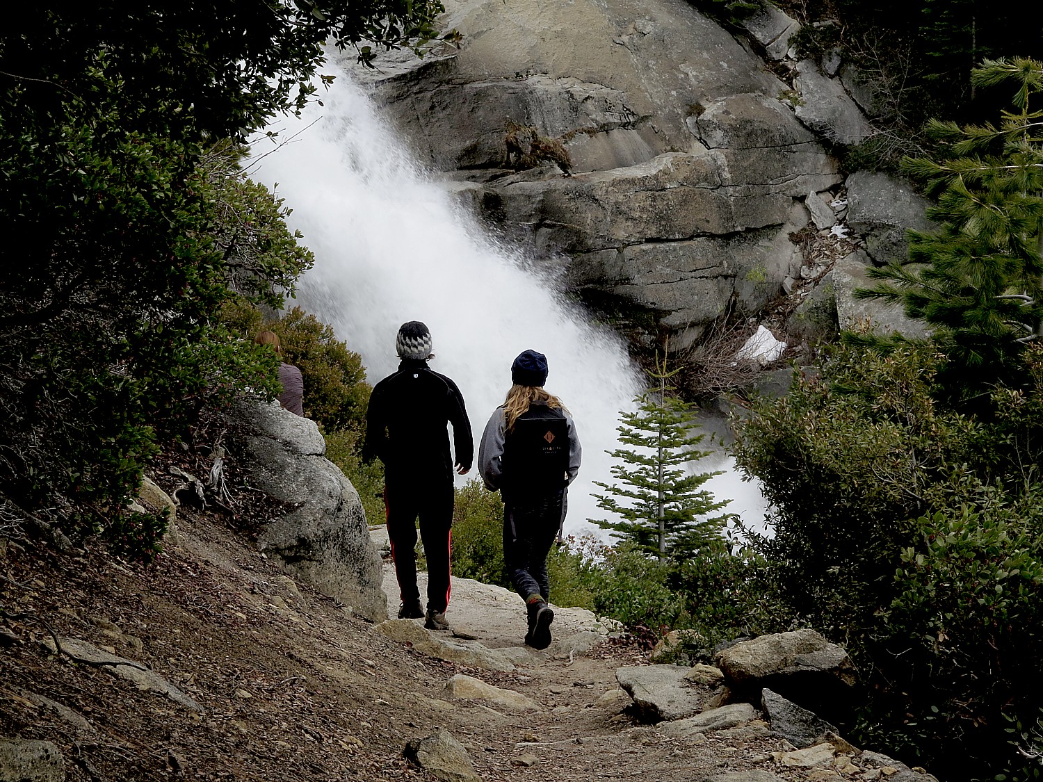
The Chilnualna Falls Trail brings you close to dramatic cascades several times on the way to the top © 2017 Karen Rubin/goingplacesfarandnear.com

By Karen Rubin, Eric Leiberman, Sarah Falter

Travel Features Syndicate, goingplacesfarandnear.com

It’s our second day in Yosemite National Park.

I am surprised at how much we could cover on our first day in Yosemite National Park, spent hiking in Yosemite Valley. This is the most popular and iconic part of this vast park, the size of Rhode Island, but the three trails we chose – Mist Trail, John Muir, Mirror Lake – haven given us a really good sense of the park, despite its size. Since we need to leave the area for San Francisco, 200 miles away, by 4 pm, we cleverly find a hike (thanks to the Tenaya Lodge concierge) that starts from just inside the South Gate, in the Wawona section, thereby cutting out 1 ½ hour drive each way jut to get into Yosemite Valley at the center of the park. We plan this out very well: the Chilnualna Falls Trail is just about 6 miles from the Tenaya Lodge, and is much, much, much less crowded – and yet, we meet some wonderful people from Australia and other places.

It is also sufficiently long hike to take about five or six hours – exactly the amount of time we have, and, we discover, offers dramatic, close-by views of the cascading Chilnualna Falls, the sweeping vistas of the southern  Yosemite, and wonderful diversity of the landscape, as the trail winds through a variety of terrain and habitats. Our choice proves brilliant.

We start out in the village of Wawona (you pass a general store so if you need supplies, this would be a great place), turn onto Chilnualna Falls Road and park at the trailhead (there are restroom facilities here).

Hiking the Chilnualna Falls Trail, Yosemite National Park © 2017 Karen Rubin/goingplacesfarandnear.com

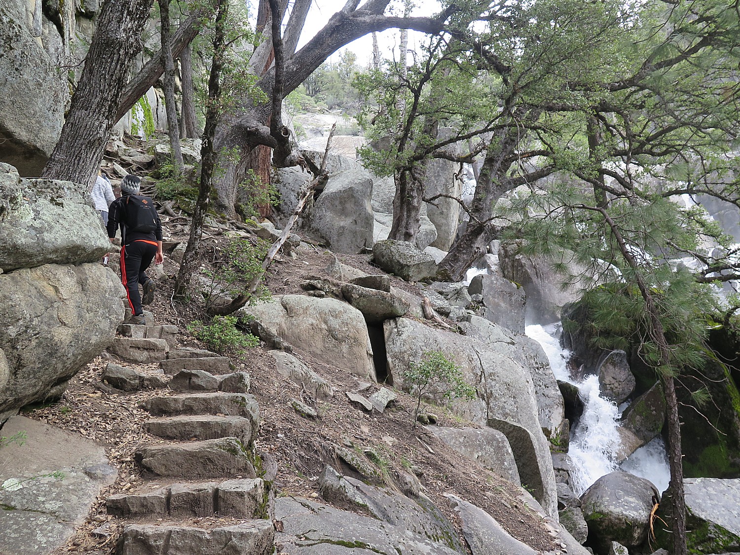
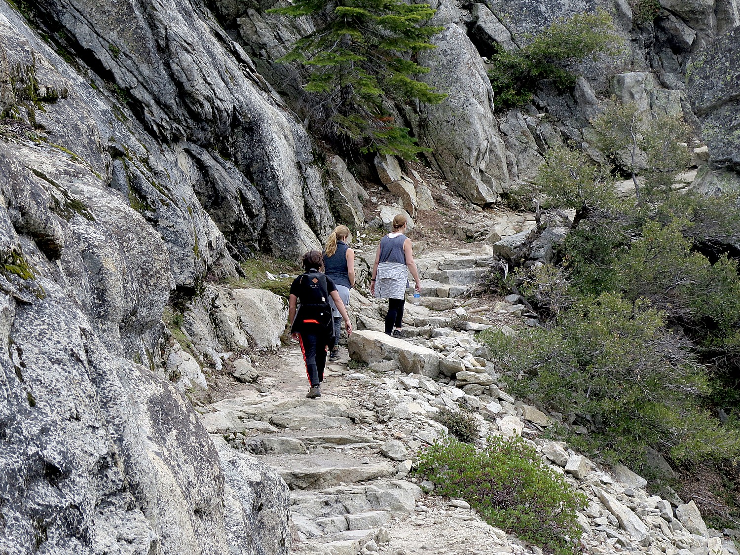
This hike is billed as strenuous – mainly for a fairly steep, nearly mile-long beginning, that includes narrow, high stone steps (with the reward of a gorgeous cascading waterfall). Then it is a steady upward (though mostly gradual) climb for about 4 miles, with a 2,400-foot elevation gain to an altitude of 6,600 feet – that’s what makes the hike tough.

The Chilnualna Falls Trail hike is billed as strenuous – mainly because it is a steady upward climb, with the steepest part at the beginning © 2017 Karen Rubin/goingplacesfarandnear.com

The Chilnualna Falls, which fortunately for us is one of the less known and visited falls (and not accessible by car), consists of five large cascades that slide through and over large granite rock formations – almost like the ruins of a fort, parts of which we get to climb.

At various points we come across the cataracts, up close, and each time, the sound and view is dramatic.

Hiking the Chilnualna Falls Trail, Yosemite National Park © 2017 Karen Rubin/goingplacesfarandnear.com

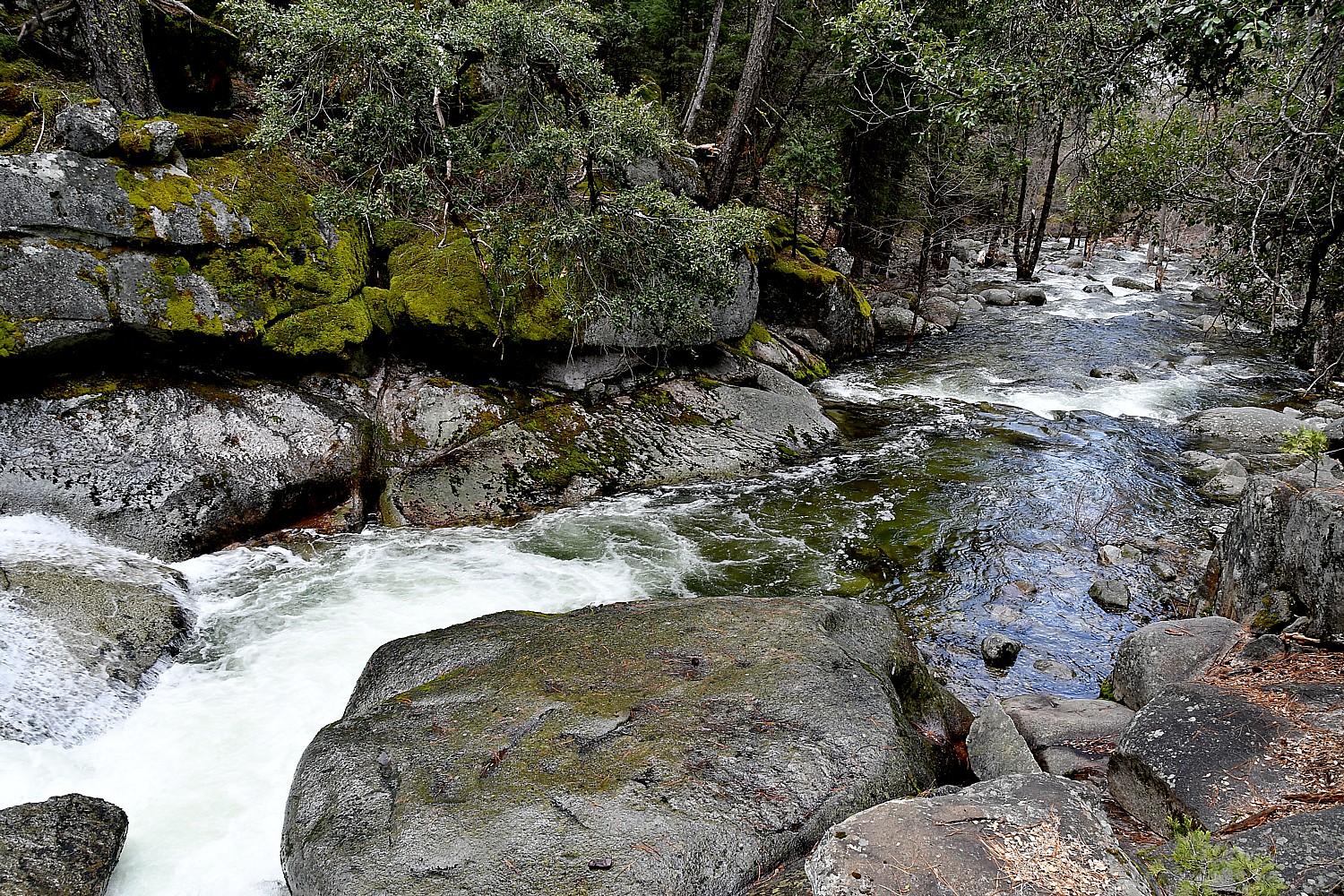
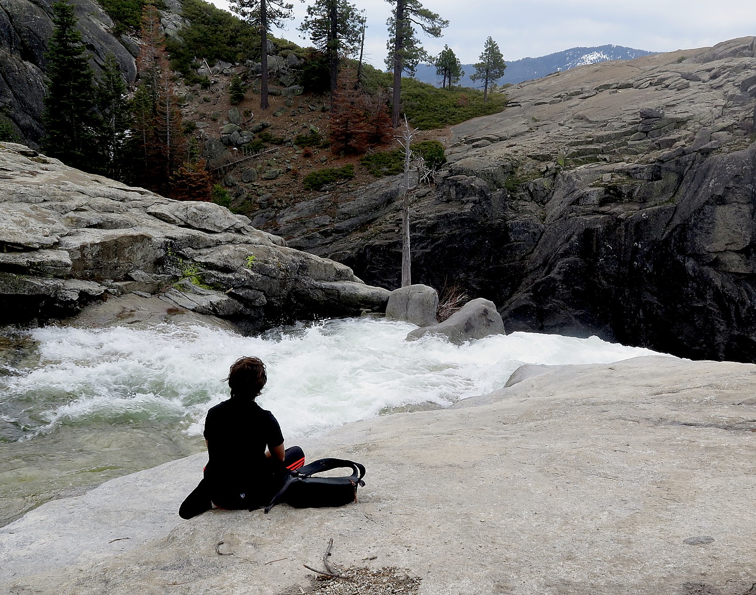
Finally, we come to a beautiful scene where the Chilnualna Falls comes to a ledge before going over a ridge. Here, we sit along some flat rocks right beside the water, and look over the forest and distant mountain peaks of the southern Yosemite and the Wawona Dome.

Peaceful contemplation alongside the Chilnualna Falls, Yosemite National Park © 2017 Karen Rubin/goingplacesfarandnear.com

From here, you can continue on to get to the top of the fall (as well as connect to several other trails that go all the way back to into Yosemite Valley), but considering our time schedule (and looking out at rain clouds flowing in), we head down after a lovely picnic along side the cascading Chilnualna Creek.

Most of the trail is along the ridge so you have dramatic views of the creek or valley.  Some of it crosses through meadow, so there is wonderful variation. The views of the rushing water and waterfalls are surprising and dramatic.

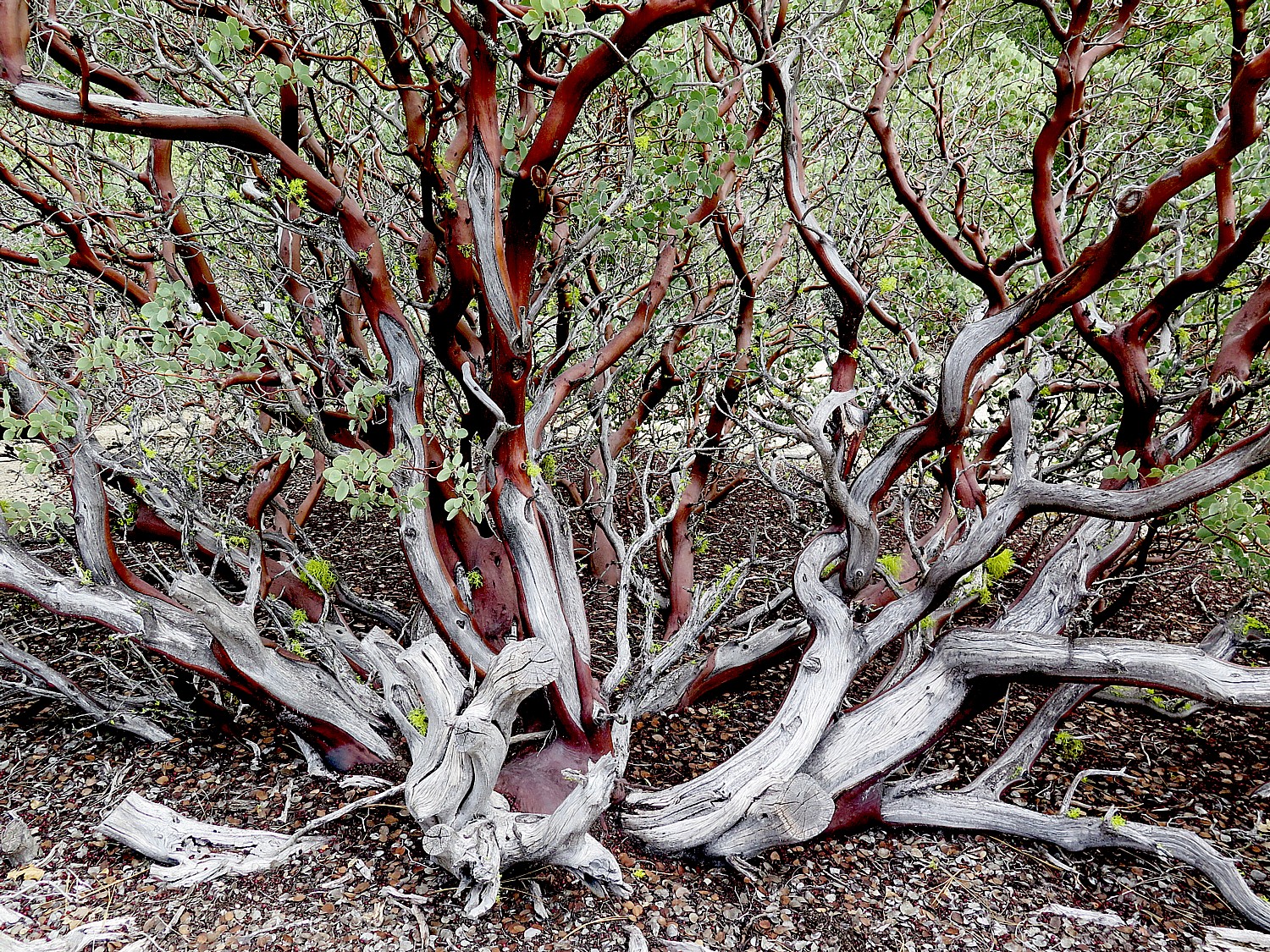
One of the nicest aspects of this trail, as compared to yesterday’s hikes on the Mist Trail, the John Muir Trail and the Mirror Lake Trail, are the opportunities to appreciate some magnificent trees and flowers. After about a half mile (and the first cascade), the trail leaves the creek and heads up switchbacks through manzanita, oak and mixed conifer forest. In the spring, the hillsides are full of Mountain Misery – a spreading plant with beautiful white blossoms, which we get to see. In among the Mountain Misery you may well see Hartweg’s Irises, Indian Pink, Golden Yarrow, Narrow-Leaved Ceanothus, Utah Serviceberry and several more showy flowers. Some of the side seeps might be blooming with Seep Spring Monkeyflowers and perhaps Sunflowers.

In the spring, the hillsides along the Chilnualna Falls Trail are full of Mountain Misery © 2017 Karen Rubin/goingplacesfarandnear.com

The upper cascades of Chilnualna Falls are quite beautiful in high flow, and in the early season they will be flanked with Azaleas, Mountain Pride Penstemmon and Dogwoods, Pussypaws and others.

We don’t necessarily realize it, but we are also passing through territories of deer, coyote, mountain lion, and black bear. There are birds, as well, but we are a bit early to see the western tanager which can be spotted from May through September.

Hiking the Chilnualna Falls Trail, Yosemite National Park © 2017 Karen Rubin/goingplacesfarandnear.com

Finally, as we near the top, we have views over to Wawona Dome and finally of the falls themselves.

We have to climb down a little from the trail to these broad slabs so we have a beautiful view of the falls. It is a perfect place for our picnic lunch.

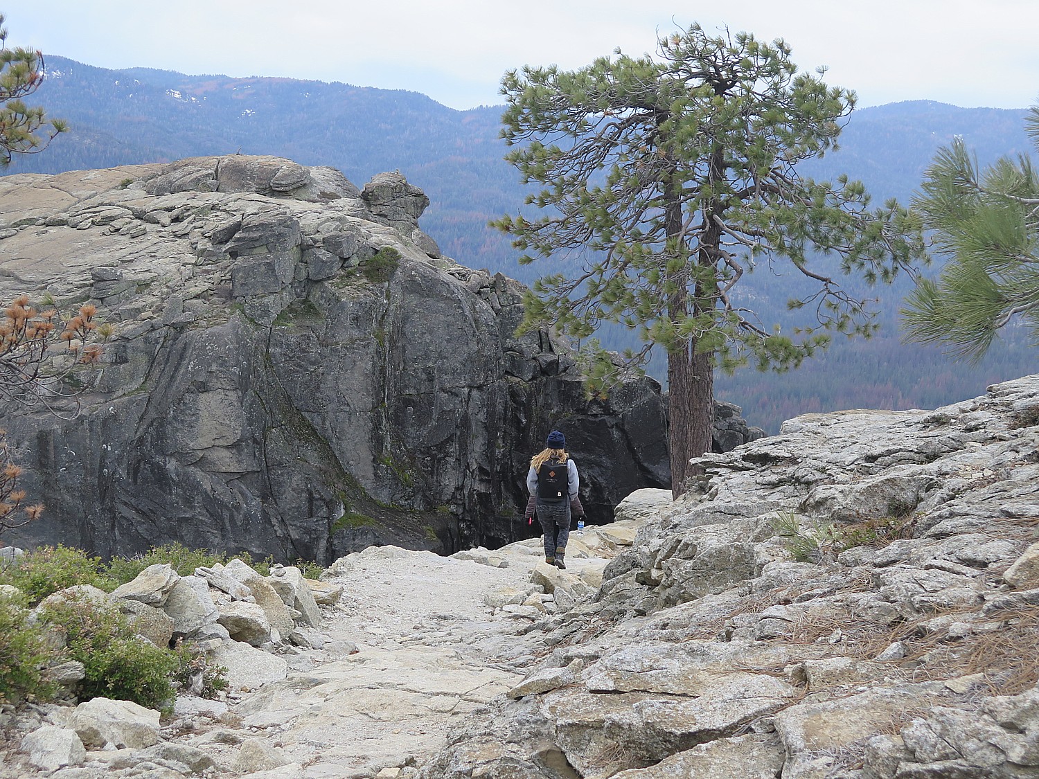
Coming back is much, much easier – basically a gentle downward slope, and you are looking out at the scenery. Even the obstacles are no concern because we have already done them.

We are down to the steep part when it begins to rain. There are a couple of obstacles – like leaping over flowing water (thank goodness for my hiking sticks!).

We make it all the way back just in time for it to rain in earnest, adding to our feeling of physical satisfaction and accomplishment. All in all, an 8.2 mile hike that takes from 10 am to 3:40 pm.

Eric climbs to get a closer view of the Chilnualna Falls © 2017 Karen Rubin/ goingplacesfarandnear.com

What I love most, after completing this trail, is how different the experience has been from the previous day’s hike in Yosemite Valley – the vegetation, the meadows, the general landscape – and how surprisingly gorgeous the falls and the creek, and especially, the peacefulness without the crowds.

Preparation: bring enough water (2 water bottles) and prepare for changes in weather: bring rain poncho and plastic bags to cover cameras from rain or mist; rain poncho; snacks, moleskin for blisters, hat, sunglasses and sunscreen, camera, extra memory card and battery, cell phone, an extra layer in case it gets cool. I have also found hiking sticks extremely helpful.

For non-hikers, non-DIYers, Tenaya Lodge offers a Yosemite Tour Package, via mini-bus, that includes lunch and narration, and guarantees waterfalls and wildlife and seeing the most popular sights of Yosemite. (Offered May 1-Nov. 30; from $575 spring, $685 summer, $555 fall; call 888-514-2167 or Tenaya Reservations directly at 559-692-8916).

Tenaya Lodge, 1122 Highway 41, Fish Camp, CA 93623, 800-722-8584, tenayalodge.com.

To plan your visit to Yosemite National Park, https://www.nps.gov/yose/planyourvisit/basicinfo.htm, https://www.nps.gov/yose/index.htm. 

Great information for planning your hike at these sites: http://yosemiteexplorer.com/trails

https://outsidehow.com/yosemite-hiking-tips.html

See also:

Yosemite National Park: Best Valley Hikes for First Timers

Tenaya Lodge Provides Luxury Lodging Resort Experience at Gateway to Yosemite National Park

Muir Woods is San Francisco’s Cathedral to Mother Nature

____________________

© 2017 Travel Features Syndicate, a division of Workstyles, Inc. All rights reserved. Visit goingplacesfarandnear.com,  www.huffingtonpost.com/author/karen-rubin , and travelwritersmagazine.com/TravelFeaturesSyndicate/. Blogging at goingplacesnearandfar.wordpress.com and moralcompasstravel.info. Send comments or questions to [email protected]. Tweet @TravelFeatures. ‘Like’ us at facebook.com/NewsPhotoFeatures
Yosemite National Park: Best Valley Hikes for First Timers

Yosemite National Park, Calif.

By Karen Rubin, Eric Leiberman, Sarah Falter

Travel Features Syndicate, goingplacesfarandnear.com

Yosemite National Park – America’s first – has been on my bucket list for years, so I am beyond excited when we arrive at the Tenaya Lodge, in Fish Camp, just two miles from the South Gate, and immediately start planning for how we will tackle the park the next day. I am intimidated at first by how vast Yosemite is – the size of Rhode Island I am told – and how to organize the logistics if I am going to see for myself the places that are etched in the images in my mind in only two days.

We spend a lot of time with the Tenaya Lodge concierge to get suggestions of where to go, which trails to hike, where to park (there is a bus shuttle system but during our visit, at the very beginning of spring, it wasn’t operating very well).

Because it is so early in the season, some of the areas (like Glacier Point) aren’t even open yet. But it also means that the waterfalls are at near maximum of their cascading flow: all the sound and the fury, the feel of the cool spray, the moist smell. On the other hand, as it happens, we are here on the weekend of National Parks Week, when admission is free, coinciding with Easter, so the park is likely to be especially crowded.

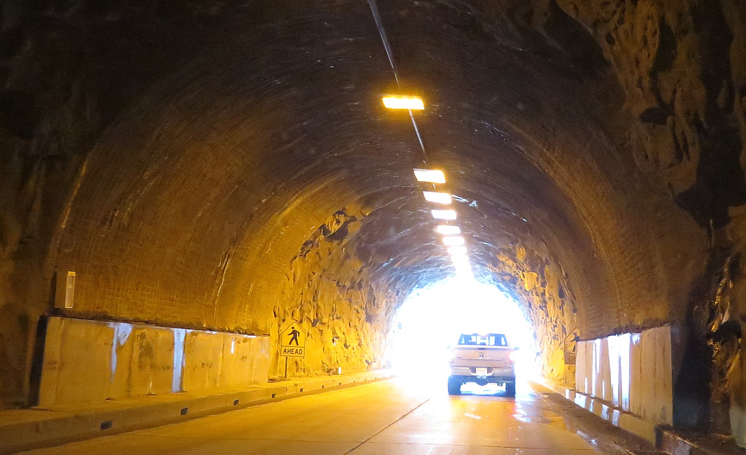
Coming through the mile-long tunnel into Yosemite National Park © 2017 Karen Rubin/goingplacesfarandnear.com

But we pick out the trail for the day: Mist Trail – which is also one of the most popular (we discover) for good reason, especially this early in the season. In one trail, it seems to encapsulate the entire Yosemite experience of a reasonably vigorous hike over a good distance (3 miles roundtrip to Vernal Fall, with 1,000 foot elevation gain, taking about 3 hours), sensational views, proximity to a fantastic waterfall (Vernal) with views of the Nevada Fall (which would be a further 1.3 miles up Mist Trail from Vernal Fall).

Indeed, it is a shock to learn that though the Tenaya Lodge is a mere two miles from the South Gate entrance into Yosemite National Park, it is another 45 minutes drive (30 miles) just to get to the famous Tunnel View, then another 45 minutes drive to get to Curry Village where we will fnd parking for the Mist Trail.

The concierge prepares us well. We know that just outside of the mile long tunnel, to look for the parking lot for the iconic Tunnel View. “Take the first spot” she has advised.

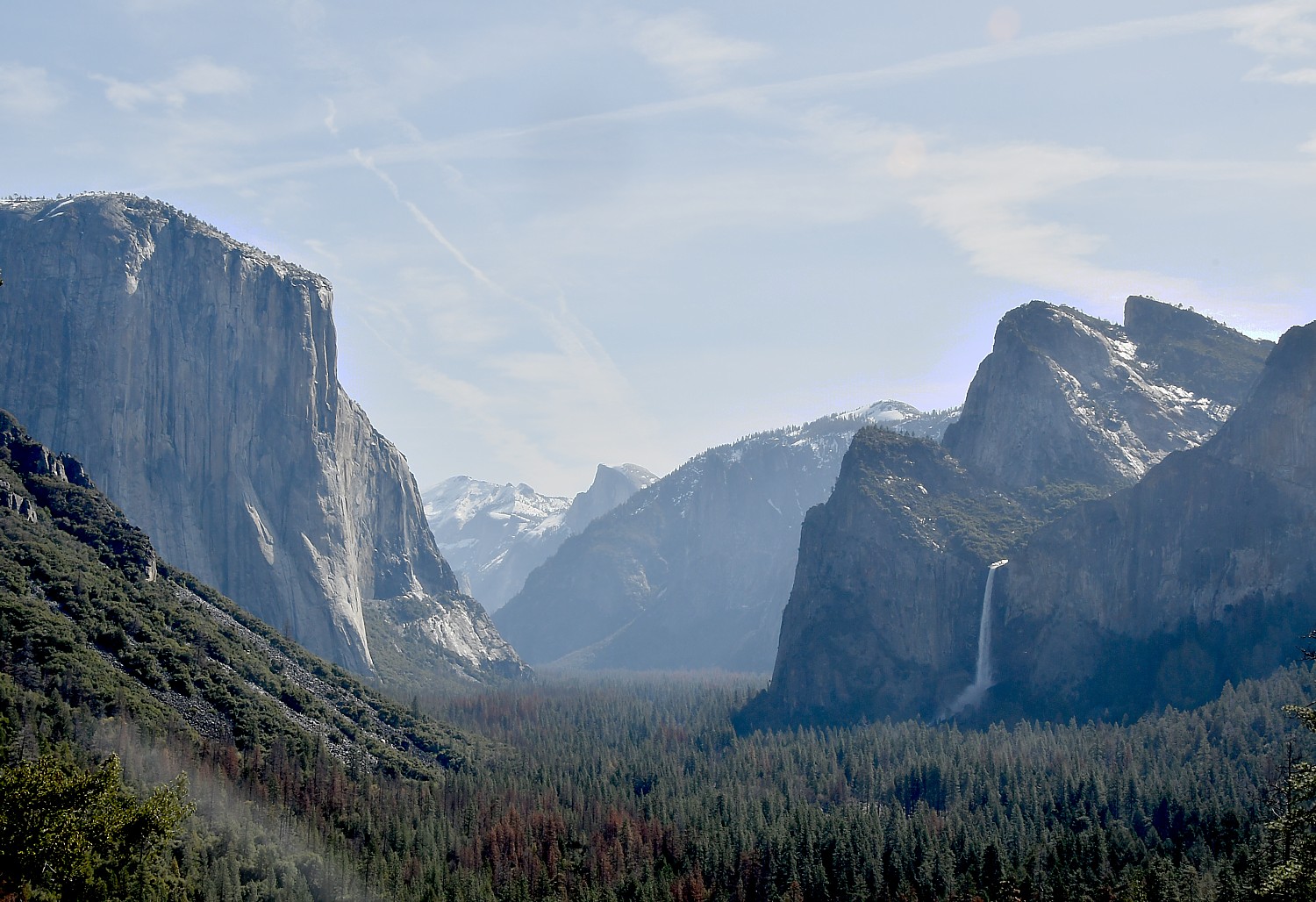
The Tunnel View lookout place, in one image, offers a spectacular view of the quintessential Yosemite sites: Bridalveil Fall, Half Dome, Clouds Rest, El Capitan.

The Tunnel View lookout place, in one image, offers a spectacular view of the quintessential Yosemite sites: Bridalveil Fall, Half Dome, Clouds Rest, El Capitan © 2017 Karen Rubin/goingplacesfarandnear.com

Indeed, the biggest surprise for me is how accessible the iconic features of Yosemite National Park are from the road – I expected them to be more remote, reached only after long, difficult hikes through the wilderness.

And so I shouldn’t have been surprised by the steady stream – wall to wall in some spots – of people, just like us, seeking out the solace and majesty or our natural, national heritage. Indeed, last year saw a record – 331 million visitors to America’s 417 National Park Service sites (contributing $34.9 billion to the U.S. economy in 2016), 5 million alone to Yosemite (Grand Canyon got 6 million).

Yosemite’s falls are most dramatic in early spring © 2017 Karen Rubin/ goingplacesfarandnear.com

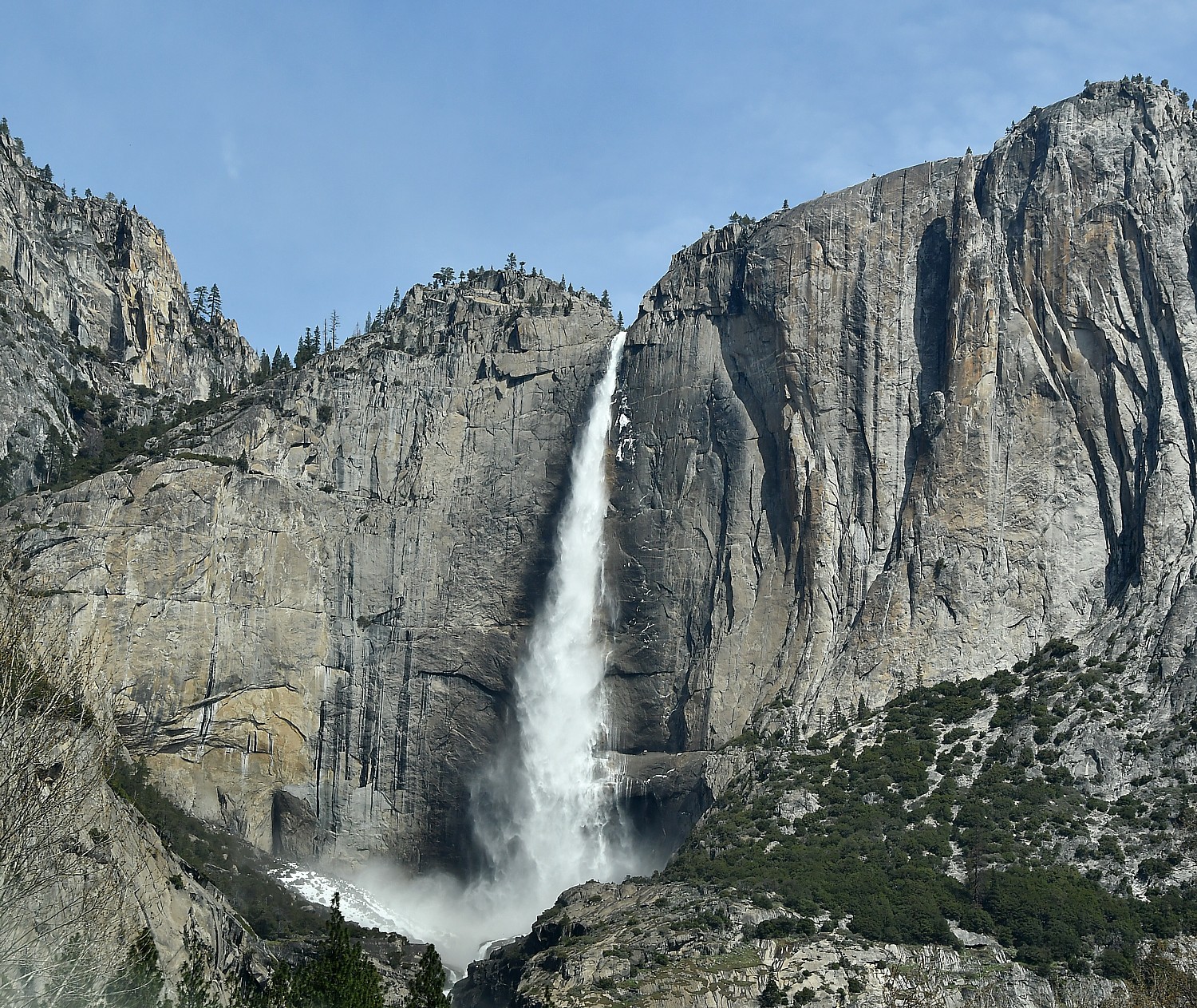
Just a half mile beyond Tunnel View, you come to Bridalveil Fall – which has to be the second most visited place in Yosemite – and it is just a quarter-mile walk to the waterfall (a key reason it gets MASSIVE crowds that converge in this small spot; I even meet someone who had just been at a wedding right there). The famous Yosemite Falls, also, is visible from the road (we see it on our way out, when it is already getting dark), and the Lower fall is an easy one-mile loop (half of it is wheelchair accessible).

One of the spectacular views as we set out for the Vernal Fall on the Mist Trail © 2017 Karen Rubin/goingplacesfarandnear.com

But we are here to hike! And the trails we have picked out are perfect for the level of physical exertion (and satisfaction), photographic opportunities, and the general appreciation of Yosemite that we are seeking today.

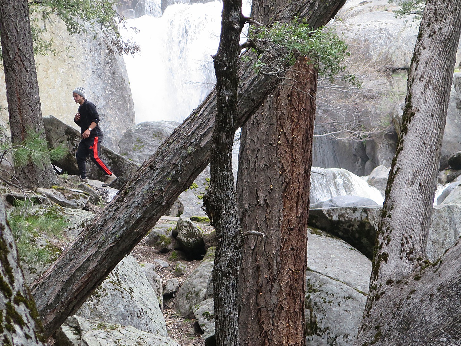
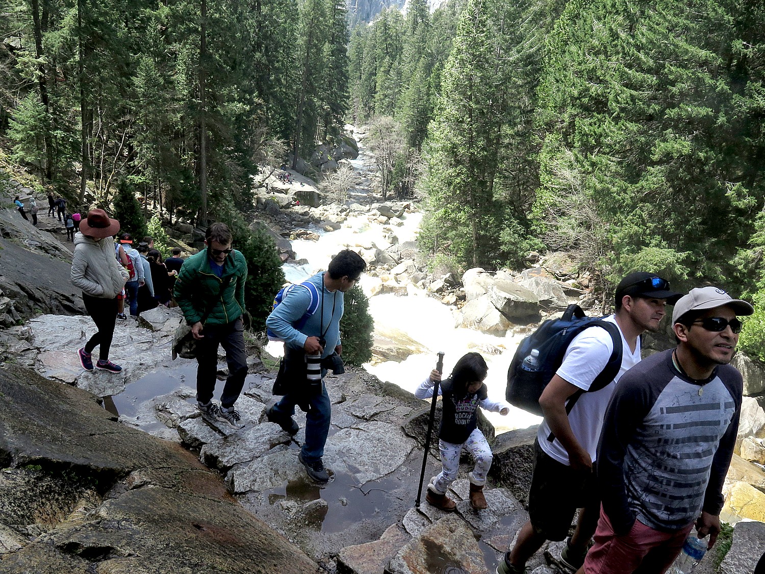
We have set our sights today on the Mist Trail which takes us alongside the Vernal Fall. The trail is both moderately challenging and an ideal distance (not too short, not too long), and unbelievably gorgeous, especially this early in the season, with the fall at maximum flow (especially after a winter where they had twice the normal snowfall; prepare to be sprayed). It is a steep hike beside the waterfall on a series of stone steps – narrow and very crowded, with most people walking up but some people trying to come down this way. (It is better to continue down on the John Muir Trail, which is not as steep or crowded and has fantastic views).

The Mist Trail is one of the most popular in Yosemite, for good reason © 2017 Karen Rubin/goingplacesfarandnear.com

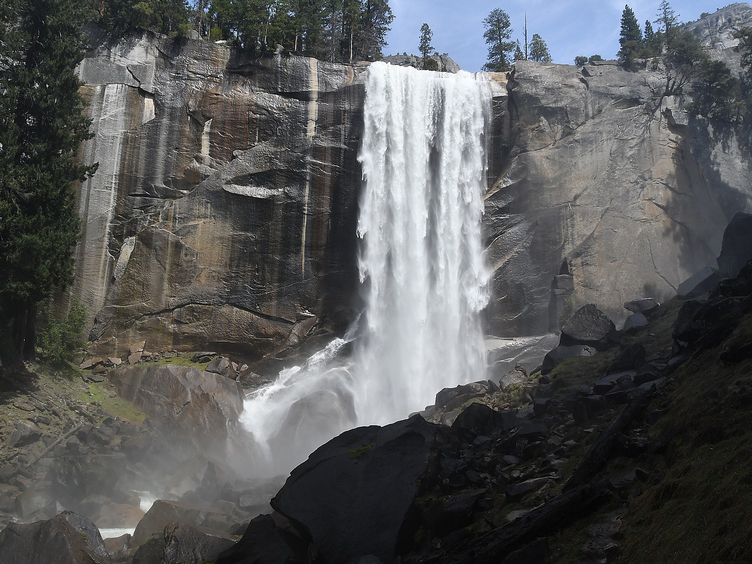
The trail starts off with an .8 mile hike up to the Vernal Falls footbridge (there are restrooms and water fountains here which you should definitely take advantage of before continuing on); and then another mile hike up to the top of Vernal Falls. Along the way, we see a rainbow in the spray at the bottom of the falls.

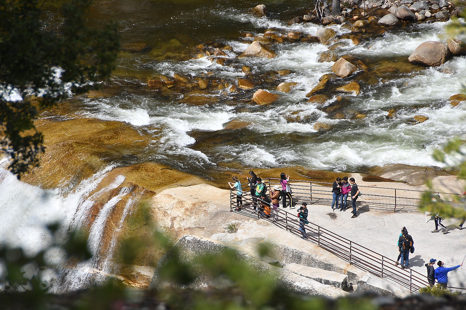
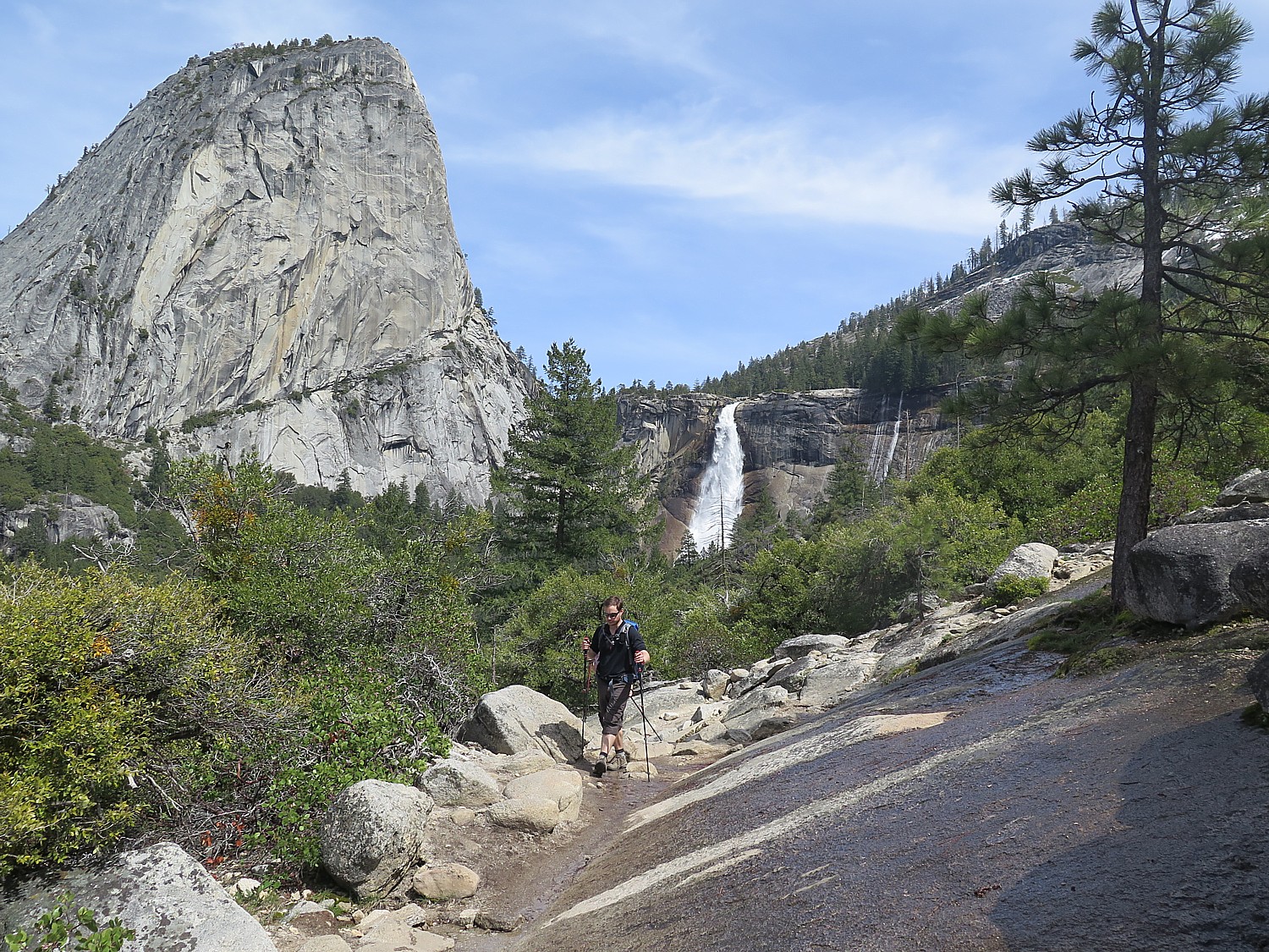
The Vernal Fall lookout – a series of relatively flat slabs – is about 1000 feet above where we started and is extremely popular spot for picnicking, relaxing and taking selfies. We do the same.

From here it is a short walk up to Emerald Pool which, so early in the season is a rushing torrent rather than the calm pool it will become by late summer.

Top of Vernal Fall, Yosemite National Park © 2017 Karen Rubin/ goingplacesfarandnear.com

It is so scenic and seems so benign, but there are warnings signs not to be so foolhardy as to go near the water or (perish the thought) swim. People are warned to watch out for their children.  The rocks are slippery and this has been the scene of many accidents. I learn that in the summer of 2005, a hiker walked out into the water a bit to fill his water bottle, slipped, got caught in the deceptively strong current and was swept over the falls.

The John Muir Trail gives a wonderful view of the Nevada Fall and Half Dome, © 2017 Karen Rubin/goingplacesfarandnear.com

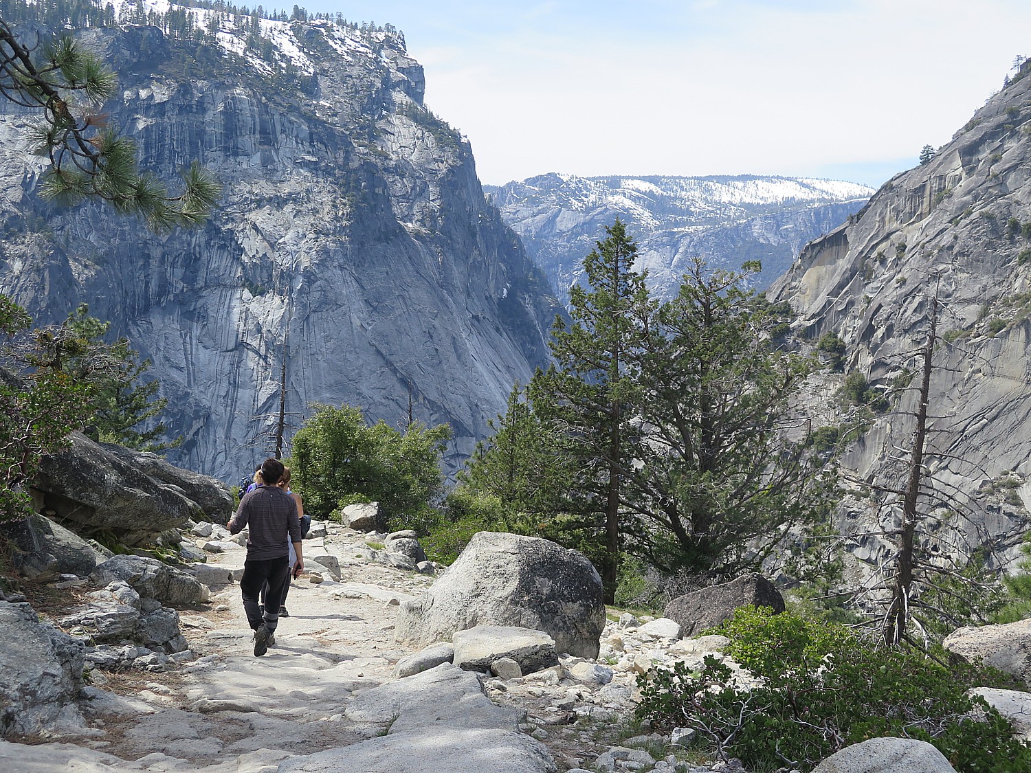
At this point, you can continue to hike another two miles to the top of the Nevada Fall, but we decide to hike down 3.5 miles along the less-steep John Muir Trail (versus coming back down on the Mist Trail). The John Muir Trail gives us a marvelous view of the Nevada Fall and Half Dome; much of the trail follows along a ridge that opens up to purple mountain majesty.

Views of purple mountain majesty from The John Muir Trail, Yosemite National Park © 2017 Karen Rubin/goingplacesfarandnear.com

It’s still early enough in the afternoon when we get back down to the base – delighted with how perfect the Vernal Fall hike was (altogether, we’ve hiked six miles, and climbed 1885 ft. in elevation) that we are excited to try another. We look over the list we have been given for a shorter, easy hike and set out for Mirror Lake.

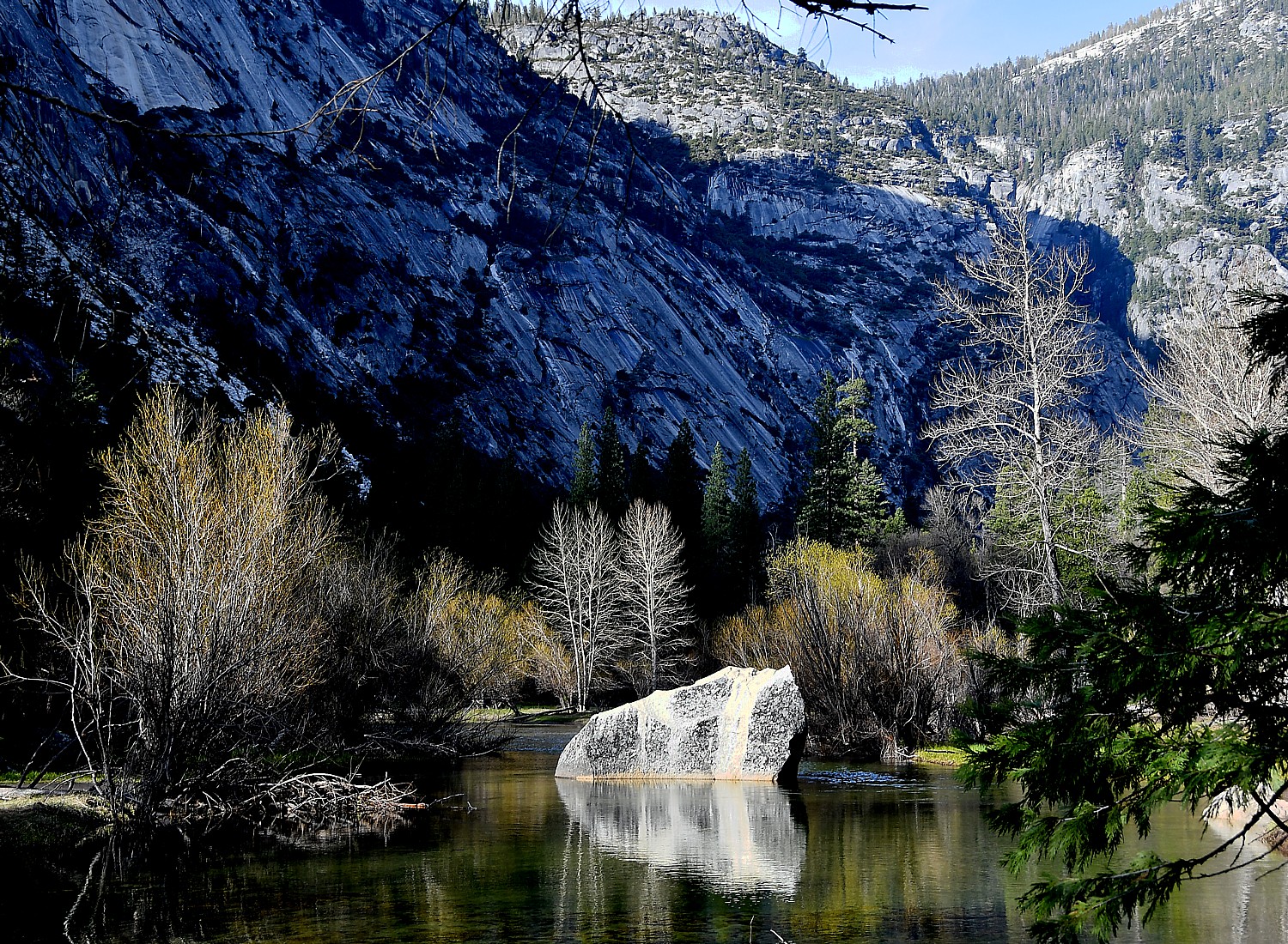
Mirror Lake, Yosemite National Park © 2017 Karen Rubin/ goingplacesfarandnear.com

The Mirror Lake hike is supposed to be two miles round trip (taking one hour), but this is apparently if you just walk along the road. Instead, we take the trail that is apparently part of a five-mile loop around the lake which has more obstacles than I had bargained for. But there are some dazzling scenes along the way, and a stunning scene of the lake, so flat and still that it is literally a mirror reflecting back the stunning backdrop, and affords a closer view of the face of Half Dome.

To walk back by the road, Eric and Sarah scurry on a log across a narrow point which they imagine is a short cut to a road (the option is to hike around the lake). I’m not the scurrying-across-a-fallen-tree type, so I opt to backtrack along the same trial, which turns out to be fun, now that I know what the obstacles are (and that I can do them).

Finally meeting up with everybody in the car (after a MUCH longer walk back from the trailhead toward the parking lot, without seeing a single shuttle bus), which turns out to be a feat because cars are restricted, we set out to return to the Tenaya Lodge.

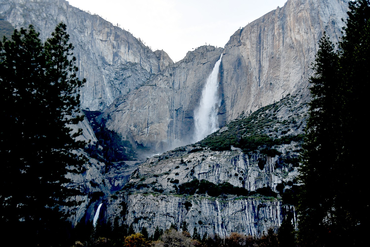
A view of Yosemite Falls © 2017 Karen Rubin/goingplacesfarandnear.com

On the way out of Yosemite, we find ourselves crossing Sentinel Bridge which is supposed to be one of the best photo spots to capture Half Dome over the Merced River (the dusky light doesn’t cooperate, but that’s the element of serendipity that comes with every visit).

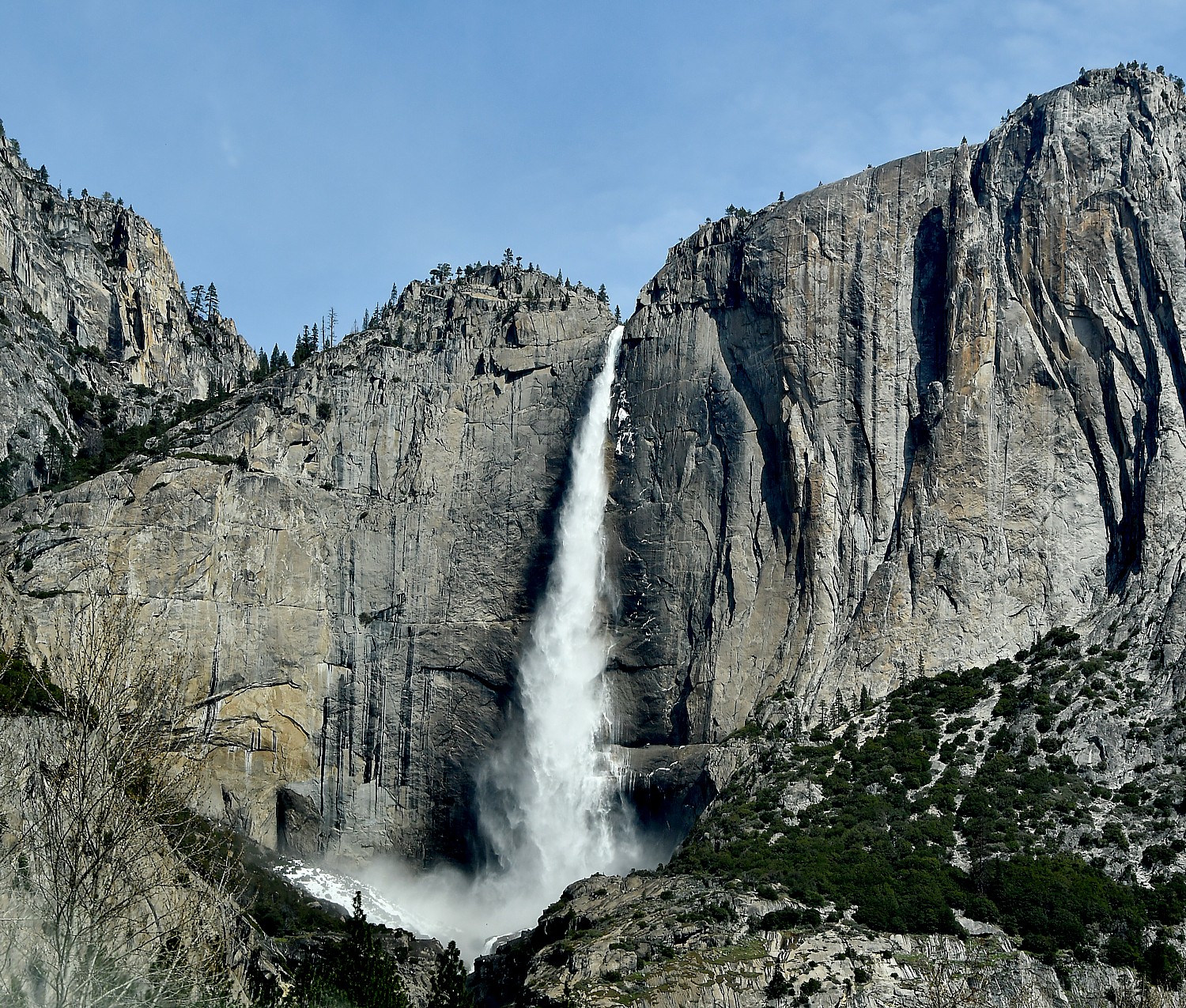
Then, the one-way road back to the South Gate passes by Yosemite Falls, agonizingly close (just a quarter of a mile), but it is too late to hike up to it in the fading light. We get a fleeting shot – I am surprised that it is so “exposed” to the access road – I imagined it was tucked inside.See https://www.nps.gov/yose/planyourvisit/valleyhikes.htm

Preparation: bring enough water (2 water bottles) and prepare for changes in weather: bring rain poncho and plastic bags to cover cameras from rain or mist; rain poncho; snacks, moleskin for blisters, hat, sunglasses and sunscreen, camera, extra memory card and battery, cell phone, an extra layer in case it gets cool. I have also found hiking sticks extremely helpful.

For non-hikers, non-DIYers, Tenaya Lodge offers a Yosemite Tour Package, via mini-bus, that includes lunch and narration, and guarantees waterfalls and wildlife and seeing the most popular sights of Yosemite. (Offered May 1-Nov. 30; from $575 spring, $685 summer, $555 fall; call 888-514-2167 or Tenaya Reservations directly at 559-692-8916).

Tenaya also offers an itinerary you can take on your own to hit Yosemite’s highlights in a single day: Half Dome, El Capitan, Yosemite Falls, Bridalveil Fall, Mariposa Grove, Glacier Point, Wawona, Royal Arches, Turtleback Dome, Three Brothers, Leaning Tower, Ribbon Fall, Cathedral Spires, Yosemite Chapel, Vernal and Nevada Falls. In summer, you have to park and use shuttle buses to get around.

Tenaya Lodge, 1122 Highway 41, Fish Camp, CA 93623, 800-722-8584, tenayalodge.com.

To plan your visit to Yosemite National Park, https://www.nps.gov/yose/planyourvisit/basicinfo.htm, https://www.nps.gov/yose/index.htm. 

Great information for planning your hike at these sites: http://yosemiteexplorer.com/trails

https://outsidehow.com/yosemite-hiking-tips.html

Next:

Yosemite National Park: Surprising Diversity, Dramatic Scenes Hiking Chilnualna Falls Trail, Wawona

See also:

Tenaya Lodge Provides Luxury Lodging Resort Experience at Gateway to Yosemite National Park

____________________

© 2017 Travel Features Syndicate, a division of Workstyles, Inc. All rights reserved. Visit goingplacesfarandnear.com,  www.huffingtonpost.com/author/karen-rubin , and travelwritersmagazine.com/TravelFeaturesSyndicate/. Blogging at goingplacesnearandfar.wordpress.com and moralcompasstravel.info. Send comments or questions to [email protected]. Tweet @TravelFeatures. ‘Like’ us at facebook.com/NewsPhotoFeatures
Pennsylvania’s Industrial Past Highlights Day 3 on Rails-to-Trails Sojourn on Great Allegheny Passage


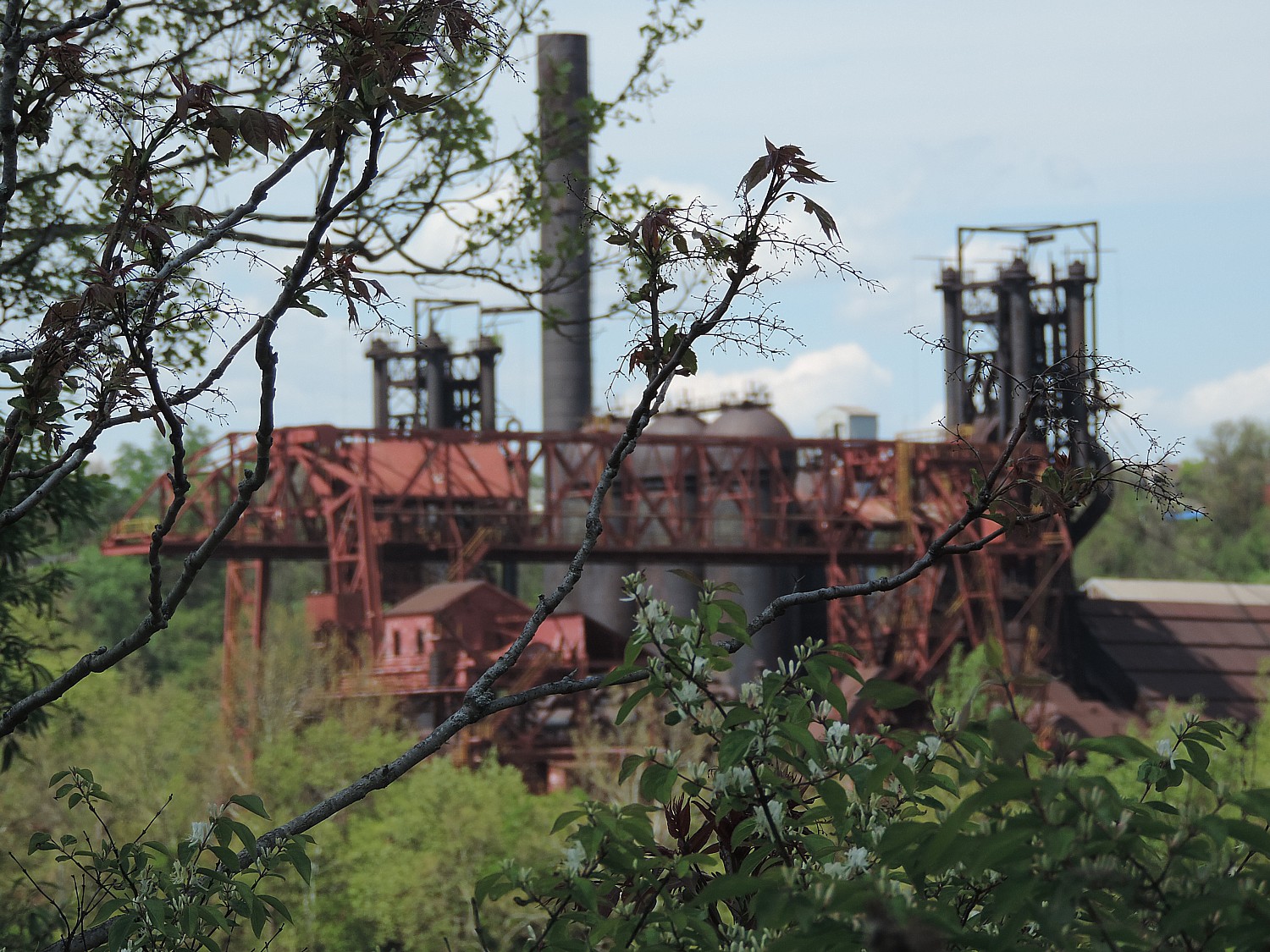
The third and final day of Rails-to-Trails Conservancy’s spring sojourn on the Great Allegheny Passage offers the starkest contrasts between a trail reclaimed for nature and the industrial heritage that both built and destroyed this region’s environment © 2016 Karen Rubin/goingplacesfarandnear.com

By Karen Rubin, Travel Features Syndicate, goingplacesfarandnear.com

(After meeting up at Homestead, PA and bussing to the start of our Rails-to-Trails Conservancy’s first springtime Sojourn, a three-day biketour on the Great Allegheny Passage, we rode 33.5 miles from Harnedsville to Adelaide on Day 2, a ride highlighted by a sidetrip into Dunbar to see Donald Trump’s donation of Pascal’s ‘Seated Torso’ glass sculpture to the historical society. Our adventure continues.)

The last day of Rails-to Trails Conservancy’s first spring sojourn, a three-day supported bike tour on the Great Allegheny Passage, is our longest ride, 49 miles from Adelaide to West Homestead, and, unlike our first two days which have been essentially downhill, has a good number of ascents, to boot – mostly as we come into the urban area and have to ride up and over bridges and overpasses.

This ride offers the starkest contrasts between the wholesomeness of a trail reclaimed for nature, and the industrial heritage that both built and destroyed this region’s environment.

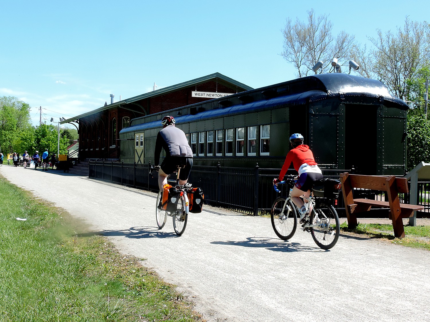
West Newton has a replica of the 1910 P&LE train station, now a historical society and visitors center and retail shop, with a historic train car outside © 2016 Karen Rubin/goingplacesfarandnear.com

We have three support stops. The second, at 21.9 miles, is in West Newton at a replica of the 1910 P&LE train station, now a historical society center and retail shop, with a train car outside. Literally across the “street” are three bed-and-breakfasts, right off the trail.

If you took the time to explore the downtown, you would find some quaint storefronts (some needing new owners), and some tucked away gems like the Victorian home on Vine Street, the historic Plumer House (circa 1814) on South Water Street. I take time to explore the historic West Newton Cemetery, accessible from the trail.

The trail follows the Youghiogheny River with beautiful scenic views.

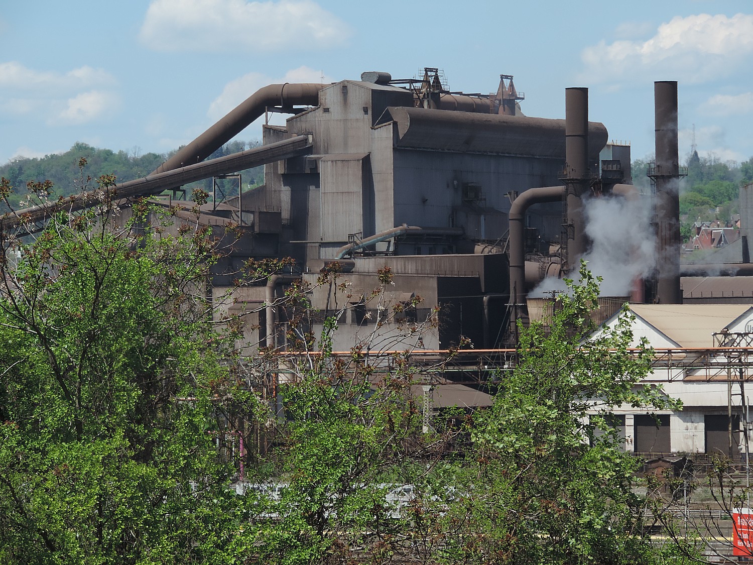
In the 1890s, this area that we ride through that seems so natural and so pristine today, was the Industrial Heartland of America – steel mills, coke ovens filled the air with suffocating black smoke, blighting the area and making it unhealthy to live.

Pittsburgh’s industrial past comes into view © 2016 Karen Rubin/goingplacesfarandnear.com

“They didn’t have the number of trees we see now,” Tom Sexton, the Northeast Regional Director for Rails-to-Trails Conservancy tells us during our nightly presentation. “The skies were so dark, they needed to use lights during the day.”

But these steel mills also were enabled the expansion of the United States– forging the bridges,  railroads, skyscrapers – and the booming industrial economy that made the United States a world power. The wealth generated – and the economic policies – produced the Gilded Age, a time of great income inequality, when money and power was concentrated in a handful of Industrial Barons like Andrew Carnegie and Henry Clay Frick, among the richest people in the world, whose steel plants accounted for 30% of all the steel produced in the US.

We associate Carnegie and Frick today as great philanthropists, but they were ruthless industrialists who exploited labor and the environment for their personal benefit.

Sexton cites a book, “Meet You in Hell: Andrew Carnegie, Henry Clay Frick, and the Bitter Partnership That Changed America, by Les Standiford, who drew his title from Frick’s response to Carnegie’s deathbed invitation to meet: “I’ll meet you in hell,” Frick responds, perhaps a reflection of the penance they would have to pay for the hellfire they forced their workers to endure.

Carnegie and Frick were enthralled by efficiency, developed new processes, new tools to maximize productivity and manpower, Sexton tells us. That helped them add to their fortune, but “wasn’t a good lifestyle for people living and working in the steel and coal plants.

“They cut costs in all ways.” For example, workers lived in company towns and had to shop in company stores where prices were high. People were working 12 hours a day and wanted  a shorter day.

“Being efficiency experts, they did study and found that after 8 hours, worker wasn’t so productive, less efficient, so they reduced the work day to 8 hours.”

Still, conditions were abominable and on July 4, 1892, the steel workers went on strike. After a bloody battle, followed by the state militia ultimately quashing the labor action months later, in November, Carnegie Steel reinstated the 12-hour day as retribution.

Sexton relates this story because our ride will take us passed the historic Pump House in West Homestead where the bloody labor battle took place.

Sexton’s story is in my mind as we ride, as I reflect on the glorious landscape. To think this whole area was so blighted – didn’t have the trees, the clear clean air, the clean rushing water that is so intoxicating now.

Indeed, the ride is gorgeous up until Boston where there is a beautiful park and we have our third support stop. Then, just as we ride through some trees, it is like culture shock because the trail becomes very urban – broken and winding, and then plops you out to a street beside the railroad tracks.

We go through a series of streets before getting back on the trail, going up and over several railroad crossings, past shuttered factories.

This is the part of the ride when we get to peer back into the landscape of the Industrial Revolution and get a greater appreciation of the clean pure air and the trees and clean water that we had been seeing along the GAP.

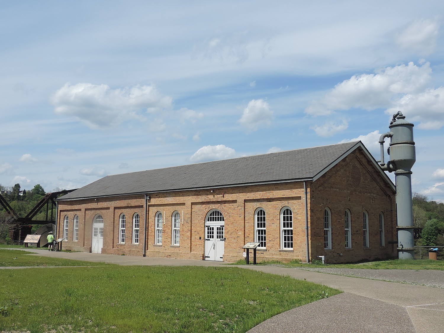
The historic Pump House, from 1892, marks the place of a bloody battle of Homestead, where striking workers first battled Pinkertons and later state militia© 2016 Karen Rubin/goingplacesfarandnear.com

The most interesting part of the ride is when we come to the Pump House at West Homestead, the site of a bloody strike which Sexton has described to us, the site in 1892 of one American Labor’s bloodiest battles. I frankly might not have stopped (though there is also a restroom there for the benefit of the GAP trail riders) and spent as much time inspecting the site were it not for Sexton’s orientation.

Notes from the site tell the story: “In the early morning hours of July 6, 1892, at the Pump House of the Carnegie Steel Company’s Homestead Works, thousands of workers, their families and supporters, armed with sticks, rocks, and guns rushed to meet two barges coming up the Monongahela River.  The barges carried 300 Pinkerton guards who had been sent to protect the works during the Homestead Strike and Lockout.

“After bitter fighting throughout the day resulted in the deaths of seven strikers and three Pinkerton men and dozens of others wounded, the guards surrendered.  They were then forced to “run a bloody gauntlet” while being lead to a temporary jail at the Homestead Opera House until they were sent out of town by rail the next morning.

“Henry Clay Frick, Andrew Carnegie’s partner, convinced Pennsylvania Governor Pattison that Homestead was under “mob rule”. On July 12, 1892  the governor ordered 8,000 state militiamen into Homestead. The strike and lock out continued until November when unskilled laborers asked to be released from their strike pledge. Two days later, the strike ended – the union had been broken. The Battle of Homestead signaled the end of union activity in the steel industry until the 1930s” (riversofsteel.com).

After learning the history of the strike, a sign that salutes steelworkers seems more ironic than respectful: “In honor of the employees, USS. Homestead.” It also happens to be across the street from the offices of the US Steel Corporation.

Pittsburgh’s industrial past comes into view © 2016 Karen Rubin/goingplacesfarandnear.com

As we continue along the riverfront trail, across the way, we see get a sense of how it was – massive factories, small houses built into the hillside, giant churches commanding the highest ground.

The ending of the ride proves the most strenuous – besides the ups and downs as we negotiate the overpasses and bridges, we are fighting against a strong head wind.

Riding over one of the rail bridges converted for biking use on the Great Allegheny Passage © 2016 Karen Rubin/goingplacesfarandnear.com

We continue on for several more miles until we come to the trickiest part of the ride – the shopping mall that has replaced Carnegie’s steel mill – and back to where we have parked, under the smokestacks.

This ride showcases a Rails-to-Trails Conservancy success story – the gorgeously maintained Great Allegheny Passage trail. It exemplifies the renaissance from industrial blight back to clean air and water and a better quality of life.  Besides bringing in visitors who form the underpinning of a new, sustainable economy, the trail directly benefits locals, too – healthy living (the best preventive medicine) while offering families fun activities they can share together.

Complete from Pittsburgh in the west to Cumberland, MD in the east, the 150-mile Great Allegheny Passage connects with the 184.5-mile C&O Canal Towpath to create a 335-mile non-motorized route between Pittsburgh and Washington, DC. AMTRAK offers a walk on bicycle service. (https://gaptrail.org/, 888-282-BIKE).

For more information about the sojourn supported bike tours, visit railstotrails.org/sojourn.

Rails-to-Trails Conservancy, a nonprofit organization headquartered in Washington DC with more than 160,000 members and supporters, is the nation’s largest trails organization dedicated to connecting people and communities by creating a nationwide network of public trails, many from former rail lines. Founded in 1986, Rails-to-Trails Conservancy’s national office is located in Washington, D.C., with regional offices in California, Florida, Ohio and Pennsylvania. For more information, visit www.railstotrails.org or call 866-202-9788.

These rides are organized by Wilderness Voyageurs which offers many different biking and rafting trips including inn to inn biking trips, across the US and international: 800-272-4141, Wilderness-Voyageurs.com.

See also:

Rails-to-Trails Conservancy Takes Cyclists on Sojourn on Great Allegheny Passage

Rails-to-Trails’ Great Allegheny Passage Bike Tour Side Trip into Dunbar Brings Surprise Encounter with TrumpWorld

One Day, Two Nights in Pittsburgh: From Grey to Green, A Proud City Revitalized

36 Hours in Pittsburgh: Point State Park Proves Highlight of Walking Tour

36 Hours in Pittsburgh: Andy Warhol Museum is at Center of Revitalized City

36 Hours in Pittsburgh: Strip District Exemplifies City’s Past, Future

Two Nights, One Day in Pittsburgh: Historic Omni William Penn Hotel Connects to City’s Proud Heritage 

____________________

© 2016 Travel Features Syndicate, a division of Workstyles, Inc. All rights reserved. Visit goingplacesfarandnear.com and travelwritersmagazine.com/TravelFeaturesSyndicate/. Blogging at goingplacesnearandfar.wordpress.com and moralcompasstravel.info. Send comments or questions to [email protected]. Tweet @TravelFeatures. ‘Like’ us at facebook.com/NewsPhotoFeatures
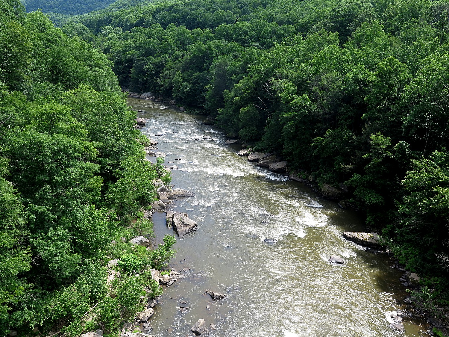
Rails-to-Trails’ Great Allegheny Passage Bike Tour Side Trip into Dunbar Brings Surprise Encounter with TrumpWorld

Biking the Great Allegheny Passage rail-trail, Confluence to Adelaide, PA on Rails-to-Trails’ spring sojourn © 2016 Karen Rubin/goingplacesfarandnear.com.

By Karen Rubin, Travel Features Syndicate, goingplacesfarandnear.com

(After meeting up at Homestead, PA and bussing to the start of our Rails-to-Trails Conservancy’s first springtime Sojourn, a three-day biketour on the Great Allegheny Passage, we start off Day 2 in Harnedsville and ride 33.5 miles to Adelaide. Our adventure continues.)

Yesterday, our first day on the Rails-to-Trails Conservancy’s Sojourn bike tour on the Great Allegheny Passage was mostly under overcast skies and rainy (fortunately after we finished the ride) but today is crystal clear, glorious spring day. This is Rails-to-Trails Conservancy’s first spring sojourn supported bike tour  – these sojourns are designed to showcase rail-trails, transform trail users into advocates and show the value for economic development for trail networks nationwide – and we soon realize the advantages of a spring ride: The leaves are not yet full on the trees so we can see through to the vistas, and have a soft delicacy that makes you think of Chinese painting. The blossoms are out making for gorgeous pastel colors. Butterflies seem to be everywhere, but the pesky insects haven’t yet appeared. There are scores of waterfalls from the spring melt. The weather is cool, sparkling, the air so and pure it is like a narcotic.

Our group is only 85 riders (owing in part to the fact the ride started on a workday/school day and finishes on Mothers Day). Nonetheless, we come from dozens of states. A woman from Colorado observes that the hardwood trees which line the path, some impossibly tall and straight like tent-poles, create a canopy effect which she doesn’t have. Today, the trees seem to glow in yellow sunlight.

Our ride today from Harnedsville, where we camped on the grounds of the Turkey Foot Valley School, is 33.5 miles to Adelaide, almost entirely downhill. We will drop 500 feet in elevation, overall, and we continue to marvel how well maintained the trail is – wide, flat, crushed gravel.

We ride over a bridge over the Casselman River, then another bridge over the Youghiogheny River, then pass under the highway bridge at Confluence where there is a fisherman casting for trout.

A scene along the Great Allegheny Passage rail trail on day 2 of Rails-to-Trails Conservancy's Spring Sojourn, just outside Confluence © 2016 Karen Rubin/goingplacesfarandnear.com
A scene along the Great Allegheny Passage rail trail on day 2 of Rails-to-Trails Conservancy’s Spring Sojourn, just outside Confluence © 2016 Karen Rubin/goingplacesfarandnear.com

The trail is absolutely stunning. On one side, you see wonderful rock formations – signposts that explain the geology and point to a seam of coal (I find pieces of coal along the path).

Much of the ride today is through the utterly gorgeous Ohiopyle State Park, and a highlight comes at the town of Ohiopyle, a hub for visiting the park. A short ride off the trail are the 20’ waterfalls across the width of the Youghiogheny River (no luck spotting the Youghiogheny Monster). This is a rafting and kayaking center and for excellent reason– a class 5 river at the top, a class 3 below the falls.

Kayakers at the bottom of the Youghiogheny River falls in Ohiopyle State Park. A new visitors center offers fabulous views and excellent exhibits © 2016 Karen Rubin/goingplacesfarandnear.com

The people are duly proud of their new Visitors Center – an architectural gem wonderfully positioned to let you look out over the falls, while in the lower level, offering excellent exhibits about the area – how water power was central to its development – with interactive exhibits that will engage children.

Wagons and settlers came through on the National Road in 1818. Ohiopyle, itself, was settled in 1891, when it was known as Falls City, and its economy revolved around these rushing waters. The area has always drawn tourists because of the natural beauty. Among the early visitors: Thomas Edison, Henry Ford and Harvey Firestone came in a camper in 1918. Visiting wasn’t cheap – an exhibit notes that a family spent $20 on accommodations and $11 on tolls, at a time when the average worker took home just $11 a month.

But by 1900, the area was already polluted by coal production and lumbering.

Today, though, the natural beauty has been reclaimed. Ohiopyle is at the hub of the 20,000 acre Ohiopyle State Park which features utterly stunning sites including the Youghiogheny River Gorge, Ohiopyle Falls, Cucumber Falls and Ferncliff Peninsula (724-329-8591, [email protected].)

The town now has wonderful shops that cater to visitors, outdoor recreation.

Nearby is Fallingwater, a home designed by architect Frank Lloyd Wright in 1937 for the wealthy Pittsburgh department store magnate, Edgar Kaufmann, Sr. (www.fallingwater.org/2/visit), and Kentuck Knob, another Wright work. (www.friendsofohiopyle.info, 224-329-8591).

The trail from Confluence to Ohiopyle was the first completed section of the GAP – in 1986 – and it is gorgeous.

Riding out of Ohiopyle, I see the Great Gorge hiking trail which goes to Cucumber Falls. I am tempted but I am not sure how far the hike is and how long it will take (next time, I will).

Trees line the Great Allegheny Passage on the Rails-to-Trails Conservancy’s spring sojourn © 2016 Karen Rubin/goingplacesfarandnear.com

Continuing on, there are wonderful hiking trails, and we take a short one just across from where we have our rest stop which is supposed to take us to a view over the Youghiogheny falls. The view isn’t so great, but surrounded by wilderness, it is easy to imagine this landscape when the Indians were the main inhabitants.

We come to a new connector to the Sheepskin Trail, a 34-mile “missing link” between the Great Allegheny Passage, the Potomac Heritage National Scenic Trail and the West Virginia Mon River Trail System.

We ride the new trail from the GAP for 2 miles into the town Dunbar (we had to ride over a rocky half-mile section that is still being finished by the railroad).

Bike-Trail, Trump Sculpture Breathe New Life into Dunbar

Historic buildings such as the George H. Swearingen Store (1901) are testament to the Dunbar’s former prosperity as an industrial center © 2016 Karen Rubin/goingplacesfarandnear.com

Dunbar is the poster child for a town blighted by the loss of industry and epochal changes in technology, but here you also witness the beginning of a revitalization largely because of the rail-trail. But its history has always been that way: new technology and new industry that brings new people, and funds new structures and institutions. The entirety of the Industrial Revolution, supplanting the agrarian economy, was that way.

Settled in the 1790s, Dunbar was originally called Frogtown. It was renamed for Col. Thomas Dunbar who fought in the French & Indian War along with General Braddock, and helped retake Fort DuQuesne (now Fort Pitt) in Pittsburgh, taking from the French and important hub from which it wanted to control its colonial empire (as I have learned from my visit to the Fort Pitt Museum there, www.heinzhistorycenter.org/fort-pitt/).

Historic coke oven in Dunbar’s town park © 2016 Karen Rubin/goingplacesfarandnear.com

In 1793, Isaac Meason set into motion an industrial revolution in Dunbar when he opened his Union Furnace #1 (I later see a street named for Meason). This became Dunbar’s lifeblood over the next century. One of the coke ovens now has a place in the town park, alongside a creek, adjacent to the railroad tracks. All around the town are the brick buildings that are testament to the prosperity – at one time, there were five banks. From the time of Meason’s first iron furnace through the 1950s, Dunbar was home to Dunbar Furnace, Pennsylvania Wire Glass Company (it was a leading glass making center), Bluestone quarry, among others, plus several mines and coke oven sites. Today, we see some wonderful historic buildings from the turn of the last century, such as the George H. Swearingen Store (1901) just across from the railroad tracks.

Except for the little league baseball game going on and the activity at the Historical Society, the town is eerily vacant – almost like a movie set.

The rail-trail is breathing new life into towns like Dunbar. Last year, RTC centered its Sojourn ride around Dunbar, a sleepy town of 1900 people, camping overnight in the Coke Oven town park, and all 300 riders, who hailed from 36 states, were personally greeted by the mayor. He appreciated what this event could mean to its economic development (the ride alone injected $245,000 into the local economy.

Donald J. Trump commemorates his largesse in donating Pascal's "Seated Torso" glass sculpture to the town of Dunbar, where it is housed at a new Historical Society annex © 2016 Karen Rubin/goingplacesfarandnear.com
Donald J. Trump commemorates his largesse in donating Pascal’s “Seated Torso” glass sculpture to the town of Dunbar, where it is housed at a new Historical Society annex © 2016 Karen Rubin/goingplacesfarandnear.com

This year, there is a major new attraction in Dunbar which really will draw people: an 8 x 5 foot, 2,800-pound glass sculpture, “Seated Torso,” by French artist Pascal, who visited Dunbar in 1961 when it was still a major glass-making center, as the Pennsylvania Wire Glass Co. was going bankrupt and closing down, donated to the tiny town by none other than Donald J. Trump.

The Dunbar glass was unusual because it was so tempered, it resisted splintering when struck with a hammer, and Pascal could attempt what no one else had accomplished, sculpt glass. She purchased a 4,000-pound hunk of the glass, according to an account published in Triblive.com.

“Pascal spent 15 to 20 years carving ‘Seated Torso,’ [her daughter Jill] Petty said. It was purchased in 1994 for $3 million by billionaire John Kluge, who at the time was considered one of the richest men in America.

“Kluge, who died in 2010, displayed the sculpture in a domed rotunda at his Charlottesville, Va., estate. When tycoon Donald Trump acquired the estate for a winery, he needed the space for other purposes, and a search was on for a home for the piece, said Kerry Woolard, general manager of Trump Winery.”

So, the Trump people decided to return the sculpture to where the glass had originated. Then it was up to the town to raise the tens of thousands of dollars to build a place to display the piece and get it to Dunbar, including $16,000 to remove the roof from the domed structure in Virginia in order to extricate it, Trib Live’s Liz Zemba reported.

(I have no doubt Donald Trump took a $3.5 million tax deduction for his largesse.)

Artist Pascal’s “Seated Torso” glass sculpture now housed in a new Dunbar Historical Society annex should be a major draw to the town © 2016 Karen Rubin/goingplacesfarandnear.com

We visit on the day that the Dunbar Historical Society is unveiling the new space, the Pascal Annex, that houses the Seated Torso and offers quite a fine exhibit of the artist, as well as a framed photo and letter from Donald J. Trump. We are also treated to a bottle of 2008 vintage Trump “red wine.” (Dunbar Historical Society Center, www.dunbarhistoricalsociety.com, 724-277-8800).

It is fascinating to see the contrast between Dunbar and Connellsville, just a few miles away on the trail.

Connellsville is located on the banks of the Youghiogheny River – new, beautiful homes have been built between the bike trail (once the railroad) and the river.

Connellsville was once known as the “coke center of the world” – for the coke ovens that heated the coal to produce steel. In the early 1900s, beehive ovens “lit up the hillsides” (you can see ovens between miles 93 and 94) and there would have been rail lines and streetcars crisscrossing the city.

We pass the Youghiogheny Opalescent Glass Factory, with painted silos (part of the public art program along the rail trail that we have been enjoying).

The trail takes us through the West Side (formerly the town of New Haven). In the renovated Yough River Park, where we have our support stop. We pass by a re-creation of Col. William Crawford’s 1766 Cabin and Spring House, and one of 16 Heritage Trail signs that you can follow on a two-mile walk or ride to explore the city – another indicator of pride people have in their heritage.

The end of our 33-mile ride on Day 2 of Rails-to-Trails Conservancy's Spring Sojourn on the Great Allegheny Passage takes us to the ROA camping resort in Adelaide, where Comfy Campers has already set up tents © 2016 Karen Rubin/goingplacesfarandnear.com
The end of our 33-mile ride on Day 2 of Rails-to-Trails Conservancy’s Spring Sojourn on the Great Allegheny Passage takes us to the ROA camping resort in Adelaide, where Comfy Campers has already set up tents © 2016 Karen Rubin/goingplacesfarandnear.com

We come to the KOA at River’s Edge- a camping resort that borders both the rail-trail and the river, which seems luxurious to us (there are inner tubes available and other water sports equipment, including a pool which is not yet open for the season. We enjoy a BBQ dinner under a pavilion and the other amenities of a camping resort. It is Saturday night and the resort offers a DJ that plays until 10 pm.

For more information about Rails-to-Trails Conservancy rides and to register, visit railstotrails.org/sojourn.

Next: Great Allegheny Passage bike tour takes us back to Homestead’s turbulent industrial history

See also:

Rails-to-Trails Conservancy Takes Cyclists on Sojourn on Great Allegheny Passage

One Day, Two Nights in Pittsburgh: From Grey to Green, A Proud City Revitalized

36 Hours in Pittsburgh: Point State Park Proves Highlight of Walking Tour

36 Hours in Pittsburgh: Andy Warhol Museum is at Center of Revitalized City

36 Hours in Pittsburgh: Strip District Exemplifies City’s Past, Future

Two Nights, One Day in Pittsburgh: Historic Omni William Penn Hotel Connects to City’s Proud Heritage


____________________

© 2016 Travel Features Syndicate, a division of Workstyles, Inc. All rights reserved. Visit goingplacesfarandnear.com and travelwritersmagazine.com/TravelFeaturesSyndicate/. Blogging at goingplacesnearandfar.wordpress.com and moralcompasstravel.info. Send comments or questions to [email protected]. Tweet @TravelFeatures. ‘Like’ us at facebook.com/NewsPhotoFeatures
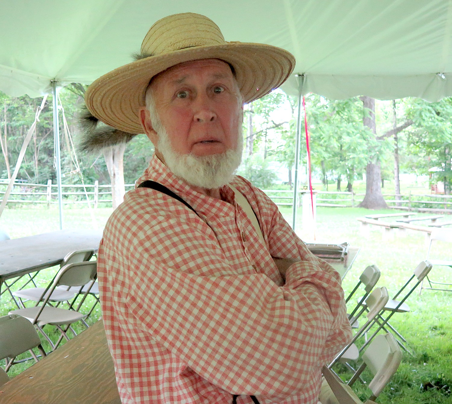
Rails-to-Trails Conservancy Takes Cyclists on Sojourn on Great Allegheny Passage


A highlight of this section of the Great Allegheny Passage ride is going through the Pinkerton Tunnel, only recently rebuilt and reopened © 2016 Karen Rubin/goingplacesfarandnear.com

By Karen Rubin, Travel Features Syndicate, goingplacesfarandnear.com

I’m the first to arrive at the appointed spot beside the tall brick smokestacks that border the parking field of a shopping mill, where once one of Pittsburgh’s mighty steel mills had been. It’s 6:30 am, but one of the leaders of the Rails to Trails Conservancy’s Great Allegheny Passage Spring Sojourn is already here. Gradually over the next half hour, our group of 85 riders comes together. We bring our bikes, now with our “license plate” to a truck, load our luggage and camping gear, board the two buses, and drive about 1 ½ hours to where the start of our three-day, 120 mile ride begins, in Meyersdale.

Meyersdale is just nine miles down from the Eastern Divide – the equivalent of the Continental Divide, a highpoint in the Allegheny Mountains. The Great Allegheny Passage (GAP), a relatively new, dedicated rail-trail completed in 2013, actually starts in Cumberland, 32 miles from where we begin our sojourn. The GAP links to the 184.5-mile C&O Canal trail that comes out of Washington DC, and extends 150 miles westward to Pittsburgh, creating a 335-mile non-motorized route between Pittsburgh and Washington, DC. (AMTRAK offers a walk on bicycle service; https://gaptrail.org/, 888-282-BIKE).

We are starting our ride below the Divide, so our trip today, 27 miles, will be a gentle decline totaling 600 feet. Had I been cleverer, I would have done what a few others did, and go back the nine miles up to the Divide, which would have added about 1 ½ hours to the ride. (

We are greeted at the Meyersdale train station, now converted into a delightful café and shop, by representatives of the Meyersdale Merchants Association. We are part of the repurposed, renewed, sustainable economy, now that the rail line, steel and coal extraction have shut down. The rail-trail has brought new visitors, and new vitality, to these small villages and towns all along the Great Allegheny Passage.

This is Rails-to-Trails Conservancy’s first spring sojourn, and it takes place over Mothers Day, no less, which accounts for our group being smaller than a typical sojourn – just 85 riders instead of over 200 which is more typical of the annual sojourn. But this year, RTC is for the first time offering a series of four sojourn rides. The first, in Florida, had already taken place. The third one will be in West Virginia (June19-22); and the last is four-days/three nights from Cleveland to Columbus on the Ohio-to-Erie Trail, Ohio in (Sept. 23-26, 4 days/three nights)..

Riding over the historic Salisbury Viaduct on the Great Allegheny Passage trail, wind turbines on the hillside © 2016 Karen Rubin/goingplacesfarandnear.com

These rides showcase the progress of rail lines that are no longer used converted to biking and multi-use trails, and where there are gaps in the trails that need the support of advocates, communities and government to complete. The Great Allegheny Passage rail trail is on what was the Western Pennsylvania line, which closed in 1975, because it couldn’t compete with the C&O line (that still operates on the other side of the river, and, as it happens, right beside our campsites).

This ride, as it turns out, showcases a success story – the Great Allegheny Passage trail we ride over these three days is exquisite, a testament to the enthusiastic participation and pride of the communities it crosses – wide, with crushed limestone, lovely sitting areas along the way with views to the river, wonderful bridges and tunnels, some bathroom facilities, excellent signage, even “stations” where there are bike repair tools and an air pump. Since its opening, GAP (as it is known) has become one of the most popular trails and was the first inductee in RTC’s Rail-Trail “Hall of Fame.”

Our ride features gorgeous mountain vistas and relaxing river scenes, historic bridges and tunnels that showcase the GAP’s railway heritage. Highlights include Salisbury Viaduct, Casselman River Valley, the Historic Pump House (Homestead) and Great Allegheny Passage Trail towns: Meyersdale, West Newton, Confluence and Ohiopyle.

Offering these supported bike rides is not RTC’s main mission, but the rides are invaluable to raising consciousness and commitment, not just of the riders, but of the communities which are essential. We become ambassadors for the concept of rail-trails,

The Rails-to-Trails Sojourn on the Great Allegheny Passage is a supported ride © 2016 Karen Rubin/goingplacesfarandnear.com

I love these supported rides. RTC’s sojourns are professionally organized by an Ohiopyle-based tour company, Wilderness Voyageurs, which lays out the route, arranges for our camping sites, the trucks, the meals (breakfast and dinner), the support stops.

This ride takes place over Mothers Day, as well as over a work/school day. Nonetheless, there are a number of us who have come on our own, leaving spouse and/or children at home (one mother left her five kids, age 8 to 16 at home with her husband as her Mothers Day gift). These rides are ideal for couples, for families (the ages on this ride range from 8 years old to 82 and a 10-year old can manage the ride), and particularly for single travelers because we become not just a community, but a tribe – a nomadic tribe in fact that picks up stakes and moves on each day. It’s a supported ride which means that our luggage is ferried by truck to the next  designated campground where they have arranged dinner and breakfast, a place to charge our phones, bathrooms and showers, provide support stops (with snacks) along the way, leader/volunteers who ride with us and behind, and support vehicle if anyone can’t complete the day’s ride.

Day 1: Meyersdale to Harnedsville, 27.3 Miles

The first day’s ride starts in Meyersdale in the Casselman River Valley, near Pennsylvania’s highest point, Mount Davis (mile 32 from the start of the Great Allegheny Passage trail).

The area was first occupied by the Monongahela Indians, who harvested the sap from maple trees to make maple syrup – and representatives of the Meyersdale Merchants Association greet us with maple candy samples. Known as “Maple City,” Meyersdale has hosted the Pennsylvania Maple Festival every March for more than 60 years.

The town itself is experiencing a renaissance with rail-trail and the completion of a streetscape project. At the trail access, the Western Maryland Railway Station has been turned into a visitor center, with local history exhibits and a retail store. A mural on Main Street (one of several along the Great Allegheny Passage) pays homage to Meyersdale’s roots as a bustling transportation hub for local agriculture, coal and timber. (www.visitmeyersdale.com).

There is a bit of fan-fare as we set out, going through a blow-up arch.

Countryside just passed the Salisbury Viaduct on the Great Allegheny Passage outside Meyersdale © 2016 Karen Rubin/goingplacesfarandnear.com

It is clear, sunny day as we set out, but the weather forecast is for clouds and rain. But we soon come to one of the highlights of the GAP: going over the Salisbury Viaduct,: 1,912’ long, built in 1908, it is our first crossing of the Casselman River (this turns out to be one of the top 10 photo views). At the other end, we see a line of wind turbines on stretched out over the hilltops – a fitting testament to what is old is new again. I also come upon an old cemetery – a stone there memorializes Peter G. Meyers who died in 1891, and I wonder if he is the founder of Meyersdale.

Our cue sheets (very well done) also point us to the Wymps Gap Fossil Quarry, at 9.0 miles into the ride. During the Mississippian Period (330 million years ago), Western Pennsylvania was the hsore of a shallow sea. The exposed limestone layers are a fairly thin band of fossil bearing rock sandwiched between layers of shale. It’s marked with a wooden post, labeled GR5 (unfortunately, I miss it)..

At 11.9 miles, we pass Rockwood, where we are recommended for lunch options.

Rockwood is described as a tightly knit rural community, with roots in industry and railroading. The town was laid out in 1857 but boomed after the end of the Civil War, with the Baltimore & Ohio Railroad. By 1884, the town had several mils and shops, four general stores, two grocery stores and four hotels.

Playful public art pays homage to Rockwood’s heritage and its new commitment to the bike trail © 2016 Karen Rubin/goingplacesfarandnear.com

A locomotive sculpture at the Rockwood trailhead is a link between the town’s rail history and its present-day “investment” in biking and recreation. You cross the Casselman River to get into the town. There is public art, including a mural that honors trail ambassador Maynard Sembower, who died in 2009 at the age of 100 – a reminder that these improvements are the result of sweat and activism of committed individuals.

The most interesting structure is the Rockwood Mill Shops & Opera House, with a performance space. Lumber and feed were processed in the building for nearly a century, while the opera house hosted visiting and local performers above the mill. The building was restored in 2000 and listed on the National Register of Historic Places. (www.somersetcountychamber.com).

The highlight of today’s ride for me comes at 19.9 miles: riding through the 849‘ long Pinkerton Tunnel. The tunnel was originally built in 1911, collapsed and was rebuilt in a kind of a kwansit hut at a cost of $1.8 million and only reopened in 2015. It is very surreal going through it: Inside, a dizzying array of concentric metallic circles – long, dark, with proverbial light at the end of it.

Shortly after, we cross High Bridge over the Casselman River (our third crossing on the GAP today).

The Great Allegheny Passage reclaims a former rail line into a stunning 150-mile non-motorized trail returned to nature © 2016 Karen Rubin/goingplacesfarandnear.com

At 27.1 miles, we leave the GAP and follow the signs they have placed for us, for a couple of turns that bring us just a 2/10 of a mile beyond to the grounds of the Turkey Foot High School (which has been on the USA Today’s list of top high schools) where we will camp.

It’s Friday and school is in session, so we aren’t able to enter the school until after 3:30 pm – a little disconcerting because rain is threatening.

I opt to continue down the trail another two miles to the town of Confluence, so named because it is set where three rivers converge. It’s the shape of the three peninsulas that looks just like a turkey’s foot.

A highlight of this section of the Great Allegheny Passage ride is going through the Pinkerton Tunnel, only recently rebuilt and reopened © 2016 Karen Rubin/goingplacesfarandnear.com

Indeed, in George Washington’s day, this area was called Turkeyfoot by natives and settlers. George Washington, himself, came to the confluence of the rivers in 1754 during the French & Indian War, as he and his soldiers were on their way to the forks of the Ohio River. As we travel the trail in the woods, revitalized and full now that the steel mills and coal mining have shut down, I can easily imagine the wilderness that he saw and the how the Indians would have used the rivers.

The skies have been threatening rain and I return to the campsite.

If we don’t want to set up our own tents, we can use the Comfy Camper service or stay in nearby bed-and-breakfast accommodations. This trip I treat myself to the Comfy Camper service ($118 for the two nights, comfycampers.info, 315-283-0220) and it adds a measure of luxury to the trip: When I arrive, the tent – roomy, comfortable, wonderfully waterproof, with an air mattress, chair and towel – are all ready for me. Shawn Stewart, owner/director, has just finished blowing up the air mattress and I am cozy inside, just as the rain comes down in earnest.

Our dinner is provided by the Turkey Foot Fire Department – another way the Sojourn supports local communities.

Ambassadors for Rail-Trails

Indeed, this is the theme for the Sojourn rides.

During the evening’s presentation, Tom Sexton, Northeast Regional Director of Rails to Trails Conservancy, tells us about the plans to finish the gaps on the trails, and ultimately connect a network of trails stretching through most of the Mid Atlantic.

RTC, in its 30th year, helps finds money and means to build rail-trails. Since 1991, $1 billion spent. Certain amount of transportation money (from fed) has to be spent on things other than highways, airports, bridges, but “other transit.” RTC helps communities, nonprofits, governments come together on how to build rail trail – negotiate with railroad, what surface to use, how to maintain. RTC also offers its members TrailLink – an online tool that helps you find trails and map your ride.

These Sojourns are a means of engaging interest in the rail trials – spotlighting gaps in trails, showcasing successes, and inspiring communities to get involved. The riders become ambassadors – especially with our “license” plates and shirts that announce who we are.

The sojourn also helps show a community (and funding agencies) the economic benefits of trails, as well as its social benefits, building camaraderie, community, and quality of life benefits.

“Towns (like Dunbar) which have fallen on hard times since the railroad left, find the trails revitalize, become the main street. In 15 years since RTC started sojourn rides, we’ve hosted 3400 riders, brought $2.1 billion in spin off to the corridors we ride through.

“We show that an economy built around the rail-trail is sustainable. The money spent stays here, it has low impact. The trail benefits environment and the local people who benefit from trails.”

Indeed, as we ride over the weekend, you see families out and about – the trails provide a healthy, active outdoor activity that families can share together.

RTC has big plans to create a regional network of interconnected trails.

For example, connecting Parkersburg West Virginia, the access for the North Bend Trail (the start of the third Sojourn of this year’s series) to Pittsburgh and the GAP rail trail, which already connects to the 34-mile long Sheepskin Trail out of Dunbar.

Then the idea is to continue on to Clarksburg-Parkersburg trail, which will be 260 miles when finished. At that point, you could start in DC, go to Pittsburgh (on C&O, 183 miles and GAP 150 miles), altogether about 600 miles.

“This is the epicenter of trails in the US,” Sexton says.

But this is only a piece of what is an even bigger grand plan. 

Eric Oberg, Director of Trail Development, Midwest Regional Office, speaks of a “Trails Manifest Destiny”:in describing a sprawling network of 1,450 miles of interconnected multiuse trails that will be called “The Industrial Heartland Trail” which together, would be the largest in the country – from DC to Pittsburgh, to Cleveland –Cleveland-Cincinnati-Dayton, Parkersburg, Indianapolis, up to Erie and Buffalo (where you can then connect to the 400-mile long Erie Canalway). Some 48% of these multi-use trails are done, and the hope is to have it completed by 2035.

“It won’t take 80 years, but it will be more than five years” before the manifest destiny is realized, Eric says.

Comfy Campers sets up comfortable tents with air mattress, chair and towel for those who don’t want that extra luxury © 2016 Karen Rubin/goingplacesfarandnear.com

Sojourn Bike Tours

For the first time in the 14 years of hosting a Sojourn bike tour showcasing a rail-trail, the Rail-Trails Conservancy expanded the series to four rides: the first, in Florida, was held in February; the second on the popular Allegheny Passage in Pennsylvania, was May 6-8. The third was a four-day/three-night North Bend Rail Trail out of Parkersburg, West Virginia (June 19-22; and the last was four-days/three nights from Cleveland to Columbus on the Ohio-to-Erie Trail, Ohio in September.

“The Sojourn Series is much more than just a bike ride. It’s a trail building tool for Rails-to-Trails Conservancy, and allows us to pull advocacy into participants’ trail use experience.”

The Sojourn rides are crafted to weave experiences that go beyond simply riding from point A to point B. Each sojourn aims to transform trail users into advocates and create the economic case for trail networks nationwide.

The West Virginia Sojourn showcases the North Bend Rail Trail out of Parkersburg, West Virginia. “It is an incredible trail but does not yet connect to the two communities on either end, Parkersburg and Clarksburg.” This ride serves to bring attention to those gaps and advocate for their completion. The corridor is also part of a much larger trail development effort being undertaken by the Industrial Heartland Trails Coalition.

“The West Virginia ride will allow you to get on a new trail and take part in some of the advocacy that our organization is known for.”

Since 2001, more than 3,000 riders have joined RTC’s sojourns. These rides not only highlight incredible trails, but they also help empower communities to complete trail networks that will benefit the entire region.

Equally importantly, they highlight the economic benefit to communities, particularly those who have seen older industries shut down, along with the rail lines.

RTC’s 2015 Pennsylvania Rail-Trail Sojourn brought visitors from 35 states and had an economic impact of more than $245,000 – something significant for a town like Dunbar, Pennsylvania, which once depended upon coal and railroads.

The rail-trail could be an engine for a new economy fueled by lodging, restaurants and gear shops. RTC estimates that the GAP would generate more than $40 million in direct spending from trail users annually.

“The Sojourn Series is a real-world example that show how trails can provide an economic boon to local economies,” says Liz Thorstensen, vice president of trail development for RTC. “By providing these rides, we’re creating more opportunities for people to experience and advocate for these trail networks.”

For more information about the rides and to register, visit railstotrails.org/sojourn.

Rails-to-Trails Conservancy, a nonprofit organization with more than 160,000 members and supporters, is the nation’s largest trails organization dedicated to connecting people and communities by creating a nationwide network of public trails, many from former rail lines. Founded in 1986, Rails-to-Trails Conservancy’s national office is located in Washington, D.C., with regional offices in California, Florida, Ohio and Pennsylvania. For more information, visit www.railstotrails.org. 

These rides are organized by Wilderness Voyageurs which offers many different biking and rafting trips including inn to inn biking trips, across the US and international: 800-272-4141, Wilderness-Voyageurs.com.

Next: Great Allegheny Passage Rails-to-Trails Conservancy Sojourn Continues

See also:

One Day, Two Nights in Pittsburgh: From Grey to Green, A Proud City Revitalized

36 Hours in Pittsburgh: Point State Park Proves Highlight of Walking Tour

36 Hours in Pittsburgh: Andy Warhol Museum is at Center of Revitalized City

36 Hours in Pittsburgh: Strip District Exemplifies City’s Past, Future

Two Nights, One Day in Pittsburgh: Historic Omni William Penn Hotel Connects to City’s Proud Heritage

____________________

© 2016 Travel Features Syndicate, a division of Workstyles, Inc. All rights reserved. Visit goingplacesfarandnear.com and travelwritersmagazine.com/TravelFeaturesSyndicate/. Blogging at goingplacesnearandfar.wordpress.com and moralcompasstravel.info. Send comments or questions to [email protected]. Tweet @TravelFeatures. ‘Like’ us at facebook.com/NewsPhotoFeatures
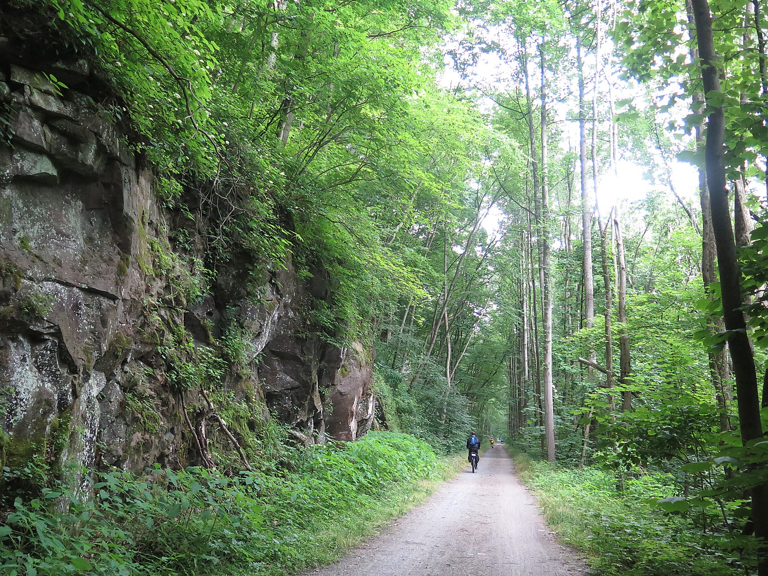


Erie Canal Cruises, Gems Along Mohawk Round Out Stay at Herkimer Diamond Mines KOA

Excitement entering Lock 18 on the Erie Canal, on the cruise from Gems Along the Mohawk © 2015 Karen Rubin/news-photos-features.com

I’ve already had some extraordinary experiences during my all-too-brief stay at the Herkimer Diamond Mines KOA, a camping resort that prides itself on “edutainment”. I’ve tried my hand at mining for Herkimer Diamonds in the quarry – these magnificent quartz crystals that almost pop out of their rocky prison as if cut and polished by Mother Nature. I’ve done sluicing and had the delight in finding gemstones, diamonds and fossils, and explored the massive retail store and museum with its fine display of rocks, gemstones and fossils – including the large Herkimer diamond cluster in the shape of a cross that was discovered the morning of September 11, 2001, and the skull of a triceratops. And I’ve enjoyed the special atmosphere of a campground – or rather, a camping resort – the peaceful sounds of the flowing West Canada Creek, the smells of campfires, and the giggles of kids riding bikes passed my creekside cabin, themed for dinosaurs.

But there is more to do: the Herkimer KOA is but seven miles away from the Erie Canal, that marvel of human ingenuity and engineering which helped unify the fledgling nation and propel it into the Industrial Revolution. There, Dr. Renee Shevat, who owns the Herkimer Diamond Mines KOA, has turned a building that used to warehouse buoys into a gigantic indoor “mall” showcasing artists, artisans, writers, and companies, in a most pleasant environment (come on Saturdays, when there are free tastings), a marina where you can take a delightful 90-minute narrated cruise on the Erie Canal, climaxed with going through a lock that lifts (or drops) the boat 20 feet, and an excellent restaurant, the Waterfront Grille, with a lovely setting on the canal.

Cruising the Erie Canal

Captain Jerry Gertz welcomes passengers aboard the Lil Diamond II for the 90-minute narrated Erie Canal cruise © 2015 Karen Rubin/news-photos-features.com

Captain Jerry Gertz delivers a delightful narration (part on tape, but he interjects and takes questions) which is interesting, engaging, and very entertaining, delivered with wonderful humor. The climax of the 90-minute cruise comes when you go through Lock 18.

Along the way, he points out interesting sights and fascinating (and I mean fascinating) details about the history and the remarkable engineering of the Erie Canal, and why the Erie Canal was so crucial to opening the West, unifying the fledgling nation, making New York the Empire State and New York City the financial capital of the world. Captain Jerry came to the Erie Canal in his “retirement” – after operating one of the largest tour boat companies in Florida.

I am surprised to learn that the peak use of the Erie Canal (this is actually the third “incarnation” of the canal – the first was Governor DeWitt Clinton’s Ditch, built 1817-1825 despite enormous skepticism and opposition and was so successful, it had to be enlarged just 10 years later and this, the third, is the Barge Canal) was not in the 1920s but in the 1950s, when over 5 million tons of cargo came through. And the canal’s undoing wasn’t even the Transcontinental Railroad (though that helped), but Eisenhower’s Interstate Highway (and volume on the canal tracks with fuel prices), which did not close down, as the Erie Canal did, from November to April, and even more devastating, the opening of the St. Lawrence Seaway, which could carry much larger ships.

Since the 1980s, the Erie Canal has been “re-purposed” from commercial use to almost entirely recreational. And while people like Dr. Shevat and her husband who grew up in the 1950s near the canal would have never thought to boat on it – it was regarded as little better than a sewer with the pollution and smell – now it is this bucolic place, with the canal towns finding new life and new quaint housing cropping up along the canal, and the original towpath used by boys leading mules to pull the boats, is now a multi-use path extending almost the entire 363-mile length, from Buffalo to Albany (30% of the trail still needs to be completed; when it is completed, it will be longest multi-use trailway in US, and then can be combined with the Hudson Greenway down to New York City.).

Approaching Lock 18 on the Erie Canal, on the cruise from Gems Along the Mohawk © 2015 Karen Rubin/news-photos-features.com

Today’s Barge Canal extends 524 miles with 57 locks, each lock chamber made 328 feet long, 45 ft wide (and using the same century-old motors, manufactured by General Electric). This canal was completed in 1918 at a cost of $151 million (would cost $2.5-$3 billion in today’s dollars), but it could not be built today because of environmental restrictions (while the earlier canals probably could not be built either because of environmental and labor protections).

“The Erie Canal was the most important economic, transportation structure; only the Intercontinental railway had the same impact,” he tells us. “It was more than trade – it was about religion (7th Day Adventist), women’s suffrage, abolition. The underground railroad used the canal.

“It was the Internet of its day – the first attempt at networking and globalization,” he declares.

For the original 13 states to prosper, he tells us, they needed to open the West in order to tap those natural resources, such as lumber, as well as access to the inland waterways like the Mississippi River. “But the Appalachians were hard to get over. The route was impossible to cross –they couldn’t blast mountains then – they only had black powder.”

President Madison, a Jeffersonian, didn’t see the benefit to the nation of such a canal, so it was left o New York State to finance the project on its own.

“DeWitt Clinton worked tirelessly.” There was tremendous skepticism – no one actually had the technical expertise to build such a canal. But a “New York Memorial” speech Clinton delivered as a State Senator ignited the Legislature which authorized $7 million in bonding.

Of the three men overseeing construction, only one had any engineering background. They had to invent new methods and tools – the breakthrough was inventing hydraulic cement that hardens under water.

Now where to build? DeWitt Clinton realizes that $7 million may not be enough money to finish the project, so he has the construction start where it is easiest – in soft, flat farmland – and in the middle of the state, in Rome, and tells them to dig east and west from there. “It starts in the middle of nowhere, goes nowhere, so the state would have to give them more money.” Captain Jerry relates.

The original canal was built by 350 workers who were being paid 80c/day – they carved the ditch 40 feet wide and just four feet deep, 363 miles, from Albany-Buffalo, 83 locks, which take a boat the 565 feet difference in elevation. In the first year, was a huge success, as the cost of commerce dropped from $125/ton; one year after canal opened, to $5/ton to transport.

By now, we have cruised to Lock 18, which Captain Jerry says is still powered by the original GE motors from 1912 (the earlier canals were not motorized, but were opened and closed manually). The lock will lower us 20 feet, emptying 2.5 million gallons of water in just 7 1/2 minutes (and reversing the process when we return).

As we pass Fort Herkimer Church, the second oldest surviving church, dating from 1767, Captain Jerry tells the story of General Herkimer - probably the most important Revolutionary War hero few have heard of © 2015 Karen Rubin/news-photos-features.com
As we pass Fort Herkimer Church, the second oldest surviving church, dating from 1767, Captain Jerry tells the story of General Herkimer – probably the most important Revolutionary War hero few have heard of © 2015 Karen Rubin/news-photos-features.com

As we pass Fort Herkimer Church, which he says is the second oldest surviving church, dating from 1767, Captain Jerry also tells the story of General Herkimer – probably the most important Revolutionary War hero few have heard of:

General George Washington commissioned Herkimer as a general but he had no army. But when Herkimer learned that the British had taken Fort Stanwix in July 1777, he gathered up a militia formed mainly of German immigrants to gather at Fort Dayton (now Herkimer, New York), to begin the 40-mile westward march to the besieged Stanwix.

Herkimer was betrayed by Molly Brant, who sent word of their march to her brother, Joseph Brant, the Mohawk leader.

On August 6, Herkimer and his men were ambushed by a group of Loyalists and Mohawk Indians at a bloody battle that came to be known as the Battle of Oriskany, during which Herkimer was mortally wounded – he died 10 days later.

it is one of bloodiest encounters of War – 400 were killed in just 6 hours.

But the British blockading Fort Stanwix believed reinforcements were on their way and retreat – giving the Patriots their first victory of sorts. And the British General John Burgoyne went on to a major defeat at Saratoga (at the hands of General Benedict Arnold), turning the tide of the war for the Patriots.

“Herkimer was one of saviors of American Revolution,” Captain Jerry says, no doubt introducing most of us to a historic figure we had never heard of before.

Near here, is the Herkimer Homestead, which during the Revolutionary War consisted of 7 building on 3000 acres. The Historic Herkimer House, a 1762 mansion, can be visited in Little Falls. And you can easily reach the Fort Herkimer Church, on Rte. 5S.

Captain Jerry Gertz gives over the wheel to a young passenger  © 2015 Karen Rubin/news-photos-features.com
Captain Jerry Gertz gives over the wheel to a young passenger © 2015 Karen Rubin/news-photos-features.com

This day we are on a small, 36-passenger boat, the Lil Diamond II (he even lets a couple of the kids drive it for awhile), but he also has a large boat, the Lil Diamond III, that is utilized by groups (including weddings).

($19/adults, $12/3-10; reservations recommended, departs 1 & 3 pm daily, mid-May through mid-October, rain or shine. Erie Canal Cruises, 315-717-0077, www.eriecanalcruises.com.)

Gems Along the Mohawk

Gems Along the Mohawk is one of the most interesting shops you will ever encounter.

It serves as a Visitor Center for travelers coming off of I-90 (it is directly across from the ramp at Exit 30), and staff cheerfully greet guests and provide travel information (and rest rooms) for weary travelers. It offers a wonderful restaurant with stunning views of the canal, and a marina from which you can take the 90-minute Erie Canal Cruise.

But it is so much more. The shop is a showcase for New York and the Mohawk Valley producers – actually 70 different merchants whose items are displayed, like Mele jewelry boxes (based in Utica since 1912, which you have probably seen in major department stores), and Salida Tea (check out the collection of Red Rose figurines and the giant porcelain tea set); Also, Jim Parker Folk Art. And it also heralds the region’s legacy companies, like Revere Copper Products, started by Paul Revere, 1801), and Remington Arms (200 years old, the same company as produced the iconic typewriter and other items like sewing machines and even a bridge – you can even visit the Remington Museum nearby); HM Quakenbush, founded in 1871 in Ilion, which is America’s largest and oldest manufacturer of nutcrackers; Beech Nut, founded in 1931 in Amsterdam, the baby-food company

“This is what created Mohawk Valley,” Melody Milewski, General Manager, tells me as she gives me a tour.

“We don’t just take anybody,” she says. “All the associates want to show their story, their connection to the Mohawk Valley.”

Come on Saturdays and Sundays, and you can enjoy tastings (and free coffee and tea) at about 17 of the 70 shops.

But when you peruse the shop, it is astonishing how much you learn.

Gems Along the Mohawk, an unusual shop showcasing local artisans and producers, features a children's play area themed for the Wizard of Oz © 2015 Karen Rubin/news-photos-features.com
Gems Along the Mohawk, an unusual shop showcasing local artisans and producers, features a children’s play area themed for the Wizard of Oz © 2015 Karen Rubin/news-photos-features.com

NYS-HerkimerKOA_071015_225(c) Karen RubinThe kids can play in an area devoted to the Wizard of Oz. Why the Wizard of Oz, I ask? The famous author, L. Frank Baum, lived not far from here (you can visit the All Things Oz Museum, in Chittenango), but his mother-in-law, Matilda Joslyn Gage, had an even greater connection and for the first time, I learn that she was instrumental in the Women’s Rights movement. She had connections to the Oneida women and incorporated their ideas of a woman’s right to property and child custody and selecting the chief at a time when women had rights to none of these. (I take this basic knowledge with me to Seneca Falls, to the Women’s Rights National Park, and to Fort Stanwix which picks up on the themes of the “clash of cultures” between Europeans and Indians).

Indeed, the Mohawk Valley was The West, a vast wilderness. James Fennimore Cooper’s “Last of the Mohicans: was set in part in Glens Falls). This was the land of the Mohawk, the Oneida and the 6 Nations.

The shop features a bookstore stocked by Ganesvoort House Books (who also operates a bed-and-breakfast in Little Falls), which offers books about Gage, and the native American influence on Women’s Rights movement, “Sisters in Spirit,” by Sally Roesch Wagner as well as scores of other local writers.

This is all news to me. Just walking around introduces me to people and places I had never heard of before – like Fort Stanwix which I will later visit in Rome, when I take the 400-mile Cycle the Erie Canal tour (I will get to camp out at the Fort, where Melody says she participated in excavations before the National Park Service rebuilt it.)

Gems Along the Mohawk (800 Mohawk Street, Herkimer NY 11350, 315-717-0077, 866-716-GEMS, [email protected], www.gemsalongthemohawk.com).

Waterfront Grille

Today, cruising the Erie Canal and dining at the Waterfront Grille, we see a bucolic scene, but when Dr. Renee Shevat and her husband, Sam, were growing up, during the peak of commercial traffic on the Erie Canal, it was a noxious sewer.

The canal has gone through a major re-purposing – it carries very little commercial traffic but is almost exclusively used for recreation – and so have the canal towns the grew up because of the canal, then went into a tailspin with its decline.

The complex that is now a retail store, visitors center, restaurant and marina was originally a terminal building for tending buoys for the Barge Canal, before Dr. Shevat convinced the state to let her build a private enterprise on the canal, which is part of the Heritage Corridor.

Dr. Renee Shevat has put her PhD in finance and strategic planning to good use in developing four business units for the Herkimer Diamond Mines KOA, mining attraction, Gems Over the Mohawk and retailing Herkimer Diamonds worldwide © 2015 Karen Rubin/news-photos-features.com

Dr. Shevat, who has her PhD in finance and strategic planning, and was the vice president of a college (with ambition of becoming a president someday) utilized all of her skills and experience when she took over running the campground and mining attraction from her father – developing four distinct business units.

She also clearly has not left her academic credentials behind, but manages to incorporate “edutainment” into every aspect of the experience – and not just for the young campers, but for the adult campers and the young people who work as counselors, as well.

“I like making science fun,” she says. The activities that are offered daily incorporate gemology, paleontology, robotics, geology. Many of the lodges are themed around science – solar powered lodges, dinosaurs, a fossil pit, an astronomy lodge (with a real computer-operated telescope for the exclusive use of that cabin), and a robotics lodge.

“I don’t want them just to have a summer job but a resume,” she says of her counselors. “I encourage them to do projects.” So Blair and Josh, both student teachers, created the catalog of gems and fossils and a curriculum to teach their colleagues, and counselors will be helping campers build a robot and a crystal radio.

That philosophy was genesis of Professor Gadget’s Lodge.

The Robotics Lodge was designed by the 2013-2014 graduating senior class of engineers from Binghamton University’s Watson School of Engineering and Applied Science. At the Herkimer Diamond Mines, there are K-12 projects and programs offered throughout the year, but this was the first project at the collegiate level, giving students a the opportunity to design a commercial project from the ground up.

This process involved five interdisciplinary projects which were completed by two teams of 12 students. Each project allowed not only for the education of the students who created it, but also for the continued education of KOA guests. Campers of all ages learn about motors, motion sensors, battery power, chain machines, vectors and inertia.

A Rube Goldberg-like sculpture, designed by Binghamton University grad students, decorates the Professor Gadget's Robotics Lodge at Herkimer Diamond Mines KOA © 2015 Karen Rubin/news-photos-features.com
A Rube Goldberg-like sculpture, designed by Binghamton University grad students, decorates the Professor Gadget’s Robotics Lodge at Herkimer Diamond Mines KOA © 2015 Karen Rubin/news-photos-features.com

When you walk by the lodge, the first thing you notice is the 6’ tall weatherproof case engineered by Danielle Brogna, which contains a prototype of a Rube Goldberg rolling ball sculpture. Inside, the lodge utilizes an innovative and interactive lighting system designed and programmed by computer engineering major Elan Ashendorf; a mechanical lift system and hammock which lets guests practice their own engineering skills, and has robotic display boxes lining the wall.

“What is special about this project,” says Shevat, “is that each student was allowed the freedom to design to their strengths, which they believed would be enjoyed by many campers.

“The partnership with Binghamton University and campers, as consumer consultants, was very rewarding. And, yes, we would do it again with another scientific theme!.”

Also, during the season, the KOA offers a Rock and Gem Camp for about 100 kids (26 had to be turned away for the first camp) as well as Geology weekends for Girl Scouts and Boy Scouts (conferring a Geology badge).

“Diamonds and the Erie Canal – two unique attractions – I want to be the centerpiece for dinner conversation: ‘Do you remember when we….?’” Dr. Shevat says.

The Herkimer Diamond KOA is open April through October (peak season rates apply July and August.) Weekends have special themes.

Herkimer Diamond Mines KOA was recognized as KOA’s “Kampground of the Year” on the North American continent in 2010. I would rate the Herkimer Diamond KOA 5 diamonds – and then some.

Herkimer Diamond KOA, 4626 State Route 28, Herkimer, NY 13350, 315-891-7355, E-mail: [email protected], www.herkimerdiamond.com; mining info at 315-717-0175, [email protected]. Erie Canal Cruises, 315-717-0077, www.eriecanalcruises.com; Gems Along the Mohawk, 315-717-0077, www.gemsalongthemohawk.com; Waterfront Grille, 315-717-0700, www.waterfrontgrille.net

More to Explore

There is much to do in the area:

Cooperstown (half hour away)

Howe Caverns (1 hour away)

Remington Gun Museum (on Catherine Street off Route 5S, Ilion, NY 13357, 315-895-3200, 800-243-9700, www.remington.com).

Fort Herkimer Church, on 5S

Historic Herkimer Mansion

Fort Stanwix, Rome

Erie Canal Museum (318 Erie Boulevard East Syracuse, NY 13202, eriecanalmuseum.org

All Things Oz Museum, which opened in 2011 and is run by volunteers, is the house where L. Frank Baum, who wrote “The Wizard of Oz,” was born in 1856. The museum claims to have over 1000 Baum- and Oz-related items in its collection (219 Genesee St., Chittenango, NY, Wed-Sun., 315-333-2286, $5.)

I get to experience many of these sites when I continue my travels, biking 400-miles on the Erie Canal Trail, along with 600 others in the 17th annual Cycle the Erie Buffalo-Albany bike tour (ptny.org).

See also:

Diamond Mining, Robotics, Erie Canal Cruises Top List of Special Experiences at Herkimer KOA Camping Resort

_______________________________

© 2015 Travel Features Syndicate, a division of Workstyles, Inc. All rights reserved. Visit www.examiner.com/eclectic-travel-in-national/karen-rubin,www.examiner.com/eclectic-traveler-in-long-island/karen-rubin, www.examiner.com/international-travel-in-national/karen-rubin, goingplacesfarandnear.com and travelwritersmagazine.com/TravelFeaturesSyndicate/. Blogging at goingplacesnearandfar.wordpress.com and moralcompasstravel.info. Send comments or questions to [email protected]. Tweet @TravelFeatures. ‘Like’ us at facebook.com/NewsPhotoFeatures
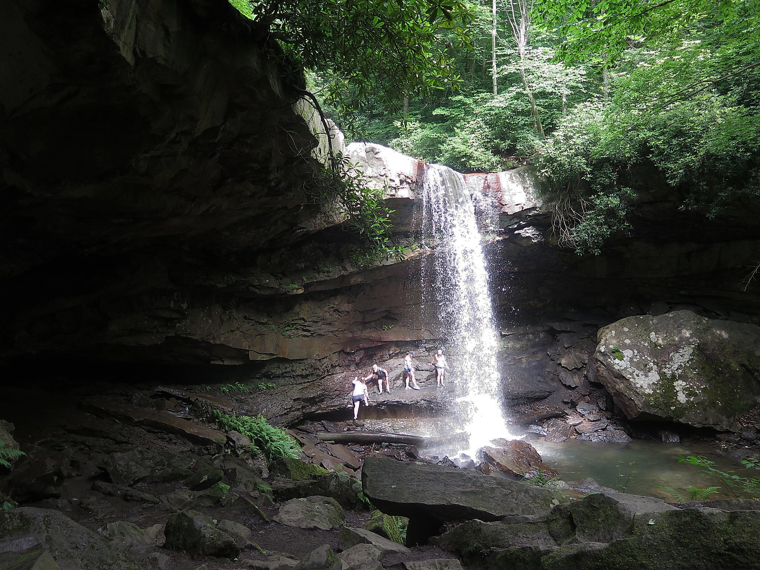
 

Diamond Mining, Robotics, Erie Canal Cruises Top List of Special Experiences at Herkimer KOA Camping Resort

The Herkimer Diamond, actually a special kind of quartz crystal, is found crystal clear and faceted in the dolomite rock, as if cut and polished by Mother Nature © 2015 Karen Rubin/news-photos-features.com

There I am, swinging a small sledgehammer, quarrying for diamonds – Herkimer Diamonds, that is, extraordinary quartz crystal nuggets that emerge (even pop right out) of their rocky prison with 18 facets, as if they had been cut by a jeweler.

You never know what you will find, what the next smashing, crushing blow will reveal and it is thrilling when you crack the rock to expose the diamond. A treasure hunt, to be sure. But it is also remarkably satisfying to be smashing rock.

This is just one of the – dare I say – unique attractions when you come to Herkimer Diamond Mines KOA, a true camping resort, in upstate New York. An altogether different experience – certainly, not your father’s camping experience.

Bucolic setting - the newest themed Herkimer Diamond KOA cabins hug the West Canada Creek © 2015 Karen Rubin/news-photos-features.com
Bucolic setting – the newest themed Herkimer Diamond KOA cabins hug the West Canada Creek © 2015 Karen Rubin/news-photos-features.com

To begin with, I am in one of the Herkimer Diamond KOA’s new themed cabins, set right on a rushing creek, which campers use for tubing (a whole mile from beginning to end, for a 20-minute ride!), and others use for some of the best trout and bass fishing in New York.

Mine is called Randy’s, named for the triceratops skull that is on view in Herkimer Diamond Mines’ gems and fossil museum (yes, it has its own museum), and is themed for dinosaurs.

The first emotion I feel when I enter is sheer delight that manifests as an ear-to-ear smile when I see all the dinosaur accoutrements – including a two-foot high (plastic) raptor that whenever I see it in the corner of my eye, makes me jump. The bedding, shower curtain, wall hangings are all themed for dinosaurs, and it is complete fun (informative, also).

The cabin is outfitted with every creature comfort you could possibly want – a well equipped kitchenette, bath items, flat-screen TV, sofa in the living room, table with four chairs, air conditioning and heater, linens and towels – all cleverly laid out to maximize space. The porch has a rocking chair and there is even a patio, right beside the creek, with patio furniture, BBQ and firepit.  And WiFi, which has become such an essential feature.

Ideal for pet lovers: Caesar's Cabin at Herkimer Diamond Mines KOA has its own doggie run, just for that cabin © 2015 Karen Rubin/news-photos-features.com
Ideal for pet lovers: Caesar’s Cabin at Herkimer Diamond Mines KOA has its own doggie run, just for that cabin © 2015 Karen Rubin/news-photos-features.com

Other cabins and lodges are also themed: there is Caesar’s Place (Woof), which has its very own doggie-park; Another is themed for fossils and even has its own pit where you can dig to find your own fossils.

There are even more elaborate lodges (I really would have trouble choosing): one is themed for astronomy and actually has its own “planetarium” with a sophisticated, computer-operated telescope as well as photos taken from the Hubble telescope; another is Professor Gadget’s Robotics Lodge that features working robotic components (“to educate and entertain”) devised by Binghamton University grad students.

Then there are three lodges that operate on solar energy – just part of the initiative to demonstrate renewable energy and model eco-friendly living.

In another delightful socially-conscious and community-building initiative, there are 40 bins where they grow fresh vegetables, and campers are welcome to help themselves. There is also a Japanese garden which is a tribute to the victims of Japan’s tsunami.

There is so much about the Herkimer Diamond KOA that is special – and I haven’t even begun to describe the diamond mining, jewelry making. and Erie Canal cruising.

There is an atmosphere here – it’s true of camping in general, but there is something very special about this place.

To begin with, its Edutainment – that is, a healthy mixture of education (or actually, enrichment) with entertainment, that is woven into the architecture, the landscape and programming.

The playground and basketball court at Herkimer Diamond Mines KOA © 2015 Karen Rubin/news-photos-features.com

There are daily activities – jewelry making, science experiment (static electricity, make a volcano, make a balloon rocket), badminton, flag football, cray fishing, basketball, chess and checkers tournament, volleyball, dodgeball, water balloon toss, table tennis, scavenger hunt, relay races, hula hoop contest – as well as nightly movies (outside on nice evenings, under the pavilion when it rains), and gatherings around the firepit (S’mores on Saturday nights).

There is a huge playground area –  separate playground equipment for youngest kids and older kids, and basketball court.

A volleyball court which is next to a gigantic firepit which is a gathering area (s’mores on Saturday nights); and a pavilion where there are games, a snack bar (ever try  a breakfast pizza? It’s made with bacon and egg; and a Herkimer Diamond pizza for evening).

There is a gorgeous swimming pool (next year, the plan is to have it solar heated).

If you forgot your tube or fishing rod, you can buy these in the Herkimer Diamond KOA general store; in fact, probably everything you need, forgot, wish you brought, can be had there, so if you wanted to travel light, no problem.

And if you don’t feel like cooking, there is the Rock n’ Roll Cafe, as well as Crystal Chandelier Restaurant, a very pleasant pub-style restaurant located a short walk across the road from the campground (KOA guests get a discount and $9.95 nightly specials, 4579 State Rt. 28N,, 315-891-3366, crystalchandelier.net).

You can easily fill out a two or three-day getaway with just the activities right at the resort: directly across the tiny road (Rte 28), from the camping resort  is the Herkimer Diamond Mine – an attraction that brings people from far and wide, including many who come back time and again (more on that to come). There is mile-long tubing along the West Canada Creek, which also affords some of the best trout and bass fishing in New York State.

Just about five miles away – bikeable on the bike lane on Rte 28 – is the uniquely appealing Erie Canal, where you can enjoy Gems Along the Mohawk (owned by the Herkimer Diamond KOA people) a combination visitor center, specialty shops showcasing regional artisans and artists, Waterfront Grille for dining, and a marvelous 90-minute narrated Erie Canal Cruise which climaxes with the experience of going through Lock 18, as well as biking along the Erie Canal.  Not to mention that Cooperstown is about 30-minutes drive away.

Mining for Diamonds!

Prospecting for treasure in the Herkimer Diamond Mines quarry © 2015 Karen Rubin/news-photos-features.com

Mining for the Herkimer diamonds isn’t a fantastical thing – it is more unlikely that you will leave without finding one than it is to find one. And there are many people who come and merely gather diamonds from the ground, without even swinging a hammer.

The kind of mining we get to do is “quarry” mining, rather than going into a cave. An outcrop of rock of this giant crystal-laden mountain has been exposed, and the idea is to basically look for rocks with black holes or a black vein – sometimes pulling down rock using crowbars and chisels, and 6 to 20 lb. sledge hammers. Then whacking at the pieces of rock with a 2 or 3 lb. crack hammer.

Jordan, Herkimer’s resident miner (your image would be of a grizzled, fossilized old man, but Jordan is a young strapping fellow who grew up nearby but learned his mining skills on the job), guides me in what to look for: a dark pocked hole in a rock that makes it a good candidate for housing a diamond. Then he shows me how to set it down on flat ground and whack across a line (being careful not to smash your hand, finger or foot). Sometimes, you don’t want to release the diamond, but let it show itself off in the rock.

Most Herkimer Diamonds, no matter how small, have 18 facets – all you do is wash off the mud and there you have it: a jewel.

Jordan tells me that each Herkimer diamond stone is unique. “To a collector, a certain stone ‘speaks to him’ because of its shape, inclusion, anthraxolite (ancient carbon) inside, presence of a water bubble, or another distinctive feature like a negative crystal (another stone) inside.”

Jordan displays how the Herkimer diamonds are found embedded in the rock, at the Herkimer Diamond Mines © 2015 Karen Rubin/news-photos-features.com

Often you see the rock not with a single stone, but with “druzy” – thousands, even millions of sparkling Herkimers, that form a vein or fill one of those black holes. “We don’t know why – perhaps it is a phase of growth,” Jordan tells me. Rocks with druzy can be even more valuable because of how beautiful and unusual they are.

He says that often, the stone is even more valuable when it is kept in the rock, where the black-hole background enhances the visual display – makes it “pop”  (you have to put felt on the bottom or the rock will ruin wood or glass).

I find a fairly large Herkimer diamond, which Jordan estimates to be valued at $25.

The most perfect crystals are usually less than half-inch long, but occasionally much larger crystals are found. Crystals are also common that are intertwined or clustered, with perfect crystals attached to the backs of larger ones. And you can bring your day’s find into the shop for an appraisal. (The most valuable stone a tourist found was valued at $2000).

You can watch a video in the museum which explains the process.

(The admission pass, $11/adult, $1 less for KOA campers and veterans, $9/ages 5-12 – includes all day prospecting, use of rock hammer, all day museum entrance, zip lock bags, mining information. You should bring protective eye wear and closed-toed shoes, though they sell goggles. Some people bring their own chairs, umbrellas, chisels, screens. and when you get hungry, you can visit the Rocks n’ Roll Cafe, right by the quarry.)

Polished by Mother Nature

It doesn’t matter to me that the Herkimer diamonds are not actually diamonds – they are marvels in their own right in that they literally pop out of the dolomite rock that holds them, coming out polished and faceted by Mother Nature. (And many attach healing powers to them.)

They look like actual diamonds, but in actuality, they are “doubly terminated” quartz crystals. They have a hardness of 7.5, comparable to emeralds and aquamarines, whereas diamonds, which are formed from carbon, have a hardness of 10 (one of the hardest substance known to man). Most interestingly, by quirk of how the earth formed, they are found mainly in Herkimer County and the Mohawk Valley of New York.

The dolomite bedrock in which the crystals are found – a sedimentary carbonate rock, closely related to limestone – began forming 500 million years ago in a shallow Cambrian sea on the southern shores of what became the Adirondack Mountains. The limy sediments (calcium magnesium carbonate) which had slowly accumulated beneath the sea’s saltwater were gradually compacted under the weight of thousands of feet of sediment, forming the rock strata Dolostones (interestingly, it is also in this layer of Early Ordivician rock that the first evidence of marine life can be found).

It is believed that while still beneath the sea, water seeped through the pores of the rock, often creating “vugs” by dissolving part of the rock. Millions of years later, water rich with silica  filled these vugs and eventually evaporated or drained away, leaving the silica which had grown by precipitation to form the quartz crystals.

One theory that explains the source of the silica material is that hundreds of millions of years ago, there were micro-sized simple-cell sea organisms that lived in colonies and secreted silica in glass-like geometrical shapes, and that they were trapped under the sediments.

A series of evolutionary geographical events continued through the Ice Age – the Pleistocene Epoch. A giant continental ice sheet covered the region. Rushing waters caused by the melting glacier eroded away thousands of feet of sedimentary rock, eventually uncovering the dolomite rock layer.

Often you see the rock not with a single stone, but with “druzy” – thousands, even millions of sparkling Herkimers, that form a vein or fill one of those black holes © 2015 Karen Rubin/news-photos-features.com

What is remarkable about the Herkimer diamonds is that most have 18 facets – six triangular faces form the termination points on each end of the crystal – regardless of how small they are. These are separated by a group of six square or rectangular faces that form a diamond shape, with such precision that it would be hard to reproduce by hand.

“Most limestone doesn’t throw quartz crystal like here,” Jordan tells me.

A “curiosity” of some Herkimer Diamonds is that many of the crystals have liquid trapped inside, which can be seen with the naked eye because of the clarity.

The liquid  inside the inclusion is mostly saltwater, confirming that seawater was present when they were forming. Many of the liquid inclusions have bubbles which float about in the liquid – some are carbon dioxide gas, but most are water vapor.

Some Herkimer Diamonds have solid inclusions – most commonly a coal-like substance called “anthraxolite,” which give the pockets a solid black appearance. The anthraxolite could be the result of decomposition of plant life that inhabited the sediments.

Another theory is offered to explain the source of the silica material – that hundreds of millions of years ago, there were micro-sized simple-cell sea organisms that lived in colonies and secreted silica in glass-like geometrical shapes, and that they were trapped under the sediments.

As for the discovery of the Herkimer diamonds: Local lore has it that two Revolutionary War soldiers happened on the diamonds and believed they were real. Their commanding officer, General Herkimer (who went on to become a genuine hero of the Revolutionary War), was said to want to use the diamonds to help finance the war, but that when the minerals were assayed, they were found not to be actual diamonds.

“General Herkimer is legend in the valley,” Dr. Renee Scialdo Shevat, who owns the property, tells me later.  “They named the county, the village for him. He led troops to Battle of Oriskany – a turning point for the Revolution.”  (He mustered 800 locals for a militia to save Fort Stanwix which was being blockaded by British, and when the British retreated, that gave the patriots their first victory.)

“But it is a myth that Herkimer financed artillery with Herkimer diamonds. The Native Americans were first to find the diamonds. The Mohawk Valley was called the land of crystal. Iroquois arrowheads have been found that used Herkimer diamonds.”

Awareness of the Herkimer diamonds goes back to at least 1819 but James Hadley is credited with being the first to bring the diamonds to public attention, in 1823. Prospectors were blasting the hard dolomite rock earlier than 1879. But what really exposed the diamonds was cutting the road for Route 28 which passes directly in front of the Herkimer Diamond Mines.

Miners come with their equipment for a day in the Herkimer Diamond Mines quarry © 2015 Karen Rubin/news-photos-features.com

The Herkimer Diamond Mines was first opened to the public in 1955 for prospecting by the farmer who owned the property. Eventually the property was sold to investors headed by Van Atty, who developed the mine, the rock shop and a public campground for the prospectors. In 1981, Rena and Rudy Scialdo purchased the property, today, it is owned and operated by their daughter, Dr. Renee Scialdo Shevat.

Dr. Shevat, who has a PhD in finance and strategic, took over the operation in 1997 and really boosted the Diamond Mines as an attraction and the Herkimer diamonds in jewelry, and has carefully guarded against over-saturating the market. The mountain that is rich in Herkimer diamonds spans 300 acres, but in all these years, they have only opened 6 acres for prospecting.

As many as 500 people a day from all around the world come here to prospect.

People who aren’t physically inclined to smash rocks with a hammer can do very well just hunting for the Herkimer diamonds on the ground – Dr. Shevat relates how a 98-year old woman found $400 worth of diamonds loose in the soil.

If quarrying isn’t your thing, you can do sluicing – you can purchase a bag and do like the California gold miners, and run water over a sieve to find your treasure – which has its own Zen quality to it. You can purchase a bag that has Herkimer diamonds, or a bag that has various gemstones, or a bag that contains fossils (these are $11), or a “megabag” (it is giant), that has all three ($29).

Ambitious interns Blair and Josh, who are student teachers  have produced a guide to what you find and are on hang to help people not just identify their finds, but to learn about what they are.

Edutainment: Blair and Josh, student teachers, created a guide for people to identify the rocks, gems and fossils they find when they sluice © 2015 Karen Rubin/news-photos-features.com

I did the mixed bag – and yes indeed, there were the Herkimer diamonds, nice chunks of amethyst, gemstones and fossils galore which Josh and Blair helped me identify: a blue stone (sodalite), rose quartz, a fossil with the imprint of a sea clam; petrified wood; agate; ammonite; ammulite (which they tell me could grow up to 3 feet long, and like an octopus, pull water in the shell, and squirt it out to propel motion); sand shark teeth; a crinoid (which I am told, was a free-floating animal that went extinct 65 million years ago), and a piece of coral.

Yet another activity at the Herkimer Diamond Mine: you can even get your picture taken via drone.

And if you get hungry from all your mining, you can stop into the Rock & Rolls Cafe.

Jewelry Shop and Museum

On the morning of September 11, 2001, the largest cluster ever found of Herkimer diamonds, in the shape of a cross, was unearthed. It is on view in the museum © 2015 Karen Rubin/news-photos-features.com

The Herkimer Jewelry Shop is an attraction in itself – not just items made from the Herkimer diamonds (which are actually sold on the Home Shopping Network, and similar shopping networks around the world, including Germany and Japan) – but gems collected and turned into jewelry by designers from around the world – Istanbul, Bali, Egypt, Rio, Hong Kong. It boasts being the largest jewelry, rock and gem store in the Northeast.

The second floor of the shop offers an extensive, really well-done museum with gemstones, rocks and minerals, as well as fossils, a Herkimer Diamond Hall of Fame, a Children’s reaching room, and an exhibit of the largest and finest cut Herkimer Diamonds.

One of the most remarkable exhibits is a massive cluster of Herkimer Diamonds, 17 x 12 inches (one of the largest ever found) in the shape of a cross, which Dr. Shevat tells me, was unearthed on September 11, 2001 at almost the exact time as the terror planes hit the Twin Towers in New York City. It seems to bolster the belief in such quartz crystals for their mystical properties.

The skull of a triceratops, Randy, excavated in Madagascar,  is on view in the Herkimer Diamond Mines museum © 2015 Karen Rubin/news-photos-features.com
The skull of a triceratops, Randy, excavated in Madagascar, is on view in the Herkimer Diamond Mines museum © 2015 Karen Rubin/news-photos-features.com

Another key attraction is Randy, a dinosaur skull from Madagascar (most likely a triceratops), found two years ago. Jordan points out that inside his mouth is another dinosaur bone, suggesting that the dinosaur died choking on its meal.

The building was originally an 1880 barn, and upstairs, you can see the original wood floor; and sit in chairs from the oldest movie theater in town to watch a video about prospecting the Herkimer Diamonds.

Herkimer Diamond KOA: An Edutaining Experience

A family poses for a photo at their campfire at the Herkimer Diamond Mines KOA © 2015 Karen Rubin/news-photos-features.com

In the morning, I wander around as this camping community comes to life – kids on bikes, parents walking dogs or pulling their kids , kids on the basketball court,  people sitting by the creek with a cup of coffee, others sitting around a fire. A neighborhood that ebbs and flows daily, but a neighborhood, nonetheless.

There are all manner of RVs – some bigger than a bus – and I am always amazed at how people outfit them (one has its own bike rack, plastic bins all neatly organized, another has a TV and its own homecoming sign, “The Dennies”).

There are also many sites for tents.

“When I was 18, I might have tented, but not so much now,” Dr. Shevat tells me later when we go about the campground. “And people of all ages want to be able to charge their mobiles and computers and access WiFi. Kids like to tent but they want to charge cell phone,” so now they provide 30 amp connections at the tent sites.

There may be all these comforts added to the “camping” experience, but what is still true, is being outdoors. And together.

We see a steady stream of people returning from the creek with their tubes – you can float a mile, about 20 minutes worth, from one end of the resort to the other.

The Astronomy Lodge at Herkimer Diamond Mines KOA features its own planetarium and electronic telescope, and is decorated with photos from the Hubble © 2015 Karen Rubin/news-photos-features.com

We meet people from all over the country – a family from West Texas, sitting around their campfire – and many who have been coming back year after year; the fellow who has rented the Astronomy Cabin (who turns out to be an astronomy hobbyist), who delightedly shows me the telescope, is part of a big group that comes to the campground every year for the Boilermaker Race that takes place in Utica.

Shevat, who earned a PhD in finance and strategic planning, was a vice president of a college with hopes of eventually becoming a college president, when, in 1997, she took over running the Herkimer Diamond KOA for her father, expecting it to be a temporary arrangement.

Dr. Renee Shevat, who owns the Herkimer Diamond Mines KOA, expanded the retail operation. Herkimer diamond jewelry is now sold on Home Shopping Network © 2015 Karen Rubin/news-photos-features.com

She went on to develop the four major business units – the campground, turning it into a camping resort with themed lodges; the Herkimer Diamond mine attraction; the retail shop; and now the Gems on the Mohawk complex with the Erie Canal Cruise. Her retail jewelry operation is global – selling on Home Shopping Networks around the world – and the Herkimer Diamonds have some novel uses, including being used in the making of vodka (Crystal Skull Vodka, with a bottle in shape of crystal skull from Indiana Jones, and 46 Peaks in Adirondacks, are filtered through Herkimer diamonds), and the Dalai Lama, she tells me, is purchasing Herkimer diamonds to decorate Buddhas.)

In the days of quartz watches, these diamonds were used for their precision with which they would release their pulse, and there is some research being done to see if there are new uses for the Herkimer crystals in telecommunications.

But she is an educator at heart, and interweaves “edutainment” in every aspect of the resort.

They offer two sessions of week-long science camps, accommodating 100 kids at a time (they had to turn away 26 for the first camp), where kids get to take part in activities like  exploding volcano, dissecting a frog, building a robot, flying drones, and learning about geology, paleontology, gemology. (Activities for parents are organized, as well, such as trips to nearby Cooperstown.)

And there are weekend sessions for Boy Scouts and Girl Scouts to earn a Gemology badge.

A Rube Goldberg-like sculpture, designed by Binghamton University grad students, decorates the Professor Gadget's Robotics Lodge at Herkimer Diamond Mines KOA © 2015 Karen Rubin/news-photos-features.com
A Rube Goldberg-like sculpture, designed by Binghamton University grad students, decorates the Professor Gadget’s Robotics Lodge at Herkimer Diamond Mines KOA © 2015 Karen Rubin/news-photos-features.com

About inviting Binghamton University graduate students to help design the Robotics Lodge, she says, “What is unique about this project is that each student was allowed the freedom to design to their strengths, which they believed would be enjoyed by many campers. What better sense of accomplishment can one have when you build something unusual with high energy collegiate talent for campers to experience an all-inclusive scientific theme…The partnership with Binghamton University and campers, as consumer consultants, was very rewarding.  And, yes, we would do it again with another scientific theme!”

Herkimer Diamond KOA was recognized in 2010 as KOA’s Kampground of the Year on the North American continent for its innovative lodgings and programming . Kampgrounds of America, with 485 locations in North America, is celebrating its 53rd Anniversary in 2015. (For more information and trip-planning tools, go to www.KOA.com.)

A stay at Herkimer Diamond KOA offers so much more to do, such as a canal boat ride with Lil’ Diamond III at the Herkimer Marina that takes you through a lock that lifts you up and down 20 feet on the Erie Canal (see next).

“Diamonds and the Erie Canal – two unique attractions,” Dr. Shevat tells me. “I want to be the centerpiece for dinner conversation: ‘Do you remember when we….?’”

The Herkimer Diamond KOA is open April through October (peak season rates apply July and August.) Weekends have special themes.

Herkimer Diamond KOA, 4626 State Route 28, Herkimer, NY 13350, 315-891-7355, E-mail: [email protected], www.herkimerdiamond.com; mining info at 315-717-0175, [email protected]

Next: More to Do at Herkimer Diamond KOA: Gems Along the Mohawk, Eric Canal Cruise

_______________________________

© 2015 Travel Features Syndicate, a division of Workstyles, Inc. All rights reserved. Visit www.examiner.com/eclectic-travel-in-national/karen-rubin,www.examiner.com/eclectic-traveler-in-long-island/karen-rubin, www.examiner.com/international-travel-in-national/karen-rubin, goingplacesfarandnear.com and travelwritersmagazine.com/TravelFeaturesSyndicate/. Blogging at goingplacesnearandfar.wordpress.com and moralcompasstravel.info. Send comments or questions to [email protected]. Tweet @TravelFeatures. ‘Like’ us at facebook.com/NewsPhotoFeatures.