Category Archives: Cultural travel

Nassau County Museum of Art Exhibitions Celebrate Century of Iconic Photography

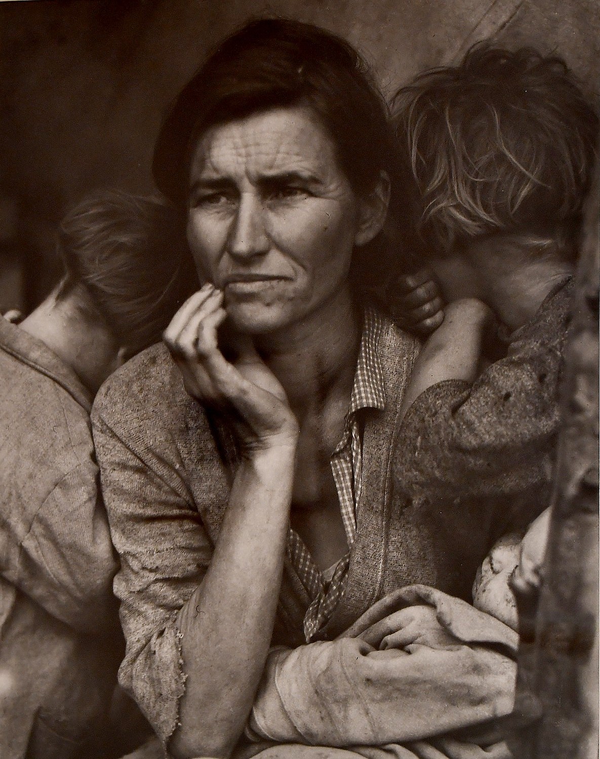
One of the most famous photos of all time, Dorothea Lange’s “Migrant Mother, Nipomo California” (1936) is on view in “Light Works: 100 Years of Photos” at NCMA © 2016 Karen Rubin/goingplacesfarandnear.com

By Karen Rubin, Travel Features Syndicate, goingplacesfarandnear.com

For the first time, all of Nassau County Museum of Art’s galleries are devoted to the art of photography, collectively giving a retrospective and perspective on 100 years and some of the most important photographs and photographers in history. The exhibit is on view through March 5, 2017.

On view in the Main Galleries on the first floor are two exhibitions drawn from the collection of the Kalamazoo Institute of the Arts (KIA), Kalamazoo, Michigan: Ansel Adams: Sight and Feeling and Light Works: 100 Years of Photos. On view in the Second Floor Galleries is New Photos: Long Island Collects, important photographic works of the last half century from private Long Island art collections.

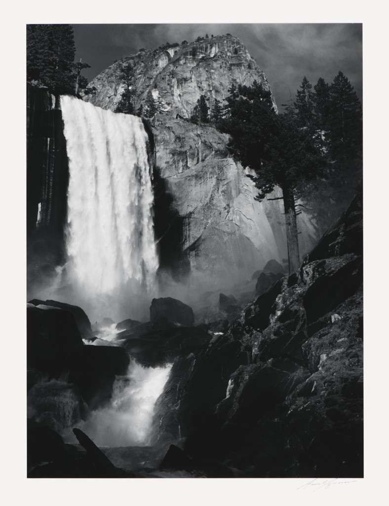
Ansel Adams: Sight and Feeling: Ansel Adams’ ability to create photographs with a remarkable range and subtlety of tones is legendary. Yet for all his technical mastery, Adams recognized that what made a compelling photograph was far more elusive. This exhibition of Adams’ photographs from the KIA collection suggests how his intuitive and emotional response to the landscape resulted in powerful and enduring photographs. 

Ansel Adams, Vernal Fall, Yosemite Valley, California, 1920, gelatin silver print. Collection of the Kalamazoo Institute of Arts; Gift of Wm. John Upjohn. ©The Ansel Adams Publishing Rights Trust.

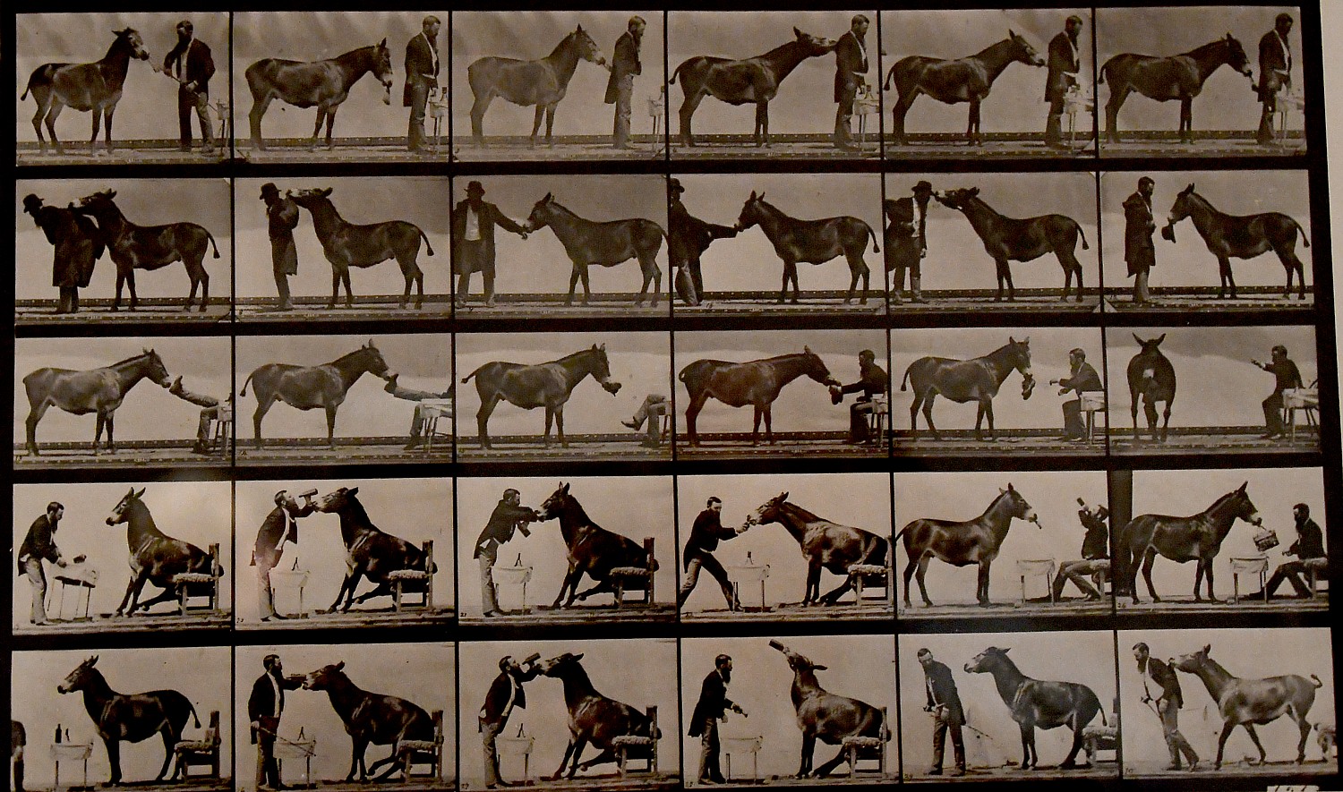
Light Works: 100 Years of Photos: From Eadweard Muybridge’s 19th-century photographic studies of animal locomotion to Richard Misrach’s contemporary chromogenic prints, this exhibition spans the history of photography. Alfred Stieglitz, Edward Curtis, Ansel Adams, Dorothea Lange, Diane Arbus, Richard Avedon, Walker Evans, Henri Cartier-Bresson and many other celebrated photographers comprise this survey of photography processes and subjects from 1873 to 2000.

Eadweard Muybridge’s breakthrough photo, “The Horse in Motion,” from 1878 is on view at the Nassau County Museum of Art © 2016 Karen Rubin/goingplacesfarandnear.com

Coincidentally, the opening at NCMA occurred the same day as Time published its “100 Most Influential Photos of All Time,” and notably, several in this exhibit have been included among those deemed the most influential including Eadweard Muybridge’s breakthrough photo, “The Horse in Motion,” from 1878; Edward Steichen’s “The Steerage” (1904), Henri Cartier-Bresson’s “Behind the Gare Saint-Lazare” (1932), Dorothea Lange’s “The Migrant Mother” (1936) among them.

New Photos: Long Island Collects focuses on significant photographic works created from the 1960s through the present day, from private collectors. Among the artists included in New Photos: Long Island Collects are John Baldessari, Matthew Barney, Robert Mapplethorpe, Vic Muniz, Cindy Sherman and William Wegman.

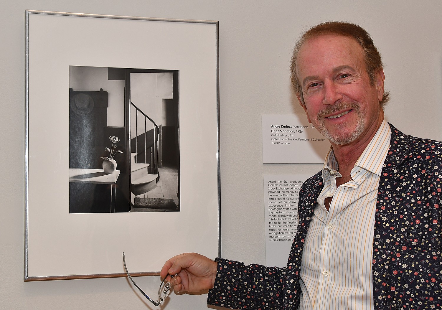
Dr. Harvey Manes poses with Andre Kertesz’s “Chez Mondrian,” a print which he also has in his collection © 2016 Karen Rubin/goingplacesfarandnear.com

The Museum is offering a variety of public programs to amplify the experience of visiting these three exhibitions. Two films are screening daily: Stryker’s America: Photographing the Great Depression and Cartier-Bresson’s Century. Three Brown Bag Lectures illuminate the art and the artists included in these exhibitions. Other public programs are inspired by the exhibitions: Sketching in the Galleries, and The River, a concert performed by the musical ensemble ETHEL. The Museum’s family programs from November 19 to March 5 similarly draw inspiration from the exhibitions: Neiman Marcus Family Sundays, February Break for Art and two Super Family Sunday offerings, Winter Wonderland and Merrynaking in a Gold Coast Mansion. For further information on these programs, visit the Museum’s website, nassaumuseum.org/events.

Even the museum’s gift shop artfully presents items that evoke the exhibit.

A Destination

The Nassau County Museum of Art is a destination in itself.

Most of the 145 acres that are now the Nassau County Museum of Art originally belonged to poet, lawyer, conservationist, political activist, patron of the arts and preservationist William Cullen Bryant, who settled in Roslyn in 1843.

The long-time editor of the New York Post built his home, Cedarmore, and founded Roslyn’s public library.

In 1862, he built a cottage for his friend and fellow poet, Miss Jerusha Dewey (you can see the cottage when you explore the hiking trails).

In 1900, Lloyd Stephens Bryce purchased Bryant’s ‘Upland Farm’ and commissioned architect Ogden Codman, Jr. to design Bryce House, the present mansion. Henry Clay Frick, co-founder of U.S. Steel Corporation purchased Bryce House in 1919 as a gift for his son, Childs Frick, a Princeton graduate who became a vertebrate paleontologist and naturalist.

Be sure to make time to explore the grounds of this magnificent estate:

Sculpture Park: Approximately 40 works, many of them monumental in size, by renowned artists including Fernando Botero, Tom Otterness, George Rickey and Mark DiSuvero among others, are situated to interact with nature on the museum’s magnificent 145-acre property.

Walking Trails: The museum’s 145 acres include many marked nature trails through the woods, perfect for family hikes or independent exploration.

Gardens: From restored formal gardens of historic importance to quiet little nooks for dreaming away an afternoon, the museum’s 145 acre property features many lush examples of horticultural arts. Explore expanded gardens and beautiful new path to the museum.

Nassau County Museum of Art is located at One Museum Drive in Roslyn Harbor, just off Northern Boulevard, Route 25A, two traffic lights west of Glen Cove Road. The museum is open Tuesday-Sunday, 11 a.m.-4:45 p.m. Admission is $12 for adults, $8 for seniors (62 and above) and $4 for students and children (4 to12). Members are admitted free. Docent-led tours of the exhibition are offered at 2 p.m. each day; tours of the mansion are offered each Saturday at 1 p.m.; meet in the lobby, no reservations needed. Tours are free with museum admission. Family art activities and family tours are offered Sundays from 1 pm; free with museum admission. Call (516) 484-9338, ext. 12 to inquire about group tours. The Museum Store is open Tuesday through Sunday, 11 a.m. to 4:30 p.m. The Red Maple Market Café is open Saturday and Sunday, noon to 3 p.m. Call (516) 484-9337 for current exhibitions, events, days/times and directions or log onto nassaumuseum.org.

____________________

© 2016 Travel Features Syndicate, a division of Workstyles, Inc. All rights reserved. Visit goingplacesfarandnear.com and travelwritersmagazine.com/TravelFeaturesSyndicate/. Blogging at goingplacesnearandfar.wordpress.com and moralcompasstravel.info. Send comments or questions to [email protected]. Tweet @TravelFeatures. ‘Like’ us at facebook.com/NewsPhotoFeatures


36 Hours in Pittsburgh: Strip District Exemplifies City’s Past, Future

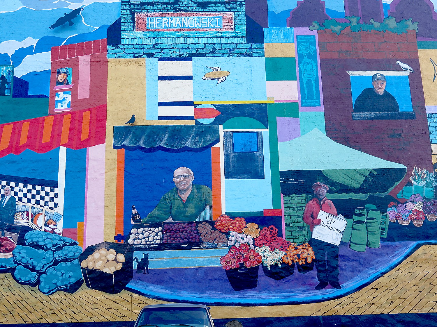
Pittsburgh’s Strip District has an artful, playful vibe © 2016 Karen Rubin/goingplacesfarandnear.com

By Karen Rubin, Travel Features Syndicate, goingplacesfarandnear.com

(With only one full day to explore Pittsburgh, I specifically seek out attractions that define the city, all walkable within the downtown, getting advice from the Omni William Penn Hotel concierge. I start on its two remaining funiculars, going up the Monongahela Incline and down the Duquesne Incline, dating from the 1870s, and stroll Grandview Avenue that links the two, and continue on to Point State Park and the Fort Pitt Museum, then on to the National Aviary and the Andy Warhol Museum. This is fourth in series.)

I walk back over the 7th Street Bridge (The Andy Warhol Bridge, as it happens), into Pittsburgh’s Cultural District, where there is a cluster of theaters and galleries, including one named for another native son of Pittsburgh, playwright August Wilson (there is an August Wilson Center / African American Cultural Center, 980 Liberty Avenue, in the Cultural District).

I take it all in, but I am en route to the interestingly named Strip District, where literally in front of your eyes, you can see gentrification unfold – factories converted to apartments and lofts. This has become an amazing restaurant district, capitalizing on the diverse immigrant experience in Pittsburgh. Within a few blocks, there is a United Nations-worth of dining traditions and markets.

Pittsburgh’s Strip District shows off the city’s past, present and future © 2016 Karen Rubin/goingplacesfarandnear.com

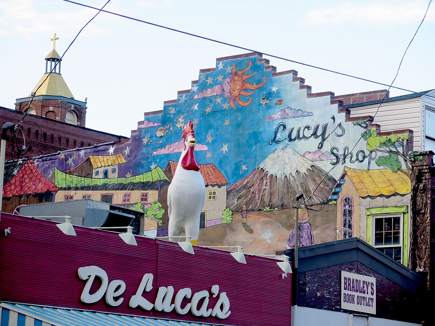
The Strip District is described as “authentic Pittsburgh,” where the locals go for great goods at low prices. The streets along the half-mile long district are linked with restaurants, ethnic grocers, produce stands, sidewalk vendors, meat and fish markets – a haven for foodies. It is so colorful, artful, playful.

Pittsburgh’s Strip District offers trendy restaurants © 2016 Karen Rubin/goingplacesfarandnear.com
Fabric store in Pittsburgh’s Strip District © 2016 Karen Rubin/goingplacesfarandnear.com

A sign over a restaurant, Gaucho, an Argentinian Grill, which has a line of people outside waiting their turn, reads Home Improvement, Lifestyle, Dining & Entertainment. I pass Vietnamese, Korean, Thai restaurants, markets like Robert Wholey Co. purveying live Maine lobster, whole farm raised rabbits and whole duckling; a Middle Eastern grocery, Stamoolis Bros. Co, since 1909; the Pennsylvania Macaroni Company (fresh handmade mozzarella, Pennmac.com); a Mexican grocery; Pittsburgh Popcorn, next door to La Prima Espresso Corp, across the street from Chocolat; an Asian supermarket across from the Brooklyn Brewery; the S&D Polish Deli, Grandpa Joe’s Candy Shop, a textile shop selling fabrics, thread and button; and Mike Feinberg & Co’s sports store.

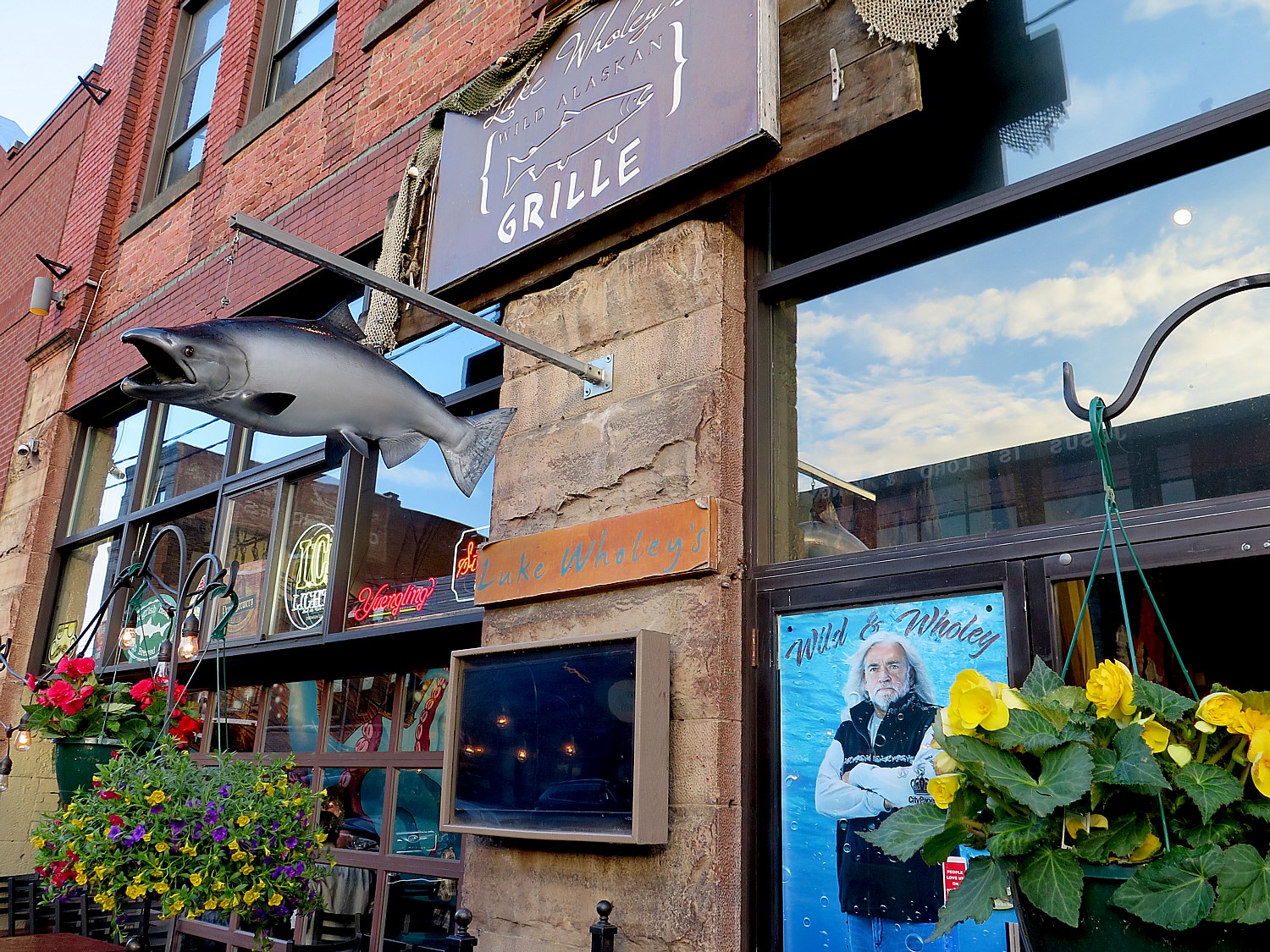
And trendy restaurants like Luke Wholey’s Wild Alaskan Grill (probably related to the market); Jade 99, Chicken Latino (Peruvian); Casa Rena (Mexican),

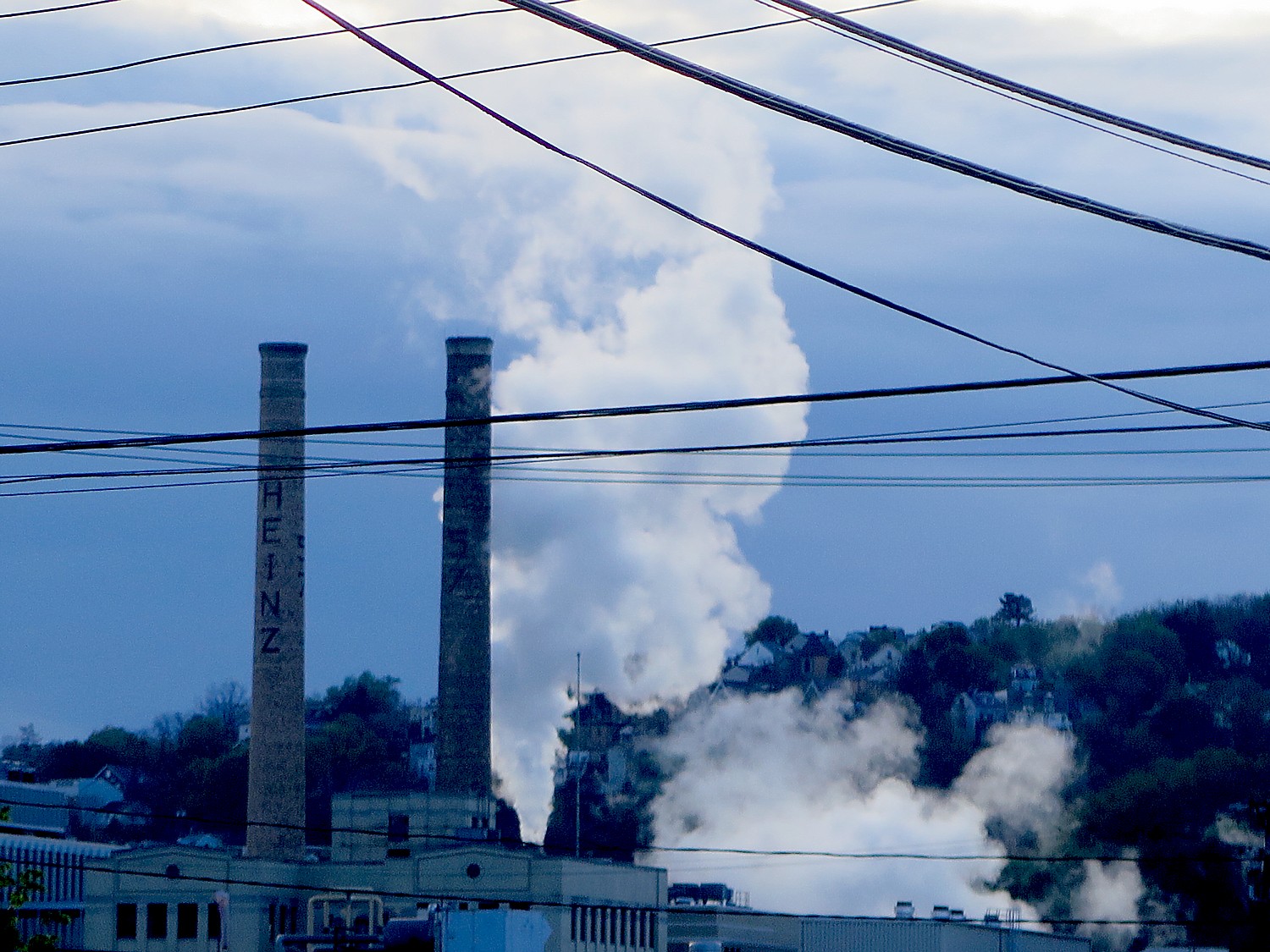
Smoke billowing from a processing plant © 2016 Karen Rubin/goingplacesfarandnear.com

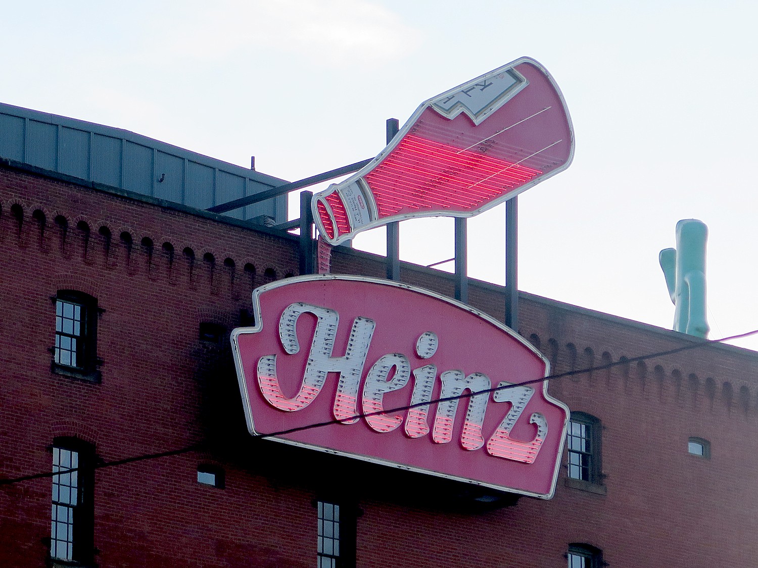
Walking back, I see smoke emanating from a factory with the Heinz name on it, and pass a red-brick building with a giant neon Heinz Ketchup display (above the Heinz History Center building), diagonally across from United States Steel Corporation offices (while downtown is the United Steelworkers Union building).

Senator John Heinz History Center 

I am too late to visit the Senator John Heinz History Center, but it is on my list to visit when I return.

Devoted to the history and heritage of Western Pennsylvania, the 370,000 sq. ft. Senator John Heinz History Center (more formally known as the Historical Society of Western Pennsylvania) is Pennsylvania’s largest history museum and, since 2000, an affiliate of the Smithsonian Institution.

Ketchup Bottle in neon above the Heinz History Center © 2016 Karen Rubin/goingplacesfarandnear.com

In addition to the Fort Pitt Museum which I have visited, the Senator John Heinz History Center family of museums and programs includes:

The Senator John Heinz History Center presents compelling stories from American history with a Western Pennsylvania connection in an interactive environment; the museum’s Smallman Street home combines the former Chautauqua Lake Ice Company building with a five-story Smithsonian wing.

The Western Pennsylvania Sports Museum, a museum-within-a-museum located on the History Center’s second and third floors, celebrates the region’s passion for amateur and professional sports, from football to baseball and hockey to golf.

Meadowcroft Rockshelter and Historic Village, the oldest site of human habitation in North America, is located in Avella, Washington County, Pa. Meadowcroft Rockshelter, a National Historic Landmark, showcases 16,000-year-old evidence of the region’s earliest inhabitants under a massive rock overhang. In addition to the Rockshelter, the site is also home to three outdoor historic areas, including a 16th century Indian village, 18th century Frontier Trading Post, and 19th century village that help visitors experience life over the past 500 years.

More than 250 years of Western Pennsylvania’s history is preserved at the Thomas and Katherine Detre Library & Archives. Founded in 1879, the Library & Archives’ collections, located on the History Center’s sixth floor, are accessible to researchers, students, and the general public.

The new Museum Conservation Center provides visitors with professional services and expert advice on how to properly preserve and care for family heirlooms.

Heinz History Center, 1212 Smallman St., Pittsburgh, PA 15222, 412-454-6000, www.heinzhistorycenter.org (10-5 daily)

Biking on a dedicated lane in Pittsburgh © 2016 Karen Rubin/goingplacesfarandnear.com

Other important Pittsburgh attractions which I have on my list for my next visit:

Soldiers & Sailors Memorial Hall & Museum, the nation’s only military memorial dedicated to honoring all branches of service – exhibits cover all of America’s conflicts and include a face casting done of Abraham Lincoln the month he died; the Frick Art & Historical Center, the Carnegie Museums of Art and Natural History (from fine art to fossils, masterpieces to minerals, CMOA.org;  the Carnegie Museum of Natural History offers 5 billion years of Earth’s history, and the world’s third largest dinosaur repository (carnegiemnh.org). Also, the Phipps Conservatory & Botanical Gardens and the Pittsburgh Zoo & PPG Aquarium.

For more information, contact Visit Pittsburgh, 412-281-7711, 800-359-0758, 877-LOVE PGH (568-3744), [email protected], www.visitpittsburgh.com. 

Next: The Omni William Penn Hotel is Part of Pittsburgh Heritage 

See also:

One Day, Two Nights in Pittsburgh: From Grey to Green, A Proud City Revitalized

36 Hours in Pittsburgh: Point State Park Proves Highlight of Walking Tour

36 Hours in Pittsburgh: Andy Warhol Museum is at Center of Revitalized City

____________________

© 2016 Travel Features Syndicate, a division of Workstyles, Inc. All rights reserved. Visit goingplacesfarandnear.com and travelwritersmagazine.com/TravelFeaturesSyndicate/. Blogging at goingplacesnearandfar.wordpress.com and moralcompasstravel.info. Send comments or questions to [email protected]. Tweet @TravelFeatures. ‘Like’ us at facebook.com/NewsPhotoFeatures
36 Hours in Pittsburgh: Andy Warhol Museum is at Center of Revitalized City

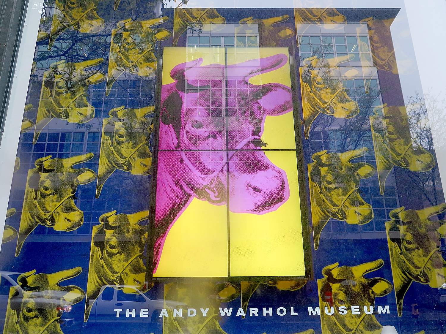
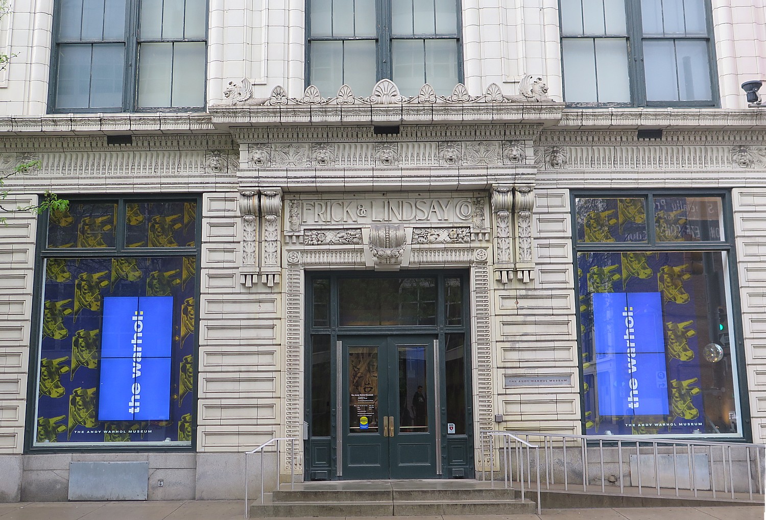
The Andy Warhol Museum pays homage to a native son of Pittsburgh © 2016 Karen Rubin/goingplacesfarandnear.com

By Karen Rubin, Travel Features Syndicate, goingplacesfarandnear.com

I have come to Pittsburgh for the three-day, 120-mile Rails-to-Trails Conservancy’s Spring Sojourn on the Great Allegheny Passage, and used it as an opportunity to explore Pittsburgh, a city that once was known for steel mills, but which now has won accolades as “America’s most livable city.” 

I am fascinated to see how it made such a transition from grey to green. 

With only one full day to explore, I specifically seek out attractions that define Pittsburgh, all walkable within the downtown, getting advice from the Omni William Penn Hotel concierge. 

I start on its two remaining funiculars, going up the Monongahela Incline and down the Duquesne Incline, dating from the 1870s, and stroll Grandview Avenue that links the two, and continue on to Point State Park and the Fort Pitt Museum. (This is third in a series) 

The National Aviary

I continue my walk from the Fort Pitt Museum, over the Fort Duquesne Bridge toward the National Aviary (it was the “national” that got my attention), fascinated how city planners  managed to turn a city designed for industry and machines into one that can be so walkable and bikeable.

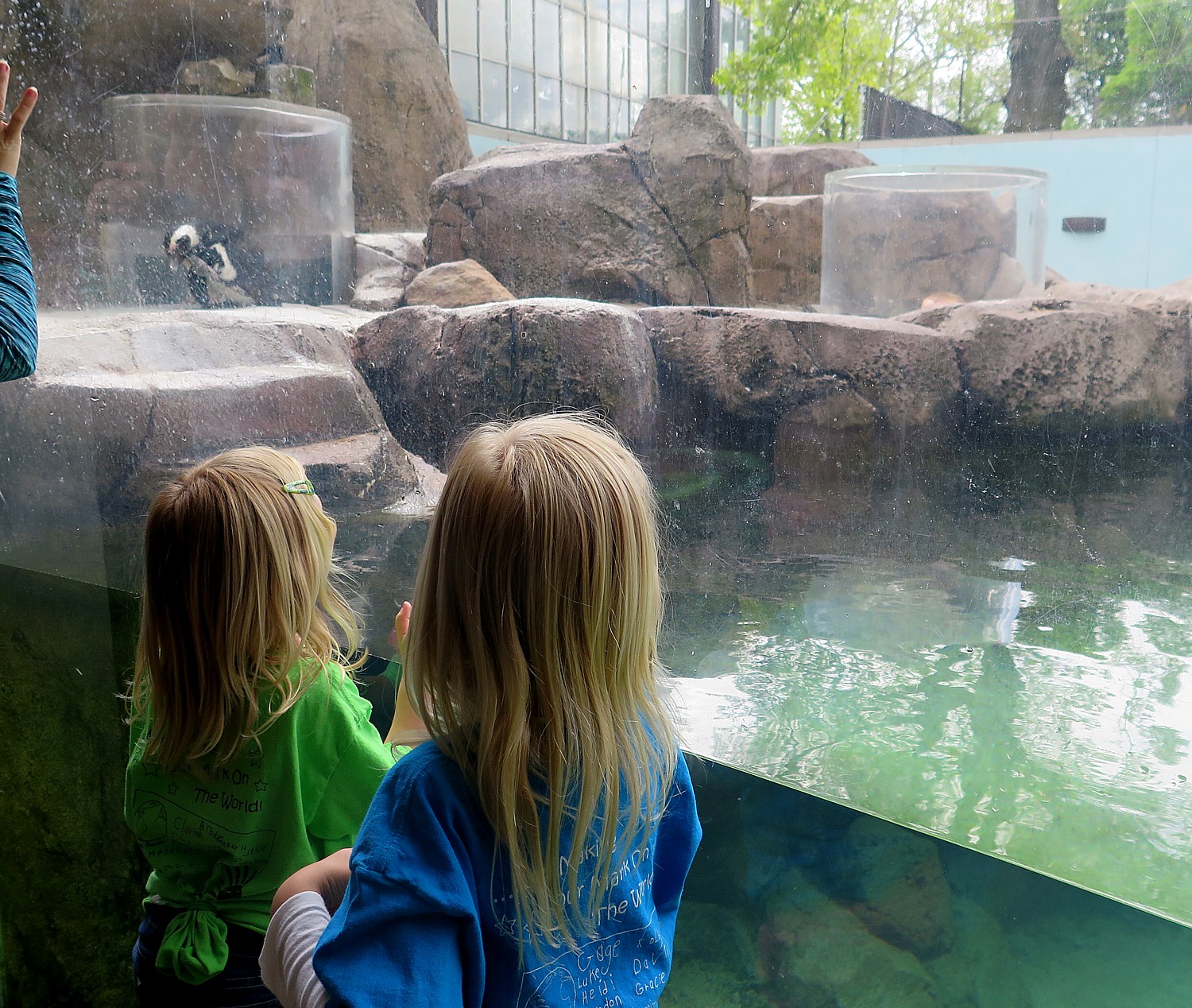
Children delight at the exhibits at the National Aviary in Pittsburgh © 2016 Karen Rubin/goingplacesfarandnear.com

The National Aviary, America’s only independent indoor nonprofit zoo dedicated to birds, offers a lovely exhibit of birds, including being able to walk through massive habitat-style exhibits, where the birds – like the Victoria Crowned Pigeon (amazing headdress), Golden Breasted Starling (nesting) fly freely about you, often landing very close by.

Bats at the National Aviary in Pittsburgh © 2016 Karen Rubin/goingplacesfarandnear.com

There is also a bat exhibit (you can watch bat feeding), poke your head up into the penguin pen, As I walk about, I am surprised to read a marker that states this was the site of the Western Penitentiary (1826-1880) and held confederate prisoners here 1863-64.

The National Aviary (www.aviary.org), which was designated  “national” by President Clinton, would certainly be a highlight for family travelers and am having such an amazing time taking pictures, seeing some birds that I had never seen before in such close proximity without cages, I lose all sense of time (which is why I didn’t have enough time to visit the Heinz History Center).

The National Aviary in Pittsburgh lets you see up close, without any caging between you, such exotic birds as the Victoria Crowned Pigeon © 2016 Karen Rubin/goingplacesfarandnear.com

The Warhol Museum

The National Aviary is also just a short walk to my next stop: the Warhol Museum. I had not realized that Andy Warhol was a native son of Pittsburgh (born to a Slovakian family of modest means, he attended Carnegie Mellon which was Carnegie Technical at the time) – this museum is in the tradition of the Dali Museum in St. Petersburg, totally extolling the life of one artist. It basically continues what Andy Warhol did most successfully his whole life: market his art to inflate prices. The best part, for me, was learning more about his biography – what made him “tick”, his creative process and about his techniques.

The Andy Warhol Museum, a 7-story temple to the artist which opened in 1994, was created by the Andy Warhol Foundation, Dia Center for the Arts, and the Carnegie Foundation which operates the museum © 2016 Karen Rubin/goingplacesfarandnear.com

My own belief is that Warhol was more of a marketing genius than an artistic one (at least Salvador Dali was both a marketing genius and an artistic one), but I am willing to be convinced otherwise as I roam the museum.

Indeed, as a placard notes, since the seven-story museum opened in 1994, there has been a steady increasing level of recognition of Warhol’s “singular contribution to 20th century art and his extraordinary influence on contemporary art internationally. The museum is on the forefront of research into Warhol’s work.”

There is a timeline along the massive walls that document in excruciating detail Warhol’s life and learn such tidbits as: Andrew Warhola was born in 1928 to immigrants from Mikona in Slovakia; he graduated Carnegie Tech (which became Carnegie Mellon); in 1956 he met Edmond Walloaitch who used photography in his own works; most of Warhol’s early endeavors were self-published; he was inspired by popular culture and enlarged images from magazines and photographs with a projector, then painted the projection on canvas; he used a rubber stamp, then the silk screen process; the first silkscreen painting based on a photograph was a baseball, in 1962; he “replicated the look of commercial advertising, giving Warhol faithful duplication of his appropriated source image, while also allowing him to experiment with over-painting, off-register and endless chance combinations”.

After graduating Carnegie Tech, he took a “risk” and came to New York City where he got his big break, illustrating a story “What is Success” for Glamour Magazine. “He became one of the most successful commercial illustrators.” A particularly noteworthy item on the timeline: 1972- after publication of his “Vote McGovern,” the IRS audited Warhol annually until his death.” Warhol died in 1987, at the age of 58.

He created the “blotted line technique” – where he could trace or copy and an image “appropriating images from popular culture” – and reproduce any number of them, factory-style.

Warhol, we learn, made a fortune from portraits, once again, getting a giant commercial boost after an exhibit at the Whitney in 1979, curated by his close friend David Whitney consisting of 56 double portraits of artists, fashion designers, collectors, art dealers, which showcased an aspect of his painting “that he characterized as ‘business art’.”

After the 1979 show, his private portraits business hit heights- early 80s – he produced did 50 a year at $40K for 2-panel, or $2 million in annual profits.

“He was unapologetic in his imposition of lucrative business model as part of his art practice.”

I notice a prominently displayed portrait of Prince from 1984, which is up just after the musician’s death.

Andy Warhol was known for his passion as a collector – very possibly an outgrowth of his impoverished childhood and his expropriation of others’ art and design. Over his lifetime, he collected some 500,000 artifacts. There is an immense room, called the “Vault” that is filled with “time capsules” – 610 flimsy cartons, each with 500 objects.

I found it totally ironic, though, that you are not allowed to take any photos since Warhol’s art was based on expropriating the images and designs created by others (ie. Campbell Soup Can, Marilyn Monroe photo). You can take part in workshops to learn the silkscreening techniques he used. The museum is a must-see for anyone who is a fan.

The Andy Warhol Museum was created by the Andy Warhol Foundation, Dia Center for the Arts, and the Carnegie Foundation which operates the museum. It is one of four Carnegie Museums of Pittsburgh (Carnegie Museum of Art, Carnegie Museum of National History and Carnegie Science Center are the others, www.carnegiemuseums.org).

The Andy Warhol Museum, 117 Sandusky Street, Pittsburgh, PA 15212, 412-237-8300, www.warhol.org ($20/adults, $10/students and children 3-18, half price on Fridays, 5-10 pm; closed Mondays). 

For more information, contact Visit Pittsburgh, 412-281-7711, 800-359-0758, 877-LOVE PGH (568-3744), [email protected], www.visitpittsburgh.com.

Next: Pittsburgh Walking Tour Continues to Strip District 

See also:

One Day, Two Nights in Pittsburgh: From Grey to Green, A Proud City Revitalized

36 Hours in Pittsburgh: Point State Park Proves Highlight of Walking Tour

____________________

© 2016 Travel Features Syndicate, a division of Workstyles, Inc. All rights reserved. Visit goingplacesfarandnear.com and travelwritersmagazine.com/TravelFeaturesSyndicate/. Blogging at goingplacesnearandfar.wordpress.com and moralcompasstravel.info. Send comments or questions to [email protected]. Tweet @TravelFeatures. ‘Like’ us at facebook.com/NewsPhotoFeatures

36 Hours in Pittsburgh: Point State Park Proves Highlight of Walking Tour

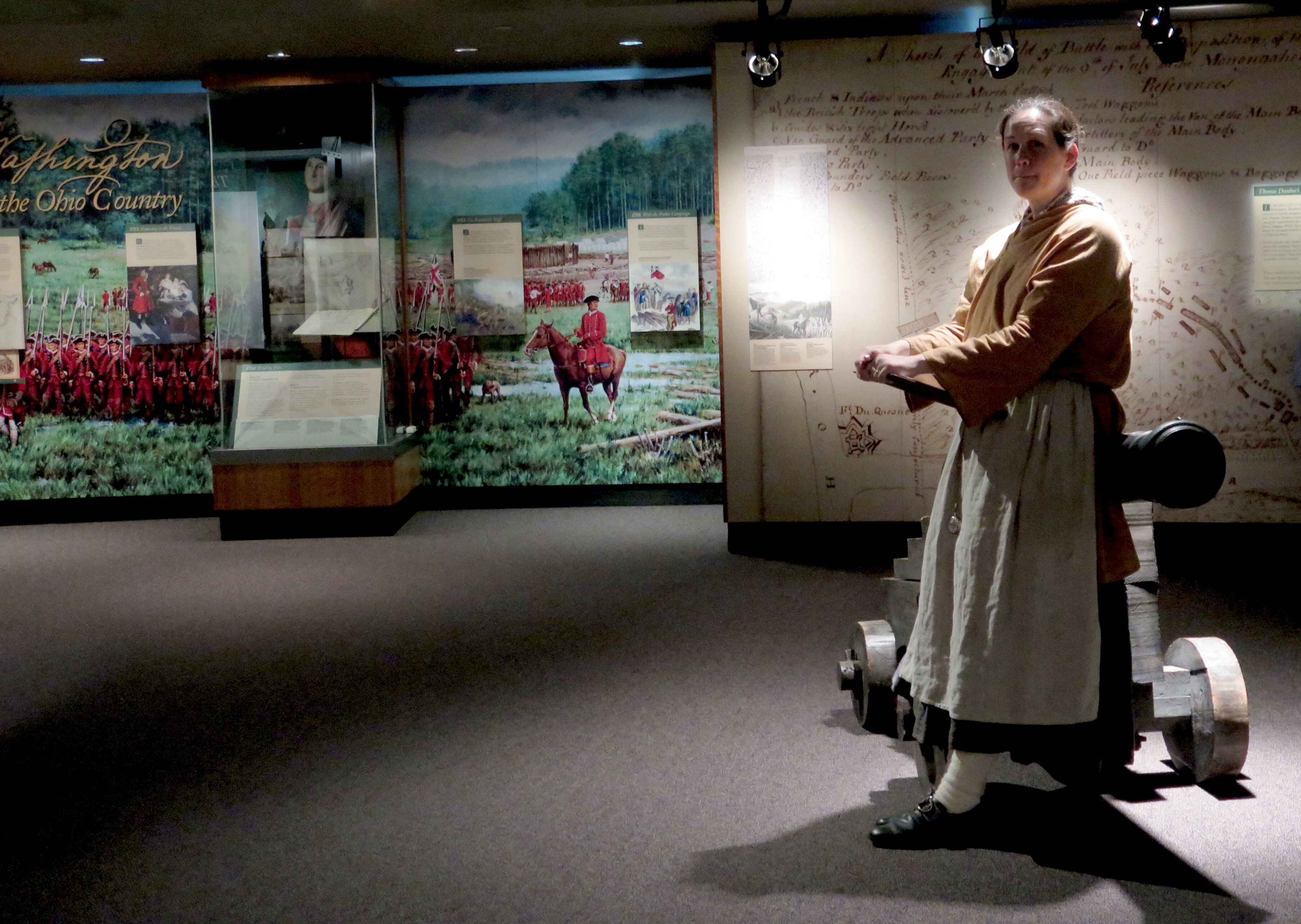
Costumed docent sends school kids off on a scavenger hunt at the Fort Pitt Museum © 2016 Karen Rubin/goingplacesfarandnear.com

by Karen Rubin, Travel Features Syndicate, goingplacesfarandnear.com

(I have come to Pittsburgh to join the Rails-to-Trails Conservancy’s Sojourn three-day, 120-mile bike tour on the Great Allegheny Passage. I only have one full day in the city, so I set out on a walking tour aimed at focusing on what is uniquely Pittsburgh’s heritage. In the first part of the series, I experienced the Monongahela Incline, Mount Washington, Grandview Avenue, and the Duquesne Incline. I continue my walking tour at Point State Park.)

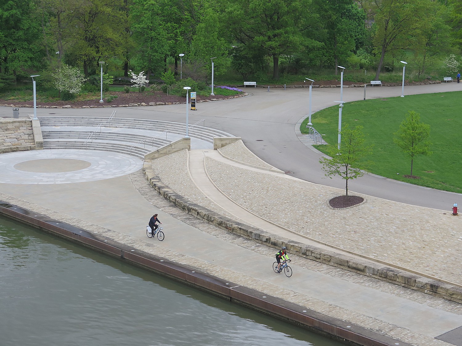
Biking around Point State Park © 2016 Karen Rubin/goingplacesfarandnear.com

What a jewel Pittsburgh’s Point State Park is, literally at the confluence of three rivers:  the Monongahela River at one side and where the Allegheny and Ohio Rivers meet on the other. Its location made it critical to control over this territory and later, the industrial and economic development of the nation.

The Point offers beautiful park land as well as some of Pittsburgh’s most significant heritage sites.

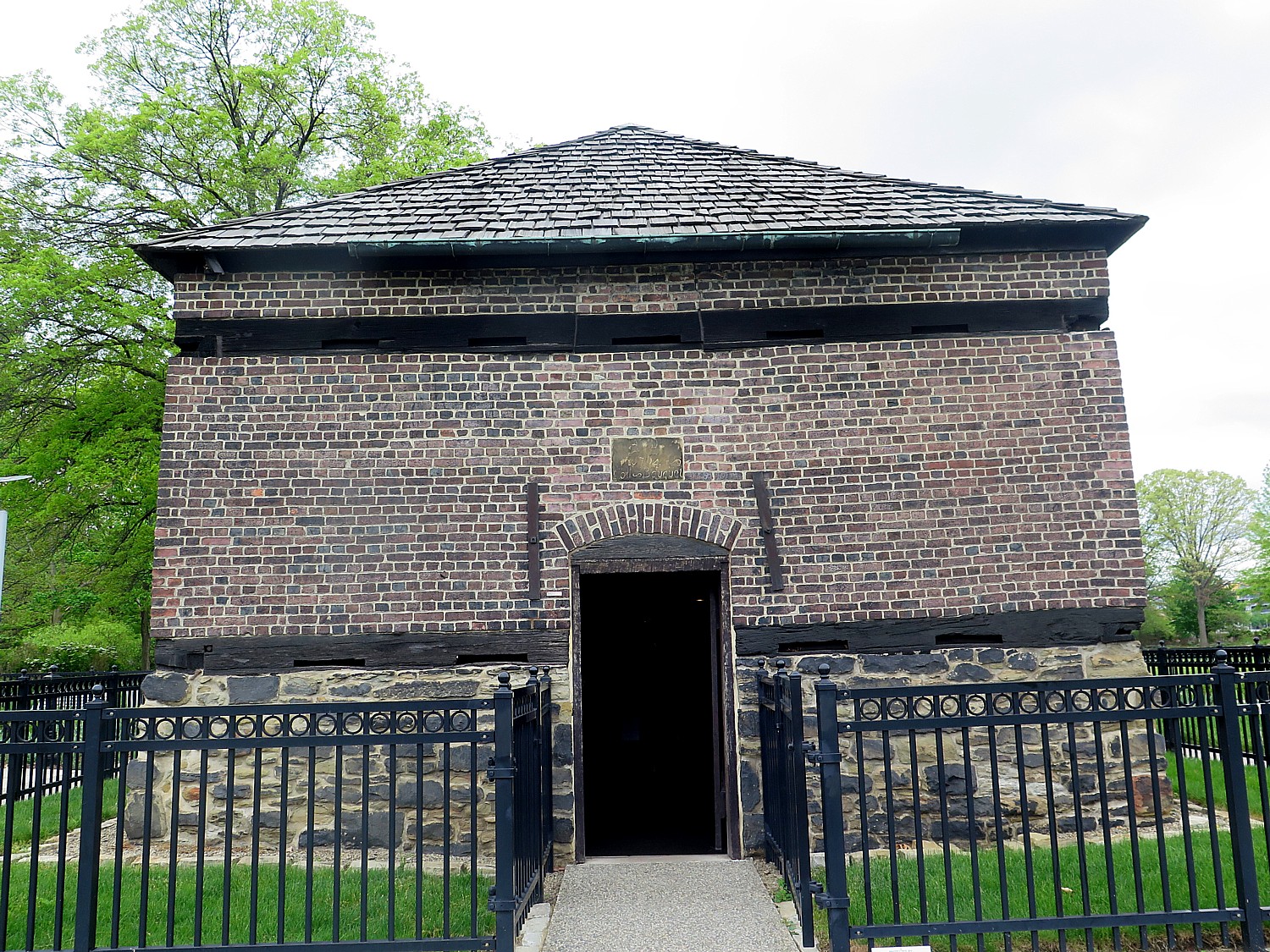
You first come upon the Fort Pitt Blockhouse, built in 1764, the oldest building in Pittsburgh and the only remaining structure from colonial times. Inside this small, dark space, it gives you a glimpse of western Pennsylvania’s role during the French & Indian War and the American Revolution (admission is free).

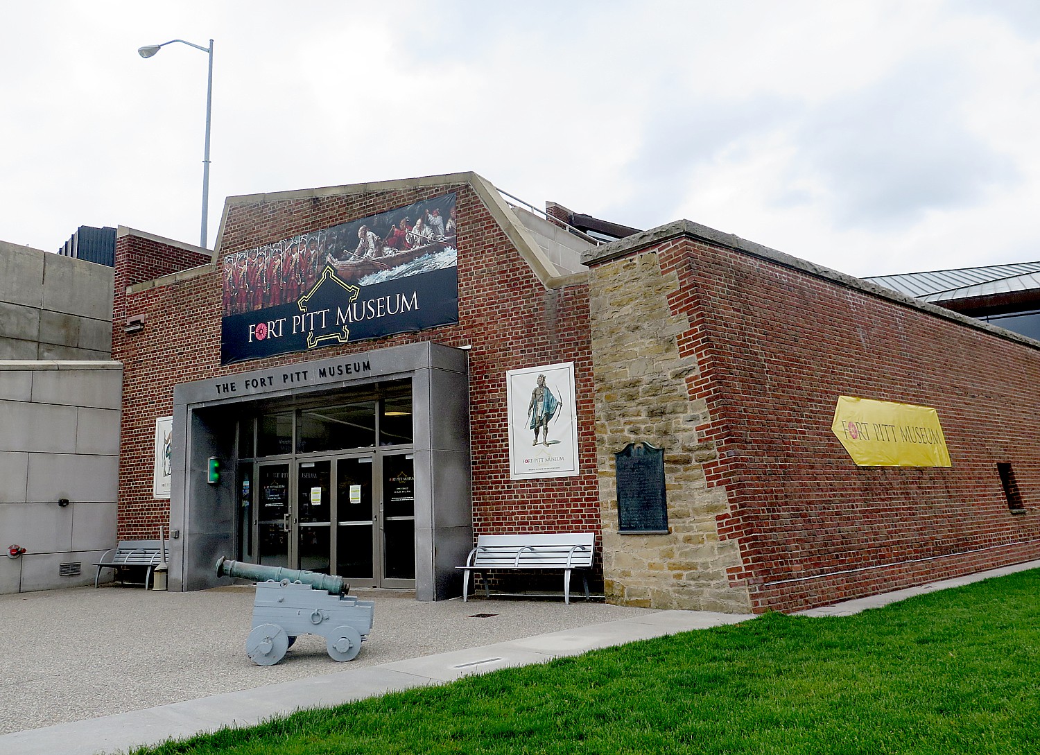
What proves to be the highlight of my visit to Pittsburgh is the Fort Pitt Museum (the newest member of the Senator John Heinz History Center, in association with the Smithsonian Institution), a modern, two-story, 12,000 square foot museum built on the site of Fort Pitt.

“From 1754 to today, Fort Pitt has shaped the course of American and world history as the birthplace of Pittsburgh.

Fort Pitt Blockhouse, built in 1764, is the oldest building in Pittsburgh and the only remaining structure from colonial times © 2016 Karen Rubin/goingplacesfarandnear.com

The presentations are absolutely thrilling in conveying how at a critical point in the settlement of the New World, this point was the epicenter of world-changing events.

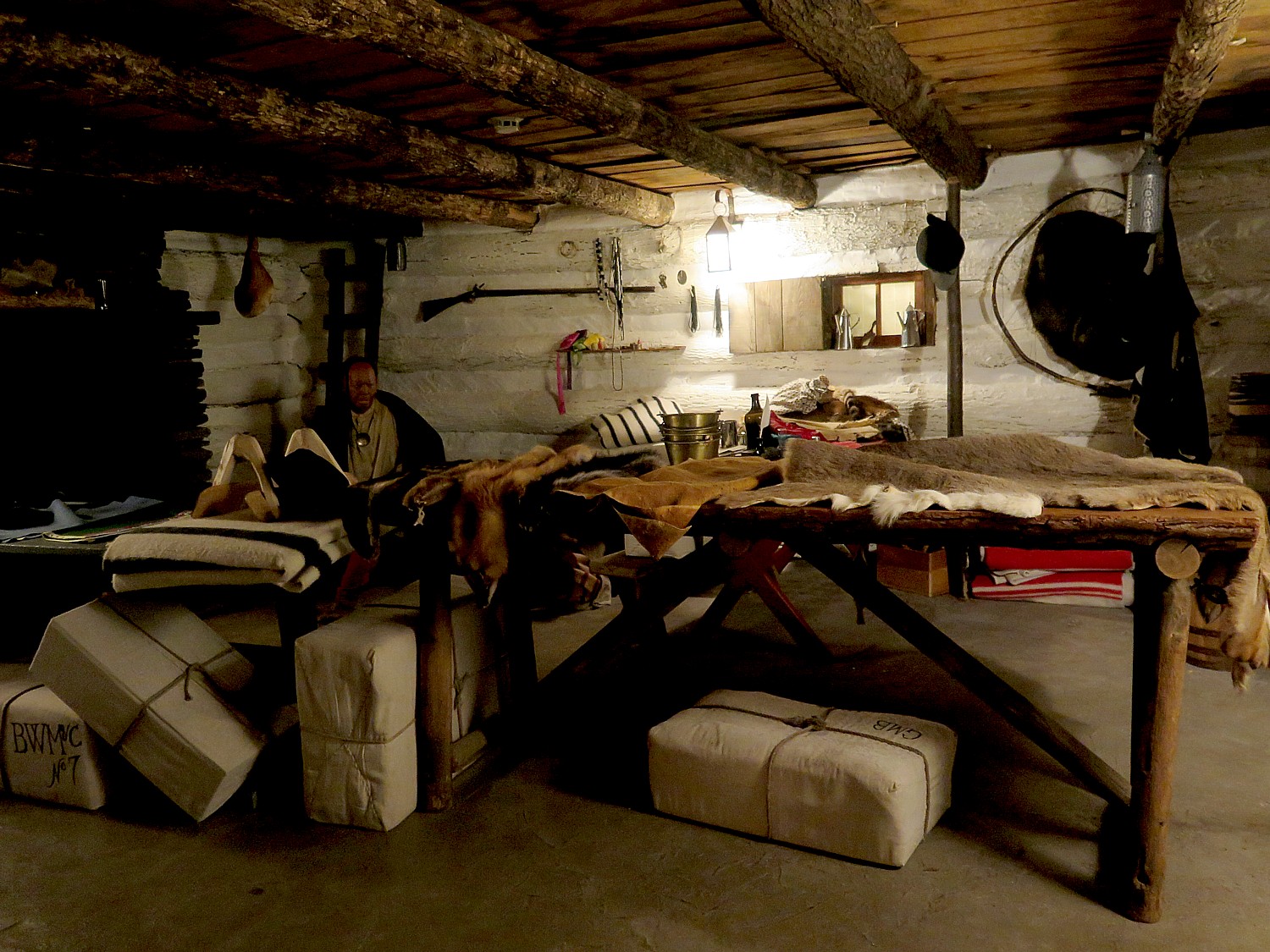
The museum tells the story of Western Pennsylvania’s pivotal role during the French & Indian War, the American Revolution, and as the birthplace of Pittsburgh (William Pitt never actually visited). It offers extremely well crafted interactive exhibits, life-like historical figures, rare artifacts that let you come away with a new appreciation for the strategic role the region played.

Known as The Point, this was once one of the most strategic areas in North America, controlling access to Ohio and Mississippi Rivers and much of interior of North America; it was the intersection of cultural exchange with native people, and a departure point for settlers moving west.

I appreciated the balance in the presentations between points of view – the colonists (actually split between the British and the French) and the Indian tribes. There is a sensational video that presents the different perspectives (the Indians still come up short) – the different perspectives that the British and French brought, and the Indians whose culture did not acknowledge that a person could own land, but by this point, the Indian tribes had already had already become dependent economically on imported European goods.

British and French clashed for control of the New World colonies constantly from 1689-1748:  The French, most interested in trade, saw the Ohio River as a way to connect Canada and Louisiana and leverage their relations with Indians. The British, determined to control territory, also realized the strategic importance of this artery, “the Keystone of the Frontier.”

This becomes clear in a superbly produced video, “Whose Land?”: “The French couldn’t stand the British and the British wouldn’t rest until they owned [the territory].” Native Americans, were fully aware that they could not allow the Europeans to control the land, but they were caught in the middle – by this point, Indians were dependent upon trading for manufactured goods.

“The Indians negotiated with weight and authority. They had a powerful confederacy

Iroquois – Seneca, Cayuga, Mohawk, Oneida. They had sophisticated government, freedom, a rich culture, complex trading relations. Agriculture was central but they did not have private ownership. They took a cue from nature. They enjoyed trade – and were heavily dependent on some European goods, and even took up the European religion, but kept their own ways.”

“God created all people but different,” an Indian chief said in 1742.

With French dominion on one side of the river and English on the other, where does the Indian claim lie?

Indians became dependent upon European traders © 2016 Karen Rubin/goingplacesfarandnear.com

George Washington, a 21-year old major in 1753 with experience as a surveyor, was given a mission to explore to Fort LeBoeuf and recommended the site for Fort Prince George.

Washington “had no diplomatic experience, and couldn’t speak French yet he was selected to bring message to French. He was selected because of his close connection with Ohio corporations and other Virginian land speculators in land. He knew ‘the West’.”

In 1754, Fort Duquesne (which was renamed Fort Pitt when the British took over), was the largest French military installation in Ohio, and evicted the Virginians.

William Pitt, for which the fort is named, never came to the colonies. The city originally was called “Pittsboro”. The Fort – perhaps because it was so foreboding, was attacked only once, during Pontiac’s War of 1763.

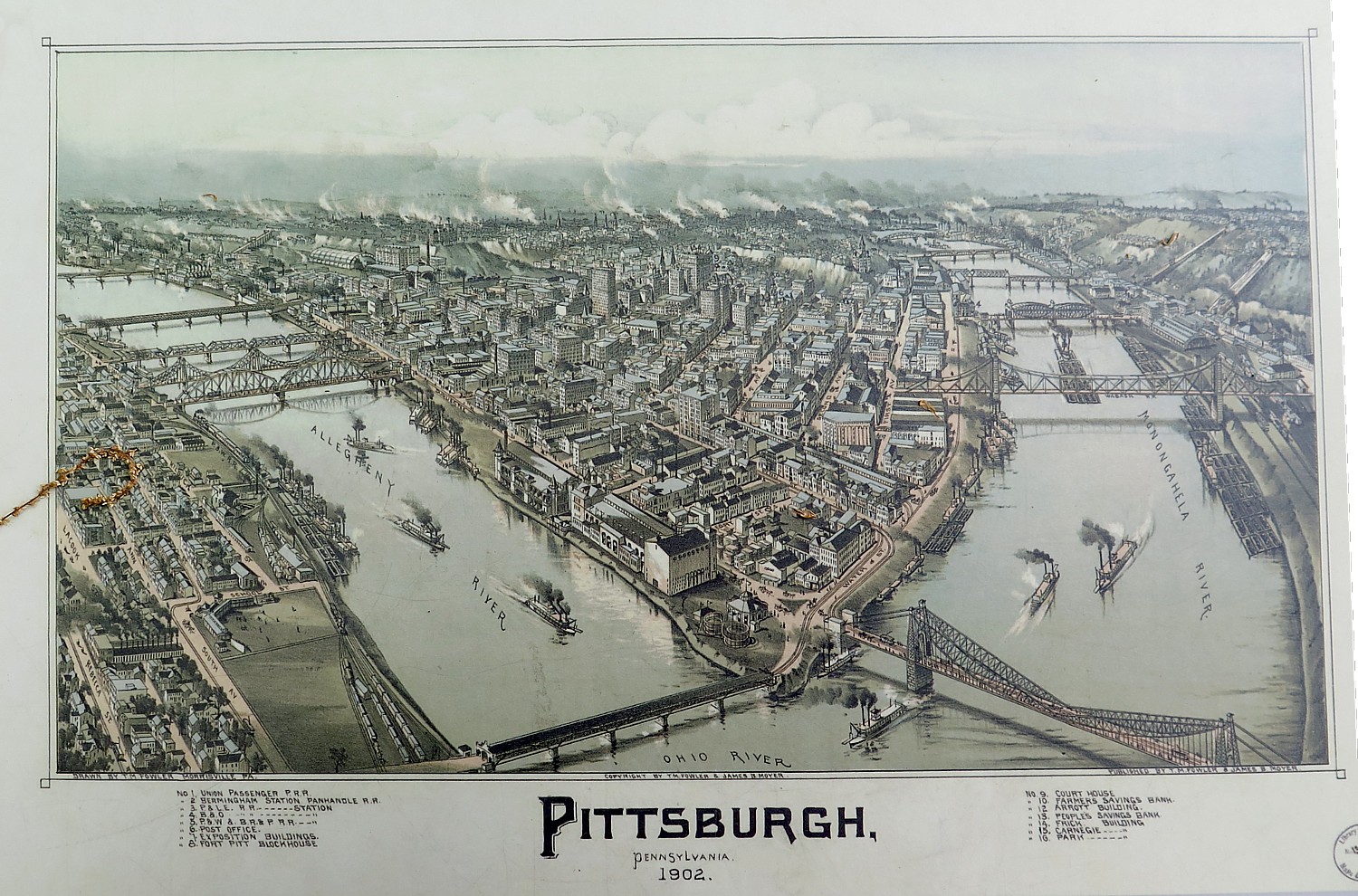
Its location made Pittsburgh a boom town. The Ohio River carried 18,000 settlers through in 1788. The population of Pittsburgh, just 150 in 1780, grew to 4,800 by 1810, making it the third largest in Pennsylvania after Philadelphia and Lancaster.

Its economy developed from coal mining, glass making, and boat building, fueling the nation’s industrial and physical expansion. The city was incorporated in 1816.

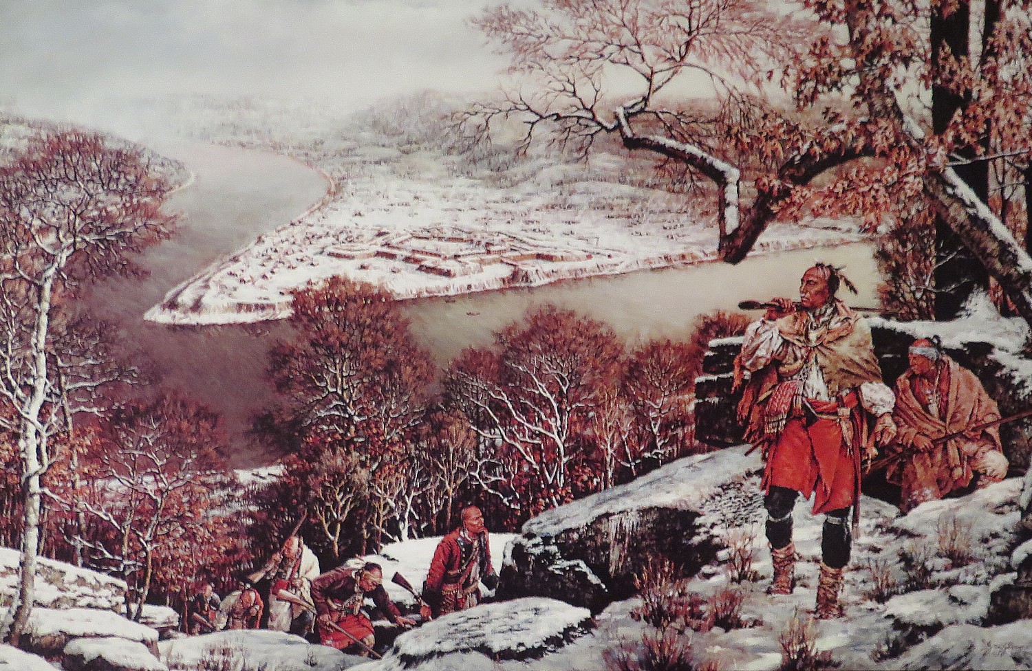
Illustration of Indians on what is now Mount Washington, with Fort Pitt below.

When I visit the museum, there are a number of school groups coming through. The school kids are sent out in teams on a scavenger hunt by a docent in period dress. What surprises the kids the most? That the Indians were not as primitive as they expected, she tells me. Indeed, many are pictured wearing European-style clothes and served in the military. By this point, the Indians were part of the world economy – the Indians traded their furs for items from as far away as China; the European traders were like Walmart to them. For the first time, I understand why the Indians did not kick the Europeans out when it was clear they were setting up outposts.

As I explore the exhibits, I learn of what may have been the first incidence of germ warfare: in 1763, an Indian trader, on orders from Ft. Pitt, is alleged to have given Indians two blankets and a handkerchief from the fort’s smallpox hospital.

I am most excited when I am introduced to an idea or a topic that I knew nothing about before, , that makes you really think.

‘Captured by Indians’ 

That experience happened at the Fort Pitt Museum, which happened to be presenting a fascinating exhibit, “Captured by Indians,” about European (white) colonists who were kidnapped by Indian tribes. The exhibit did not disguise the brutality, but most fascinating is that the individuals (who often were young when they were taken captive), particularly women, once they survived the arduous journey and a literal gauntlet (to weed out the weak), were adopted into the tribe, treated as equals, and generally had a better life than the colonial settlements they came from, especially if they were indentured servants or slaves or women, to the extent that when they had the chance to be “freed” and be returned to their community – such as in a hostage exchange – they would refuse and even escape back to the tribe.

The presentation, the artifacts and the connection to people living today, descendants of those people, was utterly fascinating.

“During the turbulent decades of the mid-18th century, thousands of European and African settlers were captured by American Indians whose dwindling numbers forced them to adopt non-Indians in an effort to survive. The subsequent experience of captivity and adoption forever altered both the captives and their captors as identities shifted, allegiances were tested, and once-rigid lines between cultures became forever blurred.”

The exhibit draws upon documentary evidence gleaned from 18th and early 19th century primary sources, dozens of rare artifacts, and a wide array of imagery, to examine the practice of captivity from its prehistoric roots to its impact on modern American Indians and other ethnicities.

The exhibit notes that the many of the wave of European settlers who came in the 18th century  sold their freedom to come as indentured servants. Most who came were poor. The borderlands were already bitterly contested by rival Europeans and native tribes. These settlers were viewed by colonial legislators as buffers against the Indians.

The captives taken in brutal raids, massacres and abductions were mainly of young who were physically fit and could assimilate and women who would be married off and bear children. They would size people up in a raid, and decide who to take.

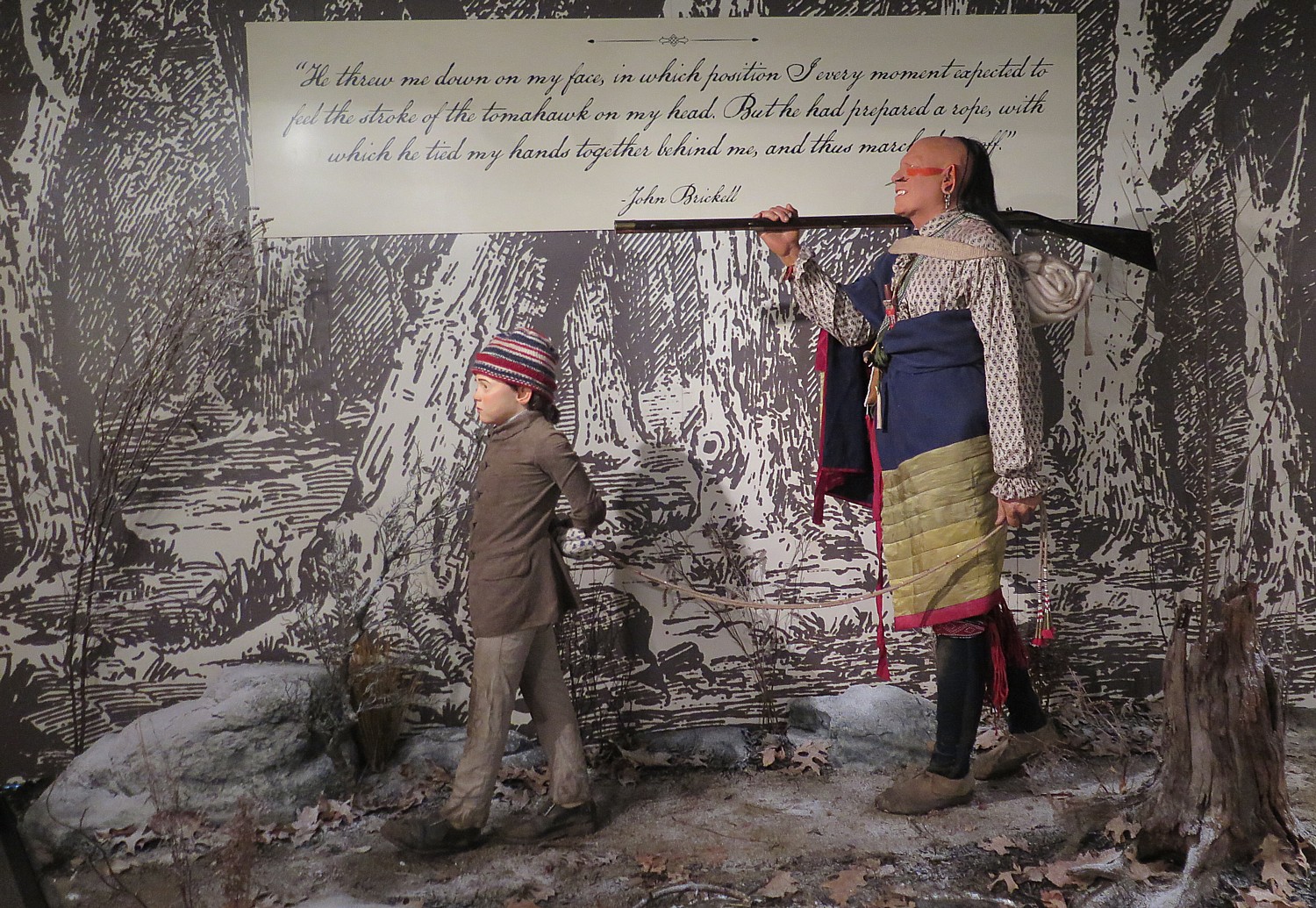
The exhibit tells the story through the experiences of real-life captives, and in stunning displays including three life-like vignettes that portray John Brickell, a local boy captured just a few miles from Fort Pitt at age 10; Massy Harbison, who heroically saved the life of her child after escaping from her captors; and the Kincade family, who were reunited on the Bouquet Expedition in 1764.

‘Captured by Indians’: A life-like vignette portrays the capture of 10-year old John Brickell, taken just a few miles from Fort Pitt © 2016 Karen Rubin/goingplacesfarandnear.com

The exhibit, which does an outstanding view of making this rarely discussed history, makes it personal, presenting biographies and stories, draws upon artifacts borrowed from descendants of the captives, which make it all the more real and present:

There are personal artifacts on display that make this rarely discussed history all the more real:

  • A bullet-ridden 18th century door from a cabin near Ligonier, Pa., that was attacked by Indians during the American Revolution;
  • A Logan war club which was left at the site of a brutal Indian raid in southwest Virginia in 1774 which belonged to John Smith
  • A rare prisoner cord, used to bind captives taken during raids on frontier settlements;
  • An American Indian horn spoon given to Catharine Bard by her Delaware captors in 1758 (the owner who provided it to the exhibit is in her 90s)
  • An original pencil sketch of Mary Jemison, who was captured during the French & Indian War and lived out the rest of her days among her adoptive people; and
  • The hat and waistcoat of Jacob Miller, a frontier settler who was killed during a raid on Miller’s Blockhouse in Washington County in 1782.

I am amazed to learn that many of the captives preferred Indian society: Colonial society could be brutal, especially for those at the bottom (like slaves and indentured servants and poor), women were property of husband. But in native society, they had equality. “Many adopted captives lived and died among chosen people.”

At the end is a large wall of photos of people today who trace their origins to these captives.

“While many captives were returned to the society of their birth after months or years among the Indians, many others lived out the remainder of their lives with their adoptive people. Today, the descendants of captives represent a wonderfully diverse cross section of American society. In many cases they are alive today because of crucial decisions made in an instant, two centuries ago. They represent the living legacy of captivity, reminding us not only of our connection to the past, but also to the future.”

The exhibit engendered controversy when it first opened, but was so well appreciated, they extended viewing to October 2016.

Fort Pitt Museum tells the story of Western Pennsylvania’s pivotal role during the French & Indian War, the American Revolution, and as the birthplace of Pittsburgh © 2016 Karen Rubin/goingplacesfarandnear.com

The school children now are gathered around a massive, detailed model of early Pittsburgh and the docent urges them to spot the tiny, anachronistic motorcycle (to make you more observant).

In summer, the museum offers living history programs and reenactments –with staff dressed in period costumes, firing off cannons, playing fife and drum, doing carpentry.

Fort Pitt Museum (open daily, 10 am – 5 pm, $5/adults, $4/seniors/ $3 students and children 4-17), 101 Commonwealth Place, Pittsburgh, PA, 15222, 412-281-9285, www.heinzhistorycenter.org/fort-pitt/ 

For more information, contact Visit Pittsburgh, 412-281-7711, 800-359-0758, 877-LOVE PGH (568-3744), [email protected], www.visitpittsburgh.com. 

Next: Pittsburgh Walking Tour Continues to National Aviary, Andy Warhol Museum

See also:

One Day, Two Nights in Pittsburgh: From Grey to Green, A Proud City Revitalized

____________________

© 2016 Travel Features Syndicate, a division of Workstyles, Inc. All rights reserved. Visit goingplacesfarandnear.com and travelwritersmagazine.com/TravelFeaturesSyndicate/. Blogging at goingplacesnearandfar.wordpress.com and moralcompasstravel.info. Send comments or questions to [email protected]. Tweet @TravelFeatures. ‘Like’ us at facebook.com/NewsPhotoFeatures

 

One Day, Two Nights in Pittsburgh: From Grey to Green, A Proud City Revitalized

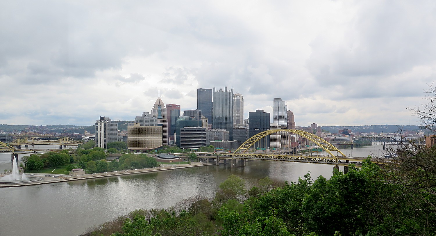
Pittsburgh’s skyline and rivers, as seen from Grandview Avenue at the Duquesne Incline © 2016 Karen Rubin/goingplacesfarandnear.com

By Karen Rubin, Travel Features Syndicate, goingplacesfarandnear.com

Pittsburgh was at the crossroads, commanding a literal pivotal position in the struggle for control of New World colonies by France and England – the Keystone of the Frontier. George Washington surveyed from a point now known as Mount Washington and picked the location for what became known as Fort Pitt, for who controlled this confluence of the rivers, would control the Colonial empire. Meriwether Lewis embarked on his historic westward Lewis & Clark Expedition from Pittsburgh.

The city grew and prospered and was blighted under the control of Industrial titans like Andrew Carnegie and Henry Clay Frick whose steel mills controlled almost one-third of US output that built America’s infrastructure and turned the nation into an economic world power.

Most of those steel mills, the coal mines, the rail lines, the glass factories are shuttered, and the city went through a dismal time. But today, the city has been reborn.

One of the best reasons to visit Pittsburgh is to see how a city reclaims itself, how it can rise like a phoenix quite literally from ashes and turn itself into a city that embraces and nurtures its people.

The most fascinating discovery about Pittsburgh is how a city built for commerce and industry, built upon steel and machines, has become such a walkable, bikeable, liveable place – from grey to green.

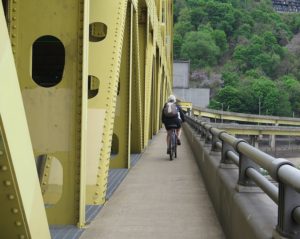
Biking across one of Pittsburgh’s 445 bridges (more than any city in the world) © 2016 Karen Rubin/goingplacesfarandnear.com

You still see coal on barges on the river, railroads carrying freight on the bank below Mount Washington, the skyscrapers housing US Steel Corporation and the United Steelworkers Union, but you can actually see the city from Grandview Avenue, where once, the smokestacks would billow such thick particulates as to choke the city.

There is such richness in culture and heritage that abounds here, but the best reason to visit is to feel the vibe.

Old juxtaposed with new in Pittsburgh’s downtown © 2016 Karen Rubin/goingplacesfarandnear.com

You feel it as you walk about, going from neighborhood to neighborhood, taking in the stunning juxtaposition of centuries-old architecture against modern structures. Pittsburgh is becoming an example of a “best of both worlds”, though old and new doesn’t necessarily mesh seamlessly, but rather with an exciting creative tension.

I have come to Pittsburgh to join the Rails-to-Trails Conservancy’s Sojourn three-day, 120-mile bike tour on the Great Allegheny Passage – a trail reclaimed from a former rail line that was used to carry the coal from the mines to the steel mills. It is the foremost example of the transition of an economy and the society that it supports. But I only have one full day, so I want my time to be as productive as possible.

And as authentic as possible, so I choose the historic Omni William Penn Hotel – a member of Historic Hotels of America – which celebrated its centennial in 2016 the same year as the city celebrated its bicentennial.

I start with the hotel’s concierge to get some ideas of how to organize my day in order to pack enough highlights that give me a real sense of this place – the things that are unique to the city.

She, in fact, epitomizes the story of Pittsburgh:

You see, her father worked in those steel mills of Andrew Carnegie and Frick, suffering the intense heat of a firey hell. There used to be steel mills lining the riverfront. She remembers how the pollution in the city was so thick, that you could not see the city below Grandview Avenue on Mount Washington ridge where I will be heading soon to take in the view. Her father died at an early age.

Today, the city’s main industries include academia, robotics, banking and finance and his daughter is now a concierge in a luxury hotel.

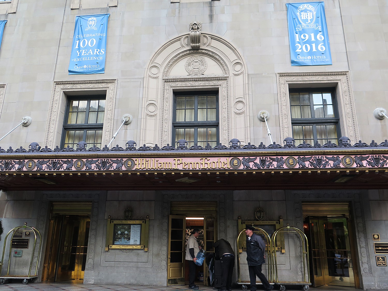
Entrance to the Omni William Penn Hotel, which celebrated its centennial in 2016, the same year as Pittsburgh’s bicentennial © 2016 Karen Rubin/goingplacesfarandnear.com

At its bicentennial in 2016, Pittsburgh boasted a population of 305,704; 2781 acres of city parks; 300 downtown restaurants; 31 skyscrapers; 90 neighborhoods; 24 miles of riverfront trails; 500 bicycle rentals through 50 stations of Pittsburgh  Bike Share (download app); 445 bridges (more than any city in the world) across three rivers.

Several Pittsburgh’s unique attractions are associated with people that I had not realized were native sons: August Wilson, Andy Warhol. Indeed, the special history of Pittsburgh is preserved in the institutions associated with the Senator John Heinz History Center (yes, the ketchup company family), as I discover.

She loads me up with handy lists and maps, and draws a route for me, and I am on my way.

Walk with me…

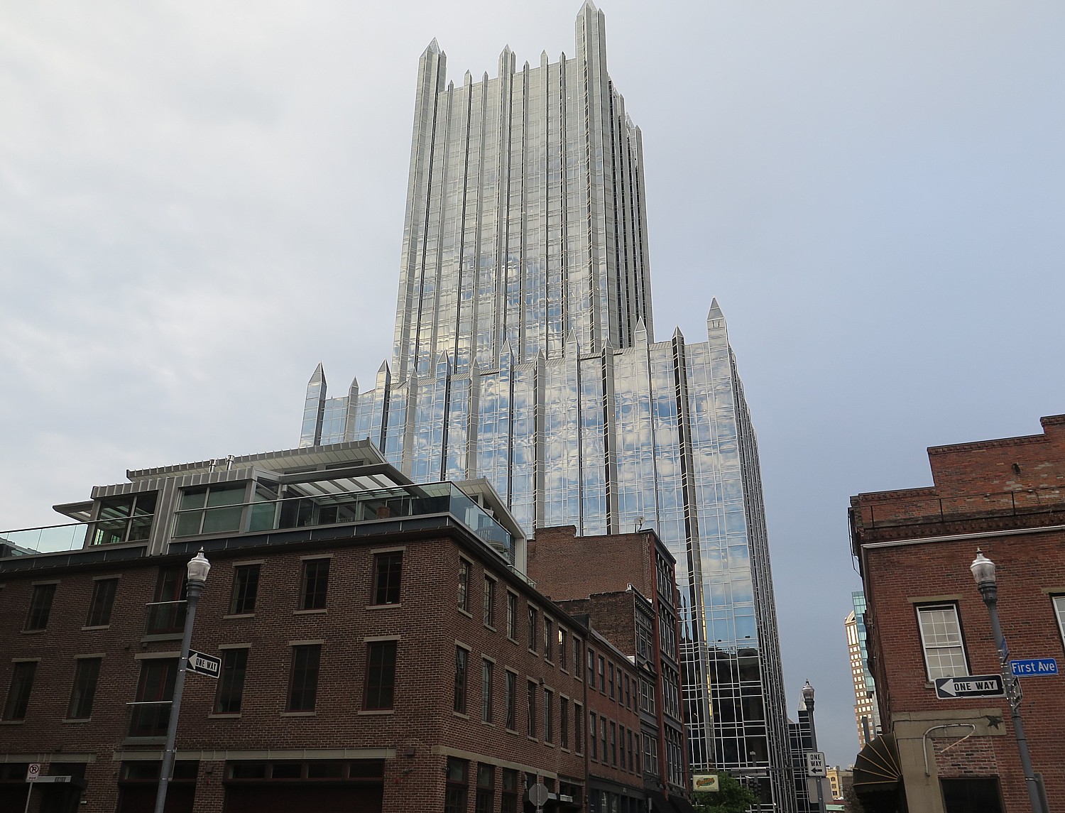
Old reflected in new in Pittsburgh © 2016 Karen Rubin/goingplacesfarandnear.com

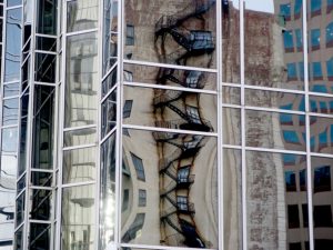
Around the Omni William Penn Hotel, a complete renaissance is still underway: modern skyscrapers in glass and steel reflect back on restored brick Victorians – not exactly a seamless melding of past and present, nor is history accurately reflected.

I head toward the Southfield Street Bridge, a jewel of a steel bridge with a walking/biking lane, that takes me over the Monongahela River, where on the shore, a lovely indoor Station Square mall has developed around what would have been a factory, and there is a lovely bike path. Across the street, is the entrance to the Monongahela Incline, a funicular that takes you up to the Grandview Avenue, aptly named for the grand view of the city from its heights, on Mount Washington, named for George Washington who surveyed the area from this place, choosing the location at the Point below for a fort.

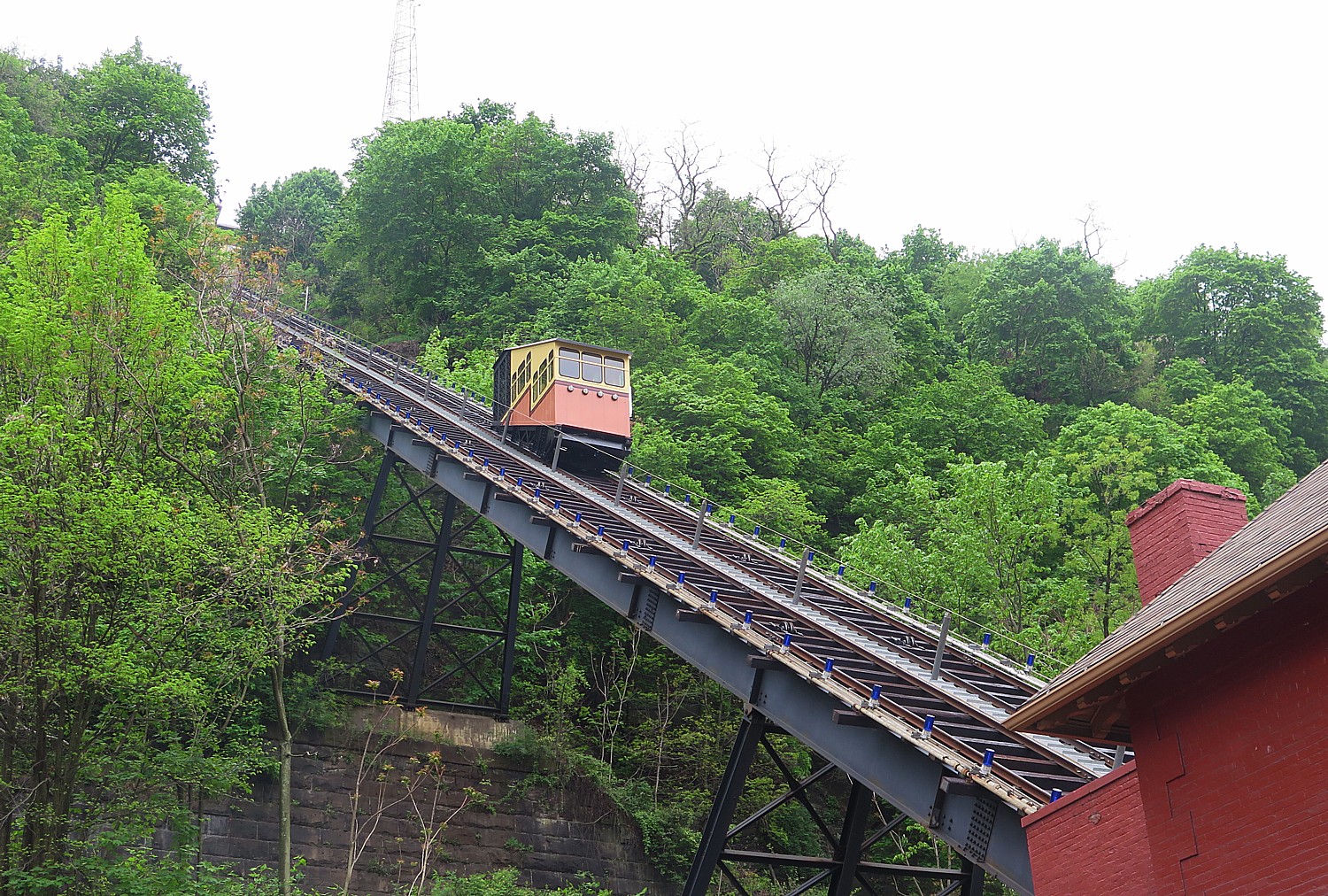
The Monongahela Incline originally opened in 1870 (refurbished in 2015) and is the nation’s oldest cable car operation © 2016 Karen Rubin/goingplacesfarandnear.com

It is one of two remaining of the original 19 that used to run.

The Monongahela Incline originally opened in 1870 (refurbished in 2015) and is the nation’s oldest cable car operation. Its 35-degree grade makes it the steepest incline in the US; it travels the 635-foot length at 6 mph. It is operated by the Port Authority (so your bus pass works). Though the ride takes but a few minutes, it is so much fun. (portauthority.org).

The story of Pittsburgh is encapsulated from Mount Washington, named for George Washington who as a young man surveyed the area from this perch to choose a location for a fort. You gaze down at the expanse from viewing perches – how the rivers merge together, the skyscrapers and landscape. There are fascinating historical markers along Grandview Avenue that tell the story of steel and the critical role Pittsburgh played in the industrialization of the United States and its emergence, really, as a world economic power, and ultimately, “the Greening of Pittsburgh.”

Historical markers along Grandview Avenue make it easy to visualize Pittsburgh’s past © 2016 Karen Rubin/goingplacesfarandnear.com

Mount Washington was once called Coal Hill, the spot where the nation’s coal industry was born around 1760.  “Here the Pittsburgh coal bed was mined to supply Fort Pitt. This was eventually to be judged the most valuable individual mineral deposit in the U.S.”

Another marker: “With its steel mills belching fire and smoke, Boston writer James Parton described the city as ‘hell with the lid off.’ Streetlights were often needed in the middle of the day to combat the haze of industrial smoke and grime. As recently as the late 1940s, visitors to Grandview Avenue had to strain to see the skyline through the haze.” Today, despite the clouds casting a grey pallor, I can still see the striking skyscape, and follow the outline of the rivers a long distance.

I stroll the avenue toward the next incline, the Duquesne, passing lovely Victorian homes and a library.

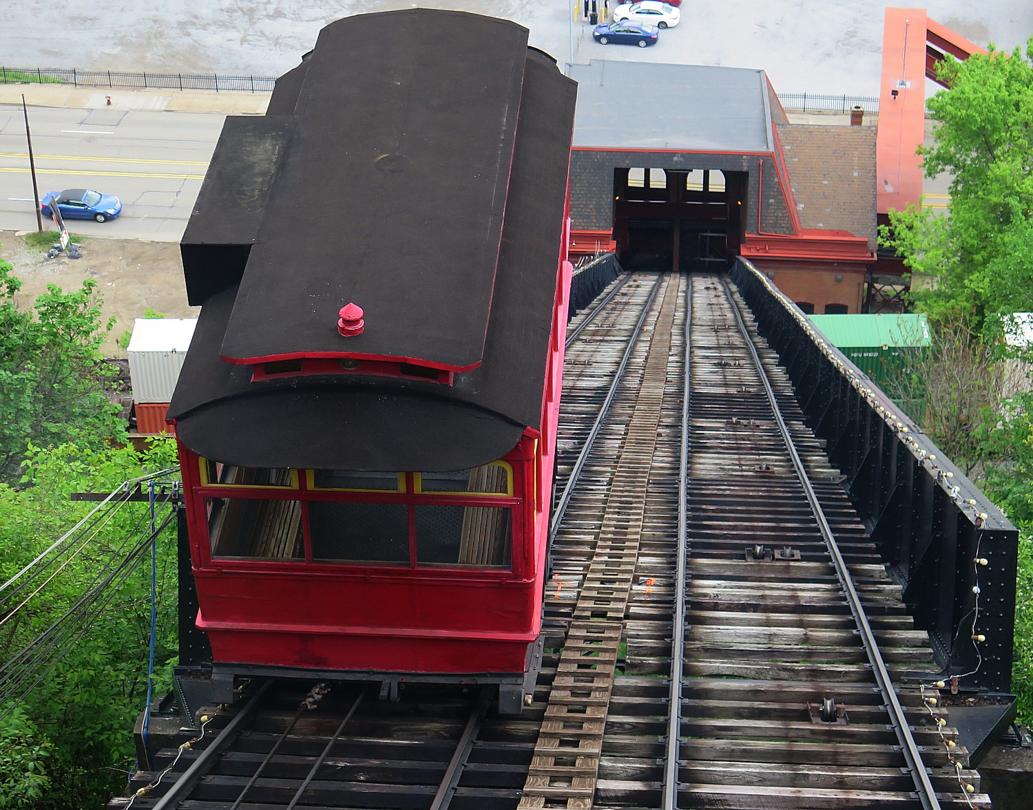
Riding down the Duquesne Incline © 2016 Karen Rubin/goingplacesfarandnear.com

The Duquesne Incline opened in 1877 – it has quite an interesting display of historical photos and artifacts. It is operated by the Society for the Preservation of Duquesne Heights Incline. It travels the 793 length at a speed of 6 mph, bringing me back down to the riverfront and I walk across the Fort Pitt Bridge down into Point State Park.

For more information, contact Visit Pittsburgh, 412-281-7711, 800-359-0758, 877-LOVE PGH (568-3744), [email protected], www.visitpittsburgh.com. 

Next: Pittsburgh Walking Tour Continues to Fort Pitt Museum

____________________

© 2016 Travel Features Syndicate, a division of Workstyles, Inc. All rights reserved. Visit goingplacesfarandnear.com and travelwritersmagazine.com/TravelFeaturesSyndicate/. Blogging at goingplacesnearandfar.wordpress.com and moralcompasstravel.info. Send comments or questions to [email protected]. Tweet @TravelFeatures. ‘Like’ us at facebook.com/NewsPhotoFeatures

E-Bike Opens World of Possibility for Bike Touring

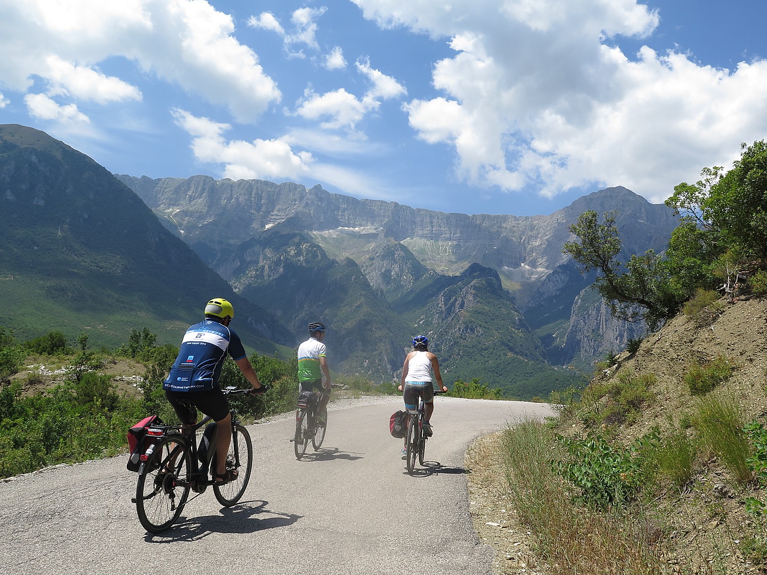
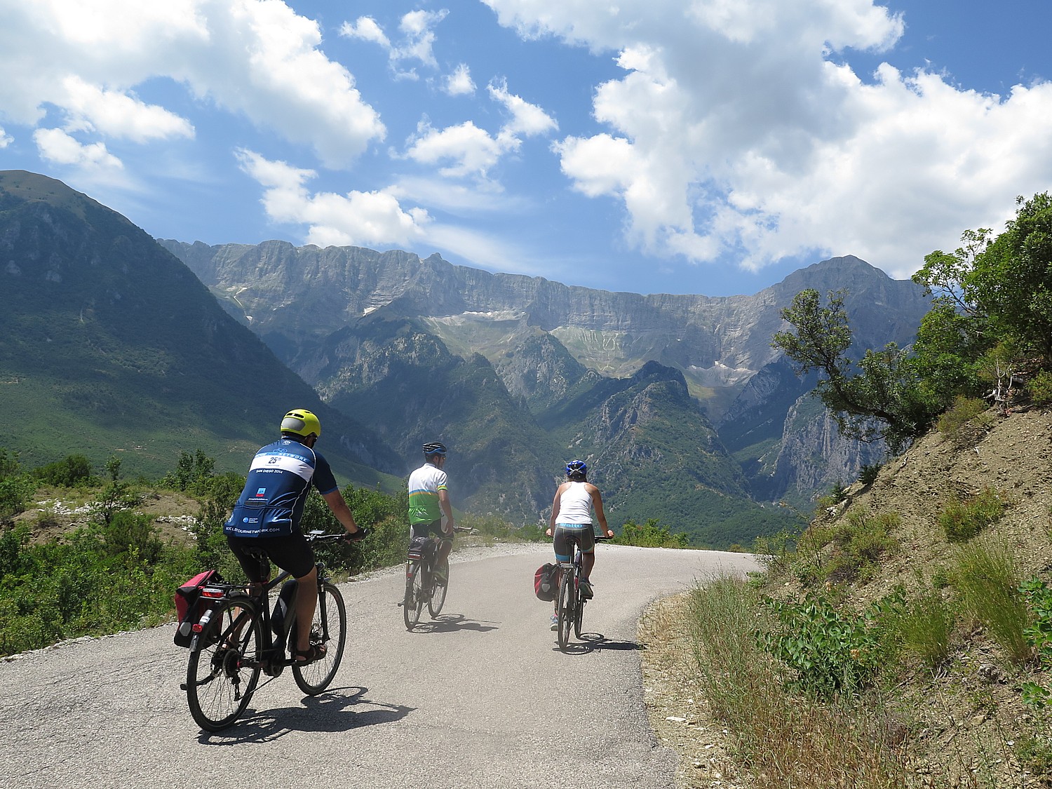
BikeTours.com President Jim Johnson (left) and Junid (middle) riding e-bikes on the mountain roads of Albania © 2016 Karen Rubin/gongplacesfarandnear.com
BikeTours.com President Jim Johnson (left) and Junid (middle) riding e-bikes on the mountain roads of Albania © 2016 Karen Rubin/goingplacesfarandnear.com

By Karen Rubin, Travel Features Syndicate, goingplacesfarandnear.com

Here’s my dilemma: A chance to see Albania by bike, a country that is steeped in mystery having been secluded behind an Iron Curtain for decades, but so mountainous, it may be too difficult to make the enormous climbs. Or, I could set aside pride and principle and use an e-bike – an electric bike that uses a battery to give an extra push to your pedaling.

I’m a purist and enjoy the physical challenge of biking. I had had an amazing time on Biketours.com’s bike/boat trip in the Greek Isles the year before and know the pain (and accomplishment) of burning lungs that come with tackling the steepest, longest climbs of my life. But the BikeTours experts say that the Greek Isles was a Class 3 ride and Albania would be a Class 4 – with even steeper, longer climbs (and when I look over the day-by-day elevations, one day stands out at being the equivalent of a mile in total elevation gain). So if the Greek Isles was my physical limit, I’m not so sure I can do Albania.

BikeTours.com President Jim Johnson biking in Albania on an e-bike. © 2016 Karen Rubin/goinplacesfarandnear.com
BikeTours.com President Jim Johnson biking in Albania on an e-bike. © 2016 Karen Rubin/goingplacesfarandnear.com

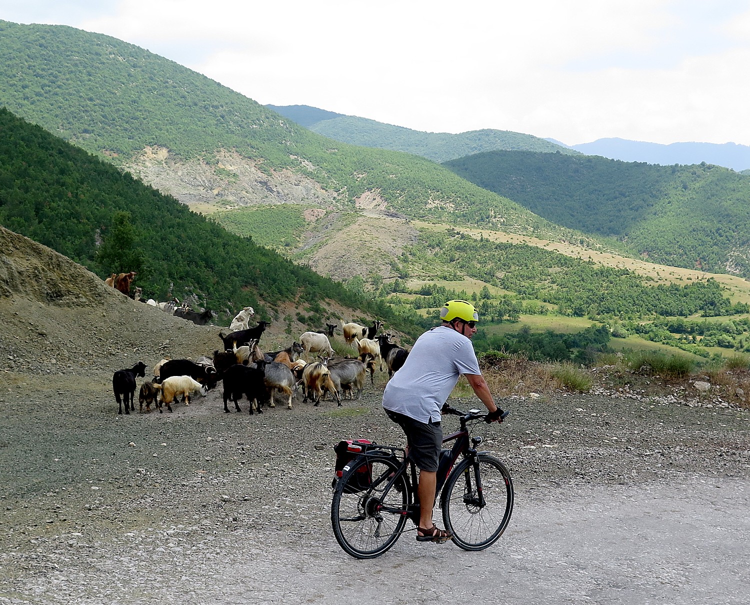
But I also believe that the best way to engage, to discover a destination like Albania is by bike. Cars, buses would never come to these back country roads, roads that have been bypassed by more recently constructed highways, or through villages and neighborhoods. They would go too fast to get any sense at all of moments that, on a bike, you can snatch up and savor, and looking through glass windows puts a layer of unreality. But from the perch of a bike saddle, you move at just the right pace to see things, hear the sounds of cows mooing, the bells attached to goats, the cicadas; you can smell the wild sage growing beside the road, and feel the moist coolness as you ride through a forest. You can stop at a bend in the road to take in the breathtaking views or just get your breath. You can stop – even chat – with a shepherd edging his flock across the road. People wave and call out hello as we ride through a village and we wave and say a cheery “hello” as back. Most important of all, you can stop when you want (as I did most frequently) to take photos.

And, finally, I believe ardently in the quest for knowledge and understanding and ambassadorship that is the essence of travel and particularly, the style of travel of a bike tour, so if the only way to experience Albania is to use an e-bike, I will set aside my pride and principle.

And actually, the e-bike is part of the new experience and I discover a whole new dimension of possibility.

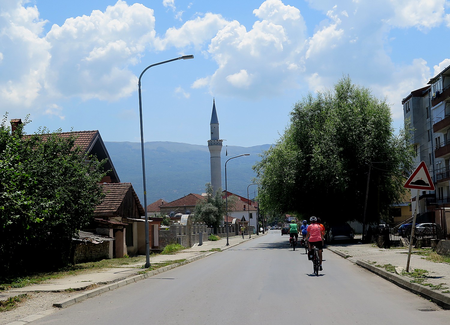
Biking in Albania brings you into villages you would not visit otherwise © 2016 Karen Rubin/gongplacesfarandnear.com
Biking in Albania brings you into villages you would not visit otherwise © 2016 Karen Rubin/goingplacesfarandnear.com

For one thing, I discover other advantages of using an ebike: I can stop for pictures and know I can catch up with the group; I don’t suffer or need to focus exclusively on the ride; I don’t lose sleep over the worry of whether I can manage the next day’s ride. What is more, I discover I can make the ride as challenging as I want (I simply don’t go into an easier setting), so I still get the workout I want and feel the satisfaction of conquering a climb. But most importantly, the priority of this trip is to experience a culture and explore a destination, not a physical work-out or just getting from point A to B.

And finally, what I realize is that the e-bike extends horizons and lifespan for adventure and exploration for many of us who have reached an age where we appreciate biking but are unsure of doing the distance or the hills.

And so I opt for the e-bike for the first time. It takes me about two minutes to figure it out and three minutes to get comfortable.

The e-bike is not like a scooter – you still have to pedal. But to me, it takes the hill out of the climb, making it like pedaling on flat surface (unless you want to retain the challenge, as I did, and keep it at an “Econ” setting, the lowest of three “speeds”, “Norm” and “Sport” being the others). In “Econ”, I find, it makes my hybrid bike, which with the added weight of the battery (about 12-15 pounds) feels like a mountain bike, ride like a road bike.

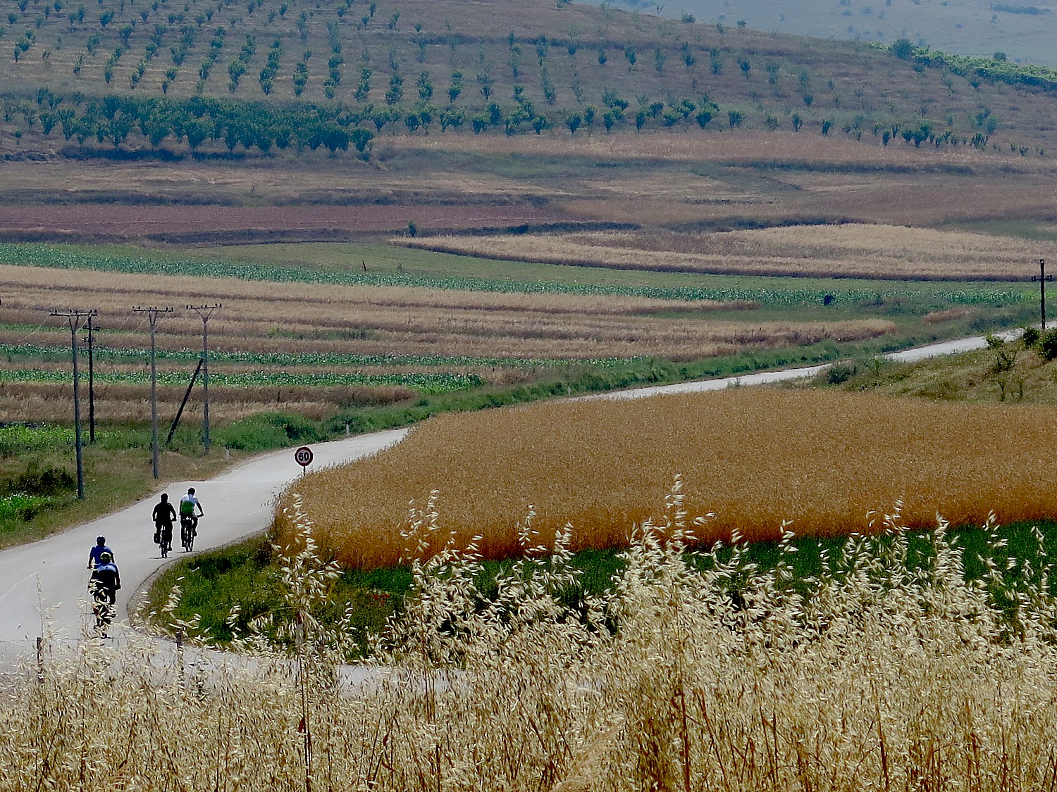
Biking through Albania’s countryside © 2016 Karen Rubin/goingplacesfarandnear.com

The e-bike that I ride is so responsive – it changes gears immediately, efficiently, at the push of a button (up arrow, down arrow) and I could change speeds if necessary, from “Econ” to “Norm” on a dime, smoothly, without any hesitation or resistance.

I find that on the big hills, by keeping the setting at Econ I still have that physical effort of climbing, but I don’t wind up with burning lungs. And of course, I can just zip up the hills by going to the Norm and for an even greater push, the Sport setting (I never use the Sport setting, and only use Norm a couple of times, when the climb seems never ending).

It makes me feel as if I have superpowers.

The cycling company that BikeTours.com has selected for our tour, Cycle Albania, is relatively new and may in fact be the only company offering bike tours in the country. We attracted attention as we zipped through villages because we were such an oddity.

I am really impressed with the quality of the bikes, manufactured by the Taiwan-based Giant company, which Cycle Albania purchased from the Netherlands. Each of the bikes – the regular hybrids and the e-bikes (probably the only ones in the entire country) – are the best quality, valued at thousands of dollars (in a country where the median income is $5000 a year). They have hydraulic brakes, suspension. (You can bring your own seat and pedals if you want, as does a couple from Oregon, used to climbing hills).

My pedals have screw heads that grip the soles of my sneakers for the extra push without toe clips.

And boy are we grateful for suspension and hydraulic brakes on the Day 6 ride, when we come down a road more like a mountain trail – broken gravel, rocks, potholes, gravel, steep with winding hairpin turns.

I use the e-bike feature of my Giant bike for the first time on the second day of cycling, when we are leaving Ohrid, in Macedonia, one of the oldest human settlements in Europe, and are on the last third of a 35-mile ride. We have three progressively longer and harder hills to climb on our way back into Albania. I just whisk up the hills like nothing – and am only in the “Norm” setting – I didn’t even use the “Sport” setting which gives even more thrust to each pedal stroke.

Biking through Albania’s countryside © 2016 Karen Rubin/goingplacesfarandnear.com

But that’s what it is – it’s like taking the hill out of the ride. You feel like you are riding on flat. You still pedal each stroke, change the gears but each stroke is magnified. You hear a tiny whir of a motor but it isn’t like riding a scooter.

The e-bike is a superb alternative for anyone who has denied themselves the opportunity to discover a destination by bike – the best way in my opinion – because they were afraid they could not go the distance or manage hills. The e-bike is a godsend: destinations and experiences that seemed out of reach can now be conquered. If you felt you had aged out of managing 35 to 50 miles a day on anything but flat rail-trails, e-bikes open up a whole new world, and a whole new dimension.

Many of the BikeTours.com offerings now give an e-bike option.

BikeTours.com 1-877-462-2423 or 423-756-8907, 1222 Tremont St., Suite 100, Chattanooga, TN 37405, biketours.com.

______________

© 2016 Travel Features Syndicate, a division of Workstyles, Inc. All rights reserved. Visit goingplacesfarandnear.com and travelwritersmagazine.com/TravelFeaturesSyndicate/. Blogging at goingplacesnearandfar.wordpress.com and moralcompasstravel.info. Send comments or questions to [email protected]. Tweet @TravelFeatures. ‘Like’ us at facebook.com/NewsPhotoFeatures
Biking Albania: Saranda & the Albanian Riviera

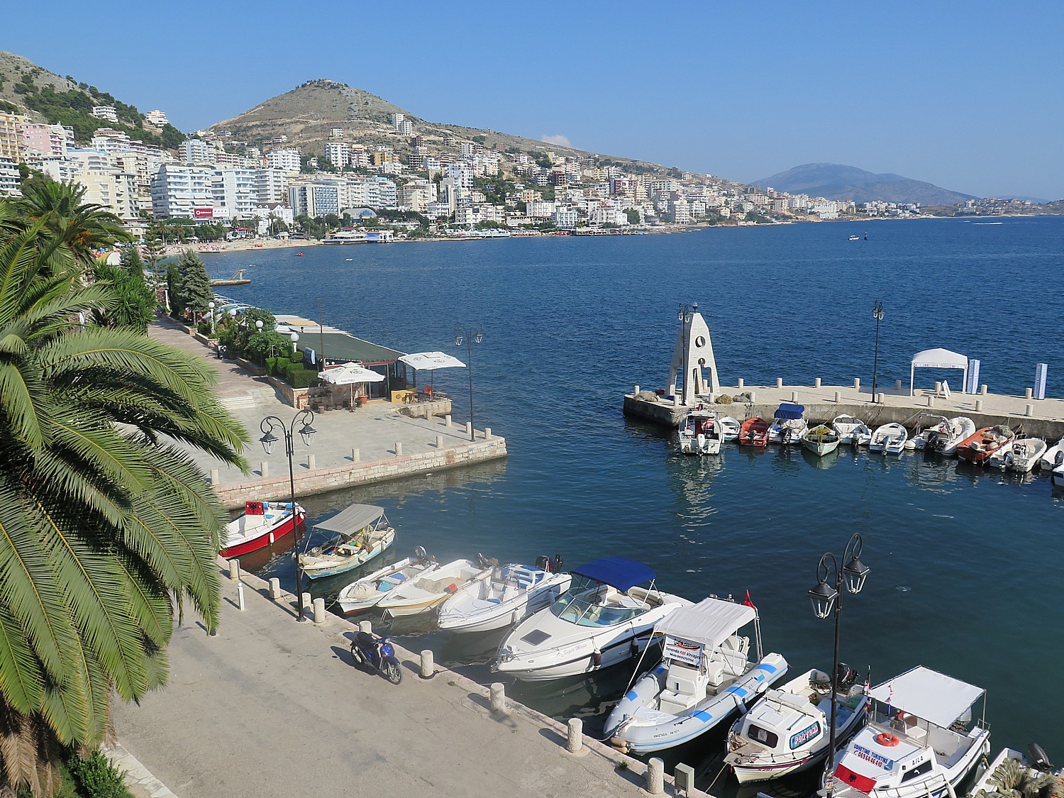
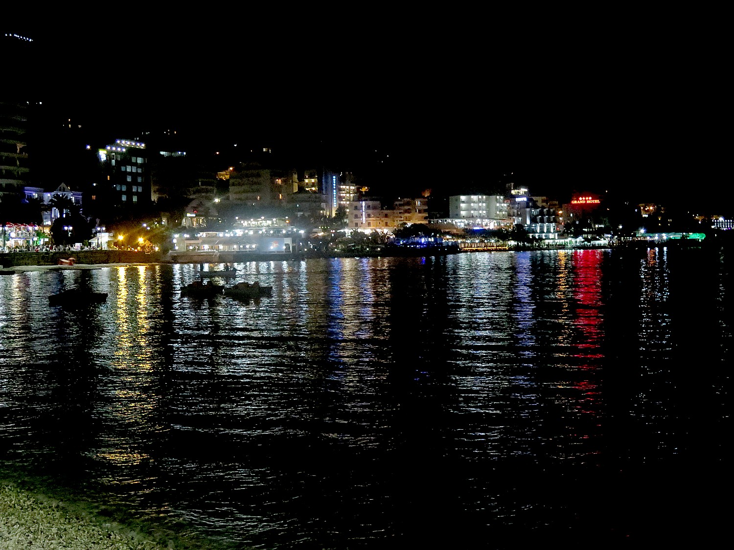
Saranda, a cosmopolitan resort town on Albania’s Riviera © 2016 Karen Rubin/goingplacesfarandnear.com

by Karen Rubin, goingplacesfarandnear.com

(I travel to Albania with BikeTours.com’s President Jim Johnson on a specially constructed “President’s Tour” itinerary that modifies the regular “Albania’s UNESCO Sites with Rivers, Valleys, and Gorges” trip.  (See: Come to Albania Now to See Emergence of a Young Country-Best Way to Experience Albania is on Bike Tour. This is 7th in the series.)

After our tour of the National Park of Butrint, the extraordinary archaeological site that lets us travel through five époques of civilization, from the Hellenic to Roman, to Ottoman to Venetian, we continue riding our bikes into Saranda, one of the most popular beach towns along Albania’s Riviera, the end of a 70 km ride.

Draped along a curving bay with a narrow strip of beach, Saranda immediately reminds me of some of the smaller, non-posh beach towns of the French Riviera. Riding in, there are any number of new-built apartment houses, many not yet finished (housing bubble, anybody?). We ride down to the beach level where lovely hotels abound, and there is a gorgeous promenade.

Our bike tour turns into a beach holiday, and we get to see a different side of Albania – Albanians at play.

Saranda © 2016 Karen Rubin/goingplacesfarandnear.com

Saranda immediately reminds me of some of the smaller, non-posh beach towns of the French Riviera. Riding in, there are any number of new-built apartment houses, many not yet finished (housing bubble, anybody?). We ride down to the beach level where lovely hotels abound, and there is a gorgeous promenade.

Saranda, formerly known as Porto Edda, named after Mussolini’s daughter, has emerged as a major beach resort on the Ionian Sea, just opposite the Greek island of to Corfu (we watch major cruise ships sailing in the distance toward Corfu). Indeed, it has that cosmopolitan flare we found in Korca, owing to the fact many foreign day-trippers come by ferry from Corfu. There is a very festive atmosphere – and didn’t exist during the Communist reign. Indeed, most of its buildings are post-1990.

Still, Albanian most southern coastal city, only recently accessible, remains unpretentious.

Saranda © 2016 Karen Rubin/goingplacesfarandnear.com

I get the idea that this would be a great place for some Americans looking for an inexpensive place to retire where there is a very pleasant, relaxed, welcoming atmosphere (like in “Best Exotic Marigold Hotel”). It is cheap to live here, where I calculate living costs at about one-fourth to one-fifth of what we expect to pay in the US, and where the median annual income is $5000 (though Albania’s medical infrastructure gets mixed reviews).

Our bike tour turns into a beach holiday, and we get to see a different side of Albania – Albanians at play.

I drop my stuff at our hotel, a very pleasant place which is directly above this marvelous promenade with gorgeous views from my balcony to the beachfront and marina, and go for a swim.

Instead of soft white sand, though, the beach is made of pebbles (bring water shoes, not just flip flops).

Strolling the promenade at night in the resort town of Saranda on Albania's Riviera © 2016 Karen Rubin/goingplacesfarandnear.com
Strolling the promenade at night in the resort town of Saranda on Albania’s Riviera © 2016 Karen Rubin/goingplacesfarandnear.com

Strolling along the promenade after dinner, I mix in with the crowds of people – couples holding hands, groups of friends, families with young children excitedly leaning up to an ice cream stand. There is a gay, carefree spirit.

This could be Coney Island, Brighton Beach, Long Beach, Jones Beach.

Across the water there is a loud dance place, with bright lights flashing; they shoot off fireworks.

Nighttime in Saranda © 2016 Karen Rubin/goingplacesfarandnear.com

(I subsequently learn that just before we arrived here, the city unveiled a bust to Secretary of State Hillary Clinton, but I did not know to look for it.)

(More info at www.visitsaranda.com)

Day 8 Cycling: Himare

Today’s ride, the last of the cycling portion of our specially arranged President’s tour of Albania, is the most arduous and challenging, with a total elevation gain of 1064 meters (and an equal drop), over a distance of 54 km.

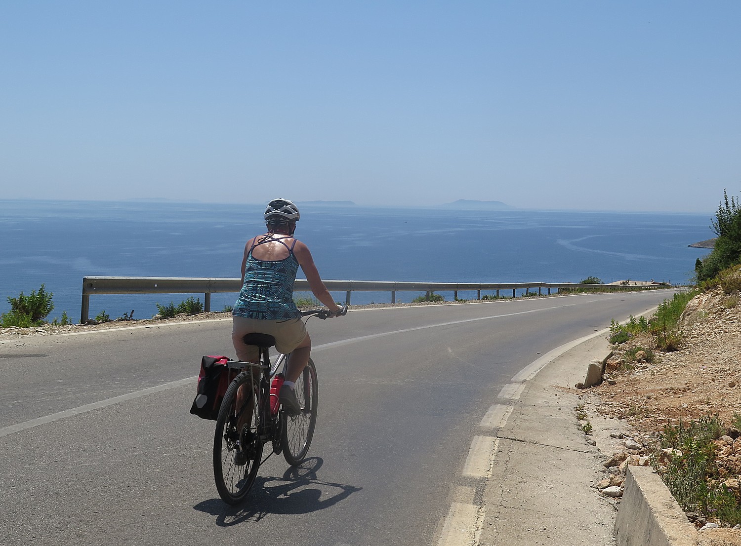
Cycling along Albania’s Ionian Seacoast © 2016 Karen Rubin/goingplacesfarandnear.com

We cycle up out of Saranda, along the Albanian Riviera heading north toward Himare, a small Communist-era fishing village. We have mountains to the right and coastal views to the left before descending to the long beach and bay of Potam where we get to swim in the brilliant aquamarine waters of the Ionian Sea, just across the street from our hotel.

Himare, a Communist-era fishing village is an emerging beach town on Albania’s Ionian seacoast © 2016 Karen Rubin/goingplacesfarandnear.com

This ends the biking portion of our trip and I am frankly sad to see our bikes (especially my e-bike, which I have become very attached to) being hauled off in the van by Bato, our wonderful driver. The next two days, we will be traveling by kayak – another special feature of this specially tailored Presidents’ tour.

Seeing the coastline from the kayak is stunning – the blue-to-aquamarine-to-emerald colored water, so clear when you look down; the rocky cliffs that drop straight into the water.

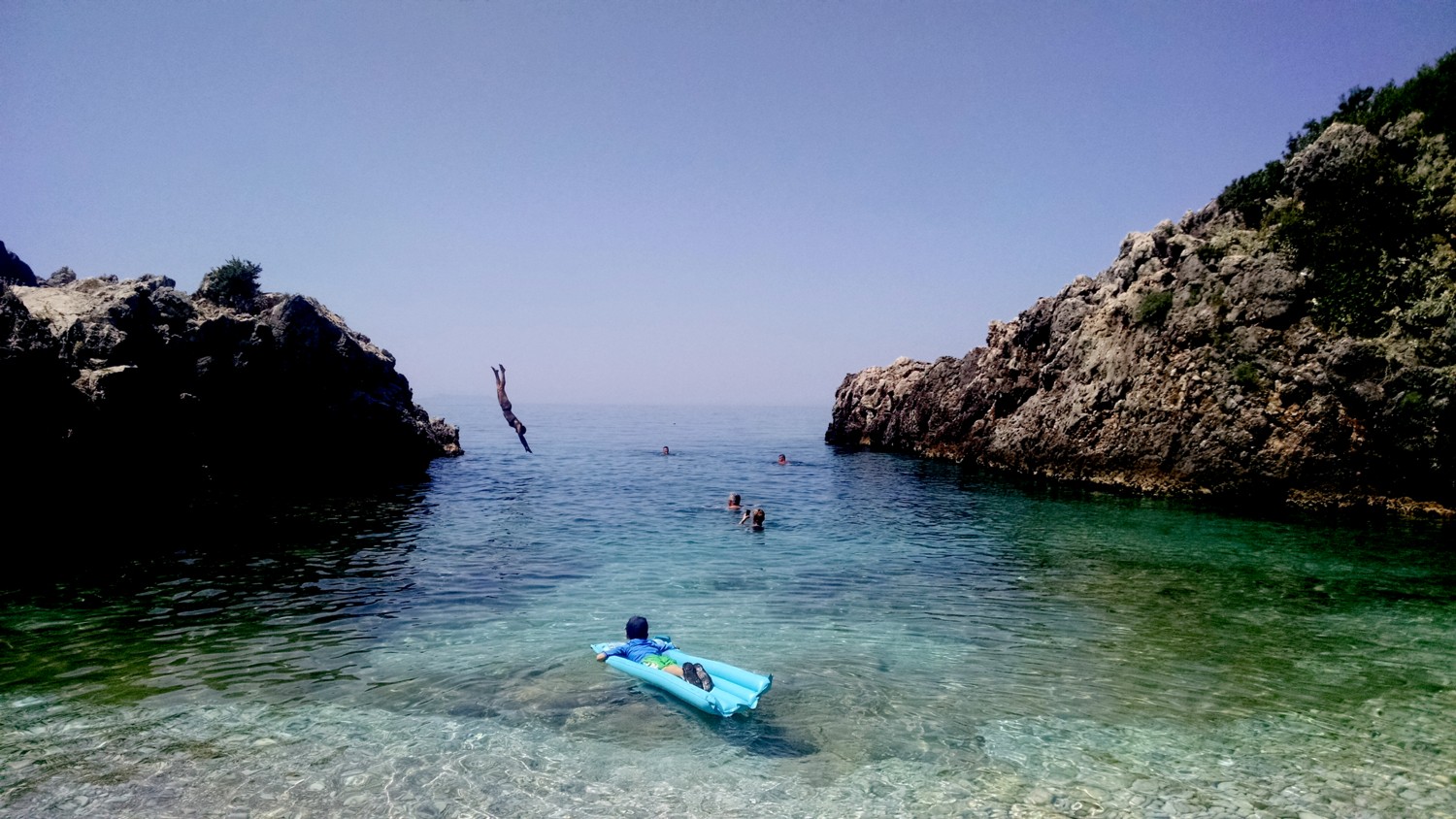
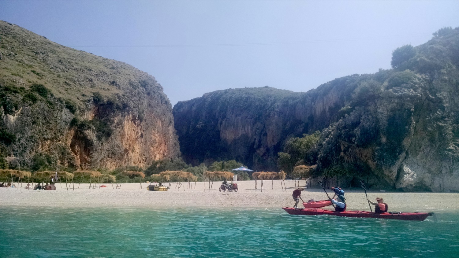
Kayaking to a secluded beach along Albania’s Ionian seacoast © 2016 Karen Rubin/goingplacesfarandnear.com

We paddle about 6 km, pulling into secluded beaches and coves, and get to peak into a couple of small caves. There are any number of these beaches where there are but a handful of people, some of whom are camping out.

Kayaking to a secluded beach along Albania’s Ionian seacoast © 2016 Karen Rubin/goingplacesfarandnear.com

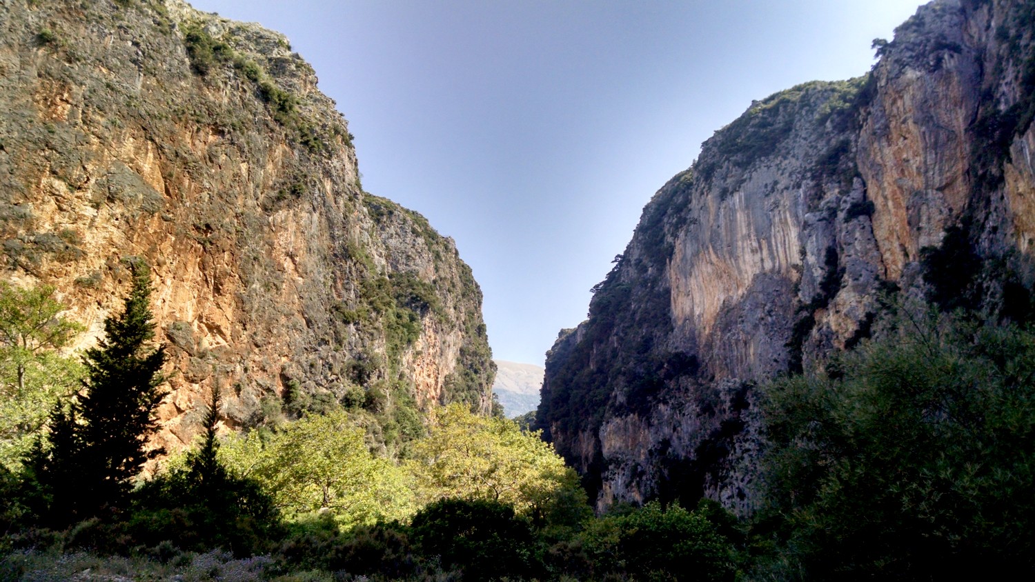
One of the beaches near Himare (also spelled Dhimare), in particular, has a canyon for a backdrop of exquisite beauty.

It is tremendous fun to arrive into the place where you will be staying by kayak.

A canyon behind a secluded beach along Albania’s Ionian seacoast © 2016 Karen Rubin/goingplacesfarandnear.com

Our last two days are spent in Dhermi – a small village that is considered Albania’s #1 beach town – providing us with an unexpected time to just relax and stay put.

Dhermi is considered Albania’s #1 beach town © 2016 Karen Rubin/goingplacesfarandnear.com

This is like the Riviera without any of the pretension. Lounge chairs and umbrellas are neatly laid out; a waiter comes to take drink orders; the roadway (sometimes asphalt, sometimes cobblestone and sometimes dirt and rock) lined with hotels and restaurants.

Here we get more opportunity to hang out with ordinary Albanian families. I am struck to see how parents dote over their kids, how tender, attentive and adoring fathers are with their toddlers, how women are every bit on equal footing with the men, without any kind of self-consciousness. It just is. And how scant the bathing suits. So much for a Majority Muslim country.

Sunset from Dhermi © 2016 Karen Rubin/goingplacesfarandnear.com

On our last evening, Junid, our guide, drives us up to the actual town, Dhermi,built into the hillside, where there is a delightful tavern that has an exquisite view of the sunset.

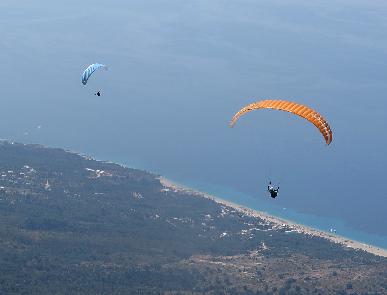
The next day, on our way back to Tirana, the capital city, where the Mother Theresa International Airport is located, he takes us up to an even higher promontory on the mountain pass, where we get to watch a paragliding club take off and soar down to the seacoast.

Paragliding in Albania © 2016 Karen Rubin/goingplacesfarandnear.com

It is hard to imagine these scenes 35 years ago or even 20 years ago.

This is the new Albania, the young Albania. It is a very different place from even 10 years ago and one only can imagine what it will be like in 10 years time.

“It’s Europe’s best-kept—and maybe last—secret,” says Jim Johnson, president of BikeTours.com. Few foreigners have visited this mysterious country due to decades of Communist rule, dictatorship and isolationism. But since the country opened its borders in 1991, visitors have been awestruck by its untouched nature and rich culture and the overall uniqueness of this truly special place.

“Albania still remains undiscovered by mass tourism, setting it apart from other European destinations. In Rome, you’ll throng elbow to elbow with tourists vying for views of ancient ruins. In Albania, you’ll often have them all to yourself. In Butrint National Park, for example, our small group roamed nearly alone among acres of ruins dating from Greek, Roman, Byzantine, and medieval times. Even just to the north in Croatia, tourists clog the beaches. In Albania, we could dip our toes into turquoise waters along the pristine coastline with not another person in sight.

“Albania is the best place no one has been to yet,” he says. “See it now” before it comes on to travelers’ radar.

Bike Touring: Best Way to Travel

I’ve been touring Albania for just two weeks – before it was a complete unknown to me, and I expect most Americans. But I believe that I have really come to know the country, its culture and its people and that’s mainly because of the way we travel: by bike.

Bike touring is the best way to engage, to really discover a destination even in a short period of time. Cars and tour buses would never come to these back country roads, roads that have been bypassed by more recently constructed highways; they would never come through these villages and neighborhoods as we have. They would go too fast to get any sense at all of moments that, on a bike, you can snatch up and savor, and looking through glass windows puts a layer of unreality.

Biking through Albania with BikeTours.com President Jim Johnson © 2016 Karen Rubin/goingplacesfarandnear.com

I have found, over a lifetime of travel, that bike touring is my favorite style of traveling. The pace is perfect to really see things – I really like the physical aspect (as opposed to sitting in a car or bus to get point-to-point), with the ability to stop and really look around, have a conversation with a local person, take a photo. The word “authentic” has been bandied about, but bike touring affords one of the more “authentic” travel experiences. Typically, the routes go into villages, through neighborhoods, and along country roads that would not typically be traveled by a tour bus.

And now, with the availability of e-bikes (which are not scooters, but basically provide an electronic boost to your pedaling), especially in hilly destinations, you really don’t have to worry about being able to manage the distance or climbing the hills.

Exercising your body (biking versus sitting in a car or bus) also gets your brain working, and you find yourselves really thinking about what you are seeing, really absorbing.

And what you feel at the end of the trip is a combination of exhilaration, satisfaction and personal growth.

BikeTours.com President Jim Johnson, who is leading this special “President’s Tour” of Albania (and who is providing some counsel to USAID on how to develop sustainable tourism, like bike trips), says that too many people have a misconception of what bike tours are about.

“They think they will be biking 100 miles in a day.” In fact, the distances each day were more in the range of 25-50 miles, depending upon the difficulty, and are broken up with coffee stops and lunch.

Biking from Saranda to Himare © 2016 Karen Rubin/goingplacesfarandnear.com

More significantly, the bike tour itinerary is constructed so that the distances are manageable (there are classes of guided bike-tours which indicate the difficulty), and the emphasis is on enjoying and appreciating the destination, as opposed to racing or training for the Olympics. The day’s rides are designed to feature the best scenery and sites. And each day, we finish biking early in the afternoon and have time for sightseeing, or visit sites along the way, still arriving early in the afternoon at our destination. (Admissions are typically included and the visits are guided.)

Also people assume that on a guided tour, they will have to ride in a pack. In fact, we ride at our own pace.

Our biking tour through Albania brings us through countryside we would likely never get to otherwise © 2016 Karen Rubin/goingplacesfarandnear.com

Also, even though this is a guided group trip, we ride at our own pace – the guide or the group typically will take a water break to allow the slower rider (me) catch up, and there will always be someone to wait for the following rider if there is a turn. When there are larger groups, there is typically a guide at the front and at the back. (Once I inexplicably wound up as the lead rider and came to a fork in the road, and was just consulting my map when I hear shouts to tell me I was on the wrong side of the fork.).

In the Greek Isles on Biketours.com’s bike/boat trip, when we had a dozen in our group, there was a guide leading and another following; here in Albania, with only five riders, we had a guide and are followed by a van (Bato keeps a distance so we barely notice him) – and if any of us would have felt we couldn’t finish a climb, could have just hopped in.

The rides are supported – the van carries our luggage (that is a key difference with traveling on your own) as well as a supply of water.

There are variations on bike tours.

Our Biketours.com group says goodbye to Bato, the van driver, and our bikes at the end of the cycling portion of our Albania trip © 2016 Karen Rubin/goingplacesfarandnear.com

Guided bike tours are a terrific advantage, especially if you are traveling on your own – you get to join a group. But you also have the benefit of a guide to lead, who knows the territory, speaks the language, has mapped the best route both for riding as well as sights), and can explain things. Equally important, there is the benefit of the support van that carries luggage and is available in case someone feels they can’t climb the hill. You have the benefit of arranged coffee stops, lunch places, quaint accommodations, admissions to sites and attractions. On your own, you would need massive amounts of time to research the route, find lodging, not know the quality of the road or how long it would take to get to the destination.

Self-guided trips: Apart from guided tours (as the Albania trip and the boat/bike tour of the Greek Isles), there are self-guided trips, where you travel on your own, say with a friend or family or your own small group (which I did on the Danube Bike Trail with my two adult sons). But you still have the benefit of a mapped-out route (you can do at your own pace and pleasure), the maps with the route, itinerary, the bike rentals, and vouchers for the pre-arranged accommodations. You can choose your style of accommodation, from modest inns to luxury hotels (if available). The ride is supported – they pick up your luggage and deliver it to the next inn, which is a tremendous advantage. And there would be help available if you needed it along the way.

In both cases, you benefit from the expertise of the local tour operators, as well as their buying power to book accommodations at favorable rates.

BikeTours.com is basically a broker that has cataloged the best tours operated by local companies. I have typically found the programs to provide excellent value for dollar. Their pre-trip preparation materials are excellent, and their logistical coordination (pick up at airport, transfers, for example) are really well done.

Beginning with next season’s brochure, the company is returning to its roots and concentrating its offerings on Europe, rather than the entire world.

The biketours.com website is really user-friendly, but if you have trouble deciding where you want to go, you can check out the Gold Star Tours, which is a compendium of the most popular (for different reasons), and the Founders Tour (which I took this year to Albania), which is specially done.

You can search the site based on destination, style of bike touring, or special interest: Categories include: Self-guided, Guided, Bike + boat, Budget-friendly, Flat + leisurely, E-bikes, Family-friendly, Challenging, Wine + cuisine.

The key advantage of working with BikeTours.com advisors is that they know the destinations and the biking programs and can give the kind of advice to make the best choices (based on interest, goals, ability) and prepare for the trip (everything from a superb packing list to organizing transfer, pre- and post-trip hotels).As BikeTours motto says, “Life begins at the end of your comfort zone.”

Go for it.

BikeTours.com 1-877-462-2423 or 423-756-8907, 1222 Tremont St., Suite 100, Chattanooga, TN 37405, biketours.com

____________________

© 2016 Travel Features Syndicate, a division of Workstyles, Inc. All rights reserved. Visit goingplacesfarandnear.com and travelwritersmagazine.com/TravelFeaturesSyndicate/. Blogging at goingplacesnearandfar.wordpress.com and moralcompasstravel.info. Send comments or questions to [email protected]. Tweet @TravelFeatures. ‘Like’ us at facebook.com/NewsPhotoFeatures
 

Biking Albania: National Park of Butrint is Pathway to 5 Archaeological Epoques

Unearthed ruins from the Hellenic period of the ancient city of Butrint © 2016 Karen Rubin/goingplacesfarandnear.com

By Karen Rubin, goingplacesfarandnear.com

(I travel to Albania with BikeTours.com’s President Jim Johnson on a specially constructed “President’s Tour” itinerary that modifies the regular “Albania’s UNESCO Sites with Rivers, Valleys, and Gorges” trip.  (See: Come to Albania Now to See Emergence of a Young Country-Best Way to Experience Albania is on Bike Tour. This is 6th in the series.)

On this, the seventh day of our cycling through Albania (8th day of our trip), we have our longest distance ride, at 70 km, but it is mostly downhill: just 725 meter gain in elevation and a total of 1285 meters drop, and mostly along the coast, giving us our first spectacular views of the Ionian Sea, with the Greek island of Corfu in the distance.

But today’s attraction is an absolute highlight among the many fascinating places we have already visited in Albania: the National Park of Butrint is a 2000-year old Hellenic-Roman-Byzantine city, reclaimed from forest overgrowth and an earthen tomb by Italian archaeologists beginning in 1924, nearly 100 years ago. Indeed, Butrint is the most visited cultural tourist destination in Albania, and for good reason.

The setting is exquisite, the ruins most impressive, and for me, the connection to Asclepius (the Greek God of Healing or more accurately the father of Medicine), and to Anthony and Cleopatra (defeated in the battle Actium nearby by Augustus who is immortalized with busts created during his lifetime which can be seen in the museum), makes this place all the more profound.

But to get there, we have a fantastic ride.

After the past few days riding in the mountains (affording magnificent views), we reach the seacoast. Albania’s coastline extends over two seas: from the Adriatic Sea in the north to the Ionian Sea in the south, where we are.

We start with a 45 minute transfer in the van to Muzina Pass in the mountains that brings us to the seacoast. We start descending just before the turnoff to Saranda which is our ultimate destination today (we will double back to Saranda, a beach resort city, by the end of the day) and continue south toward the southernmost tip of Albania, near the Greek border.

Riding by fortress en route to Butrint © 2016 Karen Rubin/goingplacesfarandnear.com

We pass a fascinating triangle-shaped fort on our way to a small “improvised” ferry – a wooden raft pulled by cables that calls to mind Huckleberry Finn – to Butrint, a UNESCO World Heritage Site, one of Albania’s most important archeological treasures.

Before visiting the site, though, we enjoy a terrific lunch just next door at the Livia Restaurant (named for Emperor Augustus’ wife, as I learn later in the museum at Butrint) – mussels, calamari, sea bass, dining outside under a canopy, across the road from the water.

After lunch, we stroll into the National Park.

Taking the raft over to Butrint © 2016 Karen Rubin/goingplacesfarandnear.com

Butrint’s history dates back to Greek times (in fact, this whole area was part of Greece), and was an important coastal city.

Roman writer Virgil said the legendary founder of the city was the seer Helenus, a son of the King Priam of Troy who moved West after the fall of Troy. Greek Historian Dionysius of Halicarnasseus, as well as Virgil, in his epic poem “Aeneid”, wrote that Aeneas visited Bouthroton after he escaped the destruction of Troy.

What is so fascinating is that there were five civilizations that occupied this town, and you can peel away the centuries and eras, one by one. The city was hidden underground until 1924 when Italian archaeologists began to excavate. Most of what we see is thanks to the Italian Archaeological Mission, headed by Luigi Maria Ugolini, who worked for a decade in Butrint (1928-1939). What has been uncovered shows the stamp of Hellenistic, Roman, Byzantine, Venetian and Ottoman cultures and civilization, and the artifacts are presented in an astonishing museum.

According to notes, Butrint (also called Buthrotum or Bouthroton) was originally within the region of Epirus, and one of the main centers of the Greek tribe of Chaonians who had close contacts to the Corinthian colony of Corcyra (Corfu).

The earliest archaeological evidence of settled occupation dates between 10th and 8th centuries BC. The occupied original settlement likely sold food to Corfu and had a fort and sanctuary. It occupied a strategic position due to its access to the Straits of Corfu. The geographer Hecataeus of Miletus described Buthrotum as an important port and trading center on the main Adriatic waterway.

Around 380 BC the ancient settlement was surrounded with defensive walls, fortified with a new 870 meters long wall, with five gates, enclosing an area of four hectares.

By the 4th century BC it had grown in importance as a cult center, and included a sanctuary to Asclepius, the Greek god of healing, on the southern slope of the Acropolis hill, an agora and a theater – there is even an inscription from the 4th century BC on one of the seas of the theater that credits donations of religionists that supported construction.


Unearthed ruins of the ancient city of Butrint © 2016 Karen Rubin/goingplacesfarandnear.com

In 228 BC, Buthrotum (Bouthroton) became a Roman protectorate and later, in the 1st century BC, a part of the Roman province of Macedonia. In 44 BC, Caesar designated Buthrotum as a colony to reward soldiers who had fought with him against Pompey, naming in Colonia Julia Buthrotum. In what sounds like it could be ripped from the headlines of today, the local landholder Titus Pomponius Atticus objected to his correspondent Cicero who lobbied against the plan in the Roman Senate. As a result, Buthrotum received only a small number of colonists.

In 31 B C, Emperor Augustus, fresh from his victory over Mark Antony and Cleopatra at the battle of Actium mere meters away from here, renewed the plan to turn Buthrotum into a veterans’ colony.

Under Emperor Augustus, the city, now known as Colonia Augusta Buthrotum, experienced its greatest development, doubling the size of the town – temples, fountains, baths (thermae), villas (private residences), a forum complex, and nyphaeum ( a monument consecrated to the nymphs, especially those of springs, typically natural grottoes, which were believed to be where local nymphs lived), a new water supply and a bridge linking the two banks of the Vivari canal. (We see these ruins clearly, and even the nyphaeum the mere thought of which had piqued our curiosity.)

A rare look at the mosaics on the Baptistry floor at Butrint © 2016 Karen Rubin/goingplacesfarandnear.com

In the 3rd century AD, an earthquake destroyed a large part of the town. By the 6th century, it became the seat of a bishop and new construction included a large baptistery, one of the largest Paleochristian buildings of its type, and a basilica. We see some of the gorgeous mosaic floor of the baptistery, laid out in 8 rings with columns, which, we are told, is a rare treat and a bit of luck because the mosaic usually cannot be seen, kept under protective sand. But because they were in the process of changing out the sand, we get to see half of the floor exposed. So far, eight other churches have been uncovered, the most important of which is in Vrina plain on the other side of the Vivari canal.

Butrint followed the historical pattern seen in other Balkan cities, with the 6th to 7th centuries being a period of transformation of the Roman world into the Early Middle Ages.

By the beginning of the 9th century, Butrint had become a small fishing settlement. Around 1807, in the outfall of the Vivari canal, Ali Pasha built a fortress to guard against French attacks coming from Corfu. After his death, Butrint fell under Ottoman Rule, until the Declaration of Independence in 1912.

What is so impressive about Butrint is that it is at once a place of these extraordinary historical monuments that clearly depict these époques of civilization, but also the natural setting and landscape and the scale.

Pathway Through Time

Our visit begins at a Venetian tower built in the 15th and 16th century and a chapel of the 4th century BC dedicated to the god of Asclepius.

Junid, our Biketours.com guide on this two-week cycling trip through Albania, leads us on a path through the woods to the 300-seat theater where plays were performed and there was  public discussion (they still hold festivals here).

Buthrotum was as much a healing place (or in modern terms, a spa retreat) as a religious center, dedicated to Asclepius, god of heating because in those days, the earliest form of medicine involved spiritual healing.

Unearthed ruins from the Hellenic period of the ancient city of Butrint © 2016 Karen Rubin/goingplacesfarandnear.com
View of the theater devoted to Aslepius, god of healing, from the Hellenic period of the ancient city of Butrint © 2016 Karen Rubin/goingplacesfarandnear.com

I am particularly fascinated with Asclepius, who I first encountered on the island of Epidaurus in Greece on a previous Biketours.com tour. Asclepius is regarded as the God of Healing, by virtue of being the son of Apollo and the human princess Coronis, but who incited the wrath of Zeus (who would have been Asclepius’ grandfather). Zeus struck Asclepius dead with a thunderbolt because Asclepius had the audacity of cheating death – Asclepius used his powers of healing to restore people to life, usurping Zeus’ power. To me, though, Asclepius is the first doctor, the first to use the scientific method – testing what worked and what did not; he kept notes and refined his technique. (The medical symbol still used today is the staff of Asclepius.)

In this period of time, though, “medicine” or “healing” was all wrapped up with spiritualism (faith). So, just like at the temple at Epidaurus, Butrint has a great amphitheater because Greeks believed in the connection between spiritual, emotional, mental and physical health (theater as well as athletics were part of religious experience).

The sick usually had to spend one or more nights in Asclepius’ sanctuary so that remedy for their ailment could be revealed in their dreams.  Priests and physicians would perform rituals to interpret their dreams so an appropriate cure or treatment could be devised (or surmised).

We come to the remains of a really magnificent Roman Forum – it is astonishing to learn that it was only unearthed as recently as 2005.

We go by a structure that is thought to be a gymnasium (a high school, still the word that is used in Albania today for high school).

Baptistry at Butrint © 2016 Karen Rubin/goingplacesfarandnear.com

We come to the Baptistry and Junid, points out the mosaic floor (partially exposed). The use of mosaics, he says, meant that it was a place of importance. It was designed in a series of eight circles (we see the columns). Junid notes that the mosaic is usually covered with sand and the only reason we are fortunate enough to see even part of the art is because workers are changing the sand.

We walk further through the forest path and come to the Basilica, constructed in 6th century, which Junid notes has an altar facing east.

The historic markers (in English), are really well done.

Junid points out Lion’s Gate and the unusual stone relief at Butrint © 2016 Karen Rubin/goingplacesfarandnear.com

We come to the Lake Gate, a beautiful setting on the water, then walk through the woods again, along the outer fortress wall, until we come to Lion’s Gate – where there is a big stone with a relief of a lion devouring a bull’s head. Junid notes the odd position and how the boulder stands out from the rest – an indication that the stone may have been taken from a temple (but that doesn’t answer why it was positioned too low for a door frame).

Remarkably, only half of Butrint has been excavated so far. “They want to leave something for next generation of archeologists,” Junid tells us.

View from the Museum at Butrint © 2016 Karen Rubin/goingplacesfarandnear.com

Finally we come to the Butrint Museum, situated in the Acropolis castle (and what a setting this affords, with a view out to the water).

The Museum at Butrint © 2016 Karen Rubin/goingplacesfarandnear.com

The museum was established in the 1950s to house the finds from Italian archeologists who first excavated 1928-40. In 1988, the museum was enlarged, and in 2005, it was completely renovated, updated and reopened under the aegis of the Albania Institute of Archeology, Butrint Foundation, AG Coventis Foundation, Packard Humanities Institute and Butrint National Park.

The museum is absolutely astonishing – it presents a chronological overview of the history of Butrint starting from the Bronze Age to the Late Middle Ages, and displays artifacts that have been uncovered from the archaeological digs.

Busts of Augustus and Livia in the museum at Butrint © 2016 Karen Rubin/goingplacesfarandnear.com

In 1992, the ancient city was designated a UNESCO World Heritage Site. Butrint is also a national park comprising 9400 hectares and since 2003 has also been designated a wetland area of international importance (RAMSAR area). There are some 800 kinds of plants among them 16 which are considered endangered and 12 as rare; 246 species of birds; 105 species of fish and 39 species of mammals.

Admission is 700 Lek for foreigners (about $7). (National Park of Butrint, Saranda, Albania, pkbutrint@yahoo.,com, www.butrint.al)

There are still some scheduled departures left this year for “Albania’s UNESCO Sites with Rivers, Valleys, and Gorges,” 9 nights, Level 4, averaging 37 miles/day (950E or about $1050) (www.biketours.com/albania/albania-UNESCO-tour).  

BikeTours.com 1-877-462-2423 or 423-756-8907, 1222 Tremont St., Suite 100, Chattanooga, TN 37405, biketours.com. 

See also:

Come to Albania Now to See Emergence of a Young Country – Best Way to Experience Albania is on Bike Tour 

Biking Albania: Exploring Heritage Sites of Lake Ohrid, St Naum, Ancient City of Ohrid

Biking through Albania’s ‘Breadbasket’ into Korca, the ‘Paris of Albania’

Biking Albania: Farm, Thermal Springs on Route through Countryside into the Mountains

Biking Albania: Touring Centuries Old City of Gjirokaster

Next: Biking Albania: Saranda & the Albanian Riviera

____________________

© 2016 Travel Features Syndicate, a division of Workstyles, Inc. All rights reserved. Visit goingplacesfarandnear.com and travelwritersmagazine.com/TravelFeaturesSyndicate/. Blogging at goingplacesnearandfar.wordpress.com and moralcompasstravel.info. Send comments or questions to [email protected]. Tweet @TravelFeatures. ‘Like’ us at facebook.com/NewsPhotoFeatures
Zhejiang Province Presents Microcosm of China, Ancient & New

Traditional boats powered by oars pushed by feet, at East Lake, a preserved village in Zhejiang © 2016 Karen Rubin/goingplacesfarandnear.com

By Karen Rubin, Travel Features Syndicate, goingplacesfarandnear.com

(On September 3, 2016, President Obama traveled to Hangzhou, China, in Zhejiang Province for a ceremony in which the United States and China formally joined the Paris Agreement. This is sure to spark interest in visiting this enchanting destination that I so enjoyed experiencing a few years ago. This story was originally published in 2008.)

Zhejiang Province, just south of Shanghai, is a veritable microcosm of China, I discover during my five-day visit. In a relatively compact area, it offers some of the most beautiful scenery and natural sites to be found in China – landscapes that evoke the classic Chinese paintings – as well as ancient Buddhist temples, historic and heritage places. It is where you can trace the development of silk, porcelain, and tea that proved so important to China’s history and are still so important locally, and where you can see firsthand modern life in both urban and countryside settings.

If you only have a week (and I only have five days), touring Zhejiang Province, and its provincial capital at Hangzhou, can give you an excellent sense of China, as an ancient civilization and as an emerging global power.

I can see why the phrase “paradise on earth” is used in referring to Zhejiang – it is one of the cradles of Chinese civilization, with the 7000-year old Hemudu culture and the 5000-year old Liangzhu culture. It has fabulous natural wonders – breathtakingly beautiful scenery that has inspired art, poetry, music, and unleashed extraordinary creativity and innovation.

It seems to me as I travel through the province, that throughout China’s history, Zhejiang was on the cutting edge of culture and handcraft development, as in the case of sword casting in the Spring and Autumn Period and the Warring States Period (770-221 BC), porcelain production and bronze mirror making in the Eastern Han dynasty (25-220), and silk production, tea cultivation, engraving and printing techniques, traditional medicine, pagoda and temple construction, and the art of Buddha sculpture after the Tang Dynasty (618-907).

The Zhejiang region has ideal conditions for cultivating the mulberry tree, which nurtures the silk worm, so this became a region for silk production going back more than 5000 years. Here, along the bank of the stunningly scenic West Lake that so captivated Marco Polo, is the China National Silk Museum, purportedly the largest silk museum in the world.

The museum superbly shows how silk was so much more than a cloth, and how it became a major impetus to trade with Europe along the so-called Silk Road. Silk is far more than just a commercial product – it permeates Chinese society. Silk was considered “the gift of gods,” it was used to show status, was a sign of good luck, and a longing for a better life. The style of dress related to the political structure – literal “rules of dress” were dictated by the Emperor. A fabulous exhibit displays examples of silk clothes over the centuries.

There are looms, some interactive computers, a video of the life of a silk worm, and an excellent (and large) shop. They even do fashion shows; indeed, Hangzhou continues to be a major center for women’s fashion.

As I look at the displays, especially the “rules of dress,” I think about the role of fashion in terms of political authority – and understand better how a people that clearly cherished color could be regimented to gray, blue, brown and green and the bland, military styles under the Mao Tse Tung regime, and what a thrill it was to be allowed to buy colorful fabrics again, beginning in 1978 when I made my first visit to China.

I look at the tiny shoes that were used to bind girls’ feet so they could barely walk – it was a sign of submission to male authority – and think that there was one good aspect of the Cultural Revolution that seems to have remained: while people seem to have wrested themselves from such sterility of the Cultural Revolution, it seems to have eradicated from Chinese society the entrenched inequality of women. I see it in the “body English” in the way women and men talk casually to each other, and the way they interact with one another in their jobs. (Interestingly, I am told during my visit in Tokyo, that in Japan there are still gender biases that keep a glass ceiling well in place.)

Not too far from the Silk Museum is another interesting site (which I will make a point to visit next time): the Museum of Guanyao Kiln (the official kiln) of the Southern Song Dynasty, the first museum devoted to ceramics that was built on the original site. China developed the technology for porcelain, which also figured into its place in global trade.

Pagoda of Six Harmonies, Zhejiang Province, China © 2016 Karen Rubin/goingplacesfarandnear.com

Traveling down Tiger Running Road, we come to The Pagoda of Six Harmonies, considered one of the best examples of pagoda construction technology in China. It was built in 970 during the Northern Song Dynasty by Qian Hongchu, the last Yue king, who built it to (spiritually) “calm” the tide of the Qiantang River, and more practically, serve as a lighthouse. The pagoda, destroyed in the peasant uprising of 1121 and rebuilt in 1152, has 13 stories outside but seven inside. You can climb to the top (be warned: there aren’t always banisters and the stone steps can be high) and be rewarded for the effort by a beautiful view of the Qiantang River and the 1937 Bridge.

The Qiantang River is considered a world wonder for its Tidal Bore, most prominent on the 18th day of the 8th lunar month when the attraction between sun and moon is most pronounced. People have been amazed by the spectacle for 2000 years.

Continuing on, a short distance beyond West Lake, we come to Mei Jiawu Tea Culture Village – with a heritage in harvesting tea that goes back 7600 years. Here, there are optimal conditions of white sand soil, temperate climate, not too much rain, for producing a sweet-tasting tea. The tea grows in terraces up the mountain sides, making for a lovely scene. The village is ancient and most typical in style. Here you are fascinated to learn the painstaking effort that goes into producing tea – women pick the leaves; men fry the leaves in small batches three separate times, so it takes four hours to produce a half-kilo of the tiny leaves.

This is the Dragon Well tea, the most famous and important in China. The region has been supplying tea to the Emperor in Beijing for centuries, and now supplies the government with half their harvest, in place of tax. It is the most delightful, tranquil setting. There is also an excellent shop.

As I sit and am served samples of the green tea that is grown and harvested so carefully, I am told of all the healing benefits of tea – good for digestion, an anti-oxidant, good for complexion, blood pressure, helps control weight – I can’t resist but purchase my own supply.

If you are still thirsting for more, the China Tea Museum (Longjing Road) is the only national museum in China focused on tea. Various aspects of the tea culture are displayed, including tea history, famous teas, tea events, tea sets and tea customs.

Lingyin Temple

Lingyin Temple, one of the ten most celebrated Buddhist monasteries in China © 2016 Karen Rubin/goingplacesfarandnear.com

The massive and spectacular Lingyin Temple (Temple of the Soul’s Retreat) was originally built in 326, though it has been rebuilt many times over the centuries (it was never destroyed during the Cultural Revolution; Chou En Lai protected it). It is one of the ten most celebrated Buddhist monasteries in China. The statue of Sakyamuni carved from camphor wood and gilded with gold inside the Grand Hall of the temple is considered a masterpiece. It is the largest carving of a sitting Buddha in China.

At its peak, there were 1000 rooms and more than 3000 monks living here, and it was the most popular temple in Southeast Asia, attracting scores of worshippers. Even today, there are flocks of people who have come from all over.

We come late in the afternoon, around 5 p.m. Inside the temple, the monks have gathered and are chanting and banging drums as they go through their prayers.

The Laughing Budda, one of 340 statues in the limestone on Feilai Peak – the Peak Flying From Afar - at Lingyin Temple © 2016 Karen Rubin/goingplacesfarandnear.com
The Laughing Budda, one of 340 statues in the limestone on Feilai Peak – the Peak Flying From Afar – at Lingyin Temple © 2016 Karen Rubin/goingplacesfarandnear.com

Opposite the temple stands the Feilai Peak – the Peak Flying From Afar. It is marked by a rocks and limestone caves with some 340 Buddhist sculptures in grottoes, most of them dating back to the 10th and 11th centuries. These are considered the most precious of China’s grotto art. The peak goes up 548 feet, but our time to wander about them is very limited, and we go into a few of the closest grottoes.

It is mysterious and mystical.

Wuzhen, Water Town

Wuzhen, one of the ancient river towns, has been preserved in Zhejiang Province as a living history museum © 2016 Karen Rubin/goingplacesfarandnear.com.

The hub for my stay is Hangzhou, China’s capital city for 150 years and still the provincial capital. On my second full day in the city, we drive about 1 ½ hours away to Wuzhen, in Tongxiang, one of six ancient water towns that have been preserved as living history museums. The ride is fascinating because it is not much different than driving in upstate New York – the juxtaposition of the modern cities downstate with the rural areas; here, a modern highway ribbons through the countryside now dotted with high-rise buildings, new factories and farming communities.

Wuzhen, which means “black town,” is named for the black color of the mud. With the Grand Canal passing through it, it has been an important gateway connecting Suzhou (that gorgeous city of gardens) and Hangzhou.

The town is known for its quaint stone bridges with crisscrossing rivers flowing under them, buildings with high walls and tail-shaped eaves, and long narrow lanes, lined by wood structures in the traditional architectural style of south of the Yangtze River. The wood carvings and decorations are breathtakingly beautiful.

Wuzhen’s settlement goes back 7000 years; the village, itself, has a 1300 year history, and these houses, in the Qing style, are 200 years old. There would have been 1,000 people living in the town; today, the buildings are inhabited mainly by older residents who are allowed to live there for free and make it very much a living place, versus a museum exhibit.

In 1991, Wuzhen was “authorized” as the Provincial Ancient Town of History and Culture, ranking it first among the six ancient towns south of the Yangtze River. Wuzhen is a huge tourist attraction now – it costs 100 yuan (about $15) for admission, and its popularity is indicated by how it is being expanded with shops and eateries.

A popular way to experience the magnificent scenery of Wuzhen and its bridges is by boat© 2016 Karen Rubin/goingplacesfarandnear.com.

Wuzhen is famous for the picturesque scene known as “Bridge in Bridge,” created by two ancient bridges, one of which is Tongji Bridge that crosses the river from east to west and the other Renji Bridge running from south to north, which join at one end. Either of two bridges can be seen through the arch of the other, hence the name.

A popular way to experience the setting is by a traditional wooden boat.

As you walk through and in and out of houses and buildings, you come upon displays that present a fascinating picture of Chinese society and cultural heritage. There are also demonstrations of traditional handicrafts, rice wine making, printing and dyeing of the traditional blue printed fabrics.

The exhibits are fascinating in how they present the traditions and beliefs of the time. In the bed exhibit, you see an “unmarried daughter bed”. In the clothes exhibit, you learn that in feudal times, dress was regulated, but in the 1920s and 1930s, there was a break from “the emperor system” and people started choosing freely; during the time of arranged marriages, embroidery was a key to a successful match.

A boatsman at Wuzhen, one of the ancient river towns, has been preserved in Zhejiang Province as a living history museum © 2016 Karen Rubin/goingplacesfarandnear.com

There is an exhibit about important Chinese ceremonies – like one that is held on the fifth day of the first lunar month, which is dedicated to “living fish” – they put some red substance on its eyes to prevent them drying out and ultimately free the fish after the ceremony. (You would need a guide to understand any of this, because there were no English-language brochures or signs).

You also can visit the former residence of one of the famous native sons of Wuzhen: novelist, cultural critic and journalist Shen Dehong, known as Mao Dun, who lived from 1896 to 1981 and served as the Minister of Culture from 1949 to 1965, and grew up here. Considered one of the best modern novelists in China, his most famous works are “Midnight” and “Spring Silkworms.” His masterpiece, “The Lin’s Shop,” describes the life of Wuzhen.

(Interesting bit of information that I subsequently learned from Wikipedia is that he adopted the pen name of “Mao Dun” which means “contradiction” as a reflection of the conflicting revolutionary ideology in China in the unstable 1920s; his friend, Ye Shengtao, changed the character he used for the first word to protect him from political persecution.)

Wuzhen is now like a tiny protected oasis, though it is already being expanded with shops and services. But all around it are modern high-rise buildings and the trappings of a village turned metropolis.

(Another of these preserved historic water towns in Zhejiang Province is Xitang, in Jiashan, which is known for its 27 stone bridges, 122 old lanes, and corridor canopies more than 1000 meters long. It has folk museums – a buttons museum, tiles and bridges exhibition hall, Zhangzheng Root-Carving Art Museum, exhibition hall of woodcarving of the Ming and Qing dynasties, and brown wine display hall.)

Shaoxing, Venice of the East

One of the famous “black boats,” which the oarsman powers by his feet, glides along East Lake © 2016 Karen Rubin/goingplacesfarandnear.com.

The next day, we travel again about 1 ½ hours from Hangzhou to Shaoxing, a water town known as the Venice of the East. A cultured city with a 2,400-year old history, it has a long tradition in calligraphic art.

Here, we visit East Lake, a small preserved village, where you walk along an ancient tow path along a narrow lake as black-topped boats glide by, powered by oars pushed by the feet of oarsmen wearing traditional black velvet hats. It is a stunning landscape of limestone cliffs carved into shapes by the water.

The Lanting (Orchid) Pavilion, in Shaoxing © 2016 Karen Rubin/goingplacesfarandnear.com.

From the village, it is a short ride to Lanting Pavilion, known as the Orchid Pavilion, at the base of Lanzhu Mountain. In ancient times, Goujian, the Yue King, planted orchids. The site is even more revered as a center for China’s most important calligraphy, displayed in a park-like setting and in a Calligraphy museum. In 353 AD, the famous calligrapher Wang Xizhi and others assembled in this serene setting, and were inspired to write the famous “Preface to Lanting Pavilion Collection of Literary Writings.” It has become a place where the sages of Chinese calligraphy resided, known as “one preface, three tablets and eight scenes.” Now Shaoxing city holds a calligraphy festival every year, drawing famous calligraphers from around the world.

Shaoxing is an important city, noted for its rivers, bridges, and lakes making for lovely scenery, and for several key figures: Lu Xun, a great modern writer and thinker grew up here and there is a memorial and museum to him. Chou En Lai, the former premier of China, also grew up in Shaoxing, and you can visit his ancestral residence.

More to See

There is so much more to see through Zhejiang Province, which offers five major historic and cultural cities; 70 historic and cultural relics; more than 140 museums including The Zhejiang Provincial Museum, originally built in 1929, housed in a villa with a garden which has a collection of more than 100,000 cultural relics; and a Hemudu Primitive Culture Museum.

I am intrigued also to return to Zhejiang Province to visit the city of Ningbo, where 7,000 years ago, the Hemudu culture in the New Stone Age was established; the port city has been important to trade and transport for the millennia and was the starting point in the Ceramics Route and the Silk Route. The Tianyige Library, dating from the Ming Dynasty in the 1560s, is the oldest library in China; it offers a museum that preserves books, gardening arts, Majian culture and Ningbo folk culture. There is also the Fenghua Xikou Scenic District, which offers a Xuedou Mountain Scenic Area, known for its natural valleys and waterfalls, and the Xikou Ancient Town, famous for its ancient temples and pagodas. There is also the former residence of Chiang Kai-shek in Xikou.

Wenzhou, another important trading port, offers a charming river town. Mount Yandang, formed 120 billion years ago from acid lava from erupting volcanoes, presents a scenery of “grotesque” rocks, cliffs, dingles, caves, waterfalls and lakes, and is known as a “Museum of Nature.”

Quzhou offers one of only two Confucian shrines in China. This one was reopened to the public in July 2000. Here, too, is the Longyou Rock Caves, completely underground, where the origins of abstract drawings on the rocks are still unknown.

Another area that prompts a return visit is Taizhou and the Tiantai Mountain, located on the eastern coast of Zhejiang. Taizhou is a newly emerging tourist city, with beaches and hills, the Shiliang Waterfalls, and the Linhai Great Wall, built before the Great Wall in Beijing.

There is so much more to see in Hangzhou and Zhejiang Province than I could possibly do in the five days, and I look forward to returning. Several tour companies offer itineraries, such as a 10-day Zhejiang Highlights bus tour.

For more information about travel to Hangzhou, contact Hangzhou Municipal Tourism Commission, http://eng.hangzhou.gov.cn/ 

See also: 

Hangzhou, China: Marco Polo’s ‘City of Heaven’ As Alluring as Ever

Hangzhou: Ancient & Modern Come Together in China’s Popular Resort City

____________________

© 2016 Travel Features Syndicate, a division of Workstyles, Inc. All rights reserved. Visit goingplacesfarandnear.com and travelwritersmagazine.com/TravelFeaturesSyndicate/. Blogging at goingplacesnearandfar.wordpress.com and moralcompasstravel.info. Send comments or questions to [email protected]. Tweet @TravelFeatures. ‘Like’ us at facebook.com/NewsPhotoFeatures
Hangzhou: Ancient & Modern Come Together in China’s Popular Resort City

Traditional wooden boats on West Lake against the backdrop of Hangzhou's modern skyline © 2016 Karen Rubin/goingplacesfarandnear.com
Traditional wooden boats on West Lake against the backdrop of Hangzhou’s modern skyline © 2016 Karen Rubin/goingplacesfarandnear.com

By Karen Rubin, Travel Features Syndicate, goingplacesfarandnear.com
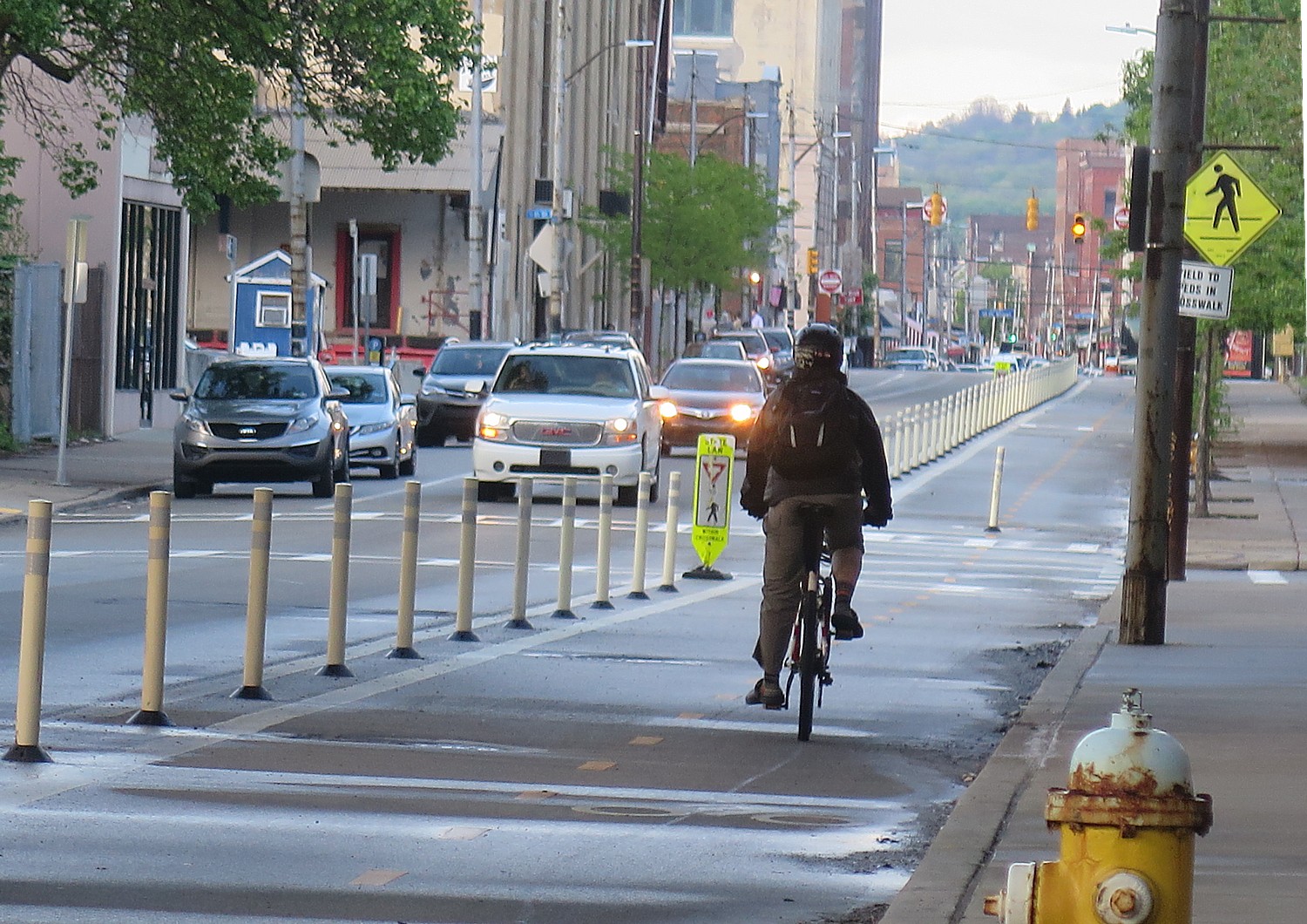
(On September 3, 2016, President Obama traveled to Hangzhou, China for a ceremony in which the United States and China formally joined the Paris Agreement. This is sure to spark interest in visiting this enchanting destination that I so enjoyed experiencing a few years ago. This story was originally published in 2008.)

Through its 5,000 years of human habitation, Hangzhou, a city on China’s southeastern coast about two hours drive south of Shanghai, has been called many things – Xifu, Li’An; Marco Polo referred to the city as Kinsay.

I have spent three days touring Hangzhou and the Zhejiang Province with a guide and a driver provided by the Zhejiang Provincial tourist office. They have given me a fairly good orientation to the city (see related story, Hangzhou: China’s City of Romance). I am very grateful for having had them, because it would have been difficult to figure out in the short time I had what to see and how to see important sites travel without the ability to speak and read the language. (Americans coming to China can arrange for escorted tours through several different agencies, though I did not find an easy way to hire a car and English-speaking driver.)

But for my fourth and final day in Hangzhou, I am completely on my own and I am eager to explore the city on foot (and by bicycle, as it turns out). Frankly, what made me anxious was the prospect of crossing the street.

Braving the traffic: bikes and mopeds cram their lane on the streets of Hangzhou © 2016 Karen Rubin/goingplacesfarandnear.com

Hangzhou is a city that seems eternal for preserving its ancient heritage, but it is manifestly modern in its economic and social development. Instead of quaint narrow streets and bicycles, it has massive boulevards just crammed with cars, people riding mopeds and bicycles, all manner of vehicles and people crisscrossing, and it seems that in this mashing of man and machine, the cars have right of way – pedestrians better get out of it.

I am in the minority, it seems, in trying to merely walk on the sidewalk. But the first time I cross the street from my hotel (they have pedestrian crossing signs and some of the intersections have traffic controllers) I am okay.

I have planned my day to just wander around the city – I have a general idea and one specific destination in mind – rather than figure out public buses or hire a taxi to get to more distant places. I have plotted my course. Most of the main streets, thankfully, have English transliteration of the names on signs (something they didn’t have when I was last in China). The problem is that the spelling is not always consistent. But this is my adventure and I imagine myself Marco Polo coming into a completely foreign place.

I have prepared in advance by taking away the Capital Star Hotel card in Chinese and English, with the directions; also, my guide has written a list of places she recommended I visit, in Chinese and English. And I know that if I run into trouble, I can just to go any hotel and hail a cab. And of course, I have my street maps and handy tourist guide.

Walking about on your own is an entirely different experience than being driven places. Driving, the world unfolds like a grand tableaux – I notice, for example, buses wrapped with boldly colored advertising (even a bit risqué) on the side and such sights as the Family Planning Publicity & Technical Guidance Station of Hangzhou City.

But walking, you can choose the pace and take time to really observe things – shopkeepers opening their shops, commuters making their way to work having conversations with each other as they ride side by side on mopeds, grandparents biking their grandkids to school. Because you don’t understand the language, it is as if you are watching television without the sound – you find yourself intently focusing on details. You watch daily life unfold in real time. You also get to interact with people.

More importantly, you can follow an inner spirit, a whim.

The city itself is crowded with cars and skyscrapers, but now that I have the time to look at them more closely, many show pleasing architecture, not the sterile, institutional, massive apartment buildings that you might have imagined would have been built hurriedly, in order to accommodate the needs of the 1.5 million who live downtown and a burgeoning economy. The buildings have big windows and actually are built with light and air around. And everywhere I look, there are plantings – Hangzhou prides itself on being a “green” city. Here, at least, the oppressive pollution that I have heard about in other major cities, has not taken hold – no doubt because of the large amount of greenspace, national and protected lands, and the vast West Lake, itself.

At a major intersection, where the roads seem to diverge a bit, I stop to study the map (okay, I am a little confused), and a young woman wearing a leather cowboy hat asks in wonderful English if I need any help – she has just come from making a film in Tibet (I don’t ask her about the riots that had just taken place).

A fashionable man struts down Wulin Road, Hangzhou's 'Fashion Avenue.' The city manifests old & new © 2016 Karen Rubin/goingplacesfarandnear.com
A fashionable man struts down Wulin Road, Hangzhou’s ‘Fashion Avenue.’ The city manifests old & new © 2016 Karen Rubin/goingplacesfarandnear.com

I have walked from my hotel in virtually a straight line, down South Hushu Road, which turns into Wulin Road, called “the Fashionable women’s garment street” on the map. This reminds me that Hangzhou is considered the capital of women’s fashion. Wulin is a street of boutiques with very fashionable clothes, western music playing, and ads on the street with western faces.

A little further on young man on a moped stops, intrigued by seeing a Westerner. “Where are you from?” he asks. “USA? America is wonderful.”

I have been surprised, in fact, that my presence (I am the only Westerner around that I can see), barely catches anyone’s notice. I had been in the first wave of Westerners to penetrate the Bamboo Curtain that had kept China virtually in isolation for decades, during my last two visits, in 1978 and 1980; today, you have the feeling that the Chinese are not so insulated, despite the government control of the media. This is probably because of all the multinationals setting up factories and other commercial ventures, and because television, even though limited, does offer some American movies. Whether or not they are actually still behind some curtain of censorship, the people don’t necessarily reflect it.

I continue on my way and come to the Anji Road Experimental School, built in 1954, where children are playing in a courtyard. The name and date intrigues me, and I wonder how teaching has changed from those days.

I finally come to West Lake and see a bicycle rental stand. I figure it will be great for transportation, if not for a chance to see more of the lake. The cost is 10 yuan (about $1.50) an hour, with a 300Yuan deposit, about $45, including the use of a bike lock and helmet. (My guide had made mention of the 300 Yuan deposit, so I am prepared, and we are able to have this conversation with the rental guy without actually understanding each other).

There are many bike rental stations around the lake; you can also get around by a golf cart – either hailing one like a cab, or chartering one.

Once I have the bike, though, I feel I have wings – I am not so brave as to tackle the major streets which are much too congested for me, but stick around the Lake and the side streets. Even here, though, it gets fairly frantic. I am thankful that it is a very low bike, and I can quickly put a foot down when I need to.

It is this wonderful sense of adventure, of having no schedule, no itinerary, just following a whim that makes the day particularly exciting. I follow whatever seems interesting, and so I find myself following the willows and the purple blossoms, and come to West Lake, again.

A statue of King Qian, who established Hangzhou as a capital city © 2016 Karen Rubin/goingplacesfarandnear.com.

I stop at an archway made of these graceful willow trees, and come upon the statue of Qian, the first king of Wu, and then to the memorial to him, the Temple of King Qian (15 Y, about $2 entrance). Qian Liu, who lived from 852-932, was born in Lin’an (later called Hangzhou) and in 923 established the Wu Yue Kingdom with Hangzhou as the capital.

From what I read, Qian Liu sounds like a fascinating man. He was born to a peasant family and made his living selling salt. He joined the army when he was 20, and “suppressed war chaos of military governors.”

A curious artifact on exhibit is a replica of the Iron Certificate that Qian Liu received from the Emperor, in 895, for suppressing rebel official Dong Chang. The certificate basically exempts King Qian and his descendants from the death penalty and other legal penalties.

“The iron certificate was lost in wartime but found by fisherman in deep water,” the notes read. “Descendents of Qian bartered it back with rice. It had been for sale in bazaar.”

In 923, Qian Liu became King of the Wu Yue. He is revered for “guarding the border and keeping the people at rest, including initiating no war, converting people, awarding cultivation and weaving, building irrigation works, dredging West Lake, recruiting talent and developing trade.

“He built irrigation system and sericulture [raising silk worms for the production of raw silk], treated subordinates well and enlisted competent people.” Under his rule, the notes say, “Hangzhou became the #1 city in Southeast China in prosperity.”

He died at the age of 81 and was followed by four other Qian kings from three generations (one became king at the age of 14 and another lasted only six months).

Hangzhou served as the capital of the Wuyue Kingdom for 200 years; the city reached its zenith of power in the period just before China was invaded by the Mongols, in 1276. By then, the city had nearly a million people, making it one of the most populous cities in the world.

Though it was no longer a capital, Italian explorer Marco Polo found it a beautiful city even after the Mongol conquest. During the years of the great Kublai Khan, 100 years after the Mongol conquest, Polo wrote, “[It is] beyond dispute the finest and the noblest in the world. The number and wealth of the merchants, and the amount of goods that passed through their hands, was so enormous that no man could form a just estimate….”

All through my visit to various historic sites, I try to absorb as much as I can, but it is very difficult – for one thing, you are dealing with thousands of years of history, with dates based on dynasties and kingdoms; for another, the spellings and names of places and people are not consistent, and for an American, it is often difficult to distinguish the Chinese names because of the different transliterations. Even maps are hard to follow because they don’t always use the same English names or transliterations. But that is part of the fun of discovery – pieces of the puzzle come closer together.

An archway of graceful willow trees leads to the statue of Qian, the first king of Wu © 2016 Karen Rubin/goingplacesfarandnear.com

As I leave the King Qian’s memorial hall, I hear “Auld Lang Syne” playing in the orchard of willows. I follow the willows and then I follow purple flowers, and come again to the water’s edge. I am pulled in two ways: Spend more time at the magnificent West Lake, perhaps to ride completely around it (about 15 miles or so), or to go in search of Hefang Street and the Museum of Traditional Chinese Medicine?

I make my way to Hefang Street, which turns out to be an ancient market street that seems little changed from the centuries, and in fact, epitomizes the history and culture of Hangzhou.

Hefang Street © 2016 Karen Rubin/goingplacesfarandnear.com

When the Southern Song Dynasty set up Hangzhou as its capital, a ten-li (li is a measure of distance, 500 meters or 547 yards) royal street was opened. Today, there are more than 100 shops including teahouses, drug stores, silk shops, baked goods, food, curios, calligraphy and paintings, and some noted shops including the Wanlong Ham Workshop and Wangsingji fans, that line the promenade, including a massive multi-story market building where you can buy fresh flowers, fresh fish, and just about anything else. But the most famous, is the Hu Qing Yu Tang Drugstore.

Chinese Medicine Museum

The Hu Qingyutang Chinese Pharmacy founded in 1874 by Hu Xueyan and still operating in Hangzhou, China © 2016 Karen Rubin/goingplacesfarandnear.com

My key objective for the day is to find the Museum of Traditional Chinese Medicine (Hu Qing Yu Tang Chinese Medicine Museum), but I am having trouble figuring out where it is (largely because the maps don’t conform). I look down a narrow alley that seems intriguing and see giant Chinese characters on a wall and an arrow pointing down the street. I feel compelled to follow the arrow, and sure enough, almost by accident, I come upon the entrance to the museum.

I pay the 10Y fee ($1.40), and follow the signs: “Upstairs, Visitor” and “Onwards, Visitor.”

The first museum dedicated to Chinese medicine in China, it is located within a fantastic house like a palace and today, one of the finest examples of architecture that remains from the late Qing Dynasty. It is exactly as the brochure says, “ingenious in layout, antique in form, most well preserved”. The structure is a significant attraction in itself.

This is the site of the Hu Qingyutang Chinese Pharmacy founded in 1874 by Hu Xueyan, who is identified as “a red-hat businessman”. A man of modest background, I learn, he made his money by raising food and supplying the government during a period of rebellion. As a reward, he was crowned by the Emperor Tongzhi of Qing Dynasty with the top rank and bestowed a yellow mandarin jacket.

He became fantastically wealthy, owned an enormous amount of real estate, and founded the pharmacy as his way of giving back to the community. But in 1883, he began to invest in silk and “failed in competition with foreign adventurers, went bankrupt and two years later, died of depression.”

I am intrigued by the Hu Xueyan motto: “Refraining from cheating.” In fact, on display is a “Deception Warning Tablet”. According to the brochure, Hu Xueyan instructed salesclerks to raise deer and, dressed in livery uniform, parade them when the Idrodeer pill was being prepared. The deer was killed in public to show that the ingredients were “true” and there was no deception.

The art, relics, architecture of the museum are simply fantastic – as you roam from room to room, exhibit to exhibit. In fact, the brochure says this is the largest ancient commercial building hall in the country.

The exhibit lays out the fundamentals of traditional Chinese medicine, and asks and answers, “How did it come about? In a primitive society, hungry people are forced to eat anything – they ate poisonous plants and suffered vomiting, diarrhea, coma, even death; sometimes they ate and found the poison alleviated.”

Archeology on the lower reaches of the Yangtze showed the use of traditional medicine from 6000-7000 years ago. Marco Polo also described traditional medicine.

In the exhibition hall, the history of Chinese traditional medicine is demonstrated through a great number of items and descriptions, including anecdotes of famous Chinese doctors in history.

A legend of one of the founders of the science of Chinese medicine is quoted: “’Shennong tasted every herb and met poisoning 10 times a day’ – through numberless intentional and accidental trials, found what worked.”

Other early practitioners, like Zhao Vuemnn (1719-1805), a native of Hangzhou, who wrote 12 books kept detailed records of scientific observations.

The Hu Qingyutang Chinese Pharmacy founded in 1874 by Hu Xueyan and still operating in Hangzhou, China © 2016 Karen Rubin/goingplacesfarandnear.com

There is a medicine preparation hall, where veteran masters demonstrate for visitors such operations as pill shaping and slicing of crude drugs and give visitors the chance to use the hand tools, themselves (though none are there on the day I visit). I learn how the medical pellet originated from ancient alchemy by a Taoist priest.

I go through room after room of specimens of just about every element used in traditional Chinese medicine – from plants and rocks to animals, including gecko, snake, tiger, lion – with descriptions of what they are used for: leopard relieves rheumatism and pain; oil from fur seal to moisturize skin, clear wrinkles; Mastodon fossil for calming mind and settling fright.

In 1958, the pharmacy was turned into a Chinese medicine factory; it was restored and opened as a historical site in 1988 (a year which I note there seem to be a renewed respect and appreciation for ancient heritage). Most amazing to me as I finish exploring the museum, is that it is still a traditional Chinese pharmacy. As I leave the museum, and walk next door, there is an enormous salesroom with counters and white-coated pharmacists, jars of floating roots; I see patients waiting in a pleasant seating area where there are pools of water. Upstairs, in an attached modern building, are medical offices.

You need to spend at least one hour to go through the museum; it is simply not to be missed (www.hqytgyh.com).

As I make my way around the corner back to Hefang, I look beyond this ancient street at the McDonald’s, and my trip to the past is ended.

Hangzhou, China © 2016 Karen Rubin/goingplacesfarandnear.com

It’s my last day in Hangzhou and I realize I haven’t had much of a chance to shop (only kind of ironic, since everything in the U.S., it seems, is manufactured here). I look more closely at what is on sale here – there is fabulous stuff. After hearing so much about silk, I decide to buy some – silk pajamas for everyone.

I cycle back to the bike rental station – get back my 300 Yuan deposit, minus 50 yuan for 5 hours of bicycle rental ($7) – all of this by writing on a pad the number of hours I had the bike – we laugh.

As I walk back, parents and grandparents are waiting for children at dismissal from school. I watch a kind of parade as the students leave.

I make my way to a commercial center, just below the Radisson Hotel, where there is a Starbucks, as familiar in décor as the one our neighborhood, and enjoy a mocha Frappachino and a scone, watching the traffic and reading the newspaper.

On the way to the airport, I finally get to hear what the story of the Chinese “Romeo & Juliet” is about. My guide has made frequent mention of it, in connection with the legend of West Lake. It is a love story of a girl who pretends to be a man and falls in love. The boy realizes his friend is a girl and rushes to her home to ask for her hand in marriage, but she has been married off. I think this sounds more like “Yentl” than Shakespeare’s “Romeo & Juliet” but my guide has never heard of “Yentl.”

There is so much more to see in Hangzhou and Zhejiang Province than I could possibly do in the five days, and I look forward to returning. Several tour companies offer itineraries, such as a 10-day Zhejiang Highlights bus tour.

For more information about travel to Hangzhou, contact Hangzhou Municipal Tourism Commission, http://eng.hangzhou.gov.cn/ 

See also: Hangzhou: Ancient & Modern Come Together in China’s Popular Resort City

____________________

© 2016 Travel Features Syndicate, a division of Workstyles, Inc. All rights reserved. Visit goingplacesfarandnear.com and travelwritersmagazine.com/TravelFeaturesSyndicate/. Blogging at goingplacesnearandfar.wordpress.com and moralcompasstravel.info. Send comments or questions to [email protected]. Tweet @TravelFeatures. ‘Like’ us at facebook.com/NewsPhotoFeatures