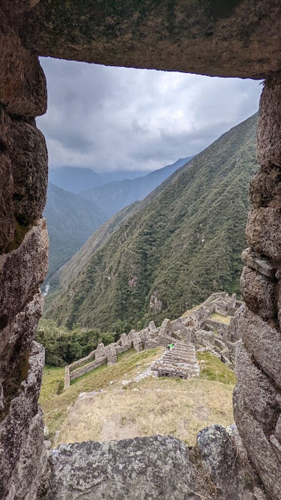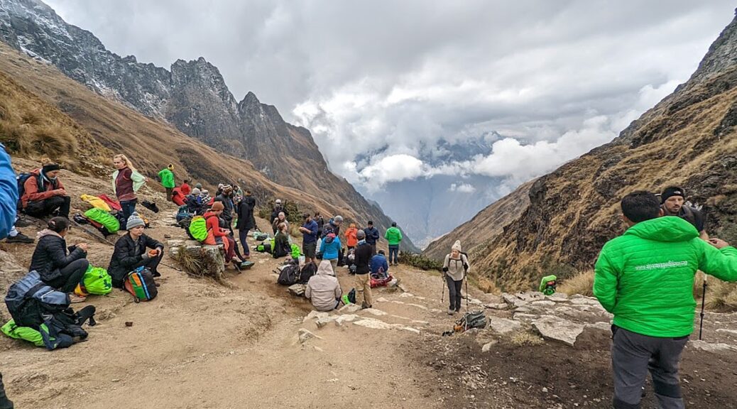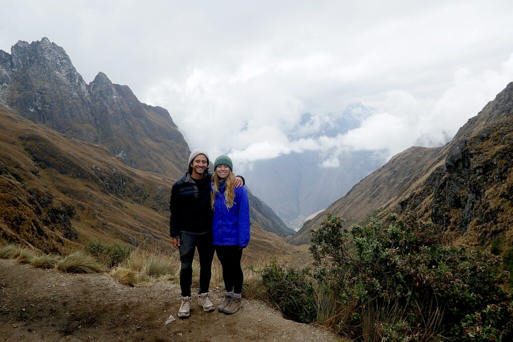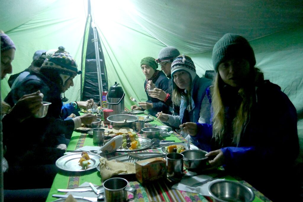
Category Archives: Places of History

New Brunswick, Canada Roadtrip: Saint John, City of Firsts, Oldests, Amazements

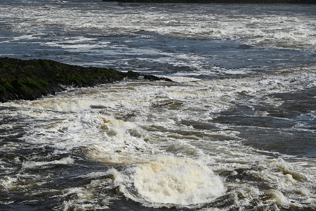
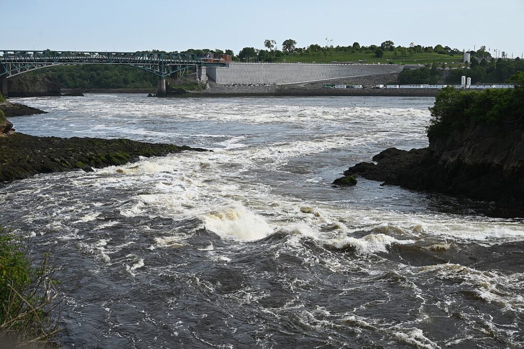
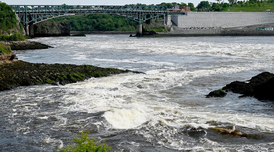
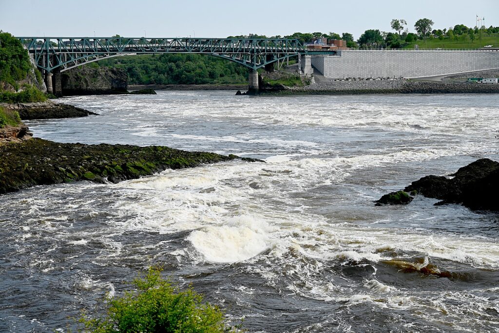
Reversing Falls Rapids, one of only two reversing falls in the world, is where the Saint John River runs through a narrow gorge before emptying into the Bay of Fundy. The force of the tide of Fundy Bay – 160 million tons of seawater at high tide – overpowers the river, pushing it backwards. © Karen Rubin/goingplacesfarandnear.com

By Karen Rubin, with Dave E. Leiberman, Laini Miranda & Eric Leiberman

Travel Features Syndicate, www.goingplacesfarandnear.com

Our roadtrip through New Brunswick, one of Canada’s Maritime Provinces, continues in Saint John, a city of firsts, of oldest, of amazements worthy of Ripley’s or Guinness, like the wondrous Reversing Falls (one of only two in the world), and Stonehammer UNESCO Global Geopark, where we will actually see remnants of Pangea – primordial earth before the continents split apart.

A City of Oldests, Firsts

Saint John is only about an hour’s drive from St. Andrews where we meet Doug Scott, who is taking us on a walking tour to best appreciate the history and heritage of Canada’s oldest incorporated city, the province’s second biggest city with a population of 135,000, the only city on the Bay of Fundy, and a major cruise ship port, which served as an major immigration center for 200 years.

It was into this port that explorer Samuel de Champlain sailed in 1604 –claiming it for France.

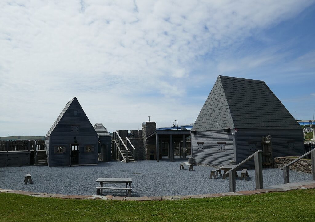
Fort La Tour National Historic Site, Saint John, New Brunswick, Canada © Karen Rubin/goingplacesfarandnear.com

We follow a beautiful waterfront walkway that is taking shape around to Fort La Tour National Historic Site, built in 1631 by Charles La Tour to trade with First Nations people. This has been an archeological site, but more recently, they have reconstructed the fort, “the site of treachery, intrigue and a memorable battle in early Acadian times,” the literature reads. It is also “commemorates 5,700 years of changing ceremonial, commercial and industrial uses.” (Harbour Passage, 506,607-7171, www.placefortlatour.com)

The “treachery” and “intrigue” comes from the fact that during her husband’s absence in 1645, Françoise-Marie Jacquelin, Madame de La Tour, unsuccessfully defended the fort against their chief rival, Charles de Menou d’Aulnay, who promised that if she surrendered, he would spare the lives of her people; she surrendered and he killed them anyway.

Though claimed for France, the British had different ideas, seeing Saint John as an important defensive port, and, when the British and French were embroiled in the French & Indian War (1754-1763) over control of the colonies, in 1755, expelled the French Acadians who did not swear an oath to Britain.

Loyalists fleeing the American Revolution founded Saint John in 1783, incorporating the city in 1785 (Canada’s first).

From Fort La Tour we can see out to the 24 acres of Partridge Island in the harbor, “the most historic chunk of rock in Canada,” Scott says.

Partridge Island had New Brunswick’s first gas-powered lighthouse (1791), North America’s first quarantine station (1785) and the world’s first steam-operated fog alarm (1859).

Much like Ellis Island in New York harbor, 3 million immigrants passed through here to make Canada their home. A flood of Europeans came through in 1815 at the end of the Napoleonic Wars; and from 1812-1850, 70 percent of immigrants were Irish, peaking in 1845-47, because of the Irish Potato Famine. There was tension between the British (Protestants) and the Irish (Catholics), that climaxed in an 1849 riot which led to the formation of Canada’s first police force. (You can visit the Saint John Police Museum, 56 Prince William St., 506-674-4137, www.saintjohnpolicemuseum.ca)

Saint John’s role as the gateway for immigrants is notable. There is the Saint John Jewish Historical Museum (91 Leinstar St., 506-633-1833, http://jewishmuseumsj.com/), focusing on the development and engagement of Saint John’s Jewish community since its founding in 1858, through its “Golden Years” (1919-1960s), when there 1400 Jews and 85 businesses.

From 1858 through 1947, Partridge Island was used for defense and still is a Canadian Coast Guard base. People used to be able to go to the island for concerts but today, the island is closed to visits.

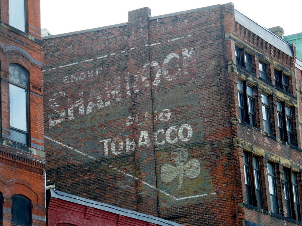
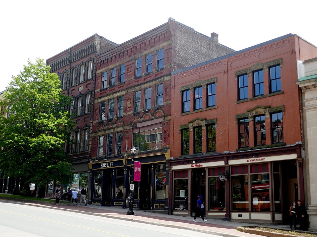
Much of Saint John, New Brunswick, Canada’s oldest incorporated city,had to be rebuilt (in brick) after the Great Fire of 1877 Canada © Karen Rubin/goingplacesfarandnear.com
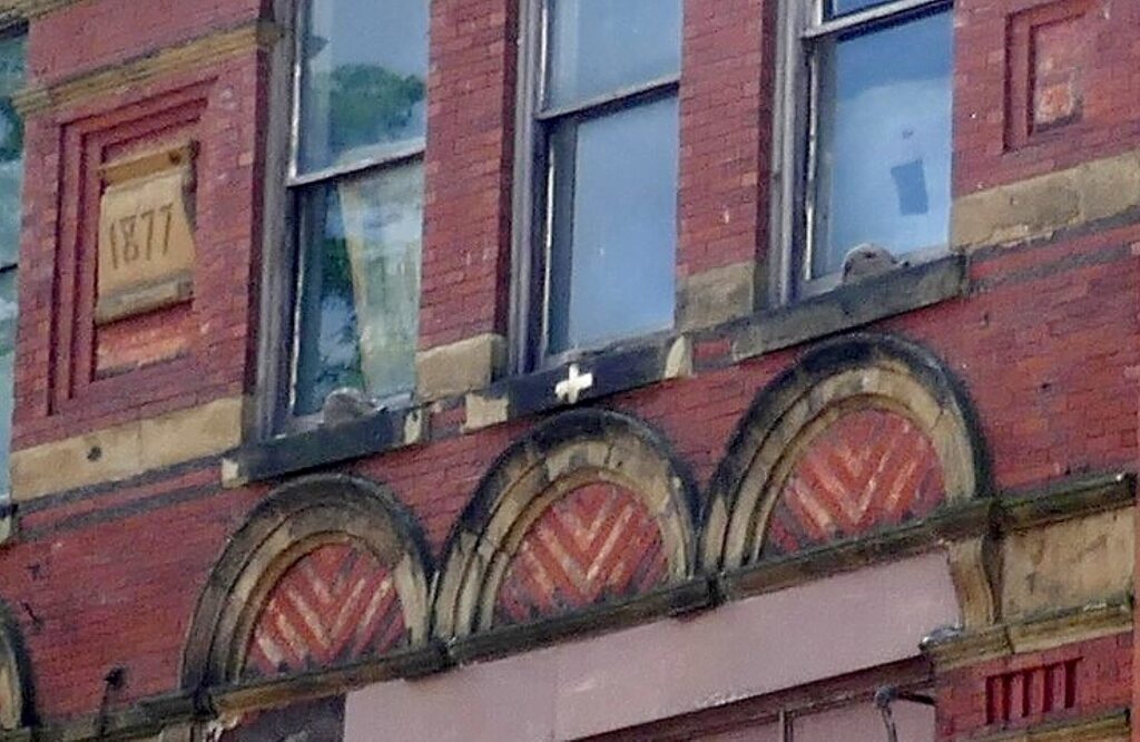
A white cross indicated a building that had been rebuilt after the 1877 fire © Karen Rubin/goingplacesfarandnear.com

1877 was a pivotal year for Saint John: a Great Fire destroyed everything from the waterfront to King Street (you can even see the difference in architecture). 19 died and 7 newspapers, 16 churches and 2600 buildings were destroyed. The city brought in architects from New York and within one year, rebuilt 1,300 buildings using brick. Today, you see many buildings with dates from 1877, 1878, 1879; many also have white crosses to show that were rebuilt to a new fire standard.

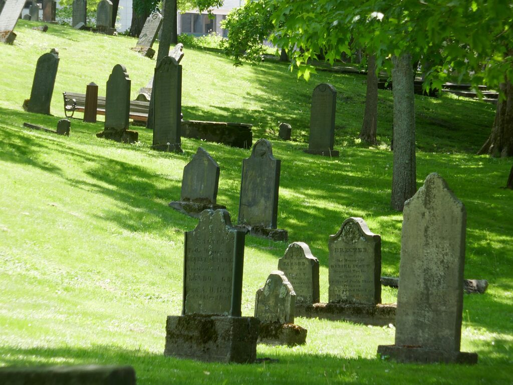
Loyalist Cemetery, in King’s Square, Saint John, New Brunswick. Canada’s oldest incorporated city, it was founded by Loyalists fleeing the American Revolution in 1783 and incorporated in 1785 fire © Karen Rubin/goingplacesfarandnear.com

Scott takes us to a street which is pretty much the dividing line where the fire stopped. On one side are all the brick buildings. But just nearby, you can still visit Loyalist House (120 Union Street, 506-652-3590, www.LoyalistHouse.com), built by local merchant David Daniel Merritt around 1810, which is the city center’s oldest standing wooden structure. We also visit Loyalist Cemetery, in King’s Square, just behind the City Market, which is a beautiful park.

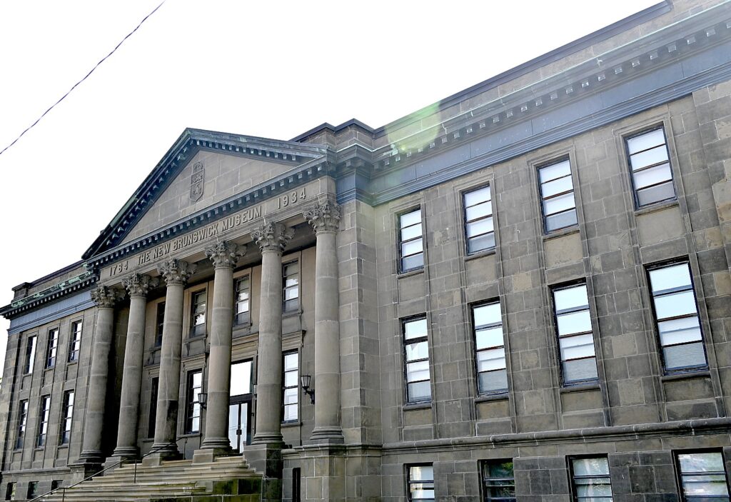
Another interesting place to visit is the New Brunswick Museum which houses historic and geologic exhibits (Market Square, 1-888-268-9595, 506-643-2390, www.nbm-mnh.ca) and its Archives & Research Library (277 Douglas Avenue), housing death and marriage records that draws people from all over to research.  (While the museum itself is in the process of undergoing an extensive renovation and the collections are currently inaccessible, you can still access the Archives & Research Library by appointment.)

City Market, Saint John, New Brunswick © Karen Rubin/goingplacesfarandnear.com

We have lunch at the Saint John City Market. At one of the entrances, a sign lists St. John’s City of Firsts:  oldest continuing operating farmers market in Canada; first police force; first public high school, first museum, library, paved street, banking district in Canada. The market is itself housed in a historic building, dating from 1876, its ceiling is in the shape of an upside down ship’s hull (a shipbuilder built it).

Stonehammer Geopark’s Amazements

Saint John is not only Canada’s oldest incorporated city, it is built on some of the oldest geology on the planet. For the geology part of our Saint John exploration, we meet up with Wanda Hughes who runs the Inside Out Nature Centre inside Rockwood Park (55 Lake Drive), and has been involved with the Stonehammer UNESCO Global Geopark since its founding in 2010, the first geopark in North America.

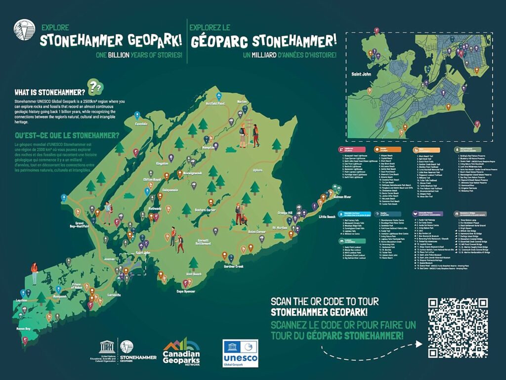
Stonehammer UNESCO Geopark, the first in North America, contains some 60 sites of geologic significance, including some of the oldest geology on the planet and evidence of Pangea, as well as some of the oldest fossils © Karen Rubin/goingplacesfarandnear.com

There are now 177 UNESCO Global Geoparks in 46 countries around the world (the first opened in China in 1980s; Canada has five). But Stonehammer is distinguished because while most geoparks are a single site (like a cave or volcano), because of the extraordinary diversity and scale of geology here, Stonehammer contains 60 different sites, spanning 965 sq. miles up the coast to St. Martins, each site with a different geological story. During our visit, we get just a taste.

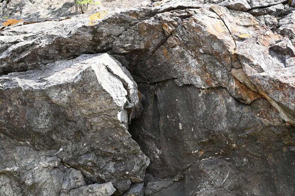
In Stonehammer Geopark in Saint John, you can see evidence of Pangea, primordial Earth before the continents split, and rocks that come from present-day Africa and South America in one place © Karen Rubin/goingplacesfarandnear.com

350 million years ago, the earth was one super continent, Pangea, that through ice ages and other geologic forces, separated into 7 continents. But when the world was Pangea, New Brunswick was located where Africa is today, a tropical paradise south of the equator.

“Our geology is unique,” Hughes tells us. “As the continents drifted apart, a new Atlantic Ocean was created here.” You can see rocks facing each other, one that would have been in Africa (today), and the other that would have been South America today – two different continents.

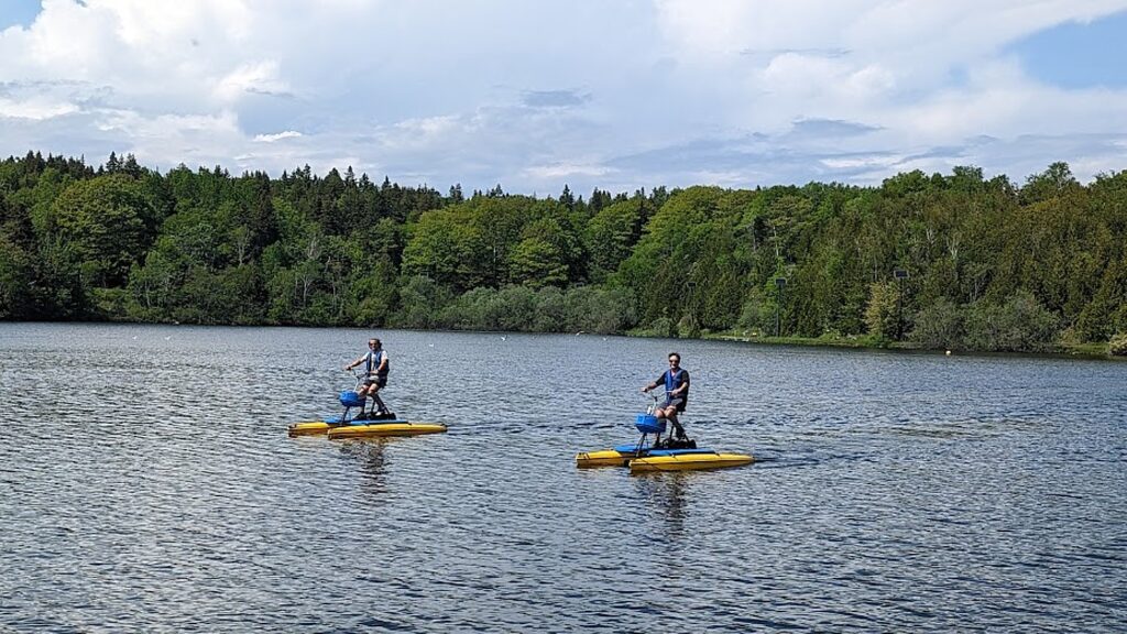
Our Stonehammer Geopark experience starts in Rockwood Park, one of the Stonehammer Geopark sites. Spanning 2,200 acres with 10 lakes and 55 trails, it is one of the largest urban parks in Canada and was designed by Frederick Olmstead in the 1800s (who also designed NYC’s Central Park and San Francisco’s Golden Gate). Before heading out, we actually get to try out hydrocycles! You can also do geo-caching, rockclimbing, kayaking, and mountain biking from the Nature Center.

Trying out hydrocycles in Rockwood Park, one of the Stonehammer Geopark sites in Saint John, New Brunswick © Karen Rubin/goingplacesfarandnear.com

Enroute to one of the major Stonehammer sites, Reversing Falls, Hughes takes us through a wealthy neighborhood of Captain’s Houses and notes that Abraham Pineo Gesner (1797-1864), a Canadian physician and geologist who lived much of his life in Saint John, invented kerosene, saving whales from extinction and basically founding the petroleum industry.

Reversing Falls Rapids, one of only two reversing falls in the world, is where the Saint John River runs through a narrow gorge before emptying into the Bay of Fundy. The force of the tide of Fundy Bay – 160 million tons of seawater at high tide – overpowers the river, pushing it backwards. © Karen Rubin/goingplacesfarandnear.com

Reversing Falls,  one of only two reversing falls in the world (the other is in Norway), is a series of rapids (not really waterfalls) where the Saint John River runs through a narrow gorge before emptying into the Bay of Fundy. The force of the tide of Fundy Bay – 160 million tons of seawater at high tide – overpowers the river, pushing it backwards.

The tide can rise as much as 26 ft – how high depends on moon cycle, season (higher in spring), and the gravitational pull. But for about 20 minutes at a time, there is a “slack tide” when the river and bay meet, “when the ocean stops the river,” Wanda tells us. It is only then that you can safely bring in a boat. “American sailors who didn’t realize they had to change their clock [Atlantic time is one hour earlier than Eastern time] would get stuck.”

Reversing Falls, one of the Stonehammer Geopark sites, Saint John, New Brunswick © Karen Rubin/goingplacesfarandnear.com

It is hard to make out (you would really need to know where and what to look for), but there is evidence of an ancient ocean and the formation of the supercontinent Pangea under the Reversing Falls bridge: billion-year-old light gray marble from South America on one side and 500-million-year-old dark gray shale and sandstone from northern Africa on the other. They came together 480-430 million years ago. (See: Southern New Brunswick rocks tell a billion years worth of stories, says geologist.)

Not surprisingly, considering the power of these falls, there is a local legend from the Mi’kmaq people who lived here well before the Europeans that tells of Glooscap (the Creator), who was angered  that a giant beaver was damming up the river, harming fishing, and refused to stop. Glooscap used a giant club to smash the dam, which created the small islands we see, and then shrank the beaver to the size it is now.  (I gather this is the source of the name, Stonehammer.)

“At low tide, you can see Glooscap’s club and face in rock. And then they found fossil of giant beaver,” Wanda tells us. A banana-sized beaver tooth displayed at the New Brunswick Museum is evidence that giant beavers, the size of black bears today, actually existed.

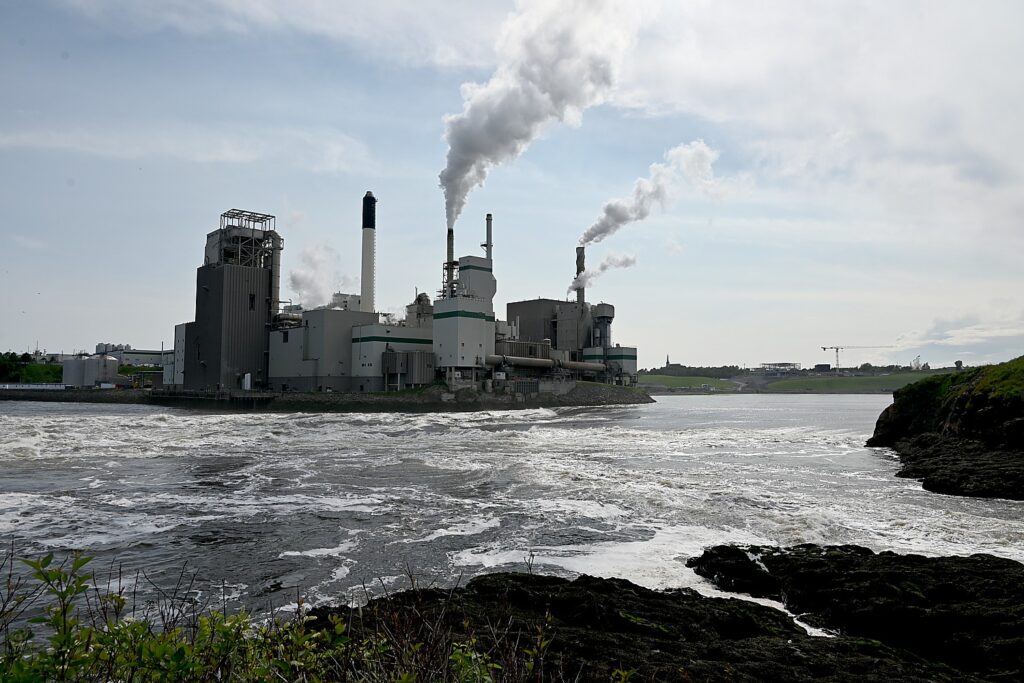
Historically, such fast-moving waterways as Reversing Falls were used for manufacturing and commerce, like the Irving Paper & Pulp Mill © Karen Rubin/goingplacesfarandnear.com

On the other shore of the Reversing Falls is the Irving Paper & Pulp Mill, a key industry and employer in Saint John, which seems incongruous but like so many factories, was built on such dynamic waterways because of the water power and transportation and that Saint John was an industrial city.

The bridge over the Reversing Falls gorge and rapids is notable. There were three previous attempts: the St. John Bridge Company tried in 1837, but the partially completed bridge collapsed, killing seven workmen. Finally, Edward W. Serrerell, who designed the first bridge to span Niagara Falls, was hired in 1849, and three years later, the first successful bridge opened, becoming a principal north-south trade link to the United States. (The current bridge was erected in 1915).

For a different experience, you can walk “The Plank,” an observation deck 110 feet in the air overlooking the Reversing Falls Rapids (https://theplank.ca/). 

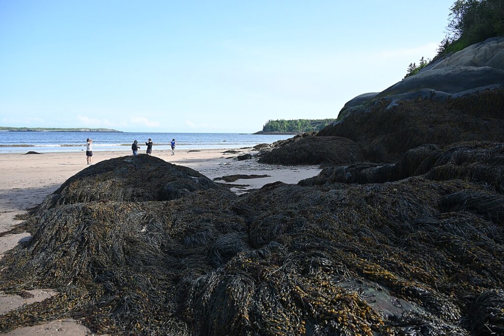
Irving Nature Park, one of the Stonehammer Geopark sites in Saint John, New Brunswick © Karen Rubin/goingplacesfarandnear.com

We next visit the Irving Nature Park, a 600 acre wooded park located on the City’s west side, which is a Stonehammer Geopark site, owned and maintained by J.D.Irving Ltd. That offers beautiful views of the Fundy coastline, groomed trails and a gravel road for walking, hiking, and biking. And just outside the main entrance is a Children’s Forest, playground, and life-size mazes. It is also a “dark sky” preserve. Be mindful of the tide!

The full complement of 60 Stonehammer geosites presents almost continuous geological history of the planet over a billion years. Of the sites, about a dozen are easily accessible by the public and are presented as parks and recreation centers.

Dominion Park, for example, is where billion-year-old stromatolite fossils in the marble that formed in South America and evidence of an ancient cyanobacteria, was where the oldest evidence of life on Earth was first identified in 1890; it also offers some of the best beaches for swimming in Saint John https://stonehammergeopark.com/geosites/dominion-park/

“This was the most violent place on the planet 250 million years ago, but not now. Here, [the continents] stabilized.” She says this place is an example of a “failed continental rift”, where the continents stopped separating, creating a narrow bottleneck which traps the ocean. “It’s why we have the highest tides.”

Stonehammer Geopark has an interpretation/visitor center at Area 506 Container Village which displays some of the fossil collection, and can provide map and guidance on how to best visit (Open June-October, 85 Water St., 1-506-471-1310, www.stonehammergeopark.com).

Wanda Hughes’ company, Go Fundy Events, offers a variety of ecotourism and adventure programs for individuals and groups (712 Dominion Park Road, Saint John, NB E2M 5S8, 506.672.0770, 1.866.672.0770, [email protected], www.gofundyevents.com.

Saint John’s Quirky Vibe

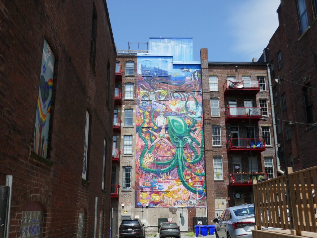
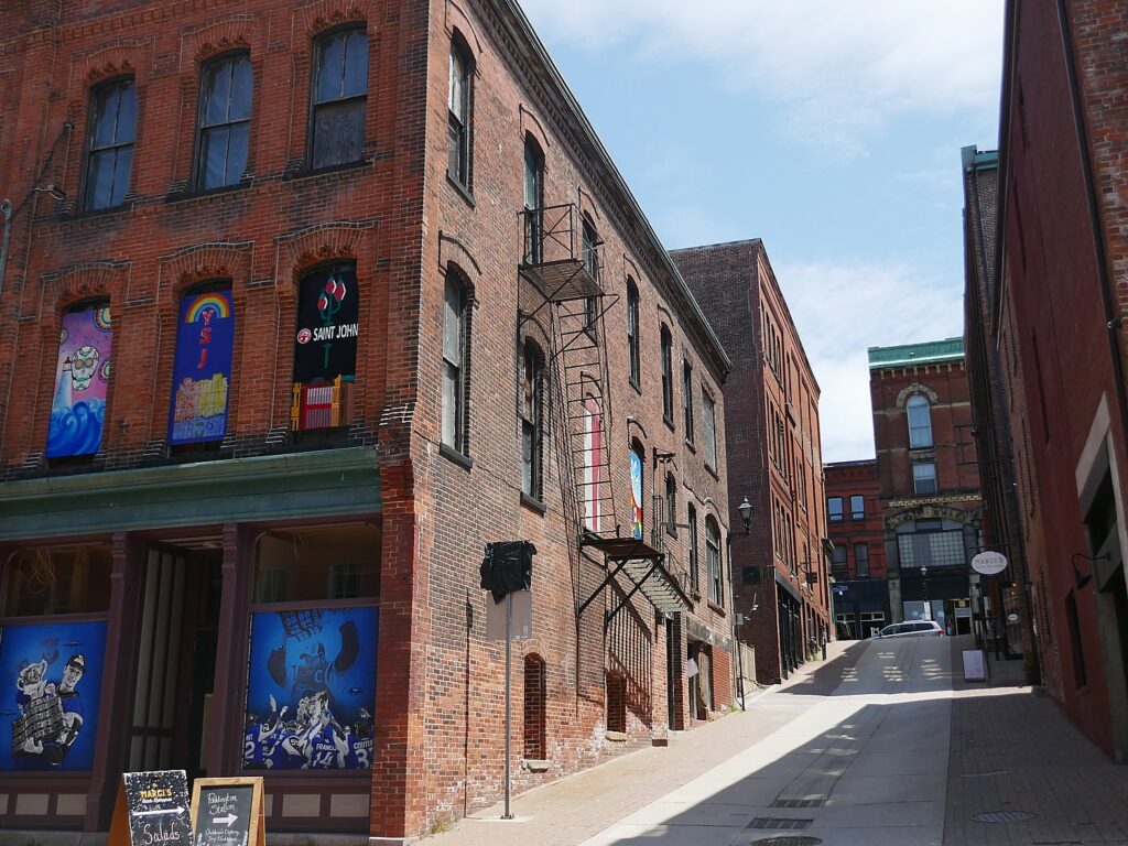
With all this history and serious geology, what is especially notable is the quirky vibe of Saint John, which you feel especially in the project to redevelop the waterfront to host shops, a skating rink and concert venue.

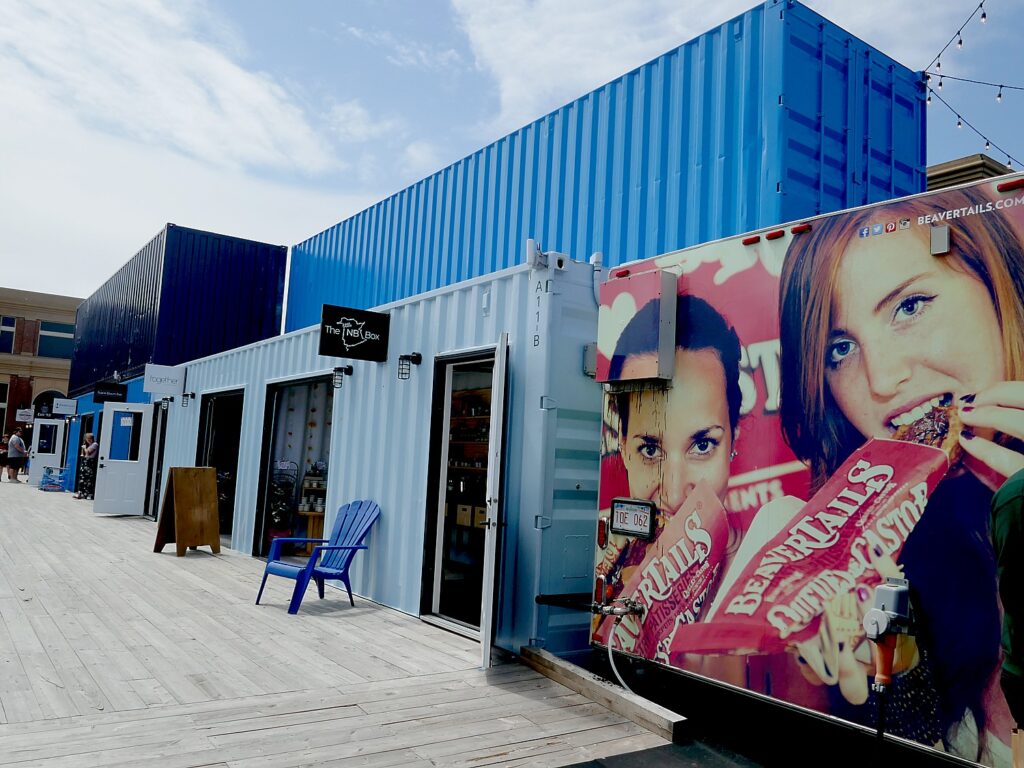
Area 506, the Waterfront Container Village, offers fun boutiques, eateries, pop up art, and music and movie space © Karen Rubin/goingplacesfarandnear.com

Area 506, the Waterfront Container Village, located next to the cruise ship terminal, opened in summer 2022 with some 60-plus shipping containers converted into retail spaces that showcase New Brunswick creativity. There is also a large stage performance and movie space, a three-level patio that provides great views of the stage and Bay of Fundy, a beer garden,  food trucks, a graffiti alley for local and international artists, and pop-up activities.

For all its history and 19th century architecture, Saint John, New Brunswick, has a young, quirky vibe © Karen Rubin/goingplacesfarandnear.com

Saint John also “punches far above its weight in terms of dining experiences,” Scott tells us. There’s a vibrant food and beverage scene in Saint John with 80-plus bars/restaurants within 10 blocks downtown near the cruise ship terminal – all of them local and independent, offering an amazing diversity of cuisine from around the world (reflecting Saint John’s heritage as an immigration center and cruise port). 

For all its history and 19th century architecture, Saint John, New Brunswick, has a young, quirky vibe © Karen Rubin/goingplacesfarandnear.com

We’ve even gotten a list of recommendations:

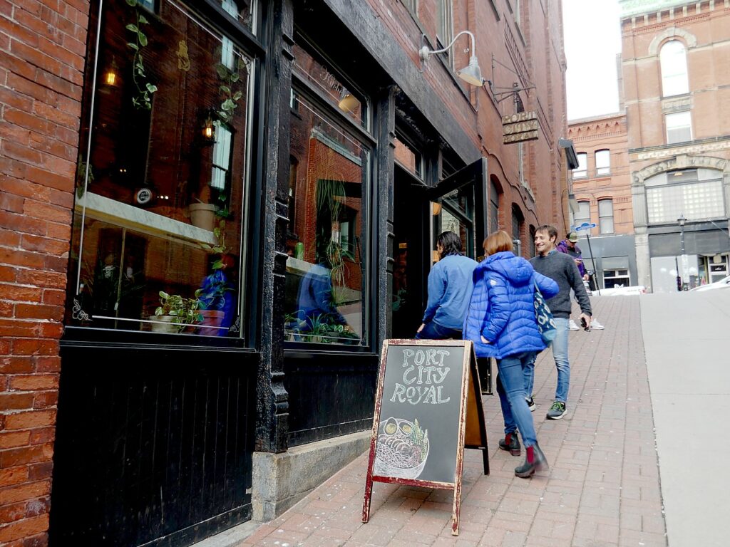
Port City Royal (45 Grannan Street), where we savor handmade ravioli filled with whipped feta and ricotta cheese, topped with buttery glazed fiddleheads, crispy guanciale and Egyptian walking onion oil;roast pork & chick shoyu ramen and Japanese spring noodle salad. It also offers an imaginative cocktail menu.

Saint John, New Brunswick, ”punches above its weight” in cuisine. We enjoy a dinner at Port City Royal © Karen Rubin/goingplacesfarandnear.com

Saint John Ale House (owned by celebrity chef Jesse Vergen, from Top Chef and Wall of Chefs, 1 Market Square, https://www.saintjohnalehouse.com/

Lemongrass Thai Fare / Peppers Pub, 1 Market Square.

Five and Dime, vinyl record bar, 34 Grannan Lane, https://fiveanddimesj.com/

East Coast Bistro, local cuisine prepared with French techniques, 60 Prince William Street,

Pomodori Pizza – for a casual night out – attached to Picaroons brew pub, 34 Canterbury Street.

Picaroons Brew Pup is a popular spot in Saint John, New Brunswick © Karen Rubin/goingplacesfarandnear.com

It’s appropriate to mention that (at least during our visit) the US dollar goes about 25% further than the Canadian dollar, so what we buy – like a fancy meal – is at a 25 percent discount.

Being a major city, Saint John offers lots of choices of accommodations. We enjoy our stay at Hilton Saint John, an upscale property with its own parking garage, ideally located right on the waterfront, with indoor pool, fitness center, restaurant, pet-friendly rooms (1 Market Square, +1 506-693-8484).

Travel planning assistance from Discover Saint John, 1 866 463 8639, [email protected], https://www.discoversaintjohn.com/ and Tourism New Brunswick, 800-561-0123, www.tourismnewbrunswick.ca.

Next: New Brunswick Roadtrip Takes Us On the Newly Completed Fundy Trail Parkway

See also: NEW BRUNSWICK ROADTRIP BEGINS IN ST. ANDREWS

____________________________

© 2023 Travel Features Syndicate, a division of Workstyles, Inc. All rights reserved. Visit goingplacesfarandnear.com, www.huffingtonpost.com/author/karen-rubin, and travelwritersmagazine.com/TravelFeaturesSyndicate/. Blogging at goingplacesnearandfar.wordpress.com and moralcompasstravel.info. Visit instagram.com/going_places_far_and_near and instagram.com/bigbackpacktraveler/ Send comments or questions to [email protected]. Tweet @TravelFeatures. ‘Like’ us at facebook.com/KarenBRubin 
On the Trail to Discover Vancouver’s Revived Indigenous Heritage

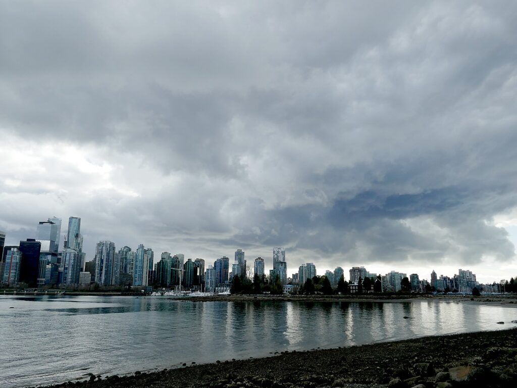
The view from the seawall at Stanley Park across Burrard Inlet to West Vancouver, where indigenous peoples had lived for thousands of years taking advantage of rich fishing and hunting before being forced out of land considered “unceded.” Expression of indigenous culture was banned in Canada for more than 100 years © Karen Rubin/goingplacesfarandnear.com

By Karen Rubin, Travel Features Syndicate, goingplacesfarandnear.com

Who could have imagined such an immersive experience into British Columbia’s indigenous culture revival in the heart of a bustling, modern metropolis like Vancouver?

I come to Vancouver intent to see how indigenous heritage culture is being resurrected, revived, and coming to the forefront of national consciousness and respect.

My trip is very much a voyage of discovery, in so many ways so surprising, illuminating and enriching, especially once I am sensitized to look.

My itinerary is arranged by Indigenous Tourism BC, one of Canada’s oldest (at 25 years) provincial entities to promote the economic and social benefits tourism brings to revive and sustain a heritage that had been relegated to shadows.

These efforts have accelerated after Canada signed its historic Truth and Reconciliation Act, in 2014, acknowledging the harm of 140 federally run residential schools that operated from 1867 up until 1996, and other laws, like the Indian Act, banning the practice of indigenous culture that amounted to cultural genocide.

It was only in 1951 that amendments to the Indian Act removed restrictions on rituals, customs and culture. Canada’s indigenous peoples – who account for five percent of the population – could not vote until the 1960s.

Skwachays Lodge, Canada’s First Aboriginal Art Hotel

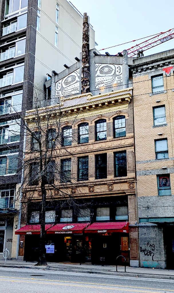
Skwachays Lodge, Canada’s first aboriginal art hotel, affords the nearest thing to staying in a First Nations community you might find in a major modern city © Karen Rubin/goingplacesfarandnear.com

My voyage of discovery starts as soon as I check in to my hotel, Skwachays Lodge, the nearest thing to staying in a First Nations community you might find in a major modern city.

Skwachays Lodge, Canada’s first aboriginal art hotel, opened in 2012 as a social enterprise that turned a derelict building into a boutique hotel combined with an artist-in-residence program supporting indigenous artists with housing and studio space.

Skwachays Lodge, a social enterprise, provides housing and studio space for 24 indigenous artists © Karen Rubin/goingplacesfarandnear.com

Even though it is late, Rick, the night manager, is eager to show me around to the art studios and introduces me to two of the 24 artists in residence who live for up to three-years in apartments on the 2nd, 3rd, and 4th floors. The hotel also has a gallery and a superb shop.

The 18 guest rooms and suites, which occupy the 5th and 6th floors, have been individually designed by six indigenous artists – there is the Water Room (502), the Sea Kingdom Suite, Northern Lights Room, Forest Spirits Room, Earth Room, King Salmon Suite.

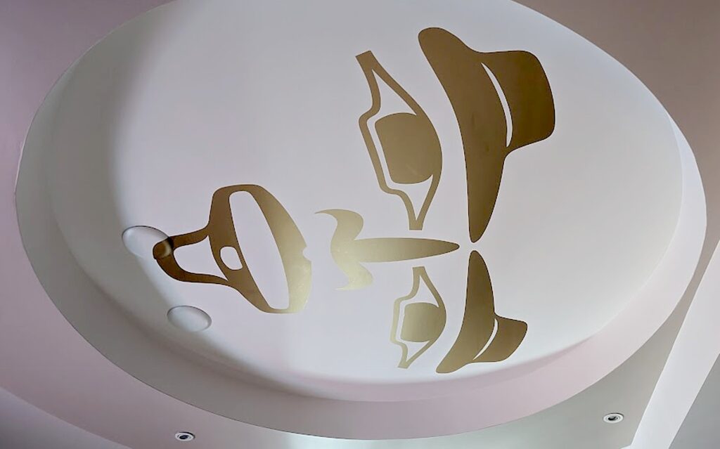
The gold-painted ceiling in the Moon Room. Each of the 18 Skwachays Lodge rooms and suites has been designed by an indigenous artist © Karen Rubin/goingplacesfarandnear.com

Mine is the Moon Room (505), designed by Sabina Hill and Mark Preston, equipped with a kitchenette, desk/workspace, and a giant round bed on a platform. The ceiling is decorated with the moon’s radiance in gold, and the wall, in gold calligraphy, tells the legend of the trickster god Raven who stole the sun, the moon and the stars, and released them into the sky. “Delivered to its heavenly perch by the daring Raven, the Golden Moon watches over the world below.” It’s almost like finding yourself in a painting, in the story.

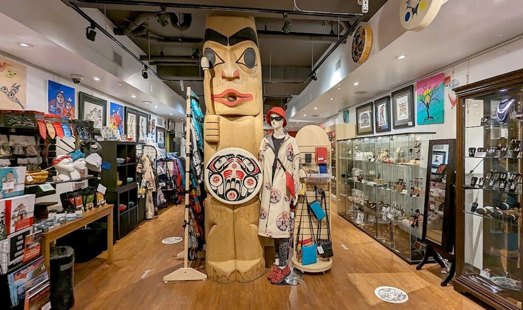
The gallery and shop at Skwachays Lodge © Karen Rubin/goingplacesfarandnear.com

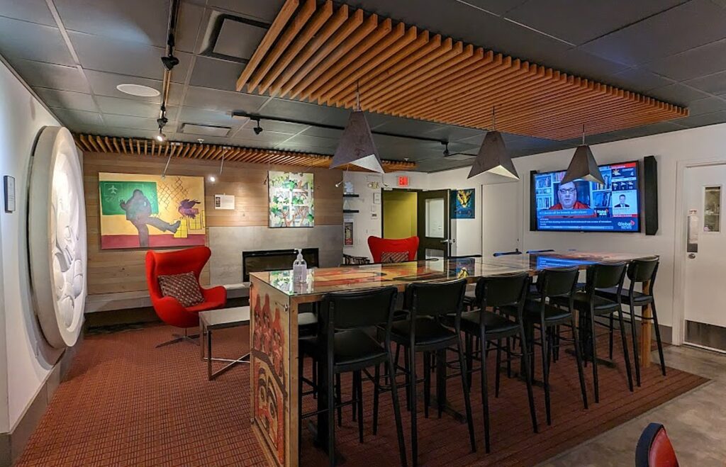
The hotel also offers opportunities to do a Sweat Lodge ceremony in the rooftop garden; a Smudging Ceremony in the traditional Smudge Room; as well as studio visits with the artists in residence. Its Kayachtn (“Welcome”) room, where breakfast is served, also provides a traditional community gathering place as well as a gallery.

Atop the hotel is a totem, a marvelous counterpoint to the arch that marks the entrance to Vancouver’s Chinatown, a half-block away.

The Kayachtn (“Welcome”) room at Skwachays Lodge, where breakfast is served, also provides a traditional community gathering place © Karen Rubin/goingplacesfarandnear.com

It should be noted that the hotel is one block over from East Hastings, considered Canada’s “Bowery” – but I had no problem walking everywhere, including to the marvelous Gastown district – the historic district offering boutique shopping and dining famous for its gas-spewing clock – just 10 minutes walk away. Actually, I was able to walk everywhere.

Skwàchays Lodge 31 W Pender St Vancouver, BC V6B 1R3 604.687.3589, 1 888 998 0797, [email protected], https://skwachays.com/.

Bill Reid Gallery

My first morning, after a marvelous breakfast (served 8-10 am in the Kayachtn “Welcome” room), I walk over to the Bill Reid Gallery, which is just around a corner from the Vancouver Art Gallery and the historic, grand Fairmont Hotel.  

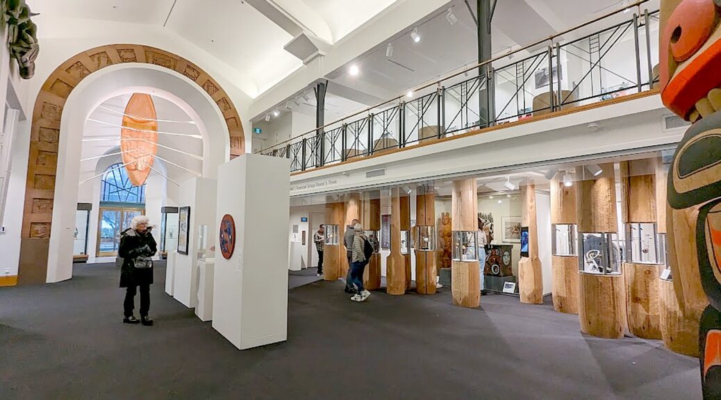
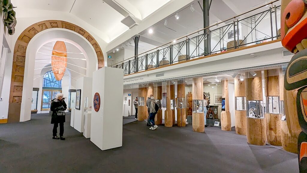
The Bill Reid Gallery opened in 2008 to celebrate Haida cultural heritage, diverse living artists of the Northwest Coast, and the life and work of master artist Bill Reid (1920-1998). Reid arguably was responsible for bringing indigenous art from the shadows (after having been suppressed for 150 years) into the national consciousness, awareness and respect.

The Bill Reid Gallery celebrates Haida cultural heritage, diverse living artists of the Northwest Coast, and the life and work of master artist Bill Reid © Karen Rubin/goingplacesfarandnear.com

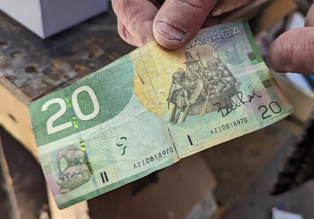
Bill Reid, I learn, is a national treasure. Two of Reid’s most popular works depict a canoe filled with human and animal figures: one black, “The Spirit of Haida Gwaii,” is at the Canadian Embassy, Washington, D.C.; and one green, “The Jade Canoe,” is at Vancouver International Airport (and was featured on the Canadian $20 bill).

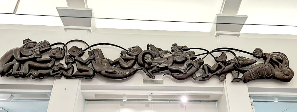
Here at the gallery, you not only trace his own artistic evolution and self-discovery, but see his most famous works, including “Mythic Messengers” (1984), a multi-ton, 8.5 meter long frieze referencing folk stories that is the gallery’s piece de resistance.

Bill Reid’sMythic Messengers” (1984), a multi-ton, 8.5 meter long frieze referencing folk stories,  is the gallery’s piece de resistance © Karen Rubin/goingplacesfarandnear.com

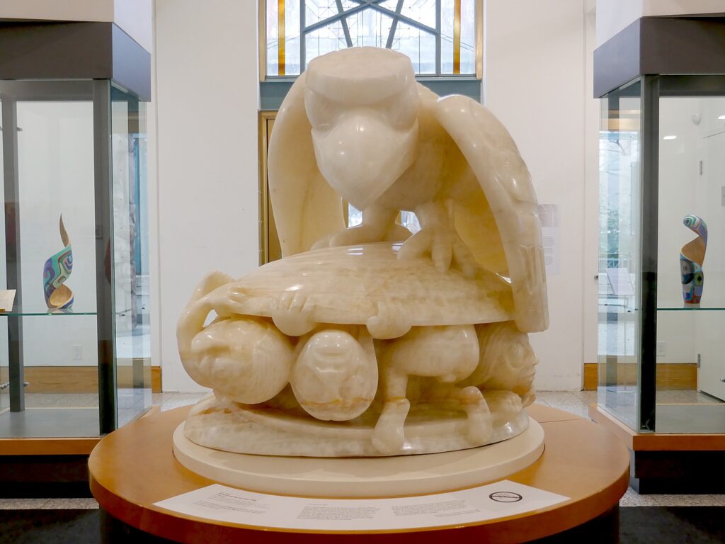
There is an artist’s proof in white onyx of another famous work, “Raven and First Men” that depicts the Haida creation myth – how the Raven discovers a massive clamshell on the beach with humans protruding from it and coaxes the humans out, unleashing civilization. (The full-sized, cedar wood version is at the Museum of Anthropology on the University of British Columbia campus; Reid depicted this myth in many forms and sizes throughout his career.)

Another famous Bill Reid work, “Raven and First Men” that depicts the Haida creation myth, in white onyx © Karen Rubin/goingplacesfarandnear.com

Bill Reid, probably more than anyone, is responsible for resurrecting indigenous art, raising awareness, appreciation and respect, and bringing this heritage that had so long been subject to cultural genocide, into Canada’s cultural mainstream. His story is remarkable and I soon come to appreciate why he was uniquely able to achieve this.

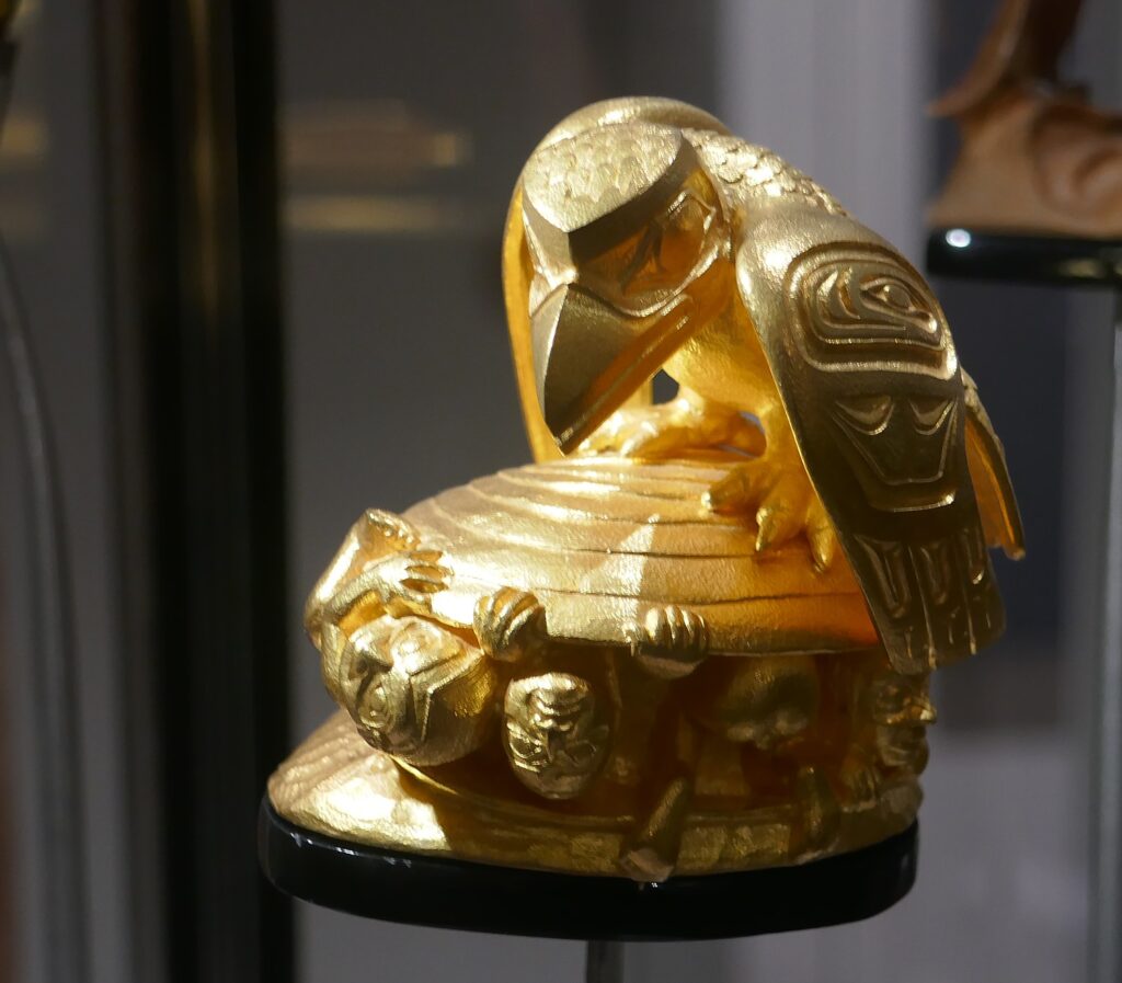
Bill Reid represented “Raven and First Men” myth in many versions and genres © Karen Rubin/goingplacesfarandnear.com

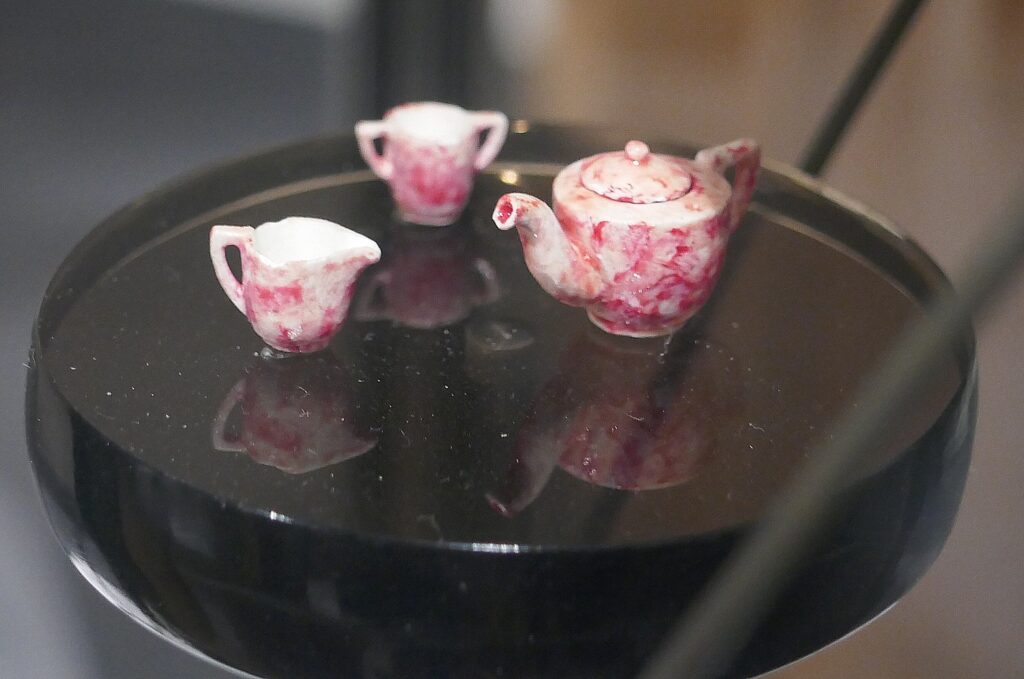
As I look at a miniature (I mean really tiny) tea set that Reid carved from chalk in 1932 when he was 12, my guide, Wayne Louie, explains that Reid’s father was of German-Scottish descent and his mother was born to the Haida nation. She was part of the residential school system which took First Nations children from their families and put them in prison-like boarding schools designed to “kill the Indian inside the man” (as I learned at the Buffalo Nations Luxton Museum in Banff).

“His mother didn’t reveal her ancestral roots – that was the effect of residential schools, aimed to culturally cleanse the indigenous side,” Louie tells me. “He didn’t discover his ancestral roots until his teens.”

He began exploring his Haida roots at the age of 23. He visited grandparents and slowly and deliberately rediscovered and incorporated his heritage into his art. This journey of discovery lasted a lifetime and shaped Reid’s artistic career.

Glass artist John Nutter, whose studio is the site of Bill Reid’s studio on Granville Island, shows a $20 bill featuring Bill Reid’s famous “The Spirit of Haida Gwaii” © Karen Rubin/goingplacesfarandnear.com

Reid became a pivotal force in building bridges between Indigenous people and other peoples. Through his mother, he was a member of the Raven clan from T’aanuu with the wolf as one of his family crests. In 1986, Reid was presented with the Haida name Yaahl Sgwansung, meaning The Only Raven. Many of his works incorporate the raven.

“Reid’s quest for understanding the essence and the roots of a unique art form led him to discover his own ‘Haidaness’ and, in the process, restored much of the dynamic power, magic, and possibility to the art. In doing so he became the catalyst to empower a whole Nation,” the gallery notes say.

Reid’s story also shows how an artistic spirit cannot be suppressed. Even later in his life, when he contracted Parkinson’s, he created wire sculptures, some of which are on view –art is irrepressible, it must be expressed.

Bill Reid carved this tiny tea set out of blackboard chalk when he was 12 © Karen Rubin/goingplacesfarandnear.com

“Somewhere along the line, I developed a unique art: blackboard chalk carving,” he reflected in 1982. “I started it in school because I was very bored. Round chalk was such a fine medium that I made little tea sets, cup and saucers, and finished them with nail polish…It showed me I could do fine work. The first totem pole I ever made was out of blackboard chalk.”

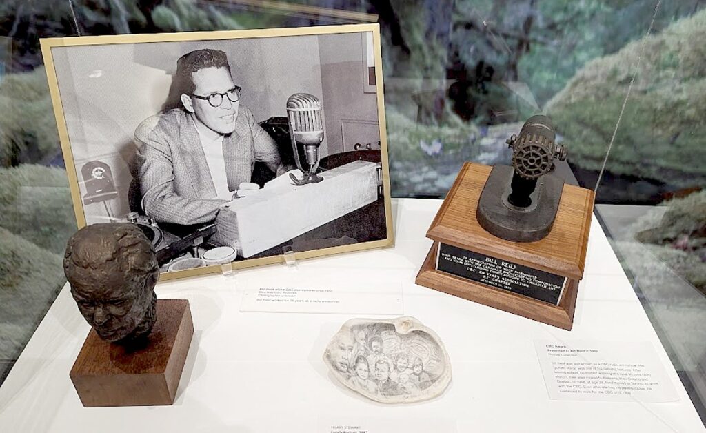
But the reason he was able to spur a renaissance in indigenous art is that Reid had become a popular CBC announcer with a national audience. He got his first job in radio in 1939 and became a radio broadcaster for the CBC in Toronto in 1948. As a CBC announcer he had a platform, was known and accepted, and connected to more people.  I imagine promoting his indigenous identity was almost like “coming out.”

Bill Reid was perhaps uniquely positioned to revive indigenous art and bring it into mainstream of Canadian culture because of his celebrity as a CBC broadcaster © Karen Rubin/goingplacesfarandnear.com

His interest in making art had already been ignited. In 1943, he made his first visit to the Haida Gaiia since his early childhood. “He was a goldsmith at heart and hoped to build a career focused on modernist jewelry,” the notes say. “He was fascinated by the simple engravings his grandfather made and bracelets by John Cross his aunts wore. When he later saw the deeply carved bracelets by his great, great uncle Charles Edenshaw, he said, ‘Life was not the same after that’.”

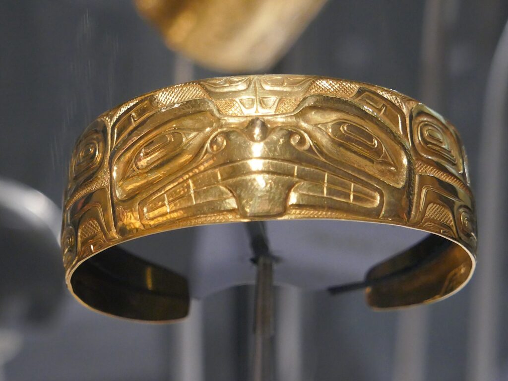
Bill Reid was a goldsmith who incorporated French repousse technique to gold bracelets with traditional Haida elements he learned from his relatives © Karen Rubin/goingplacesfarandnear.com

He set up a studio in his basement, and then on Granville Island (which I later come upon almost by accident). He combined traditional Haida forms and figures with contemporary innovations, notably the European technique of repousse – pushing the metal out from behind, to bring a three-dimensional quality to his Haida-inspired work.

“Well, I don’t consider myself Haida or non-Haida or white or non-white,” Reid wrote. “I am a citizen of the West Coast of North America and I have availed myself of all the inheritance I got from all directions.”

Bill Reid infused Haida traditions with his own modernist aesthetic to create both exquisite small as well as monumental works that captured the public’s imagination.

“Reid was biracial,” Louie tells me. “He had to learn who he was – observe art of his ancestors, reinterpreted into his art. He started with jewelry, small pieces, then large, monumental works.”

Reid was in the vanguard of the revival of indigenous art, Louie tells me. “During the time these pieces created no other indigenous artist was doing this – now there are many.”

Throughout Reid’s life, he encouraged young artists as he was encouraged, and that is reflected in this gallery, which features exhibits of a dozen contemporary artists.

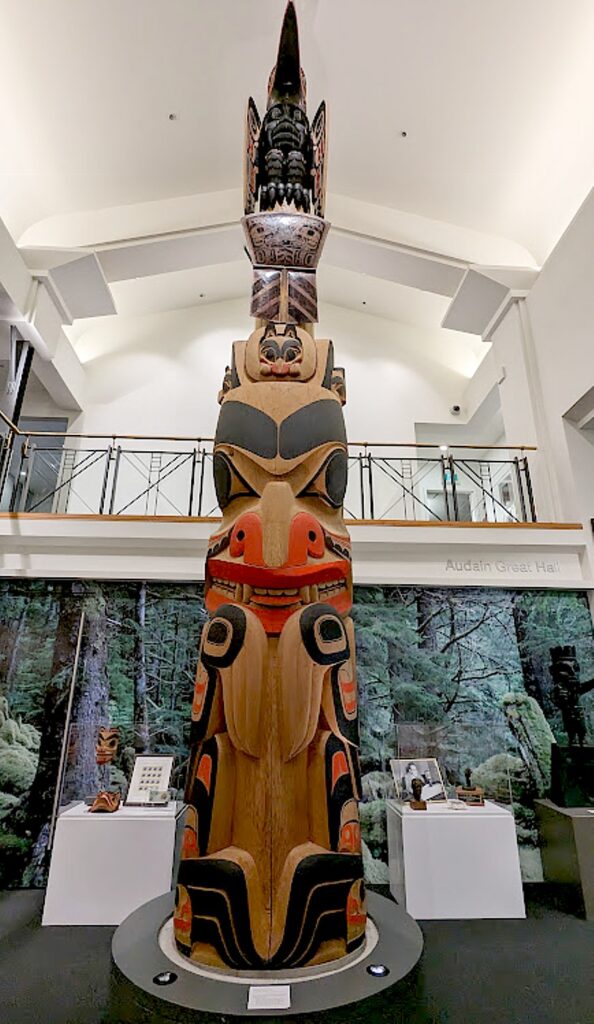
James Hart’s totem pole is the centerpiece of the Bill Reid Gallery © Karen Rubin/goingplacesfarandnear.com

The centerpiece of the gallery is a full-scale totem pole carved by James Hart of Haida Gwaii, featuring the Wasgo (Haida Sea-Wolf).

What strikes me as interesting is how some of the artists seem intent on reproducing the traditional symbols and techniques (like weaving), while others veer off into modern forms, like graffiti. But when you think about it, for these First Nations artists who live on lands that were never officially ceded to Canada (there was never a treaty so technically, according to Canadian law, the land is illegally occupied), the essence of street art is a form of rebellion, a means for people who feel displaced and disempowered to mark territory and establish identity, so it seems like a very appropriate form.

“Raven Who Kept Walking” (2021) by Corey Bulpitt, one of the contemporary British Columbia indigenous artists  on exhibit at the Bill Reid Gallery © Karen Rubin/goingplacesfarandnear.com

Monthly workshops, artist talks; guided tours are offered June-August. There is an excellent shop. Summer hours, open daily 10-5.

Bill Reid Gallery, 639 Hornby St, Vancouver 604-682-3455, https://www.billreidgallery.ca/, [email protected]

Indigenous Tourism BC offers travel ideas, things to do, places to go, places to stay, and suggested itineraries and a trip planning app (https://www.indigenousbc.com/)

Next: Walking Tours, Dining Experiences Reveal Vancouver’s Revived Indigenous Heritage

_____________________________

© 2023 Travel Features Syndicate, a division of Workstyles, Inc. All rights reserved. Visit goingplacesfarandnear.com, www.huffingtonpost.com/author/karen-rubin, and travelwritersmagazine.com/TravelFeaturesSyndicate/. Blogging at goingplacesnearandfar.wordpress.com and moralcompasstravel.info. Visit instagram.com/going_places_far_and_near and instagram.com/bigbackpacktraveler/ Send comments or questions to [email protected]. Tweet @TravelFeatures. ‘Like’ us at facebook.com/KarenBRubin 

Pioneering Spirit Still Inspires Visitors to Banff, Canada

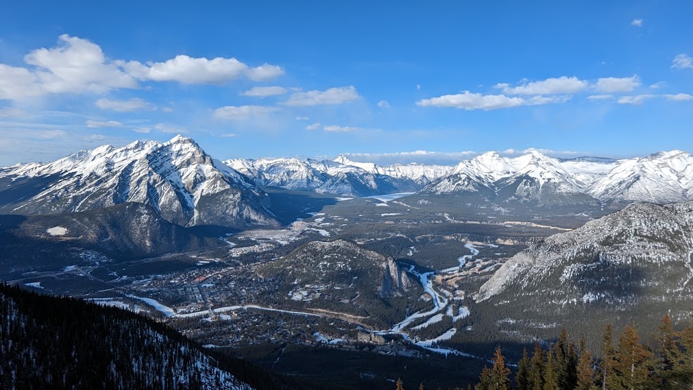
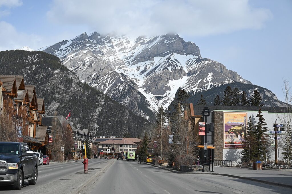
Banff, Canada’s first municipality set within a national park, has lured pioneers, adventurers, entrepreneurs and free spirits © Karen Rubin/goingplacesfarandnear.com

By Karen Rubin, Travel Features Syndicate, goingplacesfarandnear.com

The spirits of the founders, pioneers and entrepreneurs are everywhere in Banff, which, for a small town within an immense national park (Canada’s most visited) continue to inspire the 4.5 million who come each year with their rich heritage, cultural legacy, and heady exhilaration of the Rocky Mountains.

We find their presence ever-present – at the Mount Royal Hotel, one of the oldest in Banff; at the Cave & Basin historic site (the hot springs that started it all); at the Whyte Museum and the Moore House; at a museum that tells the story of Banff National Park (Canada’s first national park and one of the oldest in the world); atop the Banff Gondola, the old Trading Post (which I remember visiting decades ago), the Open-Top Sightseeing tour in custom-designed vintage automobile, and most spectacularly, the Buffalo Nations Luxton Museum.

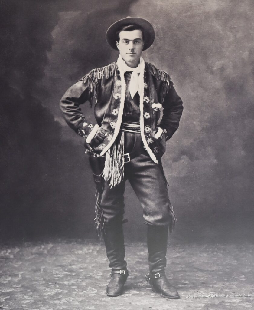
I love that all around the Sky Bistro on the summit of Sulphur Mountain are poster-sized photos of Banff’s pioneers and founders, many who are already familiar from our Open-Top sightseeing tour, the Whyte Museum, and the historic markers about town: There are the Brewster brothers, Norman Luxton, and the colorful park warden, Bill Peyto, who toted a live lynx into a bar. There are the indomitable, liberated women like Pearl Brewster, who manifested the frontier, mountaineering spirit; Caroline Hinman, who came from New Jersey to organize Off the Beaten Track pack trips; and Lizzie Rummel, who, born to a German aristocratic family, came to the Rockies in 1914 and ran back country lodges.

Jim Brewster, who with his brother, Bill, as boys, started a guide service for guests of the Banff Springs Hotel, later expanded to a massive sightseeing and hospitality company © Karen Rubin/goingplacesfarandnear.com

Cave and Basin

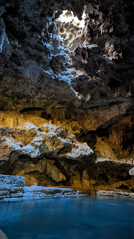
The visit to Cave and Basin is like going back to the origin story for Banff – it is the very reason Banff developed and why Canada’s first national park was established here, though this area had been a special place for First Nations peoples for 10,000 years. Modern Banff was born here, at Cave & Basin historic site.

“… like some fantastic dream from a tale of the Arabian Nights,” is how William McCardell described the mist-filled cave on the slopes of Sulphur Mountain when he, his brother Tom, and their partner Frank McCabe, three railway workers who stayed behind, first spotted the venting steam in the fall of 1883.

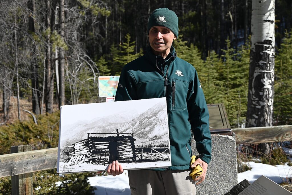
Ranger Amar Athwal relates the origin story of Cave & Basin, Canada’s first national site which became Banff National Park © Karen Rubin/goingplacesfarandnear.com

They immediately saw the profit potential, fenced it off, built a small log cabin at the entrance (they called it “the hotel”) and put in a claim for a land grant. But the Canadian government, in financial straits from building the transcontinental railroad, also saw the potential (the popularity of thermal springs in Arkansas and Yellowstone was already known). The government paid them off with $900 and, in 1885, set aside 10 square miles around the thermal springs.  In 1887, Prime Minister John A. McDonald declared the land protected for all Canadians and named George Stewart, park superintendent.

Canadian Pacific’s visionary executive director, William Cornelius Van Horne, built and opened the Banff Springs Hotel in 1888 with 250 rooms, and invited writers and artists to come to promote the destination.

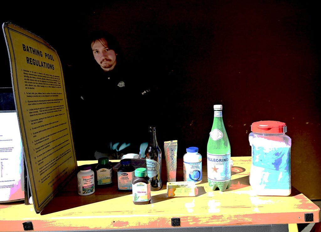
At the Cave and Basin (the cave has an interior thermal pool and the basin has an outdoor thermal pool), people paid 5c to enjoy bathing, one sex at a time – ladies in the cave when men were in the basin, and visa versa.

A 30-minute guided tour takes us into the cave (surprisingly small) and the basin (where we get to see the tiny, endangered Banff Springs snail that only exists here), and tour the 1914 Bathing Pavilion.

Our guide, Ranger Amar Athwal, tells us that 500 generations of indigenous people gathered here at the hot springs before the first Europeans ever arrived; one of the oldest artifacts found in the area is a bison skull from 8500 years ago, bearing wounds inflicted by humans.

The Europeans first came in a quest to find a route to Asia and then to trap beaver (nearly to extinction, before silkworms were used to make hats). And then the transcontinental railroad came through, to unite the fledgling country.

The cave of thermal springs which has drawn visitors for thousands of years © Karen Rubin/goingplacesfarandnear.com

The natural springs, mysteriously hot even in winter and supporting plants and life that did not exist anywhere else, were regarded as a spiritual place of healing, and where different tribes gathered to hold ceremonies in peace here. (When the park was created, the native communities were pushed out.)

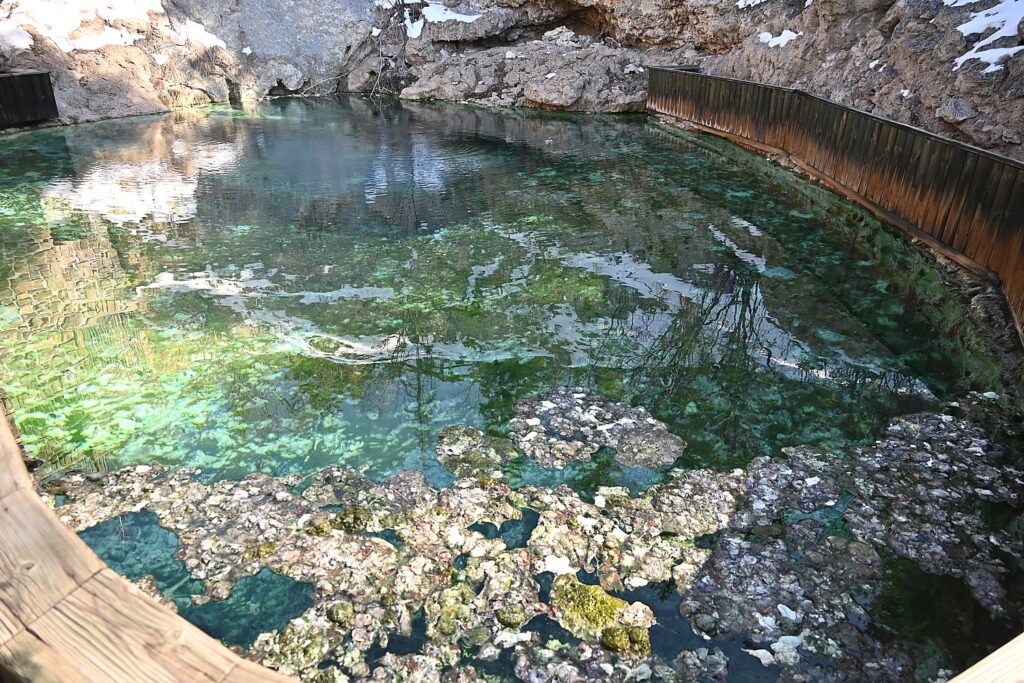
The natural springs are a unique ecosystem, Athwal tells us. The water flows year-round despite the fact that temps can go as low as minus 41 degrees in winter in Banff. Here, the water stays 92-100 F so plants grow here, animals like the garter snake live here, and the Basin harbors a tiny snail that is unique to these Banff thermal springs (which we get to see).

The Basin creates a unique ecosystem, harboring a unique species of Banff Springs snail © Karen Rubin/goingplacesfarandnear.com

The smell comes from the bacteria that takes in the sulphur particles and gives off gas – in high concentrations, it would be fatal. The waters smell differently, even within this place, depending upon what chemicals the bacteria is feeding on.

The waters were regarded as healing by the indigenous peoples as well as the settlers – entrepreneurs would sell bottles of the water, like snake oil.

The Basin creates a unique ecosystem, harboring a unique species of Banff Springs snail © Karen Rubin/goingplacesfarandnear.com

Germans, Austrians, Hungarians and Ukrainians who were recruited as mountain guides and to build the railway with a promise of land, were interred here when World War I broke out, fearing “enemies within,” from 1914 to 1920. They were used as labor and built this gorgeous bath house and outdoor pool. Only recently did Canada issue an official apology and provide funding to create a memorial exhibit here, which opened in 2013.

Entrepreneurs capitalized on Banff’s thermal springs© Karen Rubin/goingplacesfarandnear.com

You can also stroll the thermal water boardwalks (the best bird watching in Banff National Park) and hike trails around the Cave and Basin (https://parks.canada.ca/lhn-nhs/ab/caveandbasin).

Whyte Museum

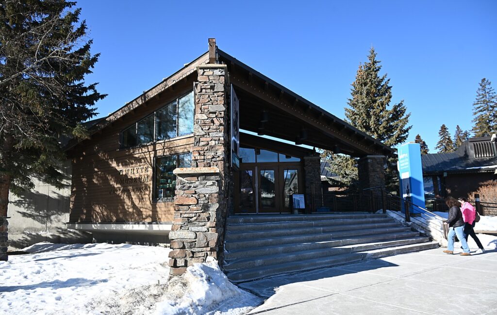
The Whyte Museum of the Canadian Rockies is a historical museum, art gallery, and archives that celebrates the lively history, heritage and people of the Rocky Mountains.

The museum was founded in 1968 by Peter and Catherine Whyte who were artists and philanthropists. Peter Whyte’s father, Dave, came out with the railroad and started a grocery store. Peter grew up here and built a compound with their home and other cabins.

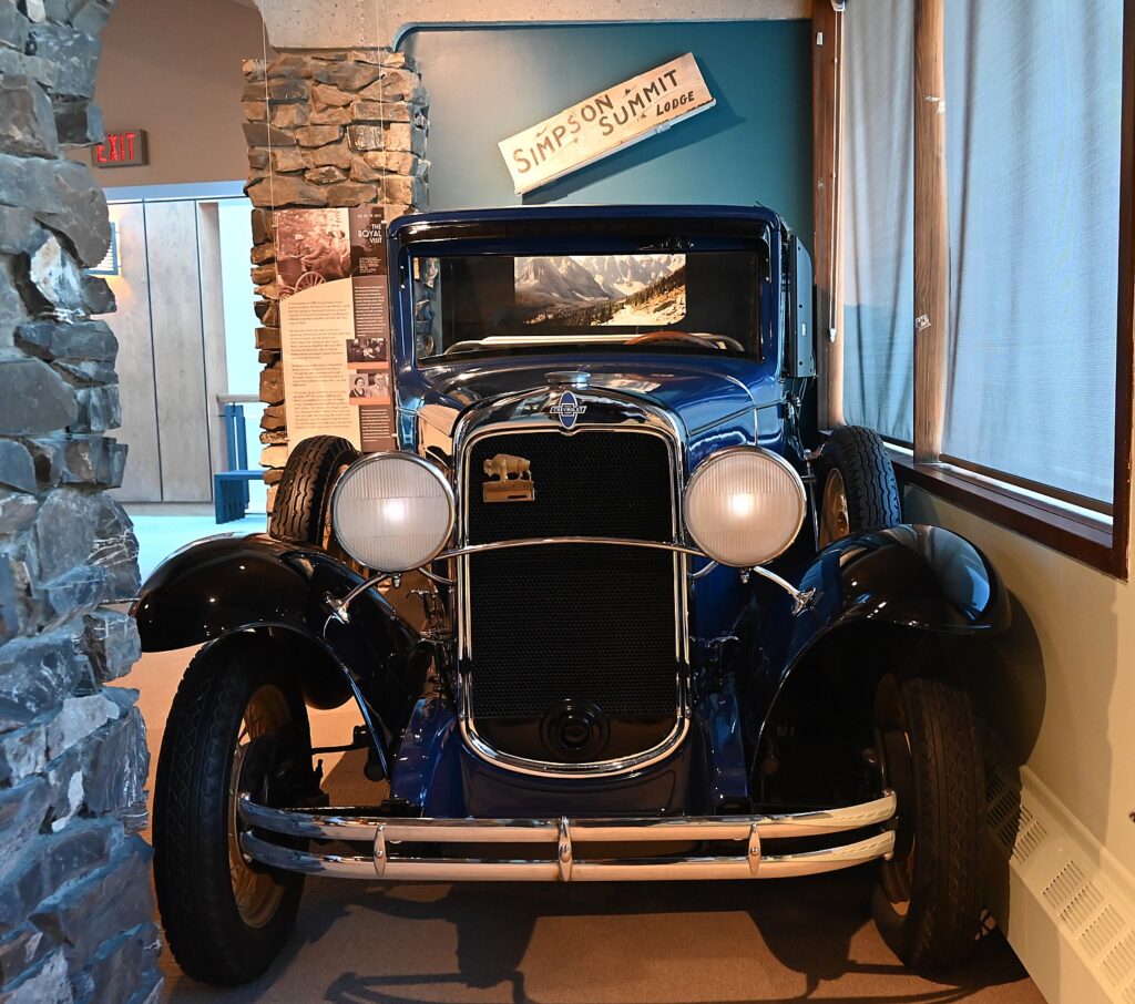
One of the original Brewster open-top vehicles is on view at th e Whyte Museum © Karen Rubin/goingplacesfarandnear.com

The Whyte Museum offers four galleries, including a heritage Gallery. It is a marvelous display, where we see an actual open-top vehicle the Brewsters designed, fantastic photos (including them driving the King and Queen of England in 1939), so that you feel you are literally walking through history.

But my favorite part of visiting the Whyte Museum is the visit to the Moore House, which is on the museum’s property.

Pearl Brewster Moore’s 1907 cottage is now part of the Whyte Museum © Karen Rubin/goingplacesfarandnear.com

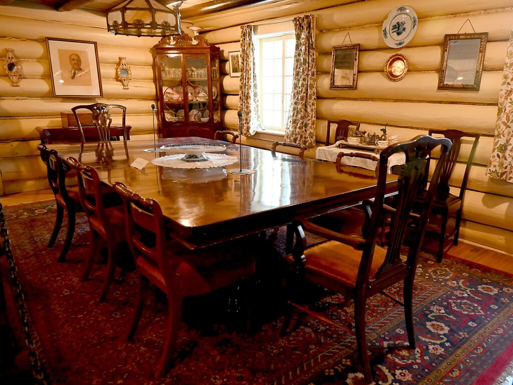
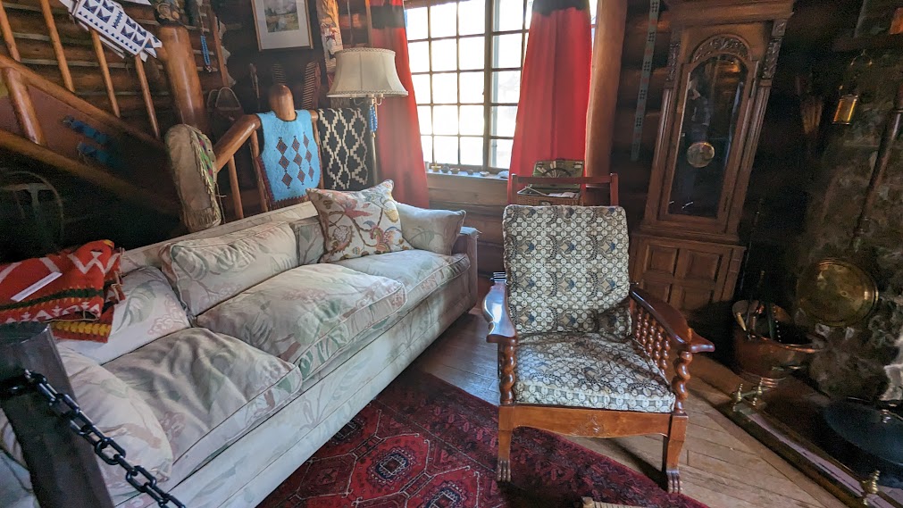
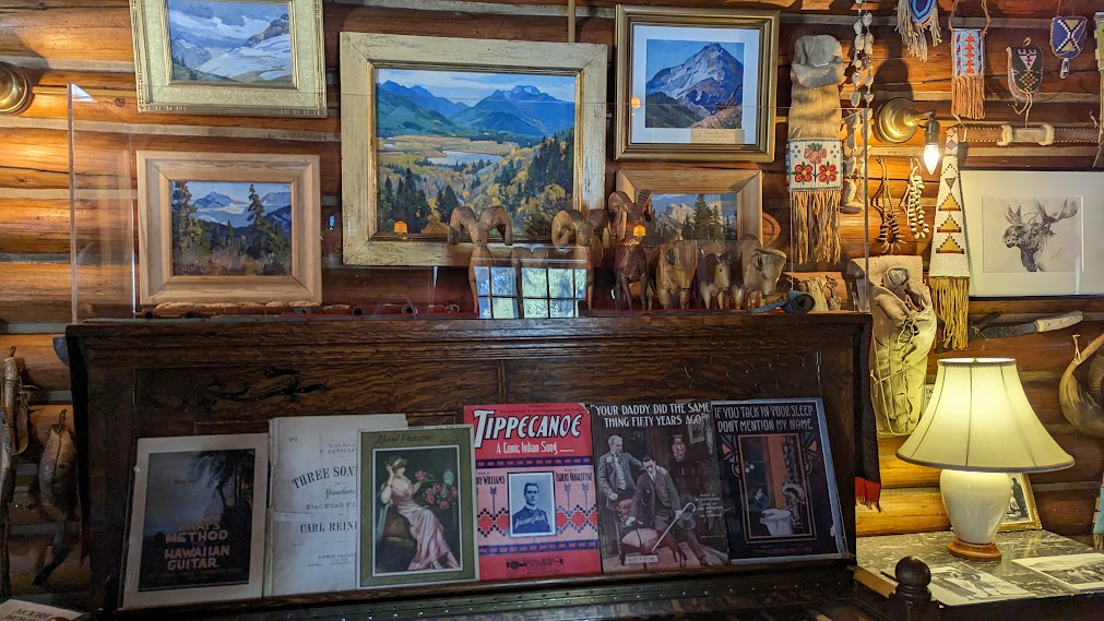
The cottage belonged to Pearl Brewster Moore, who was Jim and Tom Brewster’s sister (born 1889, she was the only girl among seven children). The cottage dates from 1907 when she married Philip Moore, a Princeton graduate from New Jersey who came to Banff as a guide), and contains the couple’s own furnishings, so is a window into their lives and the times – their sheet music on the piano, their books, a stunning Chippendale dining set from Philip’s New Jersey family.

Philip Moore’s family Chippendale dining room set © Karen Rubin/goingplacesfarandnear.com
The Moore’s furnishings and artifacts are fascinating insight into their lives and times © Karen Rubin/goingplacesfarandnear.com

“She had 6 brothers – that shaped who she was: a horsewoman, she hunted, played hockey,” our guide tells us. “Pearl led trail rides. Her parents sent her to two finishing schools – she was sent home from both. When Pearl passed away in 1973, the obituary called her ‘one of the best horsewomen,’ and she was remembered for her forthright opinions she was not afraid to express.”

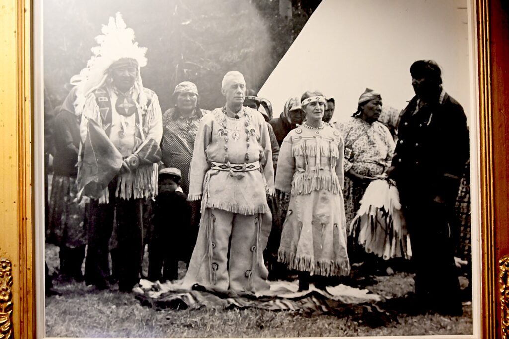
Pearl Brewster and Philip Moore were made honorary members of the Stoney Nakota tribe © Karen Rubin/goingplacesfarandnear.com
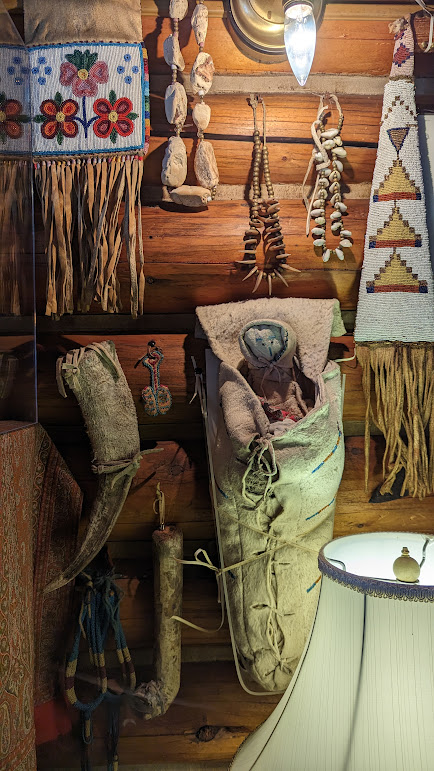
Indigenous artifacts that were presented to Pearl Brewster Moore, who would judge beadwork competitions © Karen Rubin/goingplacesfarandnear.com

You get to see the Moores’ many indigenous artifacts. The couple had close ties with the Stoney Nakota and were made honorary members of the tribe. Pearl regularly judged their beadwork competitions. And I note a book on Indian sign language in the book case (Philip majored in history and English at Princeton).

The Moore’s furnishings and artifacts are fascinating insight into their lives and times © Karen Rubin/goingplacesfarandnear.com

They had one child, Edmee, born 1908, who sadly pre-deceased Pearl. Her husband, Philip died in 1971. That same year, Pearl bequeathed the house and contents to the Whyte Museum and had it moved from its original location on Fox Street (there is a hotel there now) to the Whyte Museum grounds where she lived until her death just two years later, in 1973.

The Whyte Museum is a treasure trove of history, heritage, and culture © Karen Rubin/goingplacesfarandnear.com

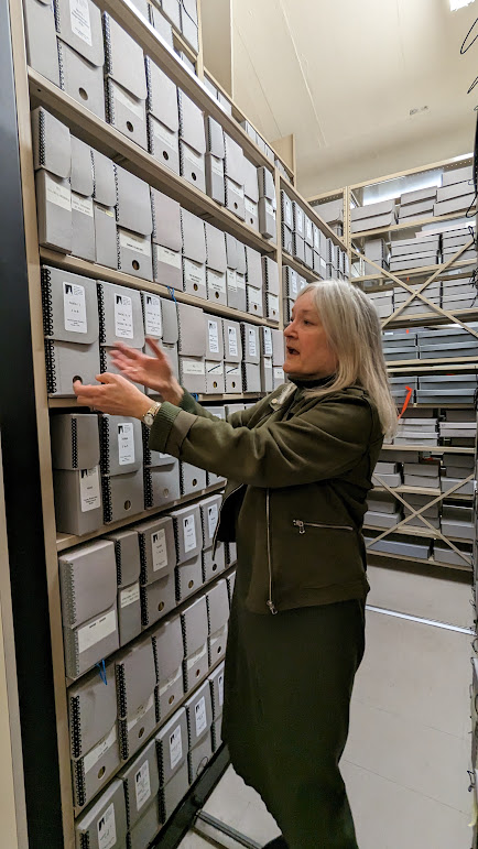
The Whyte Museum also houses important archives, especially of mountaineering (it holds the Alpine Club of Canada’s archive that spans 50 meters of shelves), the Banff National Park history, Crag & Canyon newspapers (Norman Luxton’s newspaper) going back to 1900. You can actually consult the card catalog with typed entries (who remembers those?), as well as digital catalogs (www.whyte.org).

A glimpse into the archives housed at the Whyte Museum © Karen Rubin/goingplacesfarandnear.com

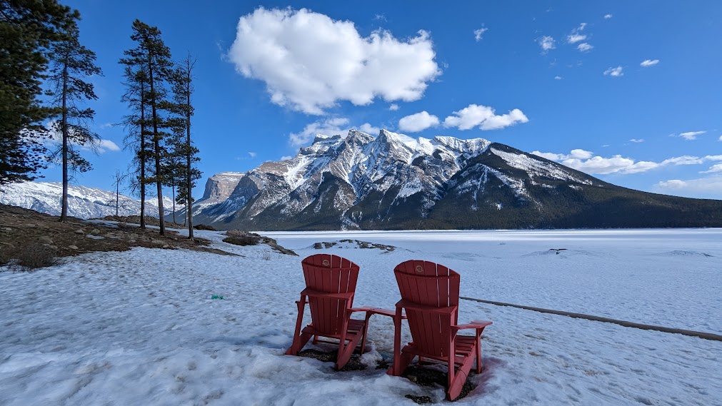
We pick up sandwiches from the café at the Elk & Avenue hotel, and set out to picnic at Lake Minnewanka (the name means “Spirit Water”). There is still snow and the lake is still frozen enough for us to walk on (someone has started to build an igloo and another couple is posing for wedding photos). It is a delightful place that is especially popular in summer – hiking trails, boating and scenic cruises from the marina (also operated by Pursuit Collection which has the snack shop).

Lake Minnewanka, still frozen over, becomes a summer destination for lake cruises, boat rentals, hiking, excursions started by Norman Luxton and now part of Pursuit Collection © Karen Rubin/goingplacesfarandnear.com

Blackfoot Nations Luxton Museum

I go off on my own to explore, and come to the Blackfoot Nations Luxton Museum, next to the Trading Post which Luxton started.

Visiting the Blackfoot Nation Luxton Museum fills in that 10,000-year gap before the railroad workers discovered the hot springs.

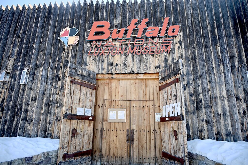
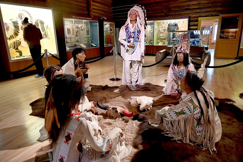
Buffalo Nations Luxton Museum houses Norman Luxton’s fabulous collection in a log re-creation of a Hudson Bay trading post © Karen Rubin/goingplacesfarandnear.com

This is an astonishingly excellent museum that takes a bit of patience and focus to really appreciate. But once you spend a little time, you are overwhelmed by what is on view. It has the feeling of visiting a private collection (it was the collection of Norman Luxton), even with a comfy sofa where you can sit to watch a series of fascinating videos.

There is a feeling of informality and personal engagement. The notes that are provided actually give a more direct and different perspective than other indigenous museums I have visited.

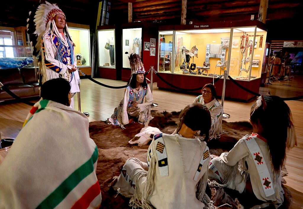
The Buffalo Nations Luxton Museum is dedicated to the appreciation, interpretation, demonstration and display of the cultures, traditions, and values of the First Nations of North America © Karen Rubin/goingplacesfarandnear.com

You see realistic manikins in indigenous dress, surrounded by artifacts in settings staged to put you in the scene –a meeting in a teepee, a gathering around a fire.

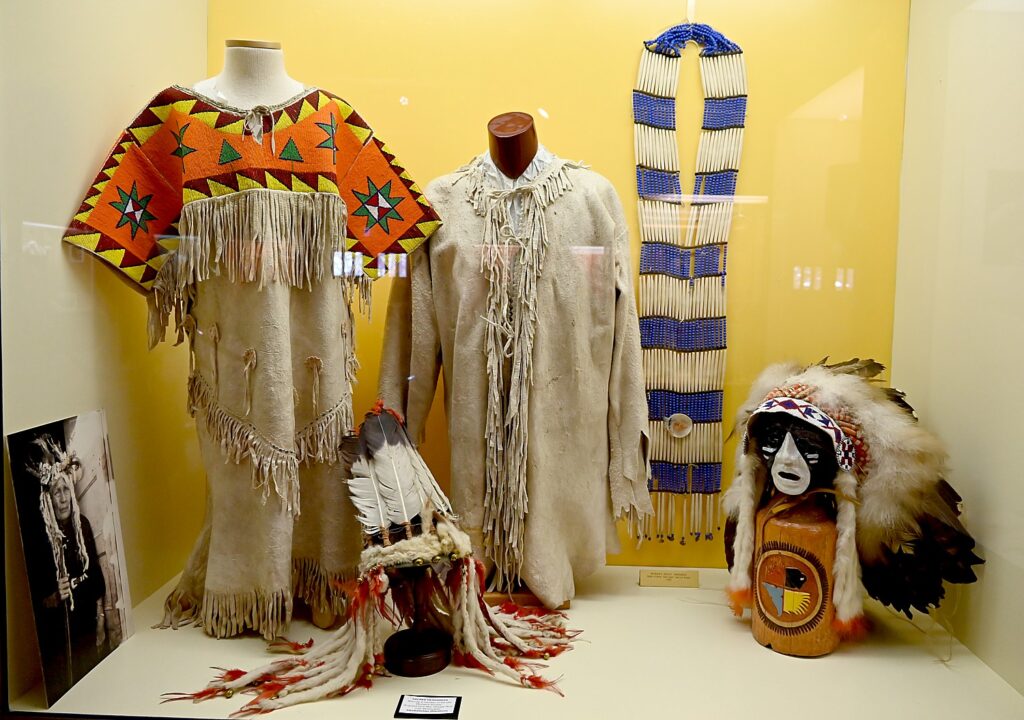
There are fabulous historic photographs often placed adjacent to the artifact. So right beside a beaded leather baby carrier is a black-and-white photo of a woman with that carrier (with baby) on her back.

The Buffalo Nations Luxton Museum exhibits often pair the artifacts with historic photos © Karen Rubin/goingplacesfarandnear.com

You learn that horses, introduced in the 1700s “gave more time for war, religion, craftsmanship….[because they] saved time for hunting, traveling” (and probably was like a major new weapon for battle, like a tank, changing the battlefield.)

I sit myself in a comfortable sofa and watch a video about the residential schools that First Nations children were forced away from their family to attend, and a group’s activism to recover the heritage that had been stolen from them. It takes you into the vacant, dilapidated building, like a prison, that would have been their residential school.

 “Their idea was to kill the Indian in the man, but both were killed…Treaties broken over and over – not just money, but trust,” that narrator says.  “The schools were like jail. You would be punished if you couldn’t find a shoe. You became Christian for survival…the biggest defiance is who I am now.”

Several tribes – the Nahota, Blackfoot and Cree – and the Wildlife Conservation Society are featured in the video signing a Repatriation Treaty to bring back the buffalo.

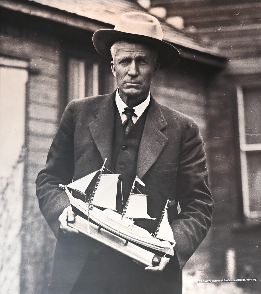
The museum feels personal because it is founded on the personal collection of Norman Luxton, one of Banff’s pioneering founders, who, the more I learn about him, the more I admire him. He seems to have been a mix of P.T. Barnum, Wild Bill Hickok, William Hearst, and Thor Heyerdahl, and I can’t get enough of his story, especially as I explore Banff.

Norman Luxton earned the nickname “Mr. Banff” for all he created © Karen Rubin/goingplacesfarandnear.com

I love this man. When he was in his 20s, he sailed around the world in a 100-year old, 30-foot long dugout canoe with an eccentric sea captain, going as far as Tahiti, Samoa and Fiji. He was a newspaper man who took over and saved the Crag & Canyon, still published today, built Banff’s first all-season hotel, filling it with the latest technology (gramophone!); opened its first cinema (one of first to screen talkies and Technicolor, still operating today).

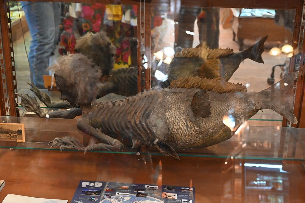
The “Fiji Merman” which Norman Luxton used to draw tourists into his Trading Post © Karen Rubin/goingplacesfarandnear.com

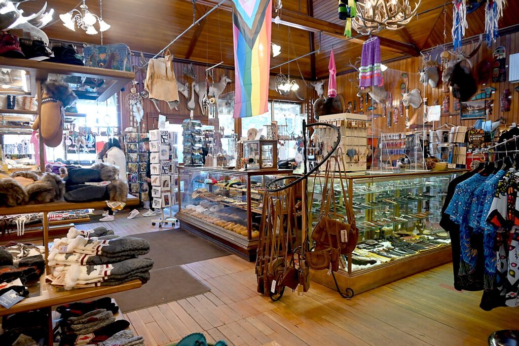
Luxton promoted trade and economic development of the Indigenous peoples, opening the Trading Post (a combination curio shop featuring indigenous crafts and taxidermy shop), promoting it with a bear (“Teddy”) that tourists were encouraged to feed chocolate they purchased at the shop and, P.T. Barnum-like with a “Fiji Merman”.  

Luxton, who earned the nickname, “Mr. Banff” for all he did to develop and promote Banff,   began the Winter Carnival events in 1917 that helped turn Banff into a snow-sports destination and from 1909-1950, organized the Banff Indian Days, an annual weekend event that brought locals, tourists and First Nations peoples together. And finally, he turned his amazing collection of First Nations artifacts into a museum. (https://banff.ca/1135/Norman-K-Luxton)

Norman Luxton’s Trading Post, still operating today, offering quality First Nations crafts © Karen Rubin/goingplacesfarandnear.com

Throughout his life, going back to when he was 21 and delivering treaty payments to tribes, Luxton displayed his respect for the indigenous people, and not only helped save their heritage, their culture but provided a proper platform and visibility, when indigenous art and culture was made illegal, invisible, with a goal of eradicating the culture – and the people – altogether.   

The Luxton Museum of the Plains Indian opened in June 1953, now the Buffalo Nations Museum. Built of logs to resemble a Hudson’s Bay Trading Post, the museum allowed Luxton “to share and preserve his extensive collection of Indigenous artifacts and cultural items, providing a better understanding of and appreciation for local First Nations peoples and cultures for locals and visitors alike.” (see www.luxtonfoundation.org).

The Buffalo Nations Luxton Museum seeks to show how the people of this land lived and adapted to their surroundings and each other prior to contact with European culture, and how they continued to adapt after European influences © Karen Rubin/goingplacesfarandnear.com

“The Buffalo Nations Luxton Museum is dedicated to the appreciation, interpretation, demonstration and display of the cultures, traditions, and values of the First Nations of North America and their trading partners. The museum seeks to show how the people of this land lived and adapted to their surroundings and each other prior to contact with European culture, and how they continued to adapt after European influences.” (https://www.buffalonationsmuseum.com/content/museum).

A Town That Cherishes its History

Befitting a town built on tourism, they really know how to cater to visitors – there are wonderful signs, markers, historic plaques (there are 48) and descriptions (there are 179 sites listed on its Inventory of Historic Resources including 25 Landmarks and Legends, which can be accessed on its Heritage Finder website, https://banff.ca/113/History-and-Heritage ) that immerse you in their stories.

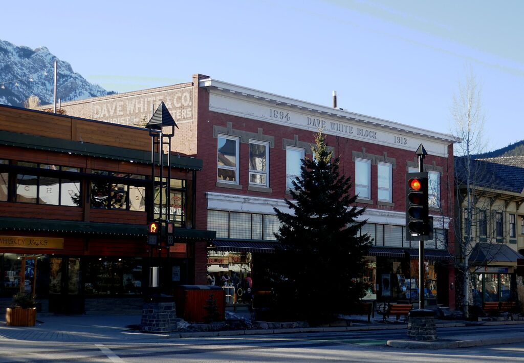
Dave White Block, 1894-1913 © Karen Rubin/goingplacesfarandnear.com

One of Banff Avenue’s first merchants was David White who arrived in Banff in 1885 and became a railway section foreman. He stayed on and in 1894 opened a general store on this site. In 1908, a brick building replaced the “boomtown’ Park Store. Renovated in 1996, the Dave White Block is the oldest remaining commercial building on Banff Avenue.

There is a Hudson Bay Company store that is only now closing (incorporated 1670, and responsible for European settlement of these western territories).

The Rocky Mountains almost flow into Banff’s streetscape © Karen Rubin/goingplacesfarandnear.com

I stop at a marker in front of the Elk Lodge, which I learn began “life” as The Browne Residence in 1921, the home of American hunter and wildlife artist Belmore Browne born 1880 in New York City. In 1912, he accompanied one of the first parties to attempt Mt. Mckinley in Alaska and came within 125 feet of the summit, a North American climbing record. Browne arrived in Banff in 1921 and purchased a single room log cabin on this site, later adding an artist’s studio. It served as a summer studio and home from 1921 to 1946, from which he painted many of the illustrations for the Canadian Pacific Railway literature, in exchange for transport to the east coast. Margaret Aldhelm White purchased the property in 1947, added and transformed it into the Elkhorn Lodge, one of Banff’s oldest guest lodges still operating today. “This Lodge is a good example of the adaptation and reuse of older buildings.”

In fact, The Town of Banff was only incorporated as a municipality in 1990 – the first municipality in Canada to be incorporated inside a national park. (The only other national park community in Canada is the Municipality of Jasper, in Jasper National Park, incorporated in 2001.)

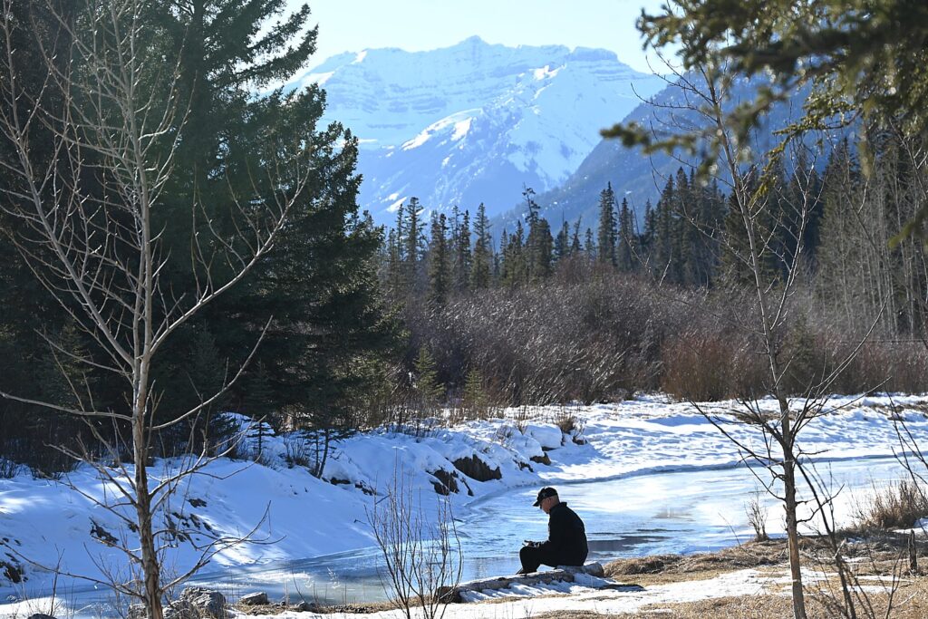
The tranquility of Banff, enjoyed by locals and visitors alike © Karen Rubin/goingplacesfarandnear.com

I delight in wandering Banff, which though very compact and walkable, has all these marvelous trails and paths – my favorite on both sides following the river (actual hiking trails were still too icy during our visit), and bring you to the Bow Falls.

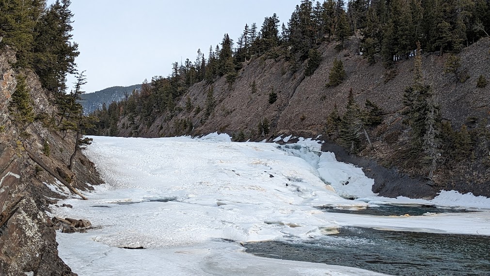
Bow Falls reached along a delightful riverside path. Marilyn Monroe was filmed going over the falls © Karen Rubin/goingplacesfarandnear.com

People came out here, settled here to be adventurous, to test their mettle climbing mountains, riding horses, hunting, to be free of the constraints of urban “civilized” society. So many of the pioneers and founders and entrepreneurs we encounter – women included – came from New York, New Jersey, and Europe. Visitors today – the 4.5 million who come to Banff National Park in a year – seek the same sense of adventure.

You can find Pursuit Collection’s services and attractions at https://www.pursuitcollection.com/; to book Pursuit Collection’s Banff and Jasper experiences, https://www.banffjaspercollection.com/.

See also:

PURSUIT COLLECTION CELEBRATES A CENTURY OF TOURISM ENTERPRISE IN BANFF

PURSUIT COLLECTION OFFERS FEAST FOR SENSES AND THE SOUL IN BANFF, CANADA

_____________________________

© 2023 Travel Features Syndicate, a division of Workstyles, Inc. All rights reserved. Visit goingplacesfarandnear.com, www.huffingtonpost.com/author/karen-rubin, and travelwritersmagazine.com/TravelFeaturesSyndicate/. Blogging at goingplacesnearandfar.wordpress.com and moralcompasstravel.info. Visit instagram.com/going_places_far_and_near and instagram.com/bigbackpacktraveler/ Send comments or questions to [email protected]. Tweet @TravelFeatures. ‘Like’ us at facebook.com/KarenBRubin 
Utah Adventure Day 8: Arches National Park, a Geologic Wonderland

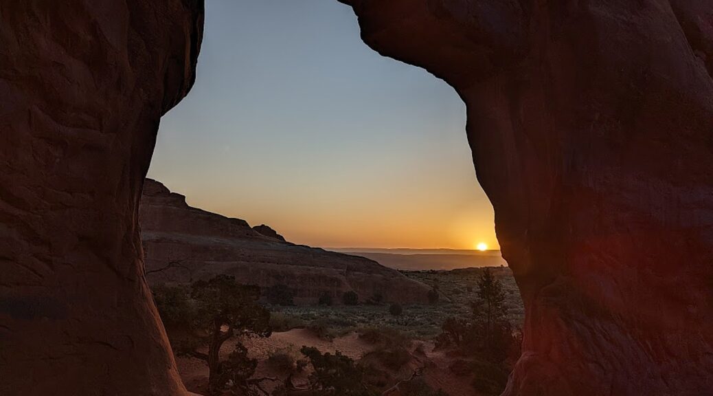
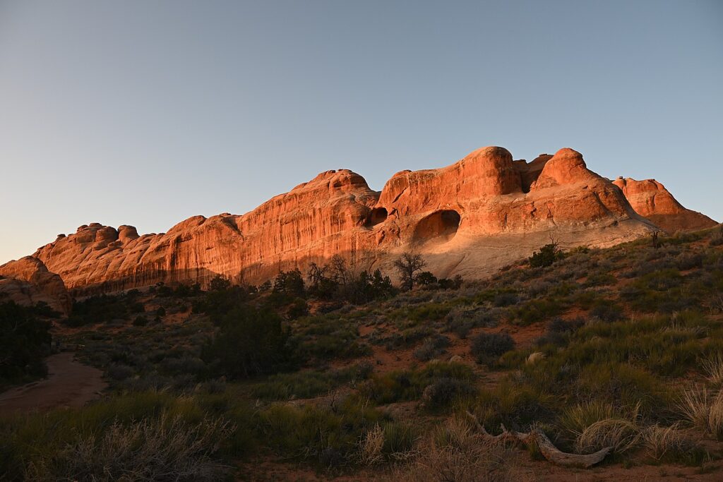
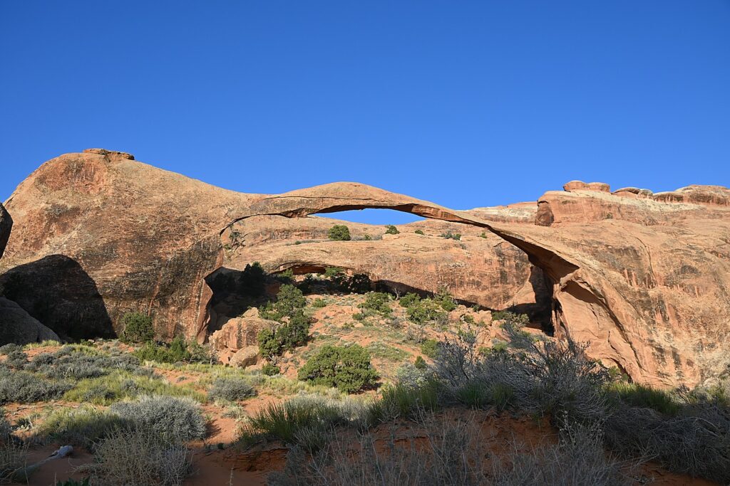
Sunrise on the Landscape Arch, Devils Garden Trail, Arches National Park © Karen Rubin/goingplacesfarandnear.com

By Karen Rubin, with Laini Miranda and Dave E. Leiberman

Travel Features Syndicate, goingplacesfarandnear.com

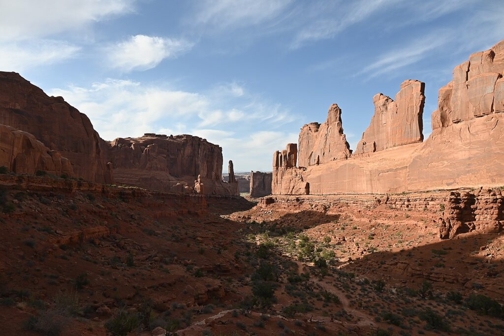
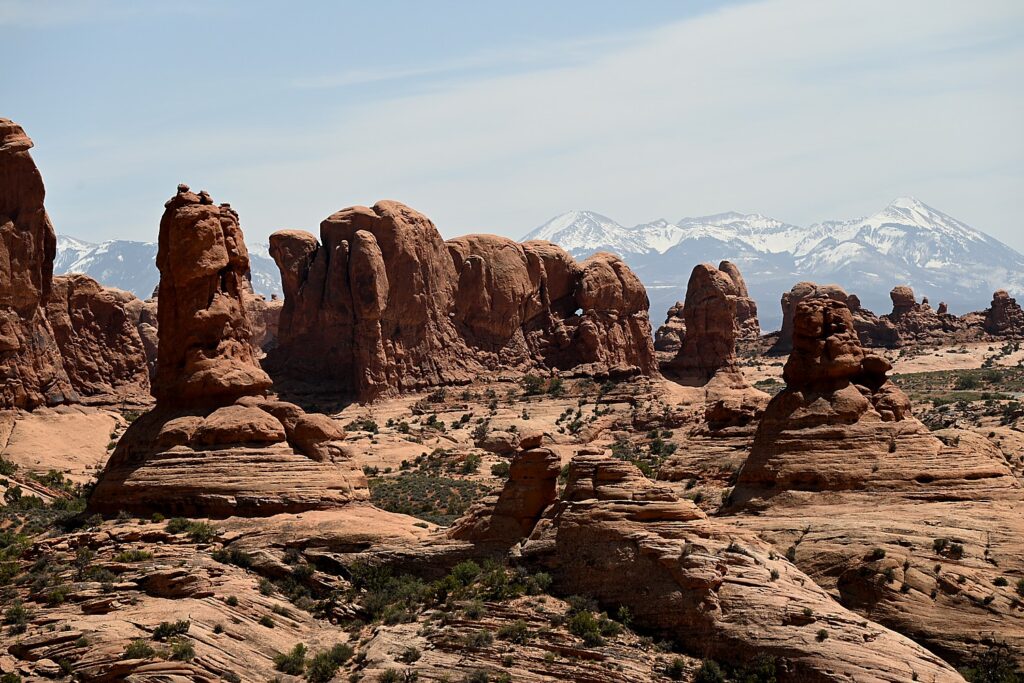
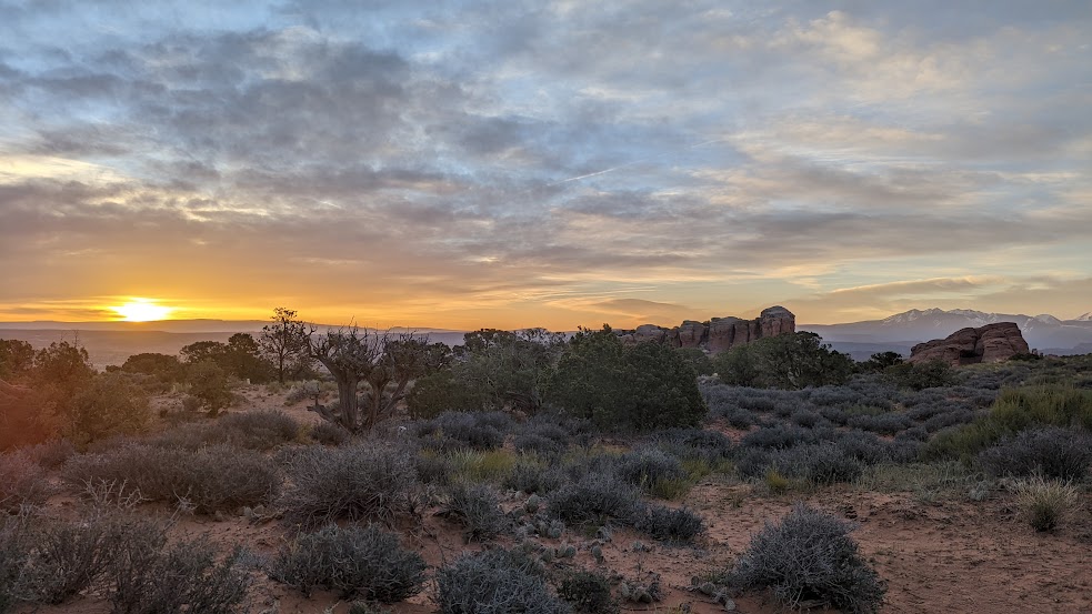
Arches National Park is a fantastical place, a geologic wonderland, and being able to wake up before the sun in the Devils Garden Campground and stroll along the Devils Garden Trail as the formations come alive with color, is extraordinary.

Arches’ sprawling landscape of 2,000 natural stone arches – the highest concentration of arches on the planet – plus hundreds of soaring pinnacles, massive rock fins, giant balanced rocks, coupled with its accessibility and ease of getting around (well, except for traffic and difficulty finding parking) and access (through Moab) draws hundreds of thousands of visitors each year, making it one of the most popular national parks. Indeed, Arches is so popular (and crowded) that it requires advance purchase, timed entry reservations just to enter, between April 1 and October 31.

Arches National Park is a geologic wonderland © Karen Rubin/goingplacesfarandnear.com

We are lucky because Laini has cleverly booked two nights at the Devils Garden campground months before our trip. The campsite reservation acts as the entry ticket and for this reason but especially because of being immersed in the landscape, this is the absolute best way to experience Arches National Park. (Devils Garden Campground is pen year-round, with 52 sites, reservations for individual sites can be made up to six months in advance; for group sites can be reserved up to year in advance, www.nps.gov/arch)

Arches is the most touristic of all the places we have visited this trip and offers such a contrast with the wild camping and communion with ancient spirits (Bears Ears), the remote unmarked hikes (Grand Staircase-Escalante), the long meandering hikes (Capitol Reef) and our search through muck and mud to find archaeological sites (Glen Canyon).

Here, we go sightseeing for the dazzling arches that give the park its name, like the amazing Double Arch, the Windows, Landscape Arch and Delicate Arch, accessed along paved paths from parking lots, with restroom facilities.

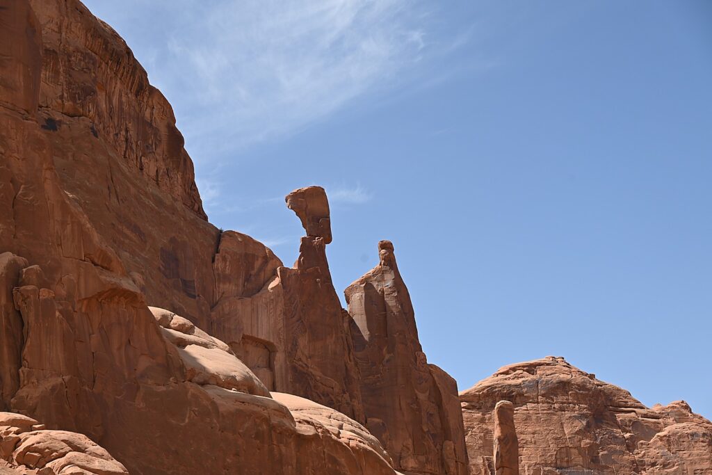
A formation in Arches National Park that looks like Croesus had just been turned to rock © Karen Rubin/goingplacesfarandnear.com

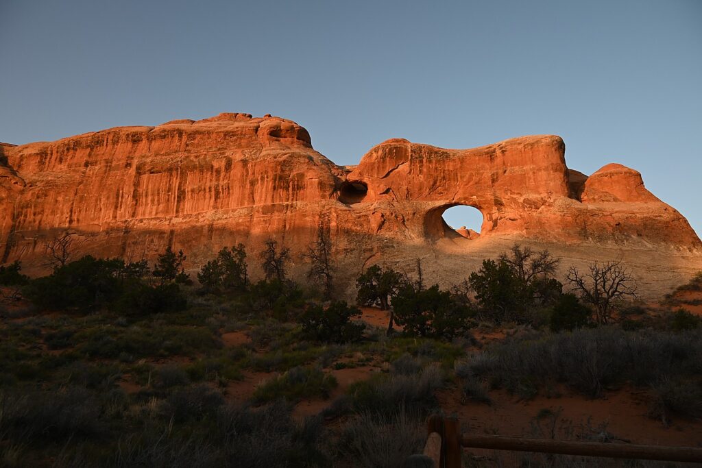
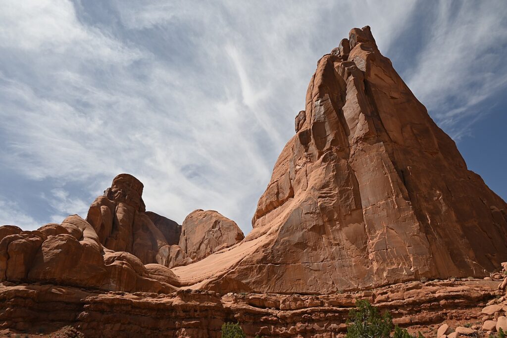
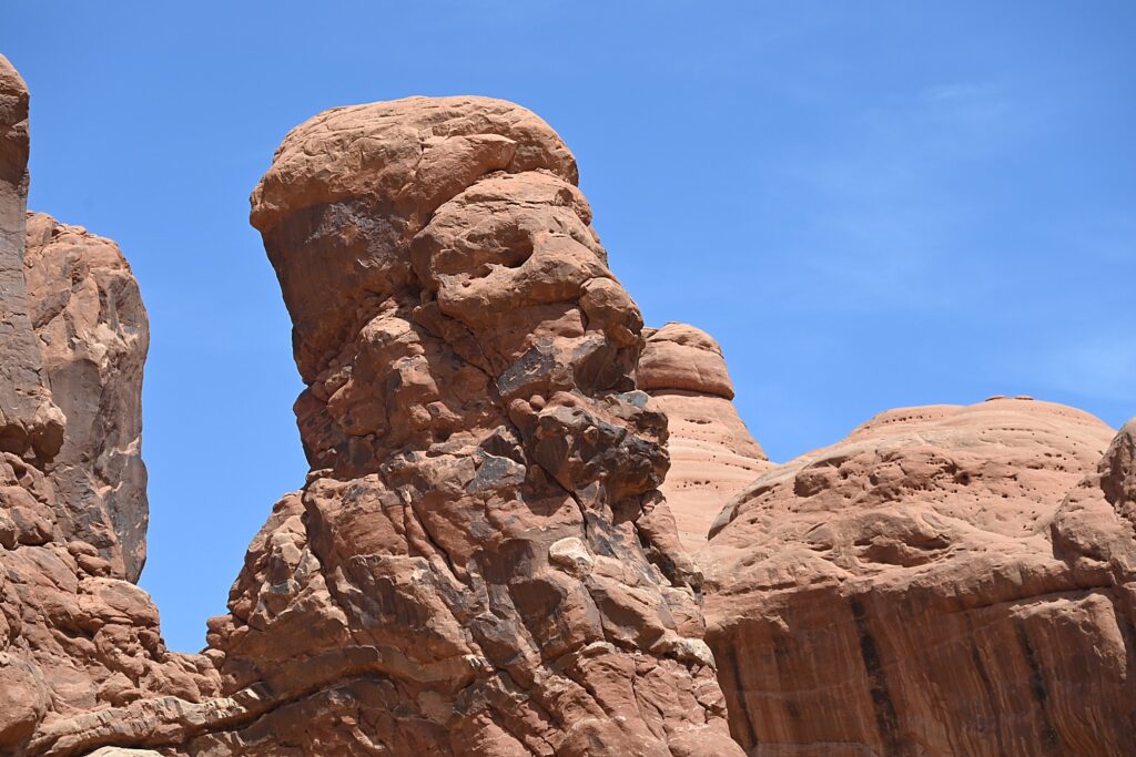
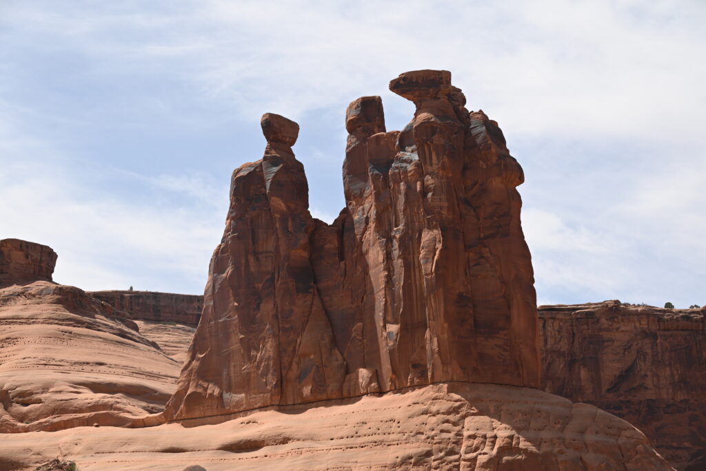
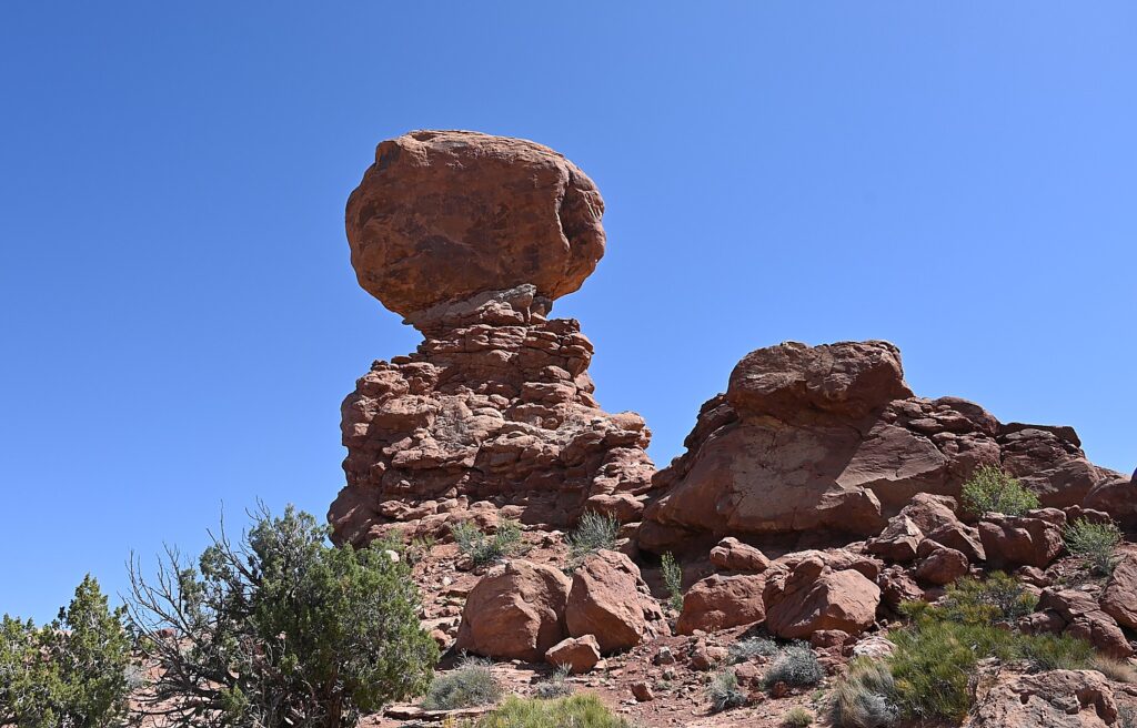
Throughout Arches, there are formations – eroded monoliths – that inspire names, like Parade of Elephants, Petrified Dunes, Tower of Babel and Fiery Furnace, also trigger imagination. Some look so much like mudmen, we name them (we rechristen Balanced Rock “E.T.”, the Gossips we rename “The Suffragists,” and formations that look to me as if Nefertiti and Croesus had just been turned to rock.

The formation once known as “The Gossips” we re-name “The Suffragists” Arches National Park © Karen Rubin/goingplacesfarandnear.com

The source of what we see is a salt bed, thousands of feet thick in places, that was deposited across the Colorado Plateau 300 million years ago when a sea flowed into the region and eventually evaporated, according to the Arches National Park notes. The salt bed was unstable and unable to hold the weight of the thick cover of rock formed from compressed debris. It shifted, buckled, liquefied and repositioned, thrusting rock layers upward as domes, while whole sections fell into cavities.

Doesn’t this rock formation look like Nefertiti? Imaginations run wild in Arches National Park © Karen Rubin/goingplacesfarandnear.com

Faults make the surface even more unstable. From the visitor center, you can see the result of a 2,500-foot displacement, the Moab Fault. The faults caused vertical cracks and wind and water over 100 million years of erosion and weathering, ultimately formed the arches of salmon-colored Entrada Sandstone and buff-colored Navajo Sandstone.

The process is ongoing – new features are being formed as old ones are transformed.

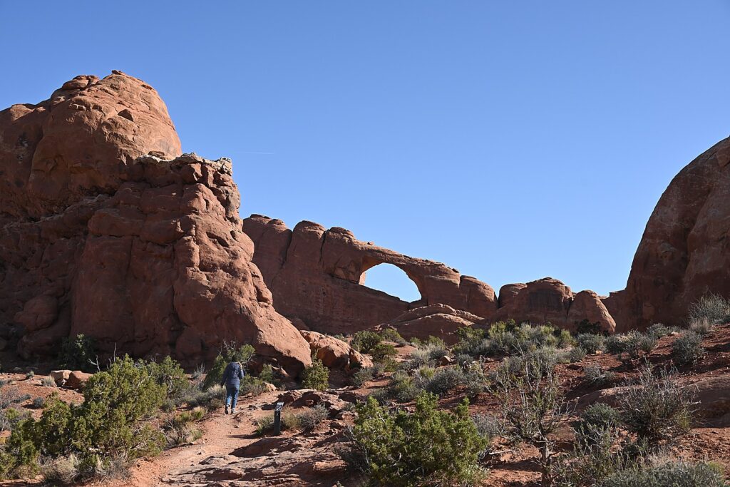
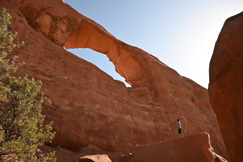
Sometimes the changes happen suddenly, violently. That was the case at the Skyline Arch, just next door to Devils Garden, where a massive boulder tumbled down in the 1940s, expanding the arch.

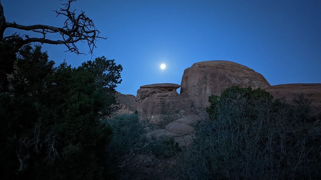
Waking before sunrise with the moon in Devils Garden Campground, Arches National Park © Karen Rubin/goingplacesfarandnear.com

The most ambitious hikes in Arches National Park are to the Double O Arch (4.1 miles); the Primitive trail (2.1 miles one way, considered most difficult), and if you would do the whole Devils Garden Trail (7.8 miles, that goes to the Landscape Arch, Double O Arch, Dark Angel along a primitive trail, with narrow ledges, rock scrambling and few trail markers; be sure to take enough water— 1 liter of water per person, per hour).

We do none of these, holding out for our most ambitious hike, to Delicate Arch, for sunset but I already have my trepidations.

And, in addition to the outstanding Devils Garden trail, from the campground (which feels luxurious to us for its restrooms and running water), you can hikethe Broken Arch Loop Trail which runs past Tapestry Arch and Broken Arch, then swings south towards Sand Dune Arch and back up passed Skyline Arch before returning to the campground. (Unfortunately, we don’t have time for that hike. Next time!)

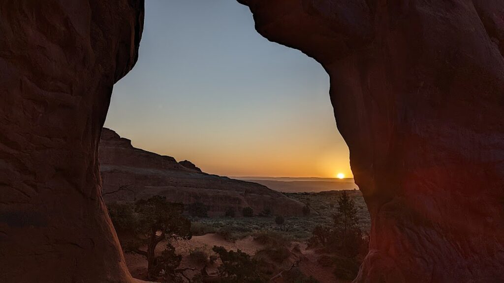
Sunrise in Devils Garden, Arches National Park © Karen Rubin/goingplacesfarandnear.com

For my sunrise hike, I do the easy, paved trail, rushing to get to a good position for photos, and then continue on to do more of it, going to where I see the famous Landscape Arch. After my walk through the easy part of the Devils Garden Trail (it is surprising how fast the sun comes up, washing out the colors), I go back to the campsite where we have breakfast.

Sunrise in Devils Garden, Arches National Park © Karen Rubin/goingplacesfarandnear.com

(Actually, we have to move from one campsite to another for our second night and Dave and Laini figure out to just put the tent with the sleeping bags and stuff on top of the Jeep and drive it over, which we do by check-out time.)

Landscape Arch, Devils Garden, Arches National Park © Karen Rubin/goingplacesfarandnear.com

We then set out to explore Arches.

We only have one full day at Arches National Park, and it’s the end of our hiking/camping adventure, so we kind of go with the flow. We drive to the different sites, and do short hikes up to the various formations, basically doing the tourist thing.

An easy trail takes you to the Skyline Arch, Arches National Park © Karen Rubin/goingplacesfarandnear.com

We follow a route, starting with the Skyline Arch adjacent to Devils Garden. Dave climbs to the top of that humongous boulder that fell down (scary to contemplate). The Skyline Arch Trail is short and easy, less than a half-mile roundtrip hike from the parking lot and back. The arch itself is one of the more popular landmarks in Arches. It makes for spectacular photographs, owing to its position, literally, on the skyline. And its proximity to the Devils Garden Campground makes it a perfect hike if you arrive late in the afternoon. (We arrived too late.)

Dave climbs atop of a boulder that came off the Skyline Arch © Karen Rubin/goingplacesfarandnear.com

We go next to the observation area that overlooks The Fiery Furnace, a labyrinth of narrow sandstone canyons. (Hiking the Fiery Furnace requires agility and a permit, or a ticket for a ranger-led hike that must be reserved in advance through Recreation.gov; one route is marked, but getting lost is still possible.)

The Fiery Furnace, contrasted against snow-capped peaks, Arches National Park © Karen Rubin/goingplacesfarandnear.com

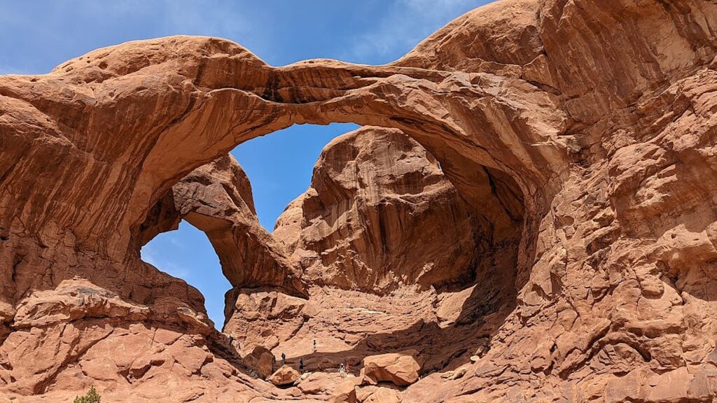
Next, we drive to one of the famous highlights of Arches (there are many, but this one is tops for me): the Double Arch Viewpoint and Trail. The tallest arch in the park at 122 ft., there seems to be this intricate dance between the two arches. An easy gravel path leads to the base of the two huge, arching spans. Of course Dave and Alli climb up to the arches, while Laini draws.

There seems to be an intricate dance between the two arches of the Double Arch, Arches National Park © Karen Rubin/goingplacesfarandnear.com

Balanced Rock is another signature landmark and just about everyone (who can get a parking space) walks the short hike around the base for up-close perspectives. We re-name Balanced Rock E. T. because from a certain angle, it’s a dead ringer for the endearing character.

“Balanced Rock”is a dead-ringer for the beloved E.T., Arches National Park © Karen Rubin/goingplacesfarandnear.com

(The Arches National Park newsletter guide is invaluable – it recommends how much water to take, and gives excellent information about distance and time and difficulty for each of the hikes.)

Dinosaurs, Indians!

Arches National Park (believe it or not), has no food or lodging (that is, beyond the sensational Devils Garden campground) – so we drive out of the park into the delightful, hopping town of Moab for lunch at the food truck park, and a bit of shopping.

From here, we drive a short distance to where Laini promises we will encounter both dinosaurs and Indians.

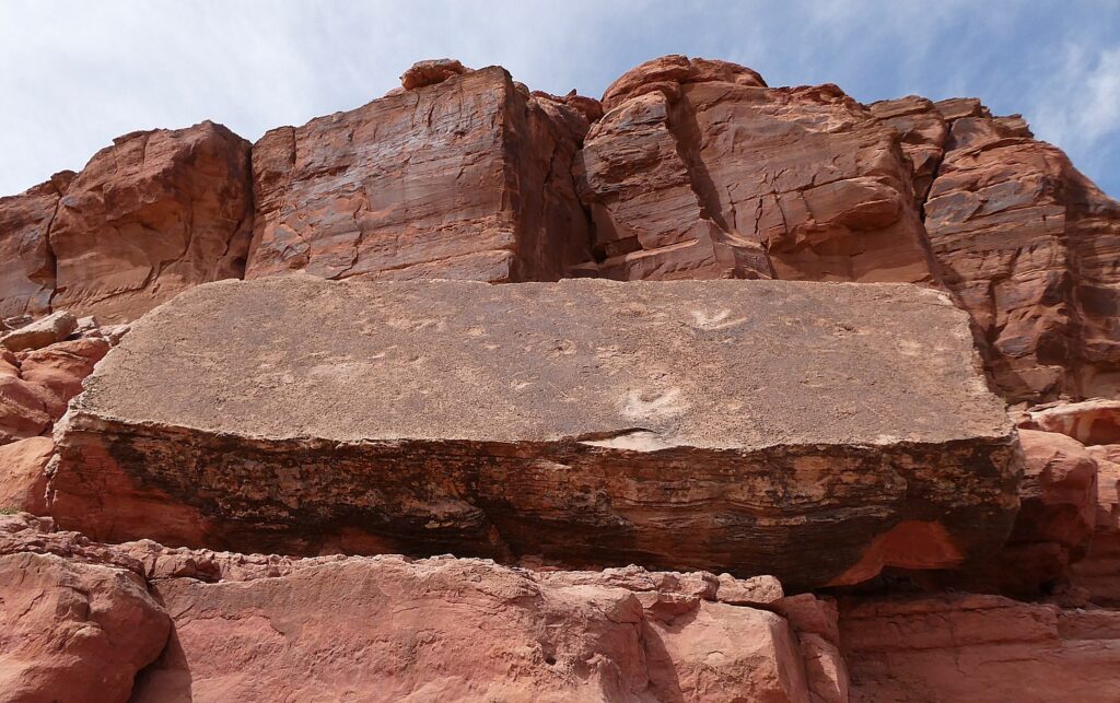
Tracks made by three-toed meat-eating dinosaurs can be seen at the Poison Spider Dinosaur Tracksite and Rock Art Trail © Karen Rubin/goingplacesfarandnear.com

We drive along Utah Scenic Byway 279 to the trailhead of the Poison Spider Dinosaur Tracksite and Rock Art Trail. It’s a quarter-mile walk up a steep, crumbly trail up a rocky hillside to two rock slabs where tracks made by three-toed meat-eating dinosaurs can be seen, as well as a wall with a good collection of petroglyphs.

This area was once a vast sand dune sea, known as an erg. These tracks would have been found along the edge of a lake between dunes. As the wind would blow across the dunes these tracks would have been gently buried in shifting sand and preserved. The preserved tracks were unearthed when the slabs fell from the sandstone cliffs above.

The trail switchbacks up the hill before coming alongside the petroglyph wall and then descends back to the parking lot. (Use caution: though short, there are a few steep areas and the trail can be hard to follow.)

(From this trailhead you can also connect to the Longbow Arch hiking trail that goes into a canyon to an arch, 2.4 miles roundtrip.)

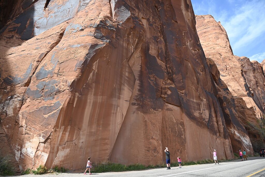
The astonishing Utah Highway 279 Rock Art Site, where a huge rock wall face has the most amazing sets of petroglyphs and pictographs, Moab © Karen Rubin/goingplacesfarandnear.com

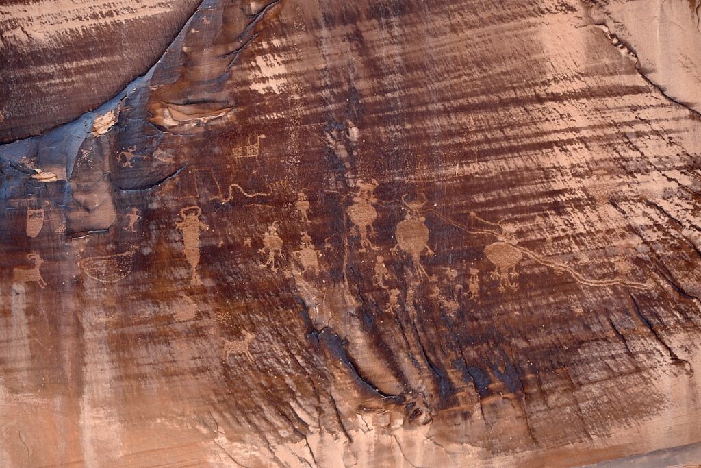
A short distance along Potash Road is the Utah Highway 279 Rock Art Site, where a huge rock wall face has the most amazing sets of petroglyphs and pictographs. It looks like a museum exhibit, except this is where they were made and it is astonishing to contemplate that this is where people so very long ago stood here and carved and painted them.

The astonishing Utah Highway 279 Rock Art Site, where a huge rock wall face has the most amazing sets of petroglyphs and pictographs, Moab © Karen Rubin/goingplacesfarandnear.com

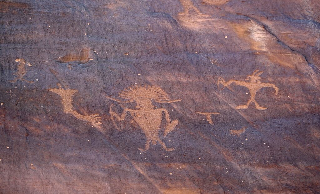
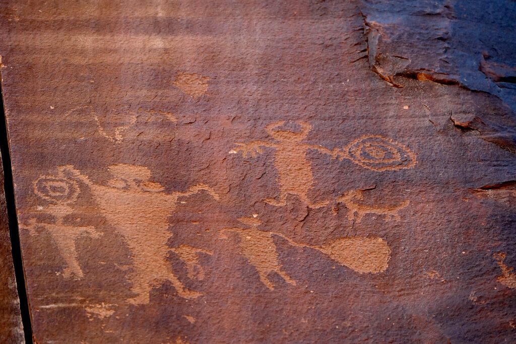
Archaeologists believe most of the rock art found here was created during the Archaic (6,000 – 1,000 B.C.) and Fremont (450-1300 A.D.) cultural periods. The art consists of pictographs (painted images) and petroglyphs (pecked, incised or chiseled images). The majority of the rock art features anthropomorphic (human forms) and zoomorphic (animal forms) but there are also curvilean lines, zigzags, wavy lines, concentric circles and abstract symbols. Sometimes both Archaic and Fremont petroglyphs can be found on the same rock art panel.

The astonishing Utah Highway 279 Rock Art Site, where a huge rock wall face has the most amazing sets of petroglyphs and pictographs, Moab © Karen Rubin/goingplacesfarandnear.com

Some of the rock art panels depict religious rituals and are considered sacred sites. Some depict migration routes, fertility, hunting, ceremonies, and cosmic events.

The astonishing Utah Highway 279 Rock Art Site, where a huge rock wall face has the most amazing sets of petroglyphs and pictographs, Moab © Karen Rubin/goingplacesfarandnear.com

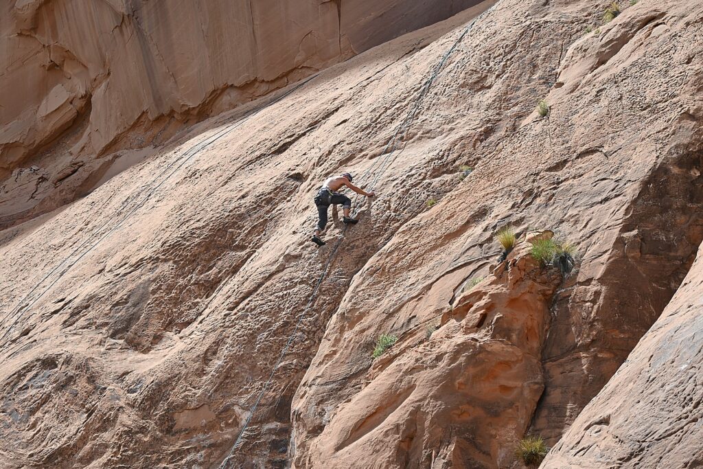
These petroglyphs were exposed when the road was widened, and it is a surreal experience to see these magnificent, huge murals just along the road – especially because it is beside a section popular with rock climbers (one was prosecuted for rock climbing where the protected petroglyphs are).

Fremont rock art often depicts trapezoidal anthropomorphs with horns, bighorn sheep, dogs, hunting scenes with weapons, and abstract objects – and sure enough, we see plenty of examples – there are horned anthropomorphs holding shields and paper doll-like cut-outs; at the southern end of the panel, we see a large bear with a hunter at its nose and another hunter over its back. The notes say this art is 3000 to 8000 years old.

The ancient rock-art panels are next to a popular rock climbing place © Karen Rubin/goingplacesfarandnear.com

At the northern end of the panel, round holes carved into the sandstone underneath the left side would have once held roof poles of a structure which was excavated by archaeologists before the road construction. The rock panels extend 125 feet along Potash Road.

Sunset and Star-Gazing

We return to Arches National Park for sunset (there is still a long line of cars getting in with their timed admission tickets, but because we are camping, we breeze right in).

Laini suggests we hike the 3 miles roundtrip to Delicate Arch for the sunset, but I’m actually dreading it (my feet are actually bleeding from yesterday’s 11-mile Kane Gulch hike – the folly of hiking in boots that haven’t been broken in).

My trepidation comes from the description of the hike: The Delicate Arch hike is ranked difficult – the trail climbs 480 feet up a steep slickrock slope, and just before you get to Delicate Arch, follows a narrow rock ledge for about 200 yards). I am especially nervous about hiking the 1.5 miles back in the dark.

Laini, who has done the hike on their previous trip, admits she also has been dreading it but only wanted to do it for me, because I would have been disappointed not to see the iconic rock formation that Utah uses for its state symbol.

We set out and I ask what exactly we will see and she pulls up the photo she took on a previous trip. I suggest we not bother, but rather go to The Windows where I’ve been told is a popular place for sunset.

But before we leave the trail to the Delicate Arch, we explore the Wolfe Ranch historic site and walk a little further along a path to see an excellent example of historic Ute rock art – a huge bonus to coming here.

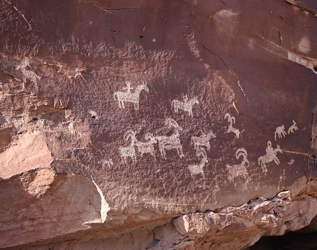
Historic Ute rock art at the Wolfe Ranch site, Arches National Park © Karen Rubin/goingplacesfarandnear.com

The panel depicts a stylized horse and rider surrounded by bighorn sheep and dog-like animals which are typical of Ute rock art. The petroglyphs were carved sometime between 1660-1860.

The historic marker is fascinating because it also shows photos of an Ute on horseback in 1909. “The Utes’ acquisition of horses by the mid-1600s radically changed the way they hunted, worked and traveled.” Another photo depicts a Ute warrior and his bride, circa 1873. Utah’s name is derived from the Ute Indians who moved into this area around 1300 AD.

I’m thrilled we came here, and even more thrilled to go to The Windows for the sunset, which I had read in the park’s newsletter (so helpful!) is one of the great spots to watch the sunset.

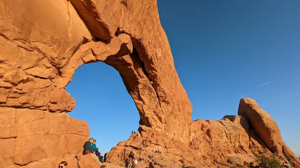
The Windows, a great place to watch the sunset in Arches National Park © Karen Rubin/goingplacesfarandnear.com

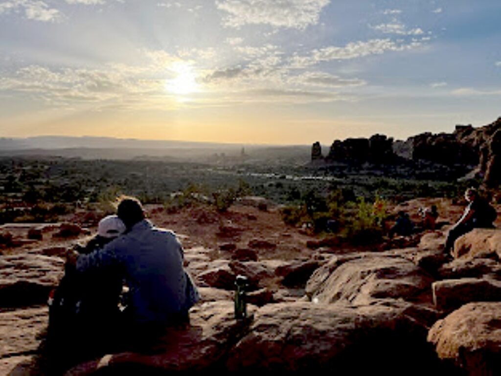
The Windows – just across from the Double Arch where we had been in the morning – is a pleasant half mile walk. We arrive just as the light is turning the rock deep gold, to orange, to red. I find a “comfortable” rock to sit on at the bottom of the arch while Dave, Laini and Alli (of course) climb up into the Windows.  Our view looks out to the Turret Arch and a wide open expanse, to where the sun dips below the horizon.

Watching the sunset from The Windows, Arches National Park © Laini Miranda/goingplacesfarandnear.com

We drive back to Moab to stop in for a bite and beer flight at Moab Brewery, and then return to the national park to do some stargazing before settling into our campsite.

Arches National Park is a great family park where a short walk brings you to many of the iconic features, and you can even see a lot from a car and the observation areas. Stop at the visitor center for advice, where you can watch an orientation film and see exhibits. A self-guiding audio tour is available. Ranger programs are offered seasonally.

For more information, and to reserve entry tickets and campsites, www.nps.gov/arch; info 435-719-2299; hiking info at https://www.nps.gov/arch/planyourvisit/hiking.htm

Sunrise from the Devils Garden Campground, Arches National Park © Karen Rubin/goingplacesfarandnear.com

On our last morning, I awake again before sunrise and scramble up a small hill across the road from our campsite for a different view.

We pack up quickly for our departure which also entails packing up the rental sleeping bags and pads, which we ship back to Moosejaw.com from Moab, pick up breakfast from a delightful cafe, and head out for the drive back to Salt Lake City and our flight home, having had the most marvelous Utah Adventure, a trip of a lifetime for me.

Trip planning tools are available at https://www.visitutah.com/.

Advance Purchase Tickets Required

From April 1 to Oct. 1, 2023, you need to secure in advance a timed entry reservation in order to enter Arches National Park between 7 a.m. and 4 p.m. Reservations must be secured three months in advance of the anticipated date of visiting Arches. A single booking of a timed entry ticket covers each registered visitor (an individual, couple, group or family). You can enjoy the park all day, entering and re-entering at will with the validated ticket. A $2 processing fee is added nto the standard park entry fee. Reservations are accepted on a first-come, first-served basis on Recreation.gov. (It may also be possible to obtain a limited number of tickets through Recreation.gov up to midnight the day before planning to visit the park.).

See:

UTAH ADVENTURE DAY 1-2: CAPITOL REEF’S COLORFUL CANYONS

UTAH ADVENTURE DAY 3-4: GRAND STAIRCASE-ESCALANTE POSES CHALLENGE

UTAH ADVENTURE DAY 4-5: DRIVING BURR TRAIL, EXPLORING GLEN CANYON, WILD CAMPING IN ARCH CANYON

UTAH ADVENTURE DAY 6: SACRED SITES, SPIRITS OF BEARS EARS NATIONAL MONUMENT

UTAH ADVENTURE DAY 6-7: HOUSE ON FIRE AMONG HIGHLIGHTS HIKING AMID SACRED SITES, SPIRITS OF BEARS EARS NATIONAL MONUMENT

______________________

© 2023 Travel Features Syndicate, a division of Workstyles, Inc. All rights reserved. Visit goingplacesfarandnear.com, www.huffingtonpost.com/author/karen-rubin, and travelwritersmagazine.com/TravelFeaturesSyndicate/. Blogging at goingplacesnearandfar.wordpress.com and moralcompasstravel.info. Visit instagram.com/going_places_far_and_near and instagram.com/bigbackpacktraveler/ Send comments or questions to [email protected]. Tweet @TravelFeatures. ‘Like’ us at facebook.com/KarenBRubin 
Day 4 on the Inca Trail: Sun Gate to Machu Picchu, The Lost City Of The Incas

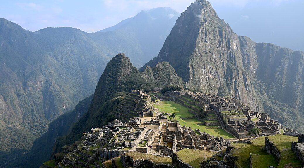
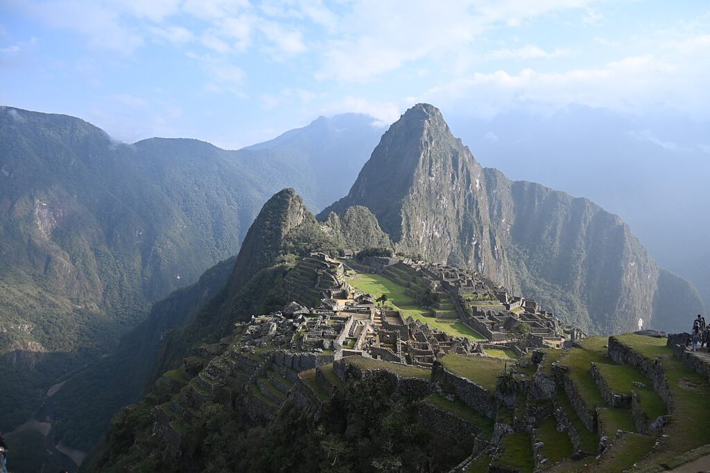
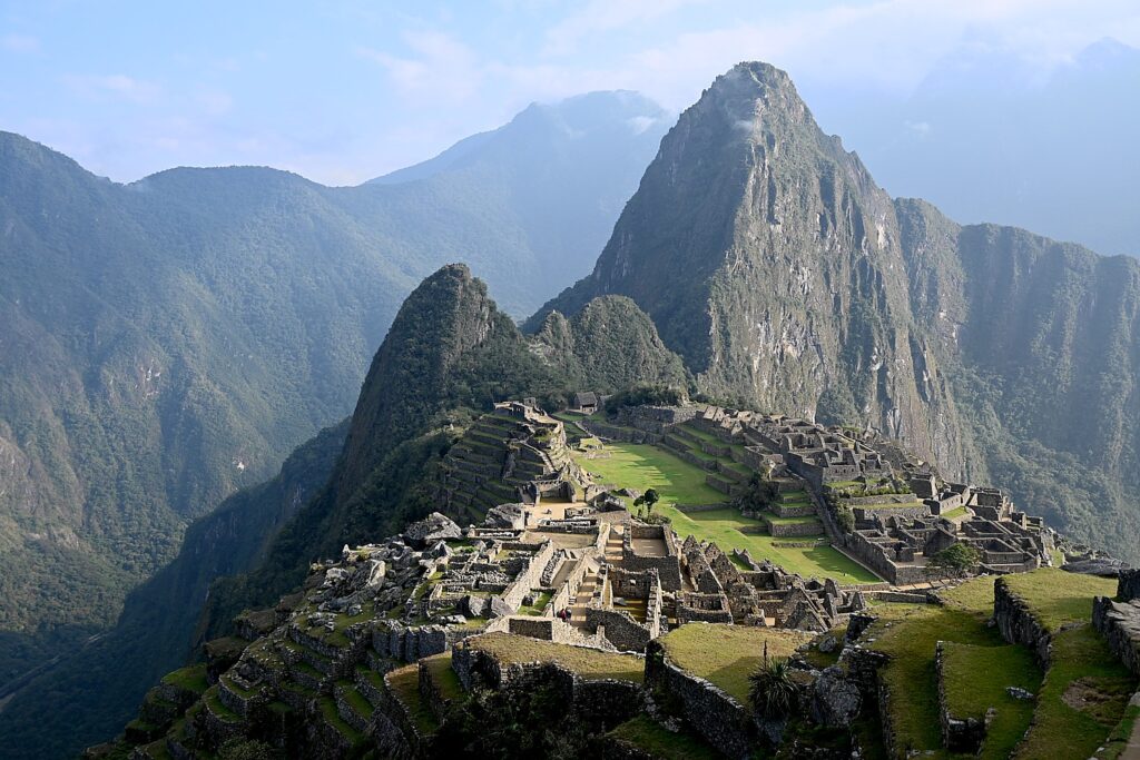
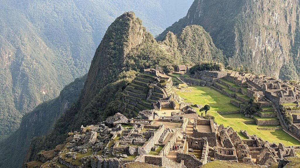
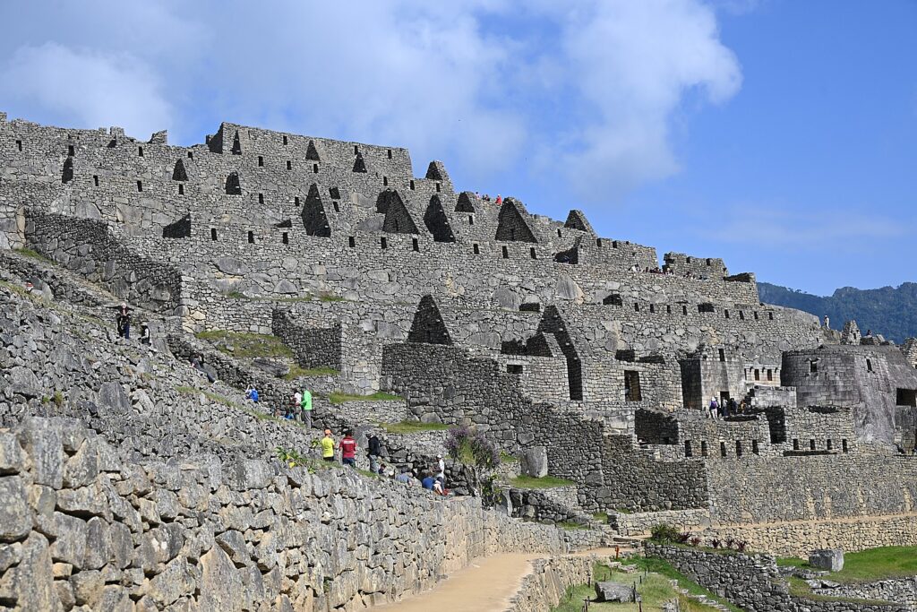
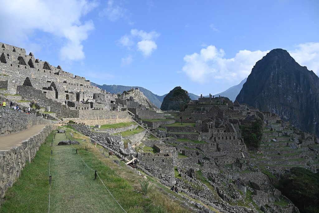
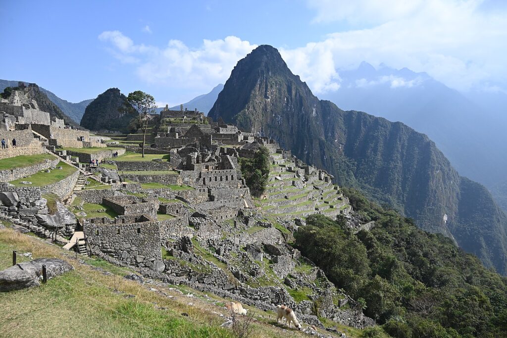
Machu Picchu, The Lost City of the Inca, reached on Day 4 of the Alpaca Expeditions 26-mile Inca Trail trek © Karen Rubin/goingplacesfarandnear.com

By Karen Rubin, with Eric Leiberman and Sarah Falter

Travel Features Syndicate, goingplacesfarandnear.com

This is the day that many of us have had on a bucket list, and for some of us, represents the fulfillment of a “trip of a lifetime”: Machu Picchu.

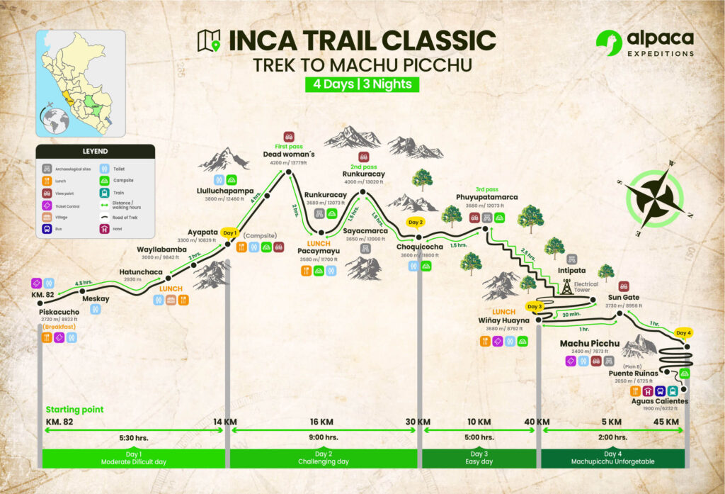
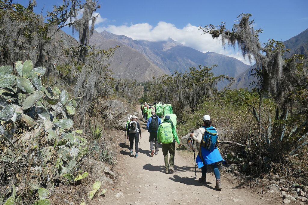
We are awakened at 3 am when the Alpaca Expeditions staff bring hot coffee to our tents. We have everything ready for leaving the Wiñaywayna campsite by 3:15 am (I had packed everything the night before and only kept out what I would be taking on the trail), and set out, our bagged breakfast in hand, wearing our headlamps in the dark for the surprisingly short distance walk to the check-in point for Machu Picchu where we wait until it opens at 5:30 am.
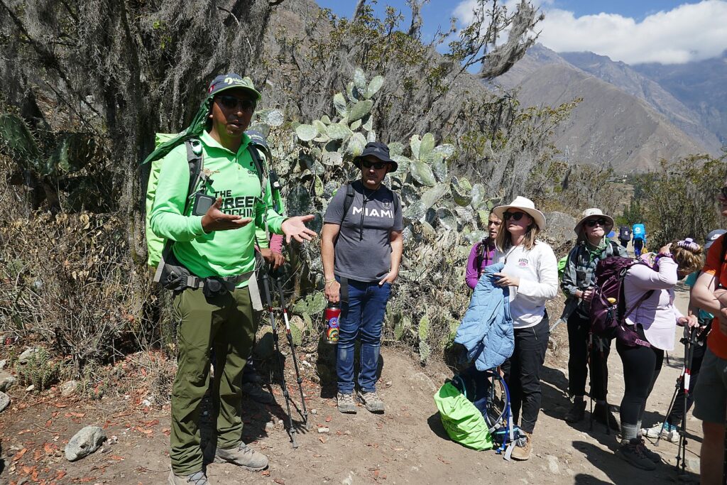
Our guide Lizandro Aranzabal Huaman wants us to get up so early to be first on line (he claims to have a 98% success rate) and also to get to the Sun Gate as the sun rises (and before it gets overwhelmed with photo-snappers), and to Machu Picchu in time for the first rays to illuminate the scene. In fact, there is only a group of six ahead of us and something like 200 behind us, checking our passport against the list of permits granted for the day.
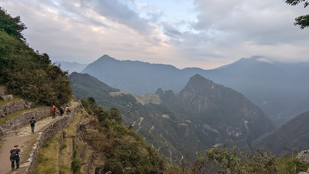
Somehow, I wind up leading our pack of 15 trekkers and I surprise myself at the pace I set for the one-hour hike on this mostly flat portion of the trail to the Sun Gate. I am in the lead until we get to what Lizandro calls the “Gringo killer”- 50 of the steepest steps – more like a rock climbing wall – where you need to use your hands to crawl up like cat.

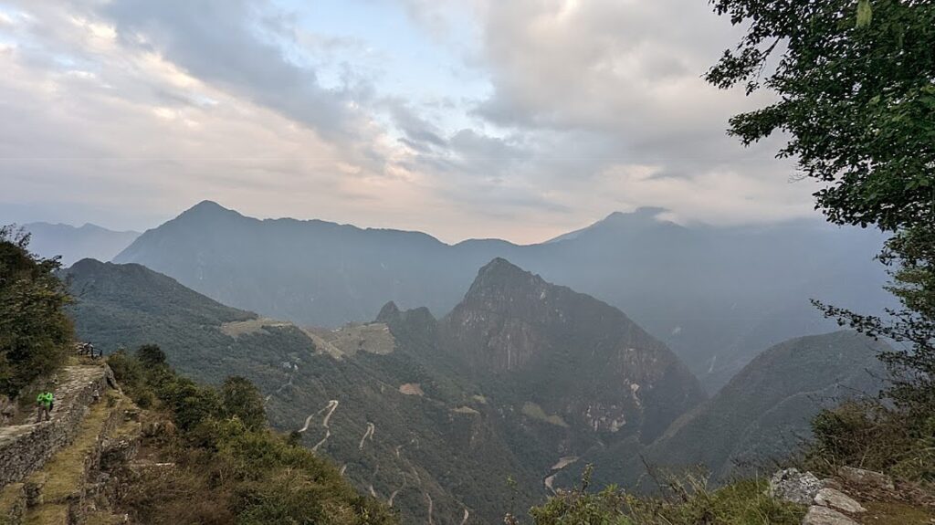
Lizandro has prepared us for the fact that the sun only comes through the Sun Gate (Inti Punku) at sunrise on the solstice. But from here, we get our first view of Machu Picchu in the distance (it’s still an hour’s hike away).

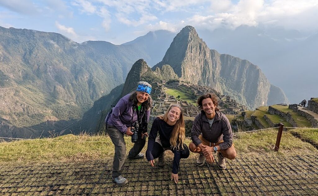
One of the many nice aspects of our guides, Lizandro and Georgio, is that they have been patiently  taking individual and group photos of us with our phones and cameras at each of the key spots along the trail, and so we stop at the Sun Gate to take our turn posing for those shots. (Everyone wants to be at this small point for the sunrise, which is why Lizandro wanted us first.)

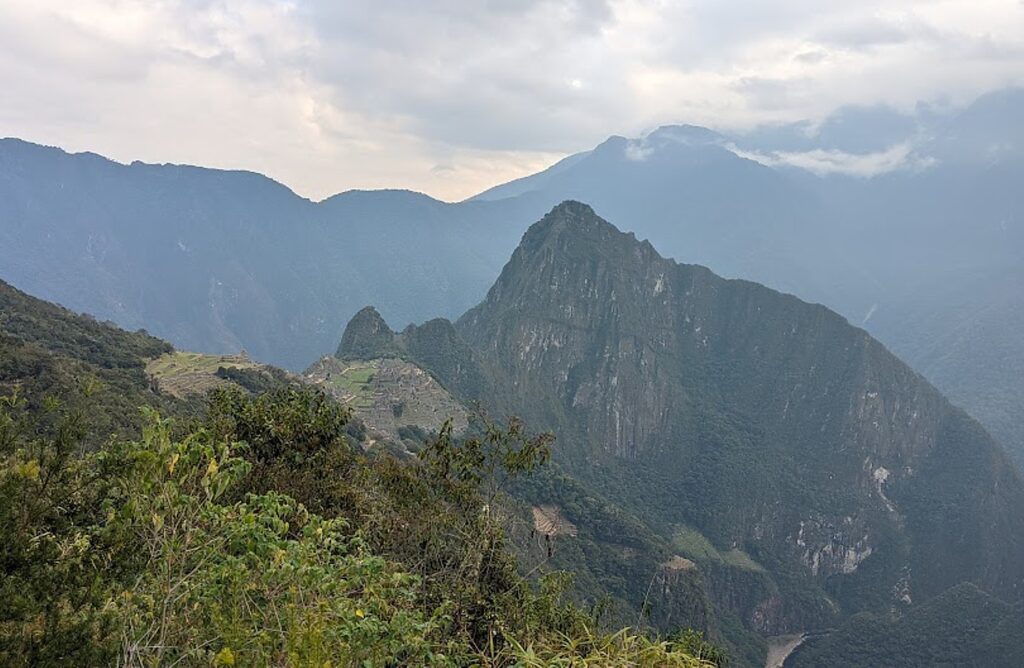
The first view of Machu Picchu from the famed Sun Gate on the Inca Trail © Karen Rubin/goingplacesfarandnear.com

And then we continue (downhill!) from the Sun Gate at 8,956 ft. elevation, an hour more to Machu Picchu, descending to 7,873 elevation over the course of three miles from the Wiñaywayna campsite. At the same time, the temperature which had been cold at the highest elevations, becomes warm, even balmy, so we are actually sweating (need sunscreen and hat!) at the site.

The first view of Machu Picchu from the famed Sun Gate on the Inca Trail as dawn breaks © Karen Rubin/goingplacesfarandnear.com

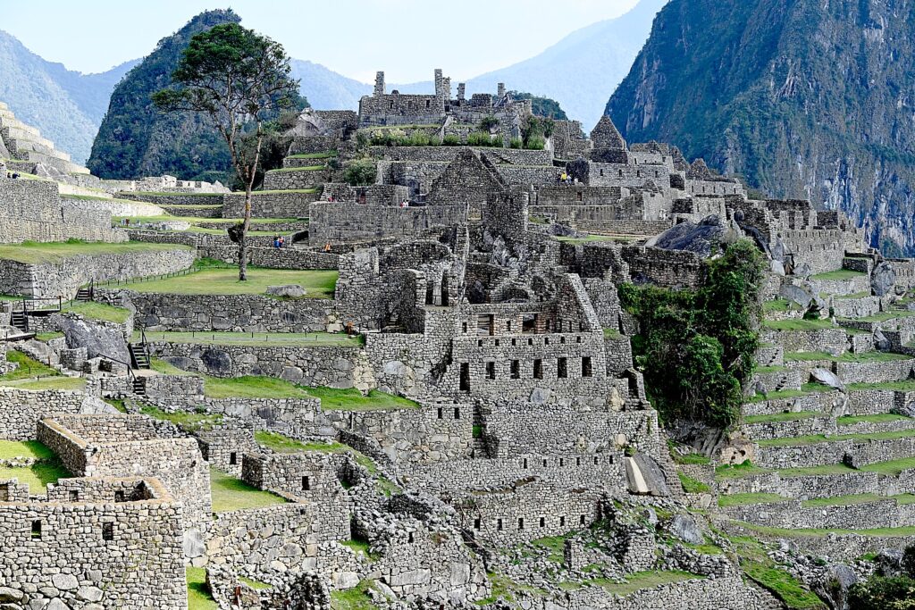
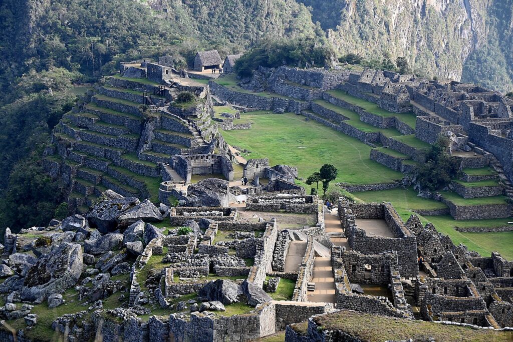
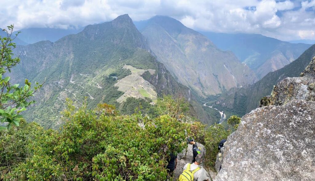
This part of the Inca trail gives us views that show how Machu Picchu is positioned – we see the entirety of the Lost City (I can only imagine what it was like before it was excavated) and how it is etched amid the contours of the mountain peaks – which is how it was kept hidden from the Spanish when they invaded in 1538 and for 400 years.

The first view of Machu Picchu from the famed Sun Gate on the Inca Trail as dawn breaks © Karen Rubin/goingplacesfarandnear.com

Literally 10 seconds after I pass a scenic overlook, the sun pokes out. (These views and so much more, are why we take the Inca Trail trek.)

At about 7:40 am, we walk in what seems to be a back entrance into the city, where we are perched on high terraces and the views are the iconic ones of magazines and postcards (and I suspect are not available to the day-trippers who come in from the bottom entrance for the tour). How lucky we are because the sun breaks through, highlighting the structures, for exquisite scenes.

Only 40% of Machu Picchu has been excavated so far, which means that 60% is still underground and hidden from view © Karen Rubin/goingplacesfarandnear.com

We actually walk down and out of Machu Picchu site to wait for our ticketed time to re-enter (you can only stay 2 ½ hours and can only come in with a guide). While we wait, we have to use the bathroom before we reenter and check bigger backpacks and hiking poles.

We made it! Karen, Sarah and Eric at Machu Picchu at the end of the Alpaca Expeditions four-day, 26-mile Inca Trail trek (photo by Lizandro Aranzabal Huaman)

Our scheduled time to enter Machu Picchu to begin our 2 hour private guided tour with Lizandro is 8:30 am, who leads us on Circuit #4 (there are four different circuits to control crowds) to the highlights: the terraces, Sun Temple, Royal Mausoleum, Palace, Plaza, Sacred Rock.

Machu means “old,” “ancient,” “big”). Picchu means “peak,” so Machu Picchu actually means “Ancient Mountain,” but that is not its indigenous name.

Lizandro tells us that Machu Picchu was built in the mid-1400s by Pachacuti, the 9th Inca king but its first emperor and the “Alexander the Great” , the Empire Builder, of the Inca. Beginning in 1438, he and his son Tupac Yupanqui began a far-reaching expansion that brought much of the modern-day territory of Peru under the ruling Inca family control. He rebuilt Cuzco, built Pisac, Ollantaytambo  as well as Machu Picchu. He built Machu Picchu up in the mountains instead of the valley to be closer to the sun, to connect the sky and the earth in one place, as well as for protection.  “Mountains were gods that protected the villages and the animals,” he relates. Almost all of the construction faces east to catch the sunrise – the Inca rulers claimed to be the children of Inti, the Sun God.

The archaeologist Hiram Bingham didn’t discover Machu Picchu (it was discovered in 1902 by Bolivian fortune hunters looking for Incan treasure), but came on an expedition in 1911 in search of Vilcabamba, the last stronghold of the Inca after the Spanish conquest. But Bingham is credited with bringing Machu Picchu to the attention of the world. © Karen Rubin/goingplacesfarandnear.com

Over the next 100 years, the Empire ultimately expanded to what are today six South American countries, connected by 25,000 miles of roads, suspension bridges and trails, and controlling a population as many as 18 million.

The Sun Gate was built as a check point to enter Machu Picchu, but positioned so that on December 22, the summer solstice, the sun beam would come through gate; and on June 21, it comes through the other window.  

Only when you are actually at Machu Picchu can you begin to comprehend what an astonishing construction it is, why it is worthy of being called one of the Seven Wonders of the World and designated a UNESCO World Heritage Site © Karen Rubin/goingplacesfarandnear.com

Machu Picchu is built in two sections – an urban sector has some 200 units of which 172 were homes, and the rest were temples, and a sun dial.

There would have been 700-800 people living here full time – 60% were nobles, the rest were farmers and workers.

Only when you are actually at Machu Picchu can you begin to comprehend the scale of the construction, why it is worthy of being called one of the Seven Wonders of the World and designated a UNESCO World Heritage Site © Karen Rubin/goingplacesfarandnear.com

How did they build Machu Picchu without slaves, without animals to carry, without a wheel, iron tools, or written language? Consider that China’s Great Wall and the Egyptian pyramids were built with slave labor, draft animals, a wheel, iron tools and written language.

What they had was a culture and a labor system based on principles: Ani – reciprocity – one for all, all for one; Minka – community benefit – care for vulnerable – collectivity (how the Peruvians got through Covid despite a poor health care system); and Mita – paying taxes by work, labor (not cash) to benefit the whole.

Only when you are actually at Machu Picchu can you begin to comprehend what an astonishing construction it is, why it is worthy of being called one of the Seven Wonders of the World and designated a UNESCO World Heritage Site © Karen Rubin/goingplacesfarandnear.com

It took 50-60 years to build Machu Picchu for Emperor Pachacuti,  who ruled from 1432-1472, but it was never finished. I can’t help but wonder how many men were impressed to build this enormous complex of structures in that amount of time.

When the Spanish invaded in 1538, Machu Picchu was abandoned before it was finished and the Incan forces fell back to arm Vilcabamba, the Inca’s last stronghold. “They promised to come back but didn’t,” Lizandro says.

Our Alpaca Expeditions guide Lizandro Aranzabal Huaman relates the background to Machu Picchu, the Lost City of the Inca © Karen Rubin/goingplacesfarandnear.com

It is mindboggling to contemplate that as complex a construction as what we see, the scale, and the fact that more than 60% is still unexcavated, buried under 400 years of overgrowth.

The archaeologist Hiram Bingham didn’t discover Machu Picchu (it was discovered in 1902 by Bolivian fortune hunters looking for Incan treasure), but came on an expedition in 1911 in search of Vilcabamba, the last stronghold of the Inca after the Spanish conquest.

“He set up tents at base, met a local to ask where Vilcabamba might be. The man didn’t know, but on July 24 1911, with machete in hand, Bingham had a big surprise: the sight of Machu Picchu took his breath away. Two families were living here, cultivating the terraces two years before Bingham arrived. They were running away from paying taxes to the government.” [Off the grid?]

Only 40% of Machu Picchu has been excavated so far, which means that 60% is still underground and hidden from view © Karen Rubin/goingplacesfarandnear.com

Bingham returned for a second, then a third expedition. He uncovered eight Inca trails (the Inca destroyed many of the trails to prevent the Spanish from reaching Machu Picchu) and took away artifacts, he claimed, for two years. “More than 100 years later, Yale still has the artifacts and is requiring Peru to build a museum to hold artifacts near Machu Picchu. But Peru wants it by the river. In 2015, the United States sent 11 percent of the artifacts back – but not all were real, some were replicas that they returned. The Peru government wants all of it back.”

The photos Bingham published brought international attention to Machu Picchu, the “Lost City of the Inca” – and tourists. The first tourist following the Inca trail came in 1954 and this Incan Citadel has become the most visited tourist attraction in Peru. The site was named among the New Seven Wonders of the World and designated a UNESCO World Heritage Site in 1983.

Machu Picchu, reached on Day 4 of the Alpaca Expeditions 26-mile Inca Trail trek © Karen Rubin/goingplacesfarandnear.com

We trekkers follow Circuit 4 (there are four circuits, to spread out the crowds): starting at the Main Gate (where we must present our passports and permit), to the Sun Temple, House of the Inka, the water foundation; Granitic Chaos; Sacred Plaza; Intiwatana Pyramid; Sacred Rock; Three Gates; Water Mirrors; and Condor Temple.

Our Alpaca Expeditions guide Lizandro Aranzabal Huaman points to the astonishing construction of Machu Picchu © Karen Rubin/goingplacesfarandnear.com

We climb the steep stone steps and come to the Sun Temple. It was built as a royal tomb to contain the mummified remains of the king.  Lizandro points to how a temple would have the highest quality building stones and most precise placement and its architecture emphasizes the “harmony between people and nature. They always incorporate the natural bedrock. The windows are aligned for summer and winter solstice – a solar observatory. There are three steps – the Inca triology. The mummified body was placed in the tomb in fetal position.” There are no mummies left in the tomb, but there would have been mummies of the 12 Inca kings (others were buried). On the day of Ayamaki, the mummies would have been paraded from the mausoleum.

The Royal Tomb at Machu Picchu © Karen Rubin/goingplacesfarandnear.com

Lizandro notes that the word ‘jerky” – the dehydrated meat snack – comes from the indigenous Quechua word, “jakky charky” (related to mummification).

We come to the Royal Inca Palace, where we can see that instead of windows (too cold), there would have been shelves for idols. “Bingham got here in time to see some.”

Only when you are actually at Machu Picchu can you begin to comprehend what an astonishing construction it is © Karen Rubin/goingplacesfarandnear.com

How would they have set the weighty keystone in place? With ramps, aloe vera to make it slick, he says. The enormous stone building blocks, weighing tons, are trapezoid shape and set at a slight incline angle, for stability against earthquakes. Indeed, Peru suffered two big earthquakes – in 1650 and 1950 – when the colonial buildings collapsed, the great cathedral in Cuzco collapsed, but these structures remained (in fact, the 1950 earthquake in Cuzco unearthed Incan structures). We see under one massive block a roller-shaped stone – a precursor to the wheel.

You only appreciate the scale of Machu Picchu as you haul yourself up the high steep stone steps © Karen Rubin/goingplacesfarandnear.com

You only appreciate the scale of Machu Picchu as you haul yourself up the high steep stone steps. The straight lines and perfect angles, the precision, the sheer size and bulk of the stones, and how this entire city is nestled on a plateau amid these sheer mountain peaks.

You only appreciate the scale of Machu Picchu as you haul yourself up the high steep stone steps © Karen Rubin/goingplacesfarandnear.com

There is a large open area, like a field, which would have been used for festivals, activities, an amphitheater. And in the middle, is what would have been a sundial. In 1978, the then president invited the Spanish King and Queen to visit, and their helicopter landing in the field, broke the sundial. (I find it ironic that the Spanish were still destroying Incan heritage.)

In this small plaza, Lizandro points out a huge section of bedrock cut to mimic the shape of the mountain behind – mountains were considered sacred.

Our Alpaca Expeditions guide Lizandro Aranzabal Huaman points to the precision of the placement of the stone boulders for the temple at Machu Picchu © Karen Rubin/goingplacesfarandnear.com

He explains a bit of the Incan society hierarchy – the Inca were the royal family and nobles – perhaps 20,000 who ruled over a population of dozens of different tribes totaling as many as 18 million across much of South America. Professionals could become nobles (rise to that privileged class) because of their expertise, skill and function. Teenagers could show a talent and go into a profession.

Can’t help but thinking of architect Antoni Gaudi’s style at Temple of the Condor at Machu Picchu © Karen Rubin/goingplacesfarandnear.com

We sit around for a bit of a rest, and Lizandro explains some of the contemporary politics. Apparently, in the 1990s, President Alberto Fujimori [a fixture in Peru’s politics from 1990 to 2003] wanted to privatize Machu Picchu – selling it off to Chilean investors, drawing an outcry of protests from the people. “The president did well his first five years – investing in industrial farming – but after he was reelected, he sold off or privatized without people knowing.” Fujimori, the son of Japanese immigrants, wound up being investigated for corruption. He tried to flee to Japan and was captured enroute in Santiago with eight suitcases of cash. He was convicted and sentenced to 17 years in prison.”

Lizandro says the Peruvian constitution (which I subsequently read has been rewritten and set aside multiple times since the country’s independence, while the government has undergone a series of coups back and forth from dictatorship to democracy, socialism to capitalism) favors foreign companies (they don’t pay tax). Because 50 percent of Peru’s population lives in Lima, he tells us, the people who live in rural areas, in the mountains, have little say.

The view of Machu Picchu from the top of Huayna Picchu © Sarah Falter/goingplacesfarandnear.com

Several of our group have obtained permits in advance to climb Huayna Picchu – that famous nub of a mountain, like an overlord, in the iconic Machu Picchu images – and Sarah has obtained one, while the rest of us continue touring Machu Picchu with Lizandro.

The steep stone trail to the top of Huayna Picchu © Sarah Falter/goingplacesfarandnear.com

Sarah reports back that the 45-minute hike is extremely arduous – much harder than the Inca Trail hike – almost straight up to a tiny perch at the top, at 8,835 ft., 850 ft. higher than Machu Picchu, where everyone has to take turns for the photo, but you get a famous view of Machu Picchu. The trail was built by the Inca who also built temples and terraces at the top.  “I would definitely recommend it to fitter hikers looking for one last challenge. It’s not super long and being able to see the scale of Machu Picchu from above was really impressive.”

Sarah with other members of our Alpaca Expeditions trek celebrate reaching the Huayna Picchu summit.

We finally come back down to the entrance/exit to Machu Picchu and Lizandro hands us a ticket for the bus that takes us down an extremely winding road to the village of Aguas Calientes. We meet for a last lunch together in a local restaurant – kind of a celebratory meal ( optional and not included). Lizandro gives us our train ticket, departing Aguas Calientes 3:20 pm (you need to take seriously the notice to be on the platform at least 30 minutes ahead of time, which is when the train loads) to Ollantaytambo.

The train is wonderfully vintage, with roof-windows, and very comfortable for the two-hour trip (which for some reason takes us much longer). At Ollantaytambo, we are met by the Alpaca Expeditions bus for the two-hour drive back to Cuzco and drop off back at our hotel.

The train from Aguas Calientes is wonderfully vintage, with roof-windows, and very comfortable for the relaxing two-hour trip to Ollantaytambo © Karen Rubin/goingplacesfarandnear.com

Candidly, I had been so obsessed about getting passed Day 2, Machu Picchu was more of an end-goal of a quest than the prime attraction – being here means I had gotten over the Dead Woman’s Pass, completed the 26 miles, going as high as nearly 14,000 feet – much as it would have been for the pilgrims who undertook this journey of a lifetime. It is personal.

For me, it is not just a trip of a lifetime but a now or never proposition.

I am not the only one celebrating an important milestone. Indeed, this is the sort of bucket-list trip that warrants a milestone – Peter timed reaching Machu Picchu for his 35th birthday; a couple had just gotten engaged at the start of the hike; another 30-something couple (he’s Italian, she’s Dutch) is on their honeymoon .That’s how special this trek is, embodying physical, spiritual – just as it did for the Inca, a triumph of will and willpower. A test of character then as now.

Eric and Sarah relax on the train after our four-day trek and two-hour tour of Machu Picchu © Karen Rubin/goingplacesfarandnear.com

You are at the same time amazed by the ability of these people to construct these sites at all, but then wonder at the level of control exerted, the role of religion in maintaining that control and how authoritarians throughout human history use religion (the divine right). No surprise: the Inca kings claimed to be the son of the Sun God, Inti. And yet, you can’t help but marvel at the accomplishment of that government capable of building the 25,000 miles of roads, in producing the amount of food to sustain the population, and unifying a population of 18 million into a society.

You appreciate the social structure that produced these extraordinary mountain villages in a society that did not have slaves nor currency, did not have the wheel or beasts of burden, did not have compass, ruler, alphabet or written language.

Most astonishing, these structures were built within 20, 40 or 60 years’ time – apparently, each chief would select a project to be completed within his own lifetime.

Photos do not do justice, you have to stand next to the rock walls, trace how the boulders link to perfectly together, see the curve at the edge, the inclined angle (for stability against earthquake) with such exquisite precision, hoist yourself up the steep stone steps, look beyond to the distance these boulders would have had to be transported from their quarry.

You stand perched on these terraced structures built into the side of a mountain and simply cannot fathom what it took to build.

All these thoughts come to me as I step, climb, step, climb the trail.

Our Alpaca Expeditions group, at Machu Picchu © Karen Rubin/goingplacesfarandnear.com

At each site, Lizandro tells us more of the story of the Inca and the society they created – but unlike the sturdy bedrock that these sites were built on, the Inca’s hold on the people was really not that strong because it was not a bond. At a certain point, their hold was by force. “The Inca weren’t very nice people,” he says softly.

What was unexpected was to come away with an understanding of the limits of authoritarian control. Indeed, the Inca ruled for less than 400 years, but the empire existed only for a century before it was toppled, too weak and lacking support of the people, to withstand the Spanish invaders. There are lessons for day.  And as we learn, Peru is still going through these cycles of economic struggle, political ping-pong between dictatorship and democracy, socialism and capitalism, since becoming independent from Spain in 1821. The more things change, the more they stay the same, may well be the lasting lesson.

What makes a “trip of a lifetime” – one that is truly life-enhancing, even life-changing? It is the doing.

Alpaca Expeditions offers many ways to get to experience Machu Picchu – the trek is its own experience, and when you think about it, is very inexpensive (from $650); it’s not even that difficult or expensive an airfare to reach (at this stage, you fly through Lima or Quito to Cuzco, but a new international airport is being built closer to Cuzco). The tour company also offers many different programs – like the Sacred Valley excursions – to different areas.

The permits to do the Inca Trail trek are limited to 500 a day for all the trekking companies (which includes 200 for trekkers and 300 for porters and staff) and get booked up months in advance.

More information: Alpaca Expeditions, USA Phone: (202)-550-8534, [email protected], [email protected], https://www.alpacaexpeditions.com/

See also:

VISIT TO PERU’S SACRED VALLEY IS BEST WAY TO PREPARE FOR INCA TRAIL TREK TO MACHU PICCHU

INCAN SITES OF PISAC, OLLANTAYTAMBO IN PERU’S SACRED VALLEY ARE PREVIEW TO MACHU PICCHU

ALPACA EXPEDITIONS’ INCA TRAIL TREK TO MACHU PICCHU IS PERSONAL TEST OF MIND OVER MATTER

DAY 1 ON THE INCA TRAIL TO MACHU PICCHU: A TEST

DAY 2 ON THE INCA TRAIL TO MACHU PICCHU: DUAL CHALLENGES OF DEAD WOMAN´S PASS,
RUNCURACCAY

DAY 3 ON THE INCA TRAIL TO MACHU PICCHU: TOWN IN THE CLOUDS, TERRACES OF THE SUN
& FOREVER YOUNG

DAY 4 ON THE INCA TRAIL: SUN GATE TO MACHU PICCHU, THE LOST CITY OF THE INCAS

__________________

© 2022 Travel Features Syndicate, a division of Workstyles, Inc. All rights reserved. Visit goingplacesfarandnear.com, www.huffingtonpost.com/author/karen-rubin, and travelwritersmagazine.com/TravelFeaturesSyndicate/. Blogging at goingplacesnearandfar.wordpress.com and moralcompasstravel.info. Visit instagram.com/going_places_far_and_near and instagram.com/bigbackpacktraveler/ Send comments or questions to [email protected]. Tweet @TravelFeatures. ‘Like’ us at facebook.com/NewsPhotoFeatures

Day 3 on the Inca Trail to Machu Picchu: Town in the Clouds, Terraces of the Sun & Forever Young

Wiñaywayna is the most spectacular Inca site on the trail after Machu Picchu © Karen Rubin/goingplacesfarandnear.com

By Karen Rubin, with Eric Leiberman and Sarah Falter

Travel Features Syndicate, goingplacesfarandnear.com

On our third morning on the Inca Trail, we are wakened at 5 am at our tents in the Chaquiccocha campsite to be packed up, have breakfast at 5:30 am and out by 6:30 am to begin what is generally considered the most relaxed day of the four-day trek, when our Alpaca Expeditions group will hike 6.2 miles mostly downhill, and visit two Inca sites, Phuyupatamarka (‘Town in the Clouds”) and Intipata (“Terraces of the Sun”), before reaching the campsite, where, we are told, a special activity awaits.

I’m still on a high from surviving Day 2 and the dual challenges of Dead Woman’s Pass and Runcuraccay Pass, so I feel I can handle anything (and not just on this trek).

It’s a foggy morning and before setting out, our guide Lizandro organizes all of us in a great circle with the porters and staff and guests (Giorgio calls us “family” and Lizandro calls us “team” and both are true in the way we have bonded) so we meet each other. We learn that the porters all come from one mountain village, that two are brothers, 62 and 68 years old, that one of the porters is a woman (very unusual, but Alpaca Expeditions has made an effort to recruit women).

Getting to know you: Alpaca Expeditions porters and staff and trekkers introduce ourselves © Karen Rubin/goingplacesfarandnear.com

We trekkers introduce ourselves, also, and I mention that today is my 71st birthday – mentioning it because I am pretty pleased with the achievement (and our guide, Giorgio, at one point guessed I was 55 – perhaps just being polite) – to emphasize that they have made this experience of a lifetime possible for me.

Alpaca Expeditions’ “Green Machine” porters and staff who make our Inca Trail trek to Machu Picchu – a trip of a lifetime for many – possible © Karen Rubin/goingplacesfarandnear.com

We hike for 2 hours along what they call “Inca flat” (gradual inclines) and begin to enter the jungle, known as the Cloud Forest. As we walk, we have the opportunity to see Salkantay, the second highest snow-capped mountain in the Sacred Valley, and get glimpses of a fantastic panoramic view of the Vilcabamba mountain range through mist and clouds.

One of the fun sections of the Inca Trail goes through a small cave © Karen Rubin/goingplacesfarandnear.com

We make our way up to the last peak and our third pass, Phuyupatamarka (“Temple Above the Clouds”) at 12,073 ft. from where we have great views overlooking the Urubamba River.  Down the valley, we get our first view of Machu Picchu Mountain, but the famous “Lost City” itself is still hidden from view.

From Phuyupatamarka it´s a 3-hour walk down a flight of stone steps to our last campsite and the grand finale for this day, exploring the Incan site of Wiñaywayna (“Forever Young”).

On the descent, we stop in a small cave, and just as the pilgrims did 600 years ago as they came closer to Machu Picchu, the religious center, Lizandro uses this site, the Temple Above the Clouds, to discuss religious beliefs and practices at the time of the Inca.

Exploring the Incan site of Phuyupatamarka © Karen Rubin/goingplacesfarandnear.com

This would have been one of the religious sites where pilgrims 600 years ago would be able to show their devotion and purify themselves before they reached the sacred Machu Picchu. It would have been a place of offerings, a ritual shower, of sacrifice.

At the time of the Inca and thousands of years before, the many different tribes were polytheists, worshipping many gods mostly associated with Nature. They believed that nature, man and the Pachamama (Mother Earth), lived in harmony and perpetual interrelationship. The Inca state promoted the worship of a Creator God (Wiracocha), Sun God (Inti), Moon Goddess (Mamaquilla), Thunder God (Illapa) and Earth Mother (Pachamama), and a host of other supernatural entities. But the ruling Inca established Inti, the sun god, as the most important (the first Inca king declared himself to be the son of Inti, to establish his divine power and authority).

Eric takes in the dramatic landscape along the Inca Trail to Machu Picchu © Karen Rubin/goingplacesfarandnear.com

Lizandro points to a trinity that organizes the belief system: “The Inca thought three lives (past, present and future) ran parallel – one underneath (past), one above (future). They divided the world in three dimensions, three stages of life, which they depicted with animals – the condor (the heavens), the puma (the middle world of earth), and the snake (the underworld).

The snake represents knowledge, wisdom; because everything known is from past; the puma represents strength, energy; the condor connects this world to next world because it could touch heaven and carry heavy things, he says.

“The Inca saw life as a circle, not a line, so life never ends. They believed life is reborn and when they were buried, they were placed in the fetal position pointing to the sun and mountains; rulers were mummified and their mummified remains taken and paraded around one day a year. Children didn’t inherit property – people were buried with their belongings (for the next life). Machu Picchu, a sacred place, would have taken more than a lifetime to build, but though Emperor Pachacuti believed he wouldn’t enjoy it in this world, he would in the next.”

And the linchpin to it all, the basis for the Inca emperor’s power and authority, was religious faith.

So, while the Inca did not have slaves, they had a system of labor, whereby the men would give two to three months of service to the rulers (the first Inca Emperor, Pachacútec, the Alexander the Great of the Inca, had them build Machu Picchu, Pisac, Ollantaytambo and the various palaces and temples), and gave 50 percent of what they harvested to the nobles and the priests out of religious devotion.  And the people were kept ignorant – only the nobles and priests were educated – so they could be controlled with the use superstition and miracles.

He says there would have been six water fountains here – so people could take a ritual shower “to purify mind and body before going to Machu Picchu.” He also points to a sacrificial rock.

There appears to be an altar carved into the bedrock facing sunrise.

We have about 45 minutes of a steep downward hike before it levels off again.

The Incan site of Intipata, Terraces of the Sun, one of the sites that would have served the pilgrims and nobles on their way to Machu Picchu and were abandoned for 400 years before being discovered by archaeologists © Karen Rubin/goingplacesfarandnear.com

We come to an Inca site, Intipata (Terraces of the Sun) that interestingly, overlooks our final campsite waaaay down the mountain. Lizandro points out what would have been a platform for sacrifice. “Not for human. That would be rare” indicating that it would take place only in extreme circumstances, like a famine and would be mainly girls 11 and 13 years old who belonged to Cuzco noble families, who were told they were born to be sacrificed as offerings to stop a national disaster. He describes one instance when the king sacrificed his daughter. (I’ll bet it was a period of famine, because they needed to reduce population to keep in balance.) The sacrificed were given fresh vegetable hallucinogenic flower to eat. “They offered them not death, but life.”

Llama at Intipata. “The Llama represents spiritual life and the black llama, a symbol of material life, would be sacrificed,” our Alpaca Expeditions guide, Lizandro, tells us © Karen Rubin/goingplacesfarandnear.com

More typically, it was a llama that would be sacrificed. “The llama represents spiritual life and the black llama, a symbol of material life, would be sacrificed.”

At Intipata, a boulder that would have been used as a platform for ritual sacrifice © Karen Rubin/goingplacesfarandnear.com

The Inca did not have a written alphabet, yet they had to figure ways to communicate across distances – to alert the villages along the Inca Trail when the king was coming, when enemies approached. They did it using runners – sometimes in relays (they could do the 26 mile distance we do in four days in four hours), using conch trumpets. Also, the patterns and colors of their clothing would identify who they were, what tribe, and so, whether friend or foe.

Terraces at Intipata. The scale is mind-blowing © Karen Rubin/goingplacesfarandnear.com

But they also had a system of colored strings and knots, called quipu, that recorded and relayed information, which he shows us as an example. Lizandro says (not disguising his resentment) that only a few quipu have survived but many have been taken to foreign museums (in fact, most of what the archeologists have taken from the Inca sites have yet to be returned).

(I imagine that the quipu could be read like Morse code and while they did not have an alphabet, the code was probably based on mathematics, so perhaps a computer could decipher?)

Getting set for our Alpaca Expeditions cooking class activity © Karen Rubin/goingplacesfarandnear.com

At the end of this relatively short and easy third day’s hike, we get into camp at 1 pm (it doesn’t feel like five hours!) and Lizandro tells us to look forward to a special “activity”. This turns out to be a cooking class, where Chef Mario shows us how to cook a popular Peruvian dish, lomas latudo. We get chef’s hats and aprons and the platters of ingredients – beef, red pepper, tomatoes, onions, yellow pepper, ginger, garlic, vinegar, soy sauce, salt, pepper, cilantro, oil to fry potato (served with French fries and rice) – which we learn how to properly cut, dice, stir and sauté – before enjoying our handiwork for lunch.

Chef Mario leads a cooking demonstration © Karen Rubin/goingplacesfarandnear.com

Later in the afternoon, after time to relax, we walk a surprisingly short distance (less than 10 minutes) along a trail from our campsite to one of the most impressive Incan villages of all, Wiñaywayna, and (unlike when we go to Machu Picchu the next day) we have it almost to ourselves to explore.

Eric demonstrates the tossing technique during our Alpaca Expeditions cooking class © Karen Rubin/goingplacesfarandnear.com

Wiñaywayna is the most spectacular Inca site on the trail after Machu Picchu and the most popular campsite because of its proximity to Machu Picchu.

Winawayna, one of the most impressive archaeological sites along the Inca Trail, was named ”Forever Young” because of the blooming orchids found there © Karen Rubin/goingplacesfarandnear.com

Wiñaywayna was discovered by a local archeologist in 1942 who was excavating a different site, Chamchabamba, and found it hidden under dense vegetation and cloud forest. Amazingly, they found orchid flowers growing on the wall. Lizandro explains that Peru has 435 species orchids, but they mostly bloom early or at the end rainy season, some bloom only  every 4-5 years or for only one day year, opening at sunrise and dying at sunset. But the orchids found here bloom year round, which is why they named the site, Wiñaywayna  – Forever Young – for the orchid. (If Dead Woman’s Pass, thankfully, did not prove prescient for me, perhaps Forever Young on this, my birthday?)

Wiñaywayna is the most spectacular Inca site on the trail after Machu Picchu © Karen Rubin/goingplacesfarandnear.com

We explore the site, climbing up and down the steep stone steps, walking through the corridors, really getting into the architecture and engineering, the logistics, as if the people left only yesterday. You realize these ruins were buried under overgrowth for 400 years and can only marvel at what was involved in its excavation so that we can appreciate it today.

Wiñaywayna is the most spectacular Inca site on the trail after Machu Picchu © Karen Rubin/goingplacesfarandnear.com

Most of the Inca sites have yet to be uncovered and are still buried, and the ones that we do see have only been partially excavated. Indeed, only about 40 percent of Machu Picchu has been excavated.

We go through a room with three walls and big windows which, Lizandro tells us, means it was a storage room – the windows provided ventilation for better preservation, while homes had no windows because it would be too cold; instead, there are spaces in the walls where they would put idols for decoration.

Wiñaywayna is remarkably intact so you can see how the homes, storage rooms and temple were constructed © Karen Rubin/goingplacesfarandnear.com

We see what would have been a watch tower. There would have been guards with weapons at the ready to protect Machu Picchu – like sling shots (a rope of wool with a bag in the middle with rocks),  arrows, lances, spears, hatchets – fine for use against another tribe, but fairly useless against the weapons the Spanish invaders wielded. The guard would have been able to recognize if someone coming was friend or foe by the colors and design of their clothes.

Seven windows arranged on a curve in the temple at Winawayna © Karen Rubin/goingplacesfarandnear.com

The temple here has three different architectural styles, which Lizandro says shows it was built by different generations and different engineers. A wall of this temple has seven windows that look out to the peak, arranged in a curve. The round shape was to reflect the sun, to provide different places to observe sun, like a sun dial. The seven windows are homage to the Seven Sister stars of the Pleiades.

Appreciating the terraces – an agricultural laboratory to determine the best methods at different levels of elevation – and how Winawayna was built into these steep cliffs of the Andes Mountains © Karen Rubin/goingplacesfarandnear.com

The terraces here at Wiñaywayna were Incan agricultural laboratories – narrow and concave to follow the curves of the mountain, every seven levels a different ecology, granite and quartz used to absorb heat from the sun to keep plants from freezing overnight. “The Inca realized that elevations produced better potato and corn adapted to altitude.”

This site, along with the others, were purposely abandoned in 1538 with the Spanish conquest.

The first Spanish expedition, in 1532, had only 167. “They were invaders, not explorers.  They came to destroy the culture, the civilization. They took gold and silver and brought disease,” Lizandro says. The population at the time of the Inca was as high as 18 million before the Spanish.

Appreciating the terraces – an agricultural laboratory to determine the best methods at different levels of elevation – and how Winawayna was built into these steep cliffs of the Andes Mountains © Karen Rubin/goingplacesfarandnear.com

Machu Picchu and the other sites were built in the mid 1400s, over a period of about 60 years. Less than 100 years later, the population started decreasing– the human ecologist in me can’t help but wonder if the massive building projects and empire building didn’t take its toll on the population.

“European diseases came even before the Spaniards came. Cortez brought disease to the Mayans, and the Mayans, trying to flee the Spaniards by going south, carried the diseases along the same network of roads the Inca used to conquer and unify its empire. The 12th Incan king, Huayna Cápac (it is believed) died in 1525 from smallpox and there was no king to follow.”

He says that it is wrong to think of an Incan civilization, rather than an Incan ruler and ruling family of perhaps 20,000 who dominated a population that ranged in size from 10 to 20 million.  “When he passed away, he was mummified to continue guiding.” Because the Inca ruler could have as many concubines as he wanted, Huayna Cápac likely had 500 children throughout the kingdom, but only three who were sons of the Queen, were in line to be king. Two of the brothers were fighting a civil war for control at the time the Spanish came to Cuzco in 1533,” another reason the Spanish were successful with their conquest.

“The Spaniards saw amazing gold, silver – a city of gold – buildings covered in gold, a temple that had life-sized animals of gold. The Spaniards melted them to make coins. Then the Spanish king sent more soldiers.”

The view through the temple at Winawayna © Karen Rubin/goingplacesfarandnear.com

The Incan kingdom, weakened by civil war and not exactly supported by the masses they had subjugated for a century, abandoned this place to protect Machu Picchu, which was holy to them, like the Vatican. Machu Picchu was hidden amid the mountain peaks. To protect it from the Spanish invaders, the Inca destroyed the trails that led to Machu Picchu, and ultimately, abandoned Machu Picchu as well, making a last stand at Vilcabamba.

“The Inca weren’t the nicest to build such a civilization. For 100 years, they had to kill to control, so not all people were happy, so they didn’t help the Inca against the Spanish,” Lizandro says.

None of these grand projects were ever finished, which is more understandable than if they were completed.

We have as much time as we want to explore until darkness begins to fall because we can just stroll back to the campsite.

When we sit down to dinner, Chef Mario presents me with the most amazing birthday cake I have ever had in my life – completely decorated. It took him three hours to prepare it with the camping equipment he cooks with. I share the cake with Peter who timed his bucketlist Machu Picchu ascent for his 35th birthday the next morning.

Lizandro then asks us what time we would like to wake up in order to get to the check point to Machu Picchu before the other 200 trekkers who will be on line: “3 am? No? Then 3:01,” he says, noting that he has a 98% success rate in being first in line for the checkpoint when it opens at 5:30 am. The check point is only about 10 minutes walk from the campsite. Why so important to be first? Well, to get to the Sun Gate by sunrise, and before the small space gets jammed crammed with people all elbowing to get the best views and photos.

Tomorrow is the day we will reach the goal of our trek: Machu Picchu.

The permits to do the Inca Trail trek to Machu Picchu are limited to 500 a day for all the trekking companies (which includes 200 for trekkers and 300 for porters and staff) and get booked up months in advance.

More information: Alpaca Expeditions, USA Phone: (202)-550-8534, [email protected], [email protected], https://www.alpacaexpeditions.com/

Next: Day 4 on the Inca Trail – Machu Picchu!

See also:

VISIT TO PERU’S SACRED VALLEY IS BEST WAY TO PREPARE FOR INCA TRAIL TREK TO MACHU PICCHU

INCAN SITES OF PISAC, OLLANTAYTAMBO IN PERU’S SACRED VALLEY ARE PREVIEW TO MACHU PICCHU

ALPACA EXPEDITIONS’ INCA TRAIL TREK TO MACHU PICCHU IS PERSONAL TEST OF MIND OVER MATTER

DAY 1 ON THE INCA TRAIL TO MACHU PICCHU: A TEST

DAY 2 ON THE INCA TRAIL TO MACHU PICCHU: DUAL CHALLENGES OF DEAD WOMAN´S PASS, RUNCURACCAY

DAY 3 ON THE INCA TRAIL TO MACHU PICCHU: TOWN IN THE CLOUDS, TERRACES OF THE SUN & FOREVER YOUNG

DAY 4 ON THE INCA TRAIL: SUN GATE TO MACHU PICCHU, THE LOST CITY OF THE INCAS

__________________

© 2022 Travel Features Syndicate, a division of Workstyles, Inc. All rights reserved. Visit goingplacesfarandnear.com, www.huffingtonpost.com/author/karen-rubin, and travelwritersmagazine.com/TravelFeaturesSyndicate/. Blogging at goingplacesnearandfar.wordpress.com and moralcompasstravel.info. Visit instagram.com/going_places_far_and_near and instagram.com/bigbackpacktraveler/ Send comments or questions to [email protected]. Tweet @TravelFeatures. ‘Like’ us at facebook.com/NewsPhotoFeatures

Day 2 on the Inca Trail to Machu Picchu: Dual Challenges of Dead Woman´s Pass, Runcuraccay

Eric and Sarah celebrate having reached Dead Woman’s Pass on Day 2 of Alpaca Expeditions’ four-day Inca Trail trek to Machu Picchu © Karen Rubin/goingplacesfarandnear.com

By Karen Rubin, with Eric Leiberman and Sarah Falter

Travel Features Syndicate, goingplacesfarandnear.com

This is the day I have been dreading for weeks. This is the day of reckoning. Dead Woman’s Pass.

Everyone  – and not just my about-to turn-71-year-old self, some 25 to 40 years older than the other 14 in our pack – seems to have the same anxiety over Day 2. It is the longest, most challenging day of the four-day trek on the Inca Trail to Machu Picchu, when we will hike for four hours up to 13,829 ft over what I hope is not presciently named Dead Woman’s Pass (the name comes from its shape, not an event).

In fact, the climb up to Dead Woman’s Pass is only the first four hours of the full day’s hike, followed by two hours down, then rest and lunch. But then (and this is what could do me in), another hike up another mountain, to Runcuraccay Pass at 13020 ft albeit not quite as high, but steeper, 1,378 ft in elevation (more like a stadium staircase times 100 that I had imagined the whole way up to Dead Woman’s Pass would be), and then a steeper (1,220 ft), challenging decline to our campsite at Choquicocha. In fact, it is theRuncuraccay Pass that proves the more fearsome, as I soon discover, but actually unfolds to some of the most dramatic and interesting views and sites of the entire 26-mile Inca Trail trek. In all, we will hike a total of 10 miles this day, which includes a mile’s worth of up and downs.

One of my fears is that I won’t make it into camp before dark (there are 12 hours of daylight) so I keep my headlamp handy in my day pack, which helps alleviate my high anxiety.

(I used Day 1, the second hardest of the four day-hike, as a test, fully well expecting that our guide would politely tap me on the shoulder and suggest I walk back down the way I came, which also was my strategy if I decided the trek was too hard. But he didn’t. And I didn’t. But pressed on.)

Our Alpaca Expeditions group up at 5 am for breakfast before tackling the most challenging day on the Inca Trail Trek to Machu Picchu: hiking over Dead Woman’s Pass at an altitude of 13,779 ft. above sealevel, followed by Runkuracay Pass at 13,020 ft. © Karen Rubin/goingplacesfarandnear.com

It’s 5 am when we are wakened in our tents with basins of hot water and soap and hot coca tea (to help with the altitude).

Breakfast is sensational, providing excellent energy food (porridge is especially good). Indeed, breakfast typically offers some combination of scrambled eggs or omelette, pancakes, porridge, cereal, fruit salad, toast, orange juice, milk, tea, coffee, hot chocolate. We are always supplied enough drinking water – tap water that is boiled for us.

Alpaca Expeditions’ Green Machine team of porters cheer us on as we leave for Day 2 on the four-day Inca Trail trek to Machu Picchu © Karen Rubin/goingplacesfarandnear.com

As we leave camp at just about 6 am with the first light, the porters line up and applaud for us, giving us that extra boost of encouragement.

As we get higher, Lizandro stops to tell us little stories – a clever ploy so that we rest and acclimate to the higher altitude (in fact, I hear that older people such as myself do better with the altitude precisely because we go slower and stop more often).

Hiking up to Dead Woman’s Pass on Day 2 of Alpaca Expeditions’ four-day Inca Trail trek to Machu Picchu © Karen Rubin/goingplacesfarandnear.com

At another point, he distributes coca leaves and instructs us how to stuff it into a cheek and let the liquid blend with saliva to get its benefit of countering altitude sickness. Then, at another stop, he distributes a kind of plant oil (like eucalyptus) and shows us how to clap three times, then breath in the vapor, which opens up our air passages so we can can in more oxygen.

Alpaca Expeditions guide Lizandro gives us an oil and shows us how to inhale it to breathe more efficiently as we climb the last stage to Dead Woman’s Pass © Karen Rubin/goingplacesfarandnear.com
Hiking up to Dead Woman’s Pass on Day 2 of Alpaca Expeditions’ four-day Inca Trail trek to Machu Picchu © Karen Rubin/goingplacesfarandnear.com

Before the last ascent to Dead Woman’s Pass, there is a rest stop at Llulluchampampa (the best public restrooms on the trail!) and a stand where locals sell snacks and such. There are llamas with a baby grazing and hummingbirds. We see snow on the peaks.

Llama graze along the Inca Trail at Llulluchapampa, happy at an altitude of 12460 ft. © Karen Rubin/goingplacesfarandnear.com
 
A rest stop and snack stand at Llulluchapampa, before the final ascent to Dead Woman’s Pass © Karen Rubin/goingplacesfarandnear.com

Actually, I make it up to Dead Woman’s Pass by 9:15 am – coming in not at the end of the pack as I expected, but more towards the middle, Eric tells me. Everyone cheers. I honestly don’t remember feeling pain or discomfort, though I know I stopped several times along the way.

A rest break at Dead Woman’s Pass, the highest point on the four-day Inca Trail trek to Machu Picchu, at 13020 ft. © Karen Rubin/goingplacesfarandnear.com
Group photo! Our Alpaca Expeditions pack celebrates reaching Dead Woman’s Pass, the highest point, at 13020 ft., on the four-day Inca Trail trek to Machu Picchu © goingplacesfarandnear.com

On reaching the pass, we stop for a short break to enjoy the views and take photos (our guide, Lizandro, patiently takes each of our photos and a group photo), and we each indulge in the self-satisfaction of the accomplishment before setting off again to descend to Pacaymayu Valley, Hidden River. It’s another hour and a half down the side of the valley – to our lunch spot.

Beginning the descent from Dead Woman’s Pass 13,020 ft. to Pacaymayu at 11,700 ft. on the four-day Inca Trail trek to Machu Picchu © Karen Rubin/goingplacesfarandnear.com

I get in at 11:15 am to the cheers of the porters and fellow trekkers, where I find mats have been laid out for us to rest, but Mary Kate (who is part of the group of six women who are friends or friends of friends or friends of friends of friends of Caroline), is leading yoga stretches.

Mary Kate leads our Alpaca Expeditions trekkers in yoga stretches © Karen Rubin/goingplacesfarandnear.com

We enjoy a snack and then a fantastic and welcome lunch served in the dining tent (delectable chicken salad appetizer; Sara Lawa soup which is a kind of egg-drop soup made with corn flour, eggs, ginger) and I am struck by how really excellent the food is – I mean as good as the finest restaurant in Peru. Alpaca Expeditions boasts the best chefs in the mountains, and I am inclined to agree.

Alpaca Expeditions sets out basin of warm water and soap before lunch in the dining tent © Karen Rubin/goingplacesfarandnear.com

Chef Mario seems to use spices, flavors, textures (hot soups, energizing carbs, reinforcing proteins) that are medicinal or at least appropriate to the activity, whether to hike, acclimate, rest, sleep or wake. All the food is prepared from fresh ingredients purchased in the Cusco local market and carried up for us by the porters, then prepared by the chef (no canned or rehydrated food) who also caters to vegetarians, lactose intolerant and food allergies with heaping platters.

Lunch typically includes a delicious soup (like corn or mushroom) and some combination of chicken and rice, sausage, fried fish, ceviche, steak, beans, fried rice, french fries, boiled potatoes, vegetables, salad.

Tea time snack when we make it into camp for lunch © Karen Rubin/goingplacesfarandnear.com

There is such a lot of food but it is not just for us – the porters and staff eat the same food as we do (which, we learn, was not always the case for the trekking companies and a feature of Alpaca Expeditions that we really appreciate).

 After this delightful lunch, the realization sets in: this is only the half-way mark of this challenging day. We actually have another mountain to climb and descend.

Alpaca Expeditions porters hike up to Runkuracay Pass on the four-day Inca Trail trek to Machu Picchu © Karen Rubin/goingplacesfarandnear.com

In fact, the two-hour climb up the next mountain to Runcuraccay Pass is steeper though shorter – really what I had envisioned (and feared) the Dead Woman’s Pass would be like – and altogether more challenging.

We stop at a small Inca site (Runcuraccay) and see two huge waterfalls cascading down the opposite side of the valley.

Our Alpaca Expeditions guide, Lizandro, explain that while the Inca did not have written language, they communicated with quipu – a system of colored strings and knots – that so far have not been deciphered © Karen Rubin/goingplacesfarandnear.com

After the second pass, it’s another hour of a steep downhill hike to reach the magnificent Inca site, Sayacmarca (an otherwise inaccessible village).

The second half of the Day 2 Inca Trail trek proves the more challenging, but also the most scenic © Karen Rubin/goingplacesfarandnear.com

This part of the trek has actually been the hardest. Eric and Sarah, who had just 10 days before hiked Rainbow Mountain, a 6.2-mile out-and-back trail near Pitumarca, Cusco, where they hiked 1,627 ft  in elevation up to 16,000 feet (and suffered altitude sickness), are skipping up and down these peaks like a mountain goat. I’m a tortoise, taking my sweet time, going slow and steady, stopping for the views.

Eric and Sarah, on the “grand finale” of a six-month travel odyssey, having already hiked Peru’s Rainbow Mountain, literally skip up and down the Inca Trail © Karen Rubin/goingplacesfarandnear.com
The descent from Runkuracay Pass proves the more challenging © Karen Rubin/goingplacesfarandnear.com

The trail disappears as a thin line hugging the mountainside, the people are mere dots of color, and then, in the distance, this amazing and improbable fortress, Sayacmarca, appears. This is an astonishing view as we descend (it is steep), with the mountain mist – even more astonishing because you are not prepared for it as you are for Machu Picchu. And to realize that this construction was basically to protect Machu Picchu. (Here, though, as Lizandro warned, we encounter the meanest mosquitoes.)

Those tiny dots of color are members of our Alpaca Expeditions pack on the Inca Trail toward Sayacamaka, the “inaccessible village” © Karen Rubin/goingplacesfarandnear.com

In 1941, an archeaologist came upon Sayacamaka, which was completely buried under the overgrowth and named it “inaccessible village.” The site is strategic – on top of mountain, surrounded by valleys, and protected. We see what would have been a watch tower. These structures were used for resting places, like a hostel, for the pilgrims, nobles and travelers, spaced 20-25 km apart so they could be reached in a day’s hike and travelers knew there would be food and drink ready, Lizandro tells us.

Sayacamaka, which was completely buried under the overgrowth and named by archaeologist “inaccessible village” emerges out of the mist along the Inca Trail © Karen Rubin/goingplacesfarandnear.com

The Inca would build a temple just for storing idols (gold), but would worship in open area – more important than a temple, because being in contact with nature  was the essence of their religion.

Some 16 small rooms have been excavated – the ones with windows were storage rooms; homes did not have windows (too cold). There were no farming terraces here; food came from other places, supplied by other community people.

Sayacamaka, which was completely buried under the overgrowth and named by archaeologist “inaccessible village” emerges out of the mist along the Inca Trail © Karen Rubin/goingplacesfarandnear.com

There is a huge rock in the middle of a house that was natural, part of mountain, in the same shape as mountain. “The Inca made a replica to be closer to mountain (it was considered a god).”

Sayacamaka is one of the most intriguing and dramatic sites along the Inca Trail © Karen Rubin/goingplacesfarandnear.com

How did they get the building stones there? Lizandro points to where a quarry would have been on the other side of the mountain; the building stones would have been brought up the steep trail using only human power. How many would have built the village, and over what period of time, I wonder.

They also engineered canals to bring drinking water – we see three small, square constructions that served as water fountains.

Peru’s Ministry of Culture and Ministry of Environment is responsible for these sites and rangers protect them. While they excavate and can restore, they cannot rebuild any of the structures, so if there is a stone that has fallen off and they are not sure where it came from, they leave it where it fell.

Sayacamaka is one of the most intriguing and dramatic sites along the Inca Trail © Karen Rubin/goingplacesfarandnear.com

In 1915, the archaeologist Hiram Bingham, who is most responsible for uncovering Machu Picchu, found 8 of these Incan trails. One of the trails led to Vilcambaba, the last refuge of the Inca. In 1538, these sites along the Inca Trail to Machu Picchu and Machu Picchu were destroyed by order of Manco Inca, the last Incan king to protect them from the invading Spaniards. Portions have been restored.

After exploring Sayacamaka, it’s only 20 minutes further to our second campsite, Chaquicocha (Dry Lake) at 11,808 ft. altitude, as the sun sets over the Vilcabamba mountain range. 

Chaquicocha campsite is described as a recently restored Inca settlement at the gateway to the jungle, nestled between two eco-systems – high ground and cloud forest © Karen Rubin/goingplacesfarandnear.com

After exploring Sayacamaka, it’s only 20 minutes further to our second campsite, Chaquicocha (Dry Lake) at 11,808 ft. altitude. We reach the campsite at around 6:30 pm, as the sun sets over the Vilcabamba mountain range, having met the toughest challenge of the trip (and my life).

The Chaquicocha campsite is described as a recently restored Inca settlement at the gateway to the jungle, nestled between two eco-systems – high ground and cloud forest. It has one of the most picturesque settings with a fantastic view of the night sky to observe the stars, except it is cloudy tonight. It is also quite cold, and I am so happy with my $4 purchase of knee-high alpaca wool socks.

Chaquicocha campsite is described as a recently restored Inca settlement at the gateway to the jungle, nestled between two eco-systems – high ground and cloud forest © Karen Rubin/goingplacesfarandnear.com

“Happy Hour” ( tea time) before dinner consists of popcorn, fried wontons, tea, coffee, followed by another superb dinner (the menu might consist of some combination of stuffed chicken, vegetable tortillas, pizza, spaghetti, pork cutlet, sauteed vegetables, salad).

The permits to do the Inca Trail trek are limited to 500 a day for all the trekking companies (which includes 200 for trekkers and 300 for porters and staff) and get booked up months in advance.

More information: Alpaca Expeditions, USA Phone: (202)-550-8534, [email protected], [email protected], https://www.alpacaexpeditions.com/

Next: Day 3 on the Inca Trail

See also:

VISIT TO PERU’S SACRED VALLEY IS BEST WAY TO PREPARE FOR INCA TRAIL TREK TO MACHU PICCHU

INCAN SITES OF PISAC, OLLANTAYTAMBO IN PERU’S SACRED VALLEY ARE PREVIEW TO MACHU PICCHU

ALPACA EXPEDITIONS’ INCA TRAIL TREK TO MACHU PICCHU IS PERSONAL TEST OF MIND OVER MATTER

DAY 1 ON THE INCA TRAIL TO MACHU PICCHU: A TEST

DAY 2 ON THE INCA TRAIL TO MACHU PICCHU: DUAL CHALLENGES OF DEAD WOMAN´S PASS, RUNCURACCAY

DAY 3 ON THE INCA TRAIL TO MACHU PICCHU: TOWN IN THE CLOUDS, TERRACES OF THE SUN & FOREVER YOUNG

DAY 4 ON THE INCA TRAIL: SUN GATE TO MACHU PICCHU, THE LOST CITY OF THE INCAS

__________________

© 2022 Travel Features Syndicate, a division of Workstyles, Inc. All rights reserved. Visit goingplacesfarandnear.com, www.huffingtonpost.com/author/karen-rubin, and travelwritersmagazine.com/TravelFeaturesSyndicate/. Blogging at goingplacesnearandfar.wordpress.com and moralcompasstravel.info. Visit instagram.com/going_places_far_and_near and instagram.com/bigbackpacktraveler/ Send comments or questions to [email protected]. Tweet @TravelFeatures. ‘Like’ us at facebook.com/NewsPhotoFeatures

Day 1 on the Inca Trail to Machu Picchu: A Test

Crossing the bridge to set out on the Inca Trail on Day 1 of the four-day, 26-mile Alpaca Expeditions trek to Machu Picchu © Karen Rubin/goingplacesfarandnear.com

By Karen Rubin, with Eric Leiberman and Sarah Falter

Travel Features Syndicate, goingplacesfarandnear.com

For me, the first day of the four-day, 26-mile Inca Trail trek to Machu Picchu is a test – like throwing down the gauntlet. It is the second hardest (Day 2 is the day I have been dreading), when we will hike 8.7 miles, climbing 1,866 feet to an altitude of 10,829 feet where our campsite will be. My strategy is that if I find it too difficult, I will simply walk back the way I came, rather than continue on to Day 2. Having an out is the security blanket I need.

The day actually begins the evening before, when our group meets at 6 pm (we arrive late from our Sacred Valley day tour) at the Alpaca Expeditions offices in Cuzco for an orientation and to pick up the duffle bags (we are limited to 7 kg which includes the sleeping bag, so only about 4 kg of stuff), as well as a rain cover for our day packs, a rain poncho and hiking poles that we have rented. (We will leave the rest of our luggage at the hotel or can store it with Alpaca). A team of porters will carry not only our duffels (they carry 3 plus their own!), but the camping gear (tents, sleeping bags and mats), a dining tent and stools, cooking stuff, our food, and even a private potty tent.

Alpaca Expeditions’ Porters House provides a place for the porters to stay between expeditions, and is where trekkers have breakfast before setting out on the Inca Trail © Karen Rubin/goingplacesfarandnear.com

Our adventure starts with a pick up at our hotel, Amaru Inca, in Cuzco’s historic district at 4 am. We pick up the other participants at various locations (didn’t realize we could have overnighted at Ollantaytambo!) and are taken to Piskachucho, Porters House, where we enjoy a marvelous and energizing breakfast. This is a bunkhouse where the porters – who come from mountain villages hours away – stay between expeditions.

We stop off for a bathroom break at a fantastic shop where I purchase a treasure: the most marvelous alpaca wool knee-high socks for $4 which I adore to keep me comfy cozy on the cold nights in the tent.

Alpaca Expeditions guides Lizandro and Giorgio give us a bit of an orientation and pep talk at the museum at the entrance to Machu Picchu national park, a UNESCO World Heritage Site since 1983 © Karen Rubin/goingplacesfarandnear.com

We drive to Km 82, and go through the first Inca Trail checkpoint to begin our trek. We have to present our passport and be checked off against the list of permits, which are limited to 200 trekkers a day (which is why you have to book this trip sometimes months in advance). Machu Picchu became a national sanctuary in 1981 and a UNESCO World Heritage Site in 1983. There is a small museum there and our lead guide, Lizandro Aranzabal Huaman, uses this opportunity to gather us all together to reintroduce ourselves (after the orientation meeting the night before), and give us a little intro and pep talk.

Our Alpaca Expeditions group sets out on the Inca Trail © Karen Rubin/goingplacesfarandnear.com

We are a group of 15: a couple on their honeymoon (he from Italy, she from Netherlands), a couple from New York (actually he comes from my hometown and she from Miami) who just got engaged; a couple from Norway living in Guyana; a couple (she from New Zealand, he from Ukraine) doing remote work in Lima; a group of six ladies organized by one who actually did not know each other until the trip, but were friends or friends of friends, who come from NY, Kentucky, California; and Eric and Sarah who are finishing up six-month travel odyssey with this grand finale and me. Every one is well traveled and adventurous (also between 25 and 35 years younger than me. (On the trail, I find a family taking a private tour where the parents are in their mid-60s, so I believe I am the oldest trekker on the trail at this point.)

Crossing the river to the Inca Trail to Machu Picchu © Karen Rubin/goingplacesfarandnear.com

What we call the Inca Trail was part of an immense network built Pachacuti Inca Yupanqui, the ninth ruler of the Inca, in the mid-1400s. These roads linked the main cities of the empire with Cusco, the capital, and Machu Picchu. During the time of the Inca, the trail was the only way to get to Machu Picchu.

Sarah and Eric at the start of the Inca Trail trek to Machu Picchu, the “grand finale” to their six-month odyssey © Karen Rubin/goingplacesfarandnear.com

Our guide, Lizandro, tells us about the animals we may encounter: puma and condor (not surprisingly, they are also sacred animals that appear in architecture), speckle bear (a herbivore), and birds like fly catcher and hummingbirds (32 species).

Setting out on the Inca Trail on Day 1 of the four-day, 26-mile Alpaca Expeditions trek to Machu Picchu © Karen Rubin/goingplacesfarandnear.com

We head out and cross a bridge over a rushing river after scouts tell us the trail has been reopened. It had been closed down for a month after a rock slide killed two porters. We are the first group of trekkers on the trail – which saves about an hour.

Lizandro stops to point out an insect on cactus – cochinillia – which the Inca used for dying textile. The prickly pear on a cactus, he says, should be eaten before sundown or it will cause an upset stomach. He points to a kind of bean which is made into a powder as a base for aspirin.

Lizandro explains the properties of green agave so important to Incan society © Karen Rubin/goingplacesfarandnear.com

The green agave was used to make string, while ichu grass was woven into rope, strong enough to haul the massive building stones and build suspension bridges (an Incan invention). Part of the bridge’s strength and reliability came from the fact that each cable was replaced every year by local villagers as part of their mit’a – their public service obligation.

Incan society innovated suspension bridges, which villagers replaced each year as part of their mit’a public service obligation to the state © Karen Rubin/goingplacesfarandnear.com

Indeed, the Inca did not use currency, nor, apparently, have slave labor; their society was organized on a system of Anyi (reciprocity, like barter); Minka (communities work together) and Mita (a labor tax, where every man was obligated to do two to three months of service to the government or serve in the military each year). By combining their political authority with religious authority, the people who were impressed to build temples and palaces did it out of devotion.

The first morning’s hike takes us through a few mountain villages – now set up to sell drinks, snacks and items to the hikers.

The Inca Trail takes us through mountain villages © Karen Rubin/goingplacesfarandnear.com

At the last village we encounter before ascending into mountain wilderness, Lizandro tells us this is actually the village where he grew up and where 96 families still live. From the age of 5, he was leading a pack horse on the trail. There was no school in his community, so his parents sent him to live with an uncle for three years, until his parents couldn’t afford to send him. He met a chef for an expedition company and began as a porter at age 18 (one of the youngest) and spent two years as a porter, then a chef before becoming a guide, which is how he learned English. Our other guide, Georgio, lives in the Sacred Valley and joined Alpaca Expeditions this year.

The first 2 hours of the trek are relatively easy – a warm up – as we make our way to our first Inca site where there is also a stunning overlook.

Patallacta was an ancient Inca checkpoint for the approach to Machu Picchu. This was a small resting place and Lizandro begins his story that he will continue at various sites and resting places along our four-day hike © Karen Rubin/goingplacesfarandnear.com

Patallacta was an ancient Inca checkpoint for the approach to Machu Picchu. This was a small resting place and Lizandro begins his story that he will continue at various sites and resting places along our four-day hike (each time, giving us time to refresh and acclimate to the altitude and recover energy to progress).

Overview of an Incan village © Karen Rubin/goingplacesfarandnear.com
Coming to our first Incan site on the trail, Patallacta was an ancient Inca checkpoint for the approach to Machu Picchu © Karen Rubin/goingplacesfarandnear.com

This site would have housed travelers and soldiers who manned the nearby “hill fort” of Willkaragay. It was also a shrine with rounded walls known as Pulpituyuq that had religious and ceremonial functions. Patallacta was burned by Manco Inca Yupanqui, the last Incan emperor, who destroyed a number of settlements along the Inca road system during his retreat from Cuzco in 1536, to block pursuit from the Spanish conquistadors. This is one reason why the Spanish never discovered the Inca Trail to Machu Picchu.

Patallacta was an ancient Inca checkpoint for the approach to Machu Picchu. This was a small resting place and Lizandro begins his story that he will continue at various sites and resting places along our four-day hike © Karen Rubin/goingplacesfarandnear.com

“The culture that built these weren’t the only civilization,” Lizandro tells us. The peoples who lived here were one of the oldest cultures in the hemisphere: the Caral civilization of Peru dating back to 3200 BCE, is the oldest known civilization in the Americas and built pyramids before the Egyptians.

The Paracas performed skull surgery 2000 years ago. I learn that Inca was one of the first cultures that could do surgery; surgeons in ancient Peru commonly and successfully removed small portions of patients’ skulls to treat head injuries; the surgical procedure—known as trepanation —was most often performed on adult men, likely to treat injuries suffered during combat.

Besides the Paracas, there were the Nasca who were responsible for those mysterious lines etched into plains that could only be seen from high up in the shapes of monkey and toucan even though these animals didn’t live here (sometimes I think we imagine what the shapes represent); Chimu, believed to be the first civilization to practice human sacrifice (500 skeletons were found in one tomb near Lima); Tiajuanacas who were the first culture to domesticate animals – llama used to carry goods, alpaca for their fur and meat, and vincuna, all three in the camel family.

These civilizations and cultures all preceded the Inca but the Inca, a ruling family that imbued themselves with divine authority, were the first to conquer the Andes and establish such a vast empire. The Inca reigned from 1150 to 1533, but the history is mostly lost – eradicated by the Spanish – because the Inca did not develop a written language (that is that they know of).

Coming to our first Incan site on the trail, Patallacta was an ancient Inca checkpoint for the approach to Machu Picchu © Karen Rubin/goingplacesfarandnear.com

How did they build such big monuments and conquer the Andes?

According to myth, Lizandro relates, around 1100, the first Incan king and queen emerged from Lake Titicaca floating islands, traveled north looking for good soil and came to Cuzco Valley which was already inhabited. They transformed the land – built homes, established religion putting the sun god, Inti, ahead of the other gods, and the Incan king anointing himself the son of the sun. They conquered the tribes around Cuzco and made Cuzco the center of their universe and the spiritual center of the Andes. Then they discovered (and conquered) the Sacred Valley – sacred because of its fertile production of corn.

Overview of an ancient Incan village © Karen Rubin/goingplacesfarandnear.com

Over the next 350 years, the Inca expanded their empire, built a road system (known as the Royal Road) that was the most extensive and advanced transportation system in pre-Columbian South America – 25,000 miles of road stretching to Ecuador, Argentina, and Chile, connecting the coast, Andes and rainforest regions. It was also a communications system. They would send messages by relay runners who carried quipu – messages based on strings and knots (they did not have written alphabet). The runners – who might announce the impending arrival of a noble – could make it to Machu Picchu in four hours (we take four days).

Most of the sites we see were built in the mid-1400s by Pachacuti, the Incan “Alexander the Great”. He rebuilt Cuzco, built Pisac, Ollantaytambo and Machu Picchu. These sites we encounter along the Incan Trail were built specifically as resting places for pilgrims and travelers headed to Machu Picchu, for religious purpose and for protection of Machu Picchu.

Lunch at Hatunchaca before we enter the wilderness© Karen Rubin/goingplacesfarandnear.com

From Patallacta it’s another 2-hour hike to Hatunchaca, a kind of way station, where we have lunch, actually served in a small building, as fine as the best restaurant: avocado salad, a sensational pumpkin soup  (the soups are so welcome, comfort food), garlic bread; trout (outstanding), rice, roasted potato, corn.

We meet villagers during the day’s hike on the Inca Trail © Karen Rubin/goingplacesfarandnear.com

The next hour (for me, more like 1 hour 20 minutes) is all uphill, making me all the more anxious for Day 2’s hike, which will be the real challenge. I am imagining that tomorrow will be this times 10 – four hours of this just to get to Dead Woman’s Pass.

On this last stretch, we pass through two small communities where we can buy an energy drink, snacks, or essential items like batteries.

At Wayllabamba (9842 ft elevation it begins to mist and we delight in seeing a rainbow (auspicious? Some indigenous people worshipped the rainbow, associated with fertility), but then it thunders and rains © Karen Rubin/goingplacesfarandnear.com

We come to a ranger station at Wayllabamba (9,842 ft elevation) where it begins to mist and we delight in seeing a rainbow (auspicious? Some indigenous people worshipped the rainbow, which they associated with fertility), then drizzle, then thunder, and as we get into the Ayapata campsite (10,829 ft elevation) , at 4:30 pm, it is a real downpour. But we get cozy inside our tents, where the sleeping bag (winter grade) and mat and our duffels are already placed (whew!).

Then it’s tea time! with snacks (popcorn!), and by 7:30 pm a marvelous dinner.

Our tents are all set up when we get to the Ayapata campsite for our first night © Karen Rubin/goingplacesfarandnear.com

The rain clears out and the stars are amazing.

Lizandro points out the constellations so important to the Inca. The Inca believed the Milky Way to be a river, Mayu, the source of all water on earth. and that earth and sky are connected, sacred, alive and parts of one whole. The sky had special, even religious significance in managing this civilization and organizing daily life, especially food production. The Inca could identify the solstices, equinoxes, the changes of season in order to better identify when to sow and harvest. We see how the Incan sites were constructed to connect to the solstice – even Machu Picchu was constructed around the stars and the Sun Gate aligned with the solstice. In the magnificent Southern Hemisphere sky, away from all the artificial lighting, you can appreciate the wonder the sky evoked.

We hiked 8.7 miles this day and climbed from an altitude of 8,923 ft to 10,829 to the Ayapata campsite, the hike helping us to acclimate and get used to the Inca Trail. I’m feeling fine after today’s hike – at first feeling sensory deprived because I did not bring a book with me (too much weight) so I look over old tweets. I fall asleep anxious about what Day 2 will bring.

The stars come out at Ayapata campsite, so we can appreciate the constellations that inspired such wonder and awe in the Inca © Karen Rubin/goingplacesfarandnear.com

The permits to do the Inca Trail trek are limited to 500 a day for all the trekking companies and get booked up months in advance.

More information: Alpaca Expeditions, USA Phone: (202)-550-8534, [email protected], [email protected], https://www.alpacaexpeditions.com/

Next: Day 2: Conquering Dead Woman’s Pass

See also:

VISIT TO PERU’S SACRED VALLEY IS BEST WAY TO PREPARE FOR INCA TRAIL TREK TO MACHU PICCHU

INCAN SITES OF PISAC, OLLANTAYTAMBO IN PERU’S SACRED VALLEY ARE PREVIEW TO MACHU PICCHU

ALPACA EXPEDITIONS’ INCA TRAIL TREK TO MACHU PICCHU IS PERSONAL TEST OF MIND OVER MATTER

DAY 1 ON THE INCA TRAIL TO MACHU PICCHU: A TEST

DAY 2 ON THE INCA TRAIL TO MACHU PICCHU: DUAL CHALLENGES OF DEAD WOMAN´S PASS, RUNCURACCAY

DAY 3 ON THE INCA TRAIL TO MACHU PICCHU: TOWN IN THE CLOUDS, TERRACES OF THE SUN & FOREVER YOUNG

DAY 4 ON THE INCA TRAIL: SUN GATE TO MACHU PICCHU, THE LOST CITY OF THE INCAS

__________________

© 2022 Travel Features Syndicate, a division of Workstyles, Inc. All rights reserved. Visit goingplacesfarandnear.com, www.huffingtonpost.com/author/karen-rubin, and travelwritersmagazine.com/TravelFeaturesSyndicate/. Blogging at goingplacesnearandfar.wordpress.com and moralcompasstravel.info. Visit instagram.com/going_places_far_and_near and instagram.com/bigbackpacktraveler/ Send comments or questions to [email protected]. Tweet @TravelFeatures. ‘Like’ us at facebook.com/NewsPhotoFeatures

Incan Sites of Pisac, Ollantaytambo in Peru’s Sacred Valley are Preview to Machu Picchu

Pisac, Incan archeological site © Karen Rubin/goingplacesfarandnear.com
 

By Karen Rubin, Eric Leiberman & Sarah Falter

Travel Features Syndicate, goingplacesfarandnear.com

The Incan ruins at Pisac in Peru’s Sacred Valley on this one-day Alpaca Expeditions tour are our first introduction to the massive scale of Incan building projects. Though there were settlements here before who built terraces (there were two other major empires before the Inca), it was the Inca emperor Pachacuti who conquered the area in the mid 1400s who ordered the building of a sprawling mountain complex covering 162 acres.

Pisac, Incan archeological site © Karen Rubin/goingplacesfarandnear.com
 

Pachacuti (who also built Machu Picchu, our ultimate destination on Alpaca Expeditions’ four-day/three-night Inca Trail trek) built Pisac as a multi-purpose residence, citadel, observatory and religious site – a secluded royal retreat outside of Cusco where he and nobility could “relax” between military campaigns, undertake ritual and religious ceremonies and be a defensive refuge.  Francisco Pizarro and the Spanish conquistadors destroyed the Inca complex.

Pisac, Incan archeological site © Karen Rubin/goingplacesfarandnear.com
 

In fact, it seems most of what we associate with the Incan Empire came under the rule of Sapa Inca (paramount leader) Pachacuti-Cusi Yupanqui, whose name meant “earth-shaker”. Beginning in 1438, he and his son Tupac Yupanqui began a far-reaching expansion that brought much of the modern-day territory of Peru under the ruling Inca family control.

At the time of the Spanish conquest, the Incan Empire extended 3,000 miles, connected by an elaborate network of roads, and had built these monumental structures at Cuzco, Pisac, Ollantaytambo  and Machu Picchu– without the benefit of draft animals like the horse, the wheel, iron or steel tools, written language or currency.

Pisac, Incan archeological site © Karen Rubin/goingplacesfarandnear.com
 

How was that possible?

Our Alpaca Expeditions guide Jaime explains how the Incan society was organized – its principles of labor and work.

Pisac, Incan archeological site © Karen Rubin/goingplacesfarandnear.com
 

 “The Inca had three layers of labor,” Jaime tells us: Anyi (reciprocity); Minka (communities work together) and Mita (a labor tax, where every man had to give two to three months of service to the government or serve in the military each year). By combining their political authority with religious authority, the people drafted to build the Inca’s palaces and temples did it as much out of devotion to god as their obligation to give service the state.

The Inca believed the mountains and stones were sacred so they would build on top of the bedrock rather than disturb it © Karen Rubin/goingplacesfarandnear.com
 

Societal behavior was governed by three moral precepts: Ama sua: Do not steal; Ama llulla: Do not lie; and Ama quella: Do not be lazy.

How long would it have taken to build Pisac? Jaime says that each ruler would have designated his own project that had to be completed in his lifetime and not left to a successor (which is why most of these sites we see were not finished).

The Inca believed the mountains and stones were sacred so they would build on top of the bedrock rather than disturb it © Karen Rubin/goingplacesfarandnear.com
 

At the high point of Pisac, 3,594 meters (11,791 feet elevation), there is a watchtower, from which guards would have sent and received messages by blowing a conch. It might announce that the Inca king was coming and to be ready, or a threat.

The Inca worshipped the mountain and the rocks, so would integrate the mountain contour into the structure, rather than alter it, building on top of the bedrock.

Pisac, Incan archeological site © Karen Rubin/goingplacesfarandnear.com

Jaime explains how the terraces were built – how they would build from the bottom to the stone wall, digging a couple of feet into the ground, use a tree as a lever, filling three layers of material – soil-gravel-big stones – so that the water would drain to the lower terrace. They used a rudimentary tool – a long stick with a stone or metallic point, and one man would use it like a spade and a second would turn the soil over.

The Inca family was “pure”, but could name a non-Incan as chief. Someone could ascend to noble rank if they had a skill. An Incan ruler would have an official wife who would also be Incan, and only her children would inherit, but he could have as many concubines as they liked, and would have dozens of children.

“It was a very organized (and controlled) society.”

Holes in the mountain at Pisac indicate where graverobbers hoped to find treasure buried along with the body © Karen Rubin/goingplacesfarandnear.com

At another overlook, we see where some 3,000 holes have been made in a cliff – created by grave robbers. At this site, people were buried in caves with their belongings so they would have them for the next world. The king and nobles, though, were mummified and put into a mausoleum.

Pre-Incan cliff dwellings at Pisac © Karen Rubin/goingplacesfarandnear.com

We also see the remains of pre-Incan cliff dwellings. “They were afraid of cannibals” who believed they could ingest their victim’s power. “It was practiced until the mid-1800s.” Also, 1000-2000 years ago, there more wild animals and the people lived in cliffs to be safe.

We drive down into the town of Pisac which was built in the valley below the ruins by Viceroy Toledo in the 1570s, where Eric has found a local Andean restaurant online for lunch.

Alpaca Expeditions’ one-day Sacred Valley tour is an opportunity to visit villages as well as major important archeological sites © Karen Rubin/goingplacesfarandnear.com

Pisac is famous for its market. Official market days are Tuesday, Thursday and Sunday filling the Plaza Constitución but the market is busiest on Sunday when indigenous Quechua communities from the surrounding area come to town to sell their produce and stock up on supplies for the week. We have very little time to explore the market. (We need to be back in Cuzco at 6 pm for our mandatory orientation for the Alpaca Expeditions trek to Machu Picchu.)

Alpaca Expeditions’ one-day Sacred Valley tour is an opportunity to visit villages as well as major important archeological sites © Karen Rubin/goingplacesfarandnear.com

We would also have liked time to visit the museum, Comunitario de Pisac, which opened in 2009 with exhibits on the production of ceramics and the traditional textiles produced by local Quechua communities. A room is dedicated to the Incan presence in the area covering its development from the archaic period (7,000 to 800 BC) to the period of imperial expansion of the Inca state (1400 to 1535). The museum includes a graphical presentation of the various areas of the imperial city, as well as various ceramic objects and remains (including Incan mummies).

Ollantaytambo

After lunch, we drive 1 ½ hours further to Ollantaytambo, a fascinating and massive Incan site built during the Inca’s heyday which provides an excellent preview of what we will experience at Machu Picchu. Here, we see rock formations representing the Incan god, Wiracocha (the god of creation), and the Church of St. James on top of Inca site.

Rock formation representing the Incan god, Wiracocha (the god of creation) at Ollantaytambo (note the crown on his head) © Karen Rubin/goingplacesfarandnear.com

The large boulders, 40-50 tons each,  were so finely finished with curved and convex edges and placed, indicate that this structure would have been the temple; boulders that are basically piled up show that it was never finished. He points out the slight angle of the wall – meant to for stability in the event of an earthquake.

It’s almost impossible to contemplate how the Inca cut such stone, let alone how they moved them from the quarry and put them in place on a mountainside to build Ollantaytambo © Karen Rubin/goingplacesfarandnear.com

“They believed rocks were beings,” Jamie says. “From the quarry to the structure they may whip the rock (rather than the person)“ to get it to coooperate. There would have been a model of the structure they were building in ceramic or stone at the quarry and most of the carving would have been done there, where there was more room, the finishing touches would be done at the site. In the distance we can see the two quarries but it is unfathomable how they managed to move these multi-ton boulders.

It’s almost impossible to contemplate how the Inca cut such stone, let alone put them in place on a mountainside to build Ollantaytambo. Note how many angles there are in this boulder © Karen Rubin/goingplacesfarandnear.com

At the Temple of Water, we see how the Inca used water for irrigation as well as for drinking. The window opening was cut to align with the solstice, and water, diverted from the river, would be directed back into the channel.

The Temple of Water Ollantaytambo – the window lines up with the stolstice, while the water was directed into the temple and then directed out to a channel © Karen Rubin/goingplacesfarandnear.com

I was concerned that I was huffing and puffing climbing around the site – realizing this was part of my acclimation to the altitude but anxious that it did not bode well for the Inca Trail trek we would be starting the next morning. I half imagined the Alpaca Expeditions guide would tap me on the shoulder and tell me I wasn’t suited for the trek. 

You could easily spend 2-4 hours here – there is so much to explore – and then spend time in the gorgeous market in the charming village just outside the walls. But we have to rush back – it’s about 3 hours drive back to Cuzco – to get to our mandatory 6 pm orientation at Alpaca Expeditions’ offices for our Inca Trail trek.

The town of Ollantaytambo is at the base of the archeological site © Karen Rubin/goingplacesfarandnear.com

The next morning, when our bus taking our group to the start of the Inca Trail trek stops in this very village to pick up a couple from their hotel here, we realize we could have organized our tour differently – done the orientation the night we arrived and stayed overnight in Ollantaytambo. Then we could have had more time to really enjoy the site and the village and instead of getting picked up at our hotel in Cuzco at 4 am could have been picked up here at 6 am. (In this scenario, we still would have left our luggage back at the Amaru Inca hotel in Cuzco where we will return after the Inca Trail to Machu Picchu trek, and just had with us what we were taking on the trek.)

Everyday life in the town of Ollantaytambo is at the base of the archeological site © Karen Rubin/goingplacesfarandnear.com

It is also possible to combine a stay in Ollantaytambo with Machu Picchu without doing the four-day Inca Trail trek. Alpaca Expeditions has various tour options with shorter or no hiking.

Everyday life in the town of Ollantaytambo is at the base of the archeological site © Karen Rubin/goingplacesfarandnear.com

The permits to do the Inca Trail trek are limited to 500 a day for all the trekking companies and get booked up months in advance.

To see all the options for touring, visit Alpaca Expeditions, USA Phone: 202-550-8534, [email protected], [email protected], https://www.alpacaexpeditions.com/

Arriving back in Cuzco for our orientation to the Alpaca Expeditions four-day/three-night hike/camping trek to Machu Picchu © Karen Rubin/goingplacesfarandnear.com

Next: Trekking the Inca Trail to Machu Picchu

See also:

VISIT TO PERU’S SACRED VALLEY IS BEST WAY TO PREPARE FOR INCA TRAIL TREK TO MACHU PICCHU

INCAN SITES OF PISAC, OLLANTAYTAMBO IN PERU’S SACRED VALLEY ARE PREVIEW TO MACHU PICCHU

ALPACA EXPEDITIONS’ INCA TRAIL TREK TO MACHU PICCHU IS PERSONAL TEST OF MIND OVER MATTER

DAY 1 ON THE INCA TRAIL TO MACHU PICCHU: A TEST

DAY 2 ON THE INCA TRAIL TO MACHU PICCHU: DUAL CHALLENGES OF DEAD WOMAN´S PASS, RUNCURACCAY

DAY 3 ON THE INCA TRAIL TO MACHU PICCHU: TOWN IN THE CLOUDS, TERRACES OF THE SUN & FOREVER YOUNG

DAY 4 ON THE INCA TRAIL: SUN GATE TO MACHU PICCHU, THE LOST CITY OF THE INCAS

__________________

© 2022 Travel Features Syndicate, a division of Workstyles, Inc. All rights reserved. Visit goingplacesfarandnear.com, www.huffingtonpost.com/author/karen-rubin, and travelwritersmagazine.com/TravelFeaturesSyndicate/. Blogging at goingplacesnearandfar.wordpress.com and moralcompasstravel.info. Visit instagram.com/going_places_far_and_near and instagram.com/bigbackpacktraveler/ Send comments or questions to [email protected]. Tweet @TravelFeatures. ‘Like’ us at facebook.com/NewsPhotoFeatures

Visit to Peru’s Sacred Valley is Best Way to Prepare for Inca Trail Trek to Machu Picchu

A weaver at Manos de la Comunidad, a handicraft center where we see the different varieties of llama and alpaca, learn about how the wool is produced, the raw materials that the dyes are made from, and watch villagers at their looms make stunning textiles on Alpaca Expeditions’ Sacred Valley tour © Karen Rubin/goingplacesfarandnear.com

By Karen Rubin, Eric Leiberman & Sarah Falter

Travel Features Syndicate, goingplacesfarandnear.com

We prepare for our Alpaca Expeditions four-day/three-night Inca Trail hiking/camping trek to Machu Picchu by spending an extra day Cuzco and the Sacred Valley – the best way to begin to acclimatize to the high altitude before the trek, which goes up to nearly 14,000 feet. This not only helps us avoid debilitating altitude sickness but also lays the foundation for appreciating what we will see and experience along the trail.

While it would be better to have arranged two or three days to acclimate before the trek – which would also provide more time to visit the extraordinary sights in Cuzco, Pisac and Ollantaytambo – having come from a week in the Galapagos for this grand finale to Eric and Sarah’s six-month odyssey, we only have one full day before starting out on the trek, so Alpaca Expeditions’ one-day Sacred Valley tour is ideal.

Our guide, Jaime, picks us up at 8 am our charming boutique hotel, the Amaru Inca (Cuesta San Blas, 541, Cusco City Center, Cusco, 84) which must once have been a hacienda, and we set out in private car into the countryside, where we immediately see neighborhoods, villages and communities.

Cuzco’s most famous monument, the statue of Christo Blanco with open arms that overlooks the city © Karen Rubin/goingplacesfarandnear.com

The road begins its twisting rise into the mountains and Jaime stops just before the Sacsayhuaman fortress at a point where we are level with Cuzco’s most famous monument, the statue of Christo Blanco with open arms that overlooks the city. Eight meters high, it was created by Cusco sculptor Francisco Olazo – a gift from Palestine in 1945 – and a mini version of Rio’s statue. From here, the Cathedral and churches and Spanish-style buildings are most prominent.

Looking down at Cuzco, you see the Spanish structures built over the Incan structures © Karen Rubin/goingplacesfarandnear.com

Cuzco was the capital of the Incan Empire and the “navel” of the world, according to its lore. At its peak, had 30,000-40,000 inhabitants.

“There is nothing like Cuzco in any other part of South America for the concentration of people and sites,” Jamie says.  There are some 1,250 sacred sites in Cuzco.

The hostels we stay in today were once grand homes – first of Inca rulers who began to take over Cuzco in 1000 AD, then rich Spaniards who came in the first century after conquest, in 1536.

The Incan heritage pretty much had to be resurrected because the Spanish did their level best to eradicate the culture, and especially the “pagan” religion which was based on nature worship – literally building their palaces and churches on top of the original foundation stones of the Incan palaces and temples.

“It’s as if they were saying, ‘We are built upon your gods. Submit.’”

The Spanish conquerors intentionally eradicated the Incan culture and society © Karen Rubin/goingplacesfarandnear.com

The center square, would have been the city’s market place and where religious ceremonies would have been held, was renamed by the Spanish the Plaza de Armas – the place of arms – where they would have held executions of rebels.

Our guide Jamie explains that the Inca were actually the ruling family – not the people – who basically ruled over some 50 different tribes and city-states, speaking different languages.  Some 20,000 to 40,000 Inca nobility ruled over a population of 10 to 20 million that at its peak, spanned as far as Columbia, Ecuador, Chile and Argentina. The Inca expanded its empire from Cuzco by conquest and “diplomacy” between 1000 and 1536, reaching its peak in the mid 1400s, 125 years before the Spanish conquest.

What is so remarkable is the Empire the Inca built – the monumental architecture and 3,000-miles of road network reaching all corners of the empire – was accomplished without the benefit of draft animals like the horse, the wheel, iron or steel tools, a written language, currency, or slaves.

How was it possible for a few hundred Spanish conquistadors to conquer the Incan Empire ? The Spanish seemed to arrive during a perfect storm of turmoil and weakness in the Empire. The Inca Emperor Huayna Capac had died in 1529 after contracting smallpox, that likely came from Maya fleeing south along the roads the Inca built, who were infected by the Spanish and weakened the population; and two brothers were embroiled in a devastating civil war to become the new Emperor. Atahuallpa, the 13th and last emperor of the Inca, was victorious, only to be captured, held for ransom, and then executed by Francisco Pizarro.

But a key reason for the Spaniards’ success was that the tribal people were not motivated to battle the invaders. Many wanted to be rid of the Inca rulers and allied with Spaniards (“The Inca weren’t very nice,” Jamie says). Also, the Spaniards seemed to be endowed with supernatural power and the incarnation of the priests’ prophesy of an existential event akin to Armageddon.

The first group of 90 Spaniards arrived in Cuzco in 1533 in Cuzco and lived together with Cuzco population for three years. But in 1536, a second, larger, more militant group came, determined to take the Inca’s gold and silver (the Inca did not understand how the Europeans valued precious metals as a source of power) and forcibly replace the “pagan” religion with Christianity.

The Incan leader Manco realized the Spaniards weren’t leaving, so rose up against them, but the Incan weapons were no match. After the third battle, the indigenous population abandoned Cuzco and the Spanish took over their properties.

If the Spaniards would have come 50 years later, Jaime says, the Incan Empire may have taken over Mexico and been powerful enough, unified enough to drive the conquerors out, he says.

At the Manos de la Comunidad, a handicraft center, we learn the vital importance of domestication of llama and alpaca to the Incan Empire © Karen Rubin/goingplacesfarandnear.com

The Spaniards did whatever they could to eradicate the pagan religions. Some continued to observe  their religious rituals in secret – even up to modern day and as recently as 15 years ago, would practice secretly. Today people openly practice. “The church knows our religion was respecting nature,” Jamie says.

We stop at the Manos de la Comunidad, a handicraft center where we see the different varieties of llama and alpaca, learn about how the wool is produced, the raw materials that the dyes are made from, and watch villagers at their looms, make stunning textiles (there’s also a fantastic gallery, museum and a large store).

A weaver at Manos de la Comunidad, a handicraft center, © Karen Rubin/goingplacesfarandnear.com

This visit provides fascinating insights into the culture and heritage, the structure of society and the ecosystem that shaped and sustained the Incan Empire – the environment that supports agriculture in high altitude (enough food and calories to fuel the building of these monumental structures and support an army) and domestication of animals, how the natural materials at hand shaped the culture.

A weaver at Manos de la Comunidad, a handicraft center © Karen Rubin/goingplacesfarandnear.com

You realize how critical to the success of the Incan Empire the domestication of llama and alpaca were – for carrying goods and producing wool for clothes – the only domesticated animals in pre-Hispanic America. Also, the grasses were food for the animals but also used to make the ropes for bridges and hauling the massive stones (I suspect were also used to make the straight lines without the benefit of rulers.)

A weaver at Manos de la Comunidad, a handicraft center © Karen Rubin/goingplacesfarandnear.com

These finely-woven textiles and the monumental architecture were the main arts of the Incan Empire; instead of written communications they used knotted strings (quipu), which still cannot be deciphered but which (Karen postulates) might have been a kind of Morse code (so why can’t a computer crack the code?). The colors and patterns of clothes would communicate tribal affiliation, friend or foe.

The source of the natural dyes for the textiles © Karen Rubin/goingplacesfarandnear.com

The Inca’s success at farming had much to do with the fact the Inca calendar was tied to astronomy. Inca astronomers understood equinoxes, solstices and zenith passages and the Venus cycle. Religious leaders –the only others besides the nobles who were educated – used their knowledge as power over the people who were kept ignorant. The priests would use the solstice as if the people’s religious devotion would bring back the longer days. They couldn’t predict an eclipse, but they well understood how it operated.

Weavers at Manos de la Comunidad, a handicraft center © Karen Rubin/goingplacesfarandnear.com

The Inca also used mathematics to divide up political governance (a system of 10s), assess taxes, keep the census, and to do the calculations necessary to create such monumental architecture.

A father and child at Manos de la Comunidad, a handicraft center © Karen Rubin/goingplacesfarandnear.com

We also see guinea pigs in cages. They were a delicacy, served at important festivals, and even today are served for festivals as well as in restaurants.

At the Manos de la Comunidad, a handicraft center, we learn the vital importance of domestication of llama and alpaca to the Incan Empire © Karen Rubin/goingplacesfarandnear.com

But the Inca could not have accomplished what they did – labor, military might – without enough food (calories) to support the population, which is why the Machu Picchu Sacred Valley was so vital.

Sarah and Eric pet a baby alpaca at Manos de la Comunidad, a handicraft center © Karen Rubin/goingplacesfarandnear.com

We stop at a famous overlook known as El Mirador (Lookout Point) from where we can see the Sacred Valley – an abundance of fertile plains in this high area of the Andes – spread out in front of us.

The view from El Mirador (Lookout Point) of the Sacred Valley © Karen Rubin/goingplacesfarandnear.com

Around the year 1000, Manco Capac claimed to be the “son of the sun god Inti,” sent to earth to become the first king of the Inca. He was known for his courage, and taught the people how to grow plants, make weapons, work together, share resources and worship the gods – in other words, set the parameters for the society.

Karen suspects the source of Manco’s power over the people was that he was an agricultural genius – figuring out terraces and irrigation technology – and abundant food production was proof of his divinity. He probably was a popular dictator but later Inca rulers relied on force. Besides military might and a brutal form of “justice,” the Inca ruled through religion and superstition.

The view from El Mirador (Lookout Point) of the Sacred Valley © Karen Rubin/goingplacesfarandnear.com

Their religion was based on nature and the different tribes had their own local gods and idols – they worshiped the gods and goddesses of rain, lightning, rainbow (connected with fertility), moon, sea and water. The Inca imposed sun worship of Inti over other gods, even Pachamama (Earth Mother). The people drafted to build their palaces and temples did it as much out of devotion to god as their obligation to give service to the state.

Chancing upon traditional dancers filming a video at El Mirador © Karen Rubin/goingplacesfarandnear.com

The elevation of the valley provides the perfect climate for growing corn (maize), so Inca named in Sacred Valley (a golden staff also comes into play). The maize was also used to make a fermented liquor that was used in religious ceremonies, adding to the “sacred” nature of the valley.

They modified the river bank with sand bags to control flooding and perfected irrigation techniques to create more arable land; the terraces created micro-climates for producing different crops.

Terracing and irrigation account, plus the ability to find fertile soil and take advantage of micro-climates account for the Inca Empire’s success in producing food © Karen Rubin/goingplacesfarandnear.com

The Inca society was a combination of feudalism and socialism. While they did not have currency and technically did not use slaves, instead, the exchange of goods and services was based on reciprocity between individuals and among individuals, communities and the Inca rulers. Farm production was divided up with 25 percent going to the Inca rulers and nobility, 25 percent to the priests and religious institutions and half kept by the farmers. The Inca rulers (who theoretically owned all the means of production) reciprocated by granting access to land and goods and providing food and drink in celebratory feasts for their subjects.

When the Spanish came, they introduced a feudal system – where the Spanish owned all the land. That persisted up to as recently as 1969, when a socialist (nationalist) president came to power.

“The government bought the land to give to farmers, brought more freedom, and the right to go to school. For the first 15-20 years, it didn’t work well because farmers didn’t know business like the landlord, didn’t have the export connections, and were used to being bossed. The government had to step in, ‘Remember the Inca time’ – and get them to act as a cooperative. Today, every farmer has his own land. Peru’s biggest export is avocado; its corn is shipped to Japan, Germany and Canada.”

As we drive into the countryside, we see women in traditional dress, pass markets and see buildings painted with election posters © Karen Rubin/goingplacesfarandnear.com

As we drive into the countryside, we see women in traditional dress, we pass markets. Many of the houses – still made of adobe – were swept away in a massive flood and are being replaced with brick structures which do not seem completed (to save taxes?). There is an election underway and we note campaign posters painted on whole buildings.

Before the day is done, we will have a chance to explore the archeological sites of Pisac and Ollantaytambo before making our way back to Cuzco for our 6 pm orientation with Alpaca Expeditions for our Incan Trail trek that begins the next morning.

The permits to do the Inca Trail trek are limited to 500 a day for all the trekking companies (which includes 300 set aside for guides and staff and only 200 for trekkers) and get booked up months in advance.

More information: Alpaca Expeditions, USA Phone: (202)-550-8534, [email protected], [email protected], https://www.alpacaexpeditions.com/

Next: Exploring Pisac, Ollantaytambo

__________________

© 2022 Travel Features Syndicate, a division of Workstyles, Inc. All rights reserved. Visit goingplacesfarandnear.com, www.huffingtonpost.com/author/karen-rubin, and travelwritersmagazine.com/TravelFeaturesSyndicate/. Blogging at goingplacesnearandfar.wordpress.com and moralcompasstravel.info. Visit instagram.com/going_places_far_and_near and instagram.com/bigbackpacktraveler/ Send comments or questions to [email protected]. Tweet @TravelFeatures. ‘Like’ us at facebook.com/NewsPhotoFeatures