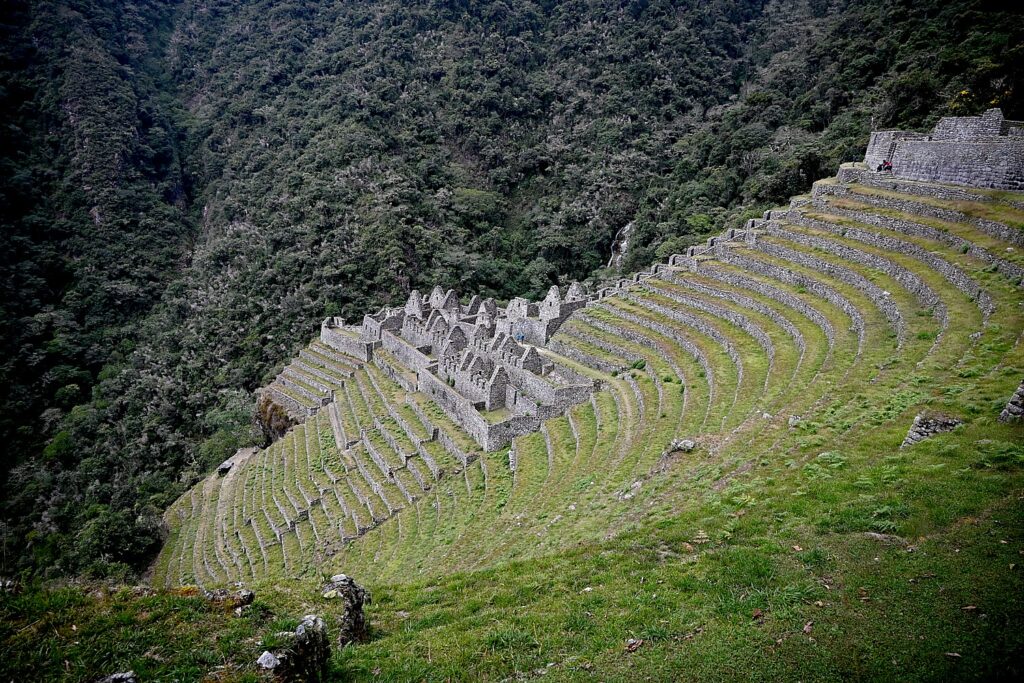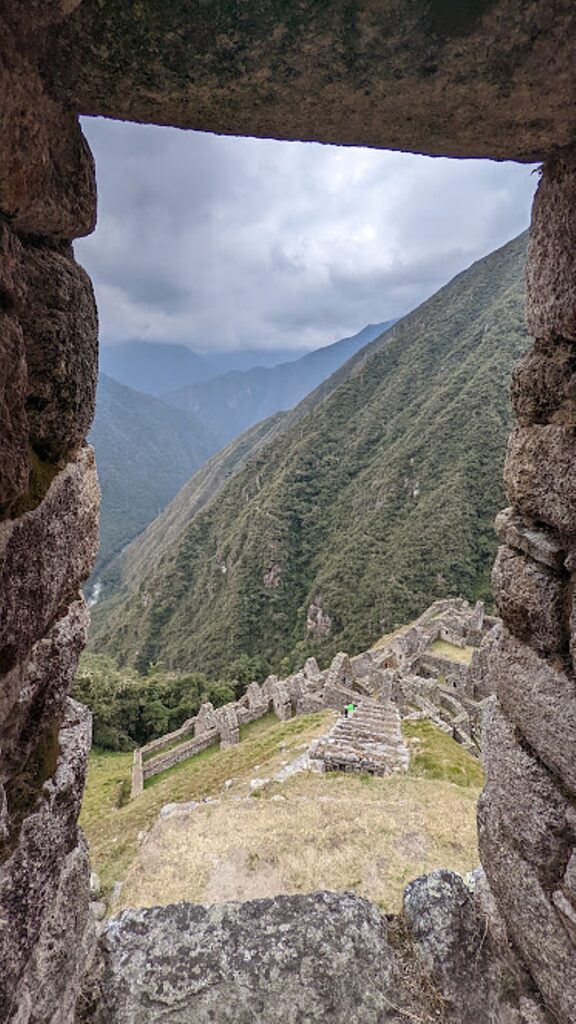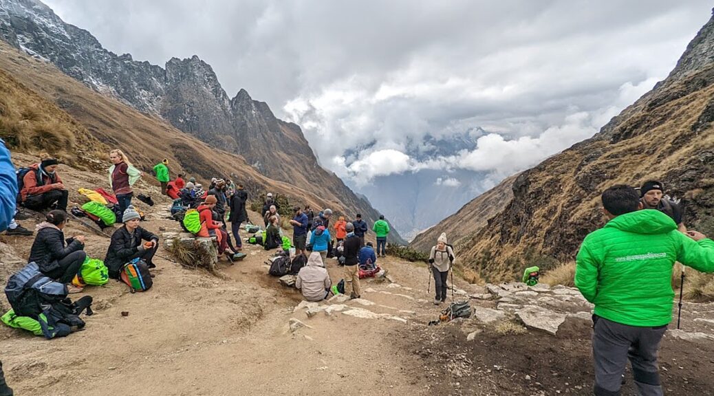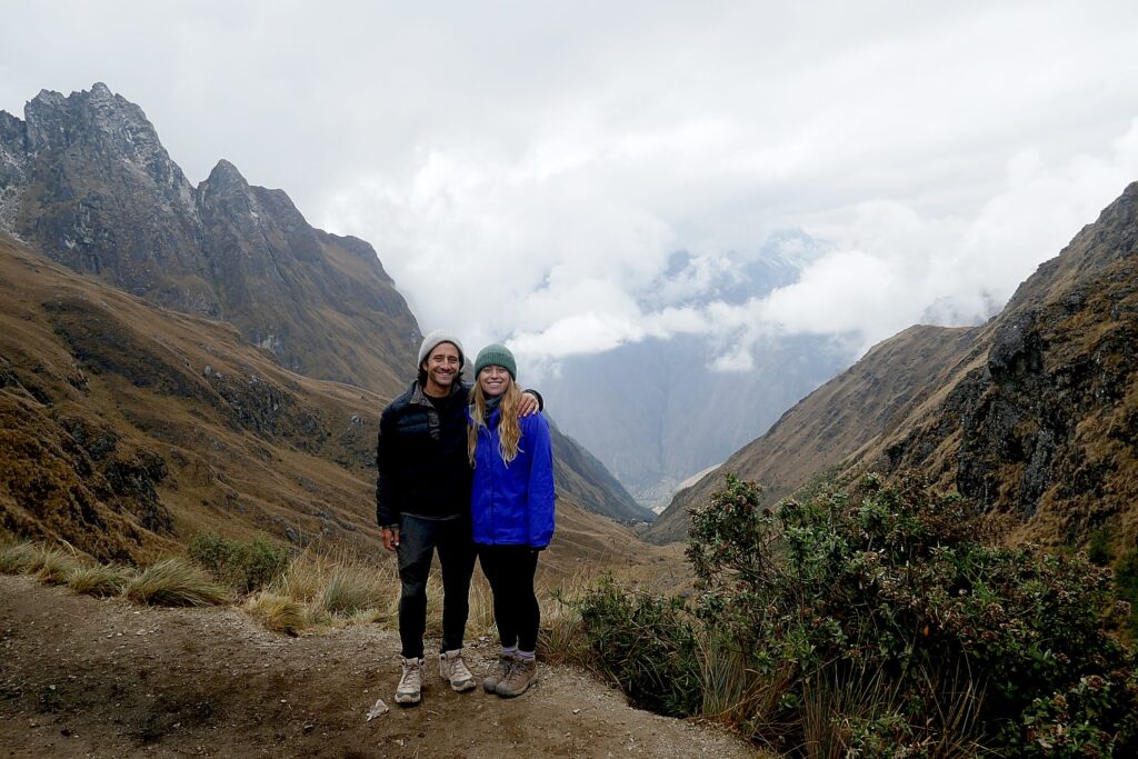
Category Archives: Cultural travel

Utah Adventure Day 1-2: Capitol Reef’s Colorful Canyons

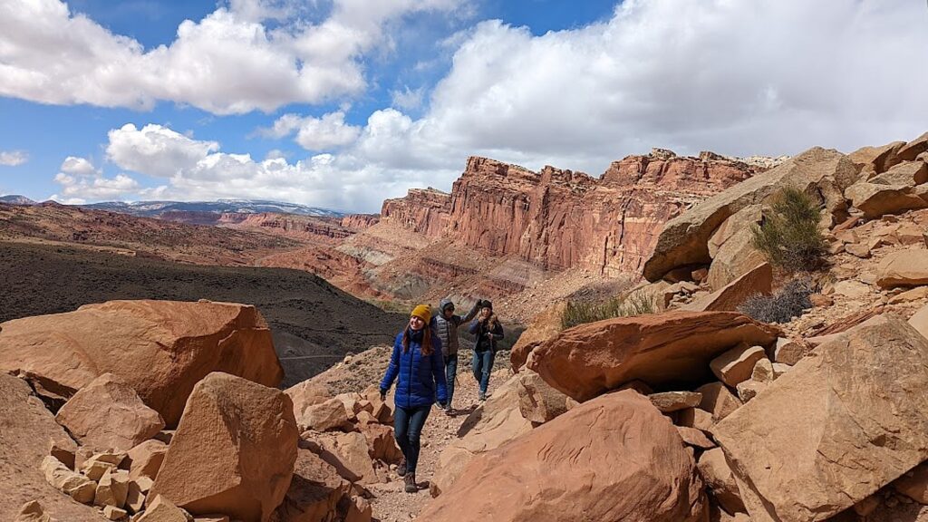
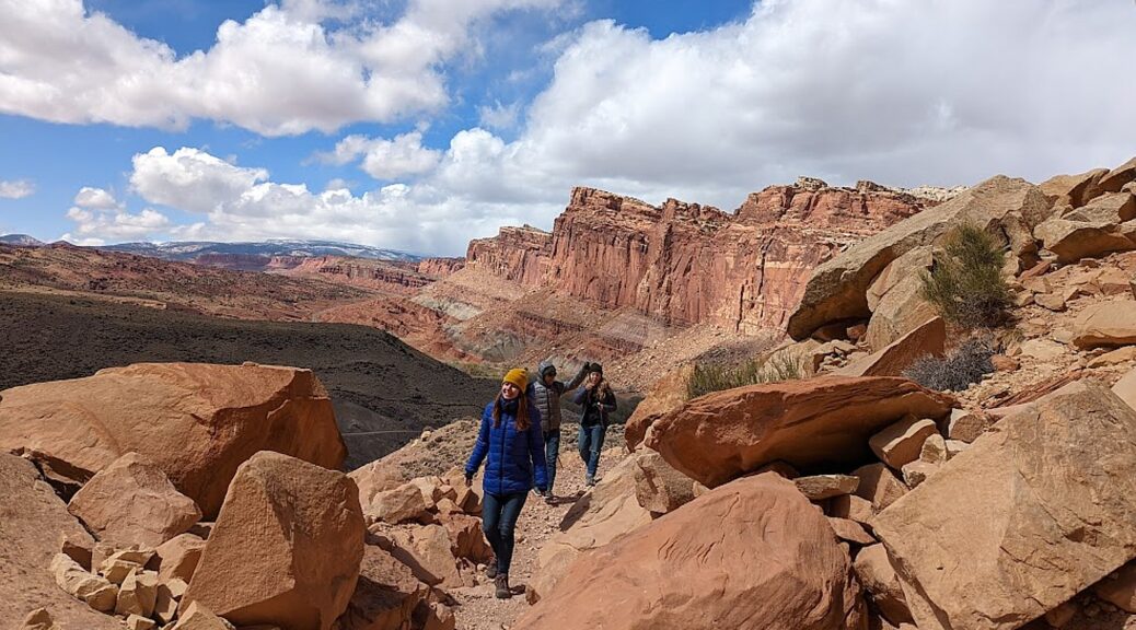
Hiking the Cohab Canyon Trail in Capitol Reef National Park, the first stop our Utah Adventure © Karen Rubin/goingplacesfarandnear.com

By Karen Rubin, with Laini Miranda and Dave E. Leiberman

Travel Features Syndicate, goingplacesfarandnear.com

Travel is as much about resilience, adaptability and problem-solving, as it is about personal growth, rejuvenation, and human connection. And so, though our intent was to camp (mostly wild camping) for our 8-day expedition through Utah’s wilderness and immerse ourselves in the topography and indigenous culture, the forecast for the first half of our trip in mid-April was for temps down to the 20s. In fact, when we arrived, there was a fierce gale-force wind blowing at 60 mph that pushed our rental Jeep around and made it difficult even to open the door.

Laini and Dave have taken the temperature into account and fortunately booked a spacious two-bedroom AirBnB in Teasdale (https://www.airbnb.com/rooms/41151071) just outside Capitol Reef National Park for our first night, and a one-room cabin at Canyons of Escalante RV Park for two nights in Escalante (where Dave has arranged for delivery of winter-grade sleeping bags and pads from Moosejaw.com).

Laini and Dave – who are making their third trip back to Utah and have invited their friend Alli and me to join – have carefully planned the itinerary. Each day has its own highlight and each destination its own topography and character and therefore, the experience we have. At Capitol Reef National Park it is the colored rock formations; Grand Staircase Escalante National Monument (for hard-core adventurers) offers slot canyons and hoodoos; Lake Powell in the Glen Canyon Recreation Area is our boat expedition into the flooded canyon; Cedar Mesa offers hiking expeditions in search of cliff dwellings and petroglyphs; and Arches National Park offers the most dramatic, expansive landscapes.

Fortunately, during the course of our trip, just about all the hikes and experiences we have are new for Dave and Laini. 

We land at Salt Lake City Airport and pick up an off-road Jeep capable of plowing through deep gravel and sand from Alamo, and set out for the four-hour drive. Laini has planned to stop off at Walmart in Provo along the way to pick up food and camping supplies, and we find a delightful coffee shop (Java Junkie) for a snack and what becomes our all-time favorite coffee (Isis Roasters’ Grogg). 
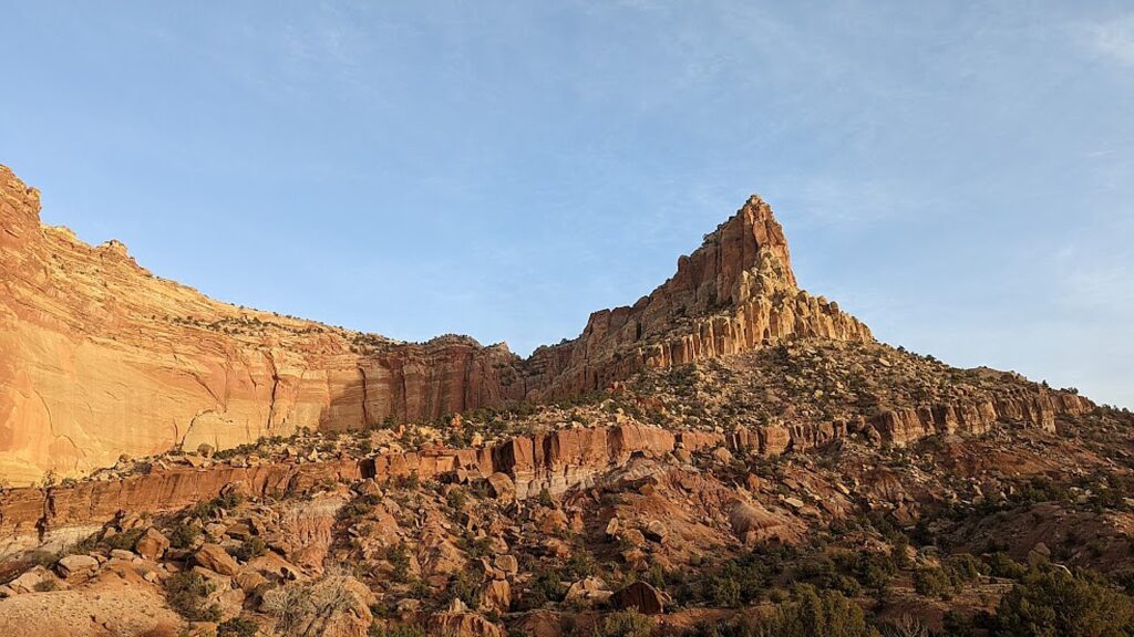
Gorgeous views from the Scenic Drive through Capitol Reef National Park © Karen Rubin/goingplacesfarandnear.com

We arrive at Capitol Reef in the late afternoon and (I suggest) we take advantage of the gorgeous light and weather and drive the Scenic Drive to get a sense of the park. It is utterly perfect – the warm light, rich colors – and we get such a wonderful introduction.

The Scenic Drive is a 7.9 mile (12.7 km) paved road, suitable for passenger vehicles. You would need about an hour and half roundtrip to drive the Scenic Drive and the two dirt spur roads, Grand Wash and Capitol Gorge which go into canyons and lead to trailheads. (You can follow the Park Service’s Virtual Tour: https://www.nps.gov/care/planyourvisit/scenicdrive.htm; the tour is free but you still need to pay the $20 park entrance fee when you drive the Scenic Drive – though my America the Beautiful Pass satisfies.)

(The Scenic Drive, Grand Wash, and Capitol Gorge roads can be closed due to snow, ice, mud, and flash floods. Check at the visitor center or call 435-425-3791, for possible road closures.)

‘A Wrinkle in the Earth’s Crust’

“A Wrinkle in the Earth’s Crust” is the poetic description of Capitol Reef – referring to how this stunning landscape was formed. “The light seems to flow or shine out of the rock rather than to be reflected from it,” is how Clarence Dutton, a geologist and early explorer, described it in the 1880s.
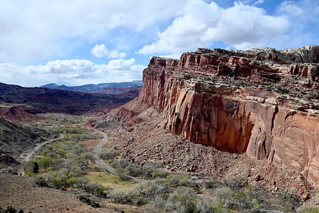
Capitol Reef’s topography was caused by intense crustal pressure which reactivated a fault buried deep beneath the sedimentary rock layers of the Colorado Plateau. This caused the overlying sedimentary rock layers to fold or bend into a one-sided slope called a monocline © Karen Rubin/goingplacesfarandnear.com

Located in south-central Utah in the heart of red rock country, Capitol Reef National Park is a tapestry of cliffs, canyons, domes, and bridges. What makes Capitol Reef so special is how the rock layers tilt. The notes say that this was caused by intense crustal pressure which reactivated a fault buried deep beneath the sedimentary rock layers of the Colorado Plateau. This caused the overlying sedimentary rock layers to fold or bend into a one-sided slope called a monocline, which is uplifted 6,800 feet higher on the west side.
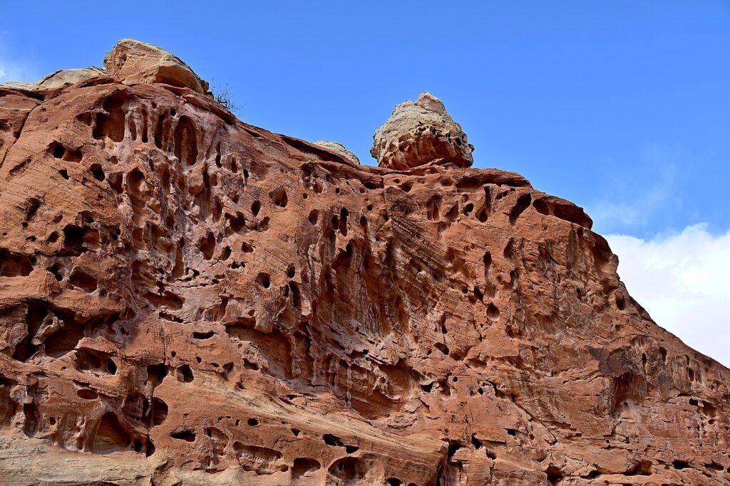
The Waterpocket Fold is named for the numerous small potholes, tanks, or “pockets” that hold rainwater and snowmelt and extends almost 100 miles from Thousand Lake Mountain to Lake Powell © Karen Rubin/goingplacesfarandnear.com

It is named the Waterpocket Fold because of the numerous small potholes, tanks, or “pockets” that hold rainwater and snowmelt and extends almost 100 miles from Thousand Lake Mountain to Lake Powell. The Waterpocket Fold  has been impacted and shaped over eons by the geological processes of erosion, deposition, and uplift, all playing a part in the “drama” of Capitol Reef. This geologic feature is what accounts for the vibrant palette of constantly changing hues, as the light hits the towering cliffs, massive domes, arches, bridges and twisting canyons.

On the way back from our Scenic drive, we stop at a fascinating site, the Fremont Culture petroglyphs, not far from the Capitol Reef Visitor Center. The petroglyphs are reached after a short stroll on two boardwalks. The shorter boardwalk provides views of large, anthropomorphic (human-like) petroglyphs, zoomorphic (animal) petroglyphs of bighorn sheep and other animals, as well as geometric designs; the longer boardwalk parallels the cliffs and the petroglyphs along it are closer to the viewer but harder to see because of a patina that has developed over them.
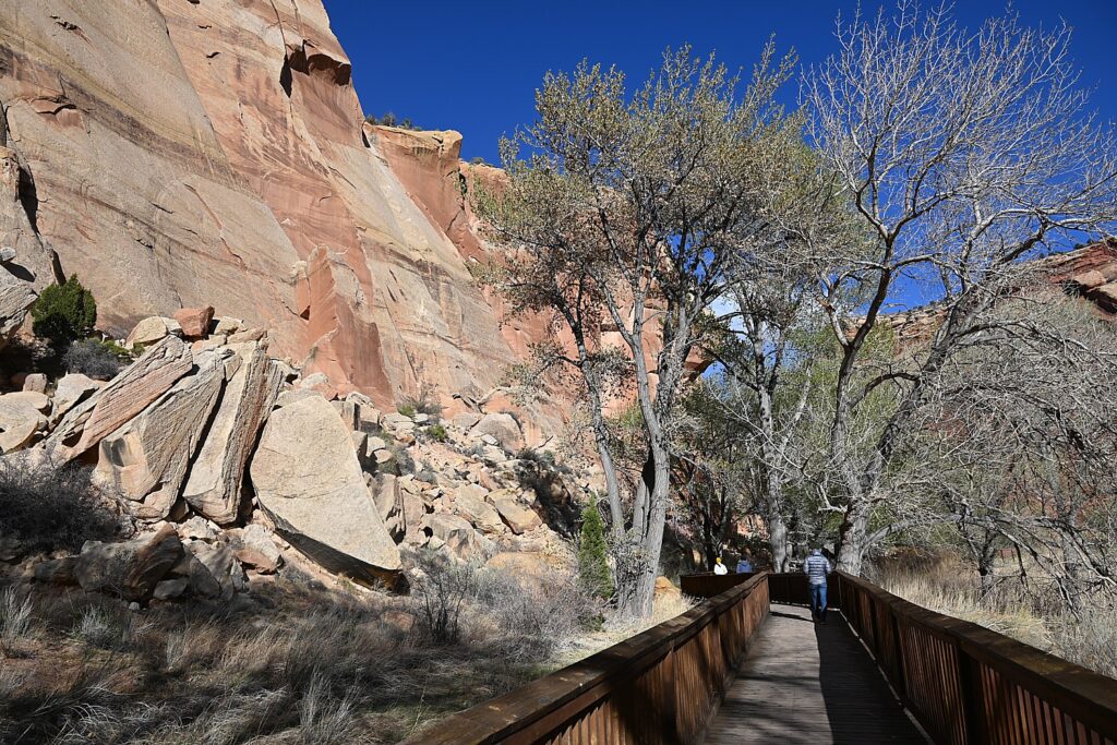
Walk a short boardwalk to see the Fremont Culture petroglyphs © Karen Rubin/goingplacesfarandnear.com

The indigenous people who lived in what is now Utah for about 1000 years, from 300-1300 CE are known as The Fremont Culture, named by the archaeologists for the Fremont River canyon where they were first defined as a distinct culture. These petroglyphs (images carved or pecked into stone) are one of the most visible aspects of their culture that remains, according to the historic panels at the site.
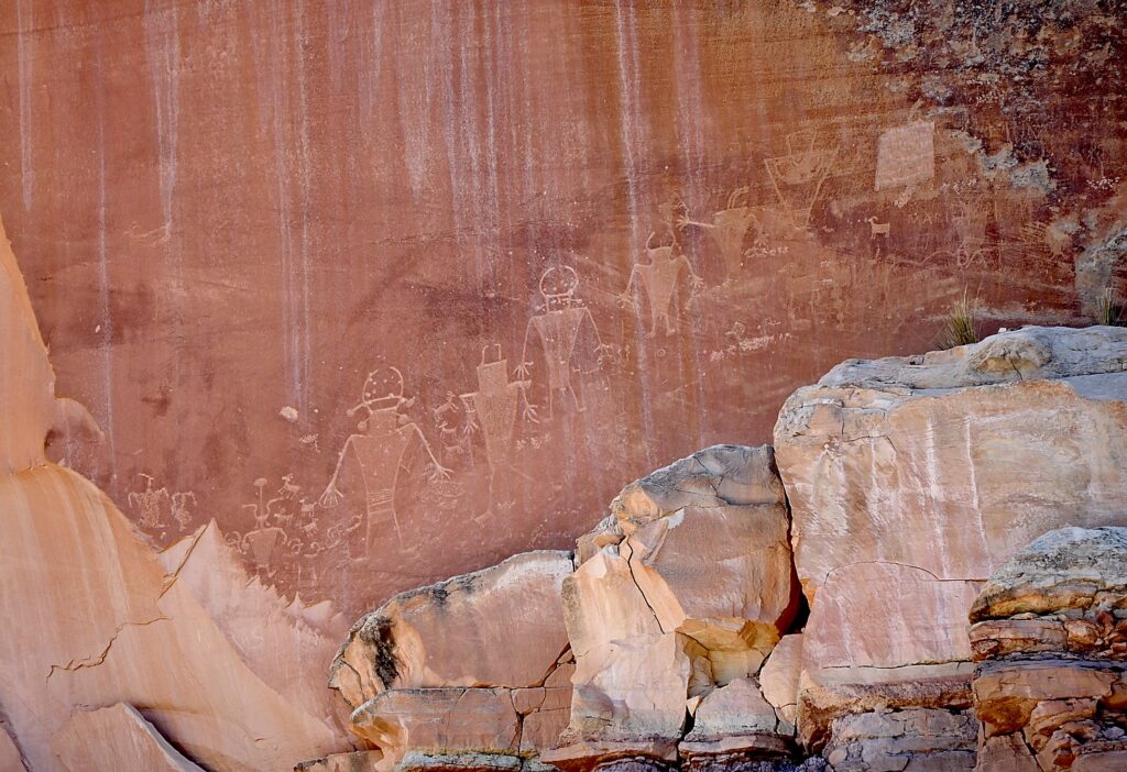
Writing or art? Or Both? The Fremont Culture petroglyphs © Karen Rubin/goingplacesfarandnear.com

Prehistoric people of Fremont Culture used area rock for tools and projectile points, and for the foundations of their homes. Clay was used for pottery, construction and to make figurines. Fertile floodplains supported crops of corn, beans, and squash along the streams of Capitol Reef until about 1300 CE.

(You can link to the audio guide, narrated by Rick Pickyavit, whose Southern Paiute ancestors lived here when the settlers arrived in the 1880s. https://www.nps.gov/care/learn/historyculture/fremont-culture-petroglyphs.htm)
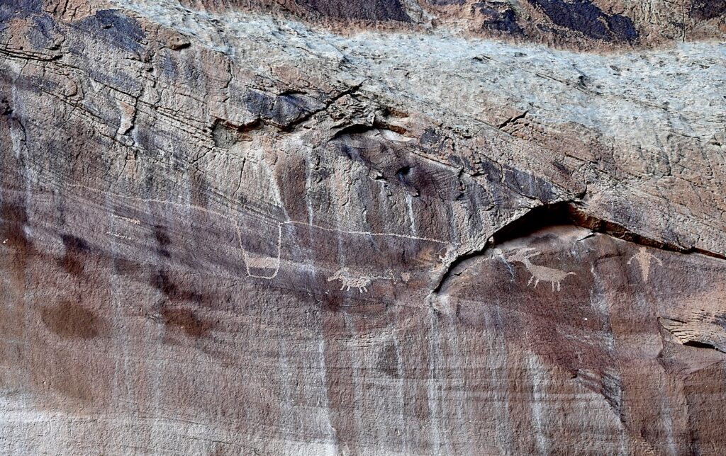
Writing or art? Or Both? The Fremont Culture petroglyphs © Karen Rubin/goingplacesfarandnear.com

Pickyavit says that unlike his ancestors, who were nomadic, the Fremont people settled in these canyons and became farmers and hunter-gatherers. It is not known if they were related to the better-known Ancestral Puebloans. What is known about the Fremont people’s daily lives comes mainly from artifacts and from these petroglyphs, but it is not known where they came from or why they left suddenly in the 13th century (though I believe it is now widely accepted that the people left after a historic, 20-year drought). “As you walk these paths and hidden places, do not even touch the petroglyphs. Protect their legacy, even as I respect it.”

It is natural to imagine the meaning of the images, but, Pickyavit says, “Caution must always rule in the interpretation of petroglyphs. With few exceptions, we cannot really be sure what the ancient maker of the petroglyphs had in mind. Some consider almost all petroglyphs a form of writing, while others consider most of them to be art, not writing. The large trapezoid-shaped human figures excite interest. Many have headgear and horns. Figures are commonly seen with necklaces, earrings and sashes. Animals, especially bighorn sheep, appear in many petroglyphs, indications that they were hunted and perhaps revered.”

I wonder, since these were created by different people in different times, isn’t it possible some were messages (writing, information) and some were art?
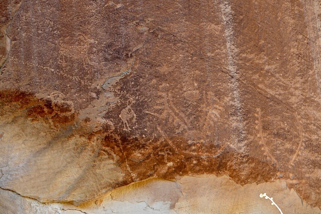
Writing or art? Or Both? The Fremont Culture petroglyphs © Karen Rubin/goingplacesfarandnear.com

He notes that “Following the disappearance of the Fremont people in the 13th century, no one resided in the Waterpocket Fold country for 500 years. During this time, however, Ute and Southern Paiute hunters and gatherers roamed the region. They lived in close harmony with the natural environment and left little evidence of their presence.”

We stop in Torrey at the Torrey Grill and BBQ which offers a sheltered outdoor setting complete with firepit (we are still concerned about COVID) and is serving late.

The wind is still howling when we get to the AirBnB – home with gorgeous interior design, so cozy and comforting. I wake in the middle of the night to a blizzard – gale force winds, giant flakes of snow – that leaves 3-5 inches by morning. I feel (without hyperbole) we would have died –crushed under the snow or frozen to death – had we camped. I imagine us in some Survivor (or Disaster) movie based on fact (not the last time this image occurs to me during our Utah Adventure).

Hiking Capitol Reef National Park
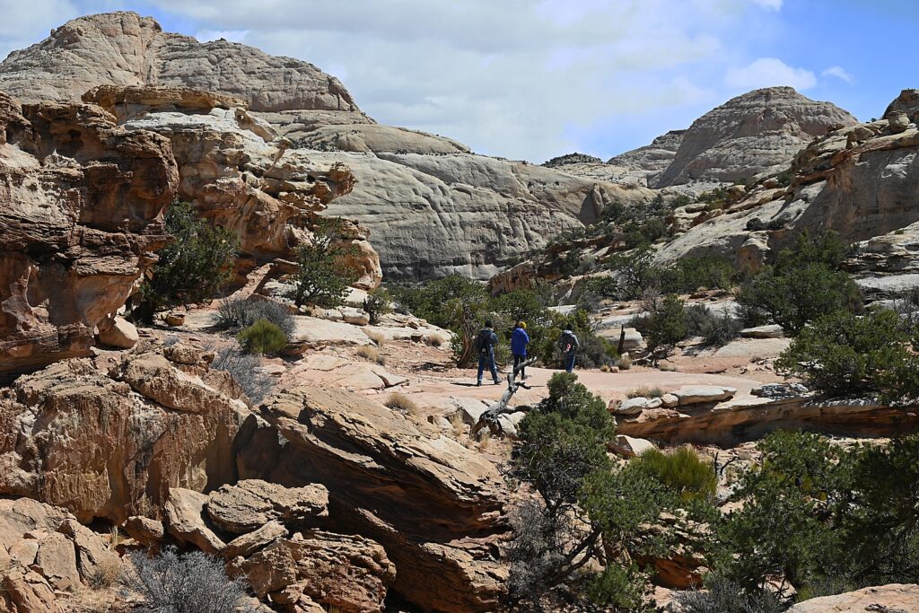
The Hickman Bridge trail is a perfect first hike in Capitol Reef National Park © Karen Rubin/goingplacesfarandnear.com

Considering the weather, we phone the Visitor Center to get their recommendation for hikes, and the Ranger recommends Hickman Bridge and Cohab Canyon, both in the nearby Fruita area (435-425-2791). The snow, so gorgeous in the morning, is gone by the time we arrive at Capitol Reef but for some oddly frozen patches, and we have perfect winter hiking weather.

Both these trails are extremely popular – and for good reason.
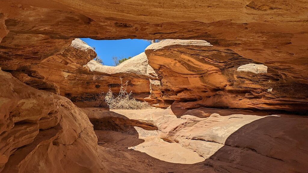
Gorgeous arches, formations and colors along the The Hickman Bridge trail makes it one of the most popular hikes in Capitol Reef National Park © Karen Rubin/goingplacesfarandnear.com

Hickman Bridge Trail, just 1.8 miles roundtrip, is the most popular trail (so the most crowded): it is geologically fascinating, relatively easy, great for families, with each step offering stunning visuals – red rock with beige and blond striations, textures, overhangs – and eminently doable to get the full  appreciation, with the climax of a spectacular arch. The hike encapsulates for us what Capitol Reef is about.
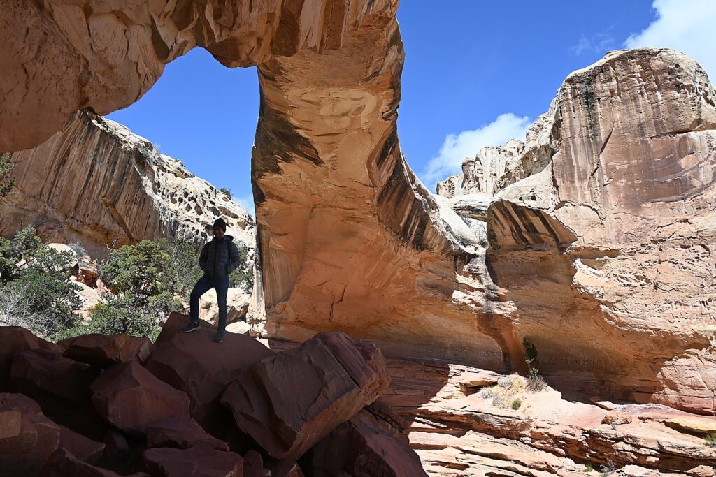
The Hickman Bridge, Capitol Reef National Park © Karen Rubin/goingplacesfarandnear.com

Along the Hickman Bridge Trail, you see high-desert views, traces of prehistoric American Indian culture, and evidence of the Civilian Conservation Corps’ work in the 1940s. After ascending through a scenic sandstone side-canyon, the trail loops under the grand 133-foot span of the Hickman Natural Bridge. This is considered a “moderate” trail, but I would say it is easy. What an introduction!
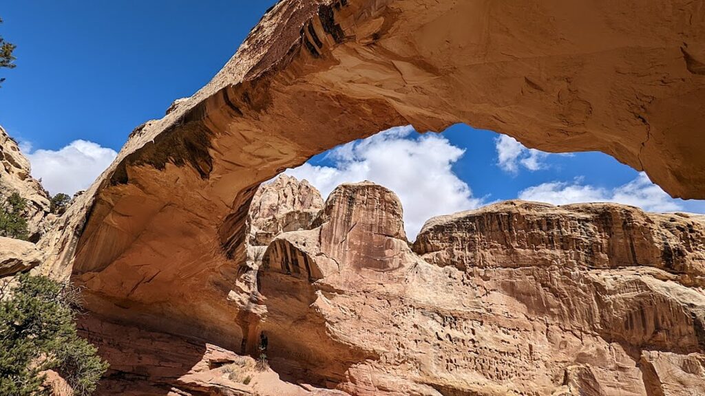
The 133-foot span of the Hickman Bridge, Capitol Reef National Park © Karen Rubin/goingplacesfarandnear.com

From the same parking lot (and when it’s popular, it may well be difficult to find a parking spot so you have to wait for one to open), you can walk something like two miles to one end of the Cohab Trail. We smartly decide to move the car to a small, dirt parking lot, 1.2 miles down the Scenic Drive from the Capitol Reef Visitor Center, diagonally across from the picturesque historic Pendleton Barn, to access the trailhead at the other end (actually it is the beginning).  (If this dirt parking lot is filled, you can backtrack 2/10 mile and park at the picnic area.)
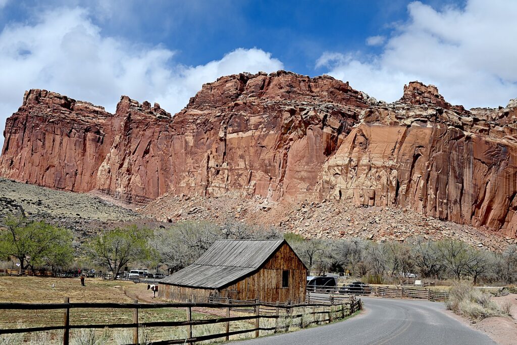
The picturesque, historic Pendleton Barn across from the Cohab Canyon trailhead © Karen Rubin/goingplacesfarandnear.com

We have our lunch in the picnic area before starting out on the Cohab Trail.

Cohab Canyon trail is of easy-to-moderate difficulty with gorgeous vividly-colored rock formations and shapes. The first 0.3 mile is a tad steep (I’m glad I brought my hiking poles for this hike). A series of switchbacks lift you up 400 feet, all the while you gaze out at gorgeous views of the Johnson Mesa and Fruita Cliffs. But once within the canyon, the hiking is fairly easy.  
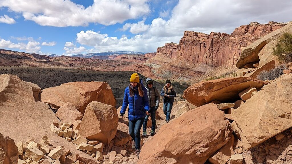
Hiking the Cohab Canyon Trail in Capitol Reef National Park, the first stop our Utah Adventure © Karen Rubin/goingplacesfarandnear.com

Cohab Canyon is called a “hanging canyon” because it sits above the Fremont River floodplain. The entire trail is so beautiful – we come upon a few slots to explore, a 20-foot high mushroom shaped hoodoo (a tree is growing out of the top!) surrounded by slickrock, the Cohab Canyon arch, then some stunning overlooks of the valley and Fruita.
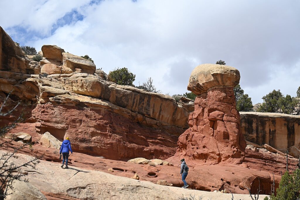
A 20-foot high mushroom hoodoo on the Cohab Canyon Trail, Capitol Reef National Park © Karen Rubin/goingplacesfarandnear.com

We opt not to do the whole hike, which goes 2.9 miles one way to the Hickman Trail parking lot (which would require taking a shuttle back, or, if you do the round trip, would take 4 hours). We hike in about 1.7 miles and return.
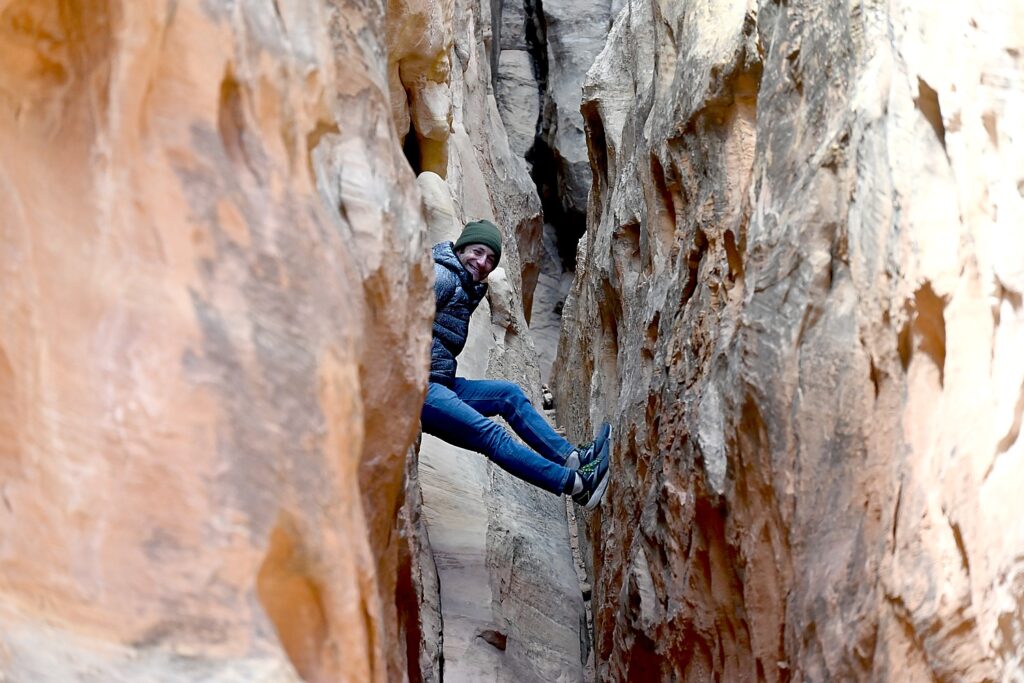
Dave ventures into a small slot off the Cohab Canyon Trail, Capitol Reef National Park © Karen Rubin/goingplacesfarandnear.com

The two hikes – Hickman and Cohab Canyon – afford a very different experience, though both offer dramatic landscapes that are signature Capitol Reef. Hickman is well-traveled, ideal for families, and you feel like a tourist – but Cohab Canyon is all but devoid of other people so you feel the isolation (even if you do come upon another hiker here and there).
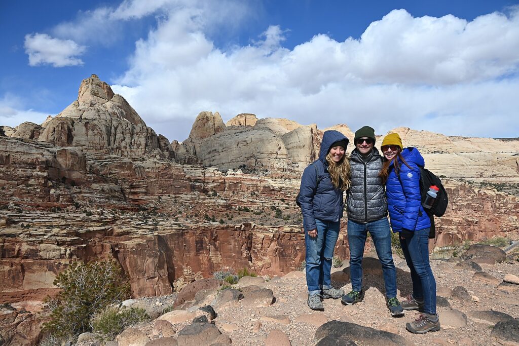
The climatic view from the Cohab Canyon Trail hike, Capitol Reef National Park © Karen Rubin/goingplacesfarandnear.com

Laini had The Castle Trail hike on her to-do list but unfortunately, we don’t have the time. (It’s described as an old trail that apparently is no longer “advertised” to the enigmatic “back side” of the Castle, exploring a hidden canyon lined with mammoth boulders and violet-colored hoodoos, taking about two hours.)  

You can see the cragged hunk of The Castle from just outside the Visitor Center. One of Capitol Reef National Park’s iconic landmarks, The Castle is a prominent sandstone formation made up of three primary layers: the bottom sandstone layer, the Moenkopi Formation, is 245 million years old; the middle gray-green layer, the Chinle Formation, was laid down as volcanic ash 225 million years ago; the top layer, including the Castle, Wingate Sandstone, formed 200 million years ago.
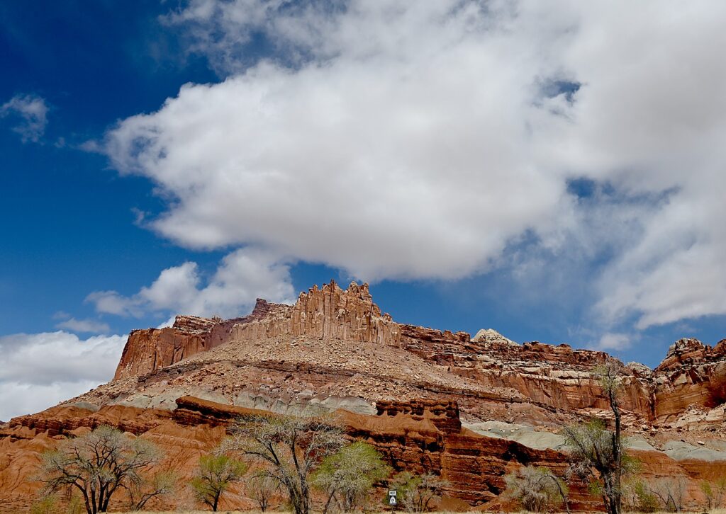
The Castle, one of Capitol Reef National Park’s iconic landmarks © Karen Rubin/goingplacesfarandnear.com

Also, though we didn’t hike Grand Wash on this trip, Laini and Dave hike it on their next one and highly recommend entering through the lower trailhead for an easy 20-30 minute walk through the most dramatic and narrowest part of the canyon, with towering walls over 100 feet overhead.

In the Fruita area, there are 15 hiking trails with trailheads located along Utah Highway 24 and the Scenic Drive. These offer a wide variety of hiking options from easy strolls over level ground to strenuous hikes involving steep climbs over uneven terrain near cliff edges. Round trip distances range from a mere quarter mile to 10 miles, and are well-marked with signs at the trailhead and at trail junctions and by cairns (stacks of rocks) along the way. Some trails have self-guiding brochures, available for a fee at the trailhead and visitor center.

The best detailed descriptions of these hikes are available at https://liveandlethike.com/category/utah/capitol-reef-national-park/

Capitol Reef also offers many hiking options for serious backpackers and those who enjoy exploring remote areas. Minimally marked hiking routes lead into narrow, twisting gorges, slot canyons, and to spectacular viewpoints high atop the Waterpocket Fold. Popular backcountry hikes in the southern section of the park include Upper and Lower Muley Twist Canyons and Halls Creek and in the Cathedral Valley area. A backcountry permit is required for camping outside of established campgrounds. The permit is free and can be obtained in person at the visitor center during normal business hours.

Capitol Reef offers so much to explore, Laini says, you really need more time there. Tourists overrun the main part, but there is a whole “backcountry” side that most miss.

See: https://www.nps.gov/care/planyourvisit/trailguide.htm  and https://www.nps.gov/care/planyourvisit/hiking.htm

Scenic Byway 12

Driving out of Capitol Reef we come to an overlook just as the sun is at a perfect angle to make the red rocks blaze.

We drive 64 of the 124 miles of the Scenic Byway 12 to Escalante. Scenic Byway 12 is Utah’s first “All-American Road,” (and one of Laini’s favorite roads in the country) winding through vast slickrock benches and canyons. We reach the summit, 9,600 feet – and the temp has dropped to 15 degrees – with sweeping vistas of the Henry Mountains, Grand Staircase–Escalante National Monument and Capitol Reef National Park.
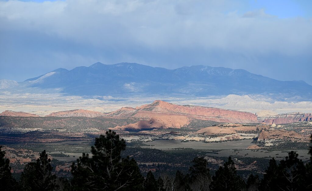
The view back to Capitol Reef National Park as we drive along Scenic Byway 12 © Karen Rubin/goingplacesfarandnear.com

Because the forecast had been for temps in the 20-30s, Dave and Laini booked a cabin  at Canyons of Escalante RV Park, right in Escalante. It is one room for the four of us– very cozy (we still have to go outside for the bathroom, so we have that camping experience). And we’re able to have dinner at one of their favorite places from their previous adventures, Escalante Outfitters, serving up the best pizza outside of New York.
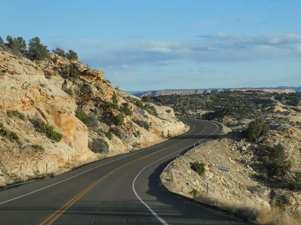
Driving on Scenic Byway 12 from Capitol Reef National Park to Escalante © Karen Rubin/goingplacesfarandnear.com

I find this day’s hikes in Capitol Reef perfect to acclimate and just become immersed in the spectacular scenery. And, I soon find out, these hikes are so very different from what we have yet to experience in the Grand Staircase-Escalante, where our Utah Adventure continues. Because Grand Staircase-Escalante National Monument is for more hardcore hikers.

Next: Grand Staircase-Escalante

______________

© 2023 Travel Features Syndicate, a division of Workstyles, Inc. All rights reserved. Visit goingplacesfarandnear.com, www.huffingtonpost.com/author/karen-rubin, and travelwritersmagazine.com/TravelFeaturesSyndicate/. Blogging at goingplacesnearandfar.wordpress.com and moralcompasstravel.info. Visit instagram.com/going_places_far_and_near and instagram.com/bigbackpacktraveler/ Send comments or questions to [email protected]. Tweet @TravelFeatures. ‘Like’ us at facebook.com/KarenBRubin
Long Island Has New Destination Attraction: Long Island Music & Entertainment Hall of Fame Opens in Stony Brook

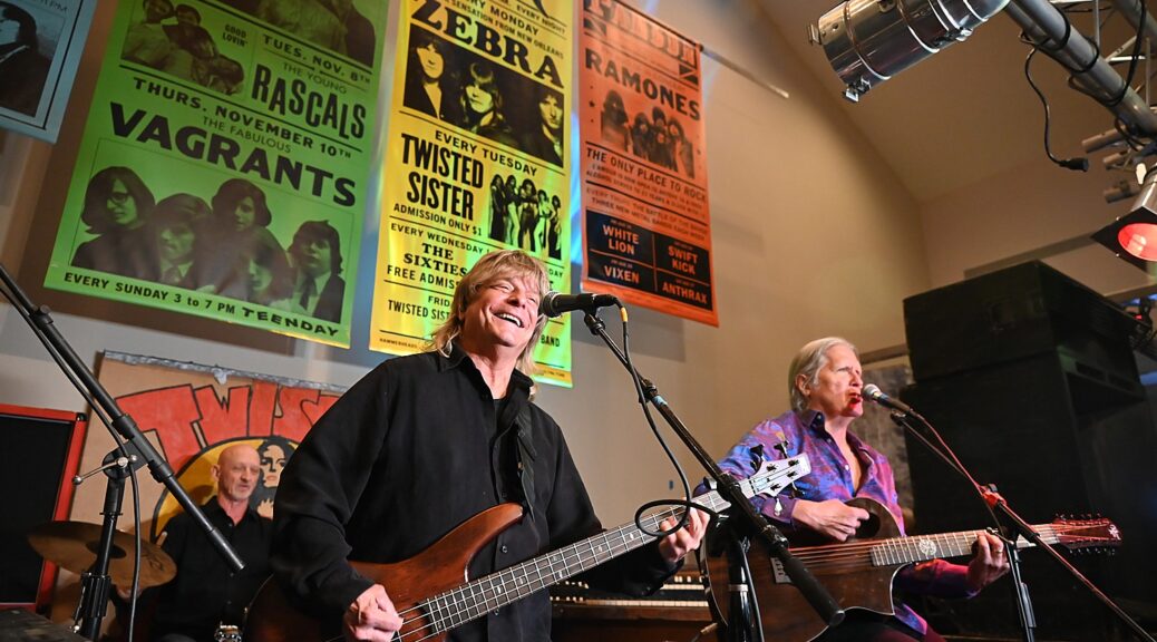
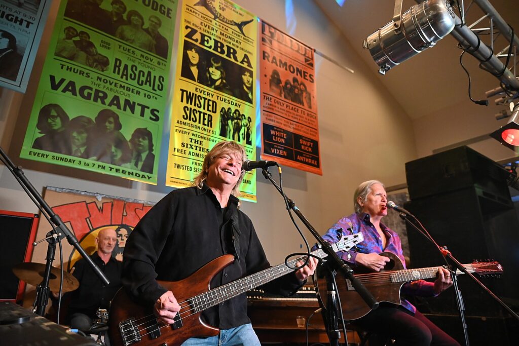
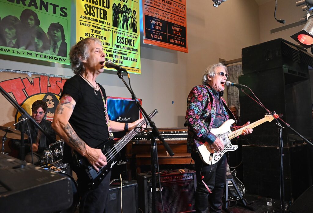
Guitarist Randy Jackson, bassist Felix Hanemann and drummer Guy Gelso of Zebra perform under a vintage poster from way back when, at the opening of the Long Island Music & Entertainment Hall of Fame and Museum © Karen Rubin/goingplacesfarandnear.com

By Karen Rubin, Travel Features Syndicate, goingplacesfarandnear.com

Your eyes open wide as you enter the new, permanent location of the Long Island Music & Entertainment Hall of Fame, housed in a former Ward Melville Historical Organization building in historic Stony Brook Village, and realize the prominent musicians who grew up, got their start, built their careers on Long Island. That is, the whole of Long Island, from Queens and Brooklyn through Nassau and Suffolk.

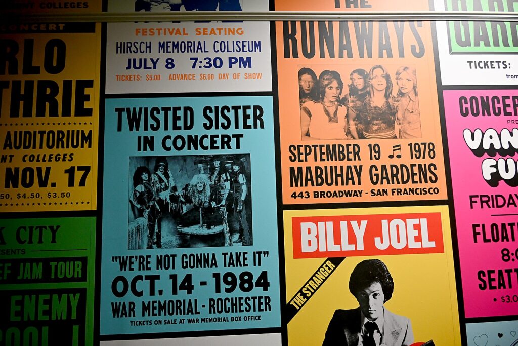
While the Hall of Fame has been inducting honorees since 2004, this is its first permanent home, so is the first opportunity to really see the breadth and depth of the talent nurtured on the island. And it is so much fun to see the original posters, costumes, musical instruments, memorabilia from inductees including Twisted Sister, Zebra, Blue Oyster, Public Enemy, Vanilla Fudge, even Billy Joel’s actual motorcycle and Joan Jett’s 1983 Jaguar.

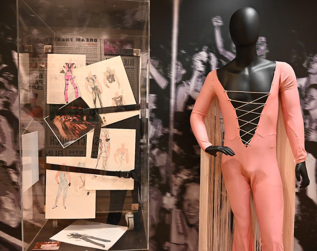
Dee Snider, frontman of Twisted Sister, donated 12 costumes that hadn’t been seen in years, designed by Suzette Snyder © Karen Rubin/goingplacesfarandnear.com

Jay Jay French, founding member and bassist of the heavy metal band Twisted Sister, manager and record producer, went so far as to declare, “Without Long Island, Brooklyn and Queens, you got nothing.  The circuit never existed before, and will never exist again.”

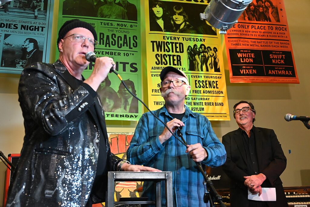
Jay Jay French of Twisted Sister; Kevin O’Callahan, Hall of Fame creative director and board member;  and Ernie Canadeo, LIMEHoF chairman © Karen Rubin/goingplacesfarandnear.com

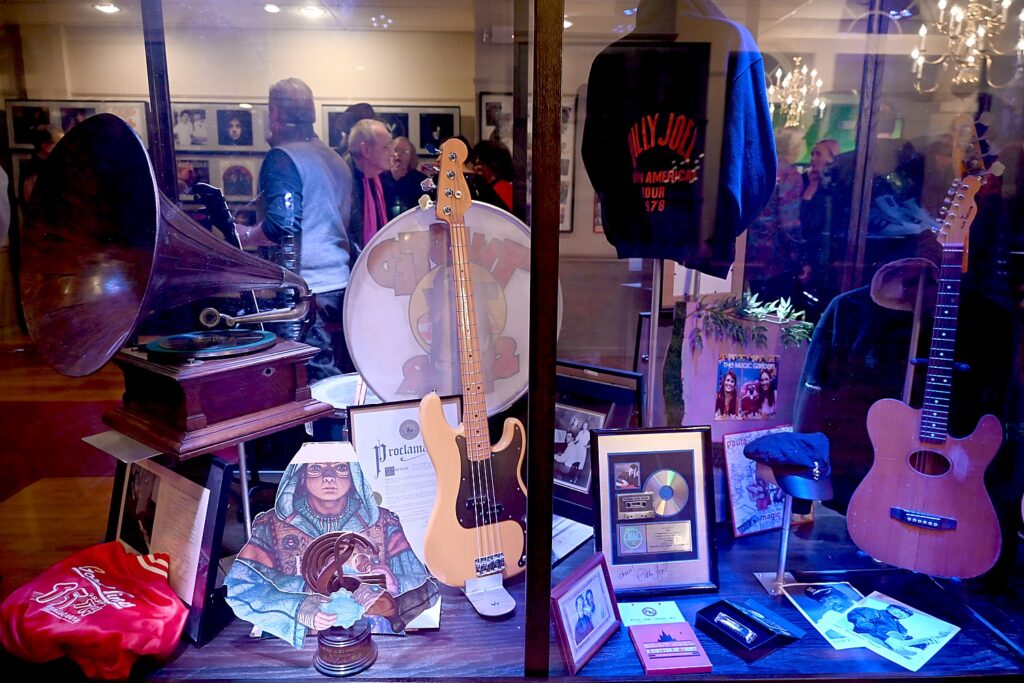
That might be hyperbole, but he can be forgiven when you go up to the second floor, where there is the “Hall of Fame” with plaques and exhibits that recognize over 120 inductees, displayed across the walls the inductees year by year. In fact, you can easily imagine they will soon run out of wall space entirely when beginning next year, they also induct people from television and film. There are also cases chock full of memorabilia such as Perry Como’s Emmy (you have to really search – it’s like an attic).

An eclectic assemblage of memorabilia from Long Island Music and Entertainment Hall of Famers © Karen Rubin/goingplacesfarandnear.com

There are also areas for a library, classrooms for educational programs, and master classes, a surround sound theater, and a gift shop with music and entertainment-themed memorabilia.

Having an actual space means that the Hall of Fame also can present special exhibits.

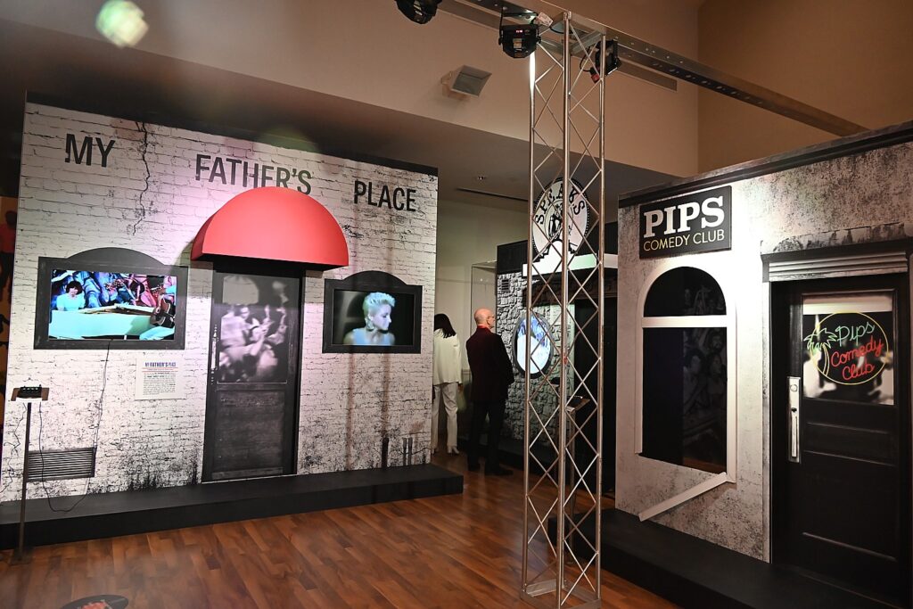
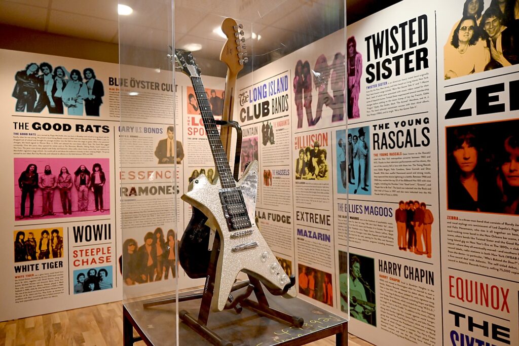
Created by renowned designer Kevin o’Callaghan, “Long Island’s Legendary Club Scene – 1960s-1980s” is laid out to be like a club crawl, sparking those pangs of nostalgia for those places © Karen Rubin/goingplacesfarandnear.com

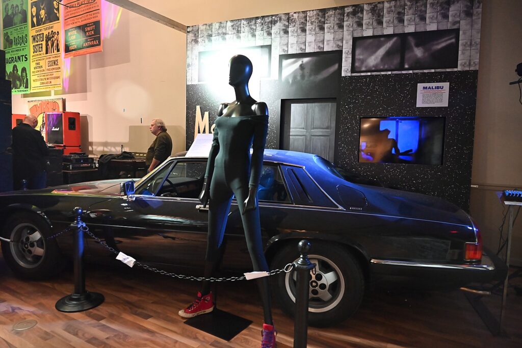
Its first exhibit now on display re-creates those cherished clubs. Created by renowned designer Kevin o’Callaghan, “Long Island’s Legendary Club Scene – 1960s-1980s” is laid out to be like a club crawl, sparking those pangs of nostalgia for those places. The exhibit features replicas of clubs – My Father’s Place, The Mad Hatter in Stony Brook, Oak Beach Inn, Malibu in Lido Beach, Speaks in Island Park and Pips Comedy Club in Brooklyn -with videos of artists performing, ads, posters, instruments. There is also a replica of a typical 1960s stage, complete with vintage equipment and sound system (donated by Zebra).

At the opening, guitarist Randy Jackson, bassist Felix Hanemann and drummer Guy Gelso of Zebra performed on that stage with the very sound equipment they used at clubs in the 1970s and donated to the museum (in order to better re-create the sound), and below a poster which showed their 1970s selves. Surreal time warp.

Blue Öyster Cult perform at the opening of the Long Island Music & Entertainment Hall of Fame and Museum © Karen Rubin/goingplacesfarandnear.com

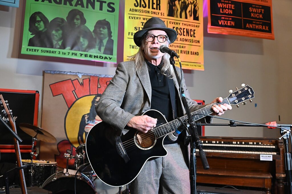
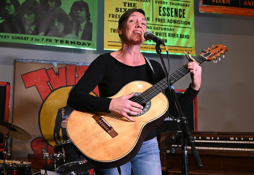
Also performing, bassist Joe Bouchard and drummer Albert Bouchard of Blue Öyster Cult, Paula Janis and Carole Demas of “The Magic Garden,” singer/songwriter Elliott Murphy, and Jen Chapin, daughter of Harry Chapin.

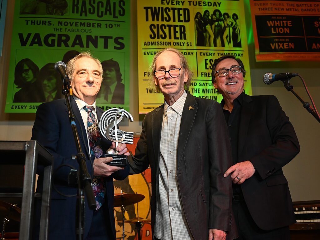
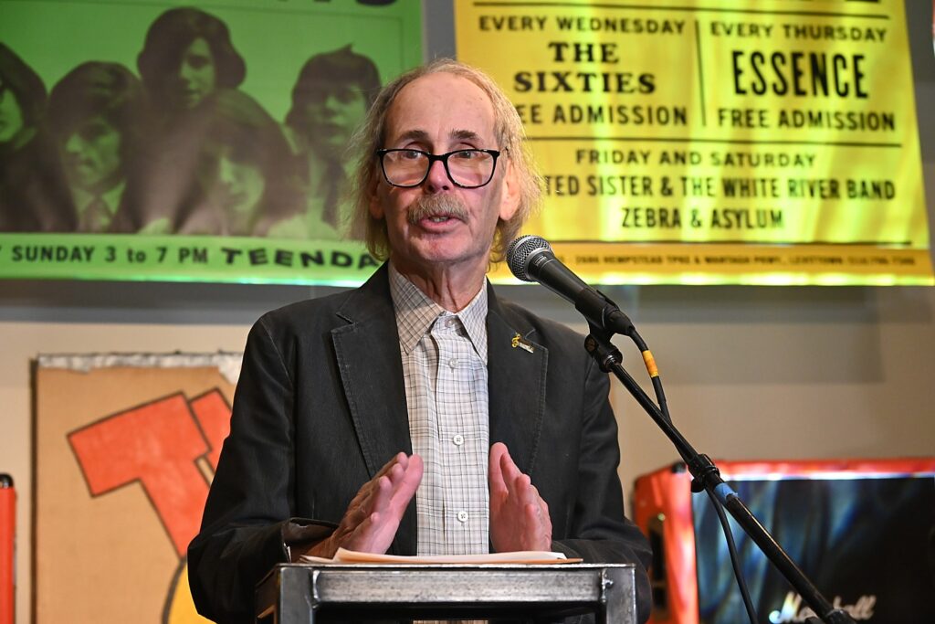
The newest honoree in the Hall of Fame, Wayne Robins, had to wait two years (because of COVID) to officially be inducted. At the official opening, Robins, who for more than 50 years has been a leading music and pop culture journalist, waxed nostalgic as he recalled being at Shea stadium for the Beatles Concert, Diana Ross sitting in his lap at her concert at Westbury Music Fair, using fake ID to get into music venues before he was 18. He began his career in 1972 at CBS Records, then writing for Rolling Stone, the New Musical Express, Melody Maker, the Village Voice and Creem Magazine before joining Newsday in 1975 as its pop music writer, where he worked for the next 20 years.

The 2020 inductee to the Long Island Music & Entertainment Hall of Fame is Wayne Robins, a longtime music and culture journalist, who was presented with his award by Norm Prusslin and Chairman Ernie Canadeo © Karen Rubin/goingplacesfarandnear.com
 

Throughout, there are compelling visual elements and artifacts on display. Among the inducted artists who have donated memorabilia, are Billy Joel, Joan Jett, Debbie Gibson, Blue Oyster Cult, Twisted Sister, and the families and estates of Harry Chapin, Guy Lombardo, John Coltraine. Donations include various musical instruments, performance outfits, vintage automobiles and motorcycles, rare posters and photos, and handwritten lyrics.

Jen Chapin, daughter of Harry Chapin, performs at the opening of the Long Island Music & Entertainment Hall of Fame and Museum © Karen Rubin/goingplacesfarandnear.com

Dee Snider, frontman of Twisted Sister, donated 12 costumes that hadn’t been seen in years, designed by Suzette Snyder. Suzette was 15 years old when she first met Dee, having borrowed her cousin’s ID to sneak into a show. She designed an outfit – pink with fringes – and created the ‘Twisted Sisters look’.”

Suzette was 15 years old when she first met Dee Snider. She designed an outfit – pink with fringes – and created the “Twisted Sisters look” © Karen Rubin/goingplacesfarandnear.com

The opening night event included performances by guitarist Randy Jackson, bassist Felix Hanemann and drummer Guy Gelso of Zebra, bassist Joe Bouchard and drummer Albert Bouchard of Blue Öyster Cult, singer/songwriter Jen Chapin, Paula Janis and Carole Demas of “The Magic Garden,” singer/songwriter Elliott Murphy, and Jen Chapin.

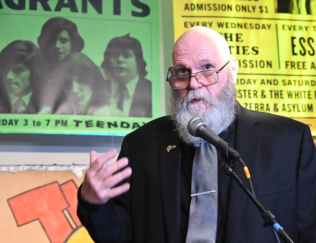
Rich L’Hommedieu, one of the co-founders of the Long Island Music & Entertainment Hall of Fame and Museum © Karen Rubin/goingplacesfarandnear.com

Rich L’Hommedieu, one of the co-founders, said, “The music industry started on Long Island – song sheet sellers came from Manhattan, Jazz musicians who couldn’t afford Manhattan had homes in Queens. Duke Ellington, Louie Armstrong. Then there were the street corner doo wop groups, the hip hop. Garages in suburbia incubated rock bands.

It’s mind-bending to realize how many music groups and musicians have ties to Long Island © Karen Rubin/goingplacesfarandnear.com

In fact, every musical genre is represented among the122  honorees (so far) – there’s Aaron Copland, Brooklyn (2008), Barbra Streisand, Brooklyn (2008), Beverly Sills, Brooklyn (2008), Eddie Palmieri, Queens (2010, George Gershwin, Brooklyn (2006), George M. Cohan, Kings Point (2006), Carole King, Brooklyn (2008), Ervin Drake, Great Neck (2012), Cyndi Lauper, Brooklyn/Queens, (2006), Guy Lombardo, Freeport (2008), Marvin Hamlisch, Westhampton Beach (2008), Morton Gould, Queens/Great Neck (2010, Oscar Brand, Brooklyn/Great Neck (2010), Perry Como, Port Washington (2006), Simon & Garfunkel, Queens (2008), Steve Martin, Long island (2010), Tony Bennett, Queens (2006), Vince Giordano, Brooklyn/Hauppauge (2016), William “Count” Basie, Queens (2008), and Cousin Brucie Morrow, Brooklyn (2018), Arlo Guthrie, Coney Island (2008), LL Cool J, Bayshore (2008) (The full list is mind-blowing.)

It’s mind-bending to realize how many music groups and musicians have ties to Long Island © Karen Rubin/goingplacesfarandnear.com

Among the groups with roots on Long Island: Gary U.S. Bonds; the Lovin’ Spponful; Johnny Maestro & the Brooklyn Bridge; Public Enemy; Salt-N-Pepa; The Ramones; The Shangri-las; The Tokens; Twisted Sister, Vanilla Fudge, Zebra, Blue Oyster Cult, little Anthony and the Imperials

Also among the honorees: My Father’s Place, Dream Theater, WALK 97-5 FM, Westbury Music Fair, Jones Beach theater, Stony Brook University, CSS Security Service.

The idea for the Hall of Fame originated with co-founders Jim Faith, Rich L’Hommedieu and Norm Prusslin, who met at Stony Brook University in the fall of 2003 and by January 2004, launched the nonprofit without any government assistance at all, but with lots of volunteer help.

It was created as a place of community that inspires and explores Long Island music in all its forms. In addition to the Hall of Fame, the organization also offers education programs and scholarships to Long Island students, sponsors the Long Island Sound Award, and features traveling educational exhibits, including a state-of-the-art mobile museum.

Billy Joel’s motorcycle is on view at the Long Island Music & Entertainment Hall of Fame and Museum © Karen Rubin/goingplacesfarandnear.com

In 2014, when the Billy Joel Band was inducted into the Long Island Music and Entertainment Hall of Fame, Billy Joel said this in a statement: “After The Stranger was released, people began to recognize that the ‘Long Island Sound’ wasn’t just a body of water.” Indeed, it isn’t. Over the years, Long Island has produced some of the most talented and accomplished musicians and has become a respected music scene.

But, according to the museum’s history, it didn’t start off that way.

In the late 1960s and early 1970s, the Long Island music landscape was rather barren and more of a stepchild to that of New York City, which had become a focal point of the music industry, with recording sudios and iconic music venues such as Max’s Kansas City, Fillmore East, and Electric Circus. Beside some local bars, schools and Westbury Music Fair (which had sporadic star performances, such as Judy Barland in 1967, The Who in 1968 and Bruce Springsteen in 1975), there were few live venues on Long Island.

Paula Janis and Carole Demas of “The Magic Garden” at the opening of the Long Island Music & Entertainment Hall of Fame and Museum © Karen Rubin/goingplacesfarandnear.com

According to Norm Prusslin, music historian and a founding member of the Long Island Music and Entertainment Hall of Fame, in the late 1960s Stony Brook University, emerged as an important venue to bring music to Long Island.

FM radio stations began popping up on Long Island, giving national recording artists Long Island airplay, and college radio stations began to showcase Long Island’s burgeoning musicians.

 “Long Island college radio stations were important in bringing to the airwaves local musicians of all genres, and that certainly contributed to Long Island artists getting heard and getting spoken about,” Prusslin stated.

Joan Jett’s jaguar is on view at the Long Island Music & Entertainment Hall of Fame and Museum © Karen Rubin/goingplacesfarandnear.com

At the same time,  Long Island-based publications, such as Good Times magazine, began pioneering local music coverage and talking up Long Island artists. And venues, such as My Father’s Place in Roslyn, brought in a lot of local bands who didn’t have the opportunity for commercial exposure before.

By the early 1980s, some of the commercial radio stations, particularly WLIR and WBAB, began to follow Long Island college radio’s lead, focusing on Long Island artists.

An eclectic assemblage of memorabilia from Long Island Music and Entertainment Hall of Famers © Karen Rubin/goingplacesfarandnear.com

By the early 2000s, Long Island had become a hotbed for upcoming musicians as well as a sophisticated music scene. It now had its own music festivals, such as the Great South Bay Music Festival (established in 2006) and the Long Island Bluegrass Festival (which premiered in 2002), as well as the establishment of music-specific societies and organizations such as the Long Island Blues Society and the Long Island Traditional Music Society.

Co-founder Norm Prusslin reflects on how the Long Island Music and Entertainment Hall of Fame came to be © Karen Rubin/goingplacesfarandnear.com

In August 2003, Prusslin had been reading an editorial in a local music magazine written by Richard L’Hommedieu—who would go on to become the founding chairman of the Long Island Music and Entertainment Hall of Fame—about the new Georgia Music Hall of Fame, which had opened in 1996. L’Hommedieu wrote that it would be great if Long Island had its own music hall of fame.

In January 2004, this enterprising group of founding members including Prusslin, L’Hommedieu, and other music educators, held an event at the Patchogue Theater announcing the creation of “a nonprofit organization that would recognize, honor, and preserve Long Island’s longstanding and diverse music heritage—a heritage that fought its way out of the shadow of New York City and would go on to inspire generations of music lovers.”

The Long Island Music and Entertainment Hall of Fame was born.

“This is your home, your place, personal space, when can come and remember where great music came from on Long Island,” Jay Jay French said. “It’s your legacy.”

LIMEHoF is open Wednesday-Sunday, 12-5 pm. Tickets are $19.50/adult, $17/seniors (65+)/Veterans; $15/students with id, 12 and under free.

Long Island Music & Entertainment Hall of Fame, 97 Main Street, Stony Brook Village, https://www.limusichalloffame.org/.

__________________

© 2022 Travel Features Syndicate, a division of Workstyles, Inc. All rights reserved. Visit goingplacesfarandnear.com, www.huffingtonpost.com/author/karen-rubin, and travelwritersmagazine.com/TravelFeaturesSyndicate/. Blogging at goingplacesnearandfar.wordpress.com and moralcompasstravel.info. Visit instagram.com/going_places_far_and_near and instagram.com/bigbackpacktraveler/ Send comments or questions to [email protected]. Tweet @TravelFeatures. ‘Like’ us at facebook.com/NewsPhotoFeatures

Day 4 on the Inca Trail: Sun Gate to Machu Picchu, The Lost City Of The Incas

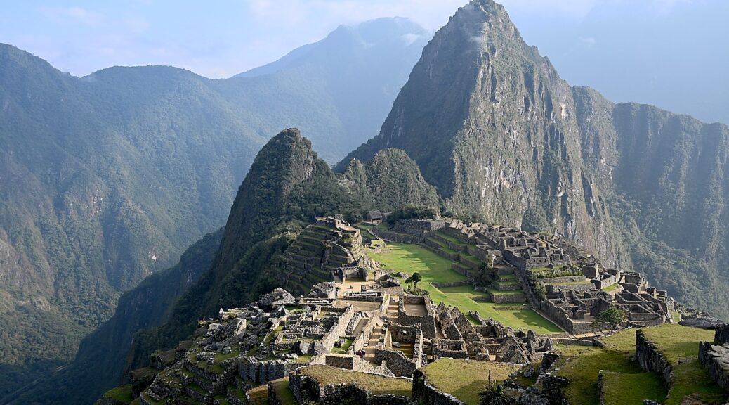
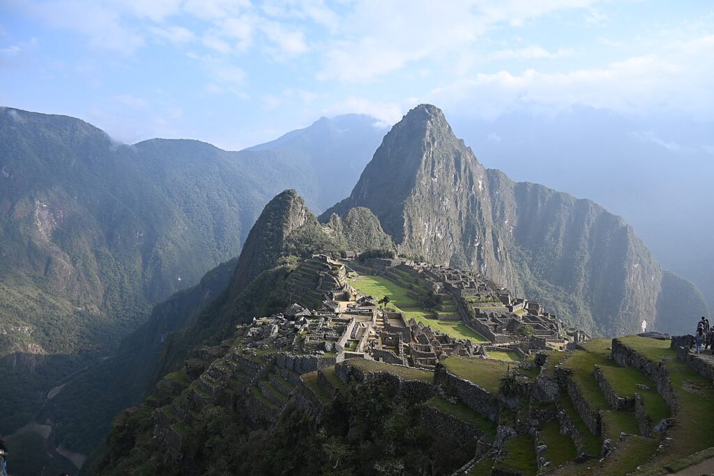
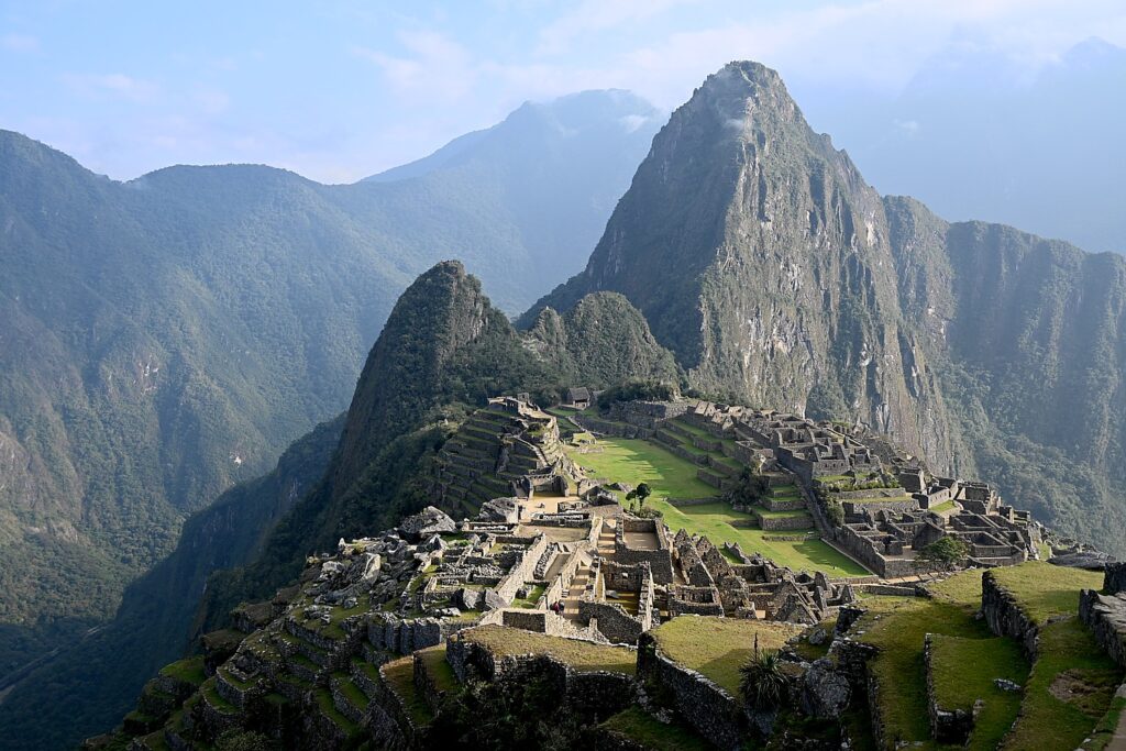
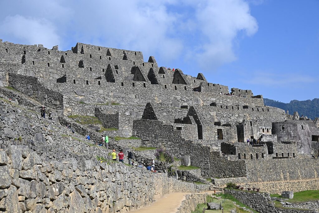
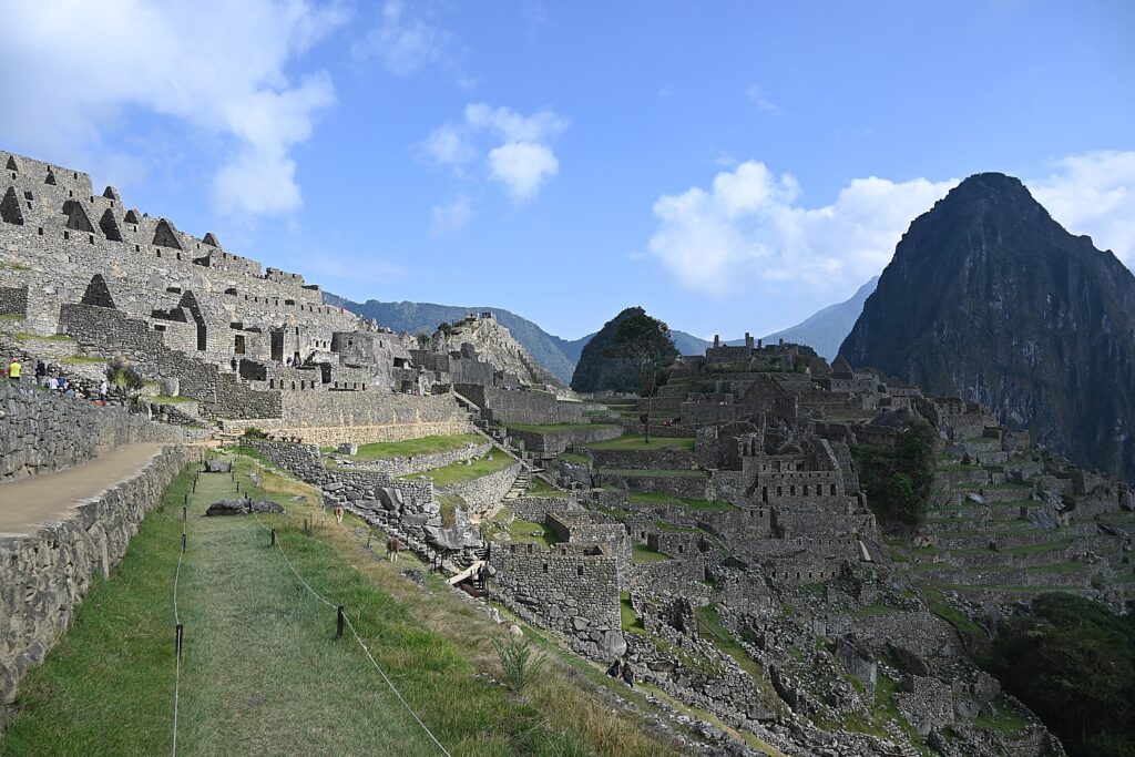
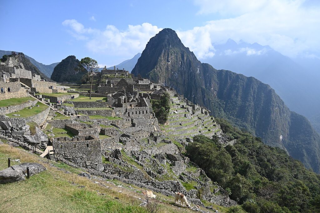
Machu Picchu, The Lost City of the Inca, reached on Day 4 of the Alpaca Expeditions 26-mile Inca Trail trek © Karen Rubin/goingplacesfarandnear.com

By Karen Rubin, with Eric Leiberman and Sarah Falter

Travel Features Syndicate, goingplacesfarandnear.com

This is the day that many of us have had on a bucket list, and for some of us, represents the fulfillment of a “trip of a lifetime”: Machu Picchu.

We are awakened at 3 am when the Alpaca Expeditions staff bring hot coffee to our tents. We have everything ready for leaving the Wiñaywayna campsite by 3:15 am (I had packed everything the night before and only kept out what I would be taking on the trail), and set out, our bagged breakfast in hand, wearing our headlamps in the dark for the surprisingly short distance walk to the check-in point for Machu Picchu where we wait until it opens at 5:30 am.

Our guide Lizandro Aranzabal Huaman wants us to get up so early to be first on line (he claims to have a 98% success rate) and also to get to the Sun Gate as the sun rises (and before it gets overwhelmed with photo-snappers), and to Machu Picchu in time for the first rays to illuminate the scene. In fact, there is only a group of six ahead of us and something like 200 behind us, checking our passport against the list of permits granted for the day.

Somehow, I wind up leading our pack of 15 trekkers and I surprise myself at the pace I set for the one-hour hike on this mostly flat portion of the trail to the Sun Gate. I am in the lead until we get to what Lizandro calls the “Gringo killer”- 50 of the steepest steps – more like a rock climbing wall – where you need to use your hands to crawl up like cat.

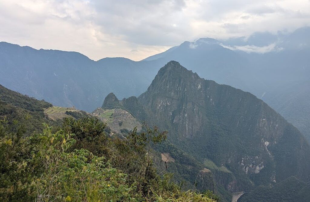
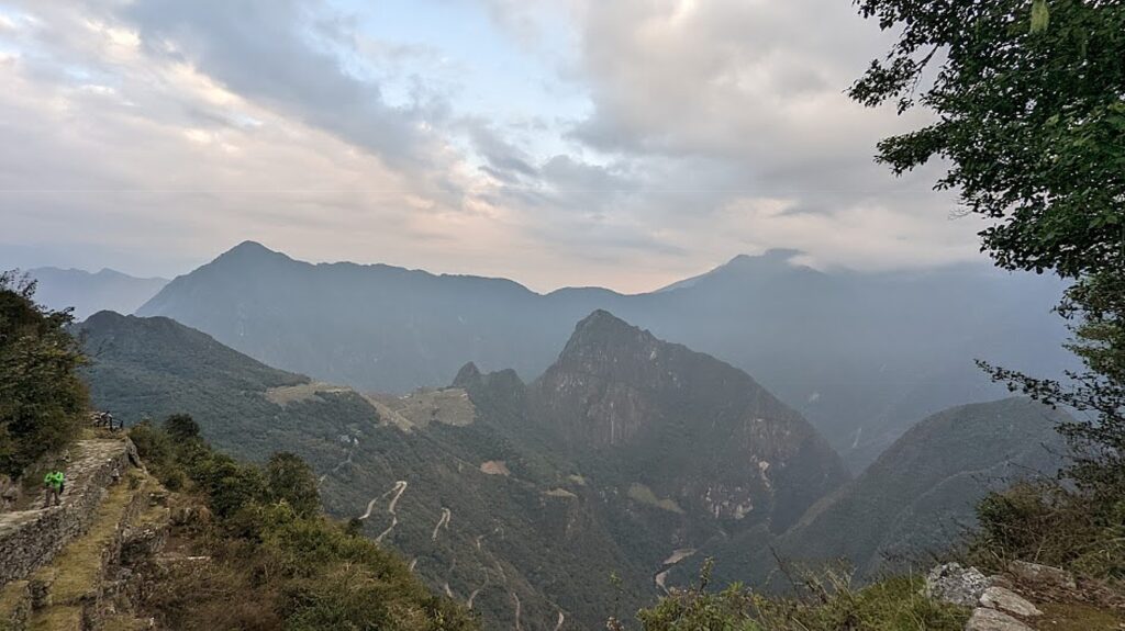
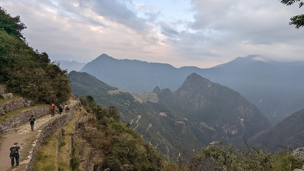
Lizandro has prepared us for the fact that the sun only comes through the Sun Gate (Inti Punku) at sunrise on the solstice. But from here, we get our first view of Machu Picchu in the distance (it’s still an hour’s hike away).

One of the many nice aspects of our guides, Lizandro and Georgio, is that they have been patiently  taking individual and group photos of us with our phones and cameras at each of the key spots along the trail, and so we stop at the Sun Gate to take our turn posing for those shots. (Everyone wants to be at this small point for the sunrise, which is why Lizandro wanted us first.)

The first view of Machu Picchu from the famed Sun Gate on the Inca Trail © Karen Rubin/goingplacesfarandnear.com

And then we continue (downhill!) from the Sun Gate at 8,956 ft. elevation, an hour more to Machu Picchu, descending to 7,873 elevation over the course of three miles from the Wiñaywayna campsite. At the same time, the temperature which had been cold at the highest elevations, becomes warm, even balmy, so we are actually sweating (need sunscreen and hat!) at the site.

The first view of Machu Picchu from the famed Sun Gate on the Inca Trail as dawn breaks © Karen Rubin/goingplacesfarandnear.com

This part of the Inca trail gives us views that show how Machu Picchu is positioned – we see the entirety of the Lost City (I can only imagine what it was like before it was excavated) and how it is etched amid the contours of the mountain peaks – which is how it was kept hidden from the Spanish when they invaded in 1538 and for 400 years.

The first view of Machu Picchu from the famed Sun Gate on the Inca Trail as dawn breaks © Karen Rubin/goingplacesfarandnear.com

Literally 10 seconds after I pass a scenic overlook, the sun pokes out. (These views and so much more, are why we take the Inca Trail trek.)

At about 7:40 am, we walk in what seems to be a back entrance into the city, where we are perched on high terraces and the views are the iconic ones of magazines and postcards (and I suspect are not available to the day-trippers who come in from the bottom entrance for the tour). How lucky we are because the sun breaks through, highlighting the structures, for exquisite scenes.

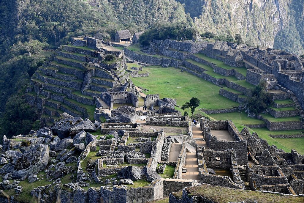
Only 40% of Machu Picchu has been excavated so far, which means that 60% is still underground and hidden from view © Karen Rubin/goingplacesfarandnear.com

We actually walk down and out of Machu Picchu site to wait for our ticketed time to re-enter (you can only stay 2 ½ hours and can only come in with a guide). While we wait, we have to use the bathroom before we reenter and check bigger backpacks and hiking poles.

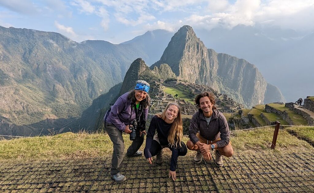
We made it! Karen, Sarah and Eric at Machu Picchu at the end of the Alpaca Expeditions four-day, 26-mile Inca Trail trek (photo by Lizandro Aranzabal Huaman)

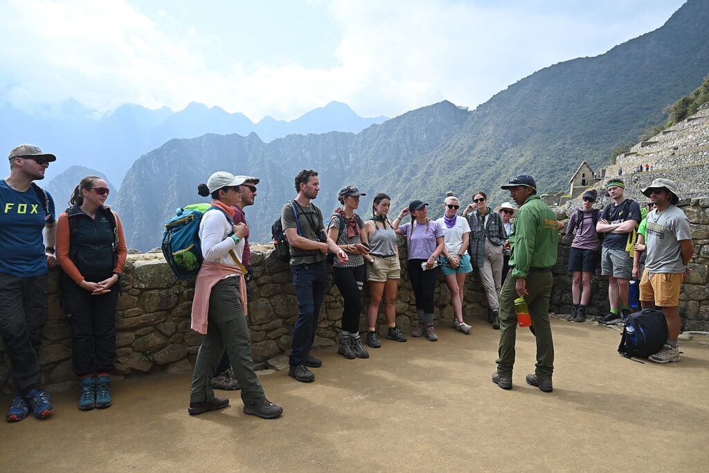
Our scheduled time to enter Machu Picchu to begin our 2 hour private guided tour with Lizandro is 8:30 am, who leads us on Circuit #4 (there are four different circuits to control crowds) to the highlights: the terraces, Sun Temple, Royal Mausoleum, Palace, Plaza, Sacred Rock.

Machu means “old,” “ancient,” “big”). Picchu means “peak,” so Machu Picchu actually means “Ancient Mountain,” but that is not its indigenous name.

Lizandro tells us that Machu Picchu was built in the mid-1400s by Pachacuti, the 9th Inca king but its first emperor and the “Alexander the Great” , the Empire Builder, of the Inca. Beginning in 1438, he and his son Tupac Yupanqui began a far-reaching expansion that brought much of the modern-day territory of Peru under the ruling Inca family control. He rebuilt Cuzco, built Pisac, Ollantaytambo  as well as Machu Picchu. He built Machu Picchu up in the mountains instead of the valley to be closer to the sun, to connect the sky and the earth in one place, as well as for protection.  “Mountains were gods that protected the villages and the animals,” he relates. Almost all of the construction faces east to catch the sunrise – the Inca rulers claimed to be the children of Inti, the Sun God.

The archaeologist Hiram Bingham didn’t discover Machu Picchu (it was discovered in 1902 by Bolivian fortune hunters looking for Incan treasure), but came on an expedition in 1911 in search of Vilcabamba, the last stronghold of the Inca after the Spanish conquest. But Bingham is credited with bringing Machu Picchu to the attention of the world. © Karen Rubin/goingplacesfarandnear.com

Over the next 100 years, the Empire ultimately expanded to what are today six South American countries, connected by 25,000 miles of roads, suspension bridges and trails, and controlling a population as many as 18 million.

The Sun Gate was built as a check point to enter Machu Picchu, but positioned so that on December 22, the summer solstice, the sun beam would come through gate; and on June 21, it comes through the other window.  

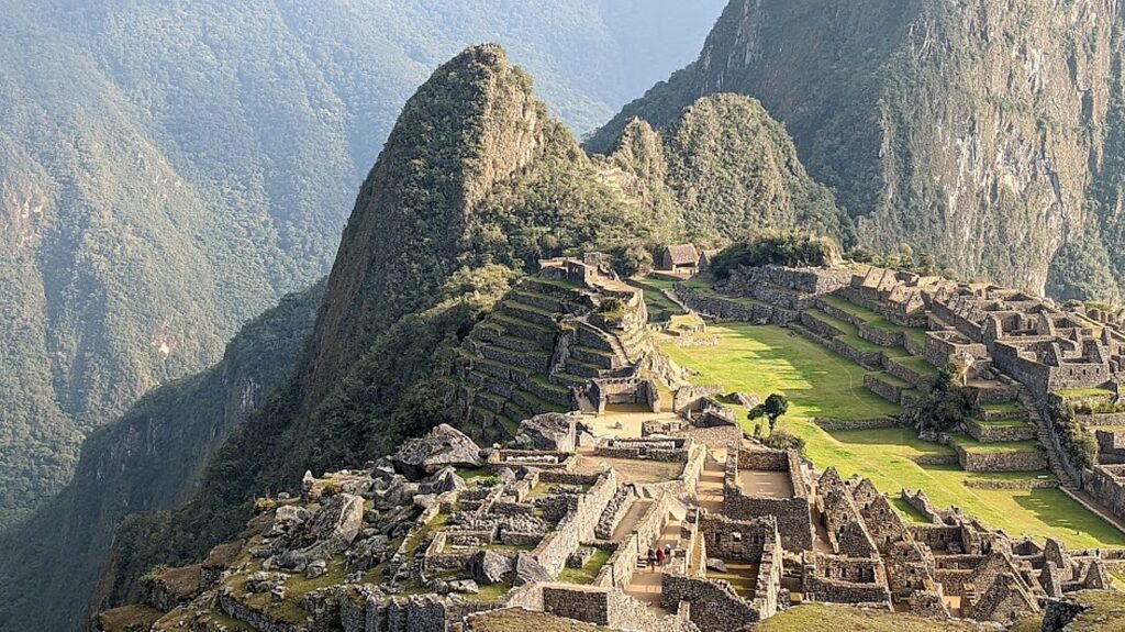
Only when you are actually at Machu Picchu can you begin to comprehend what an astonishing construction it is, why it is worthy of being called one of the Seven Wonders of the World and designated a UNESCO World Heritage Site © Karen Rubin/goingplacesfarandnear.com

Machu Picchu is built in two sections – an urban sector has some 200 units of which 172 were homes, and the rest were temples, and a sun dial.

There would have been 700-800 people living here full time – 60% were nobles, the rest were farmers and workers.

Only when you are actually at Machu Picchu can you begin to comprehend the scale of the construction, why it is worthy of being called one of the Seven Wonders of the World and designated a UNESCO World Heritage Site © Karen Rubin/goingplacesfarandnear.com

How did they build Machu Picchu without slaves, without animals to carry, without a wheel, iron tools, or written language? Consider that China’s Great Wall and the Egyptian pyramids were built with slave labor, draft animals, a wheel, iron tools and written language.

What they had was a culture and a labor system based on principles: Ani – reciprocity – one for all, all for one; Minka – community benefit – care for vulnerable – collectivity (how the Peruvians got through Covid despite a poor health care system); and Mita – paying taxes by work, labor (not cash) to benefit the whole.

Only when you are actually at Machu Picchu can you begin to comprehend what an astonishing construction it is, why it is worthy of being called one of the Seven Wonders of the World and designated a UNESCO World Heritage Site © Karen Rubin/goingplacesfarandnear.com

It took 50-60 years to build Machu Picchu for Emperor Pachacuti,  who ruled from 1432-1472, but it was never finished. I can’t help but wonder how many men were impressed to build this enormous complex of structures in that amount of time.

When the Spanish invaded in 1538, Machu Picchu was abandoned before it was finished and the Incan forces fell back to arm Vilcabamba, the Inca’s last stronghold. “They promised to come back but didn’t,” Lizandro says.

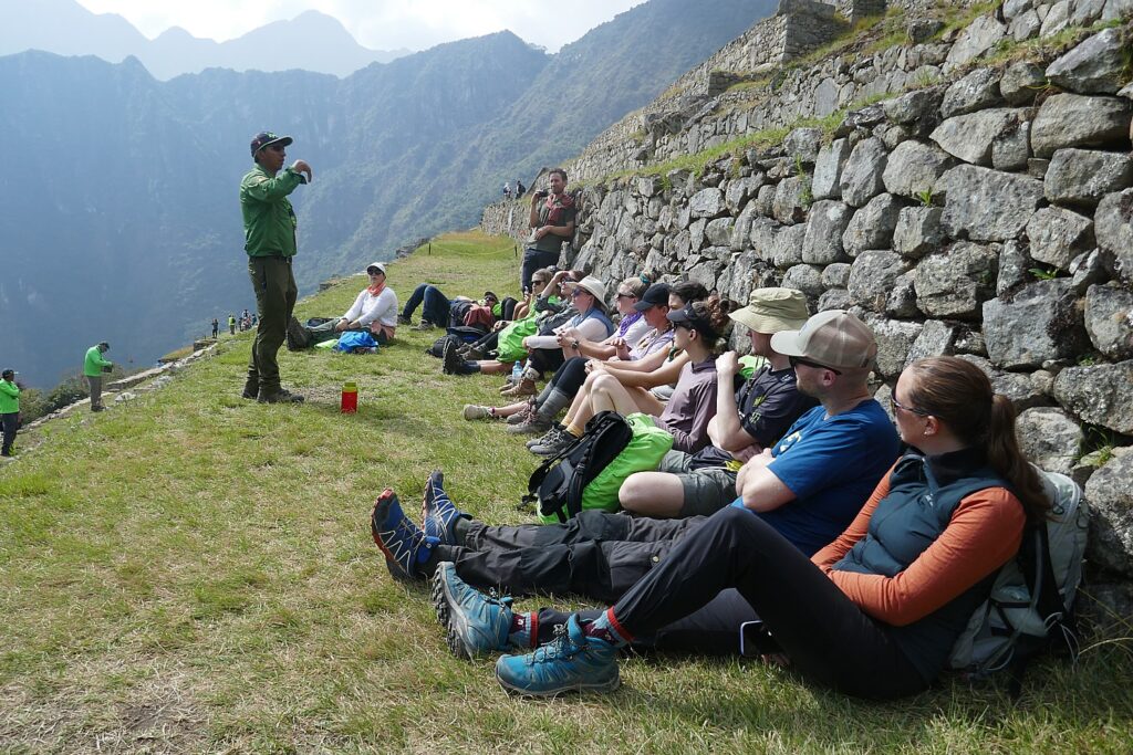
Our Alpaca Expeditions guide Lizandro Aranzabal Huaman relates the background to Machu Picchu, the Lost City of the Inca © Karen Rubin/goingplacesfarandnear.com

It is mindboggling to contemplate that as complex a construction as what we see, the scale, and the fact that more than 60% is still unexcavated, buried under 400 years of overgrowth.

The archaeologist Hiram Bingham didn’t discover Machu Picchu (it was discovered in 1902 by Bolivian fortune hunters looking for Incan treasure), but came on an expedition in 1911 in search of Vilcabamba, the last stronghold of the Inca after the Spanish conquest.

“He set up tents at base, met a local to ask where Vilcabamba might be. The man didn’t know, but on July 24 1911, with machete in hand, Bingham had a big surprise: the sight of Machu Picchu took his breath away. Two families were living here, cultivating the terraces two years before Bingham arrived. They were running away from paying taxes to the government.” [Off the grid?]

Only 40% of Machu Picchu has been excavated so far, which means that 60% is still underground and hidden from view © Karen Rubin/goingplacesfarandnear.com

Bingham returned for a second, then a third expedition. He uncovered eight Inca trails (the Inca destroyed many of the trails to prevent the Spanish from reaching Machu Picchu) and took away artifacts, he claimed, for two years. “More than 100 years later, Yale still has the artifacts and is requiring Peru to build a museum to hold artifacts near Machu Picchu. But Peru wants it by the river. In 2015, the United States sent 11 percent of the artifacts back – but not all were real, some were replicas that they returned. The Peru government wants all of it back.”

The photos Bingham published brought international attention to Machu Picchu, the “Lost City of the Inca” – and tourists. The first tourist following the Inca trail came in 1954 and this Incan Citadel has become the most visited tourist attraction in Peru. The site was named among the New Seven Wonders of the World and designated a UNESCO World Heritage Site in 1983.

Machu Picchu, reached on Day 4 of the Alpaca Expeditions 26-mile Inca Trail trek © Karen Rubin/goingplacesfarandnear.com

We trekkers follow Circuit 4 (there are four circuits, to spread out the crowds): starting at the Main Gate (where we must present our passports and permit), to the Sun Temple, House of the Inka, the water foundation; Granitic Chaos; Sacred Plaza; Intiwatana Pyramid; Sacred Rock; Three Gates; Water Mirrors; and Condor Temple.

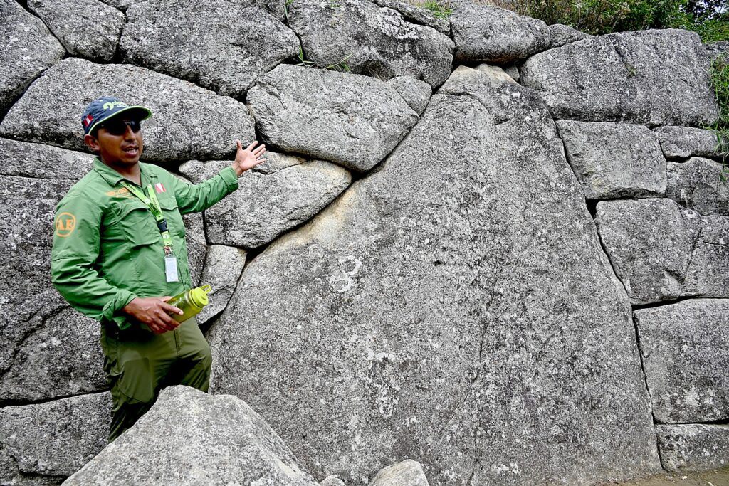
Our Alpaca Expeditions guide Lizandro Aranzabal Huaman points to the astonishing construction of Machu Picchu © Karen Rubin/goingplacesfarandnear.com

We climb the steep stone steps and come to the Sun Temple. It was built as a royal tomb to contain the mummified remains of the king.  Lizandro points to how a temple would have the highest quality building stones and most precise placement and its architecture emphasizes the “harmony between people and nature. They always incorporate the natural bedrock. The windows are aligned for summer and winter solstice – a solar observatory. There are three steps – the Inca triology. The mummified body was placed in the tomb in fetal position.” There are no mummies left in the tomb, but there would have been mummies of the 12 Inca kings (others were buried). On the day of Ayamaki, the mummies would have been paraded from the mausoleum.

The Royal Tomb at Machu Picchu © Karen Rubin/goingplacesfarandnear.com

Lizandro notes that the word ‘jerky” – the dehydrated meat snack – comes from the indigenous Quechua word, “jakky charky” (related to mummification).

We come to the Royal Inca Palace, where we can see that instead of windows (too cold), there would have been shelves for idols. “Bingham got here in time to see some.”

Only when you are actually at Machu Picchu can you begin to comprehend what an astonishing construction it is © Karen Rubin/goingplacesfarandnear.com

How would they have set the weighty keystone in place? With ramps, aloe vera to make it slick, he says. The enormous stone building blocks, weighing tons, are trapezoid shape and set at a slight incline angle, for stability against earthquakes. Indeed, Peru suffered two big earthquakes – in 1650 and 1950 – when the colonial buildings collapsed, the great cathedral in Cuzco collapsed, but these structures remained (in fact, the 1950 earthquake in Cuzco unearthed Incan structures). We see under one massive block a roller-shaped stone – a precursor to the wheel.

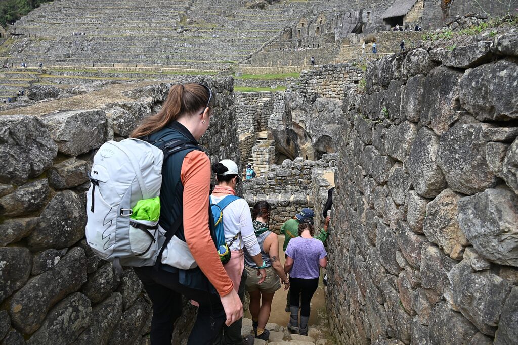
You only appreciate the scale of Machu Picchu as you haul yourself up the high steep stone steps © Karen Rubin/goingplacesfarandnear.com

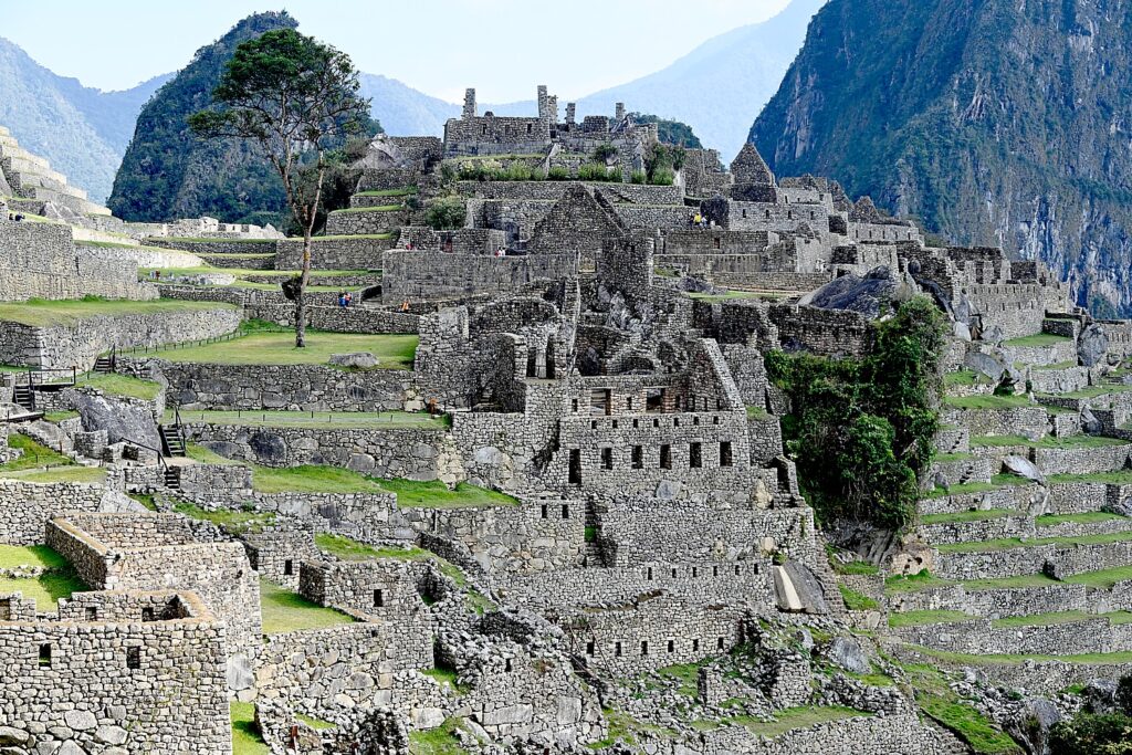
You only appreciate the scale of Machu Picchu as you haul yourself up the high steep stone steps. The straight lines and perfect angles, the precision, the sheer size and bulk of the stones, and how this entire city is nestled on a plateau amid these sheer mountain peaks.

You only appreciate the scale of Machu Picchu as you haul yourself up the high steep stone steps © Karen Rubin/goingplacesfarandnear.com

There is a large open area, like a field, which would have been used for festivals, activities, an amphitheater. And in the middle, is what would have been a sundial. In 1978, the then president invited the Spanish King and Queen to visit, and their helicopter landing in the field, broke the sundial. (I find it ironic that the Spanish were still destroying Incan heritage.)

In this small plaza, Lizandro points out a huge section of bedrock cut to mimic the shape of the mountain behind – mountains were considered sacred.

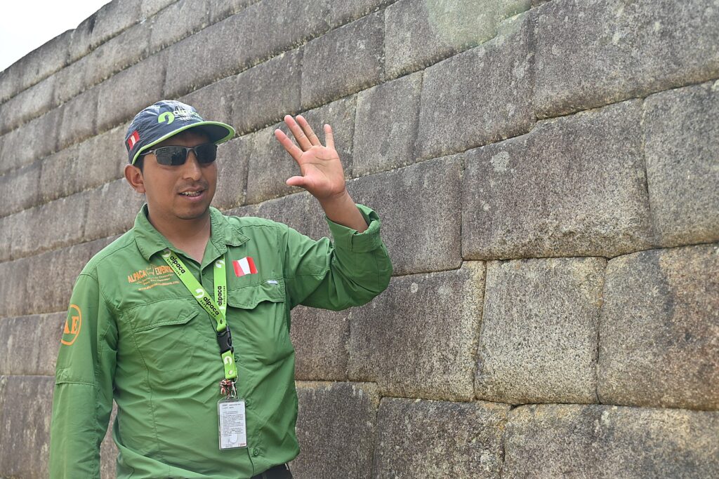
Our Alpaca Expeditions guide Lizandro Aranzabal Huaman points to the precision of the placement of the stone boulders for the temple at Machu Picchu © Karen Rubin/goingplacesfarandnear.com

He explains a bit of the Incan society hierarchy – the Inca were the royal family and nobles – perhaps 20,000 who ruled over a population of dozens of different tribes totaling as many as 18 million across much of South America. Professionals could become nobles (rise to that privileged class) because of their expertise, skill and function. Teenagers could show a talent and go into a profession.

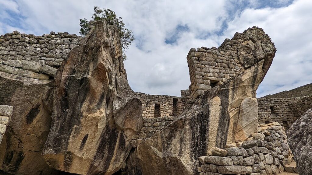
Can’t help but thinking of architect Antoni Gaudi’s style at Temple of the Condor at Machu Picchu © Karen Rubin/goingplacesfarandnear.com

We sit around for a bit of a rest, and Lizandro explains some of the contemporary politics. Apparently, in the 1990s, President Alberto Fujimori [a fixture in Peru’s politics from 1990 to 2003] wanted to privatize Machu Picchu – selling it off to Chilean investors, drawing an outcry of protests from the people. “The president did well his first five years – investing in industrial farming – but after he was reelected, he sold off or privatized without people knowing.” Fujimori, the son of Japanese immigrants, wound up being investigated for corruption. He tried to flee to Japan and was captured enroute in Santiago with eight suitcases of cash. He was convicted and sentenced to 17 years in prison.”

Lizandro says the Peruvian constitution (which I subsequently read has been rewritten and set aside multiple times since the country’s independence, while the government has undergone a series of coups back and forth from dictatorship to democracy, socialism to capitalism) favors foreign companies (they don’t pay tax). Because 50 percent of Peru’s population lives in Lima, he tells us, the people who live in rural areas, in the mountains, have little say.

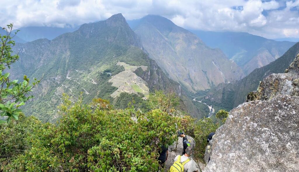
The view of Machu Picchu from the top of Huayna Picchu © Sarah Falter/goingplacesfarandnear.com

Several of our group have obtained permits in advance to climb Huayna Picchu – that famous nub of a mountain, like an overlord, in the iconic Machu Picchu images – and Sarah has obtained one, while the rest of us continue touring Machu Picchu with Lizandro.

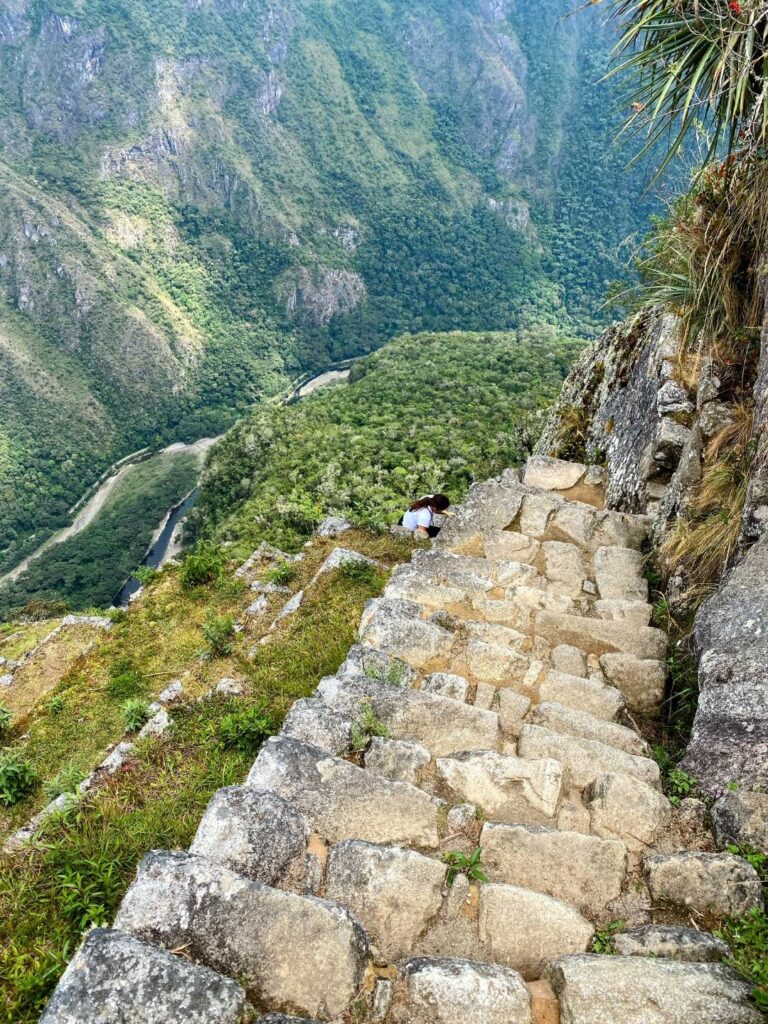
The steep stone trail to the top of Huayna Picchu © Sarah Falter/goingplacesfarandnear.com

Sarah reports back that the 45-minute hike is extremely arduous – much harder than the Inca Trail hike – almost straight up to a tiny perch at the top, at 8,835 ft., 850 ft. higher than Machu Picchu, where everyone has to take turns for the photo, but you get a famous view of Machu Picchu. The trail was built by the Inca who also built temples and terraces at the top.  “I would definitely recommend it to fitter hikers looking for one last challenge. It’s not super long and being able to see the scale of Machu Picchu from above was really impressive.”

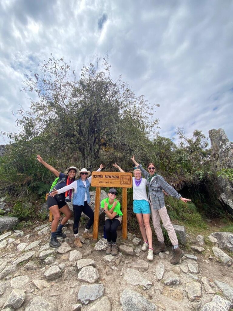
Sarah with other members of our Alpaca Expeditions trek celebrate reaching the Huayna Picchu summit.

We finally come back down to the entrance/exit to Machu Picchu and Lizandro hands us a ticket for the bus that takes us down an extremely winding road to the village of Aguas Calientes. We meet for a last lunch together in a local restaurant – kind of a celebratory meal ( optional and not included). Lizandro gives us our train ticket, departing Aguas Calientes 3:20 pm (you need to take seriously the notice to be on the platform at least 30 minutes ahead of time, which is when the train loads) to Ollantaytambo.

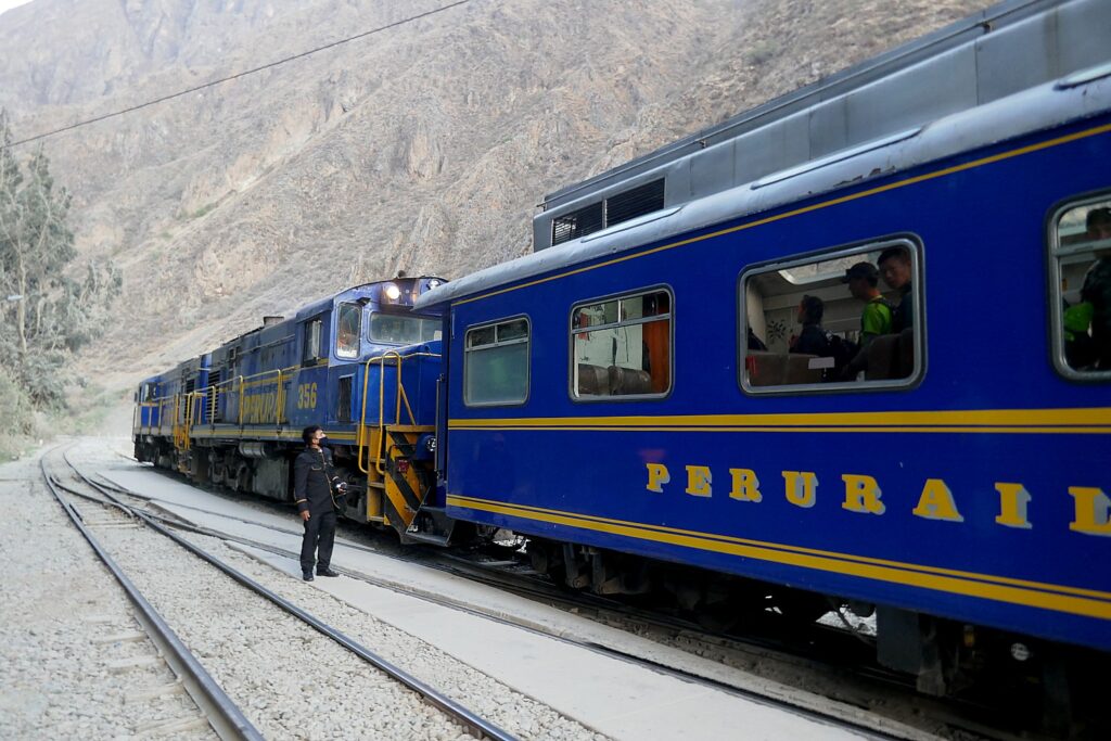
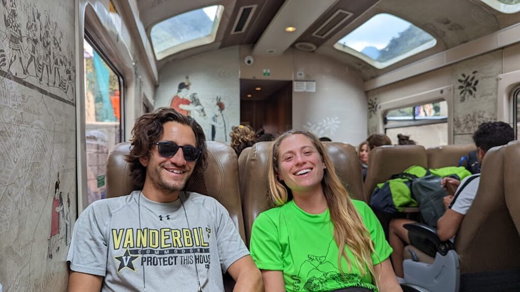
The train is wonderfully vintage, with roof-windows, and very comfortable for the two-hour trip (which for some reason takes us much longer). At Ollantaytambo, we are met by the Alpaca Expeditions bus for the two-hour drive back to Cuzco and drop off back at our hotel.

The train from Aguas Calientes is wonderfully vintage, with roof-windows, and very comfortable for the relaxing two-hour trip to Ollantaytambo © Karen Rubin/goingplacesfarandnear.com

Candidly, I had been so obsessed about getting passed Day 2, Machu Picchu was more of an end-goal of a quest than the prime attraction – being here means I had gotten over the Dead Woman’s Pass, completed the 26 miles, going as high as nearly 14,000 feet – much as it would have been for the pilgrims who undertook this journey of a lifetime. It is personal.

For me, it is not just a trip of a lifetime but a now or never proposition.

I am not the only one celebrating an important milestone. Indeed, this is the sort of bucket-list trip that warrants a milestone – Peter timed reaching Machu Picchu for his 35th birthday; a couple had just gotten engaged at the start of the hike; another 30-something couple (he’s Italian, she’s Dutch) is on their honeymoon .That’s how special this trek is, embodying physical, spiritual – just as it did for the Inca, a triumph of will and willpower. A test of character then as now.

Eric and Sarah relax on the train after our four-day trek and two-hour tour of Machu Picchu © Karen Rubin/goingplacesfarandnear.com

You are at the same time amazed by the ability of these people to construct these sites at all, but then wonder at the level of control exerted, the role of religion in maintaining that control and how authoritarians throughout human history use religion (the divine right). No surprise: the Inca kings claimed to be the son of the Sun God, Inti. And yet, you can’t help but marvel at the accomplishment of that government capable of building the 25,000 miles of roads, in producing the amount of food to sustain the population, and unifying a population of 18 million into a society.

You appreciate the social structure that produced these extraordinary mountain villages in a society that did not have slaves nor currency, did not have the wheel or beasts of burden, did not have compass, ruler, alphabet or written language.

Most astonishing, these structures were built within 20, 40 or 60 years’ time – apparently, each chief would select a project to be completed within his own lifetime.

Photos do not do justice, you have to stand next to the rock walls, trace how the boulders link to perfectly together, see the curve at the edge, the inclined angle (for stability against earthquake) with such exquisite precision, hoist yourself up the steep stone steps, look beyond to the distance these boulders would have had to be transported from their quarry.

You stand perched on these terraced structures built into the side of a mountain and simply cannot fathom what it took to build.

All these thoughts come to me as I step, climb, step, climb the trail.

Our Alpaca Expeditions group, at Machu Picchu © Karen Rubin/goingplacesfarandnear.com

At each site, Lizandro tells us more of the story of the Inca and the society they created – but unlike the sturdy bedrock that these sites were built on, the Inca’s hold on the people was really not that strong because it was not a bond. At a certain point, their hold was by force. “The Inca weren’t very nice people,” he says softly.

What was unexpected was to come away with an understanding of the limits of authoritarian control. Indeed, the Inca ruled for less than 400 years, but the empire existed only for a century before it was toppled, too weak and lacking support of the people, to withstand the Spanish invaders. There are lessons for day.  And as we learn, Peru is still going through these cycles of economic struggle, political ping-pong between dictatorship and democracy, socialism and capitalism, since becoming independent from Spain in 1821. The more things change, the more they stay the same, may well be the lasting lesson.

What makes a “trip of a lifetime” – one that is truly life-enhancing, even life-changing? It is the doing.

Alpaca Expeditions offers many ways to get to experience Machu Picchu – the trek is its own experience, and when you think about it, is very inexpensive (from $650); it’s not even that difficult or expensive an airfare to reach (at this stage, you fly through Lima or Quito to Cuzco, but a new international airport is being built closer to Cuzco). The tour company also offers many different programs – like the Sacred Valley excursions – to different areas.

The permits to do the Inca Trail trek are limited to 500 a day for all the trekking companies (which includes 200 for trekkers and 300 for porters and staff) and get booked up months in advance.

More information: Alpaca Expeditions, USA Phone: (202)-550-8534, [email protected], [email protected], https://www.alpacaexpeditions.com/

See also:

VISIT TO PERU’S SACRED VALLEY IS BEST WAY TO PREPARE FOR INCA TRAIL TREK TO MACHU PICCHU

INCAN SITES OF PISAC, OLLANTAYTAMBO IN PERU’S SACRED VALLEY ARE PREVIEW TO MACHU PICCHU

ALPACA EXPEDITIONS’ INCA TRAIL TREK TO MACHU PICCHU IS PERSONAL TEST OF MIND OVER MATTER

DAY 1 ON THE INCA TRAIL TO MACHU PICCHU: A TEST

DAY 2 ON THE INCA TRAIL TO MACHU PICCHU: DUAL CHALLENGES OF DEAD WOMAN´S PASS,
RUNCURACCAY

DAY 3 ON THE INCA TRAIL TO MACHU PICCHU: TOWN IN THE CLOUDS, TERRACES OF THE SUN
& FOREVER YOUNG

DAY 4 ON THE INCA TRAIL: SUN GATE TO MACHU PICCHU, THE LOST CITY OF THE INCAS

__________________

© 2022 Travel Features Syndicate, a division of Workstyles, Inc. All rights reserved. Visit goingplacesfarandnear.com, www.huffingtonpost.com/author/karen-rubin, and travelwritersmagazine.com/TravelFeaturesSyndicate/. Blogging at goingplacesnearandfar.wordpress.com and moralcompasstravel.info. Visit instagram.com/going_places_far_and_near and instagram.com/bigbackpacktraveler/ Send comments or questions to [email protected]. Tweet @TravelFeatures. ‘Like’ us at facebook.com/NewsPhotoFeatures

Day 3 on the Inca Trail to Machu Picchu: Town in the Clouds, Terraces of the Sun & Forever Young

Wiñaywayna is the most spectacular Inca site on the trail after Machu Picchu © Karen Rubin/goingplacesfarandnear.com

By Karen Rubin, with Eric Leiberman and Sarah Falter

Travel Features Syndicate, goingplacesfarandnear.com

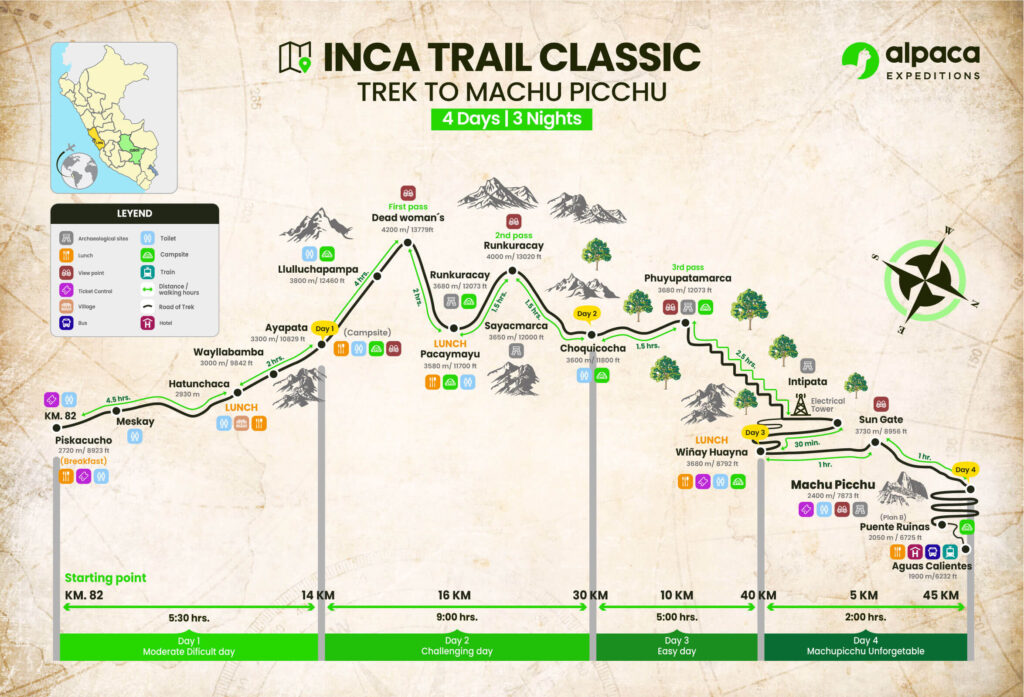
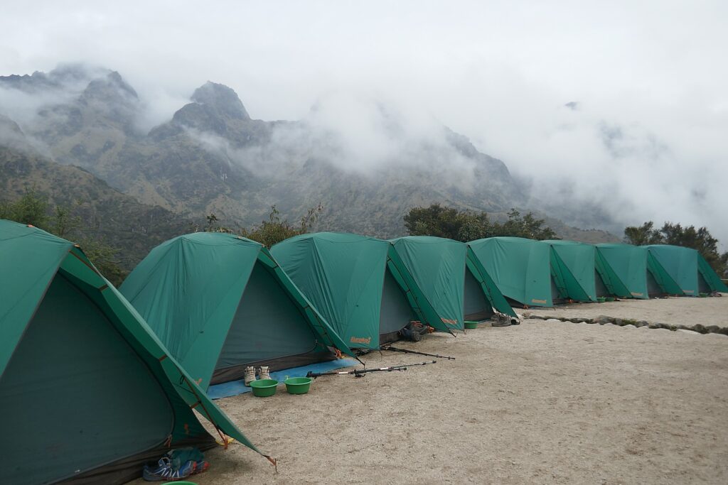
On our third morning on the Inca Trail, we are wakened at 5 am at our tents in the Chaquiccocha campsite to be packed up, have breakfast at 5:30 am and out by 6:30 am to begin what is generally considered the most relaxed day of the four-day trek, when our Alpaca Expeditions group will hike 6.2 miles mostly downhill, and visit two Inca sites, Phuyupatamarka (‘Town in the Clouds”) and Intipata (“Terraces of the Sun”), before reaching the campsite, where, we are told, a special activity awaits.

I’m still on a high from surviving Day 2 and the dual challenges of Dead Woman’s Pass and Runcuraccay Pass, so I feel I can handle anything (and not just on this trek).

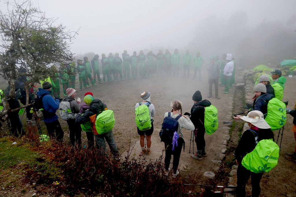
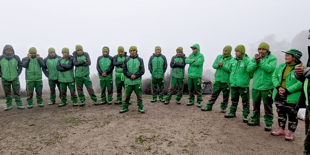
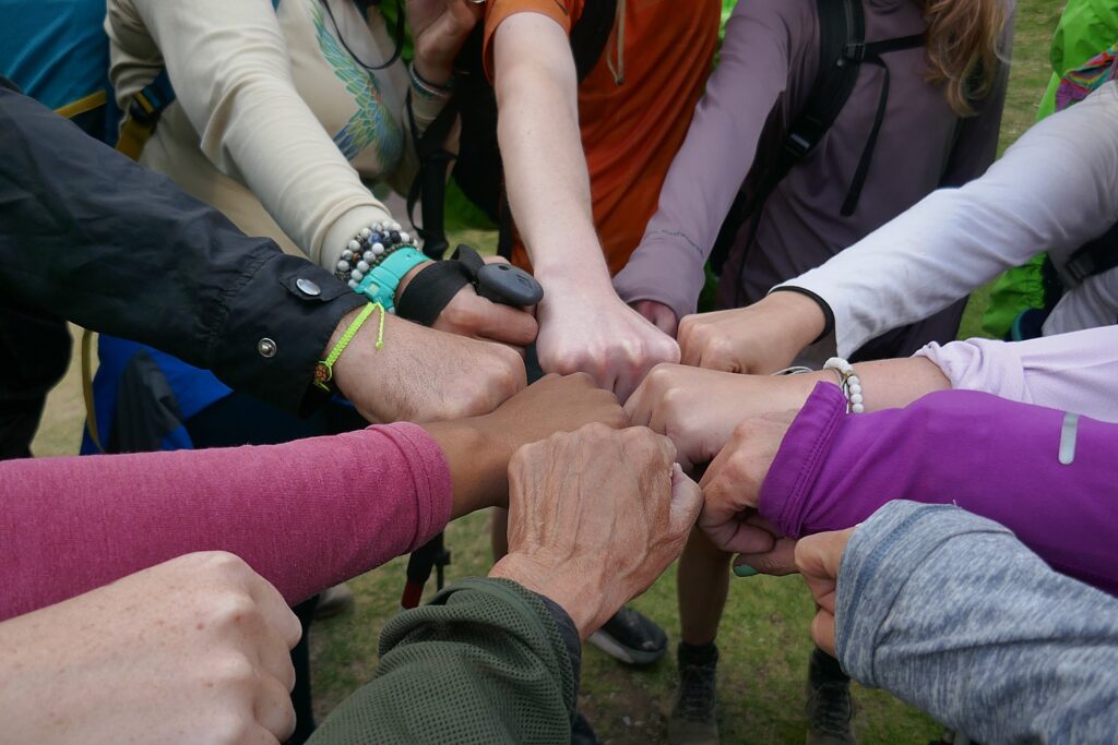
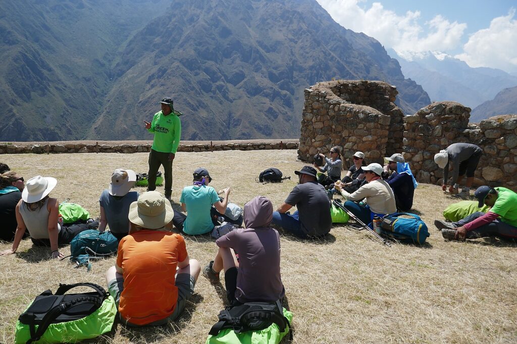
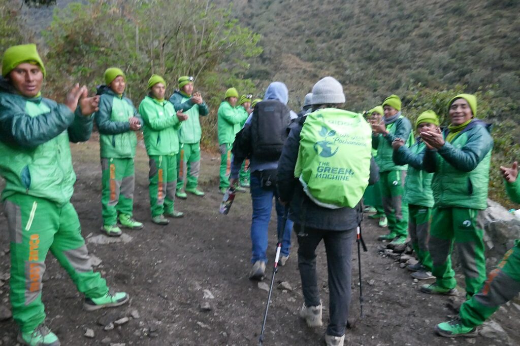
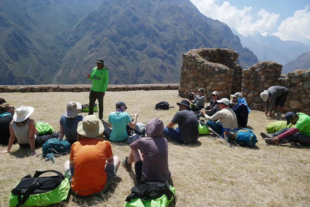
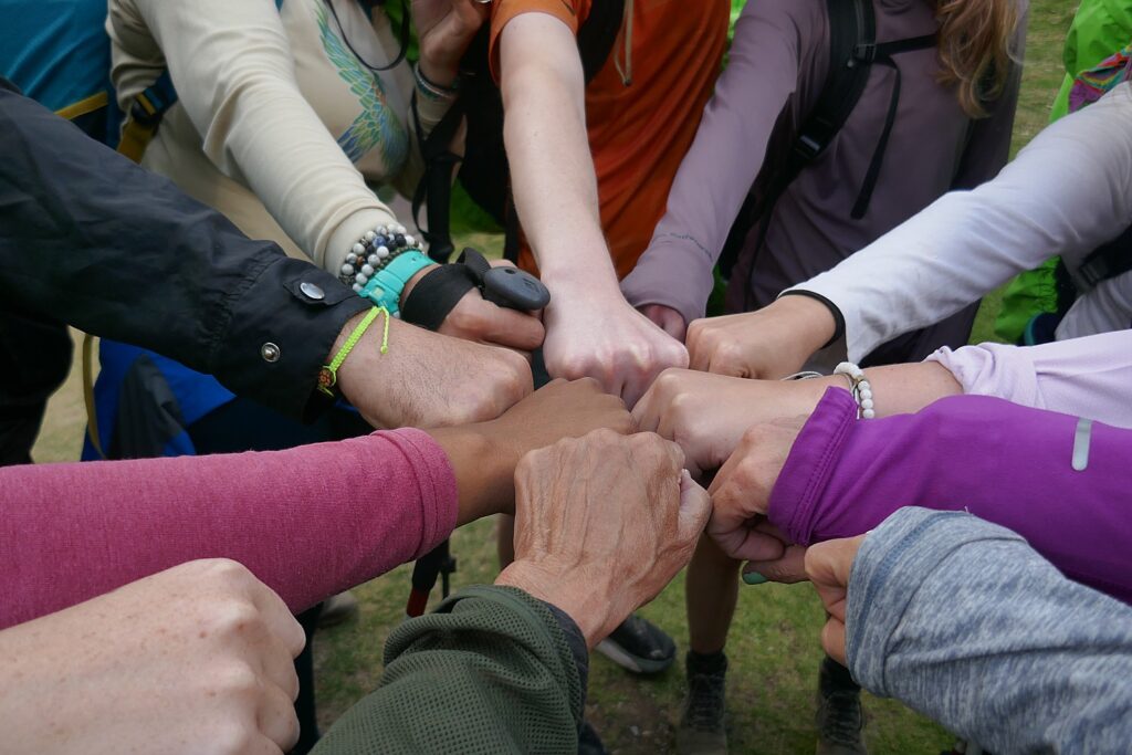
It’s a foggy morning and before setting out, our guide Lizandro organizes all of us in a great circle with the porters and staff and guests (Giorgio calls us “family” and Lizandro calls us “team” and both are true in the way we have bonded) so we meet each other. We learn that the porters all come from one mountain village, that two are brothers, 62 and 68 years old, that one of the porters is a woman (very unusual, but Alpaca Expeditions has made an effort to recruit women).

Getting to know you: Alpaca Expeditions porters and staff and trekkers introduce ourselves © Karen Rubin/goingplacesfarandnear.com

We trekkers introduce ourselves, also, and I mention that today is my 71st birthday – mentioning it because I am pretty pleased with the achievement (and our guide, Giorgio, at one point guessed I was 55 – perhaps just being polite) – to emphasize that they have made this experience of a lifetime possible for me.

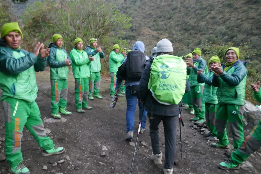
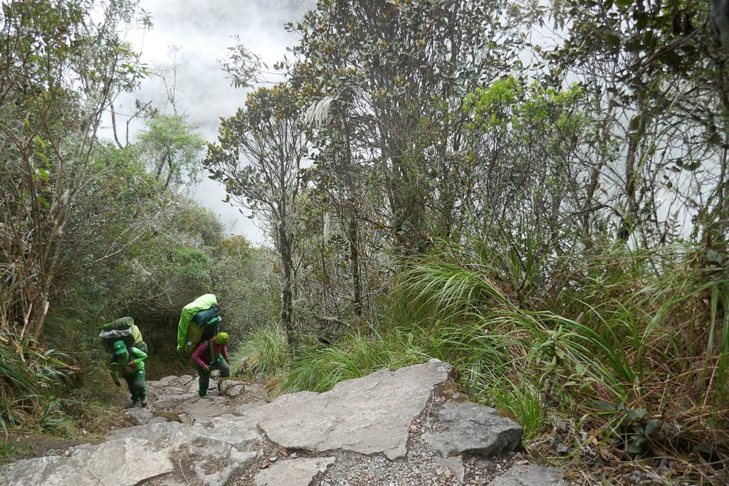
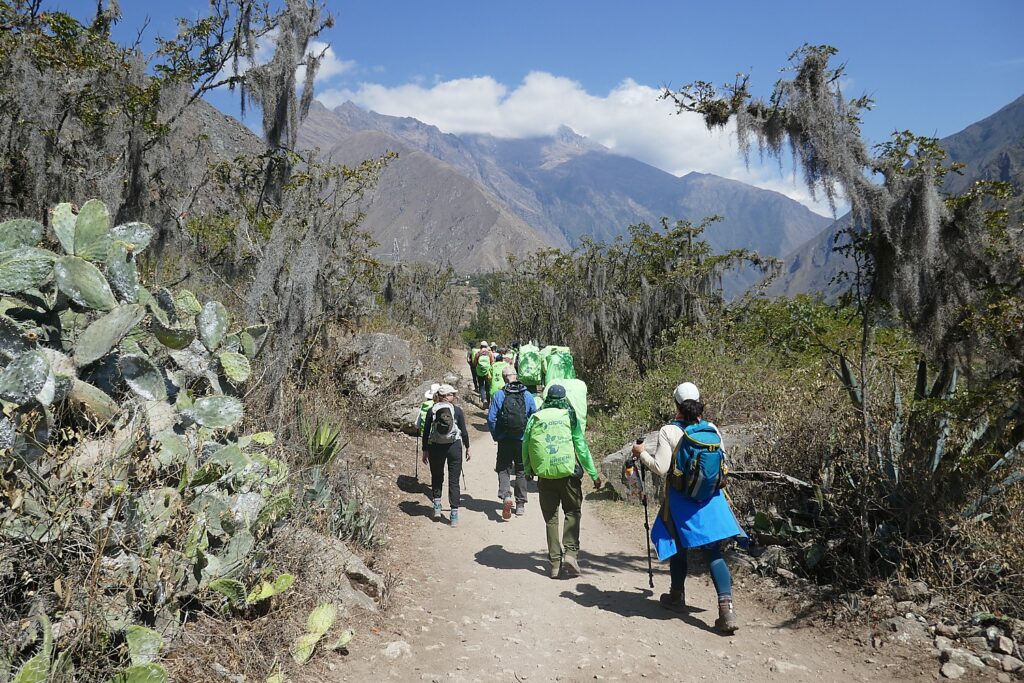
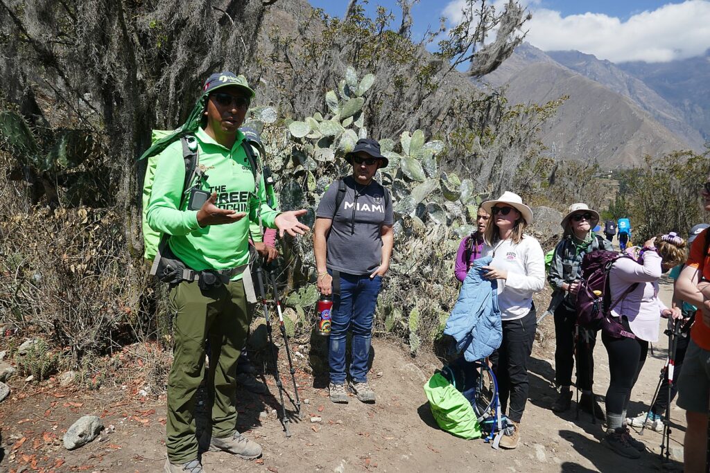
Alpaca Expeditions’ “Green Machine” porters and staff who make our Inca Trail trek to Machu Picchu – a trip of a lifetime for many – possible © Karen Rubin/goingplacesfarandnear.com

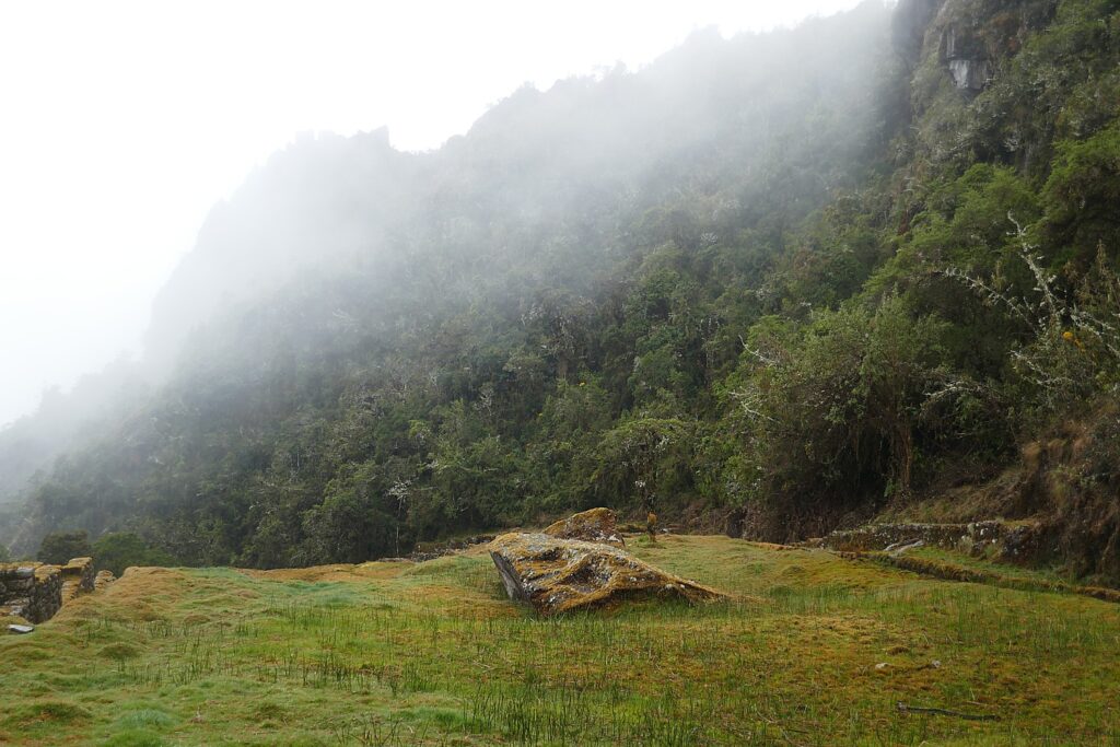
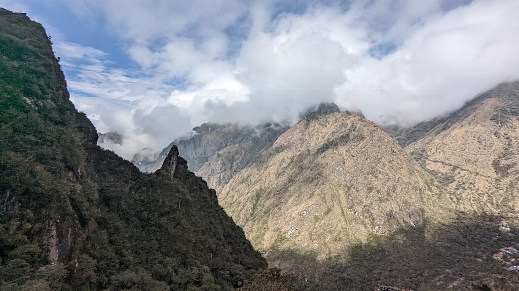
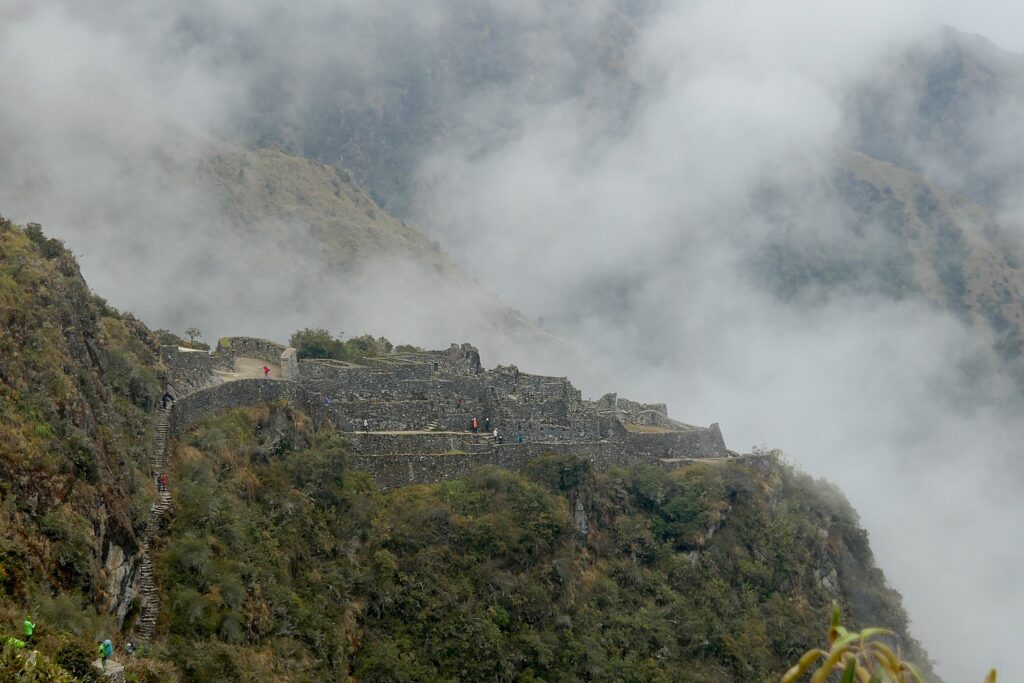
We hike for 2 hours along what they call “Inca flat” (gradual inclines) and begin to enter the jungle, known as the Cloud Forest. As we walk, we have the opportunity to see Salkantay, the second highest snow-capped mountain in the Sacred Valley, and get glimpses of a fantastic panoramic view of the Vilcabamba mountain range through mist and clouds.

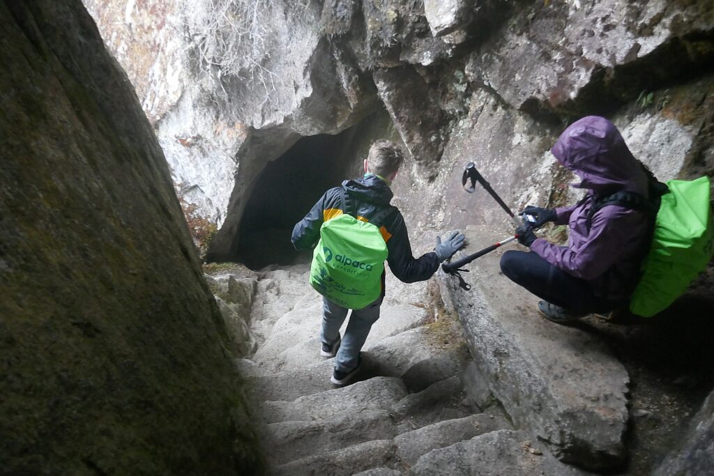
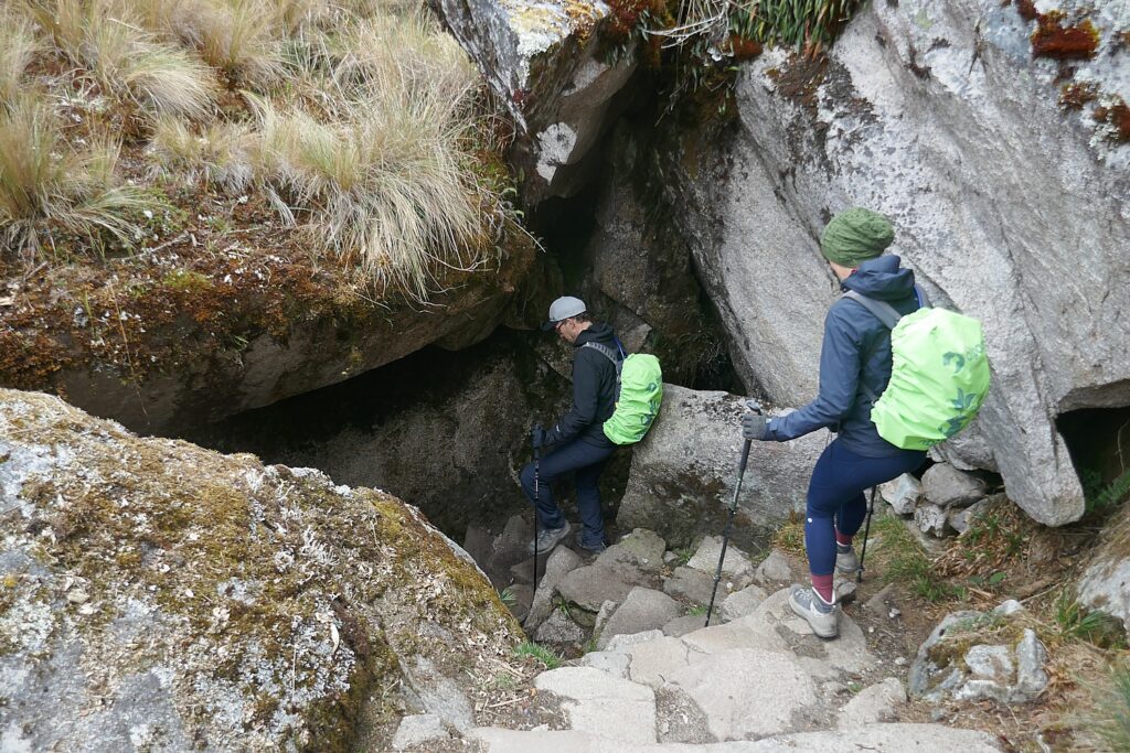
One of the fun sections of the Inca Trail goes through a small cave © Karen Rubin/goingplacesfarandnear.com

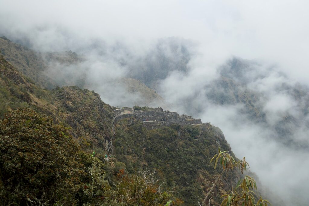
We make our way up to the last peak and our third pass, Phuyupatamarka (“Temple Above the Clouds”) at 12,073 ft. from where we have great views overlooking the Urubamba River.  Down the valley, we get our first view of Machu Picchu Mountain, but the famous “Lost City” itself is still hidden from view.

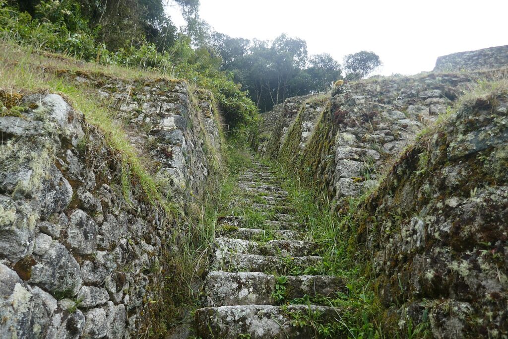
From Phuyupatamarka it´s a 3-hour walk down a flight of stone steps to our last campsite and the grand finale for this day, exploring the Incan site of Wiñaywayna (“Forever Young”).

On the descent, we stop in a small cave, and just as the pilgrims did 600 years ago as they came closer to Machu Picchu, the religious center, Lizandro uses this site, the Temple Above the Clouds, to discuss religious beliefs and practices at the time of the Inca.

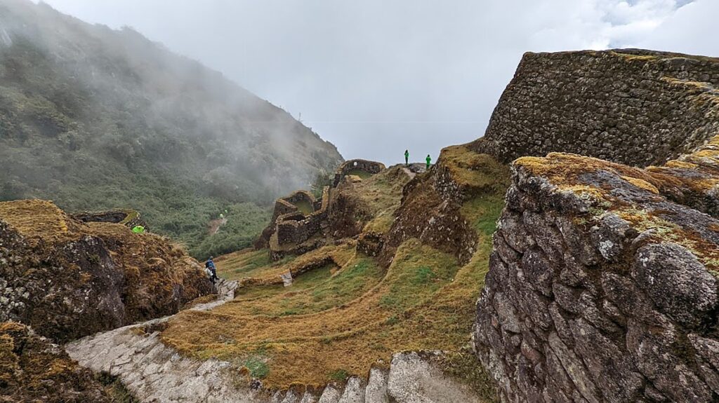
Exploring the Incan site of Phuyupatamarka © Karen Rubin/goingplacesfarandnear.com

This would have been one of the religious sites where pilgrims 600 years ago would be able to show their devotion and purify themselves before they reached the sacred Machu Picchu. It would have been a place of offerings, a ritual shower, of sacrifice.

At the time of the Inca and thousands of years before, the many different tribes were polytheists, worshipping many gods mostly associated with Nature. They believed that nature, man and the Pachamama (Mother Earth), lived in harmony and perpetual interrelationship. The Inca state promoted the worship of a Creator God (Wiracocha), Sun God (Inti), Moon Goddess (Mamaquilla), Thunder God (Illapa) and Earth Mother (Pachamama), and a host of other supernatural entities. But the ruling Inca established Inti, the sun god, as the most important (the first Inca king declared himself to be the son of Inti, to establish his divine power and authority).

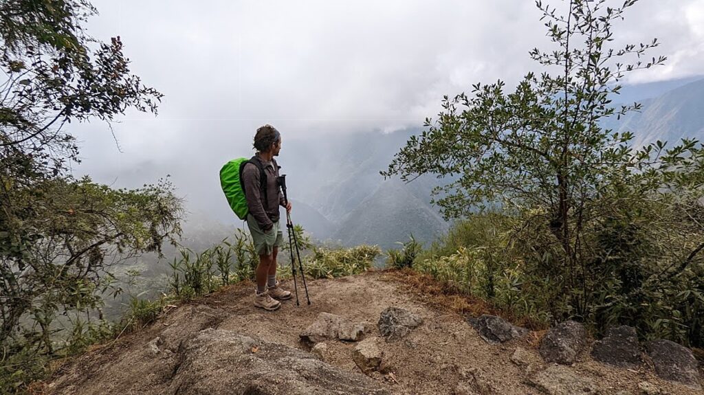
Eric takes in the dramatic landscape along the Inca Trail to Machu Picchu © Karen Rubin/goingplacesfarandnear.com

Lizandro points to a trinity that organizes the belief system: “The Inca thought three lives (past, present and future) ran parallel – one underneath (past), one above (future). They divided the world in three dimensions, three stages of life, which they depicted with animals – the condor (the heavens), the puma (the middle world of earth), and the snake (the underworld).

The snake represents knowledge, wisdom; because everything known is from past; the puma represents strength, energy; the condor connects this world to next world because it could touch heaven and carry heavy things, he says.

“The Inca saw life as a circle, not a line, so life never ends. They believed life is reborn and when they were buried, they were placed in the fetal position pointing to the sun and mountains; rulers were mummified and their mummified remains taken and paraded around one day a year. Children didn’t inherit property – people were buried with their belongings (for the next life). Machu Picchu, a sacred place, would have taken more than a lifetime to build, but though Emperor Pachacuti believed he wouldn’t enjoy it in this world, he would in the next.”

And the linchpin to it all, the basis for the Inca emperor’s power and authority, was religious faith.

So, while the Inca did not have slaves, they had a system of labor, whereby the men would give two to three months of service to the rulers (the first Inca Emperor, Pachacútec, the Alexander the Great of the Inca, had them build Machu Picchu, Pisac, Ollantaytambo and the various palaces and temples), and gave 50 percent of what they harvested to the nobles and the priests out of religious devotion.  And the people were kept ignorant – only the nobles and priests were educated – so they could be controlled with the use superstition and miracles.

He says there would have been six water fountains here – so people could take a ritual shower “to purify mind and body before going to Machu Picchu.” He also points to a sacrificial rock.

There appears to be an altar carved into the bedrock facing sunrise.

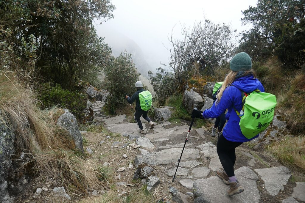
We have about 45 minutes of a steep downward hike before it levels off again.

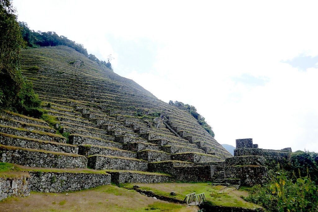
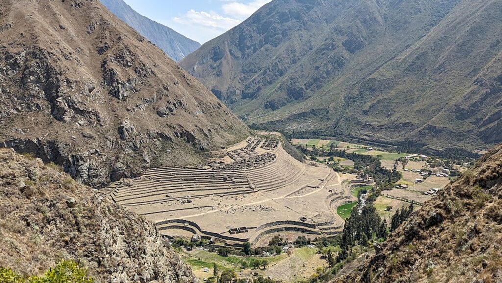
The Incan site of Intipata, Terraces of the Sun, one of the sites that would have served the pilgrims and nobles on their way to Machu Picchu and were abandoned for 400 years before being discovered by archaeologists © Karen Rubin/goingplacesfarandnear.com

We come to an Inca site, Intipata (Terraces of the Sun) that interestingly, overlooks our final campsite waaaay down the mountain. Lizandro points out what would have been a platform for sacrifice. “Not for human. That would be rare” indicating that it would take place only in extreme circumstances, like a famine and would be mainly girls 11 and 13 years old who belonged to Cuzco noble families, who were told they were born to be sacrificed as offerings to stop a national disaster. He describes one instance when the king sacrificed his daughter. (I’ll bet it was a period of famine, because they needed to reduce population to keep in balance.) The sacrificed were given fresh vegetable hallucinogenic flower to eat. “They offered them not death, but life.”

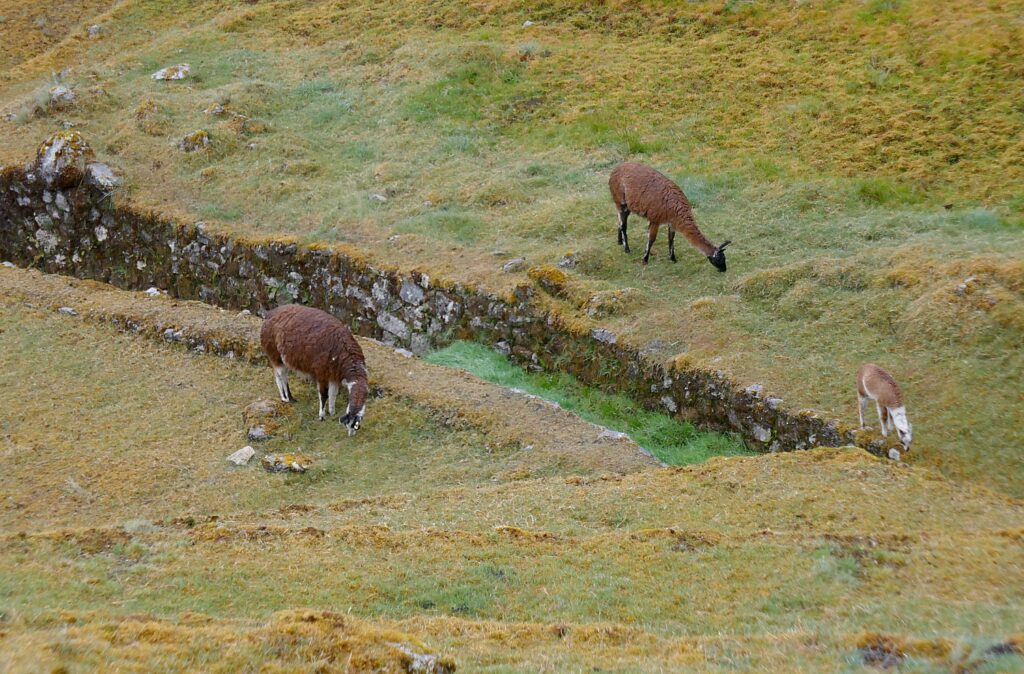
Llama at Intipata. “The Llama represents spiritual life and the black llama, a symbol of material life, would be sacrificed,” our Alpaca Expeditions guide, Lizandro, tells us © Karen Rubin/goingplacesfarandnear.com

More typically, it was a llama that would be sacrificed. “The llama represents spiritual life and the black llama, a symbol of material life, would be sacrificed.”

At Intipata, a boulder that would have been used as a platform for ritual sacrifice © Karen Rubin/goingplacesfarandnear.com

The Inca did not have a written alphabet, yet they had to figure ways to communicate across distances – to alert the villages along the Inca Trail when the king was coming, when enemies approached. They did it using runners – sometimes in relays (they could do the 26 mile distance we do in four days in four hours), using conch trumpets. Also, the patterns and colors of their clothing would identify who they were, what tribe, and so, whether friend or foe.

Terraces at Intipata. The scale is mind-blowing © Karen Rubin/goingplacesfarandnear.com

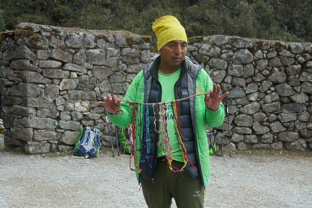
But they also had a system of colored strings and knots, called quipu, that recorded and relayed information, which he shows us as an example. Lizandro says (not disguising his resentment) that only a few quipu have survived but many have been taken to foreign museums (in fact, most of what the archeologists have taken from the Inca sites have yet to be returned).

(I imagine that the quipu could be read like Morse code and while they did not have an alphabet, the code was probably based on mathematics, so perhaps a computer could decipher?)

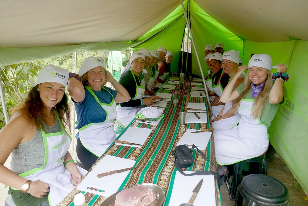
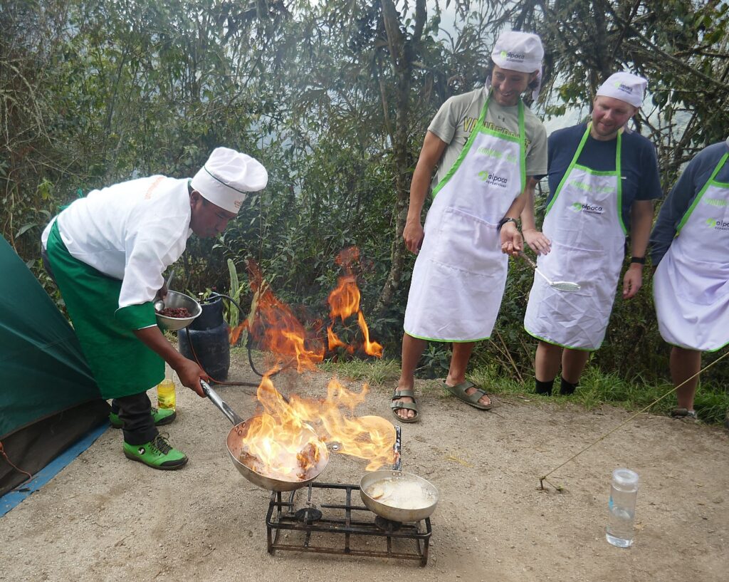
Getting set for our Alpaca Expeditions cooking class activity © Karen Rubin/goingplacesfarandnear.com

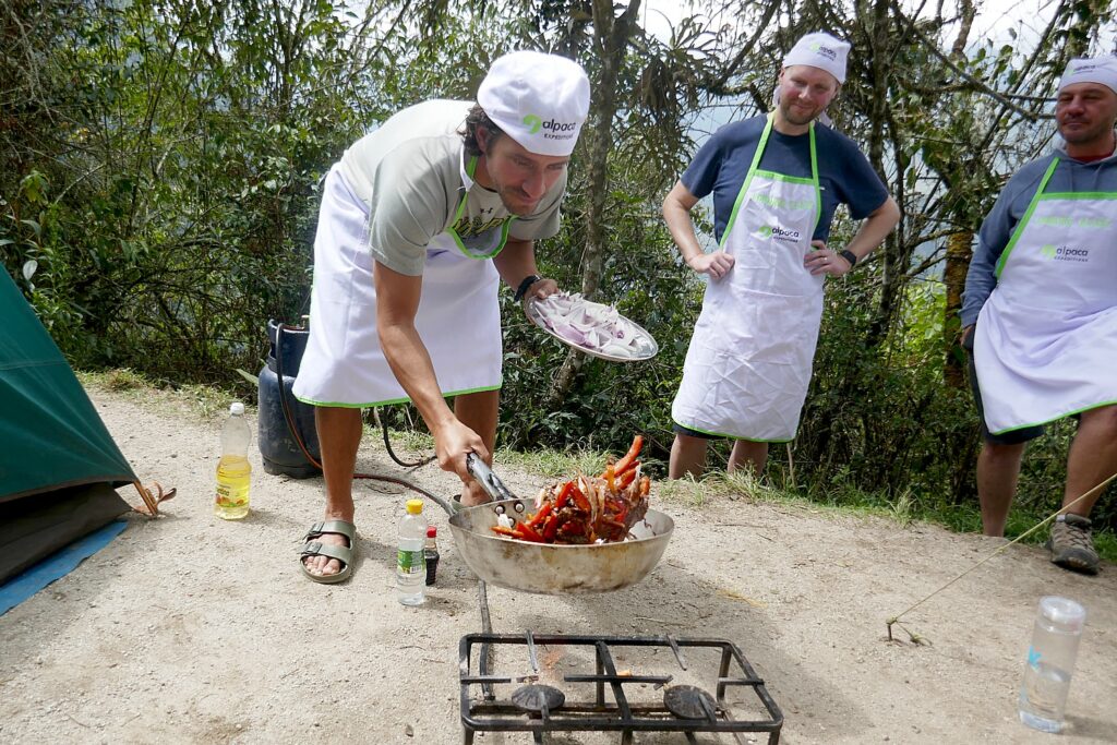
At the end of this relatively short and easy third day’s hike, we get into camp at 1 pm (it doesn’t feel like five hours!) and Lizandro tells us to look forward to a special “activity”. This turns out to be a cooking class, where Chef Mario shows us how to cook a popular Peruvian dish, lomas latudo. We get chef’s hats and aprons and the platters of ingredients – beef, red pepper, tomatoes, onions, yellow pepper, ginger, garlic, vinegar, soy sauce, salt, pepper, cilantro, oil to fry potato (served with French fries and rice) – which we learn how to properly cut, dice, stir and sauté – before enjoying our handiwork for lunch.

Chef Mario leads a cooking demonstration © Karen Rubin/goingplacesfarandnear.com

Later in the afternoon, after time to relax, we walk a surprisingly short distance (less than 10 minutes) along a trail from our campsite to one of the most impressive Incan villages of all, Wiñaywayna, and (unlike when we go to Machu Picchu the next day) we have it almost to ourselves to explore.

Eric demonstrates the tossing technique during our Alpaca Expeditions cooking class © Karen Rubin/goingplacesfarandnear.com

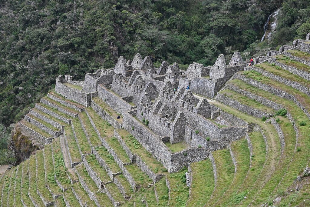
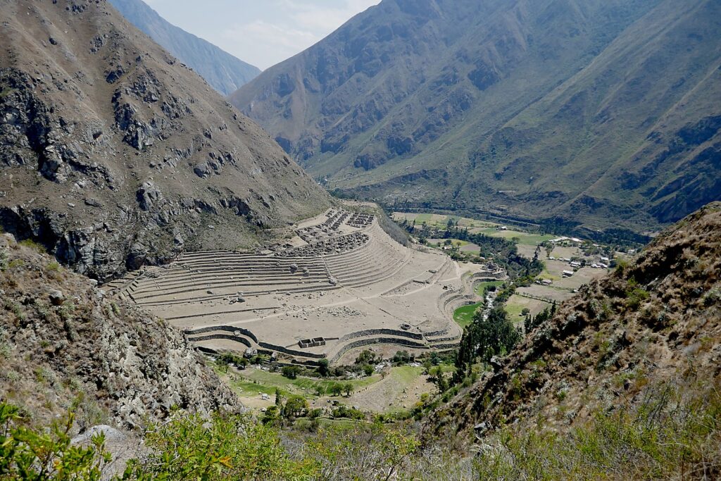
Wiñaywayna is the most spectacular Inca site on the trail after Machu Picchu and the most popular campsite because of its proximity to Machu Picchu.

Winawayna, one of the most impressive archaeological sites along the Inca Trail, was named ”Forever Young” because of the blooming orchids found there © Karen Rubin/goingplacesfarandnear.com

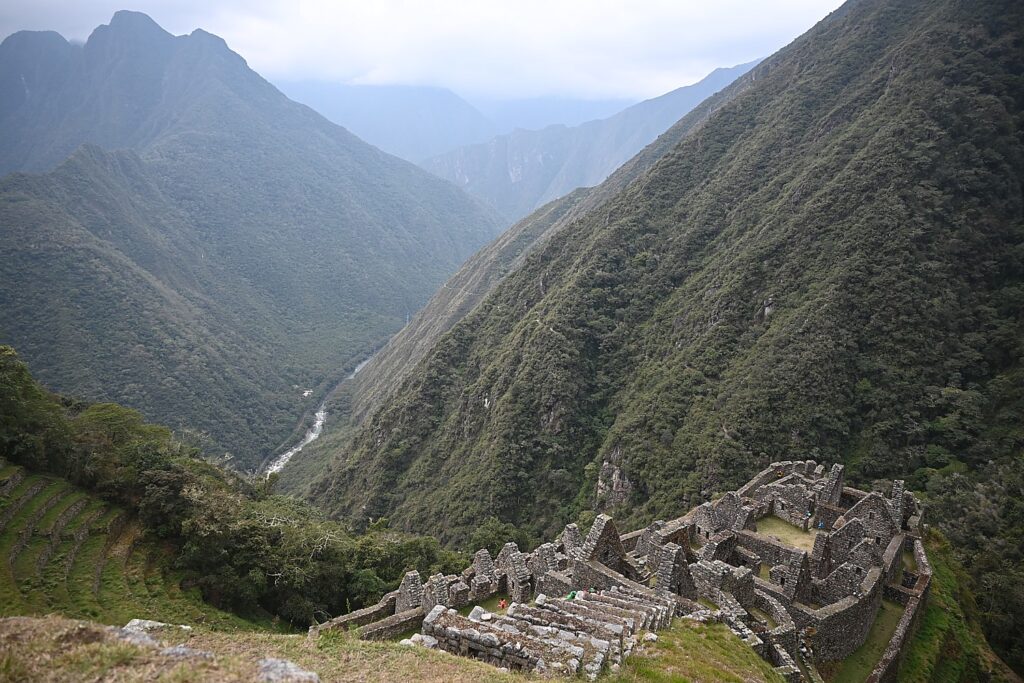
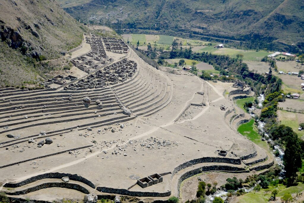
Wiñaywayna was discovered by a local archeologist in 1942 who was excavating a different site, Chamchabamba, and found it hidden under dense vegetation and cloud forest. Amazingly, they found orchid flowers growing on the wall. Lizandro explains that Peru has 435 species orchids, but they mostly bloom early or at the end rainy season, some bloom only  every 4-5 years or for only one day year, opening at sunrise and dying at sunset. But the orchids found here bloom year round, which is why they named the site, Wiñaywayna  – Forever Young – for the orchid. (If Dead Woman’s Pass, thankfully, did not prove prescient for me, perhaps Forever Young on this, my birthday?)

Wiñaywayna is the most spectacular Inca site on the trail after Machu Picchu © Karen Rubin/goingplacesfarandnear.com

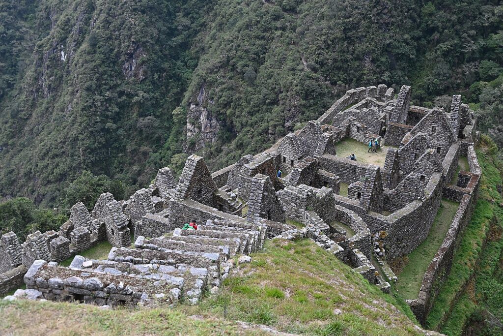
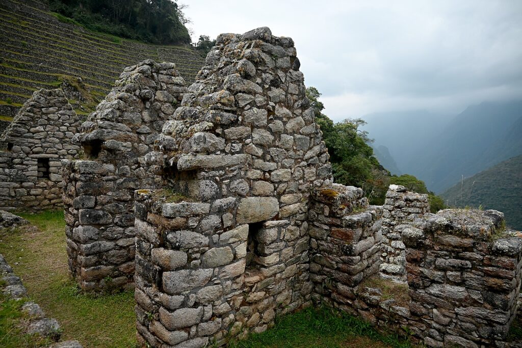
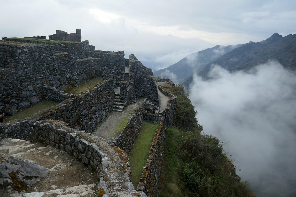
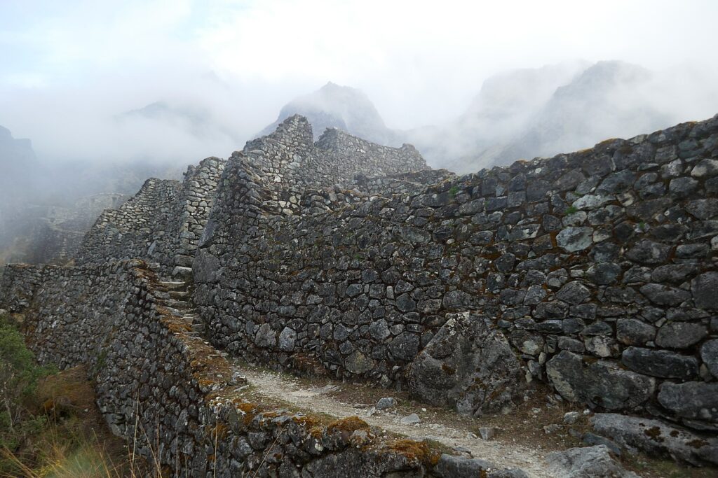
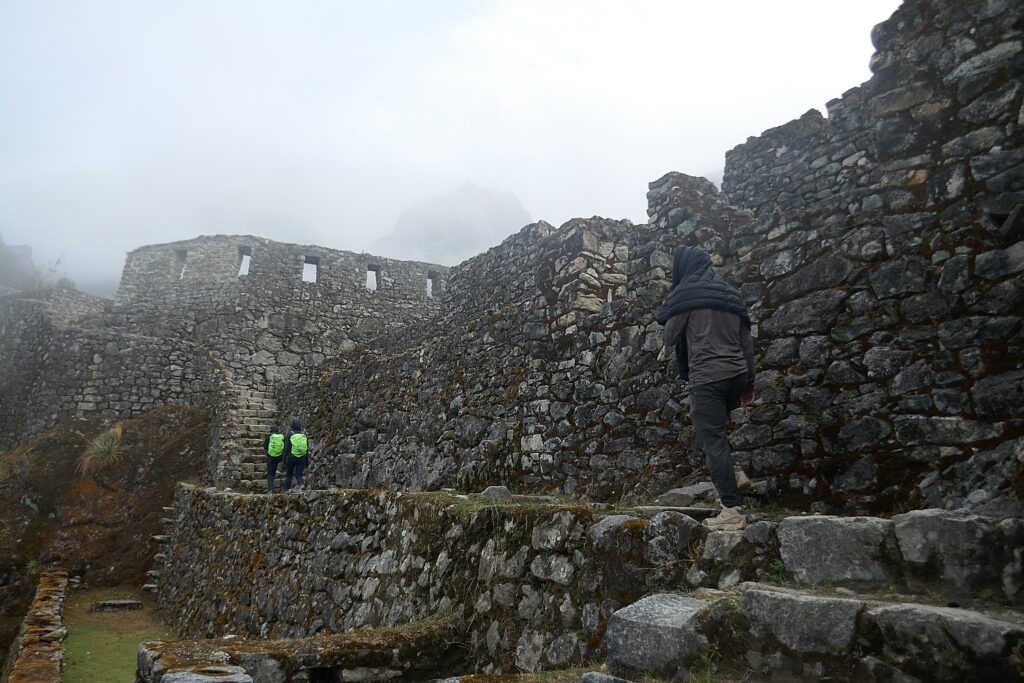
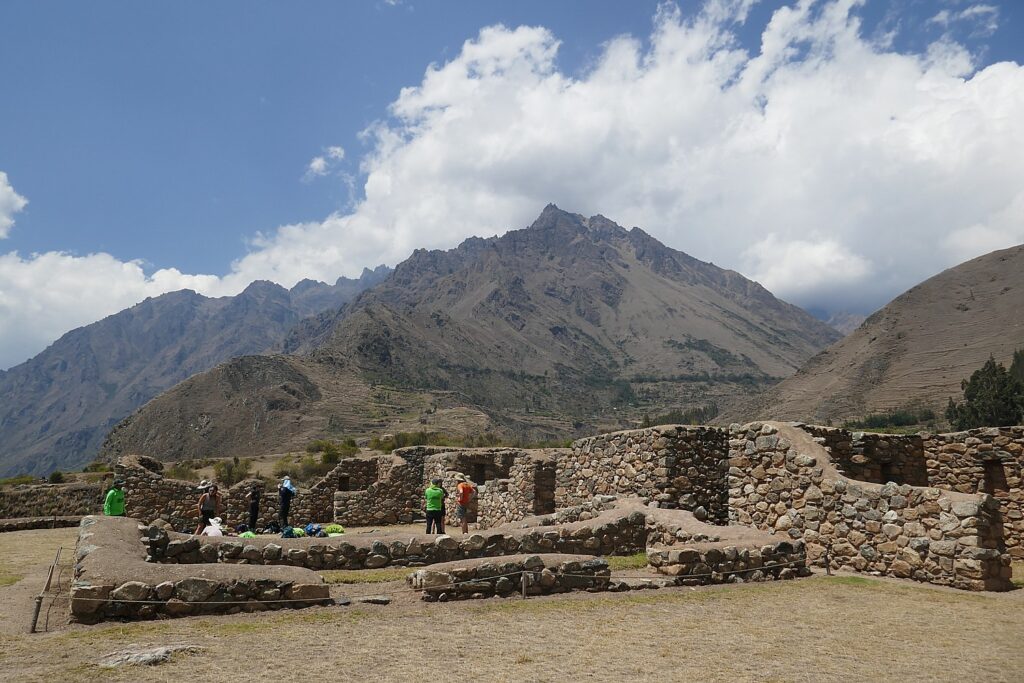
We explore the site, climbing up and down the steep stone steps, walking through the corridors, really getting into the architecture and engineering, the logistics, as if the people left only yesterday. You realize these ruins were buried under overgrowth for 400 years and can only marvel at what was involved in its excavation so that we can appreciate it today.

Wiñaywayna is the most spectacular Inca site on the trail after Machu Picchu © Karen Rubin/goingplacesfarandnear.com

Most of the Inca sites have yet to be uncovered and are still buried, and the ones that we do see have only been partially excavated. Indeed, only about 40 percent of Machu Picchu has been excavated.

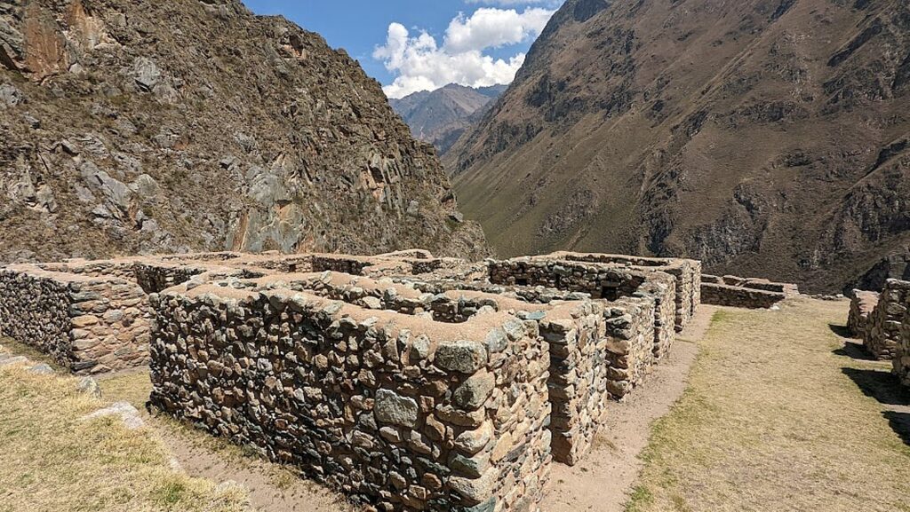
We go through a room with three walls and big windows which, Lizandro tells us, means it was a storage room – the windows provided ventilation for better preservation, while homes had no windows because it would be too cold; instead, there are spaces in the walls where they would put idols for decoration.

Wiñaywayna is remarkably intact so you can see how the homes, storage rooms and temple were constructed © Karen Rubin/goingplacesfarandnear.com

We see what would have been a watch tower. There would have been guards with weapons at the ready to protect Machu Picchu – like sling shots (a rope of wool with a bag in the middle with rocks),  arrows, lances, spears, hatchets – fine for use against another tribe, but fairly useless against the weapons the Spanish invaders wielded. The guard would have been able to recognize if someone coming was friend or foe by the colors and design of their clothes.

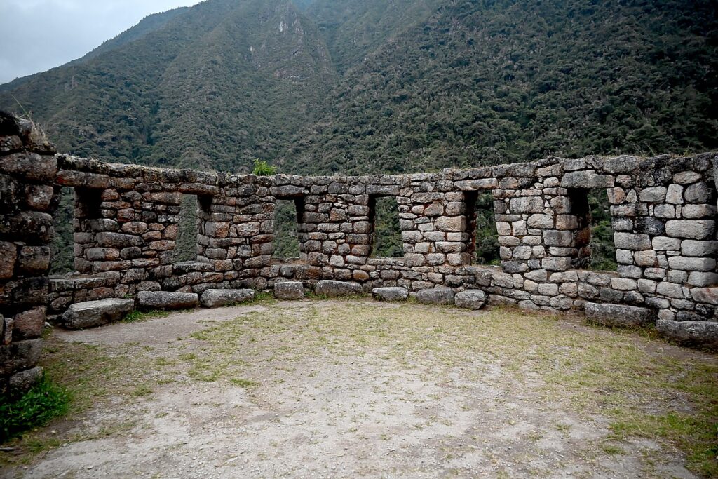
Seven windows arranged on a curve in the temple at Winawayna © Karen Rubin/goingplacesfarandnear.com

The temple here has three different architectural styles, which Lizandro says shows it was built by different generations and different engineers. A wall of this temple has seven windows that look out to the peak, arranged in a curve. The round shape was to reflect the sun, to provide different places to observe sun, like a sun dial. The seven windows are homage to the Seven Sister stars of the Pleiades.

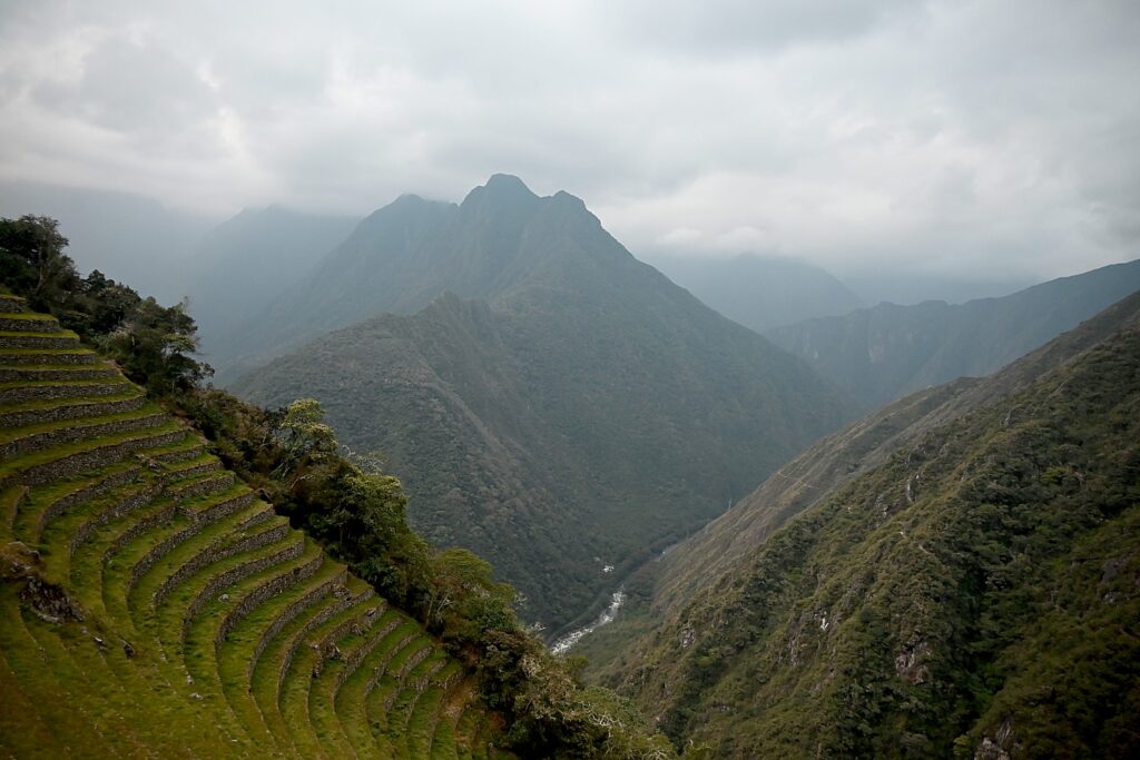
Appreciating the terraces – an agricultural laboratory to determine the best methods at different levels of elevation – and how Winawayna was built into these steep cliffs of the Andes Mountains © Karen Rubin/goingplacesfarandnear.com

The terraces here at Wiñaywayna were Incan agricultural laboratories – narrow and concave to follow the curves of the mountain, every seven levels a different ecology, granite and quartz used to absorb heat from the sun to keep plants from freezing overnight. “The Inca realized that elevations produced better potato and corn adapted to altitude.”

This site, along with the others, were purposely abandoned in 1538 with the Spanish conquest.

The first Spanish expedition, in 1532, had only 167. “They were invaders, not explorers.  They came to destroy the culture, the civilization. They took gold and silver and brought disease,” Lizandro says. The population at the time of the Inca was as high as 18 million before the Spanish.

Appreciating the terraces – an agricultural laboratory to determine the best methods at different levels of elevation – and how Winawayna was built into these steep cliffs of the Andes Mountains © Karen Rubin/goingplacesfarandnear.com

Machu Picchu and the other sites were built in the mid 1400s, over a period of about 60 years. Less than 100 years later, the population started decreasing– the human ecologist in me can’t help but wonder if the massive building projects and empire building didn’t take its toll on the population.

“European diseases came even before the Spaniards came. Cortez brought disease to the Mayans, and the Mayans, trying to flee the Spaniards by going south, carried the diseases along the same network of roads the Inca used to conquer and unify its empire. The 12th Incan king, Huayna Cápac (it is believed) died in 1525 from smallpox and there was no king to follow.”

He says that it is wrong to think of an Incan civilization, rather than an Incan ruler and ruling family of perhaps 20,000 who dominated a population that ranged in size from 10 to 20 million.  “When he passed away, he was mummified to continue guiding.” Because the Inca ruler could have as many concubines as he wanted, Huayna Cápac likely had 500 children throughout the kingdom, but only three who were sons of the Queen, were in line to be king. Two of the brothers were fighting a civil war for control at the time the Spanish came to Cuzco in 1533,” another reason the Spanish were successful with their conquest.

“The Spaniards saw amazing gold, silver – a city of gold – buildings covered in gold, a temple that had life-sized animals of gold. The Spaniards melted them to make coins. Then the Spanish king sent more soldiers.”

The view through the temple at Winawayna © Karen Rubin/goingplacesfarandnear.com

The Incan kingdom, weakened by civil war and not exactly supported by the masses they had subjugated for a century, abandoned this place to protect Machu Picchu, which was holy to them, like the Vatican. Machu Picchu was hidden amid the mountain peaks. To protect it from the Spanish invaders, the Inca destroyed the trails that led to Machu Picchu, and ultimately, abandoned Machu Picchu as well, making a last stand at Vilcabamba.

“The Inca weren’t the nicest to build such a civilization. For 100 years, they had to kill to control, so not all people were happy, so they didn’t help the Inca against the Spanish,” Lizandro says.

None of these grand projects were ever finished, which is more understandable than if they were completed.

We have as much time as we want to explore until darkness begins to fall because we can just stroll back to the campsite.

When we sit down to dinner, Chef Mario presents me with the most amazing birthday cake I have ever had in my life – completely decorated. It took him three hours to prepare it with the camping equipment he cooks with. I share the cake with Peter who timed his bucketlist Machu Picchu ascent for his 35th birthday the next morning.

Lizandro then asks us what time we would like to wake up in order to get to the check point to Machu Picchu before the other 200 trekkers who will be on line: “3 am? No? Then 3:01,” he says, noting that he has a 98% success rate in being first in line for the checkpoint when it opens at 5:30 am. The check point is only about 10 minutes walk from the campsite. Why so important to be first? Well, to get to the Sun Gate by sunrise, and before the small space gets jammed crammed with people all elbowing to get the best views and photos.

Tomorrow is the day we will reach the goal of our trek: Machu Picchu.

The permits to do the Inca Trail trek to Machu Picchu are limited to 500 a day for all the trekking companies (which includes 200 for trekkers and 300 for porters and staff) and get booked up months in advance.

More information: Alpaca Expeditions, USA Phone: (202)-550-8534, [email protected], [email protected], https://www.alpacaexpeditions.com/

Next: Day 4 on the Inca Trail – Machu Picchu!

See also:

VISIT TO PERU’S SACRED VALLEY IS BEST WAY TO PREPARE FOR INCA TRAIL TREK TO MACHU PICCHU

INCAN SITES OF PISAC, OLLANTAYTAMBO IN PERU’S SACRED VALLEY ARE PREVIEW TO MACHU PICCHU

ALPACA EXPEDITIONS’ INCA TRAIL TREK TO MACHU PICCHU IS PERSONAL TEST OF MIND OVER MATTER

DAY 1 ON THE INCA TRAIL TO MACHU PICCHU: A TEST

DAY 2 ON THE INCA TRAIL TO MACHU PICCHU: DUAL CHALLENGES OF DEAD WOMAN´S PASS, RUNCURACCAY

DAY 3 ON THE INCA TRAIL TO MACHU PICCHU: TOWN IN THE CLOUDS, TERRACES OF THE SUN & FOREVER YOUNG

DAY 4 ON THE INCA TRAIL: SUN GATE TO MACHU PICCHU, THE LOST CITY OF THE INCAS

__________________

© 2022 Travel Features Syndicate, a division of Workstyles, Inc. All rights reserved. Visit goingplacesfarandnear.com, www.huffingtonpost.com/author/karen-rubin, and travelwritersmagazine.com/TravelFeaturesSyndicate/. Blogging at goingplacesnearandfar.wordpress.com and moralcompasstravel.info. Visit instagram.com/going_places_far_and_near and instagram.com/bigbackpacktraveler/ Send comments or questions to [email protected]. Tweet @TravelFeatures. ‘Like’ us at facebook.com/NewsPhotoFeatures

Day 2 on the Inca Trail to Machu Picchu: Dual Challenges of Dead Woman´s Pass, Runcuraccay

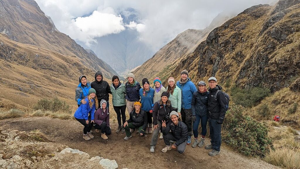
Eric and Sarah celebrate having reached Dead Woman’s Pass on Day 2 of Alpaca Expeditions’ four-day Inca Trail trek to Machu Picchu © Karen Rubin/goingplacesfarandnear.com

By Karen Rubin, with Eric Leiberman and Sarah Falter

Travel Features Syndicate, goingplacesfarandnear.com

This is the day I have been dreading for weeks. This is the day of reckoning. Dead Woman’s Pass.

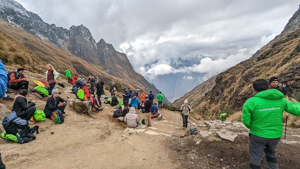
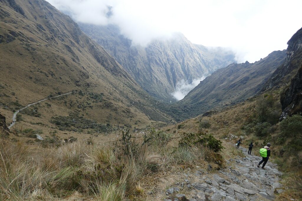
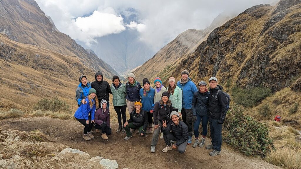
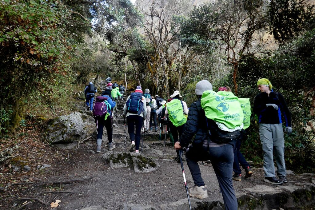
Everyone  – and not just my about-to turn-71-year-old self, some 25 to 40 years older than the other 14 in our pack – seems to have the same anxiety over Day 2. It is the longest, most challenging day of the four-day trek on the Inca Trail to Machu Picchu, when we will hike for four hours up to 13,829 ft over what I hope is not presciently named Dead Woman’s Pass (the name comes from its shape, not an event).

In fact, the climb up to Dead Woman’s Pass is only the first four hours of the full day’s hike, followed by two hours down, then rest and lunch. But then (and this is what could do me in), another hike up another mountain, to Runcuraccay Pass at 13020 ft albeit not quite as high, but steeper, 1,378 ft in elevation (more like a stadium staircase times 100 that I had imagined the whole way up to Dead Woman’s Pass would be), and then a steeper (1,220 ft), challenging decline to our campsite at Choquicocha. In fact, it is theRuncuraccay Pass that proves the more fearsome, as I soon discover, but actually unfolds to some of the most dramatic and interesting views and sites of the entire 26-mile Inca Trail trek. In all, we will hike a total of 10 miles this day, which includes a mile’s worth of up and downs.

One of my fears is that I won’t make it into camp before dark (there are 12 hours of daylight) so I keep my headlamp handy in my day pack, which helps alleviate my high anxiety.

(I used Day 1, the second hardest of the four day-hike, as a test, fully well expecting that our guide would politely tap me on the shoulder and suggest I walk back down the way I came, which also was my strategy if I decided the trek was too hard. But he didn’t. And I didn’t. But pressed on.)

Our Alpaca Expeditions group up at 5 am for breakfast before tackling the most challenging day on the Inca Trail Trek to Machu Picchu: hiking over Dead Woman’s Pass at an altitude of 13,779 ft. above sealevel, followed by Runkuracay Pass at 13,020 ft. © Karen Rubin/goingplacesfarandnear.com

It’s 5 am when we are wakened in our tents with basins of hot water and soap and hot coca tea (to help with the altitude).

Breakfast is sensational, providing excellent energy food (porridge is especially good). Indeed, breakfast typically offers some combination of scrambled eggs or omelette, pancakes, porridge, cereal, fruit salad, toast, orange juice, milk, tea, coffee, hot chocolate. We are always supplied enough drinking water – tap water that is boiled for us.

Alpaca Expeditions’ Green Machine team of porters cheer us on as we leave for Day 2 on the four-day Inca Trail trek to Machu Picchu © Karen Rubin/goingplacesfarandnear.com

As we leave camp at just about 6 am with the first light, the porters line up and applaud for us, giving us that extra boost of encouragement.

As we get higher, Lizandro stops to tell us little stories – a clever ploy so that we rest and acclimate to the higher altitude (in fact, I hear that older people such as myself do better with the altitude precisely because we go slower and stop more often).

Hiking up to Dead Woman’s Pass on Day 2 of Alpaca Expeditions’ four-day Inca Trail trek to Machu Picchu © Karen Rubin/goingplacesfarandnear.com

At another point, he distributes coca leaves and instructs us how to stuff it into a cheek and let the liquid blend with saliva to get its benefit of countering altitude sickness. Then, at another stop, he distributes a kind of plant oil (like eucalyptus) and shows us how to clap three times, then breath in the vapor, which opens up our air passages so we can can in more oxygen.

Alpaca Expeditions guide Lizandro gives us an oil and shows us how to inhale it to breathe more efficiently as we climb the last stage to Dead Woman’s Pass © Karen Rubin/goingplacesfarandnear.com
Hiking up to Dead Woman’s Pass on Day 2 of Alpaca Expeditions’ four-day Inca Trail trek to Machu Picchu © Karen Rubin/goingplacesfarandnear.com

Before the last ascent to Dead Woman’s Pass, there is a rest stop at Llulluchampampa (the best public restrooms on the trail!) and a stand where locals sell snacks and such. There are llamas with a baby grazing and hummingbirds. We see snow on the peaks.

Llama graze along the Inca Trail at Llulluchapampa, happy at an altitude of 12460 ft. © Karen Rubin/goingplacesfarandnear.com
 
A rest stop and snack stand at Llulluchapampa, before the final ascent to Dead Woman’s Pass © Karen Rubin/goingplacesfarandnear.com

Actually, I make it up to Dead Woman’s Pass by 9:15 am – coming in not at the end of the pack as I expected, but more towards the middle, Eric tells me. Everyone cheers. I honestly don’t remember feeling pain or discomfort, though I know I stopped several times along the way.

A rest break at Dead Woman’s Pass, the highest point on the four-day Inca Trail trek to Machu Picchu, at 13020 ft. © Karen Rubin/goingplacesfarandnear.com
Group photo! Our Alpaca Expeditions pack celebrates reaching Dead Woman’s Pass, the highest point, at 13020 ft., on the four-day Inca Trail trek to Machu Picchu © goingplacesfarandnear.com

On reaching the pass, we stop for a short break to enjoy the views and take photos (our guide, Lizandro, patiently takes each of our photos and a group photo), and we each indulge in the self-satisfaction of the accomplishment before setting off again to descend to Pacaymayu Valley, Hidden River. It’s another hour and a half down the side of the valley – to our lunch spot.

Beginning the descent from Dead Woman’s Pass 13,020 ft. to Pacaymayu at 11,700 ft. on the four-day Inca Trail trek to Machu Picchu © Karen Rubin/goingplacesfarandnear.com

I get in at 11:15 am to the cheers of the porters and fellow trekkers, where I find mats have been laid out for us to rest, but Mary Kate (who is part of the group of six women who are friends or friends of friends or friends of friends of friends of Caroline), is leading yoga stretches.

Mary Kate leads our Alpaca Expeditions trekkers in yoga stretches © Karen Rubin/goingplacesfarandnear.com

We enjoy a snack and then a fantastic and welcome lunch served in the dining tent (delectable chicken salad appetizer; Sara Lawa soup which is a kind of egg-drop soup made with corn flour, eggs, ginger) and I am struck by how really excellent the food is – I mean as good as the finest restaurant in Peru. Alpaca Expeditions boasts the best chefs in the mountains, and I am inclined to agree.

Alpaca Expeditions sets out basin of warm water and soap before lunch in the dining tent © Karen Rubin/goingplacesfarandnear.com

Chef Mario seems to use spices, flavors, textures (hot soups, energizing carbs, reinforcing proteins) that are medicinal or at least appropriate to the activity, whether to hike, acclimate, rest, sleep or wake. All the food is prepared from fresh ingredients purchased in the Cusco local market and carried up for us by the porters, then prepared by the chef (no canned or rehydrated food) who also caters to vegetarians, lactose intolerant and food allergies with heaping platters.

Lunch typically includes a delicious soup (like corn or mushroom) and some combination of chicken and rice, sausage, fried fish, ceviche, steak, beans, fried rice, french fries, boiled potatoes, vegetables, salad.

Tea time snack when we make it into camp for lunch © Karen Rubin/goingplacesfarandnear.com

There is such a lot of food but it is not just for us – the porters and staff eat the same food as we do (which, we learn, was not always the case for the trekking companies and a feature of Alpaca Expeditions that we really appreciate).

 After this delightful lunch, the realization sets in: this is only the half-way mark of this challenging day. We actually have another mountain to climb and descend.

Alpaca Expeditions porters hike up to Runkuracay Pass on the four-day Inca Trail trek to Machu Picchu © Karen Rubin/goingplacesfarandnear.com

In fact, the two-hour climb up the next mountain to Runcuraccay Pass is steeper though shorter – really what I had envisioned (and feared) the Dead Woman’s Pass would be like – and altogether more challenging.

We stop at a small Inca site (Runcuraccay) and see two huge waterfalls cascading down the opposite side of the valley.

Our Alpaca Expeditions guide, Lizandro, explain that while the Inca did not have written language, they communicated with quipu – a system of colored strings and knots – that so far have not been deciphered © Karen Rubin/goingplacesfarandnear.com

After the second pass, it’s another hour of a steep downhill hike to reach the magnificent Inca site, Sayacmarca (an otherwise inaccessible village).

The second half of the Day 2 Inca Trail trek proves the more challenging, but also the most scenic © Karen Rubin/goingplacesfarandnear.com

This part of the trek has actually been the hardest. Eric and Sarah, who had just 10 days before hiked Rainbow Mountain, a 6.2-mile out-and-back trail near Pitumarca, Cusco, where they hiked 1,627 ft  in elevation up to 16,000 feet (and suffered altitude sickness), are skipping up and down these peaks like a mountain goat. I’m a tortoise, taking my sweet time, going slow and steady, stopping for the views.

Eric and Sarah, on the “grand finale” of a six-month travel odyssey, having already hiked Peru’s Rainbow Mountain, literally skip up and down the Inca Trail © Karen Rubin/goingplacesfarandnear.com
The descent from Runkuracay Pass proves the more challenging © Karen Rubin/goingplacesfarandnear.com

The trail disappears as a thin line hugging the mountainside, the people are mere dots of color, and then, in the distance, this amazing and improbable fortress, Sayacmarca, appears. This is an astonishing view as we descend (it is steep), with the mountain mist – even more astonishing because you are not prepared for it as you are for Machu Picchu. And to realize that this construction was basically to protect Machu Picchu. (Here, though, as Lizandro warned, we encounter the meanest mosquitoes.)

Those tiny dots of color are members of our Alpaca Expeditions pack on the Inca Trail toward Sayacamaka, the “inaccessible village” © Karen Rubin/goingplacesfarandnear.com

In 1941, an archeaologist came upon Sayacamaka, which was completely buried under the overgrowth and named it “inaccessible village.” The site is strategic – on top of mountain, surrounded by valleys, and protected. We see what would have been a watch tower. These structures were used for resting places, like a hostel, for the pilgrims, nobles and travelers, spaced 20-25 km apart so they could be reached in a day’s hike and travelers knew there would be food and drink ready, Lizandro tells us.

Sayacamaka, which was completely buried under the overgrowth and named by archaeologist “inaccessible village” emerges out of the mist along the Inca Trail © Karen Rubin/goingplacesfarandnear.com

The Inca would build a temple just for storing idols (gold), but would worship in open area – more important than a temple, because being in contact with nature  was the essence of their religion.

Some 16 small rooms have been excavated – the ones with windows were storage rooms; homes did not have windows (too cold). There were no farming terraces here; food came from other places, supplied by other community people.

Sayacamaka, which was completely buried under the overgrowth and named by archaeologist “inaccessible village” emerges out of the mist along the Inca Trail © Karen Rubin/goingplacesfarandnear.com

There is a huge rock in the middle of a house that was natural, part of mountain, in the same shape as mountain. “The Inca made a replica to be closer to mountain (it was considered a god).”

Sayacamaka is one of the most intriguing and dramatic sites along the Inca Trail © Karen Rubin/goingplacesfarandnear.com

How did they get the building stones there? Lizandro points to where a quarry would have been on the other side of the mountain; the building stones would have been brought up the steep trail using only human power. How many would have built the village, and over what period of time, I wonder.

They also engineered canals to bring drinking water – we see three small, square constructions that served as water fountains.

Peru’s Ministry of Culture and Ministry of Environment is responsible for these sites and rangers protect them. While they excavate and can restore, they cannot rebuild any of the structures, so if there is a stone that has fallen off and they are not sure where it came from, they leave it where it fell.

Sayacamaka is one of the most intriguing and dramatic sites along the Inca Trail © Karen Rubin/goingplacesfarandnear.com

In 1915, the archaeologist Hiram Bingham, who is most responsible for uncovering Machu Picchu, found 8 of these Incan trails. One of the trails led to Vilcambaba, the last refuge of the Inca. In 1538, these sites along the Inca Trail to Machu Picchu and Machu Picchu were destroyed by order of Manco Inca, the last Incan king to protect them from the invading Spaniards. Portions have been restored.

After exploring Sayacamaka, it’s only 20 minutes further to our second campsite, Chaquicocha (Dry Lake) at 11,808 ft. altitude, as the sun sets over the Vilcabamba mountain range. 

Chaquicocha campsite is described as a recently restored Inca settlement at the gateway to the jungle, nestled between two eco-systems – high ground and cloud forest © Karen Rubin/goingplacesfarandnear.com

After exploring Sayacamaka, it’s only 20 minutes further to our second campsite, Chaquicocha (Dry Lake) at 11,808 ft. altitude. We reach the campsite at around 6:30 pm, as the sun sets over the Vilcabamba mountain range, having met the toughest challenge of the trip (and my life).

The Chaquicocha campsite is described as a recently restored Inca settlement at the gateway to the jungle, nestled between two eco-systems – high ground and cloud forest. It has one of the most picturesque settings with a fantastic view of the night sky to observe the stars, except it is cloudy tonight. It is also quite cold, and I am so happy with my $4 purchase of knee-high alpaca wool socks.

Chaquicocha campsite is described as a recently restored Inca settlement at the gateway to the jungle, nestled between two eco-systems – high ground and cloud forest © Karen Rubin/goingplacesfarandnear.com

“Happy Hour” ( tea time) before dinner consists of popcorn, fried wontons, tea, coffee, followed by another superb dinner (the menu might consist of some combination of stuffed chicken, vegetable tortillas, pizza, spaghetti, pork cutlet, sauteed vegetables, salad).

The permits to do the Inca Trail trek are limited to 500 a day for all the trekking companies (which includes 200 for trekkers and 300 for porters and staff) and get booked up months in advance.

More information: Alpaca Expeditions, USA Phone: (202)-550-8534, [email protected], [email protected], https://www.alpacaexpeditions.com/

Next: Day 3 on the Inca Trail

See also:

VISIT TO PERU’S SACRED VALLEY IS BEST WAY TO PREPARE FOR INCA TRAIL TREK TO MACHU PICCHU

INCAN SITES OF PISAC, OLLANTAYTAMBO IN PERU’S SACRED VALLEY ARE PREVIEW TO MACHU PICCHU

ALPACA EXPEDITIONS’ INCA TRAIL TREK TO MACHU PICCHU IS PERSONAL TEST OF MIND OVER MATTER

DAY 1 ON THE INCA TRAIL TO MACHU PICCHU: A TEST

DAY 2 ON THE INCA TRAIL TO MACHU PICCHU: DUAL CHALLENGES OF DEAD WOMAN´S PASS, RUNCURACCAY

DAY 3 ON THE INCA TRAIL TO MACHU PICCHU: TOWN IN THE CLOUDS, TERRACES OF THE SUN & FOREVER YOUNG

DAY 4 ON THE INCA TRAIL: SUN GATE TO MACHU PICCHU, THE LOST CITY OF THE INCAS

__________________

© 2022 Travel Features Syndicate, a division of Workstyles, Inc. All rights reserved. Visit goingplacesfarandnear.com, www.huffingtonpost.com/author/karen-rubin, and travelwritersmagazine.com/TravelFeaturesSyndicate/. Blogging at goingplacesnearandfar.wordpress.com and moralcompasstravel.info. Visit instagram.com/going_places_far_and_near and instagram.com/bigbackpacktraveler/ Send comments or questions to [email protected]. Tweet @TravelFeatures. ‘Like’ us at facebook.com/NewsPhotoFeatures

Day 1 on the Inca Trail to Machu Picchu: A Test

Crossing the bridge to set out on the Inca Trail on Day 1 of the four-day, 26-mile Alpaca Expeditions trek to Machu Picchu © Karen Rubin/goingplacesfarandnear.com

By Karen Rubin, with Eric Leiberman and Sarah Falter

Travel Features Syndicate, goingplacesfarandnear.com

For me, the first day of the four-day, 26-mile Inca Trail trek to Machu Picchu is a test – like throwing down the gauntlet. It is the second hardest (Day 2 is the day I have been dreading), when we will hike 8.7 miles, climbing 1,866 feet to an altitude of 10,829 feet where our campsite will be. My strategy is that if I find it too difficult, I will simply walk back the way I came, rather than continue on to Day 2. Having an out is the security blanket I need.

The day actually begins the evening before, when our group meets at 6 pm (we arrive late from our Sacred Valley day tour) at the Alpaca Expeditions offices in Cuzco for an orientation and to pick up the duffle bags (we are limited to 7 kg which includes the sleeping bag, so only about 4 kg of stuff), as well as a rain cover for our day packs, a rain poncho and hiking poles that we have rented. (We will leave the rest of our luggage at the hotel or can store it with Alpaca). A team of porters will carry not only our duffels (they carry 3 plus their own!), but the camping gear (tents, sleeping bags and mats), a dining tent and stools, cooking stuff, our food, and even a private potty tent.

Alpaca Expeditions’ Porters House provides a place for the porters to stay between expeditions, and is where trekkers have breakfast before setting out on the Inca Trail © Karen Rubin/goingplacesfarandnear.com

Our adventure starts with a pick up at our hotel, Amaru Inca, in Cuzco’s historic district at 4 am. We pick up the other participants at various locations (didn’t realize we could have overnighted at Ollantaytambo!) and are taken to Piskachucho, Porters House, where we enjoy a marvelous and energizing breakfast. This is a bunkhouse where the porters – who come from mountain villages hours away – stay between expeditions.

We stop off for a bathroom break at a fantastic shop where I purchase a treasure: the most marvelous alpaca wool knee-high socks for $4 which I adore to keep me comfy cozy on the cold nights in the tent.

Alpaca Expeditions guides Lizandro and Giorgio give us a bit of an orientation and pep talk at the museum at the entrance to Machu Picchu national park, a UNESCO World Heritage Site since 1983 © Karen Rubin/goingplacesfarandnear.com

We drive to Km 82, and go through the first Inca Trail checkpoint to begin our trek. We have to present our passport and be checked off against the list of permits, which are limited to 200 trekkers a day (which is why you have to book this trip sometimes months in advance). Machu Picchu became a national sanctuary in 1981 and a UNESCO World Heritage Site in 1983. There is a small museum there and our lead guide, Lizandro Aranzabal Huaman, uses this opportunity to gather us all together to reintroduce ourselves (after the orientation meeting the night before), and give us a little intro and pep talk.

Our Alpaca Expeditions group sets out on the Inca Trail © Karen Rubin/goingplacesfarandnear.com

We are a group of 15: a couple on their honeymoon (he from Italy, she from Netherlands), a couple from New York (actually he comes from my hometown and she from Miami) who just got engaged; a couple from Norway living in Guyana; a couple (she from New Zealand, he from Ukraine) doing remote work in Lima; a group of six ladies organized by one who actually did not know each other until the trip, but were friends or friends of friends, who come from NY, Kentucky, California; and Eric and Sarah who are finishing up six-month travel odyssey with this grand finale and me. Every one is well traveled and adventurous (also between 25 and 35 years younger than me. (On the trail, I find a family taking a private tour where the parents are in their mid-60s, so I believe I am the oldest trekker on the trail at this point.)

Crossing the river to the Inca Trail to Machu Picchu © Karen Rubin/goingplacesfarandnear.com

What we call the Inca Trail was part of an immense network built Pachacuti Inca Yupanqui, the ninth ruler of the Inca, in the mid-1400s. These roads linked the main cities of the empire with Cusco, the capital, and Machu Picchu. During the time of the Inca, the trail was the only way to get to Machu Picchu.

Sarah and Eric at the start of the Inca Trail trek to Machu Picchu, the “grand finale” to their six-month odyssey © Karen Rubin/goingplacesfarandnear.com

Our guide, Lizandro, tells us about the animals we may encounter: puma and condor (not surprisingly, they are also sacred animals that appear in architecture), speckle bear (a herbivore), and birds like fly catcher and hummingbirds (32 species).

Setting out on the Inca Trail on Day 1 of the four-day, 26-mile Alpaca Expeditions trek to Machu Picchu © Karen Rubin/goingplacesfarandnear.com

We head out and cross a bridge over a rushing river after scouts tell us the trail has been reopened. It had been closed down for a month after a rock slide killed two porters. We are the first group of trekkers on the trail – which saves about an hour.

Lizandro stops to point out an insect on cactus – cochinillia – which the Inca used for dying textile. The prickly pear on a cactus, he says, should be eaten before sundown or it will cause an upset stomach. He points to a kind of bean which is made into a powder as a base for aspirin.

Lizandro explains the properties of green agave so important to Incan society © Karen Rubin/goingplacesfarandnear.com

The green agave was used to make string, while ichu grass was woven into rope, strong enough to haul the massive building stones and build suspension bridges (an Incan invention). Part of the bridge’s strength and reliability came from the fact that each cable was replaced every year by local villagers as part of their mit’a – their public service obligation.

Incan society innovated suspension bridges, which villagers replaced each year as part of their mit’a public service obligation to the state © Karen Rubin/goingplacesfarandnear.com

Indeed, the Inca did not use currency, nor, apparently, have slave labor; their society was organized on a system of Anyi (reciprocity, like barter); Minka (communities work together) and Mita (a labor tax, where every man was obligated to do two to three months of service to the government or serve in the military each year). By combining their political authority with religious authority, the people who were impressed to build temples and palaces did it out of devotion.

The first morning’s hike takes us through a few mountain villages – now set up to sell drinks, snacks and items to the hikers.

The Inca Trail takes us through mountain villages © Karen Rubin/goingplacesfarandnear.com

At the last village we encounter before ascending into mountain wilderness, Lizandro tells us this is actually the village where he grew up and where 96 families still live. From the age of 5, he was leading a pack horse on the trail. There was no school in his community, so his parents sent him to live with an uncle for three years, until his parents couldn’t afford to send him. He met a chef for an expedition company and began as a porter at age 18 (one of the youngest) and spent two years as a porter, then a chef before becoming a guide, which is how he learned English. Our other guide, Georgio, lives in the Sacred Valley and joined Alpaca Expeditions this year.

The first 2 hours of the trek are relatively easy – a warm up – as we make our way to our first Inca site where there is also a stunning overlook.

Patallacta was an ancient Inca checkpoint for the approach to Machu Picchu. This was a small resting place and Lizandro begins his story that he will continue at various sites and resting places along our four-day hike © Karen Rubin/goingplacesfarandnear.com

Patallacta was an ancient Inca checkpoint for the approach to Machu Picchu. This was a small resting place and Lizandro begins his story that he will continue at various sites and resting places along our four-day hike (each time, giving us time to refresh and acclimate to the altitude and recover energy to progress).

Overview of an Incan village © Karen Rubin/goingplacesfarandnear.com
Coming to our first Incan site on the trail, Patallacta was an ancient Inca checkpoint for the approach to Machu Picchu © Karen Rubin/goingplacesfarandnear.com

This site would have housed travelers and soldiers who manned the nearby “hill fort” of Willkaragay. It was also a shrine with rounded walls known as Pulpituyuq that had religious and ceremonial functions. Patallacta was burned by Manco Inca Yupanqui, the last Incan emperor, who destroyed a number of settlements along the Inca road system during his retreat from Cuzco in 1536, to block pursuit from the Spanish conquistadors. This is one reason why the Spanish never discovered the Inca Trail to Machu Picchu.

Patallacta was an ancient Inca checkpoint for the approach to Machu Picchu. This was a small resting place and Lizandro begins his story that he will continue at various sites and resting places along our four-day hike © Karen Rubin/goingplacesfarandnear.com

“The culture that built these weren’t the only civilization,” Lizandro tells us. The peoples who lived here were one of the oldest cultures in the hemisphere: the Caral civilization of Peru dating back to 3200 BCE, is the oldest known civilization in the Americas and built pyramids before the Egyptians.

The Paracas performed skull surgery 2000 years ago. I learn that Inca was one of the first cultures that could do surgery; surgeons in ancient Peru commonly and successfully removed small portions of patients’ skulls to treat head injuries; the surgical procedure—known as trepanation —was most often performed on adult men, likely to treat injuries suffered during combat.

Besides the Paracas, there were the Nasca who were responsible for those mysterious lines etched into plains that could only be seen from high up in the shapes of monkey and toucan even though these animals didn’t live here (sometimes I think we imagine what the shapes represent); Chimu, believed to be the first civilization to practice human sacrifice (500 skeletons were found in one tomb near Lima); Tiajuanacas who were the first culture to domesticate animals – llama used to carry goods, alpaca for their fur and meat, and vincuna, all three in the camel family.

These civilizations and cultures all preceded the Inca but the Inca, a ruling family that imbued themselves with divine authority, were the first to conquer the Andes and establish such a vast empire. The Inca reigned from 1150 to 1533, but the history is mostly lost – eradicated by the Spanish – because the Inca did not develop a written language (that is that they know of).

Coming to our first Incan site on the trail, Patallacta was an ancient Inca checkpoint for the approach to Machu Picchu © Karen Rubin/goingplacesfarandnear.com

How did they build such big monuments and conquer the Andes?

According to myth, Lizandro relates, around 1100, the first Incan king and queen emerged from Lake Titicaca floating islands, traveled north looking for good soil and came to Cuzco Valley which was already inhabited. They transformed the land – built homes, established religion putting the sun god, Inti, ahead of the other gods, and the Incan king anointing himself the son of the sun. They conquered the tribes around Cuzco and made Cuzco the center of their universe and the spiritual center of the Andes. Then they discovered (and conquered) the Sacred Valley – sacred because of its fertile production of corn.

Overview of an ancient Incan village © Karen Rubin/goingplacesfarandnear.com

Over the next 350 years, the Inca expanded their empire, built a road system (known as the Royal Road) that was the most extensive and advanced transportation system in pre-Columbian South America – 25,000 miles of road stretching to Ecuador, Argentina, and Chile, connecting the coast, Andes and rainforest regions. It was also a communications system. They would send messages by relay runners who carried quipu – messages based on strings and knots (they did not have written alphabet). The runners – who might announce the impending arrival of a noble – could make it to Machu Picchu in four hours (we take four days).

Most of the sites we see were built in the mid-1400s by Pachacuti, the Incan “Alexander the Great”. He rebuilt Cuzco, built Pisac, Ollantaytambo and Machu Picchu. These sites we encounter along the Incan Trail were built specifically as resting places for pilgrims and travelers headed to Machu Picchu, for religious purpose and for protection of Machu Picchu.

Lunch at Hatunchaca before we enter the wilderness© Karen Rubin/goingplacesfarandnear.com

From Patallacta it’s another 2-hour hike to Hatunchaca, a kind of way station, where we have lunch, actually served in a small building, as fine as the best restaurant: avocado salad, a sensational pumpkin soup  (the soups are so welcome, comfort food), garlic bread; trout (outstanding), rice, roasted potato, corn.

We meet villagers during the day’s hike on the Inca Trail © Karen Rubin/goingplacesfarandnear.com

The next hour (for me, more like 1 hour 20 minutes) is all uphill, making me all the more anxious for Day 2’s hike, which will be the real challenge. I am imagining that tomorrow will be this times 10 – four hours of this just to get to Dead Woman’s Pass.

On this last stretch, we pass through two small communities where we can buy an energy drink, snacks, or essential items like batteries.

At Wayllabamba (9842 ft elevation it begins to mist and we delight in seeing a rainbow (auspicious? Some indigenous people worshipped the rainbow, associated with fertility), but then it thunders and rains © Karen Rubin/goingplacesfarandnear.com

We come to a ranger station at Wayllabamba (9,842 ft elevation) where it begins to mist and we delight in seeing a rainbow (auspicious? Some indigenous people worshipped the rainbow, which they associated with fertility), then drizzle, then thunder, and as we get into the Ayapata campsite (10,829 ft elevation) , at 4:30 pm, it is a real downpour. But we get cozy inside our tents, where the sleeping bag (winter grade) and mat and our duffels are already placed (whew!).

Then it’s tea time! with snacks (popcorn!), and by 7:30 pm a marvelous dinner.

Our tents are all set up when we get to the Ayapata campsite for our first night © Karen Rubin/goingplacesfarandnear.com

The rain clears out and the stars are amazing.

Lizandro points out the constellations so important to the Inca. The Inca believed the Milky Way to be a river, Mayu, the source of all water on earth. and that earth and sky are connected, sacred, alive and parts of one whole. The sky had special, even religious significance in managing this civilization and organizing daily life, especially food production. The Inca could identify the solstices, equinoxes, the changes of season in order to better identify when to sow and harvest. We see how the Incan sites were constructed to connect to the solstice – even Machu Picchu was constructed around the stars and the Sun Gate aligned with the solstice. In the magnificent Southern Hemisphere sky, away from all the artificial lighting, you can appreciate the wonder the sky evoked.

We hiked 8.7 miles this day and climbed from an altitude of 8,923 ft to 10,829 to the Ayapata campsite, the hike helping us to acclimate and get used to the Inca Trail. I’m feeling fine after today’s hike – at first feeling sensory deprived because I did not bring a book with me (too much weight) so I look over old tweets. I fall asleep anxious about what Day 2 will bring.

The stars come out at Ayapata campsite, so we can appreciate the constellations that inspired such wonder and awe in the Inca © Karen Rubin/goingplacesfarandnear.com

The permits to do the Inca Trail trek are limited to 500 a day for all the trekking companies and get booked up months in advance.

More information: Alpaca Expeditions, USA Phone: (202)-550-8534, [email protected], [email protected], https://www.alpacaexpeditions.com/

Next: Day 2: Conquering Dead Woman’s Pass

See also:

VISIT TO PERU’S SACRED VALLEY IS BEST WAY TO PREPARE FOR INCA TRAIL TREK TO MACHU PICCHU

INCAN SITES OF PISAC, OLLANTAYTAMBO IN PERU’S SACRED VALLEY ARE PREVIEW TO MACHU PICCHU

ALPACA EXPEDITIONS’ INCA TRAIL TREK TO MACHU PICCHU IS PERSONAL TEST OF MIND OVER MATTER

DAY 1 ON THE INCA TRAIL TO MACHU PICCHU: A TEST

DAY 2 ON THE INCA TRAIL TO MACHU PICCHU: DUAL CHALLENGES OF DEAD WOMAN´S PASS, RUNCURACCAY

DAY 3 ON THE INCA TRAIL TO MACHU PICCHU: TOWN IN THE CLOUDS, TERRACES OF THE SUN & FOREVER YOUNG

DAY 4 ON THE INCA TRAIL: SUN GATE TO MACHU PICCHU, THE LOST CITY OF THE INCAS

__________________

© 2022 Travel Features Syndicate, a division of Workstyles, Inc. All rights reserved. Visit goingplacesfarandnear.com, www.huffingtonpost.com/author/karen-rubin, and travelwritersmagazine.com/TravelFeaturesSyndicate/. Blogging at goingplacesnearandfar.wordpress.com and moralcompasstravel.info. Visit instagram.com/going_places_far_and_near and instagram.com/bigbackpacktraveler/ Send comments or questions to [email protected]. Tweet @TravelFeatures. ‘Like’ us at facebook.com/NewsPhotoFeatures

Alpaca Expeditions’ Inca Trail Trek to Machu Picchu is Personal Test of Mind Over Matter

Our Alpaca Expeditions group strikes a celebratory pose after reaching Dead Woman’s Pass, the highest point on the four-day classic Inca Trail trek to Machu Picchu © Karen Rubin/goingplacesfarandnear.com

By Karen Rubin, with Eric Leiberman and Sarah Falter

Travel Features Syndicate, goingplacesfarandnear.com

The day after we cross over Dead Woman’s Pass at 13,829 feet above sea level on the Inca Trail and the day before reaching Machu Picchu – the destination of this Alpaca Expeditions four-day/three-night trek –  I celebrate my 71st birthday. I say this because I am not a habitual hiker or climber, am reasonably but not especially fit and live at sea level.  So I had been really, really anxious for weeks about whether or not Dead Woman’s Pass, named for its shape, would take on literal meaning.

And while age would normally be a private matter, I say this because if I could do it, anyone who is determined (it is mostly about mind over matter) can do it too.

Early morning breakfast before we head out to conquer the Dead Woman’s Pass on Day 2 of the four-day Inca Trail trek © Karen Rubin/goingplacesfarandnear.com

But my success (and yes, I do considerate it a major life accomplishment, if only to overcome fear and go outside my comfort zone to take on the challenge) has a lot to do with how well Alpaca Expeditions, the tour operator, runs this trip –all that our guides do to make the trek as comfortable and enjoyable as possible; how the porters (who are carrying our gear) all line up to applaud and cheer us when we come in from the hike; the quality of the camping and trekking equipment; the incredible food, snacks and teas (tea time!) that Chef Mario serves that are not only the quality of a fine restaurant but seem perfect for the task; providing basins of hot water and soap and delivering hot coca tea as our wake up call. (The private porto-potty tent, and an actual “sanitation engineer” assigned to keep it functioning, is also extremely appreciated.)

Alpaca Expeditions’ “Green Machine” team of porters cheer us as we set out on Day 2 for Dead Woman’s Pass © Karen Rubin/goingplacesfarandnear.com

The hike itself – 26 miles with some fairly steep ups and downs – is actually considered moderate difficulty, along a trail of stones, albeit some high (especially for someone like me with short legs), some narrow, and some that can be slick.

Imagining the people who laid these stone steps, carved the trail, and the pilgrims who used it to trek to Machu Picchu 600 years ago © Karen Rubin/goingplacesfarandnear.com
 

The main problem comes from the altitude. And my great fear that inhabits my mind with each step as I try to prepare myself by walking up and down the steepest hill in my neighborhood for an hour (fortunately, it is on my corner) is Day 2, when we climb not one but two mountain passes – the first to Dead Woman’s Pass at 13,779 ft., which will take four hours, and the second, Runkuracay, at 13020 ft, a total distance of 10 miles that involves 10 hours of hiking. I calculate the amount of sunlight in the day and am concerned it will take me 12 hours and I won’t get into camp before dark.

I console myself by giving myself an escape plan: I figure that if I have difficulty on Day 1 (the second toughest day) when the hike is  8.7 miles taking 7 hours to get to the campsite at 10,827 feet elevation, I can decide to simply walk back to the start. (I believe the tour operator also has this as a plan; in fact, we ask what happens if somebody is injured along the way and we are told that the porters, who carry huge loads, would carry the person on their back.) It is also a comfort to know the guides carry satellite phones which they can use for an emergency. I also pack my headlamp in my daypack. Just in case.

The view from Dead Woman’s Pass. Altitude was the major concern in doing the Inca Trail trek to Machu Picchu. Otherwise, the hike is considered “moderate.” © Karen Rubin/goingplacesfarandnear.com

And I prepare myself for altitude sickness – not having any alcohol before the trek, taking Sorojchi pills (mainly aspirin and caffeine, sold over the counter in Cuzco) and drinking plenty of water (which works!). I also have Ibuprofin with me.

Trekking among the peaks of the Andes along the Inca Trail to Machu Picchu © Karen Rubin/goingplacesfarandnear.com

Our guide, Lizandro Aranzabal Huaman, cleverly stops at opportune times to talk to us about plants, insects (used for medicine as well as for dyes, cactus for rope for bridges and to haul stones), the tribal people who still inhabit the mountain villages where he grew up, the Incan sites along the trail, the history, culture and legacy of the Inca Empire. This not only enhances the experience as our imagination fills the images of what we see, but (cleverly) gives us time to rest and acclimate to the higher and higher altitudes, get back our legs and our fortitude, and get revitalized for the next stage.

And on Day 2, on one of these stops, Lizandro takes out a bag of coca leaves and shows us how to pack it into a cheek and let the juice mix with saliva to help avert altitude sickness. Then, before we are about to ascend the stage to Dead Woman’s Pass, he whips out a vial of an oil, like eucalyptus, which he puts into our palms, tells us to clap three times, then inhale the vapors to open our nasal passages and make our breathing more efficient. That really helps, too.

Our Alpaca Expeditions guide Lizandro gives us an oil that helps us breathe more efficiently as we climb the last stage to Dead Woman’s Pass © Karen Rubin/goingplacesfarandnear.com

But we also go at our own pace – our guide, Georgio, typically stays in the back of the pack, so we can stop as often as we need, and admire the view, take a photo, take some extra breaths. (Which interestingly, is why they say older folks like me actually do better than the younger, eager beavers.)

I am surprised the trek is not as much about the landscape, scenery, or nature– the views of the pointed peaks with clouds and mist are beautiful, to be sure – as it is a conversation with the people who built the trail, laid the stones that line the entire trail, built the fortresses, enclaves, resting places for pilgrims and nobility on their way to Machu Picchu.

Alpaca Expeditions “Green Machine” team of porters haul up our duffels and camping gear © Karen Rubin/goingplacesfarandnear.com

You feel a oneness with the pilgrims, as you walk in their footsteps. It all becomes a matter of personal challenge and self-discipline, mind over matter, just as it would have been for the pilgrims 600 years ago when these sites were built. Each step engages you with the human dimension in time, space and substance.

And I can’t stop thinking about the people who actually built all of this.

Lizandro stops at Incan sites along the trail to tell us about the history and culture of the Inca, which also gives us time to rest © Karen Rubin/goingplacesfarandnear.com

Our voyage in the Galapagos, where we had just traveled, was about natural selection, survival of the fittest and the ecosystems in the natural world. Here, trekking on the Inca Trail, going from site to site, we learn about the human ecology. I can only wonder as I plod up these trails, what was involved to hoist those multi-ton boulders and set them in place to build these structures, the amount of food production that must have been required to sustain a population with the numbers of laborers and soldiers to build, expand and secure the Empire, and the calorie count to create and sustain all of this, without the benefit of draft animals, the wheel, iron tools, written language.

So much surprises me about the Inca Trail trek, but most of all is the number of Inca sites – resting places along the pilgrimage route, defensive forts built by Pachacuti Inca Yupanqui, the ninth ruler of the Inca, in the mid-1400s in support of Machu Picchu, his most monumental project– that we encounter. Like Machu Picchu, they were reclaimed from the overgrowth after 400 years being abandoned to Nature. How meticulously they were restored (not rebuilt) by the government– so that we could better appreciate the society, the culture and the history in their context.

The view of the Patallacta from above on the Inca Trail near Willkaraqay on the first morning of the four-day trek to Machu Picchu © Karen Rubin/goingplacesfarandnear.com

They were built to accommodate people making a once-in-a-lifetime pilgrimage. This is once-in-a-lifetime for me, as well, or as I tell myself, “now or never” as the window of opportunity closes for me. So seize the day, which is my motto.

You read about these sites, see photographs of it (indeed, the photos archaeologist Hiram Bingham published of Machu Picchu, “The Lost City of the Inca”, is what inspired the excavations and spurred this multi-million dollar tourism industry that supports preservation and conservation). But it is only when you are physically here, climbing the steep stone steps, seeing how they are built into these mountains, the scale and the precision with which they were built 600 years ago, feeling the stone, that you can understand and can appreciate this achievement of human endeavor.

Lizandro says, “Okay, team.” Giorgio calls us “Family” and in no time, we are, as we set out on the Inca Trail © Karen Rubin/goingplacesfarandnear.com

The story unfolds as we haul ourselves up the heights, over mountain passes and down onto plateaus.

Lizandro says, “Okay, team.” Giorgio calls us “Family” and we are off and in no time at all, we are a family as we set out on the Inca Trail.

Tips to prepare: Comfortable hiking boots are essential. Since so much of the four-day, 26-mile hike involves steep stone steps, I wanted a light boot with good grip and as comfortable as possible (hard for my hard-to-fit feet, I went through several different brands). After several trials and errors, I was exceedingly happy with the Altra lone peak all-weather mid (wide)  hiking boots I bought at REI just before I came – as comfortable as sneakers, but great grip and ankle support. I broke them in (and tested them) on my daily “workout” going up/down the steepest hill in my neighborhood.

Our tents are set up and ready for us when we come into camp. Alpaca Expeditions’ excellent camping equipment (even a private porto-potty tent) make the Inca Trail trek as comfortable as possible © Karen Rubin/goingplacesfarandnear.com

Hiking poles are essential (if you don’t bring your own, you can rent from Alpaca Expeditions). They provide the tents but you rent the sleeping bag, and mat (really recommended).

Bring a power bank to recharge your phone and camera batteries (no place to plug in for four days; bring extra, charged batteries for camera). Bring a light, compact camera, like a point-and-shoot, to hike with so you don’t carry any extra weight (I packed my Nikon Z5 in Sarah’s duffel but hiked with it the last (easiest) day into Machu Picchu).

Comfortable hiking boots and hiking poles are essential for the Inca Trail trek © Karen Rubin/goingplacesfarandnear.com

Bring two water bottles (they provide boiled drinking water to fill). Bring layers and hats for cold and warm weather; expect rain or mist (you trek through the Cloud Forest). The first two nights camping are likely to be cold – the sleeping bags are excellent quality winter grade but I am thrilled with the warm knee-high alpaca wool socks I had bought for $4 at the shop just before starting the hike). A headlamp is a must – I  love the Black Diamond Astro 300 lumens from REI)

Bring altitude sickness medicine (there is a prescription medicine, but I am happy with the Sorojchi Pills you can purchase over-the-counter in Cuzco), also people bring coca leaves or candy; have Ibuprofen on hand.

Definitely do what you can to prepare yourself physically (and mentally). As I was walking up/down the hill for an hour, I was contemplating doing this for 9 more hours and it wasn’t a pleasant thought. I resigned myself to feeling very uncomfortable for 12 hours, and that in itself was comforting.

The permits to do the Inca Trail trek are limited to 500 a day for all the trekking companies (this amounts to 200 trekkers and 300 porters, guides and staff) and get booked up months in advance.

More information: Alpaca Expeditions, USA Phone: (202)-550-8534, [email protected], , https://www.alpacaexpeditions.com/

To check with the US State Department to get the latest information on travel to Peru: https://travel.state.gov/content/travel/en/international-travel/International-Travel-Country-Information-Pages/Peru.html.

Next: Setting Out on the Inca Trail

See also:

VISIT TO PERU’S SACRED VALLEY IS BEST WAY TO PREPARE FOR INCA TRAIL TREK TO MACHU PICCHU

INCAN SITES OF PISAC, OLLANTAYTAMBO IN PERU’S SACRED VALLEY ARE PREVIEW TO MACHU PICCHU

ALPACA EXPEDITIONS’ INCA TRAIL TREK TO MACHU PICCHU IS PERSONAL TEST OF MIND OVER MATTER

DAY 1 ON THE INCA TRAIL TO MACHU PICCHU: A TEST

DAY 2 ON THE INCA TRAIL TO MACHU PICCHU: DUAL CHALLENGES OF DEAD WOMAN´S PASS, RUNCURACCAY

DAY 3 ON THE INCA TRAIL TO MACHU PICCHU: TOWN IN THE CLOUDS, TERRACES OF THE SUN & FOREVER YOUNG

DAY 4 ON THE INCA TRAIL: SUN GATE TO MACHU PICCHU, THE LOST CITY OF THE INCAS

__________________

© 2022 Travel Features Syndicate, a division of Workstyles, Inc. All rights reserved. Visit goingplacesfarandnear.com, www.huffingtonpost.com/author/karen-rubin, and travelwritersmagazine.com/TravelFeaturesSyndicate/. Blogging at goingplacesnearandfar.wordpress.com and moralcompasstravel.info. Visit instagram.com/going_places_far_and_near and instagram.com/bigbackpacktraveler/ Send comments or questions to [email protected]. Tweet @TravelFeatures. ‘Like’ us at facebook.com/NewsPhotoFeatures

Incan Sites of Pisac, Ollantaytambo in Peru’s Sacred Valley are Preview to Machu Picchu

Pisac, Incan archeological site © Karen Rubin/goingplacesfarandnear.com
 

By Karen Rubin, Eric Leiberman & Sarah Falter

Travel Features Syndicate, goingplacesfarandnear.com

The Incan ruins at Pisac in Peru’s Sacred Valley on this one-day Alpaca Expeditions tour are our first introduction to the massive scale of Incan building projects. Though there were settlements here before who built terraces (there were two other major empires before the Inca), it was the Inca emperor Pachacuti who conquered the area in the mid 1400s who ordered the building of a sprawling mountain complex covering 162 acres.

Pisac, Incan archeological site © Karen Rubin/goingplacesfarandnear.com
 

Pachacuti (who also built Machu Picchu, our ultimate destination on Alpaca Expeditions’ four-day/three-night Inca Trail trek) built Pisac as a multi-purpose residence, citadel, observatory and religious site – a secluded royal retreat outside of Cusco where he and nobility could “relax” between military campaigns, undertake ritual and religious ceremonies and be a defensive refuge.  Francisco Pizarro and the Spanish conquistadors destroyed the Inca complex.

Pisac, Incan archeological site © Karen Rubin/goingplacesfarandnear.com
 

In fact, it seems most of what we associate with the Incan Empire came under the rule of Sapa Inca (paramount leader) Pachacuti-Cusi Yupanqui, whose name meant “earth-shaker”. Beginning in 1438, he and his son Tupac Yupanqui began a far-reaching expansion that brought much of the modern-day territory of Peru under the ruling Inca family control.

At the time of the Spanish conquest, the Incan Empire extended 3,000 miles, connected by an elaborate network of roads, and had built these monumental structures at Cuzco, Pisac, Ollantaytambo  and Machu Picchu– without the benefit of draft animals like the horse, the wheel, iron or steel tools, written language or currency.

Pisac, Incan archeological site © Karen Rubin/goingplacesfarandnear.com
 

How was that possible?

Our Alpaca Expeditions guide Jaime explains how the Incan society was organized – its principles of labor and work.

Pisac, Incan archeological site © Karen Rubin/goingplacesfarandnear.com
 

 “The Inca had three layers of labor,” Jaime tells us: Anyi (reciprocity); Minka (communities work together) and Mita (a labor tax, where every man had to give two to three months of service to the government or serve in the military each year). By combining their political authority with religious authority, the people drafted to build the Inca’s palaces and temples did it as much out of devotion to god as their obligation to give service the state.

The Inca believed the mountains and stones were sacred so they would build on top of the bedrock rather than disturb it © Karen Rubin/goingplacesfarandnear.com
 

Societal behavior was governed by three moral precepts: Ama sua: Do not steal; Ama llulla: Do not lie; and Ama quella: Do not be lazy.

How long would it have taken to build Pisac? Jaime says that each ruler would have designated his own project that had to be completed in his lifetime and not left to a successor (which is why most of these sites we see were not finished).

The Inca believed the mountains and stones were sacred so they would build on top of the bedrock rather than disturb it © Karen Rubin/goingplacesfarandnear.com
 

At the high point of Pisac, 3,594 meters (11,791 feet elevation), there is a watchtower, from which guards would have sent and received messages by blowing a conch. It might announce that the Inca king was coming and to be ready, or a threat.

The Inca worshipped the mountain and the rocks, so would integrate the mountain contour into the structure, rather than alter it, building on top of the bedrock.

Pisac, Incan archeological site © Karen Rubin/goingplacesfarandnear.com

Jaime explains how the terraces were built – how they would build from the bottom to the stone wall, digging a couple of feet into the ground, use a tree as a lever, filling three layers of material – soil-gravel-big stones – so that the water would drain to the lower terrace. They used a rudimentary tool – a long stick with a stone or metallic point, and one man would use it like a spade and a second would turn the soil over.

The Inca family was “pure”, but could name a non-Incan as chief. Someone could ascend to noble rank if they had a skill. An Incan ruler would have an official wife who would also be Incan, and only her children would inherit, but he could have as many concubines as they liked, and would have dozens of children.

“It was a very organized (and controlled) society.”

Holes in the mountain at Pisac indicate where graverobbers hoped to find treasure buried along with the body © Karen Rubin/goingplacesfarandnear.com

At another overlook, we see where some 3,000 holes have been made in a cliff – created by grave robbers. At this site, people were buried in caves with their belongings so they would have them for the next world. The king and nobles, though, were mummified and put into a mausoleum.

Pre-Incan cliff dwellings at Pisac © Karen Rubin/goingplacesfarandnear.com

We also see the remains of pre-Incan cliff dwellings. “They were afraid of cannibals” who believed they could ingest their victim’s power. “It was practiced until the mid-1800s.” Also, 1000-2000 years ago, there more wild animals and the people lived in cliffs to be safe.

We drive down into the town of Pisac which was built in the valley below the ruins by Viceroy Toledo in the 1570s, where Eric has found a local Andean restaurant online for lunch.

Alpaca Expeditions’ one-day Sacred Valley tour is an opportunity to visit villages as well as major important archeological sites © Karen Rubin/goingplacesfarandnear.com

Pisac is famous for its market. Official market days are Tuesday, Thursday and Sunday filling the Plaza Constitución but the market is busiest on Sunday when indigenous Quechua communities from the surrounding area come to town to sell their produce and stock up on supplies for the week. We have very little time to explore the market. (We need to be back in Cuzco at 6 pm for our mandatory orientation for the Alpaca Expeditions trek to Machu Picchu.)

Alpaca Expeditions’ one-day Sacred Valley tour is an opportunity to visit villages as well as major important archeological sites © Karen Rubin/goingplacesfarandnear.com

We would also have liked time to visit the museum, Comunitario de Pisac, which opened in 2009 with exhibits on the production of ceramics and the traditional textiles produced by local Quechua communities. A room is dedicated to the Incan presence in the area covering its development from the archaic period (7,000 to 800 BC) to the period of imperial expansion of the Inca state (1400 to 1535). The museum includes a graphical presentation of the various areas of the imperial city, as well as various ceramic objects and remains (including Incan mummies).

Ollantaytambo

After lunch, we drive 1 ½ hours further to Ollantaytambo, a fascinating and massive Incan site built during the Inca’s heyday which provides an excellent preview of what we will experience at Machu Picchu. Here, we see rock formations representing the Incan god, Wiracocha (the god of creation), and the Church of St. James on top of Inca site.

Rock formation representing the Incan god, Wiracocha (the god of creation) at Ollantaytambo (note the crown on his head) © Karen Rubin/goingplacesfarandnear.com

The large boulders, 40-50 tons each,  were so finely finished with curved and convex edges and placed, indicate that this structure would have been the temple; boulders that are basically piled up show that it was never finished. He points out the slight angle of the wall – meant to for stability in the event of an earthquake.

It’s almost impossible to contemplate how the Inca cut such stone, let alone how they moved them from the quarry and put them in place on a mountainside to build Ollantaytambo © Karen Rubin/goingplacesfarandnear.com

“They believed rocks were beings,” Jamie says. “From the quarry to the structure they may whip the rock (rather than the person)“ to get it to coooperate. There would have been a model of the structure they were building in ceramic or stone at the quarry and most of the carving would have been done there, where there was more room, the finishing touches would be done at the site. In the distance we can see the two quarries but it is unfathomable how they managed to move these multi-ton boulders.

It’s almost impossible to contemplate how the Inca cut such stone, let alone put them in place on a mountainside to build Ollantaytambo. Note how many angles there are in this boulder © Karen Rubin/goingplacesfarandnear.com

At the Temple of Water, we see how the Inca used water for irrigation as well as for drinking. The window opening was cut to align with the solstice, and water, diverted from the river, would be directed back into the channel.

The Temple of Water Ollantaytambo – the window lines up with the stolstice, while the water was directed into the temple and then directed out to a channel © Karen Rubin/goingplacesfarandnear.com

I was concerned that I was huffing and puffing climbing around the site – realizing this was part of my acclimation to the altitude but anxious that it did not bode well for the Inca Trail trek we would be starting the next morning. I half imagined the Alpaca Expeditions guide would tap me on the shoulder and tell me I wasn’t suited for the trek. 

You could easily spend 2-4 hours here – there is so much to explore – and then spend time in the gorgeous market in the charming village just outside the walls. But we have to rush back – it’s about 3 hours drive back to Cuzco – to get to our mandatory 6 pm orientation at Alpaca Expeditions’ offices for our Inca Trail trek.

The town of Ollantaytambo is at the base of the archeological site © Karen Rubin/goingplacesfarandnear.com

The next morning, when our bus taking our group to the start of the Inca Trail trek stops in this very village to pick up a couple from their hotel here, we realize we could have organized our tour differently – done the orientation the night we arrived and stayed overnight in Ollantaytambo. Then we could have had more time to really enjoy the site and the village and instead of getting picked up at our hotel in Cuzco at 4 am could have been picked up here at 6 am. (In this scenario, we still would have left our luggage back at the Amaru Inca hotel in Cuzco where we will return after the Inca Trail to Machu Picchu trek, and just had with us what we were taking on the trek.)

Everyday life in the town of Ollantaytambo is at the base of the archeological site © Karen Rubin/goingplacesfarandnear.com

It is also possible to combine a stay in Ollantaytambo with Machu Picchu without doing the four-day Inca Trail trek. Alpaca Expeditions has various tour options with shorter or no hiking.

Everyday life in the town of Ollantaytambo is at the base of the archeological site © Karen Rubin/goingplacesfarandnear.com

The permits to do the Inca Trail trek are limited to 500 a day for all the trekking companies and get booked up months in advance.

To see all the options for touring, visit Alpaca Expeditions, USA Phone: 202-550-8534, [email protected], [email protected], https://www.alpacaexpeditions.com/

Arriving back in Cuzco for our orientation to the Alpaca Expeditions four-day/three-night hike/camping trek to Machu Picchu © Karen Rubin/goingplacesfarandnear.com

Next: Trekking the Inca Trail to Machu Picchu

See also:

VISIT TO PERU’S SACRED VALLEY IS BEST WAY TO PREPARE FOR INCA TRAIL TREK TO MACHU PICCHU

INCAN SITES OF PISAC, OLLANTAYTAMBO IN PERU’S SACRED VALLEY ARE PREVIEW TO MACHU PICCHU

ALPACA EXPEDITIONS’ INCA TRAIL TREK TO MACHU PICCHU IS PERSONAL TEST OF MIND OVER MATTER

DAY 1 ON THE INCA TRAIL TO MACHU PICCHU: A TEST

DAY 2 ON THE INCA TRAIL TO MACHU PICCHU: DUAL CHALLENGES OF DEAD WOMAN´S PASS, RUNCURACCAY

DAY 3 ON THE INCA TRAIL TO MACHU PICCHU: TOWN IN THE CLOUDS, TERRACES OF THE SUN & FOREVER YOUNG

DAY 4 ON THE INCA TRAIL: SUN GATE TO MACHU PICCHU, THE LOST CITY OF THE INCAS

__________________

© 2022 Travel Features Syndicate, a division of Workstyles, Inc. All rights reserved. Visit goingplacesfarandnear.com, www.huffingtonpost.com/author/karen-rubin, and travelwritersmagazine.com/TravelFeaturesSyndicate/. Blogging at goingplacesnearandfar.wordpress.com and moralcompasstravel.info. Visit instagram.com/going_places_far_and_near and instagram.com/bigbackpacktraveler/ Send comments or questions to [email protected]. Tweet @TravelFeatures. ‘Like’ us at facebook.com/NewsPhotoFeatures

Visit to Peru’s Sacred Valley is Best Way to Prepare for Inca Trail Trek to Machu Picchu

A weaver at Manos de la Comunidad, a handicraft center where we see the different varieties of llama and alpaca, learn about how the wool is produced, the raw materials that the dyes are made from, and watch villagers at their looms make stunning textiles on Alpaca Expeditions’ Sacred Valley tour © Karen Rubin/goingplacesfarandnear.com

By Karen Rubin, Eric Leiberman & Sarah Falter

Travel Features Syndicate, goingplacesfarandnear.com

We prepare for our Alpaca Expeditions four-day/three-night Inca Trail hiking/camping trek to Machu Picchu by spending an extra day Cuzco and the Sacred Valley – the best way to begin to acclimatize to the high altitude before the trek, which goes up to nearly 14,000 feet. This not only helps us avoid debilitating altitude sickness but also lays the foundation for appreciating what we will see and experience along the trail.

While it would be better to have arranged two or three days to acclimate before the trek – which would also provide more time to visit the extraordinary sights in Cuzco, Pisac and Ollantaytambo – having come from a week in the Galapagos for this grand finale to Eric and Sarah’s six-month odyssey, we only have one full day before starting out on the trek, so Alpaca Expeditions’ one-day Sacred Valley tour is ideal.

Our guide, Jaime, picks us up at 8 am our charming boutique hotel, the Amaru Inca (Cuesta San Blas, 541, Cusco City Center, Cusco, 84) which must once have been a hacienda, and we set out in private car into the countryside, where we immediately see neighborhoods, villages and communities.

Cuzco’s most famous monument, the statue of Christo Blanco with open arms that overlooks the city © Karen Rubin/goingplacesfarandnear.com

The road begins its twisting rise into the mountains and Jaime stops just before the Sacsayhuaman fortress at a point where we are level with Cuzco’s most famous monument, the statue of Christo Blanco with open arms that overlooks the city. Eight meters high, it was created by Cusco sculptor Francisco Olazo – a gift from Palestine in 1945 – and a mini version of Rio’s statue. From here, the Cathedral and churches and Spanish-style buildings are most prominent.

Looking down at Cuzco, you see the Spanish structures built over the Incan structures © Karen Rubin/goingplacesfarandnear.com

Cuzco was the capital of the Incan Empire and the “navel” of the world, according to its lore. At its peak, had 30,000-40,000 inhabitants.

“There is nothing like Cuzco in any other part of South America for the concentration of people and sites,” Jamie says.  There are some 1,250 sacred sites in Cuzco.

The hostels we stay in today were once grand homes – first of Inca rulers who began to take over Cuzco in 1000 AD, then rich Spaniards who came in the first century after conquest, in 1536.

The Incan heritage pretty much had to be resurrected because the Spanish did their level best to eradicate the culture, and especially the “pagan” religion which was based on nature worship – literally building their palaces and churches on top of the original foundation stones of the Incan palaces and temples.

“It’s as if they were saying, ‘We are built upon your gods. Submit.’”

The Spanish conquerors intentionally eradicated the Incan culture and society © Karen Rubin/goingplacesfarandnear.com

The center square, would have been the city’s market place and where religious ceremonies would have been held, was renamed by the Spanish the Plaza de Armas – the place of arms – where they would have held executions of rebels.

Our guide Jamie explains that the Inca were actually the ruling family – not the people – who basically ruled over some 50 different tribes and city-states, speaking different languages.  Some 20,000 to 40,000 Inca nobility ruled over a population of 10 to 20 million that at its peak, spanned as far as Columbia, Ecuador, Chile and Argentina. The Inca expanded its empire from Cuzco by conquest and “diplomacy” between 1000 and 1536, reaching its peak in the mid 1400s, 125 years before the Spanish conquest.

What is so remarkable is the Empire the Inca built – the monumental architecture and 3,000-miles of road network reaching all corners of the empire – was accomplished without the benefit of draft animals like the horse, the wheel, iron or steel tools, a written language, currency, or slaves.

How was it possible for a few hundred Spanish conquistadors to conquer the Incan Empire ? The Spanish seemed to arrive during a perfect storm of turmoil and weakness in the Empire. The Inca Emperor Huayna Capac had died in 1529 after contracting smallpox, that likely came from Maya fleeing south along the roads the Inca built, who were infected by the Spanish and weakened the population; and two brothers were embroiled in a devastating civil war to become the new Emperor. Atahuallpa, the 13th and last emperor of the Inca, was victorious, only to be captured, held for ransom, and then executed by Francisco Pizarro.

But a key reason for the Spaniards’ success was that the tribal people were not motivated to battle the invaders. Many wanted to be rid of the Inca rulers and allied with Spaniards (“The Inca weren’t very nice,” Jamie says). Also, the Spaniards seemed to be endowed with supernatural power and the incarnation of the priests’ prophesy of an existential event akin to Armageddon.

The first group of 90 Spaniards arrived in Cuzco in 1533 in Cuzco and lived together with Cuzco population for three years. But in 1536, a second, larger, more militant group came, determined to take the Inca’s gold and silver (the Inca did not understand how the Europeans valued precious metals as a source of power) and forcibly replace the “pagan” religion with Christianity.

The Incan leader Manco realized the Spaniards weren’t leaving, so rose up against them, but the Incan weapons were no match. After the third battle, the indigenous population abandoned Cuzco and the Spanish took over their properties.

If the Spaniards would have come 50 years later, Jaime says, the Incan Empire may have taken over Mexico and been powerful enough, unified enough to drive the conquerors out, he says.

At the Manos de la Comunidad, a handicraft center, we learn the vital importance of domestication of llama and alpaca to the Incan Empire © Karen Rubin/goingplacesfarandnear.com

The Spaniards did whatever they could to eradicate the pagan religions. Some continued to observe  their religious rituals in secret – even up to modern day and as recently as 15 years ago, would practice secretly. Today people openly practice. “The church knows our religion was respecting nature,” Jamie says.

We stop at the Manos de la Comunidad, a handicraft center where we see the different varieties of llama and alpaca, learn about how the wool is produced, the raw materials that the dyes are made from, and watch villagers at their looms, make stunning textiles (there’s also a fantastic gallery, museum and a large store).

A weaver at Manos de la Comunidad, a handicraft center, © Karen Rubin/goingplacesfarandnear.com

This visit provides fascinating insights into the culture and heritage, the structure of society and the ecosystem that shaped and sustained the Incan Empire – the environment that supports agriculture in high altitude (enough food and calories to fuel the building of these monumental structures and support an army) and domestication of animals, how the natural materials at hand shaped the culture.

A weaver at Manos de la Comunidad, a handicraft center © Karen Rubin/goingplacesfarandnear.com

You realize how critical to the success of the Incan Empire the domestication of llama and alpaca were – for carrying goods and producing wool for clothes – the only domesticated animals in pre-Hispanic America. Also, the grasses were food for the animals but also used to make the ropes for bridges and hauling the massive stones (I suspect were also used to make the straight lines without the benefit of rulers.)

A weaver at Manos de la Comunidad, a handicraft center © Karen Rubin/goingplacesfarandnear.com

These finely-woven textiles and the monumental architecture were the main arts of the Incan Empire; instead of written communications they used knotted strings (quipu), which still cannot be deciphered but which (Karen postulates) might have been a kind of Morse code (so why can’t a computer crack the code?). The colors and patterns of clothes would communicate tribal affiliation, friend or foe.

The source of the natural dyes for the textiles © Karen Rubin/goingplacesfarandnear.com

The Inca’s success at farming had much to do with the fact the Inca calendar was tied to astronomy. Inca astronomers understood equinoxes, solstices and zenith passages and the Venus cycle. Religious leaders –the only others besides the nobles who were educated – used their knowledge as power over the people who were kept ignorant. The priests would use the solstice as if the people’s religious devotion would bring back the longer days. They couldn’t predict an eclipse, but they well understood how it operated.

Weavers at Manos de la Comunidad, a handicraft center © Karen Rubin/goingplacesfarandnear.com

The Inca also used mathematics to divide up political governance (a system of 10s), assess taxes, keep the census, and to do the calculations necessary to create such monumental architecture.

A father and child at Manos de la Comunidad, a handicraft center © Karen Rubin/goingplacesfarandnear.com

We also see guinea pigs in cages. They were a delicacy, served at important festivals, and even today are served for festivals as well as in restaurants.

At the Manos de la Comunidad, a handicraft center, we learn the vital importance of domestication of llama and alpaca to the Incan Empire © Karen Rubin/goingplacesfarandnear.com

But the Inca could not have accomplished what they did – labor, military might – without enough food (calories) to support the population, which is why the Machu Picchu Sacred Valley was so vital.

Sarah and Eric pet a baby alpaca at Manos de la Comunidad, a handicraft center © Karen Rubin/goingplacesfarandnear.com

We stop at a famous overlook known as El Mirador (Lookout Point) from where we can see the Sacred Valley – an abundance of fertile plains in this high area of the Andes – spread out in front of us.

The view from El Mirador (Lookout Point) of the Sacred Valley © Karen Rubin/goingplacesfarandnear.com

Around the year 1000, Manco Capac claimed to be the “son of the sun god Inti,” sent to earth to become the first king of the Inca. He was known for his courage, and taught the people how to grow plants, make weapons, work together, share resources and worship the gods – in other words, set the parameters for the society.

Karen suspects the source of Manco’s power over the people was that he was an agricultural genius – figuring out terraces and irrigation technology – and abundant food production was proof of his divinity. He probably was a popular dictator but later Inca rulers relied on force. Besides military might and a brutal form of “justice,” the Inca ruled through religion and superstition.

The view from El Mirador (Lookout Point) of the Sacred Valley © Karen Rubin/goingplacesfarandnear.com

Their religion was based on nature and the different tribes had their own local gods and idols – they worshiped the gods and goddesses of rain, lightning, rainbow (connected with fertility), moon, sea and water. The Inca imposed sun worship of Inti over other gods, even Pachamama (Earth Mother). The people drafted to build their palaces and temples did it as much out of devotion to god as their obligation to give service to the state.

Chancing upon traditional dancers filming a video at El Mirador © Karen Rubin/goingplacesfarandnear.com

The elevation of the valley provides the perfect climate for growing corn (maize), so Inca named in Sacred Valley (a golden staff also comes into play). The maize was also used to make a fermented liquor that was used in religious ceremonies, adding to the “sacred” nature of the valley.

They modified the river bank with sand bags to control flooding and perfected irrigation techniques to create more arable land; the terraces created micro-climates for producing different crops.

Terracing and irrigation account, plus the ability to find fertile soil and take advantage of micro-climates account for the Inca Empire’s success in producing food © Karen Rubin/goingplacesfarandnear.com

The Inca society was a combination of feudalism and socialism. While they did not have currency and technically did not use slaves, instead, the exchange of goods and services was based on reciprocity between individuals and among individuals, communities and the Inca rulers. Farm production was divided up with 25 percent going to the Inca rulers and nobility, 25 percent to the priests and religious institutions and half kept by the farmers. The Inca rulers (who theoretically owned all the means of production) reciprocated by granting access to land and goods and providing food and drink in celebratory feasts for their subjects.

When the Spanish came, they introduced a feudal system – where the Spanish owned all the land. That persisted up to as recently as 1969, when a socialist (nationalist) president came to power.

“The government bought the land to give to farmers, brought more freedom, and the right to go to school. For the first 15-20 years, it didn’t work well because farmers didn’t know business like the landlord, didn’t have the export connections, and were used to being bossed. The government had to step in, ‘Remember the Inca time’ – and get them to act as a cooperative. Today, every farmer has his own land. Peru’s biggest export is avocado; its corn is shipped to Japan, Germany and Canada.”

As we drive into the countryside, we see women in traditional dress, pass markets and see buildings painted with election posters © Karen Rubin/goingplacesfarandnear.com

As we drive into the countryside, we see women in traditional dress, we pass markets. Many of the houses – still made of adobe – were swept away in a massive flood and are being replaced with brick structures which do not seem completed (to save taxes?). There is an election underway and we note campaign posters painted on whole buildings.

Before the day is done, we will have a chance to explore the archeological sites of Pisac and Ollantaytambo before making our way back to Cuzco for our 6 pm orientation with Alpaca Expeditions for our Incan Trail trek that begins the next morning.

The permits to do the Inca Trail trek are limited to 500 a day for all the trekking companies (which includes 300 set aside for guides and staff and only 200 for trekkers) and get booked up months in advance.

More information: Alpaca Expeditions, USA Phone: (202)-550-8534, [email protected], [email protected], https://www.alpacaexpeditions.com/

Next: Exploring Pisac, Ollantaytambo

__________________

© 2022 Travel Features Syndicate, a division of Workstyles, Inc. All rights reserved. Visit goingplacesfarandnear.com, www.huffingtonpost.com/author/karen-rubin, and travelwritersmagazine.com/TravelFeaturesSyndicate/. Blogging at goingplacesnearandfar.wordpress.com and moralcompasstravel.info. Visit instagram.com/going_places_far_and_near and instagram.com/bigbackpacktraveler/ Send comments or questions to [email protected]. Tweet @TravelFeatures. ‘Like’ us at facebook.com/NewsPhotoFeatures

Dispatch 5 From Living the Nomadic Life, a Global Odyssey: Australia-New Zealand-Chile

Coromandel Peninsula, New Zealand © Sarah Falter/goingplacesfarandnear.com

By Eric Leiberman and Sarah Falter, Travel Features Syndicate, goingplacesfarandnear.com

Eric and Sarah are on a 6-month around-the-world sabbatical, joining a huge movement of young people who are choosing to live the nomadic life (at least for a time) and travel or work remotely, becoming immersed in local life and culture. They are filing these dispatches periodically. They previously reported about their adventures in MexicoSouth Korea, VietnamMalaysia and Cambodia and Indonesia. Here’s their dispatch #5 from the Southern Hemisphere: Australia, New Zealand, Chile.

AUSTRALIA Melbourne

We took an overnight flight Bali → Melbourne (actually we flew separately though our flights were minutes apart–cheaper!). Food costs in Australia brought us straight back to SF living, at >$20/meal, but we managed to find  $1 oysters our budget can always accommodate!

In the colder Melbourne climate, Sarah expanded her small wardrobe when she realized for the first time she doesn’t just fit into Eric’s tops, she fits into his pants too! A whole new world. Feeling fresh in Eric’s khakis, we spent our few days there wandering hipster neighborhoods, catching an AFL game, exploring a winter food fest (including fake snow), and laughing our arses off at a comedy show (we def missed some local references, but Sarah howled when they mentioned anything Bravo-related). We reckon it was a pretty good time. 

One of Melbourne’s hipster neighborhoods © Eric Leiberman/goingplacesfarandnear.com
Watching an Australian Football League game (Australia’s own version of football, invented in Melbourne) in Melbourne © Eric Leiberman/goingplacesfarandnear.com
Can’t leave Australia without seeing an actual koala © Eric Leiberman/goingplacesfarandnear.com

NEW ZEALAND Lake Hawea, Wanaka

We arrived in New Zealand just in time for winter holidays, which meant that our serendipitous trip planning had met its match. When we began our search for an accommodation just three days before arriving, we knew we’d made a mistake – everything was booked solid. One shout out to friends and we were connected with Jack & Cass – our saviors! Jack and Cass showed us their beautiful town of Lake Hawea, South Island, where we hiked around, marveled at views of the humongous lake, drank flat whites in the morning and craft beers in the evening, and got real local watching the All Blacks (rugby) at a local pub.

Lake Hawea, Wanaka, New Zealand © Eric Leiberman/goingplacesfarandnear.com
Lake Hawea, Wanaka, New Zealand © Sarah Falter/goingplacesfarandnear.com
Meeting up with friends in Lake Hawea, Wanaka, New Zealand © goingplacesfarandnear.com

At the Mount Iron Track, we got some gorgeous views of South Island mountains, lakes and ski fields 🙂 Did ya’ll know that the only native land mammal in NZ is the bat? Everything else came with the humans…wild. And still to this day, there are no big scary predators or poisonous snakes in all of NZ…paradise. And did we mention the public bathrooms everywhere are beautiful and spotless!? Again, huge shout out to Jack & Cass for showing us their home and such a good time. It was a massive highlight of our whole trip!

Cardrona, Remarkables

Skiing in summer (or actually, our summer, their winter!) was a huge bucket list item. So to round-out our time on the South Island, we hit the slopes at Cardrona ski field with lots of borrowed gear and some thrift store finds Eric couldn’t resist ($8 for a helmet, goggles & gloves?!). It was basically a white-out all day on slippery ice, but Sarah only fell once, whined twice, and we were truly stoked to have the chance to ski on this sabbatical.

Skiing Cardrona in New Zealand © Eric Leiberman/goingplacesfarandnear.com

When the opportunity came about to ski again at Remarkables a few days later (about an hour south near Queenstown), Eric jumped at it and lucked out with a bluebird day. Sarah audibled and jumped at a local jewelry-making class.

Skiing Remarkables, New Zealand © Eric Leiberman/goingplacesfarandnear.com
 
Skiing Remarkables, New Zealand © Eric Leiberman/goingplacesfarandnear.com
 
Making my own ring in jewelry-making class © Sarah Falter/goingplacesfarandnear.com

Queenstown

We caught a flight from Queenstown → Auckland, but squeezed in time to explore this charming, twinkly-light town right on the lake. Our Airbnb gave us ghost vibes, so we skipped about town as much as the frigid temps would allow. Notably, we nommed some delicious (and massive) fish n’ chips, and washed it down with fried kiwi for dessert (!!).

Queenstown, New Zealand © Eric Leiberman/goingplacesfarandnear.com

Van Life – Coromandel Peninsula

We zipped up to North Island to begin our week-long van life extravaganza. We hit the road after stocking up on pb&j, chips & craft beer. First stop: Coromandel Peninsula. We were treated to neon greenery, the salty ocean, and cool fog (but thankfully little rain despite the forecast!). Also, no road trip is complete without Taco Bell, and Eric wants everyone to know that TB in NZ is unparalleled – perfectly crispy tortilla, succulent pulled pork & it weighed approx. 1KG. Watch out, San Francisco burritos..

We zipped up to North Island to begin our week-long van life extravaganza © Eric Leiberman/goingplacesfarandnear.com
Coromandel Peninsula, New Zealand © Eric Leiberman/goingplacesfarandnear.com
Coromandel Peninsula, New Zealand © Sarah Falter/goingplacesfarandnear.com

Van Life – Rotorua, Taupo

We continued south in the van, coming to find that NZ is bubbling with thermal activity– especially in Rotorua & Taupo. Geothermal steam oozes from ponds at local parks and Eric veered off the road for any and all opportunity to hop in a thermal bath – his favorite being the Hot N’ Cold river where two rivers converge (one piping hot, one ice cold, as the name suggests). It was his dream come true – a natural version of a hot tub and cold plunge!

Hot N’ Cold River, Rotorua, New Zealand © Sarah Falter/goingplacesfarandnear.com
Rotorua, New Zealand © Eric Leiberman/goingplacesfarandnear.com
Rotorua, New Zealand © Sarah Falter/goingplacesfarandnear.com

Our campsite in this region was chosen for us when we got our van thoroughly stuck in the mud. Thankfully a lovely Kiwi helped us MacGyver a way out in the morning:) Sarah also tried mountain biking here for the first time, and basically screamed the entire way down.

Taupo, New Zealand © Eric Leiberman/goingplacesfarandnear.com
Mountain biking, Taupo, New Zealand © Eric Leiberman/goingplacesfarandnear.com
Taupo, New Zealand © Eric Leiberman/goingplacesfarandnear.com

CHILE Santiago, Valparaiso

The direct flight from Auckland → Santiago, being loosely in the direction of home (California), was what ultimately led to the decision of concluding our adventure in South America. We touched down in Santiago and immediately had to gear our stomachs up for cream-sauce & mayo-covered-everything (Eric was ready). Sarah’s dad, Joel, joined us for the Chile leg, and we spent the first couple days at parks, drinking pisco sours, and consuming “completos” (local version of a hot dog).

Santiago, Chile © Eric Leiberman/goingplacesfarandnear.com

Eric also squeezed in one more day on the slopes of Valle Nevado (ya know, because he had to maximize the return on the thrift store ski gear he picked up in NZ). Then we scooped up a rental car and drove west to Valparaiso, a graffiti-filled port town. We wanted to love Valparaiso, but lots of warnings of crime plus stray dogs and their doodoo on every inch of the street left us feeling a tiny bit meh. Joel did find a really cool hat at the market though——->

Happy with their hats from the Valparaiso market © Sarah Falter/goingplacesfarandnear.com
Skiing at Valle Nevado, Chile © Eric Leiberman/goingplacesfarandnear.com
Valparaiso, Chile © Eric Leiberman/goingplacesfarandnear.com
 
Valparaiso, Chile © Eric Leiberman/goingplacesfarandnear.com
 
Valparaiso, Chile © Sarah Falter/goingplacesfarandnear.com
Valparaiso, Chile © Eric Leiberman/goingplacesfarandnear.com

Casablanca, Maipo

We continued on with a stop in Casablanca (wine country) where we sipped some delicious (and inexpensive) vino, ate pizza, and slept in a tiny house overlooking vineyards. We loved the much more chill and less elitist vibes of the wineries we visited (compared to Northern California).

Casablanca, Chile © Eric Leiberman/goingplacesfarandnear.com
 
Casablanca, Chile © Eric Leiberman/goingplacesfarandnear.com
 
Casablanca, Chile © Eric Leiberman/goingplacesfarandnear.com
 
Casablanca, Chile © Eric Leiberman/goingplacesfarandnear.com
 

And to round-out the road trip, we visited the mountains of San Jose de Maipo. We stocked up on food and took the hosts 4×4 van up the steep and rocky road to our Airbnb. The cute cabin had one furnace, so Eric and Joel got to practice the manly skill of fire building 24/7, and we all slept in four layers of clothing. We spent the days cooking meals and going for lots of walks with mountain views (the neighbor’s sweet dog accompanied us wherever we went).
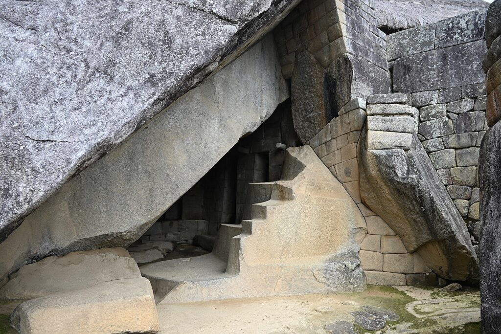
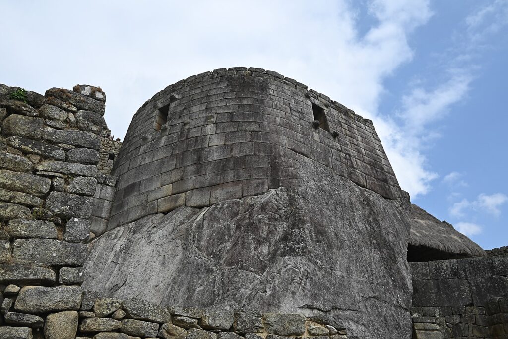
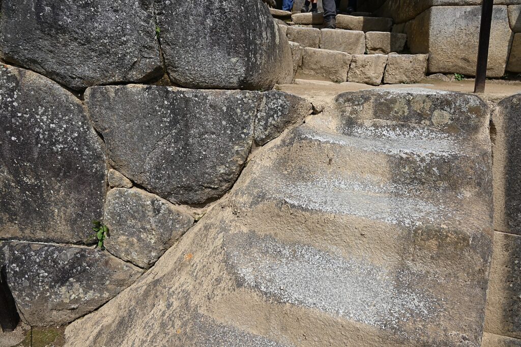
Atacama Desert

Last stop in Chile: The Atacama Desert, the driest and one of the highest deserts in the world. Lots to see in this vast dryland, which often felt like another planet – salt flats, sand dunes, lagoons with flamingos (did you know flamingos are born white, and their diet of exclusively sea monkeys turns them pink!?), multicolored canyons & geothermal springs.
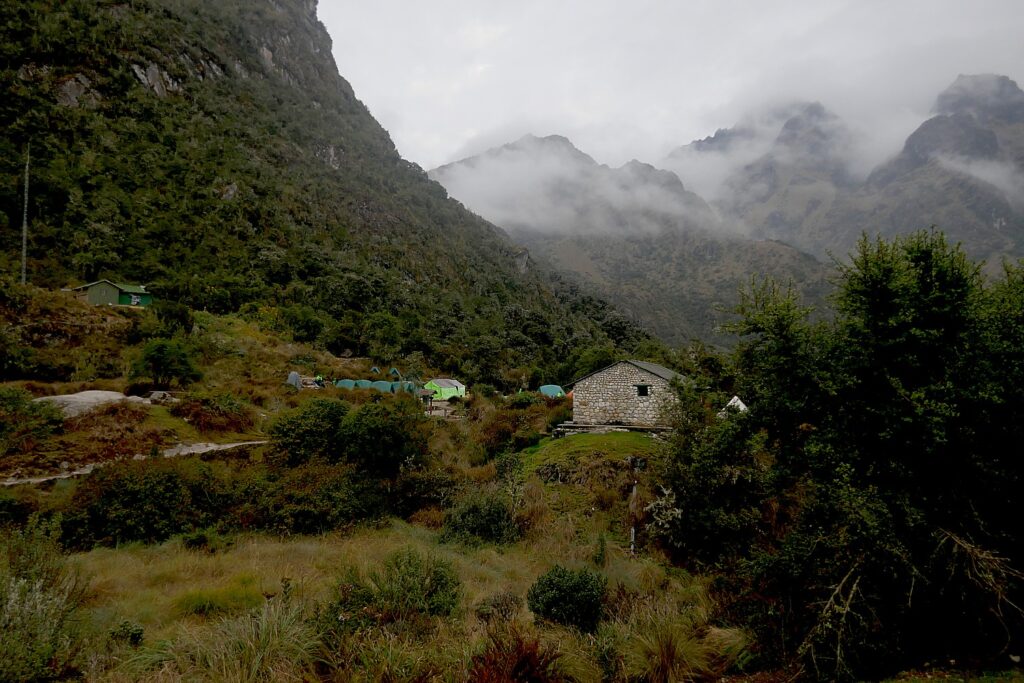
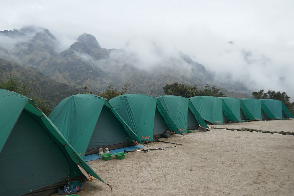
Flamingoes, Atacama Desert, Chile © Eric Leiberman/goingplacesfarandnear.com
Lagoon, Atacama Desert, © Sarah Falter/goingplacesfarandnear.com
Atacama Desert, Chile © Eric Leiberman/goingplacesfarandnear.com
Atacama Desert, © Sarah Falter/goingplacesfarandnear.com

At one point we were locked out of our car in the middle of the desert, but thankfully we are small humans and were able to climb in through the trunk back to mobile safety. After the panic subsided we were treated to a herd of llamas trekking alongside our car for 30 minutes. This desert oasis has an added bonus– a Death-Valley-meets-Albuquerque boho-chic little town called San Pedro de Atacama. Lots of funky cool souvenir shops and live music to check out.

San Pedro de Atacama © Sarah Falter/goingplacesfarandnear.com

Now off to Peru and Ecuador for trekking and wildlife viewing, the grand finale of our six-month odyssey.

See also:

DISPATCH 1 FROM LIVING THE NOMADIC LIFE, A GLOBAL ODYSSEY: MEXICO

DISPATCH 2 FROM LIVING THE NOMADIC LIFE, A GLOBAL ODYSSEY: SOUTH KOREA TO VIETNAM

DISPATCH 3 FROM LIVING THE NOMADIC LIFE, A GLOBAL ODYSSEY: MALAYSIA TO CAMBODIA

DISPATCH 4 FROM LIVING THE NOMADIC LIFE, A GLOBAL ODYSSEY: INDONESIA

DISPATCH 5 FROM LIVING THE NOMADIC LIFE, A GLOBAL ODYSSEY: AUSTRALIA-NEW ZEALAND-CHILE

____________________________

© 2022 Travel Features Syndicate, a division of Workstyles, Inc. All rights reserved. Visit goingplacesfarandnear.comwww.huffingtonpost.com/author/karen-rubin, and travelwritersmagazine.com/TravelFeaturesSyndicate/. Blogging at goingplacesnearandfar.wordpress.com and moralcompasstravel.info. Visit instagram.com/going_places_far_and_near and instagram.com/bigbackpacktraveler/ Send comments or questions to [email protected]. Tweet @TravelFeatures. ‘Like’ us at facebook.com/NewsPhotoFeatures