by Karen Rubin, Travel Features Syndicate, goingplacesfarandnear.com
The best thing about Christmas is that the festivities that brighten and warm all the days of the holiday season go on from Thanksgiving to New Year’s. And the best part is you don’t have to wait for Christmas week – festivities are happening throughout December. Here are some of our favorite places to revel in the holiday spirit:
Christmas in the Capital
Here are some of the best, can’t-miss ways to experience the holidays in Washington DC::
The National Christmas Tree, one of DC’s iconic holiday traditions, lives in President’s Park on the White House Ellipse, surrounded by trees decorated with handmade ornaments from 56 U.S. states and territories. Each night throughout the holiday season there are musical performances. The display is free to visit and open from 10 am – 10 pm while the National Christmas Tree is lit each day from 4:30-10 pm, from Dec. 5, when the lighting ceremony takes place.
Visit the Smithsonian National Zoo during ZooLights, when the zoo is illuminated with more than 500,000 environmentally-friendly LEDs, animated light installations, live music and various animals on display. ZooLights runs Nov. 29 – Jan. 1 (closed Dec. 24, 25 & 31).
Enchant Christmas is a light maze, billed as the biggest in the world, that is in DC for the first time at Nationals Park from Nov. 22 – Dec. 29. Throughout the holiday season there are ice skating trails and a large holiday market offering products from more than 60 vendors, including local businesses and international brands. (Use promo code “VISITDC” to get 10% off when you buy tickets.)
Downtown Holiday Market: Located at 8th and F Streets NW, the market holds down the area in front of the Smithsonian American Art Museum and National Portrait Gallery. At night, its bright lights bring Penn Quarter to life, providing a holiday spark to the neighborhood, but you can shop during the day too. (Open daily 12-8 pm, Nov. 22 – Dec. 23).
Georgetown GLOW exhibition of light-art, a stroll through DC’s most historic neighborhood has proven to be such a hit that it’s now a month-long celebration (Dec. 6 – Jan. 5, 5-10 pm). Afterwards, wander through a winter wonderland at The Washington Harbour, one of the district’s favorite places to ice skate.
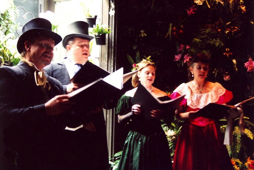
George Washington’s Mount Vernon: A George Washington-inspired Christmas awaits at the Founding Father’s Mount Vernon estate, Nov. 29 – Dec. 31. Walk through Washington’s home and visit Aladdin the camel, which pays homage to Washington’s 1787 Christmas in which he paid 18 shillings to entertain guests with a camel. See Mount Vernon by candlelight (Nov. 29 & 30, Dec. 6-7, 13-14 and 22) between 5-8 p.m., when you can enjoy a character-guided tour, 18th century dancing and fireside caroling.
The U.S. Botanic Garden gets decked out for this annual exhibit. This year’s display focuses on gardens from Hawaii to Maine, including iconic spots like the Brooklyn Botanic Garden, Franklin Park Conservatory and Huntsville Botanical Garden. Inside the Conservatory are the garden’s collection of DC’s iconic landmarks and a showcase of poinsettias. Season’s Greenings is open from Nov. 28 – Jan. 5 (10 am – 5 pm), and stays open until 8 pm, with holiday concerts on select Tuesday and Thursday evenings.
A magnificent tree decks the Great Hall of the Library of Congress‘ Thomas Jefferson Building each December, visited from the First Street SE entrance between 8:30 am and 4:30 pm (the Jefferson Building is closed Sundays and on Christmas). (Check the guide to visiting the largest library in the world so you can properly explore.)

Visit National Harbor, a shopping, dining and amusement park-like landmark located just 20 minutes south of DC (reached by public transportation). Step inside the Gaylord National Resort for ICE! (Nov. 15 – Dec. 30), an indoor winter wonderland featuring two million pounds of hand-carved ice sculptures, ice slides, a live carving area and a retelling of Dr. Seuss’ How the Grinch Stole Christmas. While at National Harbor, view the tree from atop the Capital Wheel, shop for gifts at the Tanger Outlets and experience weekend events like holiday markets, performances and movie screenings.
Beautiful lights, seasonal food and holiday-themed attractions and characters make up this annual Christmas event at Six Flags America, on weekends and select days from Nov. 23 – Jan. 1.
Located in the Brookland neighborhood, Basilica of the National Shrine of the Immaculate Conception, the largest Roman Catholic church in North America, dresses up with more than 50 Christmas trees, over 65,000 lights, halls decked with 500-plus poinsettias and two manger scenes. (Free and open to the public daily from 7 am – 6 pm)
The Willard InterContinental Washington offers a holiday tradition throughout December. You can enjoy afternoon tea from 1-4 p.m. in the elegant Peacock Alley every day of the month (except Dec. 24, 25 and 31). There will be seasonal decor, sandwiches, pastries and the beautiful sounds of a harp to accompany you as you sip on festive teas from one of DC’s most historic hotels.
Visit https://washington.org for more details and ideas.
15th Annual Vintage Christmas in Portsmouth, NH
Now in its 15th year, Vintage Christmas, taking place throughout December, transforms Portsmouth, New Hampshire, which National Geographic/Travel described as “possibly the greatest small town in the USA,” into a picture-postcard winter wonderland.
Those who visit Portsmouth during the holiday season discover an intimate streetscape framed by 19th century storefronts, boutiques and sidewalk cafes. The city’s reputation as a “foodies’” haven is upheld by chef-owned restaurants on more than every corner. The thriving craft beer and local music scene banish all suggestions of “staid New England” without losing the charm. And sales tax-free shopping offers delights for every age and taste.
For 2019 Vintage Christmas in Portsmouth includes:
The Music Hall, a historic theater dating from 1878 on Chestnut Street, presents “Annie” from November 27 to December 22, with Sally Struthers reprising her Broadway tour reprisal of Miss Hannigan. Juston McKinney: Last Laugh 2019 on Dec. 27, 28 & 29, looks back at “the year that was” with one of the region’s most “popular stand-up comics. New Year’s Eve Champagne Pops with the Portsmouth Symphony Orchestra on Dec. 31.
Strawbery Banke Museum: 40th Annual Candlelight Stroll on December 7, 8, 14, 15, 21 and 22, showcases 300+ years of daily life and holiday festivities around the theme “A Tradition for Every Family” in the historic waterfront neighborhood and living history museum of Puddle Dock. Saturdays 5-9 pm. Sundays 4-8 pm. Adult $25; child (5-17) $10, Family (2 adults/2 kids) $60. Children under 5 and Military families, free.

Labrie Family Skate at Puddle Dock Pond, Strawbery Banke’s seasonal outdoor ice skating rink, open daily 9 am to 9 pm, also hosts costumed Victorian skaters evoking Currier & Ives during each of the December evenings of Candlelight Stroll.
Vintage Christmas Trolley. This free trolley, courtesy of the City of Portsmouth, shuttles visitors on a 15-minute loop throughout the festively decorated downtown, from hotels and parking garages to the key events and shopping areas on weekends, December 7-22, 1:30-10:30 pm.
For more information, visit VintageChristmasNH.org; Discover Portsmouth, PortsmouthHistory.org, 603-436-8433.
Christmas in Newport, RI
Newport, Rhode Island, the Gilded Age’s favorite summer resort, is always enchanting, but never more so than at the winter holidays, when, it seems, the entire town is one big festival. A sampling of “Christmas in Newport” (now in its 49th year) and winter festivities include:
Holiday Lantern Tours: Hear the history of early American holiday traditions on an evening walk and learn how Newporters did, or did not, observe the holidays. Tours depart from the Museum of Newport History and Shop (Nov. 22 – Dec. 28, Fridays and Saturdays at 4 p.m.)
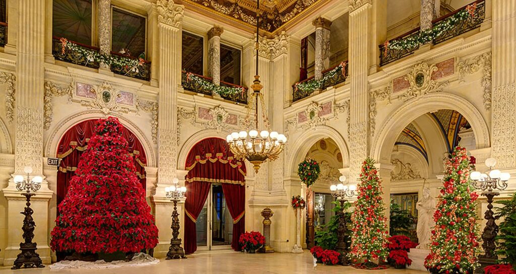
Christmas at the Newport Mansions: The glitter of gold and the sparkle of silver dazzle as you tour three magnificent mansions decked out in yuletide finery. Music, tours and spectacular decorations highlight celebrations at The Breakers, The Elms and Marble House – each of which will have Gingerbread Mansion replicas on display. Special events include “Holiday Evenings at the Newport Mansions” and “Santa Sundays.” (Nov. 23 – Jan. 1)
Christmas at Blithewold: Enjoy elaborate holiday decorations around every corner of this historic early 19th century estate in Bristol. (Nov. 29 – Jan. 1)
Holiday Market at Gurney’s: Features a curated selection of travel, lifestyle and fashion finds. (Nov. 29 – Dec. 20, Friday – Sunday).
Dickens Holiday Dinner Train: Immerse yourself in the classic tale of humbuggery, ghosts and redemption with this interactive retelling of “A Christmas Carol” by the Marley Bridges Theatre Company. Experience a dining journey along the Newport and Narragansett Bay Railroad in a custom-designed theater car featuring special tables for two all facing center stage. (Nov. 30 – Dec. 21, Saturdays)
A Rough Point Holiday: Experience the holiday traditions and winter caretaking practices at Doris Duke’s Rough Point with various rooms of the mansion museum both spruced up for the Christmas holiday and cloaked in their winter coverings. 30-minute guided tours offered throughout the day. (Dec. 7 – 28, Saturdays, 10 a.m. to 4 p.m)
48th Annual Christmas in Newport Candlelight Tour of Historical Private Homes: Experience the rare opportunity to tour private homes of note in Newport. (No children 10 or under and no high heels. Dec. 28)
Festive Igloo Pop-Ups at Gurney’s Newport Resort: Features heated multi-sensory igloos overlooking Narragansett Bay, each with its own theme including Santa’s Workshop, Winter Wonderland, Cozy Log Cabin, Roaring 20s, Harry Potter, Tropical Summer, Northern Lights, Astrology and Après Ski, complete with activities and cocktail pairings. Proceeds will go to Big Brothers, Big Sisters of Rhode Island. (Nov. 22 – Feb. 29)
Gurney’s Newport Resort Skating Rink: Opens for the season with outdoor skating on the North Lawn overlooking the Newport Harbor Lighthouse, The Point and the Newport Bridge. Open seven days a week. (Nov. 26 – March 1)
Goat Hikes at Simmons Farm: Spend an afternoon on a two-hour hike led by Farmer Karla and her crew of adventurous, fun-loving goats. Each participant gets their own goat to walk on a leash. The afternoon finishes with hot chocolate made with the milk from the farm. (Nov. 24 – Jan. 1)
Meanwhile, “Tiffany Glass: Painting with Color and Light,” an exhibit of colorful glass artwork and objects by the renowned Louis C. Tiffany opens at Rosecliff beginning Sunday, Dec. 8, and continuing through March 1. The exhibition is free to view with paid admission to Rosecliff (548 Bellevue Ave.). For tickets and information, visit newportmansions.org/learn/adult-programs or call (401) 847-1000, ext. 178. Rosecliff is one of the Preservation Society of Newport 11 historic properties, seven of them National Historic Landmarks, collectively spanning more than 250 years of American architectural and social development. (NewportMansions.org)
See more holiday and winter events in Newport and plan a visit at DiscoverNewport.org, 800-326-030, 401-849-8048.
Holidays in the Brandywine Valley
Wilmington and the Brandywine Valley is one of the most picturesque and historic places especially during the holiday season From Christmastime exhibits at du Pont family estates to the dancing fountains at Longwood Gardens. Here are highlights:
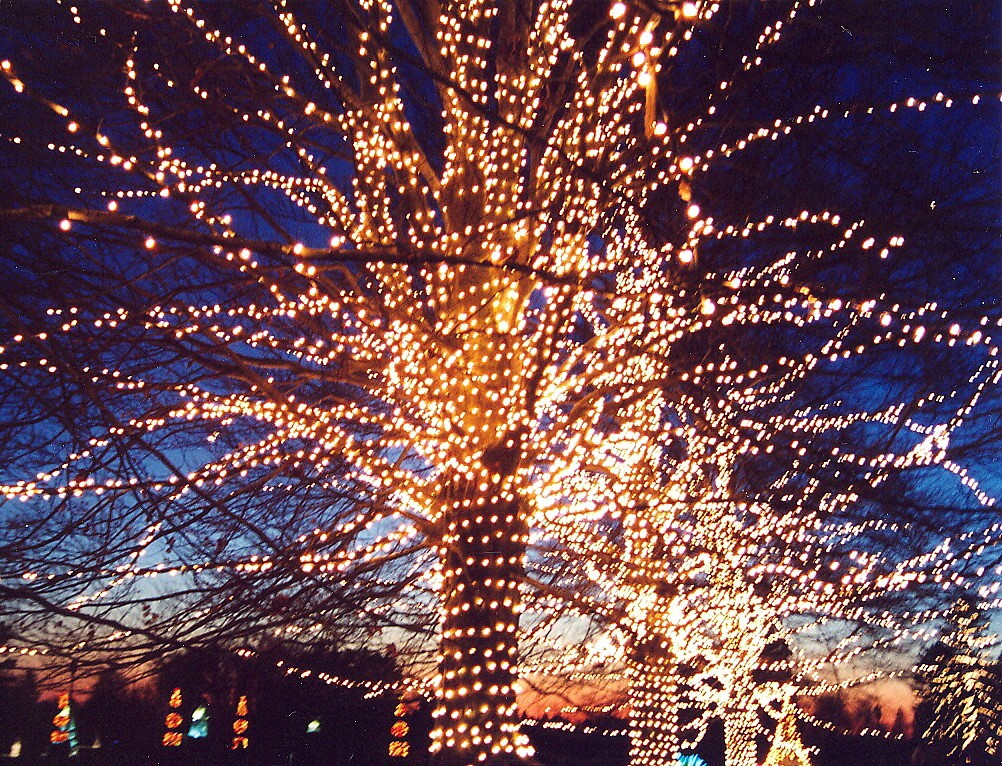
A Longwood Christmas at Longwood Gardens, is magical with 500,000 lights gracing 150 trees throughout the outdoor Gardens, a four-acre Conservatory with holiday sing-alongs accompanied by a 10,010 pipe Aeolian organ – the largest organ ever constructed in a residential setting. At the Open Air Theatre, fountains dance day and night to holiday classics. Delight in Longwood’s outdoor train display as it travels past miniature Longwood landmarks illuminated for the holiday season. In the Meadow Garden, stroll through a 140-ft tunnel of light in the winter landscape, and discover a grove of glowing architectural orbs that pulse and change to the rhythm of holiday music. Grab a hot chocolate and cozy up to one of the many fire pits. ALongwoodChristmasruns November 22, 2019– January 5, 2020 (including Christmas Day). Admission to the Christmas display is by Timed Admission Ticket, with tickets purchased in advance for a specific date and time. (Tickets and reservations at longwoodgardens.org.)
Yuletide at Winterthur: From November 23 through January 5, you can experience one of the Brandywine Valley’s most memorable attractions. Henry du Pont’s mansion is transformed into a magical holiday spectacle, with food, music, exhibits, an exquisite 18-room dollhouse mansion, and an Enchanted Woods children’s garden. Reservations are recommended for the Yuletide exhibits, and the last chance to see Winterthur’s Costuming THE CROWN (showcasing costumes from Netflix’s Emmy winning series) before it closes on January 5.
Nemours Estate: Starting November 17, you can experience holidays in traditional du Pont style as you tour the 1907 mansion and gardens that Alfred du Pont built for his wife Alicia. See original decorations (including a 19th century German crèche), twinkling lights, and bright colored ornaments.
Holidays at Hagley at Hagley Museum takes you back to 1803 as you visit the du Pont ancestral home Eleutherian Mills, decorated in vintage holiday charm. There’s also a “Christmas Trees Past and Present” exhibit.
Brandywine Christmas at the Brandywine River Museum of Art, renowned for its collection from three generations of Wyeth family artists, during the holiday season showcases the region’s most impressive model train display, which includes nearly 2,000 feet of track. Throughout the season, festive trees and crafts, live musical performances, and imaginative “Critter” ornaments made by local volunteers. There’s also a Polar Express Pajama Party, breakfast with the trains, and more special events. (www.brandywinemuseum.org)
Holiday Light Express: throughout December you can take a 45-minute ride in 100-year old (heated!) coaches and experience thousands of holiday lights twinkling as you pass decorated homes along the route.
A Christmas Carol: Delaware Theater Company’s adaptation of the Dickens classic has a twist: performed with just five actors bring Charles Dickens’ beloved characters to life using props, puppets, bold physicality and the imagination of the audience. Opening night is December 7, so make this a cultural must-see on your holiday road trip.
For more information, trip planning help and accommodations, visit www.visitwilmingtonde.com, 800-489-6664.
Visit Christmas City, USA: Bethlehem, PA
Experience the magic of the Christmas City: Bethlehem, in Lehigh Valley, PA boasts one of the top-ranked holiday markets in the world, now celebrating its 27th season. Christkindlmarkt (weekends, Nov. 22 – Dec. 22) offers visitors wares from 100 vendors, musical performances, and glass blowing demonstrations.
Along Main Street, browse the Christmas Huts on Main (weekends, Nov. 22 – Dec. 22), a shopping experience inspired by a German Weihnachtsmarkt, complete with charming wooden huts lining the streets offering holiday gifts. Browse the Moravian Book Shop, the oldest continuously operating bookstore in the country.
Join Historic Bethlehem Museums & Sites for a variety of tours including Christmas City Stroll, which takes you on a walking excursion through the city’s National Historic Landmark District. Led by a guide in period dress, this tour will give you a peek into what Moravian life was like in the 1700s.
To get a great view of the famous star atop South Mountain, get tickets for the Bethlehem by Night bus tour. On this tour, participants will learn why the north side of the city dons white lights and the SouthSide dresses up in colored lights. (Reserve in advance.)
One of the most distinctive holiday traditions is the Bethlehem’s Live Advent Calendar. Thought to be the only one of its kind in the country, visitors can join locals in this activity nightly, Dec. 1 – 23, at 5:30 p.m. Crowds gather outside the Goundie House at 501 Main Street. A selected visitor knocks on the door and the group is greeted by representatives from local businesses offering a surprise for all to enjoy. Nightly surprises could include musical performances, a story, or a tasty treat.
As you wander along Main Street, enjoy the music. Trombone choirs stroll the sidewalks playing holiday tunes, a nod to the city’s Moravian heritage.
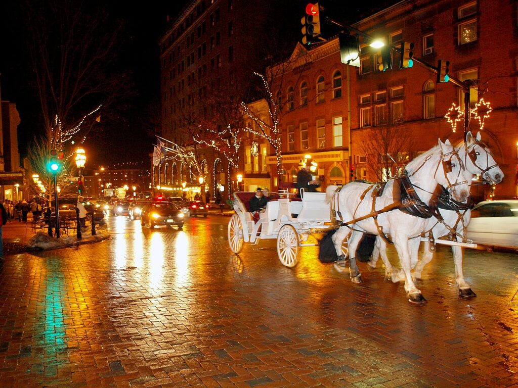
For a special view of the city’s historic district, take a horse-drawn holiday carriage ride, hosted by the Bethlehem Carriage Company.
A free Christmas City Trolley is offered Fridays-Sundays, Nov. 15 – Dec. 22. The trolley runs every 20-30 minutes, shuttling between the Historic District and the SouthSide Arts District.
More
information at discoverlehighvalley.com, info@DiscoverLehighValley.comOpens in New Window
610-882-9200, 800-MEET-HERE.
Victorian Christmas in Cape May
Share a special holiday tradition with friends and family on a festive tour of Victorian Cape May during Christmas Candlelight House Tours, presented by the Mid-Atlantic Center for the Arts & Humanities (MAC). Every year since 1974, a large selection of Victorian inns, homes, churches and hotels open their doors and welcome visitors to share the warmth and hospitality of the season during these popular, self-guided, walking tours. You will be welcomed inside with holiday hospitality and cheer. Enjoy Christmas carols by candlelight, strolling musicians along the historic streets of Cape May and beautiful holiday decorations. Walk from site to site, stopping at hospitality centers for warm beverages and holiday treats during your travels. Free heated shuttles make limited stops along some routes. The three Christmas Candlelight House Tours of the 2019 holiday season are held on Saturdays, Dec. 7, 14 and 28, from 5:30 p.m. to 8:30 p.m. (tickets should be purchased in advance). The festivities begin Friday, Nov. 22 and continue through Jan. 1, 2020.
For information about MAC’s year-round schedule of tours, festivals, and special events, call 609-884-5404 or 800-275-4278, or visit MAC’s Web site at www.capemaymac.org. For information about restaurants, accommodations and shopping, call the Chamber of Commerce of Greater Cape May at 609-884-5508 or visit www.capemaychamber.com. For information about historic accommodations, contact Cape May Historic Accommodations at www.capemaylodging.com.
Next: More Favorite Holiday Places
________________________
© 2019 Travel Features Syndicate, a division of Workstyles, Inc. All rights reserved. Visit goingplacesfarandnear.com, www.huffingtonpost.com/author/karen-rubin, and travelwritersmagazine.com/TravelFeaturesSyndicate/. Blogging at goingplacesnearandfar.wordpress.com and moralcompasstravel.info. Send comments or questions to FamTravLtr@aol.com. Tweet @TravelFeatures. ‘Like’ us at facebook.com/NewsPhotoFeatures