Tag Archives: hiking

Utah Adventure Day 8: Arches National Park, a Geologic Wonderland

Sunrise on the Landscape Arch, Devils Garden Trail, Arches National Park © Karen Rubin/goingplacesfarandnear.com

By Karen Rubin, with Laini Miranda and Dave E. Leiberman

Travel Features Syndicate, goingplacesfarandnear.com

Arches National Park is a fantastical place, a geologic wonderland, and being able to wake up before the sun in the Devils Garden Campground and stroll along the Devils Garden Trail as the formations come alive with color, is extraordinary.

Arches’ sprawling landscape of 2,000 natural stone arches – the highest concentration of arches on the planet – plus hundreds of soaring pinnacles, massive rock fins, giant balanced rocks, coupled with its accessibility and ease of getting around (well, except for traffic and difficulty finding parking) and access (through Moab) draws hundreds of thousands of visitors each year, making it one of the most popular national parks. Indeed, Arches is so popular (and crowded) that it requires advance purchase, timed entry reservations just to enter, between April 1 and October 31.
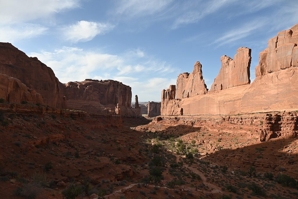
Arches National Park is a geologic wonderland © Karen Rubin/goingplacesfarandnear.com

We are lucky because Laini has cleverly booked two nights at the Devils Garden campground months before our trip. The campsite reservation acts as the entry ticket and for this reason but especially because of being immersed in the landscape, this is the absolute best way to experience Arches National Park. (Devils Garden Campground is pen year-round, with 52 sites, reservations for individual sites can be made up to six months in advance; for group sites can be reserved up to year in advance, www.nps.gov/arch)
Arches is the most touristic of all the places we have visited this trip and offers such a contrast with the wild camping and communion with ancient spirits (Bears Ears), the remote unmarked hikes (Grand Staircase-Escalante), the long meandering hikes (Capitol Reef) and our search through muck and mud to find archaeological sites (Glen Canyon).

Here, we go sightseeing for the dazzling arches that give the park its name, like the amazing Double Arch, the Windows, Landscape Arch and Delicate Arch, accessed along paved paths from parking lots, with restroom facilities.
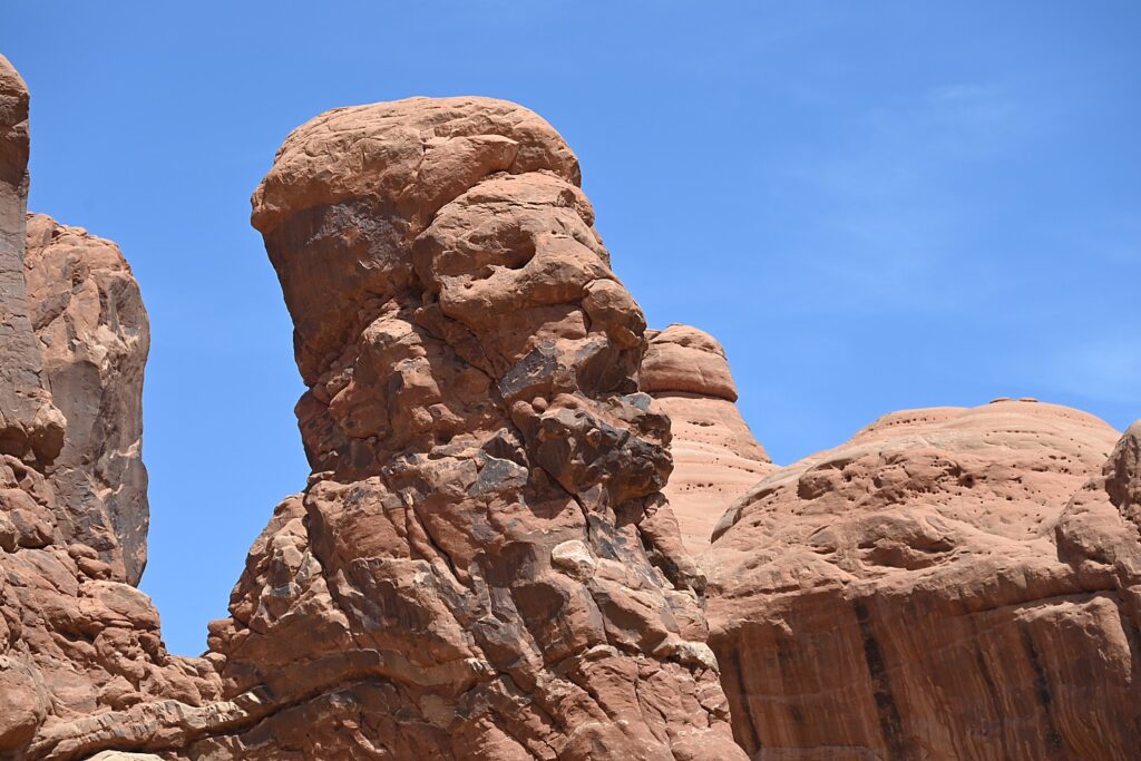
A formation in Arches National Park that looks like Croesus had just been turned to rock © Karen Rubin/goingplacesfarandnear.com

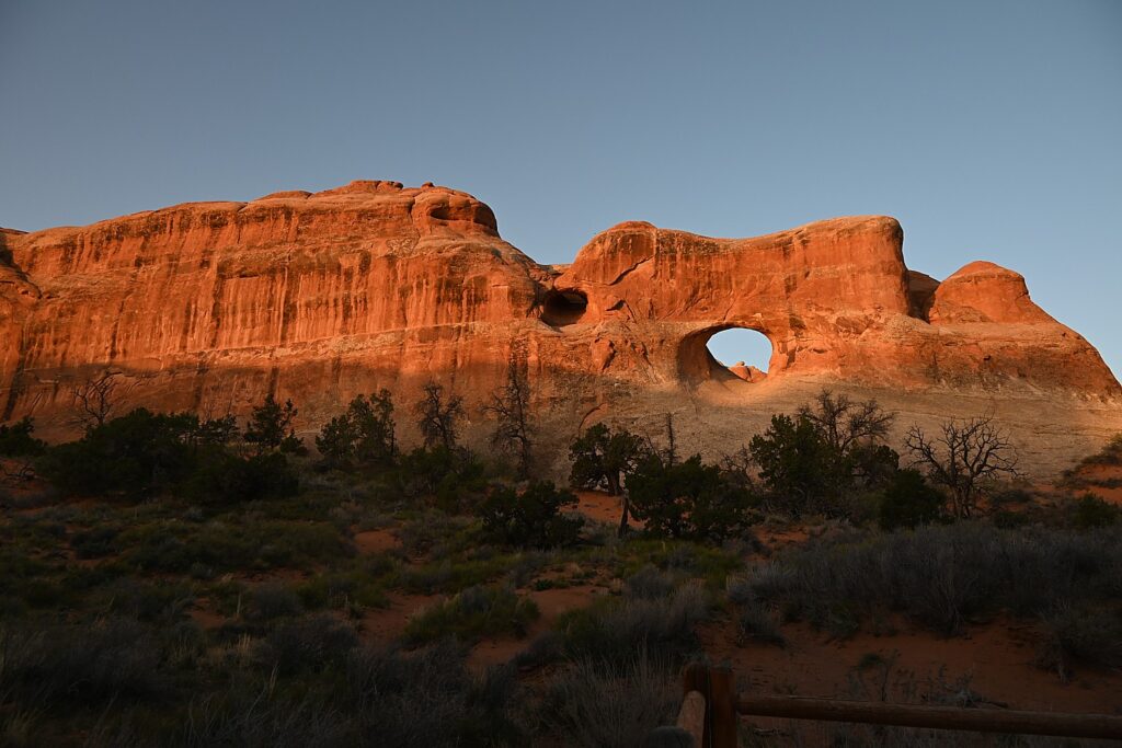
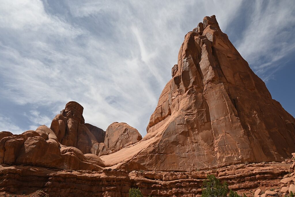
Throughout Arches, there are formations – eroded monoliths – that inspire names, like Parade of Elephants, Petrified Dunes, Tower of Babel and Fiery Furnace, also trigger imagination. Some look so much like mudmen, we name them (we rechristen Balanced Rock “E.T.”, the Gossips we rename “The Suffragists,” and formations that look to me as if Nefertiti and Croesus had just been turned to rock.
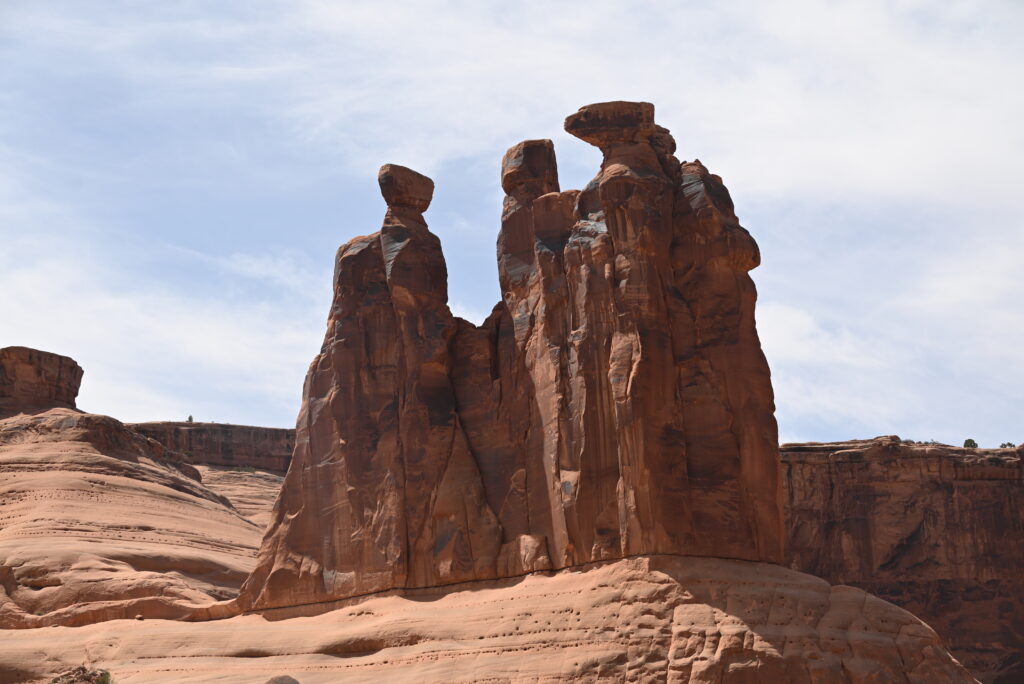
The formation once known as “The Gossips” we re-name “The Suffragists” Arches National Park © Karen Rubin/goingplacesfarandnear.com

The source of what we see is a salt bed, thousands of feet thick in places, that was deposited across the Colorado Plateau 300 million years ago when a sea flowed into the region and eventually evaporated, according to the Arches National Park notes. The salt bed was unstable and unable to hold the weight of the thick cover of rock formed from compressed debris. It shifted, buckled, liquefied and repositioned, thrusting rock layers upward as domes, while whole sections fell into cavities.
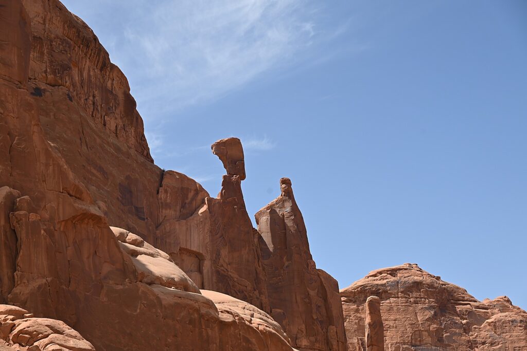
Doesn’t this rock formation look like Nefertiti? Imaginations run wild in Arches National Park © Karen Rubin/goingplacesfarandnear.com

Faults make the surface even more unstable. From the visitor center, you can see the result of a 2,500-foot displacement, the Moab Fault. The faults caused vertical cracks and wind and water over 100 million years of erosion and weathering, ultimately formed the arches of salmon-colored Entrada Sandstone and buff-colored Navajo Sandstone.

The process is ongoing – new features are being formed as old ones are transformed.

Sometimes the changes happen suddenly, violently. That was the case at the Skyline Arch, just next door to Devils Garden, where a massive boulder tumbled down in the 1940s, expanding the arch.
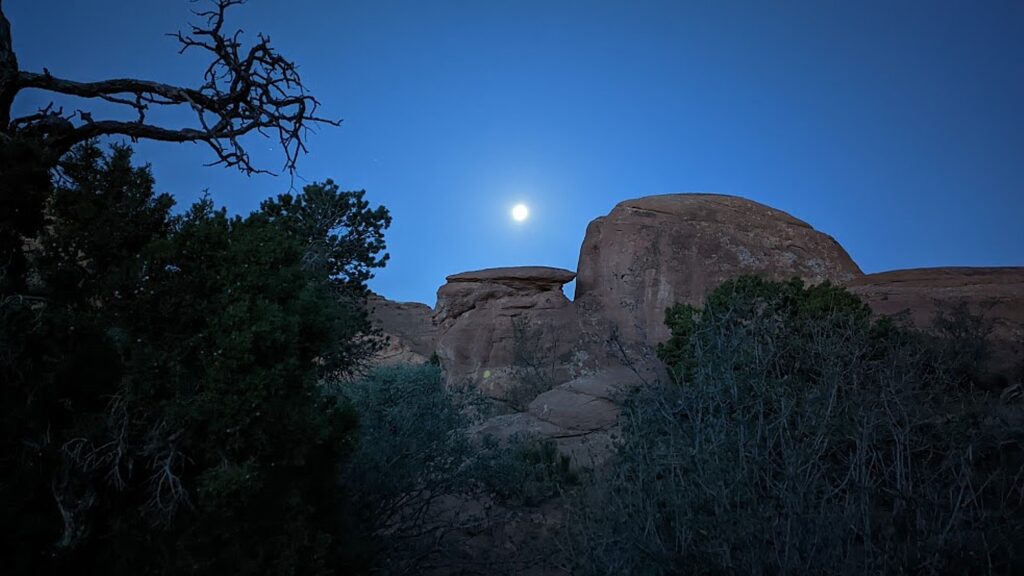
Waking before sunrise with the moon in Devils Garden Campground, Arches National Park © Karen Rubin/goingplacesfarandnear.com

The most ambitious hikes in Arches National Park are to the Double O Arch (4.1 miles); the Primitive trail (2.1 miles one way, considered most difficult), and if you would do the whole Devils Garden Trail (7.8 miles, that goes to the Landscape Arch, Double O Arch, Dark Angel along a primitive trail, with narrow ledges, rock scrambling and few trail markers; be sure to take enough water— 1 liter of water per person, per hour).

We do none of these, holding out for our most ambitious hike, to Delicate Arch, for sunset but I already have my trepidations.

And, in addition to the outstanding Devils Garden trail, from the campground (which feels luxurious to us for its restrooms and running water), you can hikethe Broken Arch Loop Trail which runs past Tapestry Arch and Broken Arch, then swings south towards Sand Dune Arch and back up passed Skyline Arch before returning to the campground. (Unfortunately, we don’t have time for that hike. Next time!)
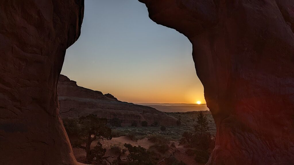
Sunrise in Devils Garden, Arches National Park © Karen Rubin/goingplacesfarandnear.com

For my sunrise hike, I do the easy, paved trail, rushing to get to a good position for photos, and then continue on to do more of it, going to where I see the famous Landscape Arch. After my walk through the easy part of the Devils Garden Trail (it is surprising how fast the sun comes up, washing out the colors), I go back to the campsite where we have breakfast.
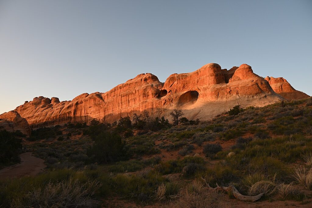
Sunrise in Devils Garden, Arches National Park © Karen Rubin/goingplacesfarandnear.com

(Actually, we have to move from one campsite to another for our second night and Dave and Laini figure out to just put the tent with the sleeping bags and stuff on top of the Jeep and drive it over, which we do by check-out time.)
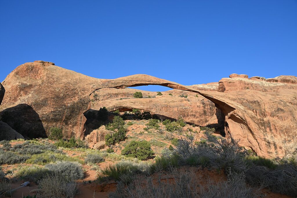
Landscape Arch, Devils Garden, Arches National Park © Karen Rubin/goingplacesfarandnear.com

We then set out to explore Arches.

We only have one full day at Arches National Park, and it’s the end of our hiking/camping adventure, so we kind of go with the flow. We drive to the different sites, and do short hikes up to the various formations, basically doing the tourist thing.
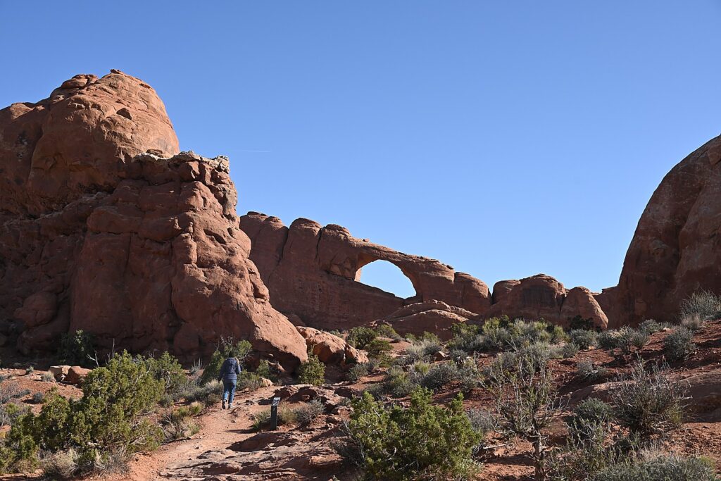
An easy trail takes you to the Skyline Arch, Arches National Park © Karen Rubin/goingplacesfarandnear.com

We follow a route, starting with the Skyline Arch adjacent to Devils Garden. Dave climbs to the top of that humongous boulder that fell down (scary to contemplate). The Skyline Arch Trail is short and easy, less than a half-mile roundtrip hike from the parking lot and back. The arch itself is one of the more popular landmarks in Arches. It makes for spectacular photographs, owing to its position, literally, on the skyline. And its proximity to the Devils Garden Campground makes it a perfect hike if you arrive late in the afternoon. (We arrived too late.)
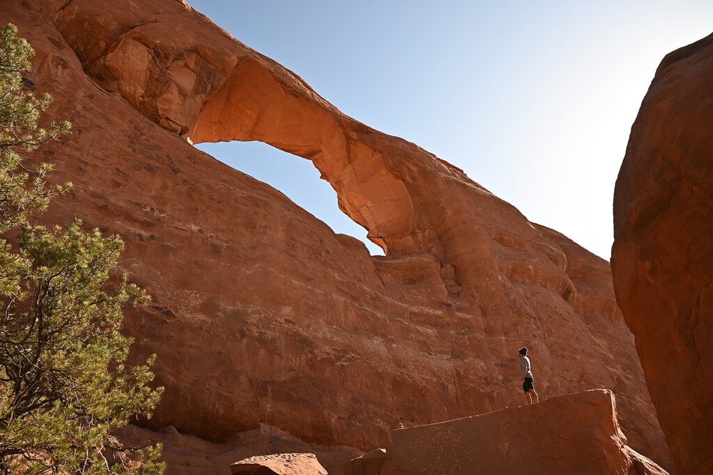
Dave climbs atop of a boulder that came off the Skyline Arch © Karen Rubin/goingplacesfarandnear.com

We go next to the observation area that overlooks The Fiery Furnace, a labyrinth of narrow sandstone canyons. (Hiking the Fiery Furnace requires agility and a permit, or a ticket for a ranger-led hike that must be reserved in advance through Recreation.gov; one route is marked, but getting lost is still possible.)
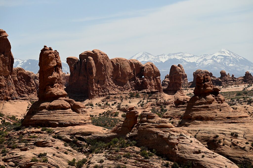
The Fiery Furnace, contrasted against snow-capped peaks, Arches National Park © Karen Rubin/goingplacesfarandnear.com

Next, we drive to one of the famous highlights of Arches (there are many, but this one is tops for me): the Double Arch Viewpoint and Trail. The tallest arch in the park at 122 ft., there seems to be this intricate dance between the two arches. An easy gravel path leads to the base of the two huge, arching spans. Of course Dave and Alli climb up to the arches, while Laini draws.
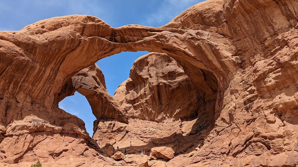
There seems to be an intricate dance between the two arches of the Double Arch, Arches National Park © Karen Rubin/goingplacesfarandnear.com

Balanced Rock is another signature landmark and just about everyone (who can get a parking space) walks the short hike around the base for up-close perspectives. We re-name Balanced Rock E. T. because from a certain angle, it’s a dead ringer for the endearing character.
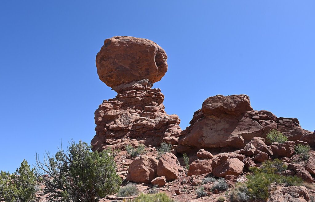
“Balanced Rock”is a dead-ringer for the beloved E.T., Arches National Park © Karen Rubin/goingplacesfarandnear.com

(The Arches National Park newsletter guide is invaluable – it recommends how much water to take, and gives excellent information about distance and time and difficulty for each of the hikes.)

Dinosaurs, Indians!

Arches National Park (believe it or not), has no food or lodging (that is, beyond the sensational Devils Garden campground) – so we drive out of the park into the delightful, hopping town of Moab for lunch at the food truck park, and a bit of shopping.

From here, we drive a short distance to where Laini promises we will encounter both dinosaurs and Indians.
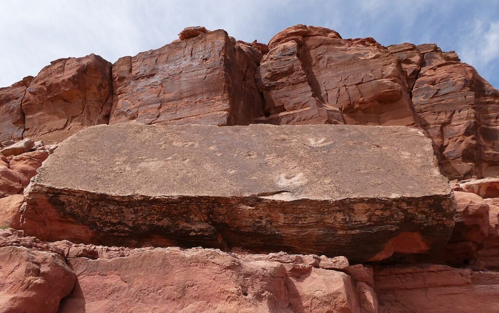
Tracks made by three-toed meat-eating dinosaurs can be seen at the Poison Spider Dinosaur Tracksite and Rock Art Trail © Karen Rubin/goingplacesfarandnear.com

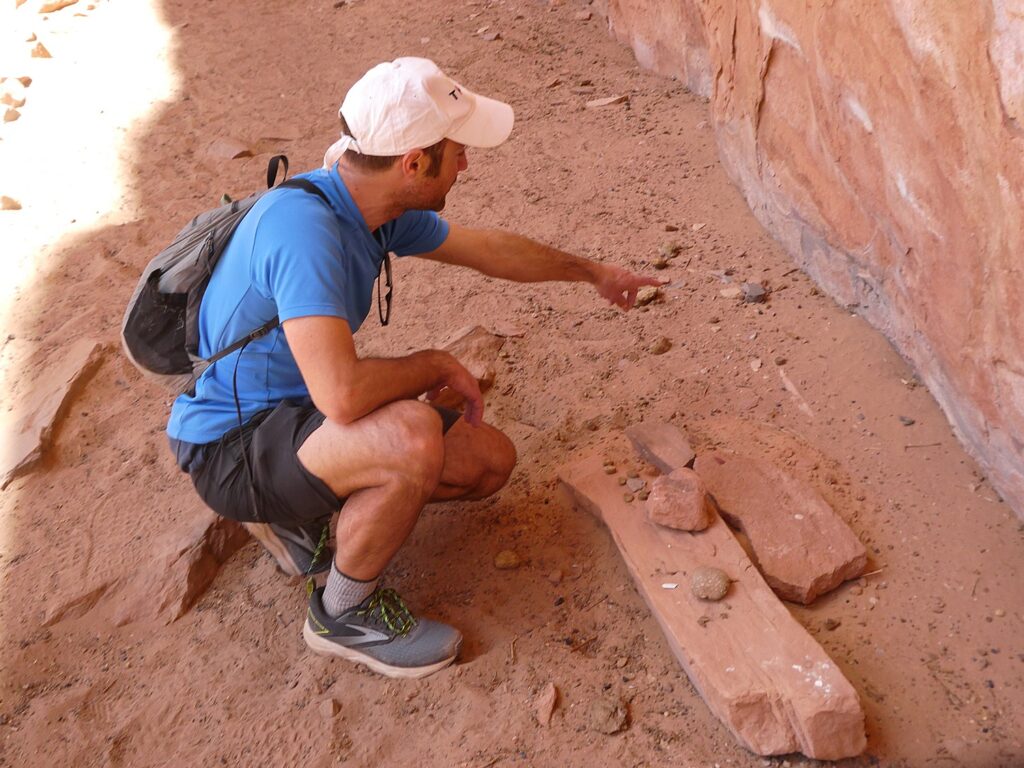
We drive along Utah Scenic Byway 279 to the trailhead of the Poison Spider Dinosaur Tracksite and Rock Art Trail. It’s a quarter-mile walk up a steep, crumbly trail up a rocky hillside to two rock slabs where tracks made by three-toed meat-eating dinosaurs can be seen, as well as a wall with a good collection of petroglyphs.

This area was once a vast sand dune sea, known as an erg. These tracks would have been found along the edge of a lake between dunes. As the wind would blow across the dunes these tracks would have been gently buried in shifting sand and preserved. The preserved tracks were unearthed when the slabs fell from the sandstone cliffs above.

The trail switchbacks up the hill before coming alongside the petroglyph wall and then descends back to the parking lot. (Use caution: though short, there are a few steep areas and the trail can be hard to follow.)

(From this trailhead you can also connect to the Longbow Arch hiking trail that goes into a canyon to an arch, 2.4 miles roundtrip.)
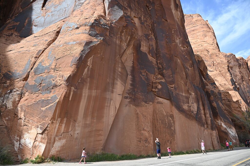
The astonishing Utah Highway 279 Rock Art Site, where a huge rock wall face has the most amazing sets of petroglyphs and pictographs, Moab © Karen Rubin/goingplacesfarandnear.com

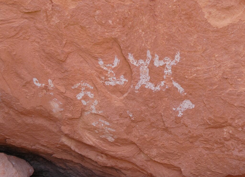
A short distance along Potash Road is the Utah Highway 279 Rock Art Site, where a huge rock wall face has the most amazing sets of petroglyphs and pictographs. It looks like a museum exhibit, except this is where they were made and it is astonishing to contemplate that this is where people so very long ago stood here and carved and painted them.
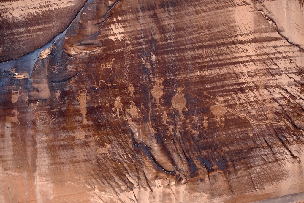
The astonishing Utah Highway 279 Rock Art Site, where a huge rock wall face has the most amazing sets of petroglyphs and pictographs, Moab © Karen Rubin/goingplacesfarandnear.com

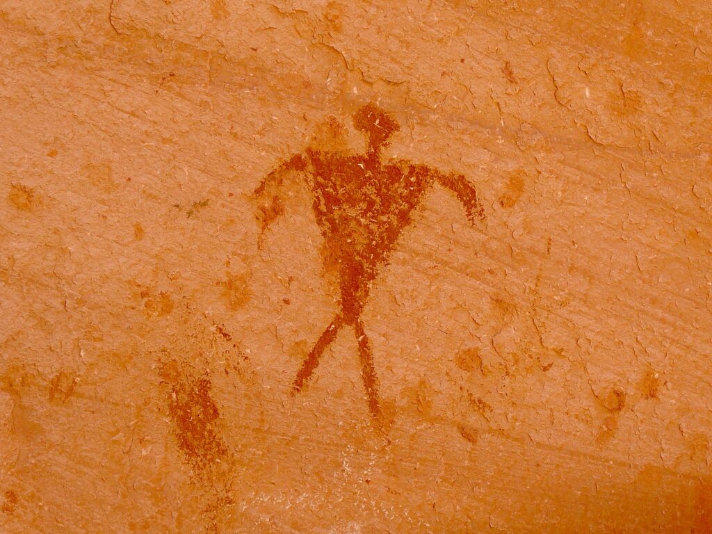
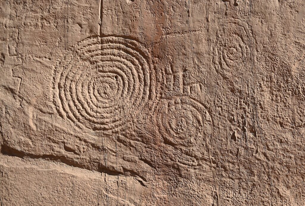
Archaeologists believe most of the rock art found here was created during the Archaic (6,000 – 1,000 B.C.) and Fremont (450-1300 A.D.) cultural periods. The art consists of pictographs (painted images) and petroglyphs (pecked, incised or chiseled images). The majority of the rock art features anthropomorphic (human forms) and zoomorphic (animal forms) but there are also curvilean lines, zigzags, wavy lines, concentric circles and abstract symbols. Sometimes both Archaic and Fremont petroglyphs can be found on the same rock art panel.
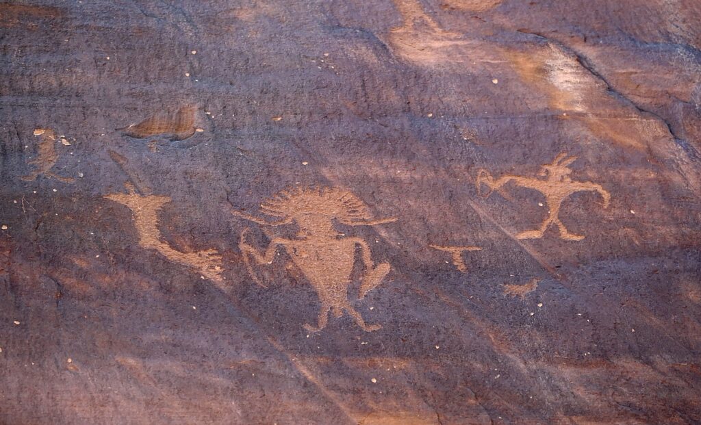
The astonishing Utah Highway 279 Rock Art Site, where a huge rock wall face has the most amazing sets of petroglyphs and pictographs, Moab © Karen Rubin/goingplacesfarandnear.com

Some of the rock art panels depict religious rituals and are considered sacred sites. Some depict migration routes, fertility, hunting, ceremonies, and cosmic events.
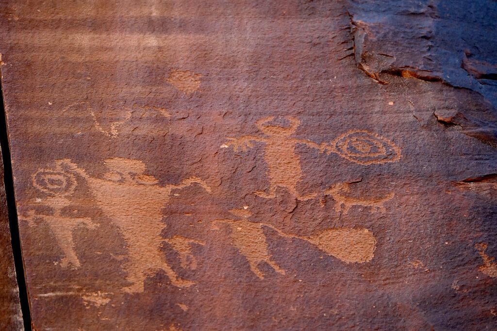
The astonishing Utah Highway 279 Rock Art Site, where a huge rock wall face has the most amazing sets of petroglyphs and pictographs, Moab © Karen Rubin/goingplacesfarandnear.com

These petroglyphs were exposed when the road was widened, and it is a surreal experience to see these magnificent, huge murals just along the road – especially because it is beside a section popular with rock climbers (one was prosecuted for rock climbing where the protected petroglyphs are).

Fremont rock art often depicts trapezoidal anthropomorphs with horns, bighorn sheep, dogs, hunting scenes with weapons, and abstract objects – and sure enough, we see plenty of examples – there are horned anthropomorphs holding shields and paper doll-like cut-outs; at the southern end of the panel, we see a large bear with a hunter at its nose and another hunter over its back. The notes say this art is 3000 to 8000 years old.
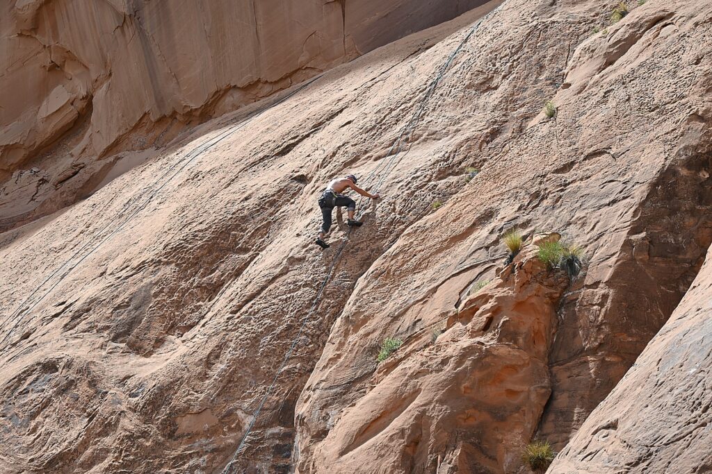
The ancient rock-art panels are next to a popular rock climbing place © Karen Rubin/goingplacesfarandnear.com

At the northern end of the panel, round holes carved into the sandstone underneath the left side would have once held roof poles of a structure which was excavated by archaeologists before the road construction. The rock panels extend 125 feet along Potash Road.

Sunset and Star-Gazing

We return to Arches National Park for sunset (there is still a long line of cars getting in with their timed admission tickets, but because we are camping, we breeze right in).

Laini suggests we hike the 3 miles roundtrip to Delicate Arch for the sunset, but I’m actually dreading it (my feet are actually bleeding from yesterday’s 11-mile Kane Gulch hike – the folly of hiking in boots that haven’t been broken in).

My trepidation comes from the description of the hike: The Delicate Arch hike is ranked difficult – the trail climbs 480 feet up a steep slickrock slope, and just before you get to Delicate Arch, follows a narrow rock ledge for about 200 yards). I am especially nervous about hiking the 1.5 miles back in the dark.

Laini, who has done the hike on their previous trip, admits she also has been dreading it but only wanted to do it for me, because I would have been disappointed not to see the iconic rock formation that Utah uses for its state symbol.

We set out and I ask what exactly we will see and she pulls up the photo she took on a previous trip. I suggest we not bother, but rather go to The Windows where I’ve been told is a popular place for sunset.

But before we leave the trail to the Delicate Arch, we explore the Wolfe Ranch historic site and walk a little further along a path to see an excellent example of historic Ute rock art – a huge bonus to coming here.
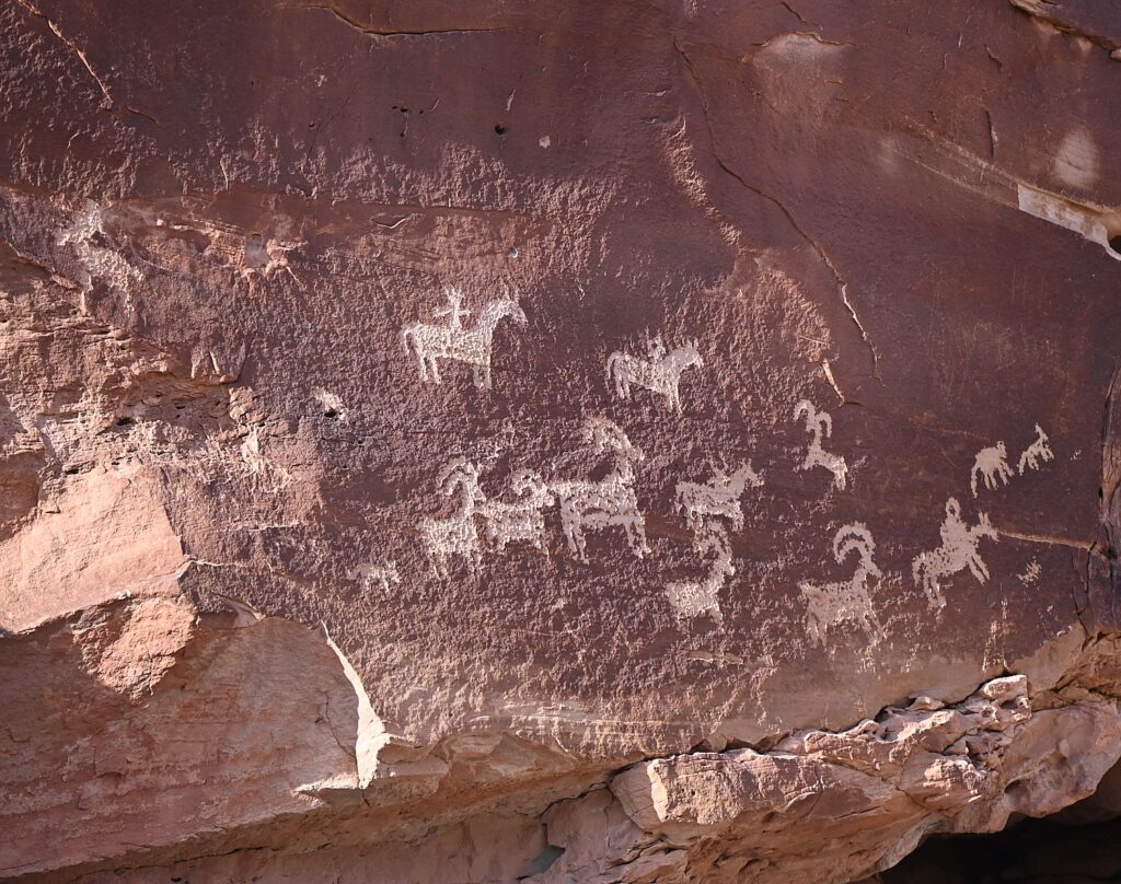
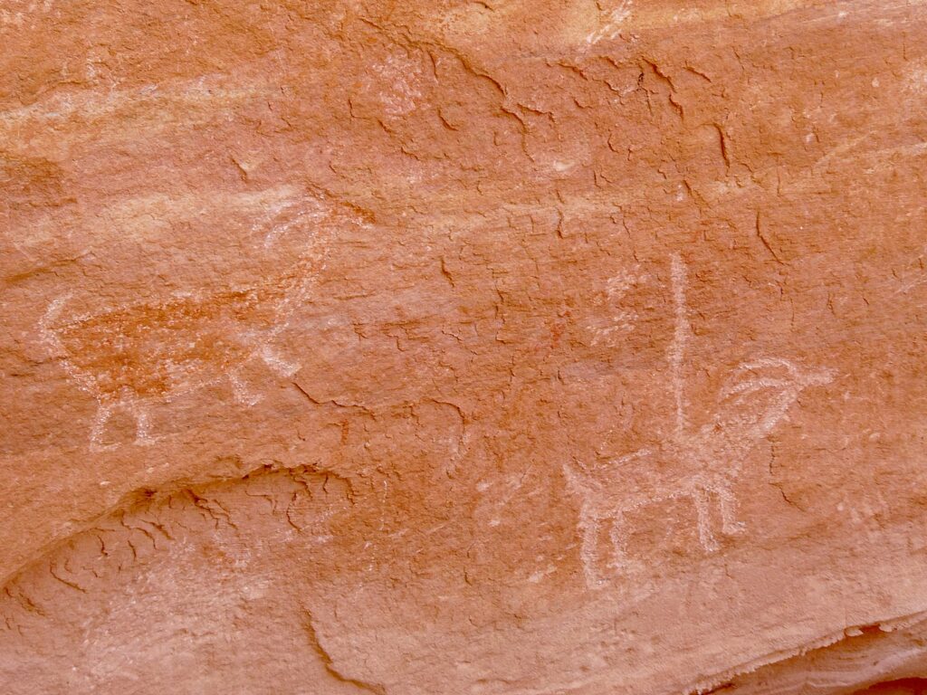
Historic Ute rock art at the Wolfe Ranch site, Arches National Park © Karen Rubin/goingplacesfarandnear.com

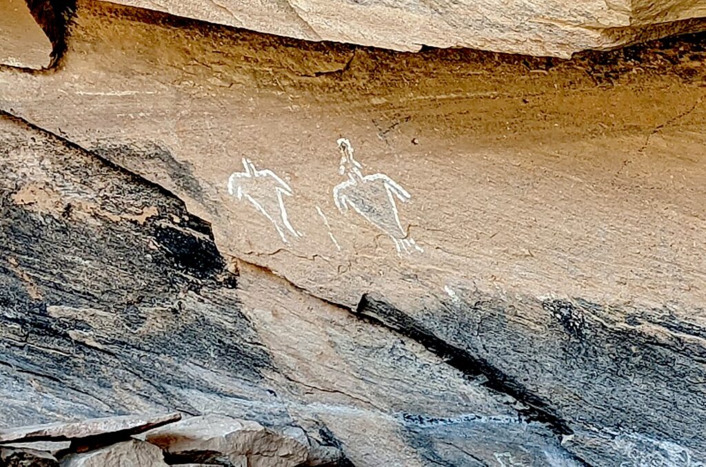
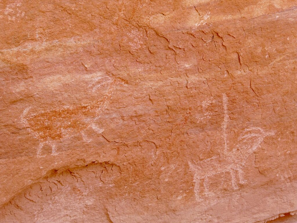
The panel depicts a stylized horse and rider surrounded by bighorn sheep and dog-like animals which are typical of Ute rock art. The petroglyphs were carved sometime between 1660-1860.

The historic marker is fascinating because it also shows photos of an Ute on horseback in 1909. “The Utes’ acquisition of horses by the mid-1600s radically changed the way they hunted, worked and traveled.” Another photo depicts a Ute warrior and his bride, circa 1873. Utah’s name is derived from the Ute Indians who moved into this area around 1300 AD.

I’m thrilled we came here, and even more thrilled to go to The Windows for the sunset, which I had read in the park’s newsletter (so helpful!) is one of the great spots to watch the sunset.
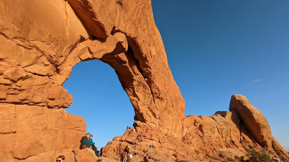
The Windows, a great place to watch the sunset in Arches National Park © Karen Rubin/goingplacesfarandnear.com

The Windows – just across from the Double Arch where we had been in the morning – is a pleasant half mile walk. We arrive just as the light is turning the rock deep gold, to orange, to red. I find a “comfortable” rock to sit on at the bottom of the arch while Dave, Laini and Alli (of course) climb up into the Windows.  Our view looks out to the Turret Arch and a wide open expanse, to where the sun dips below the horizon.
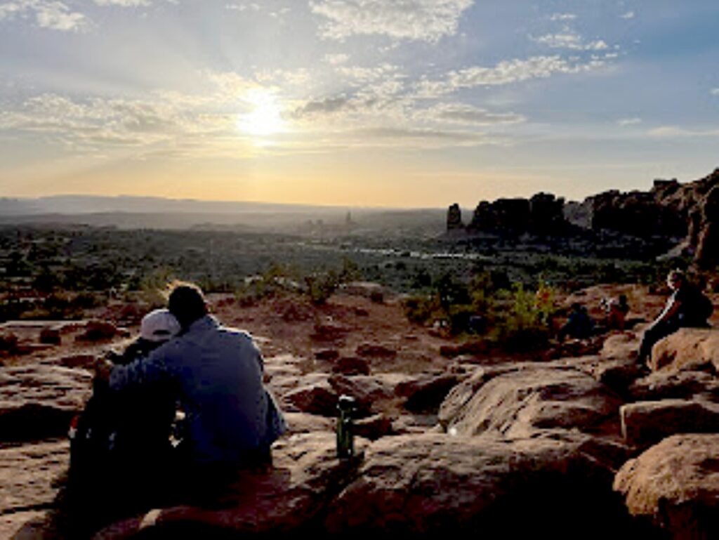
Watching the sunset from The Windows, Arches National Park © Laini Miranda/goingplacesfarandnear.com

We drive back to Moab to stop in for a bite and beer flight at Moab Brewery, and then return to the national park to do some stargazing before settling into our campsite.

Arches National Park is a great family park where a short walk brings you to many of the iconic features, and you can even see a lot from a car and the observation areas. Stop at the visitor center for advice, where you can watch an orientation film and see exhibits. A self-guiding audio tour is available. Ranger programs are offered seasonally.

For more information, and to reserve entry tickets and campsites, www.nps.gov/arch; info 435-719-2299; hiking info at https://www.nps.gov/arch/planyourvisit/hiking.htm
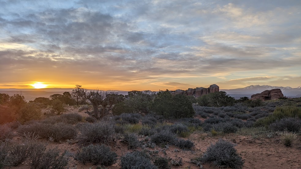
Sunrise from the Devils Garden Campground, Arches National Park © Karen Rubin/goingplacesfarandnear.com

On our last morning, I awake again before sunrise and scramble up a small hill across the road from our campsite for a different view.

We pack up quickly for our departure which also entails packing up the rental sleeping bags and pads, which we ship back to Moosejaw.com from Moab, pick up breakfast from a delightful cafe, and head out for the drive back to Salt Lake City and our flight home, having had the most marvelous Utah Adventure, a trip of a lifetime for me.

Trip planning tools are available at https://www.visitutah.com/.

Advance Purchase Tickets Required

From April 1 to Oct. 1, 2023, you need to secure in advance a timed entry reservation in order to enter Arches National Park between 7 a.m. and 4 p.m. Reservations must be secured three months in advance of the anticipated date of visiting Arches. A single booking of a timed entry ticket covers each registered visitor (an individual, couple, group or family). You can enjoy the park all day, entering and re-entering at will with the validated ticket. A $2 processing fee is added nto the standard park entry fee. Reservations are accepted on a first-come, first-served basis on Recreation.gov. (It may also be possible to obtain a limited number of tickets through Recreation.gov up to midnight the day before planning to visit the park.).

See:

UTAH ADVENTURE DAY 1-2: CAPITOL REEF’S COLORFUL CANYONS

UTAH ADVENTURE DAY 3-4: GRAND STAIRCASE-ESCALANTE POSES CHALLENGE

UTAH ADVENTURE DAY 4-5: DRIVING BURR TRAIL, EXPLORING GLEN CANYON, WILD CAMPING IN ARCH CANYON

UTAH ADVENTURE DAY 6: SACRED SITES, SPIRITS OF BEARS EARS NATIONAL MONUMENT

UTAH ADVENTURE DAY 6-7: HOUSE ON FIRE AMONG HIGHLIGHTS HIKING AMID SACRED SITES, SPIRITS OF BEARS EARS NATIONAL MONUMENT

______________________

© 2023 Travel Features Syndicate, a division of Workstyles, Inc. All rights reserved. Visit goingplacesfarandnear.com, www.huffingtonpost.com/author/karen-rubin, and travelwritersmagazine.com/TravelFeaturesSyndicate/. Blogging at goingplacesnearandfar.wordpress.com and moralcompasstravel.info. Visit instagram.com/going_places_far_and_near and instagram.com/bigbackpacktraveler/ Send comments or questions to [email protected]. Tweet @TravelFeatures. ‘Like’ us at facebook.com/KarenBRubin 
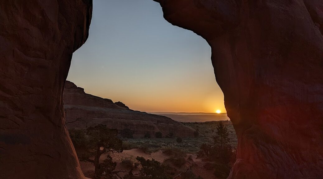
Utah Adventure Day 6-7: House on Fire Among Highlights Hiking Amid Sacred Sites, Spirits of Bears Ears National Monument

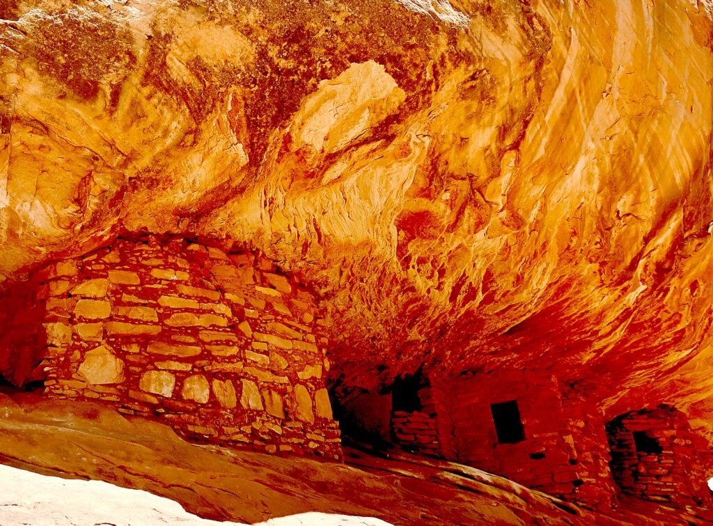
House on Fire is one of the most photographed – and dramatic – archeological sites in Bears Ears National Monument-Cedar Mesa © Karen Rubin/goingplacesfarandnear.com

By Karen Rubin, with Laini Miranda and Dave E. Leiberman

Travel Features Syndicate, goingplacesfarandnear.com

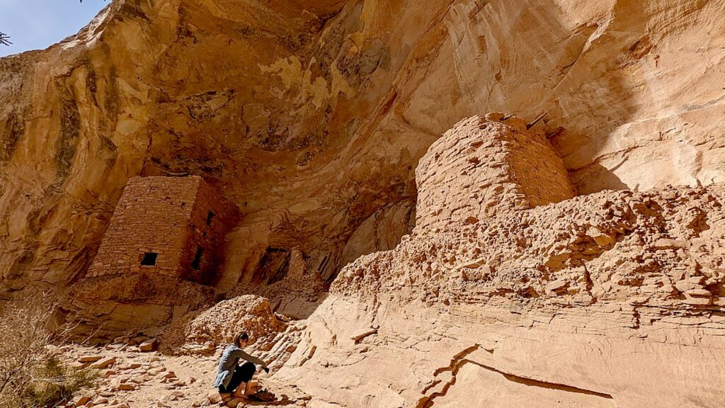
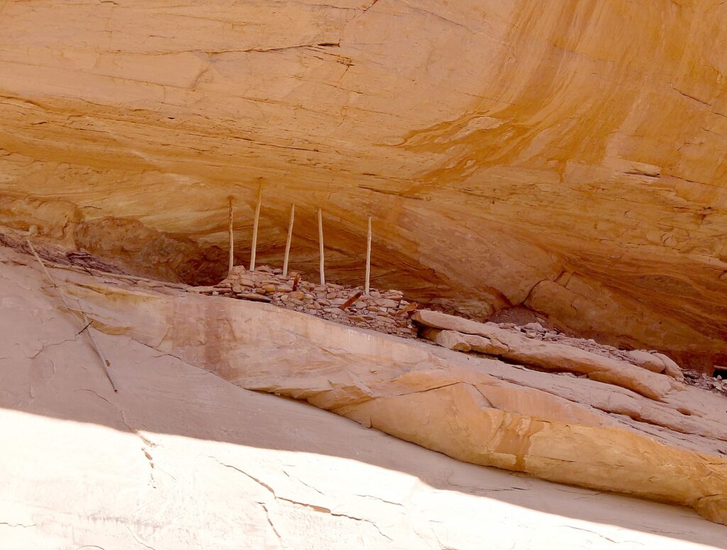
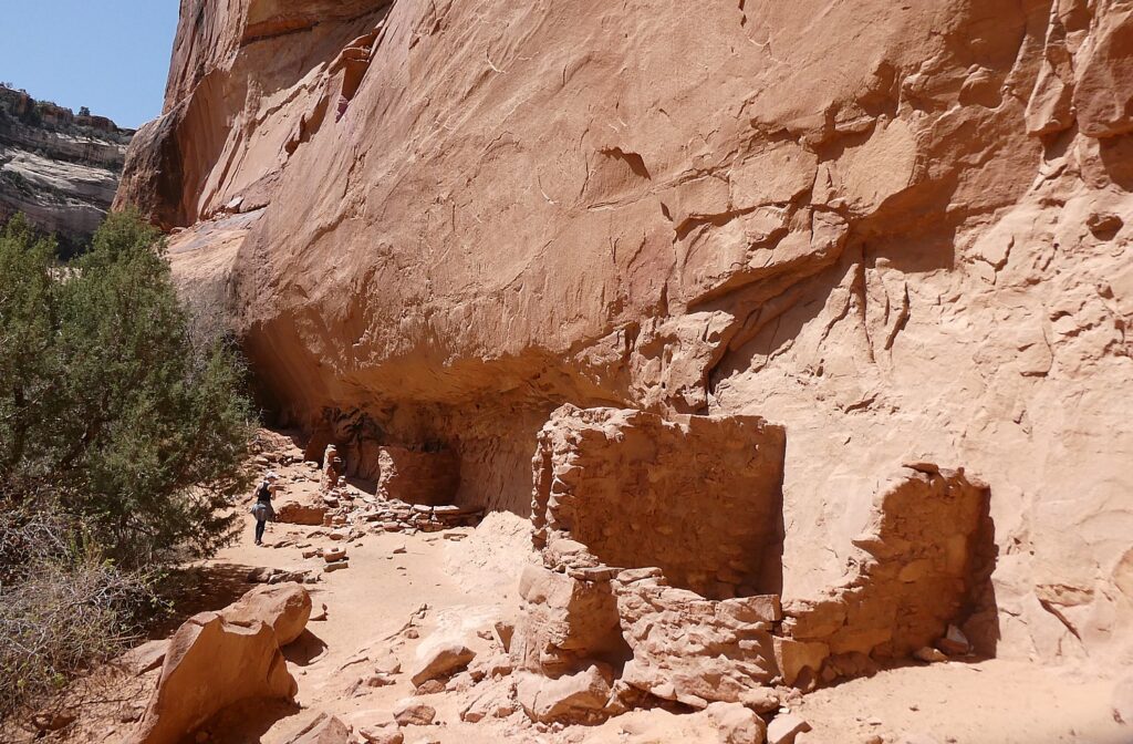
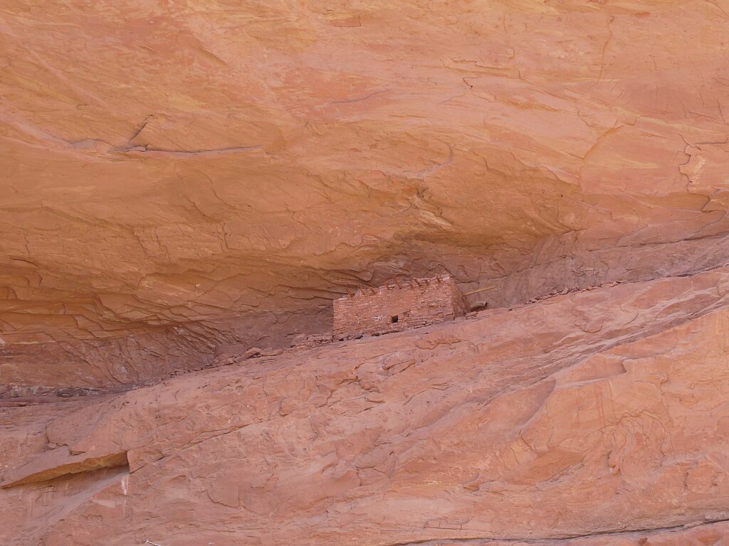
What is truly special about Bears Ears National Monument-Cedar Mesa – and what draws Laini back time and again, are the remnants, artifacts and structures left by Ancestral Puebloans – ancestors of the Hopi and Zuni – who inhabited these canyons and cliffs between 700 and 2500 years ago. Arrowheads and other artifacts dating back 10,000 years have also been found in this region. Some of these sites are at once accessible yet also feel remote – so you feel you are the first archaeologist to discover, though obviously that can’t be since the BLM Rangers have left laminated info packets in metal cases in some of the dwellings. Still, we can pretend.

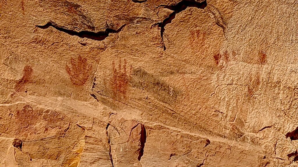
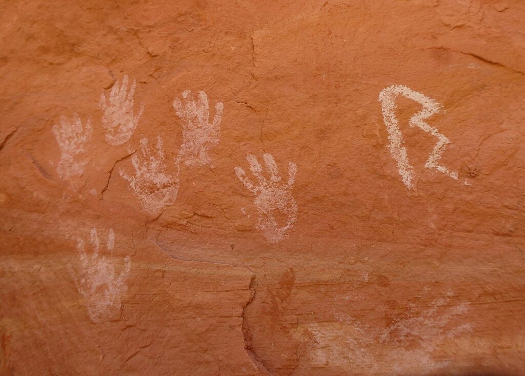
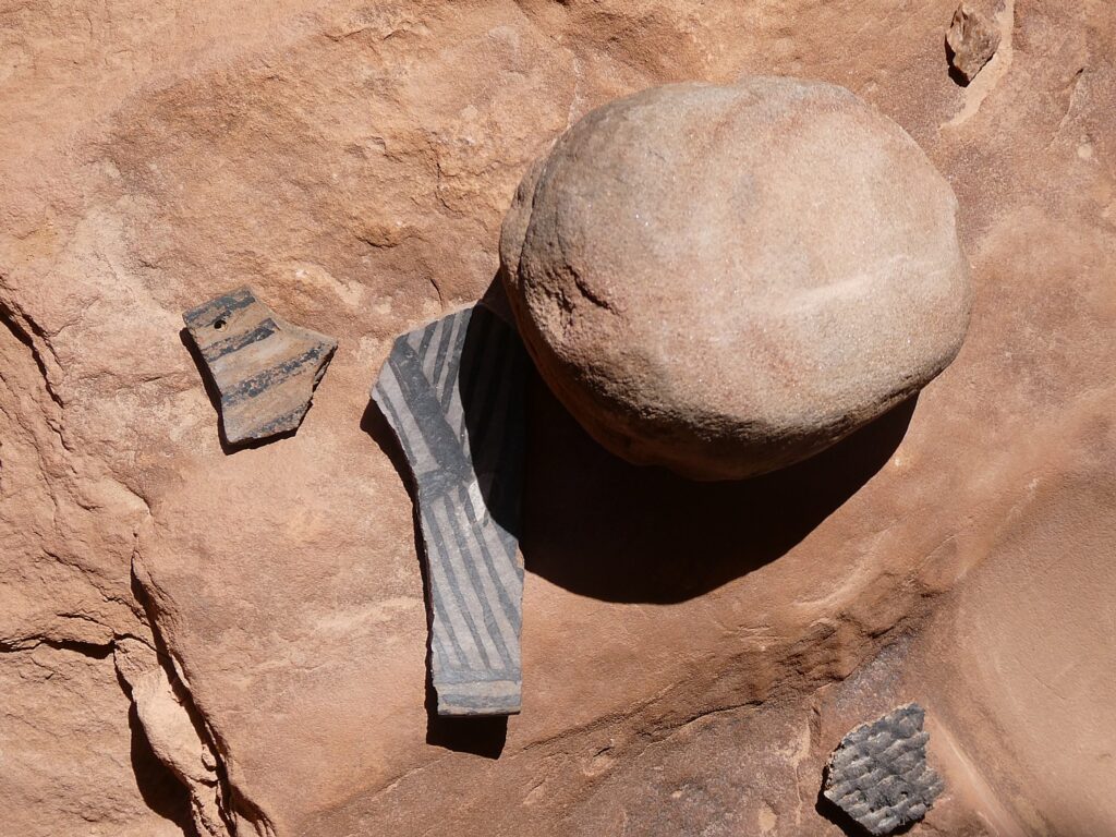
Our hikes bring us to these places that seem as if the occupants only recently vacated, leaving behind painted pottery shards, tiny corn husks, stone and bone tools, even their hand-prints, pictographs and petroglyphs that speak to us through time, as if to say, “We were here. We still are.”

Because these lands are sacred, all of us must be respectful of the dwellings and the archaeological artifacts that we come upon. And these sites truly feel sacred – precisely because of the artifacts, the pictographs and petroglyphs, you feel the presence of those who lived here. And because those of us who visit do show proper respect, these mud-and-stick (jacal) constructions delicate pictographs and petroglyphs etched into sandstone and  artifacts, though incredibly fragile, are here for us to discover, as if we are among the first.

It’s fairly miraculous these sites have survived Mother Nature, let alone humans.

After hiking to the Arch Canyon Ruins, Laini leads us to a trail to one of the outstanding highlights of the Bears Ears National Monument: the House on Fire, one of the most photographed (spectacular) sites in the region.

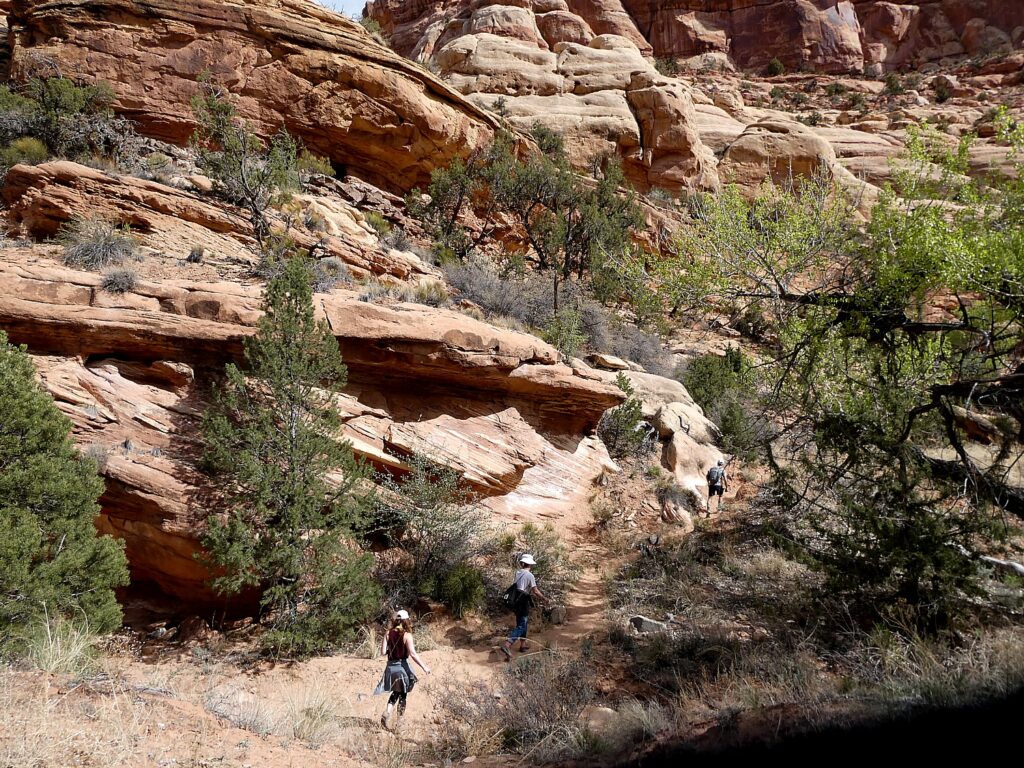
Hiking the Mule Canyon trail © Karen Rubin/goingplacesfarandnear.com

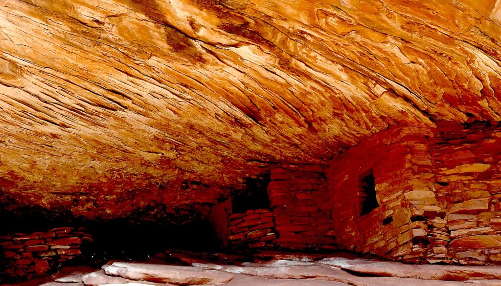
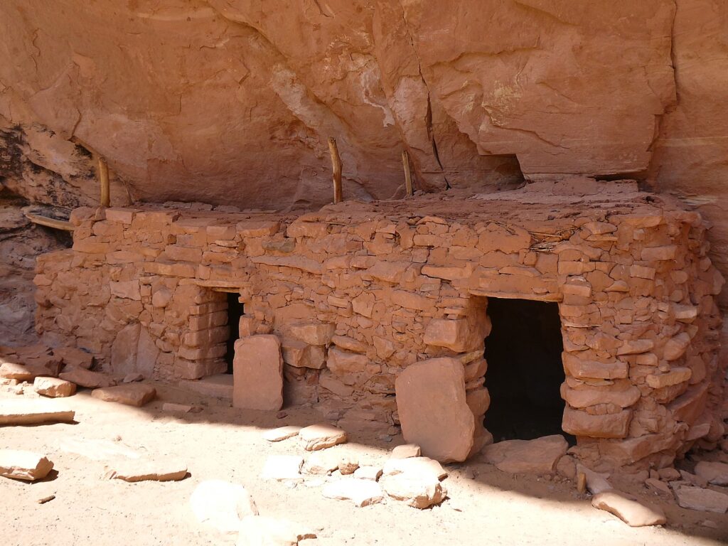
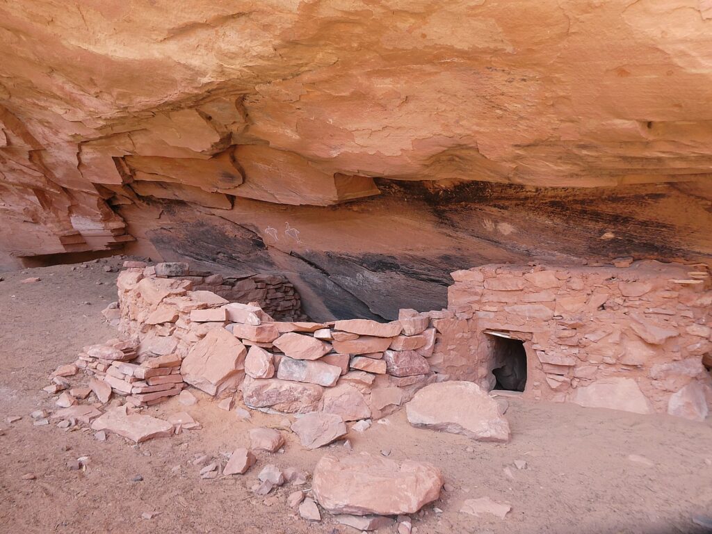
This site features five granaries built into overhanging Cedar Mesa Sandstone with a streaked pattern that, in the early morning light, resembles flames (photo tip: because these dwellings were built to be south-facing, the most dramatic light is around 10-11 am depending upon time of year). (https://bearsearsmonument.org/house-on-fire/)

House on Fire is one of the most photographed – and dramatic – archeological sites in Bears Ears National Monument-Cedar Mesa © Karen Rubin/goingplacesfarandnear.com

“As you take in the view, imagine how the ancient Puebloans lived here between 700 and 2,500 years ago,” Matcha writes at the visitutah.com site. “The granaries perched high in the cliffs stored corn, a main source of food. The Puebloans also ground Indian ricegrass into meal to make bread, and they ate abundant prickly pears. The ever-present yucca was invaluable, as its leaves were spun into fiber and woven into baskets, sandals, and bags, as well as ropes that are said to have helped reach some of the higher, less accessible granaries. The Native Americans used the root of the yucca for soap, and they roasted and ate the base of the plant.

House on Fire is one of the most photographed – and dramatic – archeological sites in Bears Ears National Monument-Cedar Mesa © Karen Rubin/goingplacesfarandnear.com

“The pinyon pines that you weave around and duck under to reach the ancient sites were a key source of building material, fuel, and food. When burned, the wood created the high temperatures needed for firing pottery, while pine bark served as roofing and padding, and pinon nuts provided much-needed vitamins and protein.” (https://www.visitutah.com/articles/exploring-mule-canyon-house-on-fire-cave-tower)

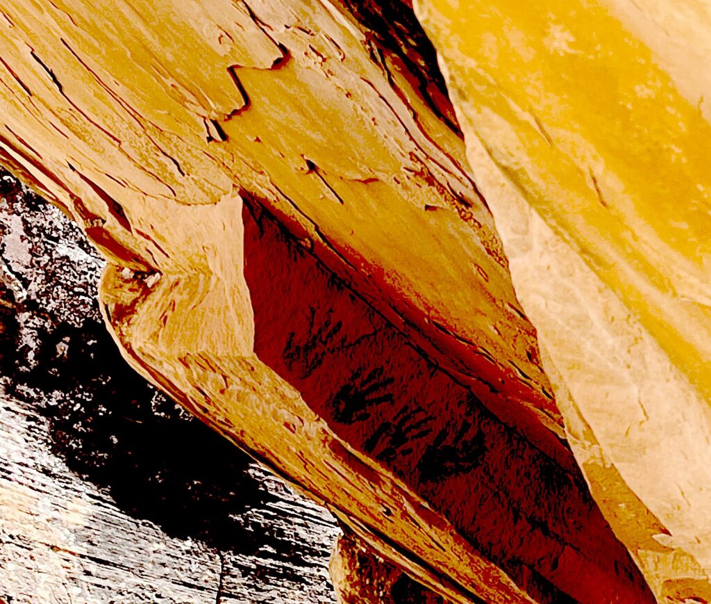
You have to really look closely to discover these hand prints in House of Fire, Bears Ears National Monument-Cedar Mesa © Laini Miranda/goingplacesfarandnear.com

Matcha further advises to search for rock art located beneath an overhanging boulder in the wash below the House on Fire. And if you continue on the trail, there are several more sites worth seeing. While some sit right off the trail, you either need binoculars to see or have to climb 200 feet to reach them. “Toward the end of the canyon is the spectacular Wall Site, which has several intact rooms built into small caves in the pock-marked cliff. Some of the roofs still have the original roof timbers.”

(South Fork of Mule Canyon trail is 4.3 miles one-way, and elevation gain is 250 feet. Cave Tower Site is 1-1.5 miles round trip, and elevation change is less than 200 feet. Passes are required for day hiking, check with the Bureau of Land Management for the current fee amount. Be prepared with exact change.)

Coming upon The Tower Ruin, off the beaten path © Karen Rubin/goingplacesfarandnear.com

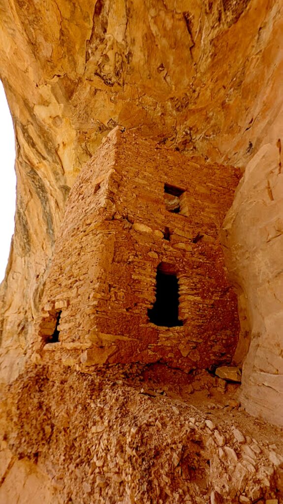
After this spectacular hike, we drive west on Hwy 95 near milepost 103, then drive onto a dirt road for half a mile. We hike in and across the way, we see The Tower Ruin – a rare, two-story structure on the other side of the canyon.

The Tower Ruin, Bears Ears National Monument-Cedar Mesa © Karen Rubin/goingplacesfarandnear.com

At first, it seems too steep a scramble for me, but Dave and Laini go down. Dave makes it look easy. Sure enough, he comes back to guide me to the site (so glad he did!).

The Tower Ruin, Bears Ears National Monument-Cedar Mesa © Karen Rubin/goingplacesfarandnear.com

This site is so secluded, remote and untouched, it feels as if we discovered it on our own (though I’m sure that’s not true, the feeling is still so exciting).

The Tower Ruin, Bears Ears National Monument-Cedar Mesa © Karen Rubin/goingplacesfarandnear.com

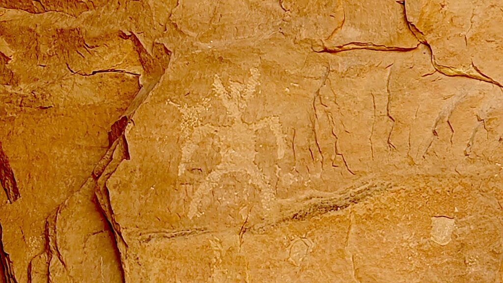
The tower construction seems to be “modern” – Laini says there is evidence of three different generations having a hand in the construction. There are fabulous pictographs and petrolyphs here. I imagine that one is a symbol for the chief.

The Tower Ruin, Bears Ears National Monument-Cedar Mesa © Karen Rubin/goingplacesfarandnear.com

Altogether, we have hiked about 9 to 10 miles today – so satisfying.

We drive into the town of Blanding for dinner and supplies, seeing signs along the way for Native American Crafts, Dinosaur Museum, State Edges of the Cedars Native American Museum.

The Tower Ruin, Bears Ears National Monument-Cedar Mesa © Karen Rubin/goingplacesfarandnear.com

Laini decides to change plans from our original itinerary and instead of leaving here for Canyonlands, we stay an extra night and day in Cedar Mesa.

So glad, because the second day’s hike is one of the best I have ever experienced.

Catching the last rays of sun driving back to our wild camping site in Arch Canyon from Blanding © Karen Rubin/goingplacesfarandnear.com
 

Kane Gulch Trail

Take seriously the need to obtain permits in advance for certain hikes. We changed our plans in order to stay this second day in Cedar Mesa so did not get the necessary permit (limited to just 20 a day) to hike to Moon House – the only day hike that requires a permit instead of just a hiking day pass. We thought we might get away with it because we are here on Easter Sunday, but no such luck (the permit allocations fill up even months before). It is easier to get permits in summer months, which is when Laini and David found themselves the only ones at the site when they last visited (likely because of the heat; when we are here, in early spring, the weather is perfect).

Hiking the Kane Gulch Trail, Bears Ears National Monument-Cedar Mesa © Karen Rubin/goingplacesfarandnear.com

Instead, at the Kane Gulch Visitor Center, the Ranger suggests we hike the Kane Gulch Trail which starts right across the road. We purchase our day hiking passes ($5 pp – my America the Beautiful pass doesn’t count). She suggests what to look for at what distances.

Hiking the Kane Gulch Trail, Bears Ears National Monument-Cedar Mesa © Karen Rubin/goingplacesfarandnear.com

Dave gets out our hot-water maker and we have our breakfast at the picnic table outside the visitor center, then set out. Our plan is to go five miles, to the Stimper Arch, and five miles back.

Profile of an Indian Chief? Hiking the Kane Gulch Trail, Bears Ears National Monument-Cedar Mesa © Karen Rubin/goingplacesfarandnear.com

At about a mile in, there is a short slot canyon where we see a formation to me looks like the profile of an Indian chief.

At the two-mile mark, Dave stashes our 5-gallon water jug so we have enough for the return.

Junction Ruin, Kane Gulch Trail, Bears Ears National Monument-Cedar Mesa © Karen Rubin/goingplacesfarandnear.com 

It’s four miles to the Junction Ruin which has some fabulous dwellings, pottery shards, and pictographs.Dave and Laini climb up sheer rock to get to an upper level (a defensive watchtower?) and could see remnants of a ladder that would have been used.

Turkey Pen, Kane Gulch Trail, Bears Ears National Monument-Cedar Mesa © Karen Rubin/goingplacesfarandnear.com 

Another .7 mile and we come to a site known as Turkey Pen. Looking up from the trail, it seems the cliff dwellings are cramped and close to the edge, but when we get up here, it is surprising how much space there actually is.

Turkey Pen, Kane Gulch Trail, Bears Ears National Monument-Cedar Mesa © Karen Rubin/goingplacesfarandnear.com

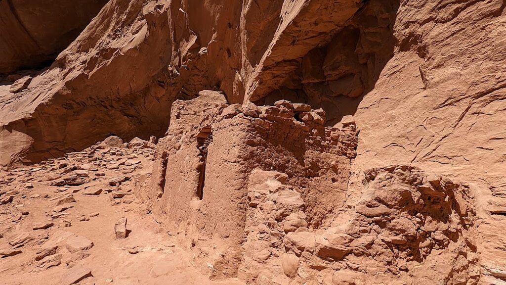
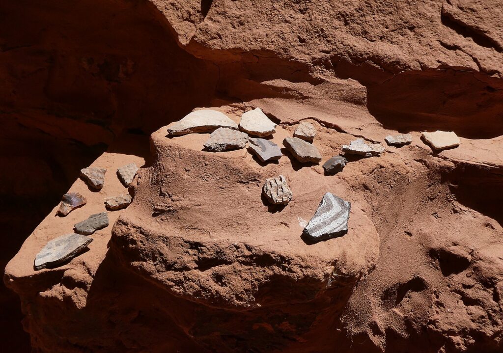
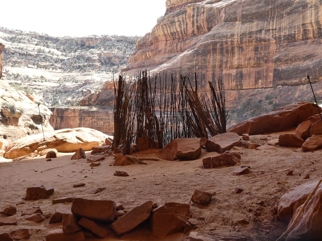
Here, we see some fabulous examples of mud and stick method of construction (jacal) and some exquisite painted pottery shards, pictographs, even the remnants of the actual turkey pen formed with sticks – so it almost seems you are coming upon a dwelling just after the residents left. You feel you are the archaeologist making the discovery – except for the printed notes left by the National Park Service- but still. 

Cliff dwellings along the Kane Gulch Trail, Bears Ears National Monument-Cedar Mesa © Karen Rubin/goingplacesfarandnear.com

We also come upon a square kiva (most kivas Laini and Dave have seen are circular, Laini notes).

Junction Ruin, Kane Gulch Trail, Bears Ears National Monument-Cedar Mesa © Karen Rubin/goingplacesfarandnear.com

You wonder about whether the site was designed to defend and who to defend from – people who would take food stored in the granary? One of the pictographs depicts sheep being killed, another of “lizard man.”

Cliff dwellings along the Kane Gulch Trail, Bears Ears National Monument-Cedar Mesa © Karen Rubin/goingplacesfarandnear.com

As we hike, we keep our eyes peeled on the cliffs above for evidence of dwellings, well off the trail and likely minimally visited. Laini says there were thousands of cliff dwellings here and only a fraction have been discovered (or are still intact, but when you consider they are 1000 years old, and the crumbling rock all around, it is amazing any remain). We spot one and Laini goes off to try to find a way to climb up to it.

Cliff dwellings along the Kane Gulch Trail, Bears Ears National Monument-Cedar Mesa © Karen Rubin/goingplacesfarandnear.com

We find a pleasant rock overhang to sit and have our picnic lunch, feeling like this would have been exactly what the Puebloans would have done.

We hike a further .3 miles to the Stimper Arch (which is the 5-mile mark), where we turn around.

Turkey Pen, Kane Gulch Trail, Bears Ears National Monument-Cedar Mesa © Karen Rubin/goingplacesfarandnear.com

This hike has everything – it has just the right amount of physical challenge – a section where you scramble a bit and walk a narrow edge – gorgeous greenery, stunning rock formations, water features (but not too watery to hike), but best and most spectacular of all, these cliff dwellings that look like we have just discovered them, with relatively large and stunningly painted pottery shards, stone tools, stunning pictographs (I start thinking they are either indications of how many people lived in the dwelling like a census; markers of whose dwelling it is, like a family name?  or just being playful, artful?).

Turkey Pen, Kane Gulch Trail, Bears Ears National Monument-Cedar Mesa © Karen Rubin/goingplacesfarandnear.com

The trail is not specifically marked – so you have to figure your own way using the landscape and intermittently placed cairns.

Turkey Pen, Kane Gulch Trail, Bears Ears National Monument-Cedar Mesa © Karen Rubin/goingplacesfarandnear.com
The actual turkey pen, Kane Gulch Trail, Bears Ears National Monument-Cedar Mesa © Karen Rubin/goingplacesfarandnear.com
Turkey Pen, Kane Gulch Trail, Bears Ears National Monument-Cedar Mesa © Karen Rubin/goingplacesfarandnear.com

Even though this is a popular trail, we come upon other people only occasionally (but it kind of reassures us we are going the right way).

The trail actually goes on for miles (days), connecting to other trails. (We meet a group of college students who are making a multi-day backpacking trip and will return on the Fish and Owl trail.)

Turkey Pen, Kane Gulch Trail, Bears Ears National Monument-Cedar Mesa © Karen Rubin/goingplacesfarandnear.com
Kane Gulch Trail, Bears Ears National Monument-Cedar Mesa © Karen Rubin/goingplacesfarandnear.com

We get back to the start at 6:30 pm (we set out around 10 am), having hiked about 11 miles. (It took us 5 hours to get 5 miles (including the time exploring the archaeological sites) and 3 ½ hours to hike back.

Stimper Arch, Kane Gulch Trail, Bears Ears National Monument-Cedar Mesa © Karen Rubin/goingplacesfarandnear.com

After this full day’s hike, we drive to Arches National Park. It’s a fairly long drive and already sunset by the time we arrive. This is the first time we have to set up camp in the dark and there is a strong wind that makes it difficult to keep the tent from blowing away (especially since I can’t find my tent stakes so we improvise, until they are ultimately found under the footprint.)

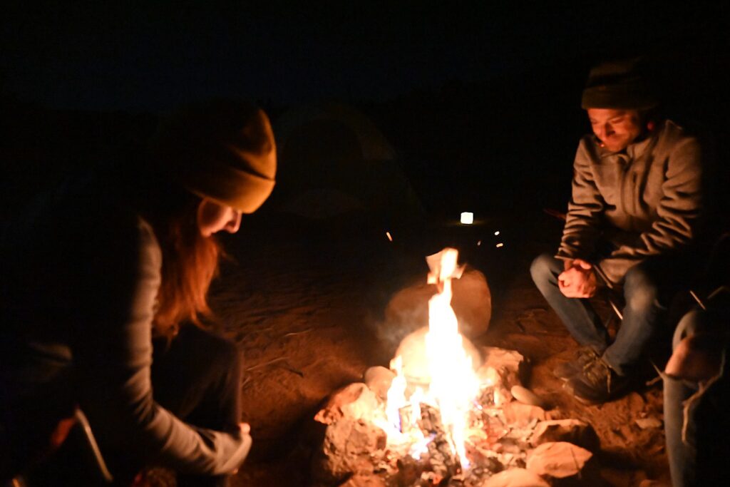
Dave makes a fire and we prepare dinner from our supplies.

It is night by the time we set up camp at the Devils Campground in Arches National Park © Karen Rubin/goingplacesfarandnear.com

If You Go….

The Moon House Ruin is one of the best archaeology sites on Cedar Mesa, consists of three separate structures with 49 rooms; well preserved pictographs grace the walls of an interior courtyard and some of the rooms (the hike is 3.2-5.6 miles roundtrip). More of the best hikes in Bears Ears at http://www.hikingwalking.com/index.php/destinations/ut/ut_se/blanding

Day hiking in Bears Ears National Monument requires a day hiking pass. Day hiking passes are unlimited.

Bears Ears National Monument does not charge an entry fee where your America the Beautiful Pass would typically apply. However, activity fees called “Individual Special Recreation Permits” are charged for day hiking and backpacking (typically $2 at the trailhead). Visit the permits page for more information (https://www.blm.gov/programs/recreation/permits-and-passes/lotteries-and-permit-systems/utah/cedarmesa).

Visitor Centers:

Kane Gulch BLM Ranger Station, UT-261 36 miles west of Blanding. Open: March 1-June 15, September 1-October 31, 8 am-noon daily

Monticello Visitor Center, 216 S Main St., Hours: 9 am-5 pm, closes at 3 pm on Sunday, Phone: 435-587-3401

Blanding Visitor Center, 12 North Grayson Parkway, 9 am-5 p.m., closed Sunday

https://www.blm.gov/visit/bears-ears-national-monument

See:

UTAH ADVENTURE DAY 1-2: CAPITOL REEF’S COLORFUL CANYONS

UTAH ADVENTURE DAY 3-4: GRAND STAIRCASE-ESCALANTE POSES CHALLENGE

UTAH ADVENTURE DAY 4-5: DRIVING BURR TRAIL, EXPLORING GLEN CANYON, WILD CAMPING IN ARCH CANYON

UTAH ADVENTURE DAY 6: SACRED SITES, SPIRITS OF BEARS EARS NATIONAL MONUMENT

______________________

© 2023 Travel Features Syndicate, a division of Workstyles, Inc. All rights reserved. Visit goingplacesfarandnear.com, www.huffingtonpost.com/author/karen-rubin, and travelwritersmagazine.com/TravelFeaturesSyndicate/. Blogging at goingplacesnearandfar.wordpress.com and moralcompasstravel.info. Visit instagram.com/going_places_far_and_near and instagram.com/bigbackpacktraveler/ Send comments or questions to [email protected]. Tweet @TravelFeatures. ‘Like’ us at facebook.com/KarenBRubin 

Utah Adventure Day 6: Sacred Sites, Spirits of Bears Ears National Monument

Exploring the Arch Canyon ruins, Bears Ears National Monument-Cedar Mesa © Karen Rubin/goingplacesfarandnear.com

By Karen Rubin, with Laini Miranda and Dave E. Leiberman

Travel Features Syndicate, goingplacesfarandnear.com

Bears Ears National Monument-Cedar Mesa is the highlight (out of so many) of our Utah Adventure – hitting on all cylinders of stunning landscape, fascinating cultural heritage, and the opportunity to really explore, adventure and discover for ourselves on some of the most wonderful hikes (Kane Gulch!) anywhere.

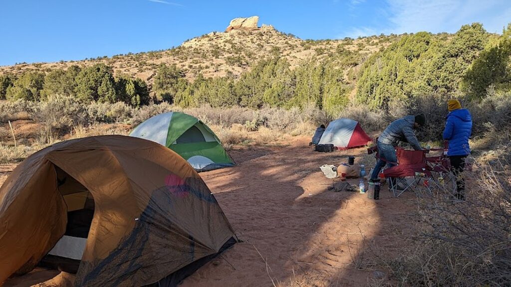
Wild camping in Arch Canyon, Bears Ears National Monument-Cedar Mesa © Karen Rubin/goingplacesfarandnear.com

Finally! I get to do wild camping that I have been so intrigued about ever since Dave and Laini spent much of a summer exploring the West in their Subaru Forester which they converted into a campervan.

Dave drives our rental Jeep down a dirt road into Arch Canyon until we find a spot we can claim for our own (it happens to be immediately adjacent to an Indian reservation, with a warning sign posted on a fence, “No trespassing.”). There are many other wild campers in this area in the spring and we get one of the last suitable spots. (But this is still so much more interesting than going further down the road to an actual campground where you need advance reservations for official campgrounds,  recreation.gov, information at 435-587-1500 M-F, 8 am-noon. No reservation is required for any BLM land that does not clearly prohibit camping and the custom is to find a site that already has a stone circle for a fire pit.)

Wild camping in Arch Canyon, Bears Ears National Monument-Cedar Mesa © Karen Rubin/goingplacesfarandnear.com

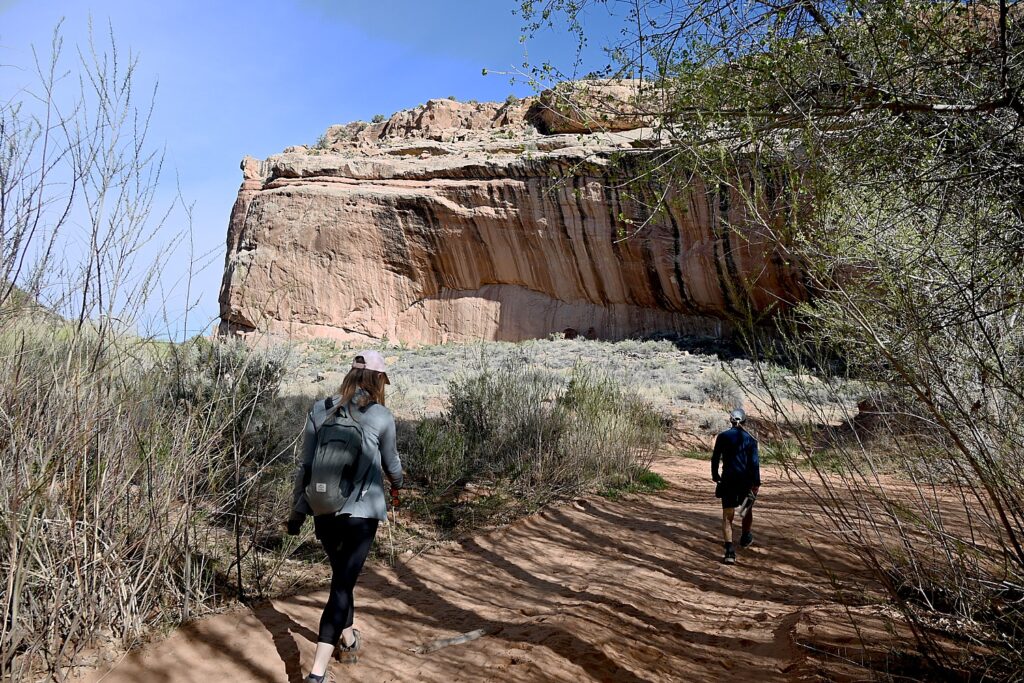
Where we set up is just a walk down a path that leads to the Arch Canyon trailhead and the Arch Canyon Ruins, where we get to explore cliff dwellings.

Indeed, Cedar Mesa is a network of canyons that are home to ancient archaeological ruins and rock art panels – the ultimate combination of spectacular scenery and fascinating cultural sites.

Streams carve into the banded yellow-gray and reddish-orange sandstone, creating fabulous formations and arches – Mother Nature’s sculpture. Cliffs are streaked with “desert varnish” – thin deposits of minerals including iron, manganese, magnetite and clay particles, combined with bacteria – which add to the painterly ambiance. And some of these have provided the overhang for dwellings.

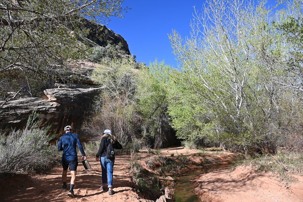
Hiking the trail into Arch Canyon, Bears Ears National Monument-Cedar Mesa © Karen Rubin/goingplacesfarandnear.com

What is truly special about Bears Ears National Monument-Cedar Mesa – and what draws Laini back time and again, are the remnants, artifacts and structures left by Ancestral Puebloans – ancestors of the Hopi and Zuni – who inhabited these canyons and cliffs between 700 and 2500 years ago. Arrowheads and other artifacts dating back 10,000 years have also been found in this region. Some of these sites are at once accessible yet also feel remote – so you feel you are the first archaeologist to discover, though obviously that can’t be since the BLM Rangers have left laminated info packets in metal cases in some of the dwellings. Still, we can pretend.

Hiking the trail into Arch Canyon, Bears Ears National Monument-Cedar Mesa © Karen Rubin/goingplacesfarandnear.com

Our hikes bring us to these places that seem as if the occupants only recently vacated, leaving behind painted pottery shards, tiny corn husks, stone and bone tools, even their hand-prints, pictographs and petroglyphs that speak to us through time, as if to say, “We were here. We still are.”

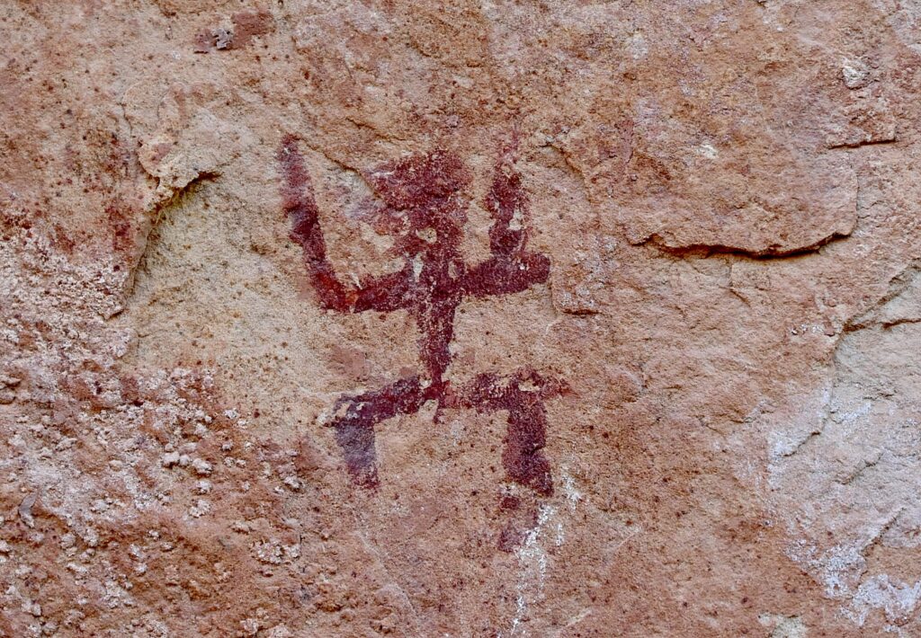
These sites in Bears Ears truly feel sacred – precisely because of the artifacts, the pictographs and petroglyphs, you feel the presence of those who lived here © Karen Rubin/goingplacesfarandnear.com

Indeed, there are a mind-boggling 100,000 known archaeological sites protected within the Bears Ears National Monument, which spans 1.35 million acres. The buttes and surroundings have long been held as sacred or significant by a number of the region’s Native American tribes.

But it has not been without controversy. 

Bears Ears National Monument was established in 2016 by President Barack Obama to preserve thousands of these indigenous cultural and archaeological sites. The Bears Ears Inter-Tribal Coalition, an alliance of five sovereign Tribal nations with ties to Bears Ears (the Hopi, Navajo, Uintah and Ouray Ute Indian Tribe, Ute Mountain Ute and Zuni Tribe), was the driving force behind its designation and are partners in managing the monument along with the federal Bureau of Land Management and US Forest Service.

These sites in Bears Ears truly feel sacred – precisely because of the artifacts, the pictographs and petroglyphs, you feel the presence of those who lived here © Karen Rubin/goingplacesfarandnear.com

In their proposal to have Bears Ears designated as a national monument, the Coalition described these canyonlands as ancestral land and the Southern Utah Wilderness Alliance (SUWA) described the Bears Ears as “the most significant unprotected cultural landscape in the U.S.”

These sites in Bears Ears truly feel sacred – precisely because of the artifacts, the pictographs and petroglyphs, you feel the presence of those who lived here © Karen Rubin/goingplacesfarandnear.com

But in 2017, catering to mining, fossil fuel and other extraction industry interests, Donald Trump drastically reduced the size of Bears Ears (by 85 percent) and Grand Staircase-Escalante (by half) – the single largest rollback of public lands protection in history. These changes exposed archaeological and paleontological sites to vandalism, looting and opened the door to drilling and mining. Moreover, Trump’s Interior Department, under Secretary Ryan Zinke (who left in 2019 in disgrace) offered meager plans for managing what remained of the monuments, leaving important cultural sites and wildlife habitat vulnerable.

These sites in Bears Ears truly feel sacred – precisely because of the artifacts, the pictographs and petroglyphs, you feel the presence of those who lived here © Karen Rubin/goingplacesfarandnear.com

Various groups brought lawsuits and President Joe Biden (who appointed Deb Haaland Interior Secretary, the first native American to hold the cabinet position and the first to lead the department which historically oversees the Bureau of Indian Affairs) restored the territory under protection in October 2021. The Bears Ears Inter-Tribal Coalition and the federal government officially signed a cooperative agreement, unveiling the first monument boundary sign on June 18, 2022,

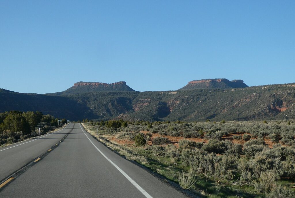
The Bears Ears National Monument is named for a pair of buttes that rise to elevations of 8,900 feet and 9,000 feet © Karen Rubin/goingplacesfarandnear.com

The monument is named Bears Ears for a pair of buttes that rise to elevations of 8,900 feet and 9,000 feet – more than 2,000 feet above Utah state routes 95 and 261. The monument includes the area around the Bears Ears formation and adjacent land to the southeast along the Comb Ridge formation, as well as Indian Creek Canyon to the northeast. The monument also includes the Valley of the Gods to the south, the western part of the Manti-La Sal National Forest’s Monticello unit, and the Dark Canyon Wilderness to the north and west.

These sites in Bears Ears truly feel sacred – precisely because of the artifacts, the pictographs and petroglyphs, you feel the presence of those who lived here © Karen Rubin/goingplacesfarandnear.com

Because these lands are sacred, all of us must be respectful of the dwellings and the archaeological artifacts that we come upon. And these sites truly feel sacred – precisely because of the artifacts, the pictographs and petroglyphs, you feel the presence of those who lived here. And because those of us who visit do show proper respect, these mud-and-stick (jacal) constructions delicate pictographs and petroglyphs etched into sandstone and  artifacts, though incredibly fragile, are here for us to discover, as if we are among the first.

It’s fairly miraculous these sites have survived Mother Nature, let alone humans.

These sites in Bears Ears truly feel sacred – precisely because of the artifacts, the pictographs and petroglyphs, you feel the presence of those who lived here © Karen Rubin/goingplacesfarandnear.com

Indeed, we are able to see artifacts and sites that date back 1000 years, but it is mind-boggling to contemplate that this area has been inhabited since 12,000 BC to 6000 BC by the PaleoIndians; the Archaic (6000-2000 BC); Early Agriculture (2000-500 BC); Basketmaker II (500 BC to 500 AD); Basketmaker III (500-750 AD); Pueblo I (750-900 AD), Pueblo II (900-1150 AD-we see evidence of their kivas, plain gray pottery, black-on-white pottery); Pueblo III (1150-1290 AD, when the Four Corners Area was abandoned).

Arch Canyon Ruins

Hiking the trail into Arch Canyon, Bears Ears National Monument-Cedar Mesa © Karen Rubin/goingplacesfarandnear.com

Each day of our Utah Adventure, which so far has taken us through Capitol Reef National Park, Grand Staircase-Escalante, and Glen Canyon National Recreation Area, has been so different in highlights, experience and even theme. Today’s theme is cultural, as we go in search of cliff dwellings through these canyons.

We wake up in our “wild” campsite and after breakfast, stroll down Arch Canyon Road and soon come to the Arch Canyon Ruin.

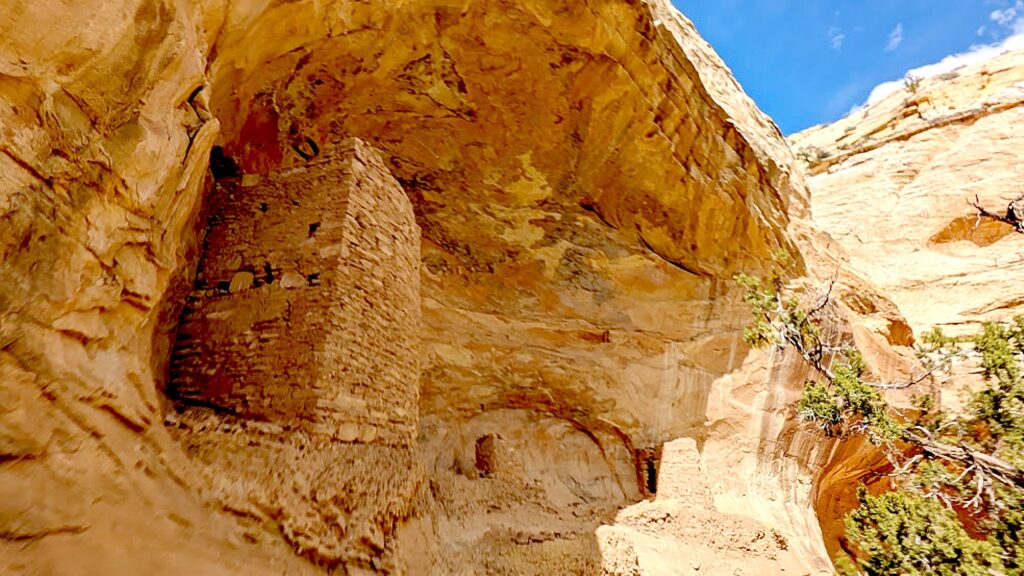
Seeing these structures, how they were built high up in the rock overhangs, camouflaged in rock, you wonder whether they were designed for defense: Who or what were they defending against? The fact that the Navajo named the Ancestral Pueblo people who were there before them, Anasazi – “enemy ancestors” (as we learned at the Anasazi State Park Museum in Boulder) suggests that there were conflicts among tribes or clans. Were these groups afraid of being attacked for their food or water? Or were they built so far above the river because of flash floods?

Arch Canyon ruins, Bears Ears National Monument-Cedar Mesa © Karen Rubin/goingplacesfarandnear.com

A panel provides background about the Puebloan People and these cliff dwellings: Few people lived in Cedar Mesa from 700-1050 AD, but by 1050, there were many Pueblo communities throughout the mesa and its canyons. During this time, Cedar Mesa’s cultural landscapes were interconnected with those of Chaco Canyon to the southeast, Mesa Verde to the east and the kayenta region to the south. Later, smaller groups moved into Cedar Mesa’s canyons to occupy nearly inaccessible but defensible places such as cliff face alcoves and ledges. But by 1280 AD, a combination of social and environmental factors prompted the Puebloan people to migrate again from Cedar Mesa to lands to the south and east. Cedar Mesa’s descendant populations now reside among the Hopi of Arizona, the Zuni and Keres-speaking pueblos of New Mexico and the Tanoan peoples along the Rio Grande.

Arch Canyon ruins, Bears Ears National Monument-Cedar Mesa © Karen Rubin/goingplacesfarandnear.com

I note the word “defensible” and wonder about who and what they were defending against.

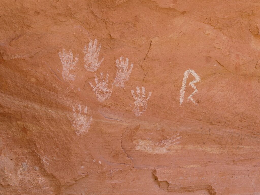
In one of the structures, we see an innovation: shelves! We climb under boulders and see a pictograph of four hands.

We spend about two hours in this section, and then get the Jeep to go to the next destination. (You can hike between Arch Canyon and House on Fire, via Arch Canyon Road and Mule Canyon trail, 5.7 miles, or two hours, one way.)

Exploring the Arch Canyon ruins, Bears Ears National Monument-Cedar Mesa © Karen Rubin/goingplacesfarandnear.com

We stop for a picnic lunch at Mule Canyon Ruin site along the road (almost a rest stop, complete with two bathrooms).

Laini leads us to a trail to one of the outstanding highlights of the Bears Ears National Monument: the House on Fire, one of the most photographed (spectacular) sites in the region.

If You Go….

Day hiking in Bears Ears National Monument requires a day hiking pass (there is no limit on the number of day hiking passes issued).

Bears Ears National Monument does not charge an entry fee where your America the Beautiful Pass would typically apply. However, activity fees called “Individual Special Recreation Permits” are charged for day hiking and backpacking (typically $2 at the trailhead). Because your America the Beautiful Pass does not cover Individual Special Recreation Permits, it does not apply toward your backpacking permit, Moon House permit, nor day hiking pass. Visit the permits page for more information.

Visitor Centers:

Kane Gulch BLM Ranger Station,  UT-261 36 miles west of Blanding. Open: March 1-June 15, September 1-October 31, 8:00 a.m. – 12:00 p.m., 7 days a week

Monticello Visitor Center, 216 S Main St., Hours: 9:00 a.m. – 5:00 p.m., Closes early at 3:00 p.m. on Sunday, Phone: 435-587-3401

Blanding Visitor Center, 12 North Grayson Parkway, 9:00 a.m. – 5:00 p.m., closed Sunday

More information: https://www.blm.gov/visit/bears-ears-national-monument

Next: House on Fire, Kane Gulch Trail

See:

UTAH ADVENTURE DAY 1-2: CAPITOL REEF’S COLORFUL CANYONS

UTAH ADVENTURE DAY 3-4: GRAND STAIRCASE-ESCALANTE POSES CHALLENGE

UTAH ADVENTURE DAY 4-5: DRIVING BURR TRAIL, EXPLORING GLEN CANYON, WILD CAMPING IN ARCH CANYON

______________________

© 2023 Travel Features Syndicate, a division of Workstyles, Inc. All rights reserved. Visit goingplacesfarandnear.com, www.huffingtonpost.com/author/karen-rubin, and travelwritersmagazine.com/TravelFeaturesSyndicate/. Blogging at goingplacesnearandfar.wordpress.com and moralcompasstravel.info. Visit instagram.com/going_places_far_and_near and instagram.com/bigbackpacktraveler/ Send comments or questions to [email protected]. Tweet @TravelFeatures. ‘Like’ us at facebook.com/KarenBRubin 
Utah Adventure Day 4-5: Driving Burr Trail, Exploring Glen Canyon, Wild Camping in Arch Canyon

In search of Defiance House archaeological site, tucked away in the Forgotten Canyon © Karen Rubin/goingplacesfaranadnear.com

By Karen Rubin, with Laini Miranda and Dave E. Leiberman

Travel Features Syndicate, goingplacesfarandnear.com

It’s the afternoon when we leave the Grand Staircase-Escalante after having a sensational hike through Big Horn Canyon, and drive through the Dixie National Forest on our way to Glen Canyon Recreation Area.

We stop in Boulder where the Magnolia burrito food truck that Dave and Laini love is based in the parking lot of the Anasazi State Park Museum. I wander into the museum for a quick look – the displays are really wonderful and had I had the time, I would have taken advantage of the interactive exhibits (you can grind corn using a mano and metate, identify seeds with a microscope, make rubbings of pottery designs).

I find it fascinating that “Anasazi” is actually a Navajo word meaning “ancient enemies” or “enemy ancestors” but it is not actually known what these people – Ancestral Pueblo who inhabited the area before the Navajo – called themselves. Still, the name has stuck. They were village-dwelling farmers – that is to say, not nomadic people – who lived in the Four Corners between 1 and 1300 AD, when there is some mystery about why they suddenly left en masse (some suspect it was the drought of historic proportions, only rivaled by our current 20-year drought). Behind the museum you can walk a short trail to the Coombs Site Ruins and a life-size, six-room replica of part of the pueblo as it would have existed 800-900 years ago. Beyond that are several more unexcavated areas. (Anasazi State Park Museum, Boulder, UT, 435-335-7308, www.stateparks.utah.gov)

Long Canyon on the Burr Trail © Karen Rubin/goingplacesfaranadnear.com
 

Just down the road from the museum, we turn onto the Burr Trail Scenic Backway, considered one of the most picturesque drives in Utah. Paved and graded in some sections, gravel and dirt in others, the road extends 66 miles from Boulder, passing the slickrock canyons of the Grand Staircase–Escalante National Monument, the Badlands of Capitol Reef National Park, the Waterpocket Fold, and painted rock desert of Glen Canyon National Recreation Area, ending at Bullfrog Basin on Lake Powell – our destination on the fourth day of our Utah Adventure.

Singing Canyon on the Burr Trail © Karen Rubin/goingplacesfaranadnear.com

I find it interesting to learn that the Burr Trail was originally developed as a cattle trail by stockman John Atlantic Burr (born in 1846 aboard the SS Brooklyn sailing across the Atlantic; his family established Burrville, Utah, in 1876). Burr developed the trail so he could take his herd through the rough, nearly impassable country around the Waterpocket Fold, Burr Canyon and Muley Twist Canyon.

Singing Canyon on the Burr Trail © Karen Rubin/goingplacesfaranadnear.com
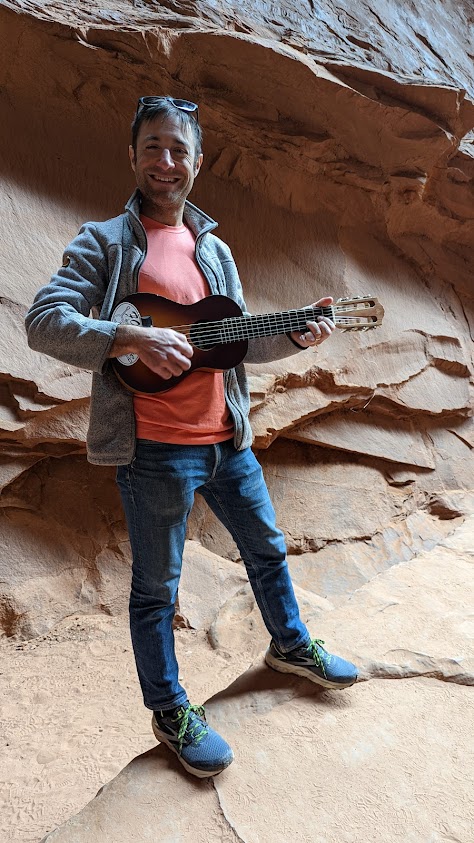
Dave tries out the acoustics in Singing Canyon on the Burr Trail © Karen Rubin/goingplacesfaranadnear.com

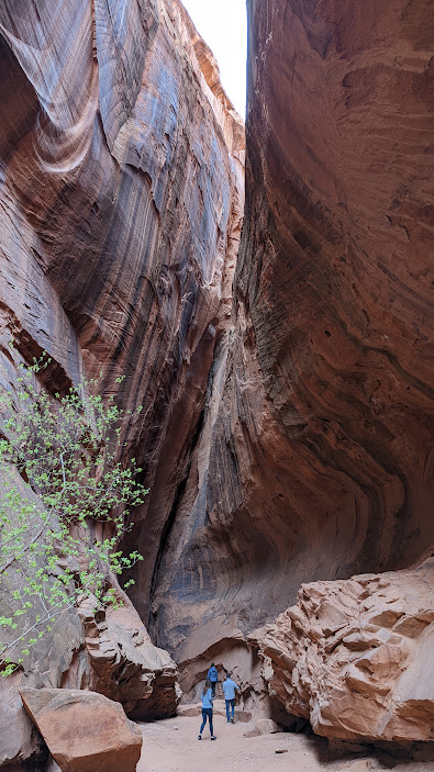
We drive through Long Canyon and soon come to one of the highlights along the route, which accounts for its nickname, Singing Canyon. It looks like a setting for Jurassic Park. We walk in, feeling so small against these gigantic, high cliffs of red rock. Dave gets out his mini-guitar for the occasion and we revel in the acoustics that give the canyon its name (I can imagine proposals and weddings happening here).

Driving along the Burr Trail, it is eerie to see how such mighty rocks crumble © Karen Rubin/goingplacesfaranadnear.com

As we drive this rustic highway, we see giant red rock boulders strewn all over, having broken off from these cliffs, so close to road. Some are precariously balanced. We wonder over what period of time they came down (last century, or last week?), and whether more are likely to come down anytime soon.

Driving along the Burr Trail, it is eerie to see how such mighty rocks crumble © Karen Rubin/goingplacesfaranadnear.com

This is a landscape that seems at once fixed and yet is constantly changing. Burr Trail is like driving through destruction – you see these enormous, massive walls of rock collapsed in heaps and think how fragile it all is, how even the mighty can fall. It is as if it is all falling apart and you wonder how long before these rocks turn to mounds of sand.

The view from the top of the famous Burr Trail Switchbacks © Karen Rubin/goingplacesfaranadnear.com

We next come to the famous Burr Trail Switchbacks. The view from the top to the Henry Mountains and Waterpocket Fold is stunning. The intriguingly named “Waterpocket Fold” is a geologic wonder: a nearly 100-mile long warp in the Earth’s crust. Aclassic monocline – a “step-up” in the rock layers – it formed between 50 and 70 million years ago when a major mountain building event in western North America, the Laramide Orogeny, reactivated an ancient buried fault in this region.

The view from the top of the famous Burr Trail Switchbacks © Karen Rubin/goingplacesfaranadnear.com

After taking in the view, Dave maneuvers down the series of ridiculously steep, tight turns (scary!) several hundred feet to the valley below.

Starting the harrowing descent down the Burr Trail Switchbacks © Karen Rubin/goingplacesfaranadnear.com
 

[A note from the Bureau of Land Management: Although in dry weather the Burr Trail is easily accessible to passenger cars, wet weather may make the road impassable even for 4WD vehicles. Check with rangers or local officials for weather and road conditions. Recreational vehicles are not recommended. (https://www.visitutah.com/places-to-go/cities-and-towns/boulder/burr-trail)

The harrowing descent down the Burr Trail Switchbacks © Karen Rubin/goingplacesfaranadnear.com
The Burr Trail Scenic Backway, considered one of the most picturesque drives in Utah © Karen Rubin/goingplacesfaranadnear.com

We don’t get to do our wild camping tonight either, but rather have found what seems one of the few motels around, Tikaboo Lodge, and make do with the remaining food supplies we have.

(Note that there are very minimal amenities in the Bullfrog/Ticaboo area during the off-season. There are, however, two helpful outdoor outfitters/gas stations open until 4pm. )

Boating in Glen Canyon, Wild Camping in Arch Canyon

Our destination the next morning is Glen Canyon National Recreation Area. Spanning 1.25 million acres, it stretches for hundreds of miles from Lees Ferry in Arizona to the Orange Cliffs of southern Utah.

Lake Powell is only 13% of the National Recreation Area, but is (or rather was) one of the largest man-made lakes in North America. At full pool (3700′ elevation) it is 186 miles long, has 1,960 miles of shoreline, some 96 major side canyons, and a capacity of 27 million acre-feet (32 million cubic meters). Its maximum depth (at Glen Canyon Dam) is 561 feet.

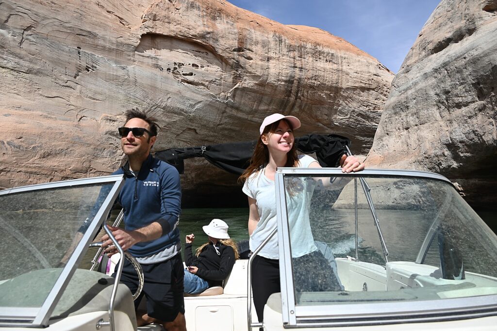
Boating on Lake Powell in Glen Canyon Recreation Area in search of cliff dwellings © Karen Rubin/goingplacesfaranadnear.com

But since 2001, declining water levels (the lake had dropped over 100 feet over a two-year period at the time of our visit) due to climate change and 20 years of drought have reshaped Lake Powell’s shoreline and changed or closed boat ramp access points, on-lake facilities, and dramatically altered the landscape. (Check conditions, www.nps.gov/glca/learn/changing-lake-levels.htm)

Boating on Lake Powell in Glen Canyon Recreation Area © Karen Rubin/goingplacesfaranadnear.com

I think that similar conditions must have been what caused the Ancestral Puebloans to leave their communities in 1300 AD after hundreds of years living here, because they also had experienced a 20-year long drought; the drought today is the worst since then.

The gorgeous formations reveal themselves on Lake Powell in Glen Canyon Recreation Area in search of cliff dwellings © Karen Rubin/goingplacesfaranadnear.com

Laini has rented a power boat from Bullfrog Boat Rentals (435-684-3010) at the Bullfrog Marina so we can explore the canyons that were flooded when they created the controversial Glen Canyon Dam on the Colorado River. We are in search of signs of cliff dwellings or petroglyphs that may have been exposed with the drop in water level.

We get a map from the boat rental company and try to follow the mile markers on the lake that help us orient.

Compared to our two days of adventuring in Grand Staircase-Escalante, this day is like a resort vacation, with the luxury of a boat allowing us to traverse 20+ miles in one afternoon. 

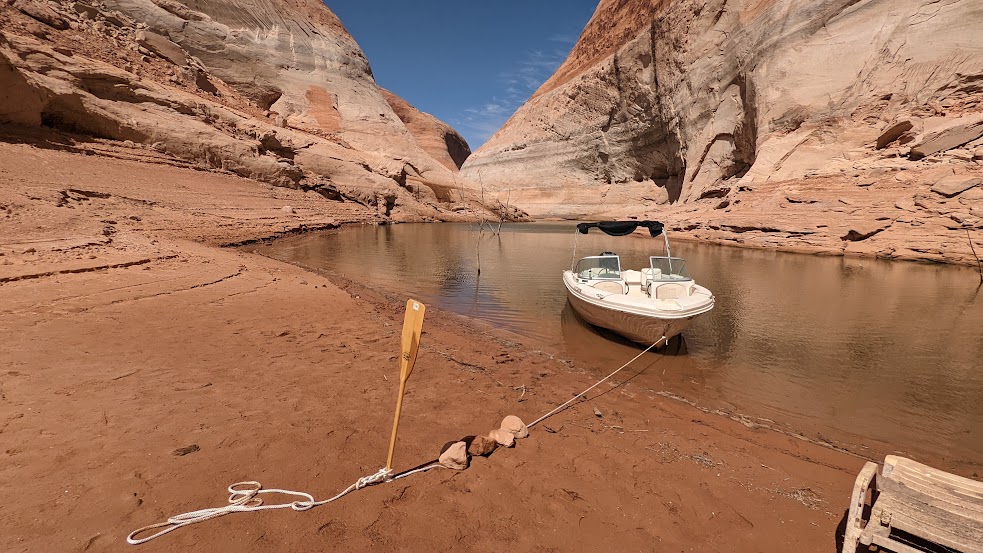
The water level has dropped so much over the past two years that trees are poking out from the bottom.

Boating on Lake Powell in Glen Canyon Recreation Area in search of cliff dwellings © Karen Rubin/goingplacesfaranadnear.com

Dave navigates to Forgotten Canyon where Laini has information that a trail will lead to Defiance House Archaeological Site, an 800-year old cliff dwelling (nps.gov, 800-227-7286).

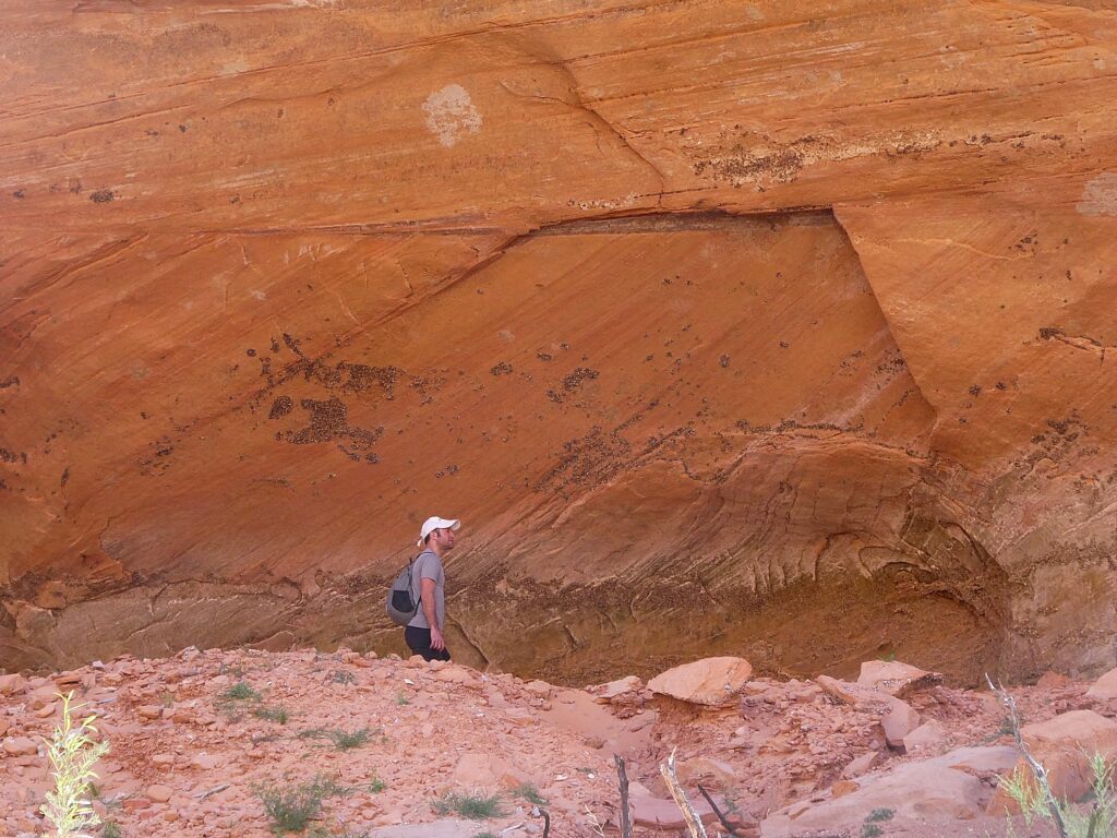
Because the water level is so low, we come to the edge of the water much earlier than expected, and pull up the boat onto a beach, have a picnic lunch (avocado on bread, peanut butter/jelly) under a rock awning (like the Ancestral Puebloans might have), and then set off on foot in search of the cliff dwelling.

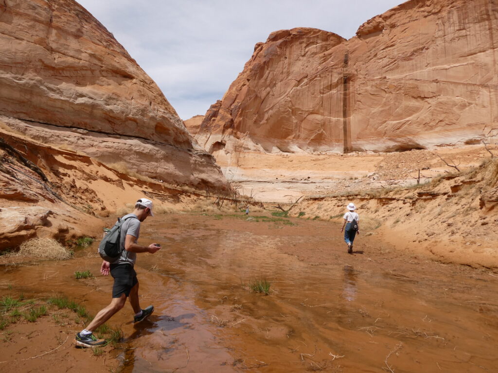
Exploring Forgotten Canyon © Karen Rubin/goingplacesfaranadnear.com

This really feels like Indiana Jones, because there is no actual trail. We follow the water  – slogging along the deep mud, crisscrossing to avoid deeper water. Dave comes with me as Laini and Alli bound ahead to explore in the limited time we have before we have to get back to the boat. 

The site (which is only reachable by boat then foot) is usually just a quarter mile past the end of the water, but with the water level so much lower, it’s now over two miles away and we don’t have the time. Also there is so much overgrowth and prickly thickets that Laini and Alli can’t get through wearing shorts. They turn around and tell us we should make our way back to the boat.

In search of Defiance House archaeological site, tucked away in the Forgotten Canyon © Karen Rubin/goingplacesfaranadnear.com

Even with this disappointment, it has been an immensely fun adventure. 

As we boat out of the canyon, we see a vulture contemplating eating a dead fish on the shore.

Boating on Lake Powell in Glen Canyon Recreation Area in search of cliff dwellings © Karen Rubin/goingplacesfaranadnear.com

We are close to the time when we need to return the boat, but Dave pilots us into the Lost Eden Canyon. This turns out to be an absolutely magical (overused word but really apt) place – a superb finale to our adventure.

Lost Eden Canyon, Lake Powell in Glen Canyon Recreation Area in search of cliff dwellings © Karen Rubin/goingplacesfaranadnear.com

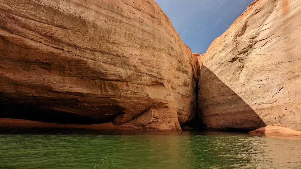
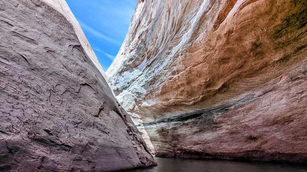
There are golden dapples on the gray rock faces like gold coins shimmering in sunlight. The water is a surreal emerald green under a brilliant blue sky, the rocks are orange, tan and gray, making interesting patterns, as we wind through the narrow canyon.

Lost Eden Canyon, Lake Powell in Glen Canyon Recreation Area in search of cliff dwellings © Karen Rubin/goingplacesfaranadnear.com

You can easily imagine how ancient artists were inspired not just by the colors, but the patterns in rock faces.

Lost Eden Canyon, Lake Powell in Glen Canyon Recreation Area in search of cliff dwellings © Karen Rubin/goingplacesfaranadnear.com

When we get back to the marina, it takes 30 minutes just to refill the tank ($200!) – which we hadn’t calculated for in getting the boat back in time.

Driving from Lake Powell on our way to our next stop, Bears Ears National Monument-Cedar Mesa, we stop at Outpost Marine Trading Post – as significant today as it must have been for early pioneers. It has a fabulous selection of gear and groceries for camping as well as fantastic sandwiches at incredibly reasonable prices (considering how desperate people can be at this point in their journey) – Reuben, probably best outside of NYC, $8; thick burgers; fresh sliced turkey only $4.99/lb (Dave can’t believe it so buys 2 pounds). Everyone is absolutely delighted as we savor our car dinner when we get back on the road.

We soon see a dead calf on the road and vultures hovering.

We stop at Hite Overlook for spectacular, iconic views of the Western landscape.

The historic marker here relates how in 1883 Navajo Chief Hoskininni led Cass Hite to the Canyon below, where he found gold. He opened a small store and post office, making his fortune off the miners. After World War II, the town’s population “swelled” to more than 200. This time, miners were searching for “hot” rocks (uranium). This mining boom also went bust and Hite returned to its small town existence. But in 1964, the waters of Lake Powell swallowed up Hite, leaving behind the only true treasure: the view.

Hite Overlook © Karen Rubin/goingplacesfaranadnear.com

We drive to Bears Ears-Cedar Mesa where we finally get to do the wild camping I have been so excited about (that means no services at all, just wilderness). The sun is descending and we are hoping to set up camp before dark.

Hite Overlook © Karen Rubin/goingplacesfaranadnear.com

Dave finds his way down a dirt road leading to Arch Canyon and we finally find a suitable site literally next door to a sign marking an Indian reservation (no trespassing!).

We set up in time before dark, but the full moon shines like a giant lantern, rising just as the sun sets, making flashlights unnecessary.

Wild camping in Arch Canyon © Karen Rubin/goingplacesfaranadnear.com

We sit around the campfire, enjoying the peace and reveling in our adventure. We will finally get to use our winter-rated sleeping bags and pads Dave had rented from Moosejaw (https://www.moosejaw.com/content/gear-rental, 877-666-7352). 

Each day of our trip, we are immersed in landscape that manifests different personality, character, color, texture, ambiance, even theme, and provide the contours for our experience.

Tomorrow we will get to meet Bears Ears and the spirits of the Ancestral Pueblo people.  

Glen Canyon National Recreation Area, www.nps.gov/glca, 928-608-6200; Bullfrog Visitors Center, 435-684-7423.

See:

UTAH ADVENTURE DAY 1-2: CAPITOL REEF’S COLORFUL CANYONS

UTAH ADVENTURE DAY 3-4: GRAND STAIRCASE-ESCALANTE POSES CHALLENGE

______________________

© 2023 Travel Features Syndicate, a division of Workstyles, Inc. All rights reserved. Visit goingplacesfarandnear.com, www.huffingtonpost.com/author/karen-rubin, and travelwritersmagazine.com/TravelFeaturesSyndicate/. Blogging at goingplacesnearandfar.wordpress.com and moralcompasstravel.info. Visit instagram.com/going_places_far_and_near and instagram.com/bigbackpacktraveler/ Send comments or questions to [email protected]. Tweet @TravelFeatures. ‘Like’ us at facebook.com/KarenBRubin 
Utah Adventure Day 1-2: Capitol Reef’s Colorful Canyons

Hiking the Cohab Canyon Trail in Capitol Reef National Park, the first stop our Utah Adventure © Karen Rubin/goingplacesfarandnear.com

By Karen Rubin, with Laini Miranda and Dave E. Leiberman

Travel Features Syndicate, goingplacesfarandnear.com

Travel is as much about resilience, adaptability and problem-solving, as it is about personal growth, rejuvenation, and human connection. And so, though our intent was to camp (mostly wild camping) for our 8-day expedition through Utah’s wilderness and immerse ourselves in the topography and indigenous culture, the forecast for the first half of our trip in mid-April was for temps down to the 20s. In fact, when we arrived, there was a fierce gale-force wind blowing at 60 mph that pushed our rental Jeep around and made it difficult even to open the door.

Laini and Dave have taken the temperature into account and fortunately booked a spacious two-bedroom AirBnB in Teasdale (https://www.airbnb.com/rooms/41151071) just outside Capitol Reef National Park for our first night, and a one-room cabin at Canyons of Escalante RV Park for two nights in Escalante (where Dave has arranged for delivery of winter-grade sleeping bags and pads from Moosejaw.com).

Laini and Dave – who are making their third trip back to Utah and have invited their friend Alli and me to join – have carefully planned the itinerary. Each day has its own highlight and each destination its own topography and character and therefore, the experience we have. At Capitol Reef National Park it is the colored rock formations; Grand Staircase Escalante National Monument (for hard-core adventurers) offers slot canyons and hoodoos; Lake Powell in the Glen Canyon Recreation Area is our boat expedition into the flooded canyon; Cedar Mesa offers hiking expeditions in search of cliff dwellings and petroglyphs; and Arches National Park offers the most dramatic, expansive landscapes.

Fortunately, during the course of our trip, just about all the hikes and experiences we have are new for Dave and Laini. 

We land at Salt Lake City Airport and pick up an off-road Jeep capable of plowing through deep gravel and sand from Alamo, and set out for the four-hour drive. Laini has planned to stop off at Walmart in Provo along the way to pick up food and camping supplies, and we find a delightful coffee shop (Java Junkie) for a snack and what becomes our all-time favorite coffee (Isis Roasters’ Grogg). 

Gorgeous views from the Scenic Drive through Capitol Reef National Park © Karen Rubin/goingplacesfarandnear.com

We arrive at Capitol Reef in the late afternoon and (I suggest) we take advantage of the gorgeous light and weather and drive the Scenic Drive to get a sense of the park. It is utterly perfect – the warm light, rich colors – and we get such a wonderful introduction.

The Scenic Drive is a 7.9 mile (12.7 km) paved road, suitable for passenger vehicles. You would need about an hour and half roundtrip to drive the Scenic Drive and the two dirt spur roads, Grand Wash and Capitol Gorge which go into canyons and lead to trailheads. (You can follow the Park Service’s Virtual Tour: https://www.nps.gov/care/planyourvisit/scenicdrive.htm; the tour is free but you still need to pay the $20 park entrance fee when you drive the Scenic Drive – though my America the Beautiful Pass satisfies.)

(The Scenic Drive, Grand Wash, and Capitol Gorge roads can be closed due to snow, ice, mud, and flash floods. Check at the visitor center or call 435-425-3791, for possible road closures.)

‘A Wrinkle in the Earth’s Crust’

“A Wrinkle in the Earth’s Crust” is the poetic description of Capitol Reef – referring to how this stunning landscape was formed. “The light seems to flow or shine out of the rock rather than to be reflected from it,” is how Clarence Dutton, a geologist and early explorer, described it in the 1880s.

Capitol Reef’s topography was caused by intense crustal pressure which reactivated a fault buried deep beneath the sedimentary rock layers of the Colorado Plateau. This caused the overlying sedimentary rock layers to fold or bend into a one-sided slope called a monocline © Karen Rubin/goingplacesfarandnear.com

Located in south-central Utah in the heart of red rock country, Capitol Reef National Park is a tapestry of cliffs, canyons, domes, and bridges. What makes Capitol Reef so special is how the rock layers tilt. The notes say that this was caused by intense crustal pressure which reactivated a fault buried deep beneath the sedimentary rock layers of the Colorado Plateau. This caused the overlying sedimentary rock layers to fold or bend into a one-sided slope called a monocline, which is uplifted 6,800 feet higher on the west side.

The Waterpocket Fold is named for the numerous small potholes, tanks, or “pockets” that hold rainwater and snowmelt and extends almost 100 miles from Thousand Lake Mountain to Lake Powell © Karen Rubin/goingplacesfarandnear.com

It is named the Waterpocket Fold because of the numerous small potholes, tanks, or “pockets” that hold rainwater and snowmelt and extends almost 100 miles from Thousand Lake Mountain to Lake Powell. The Waterpocket Fold  has been impacted and shaped over eons by the geological processes of erosion, deposition, and uplift, all playing a part in the “drama” of Capitol Reef. This geologic feature is what accounts for the vibrant palette of constantly changing hues, as the light hits the towering cliffs, massive domes, arches, bridges and twisting canyons.

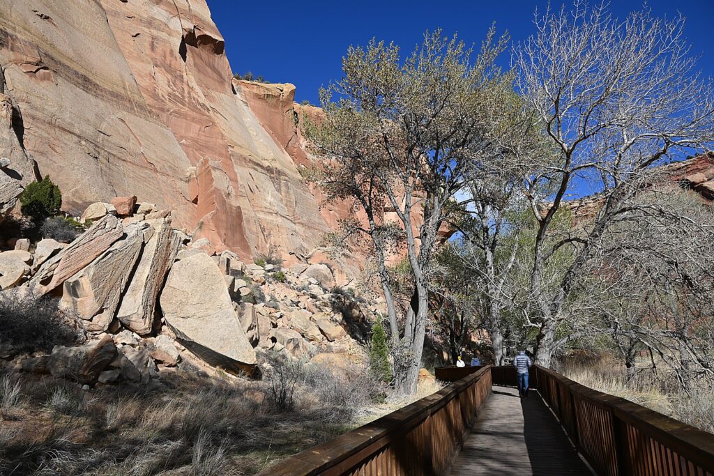
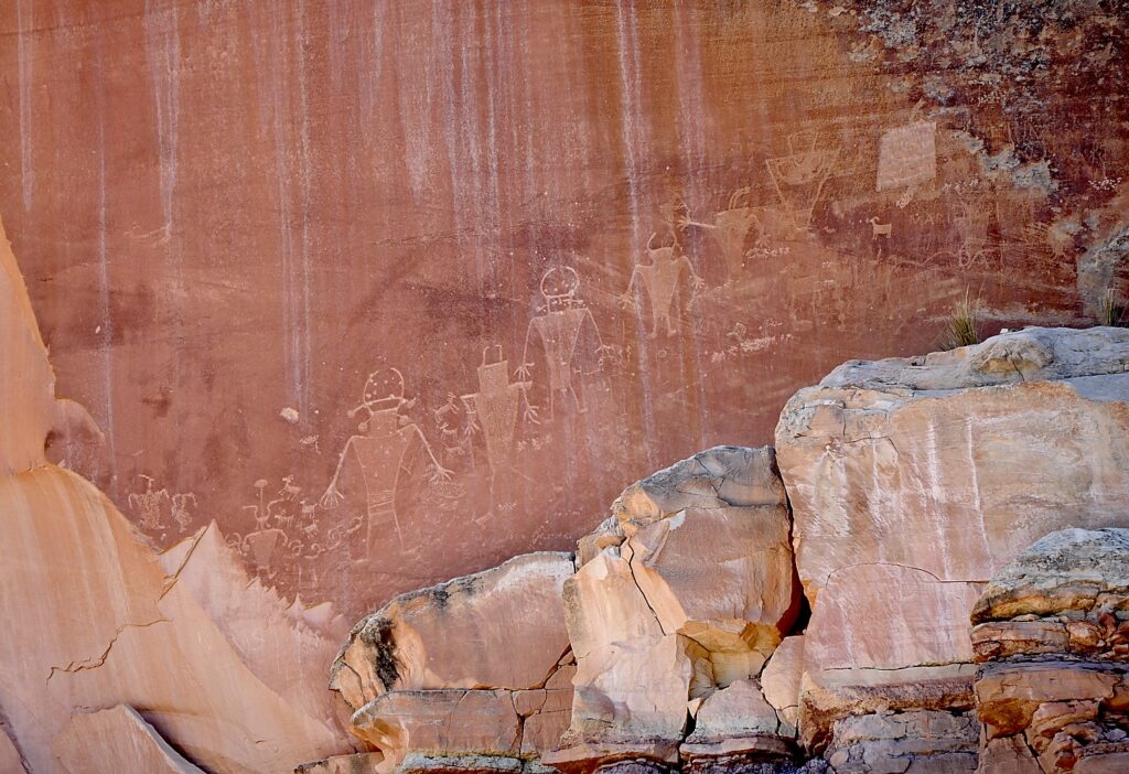
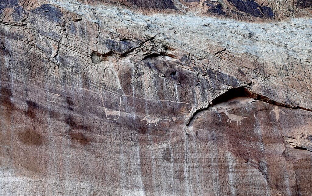
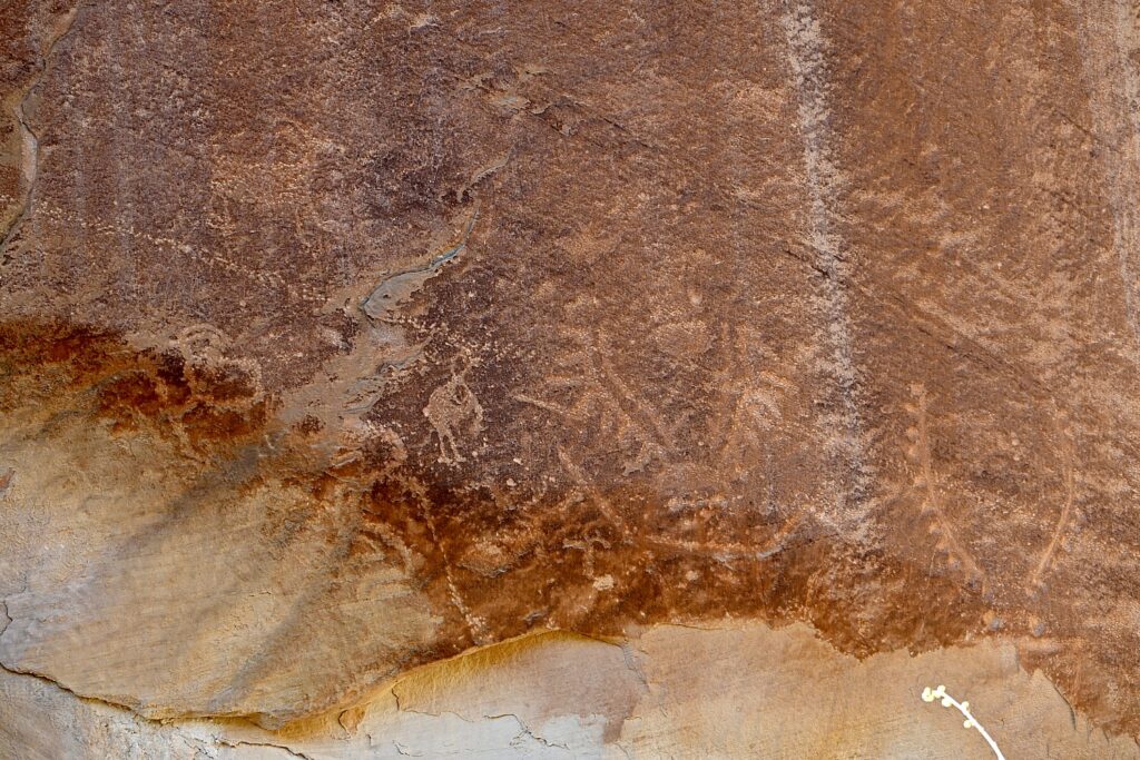
On the way back from our Scenic drive, we stop at a fascinating site, the Fremont Culture petroglyphs, not far from the Capitol Reef Visitor Center. The petroglyphs are reached after a short stroll on two boardwalks. The shorter boardwalk provides views of large, anthropomorphic (human-like) petroglyphs, zoomorphic (animal) petroglyphs of bighorn sheep and other animals, as well as geometric designs; the longer boardwalk parallels the cliffs and the petroglyphs along it are closer to the viewer but harder to see because of a patina that has developed over them.

Walk a short boardwalk to see the Fremont Culture petroglyphs © Karen Rubin/goingplacesfarandnear.com

The indigenous people who lived in what is now Utah for about 1000 years, from 300-1300 CE are known as The Fremont Culture, named by the archaeologists for the Fremont River canyon where they were first defined as a distinct culture. These petroglyphs (images carved or pecked into stone) are one of the most visible aspects of their culture that remains, according to the historic panels at the site.

Writing or art? Or Both? The Fremont Culture petroglyphs © Karen Rubin/goingplacesfarandnear.com

Prehistoric people of Fremont Culture used area rock for tools and projectile points, and for the foundations of their homes. Clay was used for pottery, construction and to make figurines. Fertile floodplains supported crops of corn, beans, and squash along the streams of Capitol Reef until about 1300 CE.

(You can link to the audio guide, narrated by Rick Pickyavit, whose Southern Paiute ancestors lived here when the settlers arrived in the 1880s. https://www.nps.gov/care/learn/historyculture/fremont-culture-petroglyphs.htm)

Writing or art? Or Both? The Fremont Culture petroglyphs © Karen Rubin/goingplacesfarandnear.com

Pickyavit says that unlike his ancestors, who were nomadic, the Fremont people settled in these canyons and became farmers and hunter-gatherers. It is not known if they were related to the better-known Ancestral Puebloans. What is known about the Fremont people’s daily lives comes mainly from artifacts and from these petroglyphs, but it is not known where they came from or why they left suddenly in the 13th century (though I believe it is now widely accepted that the people left after a historic, 20-year drought). “As you walk these paths and hidden places, do not even touch the petroglyphs. Protect their legacy, even as I respect it.”

It is natural to imagine the meaning of the images, but, Pickyavit says, “Caution must always rule in the interpretation of petroglyphs. With few exceptions, we cannot really be sure what the ancient maker of the petroglyphs had in mind. Some consider almost all petroglyphs a form of writing, while others consider most of them to be art, not writing. The large trapezoid-shaped human figures excite interest. Many have headgear and horns. Figures are commonly seen with necklaces, earrings and sashes. Animals, especially bighorn sheep, appear in many petroglyphs, indications that they were hunted and perhaps revered.”

I wonder, since these were created by different people in different times, isn’t it possible some were messages (writing, information) and some were art?

Writing or art? Or Both? The Fremont Culture petroglyphs © Karen Rubin/goingplacesfarandnear.com

He notes that “Following the disappearance of the Fremont people in the 13th century, no one resided in the Waterpocket Fold country for 500 years. During this time, however, Ute and Southern Paiute hunters and gatherers roamed the region. They lived in close harmony with the natural environment and left little evidence of their presence.”

We stop in Torrey at the Torrey Grill and BBQ which offers a sheltered outdoor setting complete with firepit (we are still concerned about COVID) and is serving late.

The wind is still howling when we get to the AirBnB – home with gorgeous interior design, so cozy and comforting. I wake in the middle of the night to a blizzard – gale force winds, giant flakes of snow – that leaves 3-5 inches by morning. I feel (without hyperbole) we would have died –crushed under the snow or frozen to death – had we camped. I imagine us in some Survivor (or Disaster) movie based on fact (not the last time this image occurs to me during our Utah Adventure).

Hiking Capitol Reef National Park

The Hickman Bridge trail is a perfect first hike in Capitol Reef National Park © Karen Rubin/goingplacesfarandnear.com

Considering the weather, we phone the Visitor Center to get their recommendation for hikes, and the Ranger recommends Hickman Bridge and Cohab Canyon, both in the nearby Fruita area (435-425-2791). The snow, so gorgeous in the morning, is gone by the time we arrive at Capitol Reef but for some oddly frozen patches, and we have perfect winter hiking weather.

Both these trails are extremely popular – and for good reason.

Gorgeous arches, formations and colors along the The Hickman Bridge trail makes it one of the most popular hikes in Capitol Reef National Park © Karen Rubin/goingplacesfarandnear.com

Hickman Bridge Trail, just 1.8 miles roundtrip, is the most popular trail (so the most crowded): it is geologically fascinating, relatively easy, great for families, with each step offering stunning visuals – red rock with beige and blond striations, textures, overhangs – and eminently doable to get the full  appreciation, with the climax of a spectacular arch. The hike encapsulates for us what Capitol Reef is about.

The Hickman Bridge, Capitol Reef National Park © Karen Rubin/goingplacesfarandnear.com

Along the Hickman Bridge Trail, you see high-desert views, traces of prehistoric American Indian culture, and evidence of the Civilian Conservation Corps’ work in the 1940s. After ascending through a scenic sandstone side-canyon, the trail loops under the grand 133-foot span of the Hickman Natural Bridge. This is considered a “moderate” trail, but I would say it is easy. What an introduction!

The 133-foot span of the Hickman Bridge, Capitol Reef National Park © Karen Rubin/goingplacesfarandnear.com

From the same parking lot (and when it’s popular, it may well be difficult to find a parking spot so you have to wait for one to open), you can walk something like two miles to one end of the Cohab Trail. We smartly decide to move the car to a small, dirt parking lot, 1.2 miles down the Scenic Drive from the Capitol Reef Visitor Center, diagonally across from the picturesque historic Pendleton Barn, to access the trailhead at the other end (actually it is the beginning).  (If this dirt parking lot is filled, you can backtrack 2/10 mile and park at the picnic area.)

The picturesque, historic Pendleton Barn across from the Cohab Canyon trailhead © Karen Rubin/goingplacesfarandnear.com

We have our lunch in the picnic area before starting out on the Cohab Trail.

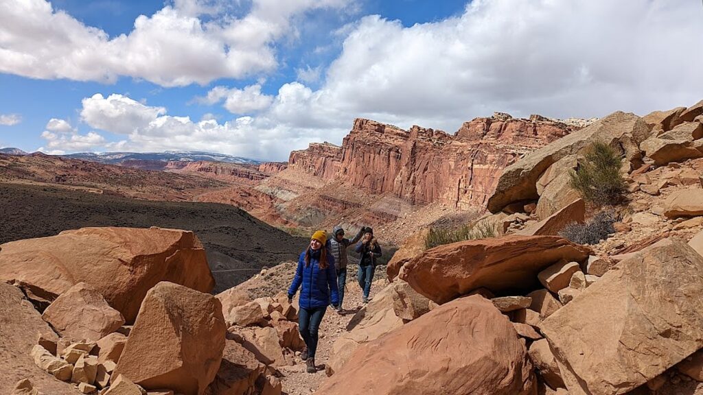
Cohab Canyon trail is of easy-to-moderate difficulty with gorgeous vividly-colored rock formations and shapes. The first 0.3 mile is a tad steep (I’m glad I brought my hiking poles for this hike). A series of switchbacks lift you up 400 feet, all the while you gaze out at gorgeous views of the Johnson Mesa and Fruita Cliffs. But once within the canyon, the hiking is fairly easy.  

Hiking the Cohab Canyon Trail in Capitol Reef National Park, the first stop our Utah Adventure © Karen Rubin/goingplacesfarandnear.com

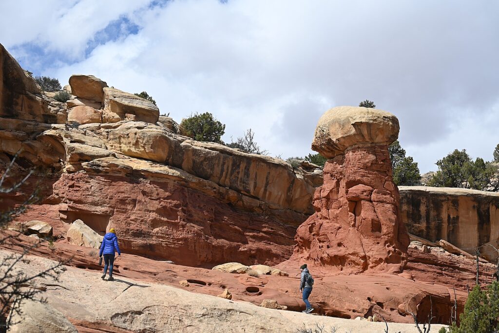
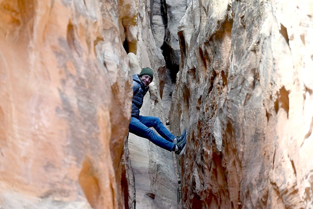
Cohab Canyon is called a “hanging canyon” because it sits above the Fremont River floodplain. The entire trail is so beautiful – we come upon a few slots to explore, a 20-foot high mushroom shaped hoodoo (a tree is growing out of the top!) surrounded by slickrock, the Cohab Canyon arch, then some stunning overlooks of the valley and Fruita.

A 20-foot high mushroom hoodoo on the Cohab Canyon Trail, Capitol Reef National Park © Karen Rubin/goingplacesfarandnear.com

We opt not to do the whole hike, which goes 2.9 miles one way to the Hickman Trail parking lot (which would require taking a shuttle back, or, if you do the round trip, would take 4 hours). We hike in about 1.7 miles and return.

Dave ventures into a small slot off the Cohab Canyon Trail, Capitol Reef National Park © Karen Rubin/goingplacesfarandnear.com

The two hikes – Hickman and Cohab Canyon – afford a very different experience, though both offer dramatic landscapes that are signature Capitol Reef. Hickman is well-traveled, ideal for families, and you feel like a tourist – but Cohab Canyon is all but devoid of other people so you feel the isolation (even if you do come upon another hiker here and there).

The climatic view from the Cohab Canyon Trail hike, Capitol Reef National Park © Karen Rubin/goingplacesfarandnear.com

Laini had The Castle Trail hike on her to-do list but unfortunately, we don’t have the time. (It’s described as an old trail that apparently is no longer “advertised” to the enigmatic “back side” of the Castle, exploring a hidden canyon lined with mammoth boulders and violet-colored hoodoos, taking about two hours.)  

You can see the cragged hunk of The Castle from just outside the Visitor Center. One of Capitol Reef National Park’s iconic landmarks, The Castle is a prominent sandstone formation made up of three primary layers: the bottom sandstone layer, the Moenkopi Formation, is 245 million years old; the middle gray-green layer, the Chinle Formation, was laid down as volcanic ash 225 million years ago; the top layer, including the Castle, Wingate Sandstone, formed 200 million years ago.

The Castle, one of Capitol Reef National Park’s iconic landmarks © Karen Rubin/goingplacesfarandnear.com

Also, though we didn’t hike Grand Wash on this trip, Laini and Dave hike it on their next one and highly recommend entering through the lower trailhead for an easy 20-30 minute walk through the most dramatic and narrowest part of the canyon, with towering walls over 100 feet overhead.

In the Fruita area, there are 15 hiking trails with trailheads located along Utah Highway 24 and the Scenic Drive. These offer a wide variety of hiking options from easy strolls over level ground to strenuous hikes involving steep climbs over uneven terrain near cliff edges. Round trip distances range from a mere quarter mile to 10 miles, and are well-marked with signs at the trailhead and at trail junctions and by cairns (stacks of rocks) along the way. Some trails have self-guiding brochures, available for a fee at the trailhead and visitor center.

The best detailed descriptions of these hikes are available at https://liveandlethike.com/category/utah/capitol-reef-national-park/

Capitol Reef also offers many hiking options for serious backpackers and those who enjoy exploring remote areas. Minimally marked hiking routes lead into narrow, twisting gorges, slot canyons, and to spectacular viewpoints high atop the Waterpocket Fold. Popular backcountry hikes in the southern section of the park include Upper and Lower Muley Twist Canyons and Halls Creek and in the Cathedral Valley area. A backcountry permit is required for camping outside of established campgrounds. The permit is free and can be obtained in person at the visitor center during normal business hours.

Capitol Reef offers so much to explore, Laini says, you really need more time there. Tourists overrun the main part, but there is a whole “backcountry” side that most miss.

See: https://www.nps.gov/care/planyourvisit/trailguide.htm  and https://www.nps.gov/care/planyourvisit/hiking.htm

Scenic Byway 12

Driving out of Capitol Reef we come to an overlook just as the sun is at a perfect angle to make the red rocks blaze.

We drive 64 of the 124 miles of the Scenic Byway 12 to Escalante. Scenic Byway 12 is Utah’s first “All-American Road,” (and one of Laini’s favorite roads in the country) winding through vast slickrock benches and canyons. We reach the summit, 9,600 feet – and the temp has dropped to 15 degrees – with sweeping vistas of the Henry Mountains, Grand Staircase–Escalante National Monument and Capitol Reef National Park.

The view back to Capitol Reef National Park as we drive along Scenic Byway 12 © Karen Rubin/goingplacesfarandnear.com

Because the forecast had been for temps in the 20-30s, Dave and Laini booked a cabin  at Canyons of Escalante RV Park, right in Escalante. It is one room for the four of us– very cozy (we still have to go outside for the bathroom, so we have that camping experience). And we’re able to have dinner at one of their favorite places from their previous adventures, Escalante Outfitters, serving up the best pizza outside of New York.

Driving on Scenic Byway 12 from Capitol Reef National Park to Escalante © Karen Rubin/goingplacesfarandnear.com

I find this day’s hikes in Capitol Reef perfect to acclimate and just become immersed in the spectacular scenery. And, I soon find out, these hikes are so very different from what we have yet to experience in the Grand Staircase-Escalante, where our Utah Adventure continues. Because Grand Staircase-Escalante National Monument is for more hardcore hikers.

Next: Grand Staircase-Escalante

______________

© 2023 Travel Features Syndicate, a division of Workstyles, Inc. All rights reserved. Visit goingplacesfarandnear.com, www.huffingtonpost.com/author/karen-rubin, and travelwritersmagazine.com/TravelFeaturesSyndicate/. Blogging at goingplacesnearandfar.wordpress.com and moralcompasstravel.info. Visit instagram.com/going_places_far_and_near and instagram.com/bigbackpacktraveler/ Send comments or questions to [email protected]. Tweet @TravelFeatures. ‘Like’ us at facebook.com/KarenBRubin
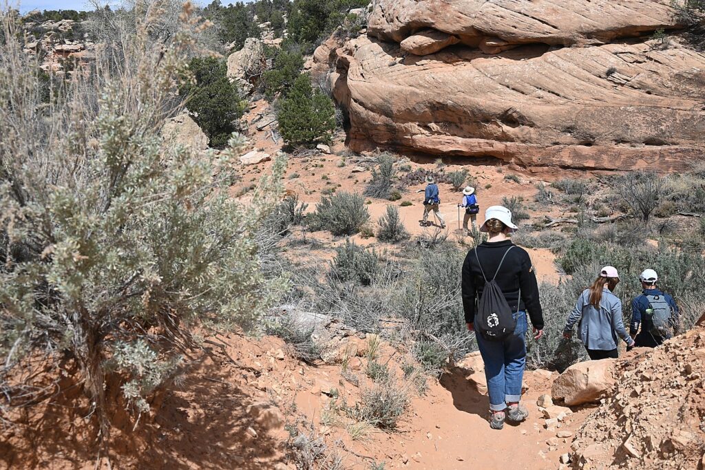
New York’s Watkins Glen State Park is Spellbinding

By Karen Rubin, David Leiberman & Laini Miranda

Travel Features Syndicate, goingplacesfarandnear.com

Rainbow Falls, one of the highlights of the Glen Creek Gorge Trail, Watkins Glen State Park, © Karen Rubin/goingplacesfarandnear.com

Walking the Gorge Trail in Watkins Glen State Park in New York’s Finger Lakes is, in a word, spellbinding.

The centerpiece of the 778-acre Watkins Glen State Park is a 400-foot deep, narrow gorge cut by the Glen Creek that was left “hanging” when glaciers of the last continental glaciation, some 12,000 years ago, deepened the Seneca valley, creating rapids and waterfalls through layers of hard rock. The textures and shapes of the soft shales, sandstone and limestone – which erode at different rates – are gorgeous.

If you have ever visited a slot canyon, and marveled at the smooth, twisted, perfectly contoured curves, walk the Glen Creek Gorge Trail, where you can watch Mother Nature working her magic.

Rainbow Falls, one of the highlights of the Glen Creek Gorge Trail, Watkins Glen State Park, © Karen Rubin/goingplacesfarandnear.com

We don’t waste time after arriving at the Six Nations Campground in the park in the afternoon, in order to take advantage of the beautiful sunlight. So we drop out things and rush down to the Gorge Trail for a taste of what we will see more completely the next day.

In the course of a 1.5 mile stone trail, with 800 steps and beautiful stone bridges you see 19 incredible waterfalls.

Cascading falls on the Glen Creek Gorge Trail, Watkins Glen State Park, © Karen Rubin/goingplacesfarandnear.com

The waterfalls range from those that flow from dramatic heights of 200 foot-high cliffs, to those that cascade; you see waterfalls coming in together from different directions, cutting through the sedimentary rock of shale, sandstone and limestone, making exquisite, remarkably perfect shapes and cuts that are astonishingly precise and straight or curved, and cascades of falls that twist.

Rainbow Falls, one of the highlights of the Glen Creek Gorge Trail, Watkins Glen State Park, © Karen Rubin/goingplacesfarandnear.com

In this “hanging valley,” we also see “hanging gardens” – the tender mosses, ferns, mosslike plants (liverworts) that drape over the rocks and down the rock walls, the delicate plants that stubbornly grow, albeit slowly in crevasses in the rock walls. They depend on continuous moisture trickling down, and you can see differences in ecosystems based on the amount of sun, shade and moisture that a section of the rock wall gets. (Visitors are told not to pick anything.)

A place of perfect peace, Watkins Glen State Park, © Karen Rubin/goingplacesfarandnear.com

You are enveloped by a feeling of perfect peace – the sound of the flowing water, the cool of the green moss and moist rock, the fresh smell, the late afternoon light that turns the tops of the trees into shades of yellow and gold. The gorge is fairly narrow, so you feel cocooned in this primal, Jurassic Park-like setting.

Looking down into where the water flattens out at one point into soil what appeared to be a giant fossil skeleton, exposed in the low water. It is exciting to imagine.

Could this be a titanoboa fossil, only just exposed in the Glen Creek? © Karen Rubin/goingplacesfarandnear.com

We walk back to Mile Point Bridge where we follow the trail back into the Six Nations Campground, after this brief survey mission.

Back at our campsite, we set up our tents and go downtown to where John, who checked us into the campground, had recommended as the best place in Watkins Glen for sunset: the marina on the southern tip of Seneca Lake. There is a rock wall that is very popular for people to walk out to watch. We opt to go to the Village Marina for dinner where we can dine outside and take in the sunset.

Blazing sunset from the Village Marina in Watkins Glen © Karen Rubin/goingplacesfarandnear.com

The colors that blaze through the sky, reflect back in the water, after the sun went behind the hills, are spectacular.

The next day, we stroll down from our campsite to the Gorge Trail.

We enter the Gorge Trail at Mile Point Bridge, giving us our first stunning view. We walk the half-mile to the end, at Jacob’s Ladder (a set of 180 stairs that goes to the Upper Entrance), and then return, choosing to go back along the Gorge Trail rather than connect to the Indian Trail that goes along the rim for views down into the Gorge. Going back this way on the Gorge Trail we go down in elevation towards the Main Entrance in the village (many people who don’t want to do the 1.5 mile trail both ways start park up here, hike down, and take a shuttle bus back, $5).

Glen Creek Gorge Trail, Watkins Glen State Park, is spellbinding © Karen Rubin/goingplacesfarandnear.com

Just beyond the Mile Point Bridge is Frowning Cliff, a gorgeous waterfall, then the climatic scene, Rainbow Falls (most dramatic from the other direction on the way back; you walk behind the falls along the trail), aptly named because, on some afternoons, the sunlight comes at just the right angle to create rainbows.

Rainbow Falls, one of the highlights of the Glen Creek Gorge Trail, Watkins Glen State Park, © Karen Rubin/goingplacesfarandnear.com

On to the Central Cascade (plunging more than 60 feet, this is the highest waterfall in the Gorge), Glen Cathedral (the horizontal layers of shale were formed 380 million years ago; ripples in the rock were created by wave action at the bottom of an ancient sea floor that eventually turned to stone), then a steeper descent, through the Spiral Tunnel (hand cut in 1927) to the Cavern Cascade, where you again walk behind the waterfall) and across Sentry Bridge (look for a round flume hole in the rock where, in the 1800s, water was once diverted to power a mill where the visitor center now stands) to the new Visitor Center and main entrance on Franklin Street in Watkins Glen.

Cascading falls on the Glen Creek Gorge Trail, Watkins Glen State Park, © Karen Rubin/goingplacesfarandnear.com
Walk through the Spiral Tunnel (hand cut in 1927) to the Cavern Cascade, where you walk behind the waterfall, Watkins Glen State Park © Karen Rubin/goingplacesfarandnear.com

Along the way, we meet up with a park ranger who we tell about seeing what appeared to be a giant fossil. He tells us that it was exposed only two days before and might well be a titanoboa – a giant sea snake that could be as big as 45 feet long. This exciting news passes from one to another as people come to that spot to view it. Another park ranger tells us that a naturalist is coming to investigate.

For awhile, visitors to Watkins Glen State Park that morning had an extra thrill beyond the breathtaking scenery: the prospect of seeing a newly discovered fossil of a prehistoric sea snake, Monster in the Glen.

A place of perfect peace, Watkins Glen State Park © Karen Rubin/goingplacesfarandnear.com

We finish walking the trail, have a delightful lunch at the Harbor Hotel on the lake. By now it is the afternoon and markedly less crowded (everyone seems to come out early for the walk) as we walk back on the Gorge Trail.

By the time we get back to where the “titanoboa fossil” would have been, we see the naturalist has etched in the soil, “Not a Fossil,” and smudged the image completely away, having revealed the fossil to be a hoax (people had remarked on what they thought were footprints leading to it).

Not a fossil! But now the mystery remains: who created it and how? © Karen Rubin/goingplacesfarandnear.com

So, if we didn’t witness a major fossil discovery, we were witness to the hoax. ow the mystery is: Who created the hoax? How? Anyway, it got everyone buzzing that day.

Also, on my walk I saw in black rock what looked like an ammonite. That too was smudged away on our return.

Glen Creek Gorge Trail, Watkins Glen State Park, is spellbinding © Karen Rubin/goingplacesfarandnear.com

This stunning gorge has been visited by tourists since 1863 and was privately operated as a tourist resort ($1 admission per person, equivalent to $34 today) until New York State acquired the property, in 1906 for a state park. (It is named for Samuel Watkins; “glen” comes from a Greek word meaning “small, narrow, secluded valley”.). After the 1935 flood destroyed the trail, it was rebuilt with a stunning series of stone walks, staircases (there are 800 steps altogether), bridges and tunnels cut through the rock, by Franklin D Roosevelt’s Civilian Conservation Corps between 1935-1940. (You can do the trail one way and take a shuttle bus, $5, back).

The stunning rock formations, created by the rushing water, on the Glen Creek Gorge Trail, Watkins Glen State Park © Karen Rubin/goingplacesfarandnear.com

Capping this experience is the beautiful Six Nations Campground – beautiful trees, excellent restroom facilities, and a glorious Olympic-sized pool. There are also a couple of pavilions that can be rented for groups and even the Iroquois Lodge, which is essentially a house that can be rented instead of a campsite (altogether, you can imagine a wedding here, with photos in front of waterfalls; there are also lovely accommodations in town including a luxury Watkins Glen Harbor Hotel, right on Seneca Lake, where we enjoy lunch). Where we camp, we are just a short walk down to the Gorge Trail.

Our campsite at Six Nations Campground, Watkins Glen State Park © Karen Rubin/goingplacesfarandnear.com

Six Nations Campground is named for the Haundenosaunee Confederation, more commonly known to us as Iroquois (Haundenosaunee means “They made the house”), a reminder of whose land this was before the European colonists came. The loops of the campground are named for the nations of the Confederacy: Mohawk, Oneida, Onondaga, Cayuga, Seneca and Tuscarora. The Haudenosaunee Confederacy, the park brochure notes, is renowned for its organization and democratic system, one of the first of its kind (Ben Franklin is said to have drawn upon the Iroquois Confederation for our US Constitution; suffragist Melinda Gage drew upon the Oneida’s matriarchal structure, in which women could be chiefs, own property, have custody of their children in a divorce, to set out demands for women’s rights in 1848).In 1842, what remained of the First Nations were relegated to the Six Nations Indian Reserve. (More information is available at nearby Ganondaganb State Historic Site, 7000 County Rd. 41 (Houghton Hill Rd), Victor, NY 14564).

Walking the stone trail along the Glen Creek Gorge, Watkins Glen State Park © Karen Rubin/goingplacesfarandnear.com

There are seven moderate trails in Watkins Glen State Park ranging from 0.7 to 7.6 miles and from 479 to 1,171 feet above sea level, but we focus all our time on the Gorge Trail (1.5 miles), captivated by the views and the enchantment of the place. Other trails – the Indian Trail (2.4 miles) and the South Rim Trail (2.6 miles) provide views of the Gorge from above. You can connect from the Gorge Trail to Lovers Lane Loop which takes you to a Suspension Bridge for a view above the gorge. You can also do a Gorge Trail, Outer Rim and Finger Lakes Trail combination (7.6 miles, about 3 hours) (see alltrails.com for more detail). (The trail is closed in winter.)

Cavern Cascade, Watkins Glen State Park © Karen Rubin/goingplacesfarandnear.com

It’s about 3:30 in the afternoon when we return to the campsite. We go to the gorgeous, Olympic-sized pool to refresh before returning to the campsite for an amazing steak dinner David and Laini prepared over the campfire they built for our second night camping.

The gorgeous Olympic-sized pool at Watkins Glen State Park © Karen Rubin/goingplacesfarandnear.com

It is no wonder that Watkins Glen State Park was awarded the third best among 6,000 state parks nationwide in 2015, and is consistently among the state’s top parks.

Watkins Glen State Park, 1009 N Franklin St, Watkins Glen, NY 14891, 607-535-4511, https://parks.ny.gov/parks/watkinsglen/maps.aspx.

There is so much to do in Watkins Glen, in the heart of the Finger Lakes, you could easily make this your base for a week.

Auto enthusiasts know Watkins Glen for its famous NASCAR races. The pavement is dotted with names of winners throughout the years, the crosswalks painted like the race start/finish. Auto racing is still sacred here, with much of the quaint village (the downtown was a recipient of New York State’s $10 million Downtown Revitalization Initiative award) themed for autos.

Wine enthusiasts know Watkins Glen as the southerly point of Seneca Lake, from which you can drive up Winery Trails on both sides.

Nearby is the Corning Museum of Glass; about 1 ½ hours drive away is another jewel,  Letchworth State Park, “The Grand Canyon of the East,” where we camped and hiked last year; a half-hour away is Ithaca.

The Finger Lakes region has over 1,000 waterfalls and gorges, 650 miles of shoreline, more than 16,000 acres of National Forest, and over 2,000 miles of hiking and biking trails. There is plenty to explore indoors at museums, art galleries, historic sites, theaters, wineries, breweries.

With summer turning to fall foliage season (which is amazing here), plan early and secure tickets and lodging.  

Excellent planning aids are available from The Finger Lakes Tourism Alliance, 309 Lake Street Penn Yan, NY 14527, 315-536-7488, 800-530-7488, www.fingerlakes.org.

New York State Begins Weekly ILoveNY Fall Foliage Reports; New Interactive Map

The 2021 fall foliage season is underway in New York State. Fall is one of the most popular travel times in New York, attracting visitors from around the world to explore the state’s unique communities and support local businesses. To help travelers and foliage enthusiasts plan a fall getaway, I LOVE NY has begun issuing its weekly fall foliage reports and will now include a new enhanced interactive progression map (www.iloveny.com/foliage).    

The foliage report is compiled each week using the on-location field observations from I LOVE NY’s team of volunteer leaf peepers. More than 85 spotters extending across the state’s 11 vacation regions are tasked with keeping track of the color change in their area as leaves progress each week. Reports detail the predominant leaf colors, approximate percentage of change, and how much color change has progressed relative to peak conditions.  

View from Chimney Mountain, The Adirondacks. ILoveny.com/foliage report helps you monitor the progress of fall foliage throughout New York State © Karen Rubin/goingplacesfarandnear.com

New this year, I LOVE NY is introducing an enhanced, interactive map that tracks weekly foliage change and progression across the state throughout the season. The map, located on the I LOVE NY foliage website, showcases great foliage viewing locations in each of the various regions throughout the state. Visitors can also use the map to see what the foliage is like during peak viewing in a given area, and learn about nearby, must-see attractions. 

Thanks in part to its size and location, New York State has one of the longest and most colorful foliage seasons in the country. On any weekend from late September through mid-November, part of the state is likely experiencing peak foliage.  

Travelers are also invited to share their photos of New York State’s amazing foliage on social media by using the #NYLovesFall hashtag. Photos submitted to this hashtag have a chance of being featured on the I LOVE NY fall foliage website and official I LOVE NY social media accounts reaching nearly two million followers. Reports and the new interactive map are updated Wednesdays throughout the season at www.iloveny.com/foliage.Reports are also available toll-free by dialing 800/CALL-NYS (800/225-5697) from anywhere in the U.S., its territories and Canada. For more information on how to volunteer for as an I LOVE NY leaf peeper, e-mail your name, address and phone number to [email protected].

______________________

© 2021 Travel Features Syndicate, a division of Workstyles, Inc. All rights reserved. Visit goingplacesfarandnear.com, www.huffingtonpost.com/author/karen-rubin, and travelwritersmagazine.com/TravelFeaturesSyndicate/. Blogging at goingplacesnearandfar.wordpress.com and moralcompasstravel.info. Send comments or questions to [email protected]. Tweet @TravelFeatures. ‘Like’ us at facebook.com/NewsPhotoFeatures

Grand Teton National Park: Mother Nature in Her Purest Form

View to String Lake from the trail, Grand Teton National Park © Karen Rubin/goingplacesfarandnear.com

By Karen Rubin, Eric Leiberman, David Leiberman & Laini Miranda

Travel Features Syndicate, goingplacesfarandnear.com

If Yellowstone National Park makes you feel you have fallen into some surreal, other-worldly, “I can’t believe this is real” state, next-door neighbor Grand Teton National Park, barely an hour’s drive away, is Mother Nature in her purest, most pristine condition.

We leave West Jackson, going through Yellowstone Park. We realize we will miss Old Faithful by just a few minutes so go straight to West Thumb again (Eric had missed it the day before), wanting to be immersed, again, in its calming Zen – with the broad blue lake and intense thermal pools. The hour of the day changes the experience, but West Thumb is marvelous.

Then we are off to the Grand Tetons. Less than an hour’s drive away, Grand Teton National Park is a majorly different landscape and different experience from Yellowstone.

Leaving Yellowstone National Park from the South entrance, we drive into the Grand Teton National Park on the John D. Rockefeller Jr Memorial Parkway, encompassing 24,000 acres. Rockefeller bought up the land to preserve it and donated 32,000 acres to the federal government.

View from Signal Mountain, Grand Teton National Park © Karen Rubin/goingplacesfarandnear.com

Here, there are sweeping vistas to snow-capped mountain peaks. Indeed, the 2.7 billion year old rocks in the core of the Teton Range are some of the oldest in North America, yet the mountains are mere youngsters in the planet’s geology. Ten million years ago, the movement on the Teton fault generated massive earthquakes, pushing up the mountains while the valley floor dropped, then erosion and glacial action sculpted the landscape and created habitats for plants and wildlife.

We see this on display when we stop at the overlook to Mount Moran, which, the notes say, “reflects all the geologic forces shaping the Teton Range. Formed of a massive block of metamorphic gneiss, cut by dikes of igneous granite and diabase, capped by sedimentary sandstone and flanked by glaciers, this formidable peak dominates the park’s northern skyline. The gneiss and granite are among the oldest rocks in North America, 2.7 and 2.5 billion years old. They form the core of the Teton Range. The vertical ‘Black Dike’ of 775 million year old diabase is about 150 feet wide and juts from the mountain face because the surrounding gneiss has eroded away.”

We pick up a picnic lunch at a well-stocked market at the Colter Bay Village and drive to the Chapel of the Sacred Heart for a scenic place for a picnic (swim, also), stopping along the way for some of the iconic views of the park, like Mount Moran.

Jenny Lake, nature’s playground, Grand Teton National Park © Karen Rubin/goingplacesfarandnear.com

We head next to Jenny Lake, one of the most visited places in Grand Teton National Park for good reason. Tucked away at the base of the Teton Range, the lake is a centerpiece of the park. From the east shore, you have stunning views of Teewinot Mountain, Mount St. John, and into Cascade Canyon. From the west shore, you can look back across the lake towards the valley of Jackson Hole. Here you find the Jenny Lake Visitor Center, housed in the historic Harrison Crandall Studio, dating from the 1920s.

Walking the Jenny Lake trail, Grand Teton National Park © Karen Rubin/goingplacesfarandnear.com

We opt for the most scenic hike, which proves to offer just the right amount of challenge, that takes us to the most impressive features – Hidden Falls and Inspiration Point (about 3 miles one way), with an option to either walk back, finish the loop (5 miles more), or take the shuttle boat (fee charged) from just below Inspiration Point back to the Jenny Lake Lodge.

Hiking the Jenny Lake trail, Grand Teton National Park © Karen Rubin/goingplacesfarandnear.com

The hike is absolutely gorgeous and fun – Hidden Falls, cascading 100 feet, is stunning, and the extra hike a half-mile almost straight up to Inspiration Point gets interesting with a rocky, sheer cliff as a special finishing touch to make you feel you have really accomplished something.

Hidden Falls, Grand Teton National Park © Karen Rubin/goingplacesfarandnear.com

From here, you can connect with the Cascade Canyon trail, and we go in search of a spectacular view that is supposed to be just about the next bend, and the next bend, and the next.

Hiking up to Inspiration Point on the Jenny Lake trail, Grand Teton National Park © Karen Rubin/goingplacesfarandnear.com

Cascade Canyon, a glacially carved u-shaped canyon, passes between Teewinot and Mount St. John to provide easy access into the Teton backcountry. This out-and-back trail is a popular option with visitors who want to get into the mountains without gaining a significant amount of elevation. While following Cascade Creek, the trail provides spectacular views of the surrounding peaks, including the Grand Teton, Mount Owen, and Teewinot. This trail also provides an opportunity to spot wildlife like moose and bears (really recommended to have bear spray with you and we heard a harrowing story from a restaurant manager encountering a bear here), as well as some of our alpine species like pika. (We spot a marmot.)

Cascade trail, Grand Teton National Park © Karen Rubin/goingplacesfarandnear.com

The trail continues 4.4 miles back into the canyon before splitting but you can turn back, making the hike as long or as short as you like. (Cascade Canyon is accessible via the Jenny Lake Loop Trail, 14.6 miles roundtrip, or you can shorten the hike to 8.8 miles by taking the shuttle boat.)

Marmot pokes out on the Jenny Lake trail © Karen Rubin/goingplacesfarandnear.com

David, Laini and Eric continue further on the Cascade Canyon trail while I return to Inspiration Point for our hike back down, deciding to take the shuttle boat back. (If you are planning on using the shuttle boat, check their hours and prices – we are told to be at the dock no later than 7 pm; tickets are purchased directly at the boat dock; you can also rent a kayak at the marina.) 

Hiking the Jenny Lake trail, Grand Teton National Park © Karen Rubin/goingplacesfarandnear.com

We finish our day in Jackson, an absolutely stunning town that makes a great effort (and success) to keep its Western charm.

Western charm in Jackson, Wyoming © Karen Rubin/goingplacesfarandnear.com

We manage to get a table on the outdoor patio at Roadhouse Brewing Co for dinner (sensational beer).

National Museum of Wildlife Art, Jackson, Wyoming © Karen Rubin/goingplacesfarandnear.com

Our second day in the Grand Tetons starts with a photo safari, as we hunt for iconic photos of the Grand Tetons. Indeed, the layout of the Grand Tetons – those vast vistas with the backdrop of snow-capped mountain peaks – makes this area especially popular with photographers. (Actually, Jackson Hole is a base for one of the most iconic wildlife photographers, Thomas D. Mangelsen, who has a gallery in Jackson, Images of Nature, as well as several other marvelous galleries; you can also visit the National Museum of Wildlife Art, 307-733-5771, www.wildlifeart.org.)

Church of the Transfiguration © Karen Rubin/goingplacesfarandnear.com

So we set out to find the iconic places, pretty much following Route 89/191 before swinging back on the Teton Park Road. (Of course, the time to be here is sunrise when the colors are most dramatic, but we do the best we can with what we have.)

Moulton Barn © Karen Rubin/goingplacesfarandnear.com

We head to the top photo site on everyone’s list, Mormon Row on Antelope Flats, and the most photographed barns in Wyoming, possibly the world (probably because it is billed as the “most photographed barn”): the Thomas Alma Moulton Barn with the pointed roof and John Moulton Barn with the rounded roof, in front of the towering Tetons. If you are really lucky, a bison or few may wander into view. The structures date back 1890s, built by Church of Jesus Christ of Latter-day Saints homesteaders. The best time is at sunrise.

Schwabacher’s Landing © Karen Rubin/goingplacesfarandnear.com

Next is Schwabacher’s Landing – absolutely so picturesque. Here I am lucky to have the river calm and reflecting the mountain range. We walk a short distance and find a lovely spot under a tree to have our picnic lunch. I spot a beaver dam which is largely responsible for setting the scene, by damming up this branch of the Snake River and creating the ponds that let us photograph the reflection of the Tetons when the water is calm.

Paying homage to the legendary landscape photographer Ansel Adams, recreating his iconic image of the Snake River, Grand Teton National Park © Karen Rubin/goingplacesfarandnear.com

We continue on to the Snake River Overlook, a scene made iconic by Ansel Adams who was commissioned to photograph it for the National Park Service in 1941. His famous photograph showed the Snake River meandering through a pine forest, with the Tetons in the background, but in the more than 75 years since, pine trees have blocked a lot of the river bend so you can’t re-create the scene. Nonetheless, you feel you are channeling, or at least paying homage to Ansel Adams, when you shoot your own, using the filter to change to black-and-white for better effect.

Elk Ranch Flats: classic Wyoming image © Karen Rubin/goingplacesfarandnear.com

Right at the Elk Ranch Flats, we get that iconic Wyoming image of a herd of bison in front of the snow-capped mountains.

Oxbow Bend, Grand Teton National Park © Karen Rubin/goingplacesfarandnear.com

The famous Oxbow Bend provides another great reflection of the Grand Tetons and Mount Moran in Snake River. 

View from Signal Mountain, Grand Teton National Park © Karen Rubin/goingplacesfarandnear.com

We next head over to the Signal Mountain road, off of the Teton Park Road, for the sweeping views of the valley from the summit.From here, you can see clearly the geology that controls the park’s natural communities, from valley wetlands to mountain alpine. The NPS notes describe how Ice Age glaciers periodically blanketed this landscape, last retreating 14,000 years ago, leaving behind river channels, outwash plains, glacial moraines, potholes, deep canyons and jagged peaks. Glaciers act like conveyor belts depositing rocky debris as ridges called moraines that contain rocks ground to the consistency of flour. Rock flour retains moisture allowing lodge pole pine forests to flourish. As glaciers retreat, blocks of ice drop to the valley floor and become buried in outwash gravel and when the ice melts, the resulting depression (pothole) forms a pocket of forest or wetland surrounded by a sea of sagebrush in the outwash plain. (This place is best at sunset, but then you would have to drive back down the steep, winding, narrow road in the dark).

Of course, the best photos are taken at sunrise and sunset – but that isn’t always practical, so you do the best with what you have.

Leigh Lake, Grand Teton National Park © Karen Rubin/goingplacesfarandnear.com

After our photo/sights safari, we want to literally get into the swim of this exquisite wilderness. We head back to the Jenny Lake Lodge area to hike along String Lake trail, just north of Jenny Lake, which connects to Leigh Lake. Again, the scenery is just breathtaking -stunning views of the “Cathedral Group,” which includes 12,325-foot Teewinot Mountain, 13,770-foot Grand Teton and 12,928-foot Mt. Owen.  At almost six-tenths of a mile we pass the Leigh Lake Trailhead. From here the trail continues to follow along the eastern shore of the narrow lake. We go purposefully to take in the gorgeous view of Mt. Moran, which, at 12,605 feet is the fourth highest mountain in Grand Teton National Park. It was named for artist Thomas Moran whose landscape paintings played a critical role in the creation of Yellowstone National Park, the world’s first national park (as we saw when we hiked the Grand Canyon of the Yellowstone trail).

A swim in String Lake, Grand Teton National Park © Karen Rubin/goingplacesfarandnear.com

On the way back, we scout a great place for swimming in the glacial water (many of the areas have communal bear boxes for you to stow your stuff while you swim; we actually spotted some very large scat on the small wooden bridge). Refreshing. Brisk. Exhilarating. And the backdrop!

More help to plan your visit to Grand Teton National Park: www.nps.gov/grte/planyourvisit/index.htm.

The town of Jackson is really fun, and so striking. The mountains come right into town (Snow King ski resort is right there); the National Elk Refuge is there (the herd seems to spend the summer elsewhere); an incredible network of bike paths take you all the way into the national park (there are many bike rental shops, plus City Bike which Eric and David used to explore).

Biking passed the National Elk Refuge. Jackson has a marvelous bike path network © Karen Rubin/goingplacesfarandnear.com

We finish the evening in Jackson at Figs, a Lebanese restaurant (who would imagine!) at the swank Jackson Hotel (the meal is excellent), then wander around.

The Playhouse, Jackson, Wyoming © Karen Rubin/goingplacesfarandnear.com

You can have a western musical dinner (“Seven Brides for Seven Brothers” and a saloon-style dinner at the Playhouse (Monday-Saturday, 307-733-6994, www.MTIShows.com.

The Million Dollar Cowboy Bar, Jackson, Wyoming © Karen Rubin/goingplacesfarandnear.com

Check out the Million Dollar Cowboy Bar, a popular place for drinks, dancing and live entertainment since 1937, with an iconic vintage neon sign of a cowboy on a bronco.

The Elk Antler Arches that mark the four corners of Jackson’s historic George Washington Memorial Park (Town Square), is another iconic feature of Jackson. A stage coach makes a regular rotation around the square.

Jackson maintains its charming Western ambiance: a stagecoach passes one of the Antler Arches that grace the town square © Karen Rubin/goingplacesfarandnear.com

The next morning, we get to explore the town more, before I head out to the Jackson Hole Airport and David and Laini continue their road trip in their Subaru Forester they converted into a camper van, for points west.

Flying into Jackson Hole Airport, Wyoming © Karen Rubin/goingplacesfarandnear.com

We loved our stay at the Elk Country Inn, delighted with the accommodations (we booked months ago) that include two queen beds plus a sleeping loft with another queen bed, refrigerator, microwave, coffee maker, balcony, parking. The hotel also has an indoor/outdoor pool, laundry facilities (really appreciated), serves a lovely full breakfast, and is walking distance to everything, and a very short drive into the Grand Teton National Park. (Elk Country Inn, 480 West Pearl Avenue, Jackson 83001 WY, 307-733-2364).

(The Elk Country Inn is one of the Town Square Inns of Jackson Hole; the others are the 49er Inn & Suites, Antler Inn and Cowboy Village Resort, 800-4-TETONS, townsquareinns.com).

We split our stay among three hotels, staying two nights in each – in Gardiner, West Jackson and Jackson – researching and booking on hotels.com and booking.com. We appreciated the ability to cancel reservations (sometimes a special rate is nonrefundable, but most bookings on hotels.com can be cancelled for free) which gives us the ability to modify our itinerary. Seeing all the “no vacancy” signs everywhere we went confirmed we were clever to book early, especially this year when travel is resurging and the national parks top the list.

Whitewater Rafting Adventure in Big Sky

Between Yellowstone National Park and Grand Teton, we spend a day in Big Sky, Montana, to go whitewater rafting on the Gallatin River, with Geyser Whitewater Expeditions.

Whitewater rafting on the Gallatin River with Geyser Whitewater Expeditions, Big Sky, Montana
(Crystal Images Photography photo by Rob Hunt/Bigskyphotos.com )

We take the half-day (three hours) rafting trip on the Lower River, which affords “the most exciting” part with class III-IV rapids. Indeed it is. There is very little floating, most of the time being splashed, bumped, soaked and generally thrilled as you go through rapids with names like Screaming Left, Straightaway, House Rock and down the Mad Mile. Much of the setting is scenic, under the rock walls, but much is also alongside the road. The rafting is really fun, and our guide, Clay Kincer, is excellent – competent (most important), funny and informative and clearly enjoying his job. They rent the wetsuit as a separate charge (usually recommended).

Whitewater rafting on the Gallatin River with Geyser Whitewater Expeditions, Big Sky, Montana © Karen Rubin/goingplacesfarandnear.com

There is also an Upper Whitewater trip, with Class II-III rapids (not as rough but you get some good soakings), and a scenic float (class I-II gentle cruise).

The company, founded in Big Sky by Eric Becker in 1992, also offers Adventure Zipline Tour; Nature Zip Tour (a half-day rafting and a pass to the Zipline Adventure Park), whitewater kayaking, and an Ousel Falls bicycle adventure (46651 Gallatin Road, Gallatin Gateway, MT, 406-995-4989, www.raftmontana.com)

______________________

© 2021 Travel Features Syndicate, a division of Workstyles, Inc. All rights reserved. Visit goingplacesfarandnear.com, www.huffingtonpost.com/author/karen-rubin, and travelwritersmagazine.com/TravelFeaturesSyndicate/. Blogging at goingplacesnearandfar.wordpress.com and moralcompasstravel.info. Send comments or questions to [email protected]. Tweet @TravelFeatures. ‘Like’ us at facebook.com/NewsPhotoFeatures

Road Trip: Hitting the Highlights of Death Valley National Park

Hiking into the Artist’s Palette, Death Valley National Park © Karen Rubin/goingplacesfarandnear.com

By Karen Rubin, Eric Leiberman, Dave E. Leiberman & Laini Miranda

Travel Features Syndicate, goingplacesfarandnear.com

Tourism began in Death Valley in 1926 with the opening of the first hotels. It became a national monument in 1933 and was elevated to a national park as recently as 1994 with the expansion of 1.3 million acres. It is mind-boggling to realize Death Valley is the largest national park outside Alaska, at 3,422,024 acres – twice the size of Delaware.

A basin below sea level, there is drought and extreme heat, but towering peaks, rising as high as 11,000 feet that ring the basin, get snow. There is even a waterfall. Periodic flooding over millions of years has carved and smoothed ragged rock – a cautionary tale of nature’s power and unpredictability – while oases provide refuge for wildlife and people. Most surprising of all is the diversity of life that has adapted to this harsh location, no more surprising than that there are people here at all – indeed, the Timbisha Shoshone American Indian tribe are repopulating the area around Furnace Creek.

Death Valley is a land of extremes and constant surprises that excite the senses and force you to pay attention. You are never merely a casual observer, but an active participant, often getting to test new skills.

Because Death Valley National Park is so vast, so massive (nearly 1,000 miles of paved and dirt roads, with gasoline and water as much as 78 miles apart) and conditions that can be fairly treacherous, you are advised to research and plan out what you want to do not only to maximize what you see but for safety’s sake.

Driving in Death Valley National Park © Karen Rubin/goingplacesfarandnear.com

Among the important safety considerations: especially in summer, you are advised not to start hiking a trail after 10 am (take into account the distance and estimate the amount of time you need – my rule of thumb is one mile per hour); make sure you have sufficient water (allocate a gallon of water per person per day, which you should buy before you arrive); have hat, sunglasses, sunscreen. You are advised not to hike certain trails after a rain or if rain threatens because they can be treacherous. The weather can change dramatically – indeed, you can see where floods have come through and etched the rock – canyons can turn into rivers quickly. The ground temperature in summer can actually be 80 degrees hotter than the air temperature – a temperature of 201 degrees F was actually measured; ground temperature on the valley floor is 40 percent higher than surrounding air temperature. And yet, it can also get very cold – the lowest temperature recorded on the valley floor was 15 degrees F in 1913.  (The best time to hike in Death Valley is from November through March.)

And though you may well see other hikers on the trail (masks!), what stays in your mind is how few, how remote; in four days, we never saw a park ranger on the road. This is no amusement park with pretend thrills. But this sense of the possibility of danger is thrilling.

Hiking the Golden Canyon Trail, Death Valley National Park © Karen Rubin/goingplacesfarandnear.com

We research the most popular hikes (alltrails.com is a great source) and highlights of Death Valley, set them into geographic areas, calculated an estimated amount of time to visit, mixed hiking with less strenuous touring, and driving time (there is no public transportation in the park) and took into account the time of day and season – you don’t want to be at the far end of a trail when the sun has already begun to set.

So we had cleverly notched one of Death Valley’s most popular highlights, Mesquite Flat Sand Dunes, timing are arrival in the late afternoon the day before, and on our way back into the park  on our first morning from our Air BnB in Beatty (20 miles away), we explored Rhyolite Ghost Town, which was also high up on our list of “must-sees.”

For our first full day in Death Valley, we’ve etched out hiking the Golden Canyon trail, 20 Mule Team, Badwater Basin, Artist’s Palette, and finishing with the sunset at Zabriskie Point.

Golden Canyon Trail

Red Cathedral off the Golden Canyon trail © Karen Rubin/goingplacesfarandnear.com

Our first hike, Golden Canyon trail, is the most popular in Death Valley and for good reason. It hits on all cylinders: the absolutely dramatic landscape, patterns and colors of the rocks, but also, the trail itself. The section between the Red Cathedral (really gorgeous) and the turn-off to the spur trail to Zabriskie Point is particularly exciting – you walk a narrow cut in a rounded rock and then over a formation we dub the “Stegasaurus” – like a dinosaur’s back. The full loop is 4.5 miles, winding past Manly Beach and Gower Gulch, just about every step pure joy. The morning sunlight brings out the golden hues in the eroded badlands, contrasting with the red stone cliffs of Red Cathedral. (The hike takes us from 10:30 am to 1:30 pm).

Golden Canyon Trail, Death Valley National Park © Karen Rubin/goingplacesfarandnear.com
The section of the Golden Canyon trail we dub “Stegasaurus” © Karen Rubin/goingplacesfarandnear.com
Golden Canyon Trail, Death Valley National Park © Karen Rubin/goingplacesfarandnear.com

Feeling absolutely exhilarated after the hike, we drive through the 20 Mule Team Canyon – driving it actually does feel more like an amusement park ride. There is a narrow, winding, looping, rolling one-way only road that takes you through. You are reminded that this place used to have mule teams hauling out borax. It’s perfect after the hike – a 15-minute drive through.

Driving through 20 Mule Team Canyon, Death Valley National Park © Karen Rubin/goingplacesfarandnear.com

We drive through Artist’s Drive to Artist’s Palette, where we have a picnic lunch (planning!), but decide to return later in the afternoon when its famous colors will be more pronounced.

Driving the loop-de-loop of Artist’s Drive, Death Valley National Park © Karen Rubin/goingplacesfarandnear.com

Badwater Basin

Badwater Basin, Death Valley National Park © Karen Rubin/goingplacesfarandnear.com

Then on to Badwater Basin, probably one of the most famous sights in Death Valley. Spanning 200 square miles, this extraordinarily expansive, giant salt flat doesn’t look it but you can walk 7 miles across, ringed by mountains. At 282 feet below sea level, when we stand here we are standing at the lowest point in North America. The basin consists of sodium chloride (table salt), calcite, gypsum, and borax. 

Badwater Basin, Death Valley National Park © Karen Rubin/goingplacesfarandnear.com

Though named “badwater,” the water is not actually bad but salty, and despite the name, “Death Valley,” it is remarkable to learn that many organisms thrive in it. The pool is home to an endemic snail naturally found only at this location, and its rim is dotted with salt tolerant plants, such as pickleweed. This was once a large inland lake which evaporated over thousands of years, leaving concentrated salt deposits behind that form fascinating geometric polygon shapes.

Badwater Basin, Death Valley National Park © Karen Rubin/goingplacesfarandnear.com

The pool and boardwalk are easily accessible from the parking lot off Badwater Road, but for the best views of the salt polygons, walk out onto the salt flats a half mile or so. Look behind you to the cliffs of the Black Mountains to the east, where there is a sign high above marking sea level. From here, you can also see Telescope Peak in the Panamint Range to the west; at 11,049 ft, this peak is over two miles above you. “Nowhere else in America can you see such a dramatic vertical relief over such a close distance.” (https://www.nps.gov/places/badwater-basin.htm)  (Eric gets to hike up Telescope Peak on his return a month later on his adVANture; see ad-VAN-turing, Newest Travel Trend)

It’s 4:30 pm and there are long shadows bringing out the interesting formations and patterns in the salt. Here, we are famously 282 feet below sea level.  (In summer, it is not advised to walk out on the salt flats after 10:30 am).

Artist’s Palette

Artist’s Palette, Death Valley National Park © Karen Rubin/goingplacesfarandnear.com

We drive the nine-mile loop-de-loop roller coaster of Artist’s Drive to Artist’s Palette, to see the richer color of the cooler, late afternoon  sun, and scamper across the rolling ridges, literally into the multi-colored palette itself – yellow ochre, burnt umber, sienna, rust, rose, copper.

Artist’s Palette, Death Valley National Park © Karen Rubin/goingplacesfarandnear.com

Artist’s Palette is one of the most popular places to watch the sunset, but we decide to go to Zabriskie Point instead.

Timing the sunset can be tricky because of the peaks, the day of the year, also. You need to get wherever you want to see the sunset a half-hour before, when the colors begin to deepen. The actual sunset is over in a few minutes, so you have a very short window for the best images.

And so we miss the sunset at Zabriskie Point by five minutes. Even so, it is a gorgeous sight as the rocks take on warm colors, there is a pink rim to along the mountain ridges, and a full moon rises.

Sunset at Zabriskie Point, Death Valley National Park © Karen Rubin/goingplacesfarandnear.com
Moonrise at Zabriskie Point, Death Valley National Park © Karen Rubin/goingplacesfarandnear.com
Sunset at Zabriskie Point, Death Valley National Park © Karen Rubin/goingplacesfarandnear.com
Sunset,at Zabriskie Point, Death Valley National Park © Karen Rubin/goingplacesfarandnear.com
Moonrise at Zabriskie Point, Death Valley National Park © Karen Rubin/goingplacesfarandnear.com

Fortunately, we will have the opportunity to see the sunrise and sunset on our next day. Indeed, that’s why we decided to book two nights at the Ranch at the Oasis, just a short drive away from Zabriskie Point, instead of driving 45 minutes each way to the Designed to Death Air BnB in Beatty, Nevada, where we stayed on our first night.

We check into the Ranch at Oasis, order out dinner from the menu and sit outside on the lovely terrace adjacent to the restaurant (which also has outside dining, properly spaced). It is sheer perfection (as was the steak with an espresso rub, fantastic!).

Dining al fresco at the Ranch at Death Valley © Karen Rubin/goingplacesfarandnear.com

We drop our things in our hotel room (Laini has made sure to get a first-floor room at the end of the hall, close to the door, so we would have minimal time in a public space, and was assured that the rooms are thoroughly cleaned and left for 24 hours before the next guest). We immediately go to the Olympic-sized pool – absolutely magnificent, naturally warmed to a constant 87 degrees by hot mineral springs. The water feels silky, and as we swim we delight in the stars overhead. (www.oasisatdeathvalley.com)

The biggest surprise of all is how diverse Death Valley is – low valley floors, salt flats, rugged mountains rising as high as 11,000 feet, deep and winding canyons, rolling sand dunes, oases. The landscape is not a monotone at all, but a riot of colors, textures, contours. Each hike we take, each highlight we explore is spectacular in its own way, exciting and thrilling, exacting surging emotions and senses – the Mesquite Flat Sand Dunes, the Golden Canyon, the Badwater Basin salt flats, the 20 Mule Team Canyon, Artist’s Palette, Zabriskie Point – and it’s only been a day and a half.

The next morning, we get up before sunrise to get to Zabriskie Point (about a 7-minute drive away) to watch the brilliant display as the rocks seem aflame with sunlight.

Death Valley in art: “Golden Canyon,” by Laini Nemett (2021, 12 x 9 in, oil on linen on panel). Visit www.laininemett.com

See also:

ROAD TRIP: DISCOVERING DEATH VALLEY’S TREASURES, RICHER THAN GOLD

_______________

© 2021 Travel Features Syndicate, a division of Workstyles, Inc. All rights reserved. Visit goingplacesfarandnear.com, www.huffingtonpost.com/author/karen-rubin, and travelwritersmagazine.com/TravelFeaturesSyndicate/. Blogging at goingplacesnearandfar.wordpress.com and moralcompasstravel.info. Send comments or questions to [email protected]. Tweet @TravelFeatures. ‘Like’ us at facebook.com/NewsPhotoFeatures

Catching the Peak Fall Foliage in New York State’s Adirondack Mountains

Stunning rock formations atop Chimney Mountain in New York’s Adirondack Mountains, made all the more spectacular by fall foliage colors © Karen Rubin/goingplacesfarandnear.com

By Karen Rubin and Dave E. Leiberman
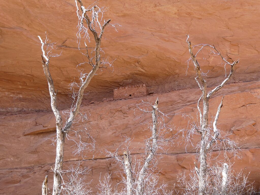
Travel Features Syndicate, goingplacesfarandnear.com

We literally raced up to catch the peak fall foliage colors in the dramatic, spectacular setting of New York’s Adirondack Mountains.

There are so many different hiking trails, we wanted to make the best choices for a one-day adventure. Researching potential hikes, I found The Adirondack Experience, which lists hikes in categories, one of which is “best summit views” and excellent descriptions (also alltrails.com gives precise maps, elevations). That wasn’t enough for me to pin down, so I called Adirondack Experience, to get the low-down on the trails to high peaks. They also offer a fall foliage report, as does New York State (www.iloveny.com).

We set up an itinerary that would allow us to do two hikes to summits affording 360-degree views, in one sensational day:

View of the Adirondack Mountains at peak fall foliage from the summit of Chimney Mountain © Karen Rubin/goingplacesfarandnear.com

Chimney Mountain: The extraordinary appeal here are the geologic formations at the top, a maze of caves and crevices, after an invigorating mile-long climb (entirely uphill), before you get to the true summit, a smoothed, mostly flat boulder, reached via a quarter-mile long herd path. “Chimney Mountain has unique features due to a large proportion of soft, sedimentary Grenville layers that have made passageways, cliffs, boulders, and caves. View the large geologic depression that was formed when the Western Rift separated from the Eastern Rift.” The hike, three-miles round trip (in/out), is a 870-foot ascent to 2721-foot elevation. Plan on 3 hours (bring water, face mask, and take into account that it gets dark in the woods before the sunset). (Big Brook Road, Indian Lake, NY, 12842, 518-548-3076, [email protected], www.adirondackexperience.com/hiking/chimney-mountain).

View from the summit of Chimney Mountain at peak fall foliage. © Dave E. Leiberman/goingplacesfarandnear.com

We came down and had ourselves a picnic lunch before setting out for our afternoon hike, about 30 minutes further drive, at Castle Rock, above Blue Mountain Lake. By the time we arrived, the drizzle which started just as we got back into the car turned into an actual rain when we were on the trail. But no matter, we were determined to forge on. This trail is a 3.2 mile long loop with a steady rise, but more gradual than Chimney Mountain – that is, until the last one-tenth mile that involves a scramble up over and between boulders, made more challenging (and therefore satisfying), by the slippery leaves (young kids would have no problem). But so worth it (and really satisfying to have accomplished it)! The rock formations here at the top are absolutely fabulous. Amazingly, just as we got to the summit – another relatively flat boulder – the rain turned to drizzle and then stopped altogether, allowing the sun to poke through, making the wet rock surface glisten. The views of Blue Mountain Lake, with its several tiny islands, and Blue Mountain, with other mountain peaks in the near and far distance, are stunning.

View from the summit of Castle Rock with the Adirondacks at peak fall foliage, rocks glistening with rain © Karen Rubin/goingplacesfarandnear.com

The summit is about at the half-way mark of the loop. At about the 1.5 mile mark, there is a sign that directs you to the summit, only a little disconcerting to realize you have another half-mile to go.  It’s 1.8 miles up on the less steep part of the trail, 1.4 miles on the other side, which goes past fabulous rock formations. (So glad we opted to do the full loop, instead of returning on the 1.8 mile side to avoid a steeper descent, but it actually wasn’t bad at all, even with the slippery leaves. I’ve cultivated a technique of hanging on to trees and branches to swing down, or climb down, or sit down and dangle my feet, and I really value my hiking poles.)

Tackling the scramble to the Castle Rock summit © Karen Rubin/goingplacesfarandnear.com

This is one of the most popular hikes in the area, so people are advised to get here early to get parking at the trailhead (Maple Lodge Road, Blue Mountain Lake). Also, on all of these hikes, wear a face mask and respect social-distancing when people are passing.

The Adirondack Fall Foliage Meter (www.adirondacksusa.com/fall) provides up-to-the-minute fall foliage reports on where the leaves are prettiest and most colorful.  

More sources: Adirondacks Regional Tourism, visitadirondacks.com; Hamilton County Tourism, adirondackexperience.com, 800-648-5239.

Hiking up to Chimney Mountain © Karen Rubin/goingplacesfarandnear.com

Since the Adirondacks are about a five-hour drive from the downstate metro area, people are flocking to Lake George and the surrounding area for accommodations which has maintained very strong occupancy. There are also any number of cabins, lodges, Airbnb’s to choose from, many with exquisite views along one of the many, many scenic lakes. At the trailhead to Chimney Mountain, in fact, there are rustic cabins.

High Peaks Resort in the heart of Lake Placid offers three different lodging experiences overlooking Mirror Lake and the Adirondack Mountains: The Resort, a traditional hotel with 105 guest rooms and suites (newly renovated earlier this year); the modern retro-vibe Lake House with 44 guest rooms; and the private and serene Waterfront Collection with 28 guest rooms including 10 suites on the shores of Mirror Lake. Take a break from studying or work with a dip in the indoor or outdoor pool, paddling Mirror Lake, hiking, biking, golfing. Dogs are welcome, with special canine-friendly treats and amenities. Save up to 30 percent with the Best Dates, Best Rates package, with rates from $125 per night (www.highpeaksresort.com).

Coming down from the summit at Castle Rock (c) Karen Rubin/goingplacesfarandnear.com

Foliage in the Catskills: Find vibrant fall colors on a hike along the Hannacroix Creek Preserve (www.greatnortherncatskills.com/outdoors/hannacroix-creek-preserve-hcp) in New Baltimore—featuring 113 acres of trails and scenic vistas—or explore the RamsHorn Livingston Sanctuary (https://www.greatnortherncatskills.com/outdoors/ramshorn-livingston-sanctuary) in Catskill, which is home to a wide variety of wildlife and plant life along more than three miles of trails. For exhilaration on your quest for foliage, try mountain biking along the Tannersville-Hathaway Trail System (https://www.greatnortherncatskills.com/outdoors/tannersville-hathaway-trail-system)  in Tannersville—suitable for beginners and experienced riders alike. To get the latest update on colors in the region, check out the Catskills’ fall foliage meter (www.greatnortherncatskills.com/catskills-fall-foliage).  

Connect with nature while camping at Purling Waters (www.greatnortherncatskills.com/camping/purling-waters), a fully-equipped campsite accommodating up to 6 campers, located along the banks Shinglekill Creek. For a historic stay, try Tumblin’ Falls House (www.greatnortherncatskills.com/resorts-lodging/tumblin-falls-house). The house, offering 5 guest rooms in an 1890s Dutch Victorian perched on a cliff overlooking Shinglekill Falls, has a tree level spa overlooking falls, natural pools, garden and trails.

To keep tabs on the progress of fall foliage in New York State, www.iloveny.com/things-to-do/fall/foliage-report.

See more information on where to go, what to do in New York, www.iloveny.com, 800-CALL- NYS, [email protected].

______________________

© 2020 Travel Features Syndicate, a division of Workstyles, Inc. All rights reserved. Visit goingplacesfarandnear.com, www.huffingtonpost.com/author/karen-rubin, and travelwritersmagazine.com/TravelFeaturesSyndicate/. Blogging at goingplacesnearandfar.wordpress.com and moralcompasstravel.info. Send comments or questions to [email protected]. Tweet @TravelFeatures. ‘Like’ us at facebook.com/NewsPhotoFeatures

Driveable Getaways: Hiking the Hudson River School Art Trail in the Great Northern Catskills

Sunset Rock. Hiking the Hudson River School Art Trail, in the Catskill Mountains, Greene County, New York State © Karen Rubin/goingplacesfarandnear.com

by Karen Rubin
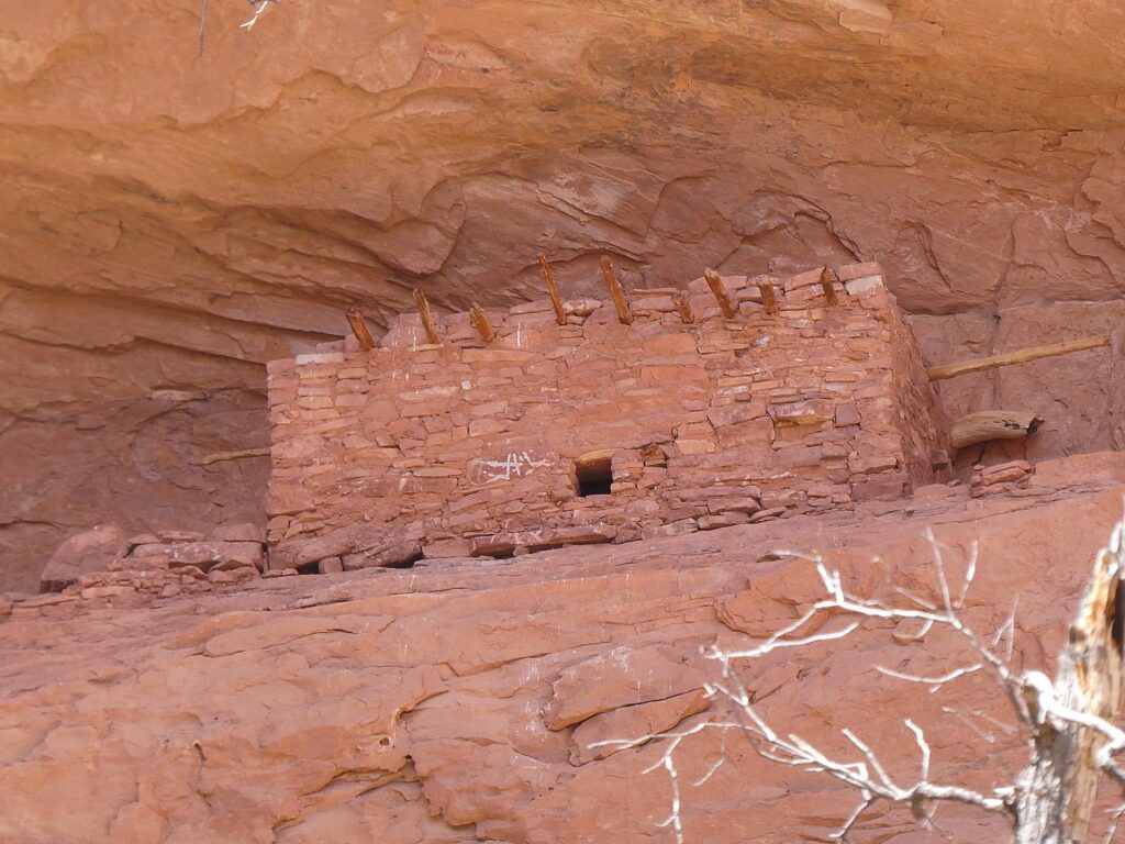
Travel Features Syndicate, goingplacesfarandnear.com

My getaway exploring the Hudson River School Art Trail in the Great Northern Catskills of New York starts at the trailhead to Kaaterskill Falls, where you get an amazing view of Kaaterskill Clove (HRSAT Site #4). You gaze out over the gorge where mountain peaks seem to thread together and compare the scene today to the way it is depicted by Hudson River School artist Asher B. Durand’s 1866 painting.
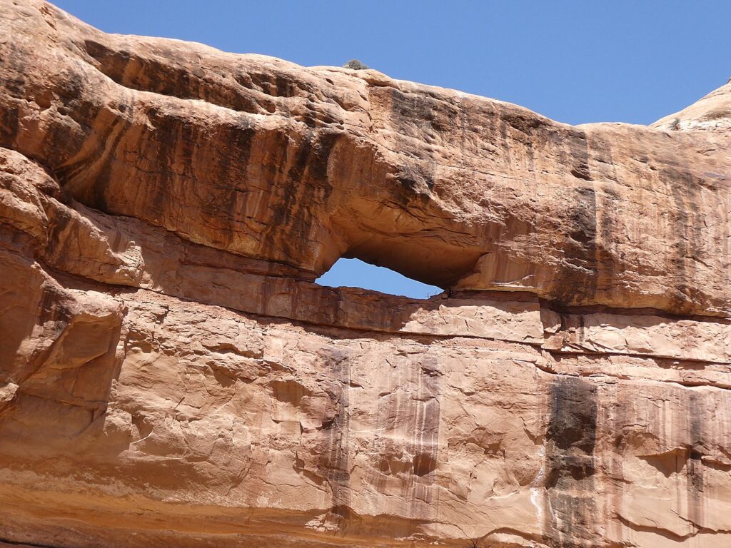
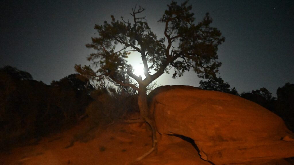
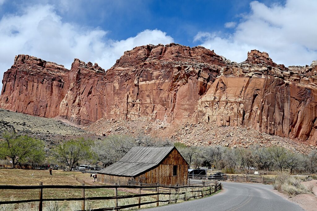
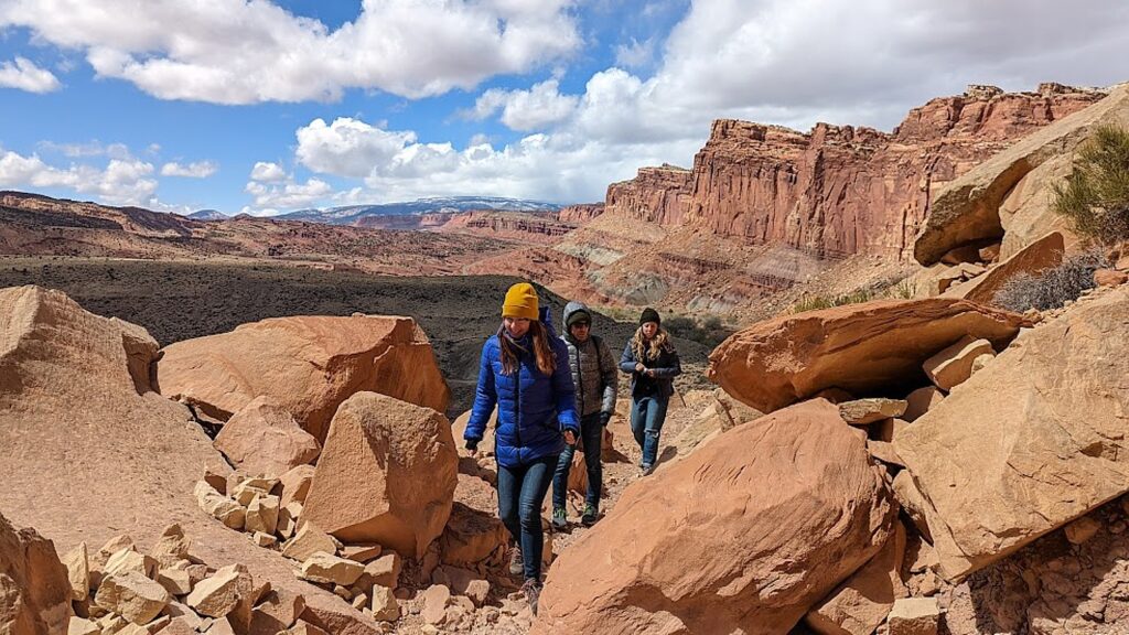
Kaaterskill Clove. Hiking the Hudson River School Art Trail, Great Northern Catskills, NY © Karen Rubin/goingplacesfarandnear.com

It’s a short walk along 23A (watch out for cars on the winding narrow road) to the trailhead for one of my favorite hikes, Kaaterskill Falls (HRSAT Site #5), a stunning scene that looks remarkably just as depicted in an 1835 painting by Thomas Cole, known as the father of the Hudson River School. “It is the voice of the landscape for it strikes its own chords, and rocks and mountains re-echo in rich unison,” Cole (who was also a poet and essayist) wrote.

Kaaterskill Falls. Hiking the Hudson River School Art Trail, Great Northern Catskills, NY © Karen Rubin/goingplacesfarandnear.com

The Kaaterskill Falls were a favorite subject of many of the Hudson River School painters and for me, is the quintessential combination of stunning scenery plus the physical pleasure of the hike – half-mile up to the base of the double-falls, then another half-mile to the top.

Kaaterskill Falls. Hiking the Hudson River School Art Trail, in the Catskill Mountains, Greene County, New York State © Karen Rubin/goingplacesfarandnear.com

The two-tiered Kaaterskill Falls, 175 and 85 feet, is the highest in New York State and was described by James Fenimore Cooper in “The Pioneers” which Thomas Cole, a friend of Cooper’s illustrated.

Hiking the Hudson River School Art Trail, Great Northern Catskills, NY © Karen Rubin/goingplacesfarandnear.com

There is a small trail through the woods to the very top of the falls. Signs admonish hikers that climbing the ledges beside Kaaterskill Falls is extremely dangerous, and has resulted in numerous injuries and deaths. But the falls are not flowing when I come, so I get to walk on the ledges, giving me a really nervous view straight down and beyond, to the Valley and letting me look at the carved initials and graffiti from the 1920s and 30s, some even from the 1800s.  You feel a sense of kindred spirit with those who have passed through and passed on. You feel the height and the proximity to the drop off, and it makes your heart flutter.

At the top of the Kaaterskill Falls. Hiking the Hudson River School Art Trail, Great Northern Catskills, NY © Karen Rubin/goingplacesfarandnear.com

Later, I will recognize the view in Thomas Cole’s paintings and imagine how he must have stood in this precise place where you are standing.

Kaaterskill Falls. Hiking the Hudson River School Art Trail, Great Northern Catskills, NY © Karen Rubin/goingplacesfarandnear.com

It is a half-mile to the base, and another half- mile to the top of the falls, for a total of 2 miles roundtrip. There are some scrambles and it is uphill almost all the way (walking sticks are really recommended), and is thoroughly fantastic.

Hiking the Hudson River School Art Trail, in the Catskill Mountains, Greene County, New York State
© Karen Rubin/goingplacesfarandnear.com

(The parking lot is just west of the trailhead and across 23A, so you park and walk back along the road, being very careful. Haines Falls NY 12436, 518-589-5058, 800-456-2267).

HRSAT Hikes in North-South Campground 

For my second day, after an amazing breakfast at the Fairlawn Inn, I head to North-South Campground, where there are several of the Hudson River School of Art Trail hikes (as well as many other hiking trails) – the lake itself depicted in paintings such as Thomas Cole’s “Lake with Dead Trees,” 1825 (HRSAT Site #6).

Artists Rock, Escarpment Trail, North-South Lake Campground, on the Hudson River School Art Trail © Karen Rubin/goingplacesfarandnear.com

The Escarpment Trail to Sunset Rock (HRSAT Trail Site #7) begins along the well-marked blue trail (you cut off to the yellow trail to Sunset Rock) that mostly wraps around the ledges, with the amazing views that so enthralled the artists of the Hudson River Valley. Close to the beginning is a fairly interesting scramble, then the trail winds through the woods along side fabulous rock formations before coming out again to the ledges. You reach Artists Rock at about a half-mile. Continuing on, you look for the yellow trail marker to Sunset Rock and from there, to Newman’s Point.

Escarpment Trail, North-South Lake Campground, on the Hudson River School Art Trail © Karen Rubin/goingplacesfarandnear.com

You can either reverse and come back on the Escarpment Trail, or make a loop, coming down the Mary’s Glen trail, passing Ashley’s Falls.

Ashley’s Falls on Mary’s Glen Trail © Karen Rubin/goingplacesfarandnear.com

Mary’s Glen trail can also be the entrance to a more challenging hike, to North Point, a distance of 3.2 miles with 840 feet ascent. It is a mostly moderate climb but has some short, steep scrambles over rock, but you come to large open slabs and expansive vistas at North Point, a 3,000 ft. elevation with some of the most distant views.)

North-South Lake. Hiking the Hudson River School Art Trail, in the Catskill Mountains, Greene County, New York State © Karen Rubin/goingplacesfarandnear.com

Back at the North-South Lake, you can follow around the shoreline to see the same views that inspired Hudson River School paintings.

You can also take the trail to the site of the Catskill Mountain House (HRSAT Site #8), one of the earliest tourist hotels. The majestic hotel, which was opened in 1823 and accommodated 400 guests a night (Presidents Arthur and Grant were among those who stayed here), burned down in 1963 but the view that attracted visitors still remains as one of the most magnificent panoramas in the region, and can be compared to Frederic Church’s “Above the Clouds at Sunrise” (1849).

Where the Catskill Mountain House used to stand. Hiking the Hudson River School Art Trail, in the Catskill Mountains, Greene County, New York State © Karen Rubin/goingplacesfarandnear.com

It is fun to see the initials carved into the stone ledges from more than a century ago. The Mountain House began drawing thousands of guests each season from all over the country as well as from abroad, who came not just for the cooler, healthier climate but for what had already become one of the most renowned natural panoramas in the young nation: the valley 1,600 feet below, stretching east to the Taconic Mountains and the Berkshires, with the silvery thread of the Hudson visible for 60 miles from north to south.  On a clear day, you can see five states – Connecticut, Massachusetts, New Hampshire, Vermont and New York. The hike is just a half-mile with only an 80-foot ascent.

Hiking the Hudson River School Art Trail, in the Catskill Mountains, Greene County, New York State © Karen Rubin/goingplacesfarandnear.com

There is a $10/car day use fee for the NYS DEC’s North-South Lake Campground from early May through late October, however the fee is waived for NYS residents 62 years or older midweek. The campground is open May through October; 518-589-5058 or call DEC Regional Office year-round at 518-357-2234, www.greatnortherncatskills.com/outdoors/north-south-lake-campground.

The Hudson River School Art Trail also features Olana, the magnificent and whimsical mansion home of artist Frederick Edwin Church. At this writing, the entrancing mansion was not yet reopened to visits, but the 250-acre grounds and the first-ever legally protected “viewshed” to the Hudson River are open (5720 Route 9G, Hudson, NY 12534, 518-828-0135, olana.org.)

Frederick Edwin Church’s Olana, Hudson, NY © Karen Rubin/goingplacesfarandnear.com

Also, you can walk the grounds Thomas Cole Historic Site (the home has yet to be reopened, but is marvelous to visit, especially Cole’s studio). (218 Spring Street, Catskill, NY 12414, 518-943-7465, www.thomasscole.org)

Thomas Cole National Historic Site, Catskill, NY, on the Hudson River School Art Trail © Karen Rubin/goingplacesfarandnear.com

Get maps, directions and background on the Hudson River School Art Trail atwww.hudsonriverschool.org/hudsonriverschoolarttrail.

View from Thomas Cole National Historic Site, Catskill, NY, on the Hudson River School Art Trail © Karen Rubin/goingplacesfarandnear.com

Also, walk on the Hudson River Skywalk along the Rip Van Winkle Bridge to find incredible river views.

In Tannersville: Explore the Mountain Top Arboretum, 178 acres of trails, wetlands, gardens, and native plants; go on a mountain biking adventure at the Tannersville Bike Park, part of the Tannersville-Hathaway Trail System.

In Athens:Rent a kayak or paddleboard at Screaming Eagle Outdoor Adventures; explore along the Hudson River at the Athens Riverfront Park and look for the Hudson-Athens Lighthouse

Places to stay include:

Fairlawn Inn bed-and-breakfast, Hunter, NY, the Catskills © Karen Rubin/goingplacesfarandnear.com

In Hunter, the Fairlawn Inn where we have stayed, oozes charm; open year-round (7872 Main St. Hunter, NY 12442, 518-263-5025, www.fairlawninn.com).

Just outside of Catskill, A Tiny House Resort offers 10 tiny houses perched over the Catskill Creek; open-year-round (2754 CR 23BSouth Cairo, NY 12484, 518-622-2626,www.atinyhouseresort.com).

In Coxsackie, Gather Greene is a glamping destination offering 17 wooden glamping cabins on 100 acres of rolling hills and fields, each is equipped with air conditioning and heating, full bathrooms, a mini-fridge (176 Levitt RoadCoxsackie,  262-448-3683, www.gathergreene.com).

More information from Greene County Tourism, 800-355 CATS, 518-943-3223, discovergreene.com.

______________________

© 2020 Travel Features Syndicate, a division of Workstyles, Inc. All rights reserved. Visit goingplacesfarandnear.com, www.huffingtonpost.com/author/karen-rubin, and travelwritersmagazine.com/TravelFeaturesSyndicate/. Blogging at goingplacesnearandfar.wordpress.com and moralcompasstravel.info. Send comments or questions to [email protected]. Tweet @TravelFeatures. ‘Like’ us at facebook.com/NewsPhotoFeatures