
By Karen Rubin, Travel Features Syndicate, goingplacesfarandnear.com
The annual eight-day Parks & Trails Cycle the Erie Canalway bike tour from Buffalo to Albany is 400 miles and 400 years of history but this year’s ride July 12-20, 2025 is particularly special because it marks the 200th anniversary of the opening of the Erie Canal in 1825. An engineering marvel of its time that transformed the United States, all along the way, riders will enjoy special events and celebrations.
The Erie Canal propelled the Industrial Revolution, opened the frontier, united the country, birthed canal towns and cities, and made New York City a financial capital of the world.
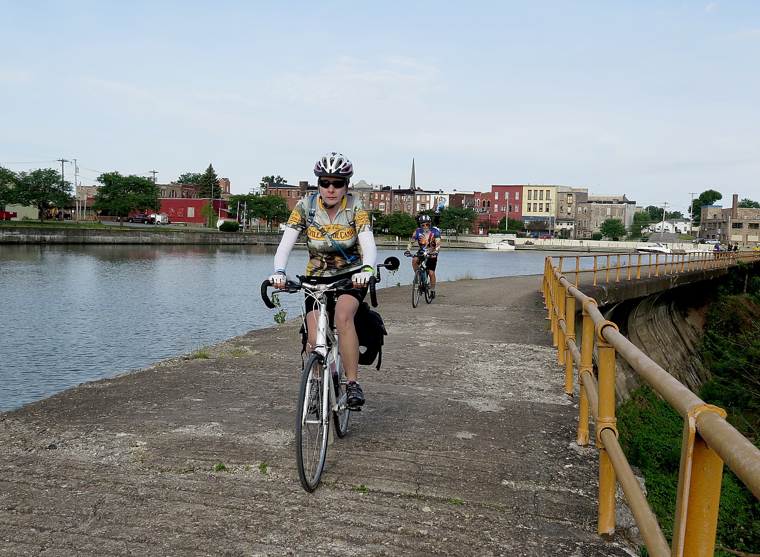
You see all of this unfolding from the first mile out of Buffalo and over the course of eight days of riding (averaging 50 miles a day), filled with activities and camaraderie.
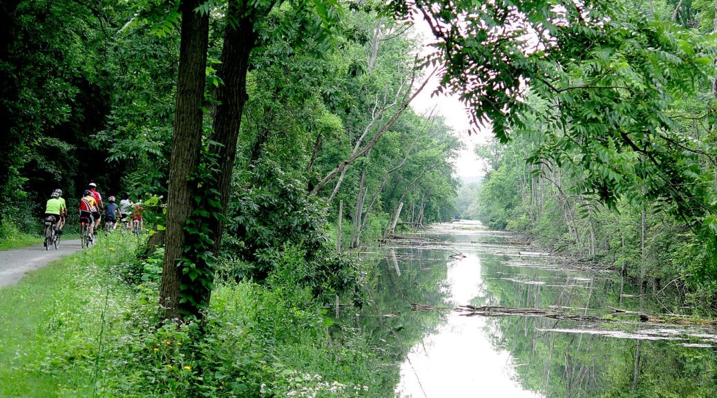
Cycle the Erie Canalway participants experience one of the best trails in America as they cycle through historic canal villages and discover the small-town charm of upstate New York that makes people like us Downstaters marvel, “This is New York!” Along the way, canal historians and local experts will introduce riders to the people, places and things that make the Erie Canal so important to the history of New York and the nation during its Bicentennial Year. Cyclists pedal between 40 and 60 miles per day on the mostly flat (but it seems the campsites tend to be at the highest point of a town) and mostly traffic-free Erie Canalway Trail, and visit some of Upstate New York’s most iconic attractions, such as the Women’s Rights National Historic Park in Seneca Falls and Fort Stanwix in Rome, a full-scale fort recreation from the French and Indian War.
The Parks & Trails NY tour is actually one of my favorite bike rides in the world – for the scenery, the sights along the way, the activities like lectures and museum visits that are arranged, the camaraderie of camping and riding together with some 650 cyclists from all over the country and all over the world, and the Erie Canalway itself –a 356 mile-long car-free recreational path that is the west-east part of New York State’s new 750-mile Empire Trail Network (the north-south trail network connects Battery Park at the tip of Manhattan to the Canadian border). Between the relatively flat nature and superb support provided, Cycle the Erie Canal offers unparalleled cycling for all ages and abilities (I’ve seen families with little ones in trailers or car seats and riders as young as 10 and as old as 92 bike on their own.)
Though there are bike tour operators (such as Wilderness Voyageurs and Pocono Biking) that offer inn-to-inn bike tours on portions of the Erie Canalway, this annual supported biking/camping trip, in its 27th year, is organized by Parks & Trails New York, which for decades has successfully advocated to open these recreational trails and improve parks.
Each day’s ride is highlighted by fascinating attractions all along the Erie Canalway

In Lockport, see the original engineering marvel that made the entire Erie Canal possible: the famous “Flight of Five”, a staircase of five locks built to elevate boats through the then-impossible 50-foot Niagara Escarpment; take a cruise through the modern lock (the GE motors that run it are over 100 years old), explore underground sluiceways, caves and the “Upsidedown Bridge.”
Leaving the historic village of Medina, look for the tunnel under the Erie Canal, where you see that the Erie Canal is really like a bathtub.
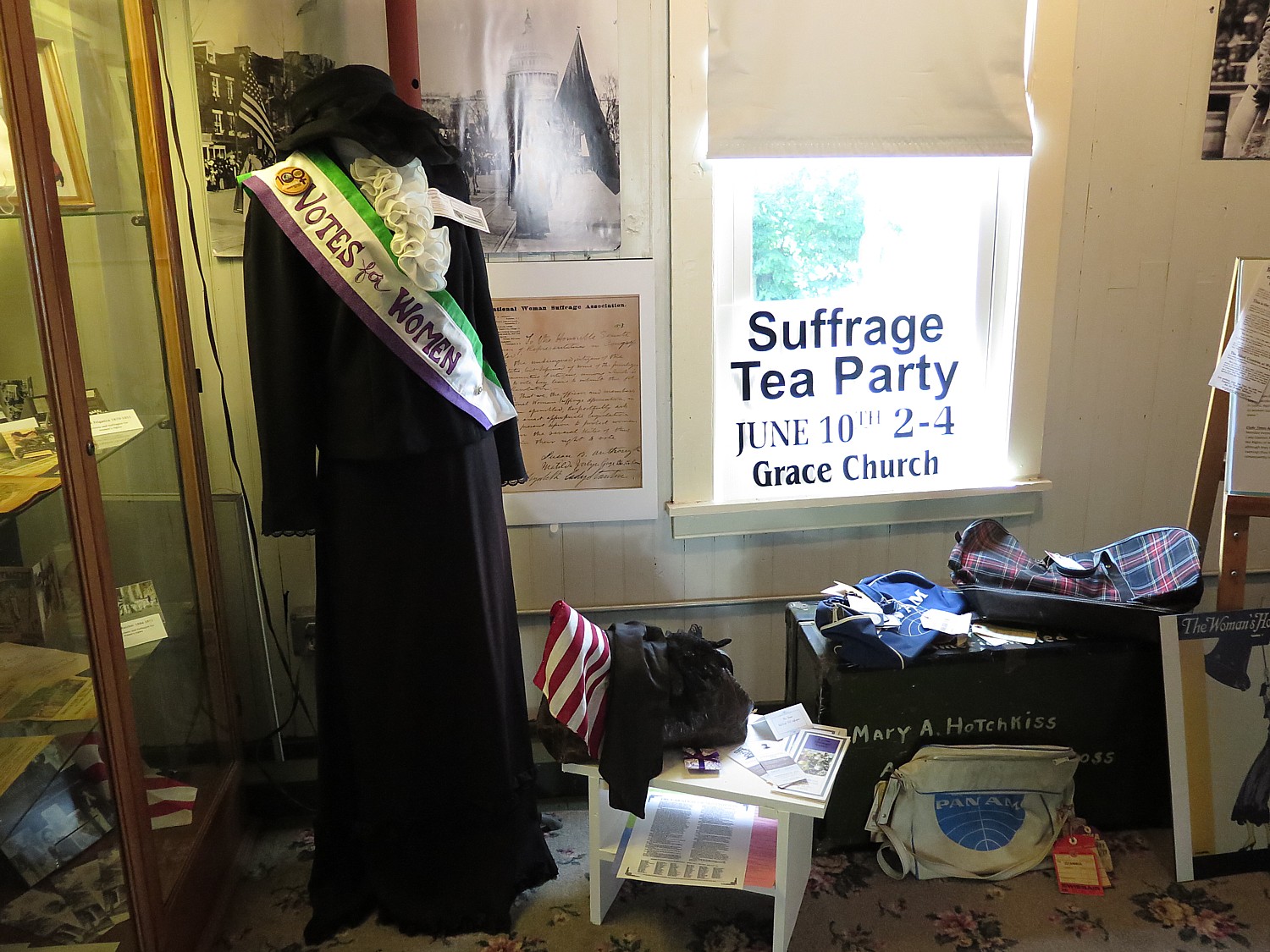
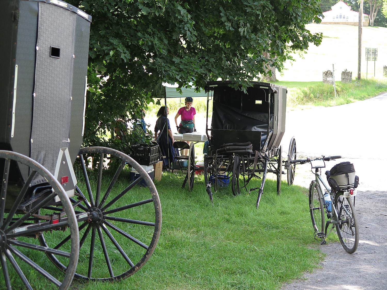
Ride through New York’s Amish Country (who knew!) on the way to Seneca Falls, birthplace of the modern Women’s Rights movement and visit the Women’s Rights National Historic Park, National Women’s Hall of Fame (housed in a former knitting mill) and the Elizabeth Cady Stanton home (the museums stay open for us).

You also get a taste of the women’s movement at the Peppermint Museum in Lyons (don’t miss it!) where you learn about the inventor, Hotchkiss’s daughter, a suffragist, who took over the company.
On the way to Syracuse, stop at the Visitors Center at the Old Erie Canal Heritage Park at Port Byron, then pedal through the authentic enlarged Erie Canal Lock 52 to the c. 1895 Erie House Saloon, Blacksmith Shop, and Mule Barn; visit the Jordan Historical Society Museum, and ride on the towpath on an original aqueduct over Skaneateles Creek which takes you to Camillus’ Erie Canal Park where you stop at Sims Store, a re-creation of a 19th century general store (where riders are cheered for passing the half-way mark at 200 miles)
In Syracuse, visit the zoo, and the next morning, the Erie Canal Museum, the best of the Canal Museums along the way (they open especially for the cyclists)
On the way to Rome, visit the Chittenango Canal Museum and dry docks and the Canastota Canal Town Museum and see the spot where the first shovel of dirt was turned for “Clinton’s Ditch” (deliberately in the middle of the canal). Chittenango was also the birthplace in 1856 of L. Frank Baum, famous throughout the world as the creator of The Wizard of Oz and his mother-in-law Matilda Joslyn Gage, was a prominent women’s rights advocate, abolitionist, and writer, known for her radical views, derived largely from the Oneida women and her work alongside Susan B. Anthony and Elizabeth Cady Stanton in the women’s suffrage movement).
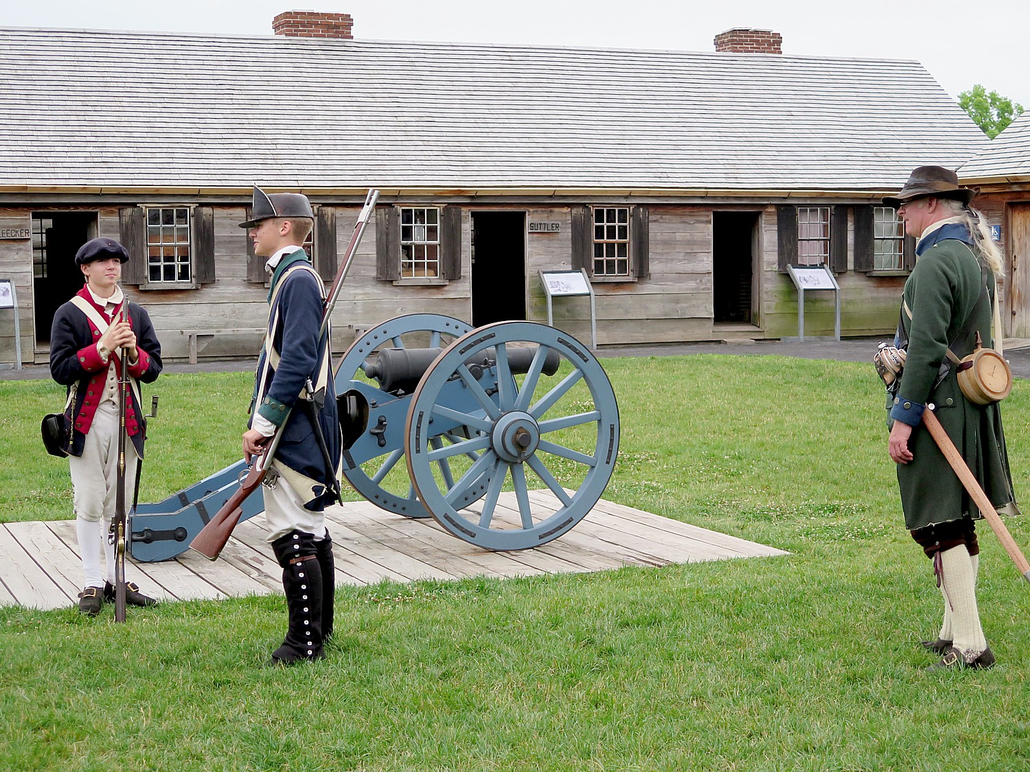
In Rome, camp at the restored Fort Stanwix National Monument, built during the French and Indian War, populated with costumed interpreters, and learn how seemingly minor battles actually shaped the outcome of the American Revolution.
In Little Falls, explore the glacial potholes of Moss Island, a National Natural Landmark, and tour Revolutionary War General Herkimer’s home.
At Schoharie Crossing State Historic Site, once a trading post and a fort (they found the footprint after a hurricane), look where you can see all three Erie Canals (yes, 3 Erie Canals have been built).
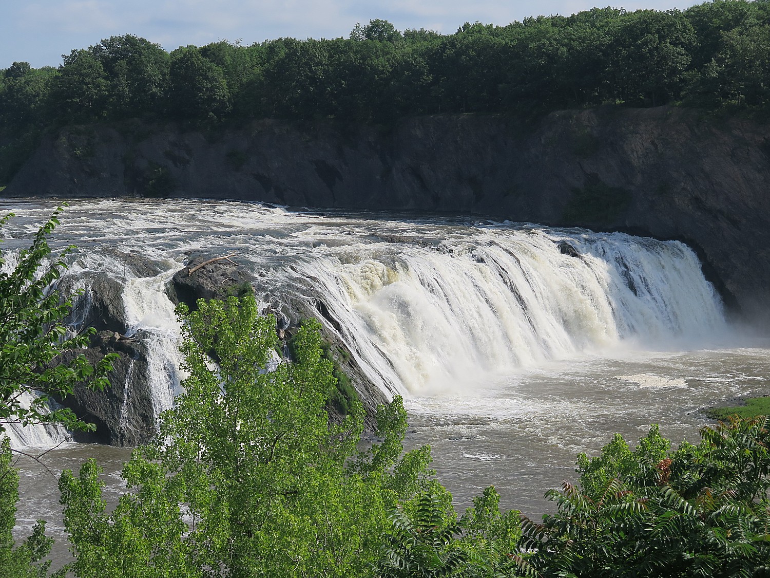
Coming from Schenectady to the finish line in Albany, stop at Cohoes Falls, one of the most powerful falls east of the Rockies and a major challenge for Erie Canal engineers (a wonderful bookend with Niagara Falls in the west); visit Peebles Island State Park, where, during the Revolutionary War, American forces prepared defenses to make a final stand against the British, and finally, bike along the Hudson River into downtown Albany, New York State’s 300-year-old capital.
Registration for Cycle the Erie Canal includes camping accommodations each evening with restrooms and showers (even swimming pools and charging stations and the possibility of indoor camping); eight hearty breakfasts and six delicious dinners; two refreshment stops daily stocked with fruit, snacks and beverages; SAG support and baggage transport; daily cue sheets and marked routes; entertainment and historic presentations every evening; and guided tours of the Canal, historic sites, museums, other attractions, and expanded celebrations for the Canal’s 200th Anniversary.
The price for the eight-day ride, July 12-20, Buffalo to Albany is $1,300/adult, $700 (youth age 6-17), $300/child (5 and under). There is also a four-day version with an optional shuttle.
(Note: they arrange for parking in Albany ($120, at the Quackenbush Garage July 12-20, 2025), and a shuttle bus to Buffalo on July 12 ($120/rider), or oppositely, parking in Buffalo ($25) and a shuttle back from Albany to Buffalo at the end of the tour.)
Parks & Trails New York, which is celebrating its own 40th anniversary this year, is a leading statewide advocate working to create a network of parks, trails, and greenways so that New Yorkers can enjoy the outdoors close to home. Cycle the Erie Canal supports Parks & Trails New York’s work on the Erie Canalway Trail and on trails in communities throughout New York State.
The New York State Canal Corporation, the agency charged with operating, maintaining and promoting New York’s Canal System and the Canalway Trail, is the Premier State Sponsor of Cycle the Erie Canal. The Erie Canalway National Heritage Corridor is the event’s Heritage Sponsor.
For more information on Cycle the Erie Canal, visit www.ptny.org/canaltour, email eriecanaltour@ptny.org or call 518-434-1583.
Erie Canal Bicentennial Events
The Cycle the Erie Canal bike tour, July 12-20, is one of the biggest events honoring the canal’s bicentennial, but there are many events happening in various towns and cities along the Canal:
On Fri., May 16, 2025, the Bicentennial Navigation season will kick off in Waterford, where the Canal meets the Hudson River, with a parade of vessels.
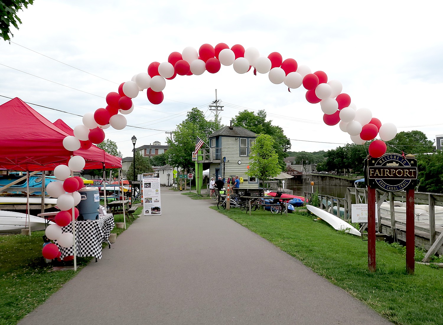
Fairport, NY, the jewel of the Erie Canal, celebrates its 48th Canal Days from June 6-8, 2025. One of New York’s premier arts festivals features artisans, music, local cuisine and fun for all ages, and brings more than 100,000 visitors to this Rochester suburb.
Canal enthusiasts, historians, engineers, environmentalists, artists and travelers from around the world can attend The 2025 World Canals Conference from Sept. 21-25, 2025 in Buffalo, NY, complete with canal-themed excursions for participants, in addition to hours of learning, discussion and networking.
The Water Music NY: More Voices Festival returns in Summer 2025, with The Albany Symphony Orchestra performing free concerts across the entire New York State Canal System. The project is a collaboration of composers, local arts partners, cultural & educational institutions and community members fusing arts, cultural heritage, and contemporary issues to re-envision the past, present, and future of people and communities bordering the historic waterway.
For the grand finale, a replica of Seneca Chief, the boat Governor Dewitt Clinton used for his inaugural Erie Canal journey to open the Canal in 1825, will set sail on September 24 and recreate the maiden voyage from Buffalo Canalside to the New York Harbor, making multiple stops along the way with celebratory events at each community stop including flotillas and a grand commemoration in New York City on October 25.
Can’t make it to the Parks & Trails NY Cycle the Erie Ride? The bike tour company, Wilderness Voyageurs offers a four-day inn to inn ride, New York Erie Canal West, that begins in Lockport and stays in places like the historic Genessee Country Inn (2025 tour dates: 6/30, 7/27, 8/10, 800-272-4141, wilderness-voyageurs.com).
Another company that offers inn-to-inn supported tour on the Erie Canalway is Pocono Biking (https://poconobiking.com/specialty-trips/6-day-erie-canal-bike-tour/). Also: Great American Bike Tours (949-424-5369, cycletheusa.com); Classic Adventures (800-777-8090, classicadventures.com); Noble Invention Bike Touring (844-424-5342, nobleinventionbiketouring.com); and 718 Outdoors (347-457-5760, 718c.com)
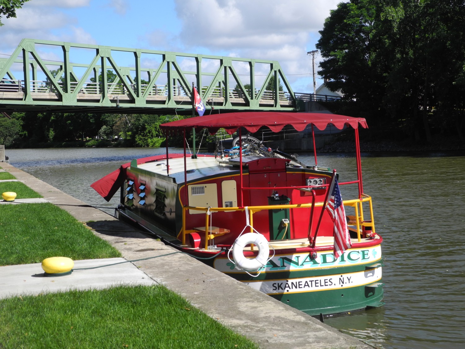
Another extraordinary way to experience the Erie Canal is by a live-aboard canal boat! This European-style self-skippered houseboat that was specifically designed for the Erie Canal let’s you make your own way on the Erie Canal, going through locks and under the lift bridges, and experience the 200th anniversary of the canal just as it was then, by boat and bike. Erie Canal Adventures provides this one-of-a-kind experience with live-aboard, fully-equipped canal boats. Accommodating 2 to 6 people, each of these charming, easy-to-pilot boats features cozy bedrooms, kitchens, and bathrooms – cooking utensils, linens, fuel, mobile app and bikes. You get 3-4 hours of training, including safety training, systems, and navigational training (and how to go through the locks which are SO fun. You learn how to work the radio to call up to the lockmaster and the bridge operators to lift the bridges. And you tie up where you like. Erie Canal Adventures, 1125 Marina Parkway, Macedon NY 14502, (315) 986-3011, Option 1, allie@eriecanaladventures.com, ericcanaladventures.com.
More ways to experience the Erie Canal can be found at the Erie Canalway National Heritage Corridor, https://eriecanalway.org/explore/cycling/cycling-resources
“This year, New York State is rich with opportunities to experience major milestone anniversaries, stay in new hotels and explore new museums and exhibits,” I LOVE NY Executive Director of Tourism Ross D. Levisaid. “The Bicentennial of the Erie Canal‘s completion can be celebrated throughout upstate communities, while downstate, New York City commemorates its 400th anniversary. The 100th anniversary of the Great Gatsby can be explored at Gold Coast mansions on Long Island, where the famous novel was set. For more information, visit iloveny.com
See also:
Cycle the Erie: 400 Miles & 400 Years of History Flow By on Canalway Bike Tour Across New York State
Cycle the Erie, Day 4: Seneca Falls to Syracuse, Crossing Halfway Mark of 400-Mile Biketour
Cycle the Erie: At Fort Stanwix, Rome, Time Travel Back to America’s Colonial, Native American Past
Cycle the Erie, Days 6-7: Erie Canal Spurs Rise of America as Global Industrial Power
__________________
© 2025 Travel Features Syndicate, a division of Workstyles, Inc. All rights reserved. Visit goingplacesfarandnear.com and travelwritersmagazine.com/TravelFeaturesSyndicate/. Blogging at goingplacesnearandfar.wordpress.com and moralcompasstravel.info. Visit instagram.com/going_places_far_and_near and instagram.com/bigbackpacktraveler/ Send comments or questions to FamTravLtr@aol.com. Bluesky: @newsphotosfeatures.bsky.social X: @TravelFeatures Threads: @news_and_photo_features ‘Like’ us at facebook.com/NewsPhotoFeatures