Category Archives: Outdoors Adventures

Surging Demand, Limited Capacity Encourages Skiers to Discover New York’s Lesser Known Areas (There are 50)

Family enjoys expanded outdoor dining at Greek Peak. The strong desire for outdoor activities like skiing, snowboarding, cross-country skiing and snowshoeing, coupled with capacity restrictions, is encouraging visitors to discover more of New York State’s 50 ski areas. Areas have found innovative, pleasurable ways to adapt to the state’s COVID-19 requirements (photo provided by Greek Peak).

by Karen Rubin, Travel Features Syndicate, goingplacesfarandnear.com

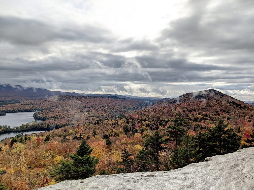
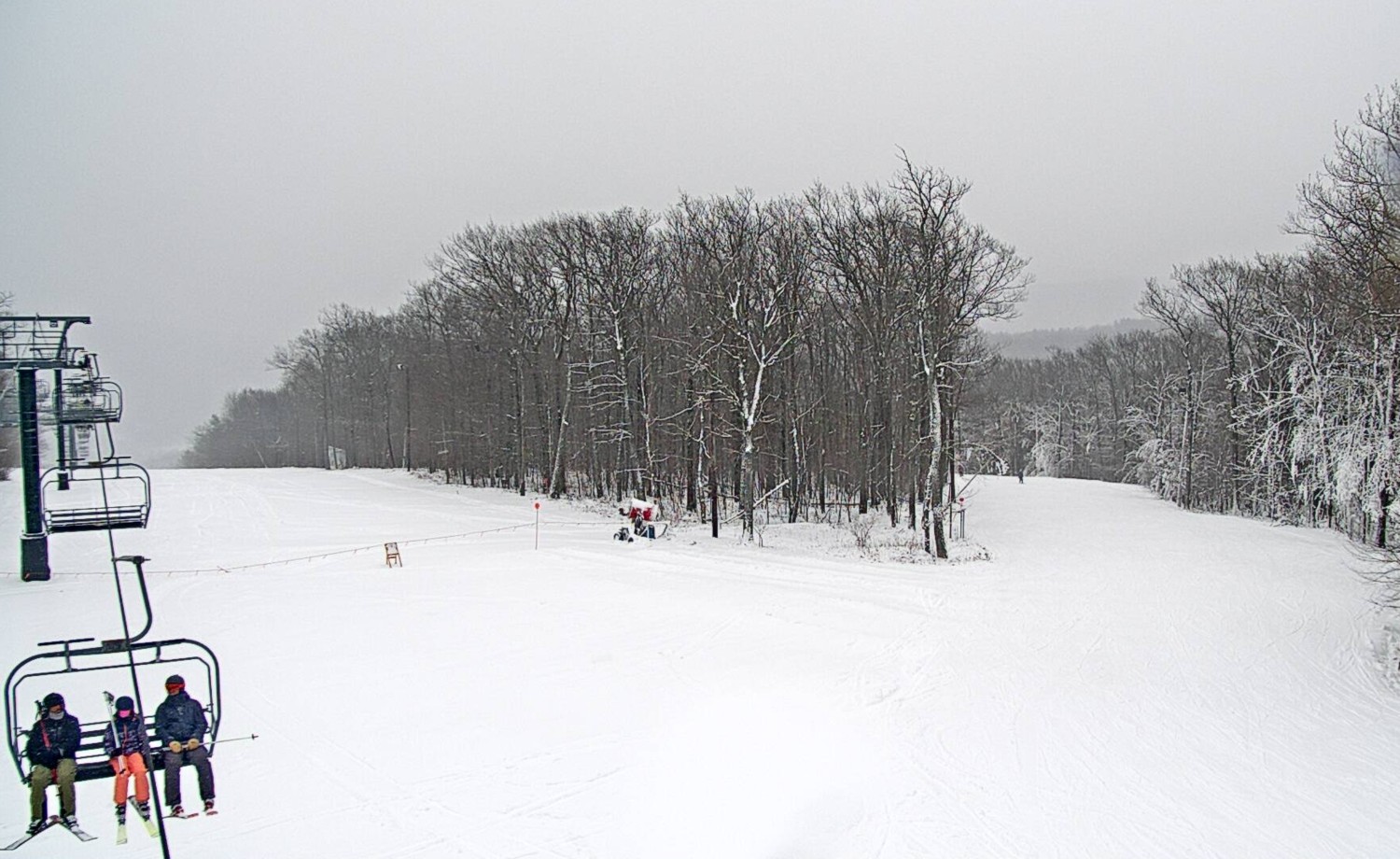
Skiing, snowboarding, cross-country skiing, snowshoeing in the brisk fresh air of greater outdoors will be salvation to get through this dark winter of isolation. Fortunately, New York State, with 50 ski areas (more than any other state), is gearing up, putting in the protocols to keep everyone safe and healthy, doing what will be the safest and healthiest way to be active this winter. Just being outdoors will be a tonic for body and soul.

ISkiNY.com (Ski Areas of New York) is a sort of one-stop online place to learn about the various mountain resorts and ski areas and overall New York State policies to address (and contain) COVID-19. All areas are under capacity constraints (50% of their busiest day last season) and visitors must follow rules for wearing masks (an actual mask, not a gaiter) at all times except when actively skiing or eating. Most require or strongly recommend purchasing tickets online in advance (and are selling out because of limits) – even season pass holders, who have priority, may be required to make advance reservations. Also, areas are limiting time that can be spent indoors in the lodges (recommending using your own vehicle as a kind of base lodge), and with limited après-ski opportunities, are promoting day-trips to ski areas within driving distance. Fortunately, with 50 areas throughout the state, just about everyone lives within 2 ½ hours of a ski area and staying in-state means that New Yorkers won’t have to quarantine after returning from a long-haul ski trip. (See more at ISkiNY.com).

Because of reduced capacity and super-charged demand the best known, most popular full-service resorts like Whiteface (Lake Placid), Gore Mountain, Belleayre, Hunter (now part of Vail, on the Epic pass) and Windham (part of IKON pass), may well be at capacity especially for the holidays and weekends. So this will certainly be the season to explore some new ski destinations – areas, often that have been operating for decades, that are wildly popular with locals.  

And with this incredible blizzard that dumped a huge base of snow, just about everywhere in the state has great conditions, in time for opening day.

All but the three ski resorts that are owned by New York State’s Olympic Regional Development Authority (Whiteface, Gore, Belleayre) and Hunter (now owned by Vail Resorts) are independently owned, many going back decades, and offer their own particular personality, character and sense of community. Most are ski areas, not full-service resorts, but that may be just the ticket this year, for a quick day’s getaway on the slopes, no need to hang around for après-ski.

All have made accommodations to keep as much outside as possible – ticketing (many are cashless, and require advance reservations), setting up outside warmers, limiting time inside for dining, encouraging people to use their own vehicles as their base lodge. But all of the areas have made marvelous accommodations and innovations to bring more activities outdoors, continue to offer ski school, snow tubing, added firepits and grab n’go food, to preserve the spirit and joy of schussing down the slopes.

“While our number one goal is to run a safe operation this season, it is also our goal to ensure that our guests do not incur any additional stress or inconvenience when they visit West Mountain”, said Spencer Montgomery, Co-Owner and Managing Member of West Mountain in Queensbury.

“Sure, things will be a little different operationally this year, but our staff is here to provide an enjoyable and stress-free environment. People have already been through so much this year; skiing and riding is a chance to simply enjoy being outdoors with friends and family.”

“We are looking forward to welcoming our guests this winter to enjoy the outdoors”, said Sara Montgomery, General Manager of West Mountain. “With so many families at home doing virtual learning this year, getting on the mountain and getting exercise will be a much-needed activity and escape!”

“Know before you go,” Scott Brandi, President Ski Areas of New York, recommends. Check ahead for conditions and availability.

Here are just a few of the ski resorts and areas to explore:
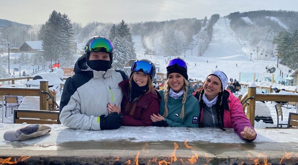
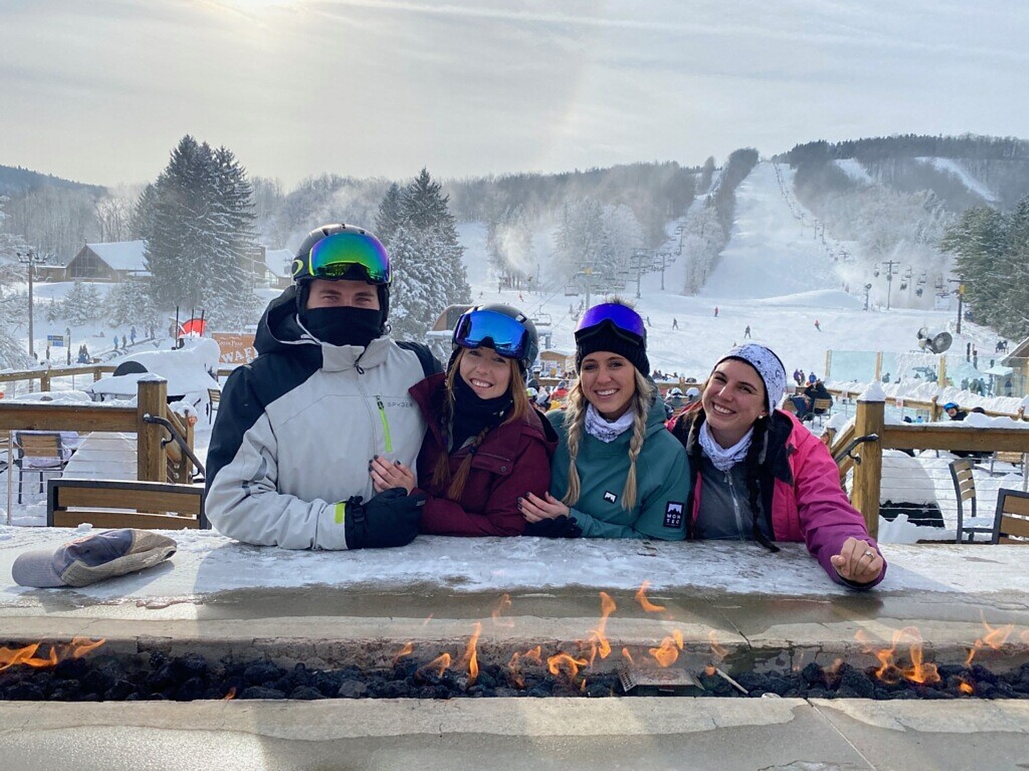
Greek Peak

Greek Peak’s night skiing. The resort has a 6,000 sq. ft. deck off its Trax Pub & Grill for outdoor dining (photo by Drew Broderick, Greek Peak)

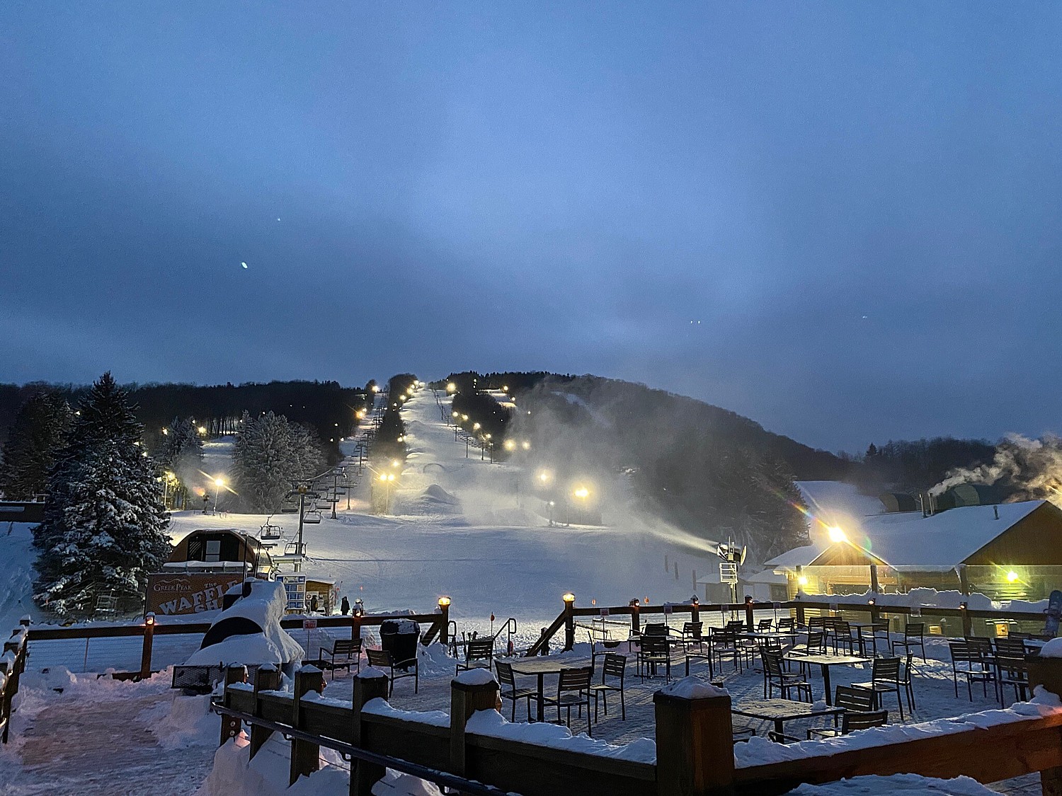
The Greek Peak Ski Resort is a full-service, four-season resort and the largest ski area in Central New York. It has a 952 ft. vertical drop from a 2100 ft summit. It’s varied terrain (220 skiable acres) offers 56 runs (35% beginner, 29% intermediate, 27% advanced, 9% double-black diamond, 4 terrain parks and half pipe), serviced by six chair lifts and two carpet lifts; the longest run is 1.5 miles, plus night skiing.  There’s also 8 km of Nordic terrain (natural, so depends on conditions) and snowshoeing.

The Adventure Center has a mountain coaster, guided zipline tours even in winter (by reservation), snowtubing (10-12 lanes).

Located in the Finger Lakes, Greek Peak offers an Adirondack-style lodge, Hope Lake Lodge (151 rooms, sleeping 4-10 people) as well as log home (sleeps 14, across from slopes), outdoor heated pool,  indoor water park with wave pool (water slides and hot tubs are currently closed under COVID-19 regulations).

Open, all year, Greek Peak is already compliant with COVID-19 restrictions and made the adaptations.

Dining inside is limited to 50% capacity. Children’s programs are exclusively outside (no nursery); there are new family lessons

“We are already seeing new people, who want to get outside and want to learn to ski,” says Drew Broderick, VP of sales & marketing.

They’ve added food and beverage service outside, “fresh tracks” which is a ski  in/out grab n go, adding menu items to the waffle shack and may add food carts.

Since being acquired in 2015 by John and Christine Meier, the resort has made more than $1.5 million improvements including adding a high-speed detachable quad, new groomers, snowmaking (78 guns added this year), the “Big Bear Activity Zone” at Cascades Indoor Waterpark, a 41,000 sq. ft. park with 500 ft. of slides, wavepool and hot tubs, open year round.

Greek Peak Mountain Resort, 2000 NYS Rte 392, Cortland, NY 13045, 800-955-2754, greekpeak.net

Plattekill Mountain

Privately owned and operated by the Vajtay family, Plattekill Mountain in the northwestern Catskills, with 38 trails and terrain, offers “authentic mountain experience.” Powder Magazine (Dec. 2018), described Plattekill as “The Alta of the Catskills.” It offers wide variety for skiers and snowboarders: 38 runs ranging from 2-mile long beginner cruisers to steep double black diamonds with 1100’ vertical from its 3500 ft. high summit, accessed by 4 lifts (20% easier, 40% intermediate, 20% black, 20% double black), a “natural terrain park” nestled in the woods between the Lower Face and Shredded Mozzarella trails.  “Big mountain terrain, small mountain charm.”

New this season: widening, clearing beginner and intermediate trails; installation of new snowmaking pump to improve snowmaking; new wireless technology; new “Platty Shack” with outdoor deck for quick grab and go items; new ‘order online’ option in cafeteria; new online shopping for tickets and rentals eliminating lines at rental shop.

Plattekill Mountain, 469 Plattekill Road, Roxbury, NY 12474, 607-326-3500, info@plattekill.com, plattekill.com

Catamount Mountain Resort

Catamount Mountain Resort is a four-season resort straddling the NY/Massachusetts border just about 2 hours from NYC. “With its sister resort, Berkshire East, Catamount is one fun mountain with some of the best steeps in southern New England and some of the best beginner and intermediate terrain.” Catamount has undergone a stunning transformation since the summer of 2018: new lift, new lodge, hundreds of new snow guns, four snow making ponds, miles of pipe, and countless other upgrades which make Catamount one of the best small ski areas on the East coast. 

It has a 1,000 ft vertical from the 2000 ft summit, 38 runs on 133 skiable acres (40% beginner, 35% intermediate, 15% advanced, 10% expert); longest run is 2 miles, and intermediates get to ski 1.25 miles from summit to base on turnpike Upper and Lower Sidewinder; for advanced, the double black Catapult is the steepest trail in the Berkshires and  its Upper/Lower Glade to Off Stage provides a half-mile of moguls; night skiing on 15 trails (more than 4 miles worth)

Catamount also boasts North America’s longest zip line, one of the largest aerial adventure parks on the East Coast. 

Tickets must be purchased in advance.

Catamount, Hillsdale, NY, 518-325-3200, info@catamountski.com, https://catamountski.com/
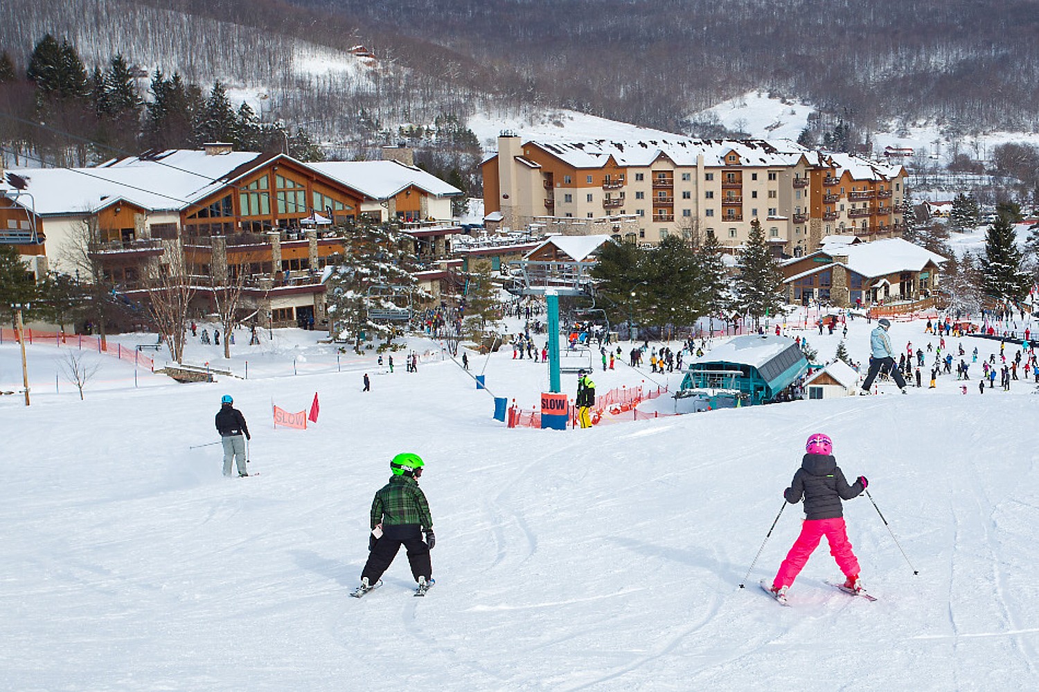
West Mountain

Nestled at the foot of the Adirondack Mountains, conveniently accessed just off I-87,  West Mountain towers over Glens Falls in Albany’s backyard, and with night skiing, is popular with people getting in a few runs after work.

Family-owned and operated, West Mountain continues to evolve to meet the needs of families as well as skiing and riding loyalists and year-round outdoor enthusiasts.

West Mountain offers a 1010 vertical drop from the 1470 ft. summit, 31 trails on 124 skiable acres (36% beginner, 55% intermediate, 9% advanced, one terrain park), accessed by four lifts, with night skiing on 105 acres. Also a tubing park with 10 lanes of tubing for all ages and abilities. 6-packs are for sale now that provide 6 tubing tickets, lift tickets or aerial treetop adventure tickets for the price of 5.  

The mountain staff has been focused on creating new, safe and innovative operations and programs to run this season including: a new Freestyle Development Program; a new Alpine Racing Academy for U12+ athletes; Learn to Ski and Snowboard packages for youth and adult first-time beginners. During non-holiday periods, West Mountain will offer popular ticket promotions such as Monday and Tuesday 4-hour ticket specials and breakfast or lunch plus lift ticket specials.

West Mountain has introduced new programs this year including freestyle skiing (photo by FreesrideMedia for West Mountain)

The resort has been open throughout COVID-19 pandemic offering safe, outdoor and socially distanced activities. For this season, there are additional outdoor eating and seating areas, warming tents, grab-n-go food and beverage windows, additional outdoor restrooms and controlled capacity at the two separate base-lodge areas (Main Base Lodge and Northwest Base Lodge).

West Mountain, 59 West Mountain Road, Queensbury, NY 12804, 518.636.3699, WestMountain.com

Mount Peter

Mount Peter, set in picturesque Warwick Valley, is the oldest operating ski area in New York State, and one of only a few remaining family-operated ski areas in America. For more than 80 years, Mount Peter has been a wintertime destination for skiing or snowboarding on 14 expertly groomed trails, 600-foot tubing run (separate Little Tikes tubing for kids under 42”), and night skiing.

Booking online is highly recommended.

Mount Peter, 51 Old Mt. Peter Road, Warwick, NY 10990T: (845) 986-4940, info@mtpeter.com, mtpeter.com

Bristol Mountain

Bristol Mountain, in Canandaigua, opened for their 56th season of operation. Located in the Western Finger Lakes Region, it offers 38 trails on 138 acres of skiable terrain and a 1200’ vertical drop from a 2200 ft. summit, accessed by six lifts including two high-speed quads. The terrain accommodates all ages and ability levels with 32% reserved for beginner, 50% intermediate and 18% advanced, including 97% lighted for night skiing terrain and 97% snowmaking coverage; the longest run is 2 miles.

Bristol Mountain has a top notch learning center, as well as two terrain parks that cater to all ability levels and 3 km of Nordic trails.

Bristol Mountain’s North Star Village Townhouses offer affordable ski-in/ski-out lodging with built in deals with their Ski & Stay programs.

Located in the Western Finger Lakes Region, Bristol Mountain offers 38 trails on 138 acres of skiable terrain and a 1200’ vertical drop from a 2200 ft. summit, accessed by six lifts including two high-speed quads (photo provided by Bristol Mountain)

Capacity at the mountain will be monitored and limited on busy days or when the mountain has limited terrain (i.e. early season). Reservations will be required for card products and lift ticket sales but currently will not be required for season pass products that allow direct- to-lift access (picture passes).

Lodge capacity will be limited this winter. Guests are asked to limit their time in the lodges to 15-30 minutes to warm up and use the restrooms. The mountain requests that guests arrive prepared and use their vehicle as their base lodge.                                                     

Bristol Mountain, 5662 Route 64, Canandaigua, NY 14424, 585-374-6000, fun@bristolmt.com, bristolmt.com.

Thunder Ridge Ski Area

Thunder Ridge Ski Area, located in Patterson, NY, may be the closest and easiest ski areas to reach from NYC, just 60 minutes drive from and accessible on Metro North (shuttle from Patterson train station). Thunder Ridge offers 100 percent snowmaking coverage on its 22 trails on 100 acres (40% beginner, 40% intermediate, 20% advanced, the longest run is 0.4 miles). A gentle mountain, it has a 500 ft drop from the summit at 1270 ft. Night skiing.

Thunder Ridge, 12563 Patterson, NY, 845-878-4100, thunderridge@cyburban.com. https://thunderridgeski.com/

Holiday Valley

Holiday Valley, Ellicottville, NY (50 miles south of Buffalo) is Western New York’s largest year ‘round resort featuring 60 slopes and trails and features a mountain coaster (photo provided by Holiday Valley).

Holiday Valley, Ellicottville, NY (50 miles south of Buffalo) is Western New York’s largest year ‘round resort featuring 60 slopes and trails, 13 lifts, 3 base lodges, slope side lodging and dining, conference facilities, a tree top aerial adventure park and a mountain coaster, and 18 hole golf course. 

Holiday Valley is in compliance with New York State’s COVID restrictions on operating the ski terrain and indoor services. Masks are required at all times except when skiing down the slope or while seated to eat or drink. Reduced capacity in the lodges and eating areas, as well as spacing in the lift lines and on the chairlifts will allow for proper social distancing. Advanced purchase of lift tickets online is encouraged, especially on holidays and busy weekends. Cleaning and sanitizing practices have been stepped up in the lodges, in the food service areas and in the restrooms. Guests are encouraged to limit their time spent indoors.

Holiday Valley, 6557 Holiday Valley Road, Route 219, Ellicottville, NY 14731, 716-699-2345, www.holidayvalley.com

Holimont Ski Area

Holimont, nestled in the foothills of the Allegheny Mountains, is a private ski area with member families from the United States and Canada. Non-members may use the facilities on non-holiday weekdays, and new members are welcome. It offers a 700 ft. drop from 2260 ft. summit, 55 trails on 135 skiable acres (25% beginner, 31% intermediate, 44% advanced, ), 3 terrain parks, longest run is 1.5 miles,  (100% snowmaking)

Holimont, Ellicottville NY 14731, 716-699-2320, info@holimont.com, holimont.com

Hunt Hollow Ski Club

Located near Naples, New York (near Rochester), Hunt Hollow Ski Club offers 400 acres of accessible winter recreation space. With an 825-foot vertical drop from a 2030 ft. summit, it offers 19 trails over 400 skiable acres (32% beginner, 21% intermediate, 37% advanced, 11% expert), accessed by a triple-chair, double-chair, T-bar and a surface lift service (100% snowmaking). There is night skiing. Also, 2.5 miles of Nordic trails and a terrain park.

Hunt Hollow Ski Club, 7532 County Road 36, Naples NY 14512, 585-374-5428, info@hunthollow.com, hunthollow.com.

An excellent source: https://www.onthesnow.com/new-york/ski-resorts.html.

For more information, contact ISkiNY.com.

______________________

© 2020 Travel Features Syndicate, a division of Workstyles, Inc. All rights reserved. Visit goingplacesfarandnear.com, www.huffingtonpost.com/author/karen-rubin, and travelwritersmagazine.com/TravelFeaturesSyndicate/. Blogging at goingplacesnearandfar.wordpress.com and moralcompasstravel.info. Send comments or questions to FamTravLtr@aol.com. Tweet @TravelFeatures. ‘Like’ us at facebook.com/NewsPhotoFeatures

Catching the Peak Fall Foliage in New York State’s Adirondack Mountains

Stunning rock formations atop Chimney Mountain in New York’s Adirondack Mountains, made all the more spectacular by fall foliage colors © Karen Rubin/goingplacesfarandnear.com

By Karen Rubin and Dave E. Leiberman

Travel Features Syndicate, goingplacesfarandnear.com

We literally raced up to catch the peak fall foliage colors in the dramatic, spectacular setting of New York’s Adirondack Mountains.

There are so many different hiking trails, we wanted to make the best choices for a one-day adventure. Researching potential hikes, I found The Adirondack Experience, which lists hikes in categories, one of which is “best summit views” and excellent descriptions (also alltrails.com gives precise maps, elevations). That wasn’t enough for me to pin down, so I called Adirondack Experience, to get the low-down on the trails to high peaks. They also offer a fall foliage report, as does New York State (www.iloveny.com).

We set up an itinerary that would allow us to do two hikes to summits affording 360-degree views, in one sensational day:

View of the Adirondack Mountains at peak fall foliage from the summit of Chimney Mountain © Karen Rubin/goingplacesfarandnear.com

Chimney Mountain: The extraordinary appeal here are the geologic formations at the top, a maze of caves and crevices, after an invigorating mile-long climb (entirely uphill), before you get to the true summit, a smoothed, mostly flat boulder, reached via a quarter-mile long herd path. “Chimney Mountain has unique features due to a large proportion of soft, sedimentary Grenville layers that have made passageways, cliffs, boulders, and caves. View the large geologic depression that was formed when the Western Rift separated from the Eastern Rift.” The hike, three-miles round trip (in/out), is a 870-foot ascent to 2721-foot elevation. Plan on 3 hours (bring water, face mask, and take into account that it gets dark in the woods before the sunset). (Big Brook Road, Indian Lake, NY, 12842, 518-548-3076, info@adirondackexperience.com, www.adirondackexperience.com/hiking/chimney-mountain).

View from the summit of Chimney Mountain at peak fall foliage. © Dave E. Leiberman/goingplacesfarandnear.com

We came down and had ourselves a picnic lunch before setting out for our afternoon hike, about 30 minutes further drive, at Castle Rock, above Blue Mountain Lake. By the time we arrived, the drizzle which started just as we got back into the car turned into an actual rain when we were on the trail. But no matter, we were determined to forge on. This trail is a 3.2 mile long loop with a steady rise, but more gradual than Chimney Mountain – that is, until the last one-tenth mile that involves a scramble up over and between boulders, made more challenging (and therefore satisfying), by the slippery leaves (young kids would have no problem). But so worth it (and really satisfying to have accomplished it)! The rock formations here at the top are absolutely fabulous. Amazingly, just as we got to the summit – another relatively flat boulder – the rain turned to drizzle and then stopped altogether, allowing the sun to poke through, making the wet rock surface glisten. The views of Blue Mountain Lake, with its several tiny islands, and Blue Mountain, with other mountain peaks in the near and far distance, are stunning.

View from the summit of Castle Rock with the Adirondacks at peak fall foliage, rocks glistening with rain © Karen Rubin/goingplacesfarandnear.com

The summit is about at the half-way mark of the loop. At about the 1.5 mile mark, there is a sign that directs you to the summit, only a little disconcerting to realize you have another half-mile to go.  It’s 1.8 miles up on the less steep part of the trail, 1.4 miles on the other side, which goes past fabulous rock formations. (So glad we opted to do the full loop, instead of returning on the 1.8 mile side to avoid a steeper descent, but it actually wasn’t bad at all, even with the slippery leaves. I’ve cultivated a technique of hanging on to trees and branches to swing down, or climb down, or sit down and dangle my feet, and I really value my hiking poles.)

Tackling the scramble to the Castle Rock summit © Karen Rubin/goingplacesfarandnear.com

This is one of the most popular hikes in the area, so people are advised to get here early to get parking at the trailhead (Maple Lodge Road, Blue Mountain Lake). Also, on all of these hikes, wear a face mask and respect social-distancing when people are passing.

The Adirondack Fall Foliage Meter (www.adirondacksusa.com/fall) provides up-to-the-minute fall foliage reports on where the leaves are prettiest and most colorful.  

More sources: Adirondacks Regional Tourism, visitadirondacks.com; Hamilton County Tourism, adirondackexperience.com, 800-648-5239.

Hiking up to Chimney Mountain © Karen Rubin/goingplacesfarandnear.com

Since the Adirondacks are about a five-hour drive from the downstate metro area, people are flocking to Lake George and the surrounding area for accommodations which has maintained very strong occupancy. There are also any number of cabins, lodges, Airbnb’s to choose from, many with exquisite views along one of the many, many scenic lakes. At the trailhead to Chimney Mountain, in fact, there are rustic cabins.

High Peaks Resort in the heart of Lake Placid offers three different lodging experiences overlooking Mirror Lake and the Adirondack Mountains: The Resort, a traditional hotel with 105 guest rooms and suites (newly renovated earlier this year); the modern retro-vibe Lake House with 44 guest rooms; and the private and serene Waterfront Collection with 28 guest rooms including 10 suites on the shores of Mirror Lake. Take a break from studying or work with a dip in the indoor or outdoor pool, paddling Mirror Lake, hiking, biking, golfing. Dogs are welcome, with special canine-friendly treats and amenities. Save up to 30 percent with the Best Dates, Best Rates package, with rates from $125 per night (www.highpeaksresort.com).

Coming down from the summit at Castle Rock (c) Karen Rubin/goingplacesfarandnear.com

Foliage in the Catskills: Find vibrant fall colors on a hike along the Hannacroix Creek Preserve (www.greatnortherncatskills.com/outdoors/hannacroix-creek-preserve-hcp) in New Baltimore—featuring 113 acres of trails and scenic vistas—or explore the RamsHorn Livingston Sanctuary (https://www.greatnortherncatskills.com/outdoors/ramshorn-livingston-sanctuary) in Catskill, which is home to a wide variety of wildlife and plant life along more than three miles of trails. For exhilaration on your quest for foliage, try mountain biking along the Tannersville-Hathaway Trail System (https://www.greatnortherncatskills.com/outdoors/tannersville-hathaway-trail-system)  in Tannersville—suitable for beginners and experienced riders alike. To get the latest update on colors in the region, check out the Catskills’ fall foliage meter (www.greatnortherncatskills.com/catskills-fall-foliage).  

Connect with nature while camping at Purling Waters (www.greatnortherncatskills.com/camping/purling-waters), a fully-equipped campsite accommodating up to 6 campers, located along the banks Shinglekill Creek. For a historic stay, try Tumblin’ Falls House (www.greatnortherncatskills.com/resorts-lodging/tumblin-falls-house). The house, offering 5 guest rooms in an 1890s Dutch Victorian perched on a cliff overlooking Shinglekill Falls, has a tree level spa overlooking falls, natural pools, garden and trails.

To keep tabs on the progress of fall foliage in New York State, www.iloveny.com/things-to-do/fall/foliage-report.

See more information on where to go, what to do in New York, www.iloveny.com, 800-CALL- NYS, info@iloveny.com.

______________________

© 2020 Travel Features Syndicate, a division of Workstyles, Inc. All rights reserved. Visit goingplacesfarandnear.com, www.huffingtonpost.com/author/karen-rubin, and travelwritersmagazine.com/TravelFeaturesSyndicate/. Blogging at goingplacesnearandfar.wordpress.com and moralcompasstravel.info. Send comments or questions to FamTravLtr@aol.com. Tweet @TravelFeatures. ‘Like’ us at facebook.com/NewsPhotoFeatures

Driveable Adventures: Hiking/Camping in the ‘Grand Canyon of the East’ – NY’s Letchworth State Park

Letchworth State Park, New York © Karen Rubin/goingplacesfarnandnear.com

by Karen Rubin, Dave E. Leiberman & Laini Miranda

Travel Features Syndicate, goingplacesfarandnear.com

It doesn’t take long once you arrive at New York’s Letchworth State Park to see why this vast preserve merits its nickname, “Grand Canyon of the East.” One of the most dramatically scenic areas in the eastern United States, the Genesee River roars through a humongous gorge that extends the 17 mile-long expanse of the park, over three major waterfalls between cliffs as high as 600 feet, surrounded by lush forest.

Ever since I saw a poster of Letchworth State Park while riding the Long Island Railroad, I said, “Where is that!” So when our plan to camp and hike in the Southwest fell apart this year and feeling safe staying within New York State which has so scrupulously monitored and imposed safety conditions to contain the coronavirus, we sought out a comparable adventure driving distance from home: Letchworth is just south of Rochester in western New York in appropriately named Wyoming County.

Letchworth State Park, New York © Karen Rubin/goingplacesfarnandnear.com

Our camping trip was made all the more special by staying in the campground within the state park that had only just reopened (private campgrounds, such as Kampgrounds of America, koa.com, are also available in the area) – so we could cook our dinner in the most spectacular settings – dinner with a view and be in prime places for the early light. (I booked our stay mere minutes after the website, reserveamerica.com, reopened reservations.)

During the two full days we were there, we hiked the most scenic, marquee trails: the Gorge Trail (#1), 7.6 miles following along the rim in the southern portion of the 17-mile long park, and the next day, the Highbanks Trail (#20), 4.5 miles along the rim and through forest in the north part of the park. Indeed, these hiking experiences were reminiscent of hiking the Rim Trail along the southern rim of the Grand Canyon.

Letchworth State Park, New York © Karen Rubin/goingplacesfarnandnear.com

Letchworth State Park, (voted best attraction in New York State in 2017) is a geologic wonder. Its main attractions are three waterfalls (and if you visit in the late afternoon, you may well see rainbows over the Middle Falls) in the southern section. The trails take you to the most popular, scenic overlooks, which people can drive to, so they can be bustling with visitors (when we visited, people seemed to be respectful of wearing masks and keeping distance). This is another reason why camping in the park is such an advantage – the driving tourists tend to arrive at mid-day, so you can get out early and have these spectacular scenes almost to yourself.

If you do the hike early in the morning, do it from north to south. It’s out-and-back, so to avoid doing the 7.6 miles twice (that is, 15 miles), you can leave a second car or a bicycle at the end (as we did).

Letchworth State Park, New York © Karen Rubin/goingplacesfarnandnear.com

The park is huge, about 17 miles long (it takes about 20-30 minutes to drive from the campground to the Upper Falls along the Park Road which is narrow, winding and rolling with dips and rises) to the Upper Falls area. Indeed, the park is so narrow that the hiking trails are just alongside the road, separated in most instances by curtains of trees.

Letchworth State Park, New York © Karen Rubin/goingplacesfarnandnear.com

The Gorge Trail, in the south, brings you to the most spectacular views – Upper Falls and Middle Falls in quick succession, then Lower Falls. The real surprise is coming upon Wolf Creek waterfall and a bridge with a painterly scene. Along the way you come upon these stunning stone look-outs at Inspiration Point, Archery Field Overlook, Great Bend Overlook, Tea Table lookout, which also have stone tables and BBQ set-ups.

Letchworth State Park, New York © Karen Rubin/goingplacesfarandnear.com

The Highbanks trail in the north section doesn’t have the awesome waterfalls, but is very special in its own way, providing the expansive vistas that evoke awe over just how enormous and winding this gorge is (respect for Mother Nature’s power) and why Letchworth has been dubbed the “Grand Canyon of the East.” Here, the hike brought us into stunning woods where the forest itself makes a painterly canvas.

View from Hogs Back on the Highbanks Trail, Letchworth State Park, New York © Karen Rubin/goingplacesfarnandnear.com
Letchworth State Park, New York © Karen Rubin/goingplacesfarnandnear.com

We started at the absolutely stunning overlook at Hogs Back (where we parked our car for the hike), going south about 2.5 miles, then reversing and going north from Hogs Back, you walk along the ridge, sometimes almost hanging over the gorge, until you come to the Mt. Morris Dam Overlook. The treat here comes at the end, at the Mt. Morris Dam Overlook Area, where there is a delightful snack bar serving excellent ice cream.

Letchworth State Park, New York © Karen Rubin/goingplacesfarnandnear.com

Two of the trails that I believe was closed during our visit, but definitely recommended is the Footbridge Trail that brings you down to the Lower Falls (#6A), just a half-mile long but rated “moderate” and the Portage Trail (#6).

Footbridge, Letchworth State Park, New York © Karen Rubin/goingplacesfarnandnear.com

Altogether, the park offers 66 miles of trails (almost all rated easy or moderate, and most on the west side of the park). But for hard-core hikers, there is a 22-mile Finger Lakes Trail that runs along the entire eastern section of the park

Letchworth State Park, New York © Karen Rubin/goingplacesfarnandnear.com

I tried to research in advance to find the best places for sunrise and sunset photos, which of course depends on season and weather. I wasn’t able to get any sunrise or sunset photos, but the late afternoon light proved best at the Upper Falls and Middle Falls (where rainbows seem not uncommon as the sun lowers and sends its rays through the mist).

Letchworth State Park, New York © Karen Rubin/goingplacesfarnandnear.com

Instead of eating at the campsite (not that scenic, but very pleasant for sleeping and breakfast), we kept our food in the cooler and equipment in the car and each evening would pick out a different setting – dining on tables with slate tabletops apparently taken from these very cliffs. David would haul out his Coleman stove and tiny propane tank, his culinary tools, cutting board, and perform his culinary magic. We dined at the appropriately named Tea Table the first evening, Wolf Creek the second evening, which proved our favorite, with a virtually private view of a sweet waterfall, that we discovered on our hike. We were going to have our third night’s dinner overlooking the Upper Falls, but realized this is the most popular part of the park, and since a priority was to avoid possible exposure to lingering COVID germs, we decided to return to Wolf Creek which we again had all to ourselves.

Wolf Creek, Letchworth State Park, New York © Karen Rubin/goingplacesfarnandnear.com

Each evening we returned to the campsite and David and Laini made a fire (s’mores for dessert!). The peace of this place, with tall trees opening to a blanket of stars, and fireflies darting about as if they were Superflies! or shooting stars, was perfect and priceless.

Highbanks Campground, Letchworth State Park, New York © Karen Rubin/goingplacesfarnandnear.com

Letchworth, which was voted USA Today’s Reader Choice for Best State Park in the nation in 2015, is well maintained, especially during this heightened COVID-19 health emergency. The campground restroom facility was very clean, and all the restrooms (they indicate which are open), require masks and social distancing.

Letchworth State Park, New York © Karen Rubin/goingplacesfarnandnear.com

Our plan for this trip was to be completely self-sufficient so we wouldn’t have to worry about getting water or food, not knowing if places would be open to buy supplies and wanting to cut down our interactions as much as possible. We took enough supplies for our three days, though we did discover that by the time of our trip, this region of New York had achieved Phase 4 reopening, so places were open though with significant limitations, including the Highbanks Camp Stores. (Concessions also were at the Dam Overlook Cafe and Highbanks Pool Snack Bar on the North end; Letchworth Gift shop, Lower Falls, upper Falls Snack Bar.)

(Indeed, for the foreseeable future, travel will involve more planning and forethought, checking ahead what will be open and under what conditions; as a general rule, some places are requiring advance reservations or timed-ticketing.)

Mount Morris Dam, Letchworth State Park, New York © Karen Rubin/goingplacesfarnandnear.com
 

The Highbanks campground is wonderful – six miles from the entrance, and several more miles to get to the actual camping loops for tents and RVs. There are also cabins. Several areas accommodate pets.

There are also a few cottages and lodges available within the park. For a family vacation rental experience, the Maplewood Lodge, located at the entrance to the Highbanks Camping Area, sleeps up to eight and has a furnished kitchen, living room with working fireplace, TV and DVD/BluRay player and formal dining room.

Camping was one of the attractions for us to come to Letchworth at this time (so many are choosing camping and RVing and even AirBnBs over commercial hotels), but the park also offers the charming Glen Iris Inn, scenically set right above the Middle Falls.

Glen Iris Inn, Letchworth State Park, New York © Karen Rubin/goingplacesfarnandnear.com

An inn since 1914, the historic Glen Iris Inn was formerly the country estate of William Pryor Letchworth. Completely restored, the inn offers accommodations and is open to the public for breakfast, lunch and dinner (banquet and catering services are available for special events). We see people dining on the lovely veranda, as well as in an enormous tent set up on the lawn to further accommodate those preferring to dine al fresco.

Addressing this historic moment, rooms are sanitized with an electrostatic cleaning machine and sealed for the guest’s arrival; capacity in Caroline’s Dining Room is limited to 50%. In addition to rooms in the Inn, the Glen Iris also offers some cottages (585-493-2622, glenirisinn.com).

Just across from the inn is the small stone William Pryor Letchworth Museum which tells the fascinating story of Letchworth Park, paying tribute to William P. Letchworth who preserved the land and its heritage by donating it to the state. The museum tells the history of the Genesee Valley, the canal, and of the Seneca who lived on these lands. Letchworth’s personal collection of artifacts from local Native American tribes is on view.

The museum also relates the compelling story of Mary Jemison, “The White Woman of the Genesee,”  born on a ship from Europe in 1743 and kidnapped from her home in Pennsylvania in 1758 by Shawnee, then sold to the Seneca who adopted her into the tribe, becoming Dehgewanus. (Trail #2 is named the Mary Jemison Trail, the creek is named De-ge-wa-nus Creek and there is a statue of her, erected by Letchworth not long after her remains were brought back from a reservation and reburied on his estate, that Letchworth dedicated to her memory in 1910; read her remarkable story: http://www.letchworthparkhistory.com/jem.html)

We didn’t have the opportunity to visit the museum during our visit, but is one of the top items on our list for our return.

Letchworth State Park, New York © Karen Rubin/goingplacesfarnandnear.com

We also did not get a chance to explore the Humphrey Nature Center which in normal times, offers year-round environmental education programming and interactive exhibits highlighting the geology, wildlife, and ecology of the park.

Highbanks Trail, Letchworth State Park, New York © Karen Rubin/goingplacesfarnandnear.com

Letchworth State Park offers many recreational facilities and activities that were just beginning to reopen at the time of our visit – including nature, history and performing arts programs, guided walks, tours, a summer lecture series. The enormous Highbanks Recreation area has a pool. And since our visit, the park opened a new $2 million outdoor Lower Falls Recreation Center offering table games, badminton and pickle ball courts, bocce and shuffleboard, as well as a fitness loop.

Highbanks Trail, Letchworth State Park, New York © Karen Rubin/goingplacesfarnandnear.com

The project also involved restoration of a historic bathhouse that is used as the base for the whitewater rafting concessionaire, Adventure Calls Outfitters (https://adventure-calls.com/). Letchworth also offers  kayaking, there is even hot air ballooning (https://balloonsoverletchworth.com/). 

A half-dozen trails allow biking (I wouldn’t recommend biking on the main Park Road), and there is horseback riding as well.

Middle Falls, Letchworth State Park, New York © Karen Rubin/goingplacesfarnandnear.com

Letchworth State Park is open year-round – the fall colors look spectacular, as do the winter scenes when there is cross-country skiing on most of the trails, snowmobiling on four trails, and snow tubing. Winterized cabins are available.

To book a spot in the state campground, go to https://newyorkstateparks.reserveamerica.com/.

Letchworth State Park, Castile, NY 14427 (there are several entrances, but Mt. Morris Entrance is closest to the highway; check out the wonderful antique shops in Mount Morris); 585-493-3600, letchworthpark.com.

Letchworth State Park, New York © Karen Rubin/goingplacesfarnandnear.com

New York State Office of Parks, Recreation and Historic Preservation oversees more than 250 parks, historic sites, recreational trails and boat launches, which were visited by a record 77 million people in 2019. A recent university study found that spending by State Parks and its visitors supports $5 billion in output and sales, 54,000 private-sector jobs and more than $2.8 billion in additional state GDP. For more information on these sites, call 518-474-0456 or visit parks.ny.gov.

______________________

© 2020 Travel Features Syndicate, a division of Workstyles, Inc. All rights reserved. Visit goingplacesfarandnear.com, www.huffingtonpost.com/author/karen-rubin, and travelwritersmagazine.com/TravelFeaturesSyndicate/. Blogging at goingplacesnearandfar.wordpress.com and moralcompasstravel.info. Send comments or questions to FamTravLtr@aol.com. Tweet @TravelFeatures. ‘Like’ us at facebook.com/NewsPhotoFeatures

See America: Cruise the Erie Canal across New York State by Self-Skippered Canalboat

Erie Canal Adventures rents Lockmaster canalboats that let you cruise fancy free on the Erie Canal, New York State (c) Karen Rubin/goingplacesfarandnear.com.

By Karen Rubin
Travel Features Syndicate, goingplacesfarandnear.com

If you want to see how America came to be, travel along the Erie Canal. A marvel of engineering when it was opened in 1825, the canal, which spans 353-miles from Albany to Buffalo, creating a water highway for commerce from the Midwest through New York City to the rest of the world, remains a dazzling achievement. But it was also the artery and an engine for invention, innovation, economic development, and ultimately social and political movements. Bike along the Erie Canalway (now virtually uninterrupted and part of the 750-mile Empire State Trail; there are several bike tour companies that offer inn-to-inn bike trips), but to really get the sense of it, float along the canal, tying up at the small towns and major cities that the canal birthed, and see unfold before you all the major social and economic movements that made America: immigration, labor, abolition and civil rights, women’s rights.

A few years ago, I had that opportunity, and in this time when people are shunning cruising because of the coronavirus pandemic but embracing RVs, renting your own self-skippered, specially-designed Lockmaster canal boat offers the best of those worlds. Founded decades ago as Mid-Lakes Navigation by Peter Wiles who designed the Lockmaster canalboats and was a significant force in repurposing the Erie Canal from commercial to recreational use, the company, Erie Canal Adventures, is now in the hands of Brian Kennan, and . And even though you are still in New York State, the sights and experiences are as interesting and exciting as sailing the canals of Europe.

The company has made accommodations for COVID-19 – sanitizing the compartments so that there is a tape over them until the passengers arrive; instead of cooking utensils and “hard goods” being kept on the boat, they are taken off after each trip, sanitized and provided to guests in a sanitized tote when they arrive.

The orientation is still done on the water – the guide wears mask and gloves – to take you through one of the canal locks (thrilling), but the orientation that would have been done in the cabin is now offered by video.

Bikes are still provided but they are taken off the boat after each cruise, sanitized and replaced for each trip.

This part of New York State is already in Phase 4 – meaning that there is indoor and outdoor dining (with social distancing), many of the museums and attractions have reopened like the George Eastman Museum and the Strong Museum (with limits on capacity). In the various canal towns, you won’t have any trouble finding groceries or restaurants. And New York State has been successful containing the spread of illness and turning from the worst infection rate to the lowest in the country, because New Yorkers have scrupulously adhered to using masks and social distancing. (Now, to prevent any reemergence, the state is imposing a 14-day quarantine on visitors from states where COVID-19 rates are surging.)

Cruising the Erie Canal in a Lockmaster canal boat, as cyclists ride the towpath (c) Karen Rubin/goingplacesfarandnear.com.

I am at the helm of a 41-foot canal boat, a boat so enchanting and lovely, it turns heads and evokes waves, smiles, and snapped photos as it chugs pleasantly along at a top speed of 6 mph.

From this vantage point, I can appreciate this marvel of engineering, of grit and ingenuity the Erie Canal was, the vital role it played in the United States’ emergence as an Industrial giant in the 19th century and a dominant economic power in the 20th century.

There is no place in the United States like the Erie Canal, and no experience like having your own self-skippered canal boat – our floating home for the week – and a bicycle with which to explore the towns that were literally birthed by the canal. And to a New York City kid, seeing this bucolic countryside is a revelation. (“This is New Yawk!”)

It is extraordinary and thrilling to travel on the 363-mile long Erie Canal that slices through New York State and played such a vital part in the nation’s history, especially as we go through locks that are filled for us, and under bridges that must be lifted for us to pass.

Most of all, it lets us explore and appreciate the extraordinary innovation and ingenuity that developed because of the Erie Canal, the villages and towns, the factories and businesses that developed, and how the canal turned New York City into a global financial capital, and united the East with the West, how it funneled thousands of immigrants who populated the Midwest.

This is a true adventure. One where there are new discoveries, new insights, new perspectives formed with every new encounter. The Erie Canal birthed these places and now we see how they are being reborn, revitalized.

Going through one of the locks on the Erie Canal, New York State (c) Karen Rubin/goingplacesfarandnear.com

Setting off on our first morning, I have rarely felt that exhilarating sense of being so fancy free – to not have a set itinerary or schedule or even know where I am going or what I will see, but to have the power and ability just go where your curiosity leads. It is a marvelous.

We had trepidation about navigating the boat – a 41-foot long houseboat, like a floating RV – docking and most intriguingly going through the locks along the canal. But when we arrive, we get a two-hour orientation – every aspect about operating the boat, plugging in to electricity and water; how to turn on the engine, the stove, the shower, flush the toilet; how to recharge the batteries by running the engine in neutral; how to operate the radio and the correct protocol when contacting bridge and lock operators to “request passage”.

We are taken on a “shake-down” cruise that includes going back and forth through a lock. We are provided with a chart book and a handy sheet that lets you approximate how many hours between ports (important to keep track of the hours the lift operator is available).

Key advice: “Don’t approach anything faster than you would care to hit it.” The steel-hulled boat is powered by a 50 horsepower diesel engine; its top speed is 6 mph, and it weighs 11 tons “so you can’t get into trouble,” we are told.

The canal boat is outfitted with just about everything you might need – from ponchos to potholders to paper towels. There is even a grill and BBQ tools and canisters of propane. There are safety devices, a tool kit, even a sewing kit.

Our boat, the Canadice, is 41 feet long and can sleep 4 people (one double bed and two bunk beds in the galley; a well designed galley kitchen with small refrigerator and freezer; a shower; a table and sitting area in the bow), suitable for a family; the largest Lockmaster can accommodate 6 adults.

Within moments, the thrill of what this is all about floods over me: This is a real adventure, where have to do everything yourself, not have it done for you, make decisions.

Going through a lock on the Erie Canal: the lock tenders are extremely helpful (c) Karen Rubin/goingplacesfarandnear.com

As we sail along, I reflect on how lovely this boat is: the gorgeous knotty pine wood detailing; the varnished wood seats and a railing that makes for a back rest as you hold the tiller, brass and varnished wood. The cabin is beautiful knotty pine. It has a canvas canopy over the helm and even on a hot day, the breezes as we travel are delightful. The bow has screens with plastic and canvas that zip and snap easily so we can close everything up in the event of rain and a table that can even be moved inside.

The design for the Lockmaster came from Peter Wiles, Sr., who was a key architect of the transition of the Erie Canal from commercial to recreational use. He had a small tour boat business on Skaneateles Lake and went to England to see the self-skippered canal boats that operated on the Thames, and brought back the concept for boats that he would design and build here.

Wiles took the charm and the traditional design but adapted the boat to the Erie Canal, with a wider (roomier) beam, mostly flat bottomed and do not have a keel (the Erie Canal is only about 12-feet deep and is actually filled and drained each season). He founded the MidLakes Navigation company which, when we visit, is run by his children, Sarah and Peter Wiles (the company has since been acquired and renamed Erie Canal Adventures).

Fairport

We soon get the hang of piloting the boat, and after a couple of hours sailing, we come to Fairport, a most charming town, with shops and restaurants right along the canal. It is a picture-perfect model of revitalization.

Fairport did not exist before construction of the Erie Canal dried up a swamp and produced a “fair port” for travelers. “Commerce thrived as entrepreneurs turned ideas into products,” says one of the best guides to this portion of the canal, “100 Must See Miles”

Henry Deland’s mansion is now the Green Lantern Inn, Fairport, one of the canaltowns on the Erie Canal (c) Karen Rubin/goingplacesfarandnear.ccm

One of these entrepreneurs was Henry Deland who had the idea to produce baking soda from wood ash. The building right on the canal and next to the bridge where there is now a delightful Towpath Cafe was where Deland manufactured his baking soda which was transported by canal to international markets.

Just up Main Street, on the south side of the canal, I find the Deland Mansion, built in 1876. After Deland made his fortune in Fairport, he bought land and founded Deland, Florida in 1876, which he thought to build into a citrus, agricultural and tourism center. He sold his northern business and hired people to clear land, lay out streets, erect buildings and recruit settlers, most from upstate New York; he lost his fortune in an orange freeze in 1885.

The mansion is magnificent: Second Empire style with tower, porches, fireplaces, it was one of the grandest private residences in western New York. After several private owners, including the Clark Family, the Deland Mansion opened as the Green Lantern Inn sometime after 1928, and served as a restaurant, speakeasy, rooming house, banquet hall.

The mansion is across from the First Baptist Church, which was built at same time as Deland built his mansion.

Each of the canal towns we visit has done a superb job of using historical markers and photos to illustrate the “then and now.” As we follow them, it is like a story that unfolds.

At Fairport, there is a marker that shows how Old South Main Street “yields to urban renewal: Commercial block changes from necessities to niceties.”

The beauty of the canal boat is that you can organize the day around what you want to do – whether it is to just hang out in a town – perhaps visit a museum. Our main purpose is to position us to bike the towpath. And so we tie up the Canadice at Fairport, take down our bikes from the roof, and head out about 7 miles to the next major town, Pittsford, along the canal bikeway. It is one of the prettier rides, with lovely homes on the canal.

The Great Embankment, Erie Canal, New York (c) Karen Rubin/goingplacesfarandnear.com

Just before Pittsford, we cross over a mile-long section called “The Great Embankment.” This is the highest canal embankment, actually built over the Irondequoit Creek which rushes through a tunnel under the canal.

In the earliest days of the Erie Canal, the embankment thrilled both onlookers and passengers as boats seemed to travel in midair over the mile-wide valley created by the Irondequoit Creek. The canal has been rebuilt three times since it originally opened in 1823. The original canal was a mere four-feet deep and 40-feet wide; three times it was enlarged, made deeper (first 7 feet deep and 70-feet wide, then 12-feet deep and 120-feet wide), and in many cases, moved entirely to make a better route as boats became motorized.

This is our first introduction to the engineering of the Erie Canal. I really hadn’t even thought of the canal as having a false bottom, that the canal is actually drained (around November 1), and refilled (around May 1) each season.

The Great Embankment is a revelation, but we will find even more dramatic examples of engineering, as we explore by bike and boat.

We return to Fairport, and prepare to get underway again – actually boating back to Pittsford.

It’s just passed 6 pm when we leave Fairport.

But to leave Fairport, you have to go under a lift bridge, and Fairport’s is very distinctive: it is constructed with no right angles.

Bridge at Fairport (no right angles) lifts for us to sail under, on the Erie Canal, New York State (c) Kaaen Rubin/goingplacesfarandnear.com

There are 16 lift bridges on the Erie Canal, all of them in the west, and the eastern-most one is here at Fairport. The bridges are delights to look at – they have ornate towers and it is wonderful to watch how they work.

We have been instructed on the etiquette of using the radio to ask the lock tender to lift a bridge or open a lock. Some are covered by operators handling multiple bridges, so you might be told to standby and wait for the operator to get back to the bridge. (take note of the hours of operation – westward from Macedon toward Buffalo, the locks are open 7 am to 10 pm; eastward to Lake Oneida in Syracuse (the boats do not go all the way to Albany), the lifts operate 7 am to 7 pm).

Pittsford

We tie up for the night at Port of Pittsford Park, right below the Main Street Bridge (there is no charge but some of the ports along the canal charge up to $15 to overnight).

We stroll the charming streets (and there are some gorgeous residential streets as well), and see what an affluent community Pittsford is. Old money and new money poured in over the last 15 years to revitalize the downtown area.

Pittsford was settled in 1789 by Revolutionary War veterans, but it was the Erie Canal that first brought prosperity to the town, because it facilitated transport to market of tons of heavy gravel from the nearby hills.

We see stunning Victorian-era buildings – the Phoenix Hotel, built in 1812 in the Federalist style, 1812 to serve the Erie Canal and Turnpike trade, restored 1967 as an office building across from the Town Hall, dated 1890. There is also the Canal Lamp Inn, a stunning Victorian, right beside the canal bridge. (Self-guided walk through Pittsford, villageofpittsford.org).

Just minutes after we finish our picnic dinner of pizza and get inside our boat and close the hatches, it starts to pour. We are cozy inside. We hear the patter of rain as we watch a DVD on our computer.

Cruising in a canalboat on the Erie Canal, New York State (c) Karen Rubin/goingplacesfarandnear.com

The star attraction – and the major character – in this travel epic is the Erie Canal, itself. The historic markers we come upon are like chapters in the story, and as our trip unfolds, our appreciation of what the canal was, what it represented, and the impact it had, grows.

All 11 Lockmasters in Erie Canal Adventures’ fleet sail from Macedon, near Rochester, NY, and with enough time, you can cruise some 200 miles from Buffalo to Lake Oneida in Syracuse along the canal. Besides sailing along the Erie Canal (as far as , you can also sail on other waterways, taking spurs south to the Finger Lakes, or north up the Oswego canal to Lake Ontario.

Erie Canal Adventures, 315-986-3011, www.eriecanaladventures.com.

________________________

© 2020 Travel Features Syndicate, a division of Workstyles, Inc. All rights reserved. Visit goingplacesfarandnear.com, www.huffingtonpost.com/author/karen-rubin, and travelwritersmagazine.com/TravelFeaturesSyndicate/. Blogging at goingplacesnearandfar.wordpress.com and moralcompasstravel.info. Send comments or questions to FamTravLtr@aol.com. Tweet @TravelFeatures. ‘Like’ us at facebook.com/NewsPhotoFeatures

New York State Parks, Campgrounds, Beaches Reopen Just in Time to Save Summer

Hiking the Escarpment Trail in the North-South Lake Campground park in the Catskills Preserve affording spectacular views of the Hudson River Valley. New York State has officially reopened state parks and is taking reservations for campsites © Karen Rubin/goingplacesfarandnear.com

By Karen Rubin
Travel Features Syndicate, goingplacesfarandnear.com

Visiting New York State’s parks has been such a respite, a source of revitalization and renewal during this unprecedented public health crisis. Thankfully, they have been officially reopened as New York proceeds with its NY Forward phased plan, as New York has gone (miraculously) from having the highest-rate of COVID-19 infection in the nation to the lowest in just 100 days. That has been managed by methodical, scrupulous implementation of protocols, a “new normal,” that include reducing capacity in parking lots and cleaning restrooms, and requiring people to wear face masks when they cannot keep six-feet apart, even when hiking on a trail.

This weekend, I biked at Jones Beach State Park, where the bike path has been extended 3 miles along Ocean Parkway, then biked along the boardwalk which was surprisingly uncrowded and people were observing healthy practices (and there were plenty of monitors, as well as hand-sanitizing stations, and scrupulously cleaned restrooms), then continued the trail along Wantagh Parkway 5 miles to Cedar Creek Park and return – a 20-mile ride that is absolutely exhilarating.

Jones Beach State Park, Long Island, NY (c) Karen Rubin/goingplacesfarandnear.com.

Another weekend, I biked the sensational Bethpage State Park trail. The 6.8-mile trail, which is remarkably treed and natural-looking despite going through a narrow corridor between highway and residential neighborhoods has been nearly doubled in length, to 12.5 miles, from Woodbury Road, into and through Bethpage State Park and Massapequa Park (https://www.dot.ny.gov/bethpagebikeway).

Biking the Bethpage State Park trail into Massapequa Park, Long Island (c) Karen Rubin/goingplacesfarandnear.com.

I can’t wait to bike the newly opened 3.6 mile bike/walking path along the Governor Mario Cuomo Bridge (former Tappan Zee), which affords views of New York City to the South, Hudson Valley to the north (mariomcuomobridge.ny.gov). Already, the Walkway over the Hudson in Poughkeepsie has become one of the most popular attractions in the state (walkway.org), and this new path is expected to be a boon for local tourism as well.

See: New 3.6 Mile Biking/Walking Path Opens on Mario Cuomo Bridge over Hudson River

New York State Governor Andrew M. Cuomo announced the opening of the 3.6-mile shared bicycle and pedestrian path on the Governor Mario M. Cuomo Bridge (the rebuilt Tappan Zee Bridge), providing an environmentally friendly new connection for families, runners, cyclists, walkers and commuters to travel between Westchester and Rockland counties over the Hudson River. The path opened with safety protocols in place to limit the potential spread of COVID-19.

I also discovered how easy it is to hike in the Catskills – within 2 ½ hours drive, to be amid sensational scenes immortalized in the Hudson River Art School paintings (and now on the Hudson River School Art Trail), making it a day trip (the rest stops along the New York Thruway are open and observing COVID-19 protocols). (hudsonriverschool.org)

A centerpiece of the art trail is the North-South Lake Campground, 2 ½ hour drive (but you can now book a campsite), where there are a number of hiking trails that bring you to the scenes depicted in paintings by Thomas Cole and Frederic Edwin Church. My favorite is the Escarpment Trail, which goes along the edge for breathtaking views over the Hudson including Artist’s Rock, Sunset Rock, Newman’s Ledge, Boulder Rock and North Point, through wilderness with dramatic rock formations, and down Mary’s Glen trail, passed the beautiful Ashley Falls. (https://cnyhiking.com/North-SouthLakeCampground.htm)

Coming upon Ashley Falls on the Mary’s Glen trail in North-South Lake Campground state park in New York’s Catskills (c) Karen Rubin/goingplacesfarandnear.com.

Make it into a real adventure, in order to enjoy all the outdoor amenities of North-South Lake Campground, and make it a camping trip. North-South Lake Campground is the largest state campground in the Catskills, with more than 200 campsites.

NYS Parks Campgrounds Reopen

New York State Office of Parks, Recreation and Historic Preservation (State Parks) has begun accepting new camping reservations for all available sites – including tents, trailers, RVs, cabins, yurts and cottages – for camping stays beginning on June 22. Reservations are expected to fill quickly. Reservations can be made in advance by calling 800-456-CAMP or http://newyorkstateparks.reserveamerica.com. Online reservations are encouraged.

State Park Police and operations staff are patrolling campgrounds to ensure compliance with social distancing and crowd control measures. Anyone who does not adhere to this guidance will be requested to leave the facility, and will not receive a refund.

Upon check-in, campers will be asked a series of screening questions to determine if they may have been in contact with anyone suffering from Covid-19, or if they have any potential symptoms of Covid-19, including fever or respiratory illness. People who may be at risk will not be permitted to camp.

Campground density reduction and social distancing measures will be in effect, including:

  • No walk-up reservations will be allowed.
  • Each congregate restroom facility will be opened and cleaned per DOH protocols.
  • Rest rooms and shower buildings may have reduced capacity and may be closed periodically for cleaning.
  • Campground gatherings will be limited to immediate household members only.
  • All campground events and programs are suspended.
  • Park Social Distancing Ambassadors will monitor campgrounds, picnic areas, beachfronts, lawns, boardwalks and other areas to ensure park guidelines are being met.
  • COVID related signage has been installed throughout the park system.

For a listing of campgrounds operated by the Office of Parks, Recreation and Historic Preservation, visit https://parks.ny.gov/camping/. Campgrounds in the Adirondack and Catskill Parks overseen by the Department of Environmental Conservation operate on a different schedule.

If you are closed out, you can look to some of the private campgrounds, such as Kampgrounds of America (koa.com).

Beaches and day-use areas

In alignment with NY Forward, State Park beaches, day-use areas and historic sites are charging the normal entrance fee of $6-$10 as regions reach phase 2 of reopening. For information, visit: https://forward.ny.gov/.

The 2020 Season Empire Pass for unlimited day-use entry costing $80, is a wallet-sized card that can be shared within a household and not assigned to a specific vehicle ( https://parks.ny.gov/admission/empire-passport/default.aspx)

For guidance on visiting New York State Parks during the Covid-19 public health crisis, visit: https://parks.ny.gov/covid19/

NY Parks 2020 Plan

New York is spending $2.9 million to improve new or existing trails and playgrounds in state parks across the state in the next phase of the NY Parks 2020 Plan. The plan is a multi-year commitment to leverage a broad range of private and public funding to invest approximately $900 million in State Park improvements. Under the initiative, Governor Andrew Cuomo has set a goal of modernizing 100 playgrounds, replacing outdated equipment with modern, code-compliant facilities, improving access for people with disabilities, and creating specific areas for older and younger age groups.

“We are continuing to invest in every corner of the state to ensure that New Yorkers have access to nearby family-friendly, top-notch facilities, with modern playgrounds and expanded or improved opportunities for hiking and outdoor recreation,” Governor Andrew Cuomo said. “Our State Parks serve as community anchors as well as economic engines for families and business across New York, and this is why we have made their enhancement a top priority.”    

New York State has invested millions to refurbish the Art Deco structures in Jones Beach State Park as well as add amenities © Karen Rubin/goingplacesfarandnear.com.

Projects funded include:

Capital Region

  • Saratoga Spa State Park ($50,000) – Rehabilitation of stone dust paths.
  • Moreau Lake State Park ($20,000) – Design work started for a new gravel parking area at the Sherman Island boat launch.
  • Materials purchased ($5,000) for creation of new trail signs at the regional sign shop for all parks in the region.

Central New York

  • Fillmore Glen State Park ($60,000) – Completion of a new 80-foot bridge, rehabilitation of box steps and stone steps, and regrading of a mile of the North Rim Trail.
  • Chittenango Falls State Park (69,000) – Renovation of existing playground.

Finger Lakes

  • Chimney Bluffs State Park ($50,000) – Construction starting on a new 400-foot boardwalk and trail relocation, with completion expected in spring 2020.
  • Genesee Valley Greenway State Park ($50,000) – New drainage culverts are being added to improve the 90-mile former canal towpath and railway bed in Monroe, Livingston, Wyoming, Allegany and Cattaraugus counties. In September, Governor Andrew Cuomo announced $6.4 million in grants from the Ralph C. Wilson, Jr. Foundation, in addition to $4 million in state funding, to support ongoing improvements to the Genesee Valley Greenway State Park and the Niagara Shoreline Trail in Western New York.

Long Island

  • Hallock State Park Preserve ($17,000) – A new .75-mile birding trail loop added from the upper parking lot through Harbor Hill moraine and rare clay hoodoos (a type of rock tower formation) along the north shore of Long Island Sound.

Mid-Hudson Region

  • Taconic State Park ($158,000) – Expansion of playground to include equipment for younger children and a bear theme.
  • Lake Taghkanic ($245,000) – Expansion of West Beach playground to include new fish theme, along with increased shade structures and an ADA-compliant pedestrian trail to the beach.
  • Mills Norrie State Park ($405,000) – Bids opened for new woodland-themed playground, with construction to start next spring for summer completion.
  • Fahnestock State Park ($325,000) – Design work started for a new bird-themed playground at Canopus Lake, with completion estimated in 2020 or 2021.
  • Trail signage replacement ($75,000) throughout region, with work expected to be done by spring 2020.
  • Hudson Highlands State Park Preserve – New interpretive panels will be added to the Constitution Marsh Bird Conservation Area, with work expected to be done by spring 2020.

North Country

  • Wellesley Island State Park ($10,000) – Construction of new boardwalks at the Minna Anthony Common Nature Center.
  • Robert G. Wehle State Park ($50,000) – Construction of a new playground shaped like a dog’s paw, to underscore Wehle’s history as a breeder of champion bird hunting dogs.
  • Higley Flow State Park ($50,000) – Construction of a second playground closer to the campgrounds.

New York City

  • Clay Pit Ponds Park Preserve ($15,000) – Trails have been improved at the 265-acre nature preserve at the southwest shore of Staten Island.

Southern Tier

  • Buttermilk Falls State Park ($30,000) – Work begun on new 56-foot bridge at Scott’s Dam connecting the main parking lot to the Bear Trail, with completion expected in spring 2020.
  • Taughhannock Falls State Park ($10,000) – Construction completed of new box steps and stone steps on the South Rim Trail.
  • Chenango Valley State Park ($282,000) – Playground near beach area improved with upgraded equipment. Clearing work has started on the Chenango Lake Trail, with planning begun for a new ADA-compliant parking area near the trailhead, a new Oak Island bridge and a mountain bikes skills course.
  • Oquaga Creek State Park ($75,500) – Construction of new play area.

Western New York

  • Allegany State Park ($130,000) – Rehabilitation complete on the 25-mile Art Roscoe Cross-Country Ski and Mountain Bike Area, with work expected to be complete by October. Work is complete on refurbishing the Lonkto Hollow Trail and culvert replacement. Replace culverts, with work expected to be done by October 2019. Refurbish the Stoney Trail and replace culverts, with work expected to be done in summer 2020.
  • Midway State Park ($300,000) – Construction this winter for a new train-themed playground reflecting the park’s origination as a 19th century “trolley park,” with work expected to be done for the 2020 operating season.
  • Letchworth State Park ($300,000) – Design work underway for new Nature Center playground, with construction start anticipated for April 2020.

Statewide

  • Backcountry Trails Program ($170,000) – Sterling Forest State Park: Repairs to existing trails, and construction of new Doris Duke Trail and seven-mile Red Back multi-use loop; Hudson Highlands State Park Preserve: Restoration and surfacing improvements to highly-used trails.

State Parks oversees more than 250 parks, historic sites, recreational trails, golf courses, boat launches and more, which were visited by a record 74 million people last year. For more information on any of these recreation areas, call 518-474-0456 or visit www.parks.ny.gov.

______________________

© 2020 Travel Features Syndicate, a division of Workstyles, Inc. All rights reserved. Visit goingplacesfarandnear.com, www.huffingtonpost.com/author/karen-rubin, and travelwritersmagazine.com/TravelFeaturesSyndicate/. Blogging at goingplacesnearandfar.wordpress.com and moralcompasstravel.info. Send comments or questions to FamTravLtr@aol.com. Tweet @TravelFeatures. ‘Like’ us at facebook.com/NewsPhotoFeatures

NYS’s Newest Attraction: 3.6 Mile Biking/Walking Path Opens on Mario Cuomo Bridge over Hudson River

New York State’s newest attraction is the 3.6-mile shared bicycle and pedestrian path on the Governor Mario M. Cuomo Bridge (the rebuilt Tappan Zee Bridge), providing an environmentally friendly new connection for families, runners, cyclists, walkers and commuters to travel between Westchester and Rockland counties over the Hudson River. The path opened with safety protocols in place to limit the potential spread of COVID-19. © Karen Rubin/goingplacesfarandnear.com

By Karen Rubin
Travel Features Syndicate, goingplacesfarandnear.com

On only the second weekend since New York State Governor Andrew M. Cuomo cut the ribbon to open the 3.6-mile  shared bicycle and pedestrian path on the Governor Mario M. Cuomo Bridge (the rebuilt Tappan Zee Bridge, named for his father, a three-term governor), it was bustling – even hard to get a parking space at Westchester Landing. There is a perennial festive atmosphere  – a sense of delight – that starts at the gorgeous, welcoming visitor center (bathrooms, water fountain), the snack trucks (beer, ice cream, other delights), and even a bike rental stall. The path opened with safety protocols in place to limit the potential spread of COVID-19 – everyone is required to wear masks, there is a monitored stand where you can get one as well as hand sanitizer, and monitors along the path at these gorgeous viewing platforms, each one artfully designed.

Biking the newly opened 3.6 mile path over the Governor Mario M. Cuomo Bridge © Karen Rubin/goingplacesfarandnear.com

The path provides an environmentally friendly new connection for families, runners, cyclists, walkers and commuters to travel between Westchester and Rockland counties. Even better, it sets what should be every municipality’s focus on providing opportunities for health and wellness (and happiness) –by walking or biking, but in any case, moving.

It takes approximately 80 minutes to walk the length of the path and approximately 20 minutes to bike across the path, so take that into account (especially with the four-hour limit on parking).

Magnificent viewing areas from the newly opened 3.6 mile path over the Governor Mario M. Cuomo Bridge © Karen Rubin/goingplacesfarandnear.com

The bridge itself is magnificent (Golden Gate, eat your heart out), and the views absolutely gorgeous. But cyclists and hikers will love the fact that once you get over to the Rockland side, you can continue the ride or hike north on the Raymond G. Esposito Memorial Trail for just a mile (not that interesting), but really marvelous is to go south on the Old Erie Path, a three-mile gravel path along an old rail line that follows the ridge and opens to magnificent views of the bridge and Hudson River, and ends at an old train station at Piermont.

The Old Erie Path, a three-mile gravel path along an old rail line that follows the ridge and opens to magnificent views of the Mario M. Cuomo Bridge and Hudson River © Karen Rubin/goingplacesfarandnear.com

“The new Governor Mario M. Cuomo Bridge is an iconic gateway to the Hudson Valley and a statewide landmark that celebrates the spirit of New York,” Governor Cuomo said. ”The addition of this state-of-the-art bike and pedestrian path will provide New Yorkers and tourists alike with more ways to cross the river, as well as updated amenities and a unique, interactive experience to enjoy while taking in the scenic views of the Hudson River Valley.”

Magnificent, artful viewing areas from the newly opened 3.6 mile path over the Governor Mario M. Cuomo Bridge © Karen Rubin/goingplacesfarandnear.com

With its signature blue overlay, the 12-foot wide shared use path extends from its Westchester Landing in the Village of Tarrytown, across one of the widest points of the Hudson River, to its Rockland Landing in the Village of South Nyack. Located on the northern side of the Governor Mario M. Cuomo Bridge’s westbound span, the path features six scenic overlooks, digital kiosks, interpretive signage and public art. Visitor parking, restrooms, bicycle repair stations and other amenities, along with connectivity to local bicycle and pedestrian networks, are available at both landings. 

The shared use path is open daily from 6 a.m. to 10 p.m. The path may temporarily close due to inclement weather, maintenance operations or security concerns. Updates and path information will be available at the bridge’s new website, mariomcuomobridge.ny.gov, and on its new Twitter account, @GMMCB.

The shared use path was part of the Thruway Authority’s $3.9 billion project to build the new Governor Mario M. Cuomo Bridge, which replaced the Tappan Zee Bridge in 2017. The cable-stayed crossing has been built to serve the Hudson Valley without major maintenance for at least a century. Approximately 50 million vehicles cross the bridge annually. 

“The opening of the Governor Mario M. Cuomo Bridge bicycle and pedestrian path is the culmination of a transformative public infrastructure project, one of the largest in the United States,” Project Director Jamey Barbas said. “Under the leadership of Governor Cuomo, the hundreds of laborers and engineers who have worked on this project have been committed from the start to providing transportation improvements, from wider lanes and emergency shoulders to dedicated space for buses and now a 3.6-mile shared use path. The path is not only functional, it is beautiful, and we thank all our community partners who made this bridge a reality.”

A lovely mural greets you as you enter the path over the Governor Mario M. Cuomo Bridge from the Rockland side © Karen Rubin/goingplacesfarandnear.com

As magnificent as the views up the Hudson River are, the art and design along the way add to the aesthetic experience. You encounter five sculptures, a 4,000-square-foot mural at the entrance in Rockland and a custom-designed bike rack referencing the Palisades and New York City skyline. Three of the sculptures incorporate remnant steel salvaged from the decommissioned Tappan Zee Bridge. Three more bicycle racks allude to the historic importance of the Hudson River as a commercial transportation artery. The viewing areas are works of art, themselves, and the people taking in the scenery almost become part of the canvas.

The Thruway Authority partnered with ArtsWestchester and the Arts Council of Rockland on the Governor Mario M. Cuomo Bridge Public Art Program. The 10 commissions were awarded to eight New York State artists. (Details about each art commission is available on the bridge website.)

“A spectacular group of monumental works of art have been installed at each terminus of the new bridge, transforming this twin crossing into a compelling destination for travelers to engage with the arts,” ArtsWestchester CEO Janet T. Langsam said. “We at ArtsWestchester were thrilled to collaborate with the New York State Thruway Authority on this landmark creative placemaking project. With the expansion of COVID19 outdoor recreation guidelines, the new bridge over the mighty Hudson is a visionary place for people to enjoy public art on their way to and from the Hudson Valley. The artwork is free, its public, and available to all New Yorkers.“

Magnificent, artful viewing areas from the newly opened 3.6 mile path over the Governor Mario M. Cuomo Bridge © Karen Rubin/goingplacesfarandnear.com

There are also free audio tours specially designed for walkers and cyclists available for download. The mobile tours include stories that cover a wide range of topics from information about bridge construction to local history, from the Hudson Valley’s connection to art to the Hudson River and its surroundings. Travelers can safely access the stories hands-free on their mobile devices while walking or cycling the path.

The New York State Thruway Authority partnered with Historic Hudson River Towns (HHRT), a non-profit consortium of riverfront municipalities, and TravelStorys to develop the audio tours. The New NY Bridge Community Benefits Program awarded Historic Hudson River Towns a grant for the project. In addition to the path tours, HHRT offers a new driving tour includes featuring its 16 member communities in Westchester and Rockland, as well as on both the new Governor Mario M. Cuomo Bridge and the Bear Mountain Bridge.

Other upcoming HHRT tours on the TravelStorys app include walking tours of Irvington, Tarrytown, Sleepy Hollow and Nyack, and artist Edward Hopper’s Nyack. Download the TravelStorys app for free to listen to the self-guided path tours.

Masks and sanitizer at the entrance to the Mario M. Cuomo Bridge path show #NewYorkTough (c) Karen Rubin/goingplacesfarandnear.com

Hudson Link, the enhanced bus service sponsored by the New York State Department of Transportation serving the Interstate 87/287 corridor, provides free shuttle service from large commuter parking lots in Rockland and Westchester to stop near the path’s landings in Tarrytown and South Nyack. The Hudson Link path shuttle regular weekend summer schedule operates from 7:30 a.m. to 7:30 p.m. each Friday, Saturday and Sunday.

There is a four-hour time limit in the parking lots at the path, and visitors are strongly encouraged to take shuttles and other mass transit to the path. The state-of-the-art path shuttles will leave every 20 minutes from Palisades Center. A map, schedule and details are available on Hudson Link’s website.

Safety features along the path over the Governor Mario M. Cuomo Bridge from the Rockland side © Karen Rubin/goingplacesfarandnear.com

As part of its COVID-19 response, Hudson Link has taken the following precautions:

  • Maximum occupancy per bus is 25 customers.
  • All passengers are required to wear face masks.
  • All passengers are asked to sit six feet away from each other while on the bus.
  • Hand sanitizing units are installed on all Hudson Link buses.
  • All operators wear face masks, gloves and use hand sanitizer.
  • CDC approved industrial sanitizers are used nightly to clean each bus.

To ensure the safety of all using the new shared use path, visitors should keep six feet apart from others. When social distancing cannot be maintained, visitors are asked to wear a face covering on the path and in the restrooms. Physical and digital signs have been posted to remind visitors of their shared responsibilities during the COVID-19 pandemic.

New York State Police Troop T is the law enforcement entity responsible for patrolling the path while a dedicated security team will actively monitor it and the entire bridge 24 hours/day, 365 days/year.

New York State’s newest attraction is the 3.6-mile shared bicycle and pedestrian path on the Governor Mario M. Cuomo Bridge (the rebuilt Tappan Zee Bridge), providing an environmentally friendly new connection for families, runners, cyclists, walkers and commuters to travel between Westchester and Rockland counties over the Hudson River. The path opened with safety protocols in place to limit the potential spread of COVID-19. © Karen Rubin/goingplacesfarandnear.com

The path features designated lanes for pedestrians and cyclists traveling in both directions to ensure safety. There is a 15-mph speed limit for all cyclists. Per a new state law, Class 1 and Class 2 bicycles with electric assist (e-bikes) may be used on the path by those 16 years of age and older. All cyclists must yield to pedestrians.

When visiting the path, keep the following in mind:

  • It takes approximately 80 minutes to walk the length of the path; factor in your return trip.
  • It takes approximately 20 minutes to bike across the path.
  • Wind, rain, sun, temperatures all feel more intense out over the water; dress accordingly.
  • Restrooms are in the Welcome Centers at both landings.
  • Water fountains are available at both landings, not on the path itself.
  • You may feel the bridge vibrate; this is normal.
  • If you need assistance, use the blue light phones along the path.

As part of a Thruway Authority pilot program, local merchants offer food and services at both landings.

One of the food trucks at Westchester Landing on the Mario M. Cuomo Bridge path © Karen Rubin/goingplacesfarandnear.com
 

Three food trucks – Anthi’s Greek Specialties, Westchester Burger Company and Graziella’s Italian Kitchen – serve both the Westchester and Rockland landings on a rotating basis, seven days a week, from 11 a.m. to 8 p.m.

At the Westchester Landing, Double Barrel Roasters serve hot and cold coffee, specialty drinks and scooped ices daily from 8 a.m. to 9 p.m. The Blue Pig, which sells locally sourced ice cream, operates from 2 p.m. to 9 p.m., Friday to Sunday, while Sleek E-Bikes offers electric bike rentals from 10 a.m. to 6 p.m. during the summer.

At the Rockland Landing, Teagevity offers organic tea and cold-brewed coffee from 9 a.m. to dusk, Thursdays to Sundays.

The Old Erie Path, a three-mile gravel path along an old rail line that follows the ridge and opens to magnificent views of the Mario M. Cuomo Bridge and Hudson River © Karen Rubin/goingplacesfarandnear.com
 

The Governor Mario Cuomo Bridge was the most ambitious infrastructure project undertaken in the United States in a decade, and Governor Andrew Cuomo equated the accomplishment to the state’s success in tackling the coronavirus pandemic which turned New York State into the global epicenter. But in 100 days, the state that had had the highest infection rate, has become the state with the lowest infection rate.

“The Mario Cuomo Bridge – nearly two years ago we celebrated the opening,” Cuomo said at the ribbon cutting for the new bike path. “The largest infrastructure project in the United States in the past 10 years. Think about that. Nowhere else in the nation did they even attempt a project this big, why? Because it’s intimidating. It’s intimidating. You’re going to build a new bridge across the Hudson River? Government? Government can’t put two bricks together; you think you’re going to build a bridge? Yes. Yes, we can do it. We can do it. That’s what we said with this bridge today.

“We’re going to open the 3.6-mile-long path for cyclists and pedestrians. You can come across the Hudson River which is spectacular in and of itself. From this bridge you look south you can see New York City; you look north you- one of the most beautiful river valleys on the globe. 3.6 miles and you’re over one of the most beautiful bridges in the United States of America…The bridge speaks to a sense of possibility, a sense of capacity— when people are wondering, ‘can we do this? Can we rise to the challenge? Are we capable of it? Can we do these big things?’

“And the bridge said, ‘yes we can,’ after 20 years of people questioning and doubting and being afraid. The bridge took on the challenge and defeated the challenge. It showed what we were capable of.”

______________________

© 2020 Travel Features Syndicate, a division of Workstyles, Inc. All rights reserved. Visit goingplacesfarandnear.com, www.huffingtonpost.com/author/karen-rubin, and travelwritersmagazine.com/TravelFeaturesSyndicate/. Blogging at goingplacesnearandfar.wordpress.com and moralcompasstravel.info. Send comments or questions to FamTravLtr@aol.com. Tweet @TravelFeatures. ‘Like’ us at facebook.com/NewsPhotoFeatures

Antidote for Cabin Fever: Road Trip to the Great Outdoors

Perfect antidote for cabin fever: Parks & Trails NY’s eight-day, 400-mile Cycle the Erie biking/camping trip from Buffalo to Albany, NY (c) Karen Rubin/goingplacesfarandnear.com

by Karen Rubin, Travel Features Syndicate, goingplacesfarandnear.com

This time last year I was getting set for an around-the-world Global Scavenger Hunt which took me to places that I had always hoped to see – Petra, Jordan; Myanmar; Vietnam; Morocco, just to list a few. The coronavirus pandemic has made that experience impossible this year. But it just goes to show: Don’t put off experiences, especially not a trip of a lifetime.

These are uncharted waters for the travel industry, and for travelers.

With the worst of the crisis appearing to be coming under control, state governments are looking to gradually reopen and lift their lockdowns. The same is true for people venturing out of doors. People are burning with cabin fever but may be cautious.

Here is the antidote to cabin fever: I’m thinking outdoors, great open vistas, clean air. This is a great time for a throwback to the 1950s family road trip to enjoy the Great Outdoors. Instead of a station wagon, pack up the SUV and set an itinerary that revolves around national and state parks, wildlife areas, nature preserves. I’m thinking camping (koa.com) or glamping (glampinghub.com). I’m thinking hiking, biking, rafting, kayaking.

“It’s vital that people find ways to engage in physical activity during this time; the benefits to our immune systems and our mental health are significant. But it is critical that we do so in ways that will keep us safe and minimize the spread of the pandemic,” writes Ryan Chao, President, Rails-to-Trails Conservancy.

Rails-to-Trails’ Conservancy has compiled resources, provides information on the latest on trails, walking and biking and the COVID-19 pandemic (Visit railstotrails.org/COVID19), and provides a trail-finder website and app, TrailLink.com, which is free for anyone to use to find particulars on more than 37,000 miles of multi-use trails nationwide, including trail maps, walking and biking directions to get to the trail, and contact information for local trail management organizations (visit railstotrails.org).

Rails-to-Trails Conservancy Sojourn on the Delaware-Lehigh Trail (c) Karen Rubin/goingplacesfarandnear.com

Here are more ambitious ideas:

An ideal trip (and also one of my favorite bike tours ever) which hits all of these criteria (driving distance, biking, camping) is the Cycle the Erie, an eight-day 400-mile, fully supported biking/camping trip, from Buffalo to Albany, operated by Parks & Trails NY. At this writing, the 22nd Annual Cycle the Erie was still taking place July 12-19, 2020. (they expect to make a decision on May 12; they have eased the cancellation policy and would transfer the registration at this year’s fee next year if they have to cancel.) For information on Cycle the Erie Canal, call Parks & Trails New York, 518-434-1583, email eriecanaltour@ptny.org or visit www.ptny.org/cycle-the-erie-canal.

Hopefully, other supported biking/camping rides that also support nonprofit organizations will also run, such as the BikeMaine 2020: Katahdin Frontier – a seven-night ride 340 mile-loop (17,455 feet of climbing), from Old Town, September 12-19, 2020 (www.bikemaine.org)

The next best thing is an organized bike tour – self-guided trips obviously have the fewest people to interact with, and guided – that utilize inn-style accommodations are our favorites. We have enjoyed trips around the world – the Danube Bike Trail, Greek islands bike/boat trip, Venice-Croatia, Slovenia, and Albania (Biketours.com is a great source), and I’m still hoping to take my family on a self-guided bike trip of northern Portugal in late summer – but there are fabulous trips within driving distance that can be done on rail-trails with camping, inns and airbnb.com, such as the Delaware-Lehigh trail in Pennsylvania and the Great Allegheny Passage which can be linked with the C&O trail that can take you from Washington DC all the way to Pittsburgh, PA, and the Erie Canalway.

Rails-to-Trails Conservancy’s Sojourn on the Great Allegheny Passage Rail Trail (c) Karen Rubin/goingplacesfarandnear.com

Wilderness Voyageurs, a wide-ranging outdoors company with an extensive catalog of biking, rafting, fishing and outdoor adventures throughout the US and even Cuba, offers many guided and self-guided bike itineraries built around rail trails like the Eric Canal in New York, Great Allegheny Passage in Pennsylvania and Katy Trail in Missouri. Last year we thoroughly enjoyed the six-day “Badlands and Mickelson Trail” bike tour of South Dakota. Wilderness Voyageurs, 103 Garrett St., Ohiopyle, PA 15470, 800-272-4141, bike@Wilderness-Voyageurs.com, Wilderness-Voyageurs.com.

Biking the Mickelson railtrail in South Dakota with Wilderness Voyageurs (c) Karen Rubin/goingplacesfarandnear.com

Bicycle Adventures is offering 6-day bike tours of Oregon Columbia (riding and hiking); South Dakota’s Mickelson Trail; and Washington San Juan Islands. Bicycle Adventures, 18047 NE 68th St, Ste B140, Redmond, WA 9805 (425-250-5540, bicycleadventures.com).

Tour Operators to the Great Outdoors

Tour operators are in a position not only to have access to permits and accommodations in places that are likely to be overrun this year, but are better plugged in to what is happening on the ground,  can move passengers around, adapt itineraries. Wilderness adventure travel companies so far are still offering trips this summer.

Based in Billings, Montana, Austin Adventures has spent over 35 years building an international reputation as a top provider of luxury, small group, multisport tours for adults and families to the world’s most captivating destinations. Austin Adventures has perfected the art of creating itineraries featuring exceptional regional dining, distinctive accommodations, incredible guides and exhilarating activities, all while keeping all-inclusive rates and services the norm. In addition to scheduled group departures on all seven continents, Austin Adventures has developed a reputation as the leader in customized trip planning and execution, all backed by the industry’s best money-back satisfaction guarantee. For information on Austin Adventures’ trips, cruises and distinctive accommodations on seven continents:800-575-1540, info@austinadventures.com, www.austinadventures.com.

Western River Expeditions escorts more people down rivers on professionally guided rafting trips in Utah, Idaho and Arizona than any other company and is the largest licensed outfitter in the Grand Canyon. (866-904-1160, 801-942-6669, www.westernriver.com).

Moab Adventure Center, a division of Western River Expeditions and the largest single tour provider in Moab, UT, is a one-stop resource for a myriad of outdoor adventures that take you to Arches National Park and Canyonlands and river rafting. (435-259-7019 or 866-904-1163, www.moabadventurecenter.com)

Moab Adventure Center, Utah, is a one-stop resource for a myriad of outdoor adventures that take you to Arches National Park and Canyonlands and river rafting.

Holiday River Expeditions hopes to be offering its river rafting trips from the end of June through the end of the season in October. The company, operating out of Green River Utah, offers trips on the Colorado, Green River, San Juan and out of Vernal, on the Yampa, in heart of Dinosaur National monument.

Holiday River has just put out The Complete Guide to Whitewater Rafting Trips in Utah, for do-it-yourselfers as well as people who are more than happy to use a commercial outfitter. This new resource for every kind of adventurer is offered free and online.

Here are the seven river trips chosen for inclusion in this new resource:

The Colorado River through Cataract Canyon 

The Colorado River through Westwater Canyon

The Green River through Desolation Canyon

The San Juan River in Utah

The Green River through Lodore Canyon

The Yampa River

Labyrinth Canyon

“Oar power is the most natural way to experience the river and the absence of motors makes high water trips as exciting as it gets. Rafters experience the rush of wind, a chatty raven or a churning rapid absent the drone and smell of a motorized raft,” said Tim Gaylord, Director of Operations and Holiday employee since 1978. (For information, availability, reservations or the catalog, 800-624-6323, Holiday@BikeRaft.com, www.bikeraft.com)

Rethink “Lodging”

A perfect corollary for any sojourn into the wilderness, instead of staying in a hotel, consider glamping – basically luxury camping that brings you into the most gorgeous and distinctive places, close to nature, in comfort but affording very distinctive experiences.

With the popularity of glamping surging, an array of glamping destinations have popped up around the world in recent years, offering everything from geodesic domes to Airstream RVs to tiny homes. For example:

Fireside Resort: By combining the amenities of a luxury boutique hotel with the atmosphere of a wooded campground, Fireside Resort offers Wyoming’s best glamping experience. The lodging options reflect the heritage of the valley’s original homesteader cabins, with cozy fireplaces, full kitchens, private furnished decks, and outdoor fire pits. Situated on wildlife-filled acres where moose, elk, red-tailed hawks, bald eagles and deer roam, Fireside Resort is just seven miles from Jackson’s bustling town square.

Fireside Resort offers Wyoming’s best glamping experience.

Kestrel Camp: The American Prairie Reserve in Montana is piecing together what will be the largest nature reserve in the lower 48 states, totaling 3.5 million acres, and restoring habitat and species in the process. APR’s Kestrel Camp offers five yurt-style luxury suites set around a central lounge and dining room serving chef-prepared meals, as well as a safari-style experience with special access to tour the reserve’s ecosystem with personal naturalists.

A great source to finding glamping accommodations is GlampingHub.com, an online booking platform for unique outdoor accommodations across the globe. With over 35,000 accommodations in over 120 countries, Glamping Hub’s mission is to connect travelers with nature in order to create authentic experiences in which travelers can stay in the great outdoors without having to sacrifice creature comforts—camping with added luxuries and five-star amenities. Guests can find over 27 different types of glamping accommodations to choose from on Glamping Hub from safari tents, tree houses, and cabins to tipis, villas, and domes. (glampinghub.com)

Or, think cottage on a beach (Cape Cod, Martha’s Vineyard are my favorites).

Rethink “resort”.

I’m thinking dude ranch: Duderanch.org lists 100 in Wyoming, Montana, Colorado and such, but there are also dude ranches as close as the Catskills and Adirondacks in the wilds of New York State, like the Pine Ridge Dude Ranch (30 Cherrytown Road, Kerhonkson, NY 12446, pineridgeranch.com), Ridin’ Hy, year-round inclusive ranch resort in the Adirondacks Preserve near Lake George, Warrensburg, NY 12885, 518-494-2742, www.ridinhy.com);  and the ever-popular Rocking Horse Ranch (reopening June 12, 600 State Route 44/55, Highland, NY 12528, 877-605-6062, 845-691-2927, www.rockinghorseranch.com).

And while many will choose to venture within driving distance – biking, hiking (check out the Hudson River School Art Trail in the Catskills and camping at the North-South Campground, for example) – I will pretty much bet that traveling by air will be absolutely safe because of the regimen that every airline has imposed (going as far as to leave middle seats empty; sanitizing surfaces and utilizing hospital-grade ventilation/air purification systems). I would bet that the most dicey part of an airline trip will be getting through airport security.

Hiking the Hudson River School Art Trail, in the Catskill Mountains, Greene County, New York State (c) Karen Rubin/goingplacesfarandnear.com

Air Travel

Airlines are doing their best to allay passengers’ concerns – both from the point of view of health as well as easing up cancellation, change and refund policies. This from Delta is fairly typical of the major carriers:

“In the current environment, it’s important for all of us to travel smarter and more consciously. That’s why I want to personally update you on the situation with COVID-19 (the coronavirus) and the steps we are taking to ensure your health and safety in your travels,” writes Delta CEO Ed Bastian.

“For more than a decade, Delta has been preparing for such a scenario. As a global airline, we have strong relationships in place with health experts including the Centers for Disease Control (CDC), the World Health Organization (WHO), the Federal Aviation Administration (FAA) and local health authorities worldwide. We are in constant contact with them to make sure our policies and procedures meet or exceed their guidelines.

“Operations are our lifeblood. We’ve learned from past experience with outbreaks like H1N1 and Ebola, and have continually refined and improved our ability to protect our customers. That includes the way we circulate clean and fresh air in our aircraft with highly advanced HEPA filters, the new fogging procedures in our cleaning process, how we sanitize aircraft between flights and how we respond if a customer is displaying symptoms.

“A full report on the measures Delta is taking to help you have a healthy flying experience..outlines our expanded cleaning and disinfecting at our airports and on board our aircraft; distribution of hand sanitizer and amenity kits to help customers stay clean; and the technology on our aircraft to filter and replace cabin air.

“A command center in Atlanta has been stood up to guide our response, leading our global team of thousands of Delta professionals dedicated to this effort. That includes our reservations specialists handling thousands of incoming calls, our flight crews and Airport Customer Service (ACS) agents taking extra care of our customers, and our TechOps and operations coordination teams keeping the airline moving. This world-class group of airline employees has your back, and I have never been prouder of the women and men of Delta.

“To ensure you always have access to the latest information and guidance, we have a website on the COVID-19 situation that is continually being updated with cleaning policies and actions we’re implementing to keep you safe, ways you can stay healthy while flying, and changes to our flight schedules and waiver information. Transparency is one of our core values, and we are committed to keeping you fully informed as the situation evolves.

“While we’re committed to providing you with information you need to make informed decisions around your travel, we also understand the need for flexibility based on your individual circumstances. To make sure you can travel with confidence, we’re offering flexible waivers, and we’ve also adjusted our network in response to guidance from the State Department.

“We understand that in today’s world, travel is fundamental to our business and our lives, which is why it can’t – and shouldn’t – simply stop. I believe Delta’s mission of connecting the world and creating opportunities is never more important than at times like this.”

_________________________

© 2020 Travel Features Syndicate, a division of Workstyles, Inc. All rights reserved. Visit goingplacesfarandnear.com, www.huffingtonpost.com/author/karen-rubin, and travelwritersmagazine.com/TravelFeaturesSyndicate/. Blogging at goingplacesnearandfar.wordpress.com and moralcompasstravel.info. Send comments or questions to FamTravLtr@aol.com. Tweet @TravelFeatures. ‘Like’ us at facebook.com/NewsPhotoFeatures

Badlands & Black Hills, Buffalos & Bikes: Close Encounters with Wildlife in South Dakota’s Custer State Park

A herd of buffalo (bison) take over a field just outside the Custer State Park Visitor Center, South Dakota (c) Karen Rubin/goingplacesfarandnear.com.

by Karen Rubin, Travel Features Syndicate, goingplacesfarandnear.com

I didn’t think I could be wowed more than yesterday’s bike ride along the Mickelson Trail to the Crazy Horse Memorial. But today’s ride through South Dakota’s Custer State Park, starting on the Needles Highway, and riding the Wildlife Loop for incredibly close encounters with the state’s famous animal life, finishing at a rustic (but luxurious) lodge in the woods, is over the moon.

The Wilderness Voyageurs guides shuttle us in the van from the town of Custer to Sylvan Lake in Custer State Park to start our ride through South Dakota’s first and, at 71,000 acres, its largest state park. Like the town, its namesake is the infamous Lt. Colonel George Armstrong Custer, who in addition to being the army commander who brutally fought Indians (meeting his master at the Battle of Little Big Horn), was an “explorer and fortune hunter”. In 1874, Custer found gold in these Black Hills, prompting a mad gold rush that resulted in the Indians being displaced from their sacred lands. But be that as it may, the park, which preserves and protects the precious buffalo (actually American bison), and so much more, seems a measure of justice.

Family goes off for rock climbing at Sylvan Lake, Custer State Park, South Dakota © Karen Rubin/goingplacesfarandnear.com

The scenery is spectacular, beginning with this first view of the enchanting Sylvan Lake. There is the Sylvan Lake Lodge (35 Lodge rooms, 31 cabins and a specialty “Cathedral Spires Cabin” that sleeps 20), one of a few lodges in the park, a superb hub for people who have come to fish, kayak, hike, rock climb or like us, bike through Custer State Park and the fabulous Wildlife Loop.

Biking along the Needles Highway, Custer State Park, South Dakota © Karen Rubin/goingplacesfarandnear.com

We bike along the Needles Highway. “14 miles of winding turns, granite spires and rock tunnels, the Needles Highway is a marvel of engineering,” a marker reads. “Peter Norbeck [South Dakota’s first governor, U.S. senator and a conservationist] walked and rode the future highway on horseback, laying out a route many deemed impossible.

“Norbeck asked his engineer, Scovel Johnson, ‘Scovel, can you build a road through here?’ Scovel answered, ‘If you can furnish me enough dynamite.’ It took 150,000 pounds of the explosive, and the highway was opened in 1922.”

Before long, we find ourselves in the midst of a section known as The Needles, with monster spires (fantastic for rock climbing).

Custer State Park, South Dakota © Karen Rubin/goingplacesfarandnear.com

We ride through the Needles Eye tunnel – carved just wide and high enough to accommodate the van (they have to take off the bikes) and soon after, the Cathedral Spires. The breathtaking scenery makes you contemplate your place in the natural world.

Needles Eye Tunnel, Custer State Park, South Dakota © Karen Rubin/goingplacesfarandnear.com

James Oerding is the guide today (while John Buehlhorn drives the van), and once again, I am last, lingering to take in the view, which means that James pretty much accompanies me. James is a master wildlife spotter and sees a pair of mountain goats on a spire and then we see their kid they are trying to convince to jump across a cavern between the spires. They seem genuinely puzzled how to get down, though I can’t figure out how they got up to this promontory in the first place.

Mountain goats, Custer State Park, South Dakota © Karen Rubin/goingplacesfarandnear.com

We find a place where we can climb down to get a better view.

James let’s me bike at my own pace and doesn’t hurry me along.

Custer State Park, South Dakota © Karen Rubin/goingplacesfarandnear.com

No sooner does the landscape change completely from the tall spires to plains, than we come across a whole herd of buffalo (actually, American bison) just where we get to the Visitor Center, where John has lunch for us. Traffic has stopped where the bison have chosen to cross the road.

Custer State Park, South Dakota © Karen Rubin/goingplacesfarandnear.com

There seem to be a hundred bison gathered on a large field just in front of the Visitor Center, and people are casually picnicking (like us) within arm’s length – a surreal scene for a city kid.

Custer State Park, South Dakota © Karen Rubin/goingplacesfarandnear.com

The Custer State Park Visitor Center is a stunning modern building, offering an array of exhibits, including a large interactive map, a 20-foot scale model of the Cathedral Spires and displays describing the natural world of the Park – as well as warnings about how not to interact with the bison (a bison can run 35 mph; if it lifts its tail, it is getting into fighting position; bison communicate to the herd with their tail). There is a wonderfully comfortable theater which offers a not to be missed 20-minute film narrated by Kevin Costner who reminds us that this was the very land (in fact used in the film) of “Dances With Wolves.”

“The buffalo – tatanka – are an enduring symbol of the Old West symbolizing abundance, strength, power and an enduring symbol of Indian culture.”

Custer State Park, South Dakota © Karen Rubin/goingplacesfarandnear.com

In the Lakota language, the word “tatanka” is translated as “buffalo” or “buffalo bull.” But native Lakota speakers say the literal translation is more like “He who owns us.”

“The Lakota and other tribes believed that a white buffalo is the most sacred living thing on earth. … The American buffalo or bison is a symbol of abundance and manifestation.  Tatanka is the root of all life.”

Custer State Park, South Dakota © Karen Rubin/goingplacesfarandnear.com

At Custer State Park, “the spirit is Tatanka,” the film intones. “71,000 acres….towering granite spires… an incredible American landscape. Choose your own path.”

The park sits between Crazy Horse Memorial at one corner, Mount Rushmore National Memorial at the other.

The park’s history dates back to 1897; but it was officially named a state park in 1919; the Needles Highway was completed in 1922; by 1924, the bison herd totaled 100. In 1927, President Calvin Coolidge and his wife spent three months at the Game Lodge. The park was expanded in the 1930s as part of FDR’s government works projects and became one of largest state parks in the United States. By 1966, the park received 1 million visitors; now, some 2 million visitors come each year.

A buffalo wallows in the dirt, creating a natural topographical depression in the flat prairie land that holds rain water and runoff, and helps mix the nutrients in the soil. Custer State Park, South Dakota © Karen Rubin/goingplacesfarandnear.com

The park has played a vital role in saving the American bison. There were 30-60 million bison roaming North America in the 1500s when Europeans first arrived; by the late 1880s-1890s, fewer than 1000 were left. In the early 1900s, the Yellowstone herd was protected; then the Custer State Park herd. In 1914, 36 bison were purchased and by 1924, the herd totaled 100. Today, there are some 500,000 bison in North America, with 400 born a year here at Custer State Park.

Each September, there is a Buffalo Roundup which this year, brought out over 19,440 visitors for the 54th Annual roundup, to watch as 60 horseback riders wrangle the herd of 1,400 bison into corrals for their annual health check. The annual roundup helps the park manage its herd; some 445 bison are sold at the annual auction. The park also hosts a three-day arts festival in conjunction with the roundup. (Upcoming Buffalo Roundups will be held on Friday, Sept. 25, 2020, and Friday, Sept. 24, 2021.)

From here, we get back onto the road to bike on Custer State Park’s Wildlife Loop.

Custer State Park, South Dakota © Karen Rubin/goingplacesfarandnear.com

Encompassing 71,000 acres in the Black Hills, Custer State Park, is one of the best places in North America to see a range of animals in their natural habitat.

Along the Wildlife Loop, there are buffalo (bison), deer, elk, pronghorn antelope (the fastest land animal on the Continent; 12 pronghorn were brought here in 1914), burros, yellow-bellied marmot, prairie dogs, big horn sheep – native to Black Hills – unique in Custer State Park. And before the end of day, we will see just about every one.

Custer State Park, South Dakota © Karen Rubin/goingplacesfarandnear.com

Just beyond the visitor center, where the herd has now moved on from the field, all the cars are stopped in both directions to allow the bison to cross the road. I put myself between two cars which I think will give me some protection.

I’ve never been in a situation like this, so close to these fearsome creatures without any barrier between (well except for the time I biked in tall grass in the tiger reserve in India). I am in their habitat.

Bison are the largest terrestrial animal in North America, standing up to six feet tall. A male can weigh upwards of a ton and a female can weigh 900 pounds, according to the National Wildlife Foundation. Bison fight by crashing their massive heads or horns together. Both male and female bison have short, curved, black horns, which can grow to two feet long. American bison like to live and travel in groups. For most of the year herds are divided by sex, with females and calves in one herd and males in another herd. When the breeding season begins in the summer, many males temporarily join the female herd and begin looking for a mate. 

Custer State Park, South Dakota © Karen Rubin/goingplacesfarandnear.com

Standing on the road, waiting for the buffalo to cross the road, is an opportunity to study their behavior. It occurs to me as I watch, that unlike dolphin which seem to show great emotion with their expressions and interactions, the buffalo don’t seem to have the means to show emotion, except perhaps a flick of a tail or their blue tongue. I wonder how one seems to emerge as a leader that the rest follow.

It strikes me how little interest or interaction there is among buffalo – except for a mother close with her calf, the buffalo don’t seem to have any connection, communication with each other, except all facing same direction and walk almost together. They all turn in one direction and move in one direction – who is leader? How is the leader selected?  I later learn that one way they communicate is with their tails.

Custer State Park, South Dakota © Karen Rubin/goingplacesfarandnear.com

It turns out that bison, who are almost constantly moving, actually vote on the direction they will travel, orienting their bodies in the direction they would like to go, and eventually choosing to follow an “initiator”; they communicate through grunts and growls, from smells and hearing, I subsequently learn from Scientific American.

Prairie dogs play an important role in the ecology of the prairie. Custer State Park, South Dakota © Karen Rubin/goingplacesfarandnear.com

There are also mountain lions in the park (we don’t get to see any), which are monitored with radio-collars and tranquilized for routine medical testing. James tells me that once he came upon the medical staff tranquilizing a mountain lion in order to take its vitals.

We’re going up where?? Custer State Park, South Dakota © Karen Rubin/goingplacesfarandnear.com

Now we come to the toughest ride of the trip – of the 39 miles we bike today, it seems three-quarters are uphill; there are lots of long, steep ascents and sweeping downhills too. This is the difference between a road and a rail trail. I plug through.

At one point, I lose momentum altogether and wind up walking the bike the equivalent of a city block and am annoyed with myself. But I make the remaining ascents, including the final half mile steep, corkscrew rise at mile 37 to the Blue Bell Lodge. I have a strategy of stopping where the road levels a bit, then resetting my concentration. (The van is available to drive people who choose not to bike.)

Blue Bell Lodge, Custer State Park, South Dakota © Karen Rubin/goingplacesfarandnear.com

The Lodge is so beautiful – 30 gorgeous log cabins among the pines (a specialty Ponderosa Cabin accommodates 20).

I have my own cabin – fireplace, deer head, two double beds, dining table/chairs, tv, kitchenette, porch with 3 chairs. Heaven.

Blue Bell Lodge, Custer State Park, South Dakota © Karen Rubin/goingplacesfarandnear.com

Wilderness-Voyageurs makes all of this it possible – you couldn’t do this itinerary on your own because it isn’t contiguous. They shuttle us to starting and ending points so we have the best route. We aren’t carrying our own gear from inn to inn.

The guides, James Oerding and John Buehlhorn, make a big difference – their knowledge not only of the trail, the route, but the places we will experience, the animals and sites we see, down to lunch recommendations. And SOOOO helpful – like father hens.

Good humored, patient, interesting. “You’re on vacation,” they say. They don’t rush us along or show impatience if we are slow or stop a lot. And they cheer us on to get through the touch climbs. Not only in their knowledge and experience but extremely helpful, patient, kind, considerate – go out of way to help guests – which is really clear this day. Van is there to help if necessary.

The trip is organized with pit stops, snacks, breakfasts and most lunches and hosted dinners, (just one lunch and two dinners on our own) as well as the admissions to sites.

Tonight, we dine at the Blue Bell Lodge’s Tatanka Dining Room (locally known as the Blue Bell Lodge Dining Room) – a lovely western themed (obviously) room. We order what we like from the menu (booze is on our own), which has some distinct items: rattle snake and buffalo sausage (tasty!); buffalo tenderloin.

Custer State Park, South Dakota © Karen Rubin/goingplacesfarandnear.com

The historic Blue Bell Lodge was originally a hunting lodge for friends- named (it is believed) for the telephone company, now run by Regency Hotel Management. A nightly chuck wagon dinner is offered that goes out 5-8 pm, with a ride to the valley; live music, dinner, dancing, for as many as 100 people.

Horsing around at the Blue Bell Lodge, Custer State Park, South Dakota (c) Karen Rubin/goingplacesfarandnear.

I stay behind at the lodge to look at my email when I get a call from James telling me a giant buffalo is just off the path in the pitch darkness. I see it when a car comes by and lights up the buffalo.

James offers to drive the van over to pick me up – I insist on finding a way to walk the short distance, and he tries talking me through but I have trouble  finding  the path. Finally, I find the path and see James and John walking over to rescue me.

The stars are gorgeous. I can see the Milky Way.

The lodge and Custer State Park, are open year-round. I can imagine how spectacular it is in winter.

(Open year round, Custer State Park, 13329 US Highway 16A, Custer, SD 57730, https://gfp.sd.gov/parks/detail/custer-state-park/ 605-255-4515,  800-710-2267. CusterStatePark@state.sd.us)

Day 5: Finishing the Mickelson Trail in Deadwood

I wake up early to sit on the porch of my cabin at the Blue Bell Lodge with a book and a cup of coffee, thinking this is the ultimate in luxury, but the peace of the moment is soon broken when I spy the buffalo from last night right outside. It lumbers toward my porch and takes a drink from a puddle.

Buffalo strolls by my cabin at Blue Bell Lodge, flicking its blue tongue (c) Karen Rubin/goingplacesfarandnear.com

James and John – not wanting to chance any confrontation with the buffalo – call us to tell us they will drive the van to pick each of us up at our cabins at 8 am. We drive back to Custer for breakfast at a cute café before starting today’s bike ride.

Day 5 of the Wilderness Voyageurs Badlands and Mickelson Trail tour is our final day on the Mickelson Trail. We ride the last miles all the way to Deadwood, a true wild west town made famous by the murder of Wild Bill Hickok.

Mickelson Trail, South Dakota © Karen Rubin/goingplacesfarandnear.com

We are shuttled back to Mystic where we left the trail two days ago, and ride 18 miles up hill, and then down the slope, for a total of 34 miles to end of Mickelson at Deadwood, at mile 109.

Mickelson Trail, South Dakota © Karen Rubin/goingplacesfarandnear.com
Coyote spotted off the Mickelson Trail, South Dakota © Karen Rubin/goingplacesfarandnear.com

John comes to pick us up with the van, making back-and-forth trips from the trailhead to our hotel, the Deadwood Mountain Grand Resort, which has an enormous casino (it seems fitting for a town that was born out of the gold rush and made famous by a poker game).

We are on our own to explore Deadwood and discover its many charms. Fortunately, I’ve had some tips from the Alex Johnson Hotel manager in Rapid City, and head straight out to the cemetery.

Wilderness Voyageurs started out as a rafting adventures company 50 years ago, but has developed into a wide-ranging outdoors company with an extensive catalog of biking, rafting, fishing  and outdoor adventures throughout the US and even Cuba, many guided and self-guided bike itineraries built around rail trails like the Eric Canal in New York, Great Allegheny Passage in Pennsylvania, and Katy Trail in Missouri.

Wilderness Voyageurs, 103 Garrett St., Ohiopyle, PA 15470, 800-272-4141, bike@Wilderness-Voyageurs.com, Wilderness-Voyageurs.com

_________________________

© 2020 Travel Features Syndicate, a division of Workstyles, Inc. All rights reserved. Visit goingplacesfarandnear.com, www.huffingtonpost.com/author/karen-rubin, and travelwritersmagazine.com/TravelFeaturesSyndicate/. Blogging at goingplacesnearandfar.wordpress.com and moralcompasstravel.info. Send comments or questions to FamTravLtr@aol.com. Tweet @TravelFeatures. ‘Like’ us at facebook.com/NewsPhotoFeatures

Capilano Suspension Bridge Among Vancouver BC’s Marvelous Attractions, First Leg of Global Scavenger Hunt

The famous Capilano Suspension Bridge is thrilling to walk over © Karen Rubin/goingplacesfarandnear.com

By Karen Rubin, Travel Features Syndicate, goingplacesfarandnear.com

I had last visited Vancouver, British Columbia, when it was the departure point for an Alaska cruise, and learned too late (from photos in the airport) about Capilano Suspension Bridge. That image stayed in my mind, and I always felt a loss not having seen it for myself. So, when I learned that our Global Scavenger Hunt – a 23-day around-the-world mystery tour where you don’t know where you are going until they tell you to get to the airport – was starting in Vancouver BC, I wasn’t going to miss an opportunity twice. I arranged to arrive a day ahead to be sure to have time to visit. And even after years of built-up anticipation, the attraction was even better than I imagined.

Capilano Suspension Bridge, it turns out, is a sanctuary to nature, and so much more than one (albeit) spectacular bridge, high above a rushing river – it isn’t just the view of the bridge, its setting, but actually walking over it and feeling it bounce and roll that is so sensational. You feel it through your entire body.

The bridge suspends you 230 feet above the Capilano River (that would be shoulder height of the Statue of Liberty), and is 450-feet long. It was built to hold 200,000 lbs. (that is the trepidation most people have as they cross), which means it can hold 1300 people standing on it at the same time, or parade 96 elephants across.

View from the Capilano Suspension Bridge to the river © Karen Rubin/goingplacesfarandnear.com

But it turns out that this is an entire nature park, with many “attractions” that enable you to become immersed in nature – the relatively new Tree Tops Adventure, which is a network of bridges that let you walk in the canopy of a rainforest and a new Cliff Walk, another network of bridges set out from the cliffs that make you feel like you are dangling over the gorge. All throughout, there are signposts that inform you about the trees, the rocks. It pays homage to sustainability – not just of nature, but as a tourist attraction that minimizes its impact and promotes consciousness.

Capilano totems pay homage to the First Peoples. © Karen Rubin/goingplacesfarandnear.com

I was surprised at the heritage aspect of Capilano – its homage to the First Peoples who inhabited this area – stunning totem poles in addition to a display about the original founders and how Capilano Suspension Bridge came to be – how the first owner, George Grand MacKay, purchased 6000 acres for $1 in 1889 (the land is now worth over $1 million), and built his house on the wrong side of the river. A civil engineer, he built a rope bridge, and then people wanted to visit. George Grant MacKay was a visionary who, as Park Commissioner for Vancouver, also set aside the land for Stanley Park, North America’s third largest urban park nestled in the heart of Vancouver. He sold off 27 acres to a guy who changed the rope to cable and charged visitors 10c to cross.  (There is a wonderful love story that is also part of the history).

It’s been a paid attraction since 1907, employing just a single gatekeeper.

The famous Capilano Suspension Bridge is thrilling to walk over © Karen Rubin/goingplacesfarandnear.com

Today’s Capilano Suspension Bridge has been a family-run business for the past 60 years. Nancy Stippard’s father, Rae Mitchell, bought the bridge in 1953 and 30 years later sold it to his daughter.

The bridge was torn down and rebuilt in 1956 with thick cable (it took just five days to install), but under the ownership of Nancy Stippard, beginning in 1983, went through a major transition – her vision was to enable visitors to walk in the trees to get a perspective like a squirrel, so she created Tree Tops Adventure; then in 2010, she had a vision to walk along the cliffs, so created the Cliff Walk.

When Nancy took over the park in 1983, admissions totaled 175,000 visitors a year. Today, the Park sees 1.2 million visitors annually. Vancouver’s oldest attraction is one of its most popular and has won many awards including British Columbia’s Best Outdoor Attraction in 1999 and 2000.

Capilano’s Treetops Adventure lets you walk in the rainforest canopy © Karen Rubin/goingplacesfarandnear.com

On Treetops Adventure, you venture from one magnificent old growth Douglas-fir to another on a series of seven elevated suspension bridges, some reaching 33-metre (110 feet). Some of the trees, we learn, are 1500 years old; we meet “Grandma Capilano,” the tallest tree at 250 feet high and 1300 years old. History and nature guides, signage and interactive human and natural history exhibits throughout the park help guests in their understanding of rainforest ecosystems and the sustainability of this environment. As I walk, I am literally euphoric breathing in the pure, cool air.

Capilano’s Treetops Adventure lets you walk in the rainforest canopy © Karen Rubin/goingplacesfarandnear.com

Treetops Adventure was the first of its kind in North America when it opened: some 700 feet of cabled suspension bridges link eight Douglas fir trees; at its highest point, you get the perspective from 110 feet above the forest floor. The towering Douglas-fir trees showcased by the attraction range in height from 130 to 300 feet tall – equivalent to a 20-story high-rise.

To protect the fragile forest during construction, the elements were crafted off-site by hand, then brought into place with pulleys and ropes.

The bridges themselves are constructed of hemp netting, wooden planks protected with environmentally-friendly preservatives and other natural products, reflecting and enhancing its surrounding rainforest environment; antique wooden beams and pegs lend a unique historical flavor to the attraction’s handcrafted, two-story Treehouse.

Treetops Adventure is an engineering marvel: an innovative compression system safely secures each tree’s observation platform using only 20 pounds of force per square inch, or the amount of pressure exerted by pressing your thumb on a tabletop.

There is a lovely café tucked into the forest on a platform amid the Treetops Adventure.

Cliff Walk utilizes an innovative system of bridges. © Karen Rubin/goingplacesfarandnear.com

The Park’s newest attraction, Cliffwalk, follows a granite precipice along Capilano River with a series of narrow cantilevered bridges, stairs and platforms extending 700 feet.  The granite formations are 160 million years old, dating back to the Mesozoic Age. At the highest point, you are 300 feet above the Capilano River – making for a thrilling experience. Cliffwalk is high and narrow and, in some sections, open metal grates are all that separate guests from the canyon far below.  With just an 11-square meter environmental footprint (about as much as a parking stall), Cliffwalk is unobtrusive as it winds its way on a heart-stopping cliff-side journey through rainforest vegetation.  Educational signage along the route shares information provided by the David Suzuki Foundation, speaks to the delicate interaction between water, granite, salmon, flora and fauna, broadening the experience.

After rappelling down the east face of Capilano Canyon into jungle-like ferns and mosses, John Stibbard, Capilano Suspension Bridge’s VP of Operations and Nancy’s son, conceived his plan to give this thrilling ecological experience. With only 16 anchor points in the granite cliff supporting the structure; It can support 100,000 pounds, the weight of 35 killer whales.

Cliff walk gives you thrilling feeling of being suspended over the gorge. © Karen Rubin/goingplacesfarandnear.com

Cliffwalk is environmentally sensitive. No two bridges, platforms or stairs are alike – each piece of Cliffwalk is custom-fabricated. The signature 7-shaped bridge utilized a first-of-its-kind construction technique that relied upon 3D digital information to establish the geometry for each segment of Cliffwalk.

The visitor facilities are fabulous – really restful and appropriate for the place. There is a trading post (absolutely superb items and crafts), an ice cream shop, a fudge shop, a café, tucked along the cliffs.

Come early in order to maximize the perfect peace of this place.

Treetops Adventure, Capilano Suspension Bridge, Vancouver BC Canada © Karen Rubin/goingplacesfarandnear.com

Capilano operates a free shuttle bus service from downtown Vancouver – five in the off season, up to 11 departures a day in summer that makes it a pleasure to make the day trip (there are also public buses that go). We took the first shuttle at 8:35 am. The driver turned it into a narrated tour for our benefit because of the questions we were asking over the course of a delightful, 40-minute drive.  As we cross over the bridge (designed by the same guy who built San Francisco’s Golden Gate Bridge), he tells us to look below to see a First Peoples reservation – or actually a residential community.

There are several pick-up points. We caught the bus at Library Square (go inside, it is spectacular), just a five-minute walk from the Victorian Hotel (built in 1896, an absolute gem which serves breakfast).

We are among the first to arrive at Capilano and the only sound we hear is the rushing water below the bridge.

Capilano Suspension Bridge, Vancouver BC Canada © Karen Rubin/goingplacesfarandnear.com

Walking through the forest of Douglas fir, you feel so small. If you are there early, you can feel the peace of the woods that the Native peoples who first lived here must have felt.

The signposts are very informative, and get you in the spirit. “Take a moment.” “Breathe In.” “Water is the lifeblood of the environment.”

Capilano Suspension Bridge, Vancouver BC Canada © Karen Rubin/goingplacesfarandnear.com

Another sign notes that in one year, the Capilano Rainforest of 7 acres can absorb the same amount of carbon that is emitted by a car driven across the continent 19 times.

“Rainforests are sometimes referred to as the Earth’s lungs, and they are responsible for 28% of the world’s oxygen turnover…Just one of these giant trees releases enough oxygen to support a family of four.”

The atmosphere is so vivifying, we saw a marriage proposal during our visit as we walk through the Treetops Adventure.

Capilano Suspension Bridge, Vancouver BC Canada © Karen Rubin/goingplacesfarandnear.com

“It is not so much for its beauty that the forest makes a claim upon men’s hearts, as for that subtle something, that quality of air, that emanation from old trees, that so wonderfully changes and renews a weary spirit,” wrote Robert Louis Stevenson. That is exactly what I am feeling when I find this signpost.

Capilano Suspension Bridge complex is about appreciating the exquisite beauty of the forest, Vancouver BC Canada © Karen Rubin/goingplacesfarandnear.com

“The tree which moves some to tears of joy is in the eyes of others only a green thing that stands in the way. Some see nature all ridicule and deformity…and some scarce see nature at all. But to the eyes of the man of imagination, nature is imagination itself.” William Blake’s words seem particularly relevant today.

Capilano totems pay homage to the First Peoples. © Karen Rubin/goingplacesfarandnear.com

We explore on our own, and then catch one of the complimentary guided tours offered hourly within the park.  We take the history tour that offers an interactive synopsis to the attraction’s colorful past including the endeavors of past owners (one chapter is a love story), the involvement of local First Nations and information on the Capilano Suspension Bridge.

There are also guided nature tours, Kids’ Rainforest Explorer program and the Living Forest exhibit; seasonal musical entertainment and First Nations culture.

Capilano Suspension Bridge, Vancouver BC Canada © Karen Rubin/goingplacesfarandnear.com

This place is reminiscent of San Francisco in other ways besides the bridge that takes you to Capilano that was built by the builder of the Golden Gate. Much like Muir Woods is a refuge for the urbanites crammed into the city, Capilano is a refuge for the city dwellers of Vancouver.

Every moment was precious and rejuvenating.

Capilano Suspension Bridge Park, 3735 Capilano Road, North Vancouver, BC, Canada V7R 4J1, 604-985-7474, info@capbridge.com, www.capbridge.com.

Global Scavenger Hunt Begins

Quaint Victorian Hotel, Vancouver BC Canada © Karen Rubin/goingplacesfarandnear.com

We ride the shuttle bus back to town, pick up our stuff from the Victorian Hotel (stopping for some refreshment they so kindly provide. Victorian Hotel (514 Homer St, Vancouver V6B2V6, BC, CA, 1604-681-6369, which proved a short walk to Gastown and just about every place we wanted to go), and walk over to the Fairmont Hotel Vancouver (900 West Georgia Street, Vancouver, British Columbia, Canada V6C 2W6 , 800-257-7544, 604-684-3131, www.fairmont.com/Hotel-Vancouver) to meet our fellow Global Scavenger Hunt travelers.

The Vancouver Art Gallery © Karen Rubin/goingplacesfarandnear.com

I still have time before the meeting to run across the street from the Fairmont to Vancouver Art Gallery, where I catch a sensational special exhibit of Impressionist Art, with many of the works, ironically, on loan from the Brooklyn Museum.  (750 Hornby Street Vancouver, BC, 604.662.4700, www.vanartgallery.bc.ca)

The afternoon meeting is really a meet-and-greet and orientation with Bill Chalmers, the “ringmaster” and Chief Experience Officer of our “traveling circus,” along with his wife Pamela (with cocktails), before we all walk over to a restaurant for dinner.

Our adventure begins the next morning.

We gather at 9 am on the first day of our 23-day Global Scavenger Hunt, a “Blind Date with the World,” where 10 teams of two people each don’t know where we are going until Bill Chalmers, the Global Scavenger Hunt Ringmaster and Chief Experience Officer, gives us our four-hour notice to get to the airport. We have come to the meeting prepared for anything – a notice to pack up to our next destination, perhaps? – and learn that we will spend the day doing a practice scavenger hunt, to level the playing field between newbies (me) and troopers/vets (one of the teams has done it 12 times). He has prepared the same kind of booklet and score sheet as we will get on arrival at every mystery destination.

Fairmont Hotel, Vancouver BC Canada © Karen Rubin/goingplacesfarandnear.com

We can choose the scavengers out of the selections – they each have different points. Among them are a choice of “mandatory” including at least one “experience”.  Many have to do with experiencing local foods. During the course of this day, we will have to complete 10 scavengers by 8 pm when we get together again. We are told this is a Par 1 in terms of difficulty, which can go as high as Par 6, so is the easiest we will encounter.

My teammate, Margo (who I have just met upon arriving at Vancouver International Airport) and I start in search of “Affluent Alley” – after all, we are staying in Vancouver’s famous Fairmont Hotel Vancouver in a toney boulevard off Robson Street where we were told you used to have to drive a Rolls or BMW in order to park on the street. We look at a couple of streets which are called Vancouver’s Fifth Avenue and Rodeo Drive. We are only allowed to ask locals – not the hotel concierge or any actual guide (and there are tourism ambassadors on the street)– but no one has heard of Affluent Alley – possibly because everyone we ask is either too young or a transplant. One woman at a bus stop is extremely helpful when we ask where a certain high-end shoe store is located, and about how the bus system works. As for Affluent Alley, I suspect that it actually refers to the opposite (maybe East Hastings), or is the red-herring (and doesn’t exist at all).

The salesman at high-end shoe-store, John Fluevog, shoes off most expensive shoe in the store. One scavenge down! Nine to go! © Karen Rubin/goingplacesfarandnear.com

But now we are in search of the high-end shoe store, John Fluevog. We go into several stores, finally Coach, and the salesperson directs us… We walk the several blocks to the store – unbelievably wacky, creative, magnificent (better art than the modern art I had seen at the Vancouver Art Gallery). We learn we are the 6th team to ask

Gassy Jack who gave Gastown its name, Vancouver BC © Karen Rubin/goingplacesfarandnear.com

We walk to the Olympic cauldron, take our selfies, record the time. It’s pouring rain now when we walk to the bike rental shop on the list to rent bikes to ride around Stanley Park’s seawall, find the Totem Poles, stop at the Teahouse (fantastic carrot soup to restore our energy and warm our souls).

A cold, rainy day to bike in Stanley Park, Vancouver, but doing the scavenge is fun nonetheless © Karen Rubin/goingplacesfarandnear.com

We go to Gastown to find more scavenges – we have the same problem trying to find Hotel Europe, but as we are gazing at the statue of Gassy Jack, the garrulous bartender that  gave Gastown its name, and, of course, the steam clock, we turn around and find the building. It turns out that Hotel Europe, built in 1908-9 by Angelo Calori, is no longer a hotel, but now is “social housing.” And haunted, as we discover when a fellow who works in the art store that is now at its street level, takes us on a tour into its basement recesses. The building looks remarkably like a smaller version of the Flat Iron Building in NYC.

Hotel Europa, now an apartment house, with an art supplies store © Karen Rubin/goingplacesfarandnear.com

Indeed, even this practice session reveals the essence and why the Global Scavenger Hunt is such a different experience. Scavengers give purpose to your wandering – more than that, they become a platform for a completely different perspective on a place and people. The Global Scavenger Hunt is designed to have us interact as much as possible with local people, to trust strangers. That’s what we have been doing all day long, and finding how incredibly friendly and kind the Canadians are (even the many who have come here from all points of the globe and made Vancouver their home. But, as we come to realize, these exercises foster new knowledge about ourselves, self-confidence in our ability to handle the unknown, and personal growth in knowledge and experience.

We gather at 8 pm, the deadline, and Bill tells us we are off tonight on a 2 am flight to Ho Chi Minh City (Saigon), Vietnam, hands us our airline info and visas, and we are off.

To plan your visit to Vancouver, visit www.tourismvancouver.com.

The Global Scavenger Hunt is an annual travel program that has been operated for the past 15 years by Bill and Pamela Chalmers, GreatEscape Adventures,310-281-7809, GlobalScavengerHunt.com.

______________________

© 2019 Travel Features Syndicate, a division of Workstyles, Inc. All rights reserved. Visit goingplacesfarandnear.com, www.huffingtonpost.com/author/karen-rubin, and travelwritersmagazine.com/TravelFeaturesSyndicate/. Blogging at goingplacesnearandfar.wordpress.com and moralcompasstravel.info. Send comments or questions to FamTravLtr@aol.com. Tweet @TravelFeatures. ‘Like’ us at facebook.com/NewsPhotoFeatures

4 Days in Morocco: Desert Adventure from Marrakesh to the Sahara

Sandboarding from the mountain-like dune in the Sahara © Laini Miranda/goingplacesfarandnear.com

By Dave E. Leiberman & Laini Miranda

Travel Features Syndicate,  goingplacesfarandnear.com

Everything about a trip from Marrakesh to the Sahara is epic. We didn’t know if we would drive ourselves or hire a tour, so from finding the right desert guide, then traveling the 8+ hours through roads filled with switchbacks and harrowing drivers, to the climactic landscape of red-hot sand dunes reaching literally as far as your eyes could follow, this was an adventure we could never have anticipated.

There are several ways to do this trip. You can book a trip online through Tripadvisor, Getyourguide, Viator, or any of the other aggregator sites with real reviews. The average price we found was around $250/person. Or, you can wait until you arrive in the country and try to haggle a better deal through your riad/guesthouse, or any of the endless storefronts advertising excursions to the desert.

With four days or more, you will be able to experience more of the desert landscape and not feel quite as rushed. Since we knew we wanted to spend a night in Aït Benhaddou, we made our own way there by bus and had our riad host arrange our desert excursion from that point.

Our main advice is to budget at least 4 days. Anything less and you won’t really experience the heart of the Moroccan Sahara. All standard 3-day desert tours offer the same basic itinerary:

Day 1: Leave Marrakech early AM, arrive in Aït Benhaddou in time for lunch, quick tour of the Kasbah then back on the bus, pass through Ourzazate for a brief visit, then overnight at a hotel or riad in Dades Valley. Day 2: Full day drive to Merzouga, stopping in the old town of Tinghir (a guided tour will probably take you to a berber carpet showroom). Arrive in Merzouga just before sunset, Berber guides will escort you on camels into the desert sand dunes, have dinner in the camp, sleep overnight in a tent or on a wool blanket on the sand. Day 3: Leave just before dawn to return to Merzouga where you’ll meet your driver for the 9 hour ride back to Marrakech. Some trips will give you a little more time in the morning to experience the dunes in the daylight for an extra fee. Absolutely do this if you have the offer.

Tzikinitza: On the harrowing drive through the switchbacks of the Tizi n’Tichka Mountain pass in the High Atlas Mountains, en route from Marrakech to Ait Ben Haddou © Laini Miranda/goingplacesfarandnear.com

Here is what we did, what we learned, and tips that we wished we’d had before we went…

Day 1 – Aït Benhaddou

This fortified ancient village, currently home to only five families, is a UNESCO World Heritage Site, and also the set of Game of Thrones, Gladiator, Lawrence of Arabia, and other epic dramas. We took the CTM bus from Marrakesh to the village of Wade Melah, where the host of our riad met us to drive us to the old town of Aït Benhaddou. No one knows exactly how old the town is, but they estimate that it dates back at least 500 years, and looks much older. It was once a hub of Jewish and Berber people who lived harmoniously in the town. In fact, if you stay in the Riad Dar El Haja, you will be staying in the former home of the old village’s Rabbi and his family, which we were told is one of only two guesthouses in the Kasbah. Today this riad features several well-appointed rooms with comfortable beds, ensuite bathrooms with hot water, 2 terraces to enjoy dinner or breakfast al fresco, and an original natural cave that makes a magical setting for a tagine dinner cooked on premise (breakfast is included in the stay, 3-course dinner was about 13 Euros/person).

Ait Ben Haddou at dawn, looking just as it did over a dozen centuries ago. A UNESCO World Heritage Site, Ait Ben Haddou has been the set of Game of Thrones, Gladiator, Lawrence of Arabia © Dave E. Leiberman/goingplacesfarandnear.com

Getting There:

Luxury: In Marrakesh you can find several private taxis or tour companies that will take you directly to Aït Benhaddou. We were quoted prices between 1500-4000 MAD (1000 MAD equals $104), haggling mandatory.

Breakfast served on the rooftop of Riad Dar El Haia, once a rabbi’s home, in the Kasbah of Aït Benhaddou © Dave E. Leiberman/goingplacesfarandnear.com

Budget: Take the CMT bus from Marrakesh to Ouarzazate (100 MAD), then a taxi to Aït Benhaddou (~90 MAD). Or you can try to convince your bus driver to drop you off in Wade Melah as we did, to meet someone from your riad willing to pick you up.

Adventure: Rent a car in Marrakesh. You can drop the car off in Ouarzazate if you decide to join a tour to the desert, or go rogue and try it all on your own. The road from Marrakesh to ABH is insane with about 2 hours of tight switchbacks as you pass the Tizi n’Tichka, but if you’re a (very) comfortable stick driver it seemed like it would be a lot of fun to drive, IN THE DAYLIGHT. The roads between Tinghir and Merzouga are more harrowing and we were happy we opted for the tour.

Our tips:

  • Stay the night: Most tour buses arrive at the Kasbah around noon and leave around 3 or 4, so spending the night before means you have the old town virtually to yourselves in the morning, and you can see the Kasbah before the stalls open for the day.
  • Break up the drive to the desert: Make Aït Benhaddou a one-night stop on a longer desert tour to break up your first or last day of the 8+ hour drive (more on this below).      
  • Catch the sunrise: Most tourists seemed to hike to the top of the Kasbah for the sunrise. For an even wilder 360-degree view, walk out of the Kasbah toward the big hill at the base of the east part of the town (right next to the famous filming spot of Gladiator and Game of Thrones), and watch the sunrise to the east with a movie-perfect view of the Kasbah to your west.
  • Lunch away from the main bus pick-up area: Most people meeting their tour groups seemed to be directed to the main large hotel/restaurant complex, which all had long waits and apparently mediocre food. We had an excellent lunch of lamb and prune tagine and Merguez sausage at Riad Maktoub, just down the road. This is also a highly-rated riad, if you decide to stay across the river from the Kasbah.

Day 2

Rashid, our riad host, referred us to a 3-day small group tour with Nature Dream, that we were able to join in Aït Benhaddou (they had started in Marrakesh at 7am that same morning, arrived at noon for lunch and had 2 hours to tour the Kasbah before getting back on the bus). We joined 4 other young travelers in an old van and drove to Boumalne Dades, an area of dramatic mountains and breathtaking views at every turn.

Our Tips:

  • If you do go with a tour, ask ahead of time about your accommodations. Once we entered Boumalne Dades we saw many cool-looking riads with incredible views. The one arranged by our tour company was not one of these, although it ended up being all we needed for a quick night’s sleep with the typical chicken and vegetable tagine dinner.
  • If you drive here on your own, make sure you arrive before sunset because the views are really worth seeing in sunlight.

Day 3

Our private dinner cave in Riad Dar El Haia, once a rabbi’s home, in the Kasbah of Aït Benhaddou © Dave E. Leiberman/goingplacesfarandnear.com

We left our riad at 8 am and drove to Tinghir, where we met a lovely guide named Rachid. He showed us around the Kasbah and informed us about its history as a Jewish and Berber community until 1948 when the Jewish people left for Israel or larger Moroccan cities. Now the Kasbah is mostly abandoned, inhabited by nomads helped by those in the village who give them jobs in the farms and share their food. There are now only about 15 families living in the Kasbah, with close to 1 million people occupying the greater city of Tinghir.

Pouring “Berber whiskey” (honey mint tea), a Moroccan ritual for welcoming guests© Dave E. Leiberman/goingplacesfarandnear.com

While in the Kasbah we were taken to a home of several families that specialized in Berber rugs. We were given the classic “Berber Whiskey” (mint tea), and learned about traditional rug-making, from the way the wool is cleaned and spun, to the pigments used to tint it, and the meanings beyond different typical Berber rug designs.

Rachid then took us to Todra Gorge, and then to a nice lunch spot nearby. We would recommend contacting Rachid even if you do not do a tour, as he was one of the sweeter, more gentle people we encountered in our 3 days, and his English is excellent (Spanish is even better). He lives in the greater village of Tinghir and often takes groups hiking and climbing in Todra Gorge, and if you have a few days he’ll take you to visit the nomadic families living deeper in the caves.  (Rachid Haddi: +212629460239 whatsapp).

Our tip:

  • The range for rugs in each of the small villages we visited fluctuated from 6000MAD (1000 MAD equals $104) down to 2000MAD for a 4 x 6 ft rug. The general rule of thumb seemed to be to suggest at most 1/3 of the first asking price, and walk away until they meet you close to your price.

Day 3 Continued:

After lunch we left Rachid and continued to Merzouga. We had learned from Rachid that wet season is August to October, and we definitely experienced this first hand during this part of the drive. There are 3 roads to Tinghir. We took the most direct route in the middle, which passes through many small towns on little maintained roads. Because of recent storms, many roads were completely flooded and may have been unpassable in standard cars. Even with a driver from the Sahara with 20+ years experience driving tour groups, we were still worried we wouldn’t make it several times and on one occasion our driver was harassed by a swarm of 20+ teenage boys trying to get 50 MAD for them to push his car across the road with the motor off. We saw a rental car with foreigners turn around at this point and I guess attempt a different way. We don’t have experience with the north and south routes, but by the look of the map they seemed like bigger roads if slightly less direct.

The sun was setting as we set out on our 7 km  camel trek through the Sahara to our desert camp, much of it in the dark © Dave E. Leiberman/goingplacesfarandnear.com

Finally around sunset we arrived at a riad in Merzouga, where we waited for our camels with about 30 other travelers who had been dropped off from similar tours. About half hour later, all of us were escorted on camels through the dunes of Merzouga to our camp in the middle of it all. We were surprised to be on the camels for an hour and a half (7 km)! Once at the camp we were assigned beds in 4 or 5 person tents, and had the expected chicken tagine dinner. The camp itself was very bare-bones, with no sheets or pillowcases, just one wool blanket on top of a mattress and another for warmth in the night. We found the tents to be quite stuffy at night, and sleeping under the stars was in all ways the better alternative. The stars at night were spectacular. The air was crisp and cool, but not freezing, and if not for the scratchy wool blankets, it would have been a pretty magical night’s sleep.

Trekking by camel through the Sahara to our desert camp © Dave E. Leiberman/goingplacesfarandnear.com

Desert camps:

            Luxury: We were quoted prices for a private driver for just the 2 of us, “stopping anywhere we wanted to”, with 3 days and 2 nights (1 in the desert), with luxury accommodations for 4000MAD/person (1000 MAD equals $104). We got this driver down to 3000 MAD for more budget accommodations and private driver. Luxury accommodations seemed to have beautiful glamping-style beds with sheets in large private tents.

            Standard: Just about every 3 day/2 night tour seems to spend one night at a hotel or riad in the Dades Valley (Boumalne Dades), stop on day 2 at Todra Gorge followed by a sunset camel ride out to the desert, camp overnight, and drive 8hr 30min back to Marrakech on day 3, leaving the camp just after sunrise. These tours all include 2 night accommodations and breakfast and dinner, with lunch spots determined by the driver and paid individually by the travelers. Standard tours ranged from 1250 – 2500 MAD/person.

            Budget: Since we joined a tour in Aït Benhaddou, we paid 900 MAD/person in a 6-person van and budget accommodations. Right as we arrived at the camp, our camp hosts told us we had the option to ride the camels back to Merzouga at 4:30am (before sunrise!), or be driven in their SUV over the dunes after sunset for 10 Euro/person. Of course opt for the latter or else you’ll miss the most spectacular time in the dunes. Or better yet, opt for a tour that has the van-ride back their default and doesn’t try to charge you for it.

Our desert camp in the Erg Chebbi Dunes of the Sahara Desert © Laini Miranda/goingplacesfarandnear.com

Our tips:

  • BYO Sheets: If you do go on a standard tour, this is a MUST: bring a cocoon travel sheet or sleep-sack. We were really jealous of our tour friends who had heard this tip before-hand and enjoyed a full night’s sleep.
  • Don’t bring food unless it’s sealed in an air-tight container. We saw a mouse in our tent earlier in the evening and woke up to see the plastic bag of our trail mix nibbled into, and one of our thin linen sweaters destroyed (still can’t imagine what was appetizing about that!).
  • Head-wrap: Bring a thin scarf for the night and morning as it can get quite chilly and is nice to wrap around your head if sleeping out under the stars (you can pick this up for 30-40 MAD at every single stop along the way, or at any stall in any medina. Beware that the really cheap ones will bleed and stain your other clothes in the laundry). It also looks cool wrapped as a turban as you’re riding your camel.
  • Sandboarding: If you’re comfortable on a snowboard and want the exercise (and amazing photos), rent a snowboard from Merzouga town before heading into the desert. Our camp hosts rented one to Dave for 200 MAD and brought it out in their truck while we rode the camels. Of course there are no ski lifts so you’ll have to trek up the highest dune with it yourself in order to get the best ride down.

Day 4

Watching the sun rise over Algeria from a sand dune ridge in the Sahara © Dave E. Leiberman/goingplacesfarandnear.com

After catching the sunrise over Algeria and sandboarding a bit, we took the SUVs back to the riad where we were given the classic breakfast of Moroccan pancakes and bread with jams and honey, and had a chance to wash up in their WCs before the long haul back to Marrakesh. They don’t supply towels, but if you bring your own you can even have a shower. The last day is a full driving day, stopping every 2-3 hours for our driver to have a coffee and take a quick break. As with most of the stops we had lunch at a random place on the route where other drivers brought their tours. Expect about 100 MAD/person for an app, entree, and dessert at each of the lunch spots (a la carte is not offered, but can be an option if you ask nicely).

View of our desert camp from atop a dune ridge © Dave E. Leiberman/goingplacesfarandnear.com

We arrived back in Marrakesh around 8:30pm, just enough time to settle at the riad where we had a relaxing dinner, and a much needed shower.

Our lodging tips:

  • Riad Al Nour: In the Marrakesh medina, Youssef and Younes will take great care of you while staying at their riad. They know the best street food spots and will even run out to pick something up for you if you want a relaxing dinner in their courtyard after your long trip back from the desert. The riad is gorgeous, beds are big and comfortable, showers are hot, and AC works! Book directly with the riad to avoid booking fees.
  • Riad Dar El Haja: One of the few riads in Aït Benhaddou, enjoy a hot shower, big comfortable bed, great food, and epic location, on the actual set of Game of Thrones!
Our host at Riad Ait Ali in Dades Valley © Dave E. Leiberman/goingplacesfarandnear.com


On the harrowing drive through the switchbacks of the Tizi n’Tichka Mountain pass in the High Atlas Mountains, en route from Marrakech to Ait Ben Haddou © Dave E. Leiberman/goingplacesfarandnear.com
 
Breakfast served on the rooftop of Riad Dar El Haia, once a rabbi’s home, in the Kasbah of Aït Benhaddou © Dave E. Leiberman/goingplacesfarandnear.com
A village on the way from Ait Benhaddou to Ourzazate © Laini Miranda/goingplacesfarandnear.com
 
Trekking by camel through the Sahara to our desert camp © Dave E. Leiberman/goingplacesfarandnear.com
Nighttime in the Sahara © Dave E. Leiberman/goingplacesfarandnear.com

_____________

© 2019 Travel Features Syndicate, a division of Workstyles, Inc. All rights reserved. Visit goingplacesfarandnear.com, www.huffingtonpost.com/author/karen-rubin, and travelwritersmagazine.com/TravelFeaturesSyndicate/. Blogging at goingplacesnearandfar.wordpress.com and moralcompasstravel.info. Send comments or questions to FamTravLtr@aol.com. Tweet @TravelFeatures. ‘Like’ us at facebook.com/NewsPhotoFeatures