In the quest, so very popular in these days of coronavirus, of finding open spaces to become renewed, revitalized, revel in nature and contemplate one’s place in the universe, there is no better place than Death Valley National Park, spanning California and Nevada.
Our four-day trip to Death Valley has an overlay of planning that goes beyond planning for hiking in a vast desert: the coronavirus pandemic. It impacts our route, where we stay (an Air BnB at the outskirts and the Ranch at Death Valley in the park, having double-checked their COVID-19 protocols), how we organize food and water to take with us (and ice chest) to cut down on the need to eat out.
And our itinerary is designed to pack as much as possible from such an expansive landscape into such a limited time. In the process, we discover that we are very much following in the footsteps of the miners who came before seeking the treasures in these landscapes. For us, the treasures we find are not the material kind, but even more enriching.
With an eight-hour drive ahead of us, we calculate when to depart in order to get to Death Valley in time to begin our exploration. With meticulous planning and organization that the Army would be proud of, we pull away from Sonoma at 5:39 am, taking an interior route, east toward Tahoe, then south, passing the eastern side of Yosemite National Park.
The fall scenery all along the way is breathtaking, going from wilderness, through these little Western towns and ranches.
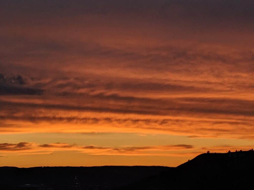
We pass the ski resorts at Lake Tahoe, where the road takes us up to an altitude of 8,000 ft. and temperatures as low as 19 degrees, and by the end of the day, down to 275 feet below sea level at Death Valley. As we drive out of Tahoe, we watch the thermometer ticking up a degree every mile, until reaching the 80s. Actually, the weather is quite cool and comfortable for Death Valley, which is the hottest place on the planet, with ungodly temperatures that reached 130 degrees this summer, but can also get frigid in winter. Our visit, in October, is actually a terrific time.
Laini plots our route so we would stop at Mono Lake Tufa State Natural Preserve, in Lee Vining, California, where we have a picnic lunch. The first sight of Mono Lake from the highway above is astonishing: a stunning, ethereal scene with its brilliant aquamarine color and striking tufa formations. We stop at the overlook and then drive down along the shore to the parking lot. The visitors center is closed (because of COVID-19 restrictions), but we go into a trailhead that leads to a short boardwalk to the lake edge.
California created the reserve to protect these spectacular “tufa towers,” calcium-carbonate (limestone) spires and knobs formed by the chemical interaction of freshwater springs and alkaline lake water. The reserve protects the lake surface as well as the wetlands and sensitive habitat for the 1 – 2 million birds that feed and rest at Mono Lake each year.
Covering 65 square miles, Mono Lake is ancient – over 1 million years old and one of the oldest lakes in North America. Freshwater evaporating from the lake each year has left the salts and minerals behind so that the lake is now about 2 1/2 times as salty as the ocean and very alkaline. “The extremely high salinity and alkalinity of Mono Lake has created a rare ecosystem, supporting a complex food chain of green algae, brine shrimp and alkali flies, and more than 80 species of migratory birds.” (www.parks.ca.gov)
(Highway 395, 13 miles east of Yosemite National Park, near the town of Lee Vining, California, 760-647-6331, www.parks.ca.gov; also www.monolake.org).
We stop off at Carroll’s Market (probably the last one we will see), which actually gets high ratings on Yelp, especially for its blue cheese dressing, and has become its own attraction. We buy a dozen gallon jugs of water and stop off to fill up at a gas station.
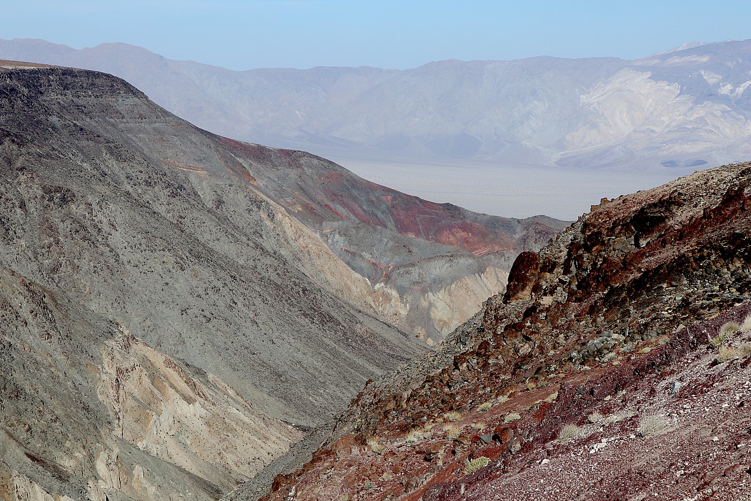
After a long flat stretch with mountains in the distance, we drive the winding mountain road (make sure you have a full tank of gas), entering the park at Panamint Springs. We stop at the Father Crowley Vista Point for the view over Rainbow Canyon, a colorfully striped canyon created by ancient volcanic activity. Nicknamed “Star Wars Canyon”, it’s where the military practices Star-Wars type of flying. The wind today is so intense, it practically throws us over.
(Nearby is Darwin Falls, a seeming oxymoron in this desert place, quickly turning from a gravel canyon to a lush oasis of cottonwoods and willows, creek crossings, and finally 20-foot waterfalls, a two-mile roundtrip hike, which we have marked down for a return visit.)
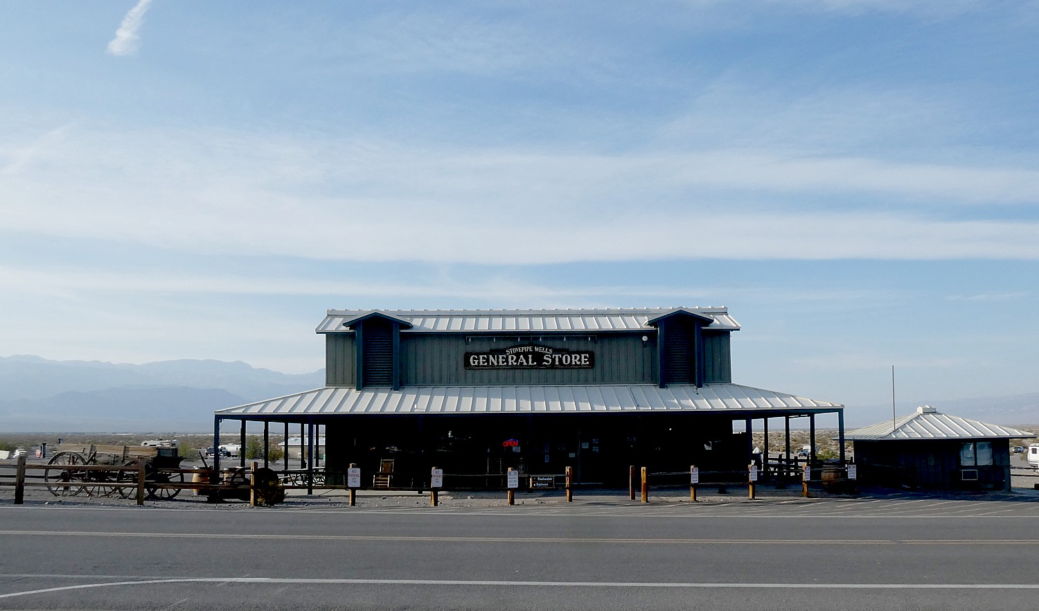
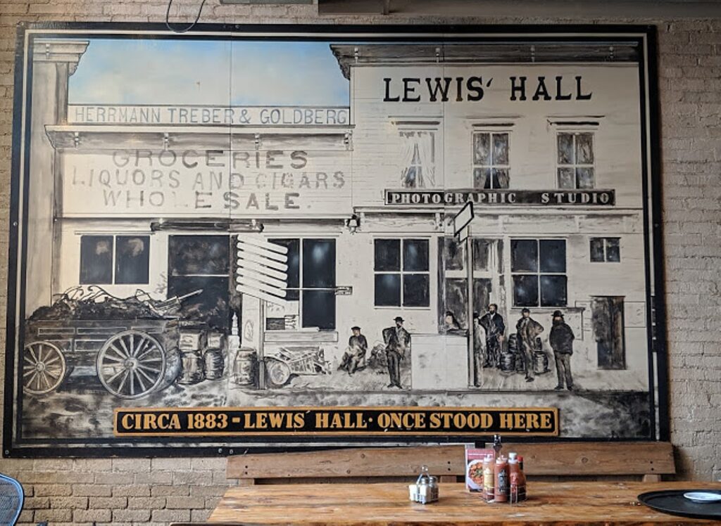
We stop at the historic Stovepipe Wells Village – like something out of a Western movie – that links back to the very beginning of tourism in Death Valley. In fact, long after mining gold, borax and talc had collapsed, tourism has been the enduring enterprise in Death Valley.
Herman William “Bob” Eichbaum effectively invented Death Valley’s tourism industry here, believing its “beauty, mystery and history” would attract tourists. Indeed, since 1915, motion pictures, automobile companies and writers weaving tales and promoting advertisements sparked interest (early social influencers) in visiting. In 1925, Eichbaum built a 38-mile toll road over Towne Pass and 20 tent-style bungalows, a restaurant, general store and filling station. He opened the Stovepipe Wells Hotel in 1926. Just a few months later, the luxurious Furnace Creek Inn was opened by the Pacific Coast Borax Company, setting off an intense rivalry. Most enthralling is that both places are still around and give you this sensation of stepping back in time. (Open year-round, deathvalleyhotels.com, 760-786-7090).
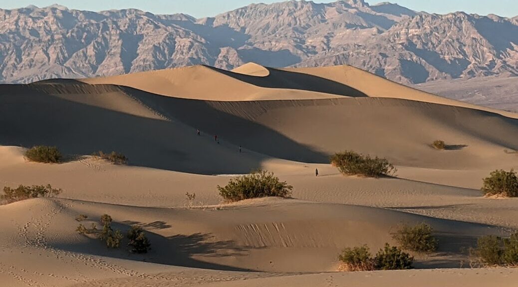
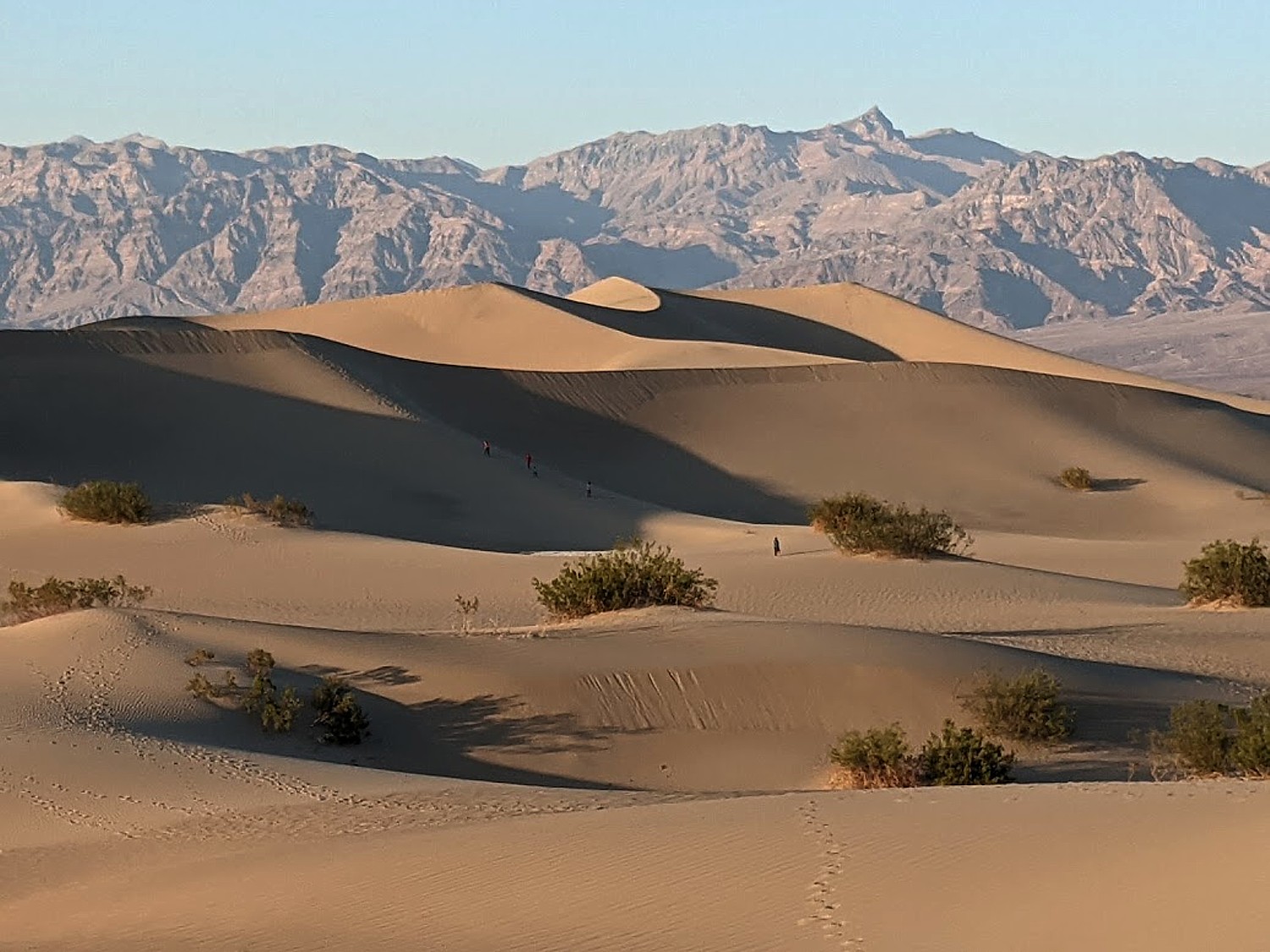
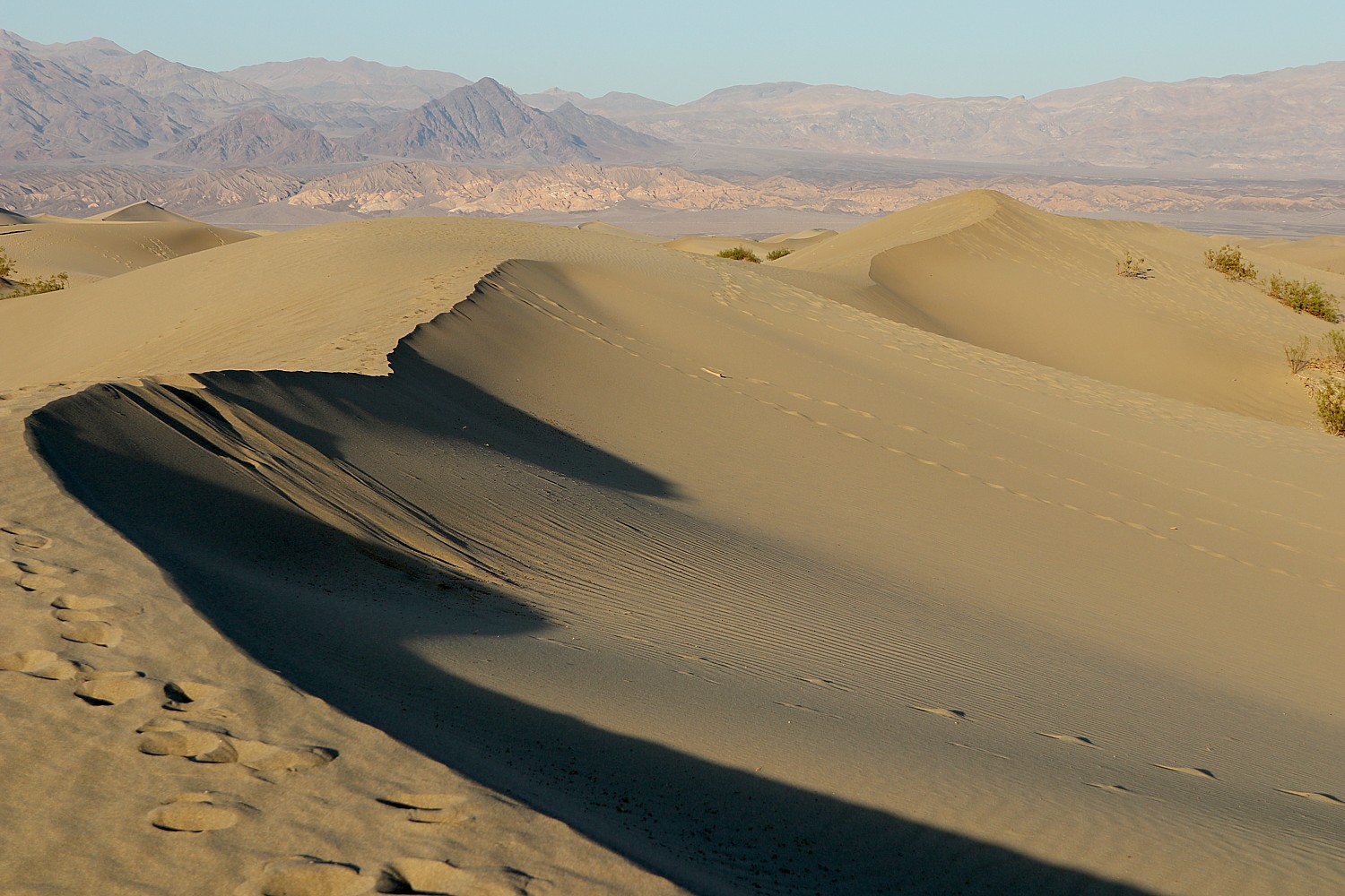
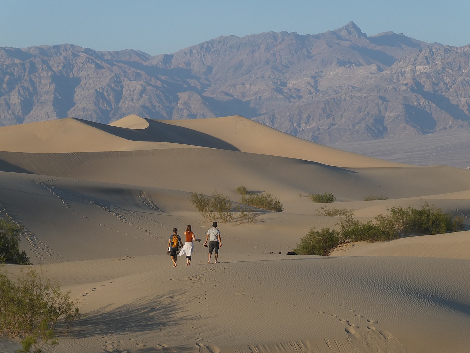
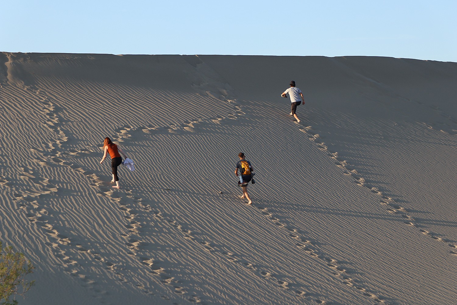
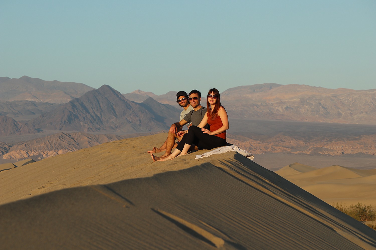
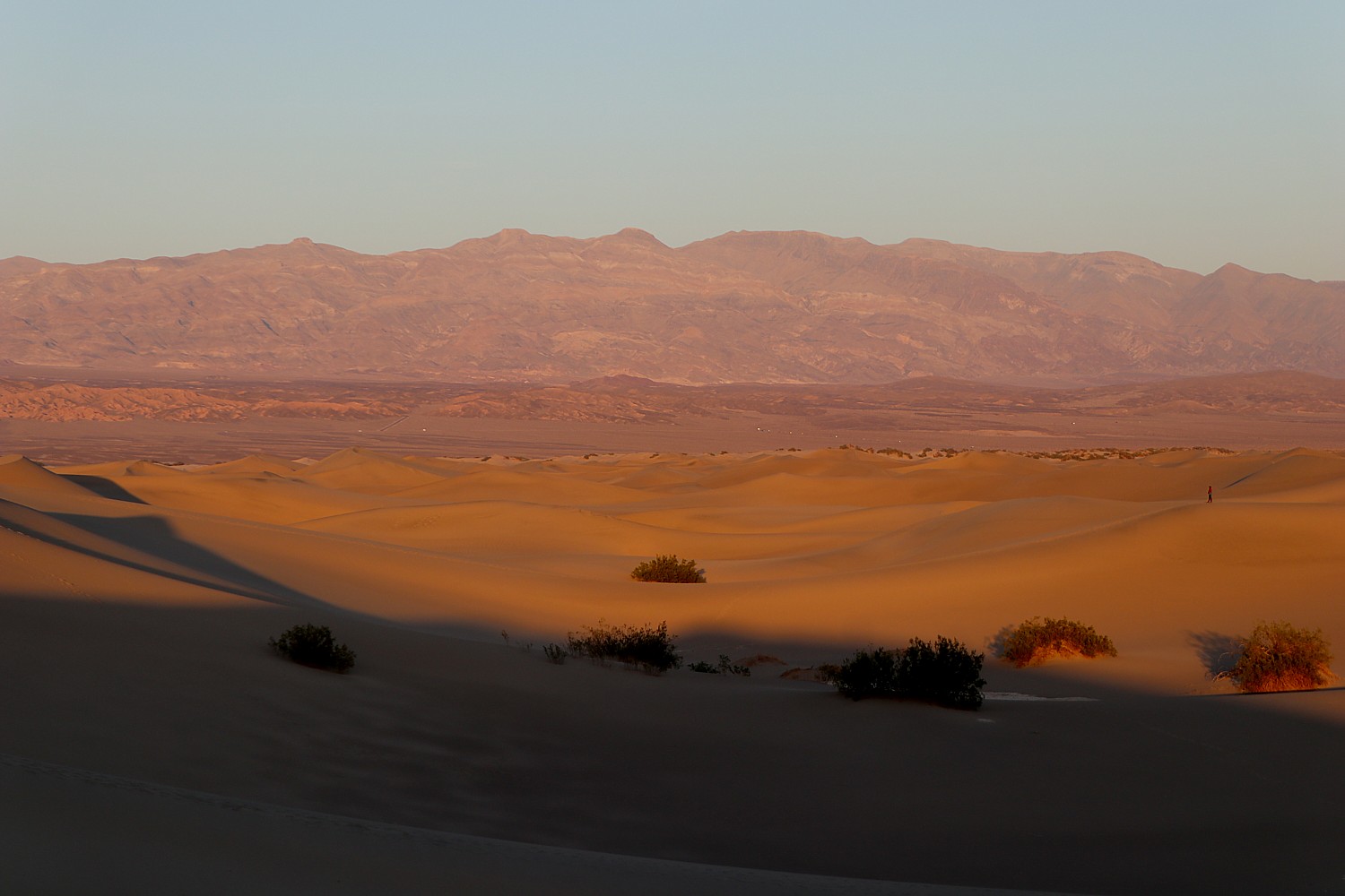
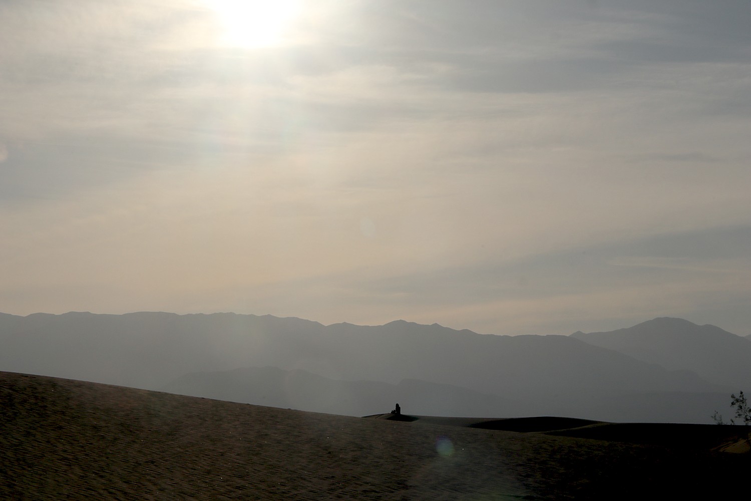
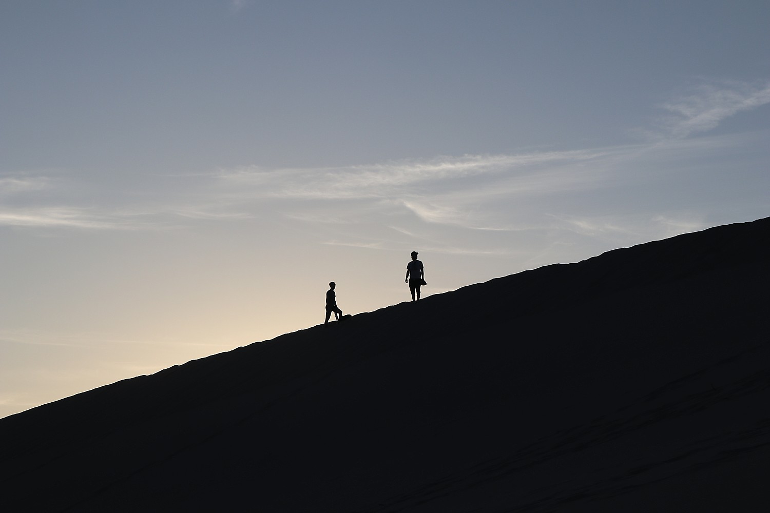
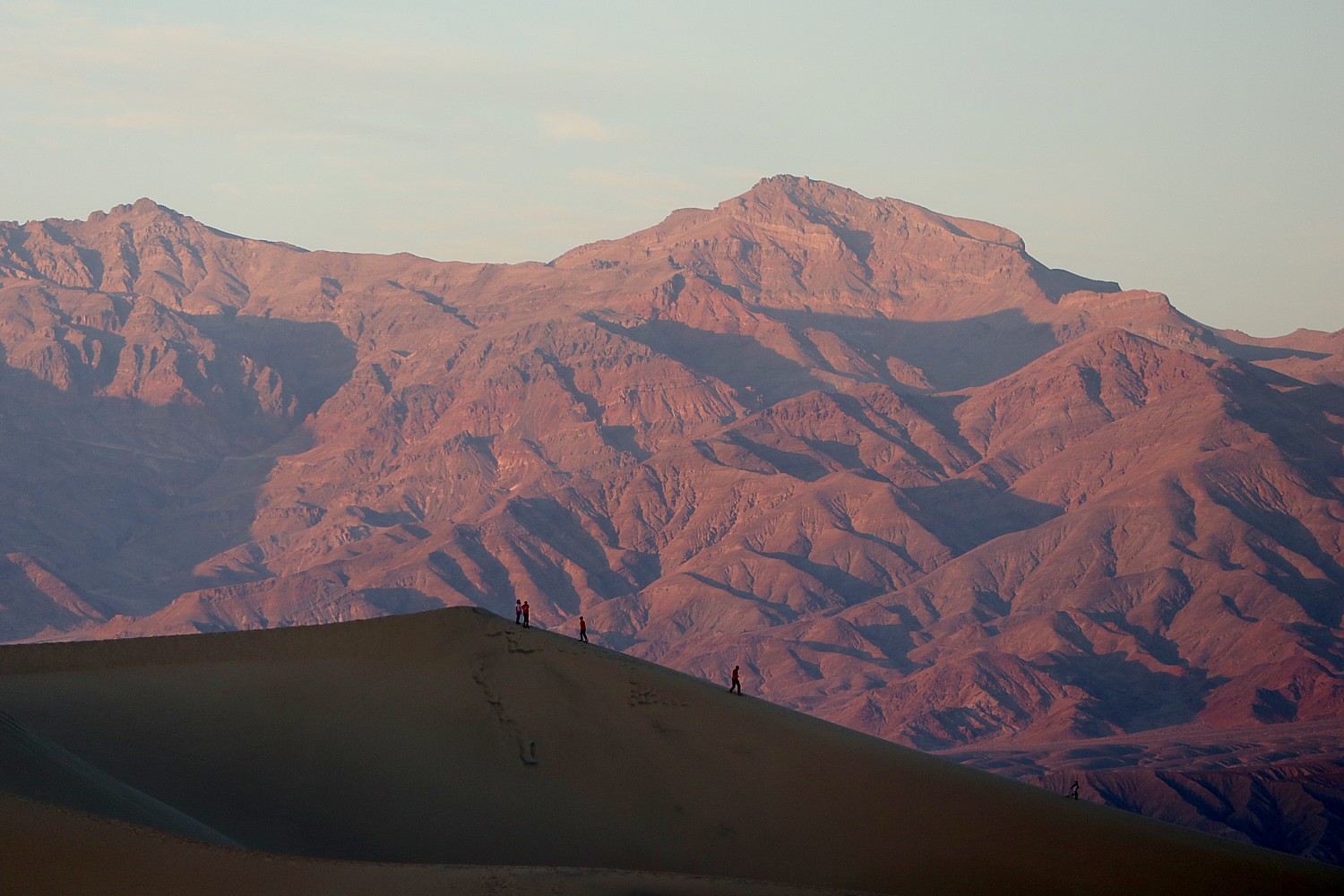
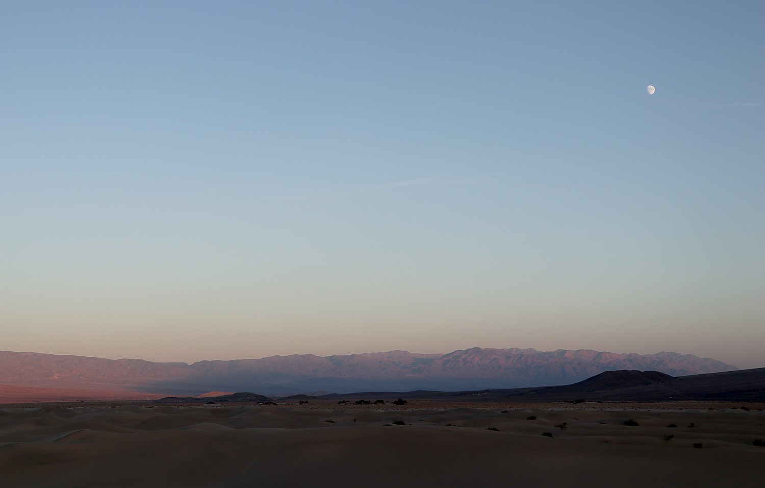
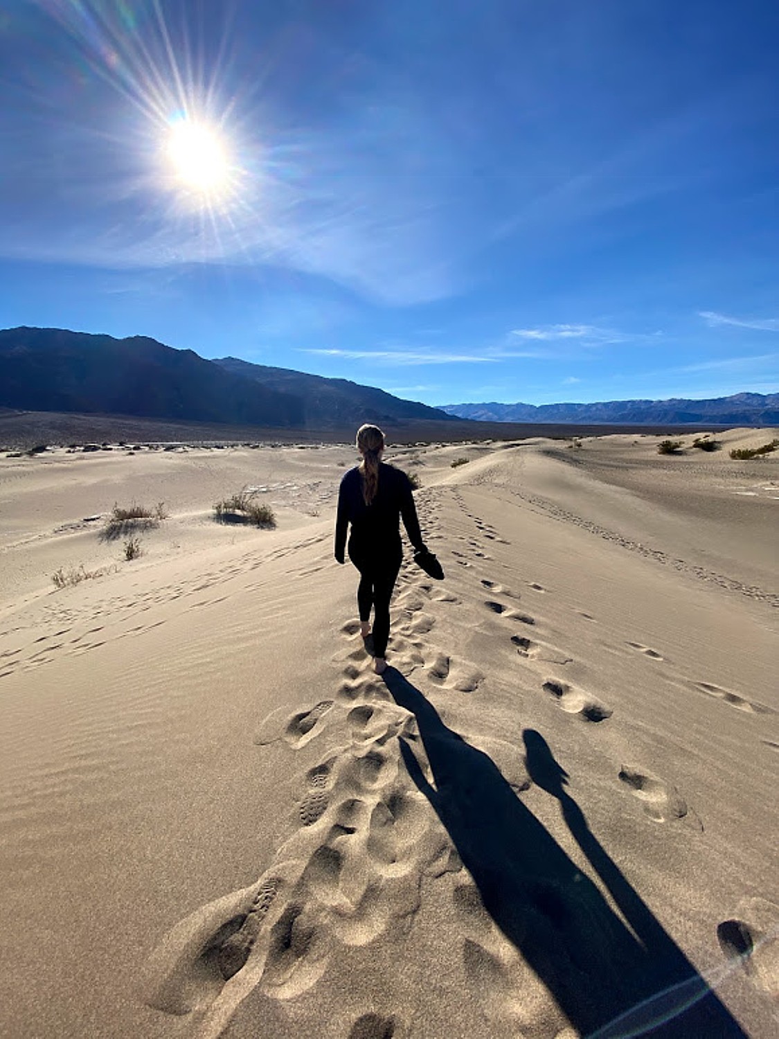
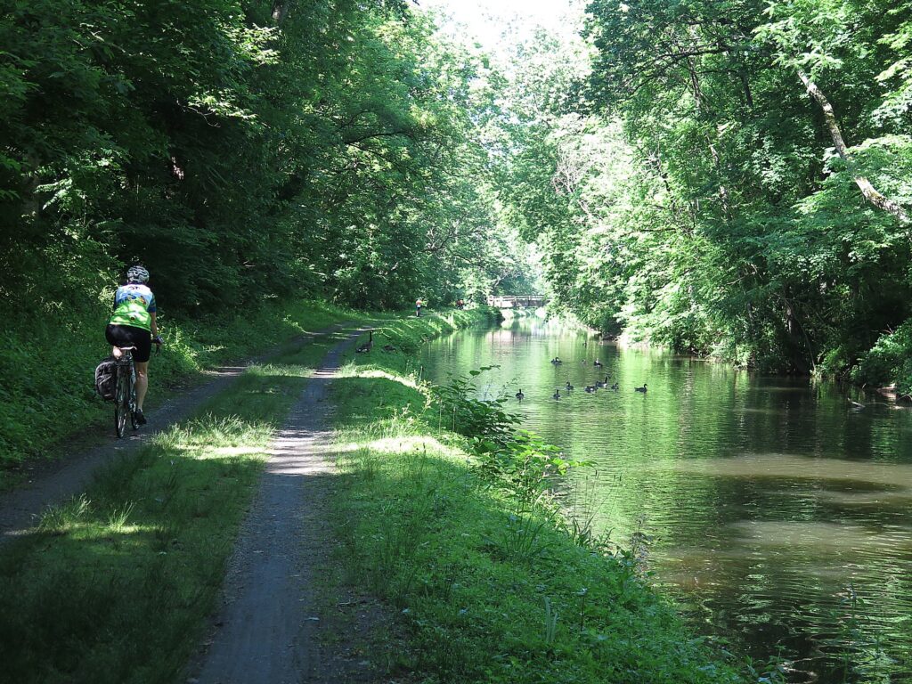
It’s only a short drive from the village to reach Mesquite Flat Sand Dunes, a little after 4 pm, giving us at least one hour before sunset. We have just enough time to play on the dunes and watch the colors (and temperature) change with the setting sun. People bring cardboard sleds, using the sand like snow.
Mesquite Flat Sand Dunes is an extraordinary setting: sprawling over 14 square miles, ringed with mountain peaks, the contrast of colors, shapes, contours is just stunning.
In late afternoon, the sand is cool enough to take off shoes and feel remarkably soft granular sand on toes. We climb the dunes –as much as 150 feet high- wowed in the colors of the golden hour as the sun descends. All the pure joy you had playing in a sand box when you were four comes bursting through.
The best time to visit is the early morning or late afternoon; on a dawn hike, the notes say, you might see tracks of nocturnal animals and if you hike at night in the warm months, they warn, be alert for sidewinder rattlesnakes (I’m still thinking about the tracks of nocturnal animals).
Designed to Death
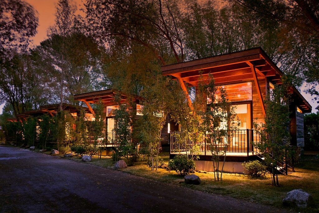
We drive on, reveling in the scenes of the road disappearing into the far distance, headed to our Air BnB, with the intriguing name, Designed to Death, in the small town of Beatty, about 20 miles outside the park’s eastern border (Las Vegas would be about 1 ½ hours beyond). Though the name evokes Agatha Christie, it is breathtakingly beautiful, cozy luxury, with a bit of a Western vibe – easily explained because the hosts are interior designers and the house is a showplace for their talent.
We are here for too short a time to fully enjoy all that the house affords. Set on an isolated stretch of high desert, the 1,200 sq. ft., three-bedroom, two-bath vacation home was designed by Peter Strzebniok to incorporate the vistas, providing stunning views while making the desert part of the interiors – merging the inside with the outside. What we do thoroughly enjoy though, is the large open kitchen, dining room, living room, that opens onto a 900 sq. ft deck with hot tub. The Presidential Suite at a five-star hotel would not have been any nicer or more comfortable.
Our Designed to Death Air BnB hosts are Karen McAloon, an interior designer who works in San Francisco Bay Area, Los Angeles and Joshua Tree, who was an HGTV host and her partner was her producer. (They have two sister properties, Hip Modern cottage of Amazingness in Lake Tahoe, @hipmoderncottageofamazingness, and Too Pool for School in Joshua Tree, @toopoolforschooljtree.)
They provide excellent notes – like the nearest place for supplies would be at Family Dollar, but the nearest actual grocery is 70 minutes south at Pahrump. They also supply tour information of nearby ghost towns, museums, attractions and of course Death Valley National Park. There is an interesting note about the wild burros that we might see (there is even a traffic sign like a deer crossing), which are descended from burros abandoned by miners a century ago. “Don’t feed them, they can be destructive. They tend to be down at the creek in the morning and wander into town at night.”
We take full advantage of the gorgeous kitchen to prepare dinner (we brought food for dinner and breakfast).
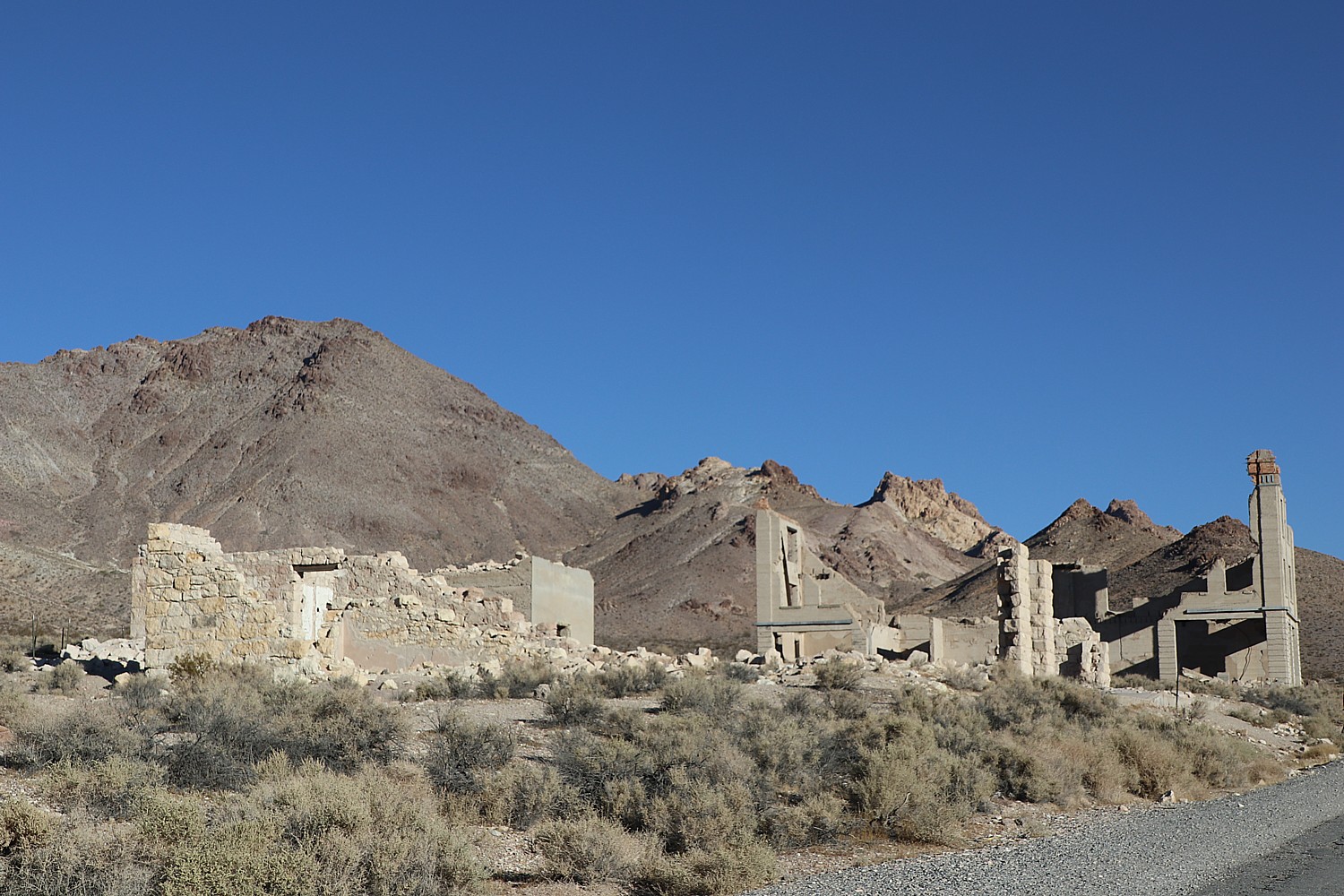
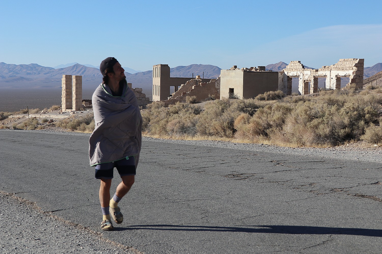
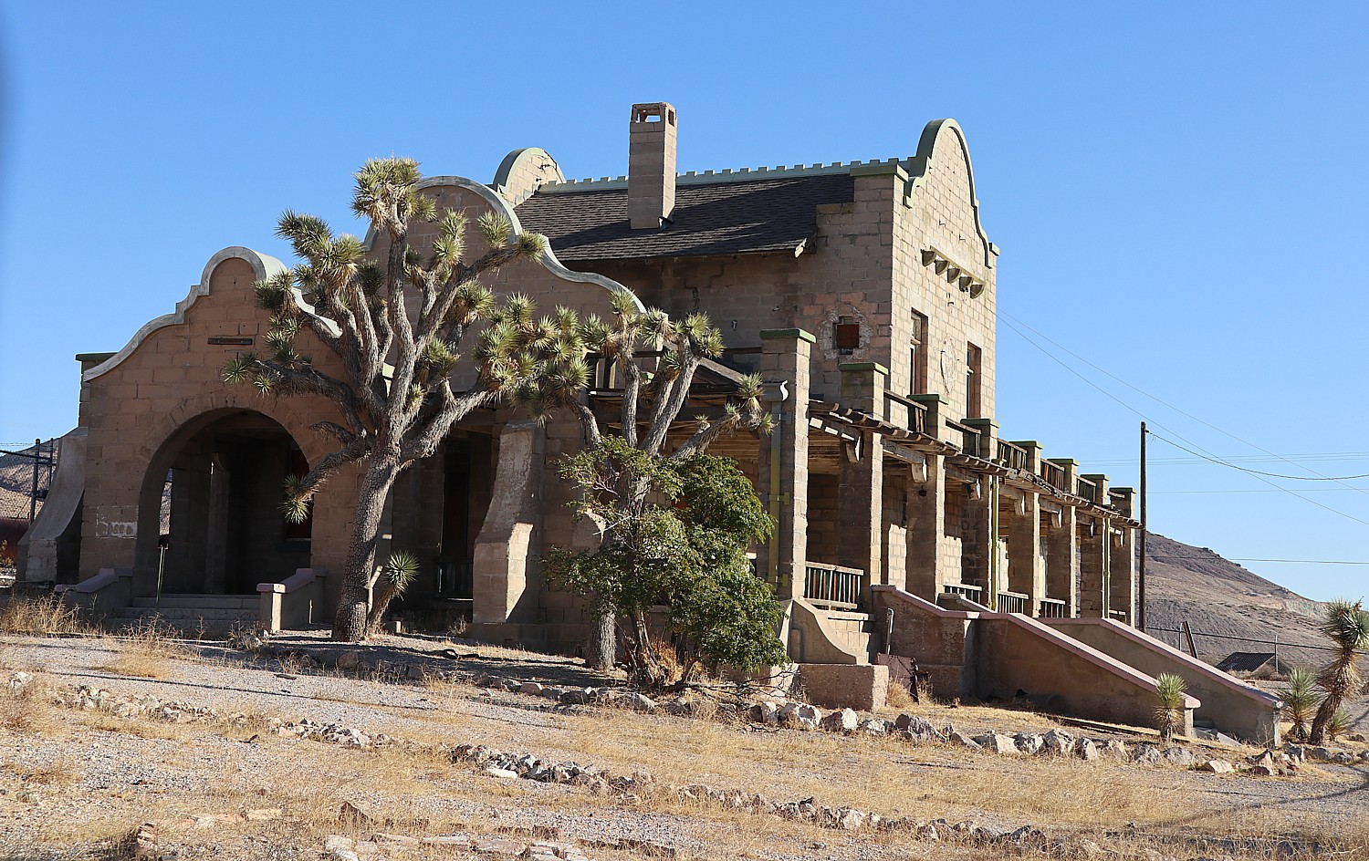
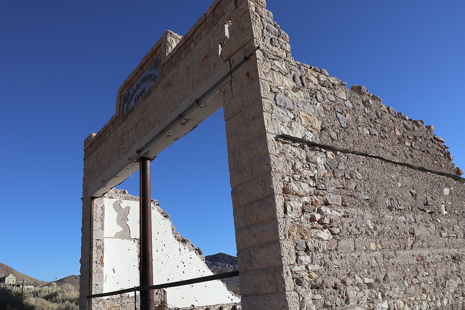
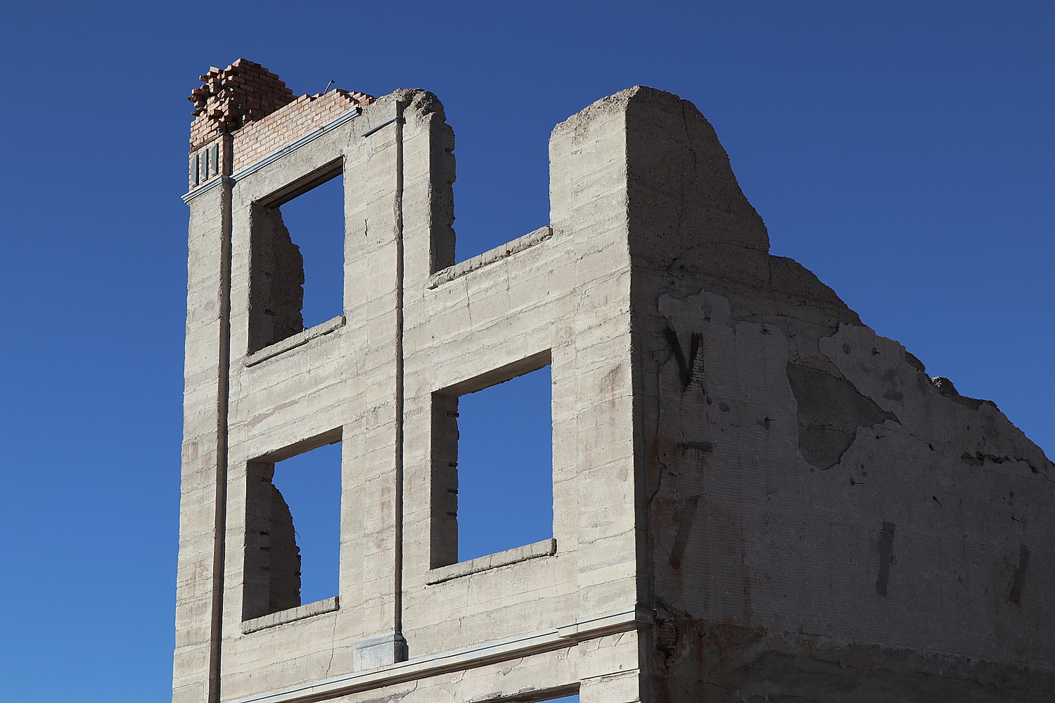
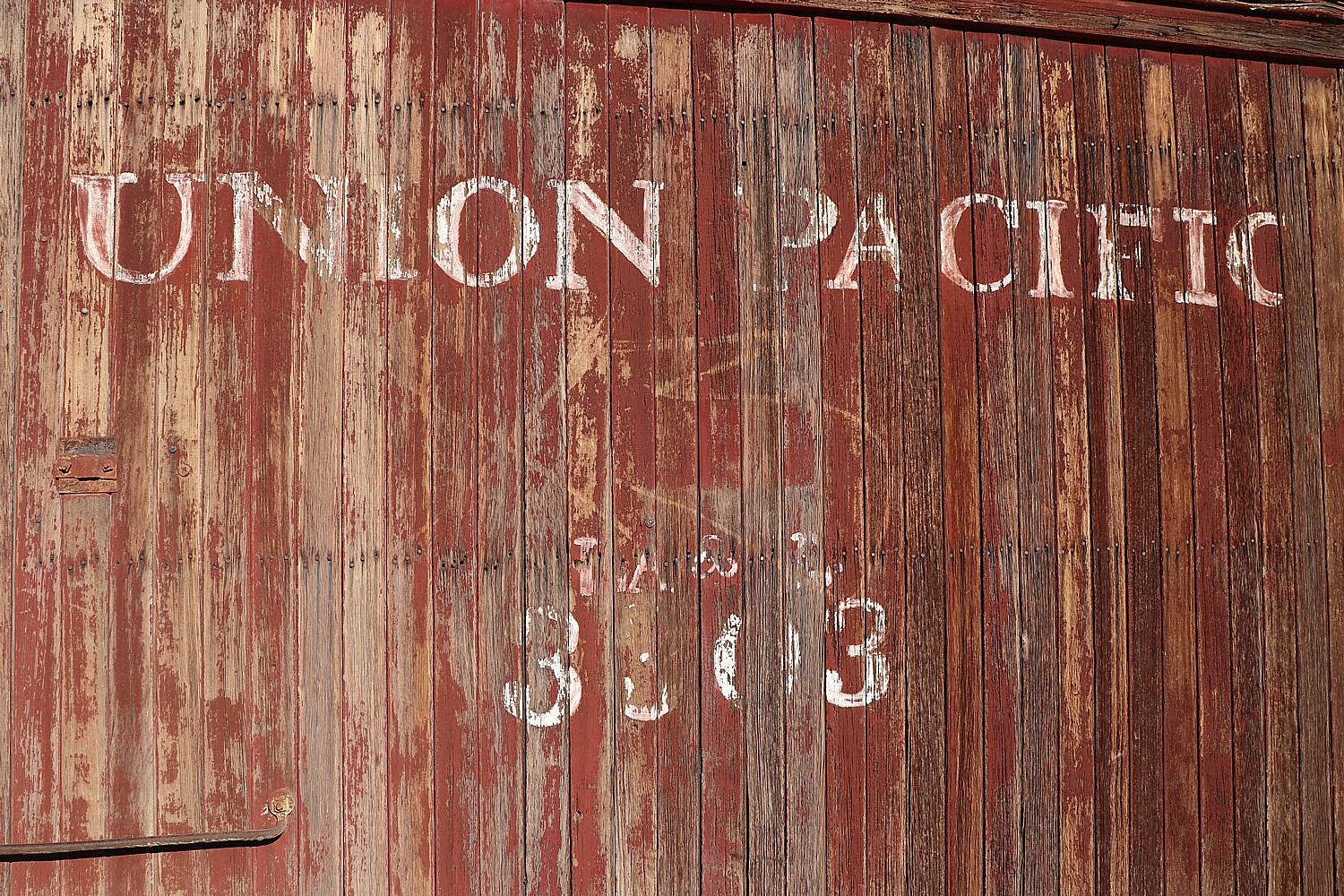
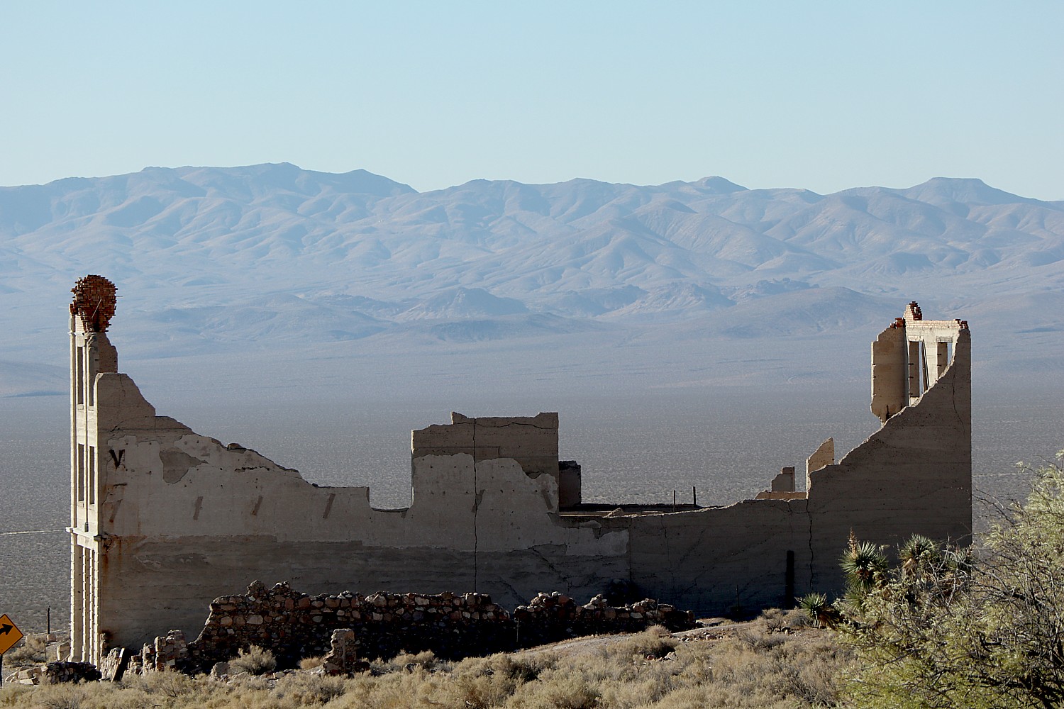
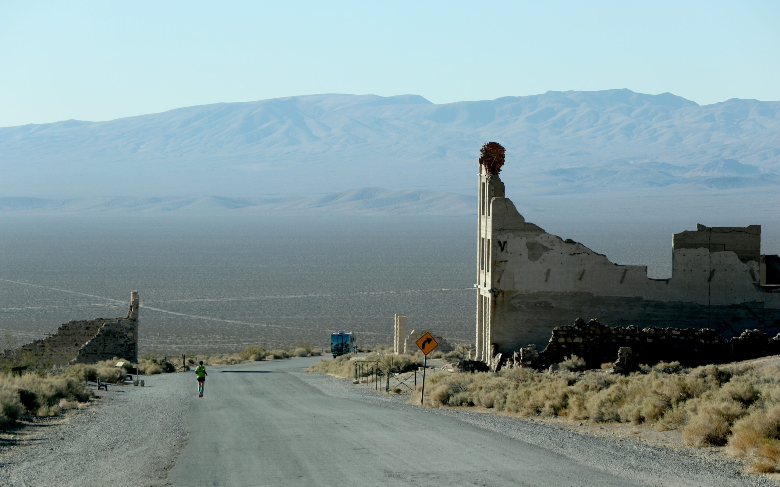
The next morning, we pack up quickly and head out early morning with a plan to stop off on our way into Death Valley to visit an actual ghost town, Rhyolite.
It is so fascinating to try to piece together what this town might have been like and to realize how big it was – most surprising, really (especially when you see the context) is what’s left of a hotel and casino. A casino! “100 years ago, Rhyolite was the largest city in southern Nevada with more than 10,000 residents. Yet after only a decade, the town became a ghostly remnant of itself” – a classic boom and bust story, with all sorts of lessons about the transitory nature of success in the span of history. It is tremendously exciting to wander about these ruins, so dramatically set.
In its heyday, between 1905-1911, Rhyolite had two churches, 50 saloons, 18 stores, two undertakers, 19 lodging houses, eight doctors, two dentists, a stock exchange and an opera.
The ruins that remain today include the Bottie House, the train depot (there is a caboose there), the remains of a three-story bank building and the jail.
It is one of several ghost towns that are scattered through Death Valley, “the silent ruins of broken dreams.”
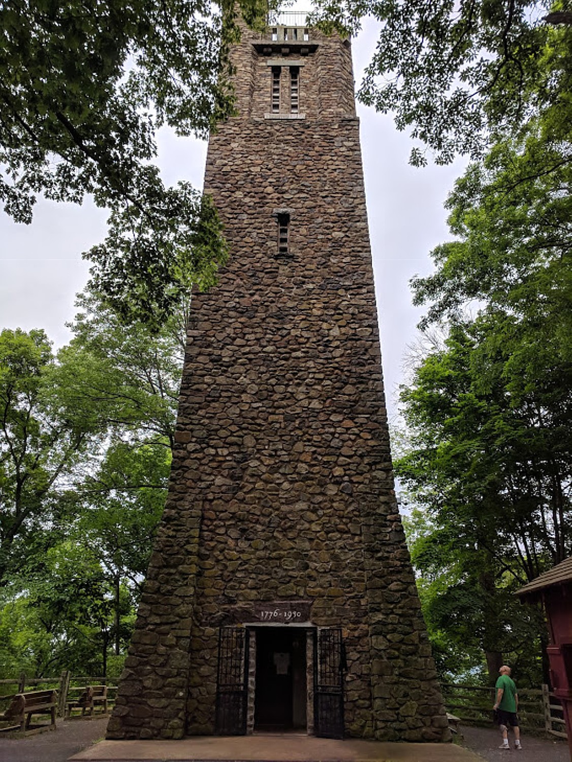
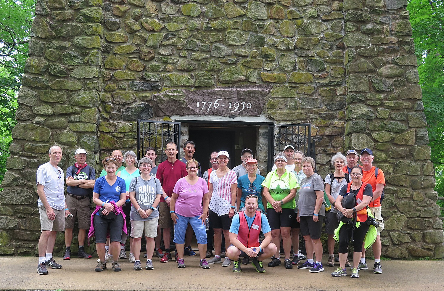
Death Valley in art: “Rhyolite Bank Window,” a Death Valley ghost town, by Laini Nemett (2020, 12 x 9 in, oil on linen on panel). Visit www.laininemett.com.
Travel Features Syndicate, goingplacesfarandnear.com
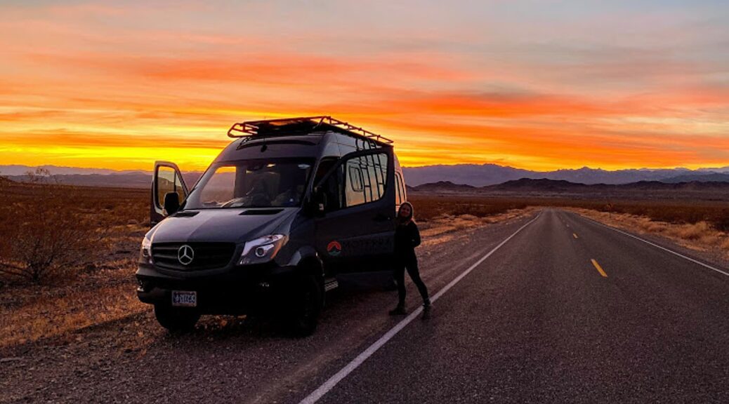
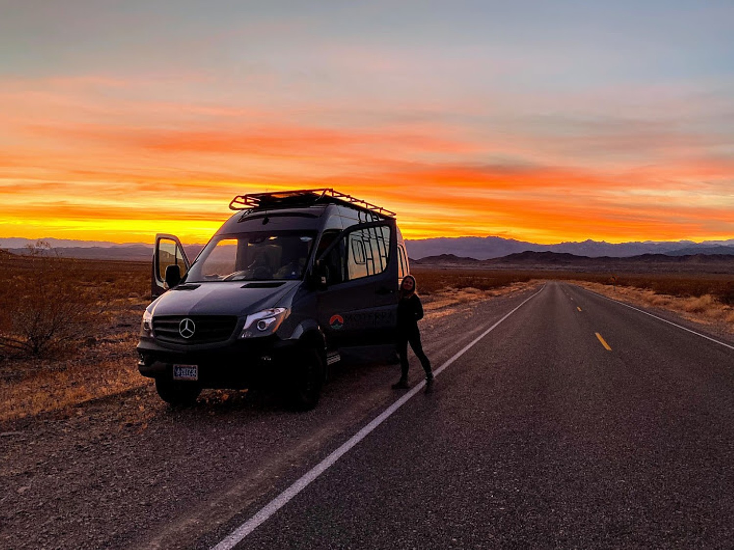
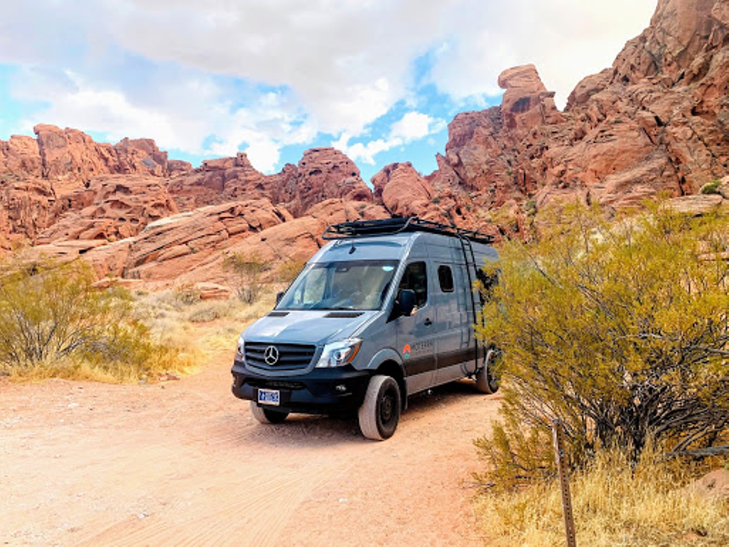
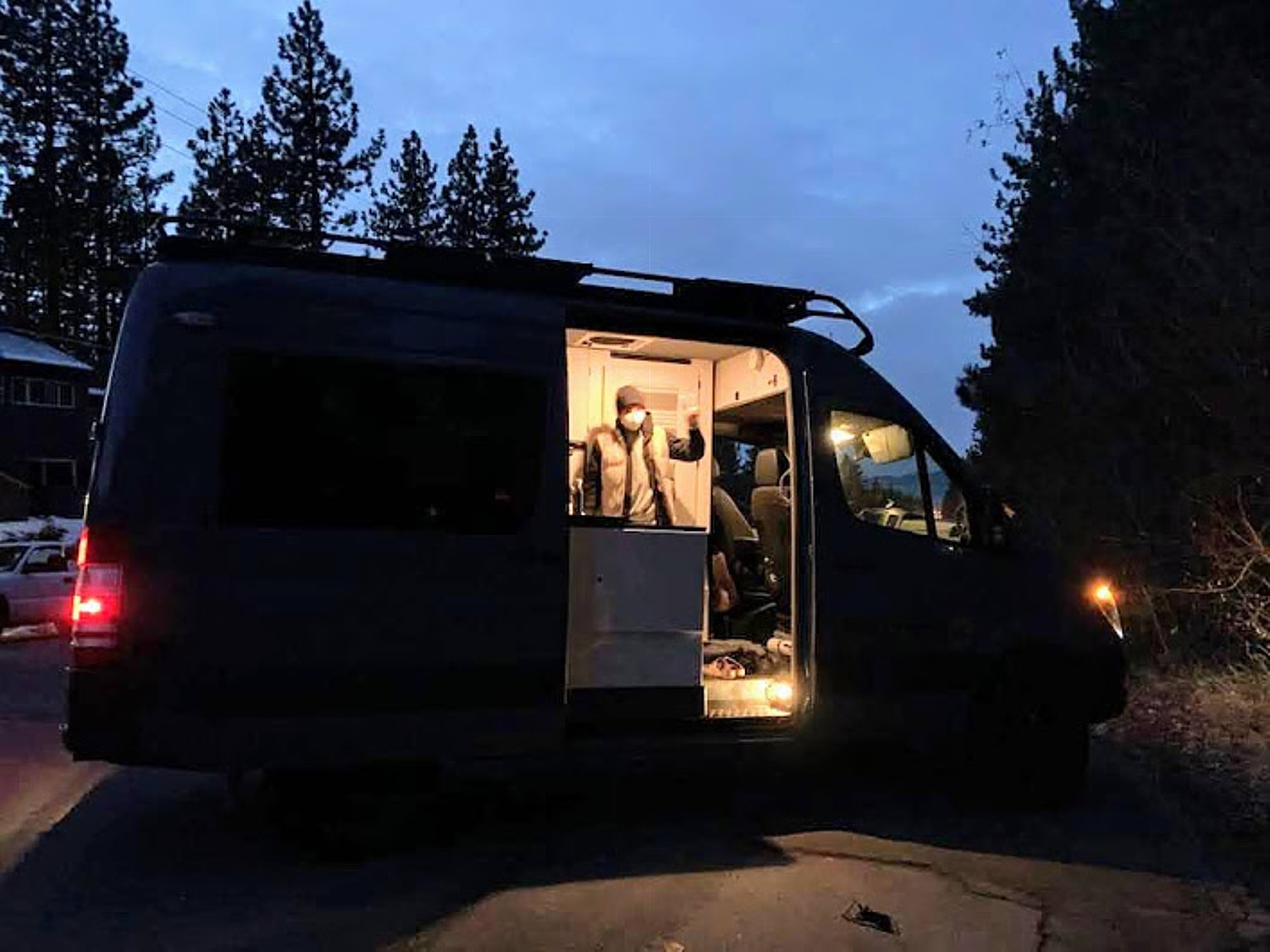
The biggest travel trend to explode out of the time of Corona is ad-VAN-turing – basically a freewheeling adventure in a tricked out van (sleeker than an RV but with most if not all the comforts of a studio apartment on wheels). These high-tech, luxury mobile campers are designed to be self-sufficient, carrying their own water, electricity, toilet, galley kitchen, even solar panels for energy so you don’t have to plug in, but can still have enough power in reserve to run the heat at night so you have incredible mobility and freedom to explore.
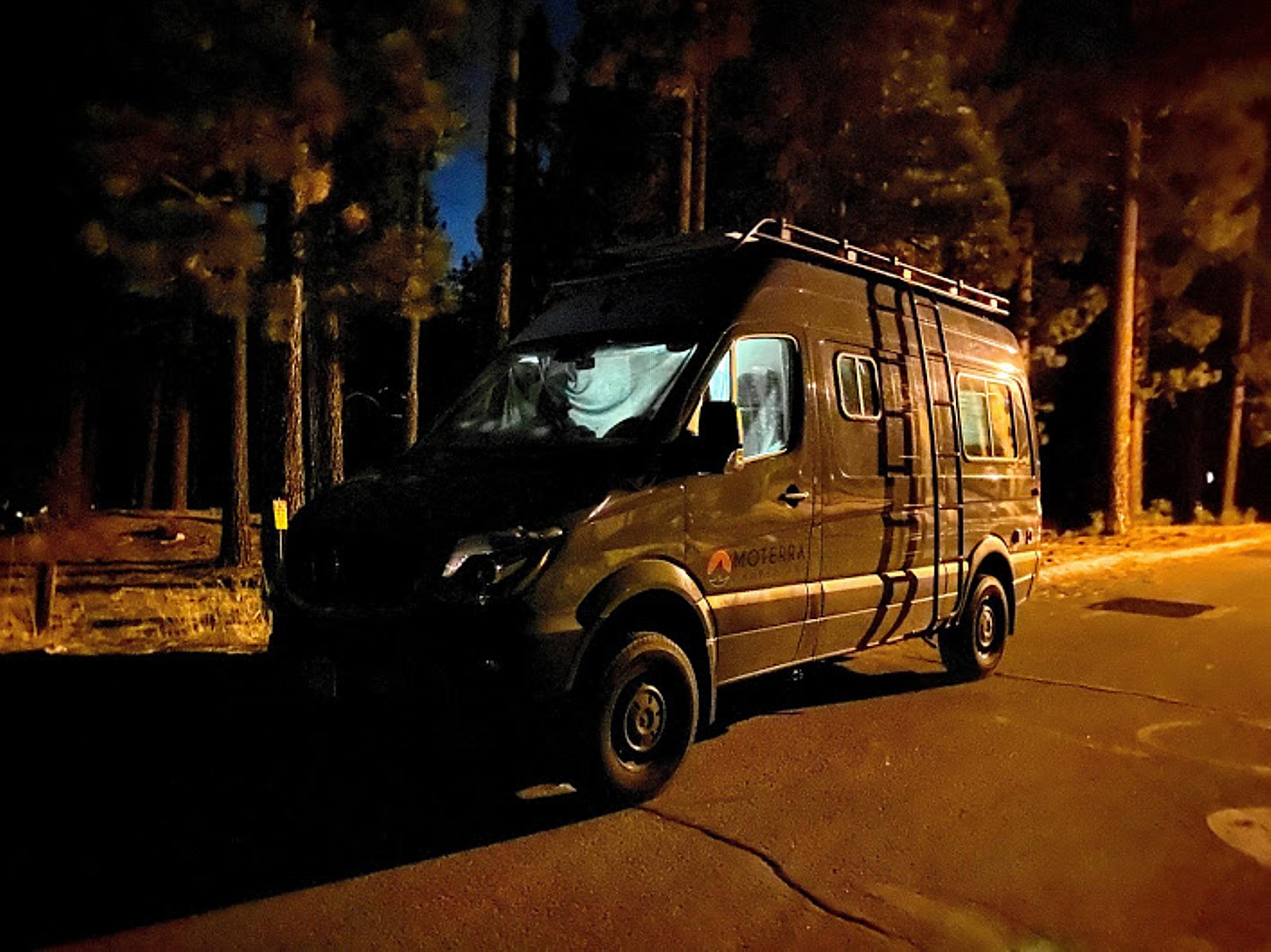
In mid-December, we took off with an indefinite week-long itinerary from Sonoma, California, in a Moterra camper van which we picked up in San Francisco.
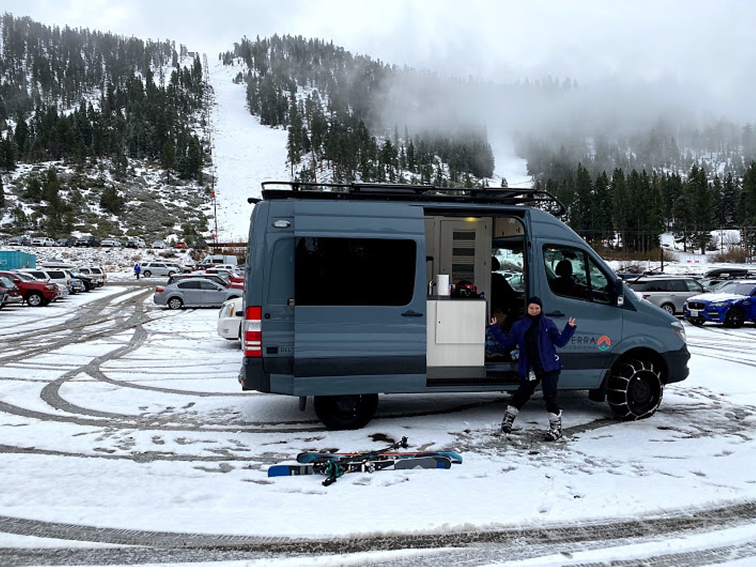
We spent our first day skiing at Heavenly Resort in Lake Tahoe, California (we stayed overnight a couple blocks away from the parking lot, which made getting first chair easy!).
From there, we drove down to Death Valley National Park, spending one night at the Panamint Springs RV park and another at the trailhead for Telescope Peak (fairly desolate this time of year). We were really impressed with how our van got us safely to the base of mountain treks without issue, thanks to the four wheel drive.
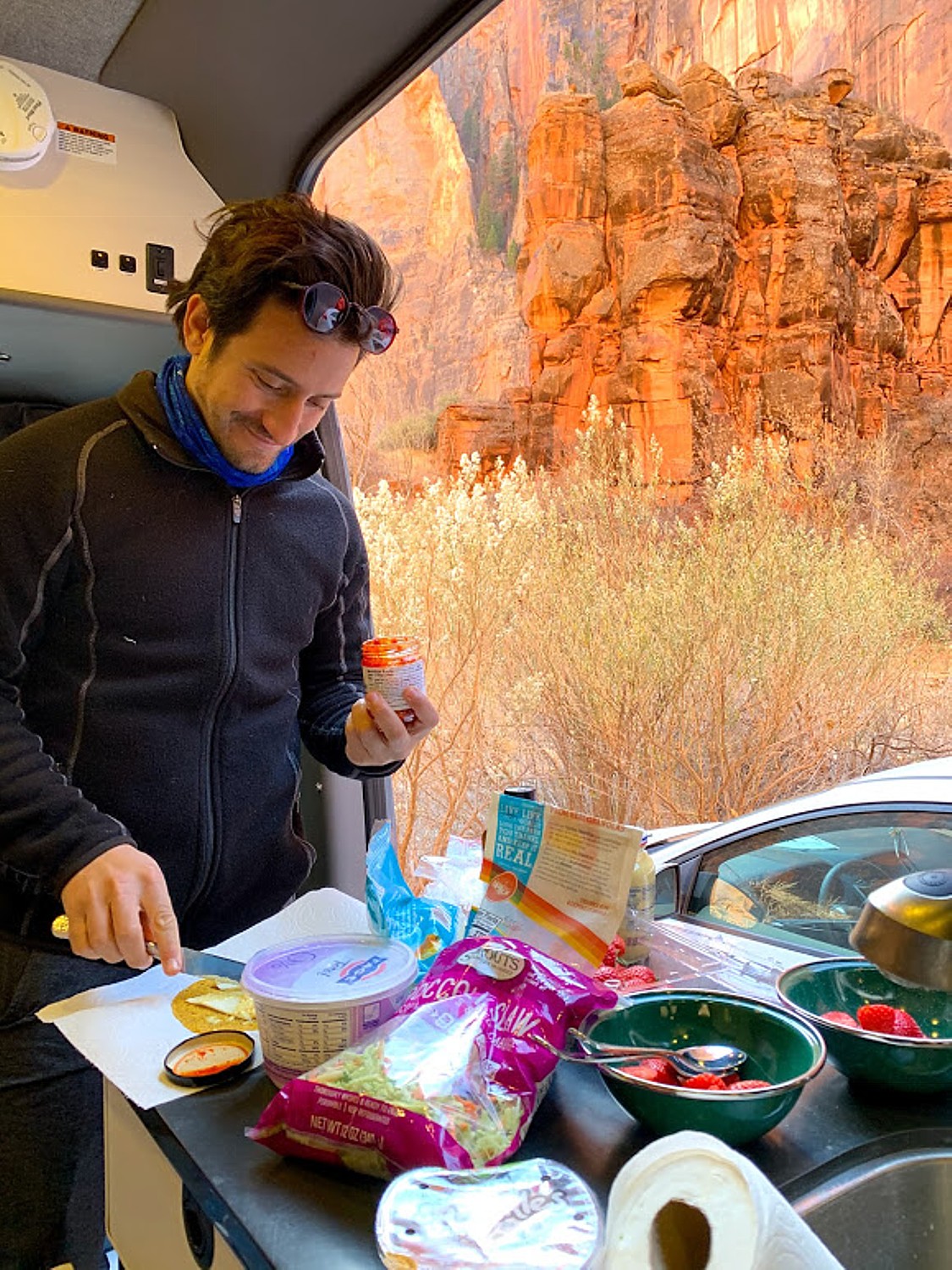
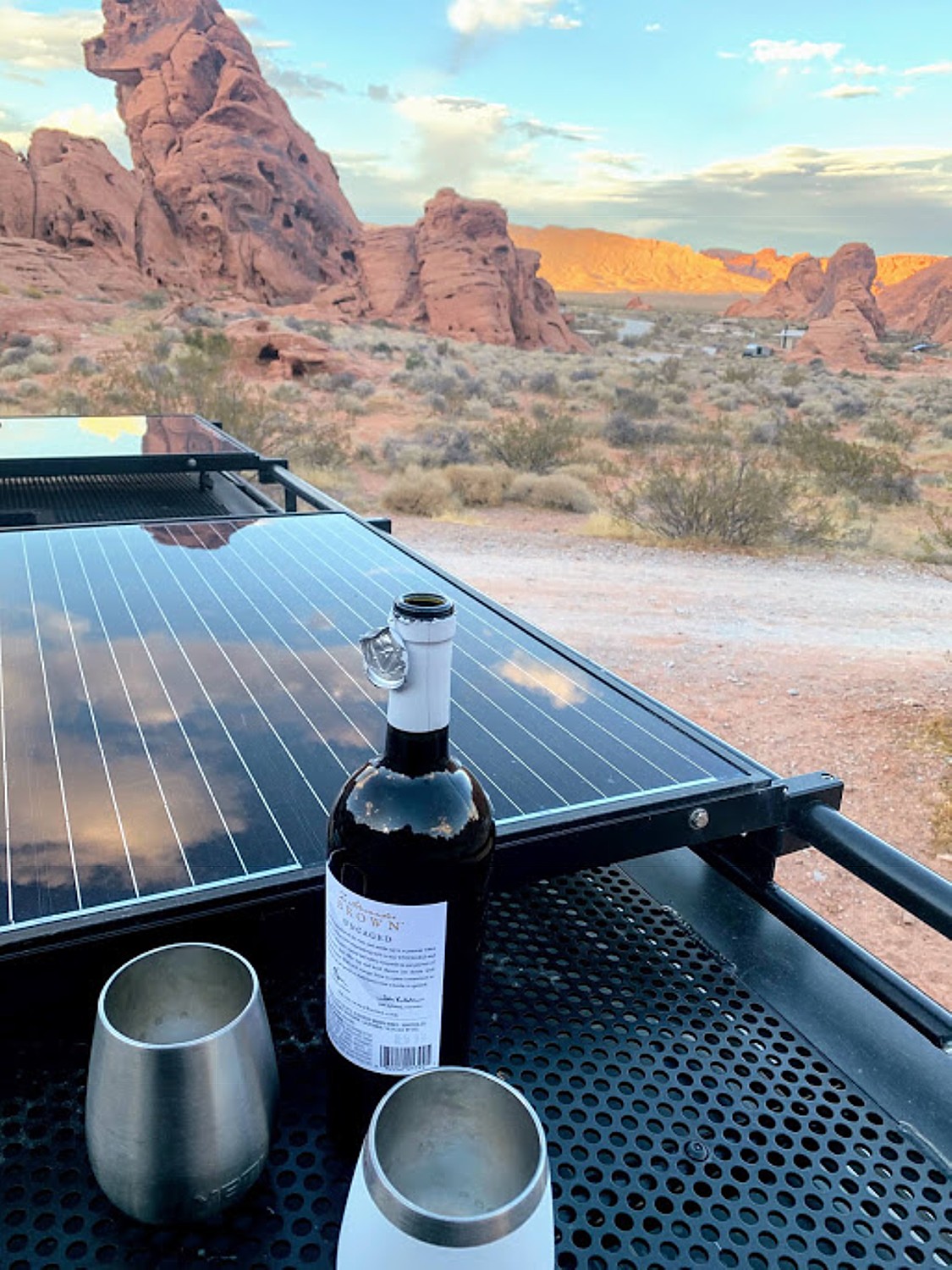
Though the mid-December days were short and the nights were cold, we were cozy and comfortable in our van with round-the-clock heat and cooking amenities. And snuggling up on the roof of the van with wine in hand made for some glorious stargazing (we lucked out our first night in Death Valley with a mind-blowing Geminids meteor shower).
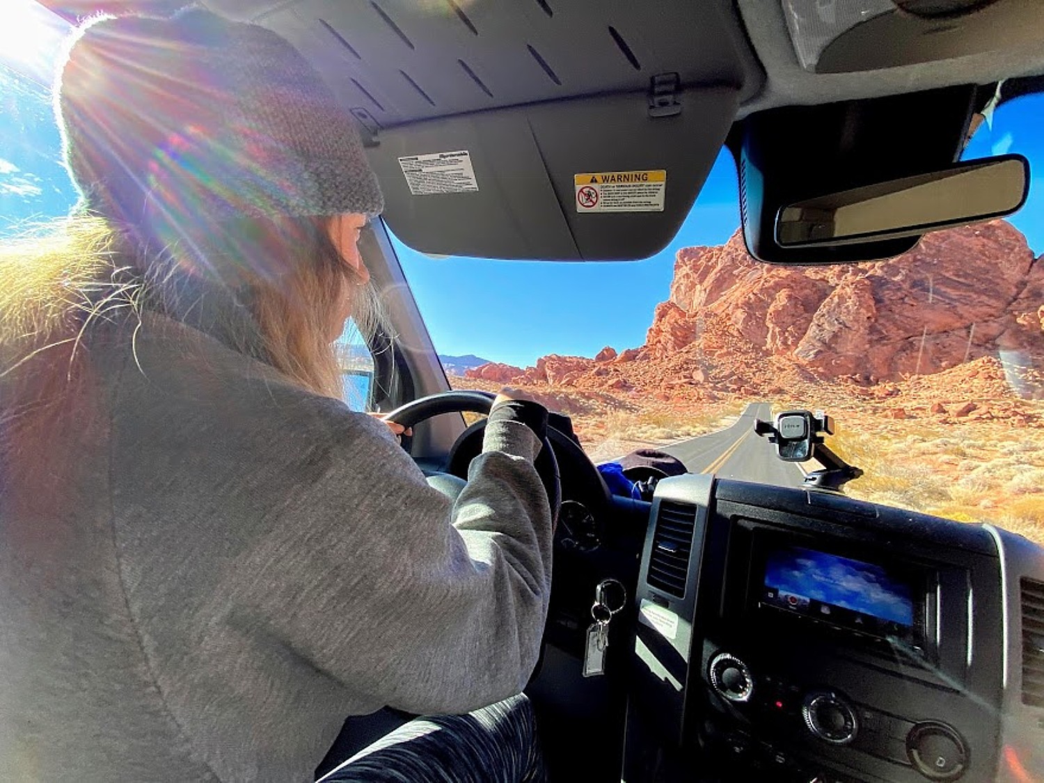
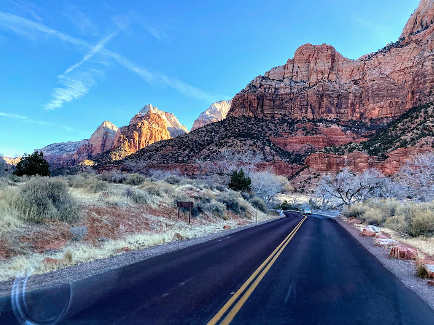
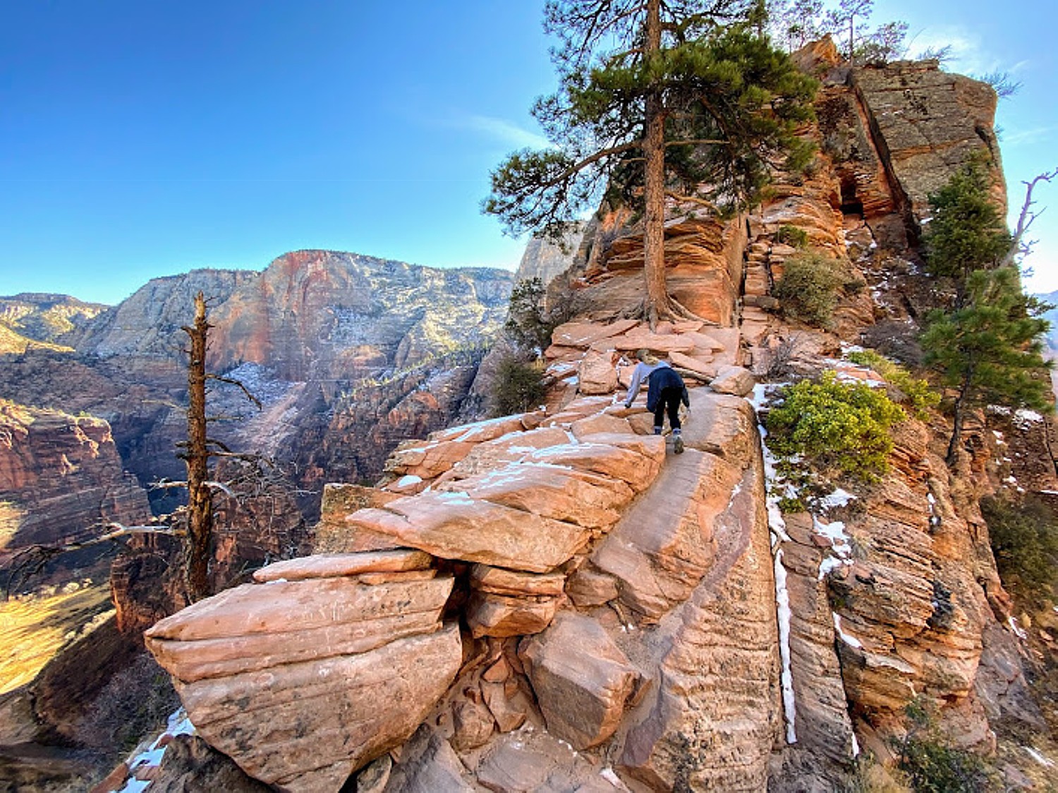
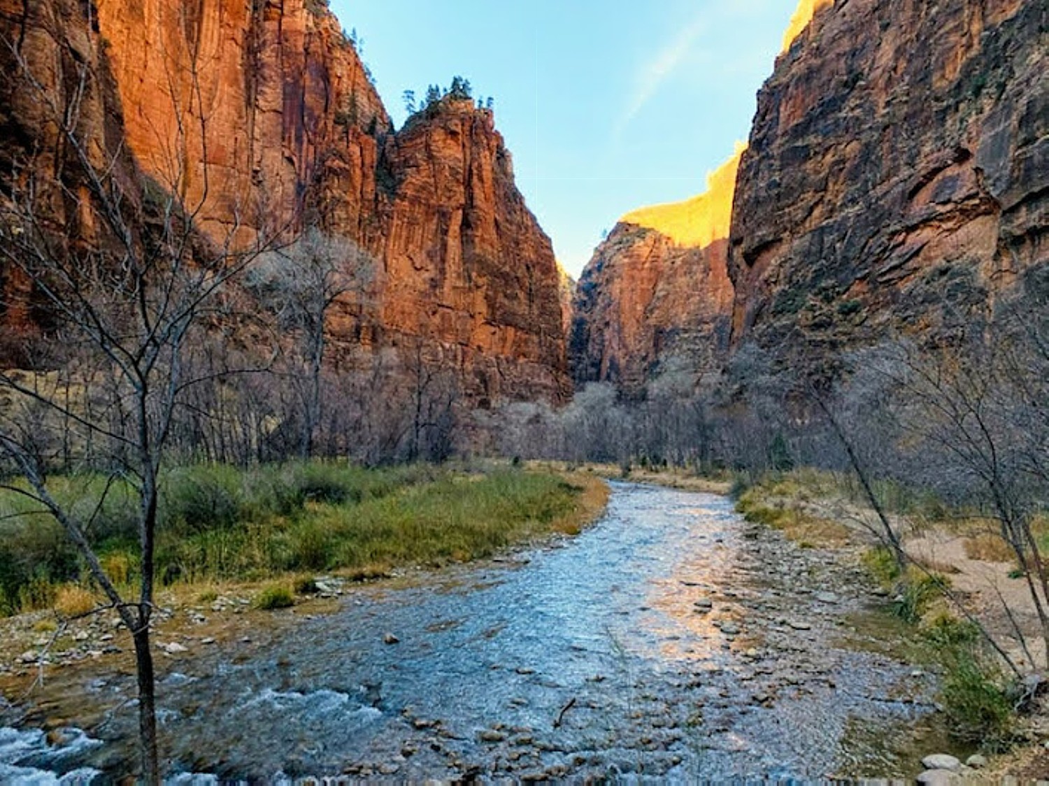
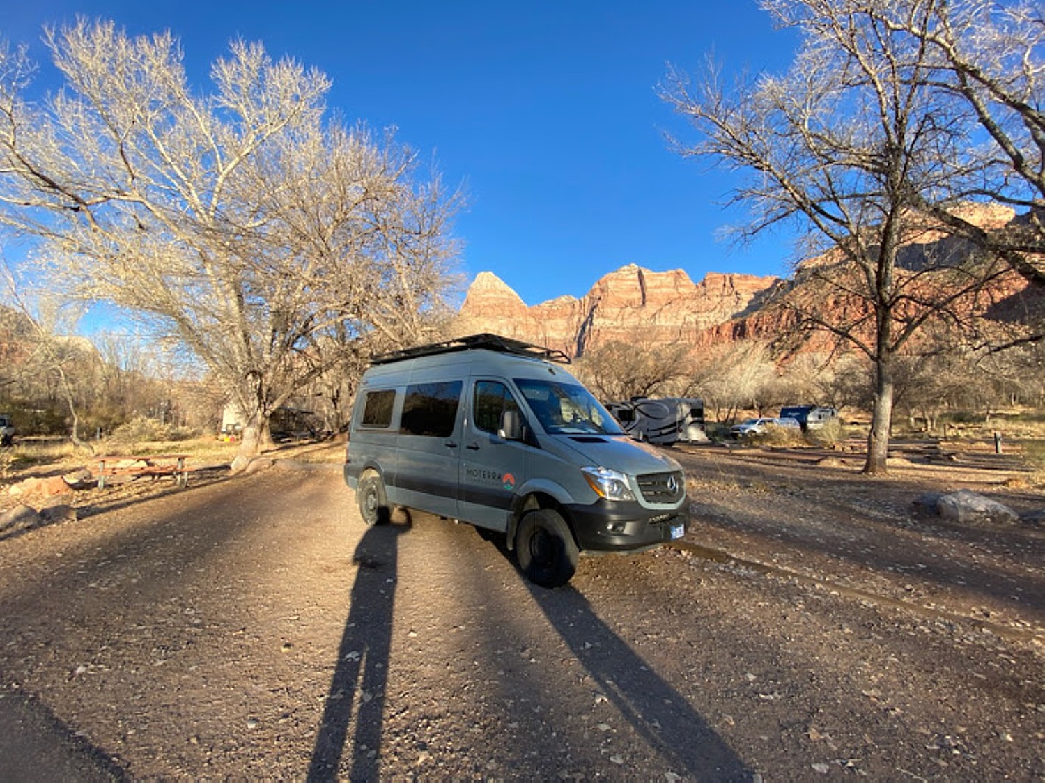
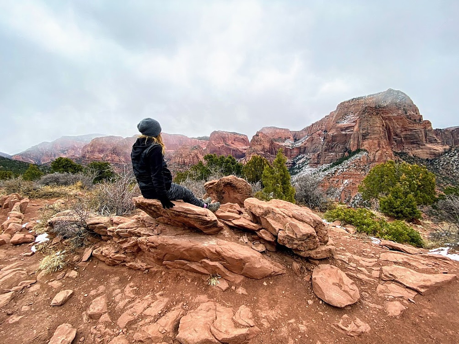
After Death Valley, we made our way to Zion National Park, Utah, stopping along the way in Las Vegas, Nevada, to pick-up a quick dinner. The Angels Landing & Narrows hikes are not to be missed. And being able to pull over at picturesque lookout points for homemade (van-made) lunches made the experience in the park all the more special.
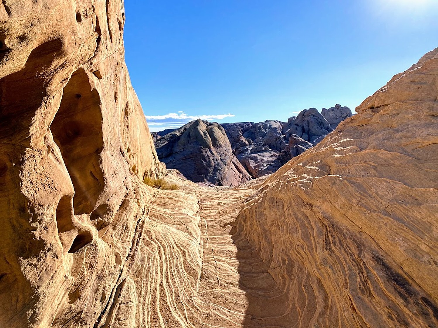
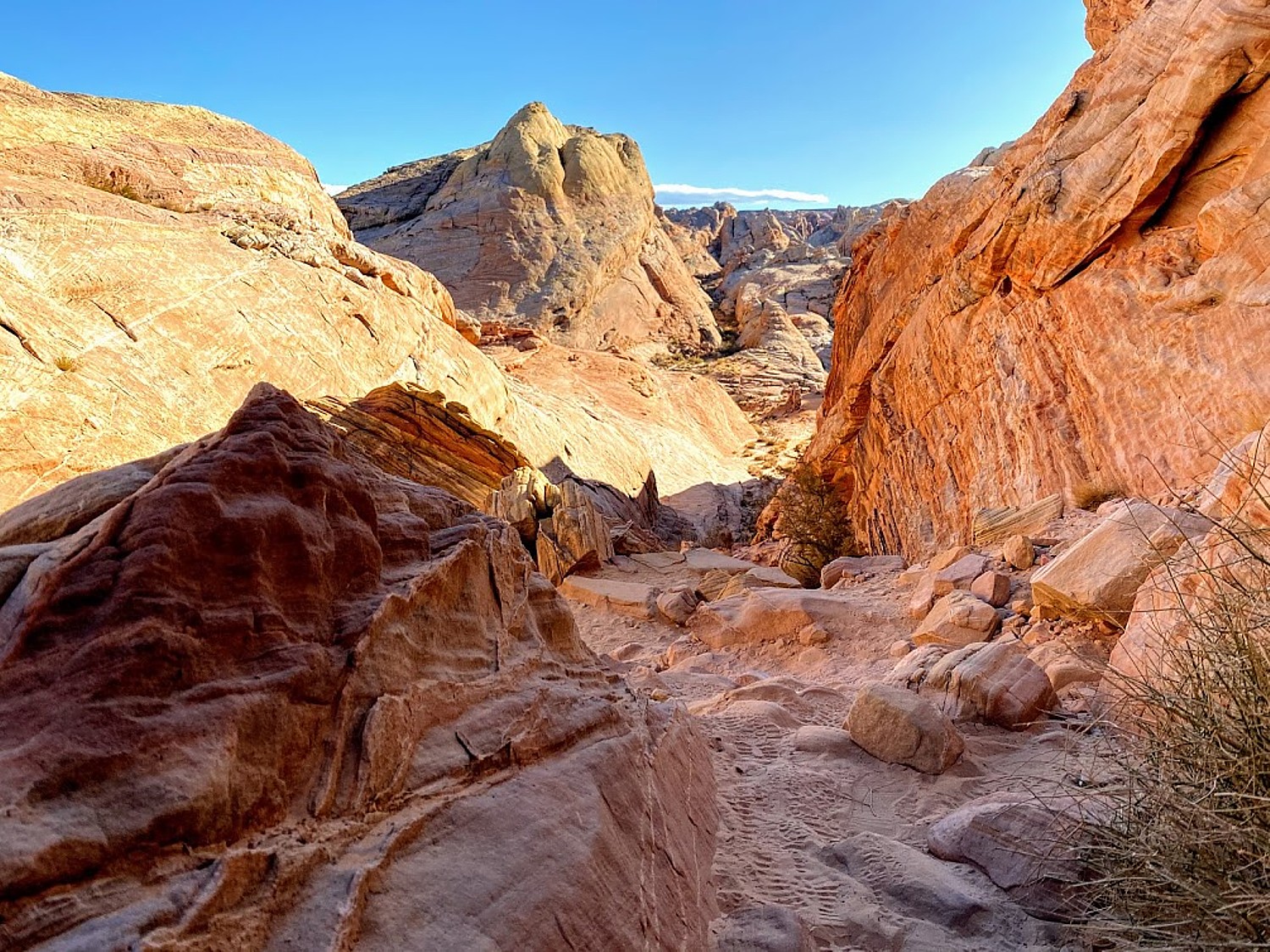
On our way back from Zion, we spent a night in Valley of Fire State Park (about an hour east of Vegas). We were shocked we hadn’t heard of this Nevada state park before. The massive red rocks and scrambly canyons made us feel like we were exploring communities and dwellings straight out of The Flintstones! We spent the night at the spectacular Arch Rock Campground.
While making our way back towards the Bay Area (by way of Los Angeles), we already began planning our next adVANture for Summer 2021 – we’re thinking the Pacific Northwest. As fabulous as it was to explore the National Parks in the off-season (we hear Zion especially can get unbelievably crowded and Death Valley is known to have some of the most extreme temperatures in the world), we’re looking forward to our next trip with warmer weather and longer days for exploring.
Moterra Luxury Camper Vans Lets You Pave Your Own Path
You’ve probably now heard of glamping – luxury camping. Now Moterra Campervans offer a novel way to experience the national parks and wilderness by luxury camper van, which also provides amazing self-sufficiency.
With all the luxury of a 50-foot long RV, the Moterra camper vans, at 19-foot long,are much less cumbersome to drive and park, and can even be used in easier-to-book tent camping spots in national parks, so you can stay away from the busy (and likely booked up) RV parks.
You don’t even need to plug into electricity because the vans are powered with rooftop solar panels and auxiliary batteries (not noisy generators); or have to plug into a water supply, since they hold between 16 and 24 gallons of fresh water, or bathroom, since they have their own sink, even their own bathroom facilities (port-o-potty; some actually have its own shower), and with their own galley for cooking and refrigerator, these camper vans provide a new level of mobility.
These camper vans come with bluetooth audio, cruise-control and touch-screen navigation. A backup camera, blind spot sensors and lane assist technology make maneuvering a breeze. You don’t have to stay in an RV park, but can go wherever tents are allowed.
Moterra’s fleet of specially outfitted Mercedes Benz Sprinters, tricked out by Sportmobile, are outfitted with absolutely everything you need for camping, from sleeping stuff (memory foam pillow!), to cooking (marshmallow skewers) and dining, cleaning supplies, amenities like chairs and table, inflatable solar lights, even bear spray.
There are two models to choose from: The High Roof is perfect for couples – it includes a queen sized bed in the back, galley kitchen, sink, indoor shower and portable toilet. The Pop Top, which sleeps four, is perfect for families, with a double bed down below and a double bed up top in the Pop Top! While the Pop Top does not have an Indoor Shower, you can get as an add-on a solar shower that can be used outside, and has a sink and stove. Both models are rented for $339 a night.
Add-ons available include hammocks & bike racks, and services such as pre-bought groceries.
The Moterra fleet is positioned for adventuring in Yellowstone, Wyoming; the Grand Tetons; Utah; Glacier National Park (Montana); Las Vegas (great gateway for desert adventuring) and California.
Moterra, which founded by Gabe Aufderheide and Trevor James who were formerly with Backroads, the renowned active travel company, also offers packaged and customized tour itineraries.
All-inclusive packages consist of:
Moterra Campervan Rental and cleaning fee
Day-by-day personalized Itinerary with directions and destination info.
Pre-booked campsites, handpicked and booked in advance where possible, or GPS locations for off-the-grid dispersed camping spots.
Scenic routes that take you to the heart of the action while minimizing road traffic.
Individualized suggestions depending on your preferences for hiking, scenic attractions, restaurants and activities.
A wide range of activities to make the trip your own, like white-water rafting, wildlife safaris, road biking, horseback-riding, kayaking and scenic floats.
For example, a 13-night/14 day Mighty 5+ Grand Canyon: featuring Arches National Park, Canyonlands National Park, Capitol Reef National Park, Bryce National Park, Zion National Park, Monument Valley and Grand Canyon National Park is priced from $5999.
A six-night/seven-day family-oriented Yellowstone Handpicked Highlights package features Yellowstone National Park and The Grand Tetons National Park (from $4699).
Moterra operates out of Jackson, WY, Whitefish, MT, Salt Lake City, UT and San Francisco, CA.
Check the website for deals, discounts on early bird bookings, extended trips, spring 2021 discounted add-on for one-ways, and gift cards.
by Karen Rubin Travel Features Syndicate, goingplacesfarandnear.com
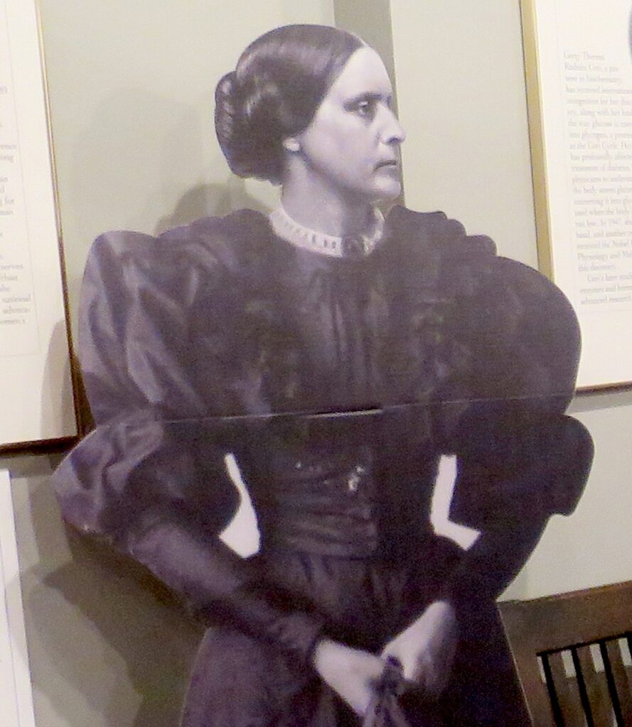
On the Centennial of passage of the 19th Amendment, also known as the Susan B. Anthony Amendment, giving women the right to vote, Donald Trump made a grand gesture with much fanfare in issuing a pardon for Susan B. Anthony, who died in 1906.
Noting she was arrested in 1872 for voting before it was legal for women to vote, he exclaimed at the White House signing ceremony, “She was never pardoned! Did you know that she was never pardoned? What took so long?”
Actually, according to those who are the caretakers of her legacy, she wouldn’t have wanted to be pardoned.
In a statement headlined, “Objection! Mr. President, Susan B. Anthony must decline your offer of a pardon today,”Deborah L. Hughes, President & CEO of the National Susan B. Anthony Museum & House in Rochester, NY, stated, “Anthony wrote in her diary in 1873 that her trial for voting was ‘The greatest outrage History ever witnessed.’ She was not allowed to speak as a witness in her own defense, because she was a woman. At the conclusion of arguments, Judge Hunt dismissed the jury and pronounced her guilty. She was outraged to be denied a trial by jury. She proclaimed, ‘I shall never pay a dollar of your unjust penalty.’ To pay would have been to validate the proceedings. To pardon Susan B. Anthony does the same.
“If one wants to honor Susan B. Anthony today, a clear stance against any form of voter suppression would be welcome. Enforcement and expansion of the Voting Rights Act of 1965 would be celebrated, we must assure that states respect the 14th, 15th, and 19th Amendments to the United States Constitution. Support for the Equal Rights Amendment would be well received. Advocacy for human rights for all would be splendid. Anthony was also a strong proponent of sex education, fair labor practices, excellent public education, equal pay for equal work, and elimination of all forms of discrimination.
“As the National Historic Landmark and Museum that has been interpreting her life and work for seventy-five years, we would be delighted to share more.”
We just celebrated the centennial of the passage of the 19th Amendment. But the journey to Women’s Right to Vote, goes back a century before, back to when Abigail Adams wrote her husband, John Adams, in 1776, “Remember the ladies.” He didn’t. The struggle began.
The journey toward Women’s Suffrage is long, and offers a long trail that can be followed, in order to experience first-hand something of what the struggle was like and pay proper respect to the Suffragists’ extraordinary courage, perseverance, and innovativeness. Here are some of the places to follow their footsteps and sense their spirit:
“The National Susan B. Anthony Museum & House, Rochester’s first National Historic Landmark, was home to the legendary suffragist, abolitionist and civil rights leader during her 40 most politically active years, as Visit Rochester proudly notes. “She served as president of the National American Woman Suffrage Association from her home on Madison Street. It was a hub for planning strategies, organizing campaigns, writing speeches, and preparing petitions. This was Anthony’s home base as she made countless trips throughout the United States, to Great Britain, and to Europe to support local suffrage campaigns and organize the International Council of Women.
“Walk through rooms where Anthony met often with Elizabeth Cady Stanton and other leaders of the civil rights movement. Stand in the parlor where Anthony was arrested in 1872 for the ‘crime’ of voting.
“It’s not hard to imagine Anthony enjoying her talks with the famous orator and abolitionist Frederick Douglass over cups of tea in her parlor. Upstairs in the small bedroom where Anthony died in 1906, visitors can’t help feeling some sadness knowing she never had an opportunity to cast a legal ballot. Fourteen years after her death, the 19th “Susan B. Anthony” Amendment was finally ratified and women throughout America were welcome at polling places.” (www.visitrochester.com/susanb2020)
The 19th Amendment to the U.S. Constitution, also known as the Susan B. Anthony Amendment, was ratified in 1920, 14 years after Anthony died, in 1906. The house was her home from 1866 until her death here in 1906; it was the site of her famous arrest for voting in the presidential election of 1872. Her bedroom contains her original furniture, including the feather-star-pattern quilt on the bed that she made with her sister Hannah. The house is filled with photographs, memorabilia, and much of the Anthony family’s furniture. A museum room on the second floor illustrates major events of the woman suffrage movement, including extensive photographs of the people who worked so long and so hard to win voting rights for women.
National Susan B. Anthony Museum & House 17 Madison Street Rochester, NY 14608 585/235-6124, www.susanbanthonyhouse.org
You can visit the Ontario County Courthouse, the site of Susan B. Anthony’s famous trial in 1873, just a short drive from Rochester in Canandaigua,
The final resting place for Susan B. Anthony, Jean Brooks Greenleaf (former president of the New York State Woman Suffrage Association), Frederick Douglass and many other important leaders of the abolitionist and women’s rights movements is Mt. Hope Cemetery in Rochester. There are guided tours and self-guiding maps.
This year is also the 200th anniversary of Susan B. Anthony’s birth, in 1820. The daughter of a Quaker family that promoted abolition and temperance, from the age of 6 and 25, from 1826 to 1845, she lived in Battenville, Washington County, and later in Center Falls, before her family moved to Rochester. So, on the 100th Anniversary of the 19th Amendment, Governor Andrew M. Cuomo announced an effort to stabilize and preserve Susan B. Anthony’s childhood home on Route 29 in Battenville. The work at the 1832 two-story brick home where Anthony lived from ages 13 to 19, is expected to be completed by September.
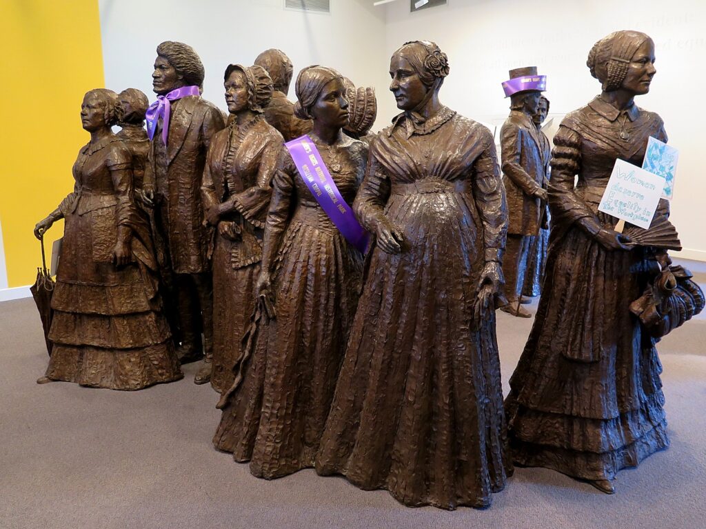
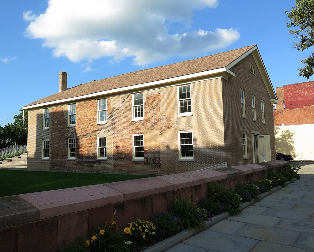
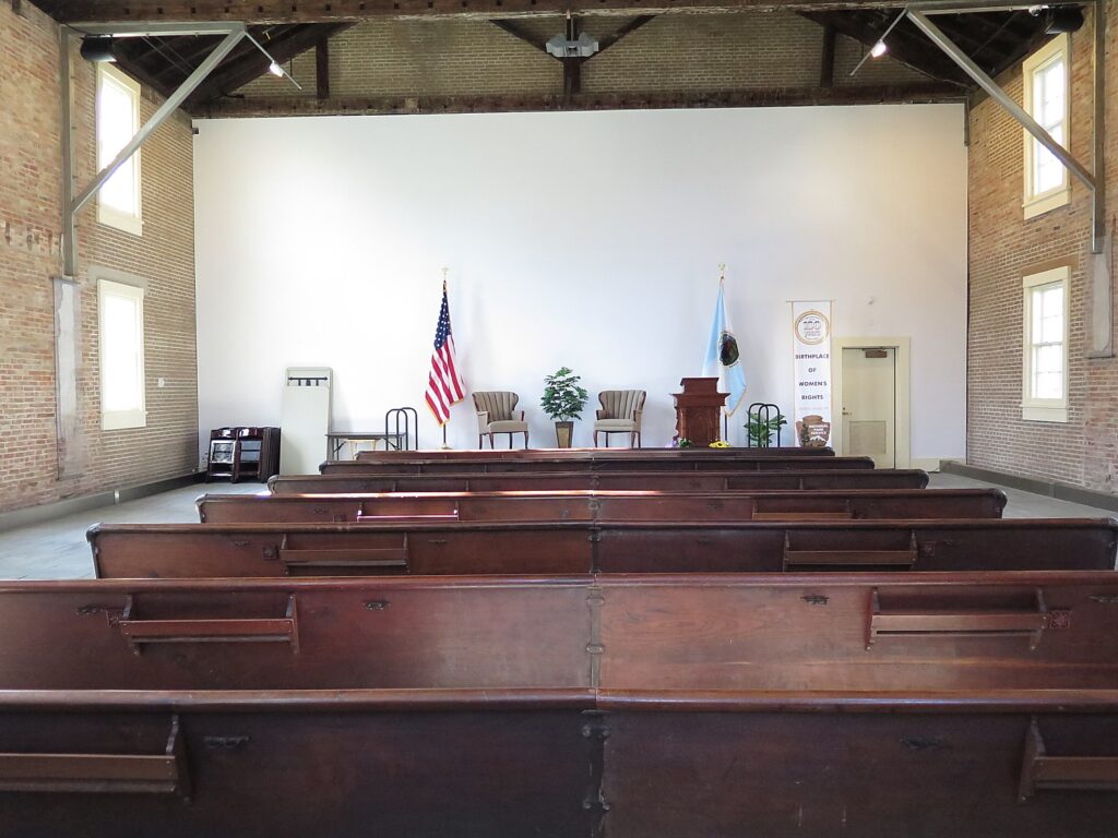
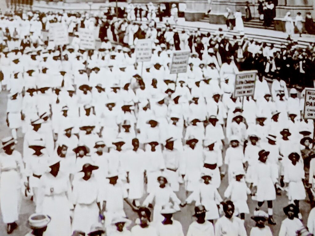
For many, the journey to women’s rights begins at The Women’s Rights National Park in Seneca Falls, New York, ostensibly the “birthplace” of the women’s suffrage movement, where the 1848 Convention offers the most identifiable launch-pad for the (ongoing) struggle. The actual exhibit, created during Ronald Reagan’s term, is disappointing, but you can visit Wesleyan Chapel where the convention took place.
The women organized the convention and prepared a document laying out their grievances, the “Declaration of Sentiments,” which was modeled after the Declaration of Independence and mimicked its language in describing the tyranny under which women were forced to live. The document outlined 11 resolutions to “declare our right to be free as man is free…” At the close of the convention, all the resolutions passed with the exception of the ninth resolution, guaranteeing a woman’s right to vote.
Out of the 300 people who attended (the chapel had a balcony then; men were allowed to attend the second day), only 100 signed the Declaration of Sentiments, and of these, 68 were women and 32 were men). (Forty percent of those who attended were Quakers, who already accommodated more equal roles for women.)
The history of the Wesleyan Chapel can be a metaphor for the ambivalence of American society to women’s rights: From 1843-1871 it was chapel, then an opera house/performing arts hall; then a roller skating rink, a movie theater (in 1910s), then a Ford dealership, and ironically enough, finished its days as a laundromat before facing a wrecking ball. “Women fought to save the building,” the Ranger says. It was only in 1982, during the Reagan Administration, that it was turned into a national park.
At this writing, with the COVID-19 restrictions, the Visitor Center is only open Tuesday and Thursday (10-4), historic homes are closed, but Ranger Programs have resumed outdoors and the grounds are open daily. Check the site for updates.
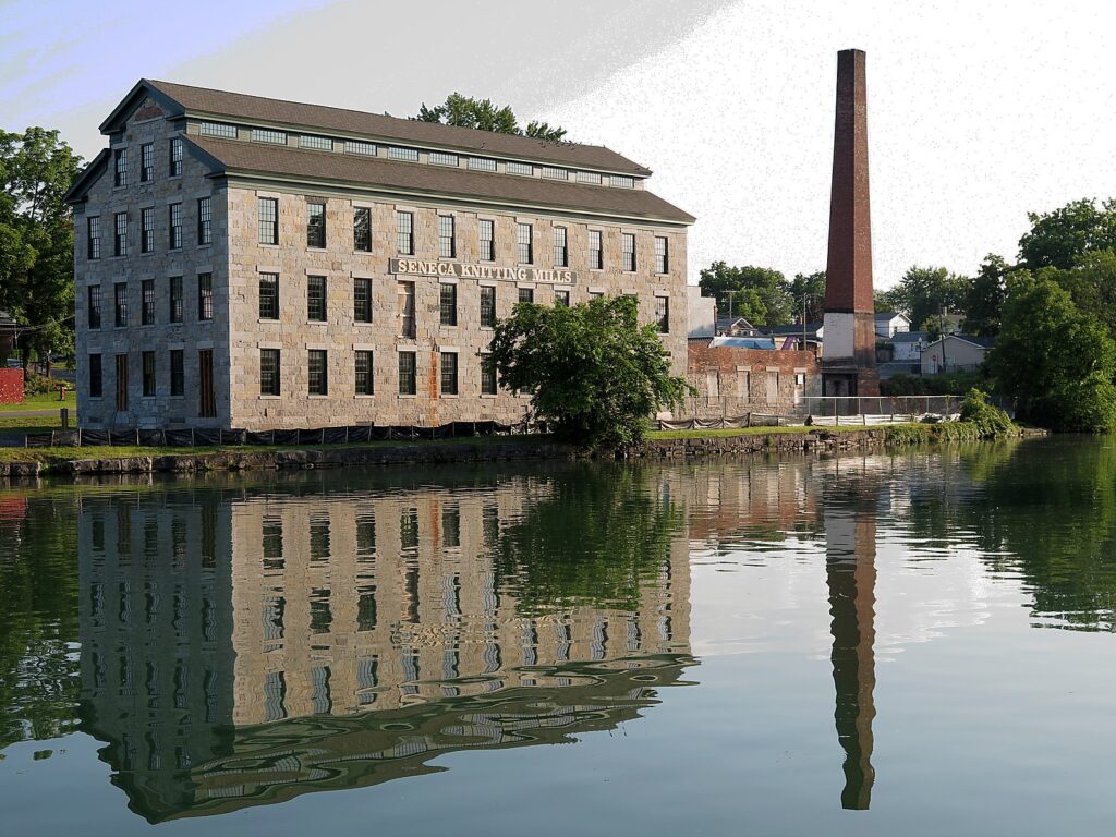
In contrast, The National Women’s Hall of Fame, now in its new location in the rehabilitated 1844 Seneca Knitting Mill building, remains the more meaningful and inspiring exhibit, putting faces on the long, long diverse parade of women, in the place “where it happened.” Indeed, women factory workers, fired for demanding equal pay, provided the seed for the convention (which initially did not seek women’s vote, but rather equal rights to pay, property and custody of children).
The Hall, housed up until last fall in a former bank building, only opened in the new location this spring, but immediately forced to shut down due to the coronavirus.
It has reopened, with timed reservations. Among the new features: a new Hall of Fame display listing Inductees and their areas of accomplishment; a section called “Why Here?” highlighting why all of this history happened in Seneca Falls and the story of the Seneca Knitting Mill and the women who worked there.
“We invite visitors to delve into the history of what happens when women innovate or lead with an interactive exhibit that challenges widely-held assumptions. Visitors can ‘weave’ themselves into the story in a participatory exhibit, and we ask visitors for their own stories of women who have inspired them. The exhibits encourage visitors to engage in creating our future and to understand the possibility of a world where women are equal partners in leadership.” (See the Women of the Hall, the inductees into the Hall of Fame: https://www.womenofthehall.org/women-of-the-hall/)
Visit the home of Matilda Joslyn Gage, who was important to developing the arguments for women’s rights, but has too often been overlooked because she did not attend the Seneca Falls convention in 1848. Gage was a noted speaker and writer on woman’s suffrage and an abolitionist. She and her husband used their home as a station for the Underground Railroad to help escaped slaves. She worked closely with prominent women’s rights leaders Susan B. Anthony and Elizabeth Cady Stanton, often holding meetings in her home. Her lifelong motto and gravestone inscription reads “There is a word sweeter than Mother, Home or Heaven; that word is Liberty.”
Less well known about Matilda Gage is that many of her ideas for women’s rights came from the Iroquois Indians, who had a maternal society where women could be chiefs, own property and have custody of their children. Also, she was the mother-in-law of L. Frank Baum, author of “The Wizard of Oz.” The Gage Center is also an educational resource for discussion and dialogue about the human rights issues to which she dedicated her life. (210 E. Genesee Street, Fayetteville, matildajoslyngage.org
Closer to home, you can join the long women’s march to voting rights at The New-York Historical Society when it reopens its indoor exhibits on Friday, September 11, to see the temporary exhibition Women March. (See www.nyhistory.org/exhibitions/women-march). Check the site for opening hours; timed Tickets are required. More details: www.nyhistory.org/safety. (New-York Historical Society, 170 Central Park West, New York, NY 10024, 212-873-3400, www.nyhistory.org).
by Karen Rubin Travel Features Syndicate, goingplacesfarandnear.com
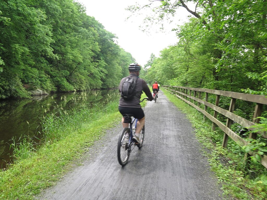
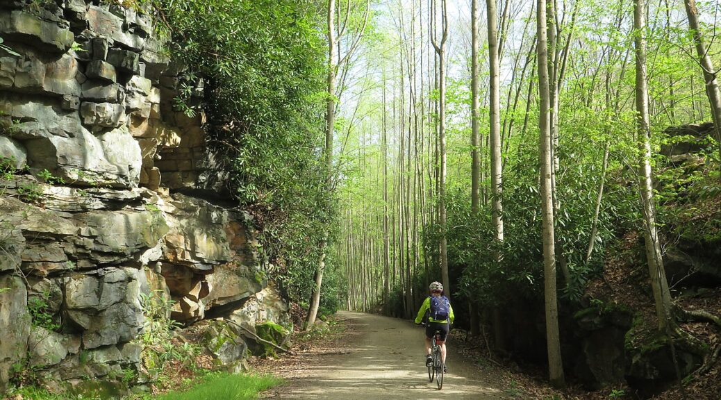
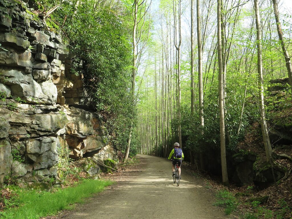
Bike tours offer one of the best vacation alternatives in these times when people want to be outdoors in open spaces, and enjoy stunning landscapes, discover heritage and history and have that opportunity for shared experiences that travel uniquely provide. There is still time this season to take advantage of guided, self-guided and private bike tours from companies including Pocono Biking, Wilderness Voyageurs and Discovery Bicycle Tours.
Pocono Biking has space on departures this season on a supported four-day bike tour that takes you 142 miles of the Delaware & Lehigh rail trail, also known as D&L Trail.
I did this ride, anchored by the charming town of Jim Thorpe and the famous historic landmark at Washington Crossing, on the Rails-to-Trails Conservancy’s Sojourn, though with camping instead of inn-to-inn along this scenic and history-rich trail (railstotrails.org). The RTC trip also was operated by Pocono Biking, a powerhouse outdoors- adventure company in the area well known for its rafting adventures on the Lehigh River in the Lehigh Valley.
The trip, traveling through 57,600 acres (90 miles) of state park, is designed so you get to enjoy three of Pennsylvania’s award winning quaint small towns: Jim Thorpe, Bethlehem and New Hope. Essentially, we follow the route of Anthracite Coal, from mine to market, which thrust America into the Industrial Revolution. Along the way, we see the geography, the resources, and the technological innovations that made this possible, and how they affected the society, the culture, and the economy of the fledgling nation. The trail, part of the Delaware & Lehigh National Heritage Corridor, is so historically significant that it is a Smithsonian Institution Affiliate.
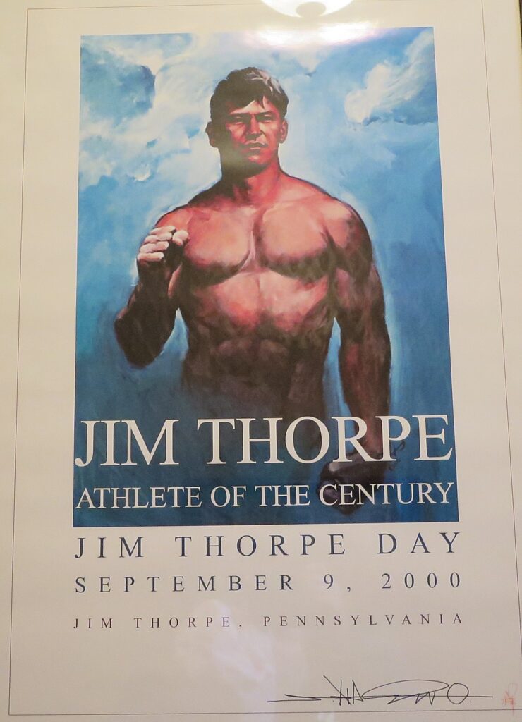
Day 1 – 36 miles: The adventure starts in the wilderness of the Lehigh Gorge State Park, riding passed waterfalls and spotting wildlife (deer!), taking advantage of the newly connected D&L Rail Trail into the charming town of Jim Thorpe. The first night is spent amid mountains in the Inn of Jim Thorpe, circa 1849.
Jim Thorpe – an odd name for a town – was established in 1818 as Mauch Chunk, which means “Mountain of the Sleeping Bear,” the name the Lenni Lenape Indians gave to the nearby mountain. But it was later renamed for an Oklahoma-born Native American, the Olympic hero Jim Thorpe, who is buried there. Thorpe was born in Oklahoma in 1888 and raised on the Sac and Fox Reservation and had never set foot in the borough. But Patsy Thorpe, Jim’s third wife, cut a deal with two struggling towns in Pennsylvania, that if they would merge, rename themselves Jim Thorpe and build a memorial to honor him, she would present them his remains for burial.
The town played a key role in the emergence of the United States as an Industrial Revolution powerhouse. Here, entrepreneurs led by Josiah White formed the Lehigh Coal & Navigation Company in the 1820s (you can still see the brick building), which shipped tons and tons of anthracite coal and other goods to market via the Lehigh and Delaware Canals which they constructed. The town grew in importance when it was named Carbon County’s seat in 1843.
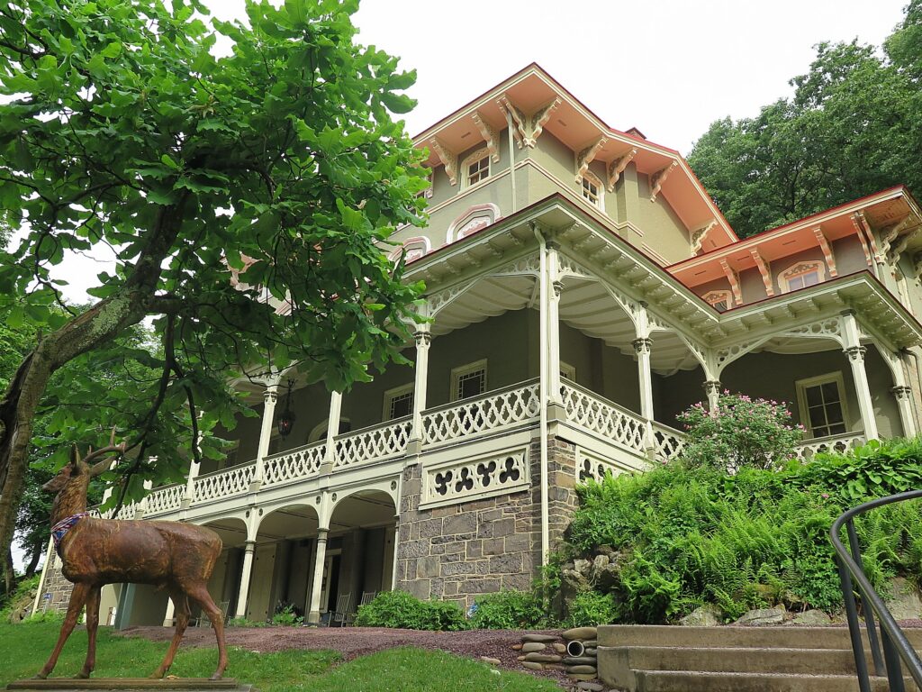
A major attraction here is the Packer Mansion, which I was lucky enough to visit on my trip. Asa Packer’s story epitomizes the rags-to-riches-for-those-with-grit-and-a-good-idea American Dream: Born poor in Mystic, Connecticut, Asa Packer (1805-1879) left home when he was 17, setting out on foot to Brooklyn, Pennsylvania where he apprenticed as a carpenter to his cousin, Edward Packer. In 1828, he married Sarah Minerva Blakslee (1807-1882) and the couple tilled a farm they rented from Sarah’s father. But after four years, they were just as poor as when they started. So hearing that men were needed to captain coal barges on the Lehigh Canal, Asa traveled to Mauch Chunk, in the winter of 1832. He used his skill as a carpenter to build and repair canal boats. He resettled his family in Mauch Chunk and became the owner of a canal boat that carried coal to Philadelphia, then opened his own firm, A. & R. W. Packer, which built canal boats and locks for the Lehigh Coal & Navigation Company.
He tried to get the company to build a railroad, but was refused. So, in October 1851, risking financial ruin, Packer purchased nearly all the controlling stock and interest for the unfinished Delaware, Lehigh, Schuylkill and Susquehanna Railroad (later known as the Lehigh Valley Railroad). By November, 1852, he expanded the railroad from Mauch Chunk to Easton, Pennsylvania, in exchange for the company’s stocks and bonds, and later into New York State.
He became the third richest person in the world and parlayed his business success into political success, serving as a Judge, a state representative, a two-term Congressman (1853-7), and even challenged Ulysses S. Grant for the Democratic presidential nomination in 1868. He narrowly lost election to become Pennsylvania’s Governor in 1869.
The Packers settled in their Italianate Villa in Mauch Chunk in 1861 and, to celebrate their 50th wedding anniversary, on January 23, 1878, held a fantastic gala (a newspaper printed in gold described it, and the man who performed their wedding attended). Asa died just 18 months later.
This quaint village is a hub for many marvelous attractions including the Packer Mansion; the Old Jail Museum (the eerie dungeon where the Molly McGuires were jailed; Cell 17 with its mysterious handprint on the wall, under the gallows on which seven of the accused Molly Maguires were put to death); the Lehigh Gorge Scenic Railway, St. Mark’s Church, Historic Stone Row, the Mauch Chunk Opera House, Anita Shapolsky Art Center, Mauch Chunk Museum, plus wineries and distilleries (Big Creek Vineyard and Stonekeep Meadery), biking, hiking and rafting.
Jim Thorpe Visitors Center, 2 Lehigh Ave., Jim Thorpe PA 18229, 570-325-3673, jimthorpe.org.
Day 2 – 37 miles: After a night exploring the shops, museums and restaurants in Jim Thorpe and breakfast at the Inn, cycle beside the locks and canals along the Lehigh River to the town of Bethlehem, PA. Along the way you pass the Lehigh Gap Nature Center with its protected land. There are stunning views of the Blue Mountain and Appalachian Trail. Bethlehem, circa 1741, an old Moravian settlement, has cobblestone streets, quaint shops, and history around every bend. Spend the night in the Hotel Bethlehem where Presidents and dignitaries have stayed.
Lehigh Gap Nature Center, a non-profit conservation organization at the foot of the Kittatinny Ridge, is dedicated to preserving wildlife and habitat through conservation programs such as the Lehigh Gap Wildlife Refuge, educational programs such as the Kittatiny Raptor Corridor Project as well as research. I linger in the butterfly garden before setting out again on the trail. (8844 Paint Mill Rd, Slatington, PA 18080, 610-760-8889, http://lgnc.org/)
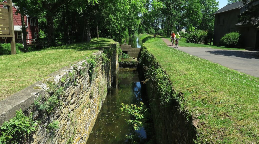
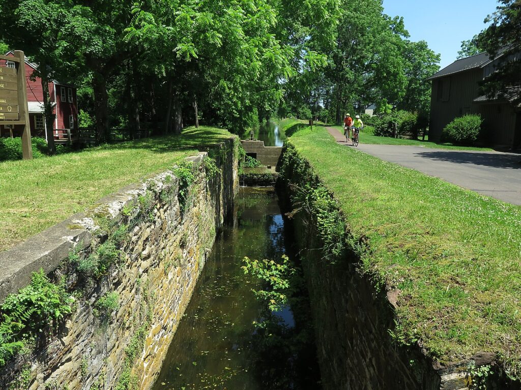
Along the way, we come upon what is left of the original canal locks – stone walls, wooden gates with metal latches and gears, remnants from the mid-1800s.
At Freemansburg, we find a lockmasters house, the remains of the locks and a mill, which, when I visited, was manned by interpreters in period dress. I wonder whether the village was settled by freemen and am told that it was named for one of the original settlers, Richard Freeman.
Freemansburg is a classic example of a canal town with houses and structures built up against the waterway that was the village’s lifeblood in the 1800s. Members of the Old Freemansburg Association (OFA) reclaimed a 1.5 mile section of the Lehigh Canal the Borough owns from overgrowth and debris and restored the towpath which became the D&L Trail. The OFA spearheaded efforts to protect and restore the 1829 Locktender’s House, mule barn, Lock No. 44, gristmill, and coal yard. Volunteers also reconstructed the barn using canal era tools and equipment, a project that took 10 years to complete. The multi-functional building now hosts weddings, educational sessions and interpretative demonstrations. (http://lehighvalleyhistory.com/history-of-the-borough-of-freemansburg)
Riding on, we come to an island that consists of a shuttered steel mill that today stands somewhat surreally like an abstract sculpture.
Day 3 – 47 miles: After breakfast, the group departs Bethlehem and cycles south following the path of 19th century aqueducts to the confluence of the Lehigh and Delaware Rivers. Visit the only operating mule drawn canal boat east of the Mississippi. Tour the National Canal Museum and pass through quaint river villages, until arriving in New Hope. New Hope offers bustling nightlife and cultural attractions such as the Bucks County Playhouse.
The Delaware & Lehigh National Heritage Corridor interprets this fascinating period of American history in the 520-acre Hugh Moore Park through tours of the National Canal Museum and rides on the 110-passenger Josiah White II canal boat. Here you see remnants of the oldest industrial park in the region, a Locktender’s House and one of only three mule-drawn canal boats still operating in America, which plies a two-mile section of the canal that has been restored. The National Canal Museum, with hands-on exhibits highlighting 19th century canal life and technology, normally is open from June until October. (https://canals.org/)
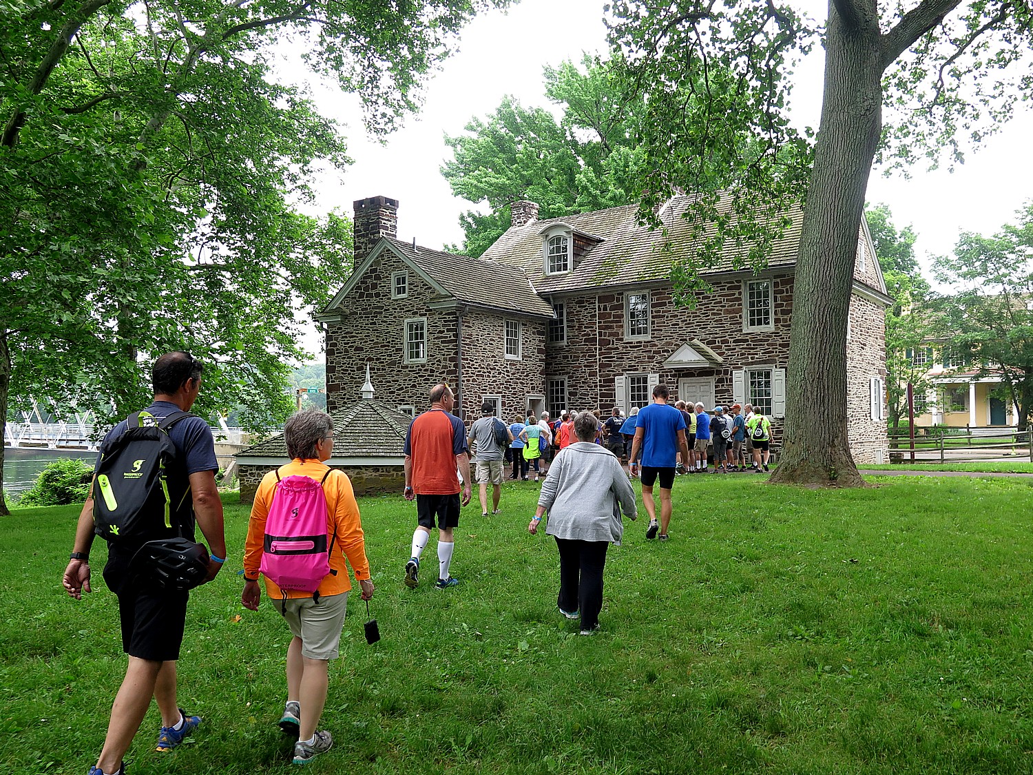
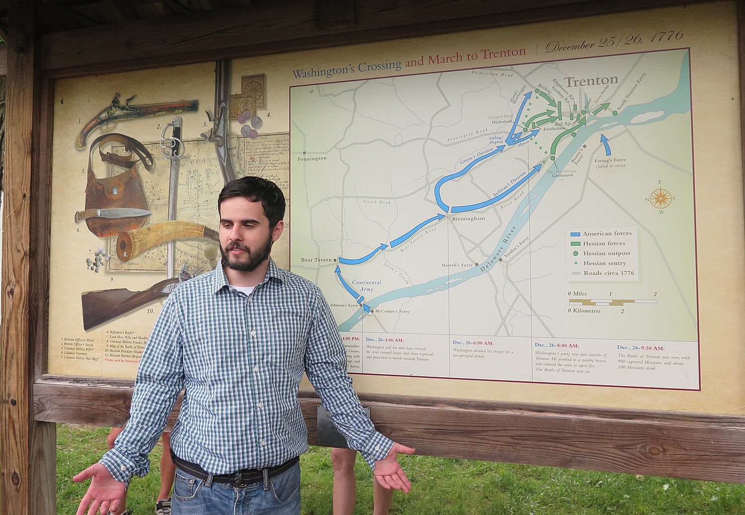
Day 4 – 22 miles: On day four, after breakfast at the Fox and Hound Bed & Breakfast, ride along the canal trail to Washington Crossing where George Washington crossed the Delaware in 1776. You also cross the Delaware to the D&R Canal State Park and head north to Bull’s Island where the ride ends with lunch before being shuttled back to your car.
Washington Crossing Historic Park, 1112 River Road, Washington Crossing, PA 18977, 215-493-4076, www.WashingtonCrossingPark.org.
Available dates at this writing include Sept. 14 and Oct. 5 (up to 14 guests per trip, with 2 guides; the minimum age is 13; e-bike rentals are available, but the trail is easy/moderate crushed gravel trail). The cost is $995 ($225 single supplement); $90 to rent a bike, and includes the overnight accommodations, professional bike guides; sag wagon; basic bike repair (replacement bike if needed to complete the ride); rest stops with snacks and water; breakfast on three days; lunch on two days; luggage transportation to each accommodation; morning trail briefings and transportation back to your car by 4pm on the final day.
If you would rather DIY, Pocono Biking also offers daily rates and shuttle service, Big Day Out & Big Night Out (Multisport Adventures), two-day trips, and Pocono Whitewater Rafting on the Lehigh River.
Pocono Biking, 7 Hazard Square, Jim Thorpe, PA, 570-325-8430, PoconoBiking.com.
“Bike touring lends itself to a vacationing style that uniquely fits these times: small groups and big open spaces! Although we understand that traveling at this moment is not for everyone and is a personal decision, our goal is to minimize the risks where possible and make traveling as comfortable as possible.”
Discovery Tours is inviting biking enthusiasts to design their own tour: “Pick any of our U.S. locations — or suggest a new one — and we’ll customize an incredible biking vacation just for you.”
Groups of 8 or more get one tour free (or spread the savings across the group). Special pricing is available for groups of 4 or fewer.
The company, based in Woodstock, Vt., has already run private tours this summer on the Mickelson Trail and Black Hills in South Dakota, in Maine and in New York’s Finger Lakes.
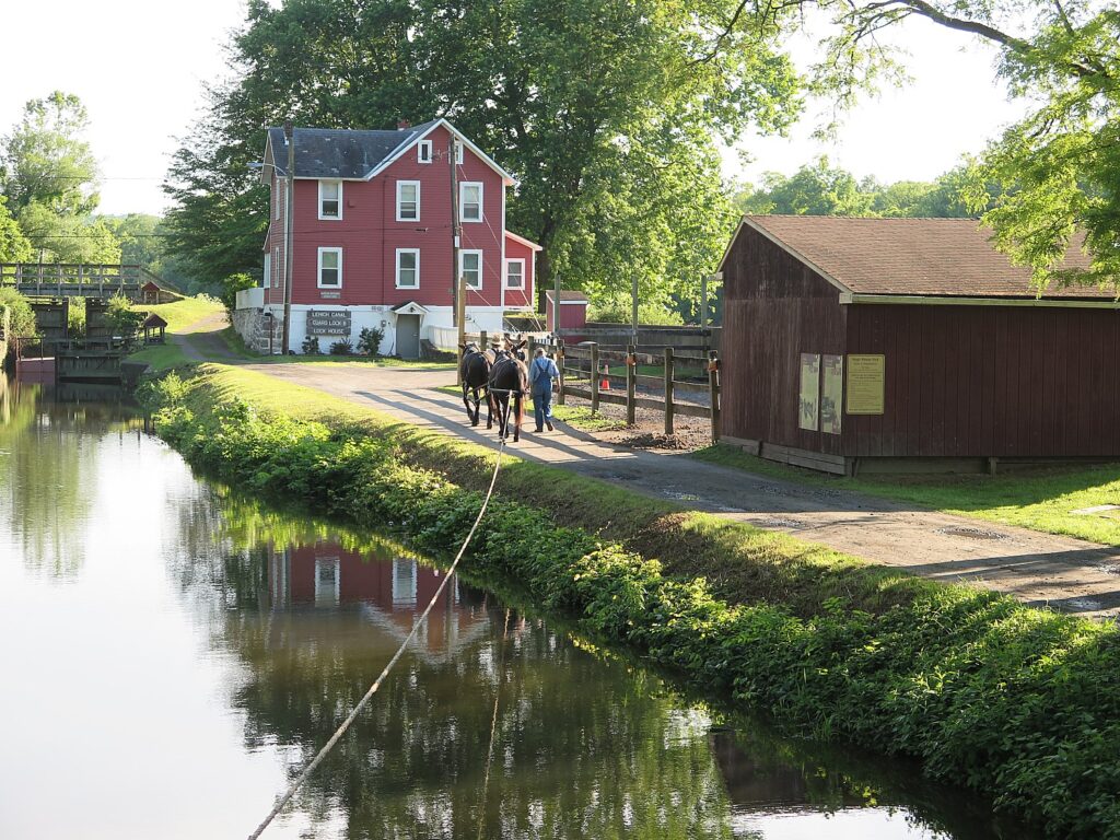
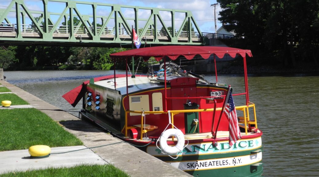
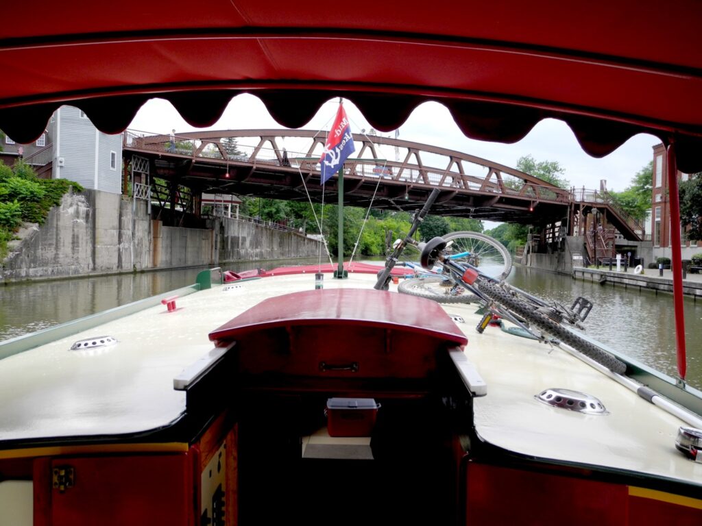
Erie Canal Adventures rents Lockmaster canalboats that let you cruise fancy free on the Erie Canal, New York State (c) Karen Rubin/goingplacesfarandnear.com.
By Karen Rubin Travel Features Syndicate, goingplacesfarandnear.com
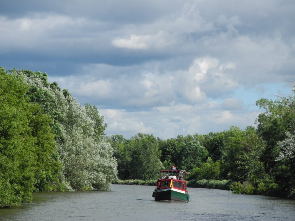
If you want to see how America came to be, travel along the Erie Canal. A marvel of engineering when it was opened in 1825, the canal, which spans 353-miles from Albany to Buffalo, creating a water highway for commerce from the Midwest through New York City to the rest of the world, remains a dazzling achievement. But it was also the artery and an engine for invention, innovation, economic development, and ultimately social and political movements. Bike along the Erie Canalway (now virtually uninterrupted and part of the 750-mile Empire State Trail; there are several bike tour companies that offer inn-to-inn bike trips), but to really get the sense of it, float along the canal, tying up at the small towns and major cities that the canal birthed, and see unfold before you all the major social and economic movements that made America: immigration, labor, abolition and civil rights, women’s rights.
A few years ago, I had that opportunity, and in this time when people are shunning cruising because of the coronavirus pandemic but embracing RVs, renting your own self-skippered, specially-designed Lockmaster canal boat offers the best of those worlds. Founded decades ago as Mid-Lakes Navigation by Peter Wiles who designed the Lockmaster canalboats and was a significant force in repurposing the Erie Canal from commercial to recreational use, the company, Erie Canal Adventures, is now in the hands of Brian Kennan, and . And even though you are still in New York State, the sights and experiences are as interesting and exciting as sailing the canals of Europe.
The company has made accommodations for COVID-19 – sanitizing the compartments so that there is a tape over them until the passengers arrive; instead of cooking utensils and “hard goods” being kept on the boat, they are taken off after each trip, sanitized and provided to guests in a sanitized tote when they arrive.
The orientation is still done on the water – the guide wears mask and gloves – to take you through one of the canal locks (thrilling), but the orientation that would have been done in the cabin is now offered by video.
Bikes are still provided but they are taken off the boat after each cruise, sanitized and replaced for each trip.
This part of New York State is already in Phase 4 – meaning that there is indoor and outdoor dining (with social distancing), many of the museums and attractions have reopened like the George Eastman Museum and the Strong Museum (with limits on capacity). In the various canal towns, you won’t have any trouble finding groceries or restaurants. And New York State has been successful containing the spread of illness and turning from the worst infection rate to the lowest in the country, because New Yorkers have scrupulously adhered to using masks and social distancing. (Now, to prevent any reemergence, the state is imposing a 14-day quarantine on visitors from states where COVID-19 rates are surging.)
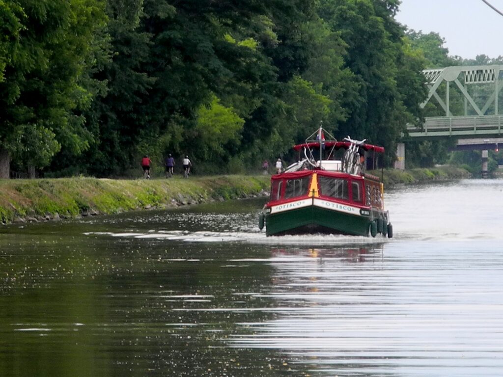
Cruising the Erie Canal in a Lockmaster canal boat, as cyclists ride the towpath (c) Karen Rubin/goingplacesfarandnear.com.
I am at the helm of a 41-foot canal boat, a boat so enchanting and lovely, it turns heads and evokes waves, smiles, and snapped photos as it chugs pleasantly along at a top speed of 6 mph.
From this vantage point, I can appreciate this marvel of engineering, of grit and ingenuity the Erie Canal was, the vital role it played in the United States’ emergence as an Industrial giant in the 19th century and a dominant economic power in the 20th century.
There is no place in the United States like the Erie Canal, and no experience like having your own self-skippered canal boat – our floating home for the week – and a bicycle with which to explore the towns that were literally birthed by the canal. And to a New York City kid, seeing this bucolic countryside is a revelation. (“This is New Yawk!”)
It is extraordinary and thrilling to travel on the 363-mile long Erie Canal that slices through New York State and played such a vital part in the nation’s history, especially as we go through locks that are filled for us, and under bridges that must be lifted for us to pass.
Most of all, it lets us explore and appreciate the extraordinary innovation and ingenuity that developed because of the Erie Canal, the villages and towns, the factories and businesses that developed, and how the canal turned New York City into a global financial capital, and united the East with the West, how it funneled thousands of immigrants who populated the Midwest.
This is a true adventure. One where there are new discoveries, new insights, new perspectives formed with every new encounter. The Erie Canal birthed these places and now we see how they are being reborn, revitalized.
Going through one of the locks on the Erie Canal, New York State (c) Karen Rubin/goingplacesfarandnear.com
Setting off on our first morning, I have rarely felt that exhilarating sense of being so fancy free – to not have a set itinerary or schedule or even know where I am going or what I will see, but to have the power and ability just go where your curiosity leads. It is a marvelous.
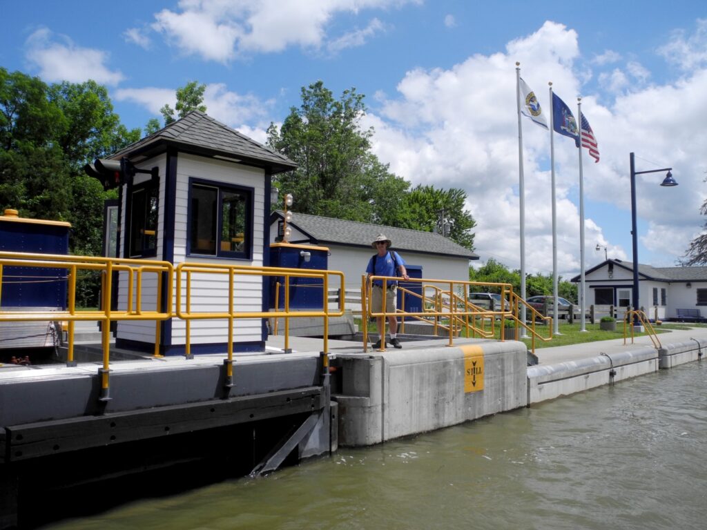
We had trepidation about navigating the boat – a 41-foot long houseboat, like a floating RV – docking and most intriguingly going through the locks along the canal. But when we arrive, we get a two-hour orientation – every aspect about operating the boat, plugging in to electricity and water; how to turn on the engine, the stove, the shower, flush the toilet; how to recharge the batteries by running the engine in neutral; how to operate the radio and the correct protocol when contacting bridge and lock operators to “request passage”.
We are taken on a “shake-down” cruise that includes going back and forth through a lock. We are provided with a chart book and a handy sheet that lets you approximate how many hours between ports (important to keep track of the hours the lift operator is available).
Key advice: “Don’t approach anything faster than you would care to hit it.” The steel-hulled boat is powered by a 50 horsepower diesel engine; its top speed is 6 mph, and it weighs 11 tons “so you can’t get into trouble,” we are told.
The canal boat is outfitted with just about everything you might need – from ponchos to potholders to paper towels. There is even a grill and BBQ tools and canisters of propane. There are safety devices, a tool kit, even a sewing kit.
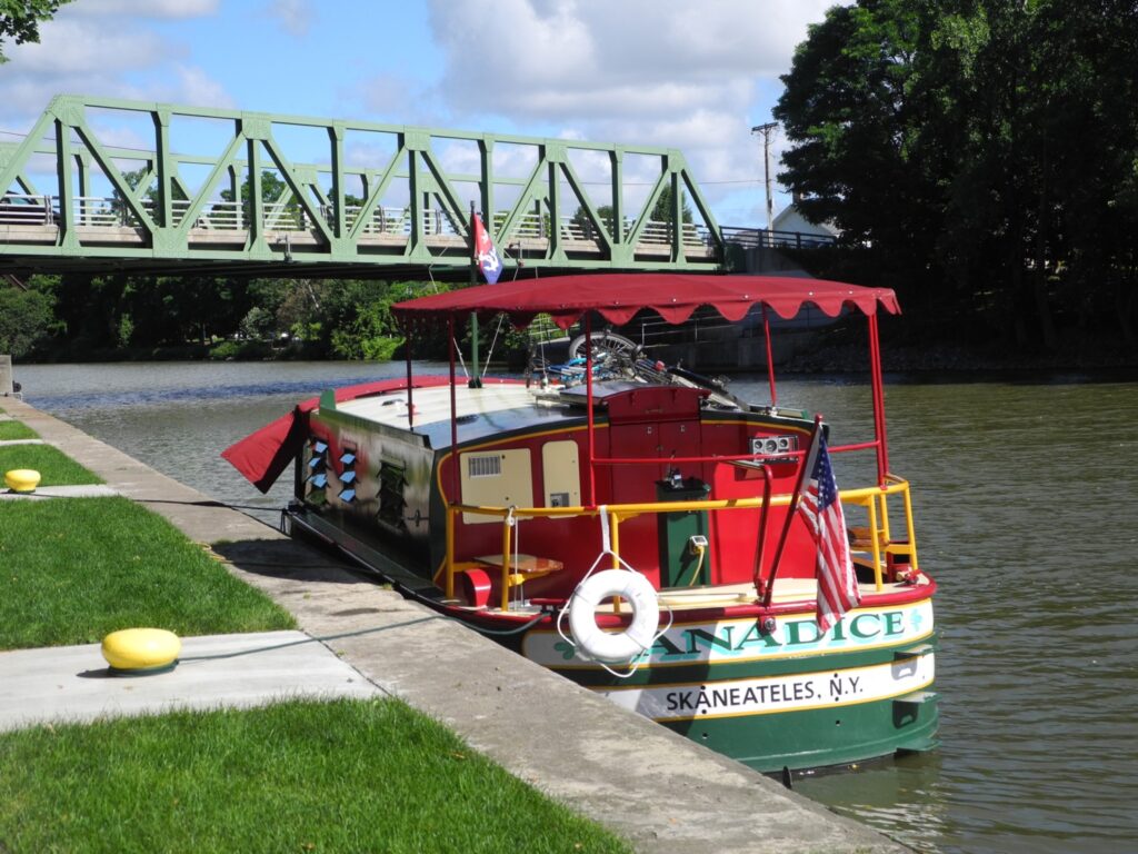
Our boat, the Canadice, is 41 feet long and can sleep 4 people (one double bed and two bunk beds in the galley; a well designed galley kitchen with small refrigerator and freezer; a shower; a table and sitting area in the bow), suitable for a family; the largest Lockmaster can accommodate 6 adults.
Within moments, the thrill of what this is all about floods over me: This is a real adventure, where have to do everything yourself, not have it done for you, make decisions.
Going through a lock on the Erie Canal: the lock tenders are extremely helpful (c) Karen Rubin/goingplacesfarandnear.com
As we sail along, I reflect on how lovely this boat is: the gorgeous knotty pine wood detailing; the varnished wood seats and a railing that makes for a back rest as you hold the tiller, brass and varnished wood. The cabin is beautiful knotty pine. It has a canvas canopy over the helm and even on a hot day, the breezes as we travel are delightful. The bow has screens with plastic and canvas that zip and snap easily so we can close everything up in the event of rain and a table that can even be moved inside.
The design for the Lockmaster came from Peter Wiles, Sr., who was a key architect of the transition of the Erie Canal from commercial to recreational use. He had a small tour boat business on Skaneateles Lake and went to England to see the self-skippered canal boats that operated on the Thames, and brought back the concept for boats that he would design and build here.
Wiles took the charm and the traditional design but adapted the boat to the Erie Canal, with a wider (roomier) beam, mostly flat bottomed and do not have a keel (the Erie Canal is only about 12-feet deep and is actually filled and drained each season). He founded the MidLakes Navigation company which, when we visit, is run by his children, Sarah and Peter Wiles (the company has since been acquired and renamed Erie Canal Adventures).
Fairport
We soon get the hang of piloting the boat, and after a couple of hours sailing, we come to Fairport, a most charming town, with shops and restaurants right along the canal. It is a picture-perfect model of revitalization.
Fairport did not exist before construction of the Erie Canal dried up a swamp and produced a “fair port” for travelers. “Commerce thrived as entrepreneurs turned ideas into products,” says one of the best guides to this portion of the canal, “100 Must See Miles”
Henry Deland’s mansion is now the Green Lantern Inn, Fairport, one of the canaltowns on the Erie Canal (c) Karen Rubin/goingplacesfarandnear.ccm
One of these entrepreneurs was Henry Deland who had the idea to produce baking soda from wood ash. The building right on the canal and next to the bridge where there is now a delightful Towpath Cafe was where Deland manufactured his baking soda which was transported by canal to international markets.
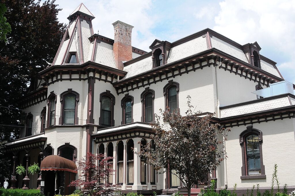
Just up Main Street, on the south side of the canal, I find the Deland Mansion, built in 1876. After Deland made his fortune in Fairport, he bought land and founded Deland, Florida in 1876, which he thought to build into a citrus, agricultural and tourism center. He sold his northern business and hired people to clear land, lay out streets, erect buildings and recruit settlers, most from upstate New York; he lost his fortune in an orange freeze in 1885.
The mansion is magnificent: Second Empire style with tower, porches, fireplaces, it was one of the grandest private residences in western New York. After several private owners, including the Clark Family, the Deland Mansion opened as the Green Lantern Inn sometime after 1928, and served as a restaurant, speakeasy, rooming house, banquet hall.
The mansion is across from the First Baptist Church, which was built at same time as Deland built his mansion.
Each of the canal towns we visit has done a superb job of using historical markers and photos to illustrate the “then and now.” As we follow them, it is like a story that unfolds.
At Fairport, there is a marker that shows how Old South Main Street “yields to urban renewal: Commercial block changes from necessities to niceties.”
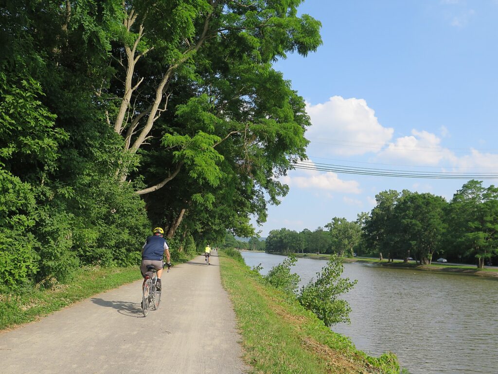
The beauty of the canal boat is that you can organize the day around what you want to do – whether it is to just hang out in a town – perhaps visit a museum. Our main purpose is to position us to bike the towpath. And so we tie up the Canadice at Fairport, take down our bikes from the roof, and head out about 7 miles to the next major town, Pittsford, along the canal bikeway. It is one of the prettier rides, with lovely homes on the canal.
The Great Embankment, Erie Canal, New York (c) Karen Rubin/goingplacesfarandnear.com
Just before Pittsford, we cross over a mile-long section called “The Great Embankment.” This is the highest canal embankment, actually built over the Irondequoit Creek which rushes through a tunnel under the canal.
In the earliest days of the Erie Canal, the embankment thrilled both onlookers and passengers as boats seemed to travel in midair over the mile-wide valley created by the Irondequoit Creek. The canal has been rebuilt three times since it originally opened in 1823. The original canal was a mere four-feet deep and 40-feet wide; three times it was enlarged, made deeper (first 7 feet deep and 70-feet wide, then 12-feet deep and 120-feet wide), and in many cases, moved entirely to make a better route as boats became motorized.
This is our first introduction to the engineering of the Erie Canal. I really hadn’t even thought of the canal as having a false bottom, that the canal is actually drained (around November 1), and refilled (around May 1) each season.
The Great Embankment is a revelation, but we will find even more dramatic examples of engineering, as we explore by bike and boat.
We return to Fairport, and prepare to get underway again – actually boating back to Pittsford.
It’s just passed 6 pm when we leave Fairport.
But to leave Fairport, you have to go under a lift bridge, and Fairport’s is very distinctive: it is constructed with no right angles.
Bridge at Fairport (no right angles) lifts for us to sail under, on the Erie Canal, New York State (c) Kaaen Rubin/goingplacesfarandnear.com
There are 16 lift bridges on the Erie Canal, all of them in the west, and the eastern-most one is here at Fairport. The bridges are delights to look at – they have ornate towers and it is wonderful to watch how they work.
We have been instructed on the etiquette of using the radio to ask the lock tender to lift a bridge or open a lock. Some are covered by operators handling multiple bridges, so you might be told to standby and wait for the operator to get back to the bridge. (take note of the hours of operation – westward from Macedon toward Buffalo, the locks are open 7 am to 10 pm; eastward to Lake Oneida in Syracuse (the boats do not go all the way to Albany), the lifts operate 7 am to 7 pm).
Pittsford
We tie up for the night at Port of Pittsford Park, right below the Main Street Bridge (there is no charge but some of the ports along the canal charge up to $15 to overnight).
We stroll the charming streets (and there are some gorgeous residential streets as well), and see what an affluent community Pittsford is. Old money and new money poured in over the last 15 years to revitalize the downtown area.
Pittsford was settled in 1789 by Revolutionary War veterans, but it was the Erie Canal that first brought prosperity to the town, because it facilitated transport to market of tons of heavy gravel from the nearby hills.
We see stunning Victorian-era buildings – the Phoenix Hotel, built in 1812 in the Federalist style, 1812 to serve the Erie Canal and Turnpike trade, restored 1967 as an office building across from the Town Hall, dated 1890. There is also the Canal Lamp Inn, a stunning Victorian, right beside the canal bridge. (Self-guided walk through Pittsford, villageofpittsford.org).
Just minutes after we finish our picnic dinner of pizza and get inside our boat and close the hatches, it starts to pour. We are cozy inside. We hear the patter of rain as we watch a DVD on our computer.
Cruising in a canalboat on the Erie Canal, New York State (c) Karen Rubin/goingplacesfarandnear.com
The star attraction – and the major character – in this travel epic is the Erie Canal, itself. The historic markers we come upon are like chapters in the story, and as our trip unfolds, our appreciation of what the canal was, what it represented, and the impact it had, grows.
All 11 Lockmasters in Erie Canal Adventures’ fleet sail from Macedon, near Rochester, NY, and with enough time, you can cruise some 200 miles from Buffalo to Lake Oneida in Syracuse along the canal. Besides sailing along the Erie Canal (as far as , you can also sail on other waterways, taking spurs south to the Finger Lakes, or north up the Oswego canal to Lake Ontario.
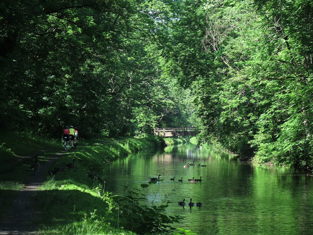
Perfect antidote for cabin fever: Parks & Trails NY’s eight-day, 400-mile Cycle the Erie biking/camping trip from Buffalo to Albany, NY (c) Karen Rubin/goingplacesfarandnear.com
by Karen Rubin, Travel Features Syndicate, goingplacesfarandnear.com
This time last year I was getting set for an around-the-world Global Scavenger Hunt which took me to places that I had always hoped to see – Petra, Jordan; Myanmar; Vietnam; Morocco, just to list a few. The coronavirus pandemic has made that experience impossible this year. But it just goes to show: Don’t put off experiences, especially not a trip of a lifetime.
These are uncharted waters for the travel industry, and for travelers.
With the worst of the crisis appearing to be coming under control, state governments are looking to gradually reopen and lift their lockdowns. The same is true for people venturing out of doors. People are burning with cabin fever but may be cautious.
Here is the antidote to cabin fever: I’m thinking outdoors, great open vistas, clean air. This is a great time for a throwback to the 1950s family road trip to enjoy the Great Outdoors. Instead of a station wagon, pack up the SUV and set an itinerary that revolves around national and state parks, wildlife areas, nature preserves. I’m thinking camping (koa.com) or glamping (glampinghub.com). I’m thinking hiking, biking, rafting, kayaking.
“It’s vital that people find ways to engage in physical activity during this time; the benefits to our immune systems and our mental health are significant. But it is critical that we do so in ways that will keep us safe and minimize the spread of the pandemic,” writes Ryan Chao, President, Rails-to-Trails Conservancy.
Rails-to-Trails’ Conservancy has compiled resources, provides information on the latest on trails, walking and biking and the COVID-19 pandemic (Visit railstotrails.org/COVID19), and provides a trail-finder website and app, TrailLink.com, which is free for anyone to use to find particulars on more than 37,000 miles of multi-use trails nationwide, including trail maps, walking and biking directions to get to the trail, and contact information for local trail management organizations (visit railstotrails.org).
Rails-to-Trails Conservancy Sojourn on the Delaware-Lehigh Trail (c) Karen Rubin/goingplacesfarandnear.com
Here are more ambitious ideas:
An ideal trip (and also one of my favorite bike tours ever) which hits all of these criteria (driving distance, biking, camping) is the Cycle the Erie, an eight-day 400-mile, fully supported biking/camping trip, from Buffalo to Albany, operated by Parks & Trails NY. At this writing, the 22nd Annual Cycle the Erie was still taking place July 12-19, 2020. (they expect to make a decision on May 12; they have eased the cancellation policy and would transfer the registration at this year’s fee next year if they have to cancel.) For information on Cycle the Erie Canal, call Parks & Trails New York, 518-434-1583, email [email protected] or visit www.ptny.org/cycle-the-erie-canal.
Hopefully, other supported biking/camping rides that also support nonprofit organizations will also run, such as the BikeMaine 2020: Katahdin Frontier – a seven-night ride 340 mile-loop (17,455 feet of climbing), from Old Town, September 12-19, 2020 (www.bikemaine.org)
The next best thing is an organized bike tour – self-guided trips obviously have the fewest people to interact with, and guided – that utilize inn-style accommodations are our favorites. We have enjoyed trips around the world – the Danube Bike Trail, Greek islands bike/boat trip, Venice-Croatia, Slovenia, and Albania (Biketours.com is a great source), and I’m still hoping to take my family on a self-guided bike trip of northern Portugal in late summer – but there are fabulous trips within driving distance that can be done on rail-trails with camping, inns and airbnb.com, such as the Delaware-Lehigh trail in Pennsylvania and the Great Allegheny Passage which can be linked with the C&O trail that can take you from Washington DC all the way to Pittsburgh, PA, and the Erie Canalway.
Rails-to-Trails Conservancy’s Sojourn on the Great Allegheny Passage Rail Trail (c) Karen Rubin/goingplacesfarandnear.com
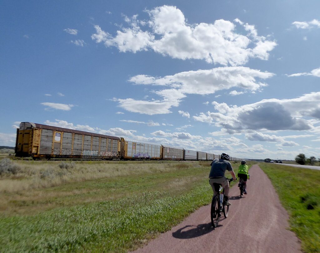
Wilderness Voyageurs, a wide-ranging outdoors company with an extensive catalog of biking, rafting, fishing and outdoor adventures throughout the US and even Cuba, offers many guided and self-guided bike itineraries built around rail trails like the Eric Canal in New York, Great Allegheny Passage in Pennsylvania and Katy Trail in Missouri. Last year we thoroughly enjoyed the six-day “Badlands and Mickelson Trail” bike tour of South Dakota. Wilderness Voyageurs, 103 Garrett St., Ohiopyle, PA 15470, 800-272-4141, [email protected], Wilderness-Voyageurs.com.
Biking the Mickelson railtrail in South Dakota with Wilderness Voyageurs (c) Karen Rubin/goingplacesfarandnear.com
Bicycle Adventures is offering 6-day bike tours of Oregon Columbia (riding and hiking); South Dakota’s Mickelson Trail; and Washington San Juan Islands. Bicycle Adventures, 18047 NE 68th St, Ste B140, Redmond, WA 9805 (425-250-5540, bicycleadventures.com).
Tour Operators to the Great Outdoors
Tour operators are in a position not only to have access to permits and accommodations in places that are likely to be overrun this year, but are better plugged in to what is happening on the ground, can move passengers around, adapt itineraries. Wilderness adventure travel companies so far are still offering trips this summer.
Based in Billings, Montana, Austin Adventures has spent over 35 years building an international reputation as a top provider of luxury, small group, multisport tours for adults and families to the world’s most captivating destinations. Austin Adventures has perfected the art of creating itineraries featuring exceptional regional dining, distinctive accommodations, incredible guides and exhilarating activities, all while keeping all-inclusive rates and services the norm. In addition to scheduled group departures on all seven continents, Austin Adventures has developed a reputation as the leader in customized trip planning and execution, all backed by the industry’s best money-back satisfaction guarantee. For information on Austin Adventures’ trips, cruises and distinctive accommodations on seven continents:800-575-1540, [email protected], www.austinadventures.com.
Western River Expeditions escorts more people down rivers on professionally guided rafting trips in Utah, Idaho and Arizona than any other company and is the largest licensed outfitter in the Grand Canyon. (866-904-1160, 801-942-6669, www.westernriver.com).
Moab Adventure Center, a division of Western River Expeditions and the largest single tour provider in Moab, UT, is a one-stop resource for a myriad of outdoor adventures that take you to Arches National Park and Canyonlands and river rafting. (435-259-7019 or 866-904-1163, www.moabadventurecenter.com)
Moab Adventure Center, Utah, is a one-stop resource for a myriad of outdoor adventures that take you to Arches National Park and Canyonlands and river rafting.
Holiday River Expeditions hopes to be offering its river rafting trips from the end of June through the end of the season in October. The company, operating out of Green River Utah, offers trips on the Colorado, Green River, San Juan and out of Vernal, on the Yampa, in heart of Dinosaur National monument.
Holiday River has just put out The Complete Guide to Whitewater Rafting Trips in Utah, for do-it-yourselfers as well as people who are more than happy to use a commercial outfitter. This new resource for every kind of adventurer is offered free and online.
Here are the seven river trips chosen for inclusion in this new resource:
“Oar power is the most natural way to experience the river and the absence of motors makes high water trips as exciting as it gets. Rafters experience the rush of wind, a chatty raven or a churning rapid absent the drone and smell of a motorized raft,” said Tim Gaylord, Director of Operations and Holiday employee since 1978. (For information, availability, reservations or the catalog, 800-624-6323, [email protected], www.bikeraft.com)
Rethink “Lodging”
A perfect corollary for any sojourn into the wilderness, instead of staying in a hotel, consider glamping – basically luxury camping that brings you into the most gorgeous and distinctive places, close to nature, in comfort but affording very distinctive experiences.
With the popularity of glamping surging, an array of glamping destinations have popped up around the world in recent years, offering everything from geodesic domes to Airstream RVs to tiny homes. For example:
Fireside Resort: By combining the amenities of a luxury boutique hotel with the atmosphere of a wooded campground, Fireside Resort offers Wyoming’s best glamping experience. The lodging options reflect the heritage of the valley’s original homesteader cabins, with cozy fireplaces, full kitchens, private furnished decks, and outdoor fire pits. Situated on wildlife-filled acres where moose, elk, red-tailed hawks, bald eagles and deer roam, Fireside Resort is just seven miles from Jackson’s bustling town square.
Fireside Resort offers Wyoming’s best glamping experience.
Kestrel Camp: The American Prairie Reserve in Montana is piecing together what will be the largest nature reserve in the lower 48 states, totaling 3.5 million acres, and restoring habitat and species in the process. APR’s Kestrel Camp offers five yurt-style luxury suites set around a central lounge and dining room serving chef-prepared meals, as well as a safari-style experience with special access to tour the reserve’s ecosystem with personal naturalists.
A great source to finding glamping accommodations is GlampingHub.com, an online booking platform for unique outdoor accommodations across the globe. With over 35,000 accommodations in over 120 countries, Glamping Hub’s mission is to connect travelers with nature in order to create authentic experiences in which travelers can stay in the great outdoors without having to sacrifice creature comforts—camping with added luxuries and five-star amenities. Guests can find over 27 different types of glamping accommodations to choose from on Glamping Hub from safari tents, tree houses, and cabins to tipis, villas, and domes. (glampinghub.com)
Or, think cottage on a beach (Cape Cod, Martha’s Vineyard are my favorites).
Rethink “resort”.
I’m thinking dude ranch: Duderanch.orglists 100 in Wyoming, Montana, Colorado and such, but there are also dude ranches as close as the Catskills and Adirondacks in the wilds of New York State, like the Pine Ridge Dude Ranch (30 Cherrytown Road, Kerhonkson, NY 12446, pineridgeranch.com), Ridin’ Hy, year-round inclusive ranch resort in the Adirondacks Preserve near Lake George, Warrensburg, NY 12885, 518-494-2742, www.ridinhy.com); and the ever-popular Rocking Horse Ranch (reopening June 12, 600 State Route 44/55, Highland, NY 12528, 877-605-6062, 845-691-2927, www.rockinghorseranch.com).
And while many will choose to venture within driving distance – biking, hiking (check out the Hudson River School Art Trail in the Catskills and camping at the North-South Campground, for example) – I will pretty much bet that traveling by air will be absolutely safe because of the regimen that every airline has imposed (going as far as to leave middle seats empty; sanitizing surfaces and utilizing hospital-grade ventilation/air purification systems). I would bet that the most dicey part of an airline trip will be getting through airport security.
Hiking the Hudson River School Art Trail, in the Catskill Mountains, Greene County, New York State (c) Karen Rubin/goingplacesfarandnear.com
Air Travel
Airlines are doing their best to allay passengers’ concerns – both from the point of view of health as well as easing up cancellation, change and refund policies. This from Delta is fairly typical of the major carriers:
“In the current environment, it’s important for all of us to travel smarter and more consciously. That’s why I want to personally update you on the situation with COVID-19 (the coronavirus) and the steps we are taking to ensure your health and safety in your travels,” writes Delta CEO Ed Bastian.
“For more than a decade, Delta has been preparing for such a scenario. As a global airline, we have strong relationships in place with health experts including the Centers for Disease Control (CDC), the World Health Organization (WHO), the Federal Aviation Administration (FAA) and local health authorities worldwide. We are in constant contact with them to make sure our policies and procedures meet or exceed their guidelines.
“Operations are our lifeblood. We’ve learned from past experience with outbreaks like H1N1 and Ebola, and have continually refined and improved our ability to protect our customers. That includes the way we circulate clean and fresh air in our aircraft with highly advanced HEPA filters, the new fogging procedures in our cleaning process, how we sanitize aircraft between flights and how we respond if a customer is displaying symptoms.
“A full report on the measures Delta is taking to help you have a healthy flying experience..outlines our expanded cleaning and disinfecting at our airports and on board our aircraft; distribution of hand sanitizer and amenity kits to help customers stay clean; and the technology on our aircraft to filter and replace cabin air.
“A command center in Atlanta has been stood up to guide our response, leading our global team of thousands of Delta professionals dedicated to this effort. That includes our reservations specialists handling thousands of incoming calls, our flight crews and Airport Customer Service (ACS) agents taking extra care of our customers, and our TechOps and operations coordination teams keeping the airline moving. This world-class group of airline employees has your back, and I have never been prouder of the women and men of Delta.
“To ensure you always have access to the latest information and guidance, we have a website on the COVID-19 situation that is continually being updated with cleaning policies and actions we’re implementing to keep you safe, ways you can stay healthy while flying, and changes to our flight schedules and waiver information. Transparency is one of our core values, and we are committed to keeping you fully informed as the situation evolves.
“While we’re committed to providing you with information you need to make informed decisions around your travel, we also understand the need for flexibility based on your individual circumstances. To make sure you can travel with confidence, we’re offering flexible waivers, and we’ve also adjusted our network in response to guidance from the State Department.
“We understand that in today’s world, travel is fundamental to our business and our lives, which is why it can’t – and shouldn’t – simply stop. I believe Delta’s mission of connecting the world and creating opportunities is never more important than at times like this.”
by
Karen Rubin, Travel Features Syndicate, goingplacesfarandnear.com
If
Deadwood, South Dakota – the endpoint of the 109-mile Mickelson Trail on the Wilderness
Voyageurs’ six-day “Badlands and Mickelson Trail” bike tour – is a shrine to
the Old Wild West, Rapid City is what the American West is today.
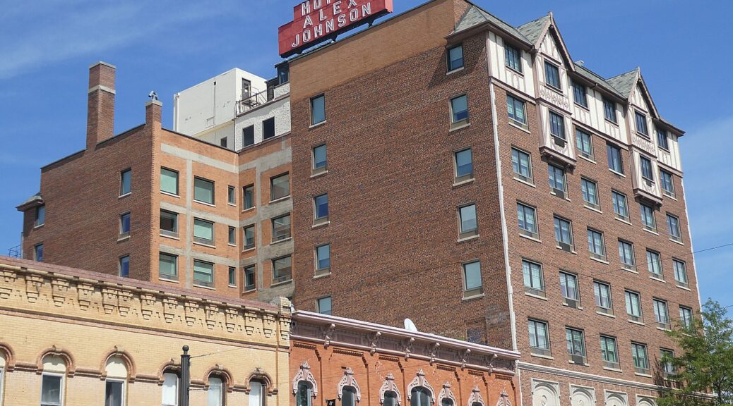
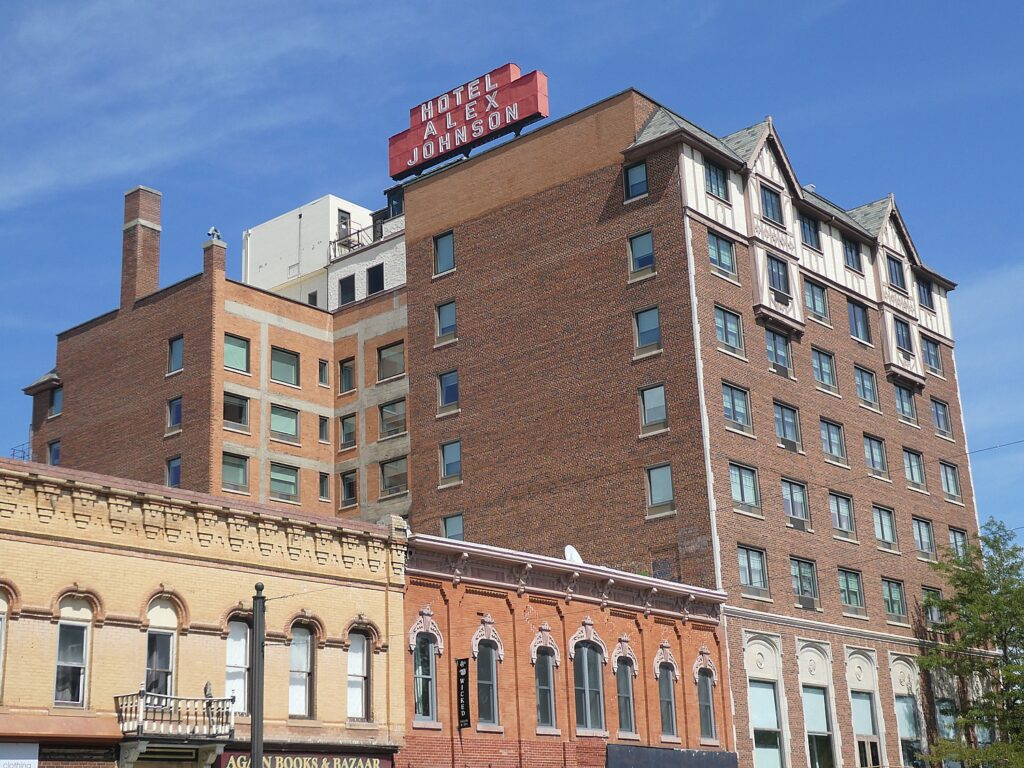
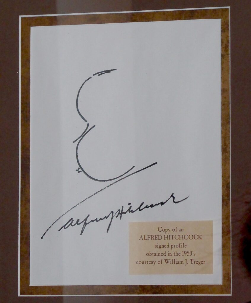
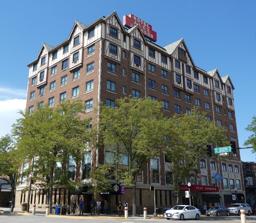
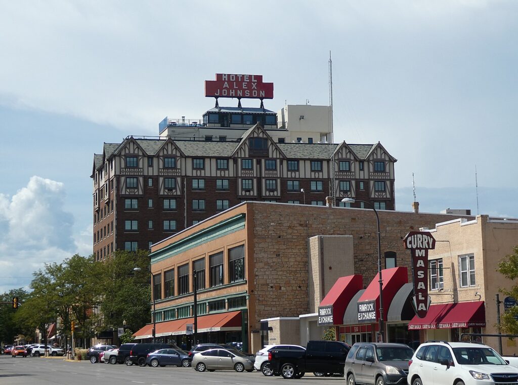
The Wilderness-Voyageurs Badlands trip (800-272-4141, Wilderness-Voyageurs.com) starts in Rapid City where I cleverly organize my trip to arrive the day before, staying at the famous, historic Alex Johnson Hotel (famous on its own, but made eternally famous for the part it played in Alfred Hitchcock’s classic film, “North by Northwest” – an autographed caricature of Hitchcock is behind the front desk).
Indeed, the Alex Johnson Hotel is a major attraction in itself (it’s red and white sign atop the building is iconic symbol of the city) – the hotel, still the third tallest in South Dakota, even provides a walking tour of many artifacts and architectural features that in their own way tell the story of Rapid City.
The Alex Johnson Hotel is listed on the National Register of Historic Places and a member of Historic Hotels of America, which means that successive owners have recognized their responsibility as stewards of these place-making hotels that harbor the story of their respective destination. To be accepted into the prestigious HHA program, which has nearly 300 members, a hotel has to faithfully maintain authenticity, sense of place and architectural integrity, be at least 50 years old; designated by the U.S. Secretary of the Interior as a National Historic Landmark or listed in or eligible for listing in the National Register of Historic Places; and recognized as having historic significance. (More information at HistoricHotels.org)
The Alex Johnson Hotel is all of these things and more. The hotel
was built by Alex Carlton Johnson (1861-1938), who was vice president of the
Chicago and Northwestern Railroad. Johnson was unusual for his time in that he
respected and admired the Native Americans who lived in the area and developed
his hotel as a tribute to the Sioux Indian Nation and honor its heritage. The
structural design of the hotel integrates the heritage of the Plains Indians
and the Germanic Tudor architecture representing German immigration into the
Dakotas.
Construction began in 1927, coincidentally, just the day before work began on nearby Mount Rushmore. The hotel opened less than a year later, on July 1, 1928.
I
follow the walking tour:
At
the entrance of the hotel are sculpted Indian heads, taken from the design of
Indian-head nickels and pennies.
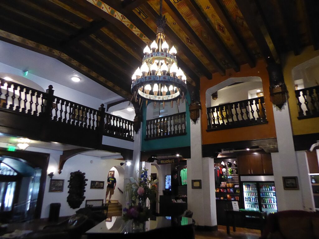
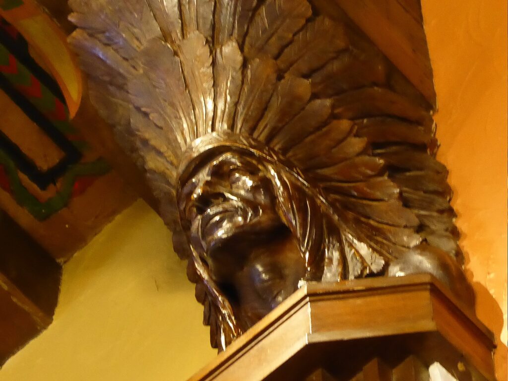
The entrance has an “AJ” tepee symbol embedded in the entry walkway. The lobby itself is designed in Native American tradition with “Sacred Four Directions” integrated in the lobby tiles. The Lakota Sioux people believed their four sacred powers were derived from the four directions: north (white) a symbol for the “Cleansing Snow.”; east (red), the “Morning Star” which gives “Daybreak Knowledge”; south (yellow) is “Warm Winds” which replenishes the land; west (black) is “Thunder Being,” giving strength and power in times of trouble. Among the signs is a symbol that resembles a swastika, but was long used by Native Americans since prehistoric times.
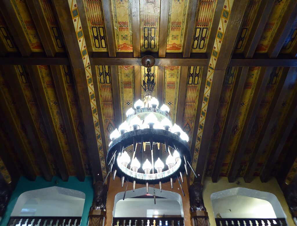
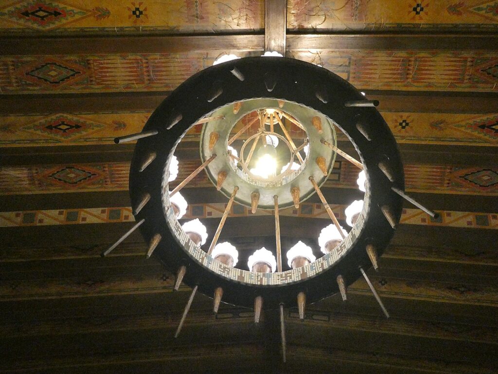
Suspended with chains, the chandelier that dominates the center is actually formed of war lances. It is in the shape of a teepee and made of concentric, decreasing-sized copper-clad wooden rings. The rings are decorated in authentic Sioux patterns.
The exquisite ceiling incorporates stenciled Sioux designs between open beams. The brightly-colored patterns, originally painted with natural materials, are in the traditional “box and border” design. There are eight plaster-cast busts of Indian men that hold the beams.
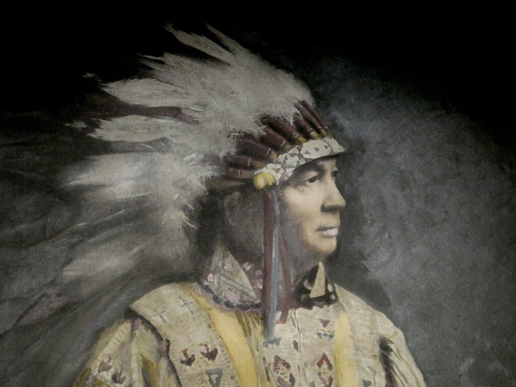
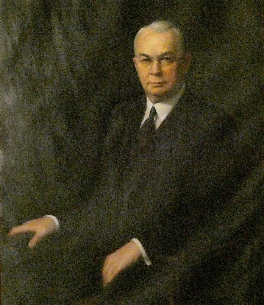
The fireplace is formed of Black Hills stones. A huge rock in the keystone was selected for its resemblance to a buffalo head. The mantle is decorated with brands of local ranchers. Above the fireplace is a striking portrait of Alex Johnson in Sioux attire. Johnson was made an honorary blood brother of Chief Iron Horse in 1933, and named “Chief Red Star.” Another portrait of Johnson, in a more typical businessman pose, was commissioned by the 580 members of the Chicago Rotary Club in appreciation for his service as president (1924-25).
Alex Johnson, who founded the Alex Johnson Hotel, Rapid City, South Dakota (c) Karen Rubin/goingplacesfarandnear.com
There are two bison heads mounted over the southwest entrance of the AJ’s Mercantile shop (American buffalo are apparently not buffalo at all, but one of two species of bison). I learn that “buffalo” was a corruption of “boeuf,” the name the French explorers used for the animal.
The
mezzanine and second floor are graced with carved wood railings and provide a
gorgeous vantage point to appreciate the Indian busts, ceiling painting and
chandelier,
The ballroom, which also served as a nightclub back in the day, has four murals painted by Max Rheiner, an artist from Chicago, that realistically depict four well known areas of the region: Harney Peak, the Needles (which we will soon visit on the bike tour), the Badlands (we will soon visit) and Spearfish Canyon.
The
Lincoln Room, the site of the original restaurant, has been restored to its
original elegance. The ceiling lights are original. The wallpaper custom,
hand-printed paper and the same design used in Abraham Lincoln’s home in
Springfield Illinois. An original 19th century Lincoln print is on
the wall. Meeting rooms are named after the four presidents on Mount Rushmore.
The hotel also offers Paddy O’Neill’s Irish Pub and Grill, named after the hotel’s first guest.
There
is a kind of museum of exhibits – you can see Johnson’s actual headdress and
other artifacts.
But
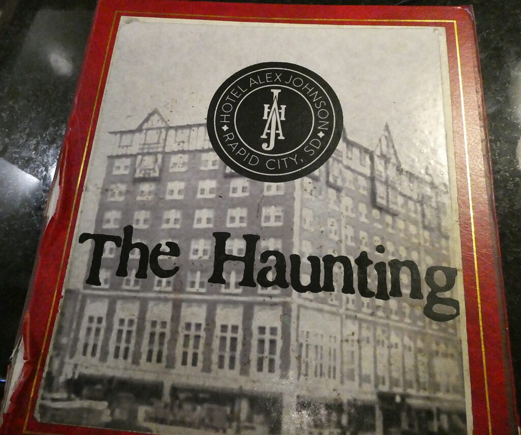
that is not all. I learn that the Alex Johnson hotel is haunted – there is an
entire book of testimonials from guests who have had sightings, and recently.
Ross Goldman, the front-desk fellow who has been giving me an orientation to the hotel and to Rapid City, points me to an entire Haunting book filled with people’s letters and descriptions of encounters.
One
of the rooms that is supposedly haunted, 304, was Alex Johnson’s private room
where he stayed when he was in Rapid City, and where he died at the age of 90.
But years before, his young daughter died in that room. People, especially
children, say they have seen a child ghost
In the Haunting book, I find a drawing by a little girl who stayed in
room 304, who drew herself, her brother, and another girl with a dark, long dress
you can see through (the ghost), dated July 5 2019. Children say they see ball
rolling and that there is a knock on doors all at once.
Another
haunted room, 812, was where 60 years ago, a bride on her wedding night jumped,
was pushed or fell out of window. Guests say that doors open, lights go on and
some say when they sleep, they feel something pressing on their chest.
The
macabre legends must have appealed to Alfred Hitchcock who used the Alex Johnson
Hotel in his iconic thriller, “North by Northwest” and stayed here through the
filming of the Mount Rushmore scenes– there is an autographed photo of
Hitchcock behind reception desk (the lobby seemed much larger in the movie).
Goldman
(the only Goldman in South Dakota, he notes), tells me his father is from
Brooklyn, and came to Rapid City for his medical residency and stayed. What a
small world: Goldman’s cousins live on my block in Long Island, New York. (He
says there are just 300 Jews in the entire state; they hold their Passover
seder in the hotel’s ballroom).
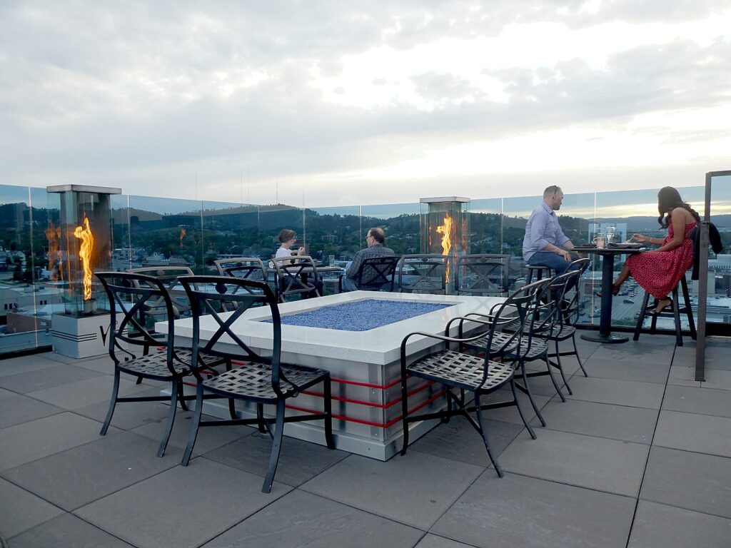
Later,
after exploring Rapid City, I get to appreciate the Vertex Sky Bar on the
hotel’s tenth floor (the Alex Johnson hotel is the third tallest building in
South Dakota). Originally, there was a solarium here and an observation tower
that was later used by KOTA radio station. Today, it is an upscale rooftop bar exclusively
for members and hotel guests. It provides a wonderful view for the sunset
behind the hills.
Goldman gives me some great tips for our bike trip – especially in Deadwood City, where he tells me to be sure to visit the cemetery where Wild Bill Hickok and Calamity Jane are buried, and where there is also a Jewish section.
And
he orients me to Rapid City: Memorial Park was created after a major flood in
1972 collapsed the dam, in which 238 people died (signs in the park tell the
story), leveling the poorest section of city. He tells me where to get the best
buffalo burger (Thirsty’s).
And
so I am off to discover Rapid City.
Rapid
City makes the absolute most of whatever it has. The architecture except for a
small historic district is mostly nondescript, but there is sheer brilliance in
that 20 years ago, an artist began an ambitious program to have almost
life-sized sculptures of every president on every corner of the two downtown
boulevards, Main Street and St. Joseph’s Boulevard. This turned Rapid City into
“The City of Presidents.”
It
is fascinating and fun to go in search of them (they aren’t in chronological or
alphabetical order). Six artists produced the 43 sculptures, beginning in 2000:Obama’s
statue, depicting the Election night scene when he came out holding his
daughter’s hand, only went up a couple of months before; Lincoln is also
portrayed with his son, Tad; FDR is shown standing at a podium with radio mics;
Taft looking amazingly svelte, shown as the first president to throw out the
first pitch at a baseball game. There is a self-guided walking tour and a
Presidential Scavenger Hunt. It is really fun to try to see all of the
presidents. What is most interesting is how these significant personages are
set in such ordinary circumstance on nondescript small-town America street
corners.
A
notable exception to the presidents is a bust, “Mitakuye Oyasin” (“We are all
related”) by DC Lamphere, from a drawing by Richard Under Baggage, representing
“hope for reconciliation, dignity and respect for all the human race.” The
earth is in the shape of a hoop or circle of life; crossed pipes represent
world peace; the eagle symbolizes all flying creatures, and communication with
Tunka Sila; wisdom and the healing arts are represented by a grizzly bear, and
a long and productive life is symbolized by a turtle. “The bison reminds us of
our ancestors’ healthy lifestyles, free from famine, and also of the white
Buffalo Calf Woman who brought us the pipe.”
Another marked contrast to the presidents on every other corner is outside a remarkable shop, Prairie Edge: “Hunkayapi” also was created by local artist Dale Lamphere. The statue, depicting a Lakota naming ceremony, is intended to reflect the warmth in Lakota families, the wisdom of a Lakota elder and the teaching of the Lakota heritage to the next generation.
Prairie
Edge is one of the most fantastic Native American shops anywhere. It is almost
a museum, with numerous contemporary Native artists who have their own
displays, biography and museum-quality art (I learn about quillwork). There is
also clothing, including Pendleton & Pilson, blankets and housewares, books
and music, and a Sioux Trading Post, and tee shirts and souvenirs and yes items
popular in tourist shops on sale, like an old-fashioned mercantile store.
The
shop contains a fine art Plains Indian Gallery, a Buffalo Room with bison
leather furnishings. There is also the Italian glass bead library boasting the
world’s largest selection of glass beads, with over 2,600 different styles and colors, from
the same Venetian guild that supplied fur traders in the 19th
century used for trade, including used in trade for the island of Manhattan;
after the Societa Veneziana Conterie closed in 1992, Prairie Edge bought the
remaining inventory of 70 tons of beads. (Prairie Edge, 606 Main Street, Rapid
City SD 57701, 800-541-2388, 605-342-3086, www.prairieedge.com).
I think about what Goldman told me about continued tension between Native Americans and the “settlers” (for lack of a better word), “Other places are more assimilated. South Dakota has nine Indian reservations. The two largest reservations – Pine Ridge, Rosebud – make Appalachia look like Beverly Hills.,” he told me. And his remarks echo for me later when I visit the Crazy Horse Memorial on our Mickelson Trail ride.
Prairie
Edge is housed in an 1886 building in Italianate style that began as the L.
Morris Dry Goods and Clothing store with a dentist’s office on the second floor
and rooms to rent. Known as the Clower Building, it is most famously remembered
as the Jack Clower Saloon (1895-1917), a cowboy bar ion its day. It is one of
the most beautiful buildings in Rapid City.
What
you do expect in an open-carry state that still prides itself as being the wild
west, are the gun shops. There is the biggest gun shop I’ve ever seen, First
Stop Gun & Coin. (I am amazed at how heavy rifles are; there are “My First
Rifle,” child-sized like starter violins, and some pink and decorated rifles
geared for women.
There is a surprising variety of restaurants you wouldn’t expect in a place that calls itself “City of Presidents” – Nepali, Mexican (considering how far from the Mexican border we are). Goldman has recommended Thirsty’s, which looks like a pool hall, as having the best buffalo burger in town. I opt for the Firehouse Brewing Company in the historic firehouse next door to Prairie Edge. I take note of a large 1883 photo mural depicting the store that had stood on the site with store names of Jewish proprietors: Herrmann Treber & Goldberg Groceries, Liquors and Cigars Wholesale.
Back at the Alex Johnson Hotel, I go up to the Vertex Sky Bar on the 10th floor to take in the sunset.
The Alex Johnson Hotel today is independently owned by the Bradsky family of Rapid City, acquired in 2008 on the hotel’s 80th anniversary, and refurbished with respect and sense of stewardship for its historic significance and importance to the city. (The family owns several properties, under the Liv Hospitality banner, in Deadwood and Rapid City, including Cadillac Jack’s and Tin Lizzie’s in Deadwood and Watiki water park in Rapid City. (www.LivHotelGroup.com)
Hotel Alex Johnson Rapid City, Curio Collection by Hilton, 523 Sixth Street, Rapid City SD 57701, 605-342-1210, alexjohnson.com.
More information at Visit Rapid City, 512 Main Street, Rapid City SD 57701, 800-487-3223, 605-718-8484, www.VisitRapidCity.com.
Minuteman
Missile National Historic Site
With better planning, I would have also
plugged into my itinerary a visit to Minuteman Missile National Historic Site. The
site provides an opportunity to explore the Minuteman II system’s role as a
nuclear deterrent during the Cold War and visit sites rarely seen by civilians
while in use, but that nevertheless loomed large on the geo-political
landscape, and in these tense times, be reminded about what a threat nuclear
weapons are.
I first became aware of the site
watching an extraordinary documentary, “The Man who Saved the World,” about
Stanislav Petrov, a former
lieutenant colonel of the Soviet Air
Defense Forces and his role in preventing the 1983 Soviet nuclear false alarm incident from leading
to nuclear holocaust. Now, with Trump and Putin at odds over
renegotiating a nuclear arms treaty while boasting about new weapons, it is
more important than ever to be reminded of how quickly things can go
astronomically wrong.
by
Karen Rubin, Travel Features Syndicate, goingplacesfarandnear.com
It’s our last
day of the Wilderness Voyageurs six-day “Badlands and Mickelson Trail” bike
tour of South Dakota, when we would have biked back a portion of the Mickelson
Trail that we cycled yesterday before visiting Mount Rushmore. But as luck
would have it (and it is actually lucky), it rains as we leave Deadwood. It is
lucky because the rest of our rides have been glorious and we did get to
complete the 109-mile long Mickelson Trail, in addition to riding through
Badlands National Park and Custer State Park. Our guides, James Oerding and
John Buehlhorn, offer us alternatives: instead of doing the Mickelson 18 miles
from Dumont to Mystic (the same trail we did yesterday but downhill) we go
directly to Mount Rushmore and see if the weather dries out.
Mount
Rushmore is such a familiar American icon, it may be a cliché. But seeing it “in
person” makes you rethink what it is all about.
The
sculptor, Gutzon Borglum, wrote “Let us place
there, carved high, as close to heaven as we can, the words of our leaders,
their faces, to show posterity what manner of men they were. Then breathe a
prayer that these records will endure until the wind and the rain alone shall
wear them away.”
Borglum also wrote, “The purpose of
the memorial is to communicate the founding, expansion, preservation, and
unification of the United States with colossal statues of Washington,
Jefferson, Lincoln, and Theodore Roosevelt.”
The
National Park Service offers this about Mount Rushmore National Monument:
“Majestic figures of George Washington, Thomas Jefferson, Theodore Roosevelt
and Abraham Lincoln, surrounded by the beauty of the Black Hills of South
Dakota, tell the story of the birth, growth, development and preservation of
this country. From the history of the first inhabitants to the diversity of
America today, Mount Rushmore brings visitors face to face with the rich
heritage we all share.”
The NPS posits that Borglum “selected these four presidents
because from his perspective, they represented the most important events in the
history of the United States. Would another artist at that time, or perhaps a
modern artist choose differently? As you read more about Borglum’s choices,
think about what you might have done if the decision was up to you.”
I stumble upon a
15-minute Ranger talk in the Sculptor’s Studio about Gutzon Borglum,
the carving process and the lives of the workers – how they
dynamited away 90 percent of the stone, leaving just 3 to 6 inches of material
to chisel off by hand, how they hang a weight to where the nose should be and
create the facial features from that reference point.
The Ranger
stands in front of a model of how a completed Mount Rushmore was envisioned by
Borglum. Who knew there was more? I’ve always taken for granted that what we
see was all that was meant to be. The model shows that it would have had their
jackets down to their waist and hands.
To
see the scale of the sculpture, it is hard to contemplate the challenge of
blasting away all that rock and carving that stone. But we learn that getting
this project underway was a challenge unto itself.
South Dakota historian
Doane Robinson is credited with conceiving the idea of carving the
likenesses of noted figures into the mountains of the Black Hills of South
Dakota in order to promote tourism in the region. But once Doane
Robinson and others had found a sculptor, Gutzon Borglum, they had to get
permission to do the carving. Senator Peter Norbeck (the man who created the
Needles Highway through Custer State Park) and Congressman William Williamson
were instrumental in getting the legislation passed to allow the carving. The
bill requesting permission to use federal land for the memorial easily passed
through Congress. But a bill sent to the South Dakota Legislature faced more
opposition.
Robinson’s initial idea
was to feature heroes of the American West, such as Lewis and Clark, Oglala
Lakota chief Red cloud and Buffalo Bill Cody. But Borglum wanted the sculpture to
have broader appeal, so chose the four presidents, who would each symbolize an
important aspect of American history. (That might be why Robinson was not
chosen for the 12-member commission to oversee the project.)
Early in the project, money was hard
to find, despite Borglum’s guarantee that eastern businessmen would gladly make
large donations. He also promised South Dakotans that they would not be
responsible for paying for any of the mountain carving. Borglum got Treasury
Secretary Andrew Mellon on board, but only asked for half of the funding he
needed, believing he would be able to match federal funding ($250,000) dollar
for dollar with private donations.
Borglum worked on the project from
1927, the presidents’ faces were carved from 1933-1939, with his son, Lincoln. Meanwhile,
in 1929, the stock market crashed; in 1933, President Franklin Roosevelt placed
Mount Rushmore under the jurisdiction of the National Park Service.
In March, 1941, as a final dedication was being planned,
Gutzon Borglum died. This fact, along with the impending American involvement
in World War II, led to the end of further carving on the mountain. With the
money – and enthusiasm – running out, Congress refused to allocate any more
funding. On October 31, 1941, the last day of work, Mount Rushmore National
Memorial was declared a completed project.
The Ranger
explains that the death of the artist raised an ethical issue for anyone who
would take over the work. And, the Ranger said, “The country had moved on. They
were not as interested in presidents as they were in the 1930s; when Mount
Rushmore was a shrine to democracy. And what if the new artist made a mistake?”
I can see how
Mount Rushmore was a cautionary tale for the Crazy Horse Memorial and why
sculptor Korczak Ziolkowski, who worked on Mount Rushmore before being tasked
to do Crazy Horse, refused any federal funding, instead establishing a foundation
funded with private donations and admissions. Some 70 years after he began his
work, his grandchildren are involved in continuing to carve the memorial.
I walk the
Presidential Trail (just 0.6 miles long, 422 stairs, weather
permitting) to get up close and personal with the mountain
sculpture and perhaps glimpse some of the area wildlife.
Some 3
million visitors come to Mount Rushmore each year.
Among the activities offered: the Junior
Ranger program (booklets are available at the information desks for ages
three to four, five to twelve and 13 and up), and the Carvers’ Café, Ice Cream Shop and Gift Shop.
Also:
Lakota,
Nakota and Dakota Heritage Village (10 – 30 mins., free): Explore
the history of the Black Hills and the American Indian tribes who have
populated this land for thousands of years. Located next to the Borglum View
Terrace for 2019, this area highlights the customs and traditions of local
American Indian communities. Open 10:30 am to 3 pm, early June through mid-August, weather
permitting.
Youth Exploration Area (10 – 30 mins., free): Explore the natural, cultural and historical aspects of Mount Rushmore with interactive programs. Located at the Borglum View Terrace for 2019. Open early June through early August.
Self-Guided
Tour
(30 – 120 mins; rental fee): Rent an
audio tour wand or multimedia device to hear the story of Mount
Rushmore through music, narration, interviews, historic recordings and sound
effects while walking a scenic route around the park. Available at the Audio
Tour Building across from the Information Center (rentals available inside the
Information Center during the winter months). The tour and accompanying
brochure are available in English, French, German, Lakota, and Spanish.
It had been gray
and drizzly when we first arrived making the monument look dull, but as we are
leaving, blue sky breaks through and for the first time, I realize that George
Washington has a jacket.
(During our
visit, the Visitor Center and amphitheater are closed for construction.)
(Just recently, the last living Mount
Rushmore construction worker, Donald ‘Nick” Clifford, who worked on the
monument from 1938-40, passed away at the age of 98.)
Even thought the weather has cleared up
just as we are leaving Mount Rushmore, because it is a getaway travel day, the
group decides not to bike (the trail James suggests is impractical because it
requires the guides to take off the roof racks in order to fit through the
tunnel). We decide instead, to go straight to Rapid City, our departure point,
for lunch before we all go our separate ways.
Rapid City, South Dakota (c) Karen Rubin/goingplacesfarandnear.com.
Our last lunch
together, in Rapid City, is at Tally’s Silver Spoon (best Reuben sandwich
outside of NYC!) – just across the street from the historic Alex Johnson Hotel,
where I began my South Dakota odyssey a week ago.
What I love best
about Wilderness Voyageurs’ “Badlands and Mickelson Trail” bike tour are the
varied experiences: Badlands – fossils – Circle View Guest Ranch – Black Hills
– Crazy Horse – Custer State Park – stone spires – wildlife – buffalo – Blue
Bell Lodge – Mount Rushmore – biking the 109-mile long Mickelson rail trail.
Guided bike trips are not cheap, but what I look for is value for money – my test is whether I could reproduce the trip for less out-of-pocket, to make up for the decided increase in convenience of having the itinerary already plotted out. I found Wilderness Voyageurs excellent value – in the services provided, wonderful accommodations (especially the guest ranch and the lodge), dining, creating an itinerary that was idyllic, entrances to attractions (Badlands National Park, Crazy Horse Memorial, Mount Rushmore), and also considerate, superb guides, a relaxed, unpressured atmosphere (“You’re on vacation!”).
The destination, South Dakota, is quite sensational and unexpectedly varied – spectacular scenery, nature and wildlife, fossils (!), culture and history – a microcosm of North America, really. Indeed, it is an ideal destination for international visitors to plunge into the American frontier west mythology of the past, but more interestingly, to see the American West as it is today. And frankly, even if I rented a bike and paid for shuttle services, I couldn’t have duplicated the itinerary, or the camaraderie, or the expertise and care.
Wilderness
Voyageurs started out as a rafting adventures company 50 years ago, but has
developed into a wide-ranging outdoors company with an extensive catalog of
biking, rafting, fishing and outdoor adventures throughout the US and even
Cuba, many guided and self-guided bike itineraries built around rail trails
like the Eric Canal in New York, Great Allegheny Passage in Pennsylvania, and
Katy Trail in Missouri.
by
Karen Rubin, Travel Features Syndicate, goingplacesfarandnear.com
It strikes me as somewhat ironic, or perhaps appropriate, that
Deadwood, South Dakota, so famous for being the place where Wild Bill Hickok
was killed in a saloon playing poker, after being mining boomtown and a virtual
ghost town, has been reincarnated as a casino gaming mecca.
Our
hotel, the Deadwood Mountain Grand Resort, actually reflects both
these traditions: it has one of the biggest casinos and the building has
repurposed what used to be a slime plant (slime is the waste left when they use
cyanide to decompose rock to release the gold), that was part of the Homestake
Mine. The Homestake Mine was the second-largest gold producer in the
United States and the longest continually operating mine in US history,
operating from 1885 to as recently as 2001.
We’ve arrived at Deadwood at the end of biking the 109-mile long Mickelson Trail, a bike trail converted from a former railroad line named to Rails-to-Trails Conservancy’s Hall of Fame, which we have covered in three days of the six-day Wilderness Voyageurs “Badlands and Mickelson Trail” bike tour of South Dakota.
My day begins at the Blue Bell Lodge in Custer State Park, with a buffalo strolling up to the porch of my cabin. We then are shuttled in the Wilderness Voyageurs van to the Mystic Trailhead, to ride the remaining 34 scenic miles of the Mickelson Trail into Deadwood.
It’s
already about 3 pm, and armed with a list of activities that take place which I
have obtained from the concierge (the shootout on Main Street at 6 pm, for
example), I quickly drop my things to rush out to get to the Mount Moriah Cemetery which I remember
the Alex Johnson Hotel manager, Ross Goldman, telling me about. Though the
concierge and the visitor bureau guy discourage me from walking up there (there
isn’t a public bus and the bus tour which makes a quick stop at the cemetery
doesn’t make sense, I head out anyway – the hike, up 4,800 ft. to a high ridge
overlooking Deadwood Gulch – the highest point in Deadwood – proves no big deal
(especially compared to the hills we biked yesterday in Custer State Park) and
takes just about 20 minutes.
At
the entrance, they provide an excellent map with information and location of
the notable graves of the important people who are buried here for you to do
your own self-guided walking tour.
The
major lure – and why there is a line of people – is the side-by-side plots of James
Butler (Wild Bill) Hickok and Calamity Jane, whose legends continue to animate
Deadwood even today.
According
to the guide, James Butler Hickok was murdered in Deadwood on August 2, 1876.
He came, along with so many others, to the Deadwood gold camp in search of
adventure and fortune. But his true passion was gambling. While playing a game
of cards, he was shot in the back of the head by Jack McCall. “Wild
Bill’s colorful life included service as a marshal, an Army scout and other
tasks which called for a fast gun and no aversion to bloodshed.” (Later, you
can see the re-creation of the arrest of Jack McCall, and then a re-creation of
the hastily convened miners’ court, by the Deadwood Alive troop.)
Martha
“Calamity Jane” Canary (1850-1903) also had a colorful life, which she largely
created and which may or may not be true. “She worked on a bull train,
performed in Buffalo Bill’s Wild West show and was a prostitute.” She claimed
to have been Wild Bill Hickok’s sweetheart (and even that they were married and
had a daughter). Her grave marker calls her Martha Jane Burke because she
married Clinton Burke after Hickok’s death. She is known for acts of charity
and willingness to nurse the sick. In 1903, Calamity Jane died in the Terry
mining camp, her dying wish, “Bury me beside Wild Bill” was carried out.
The
cemetery was established in1878 and actively used until 1949. There are some
3,627 people buried here including a children’s section with 350 who died in of
scarlet fever and diphtheria epidemic 1878-1880; a Civil War section, a Jewish
section (surprisingly large) and a Chinese section (there is even a Chinese
altar and ceremonial oven), and several notable and colorful characters who are
described in the guide with directions to their gravesites.
I am
struck by the wrought iron gates at the entrance which have symbols
representing the Independent Order of Odd Fellows, Freemasonry and the Star of
David. Indeed the name Mt. Moriah was chosen for its religious affiliation with
both the Christian Bible and the Jewish Torah (Mount Moriah is located within Jerusalem,
the site of Solomon’s temple.)
It takes about an hour to visit. ($2/entrance, 108 Sherman St., Deadwood 57732, 605-578-2082, www.cityofdeadwood.com).
Deadwood,
it turns out, was named for the dead timber on the surrounding hills, not for
its shoot-outs. The discovery of gold in the Black Hills brought thousands of
new people to the area.
I get
back down to the historic Main Street in plenty of time for the 6 pm “Main Street Shootout”, featuring a
fantastic Calamity Jane character.
There are free shows
throughout the day on Historic Main
Street (reminiscent of a theme park’s re-creation of a Wild West town):
Deadwood’s True Tales; a 2 pm Main Street shootout; a Rootin’Tootin’ Card Game
for kids and old-thyme musical show; Dr. Stan Dupt’s Travelin’ Medicine Show; 4
pm Main Street shootout; 4:30 Old Thym Hoe Down; 5:45 Deadwood’s True Tales on
the steps of the historic Franklin Hotel.
After the 6 pm
shootout, I check out the shops and grab a burger with another couple from our
bike tour who I meet up with on the street, and come back for the 7:30 pm
“Capture of Jack McCall” outside Saloon 10 (there is
the “original Saloon 10 where Wild Bill was actually shot).
From
there, we all march up the street to the Masonic Temple for the 8 pm “Trial of
Jack McCall”.
“The
Trial of Jack McCall” has been performed steadily, I am astonished to
learn since 1925, making it one of the nation’s longest
running plays. It began as an annual presentation during Statehood Days. The
script is based on news accounts of the actual trial which took place in the
mining camp of Deadwood after Jack McCall murdered James Butler
“Wild Bill” Hickok. Wild Bill was playing poker in Nuttal and Mann’s
Saloon No. 10 and was shot in the back of the head while holding Aces and
Eights, forever known as the “Dead Man’s Hand”. (People leave the
cards at his grave.). Though based on fact, it is done with great humor (if a murder trial
can be fun). “It has to be accurate,” any “Cookie” Mosher who plays John Swift,
Clerk of the Courts and Executive Director of Deadwood Alive, tells me because Deadwood Alive, a nonprofit, is supported in part
by Historical Preservation Society. (It reminds me of the “Cry Innocent,”
recreation of a Salem Witch Trial, in Salem, Massachusetts).
They even
recreate the edition of the Black Hills Pioneer which reported the story of
Hickok’s murder, on August 3, 1876. “A dastardly murder was committed in
Deadwood gulch yesterday afternoon. The fiendish murderer who shot him in the
back is in jail. The dead man is Wild Bill Hickok, whose prowess with the
pistols is known far and wide. Single-handed, he captured robbers and trouble
makers in the south, at Dodge city, Abilene and Hays, Kansas, in Nebraska, in
all the south. Men feared him, feared his quickness on the draw, the deadly and
accurate aim which send more than one roustabout sprawling.
“But on this
terrible, bloodstained afternoon in the wild gold camp of the Black Hills, Wild
Bill never had a chance.”
This is a family-friendly show where the
selected members of the audience participate in the performance serving as
jurors in the trial- the jury of miners is made up of “minors” – kids who get
to wear various hats and sit on a bench). The show is held nightly Monday
through Saturday with the schedule as outlined below.
It proves
extremely entertaining as a trial for murder could possibly be.
In 1876,
Deadwood didn’t have a courthouse so the trial was held in Deadwood Theater
(the narrator/court manager explains they have to wait for auditions to finish
– so there is music provided by Calamity Jane as the audience files in. The
theater was tearing down from the previous week’s show and getting ready for
the next, so you see various props.The trial was held just the day after McCall’s
arrest.
A
boy is given the role of sheriff; wearing an oversized cowboy hat, he seems
just itching to shoot the toy gun he hold on McCall.
They
call “witnesses” and John Swift, the clerk of Courts (played by Mosher) goes
into the audience and pulls somebody up – then after jokes (swearing on
“Bartenders Guide” instead of bible), “sneaks” them a script. He grabs a guy as
a witness who is wearing shorts so he puts shawl over his leg for modesty; he grabs
a woman to play McCall’s’ employer and pretends to flirt. (It’s very Shakespearean the way they go
in/out of character and talk to audience.)
One
witness says Wild Bill asked him to move his chair so Wild Bill could sit with his
back to wall, and he refused.
The “minors”
on the jury pretend to sleep during Defense’s summation.
As
in real life, McCall was found Not Guilty. Then, in an epilogue, the Clerk relates
that McCall was driven from town but bragged about killing Wild Bill over a
game of cards. The federal government said that because the crime was committed
in Indian Country the feds still had jurisdiction to try McCall without
violating the rule against double jeopardy. McCall was rearrested in 1877, got a
new trial, was found guilty and hanged.
Deadwood Alive has been entertaining visitors for over 20 years
with Main Street shootouts and regular performances of the Trial of Jack
McCall. The Deadwood Alive troupe of superb actors consists of over 10
characters and provide entertainment throughout the year including daily
shootouts, guided walking tours, musical performances and the famous Trial of
Jack McCall. Deadwood Alive is managed by a non-profit board of directors and
employs up to a dozen individuals each summer to re-enact several historically
accurate incidents of Deadwood’s past and make a visit to Deadwood so
entertaining for people of all ages (($6 adults, $5 seniors, $3 children,
800-344-8826, www.deadwoodalive.com).
I
enjoy the charm of the Main Street. I stop in to the Franklin Hotel, opened since
1903, a beautiful, elegant hotel, now with a casino in the lobby.
Deadwood actually offers a lot of history and attractions, which unfortunately, I do not have time to experience): The Adams Museum (554 Sherman St); Days of ’76 Museum (18 Seventy Six Dr), and Historic Adams House (22 Van Buren St.). (DeadwoodHistory.com, 605-722-4800).
More visitor information at Deadwood
South Dakota, 800-344-8826,www.deadwood.com.
Wilderness
Voyageurs started out as a rafting adventures company 50 years ago, but has
developed into a wide-ranging outdoors company with an extensive catalog of
biking, rafting, fishing and outdoor adventures throughout the US and even
Cuba, many guided and self-guided bike itineraries built around rail trails
like the Eric Canal in New York, Great Allegheny Passage in Pennsylvania, and
Katy Trail in Missouri.
Being here at Washington Crossing State Park on the Pennsylvania shore of the Delaware River, hearing the story of General George Washington crossing icy water on that fateful Christmas night, I realize that all I knew of that scene was the image from the painting so indelibly impressed on every school child’s brain. The actual events are much, much more dramatic, as the 300 Sojourners, cyclists who have come down the Delaware-Lehigh Trail, learn on our guided tour.
This opportunity to tour Washington Crossing Historical Park is built into the Rails-to-Trails Conservancy Sojourn, one of several options for our layover day on the fourth day of the five-day biking-and-camping trip.
The Sojourn rides- usually five or six days of supported camping and biking – are typically constructed with a layover day where you get to choose from activities and excursions that exemplify the area or just hang out on your own. Other options include a kayak tour on the Delaware Canal; a visit to the Bowman’s Hill Wildflower Preserve, a tour of the Old Barracks Museum in Trenton, NJ, or just exploring New Hope, PA on our own to take in attractions, dining and art galleries.
I realize I had no clue of just how heroic, indeed, how much of a Mission Impossible this feat was, and how many were involved, nor how significant this relatively small battle of was for the ultimate success of the revolution that founded our nation.
The visit to the Washington Crossing Historical Park starts with an excellent 14-minute video introduction that lays out why Washington said of this desperate mission ““Dire necessity will, nay must, justify the attack.”
It was winter of 1776. The Continental Army had suffered terrible defeats on Long Island and New York. Washington was forced to retreat across New Jersey to Pennsylvania on December 7 and 8.
The British were on the march to Philadelphia, plundering and ravishing homesteads as they went. They were waiting for the Delaware River to freeze so they could march across. That gave Washington some time to regroup.
Morale of the American troops was low. The soldiers lacked food and warm clothing, even boots. Washington watched his army shrink due to desertions and expiring enlistments. Now, more than ever, a victory was desperately needed.
Washington hatched a daring plan to cross the Delaware River under the cover of darkness, march to Trenton and unleash a surprise attack on the Hessian outposts in and around Trenton.
He ordered every boat that could be found to be at the ready. Among the various types of boats gathered, most notable were the large, heavy Durham boats that were used to carry pig iron down the Delaware.
His plan was for a Pincer-style attack, with two divisions attacking from the south of Trenton.
We walk into a historic village – and come to McConkey’s Ferry Inn, which was the only building here at the time of Washington’s Crossing – the other buildings were constructed 40 years or more after.
Walking through it, it is an amazing feeling to sense Washington sitting here, plotting what could have been a suicide mission, making such decisions.
The inn was built on the major thoroughfare between Philadelphia and New York City to accommodate the ferry, one of many along the river.
We go into the boathouse – which was built in 1977 to house re-creations of the Durham boats that Washington would have used.
These are all re-creations, and smaller (40 feet long) and lighter and more nimble than the ones Washington would have used. By the 1830s, these boats, built to carry cargo, were obsolete – indeed, even in their day, they were often used for one-way trips and discarded.
Washington’s boats were 65 feet long, weighing 7,000 pounds, 50 percent heavier that these re-creation. As it is, it takes a day to put four boats in the water for the annual Christmas re-enactment.
In Washington’s time, the boats would have been kept in the water, not a boat barn, which was built in the 1950s when they started doing the reenactments.
There were no seats in the boats – everyone stood up, but no one was as high up as Washington is depicted in the famous painting.
The painting shows 13 people – 12 in the boat and one standing up; for the reenactments, they use 11 crew, four oars each 15 feet long and 50 lbs, with two people per oar at shoulder level. One of the oars is 22 ft, weighing 100 lb,that is used like a rudder to steer the boat.
“We do it in one hour. It took 11 hours to transport Washington’s troops during the night, going back and forth.” Once, he recalled, it was snowing heavily during reenactment which was most like the actual conditions.
Each boat made five trips both ways, carrying 45 soldiers plus the boat crew (imagine what that would have been like for the boat crews). It took a half-hour or longer for each trip. One man fell off the boat, but was saved.
The river was fast, but 45 feet wider than normal, and with ice blocks as big as six feet wide, would come suddenly with speed, joggle the boat and knock it off course. It was difficult to see.
Over the course of the 11 hours, Washington’s 2,400 soldiers were shuttled across. But then, these soldiers, some of whom were dressed in rags and barely had shoes, had to wait for hours as they were pounded by a Nor’easter that set in at 11 pm, for the rest to arrive, and then march 9 miles over mud paths to fight the same Hessian troops who had beaten them five times before.
“The odds were not in their favor. It shows the fortitude of the men.”
Because surprise was his key weapon, Washington kept the mission a secret until the last minute.
“Washington didn’t tell the men the attack was underway until 1 pm. That was not enough time for the men to prepare supplies and march. So a lot of the men were late,” he tells us, standing in front of a map that illustrates the battle plan.
Washington assembled his own troops near McConkey’s Ferry in preparation for the crossing. By 6 pm, 2,400 troops had begun crossing the ice-choked river. The operation was slow and difficult due to the condition of the river. There was an abrupt change in the weather forcing the men to fight their way through sleet and a blinding snowstorm. These obstacles proved to be too much for the supporting divisions led by colonels Cadwalader and Ewing, ultimately preventing their crossing at southern points along the Delaware.
Washington had planned for a Pincer-style attack. He had them synchronize their watches. He had already started sending the men across when he learned that the other two generals were not able to send their men. He decided to continue anyway.
In this ferry building, Washington writes to Colonel Cadwalader, “’Dear Sir. Notwithstanding the discouraging accounts I have received from Colonel Reed of what might be expected from the operations below, I am determined, as the night is favorable, to cross the river and make the attack upon Trenton in the morning. If you can do nothing real, at least create as great a diversion as possible. I am, Sir, your most obedient servant.’”.
“Now the weather works to the Americans’ advantage,” our guide relates, standing in front of a battlefield map. “Hessian guards (pickets) are in houses. Washington sneaks through perimeter undetected. But one rogue group launches a raid, which undermines the crucial element of surprise. The Hessian guards run into city to warn the commander, Colonel Johann Gottlieb Riall, but Riall thinks it is just a raid. He musters half to guard two main roads, but doesn’t meet Washington head on. Washington tries to retain initiative.”
The First Battle of Trenton takes only an hour. Of the 1,500 Hessians, 100 killed or wounded. Rall is fatally wounded.
Washington informed Congress of victory but neglected to mention how many men were lost (the Hessians lost about 100).
It was a relatively small battle but the victory elevated the American cause in eye of world. Then, within 10 days, Washington chalked up victories at Trenton and Princeton.
There were still 5 more years of war, until 1781, to come, but this was the turning point in revolution.
“The 3 victories are huge for Continental Army. France and Spain began to pay attention. If Washington had lost, Continental army would have disbanded.”
The Hessian prisoners were paraded through Philadelphia to Lancaster where they worked on farms, were paid and given free room and board. A quarter of the Hessian prisoners wound up staying or returning to the area after the war (the Pennsylvania Dutch were already here.) But American prisoners were badly treated.
The single biggest fact we don’t know about Washington’s crossing of the Delaware? Who crossed.
Each December, thousands of people gather on the banks of the Delaware River to watch the reenactment of George Washington’s daring 1776 Christmas night river crossing. During the event, several hundred reenactors in Continental military dress row across the river in replica Durham boats.
This year, there are two opportunities to view the reenactment at Washington Crossing Historic Park, on December 9 (10 am to 4 pm, the crossing is at 1 pm, $8/adult, $4/child 5-11; in addition to the crossing reenactment, special colonial-era activities and demonstrations in the Historic Village will offer a full day of family fun and learning) and Christmas Day, December 25 (noon to 3 pm, crossing is at 1 pm; free. The event draws thousands of people; arrive well before 1 pm for a good place to view (see www.WashingtonCrossingPark.org).
The Historic Village
The McConkey Ferry Inn which we get to visit was the only building here at the time of Washington’s Crossing of the Delaware; the other structures came later.
The first ferry building was built in 1752, but only the basement kitchen remains. The current inn was built in several stages; the west side, the one farthest from the river, was built around 1790 and includes the original basement. The building represents a typical country inn or tavern of the Revolutionary era and suggests the variety of amenities that would have been available to the traveler at that time.
Mahlon K. Taylor House: Born in 1791, Mahlon K. Taylor became the wealthiest and most influential member of the Taylor family, a fixture of Taylorsville’s commercial success until his death in 1870.The stately home, built 1816-17, illustrates Taylor’s successful career as a merchant and entrepreneur. The house is an example of the degree to which the fashions and refinement of upper-class Philadelphians were beginning to influence rural Pennsylvania.
Taylorsville Houses: These 19th century buildings were built by different members of the Taylor family as their own residences or to rent to trades and craftsmen. Many 19th-century country villages and towns also had general stores that sold a wide array of merchandise. Mahlon Taylor opened the Taylorsville store around 1828 shortly before the Delaware Canal was constructed, and served as postmaster there for 40 years.
Hibbs House: Built in 1828, this building was one of several tenant houses the Taylor family constructed to attract artisans to Taylorsville. It served as the home and workshop of a shoemaker, then a cooper, a wheelwright, and finally a carpenter, Abdon Hibbs. A typical two-room over two-room stone structure, it housed a worker, his family, and his apprentice, as well as his shop.
Frye House and Blacksmith Shop: Bernard Taylor built the Frye House in 1828 as a tenant property. It housed Taylorsville’s blacksmith and his family, as well as an apprentice. The blacksmith was indispensable, fashioned iron tools and implements essential to work and to family life in the preindustrial era. The current shop was built in 1990. Living-history demonstrations are conducted during special events.
Revolutionary War Memorial Cemetery
Our afternoon tour begins with a visit to a memorial cemetery where an unknown number of Continental soldiers who died during the December 1776 encampment in Bucks County are buried.
Although no Americans were killed during the Crossing and the First Battle of Trenton, these soldiers would have died due to exposure, disease or previous injuries. James Moore, a 24-year-old artillery captain from Alexander Hamilton’s New York company, is the only veteran buried in this plot whose identity is known.
Washington Crossing Historic Park, 1112 River Road, Washington Crossing, PA 18977, 215-493-4076, www.WashingtonCrossingPark.org.
Thompson-Neely House & Farmstead
I love visiting the Thompson-Neely House, on Bowman’s Hill, just across a road from where we camp at the Washington Crossing State Park, and on the other side of the canal.
The house is presently interpreted as it would have been when it served as a temporary regimental army hospital during Washington’s winter campaign of 1776/1777. Ill and injured soldiers were brought to this home of the Thompson and Neely families for medical treatment and recovery. A young officer from Virginia named James Monroe, who was seriously injured during the First Battle of Trenton, convalesced here. In 1817, he became the fifth president of the United States. William Washington, a distant cousin of the commander-in-chief, was also wounded and he too recovered. This is where Captain James Moore of the New York Artillery died of camp fever on Christmas day and is buried on the property (in what is now the Soldiers’ Graves area).
The Thompson-Neely House, which is listed on the National Register of Historic Places, is an example of vernacular 18th-century architecture. Originally a low, one-room dwelling, it was expanded over time to a two-story, multi-roomed farmhouse reflecting the growth of colonial Pennsylvania’s agricultural economy and the prosperity of the Thompson family, who milled grain into flour for export.
Several hundred years ago, the area occupied by the Thompson-Neely House and Farmstead and the nearby mill were inhabited by natives of the Lenni Lenape village of Winnehawcnunick. Around 1684, a runaway indentured servant, John Pidcock, fled his master and took possession of the property, establishing a fur trading station there around 1701.
The next owner of the property, Quaker miller John Simpson, constructed the original central section of this house about 1740, as well as a gristmill along Pidcock Creek. At the time of his death in 1747, Simpson was a prosperous farmer with an interest in a sawmill besides his other holdings. His widow, Hannah, married Scots-Irish miller Robert Thompson in 1748, whose farming and milling businesses on the property made him one of the wealthiest men in Solebury Township by 1761.
In 1757, owner Robert Thompson built a two-story addition on the west end (away from the river) of the house.
Nine years later, Thompson’s daughter, Elizabeth, married her father’s apprentice William Neely, an Irish immigrant, and Thompson added a second story above the old first section.
Neely, who was in the militia in 1775 with Washington’s troops. Neely brought the army here to camp out. There would have been some 500 Continental army troops camped here (7400 in the area), among them James Monroe (the future president), and William Washington, a cousin to General Washington.
Robert Thompson enlarged the house once again by constructing the two-story east wing in 1788 to accommodate the Neely’s growing family. Taller ceilings gave this newest portion a higher roofline than the existing structure.
When he died in 1804, Robert Thompson left his large estate to his grandson, Robert Thompson Neely, including the main farmhouse with outbuildings, two mills, a cooper’s shop, and a distillery. Although Robert Thompson Neely continued to expand his family business and real estate holdings, he died in debt in 1848. Succeeding generations of the Neely family continued to own the farmhouse. When the Commonwealth of Pennsylvania acquired it in 1926, the building had been little changed since the early 19th -century.
Once the centerpiece of a working farm and milling complex, the Thompson-Neely House is surrounded by the numerous outbuildings needed for farmlife in the 18th-century, such as the restored smokehouse, chicken coop and privy. Washington Crossing Historic Park’s flock of sheep may be visited at the restored barn.
Thompson-Neely Grist Mill
The Thompson-Neely grist mill, built in 1875, is actually the third grist mill to be built on the property.
The grist mill figured into the prosperity of the families who lived here, first Englishman John Simpson who acquired the property around 1740 and built the first grist and saw mill. After he died, in 1747, the mill passed to his journeyman, Robert Thompson, who married Simpson’s widow, Hannah. The couple farmed and ran the mill at a time when Philadelphia was the largest city in British North America and had a thriving flour market, exporting five million pounds in 1771. By 1782, Thompson had become one of the wealthier men in Solebury Township.
William Neely, Thompson’s apprentice, married Thompson’s daughter in 1766, and ran the mill for more than 40 years before his death in 1804. Thompson’s daughter and grandson, Robert T. Neely, inherited the mill.
The Thompsons and the Neelys built up an estate that included the grist mill, a saw mill, cooper’s shop, distillery, store, sawyer’s house, miller’s house, and assorted barns and outbuildings on 500 acres of land.
The Second Mill, 1829-1873: The Pennsylvania Canal Commission built the Delaware Canal through Neely’s property, along the original creek bed that powered the mill’s water wheel which put Neely’s mill out of business. He received $8,000 from the state for damages and built a new mill further upstream on the site of the present grist mill.
The Third Mill, 1875-1910: Robert’s Neely’s son John owned the mill when it caught fire in August 1873. The mill was rebuilt in the same place and reopened in 1875 and operated until 1910, after being purchased by the State of Pennsylvania.
The mill was closed for 50 years, until the state renewed interest in it as a historical site.
Restoration: During the 1970s, the Pennsylvania Historical and Museum Commission carried out archaeological research and restoration of the site. A new water wheel was installed in its original location, and the mill was restored to a state resembling that of a grist mill of the late 1820s. But the mill was again shuttered 20 years later.
Restoration work began in late 2016. And after two decades shuttered to the public, the Thompson-Neely Grist Mill’s doors reopened on March 17, 2018, just a couple of months before we Sojourners arrive. In-depth programming including live demonstrations of the milling process, field trips for area students and a special program for children during the park’s annual Sheep-to-Shawl Day are planned.
Bowman’s Hill Tower
Bowman’s Hill Tower, we discover on the tour the Sojourn has arranged for us, is just about the only place in Bucks County to get an above-the-trees, bird’s-eye view of the surrounding countryside and Delaware River. The Tower, which was built between 1929-31 as a Depression-era project, rises 125 feet high atop Bowman’s Hill; on a clear day, you can see 14 miles away.
We hike up the 124 steps (an elevator installed during the 1980s restoration can take you up three-quarters of the way, to the last 23 narrow steps).
Soon after the tower’s construction, workers planted 28,300 seedlings in the area to reforest the hill like people thought it would have been in Washington’s time. Some of those seedlings have become today’s towering trees on Bowman’s Hill.
Walking up from the Thompson-Neely House, passed the Bowman’s Hill Wildflower Preserve (so many wonderful, themed trails to explore! Next time!), proves to be quite a hike, because it is about 1.5 miles up on a winding road before you even get to the staircase.
During the regular season, a 60-minute walking tour of the Thompson-Neely House and Farmstead and the grist mill is offered daily from 10 am to 4 pm; tickets are $7 or $15 for all park sites (the Historic Village, Bowman’s Hill Tower and the Thompson-Neely House and Mill).
Washington Crossing Historic Park, 1112 River Road, Washington Crossing, PA 18977, 215-493-4076, www.WashingtonCrossingPark.org.
The Delaware & Lehigh National Heritage Corridor, 2750 Hugh Moore Park Road, Easton, PA 18042, http://delawareandlehigh.org/ (It also has a description of the bike trail.)
Rails-to-Trails Conservancy is a nonprofit organization dedicated to creating a nationwide network of trails from former rail lines and connecting corridors; it advocates for its 160,000 members and supporters, 31,000 miles of rail-trails and multi-use trails, and more than 8,000 miles of potential trails waiting to be built, with a goal of creating more walkable, bikeable communities in America. RTC offers TrailLink, a free service that lets you access RTC’s 30,000 miles of trail maps and itineraries and downloadable mobile app.