We prepare for our Alpaca Expeditions four-day/three-night Inca Trail hiking/camping trek to Machu Picchu by spending an extra day Cuzco and the Sacred Valley – the best way to begin to acclimatize to the high altitude before the trek, which goes up to nearly 14,000 feet. This not only helps us avoid debilitating altitude sickness but also lays the foundation for appreciating what we will see and experience along the trail.
While it would be better to have arranged two or three days to acclimate before the trek – which would also provide more time to visit the extraordinary sights in Cuzco, Pisac and Ollantaytambo – having come from a week in the Galapagos for this grand finale to Eric and Sarah’s six-month odyssey, we only have one full day before starting out on the trek, so Alpaca Expeditions’ one-day Sacred Valley tour is ideal.
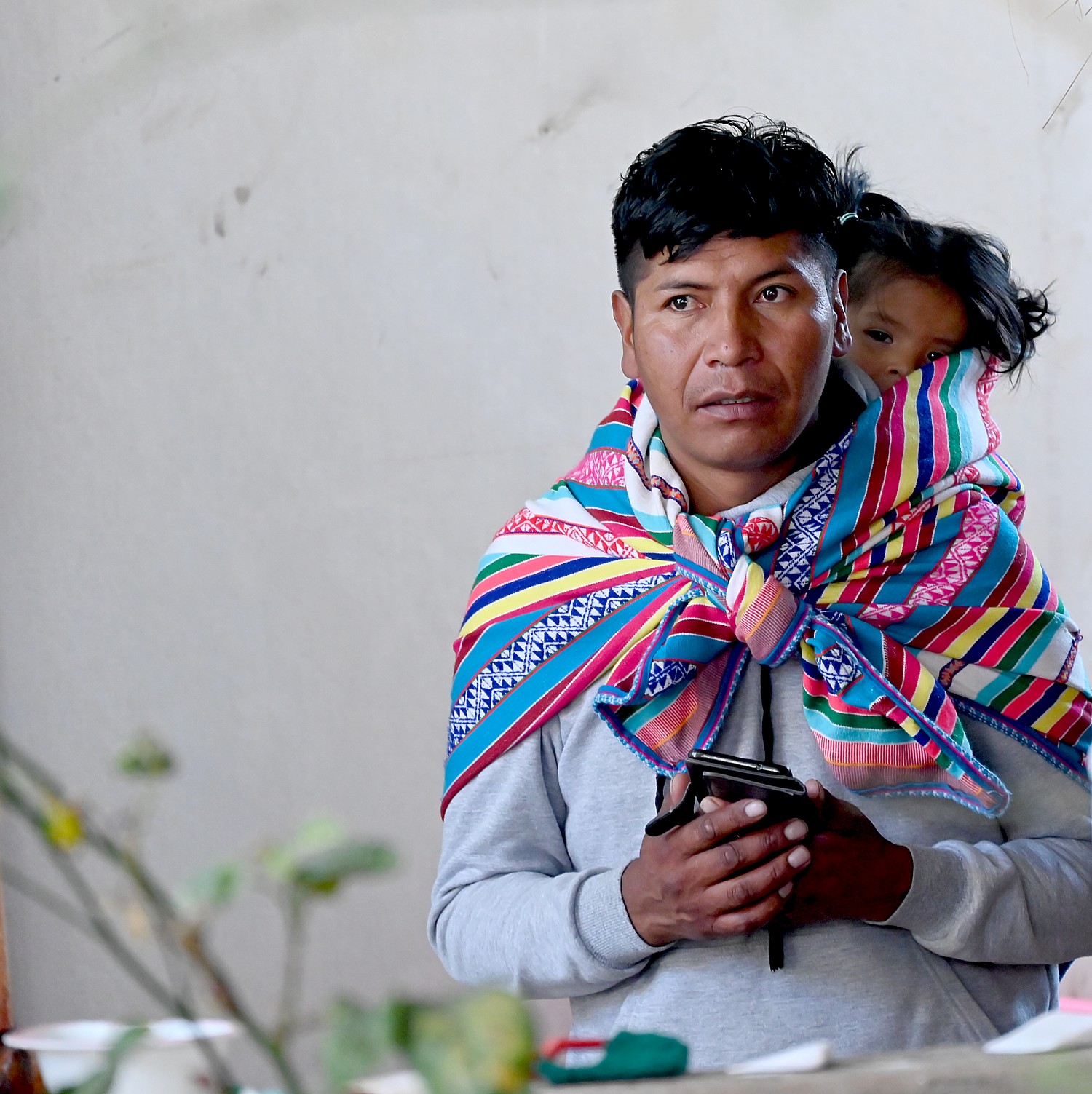
Our guide, Jaime, picks us up at 8 am our charming boutique hotel, the Amaru Inca (Cuesta San Blas, 541, Cusco City Center, Cusco, 84) which must once have been a hacienda, and we set out in private car into the countryside, where we immediately see neighborhoods, villages and communities.
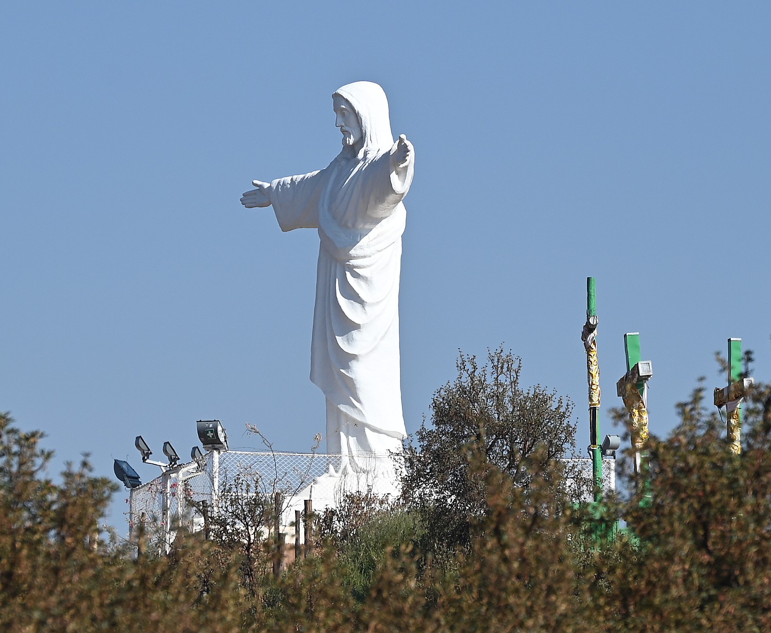
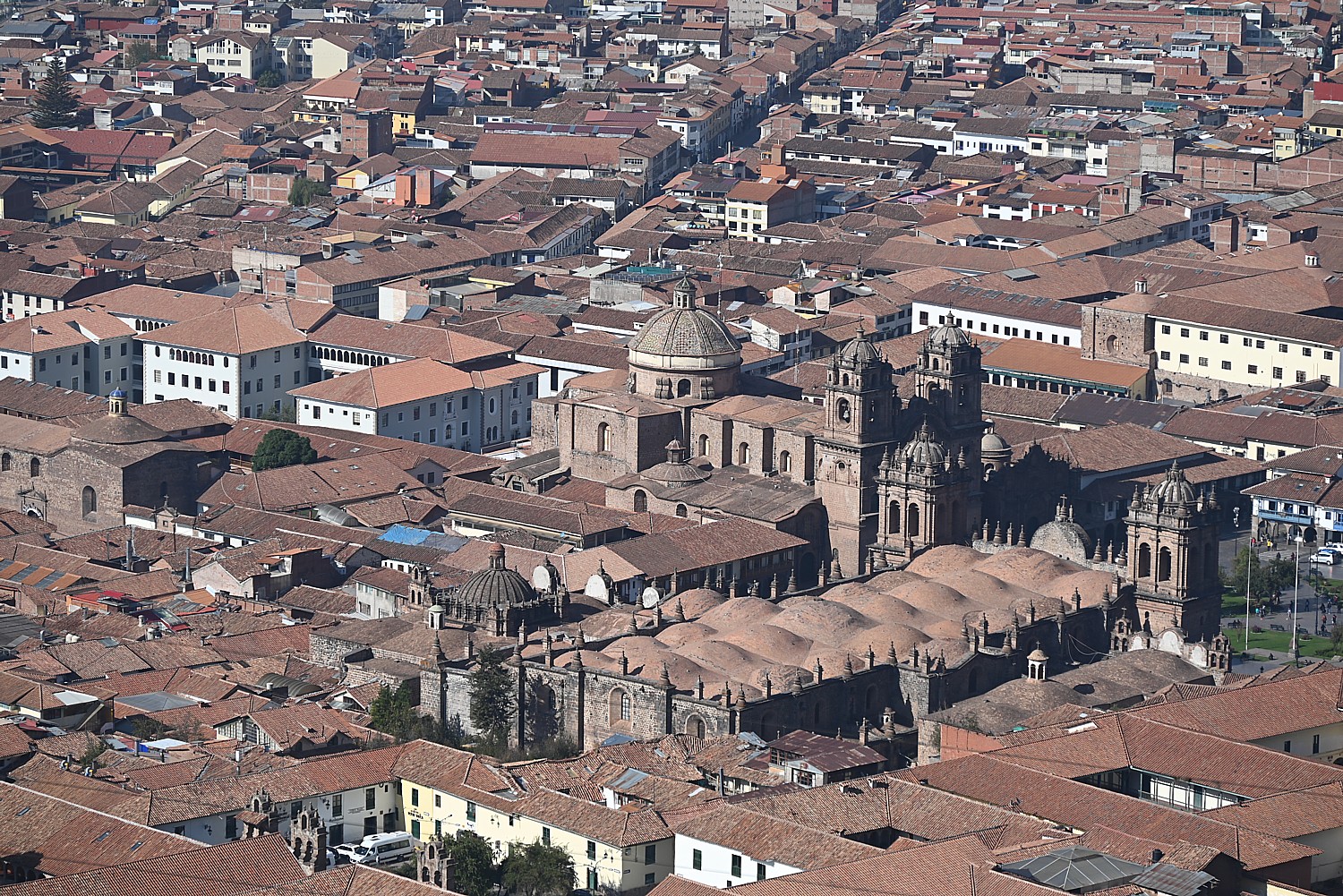
The road begins its twisting rise into the mountains and Jaime stops just before the Sacsayhuaman fortress at a point where we are level with Cuzco’s most famous monument, the statue of Christo Blanco with open arms that overlooks the city. Eight meters high, it was created by Cusco sculptor Francisco Olazo – a gift from Palestine in 1945 – and a mini version of Rio’s statue. From here, the Cathedral and churches and Spanish-style buildings are most prominent.
Cuzco was the capital of the Incan Empire and the “navel” of the world, according to its lore. At its peak, had 30,000-40,000 inhabitants.
“There is nothing like Cuzco in any other part of South America for the concentration of people and sites,” Jamie says. There are some 1,250 sacred sites in Cuzco.
The hostels we stay in today were once grand homes – first of Inca rulers who began to take over Cuzco in 1000 AD, then rich Spaniards who came in the first century after conquest, in 1536.
The Incan heritage pretty much had to be resurrected because the Spanish did their level best to eradicate the culture, and especially the “pagan” religion which was based on nature worship – literally building their palaces and churches on top of the original foundation stones of the Incan palaces and temples.
“It’s as if they were saying, ‘We are built upon your gods. Submit.’”
The center square, would have been the city’s market place and where religious ceremonies would have been held, was renamed by the Spanish the Plaza de Armas – the place of arms – where they would have held executions of rebels.
Our guide Jamie explains that the Inca were actually the ruling family – not the people – who basically ruled over some 50 different tribes and city-states, speaking different languages. Some 20,000 to 40,000 Inca nobility ruled over a population of 10 to 20 million that at its peak, spanned as far as Columbia, Ecuador, Chile and Argentina. The Inca expanded its empire from Cuzco by conquest and “diplomacy” between 1000 and 1536, reaching its peak in the mid 1400s, 125 years before the Spanish conquest.
What is so remarkable is the Empire the Inca built – the monumental architecture and 3,000-miles of road network reaching all corners of the empire – was accomplished without the benefit of draft animals like the horse, the wheel, iron or steel tools, a written language, currency, or slaves.
How was it possible for a few hundred Spanish conquistadors to conquer the Incan Empire ? The Spanish seemed to arrive during a perfect storm of turmoil and weakness in the Empire. The Inca Emperor Huayna Capac had died in 1529 after contracting smallpox, that likely came from Maya fleeing south along the roads the Inca built, who were infected by the Spanish and weakened the population; and two brothers were embroiled in a devastating civil war to become the new Emperor. Atahuallpa, the 13th and last emperor of the Inca, was victorious, only to be captured, held for ransom, and then executed by Francisco Pizarro.
But a key reason for the Spaniards’ success was that the tribal people were not motivated to battle the invaders. Many wanted to be rid of the Inca rulers and allied with Spaniards (“The Inca weren’t very nice,” Jamie says). Also, the Spaniards seemed to be endowed with supernatural power and the incarnation of the priests’ prophesy of an existential event akin to Armageddon.
The first group of 90 Spaniards arrived in Cuzco in 1533 in Cuzco and lived together with Cuzco population for three years. But in 1536, a second, larger, more militant group came, determined to take the Inca’s gold and silver (the Inca did not understand how the Europeans valued precious metals as a source of power) and forcibly replace the “pagan” religion with Christianity.
The Incan leader Manco realized the Spaniards weren’t leaving, so rose up against them, but the Incan weapons were no match. After the third battle, the indigenous population abandoned Cuzco and the Spanish took over their properties.
If the Spaniards would have come 50 years later, Jaime says, the Incan Empire may have taken over Mexico and been powerful enough, unified enough to drive the conquerors out, he says.
The Spaniards did whatever they could to eradicate the pagan religions. Some continued to observe their religious rituals in secret – even up to modern day and as recently as 15 years ago, would practice secretly. Today people openly practice. “The church knows our religion was respecting nature,” Jamie says.
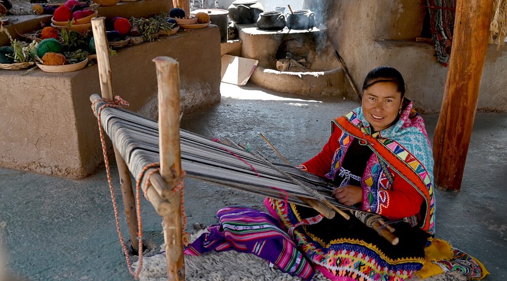
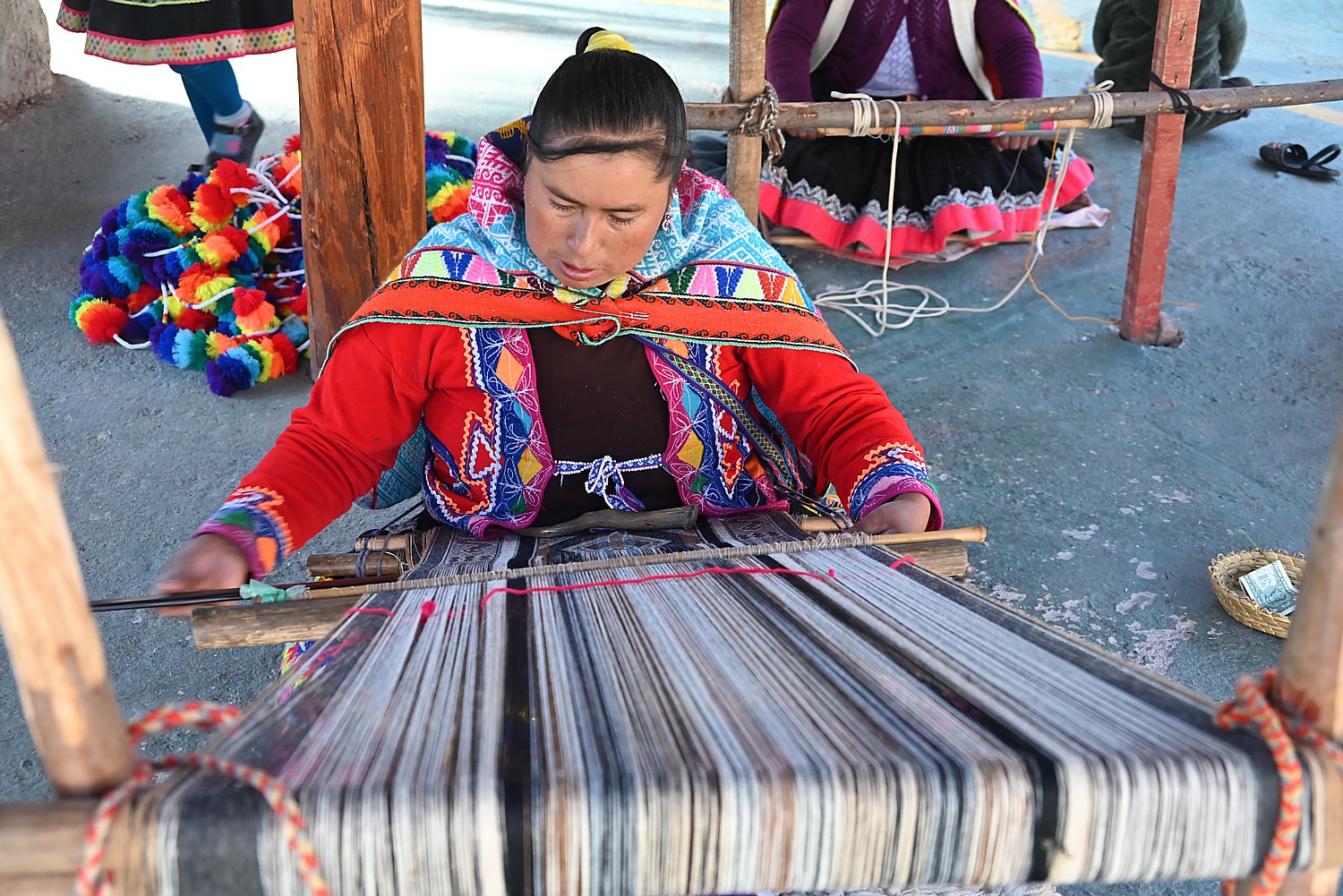
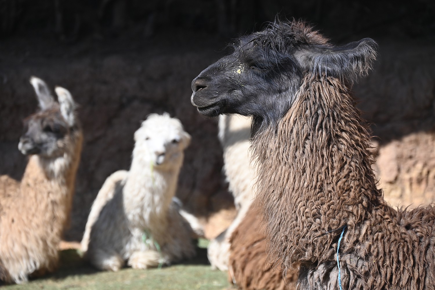
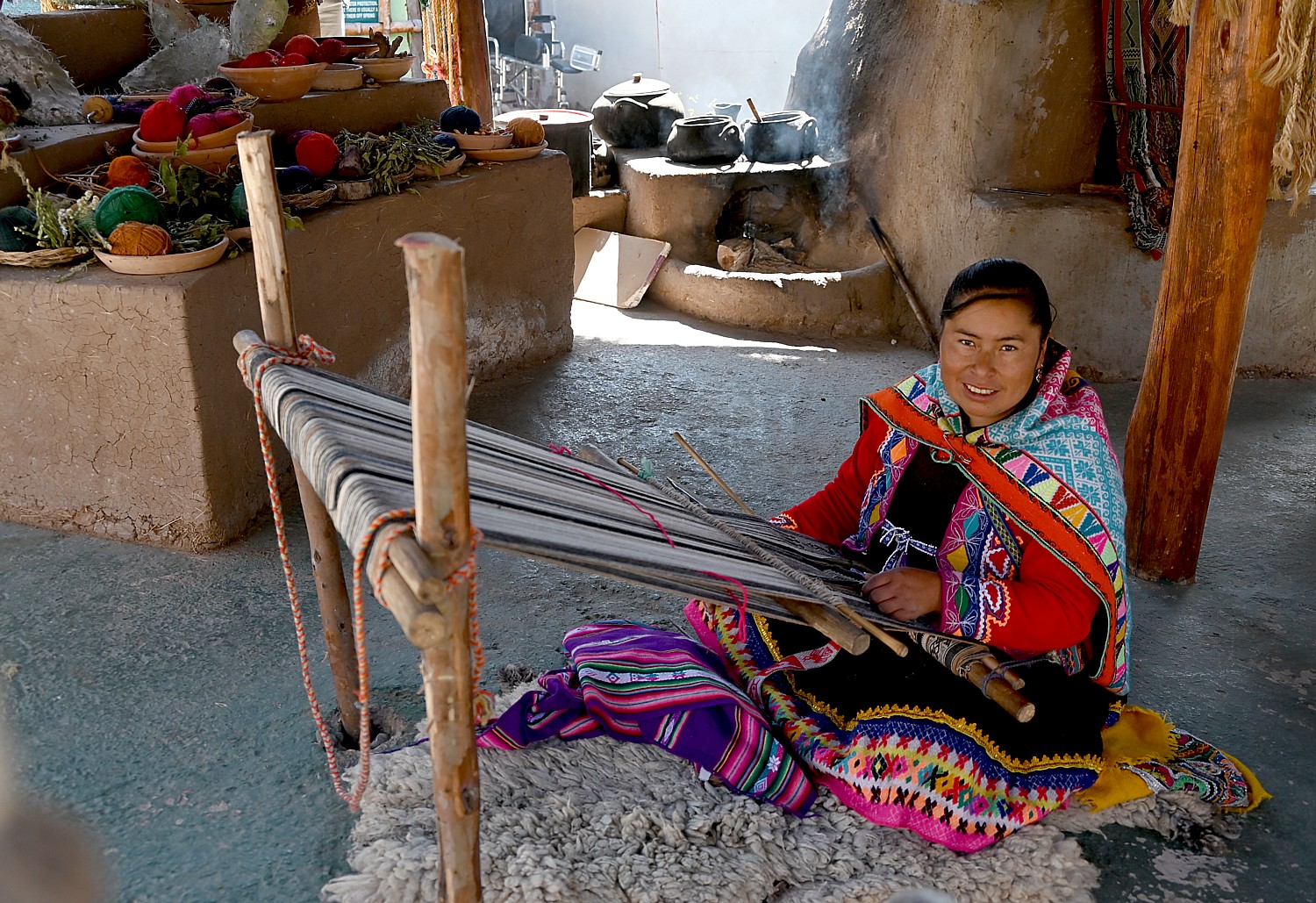
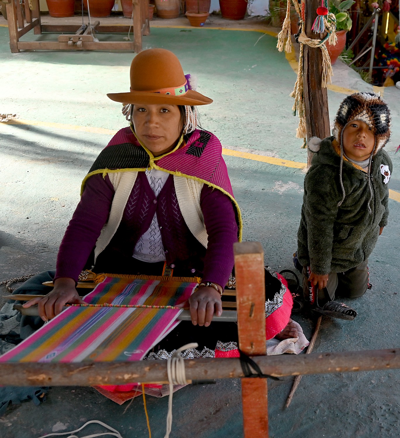
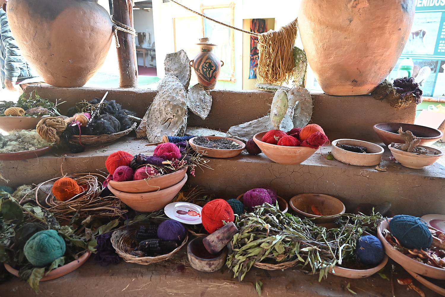
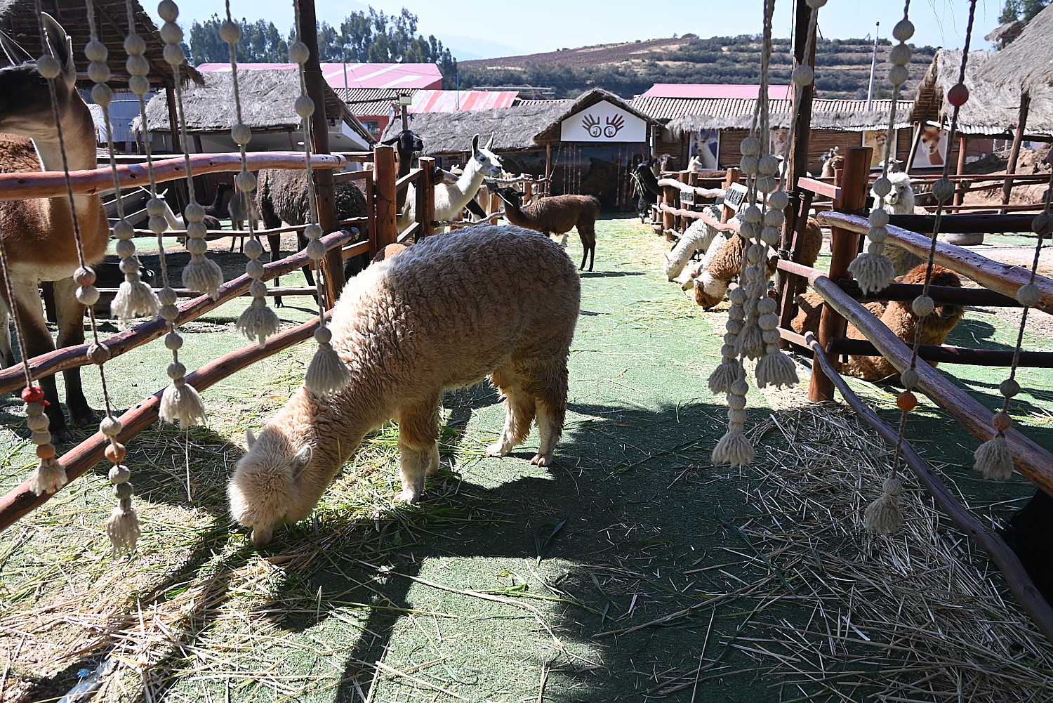
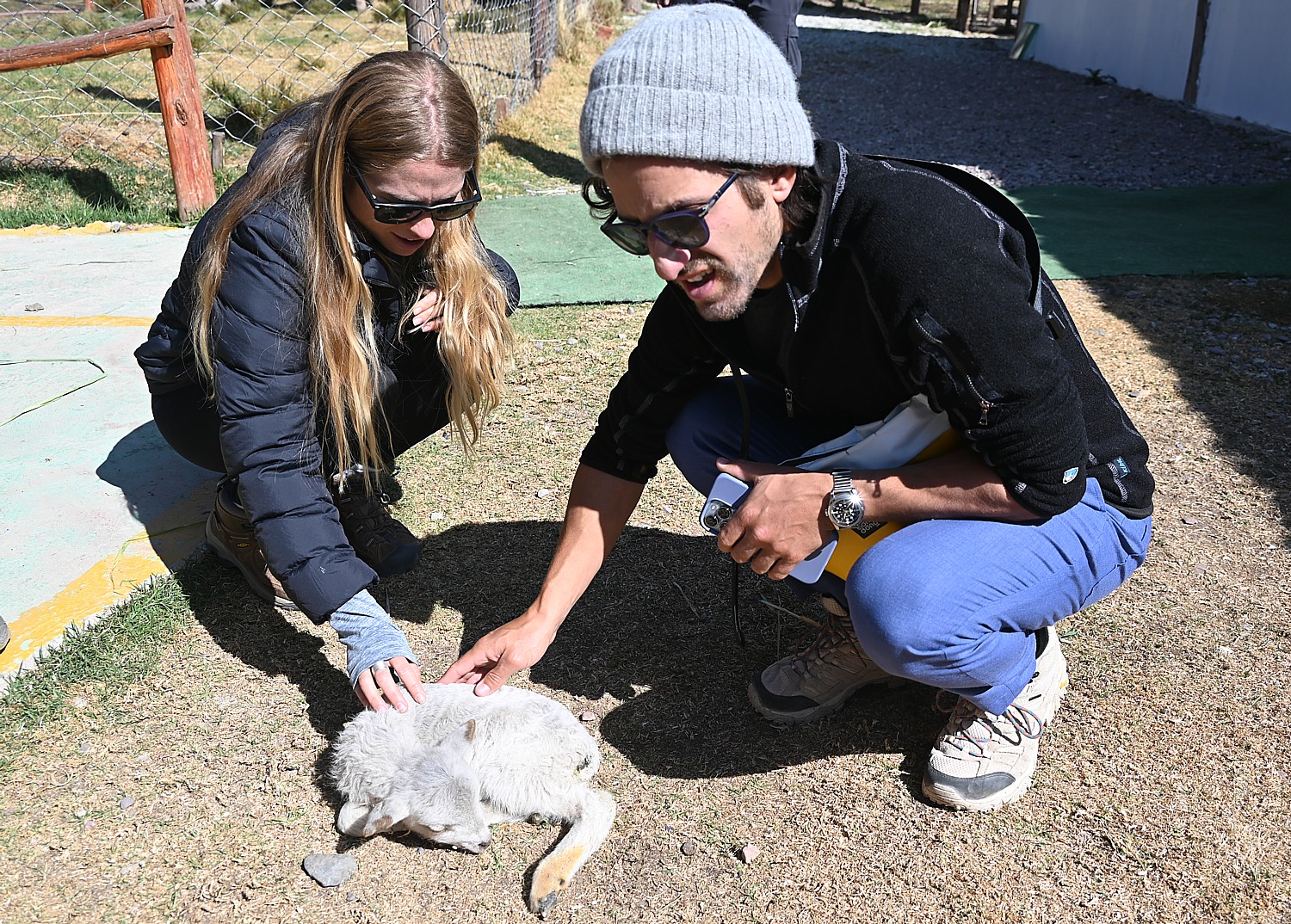
We stop at the Manos de la Comunidad, a handicraft center where we see the different varieties of llama and alpaca, learn about how the wool is produced, the raw materials that the dyes are made from, and watch villagers at their looms, make stunning textiles (there’s also a fantastic gallery, museum and a large store).
This visit provides fascinating insights into the culture and heritage, the structure of society and the ecosystem that shaped and sustained the Incan Empire – the environment that supports agriculture in high altitude (enough food and calories to fuel the building of these monumental structures and support an army) and domestication of animals, how the natural materials at hand shaped the culture.
You realize how critical to the success of the Incan Empire the domestication of llama and alpaca were – for carrying goods and producing wool for clothes – the only domesticated animals in pre-Hispanic America. Also, the grasses were food for the animals but also used to make the ropes for bridges and hauling the massive stones (I suspect were also used to make the straight lines without the benefit of rulers.)
These finely-woven textiles and the monumental architecture were the main arts of the Incan Empire; instead of written communications they used knotted strings (quipu), which still cannot be deciphered but which (Karen postulates) might have been a kind of Morse code (so why can’t a computer crack the code?). The colors and patterns of clothes would communicate tribal affiliation, friend or foe.
The Inca’s success at farming had much to do with the fact the Inca calendar was tied to astronomy. Inca astronomers understood equinoxes, solstices and zenith passages and the Venus cycle. Religious leaders –the only others besides the nobles who were educated – used their knowledge as power over the people who were kept ignorant. The priests would use the solstice as if the people’s religious devotion would bring back the longer days. They couldn’t predict an eclipse, but they well understood how it operated.
The Inca also used mathematics to divide up political governance (a system of 10s), assess taxes, keep the census, and to do the calculations necessary to create such monumental architecture.
We also see guinea pigs in cages. They were a delicacy, served at important festivals, and even today are served for festivals as well as in restaurants.
But the Inca could not have accomplished what they did – labor, military might – without enough food (calories) to support the population, which is why the Machu Picchu Sacred Valley was so vital.
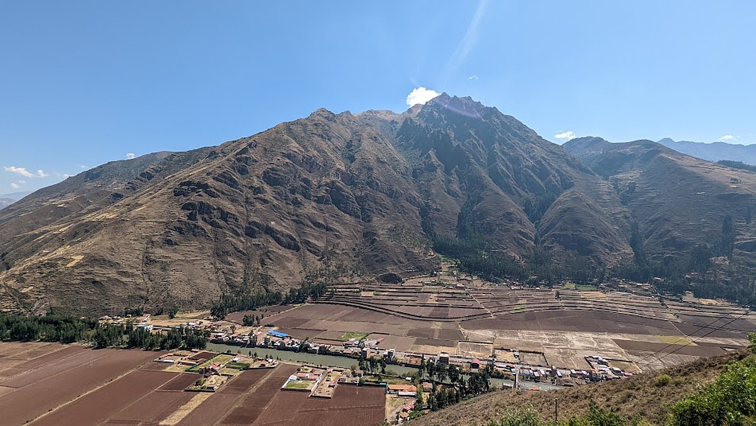
We stop at a famous overlook known as El Mirador (Lookout Point) from where we can see the Sacred Valley – an abundance of fertile plains in this high area of the Andes – spread out in front of us.
Around the year 1000, Manco Capac claimed to be the “son of the sun god Inti,” sent to earth to become the first king of the Inca. He was known for his courage, and taught the people how to grow plants, make weapons, work together, share resources and worship the gods – in other words, set the parameters for the society.
Karen suspects the source of Manco’s power over the people was that he was an agricultural genius – figuring out terraces and irrigation technology – and abundant food production was proof of his divinity. He probably was a popular dictator but later Inca rulers relied on force. Besides military might and a brutal form of “justice,” the Inca ruled through religion and superstition.
Their religion was based on nature and the different tribes had their own local gods and idols – they worshiped the gods and goddesses of rain, lightning, rainbow (connected with fertility), moon, sea and water. The Inca imposed sun worship of Inti over other gods, even Pachamama (Earth Mother). The people drafted to build their palaces and temples did it as much out of devotion to god as their obligation to give service to the state.
The elevation of the valley provides the perfect climate for growing corn (maize), so Inca named in Sacred Valley (a golden staff also comes into play). The maize was also used to make a fermented liquor that was used in religious ceremonies, adding to the “sacred” nature of the valley.
They modified the river bank with sand bags to control flooding and perfected irrigation techniques to create more arable land; the terraces created micro-climates for producing different crops.
The Inca society was a combination of feudalism and socialism. While they did not have currency and technically did not use slaves, instead, the exchange of goods and services was based on reciprocity between individuals and among individuals, communities and the Inca rulers. Farm production was divided up with 25 percent going to the Inca rulers and nobility, 25 percent to the priests and religious institutions and half kept by the farmers. The Inca rulers (who theoretically owned all the means of production) reciprocated by granting access to land and goods and providing food and drink in celebratory feasts for their subjects.
When the Spanish came, they introduced a feudal system – where the Spanish owned all the land. That persisted up to as recently as 1969, when a socialist (nationalist) president came to power.
“The government bought the land to give to farmers, brought more freedom, and the right to go to school. For the first 15-20 years, it didn’t work well because farmers didn’t know business like the landlord, didn’t have the export connections, and were used to being bossed. The government had to step in, ‘Remember the Inca time’ – and get them to act as a cooperative. Today, every farmer has his own land. Peru’s biggest export is avocado; its corn is shipped to Japan, Germany and Canada.”
As we drive into the countryside, we see women in traditional dress, we pass markets. Many of the houses – still made of adobe – were swept away in a massive flood and are being replaced with brick structures which do not seem completed (to save taxes?). There is an election underway and we note campaign posters painted on whole buildings.
Before the day is done, we will have a chance to explore the archeological sites of Pisac and Ollantaytambo before making our way back to Cuzco for our 6 pm orientation with Alpaca Expeditions for our Incan Trail trek that begins the next morning.
The permits to do the Inca Trail trek are limited to 500 a day for all the trekking companies (which includes 300 set aside for guides and staff and only 200 for trekkers) and get booked up months in advance.
By Karen Rubin, Travel Features Syndicate, goingplacesfarandnear.com
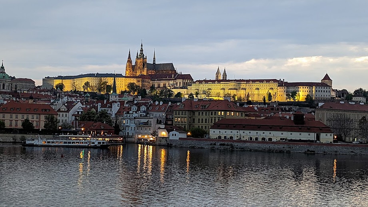
I was so glad I had the cleverness to arrange three full days to explore Prague on my own before embarking on CroisiEurope’s Prague-Berlin river cruise aboard the Elbe Princesse. I could wander, linger, get lost amid the narrow cobblestone streets, be surprised and delighted upon coming upon stunning views of the Prague Castle from the Charles Bridge across the Vltava, the Old Town Square, the Astronomical Clock at night (the most underwhelming scene you can’t miss), contemplate the Lennon Wall, discover the personalities who occupied the tiny houses on Golden Lane in the wall of Prague Castle, follow whimsy and pop into the Lobkowicz Palace to be dazzled, and have the time to really muse over the exhibits, displays and notes in the Jewish Quarter and Prague Castle, and for good measure, visit the National Museum.
And the Prague Cool Pass, which provides free access to over 70 attractions, tours, river cruises, plus discounts to concerts, entertainment and activities, helped maximize my enjoyment and how much I could see and experience in this all too brief time in such a phenomenal destination (praguecoolpass.com).
I lose the better part of a full day when my Delta flight from JFK to Amsterdam was delayed, causing me to miss my connection to Prague (I knew the 50 minute-connection was too good to work out). But if you have to wait eight hours in an airport, Schiphol is one of the most pleasant. Still, instead of arriving at 8 am, I arrive at 5:30 pm, but still in a good mood – largely because I had made a fantastic choice of hotel, the EA ApartHotel Melantrich, which I found on hotels.com, and pre-arranged an airport pick-up through the hotel.
I actually have an entire apartment on a street that strikes me as comparable to New York’s Fifth Avenue – actually Welcelas Square – with the National Museum at one end, and Old Town at the other, walking distance to everything I want to see in my all-too-short time. (Further benefits: the hotel has a gorgeous dining room where an enormous smorgasbord breakfast is served, an outdoor landscaped sitting area, an indoor pool, elevator, bar/lounge.) (EA ApartHotel Melantrich, Praha 1-Vaclavska Namesti 36 Stare Mes Prague, phone +420734596570).
I had used my time in the airport wisely, looking over “Top Attractions in Prague” and “Three Days in Prague” and there was consistency in the must-see list. I only needed to plot out the logistics (only a little tricky because the map (I LOVE a paper map) is in Czech (it takes me a day to figure it out – but I soon figure out that there are also helpful signposts pointing the direction and distance to what most people are looking for). Still, each time I set out, I get a little lost, or rather find a different way, and each time I am surprised and delighted at what I stumble upon.
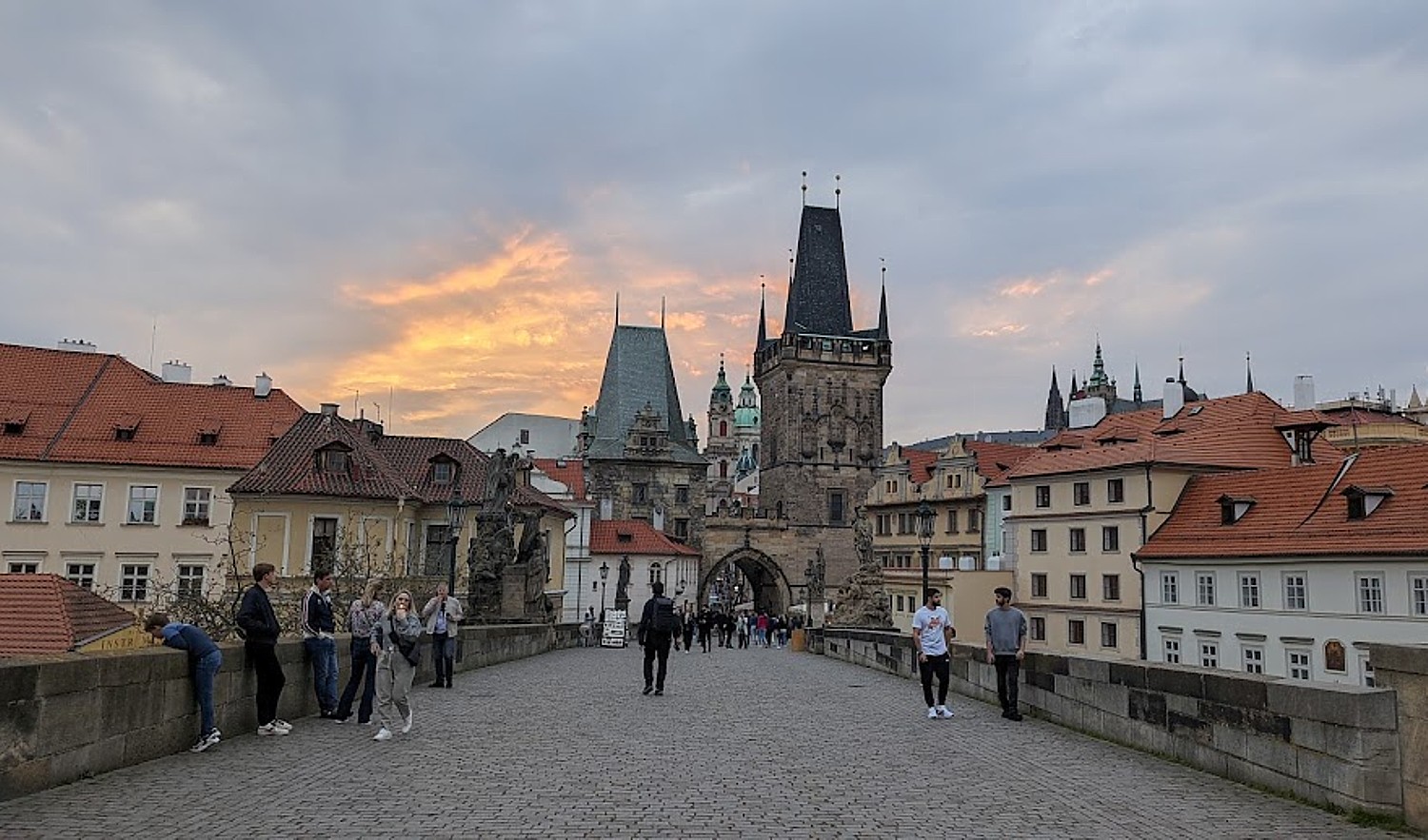
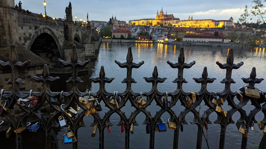
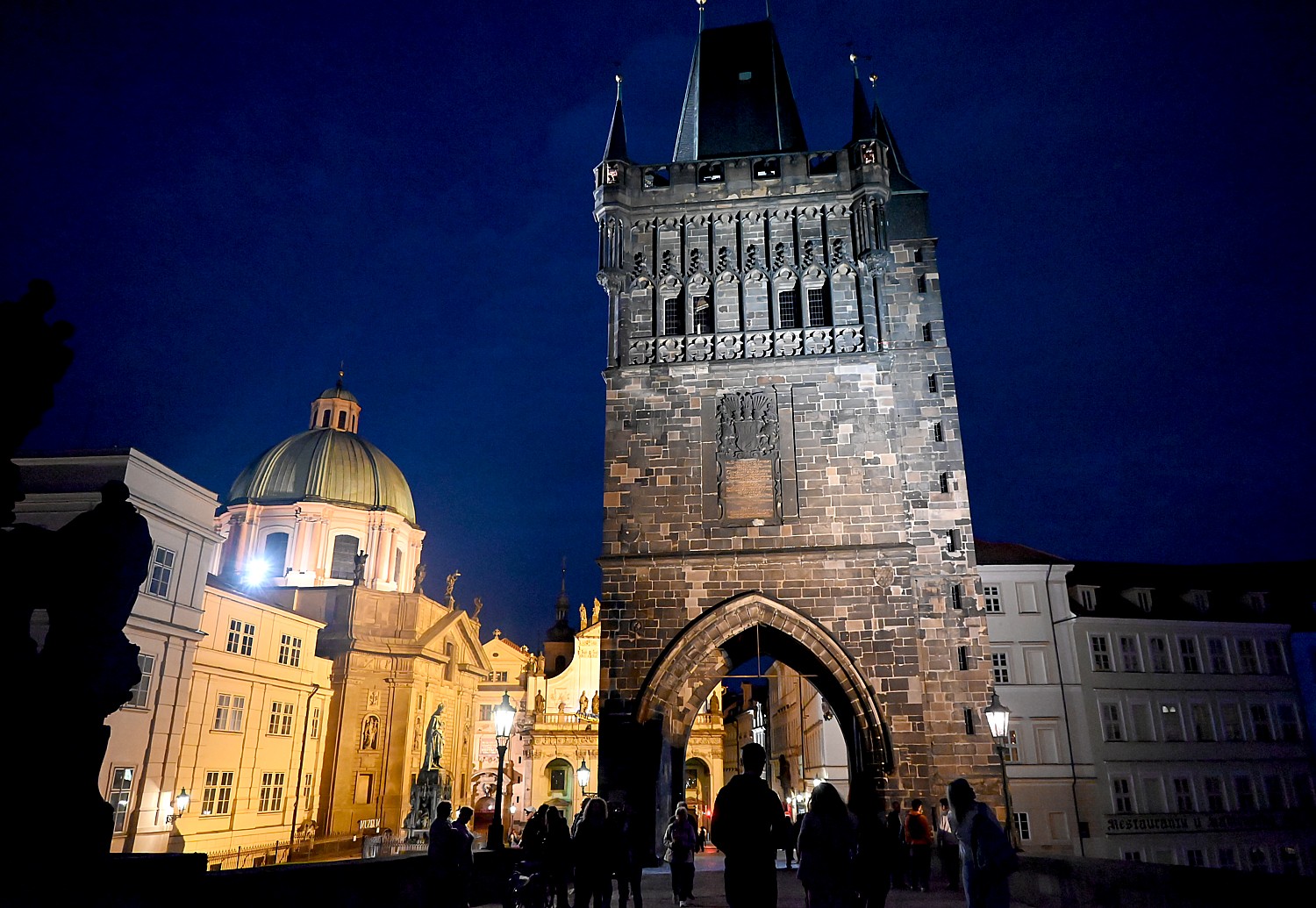
I drop my bags at the hotel and the concierge points me in the right direction to walk to the Charles Bridge, which has to be the absolute best place to be at sunset. I get there just as the final patches of orange and pink break through clouds. (It turns out was the best of all three nights, proving my maxim to seize every moment) and I get caught up in that whole vibe. There is music, hawkers, a constant flow of people.
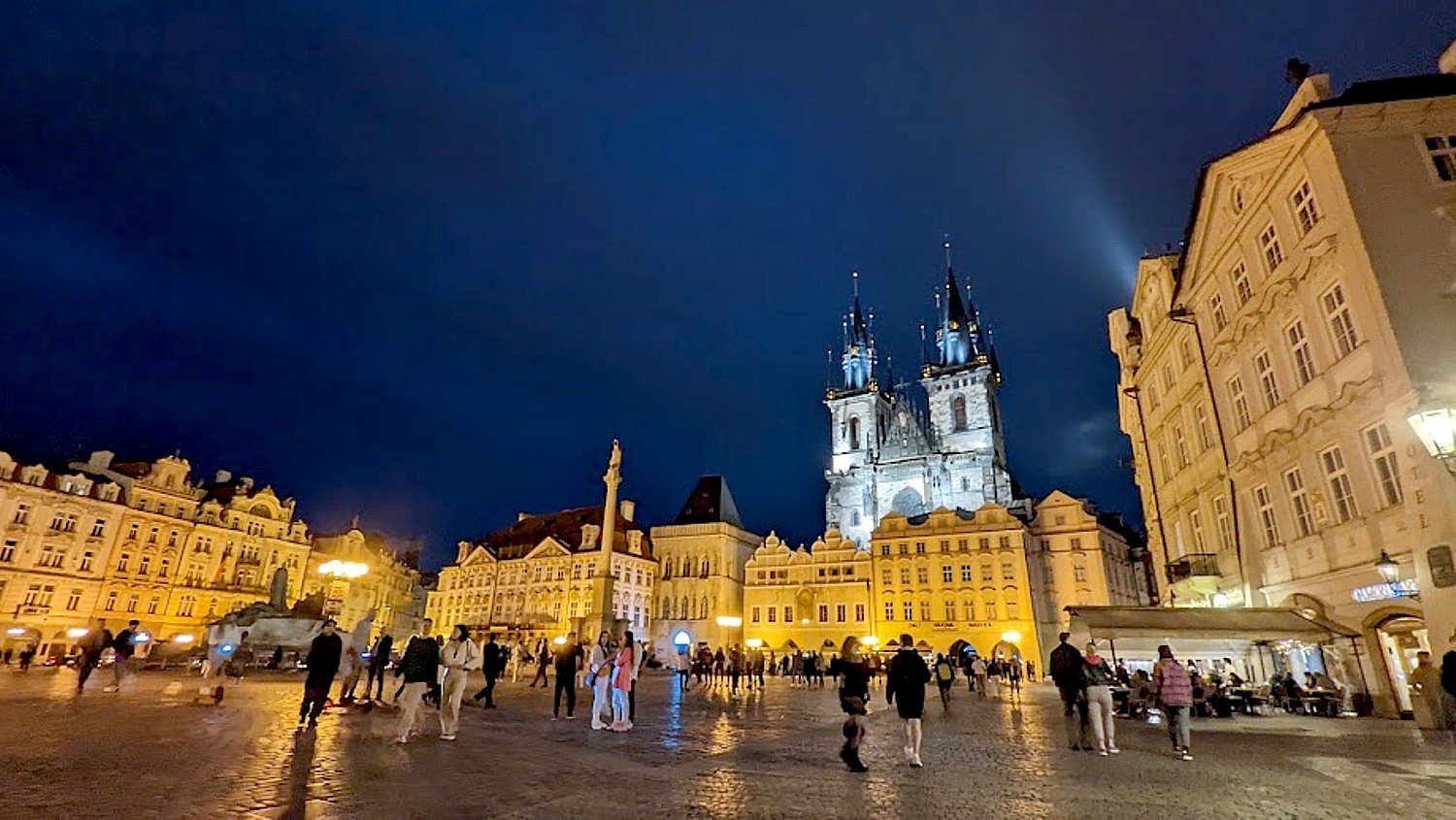
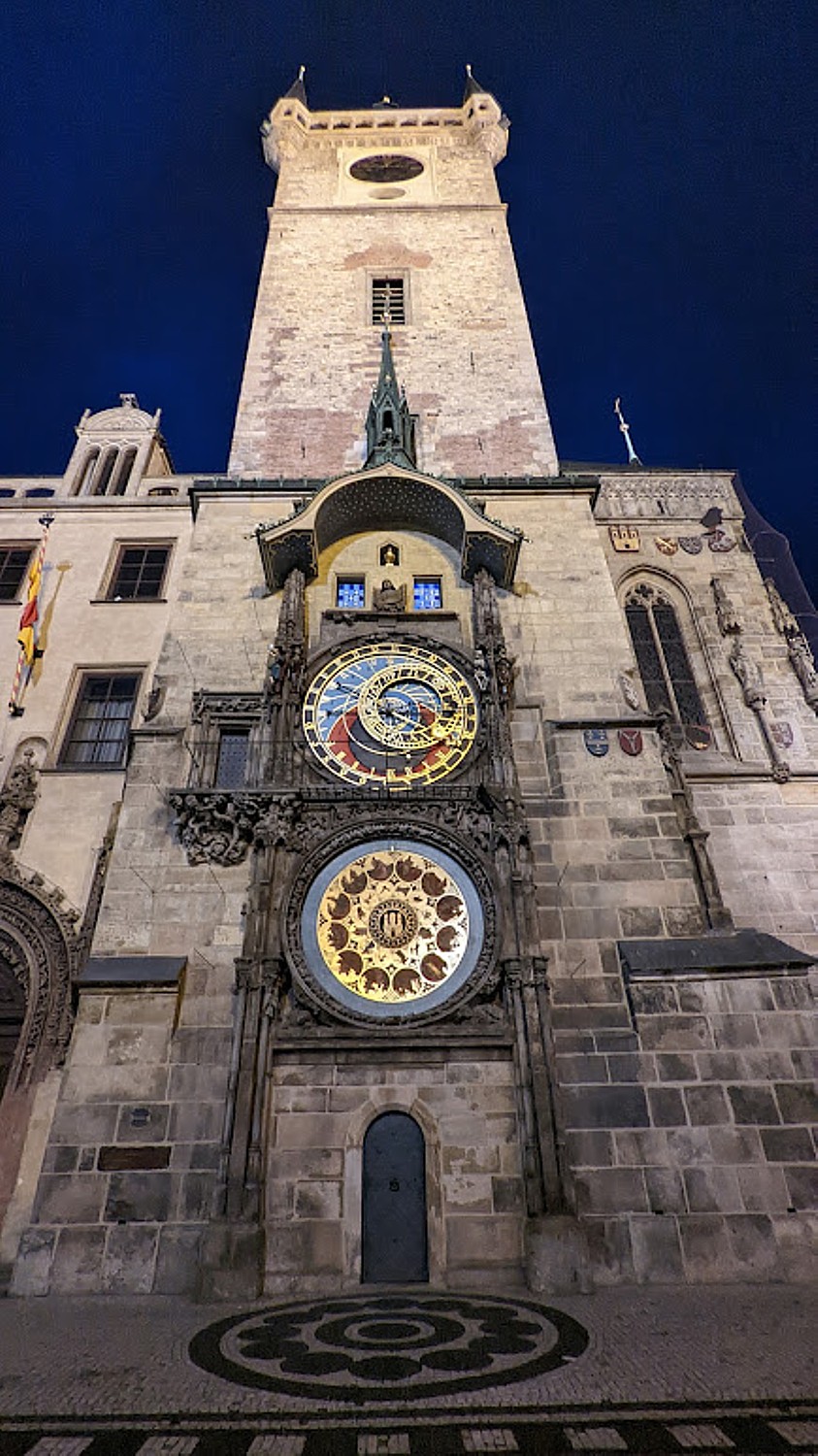
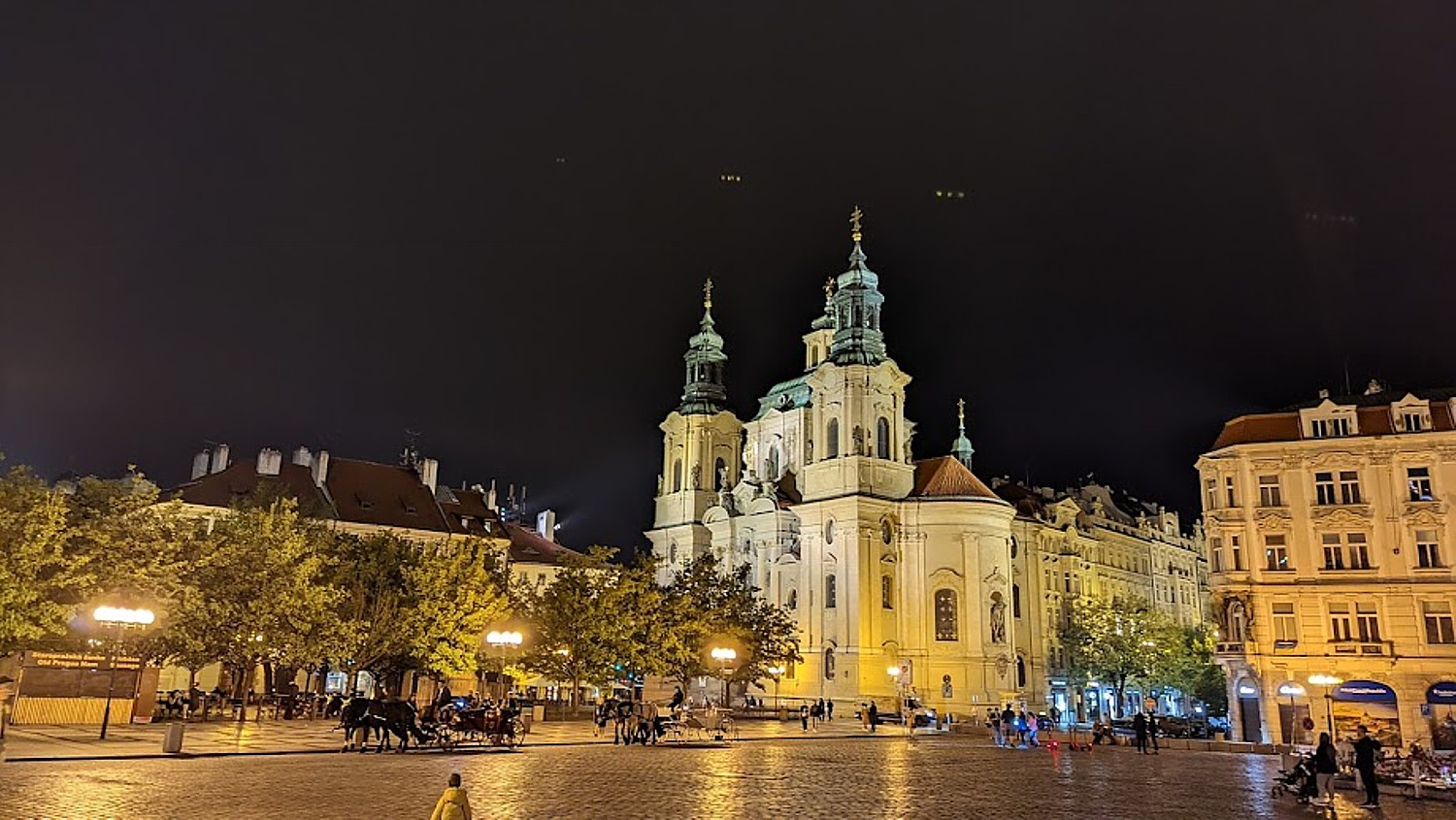
I walk back to Old Town Square and come upon the Astronomical Clock (on the hour, there is a 45-second display – the most underwhelming must-see attraction anywhere, but nonetheless, hundreds wait each hour for the show). The square is absolutely stunning. I find my way back to hotel.
The next day, I set out for the Jewish Quarter, stopping again at the Old Town Square and the Astronomical Clock (you can’t resist). I present my Prague Cool Pass at the Jewish Museum – actually seven separate sites that each tell a different part of the story of the Jewish experience in Prague, going back to the 13th century. I kind of do the sites in reverse order, which I actually appreciate more.
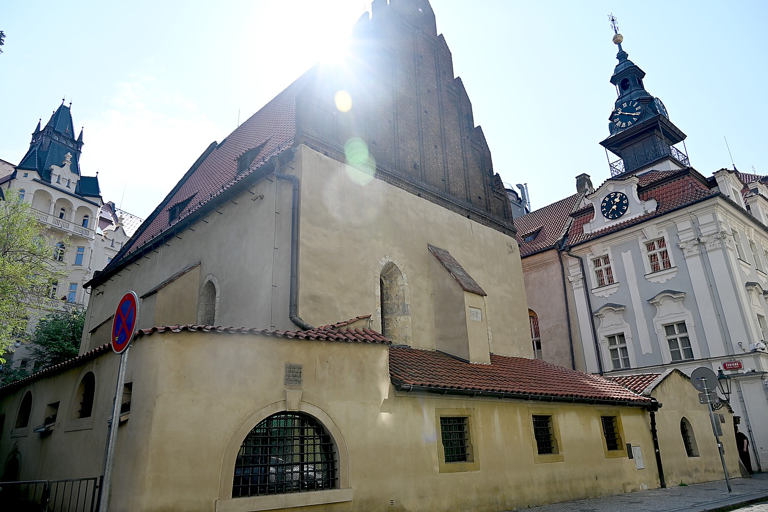
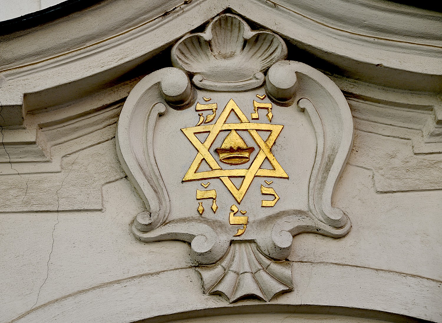
I start at the Old-New Synagogue, the oldest landmark of “Jewish Town” in Prague and one of the oldest surviving synagogues in Europe. It has served for more than 700 years as the main synagogue of the Prague’s Jewish community. Why “old new”? Because it wasn’t the oldest or first synagogue – that one was a shul on the site where the Spanish Synagogue, built in 1867, now sits. You go in and see the traditional way the synagogue was laid out – with a bima in center and seats all around the walls (women on other side of the wall). Each of the chairs still has the name plate of the family that has inherited it; one of the chairs has the name of former US Ambassador Norman Eisen, whose family came from here, and the Israeli Ambassador. A banner that hangs high is adorned with a Star of David with a golden hat in the center – the hat was original required for Jewish men to wear, but instead of a humiliation, the Jews made it a badge of identity, so incorporated it into the symbol of the Jewish Quarter.
I go next to the Ceremonial Hall, adjacent to the Jewish Cemetery, which discusses and describes Jewish burial rituals as well as medical care. Next to the Klausen Synagogue, where the exhibits describe Jewish life – you get the sense that the Prague Jews were actually well off, especially compared to the images you typically see of impoverished Jews in the Russian shetls – and you learn that under Joseph II, who reigned from 1780-90, laws governing Jews were liberalized.
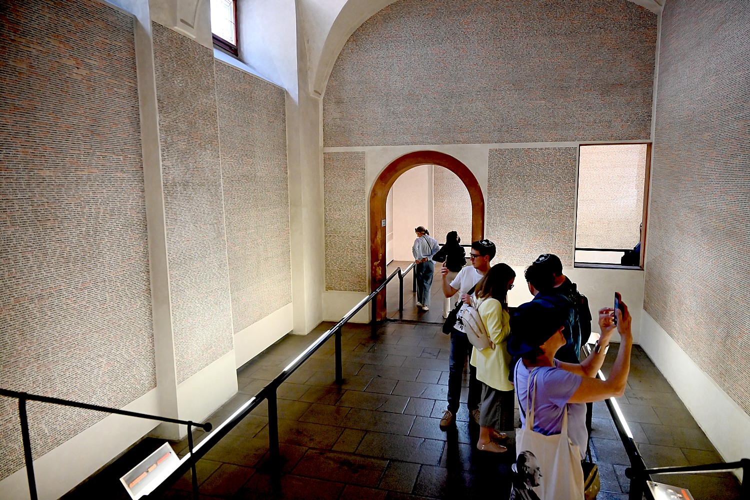
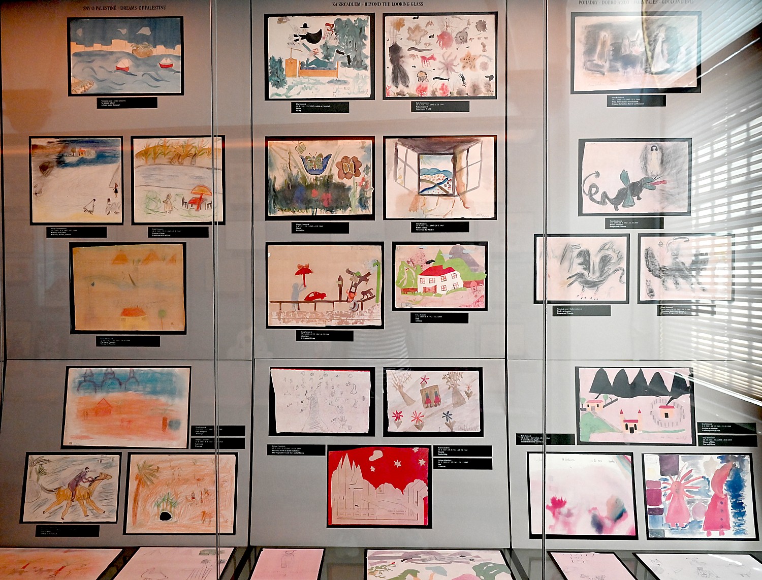
Then on to the Pinkus Synagogue, which dates from 1530, where I was surprised to find it has become a memorial to the Shoah. Some 80,000 names of Jews killed just from this region of Bohemia and Moravia are inscribed all over the walls (you can do a search for names on a computer). A gallery in one room displays paintings by Jewish children who had been deported to Terezin, organized by different themes: longing for home, a dream of Palestine, being taken away, memories of family, with the names of the child and the dates of their birth and too soon death.
Their teacher was Friedle Dicker-Brandeis (born in 1898 in Vienna, died 1944 in Auschwitz), who, from the beginning of her internment in Terezin, devoted herself to drawing lessons for the children in the ghetto. Children signed their drawings and wrote their room number, the group to which they belonged, and lesson hour. Then she classified them. She scoured the camp for paper and paint. When she was deported from Terezin to Auschwitz in a “liquidation” transport, she left behind two suitcases with more than 4000 children’s drawings. This display is heart wrenching.
Outside the synagogue, there is a photo exhibit, “Journeys With No Return,” documenting the Nazi removal.
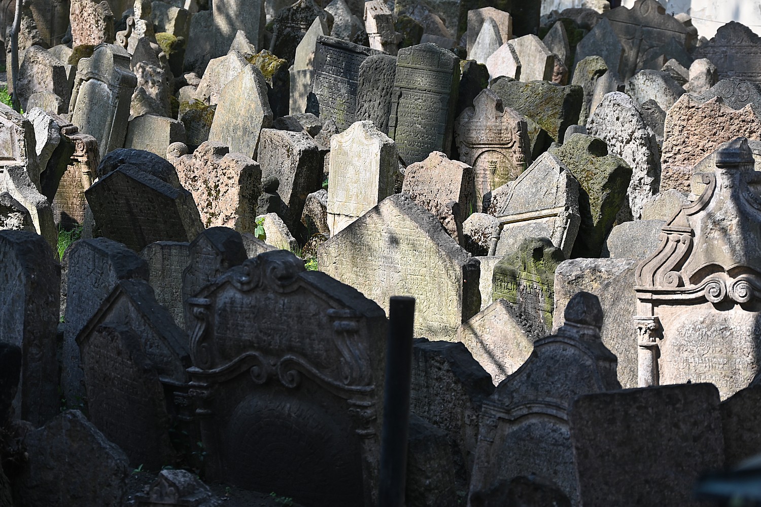
Then you go through a courtyard to enter the Jewish cemetery. There are some 12,000 tombstones in a tumult – crowded together, pushed over in all directions over time and flooding – but actually some 100,000 are buried here. But after going through the Holocaust Memorial, I felt these people at least had a grave, they had people who buried them, said prayers over them, placed stones to show they had come to pay respects.
Having had this tour, I now go to the Maisel Synagogue (marked as the #1 site) which is a museum that describes the history of Jews in the Bohemian lands from the 10th to 18th centuries, and for me, provides a context for what I had been seeing.
Notably, during the reign of Joseph II (1780-90), Jews could attend university and higher education, but their schools were taught in German instead of Hebrew; under special conditions they were allowed to rent land, learn trades and set up factories, and no longer had to wear “identifying marks.” On the other hand, Jews were compelled to adopt fixed first names and surnames (1787), and only the eldest son was allowed to marry; also the Jewish judiciary was abolished (1784) and Jews now had compulsory military service (1788). It is interesting that the Jewish Quarter is named for Joseph II.
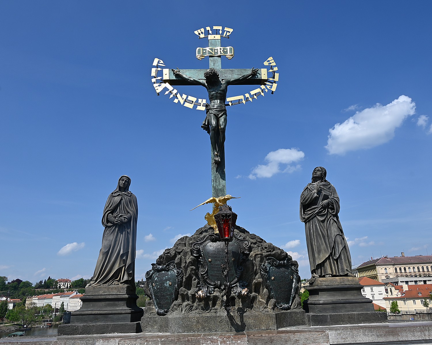
In one of the displays, having to do with the effort to assimilate, integrate and convert Jews, I see an etching of the statue of Jesus that is on the Charles Bridge, which I had noted because of the Hebrew lettering, and in Latin, the word for blasphemy. The notes state that “in 1696, the Hebrew inscription ‘Kadosh, Kadosh, Kadosh’ (holy, holy holy) on the statue was paid for by a fine imposed on the Jews Elias Backoffen and Berl Tabor for alleged blasphemy against the cross in a coded letter. The letter in question, however, was never deciphered by the authorities.”
(I wondered how these structures, these monuments and artifacts survived the Holocaust. I read somewhere that Hitler loved Prague and had thought to “retire” here. He allowed the Jewish Quarter to survive as a “museum to an extinct [extinguished?} people.” The docent at the Old New Synagogue, though, could not or would not confirm.)
On my way to the Spanish Synagogue, I wander into a gallery devoted to Robert Guttmann, “the Oldest Zionist in Prague”, who was famous in his day – a celebrity – for his long-range hikes and travels that might take 14 ½ weeks at a time (people were in disbelief, so beginning in 1903, he kept diaries). He sketched himself with famous people – very possibly the first great self-promoter, like Dali or Andy Warhol. “He belonged to Prague like the Charles Bridge, the Golem, Kampa Island or the Apostles on the Astronomical Clock. It was impossible to imagine Prague without ‘Professor’ Guttmann, the ‘renowned painter’.”
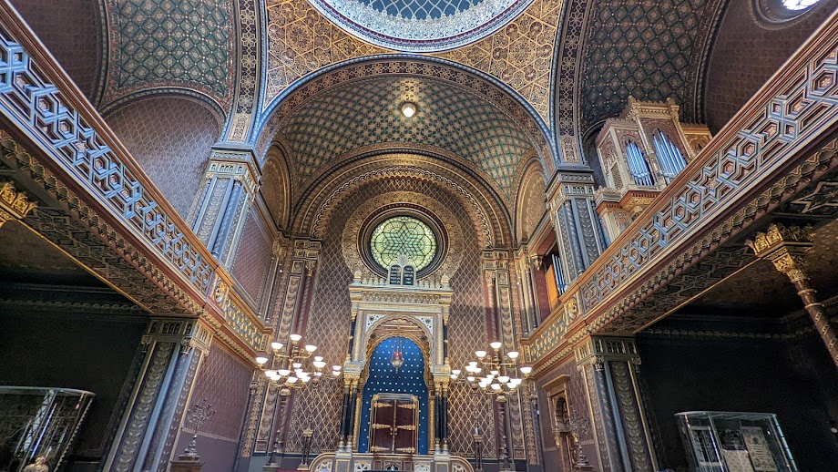
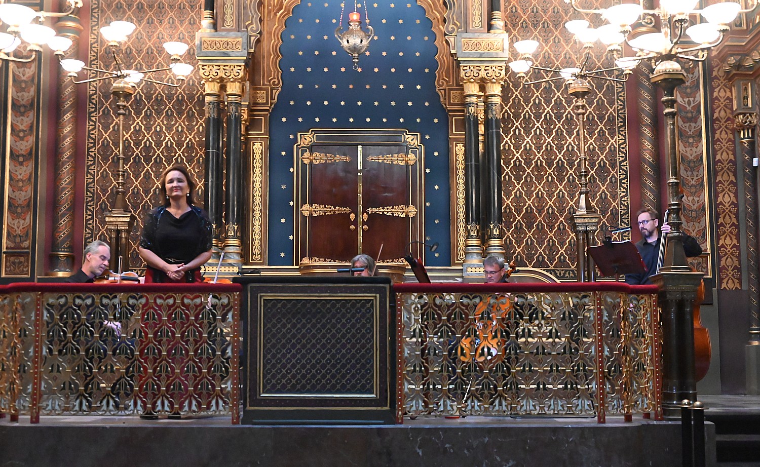
Then on to the Spanish Synagogue (more accurately known as the Temple on Dusoni Street), built 1867-8 on the site of the demolished oldest shul. It deserves its boast to be “the most beautiful synagogue in Europe.” It’s magnificent, but not so large and overwhelming that you feel enveloped by its beauty. Its design reflects a movement of “Jewish Enlightenment,” under the auspices of the Society for the Improvement of Israelite Religious Worship in Prague that followed a relative emancipation of 1848, aimed at promoting assimilation and integration into the “mainstream.”
The change in synagogue design – which moved the bima to the front from the center to increase the seating in pews – came in conjunction with changes to the liturgy and introduction of music.
Indeed, Frantisek Skroup (1801-1862), the organist here from 1836-45, composed the Czech national anthem, and the reformed worship music introduced by Skroup later spread to most other synagogues in Bohemia.
There is a 7 pm concert at the synagogue consisting of favorite compositions of favorite composers – Bach, Mozart, Vivaldi, Rossini, Verdi, Bizet, Smetana, Dvorak, Bernstein and Gershwin. I purchase a ticket. (Actually, it is amazing how many of the important churches and sites hold concerts almost nightly, including the St. Francis of Assisi Church, right at the entrance to the Charles Bridge, which claims the second oldest organ in Prague, 1702, which Mozart played, www.organconcerts.cz).
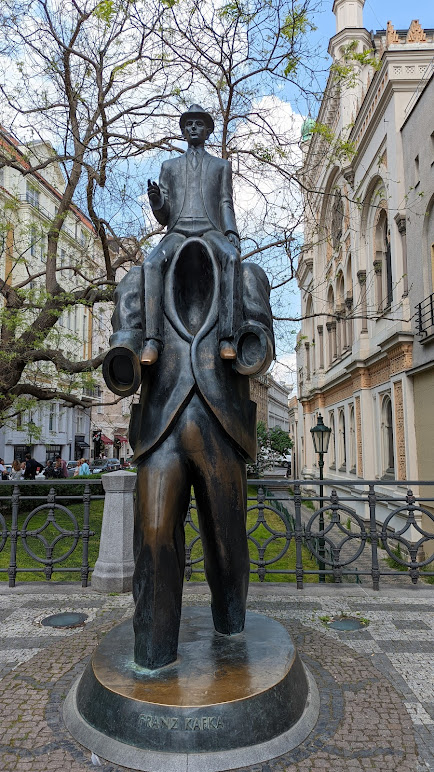
Just outside the Spanish Synagogue is a terrific sculpture of Franz Kafka (a square at the entrance to the Jewish Quarter is named for him, where the National Library is located.
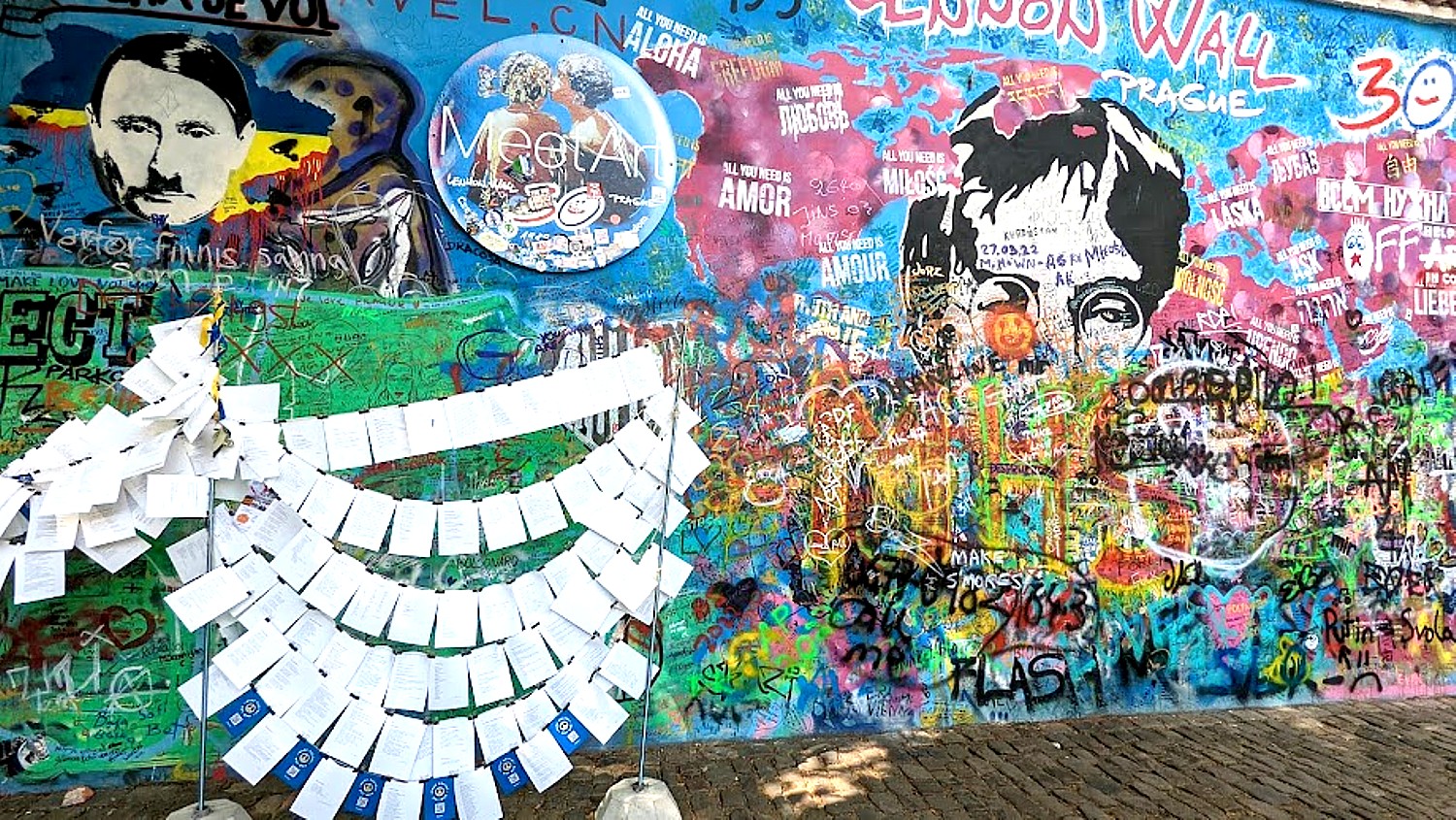
Next, I go in search of the Lennon Wall, on Kampa Island, just under the Charles Bridge. In my search, I come upon a fascinating historical display documenting the 1967 uprising against the Communist Regime, led by university students. One of the panels notes that the American beat poet Alan Ginsburg who describes being detained by police, deported, and writing “this poem on a jet seat in mid Heaven.”
I ask a woman I see walking through the park where the Lennon Wall is and she says she works at the French Embassy, directly across from the Wall, so we walk there together. (To get to the Wall, walk down stairs from Charles Bridge, turn right on Hroznova.)
Notably, John Lennon never visited Prague, but the wall began as street art, capturing his spirit of peace. The wall keeps changing – people add to it, and all of it is whitewashed so the process begins again. At this time, poems printed on paper in support of Ukraine, are hung on string in front.
“The John Lennon Wall was chosen to host the event because of its apparent symbolism. For decades the wall has served as a place to share messages of peace, love and hope. Lennon, former lead singer of the Beatles, was an avid anti-war activist, who, until the day he died, encouraged the world to ‘Give Peace a Chance’.“
I still have some time before I need to go back to the Spanish Synagogue for the concert, so I walk over to the National Museum, and flash my Prague Cool Pass. There is a very condensed history (actually there is a second building), so I find it quite interesting that there is a note that after Joseph II’s liberalization of laws suppressing Jews, repression was reestablished with the rise of a nationalist movement. Emancipation did not come until 1848. And there is one panel that refers to ‘The culmination of anti-Semitism was the so-called Hilsner Affair, 1899-1900), in which T.G. Masaryk, a founder of Czechoslovakia and its first president, stood up for Hilsner, a Jew convicted in a show trial of ritual murder. It draws a parallel to the Dreyfus Affair in France, when an accused Jewish officer was defended by the writer Emile Zola.
In addition to history, the museum also contains exhibits of Czechia’s natural history. I take note of the country’s gold rush, when I visit the Golden Lane in Prague Castle.
After stopping off at my hotel to regroup, I walk back to the Spanish Synagogue. The concert is one of the best I’ve ever heard – the five musicians of the Czech Collegium, plus soprano Michaela Srumova and trumpeter Miroslav Kejmar sound like an orchestra of 60 and perform one of the most thoroughly magnificent programs.
After the concert, I wander back to the Charles Bridge and catch the end of the setting sun’s afterglow, linger in Old Town Square, before making my way back to the hotel.
By Karen Rubin, Travel Features Syndicate, goingplacesfarandnear.com
The visit to the Museum of Jewish Heritage’s new exhibit, “The Holocaust: What Hate Can Do” kind of bookended for me my recent trip to Europe, where I started in Prague and visited the Jewish Quarter and Shoah Memorial, on through Dresden, Meissen, Wittenberg and Magdeburg t, into Berlin. In Dordrecht, Netherlands, I walked on a sidewalk with metal plaques recalling the names of the Jewish families taken from here, and onward to Amsterdam where I visited its Jewish Quarter, with its Holocaust Memorial and Jewish Museum (couldn’t get into the Anne Frank house though because tickets book up well in advance.)..
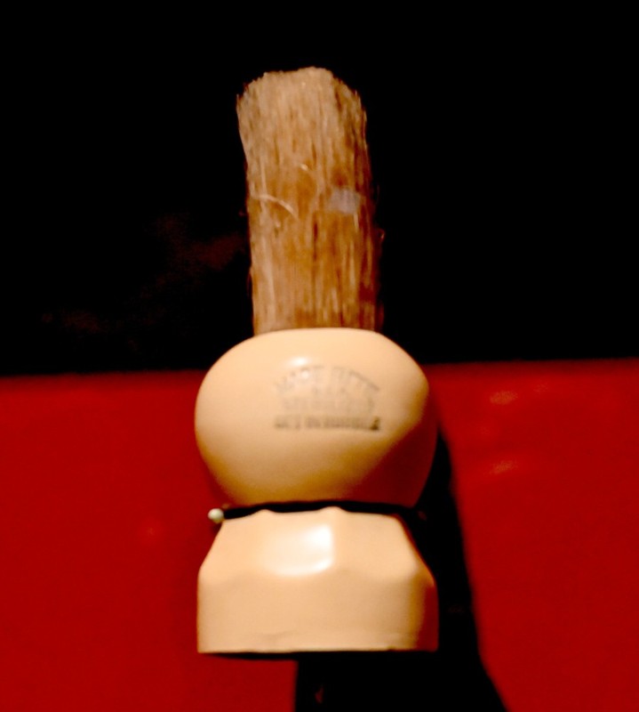
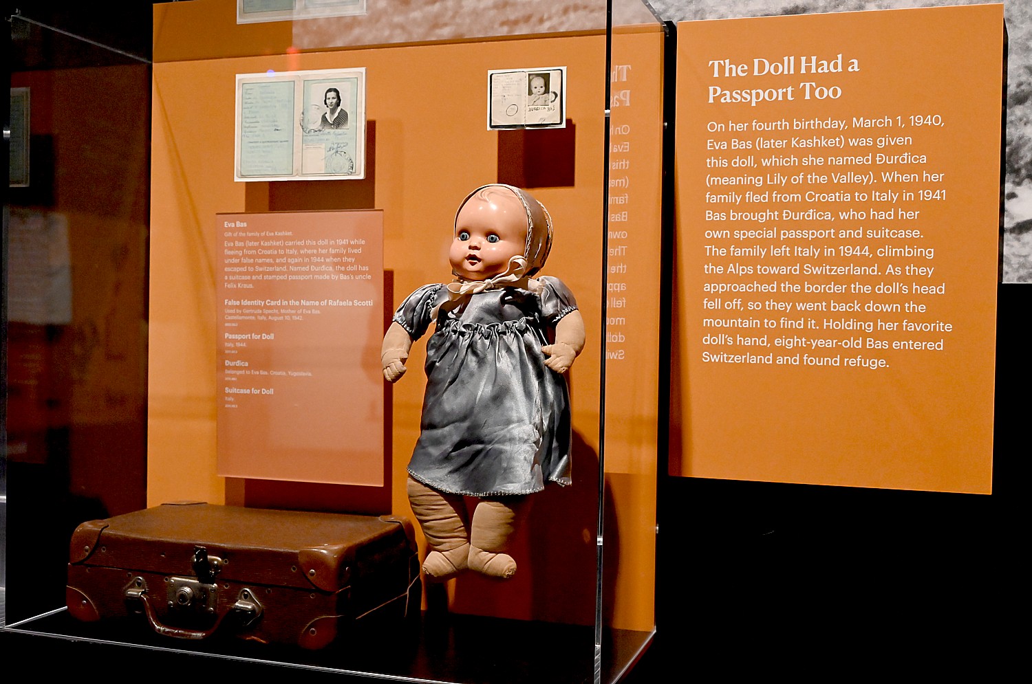
In this exhibit, I see the faces and personal effects of people who would have come from these places – a shaving brush that belonged to Yaacov Mordechai Satt in the Lodz ghetto has a hollowed out handle as a hiding place for a gold chain given to him by his mother; a piece of soap given to Esther Tikotzki to wash with after she was deported to Theresienstadt (Terezin), just outside Prague; a wooden ornament made by a pharmacist, later murdered at Auschwitz, given to Erika Jolinkova who was deported from Prague with her school friend Gertrude Jojtasova to Theresienstadt (Terezin).
The Museum of Jewish Heritage is devoted to keeping alive the lessons of the Holocaust, which are resonating with all the more volume and pitch today. Putin’s brutal, torturous invasion of Ukraine. The Christo Fascist Supreme Court ending women’s reproductive freedom, autonomy and self-determination, immediately turning half the population into 3/5 of a person. Deciding cases based on Christian orthodoxy; overturning the Separation of Church and State, from Hobby Lobby to allowing a coach to proselytize to players. Marginalizing gays, criminalizing speech, banning books, an attempted violent overthrow of a democratically elected government. A record number of antisemitic hate crimes, as political terror, intimidation and violence take hold in mainstream political life.
What you realize as you go through the first floor of the exhibit is how the cancer takes hold – starting slow and steadily but the coup de gras coming even overnight. Women in the United States can now see this exhibit with different eyes, having gone to sleep believing they had freedom and equality and waking up second-class citizens, lacking bodily autonomy, self-determination and in some places, having their movements tracked and their ability to travel curtailed.
And implicit is the question of the choices and decisions that are made. “Who could have imagined?” can no longer be an excuse for standing by.
“Sadly, the exhibit has taken on new urgency: resistance, immigration, invasion taken on new meaning,” says Michael Berenbaum, consulting curator. “Solidarity in the wake of evil takes on new meaning. We thought this was ancient history. We little imagined how vital the message is in this day, in our time.
“Events that gave rise to Holocaust are thought to only be in the past, but echoes in our world. This reminds people…They understand more clearly what it means to fight for honor, to resist. They understand when seeing people fleeing for life, they need to be welcomed. If this causes people to think twice, to reflect, to imagine what you can do to make a better world, then we have succeeded,” Berenbaum says during a press preview.
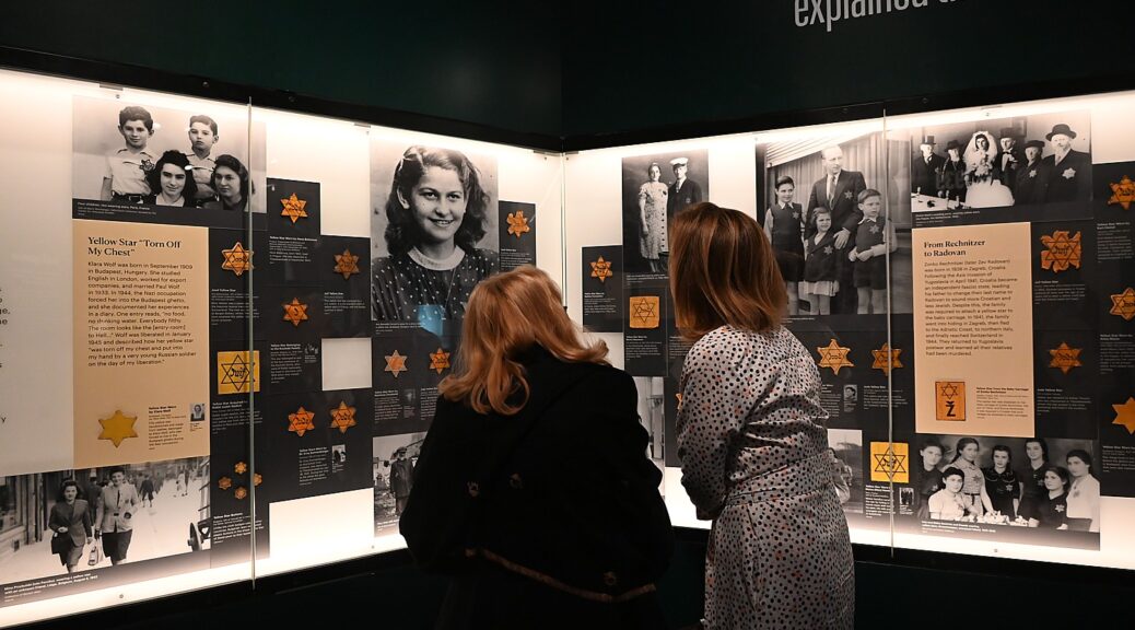
The 12,000-square-foot exhibition features over 750 original objects and survivor testimonies from the Museum’s collection. Together, these objects tell a global story through a local lens, rooted in objects donated by survivors and their families, many of whom settled in New York and nearby places, which is resonating with eerie and frightening relevance today.
In keeping with the Museum’s mission to educate people of all ages and backgrounds on the broad tapestry of Jewish life before, during, and after the Holocaust, the exhibition features countless beginnings, middles, and too many endings that make up the stories of The Holocaust: What Hate Can Do. Each room, and each object, contains generations of experiences and information about who Jews are, what sustains Jewish communities, and what life was like during the period of European modernization, World War I, and the political and social movements that brought about the rise of the Nazi Party. Within the Holocaust experiences of legalized racism and fascism, pogroms, ghettos, mass murder, and concentration camps are instances of personal and global decision-making, escape, resistance, and resilience, and ultimately liberation and new beginnings.
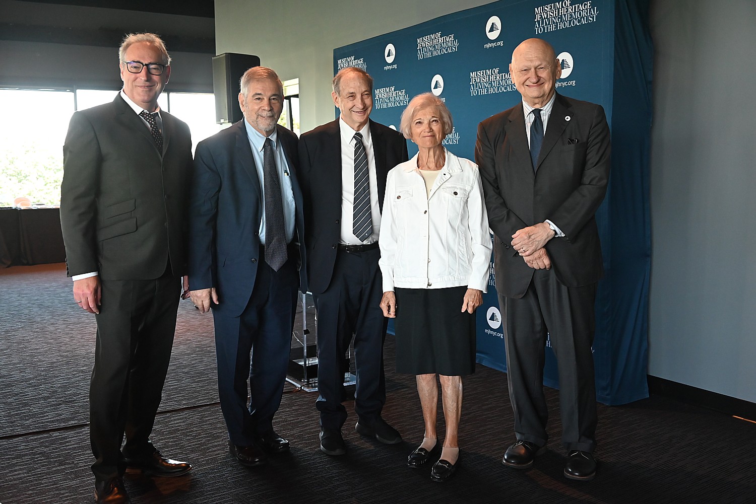
“The title of our new exhibition speaks to our institution’s very reason for being,” says Museum President & CEO Jack Kliger. “Antisemitism and fascism are again on the rise throughout the world. Right here in New York, we have witnessed not only a surge in antisemitism but an uptick in violence and harassment targeting many marginalized groups. The time to speak out and act is upon us, and it is urgent. We hope The Holocaust: What Hate Can Do will educate and inspire our visitors and honor those who perished in the Holocaust, whose memories are a blessing.”
Paul Salmons, consulting curator and creative developer of the digital guide that accompanies the exhibit, and is available to all on Bloomberg Connects, raises the question of “what was known, what choices, what decisions, what significance of their action. The Holocaust is not a story of faceless victims or bystanders. It is a profoundly human story. That was our challenge when we created the audio guide. The intensely personal stories behind the artifacts, the documents, the personal stories of ordinary people living through extraordinary times.”
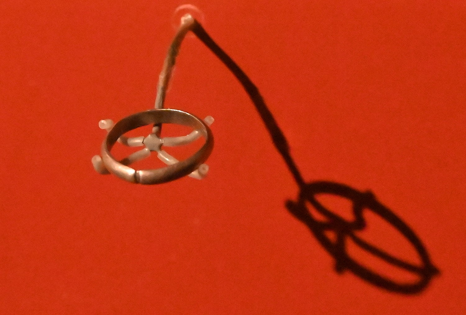
Indeed, so many of the objects on view are those everyday items –an engagement ring fashioned from a silver spoon given by Eli Rigman to Henny Rosenbaum on August 22, 1943, to mark their engagement while they were imprisoned in the Riga ghetto. She kept it on even after Eli was killed cleaning minefields, even as she was deported to several camps and during forced labor in 1944, her fingers swelled from the cold causing the ring to crack, even so, she kept the engagement ring on”. There is a photo that brings chills, of the happy couple celebrating with their friends, another photo of Henny Rosenbaum from 1937 shows this happy young woman.
They create a thread for the visitor to follow one family – the bag used to scavenge scarce food in the ghetto, the cooking pot the family used. The wonder is how they were able to trace back these objects to the people, connect with their stories, even photographs.
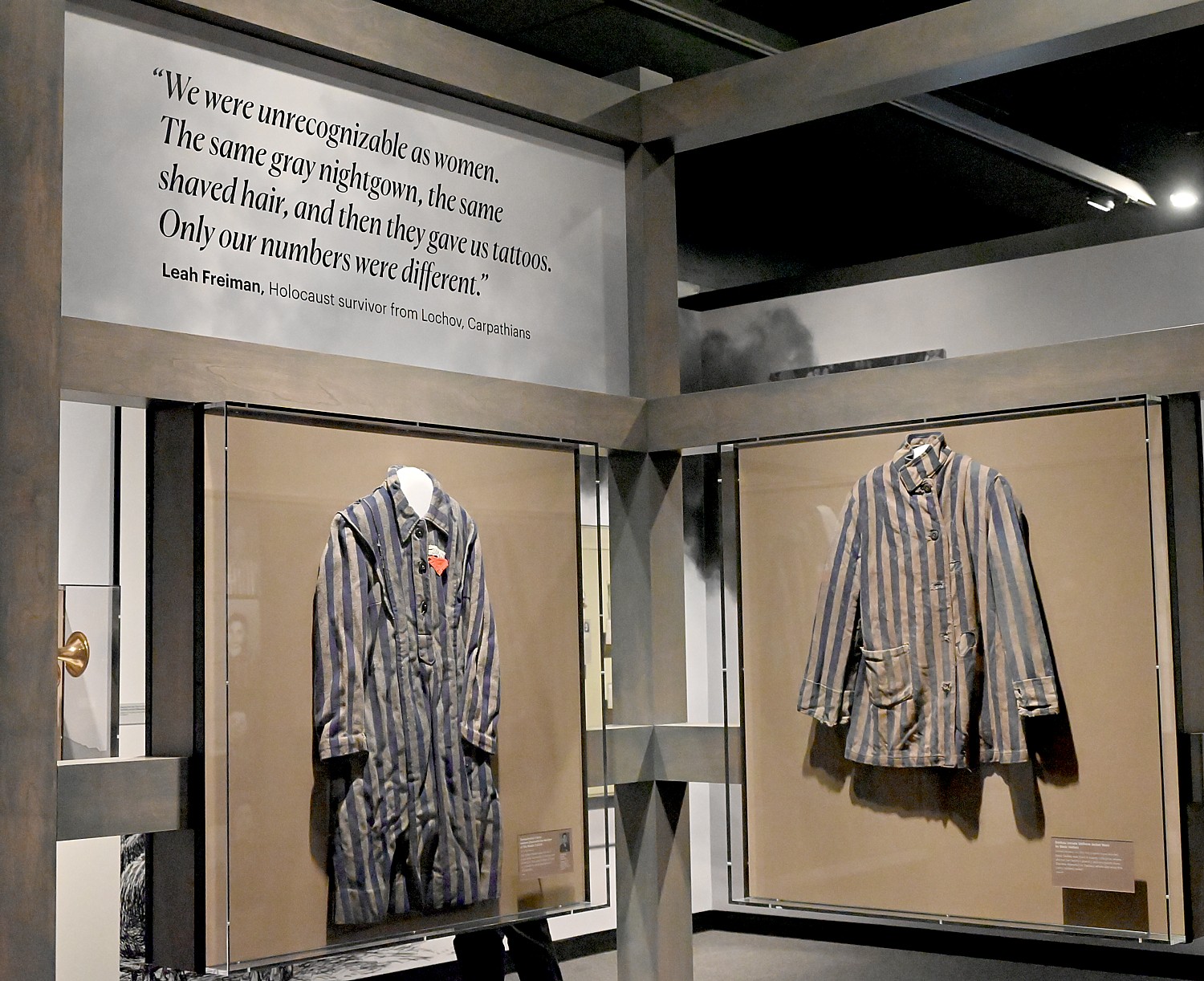
“We address common myths and misconception that Jews didn’t fight back or resist.” On display is a shirt that one of the freedom fighters wore in the forest – there were 30,000 Jewish partisan fighters in the forests of Eastern Europe. They fought the German occupation and rescued Jews – 1200 Jewish refugees lived in one camp which had its own medical center and school.
They fought back and resisted in other ways, as the exhibit shows. Fighting the dehumanization, they fashioned ID bracelet; a Star of David necklace made by Margit Rosenfeld in Auschwitz using material from the inside of her shoes and brown thread from her garments. “Something of their identity, their past life in a place of utter dehumanization.” They also secretly observed religious service, taught school, some were able to create art, music.
The films that have been made, the powerful survivors testimony, and the audio notes narrated by … are available to museum goers as well as people who do not personally visit, on Bloomberg Connects app, which can be downloaded for free. The Bloomberg Connects partnership allows access to the museum’s collections and educational resources. “The partnership demonstrates the commitment of the museum to make this vital story accessible.”
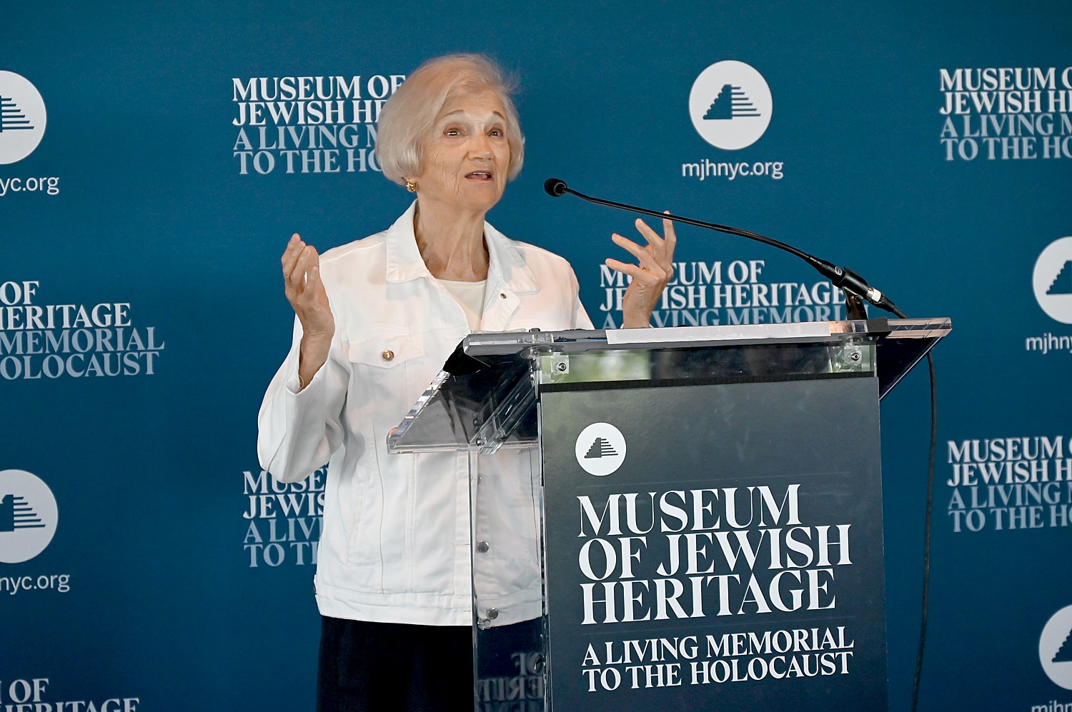
Toby Levy, a Holocaust survivor and a member of the museum’s Speakers Bureau, relates, “The year I was born, in Poland (now Ukraine, near Lebov), was the same year Hitler came to power. Jews lived in this place for 1000 years. Life was OK. My father was a merchant – I don’t remember much. We lived nicely until 1939. In a divided Europe, our part was in Russia. But in 1941, Germany broke the pact. We tried to run, but there was no place to run. We were locked in and out. No help from anywhere, especially in my part of Poland. The first day the Germans walked in, they made it clear who they are and who we are and where we’re going.
“My father realized immediately that none of us will make it, even though my father had been a German soldier in World War I. He realized these weren’t the same Germans, that the Germans were lying. Germans used the language of deception when they said they would relocate Jews. There were 5000 Jews in our town. Some say Jews followed like sheep. But we had no place to go.
“My father approached many people to try to find someone who would hide us. Stephanie Struck said she would. We were a family of four, then my aunt and uncle and their children, grandparent, we became 9 people. Two Ukrainians saved 9.” The family remained in hiding in her barn from 1942-1944.
“In hiding, my father talked had a tallit and whatever money he had; he gave material to Stephanie for food. We were four children – 4, 6, 8, 12 years old. I was 8. My father tried to teach us not to hate. “Hate will bring you to where you are today. Be kind, be moral, be a good person.”
“I have my revenge,” she says. “I am alive, enjoying my life, have Jewish children, grand children, great grand children.”
But she warned that antisemitism is very much revived. I’m scared now, not for me – I’m old – but for my children, grandchildren. Everyone must become a witness. Be a witness for me when I’m gone. Understand what it is to be antisemitic. That’s how started in Germany – language, media has to understand what anti-Semite is. Colleges are full of it. Our children are not prepared because they take for granted [religious freedom in the United States].”
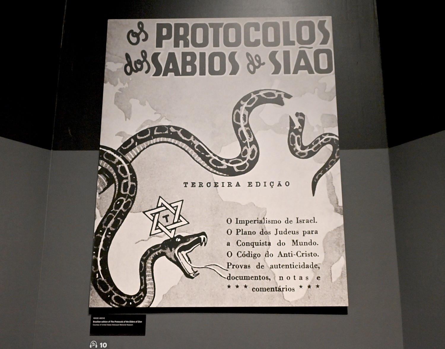
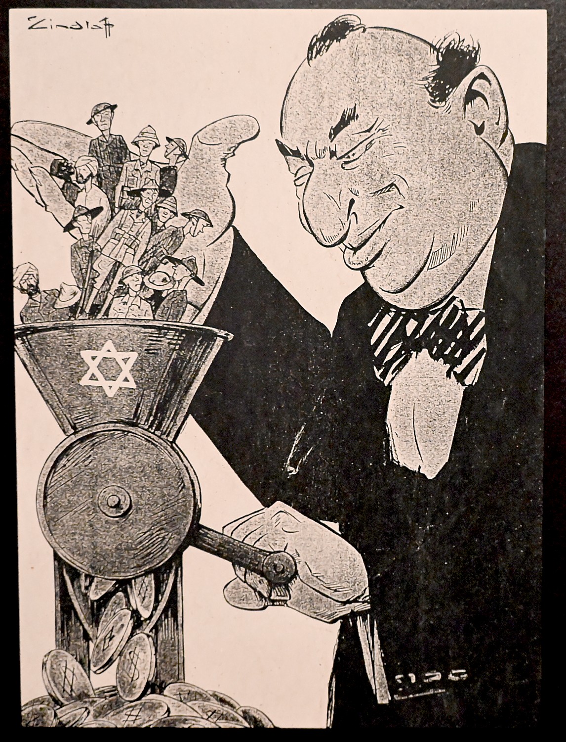
Indeed, one of America’s great historic figures, a leading capitalist, Henry Ford, was a leading proponent and propagandist for antisemitism. I knew he was an anti-Semite but did not realize that he propagated antisemitism through his newspaper, in which he serialized the Protocols of the elders of Zion.
“The Protocols of the Elders of Zion fabricated records detailing secret meetings of Jewish leaders planning world domination – is the most widely circulated antisemitic text of modern times,” the notes that accompany copies say. Plagiarized from a 19th century French book unrelated to the Jews, Protocols (author unknown) it was first published in Russia at the turn of the 20th century. In 1920 Henry Ford used it as the basis for ‘The International Jew’ article series in his newspaper. In 1938, American priest Father Charles Coughlin serialized The Protocols in new newspaper, ‘Social Justice,’ and the book played an important role in the Nazis’ antisemitic propaganda campaign. “Some still believe its claims today.” Indeed, the imagery of an international Jewish cabal of financiers and media moguls is being used by MAGA candidates and elected and is so often connected to charges of those who advocate for social justice and economic opportunity as socialists and communists.
So it is understandable why Henry Ford, a pioneering industrialist, would embrace anti-Semitism.
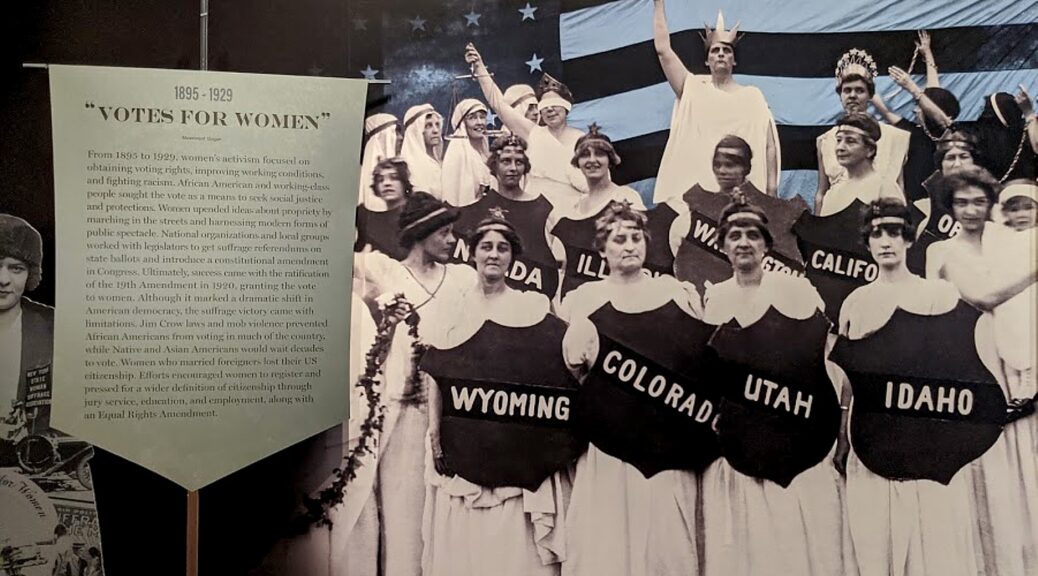
The exhibit notes, “Antisemitism flourished in early 20th century America. The Great Wave of Immigration (1881-1914) brought 2.2 million Eastern European Jews to America, fleeing persecution and seeking opportunity. They were often met with suspicion, and even violence. The 1917 Russian Revolution raised fears of Jewish immigrants being internationalists and Bolsheviks. In 1915, an Atlanta mob hung Leo Frank, accused of murdering a 13-year old girl. During the 1920s, the Ku Klux Klan targeted Blacks, Catholics and Jews. Car manufacturer Henry Ford published the International Jew in his Dearborn Independent newspaper. Based on the Protocols of the Elders of Zion, which described an international Jewish ruling conspiracy, the article series alleged such a conspiracy was infiltrating America. It ran from 1920 to 1924, reaching hundreds of thousands of readers.”
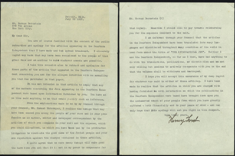
(Also on view is a letter of apology that Henry Ford was forced to write under a legal settlement after being sued by for by Jewish publisher Herman Bernstein for libel against himself and against the Jews of America. See https://mjhnyc.org/blog/herman-bernsteins-fight-for-truth/).
The letter of apology that Henry Ford was forced to write under a legal settlement after being sued by for by Jewish publisher Herman Bernstein for libel against himself and against the Jews of America is on view.
It is an important exercise to see how antisemitism is cultivated, developed, spread and used as a weapon of power – the theme that dominates the first floor of the exhibit – and then the effect on ordinary people, how their lives are upended, a dominant theme of the second-floor of the exhibit.
But there is a flip side – the story of resilience, resistance and survival – and ultimately the responsibility of the others – the leaders of other countries, the foundations and organizations, the bystanders. The exhibit concludes with the formation of Israel, the immigration of Jews to America and other places, the Nuremburg trials which were supposed to make Hitler-wannabes think twice.
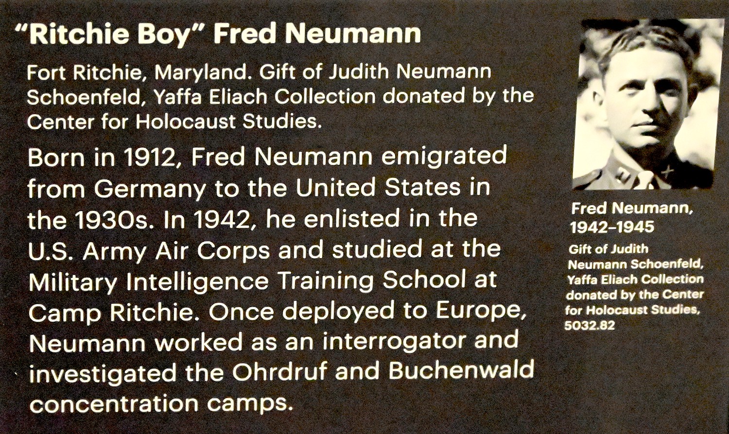
I learn for the first time of the Ritchie Boys – German-Jewish refugees, originally considered “enemy aliens” who were recruited to be an advanced intelligence combat unit. Trained at Fort Ritchie, Maryland, they were returned to Europe where they had just escaped, risking their lives to use their linguistic and cultural skills for combat, interrogation and lie detection. They fought in major battles and succeeded in gleaning tactical information from captured German soldiers. After the Allied victory, the Ritchie Boys interrogated thousands of war criminals and civilians. We meet “Ritchie Boy” Fred Neumann who emigrated to the US in the 1930s, enlisted in 1942, and worked as an interrogator and investigated the Ohrdruf and Buchenwald concentration camps.
“Working on The Holocaust: What Hate Can Do has been one of the high points of my professional career,” says co-curator Judith Tydor Baumel-Schwartz, Professor and Director of Holocaust Research in the Department of Jewish History and Contemporary Jewry at Bar-Ilan University in Israel. “As a historian specializing in the Holocaust, I have always taught my students, through stories and documentation, about what happened, and why it happened. Here, for the first time, I can actually show people how it happened and to whom it happened through hundreds of objects and graphics, most from the Museum’s collection, via the stories of the people behind the artifacts, through wall texts and an audio guide, documentary films and survivor testimonies, all put together in a unique and thought-provoking display. The Holocaust may be part of the past, but hatred, and what it can do, are very much part of our present. This path-breaking exhibition serves as a stark reminder of what can happen if that hatred is not stopped in time.”
The exhibition was curated by a team of esteemed Holocaust scholars, historians, and Museum curators that included Professor Baumel-Schwartz, Scott Miller, Ilona Moradof, and Rebecca Frank, and consulting curators Professor Michael Berenbaum and Paul Salmons. The Scholars Advisory Group included Dr. Mehnaz M. Afridi, Dr. Charles L. Chavis, Jr., Rabbi Sholom Friedmann, Atina Grossman, and Paul Wasserman.
“It is a particular point of pride for our institution that this exhibition gives new life to the Museum’s collection. The hundreds of artifacts, many of them donated by survivors, that visitors will experience were all donated to our institution with extraordinary trust and vision, and we are grateful. Each offers up its own story, and together these artifacts present an irrefutable record of history,” says the Museum’s Chairman of the Board of Trustees, Bruce Ratner.
The Holocaust: What Hate Can Do is the Museum’s first exhibition to open in its core galleries since its award-winning and widely acclaimed Auschwitz. Not Long ago. Not far away. concluded last spring.
“We are proud and honored to be long-time supporters of The Museum of Jewish Heritage, an eternal memorial to those who perished, but also a beacon of hope: the hope that through learning from history we can avoid repeating the tragedies of the past. We are privileged to support this important new exhibition and the expansion of the Museum’s vital educational mission,” says Lily Safra, Chairwoman of the Edmond J. Safra Foundation, a lead funder of the exhibition.
“The Holocaust: What Hate Can Do is an important exhibit, highlighting the impact of unchecked hatred. It is imperative that future generations understand that the Holocaust was not only a state-sponsored murder of the Jews but was, in many cases, also a communal act of complacency. Only through education can we begin to understand the outcomes bigotry and social silence inflicted on the Jewish people during the Holocaust. It is our job to give voice to the 6 million Jews who were murdered in that annihilation and to help future generations avoid the same complacency,” says Gideon Taylor, President of the Conference on Jewish Material Claims Against Germany, a lead funder of the exhibition.
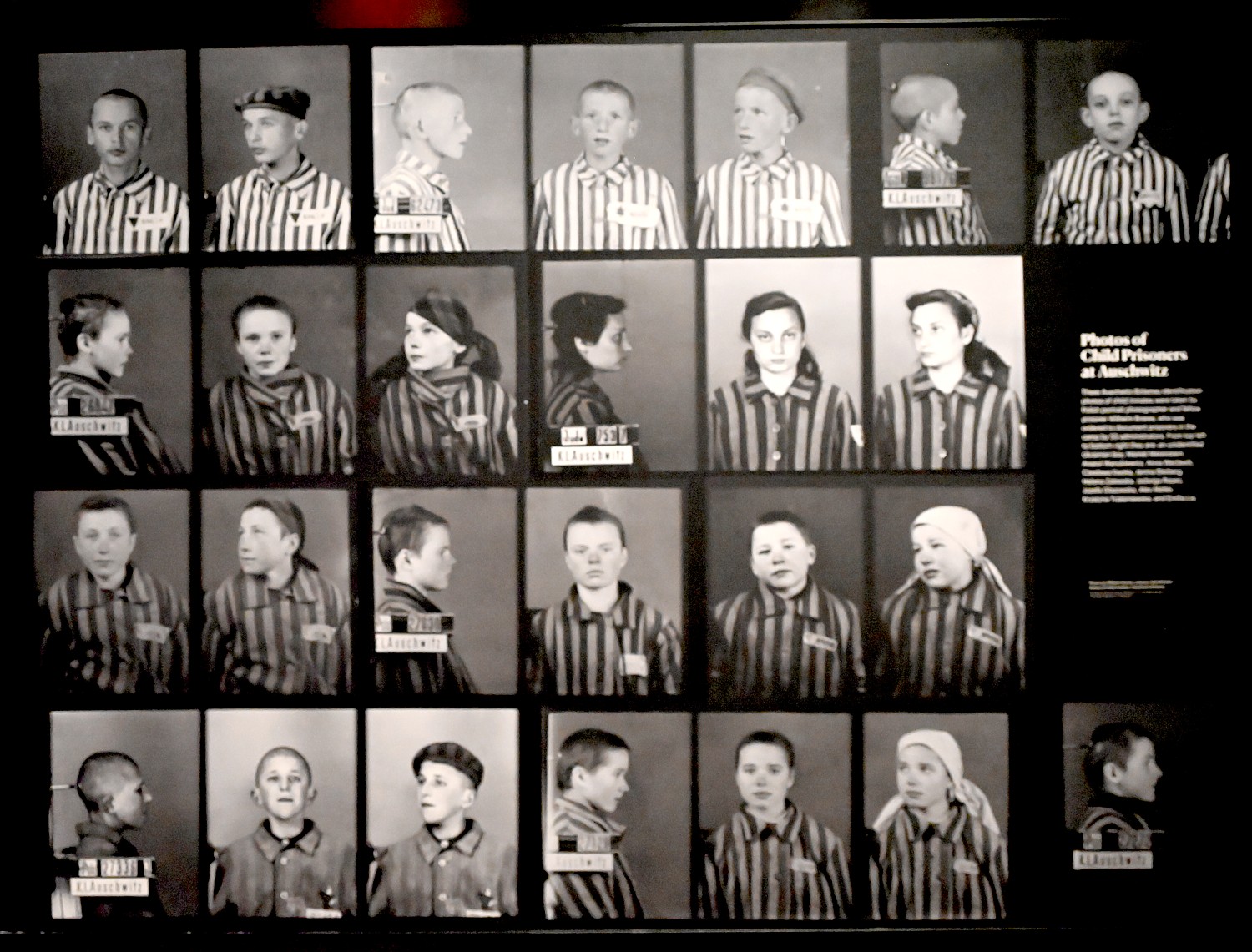
Photos of Child Prisoners at Auschwitz: Auschwitz-Birkenau identification photos of child inmates were taken by Polish portrait photographer and prisoner Wilhem Brasse,, ordered to document prisoners in the camp by SS administrators. From top left to bottom right: an unidentified Ukrainian boy, Mamet Merenstein, Anatol Wanukiewicz, Anna Weclawik, Czeslawa Kwoka, Janina Bleiberg, Helena Zalewska, Jadwiga Repec, Jozefa Glazowska, Alex Meller, Krystyna Trzesniewska, and Emilia Lis.
“We were eight brothers and one sister with loving parents; only me and my brother Yankel survived. I am from Lodz and was in the Lodz and Warsaw ghettos, the Deblin and Auschwitz death camps, and on the death march from Magdeburg. As a survivor, number 189897, I feel a responsibility to teach the lessons of the Holocaust—that hate is an insidious murderer of humanity. May we never forget those who perished in the Holocaust, and may we always be courageous in standing up to hate. This is why I am so happy to support the work that the Museum of Jewish Heritage is doing, especially in such an important city like New York, that embraces its diversity as a strength,” says benefactor David Wiener.
“Eighty years ago, on May 29,1942, my great grandparents Berel and Sara Fish Hy”d and Velvel and Zissel Poltorak Hy”d perished in mass shootings alongside 287 other Jewish families (over 800 people), all of whom were relatives and friends in Yanushpol (renamed Ivanapol after the War), Ukraine,” says Eli Gurfel, a major donor. “I honor their memories with my support of the Museum of Jewish Heritage, and the importance it places on diverse Holocaust scholarship to broaden Holocaust awareness and education. As Elie Weisel said, ‘Whoever listens to a witness, becomes a witness.’ Especially given current events in Ukraine, my hope is visitors will see this exhibition and come away with broader understandings of what happens when hate and bigotry go unchecked.”
The audio tour guide accompanying the exhibition, available for download through the free Bloomberg Connects app, features narration from actress Julianna Margulies, winner of eight Screen Actors Guild Awards, three Primetime Emmy Awards, and a Golden Globe, and Eleanor Reissa, the Tony-nominated director, Broadway and television actress, prize-winning playwright, author of the memoir “The Letters Project: A Daughter’s Journey,” and former artistic director of the National Yiddish Theatre Folksbiene. Anthony Mordechai Tzvi Russell, acclaimed vocalist and Yiddishist, and actress Lauren Lebowitz are also featured on the audio guide, for which Paul Salmons Associates provided creative development (Paul Salmons, tour concept and historical interpretation; Leah Kharibian, scriptwriter).
The Holocaust: What Hate Can Do is made possible with leadership support from The Conference on Jewish Material Claims Against Germany, The Oster Family, Patti Askwith Kenner and Family, Edmond J. Safra Foundation, and Evelyn Seroy in memory of her parents Julius & Ruth Eggener.
For more information or to purchase tickets, click here ($18/Adults, $12 ADA/Access, Seniors, Students, Veterans; FREE to children under 12 and NYC DOE K-12 students; FREE to Holocaust Survivors, active members of the military, first responders).
Museum hours: Sunday, Wednesday, Friday: 10AM to 5PM; Thursday: 10AM to 8PM; closed on all other days, on Jewish Holidays, and on Thanksgiving.
A Living Memorial to the Holocaust
The Museum of Jewish Heritage – A Living Memorial to the Holocaust is New York’s contribution to the global responsibility to never forget. The Museum is committed to the crucial mission of educating diverse visitors about Jewish life before, during, and after the Holocaust. The third-largest Holocaust museum in the world and the second-largest in North America, the Museum of Jewish Heritage anchors the southernmost tip of Manhattan, completing the cultural and educational landscape it shares with the Statue of Liberty and Ellis Island.
The Museum of Jewish Heritage maintains a collection of almost 40,000 artifacts, photographs, documentary films, and survivor testimonies and contains classrooms, a 375-seat theater (Edmond J. Safra Hall), special exhibition galleries, a resource center for educators, and a memorial art installation, Garden of Stones, designed by internationally acclaimed sculptor Andy Goldsworthy. The Museum is the home of National Yiddish Theatre Folksbiene and JewishGen.
Each year, the Museum presents over 60 public programs, connecting our community in person and virtually through lectures, book talks, concerts, and more. For more info visit: mjhnyc.org/events.
The Museum receives general operating support from the New York City Department of Cultural Affairs and New York State Council on the Arts.
Museum of Jewish Heritage – A Living Memorial to the Holocaust, 36 Battery Place, New York City, mjhnyc.org,646-437-4202.
By Karen Rubin, Travel Features Syndicate, goingplacesfarandnear.com
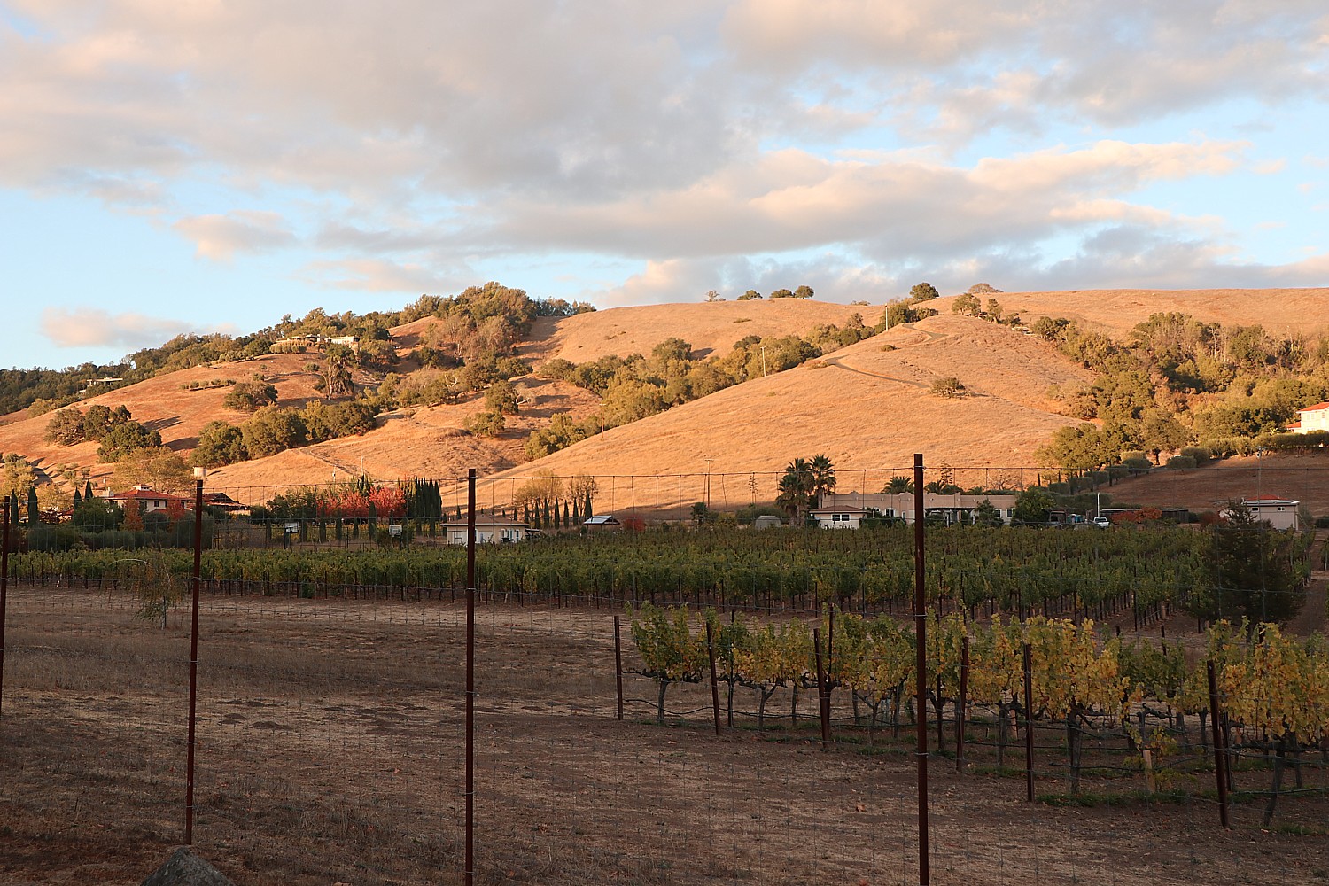
You know the refrain: “It’s a nice place to visit, but I wouldn’t want to live there.” Rare is the place that is equally precious to visit and reside. Fortunately, our family has decided to reside in such a place, and I get to visit: Sonoma, California.
Just 43 miles northeast of San Francisco, Sonoma has long been a retreat for urban dwellers, offering a “healthier” climate.
Sonoma is the perfect combination of man and nature, as the vineyards attest, and residents today are obsessive about preserving that balance. In fact, the Sonoma County Tourism, as part of its continued commitment to encourage responsible stewardship from visitors and residents, has just joined the Global Sustainable Tourism Council.
This is my second visit to Sonoma and while my family works, I get to explore like a local, hopping on a bike to ride the delightful paved recreation trail that goes right into the exquisitely quaint, historic village center and out to the vineyards. On my first trip, we biked, visited wineries, and hiked the spectacular Pacific coast. This trip, I focus on Sonoma’s history, heritage and the fascinating people who shaped it. What is more surprising is how contemporary the history feels – truly, history repeats.
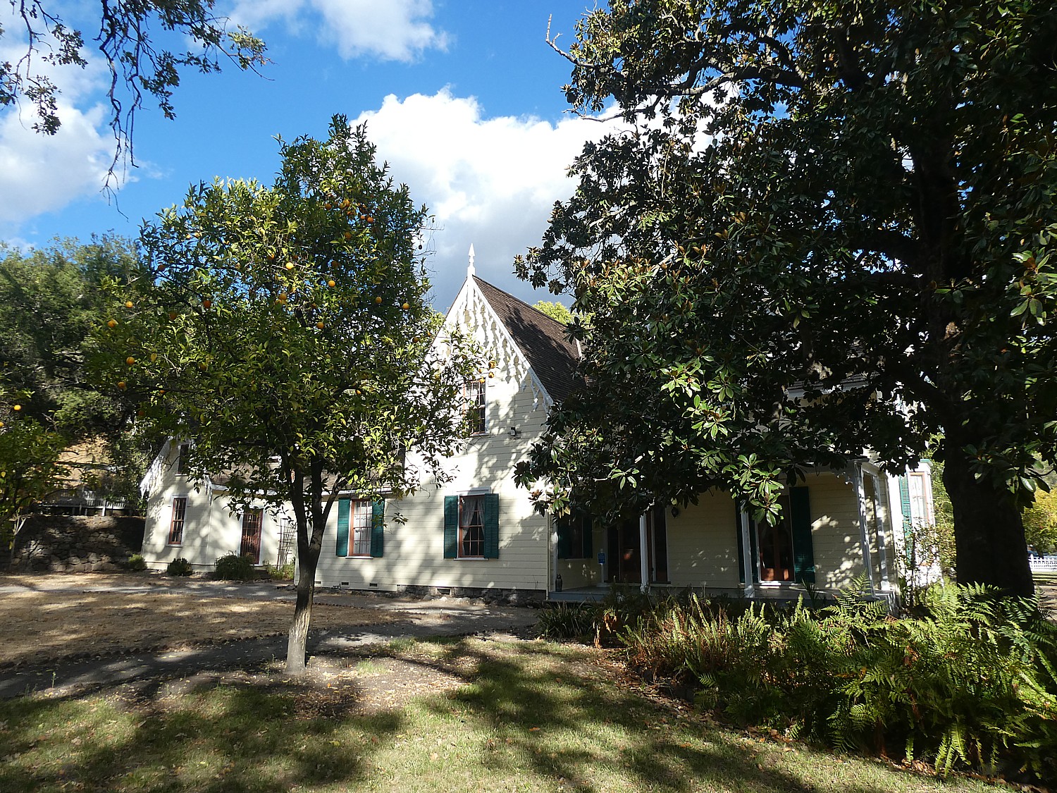
It starts at the village plaza – utterly charming today with lovely restaurants, wine tasting rooms and boutiques – but dotted with really important historic sites that are part of Sonoma State Historic Park, a collection of six sites located throughout the community.
I start at the Barracks, a military post of Mexican soldiers established in 1834 to serve as a buffer to Russian expansion from Fort Ross (!!!). The Russians had come in 1812 to produce crops and trap furs to supply their Alaskan settlement. (The Russians ultimately moved out, ironically, just before gold was discovered.) You can see a room furnished as if the soldiers were still there. It is interesting to learn that they had to supply their own uniforms, horse and supplies, and basically buy them back from the Commandante. The barracks turns out to be the best place to start my journey because it offers an excellent video that encapsulates the history of this place, and puts everything into context.
From 1834-1846, it was the headquarters for General Mariano Guadalupe Vallejo, the Commandant of the Frontera del Norte – the northern Mexico provincial frontier – who built it, as well as the Plaza. More than 100 military expeditions set out from Sonoma to subdue rebellious Wappo and Cainameros or Satisyomis native tribes trying to overthrow Mexican domination. For ten years, until 1844, the Presidial company of Sonoma was considered the most powerful military force in California. During the short-lived California Republic, the barracks housed Republic followers until July 9, 1846, when the Stars and Stripes flag was first raised at Sonoma. It then served as an army post. In 1860, Vallejo remodeled the barracks to serve as a winery. (Vallejo’s story, I learn, underpins just about everything in Sonoma.)
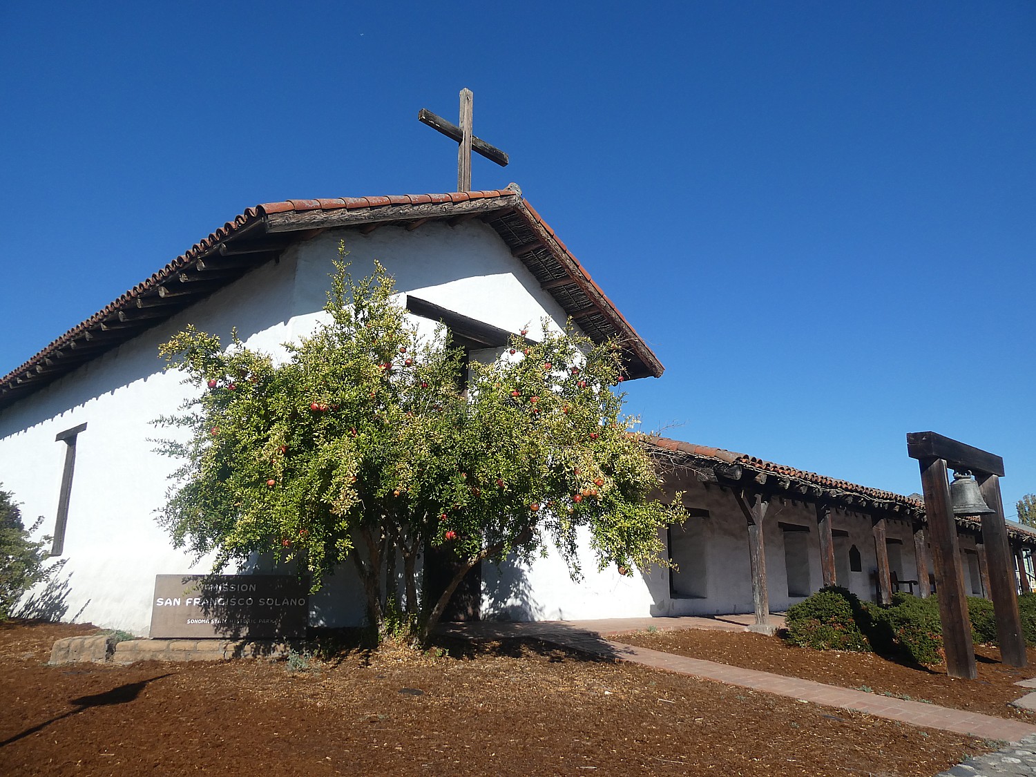
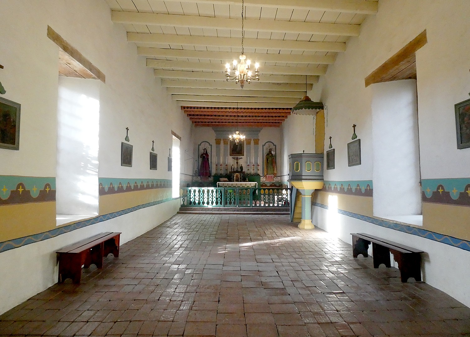
Across the street from the Barracks is Mission San Francisco Solano – the last of 21 missions established in California. It was founded in 1823 to convert Native Americans to Christianity – often forcibly. Indians would come to the mission first out of hunger –since the colonists introduced disease, technology and livestock which depleted the corn that was their mainstay. The Indians’ had their own culture, religion, lifestyle which “was contrary to the colonists” and so, had to be eradicated. Under the mission system, families were split up, children taken for indoctrination. Indians revolted and tried to escape the mission and the soldiers would hunt the “fugitives” down and bring them back. I learn in the video in the Barracks. (There is a display, “Collision of Cultures,” which acknowledges the tribes’ experience.)
“The Sonoma mission’s sphere of influence reached its peak around 1832, with nearly 1,000 Native California Indians in residence and 10,000 acres of land used to raise crops and livestock.” In 1834, the Mexican government secularized all the missions into parish churches – which was General Vallejo’s task.
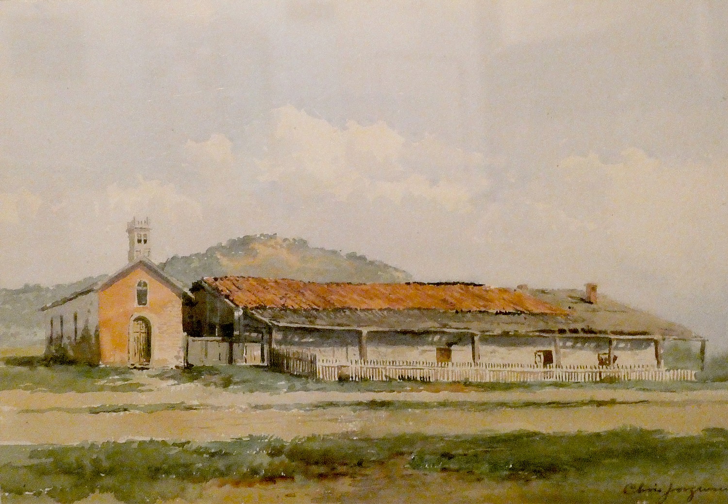
The Dining room today houses a marvelous exhibit of watercolors created between 1903-5 by Chris Jorgensen depicting the 21 missions that remained. His watercolors helped generate interest in preserving the missions. It is most interesting to see his watercolor of this mission as it stood.
It is here in the mission that I meet Ranger April Farnham. When I ask if she is a native Californian, she tells me of her great great great aunt, Eliza Farnham, born in Rensselaerville, NY in 1815, who came to northern California in 1849 with her two sons (her husband, Thomas Farnham, was apparently a rogue). What a character! Wikipedia describes Farnham as a novelist, feminist, abolitionist and activist for prison reform (she worked as the matron of Sing Sing prison’s women’s ward). She returned to New York in 1856 and in 1859, organized a society to assist destitute women find homes in the West. She returned to California, but died in New York City, at the age of 49, of consumption.
(I’m so intrigued about her, I look up her publications: Life in the Prairie Land, 1846 – An account of life on the Illinois prairie near Pekin between 1836 and 1840; California, In-doors and Out, 1856 – A chronicle of her experiences and observations on California; My Early Days, 1859 – An autobiographical novel; Woman and Her Era, 1864 – “Organic, religious, esthetic, and historical” arguments for woman’s inherent superiority’ and The Ideal Attained, 1865 – The heroine molds the hero into a worthy mate.)
I get back on my bike to visit General Vallejo’s home, Lachryma Montis, a 20-acre site (out of his original 500 acres) just along the path about a mile from the mission. Here you appreciate what a visionary – even progressive – Vallejo was, and how instrumental he was to the founding and nurturing of Sonoma through its multiple transitions. By the time he was 40, he had lived under four flags – Spanish, Mexican, the Bear Revolution and then the United States.
Born in 1807 to an upper class Spanish family, his career paths were limited to the military, politics or church. He chose the military. At the age of 25, a lieutenant, he commanded Presidio de San Francisco, the “director of colonization.” In 1826, he was ordered to secularize the missions and transfer power from the church to civil authorities.
The Mexican government fell into chaos; there were frequent changes of governor in his district. Vallejo got no assistance from Mexico and had to pay his soldiers out of his own pocket. The settlers became Mexican citizens, learned Spanish but were different from the “Yankees” who began to come through.
After Mexican Governor Jose Castro proclaimed that the purchase or acquisition of land by foreigners who had not been naturalized as Mexicans “will be null and void, and they will be subject (if they do not retire involuntary from the country) to be expelled whenever the country might find it convenient.” 33 Yankees lead the Bear Flag Revolt against Mexican authorities. They attacked Sonoma, took Vallejo prisoner, imprisoning him at Sutter’s Fort for two months, where he contracted malaria and was a dath’s door before being released. “His imprisonment lasted longer than the Republic” (communication was slow). At the time of the Bear Flag Revolt, (June–July 1846), there were 500 Americans living in California, compared with between 8,000 and 12,000 Mexicans.
Despite the Treaty of Guadeloupe that ended the Mexican-American War (1846-1848) assuring the Mexicans their property ownership would be respected, the Yankees claimed the property belonged to them “by right of conquest”. Mexicans, including Vallejo, had to fight in court to prove title and that often put them in debt. His holdings were reduced from 500 acres to 20 acres, but he kept his vineyards.
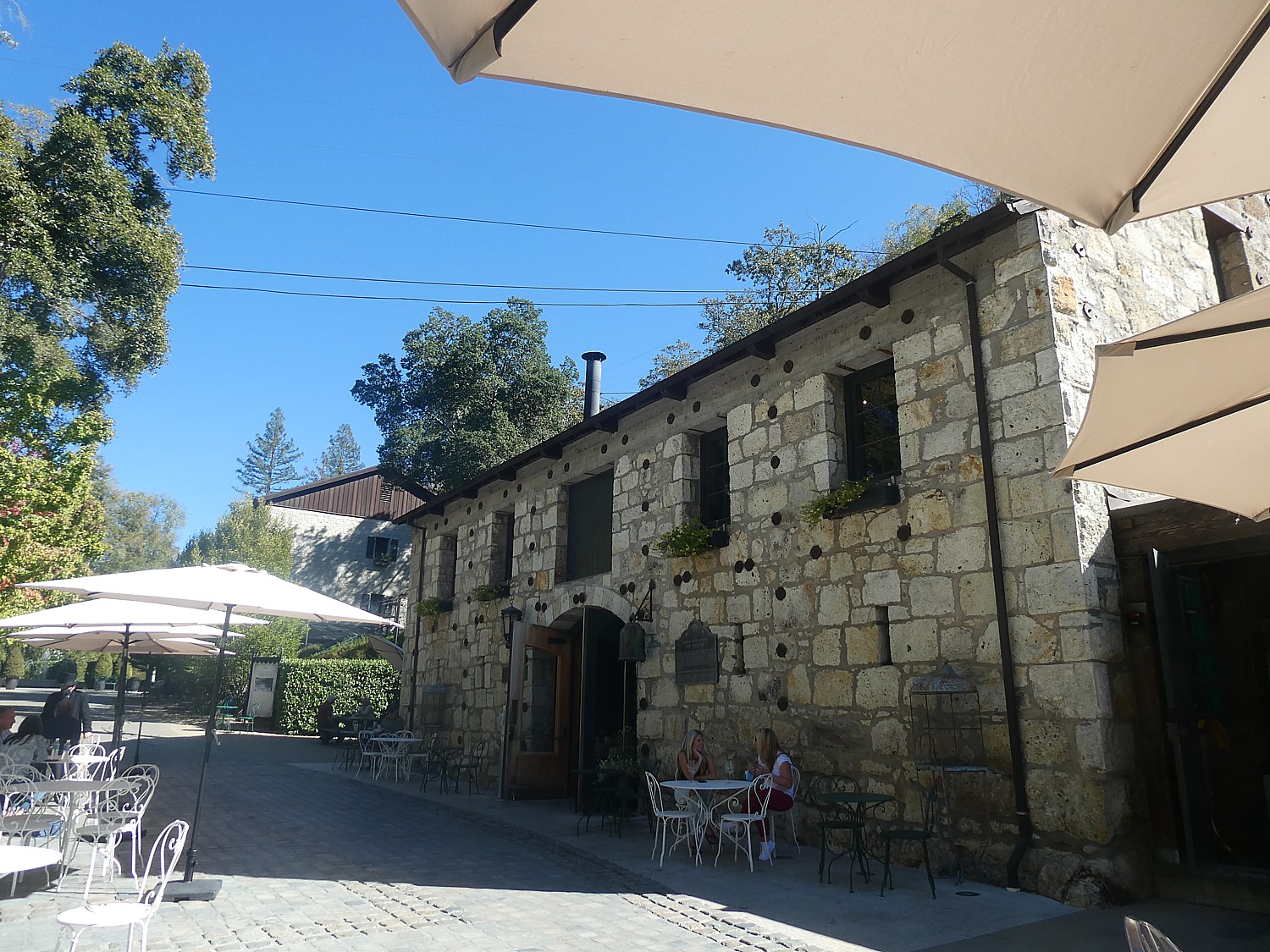
Indeed, Vallejo also had a hand in developing wine-making in Sonoma. His two older daughters married sons of Count Agoston Haraszthy, who began the first vineyards (you can learn this part of the history at Haraszthy’s Buena Vista winery).
Ever adapting, Vallejo went on to be elected state senator for Sonoma, serving until 1853.
What is striking about Vallejo’s home is that it looks like it was deposited here from New England. Vallejo referred to his dwelling as the “Yankee Home” or “Boston House,” departing from traditional adobe style. That was deliberate on his part, to symbolize change (and acceptance) of becoming part of the United States.
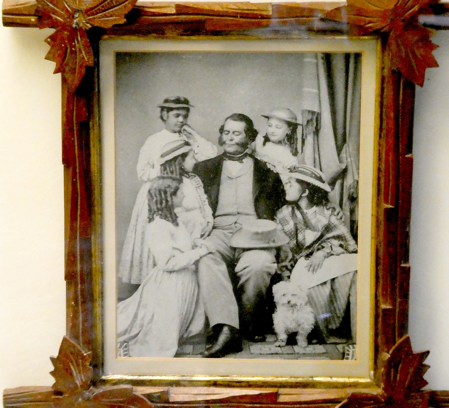
You start your visit in the Chalet, a Tudor-style structure which originally was a storage house and granary, now a visitor center that houses a museum with family photos and personal artifacts of Vallejo and his family (he had 16 children, 10 of whom lived to adulthood), as well as their magnificent carriage. The furnishings in the main house, too, are mainly from the family.
You visit the parlor, which Vallejo furnished with items from around the world, the master bedroom, his daughter, Maria’s, bedroom, the nursery. You visit the bedroom of Luisa, his 15th child, who was born here, married here and, after being widowed, raised her three children in the house; she cared for her elderly parents and inherited the estate where she lived until her death in 1943 at 87. She sold the estate to the state of California in 1933 and served as its curator from 1933-1943.
There are several other interesting buildings and structures: the picturesque stone and masonry reservoir was constructed in the 1850s to collect water from natural artesian springs; a tiny cottage, the Hermitage, or “Napoleon’s Cottage” at the top of a winding stone staircase above the reservoir, where Vallejo’s youngest son, Napoleon, moved in 1865 at the age of 15, and kept 14 dogs, two monkeys, three cats and one parrot.
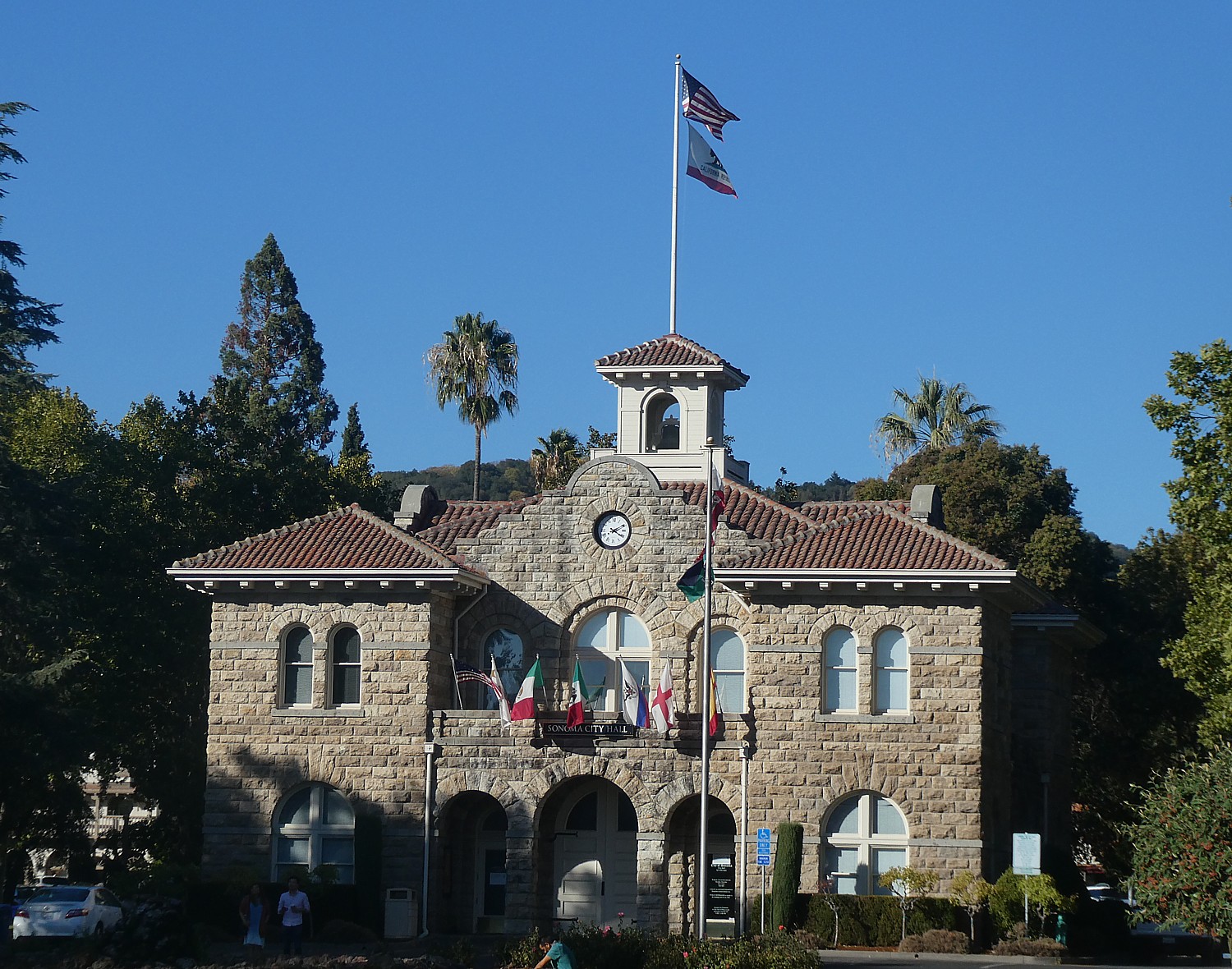
Sonoma’s Plaza itself – the birthplace of the state’s Bear Flag – is picturesque. You can see a monument to where rebels raised their new, homemade flag and declare their own republic, June 14, 1846. (The Bear Flag Republic lasted just 24 days; then the United States took over).
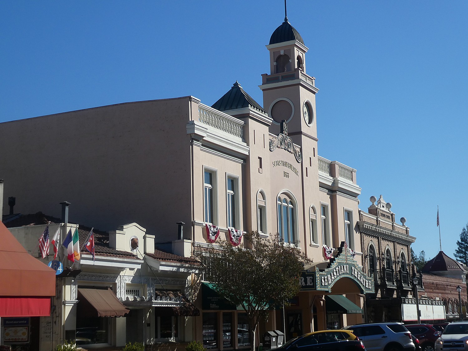
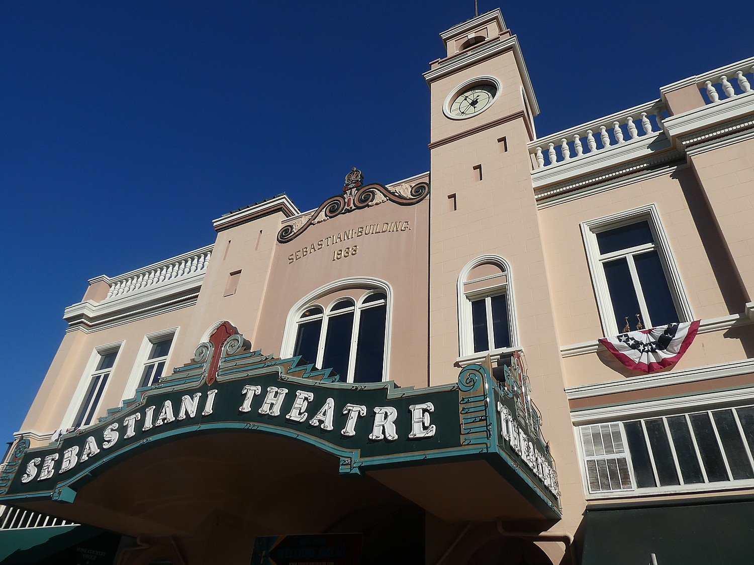
There is also City Hall, a pavilion for outdoor events, and across the way, a lovely old-timey movie theater.
The Sonoma State Historic Park (363 Third Street W, Sonoma CA 95476, 707-938-1519). includes six sites – in addition to the Mission, the Barracks and Lachryma Montis, it also includes Casa Grande (Vallejo’s home on the plaza), the beautiful Blue Wing Inn (built to house soldiers it later accommodated such famous visitors as US Army officer Ulysses S. Grant); and Toscana Hotel. For a schedule of docent-led tours, visit www.parks.ca.gov or call 707-938-9560. (The $3 admission includes same-day visit to the Barracks and General Vallejo’s Home (363 3rd St. West) and Petaluma Adobe State Historic Park (3325 Adobe Road, Petaluma).
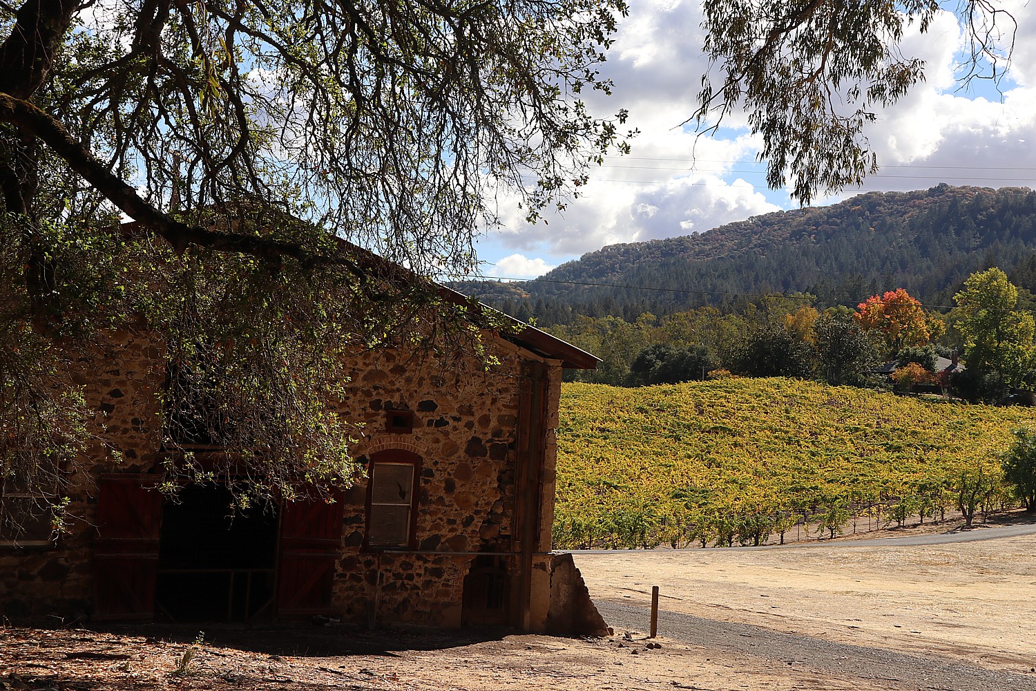
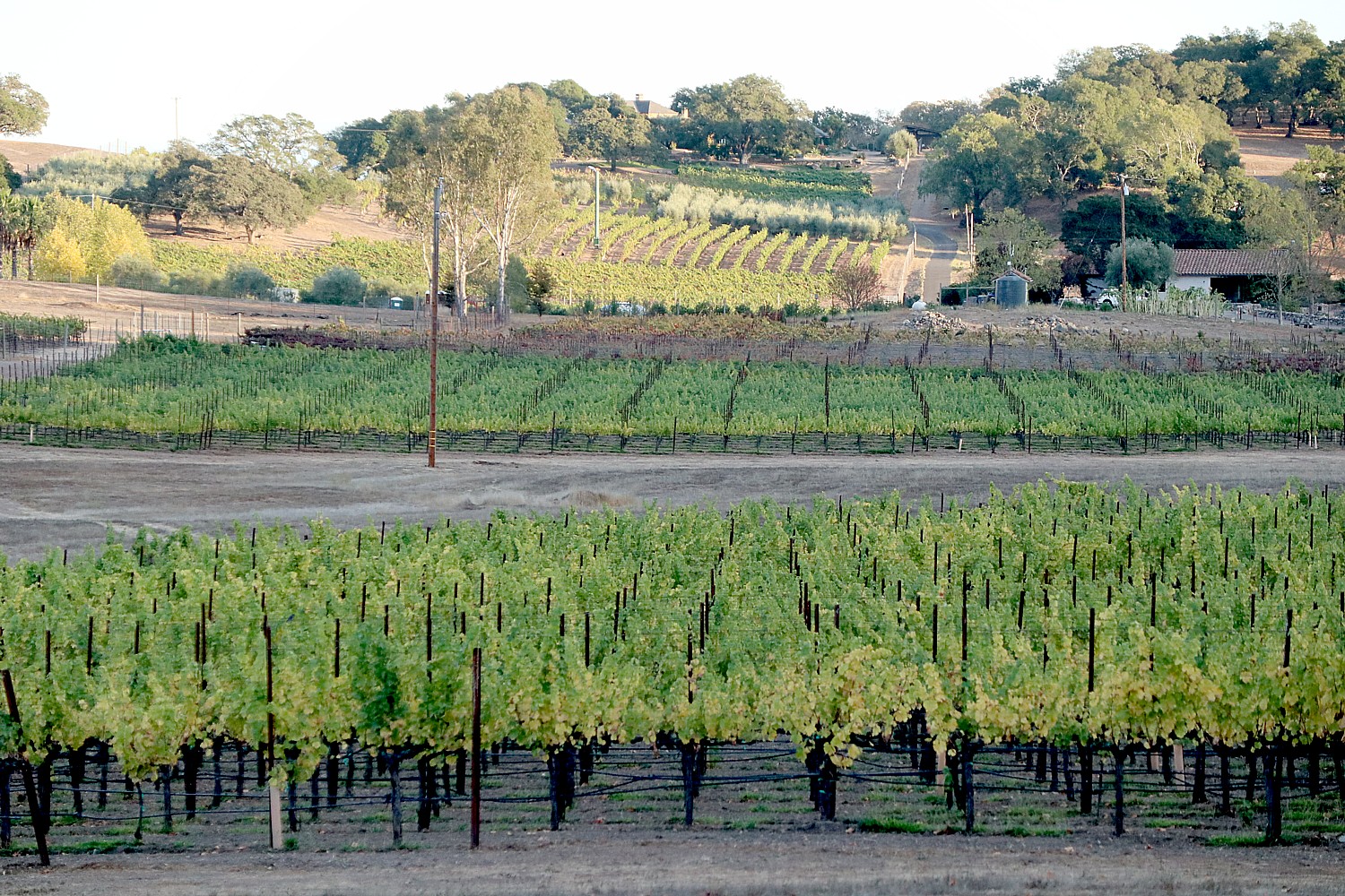
My biking takes me into the vineyards that completely ring the village. I return to the Buena Vista Winery, founded by Count Agoston Haraszthy, who came from Hungary initially in pursuit of gold but in 1857, decided instead to build a stone winery on the property. He introduced cuttings from Europe’s best vineyards to California and basically proved that California could produce wine. Buena Vista Winery, 18000 Old Winery Road, Sonoma, CA 95476, 800-926-1266, tastingroom@buenavistawinery.com, www.buenavistawinery.com.
There are about 90 vineyards and wineries you can explore, see Sonoma.com.
I also come upon a wonderful local community garden, Sonoma Garden Park, which is a working farm, education center and “vibrant gathering place” where I encounter a gardener who comes up from San Francisco and learn about sustainable gardening in this drought-plagued place (Seventh St. East & MacArthur).
Another marvelous example of this merging of man and nature is the Jack London State Park in nearby Glen Ellen, where we go for a hike and discover a most intriguing history. I was expecting to hike in the woods, but the historic and biographical features blew me away.
I always associated Jack London with San Francisco and Alaska. It was a complete surprise to learn that Glen Ellen was home to the writer/adventurer from 1905 until his untimely death in 1916, at age 40, of gastrointestinal uremic poisoning. London pioneered new agricultural techniques here at his 1,400-acre Beauty Ranch.
“London was well ahead in the real estate game in 1905 when he began buying up what was then exhausted farmland around Glen Ellen,” writes Kenneth Brandt, The Short, Frantic, Rags-to-Riches Life of Jack London,” in Smithsonian (www.smithsonianmag.com/smithsonian-institution/short-heroic-rags-riches-life-jack-london-180961200). “His intention was to restore the land by using innovative farming methods such as terracing and organic fertilizers… ‘I see my farm,’ he declared, ‘in terms of the world and the world in terms of my farm.’ Today, docents lead tours showcasing London’s progressive ranching and sustainable agricultural practices.”
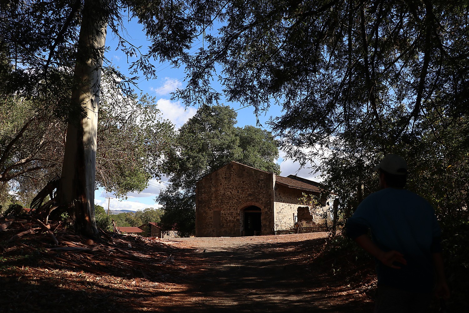
We wander through the ruins of his old stone winery and see a stone barn. You can visit the magnificent ruins of London’s 15,000-square-foot Wolf House mansion, built out of native volcanic rock and unstrapped redwoods, that would have had 26 rooms and nine fireplaces, a library measuring 19 x 40 feet, a two-story high living room, a wine cellar and – befitting a forward looking innovator – electric lighting and built-in vacuum cleaning system. It cost $75,000 ($1.9 million today) to build, but burned to the ground a month before completion.
“Built out of native volcanic rock and unstripped redwoods, it was to be the rustic capstone of Beauty Ranch and architectural avatar Jack London himself. He was devastated over the fire but vowed to rebuild. He would never get the chance,” Brandt writes.
I learn how contemporary London actually was, his writings and outlook remarkably prescient (or else you realize things don’t actually change but only repeat) – he could have been writing today. “He also remained politically engaged,” Brandt writes, quoting London from a 1914 letter: “If, just by wishing I could change America and Americans in one way. I would change the economic organization of America so that true equality of opportunity would obtain; and service, instead of profits, would be the idea, the ideal and the ambition animating every citizen.”
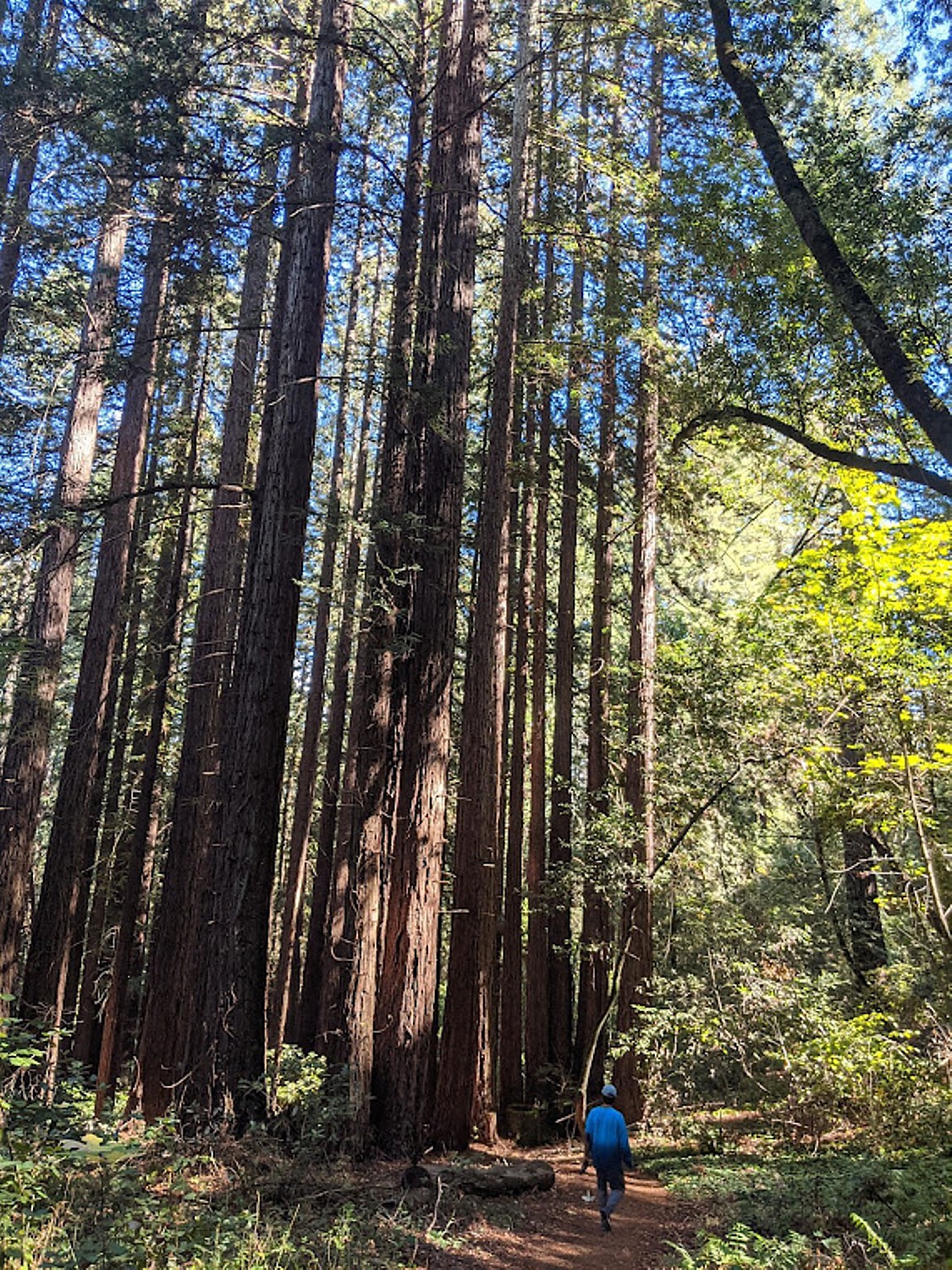
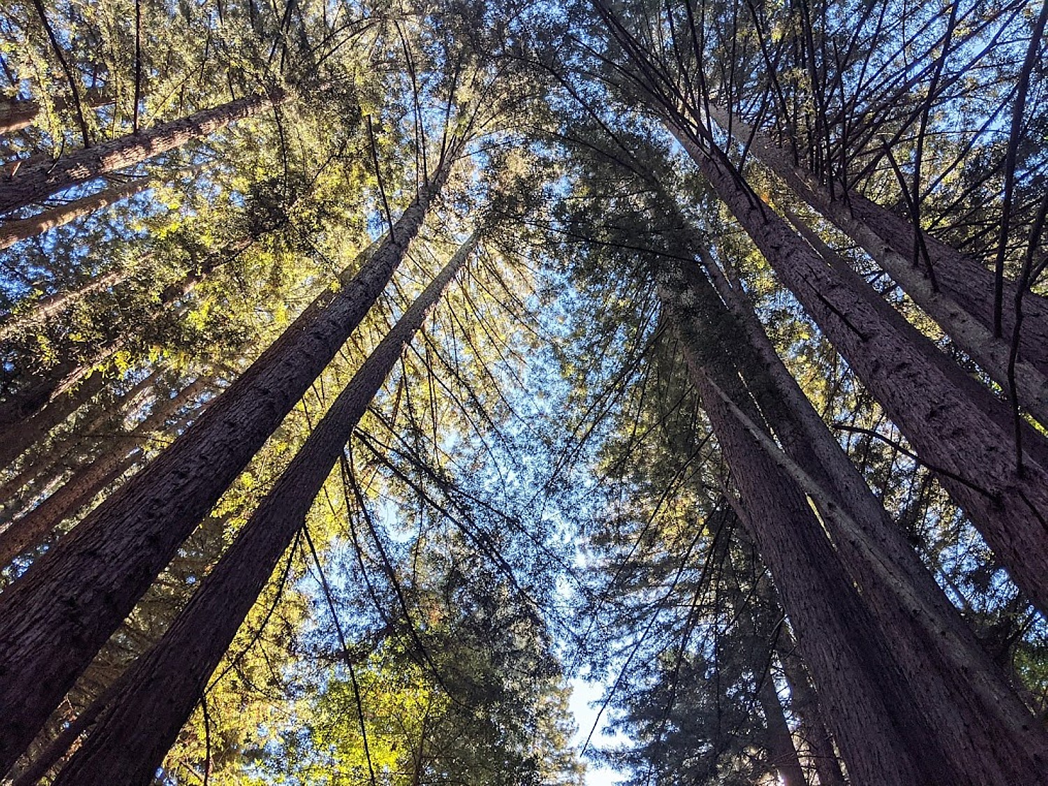
We set out on our hike (there are 20 miles of trails) through lush forest, majestic redwood groves, and meadows (a scenic six-mile trail leads to the top of Sonoma Mountain; you also can explore by horseback or bike), passing by a gorgeous vineyard to get to the trail. (We note the sign warning about rattlesnakes as we enter.)
I must return to visit the museum housed in “The House of Happy Walls” where there are displays of London’s books along with artifacts London and his second wife, Charmian, brought back from their 27-month sailing adventure among unexplored South Seas islands. (Volunteer pianists play on Charmian’s 1901 Steinway grand piano in the cottage where she lived from 1934 until she died in 1955.)
The park is very popular with locals in the know about all there is to do here – including concerts, performances, lectures, piano recitals; year-round there are free docent-guided tours, docent-led Sunday morning hikes, and other park events. Download a park map.
You can pick up picnic supplies, as we did, at the superb Glen Ellen Village Market or croissants, mini-sandwiches and other baked goods at Les Pascals bakery.
In the late afternoon, we take a walk in the “neighborhood”:
One of my favorite places for a driveable getaway is Sandwich, Cape Cod’s first village, settled in 1637. Sandwich is an enchanting jewel where history, exquisite architecture, fascinating attractions abound in a compact, walkable area, a short distance from the delightful Sandy Neck beach as well as the Cape Cod Canal biking trail. It is quintessential New England, an idyllic place to visit, to stay, to make your hub for exploring Cape Cod.
All through Sandwich, you see homes that bear the names of the ship captains who commanded the packet ships and clippers that made this area a mercantile center.
Many of these quaint historic houses and buildings (including a church) have been turned into charming bed-and-breakfast inns, but if you want to extend your time travel back to when the Patriots were debating revolution, a wonderful choice is the Dan’l Webster Inn and Spa, at the heart of the village. It is also is the most substantial in size, with 48 rooms, amenities and services that include a full-service Beach Plum Spa, offering the best of past and present.
The present inn sits on property that was once a parsonage, built in 1692 by Rev. Roland Cotton; in the 1750s, it was converted to the Fessenden Tavern, one of the first and most famous of New England’s taverns and a Patriot headquarters during the American Revolution (the Newcomb Tavern, just across the pond, served as Tory headquarters). In the late 1800s, the inn, then known as the Central House, hosted famous visitors including President Grover Cleveland and poet Henry David Thoreau.
In 1980, the Dan’l Webster was acquired by the Catania family’s hospitality company which operates the popular Hearth n’ Kettle Restaurants, as well as the John Carver Inn in Plymouth and the Cape Codder Resort, in Hyannis. Since acquiring the Dan’l Webster, they have restored it with exquisite taste and respect for its heritage – there are antique furnishings and Sandwich glass.
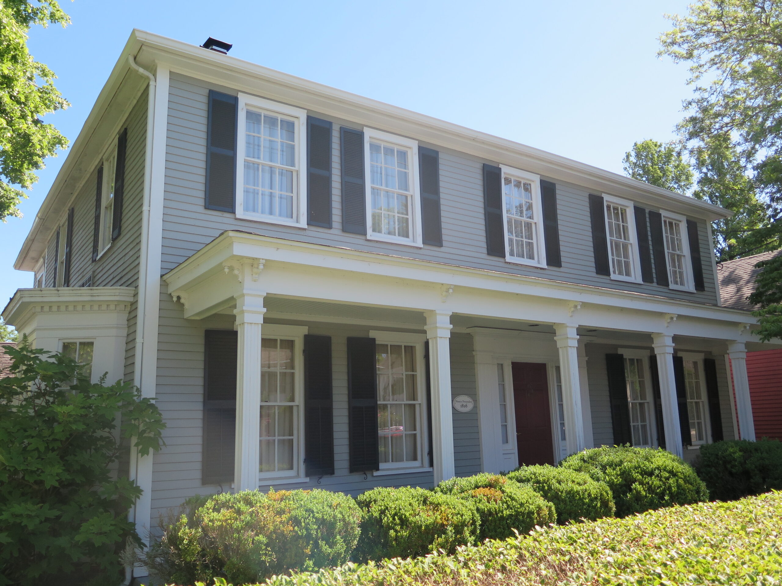
The Catania family also acquired the historic house next door. A marker outside the house tells the story: Nancy Fessenden married Capt. Ezra Nye in 1826 and moved into the house following their wedding. She was the daughter of the innkeeper (now the Dan’l Webster Inn). Nye was a famous captain who broke the speed record by sailing his clipper ship from Liverpool in 20 days, in 1829. Restored by the Dan’l Webster Inn in 1982, the house now offers accommodates four luxury suites, each named after prominent people associated with the inn, dating back to 1692.
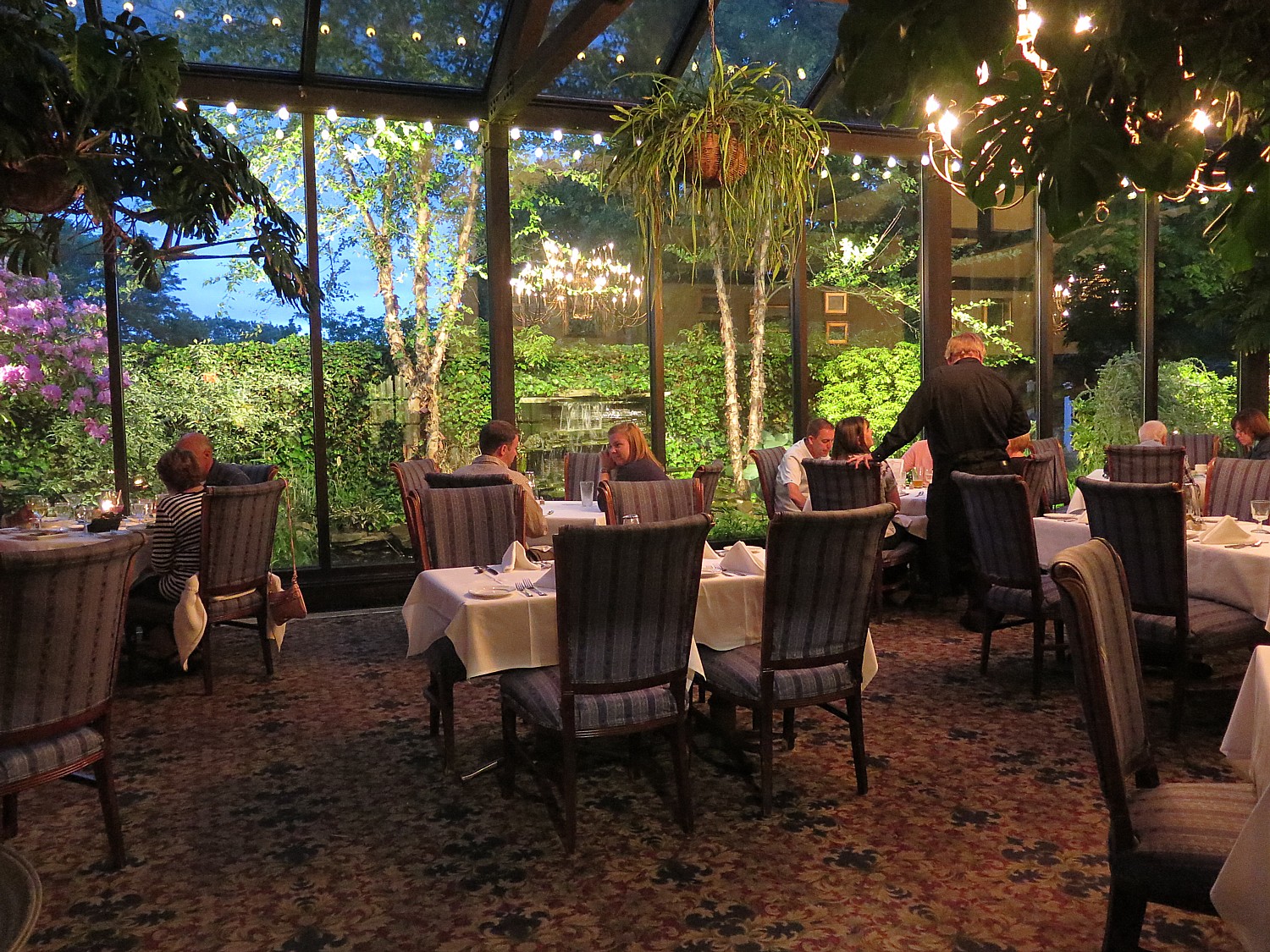
The Dan’l Webster has become an award-winning hotel, spa and dining destination. Recognized as a Distinguished Restaurant of North America (placing it in the top 1% of restaurants in the country) it offers a choice of the casual Tavern at the Inn, the cozy Music Room or the more formal (and romantic) ambiance in a lovely glass enclosed Conservatory.
The Tavern at the Inn is an authentic replica of the two-centuries-old tap room where Daniel Webster made regular visits and which had been a meeting place for local Patriots during the Revolution.
This is an especially good time to visit. The inn is offering a special package, Mosey & Museum Package, that captures the real essence of small-town Cape Cod (through October 3). It includes admission to the Sandwich Glass Museum to appreciate the art of glass making and Sandwich’s contribution to the industrial craft, and to Heritage Museum and Gardens to celebrate their Pollinator Festival. (Check the website for more packages.)
In a village of many substantial attractions and places of interest, what truly stands out is the Heritage Museum & Gardens – a destination attraction. It hits on a spectrum of cylinders – 100 acres of magnificent grounds and trails on the banks of the Shawme Pond; the vast, stunning and notable gardens that feature internationally important collections of rhododendrons, including those created by Charles Dexter, collections of hydrangeas, over 1,000 varieties of daylilies, hostas, herb, heather gardens, and more than a thousand varieties of trees, shrubs and flowers along beautiful and easily walked paths.
Also, the JK Lilly III collection of vintage cars and folk art, and you can take a ride on a delightful working vintage carousel. There is also – imagine this – Hidden Hollow, an enchanting family-friendly outdoor adventure center where you can get a “squirrel’s perspective” of the forest. You should allocate the better part of a day to visit. (Heritage Museums & Gardens, 67 Grove Street, Sandwich, MA 02563, 508.888.3300, www.heritagemuseumsandgardens.org, open daily through Mid-October.)
What built Sandwich, though (and likely the reason that so many of its magnificent buildings reflect the prosperity of the early-1800s) was that in 1825, Deming Jarves built a glass factory to manufacture glass with a revolutionary process that made it affordable for the masses (Sandwich glass is still a thing). The factory grew rapidly to be one of the largest producers in the country with over 500 workers producing over five million pieces of glass annually by the 1850s. By the 1880s, labor strikes, an economic depression, and new factories being built further closer to natural gas fuel sources forced the factory to close.
Today, you can visit the Sandwich Glass Museum which displays original pieces created during the 1800’s and provides demonstrations of glass blowing techniques. The museum’s theater shows a great documentary of the history of Sandwich. Throughout the village there are several glass blowers and artists with open studios to visit, creating a dynamic center for contemporary glass art (Sandwich Glass Museum,120 Main St., 508-833-1540, www.sandwichglassmuseum.org).
A short walk from the Dan’l Webster Inn is the Dexter Grist Mill, a working grist mill since 1654 where you can still buy ground cornmeal, or draw fresh water from the well (as many locals do for their personal supply).
The Hoxie House, built in 1675, was lived in until the 1970s but was never modernized with electricity or plumbing. This saltbox is named after a whaling captain who owned the house in the mid-1800s. it is now a wonderful little museum house showing what family life was like in the 1600s.
Benjamin Nye Homestead & Museum, is the 18th-century home of one of the first 50 men who settled in Sandwich.
Also, the Wing Fort House, built in 1641, the oldest house in New England continuously owned and occupied by one family (63 Spring Hill Rd., 508-833-1540).
A short distance away, you can visit the Green Briar Nature Center & Jam Kitchen (6 Discovery Hill Road off Route 6A), which celebrates author and naturalist Thornton W. Burgess, who wrote the Peter Cottontail stories. There are nature programs, nature trails, a working 1903 Jam Kitchen, jam-making classes (508-888-6870, www.thortonburgess.org).
One of my favorite things about Sandwich is the proximity to the Cape Cod Canal which offers a 6.2 mile-long paved path (on each side) for biking, roller blading or just walking (the banks of the canal are also popular for fishing). Along the trail, you can visit the Aptucxet Trading Post, built by the Pilgrims in 1627 to facilitate trade with the Dutch at New Amsterdam and the Narrangansett Indians.
The Cape Cod Canal is a marvel (there is a visitor center on the mainland side that tells the history). The canal was constructed in 1914 – up until then, there were a tragic number of ships that were wrecked trying to sail around the peninsula. But it is astonishing to learn that interest in building the canal dated back to the earliest settlers: in 1623, Pilgrims scouted the area as the place best suited for a canal. In 1697 the General Court of Massachusetts considered a formal proposal to build a canal, but no action was taken. In 1776, George Washington, concerned about its military implications, studied the site. But it took until 1909 for construction to start. (60 Ed Moffitt Dr., 508-833-9676, www.capecodcanal.us).
Cape Cod also has the most marvelous network of dedicated bike trails.
Sandwich offers easy access to other marvelous places to visit on Cape Cod, like Falmouth, Wood’s Hole, Hyannis but you should spend at least a day on the other side of the Sagamore Bridge, in Plymouth, to visit a score of historic attractions associated with the Pilgrims, including the Mayflower II and Plimoth Plantation, one of the best living history museums anywhere.
By Karen Rubin, Laini Miranda, Dave E. Leiberman & Eric Leiberman
Travel Features Syndicate, goingplacesfarandnear.com
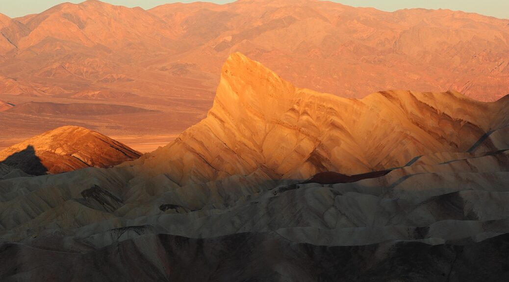
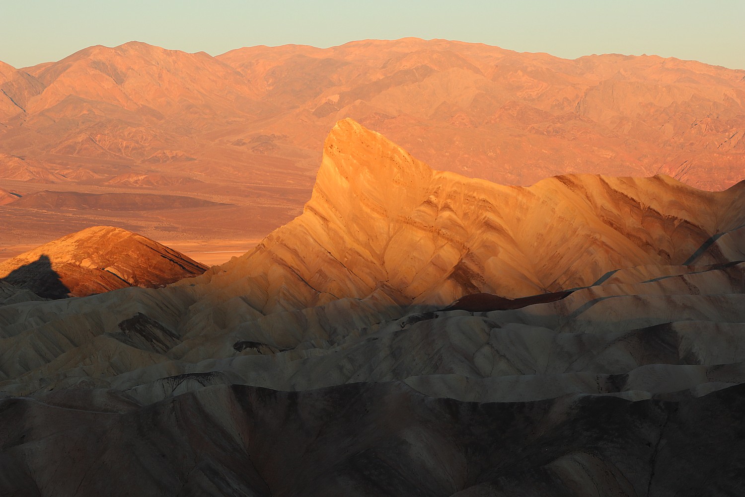
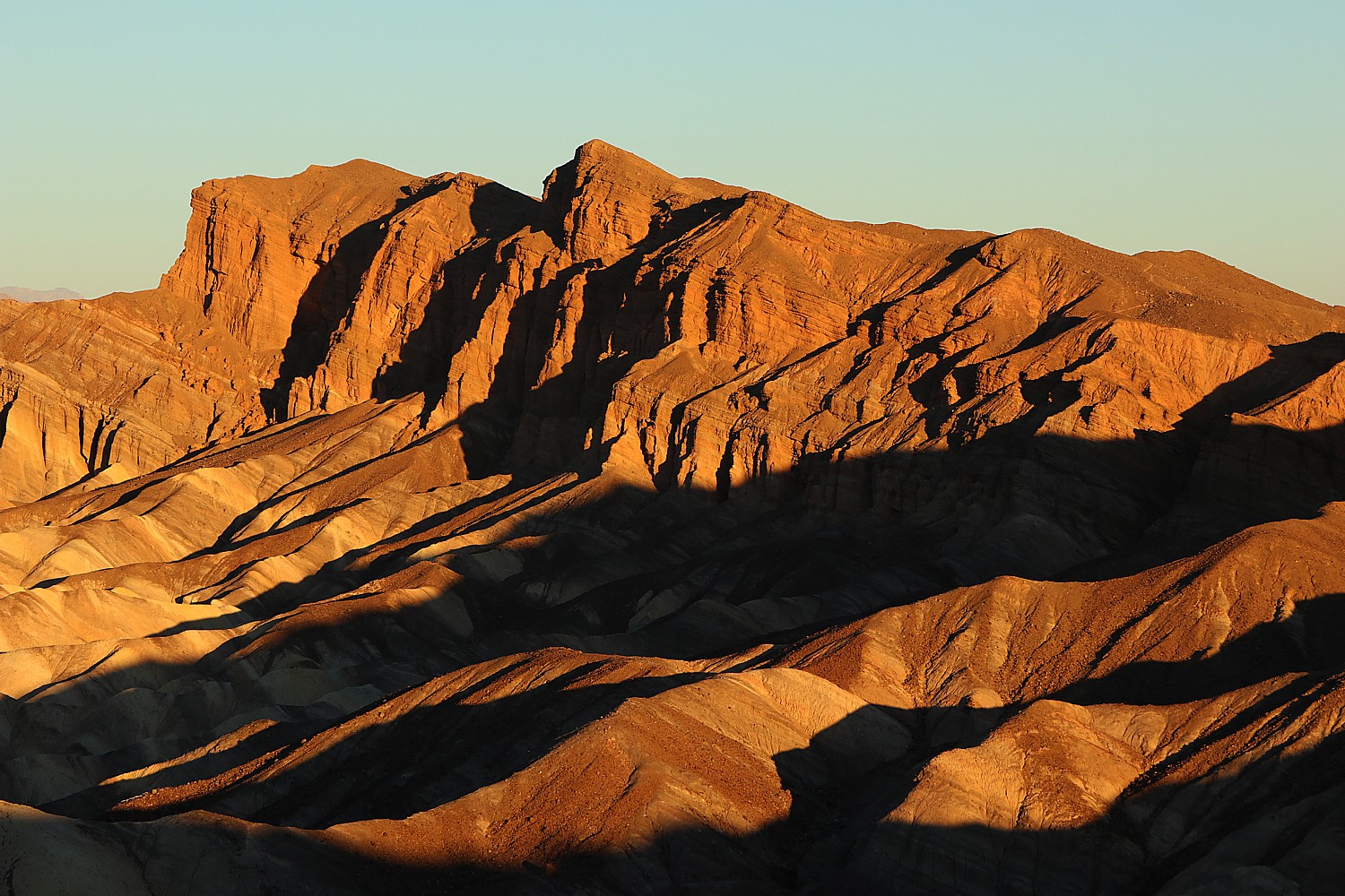
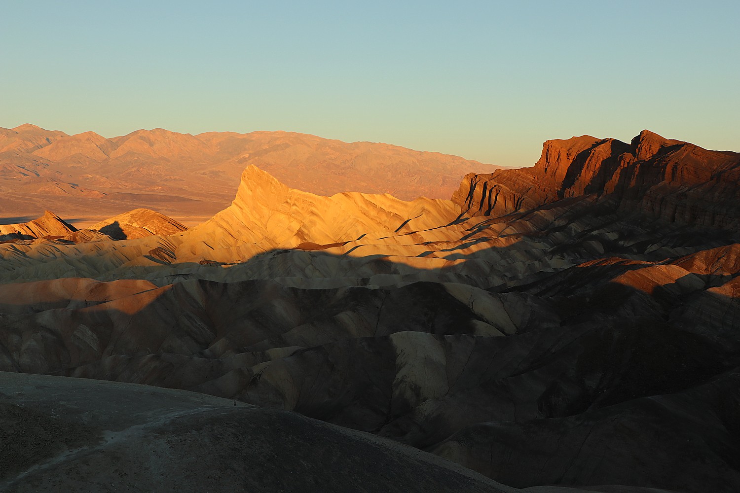
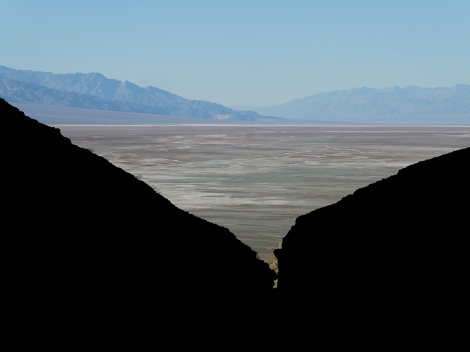
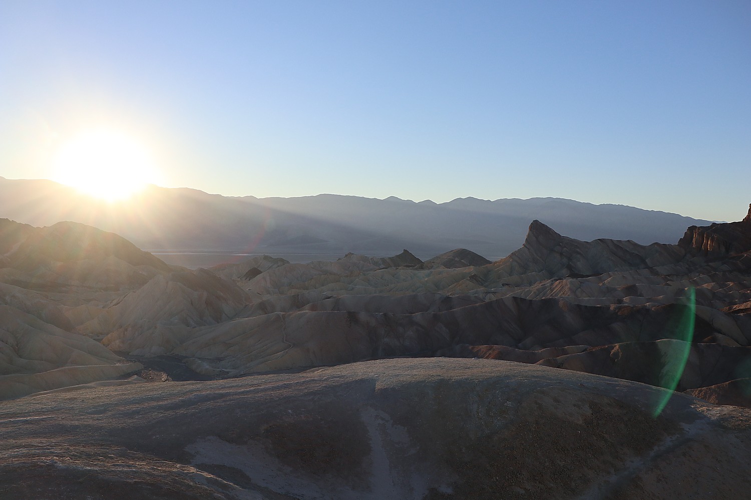
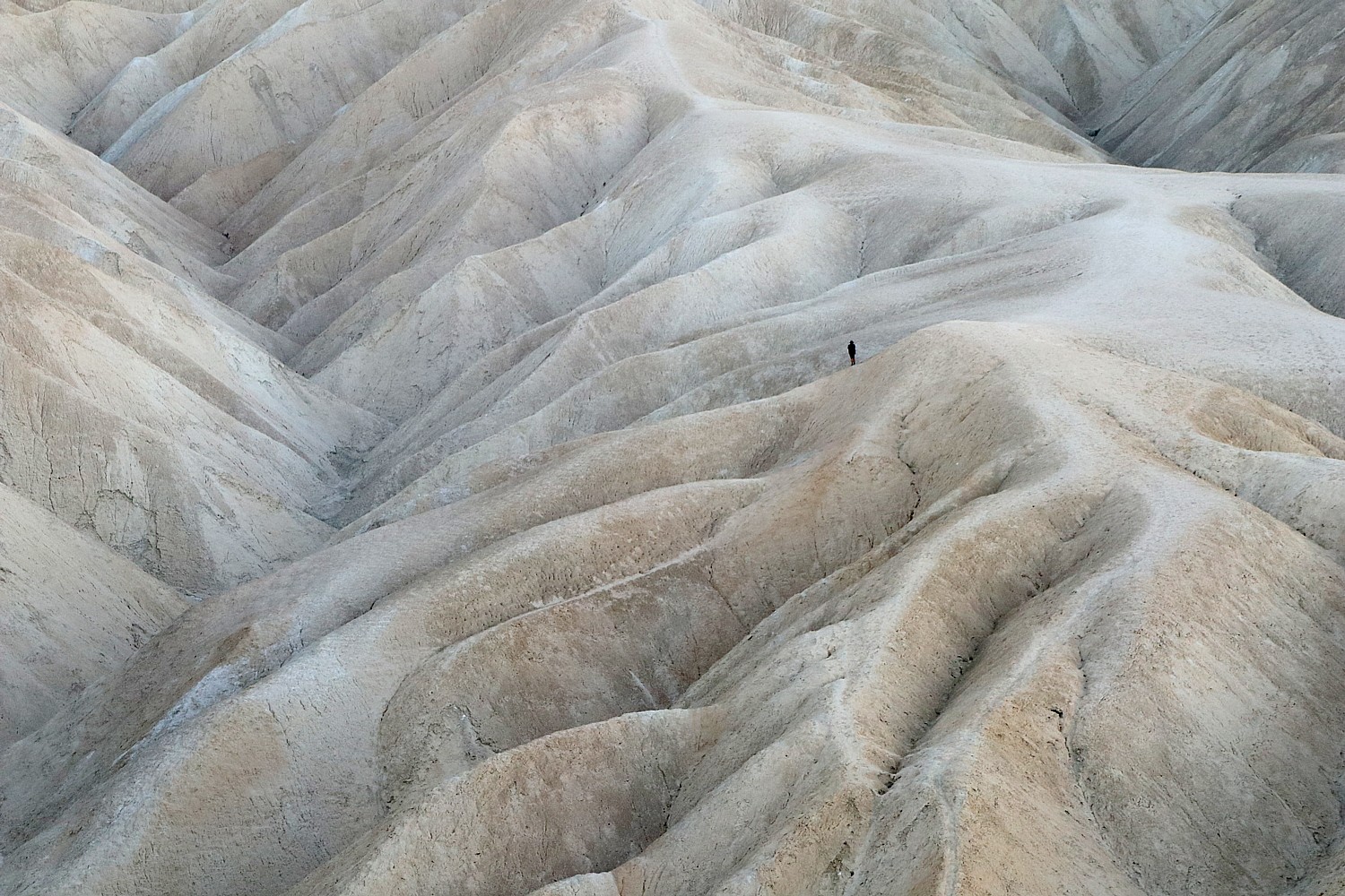
On our second morning in Death Valley National Park, we’re up before sunrise to race to Zabriskie Point, one of the not-to-be-missed highlights, to watch the brilliant display as the rising sun seems to set the rock faces aflame with color.
Today’s itinerary in Death Valley National Park is on a strict schedule around Laini’s zoom appointments (COVID has given rise to “worker nomads” and “workations”) – the proximity to the places we wanted to see was one of the reasons we left Designed to Death AirBnB, 45 minutes drive into the park, for the Ranch at Death Valley, just about 7 minutes drive from Zabriskie Point, in the most central part of this vast national park. We rush back to the Ranch at Death Valley, until her next break, so grateful for its close proximity to what we would like to do today. It requires incredible planning and logistics considering the distance to get to places in a park twice the size of Delaware.
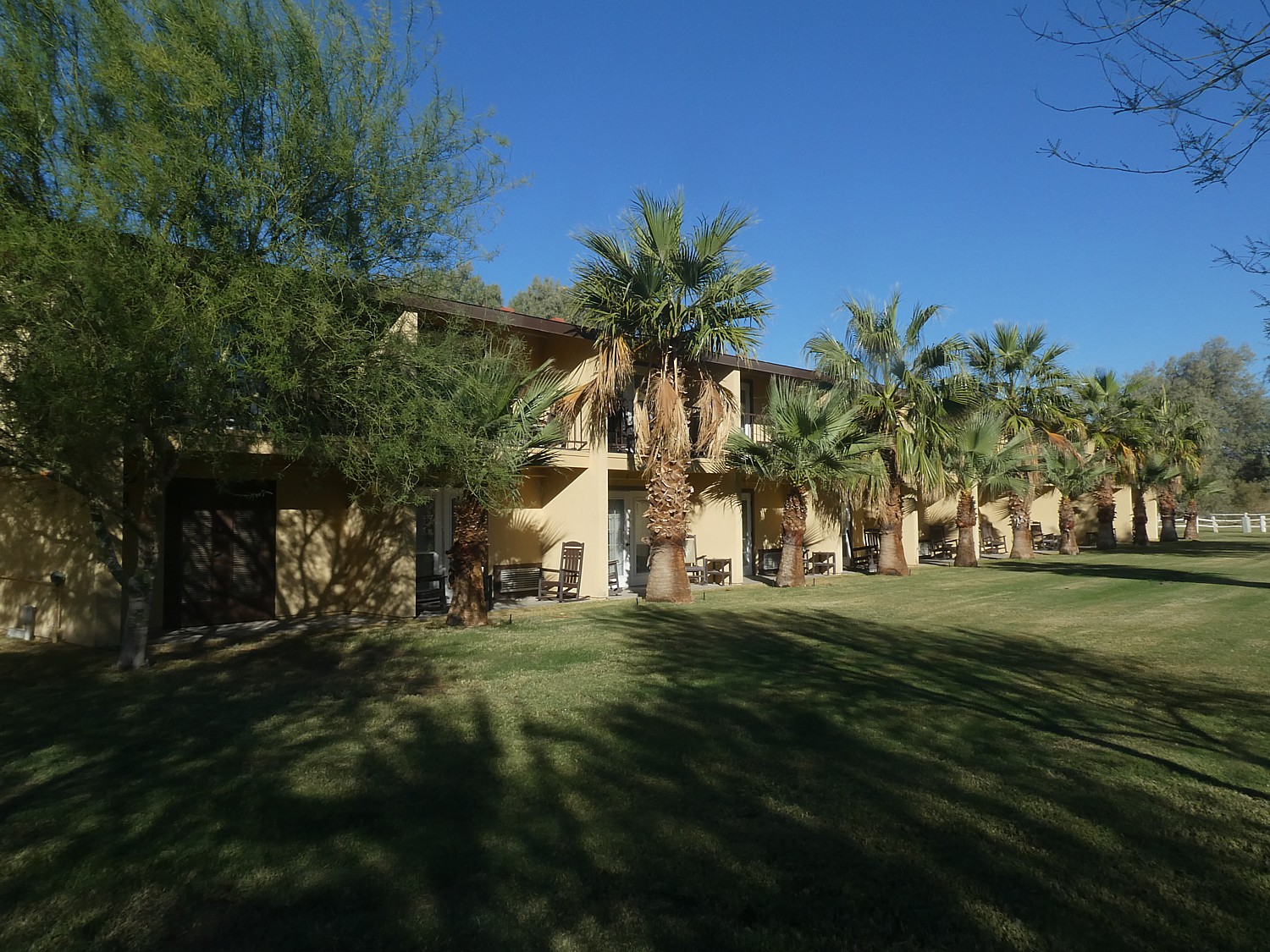
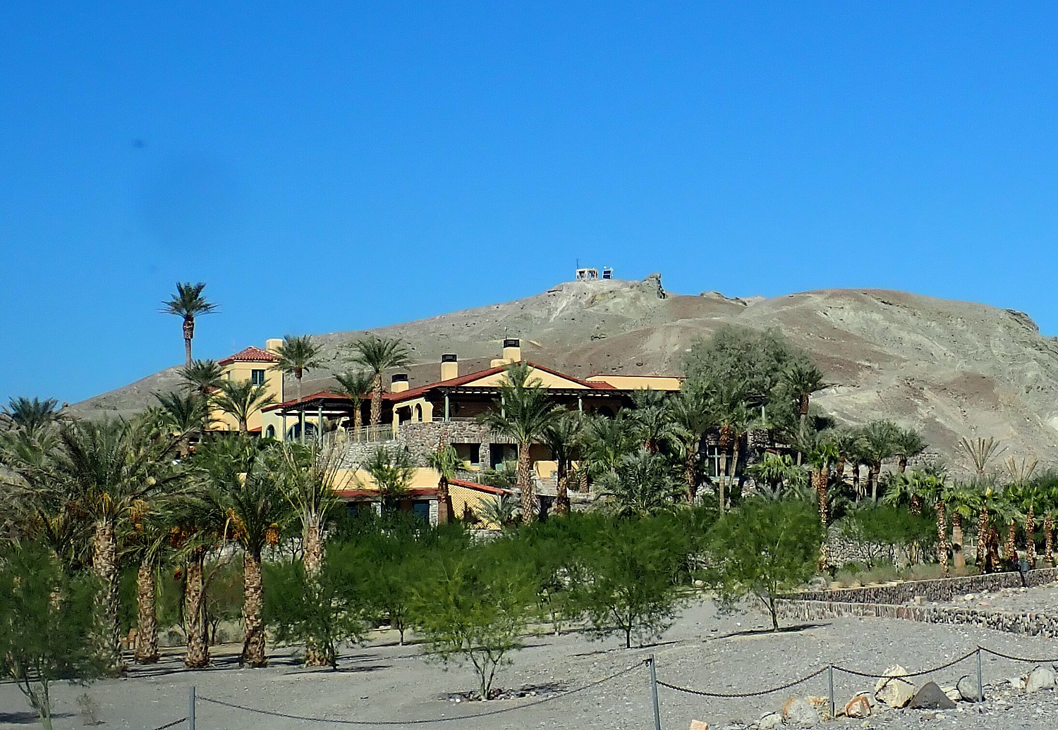
But these breaks give me more time to explore and enjoy the Ranch. It is a full resort with a very casual, family-friendly vibe almost like a dude ranch resort; in fact it once was a working ranch and now has stables offering horseback and carriage rides and a marvelous “Last Kind Words Saloon” that looks like it is straight out of a western movie. It is laid out with two-story units of rooms that open out to either a patio or balcony, with everything from a gorgeous swimming pool, tennis courts, basketball courts, playground. There is even a full 18-hole golf course, at 214 ft below sea level, the lowest elevation course in the world. The ranch also offers Jeep rentals to explore the park in a rugged 4×4.
The “new and improved” 224-room Ranch at Death Valley is part of a $100 million renaissance along with the nearby Inn at Death Valley (a historic, four-star luxury resort), and is at the vital center of activity in Death Valley. Set along Highway 190 next to the National Park Service Visitor Center, it offers a classic town square with towering date palms and Mission California architecture. Among the improvements: a new restaurant, ice cream and coffee bar, general store with souvenirs as well as groceries.
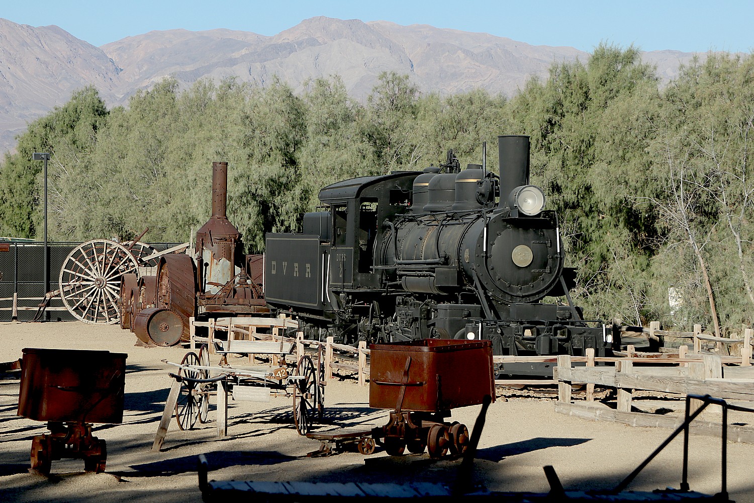
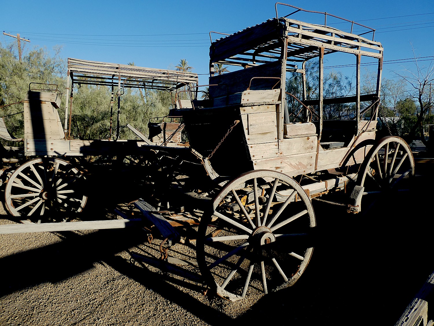
The Ranch offers a real surprise when I come upon a museum with an outdoor display (the indoor museum is still closed as a COVID precaution) of coaches, mining implements, even a full train locomotive train, set outside almost like a park. And you realize that this wasn’t all that long ago – the turn of the last century, a blip in context of the eons of time on view in Death Valley’s dramatic geology.
The Museum at the Ranch is not to be missed. When you are in the midst of this unforgiving harsh environment, it is astonishing to realize how people lived and worked here, that they even lived here at all – extracting resources like salt and borax, mining gold. The way the artifacts are displayed, it seems almost as if they had just been left behind – there is this immediate connection.
You are overwhelmed in Death Valley by nature and its powerful force, but here at the museum, you are reminded of man’s handiwork. The first white men to enter Death Valley were gold-seeking pioneers with the Death Valley Wagon Train in 1849, looking for a short cut to California. They came to Travertine Springs, near where we are here at Furnace Creek. Stranded, they eventually walked up to Stovepipe Wells and used wood from their wagons to cook meat of slaughtered oxen. We had seen the marker at Stovepipe Wells Village of “Burned Wagons Camp,” the site of the first tourist accommodations in Death Valley.
You also feel the presence of the workers and miners when you drive through the 20 Mule Team Trail and walk over the Badwater Basin salt flat, visit the Harmony Borax Works and hike passed a mine shaft.
I contemplate all of this as I sit outside on the porch of the wood cabin with a cup of coffee coffee.
We’ve timed it so as soon as Laini has another break we dash back to Zabriskie Point for a short hike (the trail connects to the Golden Canyon trail), before rushing back for her next Zoom meeting.
Back again at the Ranch, I do something I rarely ever have time to do: swim in the pool. It is absolutely glorious – naturally heated by hot mineral springs to a perfect temperature. And the scenery! We see what we couldn’t last night when we had the stars – the mountain peaks all around. We lounge for a couple of hours.
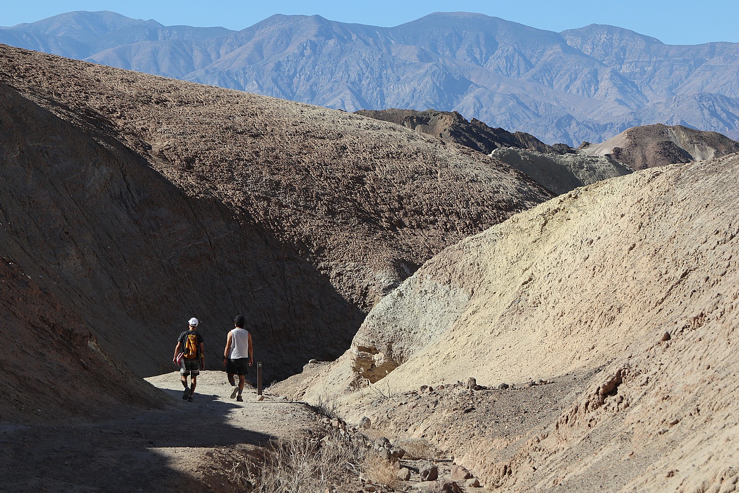
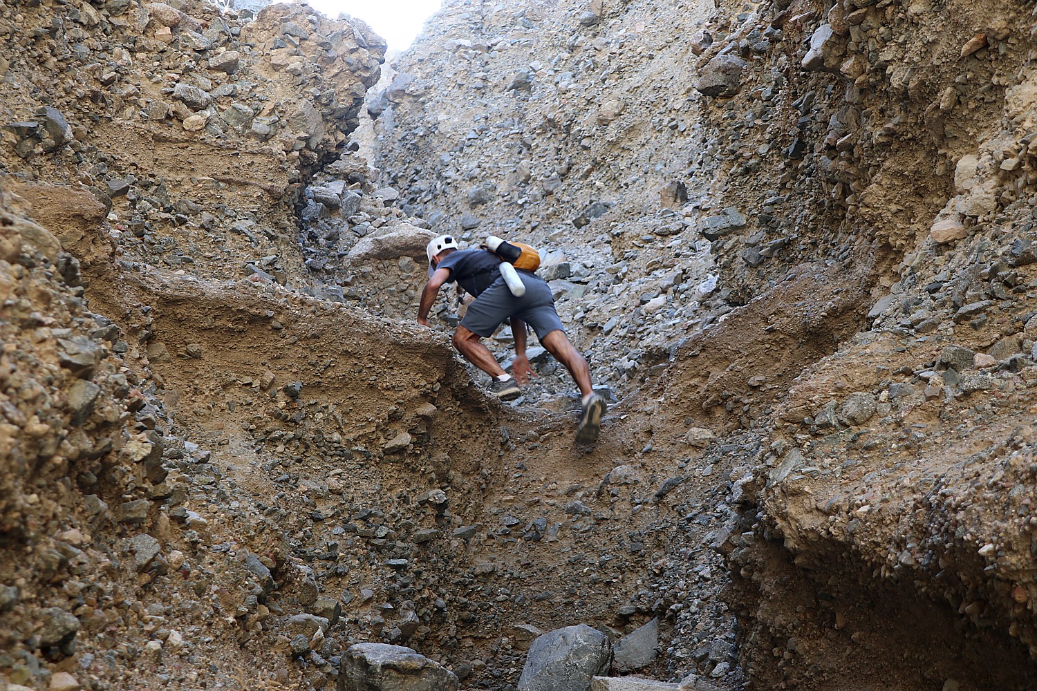
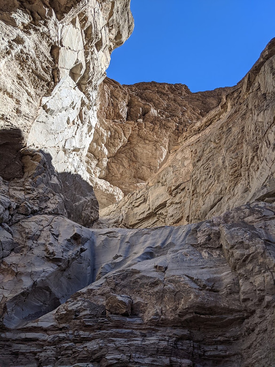
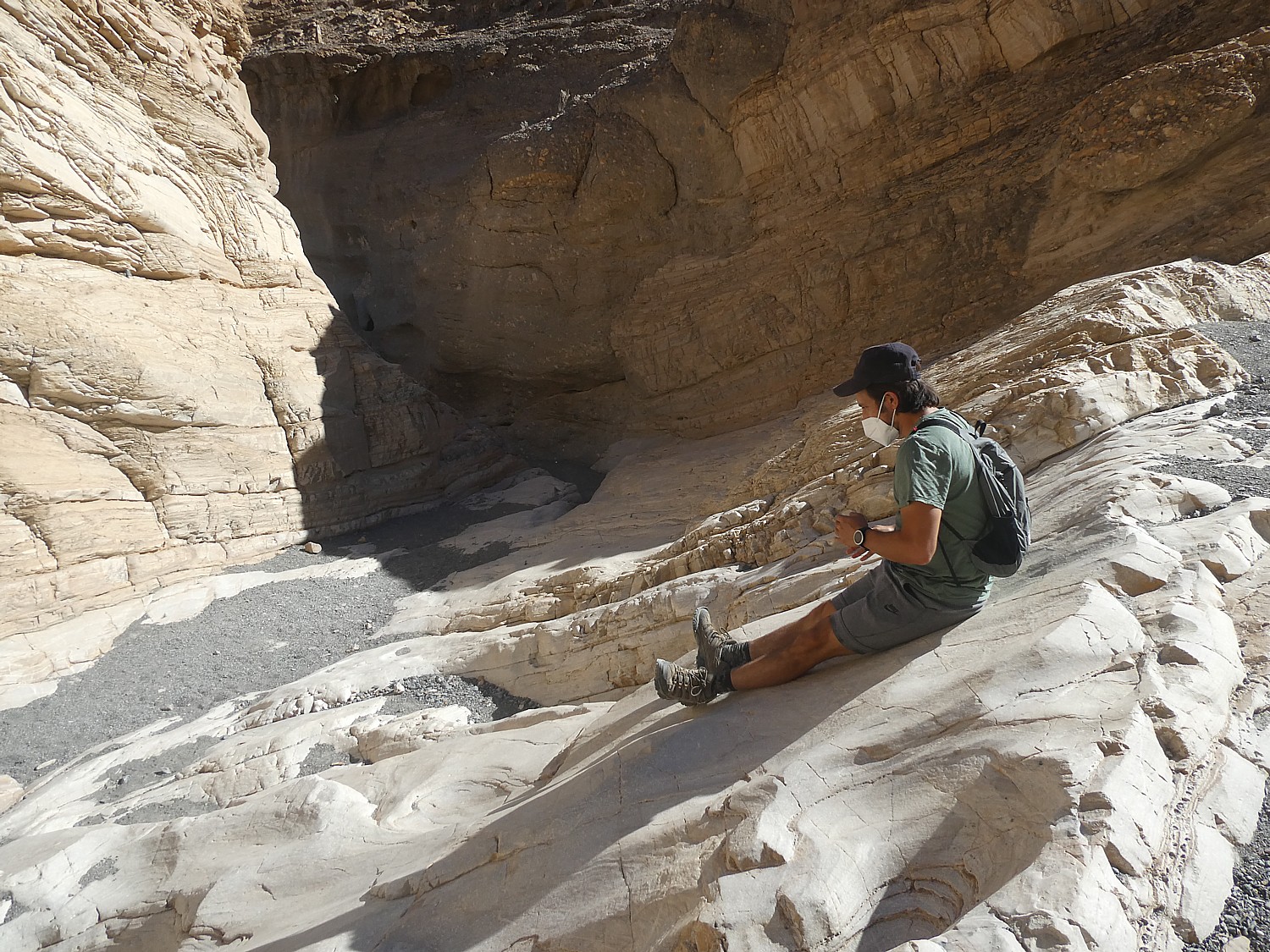
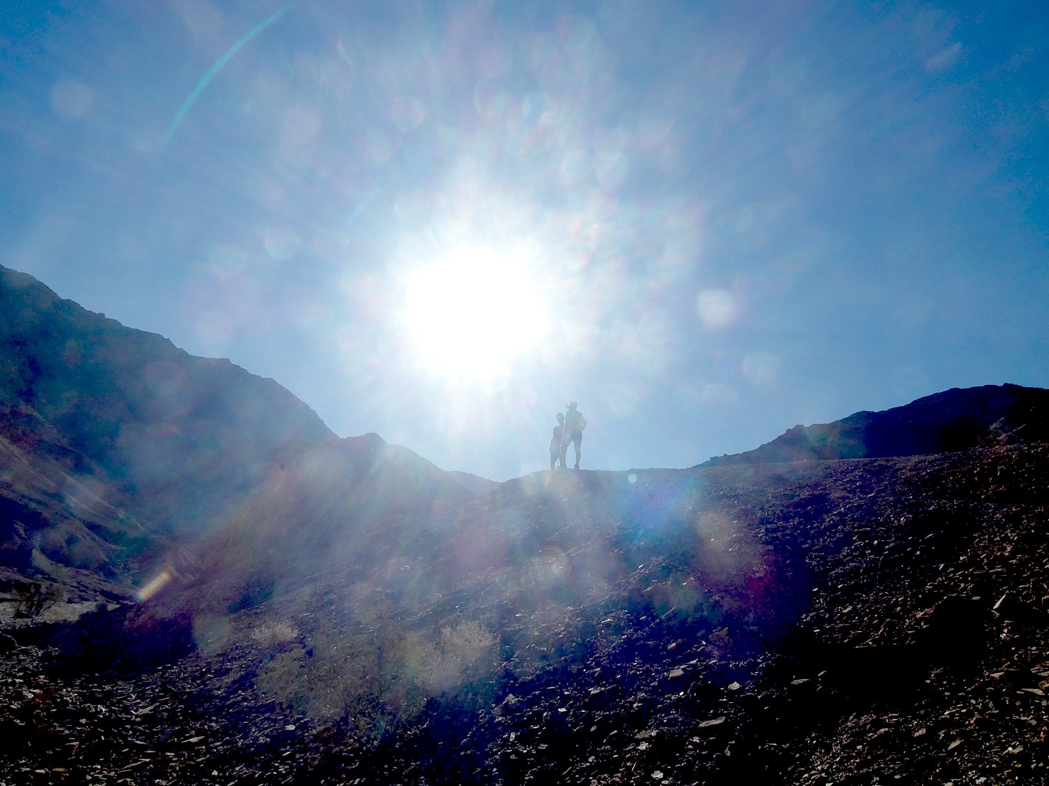
We’ve plotted an afternoon hike for when Laini finishes: Sidewinder Canyon.
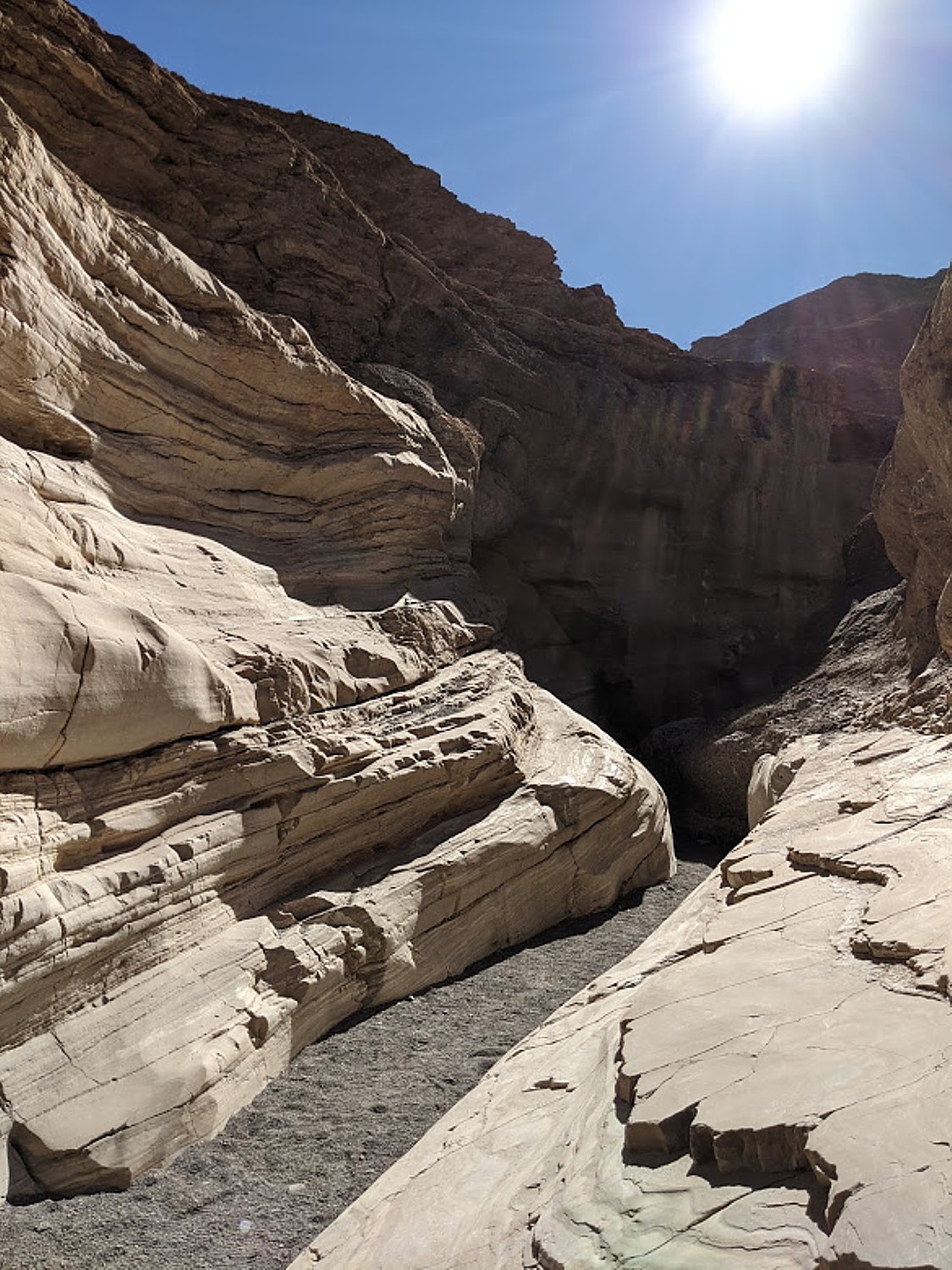
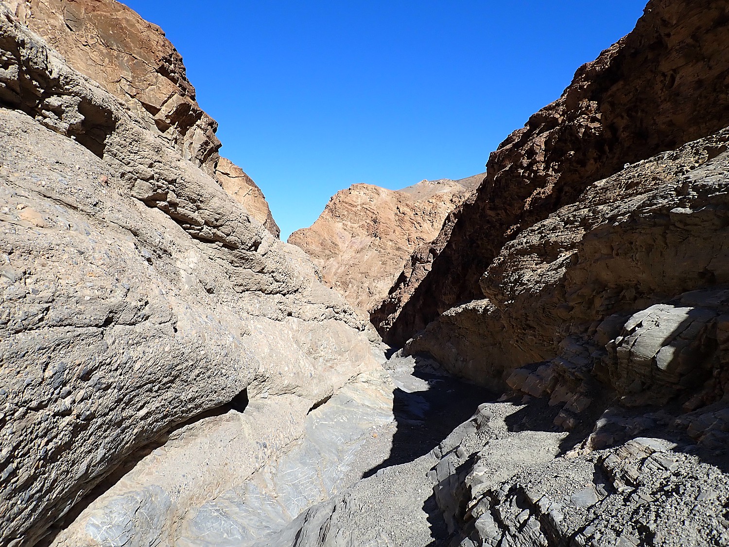
We eat our lunch in the car as we drive the 32 miles to Sidewinder Canyon, a slot canyon where you are supposed to be able to explore three separate slots.
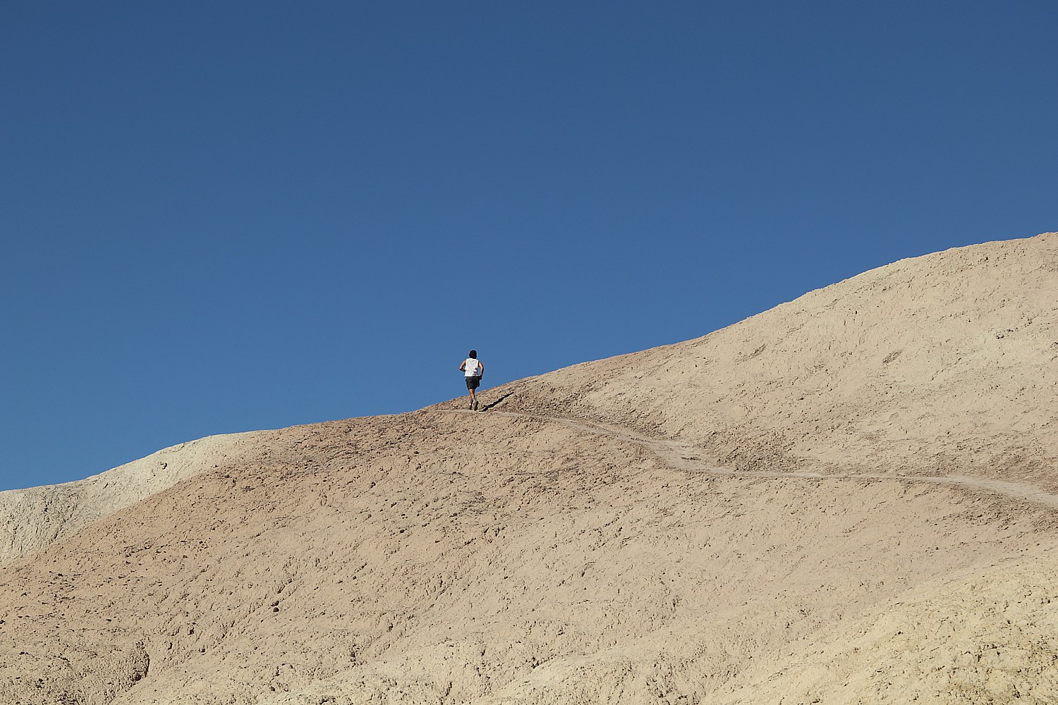
This trail is really for adventurers, much less visited than the star attractions (there isn’t even an outhouse at the trailhead here); and it’s not at all well marked.
We are supposed to watch for cairns – stones others have arranged in the shape of an arrow, or a pile of stones to mark the entrances. Even the notes say that the first slot, supposedly at the .8-mile mark, is easy to miss. What we think is the first slot has a fairly dramatic entrance, a stony scramble of pointy sedimentary rock like concrete that has come out of the mixer with lots of stones.
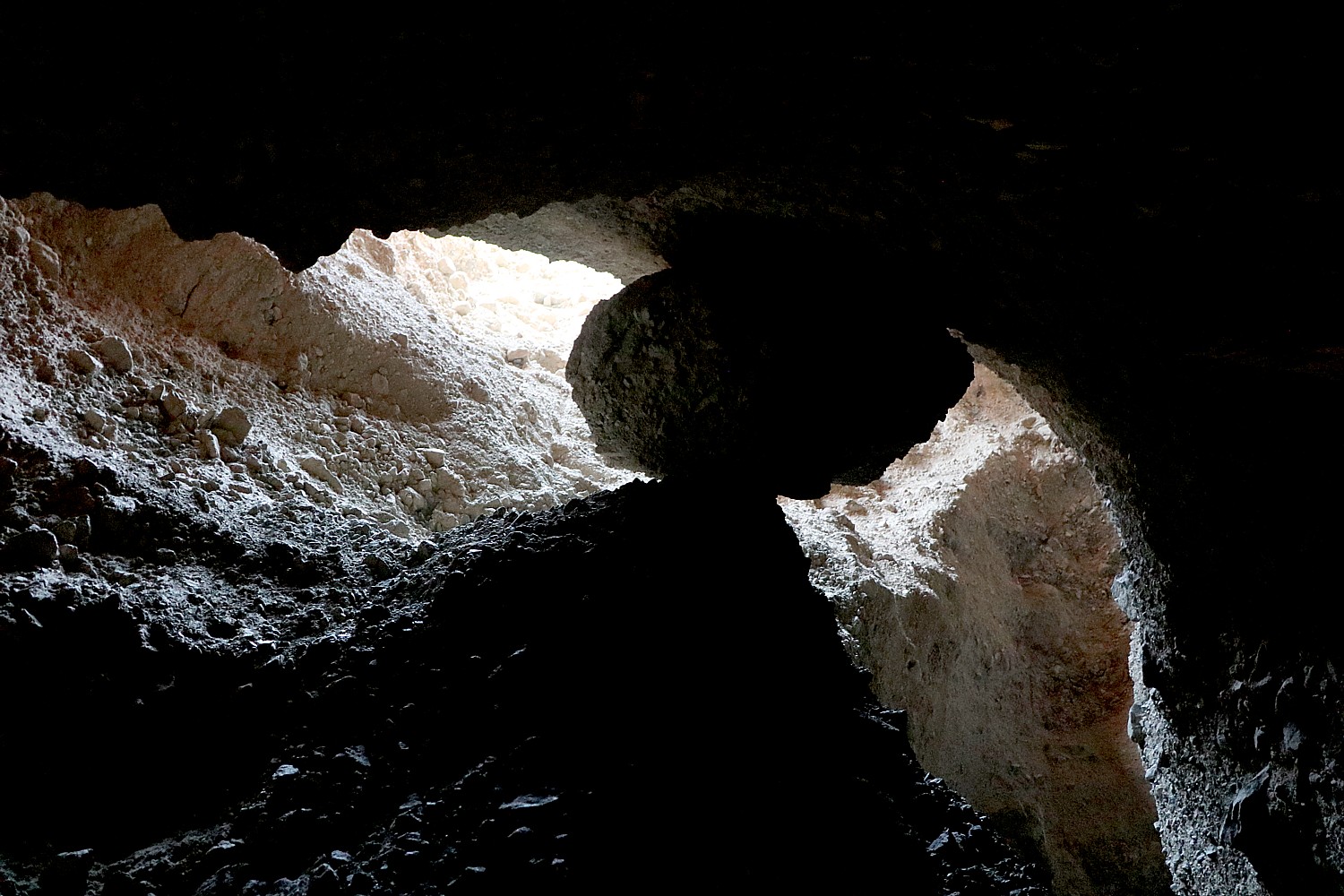
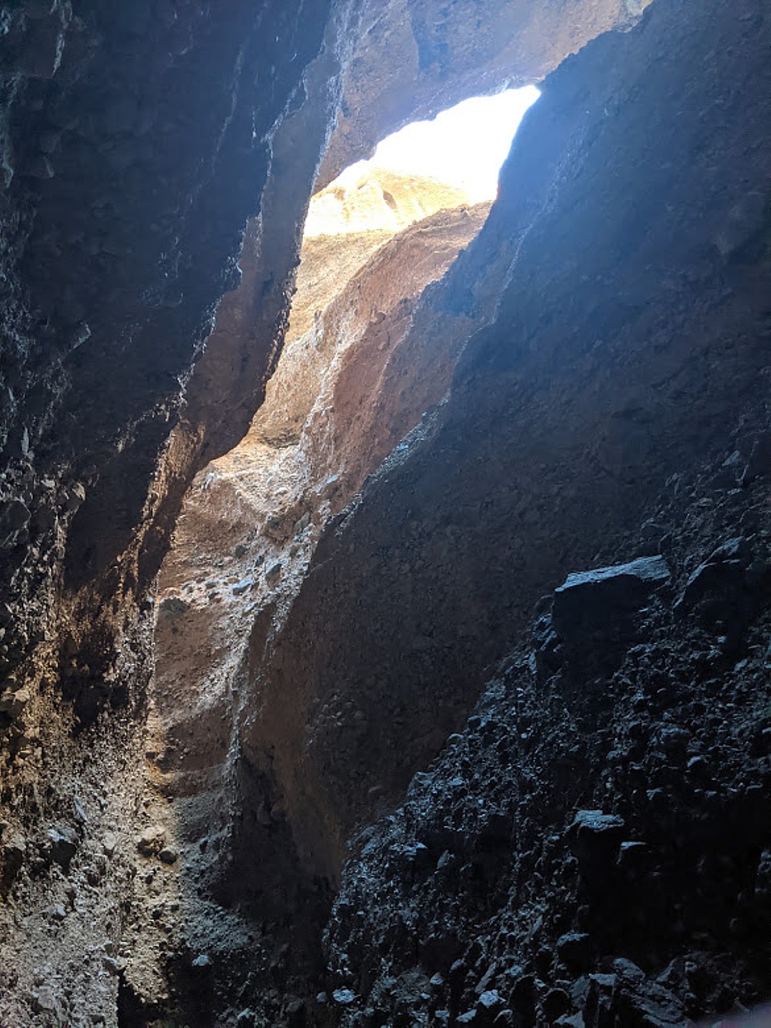
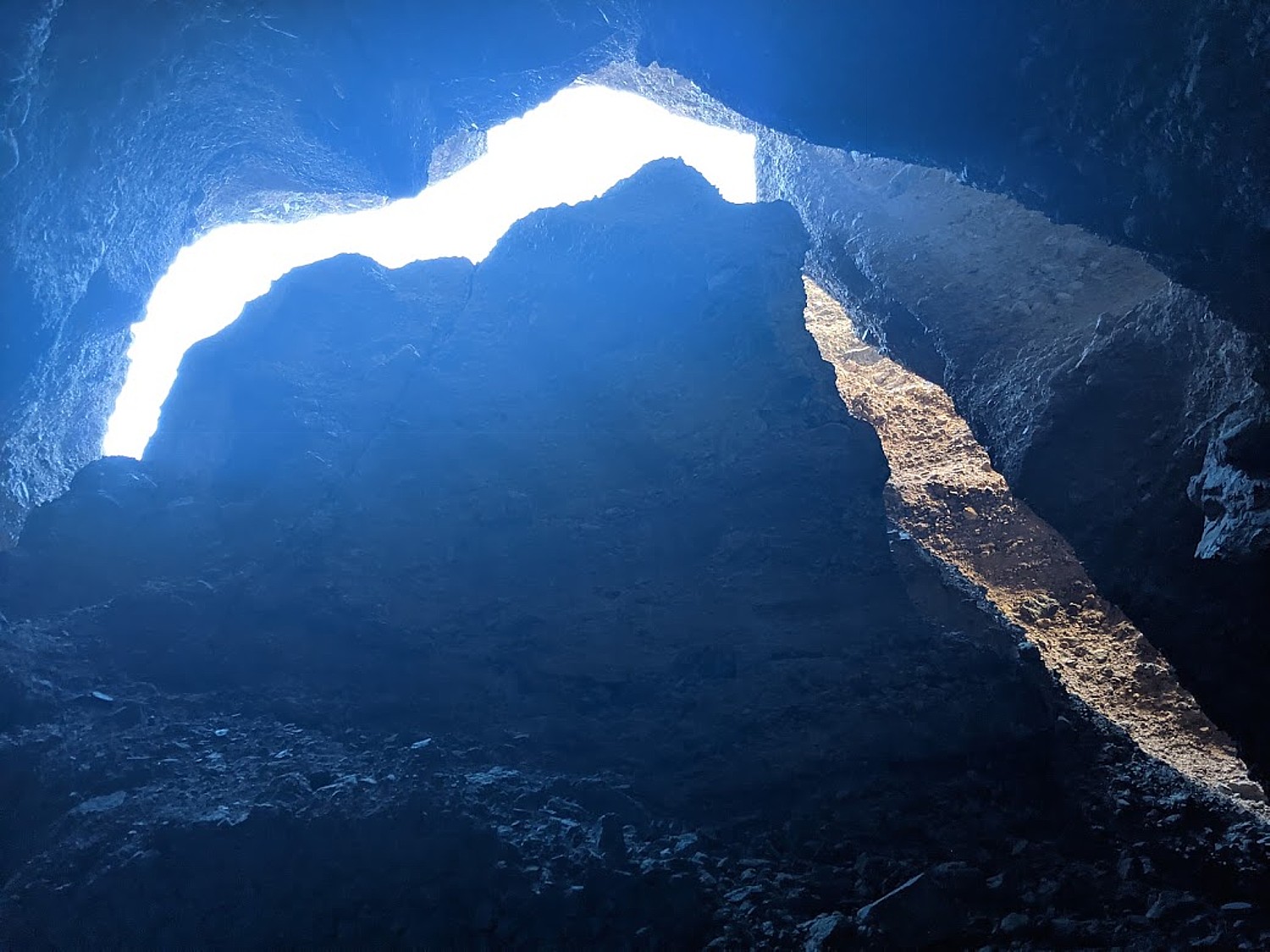
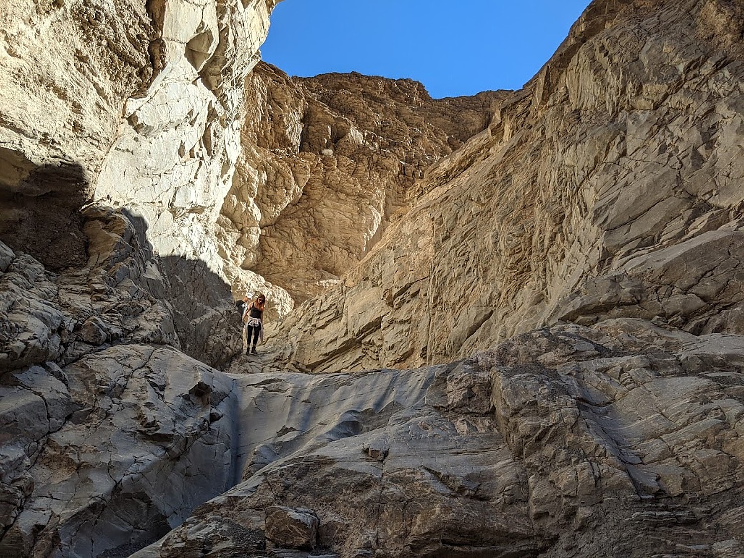
The second slot though is great – scrambles to get to higher levels – interesting formations with light coming through. It is dramatic when you enter, like something will happen, especially when look up and see a boulder wedged in a space between narrow walls above you. It dares you.
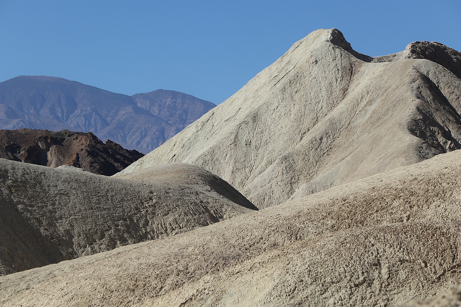
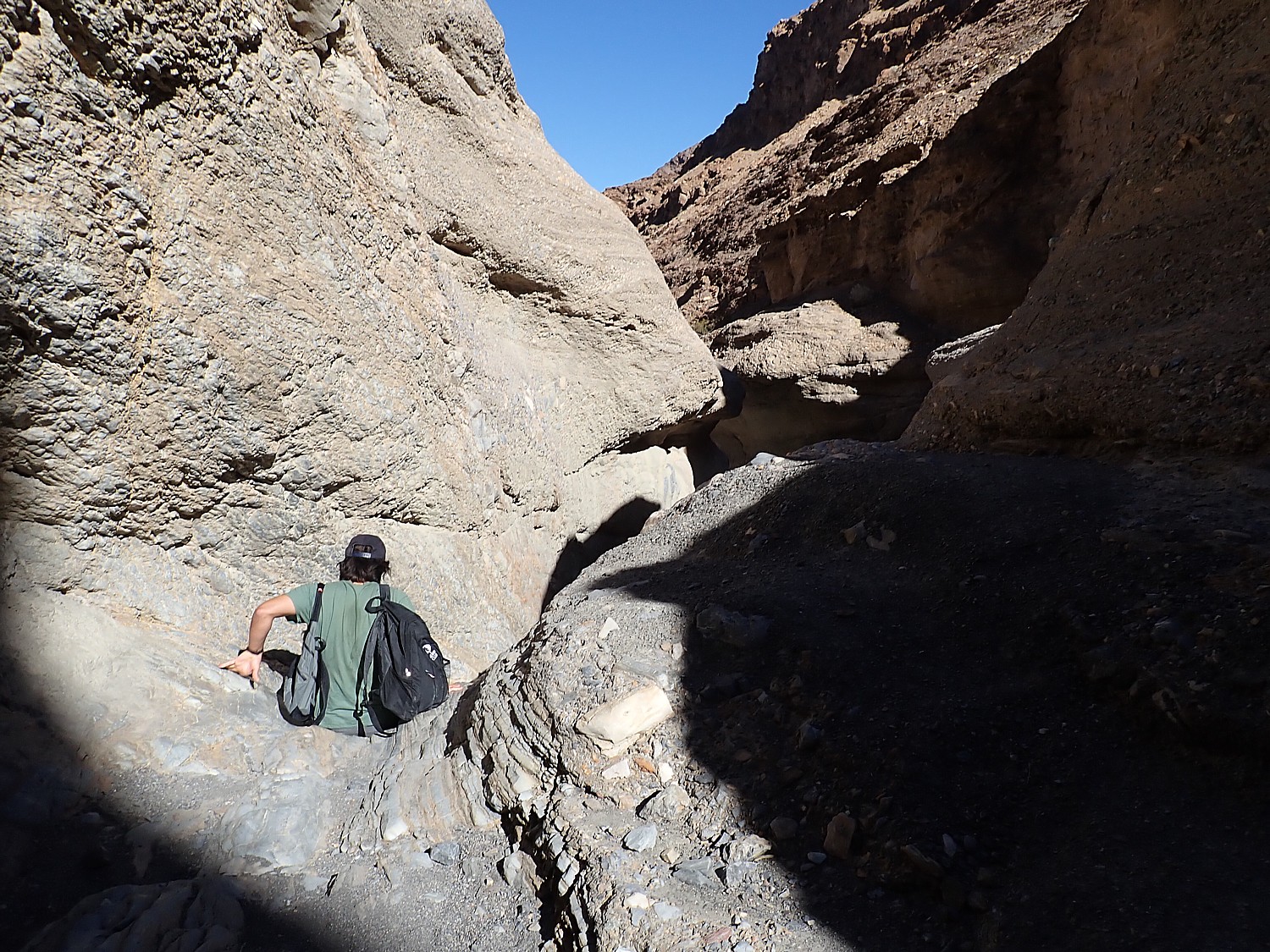
The landscape here is really harsh, unforgiving – RoadRunner cartoons come to mind, especially when we see a coyote and what seems to be roadrunner’s feathers on the ground.
The Sidewinder Canyon is more of adventure than I anticipated. Rugged, stony, not a lot of color, more scramble than I imagined (Dave and Laini go further into the canyon while Eric starts back with me), and not as picturesque, making me appreciate the Golden Canyon trail all the more, but in retrospect, a wonderful adventure. We hike uphill for a mile and then return.
The contrast between these two canyon hiking experiences – the Golden Canyon yesterday and Sidewinder today – is remarkable, in fact, all the hikes prove so wonderfully different.
We again rush back to Zabriskie Point for sunset – we had missed it by five minutes the night before, so this time, we make sure to get here in plenty of time to appreciate the changing light and colors. It proves not what I expected – I actually find myself more entranced by the full moon rising from behind the mountain peaks. (Artist’s Palette is another popular place to watch the sunset – get there at least a half-hour ahead in order to see the rich colors in the rock.)
This evening, we treat ourselves to a special dinner at the luxury, grand hotel, the Inn at Death Valley (originally named the Furnace Creek Inn), sitting outside on a lovely terrace rather than the dining room. The historic hotel, a member of Historic Hotels of America, dates from 1927, built by Richard C. Baker of the Pacific Coast Borax Company as a means to save its newly built Death Valley Railroad, and played a pivotal role in the transformation of Death Valley from a mining wasteland to treasured national park.
The Inn was designed by prominent Los Angeles architect Albert C. Martin and landscape architect Daniel Hull. Baker hired the Fred Harvey Company to manage the inn (a similar story to the famous El Tovar Hotel in Grand Canyon), which it did for decades.
After 90 years, the AAA Four Diamond resort remains an elegant hideaway- and how much more romantic could it be that it is set in a desert oasis and lists among its famous guests are Marlon Brando, Clark Gable and Carole Lombard. Open from mid- October to mid-May, it offers fine dining in one of the world’s most remote settings, a magnificent spring-fed pool, lush palm gardens, and golf on the world’s lowest golf course, 214 feet below sea level, located at the adjacent Ranch at Death Valley. Both the Ranch and the Inn at Death Valley are part of the Xanterra Travel Collection (www.oasisatdeathvalley.com; xanterra.com; you can also book at historichotels.org)
Before returning to the Ranch, we head to Harmony Borax Works, one of the best places to see stars (I even see a shooting star), though on this night with a full moon, we probably should have gone back to the Badwater Basin salt flats where we likely would have seen amazing shadows cast by the moon. The difference though, is that Harmony Borax Works is just five minutes away from the Ranch versus Badwater Basin, a 30 minutes drive.
In the moonlight, we can make out what remains of Harmony Borax Works. Borax ore was processed here from about 1884 to 1888. It was built by W.T. Coleman who developed the system of 20-mule team wagons that hauled the borax 165 miles across the desert to the railroad at Mojave. But after only five years, Coleman’s financial empire collapsed and the Harmony plant was shut down.
The next morning, we pack up to leave the Ranch, with a plan to hike the Mosaic Canyon trail on our way out of the national park.
The four-mile roundtrip hike into Mosaic Canyon is sensational from start to finish – stunning, improbably smooth marble walls, scrambles on the way in that become natural slides on the way back (from eons of floods, apparently, or perhaps all the backsides that slide down). This is like amusement park ride from start to finish – sheer delight. We follow cairns in the shape of stone arrows that point the way.
“Mosaic Canyon is a geological art gallery: irregularly shaped fragments of tan-colored Noonday Dolomite, sandy matrix, and limey cement create what seem to be murals on the canyon walls,” the National Park Service notes read. “In other places, dolomite, transformed into marble by heat and pressure, forms colorful swirls in stream-polished whirlpools and chutes in the bedrock. This is because the geologic history of Mosaic Canyon is a succession of fill-and-scour cycles – major flash floods fill the canyon with up to 20 feet or more of gravel every couple of decades, often blocking easy passage with large boulders. Less intense storms slowly scour the canyon again, removing the earlier deposits. The remains of iron railings and steps installed at the first narrows serve as reminders of a filled canyon only a few decades ago. Hiking up the canyon is a visual and intellectual treat. The canyon itself offers evidence of past floods and serves as a vivid reminder of the enormous power of water.” (https://www.nps.gov/deva/planyourvisit/mosaic-canyon.htm)
You can take just an easy one-mile roundtrip hike through the narrows or hike 2.2 miles to the upper end of the canyon.
I have to actually try my (minimal) rock-climbing skills, with lots of cheers and support from everyone. It is a hoot. And the colors and patterns!
It takes us less than three hours, gorgeous and fun from very beginning, perfect for our final hike before driving back to Sonoma, with a short stop to enjoy the view of Mono Lake in the late afternoon light.
As we drive away, we start a list of what we need to do when return: the Telescope Peak hike (a strenuous 7-mile hike up 3,000-feet to 11,049 feet altitude, which Eric does just weeks later when he returns); Dante’s Peak (for an amazing view); and Darwin Falls (an actual water fall) top the list.
Plan your visit to Death Valley National Park, nps.gov/deva, 760-786-3200.
Death Valley in art: “Sidewinder Canyon” diptych by Laini Nemett (2020, 12 x 9 in, oil on linen on panel). Visit www.laininemett.com.
by Karen Rubin Travel Features Syndicate, goingplacesfarandnear.com
Bike tours offer one of the best vacation alternatives in these times when people want to be outdoors in open spaces, and enjoy stunning landscapes, discover heritage and history and have that opportunity for shared experiences that travel uniquely provide. There is still time this season to take advantage of guided, self-guided and private bike tours from companies including Pocono Biking, Wilderness Voyageurs and Discovery Bicycle Tours.
Pocono Biking has space on departures this season on a supported four-day bike tour that takes you 142 miles of the Delaware & Lehigh rail trail, also known as D&L Trail.
I did this ride, anchored by the charming town of Jim Thorpe and the famous historic landmark at Washington Crossing, on the Rails-to-Trails Conservancy’s Sojourn, though with camping instead of inn-to-inn along this scenic and history-rich trail (railstotrails.org). The RTC trip also was operated by Pocono Biking, a powerhouse outdoors- adventure company in the area well known for its rafting adventures on the Lehigh River in the Lehigh Valley.
The trip, traveling through 57,600 acres (90 miles) of state park, is designed so you get to enjoy three of Pennsylvania’s award winning quaint small towns: Jim Thorpe, Bethlehem and New Hope. Essentially, we follow the route of Anthracite Coal, from mine to market, which thrust America into the Industrial Revolution. Along the way, we see the geography, the resources, and the technological innovations that made this possible, and how they affected the society, the culture, and the economy of the fledgling nation. The trail, part of the Delaware & Lehigh National Heritage Corridor, is so historically significant that it is a Smithsonian Institution Affiliate.
Day 1 – 36 miles: The adventure starts in the wilderness of the Lehigh Gorge State Park, riding passed waterfalls and spotting wildlife (deer!), taking advantage of the newly connected D&L Rail Trail into the charming town of Jim Thorpe. The first night is spent amid mountains in the Inn of Jim Thorpe, circa 1849.
Jim Thorpe – an odd name for a town – was established in 1818 as Mauch Chunk, which means “Mountain of the Sleeping Bear,” the name the Lenni Lenape Indians gave to the nearby mountain. But it was later renamed for an Oklahoma-born Native American, the Olympic hero Jim Thorpe, who is buried there. Thorpe was born in Oklahoma in 1888 and raised on the Sac and Fox Reservation and had never set foot in the borough. But Patsy Thorpe, Jim’s third wife, cut a deal with two struggling towns in Pennsylvania, that if they would merge, rename themselves Jim Thorpe and build a memorial to honor him, she would present them his remains for burial.
The town played a key role in the emergence of the United States as an Industrial Revolution powerhouse. Here, entrepreneurs led by Josiah White formed the Lehigh Coal & Navigation Company in the 1820s (you can still see the brick building), which shipped tons and tons of anthracite coal and other goods to market via the Lehigh and Delaware Canals which they constructed. The town grew in importance when it was named Carbon County’s seat in 1843.
A major attraction here is the Packer Mansion, which I was lucky enough to visit on my trip. Asa Packer’s story epitomizes the rags-to-riches-for-those-with-grit-and-a-good-idea American Dream: Born poor in Mystic, Connecticut, Asa Packer (1805-1879) left home when he was 17, setting out on foot to Brooklyn, Pennsylvania where he apprenticed as a carpenter to his cousin, Edward Packer. In 1828, he married Sarah Minerva Blakslee (1807-1882) and the couple tilled a farm they rented from Sarah’s father. But after four years, they were just as poor as when they started. So hearing that men were needed to captain coal barges on the Lehigh Canal, Asa traveled to Mauch Chunk, in the winter of 1832. He used his skill as a carpenter to build and repair canal boats. He resettled his family in Mauch Chunk and became the owner of a canal boat that carried coal to Philadelphia, then opened his own firm, A. & R. W. Packer, which built canal boats and locks for the Lehigh Coal & Navigation Company.
He tried to get the company to build a railroad, but was refused. So, in October 1851, risking financial ruin, Packer purchased nearly all the controlling stock and interest for the unfinished Delaware, Lehigh, Schuylkill and Susquehanna Railroad (later known as the Lehigh Valley Railroad). By November, 1852, he expanded the railroad from Mauch Chunk to Easton, Pennsylvania, in exchange for the company’s stocks and bonds, and later into New York State.
He became the third richest person in the world and parlayed his business success into political success, serving as a Judge, a state representative, a two-term Congressman (1853-7), and even challenged Ulysses S. Grant for the Democratic presidential nomination in 1868. He narrowly lost election to become Pennsylvania’s Governor in 1869.
The Packers settled in their Italianate Villa in Mauch Chunk in 1861 and, to celebrate their 50th wedding anniversary, on January 23, 1878, held a fantastic gala (a newspaper printed in gold described it, and the man who performed their wedding attended). Asa died just 18 months later.
This quaint village is a hub for many marvelous attractions including the Packer Mansion; the Old Jail Museum (the eerie dungeon where the Molly McGuires were jailed; Cell 17 with its mysterious handprint on the wall, under the gallows on which seven of the accused Molly Maguires were put to death); the Lehigh Gorge Scenic Railway, St. Mark’s Church, Historic Stone Row, the Mauch Chunk Opera House, Anita Shapolsky Art Center, Mauch Chunk Museum, plus wineries and distilleries (Big Creek Vineyard and Stonekeep Meadery), biking, hiking and rafting.
Jim Thorpe Visitors Center, 2 Lehigh Ave., Jim Thorpe PA 18229, 570-325-3673, jimthorpe.org.
Day 2 – 37 miles: After a night exploring the shops, museums and restaurants in Jim Thorpe and breakfast at the Inn, cycle beside the locks and canals along the Lehigh River to the town of Bethlehem, PA. Along the way you pass the Lehigh Gap Nature Center with its protected land. There are stunning views of the Blue Mountain and Appalachian Trail. Bethlehem, circa 1741, an old Moravian settlement, has cobblestone streets, quaint shops, and history around every bend. Spend the night in the Hotel Bethlehem where Presidents and dignitaries have stayed.
Lehigh Gap Nature Center, a non-profit conservation organization at the foot of the Kittatinny Ridge, is dedicated to preserving wildlife and habitat through conservation programs such as the Lehigh Gap Wildlife Refuge, educational programs such as the Kittatiny Raptor Corridor Project as well as research. I linger in the butterfly garden before setting out again on the trail. (8844 Paint Mill Rd, Slatington, PA 18080, 610-760-8889, http://lgnc.org/)
Along the way, we come upon what is left of the original canal locks – stone walls, wooden gates with metal latches and gears, remnants from the mid-1800s.
At Freemansburg, we find a lockmasters house, the remains of the locks and a mill, which, when I visited, was manned by interpreters in period dress. I wonder whether the village was settled by freemen and am told that it was named for one of the original settlers, Richard Freeman.
Freemansburg is a classic example of a canal town with houses and structures built up against the waterway that was the village’s lifeblood in the 1800s. Members of the Old Freemansburg Association (OFA) reclaimed a 1.5 mile section of the Lehigh Canal the Borough owns from overgrowth and debris and restored the towpath which became the D&L Trail. The OFA spearheaded efforts to protect and restore the 1829 Locktender’s House, mule barn, Lock No. 44, gristmill, and coal yard. Volunteers also reconstructed the barn using canal era tools and equipment, a project that took 10 years to complete. The multi-functional building now hosts weddings, educational sessions and interpretative demonstrations. (http://lehighvalleyhistory.com/history-of-the-borough-of-freemansburg)
Riding on, we come to an island that consists of a shuttered steel mill that today stands somewhat surreally like an abstract sculpture.
Day 3 – 47 miles: After breakfast, the group departs Bethlehem and cycles south following the path of 19th century aqueducts to the confluence of the Lehigh and Delaware Rivers. Visit the only operating mule drawn canal boat east of the Mississippi. Tour the National Canal Museum and pass through quaint river villages, until arriving in New Hope. New Hope offers bustling nightlife and cultural attractions such as the Bucks County Playhouse.
The Delaware & Lehigh National Heritage Corridor interprets this fascinating period of American history in the 520-acre Hugh Moore Park through tours of the National Canal Museum and rides on the 110-passenger Josiah White II canal boat. Here you see remnants of the oldest industrial park in the region, a Locktender’s House and one of only three mule-drawn canal boats still operating in America, which plies a two-mile section of the canal that has been restored. The National Canal Museum, with hands-on exhibits highlighting 19th century canal life and technology, normally is open from June until October. (https://canals.org/)
Day 4 – 22 miles: On day four, after breakfast at the Fox and Hound Bed & Breakfast, ride along the canal trail to Washington Crossing where George Washington crossed the Delaware in 1776. You also cross the Delaware to the D&R Canal State Park and head north to Bull’s Island where the ride ends with lunch before being shuttled back to your car.
Washington Crossing Historic Park, 1112 River Road, Washington Crossing, PA 18977, 215-493-4076, www.WashingtonCrossingPark.org.
Available dates at this writing include Sept. 14 and Oct. 5 (up to 14 guests per trip, with 2 guides; the minimum age is 13; e-bike rentals are available, but the trail is easy/moderate crushed gravel trail). The cost is $995 ($225 single supplement); $90 to rent a bike, and includes the overnight accommodations, professional bike guides; sag wagon; basic bike repair (replacement bike if needed to complete the ride); rest stops with snacks and water; breakfast on three days; lunch on two days; luggage transportation to each accommodation; morning trail briefings and transportation back to your car by 4pm on the final day.
If you would rather DIY, Pocono Biking also offers daily rates and shuttle service, Big Day Out & Big Night Out (Multisport Adventures), two-day trips, and Pocono Whitewater Rafting on the Lehigh River.
Pocono Biking, 7 Hazard Square, Jim Thorpe, PA, 570-325-8430, PoconoBiking.com.
“Bike touring lends itself to a vacationing style that uniquely fits these times: small groups and big open spaces! Although we understand that traveling at this moment is not for everyone and is a personal decision, our goal is to minimize the risks where possible and make traveling as comfortable as possible.”
Discovery Tours is inviting biking enthusiasts to design their own tour: “Pick any of our U.S. locations — or suggest a new one — and we’ll customize an incredible biking vacation just for you.”
Groups of 8 or more get one tour free (or spread the savings across the group). Special pricing is available for groups of 4 or fewer.
The company, based in Woodstock, Vt., has already run private tours this summer on the Mickelson Trail and Black Hills in South Dakota, in Maine and in New York’s Finger Lakes.
Erie Canal Adventures rents Lockmaster canalboats that let you cruise fancy free on the Erie Canal, New York State (c) Karen Rubin/goingplacesfarandnear.com.
By Karen Rubin Travel Features Syndicate, goingplacesfarandnear.com
If you want to see how America came to be, travel along the Erie Canal. A marvel of engineering when it was opened in 1825, the canal, which spans 353-miles from Albany to Buffalo, creating a water highway for commerce from the Midwest through New York City to the rest of the world, remains a dazzling achievement. But it was also the artery and an engine for invention, innovation, economic development, and ultimately social and political movements. Bike along the Erie Canalway (now virtually uninterrupted and part of the 750-mile Empire State Trail; there are several bike tour companies that offer inn-to-inn bike trips), but to really get the sense of it, float along the canal, tying up at the small towns and major cities that the canal birthed, and see unfold before you all the major social and economic movements that made America: immigration, labor, abolition and civil rights, women’s rights.
A few years ago, I had that opportunity, and in this time when people are shunning cruising because of the coronavirus pandemic but embracing RVs, renting your own self-skippered, specially-designed Lockmaster canal boat offers the best of those worlds. Founded decades ago as Mid-Lakes Navigation by Peter Wiles who designed the Lockmaster canalboats and was a significant force in repurposing the Erie Canal from commercial to recreational use, the company, Erie Canal Adventures, is now in the hands of Brian Kennan, and . And even though you are still in New York State, the sights and experiences are as interesting and exciting as sailing the canals of Europe.
The company has made accommodations for COVID-19 – sanitizing the compartments so that there is a tape over them until the passengers arrive; instead of cooking utensils and “hard goods” being kept on the boat, they are taken off after each trip, sanitized and provided to guests in a sanitized tote when they arrive.
The orientation is still done on the water – the guide wears mask and gloves – to take you through one of the canal locks (thrilling), but the orientation that would have been done in the cabin is now offered by video.
Bikes are still provided but they are taken off the boat after each cruise, sanitized and replaced for each trip.
This part of New York State is already in Phase 4 – meaning that there is indoor and outdoor dining (with social distancing), many of the museums and attractions have reopened like the George Eastman Museum and the Strong Museum (with limits on capacity). In the various canal towns, you won’t have any trouble finding groceries or restaurants. And New York State has been successful containing the spread of illness and turning from the worst infection rate to the lowest in the country, because New Yorkers have scrupulously adhered to using masks and social distancing. (Now, to prevent any reemergence, the state is imposing a 14-day quarantine on visitors from states where COVID-19 rates are surging.)
Cruising the Erie Canal in a Lockmaster canal boat, as cyclists ride the towpath (c) Karen Rubin/goingplacesfarandnear.com.
I am at the helm of a 41-foot canal boat, a boat so enchanting and lovely, it turns heads and evokes waves, smiles, and snapped photos as it chugs pleasantly along at a top speed of 6 mph.
From this vantage point, I can appreciate this marvel of engineering, of grit and ingenuity the Erie Canal was, the vital role it played in the United States’ emergence as an Industrial giant in the 19th century and a dominant economic power in the 20th century.
There is no place in the United States like the Erie Canal, and no experience like having your own self-skippered canal boat – our floating home for the week – and a bicycle with which to explore the towns that were literally birthed by the canal. And to a New York City kid, seeing this bucolic countryside is a revelation. (“This is New Yawk!”)
It is extraordinary and thrilling to travel on the 363-mile long Erie Canal that slices through New York State and played such a vital part in the nation’s history, especially as we go through locks that are filled for us, and under bridges that must be lifted for us to pass.
Most of all, it lets us explore and appreciate the extraordinary innovation and ingenuity that developed because of the Erie Canal, the villages and towns, the factories and businesses that developed, and how the canal turned New York City into a global financial capital, and united the East with the West, how it funneled thousands of immigrants who populated the Midwest.
This is a true adventure. One where there are new discoveries, new insights, new perspectives formed with every new encounter. The Erie Canal birthed these places and now we see how they are being reborn, revitalized.
Going through one of the locks on the Erie Canal, New York State (c) Karen Rubin/goingplacesfarandnear.com
Setting off on our first morning, I have rarely felt that exhilarating sense of being so fancy free – to not have a set itinerary or schedule or even know where I am going or what I will see, but to have the power and ability just go where your curiosity leads. It is a marvelous.
We had trepidation about navigating the boat – a 41-foot long houseboat, like a floating RV – docking and most intriguingly going through the locks along the canal. But when we arrive, we get a two-hour orientation – every aspect about operating the boat, plugging in to electricity and water; how to turn on the engine, the stove, the shower, flush the toilet; how to recharge the batteries by running the engine in neutral; how to operate the radio and the correct protocol when contacting bridge and lock operators to “request passage”.
We are taken on a “shake-down” cruise that includes going back and forth through a lock. We are provided with a chart book and a handy sheet that lets you approximate how many hours between ports (important to keep track of the hours the lift operator is available).
Key advice: “Don’t approach anything faster than you would care to hit it.” The steel-hulled boat is powered by a 50 horsepower diesel engine; its top speed is 6 mph, and it weighs 11 tons “so you can’t get into trouble,” we are told.
The canal boat is outfitted with just about everything you might need – from ponchos to potholders to paper towels. There is even a grill and BBQ tools and canisters of propane. There are safety devices, a tool kit, even a sewing kit.
Our boat, the Canadice, is 41 feet long and can sleep 4 people (one double bed and two bunk beds in the galley; a well designed galley kitchen with small refrigerator and freezer; a shower; a table and sitting area in the bow), suitable for a family; the largest Lockmaster can accommodate 6 adults.
Within moments, the thrill of what this is all about floods over me: This is a real adventure, where have to do everything yourself, not have it done for you, make decisions.
Going through a lock on the Erie Canal: the lock tenders are extremely helpful (c) Karen Rubin/goingplacesfarandnear.com
As we sail along, I reflect on how lovely this boat is: the gorgeous knotty pine wood detailing; the varnished wood seats and a railing that makes for a back rest as you hold the tiller, brass and varnished wood. The cabin is beautiful knotty pine. It has a canvas canopy over the helm and even on a hot day, the breezes as we travel are delightful. The bow has screens with plastic and canvas that zip and snap easily so we can close everything up in the event of rain and a table that can even be moved inside.
The design for the Lockmaster came from Peter Wiles, Sr., who was a key architect of the transition of the Erie Canal from commercial to recreational use. He had a small tour boat business on Skaneateles Lake and went to England to see the self-skippered canal boats that operated on the Thames, and brought back the concept for boats that he would design and build here.
Wiles took the charm and the traditional design but adapted the boat to the Erie Canal, with a wider (roomier) beam, mostly flat bottomed and do not have a keel (the Erie Canal is only about 12-feet deep and is actually filled and drained each season). He founded the MidLakes Navigation company which, when we visit, is run by his children, Sarah and Peter Wiles (the company has since been acquired and renamed Erie Canal Adventures).
Fairport
We soon get the hang of piloting the boat, and after a couple of hours sailing, we come to Fairport, a most charming town, with shops and restaurants right along the canal. It is a picture-perfect model of revitalization.
Fairport did not exist before construction of the Erie Canal dried up a swamp and produced a “fair port” for travelers. “Commerce thrived as entrepreneurs turned ideas into products,” says one of the best guides to this portion of the canal, “100 Must See Miles”
Henry Deland’s mansion is now the Green Lantern Inn, Fairport, one of the canaltowns on the Erie Canal (c) Karen Rubin/goingplacesfarandnear.ccm
One of these entrepreneurs was Henry Deland who had the idea to produce baking soda from wood ash. The building right on the canal and next to the bridge where there is now a delightful Towpath Cafe was where Deland manufactured his baking soda which was transported by canal to international markets.
Just up Main Street, on the south side of the canal, I find the Deland Mansion, built in 1876. After Deland made his fortune in Fairport, he bought land and founded Deland, Florida in 1876, which he thought to build into a citrus, agricultural and tourism center. He sold his northern business and hired people to clear land, lay out streets, erect buildings and recruit settlers, most from upstate New York; he lost his fortune in an orange freeze in 1885.
The mansion is magnificent: Second Empire style with tower, porches, fireplaces, it was one of the grandest private residences in western New York. After several private owners, including the Clark Family, the Deland Mansion opened as the Green Lantern Inn sometime after 1928, and served as a restaurant, speakeasy, rooming house, banquet hall.
The mansion is across from the First Baptist Church, which was built at same time as Deland built his mansion.
Each of the canal towns we visit has done a superb job of using historical markers and photos to illustrate the “then and now.” As we follow them, it is like a story that unfolds.
At Fairport, there is a marker that shows how Old South Main Street “yields to urban renewal: Commercial block changes from necessities to niceties.”
The beauty of the canal boat is that you can organize the day around what you want to do – whether it is to just hang out in a town – perhaps visit a museum. Our main purpose is to position us to bike the towpath. And so we tie up the Canadice at Fairport, take down our bikes from the roof, and head out about 7 miles to the next major town, Pittsford, along the canal bikeway. It is one of the prettier rides, with lovely homes on the canal.
The Great Embankment, Erie Canal, New York (c) Karen Rubin/goingplacesfarandnear.com
Just before Pittsford, we cross over a mile-long section called “The Great Embankment.” This is the highest canal embankment, actually built over the Irondequoit Creek which rushes through a tunnel under the canal.
In the earliest days of the Erie Canal, the embankment thrilled both onlookers and passengers as boats seemed to travel in midair over the mile-wide valley created by the Irondequoit Creek. The canal has been rebuilt three times since it originally opened in 1823. The original canal was a mere four-feet deep and 40-feet wide; three times it was enlarged, made deeper (first 7 feet deep and 70-feet wide, then 12-feet deep and 120-feet wide), and in many cases, moved entirely to make a better route as boats became motorized.
This is our first introduction to the engineering of the Erie Canal. I really hadn’t even thought of the canal as having a false bottom, that the canal is actually drained (around November 1), and refilled (around May 1) each season.
The Great Embankment is a revelation, but we will find even more dramatic examples of engineering, as we explore by bike and boat.
We return to Fairport, and prepare to get underway again – actually boating back to Pittsford.
It’s just passed 6 pm when we leave Fairport.
But to leave Fairport, you have to go under a lift bridge, and Fairport’s is very distinctive: it is constructed with no right angles.
Bridge at Fairport (no right angles) lifts for us to sail under, on the Erie Canal, New York State (c) Kaaen Rubin/goingplacesfarandnear.com
There are 16 lift bridges on the Erie Canal, all of them in the west, and the eastern-most one is here at Fairport. The bridges are delights to look at – they have ornate towers and it is wonderful to watch how they work.
We have been instructed on the etiquette of using the radio to ask the lock tender to lift a bridge or open a lock. Some are covered by operators handling multiple bridges, so you might be told to standby and wait for the operator to get back to the bridge. (take note of the hours of operation – westward from Macedon toward Buffalo, the locks are open 7 am to 10 pm; eastward to Lake Oneida in Syracuse (the boats do not go all the way to Albany), the lifts operate 7 am to 7 pm).
Pittsford
We tie up for the night at Port of Pittsford Park, right below the Main Street Bridge (there is no charge but some of the ports along the canal charge up to $15 to overnight).
We stroll the charming streets (and there are some gorgeous residential streets as well), and see what an affluent community Pittsford is. Old money and new money poured in over the last 15 years to revitalize the downtown area.
Pittsford was settled in 1789 by Revolutionary War veterans, but it was the Erie Canal that first brought prosperity to the town, because it facilitated transport to market of tons of heavy gravel from the nearby hills.
We see stunning Victorian-era buildings – the Phoenix Hotel, built in 1812 in the Federalist style, 1812 to serve the Erie Canal and Turnpike trade, restored 1967 as an office building across from the Town Hall, dated 1890. There is also the Canal Lamp Inn, a stunning Victorian, right beside the canal bridge. (Self-guided walk through Pittsford, villageofpittsford.org).
Just minutes after we finish our picnic dinner of pizza and get inside our boat and close the hatches, it starts to pour. We are cozy inside. We hear the patter of rain as we watch a DVD on our computer.
Cruising in a canalboat on the Erie Canal, New York State (c) Karen Rubin/goingplacesfarandnear.com
The star attraction – and the major character – in this travel epic is the Erie Canal, itself. The historic markers we come upon are like chapters in the story, and as our trip unfolds, our appreciation of what the canal was, what it represented, and the impact it had, grows.
All 11 Lockmasters in Erie Canal Adventures’ fleet sail from Macedon, near Rochester, NY, and with enough time, you can cruise some 200 miles from Buffalo to Lake Oneida in Syracuse along the canal. Besides sailing along the Erie Canal (as far as , you can also sail on other waterways, taking spurs south to the Finger Lakes, or north up the Oswego canal to Lake Ontario.
by
Karen Rubin, Travel Features Syndicate, goingplacesfarandnear.com
The
2017 Women’s March may have been the largest single protest in history, but
women have been marching literally and virtually for 200 years. And for 200
years, the march, the campaign for women’s rights has been shorthand for
voting, education, health care, equal pay, workers rights, civil rights,
environmental justice, gun safety. Yes, there was that period when temperance
was a priority, as well. But it has only been in the 1970s, that Feminism – the
fight for women’s equality – took hold, and with it, the fight for the
essential right: reproductive freedom.
The
new exhibit at the New-York Historical Society simply
called “Women March” (part of The Women’s Suffrage NYC Centennial
Consortium, www.WomensSuffrageNYC.org) traces
this long arc which has not always moved toward justice or equality. Indeed,
progress, on just about every front, has been in brief spurts of enlightenment.
In reality, that long arc is more zig-zags and a maze with brick walls to block
progress.
From
the beginning, women directed their activism to abolition of slavery, labor
rights, working conditions and pay equity, civil rights, health, education,
property rights, custody, rights for Native Americans – issues regarded as “moral imperative.”
“Women seized on the notion that women had a moral power, beyond home, a moral imperative to effect public policy,” said Jeanne Gardner Gutierrez, curatorial scholar in women’s history at the New-York Historical Society.
Without the right to vote, they took
advantage of the Constitution’s right to petition Congress – until Congress
said they would ignore any anti-slavery petition.
“It was infuriating. The one right
available to women, guaranteed by Constitution, swept away. They realized that
moral suasion has limits.”
Voting
rights was not at the core of the women’s activism, which was hardly a movement
then. Even at the 1848 Seneca Falls Convention, the women leaders – mainly
Quaker women who already had a measure of equality within their religious
society – had to be persuaded (by
Frederick Douglass) to include the right to vote among their demands, enunciated in the Declaration of Sentiments, that
mimicked the Declaration of Independence. Their demands centered on equal pay
and rights to own property and have control of one’s own earnings, a growing
issue for women who were being employed in factories and for the first time
earning their own wage. Many women did not sign on. It may surprise many to
learn (as I did when visiting the Roosevelt historic site at Hyde Park) that
Eleanor Roosevelt was not an early supporter of suffrage.
During
the Civil War – as in the Revolutionary War and later World War II – women took
on roles that had been reserved for men: they managed their farms and
businesses while husbands and fathers were off fighting, they were nurses, and
organized fundraisers showing they could manage large financial projects (Sanitary Fair raised $1 million for union, the treasurer was
a woman).
After the Civil War, there was a
great debate over whether women should seek the vote, whether under the 15th
amendment which said that men could not be denied the right
to vote simply based on their race,
voting should be a right of citizenship. Women were considered citizens, but
the Supreme Court found that citizenship did not automatically bestow voting
rights.
But a section of the exhibit labeled “Go West Young Woman” notes that in the Western territories, women did have right to vote (and apparently, women had the right to vote briefly in New Jersey, from 1776 to 1807 when the vote was restricted to white men. (See:On the Trail of America’s First Women to Vote)
But
those who think that Hillary Rodham Clinton was the first woman to run for
president (she was the first to run as a major party candidate) might be
surprised to learn that even before women won the right to vote, Victoria
Woodhull was the first woman to run for president as the Equal Rights Party
candidate in 1871. “Despite questions about eligibility to vote, women, she
reasoned, still could run for political office,” the notes read. Lawyer Belva
Lockwood, the first woman to argue before the Supreme Court, followed in 1884
and 1888 on the National Equal Rights Party
ticket and was the first woman to appear on
official ballots, endorsing equal rights, temperance, civil service
reform and citizenship for Native Americans; she won some 4,000 votes.
But
at a certain turning point, the women’s movement realized that moral suasion
wasn’t going to effect real change; the key to getting any of the changes and
rights they wanted was the right to vote.
They
used the latest techniques and technology to build support. Film was new in
1915, and a newsreel agency, Universal Animated Weekly, captured a 1915 strike
for workers rights (we get to see the film on a screen almost life-sized). The
films were distributed and shown in nickelodeons (small movie houses), and were an inexpensive
way to reach working-class people.
It’s
only in the 1960s-1970s, it seems, that women’s rights became equated with
reproductive rights, or more precisely, abortion, and coming almost
simultaneously with The Pill and sexual freedom that broke down gender
barriers. The threat to male domination became much starker – uprooting the
concept of women in the home, being consumers of appliances and cosmetics,
caring for children while men held the economic reins. Women could be fired for
becoming pregnant, could be paid a fraction of the same wage, and relegated
into specific jobs. Check out the classified job listing in the 1970s, and you
will see “male” and “female” listings.
Feminism
really only comes to play in the 1980s, when the right to control one’s own
body, make one’s own choices, have the same right as men to self-determination,
takes hold. The outrage at women as
property, chattel, of objectification comes into focus.
Here
you see a display with the first issue of Ms. Magazine, an organizing force
which reinforced women’s yearning for equal status.
Whereas
in the earliest stages of activism, women’s issues were those that were
considered the “moral imperative” – abolition, workers rights – now it boiled
down to self, individual rights, but exploded back up again: women’s rights are
human rights.
But
for others, feminism boiled down to one word: abortion.
Ms.
Magazine publishes an amazing call to sign on to “a campaign for honesty and
freedom” along with a long list of 53 famous women who declared, “We have had
abortions” On the list: Gloria Steinem, Nora Ephron, Judy Collins, Susan
Sontag, Lillian Hellman, Lee Grant, Gael Greene, Billie Jean King.
The
exhibit follows to the 2017 Women’s March, with some of the posters.
And
just to emphasize the importance of Women’s Suffrage, just outside the exit
door is a computer where you can check on your voter registration.
For as long as there has been a
United States, women have organized to shape the nation’s politics and secure
their rights as citizens. Their collective action has taken many forms, from
abolitionist petitions to industry-wide garment strikes to massive marches for
an Equal Rights Amendment. Women March celebrates the
centennial of the 19th Amendment—which granted women the right to vote in
1920—as it explores the efforts of a diverse array of women to expand American
democracy in the centuries before and after the suffrage victory.
On view in the Joyce B. Cowin
Women’s History Gallery, Women March is curated by Valerie
Paley, the director of the Center for Women’s History and New-York Historical
senior vice president and chief historian, with the Center for Women’s History
curatorial team. The immersive exhibition features imagery and video footage of
women’s collective action over time, drawing visitors into a visceral
engagement with the struggles that have endured into the 21st century.
The exhibition begins with the many
ways women asserted political influence long before they even demanded the
vote. Objects and images demonstrate how they risked criticism for speaking
against slavery, signed petitions against Indian Removal, raised millions to
support the Civil War, and protested reduced wages and longer days. A riveting
recreation of an 1866 speech by African American suffragist and activist
Frances Harper demonstrates the powerful debates at women’s rights conventions.
Absence of the vote hardly prevented women from running for political office:
one engaging item on display is a campaign ribbon for Belva Lockwood, the first
woman to argue before the Supreme Court, who won around 4,000 votes in her own
presidential bid.
Multiple perspectives on the vote,
including African American and working-class activism, are explored, upending
popular assumptions that suffragists were a homogenous group. The 19th
Amendment is hailed as a crucial step forward, but recognized as an incomplete
victory. One photograph shows an African American women’s voter group in
Georgia circa 1920, formed despite wide disenfranchisement, and another shows
women of the League of Women Voters who sought to make suffragists’ goals real
with legislation that addressed issues such as public health and child welfare.
A digital interactive monitor invites visitors to explore the nuances of voting
laws concerning women across the entire United States.
Offering an examination of women’s
activism in the century after the Amendment, the exhibition concludes by
showing how women engaged with issues such as safe workplaces, civil rights,
reproductive justice, and freedom from violence. Photographs and video footage
of women building warships, boycotting segregation, urging voters to register,
and marching for the Equal Rights Amendment convey the urgency of their desire
for full citizenship. The dynamism of women’s collective action continues to
the present day with handmade signs from the 2017 Women’s Marches and footage
of a variety of marches and speeches on topics ranging from reproductive
justice to indigenous peoples’ rights to climate change. Visitors can also
learn about many individuals who have been instrumental in women’s activism
over the past 200 years in an interactive display compiled by New-York
Historical’s Teen Leaders program. Meanwhile, young visitors can explore the
exhibition with a special family guide.
Women
March,
on view through August 30, 2020, is one of four major special exhibitions
mounted by the New-York Historical Society that
address the cornerstones of citizenship and American democracy.
Meet
the Presidentswhich opened on President’s Weekend, is where you can
discover how the role of the president has evolved since George Washington with
a re-creation of the White House Oval Office, decorated “thread by thread”
exactly as it was during Ronald Reagan’s tenure, and a new gallery devoted to
the powers of the presidency.
Colonists, Citizens, Constitutions: Creating the American
Republic explores the important roles
state constitutions have played in the history of our country.
The People Count: The Census in the Making of Americadocuments
the critical role played by the U.S. Census in the 19th century—just in time
for the 2020 Census.
To encourage first-time voters to
learn about our nation’s history and civic as they get ready to vote in the
presidential election, New-York Historical Society offers free admission to the
exhibitions above to college students with ID through 2020, an initiative
supported, in part, by History®. This special program allows college students to
access New-York Historical’s roster of upcoming exhibitions that explore the
pillars of American democracy as they prepare to vote, most of them for the
first time.
“The year 2020 is a momentous time
for both the past and future of American politics, as the centennial of the
19th Amendment, which granted women the right to vote, coincides with both a
presidential election and a census year,” said Dr. Louise Mirrer, president and
CEO of New-York Historical. “This suite of complementary exhibitions showcases
the ideas and infrastructure behind our American institutions that establish
and protect our fundamental rights to make our voices heard and opinions count.
We hope that all visitors will come away with a wider understanding of the
important role each citizen plays in our democracy.”
The
New-York Historical Society is located at 170 Central Park West at Richard
Gilder Way (77th Street), New York, NY 10024, 212-873-3400, nyhistory.org.
The Women’s Suffrage NYC Centennial
Consortium
One hundred years ago, women earned
the right to vote with the ratification of the 19th amendment. To honor their
fight and commemorate this moment in history, a collective of New York City
cultural organizations has formed the Women’s Suffrage NYC Centennial
Consortium.
The Women’s Suffrage NYC Centennial
Consortium is a collaboration of cultural
organizations citywide that foregrounds exhibitions and programs that,
together, offer a multi-dimensional picture of the history of women’s suffrage
and its lasting, ongoing impact. The consortium has launched www.WomensSuffrageNYC.org to highlight the activities being presented across New
York City throughout 2020.
Founding members are the New-York
Historical Society, the Staten Island Museum, the New York Philharmonic, The
New York Public Library, Brooklyn Historical Society, the Museum of the City of
New York, the Schomburg Center for Research in Black Culture, the Brooklyn
Museum, Park Avenue Armory, and Snug Harbor Cultural Center and Botanical
Garden.
Announced programming includes the
exhibition Women March at the New-York Historical
Society, which explores the efforts of a
wide range of women to expand American democracy in the centuries before and
after the suffrage victory (February 28 – August 30); Women
of the Nation Arise! Staten Islanders in the Fight for Women’s Right to Vote at
the Staten Island Museum, which presents the remarkable stories of local
suffragists acting on the grassroots level to create the momentum necessary for
regional and national change and the bold tactics they employed to win the vote
(March 7 – December 30); the New York Philharmonic’s Project 19—a
multi-season initiative to commission and premiere 19 new works by 19 women
composers, the largest women-only commissioning initiative in history, which
launched earlier this month and continues in the spring (May – June) and
beyond; and 100 Years | 100 Women a partnership of Park
Avenue Armory with National Black Theatre and nine other cultural institutions in
New York City to commission work exploring the complex legacy of the 19th
Amendment 100 years after its ratification from 100 artists who identify as
women or gender non-binary (showcase of commissions on May 16).
The consortium is committed to
showcasing women’s contributions to the past, present, and future. Though many
women were given access to the right to vote 100 years ago, the fight for
equality continues. Their goal is to expand the conversation through meaningful
cultural experiences that convey that all women should be seen, heard, and
counted.
The Women’s Suffrage NYC Centennial
Consortium is co-chaired by Janice Monger, president & CEO of the Staten
Island Museum, and Valerie Paley, director of the Center for Women’s History
and senior vice president and chief historian at the New-York Historical
Society, to bring together a group of vital New York City cultural
organizations with a shared vision to honor the Women’s Suffrage Centennial.
“We are so proud to bring together
this collective of organizations and colleagues who share the vision that
women’s stories are important and need to be told. All of these activities
represent multi-faceted, nuanced cultural and historical insights into the
early 20th century movement and equality in progress today,” said Janice
Monger, consortium co-chair and Staten Island Museum president & CEO.
“In an effort that was many decades
in the making, a century ago, women came together to fight for and win the
right to vote. While that right was not fully and immediately extended to all
women, their continued collective action galvanized movements to expand and
give substantive meaning to American democracy after the suffrage victory,”
said Valerie Paley, consortium co-chair and senior vice president and chief
historian at the New-York Historical Society, where she directs the Center for
Women’s History. “Through these cultural experiences across New York City, we
hope New Yorkers and visitors alike will be inspired by the women who made
history and the women who are making history now,” she added.
The Women’s Suffrage NYC Centennial
Consortium will continue to grow as new programs and exhibitions are announced
during the year.
Meanwhile,
the National Trust for Historic
Preservation
is compiling a catalog of 1000 sites associated with women of accomplishment and
is more than halfway to the goal of
identifying places Where Women Made History
and is inviting people to submit entries (go to the site to submit a photo and
short description).
“This
year the United States commemorates the 100th anniversary of women gaining the
right to vote, providing an important opportunity to celebrate the place of
women in American history. While history, of course, is complicated, and voting
rights for many women continued to be denied because of discriminatory
practices, we at the National Trust want to tell the full history—to uncover
and uplift women across the centuries whose vision, passion, and determination
have shaped the country we are today. Our goal: discover 1,000 places connected
to women’s history, and elevate their stories for everyone to learn and
celebrate.
“But
to do this, we need your help. What places have you encountered where women
made history? They can be famous or unknown, protected or threatened, existing
or lost. No matter their condition or status, these places matter, and we
encourage you to share them with the world.
“Have
a place you’d like to share? Submit a photo and a short description.”
Visiting the historic landmark house of Alice Austen, an early photographer, on Staten Island, one of the 1000 sites to be listed on the National Trust for Historic Preservation’s “Where Women Made History” site (c) Karen Rubin/goingplacesfarandnear.com.
Just
checking the listings in New York State, I see already listed is Grange Hall, Waterloo,
NY, associated with Belva Ann Lockwood; Harriet Tubman House and Gravesite,
Auburn, NY; the former Triangle Shirtwaist Factory, New York City, “Little
Nellie,” Newspaper Editress, Penfield, NY; Alice Austen House, Staten Island;
and Matilda Joslyn Gage Center for Social Justice Dialogue, Fayetteville, NY.
The Crazy Horse Memorial is sensational, awesome and profound. The
carved portrait in the cliff-side, which I first encounter by surprise as I
bike on the Mickelson Trail between Custer and Hill City is spectacular enough,
but there is so much more to discover. There is also a superb Museum of Native
Americans of North America (it rivals the Smithsonian’s Museum in Washington
DC) where you watch a terrific video that tells the story of the America’s
indigenous people, and can visit the studio/home of the sculptor, Korczak Ziolkowski.
It is the highlight of our third day of the Wilderness Voyageurs “Badlands and
Mickelson Trail” bike tour of South Dakota.
I rush to join a tour (a
modest extra fee) that brings us right to the base of the sculpture. You look
into this extraordinary, strong face – some quartz on the cheek has a glint
that suggests a tear.
Only then do I realize that,
much to my surprise, seeing the scaffolding and equipment, that 70 years after
sculptor Ziolkowski started carving the monument in 1947, his grandson is
leading a crew to continue carving. Right now it is mainly a bust – albeit the
largest stone carving in the world – but as we see in the museum, the completed
sculpture will show Crazy Horse astride a horse, his arm outstretched toward
the lands that were taken from the Lakota.
At 87 ft 6 inches high, the Crazy Horse Memorial
is the world’s largest mountain carving in progress. They are now working on
the 29-foot high horse’s head, the 263-foot long arm, and 33 ft-high hand, the
guide tells us. The horse’s head will be as tall as 22-story building,
one-third larger than any of the President’s at Mount Rushmore. The next phase of progress on the
Mountain involves carving Crazy Horse’s left
hand, left forearm, right shoulder, hairline, and part of the horse’s mane and
head over 10-15 years. The plan is to carve the back side of the
rock face as well, which would make the Crazy Horse Memorial a three-sided
monument.
When completed, the Crazy
Horse Mountain carving will be the world’s largest sculpture, measuring 563
feet high by 641 feet long, carved in the round. The nine-story high face of
Crazy Horse was completed on June 3, 1998; work began on the 22-story high
horse’s head soon after.
“One if hardest decisions
(after two years of planning) was to start with head, not the horse (in other
words, work way down),” the guide tells us.
In 71 years of construction,
there have been no deaths or life threatening injuries of the workers (though
there was that accident when a guy driving a machine slipped off edge; his father
told him he had to get the machine out himself.)
Four of Korczak and Ruth’s 10 children
and three of his grandchildren still work at the Memorial.
On the bus ride back to the
visitor center, the guide tells us that Zioklowski was a decorated World War II
veteran who was wounded on D-Day, but was so devoted to the Crazy Horse
Memorial, he even planned for his death: there is a tomb in a cave at the base
of the monument..
Back at the visitor
center/museum, the story about the Crazy Horse Memorial is told in an excellent
film:
The overwhelming theme is to
tell the story, to give a positive view of native culture, to show that Native
Americans have their own heroes, and to restore and build a legacy that
survived every attempt to blot it out in a form of genocide.
There were as many as 18 million Indians living in North America when the Europeans arrived
(the current population is 7 million in the US). “These Black Hills are our
Cathedral, our sacred land,” the film says.
Crazy Horse was an Ogala
Lakota, born around 1840 on the edge of Black Hills. He was first called “Curly”
but after proving himself in battle, earned his father’s name, “Crazy Horse” (as
in “His Horse is Crazy”). The chief warned of encroaching “river” of settlers,
leading to 23-years of Indian wars. In 1876 Crazy Horse led the battle against
General Custer, the Battle of Little Big Horn (known as Custer’s Last Stand,
but Indians call it “the Battle of Greasy Grass”). It was a victory for the
Indians, but short-lived. Soon after, the US government rounded up the rebels
and killed Crazy Horse while he was in custody at Fort Robinson, Nebraska. (See www.nps.gov/libi/learn/historyculture/crazy-horse.htm)
Standing Bear was born 1874 near Pierre, South Dakota, and was among the first Indian children sent away to the Carlisle Indian School in Pennsylvania where his name was randomly changed to “Henry.” In the school, their Indian identity was forcibly removed – they cut the boys’ hair, they were not allowed to speak their language “to best help them learn the ways of non-native.”
“As a result of attending Carlisle, Standing Bear concluded that in order to best help his people, it would be necessary for him to learn the ways of the non-Native world. Somewhat ironically, Carlisle – an institution that was designed to assimilate Native Americans out of their indigenous ways – became a source of inspiration that Standing Bear would repeatedly draw upon to shape his enlightened understanding of cross-cultural relationships, as well as to find new ways of preserving his people’s culture and history.” He honed leadership skills like public speaking, reasoning, and writing, realizing that because of the changing times, the battle for cultural survival would no longer be waged with weapons, but with words and ideas. “This realization became a driving force behind much of his work during his adult life and led him to become a strong proponent of education,” the background material on the Crazy Horse Memorial website explains (crazyhorsememorial.org).
Standing Bear
attended night school in Chicago while he worked for the Sears Roebuck Company
to pay for his schooling. With feet firmly placed in both worlds, he became
heavily involved in the affairs of his people over the course of his life and
politically astute —working with Senator Francis Case and serving as a member
of the South Dakota Indian Affairs Commission. He led the initiative to honor
President Calvin Coolidge with a traditional name – “Leading Eagle,”
taking the opportunity for advocacy during the naming ceremony to challenge
President Coolidge to take up the leadership role that had been previously
filled by highly-respected leaders such as Sitting Bull and Red Cloud.
In 1933, Standing
Bear learned of a monument to be constructed at Fort Robinson, Nebraska, to
honor his maternal cousin, Crazy Horse, who was killed there in 1877. He wrote
to the organizer that he and fellow Lakota leaders were promoting a carving of
Crazy Horse in the sacred Paha Sapa – Black Hills.
Standing Bear looked for an
artist with the skill to carve the memorial to his people that would show
Indians had heroes too and turned to Korczak Ziolkowski, a self-taught
sculptor who had assisted at Mount Rushmore and had
gained recognition at the 1939 World’s Fair. Standing Bear invited him back to
the Black Hills.
Born in Boston of Polish descent in
1908, Korczak was orphaned when he was one year old. He grew up in a series of
foster homes and is said to have been badly mistreated. He gained skills in heavy construction
helping his foster father.
On his own at 16, Korczak took odd jobs
to put himself through Rindge Technical School in Cambridge, MA, after which he
became an apprentice patternmaker in the shipyards on the rough Boston
waterfront. He experimented with woodworking, making beautiful furniture. At
age 18, he handcrafted a grandfather clock from 55 pieces of Santa Domingo
mahogany. Although he never took a lesson in art or sculpture, he studied the
masters and began creating plaster and clay studies. In 1932, he used a coal
chisel to carve his first portrait, a marble tribute to Judge Frederick
Pickering Cabot, the famous Boston juvenile judge who had befriended and
encouraged the gifted boy and introduced him to the world of fine arts.
Moving to West Hartford, Conn., Korczak
launched a successful studio career doing commissioned sculpture throughout New
England, Boston, and New York.
Ziolkowski wanted to do something
worthwhile with his sculpture, and made the Crazy Horse Memorial his life’s
work.
“Crazy Horse has never been
known to have signed a treaty or touched the pen,” Ziolkowski wrote. “Crazy
Horse, as far as the scale model is concerned, is to be carved not so much as a
lineal likeness, but more as a memorial to the spirit of Crazy Horse – to his
people. With his left hand gesturing forward in response to the derisive
question asked by a white man, ‘Where are your lands now?’ He replied, ‘My lands
are where my dead lie buried’.”
There is no known photo of
Crazy Horse, Ziolkowski created his likeness from oral descriptions.
He built a log studio home
(which we can visit) at a time when there was nothing around – no roads, no
water, no electricity. For the first seven years, he had to haul himself and
his equipment, including a decompressor and 50 pound box of dynamite, up 741
steps.
Living completely isolated
in the wilderness, Korczak and his wife Ruth bought an 1880s one-room school
house, had it moved to this isolated property and hired a teacher for their 10
children.
There is so much to see
here: The Museums of
Crazy Horse Memorial feature exhibits and engaging experiences that let you
discover Native history and contemporary life, the art and science of mountain carving and the lives of the Ziolkowski family.
THE
INDIAN MUSEUM OF NORTH AMERICA® houses an enormous collection of art
and artifacts reflecting the diverse histories and cultures of over 300 Native
Nations. The Museum, designed to complement the story being told in stone
on the Mountain, presents the lives of American Indians and preserves Native
Culture for future generations. The Museum collection started with a single display
donated in 1965 by Charles Eder, Hunkpapa Lakota, from Montana, which remains on display to this day. The
Indian Museum has about the same number of annual visits as the National Museum
of the American Indian at the Smithsonian Institute in Washington, DC. Close to
90% of the art and artifacts have been donated by generous individuals,
including many Native Americans.
The gorgeous building housing the Museum
was designed and built by Korczak Ziolkowski and his family in the
harsh winter of 1972-73, when no work was possible on the Mountain.
The Museum incorporated Korczak’s love of wood and natural lighting, being
constructed from ponderosa pine, harvested and milled at Crazy Horse Memorial.
The original wing of the museum was dedicated on May 30, 1973. In the early 1980s,
Korczak planned a new wing of the Museum to accommodate the growing collection
of artifacts. He did not live to see his plans realized, instead his wife Ruth Ziolkowski and 7 of their children
made sure the new wing was built. The structure was built in the winter of
1983-84 and funding came in large part from a $60,000 check left in the Crazy
Horse Memorial contribution box in late August of 1983. The contributor said he
was moved by the purpose of Crazy Horse, Korczak, and his family’s great
progress and by the sculptor’s reliance on free enterprise and refusal to take
federal funds
The Ziolkowski Family Life Collection is shown throughout the complex and demonstrates to people of all ages the timeless values of making a promise and keeping it, setting a goal and never giving up, working hard to overcome adversity, and devoting one’s life to something much larger than oneself. There are portraits of the couple and personal effects that tell their life’s story.
The Mountain Carving Gallery shares the amazing history of carving the Mountain. It features the tools Korczak used in the early years of carving, including a ½ size replica of “the bucket” – a wooden basket used with an aerial cable car run by an antique Chevy engine that allowed the sculptor to haul equipment and tools up the Mountain. Displayed in the Mountain Carving Room are the measuring models used to carve the face of Crazy Horse, plasters of Crazy Horse’s face and the detailed pictorial progression of carving the face. They also detail the next phase in the Memorial’s carving which is focused on Crazy Horse’s left hand and arm, the top of Crazy Horse’s head, his hairline, and the horse’s mane. If you stand in just the right spot, you can line up the model of how the finished work will look against the actual mountain sculpture as it is.
Crazy Horse Memorial is
actually a private, nonprofit (they also have a nonprofit college and medical
training center that educates Indians), and twice turned down federal funding
because “they didn’t believe the government would do it right.” Indeed, Mount
Rushmore (which we see on the last day of our bike tour) was never completed
because the federal government stopped funding the project. The entrance fee
($30 per car, 3 or more people, $24 per car two people, $12 per person, $7 per
bicycle or motorcycle) support the continued carving, the Indian Museum of
North America and the Indian University of North America, which assists qualifying
students get their college degrees.
Once again, I am so grateful
that I am not being pushed along with an artificial time limit by the
Wilderness Voyageurs guides, I wander through the vast complex trying to take
it all in. I am utterly fascinated.
I buy postcards for 25c apiece and stamps, sit with a (free) cup of coffee in the cafe and mail them at their tiny post-office. There is an excellent gift shop.
The Crazy Horse Memorial is
open 365 days of the year, with various seasonal offerings.
I’m the last one to leave
the Crazy Horse Memorial, and note that the bike of our sweeper guide for today John
Buehlhorn,
is still on the rack, but
I figure he will see that I have gone and catch up to me, so I get back on the
Mickelson Trail. He catches me again when I don’t realize to get off the trail
at Hill City, where we are on our own for lunch and exploring the town.
Hill City is really
charming and the home of the South Dakota State Railroad Museum, where you can
take a ride on an old-time steam railroad. The shops are really pleasant.
The Wilderness Voyageurs
van is parked there in case anybody needs anything.
The ride to the Crazy Horse Memorial was uphill on the rail trail for 8 miles but going down hill isn’t a picnic because of the loose gravel – but not difficult and totally enjoyable. We ride through train tunnels and over trestles. It is no wonder that the 109-mile long Mickelson Trail, which is a centerpiece of the Wilderness Voyageurs’ tour, is one of 30 rail-trails to have been named to the Hall of Fame by Rails-to-Trails Conservancy. We finish this day’s ride at Mystic at the 74.7-mile marker– we’ll ride the remaining miles on another day. Mystic used to be a significant town when the railroad ran here. Now there are just two buildings and four residents.
I notice the sign tacked up at the
shelter: Be Aware: Mountain Lions spotted on the trail toward Rochford within
the last few days.
We are shuttled back to Custer for our
second night’s stay at the Holiday Inn Express (very comfortable, with pool,
game room, WiFi and breakfast), and treated to a marvelous dinner at one of the
finer dining restaurants, the Sage Creek Grill (611 Mount Rushmore Road,
Custer).
Wilderness
Voyageurs started out as a rafting adventures company 50 years ago, but has
developed into a wide-ranging outdoors company with an extensive catalog of
biking, rafting, fishing and outdoor
adventures throughout the US and even Cuba, many guided and self-guided bike
itineraries built around rail trails like the Eric Canal in New York, Great
Allegheny Passage in Pennsylvania, and Katy Trail in Missouri.
There
are still a few spots left on Wilderness Voyageurs’ Quintessential West Cuba
Bike Tour departing on March 21.