Category Archives: Biking Tours

New York’s Empire State Trail Comes Together: Biking the Wallkill Valley Rail Trail in Hudson Valley

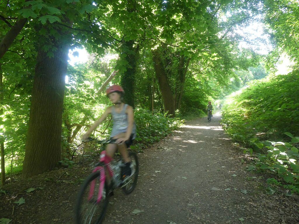
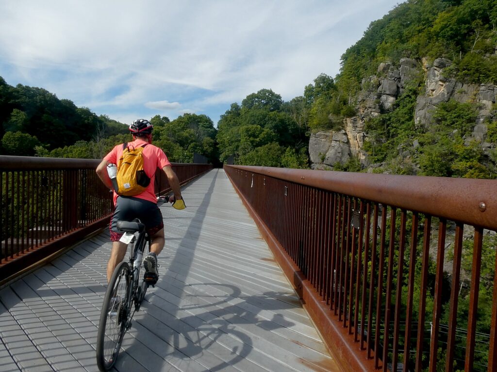
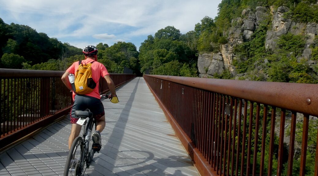
Biking over the Rosendale Trestle, 150 feet above the Rondout Creek, on the Wallkill Valley Rail Trail, part of the New York Empire State Trail © Karen Rubin/goingplacesfarandnear.com

by Karen Rubin, Dave E. Leiberman, Laini Miranda
Travel Features Syndicate, goingplacesfarandnear.com

The ambitious New York Empire State Trail is taking shape, linking and connecting and improving existing trails for a 750-mile network that will enable bikers, hikers, recreational users go from New York City to the Canadian border, and from Buffalo to Albany. And it seems like it is on track for completion by the end of the year, when it would become the longest multi-use state trail in the nation.

We headed out to one of the trails, Wallkill Valley Rail Trail, newly incorporated in the Empire State Trail, with signage and improvements (new trestles, bridges, widened paths, improved drainage), from New Paltz, which itself is a hub for some marvelous multi-use trails that collectively form the Hudson Valley Greenway Trail (www.ny.gov/empire-state-trail/routes-empire-state-trail).

It was pure delight. The linear trail through forests, beside and over creeks, passed dramatic rock formations, is 22 miles long (so 44 miles, out and back). Because of time limitations (and the fact the trail has some closures north of the Rosendale Trestle, midweek, for improvements that are expected to be completed in October, check the site), we only went seven miles north of the parking lot at Sojourner Truth Park in New Paltz, but can’t wait to return to do the rest, another 7 miles north to Kingston, and 7 miles south to Gardiner. The northern half of the trail, from New Paltz to Kingston, has been incorporated into the Empire State Trail, with new signs and improvements.
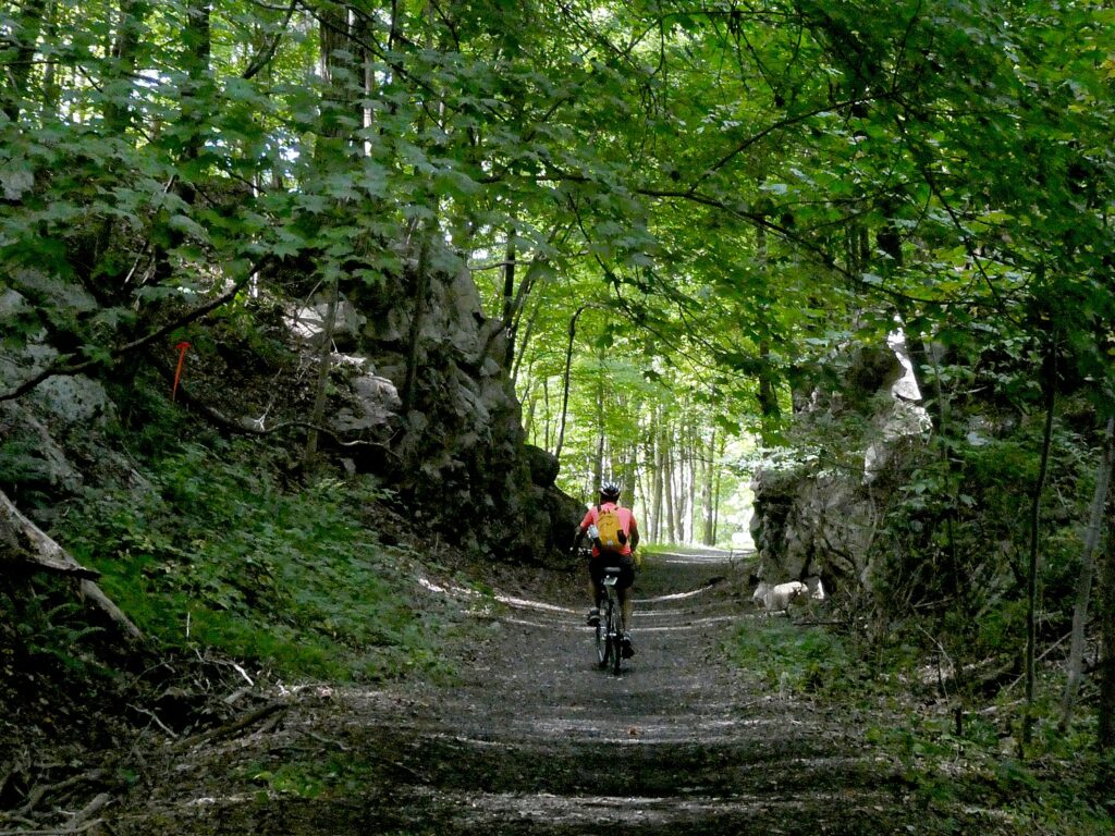
Biking the Wallkill Valley Rail Trail © Karen Rubin/goingplacesfarandnear.com

Shortly after the Wallkill Valley branch of the New York Railroad closed in the 1980s, the Wallkill Valley Land Trust purchased the12-mile stretch of the corridor between New Paltz, south to Gardiner, leading to the opening of the first stretch of trail in 1993. Today, the trail stretches a total of 24 miles and runs along its namesake river from Gardiner to Kingston.  In 2009, the northern section was purchased, extending the linear park 11.5 miles north from Rosendale through Ulster to Kingston, incorporating the dramatic Rosendale trestle, a 940-foot bridge across the Rondout Creek that provides one of the most thrilling parts of the ride. This portion of the trail, from New Paltz to Kingston, has been designated as part of the statewide Empire State Trail, which, when complete next year, will stretch 750 miles, running from New York City to Canada and from Albany to Buffalo. (info at Wallkillvalleylt.org,  845-255-2761).

The sights are marvelous, and the trail very pleasant.

We find our way from the New York Thruway to the Sojourner Truth Park along the river (where you can rent kayaks),  park the car and set off, north.

We soon come to a repurposed train station, now the Rail Trail Cafe, right on the trail.

About a mile north of the village, the trail crosses the Wallkill River on the Springtown Truss Bridge, featured in the movie “A Quiet Place” with magnificent views.  
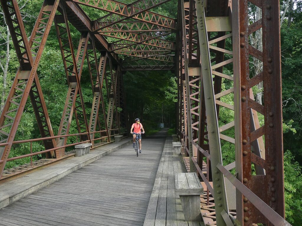
Biking over the Springtown Truss Bridge over the Wallkill River, featured in the movie “A Quiet Place” © Karen Rubin/goingplacesfarandnear.com

The trail passes besides orchards, organic farms, lakes, streams and the Wallkill River.

 In Rosendale, the most memorable feature of the trail can be found, the Rosendale Trestle. This 940-foot-long continuous truss bridge carries the trail 150-feet high over the Readout Creek, and spans both route 213 and the former Delaware and Hudson Canal.
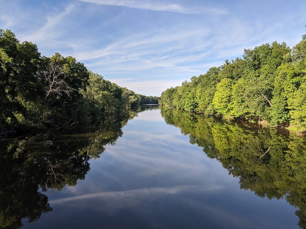
Gorgeous scenery off the Wallkill Valley Rail Trail © Karen Rubin/goingplacesfarandnear.com

We ride a little further north beyond the Rosendale Trestle, and come to the Binnewater Historic District where local quarries produced Rosendale cement. (I subsequently learn The Rosendale Cement Works near Limewater employed 5,000 workers and produced 4,000,000 barrels of cement a year at the peak of its activity at the turn of the century. Rosendale cement was used in the Brooklyn Bridge, the pedestal of the Statue of Liberty, the U.S. Treasury Building, as well as in many other structures around the country. The decline of the cementworks in this area is what accounts for the rail line being abandoned, and subsequently repurposed for the recreational trail. You can still see mines used to extract the cement,)
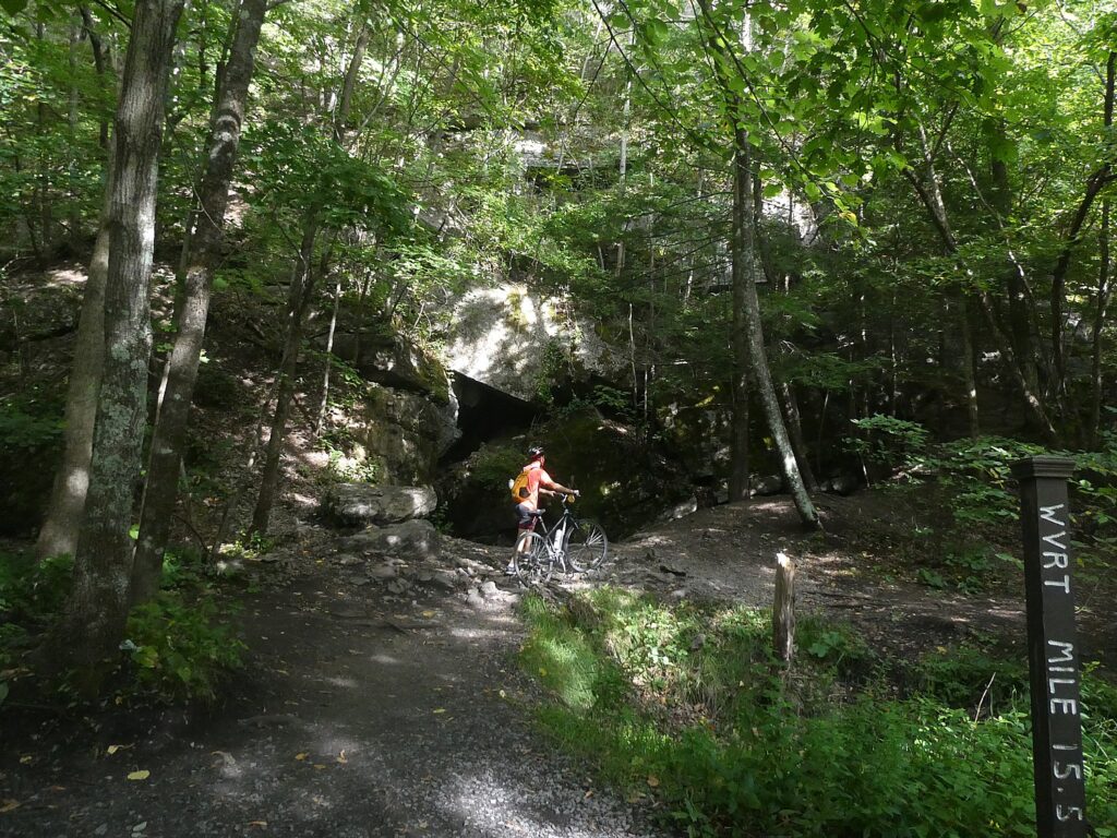
Interesting rock formations on the Wallkill Valley Rail Trail in the Binnewater Historic District where local quarries produced Rosendale cement © Karen Rubin/goingplacesfarandnear.com

Here, though, we see magnificent rock formations – what looks like a cave from which it feels as if air conditioning were flowing and we sit on a boulder to have a snack before turning back.

 Notes about the trail say that were we able to continue biking north, we would come to great views of Third Lake, Fourth Lake, and Fifth Lake before passing under Interstate 87 alongside Hickory Bush Road. The northernmost stretch of the trail runs through a scenic forested area before reaching its terminus at a parking area off of New York State Route 32 just south of Kingston. However, the City of Kingston and Ulster County are exploring options for extending the trail into the city. Meanwhile, the Empire State Trail is adding roadway enhancements to run the trail along roadways into the city, where it can connect with other projects currently underway, including the Kingston Point Rail Trail and the Ulster County Midtown Linear Park which runs out towards the O&W Rail Trail.

Riding back, we come to the Café in the Woods, set up for musical performances, where you can purchase food from what looks like a gypsy caravan, and an outdoor kitchen with a wood-burning stove.

Here is where we see Happy Trails Bike Rental (917-443-3600; call in advance) set up right on the trail, (you should call in advance to make sure he’s around). (There are a couple of bike rental shops in the area).
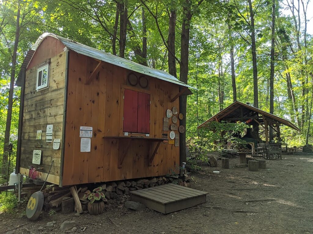
Café in the Woods on the Wallkill Valley Rail Trail © Karen Rubin/goingplacesfarandnear.com

It’s late afternoon by the time we ride back south to the Sojourner Truth Park, but if we had time, we would have wanted to complete the trail the further 7 miles to Gardiner.

The southern end of the Wallkill Valley Rail Trail is at Denniston Road in the Ulster County town of Gardiner. True to the corridor’s original use as a rail line, the trail is generally flat. However, especially at this southern end, the trail is unpaved and best suited in the summer for hikers or for bicycles with wider tires.  (www.traillink.com/trail-itinerary/wallkill-valley-rail-trail)

New Paltz Hub for Trails

New Paltz has become a regional hub for trails, with the Wallkill Valley Rail Trail running as the spine through the village. To the east, carrying the Empire State Trail up from New York City, is the Hudson Valley Rail Trail (which I have done in the past and found fantastic). This trail connects with the Walkway Over The Hudson’s western end in Highland – which has become one of New York State’s most popular attractions –  and as a part of the Empire State Trail’s investment, was recently extended from its previous terminus in the town of Lloyd all the way through to New Paltz where it connects with the Wallkill. Running west from New Paltz, a newly opened River-to-Ridge Trail  amidst the magnificent scenery of the Shawangunk Mountains.
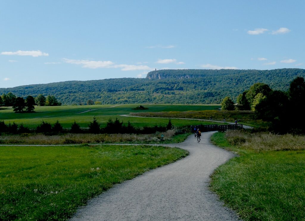
Biking the new River to Ridge Trail © Karen Rubin/goingplacesfarandnear.com

Indeed, the next weekend, we return to bike the River-to-Ridge Trail (www.openspaceinstitute.org/places/river-to-ridge-trail) which was created by the Open Space Institute in partnership with Mohonk Preserve (www.mohonkpreserve.org) with support of the Butler Conservation Fund and only opened in 2018. This is a surprisingly hilly, gravel trail, about six miles long, that runs from the Wallkill River up through newly protected lands adjacent to fields, to 90 miles of carriage road trails on the grounds of the Mohonk PreserveMohonk Mountain House, and Minnewaska State Park Preserve.

Developed and managed by the Open Space Institute, the trail is a scenic and recreational off-road loop. It meanders through farm fields and over gently rolling hills, connecting New Paltz directly to the Shawangunk Ridge and 90 miles of recreational carriage roads and trails at the Mohonk Preserve and the Minnewaska State Park Preserve (https://parks.ny.gov/parks/127); the Wallkill Valley Rail Trail; and the Empire State Trail.
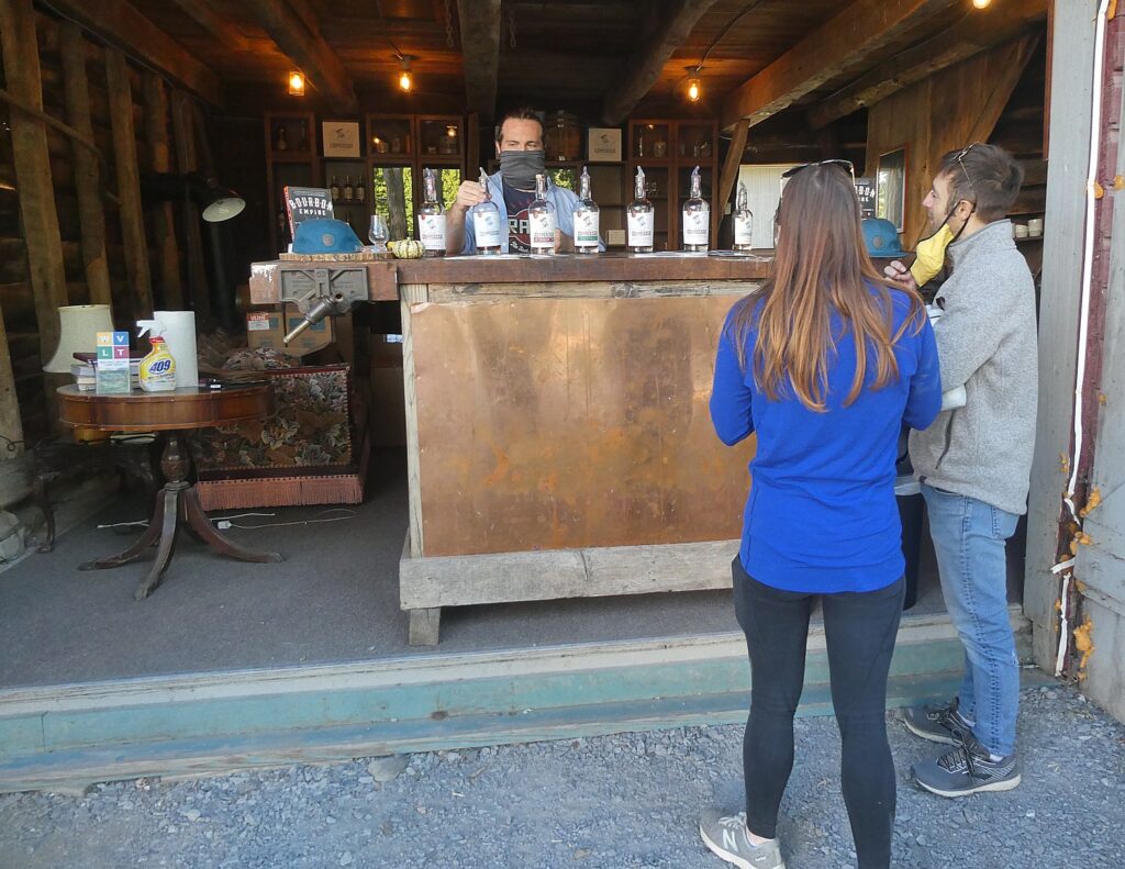
Just off the Wallkill Valley Rail Trail and up the road from the River to Ridge Trail is Coppersea Distillery © Karen Rubin/goingplacesfarandnear.com

There’s a bike rental set-up right by the parking lot on Springtown Road. Just up from the parking lot, on Springtown Road, we found you can visit Coppersea Distilling, where you can go for whiskey tasting, which turns out to be a stone’s throw from where we had biked the Wallkill Valley trail (239 Springtown Road, New Paltz, 845-444-1044, coppersea.com).

We also go for cider tasting, fruit picking, and have pizza, prepared in a wood-burning stove, enjoyed at an outdoor table (with strict COVID-19 protocols), rounding out a sensational day.

Empire State Trail

About 400 miles of the Empire State Trail network had already existed – the absolutely fantastic Erie Canalway, 326 miles from Buffalo to Albany (which we have done on the annual 8-day, 400-mile Parks & Trails NY Cycle the Erie supported biking/camping trip, ptny.org), during which you see unfurled before you 400-years of American history. Improvements to connect the Canalway have also been made.

Most notable is the work done to connect the trails on the north-south routes, from New York City (where you can ride the fabulous Hudson River Park), all the way up to Canada. This involved some 60 different construction projects, all engaging local stakeholders.

When the full 750 miles of continuous route is finished, The Empire State Trail will be the longest multi-use state trail in the nation. (see https://www.ny.gov/programs/empire-state-trail)
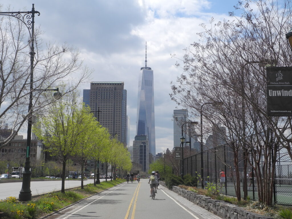
When the New York Empire State Trail is completed, it will be possible to bike from Hudson River Park in Manhattan, up to the Canada border © Karen Rubin/goingplacesfarandnear.com

The sections include:

Hudson Valley Greenway Trail

The Hudson River Valley Greenway segments start in New York City and run north to the Capital District:

LOWER HUDSON VALLEY

  • Hudson River Park
  • On-Road connection from Upper Manhattan to Van Cortlandt Park
  • South County Trailway
  • North County Trailway
  • Putnam Trailway
  • Beacon Rail Trail
  • Dutchess Rail Trail
  • Walkway Over the Hudson

UPPER HUDSON VALLEY

  • Hudson Valley Rail Trail
  • Wallkill Valley Rail Trail
  • Kingston Point Rail Trail and Promenade
  • On-Road North of Kingston to the City of Hudson
  • Albany-Hudson Electric Trail (AHET Trail)
  • Corning Preserve Trail
  • Mohawk Hudson Bike Hike Trail

Champlain Valley Trail

The Empire State Trail within the Champlain Valley goes from the Capital District to Whitehall, Wherever feasible, it is off-road along Champlain Canal towpaths. The 120- mile section from Whitehall to the Canada border at Rouses Point is on-road route primarily intended for bicyclists.

CHAMPLAIN VALLEY 

  • Champlain Canalway Trail
  • On-Road from Mechanicville to Stillwater
  • Path through Hudson Crossing Park
  • On-Road to Fort Edward
  • Champlain Canalway Trail
  • On-Road from Fort Ann to Plattsburgh
  • Terry Gordon Bike Path
  • Saranac River Trail
  • On-Road from Plattsburgh to Rouses Point / Canadian Border

Erie Canalway Trail

The Empire State Trail within the Erie Canalway include proposed new trail sections and link Buffalo to the Capital District.

WESTERN ERIE CANALWAY TRAIL

  • Buffalo Connection
  • Pendleton Connection
  • On-Road connection in Lyons
  • Shared Use Path from Lyons to Clyde
  • On-Road connection in Clyde
  • Shared Use Path from Clyde over Erie Canal
  • On-Road connection to Savannah
  • Savannah shared use path
  • On-Road connection to Port Byron trailhead
  • Honeywell Trail to Loop the Lake Trail
  • Onondaga Creekwalk 
  • On-Road Water Street Connection in Syracuse
  • Erie Boulevard

EASTERN ERIE CANALWAY TRAIL

  • Old Erie Canal State Park
  • Rome Connection
  • Utica – Schuyler
  • Ft. Herkimer Church – Lock 18
  • Lock 18 – Little Falls
  • Schuyler – Ilion
  • Ilion – Mohawk
  • Pattersonville Trail
  • Rotterdam Junction Connection

More information from Parks & Trails NY (ptny.org). (Next Cycle the Erie scheduled July 11-18, 2021).

Also, Rails to Trails Conservancy (railstotrails.org), Great American Rail-Trail, which would link up 3,700-miles of multi-use trails from Washington DC on the east coast to Washington State on the west coast (www.railstotrails.org/greatamericanrailtrail/vision).

______________________

© 2020 Travel Features Syndicate, a division of Workstyles, Inc. All rights reserved. Visit goingplacesfarandnear.com, www.huffingtonpost.com/author/karen-rubin, and travelwritersmagazine.com/TravelFeaturesSyndicate/. Blogging at goingplacesnearandfar.wordpress.com and moralcompasstravel.info. Send comments or questions to [email protected]. Tweet @TravelFeatures. ‘Like’ us at facebook.com/NewsPhotoFeatures
Driveable Adventures: Bike Tours Are Ideal Vacation Choice This Season

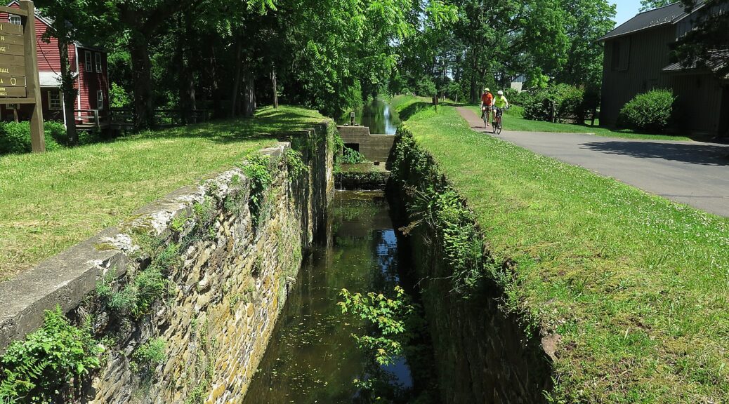
Biking the history-rich, scenic Delaware & Lehigh Trail (the D&L). Pocono Biking has a four-day, 142 mile guided inn-to-inn tour © Karen Rubin/goingplacesfarandnear.com

by Karen Rubin
Travel Features Syndicate, goingplacesfarandnear.com

Bike tours offer one of the best vacation alternatives in these times when people want to be outdoors in open spaces, and enjoy stunning landscapes, discover heritage and history and have that opportunity for shared experiences that travel uniquely provide. There is still time this season to take advantage of guided, self-guided and private bike tours from companies including Pocono Biking, Wilderness Voyageurs and Discovery Bicycle Tours.

Pocono Biking has space on departures this season on a supported four-day bike tour that takes you 142 miles of the Delaware & Lehigh rail trail, also known as D&L Trail.

I did this ride, anchored by the charming town of Jim Thorpe and the famous historic landmark at Washington Crossing, on the Rails-to-Trails Conservancy’s Sojourn, though with camping instead of inn-to-inn along this scenic and history-rich trail (railstotrails.org). The RTC trip also was operated by Pocono Biking, a powerhouse outdoors- adventure company in the area well known for its rafting adventures on the Lehigh River in the Lehigh Valley.

The trip, traveling through 57,600 acres (90 miles) of state park, is designed so you get to enjoy three of Pennsylvania’s award winning quaint small towns: Jim Thorpe, Bethlehem and New Hope. Essentially, we follow the route of Anthracite Coal, from mine to market, which thrust America into the Industrial Revolution. Along the way, we see the geography, the resources, and the technological innovations that made this possible, and how they affected the society, the culture, and the economy of the fledgling nation. The trail, part of the Delaware & Lehigh National Heritage Corridor, is so historically significant that it is a Smithsonian Institution Affiliate.

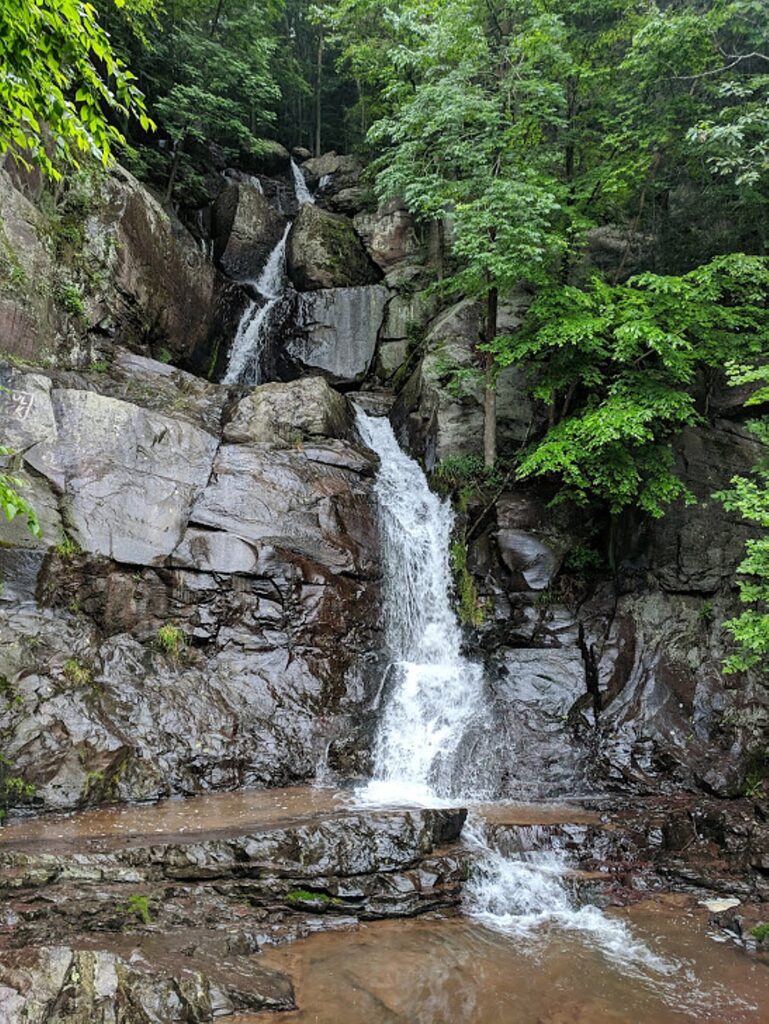
Buttermilk Falls, along the Delaware-Lehigh Trail, is a highlight of Day One’s ride through Lehigh Gorge State Park © Karen Rubin/ goingplacesfarandnear.com

Day 1 – 36 miles: The adventure starts in the wilderness of the Lehigh Gorge State Park, riding passed waterfalls and spotting wildlife (deer!), taking advantage of the newly connected D&L Rail Trail into the charming town of Jim Thorpe.  The first night is spent amid mountains in the Inn of Jim Thorpe, circa 1849.

A poster of Native American Olympian Jim Thorpe hangs in the Jim Thorpe Inn, in the town that was renamed for him © Karen Rubin/ goingplacesfarandnear.com

Jim Thorpe – an odd name for a town – was established in 1818 as Mauch Chunk, which means “Mountain of the Sleeping Bear,” the name the Lenni Lenape Indians gave to the nearby mountain. But it was later renamed for an Oklahoma-born Native American, the Olympic hero Jim Thorpe, who is buried there. Thorpe was born in Oklahoma in 1888 and raised on the Sac and Fox Reservation and had never set foot in the borough.  But Patsy Thorpe, Jim’s third wife, cut a deal with two struggling towns in Pennsylvania, that if they would merge, rename themselves Jim Thorpe and build a memorial to honor him, she would present them his remains for burial.

The town played a key role in the emergence of the United States as an Industrial Revolution powerhouse. Here, entrepreneurs led by Josiah White formed the Lehigh Coal & Navigation Company in the 1820s (you can still see the brick building), which shipped tons and tons of anthracite coal and other goods to market via the Lehigh and Delaware Canals which they constructed. The town grew in importance when it was named Carbon County’s seat in 1843.

Asa Packer Mansion in Jim Thorpe, PA © Karen Rubin/ goingplacesfarandnear.com

A major attraction here is the Packer Mansion, which I was lucky enough to visit on my trip. Asa Packer’s story epitomizes the rags-to-riches-for-those-with-grit-and-a-good-idea American Dream: Born poor in Mystic, Connecticut, Asa Packer (1805-1879) left home when he was 17, setting out on foot to Brooklyn, Pennsylvania where he apprenticed as a carpenter to his cousin, Edward Packer. In 1828, he married Sarah Minerva Blakslee (1807-1882) and the couple tilled a farm they rented from Sarah’s father.  But after four years, they were just as poor as when they started. So hearing that men were needed to captain coal barges on the Lehigh Canal, Asa traveled to Mauch Chunk, in the winter of 1832. He used his skill as a carpenter to build and repair canal boats. He resettled his family in Mauch Chunk and became the owner of a canal boat that carried coal to Philadelphia, then opened his own firm, A. & R. W. Packer, which built canal boats and locks for the Lehigh Coal & Navigation Company.  

He tried to get the company to build a railroad, but was refused. So, in October 1851, risking financial ruin, Packer purchased nearly all the controlling stock and interest for the unfinished Delaware, Lehigh, Schuylkill and Susquehanna Railroad (later known as the Lehigh Valley Railroad).  By November, 1852, he expanded the railroad from Mauch Chunk to Easton, Pennsylvania, in exchange for the company’s stocks and bonds, and later into New York State. 

He became the third richest person in the world and parlayed his business success into political success, serving as a Judge, a state representative, a two-term Congressman (1853-7), and even challenged Ulysses S. Grant for the Democratic presidential nomination in 1868. He narrowly lost election to become Pennsylvania’s Governor in 1869.

The Packers settled in their Italianate Villa in Mauch Chunk in 1861 and, to celebrate their 50th wedding anniversary, on January 23, 1878, held a fantastic gala (a newspaper printed in gold described it, and the man who performed their wedding attended). Asa died just 18 months later.

Biking the Delaware-Lehigh Trail © Karen Rubin/ goingplacesfarandnear.com

This quaint village is a hub for many marvelous attractions including the Packer Mansion; the Old Jail Museum (the eerie dungeon where the Molly McGuires were jailed; Cell 17 with its mysterious handprint on the wall, under the gallows on which seven of the accused Molly Maguires were put to death); the Lehigh Gorge Scenic Railway, St. Mark’s Church, Historic Stone Row, the Mauch Chunk Opera House, Anita Shapolsky Art Center, Mauch Chunk Museum, plus wineries and distilleries (Big Creek Vineyard and Stonekeep Meadery), biking, hiking and rafting.

Jim Thorpe Visitors Center, 2 Lehigh Ave., Jim Thorpe PA 18229, 570-325-3673, jimthorpe.org.

Day 2 – 37 miles:  After a night exploring the shops, museums and restaurants in Jim Thorpe and breakfast at the Inn, cycle beside the locks and canals along the Lehigh River to the town of Bethlehem, PA. Along the way you pass the Lehigh Gap Nature Center with its protected land. There are stunning views of the Blue Mountain and Appalachian Trail. Bethlehem, circa 1741, an old Moravian settlement, has cobblestone streets, quaint shops, and history around every bend.  Spend the night in the Hotel Bethlehem where Presidents and dignitaries have stayed.

Biking the Delaware-Lehigh Trail © Karen Rubin/ goingplacesfarandnear.com

Lehigh Gap Nature Center, a non-profit conservation organization at the foot of the Kittatinny Ridge, is dedicated to preserving wildlife and habitat through conservation programs such as the Lehigh Gap Wildlife Refuge, educational programs such as the Kittatiny Raptor Corridor Project as well as research. I linger in the butterfly garden before setting out again on the trail. (8844 Paint Mill Rd, Slatington, PA 18080, 610-760-8889, http://lgnc.org/)

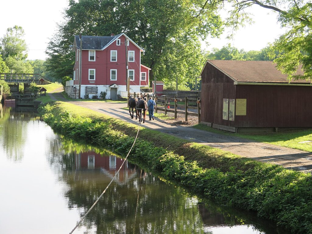
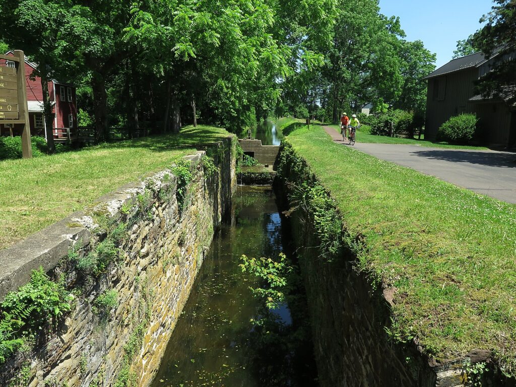
Along the way, we come upon what is left of the original canal locks – stone walls, wooden gates with metal latches and gears, remnants from the mid-1800s. 

Historic Freemansburg, on the Delaware-Lehigh Trail © Karen Rubin/ goingplacesfarandnear.com

At Freemansburg, we find a lockmasters house, the remains of the locks and a mill, which, when I visited, was manned by interpreters in period dress. I wonder whether the village was settled by freemen and am told that it was named for one of the original settlers, Richard Freeman.

Freemansburg is a classic example of a canal town with houses and structures built up against the waterway that was the village’s lifeblood in the 1800s. Members of the Old Freemansburg Association (OFA) reclaimed a 1.5 mile section of the Lehigh Canal the Borough owns from overgrowth and debris and restored the towpath which became the D&L Trail. The OFA spearheaded efforts to protect and restore the 1829 Locktender’s House, mule barn, Lock No. 44, gristmill, and coal yard. Volunteers also reconstructed the barn using canal era tools and equipment, a project that took 10 years to complete. The multi-functional building now hosts weddings, educational sessions and interpretative demonstrations. (http://lehighvalleyhistory.com/history-of-the-borough-of-freemansburg)

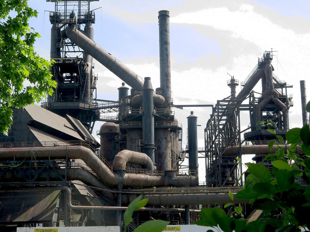
Riding on, we come to an island that consists of a shuttered steel mill that today stands somewhat surreally like an abstract sculpture.

Bethlehem, PA: A shuttered steel mill looks like abstract sculpture © Karen Rubin/ goingplacesfarandnear.com

Day 3 – 47 miles: After breakfast, the group departs Bethlehem and cycles south following the path of 19th century aqueducts to the confluence of the Lehigh and Delaware Rivers. Visit the only operating mule drawn canal boat east of the Mississippi. Tour the National Canal Museum and pass through quaint river villages, until arriving in New Hope. New Hope offers bustling nightlife and cultural attractions such as the Bucks County Playhouse.

Two mules pull the Josiah White II canal boat at the National Canal Museum in Hugh Moore Park © Karen Rubin/ goingplacesfarandnear.com

The Delaware & Lehigh National Heritage Corridor interprets this fascinating period of American history in the 520-acre Hugh Moore Park through tours of the National Canal Museum and rides on the 110-passenger Josiah White II canal boat. Here you see remnants of the oldest industrial park in the region, a Locktender’s House and one of only three mule-drawn canal boats still operating in America, which plies a two-mile section of the canal that has been restored. The National Canal Museum, with hands-on exhibits highlighting 19th century canal life and technology, normally is open from June until October. (https://canals.org/)

Day 4 – 22 miles:  On day four, after breakfast at the Fox and Hound Bed & Breakfast, ride along the canal trail to Washington Crossing where George Washington crossed the Delaware in 1776.  You also cross the Delaware to the D&R Canal State Park and head north to Bull’s Island where the ride ends with lunch before being shuttled back to your car. 

Washington Crossing Historic Park, 1112 River Road, Washington Crossing, PA 18977, 215-493-4076, www.WashingtonCrossingPark.org.

A bike tour, whether guided or self-guided, is an ideal vacation choice this season © Karen Rubin/ goingplacesfarandnear.com

Available dates at this writing include Sept. 14 and Oct. 5 (up to 14 guests per trip, with 2 guides; the minimum age is 13; e-bike rentals are available, but the trail is easy/moderate crushed gravel trail). The cost is $995 ($225 single supplement); $90 to rent a bike, and includes the overnight accommodations, professional bike guides; sag wagon; basic bike repair (replacement bike if needed to complete the ride); rest stops with snacks and water; breakfast on three days; lunch on two days; luggage transportation to each accommodation; morning trail briefings and transportation back to your car by 4pm on the final day.

If you would rather DIY, Pocono Biking also offers daily rates and shuttle service, Big Day Out & Big Night Out (Multisport Adventures), two-day trips, and Pocono Whitewater Rafting on the Lehigh River.

Pocono Biking, 7 Hazard Square, Jim Thorpe, PA, 570-325-8430, PoconoBiking.com.

Other bike tours available this season:

Wilderness Voyageurs, operating out of Ohiopyle, PA, is offering New York Erie Canal Bike Tour (4-days,Sept. 21); Great Allegheny Passage Bike Tour (4-days, Sept. 21, 28, Oct. 5), Easy Rider GAP Bike Tour (3-days,  Sept. 9).

Rails-to-Trails Conservancy’s Sojourn on the Great Allegheny Passage Rail Trail, operated by Wilderness Voyageurs © Karen Rubin/goingplacesfarandnear.com

Other upcoming tours: Michigan Islands, Trails & Dunes Bike Tour  (8/30); Cycle Colorful Colorado Bike Tour (9/13); Katy Trail Missouri Bike Tour (9/27, 10/18) and
Kentucky Bike & Bourbon Bike Tour (10/19).

“Bike touring lends itself to a vacationing style that uniquely fits these times: small groups and big open spaces! Although we understand that traveling at this moment is not for everyone and is a personal decision, our goal is to minimize the risks where possible and make traveling as comfortable as possible.”

Wilderness Voyageurs, 103 Garrett St., Ohiopyle, PA 15470, 800-272-4141, [email protected], Wilderness-Voyageurs.com

Discovery Tours is inviting biking enthusiasts to design their own tour: “Pick any of our U.S. locations — or suggest a new one — and we’ll customize an incredible biking vacation just for you.”

Groups of 8 or more get one tour free (or spread the savings across the group). Special pricing is available for groups of 4 or fewer.

Biking with Discovery Tours in Woodstock, Vermont © Karen Rubin/goingplacesfarandnear.com

The company, based in Woodstock, Vt., has already run private tours this summer on the Mickelson Trail and Black Hills in South Dakota, in Maine and in New York’s Finger Lakes.

For details, contact Scott ([email protected]), [email protected], 800-257-2226, discoverybicycletours.com.

Find more trails through Rails-to-Trails Conservancy, 2121 Ward Court, NW, Washington, DC 20037, 866-202-9788, railstotrails.org, TrailLink.com.

______________________

© 2020 Travel Features Syndicate, a division of Workstyles, Inc. All rights reserved. Visit goingplacesfarandnear.com, www.huffingtonpost.com/author/karen-rubin, and travelwritersmagazine.com/TravelFeaturesSyndicate/. Blogging at goingplacesnearandfar.wordpress.com and moralcompasstravel.info. Send comments or questions to [email protected]. Tweet @TravelFeatures. ‘Like’ us at facebook.com/NewsPhotoFeatures

NYS’s Newest Attraction: 3.6 Mile Biking/Walking Path Opens on Mario Cuomo Bridge over Hudson River

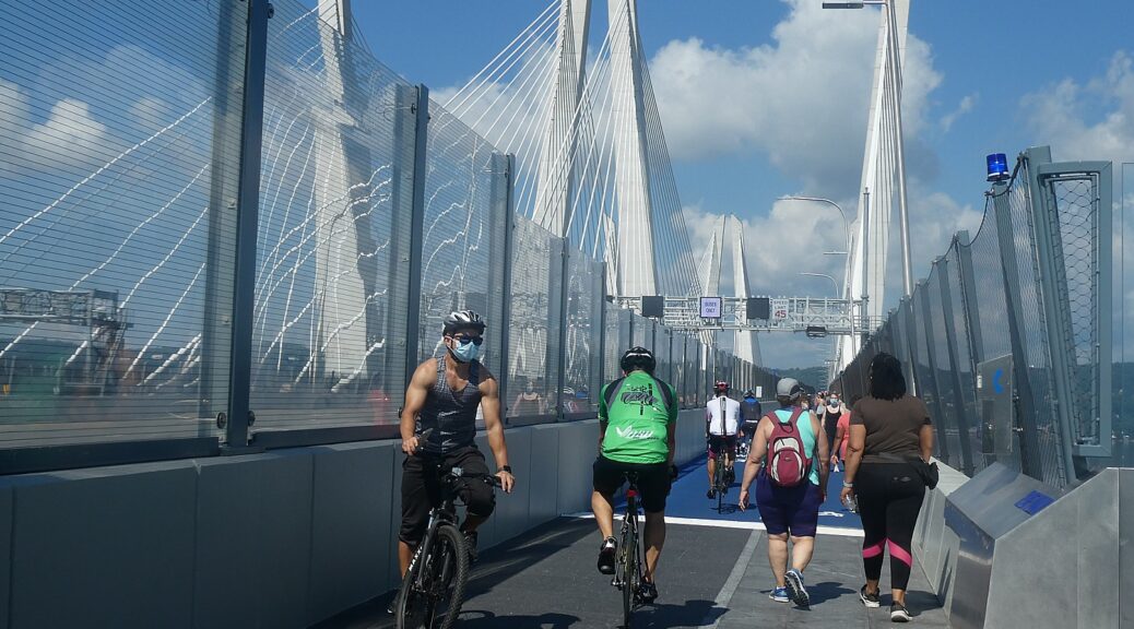
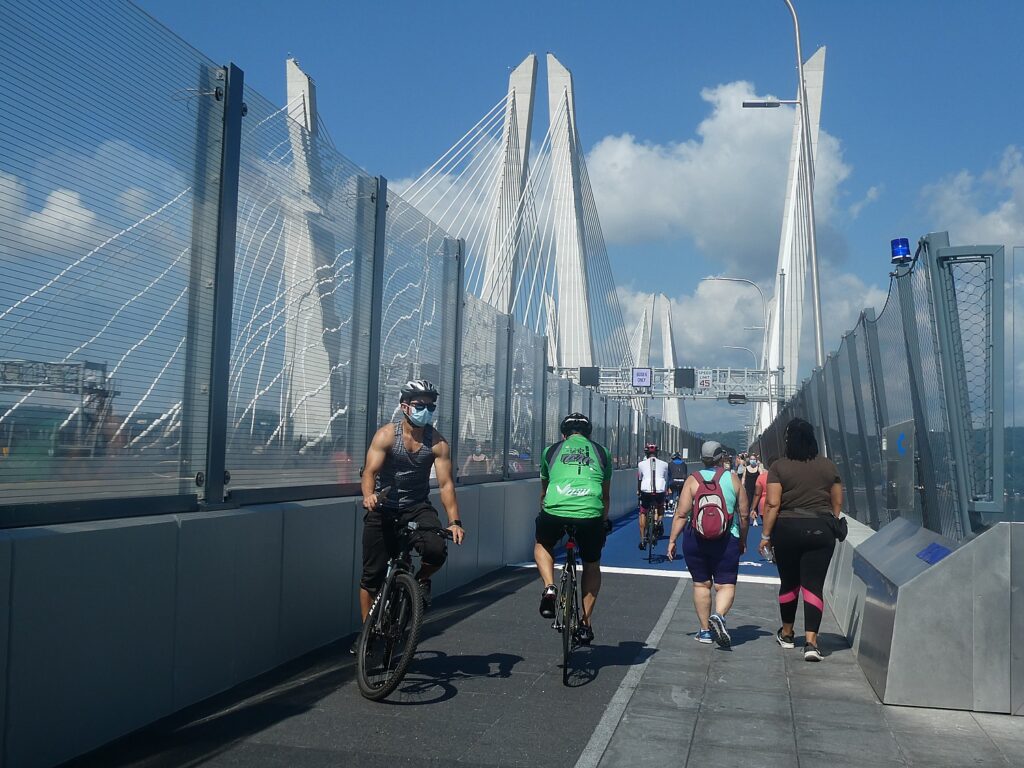
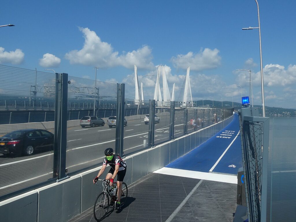
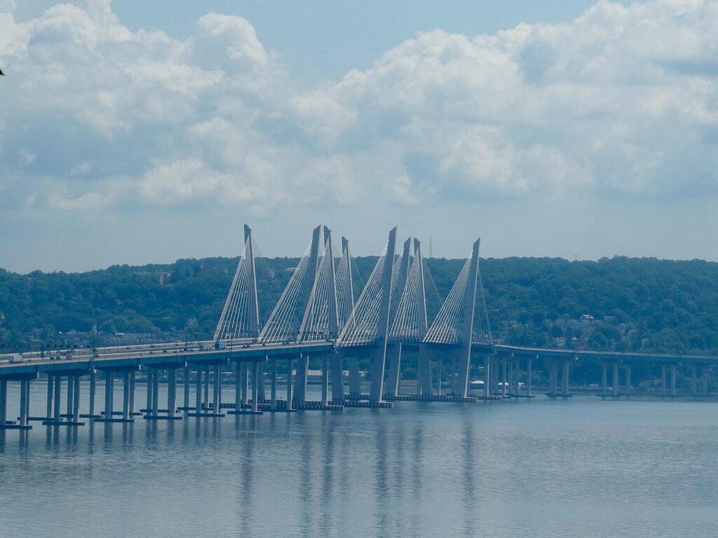
New York State’s newest attraction is the 3.6-mile shared bicycle and pedestrian path on the Governor Mario M. Cuomo Bridge (the rebuilt Tappan Zee Bridge), providing an environmentally friendly new connection for families, runners, cyclists, walkers and commuters to travel between Westchester and Rockland counties over the Hudson River. The path opened with safety protocols in place to limit the potential spread of COVID-19. © Karen Rubin/goingplacesfarandnear.com

By Karen Rubin
Travel Features Syndicate, goingplacesfarandnear.com

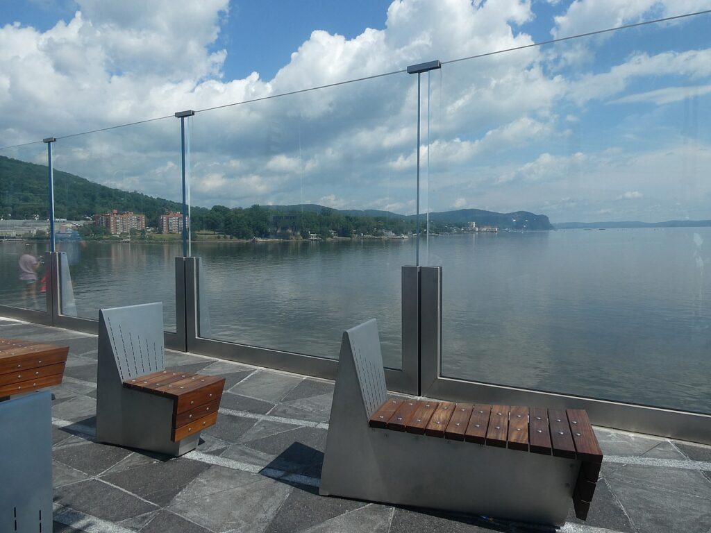
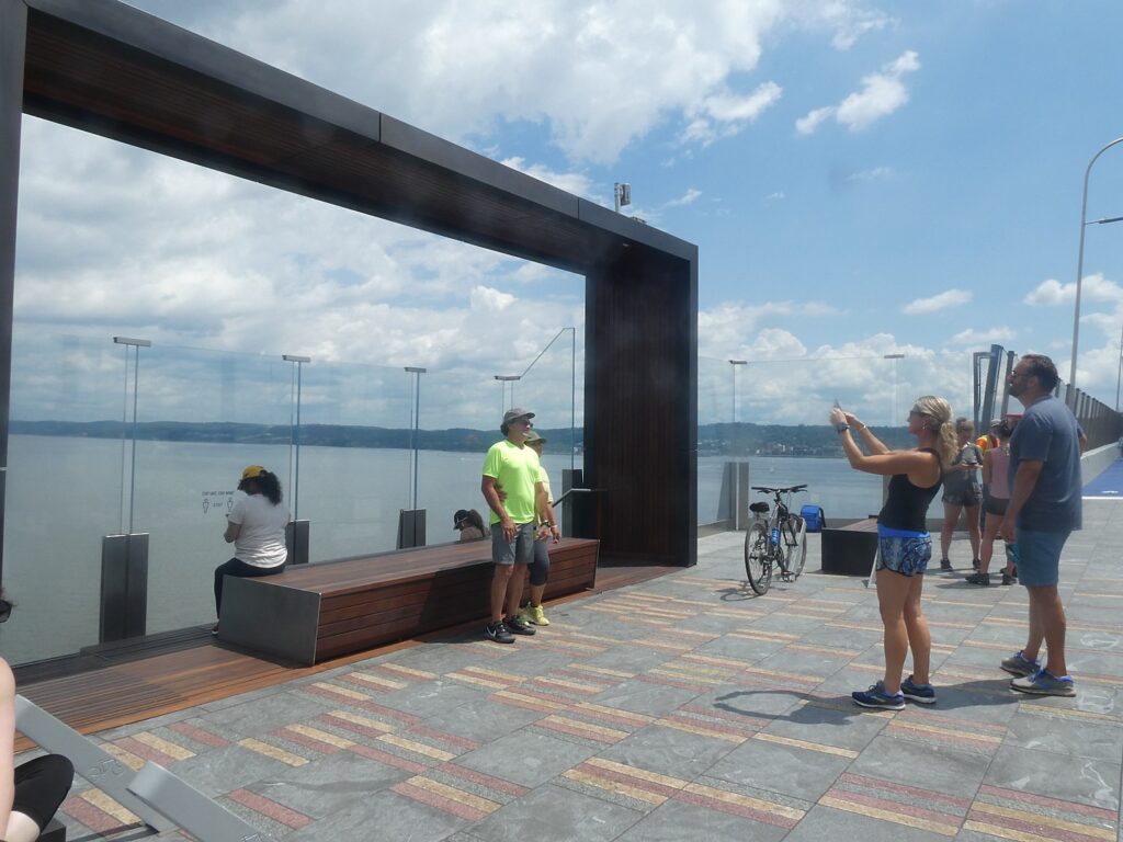
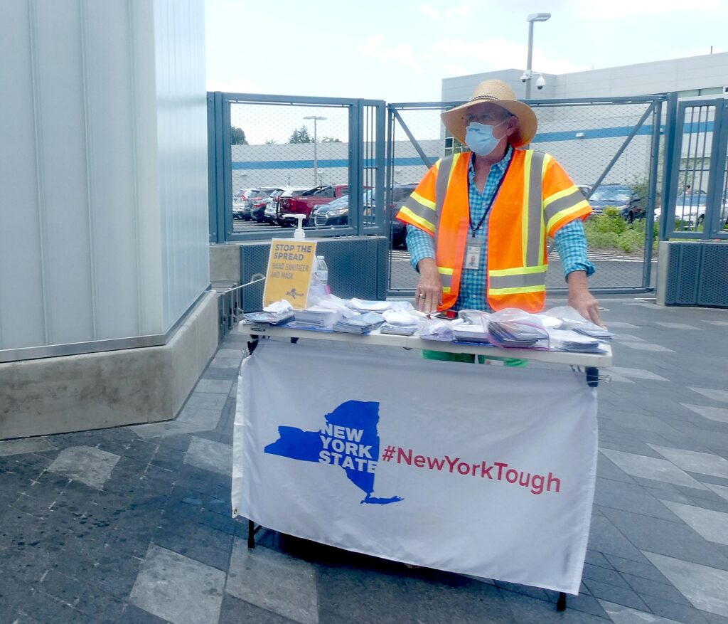
On only the second weekend since New York State Governor Andrew M. Cuomo cut the ribbon to open the 3.6-mile  shared bicycle and pedestrian path on the Governor Mario M. Cuomo Bridge (the rebuilt Tappan Zee Bridge, named for his father, a three-term governor), it was bustling – even hard to get a parking space at Westchester Landing. There is a perennial festive atmosphere  – a sense of delight – that starts at the gorgeous, welcoming visitor center (bathrooms, water fountain), the snack trucks (beer, ice cream, other delights), and even a bike rental stall. The path opened with safety protocols in place to limit the potential spread of COVID-19 – everyone is required to wear masks, there is a monitored stand where you can get one as well as hand sanitizer, and monitors along the path at these gorgeous viewing platforms, each one artfully designed.

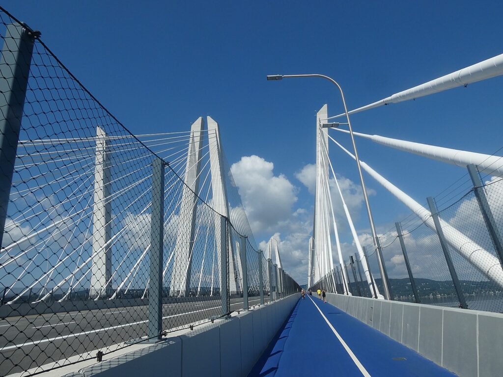
Biking the newly opened 3.6 mile path over the Governor Mario M. Cuomo Bridge © Karen Rubin/goingplacesfarandnear.com

The path provides an environmentally friendly new connection for families, runners, cyclists, walkers and commuters to travel between Westchester and Rockland counties. Even better, it sets what should be every municipality’s focus on providing opportunities for health and wellness (and happiness) –by walking or biking, but in any case, moving.

It takes approximately 80 minutes to walk the length of the path and approximately 20 minutes to bike across the path, so take that into account (especially with the four-hour limit on parking).

Magnificent viewing areas from the newly opened 3.6 mile path over the Governor Mario M. Cuomo Bridge © Karen Rubin/goingplacesfarandnear.com

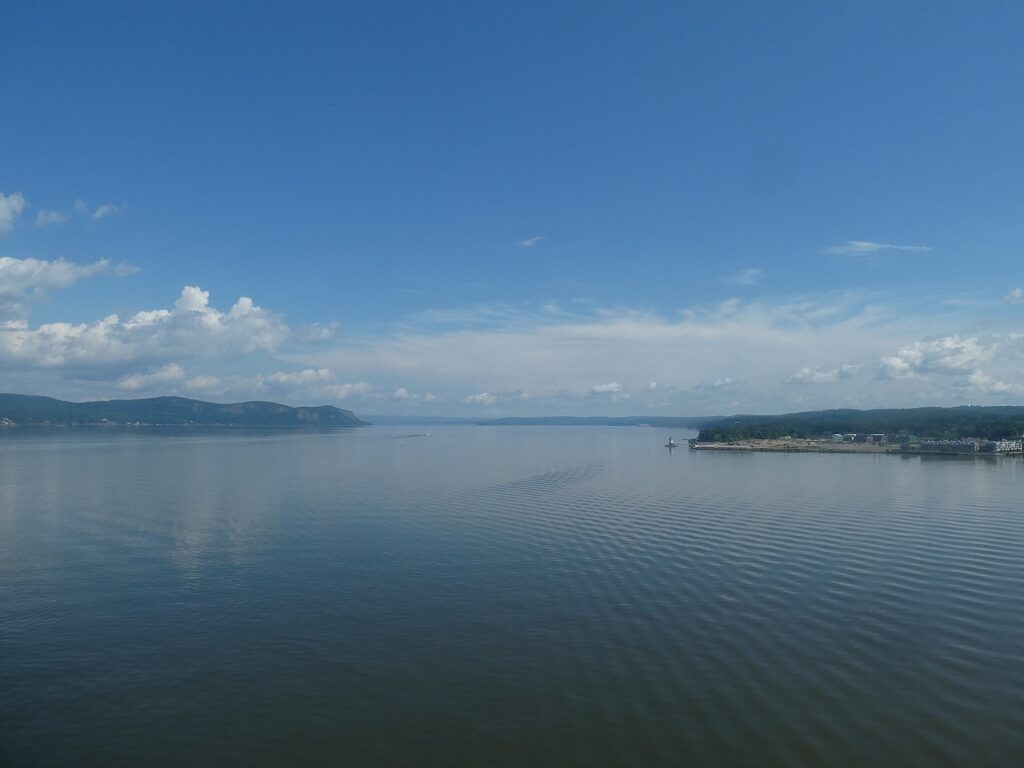
The bridge itself is magnificent (Golden Gate, eat your heart out), and the views absolutely gorgeous. But cyclists and hikers will love the fact that once you get over to the Rockland side, you can continue the ride or hike north on the Raymond G. Esposito Memorial Trail for just a mile (not that interesting), but really marvelous is to go south on the Old Erie Path, a three-mile gravel path along an old rail line that follows the ridge and opens to magnificent views of the bridge and Hudson River, and ends at an old train station at Piermont.

The Old Erie Path, a three-mile gravel path along an old rail line that follows the ridge and opens to magnificent views of the Mario M. Cuomo Bridge and Hudson River © Karen Rubin/goingplacesfarandnear.com

“The new Governor Mario M. Cuomo Bridge is an iconic gateway to the Hudson Valley and a statewide landmark that celebrates the spirit of New York,” Governor Cuomo said. ”The addition of this state-of-the-art bike and pedestrian path will provide New Yorkers and tourists alike with more ways to cross the river, as well as updated amenities and a unique, interactive experience to enjoy while taking in the scenic views of the Hudson River Valley.”

Magnificent, artful viewing areas from the newly opened 3.6 mile path over the Governor Mario M. Cuomo Bridge © Karen Rubin/goingplacesfarandnear.com

With its signature blue overlay, the 12-foot wide shared use path extends from its Westchester Landing in the Village of Tarrytown, across one of the widest points of the Hudson River, to its Rockland Landing in the Village of South Nyack. Located on the northern side of the Governor Mario M. Cuomo Bridge’s westbound span, the path features six scenic overlooks, digital kiosks, interpretive signage and public art. Visitor parking, restrooms, bicycle repair stations and other amenities, along with connectivity to local bicycle and pedestrian networks, are available at both landings. 

The shared use path is open daily from 6 a.m. to 10 p.m. The path may temporarily close due to inclement weather, maintenance operations or security concerns. Updates and path information will be available at the bridge’s new website, mariomcuomobridge.ny.gov, and on its new Twitter account, @GMMCB.

The shared use path was part of the Thruway Authority’s $3.9 billion project to build the new Governor Mario M. Cuomo Bridge, which replaced the Tappan Zee Bridge in 2017. The cable-stayed crossing has been built to serve the Hudson Valley without major maintenance for at least a century. Approximately 50 million vehicles cross the bridge annually. 

“The opening of the Governor Mario M. Cuomo Bridge bicycle and pedestrian path is the culmination of a transformative public infrastructure project, one of the largest in the United States,” Project Director Jamey Barbas said. “Under the leadership of Governor Cuomo, the hundreds of laborers and engineers who have worked on this project have been committed from the start to providing transportation improvements, from wider lanes and emergency shoulders to dedicated space for buses and now a 3.6-mile shared use path. The path is not only functional, it is beautiful, and we thank all our community partners who made this bridge a reality.”

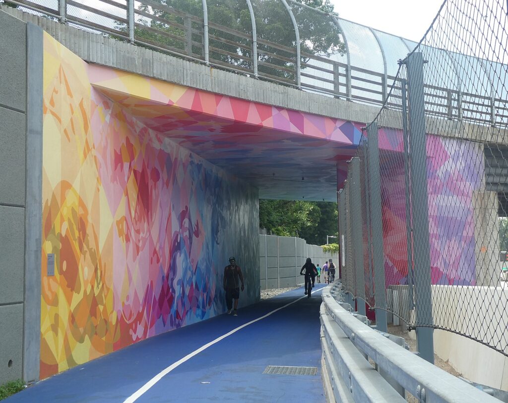
A lovely mural greets you as you enter the path over the Governor Mario M. Cuomo Bridge from the Rockland side © Karen Rubin/goingplacesfarandnear.com

As magnificent as the views up the Hudson River are, the art and design along the way add to the aesthetic experience. You encounter five sculptures, a 4,000-square-foot mural at the entrance in Rockland and a custom-designed bike rack referencing the Palisades and New York City skyline. Three of the sculptures incorporate remnant steel salvaged from the decommissioned Tappan Zee Bridge. Three more bicycle racks allude to the historic importance of the Hudson River as a commercial transportation artery. The viewing areas are works of art, themselves, and the people taking in the scenery almost become part of the canvas.

The Thruway Authority partnered with ArtsWestchester and the Arts Council of Rockland on the Governor Mario M. Cuomo Bridge Public Art Program. The 10 commissions were awarded to eight New York State artists. (Details about each art commission is available on the bridge website.)

“A spectacular group of monumental works of art have been installed at each terminus of the new bridge, transforming this twin crossing into a compelling destination for travelers to engage with the arts,” ArtsWestchester CEO Janet T. Langsam said. “We at ArtsWestchester were thrilled to collaborate with the New York State Thruway Authority on this landmark creative placemaking project. With the expansion of COVID19 outdoor recreation guidelines, the new bridge over the mighty Hudson is a visionary place for people to enjoy public art on their way to and from the Hudson Valley. The artwork is free, its public, and available to all New Yorkers.“

Magnificent, artful viewing areas from the newly opened 3.6 mile path over the Governor Mario M. Cuomo Bridge © Karen Rubin/goingplacesfarandnear.com

There are also free audio tours specially designed for walkers and cyclists available for download. The mobile tours include stories that cover a wide range of topics from information about bridge construction to local history, from the Hudson Valley’s connection to art to the Hudson River and its surroundings. Travelers can safely access the stories hands-free on their mobile devices while walking or cycling the path.

The New York State Thruway Authority partnered with Historic Hudson River Towns (HHRT), a non-profit consortium of riverfront municipalities, and TravelStorys to develop the audio tours. The New NY Bridge Community Benefits Program awarded Historic Hudson River Towns a grant for the project. In addition to the path tours, HHRT offers a new driving tour includes featuring its 16 member communities in Westchester and Rockland, as well as on both the new Governor Mario M. Cuomo Bridge and the Bear Mountain Bridge.

Other upcoming HHRT tours on the TravelStorys app include walking tours of Irvington, Tarrytown, Sleepy Hollow and Nyack, and artist Edward Hopper’s Nyack. Download the TravelStorys app for free to listen to the self-guided path tours.

Masks and sanitizer at the entrance to the Mario M. Cuomo Bridge path show #NewYorkTough (c) Karen Rubin/goingplacesfarandnear.com

Hudson Link, the enhanced bus service sponsored by the New York State Department of Transportation serving the Interstate 87/287 corridor, provides free shuttle service from large commuter parking lots in Rockland and Westchester to stop near the path’s landings in Tarrytown and South Nyack. The Hudson Link path shuttle regular weekend summer schedule operates from 7:30 a.m. to 7:30 p.m. each Friday, Saturday and Sunday.

There is a four-hour time limit in the parking lots at the path, and visitors are strongly encouraged to take shuttles and other mass transit to the path. The state-of-the-art path shuttles will leave every 20 minutes from Palisades Center. A map, schedule and details are available on Hudson Link’s website.

Safety features along the path over the Governor Mario M. Cuomo Bridge from the Rockland side © Karen Rubin/goingplacesfarandnear.com

As part of its COVID-19 response, Hudson Link has taken the following precautions:

  • Maximum occupancy per bus is 25 customers.
  • All passengers are required to wear face masks.
  • All passengers are asked to sit six feet away from each other while on the bus.
  • Hand sanitizing units are installed on all Hudson Link buses.
  • All operators wear face masks, gloves and use hand sanitizer.
  • CDC approved industrial sanitizers are used nightly to clean each bus.

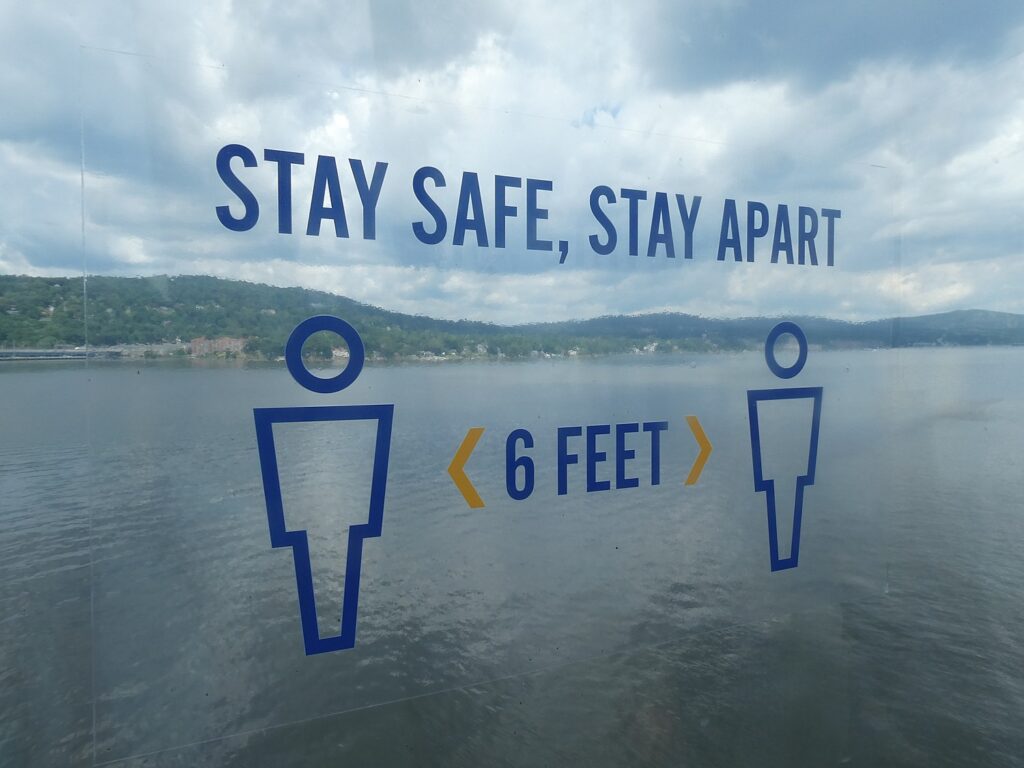
To ensure the safety of all using the new shared use path, visitors should keep six feet apart from others. When social distancing cannot be maintained, visitors are asked to wear a face covering on the path and in the restrooms. Physical and digital signs have been posted to remind visitors of their shared responsibilities during the COVID-19 pandemic.

New York State Police Troop T is the law enforcement entity responsible for patrolling the path while a dedicated security team will actively monitor it and the entire bridge 24 hours/day, 365 days/year.

New York State’s newest attraction is the 3.6-mile shared bicycle and pedestrian path on the Governor Mario M. Cuomo Bridge (the rebuilt Tappan Zee Bridge), providing an environmentally friendly new connection for families, runners, cyclists, walkers and commuters to travel between Westchester and Rockland counties over the Hudson River. The path opened with safety protocols in place to limit the potential spread of COVID-19. © Karen Rubin/goingplacesfarandnear.com

The path features designated lanes for pedestrians and cyclists traveling in both directions to ensure safety. There is a 15-mph speed limit for all cyclists. Per a new state law, Class 1 and Class 2 bicycles with electric assist (e-bikes) may be used on the path by those 16 years of age and older. All cyclists must yield to pedestrians.

When visiting the path, keep the following in mind:

  • It takes approximately 80 minutes to walk the length of the path; factor in your return trip.
  • It takes approximately 20 minutes to bike across the path.
  • Wind, rain, sun, temperatures all feel more intense out over the water; dress accordingly.
  • Restrooms are in the Welcome Centers at both landings.
  • Water fountains are available at both landings, not on the path itself.
  • You may feel the bridge vibrate; this is normal.
  • If you need assistance, use the blue light phones along the path.

As part of a Thruway Authority pilot program, local merchants offer food and services at both landings.

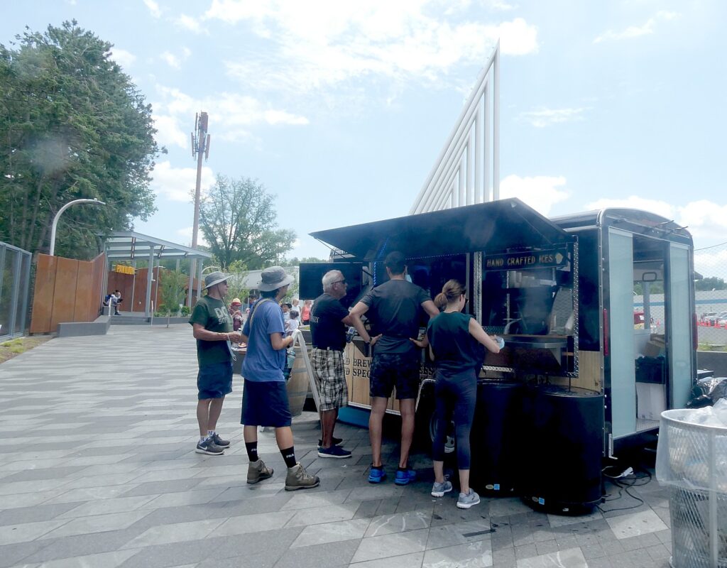
One of the food trucks at Westchester Landing on the Mario M. Cuomo Bridge path © Karen Rubin/goingplacesfarandnear.com
 

Three food trucks – Anthi’s Greek Specialties, Westchester Burger Company and Graziella’s Italian Kitchen – serve both the Westchester and Rockland landings on a rotating basis, seven days a week, from 11 a.m. to 8 p.m.

At the Westchester Landing, Double Barrel Roasters serve hot and cold coffee, specialty drinks and scooped ices daily from 8 a.m. to 9 p.m. The Blue Pig, which sells locally sourced ice cream, operates from 2 p.m. to 9 p.m., Friday to Sunday, while Sleek E-Bikes offers electric bike rentals from 10 a.m. to 6 p.m. during the summer.

At the Rockland Landing, Teagevity offers organic tea and cold-brewed coffee from 9 a.m. to dusk, Thursdays to Sundays.

The Old Erie Path, a three-mile gravel path along an old rail line that follows the ridge and opens to magnificent views of the Mario M. Cuomo Bridge and Hudson River © Karen Rubin/goingplacesfarandnear.com
 

The Governor Mario Cuomo Bridge was the most ambitious infrastructure project undertaken in the United States in a decade, and Governor Andrew Cuomo equated the accomplishment to the state’s success in tackling the coronavirus pandemic which turned New York State into the global epicenter. But in 100 days, the state that had had the highest infection rate, has become the state with the lowest infection rate.

“The Mario Cuomo Bridge – nearly two years ago we celebrated the opening,” Cuomo said at the ribbon cutting for the new bike path. “The largest infrastructure project in the United States in the past 10 years. Think about that. Nowhere else in the nation did they even attempt a project this big, why? Because it’s intimidating. It’s intimidating. You’re going to build a new bridge across the Hudson River? Government? Government can’t put two bricks together; you think you’re going to build a bridge? Yes. Yes, we can do it. We can do it. That’s what we said with this bridge today.

“We’re going to open the 3.6-mile-long path for cyclists and pedestrians. You can come across the Hudson River which is spectacular in and of itself. From this bridge you look south you can see New York City; you look north you- one of the most beautiful river valleys on the globe. 3.6 miles and you’re over one of the most beautiful bridges in the United States of America…The bridge speaks to a sense of possibility, a sense of capacity— when people are wondering, ‘can we do this? Can we rise to the challenge? Are we capable of it? Can we do these big things?’

“And the bridge said, ‘yes we can,’ after 20 years of people questioning and doubting and being afraid. The bridge took on the challenge and defeated the challenge. It showed what we were capable of.”

______________________

© 2020 Travel Features Syndicate, a division of Workstyles, Inc. All rights reserved. Visit goingplacesfarandnear.com, www.huffingtonpost.com/author/karen-rubin, and travelwritersmagazine.com/TravelFeaturesSyndicate/. Blogging at goingplacesnearandfar.wordpress.com and moralcompasstravel.info. Send comments or questions to [email protected]. Tweet @TravelFeatures. ‘Like’ us at facebook.com/NewsPhotoFeatures
Travel in a Time of Pandemic: Tour Operators Tread Uncharted Territory

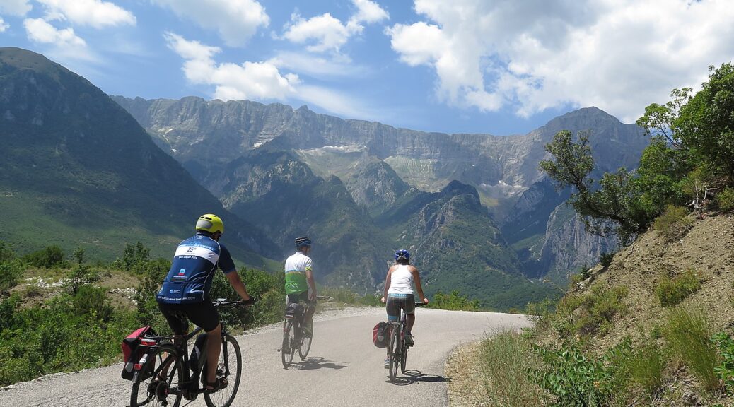
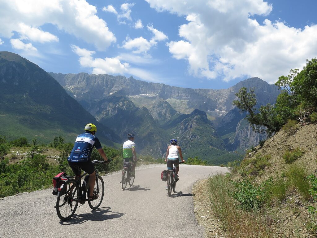
Biking in Albania with Biketours.com President Jim Johnson: “Bike touring is simply our chosen mode of world diplomacy. We believe travel brings us all closer together, fosters understanding and growth, and makes the world a better place. We’re also keenly aware of the positive economic impact tourism has on so many places.” © Karen Rubin/goingplacesfarandnear.com

by Karen Rubin, Travel Features Syndicate, goingplacesfarandnear.com

With travel all but shut down, tour operators are doing their best to keep travelers engaged and protected.

Tour operators are the facet of the global travel industry – which accounts for 10.4 percent of the total GDP worldwide and one out of every 10 jobs – most impacted by the coronavirus pandemic that has brought travel to a standstill and the least resilient. These tend to be small businesses operating on tiny profit margins. And like restaurants which are looking to supporters to purchase gift cards for future visits in order to stay afloat, many tour operators which are juggling booked clients’ trips, are taking reservations for future travel, offering incentives and waiving cancellation penalties, reissue and change fees if destinations become impacted.

“We haven’t been here before,” writes Gabriella Ribeiro, CEO of Explorateur Journeys, a Virtuoso agency that specializes in planning immersive travel itineraries. “Yes, we have seen health challenges in the world such as H1N1 and Ebola and we have weathered them but COVID-19 seems more challenging, more widespread and overall, entirely more concerning to everyone in the world and understandably so. It’s a new time, a new world, a new place, a new destination and just like any new location we find ourselves in, we all need time to explore it and get used to it temporarily.”

Explorateur is representative of travel advisors and tour companies who are constantly restructuring programs and accommodating guests who may already have booked or are looking to book.

“We are inundated with information that changes by the hour and we are doing our level best to keep our clients updated as frequently as possible in line with the world’s leading health organizations.

“The bottom line is that whatever you choose to do, we are here to support you. Changing your travel dates of your bookings with us, converting to new destinations that you may not have thought of for later in the year, or simply just opting to look at 2021. The world is big, bright, beautiful and will be ready for us all to return at our normal pace. In the meantime, we are here to help answer any of your questions and help share information if you’re still daydreaming about the days you can return to your normal Explorateurean pace. Here for you 24/7/365 at [email protected].”

Explorateur is enticing travelers to fulfill their wishlist of destinations to explore, taking advantage of booking incentives, flexible change policies. (http://explorateurjourneys.com/, .973-420-8343)

Pure Adventures president and founder Loren Siekman writes, “Clearly, this is a dynamic situation and the outlook changes daily. Therefore our first recommendation is to take a ‘watch and wait’ approach. While some of our destinations are currently unaffected, others like Italy are under travel advisories. If you have concerns about a trip you’ve booked, we remain hopeful that the efforts of public health officials and governments will bring the spread under control and restore order to a point where travel to affected destinations is once again responsible, relaxing, and fun.

To make the waiting easier, we have been working with our partners abroad to adopt a thirty-day advance notice rebooking and modified cancellation policy. Some airlines too are recognizing the wisdom of this approach and relaxing their rebooking fees. What this means simply is that you can watch and wait up to 30 days prior to the scheduled start of your trip to see if things are good to go as scheduled, or rebook your tour to start later in 2020 or 2021, with no fees. We can in some cases issue a full refund should you wish to cancel altogether.

Our primary hope is that you rebook your trip in the future. This shows support for the many small businesses that contribute to the operation of a trip, across many destinations, and that are adopting more flexible cancellation policies during this challenging time.

If you are considering travel this year and are holding off because of the current uncertainty, we are fortunate that our self-guided model gives us flexibility, so we can work on scheduling trips at the last minute once things clear up, and if you are rescheduling your trip that is already booked we can move it forward even if exact dates are unknown right now.

We are concerned of course for our travelers’ personal safety, but also for your experience of travel to a destination, and in that destination, as well as the return home. If you are to book now for some time in the near future, you have the option of getting added travel insurance, which is time-sensitive from the date of booking. We always recommend travel insurance to our guests, but for added cost and peace of mind, you can add the Cancel for Any Reason option offered by our partners at InsureMyTrip.

While we stay in close contact with our partners on the ground, we’d also like to recommend that people watch credible and reputable sources of information:

 The Center for Disease Control and Prevention offers Covid-19 travel updates by country and also has hygiene and prevention tips

The World Health Organization has daily situation reports

The United States Department of State offers travel advisories by country

“We’re travel experts, not doctors, so the best we can do is to help you make an informed decision, and give you the most flexibility we can for you to make a change if necessary. We have been at this for over 25 years and have been through Sept 11, the 2008 economic crisis, and other smaller events. This too shall pass, and we will be here to help you get out and experience the world!”

Pure Adventures offers cycling (including self-guided), hiking, multisport, foodie tours and the opportunity to build your own trip (https://pure-adventures.com/, 800-960-2221)

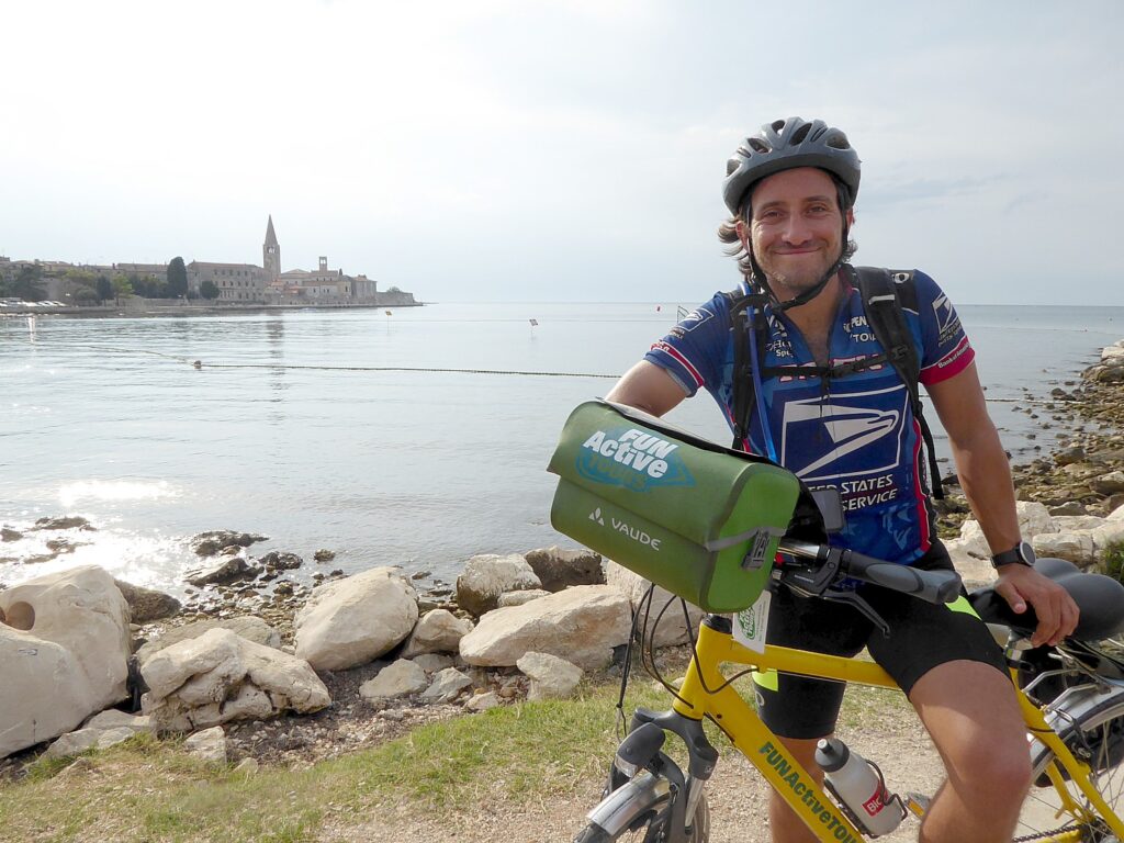
The satisfaction at arriving at the end of BikeTours.com’s eight-day Venice-Trieste-Istria self-guided bike tour in Porec, Croatia © Karen Rubin/goingplacesfarandnear.com

Jim Johnson, president of Biketours.com which brokers guided and self guided bike tours and bike/boat tours primarily in Europe, stated, that besides exercising caution, “we also want to encourage everyone to exercise patience. This is the seventh coronavirus to be identified since the 1960s, and we’re learning more about it every day. We’ve experienced similar situations before, such as SARS and MERS. We hope that this coronavirus is soon a distant memory, too.

“For those of you with pending travel plans, loved ones in distant places, or any other number of less-than-ideal scenarios, we empathize with you. The fear and discomfort of the unknown are unpleasant and stressful, to say the least.

“For those of you who have booked travel plans with us, know that as we continue to monitor the situation, we will advocate for you and keep you informed if your departure or destination is impacted. We want you to be confident and comfortable with your travel.

“Finally, bike touring is simply our chosen mode of world diplomacy. We believe travel brings us all closer together, fosters understanding and growth, and makes the world a better place. We’re also keenly aware of the positive economic impact tourism has on so many places. We’re hoping we don’t see destinations hit twice: first by the virus itself, second by devastating drops in tourism numbers.

“Thank you for being a traveler — an ambassador by bike, as we like to say — for seeing the big picture, and for being part of the BikeTours.com family. We hope that you are safe and healthy. And we hope to see you traveling soon (as soon as it makes sense for you!).” (biketours.com, 877-462-2423)

Butterfield & Robinson suspended all European scheduled small group departures with start dates before May 30.

“We’ve been closely monitoring the virus since it started, reacting to local developments with appropriate local responses in order to protect the safety of all our travelers,” Luc Robinson, President and CEO, writes. ”But now we need to go a step further. As a company, we believe that travel should enrich the soul not foster anxiety. Suspending these trips ensures this ideal continues for all of our travelers.

“Our team of travel advisors is currently getting in touch with everyone booked on impacted departures to review their options. You can transfer your booking to a scheduled small group departure later in the year or in 2021. If you would prefer to cancel outright, we will provide a full refund. Further, if you still do wish to travel, we can discuss options to do so privately – our team is ready to support you with your safety top of mind.

“If you are booked to travel privately before May 30th, the decision on how to proceed with your trip is yours. Your trip planner will be in touch with you shortly to discuss your options.

“As of now, we are planning to run trips beyond May 30th as usual. We will continue to closely monitor all travel advisories from the WHO and the CDC, as well as coordinate with our teams on the ground, and revise our plans as necessary. We’ll communicate any revisions on our website and by email.

“Butterfield & Robinson has weathered many crises since we started running trips in 1966. Through decades of experience, we’ve grown to understand that these global events are unavoidable. We are financially prepared, and we will get through this.

“To our dedicated travelers who share our passion for seeing the world, thank you for staying committed to taking the slow road with us. We truly look forward to helping you explore the world again soon. And to all our partners in the travel industry, thank you for rallying together in these tough times. With our communities we remain long-term, steadfastly optimistic.”

Butterfield & Robinson offer programs around the world including biking, walking, hiking, family, small ships, wine, active, safari, wellness, expeditions, self-guided (butterfield.com, 866-551-9090)

Western River Expeditions, which specializes in outdoor adventures – rafting, hiking – in Utah, so far is planning to continue to operate its programs this summer.

“At Western River Expeditions, there is nothing more important than the health and safety of our guests and staff. As an organization, we are continually monitoring developments to make the best decisions regarding our trip offerings and policies.  We are sensitive to the impacts the COVID-19 news is having on all facets of our lives, and want to reassure you that we are doing everything possible to prepare and to focus on your safety and welfare,” writes Brian Merrill, Chief Executive Officer.

“It is our goal to operate all trips scheduled for this season. At this time, when we are advised to avoid crowds and enclosed spaces, getting out into the backcountry may just be the perfect way to spend your vacation. As our clients, guests, friends, and family, you have our pledge that we will continue to do everything both prudent and possible to keep you safe and healthy while you enjoy the trip of a lifetime.”

Western River Expeditions is taking care to assure clients of measures to provide sanitary conditions:

“On our river trips, each of our guides holds a backcountry food handler certification. We have thorough and comprehensive sanitation practices. 

“In each camp, we set up two hand-washing stations.  One near the toilet facility and the other near the kitchen.  These stations allow a person to wash their hands without the need to touch any surfaces after the washing is completed.  It is our policy that no one may come to the meal table without having first washed their hands with soap and water followed by the use of hand sanitizer.

“Of course, due to this specific virus, we will be even more vigilant in our efforts to keep surfaces clean, require frequent hand-washing, and practice safe handling of food and anything else that has the potential to spread viruses.  In addition to our on-river sanitation protocols, all of our equipment is sanitized (including our boats) between trips.

“Our trips occur in remote, backcountry locations. This gives our trip two distinct advantages: 1. We operate in an “open air” environment.  Potential contaminants are more naturally dispersed.  2. We rarely interact closely with other groups. These factors give us great control over our immediate environment.”

If a guide or guest develops flu-like symptoms during a trip, per CDC guidelines, the individual will be kept away from the rest of the group, any suspected areas of contamination will be disinfected, and, where applicable, the individual will be evacuated as soon as possible.

If an official travel ban has been issued that does not allow you to travel to or from your point of origin, Western River Expeditions will allow you to use the full value of your non-refundable payments as a credit for a future trip. Credits may be applied to the same trip for any available departure through 2022. No refunds for any unused portion of credit will be given.Once an alternate trip is booked, it will be subject to standard cancellation policies.

As you weigh the possibility of future flight restrictions, you may also want to consider the option of driving to the starting point of your trip.

If Western chooses to cancel a launch due to any reason(s), including closure by a federal agency, governmental intervention, health department requirements, or the decision on our part, Western River will issue a full refund or allow you to use the full value of your non-refundable payments as a credit for a future trip. Credits may be applied to the same trip for any available departure through 2022. Once an alternate trip is booked, it will be subject to standard cancellation policies.

These policies will also apply to new reservations for the 2020 season. Check availability online. Purchasing travel insurance is recommended; you may wish to consider the “cancel for any reason” policy.

The 2020 season along with much of the 2021 season is currently sold out for Grand Canyon, but there is an online waitlist available (add your name to the 2020 waitlist here).

“Thank you for your support and trust. Western River Expeditions has been family owned and operated for 59 years. We consider our employees and our guests to be part of our extended family.  These are challenging circumstances, and like any family, we will endure this and any other challenge we face together.”

Western River Expeditions ([email protected], westernriver.com, 801-942-6669).

Discover France Adventures CEO Thomas Boutin writes, “The impact of the virus goes far beyond the persons infected by it. As you may know, some of the hardest hit industries are travel and hospitality. We are no exception.

“Many of you have been very understanding and rescheduled your trips, instead of canceling. This allows us to get through this period with minimal implications to the everyday lives of our team and partners. 

“As the situation changes frequently, we want to ensure that you can modify your travel plans accordingly. To this effect, special terms and conditions are applied until the end of June 2020. All you have to do is to get in touch with your dedicated tour consultant, and he/she will take care of the rest.

“Our self-guided tours give you the freedom to choose your departure date, without restrictions – our tour consultants will adapt the practical details to your needs. (Even for last minute bookings)”

Special terms until the end of June 2020:

Groups that re-schedule more than 30 days before the start date, get a travel credit of the full amount paid without any change fees. (normally there is a 200 euro per person fee for changes after a tour is confirmed)

Groups that re-schedule less than 30 days before the start date get a travel credit of the full amount paid minus hotel cancelation fees (if any).

The travel credit does not expire to give you the peace of mind to do your trip when you want.

“With these changes, our aim is let you keep your options open and see how the situation evolves.

“To make informed decisions about your travel, we advise you to follow reliable information from the World Health Organization, and official government travel advisory for your destination. 

“We do encourage you to remember the physical and mental benefits of cycling, as well as the joy of discovering new places. 

“Stay active and keep dreaming about cycling through exceptionally beautiful natural, historical and cultural regions!”

“While our regular season activities are on hold, other areas are moving ahead rapidly. Our teams are busy working on improving our offering and preparing the company for a comeback in due time.  

“Our tour planning team members, Valentine and Sebastien, have been busy on two main projects: Updating existing tours based on your feedback; Creating new tours that are available as soon as traveling is possible again. 

“Our tour consultants are staying in touch with all clients with travel impacted by travel restrictions. 

“While we are in exceptional times, we are still here for you, ready to answer any questions about travel.” (discoverfrance.com, 800-929-0152)

A source to find well-established tour operators is the United States Tour Operators Association (USTOA).Representing nearly $19 billion in revenue, the member companies provide tours, packages and custom arrangements that allow 9.8 million travelers annually unparalleled access, insider knowledge, peace-of-mind, value and freedom to enjoy destinations and experiences across the entire globe. Each member company has met the travel industry’s highest standards, including participation in the USTOA’s Travelers Assistance Program, which protects consumer payments up to $1 million if the company goes out of business. (ustoa.org).

_________________________

© 2020 Travel Features Syndicate, a division of Workstyles, Inc. All rights reserved. Visit goingplacesfarandnear.com, www.huffingtonpost.com/author/karen-rubin, and travelwritersmagazine.com/TravelFeaturesSyndicate/. Blogging at goingplacesnearandfar.wordpress.com and moralcompasstravel.info. Send comments or questions to [email protected]. Tweet @TravelFeatures. ‘Like’ us at facebook.com/NewsPhotoFeatures
Mount Rushmore, Finale to 6-Day Wilderness Voyageurs South Dakota ‘Badlands & Mickelson Trail’ Bike Tour

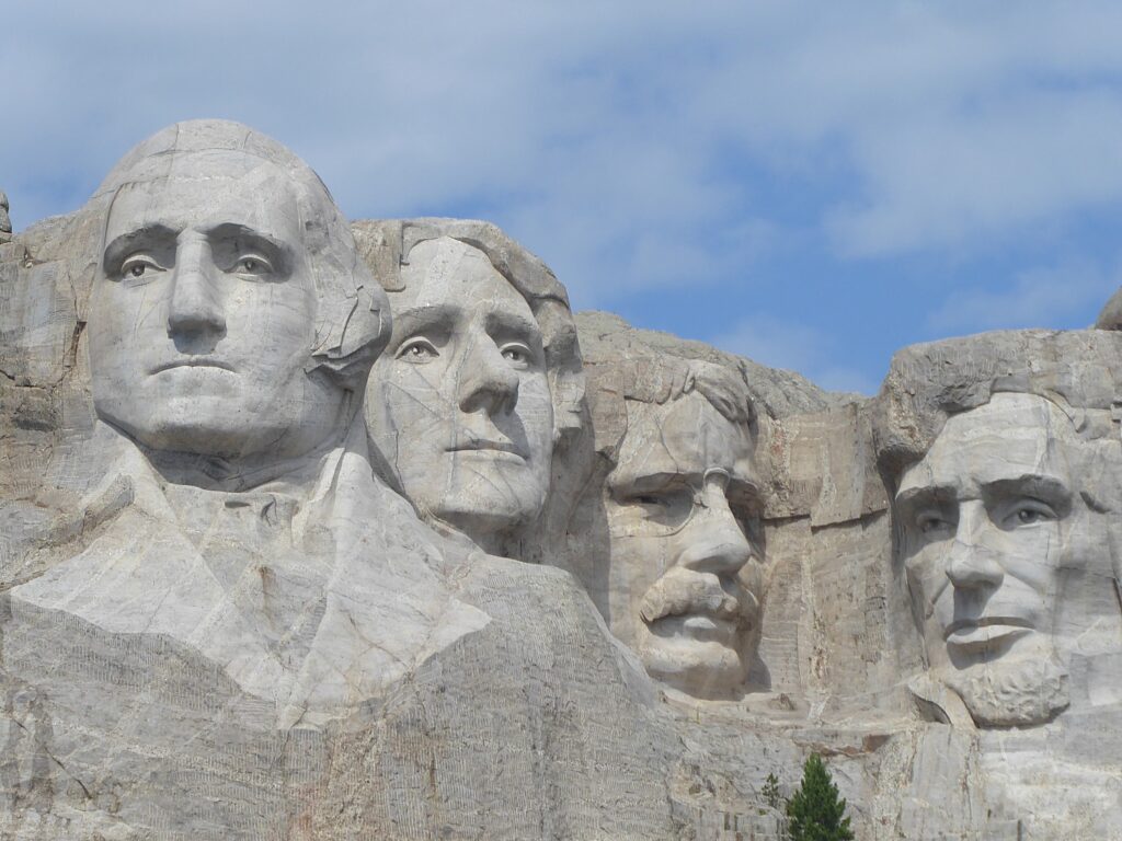
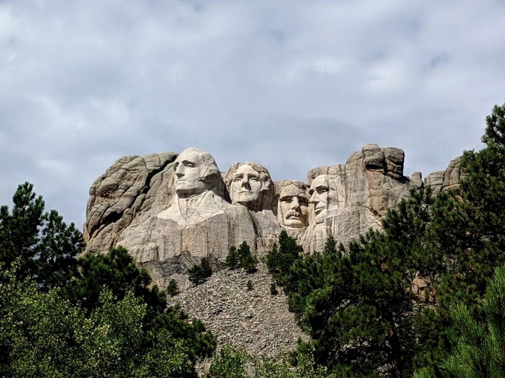
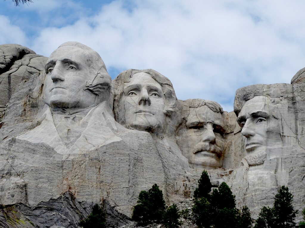
Sculptor Gutzon Borglum wrote of Mount Rushmore, “The purpose of the memorial is to communicate the founding, expansion, preservation, and unification of the United States with colossal statues of Washington, Jefferson, Lincoln, and Theodore Roosevelt.” © Karen Rubin/goingplacesfarandnear.com

by Karen Rubin, Travel Features Syndicate, goingplacesfarandnear.com

It’s our last day of the Wilderness Voyageurs six-day “Badlands and Mickelson Trail” bike tour of South Dakota, when we would have biked back a portion of the Mickelson Trail that we cycled yesterday before visiting Mount Rushmore. But as luck would have it (and it is actually lucky), it rains as we leave Deadwood. It is lucky because the rest of our rides have been glorious and we did get to complete the 109-mile long Mickelson Trail, in addition to riding through Badlands National Park and Custer State Park. Our guides, James Oerding and John Buehlhorn, offer us alternatives: instead of doing the Mickelson 18 miles from Dumont to Mystic (the same trail we did yesterday but downhill) we go directly to Mount Rushmore and see if the weather dries out.

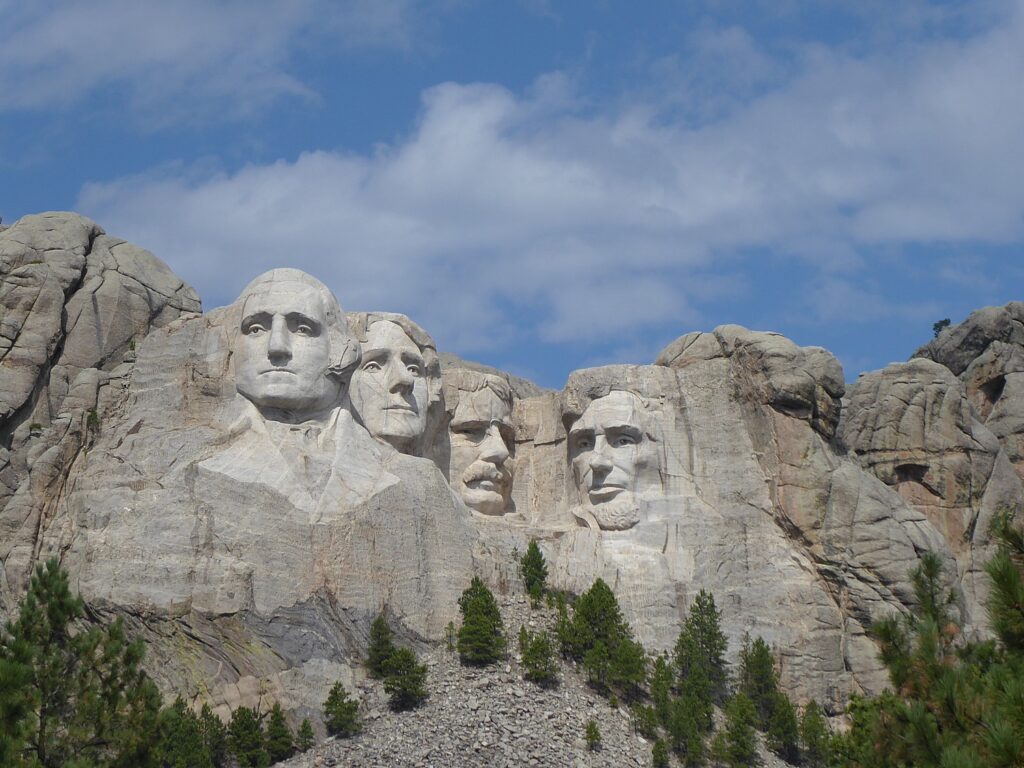
Mount Rushmore is such a familiar American icon, it may be a cliché. But seeing it “in person” makes you rethink what it is all about.

Mount Rushmore, South Dakota © Karen Rubin/goingplacesfarandnear.com

The sculptor, Gutzon Borglum, wrote “Let us place there, carved high, as close to heaven as we can, the words of our leaders, their faces, to show posterity what manner of men they were. Then breathe a prayer that these records will endure until the wind and the rain alone shall wear them away.”

Borglum also wrote, “The purpose of the memorial is to communicate the founding, expansion, preservation, and unification of the United States with colossal statues of Washington, Jefferson, Lincoln, and Theodore Roosevelt.”

The National Park Service offers this about Mount Rushmore National Monument: “Majestic figures of George Washington, Thomas Jefferson, Theodore Roosevelt and Abraham Lincoln, surrounded by the beauty of the Black Hills of South Dakota, tell the story of the birth, growth, development and preservation of this country. From the history of the first inhabitants to the diversity of America today, Mount Rushmore brings visitors face to face with the rich heritage we all share.”

Mount Rushmore, South Dakota © Karen Rubin/goingplacesfarandnear.com

The NPS posits that Borglum “selected these four presidents because from his perspective, they represented the most important events in the history of the United States. Would another artist at that time, or perhaps a modern artist choose differently? As you read more about Borglum’s choices, think about what you might have done if the decision was up to you.”

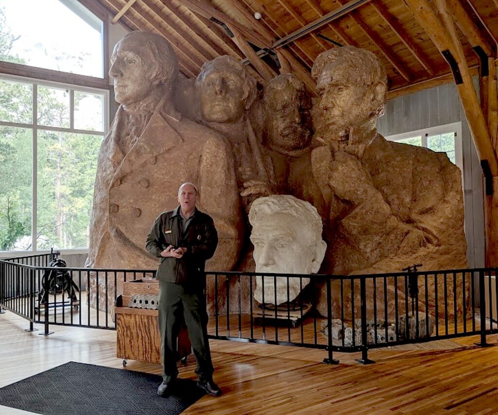
I stumble upon a 15-minute Ranger talk in the Sculptor’s Studio about Gutzon Borglum, the carving process and the lives of the workers – how they dynamited away 90 percent of the stone, leaving just 3 to 6 inches of material to chisel off by hand, how they hang a weight to where the nose should be and create the facial features from that reference point.

Mount Rushmore, South Dakota © Karen Rubin/goingplacesfarandnear.com

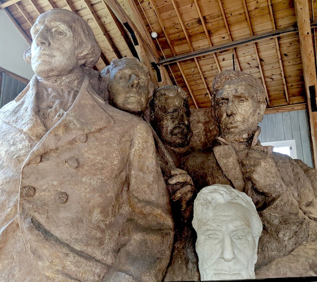
The Ranger stands in front of a model of how a completed Mount Rushmore was envisioned by Borglum. Who knew there was more? I’ve always taken for granted that what we see was all that was meant to be. The model shows that it would have had their jackets down to their waist and hands.

To see the scale of the sculpture, it is hard to contemplate the challenge of blasting away all that rock and carving that stone. But we learn that getting this project underway was a challenge unto itself.

Mount Rushmore, South Dakota © Karen Rubin/goingplacesfarandnear.com

South Dakota historian Doane Robinson is credited with conceiving the idea of carving the likenesses of noted figures into the mountains of the Black Hills of South Dakota in order to promote tourism in the region. But once Doane Robinson and others had found a sculptor, Gutzon Borglum, they had to get permission to do the carving. Senator Peter Norbeck (the man who created the Needles Highway through Custer State Park) and Congressman William Williamson were instrumental in getting the legislation passed to allow the carving. The bill requesting permission to use federal land for the memorial easily passed through Congress. But a bill sent to the South Dakota Legislature faced more opposition.

Robinson’s initial idea was to feature heroes of the American West, such as Lewis and Clark, Oglala Lakota chief Red cloud and Buffalo Bill Cody. But Borglum wanted the sculpture to have broader appeal, so chose the four presidents, who would each symbolize an important aspect of American history. (That might be why Robinson was not chosen for the 12-member commission to oversee the project.)

Early in the project, money was hard to find, despite Borglum’s guarantee that eastern businessmen would gladly make large donations. He also promised South Dakotans that they would not be responsible for paying for any of the mountain carving. Borglum got Treasury Secretary Andrew Mellon on board, but only asked for half of the funding he needed, believing he would be able to match federal funding ($250,000) dollar for dollar with private donations.

Borglum worked on the project from 1927, the presidents’ faces were carved from 1933-1939, with his son, Lincoln. Meanwhile, in 1929, the stock market crashed; in 1933, President Franklin Roosevelt placed Mount Rushmore under the jurisdiction of the National Park Service.

In March, 1941, as a final dedication was being planned, Gutzon Borglum died. This fact, along with the impending American involvement in World War II, led to the end of further carving on the mountain. With the money – and enthusiasm – running out, Congress refused to allocate any more funding. On October 31, 1941, the last day of work, Mount Rushmore National Memorial was declared a completed project.

Mount Rushmore, South Dakota © Karen Rubin/goingplacesfarandnear.com

The Ranger explains that the death of the artist raised an ethical issue for anyone who would take over the work. And, the Ranger said, “The country had moved on. They were not as interested in presidents as they were in the 1930s; when Mount Rushmore was a shrine to democracy. And what if the new artist made a mistake?”

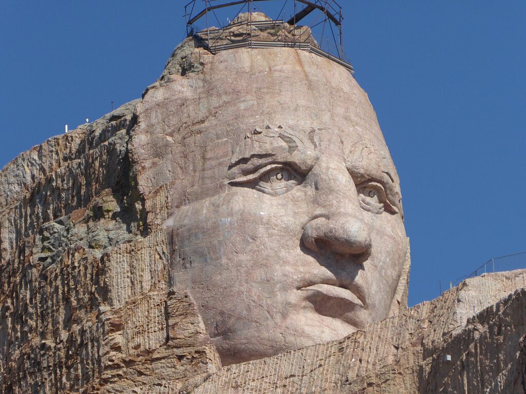
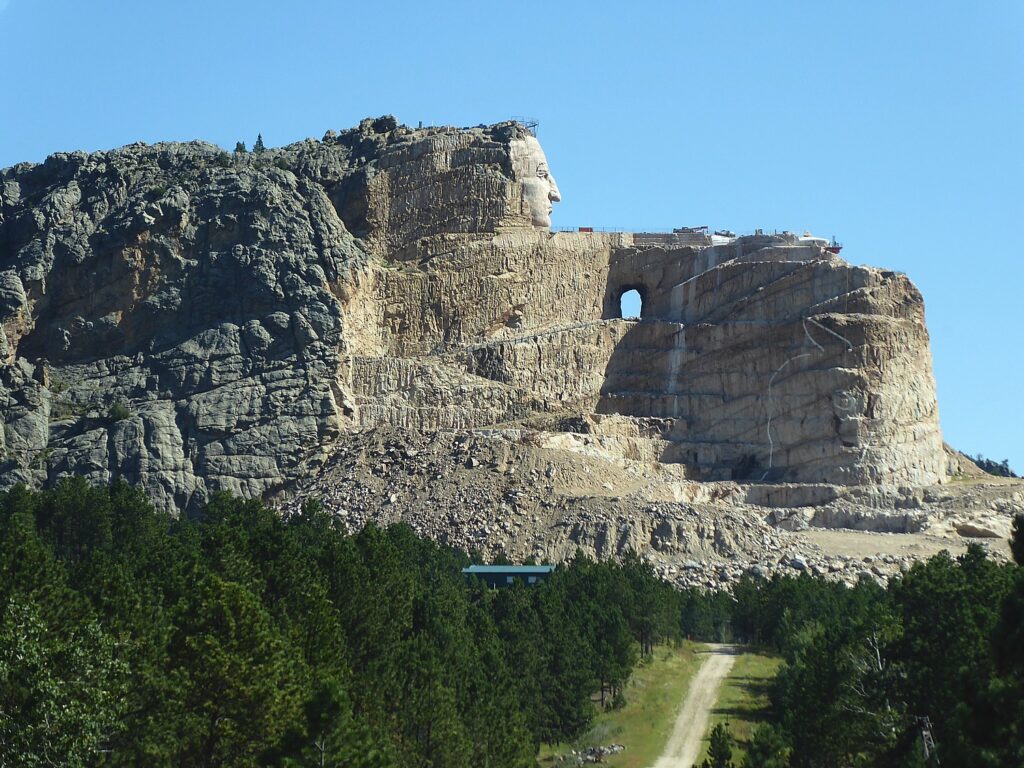
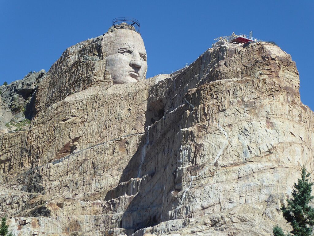
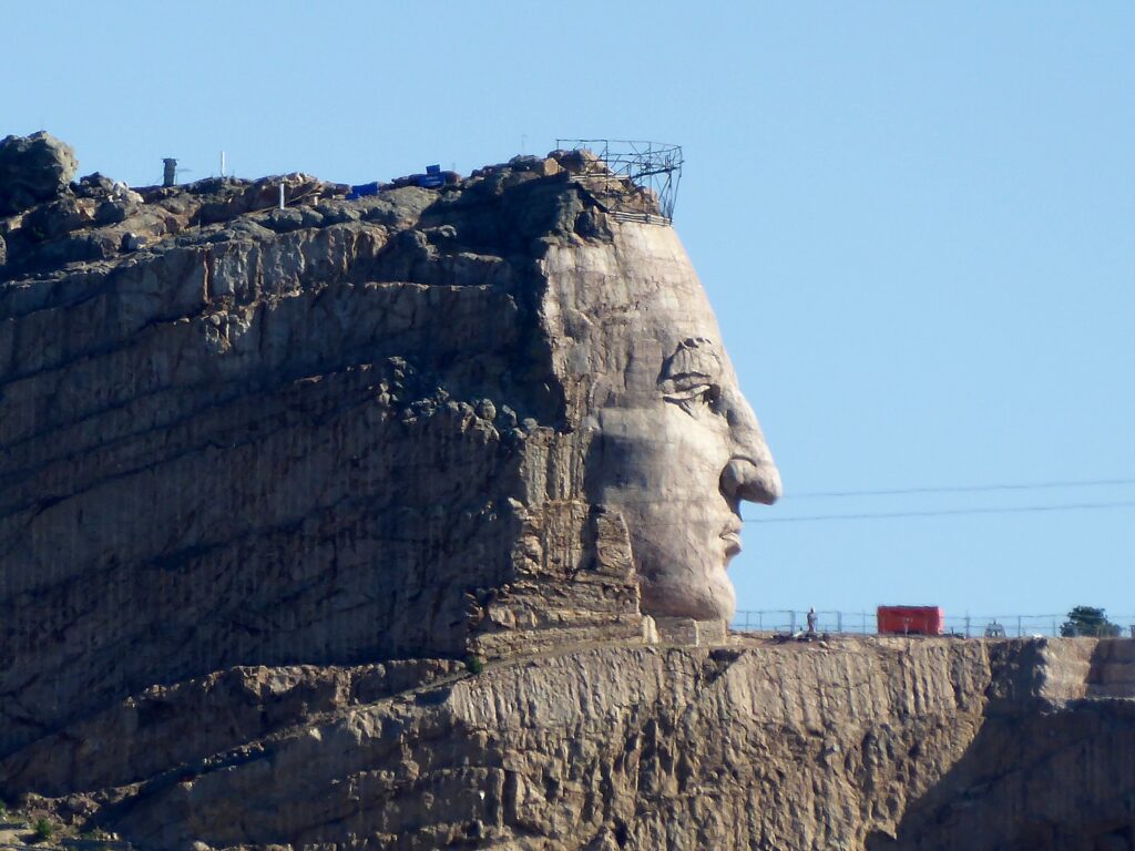
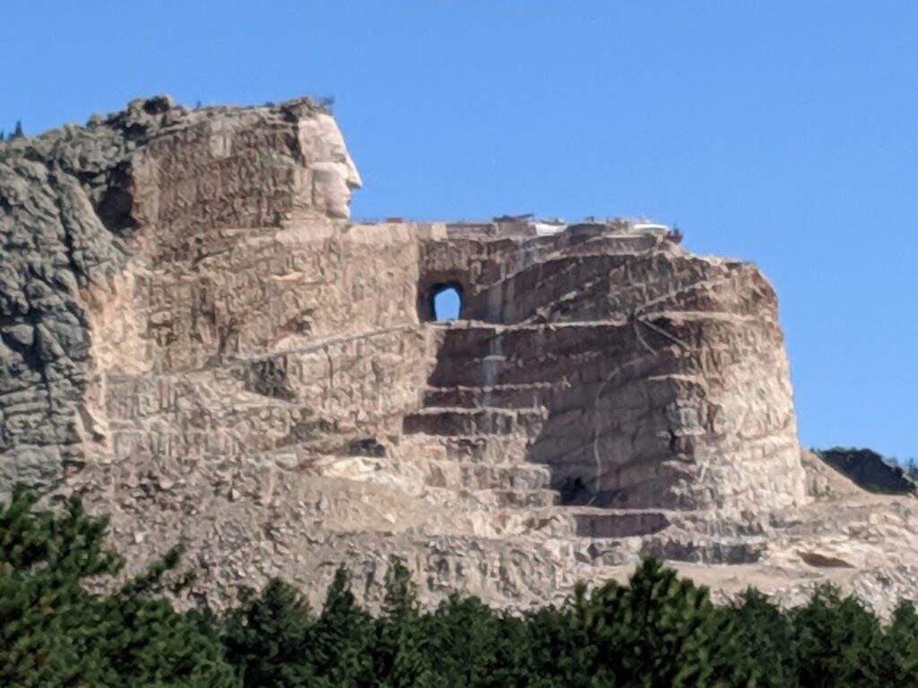
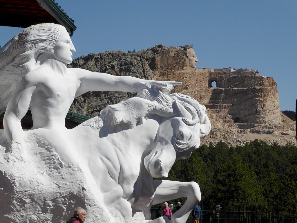
I can see how Mount Rushmore was a cautionary tale for the Crazy Horse Memorial and why sculptor Korczak Ziolkowski, who worked on Mount Rushmore before being tasked to do Crazy Horse, refused any federal funding, instead establishing a foundation funded with private donations and admissions. Some 70 years after he began his work, his grandchildren are involved in continuing to carve the memorial.

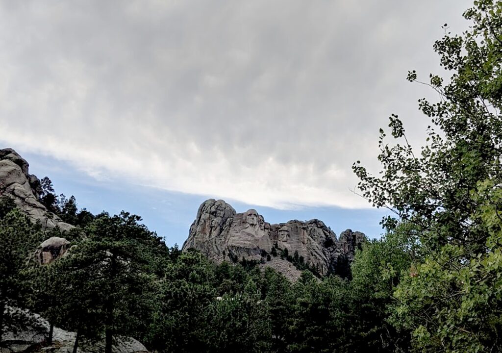
View of Mount Rushmore from the Presidential Trail, South Dakota © Karen Rubin/goingplacesfarandnear.com

I walk the Presidential Trail (just 0.6 miles long, 422 stairs, weather permitting) to get up close and personal with the mountain sculpture and perhaps glimpse some of the area wildlife.

Some 3 million visitors come to Mount Rushmore each year.

Among the activities offered:  the Junior Ranger program (booklets are available at the information desks for ages three to four, five to twelve and 13 and up), and the Carvers’ Café, Ice Cream Shop  and Gift Shop.

Also:

Lakota, Nakota and Dakota Heritage Village (10 – 30 mins., free): Explore the history of the Black Hills and the American Indian tribes who have populated this land for thousands of years. Located next to the Borglum View Terrace for 2019, this area highlights the customs and traditions of local American Indian communities. Open 10:30 am to 3 pm,  early June through mid-August, weather permitting.

Youth Exploration Area (10 – 30 mins., free): Explore the natural, cultural and historical aspects of Mount Rushmore with interactive programs. Located at the Borglum View Terrace for 2019. Open early June through early August.

Self-Guided Tour (30 – 120 mins; rental fee): Rent an audio tour wand or multimedia device to hear the story of Mount Rushmore through music, narration, interviews, historic recordings and sound effects while walking a scenic route around the park. Available at the Audio Tour Building across from the Information Center (rentals available inside the Information Center during the winter months). The tour and accompanying brochure are available in English, French, German, Lakota, and Spanish.

Mount Rushmore, South Dakota © Karen Rubin/goingplacesfarandnear.com

It had been gray and drizzly when we first arrived making the monument look dull, but as we are leaving, blue sky breaks through and for the first time, I realize that George Washington has a jacket.

(During our visit, the Visitor Center and amphitheater are closed for construction.)

(Just recently, the last living Mount Rushmore construction worker, Donald ‘Nick” Clifford, who worked on the monument from 1938-40, passed away at the age of 98.)

(Mount Rushmore, 13000 Highway 244, Keystone, SD 57751,  605-574-2523, www.nps.gov/moru/index.htm)

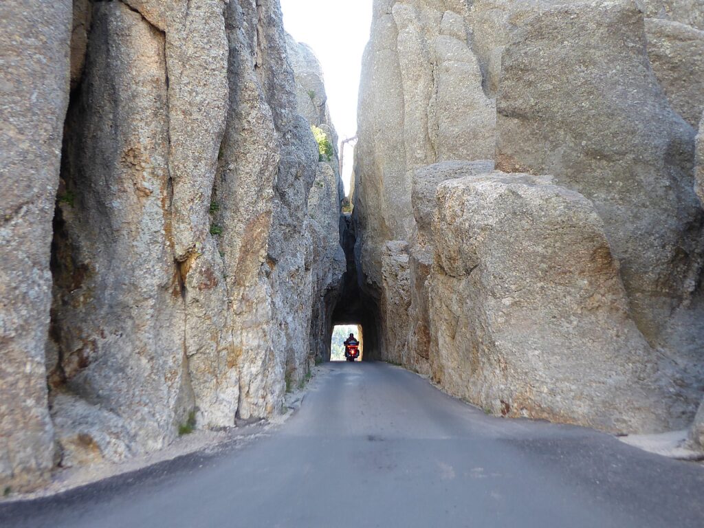
Even thought the weather has cleared up just as we are leaving Mount Rushmore, because it is a getaway travel day, the group decides not to bike (the trail James suggests is impractical because it requires the guides to take off the roof racks in order to fit through the tunnel). We decide instead, to go straight to Rapid City, our departure point, for lunch before we all go our separate ways.

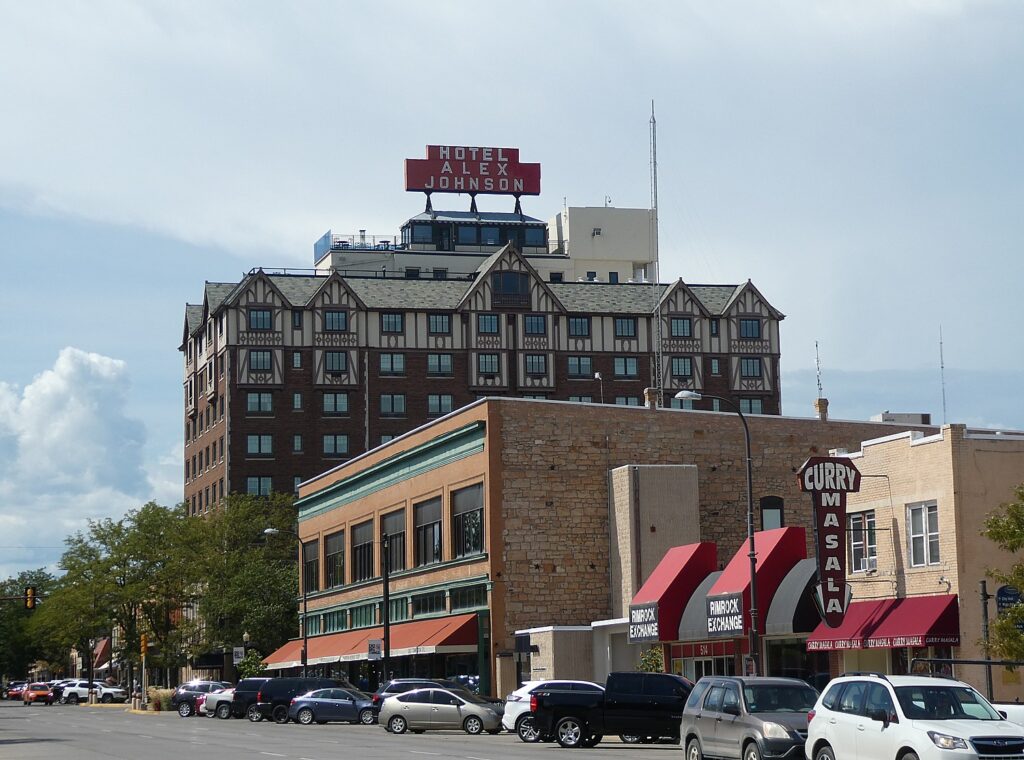
Rapid City, South Dakota (c) Karen Rubin/goingplacesfarandnear.com.

Our last lunch together, in Rapid City, is at Tally’s Silver Spoon (best Reuben sandwich outside of NYC!) – just across the street from the historic Alex Johnson Hotel, where I began my South Dakota odyssey a week ago.

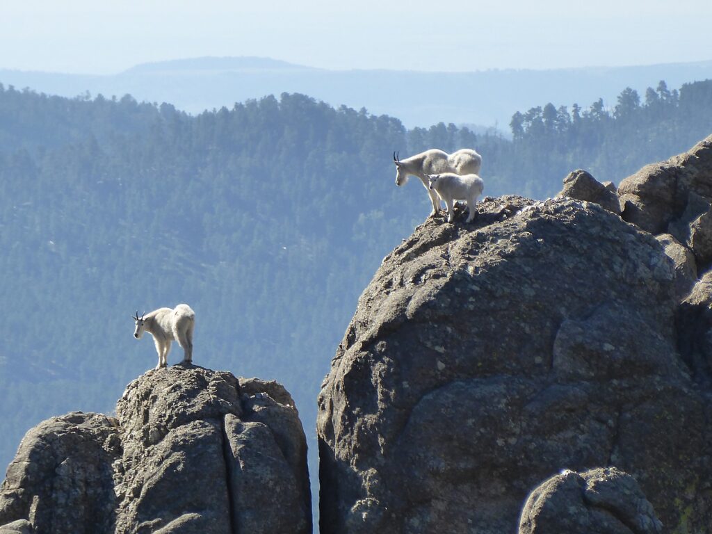
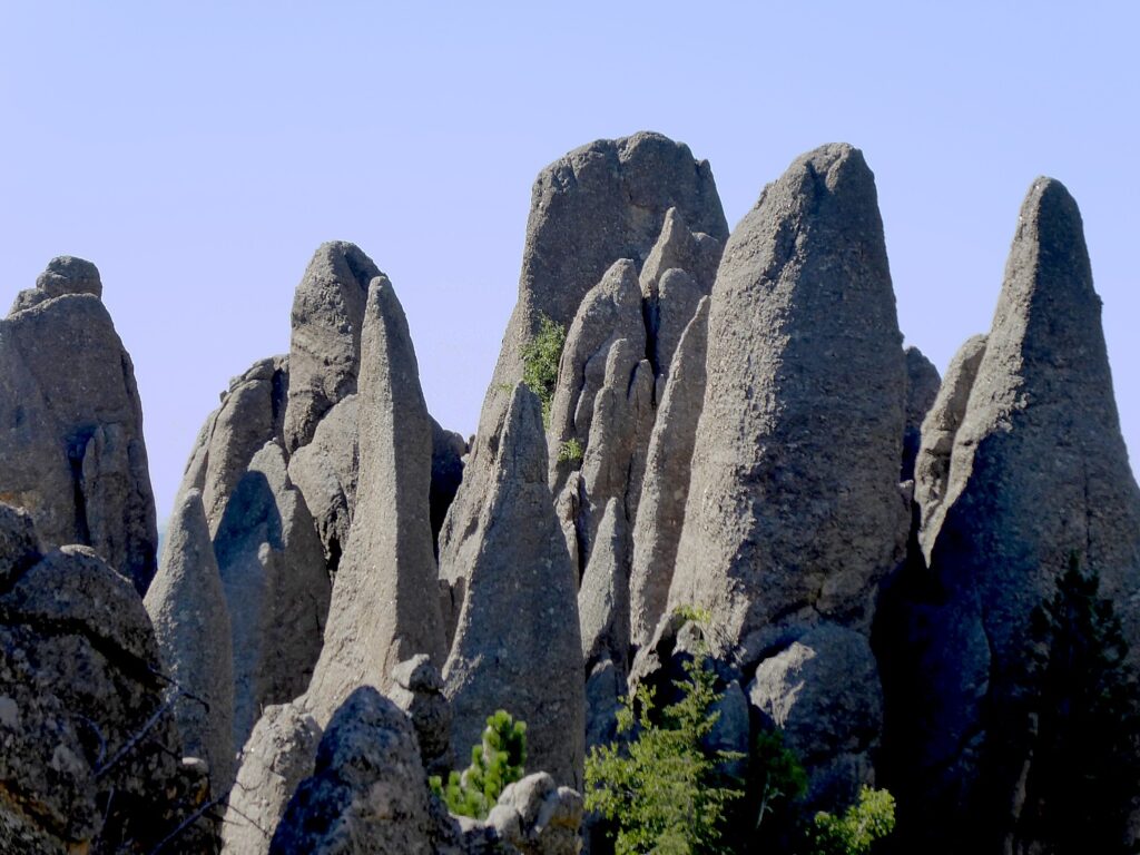
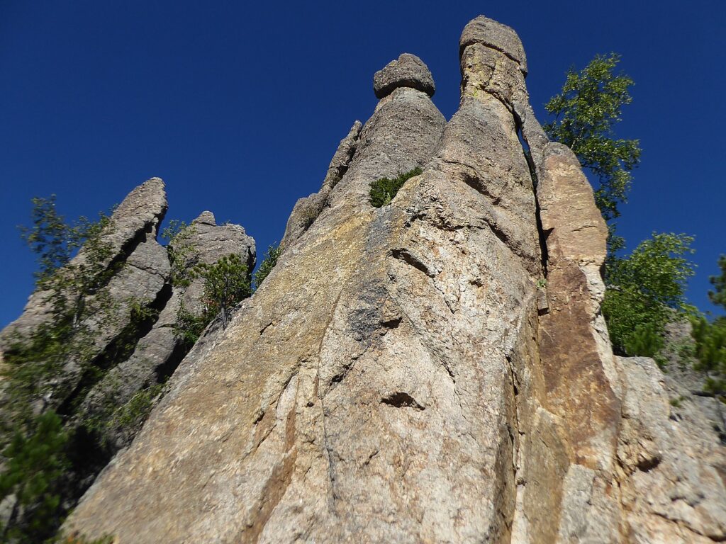
What I love best about Wilderness Voyageurs’ “Badlands and Mickelson Trail” bike tour are the varied experiences: Badlands – fossils – Circle View Guest Ranch – Black Hills – Crazy Horse – Custer State Park – stone spires – wildlife – buffalo – Blue Bell Lodge – Mount Rushmore – biking the 109-mile long Mickelson rail trail.

Guided bike trips are not cheap, but what I look for is value for money – my test is whether I could reproduce the trip for less out-of-pocket, to make up for the decided increase in convenience of having the itinerary already plotted out. I found Wilderness Voyageurs excellent value – in the services provided, wonderful accommodations (especially the guest ranch and the lodge), dining, creating an itinerary that was idyllic, entrances to attractions (Badlands National Park, Crazy Horse Memorial, Mount Rushmore), and also considerate, superb guides, a relaxed, unpressured atmosphere (“You’re on vacation!”).

The destination, South Dakota, is quite sensational and unexpectedly varied – spectacular scenery, nature and wildlife, fossils (!), culture and history – a microcosm of North America, really. Indeed, it is an ideal destination for international visitors to plunge into the American frontier west mythology of the past, but more interestingly, to see the American West as it is today.  And frankly, even if I rented a bike and paid for shuttle services, I couldn’t have duplicated the itinerary, or the camaraderie, or the expertise and care.

Wilderness Voyageurs started out as a rafting adventures company 50 years ago, but has developed into a wide-ranging outdoors company with an extensive catalog of biking, rafting, fishing and outdoor adventures throughout the US and even Cuba, many guided and self-guided bike itineraries built around rail trails like the Eric Canal in New York, Great Allegheny Passage in Pennsylvania, and Katy Trail in Missouri.

Wilderness Voyageurs, 103 Garrett St., Ohiopyle, PA 15470, 800-272-4141, [email protected], Wilderness-Voyageurs.com

_________________________

© 2020 Travel Features Syndicate, a division of Workstyles, Inc. All rights reserved. Visit goingplacesfarandnear.com, www.huffingtonpost.com/author/karen-rubin, and travelwritersmagazine.com/TravelFeaturesSyndicate/. Blogging at goingplacesnearandfar.wordpress.com and moralcompasstravel.info. Send comments or questions to [email protected]. Tweet @TravelFeatures. ‘Like’ us at facebook.com/NewsPhotoFeatures
Deadwood, South Dakota Resurrects Wild West Past at End of MicKelson Trail

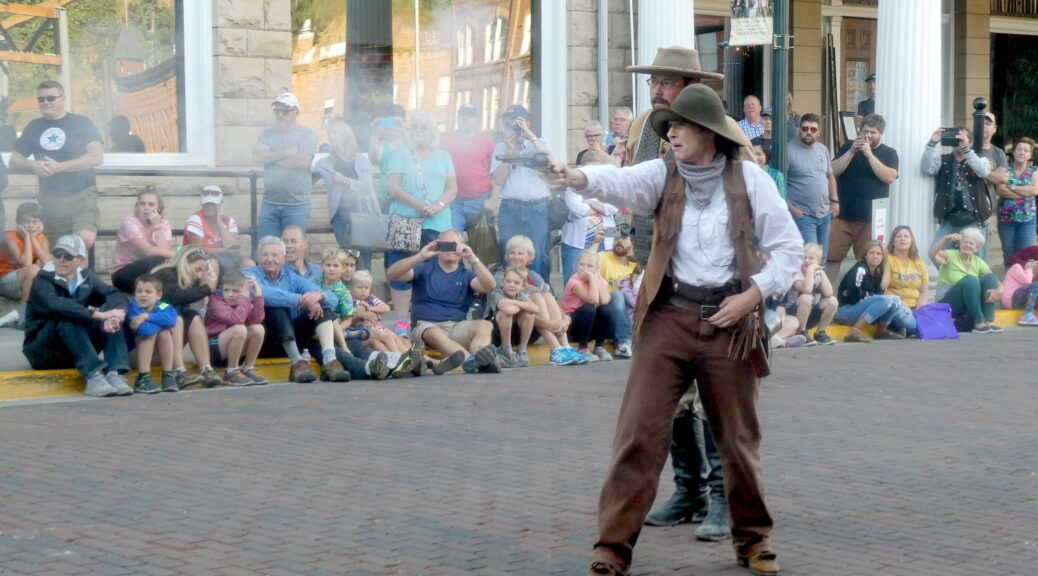
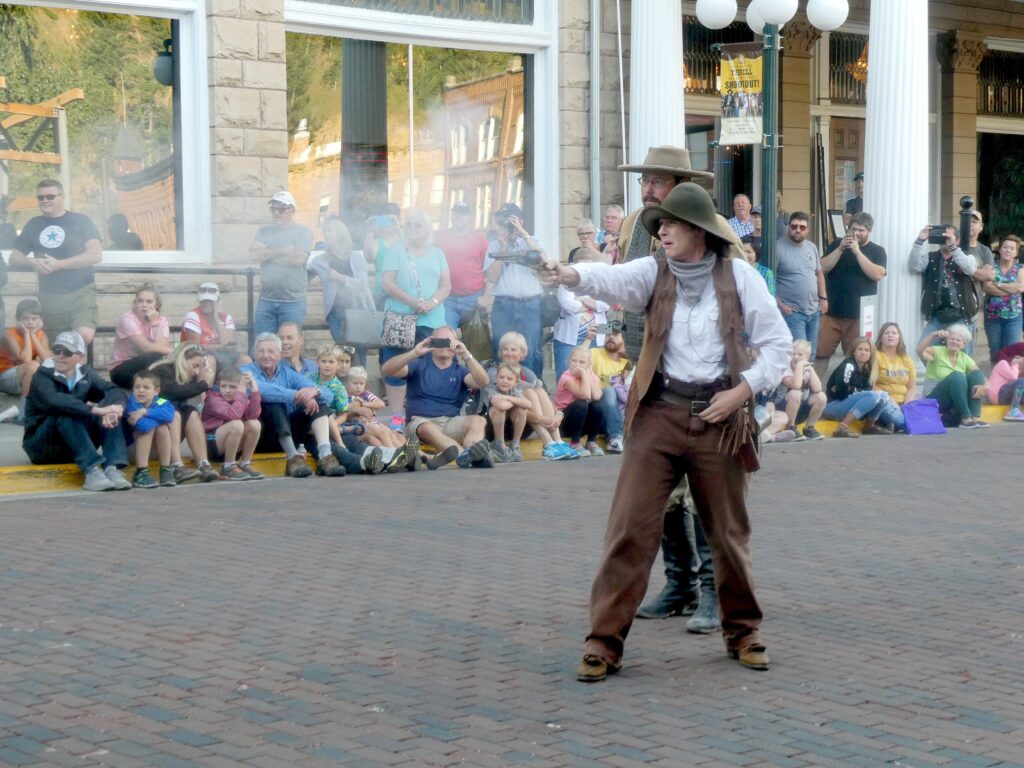
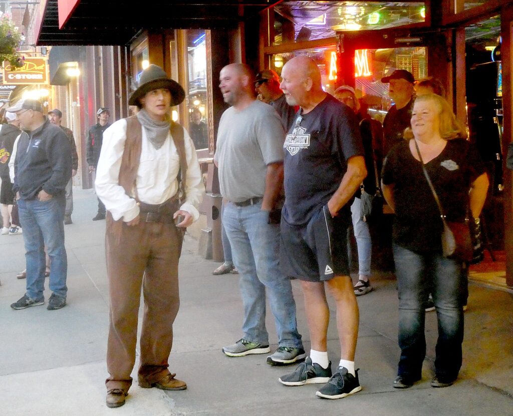
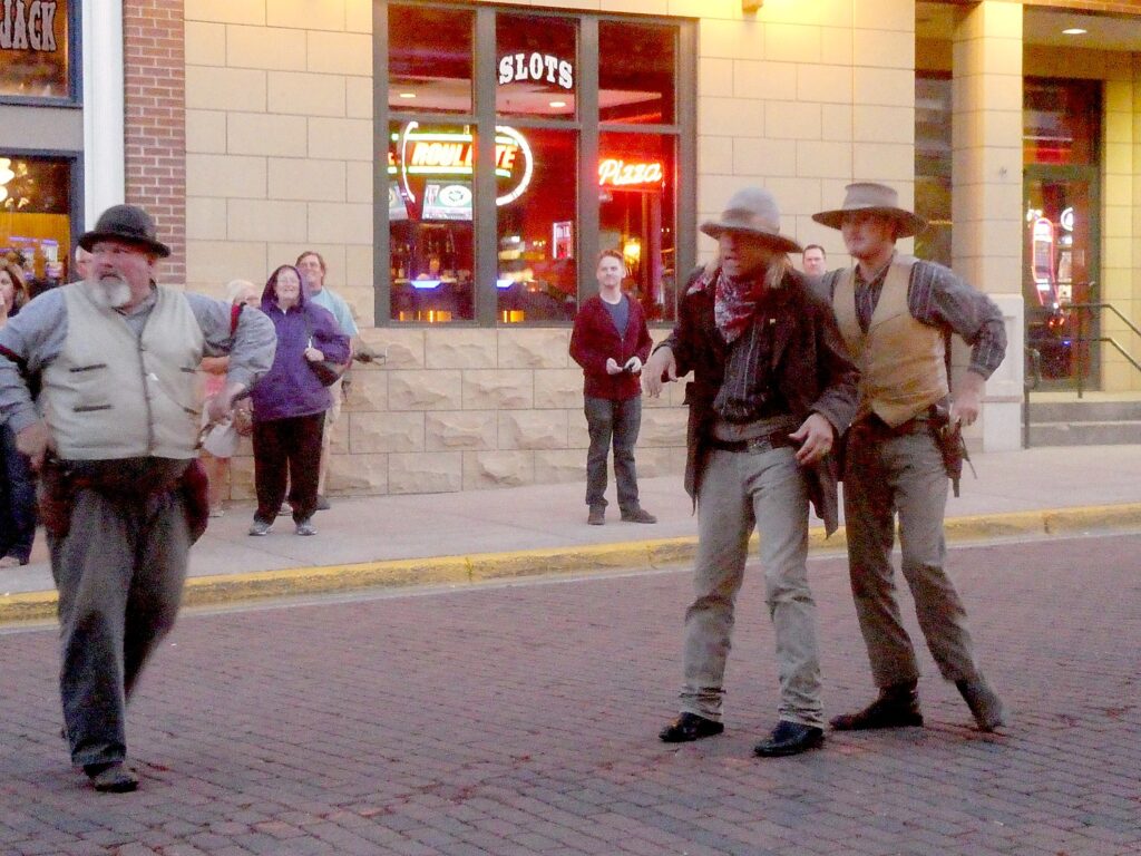
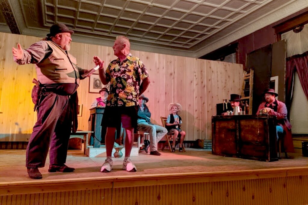
“Calamity Jane” in a daily shootout on Deadwood, South Dakota’s historic Main Street © Karen Rubin/goingplacesfarandnear.com m

by Karen Rubin, Travel Features Syndicate, goingplacesfarandnear.com

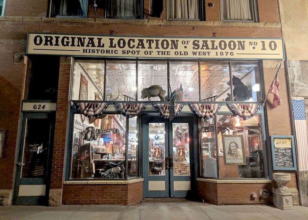
It strikes me as somewhat ironic, or perhaps appropriate, that Deadwood, South Dakota, so famous for being the place where Wild Bill Hickok was killed in a saloon playing poker, after being mining boomtown and a virtual ghost town, has been reincarnated as a casino gaming mecca.

Our hotel, the Deadwood Mountain Grand Resort, actually reflects both these traditions: it has one of the biggest casinos and the building has repurposed what used to be a slime plant (slime is the waste left when they use cyanide to decompose rock to release the gold), that was part of the Homestake Mine. The Homestake Mine was the second-largest gold producer in the United States and the longest continually operating mine in US history, operating from 1885 to as recently as 2001.

We’ve arrived at Deadwood at the end of biking the 109-mile long Mickelson Trail, a bike trail converted from a former railroad line named to Rails-to-Trails Conservancy’s Hall of Fame, which we have covered in three days of the six-day Wilderness Voyageurs “Badlands and Mickelson Trail” bike tour of South Dakota.

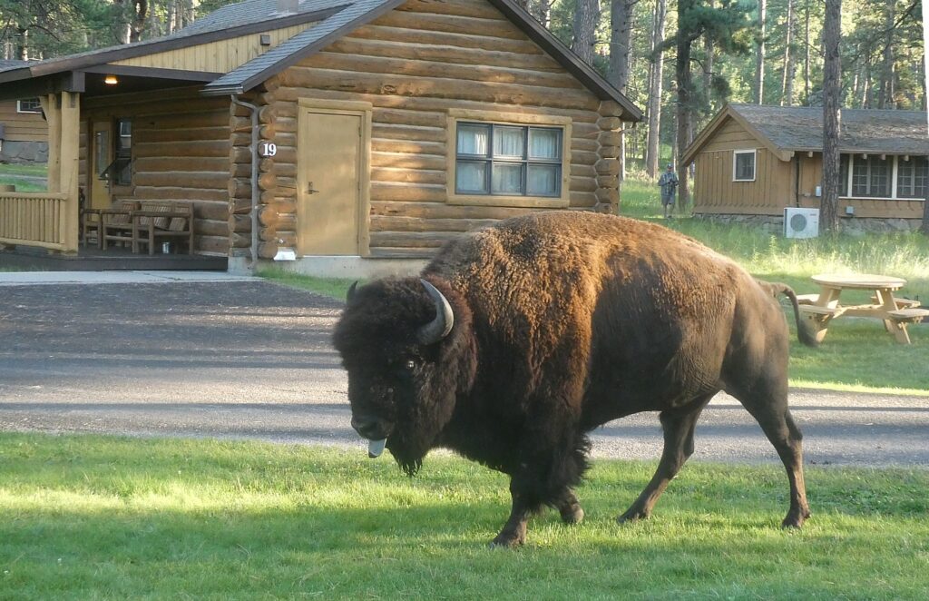
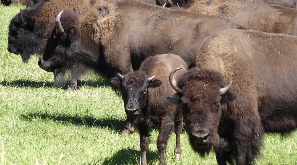
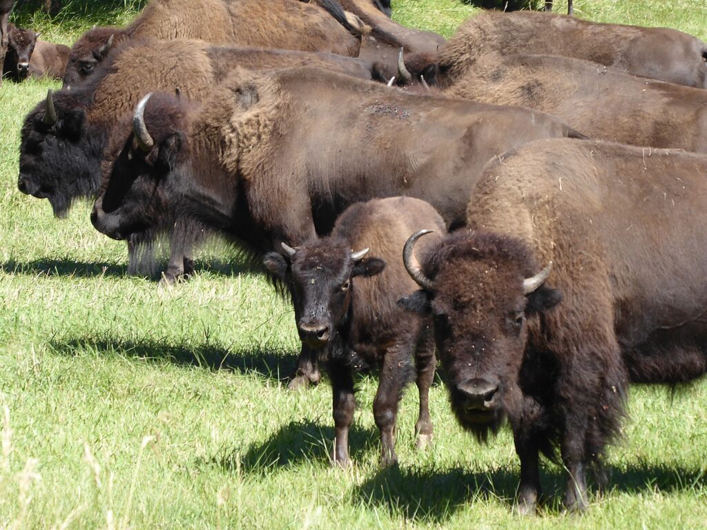
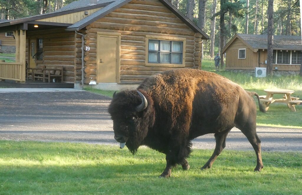
A buffalo strolls over to my cabin at the Blue Bell Lodge in Custer State Park, South Dakota © Karen Rubin/goingplacesfarandnear.com

My day begins at the Blue Bell Lodge in Custer State Park, with a buffalo strolling up to the porch of my cabin. We then are shuttled in the Wilderness Voyageurs van to the Mystic Trailhead, to ride the remaining 34 scenic miles of the Mickelson Trail into Deadwood.

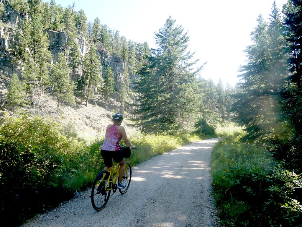
Biking the last miles on the Mickelson Trail from Mystic to Deadwood, South Dakota © Karen Rubin/goingplacesfarandnear.com
Biking the last miles of the Mickelson Trail to its end, in Deadwood, South Dakota at mile 109 © Karen Rubin/goingplacesfarandnear.com

It’s already about 3 pm, and armed with a list of activities that take place which I have obtained from the concierge (the shootout on Main Street at 6 pm, for example), I quickly drop my things to rush out to get to the Mount Moriah Cemetery which I remember the Alex Johnson Hotel manager, Ross Goldman, telling me about. Though the concierge and the visitor bureau guy discourage me from walking up there (there isn’t a public bus and the bus tour which makes a quick stop at the cemetery doesn’t make sense, I head out anyway – the hike, up 4,800 ft. to a high ridge overlooking Deadwood Gulch – the highest point in Deadwood – proves no big deal (especially compared to the hills we biked yesterday in Custer State Park) and takes just about 20 minutes.

At the entrance, they provide an excellent map with information and location of the notable graves of the important people who are buried here for you to do your own self-guided walking tour.

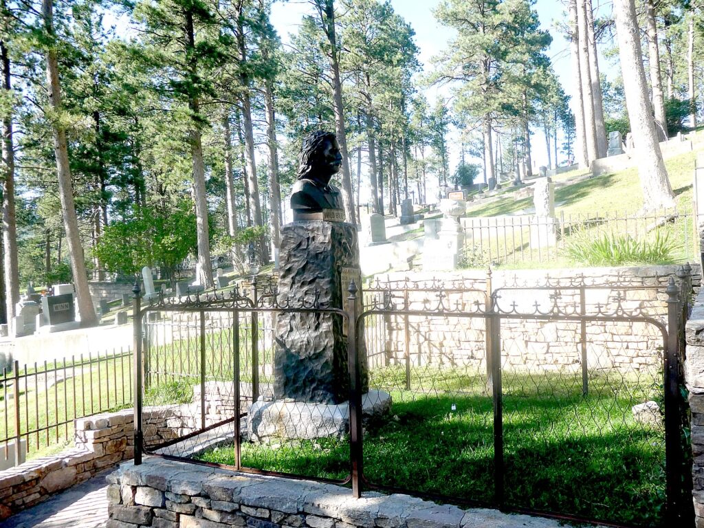
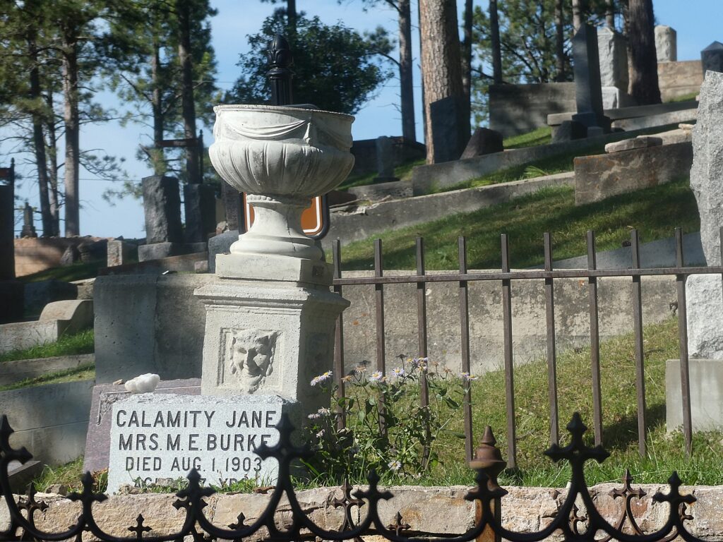
The major lure – and why there is a line of people – is the side-by-side plots of James Butler (Wild Bill) Hickok and Calamity Jane, whose legends continue to animate Deadwood even today.

Wild Bill Hickok’s gravesite is a major tourist attraction that brings hundreds to Mount Moriah Cemetery in Deadwood, South Dakota © Karen Rubin/goingplacesfarandnear.com

According to the guide, James Butler Hickok was murdered in Deadwood on August 2, 1876. He came, along with so many others, to the Deadwood gold camp in search of adventure and fortune. But his true passion was gambling. While playing a game of cards, he was shot in the back of the head by Jack McCall. “Wild Bill’s colorful life included service as a marshal, an Army scout and other tasks which called for a fast gun and no aversion to bloodshed.” (Later, you can see the re-creation of the arrest of Jack McCall, and then a re-creation of the hastily convened miners’ court, by the Deadwood Alive troop.)

Martha “Calamity Jane” Canary (1850-1903) also had a colorful life, which she largely created and which may or may not be true. “She worked on a bull train, performed in Buffalo Bill’s Wild West show and was a prostitute.” She claimed to have been Wild Bill Hickok’s sweetheart (and even that they were married and had a daughter). Her grave marker calls her Martha Jane Burke because she married Clinton Burke after Hickok’s death. She is known for acts of charity and willingness to nurse the sick. In 1903, Calamity Jane died in the Terry mining camp, her dying wish, “Bury me beside Wild Bill” was carried out.

Calamity Jane’s grave at Mount Moriah Cemetery, Deadwood, South Dakota © Karen Rubin/goingplacesfarandnear.com

The cemetery was established in1878 and actively used until 1949. There are some 3,627 people buried here including a children’s section with 350 who died in of scarlet fever and diphtheria epidemic 1878-1880; a Civil War section, a Jewish section (surprisingly large) and a Chinese section (there is even a Chinese altar and ceremonial oven), and several notable and colorful characters who are described in the guide with directions to their gravesites.

I am struck by the wrought iron gates at the entrance which have symbols representing the Independent Order of Odd Fellows, Freemasonry and the Star of David. Indeed the name Mt. Moriah was chosen for its religious affiliation with both the Christian Bible and the Jewish Torah (Mount Moriah is located within Jerusalem, the site of Solomon’s temple.)

It takes about an hour to visit. ($2/entrance, 108 Sherman St., Deadwood 57732, 605-578-2082, www.cityofdeadwood.com).

Deadwood, it turns out, was named for the dead timber on the surrounding hills, not for its shoot-outs. The discovery of gold in the Black Hills brought thousands of new people to the area. 

I get back down to the historic Main Street in plenty of time for the 6 pm “Main Street Shootout”, featuring a fantastic Calamity Jane character.

“Calamity Jane” cavorts with tourists on Deadwood’s Main Street before the shootout © Karen Rubin/goingplacesfarandnear.com

There are free shows throughout the day on Historic Main Street (reminiscent of a theme park’s re-creation of a Wild West town): Deadwood’s True Tales; a 2 pm Main Street shootout; a Rootin’Tootin’ Card Game for kids and old-thyme musical show; Dr. Stan Dupt’s Travelin’ Medicine Show; 4 pm Main Street shootout; 4:30 Old Thym Hoe Down; 5:45 Deadwood’s True Tales on the steps of the historic Franklin Hotel.

Getting ready for the shoot out on Main Street, Deadwood, South Dakota © Karen Rubin/goingplacesfarandnear.com

After the 6 pm shootout, I check out the shops and grab a burger with another couple from our bike tour who I meet up with on the street, and come back for the 7:30 pm “Capture of Jack McCall” outside Saloon 10 (there is the “original Saloon 10 where Wild Bill was actually shot).

From there, we all march up the street to the Masonic Temple for the 8 pm “Trial of Jack McCall”.

The Trial of Jack McCall has been performed regularly since 1925, one of the longest running plays in the nation but each night in Deadwood with new twists because of audience participation. © Karen Rubin/goingplacesfarandnear.com

“The Trial of Jack McCall” has been performed steadily, I am astonished to learn since 1925, making it one of the nation’s longest running plays. It began as an annual presentation during Statehood Days. The script is based on news accounts of the actual trial which took place in the mining camp of Deadwood after Jack McCall murdered James Butler “Wild Bill” Hickok. Wild Bill was playing poker in Nuttal and Mann’s Saloon No. 10 and was shot in the back of the head while holding Aces and Eights, forever known as the “Dead Man’s Hand”. (People leave the cards at his grave.). Though based on fact, it is done with great humor (if a murder trial can be fun). “It has to be accurate,” any “Cookie” Mosher who plays John Swift, Clerk of the Courts and Executive Director of Deadwood Alive, tells me because Deadwood Alive, a nonprofit, is supported in part by Historical Preservation Society. (It reminds me of the “Cry Innocent,” recreation of a Salem Witch Trial, in Salem, Massachusetts).

They even recreate the edition of the Black Hills Pioneer which reported the story of Hickok’s murder, on August 3, 1876. “A dastardly murder was committed in Deadwood gulch yesterday afternoon. The fiendish murderer who shot him in the back is in jail. The dead man is Wild Bill Hickok, whose prowess with the pistols is known far and wide. Single-handed, he captured robbers and trouble makers in the south, at Dodge city, Abilene and Hays, Kansas, in Nebraska, in all the south. Men feared him, feared his quickness on the draw, the deadly and accurate aim which send more than one roustabout sprawling.

“But on this terrible, bloodstained afternoon in the wild gold camp of the Black Hills, Wild Bill never had a chance.”

A jury of “minors” at “The Trial of Jack McCall” © Karen Rubin/goingplacesfarandnear.com

This is a family-friendly show where the selected members of the audience participate in the performance serving as jurors in the trial- the jury of miners is made up of “minors” – kids who get to wear various hats and sit on a bench). The show is held nightly Monday through Saturday with the schedule as outlined below.

It proves extremely entertaining as a trial for murder could possibly be.

In 1876, Deadwood didn’t have a courthouse so the trial was held in Deadwood Theater (the narrator/court manager explains they have to wait for auditions to finish – so there is music provided by Calamity Jane as the audience files in. The theater was tearing down from the previous week’s show and getting ready for the next, so you see various props.The trial was held just the day after McCall’s arrest.

“Jack McCall” takes the stand in his trial , recreated nightly in Deadwood, South Dakota © Karen Rubin/goingplacesfarandnear.com

A boy is given the role of sheriff; wearing an oversized cowboy hat, he seems just itching to shoot the toy gun he hold on McCall.

They call “witnesses” and John Swift, the clerk of Courts (played by Mosher) goes into the audience and pulls somebody up – then after jokes (swearing on “Bartenders Guide” instead of bible), “sneaks” them a script. He grabs a guy as a witness who is wearing shorts so he puts shawl over his leg for modesty; he grabs a woman to play McCall’s’ employer and pretends to flirt.  (It’s very Shakespearean the way they go in/out of character and talk to audience.)

Audience participation makes “The Trial of Jack McCall” especially entertaining. © Karen Rubin/goingplacesfarandnear.com

One witness says Wild Bill asked him to move his chair so Wild Bill could sit with his back to wall, and he refused.

The “minors” on the jury pretend to sleep during Defense’s summation.

As in real life, McCall was found Not Guilty. Then, in an epilogue, the Clerk relates that McCall was driven from town but bragged about killing Wild Bill over a game of cards. The federal government said that because the crime was committed in Indian Country the feds still had jurisdiction to try McCall without violating the rule against double jeopardy. McCall was rearrested in 1877, got a new trial, was found guilty and hanged.

Deadwood Alive has been entertaining visitors for over 20 years with Main Street shootouts and regular performances of the Trial of Jack McCall. The Deadwood Alive troupe of superb actors consists of over 10 characters and provide entertainment throughout the year including daily shootouts, guided walking tours, musical performances and the famous Trial of Jack McCall. Deadwood Alive is managed by a non-profit board of directors and employs up to a dozen individuals each summer to re-enact several historically accurate incidents of Deadwood’s past and make a visit to Deadwood so entertaining for people of all ages (($6 adults, $5 seniors, $3 children, 800-344-8826, www.deadwoodalive.com).

The actual Saloon No. 10 where Wild Bill Hickok was killed by Jack McCall while holding a poker hand of Aces and Eights, forever known as the “Dead Man’s Hand”. © Karen Rubin/goingplacesfarandnear.com

I enjoy the charm of the Main Street. I stop in to the Franklin Hotel, opened since 1903, a beautiful, elegant hotel, now with a casino in the lobby.

Deadwood actually offers a lot of history and attractions, which unfortunately, I do not have time to experience): The Adams Museum (554 Sherman St); Days of ’76 Museum (18 Seventy Six Dr), and Historic Adams House (22 Van Buren St.). (DeadwoodHistory.com, 605-722-4800).

Deadwood preserves its Wild West charm © Karen Rubin/goingplacesfarandnear.com

More visitor information at Deadwood South Dakota, 800-344-8826,www.deadwood.com.

Wilderness Voyageurs started out as a rafting adventures company 50 years ago, but has developed into a wide-ranging outdoors company with an extensive catalog of biking, rafting, fishing and outdoor adventures throughout the US and even Cuba, many guided and self-guided bike itineraries built around rail trails like the Eric Canal in New York, Great Allegheny Passage in Pennsylvania, and Katy Trail in Missouri.

Wilderness Voyageurs, 103 Garrett St., Ohiopyle, PA 15470, 800-272-4141, [email protected], Wilderness-Voyageurs.com

_________________________

© 2020 Travel Features Syndicate, a division of Workstyles, Inc. All rights reserved. Visit goingplacesfarandnear.com, www.huffingtonpost.com/author/karen-rubin, and travelwritersmagazine.com/TravelFeaturesSyndicate/. Blogging at goingplacesnearandfar.wordpress.com and moralcompasstravel.info. Send comments or questions to [email protected]. Tweet @TravelFeatures. ‘Like’ us at facebook.com/NewsPhotoFeatures
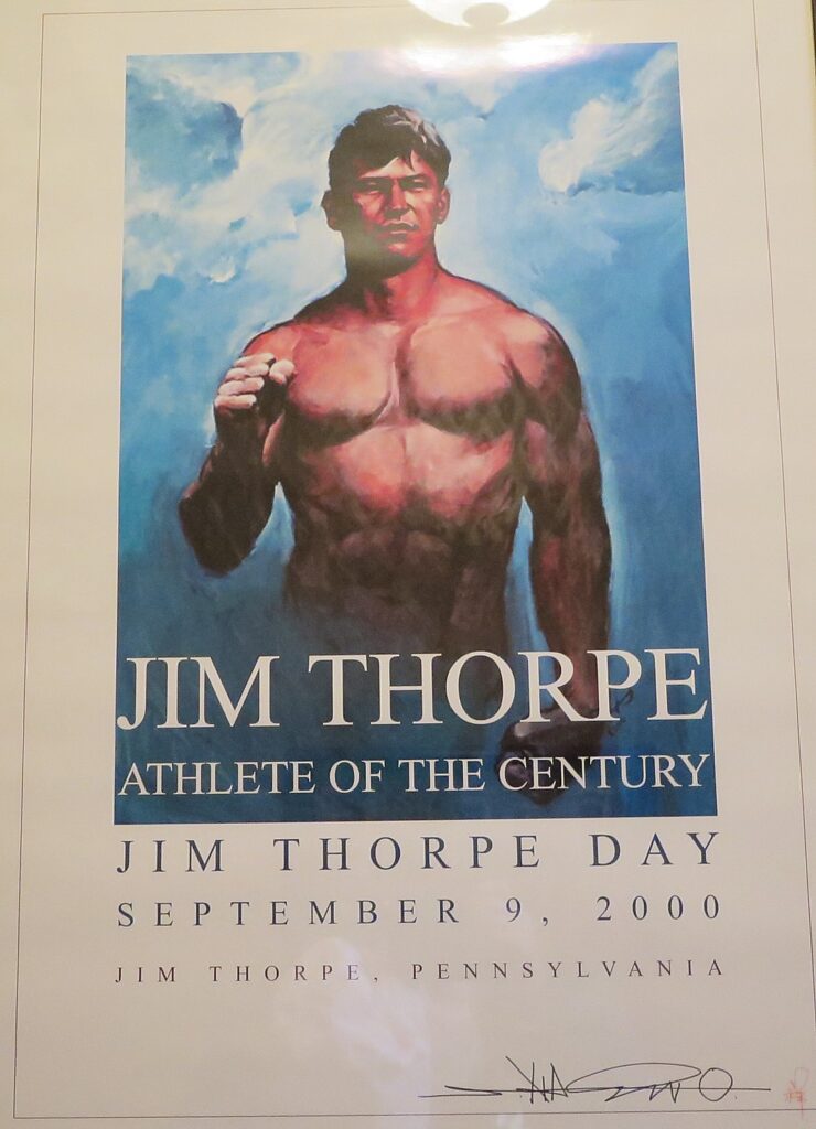
Badlands & Black Hills, Buffalos & Bikes: Close Encounters with Wildlife in South Dakota’s Custer State Park

A herd of buffalo (bison) take over a field just outside the Custer State Park Visitor Center, South Dakota (c) Karen Rubin/goingplacesfarandnear.com.

by Karen Rubin, Travel Features Syndicate, goingplacesfarandnear.com

I didn’t think I could be wowed more than yesterday’s bike ride along the Mickelson Trail to the Crazy Horse Memorial. But today’s ride through South Dakota’s Custer State Park, starting on the Needles Highway, and riding the Wildlife Loop for incredibly close encounters with the state’s famous animal life, finishing at a rustic (but luxurious) lodge in the woods, is over the moon.

The Wilderness Voyageurs guides shuttle us in the van from the town of Custer to Sylvan Lake in Custer State Park to start our ride through South Dakota’s first and, at 71,000 acres, its largest state park. Like the town, its namesake is the infamous Lt. Colonel George Armstrong Custer, who in addition to being the army commander who brutally fought Indians (meeting his master at the Battle of Little Big Horn), was an “explorer and fortune hunter”. In 1874, Custer found gold in these Black Hills, prompting a mad gold rush that resulted in the Indians being displaced from their sacred lands. But be that as it may, the park, which preserves and protects the precious buffalo (actually American bison), and so much more, seems a measure of justice.

Family goes off for rock climbing at Sylvan Lake, Custer State Park, South Dakota © Karen Rubin/goingplacesfarandnear.com

The scenery is spectacular, beginning with this first view of the enchanting Sylvan Lake. There is the Sylvan Lake Lodge (35 Lodge rooms, 31 cabins and a specialty “Cathedral Spires Cabin” that sleeps 20), one of a few lodges in the park, a superb hub for people who have come to fish, kayak, hike, rock climb or like us, bike through Custer State Park and the fabulous Wildlife Loop.

Biking along the Needles Highway, Custer State Park, South Dakota © Karen Rubin/goingplacesfarandnear.com

We bike along the Needles Highway. “14 miles of winding turns, granite spires and rock tunnels, the Needles Highway is a marvel of engineering,” a marker reads. “Peter Norbeck [South Dakota’s first governor, U.S. senator and a conservationist] walked and rode the future highway on horseback, laying out a route many deemed impossible.

“Norbeck asked his engineer, Scovel Johnson, ‘Scovel, can you build a road through here?’ Scovel answered, ‘If you can furnish me enough dynamite.’ It took 150,000 pounds of the explosive, and the highway was opened in 1922.”

Before long, we find ourselves in the midst of a section known as The Needles, with monster spires (fantastic for rock climbing).

Custer State Park, South Dakota © Karen Rubin/goingplacesfarandnear.com

We ride through the Needles Eye tunnel – carved just wide and high enough to accommodate the van (they have to take off the bikes) and soon after, the Cathedral Spires. The breathtaking scenery makes you contemplate your place in the natural world.

Needles Eye Tunnel, Custer State Park, South Dakota © Karen Rubin/goingplacesfarandnear.com

James Oerding is the guide today (while John Buehlhorn drives the van), and once again, I am last, lingering to take in the view, which means that James pretty much accompanies me. James is a master wildlife spotter and sees a pair of mountain goats on a spire and then we see their kid they are trying to convince to jump across a cavern between the spires. They seem genuinely puzzled how to get down, though I can’t figure out how they got up to this promontory in the first place.

Mountain goats, Custer State Park, South Dakota © Karen Rubin/goingplacesfarandnear.com

We find a place where we can climb down to get a better view.

James let’s me bike at my own pace and doesn’t hurry me along.

Custer State Park, South Dakota © Karen Rubin/goingplacesfarandnear.com

No sooner does the landscape change completely from the tall spires to plains, than we come across a whole herd of buffalo (actually, American bison) just where we get to the Visitor Center, where John has lunch for us. Traffic has stopped where the bison have chosen to cross the road.

Custer State Park, South Dakota © Karen Rubin/goingplacesfarandnear.com

There seem to be a hundred bison gathered on a large field just in front of the Visitor Center, and people are casually picnicking (like us) within arm’s length – a surreal scene for a city kid.

Custer State Park, South Dakota © Karen Rubin/goingplacesfarandnear.com

The Custer State Park Visitor Center is a stunning modern building, offering an array of exhibits, including a large interactive map, a 20-foot scale model of the Cathedral Spires and displays describing the natural world of the Park – as well as warnings about how not to interact with the bison (a bison can run 35 mph; if it lifts its tail, it is getting into fighting position; bison communicate to the herd with their tail). There is a wonderfully comfortable theater which offers a not to be missed 20-minute film narrated by Kevin Costner who reminds us that this was the very land (in fact used in the film) of “Dances With Wolves.”

“The buffalo – tatanka – are an enduring symbol of the Old West symbolizing abundance, strength, power and an enduring symbol of Indian culture.”

Custer State Park, South Dakota © Karen Rubin/goingplacesfarandnear.com

In the Lakota language, the word “tatanka” is translated as “buffalo” or “buffalo bull.” But native Lakota speakers say the literal translation is more like “He who owns us.”

“The Lakota and other tribes believed that a white buffalo is the most sacred living thing on earth. … The American buffalo or bison is a symbol of abundance and manifestation.  Tatanka is the root of all life.”

Custer State Park, South Dakota © Karen Rubin/goingplacesfarandnear.com

At Custer State Park, “the spirit is Tatanka,” the film intones. “71,000 acres….towering granite spires… an incredible American landscape. Choose your own path.”

The park sits between Crazy Horse Memorial at one corner, Mount Rushmore National Memorial at the other.

The park’s history dates back to 1897; but it was officially named a state park in 1919; the Needles Highway was completed in 1922; by 1924, the bison herd totaled 100. In 1927, President Calvin Coolidge and his wife spent three months at the Game Lodge. The park was expanded in the 1930s as part of FDR’s government works projects and became one of largest state parks in the United States. By 1966, the park received 1 million visitors; now, some 2 million visitors come each year.

A buffalo wallows in the dirt, creating a natural topographical depression in the flat prairie land that holds rain water and runoff, and helps mix the nutrients in the soil. Custer State Park, South Dakota © Karen Rubin/goingplacesfarandnear.com

The park has played a vital role in saving the American bison. There were 30-60 million bison roaming North America in the 1500s when Europeans first arrived; by the late 1880s-1890s, fewer than 1000 were left. In the early 1900s, the Yellowstone herd was protected; then the Custer State Park herd. In 1914, 36 bison were purchased and by 1924, the herd totaled 100. Today, there are some 500,000 bison in North America, with 400 born a year here at Custer State Park.

Each September, there is a Buffalo Roundup which this year, brought out over 19,440 visitors for the 54th Annual roundup, to watch as 60 horseback riders wrangle the herd of 1,400 bison into corrals for their annual health check. The annual roundup helps the park manage its herd; some 445 bison are sold at the annual auction. The park also hosts a three-day arts festival in conjunction with the roundup. (Upcoming Buffalo Roundups will be held on Friday, Sept. 25, 2020, and Friday, Sept. 24, 2021.)

From here, we get back onto the road to bike on Custer State Park’s Wildlife Loop.

Custer State Park, South Dakota © Karen Rubin/goingplacesfarandnear.com

Encompassing 71,000 acres in the Black Hills, Custer State Park, is one of the best places in North America to see a range of animals in their natural habitat.

Along the Wildlife Loop, there are buffalo (bison), deer, elk, pronghorn antelope (the fastest land animal on the Continent; 12 pronghorn were brought here in 1914), burros, yellow-bellied marmot, prairie dogs, big horn sheep – native to Black Hills – unique in Custer State Park. And before the end of day, we will see just about every one.

Custer State Park, South Dakota © Karen Rubin/goingplacesfarandnear.com

Just beyond the visitor center, where the herd has now moved on from the field, all the cars are stopped in both directions to allow the bison to cross the road. I put myself between two cars which I think will give me some protection.

I’ve never been in a situation like this, so close to these fearsome creatures without any barrier between (well except for the time I biked in tall grass in the tiger reserve in India). I am in their habitat.

Bison are the largest terrestrial animal in North America, standing up to six feet tall. A male can weigh upwards of a ton and a female can weigh 900 pounds, according to the National Wildlife Foundation. Bison fight by crashing their massive heads or horns together. Both male and female bison have short, curved, black horns, which can grow to two feet long. American bison like to live and travel in groups. For most of the year herds are divided by sex, with females and calves in one herd and males in another herd. When the breeding season begins in the summer, many males temporarily join the female herd and begin looking for a mate. 

Custer State Park, South Dakota © Karen Rubin/goingplacesfarandnear.com

Standing on the road, waiting for the buffalo to cross the road, is an opportunity to study their behavior. It occurs to me as I watch, that unlike dolphin which seem to show great emotion with their expressions and interactions, the buffalo don’t seem to have the means to show emotion, except perhaps a flick of a tail or their blue tongue. I wonder how one seems to emerge as a leader that the rest follow.

It strikes me how little interest or interaction there is among buffalo – except for a mother close with her calf, the buffalo don’t seem to have any connection, communication with each other, except all facing same direction and walk almost together. They all turn in one direction and move in one direction – who is leader? How is the leader selected?  I later learn that one way they communicate is with their tails.

Custer State Park, South Dakota © Karen Rubin/goingplacesfarandnear.com

It turns out that bison, who are almost constantly moving, actually vote on the direction they will travel, orienting their bodies in the direction they would like to go, and eventually choosing to follow an “initiator”; they communicate through grunts and growls, from smells and hearing, I subsequently learn from Scientific American.

Prairie dogs play an important role in the ecology of the prairie. Custer State Park, South Dakota © Karen Rubin/goingplacesfarandnear.com

There are also mountain lions in the park (we don’t get to see any), which are monitored with radio-collars and tranquilized for routine medical testing. James tells me that once he came upon the medical staff tranquilizing a mountain lion in order to take its vitals.

We’re going up where?? Custer State Park, South Dakota © Karen Rubin/goingplacesfarandnear.com

Now we come to the toughest ride of the trip – of the 39 miles we bike today, it seems three-quarters are uphill; there are lots of long, steep ascents and sweeping downhills too. This is the difference between a road and a rail trail. I plug through.

At one point, I lose momentum altogether and wind up walking the bike the equivalent of a city block and am annoyed with myself. But I make the remaining ascents, including the final half mile steep, corkscrew rise at mile 37 to the Blue Bell Lodge. I have a strategy of stopping where the road levels a bit, then resetting my concentration. (The van is available to drive people who choose not to bike.)

Blue Bell Lodge, Custer State Park, South Dakota © Karen Rubin/goingplacesfarandnear.com

The Lodge is so beautiful – 30 gorgeous log cabins among the pines (a specialty Ponderosa Cabin accommodates 20).

I have my own cabin – fireplace, deer head, two double beds, dining table/chairs, tv, kitchenette, porch with 3 chairs. Heaven.

Blue Bell Lodge, Custer State Park, South Dakota © Karen Rubin/goingplacesfarandnear.com

Wilderness-Voyageurs makes all of this it possible – you couldn’t do this itinerary on your own because it isn’t contiguous. They shuttle us to starting and ending points so we have the best route. We aren’t carrying our own gear from inn to inn.

The guides, James Oerding and John Buehlhorn, make a big difference – their knowledge not only of the trail, the route, but the places we will experience, the animals and sites we see, down to lunch recommendations. And SOOOO helpful – like father hens.

Good humored, patient, interesting. “You’re on vacation,” they say. They don’t rush us along or show impatience if we are slow or stop a lot. And they cheer us on to get through the touch climbs. Not only in their knowledge and experience but extremely helpful, patient, kind, considerate – go out of way to help guests – which is really clear this day. Van is there to help if necessary.

The trip is organized with pit stops, snacks, breakfasts and most lunches and hosted dinners, (just one lunch and two dinners on our own) as well as the admissions to sites.

Tonight, we dine at the Blue Bell Lodge’s Tatanka Dining Room (locally known as the Blue Bell Lodge Dining Room) – a lovely western themed (obviously) room. We order what we like from the menu (booze is on our own), which has some distinct items: rattle snake and buffalo sausage (tasty!); buffalo tenderloin.

Custer State Park, South Dakota © Karen Rubin/goingplacesfarandnear.com

The historic Blue Bell Lodge was originally a hunting lodge for friends- named (it is believed) for the telephone company, now run by Regency Hotel Management. A nightly chuck wagon dinner is offered that goes out 5-8 pm, with a ride to the valley; live music, dinner, dancing, for as many as 100 people.

Horsing around at the Blue Bell Lodge, Custer State Park, South Dakota (c) Karen Rubin/goingplacesfarandnear.

I stay behind at the lodge to look at my email when I get a call from James telling me a giant buffalo is just off the path in the pitch darkness. I see it when a car comes by and lights up the buffalo.

James offers to drive the van over to pick me up – I insist on finding a way to walk the short distance, and he tries talking me through but I have trouble  finding  the path. Finally, I find the path and see James and John walking over to rescue me.

The stars are gorgeous. I can see the Milky Way.

The lodge and Custer State Park, are open year-round. I can imagine how spectacular it is in winter.

(Open year round, Custer State Park, 13329 US Highway 16A, Custer, SD 57730, https://gfp.sd.gov/parks/detail/custer-state-park/ 605-255-4515,  800-710-2267. [email protected])

Day 5: Finishing the Mickelson Trail in Deadwood

I wake up early to sit on the porch of my cabin at the Blue Bell Lodge with a book and a cup of coffee, thinking this is the ultimate in luxury, but the peace of the moment is soon broken when I spy the buffalo from last night right outside. It lumbers toward my porch and takes a drink from a puddle.

Buffalo strolls by my cabin at Blue Bell Lodge, flicking its blue tongue (c) Karen Rubin/goingplacesfarandnear.com

James and John – not wanting to chance any confrontation with the buffalo – call us to tell us they will drive the van to pick each of us up at our cabins at 8 am. We drive back to Custer for breakfast at a cute café before starting today’s bike ride.

Day 5 of the Wilderness Voyageurs Badlands and Mickelson Trail tour is our final day on the Mickelson Trail. We ride the last miles all the way to Deadwood, a true wild west town made famous by the murder of Wild Bill Hickok.

Mickelson Trail, South Dakota © Karen Rubin/goingplacesfarandnear.com

We are shuttled back to Mystic where we left the trail two days ago, and ride 18 miles up hill, and then down the slope, for a total of 34 miles to end of Mickelson at Deadwood, at mile 109.

Mickelson Trail, South Dakota © Karen Rubin/goingplacesfarandnear.com
Coyote spotted off the Mickelson Trail, South Dakota © Karen Rubin/goingplacesfarandnear.com

John comes to pick us up with the van, making back-and-forth trips from the trailhead to our hotel, the Deadwood Mountain Grand Resort, which has an enormous casino (it seems fitting for a town that was born out of the gold rush and made famous by a poker game).

We are on our own to explore Deadwood and discover its many charms. Fortunately, I’ve had some tips from the Alex Johnson Hotel manager in Rapid City, and head straight out to the cemetery.

Wilderness Voyageurs started out as a rafting adventures company 50 years ago, but has developed into a wide-ranging outdoors company with an extensive catalog of biking, rafting, fishing  and outdoor adventures throughout the US and even Cuba, many guided and self-guided bike itineraries built around rail trails like the Eric Canal in New York, Great Allegheny Passage in Pennsylvania, and Katy Trail in Missouri.

Wilderness Voyageurs, 103 Garrett St., Ohiopyle, PA 15470, 800-272-4141, [email protected], Wilderness-Voyageurs.com

_________________________

© 2020 Travel Features Syndicate, a division of Workstyles, Inc. All rights reserved. Visit goingplacesfarandnear.com, www.huffingtonpost.com/author/karen-rubin, and travelwritersmagazine.com/TravelFeaturesSyndicate/. Blogging at goingplacesnearandfar.wordpress.com and moralcompasstravel.info. Send comments or questions to [email protected]. Tweet @TravelFeatures. ‘Like’ us at facebook.com/NewsPhotoFeatures
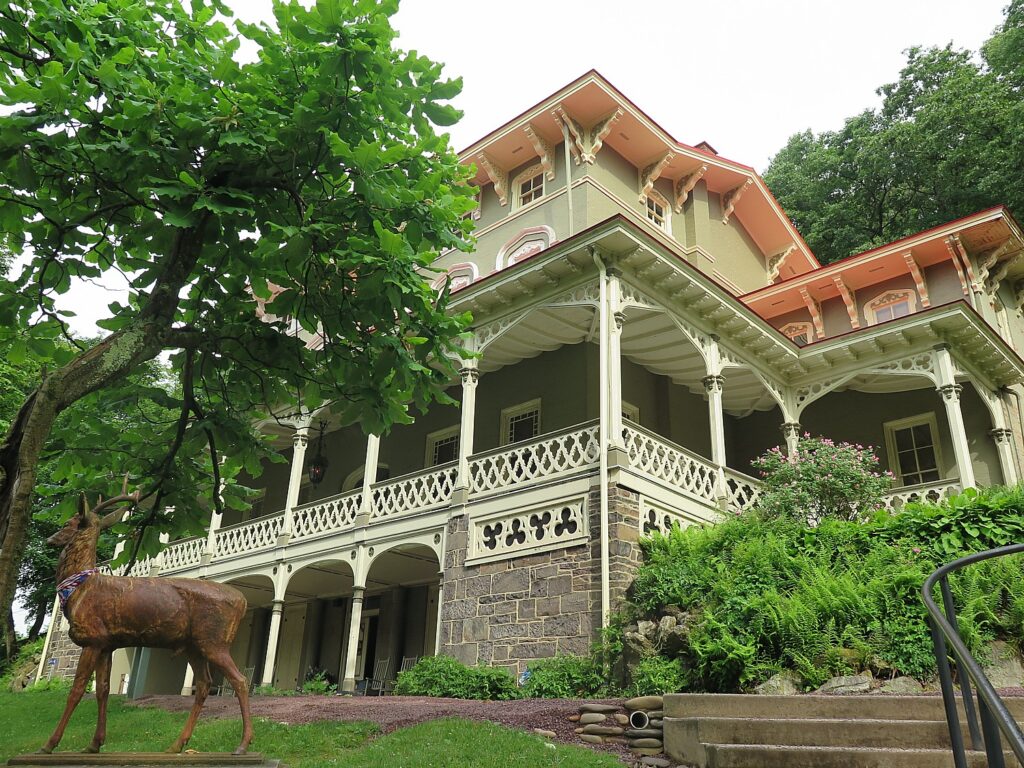
Discovering Marvels of Crazy Horse Memorial on Badlands, Black Hills & Mickelson Trail Bike Tour

Crazy Horse Memorial, Mickelson Trail, South Dakota, © Karen Rubin/goingplacesfarandnear.com

by Karen Rubin, Travel Features Syndicate, goingplacesfarandnear.com

The Crazy Horse Memorial is sensational, awesome and profound. The carved portrait in the cliff-side, which I first encounter by surprise as I bike on the Mickelson Trail between Custer and Hill City is spectacular enough, but there is so much more to discover. There is also a superb Museum of Native Americans of North America (it rivals the Smithsonian’s Museum in Washington DC) where you watch a terrific video that tells the story of the America’s indigenous people, and can visit the studio/home of the sculptor, Korczak Ziolkowski. It is the highlight of our third day of the Wilderness Voyageurs “Badlands and Mickelson Trail” bike tour of South Dakota.

I rush to join a tour (a modest extra fee) that brings us right to the base of the sculpture. You look into this extraordinary, strong face – some quartz on the cheek has a glint that suggests a tear.

Crazy Horse Memorial, Mickelson Trail, South Dakota, © Karen Rubin/goingplacesfarandnear.com

Only then do I realize that, much to my surprise, seeing the scaffolding and equipment, that 70 years after sculptor Ziolkowski started carving the monument in 1947, his grandson is leading a crew to continue carving. Right now it is mainly a bust – albeit the largest stone carving in the world – but as we see in the museum, the completed sculpture will show Crazy Horse astride a horse, his arm outstretched toward the lands that were taken from the Lakota.

Crazy Horse Memorial, Mickelson Trail, South Dakota, © Karen Rubin/goingplacesfarandnear.com

At 87 ft 6 inches high, the Crazy Horse Memorial is the world’s largest mountain carving in progress. They are now working on the 29-foot high horse’s head, the 263-foot long arm, and 33 ft-high hand, the guide tells us. The horse’s head will be as tall as 22-story building, one-third larger than any of the President’s at Mount Rushmore. The next phase of progress on the Mountain involves carving Crazy Horse’s left hand, left forearm, right shoulder, hairline, and part of the horse’s mane and head over 10-15 years. The plan is to carve the back side of the rock face as well, which would make the Crazy Horse Memorial a three-sided monument.

Crazy Horse Memorial, Mickelson Trail, South Dakota, © Karen Rubin/goingplacesfarandnear.com

When completed, the Crazy Horse Mountain carving will be the world’s largest sculpture, measuring 563 feet high by 641 feet long, carved in the round. The nine-story high face of Crazy Horse was completed on June 3, 1998; work began on the 22-story high horse’s head soon after.

“One if hardest decisions (after two years of planning) was to start with head, not the horse (in other words, work way down),” the guide tells us.

Crazy Horse Memorial, Mickelson Trail, South Dakota, © Karen Rubin/goingplacesfarandnear.com

In 71 years of construction, there have been no deaths or life threatening injuries of the workers (though there was that accident when a guy driving a machine slipped off edge; his father told him he had to get the machine out himself.)

Four of Korczak and Ruth’s 10 children and three of his grandchildren still work at the Memorial.

On the bus ride back to the visitor center, the guide tells us that Zioklowski was a decorated World War II veteran who was wounded on D-Day, but was so devoted to the Crazy Horse Memorial, he even planned for his death: there is a tomb in a cave at the base of the monument..

Back at the visitor center/museum, the story about the Crazy Horse Memorial is told in an excellent film:

The overwhelming theme is to tell the story, to give a positive view of native culture, to show that Native Americans have their own heroes, and to restore and build a legacy that survived every attempt to blot it out in a form of genocide.

There were as many as 18 million Indians living in North America when the Europeans arrived (the current population is 7 million in the US). “These Black Hills are our Cathedral, our sacred land,” the film says.

Crazy Horse was an Ogala Lakota, born around 1840 on the edge of Black Hills. He was first called “Curly” but after proving himself in battle, earned his father’s name, “Crazy Horse” (as in “His Horse is Crazy”). The chief warned of encroaching “river” of settlers, leading to 23-years of Indian wars. In 1876 Crazy Horse led the battle against General Custer, the Battle of Little Big Horn (known as Custer’s Last Stand, but Indians call it “the Battle of Greasy Grass”). It was a victory for the Indians, but short-lived. Soon after, the US government rounded up the rebels and killed Crazy Horse while he was in custody at Fort Robinson, Nebraska. (See www.nps.gov/libi/learn/historyculture/crazy-horse.htm)

Crazy Horse Memorial, Mickelson Trail, South Dakota, © Karen Rubin/goingplacesfarandnear.com

I am introduced to a new hero: Standing Bear.

Standing Bear was born 1874 near Pierre, South Dakota, and was among the first Indian children sent away to the Carlisle Indian School in Pennsylvania where his name was randomly changed to “Henry.” In the school, their Indian identity was forcibly removed – they cut the boys’ hair, they were not allowed to speak their language “to best help them learn the ways of non-native.”

“As a result of attending Carlisle, Standing Bear concluded that in order to best help his people, it would be necessary for him to learn the ways of the non-Native world. Somewhat ironically, Carlisle – an institution that was designed to assimilate Native Americans out of their indigenous ways – became a source of inspiration that Standing Bear would repeatedly draw upon to shape his enlightened understanding of cross-cultural relationships, as well as to find new ways of preserving his people’s culture and history.” He honed leadership skills like public speaking, reasoning, and writing, realizing that because of the changing times, the battle for cultural survival would no longer be waged with weapons, but with words and ideas. “This realization became a driving force behind much of his work during his adult life and led him to become a strong proponent of education,” the background material on the Crazy Horse Memorial website explains (crazyhorsememorial.org).

Standing Bear attended night school in Chicago while he worked for the Sears Roebuck Company to pay for his schooling. With feet firmly placed in both worlds, he became heavily involved in the affairs of his people over the course of his life and politically astute —working with Senator Francis Case and serving as a member of the South Dakota Indian Affairs Commission. He led the initiative to honor President Calvin Coolidge with a traditional name – “Leading Eagle,” taking the opportunity for advocacy during the naming ceremony to challenge President Coolidge to take up the leadership role that had been previously filled by highly-respected leaders such as Sitting Bull and Red Cloud.

In 1933, Standing Bear learned of a monument to be constructed at Fort Robinson, Nebraska, to honor his maternal cousin, Crazy Horse, who was killed there in 1877. He wrote to the organizer that he and fellow Lakota leaders were promoting a carving of Crazy Horse in the sacred Paha Sapa – Black Hills.

Crazy Horse Memorial, Mickelson Trail, South Dakota, © Karen Rubin/goingplacesfarandnear.com

Standing Bear looked for an artist with the skill to carve the memorial to his people that would show Indians had heroes too and turned to Korczak Ziolkowski, a self-taught sculptor who had assisted at Mount Rushmore and had gained recognition at the 1939 World’s Fair. Standing Bear invited him back to the Black Hills. 

Born in Boston of Polish descent in 1908, Korczak was orphaned when he was one year old. He grew up in a series of foster homes and is said to have been badly mistreated.  He gained skills in heavy construction helping his foster father.

On his own at 16, Korczak took odd jobs to put himself through Rindge Technical School in Cambridge, MA, after which he became an apprentice patternmaker in the shipyards on the rough Boston waterfront. He experimented with woodworking, making beautiful furniture. At age 18, he handcrafted a grandfather clock from 55 pieces of Santa Domingo mahogany. Although he never took a lesson in art or sculpture, he studied the masters and began creating plaster and clay studies. In 1932, he used a coal chisel to carve his first portrait, a marble tribute to Judge Frederick Pickering Cabot, the famous Boston juvenile judge who had befriended and encouraged the gifted boy and introduced him to the world of fine arts.

Moving to West Hartford, Conn., Korczak launched a successful studio career doing commissioned sculpture throughout New England, Boston, and New York.

Ziolkowski wanted to do something worthwhile with his sculpture, and made the Crazy Horse Memorial his life’s work.

“Crazy Horse has never been known to have signed a treaty or touched the pen,” Ziolkowski wrote. “Crazy Horse, as far as the scale model is concerned, is to be carved not so much as a lineal likeness, but more as a memorial to the spirit of Crazy Horse – to his people. With his left hand gesturing forward in response to the derisive question asked by a white man, ‘Where are your lands now?’ He replied, ‘My lands are where my dead lie buried’.”

There is no known photo of Crazy Horse, Ziolkowski created his likeness from oral descriptions.

He built a log studio home (which we can visit) at a time when there was nothing around – no roads, no water, no electricity. For the first seven years, he had to haul himself and his equipment, including a decompressor and 50 pound box of dynamite, up 741 steps.

Living completely isolated in the wilderness, Korczak and his wife Ruth bought an 1880s one-room school house, had it moved to this isolated property and hired a teacher for their 10 children.

There is so much to see here: The Museums of Crazy Horse Memorial feature exhibits and engaging experiences that let you discover Native history and contemporary life, the art and science of mountain carving and the lives of the Ziolkowski family.  

Crazy Horse Memorial, Mickelson Trail, South Dakota, © Karen Rubin/goingplacesfarandnear.com

THE INDIAN MUSEUM OF NORTH AMERICA® houses an enormous collection of art and artifacts reflecting the diverse histories and cultures of over 300 Native Nations.  The Museum, designed to complement the story being told in stone on the Mountain, presents the lives of American Indians and preserves Native Culture for future generations. The Museum collection started with a single display donated in 1965 by Charles Eder, Hunkpapa Lakota, from Montana, which  remains on display to this day.  The Indian Museum has about the same number of annual visits as the National Museum of the American Indian at the Smithsonian Institute in Washington, DC. Close to 90% of the art and artifacts have been donated by generous individuals, including many Native Americans.

Crazy Horse Memorial, Mickelson Trail, South Dakota, © Karen Rubin/goingplacesfarandnear.com

The gorgeous building housing the Museum was designed and built by Korczak Ziolkowski and his family in the harsh winter of 1972-73, when no work was possible on the Mountain. The Museum incorporated Korczak’s love of wood and natural lighting, being constructed from ponderosa pine, harvested and milled at Crazy Horse Memorial. The original wing of the museum was dedicated on May 30, 1973. In the early 1980s, Korczak planned a new wing of the Museum to accommodate the growing collection of artifacts. He did not live to see his plans realized, instead his wife Ruth Ziolkowski and 7 of their children made sure the new wing was built. The structure was built in the winter of 1983-84 and funding came in large part from a $60,000 check left in the Crazy Horse Memorial contribution box in late August of 1983. The contributor said he was moved by the purpose of Crazy Horse, Korczak, and his family’s great progress and by the sculptor’s reliance on free enterprise and refusal to take federal funds

The Ziolkowski Family Life Collection is shown throughout the complex and demonstrates to people of all ages the timeless values of making a promise and keeping it, setting a goal and never giving up, working hard to overcome adversity, and devoting one’s life to something much larger than oneself. There are portraits of the couple and personal effects that tell their life’s story.

Portraits of Korczak and Ruth Ziolkowski, Crazy Horse Memorial, South Dakota, © Karen Rubin/goingplacesfarandnear.com

The Mountain Carving Gallery shares the amazing history of carving the Mountain. It features the tools Korczak used in the early years of carving, including a ½ size replica of “the bucket” – a wooden basket used with an aerial cable car run by an antique Chevy engine that allowed the sculptor to haul equipment and tools up the Mountain. Displayed in the Mountain Carving Room are the measuring models used to carve the face of Crazy Horse, plasters of Crazy Horse’s face and the detailed pictorial progression of carving the face. They also detail the next phase in the Memorial’s carving which is focused on Crazy Horse’s left hand and arm, the top of Crazy Horse’s head, his hairline, and the horse’s mane. If you stand in just the right spot, you can line up the model of how the finished work will look against the actual mountain sculpture as it is.

Crazy Horse Memorial, Mickelson Trail, South Dakota, © Karen Rubin/goingplacesfarandnear.com

Crazy Horse Memorial is actually a private, nonprofit (they also have a nonprofit college and medical training center that educates Indians), and twice turned down federal funding because “they didn’t believe the government would do it right.” Indeed, Mount Rushmore (which we see on the last day of our bike tour) was never completed because the federal government stopped funding the project. The entrance fee ($30 per car, 3 or more people, $24 per car two people, $12 per person, $7 per bicycle or motorcycle) support the continued carving, the Indian Museum of North America and the Indian University of North America, which assists qualifying students get their college degrees.

Once again, I am so grateful that I am not being pushed along with an artificial time limit by the Wilderness Voyageurs guides, I wander through the vast complex trying to take it all in. I am utterly fascinated.

I buy postcards for 25c apiece and stamps, sit with a (free) cup of coffee in the cafe and mail them at their tiny post-office. There is an excellent gift shop.

The Crazy Horse Memorial is open 365 days of the year, with various seasonal offerings.

(Crazy Horse Memorial, 12151 Avenue of the Chiefs, Crazy Horse, SD, 605-673-4681, crazyhorsememorial.org.)

Crazy Horse Memorial, Mickelson Trail, South Dakota, © Karen Rubin/goingplacesfarandnear.com

I’m the last one to leave the Crazy Horse Memorial, and note that the bike of our sweeper guide for today John Buehlhorn, is still on the rack, but I figure he will see that I have gone and catch up to me, so I get back on the Mickelson Trail. He catches me again when I don’t realize to get off the trail at Hill City, where we are on our own for lunch and exploring the town.

South Dakota State Railroad Museum, Hill City, © Karen Rubin/goingplacesfarandnear.com

Hill City is really charming and the home of the South Dakota State Railroad Museum, where you can take a ride on an old-time steam railroad. The shops are really pleasant.

The Wilderness Voyageurs van is parked there in case anybody needs anything.

Hill City, South Dakota, © Karen Rubin/goingplacesfarandnear.com

The ride to the Crazy Horse Memorial was uphill on the rail trail for 8 miles but going down hill isn’t a picnic because of the loose gravel – but not difficult and totally enjoyable.  We ride through train tunnels and over trestles. It is no wonder that the 109-mile long Mickelson Trail, which is a centerpiece of the Wilderness Voyageurs’ tour, is one of 30 rail-trails to have been named to the Hall of Fame by Rails-to-Trails Conservancy.  We finish this day’s ride at Mystic at the 74.7-mile marker– we’ll ride the remaining miles on another day. Mystic used to be a significant town when the railroad ran here. Now there are just two buildings and four residents.

Crazy Horse Memorial, Mickelson Trail, South Dakota, © Karen Rubin/goingplacesfarandnear.com
Mickelson Trail, South Dakota, © Karen Rubin/goingplacesfarandnear.com
Mickelson Trail, Mystic, South Dakota, © Karen Rubin/goingplacesfarandnear.com

I notice the sign tacked up at the shelter: Be Aware: Mountain Lions spotted on the trail toward Rochford within the last few days.

We are shuttled back to Custer for our second night’s stay at the Holiday Inn Express (very comfortable, with pool, game room, WiFi and breakfast), and treated to a marvelous dinner at one of the finer dining restaurants, the Sage Creek Grill (611 Mount Rushmore Road, Custer).

Sage Creek Grill, Custer, South Dakota, © Karen Rubin/goingplacesfarandnear.com

Wilderness Voyageurs started out as a rafting adventures company 50 years ago, but has developed into a wide-ranging outdoors company with an extensive catalog of biking, rafting, fishing  and outdoor adventures throughout the US and even Cuba, many guided and self-guided bike itineraries built around rail trails like the Eric Canal in New York, Great Allegheny Passage in Pennsylvania, and Katy Trail in Missouri.

There are still a few spots left on Wilderness Voyageurs’ Quintessential West Cuba Bike Tour departing on March 21.

Wilderness Voyageurs, 103 Garrett St., Ohiopyle, PA 15470, 800-272-4141, [email protected], Wilderness-Voyageurs.com.

_________________________© 2020 Travel Features Syndicate, a division of Workstyles, Inc. All rights reserved. Visitgoingplacesfarandnear.com, www.huffingtonpost.com/author/karen-rubin, and travelwritersmagazine.com/TravelFeaturesSyndicate/. Blogging at goingplacesnearandfar.wordpress.com and moralcompasstravel.info. Send comments or questions to[email protected]. Tweet @TravelFeatures. ‘Like’ us at facebook.com/NewsPhotoFeatures

Badlands, Black Hills & Mickelson Trail Bike Tour Offers Unexpected Experience on Guest Ranch

Note the slope at the end of the gravel road up to the Circle View Guest Ranch © Karen Rubin/goingplacesfarandnear.com

by Karen Rubin, Travel Features Syndicate, goingplacesfarandnear.com

The steep gravel road to the Circle View Guest Ranch proves too much as I slip and slide with my hybrid bike and I wind up walking the bike a short distance (only one of us managed to ride it), at the end of our 28 mile ride through the Badlands National Park, South Dakota on this first day of our six-day Wilderness Voyageurs bike tour. The guest ranch, set on a mesa surrounded by 3,000 acres, with beautiful views, is delightful. I drop my bags in my room, wonderfully decorated in a Western motif, and go out just in time to see 11-year old Katie Kruse feeding chickens and her brother, 10-year old Jacob, being chased by an aggressive calf anxious to get at the bottle he is using to feed it.

Young guests at Circle View Ranch get to bottle feed a calf © Karen Rubin/goingplacesfarandnear.com

 A stay on a guest ranch in South Dakota, just beyond the entrance to Badlands National Park and adjacent to Indian lands, is an unexpected bonus experience of our six-day “Mickelson Trail and the Badlands” bike tour of South Dakota.

Philip Kruse was born and raised on the ranch and opened it to guests in 2000 to give visitors “a glimpse into life on a real, family run cattle ranch.” It is very much all of that.

Katie shows me where 17 eggs have been “hidden” by the hens to prevent them from being taken by the farmer so they can hatch. The secret nest had been hidden by high grass and only revealed when the grass was cut. The hen had apparently walked off to get some water, revealing the eggs. Katie lifts up one of the eggs – I can still feel the warmth.

“Sometimes they hide an egg in a tree and abandon it. Sometimes you will see one chicken with 10 chicks following. They sneak in to lay eggs that won’t be collected.” On the other hand, the hens that do hatch the chicks aren’t necessarily maternal. “They don’t show the young ones where the water is.”

I am amazed to contemplate the strategy and teamwork that these hens, which we assume are just dumb creatures, to create a collective nest, hide it from the farmer, and designate one of the hens to sit on it.

Now the farmer uses his wits to outwit the hens. “We don’t want the chickens to hatch their own because we will not have control over whether they have roosters or infertile chickens. So in the night when they sleep, we will steal an egg and replace it with a hatched chick so she will think it is hers.”

There’s a pecking order, she tells me. The older, bigger hens sleep on top; younger ones on the floor. She says that young chicks lay one egg a day; older ones lay fewer and fewer, maybe one in two or three days.

“Here, we don’t kill the hen when gets old but another lady butchers them – after she chops off the head, they can still run around for 5 minutes – she has machine that spins to take off feathers.”

I find all of this utterly fascinating.

Burros on the Circle View Guest Ranch © Karen Rubin/goingplacesfarandnear.com

I watch how aggressive the calf is chasing after Jacob who is trying to bottle feed it. The calf was born prematurely and would have been abandoned by its mother. There are a slew of chicks and peacocks all about, as well. And burros.

We enjoy a sensational dinner prepared by Amy Kruse, served family style along long tables inside and outside on the porch. Tonight’s menu is Mexican tacos, prepared with such fresh ingredients including cherry tomatoes from the garden as sweet as candy.

At Circle View Guest Ranch, see a hen defying farmer by sitting on secret nest with 17 eggs © Karen Rubin/goingplacesfarandnear.com

The next morning before breakfast, I walk out to see if the hen is sitting on the nest. Sure enough. But as I walk back, my head in my notepad, I look up to see a crowd of kids frantically gesticulating at me and yelling, pointing to my right. As I move, they stop, so I keep moving in that direction. I assume they are directing me to watch them feed the chickens. No, they are warning me not to walk up the path because there is a rattlesnake that had been discovered by their dog. “That’s why we wear cowboy boots,” 10-year old Jacob tells me. “Rattlesnakes can’t bite through.”

Later at breakfast, Philip Kruse, shows me his jar two-thirds filled with rattlesnake rattles (they are only about an inch long and quarter inch wide) collected over two generations on the ranch.

10-year old Jacob bottle feeds a calf at the Circle View Ranch © Karen Rubin/goingplacesfarandnear.com

The breakfast that Amy Kruse prepares is a triumph: fresh eggs from the farm (of course), whole wheat blueberry pancakes, tater tots with bacon, white chocolate and raspberry scones (sensational), granola made of sour cherry, pistachios, vanilla yogurt.

We get to experience much of what the Circle View Guest Ranch offers – free wifi, beautifully appointed rooms, seeing the various animals, feeding chickens, including burros, enjoying scrumptious breakfast (included) and dinner, access to the guest kitchen, and the game room. But we don’t have the time to really experience all it offers longer staying guests: horseback rides, bon fires, hunting rocks and fossils, and exploring the 3,000 acres. There are also cabins including an original 1880 Homestead cabin.

Western vibe at the Circle View Guest Ranch, Badlands, South Dakota © Karen Rubin/goingplacesfarandnear.com

But even with this short stay, it gives us a first-hand glimpse at family life on a ranch.

The ranch is open year-round, as is Badlands National Park.

Circle View Guest Ranch, 20055 E. Highway 44, Interior, South Dakota 57780, 605-433-5582, www.circleviewranch.com, [email protected].

Biking the George S. Mickelson Trail 

Biking the Mickelson Trail, South Dakota © Karen Rubin/goingplacesfarandnear.com

It’s just the second day of our six-day “Mickelson Trail and the Badlands” bike tour. We pile into the van and are shuttled from Badlands National Park to the George S. Mickelson Trail. Over the course of our trip, we will ride the whole 109 miles of the rail-trail. Today, instead of starting at mile “0” in Edgemont and riding uphill to Custer, we start at the Harbach Park Trailhead in Custer (mile 44.5) and bike mostly down a slope to Edgemont (mile 0), where we are picked up and shuttled back to Custer for the night.

Such different landscape today from biking the Badlands – we ride through a pine forest with the smell of pine.

Scenes along the Mickelson Trail, South Dakota (c) Karen Rubin/goingplacesfarandnear.com

Minnekahta, where we have an amazing lunch that our guide, James Oerding, pulls out of the van and sets up under a lean-to (28 miles into the ride) at the rest stop, is just off the highway that looks just like the country road in Alfred Hitchcock’s classic film, “North by Northwest” – that famous scene of Cary Grant running from the crop duster that is trying to kill him. There is even the same sound of silence broken by the wind and growing scream of a truck as it comes out of the distance and barrels down road. There is that long view of the road disappearing into the horizon, white clouds in blue sky, hay bales in the fields on either side (in the movie, they were corn fields). Surreal. I still wonder if this is the very location where Hitchcock filmed that scene.

Highway evokes scene in Alfred Hitchcock’s “North By Northwest” which was filmed in the area © Karen Rubin/goingplacesfarandnear.com
Lunch stop on the Mickelson Trail at Minnekahta Trailhead © Karen Rubin/goingplacesfarandnear.com
 
Railroads opened up the Black Hills. The 109-mile long Mickelson Trail is built on the historic Deadwood to Edgemont Burlington Northern rail line that passes through the Black Hills and was abandoned in 1983. Work started in 1991 and the full trail was dedicated in 1998. © Karen Rubin/goingplacesfarandnear.com

The Mickelson Trail is wonderfully maintained – mostly crushed limestone – with rest facilities and water cisterns along the way and great signage. On this first day, we are immersed in ranch land with broad vistas, dramatic cloud formations, hay bales, cows.

Custer relishes its frontier heritage © Karen Rubin/goingplacesfarandnear.com

From Edgemont, we are shuttled back to Custer, a pleasant, modest Western town, with art of decorated bison on many corners. We will be here for two nights at the Holiday Inn Express. Tonight we are on our own for dinner, but tomorrow we will be hosted at a fine-dining restaurant.

Custer relishes its frontier heritage © Karen Rubin/goingplacesfarandnear.com

The next morning, Day 3 of our trip, we ride out from the hotel directly onto the Mickelson Trail at Harbach Park Trailhead (thankfully, our guide, John Buehlhorn, has caught me again going onto a wrong spur and bringing me back to the trail).

We are now in the Black Hills National Forest – a lot of trees with black bark, which I presume gives the forest its name.

From Custer, we bike along the Mickelson Trail, 8 miles up a gentle grade (one of the advantages of a rail trail versus a road which can have much steeper slopes and corkscrew turns), with lovely scenery, beautiful rock formations, grassy plain and pine trees, when all of a sudden, the Crazy Horse Memorial comes into view. I am entranced by it when John, the Wilderness Voyageurs guide, again catches me missing the turnoff for us to ride to the Memorial for our visit. (Biking up the very steep hill proves the most challenging part of the day, and I am delighted with myself that I make it.)

That first view of the Crazy Horse Memorial from the Mickelson Trail is mesmerizing © Karen Rubin/goingplacesfarandnear.com

Visiting the Crazy Horse Memorial is a revelation.

Wilderness Voyageurs started out as a rafting adventures company 50 years ago, but has developed into a wide-ranging outdoors company with an extensive catalog of biking, rafting, fishing  and outdoor adventures throughout the US and even Cuba, many guided and self-guided bike itineraries built around rail trails like the Eric Canal in New York, Great Allegheny Passage in Pennsylvania, and Katy Trail in Missouri.

There are still a few spots left on Wilderness Voyageurs’ Quintessential West Cuba Bike Tour departing onMarch 21 (yes, Americans can still visit Cuba).

Wilderness Voyageurs, 103 Garrett St., Ohiopyle, PA 15470, 800-272-4141, [email protected], Wilderness-Voyageurs.com

_________________________

© 2020 Travel Features Syndicate, a division of Workstyles, Inc. All rights reserved. Visit goingplacesfarandnear.com, www.huffingtonpost.com/author/karen-rubin, and travelwritersmagazine.com/TravelFeaturesSyndicate/. Blogging at goingplacesnearandfar.wordpress.com and moralcompasstravel.info. Send comments or questions to [email protected]. Tweet @TravelFeatures. ‘Like’ us at facebook.com/NewsPhotoFeatures
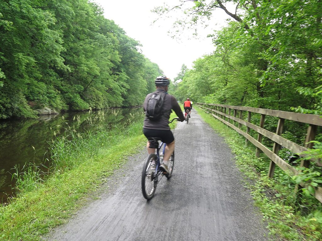
Biking through the Badlands is Voyage of Discovery Millions of Years in the Making

Badlands National Park, South Dakota is 244,000 acres of sharply eroded buttes, pinnacles and spires and the largest, protected mixed grass prairie in the United States. © Karen Rubin/goingplacesfarandnear.com

by Karen Rubin, Travel Features Syndicate, goingplacesfarandnear.com
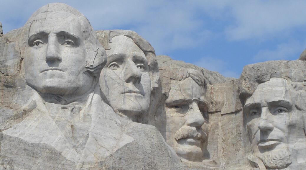
My first look at Badlands National Park is not anything I expected or visualized. The Pinnacles entrance to the national park, where the Wilderness Voyageurs guides have taken us for our first ride of the six-day “Badlands and Black Hills” bike tour of South Dakota, is aptly named for the spires that form this otherworldly landscape.

Badlands National Park is 244,000 acres of sharply eroded buttes, pinnacles and spires and the largest, protected mixed grass prairie in the United States. The Badlands Wilderness Area covers 64,000 acres, where they are reintroducing the black-footed ferret, the most endangered land mammal in North America. Just beyond is The Stronghold Unit, co-managed with the Oglala Sioux Tribe where there are sites of the 1890s Ghost Dances. But as I soon learn, Badlands National Park contains the world’s richest Oligocene epoch fossil beds, dating 23 to 35 million years old, a period between dinosaurs and hominids.

Badlands, South Dakota © Karen Rubin/goingplacesfarandnear.com

The name “Badlands” was intentional, for the earliest inhabitants and settlers found the extremes of climate and landscape extremely harsh. The American Lakota called this place “mako sica,” or “land bad” and early French trappers called it “les mauvaises terres a traverser,” both meaning “badlands.” Those very same French trappers would be the first of many Europeans who would, in time, supplant the indigenous people, as they were soon followed by soldiers, miners looking to strike it rich with gold, cattlemen, farmers, and homesteaders recruited from as far away as Europe.

We get our bikes which our guides – James Oerding and John Buehlhorn – make sure are properly fitted, and outfit us with helmet, water bottle, Garmin. They orient us to the day’s ride – essentially biking through the national park on the road (“Don’t stop riding as you go over the cattle guards”; when the van comes up alongside, tap our helmet if we need help or give a thumbs up otherwise). We will meet up at the 8.2 mile mark where there is a nature walk and the van will be set up for lunch. 

Setting out on our Wilderness Voyageurs bike trip through Badlands National Park, South Dakota © Karen Rubin/goingplacesfarandnear.com

And then we are off at our own pace down an exquisite road (the cars are not a problem). That is a mercy because the vistas are so breathtaking, I keep stopping for photos. And then there are unexpected sightings – like bighorn sheep.

At the 8.2 mile mark, we gather at the van where James has set out a gourmet lunch.

There is a boardwalk nature trail (I note the sign that warns against rattlesnakes and wonder about the kids who are climbing the mounds with abandon). I realize I am in time for a talk with Ranger Mark Fadrowski, who has with him original fossils and casts of fossils collected from the Badlands for us to look at and touch. We can see more – and even scientists working at the Fossil Prep Lab – at the Visitor Center further along our route.

Badlands, South Dakota © Karen Rubin/goingplacesfarandnear.com

“There are no dinosaurs here,” Ranger Fadrowski explains. “This area was underwater when dinosaurs lived.” But these fossils – gathered from 75 million years ago and from through 34 to 37 million years ago (there is a 30-million year gap in the fossil record), fill in an important fossil record between dinosaurs and hominids (that is, early man). Teeth, we learn, provide important information about the animal – what it ate, how it lived – and the environment of the time.

Ranger Mark Fadrowski gives a talk on the fossils found at Badlands National Park © Karen Rubin/goingplacesfarandnear.com

The Pierre Shale, the oldest layer when this area was under a shallow sea, is yielding fossils from 67-75 million years ago. He shows us a fossil of a Mosasaur, giant marine lizards, an ancestor of the Komodo dragon, and one of the biggest sea animals.

 “We don’t have fossils from the 30-million year gap – either the sediment was not deposited or it eroded.” Indeed, we learn that these tall spires of rock with their gorgeous striations, are eroding at the rate of one inch each year, and will be completely gone in another 100,000 to 500,000 years. But the erosion also exposes the fossils.

The environment changed from a sea to a swamp during the Chadron Formation, 34-37 million years ago. “That was caused when the Rocky Mountains formed, with a shift in Teutonic plates. That pushed up and angled the surface so water drained into the Gulf of Mexico.” It was formed by sediments carried by streams and rivers flowing from the Black Hills, deposited in a hot and humid forest flood plain.

Alligators lived during this time. The alligator fossils found here show that the animal hasn’t changed in 30 million years. The alligators migrated when the environment changed, so survived.

During the Brule Formation, 30-34 million years ago, this area was open woodlands, drier and cooler than during the Chadron Formation; in some areas, water was hard to find. Animals that lived here then include the Nimravid, called “a false cat” because it seems to resemble a cat but is not related. The specimen he shows was found by a 7-year old girl just 15 feet from the visitor center and is the most complete skull found to date (imagine that!); there are two holes in the skull that show it was killed by another Nimravid. Also a three-toed horse (now extinct); and a dog.

Many hikers in Badlands National Park have found fossils right on the trail, South Dakota © Karen Rubin/goingplacesfarandnear.com

In fact, it turns out it is not at all unusual for visitors to the park to come upon important fossils (there is a whole wall of photos of people and their finds just from this year). In fact, one visitor, Jim Carney, a photographer from Iowa, found two bones sticking up and reported the location. “They thought it would be a single afternoon. It turned out to be a tennis-court sized field, now known as the Pig Dig; the dig lasted 15 summers and yielded 19,000 specimens, including the “Big Pig.”

Fossil of “The Big Pig” is displayed at the Ben Reifel Visitor Center in Badlands National Park, South Dakota © Karen Rubin/goingplacesfarandnear.com

It was found at the beginning of the Brule Formation, when the area was drying out. “We believe it was watering hole drying up. Animals caught in the mud were prey for other animals.”

This is a place of Archaeotherium, Oredonts, Mesohippus, Subhyracodon, Hoplophoneus, Metamynodon, Cricid and Paleolagus.

The Sharps Formation, 28-30 million years ago, is where they have found Oreodont fossils. “The name means ‘mountain teeth’ because of the shape of its teeth, not the environment.” Fossils are identified mostly because of teeth which are most common to survive and reveal clues about behavior and what the animal ate, which speaks to the environment.

He shows us the fossil of an Oviodon. “It is weird, there isn’t anything alive like it. The closest relative is camel – like the weird cousin that no one knows how related. It is the most commonly found fossil – which means it was probably a herd animal.” And a Merycoidodon (“ruminating teeth”), which he describes as “a sheep camel pig deer”.

“The Badlands are eroding, so will reveal more fossils. Fossils are harder than rock, so won’t erode as fast.” Interestingly, only 1% of all life is fossilized. “We have to assume there are missing specimens.”

Badlands National Park, South Dakota © Karen Rubin/goingplacesfarandnear.com

The Badlands “is particularly lush for fossils – because of the types of sediment that preserves them well.– 600,000 specimens have been collected from the Badlands since paleontologists first started coming here in the 1840s. Just about every major institution in the world has specimens that were originally found here, including the American Museum of Natural History in New York.

They provide clues to the “Golden Age of mammals – half-way between when dinosaurs ended and today – horses, camels, deer.”

I had no idea.

I’m so grateful that John (elected the sweeper for today’s ride) has not rushed me away and, in fact, waited patiently without me even realizing he was there.

Wilderness Voyageurs lunch stop on our ride through Badlands National Park, South Dakota © Karen Rubin/goingplacesfarandnear.com

I continue on, stopping often to take photos of the extraordinary landscape with its shapes and textures and striations. I barely miss a dead rattlesnake on the road (I think it was dead) and am too rattled to stop and take a photo.

I get to the Visitor Center which has superb displays and an outstanding film (must see). Again, no one is rushing me away, so I stay for the film, “The Land of Stone & Light”.

Native Americans have been in this area for 12,000 years; the Lakota came from the east around 1701 following buffalo, their culture was so dependent on buffalo. “They would pray for the buffalos’ well being” rather than their own.”

Treaties were signed that defined the borders, but they were broken. The white settlers demanded more and more of the Indian land, especially after gold was discovered in the Black Hills. (I later learn it was William Custer, the famous General of Custer’s Last Stand, who discovered the gold.)

Buffalo were at the center of Lakota culture © Karen Rubin/goingplacesfarandnear.com

The buffalo – so precious to the Lakota – were hunted nearly to extinction. The white men put up fences for their ranches and farms, preventing the buffalo from migrating. “What happens to the buffalo, happens to Lakota” – they were forced to cease their traditional life, settle down and farm or ranch. Resistance led to tragedy (Battle of Wounded Knee). (There is a photo of the Wounded Knee Massacre at the Trading Post.)

By the turn of the 20th century, the federal government was inviting homesteaders to come out and settle the West – they would get 160 acres if they could last five years on the land. They advertised abroad, enticing immigrants to “the luscious plains in the Dakotas.”

Lumber and stone was rare in the Badlands, so the settlers built their shanties of sod, called “sodbusters.”

“Living was hard; small-scale farming couldn’t succeed. They endured blistering summers, cruel winters, extreme wind. Many left” especially in the Great Depression. I think how ironic.

“Before the Lakota, before the dreams of homesteaders ended, paleontologists came here 150 years ago.” The layered landscape of the Badlands told the story of geologic change, of climate change, that is still continuing. The Badlands are eroding fast – at the rate of one inch per year, “so in 100,000 to 500,000 years, all will be gone. The earth is a dynamic and changing system.”

Badlands National Park is 244,000 acres of sharply eroded buttes, pinnacles and spires and the largest, protected mixed grass prairie in the United States © Karen Rubin/goingplacesfarandnear.com

The ecology is complex. This is a mixed grass prairie – it may look dry, but the tangled roots store nutrients. Animals help sustain it –the bison churn up the soil, mixing the moisture and scattering seeds; prairie dogs are critical to the ecosystem, too – they also stir up the soil, and the burrows they dig are used by other animals like owl and ground squirrel. The black footed ferret lives in abandoned burrows and also eats prairie dogs.

The farmers’ attempt to eliminate prairie dogs resulted in the near-extinction of black-foot ferret. They have been reintroduced; also swift fox, bighorn sheep.

Coming upon longhorn sheep during our ride through Badlands National Park, South Dakota © Karen Rubin/goingplacesfarandnear.com

“The mission of National Parks is to preserve and restore – but we can’t restore the biggest animals that once were here – the prairie wolf and grizzly bear.”

I’m about to leave when I stumble upon the Paleontology Lab, which is open to the public, where we can watch as two paleontologists painstakingly work to remove sediment from bone – their efforts magnified on a TV screen.

Visitors can watch as a paleontolgist works painstakingly to release fossilized bone from rock at the Ben Reifel Visitor Center in Badlands National Park, South Dakota © Karen Rubin/goingplacesfarandnear.com

“I am working on a Merycoidodon, an oreodont, which is a group of hoofed mammals native to North America,” the sign says in response to what must be the zillionth time a visitor asks. “Although they have no living relatives in modern times, oreodonts are related to another native North American mammal: the camel. Oreodonts are sheep-sized and may have resembled pigs, but with a longer body, short limbs and with teeth adapted for grinding tough vegetation. The skulls of Merycoidon have pits in front of the eyes, similar to those found in modern deer which contain scent glands used for marking territory. Oreodonts lived in herds and may at one point have been as plentiful in South Dakota as zebras are in the African Serengeti.”

But the paleontologists are happy to answer questions, too. One tells me she has part of an ear canal (very unusual) and ear bones. “It’s unusual to have the upper teeth. This is a sub-adult –I can see wisdom teeth and unerupted teeth.” She is working on a Leptomerycid – relative of mouse deer – an animal the size of house cat.

It has taken her 170 hours to extract teeth from rock.

“This is the second time anyone got an upper row of teeth for this species. It may change scientists’ understanding. We’re not sure if it is a separate species – it has a different type of tooth crown. But having a second fossil means we can compare.”

Visitors can watch as a paleontolgist works painstakingly to release fossilized bone from rock at the Ben Reifel Visitor Center in Badlands National Park, South Dakota © Karen Rubin/goingplacesfarandnear.com

Just then, the senior paleontologist, Ed Welch comes in and tells me that because teeth are used to determine species, the work being done could prove or disprove whether this animal is a separate species.

Welch says it so far looks like a species that was named in 2010 based on the lower teeth. “Now we have upper teeth and part of the skull. The difference could be variation by ecology (for example, what it ate). It was found at same site so would have been contemporary. We looked at several hundred jaws. This one could be an ‘ecomorph’ – just different because of what it ate.”

The Badlands have some of the oldest dogs ever found, and the most diversity. In the display case is one of only eight specimens ever found – the other seven are at the American Museum of Natural History in New York City but they are not displayed; this is only specimen that can be viewed.“It is the oldest one of its kind,” 33-32 million years old – and was found by a college student from Missouri.

He says the seven-year old girl who found the saber cat fossil that the Ranger showed, came back this year, now 16 years old.

“We ask visitors to leave the fossil where it is and report to us, give us photos, a GPS, so we can locate. Some of the fossils were found right on the trail, not even in remote areas.

Probably the most famous – a hero around the lab – is photographer Jim Carney of Iowa who found two bones that ended up being a big bone bed that so far has yielded 19,000 specimens.

Judging by wall of photos of visitors and their finds just in 2019 it would seem that people have great odds and probability of finding important fossil. Add fossil hunting to the hiking or biking adventure.

Dramatic scenery in Badlands National Park, South Dakota © Karen Rubin/goingplacesfarandnear.com

The fossils collected here since the 1840s are in every major institution. While fossils of dinosaurs and early man might get everyone excited, these fossils – the middle of the Age of Mammals – are important to fill out that story of ecological and evolutionary change.

“The Badlands is in the middle of the earth’s transition from Greenhouse to Ice House – and the fossils found here show how animals responded to the ecological change: “adapt, migrate or go extinct.”

Welch made the decision to open the paleontology lab so people can see scientists at work. “We decided to do more than a fishbowl, to make it a great education tool.”

The Fossil Preparation Lab in the Ben Reifel Visitor Center is typically open from 9 am – 4:30 pm daily from the second week in June through the third week in September.

Badlands National Park is open year-round.

(More information on Badlands National Park at www.nps.gov/badl/index.htm, www.nps.gov/badl/planyourvisit/events.htm)

During our ride through the Badlands National Park, I spot the major animals that are resident here: bighorn sheep; American bison, pronghorn (also called antelope), mule deer and black-tail prairie dog. The one I miss is a coyote (yet to come).

The breathtaking scenery as we bike through Badlands National Park © Karen Rubin/goingplacesfarandnear.com

We have 12 miles further to bike to our accommodation for the night, the Circle View Guest Ranch, which proves to be an amazing experience in itself.

Wilderness Voyageurs started out as a rafting adventures company 50 years ago, but has developed into a wide-ranging outdoors company with an extensive catalog of biking, rafting, fishing  and outdoor adventures throughout the US and even Cuba, many guided and self-guided bike itineraries built around rail trails like the Eric Canal in New York, Great Allegheny Passage in Pennsylvania, and Katy Trail in Missouri.

There are still a few spots left on Wilderness Voyageurs’ Quintessential West Cuba Bike Tour departing onMarch 21.

Wilderness Voyageurs, 103 Garrett St., Ohiopyle, PA 15470, 800-272-4141, [email protected], Wilderness-Voyageurs.com

_________________________

© 2020 Travel Features Syndicate, a division of Workstyles, Inc. All rights reserved. Visit goingplacesfarandnear.com, www.huffingtonpost.com/author/karen-rubin, and travelwritersmagazine.com/TravelFeaturesSyndicate/. Blogging at goingplacesnearandfar.wordpress.com and moralcompasstravel.info. Send comments or questions to [email protected]. Tweet @TravelFeatures. ‘Like’ us at facebook.com/NewsPhotoFeatures